
Leaderboard


Popular Content
Showing content with the highest reputation on 09/26/23 in all areas
-
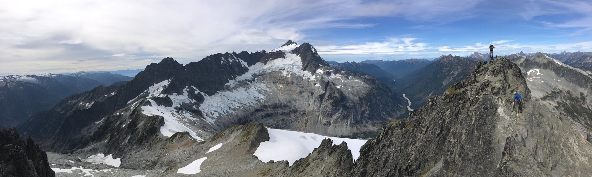
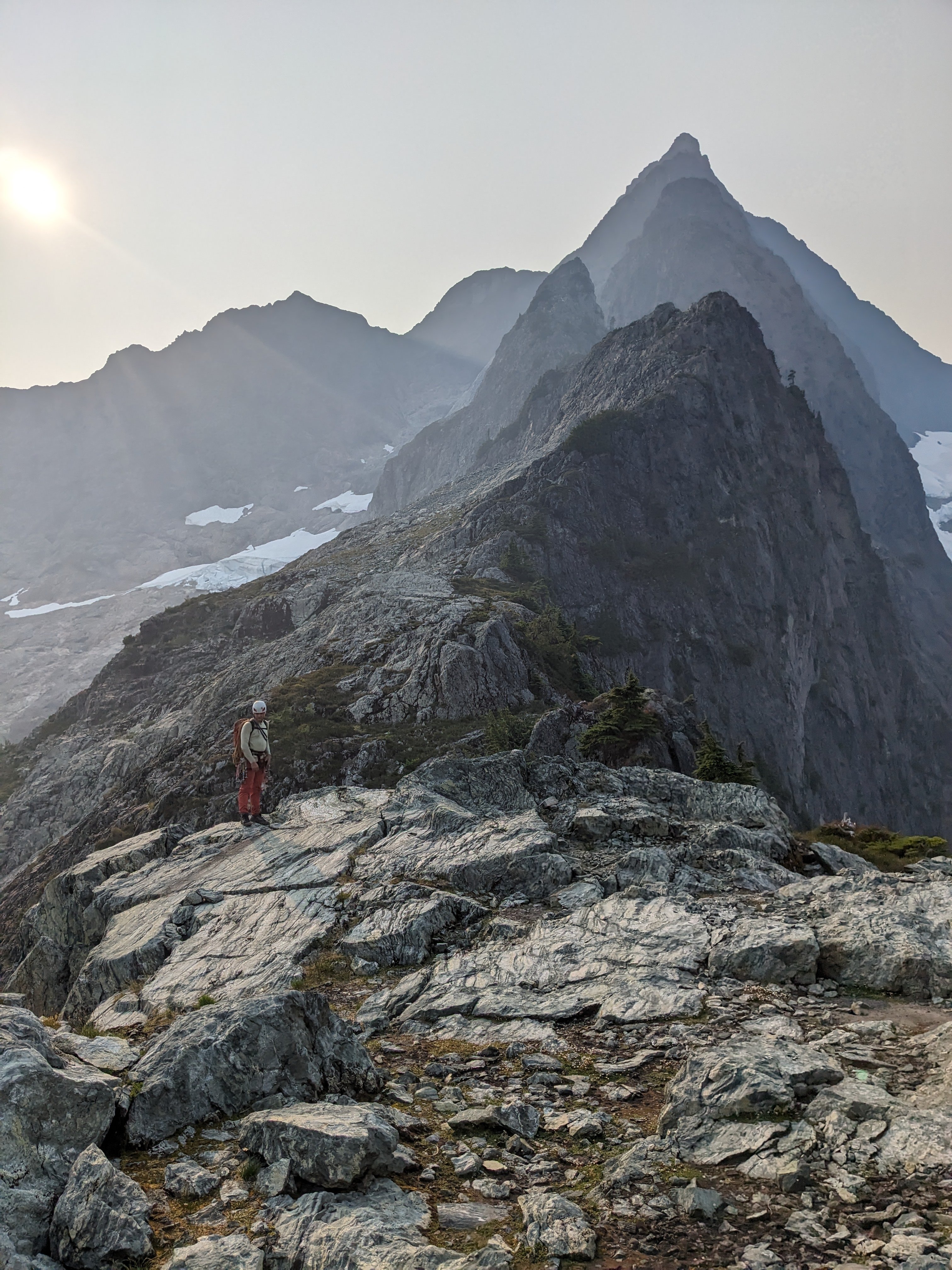
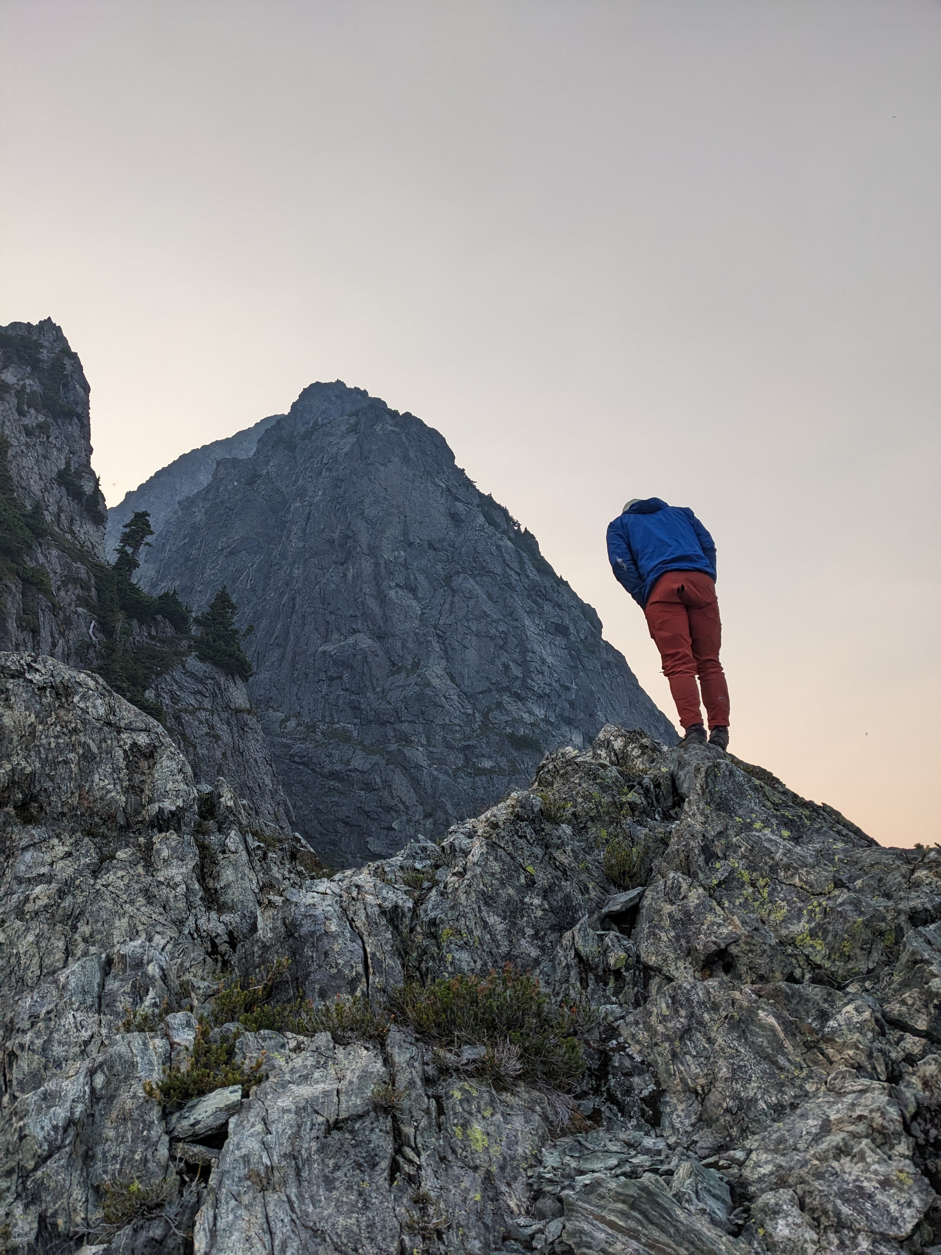
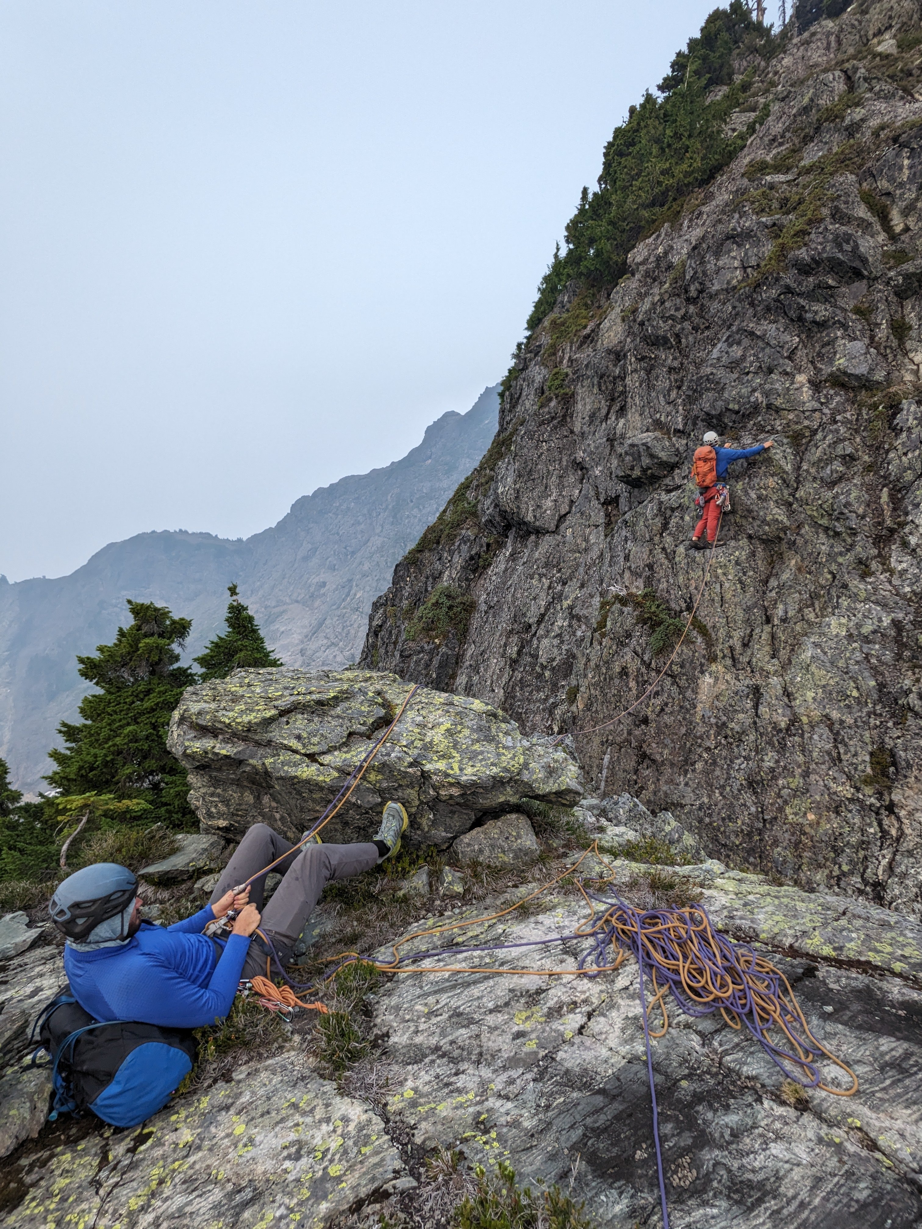
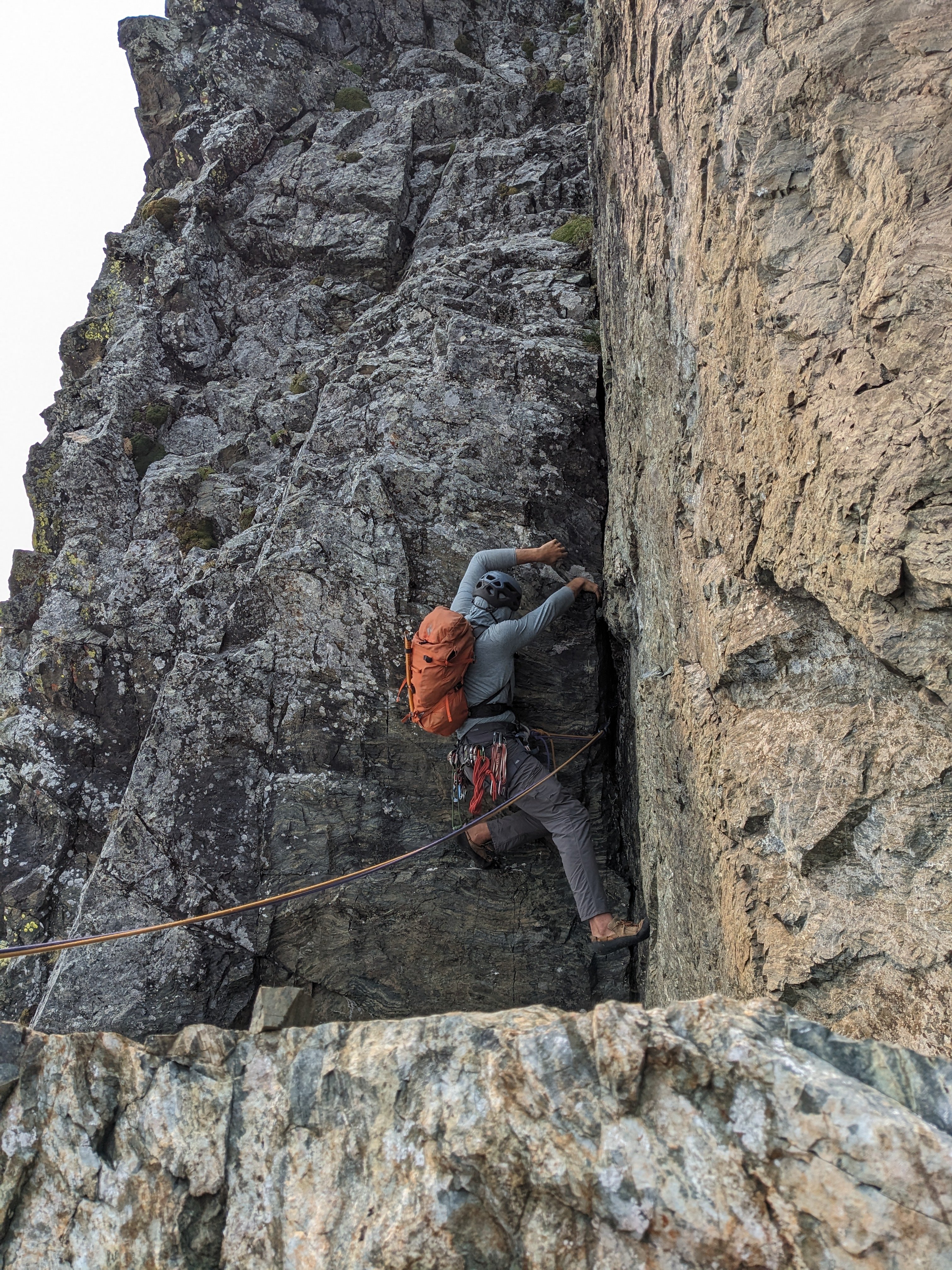
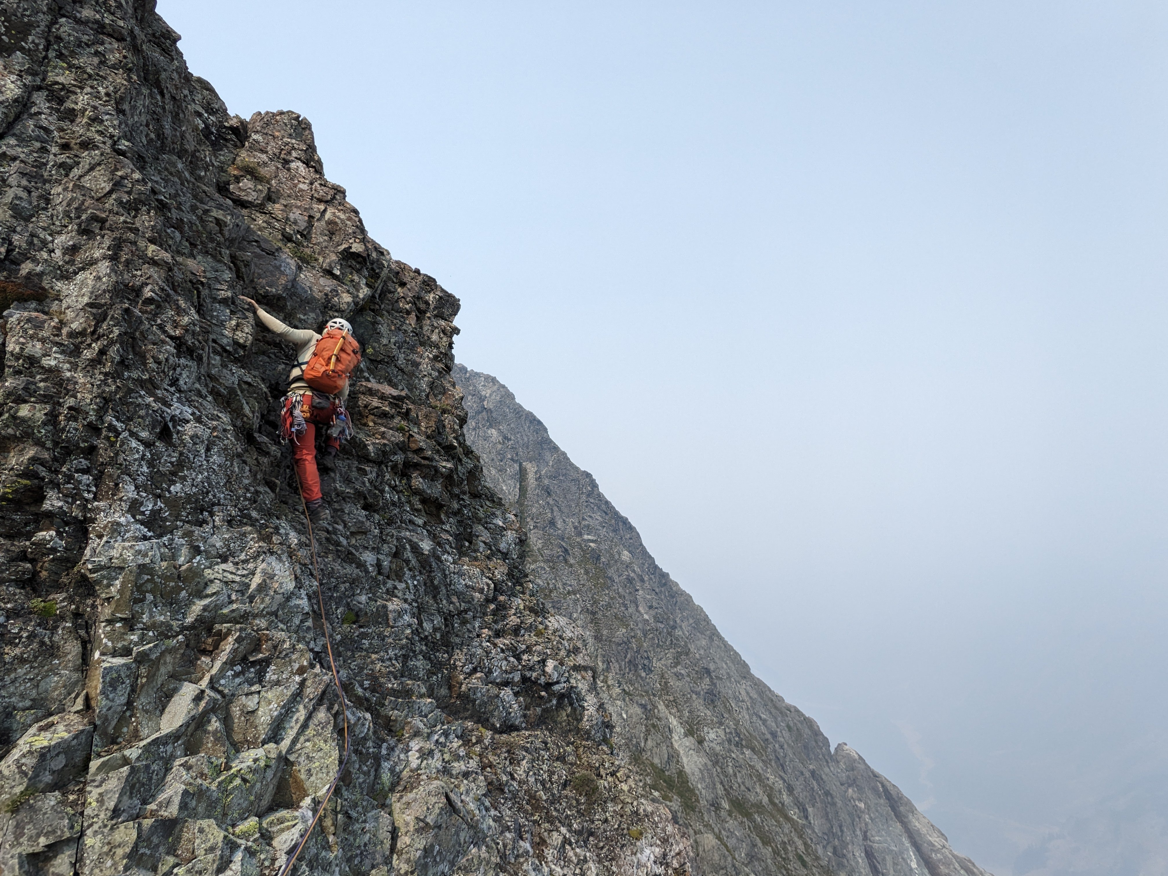
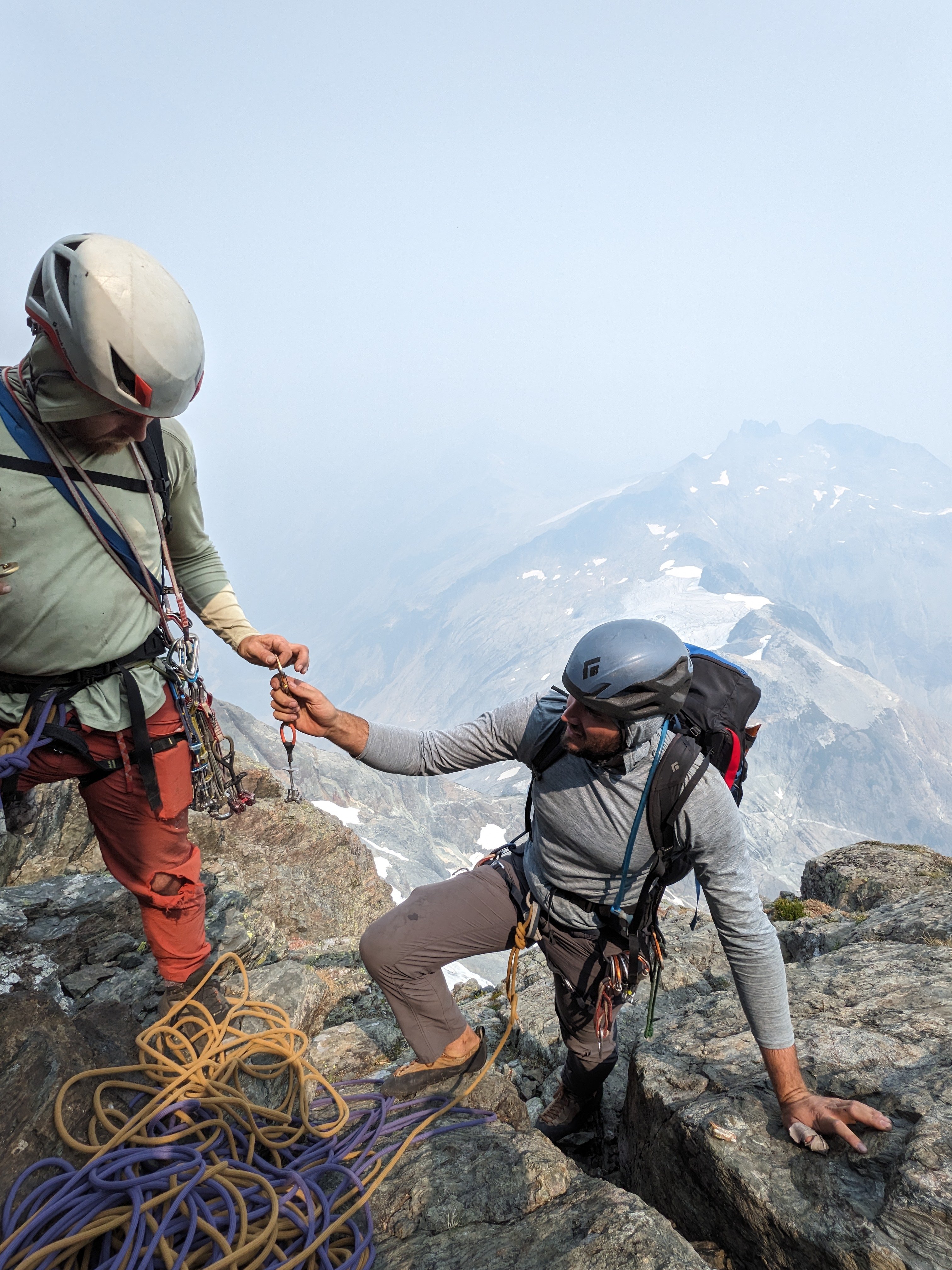
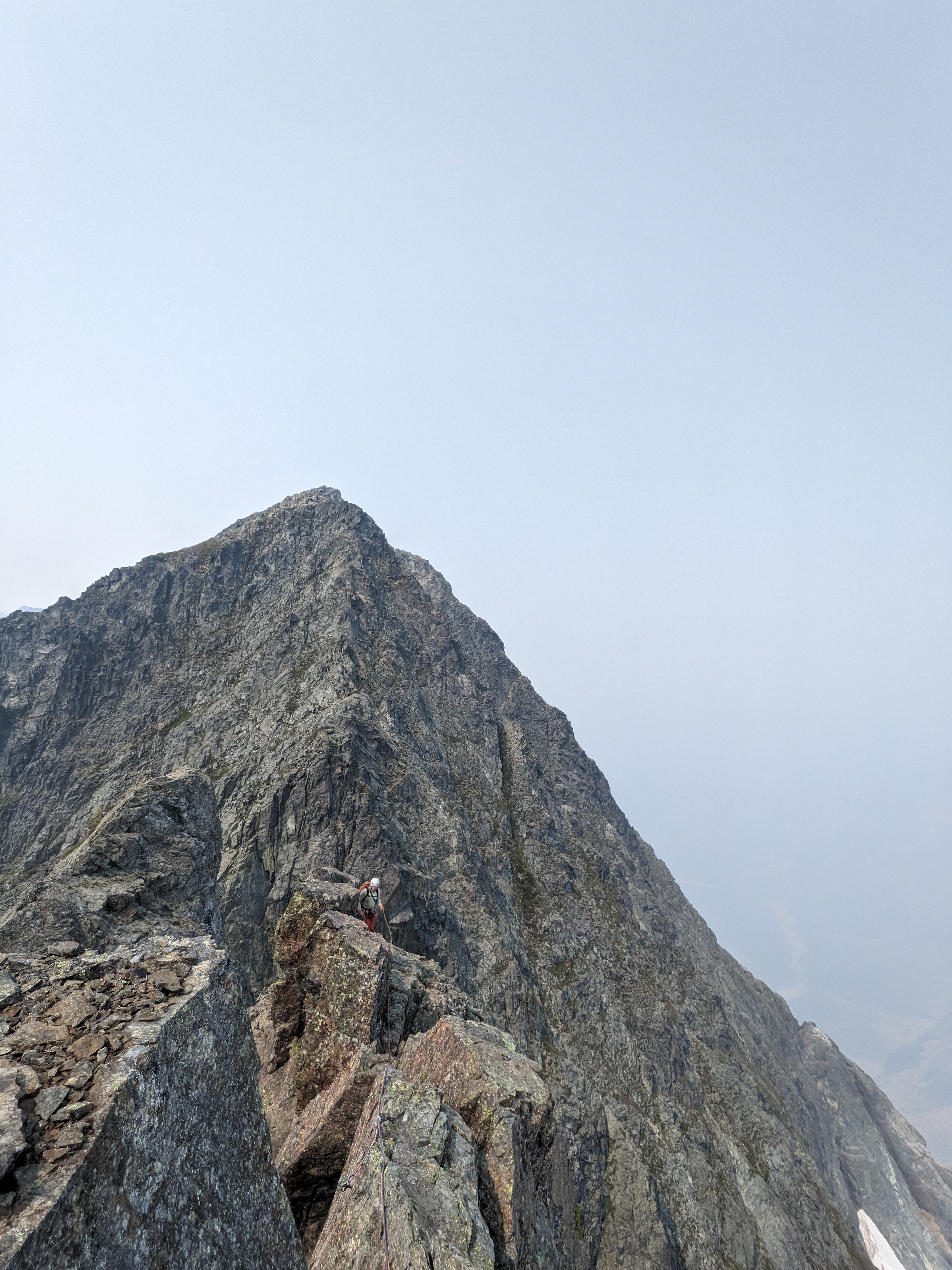
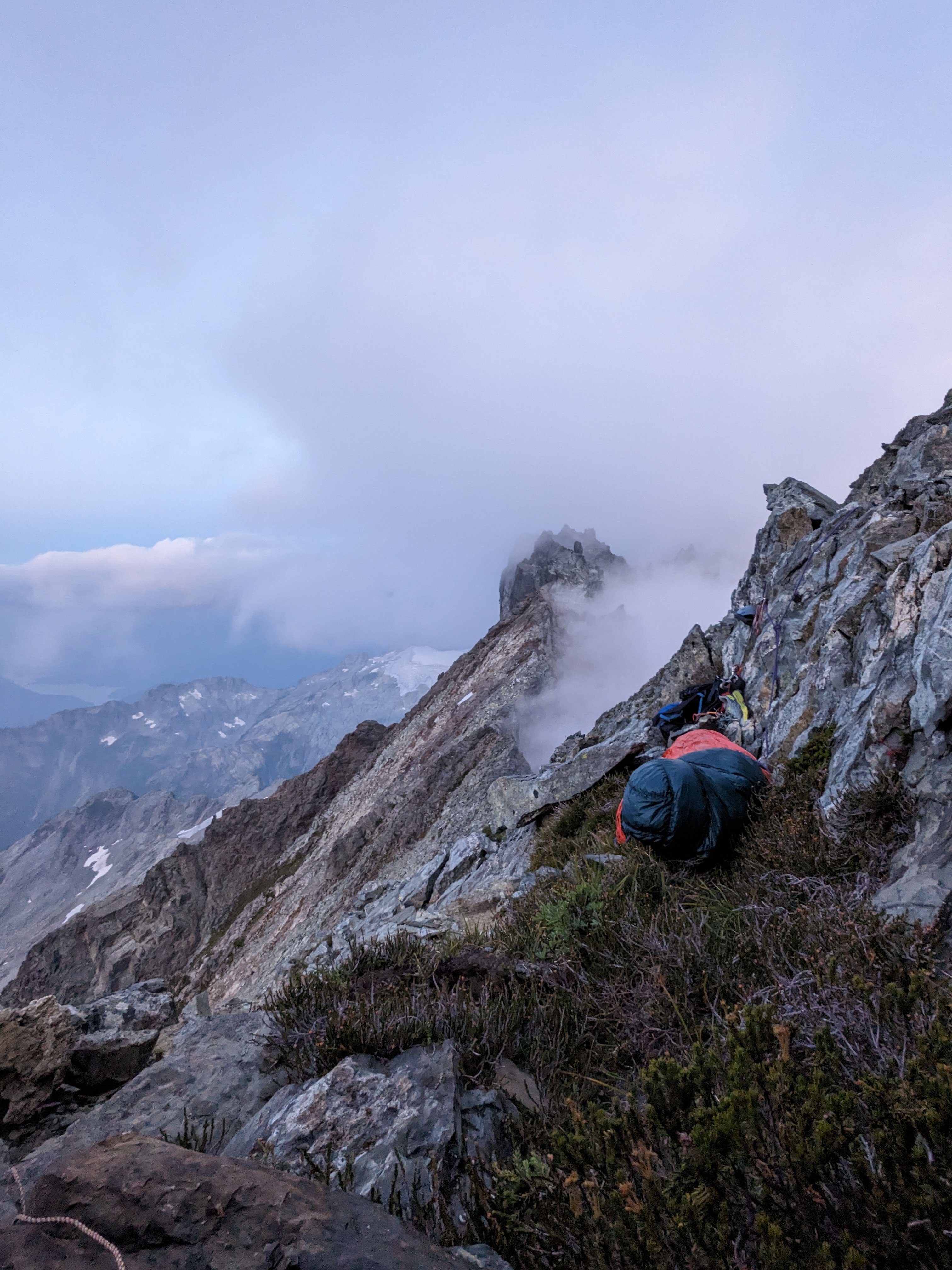
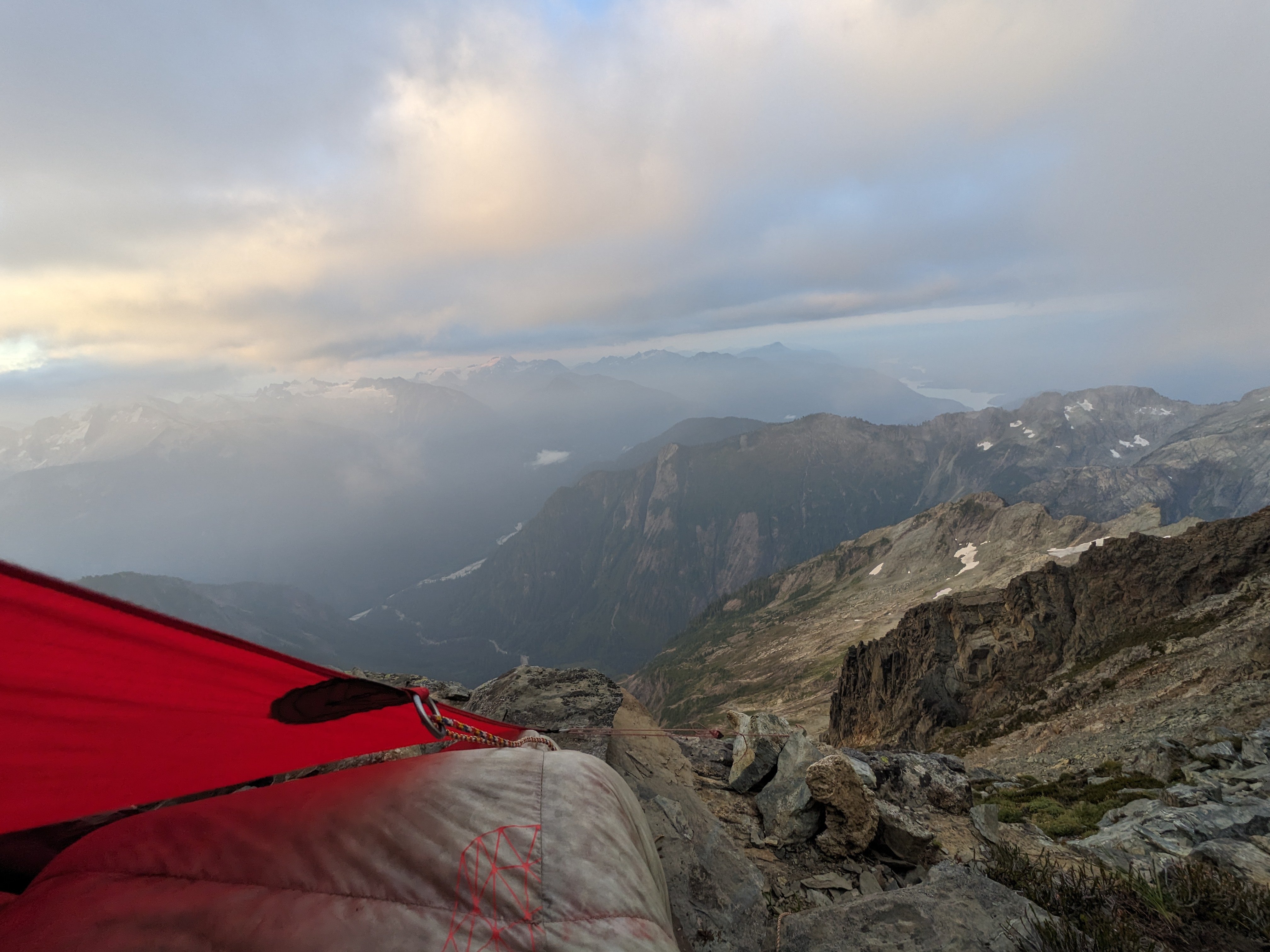
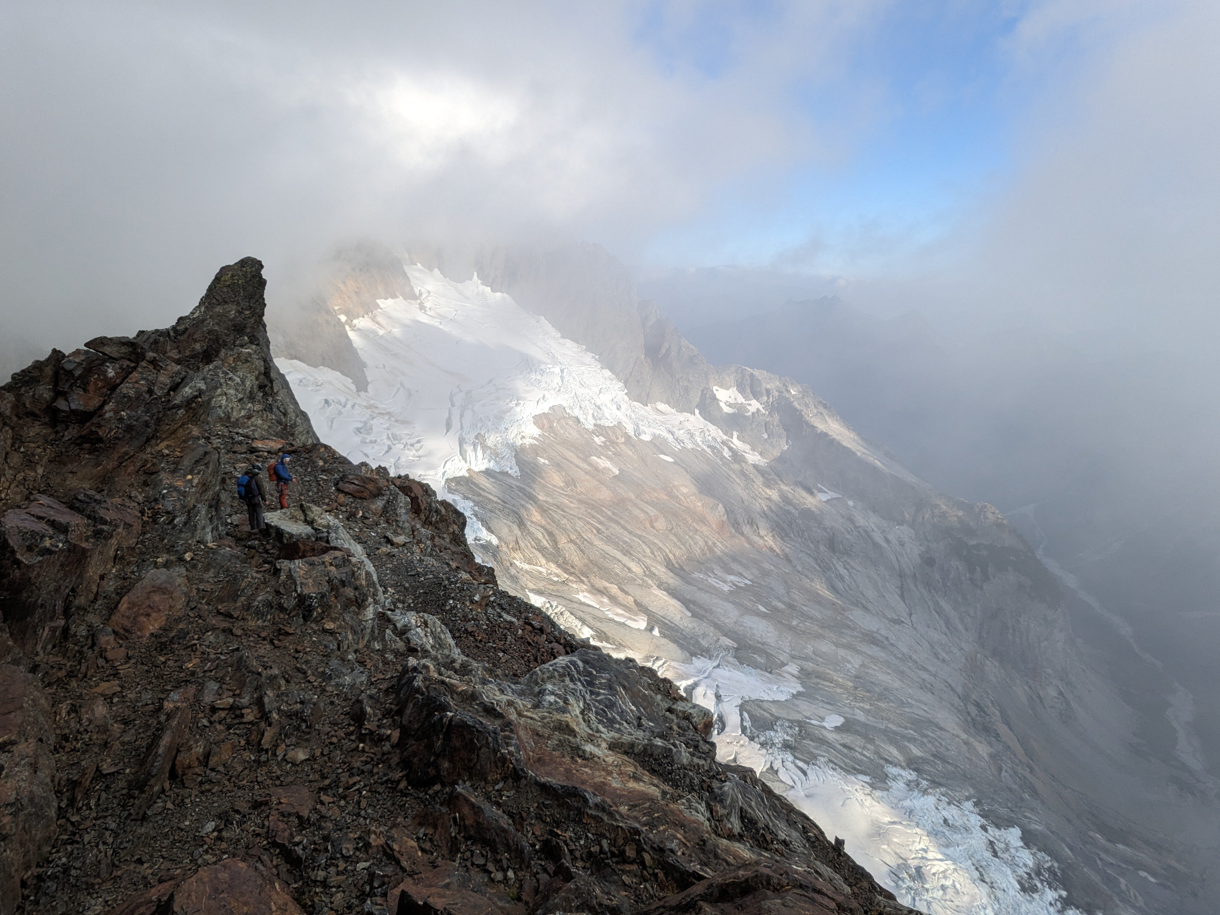
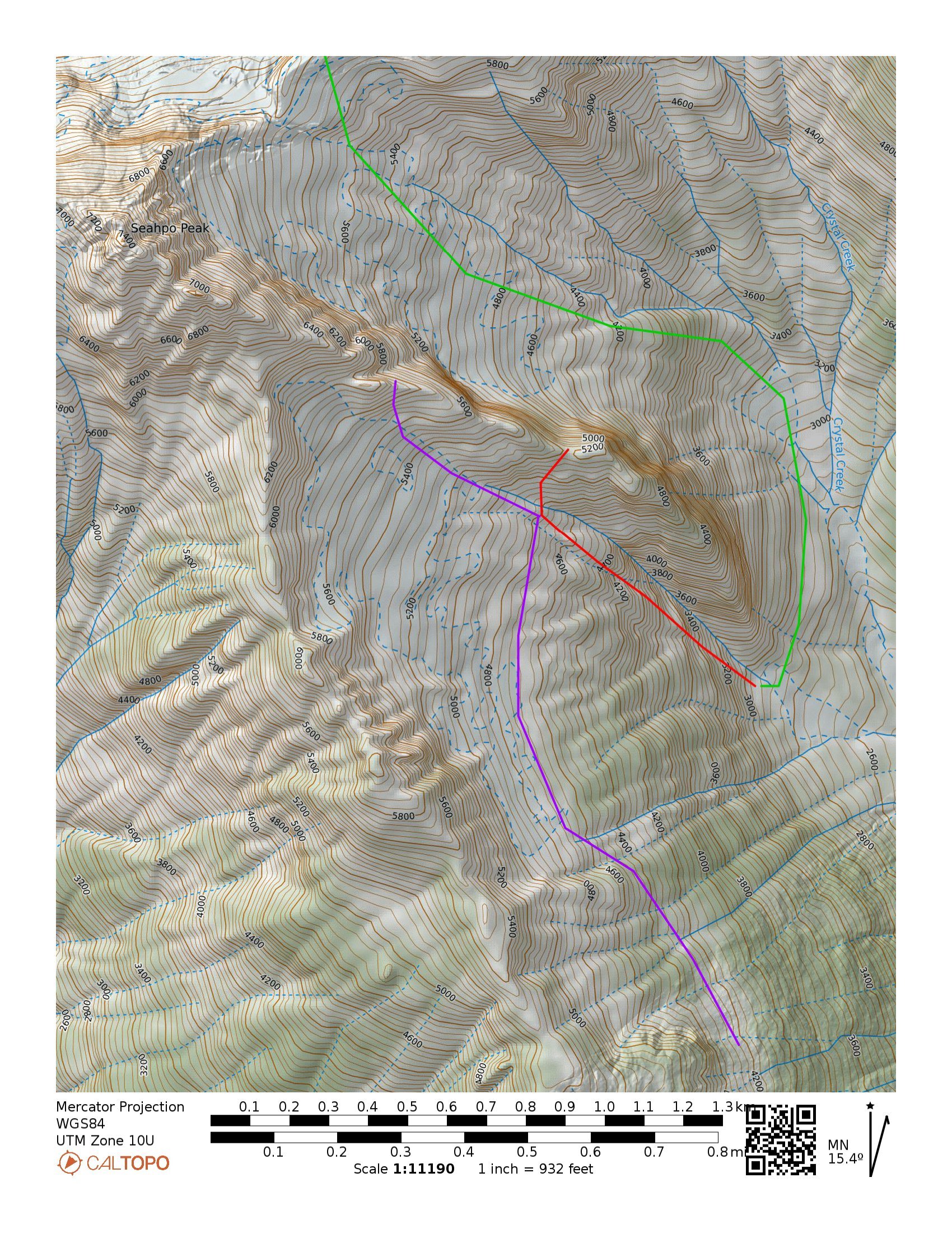
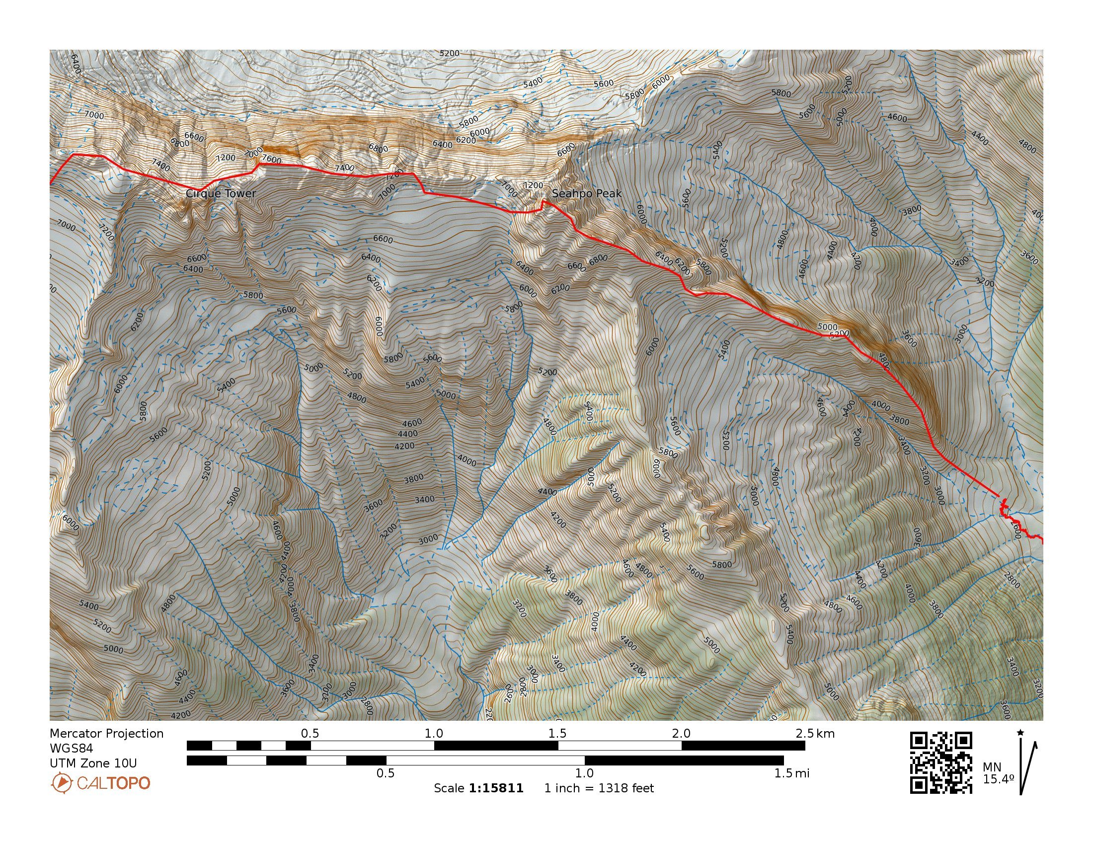
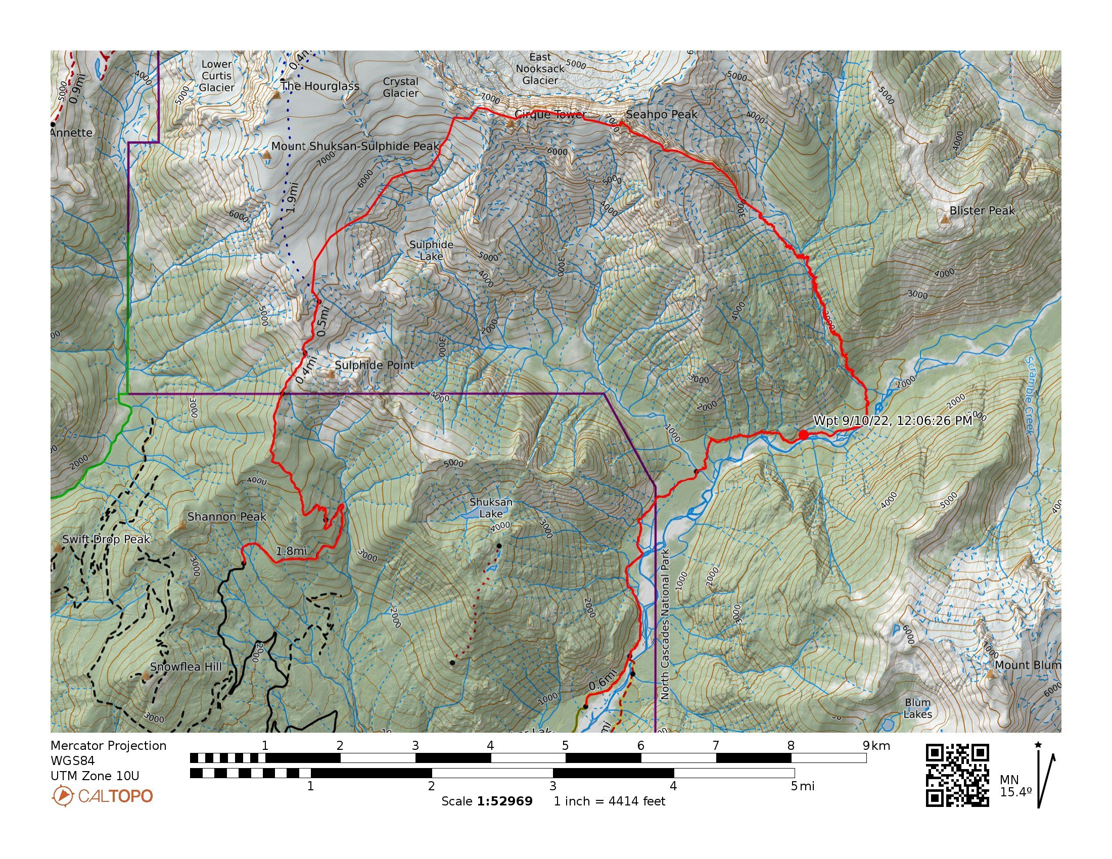
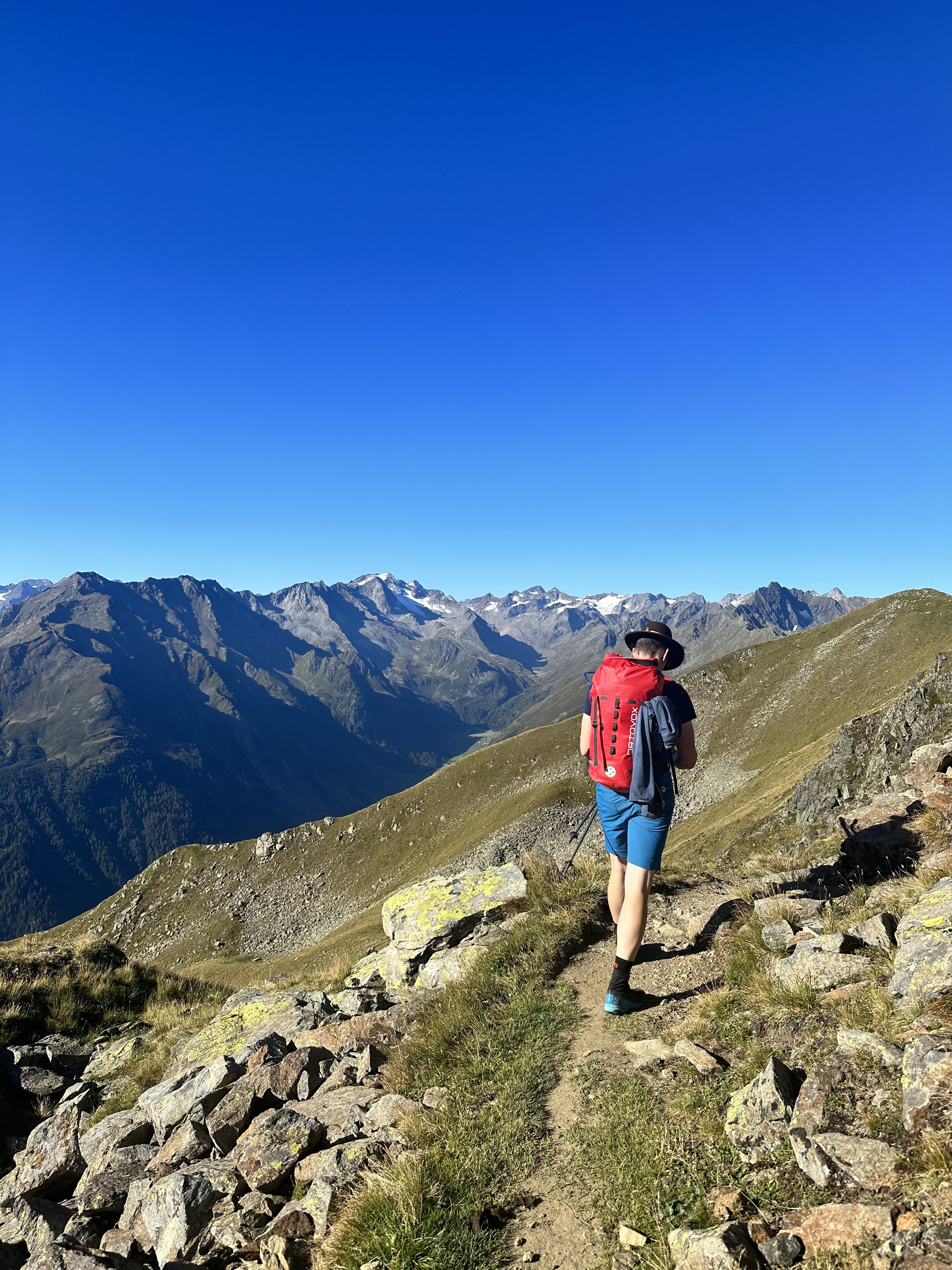
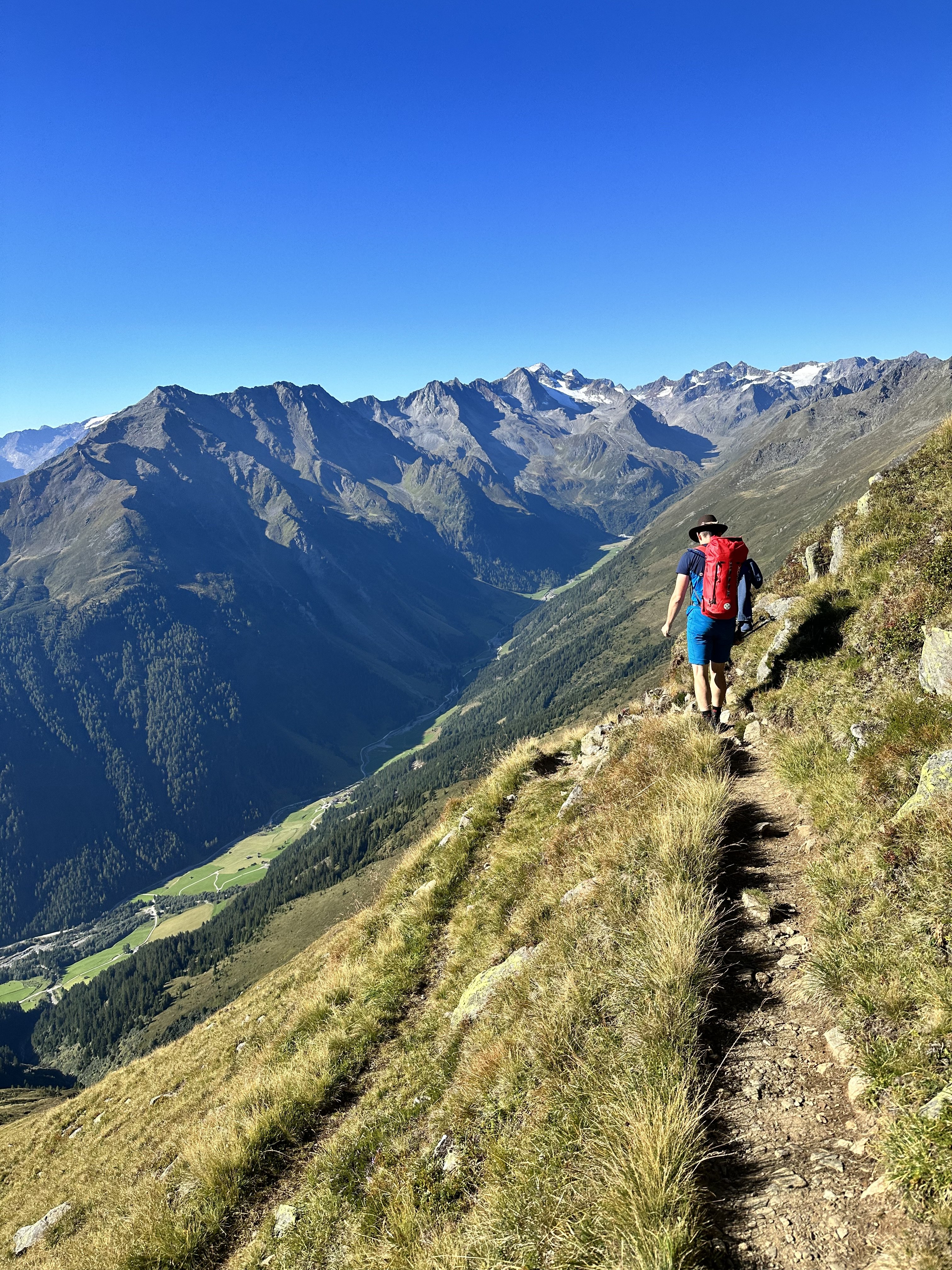
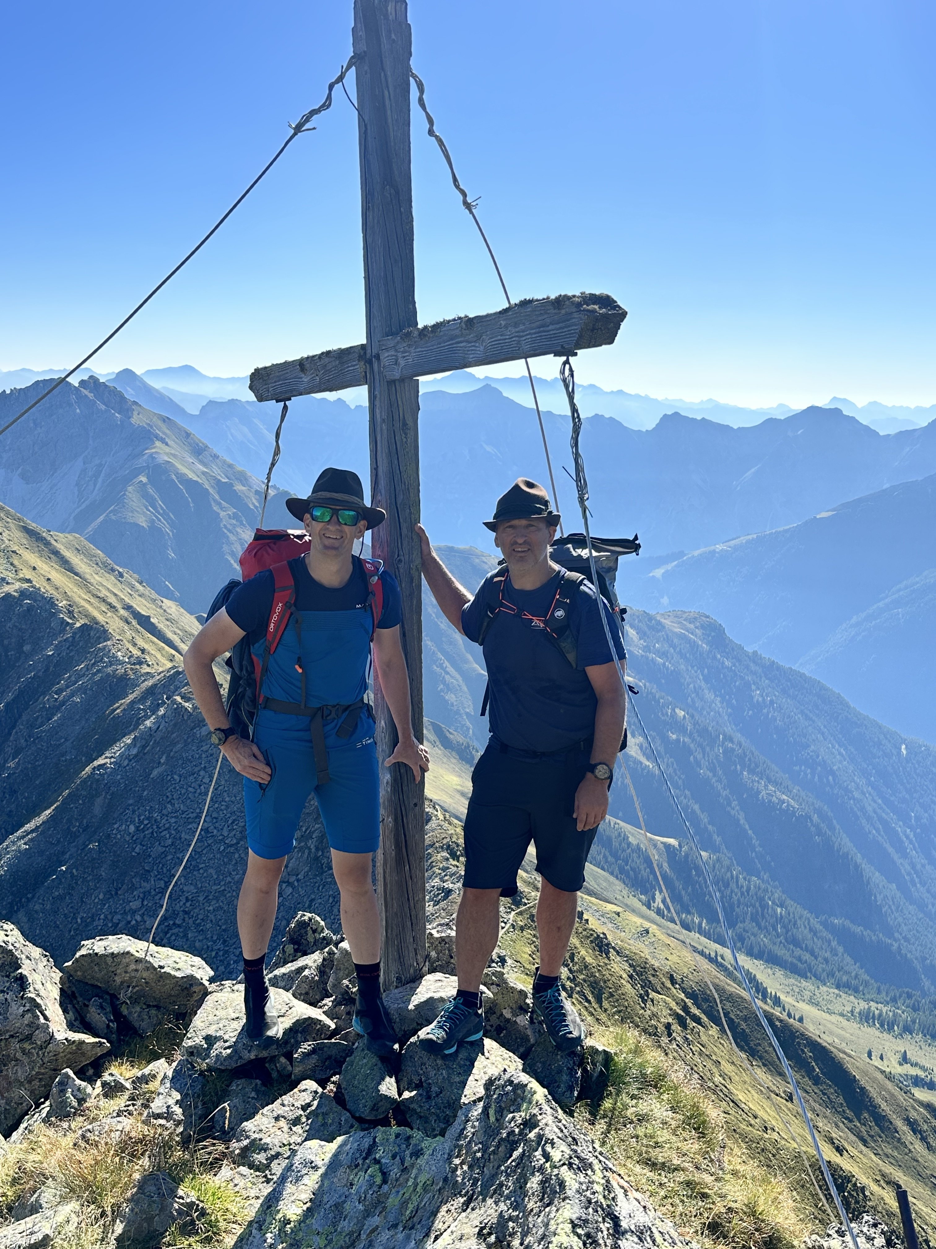
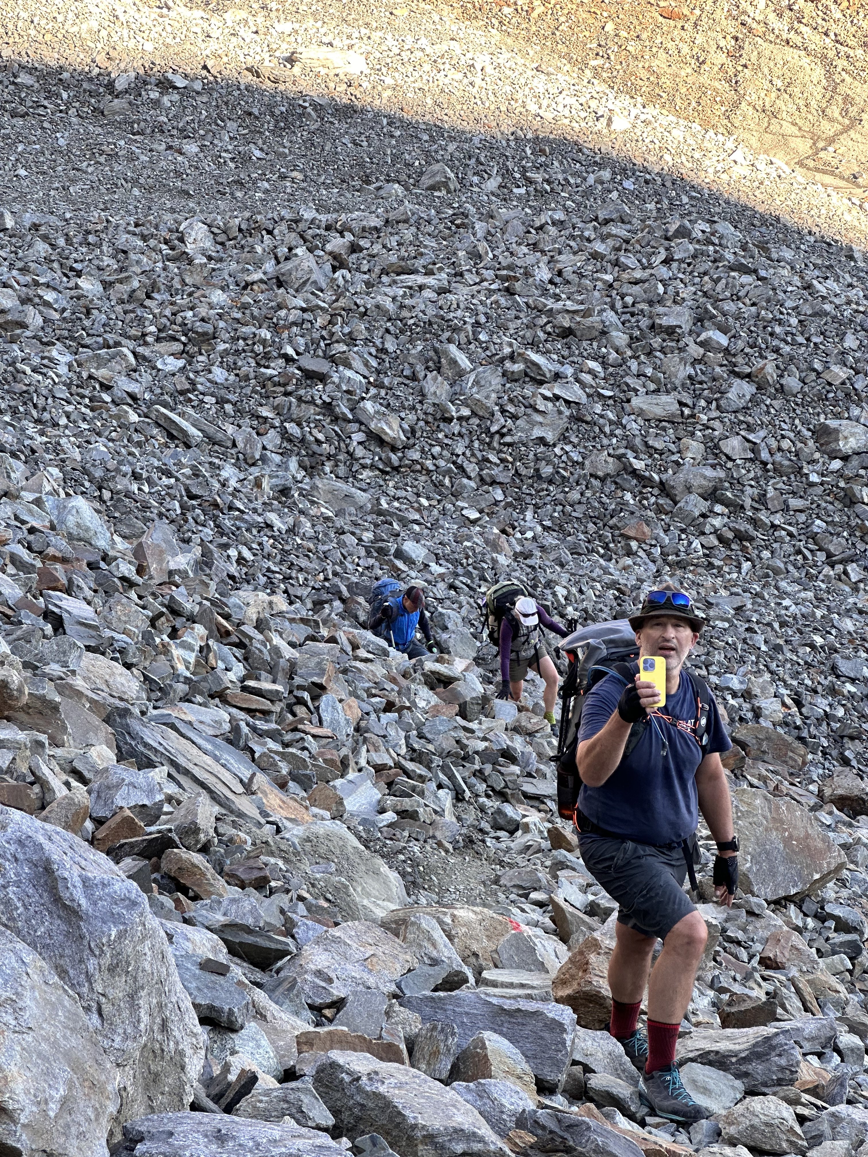
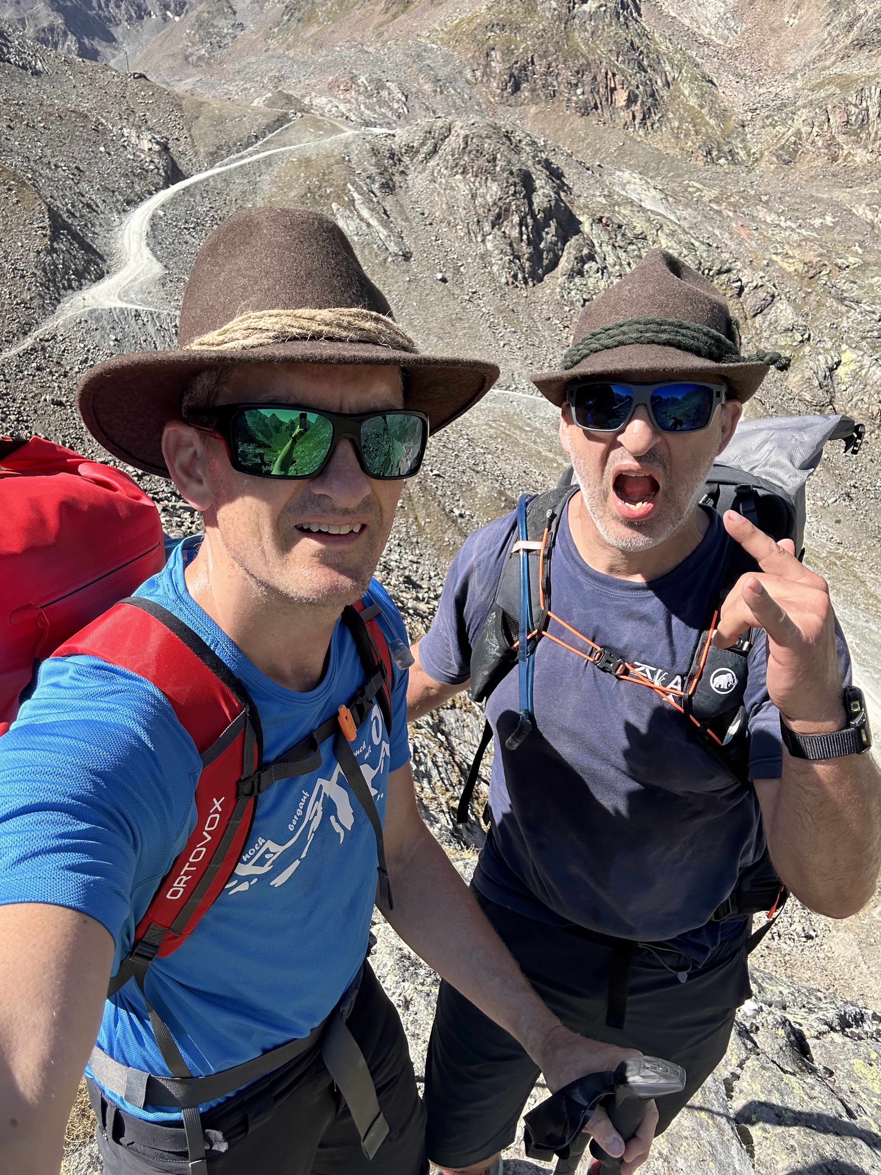
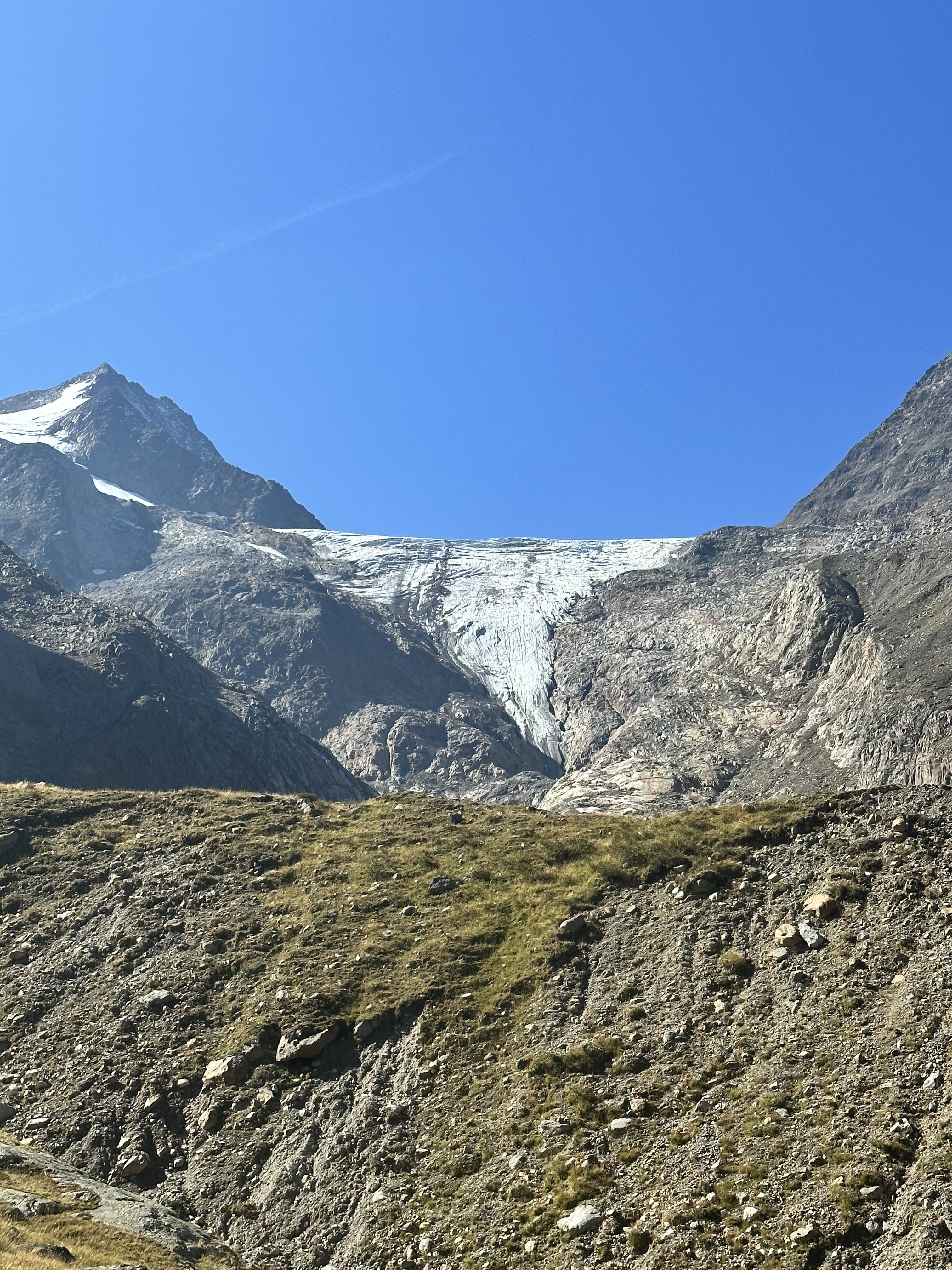
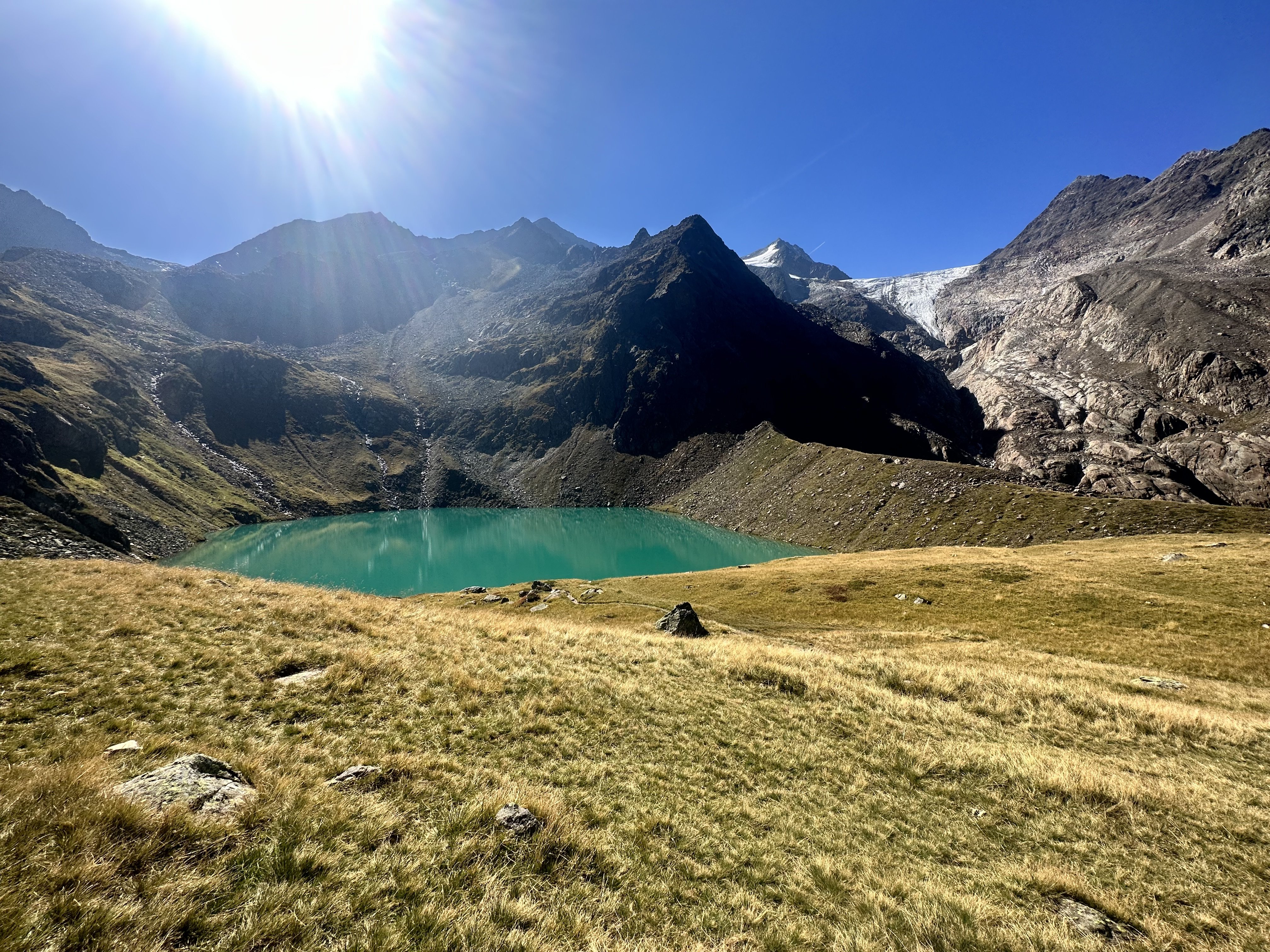
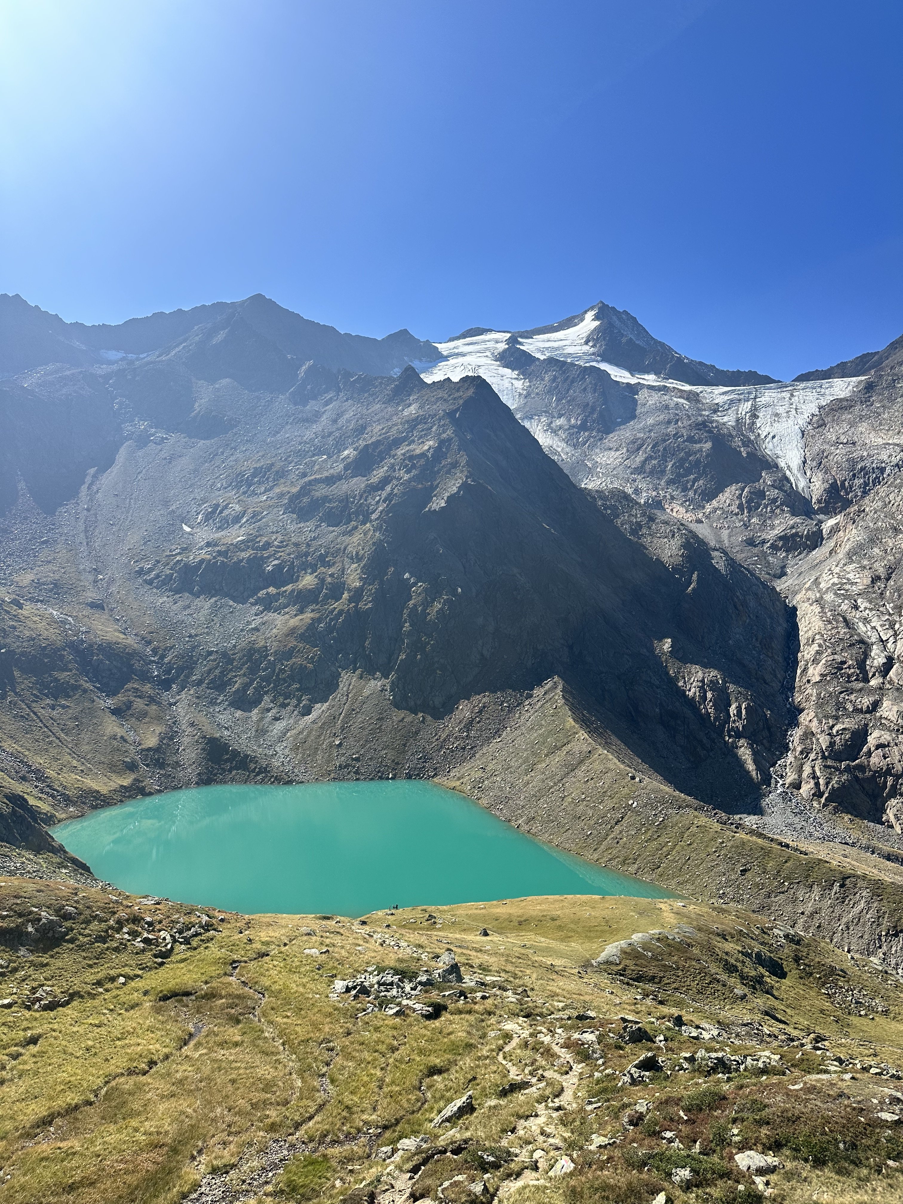
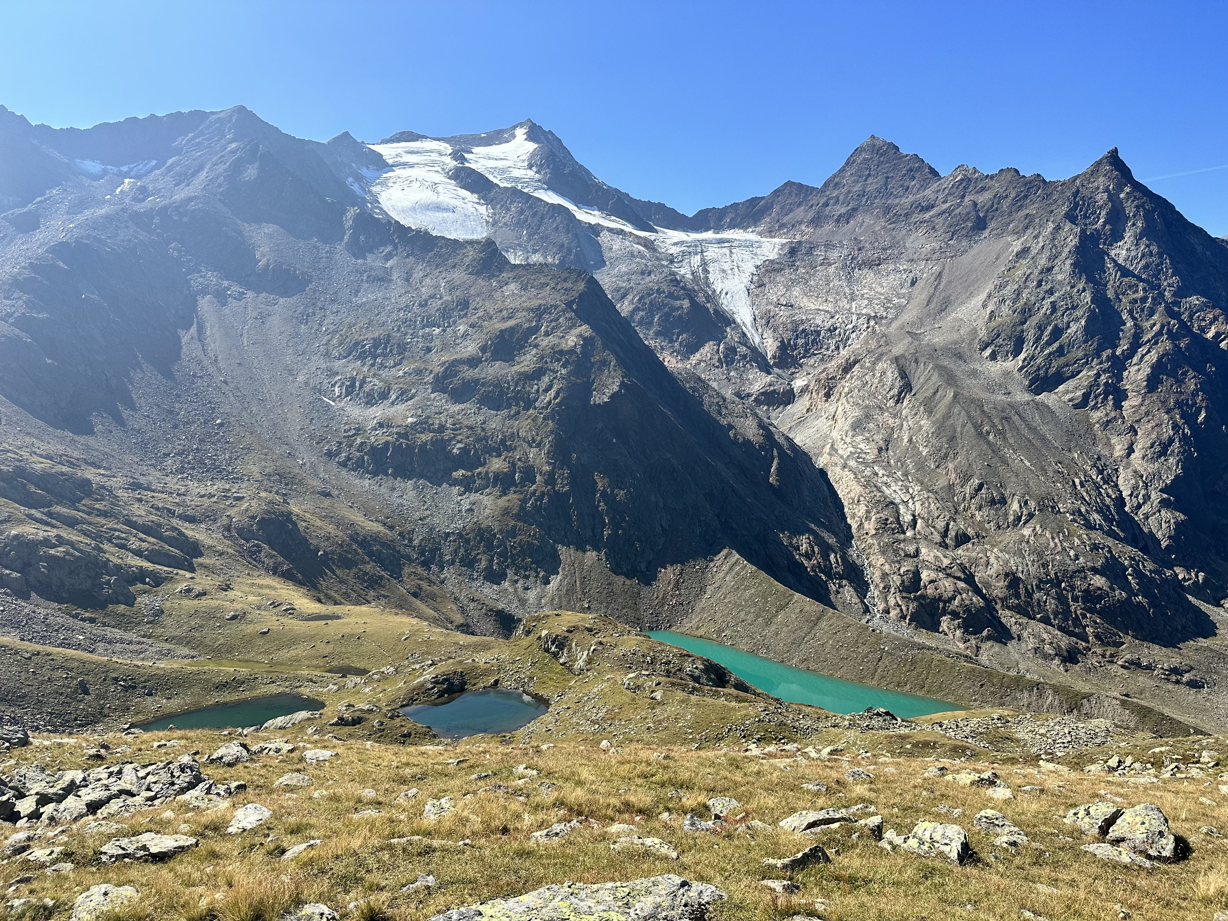
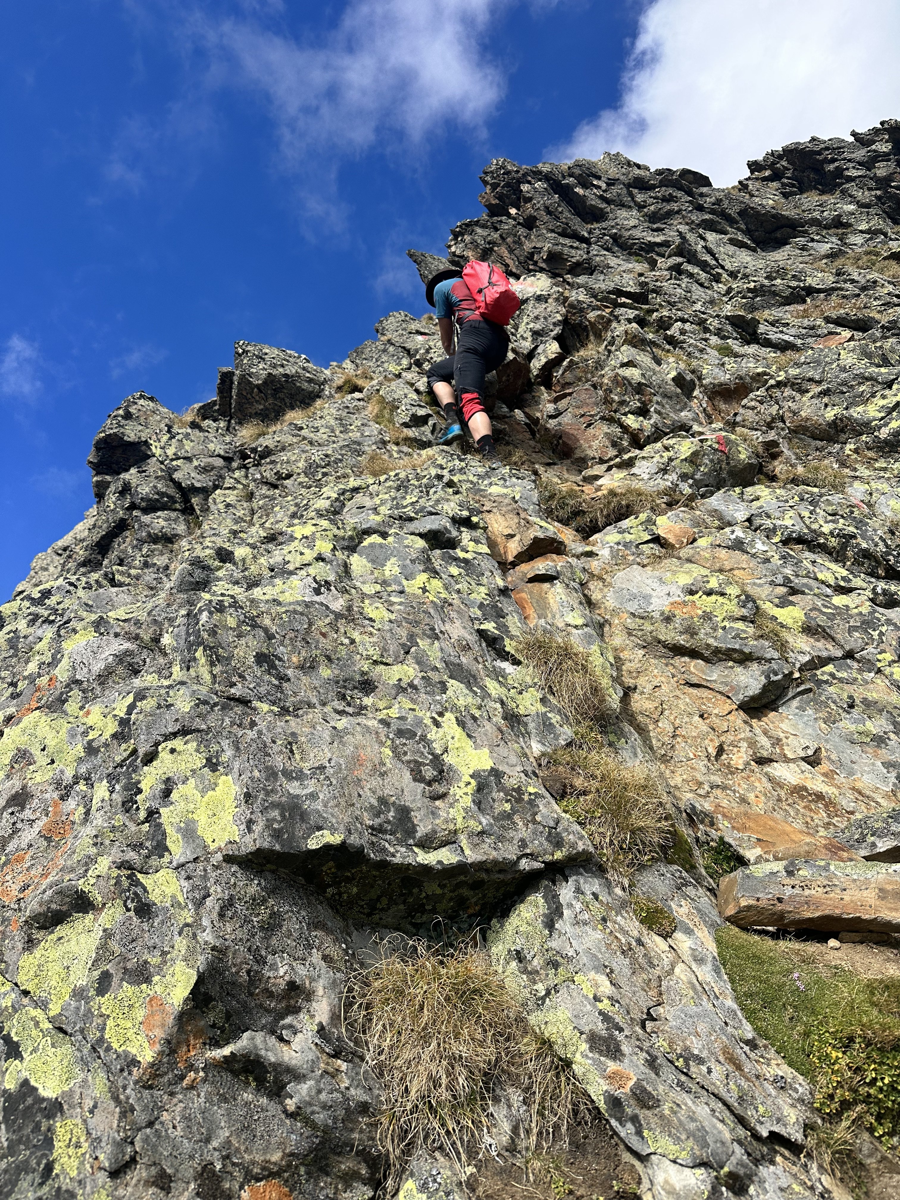
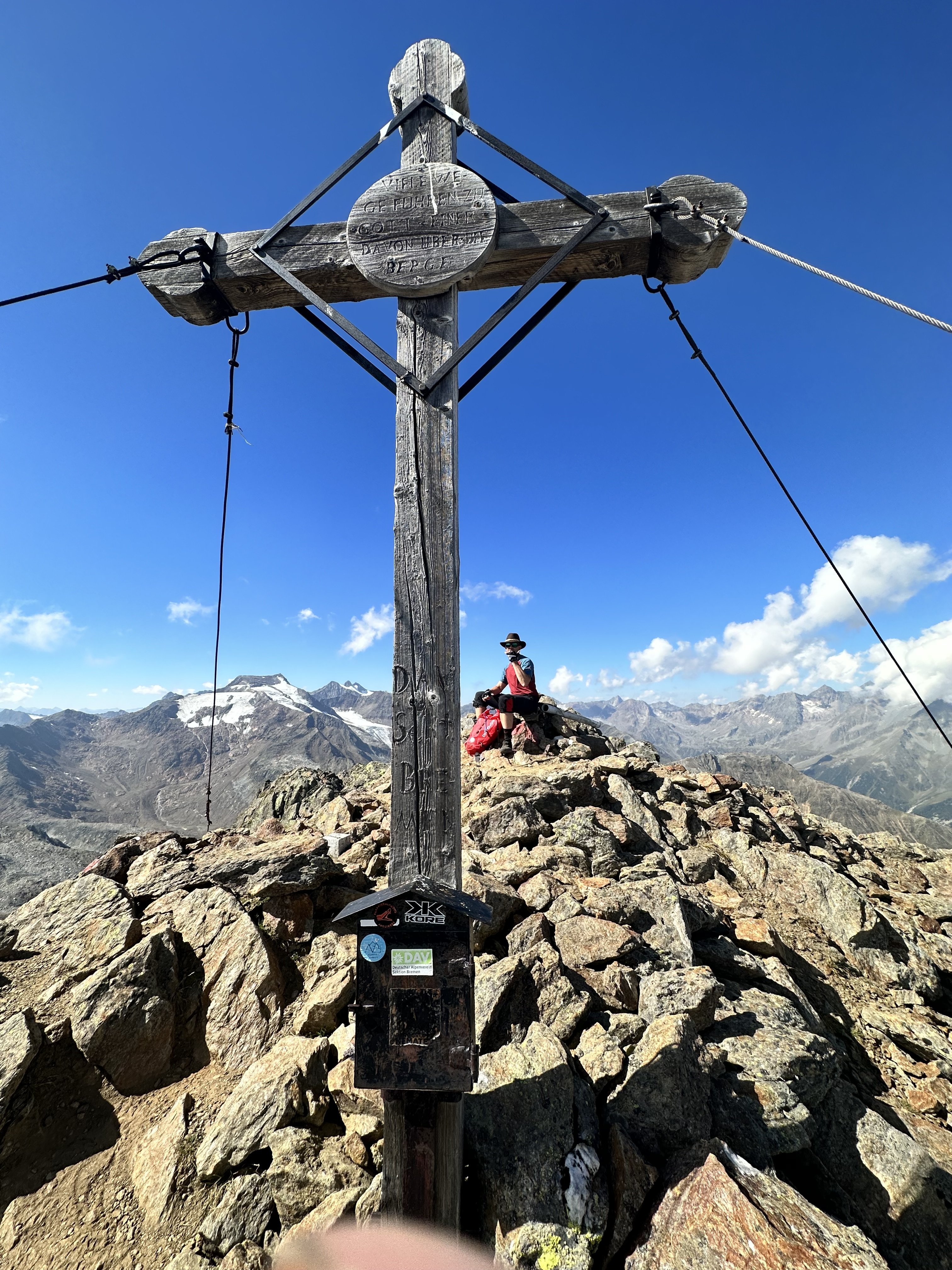
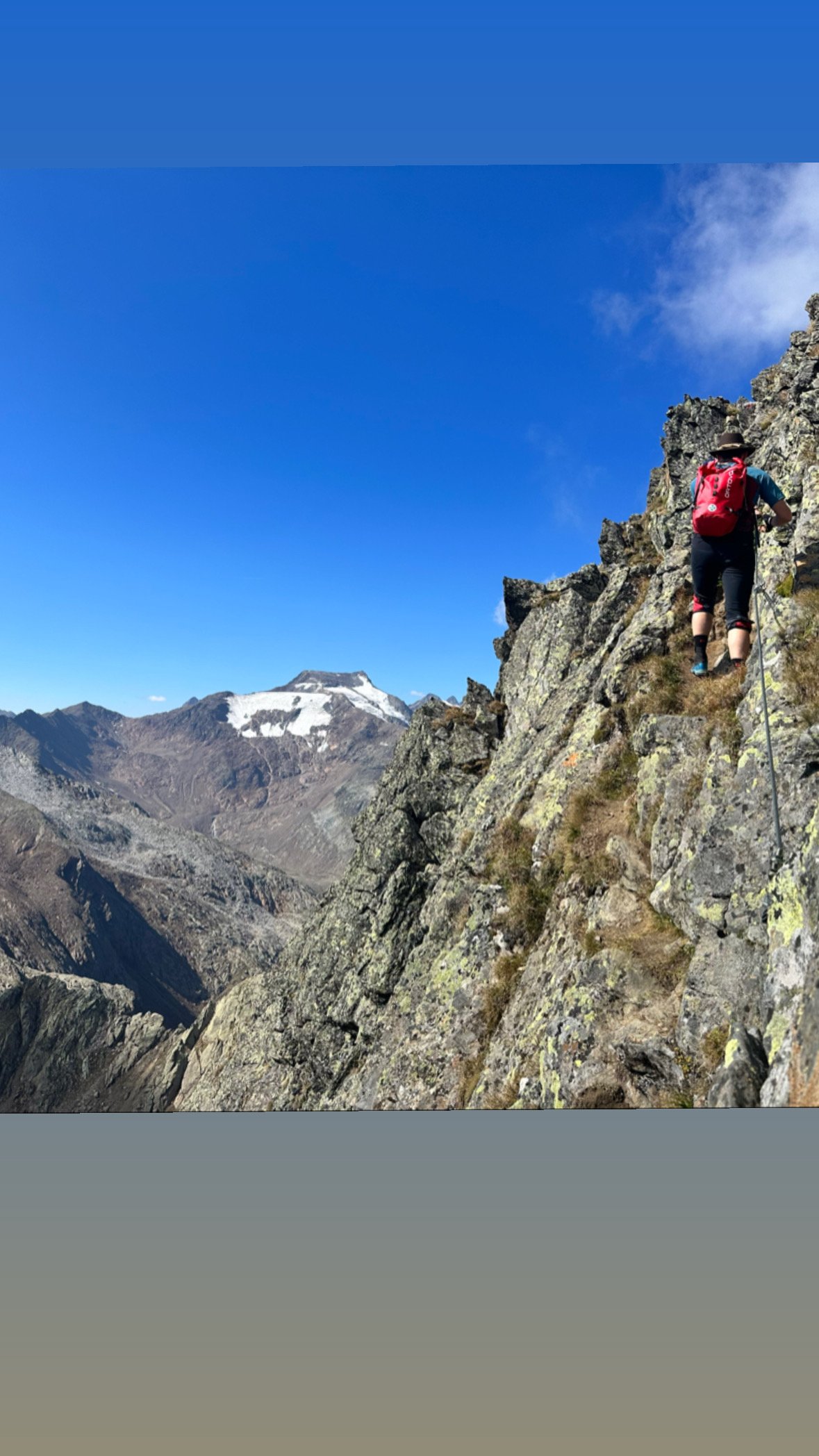
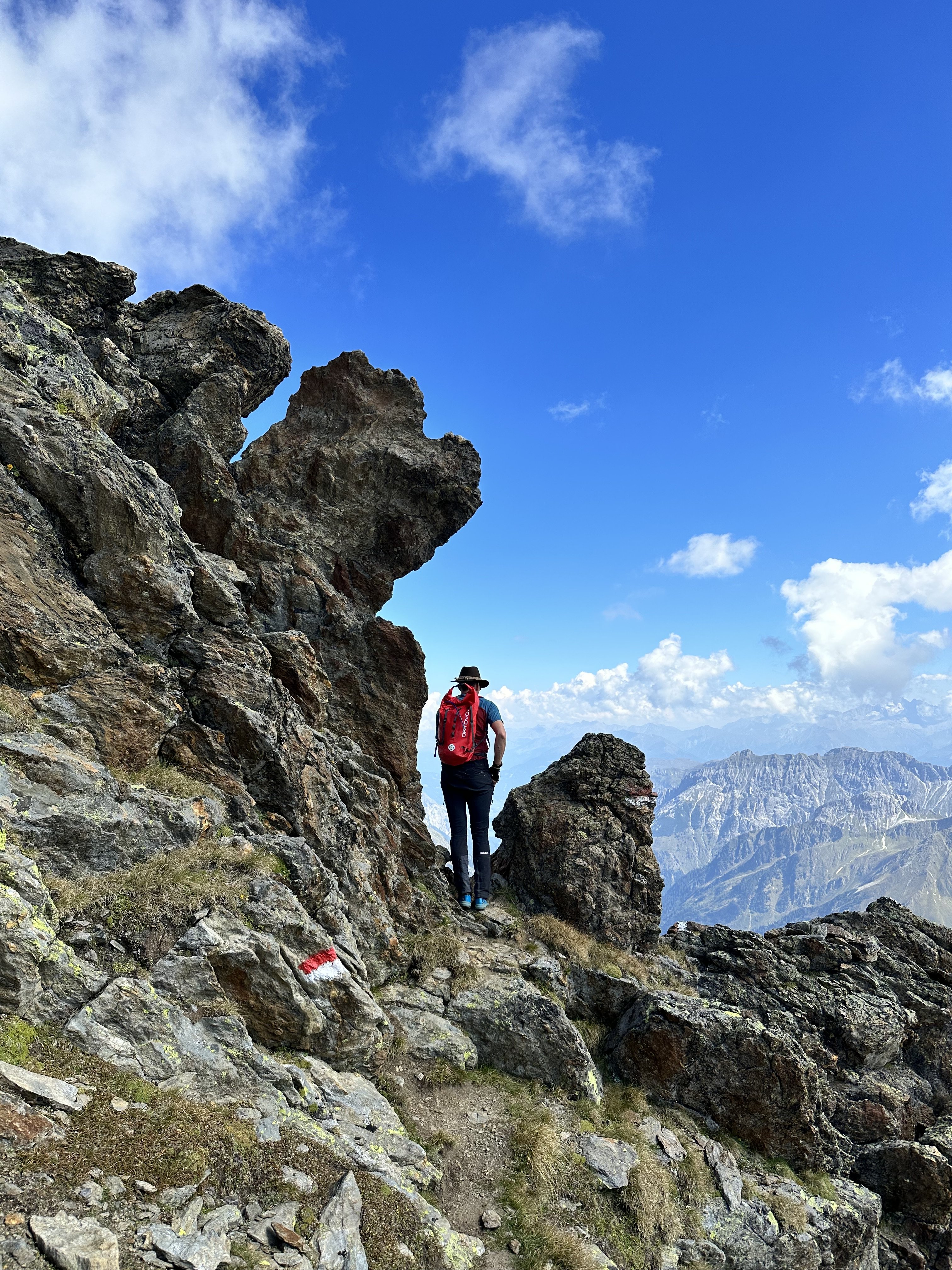
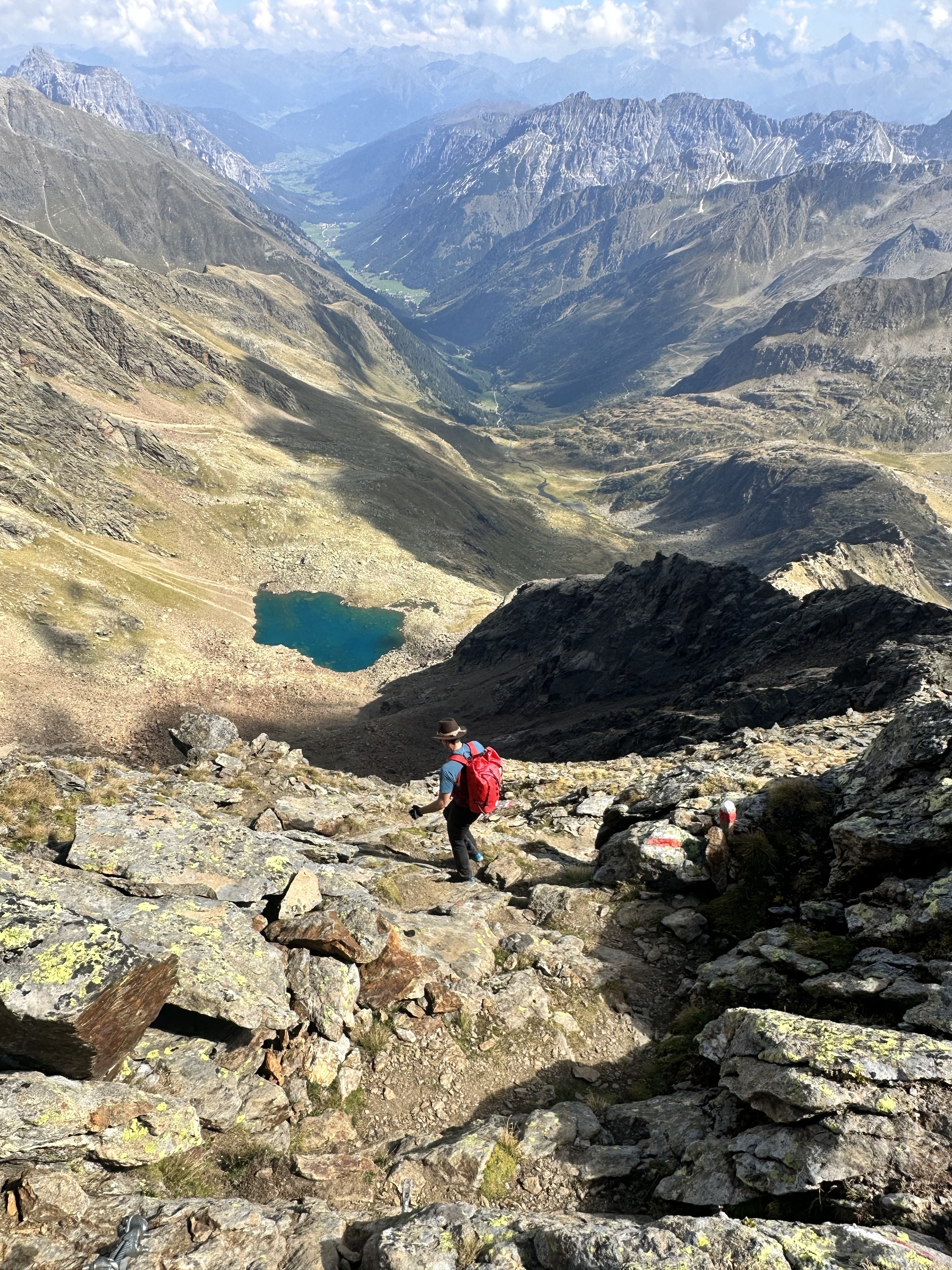
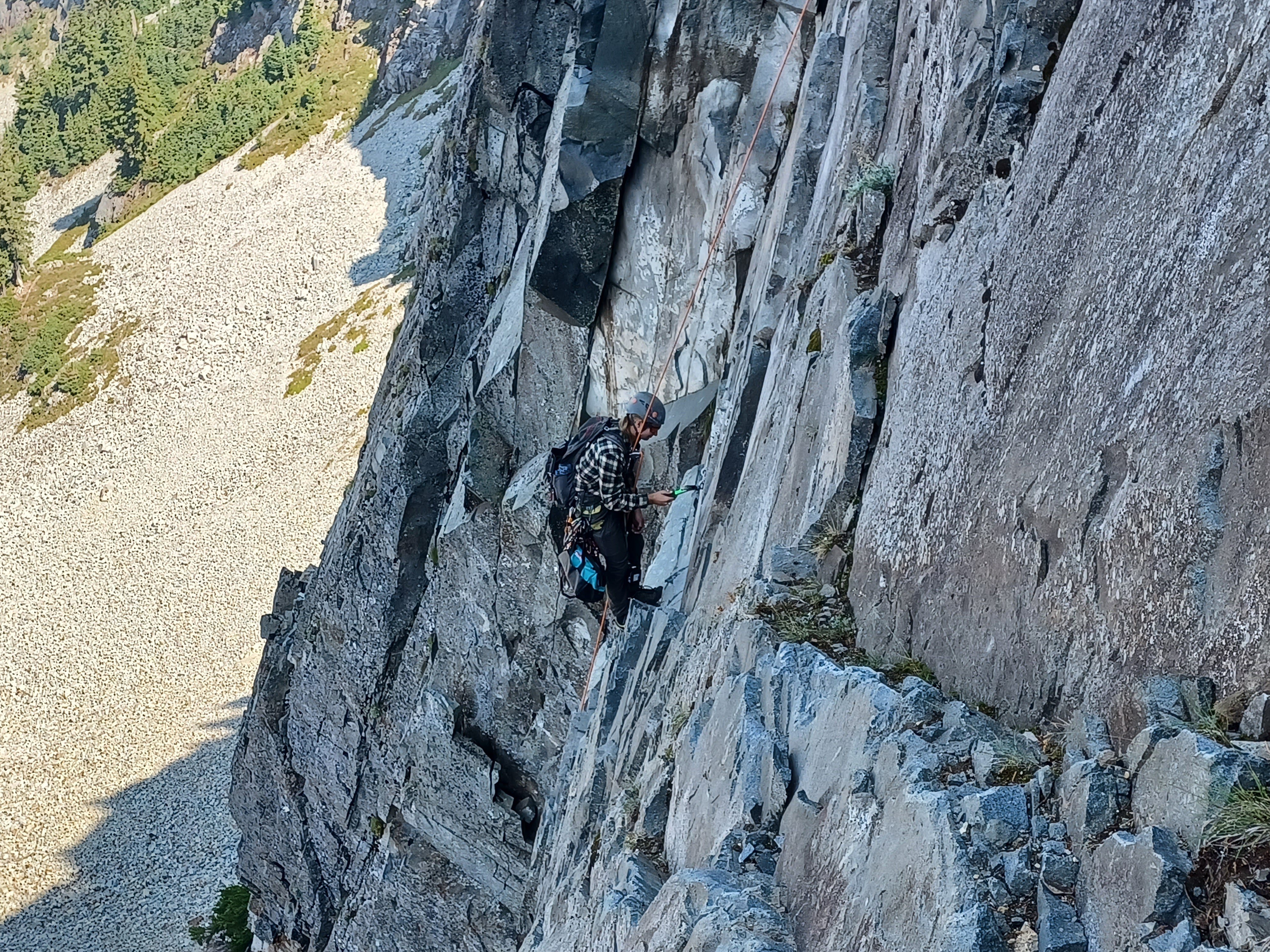
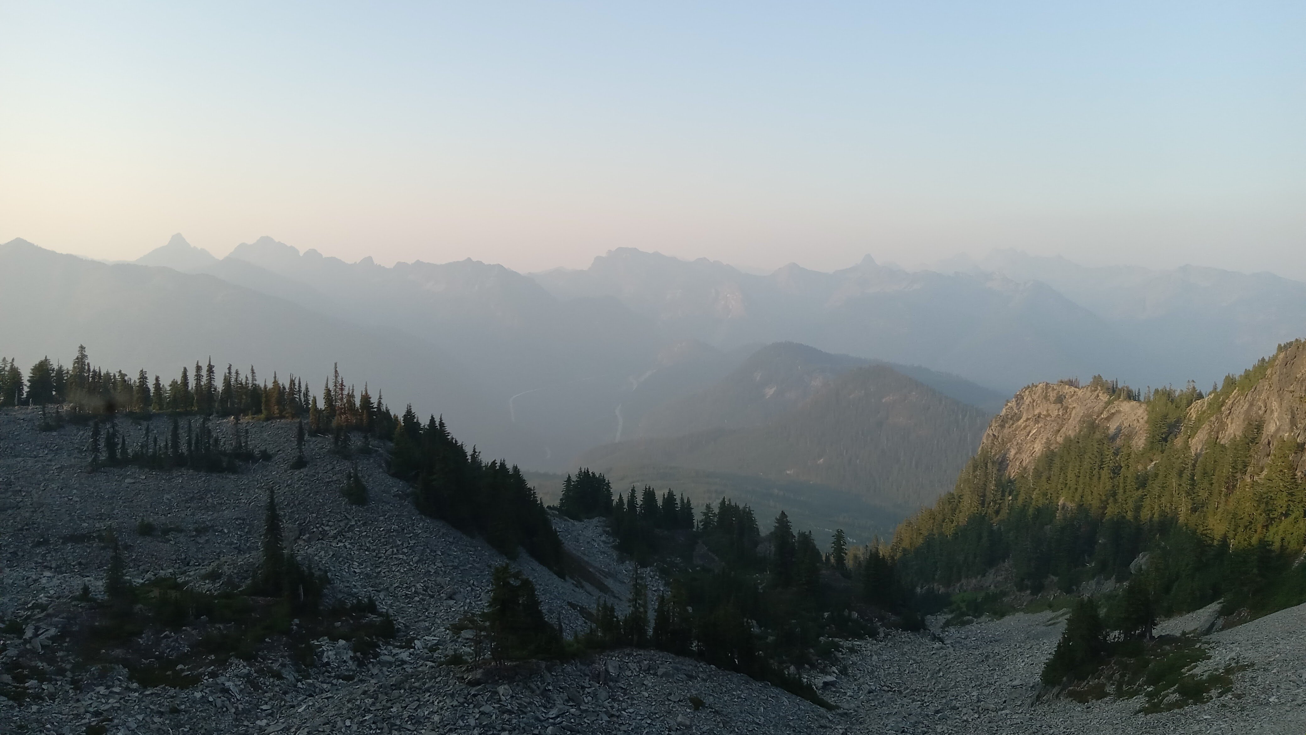
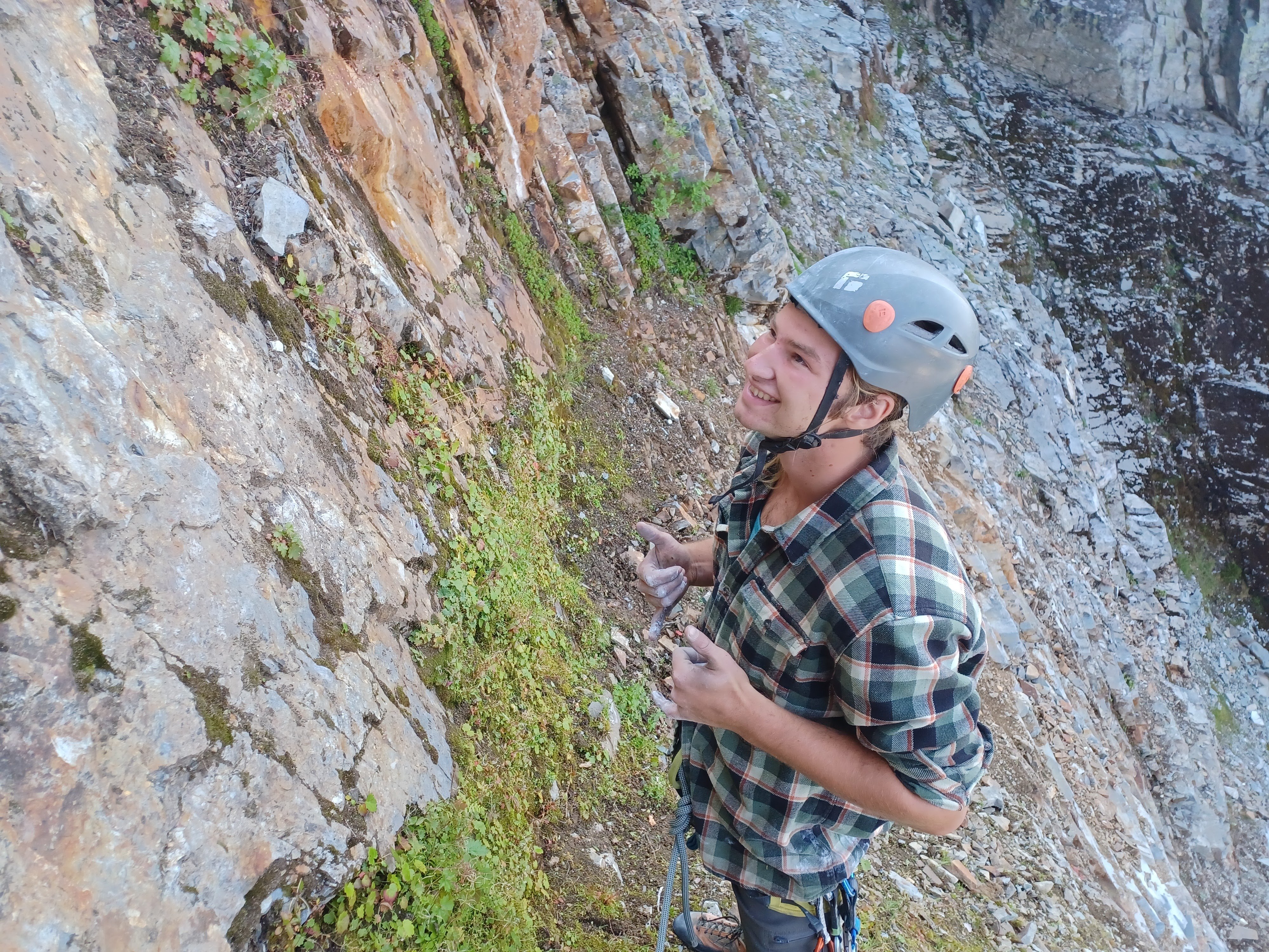
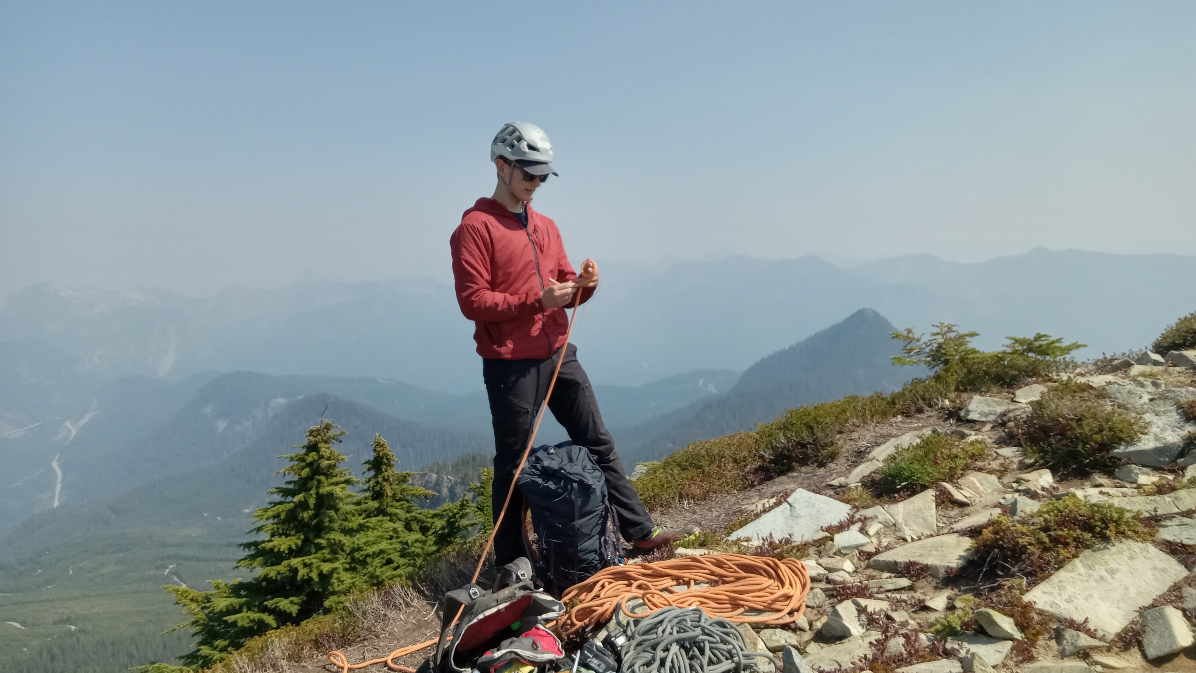
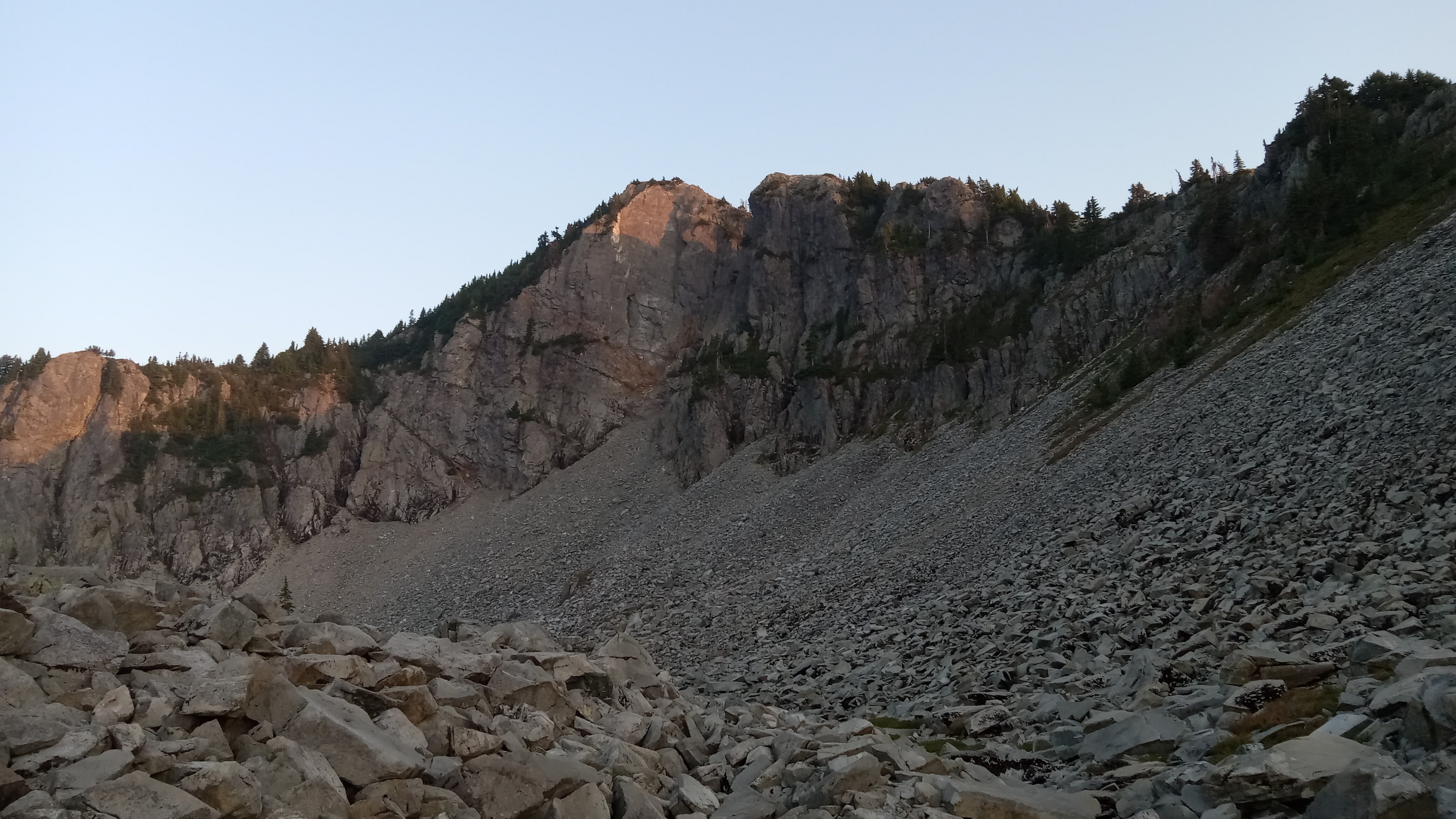
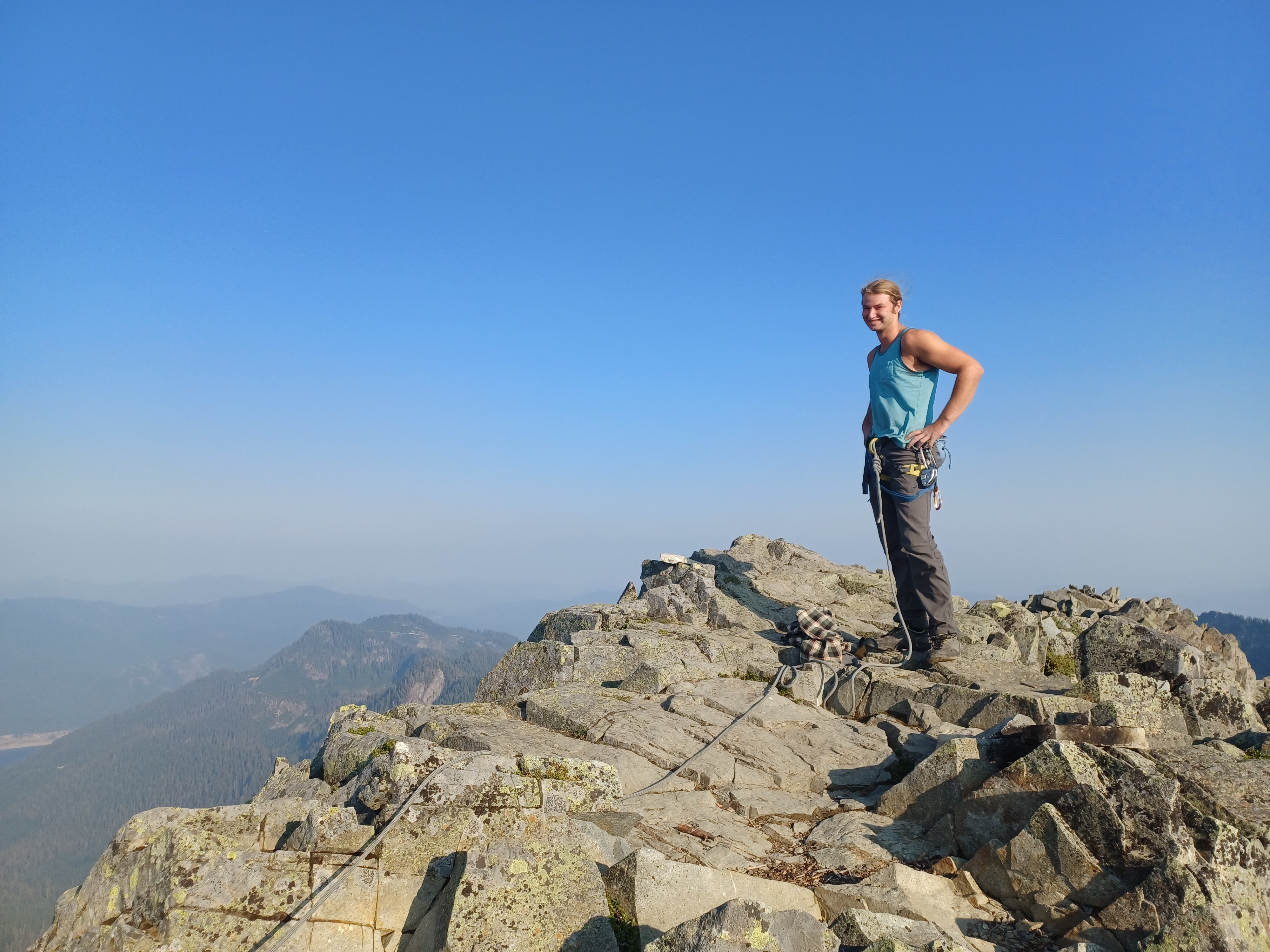
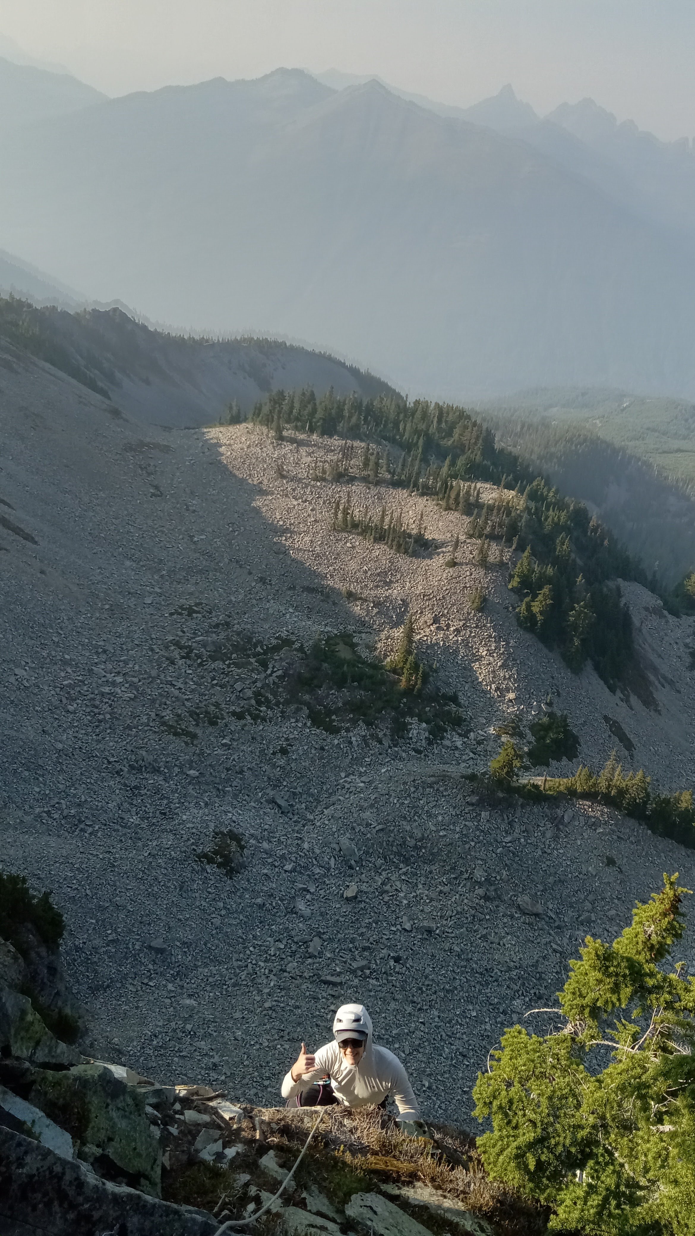
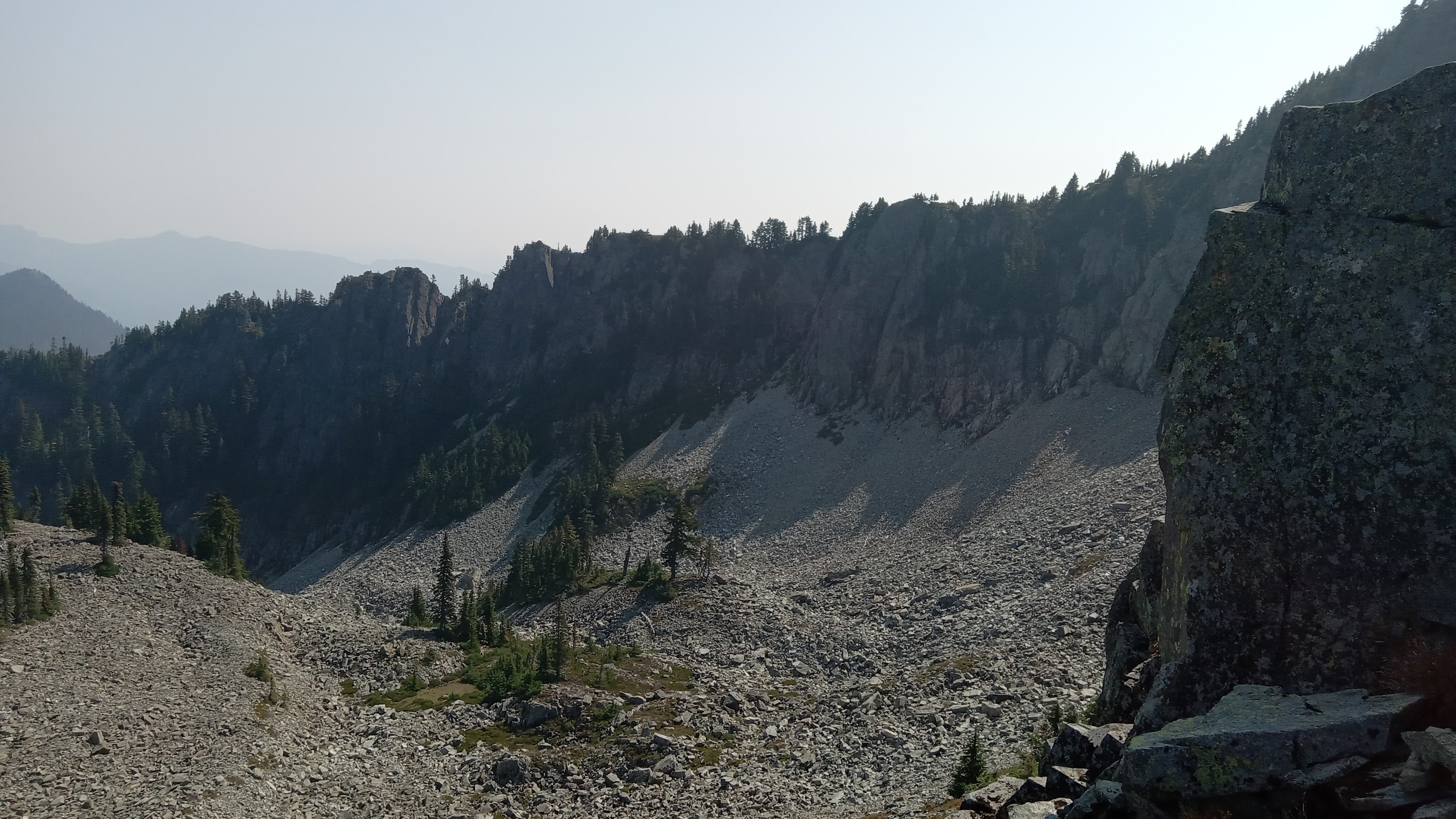
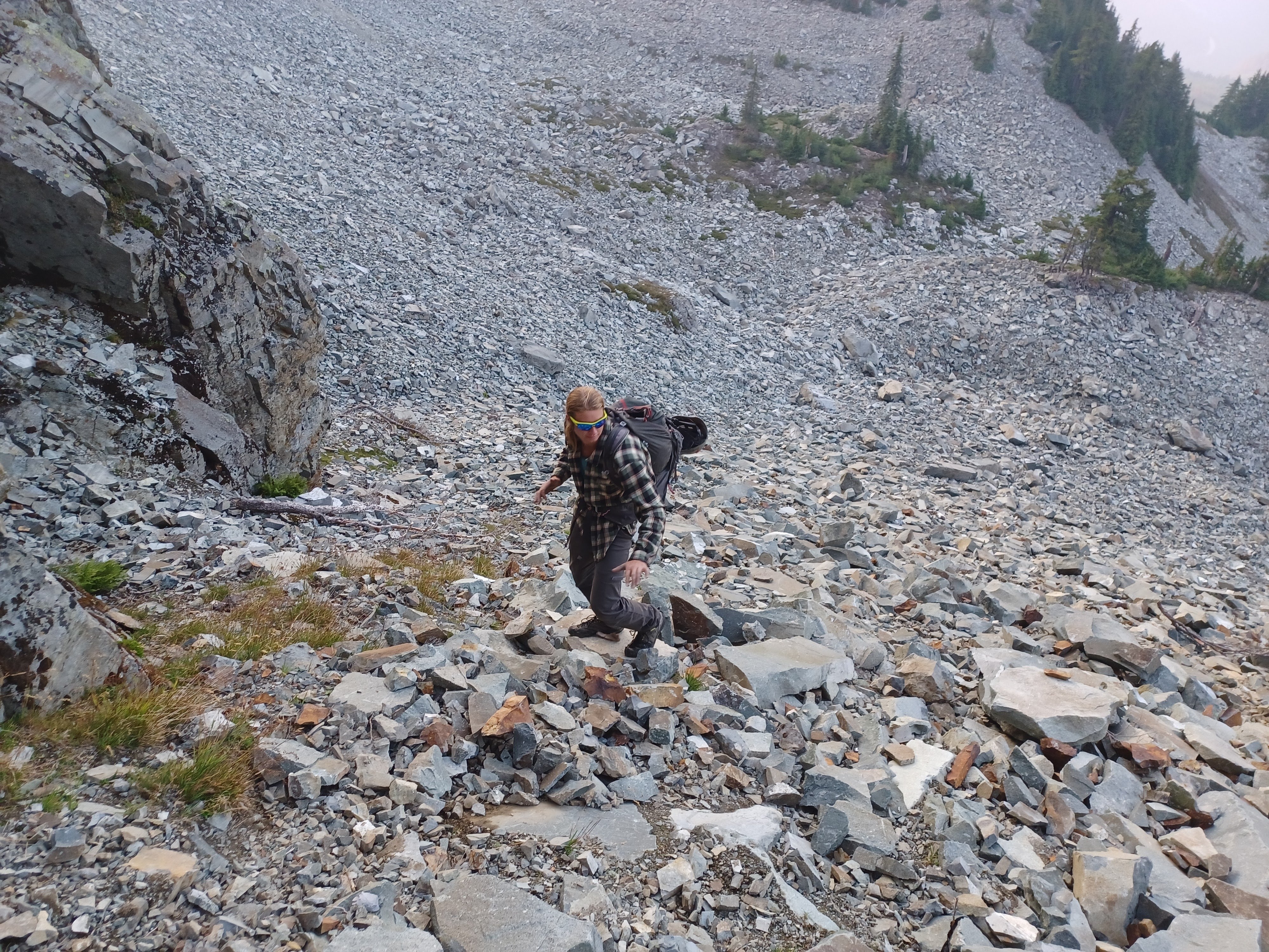
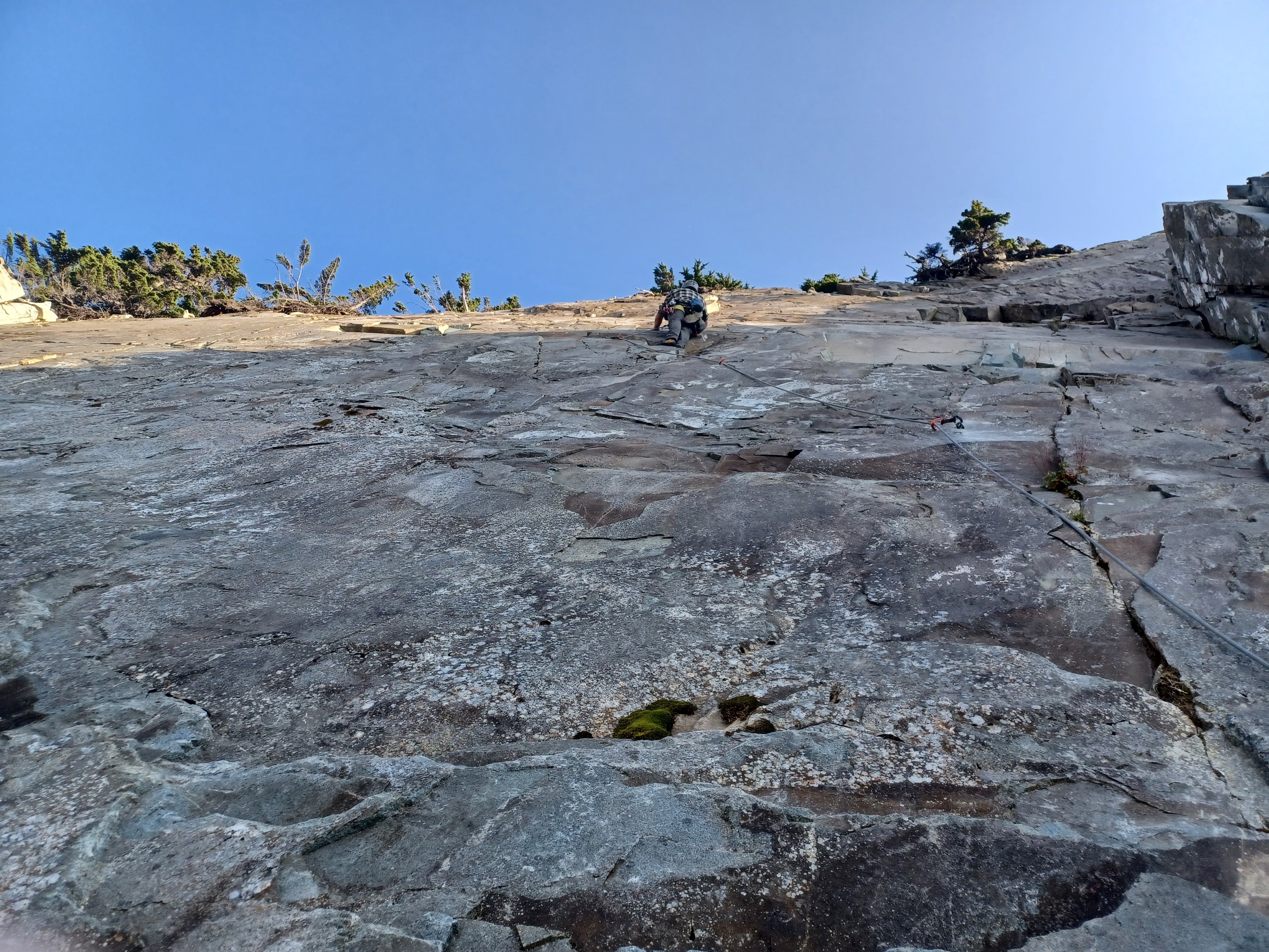
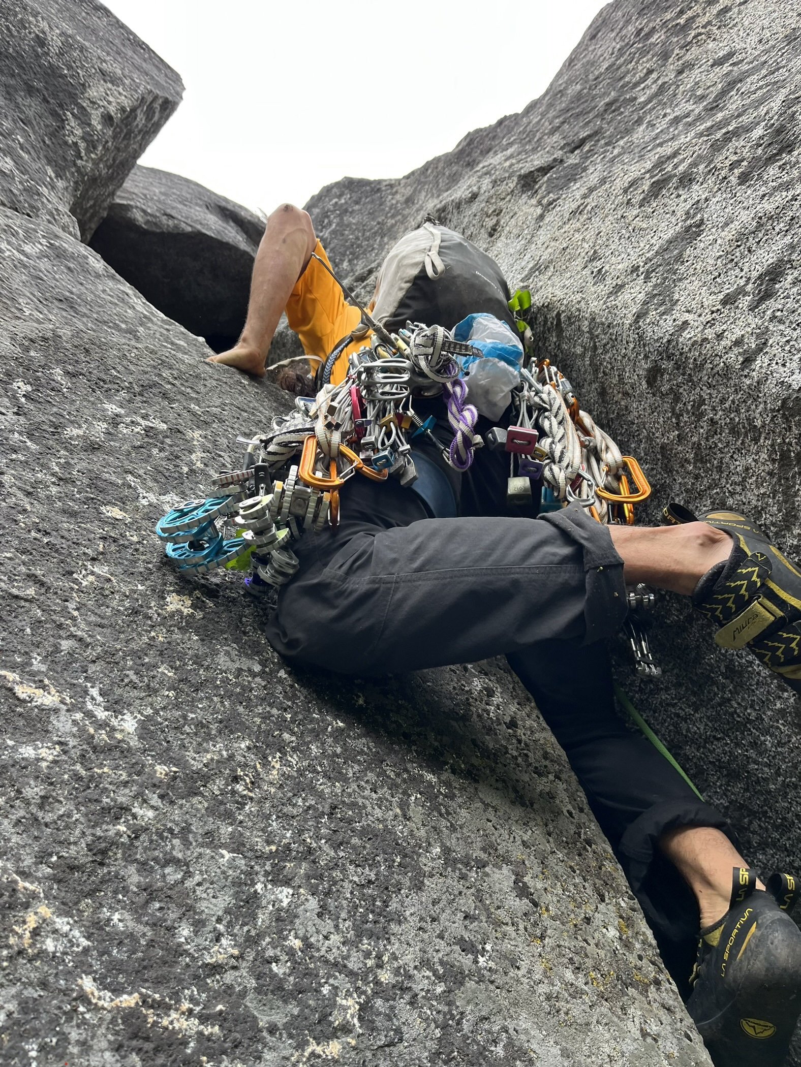
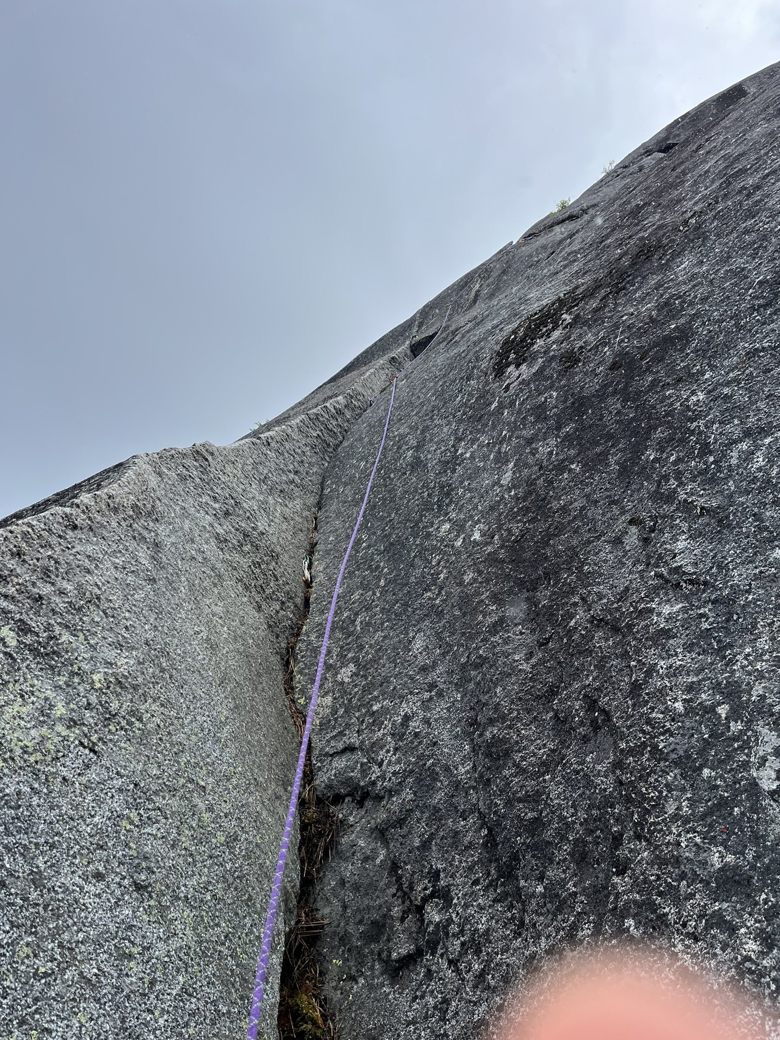
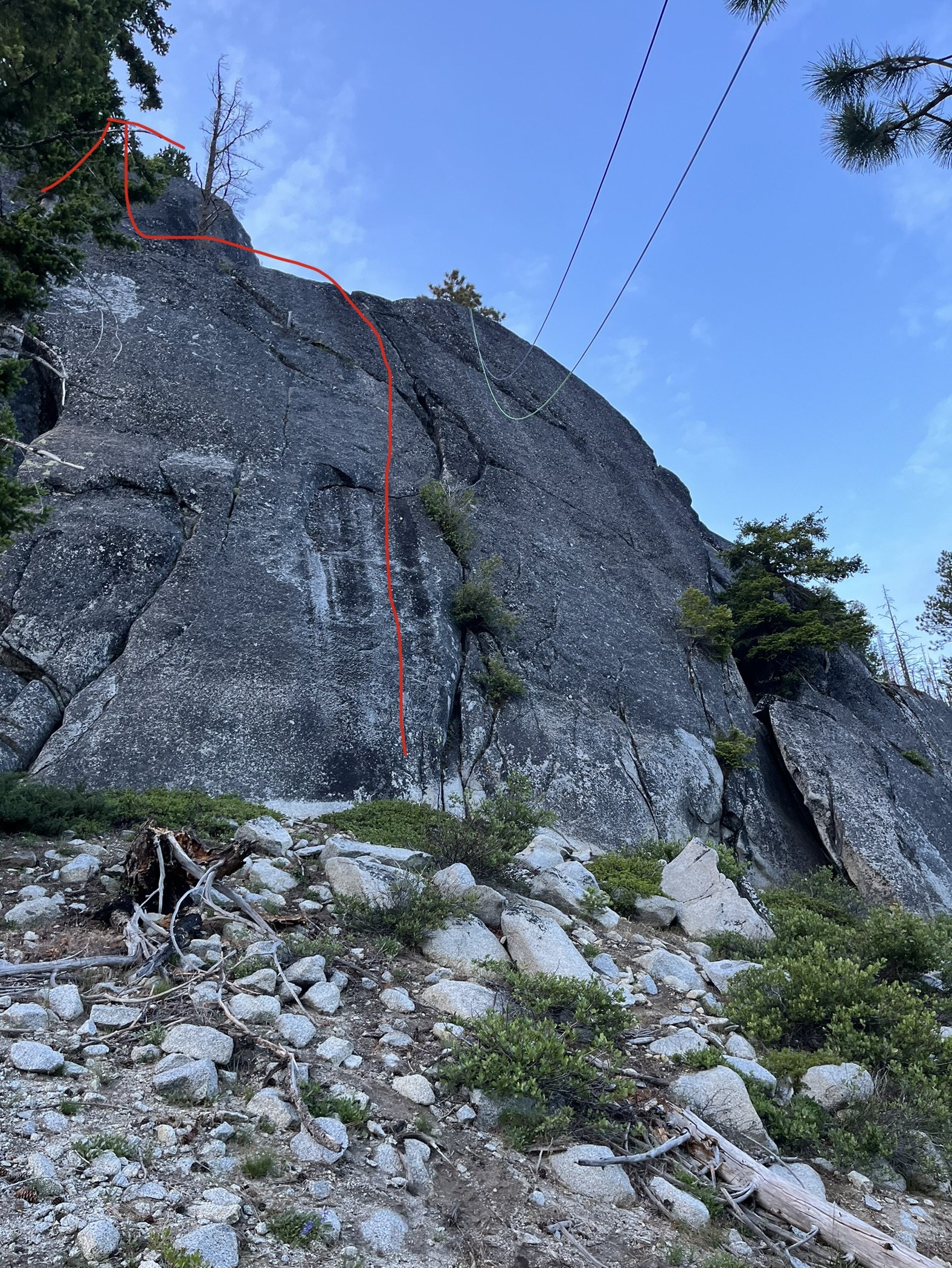
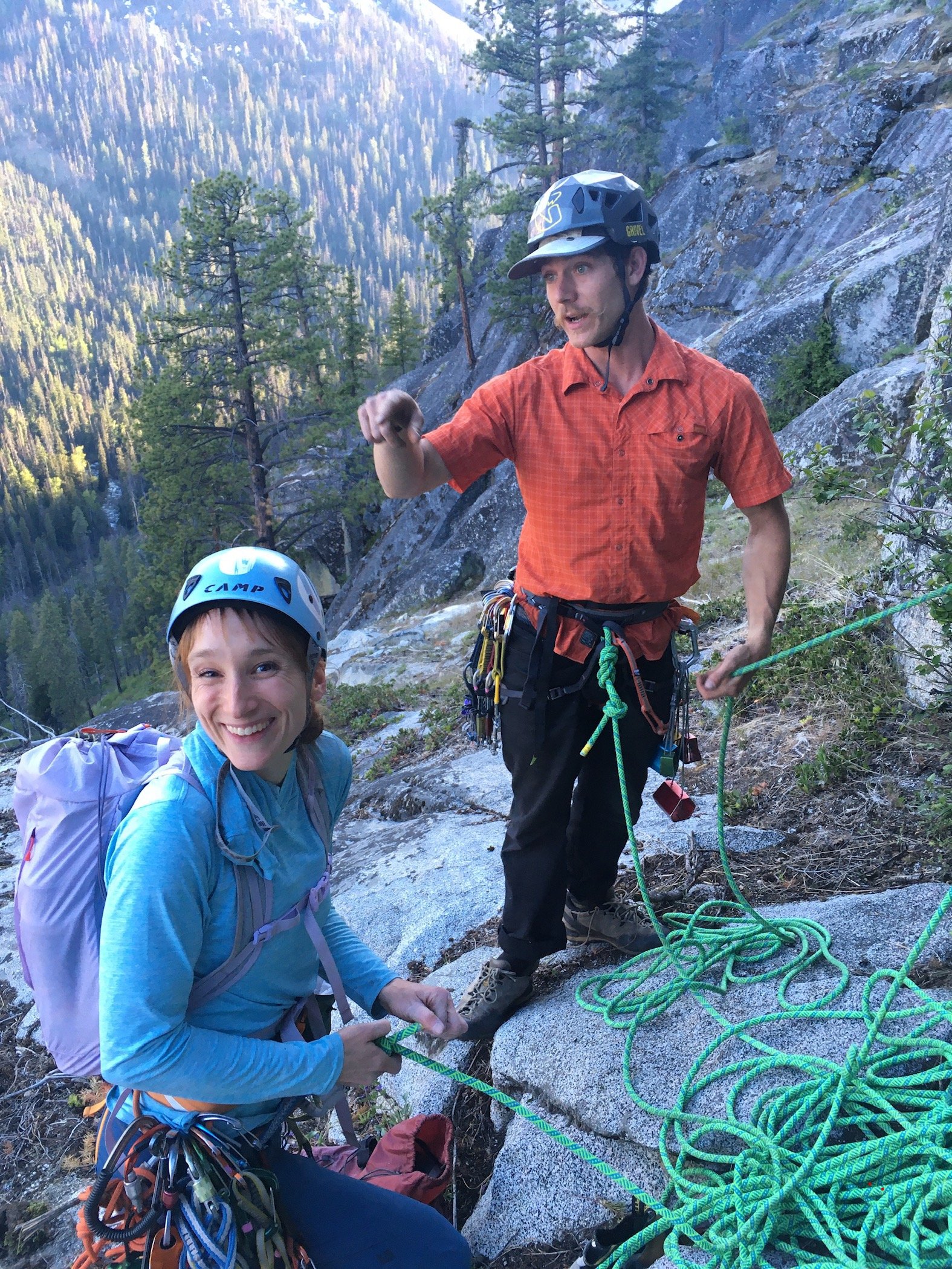
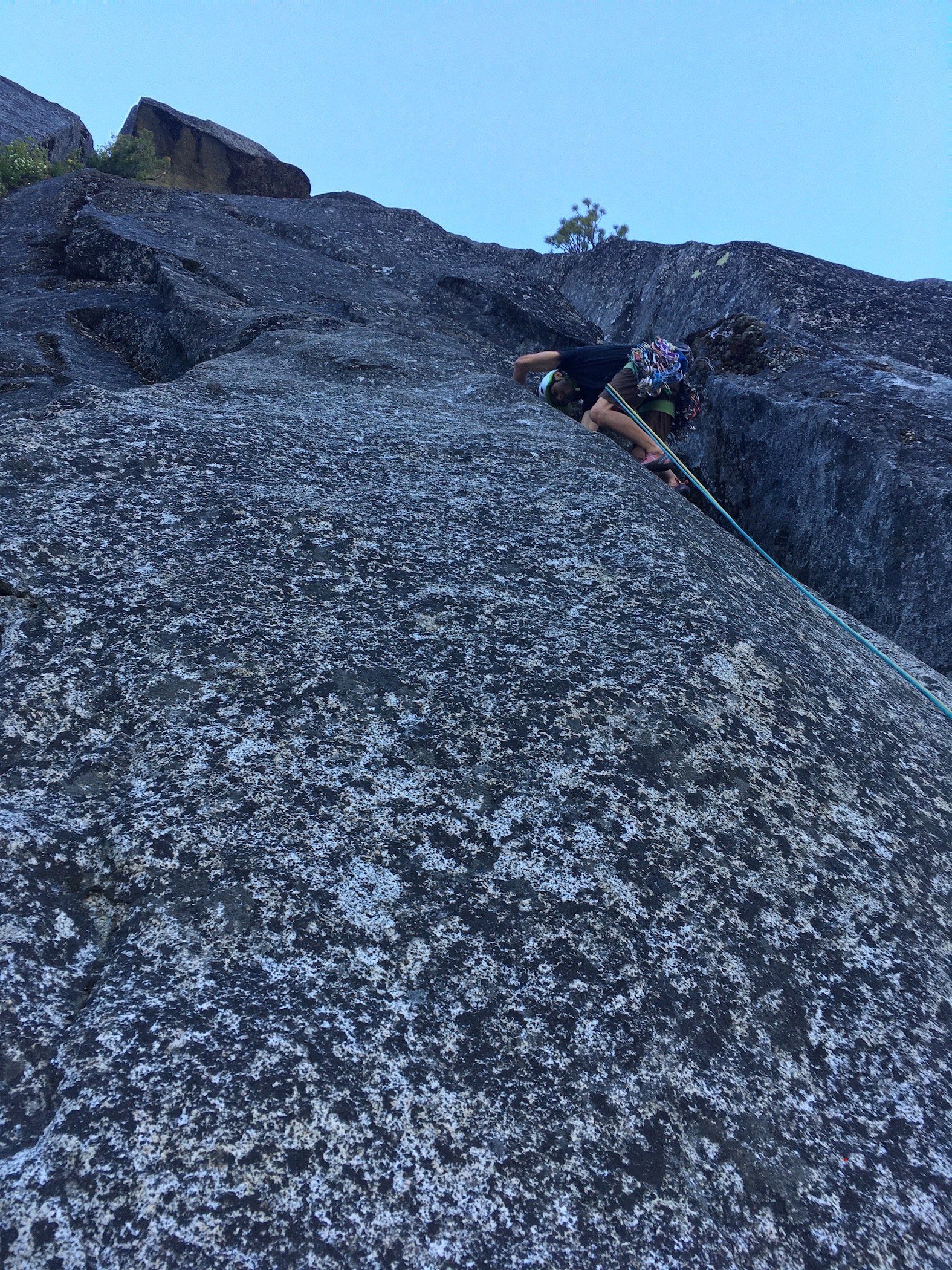
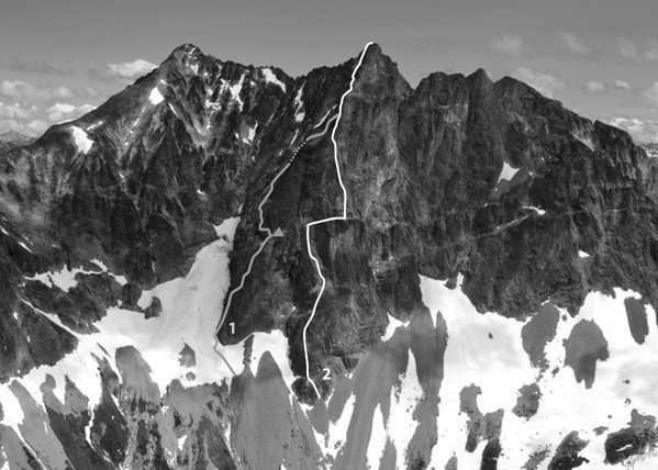
From Aug 20th to 24th Lani Chapko, Nick Gonzalez and I did the first ascent of the direct SE ridge of Seahpo Peak. The SE ridge gains roughly 4400' over around 1.5 miles of horizontal. Jagged Ridge adds roughly another 1.5 miles of ridge traversing. We climbed roughly 30 pitches on the SE Ridge of Seahpo with another 6-8 or so on Jagged Ridge. I would consider the SE ridge a Grade V as a stand alone if a team were to descend the standard route, and while maybe controversial, consider it a Grade VI with its continuation through the Jagged Ridge (Grade V 5.6). We had 18 hours of climbing time on the SE ridge and around 12 hours of climbing time on Jagged, totaling just shy of 30 hrs of climbing time over the course of 3 long days. Lani and I's climbing time on Mongo Ridge was around 17 hours and our non-speed-climber NIAD time last year was 16 hours. While not really relevant, these seem to be common benchmarks that people like to compare to. Photo I found last year from the summit of Icy showing the entirety of the ridge (sorry i don't remember who took it...) Early Attempts: I first spotted the line last year when Joe and I went in to do Spectre. It is a sneaky ridge that is only visible from a fairly narrow window of the North Cascades. We both agreed it looked massive and epic. I convinced Lani to give it an attempt late September. This was a couple weeks after a bad ankle sprain on Jo Berg. We ended up bailing after around 800' of climbing because of extreme heat, dry conditions and mild hallucinations from intense smoke. We approached via the Baker River and Crystal Creek. This year in July we had a window and decided to give it another go. We figured the Baker River approach would not go smoothly so we decided to try a high route approach via the Ruth-Icy traverse. Once at the Icy-Seahpo col we dropped down the head of the Crystal creek cirque and tried to find an access point to the ridge from the north. The climbing looked like 5.10X with minimal anchors, so we ultimately bailed out with the knowledge that we would have to repeat the heinous munge we found on the ridge last year. Day 1: We knew we were heading into dry conditions, so we sought out a third person to join the party to help distribute water weight on the harder climbing near the toe of the ridge. We reached out to Lani's friend Nick the morning of to see if he would be down, and he somewhat reluctantly joined knowing he would be procrastinating some work. The last minute shuffle meant we were in for a bit of a long packing session and late start. We got to the Baker River Trailhead in the mid afternoon and started our approach around 3PM. The approach went smoothly as the Baker River was super low and the crossings were super chill. We again picked up the old trail up crystal creek. We were initially super confused about the existing trail until we consulted with Eric W and learned that there used to be a trail up crystal creek. We got up into crystal creek basin right as it was getting dark and decided to set up camp in the trees just after crossing crystal creek. Near the end of our approach, Nick got stung by a ground wasp and started developing some full body hives. He had previously never been allergic to any kind of stings so this was a new development. Luckily we had just added some Benadryl to the first aid kit. He reacted well to the Benadryl and the hives subsided after around 20 min. Day 2: We started out the day finishing our approach up the crystal creek basin. This involves some mellow, but overhead grassy bushwhacking. When we were here in 2022, there was clear evidence that a ton of bears had trampled the valley. Adding a very eerie feeling to the endeavor. We felt like we were being taunted by Tanuki, hence the name. The climbing on the ridge starts around 2900-3000' depending on how your device is feeling. Once at the base of the ridge again we were back in familiar terrain. Ignorance may have been bliss... The first 1000' of the climb involves some substantial, runout and sometimes challenging munge-a-neering. Lani following one of the 5.9 munge pitches on the first attempt Looking up at the crux munge pitch after bailing on attempt #1 After reaching our high point, we continued questing upward. We had a hunch that we were through the major difficulties of the lower ridge on the first attempt, and luckily that prior assumption was true. 1000' more munge led us to the summit of the first major tower. This tower rises over 2000' over crystal creek basin and feels like a major accomplishment in and of itself. Lani and Nick Following near the top of Tanuki Tower Looking back down at the long scrambling section in the middle of the route After reaching the summit of the first tower, which we later dubbed Tanuki Tower, the ridge eased back for a massive, long section of 3rd and 4th class scrambling, separated by the occasional pitch. We were able to make good time to the base of an obvious gendarme to camp at 6900'. When we arrived at camp we were able to locate a 3rd class access ramp that allowed for access to the glacier on the south side of the ridge. This allowed for a much needed water top off. Future parties could consider gaining the upper (more classic) ridge via this hanging basin and scrambling access ramp to avoid the munge on Tanuki Tower. Looking up at the upper ridge from camp. Day 3: We started by climbing the obvious Gendarme above camp and traversing to the main summit massif and upper ridge. Classic moderate climbing on the Gendarme above camp The upper ridge provided a ton of clean, moderate ridge climbing with a bunch of awesome position and good climbing. Nick leading the upper crux, a clean 5.8+ lieback After a bunch of false summits, gendarme traverses and generally entertaining ridge climbing, we finally found our way to the summit of Seahpo. Stoked on our success we started the debate about continuing. We all had trail runners and light aluminum snow gear. After an hour long debate we decided thin conditions meant we could work around the snow and manage the little that we had to, so we began our committing raps off the summit of Seahpo. We started off with the moderate snow traverse across the glacier to regain the ridge. Conditions were super firm, so while only being around 30 degree traversing terrain, we ended up pitching out this short section. Looking out from the start of the Jagged Ridge Traverse Clean Rock on Jagged Ridge Once back on the rock, we were able to make super quick progress soloing a bunch of 4th class terrain to near the mid point on the Jagged Ridge traverse. There were minimal opportunities for bivies, but we found a reasonable, albeit exposed ledge near the ridge crest. If we would have been able to continue for another 20 min, we would have made to to a kush ledge on the north side of the ridge that would have been sheltered from winds. A nice ledge amongst the choss traversing near the end of Jagged Ridge Day 4: The remaining part of Jagged Ridge was honestly kind of awful without snow coverage. Very loose compact dirt and unstable talus traversing above big exposure. There was the occasional pitch but mostly scrambling. We ultimately made it to the final group of towers that define the exit to the ridge. We didn't really find the "lethal choss chimney" described in other reports, though there was a low angle choss gully with a 5.6 boulder problem around a chockstone. The final pitch to exit was the definitive crux and decent climbing, though a bit steep and committing for 5.6. Once off the traverse, we realized our mistake in equipment selection. It was clear that heading up onto the crystal glacier with so much blue ice exposed would be an awful test of our mediocre snow gear. That and a whiteout shielded the bergshrunds from our vision, so we didn't have a clear view of our exit. Our original plan was to head up and maybe tag the summit pyramid, though we decided to bail onto the slabs below the crystal and sulphide glacier. There was a level of uncertainty with terrain and overhead hazard, though the seracs looked quiet enough to feel comfortable with the traverse. The 2 mile long slab traverse took what felt like days, but we were able to link into the sulphide route right at the standard sulphide camp, avoiding all of the steep exposed ice. We took the slabs just below the snout of the crystal, then back up the rocky passage on the Sulphide Typical terrain on the slabs after a waterfall crossing A quick jaunt down the shannon ridge trail got us back to civilization, but not out of the clear... as we opted not to spend the time to set up a car shuttle. Nick in all of his glory had volunteered to run the shannon ridge trail and road all the way back to baker lake trailhead to shuttle the car, for a total of an 11 mile run to finish off the trip!! Overall, this was a grand journey up one of the largest technical features in the lower 48. I would recommend the whole ridge as an awesome cascadian, blue collar route! Rack: Singles Single Rack to 3 with doubles up to .75, optional KB's, Single 60M Rope A rough track showing our approximate route TH to TH A Close up showing our rough track on route Potential alternate approach tracks; Green showing an early season approach via the Icy-Seahpo col, this route may require some rappels down low angle slabs. Purple being a potential high route that would require a bushwhack up the ridge to the left of Crystal Creek. And Red showing a technical track up low angle waterfall slabs that would access the hanging basin to bypass Tanuki Tower. The two access points (red and purple) seem like equally easy and viable ways to access the ridge.
 2 points
 -
I've been reading The Bold and Cold by Pullan after my Rockies trip and it got me thinking about what a similar list would look like for my home range... the Oregon Cascades. For those that don't know, the Bold and Cold is 25 climbs, 5 groups of 5 routes, in the Canadian Rockies. Each group is supposed to be training for the next tier. The list was developed by famous climbs Urs Kallen and Dave Cheesmond. The five categories in the book are: Shakedown Routes, Maiden Routes, Middle Earth Routes, Galdiator Routes, Titans. All the routes are quite serious and the categories progress in commitment, length and remoteness. The crux pitch grade seems to have little to do with it. I think it would be fun to make a similar list for Washignton or the North Cascades... I think the routes would be more diverse there and the "Titans" category would actually be a bit more legit. Though still no where near what the Rockies offer. Curious to see other folks routes. Maybe for other ranges too. Here is my incomplete list. It is grouped more by category as that seemed to make more sense for this range. The Dumb and Chossy: Routes in the Oregon Cascades Crag Routes: (could include some from Smith, Beacon etc. here but wanted them to actually be in the range, once you add those two the list is kinda endless, any other multi-pitch adventure routes in the Oregon Cascades that form a decent challenge?) Exploring the Axis, Cougar Crag Dod Route, Turkey Monster Barad Dur, Wolf Rock (mostly) Snow Routes: Reid Headwall, Hood Thayer Headwall, North Sister High Noon, Broken Top Jeff Park Glacier, Jefferson Right Gully, Hood Technical Mountain Routes: (need one more, but Oregon is pretty lacking is this dept unless you have suicidal tendencies) West Ridge, Illumination Skylight, Illumination West Ridge, Washington East Buttress, Washington Ice Adventures: Eliot Headwall, Hood Center Gully, Hood Full Richardson, Broken Top Fric/Amos, Hood Emde/Ablao, Middle Sister Big Lines: Yocum Ridge, Hood Complete East Buttress, North Sister Arachnophobia, Hood Brainless Child, Thielsen After Image, Strawberries (not technically in the Oregon Cascades or in character with the others but I wanted a 5th and this is head and shoulders above other routes in sustained technical difficulty, and more remote)1 point
-
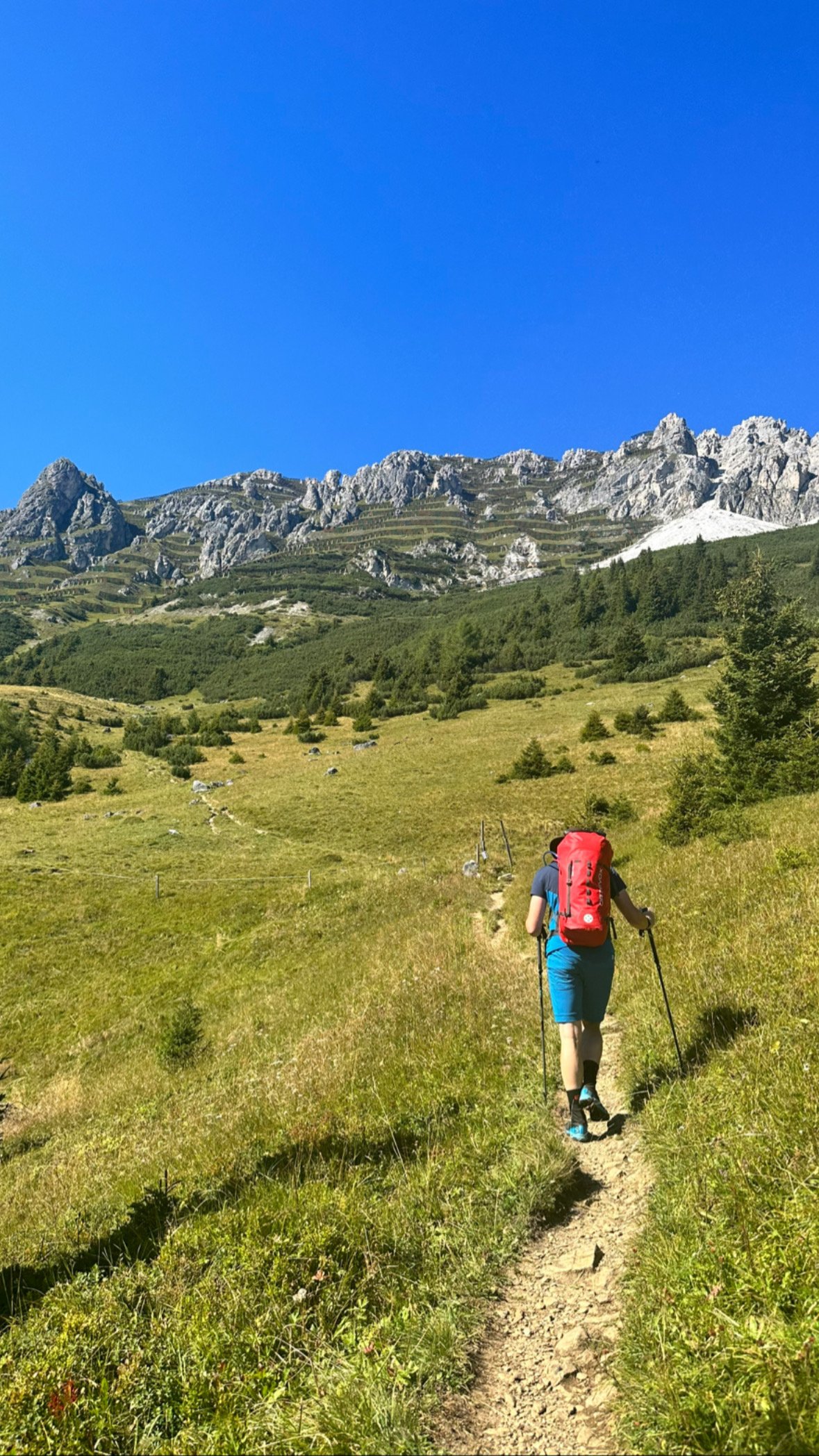
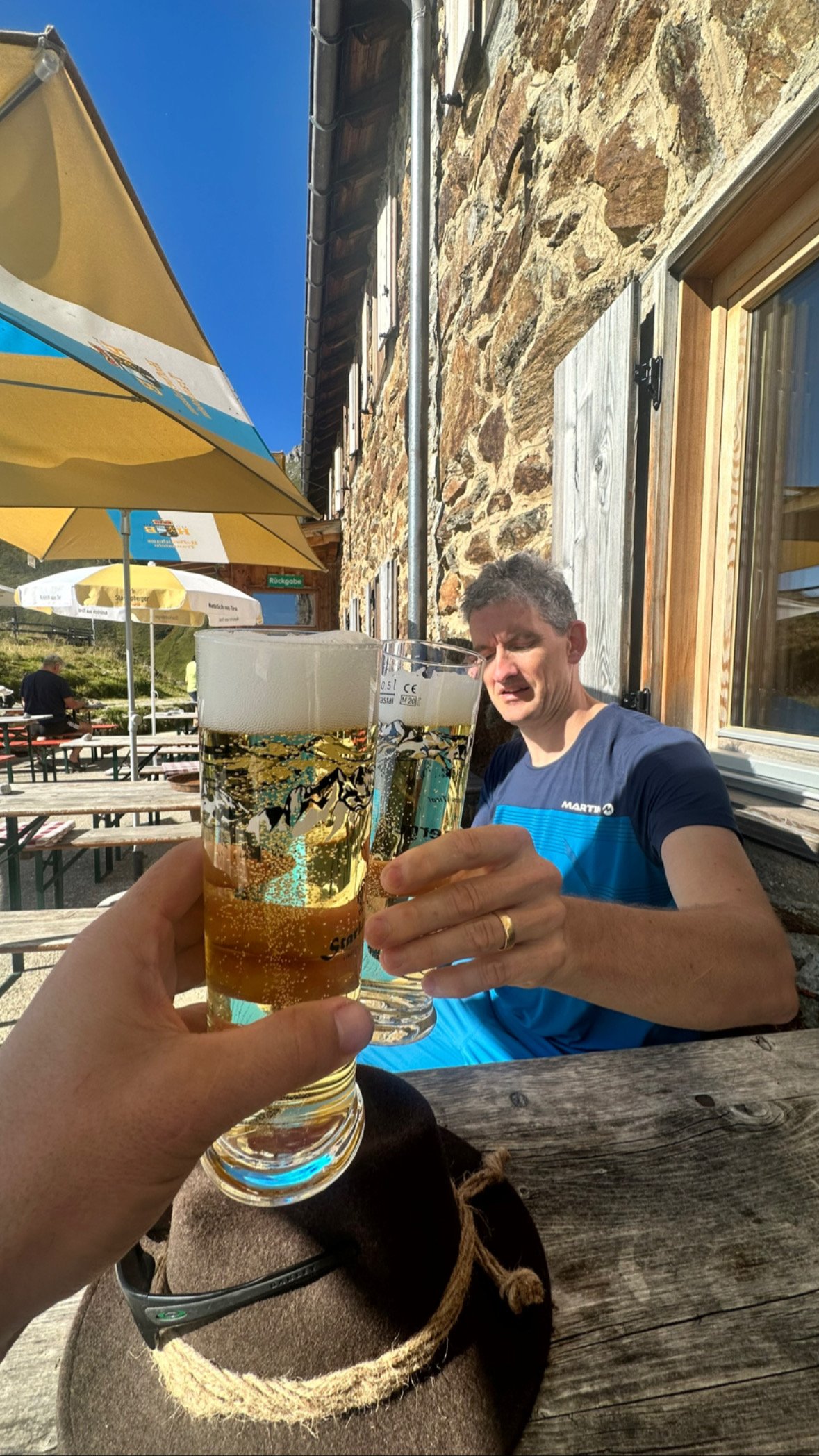
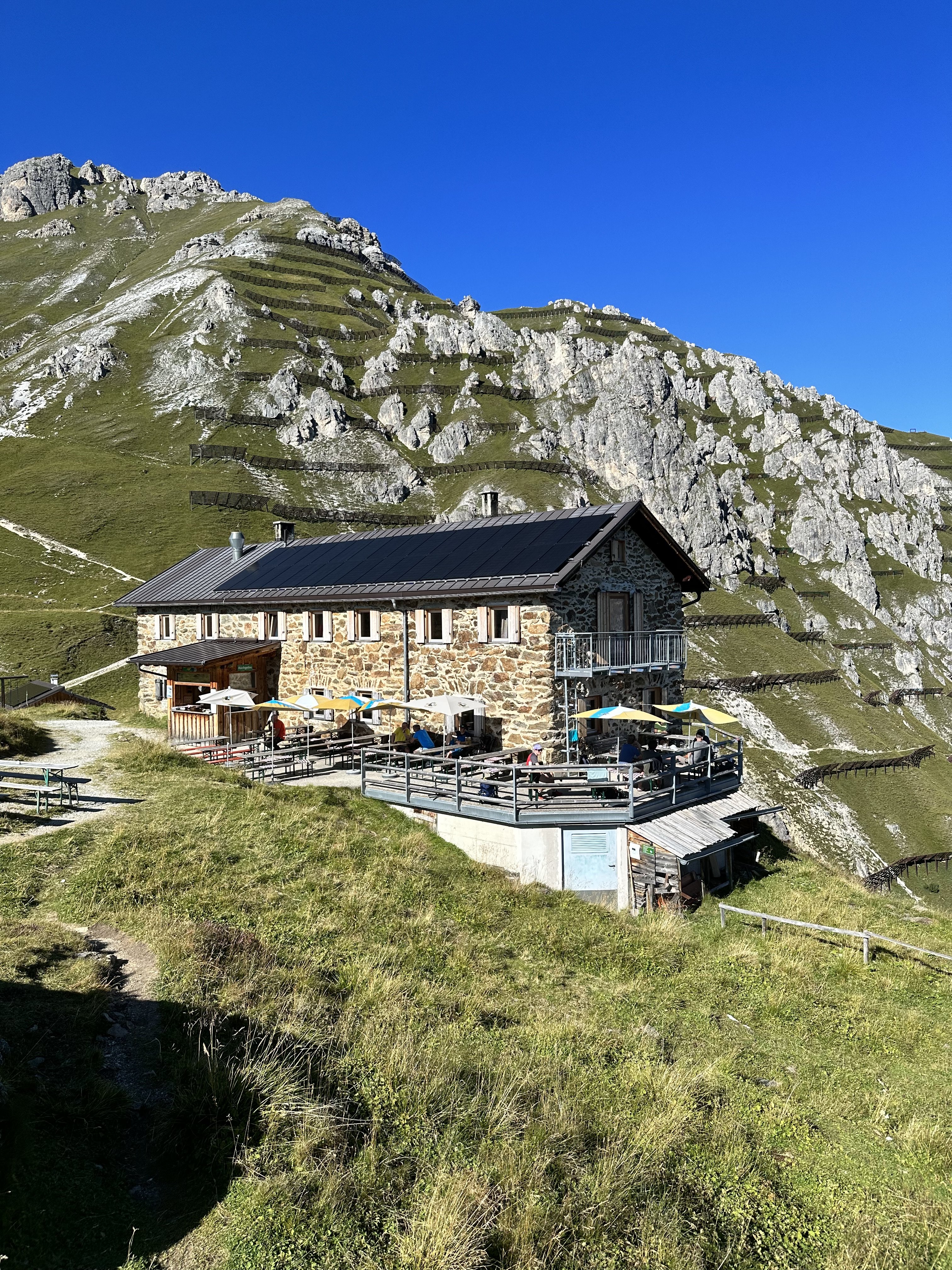
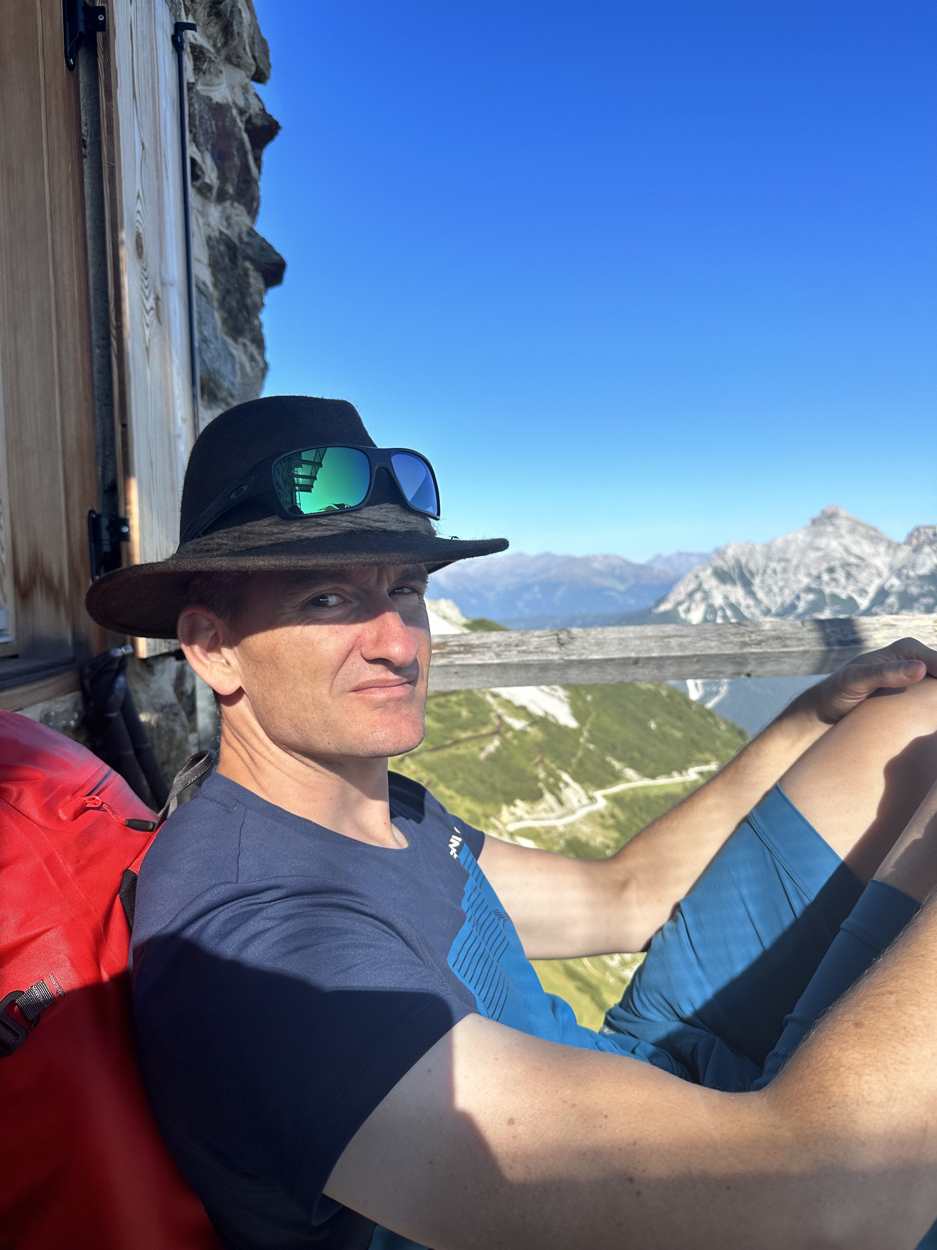
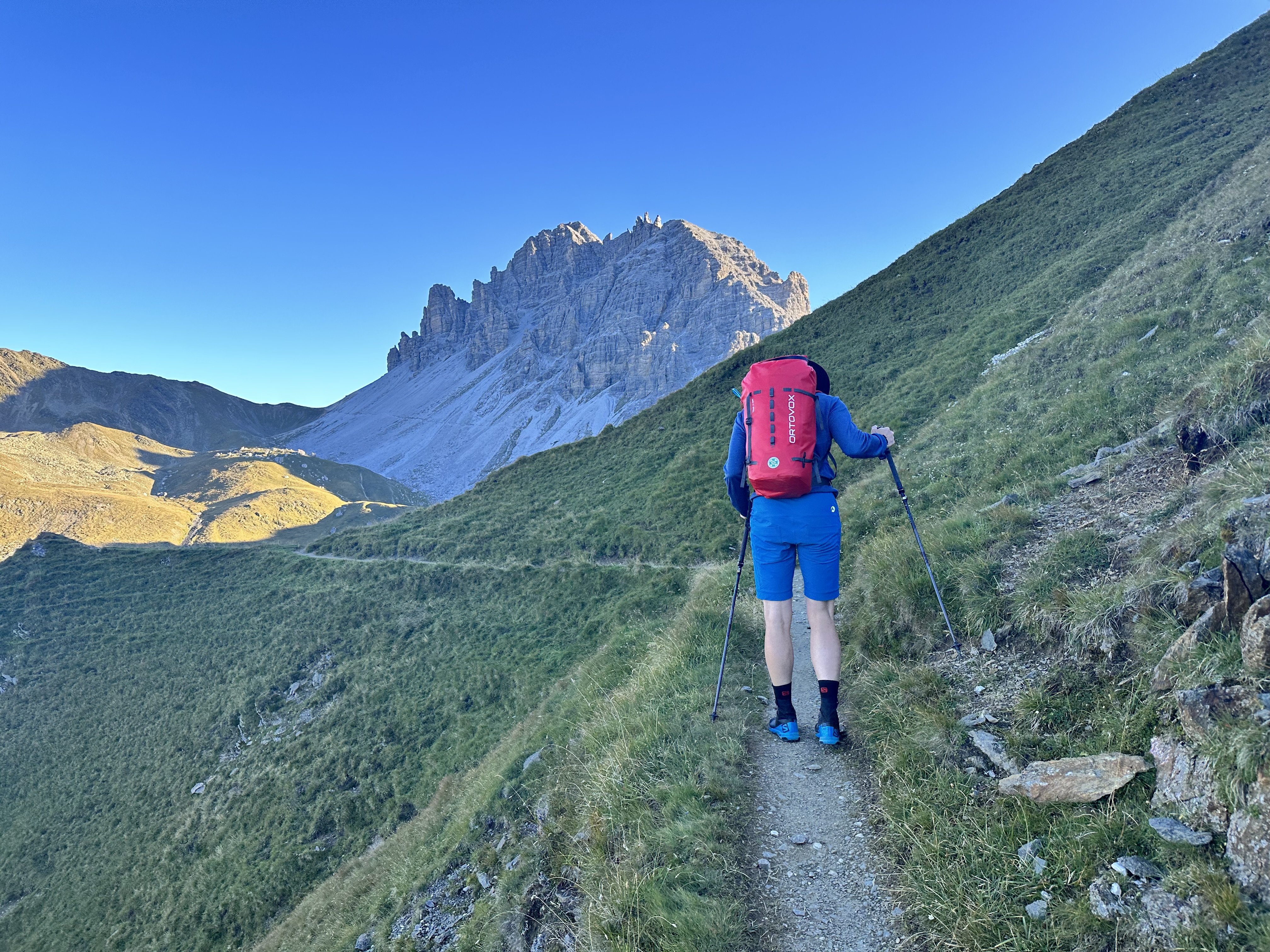
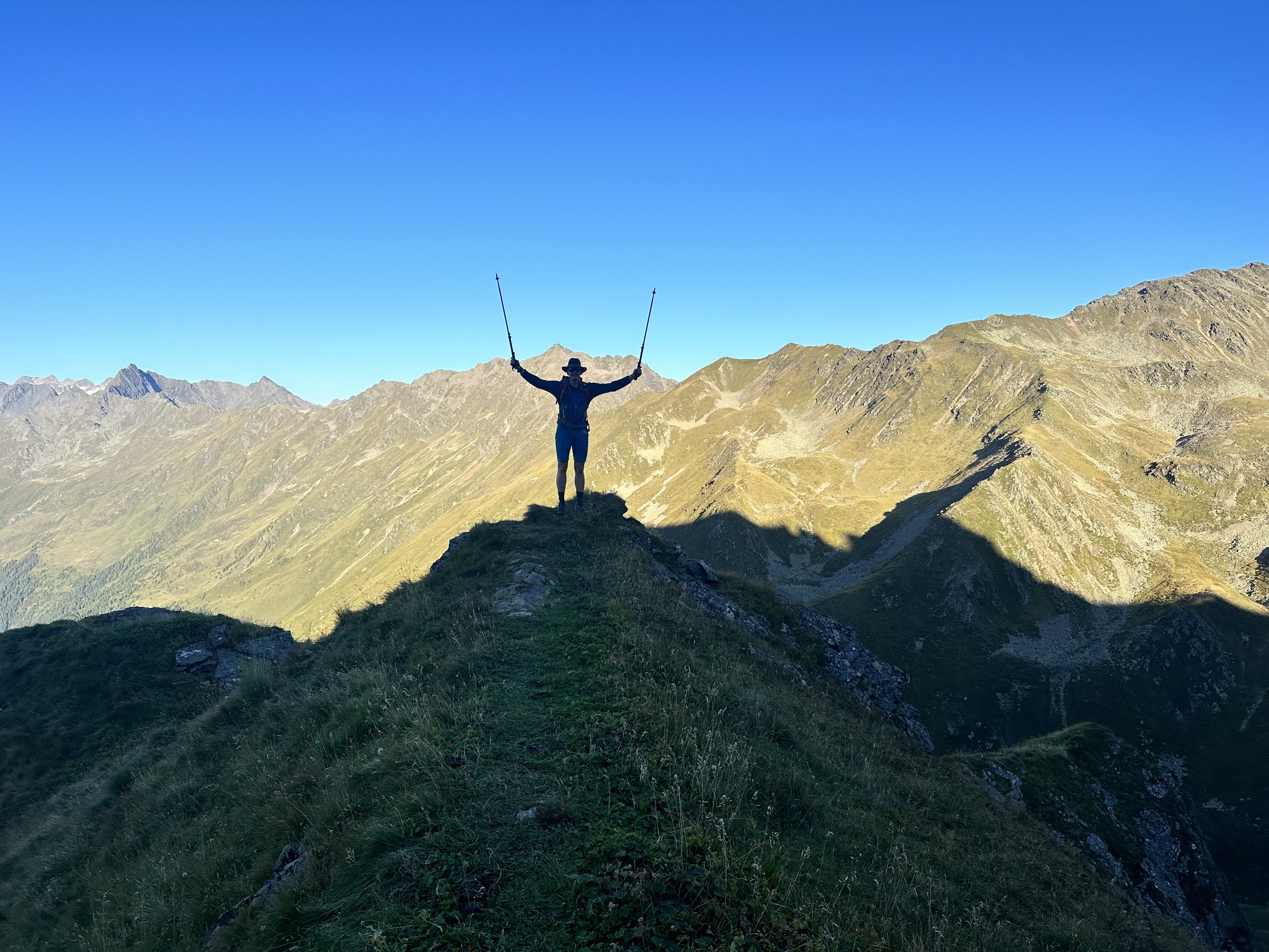
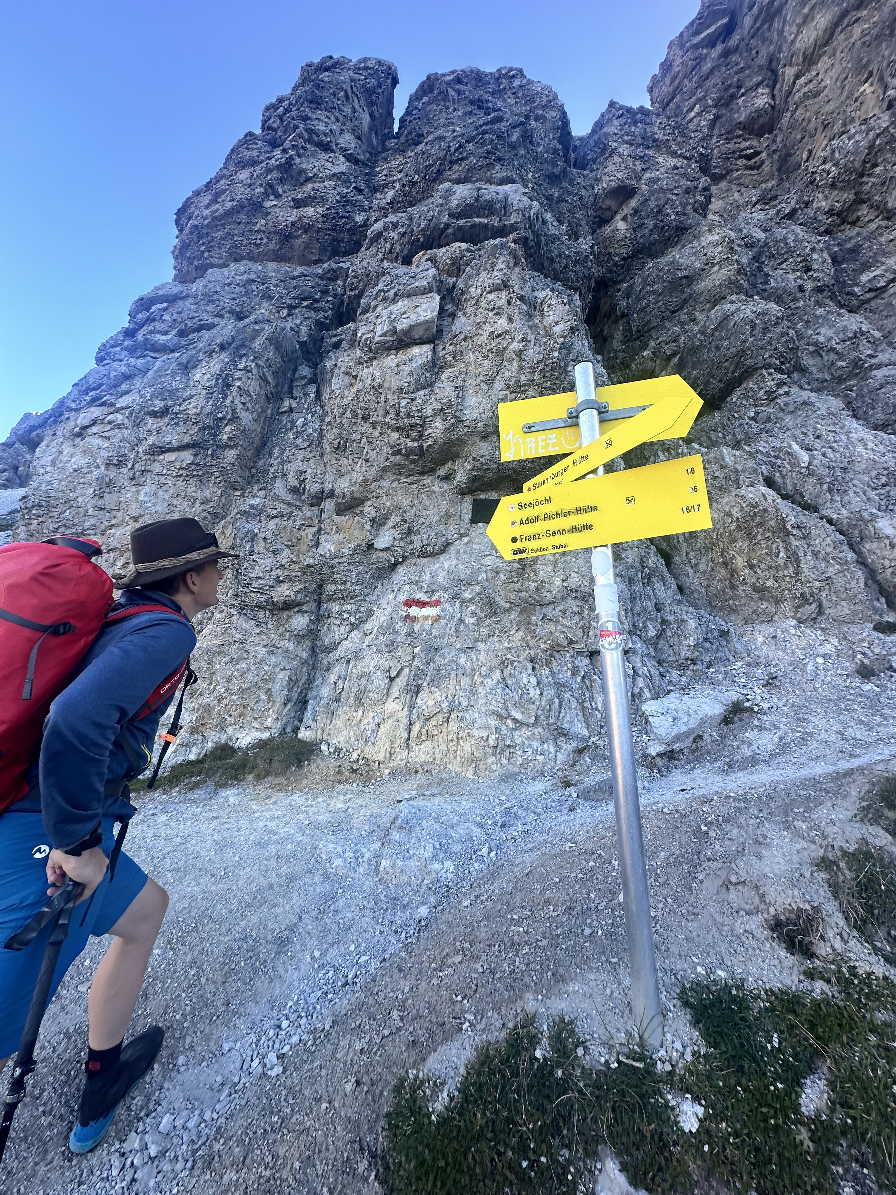
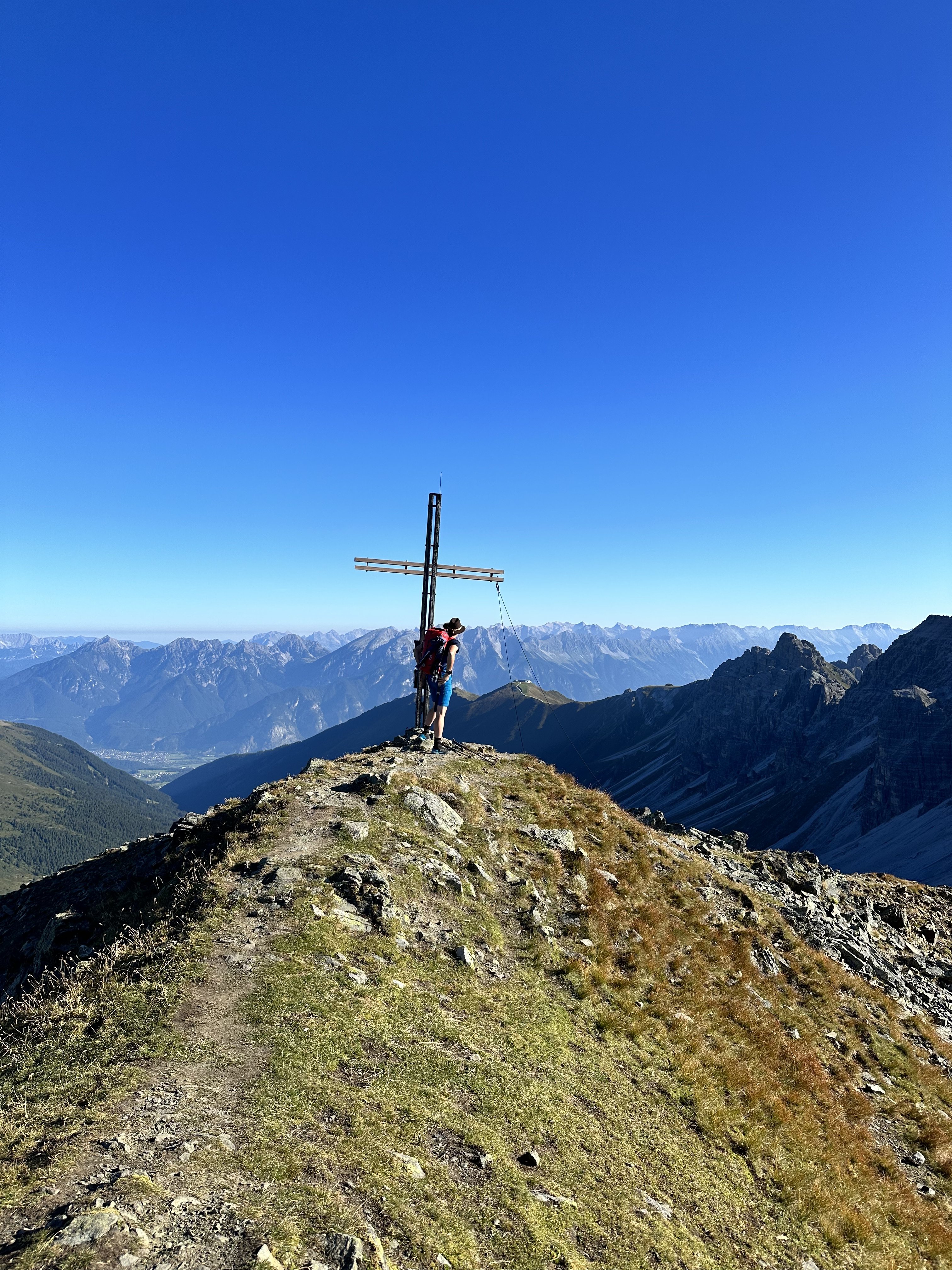
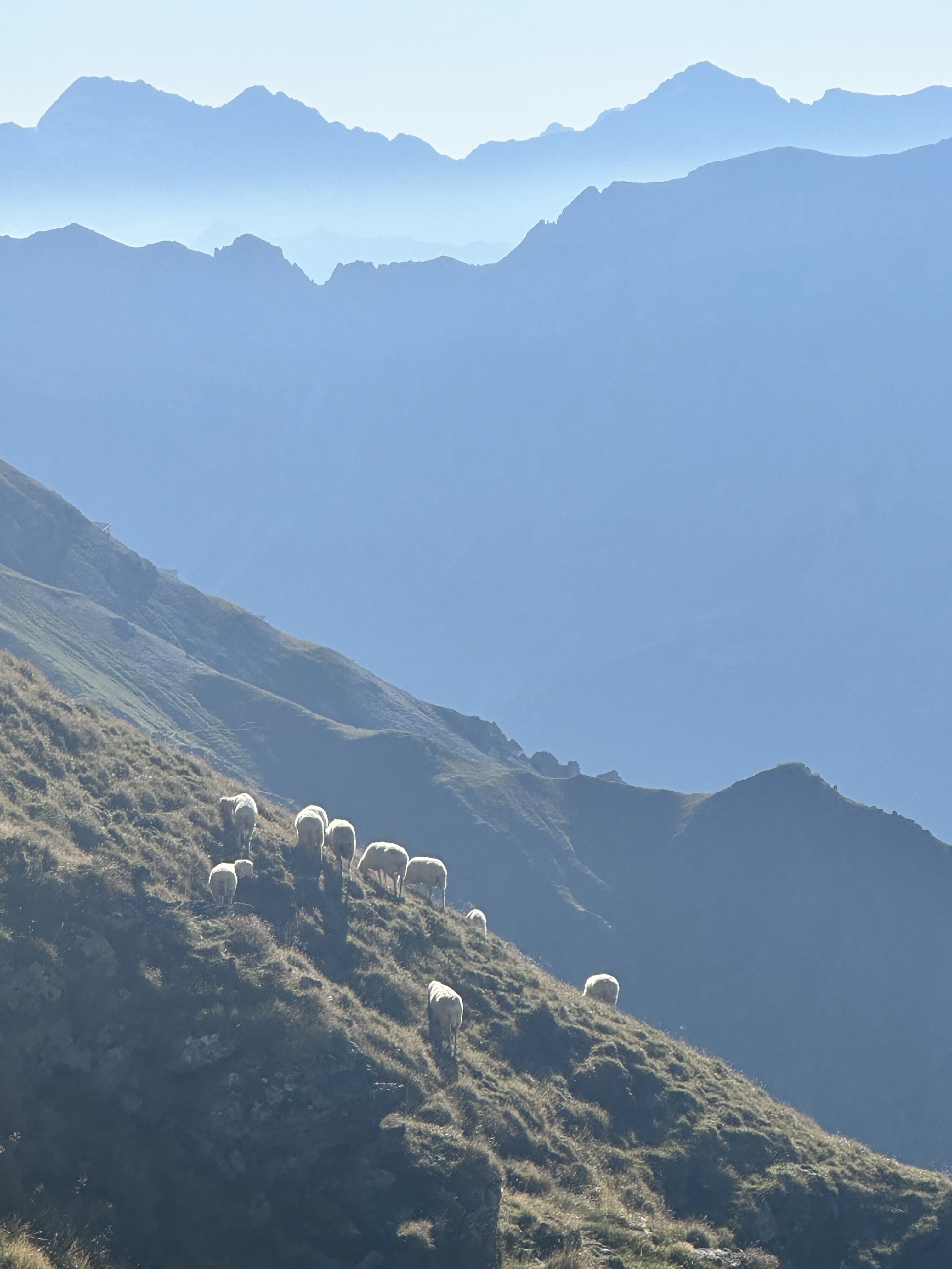
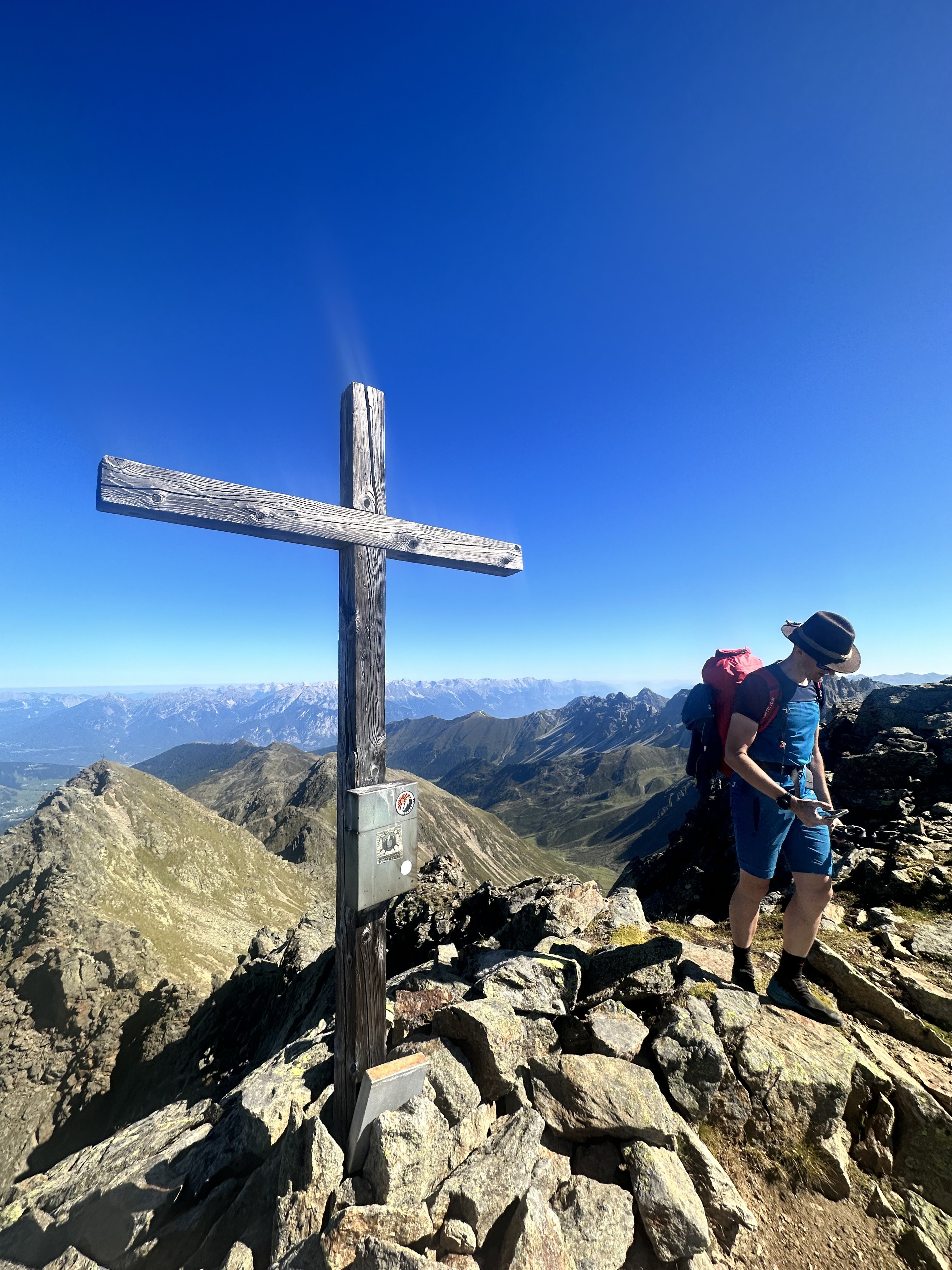
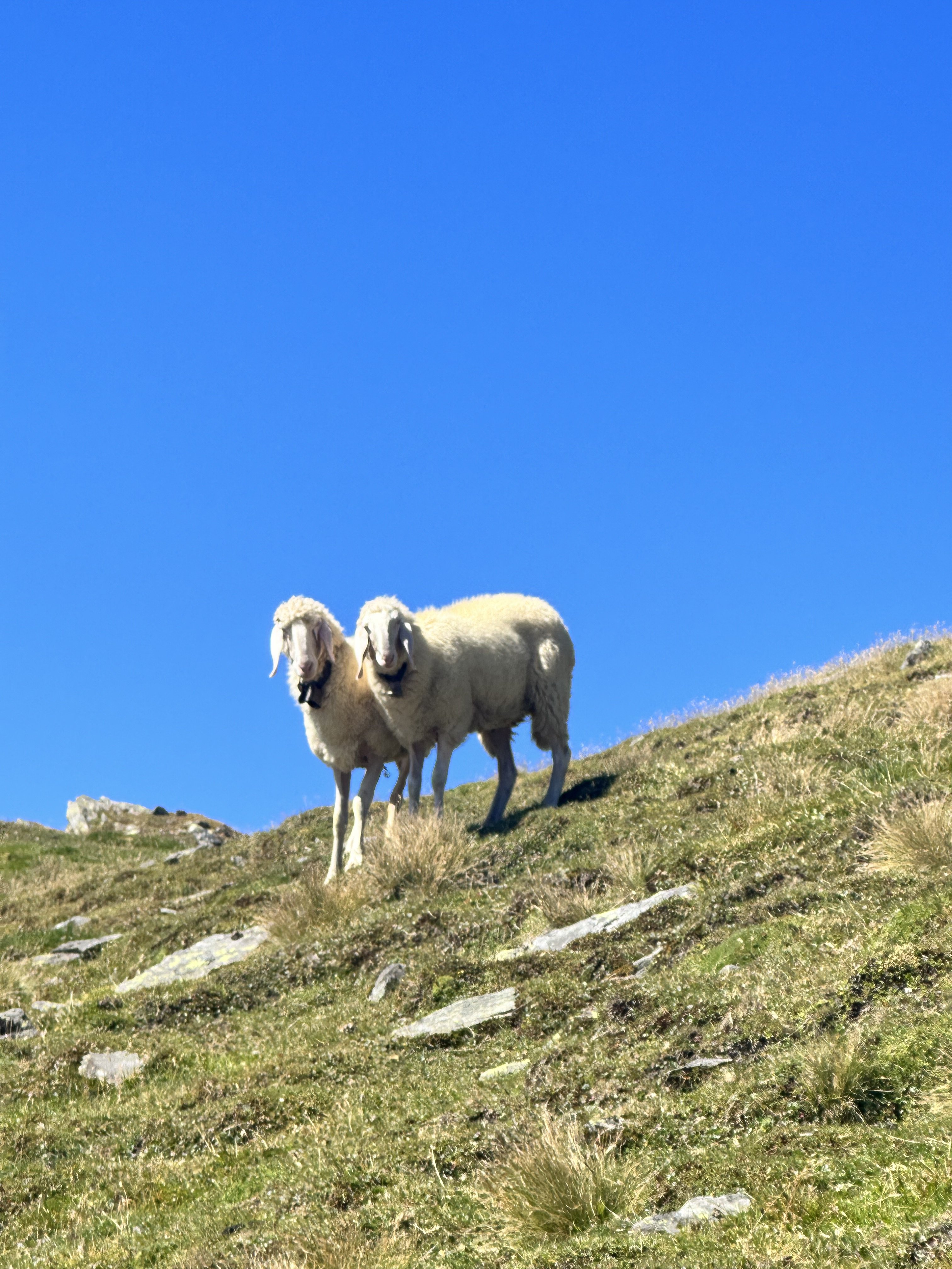
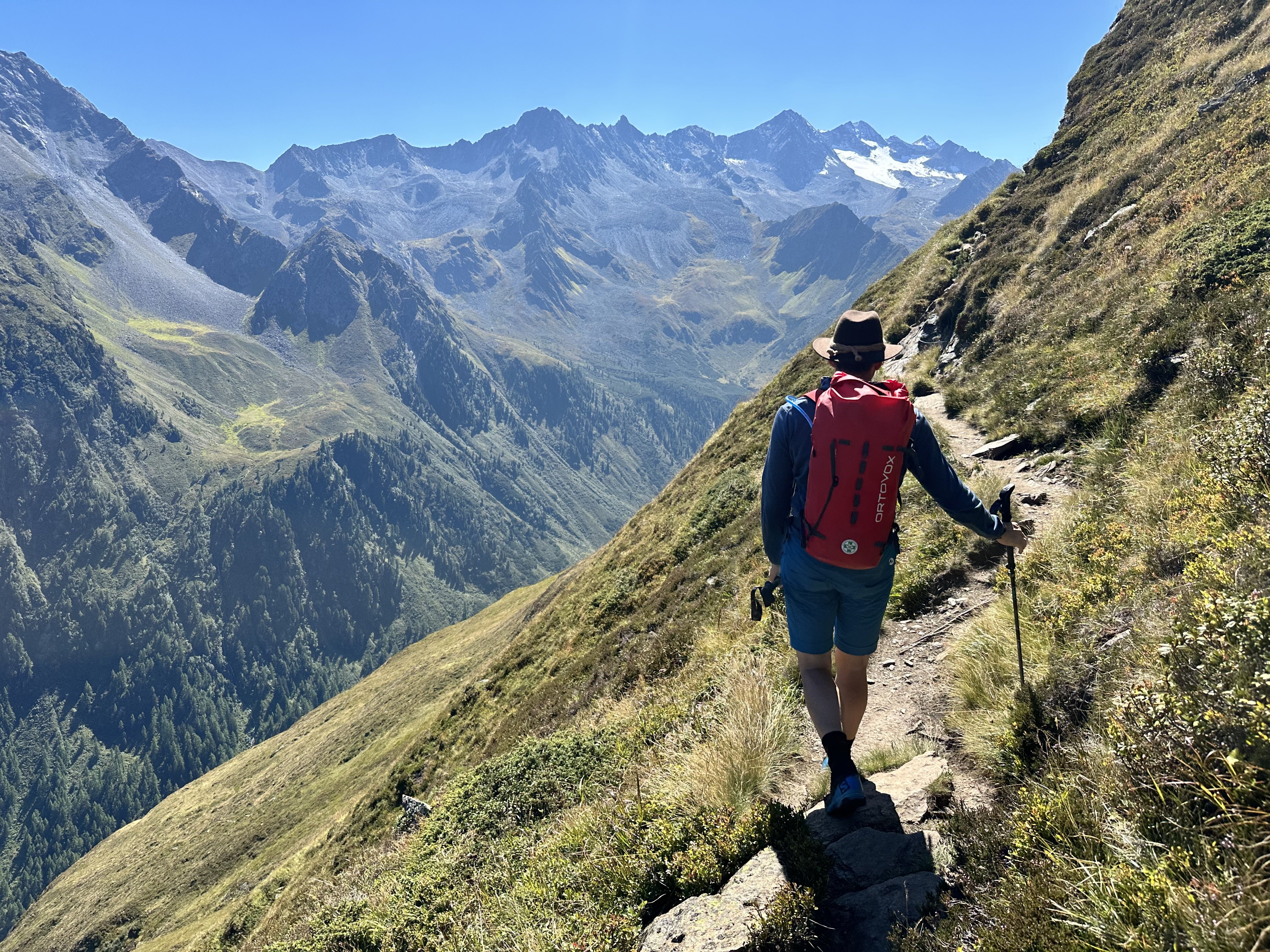
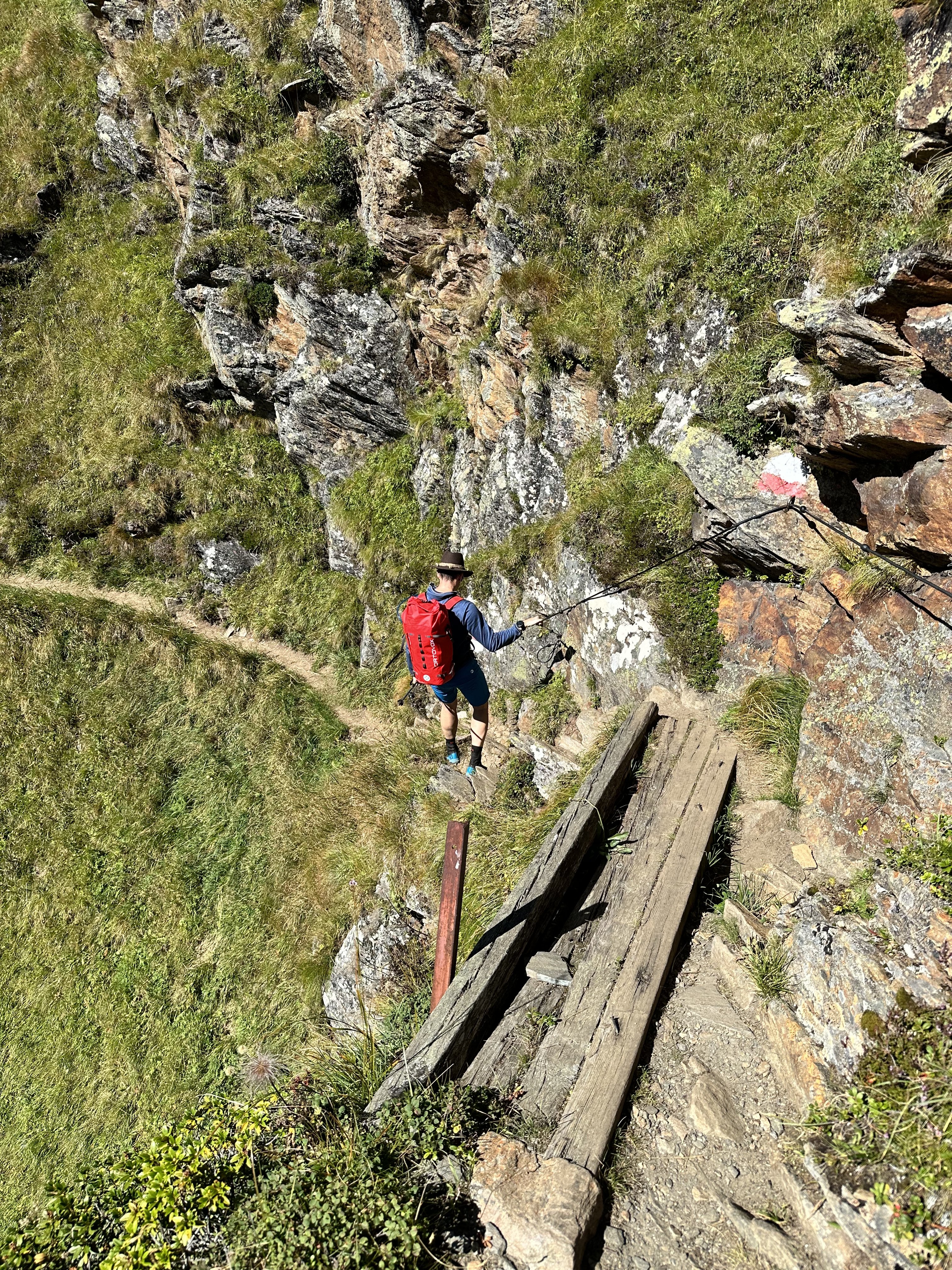
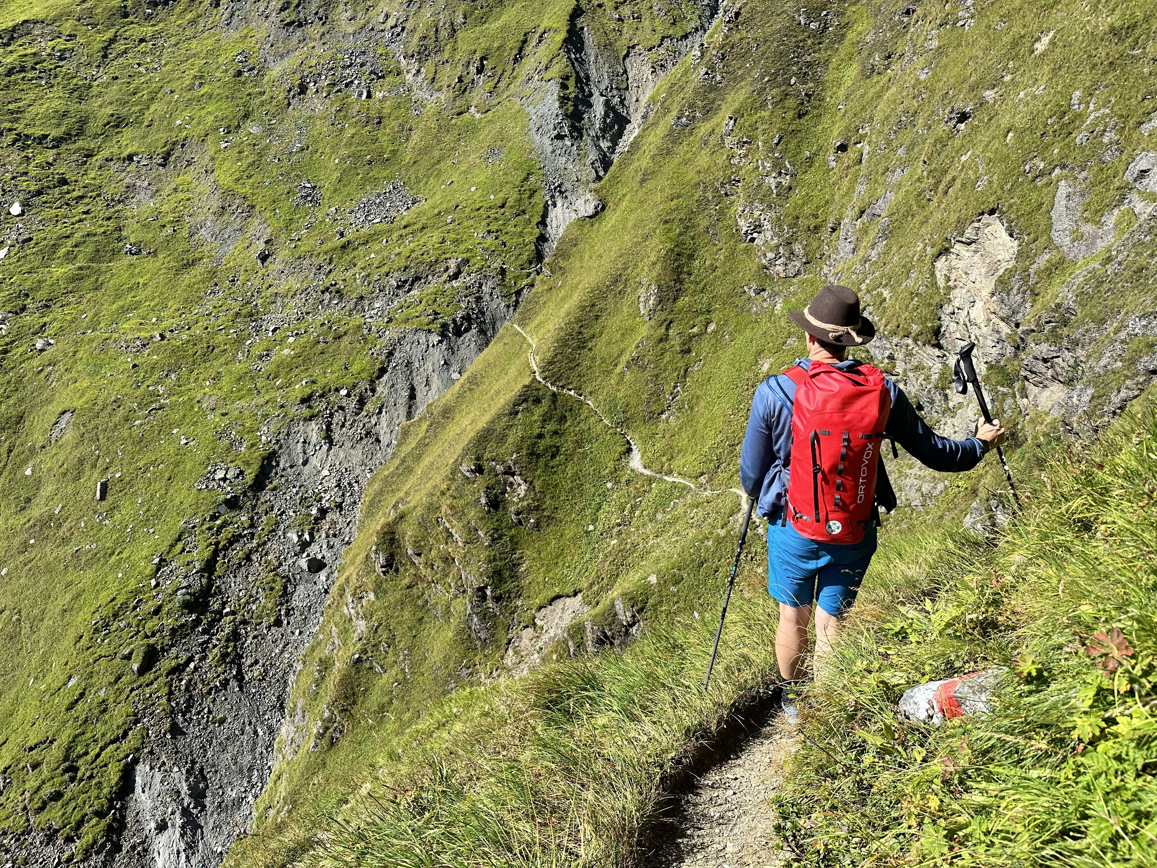
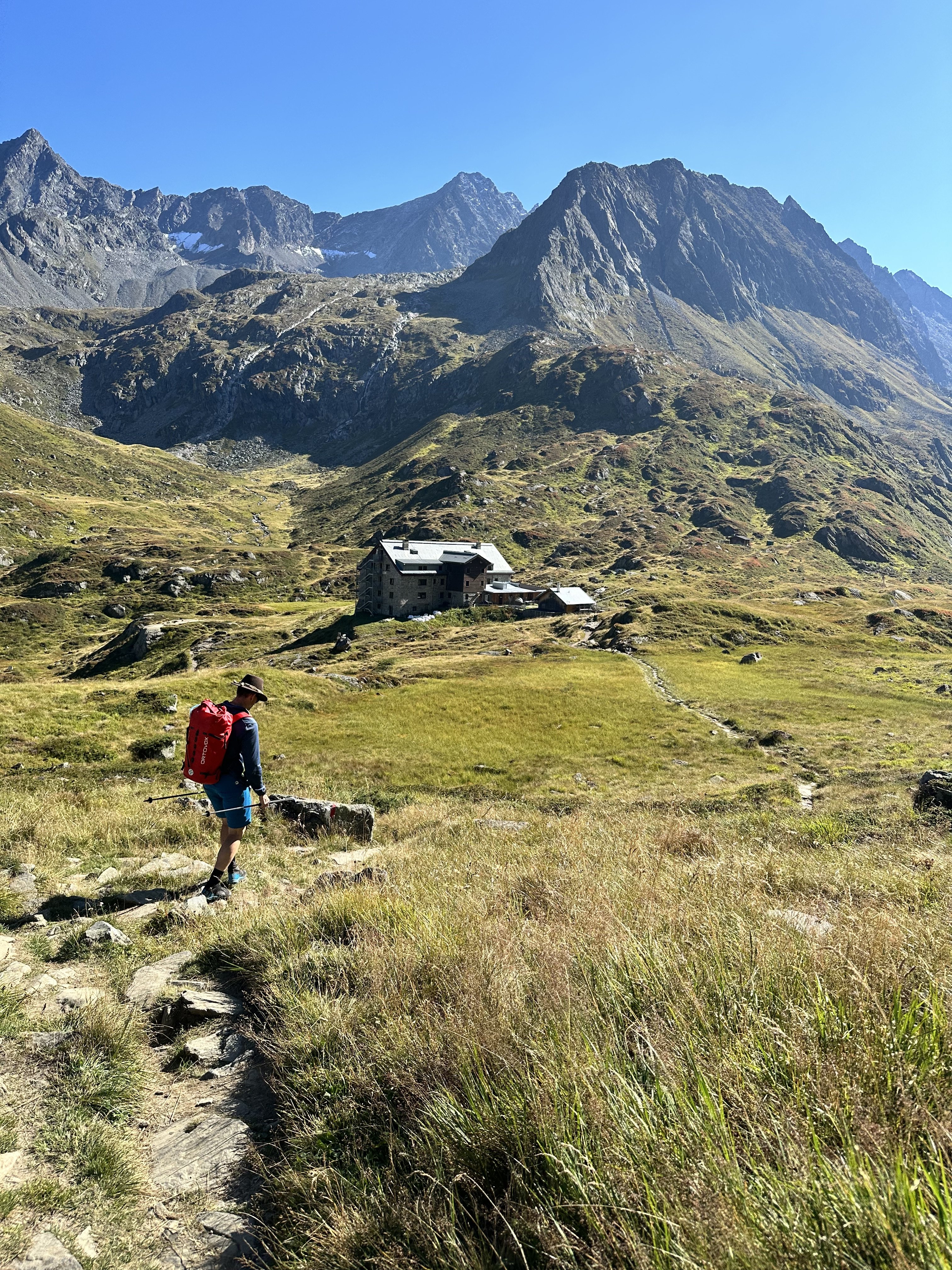
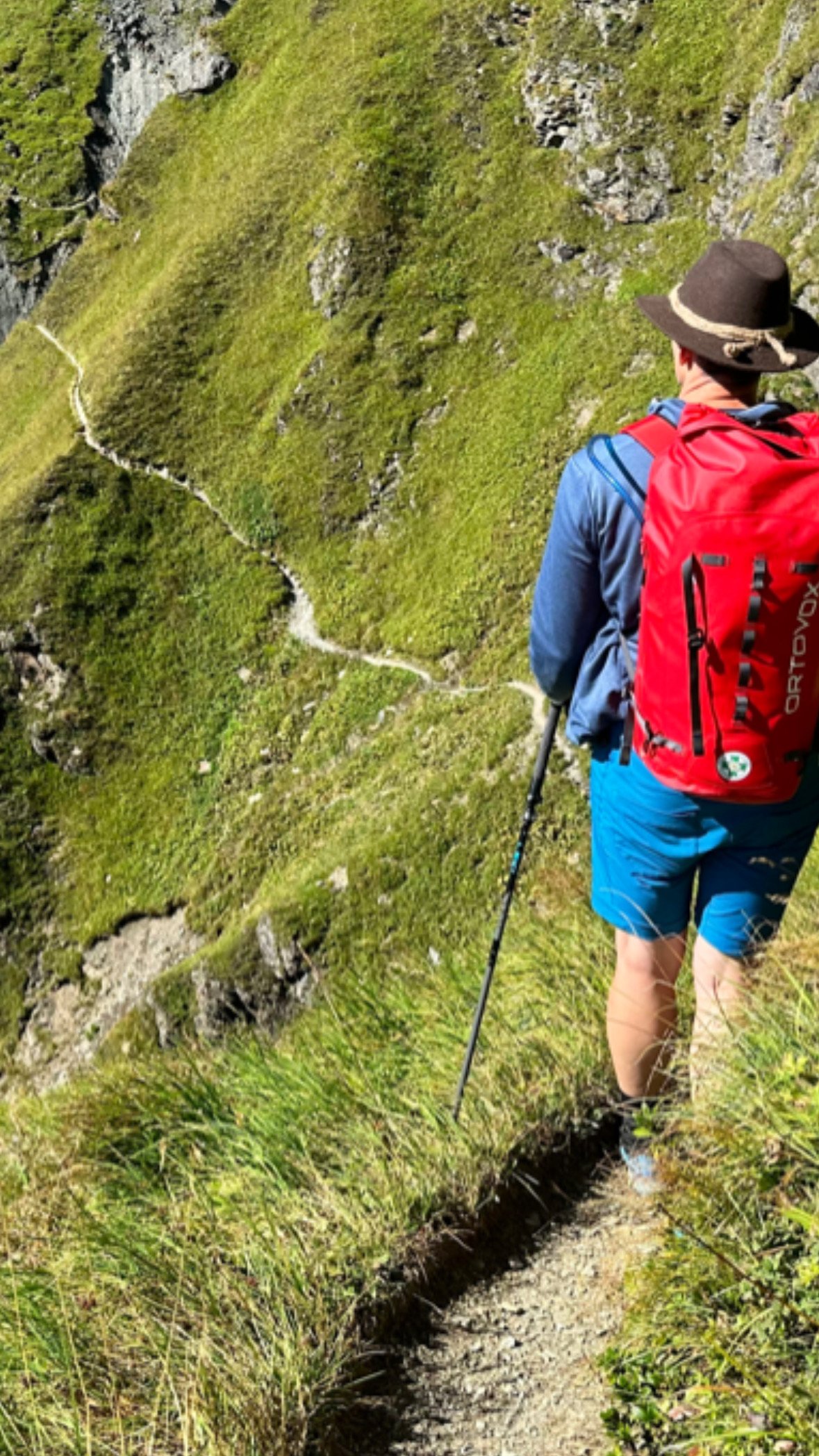
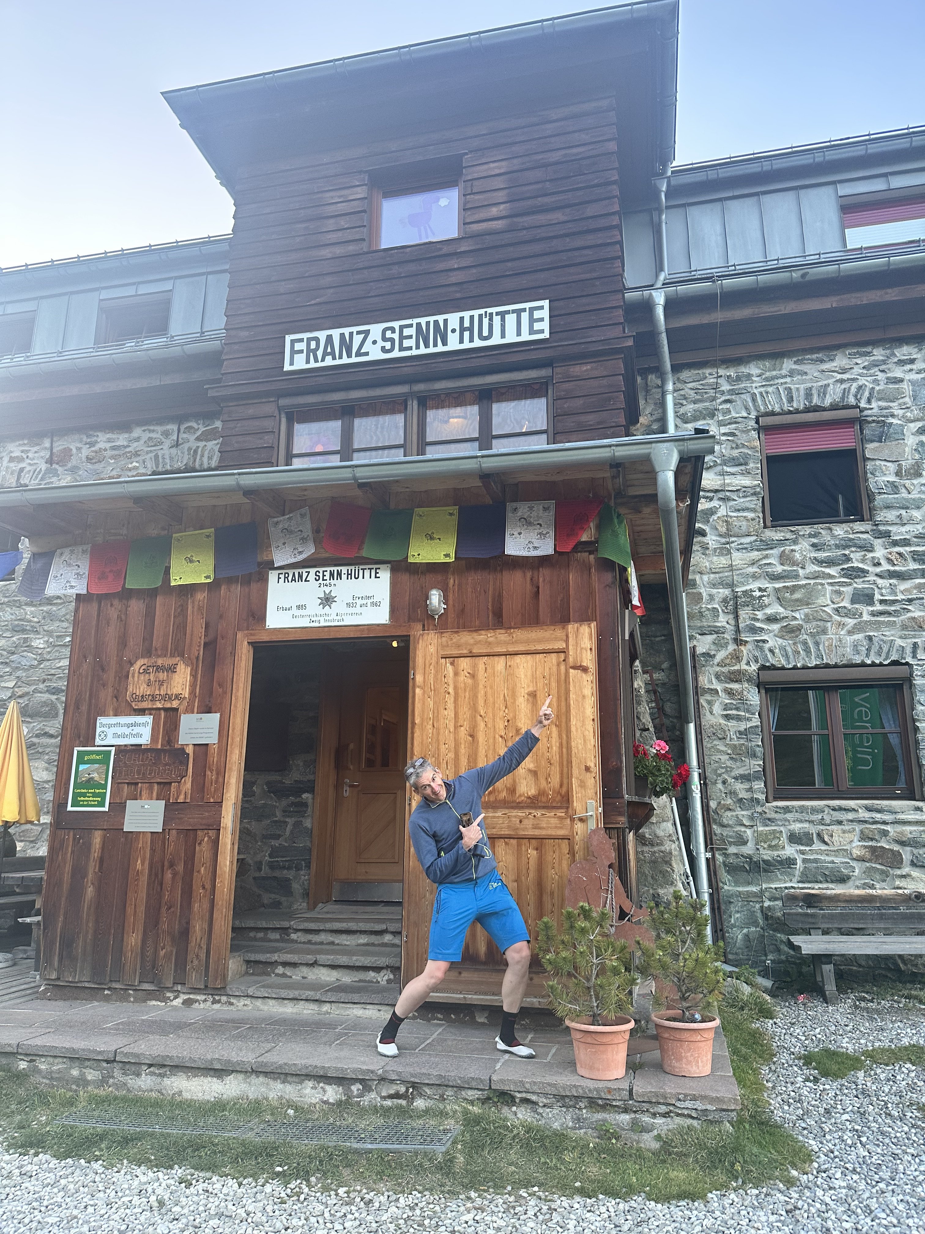
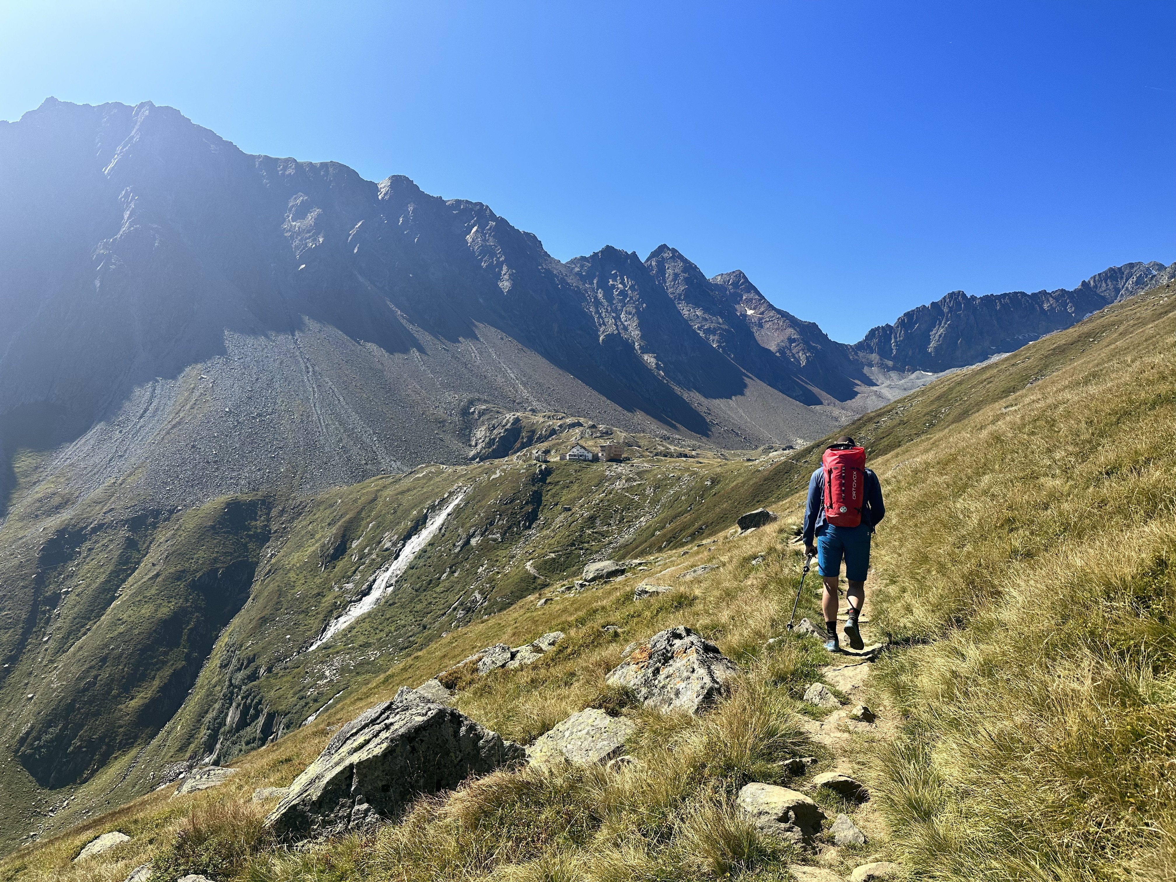
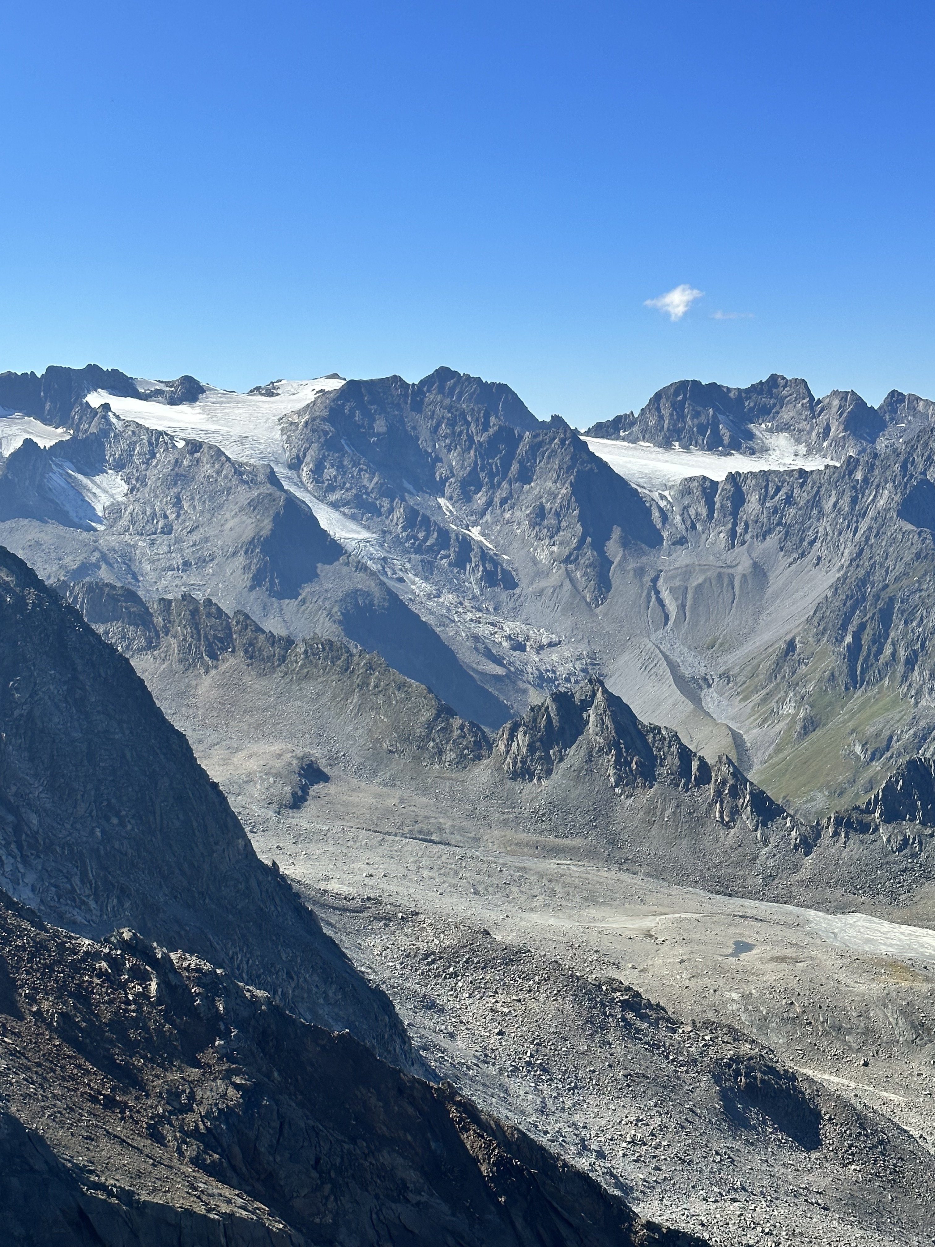
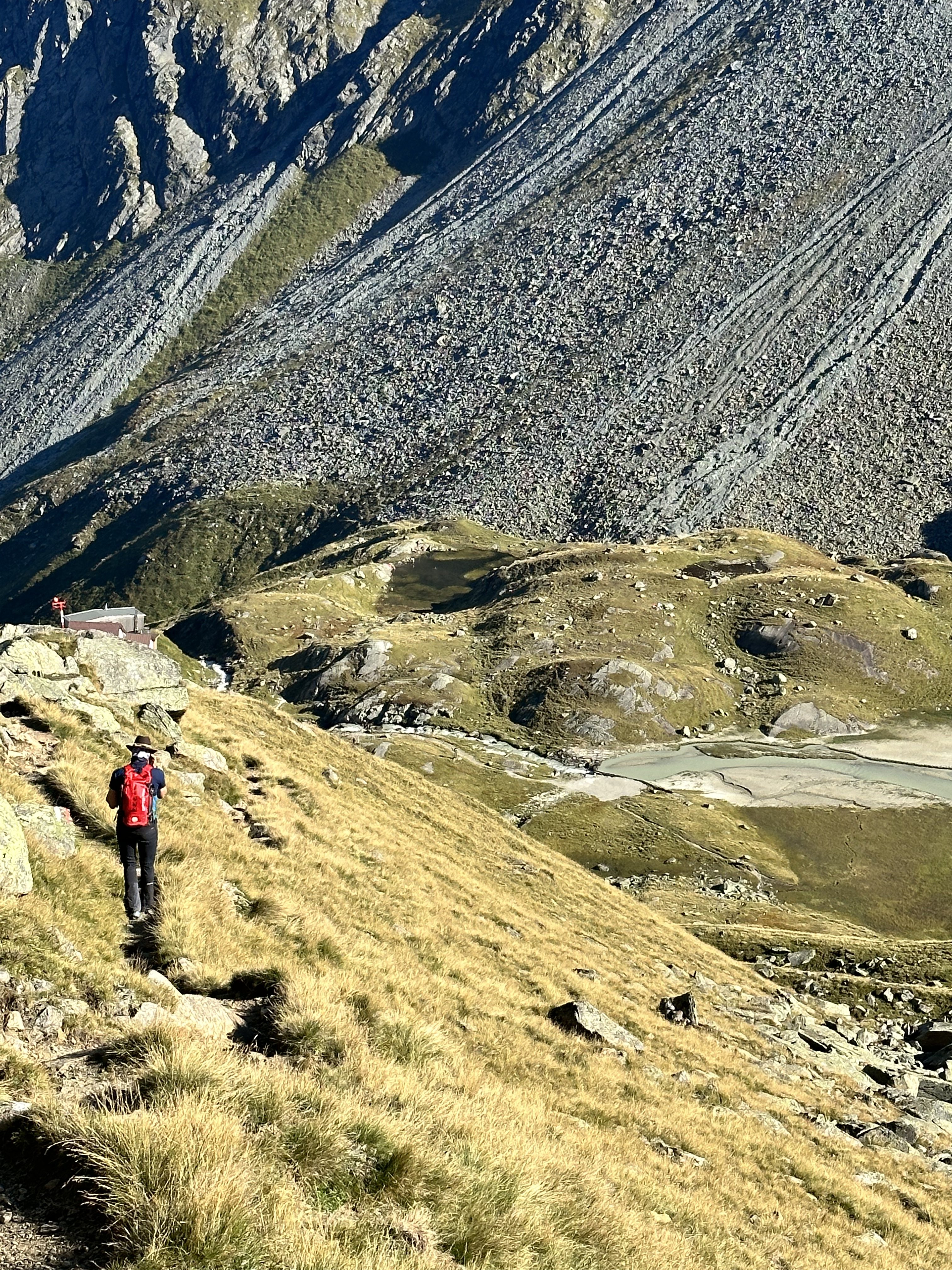
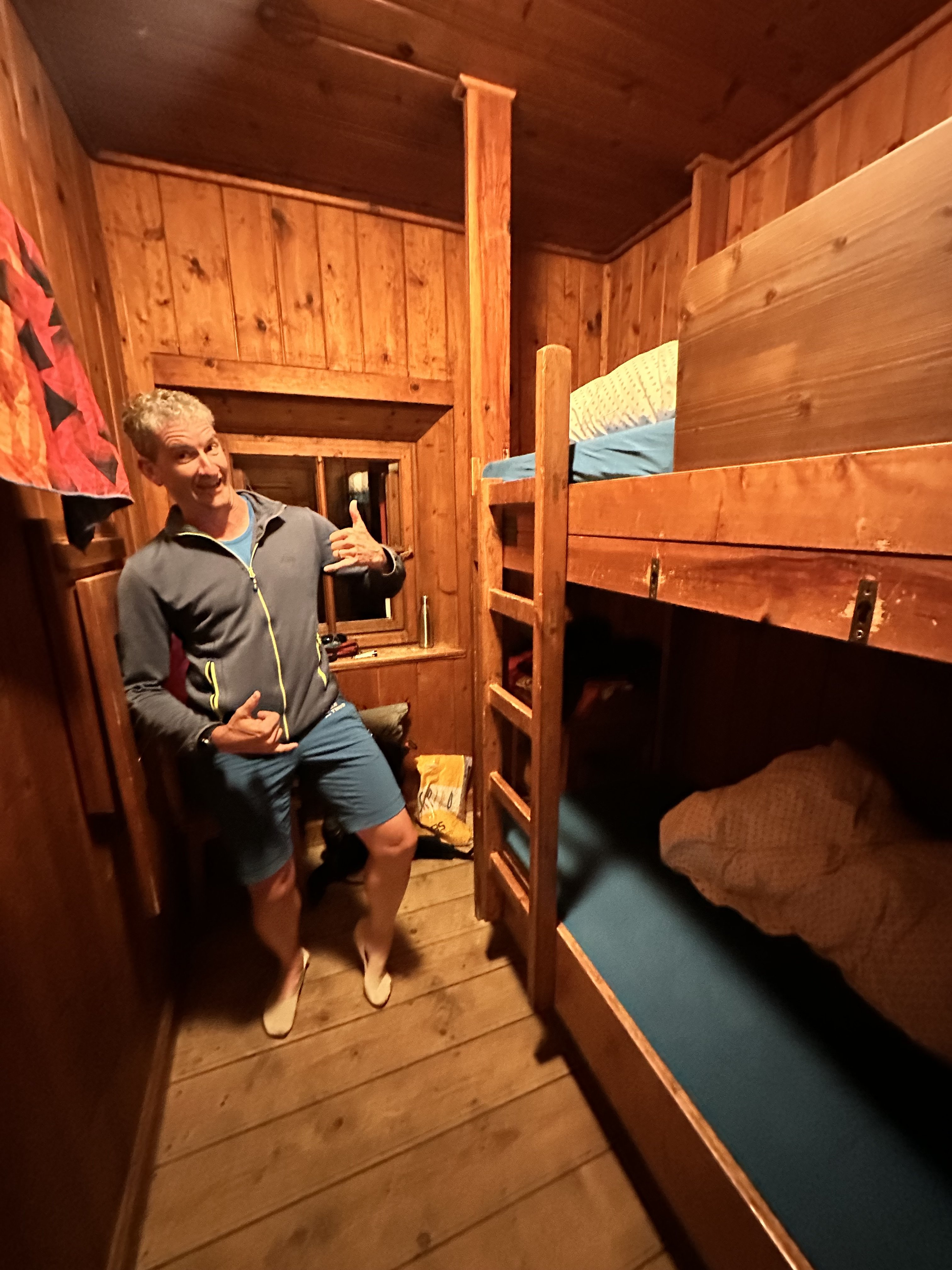
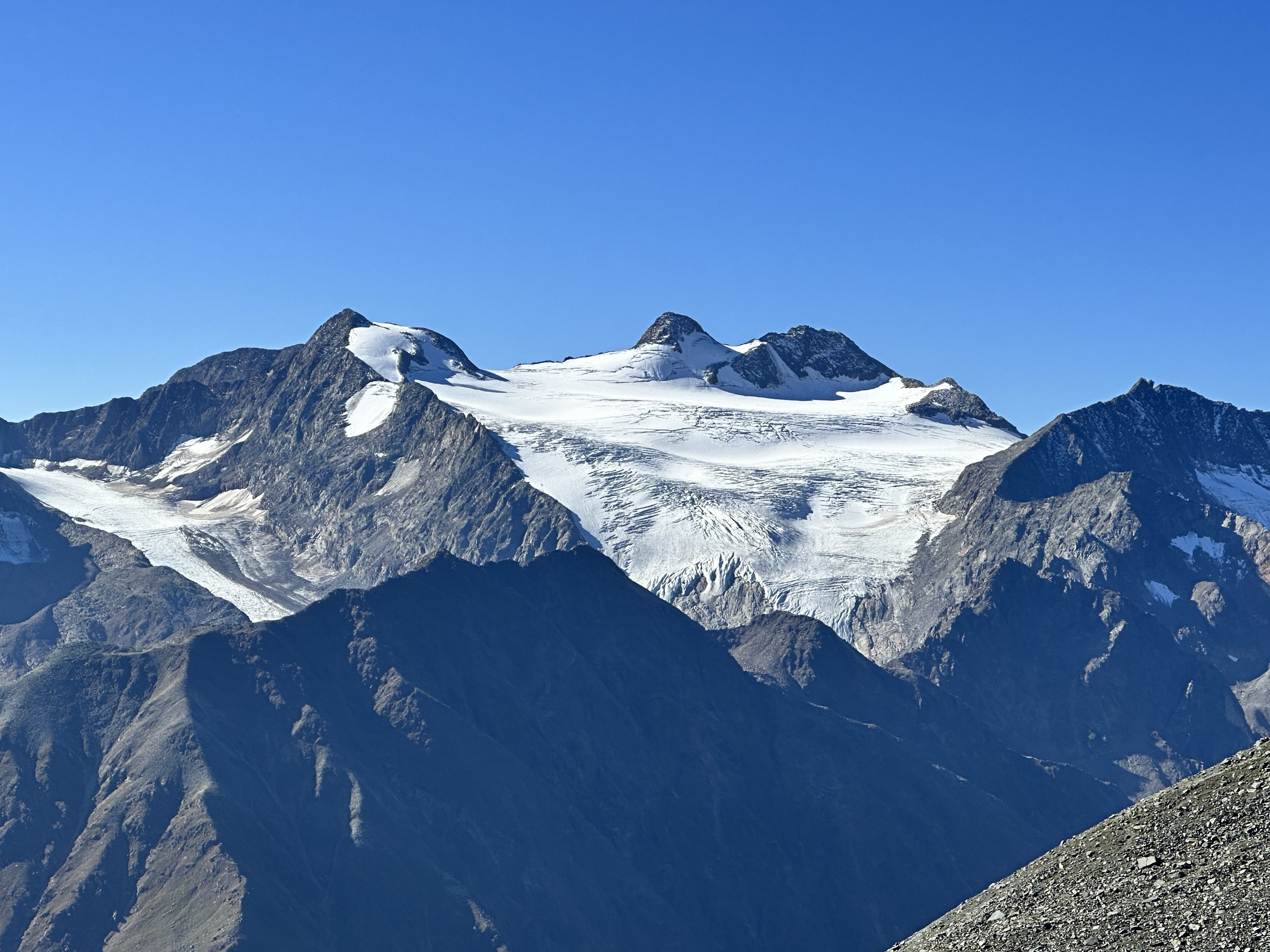
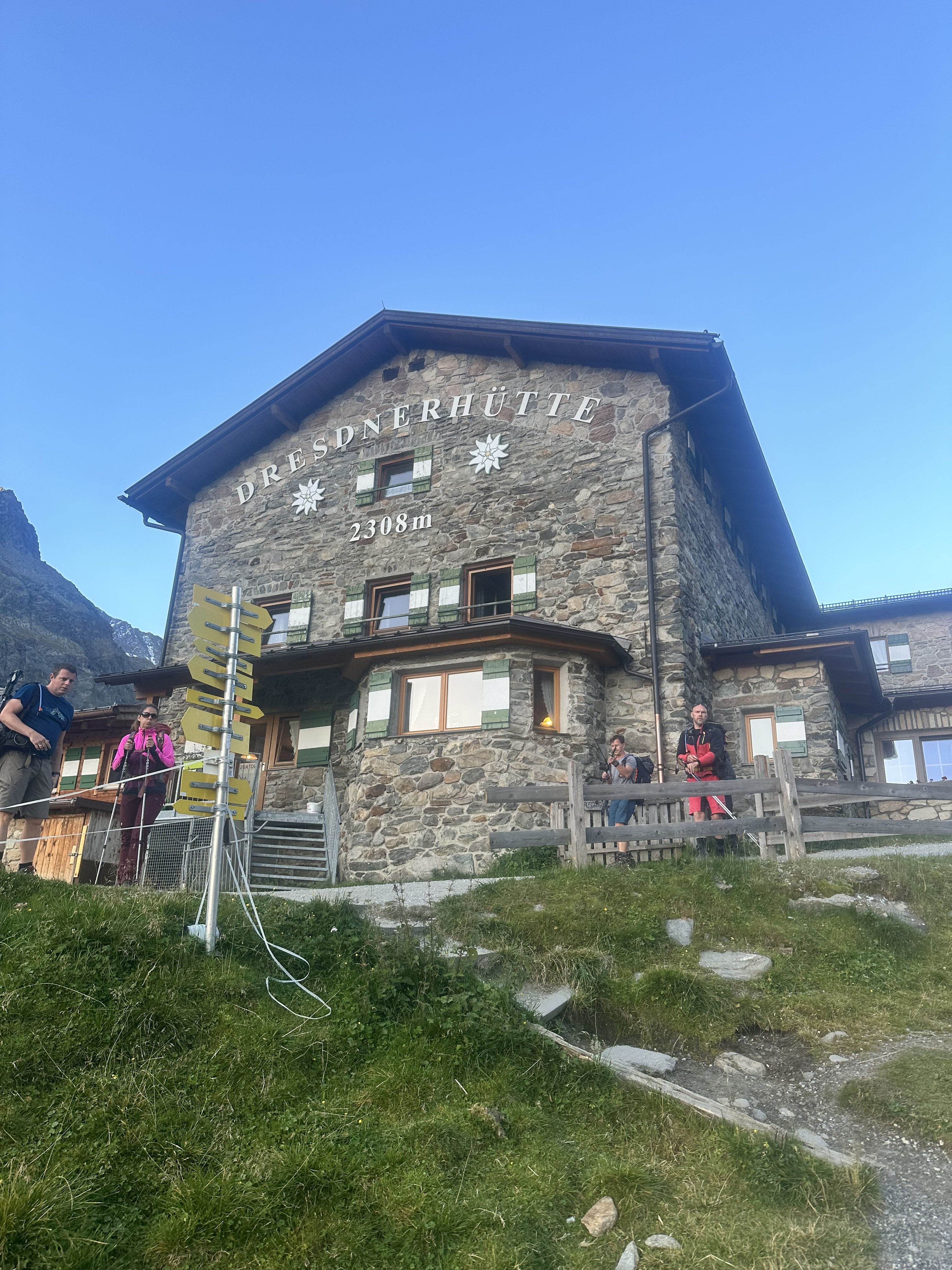
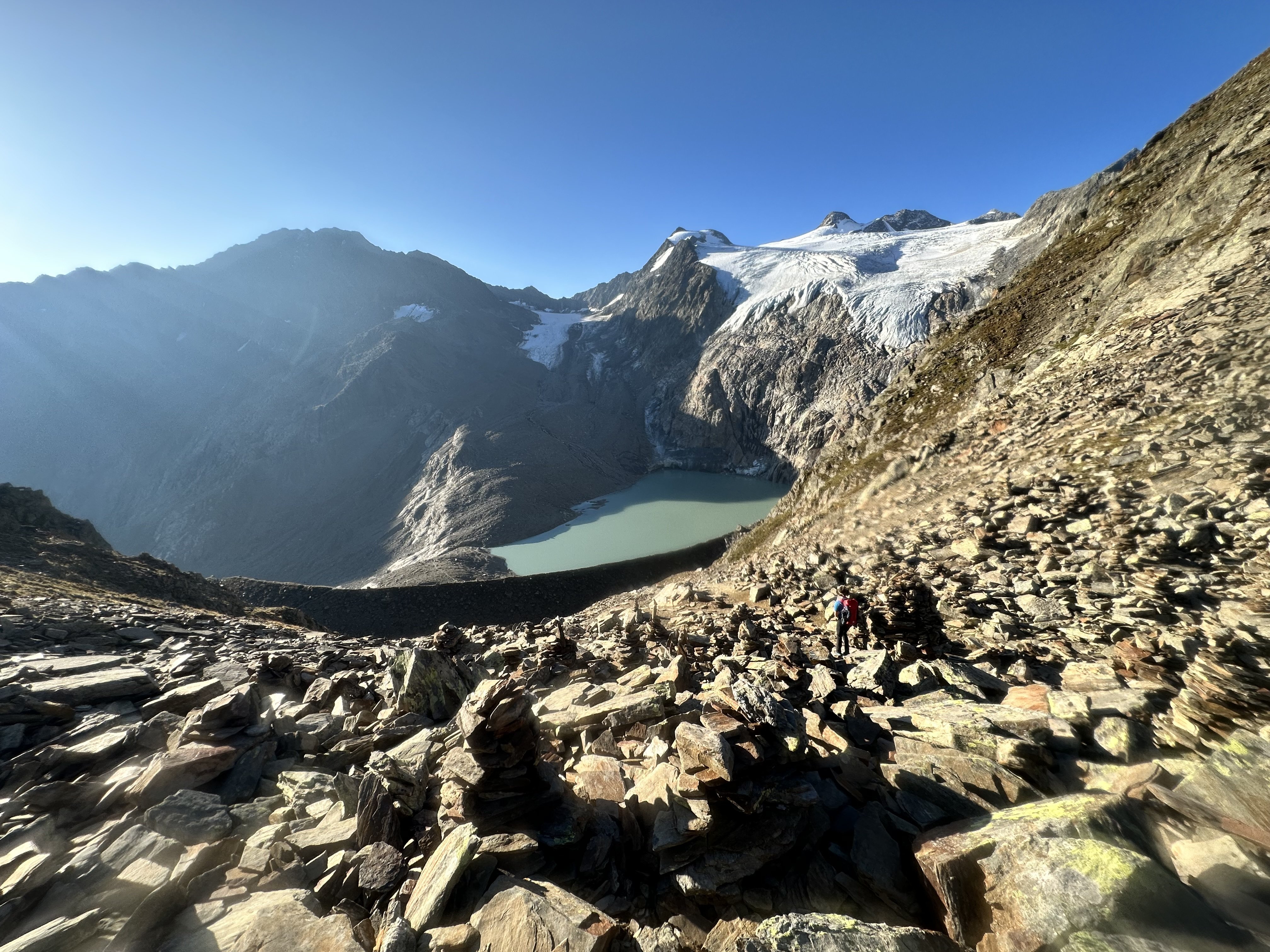
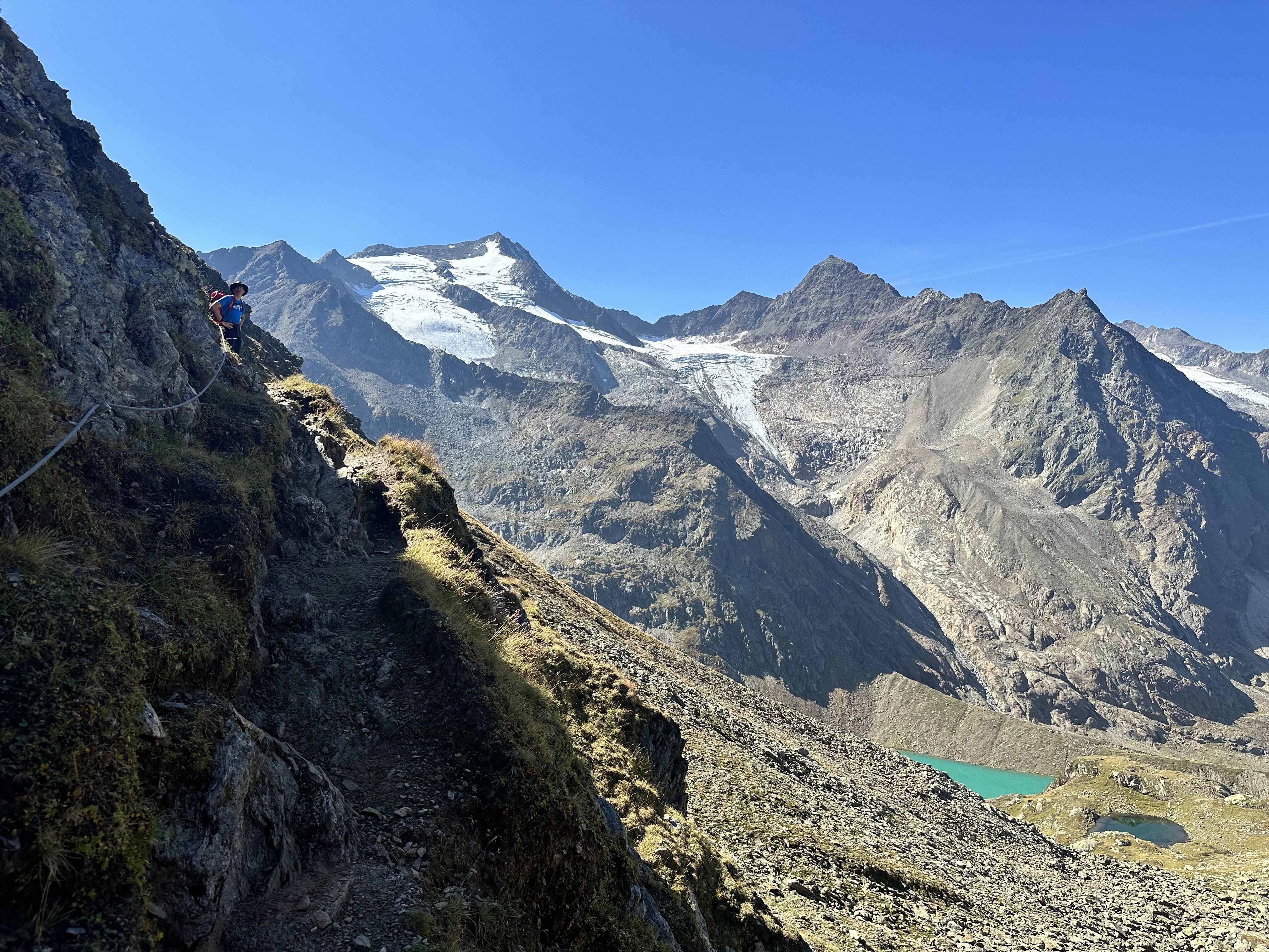
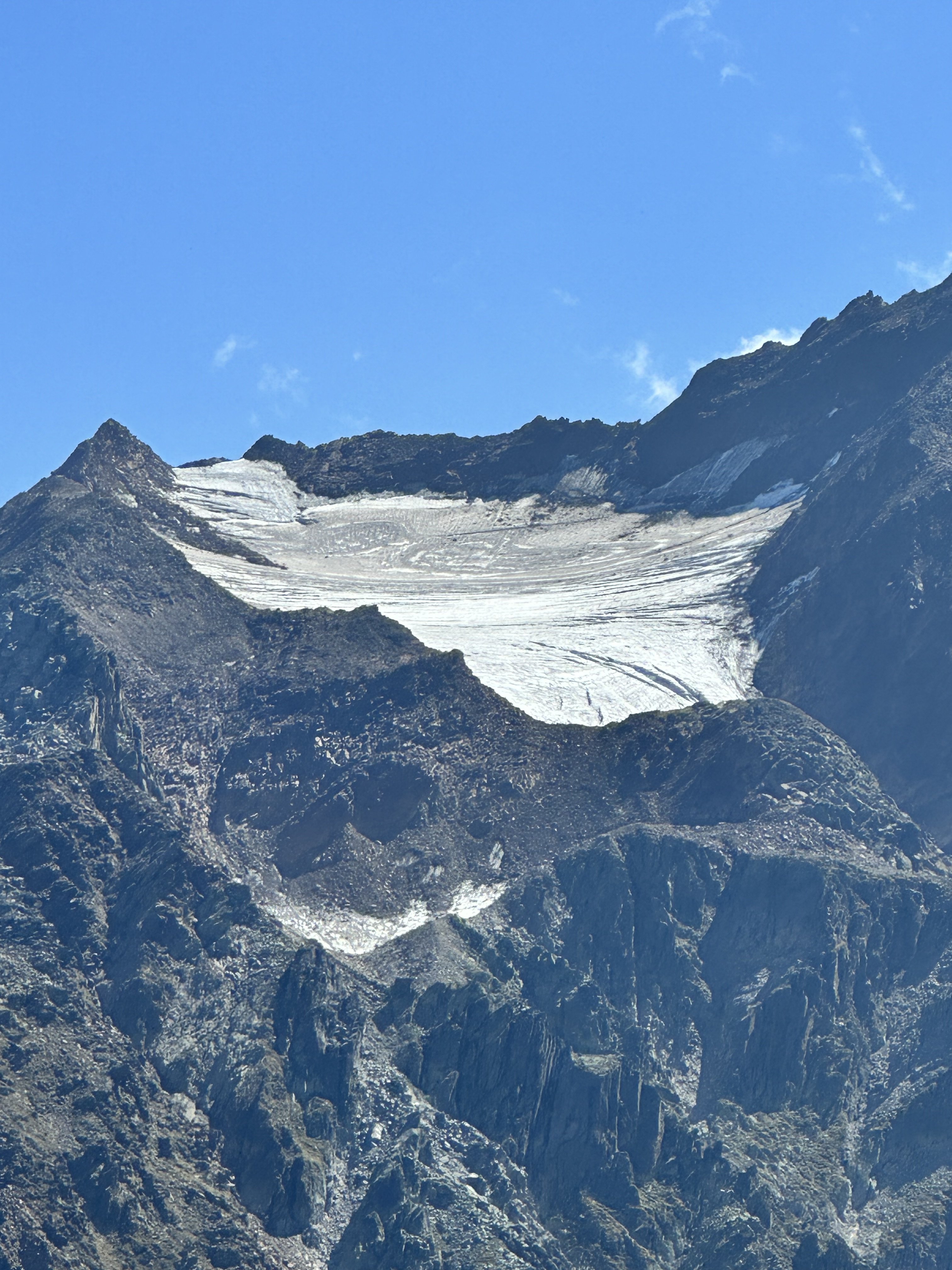
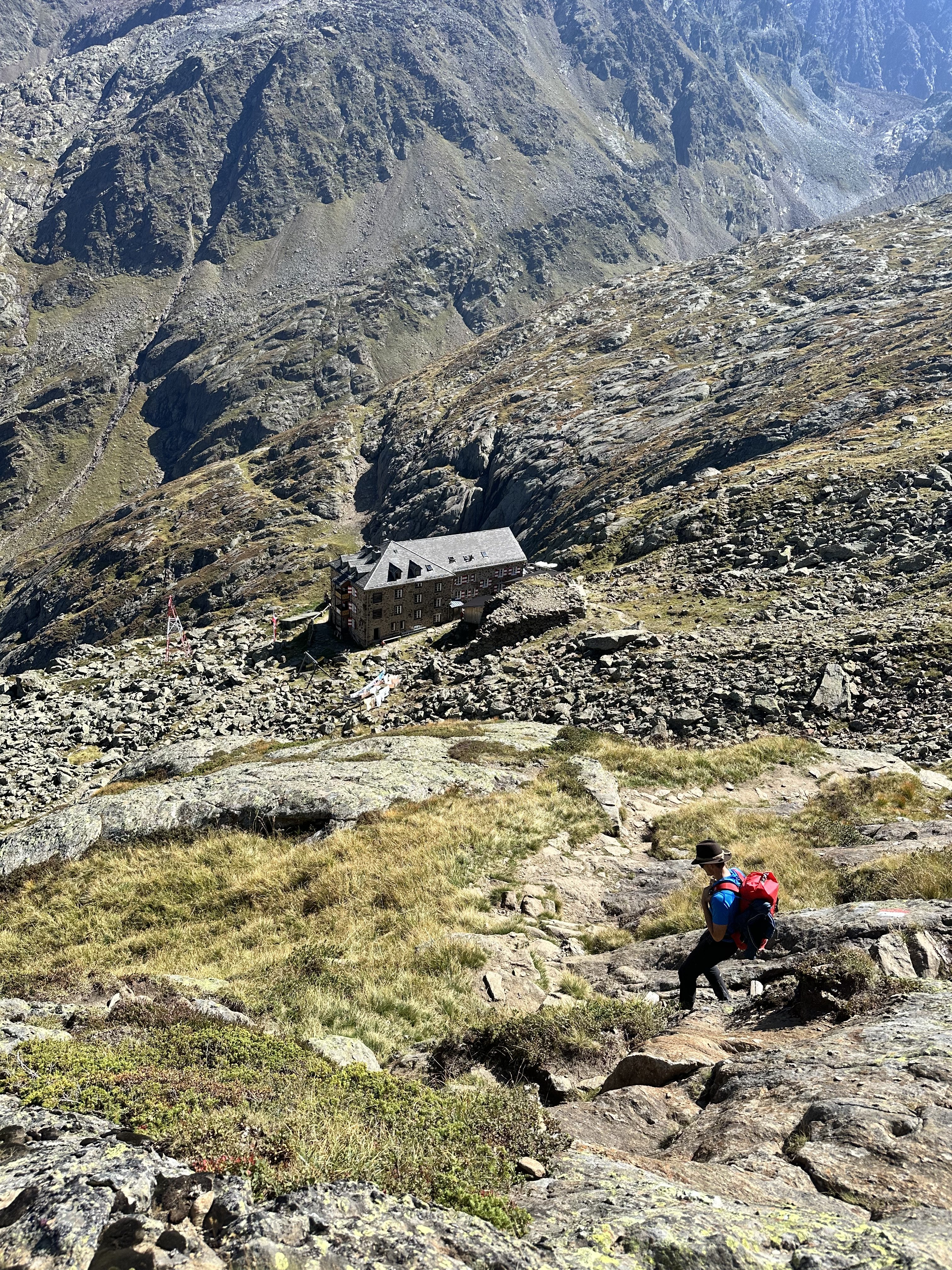
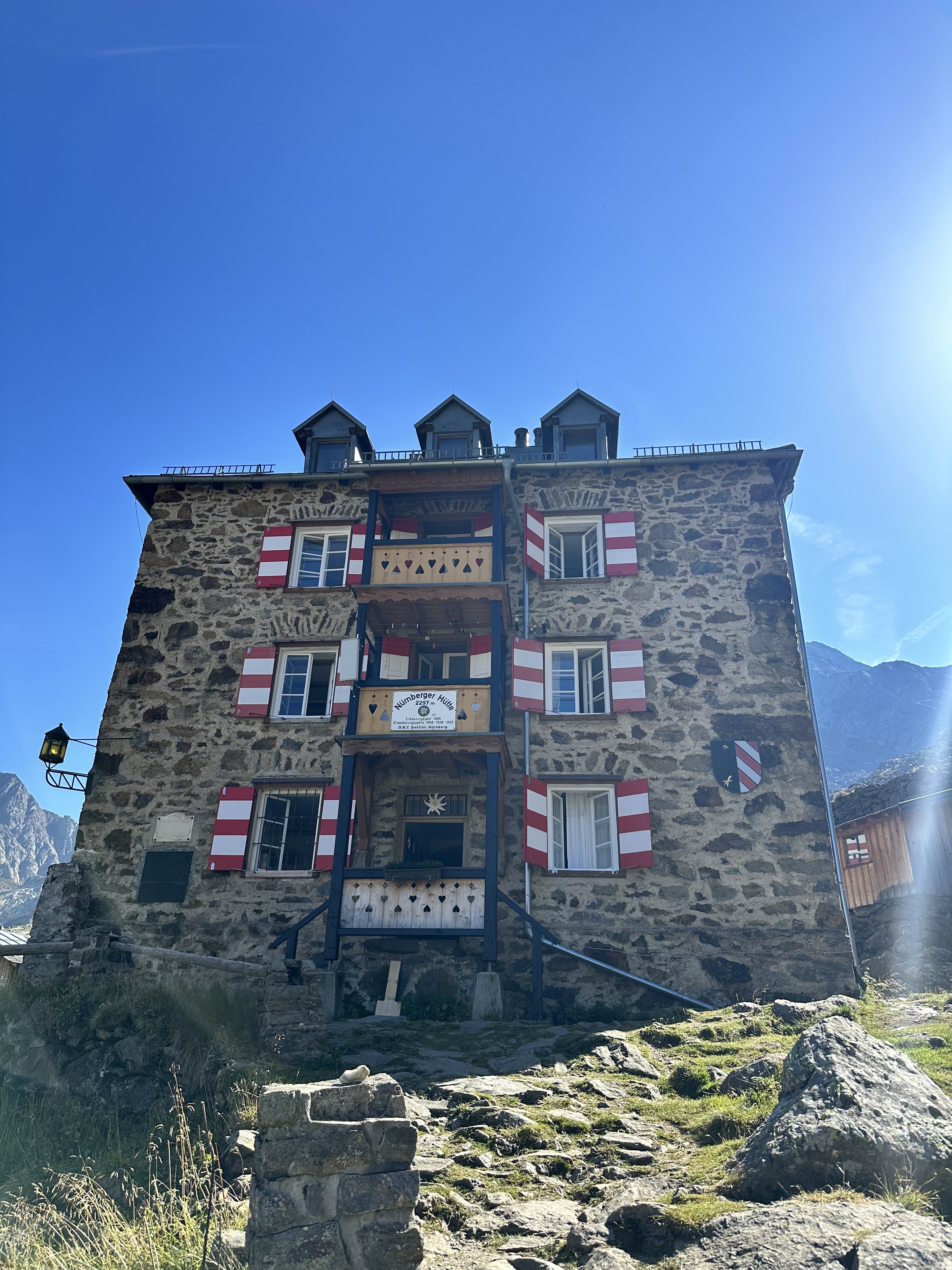
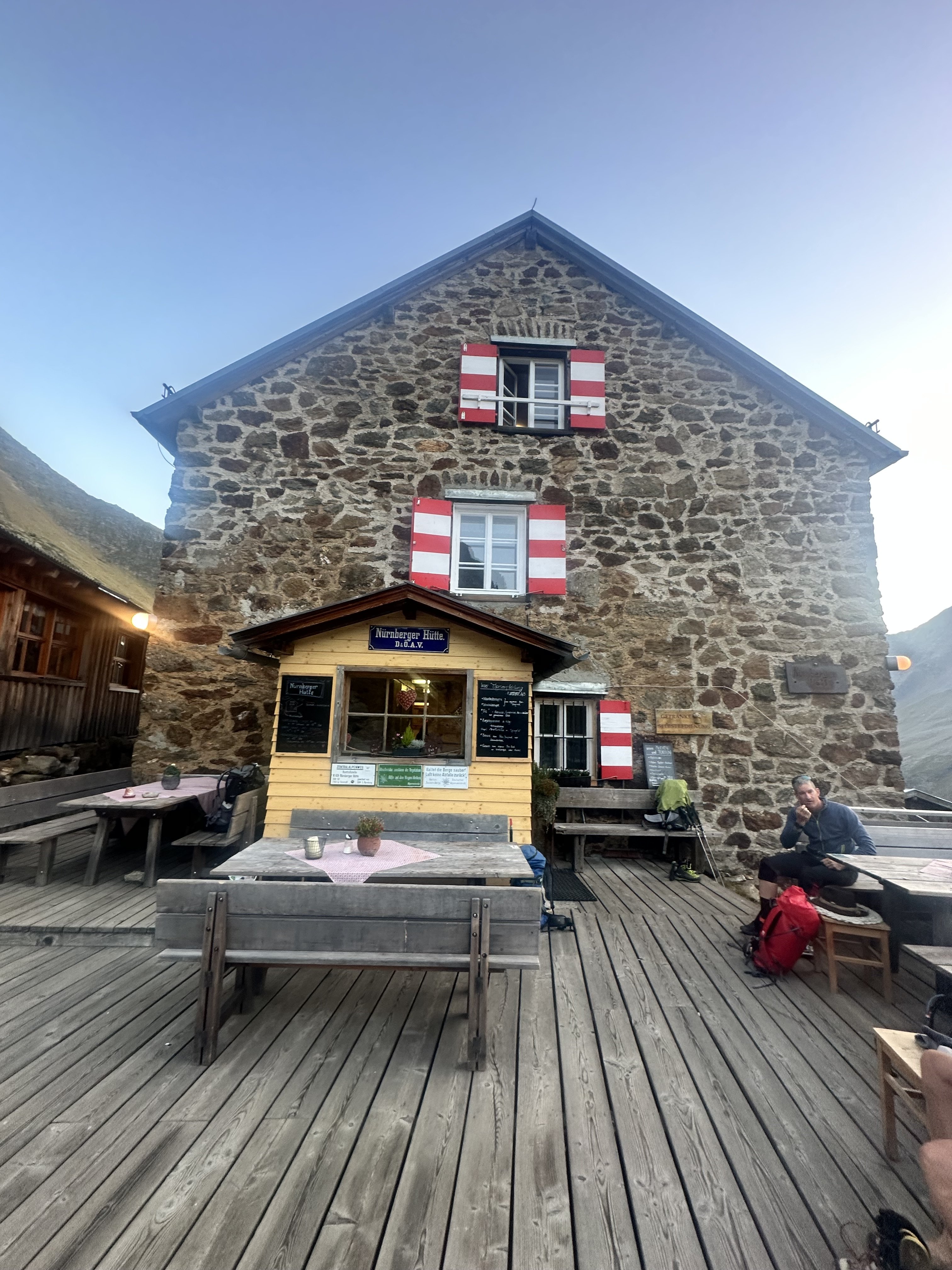
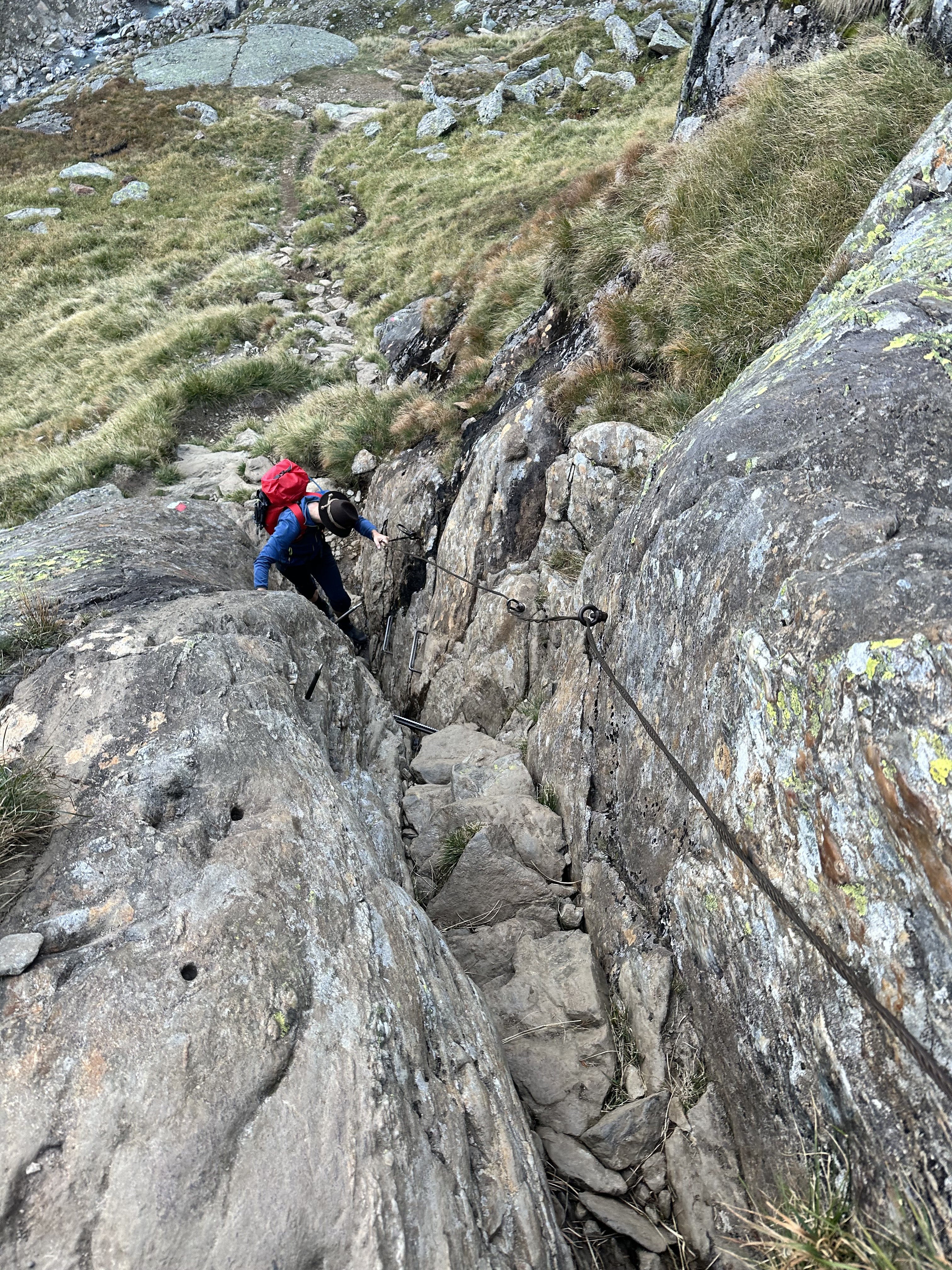
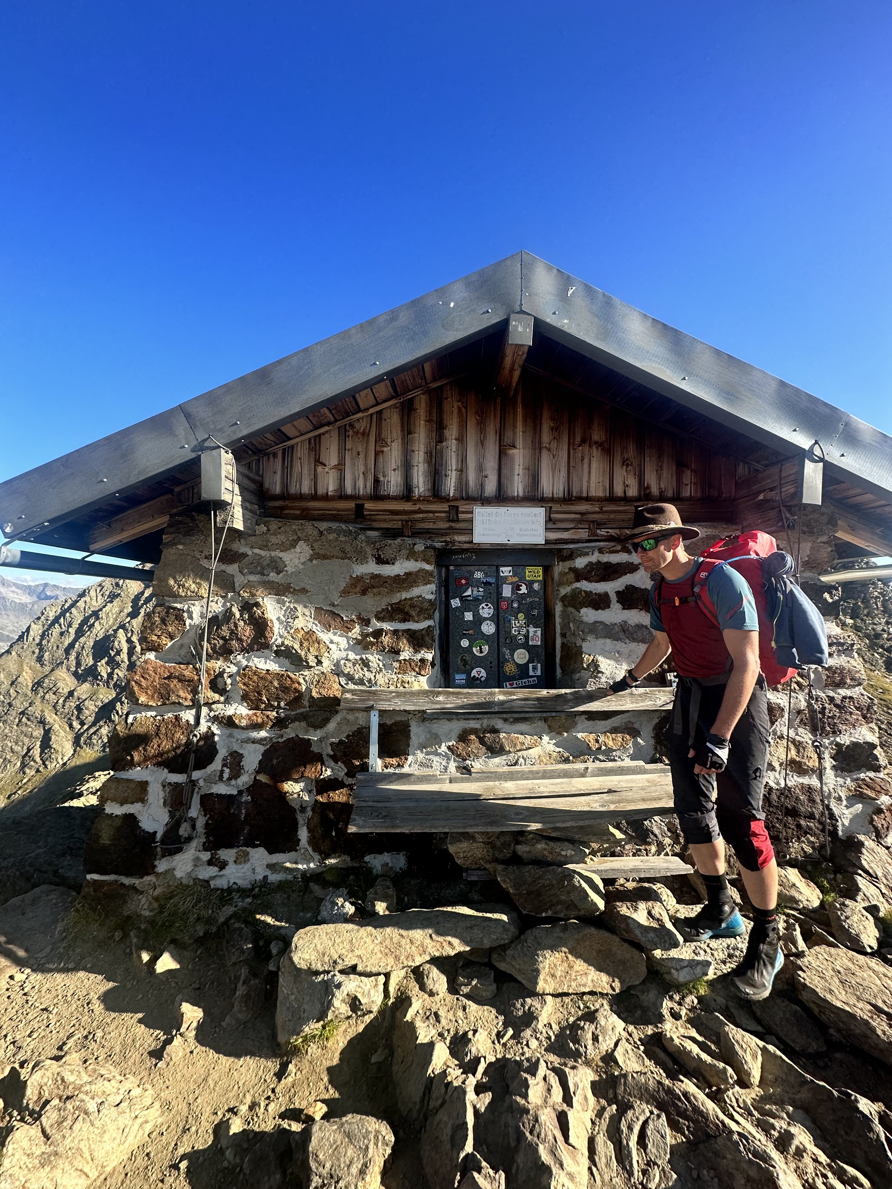
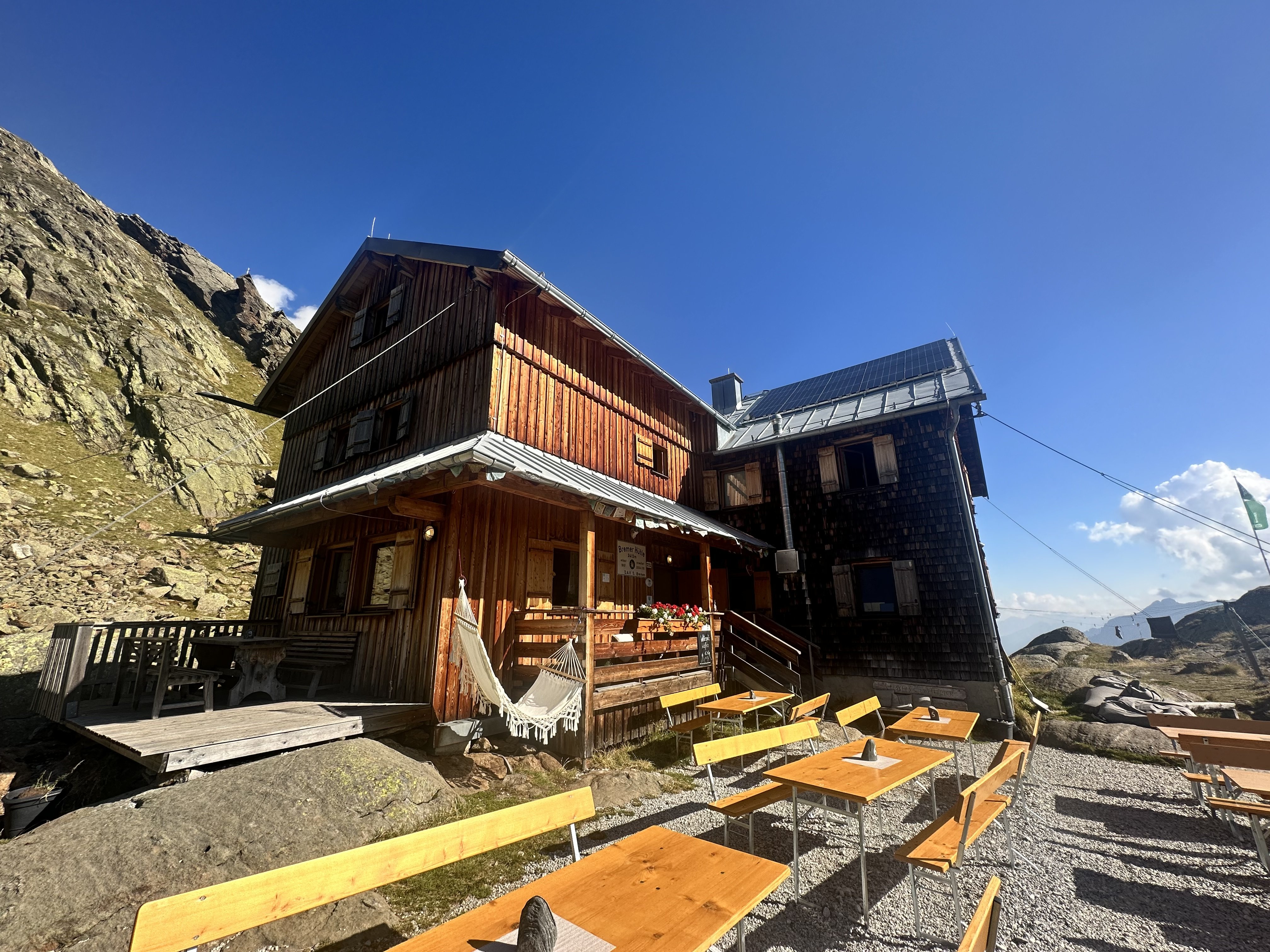
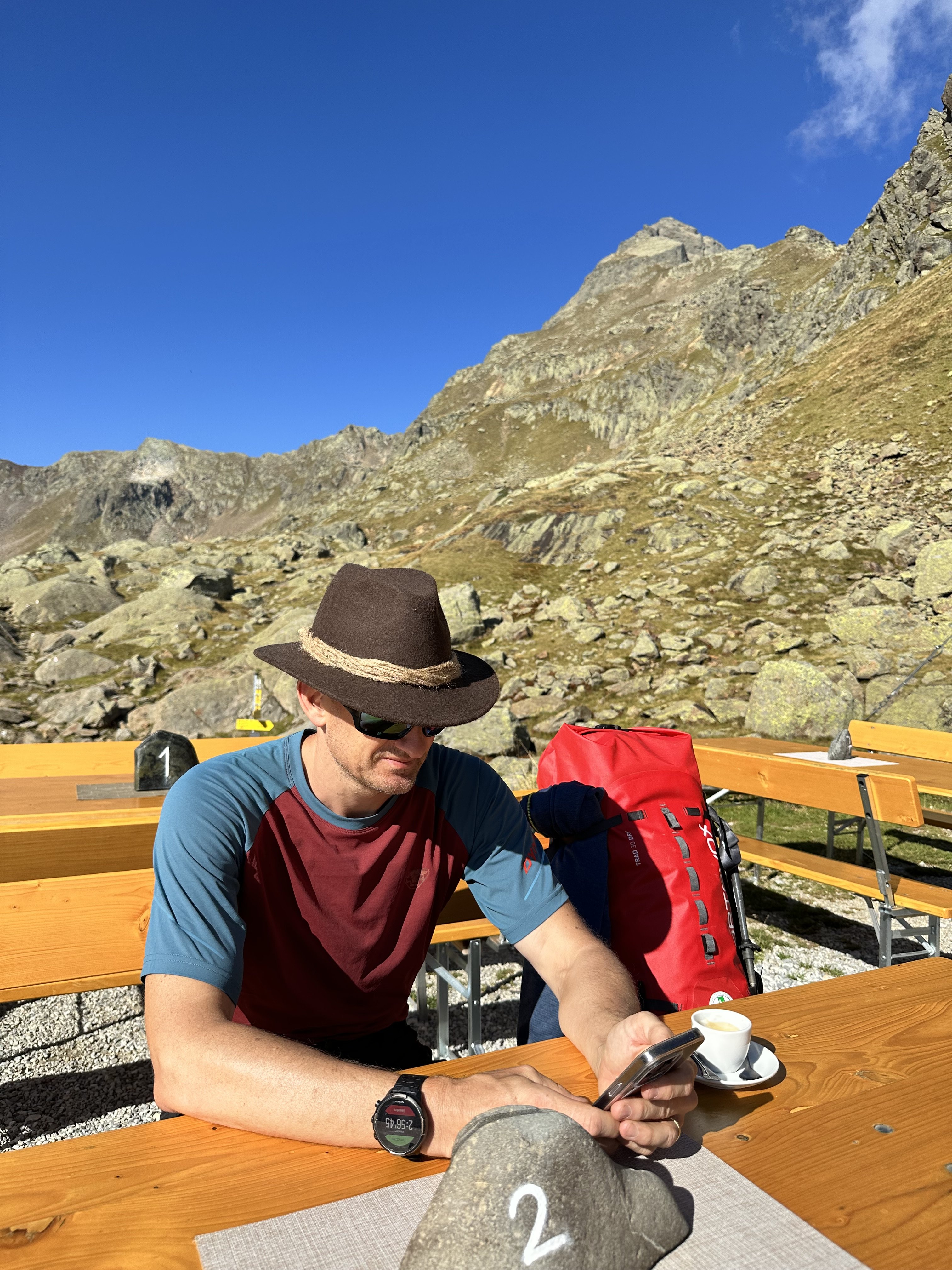
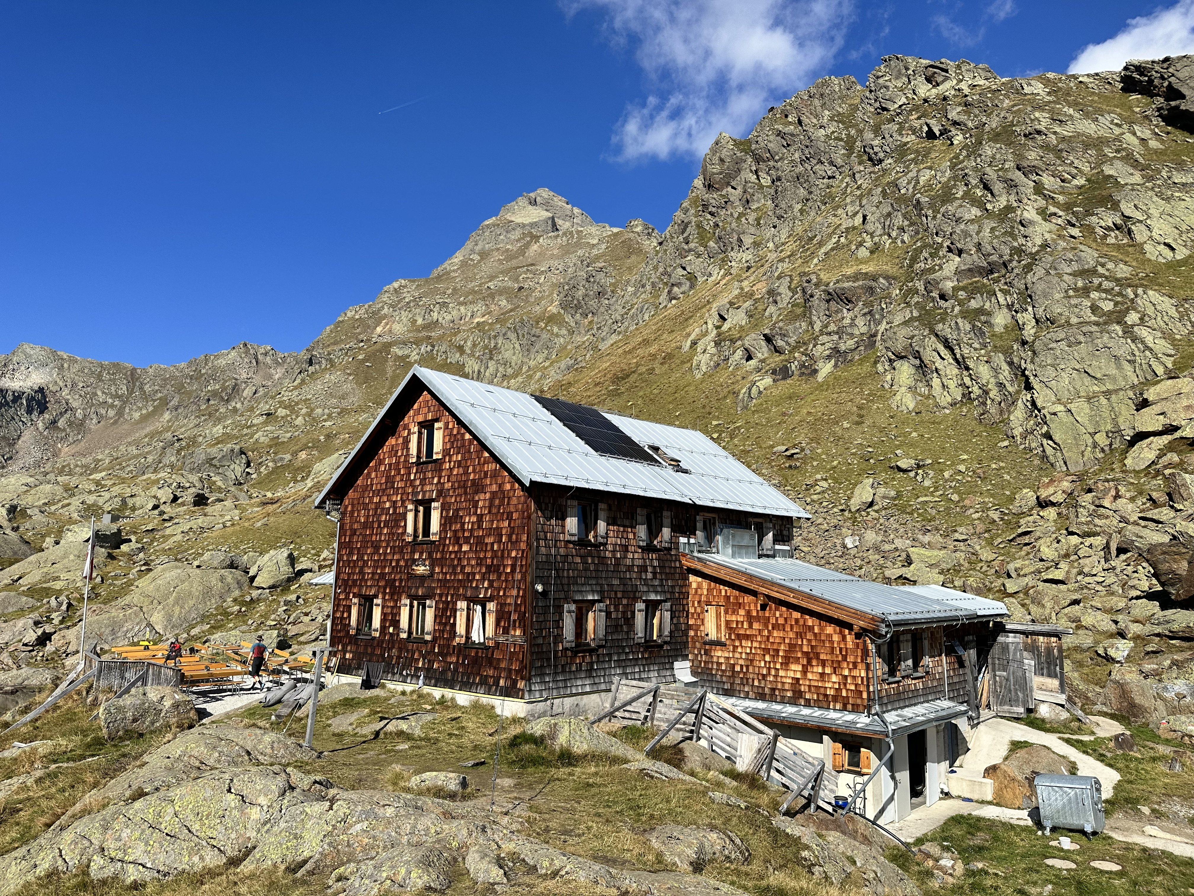
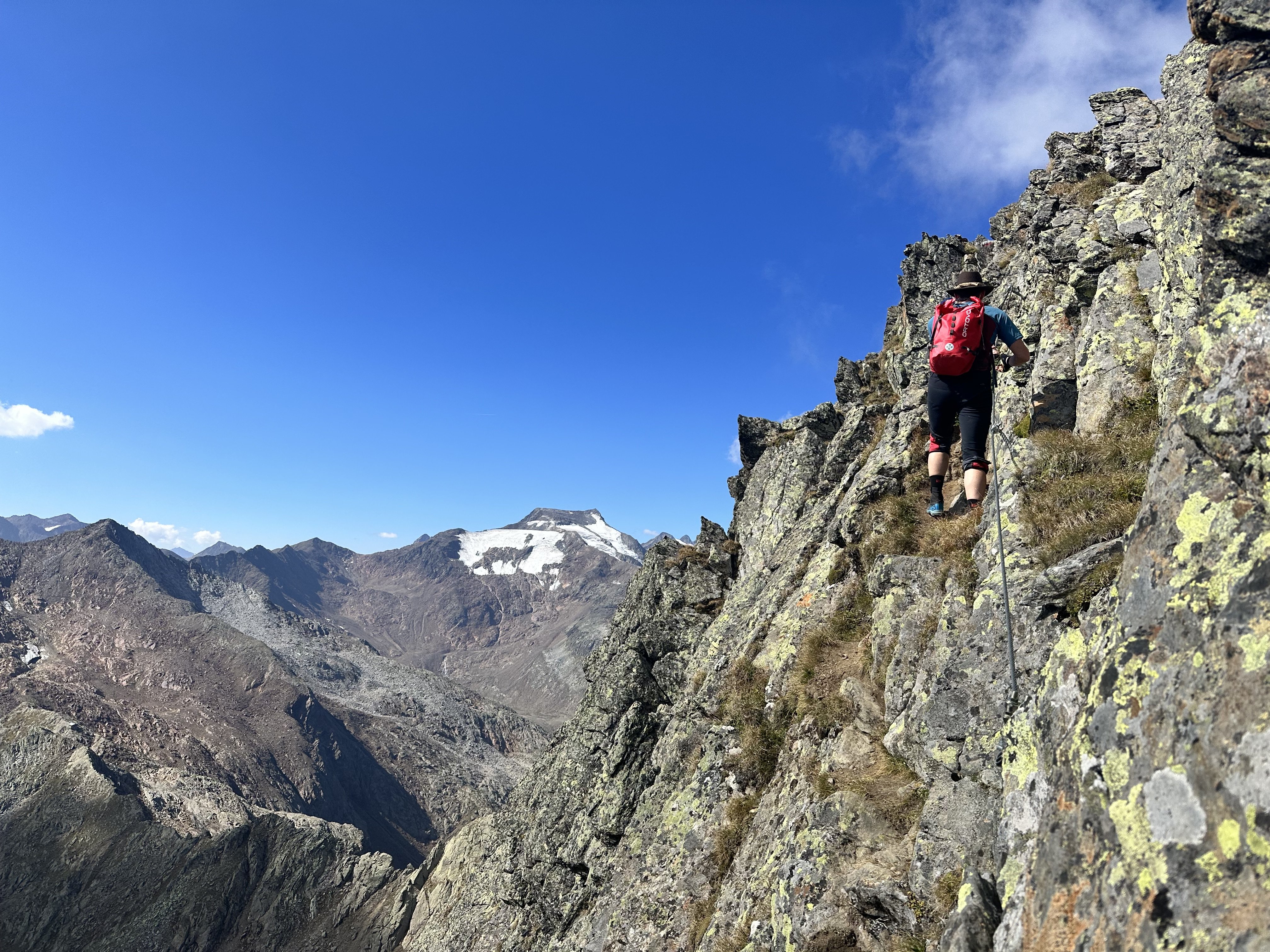
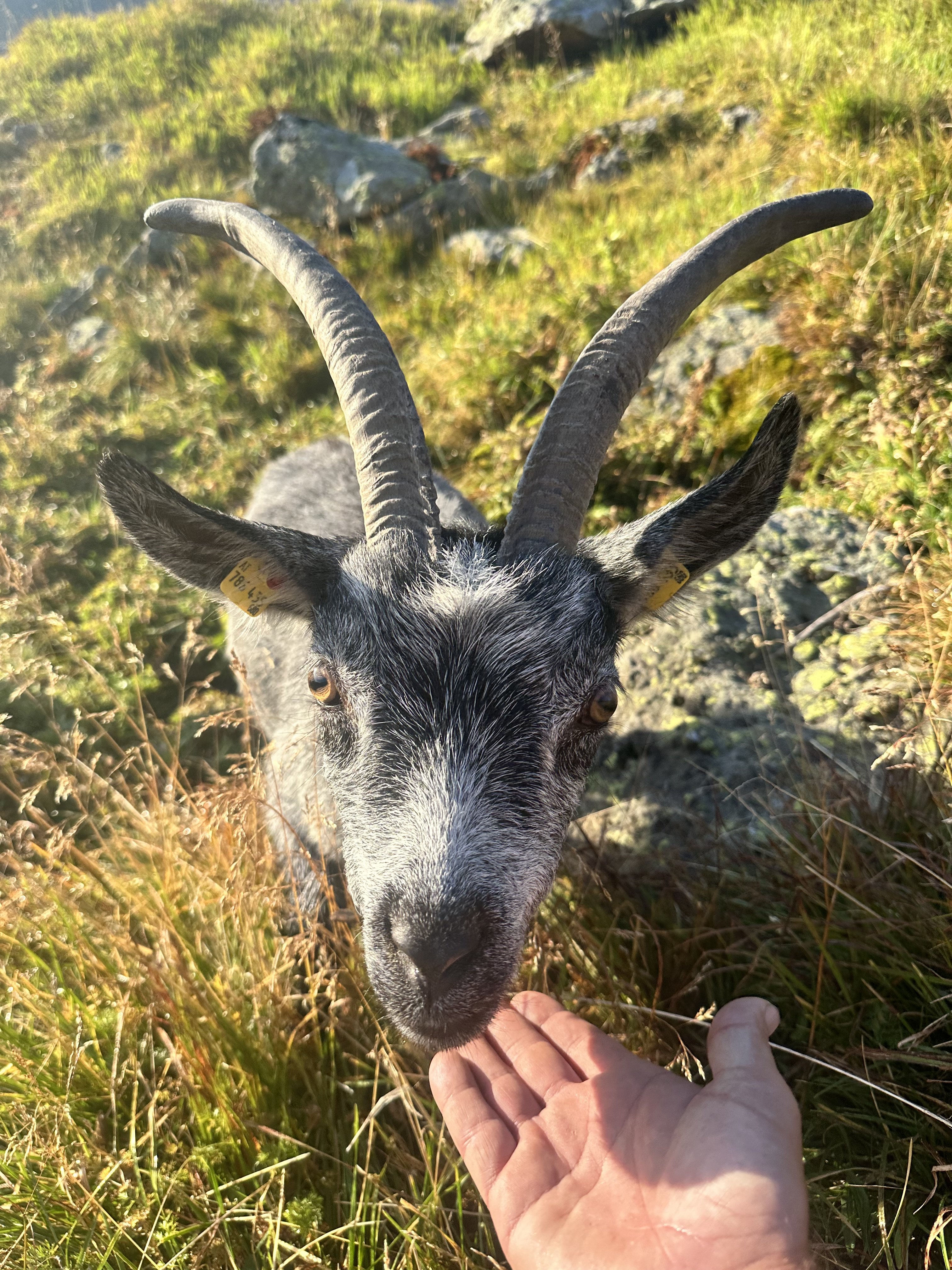
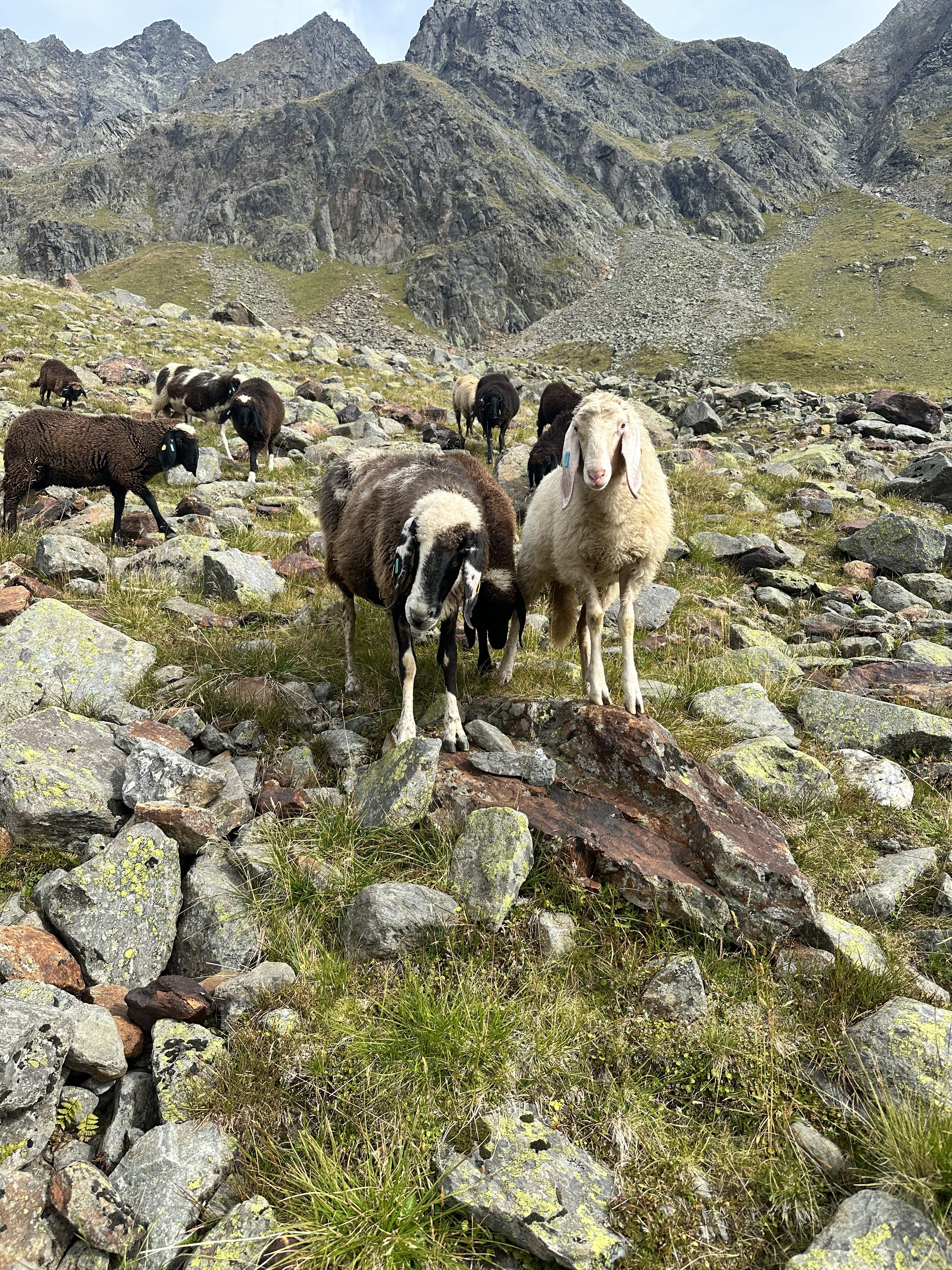
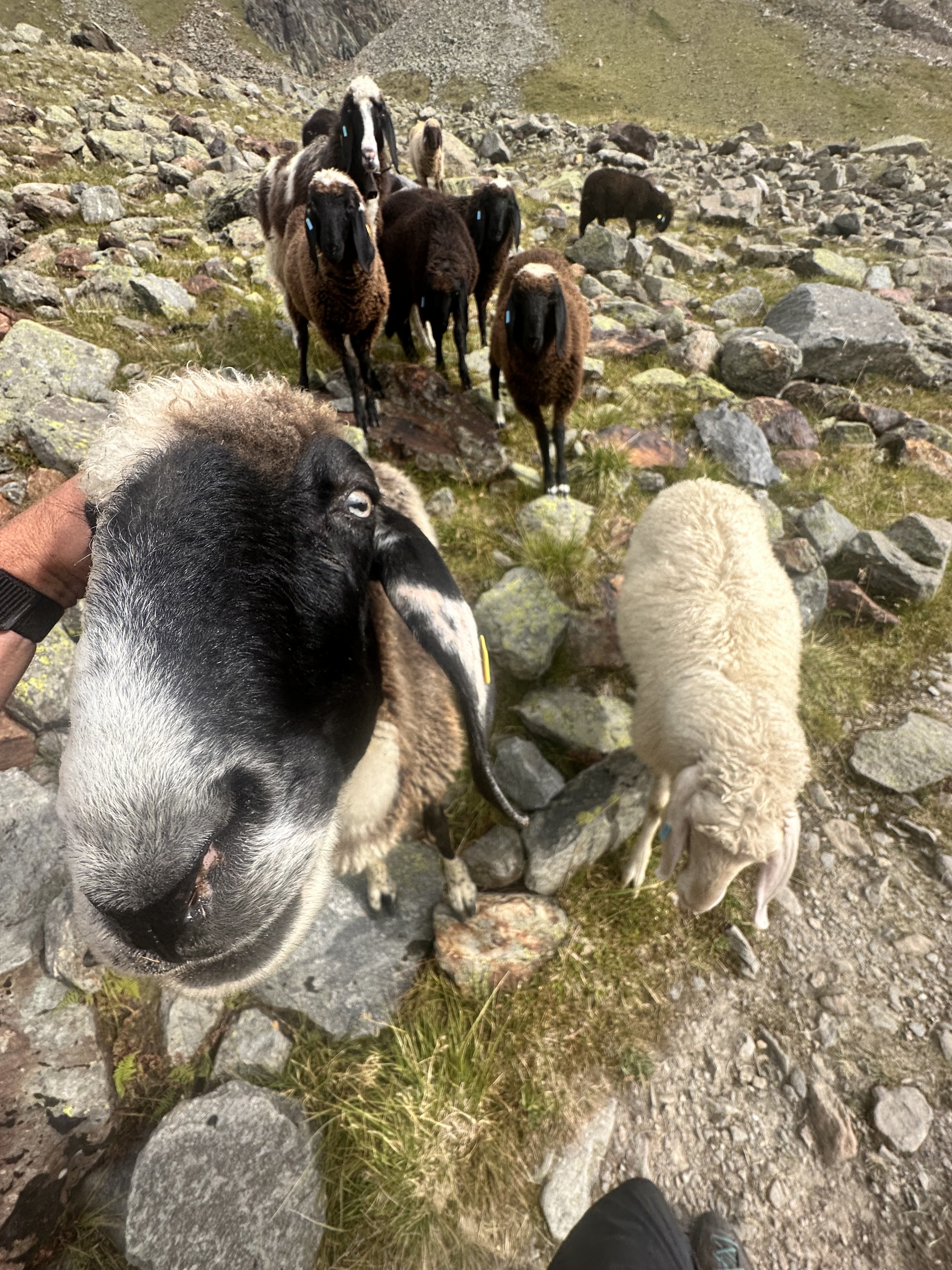
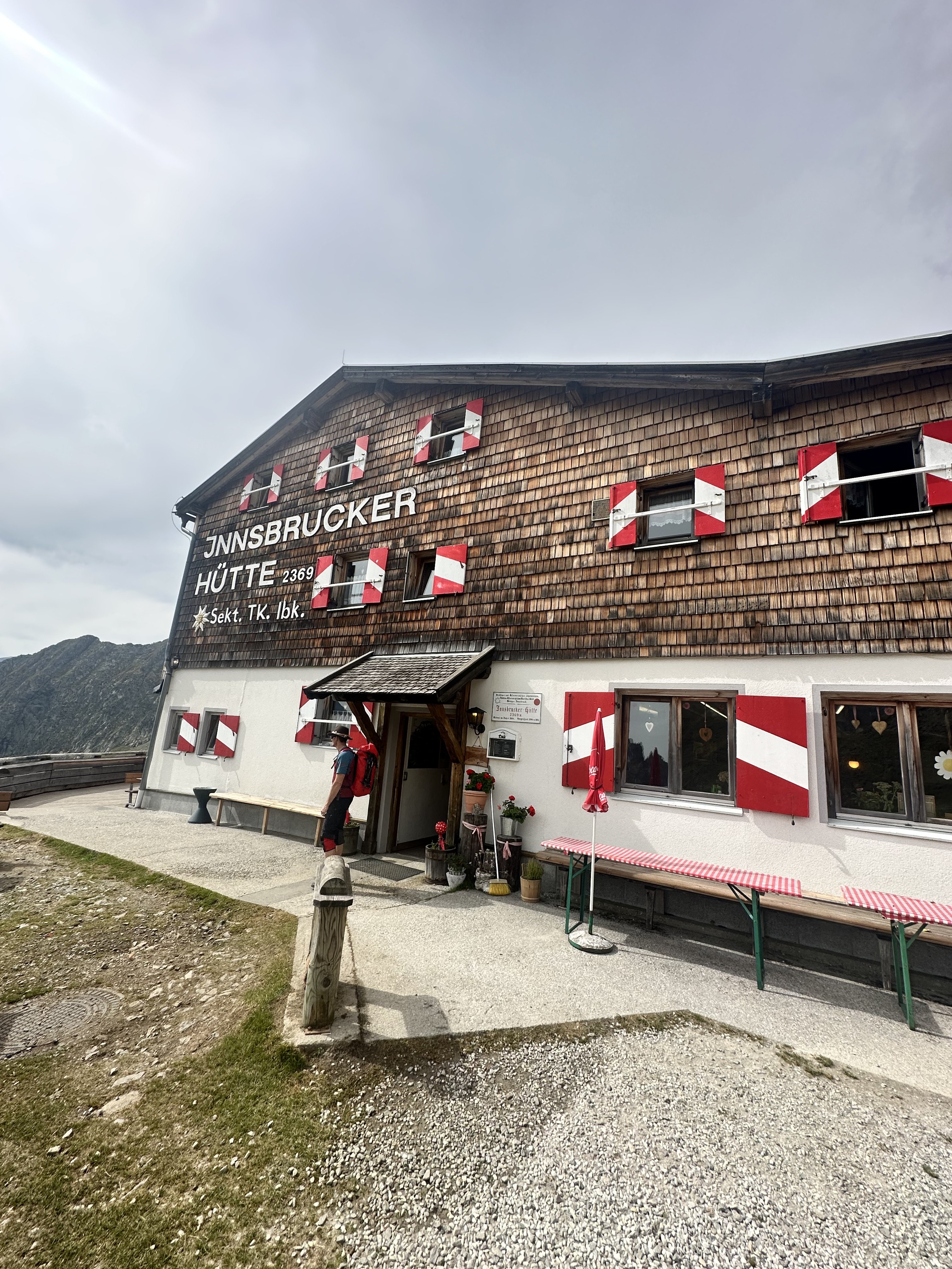
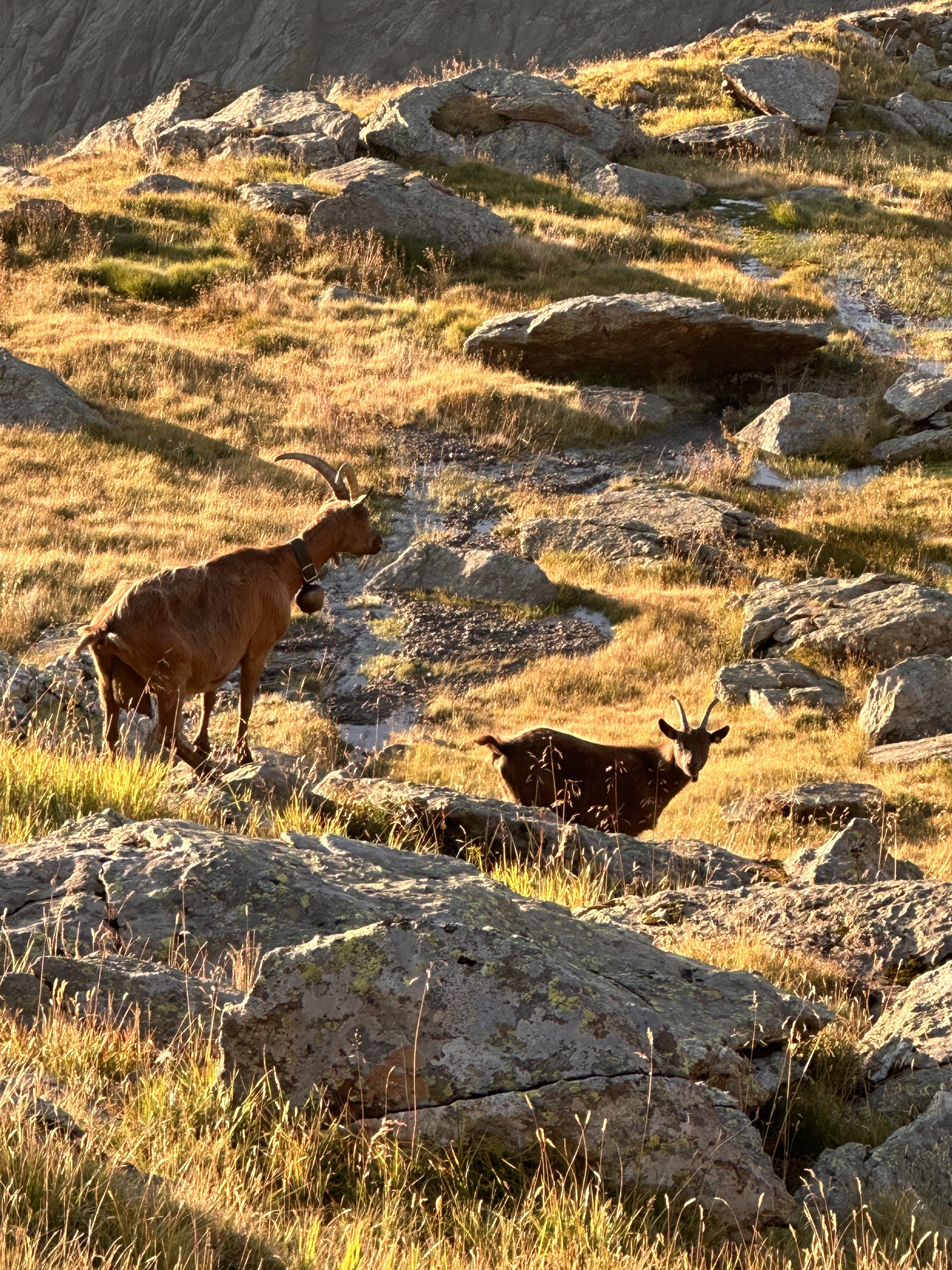
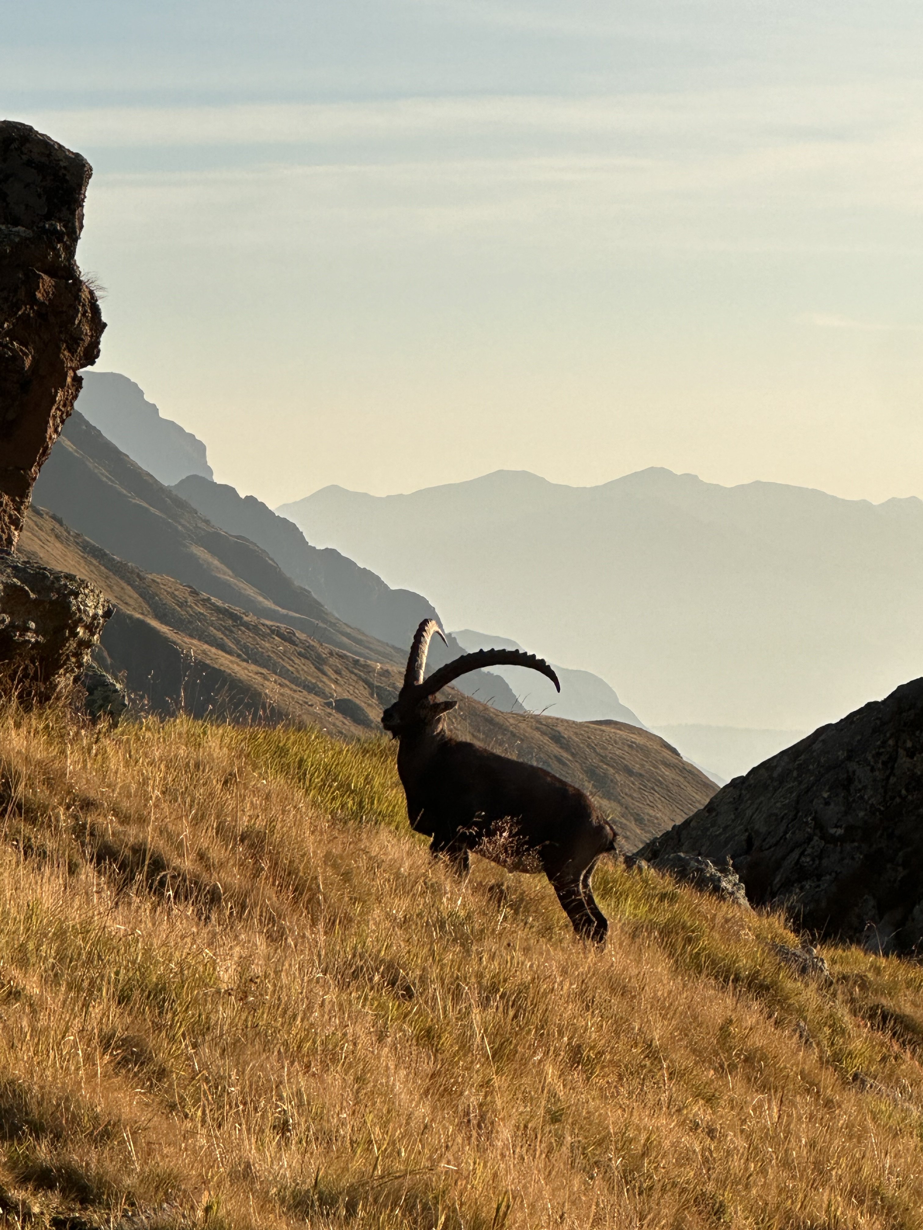
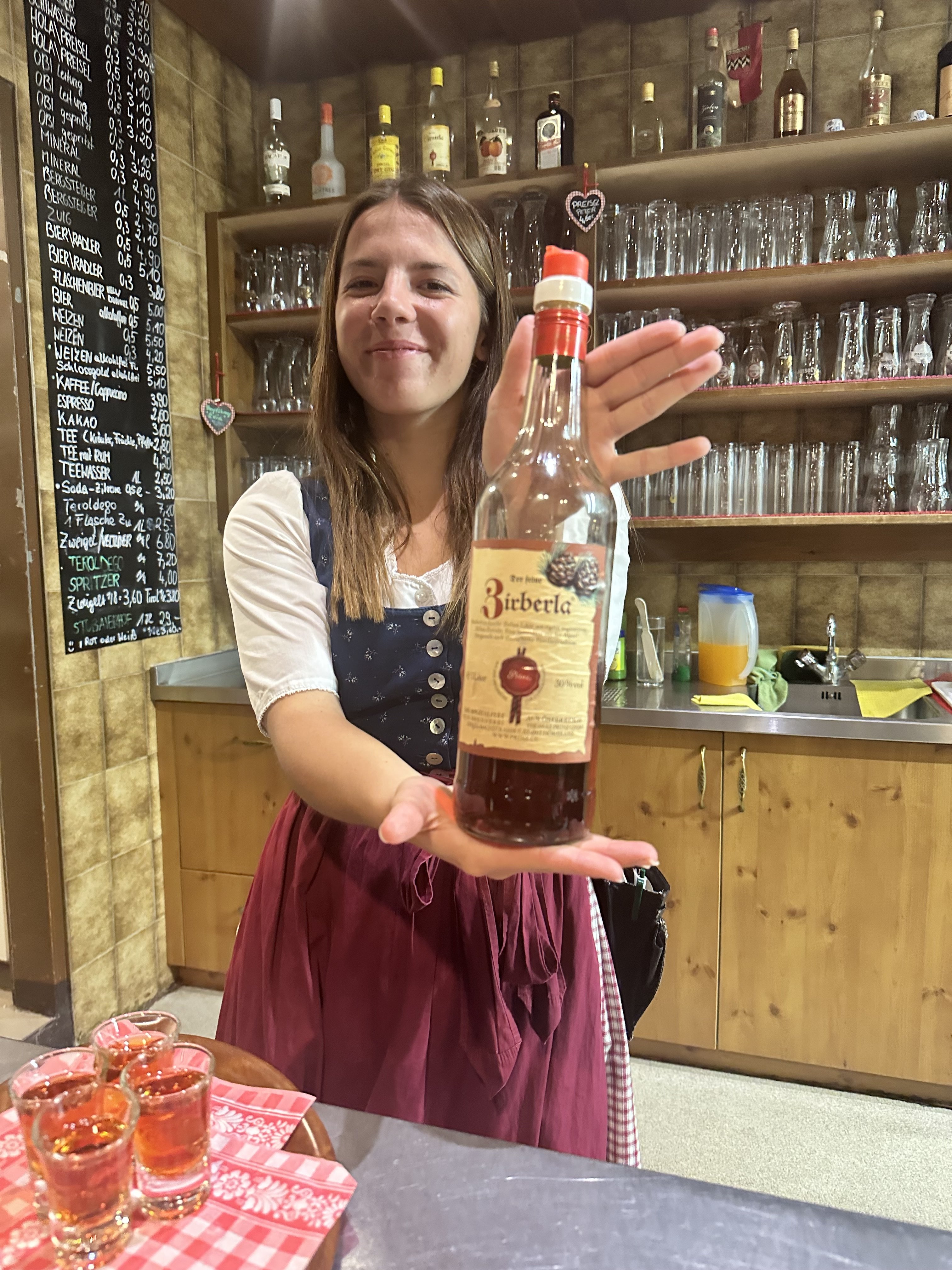
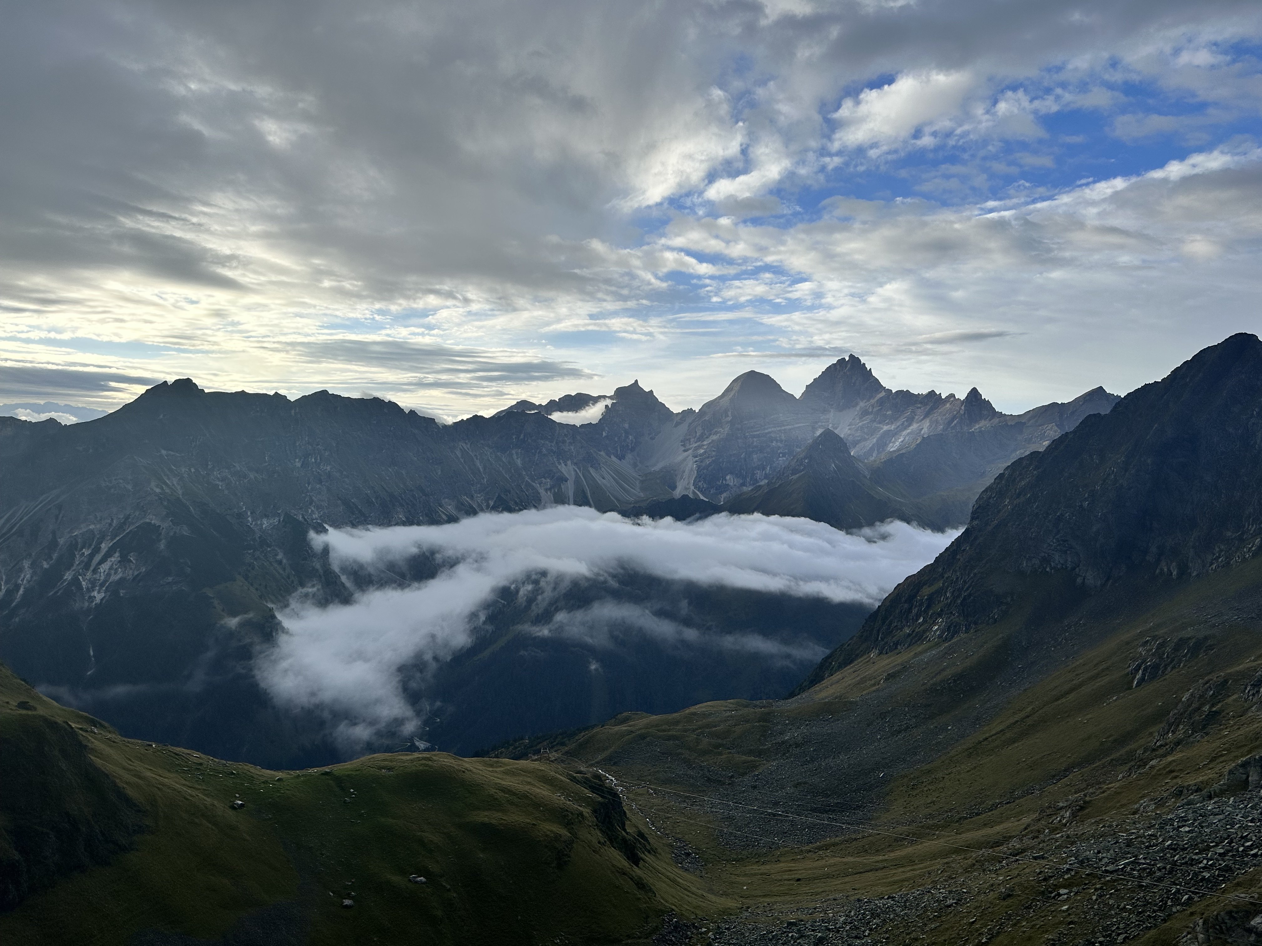
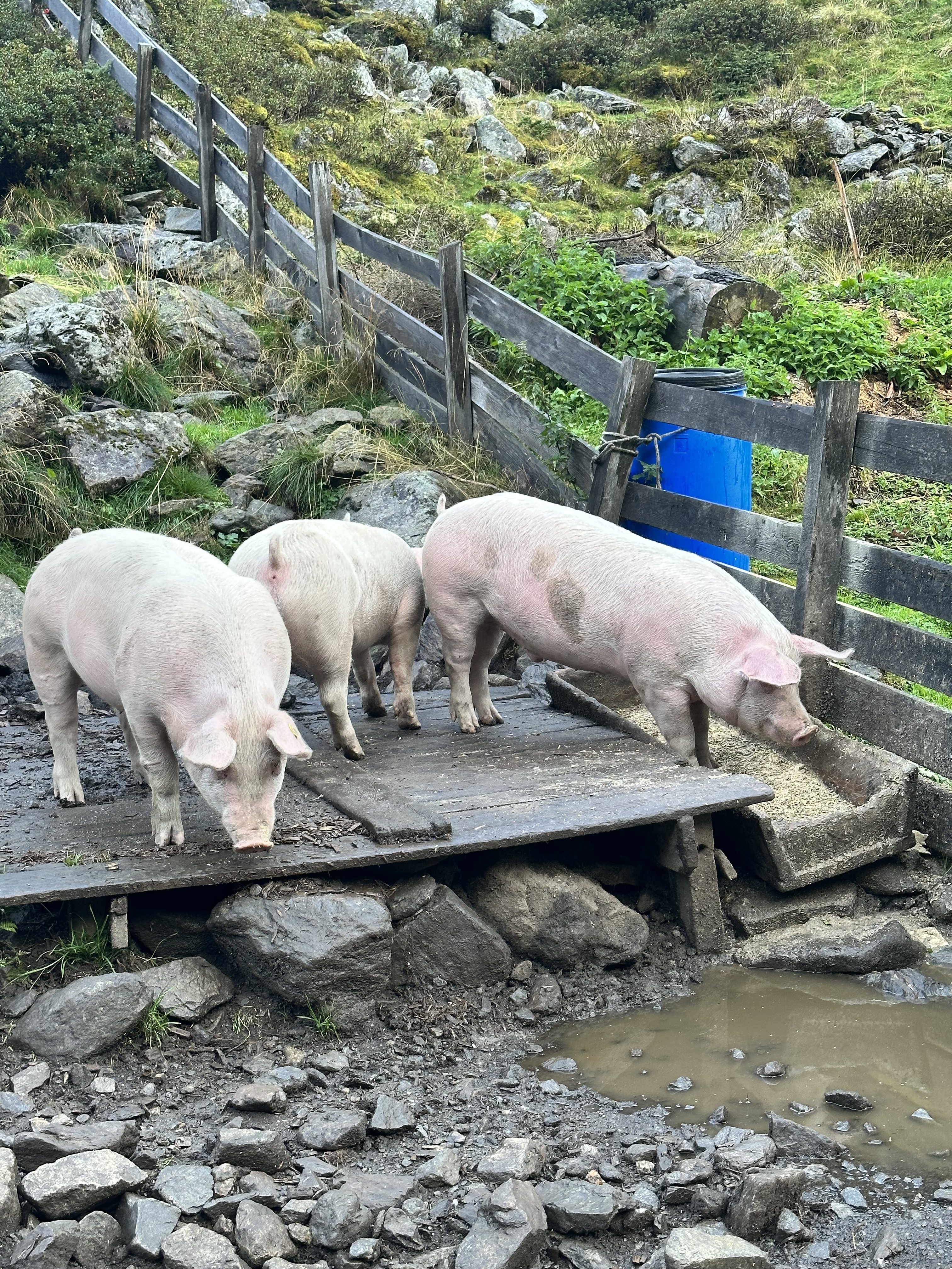
Trip: Austrian Alps - Stubai High Trail Trip Date: 09/05/2023 Trip Report: Over 20 years ago I had personal blog with custom domain name, and posted pictures of what I had going (hiking, climbing, having a kid, etc) and one day I got an email from some Austrian who was looking for a part for his company from a US business that had a domain name similar to my blogs domain name. We had a ton in common, including to him just having a kid as well. Anyway, we chatted a bit and then just stayed in touch over the years, till last year. My son was doing a quarter in Rome, and so I suggested they might meet if it worked out. Turns out his daughter was working and an au pair in Milan, and so they ended up hanging out and then after his quarter was over my son travelled around Europe for a while, ending his trip with a visit to my Austrian friend's home in a little village in the Austrian Alps. I figured it was high time I pay him a visit myself, and so I bought the plane tickets. We weren't sure how to spend my time there, but I suggested hut hiking as I'd never done that. He suggested the Stubai High Trail. So well after 20 years of our first contact a I showed up in Munich and he picked me up. He had to work the first day I was there, so while he worked, I walked from his house over to a trail and climbed the mountain you could see from his kitchen window. I was a great warm up and introduction to hiking the alps, a trail up into the alpine, with a little scrambling, a cable to two, and then a cross at the top....and an insanely beautiful view below. On the hike back down I tore the crap of my feet, getting blisters all over my feet from my climbing boots. After this we went and bought a part of Scarpa approach shoes which I used instead, as we figured out that we wouldn't actually need mountaineering boots for the peaks we would try. We drove to Innsbruck and bought ourselves some jaunty Tirolian hats, and then headed up to Neustift im Stubaital. We parked the car and headed up to the first hut, which gave me an opportunity to get into shape. Was redlining behind my Austrian Machine. Thom is pretty fit, for his 45th birthday he ran in the mountains, doing 26 miles a day for 10 days in row, running from his parent's old village to his own. Our hike that day was only 5k, but gain 4000ft in elevation. The first hut is the Starkenburger Hütte, and as became our custom we celebrated with a couple cold beers. The views from the hut were awesome. The next day, as we tried to do every day, we beat all the rest of our hut-mates to the trail. We climbed some peaks: Gamskogel 2659m, Steinkogel 2589m, Marchsaule 2598m, and Schwarzhorn 2818. These were gained with hiking or minor scrambling. We then dropped back down to the main trail, stopping for a beer and lunch at a sheep herders hut. Then we continue up the valley, which had impressively steep slopes at parts. At one point I was going through a steep gulley which obviously rockfall and heard crack! and saw a grapefruiit sized rock just graze my foot...I was lucky. We continued to Franz-Senn Hutte, which was one of my favorite. The next day we went Franz-Senn Hutte to Neue Regensburger Hutte, which seems out a movie set with a big waterfall just below it. That day we also climbed Östliche Knotenspitze, which is 3101m. It seemed improbable with no gear, but with a few strategic cables and then lots of narrow ledges and some scrambling it went fine. The next day we went from Neue Regensburger to Dresdner Hutte. The Dresdner is located right on a ski run right below the glaciers above. From the Dresdner to the Sulzenauhütte (where we had lunch) to Nürnberger Hütte was the best day for me, though there was not a bad day at all...they were all special and awesome. On this day we went over yet another pass, going by a huge amount big cairns or "hippy stacks" an incredible view of a canyon below that used to house a glaceir as late at the 1950s, but now there is a just a lake....the glaciers had retreated to well above the lake. There was a massive wall of a moraine below. Then down to the Sulzenauhütte and up by the beautiful blue lake....named "Blue Lake". Over a pass we headed down to the Nürnberger Hütte which was another favorite. The next day we went from the Nürnberger to the Bremer Huttle and climbed Innere Wetterspitze at 3053m, which was great fun. The views up there were amazing. The day after that we headed to Innsbrucker Hutte. Our intention was to climb Habicht, another 3000+m peak, but it there was thunder and rain in the morning so the next day we headed up. I can't begin to convey how fun this trip was. My friend Thomas is the nicest guy you could meet. I might as well have been climbing a with a guide (he actually was guide for a while), but what was the best was having a local who pointed out all the local flora and fuana, history, and translate German for me, and basically arranged everything. We saw plenty of herd of goats and sheep high in the alpine trying to escape the heat. This is the time of year they normally bring them down, but it was still so warm they didn't want to come down yet. We saw a pair of Stienbock, which as very cool, and then smell and eventually saw another one that was dead along the trail. We ran into a lot of other Europeans, and shared some of our time on the trail with a couple from Portland. The company and food in the huts was great save the vegetarian fare they served at the Regensburger Hutte, which came out of me in a 3 second burst just below the steep pass you go through to get out of there. I felt immediately better after. The scenery is quite amazing. It is alarming to see how much the glaciers there have receded, they could be gone in 10 years. I took so many photos and videos. Here a few photos. Gear Notes: silk sleeping bag liner. approach shoes. no tent, stove, etc... Approach Notes: south of Innsbruck


 1 point
 -
Lani will be putting on a sideshow of this climb and a couple others at the mountaineers this coming wed. You don’t have to be a member and they are offering free beer! https://www.mountaineers.org/locations-lodges/seattle-program-center/events/beta-and-brews-lani-chapko-on-castle-in-the-sky-tanuki-ridge-and-planning-a-first-ascent?fbclid=IwAR1iojfALeXLUC5YL4jJX4qEtWqOp3JsWczdOolPKGBmH1FpiKr8mvrI33o_aem_ASHUtgeL2Jfs6GJ7zdPvlY_cXrgrVMB9aihwVIL8Bkk5a_YJw8Z2nqrkXM7_bUJhVuE1 point
-
Trip: [FA] Silver Peak - Ice Cold Zach Daniel's Trip Date: 08/24/2023 Trip Report: Not much to report here but an uneventful new route. Ice Cold Zach Daniel's, 5.9+, 3 pitches, FA Daniel Montgomery and Zach Colburn. The north face of silver peak had kinda always been on our radar as something we felt should be climbed. We hiked a load of bolts to the top last October during our Indian summer (anticipating too many death blocks for any kind of ground up nonsense, which turned out to be accurate). Found a line that seemed like it would go and used up a drill battery. The face was shorter than we hoped (about 80 meters) but seemed worthwhile enough. I went to Utah for about 5 months, came back in April 2023 and waited for the hot days of summer. This basin stays cool and shaded making it nice for the month of August when a lot of the pineapple basin routes are roasting. We hiked up again with more batteries, rapped down and bolted the lower pitches, climbed the route and hiked out. First pitch has 3 bolts and wanders through some choss to a ledge with 2 bolts. This is just so you don't have to link a full 120foot pitch if you don't want to. About 5.7 Second pitch is about 90 feet with some juggy, dirty 5.8 climbing. 3rd pitch (100ft) is quite clean following a line of positive holds diagonally across the face. Fun 80 degree face climbing that requires some thought. It is a little traversy but the rope drag is minimal. To descend make 3 straight 35m raps down from the last anchor. The anchors on the climb dont have rap hardware. It's a pretty short route, approach is only about an hour compared to the tooth though. And it's shaded. There's a ton more potential for similar routes up there, but I don't really care much about bolting any more easy routes. A job for the guides. Gear Notes: 10 draws and a 70m rope Approach Notes: Go to Snoqualmie pass and drive back heading for Mt Catherine/ pct crossing in ollallie meadow. (Fs road 9070) Follow the road back as far as your car will take you then walk it to the end where there's an old fire pit. A trail heads north from here. Follow it to the talus field that sits below the gentle northwest ridge of Silver peak. Then go straight along the talus towards the face/ follow hunter trails along the edge. Pretty easy and doesn't take long. At the base of the face scramble up dirty ledges , the right and traverse back left to the first bolt. (The last rap takes you over the ledges) Zach wrote a more detailed approach beta on mtn project
 1 point
 -
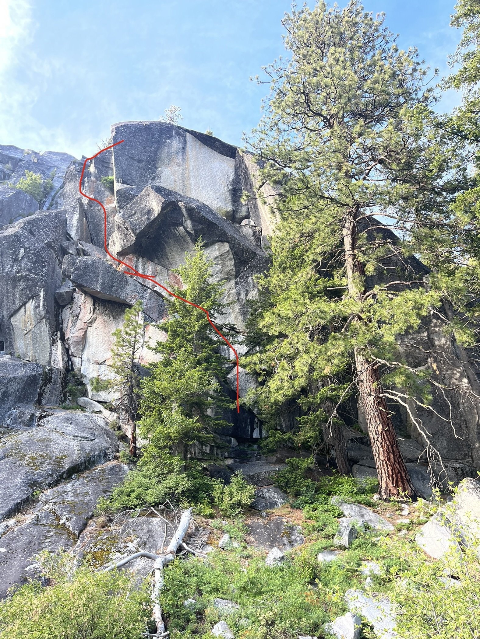
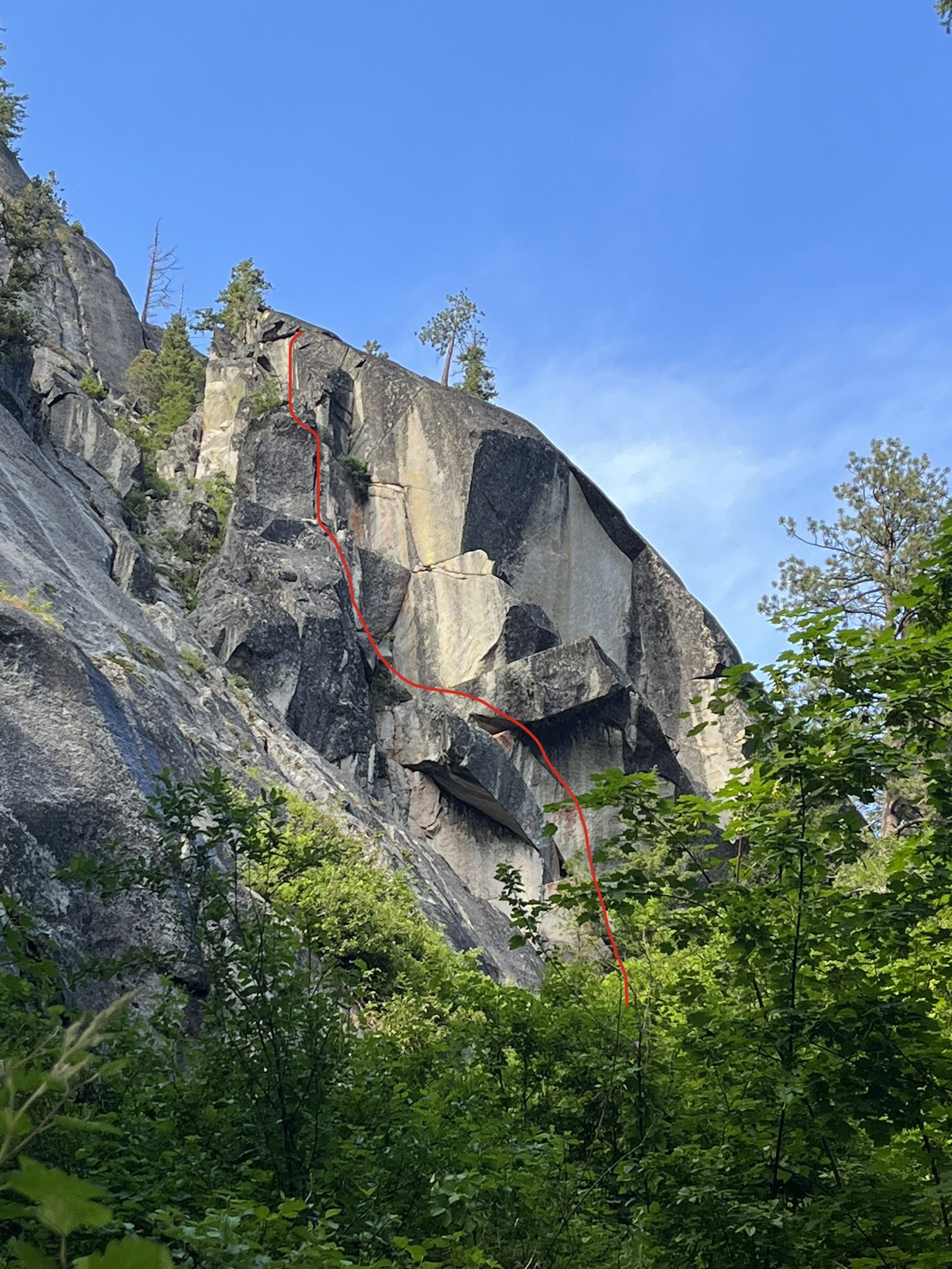
OVERVIEW This is an overdue report for several FAs. There certainly are other lines with potential and lots unexplored. Like most new routes, the rock here can vary in quality, though consistently solid granite. The vegetation has filled most cracks and lichen abounds. However, we did climb many stellar pitches without cleaning, and some with light excavation. Thar be lichen, wear some sunglasses for the overhanging cracks. Recommendation: Climb Ant and the Eel through Elevator Shaft roof for full value linkup. Whale and the Worm for a day 2 climb before heading home. APPROACH Ingalls Creek Trailhead, (see WTA), mile 8 or 9. There are maybe 2 or 3 nice creek camps between miles 8 and 10. On the way in, looking north (right) you should be able to spot the Elevator Shaft and roof, they stand out even in the ocean of of granite slabs. This is the crag. Once directly below the Elevator Shaft head ~45 minutes uphill total through brushy deadfall and talus, maybe 10 min to the talus field which you can follow almost all the way up. Either continue up to the wall then traverse right (some down climbing), or traverse through alder past a small waterfall just before the talus stops. Note there is a steep draw in this upper section, don't fall in while negotiating slide alder. These routes are listed left to right. ROUTES -Elevator Shaft, 11 something -Whale and the Worm, 10a/b -Ant and the Eel, 5.9+ The Elevator Shaft, 11 ? 2021 Sean Fujimori & Tom Beirne The stellar pitch is the 11a, which starts at the Big Ledge. You can get there via other routes, which we recommend. Seconding this route were Christian Junkar and Emma Sando, though they had more common sense than us to bail when the sun set. P1/P2 solo 5.6/5.7 slab with a view of the shaft roof. P3/P4 5.8 (broken up for rope drag) 5.8 corners ending at huge ledge. This was several years ago, but close enough to correct. P5 11? money pitch, Left facing corner, ~15-20' horizontal thin hands roof crack. Pull layback lip to a mellow slab and tree belay. No pictures - whipping on lichen ain't fun, so I was busy belaying. Sun set as I climbed, Emma and Christian bailed to camp. Sean - any pics of the roof? RAP: Short rap to fir tree 15m down and 10m climber right. Double 60m rap to elevator ledge, and from the last slab tree: double 60m to base. Whale and the Worm, 10a/b 2023 Tom Beirne, Sean Fujimori, Lydia Filipe Starts in the protected grove of the overhang with several rock benches and a large tree. Finishes on the Big Ledge connector. P1, 5.8 20m, Start on the right side of the diving board and diagonal traverse on top of the board into sideways squeeze chimney. Very strange, cool. Alternate direct start up short steep finger crack. Don't fear the drips, or the wet moss start. It gets better and remains dry afterward. P2, 10a/b 30m, Left facing corner crack, stay left at the split (two crack options, the right goes through a nootka rose). Fist crack trends left after the mantel to an overhanging hand/fist crack. Belay at the top to reduce rope drag. P3, 5.6 20' Traverse up and left through blocky 5.6 to the top slab. RAP: Small rap 10m to small pine at edge of slab, then double rope rap to base. Ant and the Eel 5.9+ Sean Fujimori, Tom Beirne, Lydia Felipe Start far right, walk a short 10m thru the greenery along the wall to a cave. P1, 60m, 5.9+. The Money Pitch! 3-star finger and hand crack, start at the entrance to the cave and follow crack up and left, when the crack transitions to fingers, reach far right for a jug ledge and mantel to continue the next crack system. Slab feet needed in crux mantel, very tricky if raining! This ends at the Big Ledge, so you can choose other routes from here. P2, 5.9+, 30m. Hand crack thru ocean spray bush with thoughtful mantels and slab feet with great hands and fingerlocks to bouldery top out. Belay at pine or dead tree. P3, 5.8 30m. Continue 20’ left past dead tree to wavy finger-eating crack, then traverse right in a nice finger crack under a small overhang. Pull onto ledge with some finesse. P4 5.7 70m, or break up into two pitches. Up the blocky slab, follow the veg direct via double chicken wing crack, to filled in finger crack and suffer or take the slab for an unprotected 15-20m runout. Over the small 5.6 roofs to a pine. Rap 1 From top of p4 pine, double 60 skier right to fir tree, 10m left of fall line. From fir, belay or walk down skier left 10m to next fir tree. This is the top of p3, dead tree left and pine on right. A double 60 could probably make it to the BIG LEDGE, BUT for rope pull ease and to reach the lowest pine on the edge of the slab for the final rap (which is a full double 60 to ground) we opted to: Rap2 30m to skier left or walk around low 5th moves to 15’ pine. Rap 3 Double 60 off pine to BIG LEDGE- to short pine skier right to fir on distant slab. Rap 4 Full double 60 to ground. Saddle bag and stay climber left of fall line ~5m going over the roof to prevent being in the tree. Free hang rappel to ground. Easy to get rope stuck in the tree, maybe worth trending climber right to avoid.
 1 point
 -
Thanks, all! For location convenience, below is some background info. on the two grade V's to the north of our route. Above, I referred to these both as climbing the NW Buttress, as they climb a vaguely wishbone-like buttress that trends WNW. However, the original Soviet party called their route the North Face, and third ascent party, the West Buttress. The Oregonians characterized their line as on the NW Buttress, which I think is a reasonable reference for the entire buttress. Excerpt from the Oregonian's trip report: SW Bonanza Peak (right) and West Bonanza Peak (left) seen from the west. (Photo: Steph Abegg) 1. NW Buttress, “The Oregonian Route.” 5.9+ V. Keena and Bonnett 2013. 2. W Buttress, "The Soviet Route." 5.9+/5.10 V. Bershov et. al. 1975. (Overlay as documented by 3rd ascent party) Our route, the Cascadian, ascends the West Face off to looker's right of these two routes, topping out just right of the summit. Our first pitch begins at the small caret-shaped (^) snowfield in the pic. Here's Steph Abegg's well-researched and documented account of a third ascent of the Soviet Route, including some interesting route history: https://sites.google.com/stephabegg.com/washington/tripreports/bonanza She rightly characterizes the wall as "rival in size and difficulty to many of the biggest faces in the Cascades". This route felt reminiscent of the routes @rat and I climbed on the Hozomeens, but with a better kind of rock-quality variability, and much easier access. It has my qualified recommendation, fwiw. Here's the view of Bonanza's west wall a couple years ago en route to (or from?) Dark Peak. The Cascadian ascends slightly left of center (begins just right of the tiny snowpatch), the other routes begin out of view at far left margin. The portion of the wall to the right, above the long snowfield, is unclimbed and looks positively atrocioulicious.
 1 point
 -
Here are the pitch notes I took while on route, for anyone ever interested in repeating. I always try to take pitch notes, both from a sense of eternal optimism and my absolutely horrible memory... There were bouts of really awesome climbing, and a couple engaging pitches with minimal protection, hard climbing and consistently portable holds. P1 5.4 220’ Scramble up white slabs to a good stance below the large, steeper band of darker rock. You are aiming for an obvious, large open book for the next pitch. P2 5.8 190’ Head up into the open book, climbing to its top. Traverse left back into low fifth terrain to a talus covered bowl. P3 5.6 260’ Climb the rib to the right of the bowl past a bunch of scrambling to another large talus ledge. P4 5.9R 140’ Climb through a heinous choss band into a gully with better rock. P5 Low fifth 230’ Scramble up the gully to a solid belay. P6 low 5th 150’ gully P7 5.7 100’ Start up the face. Trend Left to a Left facing corner. Follow this to a good ledge on the prow. P8 5.10a 110’ climb the face past a roof and up a ramp to a second roof. Belay on good ledge. P9 5.10 200’ Climb the thin Right facing corner to a ledge. Then a short steep section takes you to a ramp. Follow this to a Right facing corner. Climb up this to some scrambling that leads to a large ledge. P10 5.7 180’ Climb the low angle, loose face to a shit belay. P11 5.10R 150’ Quest up the face to a decent ledge with a tricky anchor P12 5.10R 180’ Another vision quest pitch to the notch on the shoulder of the ridge. P13 5.10+ 60’ Climb the overhanging splitter to a chossy ramp. P14 5.9 170’ Start up a nice varnished corner that eases to chossy mid fifth P15 5.8 110’ Traverse to the ramp on the right. Follow it to the S ridge P16 4th 250’ A short scramble takes you to the SW summit.1 point

