
Leaderboard


Popular Content
Showing content with the highest reputation on 07/11/23 in all areas
-
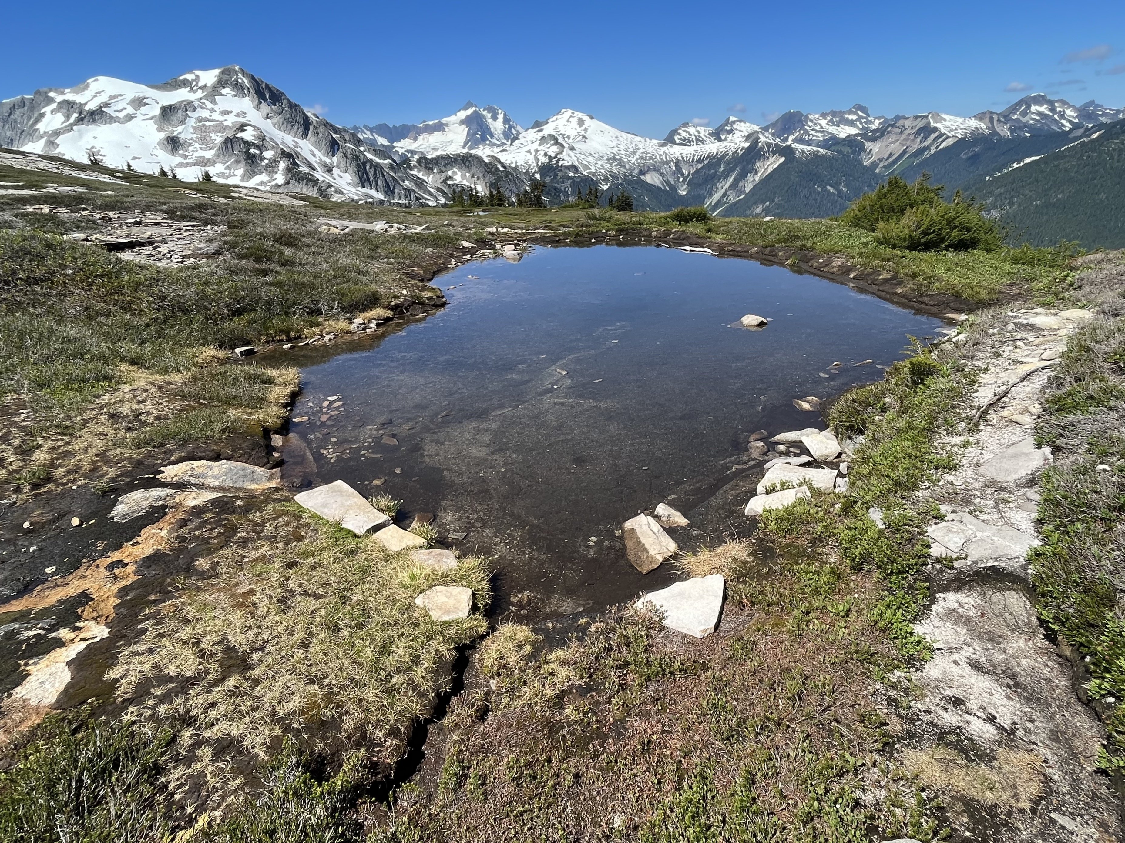
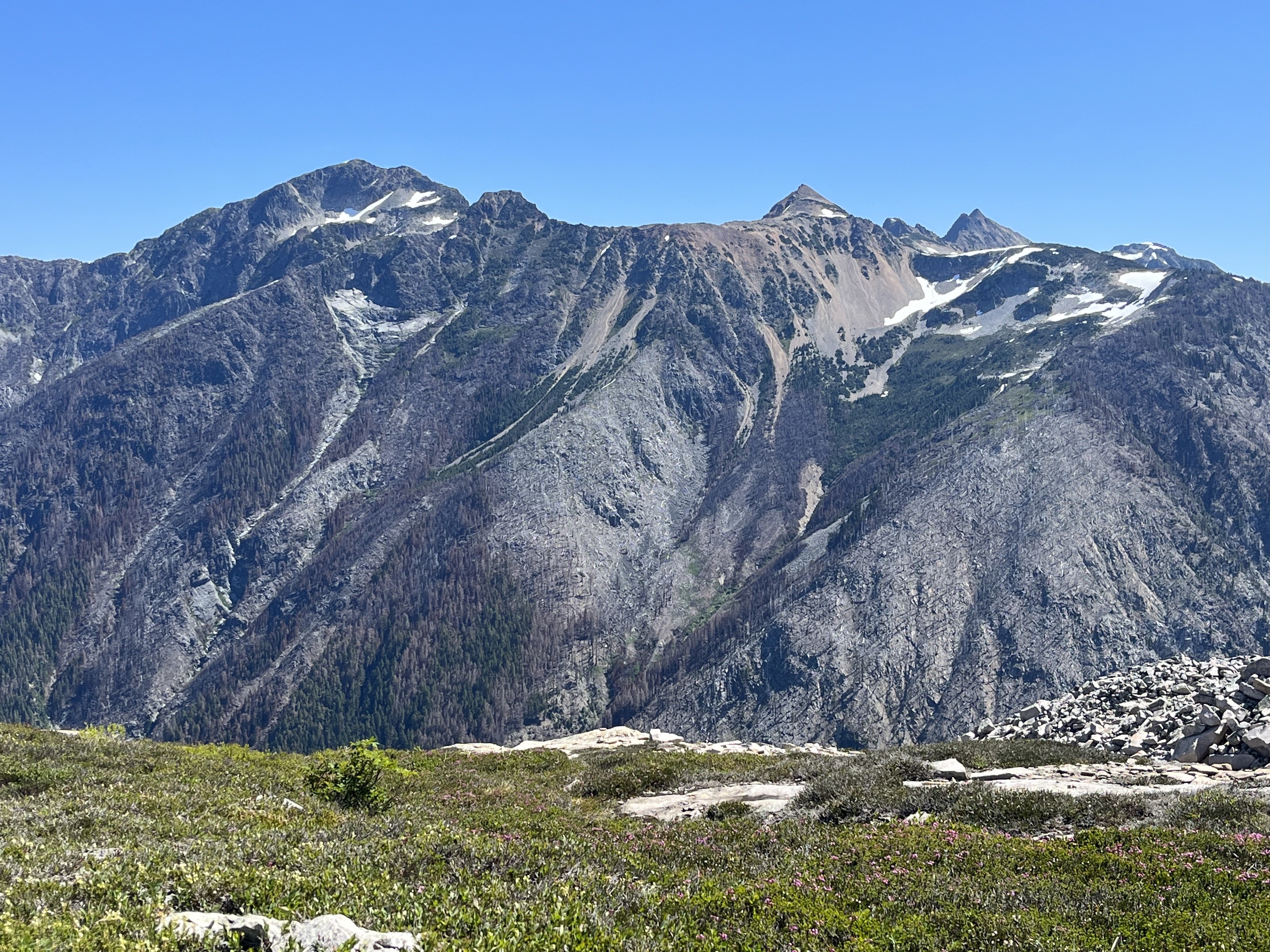
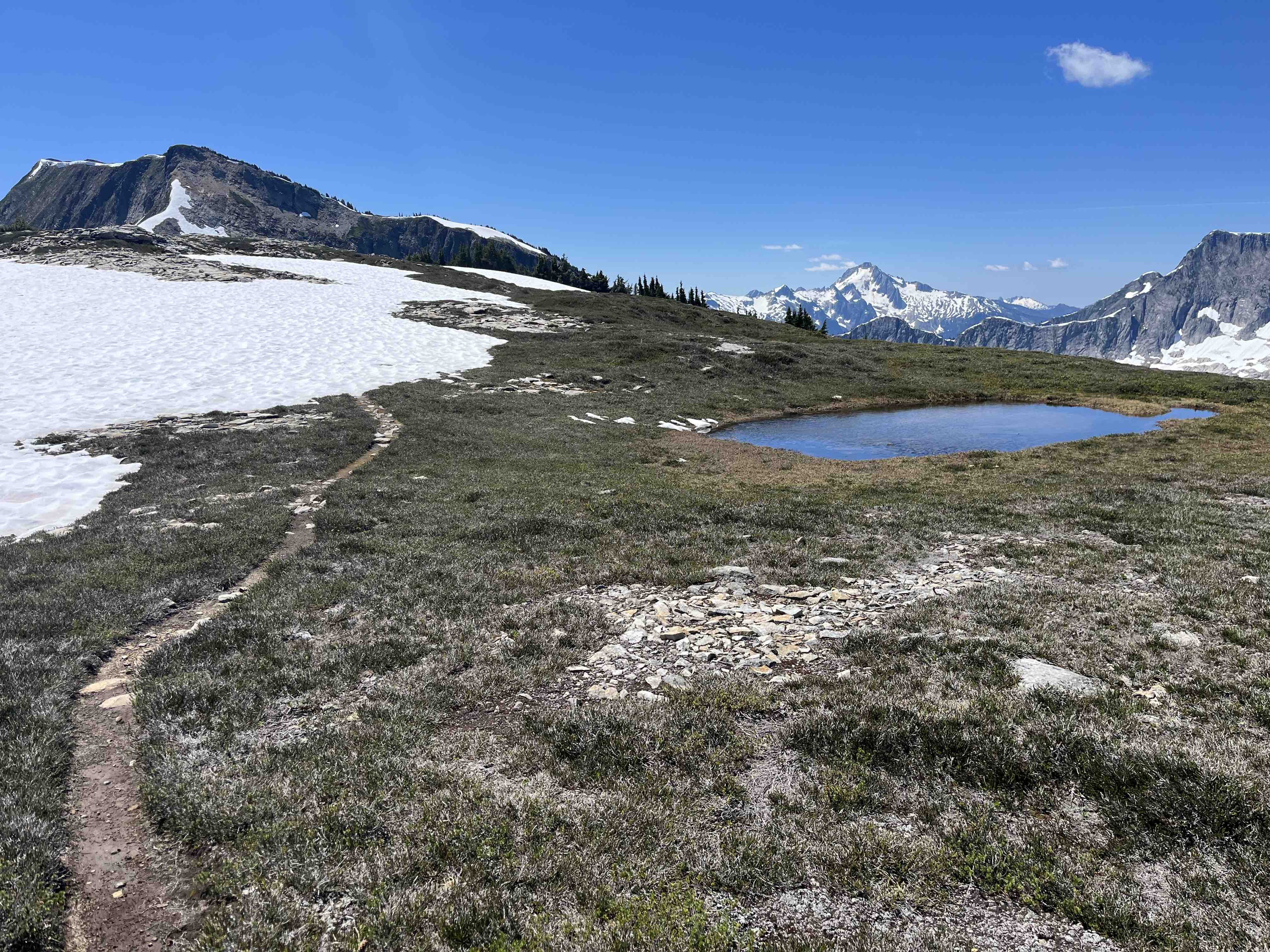
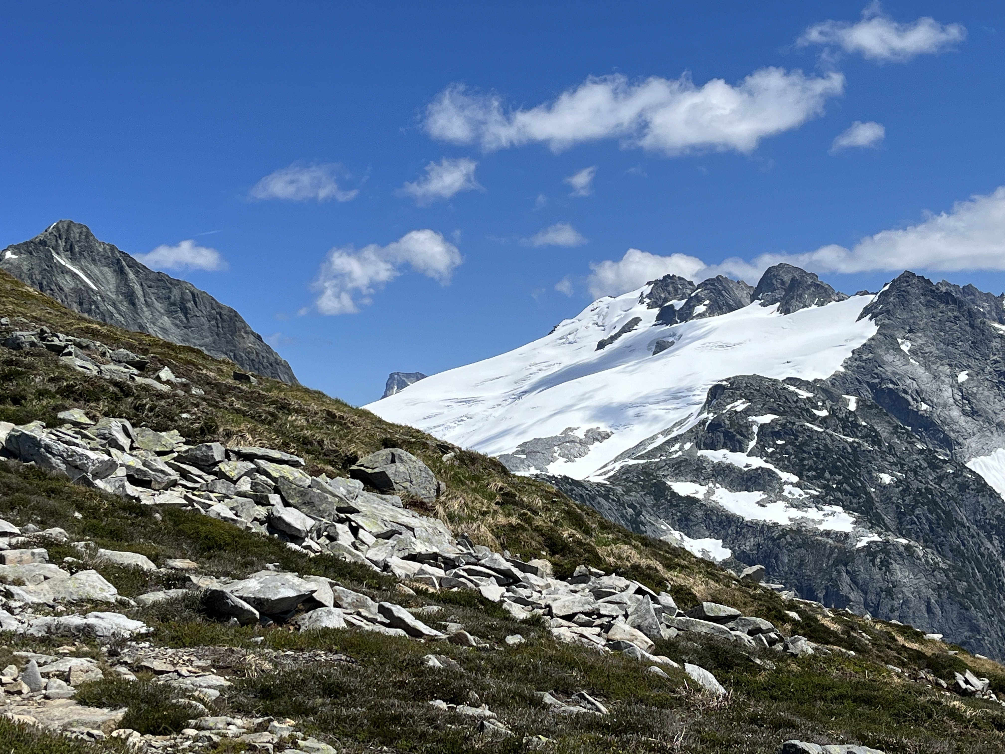
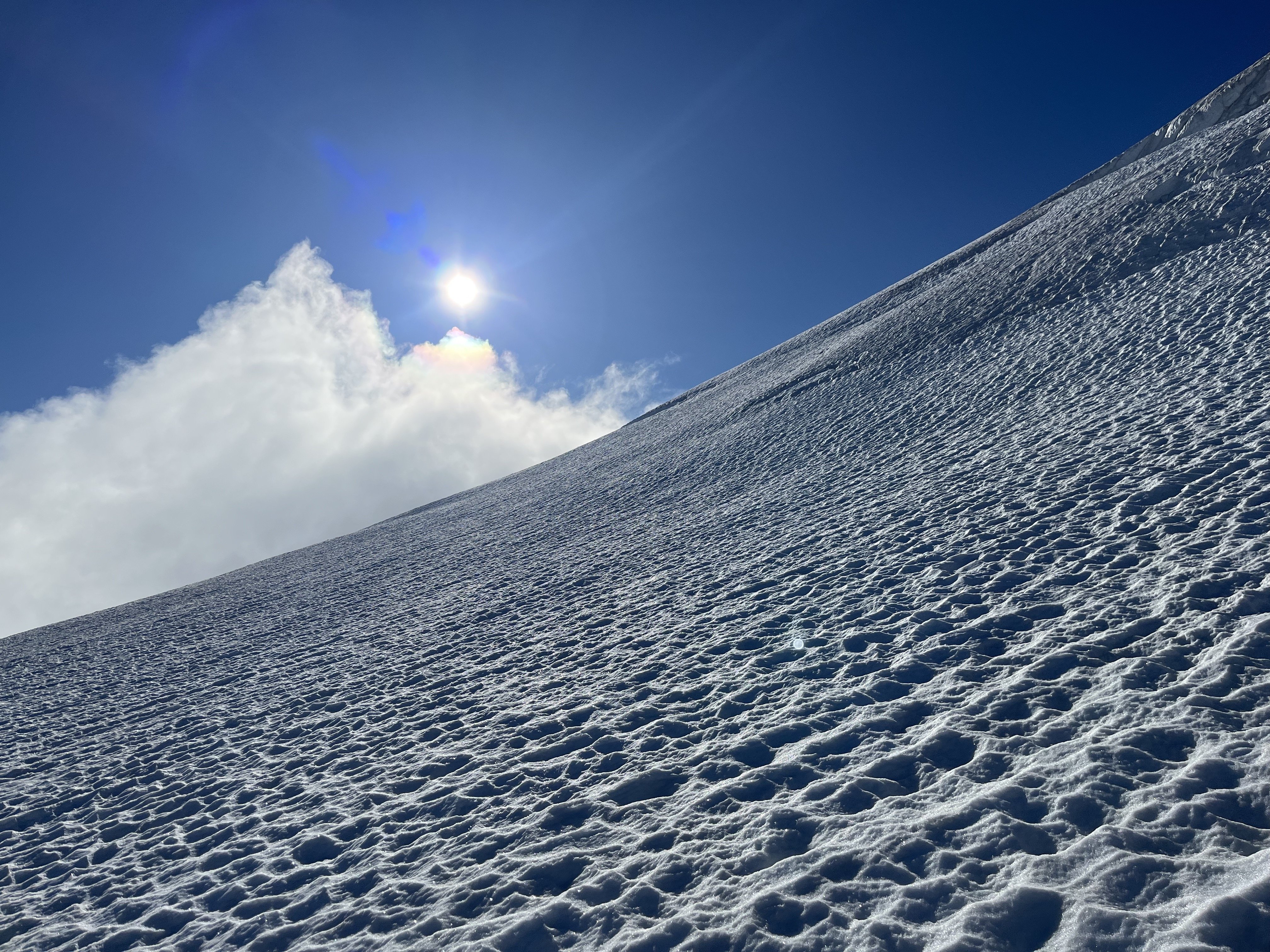
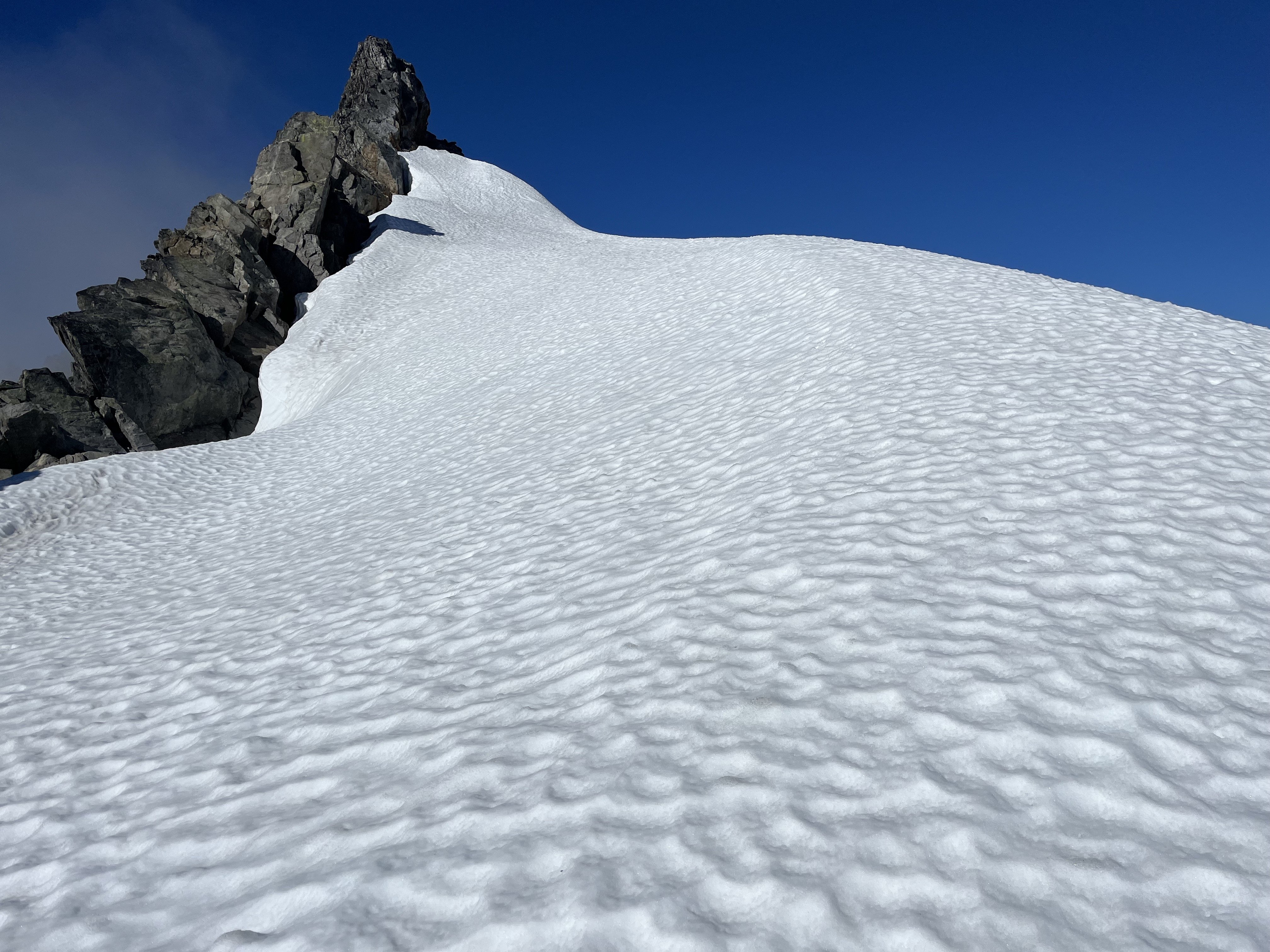
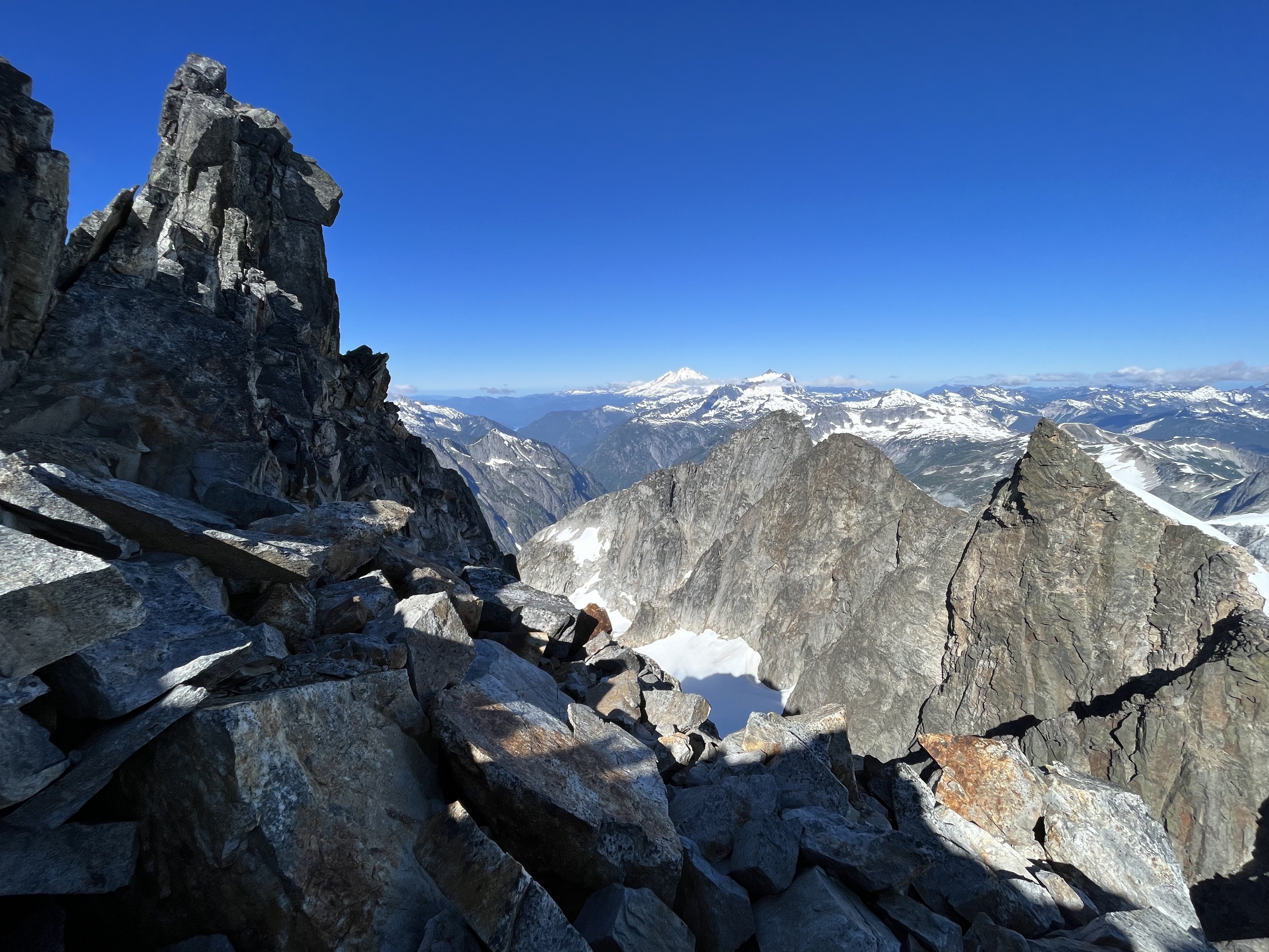
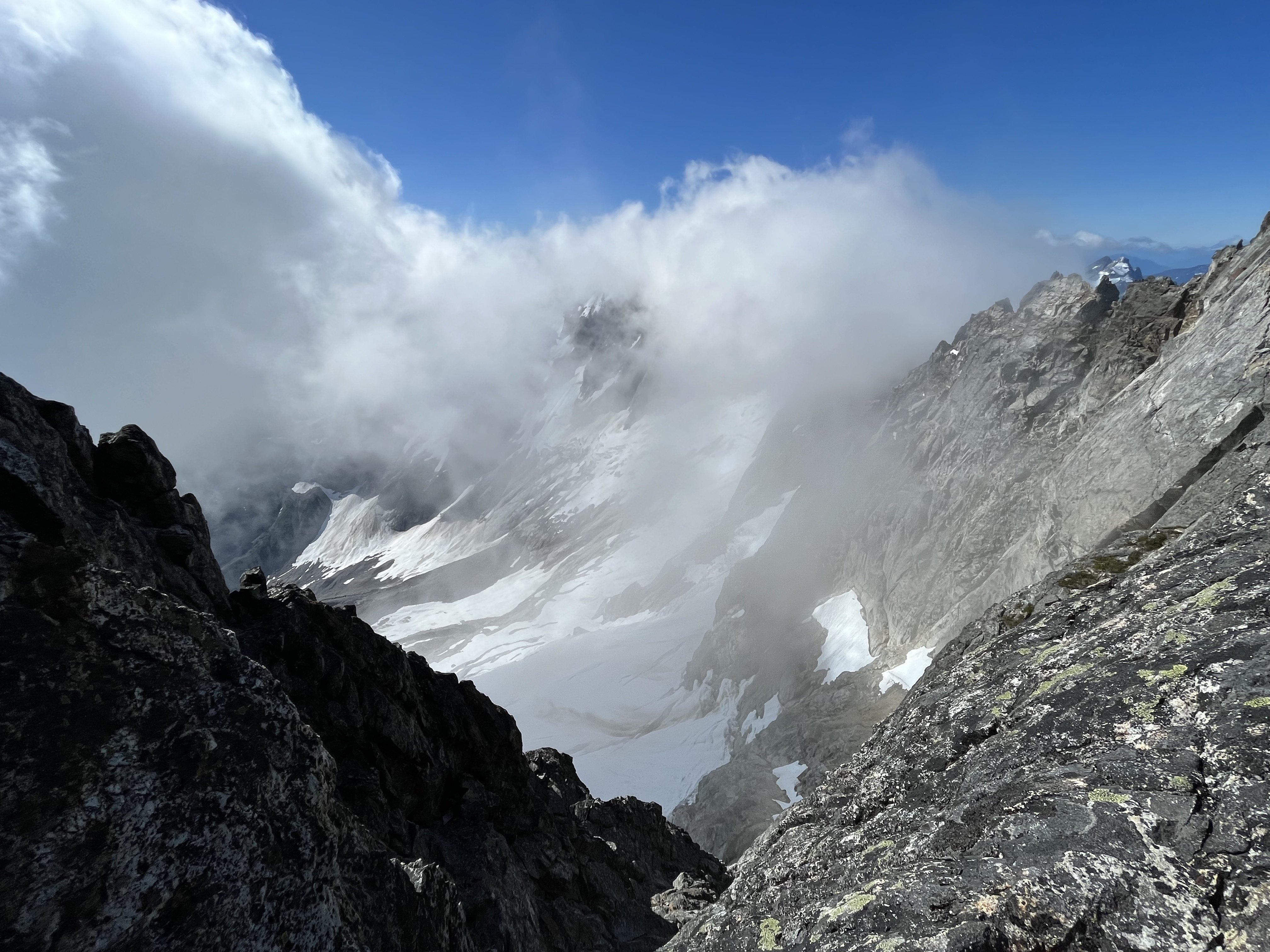
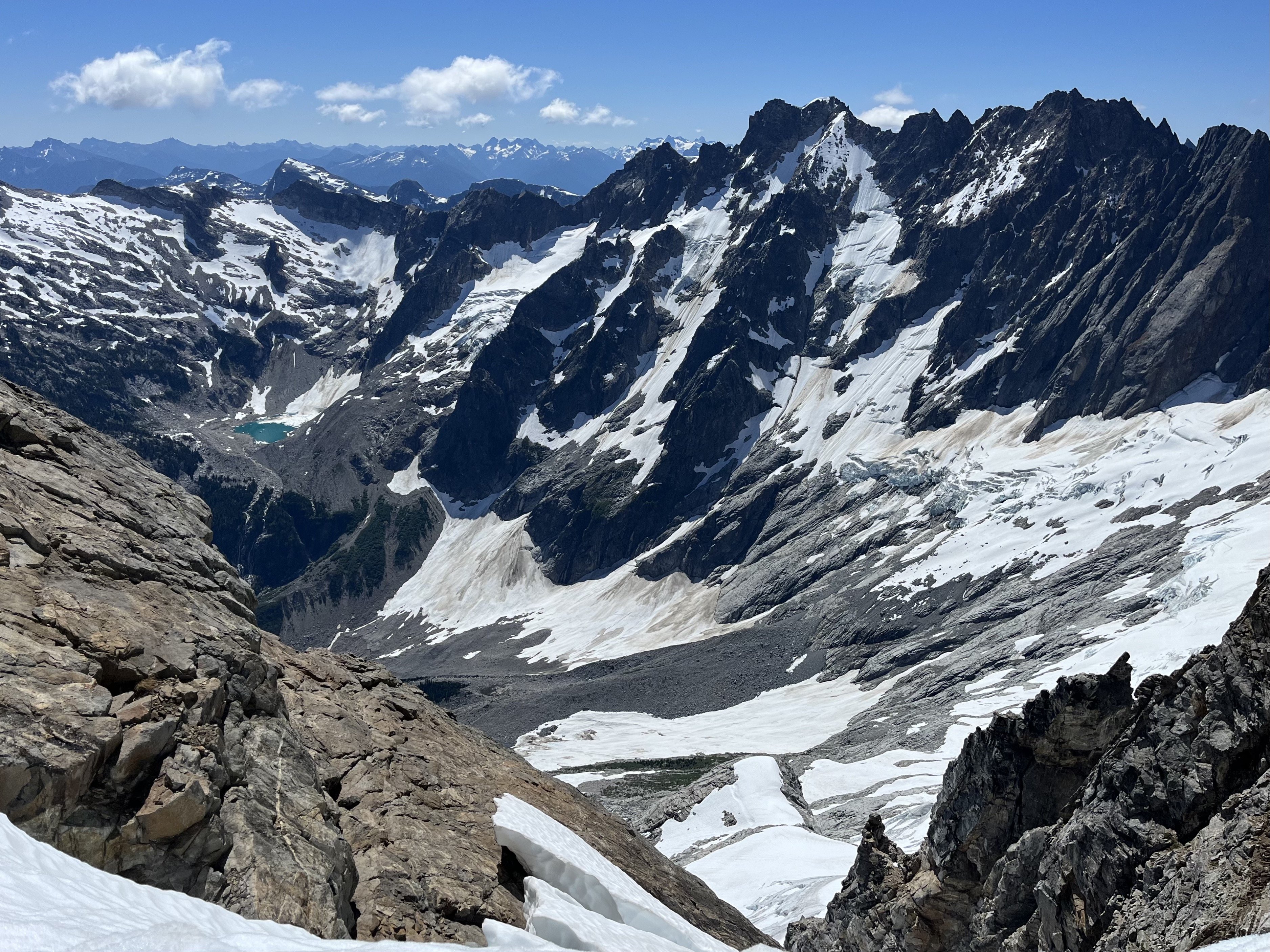
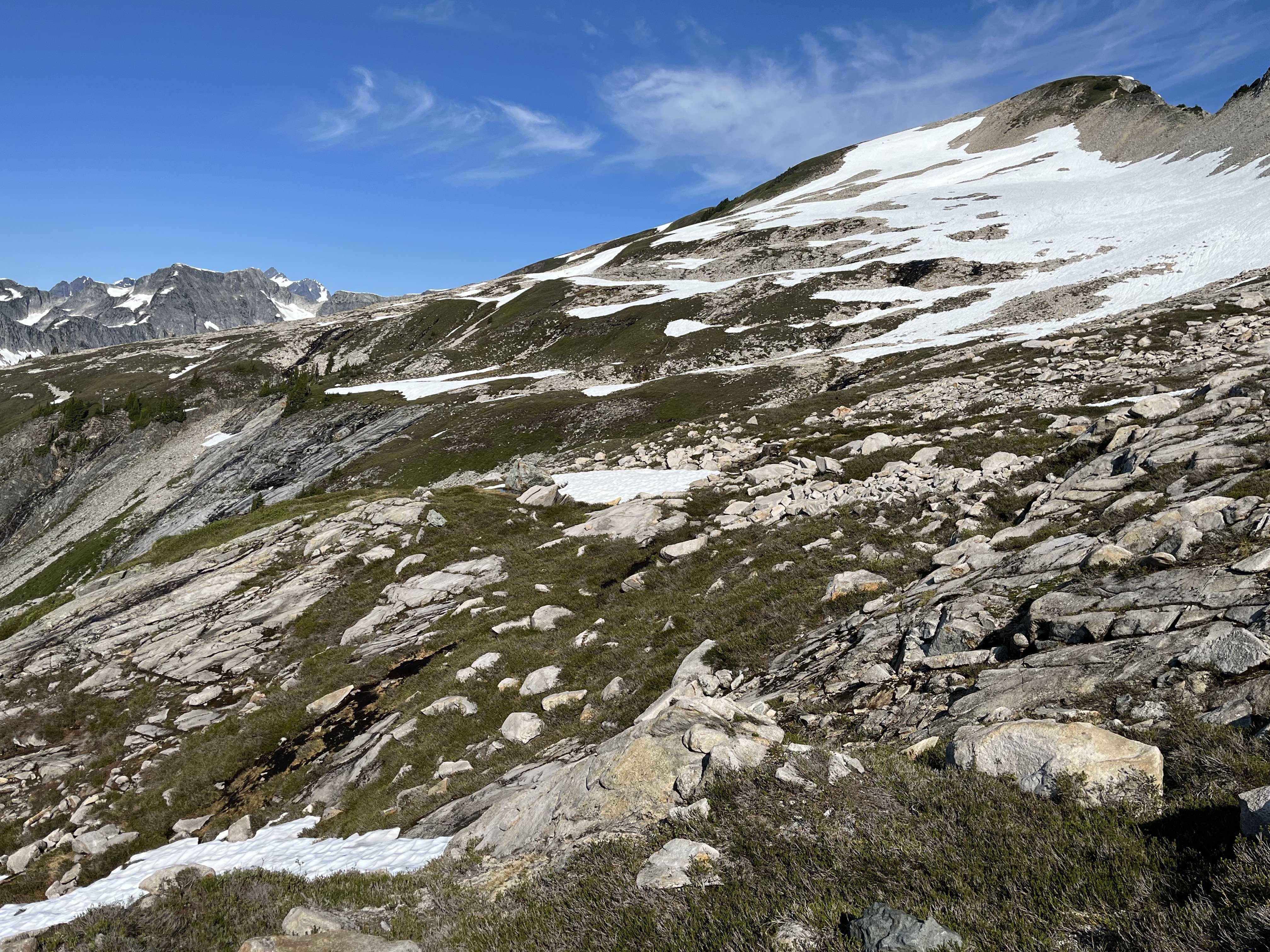
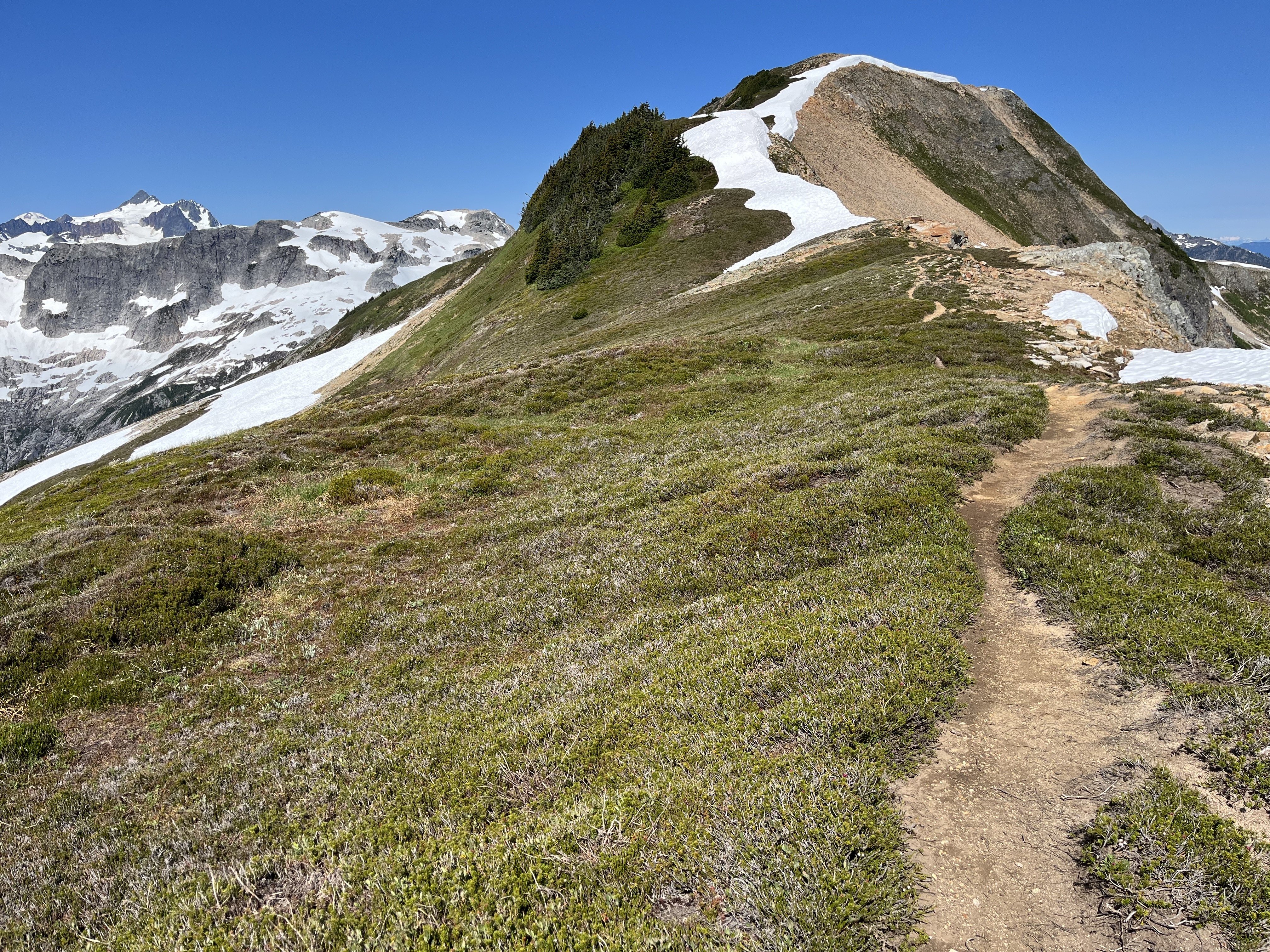
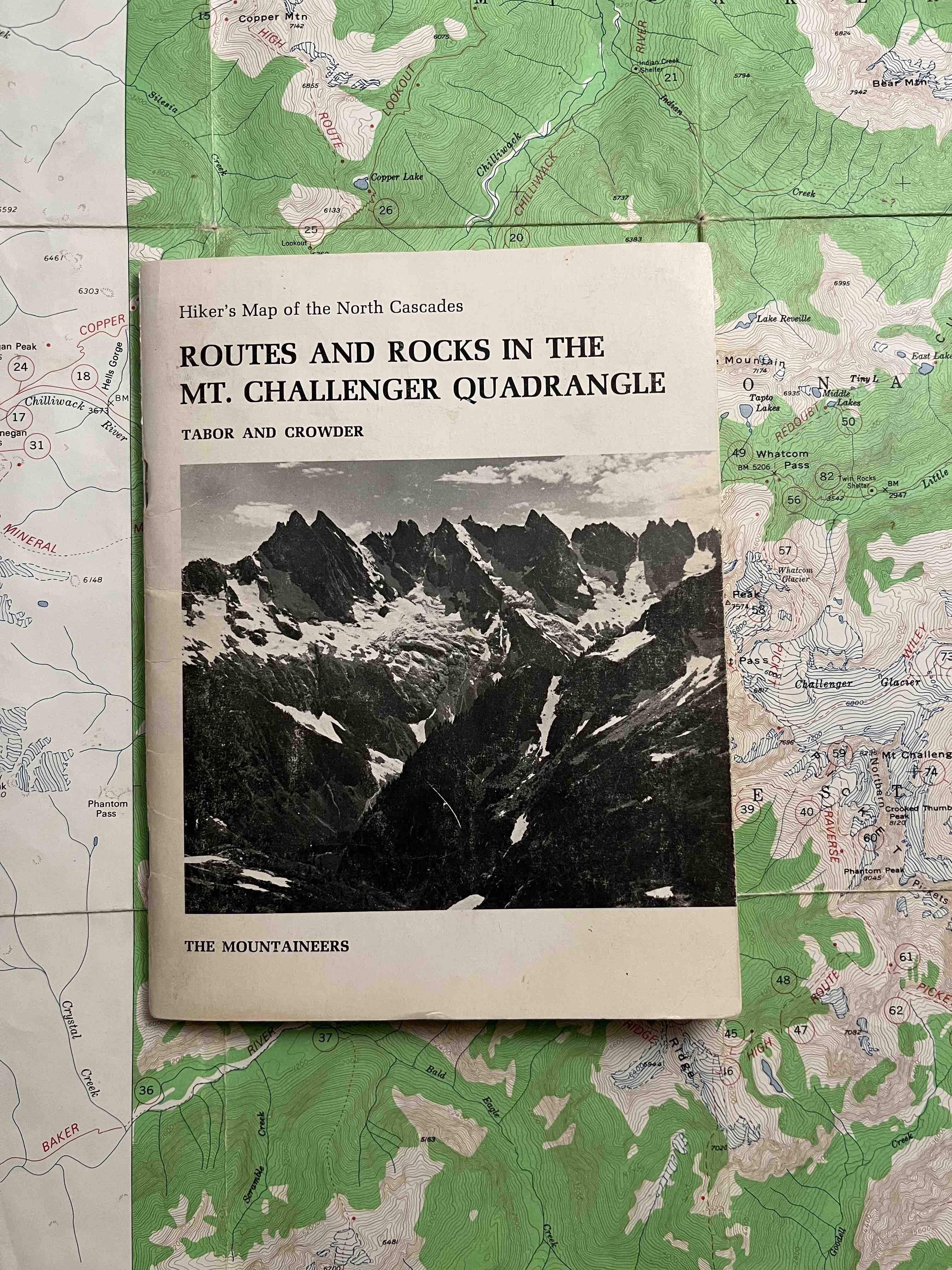
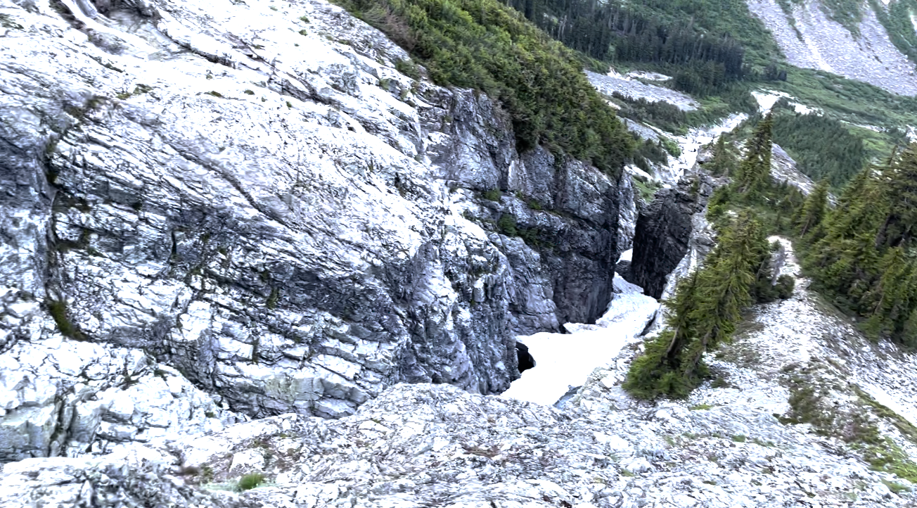
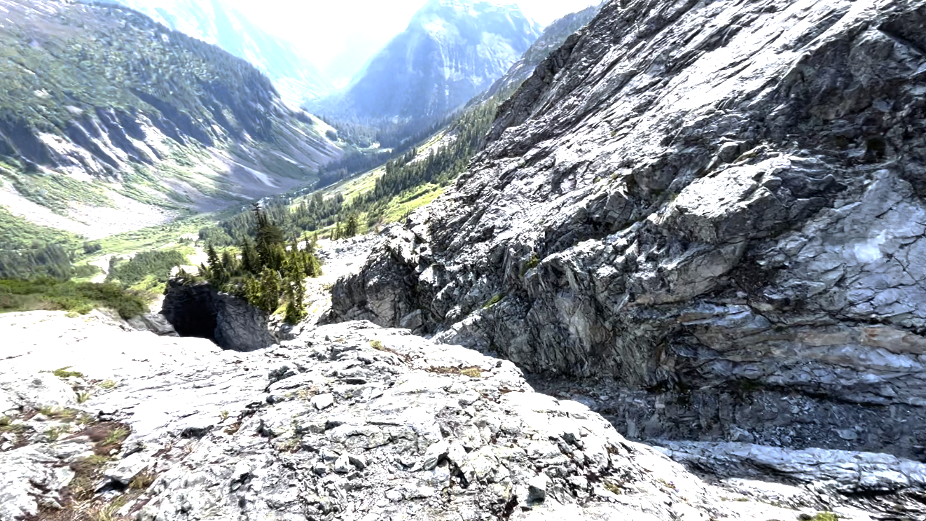
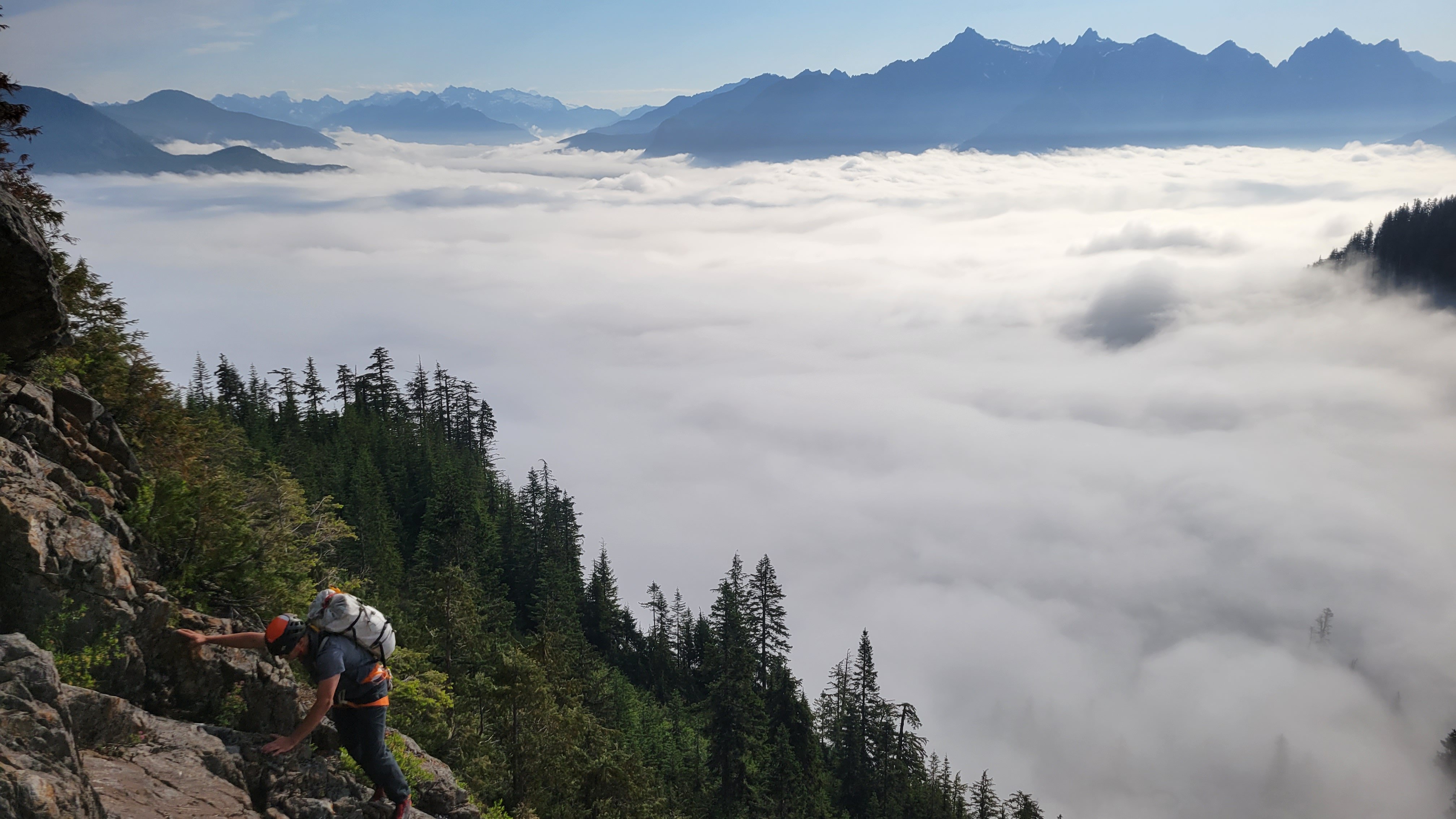
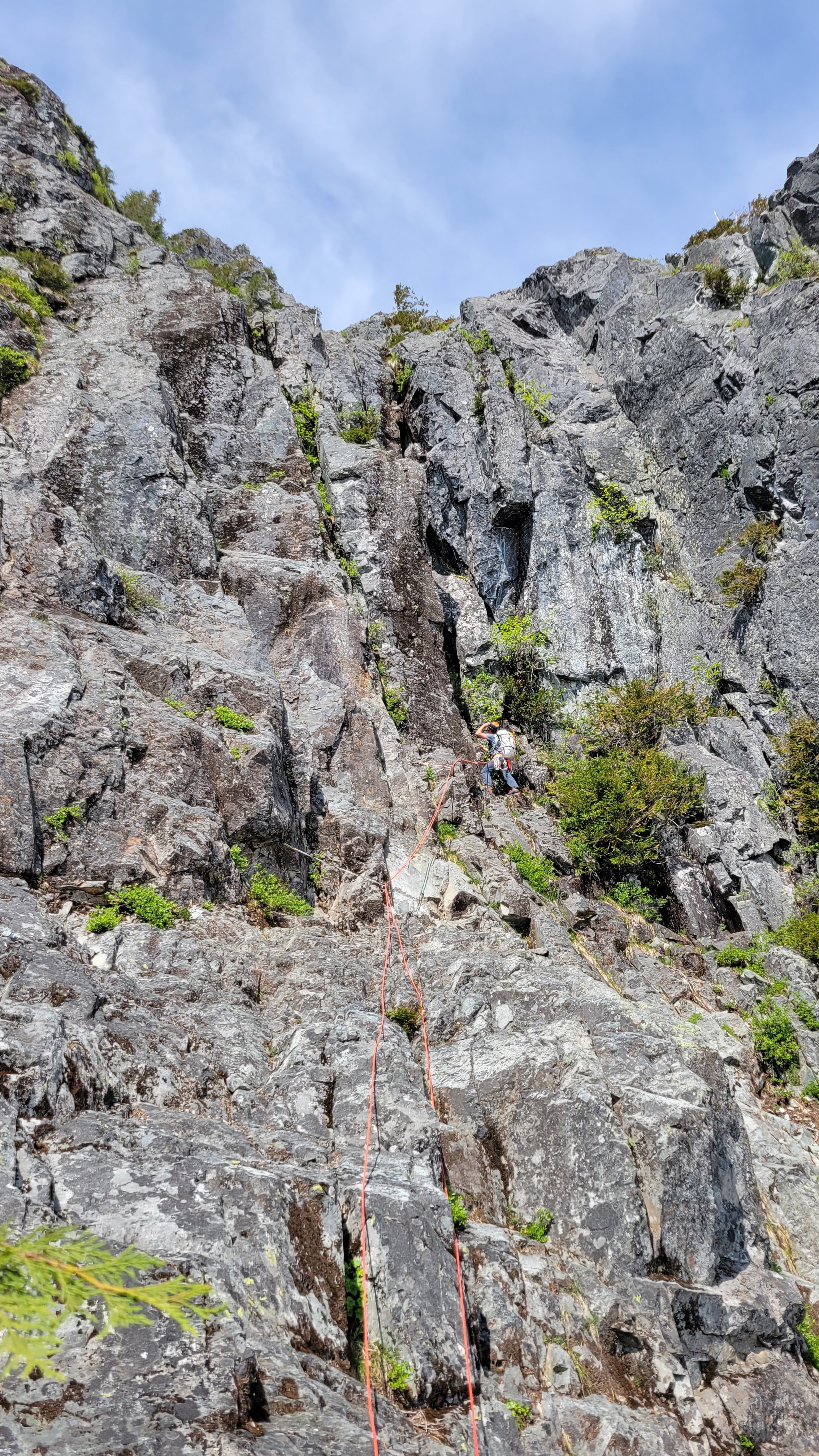
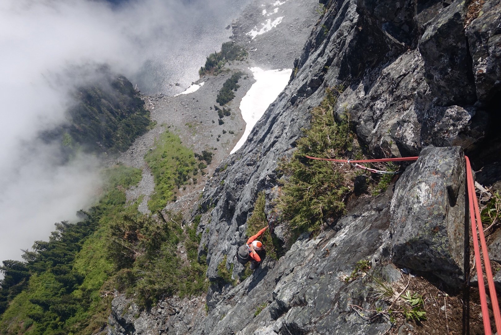
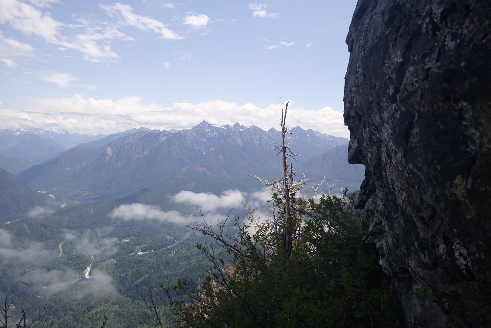
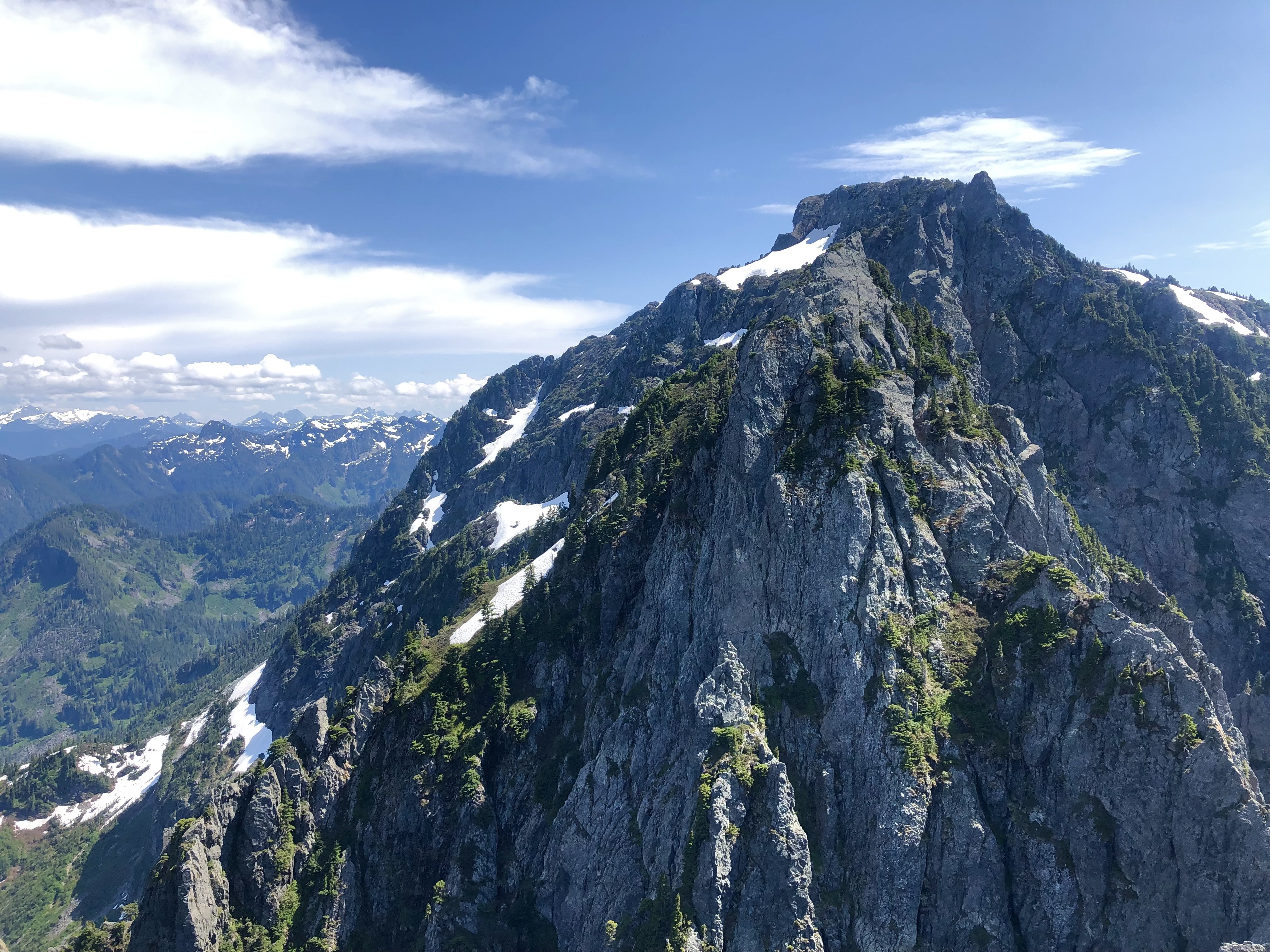
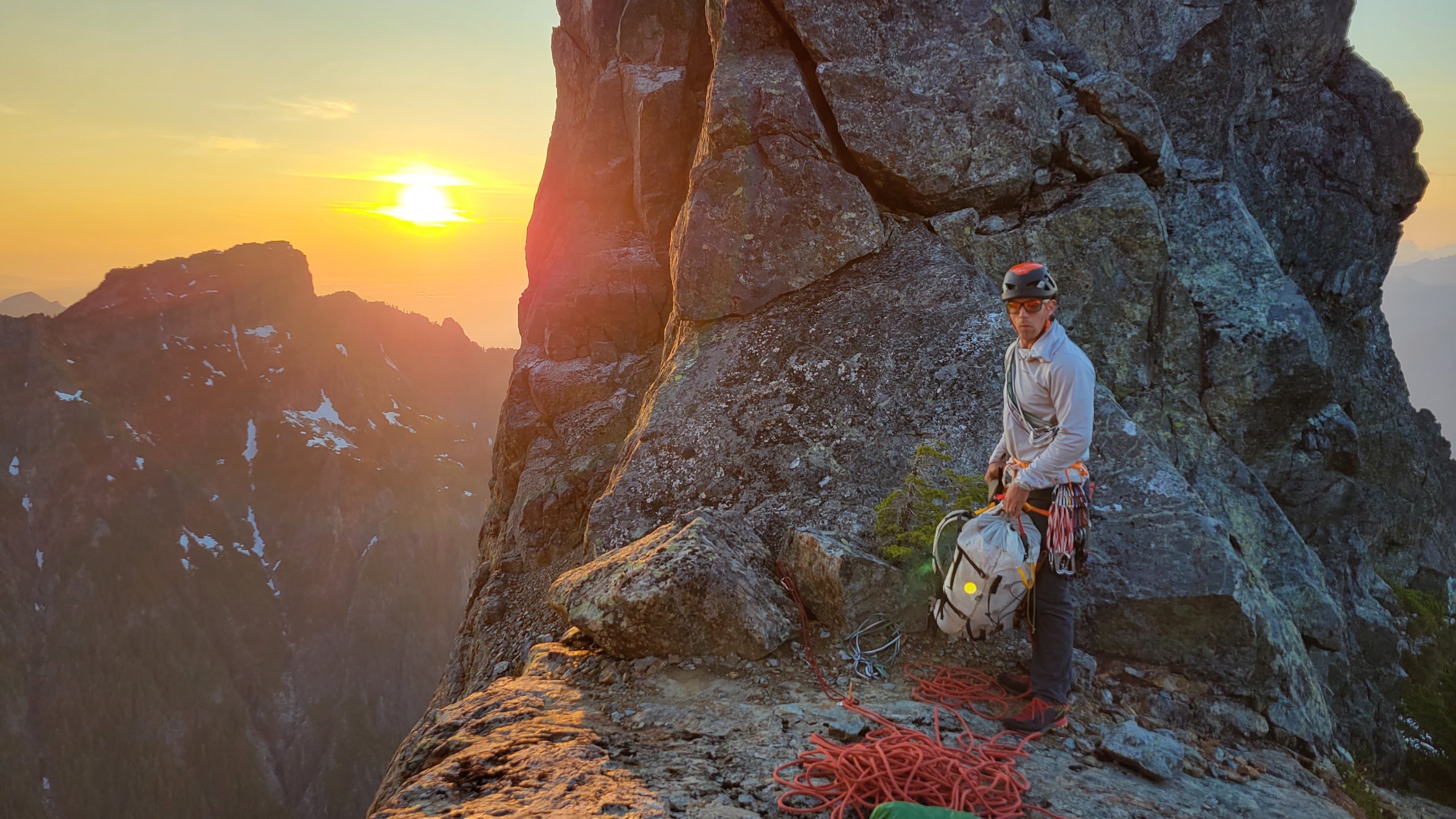
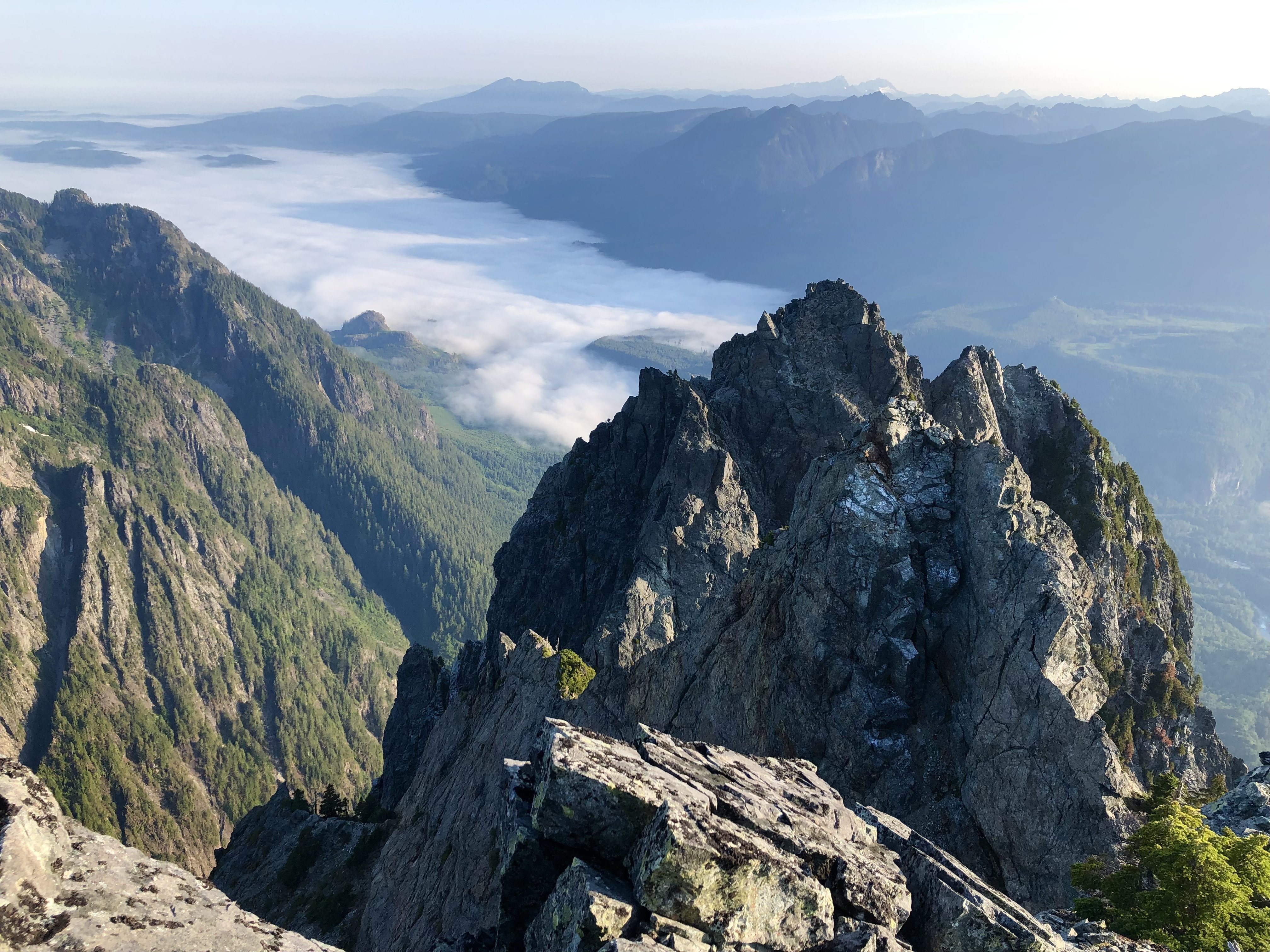
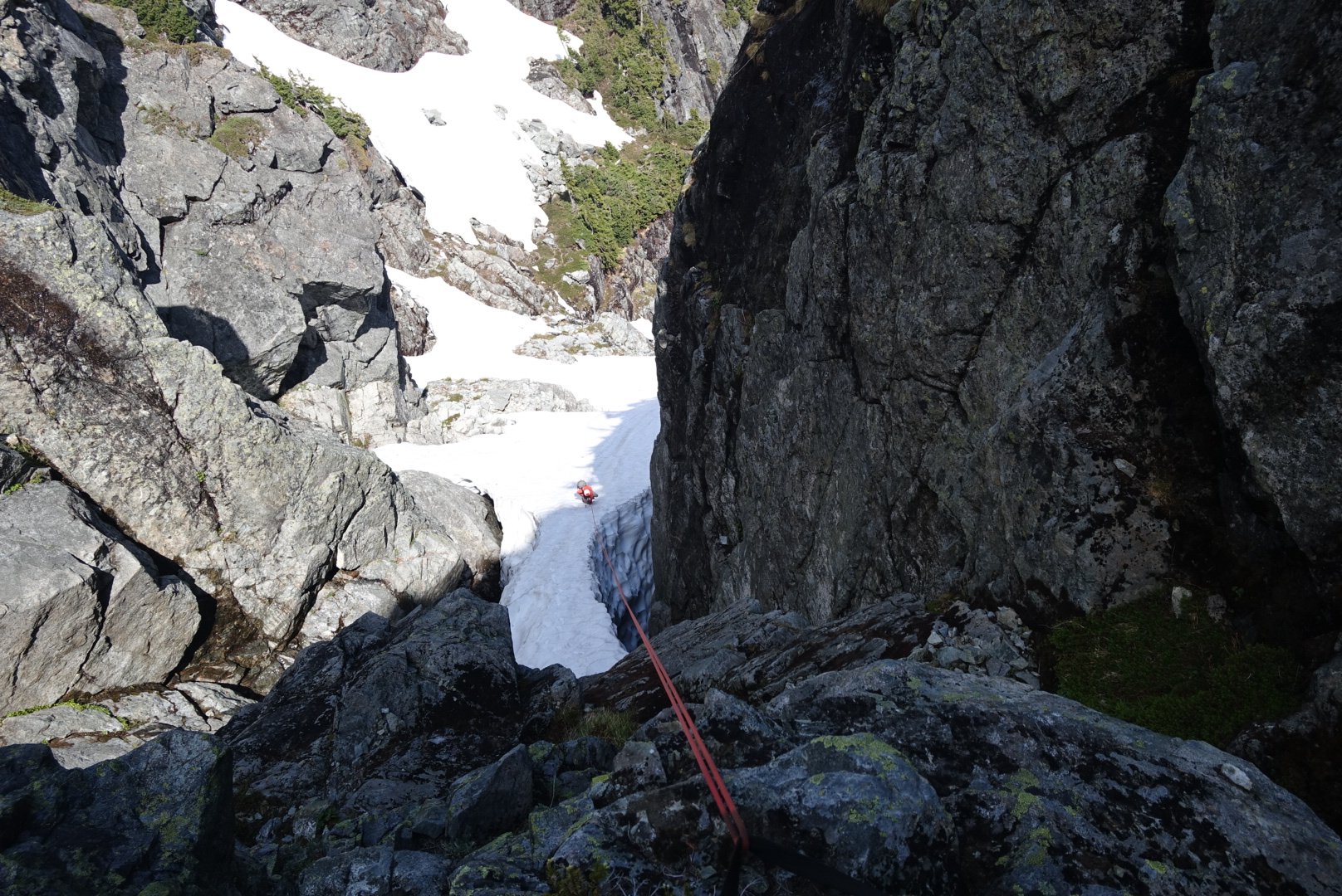
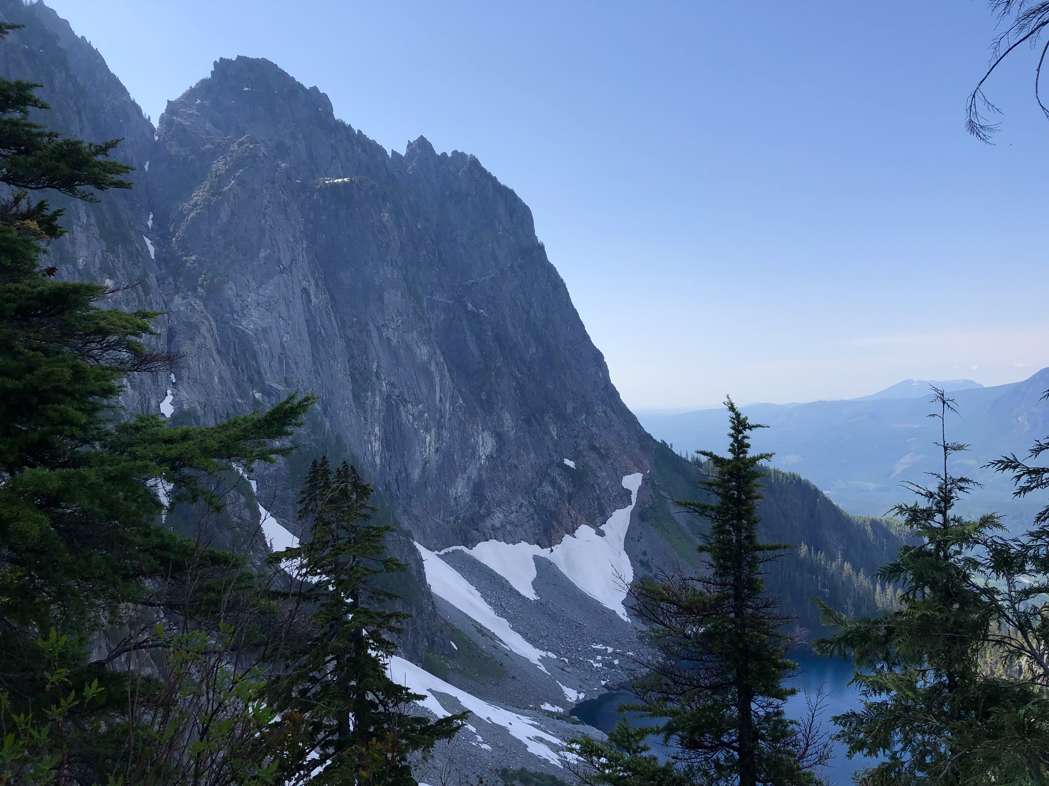
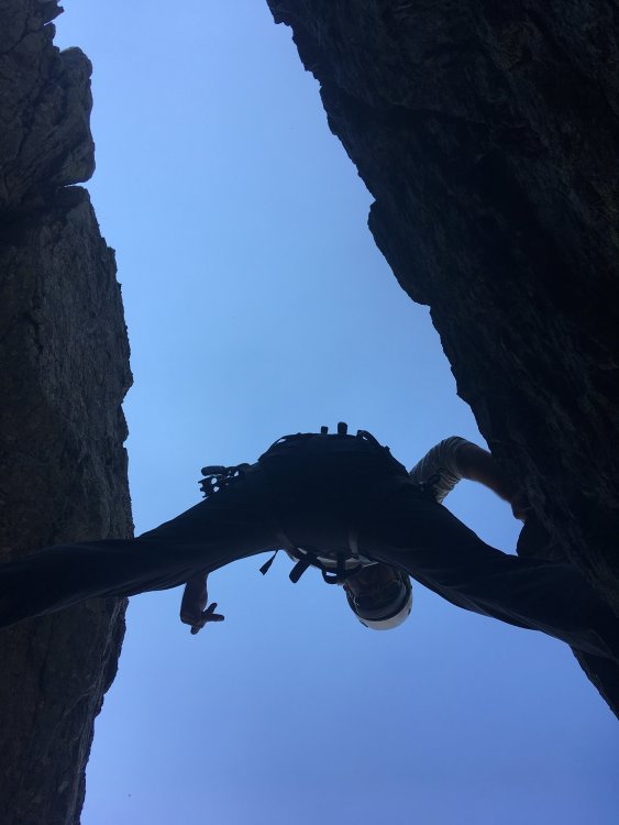
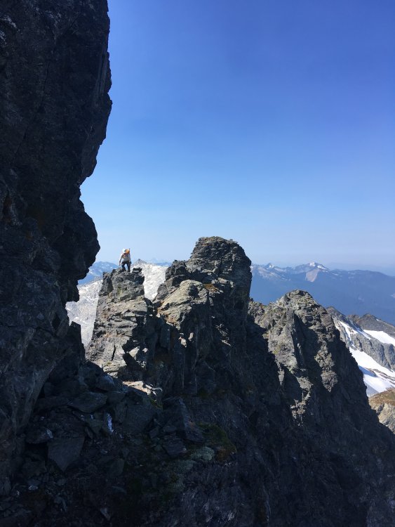
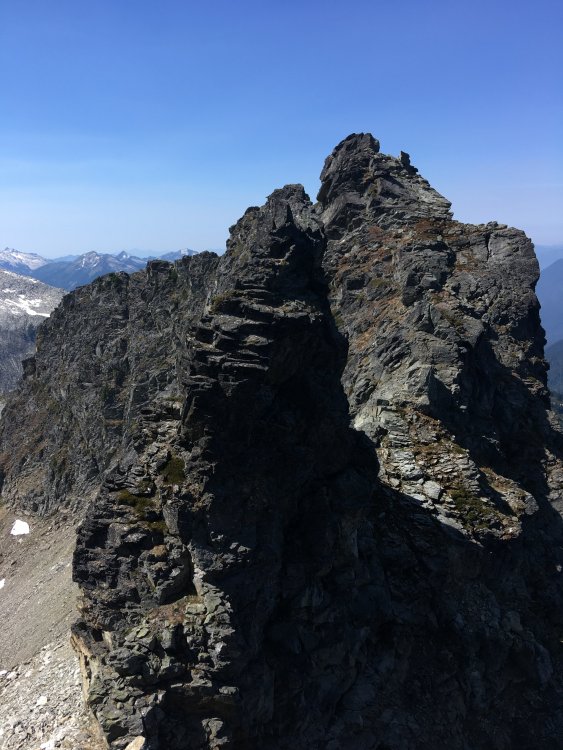
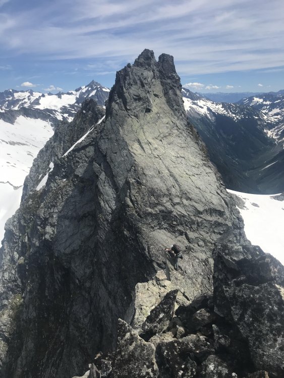
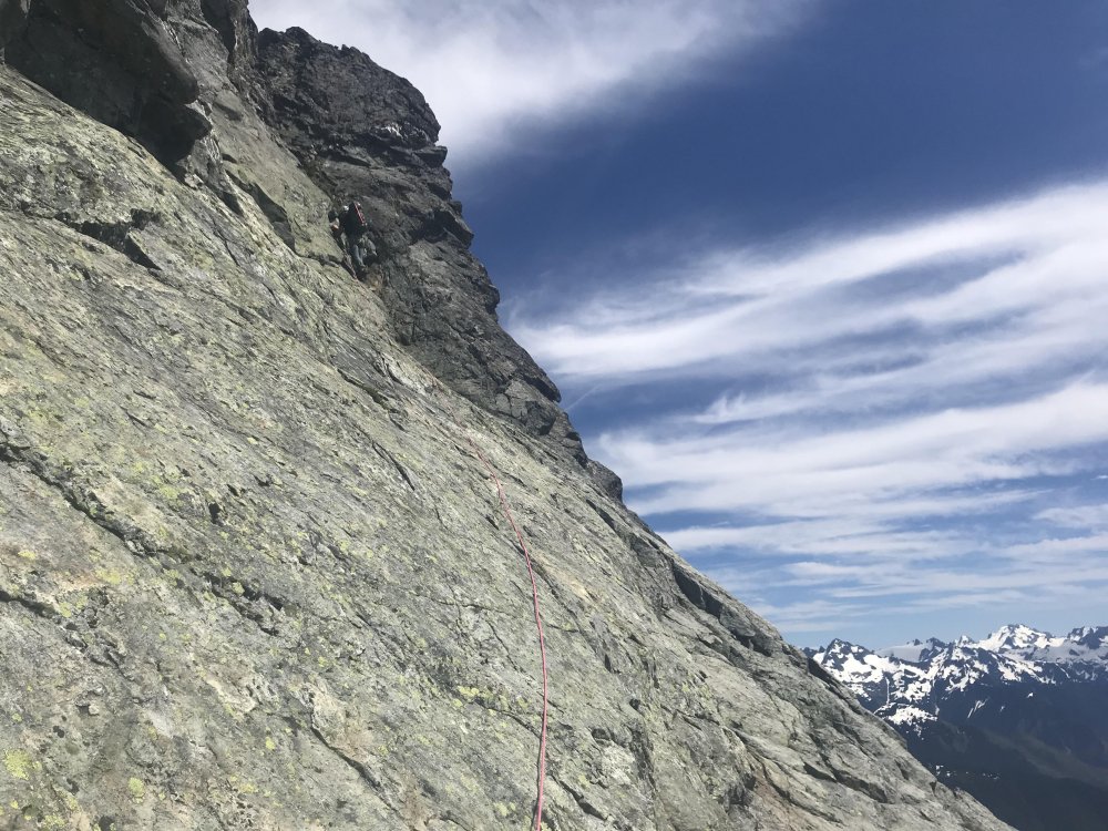
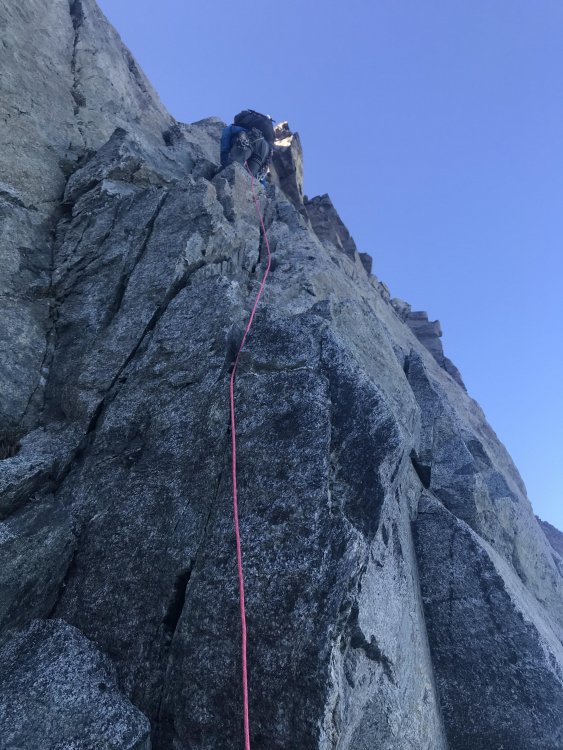
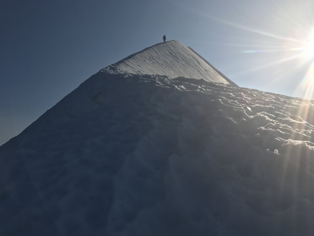
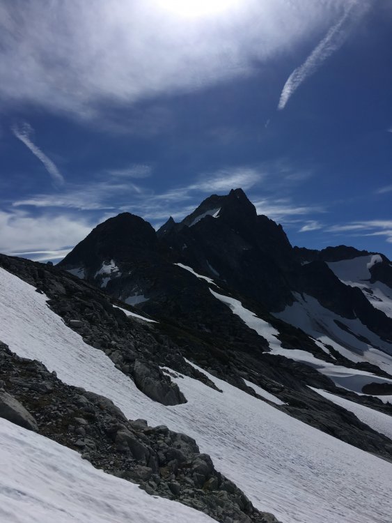
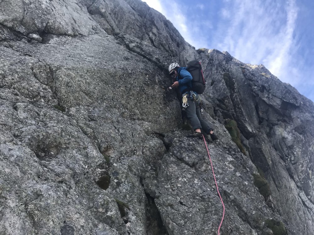
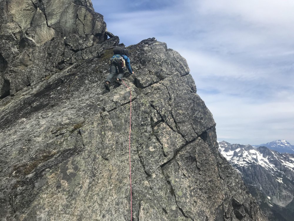
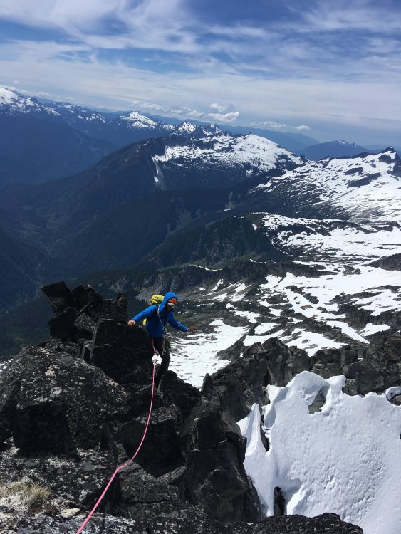
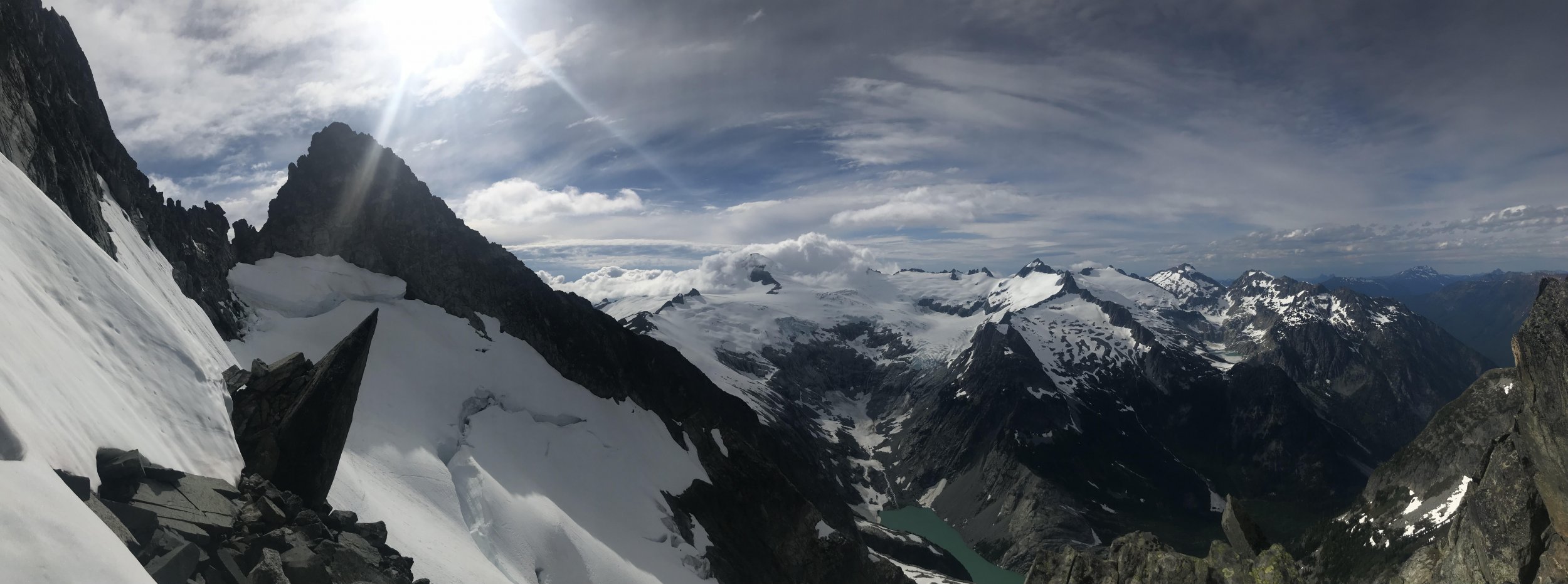
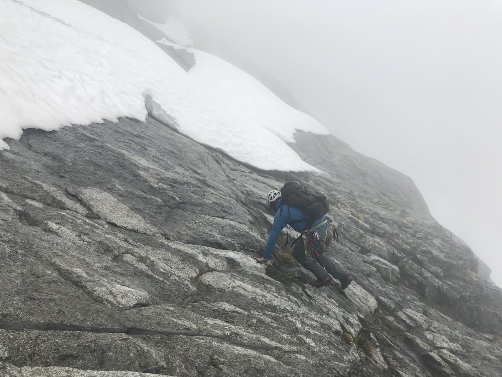
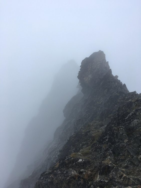
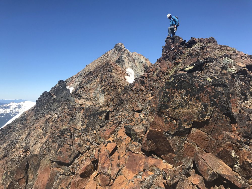
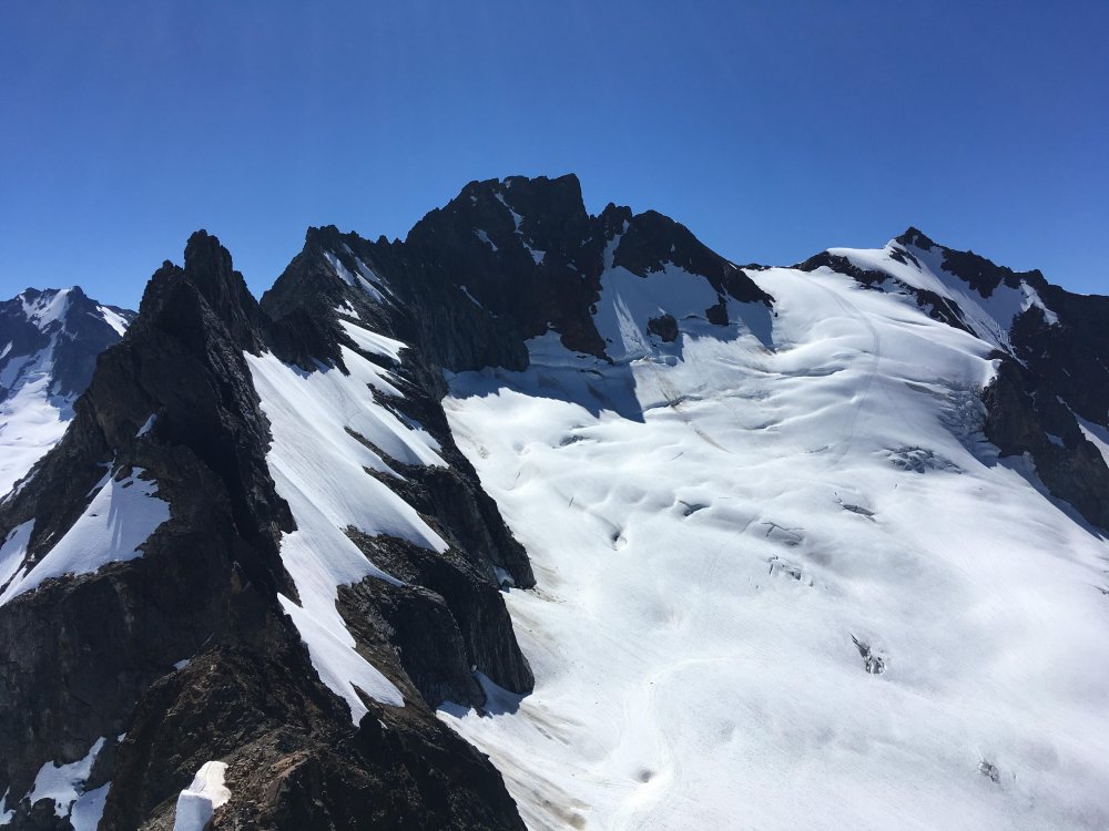
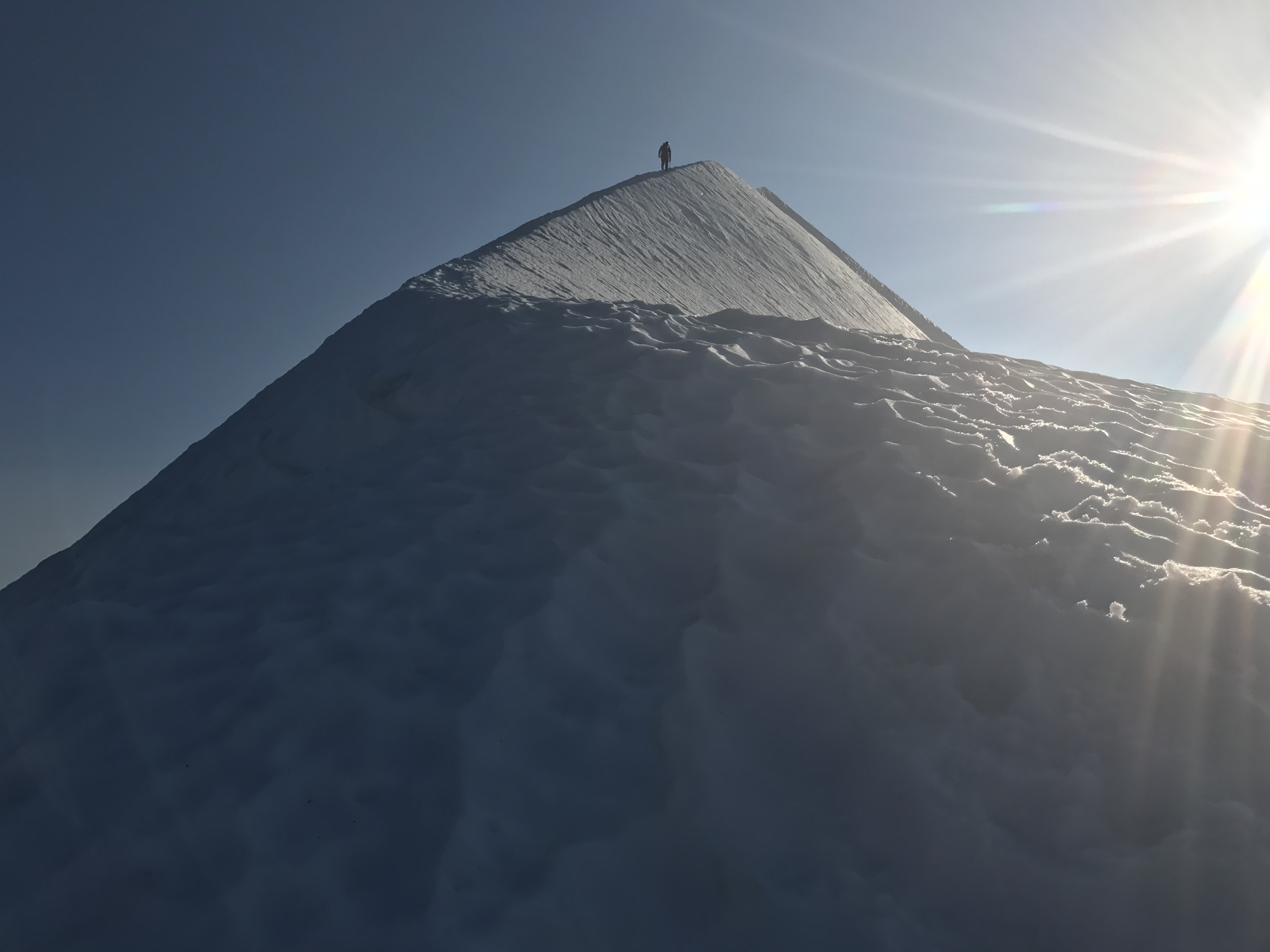
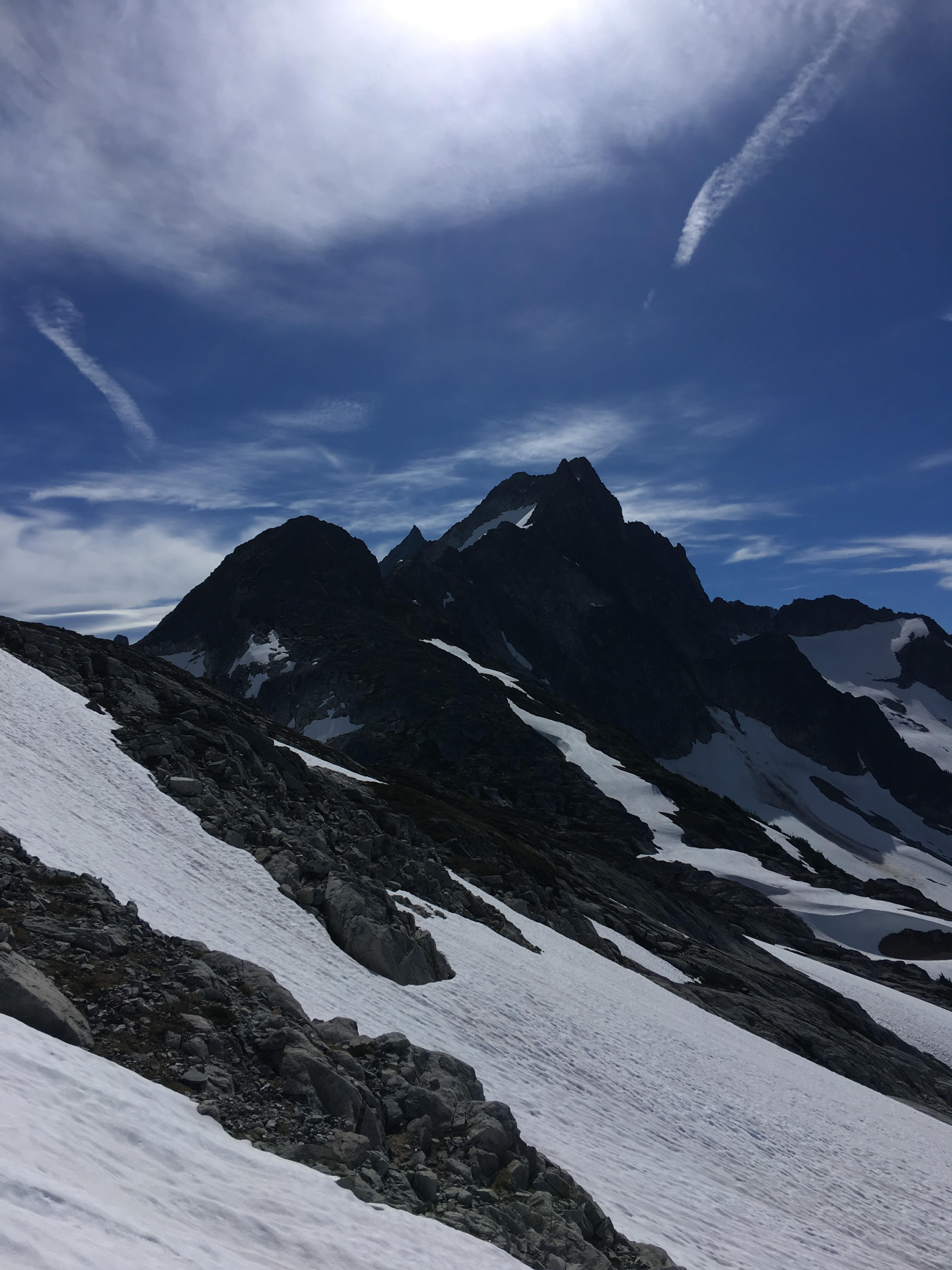
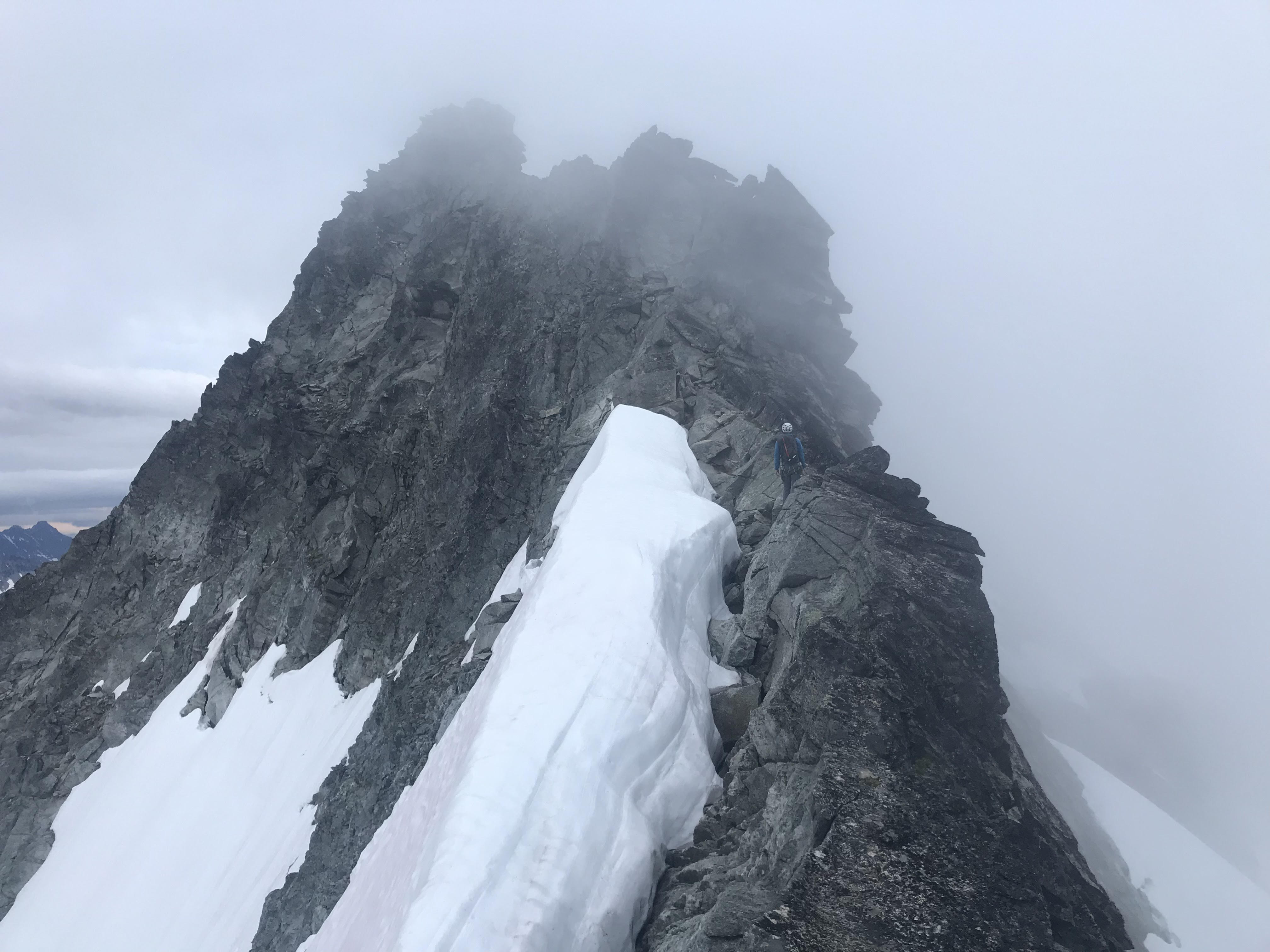
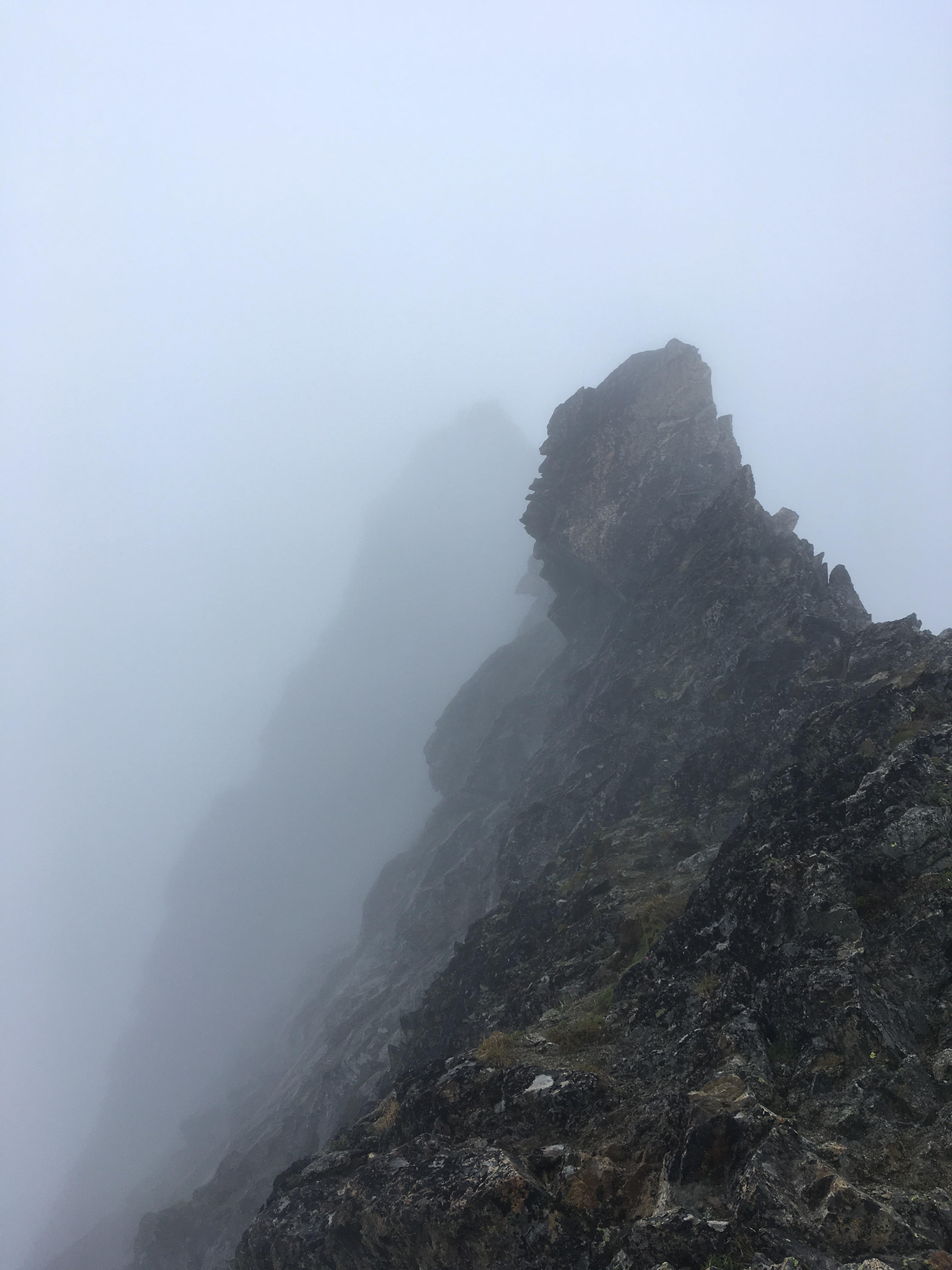
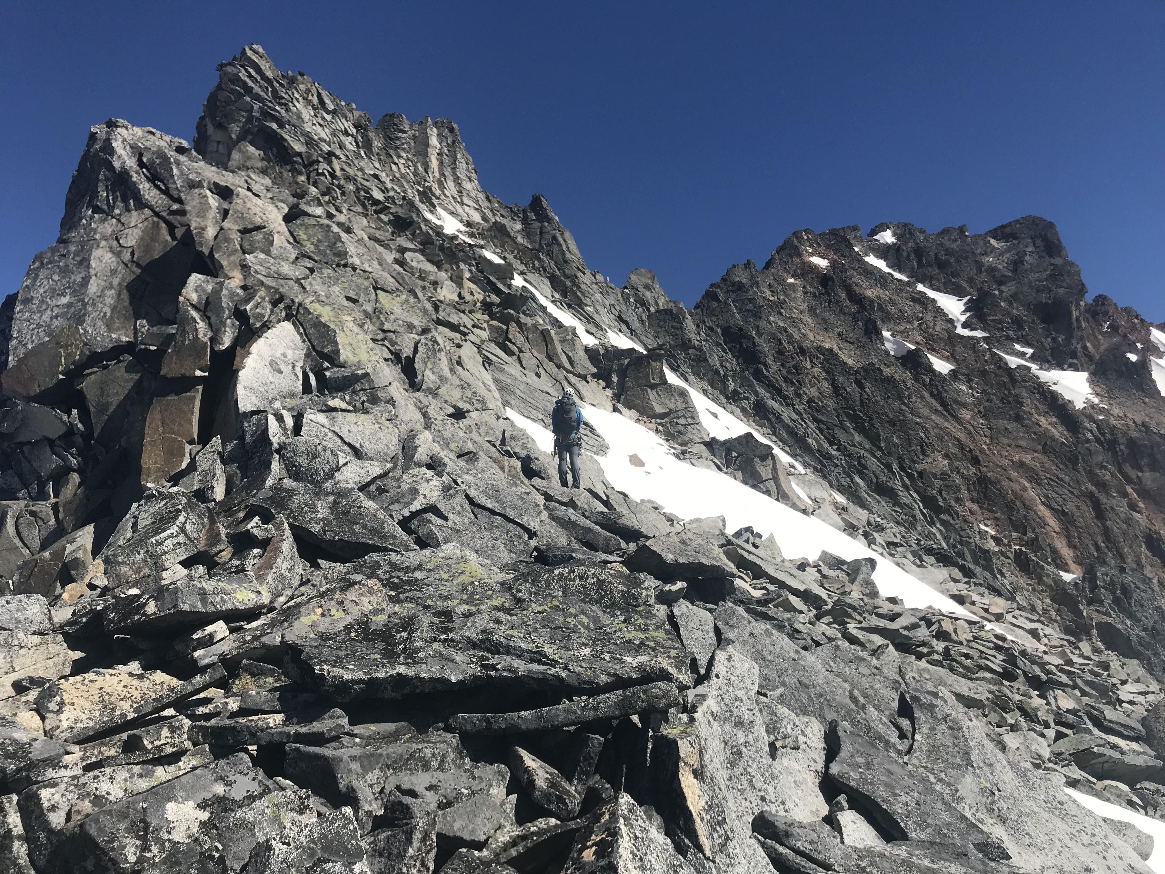
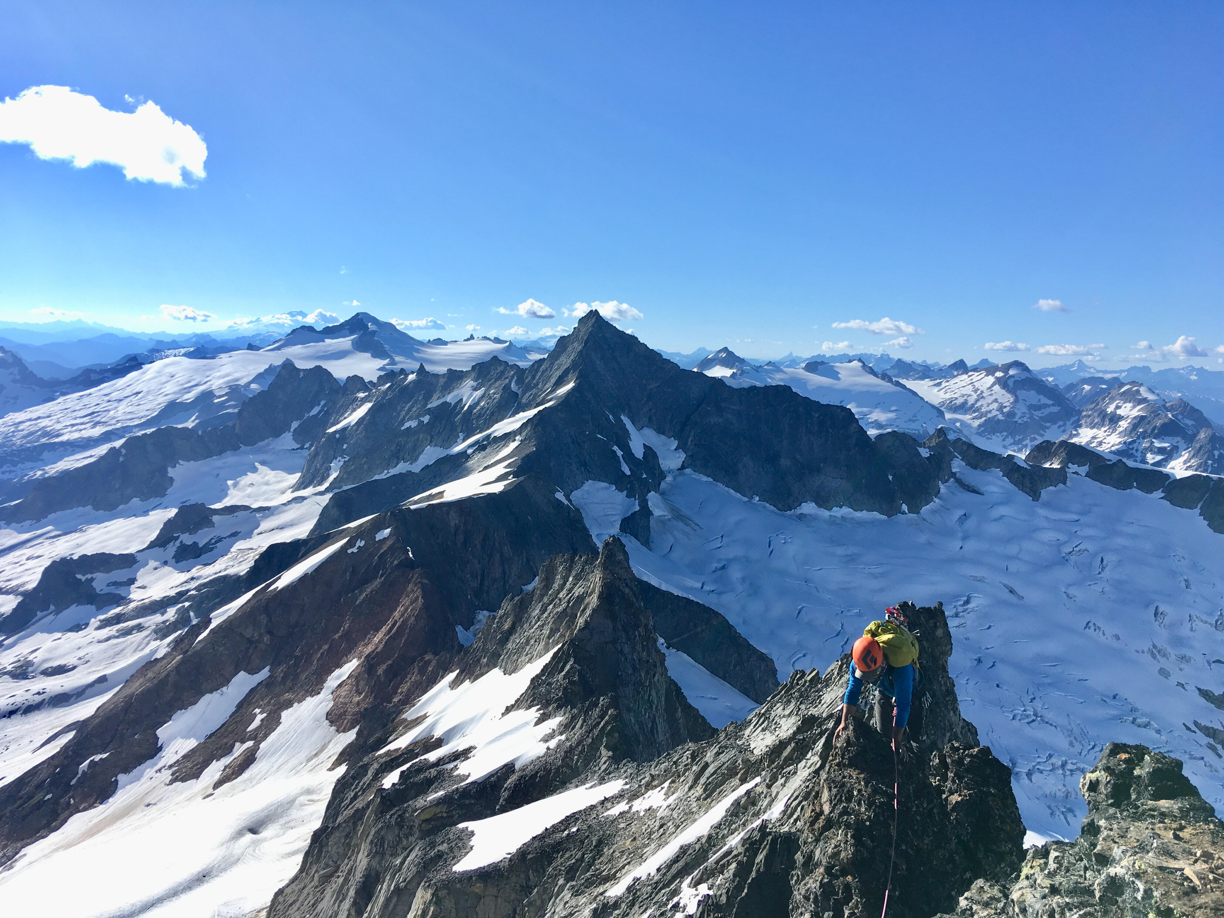
Trip: North Cascades NP - Mt Challenger via Easy Ridge High Route Trip Date: 06/30/2023 Trip Report: Over a period of four days, I solo climbed Mt Challenger, approaching from the Easy Ridge High Route. Three years ago, I clambered up to Tapto Lakes and was awestruck by the sight of Mt Challenger. I have always wanted to climb it since. In climbing Challenger, I had to use almost everything in my backcountry and climbing toolkit. The trip felt like a culmination of all the outdoor skills I have learned so far. Day 1 Permits I arrived at the Glacier service center at around 3pm. According to the ranger, I would be the first person to make my way up to Perfect Pass this season. As I explained my itinerary and possible goal of climbing Mt Challenger, he became even more excited about the trip than I was. In reality, I still felt unsure if I would actually make it up there, so I didn’t want to hype myself up too much. There would be so many factors standing in my way: the river crossing, the route-finding and bushwacking, the infamous impasse, and ultimately the glacier conditions. I sheepishly told the ranger I would be happy just to make it up to Perfect Pass. Hannegan to Copper Creek It took me about 3 hours to reach camp. This would be my fifth time hiking Hannegan Pass so I was in familiar territory. When I arrived at Copper Creek, I met a ranger camped out on the over side of the creek. He asked where I was heading next. When I told him I would possibly go up all the way to Mt Challenger, he was stoked (again, even more than I was). Day 2 Crossing the Chilliwack The next morning I broke camp at around 5:30 am and made my journey up to Easy Ridge. The Chilliwack river crossing was not as bad as I had thought. I found a short, shallow section to cross, the water only coming up to my ankles. My crocs definitely came in handy here. There really was no trail once I reached the other side of the river. Eventually, I linked up with the trail by going in the general direction of Easy Creek (listen for it) and upwards to Easy Ridge. For the most part, the trail was straightforward and never too steep. Other than maybe the first section, I would not really consider it bushwacking (that would come later). The overgrowth was all just blueberry bushes anyways, not nasty things like devil’s club. Easy Ridge Eventually the ground got rockier and the trees became shorter and fewer. The trail flattened into a meadow dotted with pools of melted snow. I had reached Easy Ridge. Further along, I was finally able to see sweeping views on all sides. To the left, I sighted Red Face mountain and knew Tapto Lakes was nested in the cirque hidden below it. To the front, I got my first view of Mt Challenger and was already plotting my route across the glacier. For the most part, the Easy Ridge trail was indeed easy but there were still some notable obstacles. Snowfields still clung onto parts of the trail. In one section, I had to take out my ax and change into my boots and crampons to manage a steep snow traverse. A slip here would have resulted in tumbling down hundreds of feet down into the valley. There was also an unexpected scramble up loose rock and scree right before reaching Easy Peak. The Nearly Perfect Impass As I reached a snow covered saddle near the end of the ridge, I knew I had to descend into the valley and then confront the infamous Perfect Impass. My descent was in steep snow. Looking back now, I should have descended earlier before the saddle, which would’ve made the descent gentler and snow-free. While descending, I also wasn’t sure the exact location of Perfect Impass. I kept thinking it was sooner than it actually was. As a result, I maintained my elevation and refused to descend even more like I should have. My route was harder and full of scree by not descending properly. You can’t miss Perfect Impass. It cleaves the valley in two and literally stops you in your tracks. When I finally reached it, I first tried to find a way to bypass it lower down, but halfway up the chasm were unstable snow bridges. Since I didn’t want to descend the supposed 1000’ to circumvent the impasse, the only other way was higher up. I don’t remember the exact movements but roughly speaking I climbed high, down climbed, made an exposed traverse, then down climbed again into the gully. From there it was an easy climb out where I encountered a rappel station and a cairn marking it. Routes and Rocks In The Mt. Challenger Quadrangle (1968), Tabor and Crowder (East side of Impass looking back) Perfect Pass Now, I had to descend even further and make my way around a buttress. The way was dotted with snowfields, which provided a welcome relief from the heather, scree, and slabs. The snow was still firm and I never punched in.After rounding the buttress, I finally reached a point where I could see the way up to Perfect Pass. For some reason, I did not climb up the heather and dry rock to the left and instead went up wet slabs scabbed with slippery lichen. All the slipperiness made for a slow climb up to the pass. I finally reached Perfect Pass at around 8:00 pm and set-up camp, trying to get to sleep as quickly as possible for tomorrow’s summit day. Day 3 Challenger Glacier Next morning, I woke up a little late at 5:30 am. After an hour-long breakfast of ramen, I lazily made my way across the Challenger Glacier, easily avoiding the obvious crevasses. The snow was firm and gave good traction. Partway across, I encountered a steep ramp that gave more direct access to the Challenger Arm. I decided to take this supposed shortcut, but after climbing three-fourths of the way up, I encountered a huge bergschrund blocking my way. I was pretty dispirited at this point and even considered turning back. There was no quick way around the bergschrund so I had to downclimb and continue traversing the glacier to the lateral moraine on the leftmost part of the arm. I carefully downclimbed, trying not to think of the crevasses below. As I continued my way to the arm, mist started spiraling out from Luna Basin. I thought it would subside, but soon it crested even higher, blotting out the sun. Wave after wave, the mist now rolled onto parts of the glacier arm. When I finally reached the arm, I saw that the steepest part of the climb was ahead of me. At first, I could crossover step my way up. Eventually, I had to high dagger up the slope. Moraines gave me good spots to rest and calm my nerves. Once on top of the arm, I saw that path flattened out to a mild snow ramp up to the summit blocks, which was now obscured by waves of mist. When I reached the base of the summit, the mist subsided back into Luna Basin and the summit towers emerged again. Summit Block and Descent In my excitement to get to the summit, I immediately started climbing high. I then realized that I had to downclimb and scramble to the right in order to access the actual summit block. The climb up the summit block didn’t look too bad. I saw several pitons and a stuck cam. For me, the crux was at the second piton. I had to think through where to put my feet and hands, but I got over it in one move. At the summit, I could see Baker and thought about how I stood on that summit exactly a week ago. I wondered how difficult it would be to climb Shuksan, its summit pyramid now bare rock. Covered in mist, the Northern Pickets were all still a mystery to me. I took a few more minutes to take it all in. It wasn’t windy and I wasn’t too pressed for time. Since I didn’t feel like downclimbing and had a 30m rope, I rappelled down. There were two rappel stations, one at the summit block and another further down. Two aged cordelettes made up the first and several pieces of webbing made up the second. When I reached the top of the arm again, the mist disappeared from Pickets, and I could finally see the Northern Pickets in all its glory. The way back was largely uneventful–I just followed the same route back. Surprisingly, my bootpack across the glacier had already faded into a faint imprint. It was around 1 pm when I made it back to Perfect Pass. The snow had already started to slush around noon, so I was glad to be off the glacier. When I thought I had finally made it to camp however, I encountered two ptarmigan chicks and their mother guarding the last little hill to my tent. I tried to go around them at first, but apparently the mother felt I was a threat. She lunged at me and herded me down the hill with her mid-air flourishes. I waited a few minutes for her and her chicks to descend down Perfect Pass. When I finally got to camp, I ate some lunch and took a long, several hours rest under the shade of some wind-twisted trees. Imperfect Bypass After getting over Perfect Impass the day before, I vowed not to do such exposed climbing again. I felt I had already tempted my fate several times already, so I wanted to find a way to bypass the impasse lower down. This was a critical mistake. I ended up bushwhacking through dense clumps of trees (or rather they were actually whacking me). I lost my approach shoes and one of my crocs in the process. I was stopped by steep cliffs every time I whacked through. With daylight quickly fading, I gave myself an 8pm stop time. I made one last attempt to find a safe way down but was again blocked by steep cliffs. I was frustrated that I lost several hours wasting so much energy trying to find the bypass. In exhaustion, I decided to just confront Perfect Impass head-on. When I reached it, it was nearing 8 pm so I thought the safest way would be to tackle the impasse after a night’s rest. I was already tired and didn’t want to be stuck in the gully after sunset. Fortunately, near the rappel station, I found a flat rocky spot and quickly set-up camp, scarfed down some food, and went to sleep. Day 4 Perfect Impass The next morning, I woke up at 5 am and dragged myself to confront the last obstacle of the trip. At the edge of the chasm, I plotted my route. There seemed to be two options: traversing or climbing high. Both options didn’t look safe. Climbing high seemed safer, but I couldn’t see what the downclimb would be like. I figured I would climb high first and if the descent was too steep, I would downclimb and make the traverse instead. I rappelled down into the gully and climbed a little further down. All sizes of broken rock were strewn all around, which really demonstrated Perfect Impass’s description as a “rotten volcanic dike.” I saw a clear way up from the bottom of the gully. As I climbed, I had to break away loose rock to make extra sure that every hold was stable. The crux for me was a two move dihedral that I had to mantle out of. I sighed with relief when I saw that the descent from the high-route was relatively safe 4th class scrambling. (West side of Impass looking back) Exit It was a long slog in my mountaineering boots back up to and along Easy Ridge, down to the Chilliwack, and up and down again to the Hannegan trailhead. I ended up using up all daylight hours to make my way back. From Perfect Pass, I corrected yesterday’s mistake and descended on the heather ledges located on skier’s right. And instead of steeply ascending onto Easy Ridge, I decided to approach it from a low angle that eventually bisected the ridge. I still could not find any trail as I approached the Chilliwack after descending from Easy Ridge. I crossed the Chilliwack again, but this time only with one croc. Copper Creek Camp, Boundary Camp, Hannegan Pass–I noted each landmark as I passed them. I tried not to think about the distance and time. The wildflowers were a useful distraction but they also slowed me down as I stopped and admired each new variety. The four mile hike from Hannegan pass to the trailhead seemed to take forever. Right after the pass, my energy started flagging. I then unexpectedly met a group of hikers heading to Boundary Camp. One hiker’s sound recording device caught my eye, and we chatted for a bit about recording soundscapes, ambient music, and strategies for creativity. For some reason this encounter renewed my energy and I pressed on. The sun had already set when I was about a mile from the trailhead. The world shifted into a more mystical register. Having hiked this trail many times, I felt like I was walking back through the past. I thought about how each time I passed through here, I was a better hiker and climber than before. Each time, my objectives grew bolder and more challenging. I wondered when I would walk this path again. How would I grow as a climber next time? I arrived at my car around 10 pm. Driving back to Seattle, I saw fireworks were already being set-off the night before The Fourth. Cops were frantically speeding down rural highways. It seemed like I would be returning to civilization on a night of full-moon anarchy. Gear Notes: Mountaineering boots, ice axe, crampons, 30m double rope, crocs, approach shoes Approach Notes: don't underestimate the route-finding challenges you can descend and ascend Easy Ridge on a gentle angle when going up Perfect Pass, stay climbers left on the heather ledges a 30m rope is sufficient for rappelling from summit and into the Perfect Impass Challenger Glacier gets hit with sun right when it rises, so plan accordingly
 2 points
 -
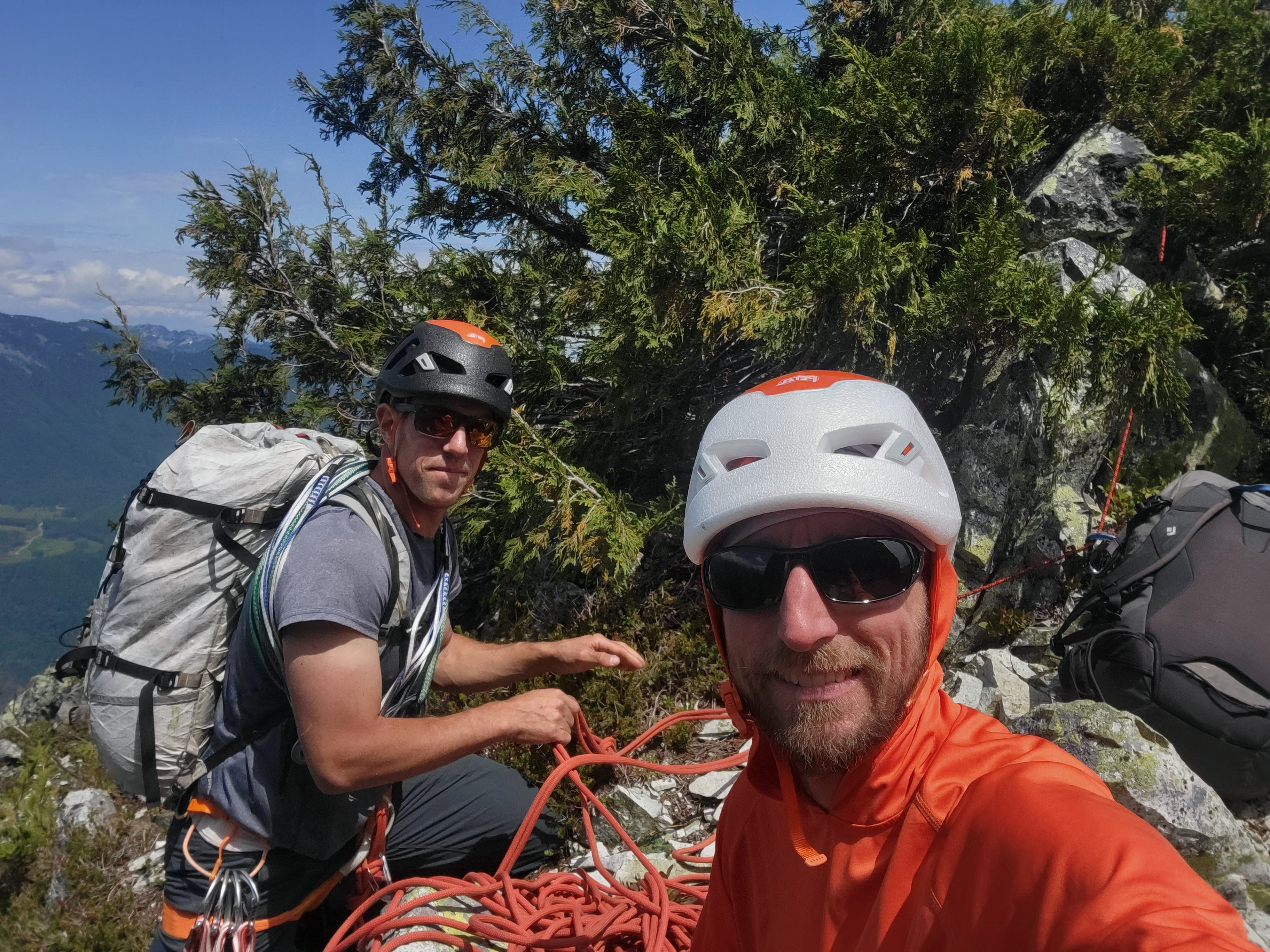
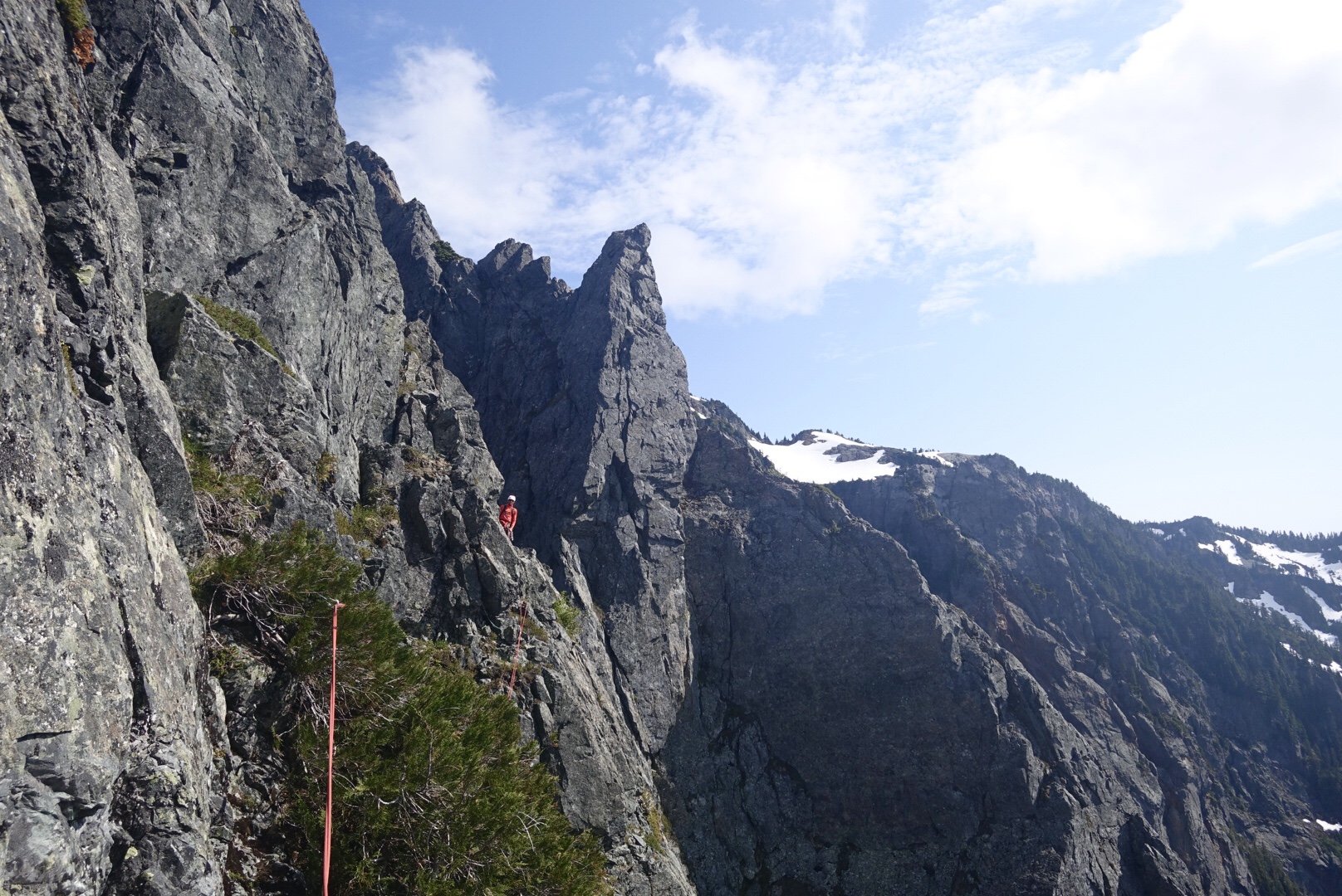
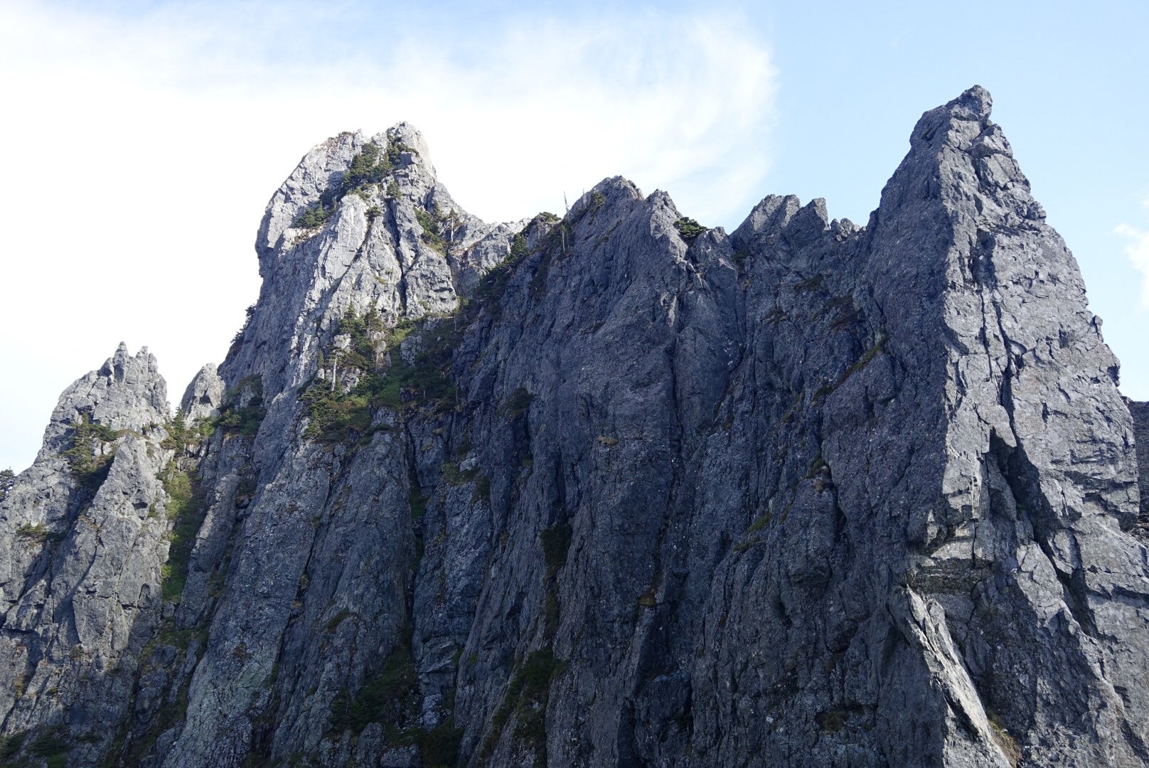
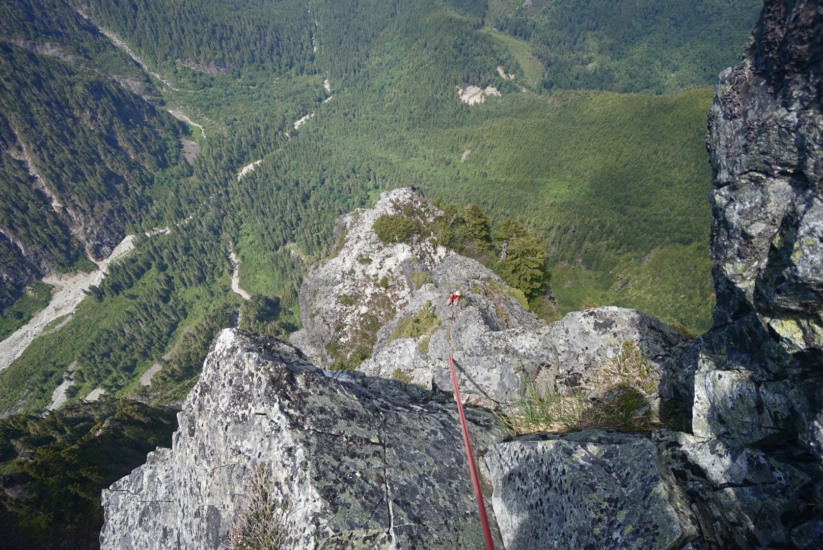
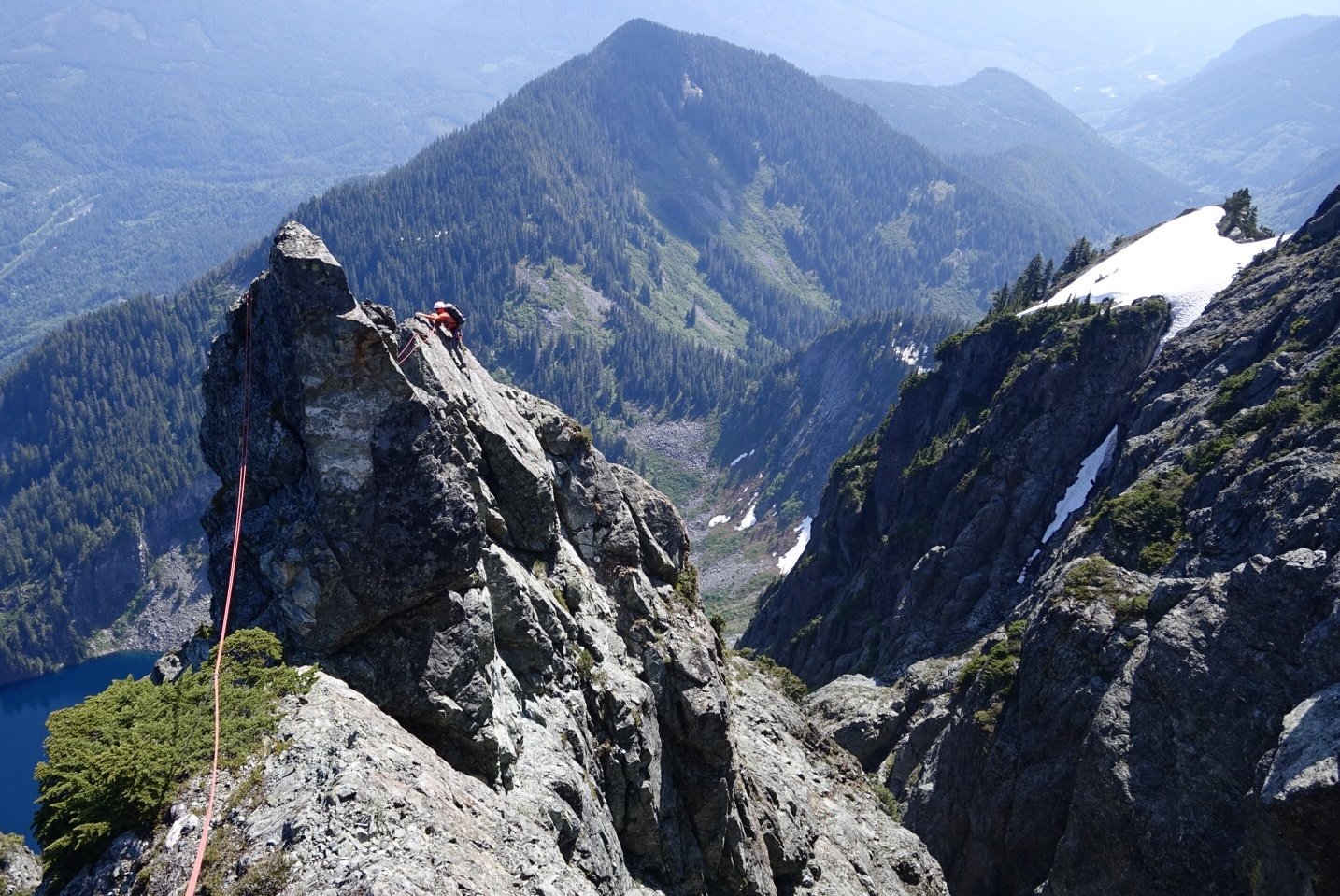
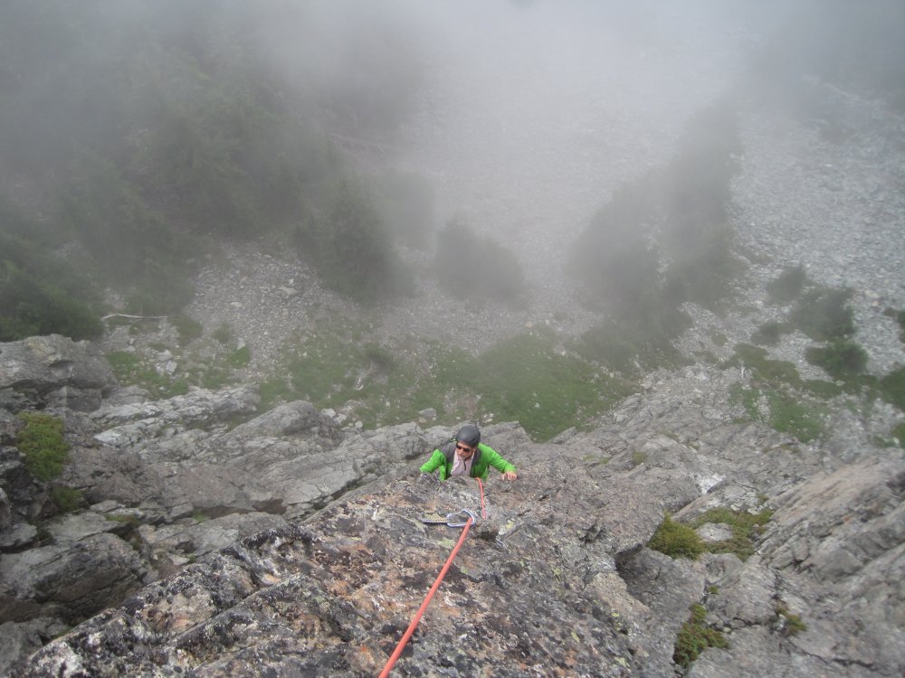
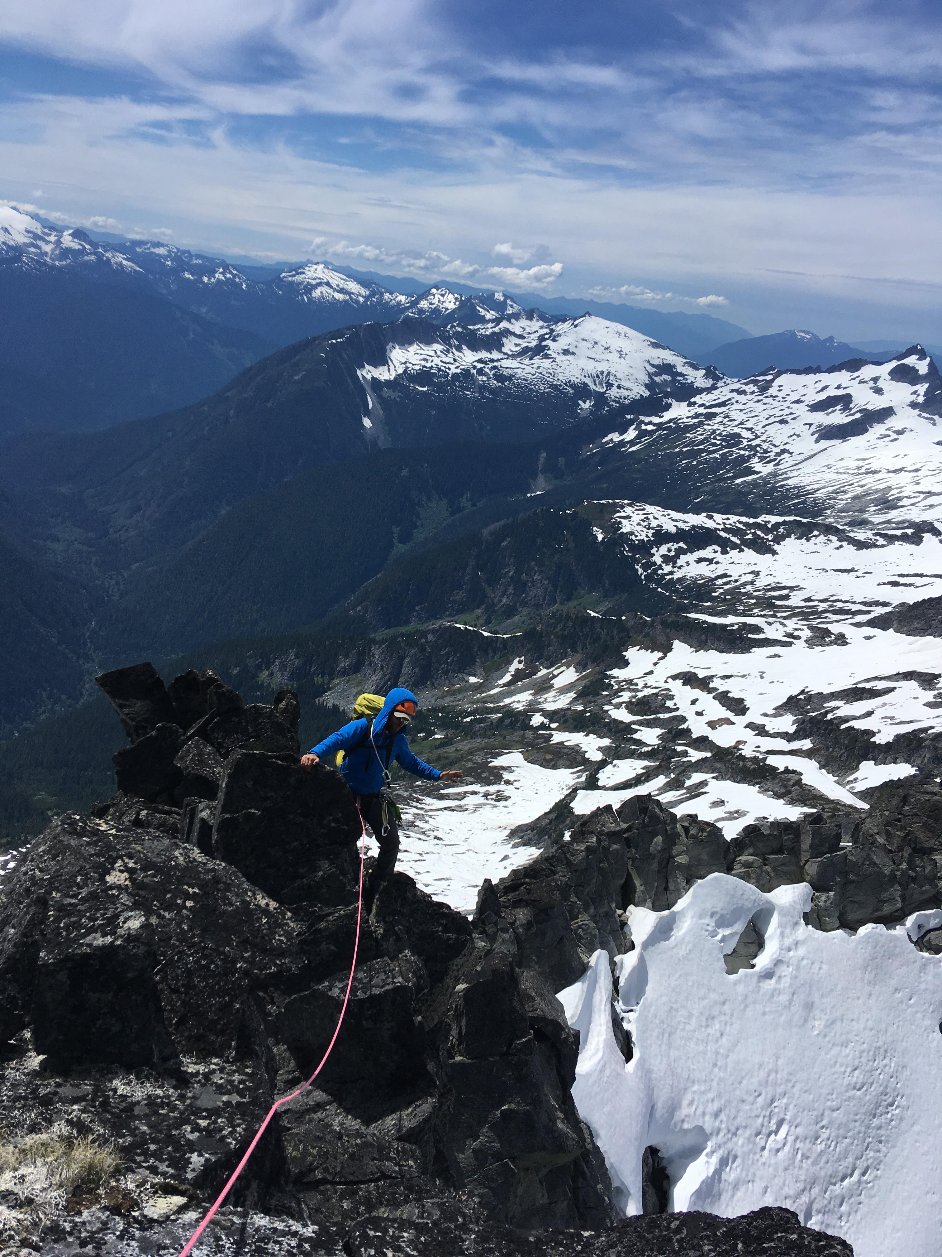
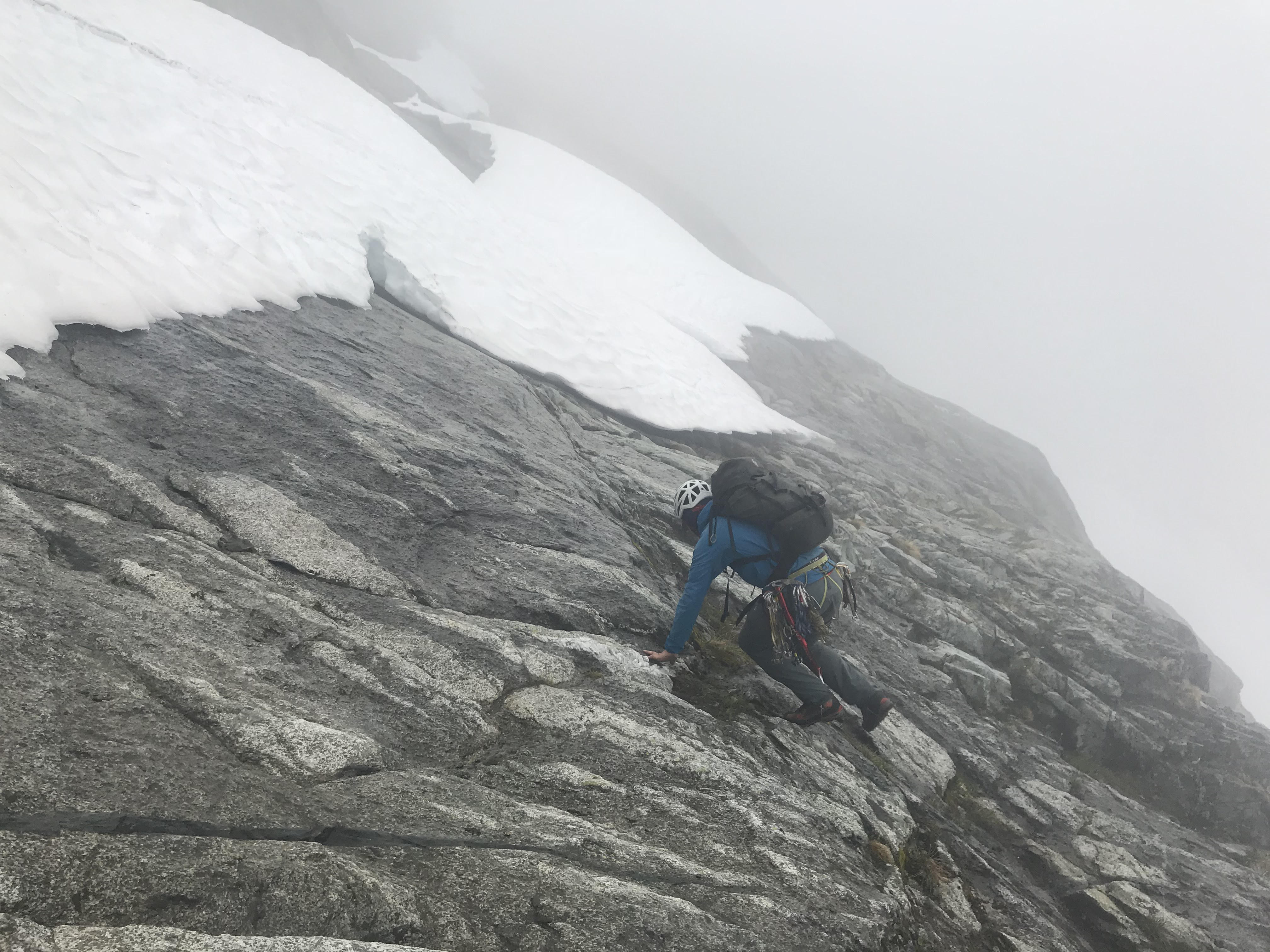
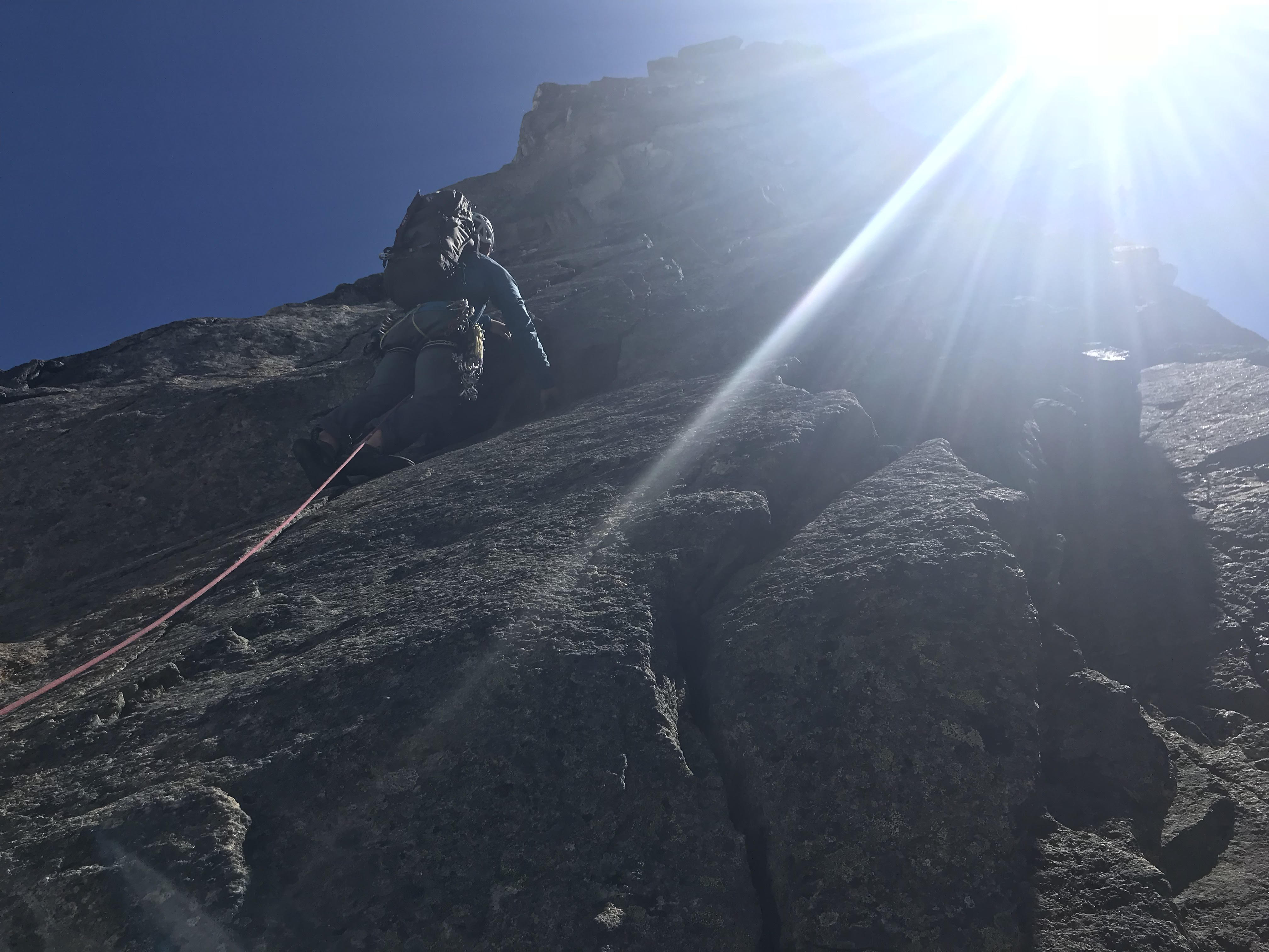
Trip: Mt. Index - Traverse: North, Middle, Main Trip Date: 06/25/2023 Trip Report: This last weekend, 6/24-25, @geosean and I climbed the Index Traverse as an overnight trip. I won't go into great detail or provide heavy beta as I think there is already plenty out there, but I will provide some emphasis on areas where we were briefly stumped. Overall the 2021 and 2014 trip reports on this site are a great resource along with the brown Beckey descriptions. Sean and I originally had loose plans to climb the Price Glacier after getting linked up by @JasonG, but a rainy weekend pushed that back. He had mentioned he had wanted to also do the Index Traverse and asked if I had wanted to do that instead. I said yes definitely as it's something that can sit on the back burner or in your back pocket until you find someone else who is eager to do the same. We met, for the second time ever, at the trailhead that Friday evening and I must not have scared him away because we made plans to get up at 4am and get hiking at 5am. As we planned we got moving around 5am and maybe saw two other people on the trail on the way up to the lake. We made it to the lake around 6:45 and filtered a bit of water to start the day. It was foggy at the lake when we started but soon busted out of the clouds as we ascended the talus field and initial scrambling to start the north face of the north peak. There are mentions in trip reports of a two piece anchor comprised of a nut and a piton and to head left under roof features from there, until you arrive at a dihedral to climb. After that dihedral feature theres a big heavily slung block to cut hard right around a corner to progress to the bowl in the face. We eventually found that nut/pin anchor in what is a sea of bail anchors on the lower north face. What we had done wrong is climbed too far left, not really realizing that we had passed the mentioned dihedral, and had to improvise on an exit pitch. That error left some doubt but we were able to connect back to the bottom of the north bowl after one simul block through heavy, but not insane, brush. Key take away here is when you see a large, maybe 5 gallon bucket sized horn with many slings on it, cut right hard. Our improvised exit was maybe harder than it needed to be but was more heady than strenuous. Some of the features that get described in other trip reports will sound an awful lot like what you are looking at. From there Sean led a big block through the mossy slabs through the bowl like a boss and got us to the notch at the north rib. I led us through the north rib and up through the false summit and then finally the summit of North Index. From there we followed the 2021 trip report's descent beta to the North - Middle Notch. We made the committing raps in to the North - Middle notch and I led the 5.6 chimney out left from the notch. Overall pretty fun and secure climbing. Sean led the simul block to the false summit of Middle Index. We rapped down to the notch between the false summit and true summit of Middle to set up the bivy for the night. There was a large snow patch at the bottom of the rap that got us enough snow for essentially a gallon of water. We stuffed stuff sacks, ziplocks and our actual water containers full of snow and did a roped up scramble to the bivy ledge trough steep heather and trees around 8:45pm. The bivy spot has great views and is pretty cush compared to the terrain along the traverse. I didn't sleep super well but boy what a treat it was to be able to lay down for hours on a route where sitting can be a novelty. We got up the next morning and started moving around 6:15 and got to the true summit of Middle Index shortly after. We followed the 2021 descent description as close as we could but there are lot of left's and right's, east's and west's to keep track of in that description so read carefully. We couldn't find a rap anchor into the Middle - Main notch so we made our own with a big broad horn with a huge loop of orange tat. Sean got us to the other side of the notch up and to the left of the pinnacle in the middle of the notch. I led the 5.3 pitch out of the notch to a big comfy tree belay spot and soon led a few simul blocks, mostly due to the zig zag nature of the ridge, to the wedge gendarme. From there Sean took over and got us to the red dike through the north face of Main Index. We did a rap hard west to the other side of the dike and set up and anchor to simul to the notch. From the notch we maybe crossed 2 or so gullies until we ascended a broad heather gully. I must have stepped on a moss patch just right because out came a cantelope sized rock tumbling at Sean. He stopped it with his hand, luckily only cutting his palm, and served as a reminder that it wasn't over yet. Not long we rolled over to the southwest slope of Main Index and hiked to the summit around 1:30pm. We stopped for a bit and signed the register and started the descent down. The hourglass, which I climbed in 2017 two weeks earlier, was insanely melted out. So much so that I didn't even believe it was it at first. We made two rappels down to the snow. The snow as way harder than expected and required tedious step kicking. We reached another moat in the Hourglass which forced us to a big heather bench on the north side of the hourglass. Here we found a large tree with a few pieces of tat to get us past the moat, but we weren't sure that we would be able to make it down from there in one shot. I sussed it out and got immediately stoked when I saw the rope tails slap the snow with maybe no excess without rope stretch. This was beautiful because the intermediate anchor options weren't exactly amazing. We down climbed more tedious hard snow until we discovered we could finally plunge step in our approach shoes. We got down to the notch below the East Ridge at about 5:30. Not much to say about the exit from there. Some low angle snow, some boulder hopping. Finally we were back at the trail and got to pound our tired feet against that until we got back to the trailhead around 7:45. This is an incredible route with great climbing that comes with a bit of moss and choss price. The position is insane given the nature of the route with the popular Lake serene, Highway 2, and train pretty much always in sight and audible. Sean and I have both climbed the NE Buttress of J'burg and we both agreed this was much more challenging and severe. The complexity of the terrain doesn't really let up for long at all along the way. We were roped up pretty much the entire time except a few spots early in the trip and after the notch off the north face of Main Index. Theres spots where unroping wouldn't be crazy but they don't last that long. Thanks Sean for the great trip and partnership on this one! Let me know if I made any mistakes in writing this up as some stuff is already kind of blurry. The photo dump: Searching for our exit pitch while off route. We ended up taking the crack in the very top left of this photo: Our Improvised pitch: At the north rib of North Index: Second of three raps in the hourglass: Gear Notes: What we brought: Ice axe. 60m half rope (maybe bring a 70m if later in the season for rapping out of the hourglass). Single rack of cams .2 to #2. Set of nuts. 8 draws and 6 runners. *Could maybe drop the #2 and add more small/ micro cams as they will get placed way more often. Add more runners, bring less draws* **Crampons are definitely worth bringing. I brought aluminum ones but they were inaccessible in my pack in the hourglass (dumb)** Approach Notes: Lake serene to NNE rib of the north peak.
 1 point
 -
Did you pet that dog in the last pic?1 point
-
Trip: Das Toof - The Tooth Fairy, 5.9+ Trip Date: 08/15/2019 Trip Report: Got out Friday on this new(ish) Nelson/Whitelaw route; if you're looking for a quick alpine hit you should give it a try. To find the start, go past the SW Face trad route and continue a short distance to a low angle corner with bolts. Easy to find. The route is generously bolted, no need for gear. It's seven 30m pitches -- we combined 6&7 and you could easily combine 3&4 as well, but I think running 1&2 together would give you some unpleasant rope drag. I skipped or unclipped a couple of bolts on P2 and still had a little drag at the end of the pitch. P5 is the crux. Rap the route with a 60 or downclimb the South Face and circle back around for your gear. Fun day out and as I'm told "it's a good training route for anything on Hozomeen." We ran into Jake the Brit as we were downclimbing the South Face, he said I should post a TR and he'd nag Whitelaw for a topo. You really don't need one though, just follow the bolts. Action shot looking down P2: Gear Notes: 13 draws, rope Approach Notes: the usual
 1 point
 -
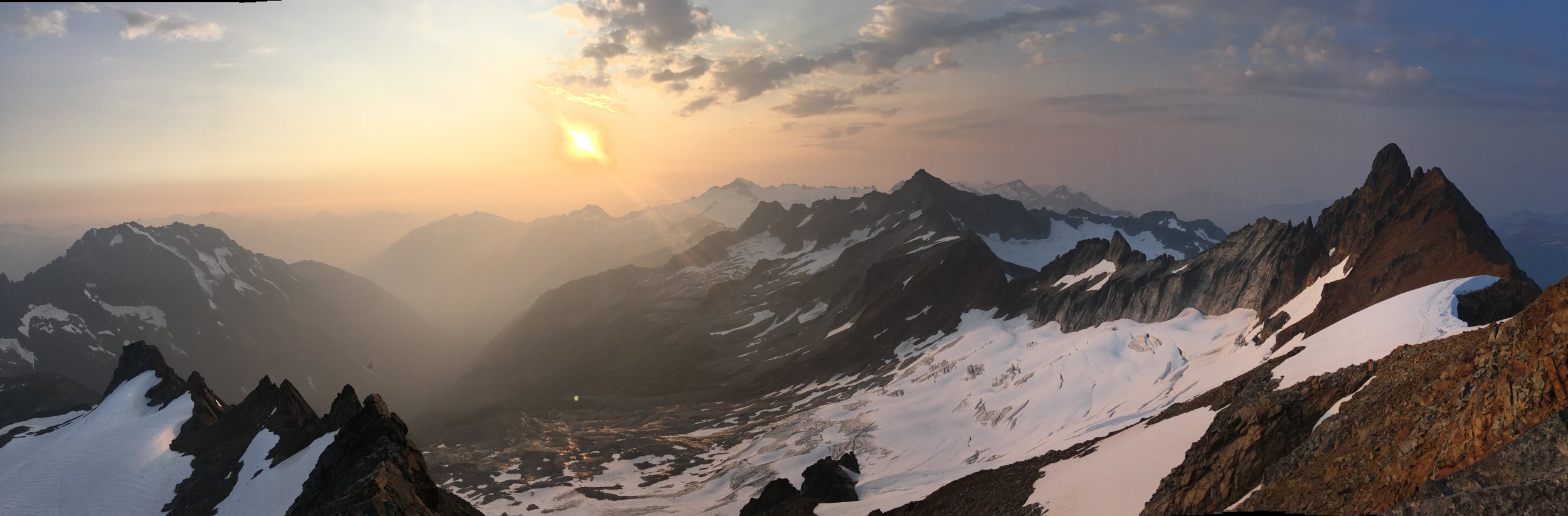
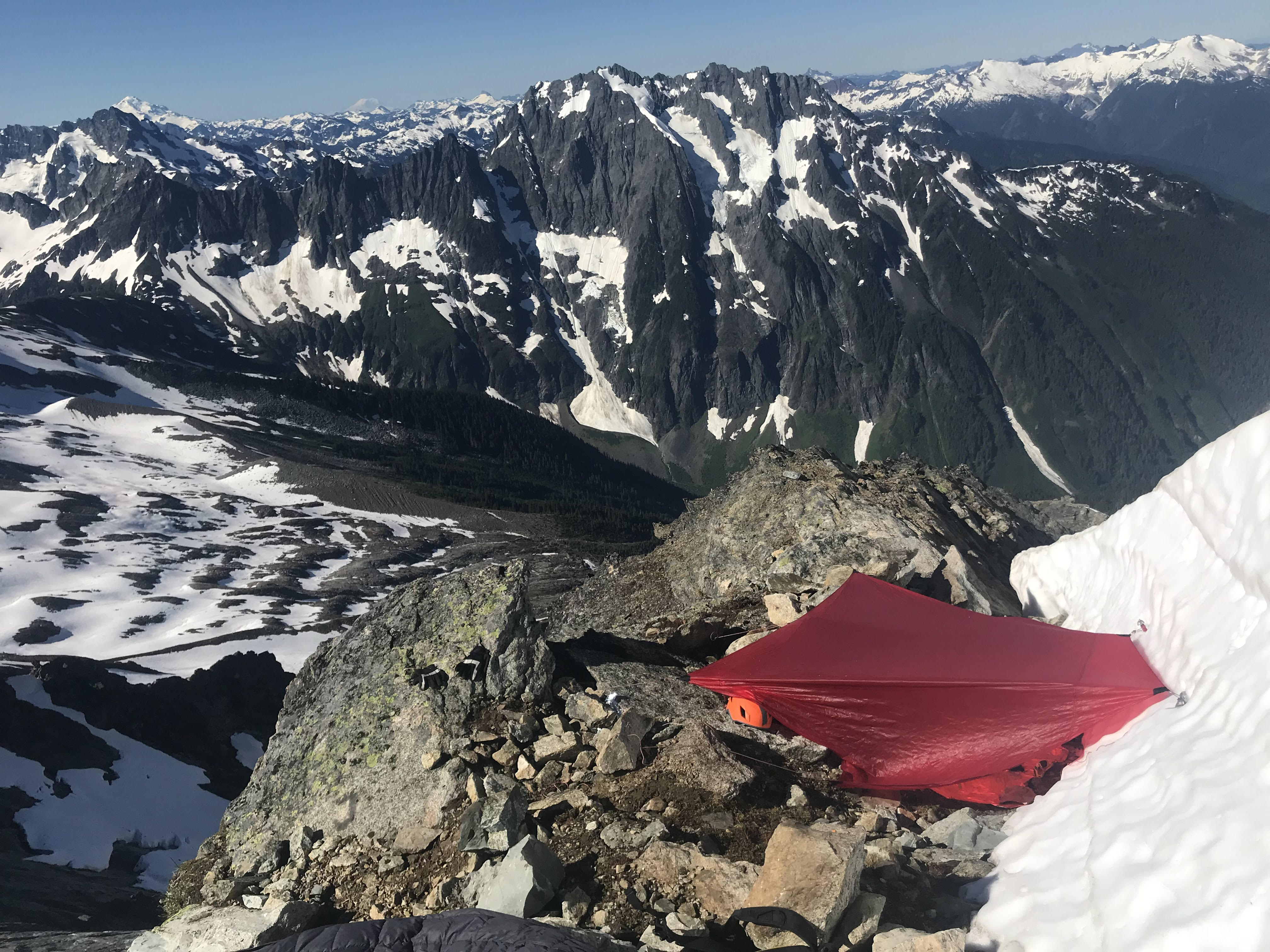
Trip: North Cascades- Boston Basin - The Boston Marathon Trip Date: 07/10/2018 Trip Report: This is super delayed, but i was looking though old pics and thought this trip was worth sharing with y'all. Kyle was most certainly the brain-child behind this absurdity. I think it was sometime in the summer of 2017 he mentioned this idea of solo circumnaving boston basin. I was a bit suspicious that things might be a little more involved than was anticipated so told him i'd join in for a recon mission. We trail ran the sahale glacier route one day and gawked at the rest of the ridge, reading the unknown v known terrain and looking at the way the ridges tended to run. It was clear we were going in the wrong direction. For one, we would have to do the tft backwards, which would have honestly been the most chill weirdness. Downclimbing the ridge to sharkfin looked damn near suicidal. So we regrouped and planned a 2 day mission from the other end. We decided to start at the hidden lakes th and start on the triad via the sibley pass approach. When we hit the triad it was clear the "triad traverse" approach as described for marble creek basin didn't really let on to how gnarly the scrambling would be if one were to stay true to the ridge. We estimated summiting the triad sometime before 10 am, somewhere around mid afternoon we finally were running up the eldorado glacier. After tagging eldo via the east ridge, we ran over to the torment col while the sun was setting. After soloing the s ridge of torment in the morning, we realized we again had underestimated our objective, so we bailed down b basin and gorged on berries. One last attempt that summer would be thwarted by an overuse injury. And the september rains came, and boston basin stood like that itch you just cant reach all friggin winter long. Summer came around again and we were racking up at our first opportunity. Sometime in early July. looking back towards eldo and the triad on an early recon We Again set up the car shuttle, but this time the road was closed at the eldo th, and we had 4 days off, so we figured we'd tentatively plan on just tossing the triplets, cascade and j-berg in on the final day (our plan was to scramble the j berg summit ridge and bushwack down the gnar forrest straight back to the eldo th.). Weather ultimately meant this final link would not go, but its certainly something to aspire to. We set off from the trailhead for the triad. This time, we were prepared for the choss. early scrambling Kyle down-soloing some 5.6 choss on the triad Some 4th class funk on the triad 100ft tower we climbed along the way, 5.7 nothing on top suggested we were the first to visit such a bizzare place some more down climbin w face of w triad 5.6 R super aesthetic The first time we visited the triad we stayed true to the ridge crest east of the eastern summit and down-climbed somewhere about a third or half way down the east ridge. This proved to be an extremely dangerous experiment in natural jenga. We pushed off multiple oven to mini cooper sized blocks that impeded safe passage. We ended up bailing down some 500 ft 5.4-5.7 wall to the glacier. This was the boldest down-soloing i've ever committed to and would never be recommended. Remembering this experience, we opted to drop off the ridge after the eastern summit of the triad. A quick jaunt accross the glacier brought us over to eldo. We decided the truest line would be to climb the south ridge of eldorado. We found info on the south face, but none on the south ridge. We thought this odd, but the ridge looked quite reasonable. It ended up providing 4-6 epic and high quality pitches of easy rock climbing. A worthy stand alone mission and my second favorite (second to the west arete) way to summit the mountain. the first pitch gaining the s ridge of eldo second pitch some good ol' fashioned knife ridin good conditions meant a casual walk down the e ridge From the summit of eldo we decided to stop and rest at eldo camp rather than push through the dark to the torment col. I mean, there is a toilet there, thats pretty darn good motivation. We woke up early the next day and scurried across the feint climbers path leading over to torment. The torment col is always a neat place to hang out and fill up water. The true line here is the NW ridge of torment. We quickly glanced at the beckey bible the first time, and saw that it had gone. But when we got to the base of the ridge the gnar choss was quite strong, and we weren't entirely sure if we had the beta memorized, so we bailed back around the mountain to the south ridge. This time around we had taken some photos of the guidebook and decided to turn reason off. Getting on the ridge was the crux, purely mental, it turned out to be fairly easy going. There was one exposed and runout 5.8ish knife-edge pitch somewhere in there, but it all kinda blurred together. Soon enough we found ourselves on the summit of torment and in familiar terrain. The TFT awaited, finally some classic easy ridge travel! A classic b basin white out slowly creeped up as we reached the w ridge notch. It became apparent a storm was comming in so we scrambled to get the tarp up. We knew we were in for a wet night. looking over at the nw ridge of torment the entrance to the ridge, what looked like 5.10 from afar turned out to be 5.6 some more ridge scrambles on torment topping out the crux pitch of the nw ridge looking back at the entrance to the tft. getting on the glacier required a 20ft pendulum, then we had to rap down that high bergshrund. our first overhanging rap off a snow bollard. things were wet and snowy on the "3rd class rock" bypass variation We woke up on day 3 soaked (i say woke up, but there wasn't that much sleep). Rain stopped around 1 pm. The whiteout however persisted. We eventually got restless and started up the w ridge of forbidden. Neither of us had been down the east side of the mountain before, so we knew we were in for a good challenge when the whiteout lingered, but we knew we had to keep going if the traverse was going to go down. Finding the raps down the east ledges was tricky, but not unreasonable, we eventually got onto the e shoulder of the mountain below the start of the east ridge route. and knew that we had no clue what layed ahead, so we tucked tails and pitched the tarp. west ridge with a fog break another little break in the whiteout while descending the east ledges our bivy the next morning, j-berg looking classy as ever We awoke on day 4 with the sun and our first view of the nw ridge of boston. And we were decidedly a little concerned. Nonetheless we packed up and found our way down to the end of the e shoulder of forbidden. if ya think boston peak is choss, try scrambling around out here, it will change your understanding of the word. We reached the end, and the large cliff that would feed us to the the notch below the sharkfin ridge. this was truly un-rappellable terrain. So we backtracked to a low 5th class gully. A very stressful hour of downclimbing and rappelling spat us on the edge of the Qiuen Sabe. Another gully by the notch led us up to the steep hanging snowfield below the sharkfin ridge. We were short on time because of weather and opted to leave the subsummit west of sharkfin for another time. We quickly found ourselves at sharkfin. We climbed something on the sw ridge of the tooth, hard to remember exactly what we did. It was solid, exposed and 5.8. Had a hanging belay and no other signs of climbers. Not sure what we climbed, but it was fun. After some victory food on the summit we rapped off and set sail into a sea of virgin choss. I think there was maybe 1 more rappel to access boston, then we started up the ridge. We soloed about 1500 ft of low 5th class before hitting a vertical section and roping up. A circuitous combination of rappeling and ridge climbing brought us to the famous "ore" describing boston. A knife edge ridge guarded the easier looking summit headwall. The prospect of bailing at that point seemed worse than climbing the ridge, so i pushed up. The rock was best described as feta cheese. And i had to mow about a foot of the surface rock off as i au chevaled to ensure the entire ridge wouldn't collapse with me on it. I fabricated a belay half way across this called "off-belay". Kyle didn't look convinced i had found gear. Climbing delicately through the remaining pitches we found ourselves in unprotectable low 5th. So we soloed to the summit. The register up there is pretty rad, its a neat summit and the regular route doesn't look that bad. A few rappels and we knew we had done it, sahale was like the icing on the cake. And a 2000 ft boot ski down to the sahale arm was the reward. We blasted obscene music and trudged down to the cascade pass th. Overall we pitched out 26 pitches, rappelled 26 times and the gps read 26.2 miles back at the eldo th. A proper cascades test-piece. Some day we might go back and add j-berg. Maybe when memory fails us. "The Boston Marathon" VI 5.8R scouting the downclimb to the qiuen sabe looking over at the nw ridge of boston starting up sharkfin the final approach to boston. We ended up climbing just under the ridge crest for good 4th and low 5th class traversing until the gendarme right before the ridge starts gaining elevation, thats were we roped up the first roped climbing on boston finishing up on the first pitch of the au cheval Heres the track i took of the traverse loaded into caltopo, my phone died for about half of boston peak, so there is a straight line through that section. Gear Notes: Single Rack to 2, 50m half rope Approach Notes: We approached via the hidden lakes th with a car shuttle to the eldo th


.thumb.jpg.e1bfe41408e1b7f12c77d6a1201c222a.jpg) 1 point
1 point


.jpg.22eb2979f0d666bcc955d7e97c379357.jpg)