mrblueblue
-
Posts
2 -
Joined
-
Last visited
-
Days Won
3
mrblueblue's Achievements
")


-
[TR] Mt Challenger - Easy Ridge High Route 06/30/2023
mrblueblue replied to mrblueblue's topic in North Cascades
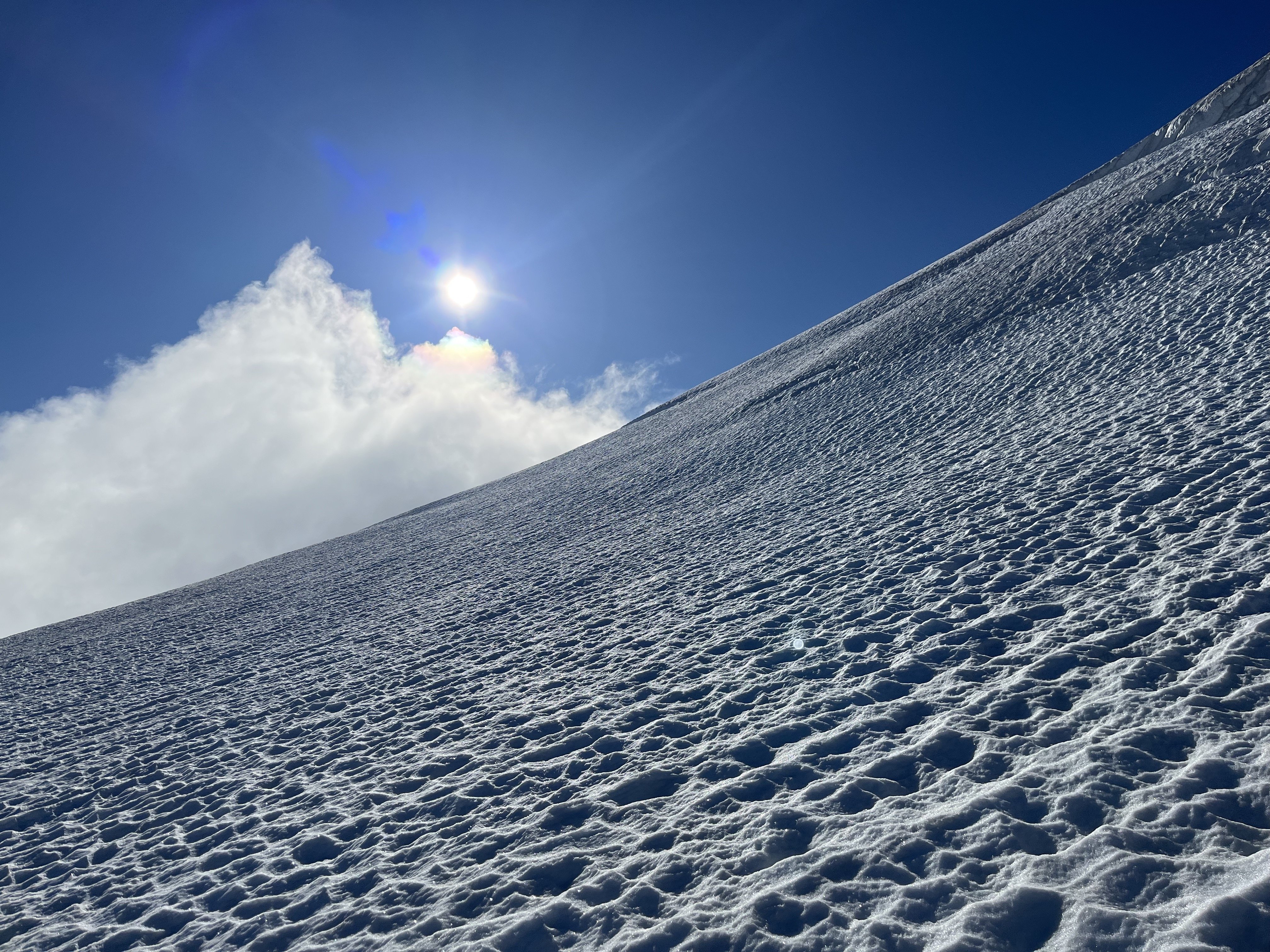
For some reason I had trouble route-finding a way around the Impasse coming from Perfect Pass. The bypass route was on my GPS, but I kept getting blocked by thick bushes or cliffs. I wonder if the crossing is somehow made easier or harder depending on the amount of snow. -
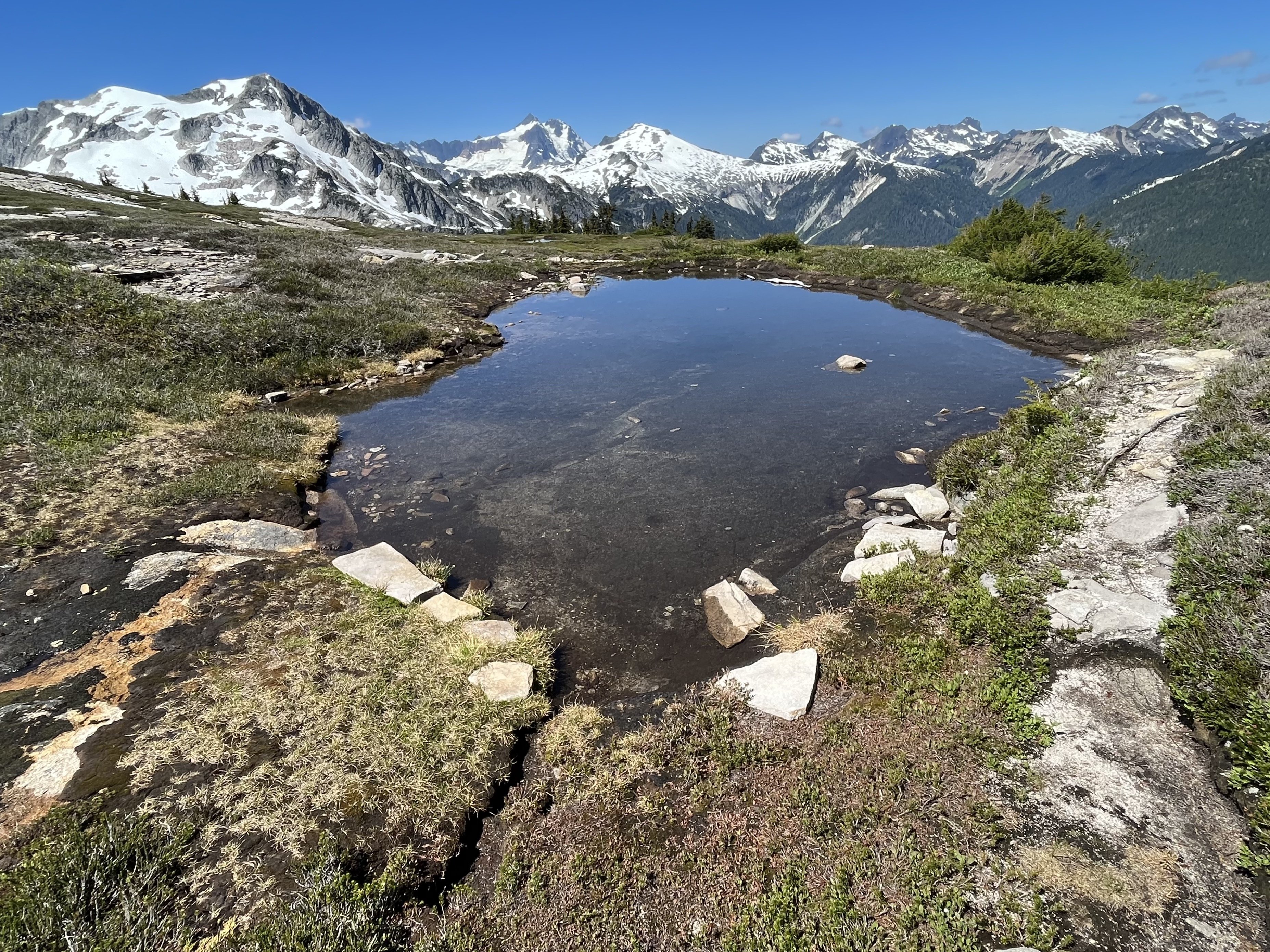
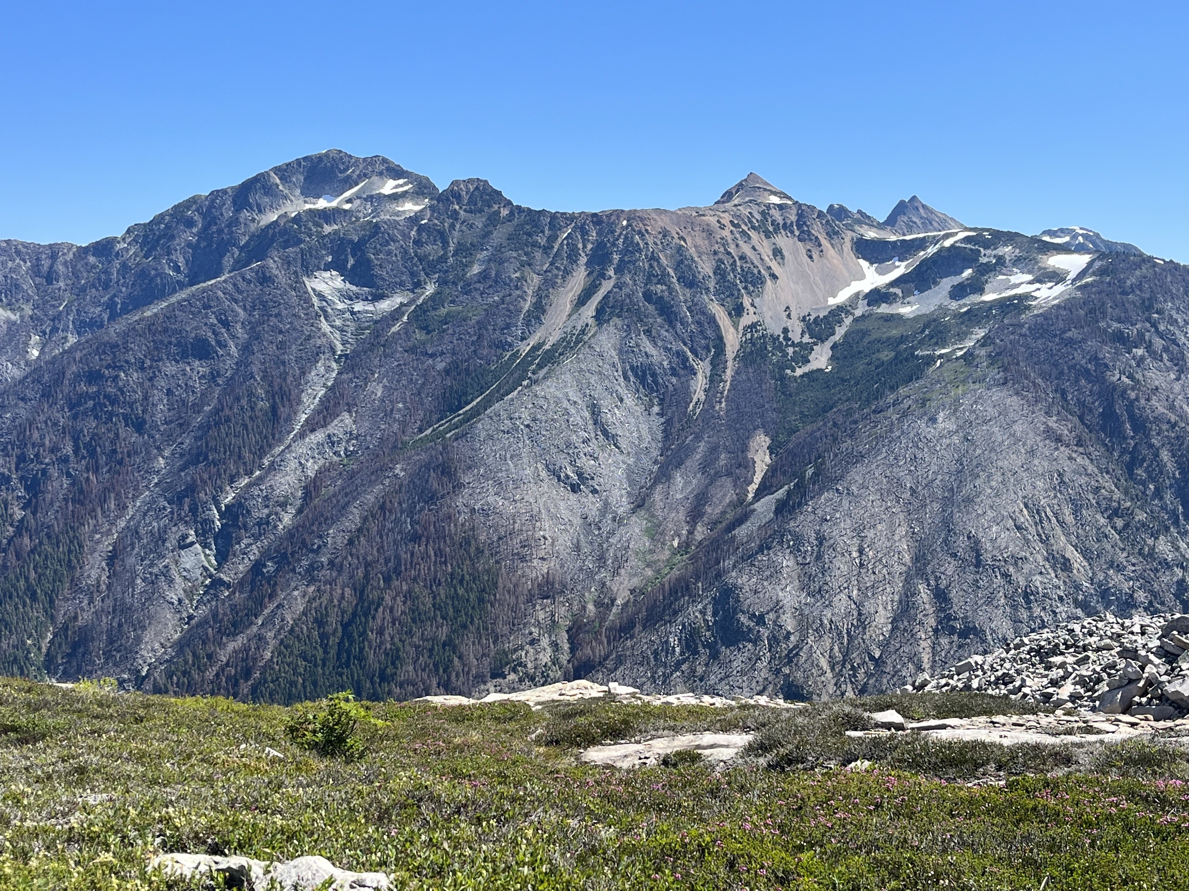
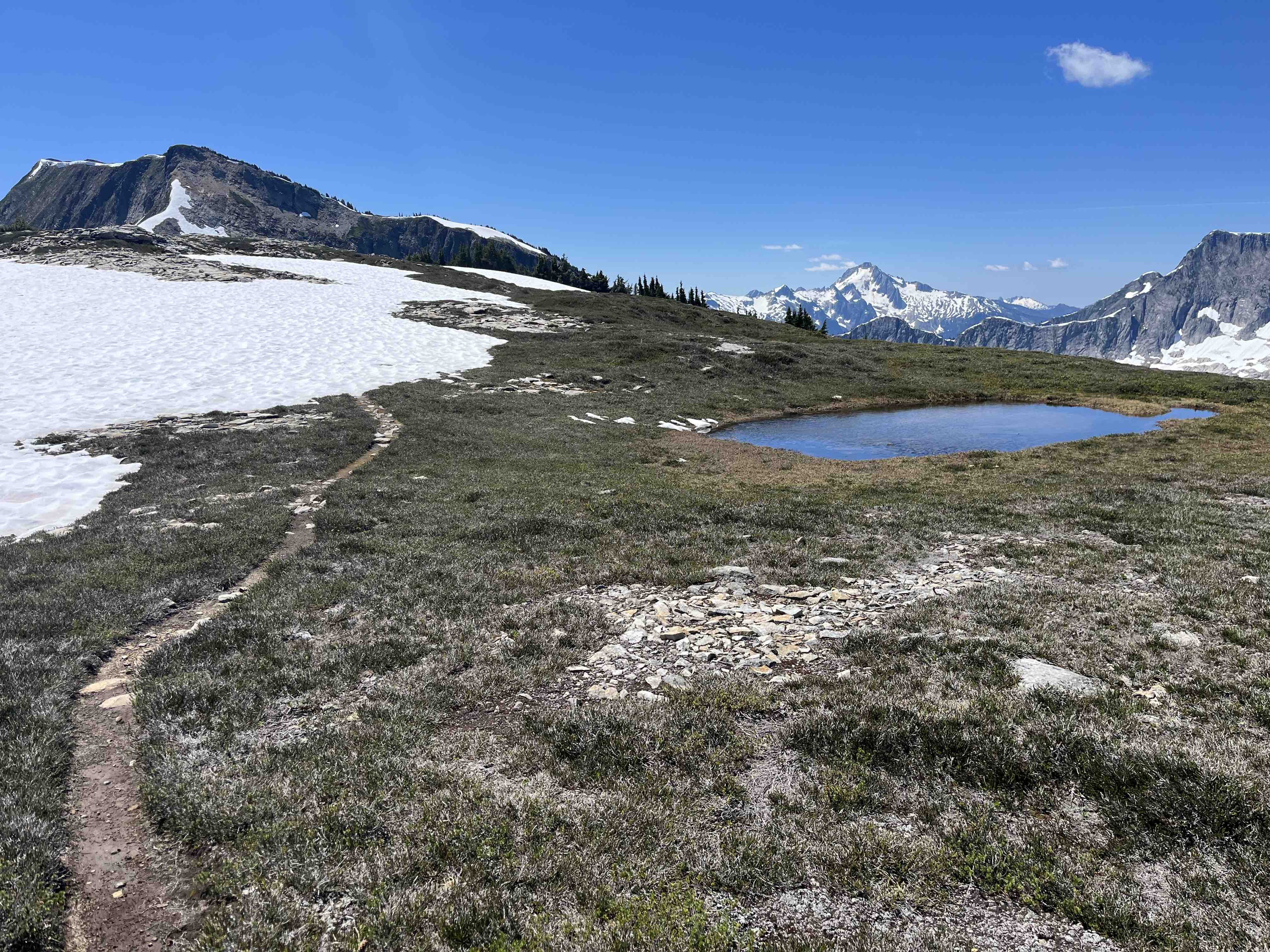
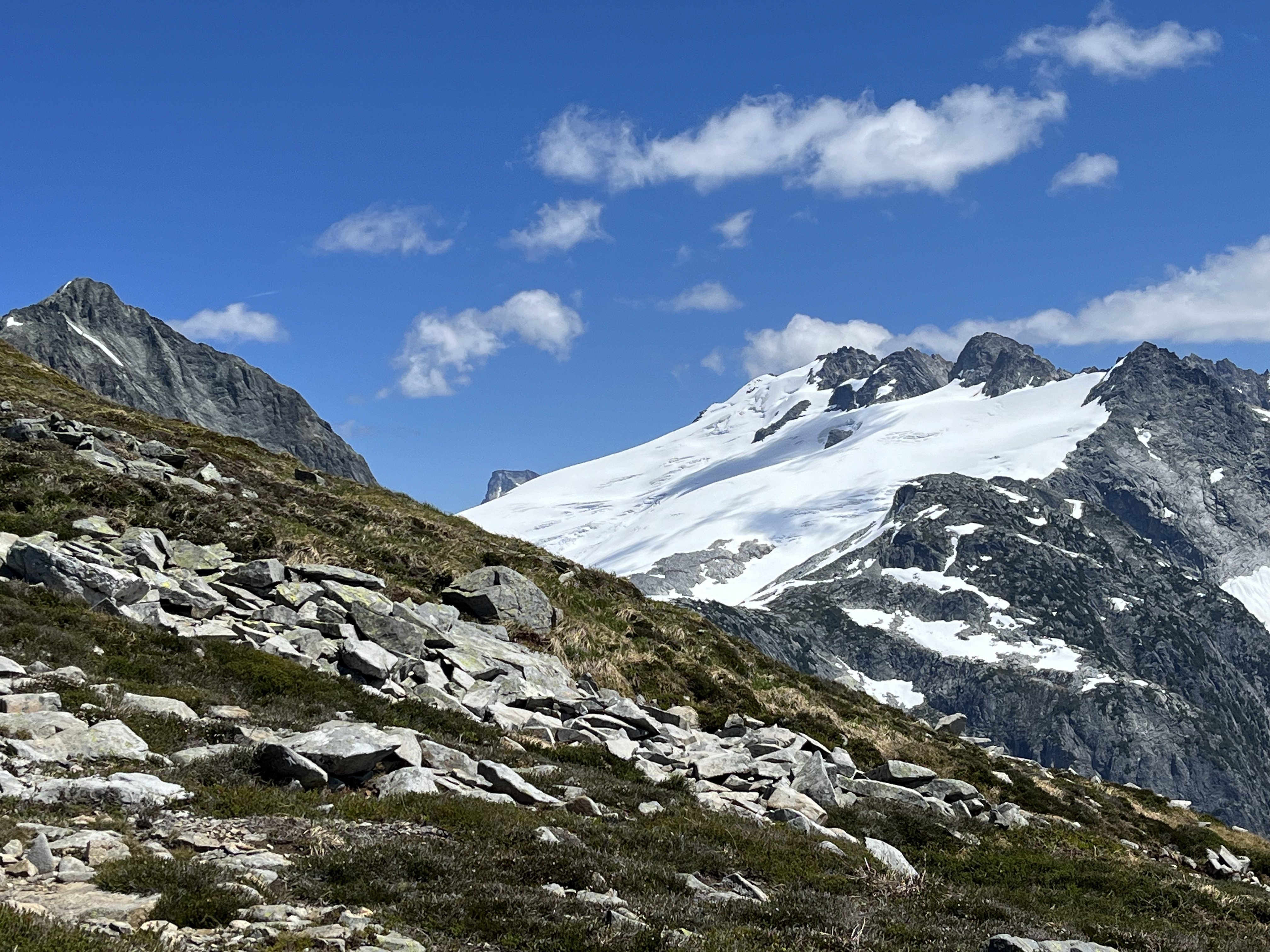
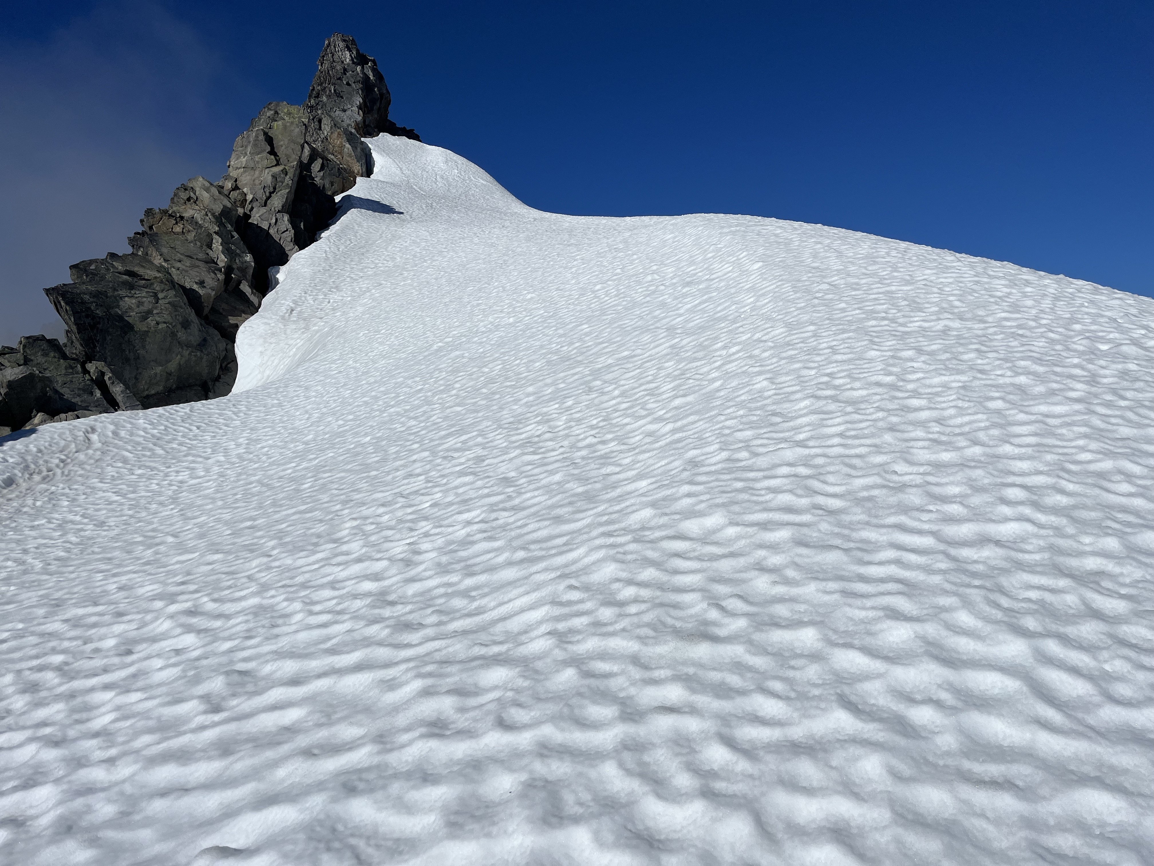
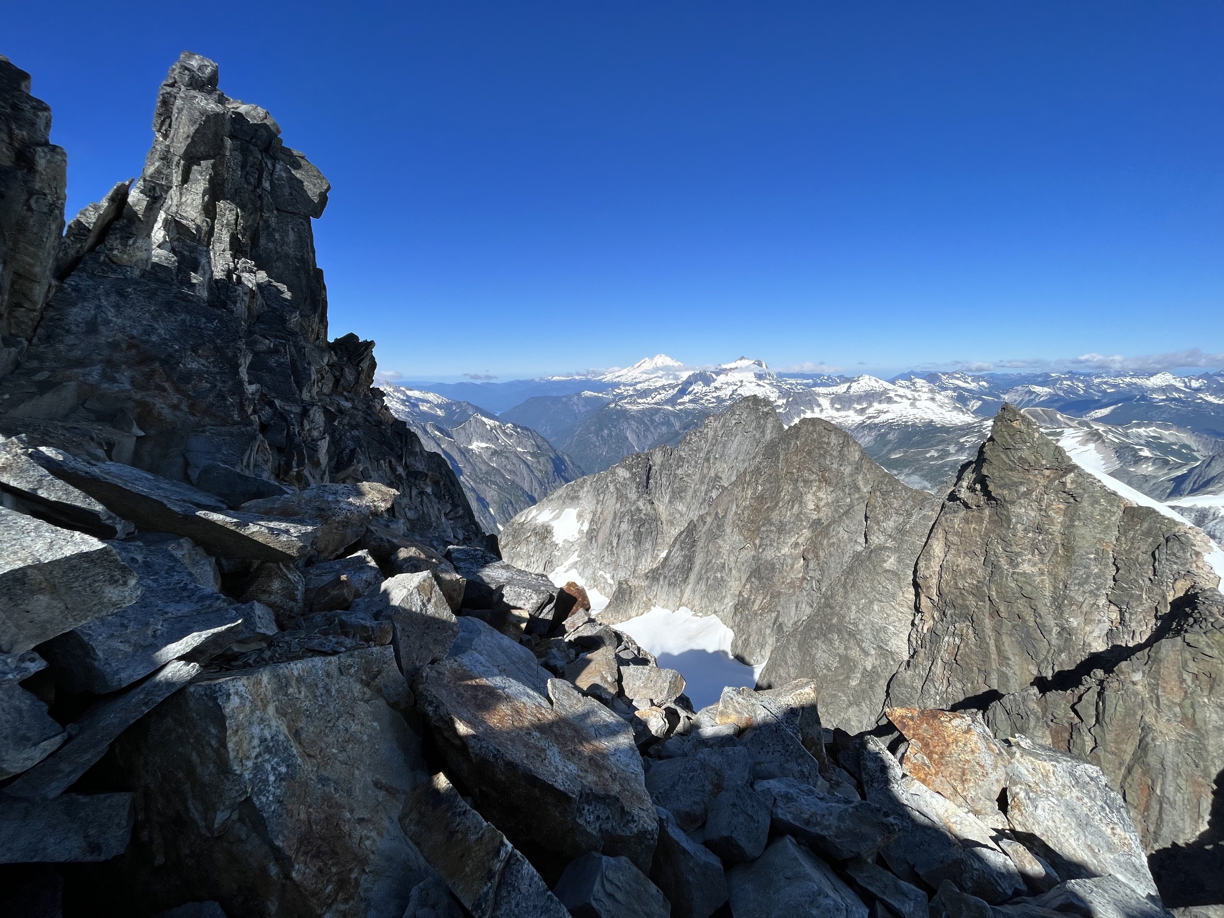
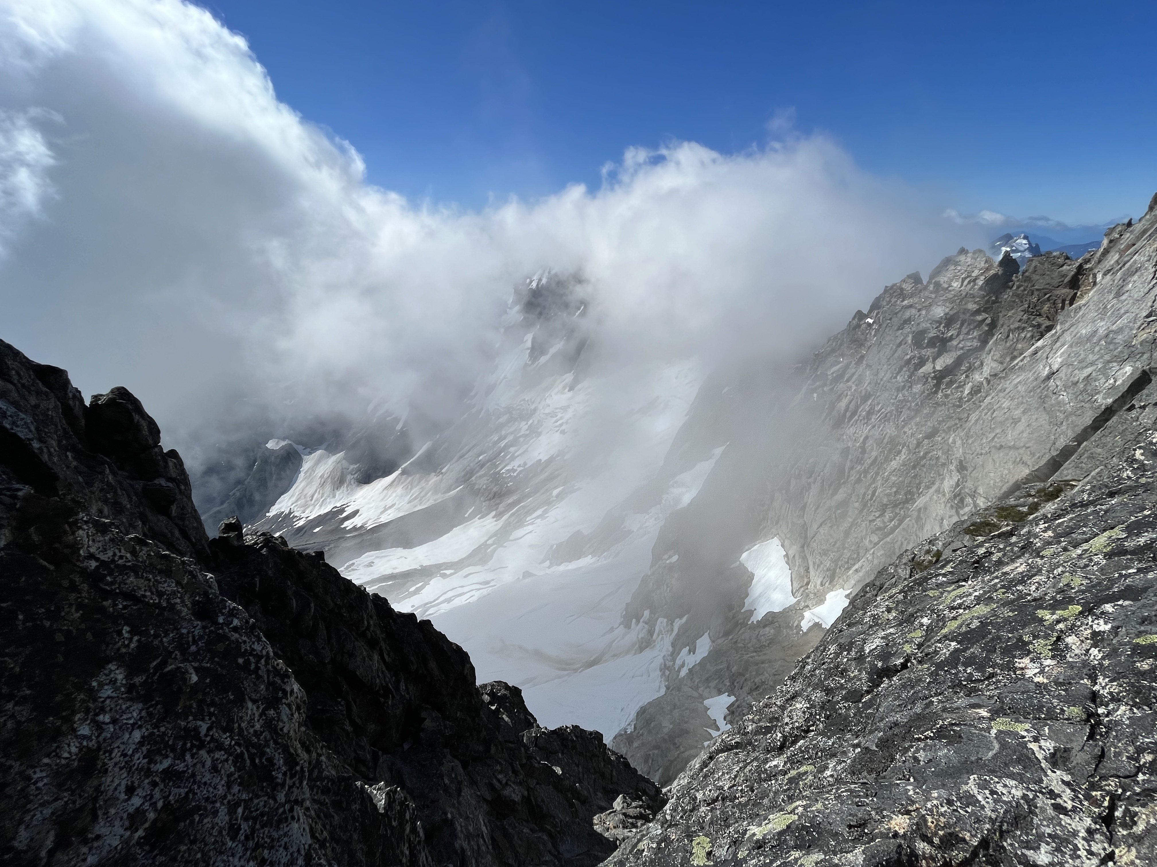
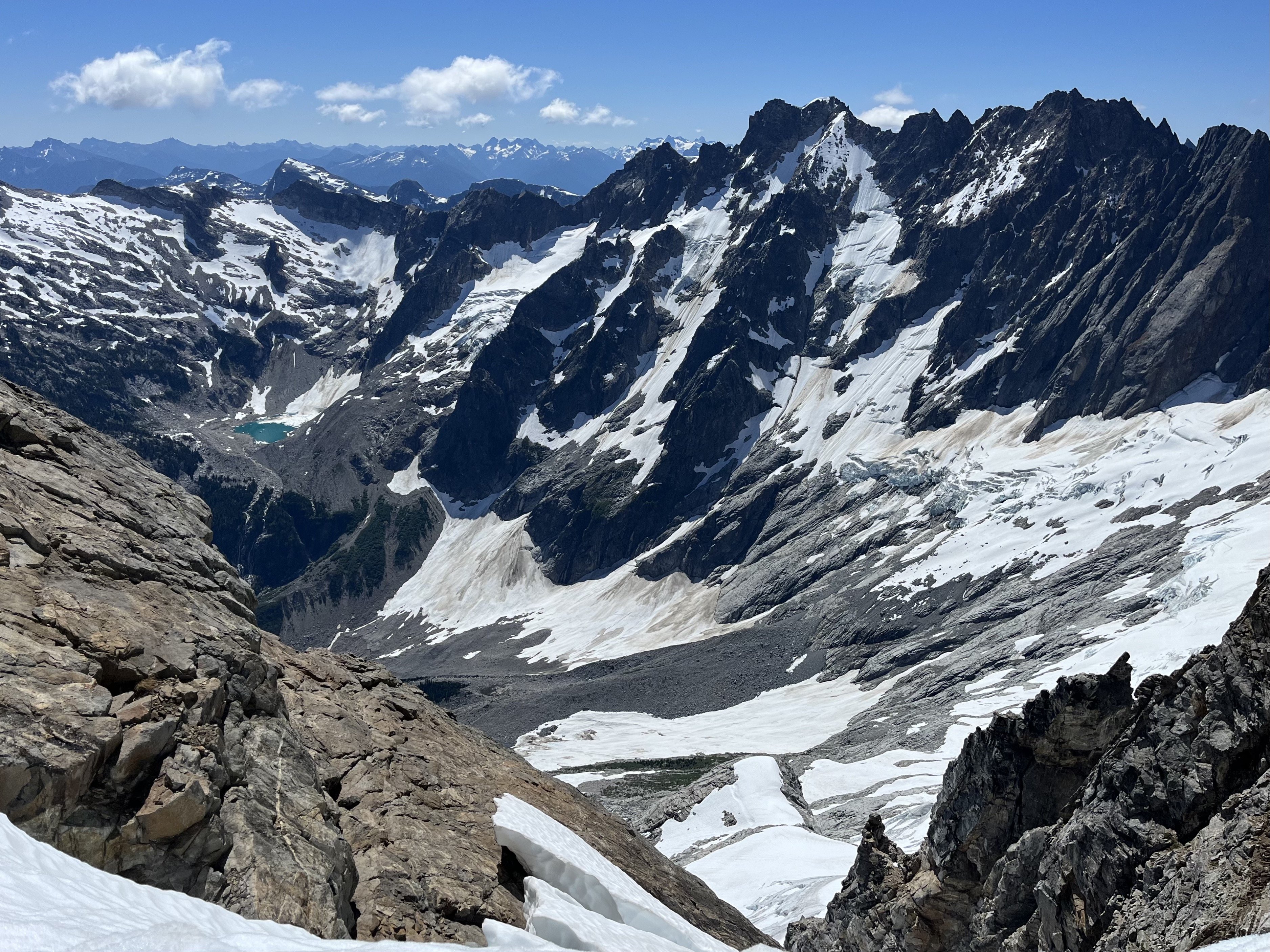
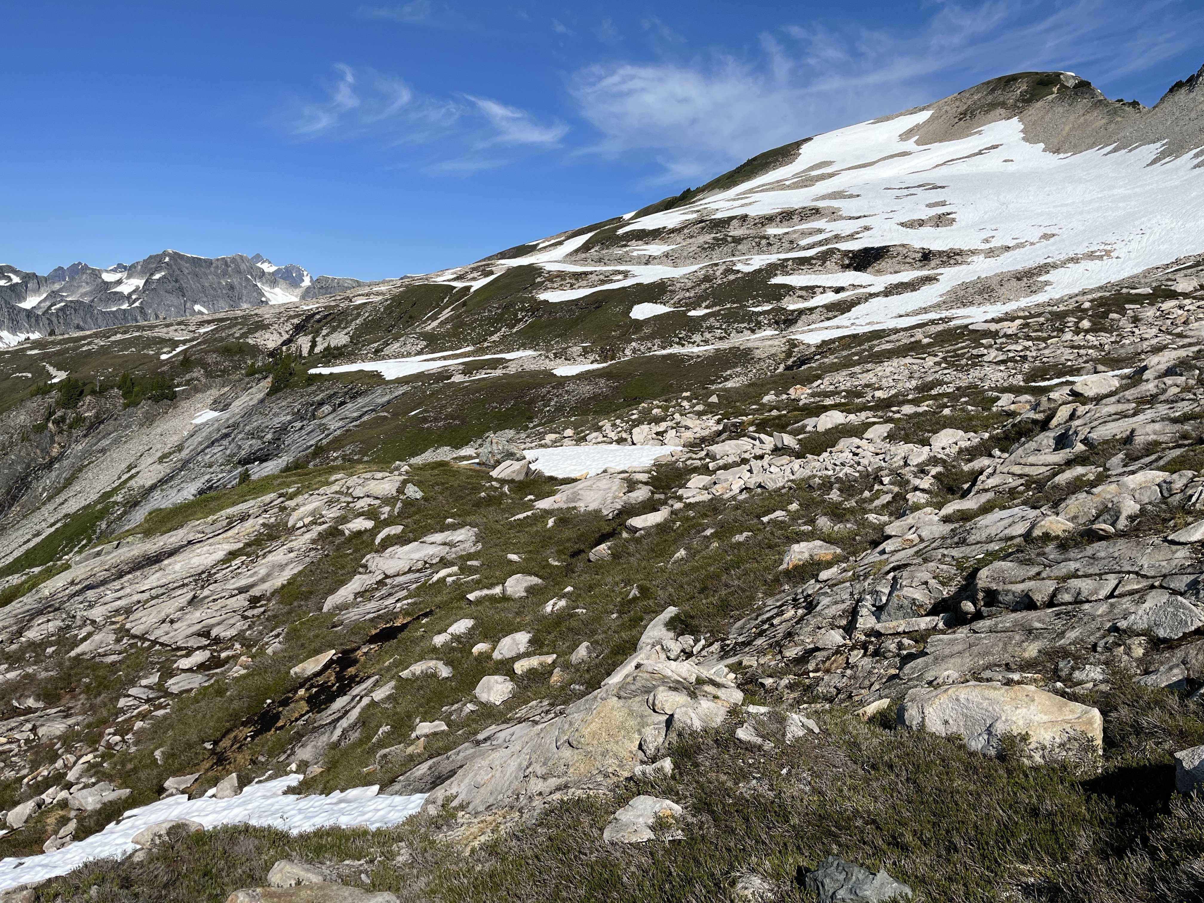
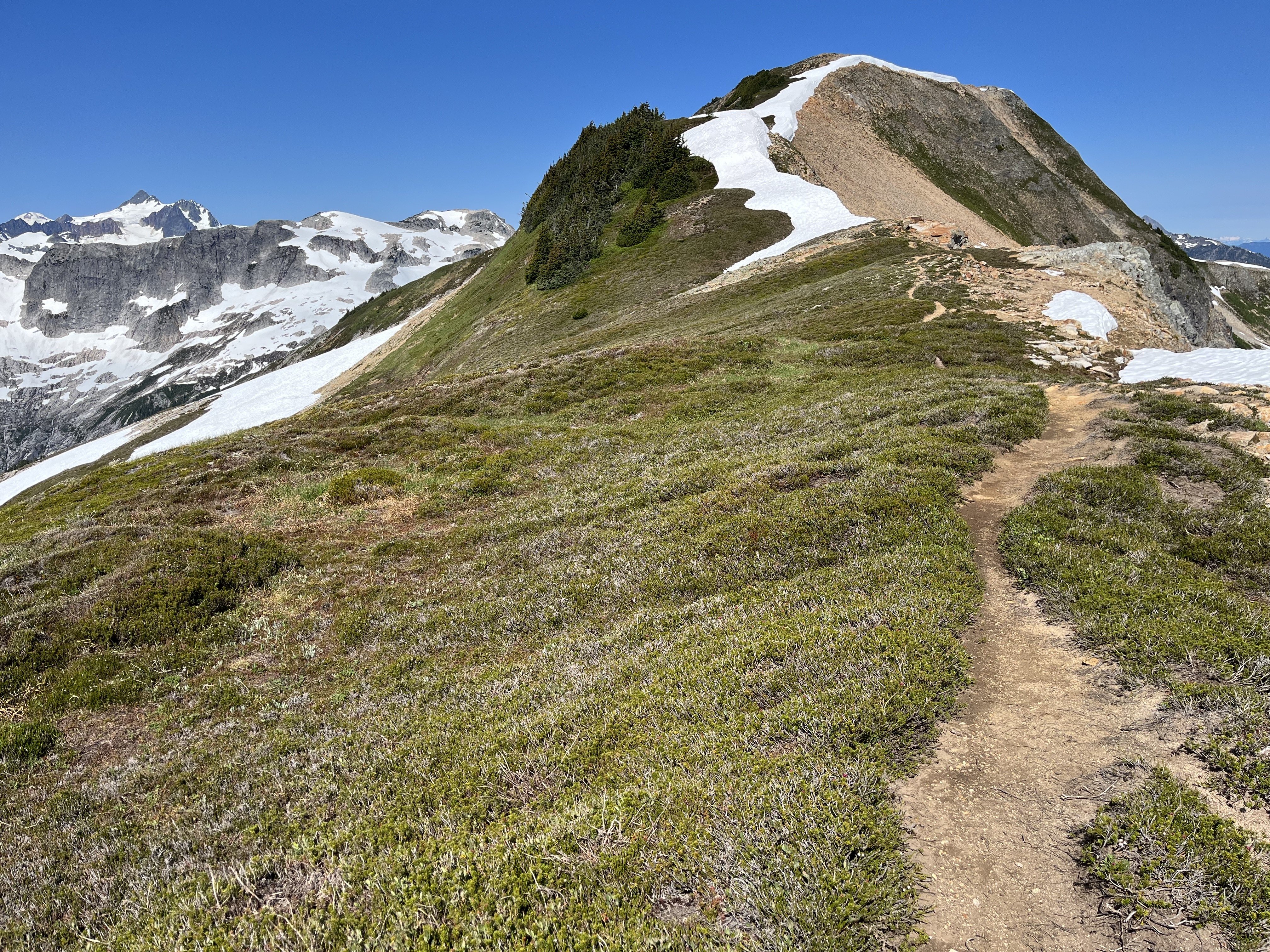
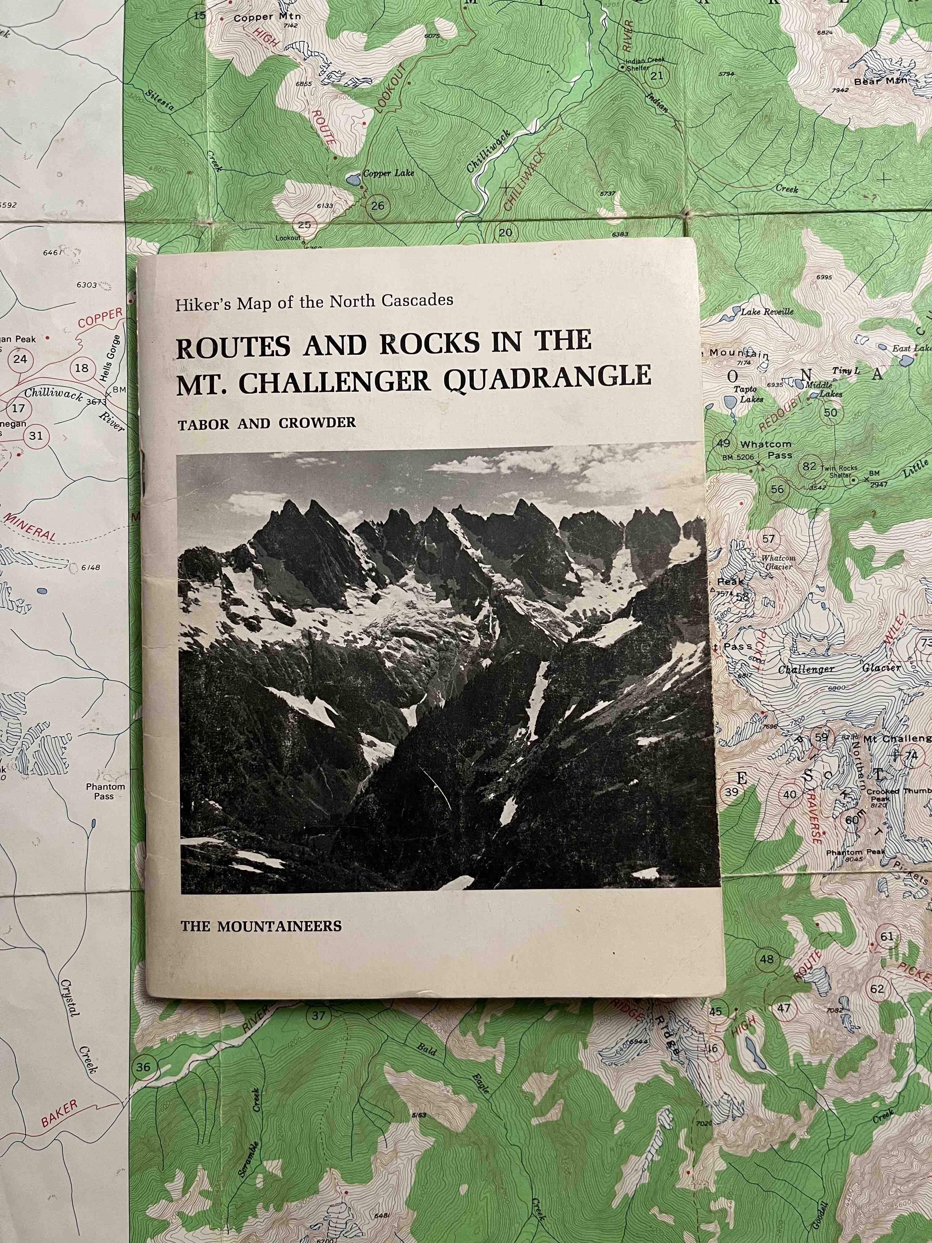
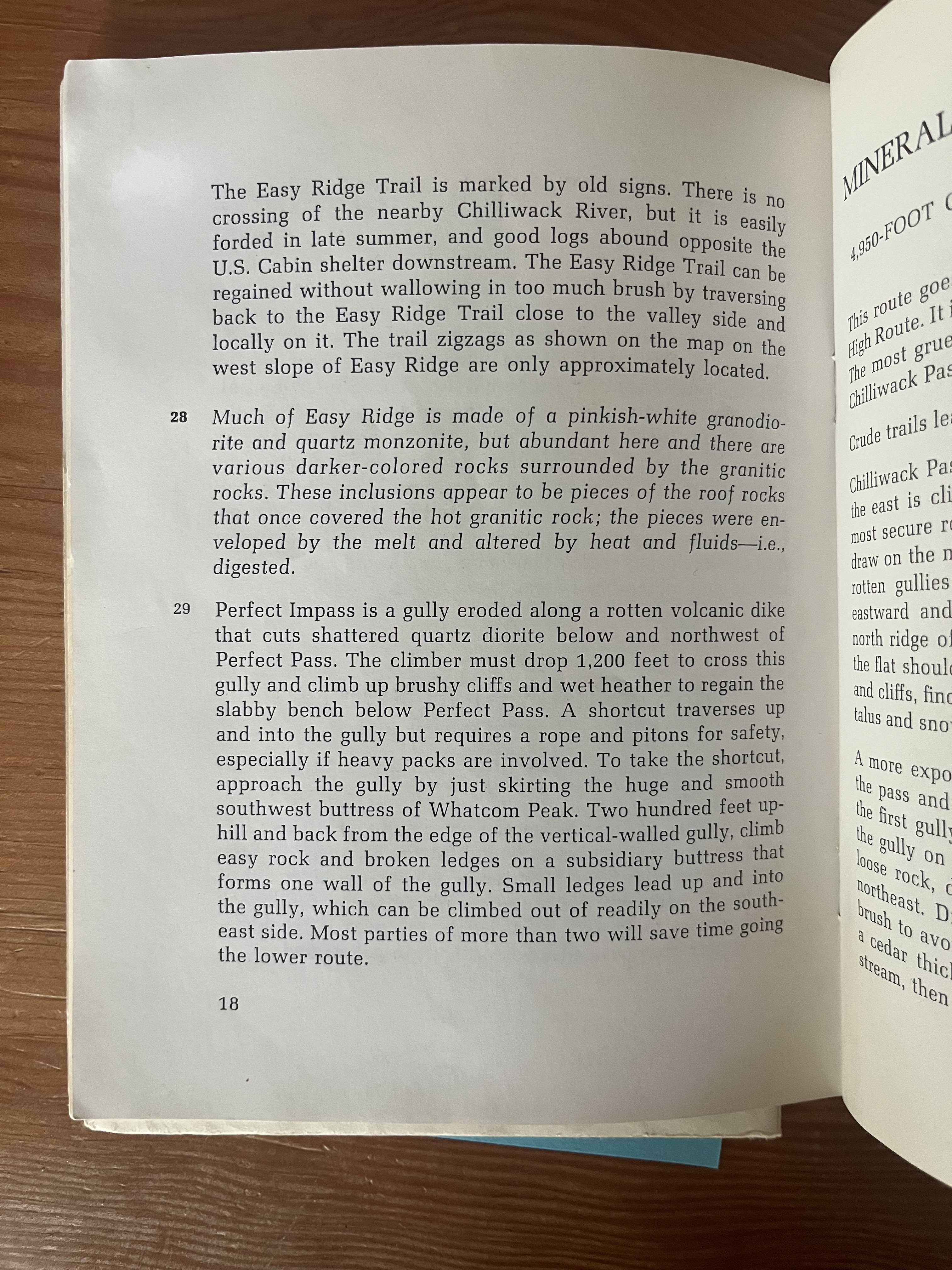
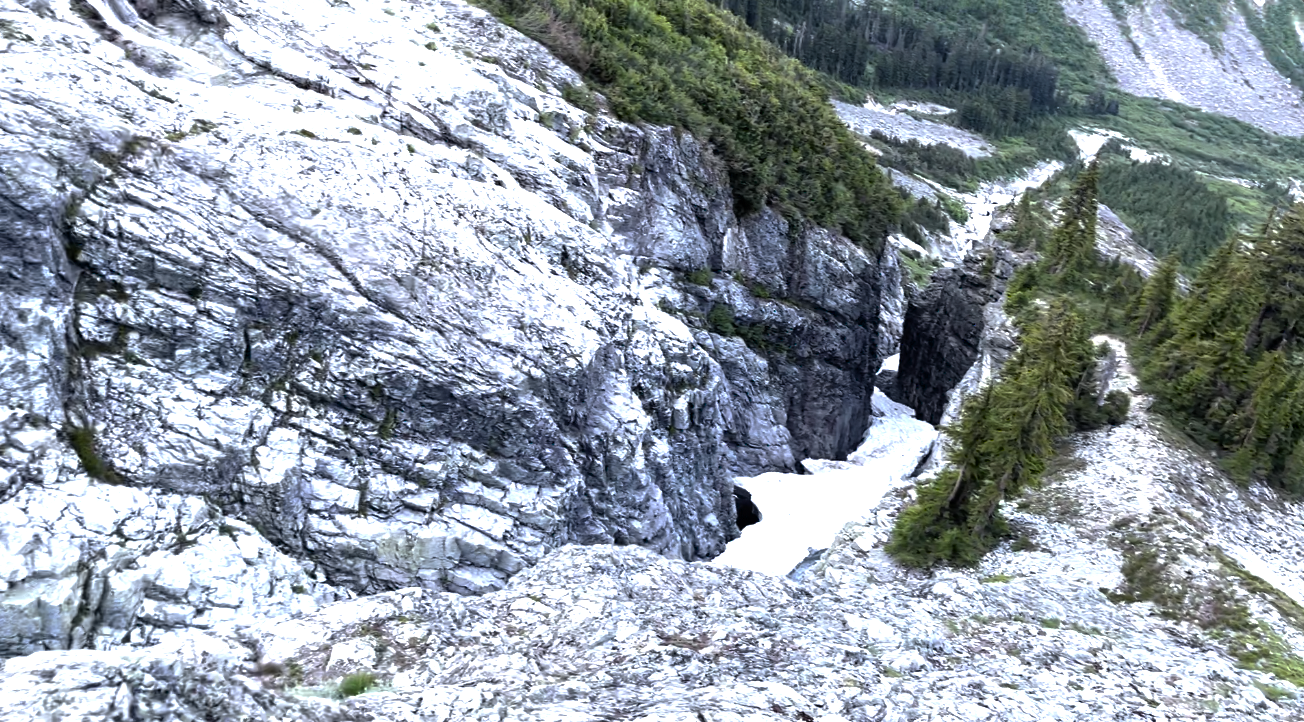
Trip: North Cascades NP - Mt Challenger via Easy Ridge High Route Trip Date: 06/30/2023 Trip Report: Over a period of four days, I solo climbed Mt Challenger, approaching from the Easy Ridge High Route. Three years ago, I clambered up to Tapto Lakes and was awestruck by the sight of Mt Challenger. I have always wanted to climb it since. In climbing Challenger, I had to use almost everything in my backcountry and climbing toolkit. The trip felt like a culmination of all the outdoor skills I have learned so far. Day 1 Permits I arrived at the Glacier service center at around 3pm. According to the ranger, I would be the first person to make my way up to Perfect Pass this season. As I explained my itinerary and possible goal of climbing Mt Challenger, he became even more excited about the trip than I was. In reality, I still felt unsure if I would actually make it up there, so I didn’t want to hype myself up too much. There would be so many factors standing in my way: the river crossing, the route-finding and bushwacking, the infamous impasse, and ultimately the glacier conditions. I sheepishly told the ranger I would be happy just to make it up to Perfect Pass. Hannegan to Copper Creek It took me about 3 hours to reach camp. This would be my fifth time hiking Hannegan Pass so I was in familiar territory. When I arrived at Copper Creek, I met a ranger camped out on the over side of the creek. He asked where I was heading next. When I told him I would possibly go up all the way to Mt Challenger, he was stoked (again, even more than I was). Day 2 Crossing the Chilliwack The next morning I broke camp at around 5:30 am and made my journey up to Easy Ridge. The Chilliwack river crossing was not as bad as I had thought. I found a short, shallow section to cross, the water only coming up to my ankles. My crocs definitely came in handy here. There really was no trail once I reached the other side of the river. Eventually, I linked up with the trail by going in the general direction of Easy Creek (listen for it) and upwards to Easy Ridge. For the most part, the trail was straightforward and never too steep. Other than maybe the first section, I would not really consider it bushwacking (that would come later). The overgrowth was all just blueberry bushes anyways, not nasty things like devil’s club. Easy Ridge Eventually the ground got rockier and the trees became shorter and fewer. The trail flattened into a meadow dotted with pools of melted snow. I had reached Easy Ridge. Further along, I was finally able to see sweeping views on all sides. To the left, I sighted Red Face mountain and knew Tapto Lakes was nested in the cirque hidden below it. To the front, I got my first view of Mt Challenger and was already plotting my route across the glacier. For the most part, the Easy Ridge trail was indeed easy but there were still some notable obstacles. Snowfields still clung onto parts of the trail. In one section, I had to take out my ax and change into my boots and crampons to manage a steep snow traverse. A slip here would have resulted in tumbling down hundreds of feet down into the valley. There was also an unexpected scramble up loose rock and scree right before reaching Easy Peak. The Nearly Perfect Impass As I reached a snow covered saddle near the end of the ridge, I knew I had to descend into the valley and then confront the infamous Perfect Impass. My descent was in steep snow. Looking back now, I should have descended earlier before the saddle, which would’ve made the descent gentler and snow-free. While descending, I also wasn’t sure the exact location of Perfect Impass. I kept thinking it was sooner than it actually was. As a result, I maintained my elevation and refused to descend even more like I should have. My route was harder and full of scree by not descending properly. You can’t miss Perfect Impass. It cleaves the valley in two and literally stops you in your tracks. When I finally reached it, I first tried to find a way to bypass it lower down, but halfway up the chasm were unstable snow bridges. Since I didn’t want to descend the supposed 1000’ to circumvent the impasse, the only other way was higher up. I don’t remember the exact movements but roughly speaking I climbed high, down climbed, made an exposed traverse, then down climbed again into the gully. From there it was an easy climb out where I encountered a rappel station and a cairn marking it. Routes and Rocks In The Mt. Challenger Quadrangle (1968), Tabor and Crowder (East side of Impass looking back) Perfect Pass Now, I had to descend even further and make my way around a buttress. The way was dotted with snowfields, which provided a welcome relief from the heather, scree, and slabs. The snow was still firm and I never punched in.After rounding the buttress, I finally reached a point where I could see the way up to Perfect Pass. For some reason, I did not climb up the heather and dry rock to the left and instead went up wet slabs scabbed with slippery lichen. All the slipperiness made for a slow climb up to the pass. I finally reached Perfect Pass at around 8:00 pm and set-up camp, trying to get to sleep as quickly as possible for tomorrow’s summit day. Day 3 Challenger Glacier Next morning, I woke up a little late at 5:30 am. After an hour-long breakfast of ramen, I lazily made my way across the Challenger Glacier, easily avoiding the obvious crevasses. The snow was firm and gave good traction. Partway across, I encountered a steep ramp that gave more direct access to the Challenger Arm. I decided to take this supposed shortcut, but after climbing three-fourths of the way up, I encountered a huge bergschrund blocking my way. I was pretty dispirited at this point and even considered turning back. There was no quick way around the bergschrund so I had to downclimb and continue traversing the glacier to the lateral moraine on the leftmost part of the arm. I carefully downclimbed, trying not to think of the crevasses below. As I continued my way to the arm, mist started spiraling out from Luna Basin. I thought it would subside, but soon it crested even higher, blotting out the sun. Wave after wave, the mist now rolled onto parts of the glacier arm. When I finally reached the arm, I saw that the steepest part of the climb was ahead of me. At first, I could crossover step my way up. Eventually, I had to high dagger up the slope. Moraines gave me good spots to rest and calm my nerves. Once on top of the arm, I saw that path flattened out to a mild snow ramp up to the summit blocks, which was now obscured by waves of mist. When I reached the base of the summit, the mist subsided back into Luna Basin and the summit towers emerged again. Summit Block and Descent In my excitement to get to the summit, I immediately started climbing high. I then realized that I had to downclimb and scramble to the right in order to access the actual summit block. The climb up the summit block didn’t look too bad. I saw several pitons and a stuck cam. For me, the crux was at the second piton. I had to think through where to put my feet and hands, but I got over it in one move. At the summit, I could see Baker and thought about how I stood on that summit exactly a week ago. I wondered how difficult it would be to climb Shuksan, its summit pyramid now bare rock. Covered in mist, the Northern Pickets were all still a mystery to me. I took a few more minutes to take it all in. It wasn’t windy and I wasn’t too pressed for time. Since I didn’t feel like downclimbing and had a 30m rope, I rappelled down. There were two rappel stations, one at the summit block and another further down. Two aged cordelettes made up the first and several pieces of webbing made up the second. When I reached the top of the arm again, the mist disappeared from Pickets, and I could finally see the Northern Pickets in all its glory. The way back was largely uneventful–I just followed the same route back. Surprisingly, my bootpack across the glacier had already faded into a faint imprint. It was around 1 pm when I made it back to Perfect Pass. The snow had already started to slush around noon, so I was glad to be off the glacier. When I thought I had finally made it to camp however, I encountered two ptarmigan chicks and their mother guarding the last little hill to my tent. I tried to go around them at first, but apparently the mother felt I was a threat. She lunged at me and herded me down the hill with her mid-air flourishes. I waited a few minutes for her and her chicks to descend down Perfect Pass. When I finally got to camp, I ate some lunch and took a long, several hours rest under the shade of some wind-twisted trees. Imperfect Bypass After getting over Perfect Impass the day before, I vowed not to do such exposed climbing again. I felt I had already tempted my fate several times already, so I wanted to find a way to bypass the impasse lower down. This was a critical mistake. I ended up bushwhacking through dense clumps of trees (or rather they were actually whacking me). I lost my approach shoes and one of my crocs in the process. I was stopped by steep cliffs every time I whacked through. With daylight quickly fading, I gave myself an 8pm stop time. I made one last attempt to find a safe way down but was again blocked by steep cliffs. I was frustrated that I lost several hours wasting so much energy trying to find the bypass. In exhaustion, I decided to just confront Perfect Impass head-on. When I reached it, it was nearing 8 pm so I thought the safest way would be to tackle the impasse after a night’s rest. I was already tired and didn’t want to be stuck in the gully after sunset. Fortunately, near the rappel station, I found a flat rocky spot and quickly set-up camp, scarfed down some food, and went to sleep. Day 4 Perfect Impass The next morning, I woke up at 5 am and dragged myself to confront the last obstacle of the trip. At the edge of the chasm, I plotted my route. There seemed to be two options: traversing or climbing high. Both options didn’t look safe. Climbing high seemed safer, but I couldn’t see what the downclimb would be like. I figured I would climb high first and if the descent was too steep, I would downclimb and make the traverse instead. I rappelled down into the gully and climbed a little further down. All sizes of broken rock were strewn all around, which really demonstrated Perfect Impass’s description as a “rotten volcanic dike.” I saw a clear way up from the bottom of the gully. As I climbed, I had to break away loose rock to make extra sure that every hold was stable. The crux for me was a two move dihedral that I had to mantle out of. I sighed with relief when I saw that the descent from the high-route was relatively safe 4th class scrambling. (West side of Impass looking back) Exit It was a long slog in my mountaineering boots back up to and along Easy Ridge, down to the Chilliwack, and up and down again to the Hannegan trailhead. I ended up using up all daylight hours to make my way back. From Perfect Pass, I corrected yesterday’s mistake and descended on the heather ledges located on skier’s right. And instead of steeply ascending onto Easy Ridge, I decided to approach it from a low angle that eventually bisected the ridge. I still could not find any trail as I approached the Chilliwack after descending from Easy Ridge. I crossed the Chilliwack again, but this time only with one croc. Copper Creek Camp, Boundary Camp, Hannegan Pass–I noted each landmark as I passed them. I tried not to think about the distance and time. The wildflowers were a useful distraction but they also slowed me down as I stopped and admired each new variety. The four mile hike from Hannegan pass to the trailhead seemed to take forever. Right after the pass, my energy started flagging. I then unexpectedly met a group of hikers heading to Boundary Camp. One hiker’s sound recording device caught my eye, and we chatted for a bit about recording soundscapes, ambient music, and strategies for creativity. For some reason this encounter renewed my energy and I pressed on. The sun had already set when I was about a mile from the trailhead. The world shifted into a more mystical register. Having hiked this trail many times, I felt like I was walking back through the past. I thought about how each time I passed through here, I was a better hiker and climber than before. Each time, my objectives grew bolder and more challenging. I wondered when I would walk this path again. How would I grow as a climber next time? I arrived at my car around 10 pm. Driving back to Seattle, I saw fireworks were already being set-off the night before The Fourth. Cops were frantically speeding down rural highways. It seemed like I would be returning to civilization on a night of full-moon anarchy. Gear Notes: Mountaineering boots, ice axe, crampons, 30m double rope, crocs, approach shoes Approach Notes: don't underestimate the route-finding challenges you can descend and ascend Easy Ridge on a gentle angle when going up Perfect Pass, stay climbers left on the heather ledges a 30m rope is sufficient for rappelling from summit and into the Perfect Impass Challenger Glacier gets hit with sun right when it rises, so plan accordingly