Leaderboard
Popular Content
Showing content with the highest reputation on 06/27/18 in all areas
-
Trip: Wine Spires - Silver Star and Chablis Spire Trip Date: 06/23/2018 Trip Report: My roommate and I had been looking to get into the North Cascades for a while but hadn’t been able to put a trip together. We finally got the chance this last weekend and drove from Portland up to Mazama on Thursday night. We got warmed up on the Liberty Bell and Concord Tower on Friday and decided that we wanted to camp somewhere high and pretty Saturday night. After a lot of back and forth, we decided to camp up near the Wine Spires and climb Chablis Spire. We started around noon on Saturday and make the trek up to the Burgandy Col. It took about three hours from the car to the camp, so we dropped our stuff and went over to Silver Star Mountain. View of the Liberty Bell group Not a bad campsite. There was still snow up on the east side of Burgandy Col, but it was pretty soft and made for easy going over to the Silver Star glacier. We didn’t know too much about the glacier, so we decided to rope up, which probably wasn’t necessary. Made it up to the top of the glacier and had a nice view into the Cascades. Snagtooth Ridge from the Glacier We opted out of the scramble to the true summit and turned around and headed back towards camp. We made some dinner and enjoyed a beautiful sunset and the view. You can see Glacier Peak hanging out in the distance. A few goats also decided that they liked the col campsite, and kept us company throughout the night. Not too early of a start and we headed down to the base of the Chablis Spire. There were a few cracks open on the snowfield below the base, so we roped up again and headed up the snow to the base of the route. The detached block is center left of this photo. The snow was still fairly high, so the “handrail” at the base of the route was still covered, so we started at a hand ramp up to the detached block. After an airy step-around (very awkward) and a cool short finger crack we headed up three pitches of wandering easy climbing. There’s a short unprotectable slab in the middle of the second pitch, to which Carmen managed to find a 5.11 finger crack variation. The last pitch ends at the notch between the bunny ears summits, and we climbed up to the true summit still roped up. It turns out there’s some rap anchors right at the summit, so we were able to rap off the top, which was nice. Looking down from the last pitch. Obligatory awkward summit selfie. 5 wandery 60 m raps brought us back to the snow. We headed up to the col, grabbed our overnight gear, and suffered through the long descent back to the car. After a quick hop in the Methow River and a burger and a beer in town, we made the haul back to Portland. Gear Notes: Single rack to 4, 60m rope, glacier gear Approach Notes: Park at the mile marker 166, find a log to cross the river, and then hike the well worn path to Burgandy Col.3 points
-
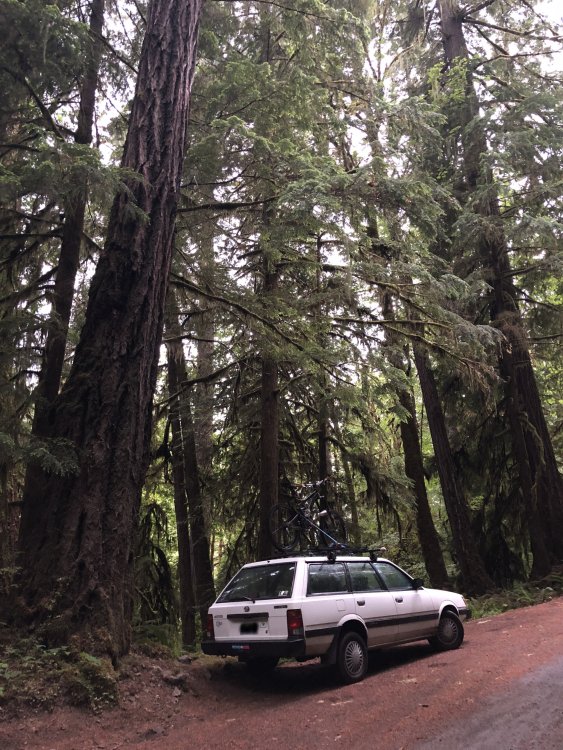
Trip: Mount Constance - South Chute Solo in a Day Trip Date: 06/23/2018 Trip Report: Climbing alone is not a priority for me, and shared mountain experiences with others are among my most vivid and cherished memories. However, climbing alone offers its own rewards... the quiet focus that comes from hours of not speaking, the attention to the wilderness that is required when you are solely responsible for yourself, and the rhythms of moving your own body over distance at your own pace and direction. I moved with my little family to Seattle in Autumn 2017, settling in north Ballard. Nearly every clear day since then my eyes have fallen upon a previously unknown to me mountain range of incredible beauty: the Olympics. Before moving to Seattle, I was only aware of the precipitous North Cascades and of course the big volcanoes. Now, I sip coffee and watch the light of the sunrise light up the eastern slopes of the Brothers; a bowl of snow and rime ice during the Winter months. The twin summits of the Brothers, with the elegant, scalloped ridge connecting them, were the first climbing objective that gripped me. I started to plot and plan an ascent, but the traverse would necessitate a partner. I planted the seed of an alpine outing with my climbing partner and watered it frequently, only to be reminded that scheduling and harmonizing lives from thousands of miles away can actually be the crux before the climb even starts. Alas, the Brothers traverse would have to wait. But what of summer, with its long days, relatively stable weather, and more forgiving conditions in the alpine? Surely there is another climb that can be born of this spectacular season? Of course, just a few degrees to the north, an even taller and more steeple-like summit beckoned: Mount Constance. Despite a state literally filled with fantastic alpine objectives, I was a prisoner to the spires I watched filter the sunset each day. So, the last-minute plan for a solo trip to the Buckhorn Wilderness was hastily constructed to take advantage of one of the longest days of the year... The Olympic National Forest, National Park, and the Buckhorn Wilderness are an utterly fantastic landscape. Without a climbing partner to share in the experience, I was compelled to share the experience post-climb through images and video. There is no shortage of information on the more technical aspects of climbing Mount Constance, with much of the best information hosted right here on CC.com. So instead I have assembled these images in a more story-telling fashion, you can find a load of Strava data here, here, and here, and you can watch the short I made of the climb here: I left downtown Seattle on the Seattle-Bridge Ferry the evening of July 22. Packed ferries meant I got the opportunity to sit at the ferry terminal for an extra 90 minutes and really soak in the city from that waterfront vantage. What a fantastic intersection of city and sea: <Leaving downtown Seattle behind.> I landed at the Dosewallips Road washout around 7pm and quickly got to setting up camp (in the Subaru), eating a burrito, and exploring the eastern-most washout area. Nice spot. I shared the "trailhead" camp with about a dozen other vehicles: Mosty party campers with fires and late-night laughter, but I did see a number of backpackers head out and up the valley late in the evening. <Dosewallips Camp. Big firs and cold water.> It rained all night, which was a nice serenade sleeping in a station wagon. In the morning I brewed up and left the car on my MTB right at 5am. <No need for a headlamp this close to the Soltice.> I really appreciated the advice of previous TRs on taking a bike for the Dosewallips Road approach. The climb from the first washout to the trailhead is not negligible, with around 900 ft of ascent before you even get off the road. A beautiful re-wilding of the Dosewallips valley is happening as slowly-but-surely the rainforest is reclaiming the previously developed road and campsites. I stashed my bike under the first bridge, about a half-mile before reaching the Lake Constance TH. <Dosewallips Road near the TH to Lake Constance.> <There is no longer a sign marking the start of the Lake Constance trail, but there is a subtle flagging as seen here.> As many others have noted, the early stretches of "trail" that lead through the old burn are pretty technical in that there is a lot of mantling and hoping over downed logs. It could probably use some maintenance for long-term durability, but I was thankful for the grade. Nothing like putting down a three thousand feet in just a few miles! It really is more of a climber's trail than a backpacking trail. The ecology of the Constance Creek valley is quietly beautiful with all of the accoutrements of a wilderness old-growth forest: countless waterfalls, moss on every surface, towering cedars and firs, and just enough devil's club to make it feel like you had to fight for your views of Lake Constance. I got to the lake at 8am, just in time to share a few quick words with a group of six or so people that were heading down from several days of camping and hiking, including a climb Constance the day prior. I passed one other pair of people similarly breaking camp to head down. After these brief interactions I did not see another soul for more than 10 hours (when I passed back by the lake on descent), as I had the upper Avalanche Canyon to myself for the day. <Tranquility encapsulated in Lake Constance at 8am, and Ramaria spp. along Constance Creek.> <Spires and summits on the South ridge of Constance protect the lake from morning sunlight in spectacular fashion.> So excited to be near the glassy-smooth lake, I missed the climbers trail out of the lower basin and instead found myself bushwhacking up out of the northern-most lake campsites. I made 600 or so feet of elevation progress before I found my way out and back on to the snow. Perhaps obviously, I do not recommend this particular bushwhack over the trail through the snow. <Back on the snow, it was easy to stay moving and motivated with views like this!> Avalanche Canyon really is a spectacular cathedral of pillow basalt and snowfields. It feels as though it is guarded by the sharp spires that surround the rim. As I progressed into the basin, I found myself daydreaming and plotting lines up the walls, leading to sharp perches above the canyon. I am certain that climbing on this rock is possible and probably even fun, but protecting a climb on this kind of rock would be a different story... <Aiming for the Cat's Ears shortly after leaving the lower basin. Mostly scree all the way to the notch at the top of the South Chute.> At this point the clouds began to boil and rise in the lower basin and it felt as if the clouds and their poor visibility chased me up to the notch. From the notch, semi-obscured views of the upper ridge and route were a harbinger of the climb and route finding charade that was to come. <At the top of the South Chute notch. Good place for a bagel break.> Despite the warm temperatures and soft snow in the intermittently sun-exposed areas, persistent shade from clouds and rock in others made for some crispy morning snow climbing and traversing. The conditions made me glad that I lugged both ice axe and crampons up the trail that morning. As I ascended towards the second notch, the left-most of the three at the top of the scree gully, I finally got an opening in the clouds to see where I had been and the setting of the South Ridge of Constance. It is a really grand alpine playground of snow slopes, loose scree, and old relics of the volcanism and uplift that created the Olympics... when you can see it! From here, the rest of my climb was stretches of crystal clear blue sky above alternating with in-a-cloud 200 ft visibility. This poor visibility, combined with lack of partner for consultation and memory, made route-finding a bit more difficult as I had to scout and re-check my route decisions a bit more. "Olympic Class 3" climbing is a little spicier than Colorado where most of my climbing experience lies, but in general I would rate the upper reaches of the climb as a super-fun scramble. The stretches of steep snow were an enjoyable reprieve from the scree and loose rock jungle-gyming, even when frozen enough to require crampons. For the sake of future trip planning, if I were plotting a repeat climbing visit to any part of the Constance massif, I would definitely aim for even earlier in the season to take advantage of more snow high on the mountain. <Looking back from the second notch during a brief opening in the clouds.> <Looking south near the entry to the Finger Traverse and associated bypass.> I did my due-diligence before the trip began, getting a solid idea of the exposure expected and what the psychological cruxes would be since I was solo. The Finger Traverse seemed like the best way to go, but as I climbed through the clouds I apparently missed the entry to the Finger Traverse proper. I ended up on the west side of the ridge, which I now understand to be the FT bypass. This route was the natural way I found my path over the ridge, and definitely does not exceed 4th class or the exposure of the FT, so I am guessing many parties find themselves traveling this way. I found the FT once I rounded the corner. At that moment in the season there was still a solid bumper of snow perched on the open book of the FT, but that did not make it seem any less airy! <Looking back at the Finger Traverse after rounding the pinnacle via the FT bypass route. I ordered up a sea of clouds for this one for extra dramatic effect.> <First glimpse of the summit block and upper reaches.> <From the base of the "yellow wall", looking back up at the route down from the FT and FT bypass area. Nice to have some soft snow for once!> From there, I was at the summit block in no time, a hunk of imposing basalt with little visible weaknesses until you traverse counter-clockwise around it to find the west face. <Summit block from the east.> <Looking north at the climbable side of the summit block from the west side.> After a few airy fourth class moves to pass the summit block while in generally clear conditions, I found myself straddling a rock on the summit of Mount Constance just before 2pm, half way to a goal realized... an ascent like this is only a success once you get back to the safety of your home and family. I only hung around on the summit for a few minutes. The wind began to whip, and the clouds boiled higher, strongly suggesting I would need some extra time to negotiate the poorly visible route on my return. <Obligatory summit-with-boot shot looking south down the ridge. The FT is visible near the snow with the light/shadow line, and looks pretty spectacular from this vantage. What a mountain vista!> <Looking south towards the FT/TT routes (prow at top center), which are accessed by ascending the snow up to the right of this view. Shortly after I took this image, the clouds socked me in for a more intimate version of the climb route on the way down.> <Finally back at the notch of the South Chute, out of water and ready to call it a day, but still 4k+ feet of descent to go!> <The kinds of views I was treated to for most of the descent. Route? Which route? Just follow the weaknesses in the clouds...> <Back in the lower basin: interesting geology and clearing views back into Avalanche Canyon.> <A sleepy Lake Constance on descent.> <Back in the safety of the rainforest.> Aside from the circuitous and comical route-finding in the clouds on the way down, the descent was relatively uneventful and even euphoric as I boot-skied my way down scree and snow to the bottom of Avalanche Canyon. I came upon a seemingly 100% still Lake Constance again, this time with a veil of fog and the sounds of two people setting camp for the evening near the shores of the lake. I shared a view words of camaraderie as I passed their camp, and began my descent towards the Dosewallips River with haste - I wanted to make it to the docks before the last ferry! I arrived at my bike around 7:30pm, and a few hoots, hollers, and a whopping 25 minutes later I was back at the car at 8pm eating left-over burrito scraps and changing clothes, almost exactly 15 hours after I had left. I made it in time to catch the midnight ferry back to downtown Seattle, a sparkling metropolis on the calm flat Puget Sound, and a sharp contrast to the steep wilderness in which I had spent my day. I did not originally intend for my first climb in Washington to be a solo one, and indeed I am looking forward to sharing experiences like this with partners on future adventures. However, the solo experience was far from a waste. Moving quietly and quickly through the jewel of wilderness that is the Buckhorn area, I have been left with a deep well of gratitude for this preserved land and the freedom and health to roam it. __________________________________________ Original post, below. __________________________________________ I'll edit this TR with pictures and full descriptions within a week or so once I get my images onto my computer. For now I just wanted to upload this TR for those of you that are curious about route conditions and perhaps planning a climb for Independence Day weekend. Also, I'm new to the CC site, so Hello! This site is an amazing resource! Car-camped at the Dosewallips washout Friday 6/22, it rained all night. Left the car at 5 am on the bike, stashed the bike at the first bridge and continued on foot from there. Arrived at the Constance Lake around 8 am. Missed the turn for the climber's trail out of the lake area and ended up bushwacking for about 600 ft of elevation out of one of the campsites until I made my way back to the snow/climber's trail. Visibility was intermittent due to fast-moving clouds lapping over the primary ridge, making route-finding past the top of the South Chute quite difficult at times. South-facing snow was soft when in the sun, but frequent cloud cover kept many of the higher snow slopes frozen - ice axe and crampons on the steeps were essential the day I was up there. Also, as several others have noted, "Olympic 3rd class" is indeed a little stiffer than Colorado 3rd class. Summited around 2pm with spectacular views of Warrior Peak, Inner Constance, and The Brothers summits poking out of a fast-moving sea of clouds. I descended by reversing the South Chute route. Despite having just climbed through the maze of the South Chute with poor visibility, descending via the same route in even poorer intermittent visibility made route-finding difficult again. A partner or more route pictures/notes would help immensely in such conditions. Descended back to the bike by around 7:30pm, and back to the car by 8:00pm for a 15 hour car-to-car. Caught the midnight ferry back to Seattle and home by 1:30am. This is a fantastic climb! The maze of gendarmes, scree and snow slopes along the ridge is an experience I won't forget! Gear Notes: Helmet Ice axe Crampons Approach Notes: Bike was key for the approach. Trekking poles were nice for the Lake Constance trail between Dosewallips and the lake, both for up and down.2 points
-
Trip: Enchantments Link-up Light - Acid Baby and Solid Gold Thru-Hike Trip Date: 06/23/2018 Trip Report: My last time up in the Enchantments I remember hiking out past Snow Creek Wall, feeling totally destroyed after climbing Der Sportsman car to car, and thinking how cool it was that the hard climbing locals can crank out big linkups in this alpine playground in a day. Inspired, my buddy Tim and I settled on a goal of getting as far as we could on a linkup we’d seen done by Jenny Abegg and Whitney Clark where they climbed Acid Baby, Solid Gold, and Iconoclast in a day. While we’re nowhere near the caliber of climbers they are, the linkup is so logical and laid out so cleanly along the thu-hike we just had to see how far we could get. The quick and dirty blow by blow: -Leave Portland after work and hit the trailhead by 11:30, alarms at 1:30 for a 2:00 start time. -Tim wakes to some unfortunate lower GI issues, no TP in the toilet, great start. -My first time on the approach from this side and in a hurry, we blast pass the turn for Colchuck Lake by almost a mile, adding nearly 2 miles to the day right off the bat. Awesome! -Arrive at the base of Acid Baby, stuff one pack into the other for the carry-over, rack up and get climbing by 5:30. - Climb Acid Baby. Great route, that’s highlighted by the spectacular and exposed position on the “summit” knife edge ridge traverse. Photos: The route, tiny me can be seen belaying P4 Dork starting Pitch 3 Tim following P3 P4 Long shot of P4. Thanks Adam for the photos! Knife edge traverse, Dragontail in the background Hero Shot -Finish around 10:30, not fast by any stretch of the imagination, but not super slow considering we were onsighting and not exactly sure what to expect. We’ll take it. -Hike up to the plateau in the Core Zone. Not sure where to go here, fearing getting cliffed out if we stay high and needing water, descend into the lake zone and what we hope is a straightforward way to Prusik Peak. It wasn’t. -Wander around the Core Zone as inefficiently as possible, down climbing slabby rock, hopping across waterfalls, and eventually hiking on snowy slopes around Perfection Lake, slogging our way up to Prusik Pass. In total this took about an hour and a half longer than what we were hoping for. (Anyone know the best way to do this!? Do we stay high? Just move better?) -Tim’s gut bug is catching up with him. He is less than psyched but marches on. -Start Solid Gold around 1:15, feels great to be climbing again! Solid Gold really is amazingly good climbing. We hit the West Ridge in 3 pitches and simul to our way to the summit by 4:00. Solid Gold P1. Linked this to just past the little boulder problem around the roof on P2 to make linking 2-3 easier. Top of Prusik, look how psyched! -Tim’s psyche returns, amazing what a little rock climbing can do, we may just be able to pull this off! We rap and rally for the long 8 mile haul to Snow Creek wall. -Fast forward 8 miles, we are hurting. I’m totally worked and Tim is stumbling and hallucinating by the time we hit Snow Creek Wall. Side note, if there is ever a true champion it’s Tim Bemrich, he pushed through some serious pain and discomfort to get us to this point and didn’t complain once. -Decide it would not be reasonably safe to try and descend off SCW in that state, so we make the prudent decision and bail on the last route. We had done what we came to do, get as far as we could. All in all a great and tiring learning experience with a great friend. We’re already excited to give something like this a go again! Thanks for reading! Gear Notes: Nuts, double rack tips to 3. Brought a 4 for P1 on Acid Baby but didn't place it all day, booo. Lots of slings. Approach Notes: Colchuck Lake2 points
-
Trip: Half Moon - North Ridge Trip Date: 06/23/2018 Trip Report: Me, Fred, and Dave climbed the north ridge of Half Moon (part of Kangaroo Ridge) on June 23. We went in knowing almost nothing: it is 5.7 and you climb up from the notch, that's it. There wasn't hardly even a reference to the route on the internet, a somewhat vague Summitpost page written about a climb many years ago (before I was born), and a short paragraph in Beckey. We made short work of the approach gully due to some steps kicked seemingly that morning... did someone else climb to the notch that day? Maybe they went down the other side to access the east side of Big Kangaroo? It was super cold and windy at the notch, I think we were all wearing pretty much everything we brought. Fred lead out on really roughly textured granite with lots of features... unfortunately most of the features turned out to be hollow flakes. Fred lead two pitches up a featured face to a large sandy bench passing two bolted rap stations (one was good, the other pretty old and manky with home made hangers). I took the next lead up what looked like a great lie back corner but turned out to be decomposed granite with crystals popping out and hollow flakes. I placed a few pieces for about 40' then the pro and rock quality deteriorated and it felt safer to just run it out. At the top was a large semi-detached flake/pinnacle about body sized or larger that I had to put my entire body on at one point... I was pretty glad it held, and a bit surprised honestly. I thought it was fun but I don't know that my partners shared my enthusiasm for this part. At least it got me warmed up after the cold belay at the notch! We walked left on a sandy bench for about a rope length then I lead up again basically straight up the arete. The rock was better here and the climbing easier. One lead got me on to walking terrain; I belayed my partners up and we scrambled another rope length to the summit. The summit was nice and flat, large, sunny, calm, warm. Beautiful. We laid around for about 45 min cloud-bathing and trying to identify peaks in the low ceiling to the west. Then we rapped and downclimbed the route. We had double ropes for climbing with three so we did a couple of double rope rappels. You could do the route with a single 60m but we wanted to avoid rapping off the crappy old bolts. We did remove and replace a lot of old webbing so aside from the old bolts the raps should be pretty good. This has become a bit of a thing for me lately, there is so much trash laying around the mountains in the form of rap tat. If you add a piece, please take one home with you as well. On the ascent in the valley: Easy snow travel: Looking back on descent, the route is more or less the skyline: Dave about to wipe out while boot skiing: Sorry I didn't get any pics while on route, I'm trying to get better about that. Gear Notes: single rack to 3" aluminum axe for the ascent, not really needed but habbit Approach Notes: Easy due to snow on the slope, will be crappier later as it melts and turns to loose scree.1 point
-
I have a pair and they'll be fine on the DC route. Snow balling could be an issue. One other tip is that the cord on the bottom stretched out the first time I used mine and had to be adjusted. Be sure they're adjusted tightly and you shouldn't have an issue.1 point
-
Trip: Wabbit Ears - Standard Trip Date: 06/17/2018 Trip Report: ah, the elusive rabbit, cloistered in obscurity, dejected down a long ridge from table mountain, frowning upon the furious boil of bonneville dam just below - shrouded in secrecy, protected by a brushy bushwack, you kinda-sorta gotta want it trip the first a disastrous donnybrook on a memorable memorial day - geoff n' kyle n' i circled aimlessly through the woods, waylaid by a less than perfect description of the approach n' our lack of common sense - stinging nettles - beers n' black flies in the bush - the only interesting thing the old big gun platforms up on aldrich butte - we paid our respect to the builder of beacon in the cemetery there in no'bo as it was the season for the reason - how the fuck did the park not mark the centennial of the trail he built? trip the second more a solo reconnaissance in force - feverish w/ flu and tingling w/ a prophet like rage in my febrile state, i made my lonely way up the proper trail now with a big roll of surveying tape, intent on establishing the right track for the 'swack so we could return and do the fucking thing proper - more stinging nettles - more flies - but this time a happy ending - got a great trundle as my reward, and then a silly tumble down the approach gully as my reminder i've become a sad old man w/ feet made numb by nattering nabobs and cruel concrete... the proverbial third time then was the charm - big thunderstorms the day before so we rallied a bit late in camas in the baleful hope the sunday heat would cook off the sodden bush - didn't help what was to be a stolid humid hike - an hour of slow plodding and dripping sweat and we were at the PCT and girding ourselves for the 'swack, which went well now that it's so masterfully marked - geoff declined to wear pants and paid the price - never seen a lawyer run so fast or yelp so loud as when a whole forest-full of yellow-jackets lit into his legs we got up to the notch and made ready to do battle - me mostly just trying to vent the buckets of snot that illness and pollen have bestowed upon me - here i sit atop the scene of my trundling crime after a beer and a butt, kyle was already tied in and shot off like a rocket - the first pitch has no pro but a single slim tree, but it's just 3rd/4th class gravel so i guess who cares? funky anchor where it attains the crumbling ridge a single 70 sufficed for the 3 of us, doubly so since geoff oddly decided to solo the first, most exposed bit - me coming up the first pitch later the twin summit is a just a heavily-laden swallow's flight away from here - i set out w/ a bunch of useless gear - an easy traverse on a gravel path, a decent bolt, and then a bit of a head-scratcher - everything crumbly as hell - there's plenty of exposure - you can plainly see the notch between the 2 summits you want, but how to get there? after hemming and hawing, i mantled up to just below the overhang below the notch using a tiny sapling about as big round as a pencil, which got me to a place i could sling a more reassuring tree - mantled on that, certain everything my feet were touching was about to go crashing down towards the columbia, but then it was done and i was in the notch, where you could actually place a 3-4 inch cam, but ironically of course it's no longer necessary as there's an anchor at an uncomfortable stance geoff followed i brought up kyle next and he led up the 35 feet or so to the higher rabbit ear - there was a single fixed pin for pro and a funkyish anchor atop - the other ear looked wierder and we skipped it the lower ear and me in the notch kyle on top and the anchor of ages bonneville dam, the pct, lake gillette and the anchor of ages certainly enough exposure to get a godless guy good n' kilt summit or death! quick, nobody look at the camera kinda a funky rap to get back to the approach gully - with our 70 we could rap straight down to the bolt, then walk on rap back the gravel path, around the lower tower to the first anchor - kyle went last and pulled the rope from the bolt, then got belayed back to the first anchor a 2nd rap and we were back to the top of the approach gully as the thunder began to roll and rain appeared in the distance set up a rap to avoid tumbling down the gully like i did the previous time - was easier just to use the rope as a handline though so none of us actually hooked in - we scooted back across the bushwack as fast as could be, certain the storm would break, but in the end it missed us and pounded points west - back at the car after a leisurely 6 hour affair, we waxed philosophic and grew great after mending our previously wounded pride - the road resplendent with rising steam from the recent storm, the air fresh and clean, the sun bright and cool, summer's appearance was clear and that was call enough for smiling as we each went our separate ways Gear Notes: couple long slings for trees/bushes - maybe a knifeblade or 2, but really there's not much by way of pro beyond vegetation, a newish bolt and a fixed pin Approach Notes: from 14, turn north just by the dam as if going to the n bonneville hot springs (now a rehab facility) - turn right onto cascade drive and stay on it as it turns and curves, passes the old resort and follows the lake - a little over a mile past the old resort the road turns to gravel and a nasty "private property - we will tow your ass away" sign appears - there's a tiny bridge here too - park here, before the signs (you can drive past them at first just to recon the scene) - there's room for 2-3 cars (this is the best/shortest approach for doing the table mtn loop now that the resort is closed) walk down the road about a hundred yards to where the power line maintaince road goes up right - follow the maintaince road for about 100 yards when it branches off to the left and becomes an old logging road - follow this steep old road bed for about a mile until it reaches carpenters lake - ignore the first primitive trail that cuts off right and about 150 yards past the lake, a sign points you left to aldrich butte (ignore) and right to table mtn (take this) - follow the trail towards table mtn for another mile until it connects with the PCT - from here you can just kinda see the rabbit through the tall trees - turn right and go all of 50 feet down the PCT to start the bushwack - currently very well marked with pink surveying tape - only 1/3 mile or so - thick ferns and nettles at first, then trees n' talus and side-hilling - the goal is to get to the steep gullyish thing that leads up to the notch that separates the rabbit from the ridge leading up to table mtn - total approach time 1 1/2 - 2 hrs1 point
-
Trip: Mount Baker - North Ridge Trip Date: 06/22/2018 Trip Report: We started off on a bad note with Robie arriving at the Park n Ride 45 minutes late. Sean had just returned from a leisurely trip to Italy the day before. I haven't slept for more than 4 hours since my baby was born 2 months ago. We were all exhausted, and we hadn't even started. And yet, spirits were high. It was both Robie and Sean's first time on Baker and I had only done the standard route. Quickly we ran into some hairy creek crossings in the dark. Water was running hard. It had been 90 degrees in Seattle this week so lot's of melt to be expected. With skis on our back, 45 lbs each, the approach was tough. I had worn ultralight running shoes, and only brought one pair of socks. Well, they were soaked. Robie reassured me our feet were going to be wet all day anyways. We quickly rose above treeline, above the Heliotrope campground where we saw maybe 10 tent groups, slowly waking up. As we got onto the Coleman Glacier we could spot a group of 2 above us traversing towards the same route. The North Ridge, looking rather mellow from this perspective. The sun was rising, the sky was turning colors, Mt Baker was showing her face, we were on route and feeling good. And then we were on route. We thought we were going to follow an older bootpack up left but as we neared it, it looked cumbersome and out of the way, so we opted for a more direct route towards the other 2 parties ahead of us. Collective exhaustion was super high as we were running on 36 hours of no sleep (expect Sean had a 3 hr nap). We took a break below the ice pitch and made Ramen. A bit of back and forth and Robie agreed to lead the ice pitch. It looked steeper than the photos we had seen. After some solid sticks, we realized it was Hero Ice! We had 7 screws, so Robie went for it in one pitch. Baller. Then it was Sean's turn. Then I snagged this photo, which I really like. It captures the moment. Sea of clouds, North Cascades poking in the distance, sunshine, glory, hero ice, stoke was very high. Above the ice pitch we got into some mixed conditions. It was my turn to lead and it felt like about a foot of wet snow ontop of a delaminating shield of ice. If I smacked hard enough I could get to the ice for a screw, or if I hammered the shit out of picket it would go in. 50 meters each, Robie and I swapping leads up the upper ridge. This upper ridge section was glorious, for a moment at least. Team exhaustion/fitness was waning and we were moving slower and slower with each passing step. The sun was raging, our skin was burning, wind was picking up, and the day was passing. Then the white out came. Heavy winds, colder temps, all of the layers on. I couldn't see Robie, one step at a time. Unsure what time it was, or how long we had been on route, and wondering how we were going to ski down and get back to Seattle. Occasionally the clouds would move and the glacier's would appear. Like monsters with no rhyme or reason they tower above the world. And then we summited. Pure alpine joy. Now an 8000 ft ski descent. The ski down was quick and efficient. We got back to the main trail and cruised out to the parking lot just by dark. 10pm. 20 hour go. What a fabulous day. Found pizza in Belligham, pulled off the highway for an hour nap on the drive home but made it back to Seattle at 3am. What an alpine adventure! Gear Notes: 7 screws, 3 pickets Approach Notes: Good shape1 point
-
sounds like pinchy wasn't pleased! How about 2/2 instead of 2/3? It's all contrived anyway and no one has actually fully repeated ALL of Acid Baby (one more pitch up top). Besides no one will ever top my feat of summiting everything in each Beckey guide in the exact order of the index in the back of each volume in a day on foot starting at sea level. Anyway Jenny and Whitney benefited from not having a set of male genitalia which Rolf and Dan can attest to being a significant benefit to one's performance in the alpine1 point
-
So....much.....work. Wow! 2/3 is still pretty impressive.1 point
-
Trip: eldorado peak - Inspiration Galcier Trip Date: 06/23/2018 Trip Report: We started 12 AM in the night to push for one day summit C2C . The starting of route was to cross the tree logs over the streams few of them in night it was quite a challenge but after that it was easy to navigate using headlamps. Boulders field were dry so we were easily able to cross them just following bearing We hit the snow around 4000ft and from there just straight up at this point mist started. We reached the base of summit 7600ft around 6:00 AM when weather changed quite a lot windy, cold and no visibility (this was not a forecast . We waited under rocks safe place 30 mins to get clear weather but it didn't change so we continue to tag the summit , we had no views we stand for 1 min on summit no one was there and then we started descending and reached cars around 1:30 pm. We saw 2 parties coming up on glacier and then on boulders filed more climbers were coming up for 2 day summit , we noticed it was not easy to assent/decent boulder field with heavy packs. Overall it was awesome climb. Gear Notes: standard glacier travel Approach Notes: wet boulders filed is a challenge1 point
-
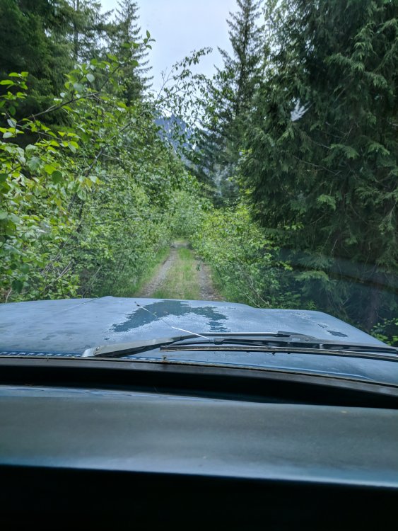
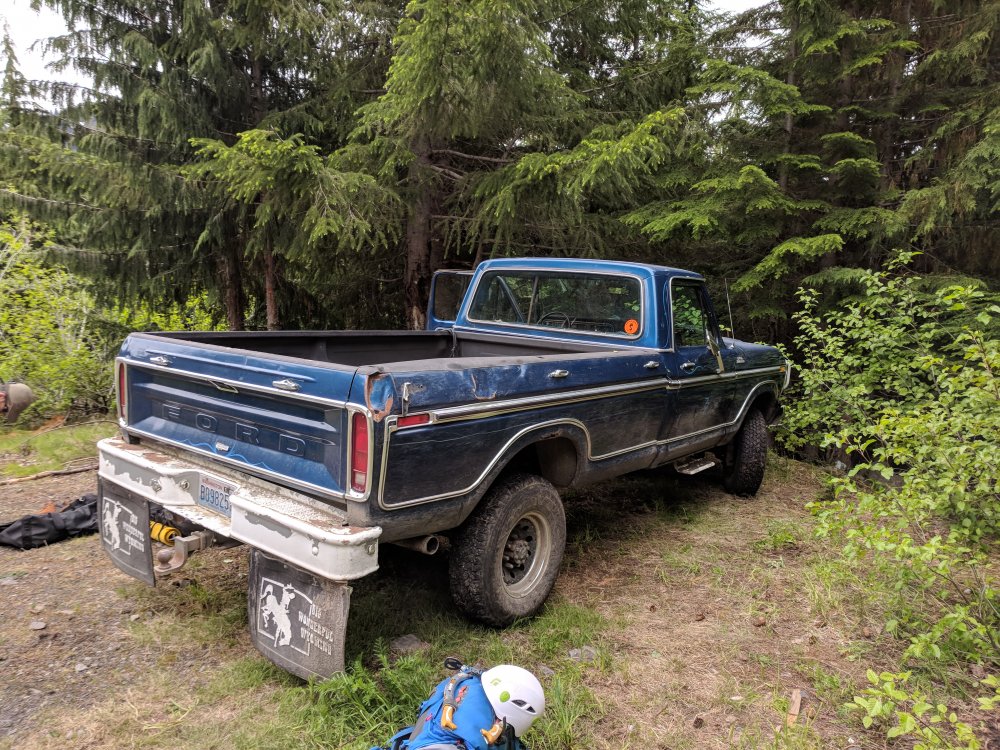
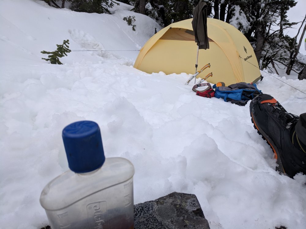
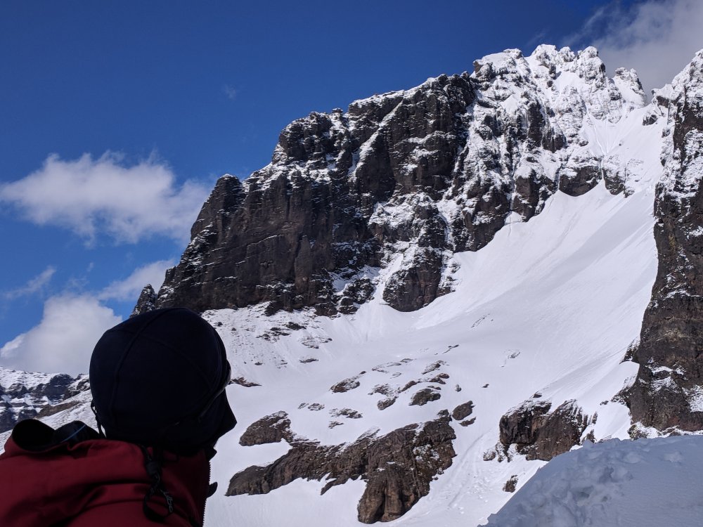
Trip: Lincoln Peak - Standard Route…I guess Trip Date: 06/11/2018 Trip Report: Trent texted Sunday night wanting to know if I was in for tomorrow. Uh, sure. For what? His partner bailed on his planned Lincoln Peak trip. Did I want to go. I haven't climbed any alpine in month's, out of climbing shape, drank all weekend with friends. Sure, I'll go. But I don't know anything about the route or approach, so Trent is the navigator on this one. We got a later start Monday so we didn't have to sit in camp for too long that afternoon. Left Burlington at 11am and drove up to the infamous FSR34. We had the secret weapon for FSR 34. Big Blue, a '79 Ford super duty beast of a truck. We drove up the road through brush and ruts to within 1 switchback of the end. Big Blue would not be denied. We then started the thrash up the old road bed. It is a thrash with plenty of slide alder, rock and an occasional trail. We broke off uphill after having enough of the road bed and enjoyed steep underbrush until finally breaking out onto snow. Surprisingly there was a fairly substantial layer of fresh snow, but travel was easy from there to high camp at the end of the ridge. We got from the car to camp in under 3 hours thanks to Blue. Great views of Lincoln and the route were enjoyed while sipping some whiskey and trying to stay warm. It was breezy and colder than we expected for the evening with clouds moving in and out. A 2am start got us to the top just after 6 for a cool sunrise. The shrund was negotiated with about 40' of steep s'nice climbing, then some crappy snow climbing with a 2" breakable crust with 4-5 inches of sugar underneath. We did have the occasional front pointing, but the large part of the climb was popping through the crust, unless you're bantamweight Trent who seemed to dance on top way more than clydesdale me. Route finding was pretty straightforward and the climbing consistently steep and enjoyable without being hairy. We broke out the rope for the final 10ft onto the summit. Great views with clear weather on top in fresh sunshine was perfect. One rappel off the summit and then we down climbed the entire route with the exception of the schrund, where we did one 30m rappel off of a picket. The steps I bitched about on the way up made for easy down climbing and back to camp. The thrash back down to Big Blue made us cuss and spit, but we made it back in 2 1/2 hours and licked our wounds with IPA spittle. All in all a great day out with Trent. The climb is really enjoyable with a bit of Rockies taste to it. If someone cut a path through that hell of an approach I think it would be a regular classic for its short climbing window. Some crappy cell phone pictures. No Jason G on this trip to capture the great images. I suck at photos. Gear Notes: 2 tools, rope, pickets, Hunters Approach Notes: Big Blue. Shwack, thrash, swear1 point
-
I'd concur with Keenwesh with one further consideration: the fit needs to be ROOMY. Even a heavily insulated boot won't keep your feet warm if the fit is tight. For my two Denali seasons 1981 & 82) I wore a double booth that was a full size larger than my summer alpine boots. I also had acquaintances that got away with using Galibier Superguides (the most popular single alpine boot in those days) two sizes oversize, wearing more socks and insulated supergators. Another acquaintance, dealing with a pre-existing condition of previous frostbite, had good experience with electric socks. whatever you decide, test it on shakedown trips as cold as you can find (Icefields, Montana-Wyoming-Colorado) before you head to Denali1 point






.thumb.jpg.2e9a5d684eebc49a6fc53941125c8284.jpg)
