All Activity
- Past hour
-

[TR] Mount Despair - southeast face/east ridge 08/14/2021
Sela replied to peter_mcb's topic in North Cascades
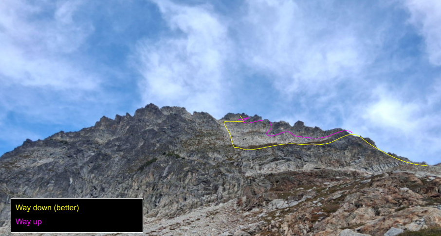
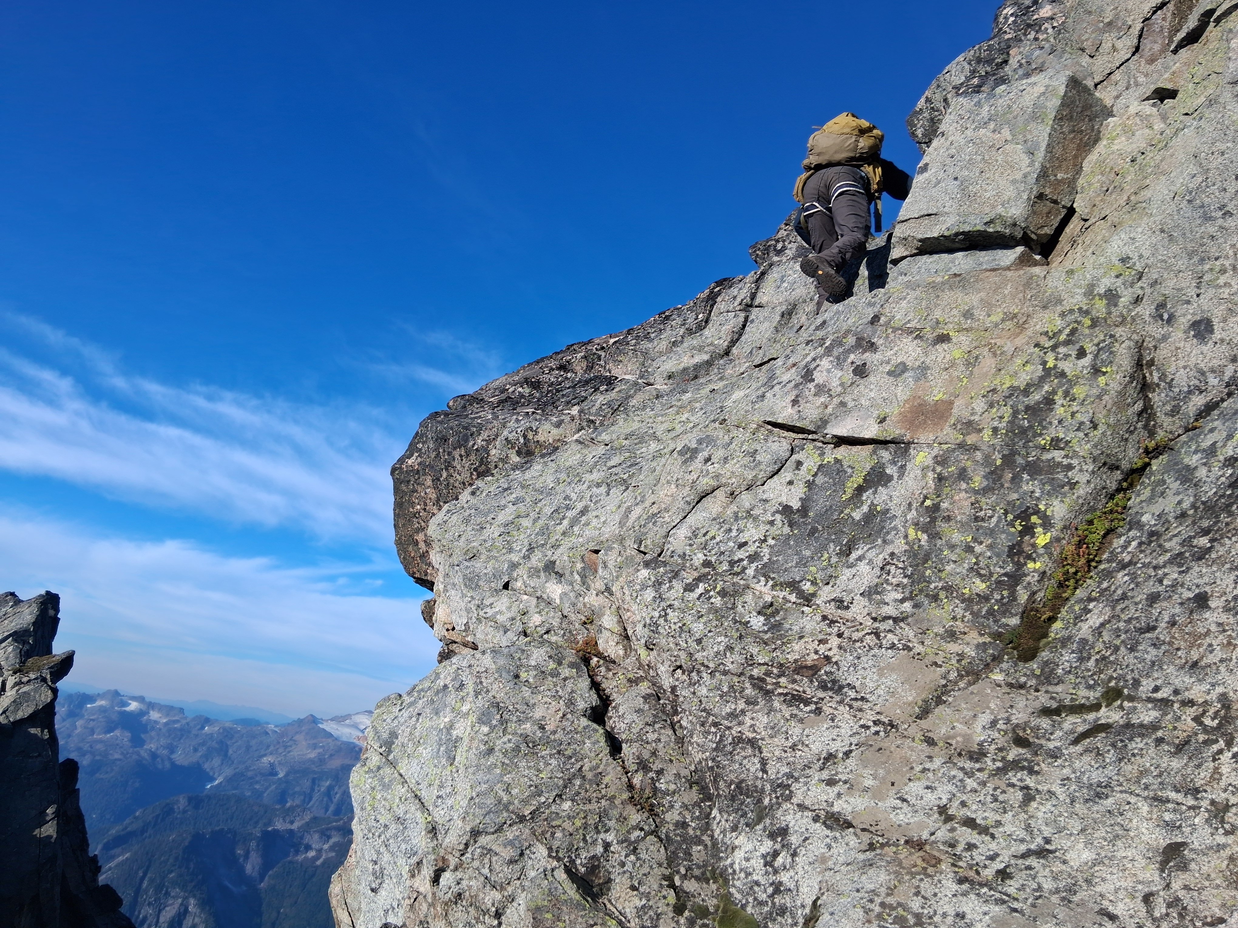
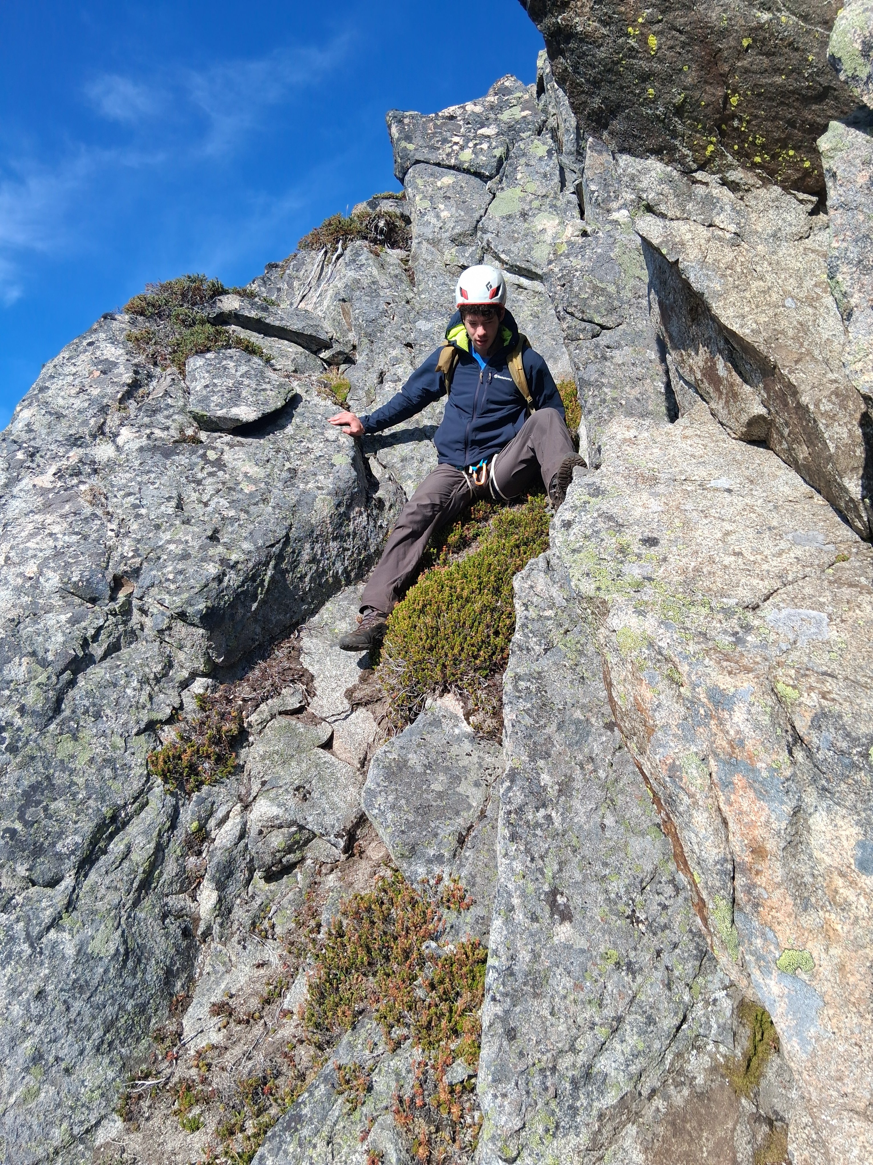
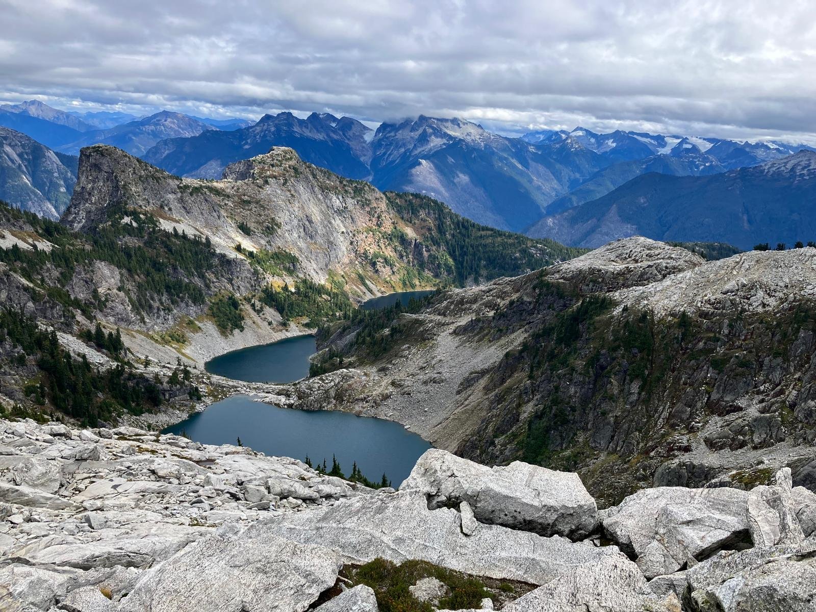
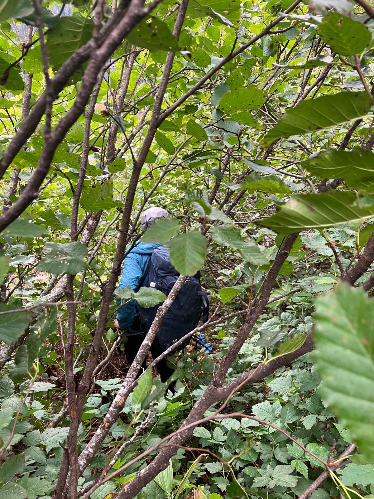
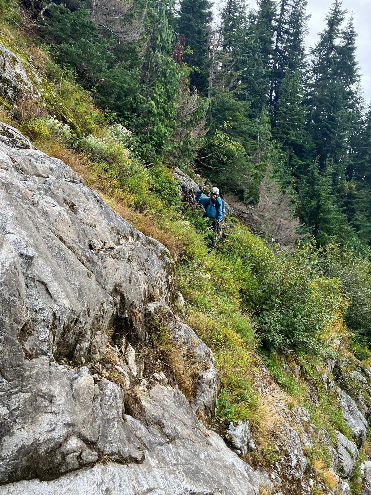
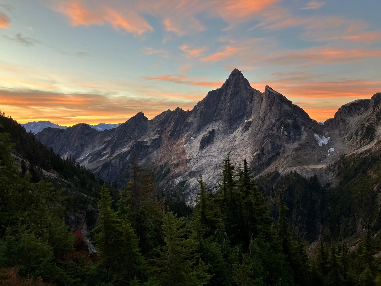
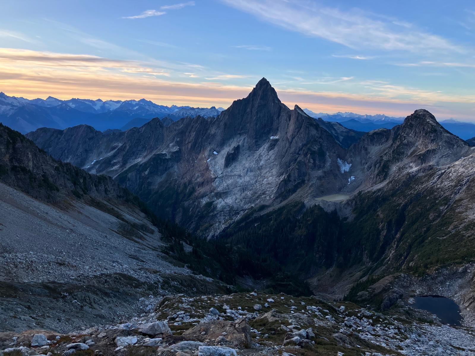
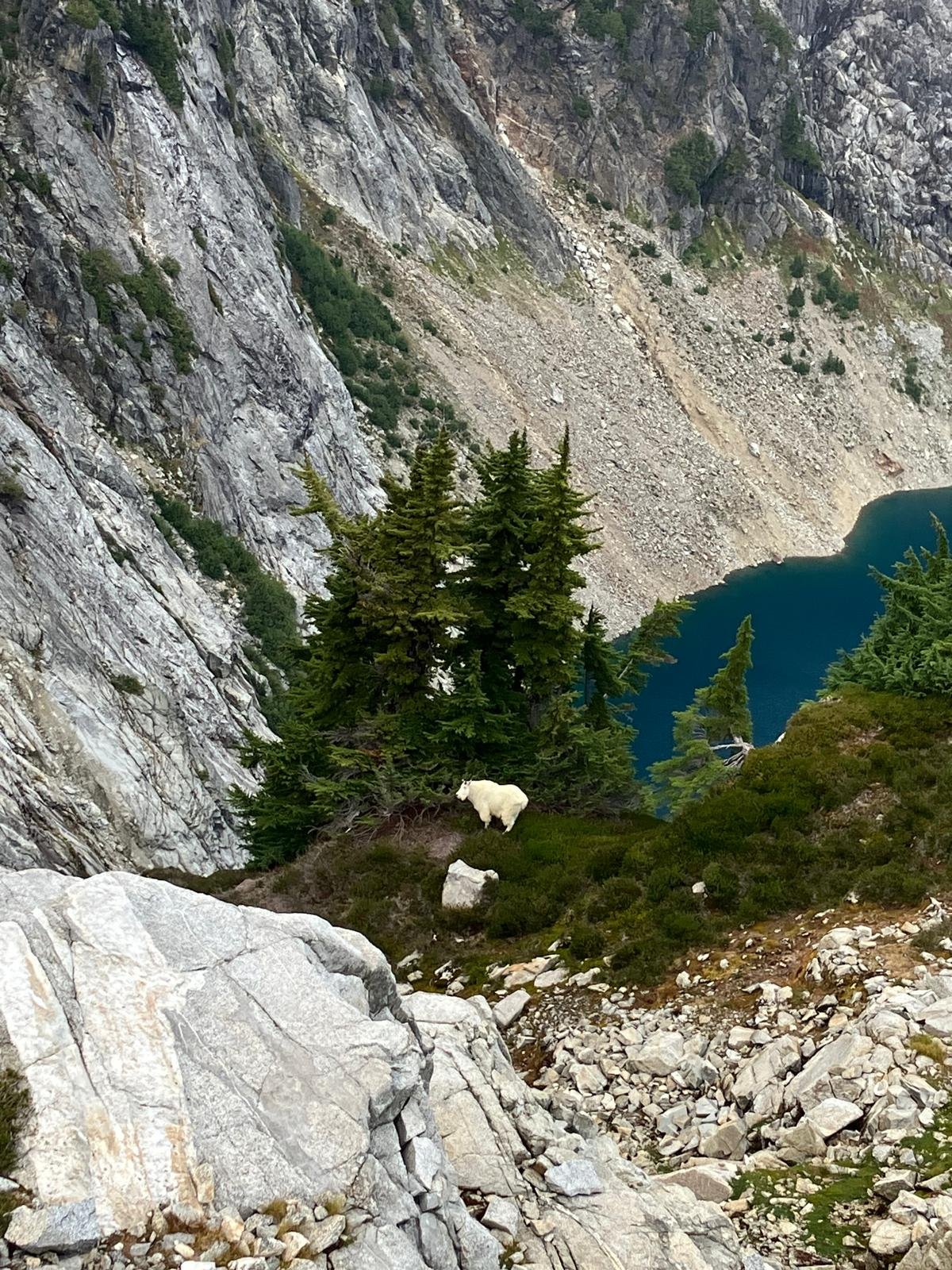
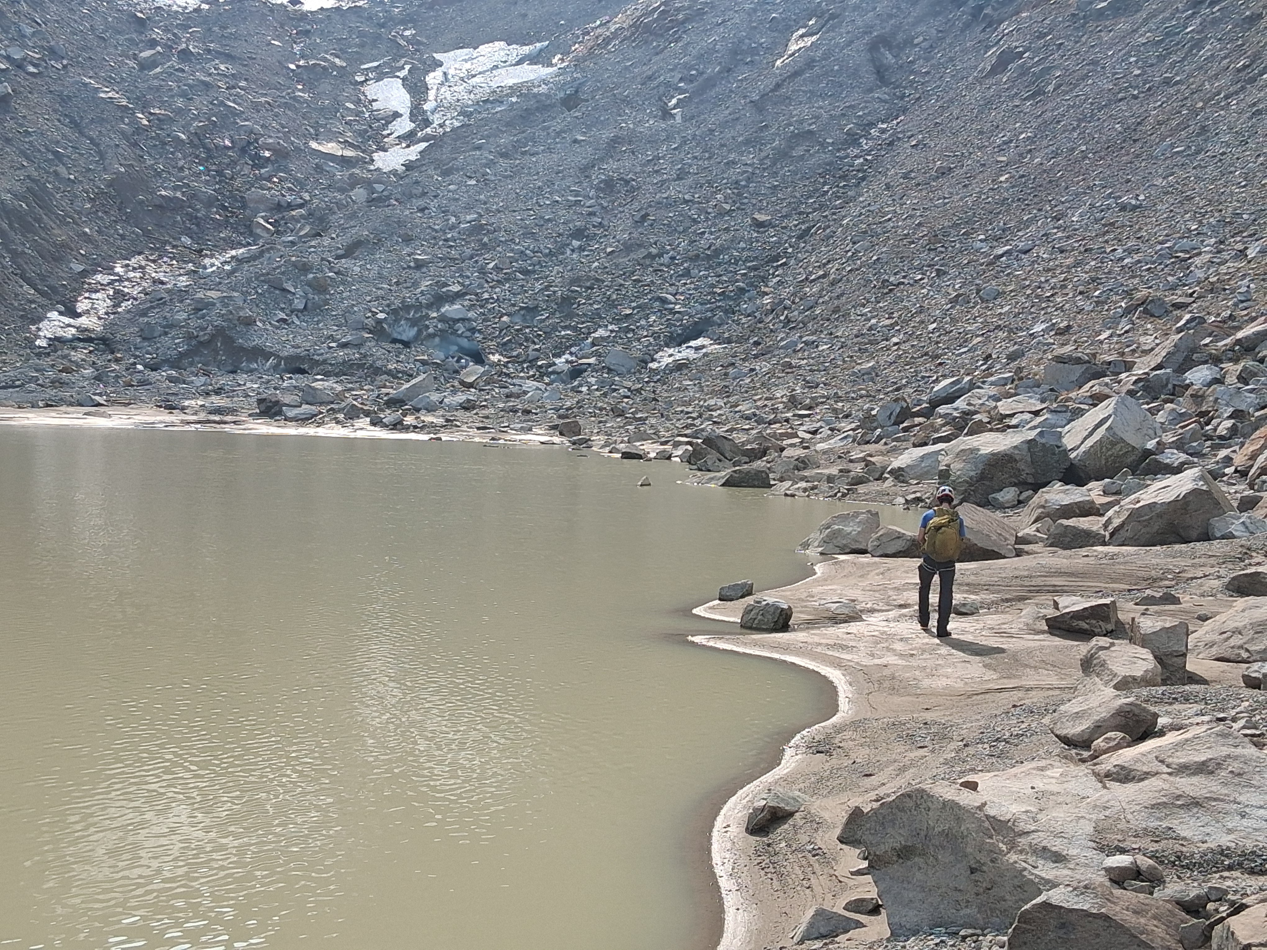
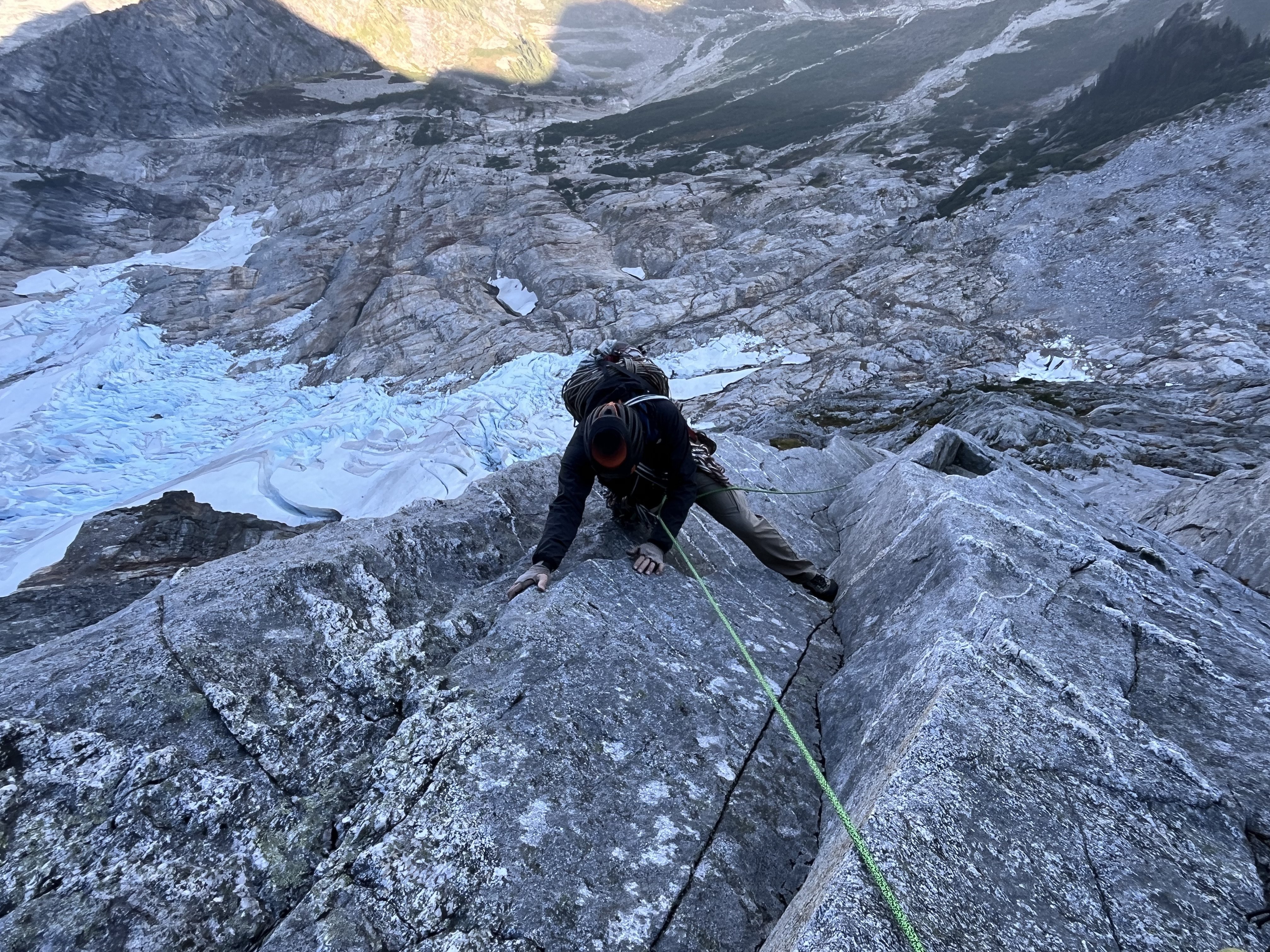
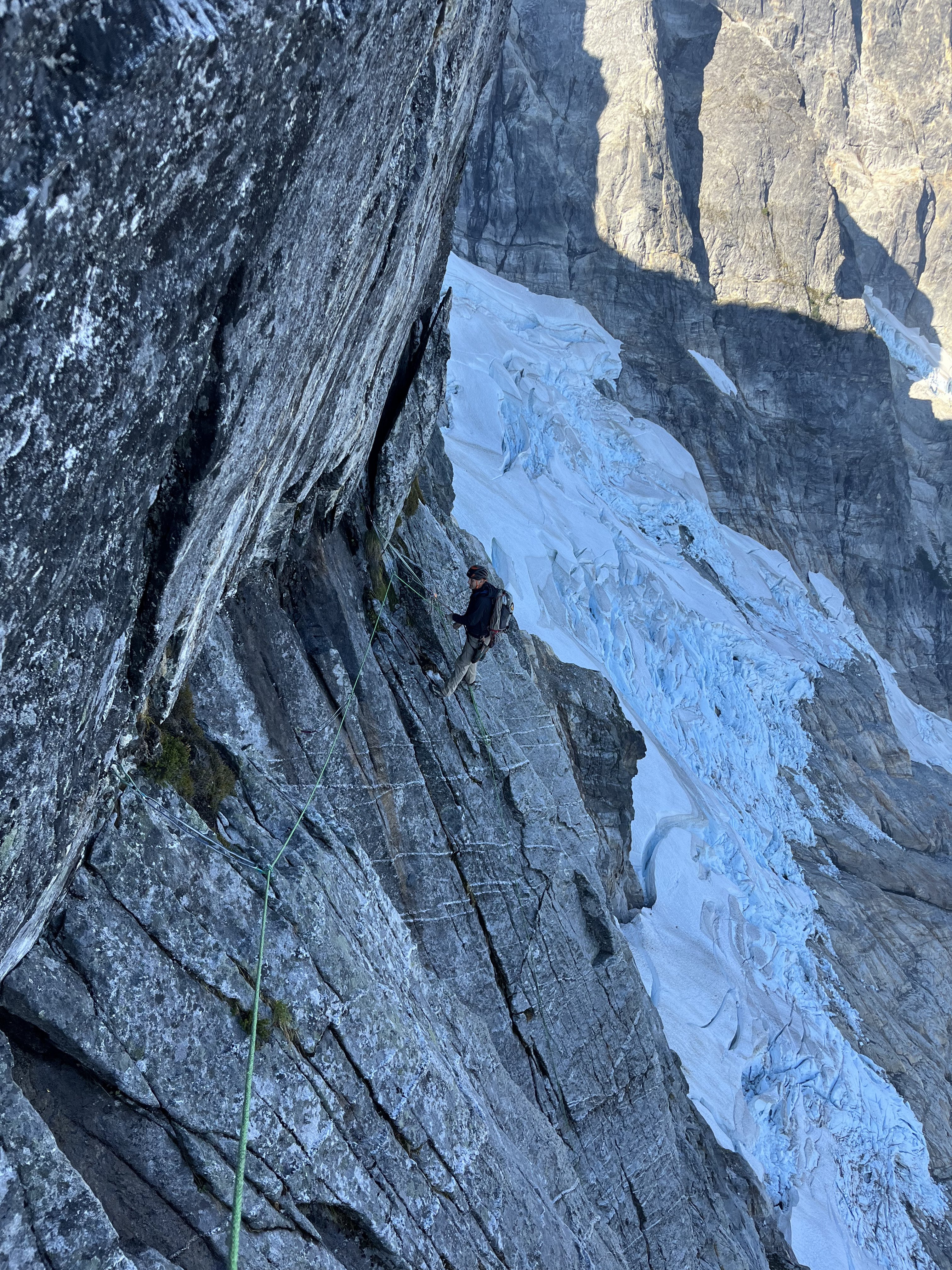
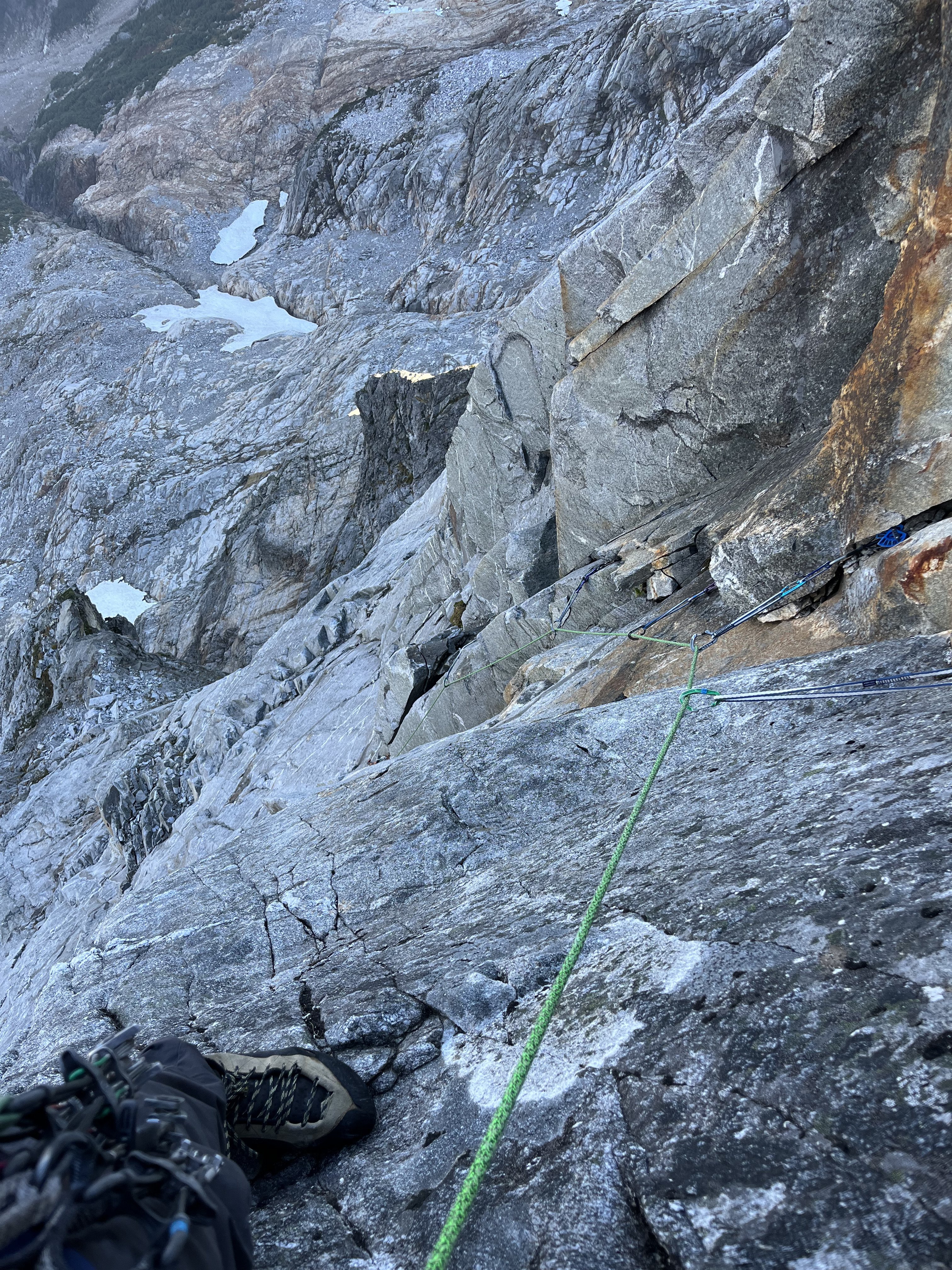
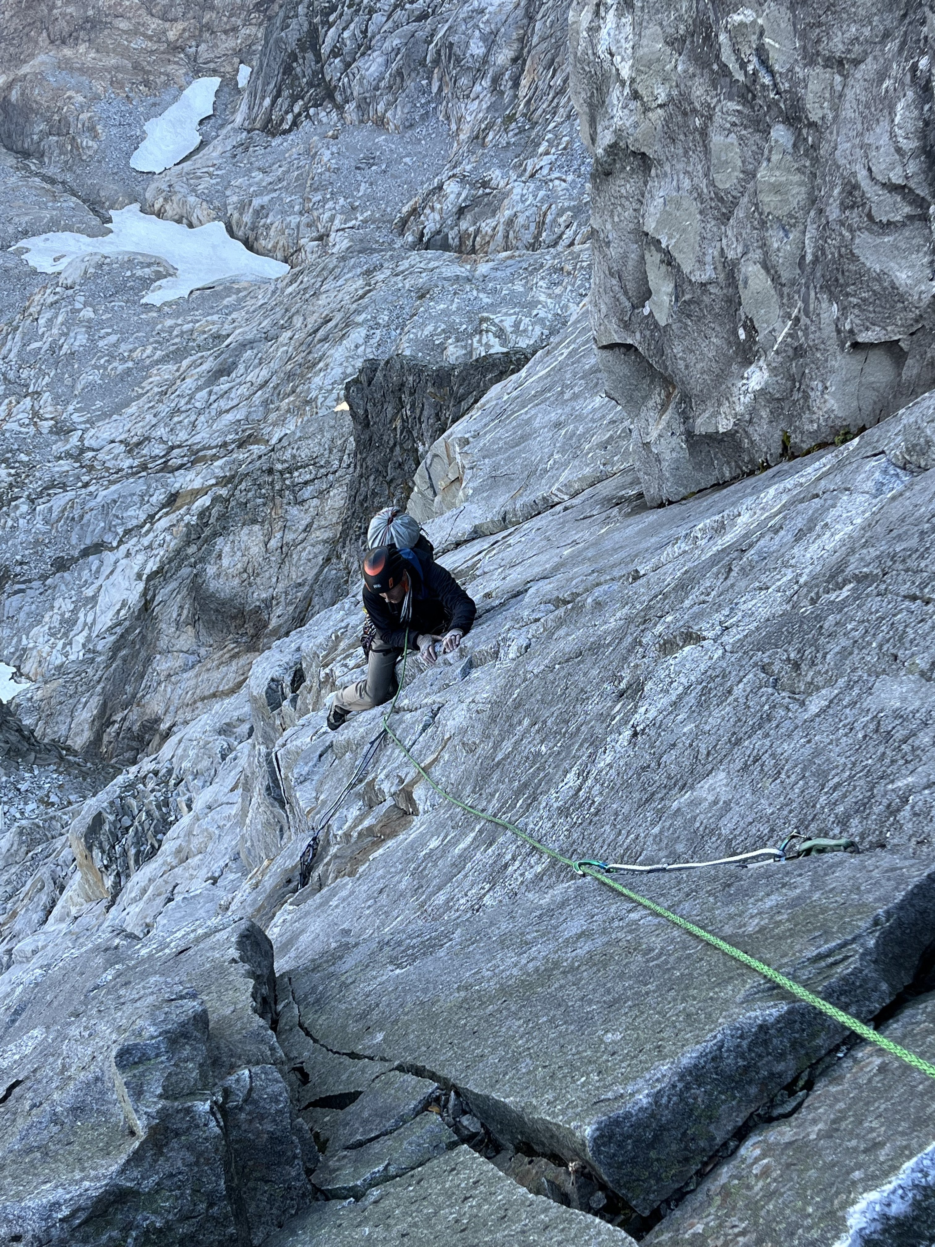
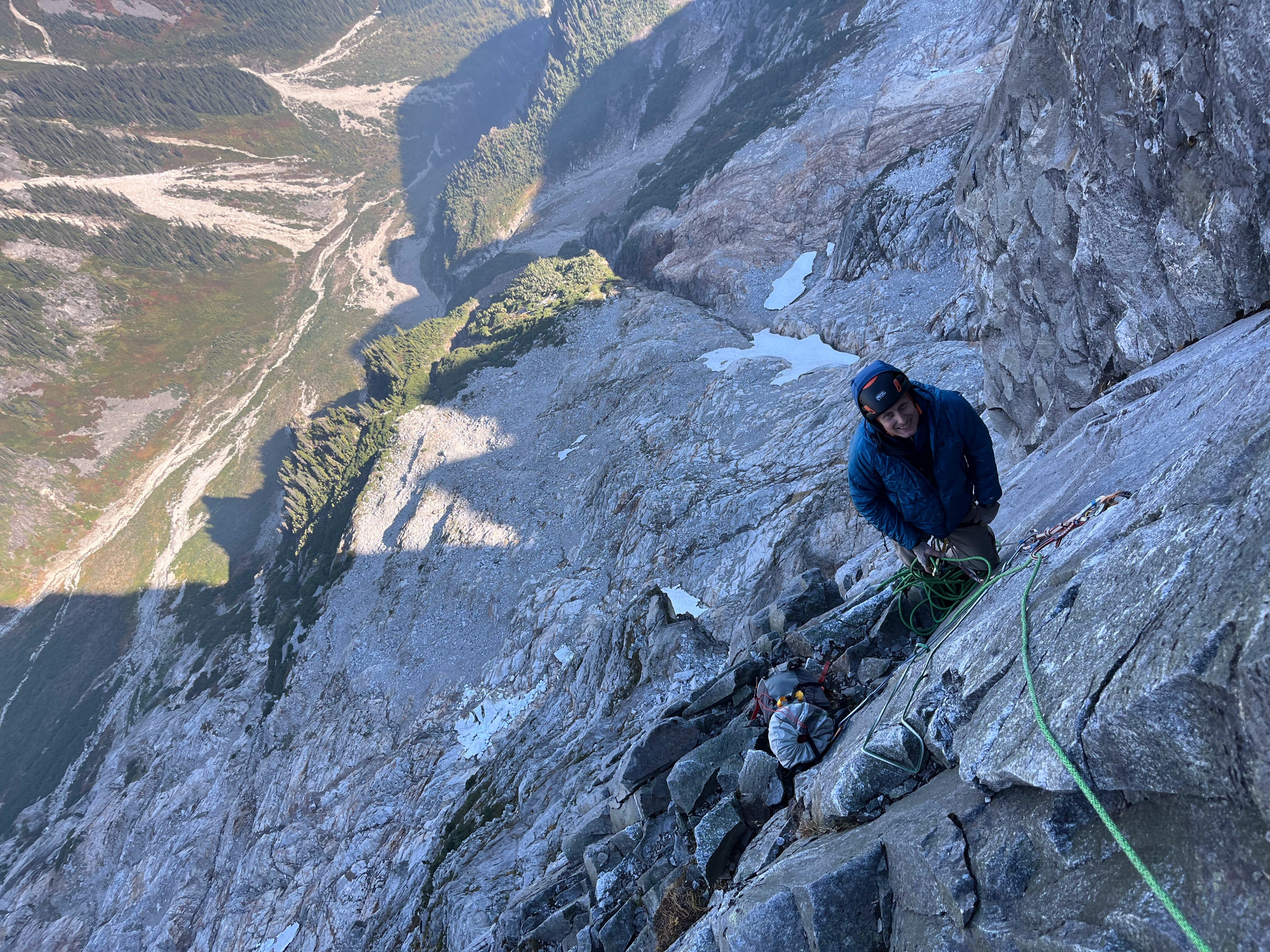
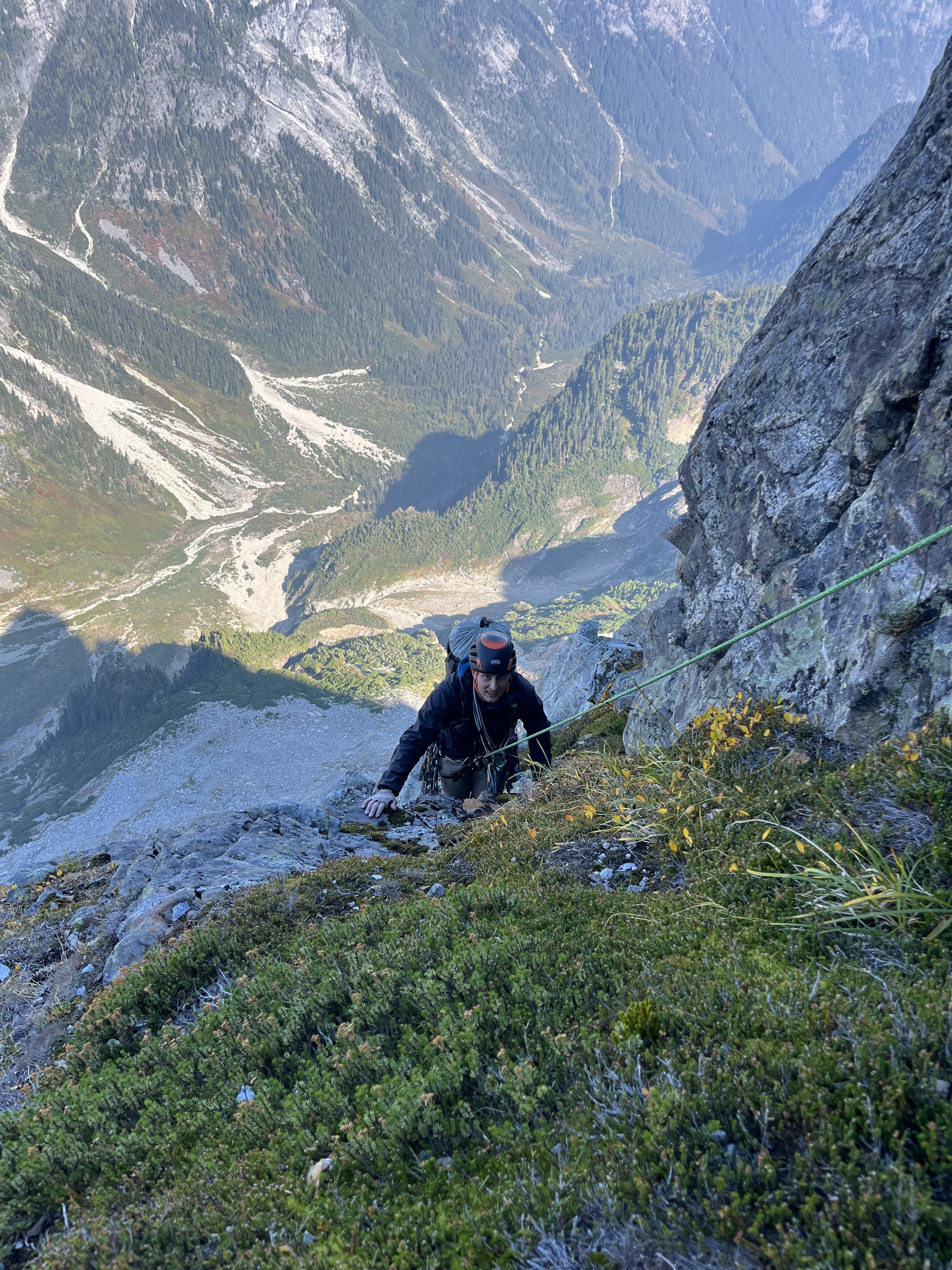
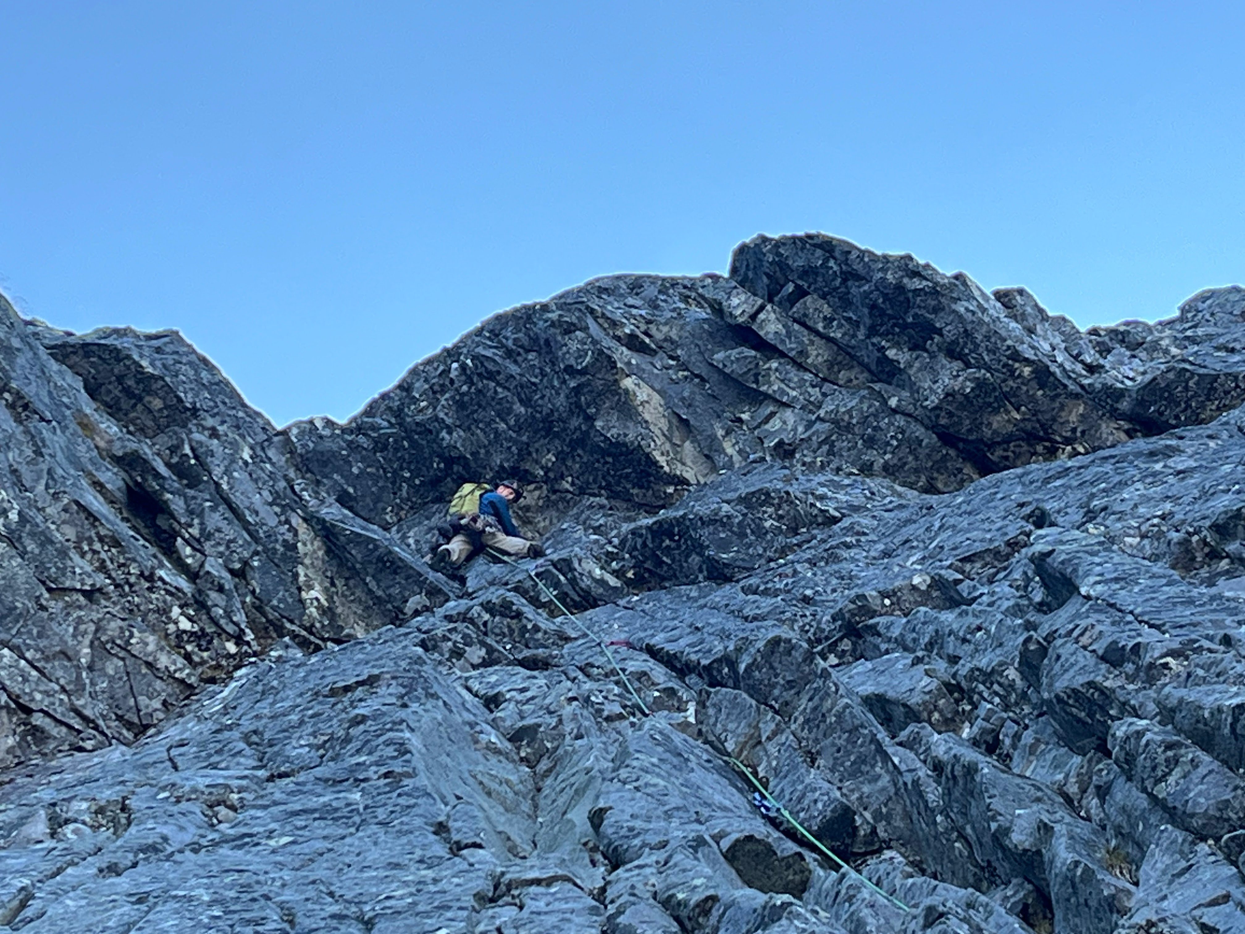
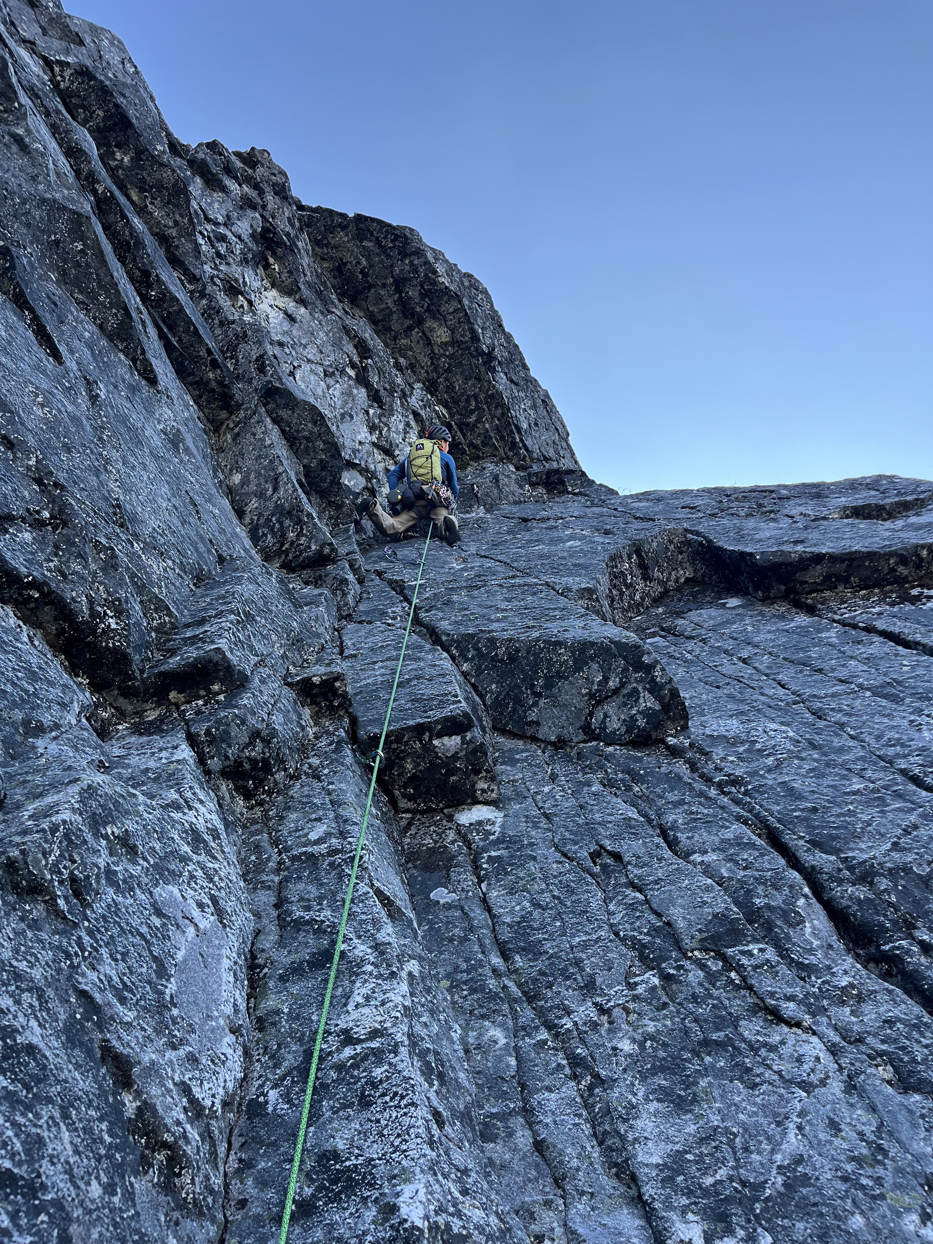
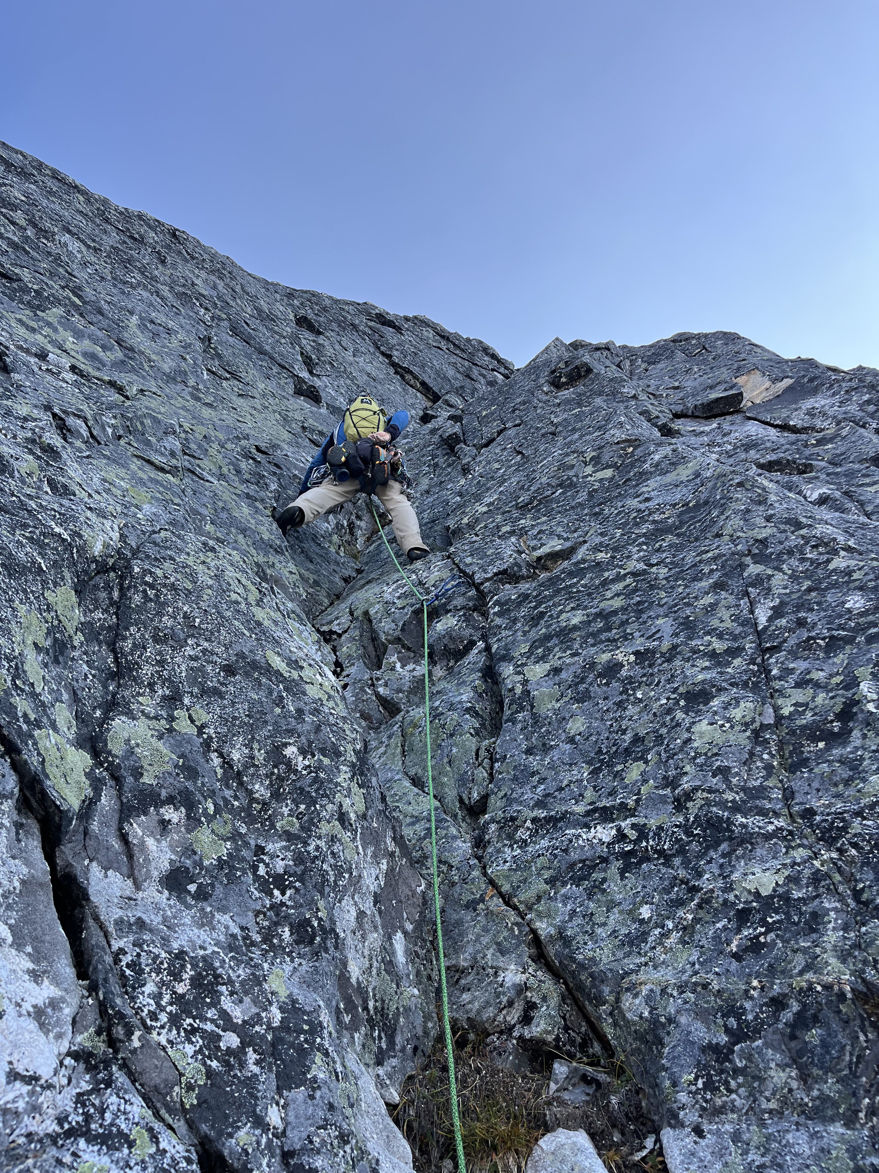
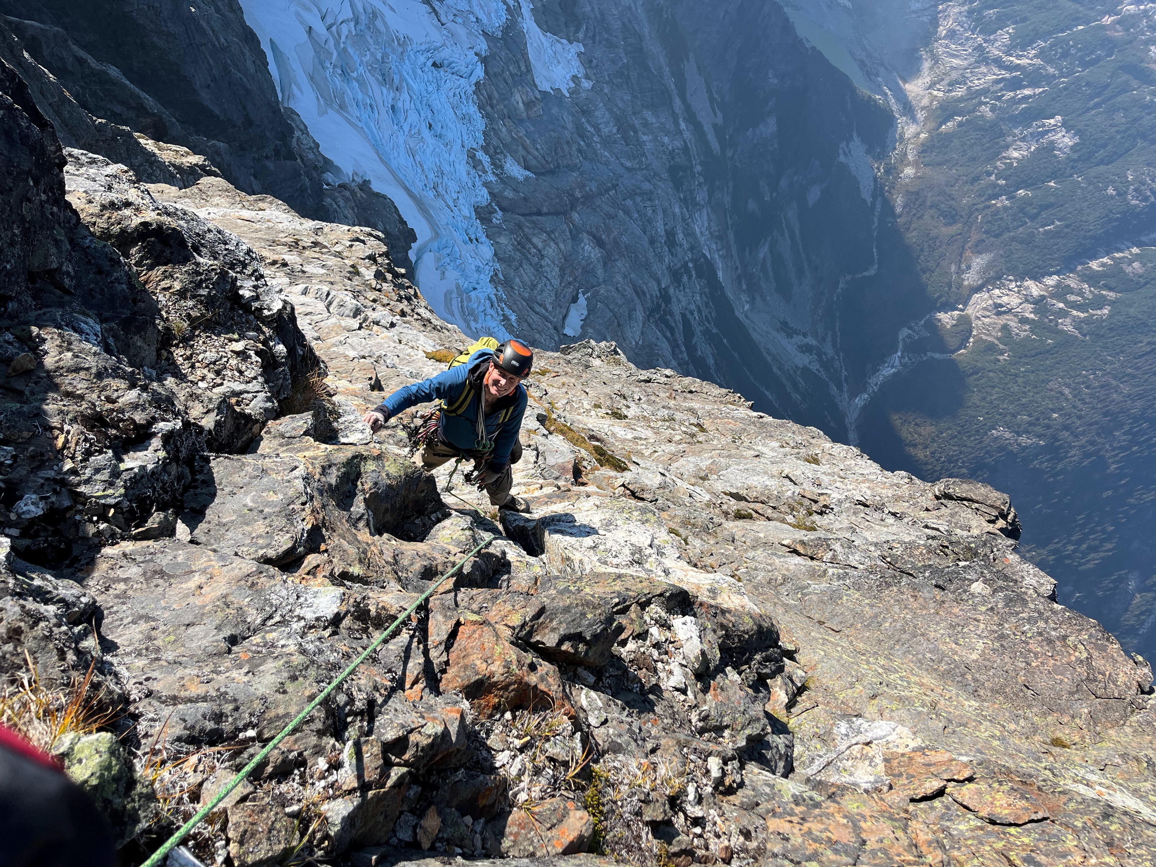
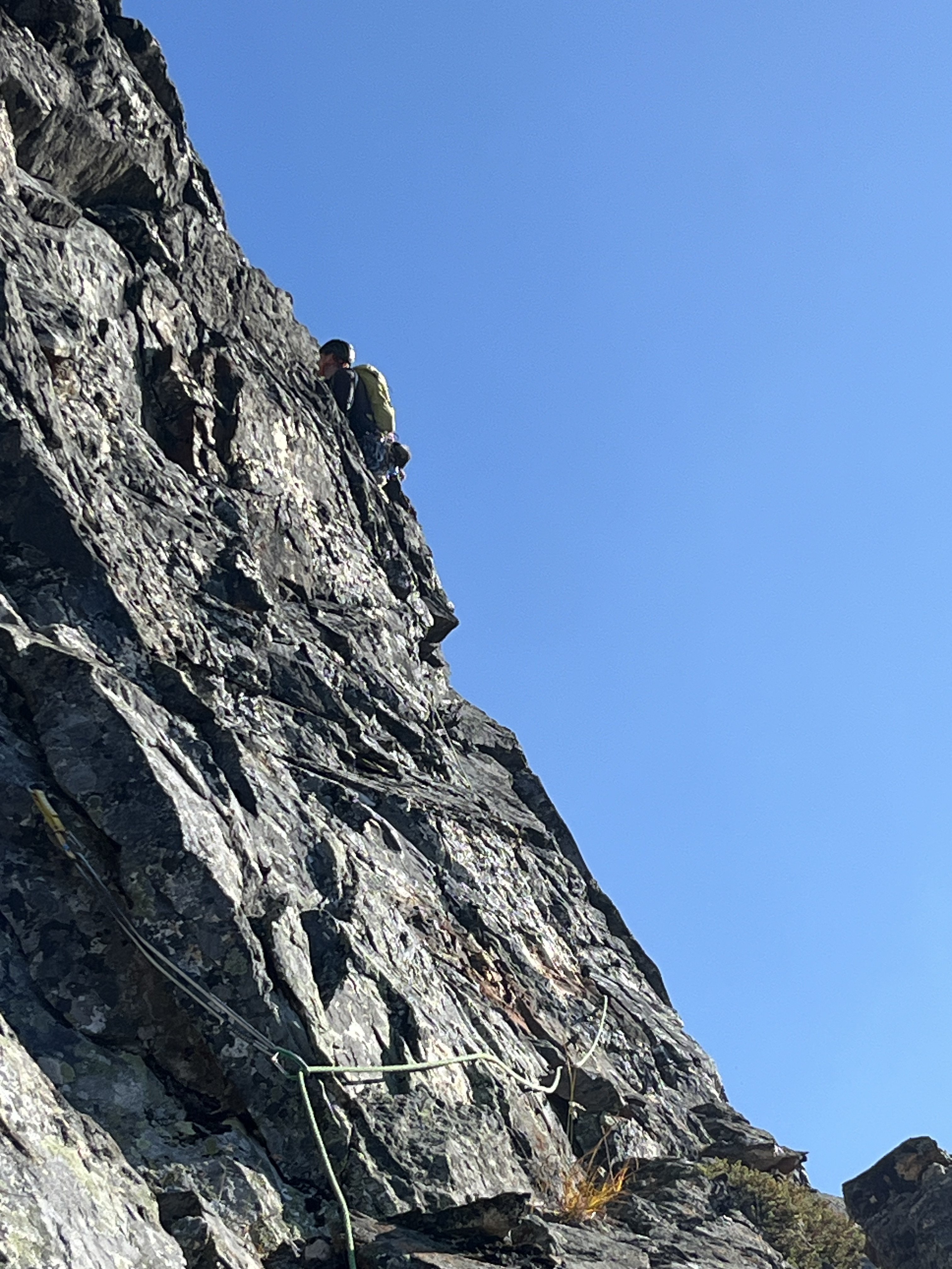
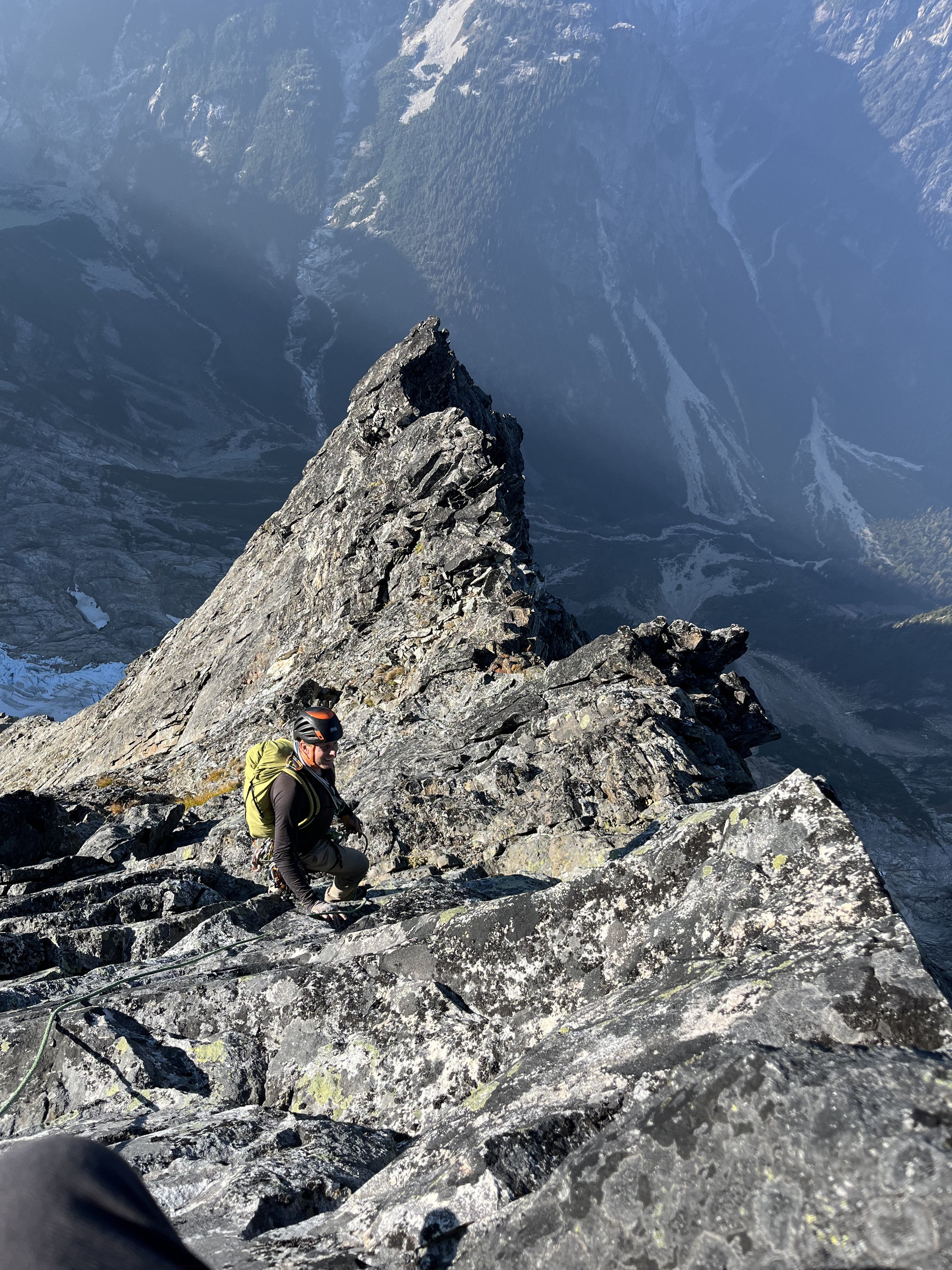
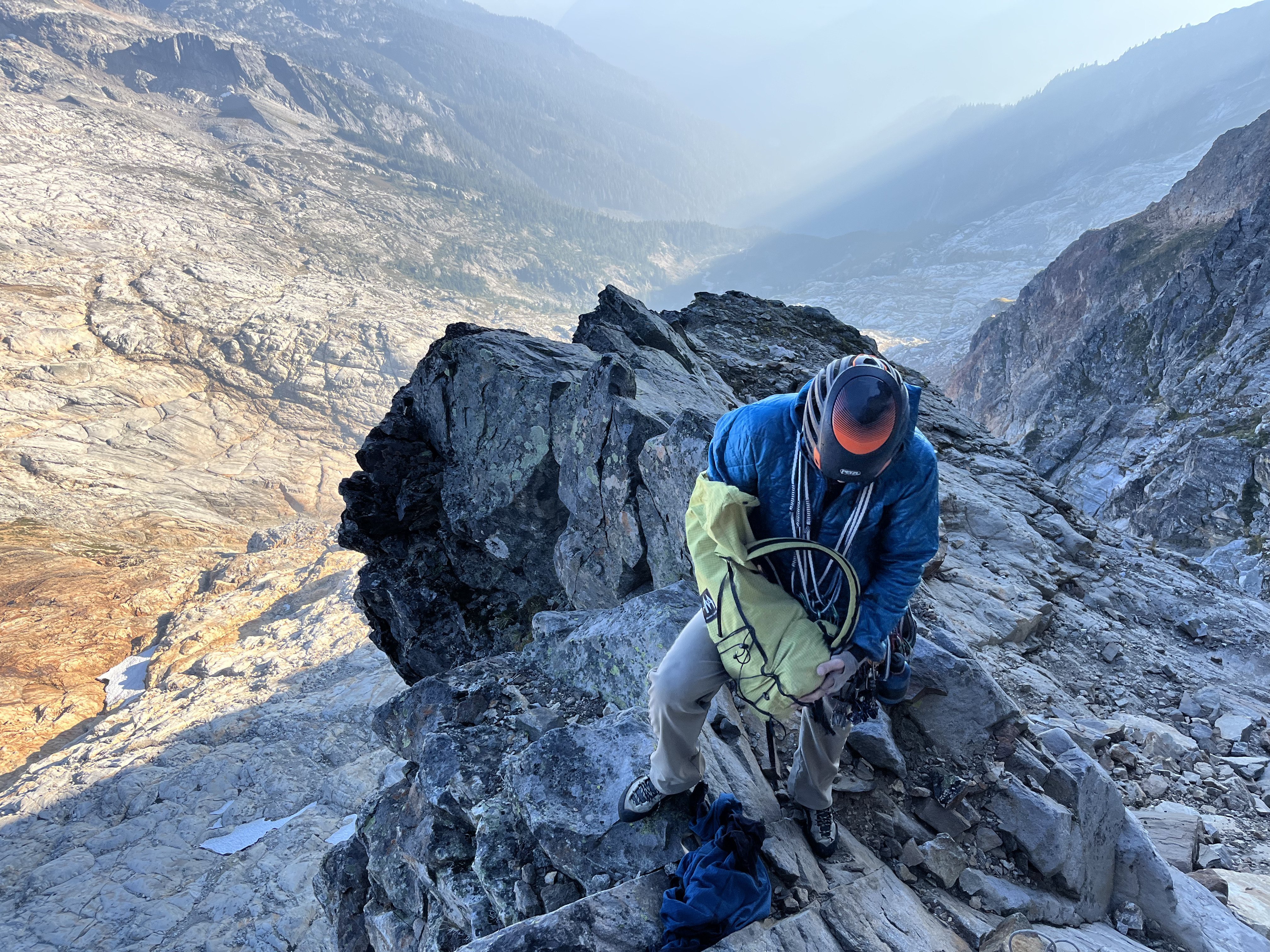
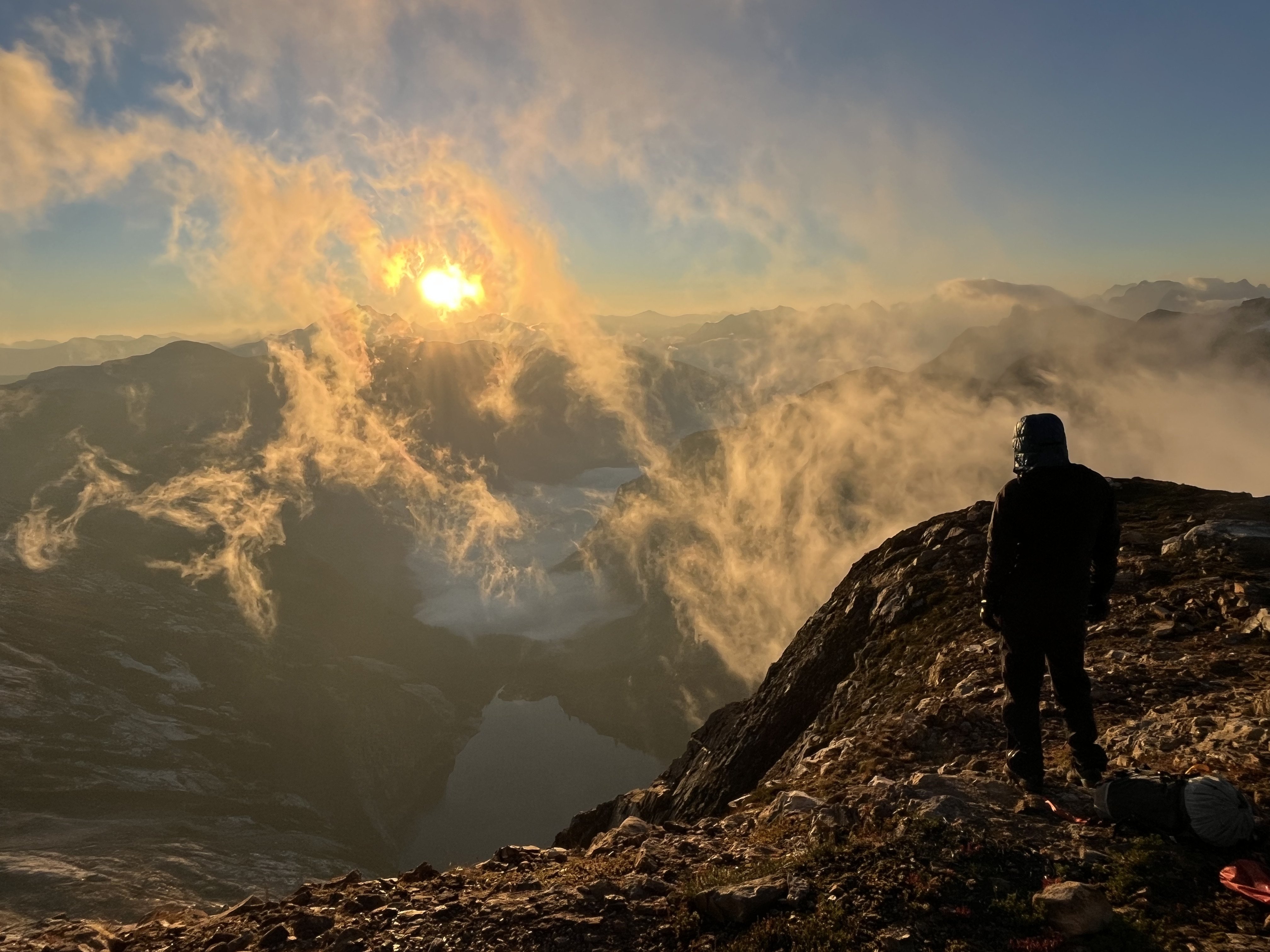
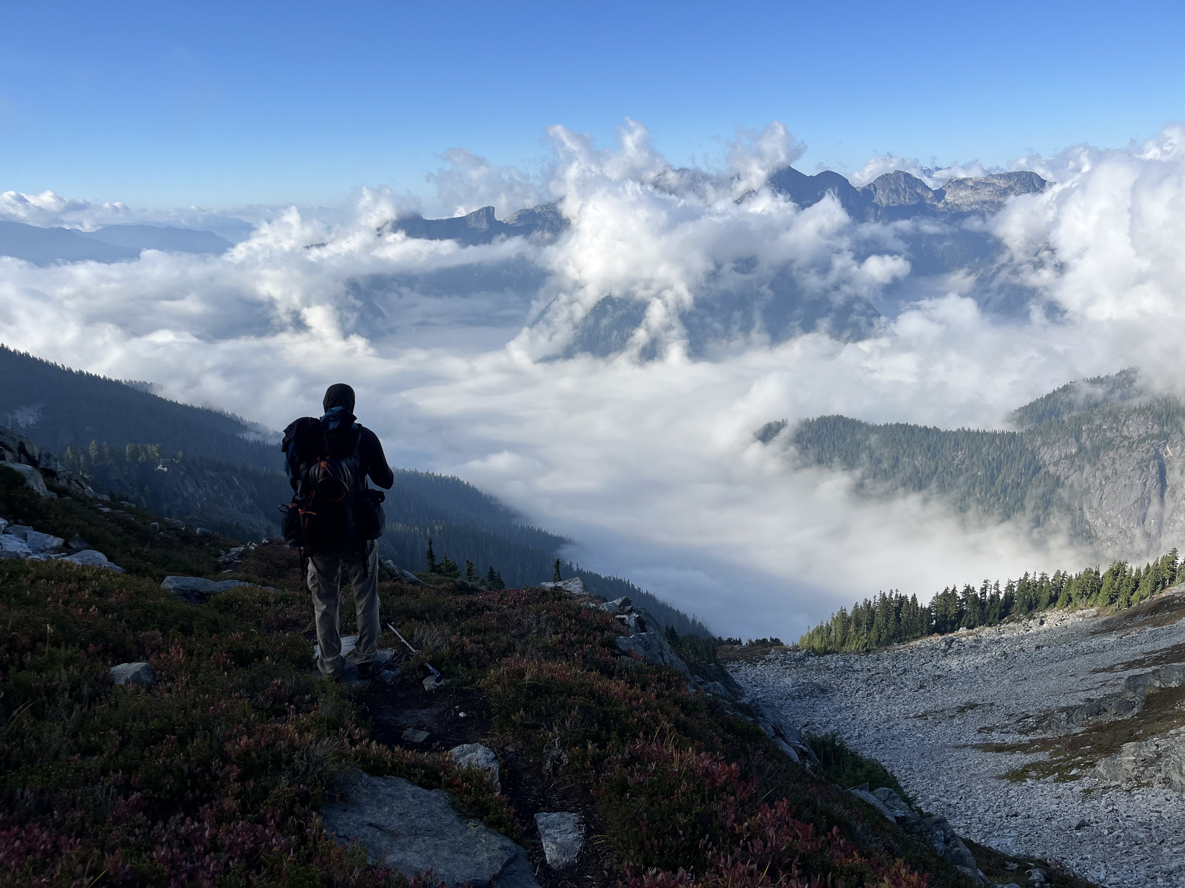
Trip Report: September 27-28, 2025 Climbed this route with my brother, Neta. I rarely write trip reports, but some additional beta for this climb might be useful. Peter's trip report is very accurate, and we followed the yellow lines closely for most of the way. Our description builds off of it, rather than being stand-alone. Beta: There is a climber's path from the lower Thornton Lake to above tree line, and from there it is pleasant travel to the saddle just South of Thornton Peak (48.69136, -121.35286). The traversing descent from there to Triumph Pass matched Peter's description. We found the steep side-slope, followed by a brief slide alder crossing, followed by a steep and cliffy forest to a bit miserable (or should I say, despairing?). This section was one of the cruxes of the route, made worse by the knowledge we have to do it in the harder direction on the way back. However, following the yellow line from Peter's photos worked well. Micro-spikes were very helpful in the side-slopes and in the steep forest. Attached are some GPS points that we recorded to help navigate the steeper portion on the way back. (Note that we did not record the slide alder crossing, which was just SE of the first point, or the steep traverses before that). TriumphBasin.gpx The descent from Triumph pass towards lake below has deteriorated since August 2021. The glacier has receded a lot, and the descent now involves lose scree. As expected from recently glaciated area, the rocks seemed to want to roll downhill at the slightest trigger, and getting through this section would have been challenging in a large group. Being only two of us, we went one at a time in the descent (where we rolled dozens of rocks), and on the way up we stayed very close together (and picked a better route with slightly less rockfall). The traverse from the lake below to the pocket lake below Mount Despair was uneventful (albeit tiring with more side-slopes), and it brought us to our camp as it was getting dark. The next morning we left camp at first light (around 6:30 this time a year) and headed towards the summit. We followed Peter's yellow route to the bottom of the Summit pyramid, to a beautiful saddle (~6600') with a great view. From there, we followed ledges and gullies through steep terrain, dry thorny heather, and lose blocks to reach the summit. On the way up we roughly followed the E ridge with some excursions to the SE Face. Unlike Peter's party we never crossed the ridge to the NE Face, which seemed very intimidating whenever we set eyes on it. The last hundred feet below the summit were the most exposed, involving a steep gully and an exposed slab. Overall the climb involved sustained class three terrain where falling would be ill-advised, with a couple class four moves. Not finding a rappel anchor to our liking (did we mention that a lot of the blocks were lose?), we down-climbed the most exposed section, and walked to a saddle South of the summit, taking a better descent path than our ascent route. While the better descent part did not bypass the most exposed section, it meant bypassed some of the 3 gullies via slightly easier terrain, making for a less stressful descent. Below is a rough estimate of our routes, along with photos of Neta on the most exposed slab, and in one of the many gullies. From the bottom of the summit pyramid we retraced our steps, making use of the GPS points we recorded to get through the steep section in Triumph basin. While there may have been a better way then the way we took to get there, we had no desire to waste time route-finding with darkness on our tails. Our only mishap was taking a wrong fork on the climber's path above the middle Thornton lakes that lead us to the outlet of the middle lake, which we did not get to on the way up. It would have made for a nice side trip had we not been so tired. However, as it was, we retraced our steps up to the climber path that we came on (Peter's yellow line). Continuing down the creek to the inlet of the lower lake and connecting to the climber's path from there might have also worked, but we preferred to retrace our steps over an additional adventure. Times: Left the car Saturday slightly after 9am, and reached camp at Lake Despair (is it what it's called? 48.72737, -121.37365) around 7:30pm, as it got dark. On the second day we left camp at first light 6:40am at first light, summited, and got back to camp at 10:50am. We left camp soon after, and reached the trail at the lower Thornton lake just before 7, happy to avoid off-trail travel in the dark. Back to the car by 9pm. Additional Photos Thornton Lakes, lined up from the saddle: Through the Triumph Creek basin: Mount Triumph, from a flattering angle. To it's right is the scree we had to descend, with the remnant of a glacier. And the loooong way back: Is this as classic as it gets for a North Cascades trip? Bushwhacking with Triumph towering over our head: A goat, with Upper Thornton Lake in the background: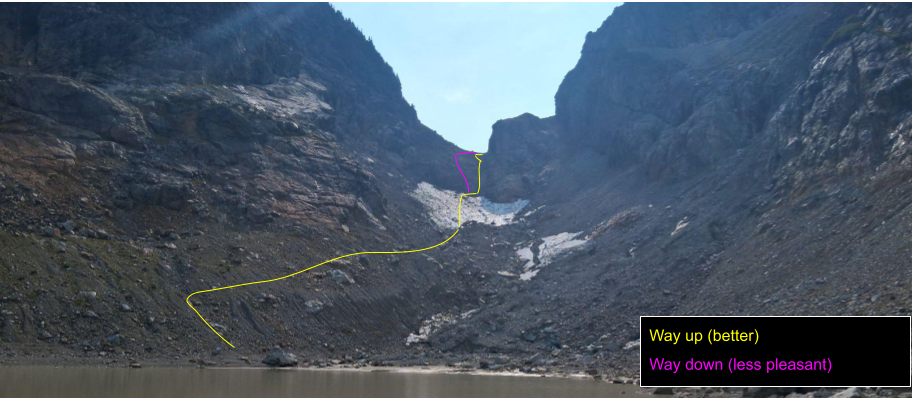


- Today
-
Love it!
-
Sela joined the community
-
The trip report for Nature's Way has languished in the North Cascades section without comment. I must bring your attention to what may become a classic NW granite pitch. Also, this "Rock Climbers Forum" needs some bloody content. If you are a crack climber, you may not pay any attention to news from Darrington, the slab paradise. But there is a new crack pitch you should be aware of, Nature's Way pitch 3. On a less-than-vertical wall, the giant flake forms a rising undercling crack of fingers width between .3" and .75" for 20 feet. The wall has been wire-brushed for clean smearing of feet. There is one rest stop halfway along, an edge for feet and a crack for fingers. After that, more pure undercling moves to the top of the flake. The pitch seems burly for this moderate slab climber. It has commitment, unless you enjoy underclinging with one arm while placing pro. It is steep enough to look intimidating at first, but not steep enough to be 5.10. I'd like some crack scholars to go up there and confirm, or not, my grade of solid 5.9. It takes three hours+ to hike up there. Bring sandals or the like for the creek crossing. It can be done in an easy day; I just did the second ascent, with my buddy Yale, yesterday, 10hrs car-to-car. It requires two 60m ropes, as the first two pitches are long, ~55m. Topo and approach details are on Mountain Project. It is restful to stand here and place extra pro: And, after some furious activity, to stand on edges and place some more: On the hike down yesterday, I daydreamed some future essay, "The Controlled Frenzy of Undercling". I hope some of you can plan to spend a day on a new crack climb. Let us know what you think. Bill
- 1 reply
-
- 1
-

- Yesterday
-
 Dude, you think you're tired? Just wait!
 -
 I really should get on that. Mostly because that fits me more and more each trip.
 -
[TR] East McMillan Spire - North Buttress 09/24/2025
JasonG replied to psathyrella's topic in North Cascades
Hope you don't mind @psathyrella....moved this to the North Cascades. Really great report, thanks for repeating such an incredible line and posting here about it!- 1 reply
-
- 1
-

-
Flying Into Washington mid october, Its late in the season but if the weather is allows I planned to go up mt baker or shuksan or even something less technical let me know if someone is interested
-
 NoonsnGoons joined the community
 - Last week
-
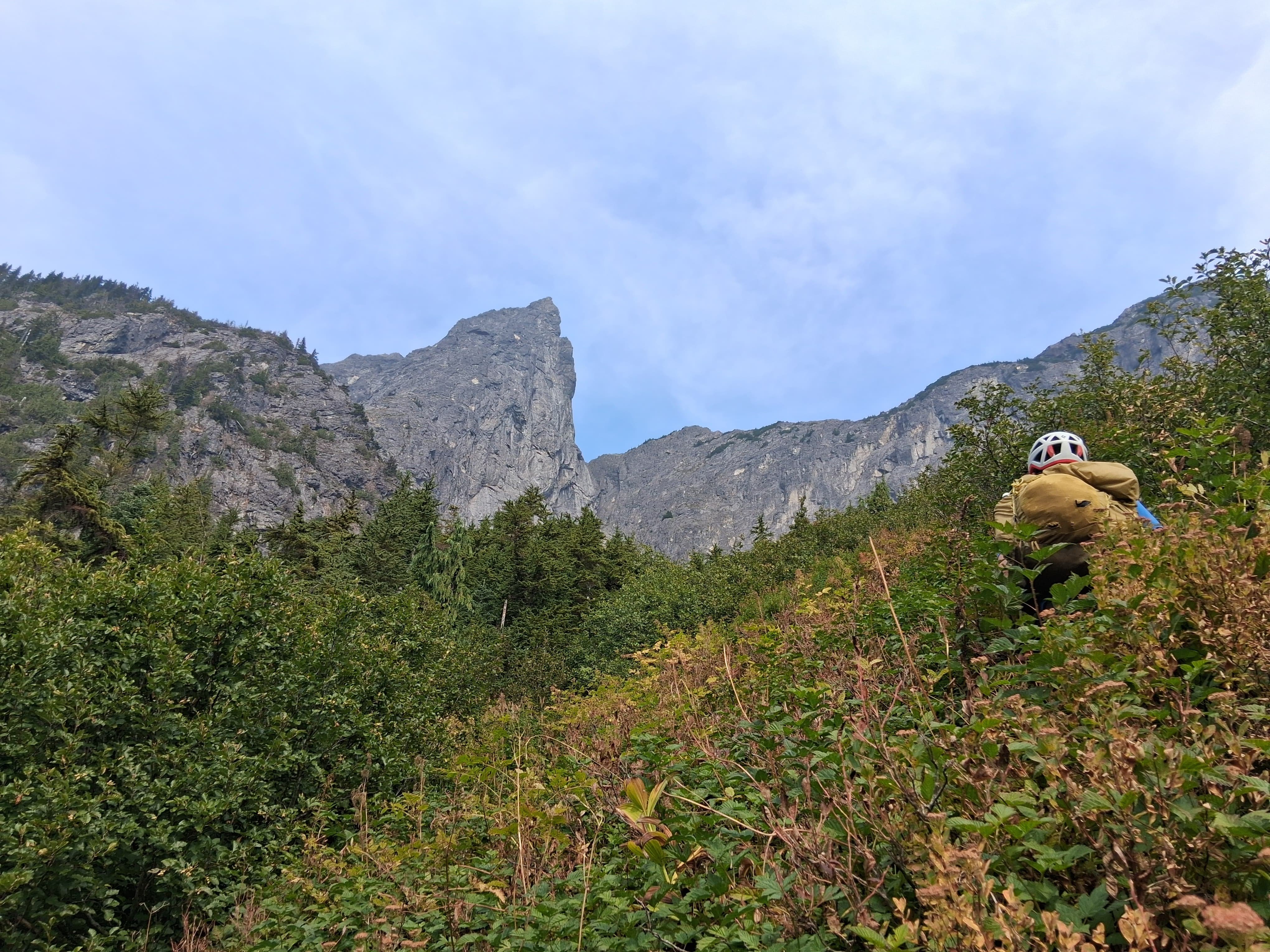
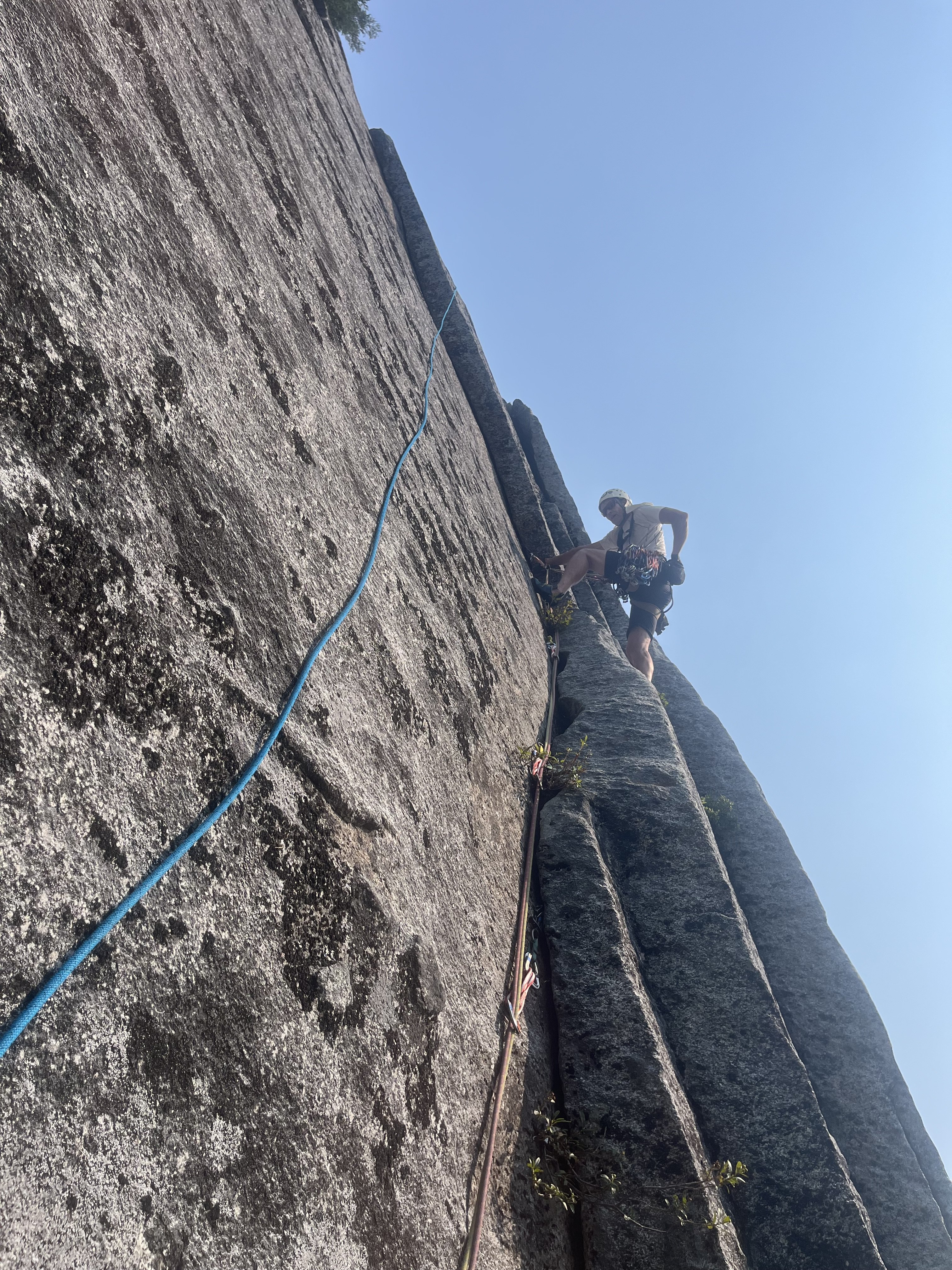
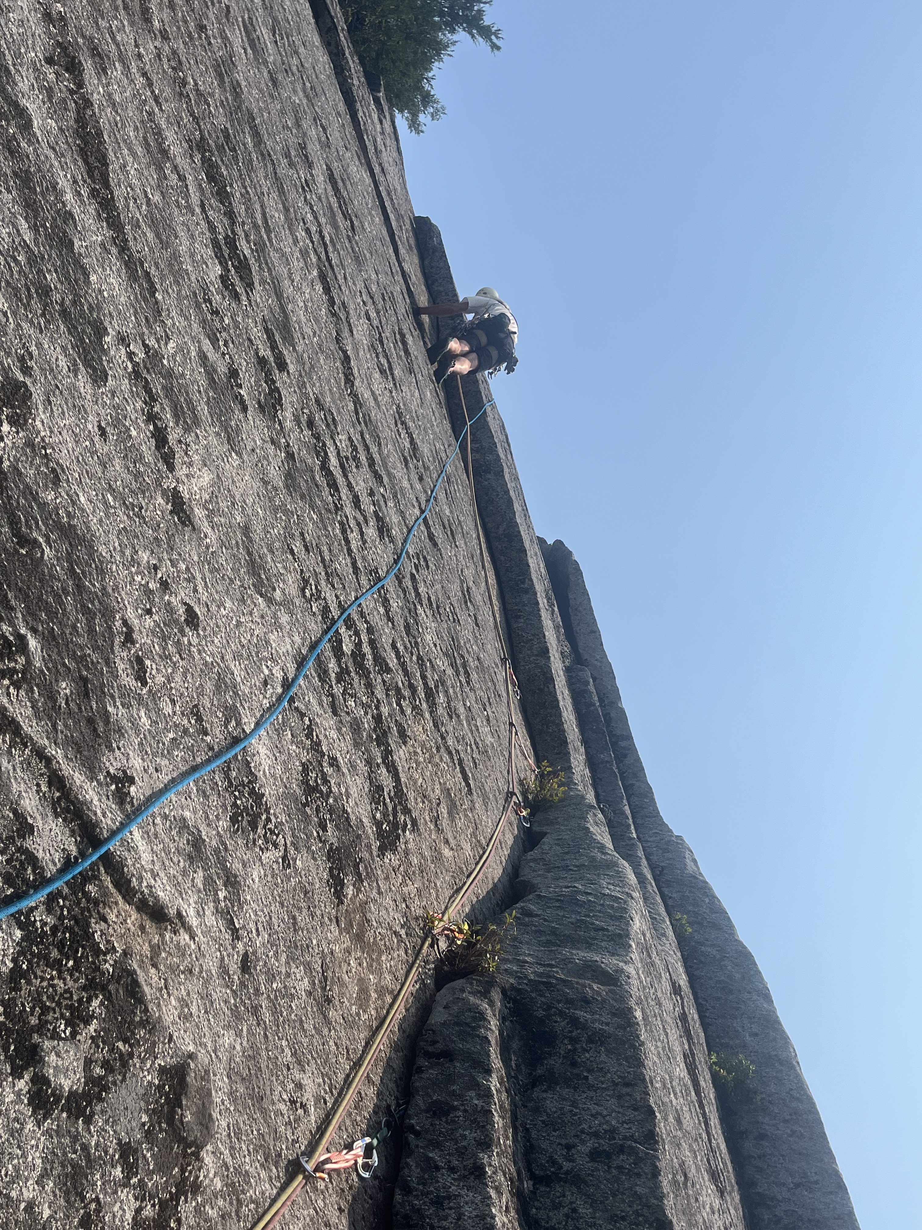
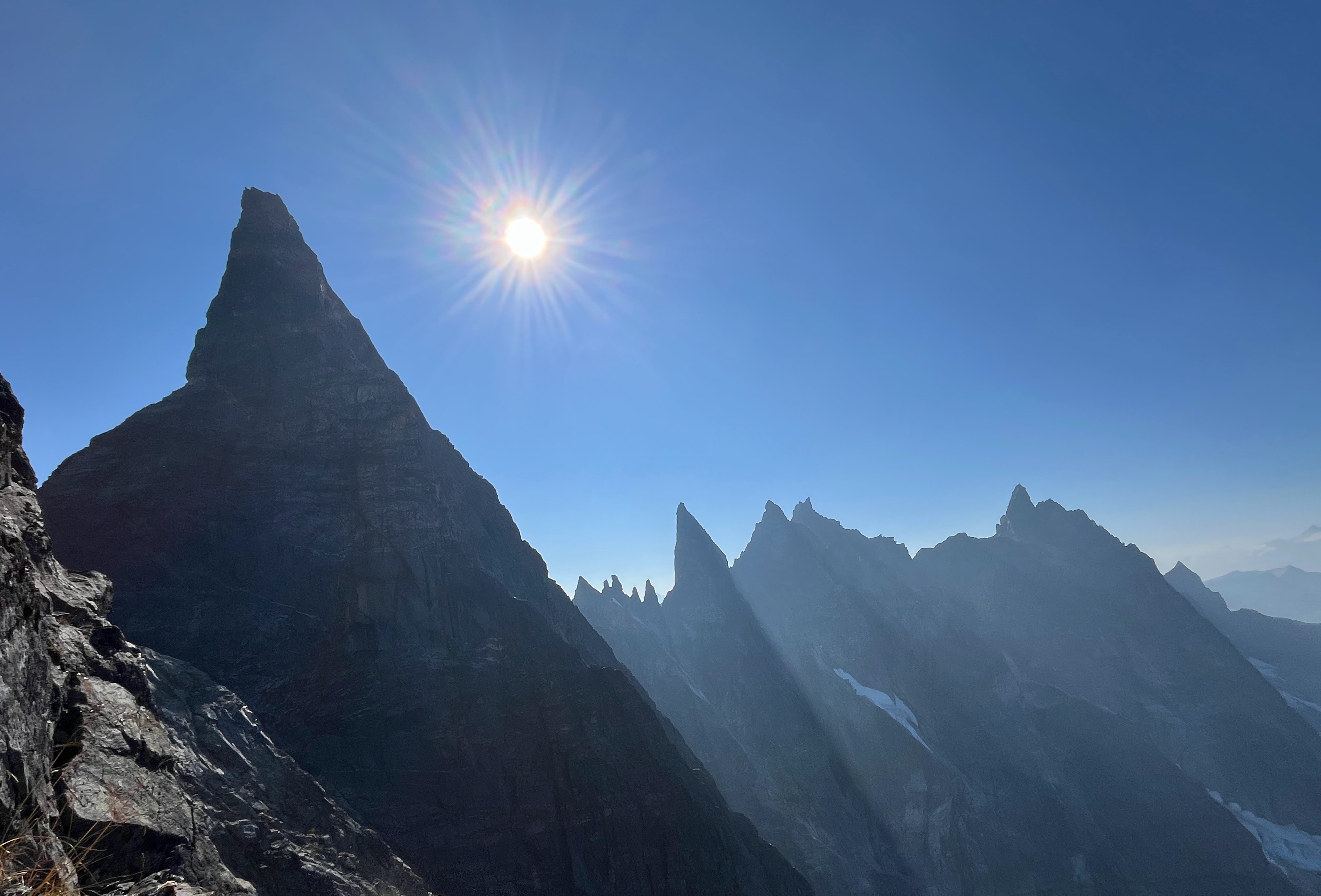
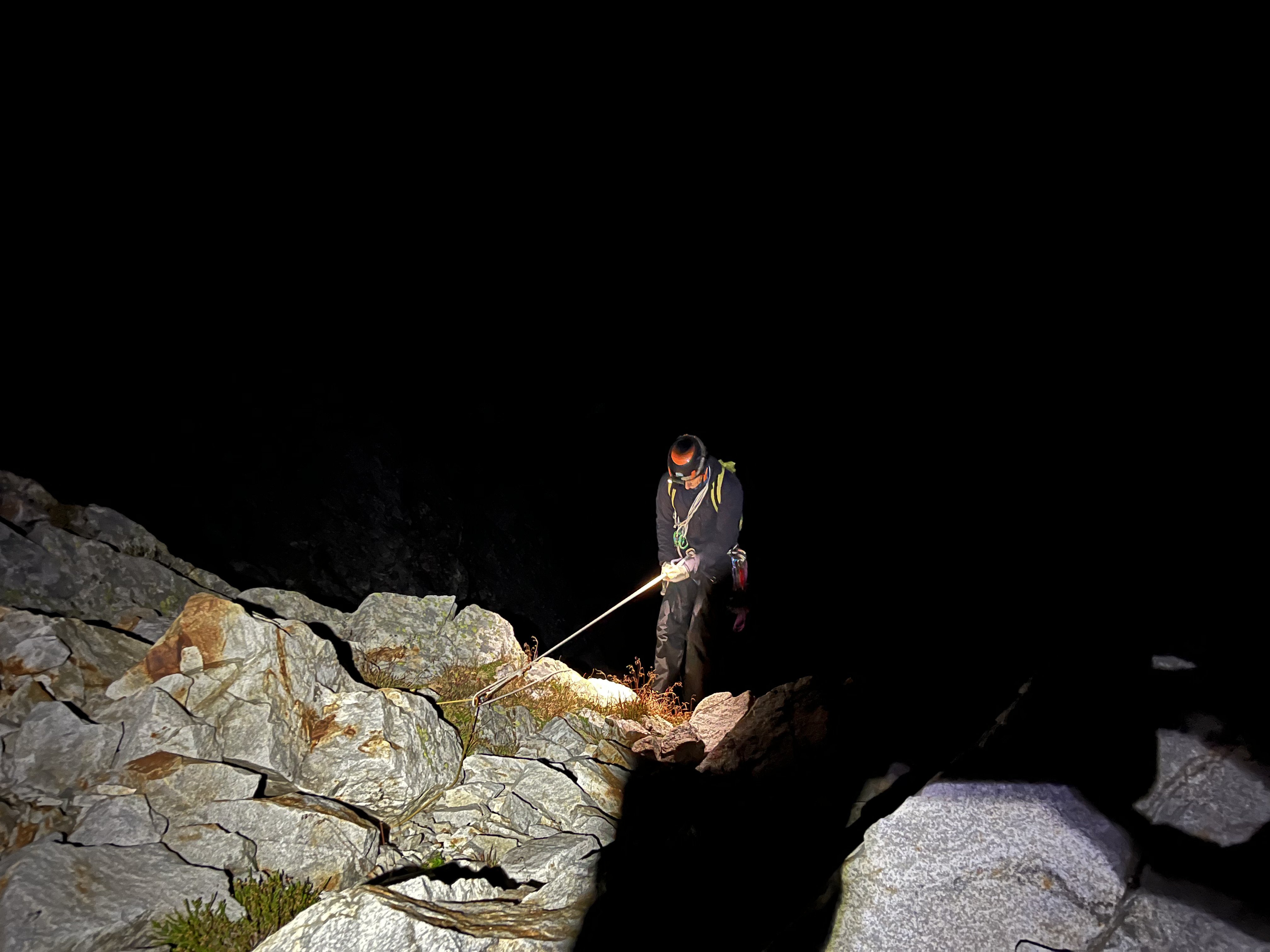
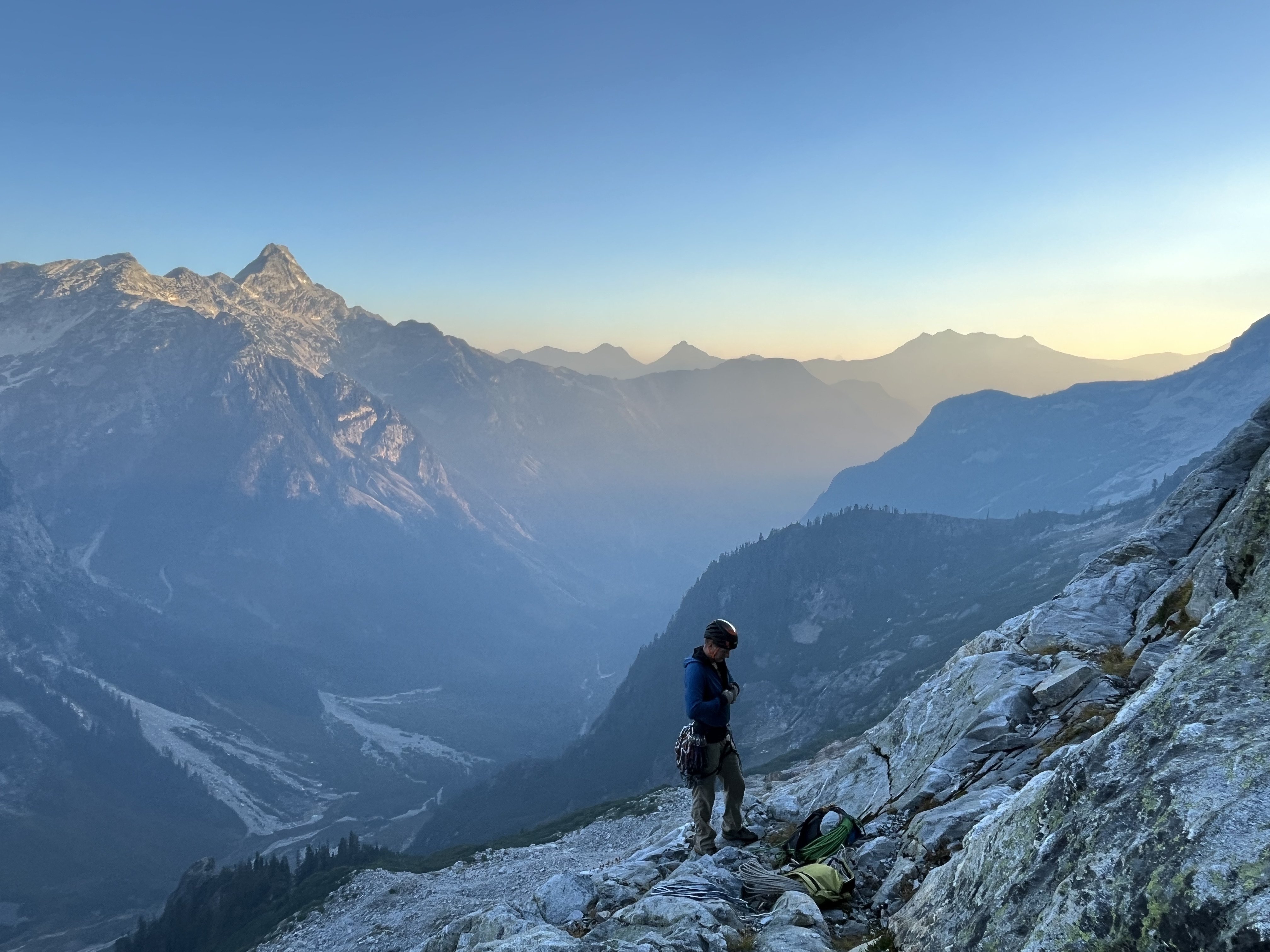
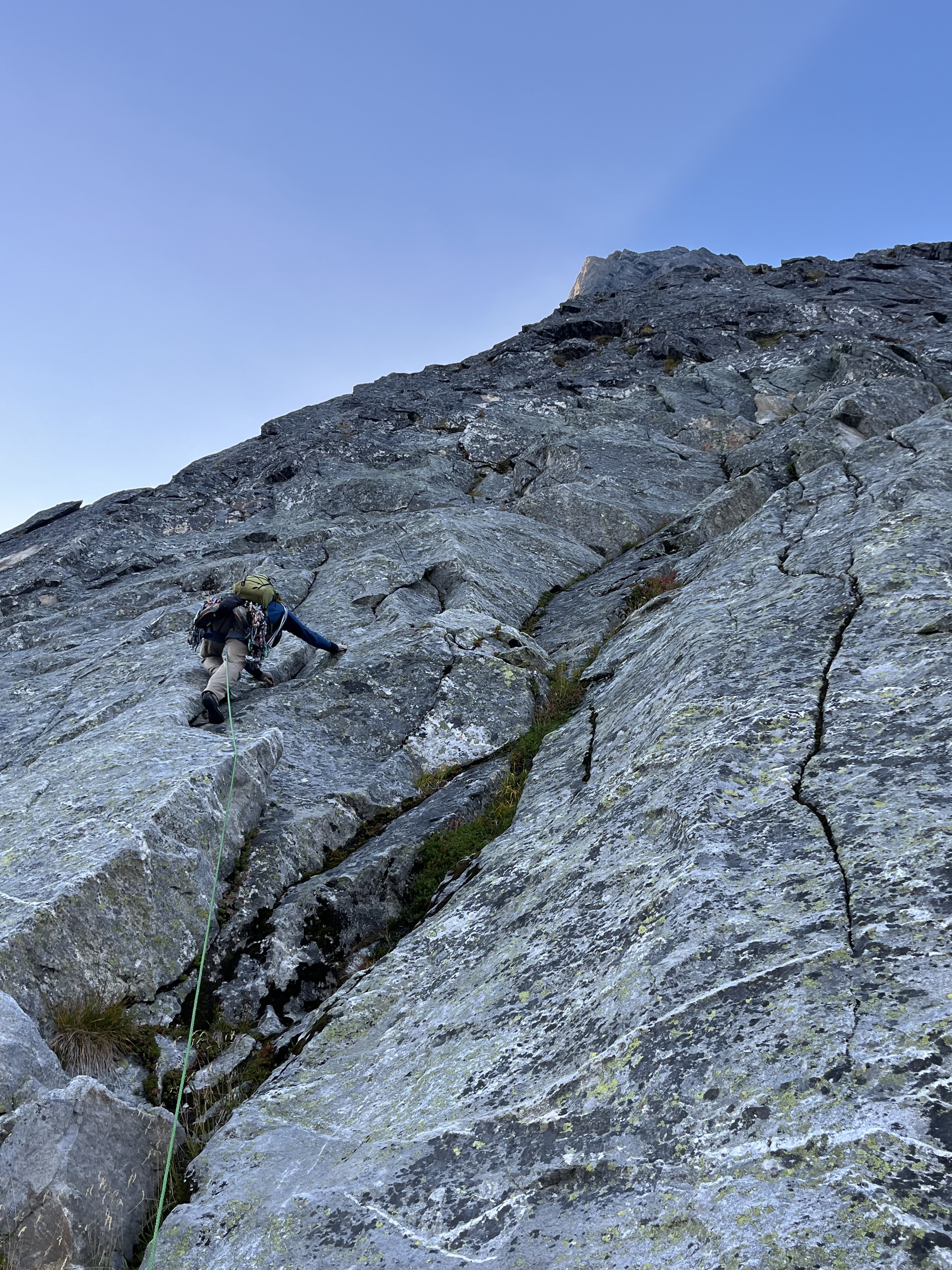
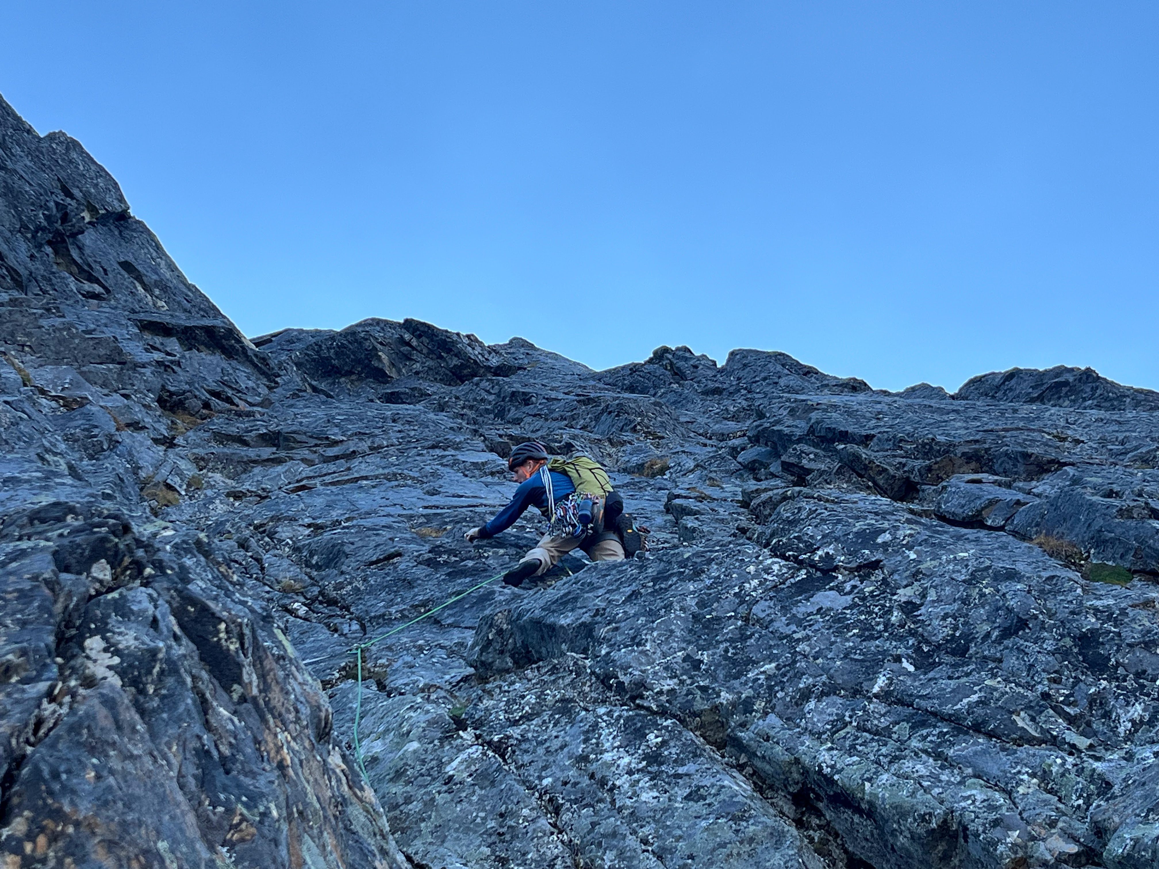
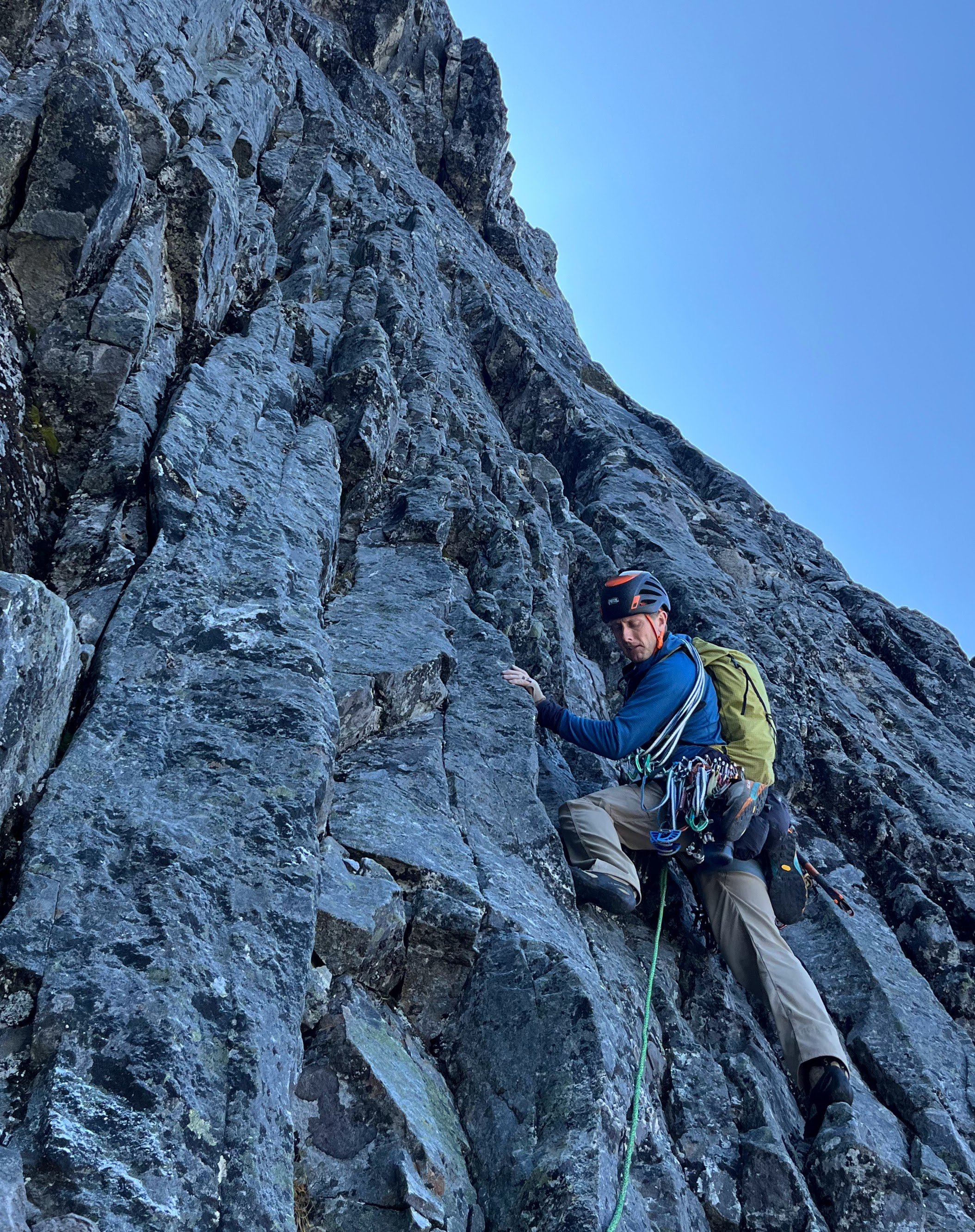
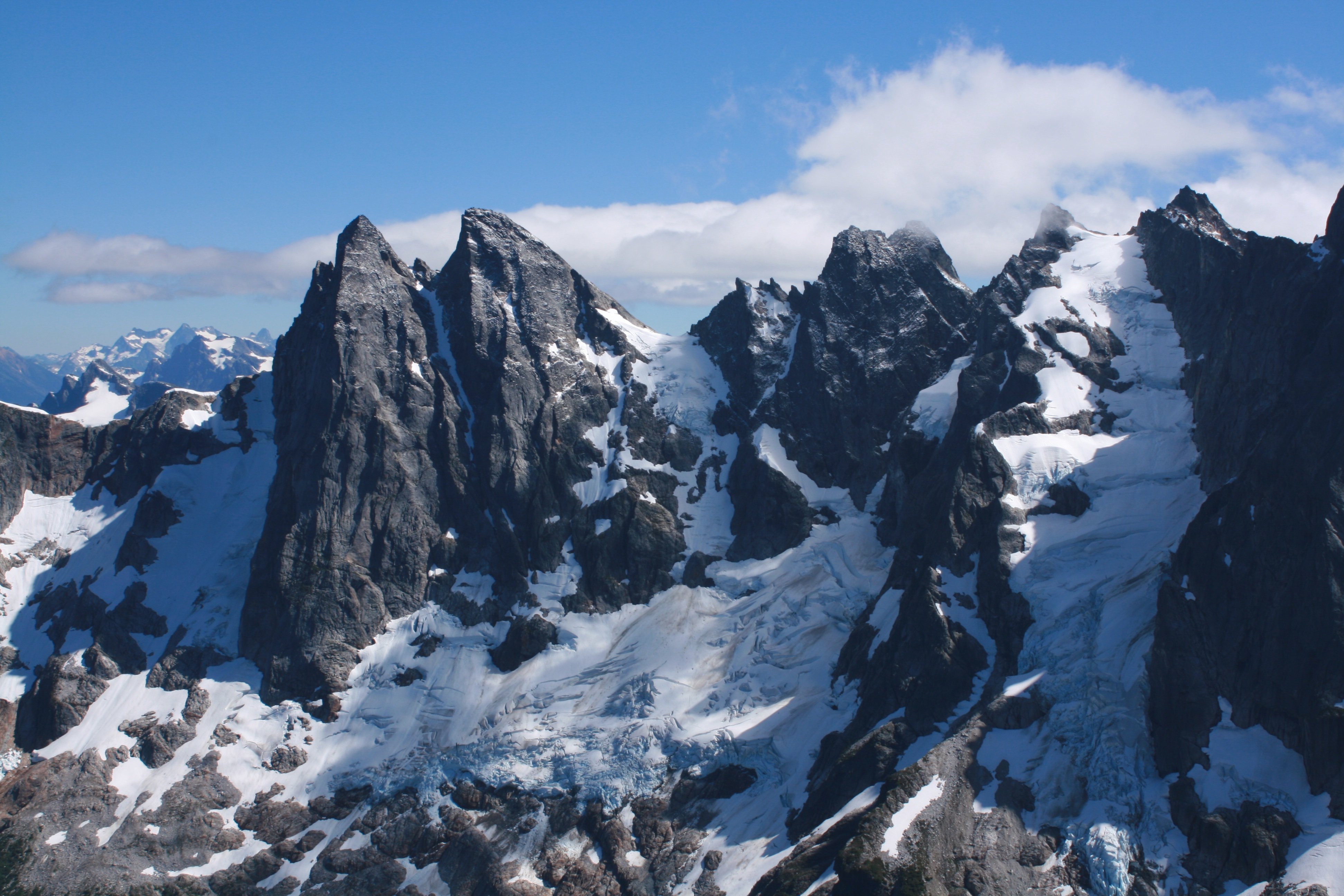
Trip: East McMillan Spire - North Buttress Trip Date: 09/24/2025 Trip Report: As Blake seems to speculate in the back of Cascades Rock, this is a legitimately high quality route. While the rock is of course worse than Index or Supercave, it is better than the E ridge of Inspiration or Stoddard Buttress on Terror (and much better than Megalodon). It's also less vegetated than the E face of Triumph or Sloan SW face. There was only one pitch we wouldn't recommend (up high in the schist band), but it can and should be avoided. The steep middle section is characterized by thin parallel cracks, highly textured ripples, and shady climbing with a shocking lack of lichen. When you emerge onto the slightly more West facing schist band for the last few hundred meters, lichen becomes tiresome as the angle eases and rock deteriorates. There are absolutely a couple of serious runouts, but they occur on clean, solid rock. From camp on a small heather patch a few minutes below Little Mac, we approached via a ledge just below Little Mac that accesses the NW trending ridge toward Elephant Butte. We made four rappels beginning at at an old station I had found during a recon trip in October 2020. This seems likely to be the rappel used by the 1986 party, maybe also the 1976 party, and I think @rat has also mentioned climbing the buttress, so perhaps used it as well. The 2008 party (AAJ, NWMJ) approached via Stetattle ridge. After four 45-55m rappels, we walked and scrambled easily to the base of the buttress. We simulclimbed 200-300m on the lower buttress, then belayed eight ~45-50m pitches (5.8 to 5.10-), then simulclimbed (interrupted by one belayed pitch, which we would recommend avoiding) to the summit. For the central, steep section we wanted to climb near but right of the buttress crest, which except for pitch 2 (a horizontal leftward traverse) yielded a logical path almost directly upward. Looking upwards from low on the buttress, two corners right of the crest (separated by a chossy roof) seem to provide the obvious options into the steeper middle section. We aimed for the left corner (which we presumed was the 2008 route), and thought the right corner was probably the 1986 route. We encountered many pieces of fixed gear throughout the route (mostly knifeblades, with a few nuts, a hex, and a rigid stem friend). Since the 2008 party rappelled the face (!!!), presumably close to their line of ascent, we think we followed large portions of their route (Come Over to the Dark Side). That said, I haven't really managed to match the route lines in either the NWMJ or AAJ to our experience (at least at the resolution I can manage to download). From the summit, we downclimbed SW to the col with West McMillan, then continued downclimbing S in the gully for a few minutes. When the gully's left wall flattened, we slung a boulder and made four 45-55m rappels to reach low angle slopes and walked back to camp, arriving about 15 hours after leaving that morning. West McMillan, Inspiration, The Pyramid, Degenhardt, and Terror from high on the route: From left to right: E McMillan, W McMillan, Inspiration, The Pyramid, and Degenhardt. The route goes just right of the sun/shade line on the leftmost peak. The approach rappels start down a relatively solid corner just right of the low point on the left). Photo by Steph Abegg: First rappel into McMillan Creek cirque: Racking up before the first simul block: Marlin starting up the first simul block: Marlin at the top of pitch 1: Looking back partway across the pitch 2 traverse. There was a fixed two-pin anchor at the end of this traverse that may be that in the 2008 NWMJ "Erik starts the crux" photo: Looking down partway up pitch 3. This section had some blocks and flakes that looked ominous from below, but sounded and felt solid on closer inspection: The upper part of pitch 3. This was probably the most runout section of the route: Looking down the start of pitch 4: Marlin at the top of pitch 4: Marlin starting up pitch 5: Marlin starting up pitch 6: And navigating the roof on pitch 6: Starting pitch 7: And pitch 8, which should have been the last belayed pitch: Simuling in the schist band: Marlin leading the very-not-recommended lichen covered, loose pitch in the schist band. Go right before here, toward the E Mac col, to keep it scrambly. There was a fixed pin near his feet here, so we weren't the first to get suckered into it: Belaying on the summit. The buttress crest in this section is stacked, lichenous blocks that seem to overhang the impressively steep East face. You want nothing to do with the crest here: Setting up the first rappel out of the E Mac-W Mac gully: Impressive ambience the next morning, looking toward Azure lake from camp: Hiking out, looking toward Triumph: And a friend from the start of the schist band. It was still solidly placed and easily removed after, probably, 17 years (although could use some lube): Gear Notes: Modern gear made a huge difference on this route, especially microcams (compare the 2008 party's rack in the NWMJ pictures), microtrax simuling, and fix-and-following. We took a 50m lead and 65m tag line (we didn't haul), ~5 kbs/lost arrows, at least triples to fingers with offset aluminum and brass nuts, doubles to #1, single #2 and #3, and four microtraxions. Our smallest cams (purple C3 and green/#0 Z4) were used in several critical placements. Approach Notes: Goodell Creek to Terror Basin, then up slabs toward Little Mac.
- 1 reply
-
- 8
-

-
-
 Casey_Idzikowski joined the community
 -
 Great TR with historic flavor. Such crisp photos. Sixteen cents!!!!
 -
"Might as well win the whole fucking thing!" Gave me chills watching Cal hit #60 to chants of "MVP! MVP!"
-
 That poetry.
 -
 Tmfd joined the community
 -
 jskis joined the community
 -
I'm calling it. THIS is the year!
-
Ideas for quick hits near Vancouver in late March
JasonG replied to bedellympian's topic in Climber's Board
Mount Vernon! Ah, didn't know you used to live up this way....So you know how all over the place March can be. Often the good skiing hangs around for a bit so that is often my go-to at that time, but you never know.... -

best of cc.com [TR] Cascade Volcanoes - Bike-athon 06/06/2025
Nick Sweeney replied to traildirt's topic in Mount Rainier NP
Wow! Such a great story and achievement, but most of all it seems that this experience was very powerful for you. The best adventures are those ones that give you appreciation for the richness of life. I'm happy you got to experience this. Thanks for sharing here. -

Ideas for quick hits near Vancouver in late March
bedellympian replied to bedellympian's topic in Climber's Board
Thanks guys! Jason, are you in Bellingham? I went to college there so I'm pretty familiar with the trails. That was before I was into climbing anything beyond basic mountaineering and bouldering in the rock gym. Based on where we'll be I'm guessing a Sea to Sky mission will make the most sense if conditions allow. Though a view of Slesse and co in their winter attire would be incredible. -
[TR] Eldorado Peak - West Arete 7/26/2025
olyclimber replied to Nick Sweeney's topic in North Cascades
It’s all about belaying, not about the climbing. -
It's not??!!
-
Ideas for quick hits near Vancouver in late March
JasonG replied to bedellympian's topic in Climber's Board
But, in reality, it might be best to just go up and ski some late season powder on the mountains close to town..... the links above will work if the ski conditions suck. The great thing about the mountains up here is that there is often something to do.... but not always! Bring your mountain bike for when the alpine/skiing is no good. I'd be happy to show you around Galbraith, or there are many techy north shore destinations for mtbing -
Ideas for quick hits near Vancouver in late March
JasonG replied to bedellympian's topic in Climber's Board
Flora Mountain is another option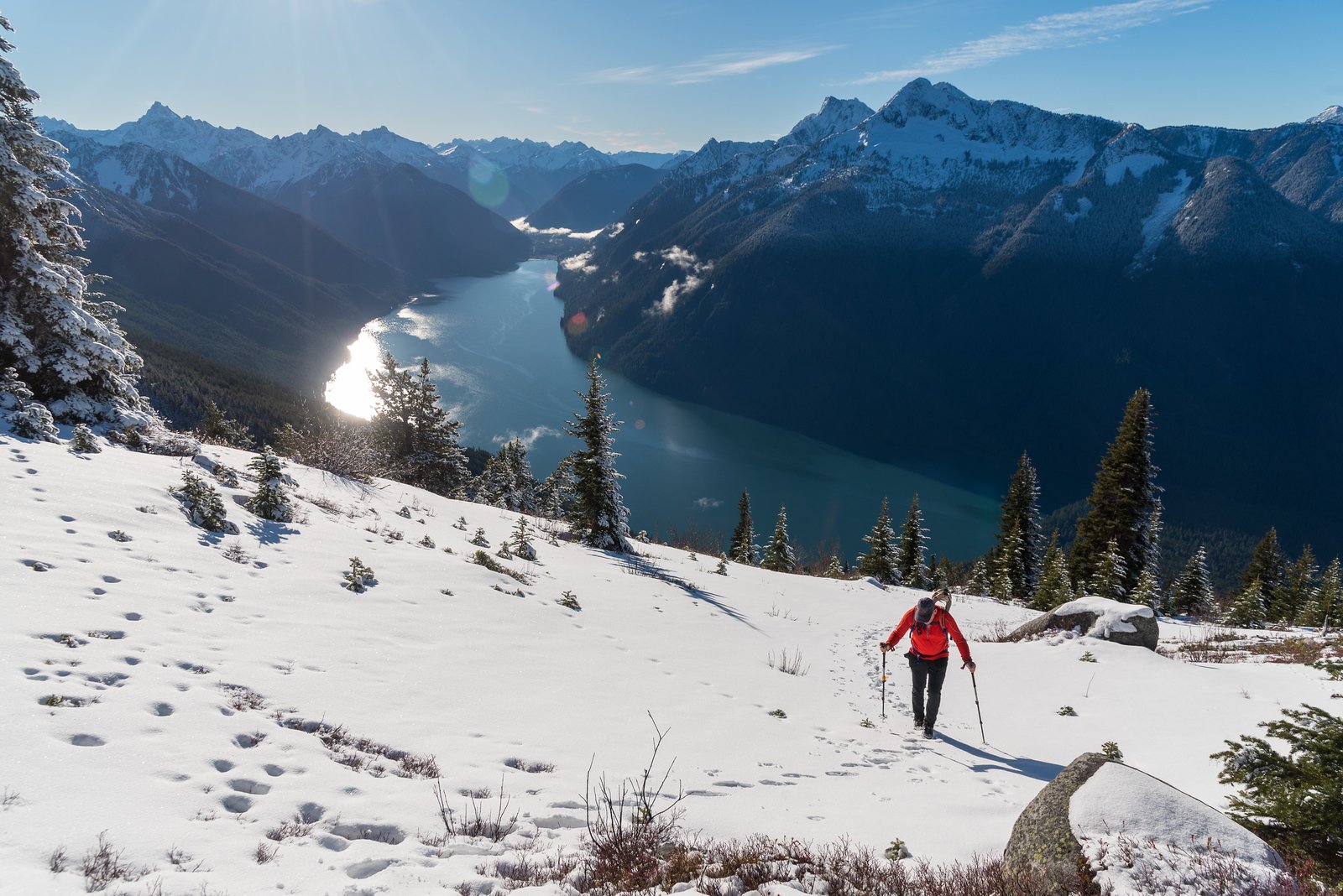
-
Ideas for quick hits near Vancouver in late March
JasonG replied to bedellympian's topic in Climber's Board
-
Ideas for quick hits near Vancouver in late March
JasonG replied to bedellympian's topic in Climber's Board
-

Ideas for quick hits near Vancouver in late March
Rad replied to bedellympian's topic in Climber's Board
The Sea to Sky gondola is a way to access alpine terrain quickly and easily, and your family can enjoy the station/restaurant if they go. March could definitely be stormy and wet and there will be tons of snow up high, but it's something you might watch. Sky Pilot, Co-Pilot, and Habrich are all accessible from the lift in a day, depending on conditions. Internet suggests it's open year round. -
Hey all, Long way off, but wanted to see if anyone had ideas... I will be visiting family in Vancouver BC in late March this coming year. I will have my family with me and can't do any overnight missions, but could conceivably do a full day or shorter. Never been in that area during that time of year before. Seems like it's probably going to be too wet for rock climbing, plus I've spent lots of time in Squamish over the years. Never done any winter alpine stuff in SW BC. Seems like there is some pretty easy access mini alpine, like the Lions, but it's low elevation and I am thinking it will probably be too warm? Obviously, conditions and weather will be highly variable and that will determine if I do anything, but does anyone have any objectives that I should have on my radar? Open to rock, ice/mixed, skiing, or even just a fun scramble. Cragging to alpine. What's been good in the past? TR links?
-
 Janicius joined the community
 -
My most memorable shiver bivy! My wife now (jokingly) questions my true motivations for climbing, implying it’s all about the bivy…..
-
 A memorable outing escorted by planning powerhouse that is JGAPLLC! Thanks Jason, awesome photos as usual!