All Activity
- Today
-
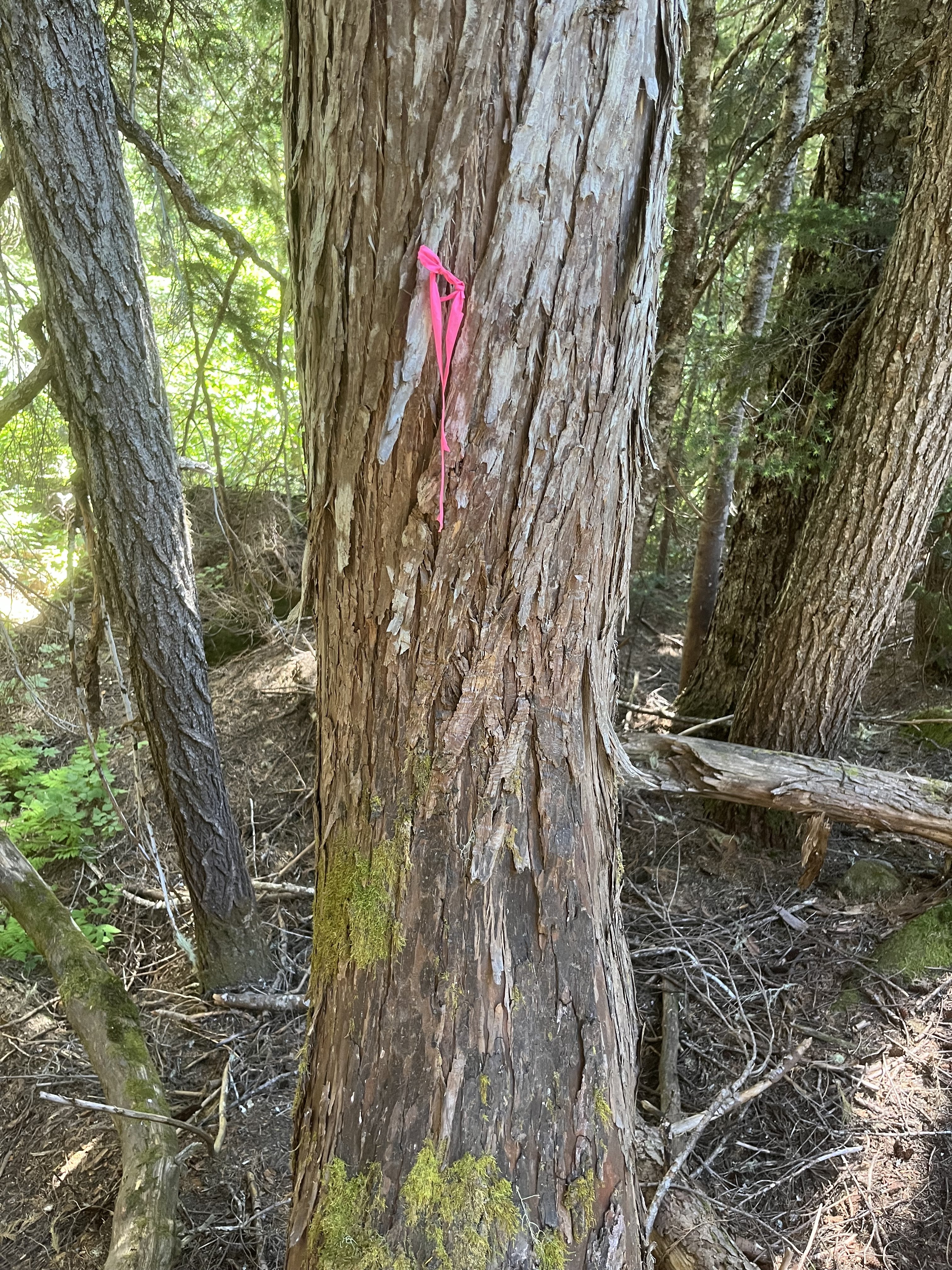
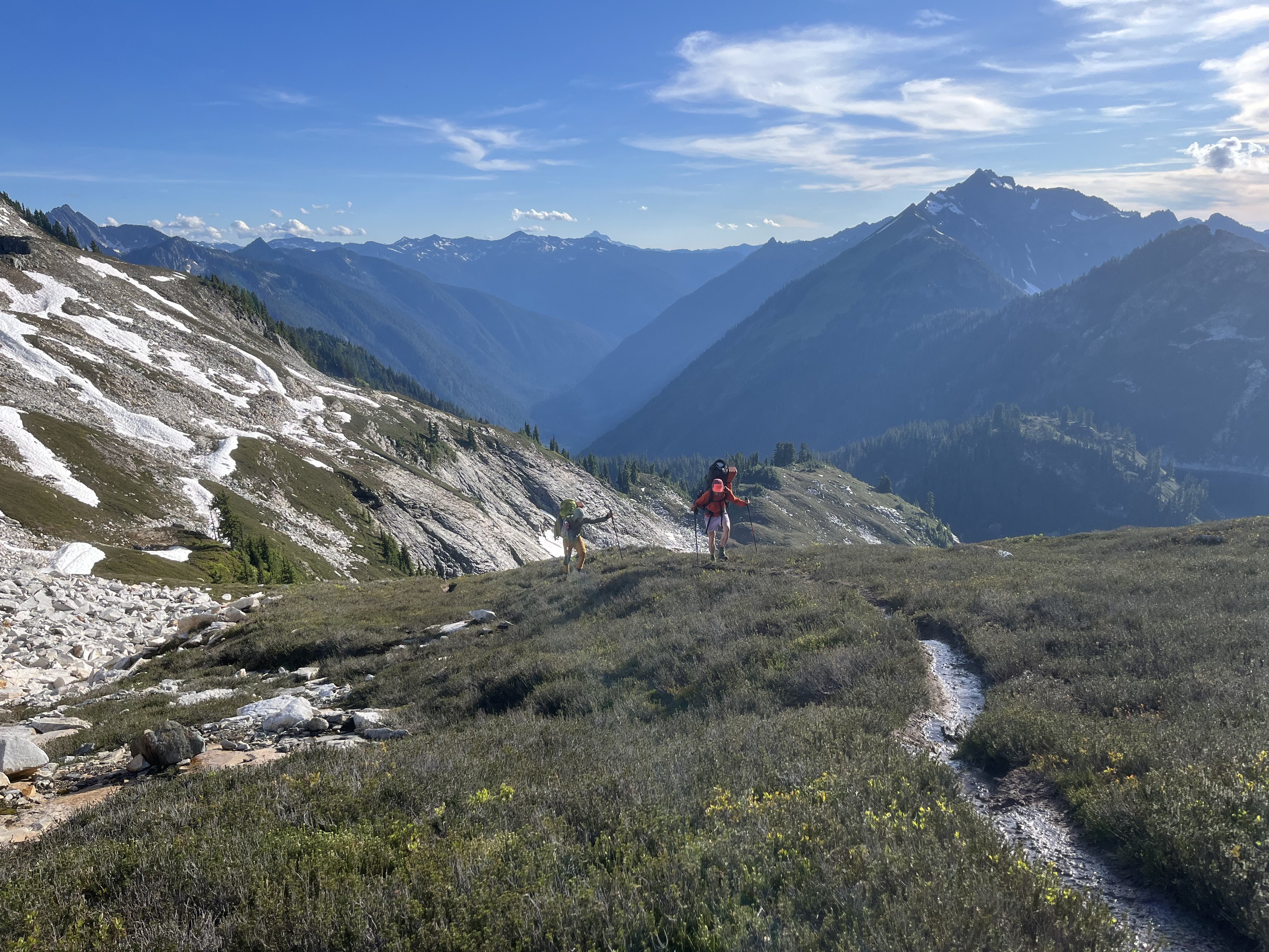
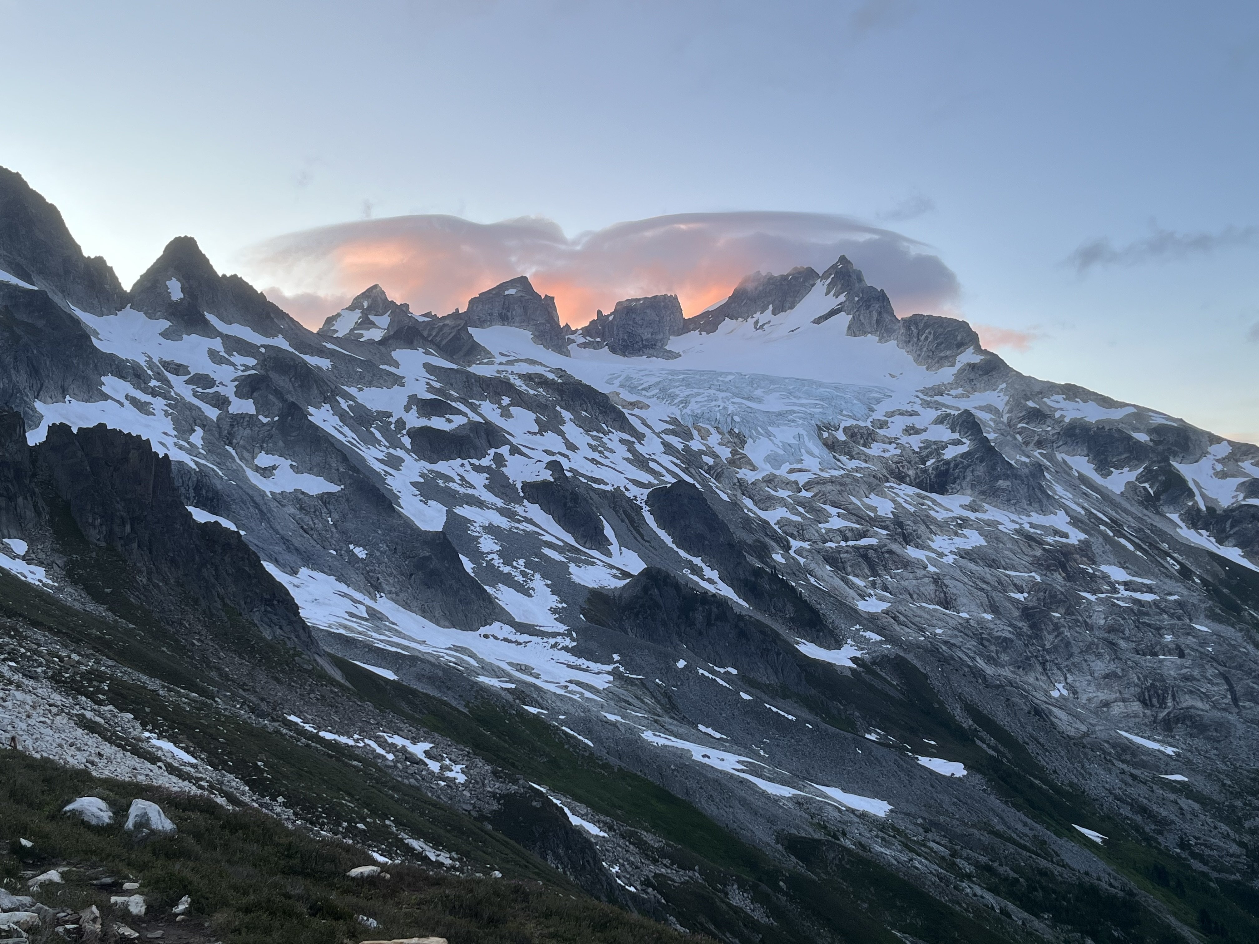
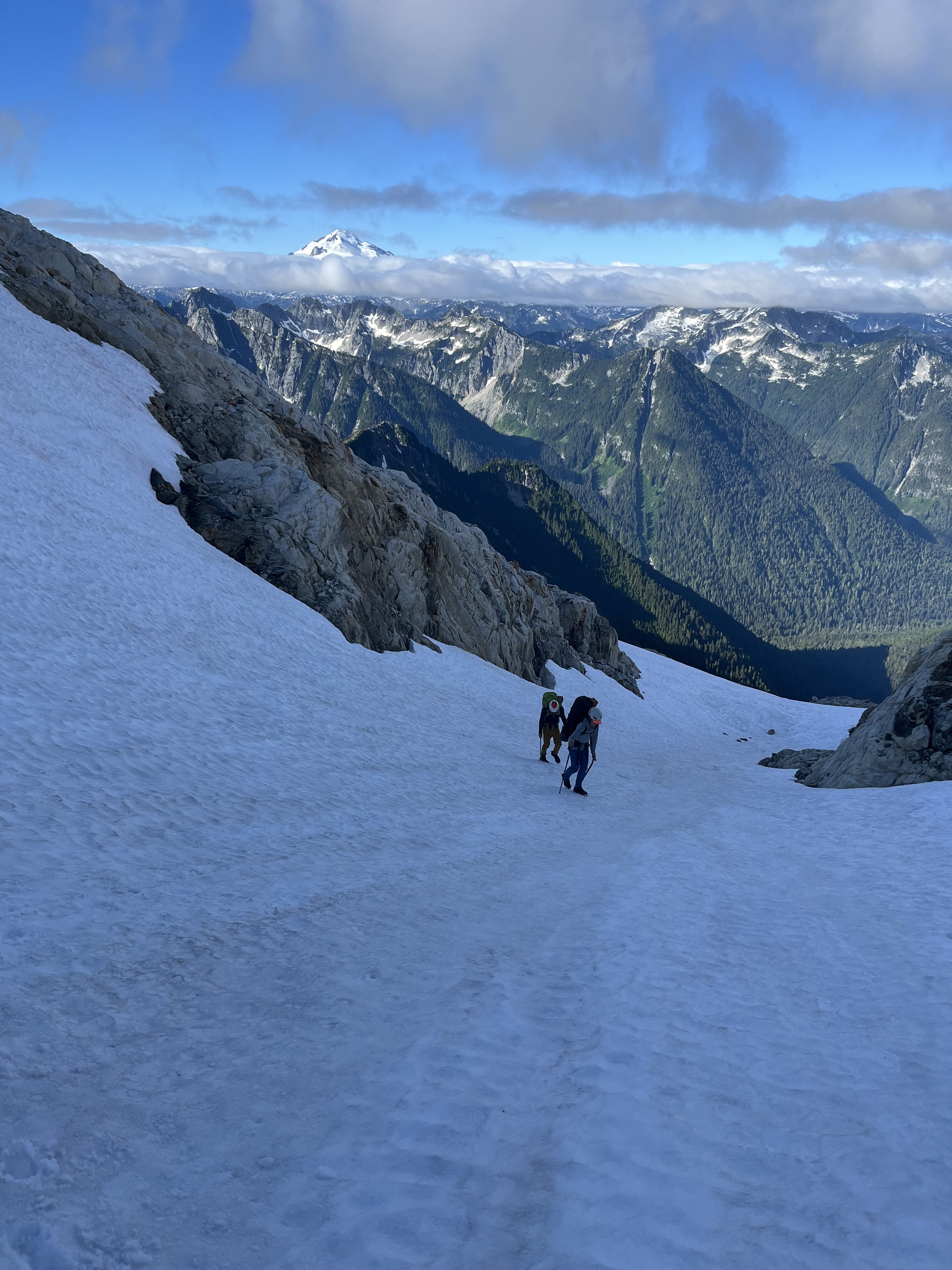
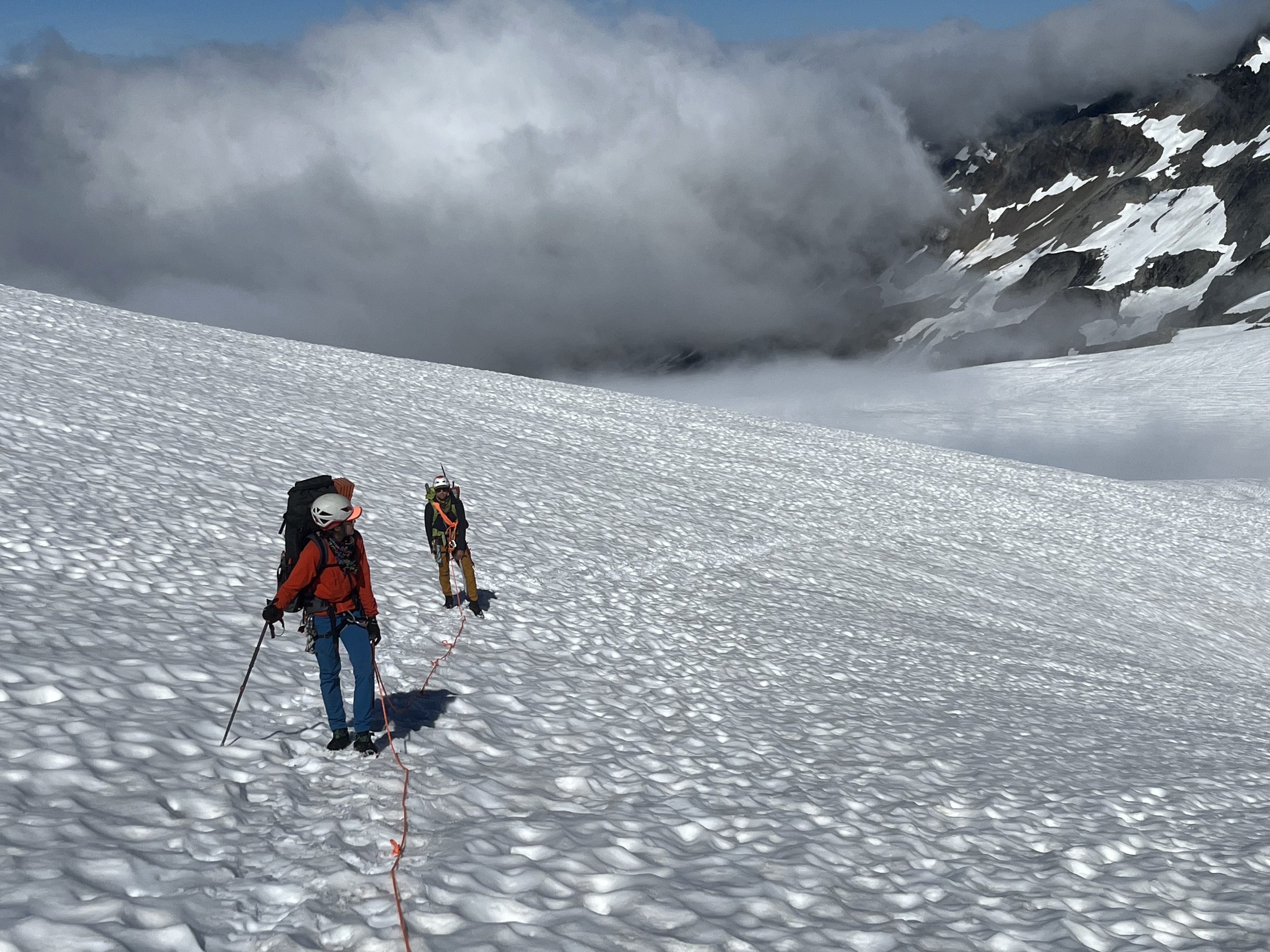
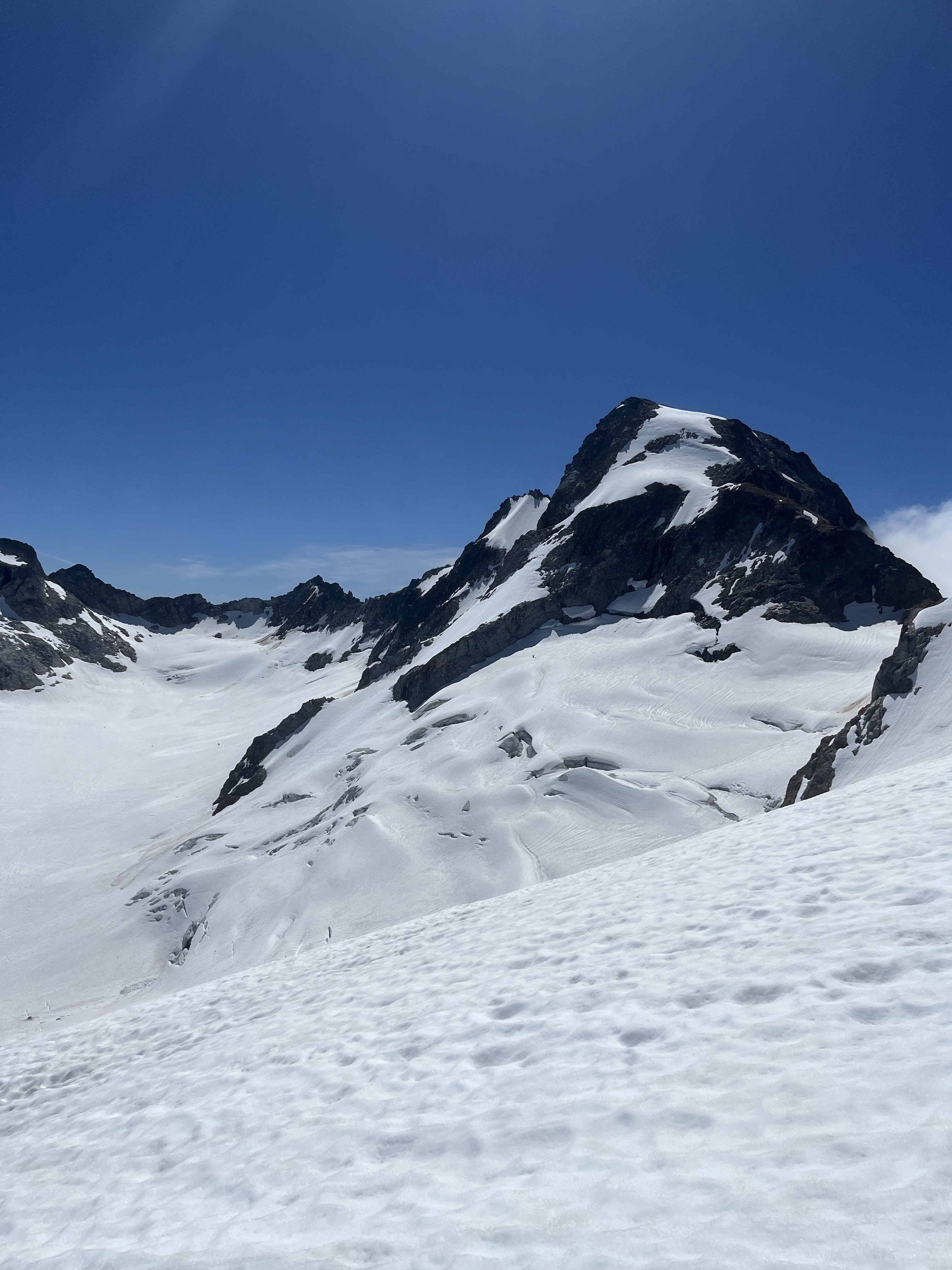
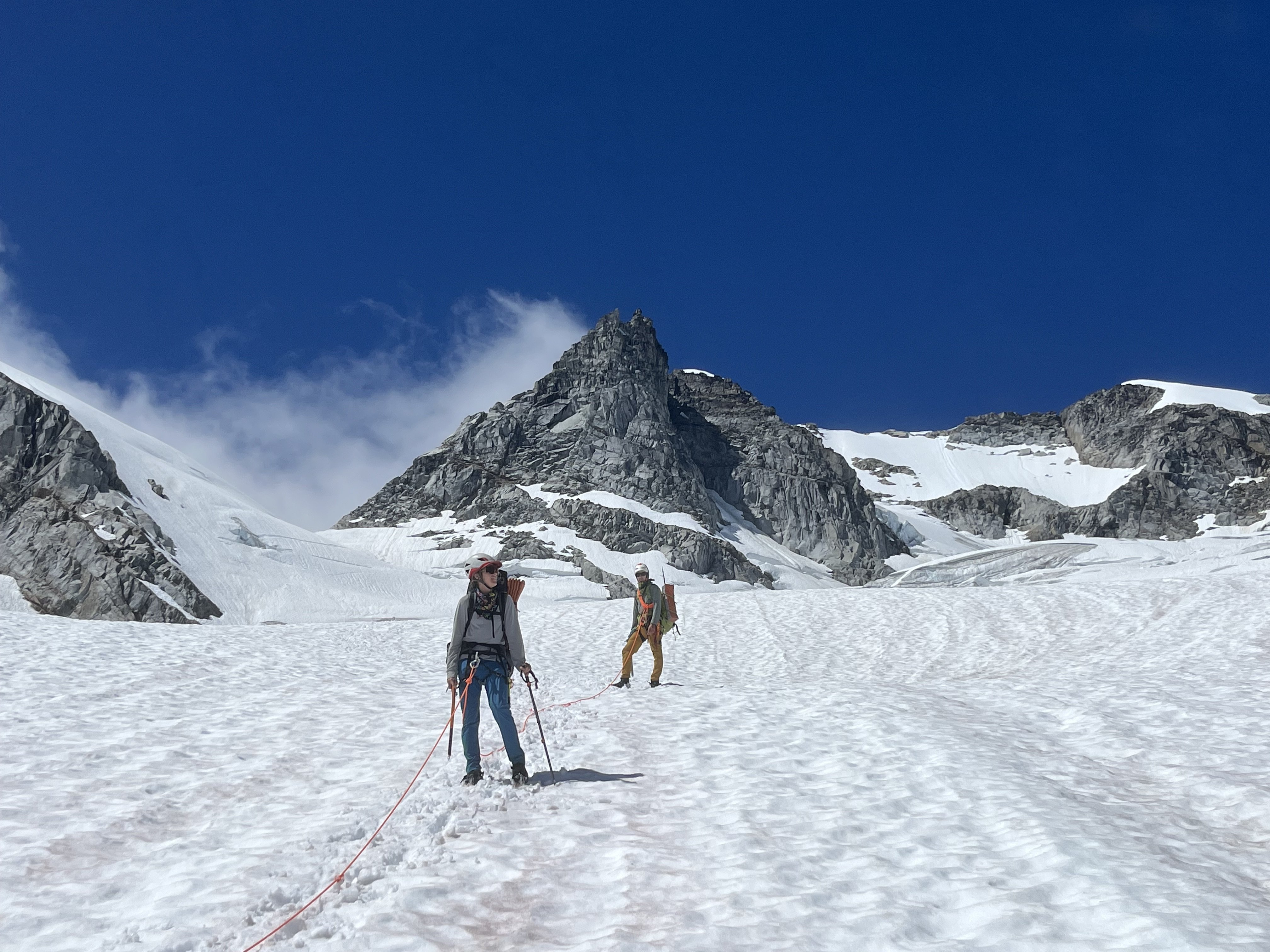
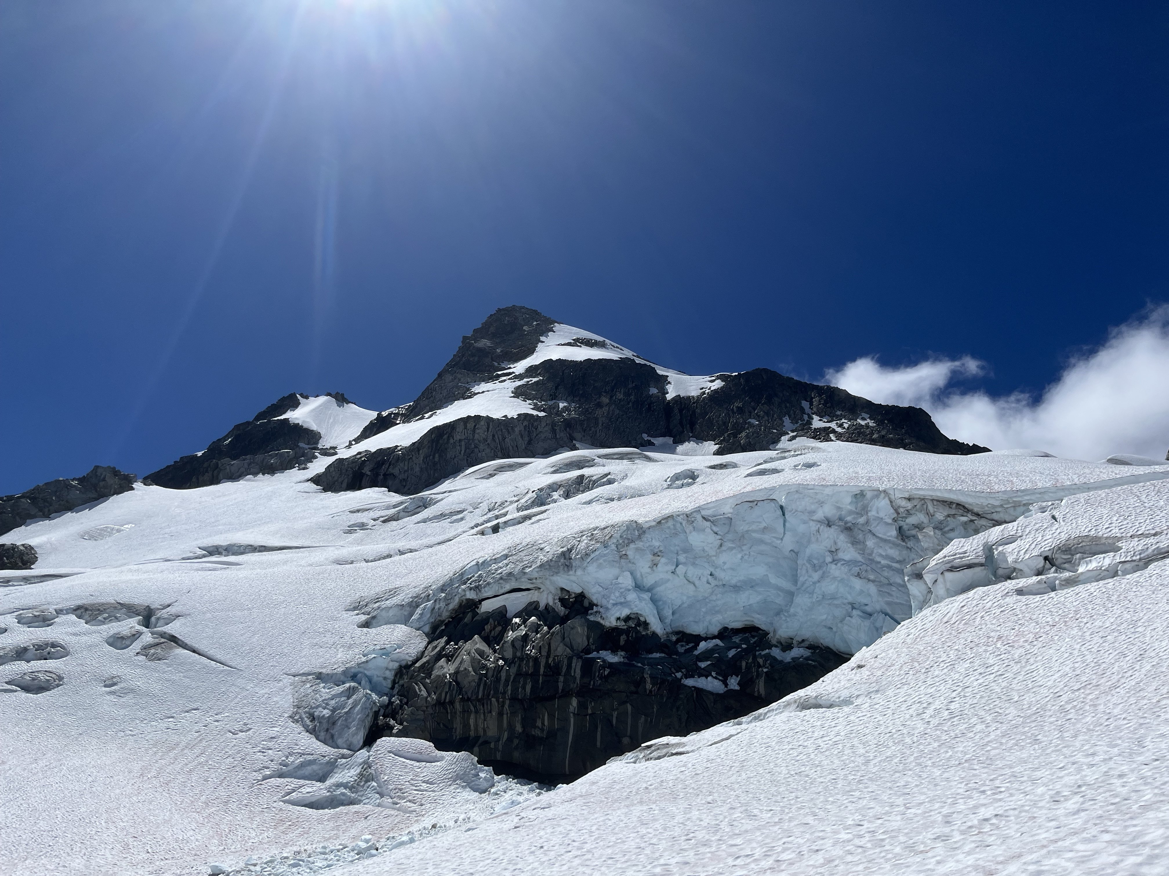
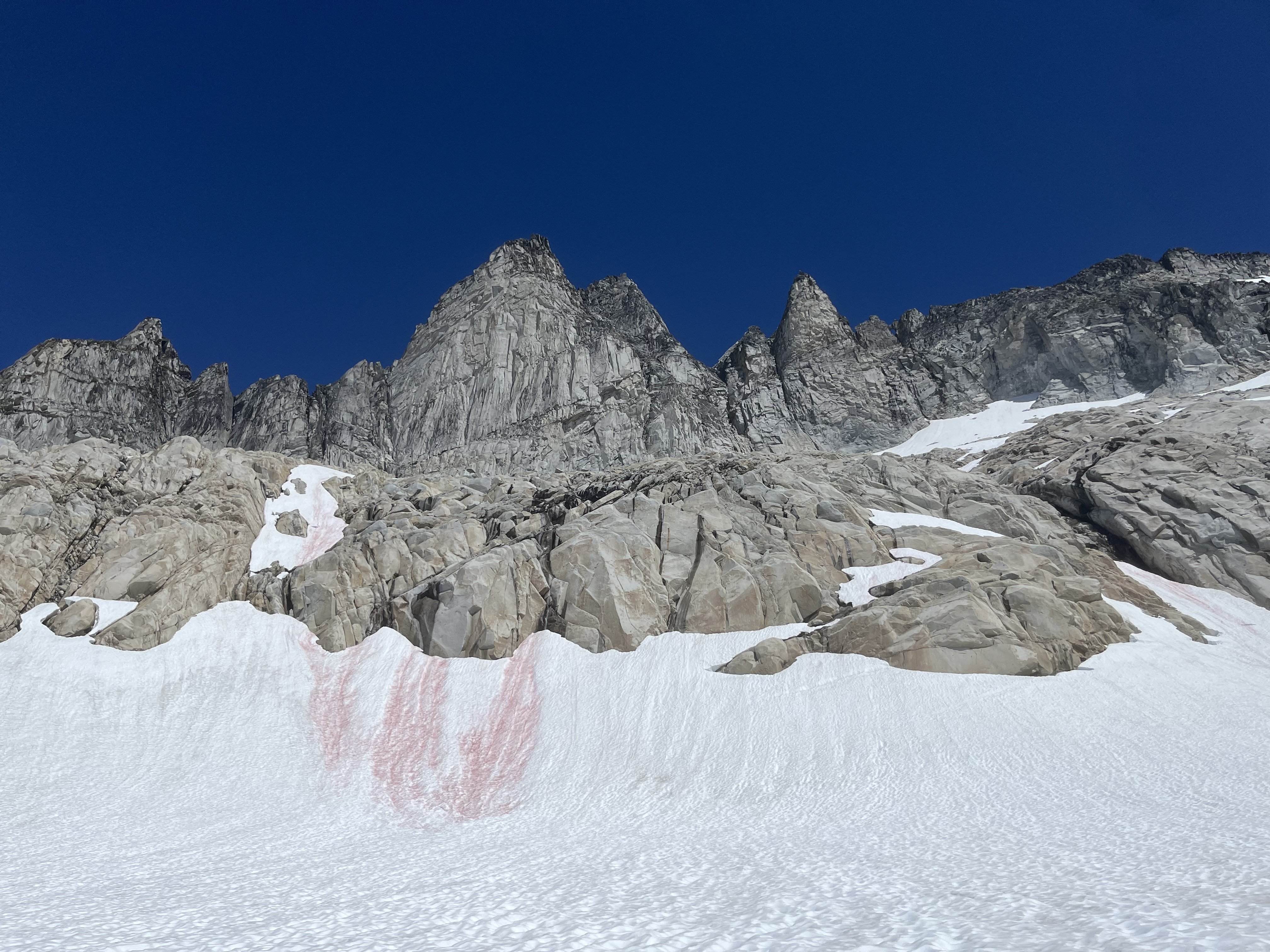
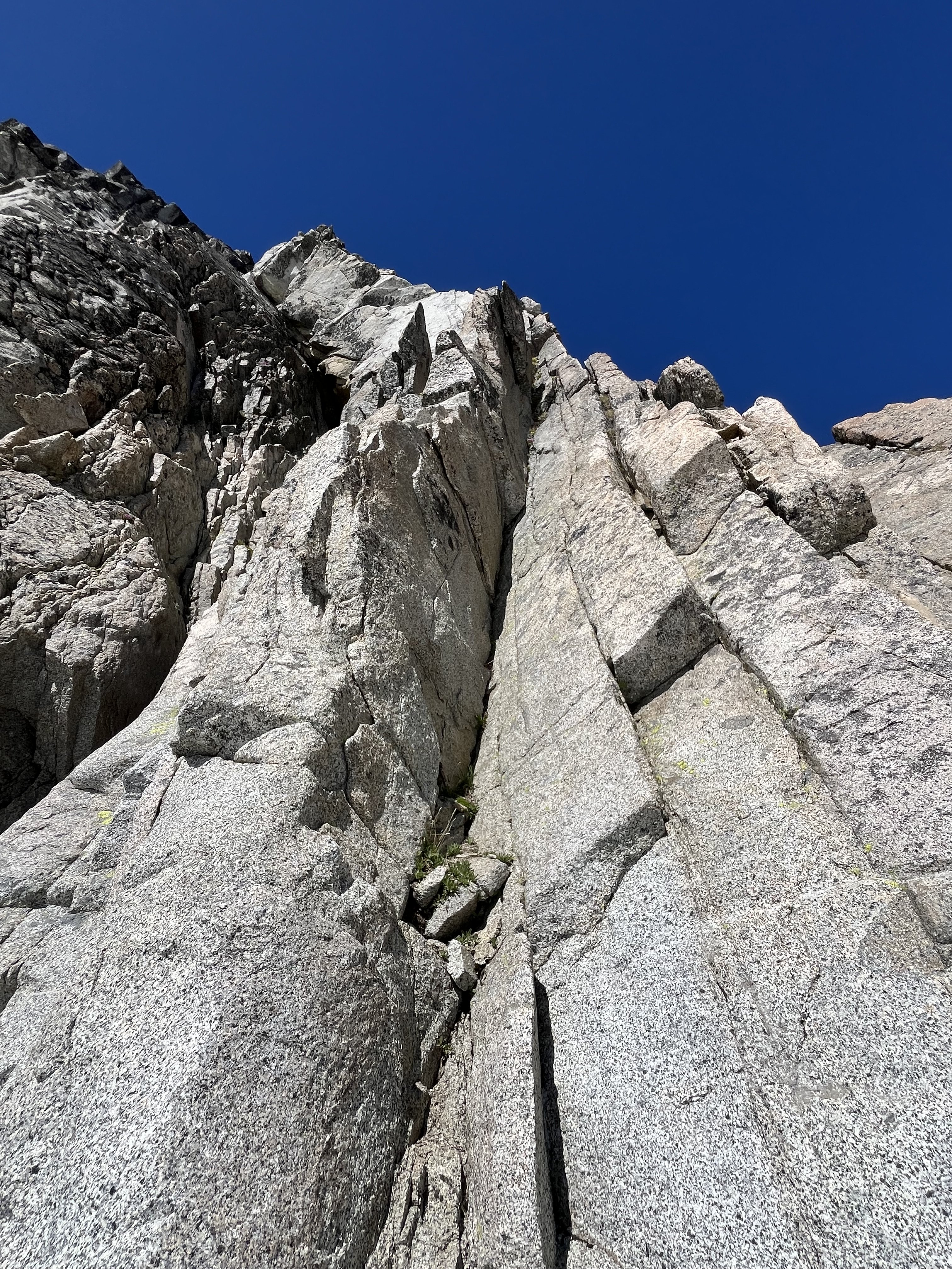
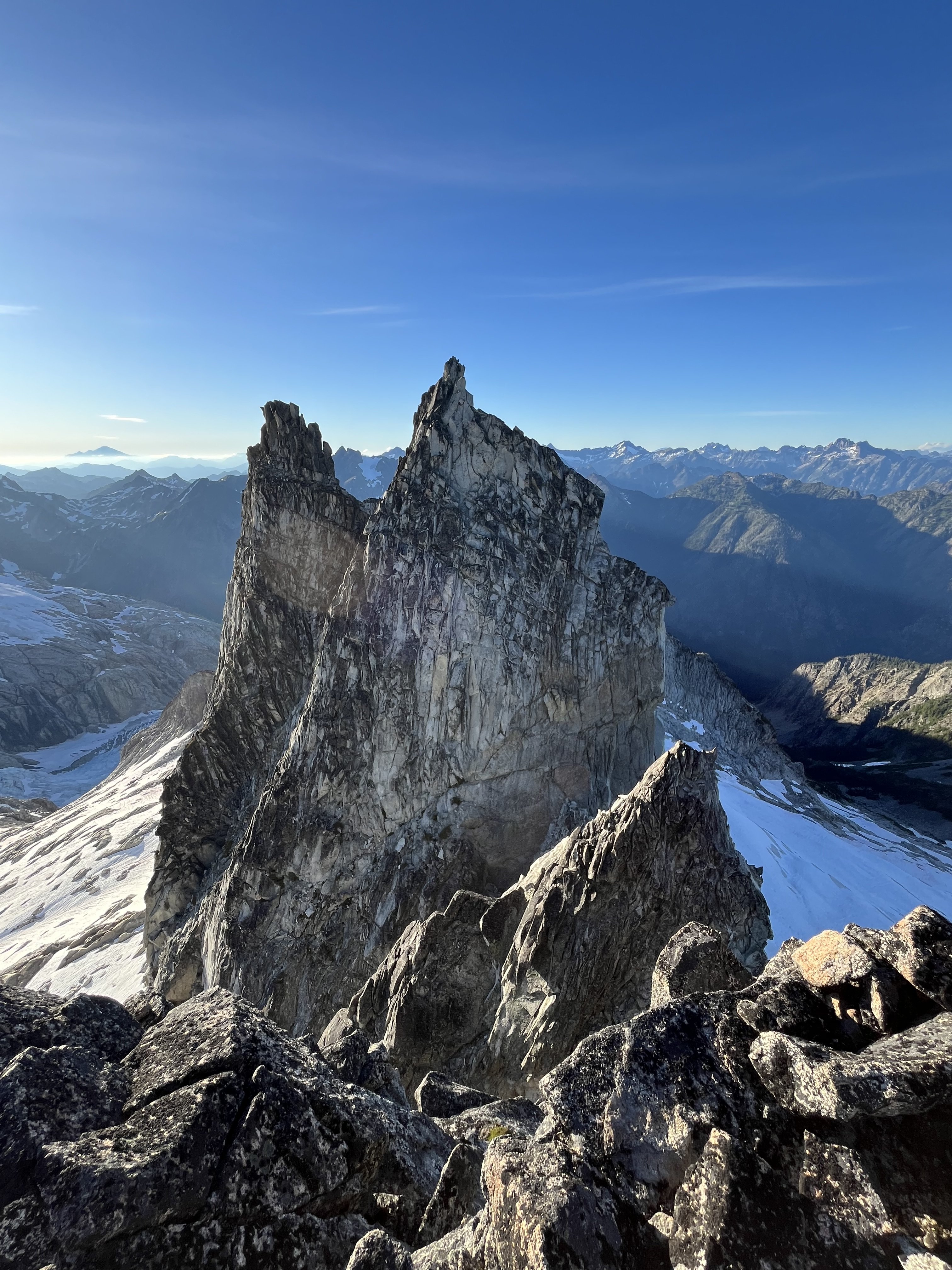
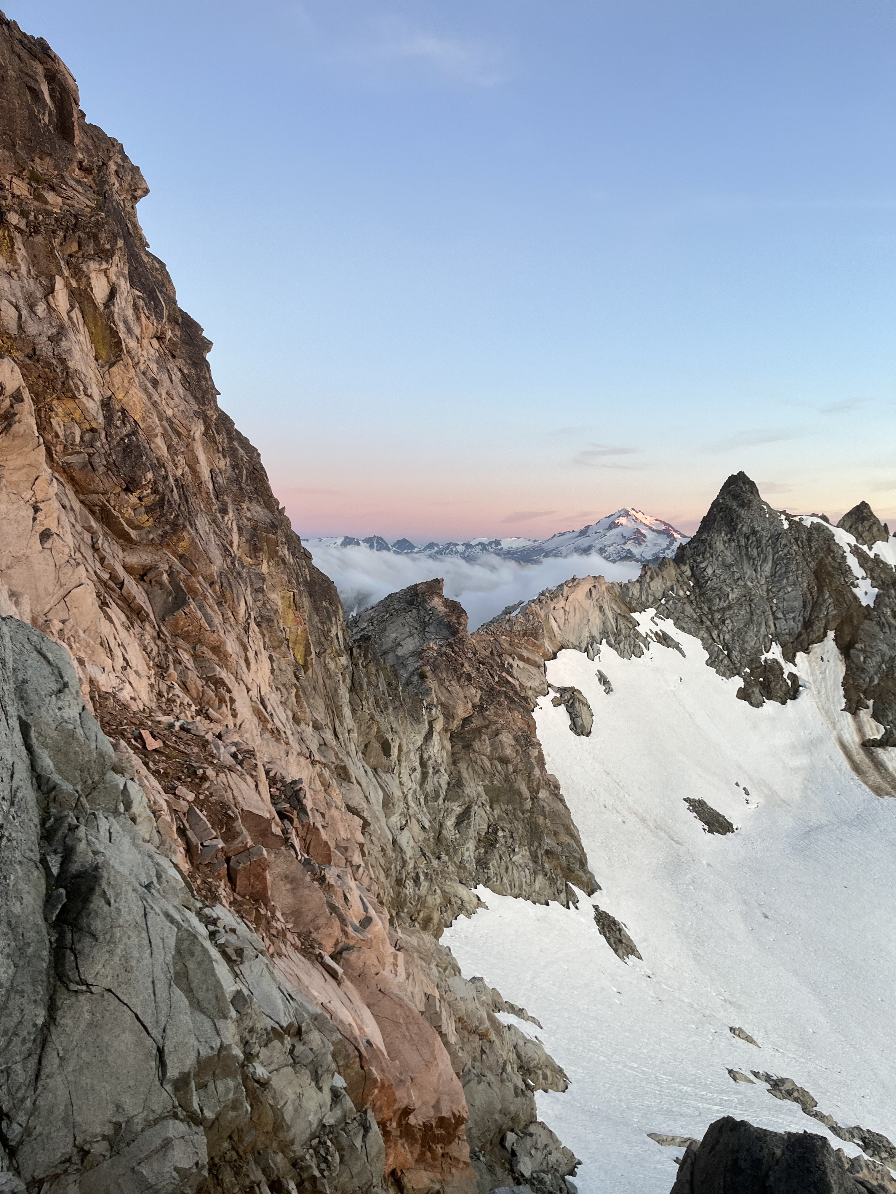
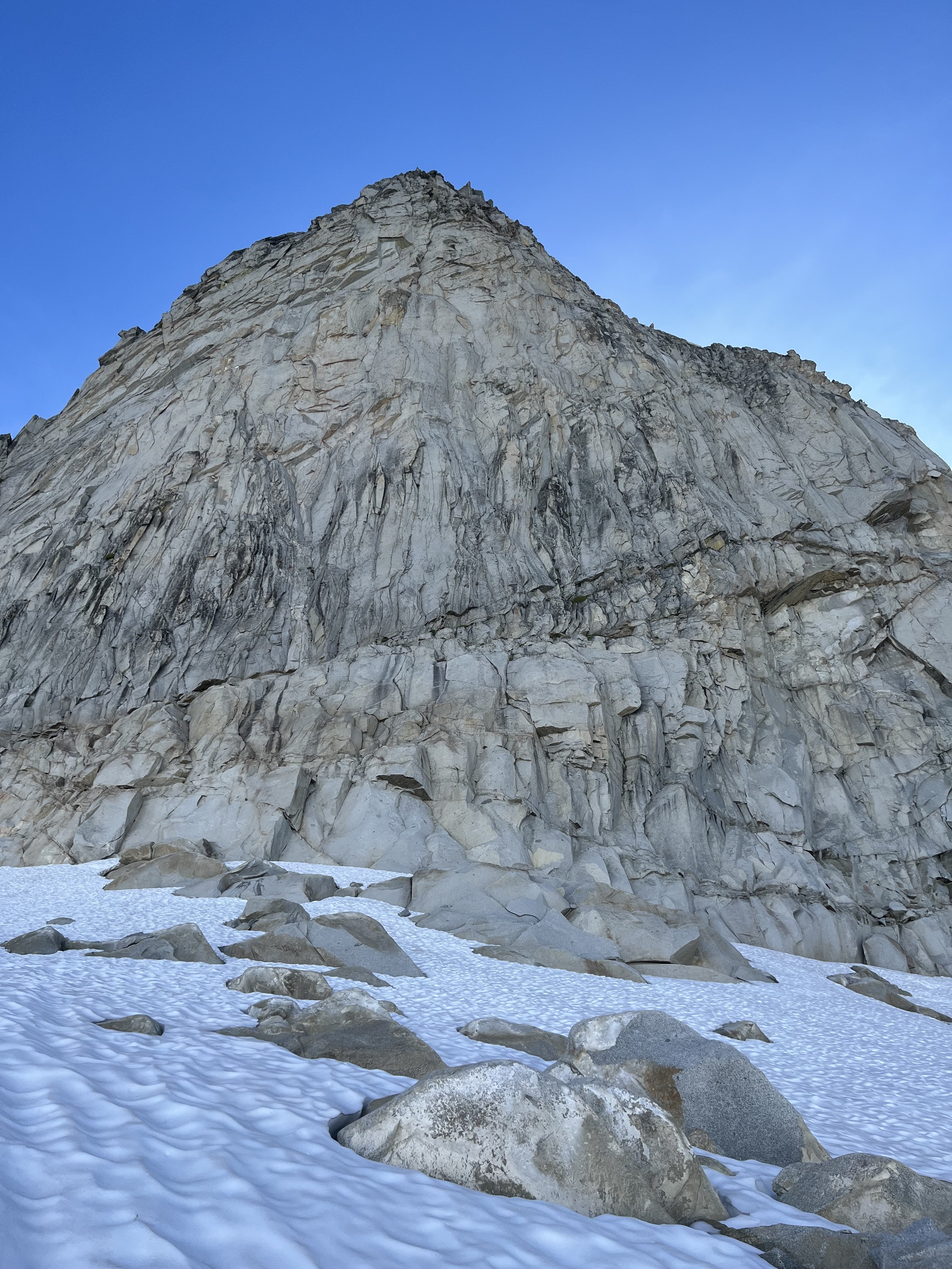
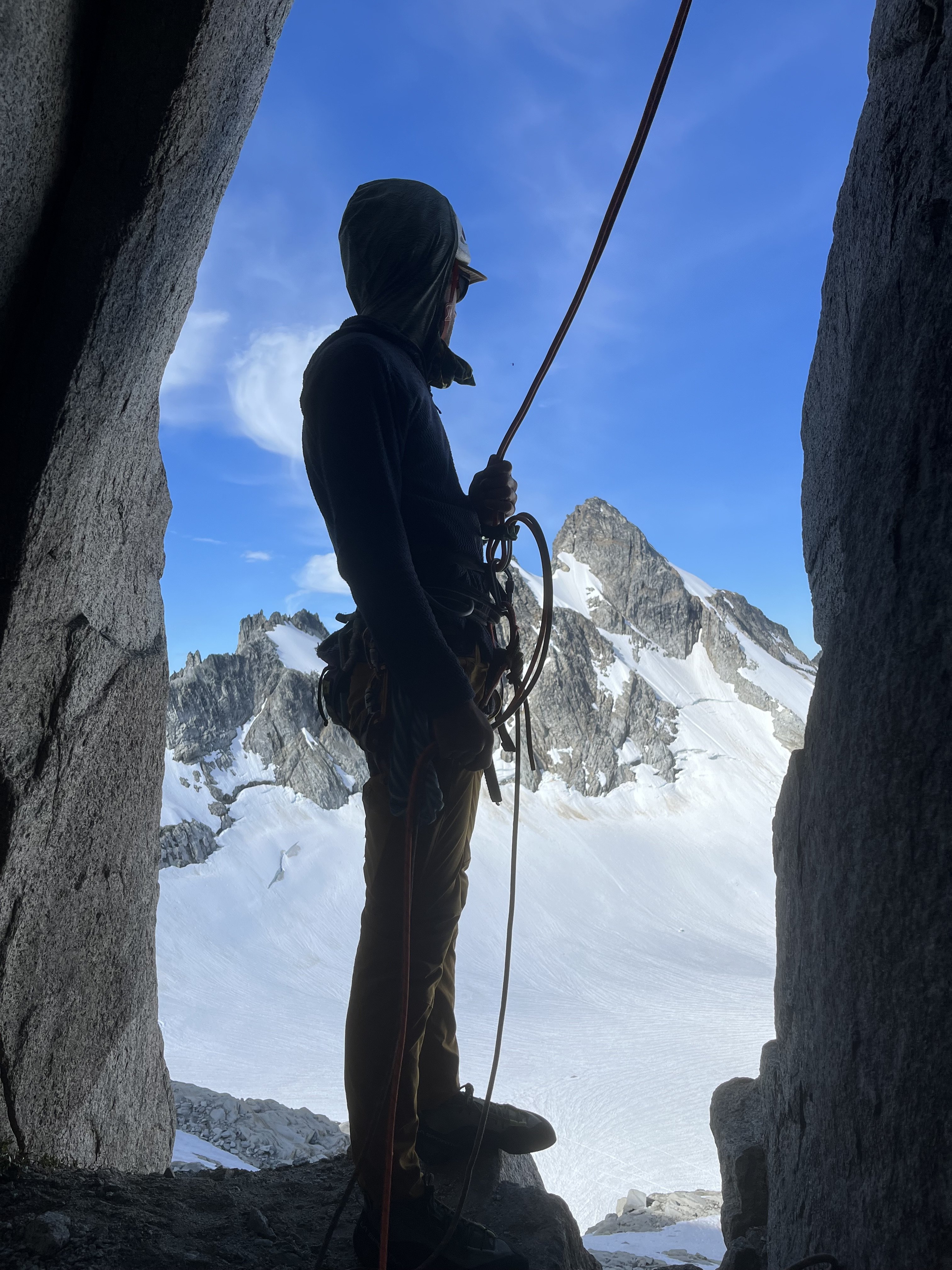
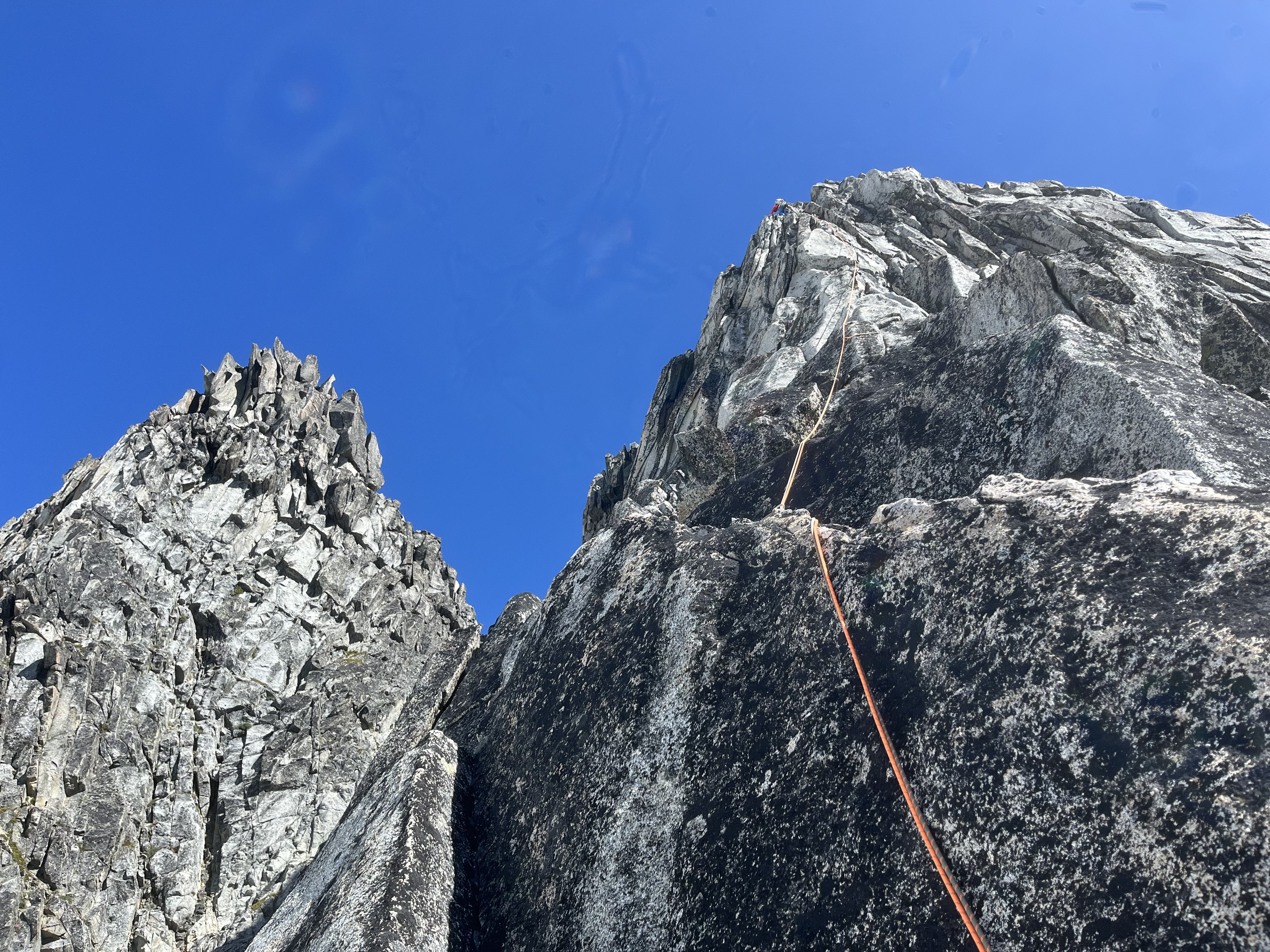
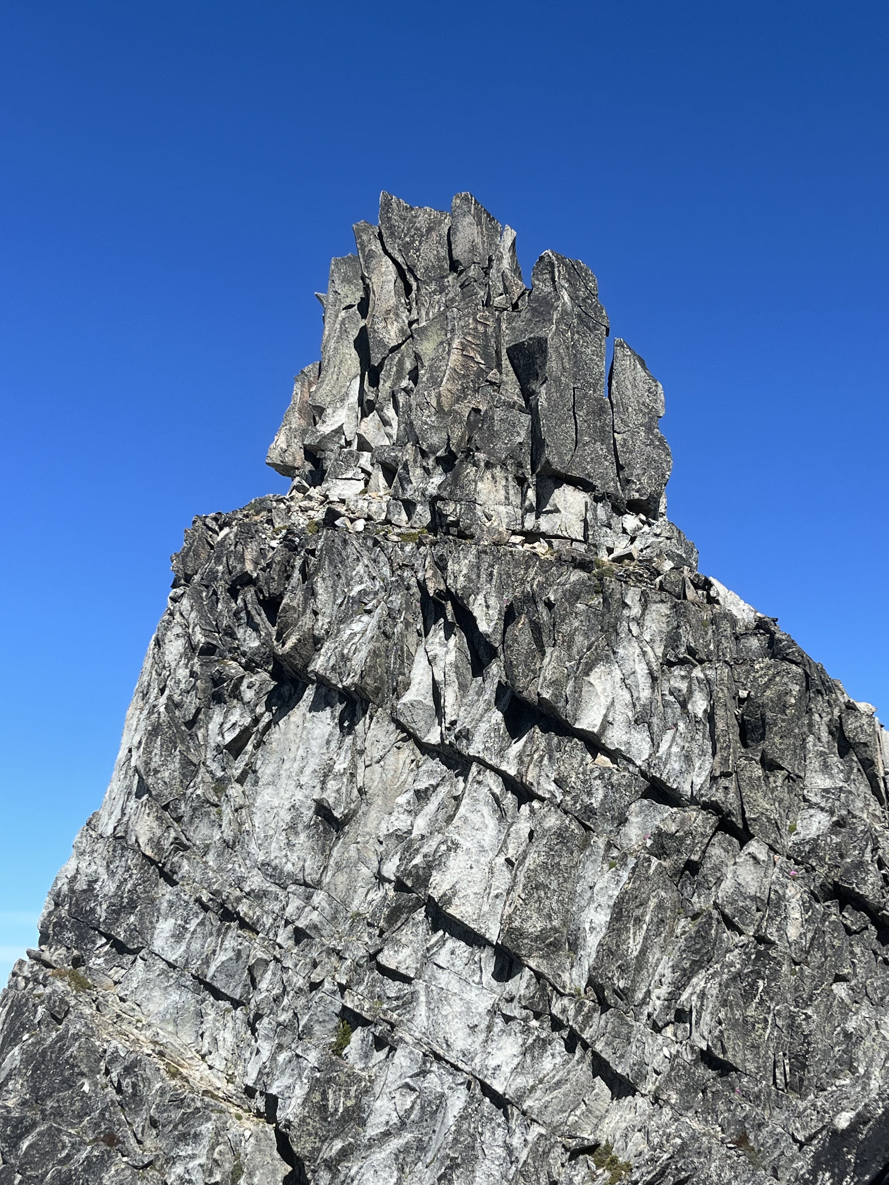
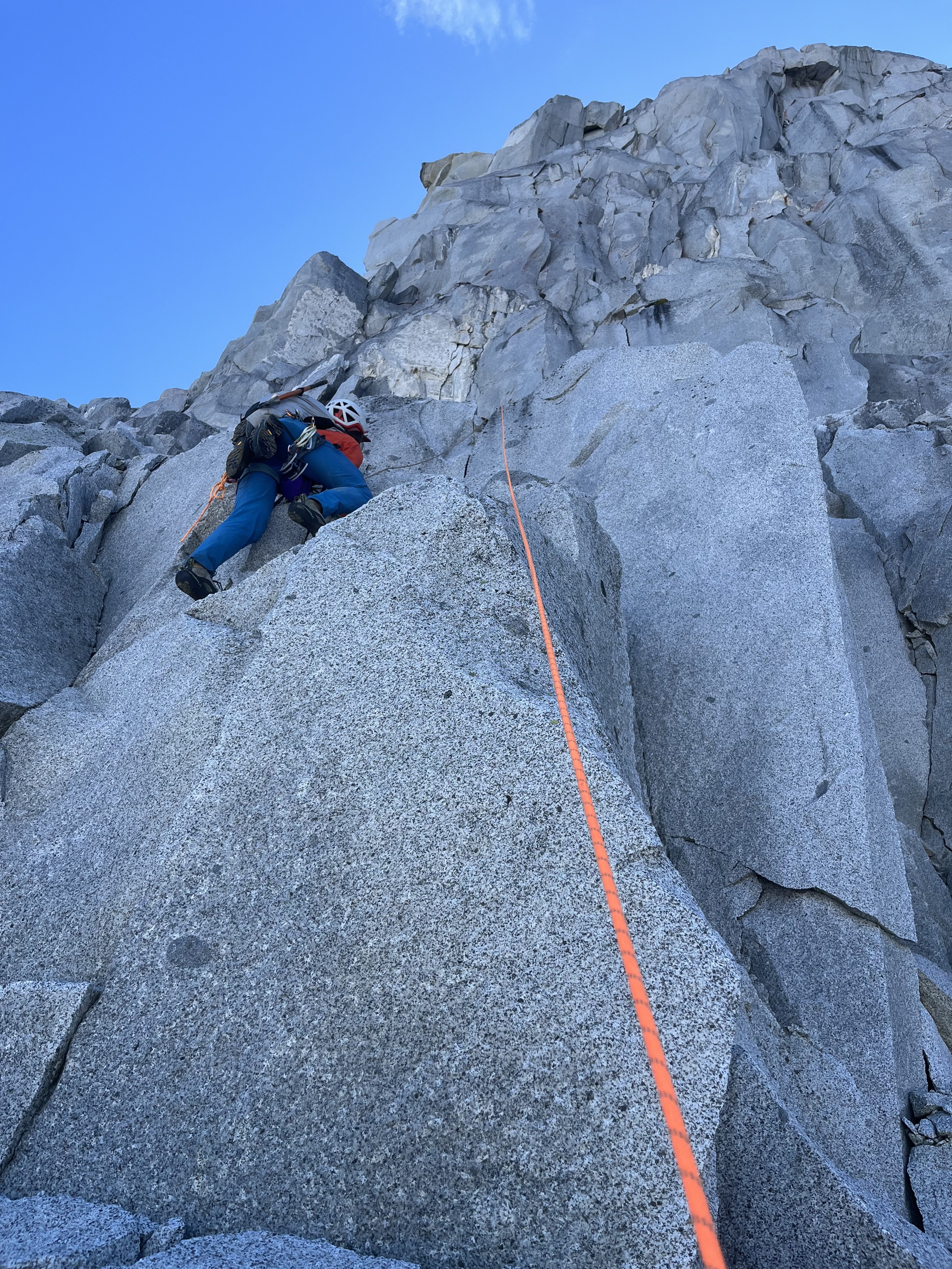
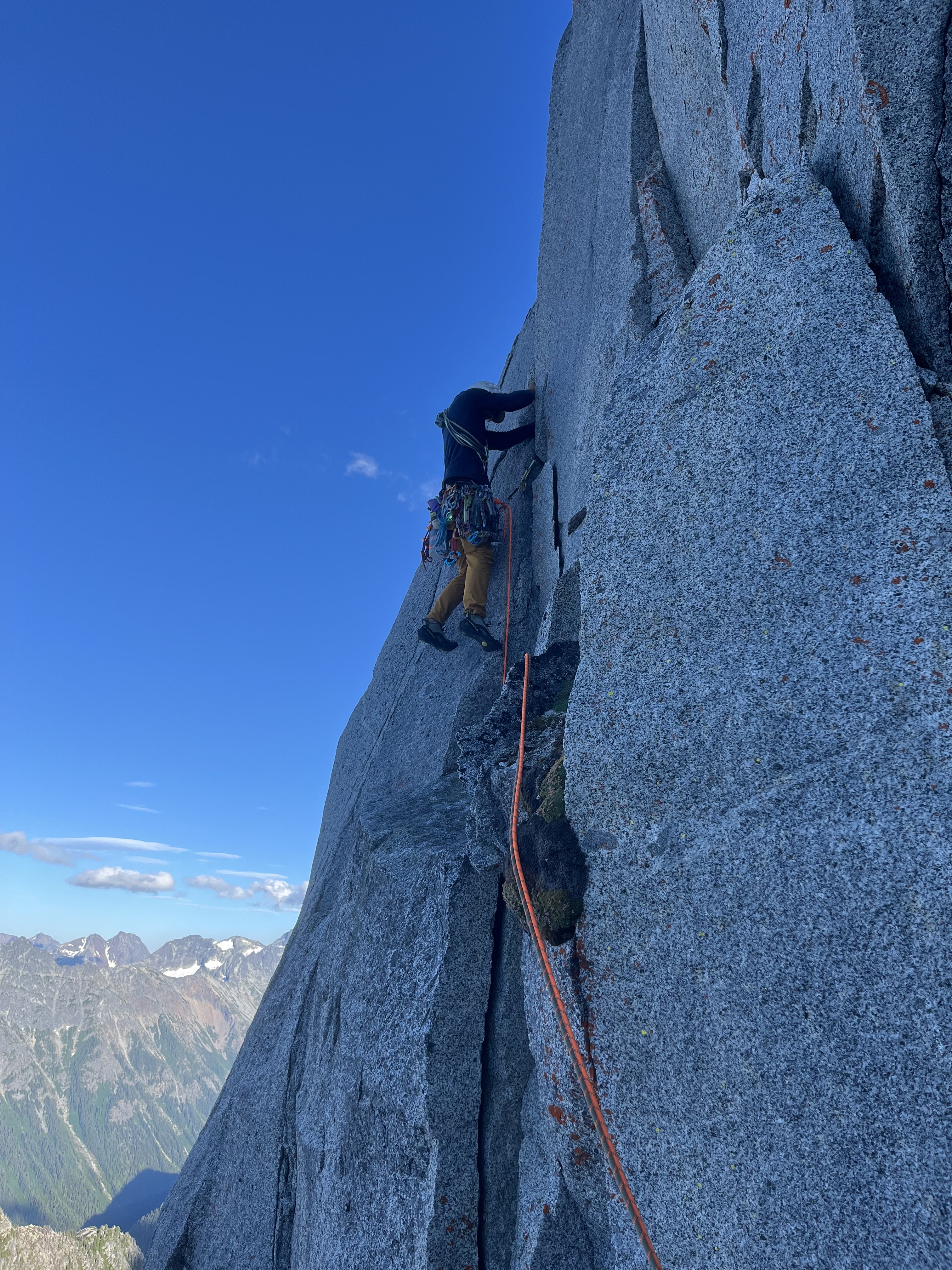
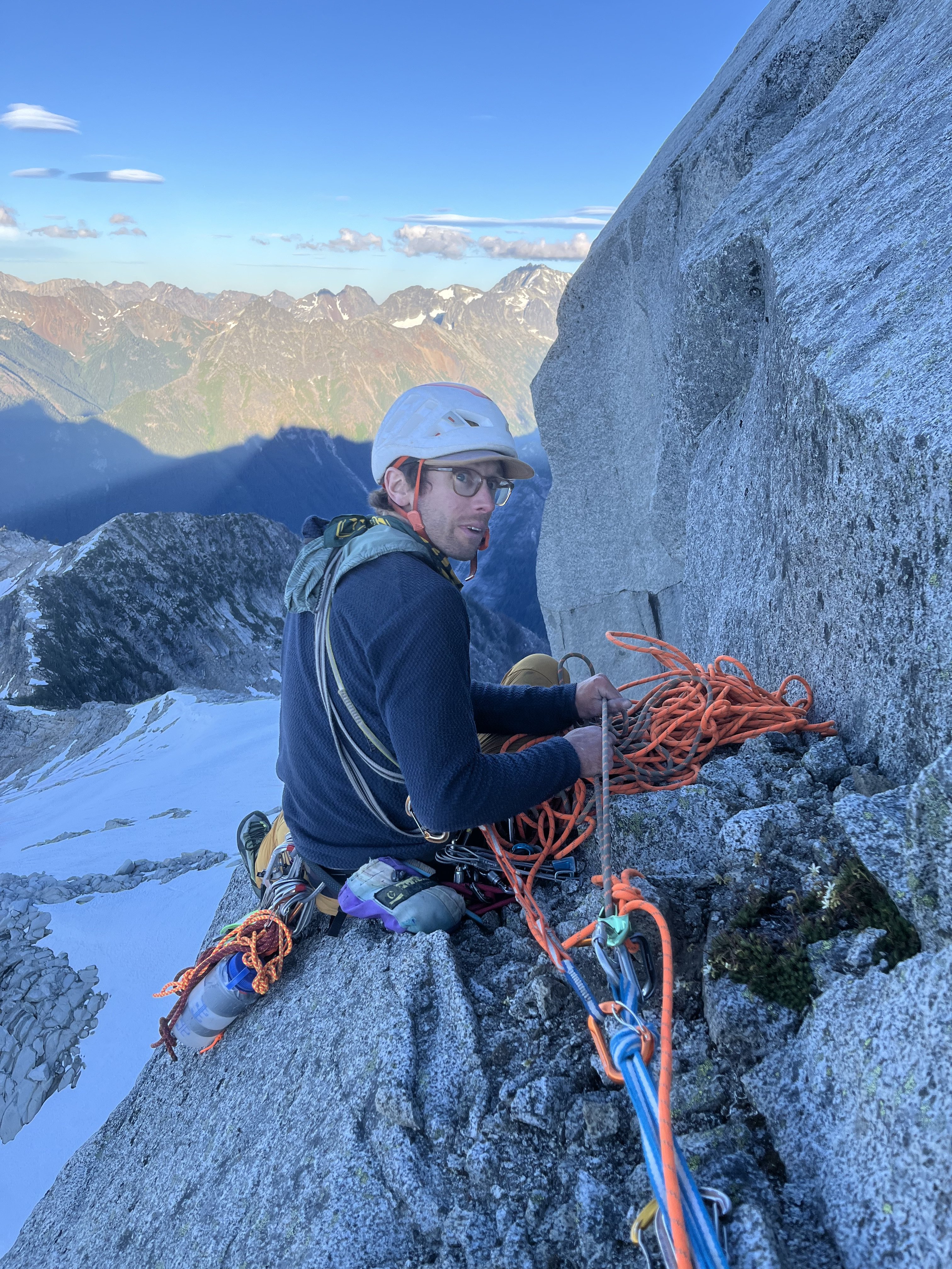
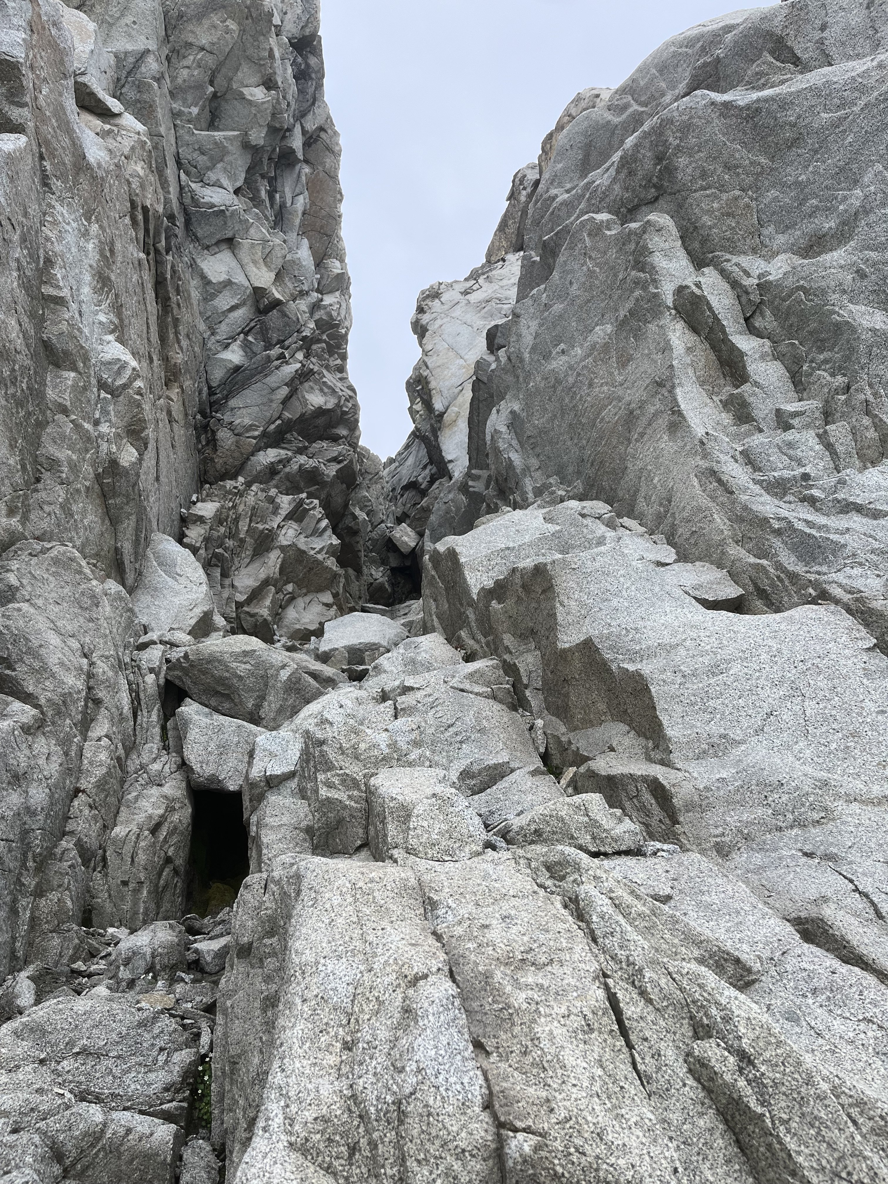
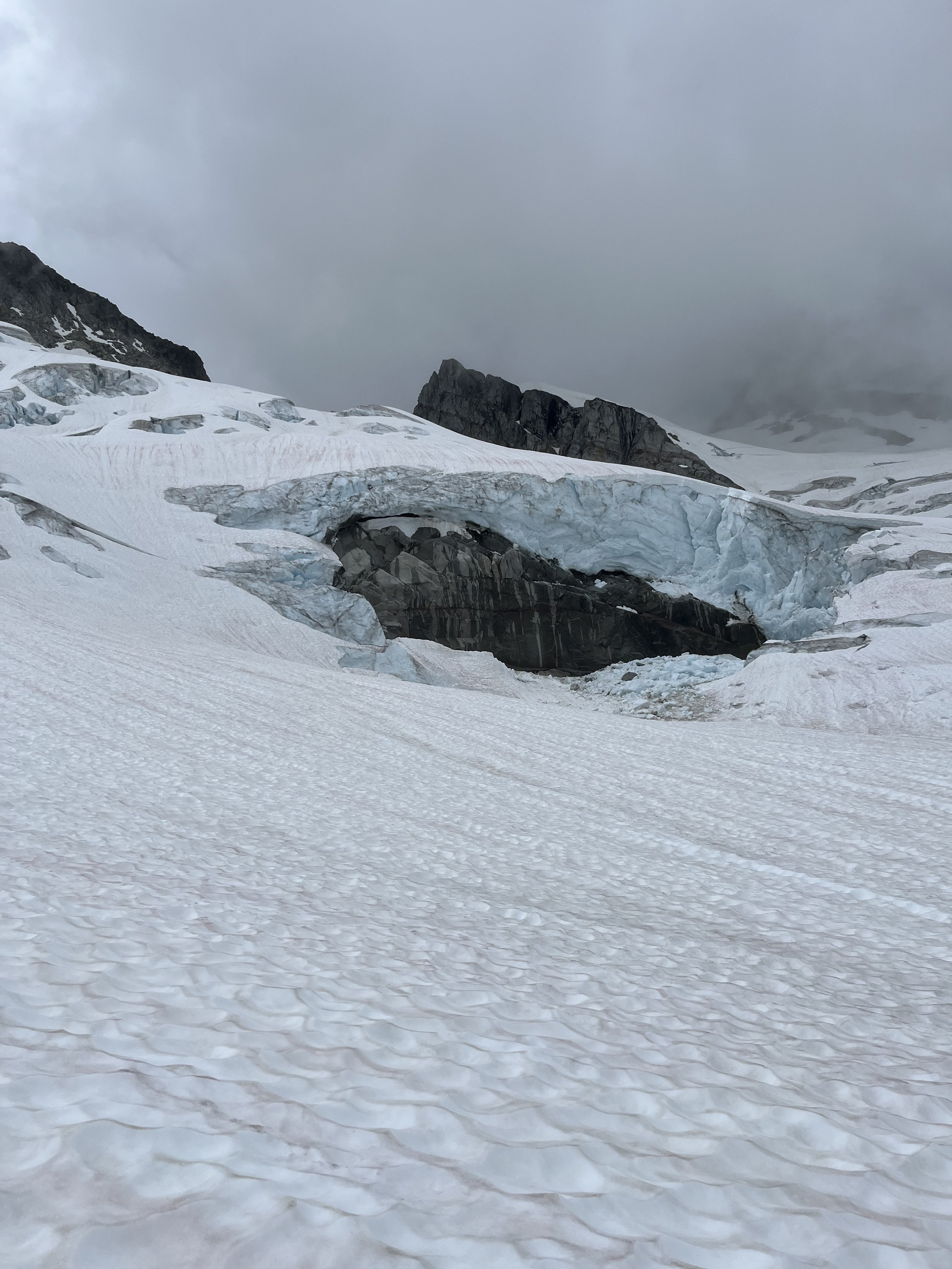
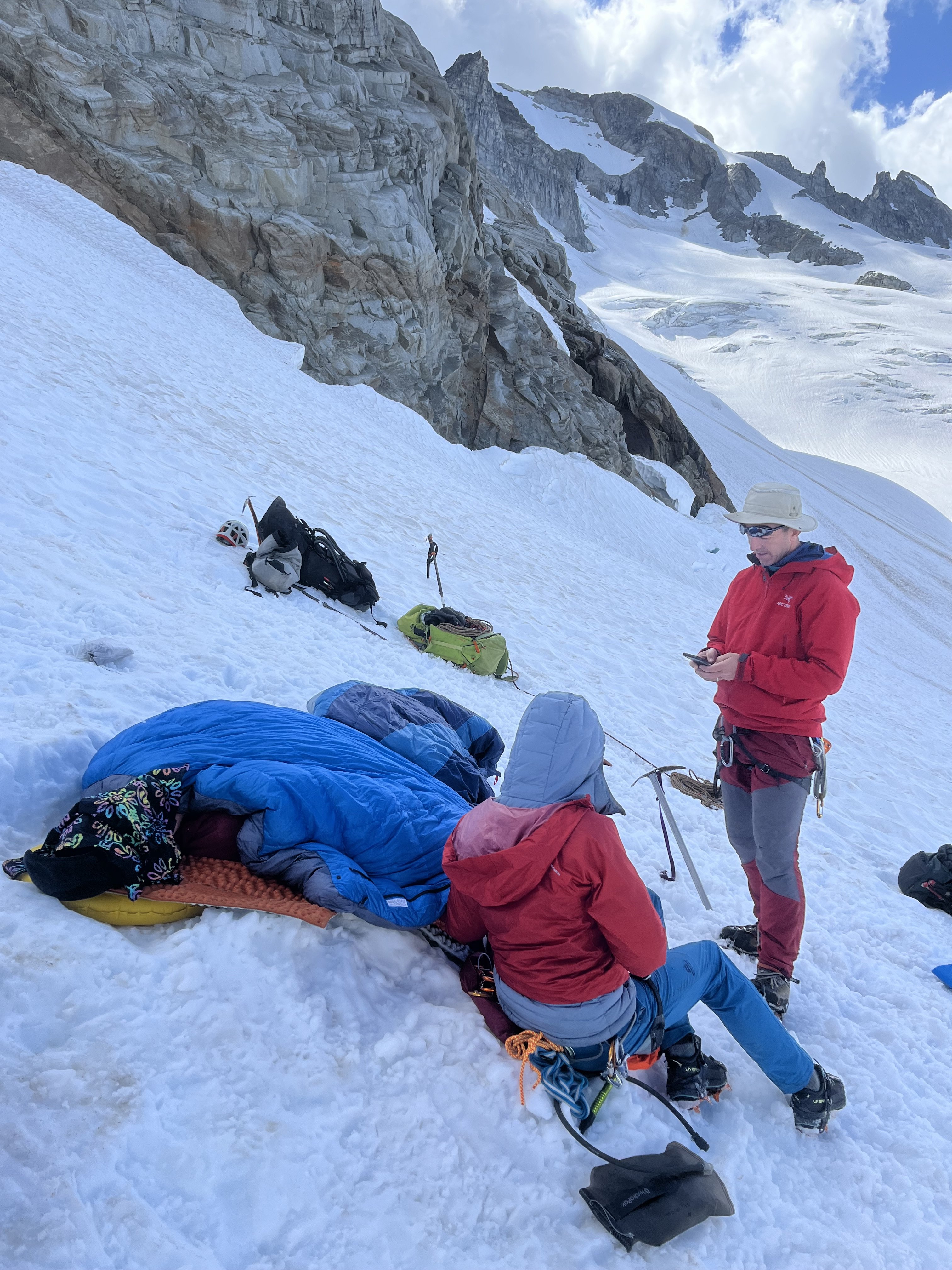
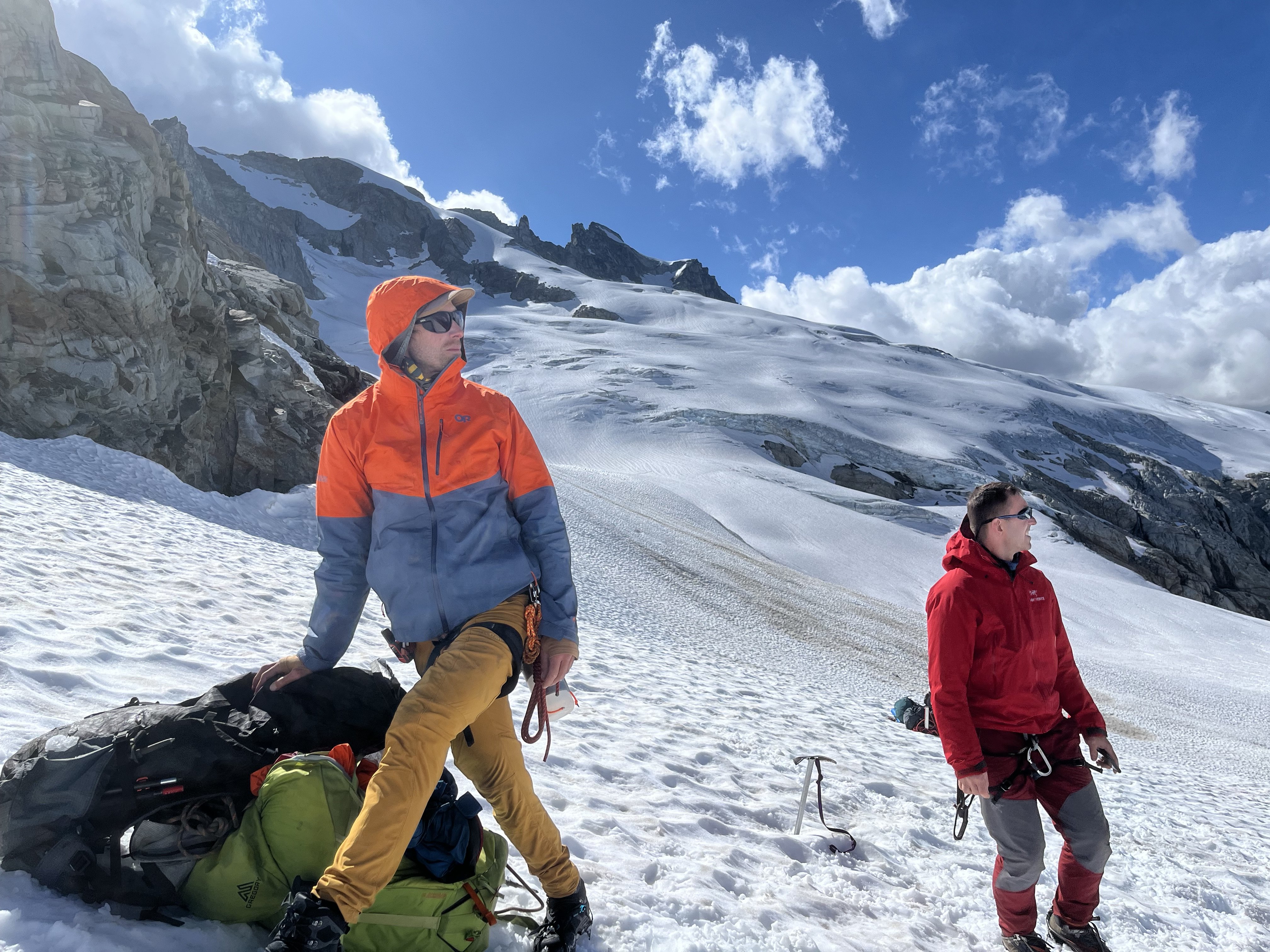
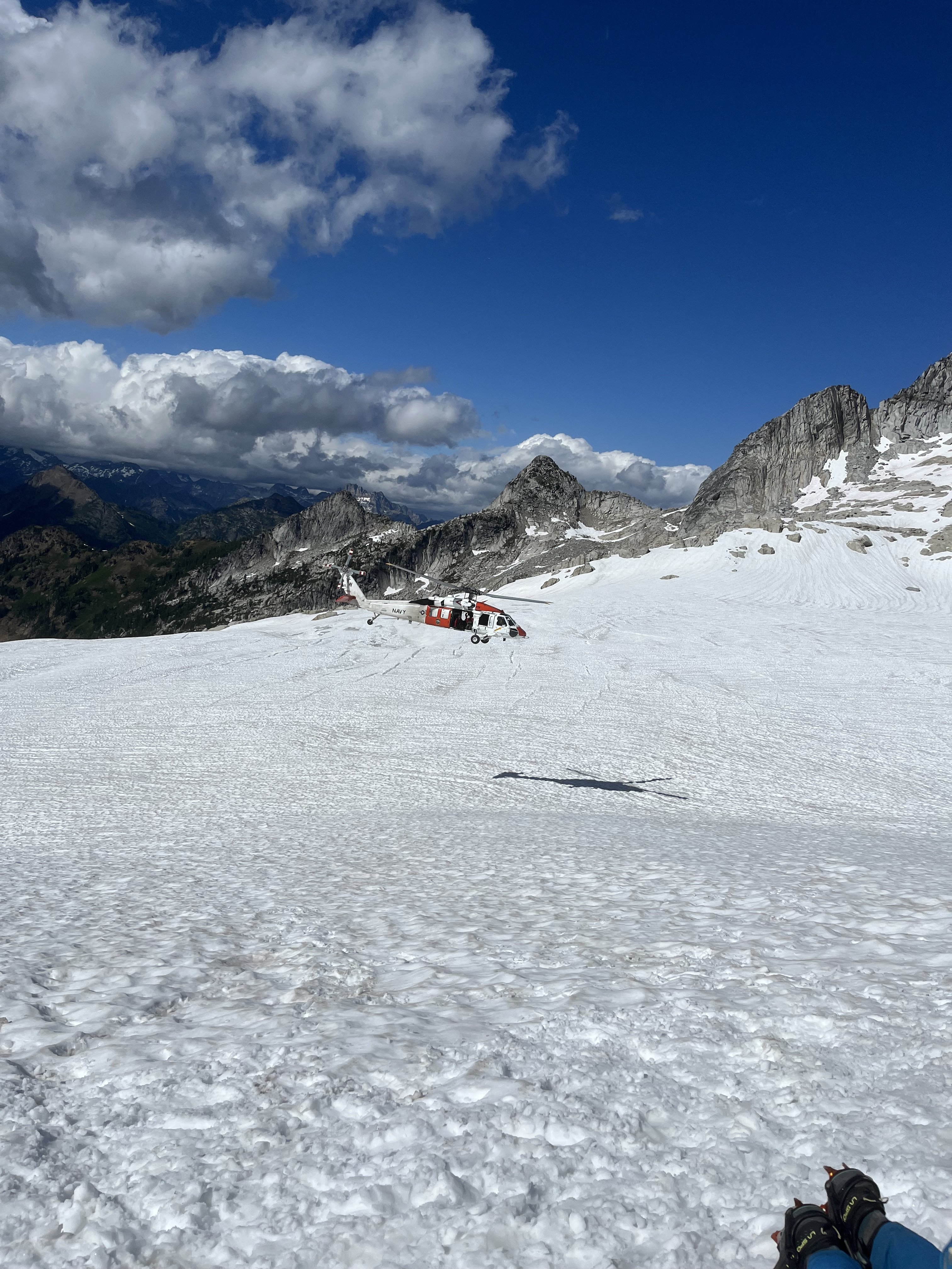
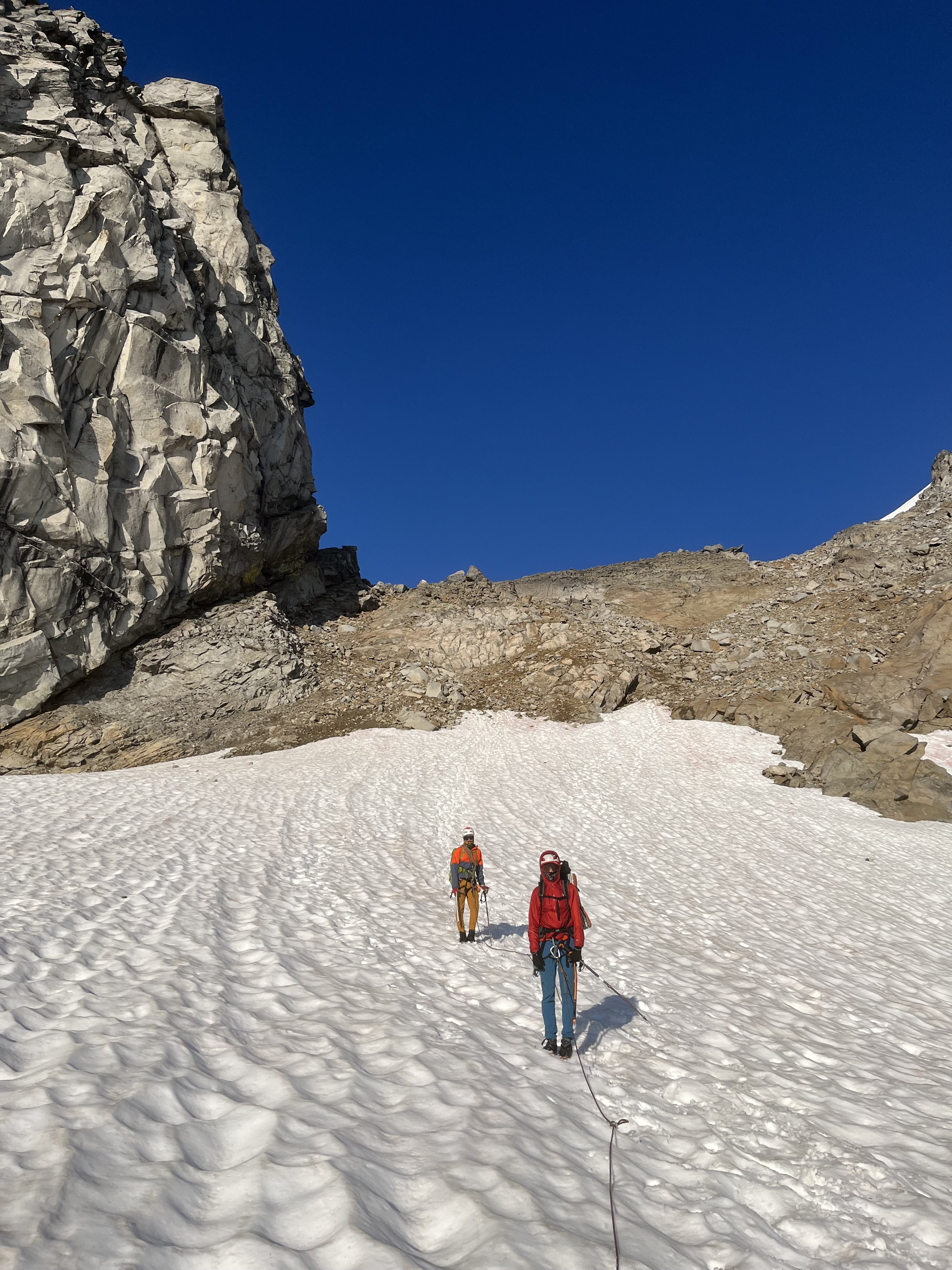
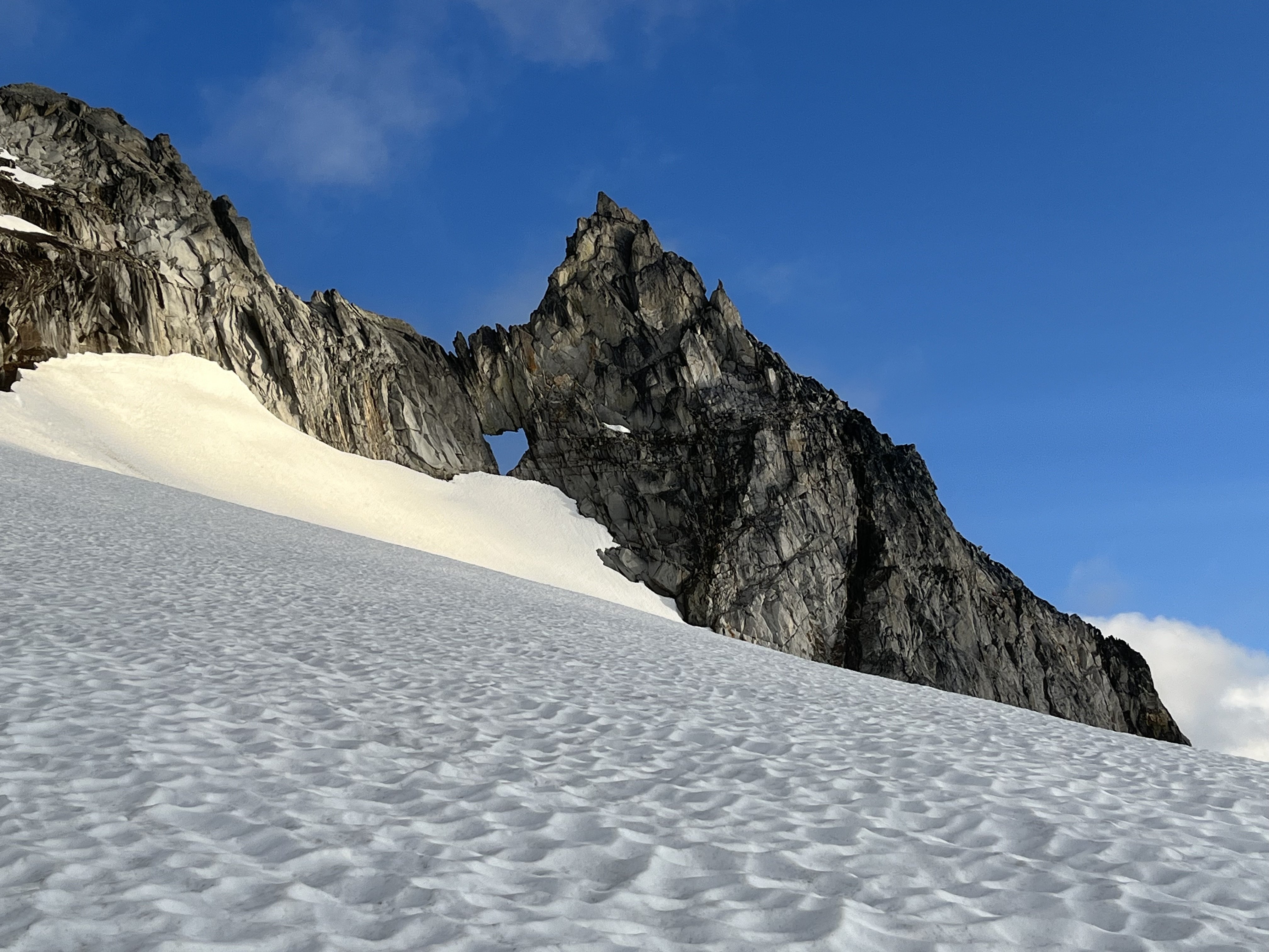
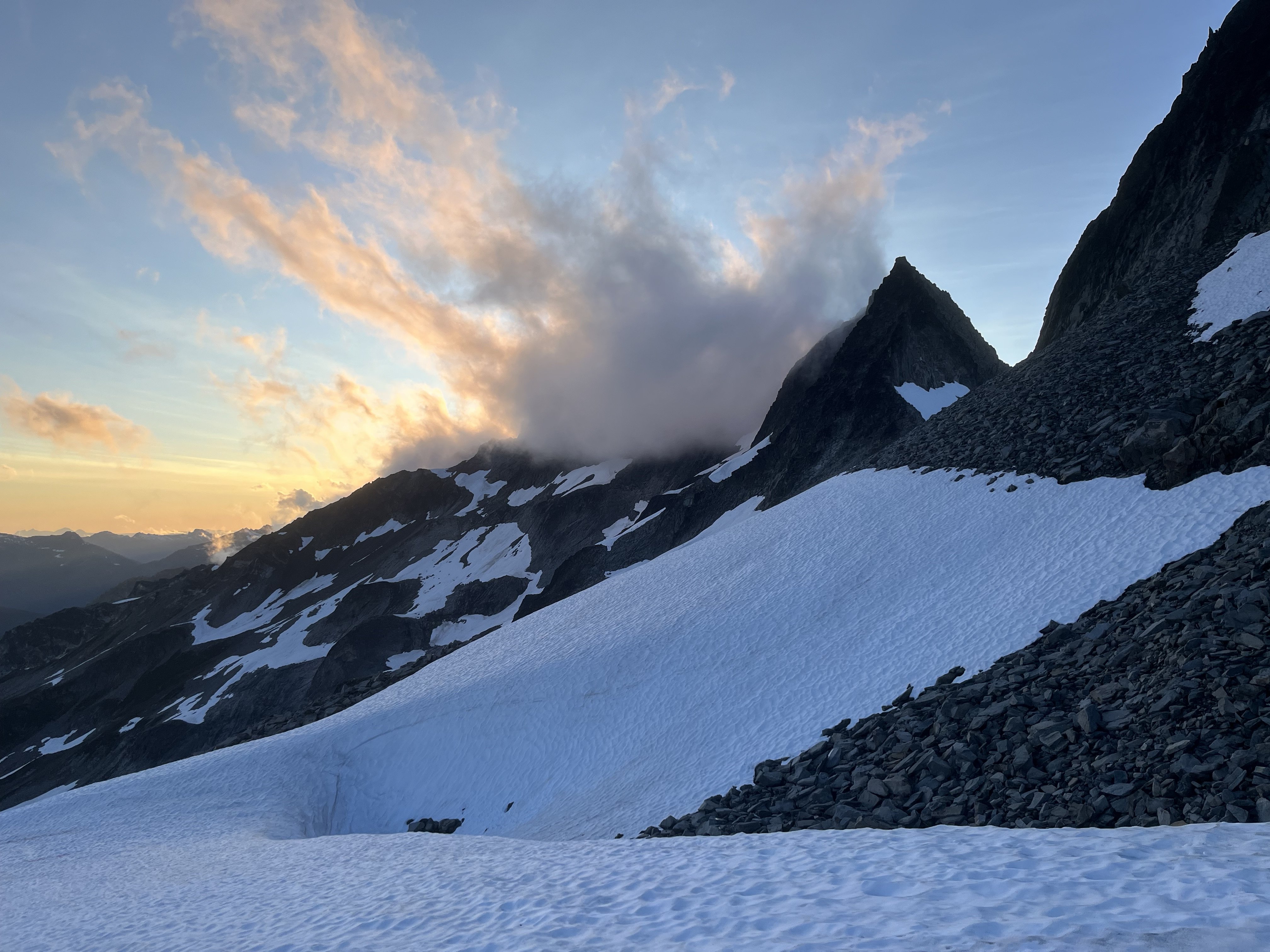
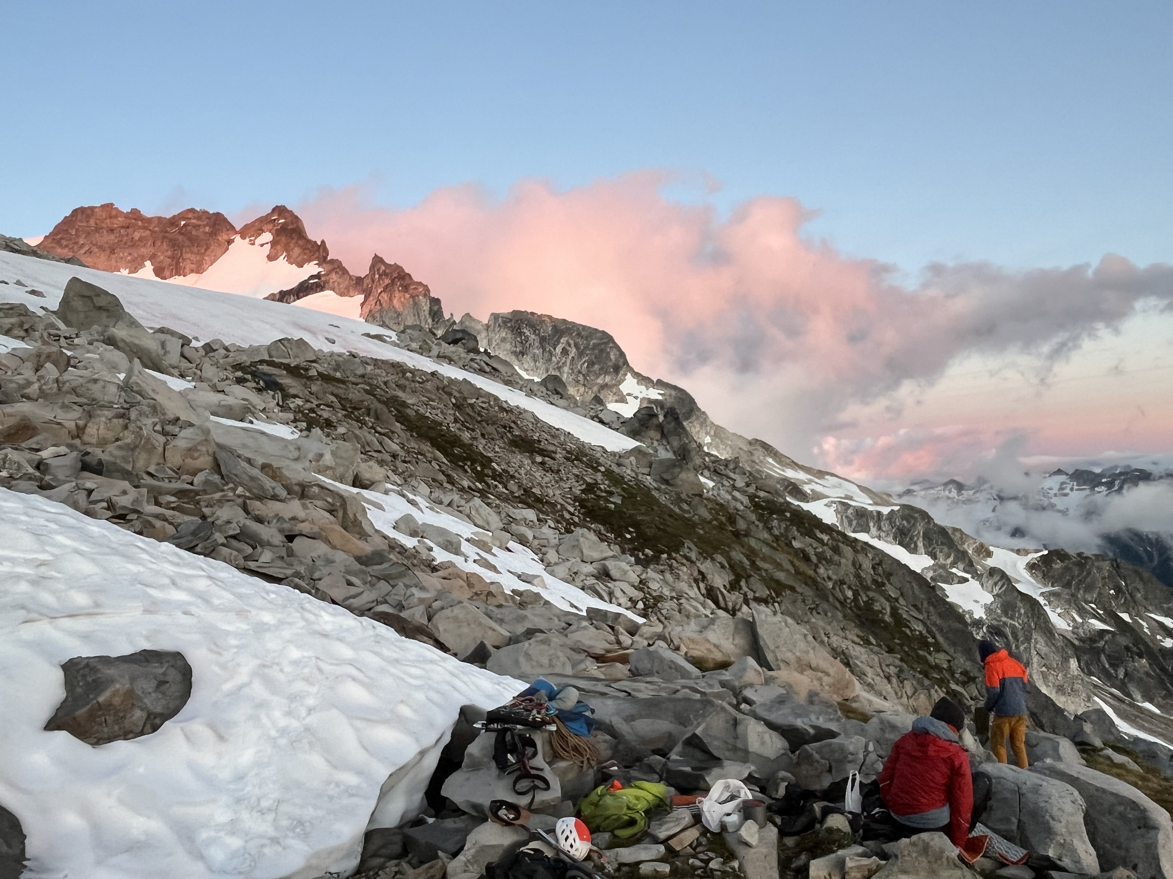
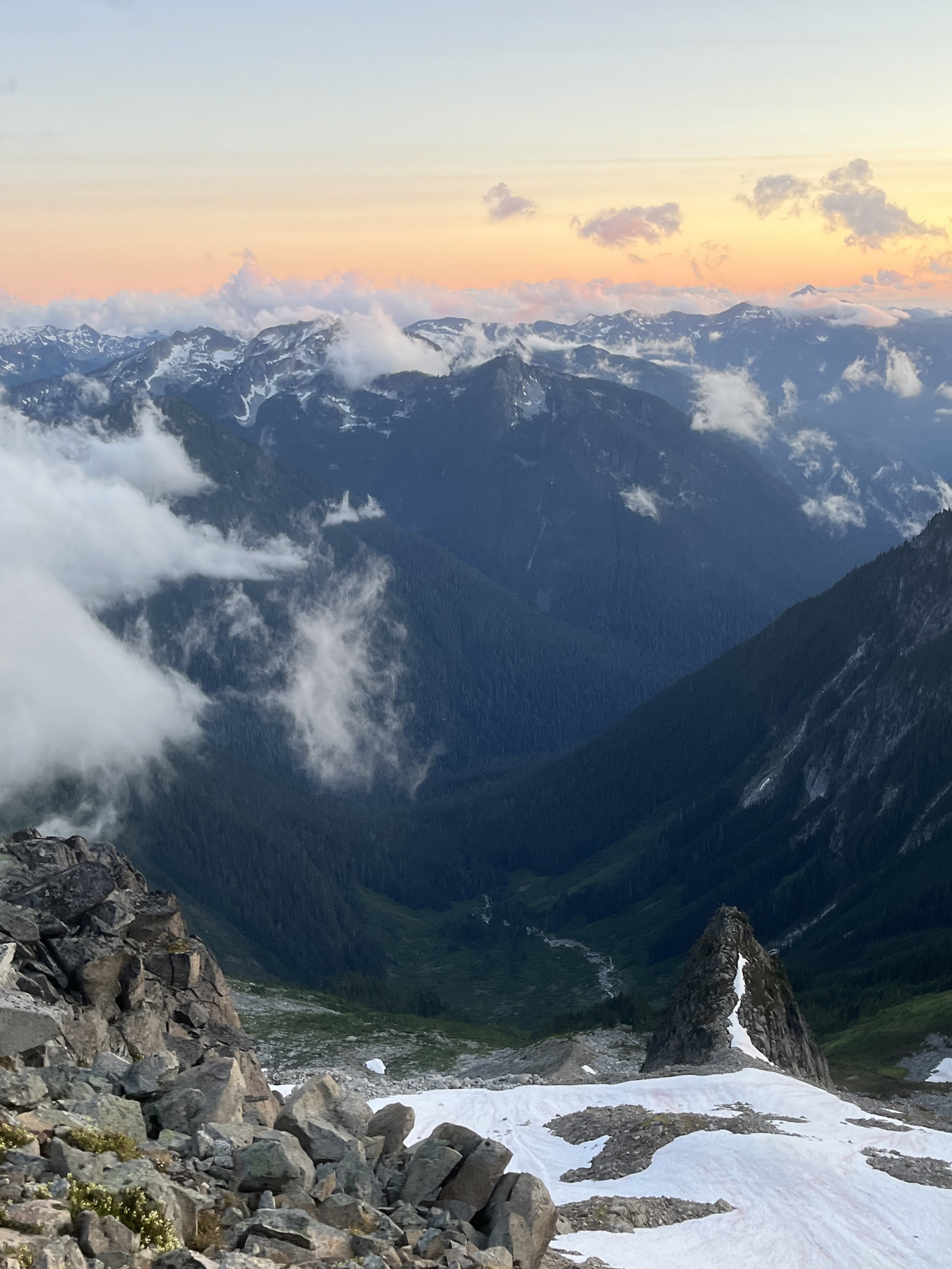
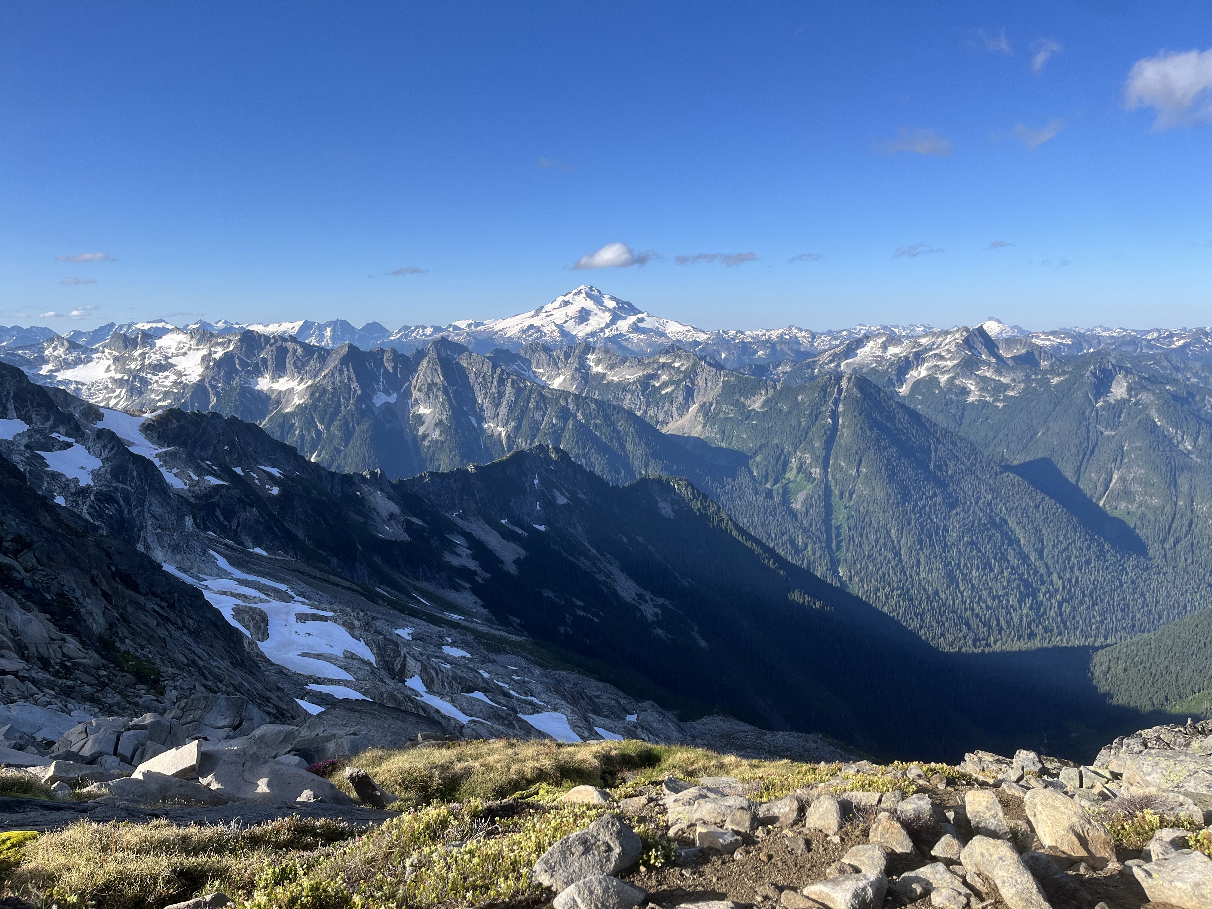
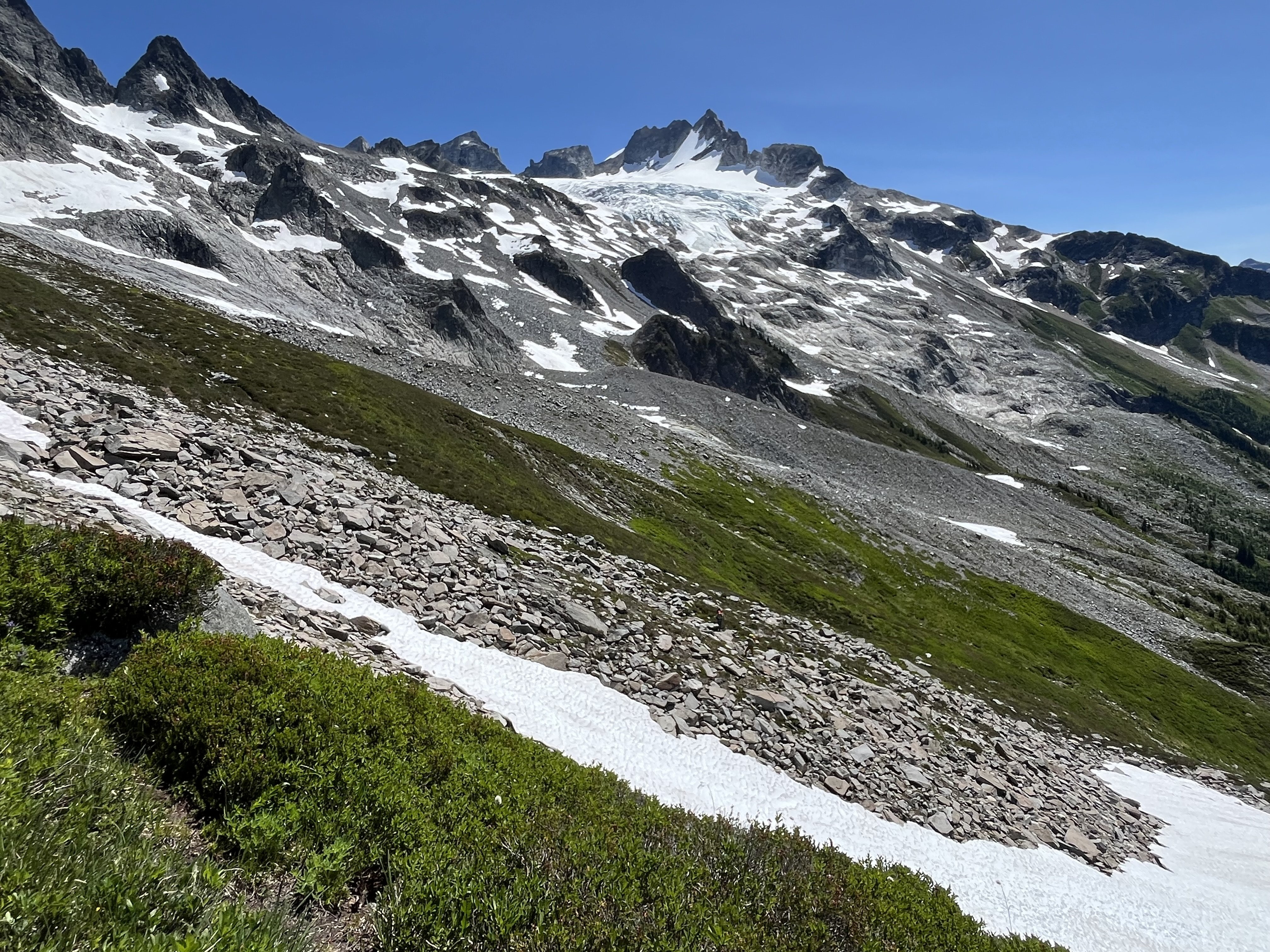
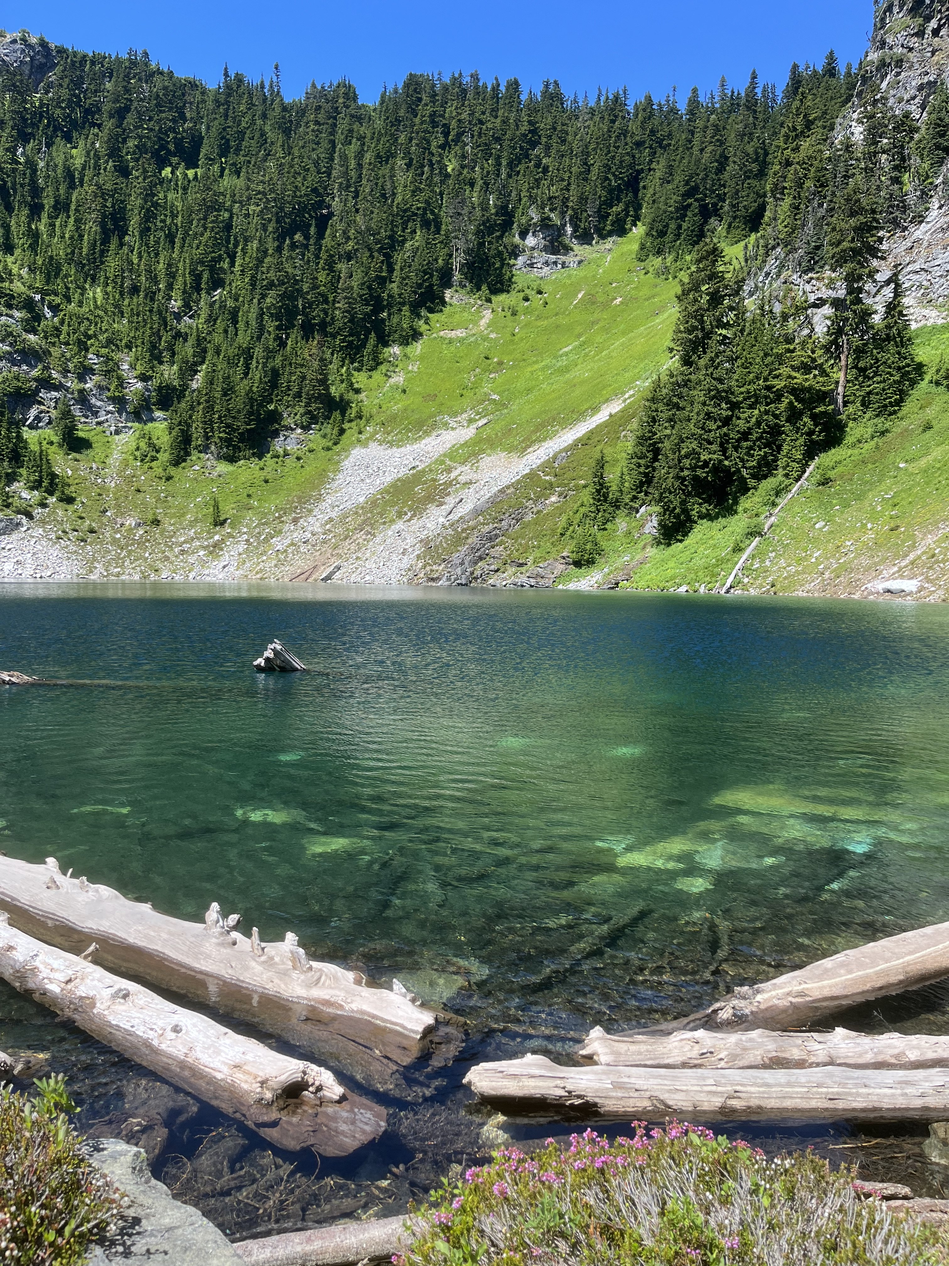
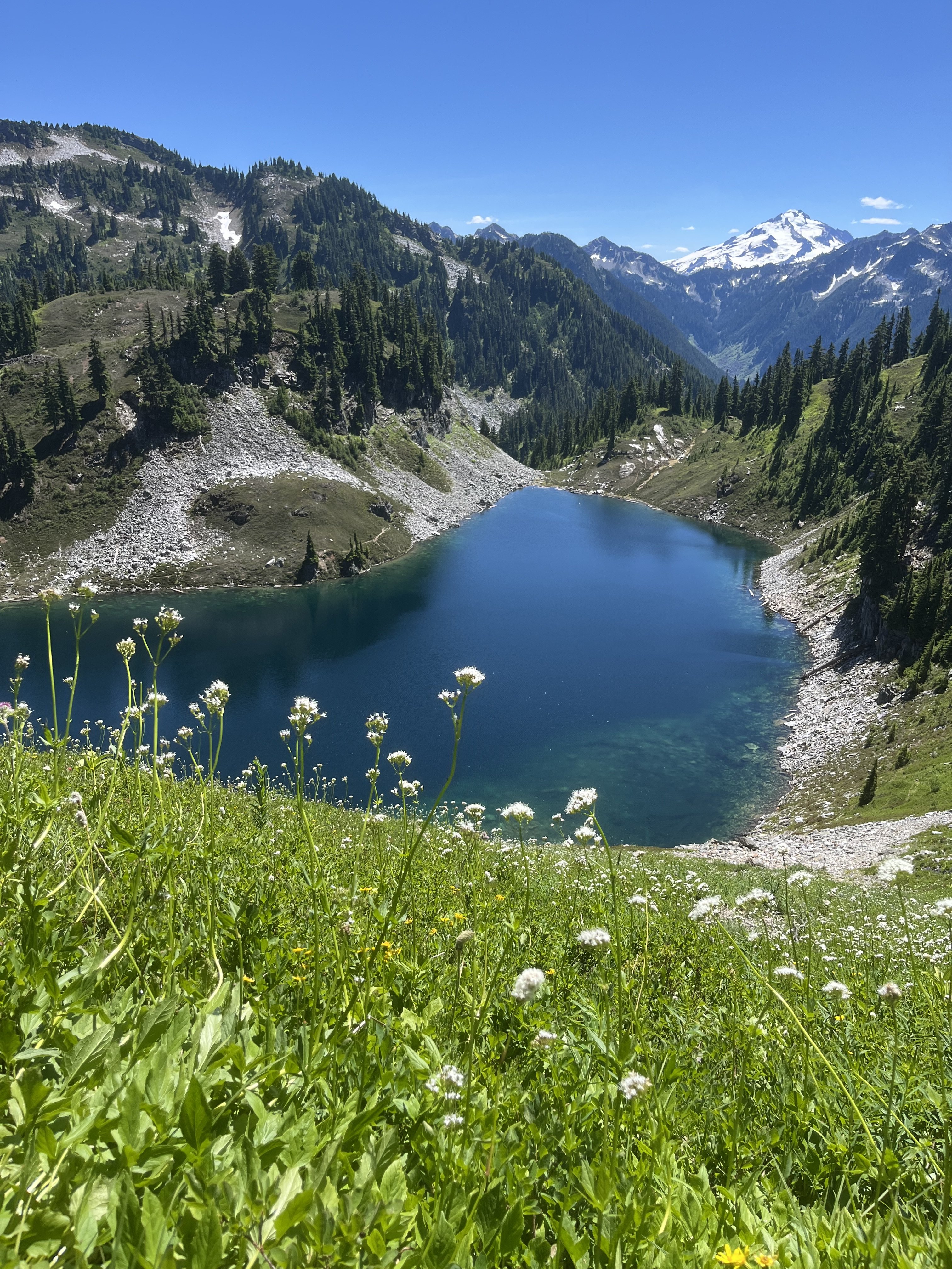
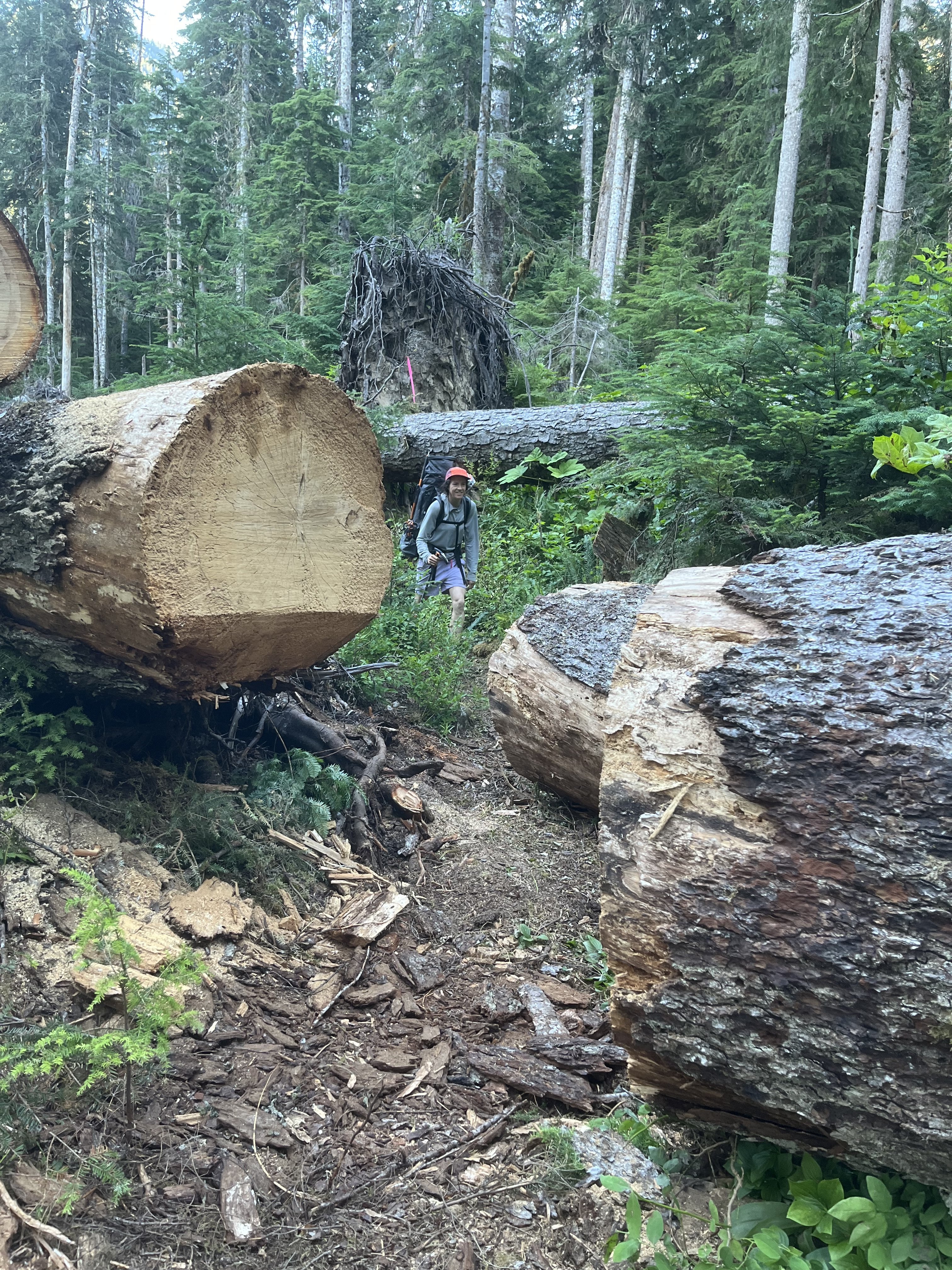
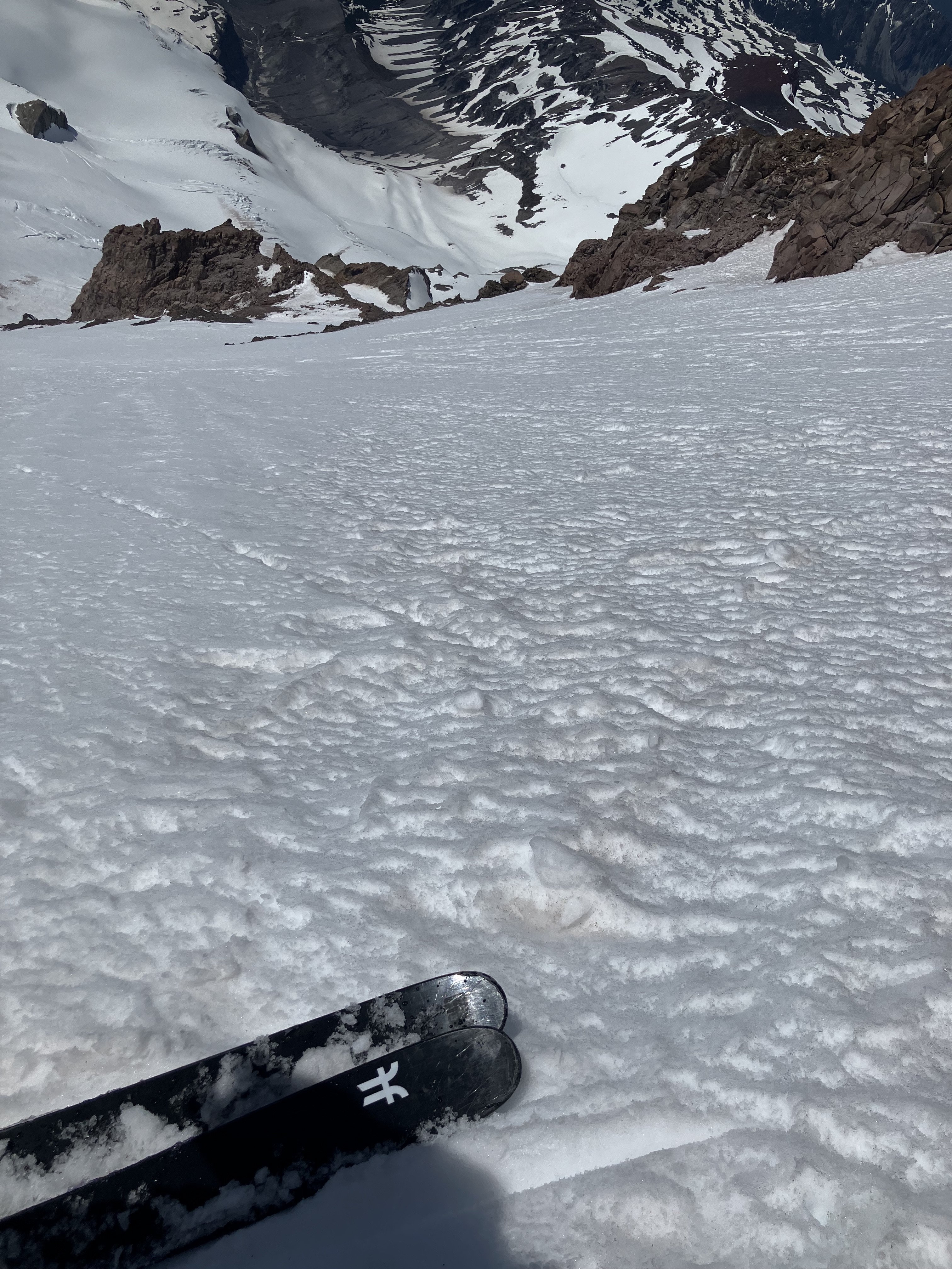
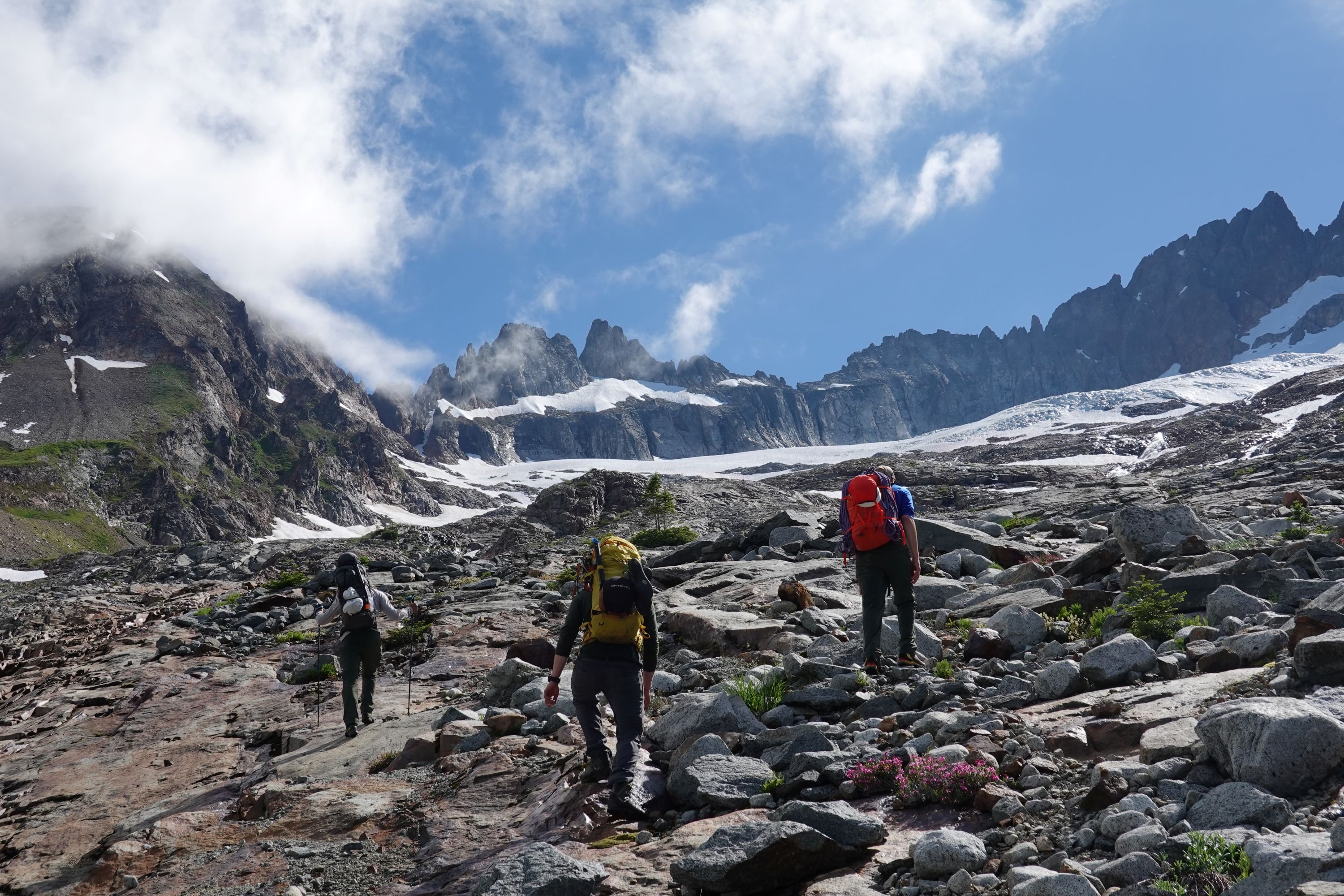
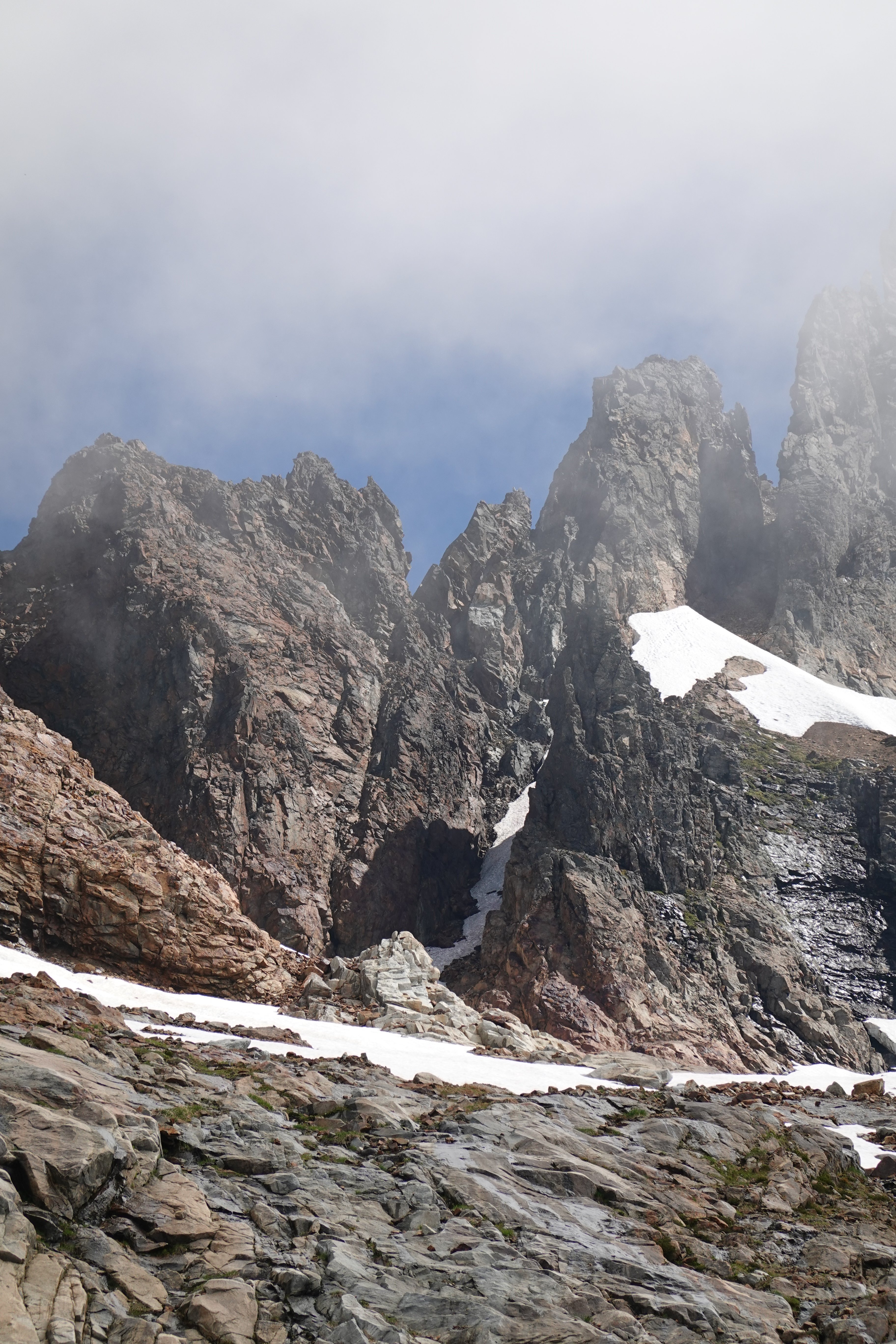
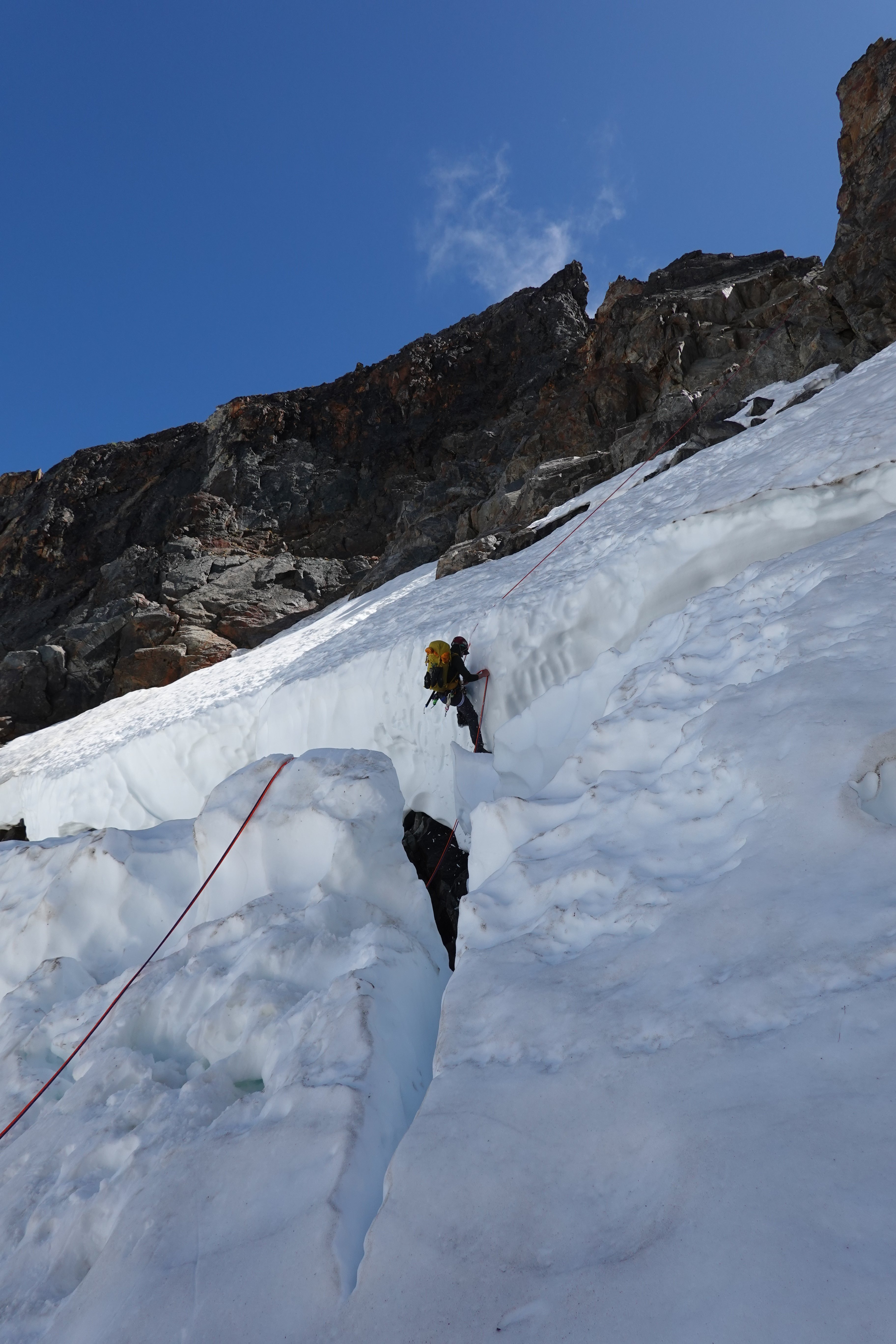
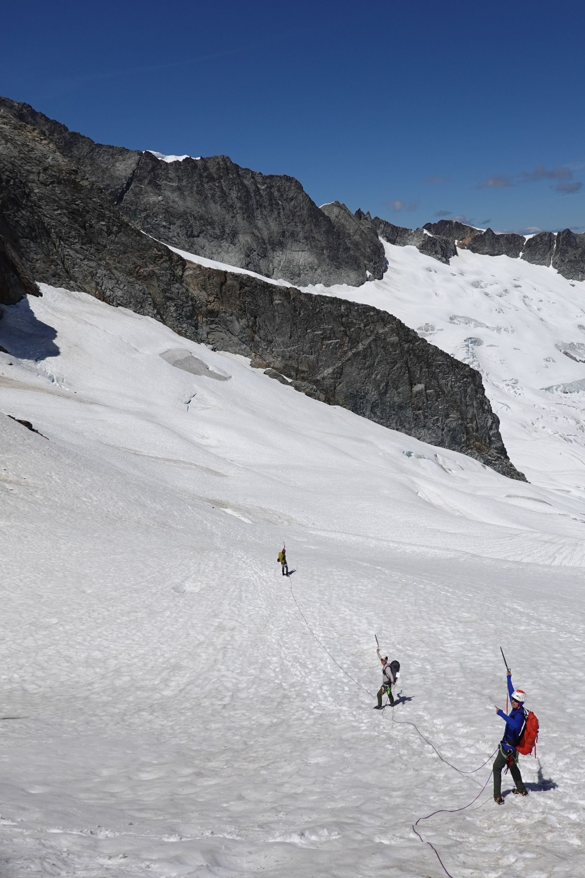
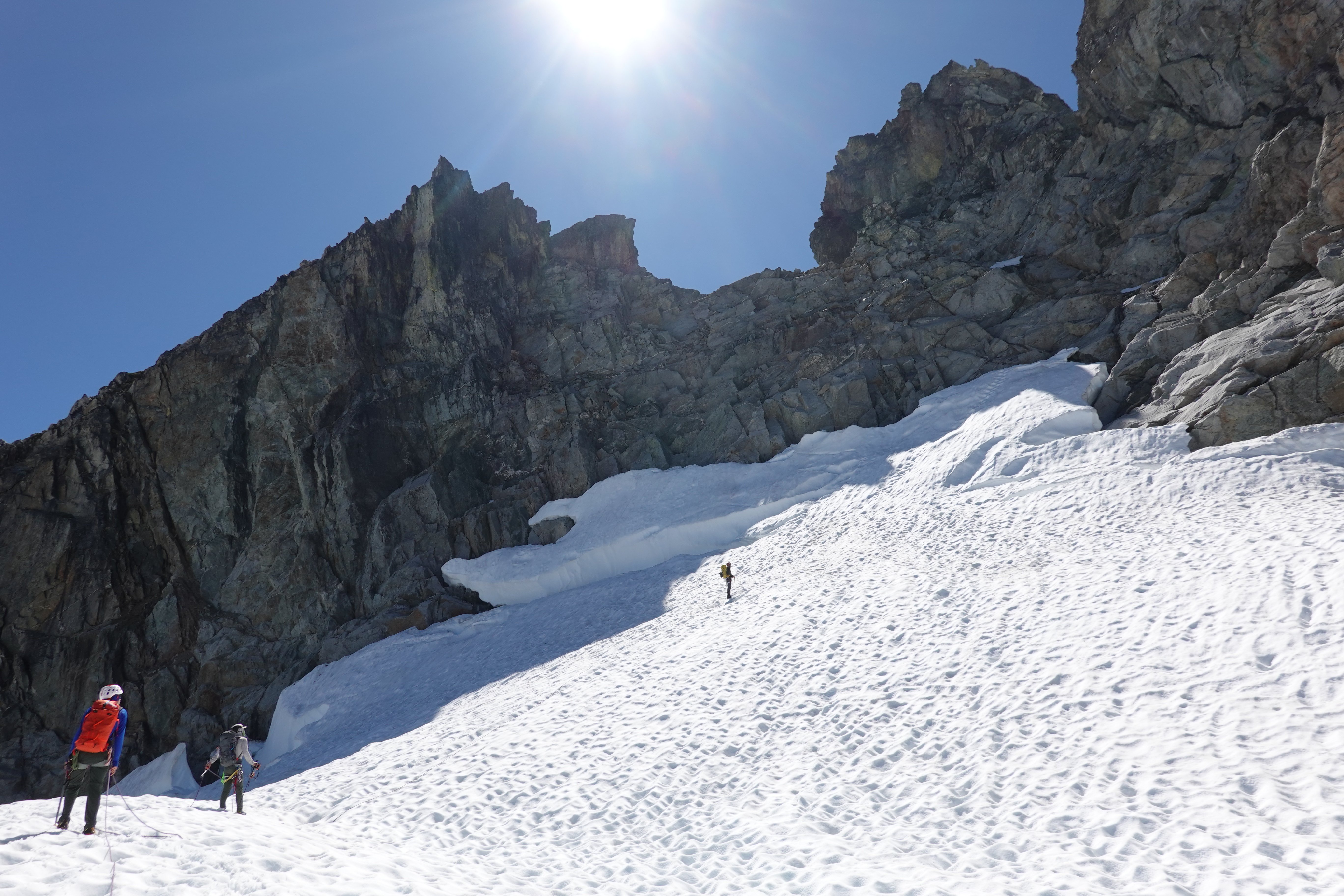
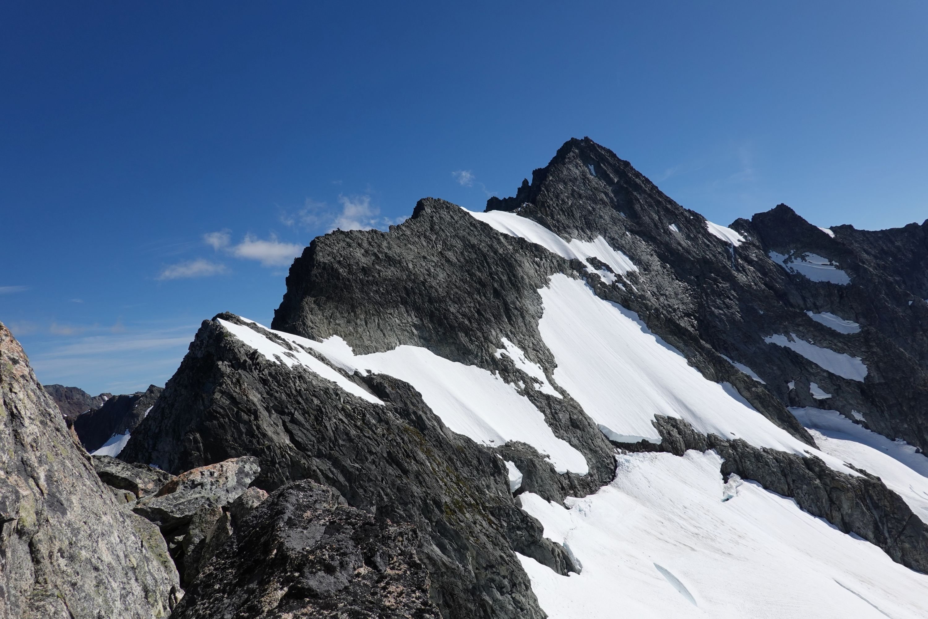
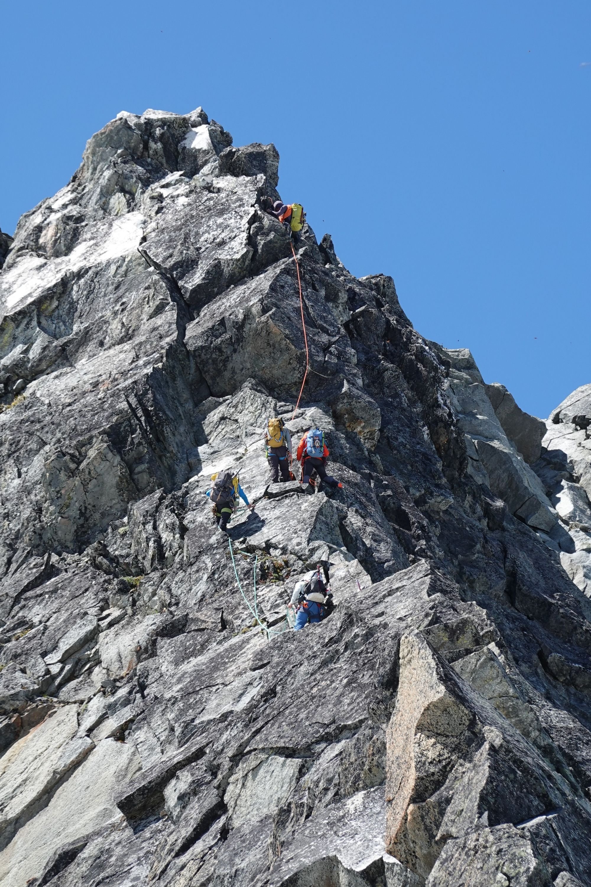
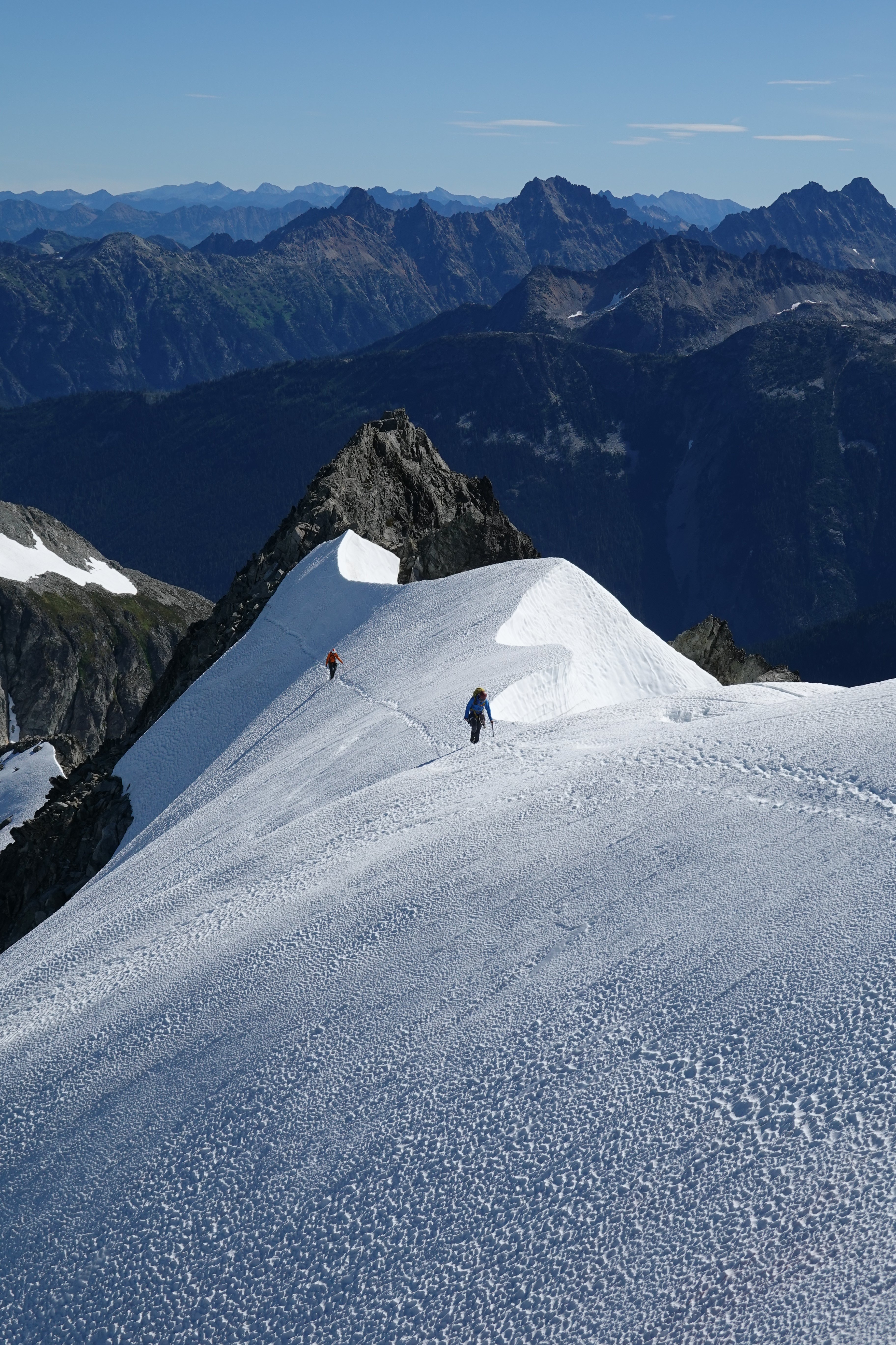
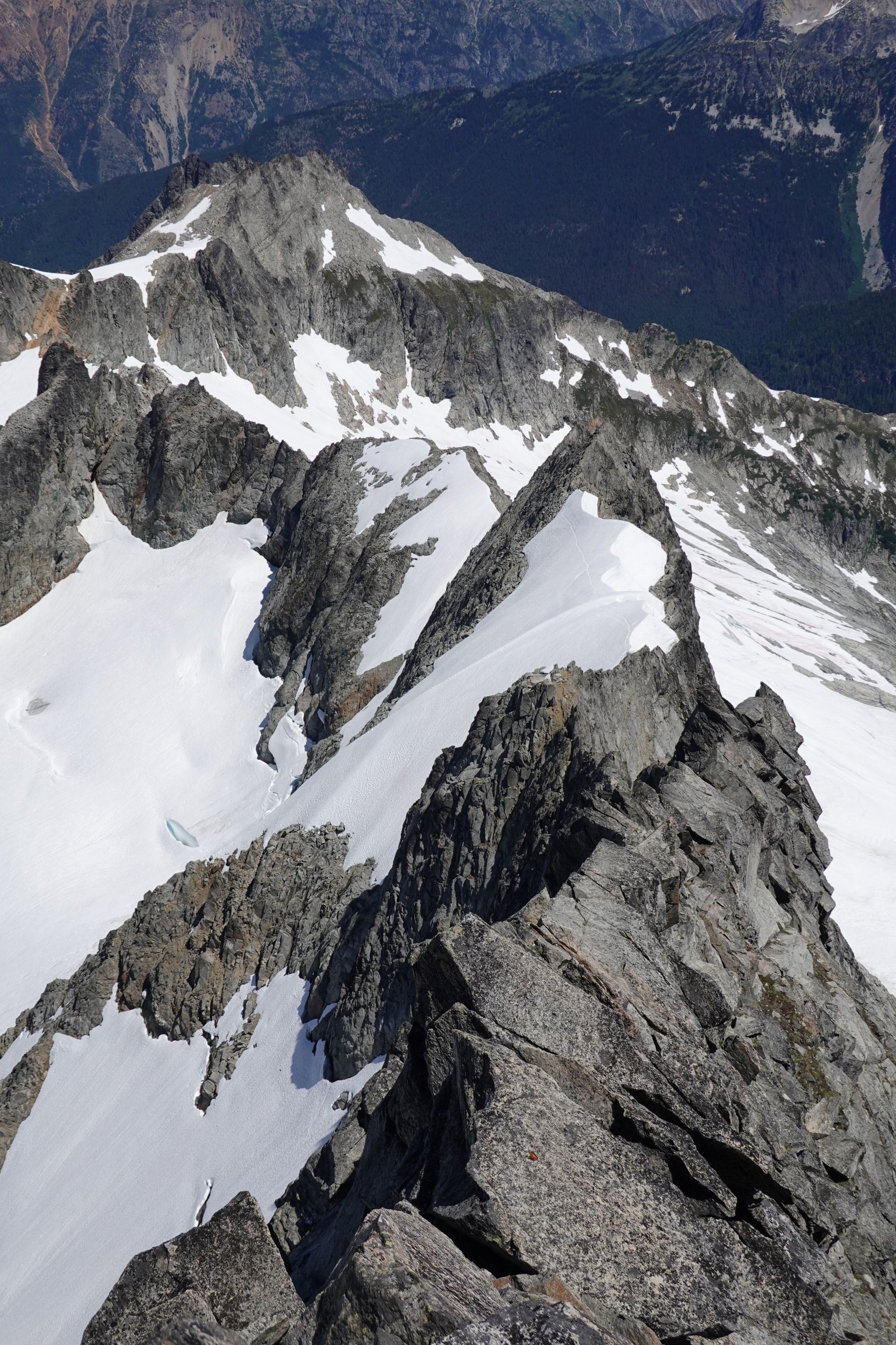
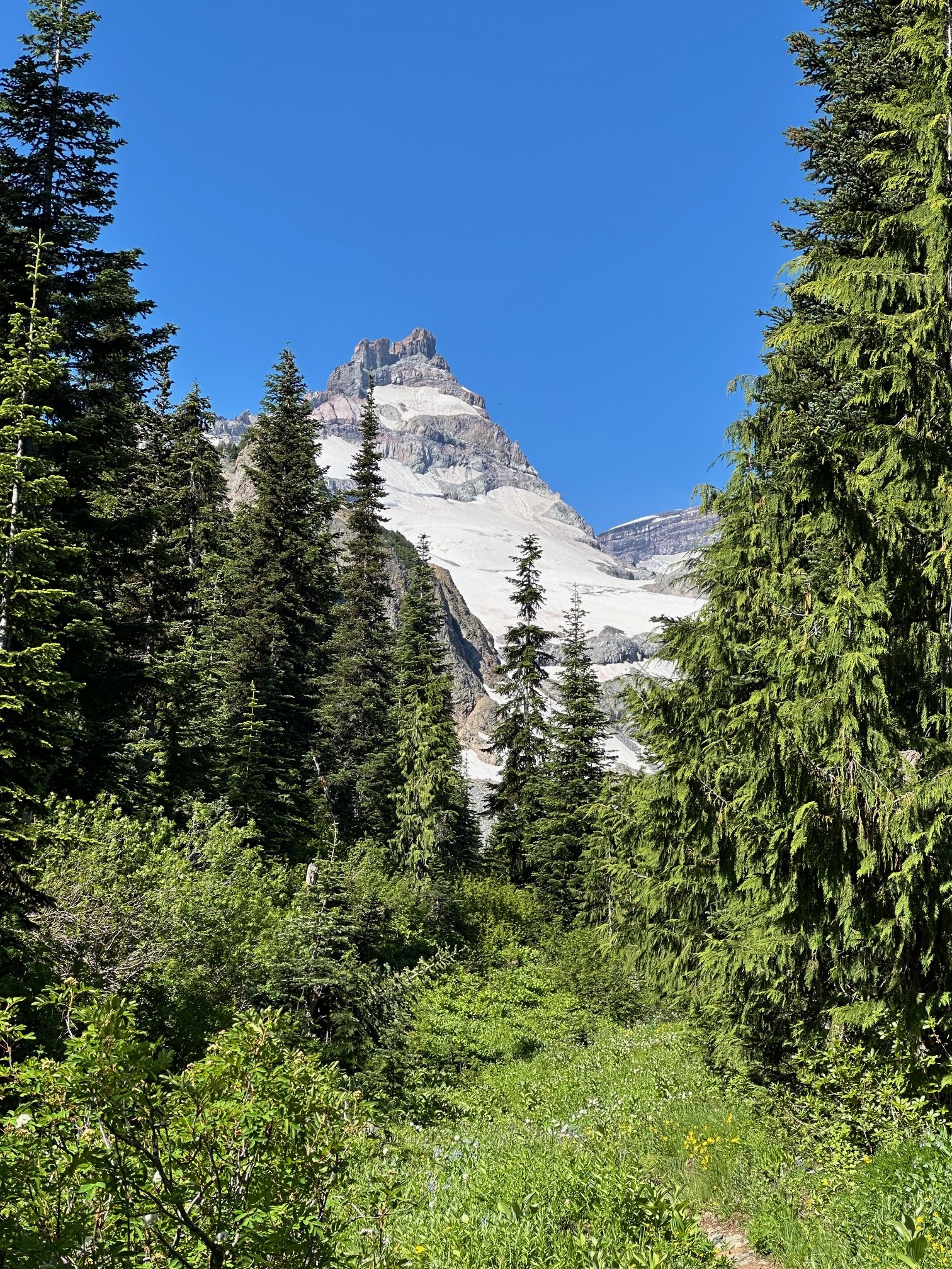
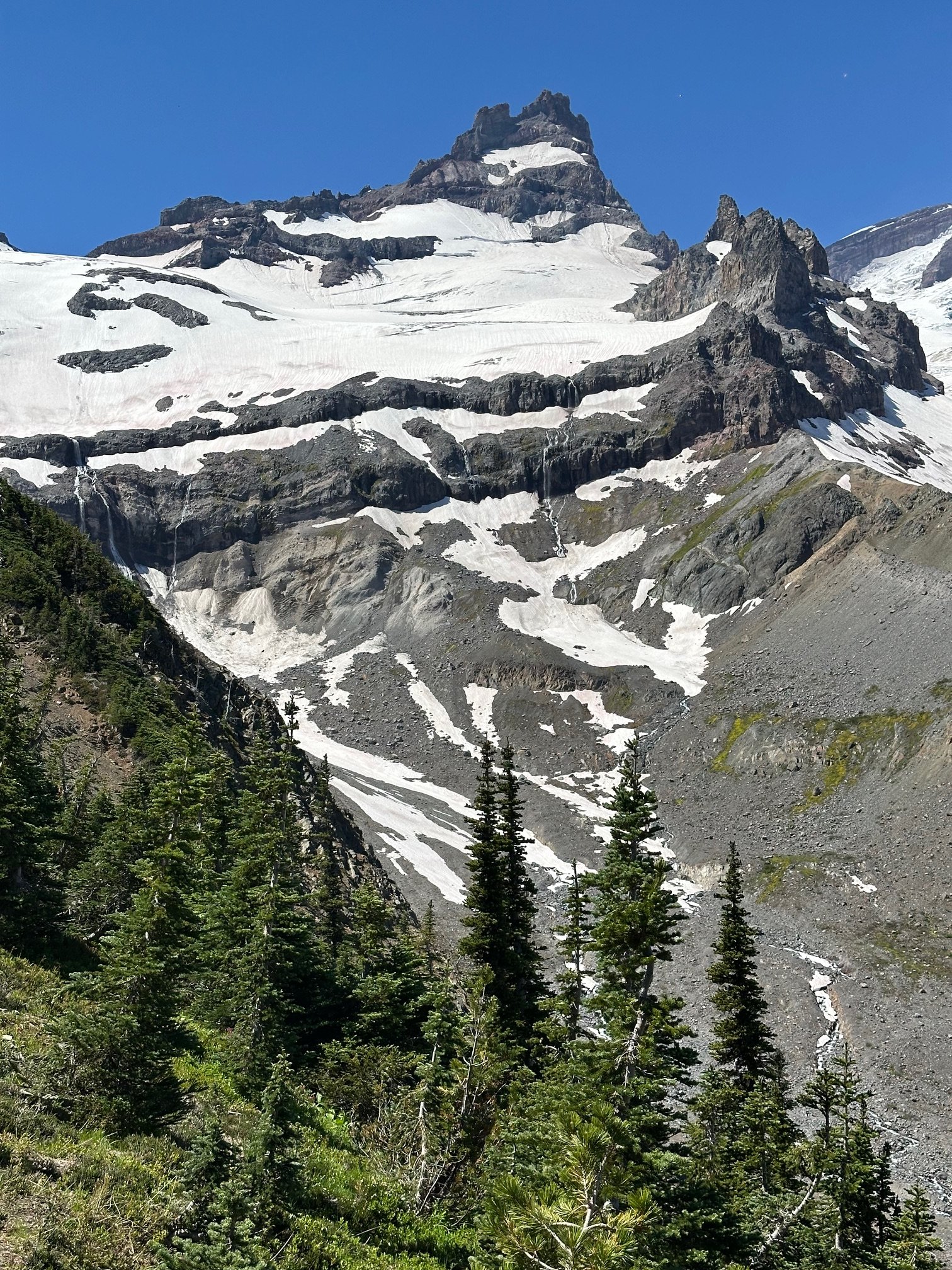
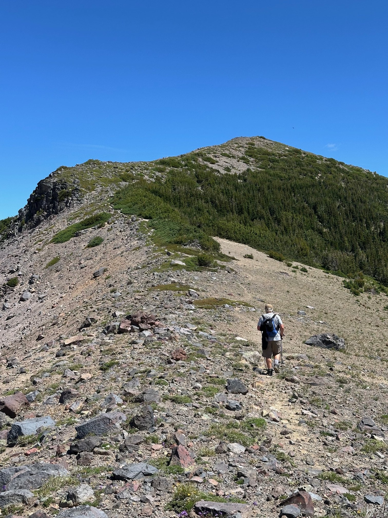
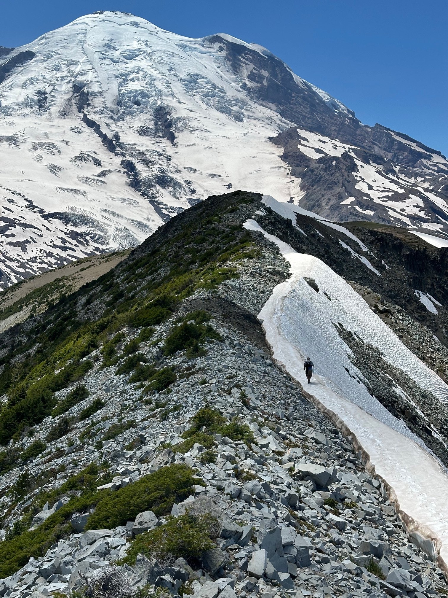
 Trip: Gunsight - E and SW faces of Middle, S ridge of South Trip Date: 07/13/2025 Trip Report: I had the tremendous luck of finding a pair of climbers (Rebecca and Shane) who wanted to check out the Gunsight range using a rope team larger than 2 for the Chikamin. We climbed as a party of 3. They turned out to be excellent climbers and excellent company. First I’ll stick mostly to the things I wish I knew beforehand, inaccurate beta, etc. On our second day we blindly followed tracks of a party about a half hour ahead of us in the Chikamin which led to the lowest pass. Getting on the rock it seemed like possibly low 5th slab and too far south of Gunsight. We decided we were in the wrong place. I briefly scoped the next gully north which was terrible. We then found the right path, using mostly clean slabs. In Blake’s book the arrow isn’t quite in the right place, we were one notch north of his line, in the “s” in “peaks”. We had hoped to climb E face of Middle this day but with the lost time settled on S ridge of S peak. We would later find out that doing E face of Middle on day 2 is doable only if everything goes right, no route finding issues, climbing and descending efficiently. A better day 2 plan that I’d recommend to most coming from Downey is to aim for SW face of Middle for your day 2. S ridge of S Gunsight is a garbage climb. The first pitch is not terrible but the face after an ok corner is covered in black lichen and any pro seemed worthless. Hard to find an anchor on top of the choss ridge. Much less than the reported 45m. The next very short pitch, again much shorter than in our description, has an exciting leap from the chockstone (my first read dyno I think). From there we expected 5.4 to finish the climb. I went back and forth, high and low, repeatedly dead ending near a notch with lots of tat. Finally I committed to a delicate and highly exposed 5.8-5.9 stem around a corner to get to a downclimb to the notch. From there I ran the rope out to the summit at somewhat dirty low 5th. Looking back I saw how the follower would be exposed to a big pendulum and deck, so I encouraged my partners to just rap that step off the existing tat. With a couple raps we were back on the east side retracing our steps to the notch. Numerous steep hard snow interruptions to the slabs involved time sucking crampon on-off transitions. I was grumpy about 2 days of effort to climb 3 pitches of choss but we caught a gorgeous sunset just as we reached the notch. From there we traversed high on snow and slabs below Gunsight to get to where we had stashed our bivies. The next day we tried again for E face of Middle. Rather than circle around the peak again Rebecca had the great idea of climbing the SW Beckey route, rapping S to the notch, then rapping E to get to the E face. The Beckey route was straightforward low-mid 5th choose your own adventure on fun solid rock with lots of knobs, which we began from a small cave just above the best moat crossing we found. The summit register’s last entry was from 3 years prior, a party doing gunrunner. We did one rap south beginning a little below the summit, backing up the slightly suspect block. From there a double rope rap from a higher confidence anchor got us to the notch. The anchor we found there wasn’t very great but we couldn’t find better options. I immediately found the e side to be mostly steep dirt. Angling slightly south I found an ok nut anchor maybe 45m down from the notch. A double rope rap from there got us down to the very dirty snow. This might have been the dirtiest gully I’ve descended up to that point. The high quality of the E face lived up to the hype, though misleading beta vexed us at times. Our first pitch was quite long due to low snow and glacial recession. Comparing our photos to some from 15 years ago there was some thing like 50-100 feet of rusty rock that had been covered in snow in the earlier photos. The pitch 2 crux is right off the deck and maybe sandbagged (or I was just tired). Awkward, tricky, exposed to decking, it took me about 4 tries to lead through it. I don’t think the pitch was more than 15m. This was another ledge where a good anchor was hard to find. Pitch3 (10c) was actually easier than pitch2. Shane had stopped one ledge short of the proper start of pitch 4. We worried about linking that step into pitch 4 because it’s supposedly 45m. In reality pitch4 turned out to be more like 30m. Oh well. The pitch 4 climbing g was fantastic and its crux (10d) was another possible sandbag. I could not have led it. Very demanding powerful moves finally got me through it after a few attempts. By now the hour was late and we were looking at the mental crux of the runout 5.9 slab. Shane led this one too. Rebecca went second and I came last. I was glad to have watched them for beta on the subtle step down crux at the most run out point. Brilliant colors lit up the horizon while it was my turn but I could give it only fleeting attention as I concentrated at the crux. Once through I ran up the ridge (low 5th? Didn’t notice any 5.8) in the twilight, basically a full 60m rather than the 15m our beta advised. We repeated the rap sequence south to the notch as it grew dark windy and cold. The rope got stuck during the pull here. With much effort Shane finally freed the rope. The descent to the east was a known thing at this point but I argued that it was so bad that the descent to the west couldn’t possibly be worse. About this I turned out to be wrong. We did one short rap to an anchor south of the main gut/vomitorium of the gulley, with resident snaffles greeting us at both ends of the rap. From there Shane plunged into the unknown, over an overhang, choss diarrhea of all sizes being released. At a full 60m we went off rope and I took a clean slab ramp around a corner and found good cracks while they pulled the rope. Somehow that rap didn’t destroy us or the ropes. We placed a cam anchor and got past the steep icy snow onto lower angle stuff and began the traverse back to camp, arriving around 2am. We made dinner, celebrated, and tucked in around 3. Next morning I went back with the suspicion that our anchor could be reached on class 4 slabs that we couldn’t see well in the dark. It turned out to have a little low 5th, so rapping was definitely the right call for the circumstance. But I was glad to recoup our gear. Having encountered the worst and second worse gullies of my life on either side of middle gunsight I now think that the best way to retreat is probably down the SW Beckey route. It’s ledgey so it would be best to downclimb most of it with some raps where it makes sense. And best done in the daylight, after climbing it at least once so you know the way at least approximately. Faded from the unexpected epics our only goal for day 4 was to get back to Itswoot ridge, beginning around noon. But around 1:40 at about 7K’ we heard a voice from a distance. We stopped and listened. Heard it again. Could barely make out words like “broken ankle” “helicopter”, “alone”. We pressed the SOS. The voice seemed to be vaguely in the Sinister area but we couldn’t tell where. We started backtracking and did some Marco Polo every few minutes without success. Finally passing east of the north face of Sinister we saw what we realized was a person. He was not moving and covered in a gray sleeping bag so we hadn’t been able to tell him apart from a rock at a distance. Maintaining some privacy here, we found that he was indeed immobilized and in severe pain and needed rescue. His inspiration and his equipment were in disharmony and this had culminated in a long and presumably very rapid slide down snow NE of Sinister. Fortunately over cracks, unfortunately meeting some rock(s) along the way. A little while later a father and daughter were coming down the Chikamin. It was nice to have more help. We did our best to keep him warm and as comfortable as possible as we waited for SAR. When the helicopter came we were surprised that it took so many laps through the area (maybe 5?) before two rescuers finally were lowered down with a litter. The morning had begun mostly cloudy but the afternoon was quite brilliant. Some rain approached quickly from the north and reached us just as the helicopter took off with the victim and SAR people aboard. We restarted our ascent in the rain, reaching our turnaround point >4.5 hours after we had stopped. This guy was quite fortunate that several people happened to be in ear shot on a week day in such a remote area. The rain cleared half way up the Chikamin and gave way to that kind of really clear atmosphere that seems to come on the heels of misty alpine weather. We found a wonderful spot past Dome glacier, well before Itswoot and called it a day. The highlights of our last day included a brief swim in cub lake, the flora above cub lake, and the many berries along Downey. Less fun was stuffing our pockets full with entirely unnecessary flagging all along very obvious trail along Bachelor. Some of it quite haphazardly stuffed onto bark like so Gunsight delivered adventure in more ways than I could have anticipated. For people going there for the first time I’d advise to stay the fuck out of the gullies on both sides of Middle, bring lots of gear for rap anchors because there seems to be little traffic there, skip south gunsight, and expect everything to take longer than you’d think. Photo dump will go here: Gear Notes: Double to 2, one 3, one 4. 2x60m twin. In reach (please people). Knife for tape. Approach Notes: Downey approach is currently straightforward. Trail work has been done all the way to Bachelor
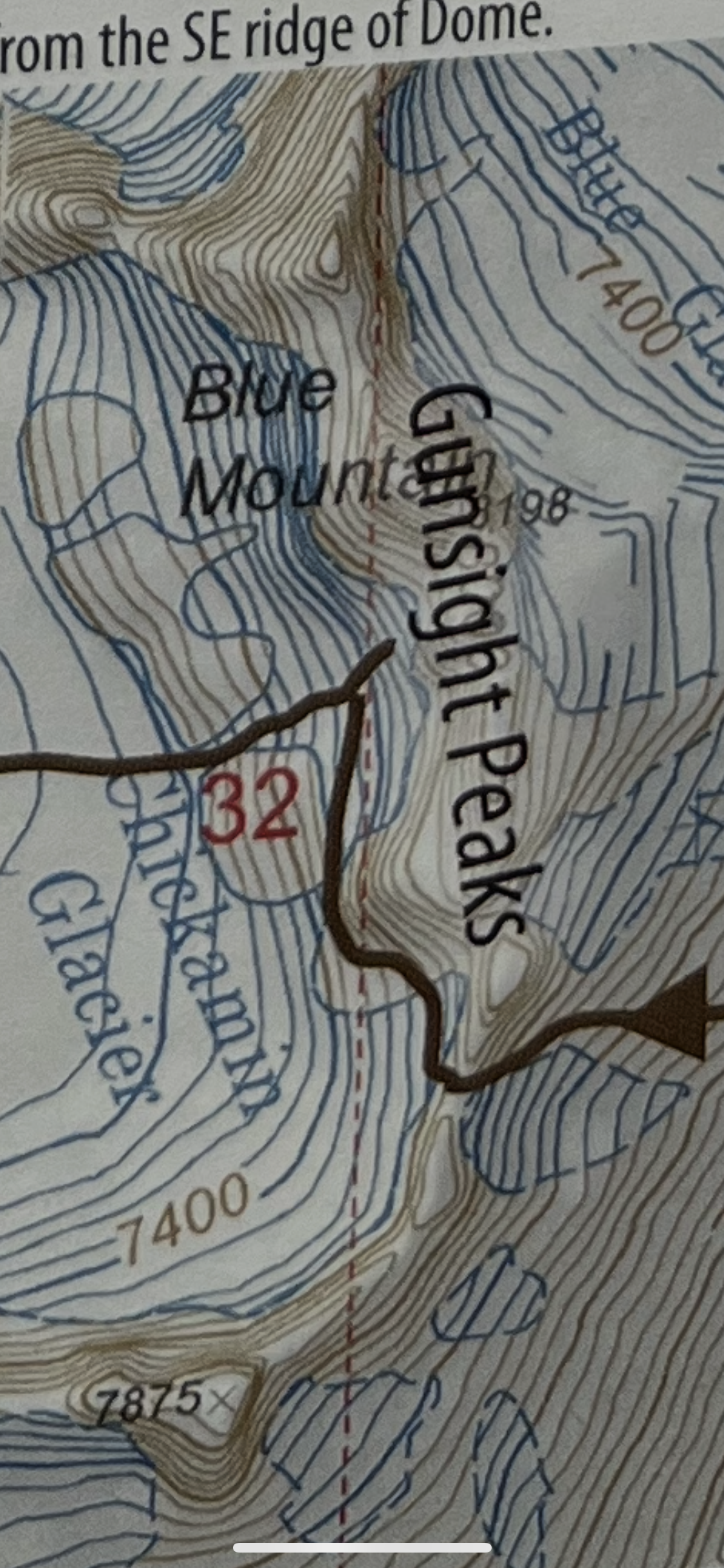


-
- 1
-

-

[TR] Mount Index North Peak - North Face 06/29/2025
Sidviscous replied to Lucas Ng's topic in Alpine Lakes
Great trip report. I’m looking at doing this route soon, but have a couple Beta questions: 1. Did you descend your climbing route or are there variations where you descended more directly? 2. Did you find the rappel stations to be in generally good condition? How much extra tat should we bring? Any other supplemental gear? 3. Approximately how long did it take you to ascend and descend? -

[TR] Forbidden Peak - NW Face 07/13/2025
Michael Telstad replied to Grant789's topic in North Cascades
Dream team 😍 -
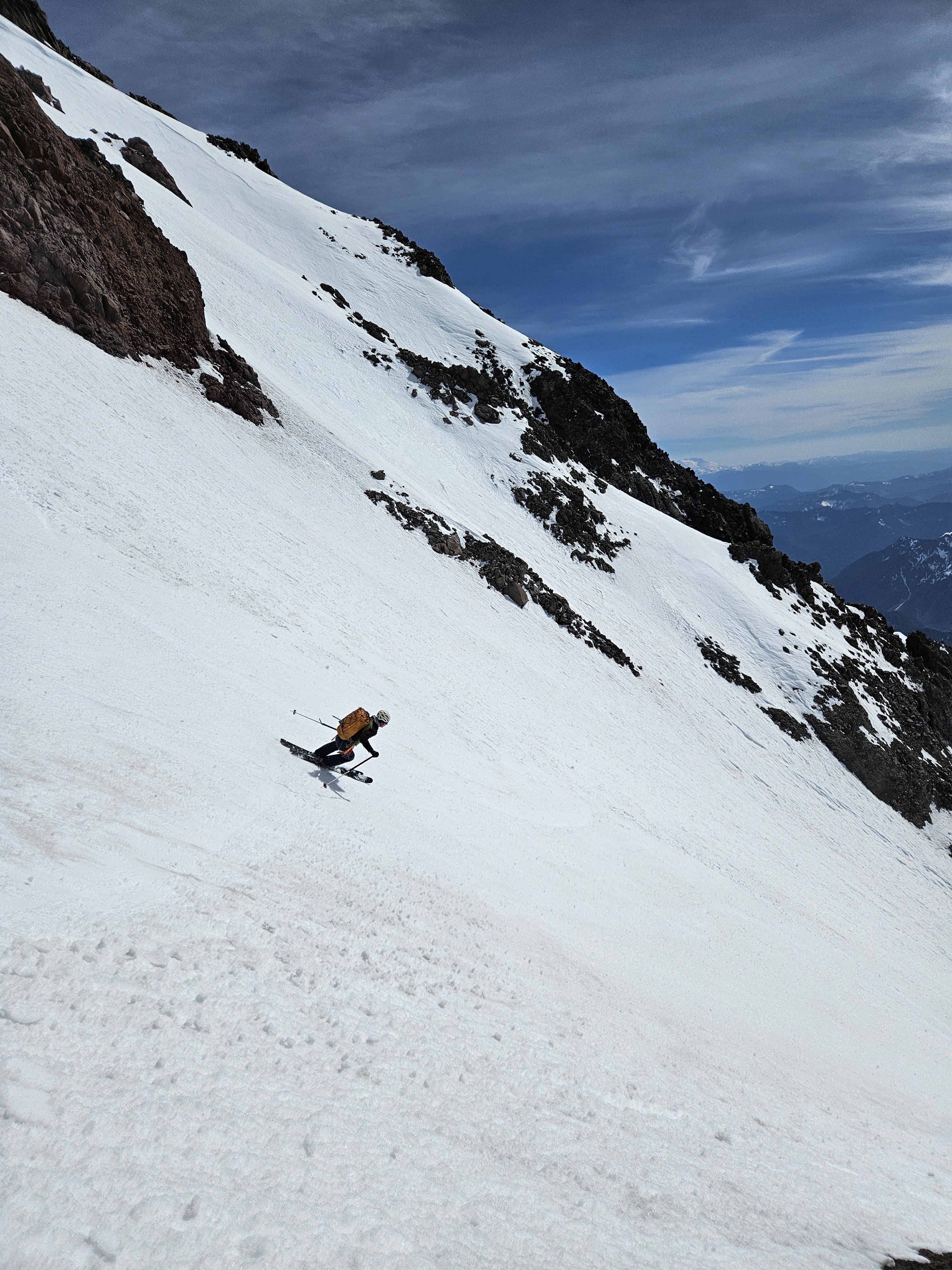
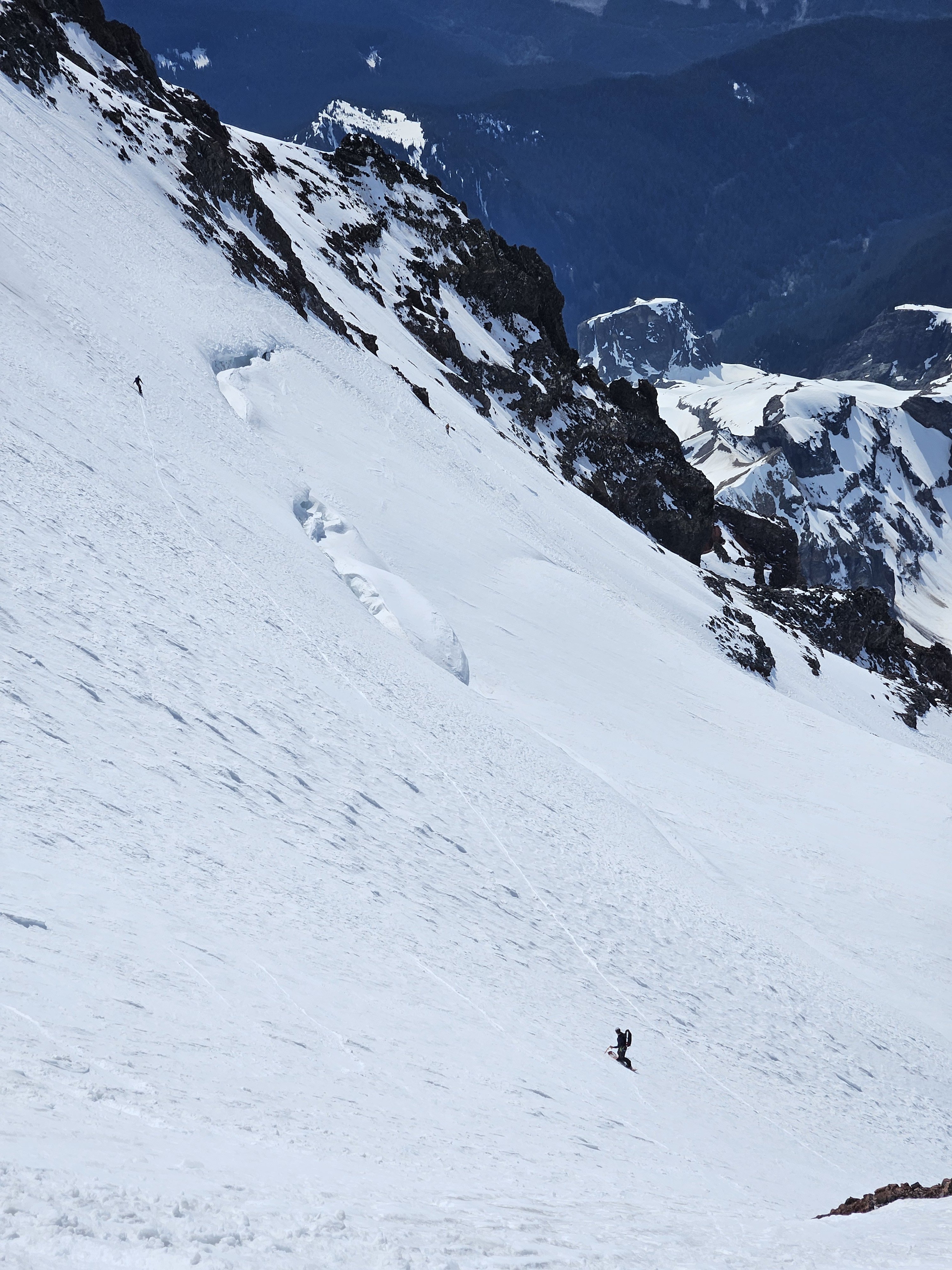
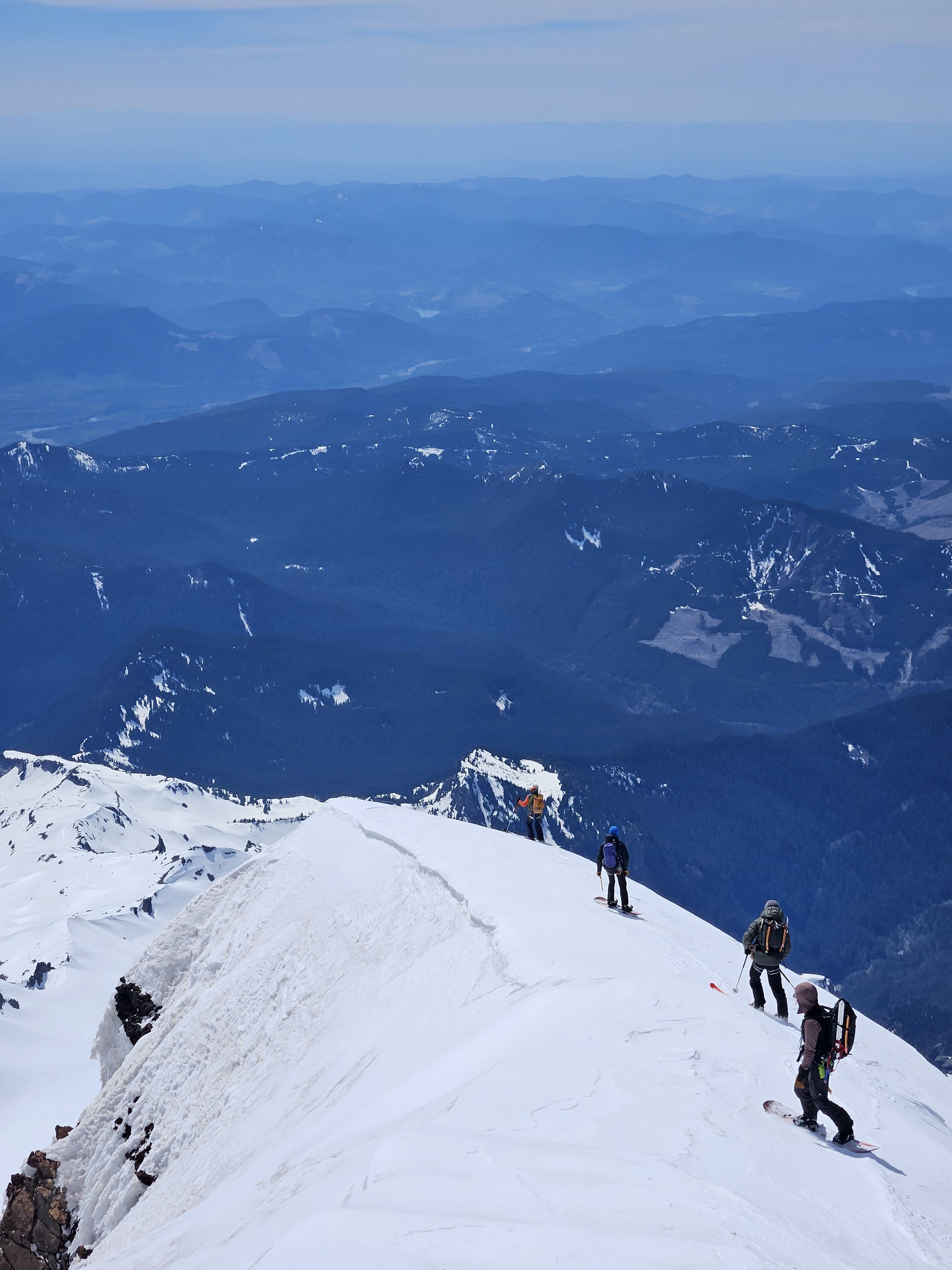
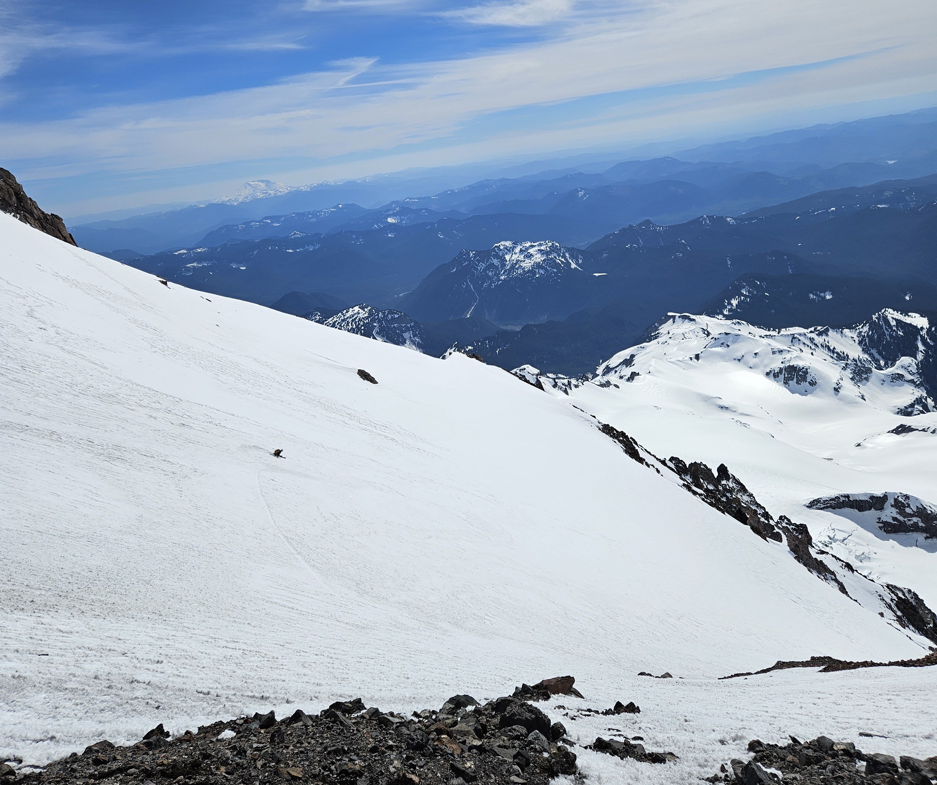
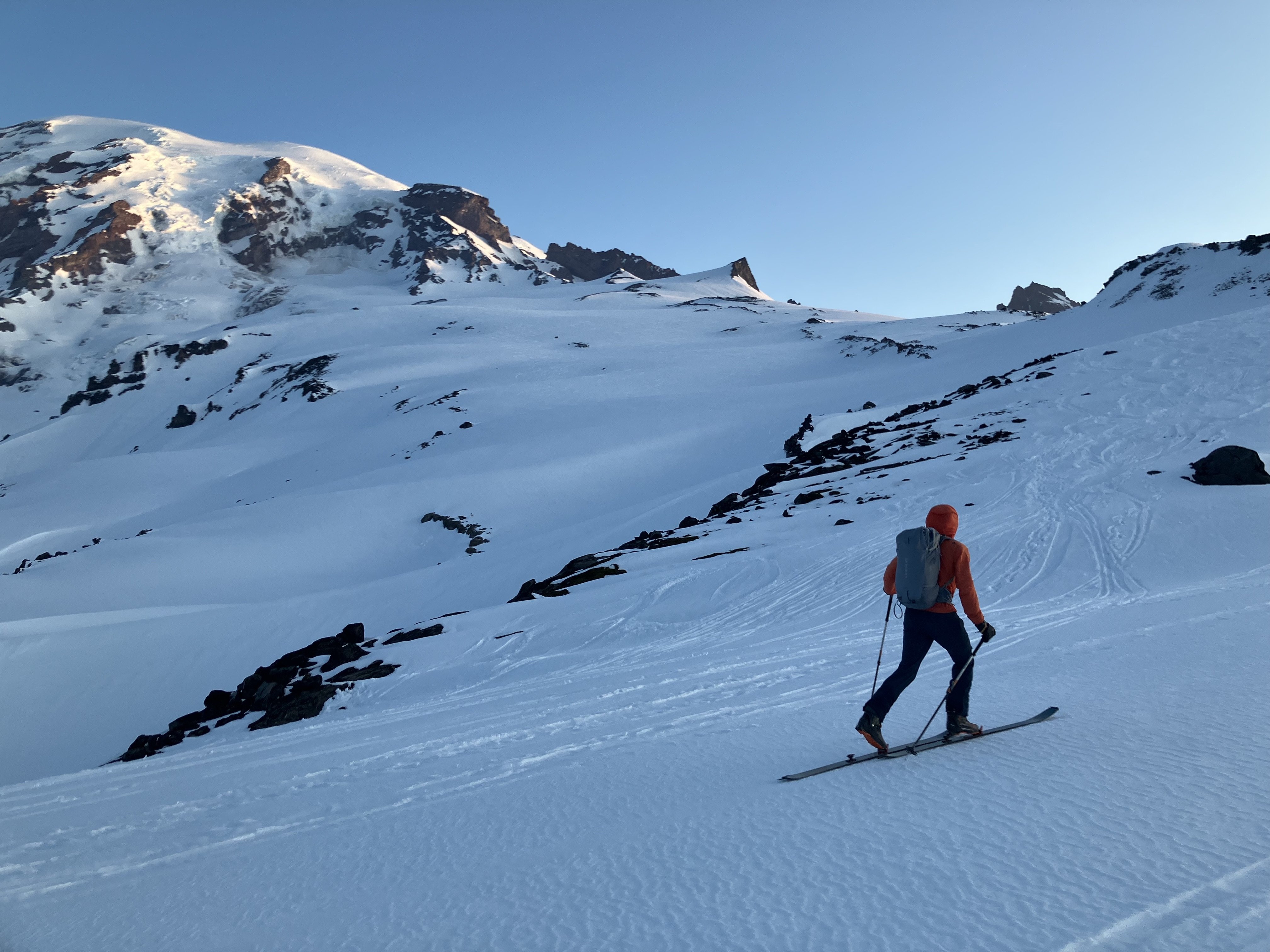
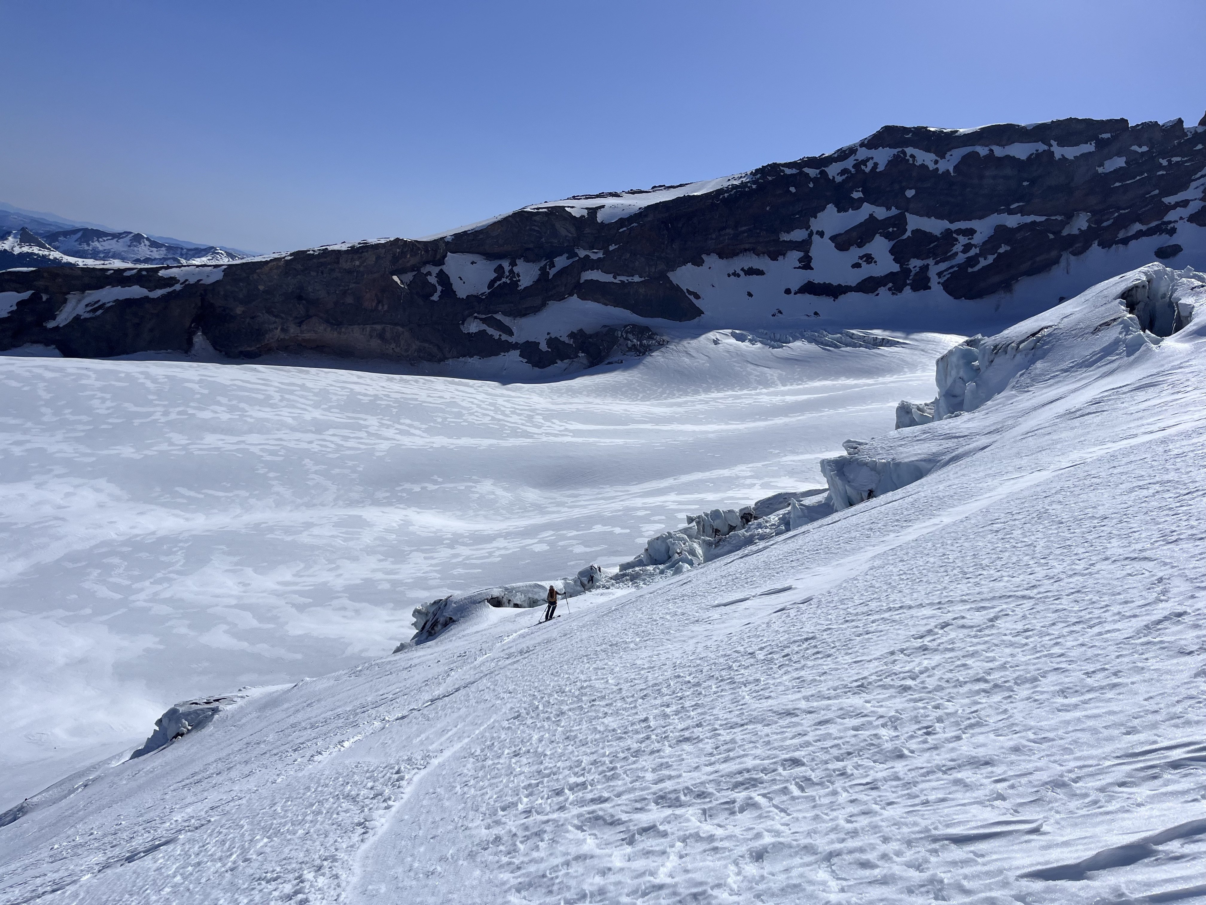
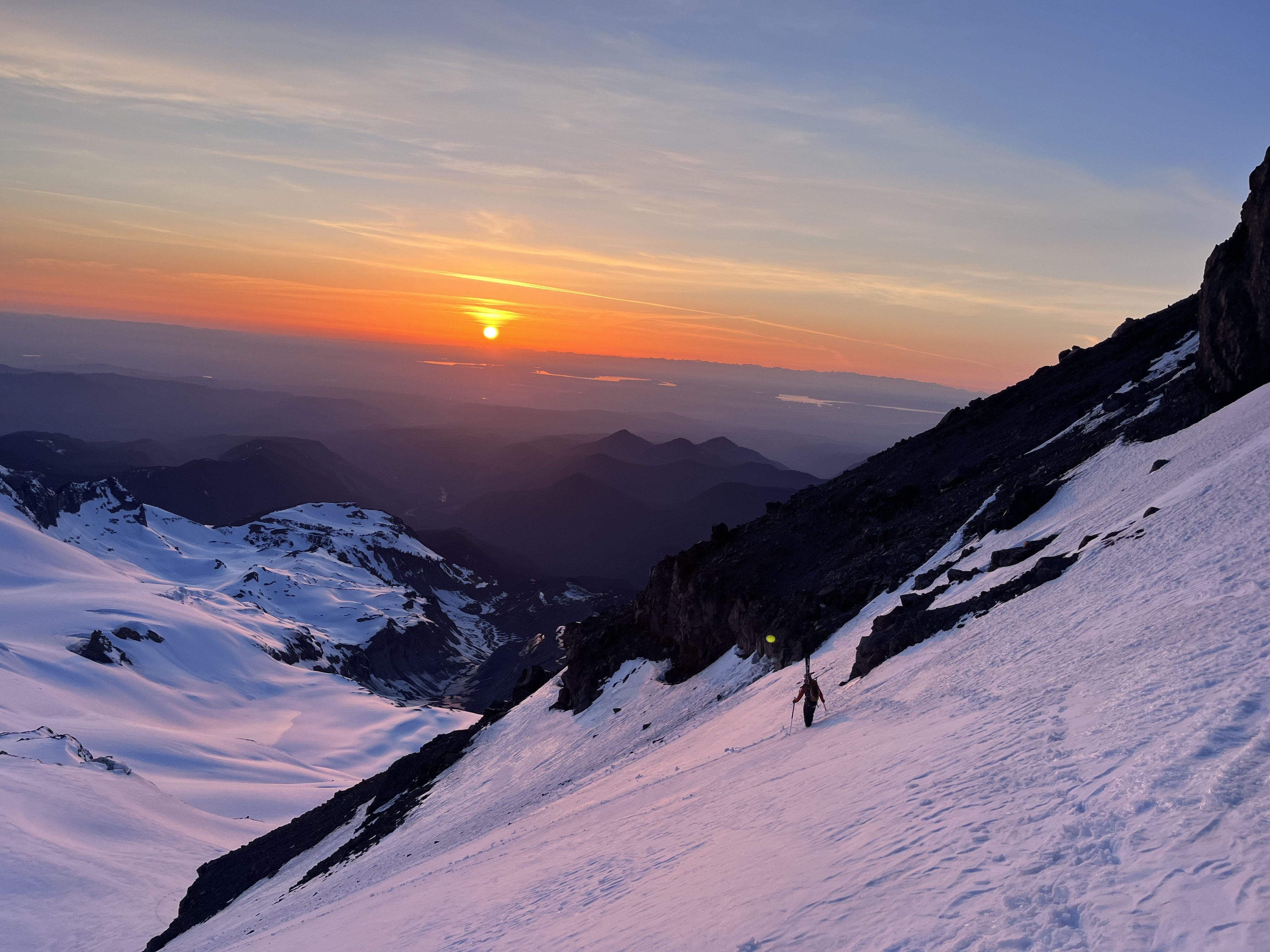
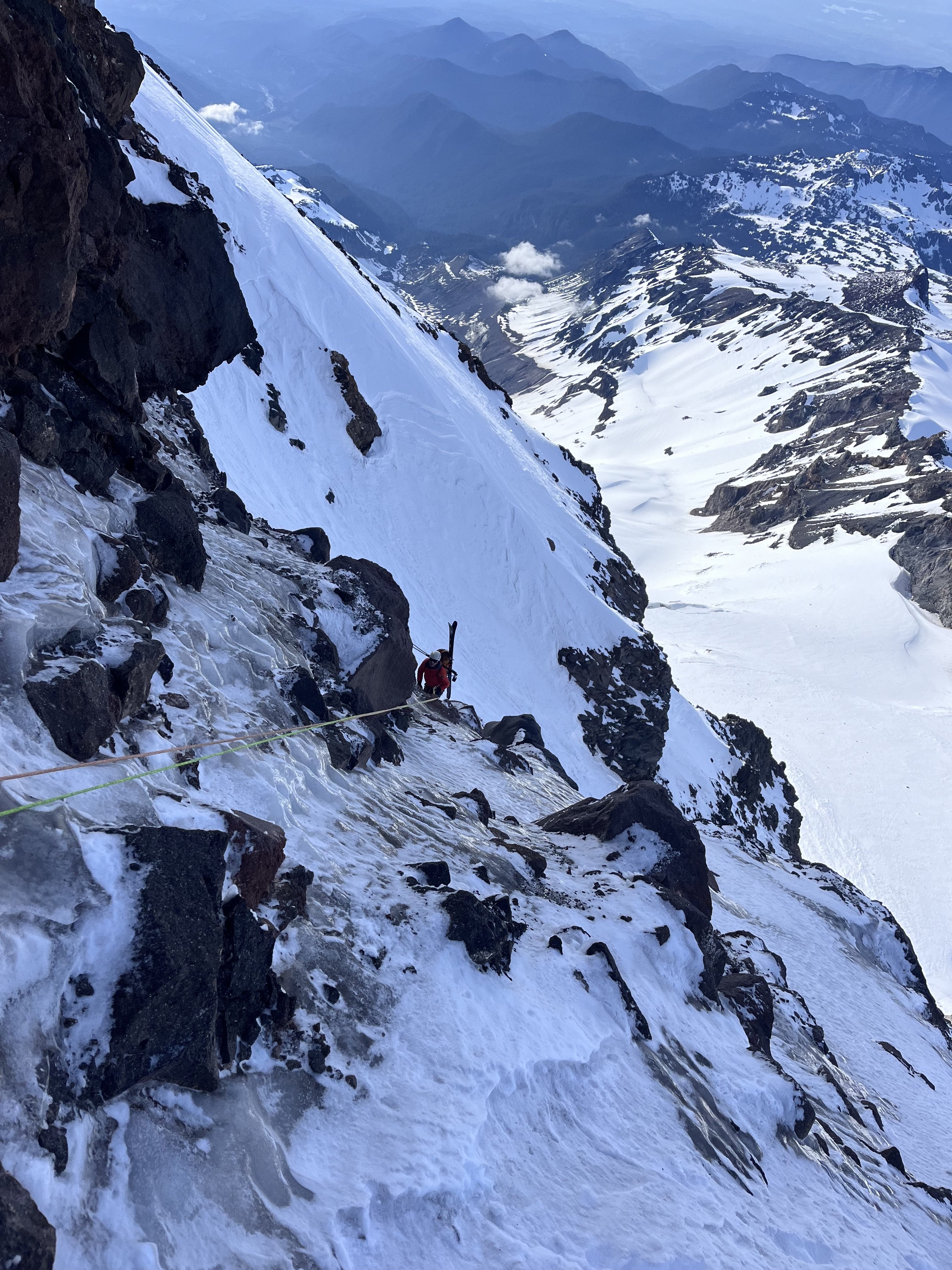
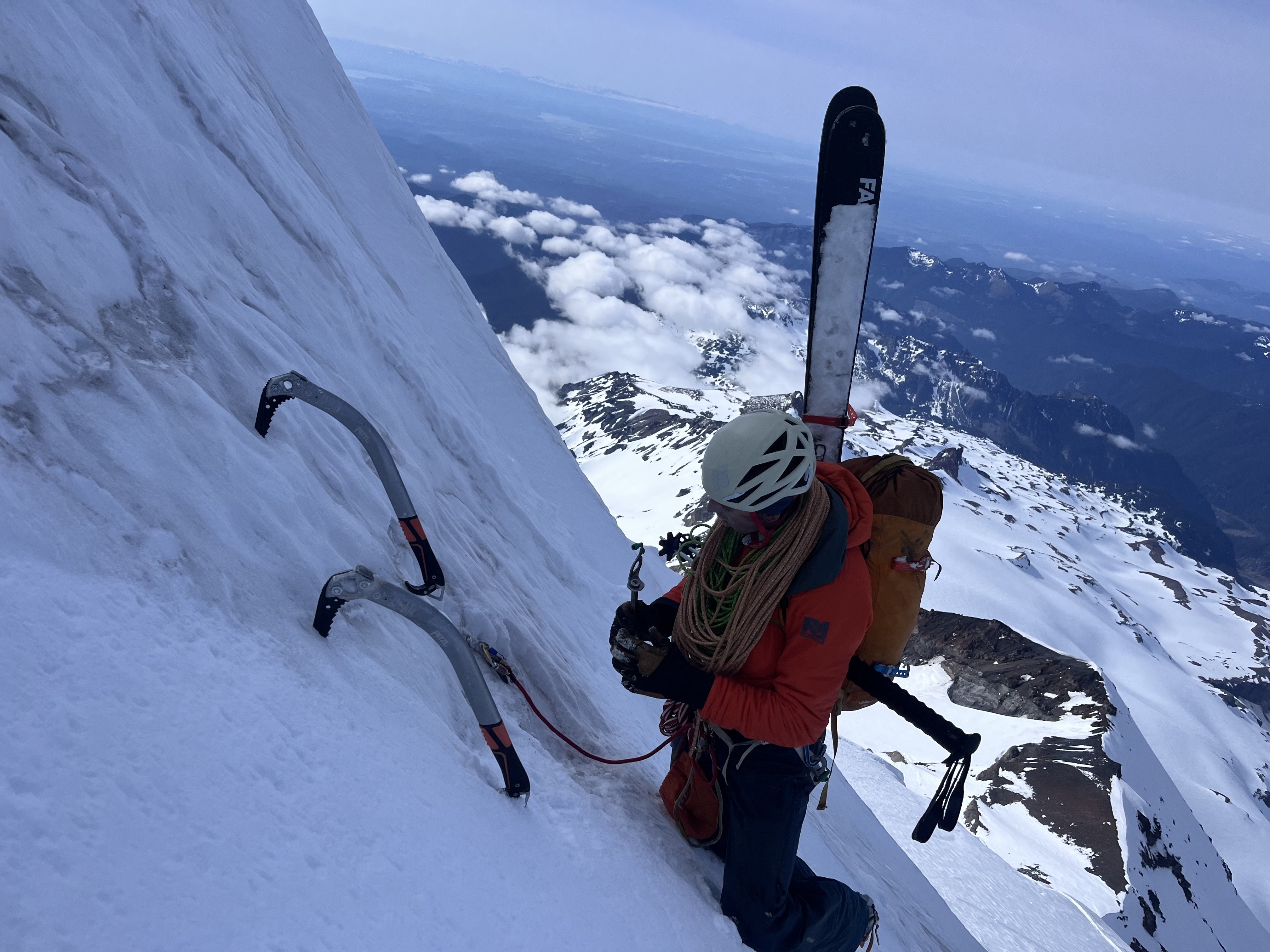
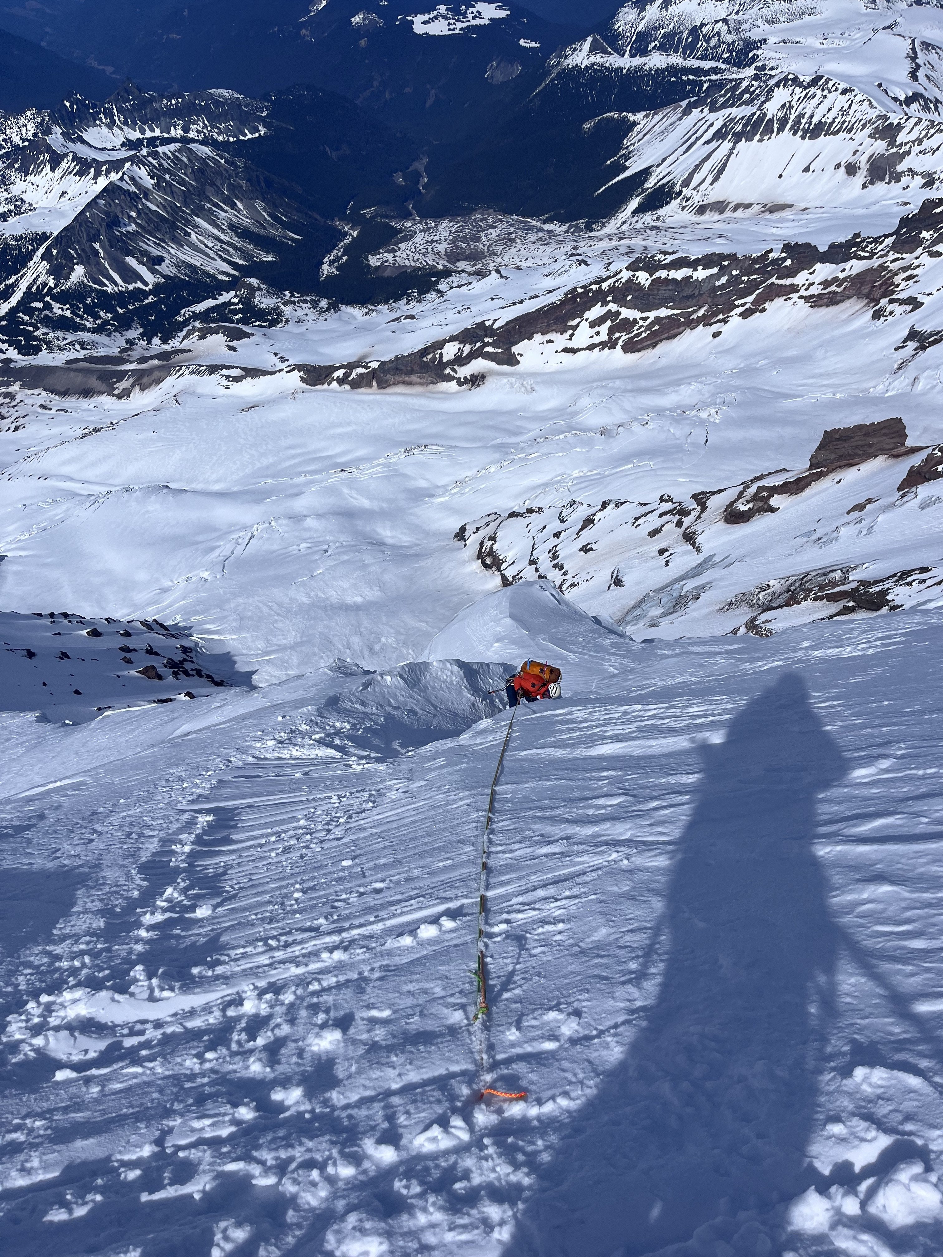
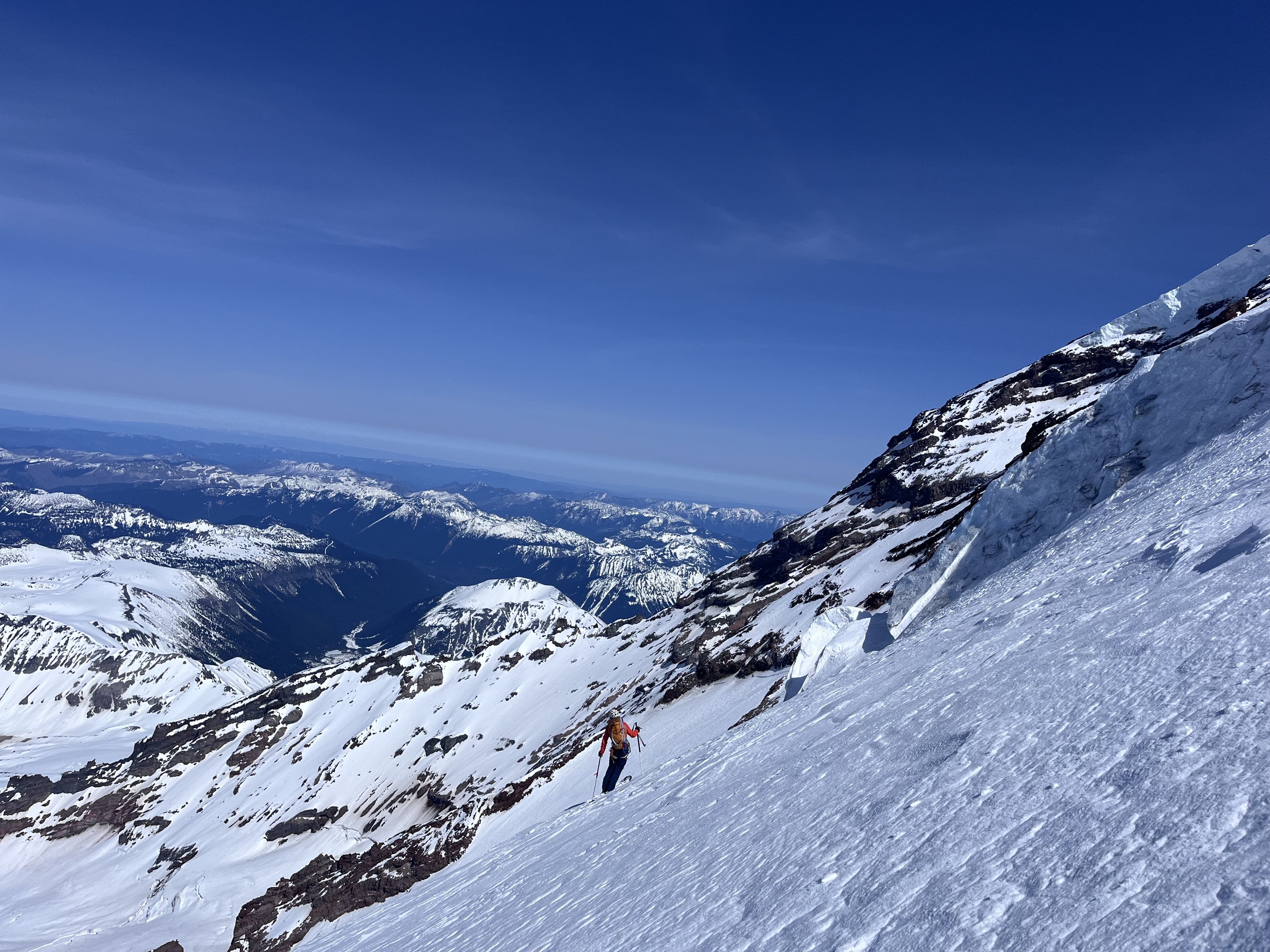
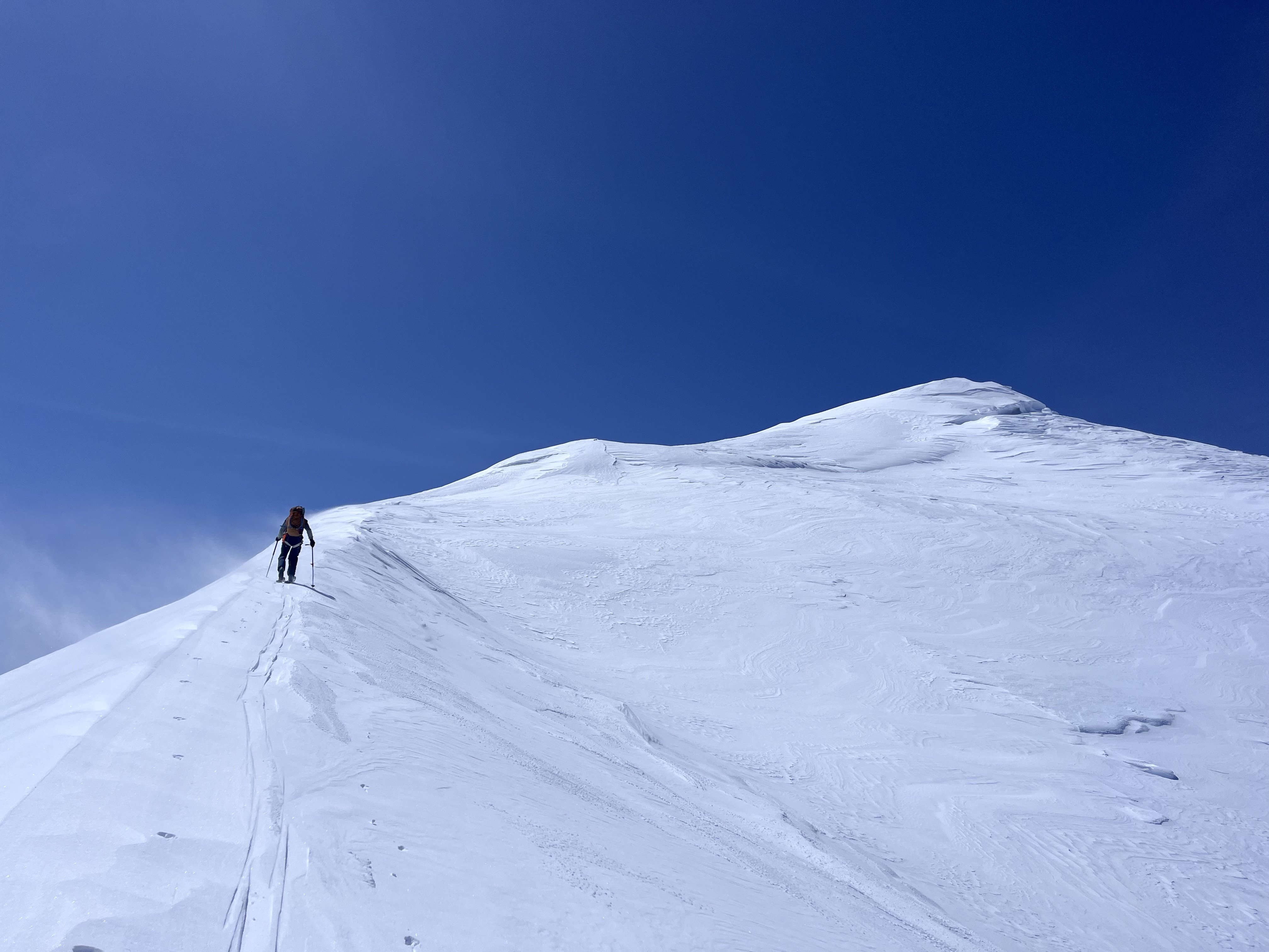
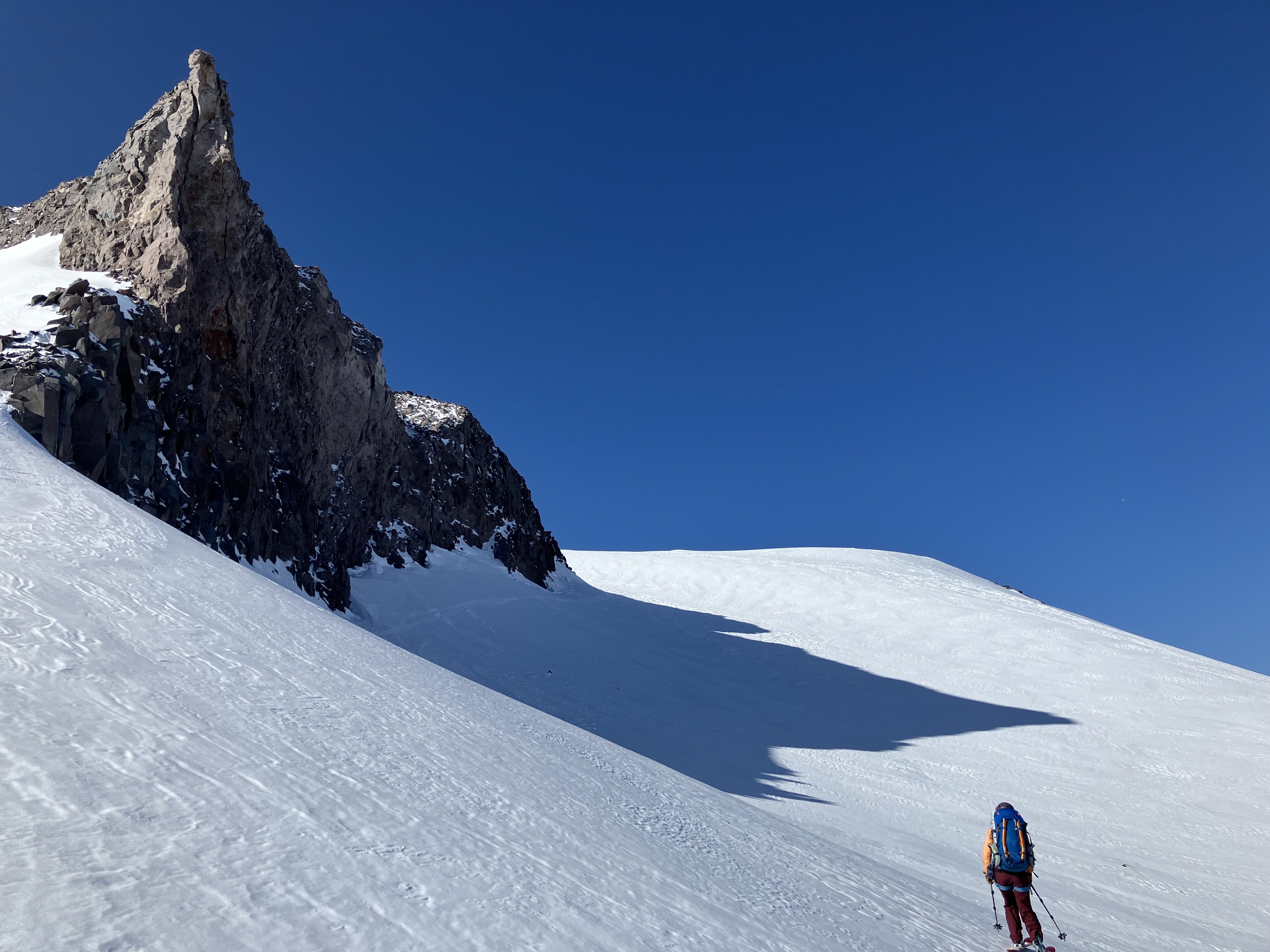
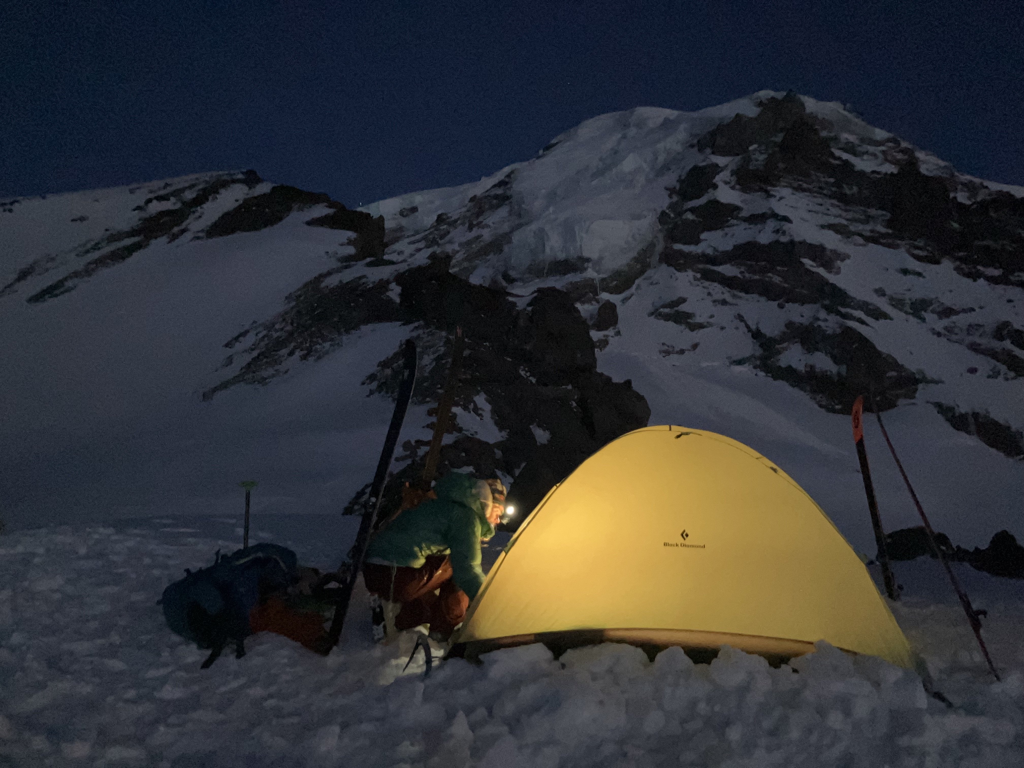
 This spring, I spent some time climbing and skiing up on Mount Rainier. I have gone back and forth on whether I cared to share any of my ski activity on Rainier this spring as it felt deeply personal, but I ultimately thought it would be fun to collect some of my thoughts and experiences as well as to provide some entertainment and inspiration. https://sam-marjerison.blogspot.com/2025/07/rainier-roundup-2025.html I'd like to give a huge thank you to everyone who has supported my spring ski season up here on Mount Rainier including Henry Coppolillo, Bailey Servais, George Hedreen, Sam Hoffman, Calvin Jirico and Kiira Antenucci. I'd also like to thank and recognize all of the people that have paved the way for big mountain skiing on Mount Rainier including Andy Bond, Sky Sjue, Aaron Mainer, Peter Dale, Eric Wherly, Dan Helmstedter and many, many more. Your style and vision for the mountains is incredibly infectious and we all aim to humbly carry on the legacy you have established here on Mount Rainier. I've attached some high res photos down below! On top of Sunset Ridge. Crewed out, heading over to the Edmunds Headwall (Upper Sunset Ridge). In the gut of Sunset Ridge. Skinning up to Liberty Cap. High on Ptarmigan looking over at Liberty Ridge. Rappel #1 on Ptarmigan Ridge. Rappel #2 on Ptarmigan Ridge. Rappelling into the traverse of Ptarmigan Ridge. Booting back up onto the Russell Glacier. Our camp below Ptarmigan Ridge on the Russell Glacier. Russell Glacier. Carbon Glacier. Central Mowich Face!
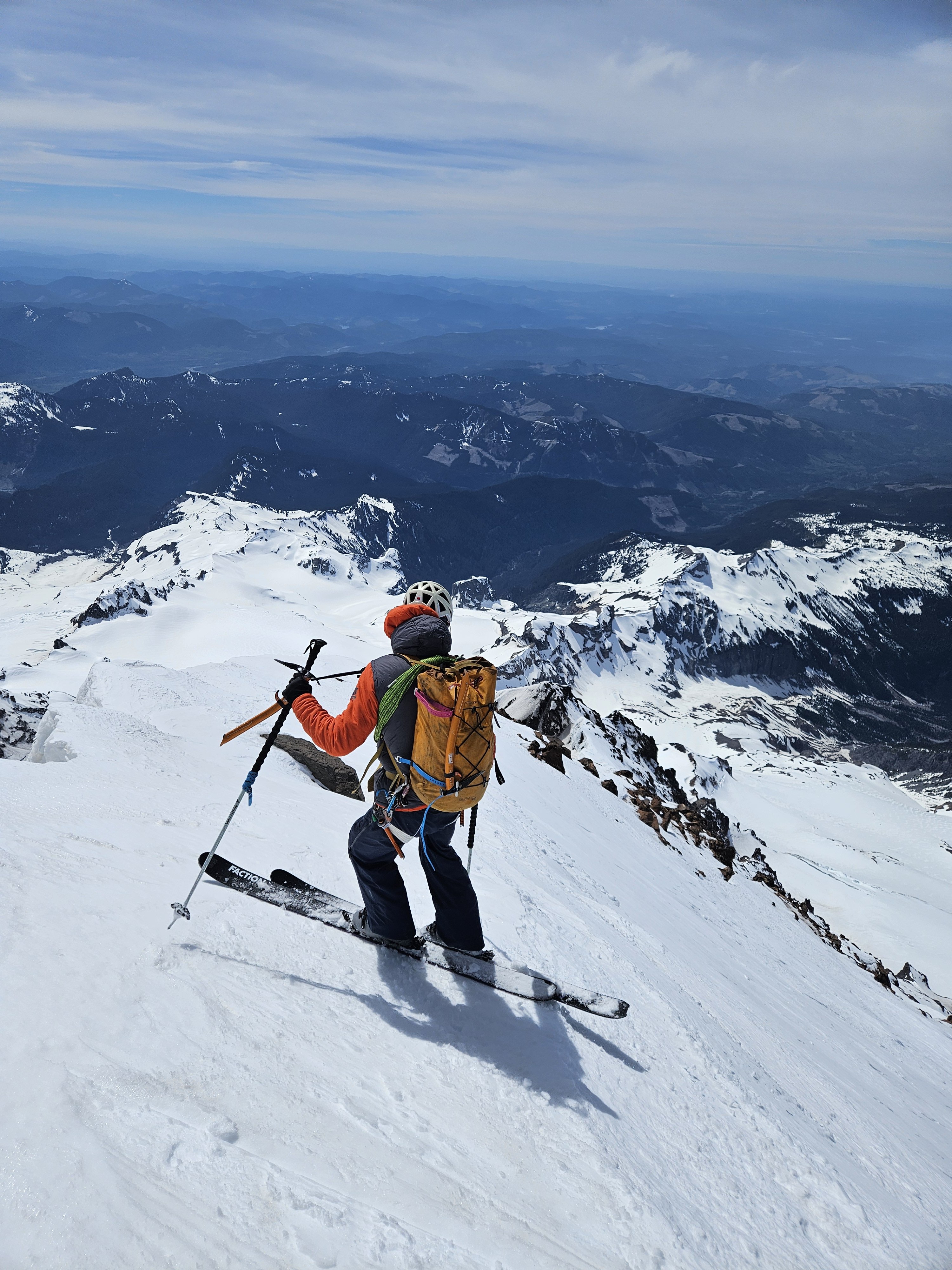
-

[TR] Forbidden Peak - North Ridge 07/12/2025
Christopher Fisher replied to Christopher Fisher's topic in North Cascades
Happy to have helped! I believe it, those slab sections were no joke. I think I recall a trip report noting a fatality years ago on that section. Thankfully our navigation of it ended up being relatively straightforward. -
Thanks! It totally felt like something you would have done in the pickets!
-
Awesome climb and report! Glad you could leave those chossy death blocks sleeping. Solid adventure for a single overnight!
-

[TR] Forbidden Peak - North Ridge 07/12/2025
Grant789 replied to Christopher Fisher's topic in North Cascades
Ugh sorry about your car. Thank you for putting in those boot tracks, they were great to follow! Navigating the snow and slabs in the dark is a classic! We did the same 4 years ago on the West Ridge and didnt get to lower camp until 3am.... -
SMarj joined the community
-
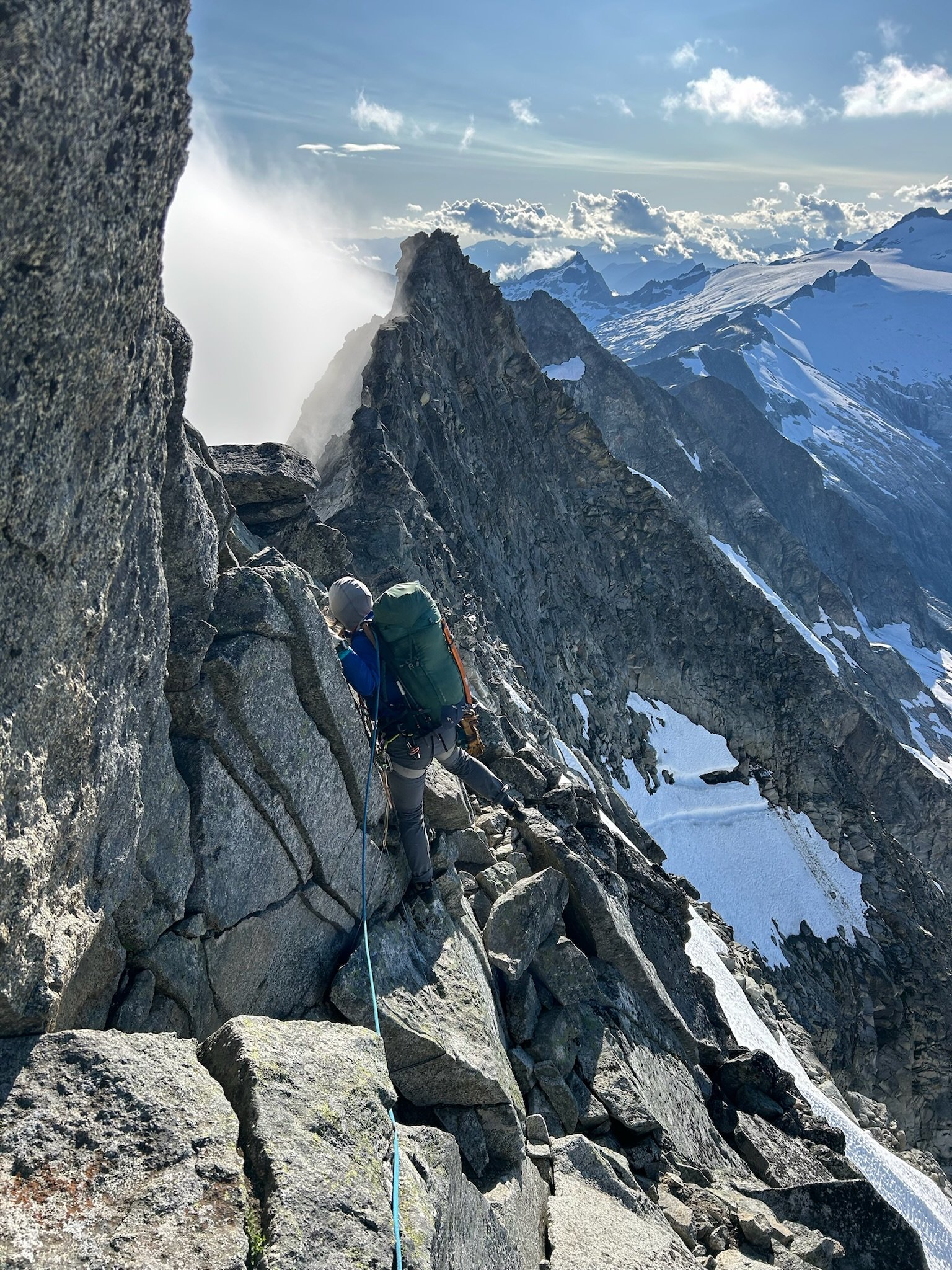
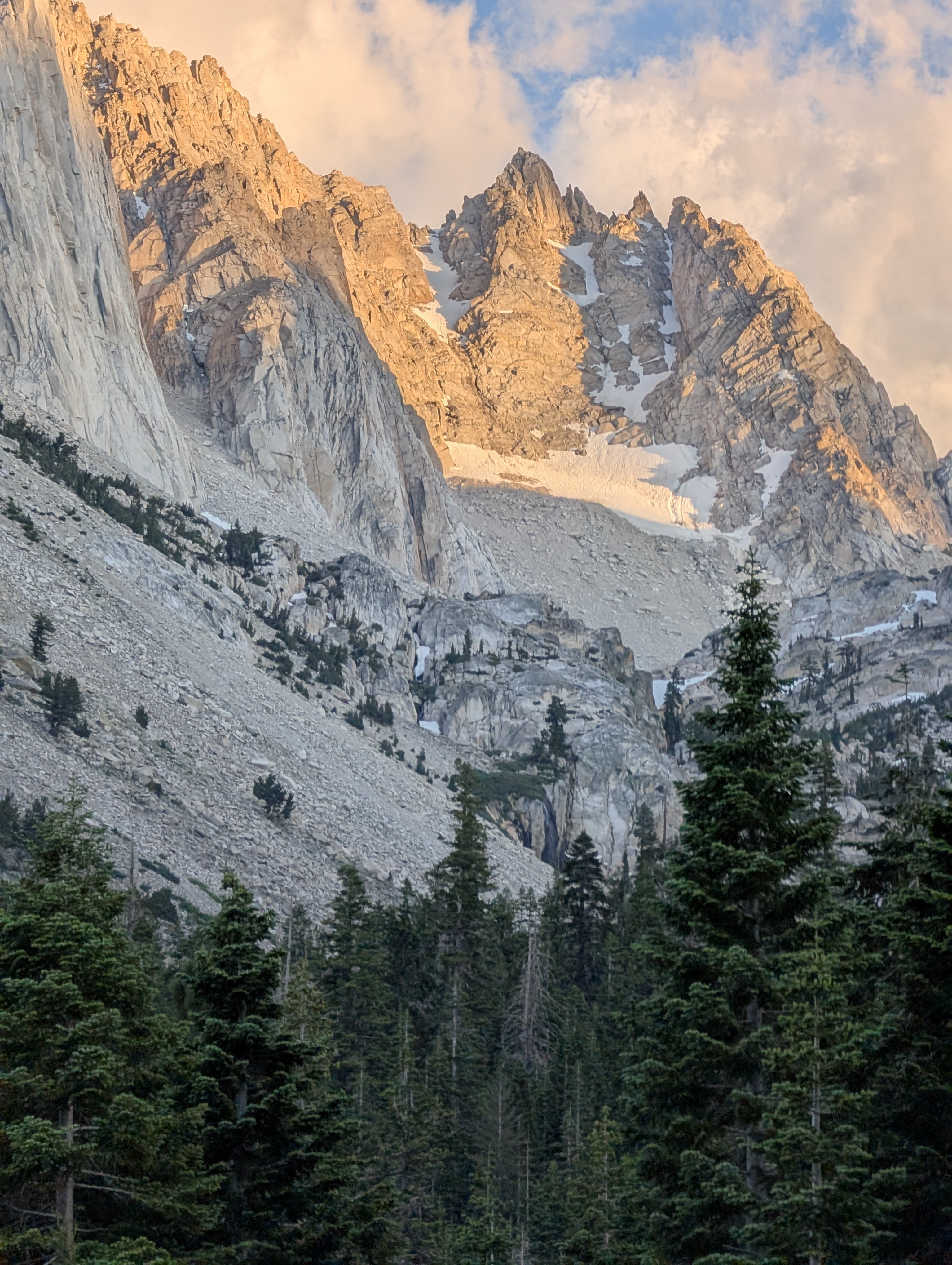
Trip: Forbidden Peak - NW Face Trip Date: 07/13/2025-07/14/2025 Trip Report: This has been on my list for a while given the high praise in guidebooks. Checking rec.gov on Monday, somehow permits to Boston Basin were available for this Sun-Mon that Alex, Liza, and I had saved for this route. With Liza and my previous experience on W Ridge, we figured this would go smoothly, but as is tradition with Forbidden, we were a bit slower than expected. Day 1: Approach to bivy on base of NW Face We left the Boston Basin trailhead at 8:45 am. The trail was brushy as usual and the river crossings had easy rocks to hop over. After a bathroom break at the lower boston we made our way to Sharkfin Col. We shot up a snow finger arching right towards Sharkfin and scrambled up and left in a gully about 200 feet before the big notch at the end of the snow finger. Two raps down to Boston Glacier over/in and out of the two bergschrunds. We made quick work of the Boston Glacier (thanks to some faint tracks likely from the day before) and scrambled the classic “potato chip” gully/col up to the Forbidden Glacier. With the crumbling rock/sand combination, this required the full body tension of precarious slab climbing with the added bonus of explosive holds that kept things spicy. Walking down the Forbidden Glacier was very chill and there were some rocks that were poking out in the middle that had water flowing over them which allowed us to fill up before crossing below the route and ascending the glacier on the other side. We saw tracks from a team that did the NW Face Var of the N Ridge (Scary!). We then navigated around crevasses on the west side of the rib to a snow ramp onto the rib at ~7,600 feet. This was smooth sailing for the most part, but the little snow finger to get onto the rock is thinning out so threw in a picket given the large bergschrund right below us to ease our nerves. The snow finger didn’t look like it would last much longer than a week or two, so additional shenanigans may be needed later in the season. By 8 pm we found a small bivy, which we adjusted to make decently comfortable for all three of us and set up camp under clear skies with views of Moraine Lake. Luckily we had no bugs or snafflehounds overnight, just very gusty wind and the occasional sound of rockfall echoing around the cirque. Day 2: Ascent and descent We woke up and made breakfast as the clouds came and went, occasionally completely surrounding us in grey. After breakfast we made a quick 4th/low 5th pitch to the base of the knife edge starting around 8 am. All of us were stiff from the day before and were grateful for the warmup. The knife edge was very fun and super chill! A short section of crumbly rock, but otherwise quite solid. Clouds rolled in and out making it hard to suss out the route above us. The crux pitch took some figuring out and I’m still not sure if I did it right. The first bit was one quick 5.8 move that was quite fun above the old piton and perfect finger-sized gear. The second bit was a weird overhanging hand/fist crack that felt burlier than I expected. I pulled up into the crack then switched to the face to make use of some great footholds. The chimney pitch was quite loose, with multiple death blocks that I stepped on to avoid the crumbly rock-sand. I did not enjoy leading that…. After the chimney pitch it was fun ridge romping up cleaner rock. I was a bit gassed so I handed the lead to Liza. Luckily the clouds cleared and we had some fun sunny climbing. Liza made the mistake of shooting left onto the face rather than staying on the true ridgeline once the ridgeline got more licheny. This led to harder climbing on what looked like cleaner rock, but it had minimal protection and hid multiple death blocks that threatened a scary rope-cutting incident. She shot back over to the ridgeline on the right for more fun and cleaner rock climbing to the summit by 4 pm. No major mistakes happened, but we were way slower than expected with the fatigue, weather, and figuring out our simul dynamic with this trio. We ended pitching out more than we needed to. At this point the clouds started rolling in, so we decided to high tail out. As we began the rappels along the ridge, the wind picked up and it started to rain. This was probably the low point of the day as sideways rain blasted us along the knife edge rappels. After two raps along the ridge, we did two raps down the west side to an easy 4th class ramp that meets the first ⅓ of the W Ridge. We added some tat to some of the weathered stations. Four double raps down the Cat Scratch and we were out hiking! It was great knowing the descent beta from when we did the W Ridge four years ago. Luckily it was still light when we navigated the snow field and slabs below. We got back to the car by 11 pm. Overall: This was an engaging adventure that required a bit of everything. Knowing the W Ridge descent was very helpful. The climbing was not as good as we expected, but the knife edge and some of the upper ridge were a blast. The position, line itself, and the approach are amazing. 4 star line with 2 star climbing (though with more traffic/trundling could be 3-4 star climbing). Overall, an engaging experience, but we are still quite confused as to why this route isn’t called NW Rib because the only time we were climbing what I would call a “face” we were definitely off route… Heading up the snow finger towards Sharkfin (rap we used is just to the left, rather than up in the notch straight ahead): Chossy scramble up to Forbidden Glacier: Snow finger to access the base of the route: Looking down on the the snow finger and the bergshrund below it: Morning at the bivy spot: Looking back down the knife edge: Cruxing: Alex pulling the weird crux move: Liza following the crux: Solid exposure! Summit selfie: W Ridge descent: Gear Notes: Singles 0.2-2 with doubles 0.4-1. 1 picket. Axes. Crampons. Having another 0.3 would have been nice. Approach Notes: Boston glacier approach
-
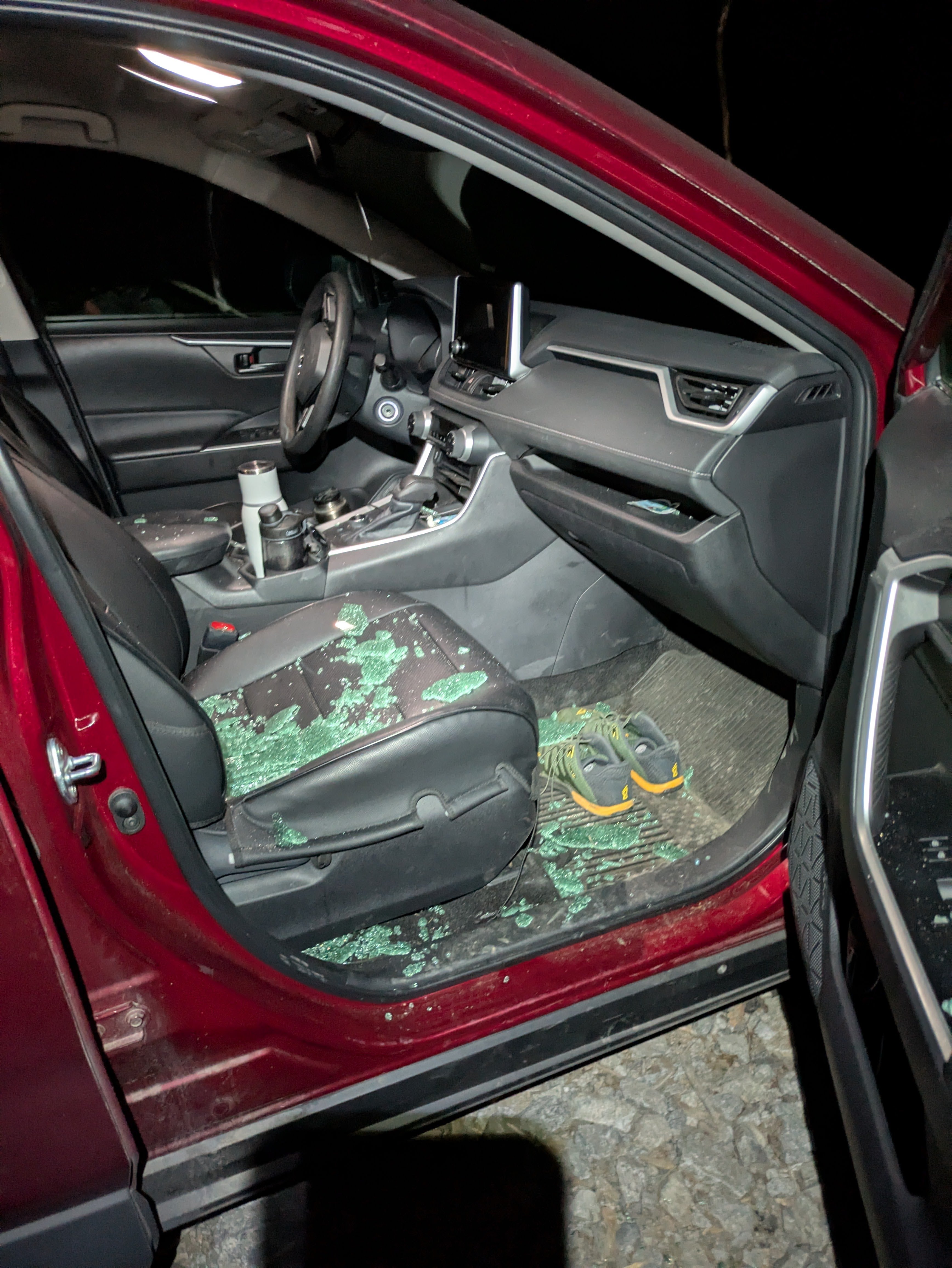
Trip: Forbidden Peak - North Ridge Trip Date: 07/12/2025 Trip Report: Spent the weekend climbing the North Ridge of Forbidden Peak (a climb so remote you have to climb over another ridge just to get to it) with a team of 4! It was a full value Alpine climb that doesn’t go too hard at any individual point, but requires the full suite of mountaineering skill sets, and is jam packed with them. This comes out as one of my all time favorite climbs, but had a bittersweet ending due to coming back to the trailhead at 1:30AM only to find two of my car windows smashed, and our happy bags stolen. Rough end to a 21 hour day climbing. GPS tracks here Our timeline was roughly: -7:45AM departure from trailhead -12:00PM Base of the gulley to go up Sharkfin Ridge -1:30PM over the ridge, and rope up for crossing Boston Glacier -3:45PM on the North Ridge -6:15PM stopped at bivy site -5:15AM Sunday started climbing -3:00PM Both parties summited, starting descent -7:00PM Arrived at the Notch of West Ridge Coulier -9:15PM Finished rappelling down the WRC -10:40PM Past the last major creek crossing and back on the main trail -1:30AM back to cars The approach was straightforward up through the Boston Basin. The creek crossings were reasonably low in the morning. As we got up to the start of the snowfield we caught sight of the gulley we were aiming for to get over sharkfin ridge. We briefly lost sight of the gulley we were aiming for as the cloud cover dropped, but thankfully we already had a general sense of where we needed to go before that happened. The gulley up to the notch we needed was thankfully still fully snow covered, but was quite thin in sections, and will probably start melting out soon (the exposed sections we saw in the gulley had very unconsolidated dirt and rock, and I’m glad we didn’t have to climb it). We did a double rope rappel down into and out of the bergschrund onto the Boston glacier (there was a 2nd rappel station for single rope rappels). We then roped up as a team of 4 to cross the Boston Glacier. Crevasses are definitely opening up on the glacier, but we didn’t have any major issues moving around them. Reading up on beta, there are two primary entrance points to get onto the North Ridge, and we chose the first and steeper option. This seemed to be the right call as we had minimal issue transferring from the snow onto the rock, and talking with another team heading out to do the NW Face who took the other option, they didn’t have kind things to say; it sounded like the other entrance point was sketchily wet and hard to protect when getting on the rock. After a scramble up to the ridge proper, we got our first sight of the full climb! Ryan C on Peakbagger very graciously marked bivy sites on the North Ridge. We stopped at the 2nd to last bivy site on the ridge. Our timeline was going well enough that we decided to start the climb and see how far we could get before dinner. We ended up simul’ing up to the first snowfield, where we opted to stop for the night. The snowfield was nice as we were able to melt some snow on the ridge for the next day. There was no running water between Boston Basin and the end of the rappels down the West Ridge. Sunday morning we got up and did the rest of the climbing, mostly simul climbing. Most of the ridge was 5th class fun with ~4 sections of 5.5-5.6 climbing (a fun challenge with mountaineering boots and a carry over pack, but still manageable), and longer stretches of class 3 scrambling on the flatter sections. Almost all of the climbing stayed close to the ridge, but there were a couple notable spots you had to get off the ridge slightly to stay in the low/mid class 5 climbing. We could have been a couple hours faster on this section, but a combination of a traffic jam right before the summit + one of our rope teams getting off route, and having to deal with some spicier sections pushed our summit time back a bit. Snowfield crossing on the ridge Summit traffic jam View close to summit looking back down on the North Ridge I found the crux of the climb to be the descent (via the west ridge), possibly the hardest mountain I’ve had to get off of. I think a major portion of the challenge was descending a 5th class route other than the one we went up. We made the mistake of trying to rappel right off the summit (should have downclimbed the section), and ran into some shenanigans. Once we were done with that, we did 3 more rappels down the face, traversed back left to the ridge, and did 1.5 pitches of downclimbing on the ridge to get down to the notch of the West Ridge Coulier. There were plenty of rappel stations down the gulley, almost too many (it made it challenging to find the right one). We found a big one that seemed to have more tat then the others, and rappeled off it4-5 single rappels later, plus a final double rappel, and we hit the snowfield below! We finished the rappels right at sunset, and had to break out our headlamps as we finished the snowfield and started hitting the slab. Getting down the slab sections almost became a serious navigational issue in the dark, as we couldn’t easily tell where the slab bands cliffed out, and it was very easy to slip on sections. Thankfully, with some aid from GPS racks we had, we were able to trend down and right until we found a weakness in the rock face that allowed us to go down and left below the cliff bands. We found a trail leading back to Boston Basin that faded in and out. Then with the aid of GPS tracks + plus another team that rappelled down just after us, we managed to find crossings through the two fastest flowing creeks. And the rest of the way down was just a normal slog to the trailhead. We got back to the trailhead around 1:30AM, only to find two of my car windows smashed open, and our happy bags stolen): Thankfully most of our valuables were locked away, but the loss of our happy bags were devastating after a 21 hour day climbing. And when it rains, it apparently pours, because about 1 hour into our drive back my car’s low tire pressure light came on. Turns out I managed to puncture the sidewall of my back right tire. Best guess is that it was from a rock on the turnout I parked my car on. Thankfully I had an air pump stowed just for this (and it wasn’t stolen!). It took three stops to refill my tire, but we were able to limp home on it so that I could deal with it later. All in all, one of my all time favorite Alpines, but a very expensive weekend for my car! Gear Notes: 60m rope, mountaineering boots, stove for dinner and melting water on the ridge Approach Notes: See GPS tracks above
- Yesterday
-
Really thoughtful and inspiring TR. Rest in peace, Teemo.
-
 Excellent report again as always. Can’t wait to see what you guys do next?
 -
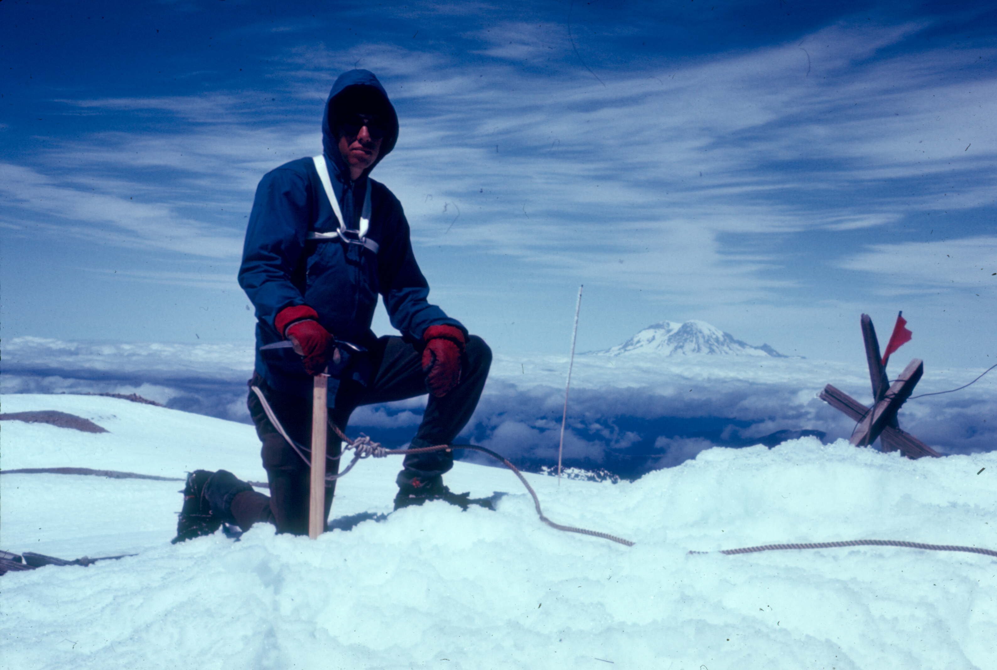
St Helens, about 1968 with the Seattle Mountaineers. Qualifying for the Intermediate Climbing Course. First time with 12 crampons, which I still have and use occasionally. We climbed the Forsyth Glacier, that is no longer there, then slept in ice cave on summit we had to dig out. I'm wearing an REI 60/40 jacket, short gaiters and army surplus wool pants. Unforgettable trip. I have climbed it in the Spring with group of friends about 20 years ago, snowboarded down Worm Flows. Others to compare? Olympus in late 60's, next with son and friend about 20 years ago. Same for Rainier, Stuart West Ridge. Baker was my first glacier before St Helens, then several times on Baker summit by three different routes Still at it, but slow. My goal is all the volcanos in Washington in my 70s' with better gear.😁
-
I’ll be heading to the cascades in August and looking for a partner or partners. I’ve done Mt Whitney via the mountaineers route and Grand Teton. Looking to tic off some Washington summits.
-
 Where's the "love" button? Thanks for the time you spent conveying all the pieces of your journey!
 -
 Dcat663 joined the community
 -
These things are unobtanium. There were people scrounging for them on this site like almost 20 years ago.
- Last week
-
Try Geartrade. I've sold a lot of stuff on commission through them without any problems.
-
@SeaLevel at least we did it on purpose this time!
-
Looking for a partner for some late summer objectives either in the pickets (inspiration east ridge, mt terror) or Forbidden. I have climbing experience but I've been out of the game for several years. I've climbed complete north ridge of Stuart c2c, multiple routes on prusik, acid baby, triumph, wa pass classics.. Have some random days the next month or so/ somewhat flexible..
-
Sick! I was the one working who chatted with you guys briefly before the easy ridge turn off. Stoked you guys made it out safe.
-
 lupe123 joined the community
 -
Conditions report from last weekend look close to perfect timing now with balance between glacier coverage and meltout on the corkscrew. Planning to leave Seattle at 3am. Was in Sierras last week and stoked to stay high and bag peaks in my backyard.
-

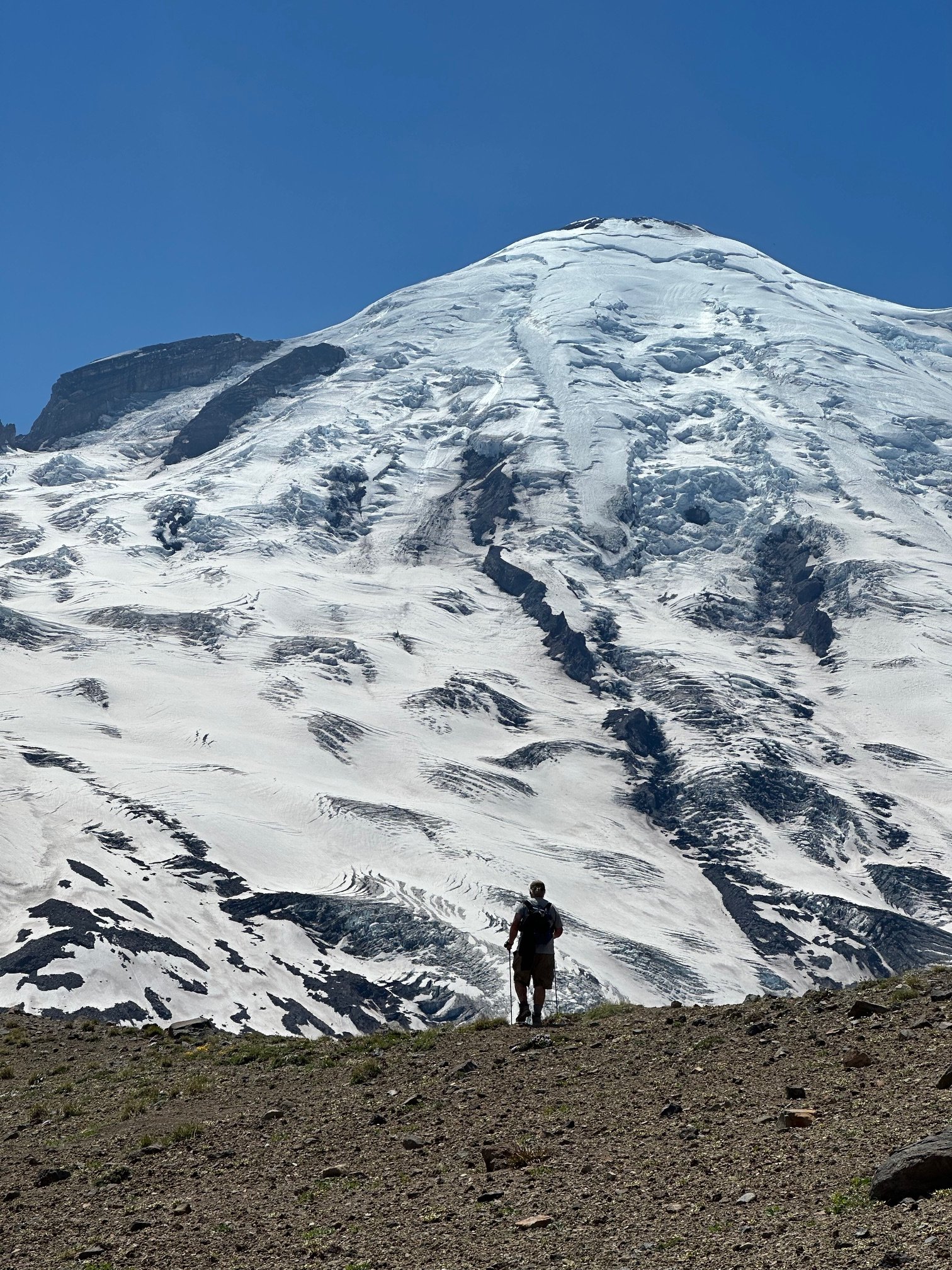
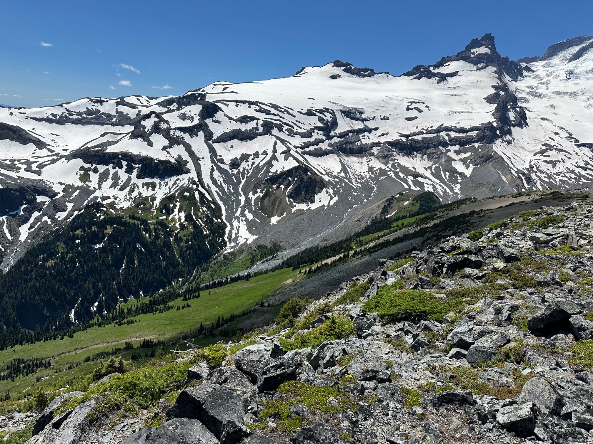
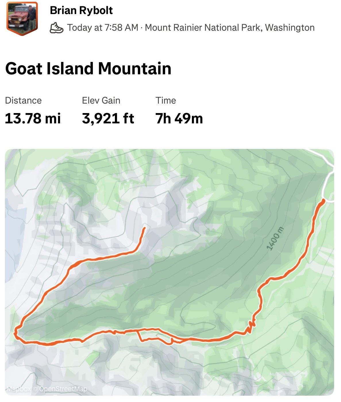
[TR] Goat Island Mountain - West Ridge 07/11/2025
olyclimber replied to Fairweather's topic in Mount Rainier NP
Nice Brian looks fun! -

[TR] Goat Island Mountain - West Ridge 07/11/2025
JasonG replied to Fairweather's topic in Mount Rainier NP
Beautiful! It is on the list! -
Trip: Goat Island Mountain - West Ridge Trip Date: 07/11/2025 Trip Report: Another MRNP Peak with Dwayner today! Left the Summerland trail about half mile above the creek crossing and boulder-hopped up Fryingpan Creek until we were forced to cross. The water was pretty high. Up to the saddle above the giant chock stone, then along the long long long ridge to the highest point. Some of the best views in the park--or anywhere on Earth IMO. Gear Notes: Boots Approach Notes: Trail to Summerland, then XC
-
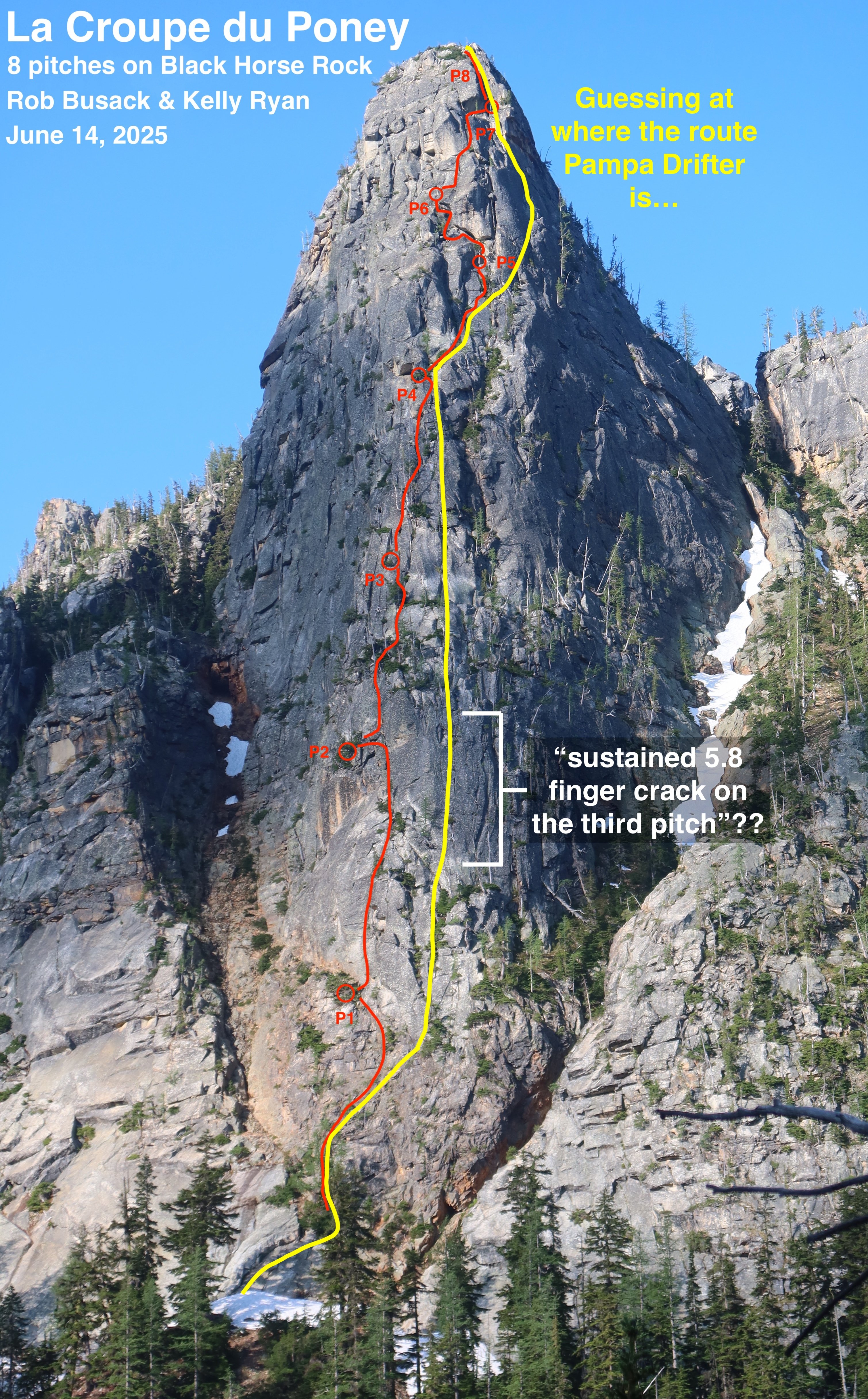
After having thought about this more (and having gone and climbed La Croupe du Poney a second time to make it a little more "ready" for other climbers,) this is, to the best of my understanding, my best guess about where the route Pampas Drifter is relative to La Croupe du Poney: I think Pampas Drifter made a direct-start from the toe of the buttress, starting climbing about 100' lower than La Croupe du Poney (whereas we started La Croupe by scrambling up the easier right side of the buttress to a big larch.) The bottom of the drawn line in the guidebook has a rightward-arching shape that appears to match the shape of a rightward-arch on the friction slab at the very bottom of the buttress. So Pampas Drifter's first pitch starts lower than La Croupe du Poney's first pitch starts, which leads to pitch numbers being half-offset the remainder of the way up. Shared segment: Although the 1st pitches of the two routes start in different spots, likely the majority of the middle of those first pitches are the same. A divergence: Pampas Drifter describes "a long, sustained 5.8 finger crack on the third pitch". Wherever that is, it is definitely unique from La Croupe du Poney. My best guess as to where that "long, sustained 5.8 finger crack" could possibly be is a clean section of rock with a number of vertical cracks that's 50ish feet to the right of La Croupe du Poney, and in terms of height, lines up with La Croupe's upper-half of our 2nd pitch plus the lower-half of our 3rd pitch. Since Pitch 3 of Pampas Drifter is definitely unique from La Croupe du Poney, it somewhat suggests that Pampas Drifter's pitch 2 and pitch 4 are also unique from La Croupe du Poney, since Pampas Drifter's route diagram doesn't show any sudden jogs to get to or from it's pitch 3; the route diagram implies that the pitches before & after pitch 3 are roughly vertically in line. Coming back together: I believe that La Croupe du Poney's pitches 3 & 4 and Pampas Drifter's pitches 4 & 5 are close neighbors, which slowly come back together and probably eventually share the same line at some point; most likely near the end of La Croupe's P4 and Pampas Drifter's P5. It's quite plausible that those pitches end at the same belay location. Shared segment: I guess the corner system marked in Pampas Drifter's diagram on their P6 has to be the same as the small right-facing-corners that La Croupe du Poney's P5 climbs through. So La Croupe's P5 and Pampas Drifter's P6 are mostly the same thing. A divergence again: Depending on where exactly Pampas Drifter's "dramatic turn on the right" is, it's likely the routes diverge again near the end of La Croupe's P5 & Pampas Drifter's P6. It's unclear to me if Pampas Drifter the huge chimney with a giant chockstone that's directly above Shish Kabob Tree, or if the "dramatic turn" is indeed further right, since further right does indeed look more likely to "lead to easier ground" out there. In either case though, it's clear that Pampas Drifter's P7 goes somewhere very different, and La Croupe du Poney's P6 & P7 are definitely new and unique. Another coming back together: Unfortunately, Pampas Drifter gives effectively no information at all about where its pitch 8 happens to be. If it had been my brain planning the route for Pampas Drifter back in the 1990's, I know I would have chosen to go for the "Incredible Dihedral" that's also La Croupe du Poney's pitch 8. So I'm guessing they made that decision?? But I'm surprised they didn't make at least some even small note at all about this striking last dihedral in their route diagram or description. It seems like if they had climbed it, they would have made at least a little mention of such a striking feature, so maybe they didn't climb it and went some other way?? But I'm going to assume they did climb it, even though they didn't say so, just because it is a probable way they might have gone. Based on that assumption, that would make pitch 8 of both La Croupe du Poney and Pampas Drifter the same. In summary: These two eight-pitch-routes would appear to have three pitches that overlap (some of the P1, some of La Croupe's P5 is the same as Pampas Drifter's P6, and to make an assumption: all of P8,) leaving each route with its other 5 pitches of climbing being unique and separate from the other. Considering that: The routes have more pitches that are separate than they do that are shared… And that I went out and climbed La Croupe du Poney as if it were a first ascent, with no beta at all except some of my own photos I had taken a few weeks prior, as there wasn't a single shred of information available about other routes on this buttress at the time that I climbed it… And that these older routes seem like they had been forgotten to time long before I got here… (I can't find any internet-evidence of anyone having climbed Pampas Drifter at all in the last 25 years) …the combination of all those things (especially point #1) makes me feel pretty good about saying "La Croupe du Poney is indeed a new first ascent" here! I've posted La Croupe du Poney to Mountian Project: https://www.mountainproject.com/route/201307606/la-croupe-du-poney If anyone has more-conclusive information / better beta about those historic routes, Archer and Pampas Drifter, it would be cool if you posted those to Mountain Project too, so that they aren't totally lost to time!