seano-
-
Posts
70 -
Joined
-
Last visited
-
Days Won
3
Content Type
Profiles
Forums
Events
Everything posted by seano-
-
What a treat to wander in here and find this! Rogers Pass is one of my favorite places for summer scrambling, and is on my bucket list for skiing. The Sierra are too good to pass up this year, but I've gotta make a future Selkirks trip a priority.
-
Ugh, yet another junk fee that goes mostly to Booz Allen Hamilton. Clearly the only option is to run up and down Adams as fast as possible. 😉
-
[TR] Canadian Border Peak (CBP) - NW Route 10/15/2022
seano- replied to geosean's topic in British Columbia/Canada
I had to check, but that was only last year -- how time flies! I enjoyed meeting you, a legend in your own right for your dedication to exploring interesting corners of the Cascades, whether famous or obscure. There was no shame intended; we all like what we like, as illustrated by my unusual affection for the north ridge of Johannesburg. Maybe I was just feeling off that day, or maybe the traverse from Larrabee wore my patience down, but... dang. That was a whole lot of dinner plates held together with mud. -
[TR] Canadian Border Peak (CBP) - NW Route 10/15/2022
seano- replied to geosean's topic in British Columbia/Canada
I'm with my fellow Sean -- what's wrong with you, man?! I like to think I'm a decent chossineer, but even before thrashing back home through the valley to the west, I knew ABP was one for the "never again" bin. I had hoped to do CBP on the same outing, but ABP beat me down. Good to know that those Canadian logging roads are cruiser if I come back for it from the Great White North. -
[TR] The Triad - East Ridge to Main Summit 08/06/2022
seano- replied to JasonG's topic in North Cascades
Thanks for the TR, bringing back memories of one of my earliest Cascades adventures. Between the high start and the Sibley Ridge heather knife-edge, The Triad has a very high reward-to-effort ratio, even if you skip the Lesser Dicks. -
What an incredible achievement, and in the best style! I firmly believe from my experience, and try to convey in my writing, that mountaineering is a smooth slope that can be climbed from hiking to... wherever your drive, time, and resources take you. I also believe that many famous mountains have built up intimidating auras that need to be dispelled, with the process of climbing them related back to normal people's experiences. This trip, and the ones building up to it, demonstrate both in spades.
-
[TR] Mont Blanc Massif - Arête du Diable 07/11/2022
seano- replied to Kyle M's topic in The rest of the US and International.
It was a pleasure to meet you in person and climb with you, Kyle. This was one of the highlights of my trip this summer, even with the rude French dude at the Cosmiques hut. -
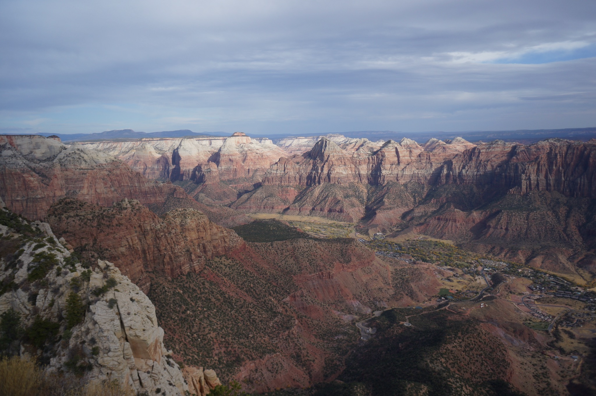
Zion sandstone in particular is kinda sketchy for scrambling -- grittier and more rounded than Red Rocks. The view from West Temple are worth it, though:
-
Way to push through and tag South Hozomeen, @JasonG and @therunningdog! One of these years I'll have to get up there when Canada is not on fire to nab that, plus whatever else is reachable from that long trailhead drive. I'm definitely a bit wiser in interpreting Beckey beta approach descriptions than I was before...
-
I believe it is Hozomeen SW and Lake from somewhere unpleasant, with Jack and the Nohokomeen Glacier barely visible through the smoke. One of the views from a minor epic fail among the Hozomeens: http://www.drdirtbag.com/2017/08/04/hozomeen-the-hard-way-sw-and-n-peaks/
-
Unfortunately the smoke followed me in from Canada, so the views were... somewhat limited:
-
Sweet! Ever since doing Larrabee and American Border Peak last summer, I have been asking myself "where can I find more of that?"
-
Finally saw this a couple of nights ago. Watching him pull that roof before the Stanley Headwall sequence, blindly sticking a tool into the ice and kicking his feet free, was mesmerizing. It was noticeable to me that he was never speed climbing, but always methodical, searching around for placements and footholds and testing them, but then supremely confident that they would hold. RIP.
-
Here's a distant photo from August 22, 1999: The left upper couloir above the King Glacier looks dry then, too, but it's hard to tell. Klenke posted a bunch of cool old photos on that page, including this dizzying shot down from the summit:
-
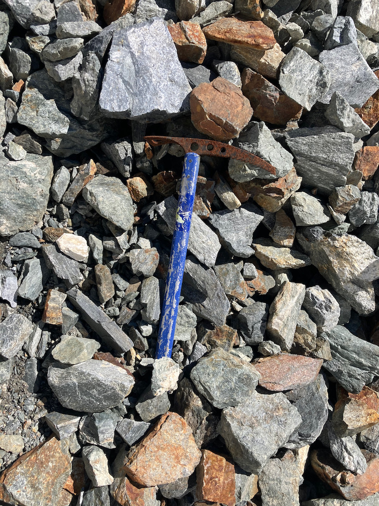
Wow! Now I feel slightly bad for not bringing back the axe. The fire apparently exterminated the devil's club, as I found very little either in the burned area or above it. I'll bet the gully where I found the worst choss was filled with snow when you climbed it. I'd love to see some photos from your climb if they exist.
-
According to this TR, the road is gated 11 miles from the Trinity trailhead in late spring: https://peakbagger.com/climber/ascent.aspx?aid=1674161
-
Haha, I hadn't planned on creating more mountain origins! My headphones broke earlier in the day, so my mind had lots of time to wander to strange places. Plus, "Cleator the Dominator" would be an awesome name for a half-orc warrior.
-
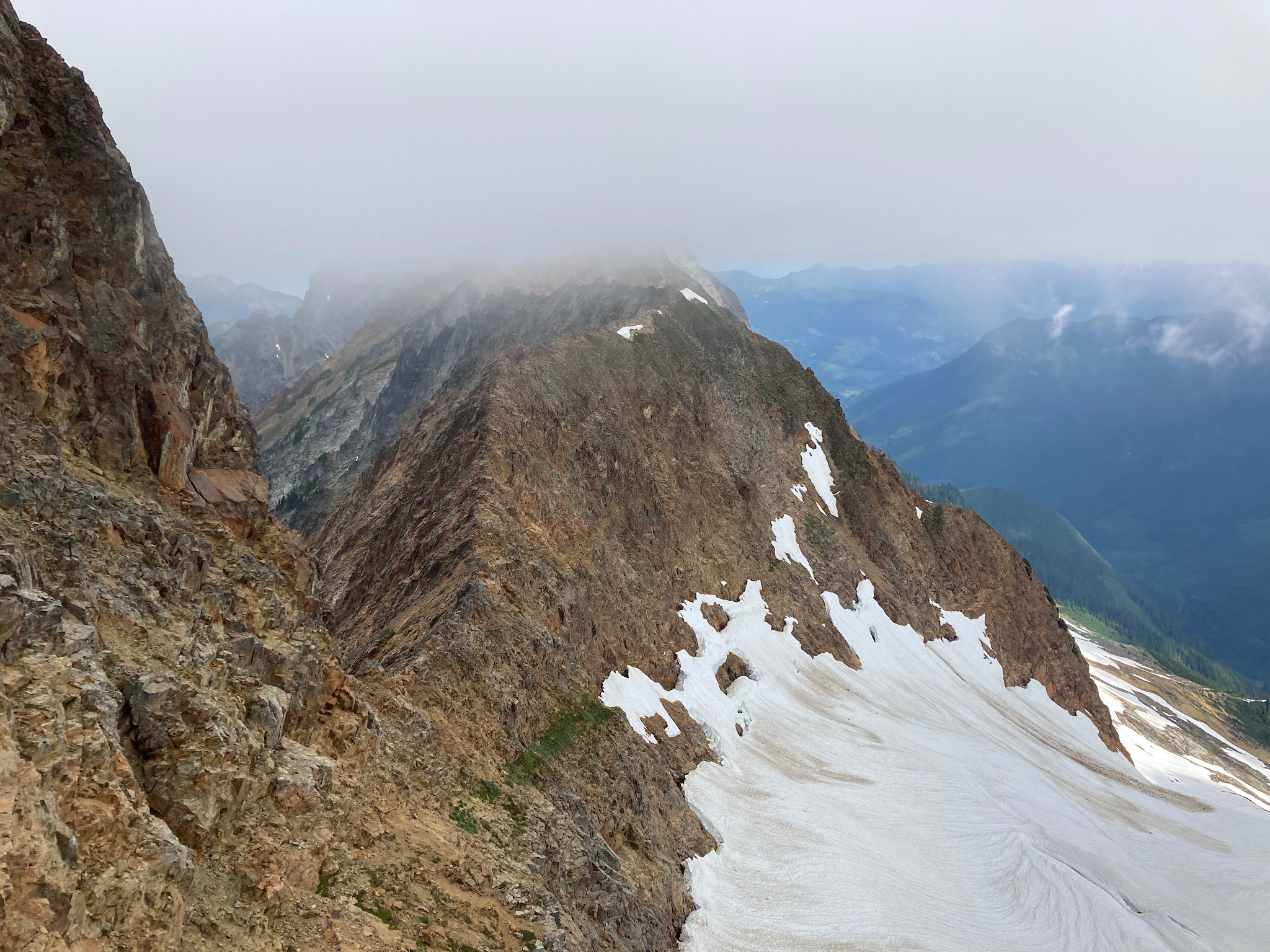
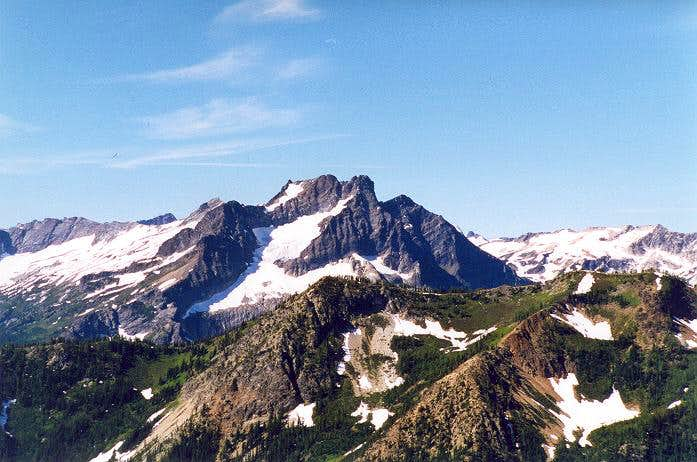
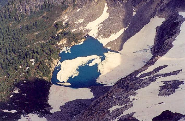
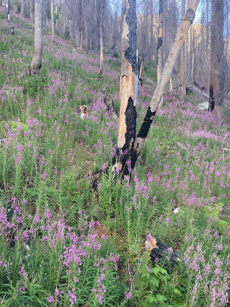
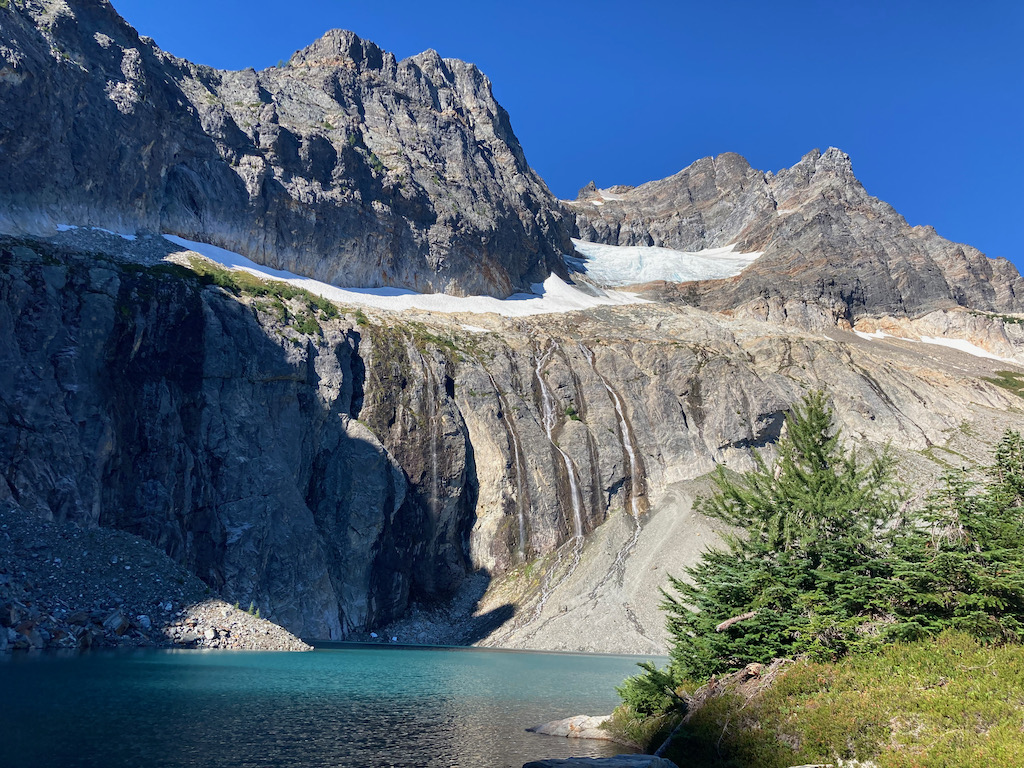
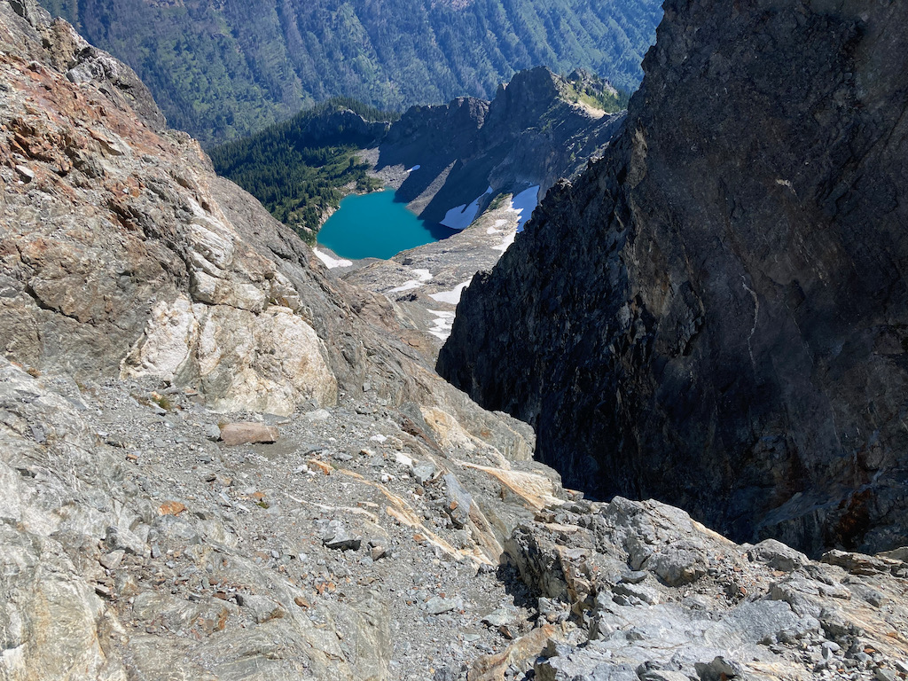
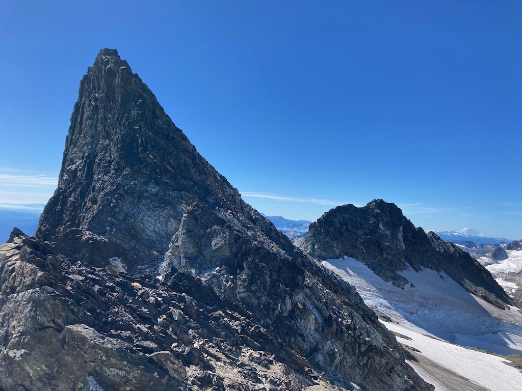
Trip: Buck Mountain - Northeast face Trip Date: 08/11/2021 Trip Report: Summary: I climbed Buck via the seldom-used northeast face above King Lake, then descended via the long standard route to Buck Pass, tagging Berge, Cleator, and Rally Cap along the way. This isn't anything groundbreaking, but it's an interesting line on a peak whose standard route(s) can be a bit of a slog. 26 miles, 10,000 feet of climbing, ice axe and probably crampons required. And if your dad left his axe up there, you're welcome to it: (Original TR here: http://www.drdirtbag.com/2021/08/12/buck-loop-ne-face-to-buck-pass/) Summitpost describes Buck as "one of the man-mountains of the Washington Cascades." Though only three miles from the Trinity trailhead to its southeast, and only class 2-3 from the southwest side, a high and rugged ridge extends north and south from Buck, and there is no road or even trail up the lower Napeequa River to the west. The "normal route" is therefore shockingly roundabout, approaching the peak's west side either over Little Giant Pass to the south, or on a high route from Buck Pass to the north. There is also a direct class 3 route from the east near Alpine Creek, involving a river ford and a savage bushwhack through steep and brushy forest, that is recommended for descent but can of course be done both ways. The Summitpost page also mentions that the northeast ridge is "class 4 or 5," which sounds like my kind of route. With these options in mind, I made the long drive up the Chiwawa River Road to Trinity, and started off around dawn planning to do at least one of these routes. Passing the place for the Alpine Creek route, I decided that I did not want to do that to myself. I continued after the split toward Buck Pass, finding that the bridge was not "out" as advertised, but was probably no longer suitable for my horse. Nearing the turnoff for King Lake and the northeast face, I entered the burn area for the 2016 Buck Creek fire. The forest was in a near-perfect state for cross-country travel, with the trees and underbrush incinerate, but the nasty things that follow a fire not yet established. The main type of plant was fireweed, a bush that is easy to whack. I contemplated the route while I ate a sandwich, then took off across the wasteland. The first obstacle was crossing Buck Creek, but I found a perfect log bridge almost exactly where I needed it. There was even a sort of tunnel through the otherwise-impenetrable alders. Beyond, I followed various deer tracks up the burn, staying on the left side of the drainage and well away from the unburnt alders to the right. I eventually entered steep woods above the burn, and the deer trail faded. Not sure what to aim for, I decided to traverse right to reach open terrain I had seen from below. This turned out to be a savage hell-schwack, variously fighting my way through alders, steep scrub pines, and cliff bands littered with fallen burned trees. After avoiding some of these cliffs, I realized that the rock was fairly solid with a grain that worked well for climbing this way, and simply headed up some class 3 crags, grateful to finally be making upward progress again. Reentering the woods higher up, I found myself on the left side of a deep cleft with a healthy cascade running through it. This was rocky enough to discourage the plants somewhat, so I stayed near the edge as I made my way upward, hoping I could cross the cascade easily higher up. I saw what I thought was a cairn in an open, slabby section, then a few cut branches and a bit of boot-pack higher up. Success! I lost and re-found the ancient fisherman's trail a couple of times, taking my time and eventually ending up in an open, grassy ravine leading easily almost to the east side of King Lake. I have no idea what this "trail" did lower down, and that part has been obliterated by the fire, but I was grateful for what I found. King Lake proved as spectacular as I imagined it would. Buck's small northeast glacier sits perched in a bowl above the lake, sending cascades of milky melt-water down the cliffs that ring the lake to its southwest. I found a couple of fire rings with fresher-than-expected ashes in them, but I can't imagine this cirque sees much traffic. Making my way around the lake's north side, I climbed rubble and easy slabs to the toe of the glacier, putting on crampons to cross one hard snowfield. I avoided the snout and broken-up lower glacier to the right on decent rock that became grittier as I progressed, then returned to the glacier where it was a bit more continuous. The travel was mostly easy, but it was surprisingly possible to fall in a crevasse if one were oblivious, as opposed to having to find one and jump in it. The top of the glacier is separated from the mountain's east ridge and south face by another wall of cliffs, the only potential exit being at the upper right side. I made my way for the highest tongue of snow, passing someone's father's ice axe on the way. This tongue probably used to extend into the gully above, but it was now separated by an expanse of steep dirt and scree. I sketched my way up this, aiming for the obvious gully to the left. The gully was made a bit more obvious by an ancient piece of tat, originally yellow and now bleached completely white. I was once again annoyed at Cascades mountaineers for leaving garbage on routes (who would rap this?!), and at myself for not bringing a knife to remove it. There was a bit of easy fifth class to pass the webbing, but above it looked like the angle eased. If only... Earlier in the season this would probably be a steep snow climb to the summit ridge, but now it was wet gravel, choss, and gritty slabs that often angled in the wrong direction. I worked my way up the right side of the gully, using the wall for handholds or to stem against the dirt. After a failed attempt to exit early to the right, I exited out the top, making a few wide stems against some reddish rock. Above that, I finally managed to traverse right on improving rock, and soon popped out between the north and south (true) summits. The south summit looks incredibly imposing from this saddle, showing only its narrow east-west profile. I scrambled up the layered slabs to the summit, where I quickly pulled the register out of a cairn guarded by flying ants, then sat a safe distance below to look around in the remarkably clear air. To the west were recently-climbed Clark and Luahna, along with the rest of the Dakobed Range, showing the glaciers that clearly make them a better ski than scramble. North was Berge, across a weirdly broad and flat saddle. I also had great views of the Entiat peaks, Bonanza, and even Baker and Rainier at the far ends of the range. Descending from the summit, I crossed the small, flat glacier nestled between Buck's summits, then descended toward the saddle with Berge, entering a surreal landscape of pumice and larches. As this region demonstrates, the Cascades' geology is incredibly complex. Between Buck's ancient dark rock (schist?) and Berge's Sierra-esque white granite lies a small region of pumice reminiscent of a recent volcano. This is presumably from the same event that created Glacier Peak, but does not seem to connect in an obvious way. Through this section I began picking up bits of use trail, leading more or less where I wanted, toward Berge's northeast summit. Most maps incorrectly label Berge's southwest (easier) summit as higher, but as seems clear to the naked eye, and as Eric Gilbertson demonstrated with a surveyor's level, it is not the highpoint. I tagged both for good measure, finding the northeast no harder than class 3 and reminiscent of the Sierra except for the green things between the granite boulders and the deposits of black lichen on some aspects. Berge's north and west sides are cliffy, so it is necessary to circle southwest to a saddle and descend west before circling back around north. Fortunately I had downloaded some other climbers' tracks, as otherwise I would have dropped all the way to the valley bottom instead of making the improbable high traverse. I finally reached a trail in this Sierra-like basin, with its clear, shallow lake and white granite, and from there it was a short hike to High Pass. The trail from these lakes to Buck Pass is one of the most scenic and runnable I have found in my years in the Cascades, reminiscent of nearby White Pass but lacking the PCT hordes. I had miles to go before home, but they were all downhill and easy trail, with clear views of the glacier-y sides of the Dakobeds and Glacier Peak. With time and energy to spare, I decided to tag a couple of easy peaks along the way. The first was Mount Cleator, named for Trinity local Cletus McCoy's tabletop D&D character. Cleator met his untimely end when Cletus' cousin Brigitte "Berge" Hatfield made him promise to give up his boozy Friday gaming sessions as a condition of their engagement. Despite its unfortunate genetic consequences, the union was a key step in reconciling their feuding branches of the family. Mount Cleator has two summits, a grassy walk-up separated from a fierce crag by a steep notch. The grassy one looks a bit higher and has a register, and I did not have enough curiosity or energy to try to reach the other. I returned to the trail after Cleator, then took a side-trip to Rally Cap on the way down to Buck Pass. I pulled out my map to find my way through the mess of trails here, but eventually got on the popular Buck Creek trail. I am not a trail runner, but I had been enjoying my jog from High Pass, and the Buck Creek trail was pleasant in its own way, smooth and gently-graded, with good shade and frequent water sources. I started to feel pretty run-down once the trail reached the valley bottom, but managed to mostly hold it together and maintain a jog back to the car. According to my phone, the whole excursion was about 26 miles with 10,000 feet of elevation gain, all in a bit under 12 hours. It was a satisfying use of what may be my last (smoke-free) day in the Cascades this year. Gear Notes: Ice axe and crampons for short glacier crossing Approach Notes: There's a fisherman's trail leading to King Lake, but you probably won't find it until quite a ways up. The 2016 fire has made travel easy lower down as of 2021, but it will only get worse.
-
When I did Challenger I came in Easy Ridge and out over Whatcom's summit, and it felt like six of one, half a dozen of the other time-wise. Whatcom's not that big compared to the rest of getting to Challenger, the Whatcom Pass trail is well-maintained, and there was even a use trail much of the way between Whatcom Pass and the summit.
-
Interesting to hear that the South Fork trail has seen a bit of maintenance -- I saw a car parked at the gate last month, and assumed someone was a glutton for punishment. This Summitpost page, last updated in 2016, suggests that the whole trail is a suffer-fest: https://www.summitpost.org/sentinel-peak/840713 . I was thinking of getting in to Sentinel that way, but did not feel up for so many miles of low-elevation vegetable combat.
-
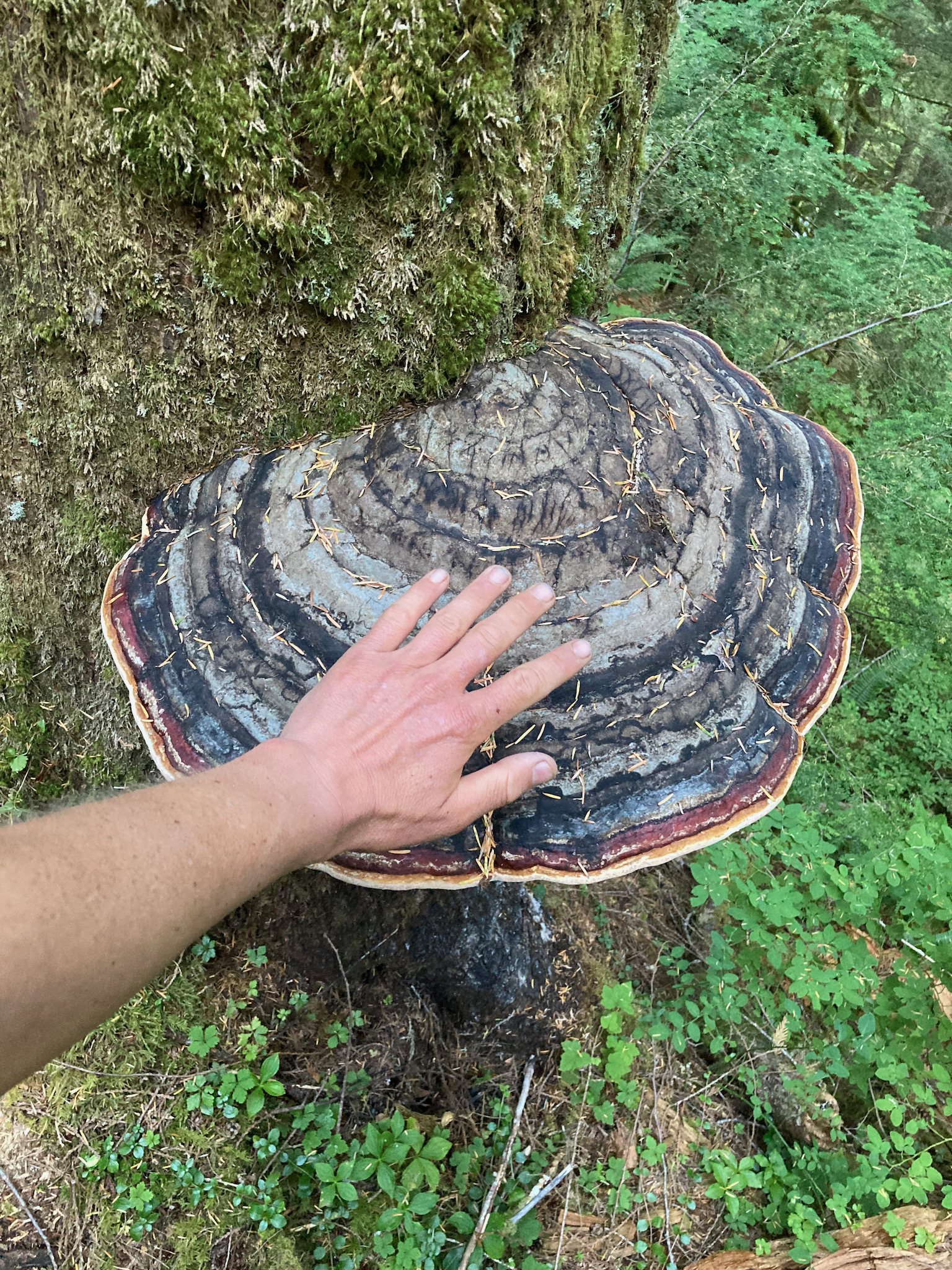
Nice TR, and great running into you guys! I think I took a photo of that very same giant "tree ear" mushroom on my much less successful Pickets trip:

-
tanstaafl -- The "trail" continued just about straight across or very slightly downstream from where I reached Terror Creek; there was a cairn, and some sparse flagging both before and after. I waded the creek slightly upstream after failing to find a dry crossing, but it was gentle and no more than calf-deep. I had more trouble following the trail below the creek crossing than above. You might be able to get a rough elevation/position from my Strava track: https://www.strava.com/activities/5652706440
-
Right -- I think most of the difficulties are getting over to the barrier, and getting to West Mac is about the same as always. You can see on the photo that it's a mix of snow and slabs. As for my "itinerary"... up Crescent Creek approach to the Chopping Block, getting served by the Twin Needles, then exiting via the Barrier and Terror Basin. A long day without much to show for it. :-(
-
I was just up there yesterday. The approach trail is pretty beaten-in, with a bit of dirt/choss getting down to camp. Terror Glacier is definitely more of a broken-up pain in the butt than when I was there in 2014, so you'll deal with steep polished slabs, crevasses, and bare ice getting to Pyramid. The high glacier traverse I used in 2014 between West Mac and Pyramid looks like it may no longer go. The 'schrund/moat getting to the Barrier was a bit dicey, too.

-
I was there 7/11, and while the snow bridge was intact, I wasn't about to cross it. The debris crossing to the right wasn't so bad staying left on the rock. One could probably traverse back left on snow above the 'schrund, but it is also possible to reach the ridge by continuing up and right, tunneling up a moat and under two chockstones. It was pretty much smooth sailing after that. Descended the ledges, ran into JasonG on the way. Good times...