

bedellympian
-
Posts
533 -
Joined
-
Last visited
-
Days Won
55
Everything posted by bedellympian
-
Hoping for a good local season! There is snow on the ground at 4k' and more coming. Some warm temps in the forecast bringing rain. Hopefully that's followed by more cold and then some things are in really nice shape! ?
-
FYI: this Saturday there is a weather window above 7k' that NOAA is not showing due to low cloud layer. Maybe someone can snag a lap on Hood or something else before it closes early pm. Highlighted in purple from the current Troutdale forecast...
-

Libtards on Parade: Alcoholism, Corruption, Murder
bedellympian replied to Fairweather's topic in Spray
More accurately: "Russian government AI bots and billionaires who own media corporations made up a bunch of lies and used their massive wealth to make sure that was all most Americans heard. So we should probably limit foreign influence and corporate powers so that actual facts are findable and the voices of American citizens are at the heart of political discussions determining the future of this country." I found this video to be helpful. -
Love it. The sped up climbing sequences with the mic picking up all the grunting is pretty funny.
-
[TR] Granite Mountain, Tuck and Robin lakes - dog route 10/13/2024
bedellympian replied to olyclimber's topic in Alpine Lakes
Sad stuff. I did like the photos though! -
Agreed! The experience is everything... unless it's raining.
-
Yeah, glue-in, but could still be old/bad. I've seen several lines with those get rebolted at Smith in the last few years. I even have an old one hanging in the garage that came off the Backbone on Monkey Face... looks identical but was no good.
-
Gonna tell us where yet?
-
I've done everything... but that was easy since my bar was intentionally set really low with our new daughter. She's been sleeping reasonably well (for a baby) and I've been able to do more than I thought. The oldest is now 3 and loves doing outdoor adventures. I did a "3 pitch" route with her last weekend. Each pitch was about 10 ft and 3rd class for me and then we lowered/rapped down a low angle slab off a tree. Pretty fun. Hoping to climb some harder routes this fall (not with the 3 year old).
-
[TR] Cathedral Peak - SE Buttress 08/28/2024
bedellympian replied to markh's topic in North Cascades
Finding the right partner feels like it's the crux on many of these long and remote climbs. Way to make it happen when the opportunity presented itself! -
Darin, You asked on my trip to the Cirque and I'm curious for yours: How much did it cost you to do this trip? How long was it B'Ham to B'Ham? While I'm thinking about it too... what does the season for climbing appear to be on Baffin? Is that changing? Most importantly, how are the bugs?
-
[TR] Fortress and Helmet Butte - Standard 07/28/2024
bedellympian replied to JasonG's topic in North Cascades
Amazing pictures as always... especially appreciate the shots of Buck N Face -
Check Jeff and Priti Wright's TRs from when they did the 6 north faces... I think they mentioned using Instagram hashtag searches to see if people were doing the routes and what they looked like. I'm sure they had some other beta in there too. Those TRs are dense.
-
30 days? That's a chunk. What did you all do?
-
Yeah I was surprised but seems like there are 1-3 parties up there continuously during the short season. We ran into UK and Swiss parties so it’s on the radar of more than just North Americans. Definitely lots of potential but very dirty unless it’s steep. The W Ridge on Huey was just done in 2008 but it has lots of moss choked cracks and lichen covered slab. Brent’s Hammer and other routes on Terrace S face are obviously clean white granite but our friends reported that it was slightly overhung most of the way. Come prepared to clean, especially on slab or non-south aspects.
-
15 days house to house… the multiple legs of travel and the constantly fluctuating weather make smash and grab pretty difficult… I wouldn’t budget less time. We spent about $9k for all of us. Having a team of 4 is definitely the most cost efficient way. You could spend less or more, that seemed pretty middle of the road.
-
That about does it. Hopefully you all enjoy.
-
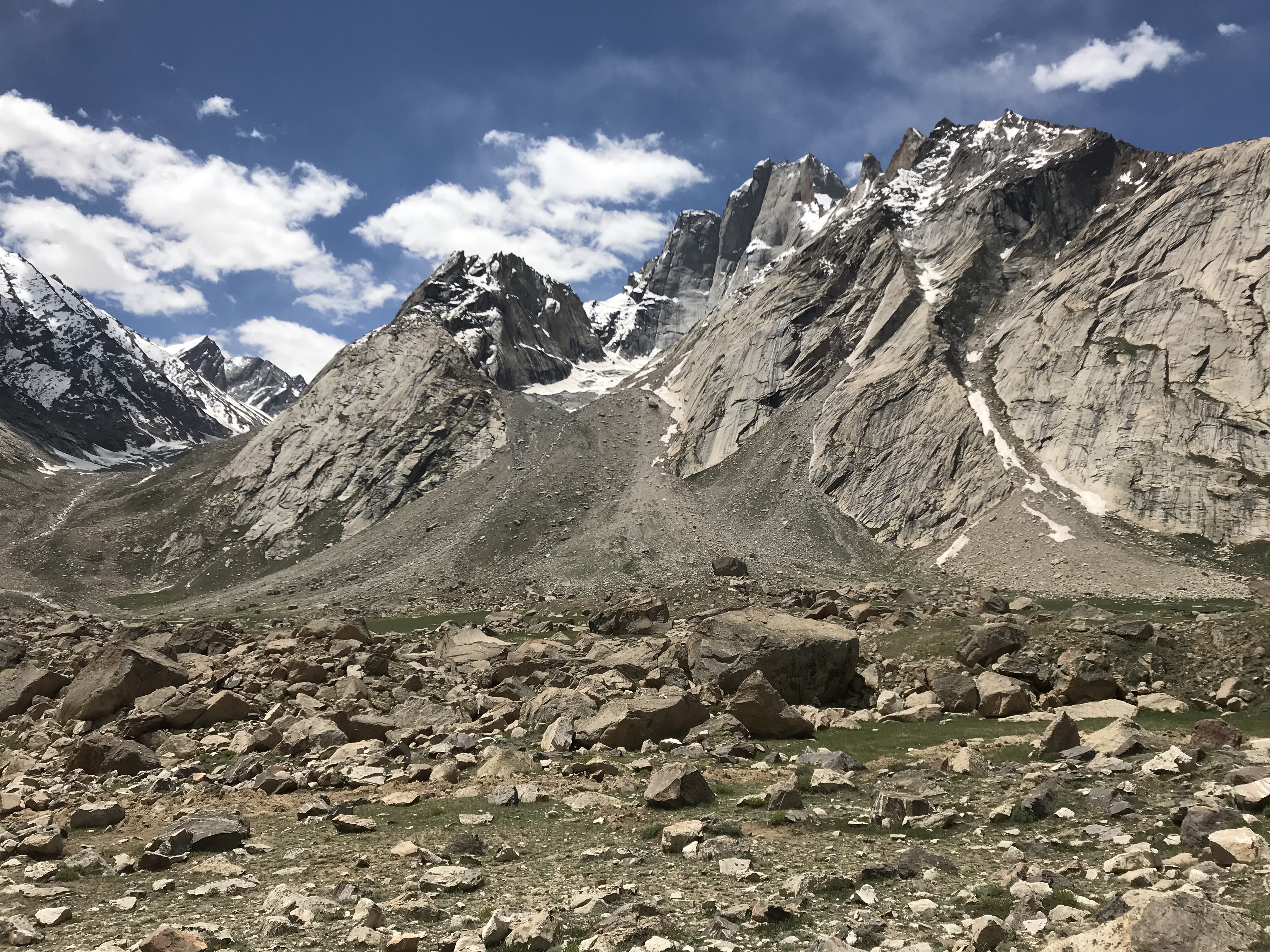
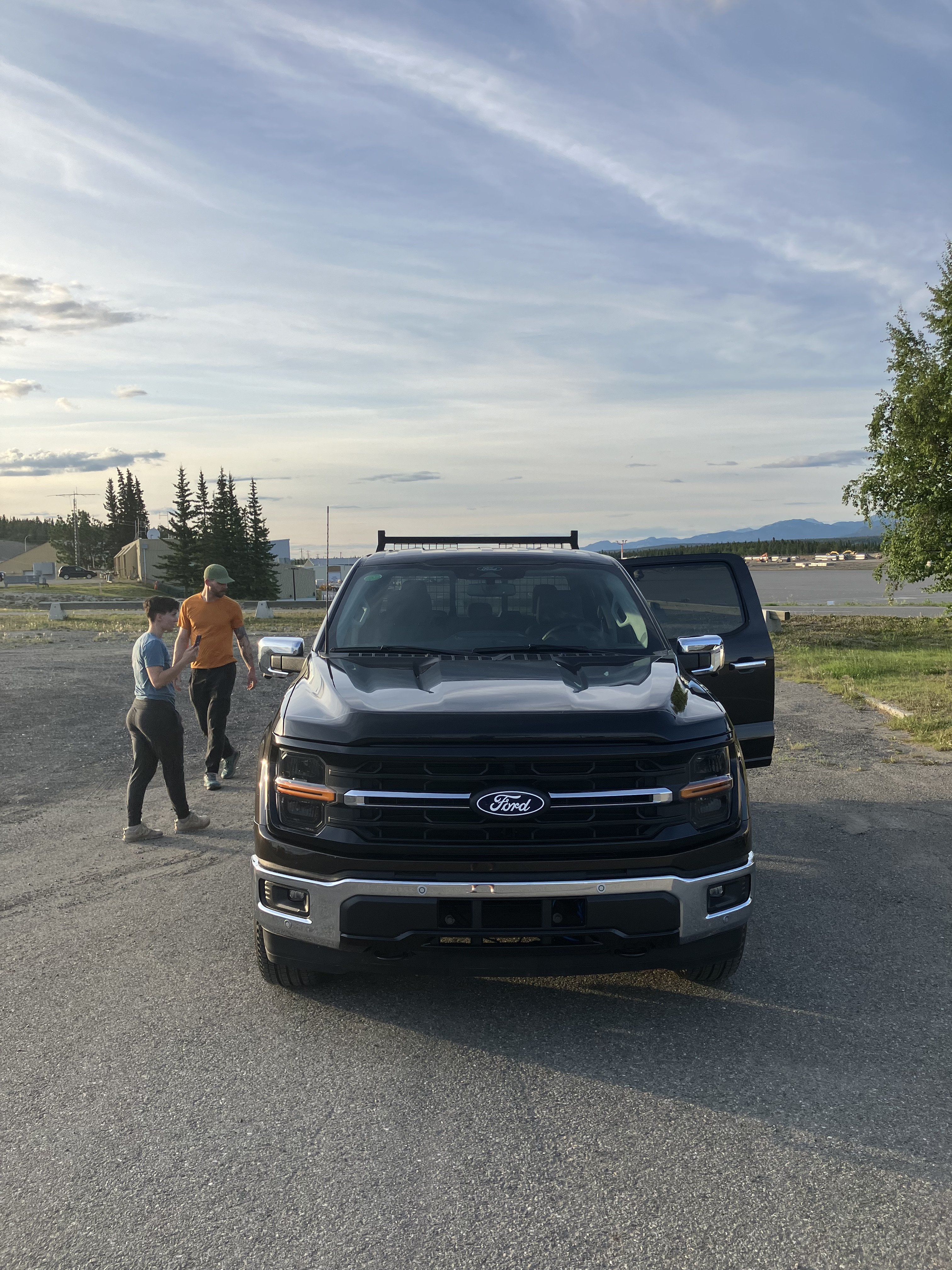
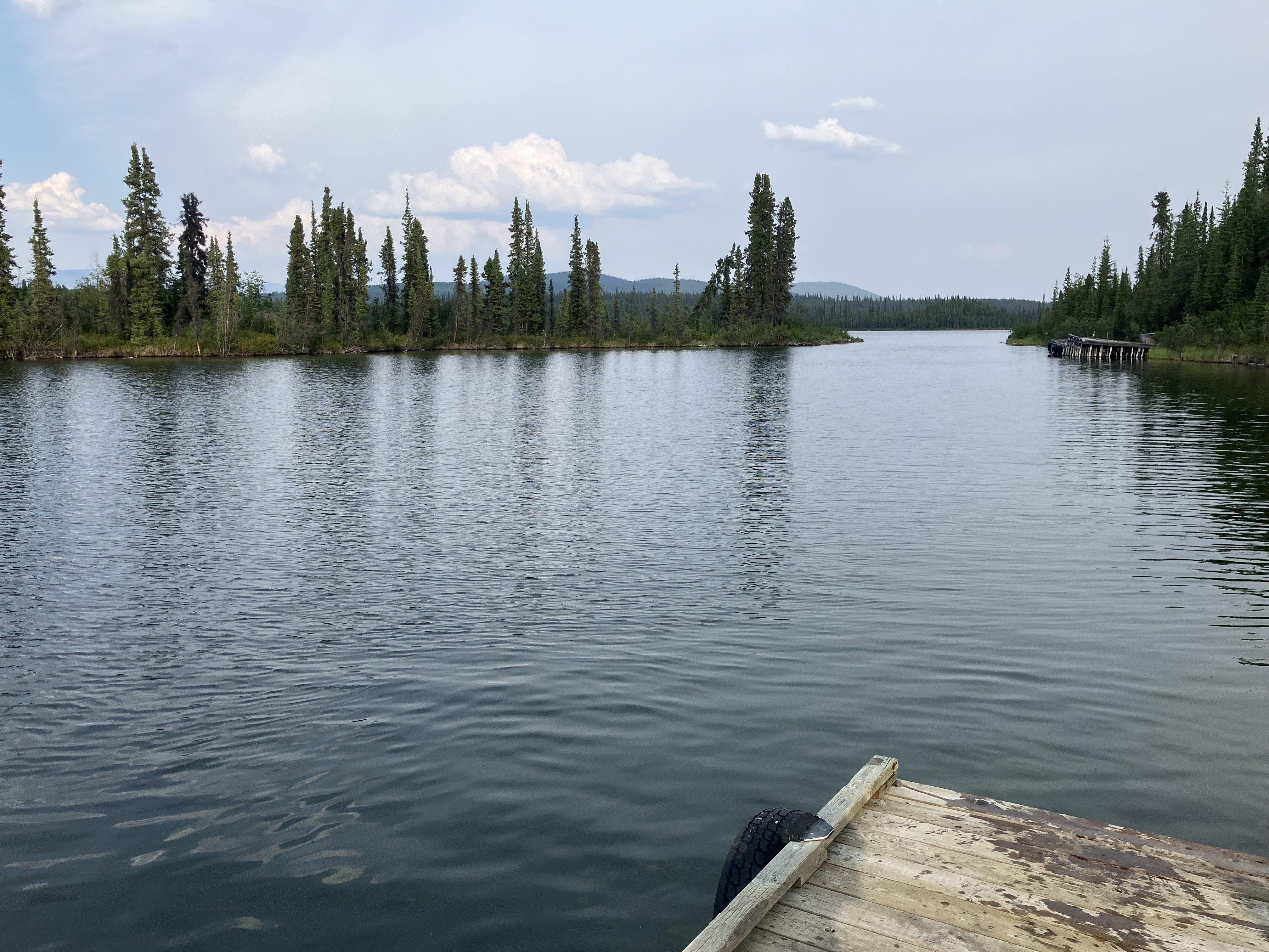
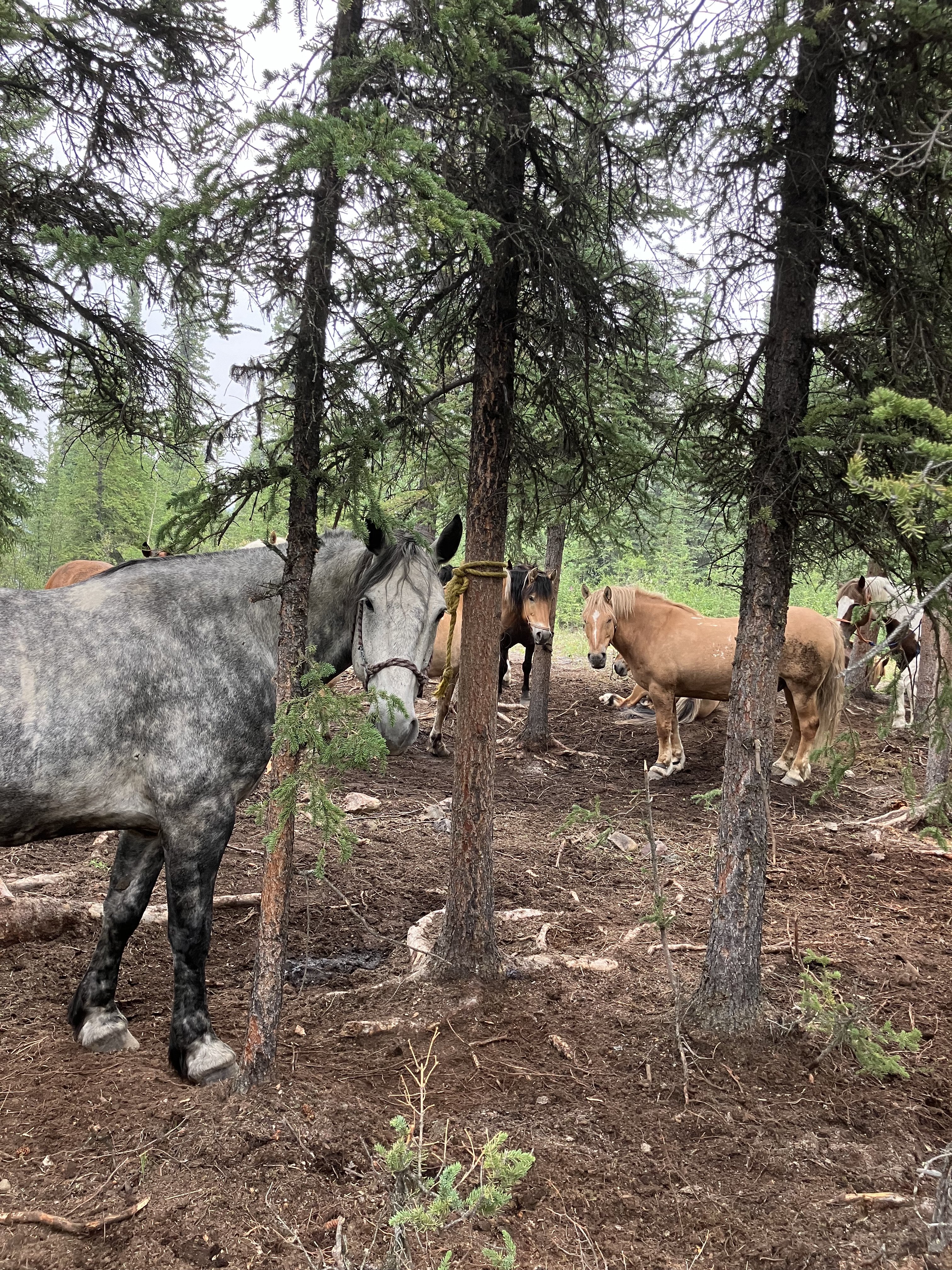
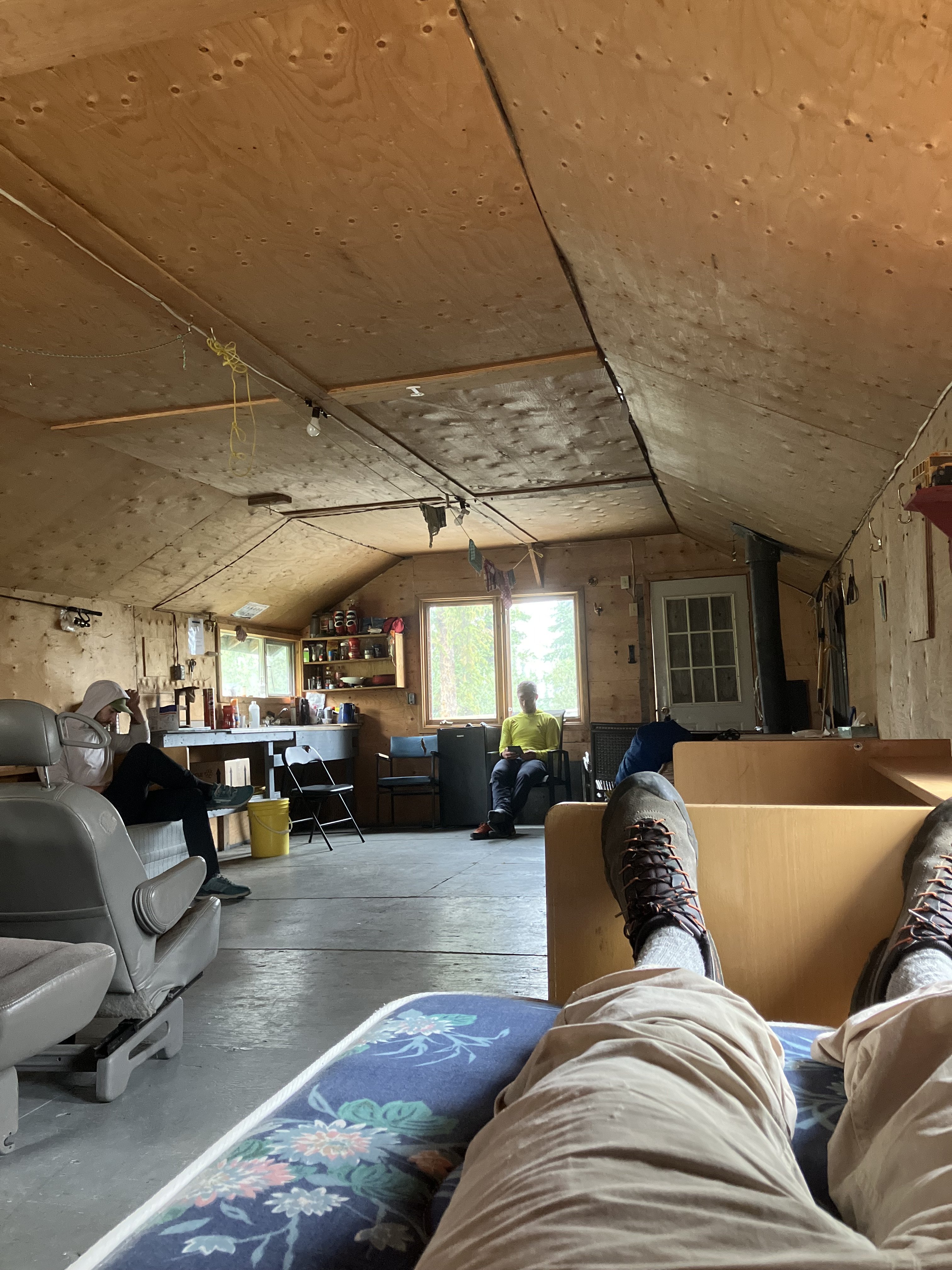
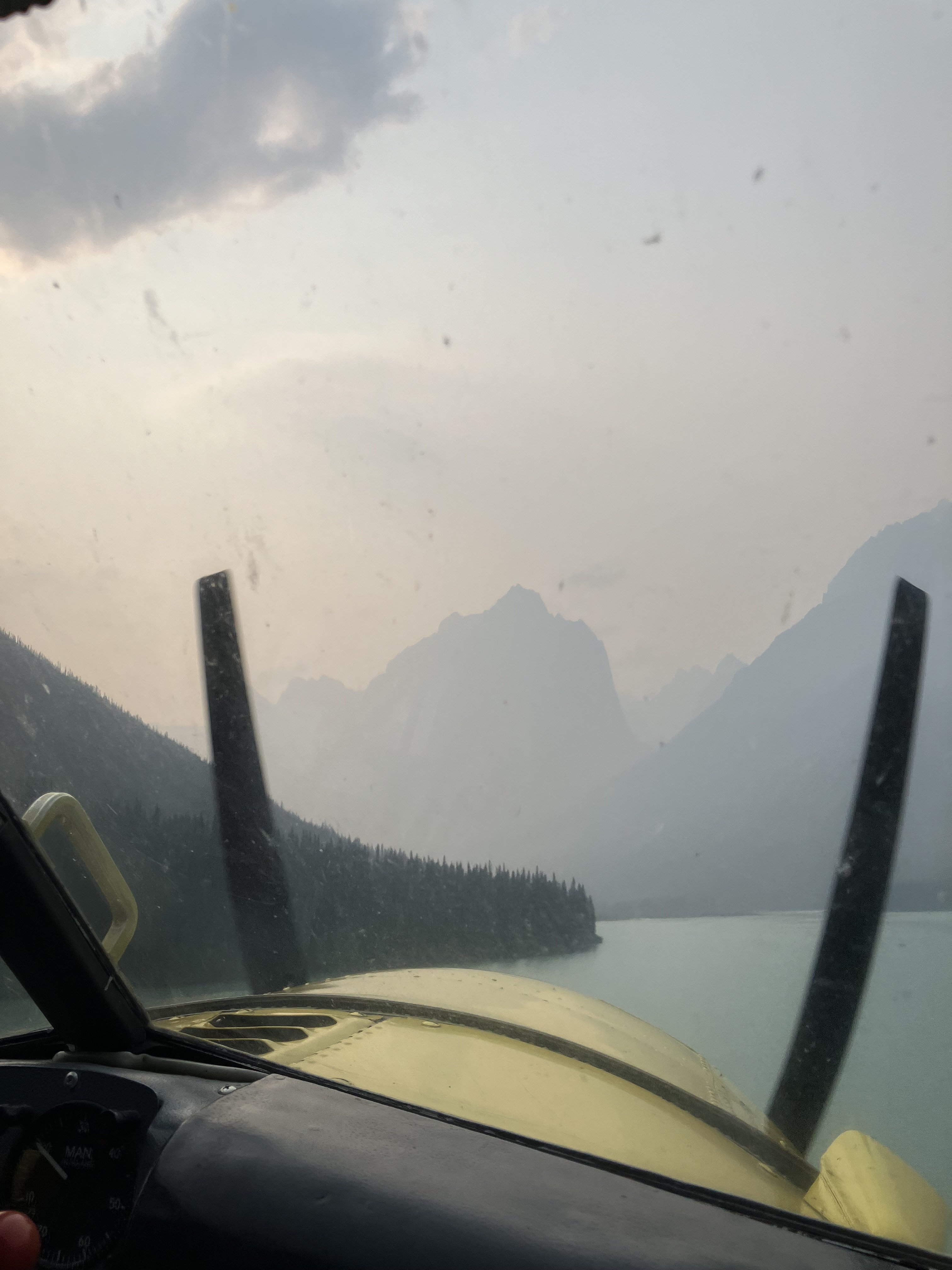
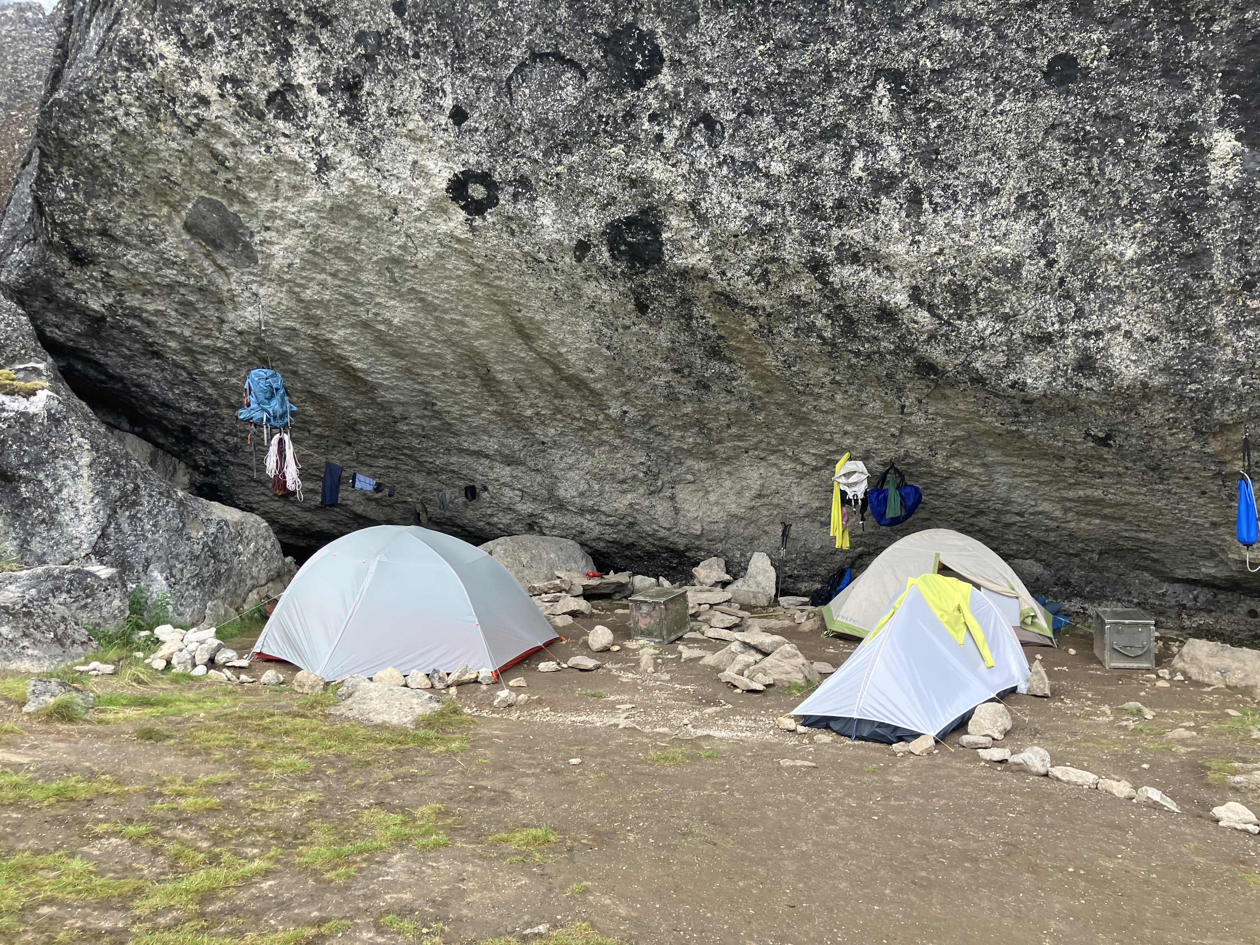
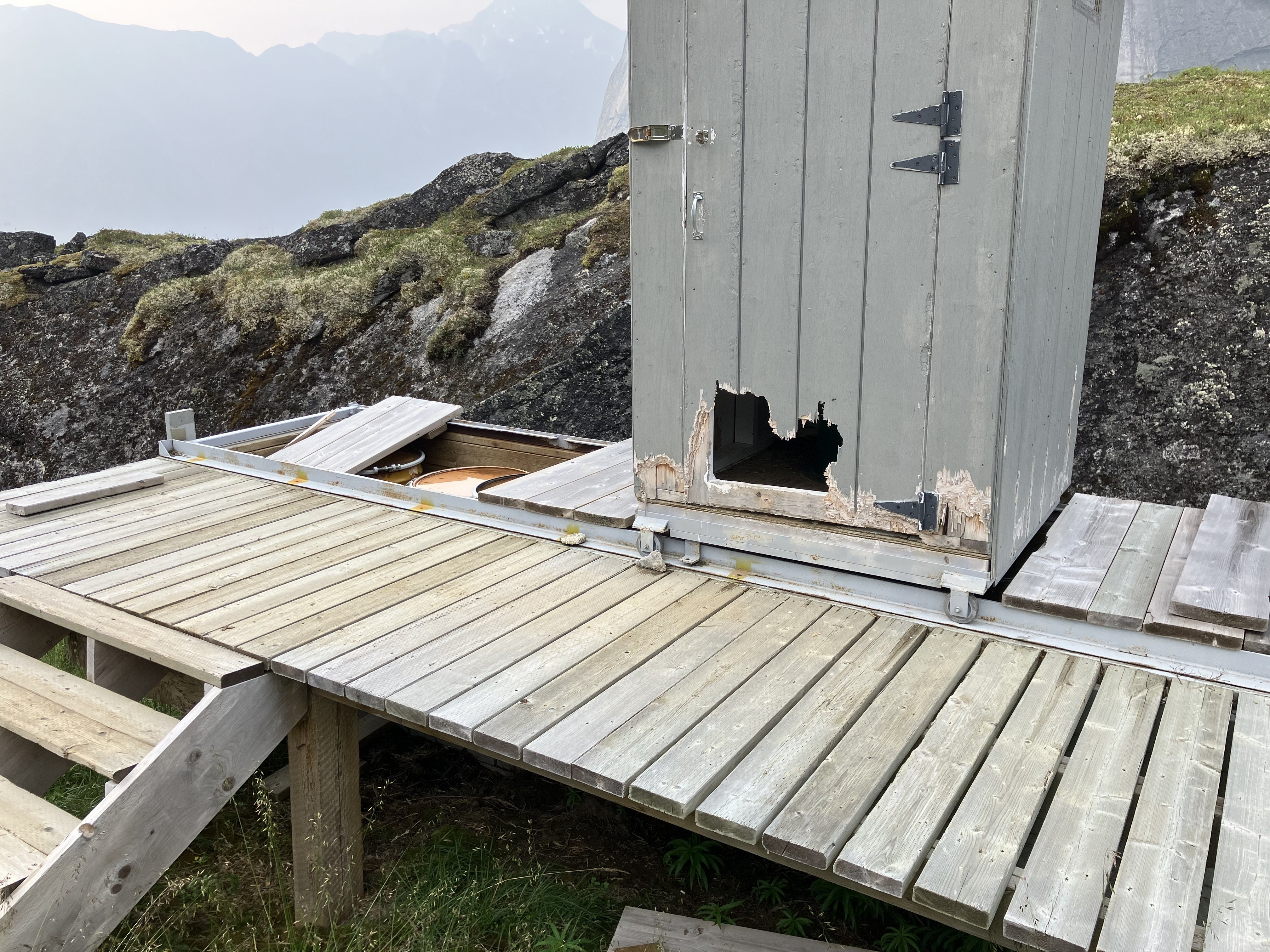
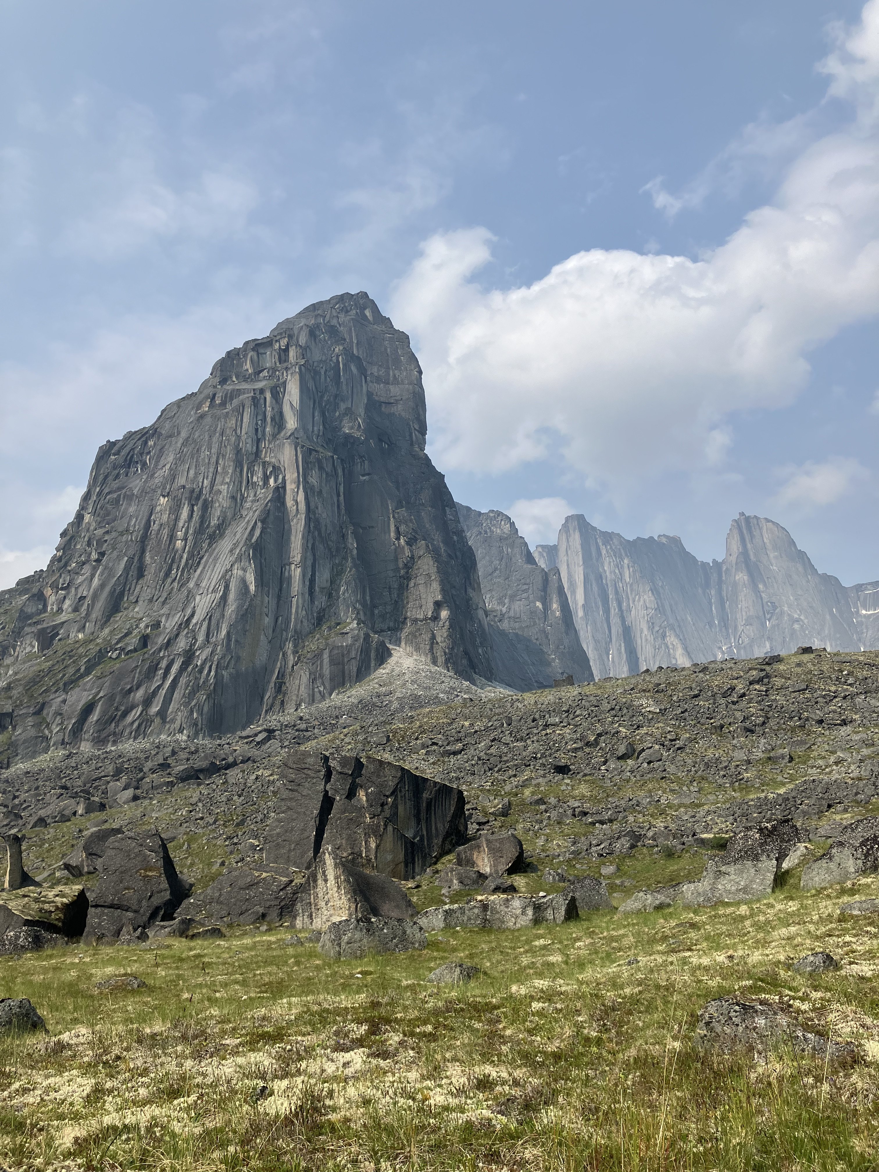
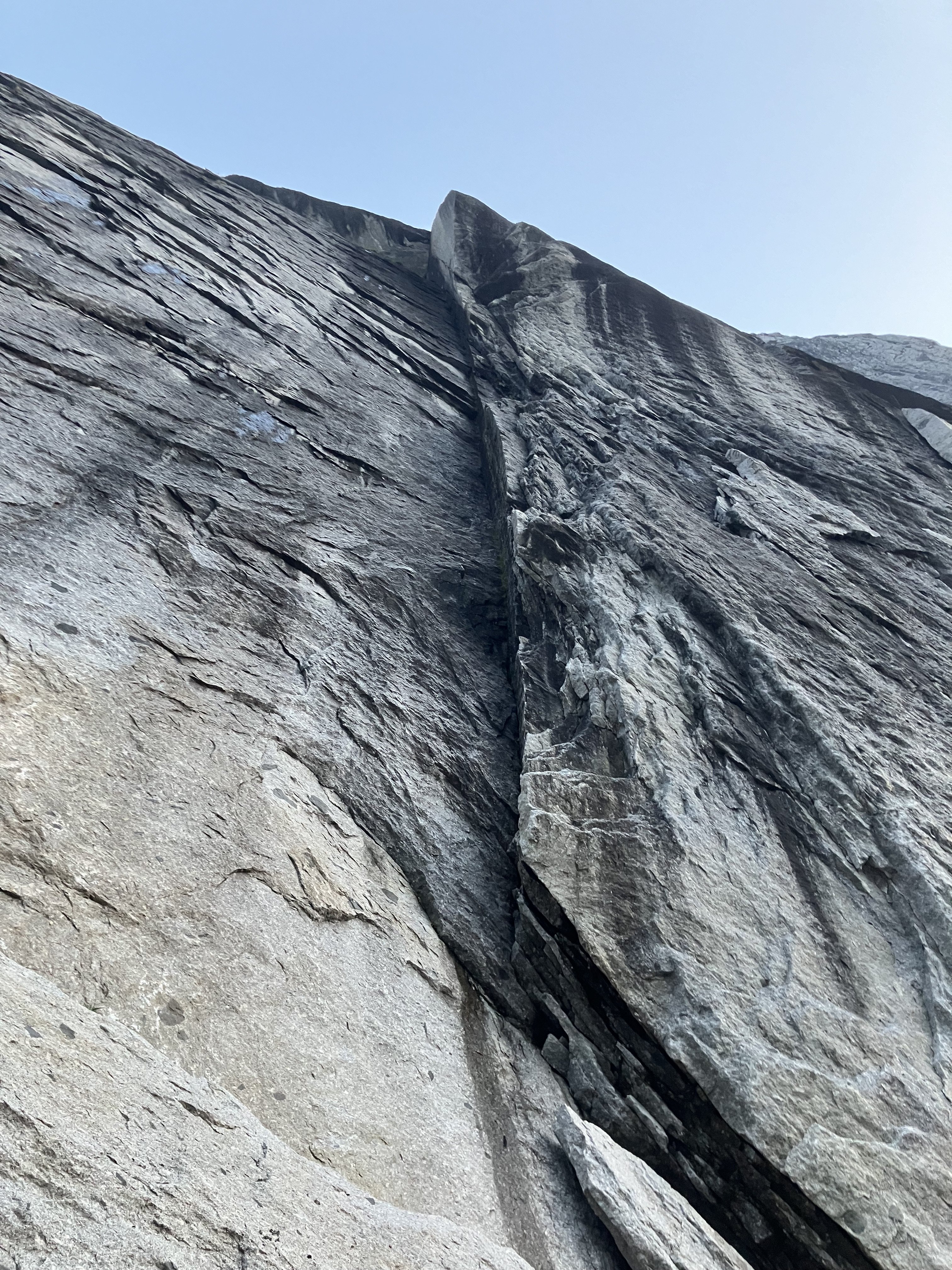
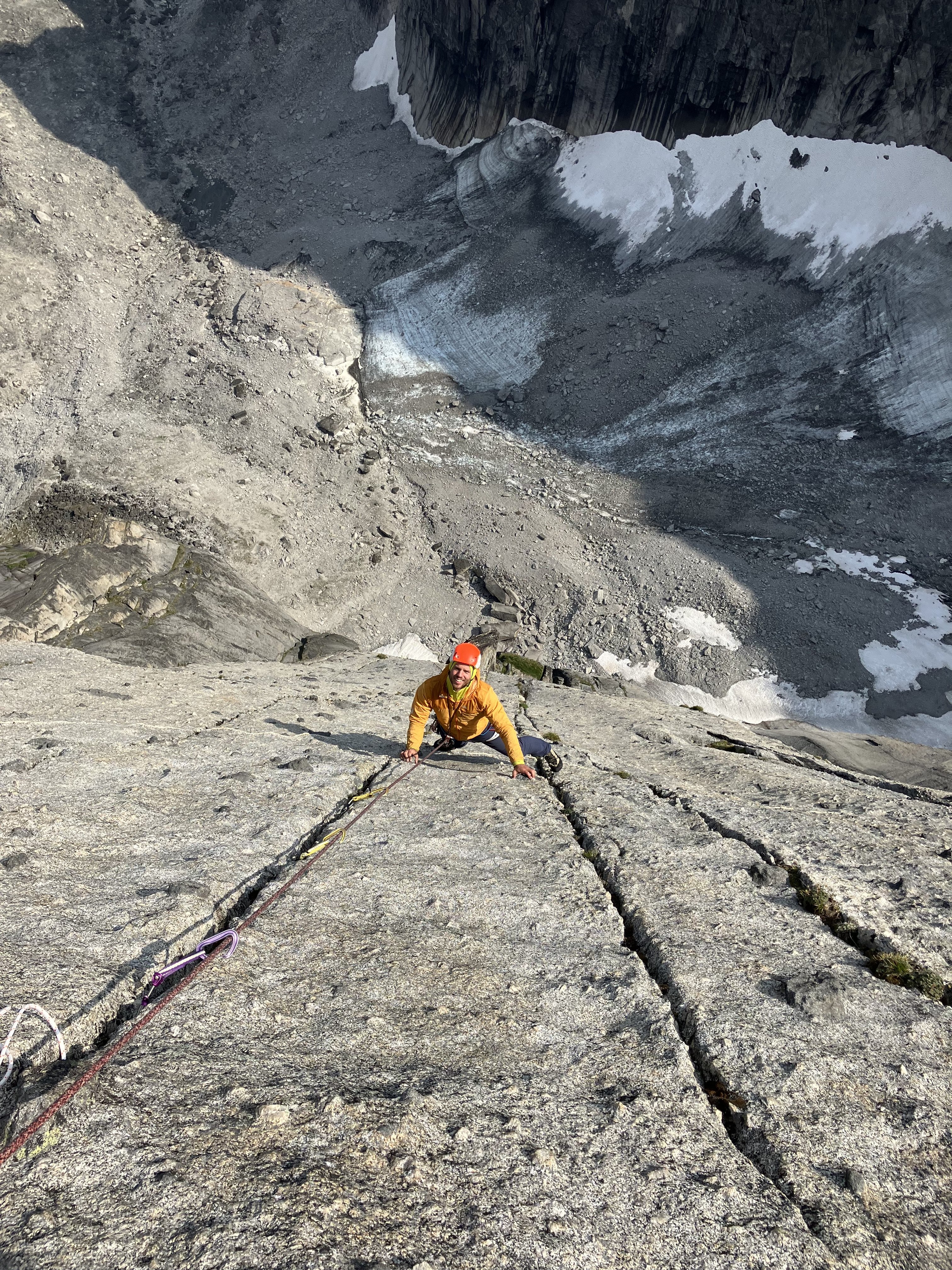
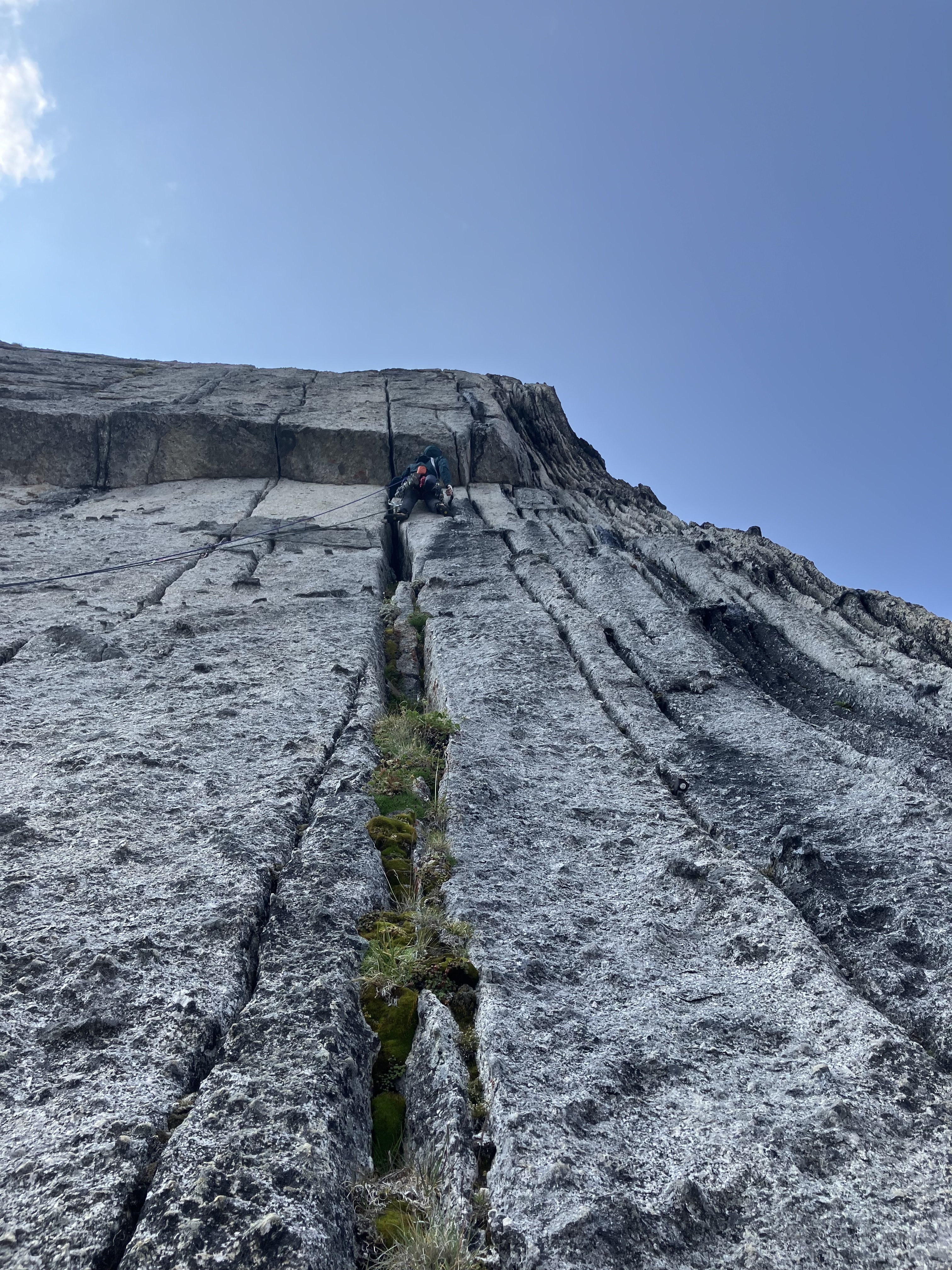
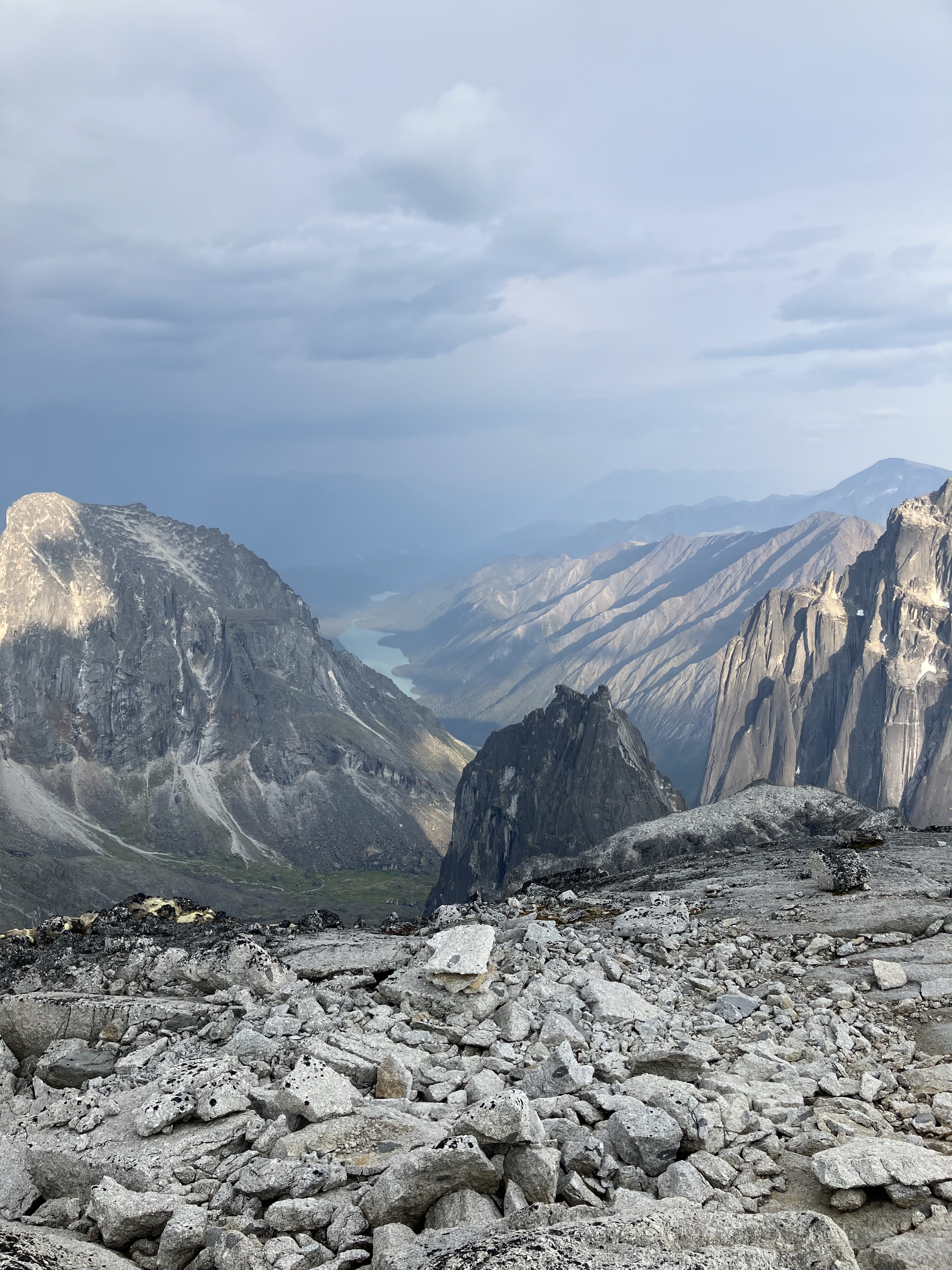
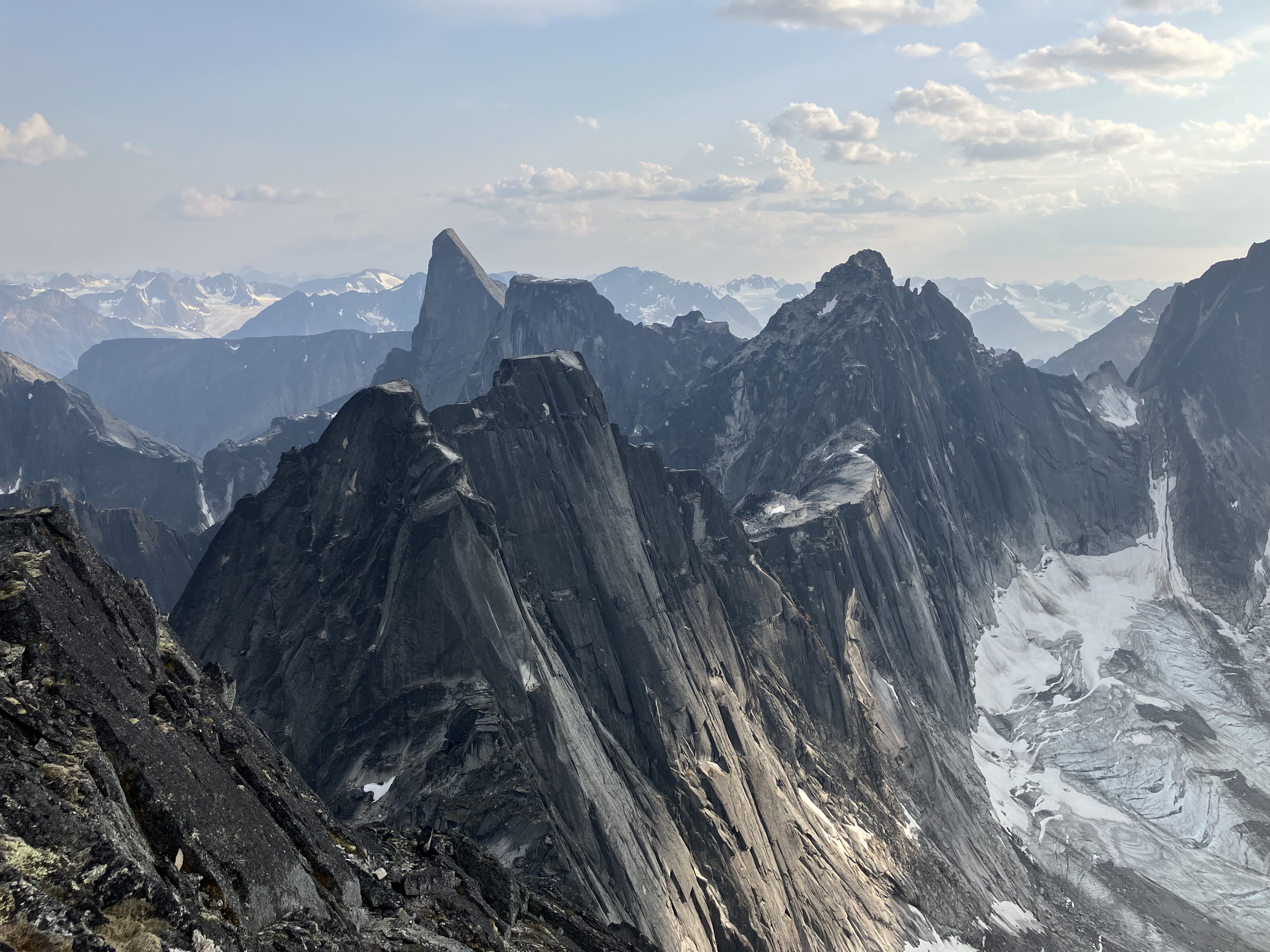
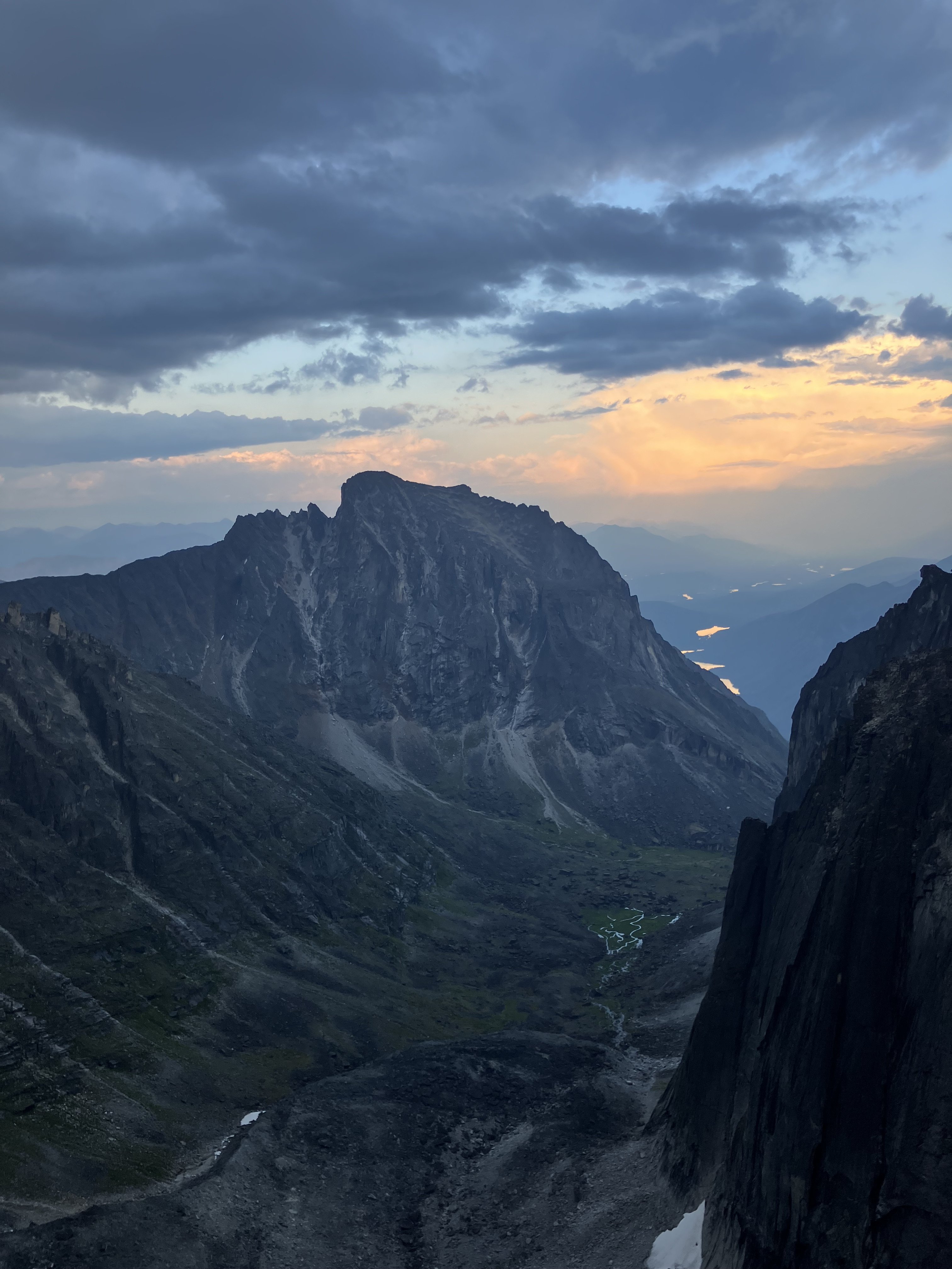
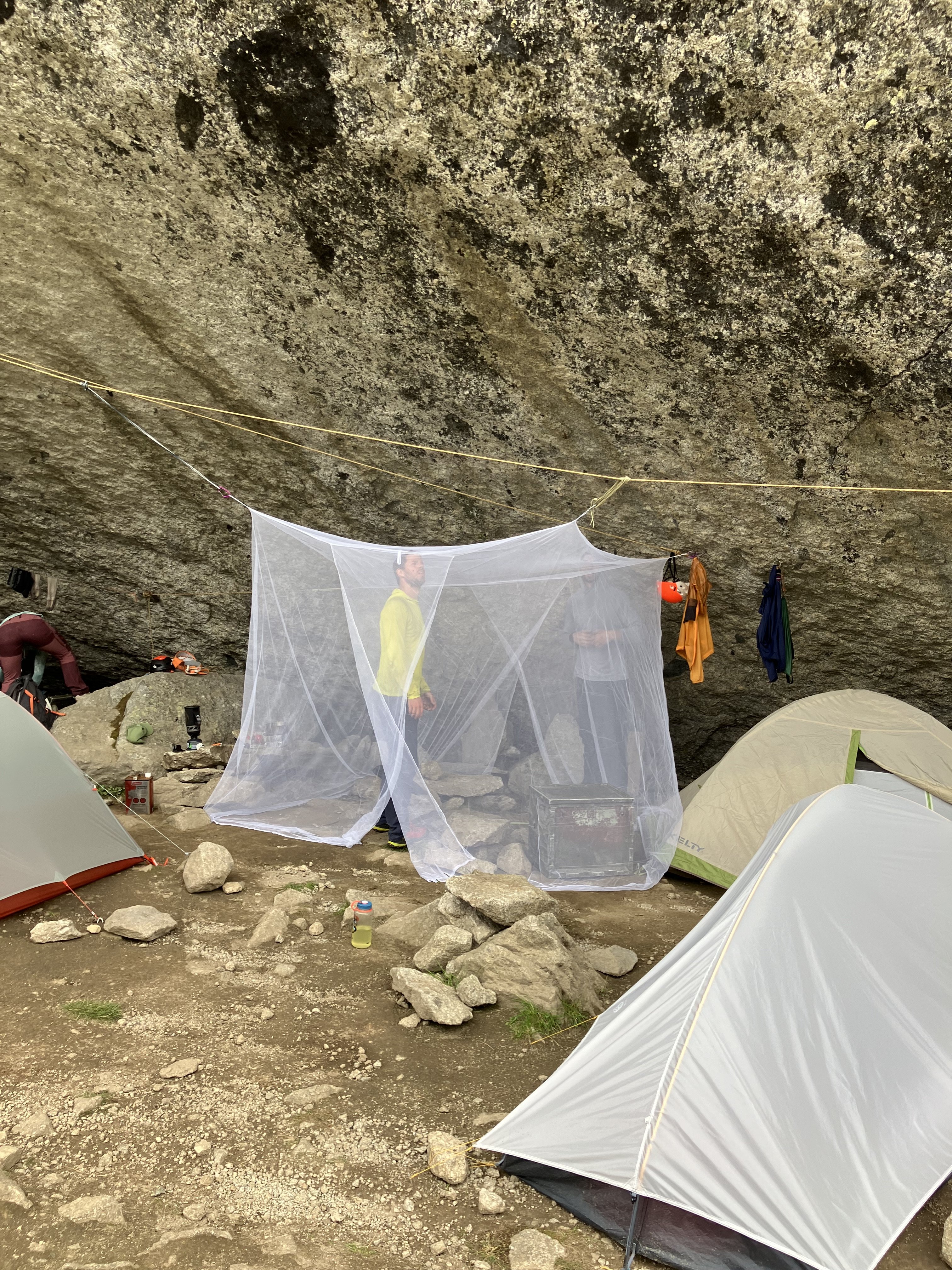
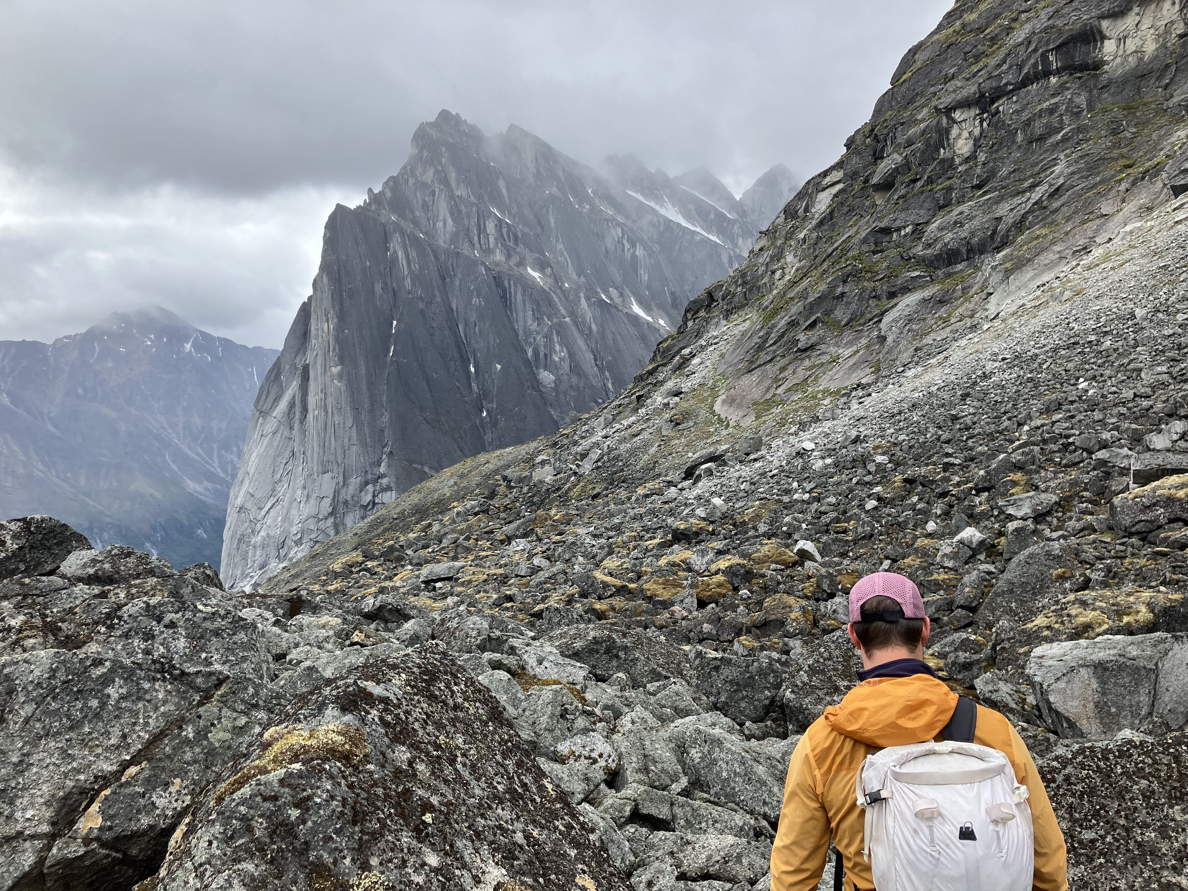
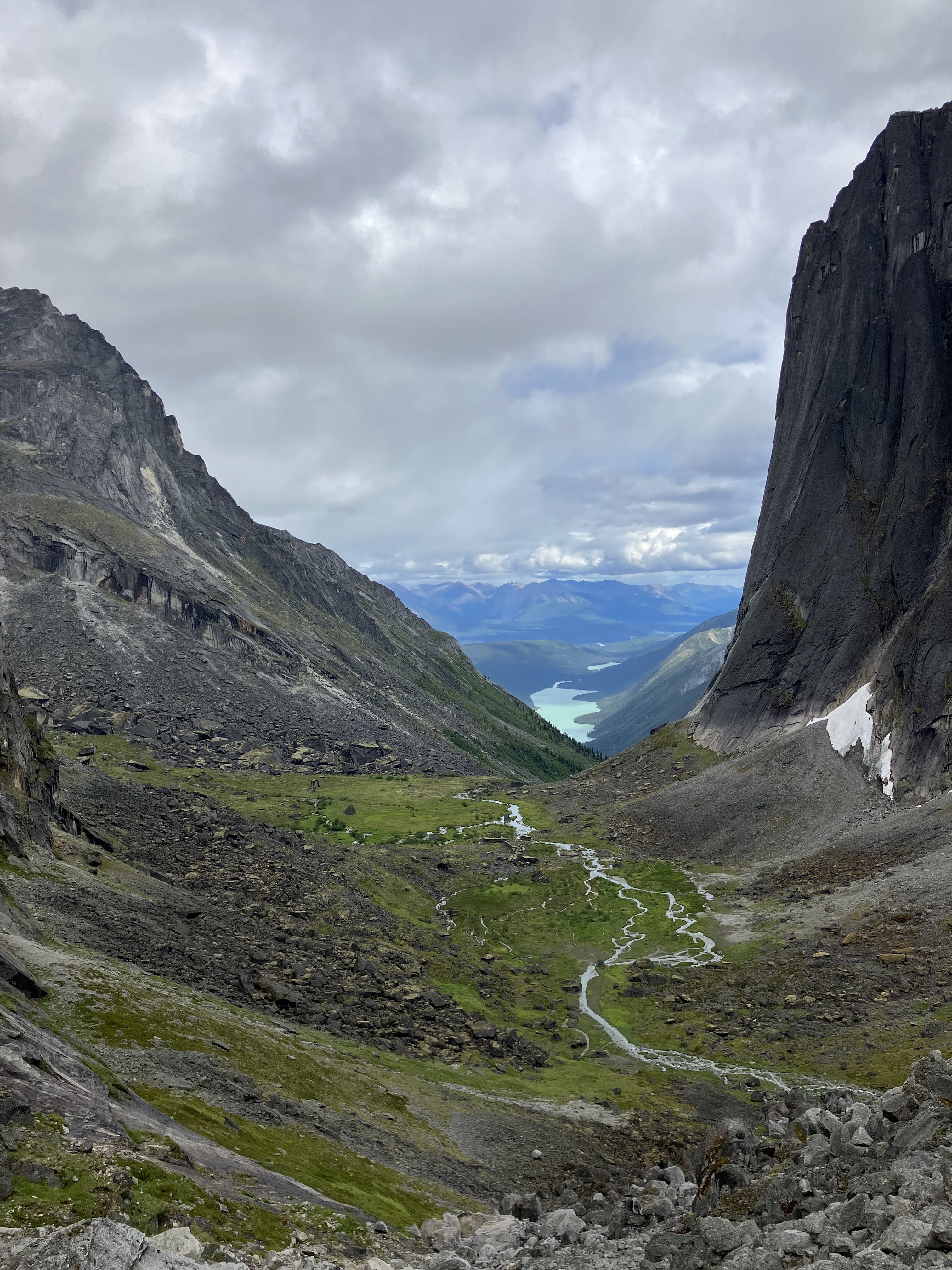
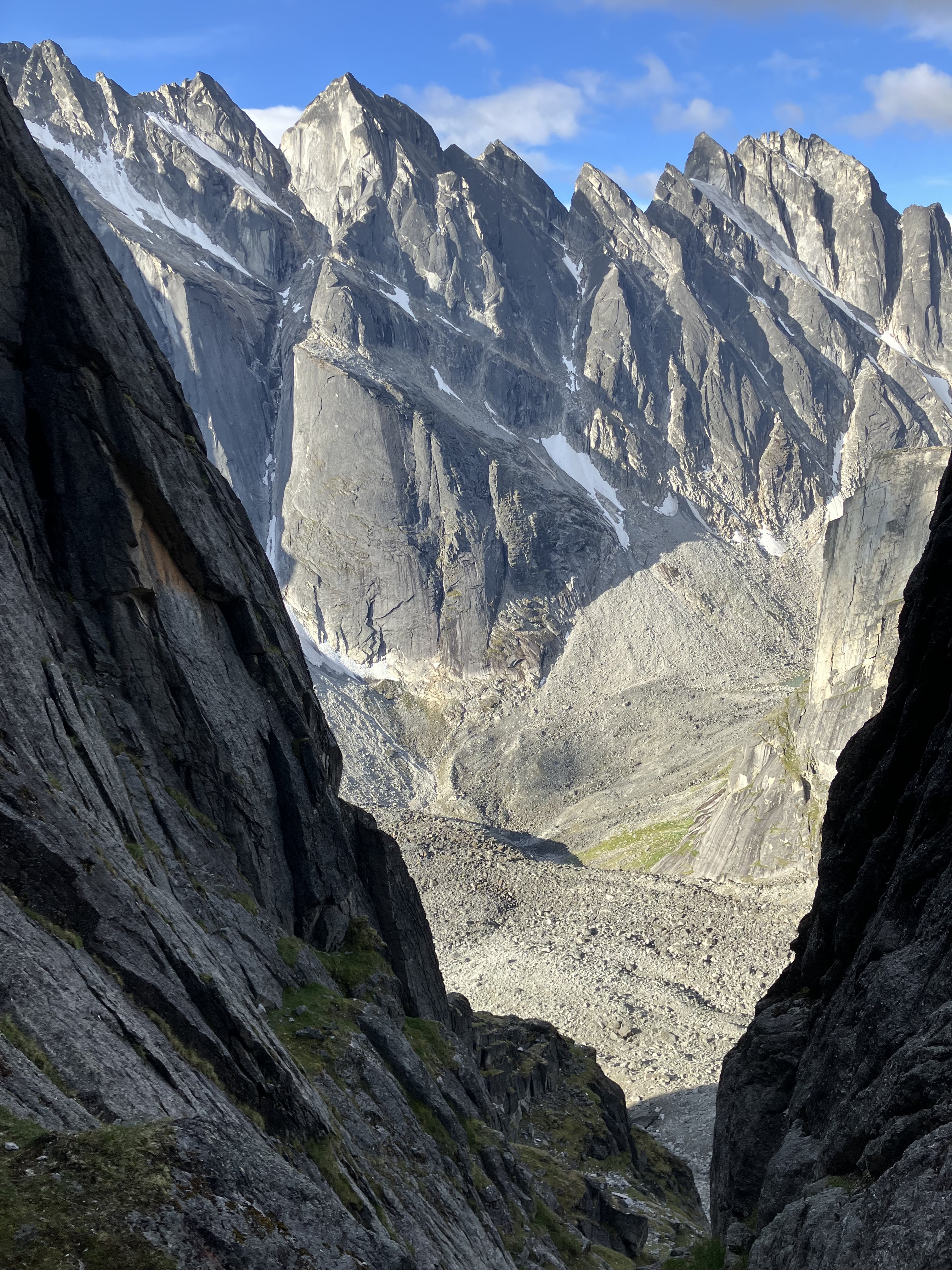
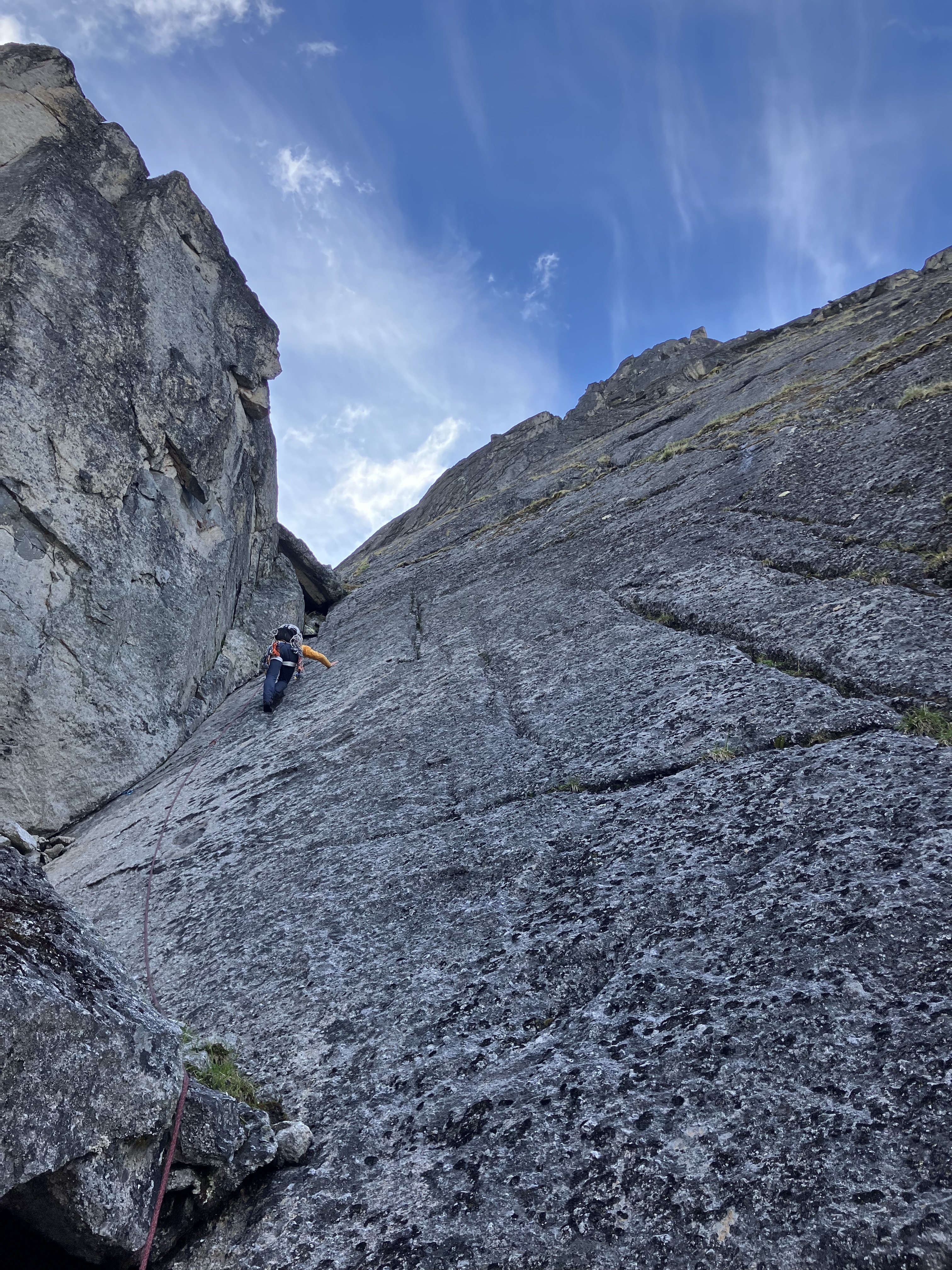
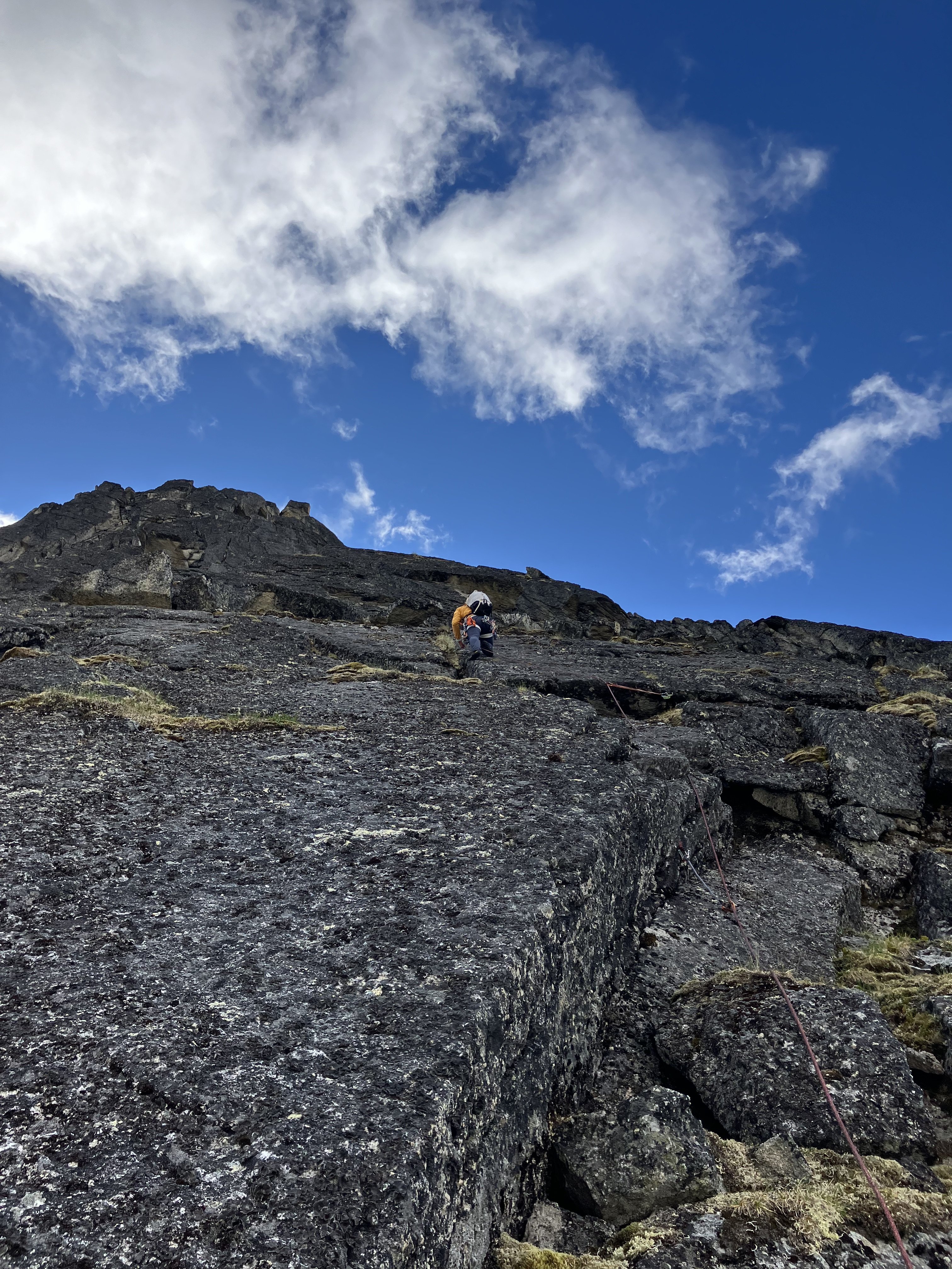
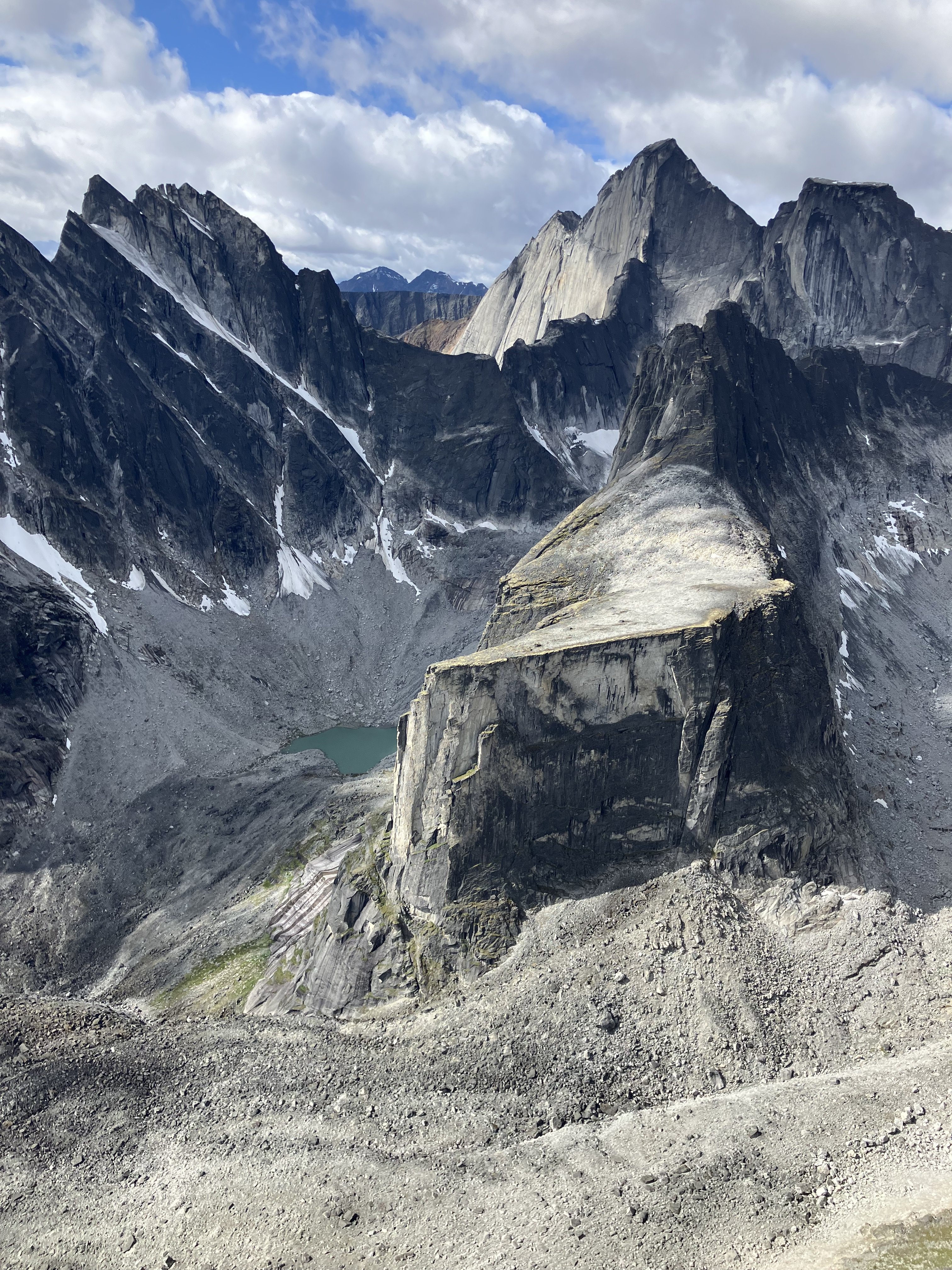
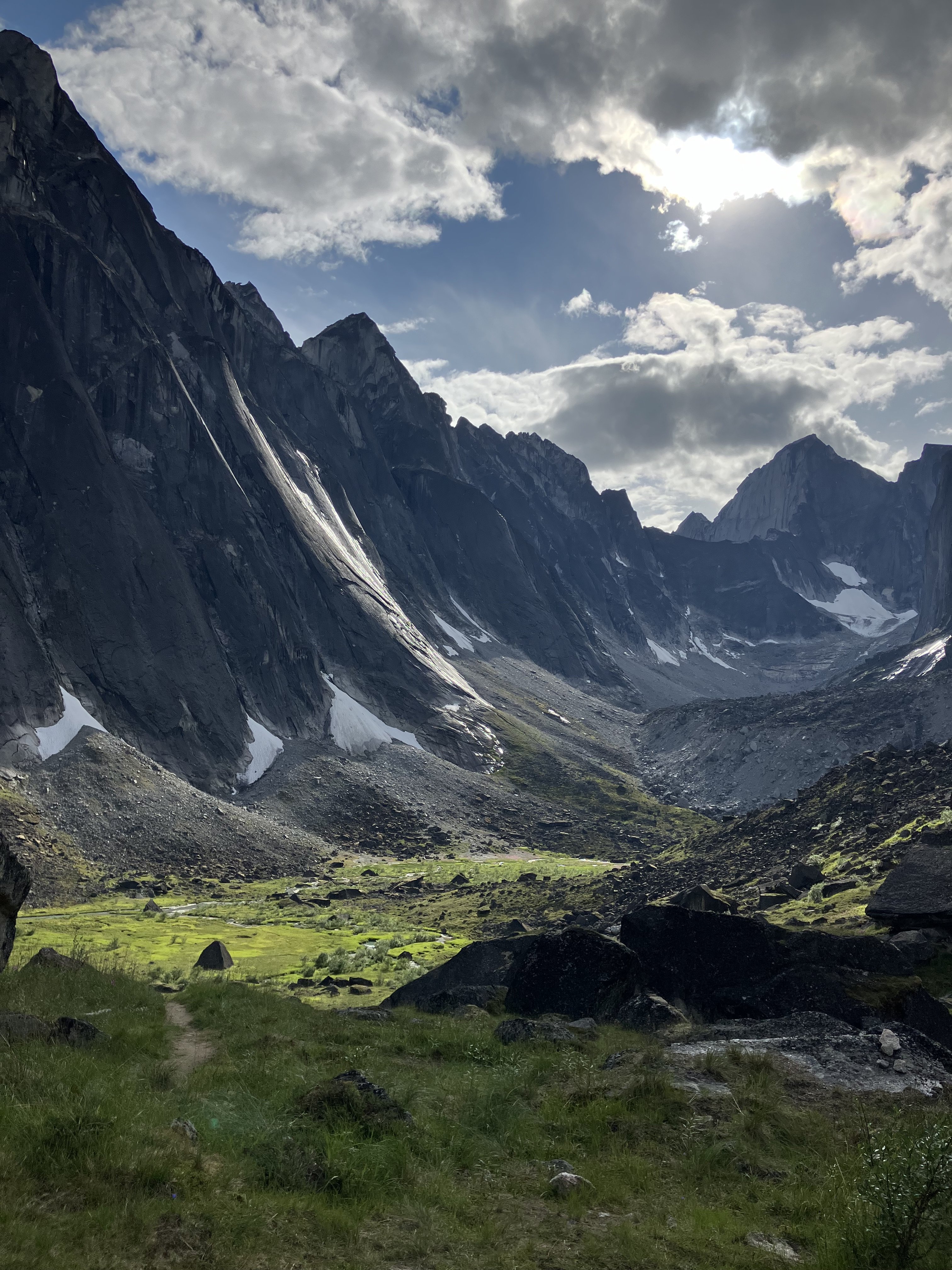
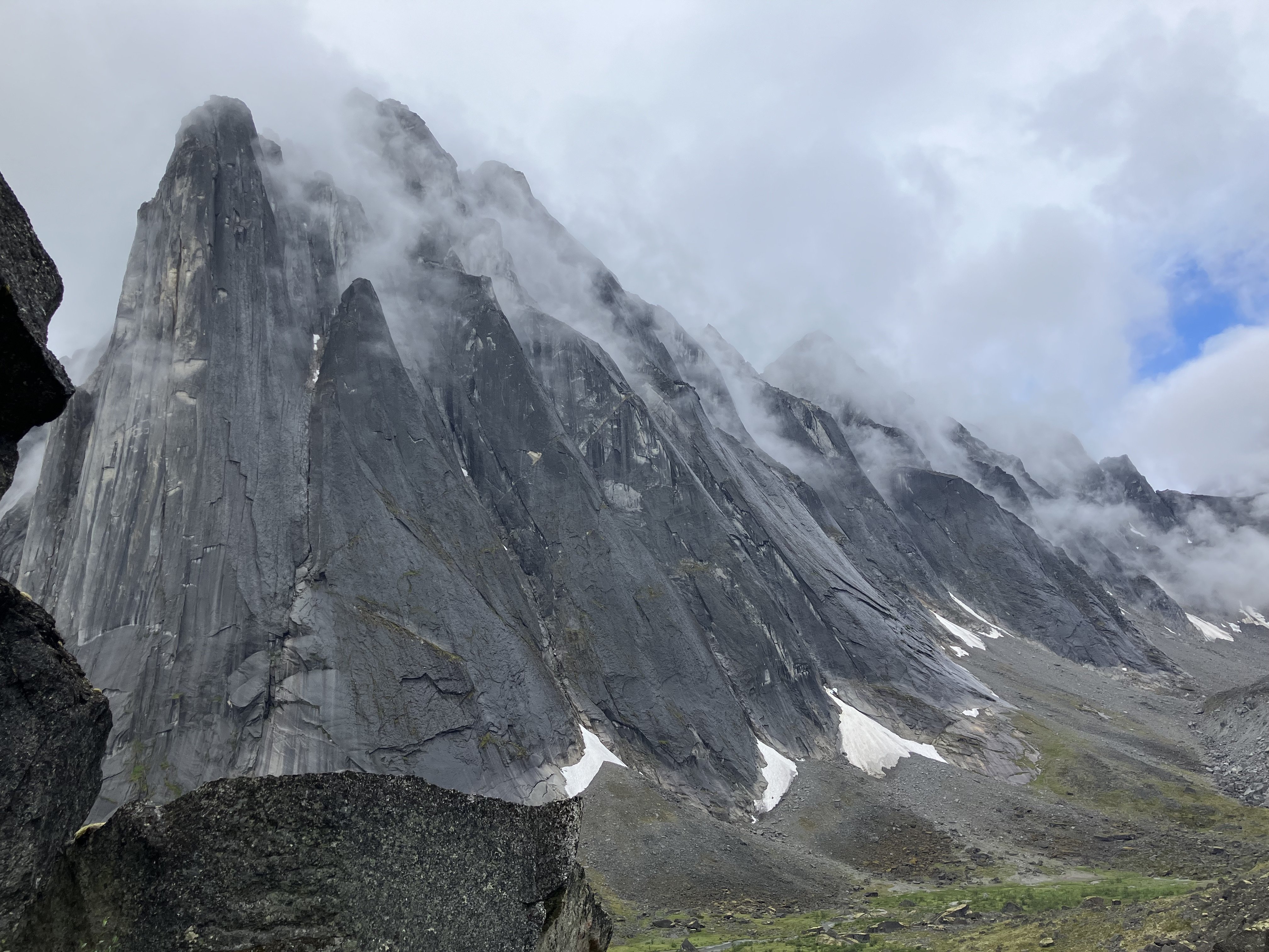
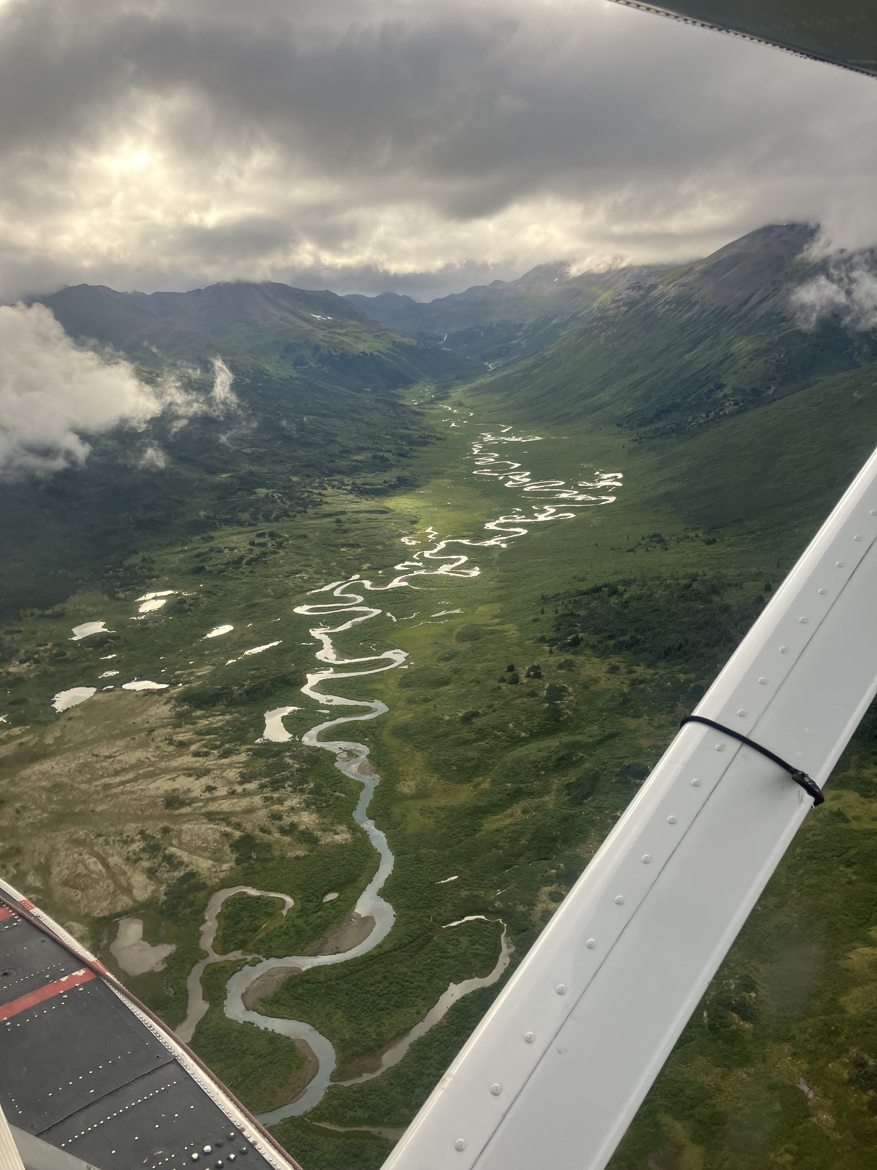
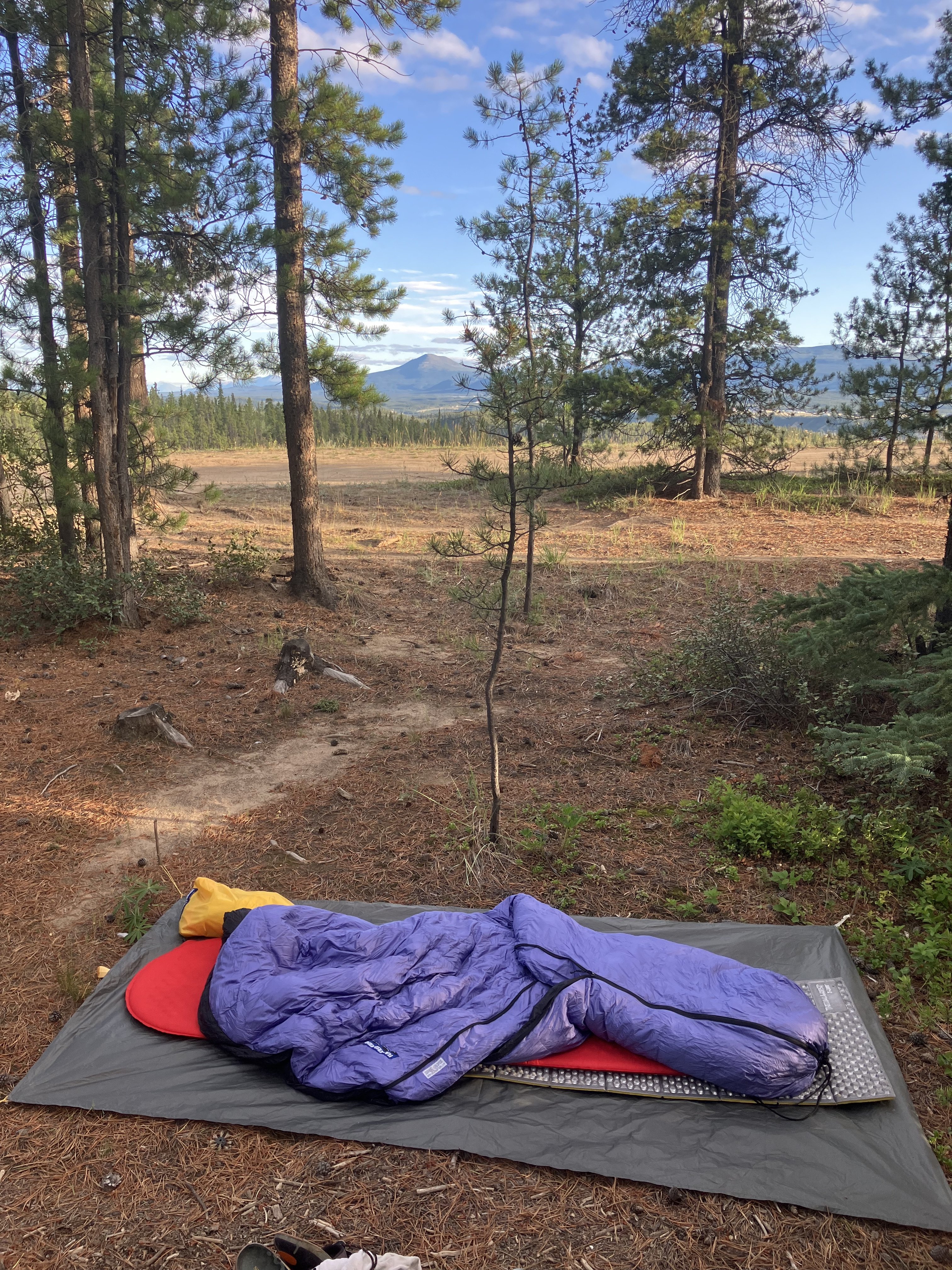
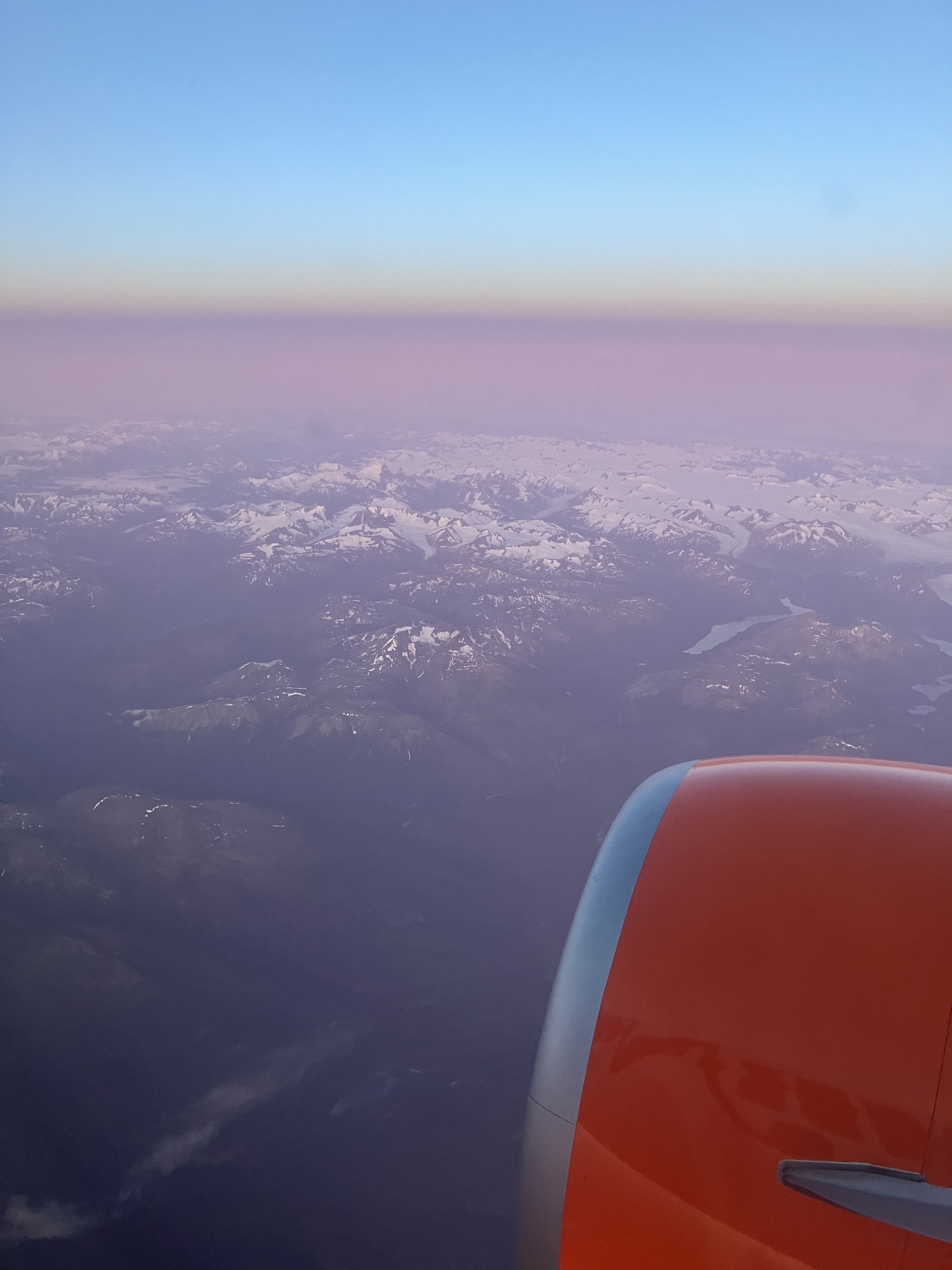
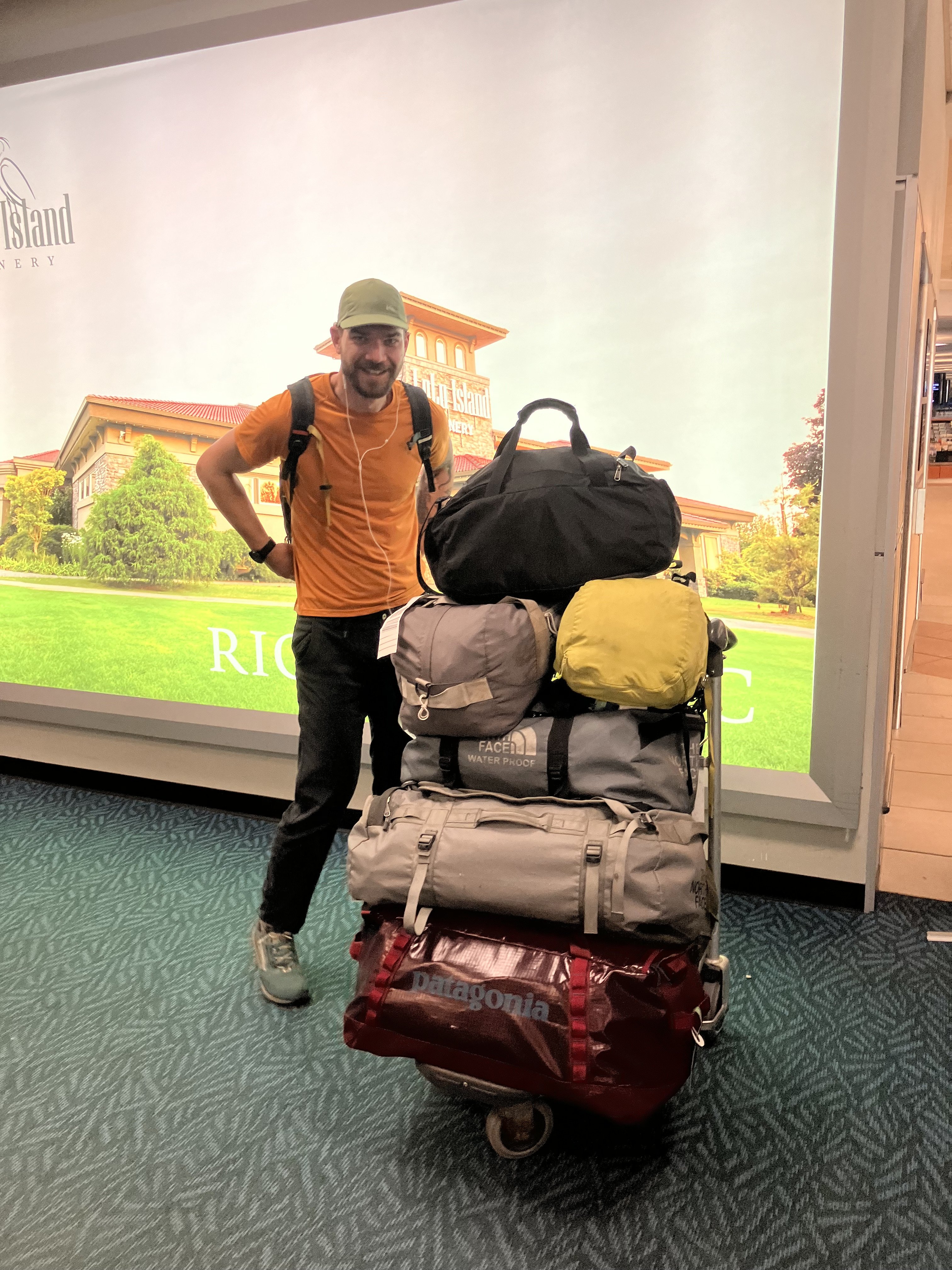
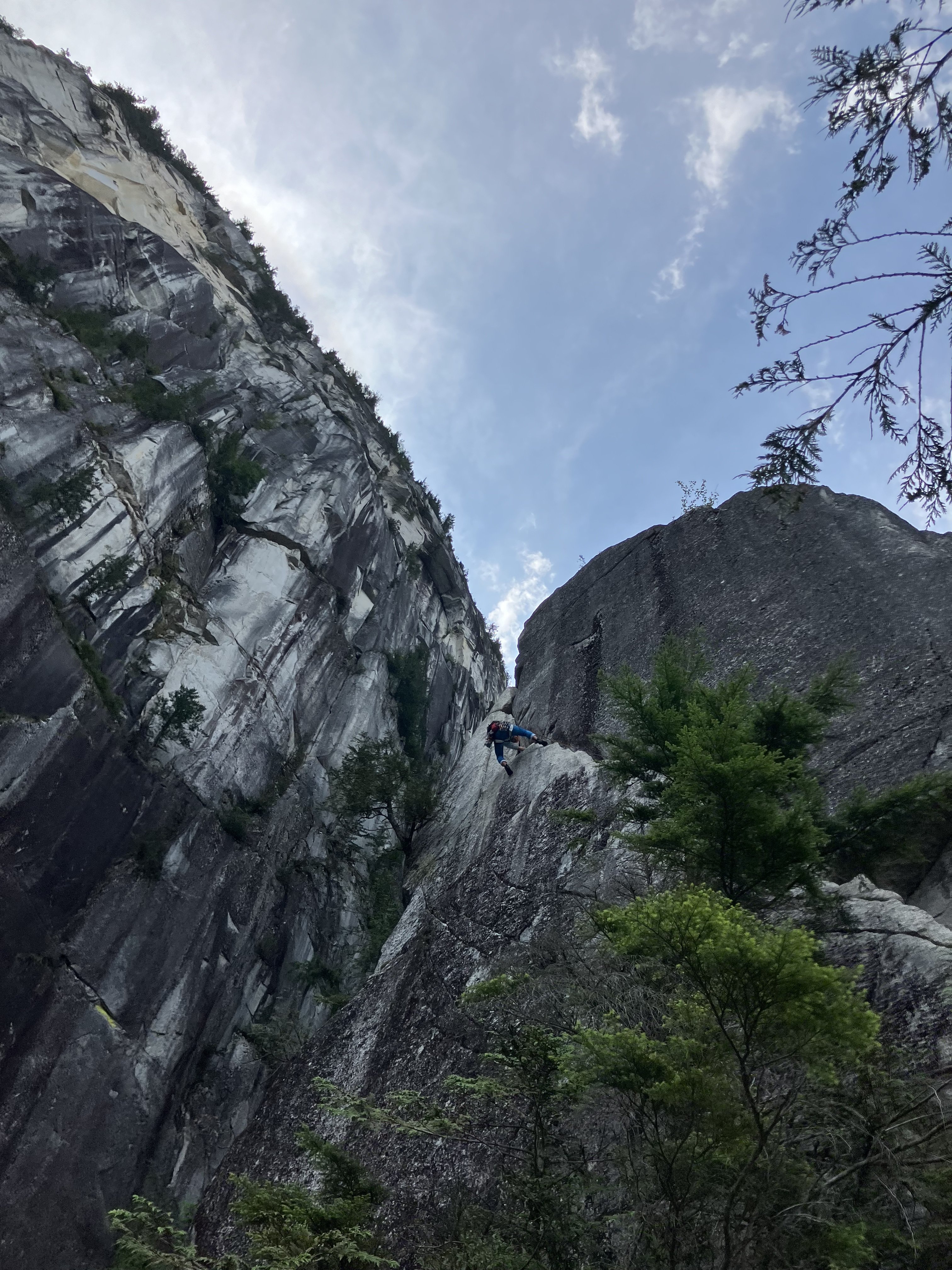
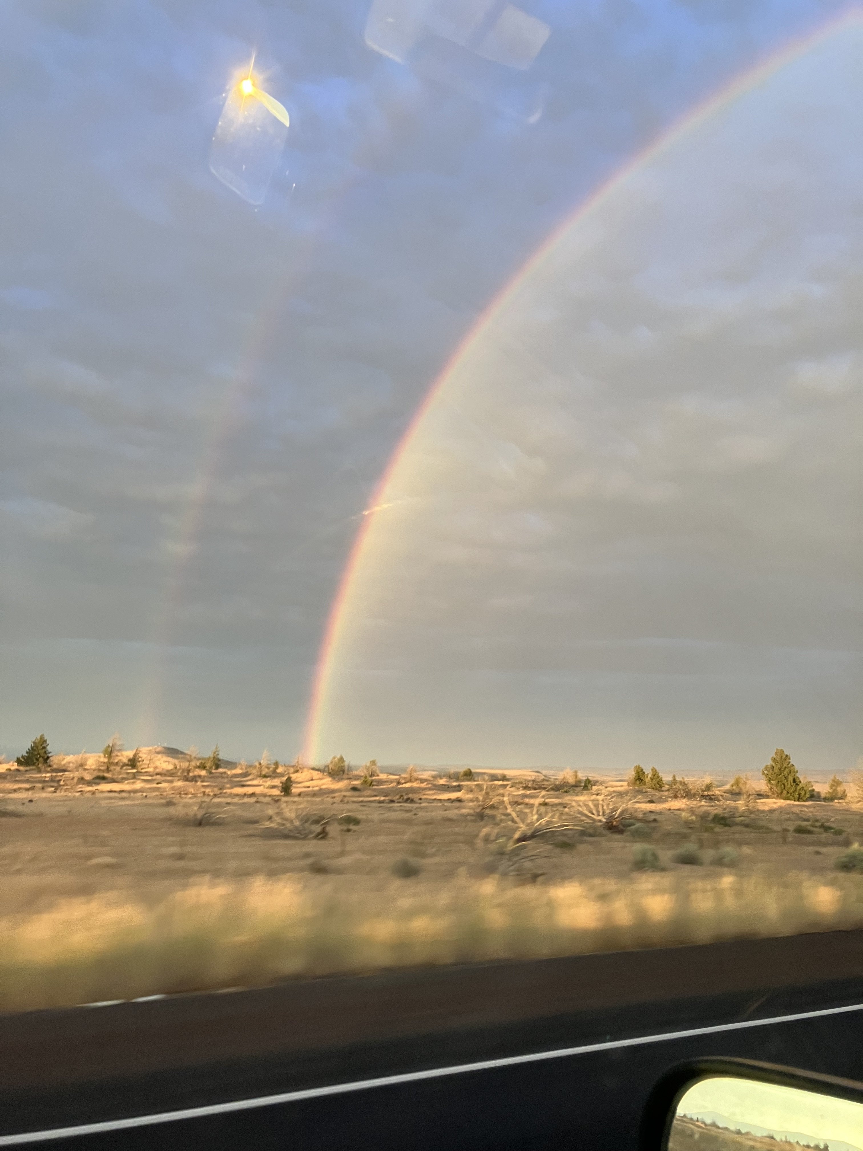
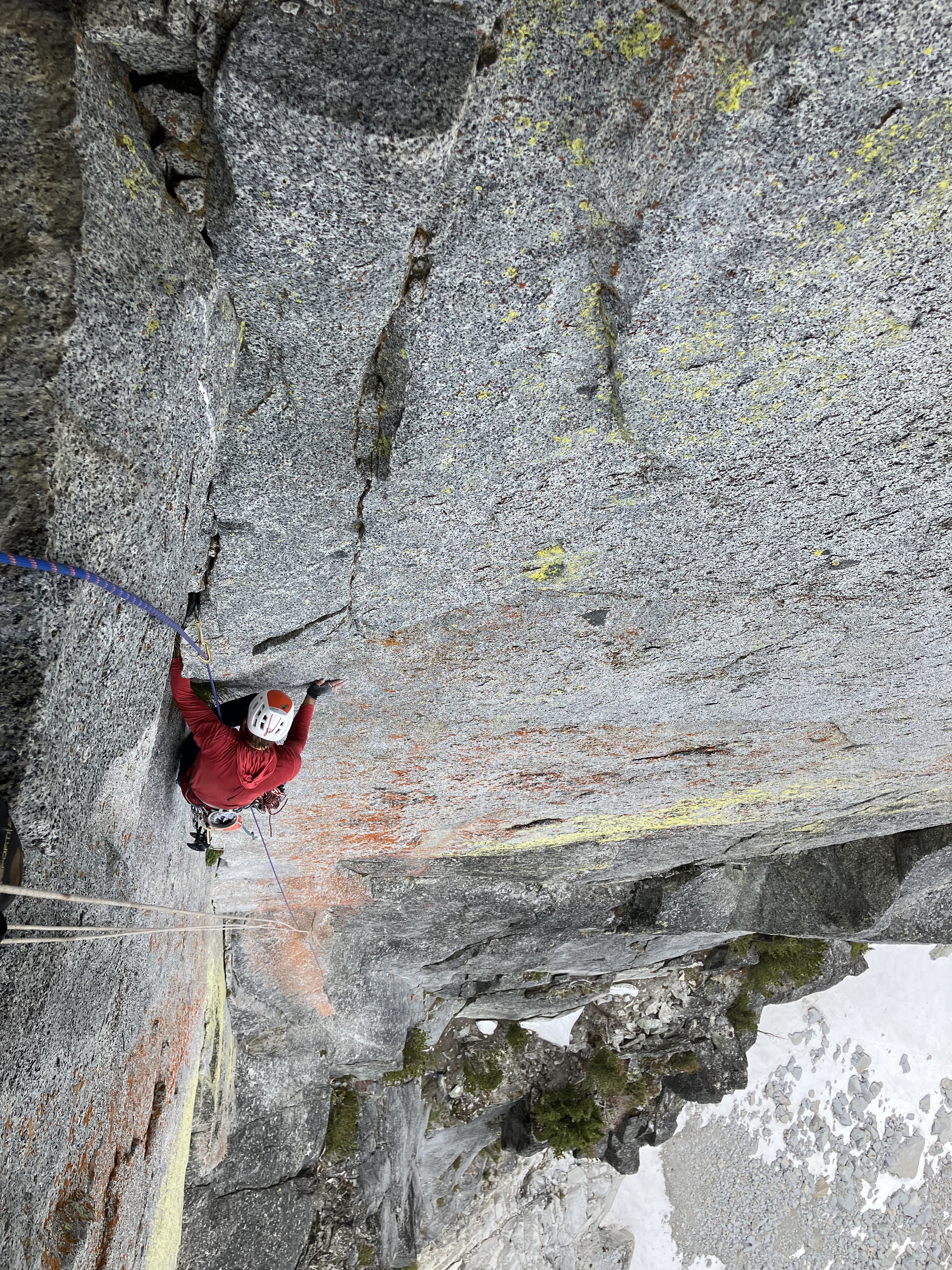
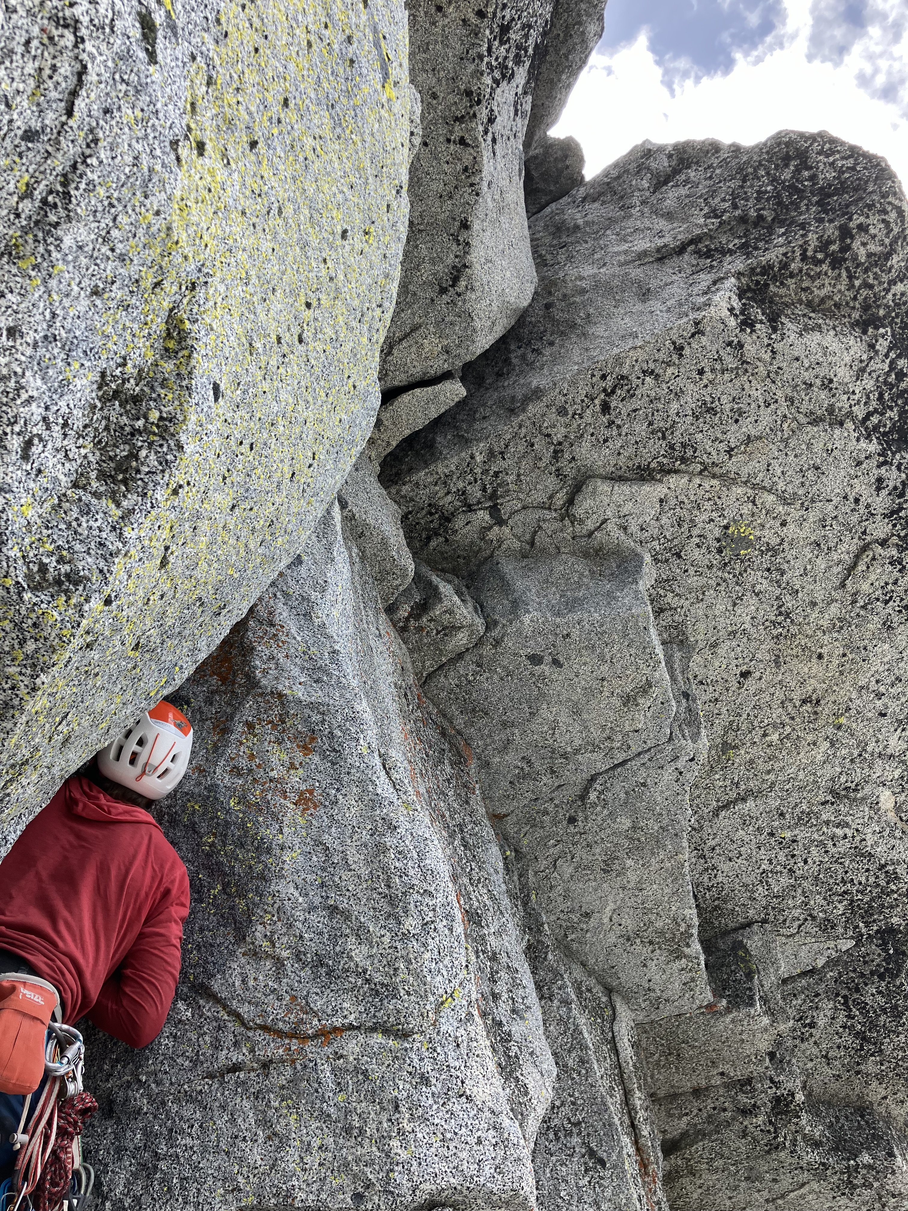
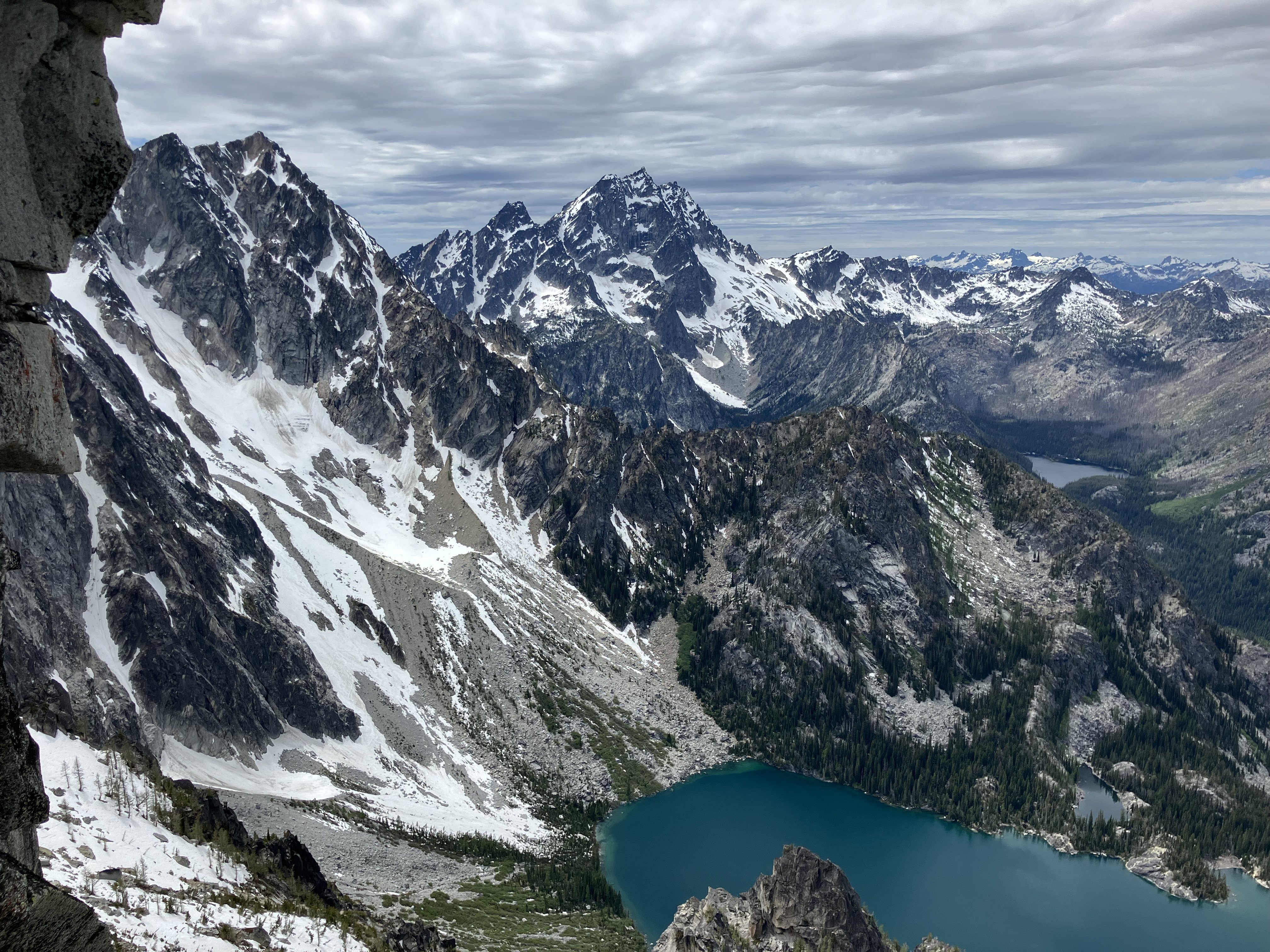
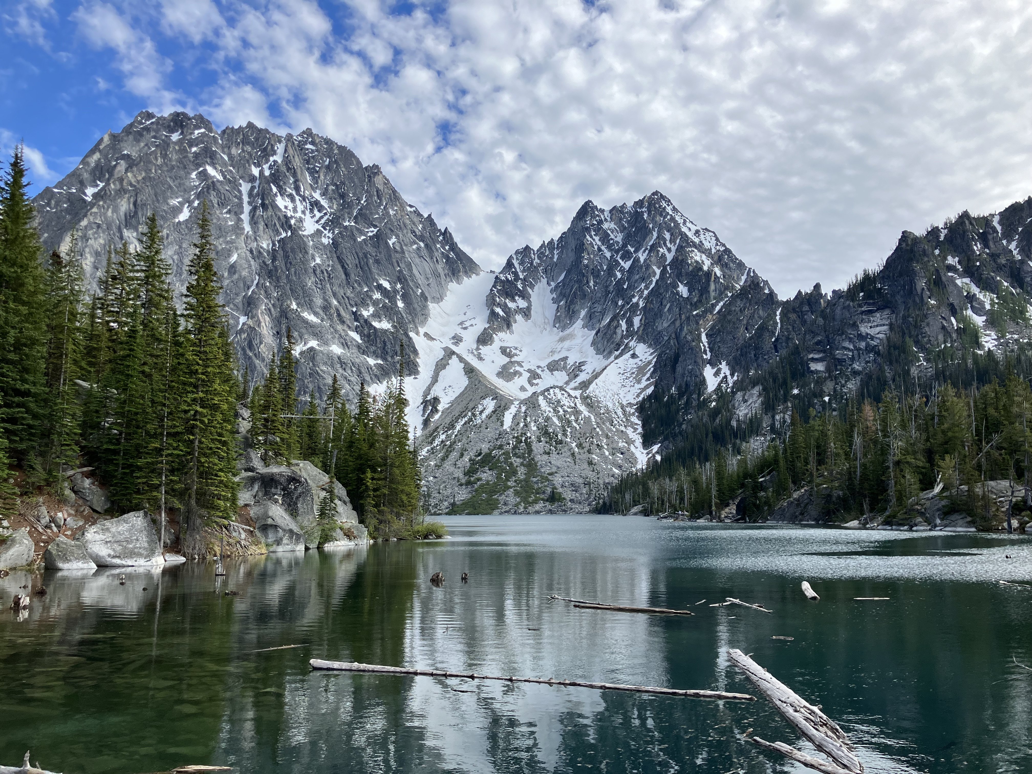
Trip: Cirque of the Unclimbables - SE Face of LFT and W Ridge of E Huey among others Trip Date: 07/25/2024 Trip Report: I was fortunate to be invited to join a team to the Cirque of the Unclimbables from 7/20 to 8/4 this summer. We were supported with generous funding from the Bob Wilson Grant through the Mazamas. The team also included my partner Kyle, and the duo Angie and Damon. Our chosen itinerary was to drive to Vancouver BC, fly to Whitehorse, rent a truck and drive 6 hrs (half on gravel) to Finlayson Lake, take a float plane to Glacier Lake, hike up to Fairy Meadows (4 miles, 2.8k', lots of downed trees currently) where you make camp. Almost all the routes are an hour or less walk from camp and involve hiking through meadows and talus, but no glacier travel. We reversed the process on the way out, but added a night at Inconnu Lodge which is included in the airfare if your timing/logistics allow (lodge is owned by the bush plane folks, Kluane Air). This whole process basically makes for 3 days travel on each end of the trip from the lower 48, expect more time if driving to Finlayson Lake from the states. The rental car definitely adds a fair bit to cost but allowed us to spend more time there as we were limited by work vacation, luckily we snagged a good deal on this. Flying Air North into Whitehorse was pretty great, awesome little airline with good service. At Finlayson Lake there is a basic dry cabin to hang out in while you wait for the float plane. We had to wait a day due to wildfire smoke which was causing low visibility in the mountains. Kluane Air, the bush plane company, is awesome but definitely account for weather as the old DeHaviland Beavers they run need visibility to fly in the mountains. These planes can take 4 passengers plus gear pretty comfortably. Once dropped at Glacier Lake there is a pit toilet, bear boxes, and a dry one-room cabin with no furnishings. We arrived in the evening and chose to hike up to camp that night. This hike looked minimal on paper but lots of over-under with downed trees, swarming mosquitoes, and 65lbs packs made this take 3:30... I think you could do it faster but it's not like anyone comes here to set FKTs on the approach and this felt pretty hefty. We left half our food and some extra gear at the cabin and did a resupply run 5 days later. Rental car... brand new F150 booked on sale (Labor Day?) The swimming dock at Finlayson Lake. The pickup compound at Finlayson is shared with a horse-pack supported big game hunting outfit. The Kluane Air cabin at Finlayson Lake. When you hear the plane it's time to go! Flying over the bush. Coming into land at Glacier Lake Smokey but not too bad, looking up at the approach from just after the lake. A bit overgrown. Entering the last uphill section above tree line. Hope it hasn't rained. Amazing fin feature visible from the approach. Final uphill bit to Fairy Meadows. The base camp area features two prime spots on opposite sides of the creek. Both are under massive boulders which shelter you from most weather. Each spot have 2-3 bear bins; military surplus metal boxes. There are also bolts in the rock and old rope/tat for hanging things. There is plentiful clear water, a pit toilet that is (barely) maintained by the park service, and quite a few sport, trad and boulder routes on the massive boulders. Bear bin at Fairy Meadows... some idiot left a bunch of open food and a book in this thing through the winter. Everything was moldy and slimy. We cleaned this out and packed out the trash. It still smelled so bad after being aired out for days that we didn't want to use it. Our camp under this massive 30ft boulder which reflected the sound of the creek. Note the items hanging from bolts. The not-very-well-maintained pit toilet that the National Park installed... looks like a marmot or three tried to live there through the winter. Beautiful creek in Fairy Meadows. After we arrived at Fairy Meadows, setup camp and had dinner it was quite late (near midnight?) but Damon and Angie decided they were going to try Lotus the next day anyway. They got up at 3am and went right to it. Kyle meanwhile started feeling sick (we sat next to an elderly lady who coughed a lot on the plane) and so we rested the next day and watched them through binoculars. Based on their progress we assumed they would rap off from the bivy ledge, where the rap route diverges from the climbing about half way up. However, after dinner we wandered up the meadow looking for them and spotted them on the headwall pitches 3/4 of the way up. The desire to not have to redo the lower pitches a second time had spurred them on. Given the latitude it's also only dark from midnight to 4am at that time of year. In the end they rapped through the night and were back in camp at 6am the next day. An impressive effort, but oof! Scoping Lotus while Damon and Angie send. Critical supplies courtesy of the Sav-on-foods in Whitehorse which has a bomb bulk section. UK Smarties in the bag. After another day of rest Kyle and I decided to go for Lotus ourselves. He still wasn't feeling 100% but we knew good weather wouldn't last forever here. We hoped to be a little faster than our teammates and woke at 4am. We were joined by Michael and Patrick, two of the four guys from a Montana team who were the only other party for most of our time. They graciously let us start first. We had heard the lower pitches were very wet but they had dried a bit and minimal french free got us into the chimneys. We had hoped to simul the chimneys which go at 5.7 but it was fairly steep and sustained enough to make us simply pitch out rope stretchers. Michael and Patrick did simul and passed us here but seemed pretty tired doing so and we all ended up about the same speed on the headwall. Start of the route. Wet and scary detached flakes to start. Kyle getting it done in the chimneys. We made good time to the bivy ledge and started on the headwall. The sun was strong and I was sweating in just a sun hoody. We had climbed to the bivy with two packs and now left some gear stashed here in one pack and continued up using fix and follow and hauling the other pack. The nubbin pitches were surprising spicy. Never dangerous but mandatory climbing above small nuts and cams on small face holds. The first roof is very easy on the L side and the second (crux) roof is a hand crack on the R side. This assumes you read the nubbin climbing correctly and can get yourself in line for each of these. The pitch above the crux roof is an amazing double crack, unfortunately our feet hurt too much to really enjoy it. Kyle on the Headwall Michael on the crux roof. Kyle on the amazing pitch above the roof, trying not to foot jam. It should be noted on this route that grades indicate sustained old school Yosemite style climbing with almost every pitch being 50m. It definitely feels more like a Yosemite route than an alpine route and took longer than we anticipated. Kyle and I topped out as thunder began to rumble from dark clouds to the E. We started to rappel immediately and were one rappel from the bivy ledge when it started to pour. Luckily it slacked off soon and we reached the ground after midnight, making it back to camp around 2am. After a rest day we used the last good weather day to do a resupply. Glacier Lake from the summit of Lotus as storm clouds approach. Proboscis and other cool mountains from the summit. Rappeling Lotus The rain is upon us. Setting up the bug net we got on the resupply. This was a game changer as mosquitoes were quite bad in the meadow. Scoping options with Kyle on a mediocre weather day. Scenic shots from Fairy Meadows waiting for more weather windows. After that we got one more full good weather day. Angie and Damon did Brent's Hammer (6 pitch 5.11+ steep cracks) on Terrace. Damon managed to onsight and declared it 11- (though he also said the style suited him). Kyle and I decided to do the W Ridge of E Huey (1200' gain, 5.9, much moss and lichen covered slab), which was fun in a way that an obscure route in the Pickets might be fun, but which I would not recommend to those looking for a quality rock climb. Kyle heading up one of the first "real" pitches on Huey at the top of a long gully system. Great views near the top of the gully on Huey. The best pitch on W Ridge of Huey? But only low 5th. Kyle on 5.6 moss slab... the real crux of the route. View of Lotus and Parrot Beak from Huey. Terrace in the foreground where DnA are climbing, with Proboscis in the back. Typical rap anchor on Huey. We also slung some blocks in the gully to avoid water polished slab down climbing. We also had some partial days playing on the crags around basecamp. We all tried the Toilet Crack (11+ hand crack roof), D+A also tried the first few pitches of Riders on the Storm (just above camp, only 10+ to P3) and the Penguin (12- bolted boulder problem). After checking the weather we decided that hanging out for 3 days of rain made no sense and flew out early. The experience flying with Sean and Warren at Kluane Air was great and the hospitality shown at their lodge was amazing. We got back to Whitehorse a couple days early, changed our flights and climbed in Squamish for a day before driving home. Nice views with the changing weather from camp. A quick paddle with the stashed canoes at the cabin while waiting for Warren to fly through the storm clouds to get us. Scenic views from the flight out. Open bivy outside Whitehorse before a 5am flight... this was a bad decision because mosquitoes. Duh. Devils Thumb massif from the flight to Vancouver? Lots of gear still. Damon with some of the bags. Kyle cranking out Angels Crest on practically no sleep after the mosquitoe bivy to 5am flight to bag shuffle and straight to Squallywood. Double Rainbow... Trout Creek somewhere just over the horizon... almost home. Gear Notes: Standard rack listed elsewhere. We used a single and a tag and liked it. A bug net to hang from the boulder at camp was clutch. Rain jacket, personal bug net, good food and entertainment. Approach Notes: Car, plane, car, plane, hike... expect 2.5 days if everything goes perfectly, count on 3+.


-
Hey Noah, I don't live in B'ham anymore but if you make it down to Smith in the fall let me know and I'll take you guys up a multipitch and show you some things.
-
I did it since they finally made me. I had to put in my email and make up a password. Then I saved the new login to my computer and nothing else has changed, same MP as it has been. I haven't gotten anymore spam email than I usually do the last few days either, so they haven't sold my email yet, though I'm not holding my breath.
-
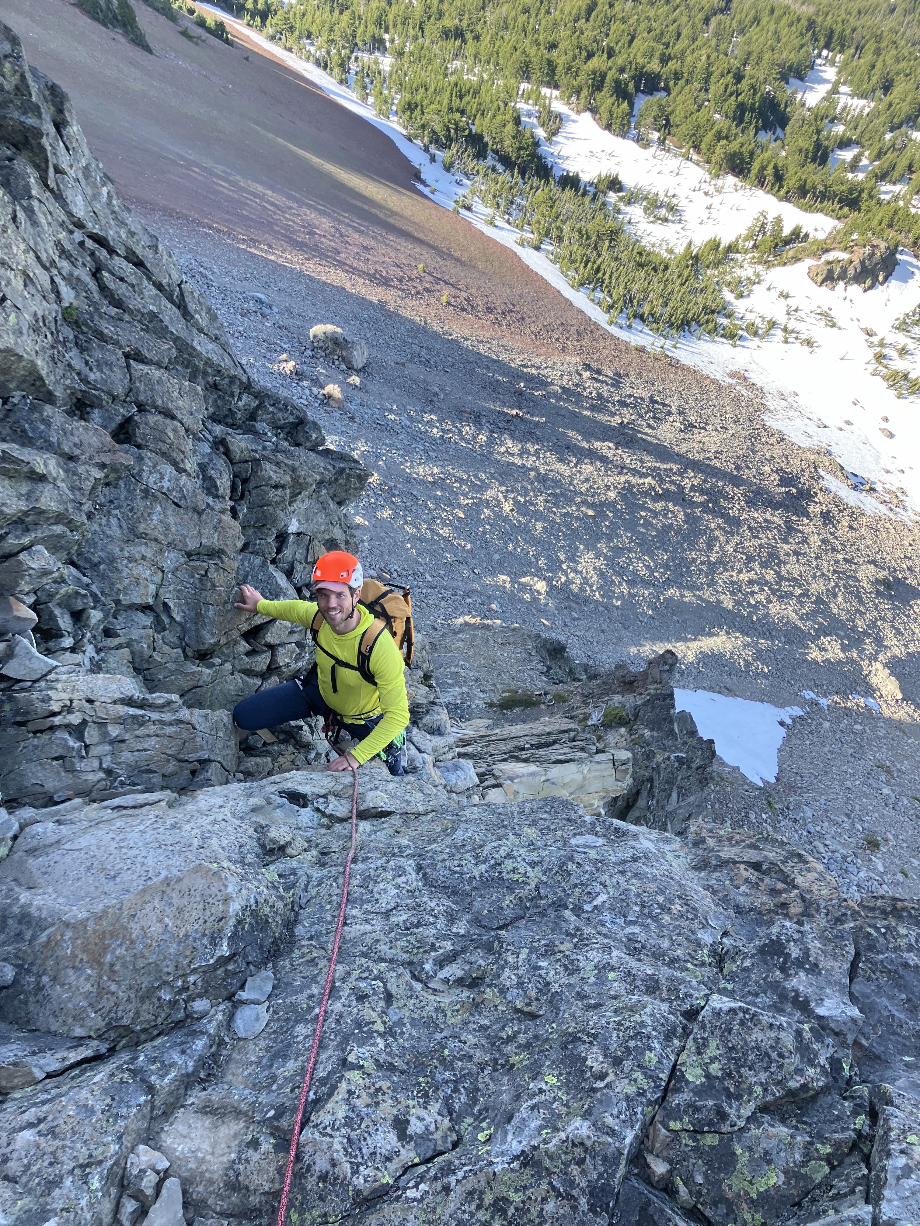
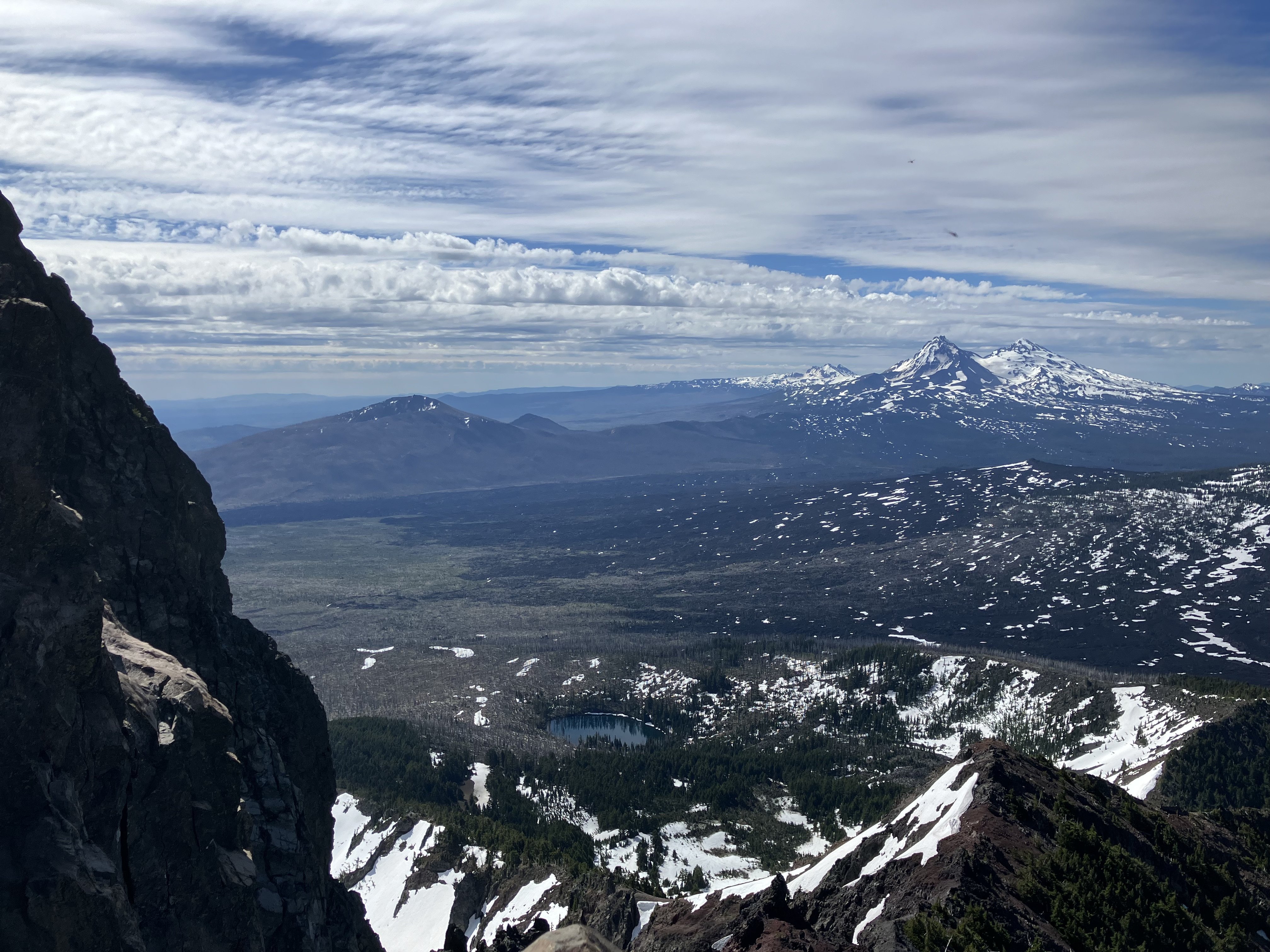
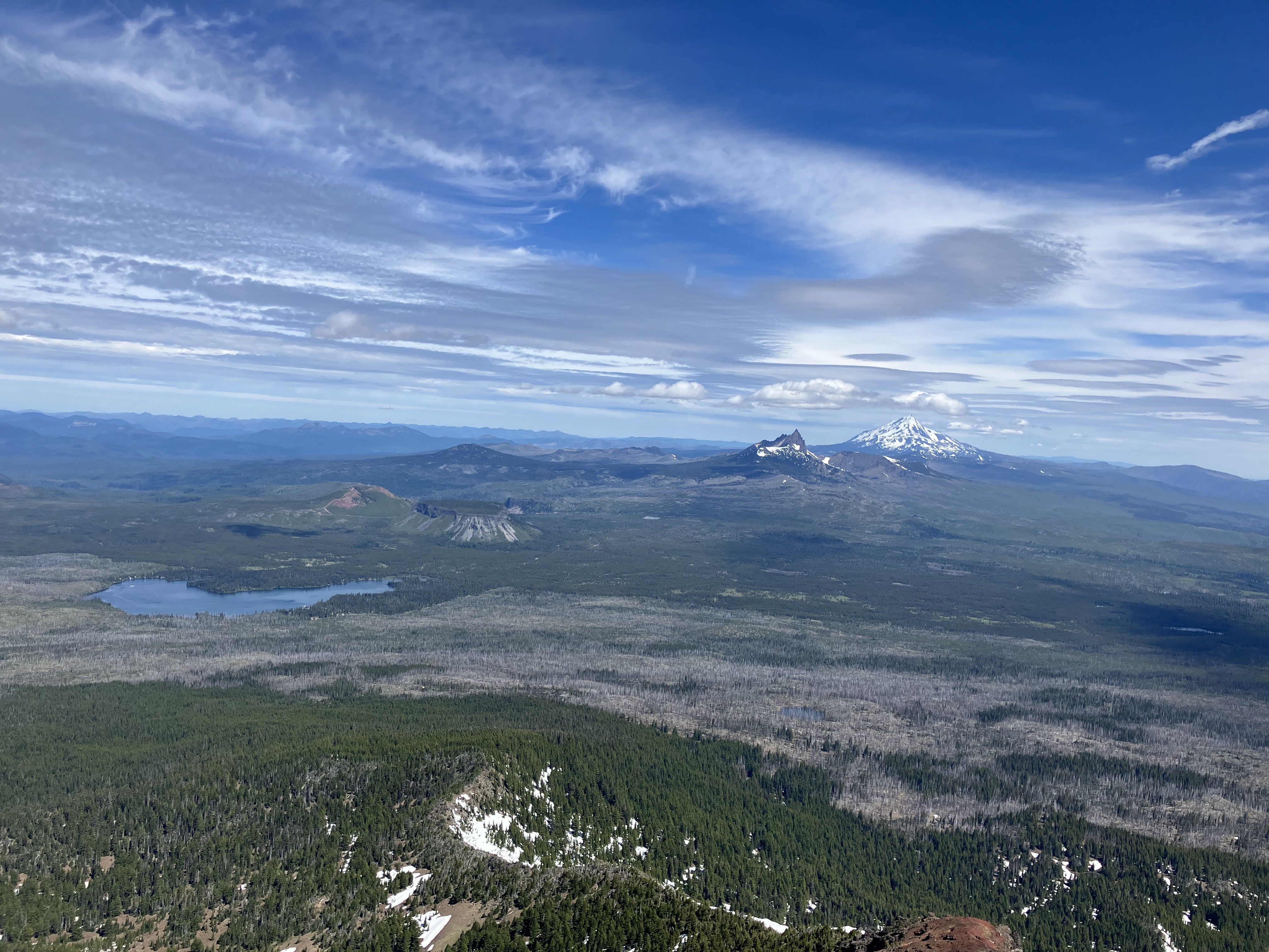
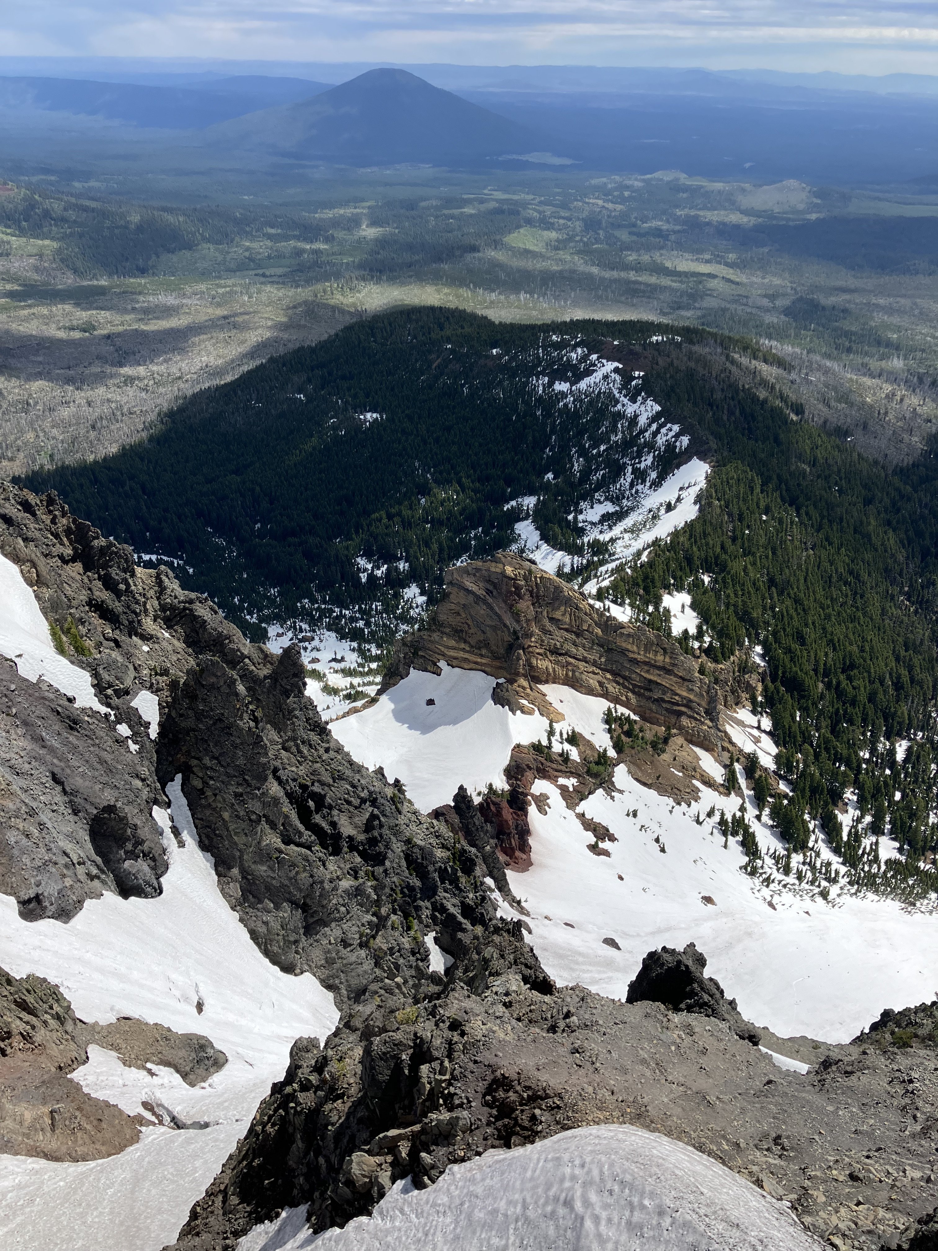
Trip: Mt. Washington - West Ridge Trip Date: 06/29/2024 Trip Report: Climbed this June 30th. Approach through the NW Bowl was actually great with snow cover and crampons, but this is changing quickly. Only a little scree the last 100 ft to the start. Climb went in 5 pitches: 60m linking N side of notch to corner pitch to start of dinner plates, simul pitch to base of headwall, 60m linking to top of headwall, 60m to just before summit, some simul scrambling to summit. Rappels have nice fresh tat on them... seriously the most pristine rap slings I've ever seen. Scrambling over to the approach trail was the most time consuming and nasty, but it's not too bad if you keep looking around for easy terrain. Overall the two crux bits (corner and headwall) are surprisingly good for volcano choss. Dinner plates are pretty bad but it's easy terrain so didn't feel awful. Approaching in the NW Bowl Top of our P1 Part way up the Headwall Looking S Coming up Headwall Views to N E Side view Gear Notes: single rack, long slings Approach Notes: nw bowl with snow


-
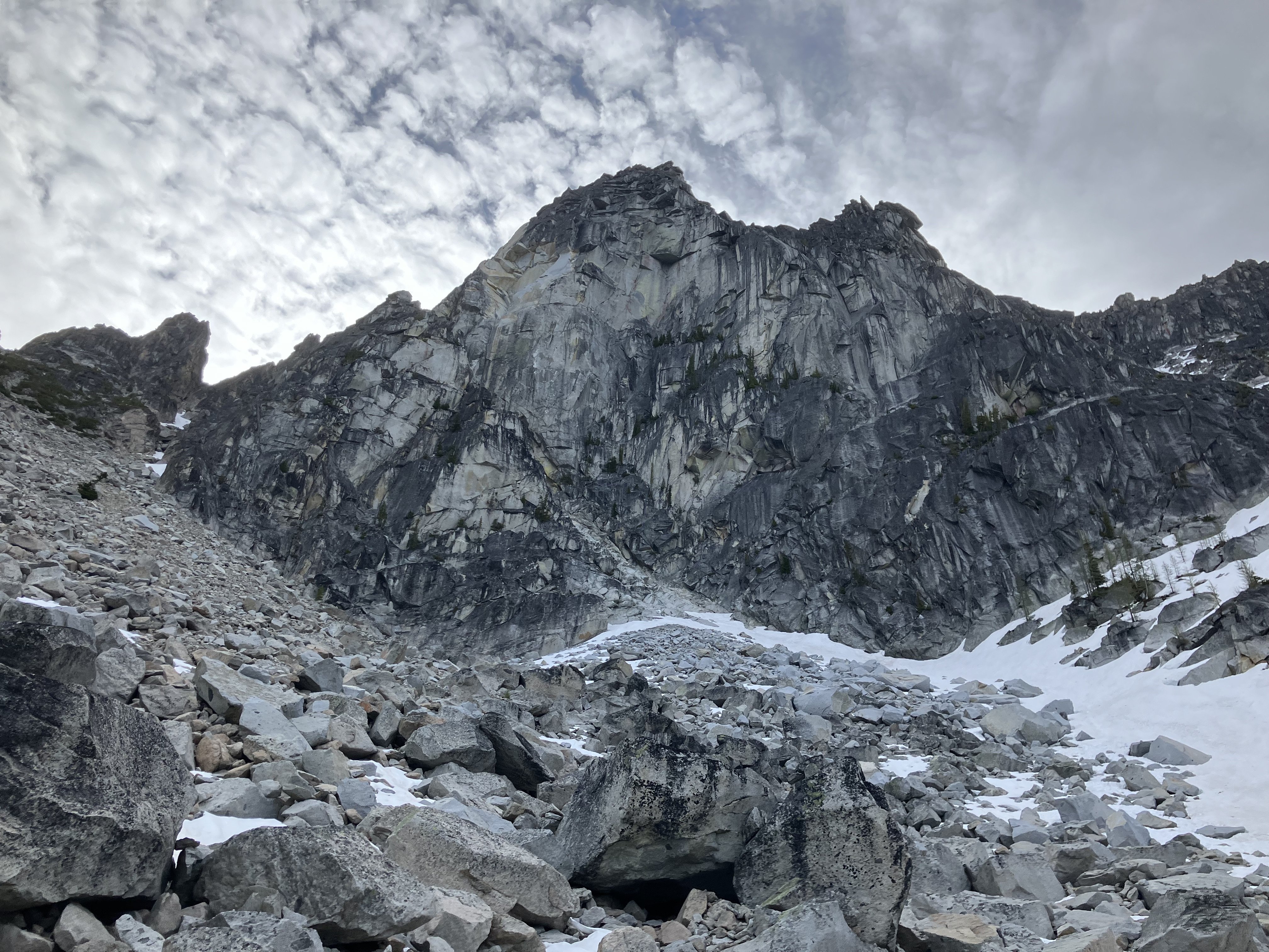
Trip: CBR - West Face Trip Date: 06/22/2024 Trip Report: Climbed this June 22nd. Route was dry except a couple jams on the corner, but friends did it the 29th and said the roof was pretty wet. Anyway, it could be dry enough to climb depending on the weather and the current snow makes for an easy descent. Enjoy! CBR: Corner pitch: Sandbagged OW pitch Views: Gear Notes: standard rack, 1x4, 3x .75 Approach Notes: Does anyone still go around to Asgard Pass? Why?
-
Looking at climbing the W Face of CBR next weekend. After this latest storm cycle I'm wondering if anyone familiar can comment on the approach and how wet the corner pitch etc might be? Thanks!
-
If you haven't yet, I would post it to this Women's forum on Mountain Project... https://www.mountainproject.com/forum/103989406/womens-forum
-
Hey Bill, I think we met on Illumination saddle... you were camped up there going over to do Cathedral Ridge, this was years ago. I have two Black Spider Hoodies, they are my favorite mid layer for alpine/winter climbing. I also have the old softshell jacket and pants which I won at the Craggin' Classic at Smith... in maybe 2013?! They are still going strong, especially the jacket which I love. Glad to see NWA continuing to do it the right way!


