

bedellympian
-
Posts
534 -
Joined
-
Last visited
-
Days Won
55
Everything posted by bedellympian
-
Personally I like it with snow. Definitely go North to South. I wore BD aluminum strap-on pons on Altras when I did it in June one year. Worked well enough but obviously you should test it first. This will give you a good idea of how much snow to expect... https://www.mtbachelor.com/the-mountain/webcams/
-
Figured I'd update this thread. Once our second was born last summer it was way harder to get the older sibling out by herself. This summer things have gotten back to "normal" (whatever that is). Some local highlights include TR sessions on the kid slab below Aggro Gully, climbing a rock "summit" on Misery Ridge, and self-selecting and topping out boulder problems at Widgi boulders. We also just did a trip to Washington where a quiet morning scramble up the back side of Castle Rock made for a great mini-summit, I short roped her up the scrambly bits with 20ft of cord. She also hiked Cutthroat Lake the next day and up to Heather Pass (Black Peak approach) and down under her own power on day 3. Took her backpacking for the first time in the Oregon Cascades this week (just one night, 1 mile hike in) and she loved it. Going bouldering with friends again this weekend and she literally screamed with joy and did a dance when I told her. How I lucked into this situation I have no idea. Oh, and her little sister is even more stoked at 18 months... climbs everything... but lacks the danger assessment of her older sibling... maybe destined for sport climbing rather than alpinism?
-
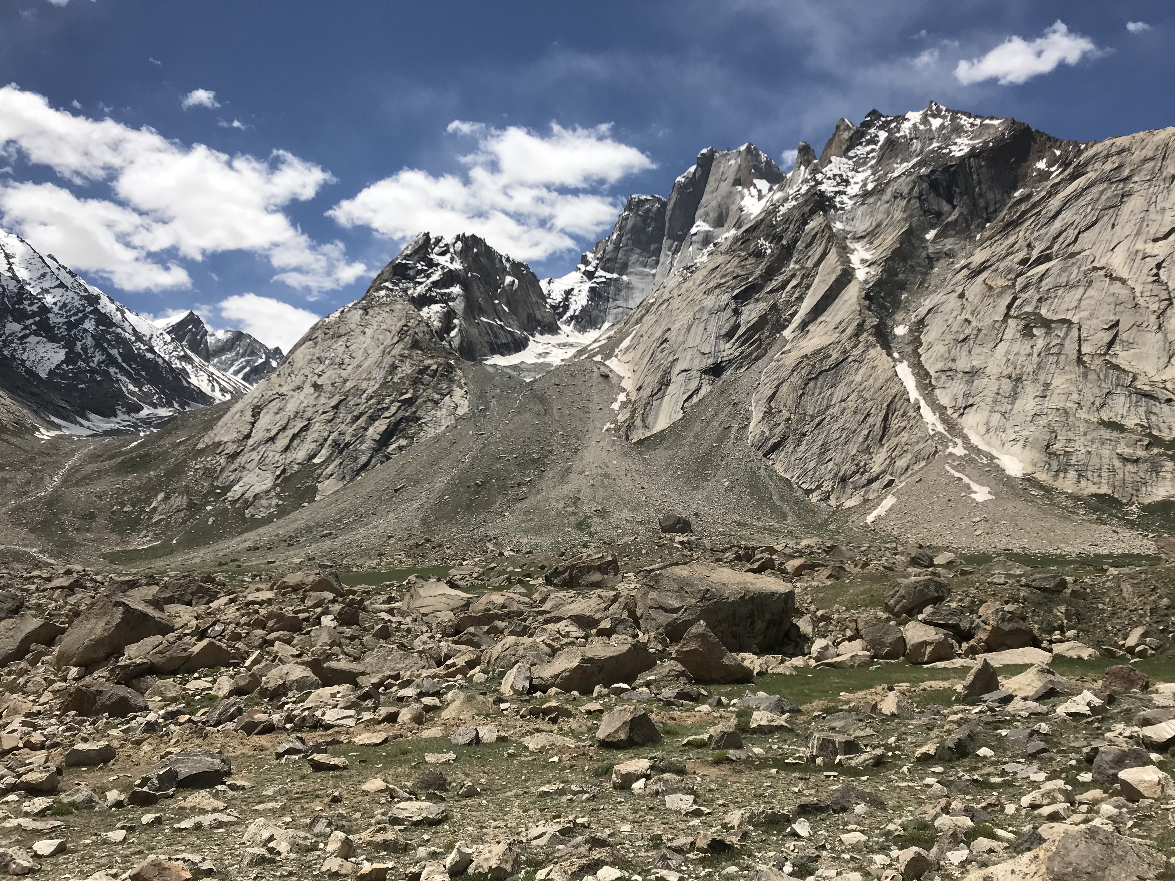
Which side are you approaching from? Could probably get eyes on it before you leave the TH if you're smart about it. I was up by the Prouty Glacier on South Sister today and was surprised at the amount of snow. The summits were socked in so I couldn't see the upper mountains. I would guess there will be some snow and some choss based on what I saw and my experience up on North.
-
 Reminds me of an August trip with similar plans and outcome a few years back! Yikes!
 -
Ah, that's unfortunate to hear.
-
[TR] Tokaloo Rock (Sunset Ridge bailure) - Standard 06/29/2025
bedellympian replied to JasonG's topic in Mount Rainier NP
Kyle Tarry and @Nick Sweeney tried it a few weeks ago too. Sounds like they had a similar experience. -
Just curious, was White Saddle more expensive? I thought they were the go to heli operation for going into the Wadd.
-
Thanks Jason! Yeah, can't go heavy on a carryover route with 5k' of technical climbing regardless! ? Though I definitely would have liked some trekking poles on the descent and warmer bivy kit on night two... oh and more food! You can always have more food!
-
Yeah, for sure, though summiting the Grand in a whiteout right after several loud thunder strikes was definitely more than I wanted in that moment!
-
Anyone know how to make videos work? Nevermind, they just needed to load a bit.
-
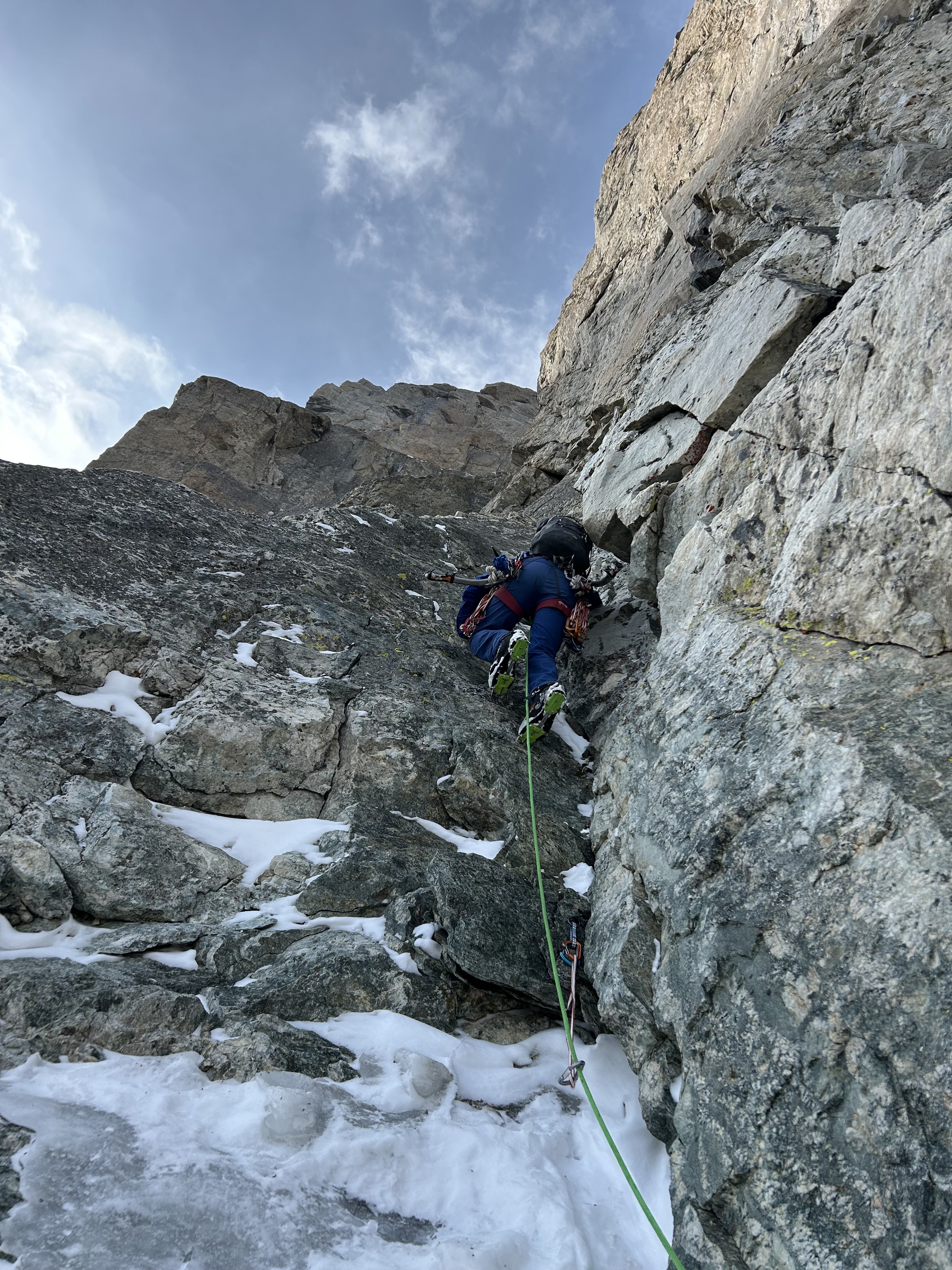
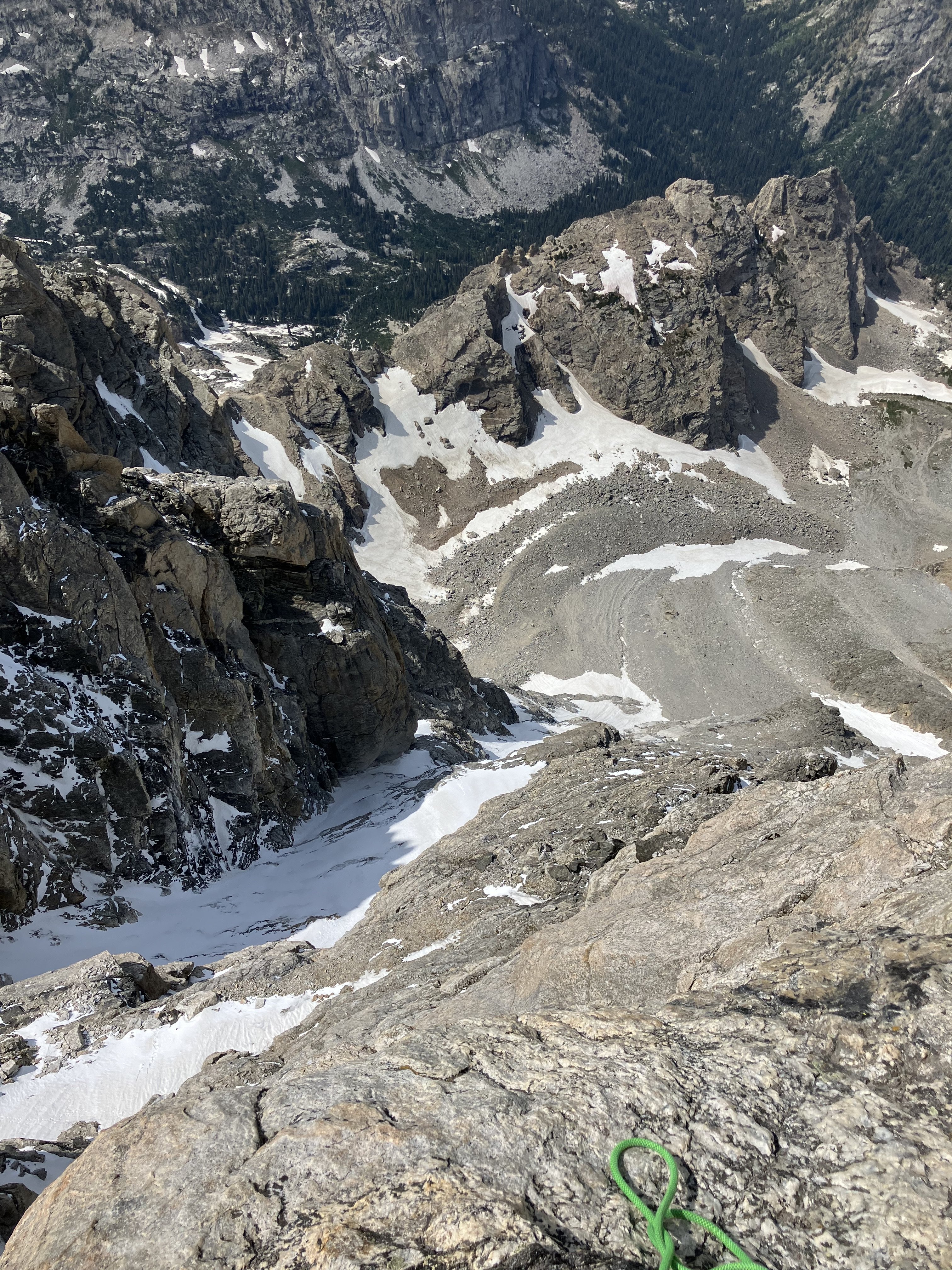
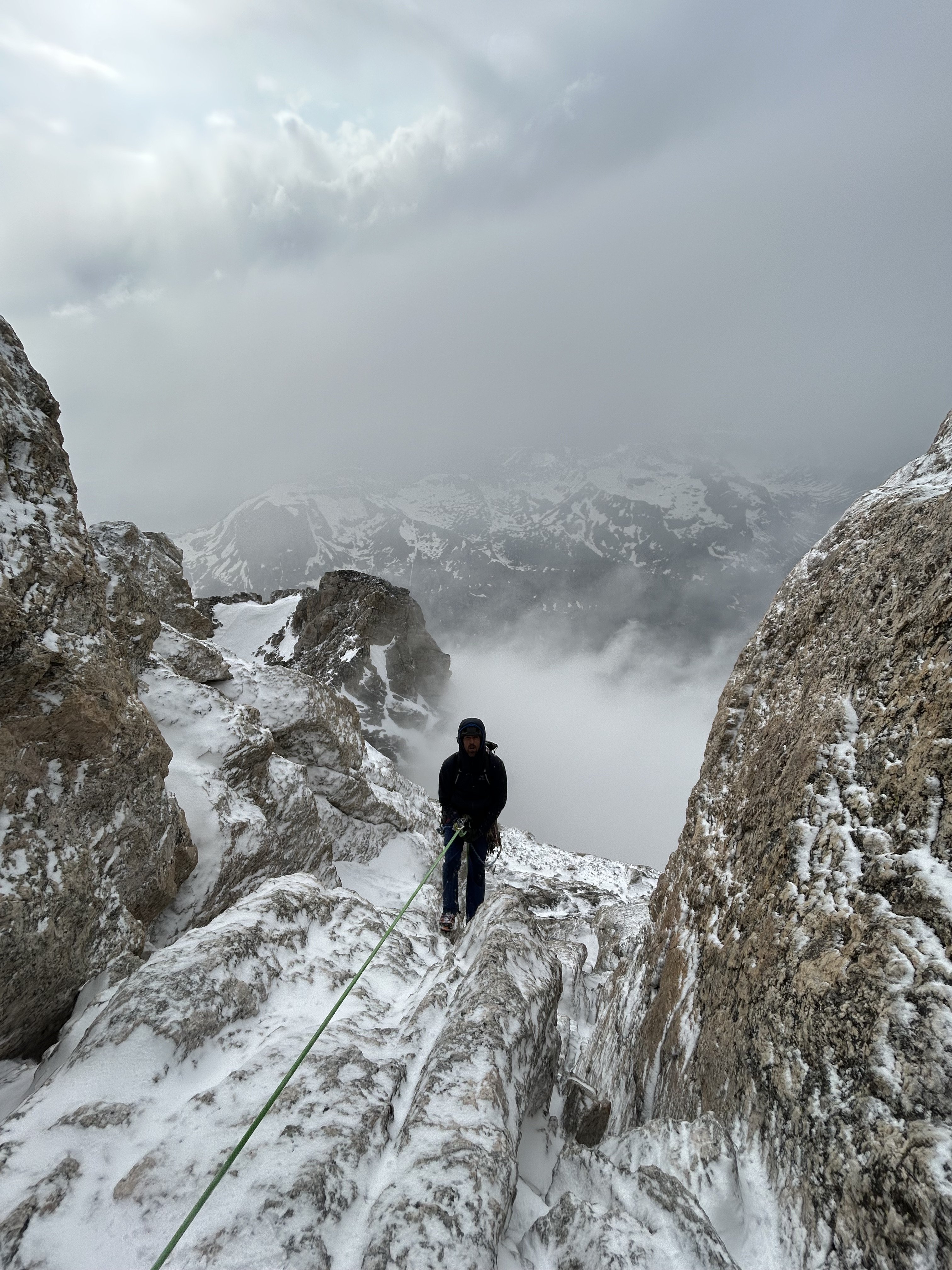
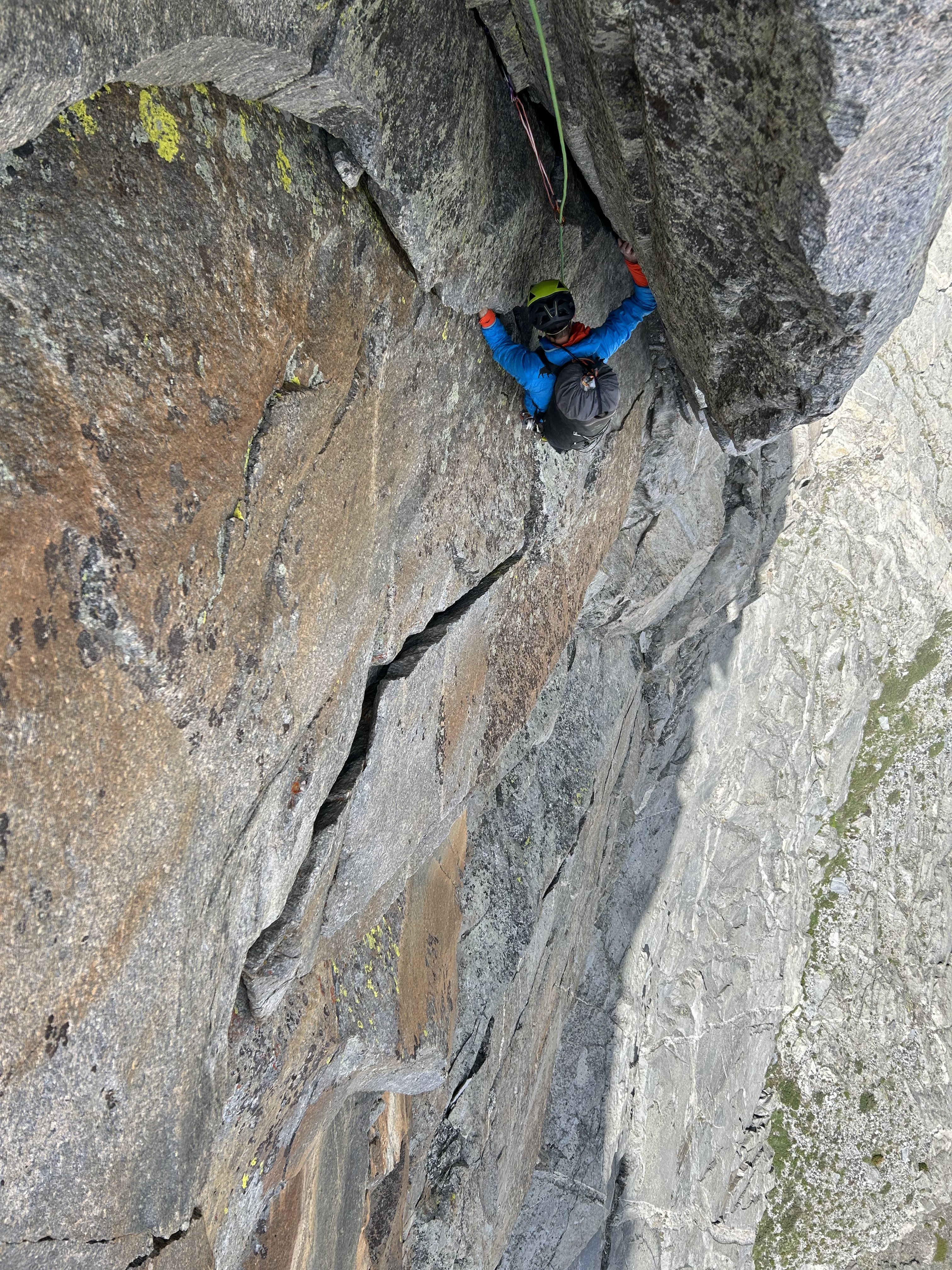
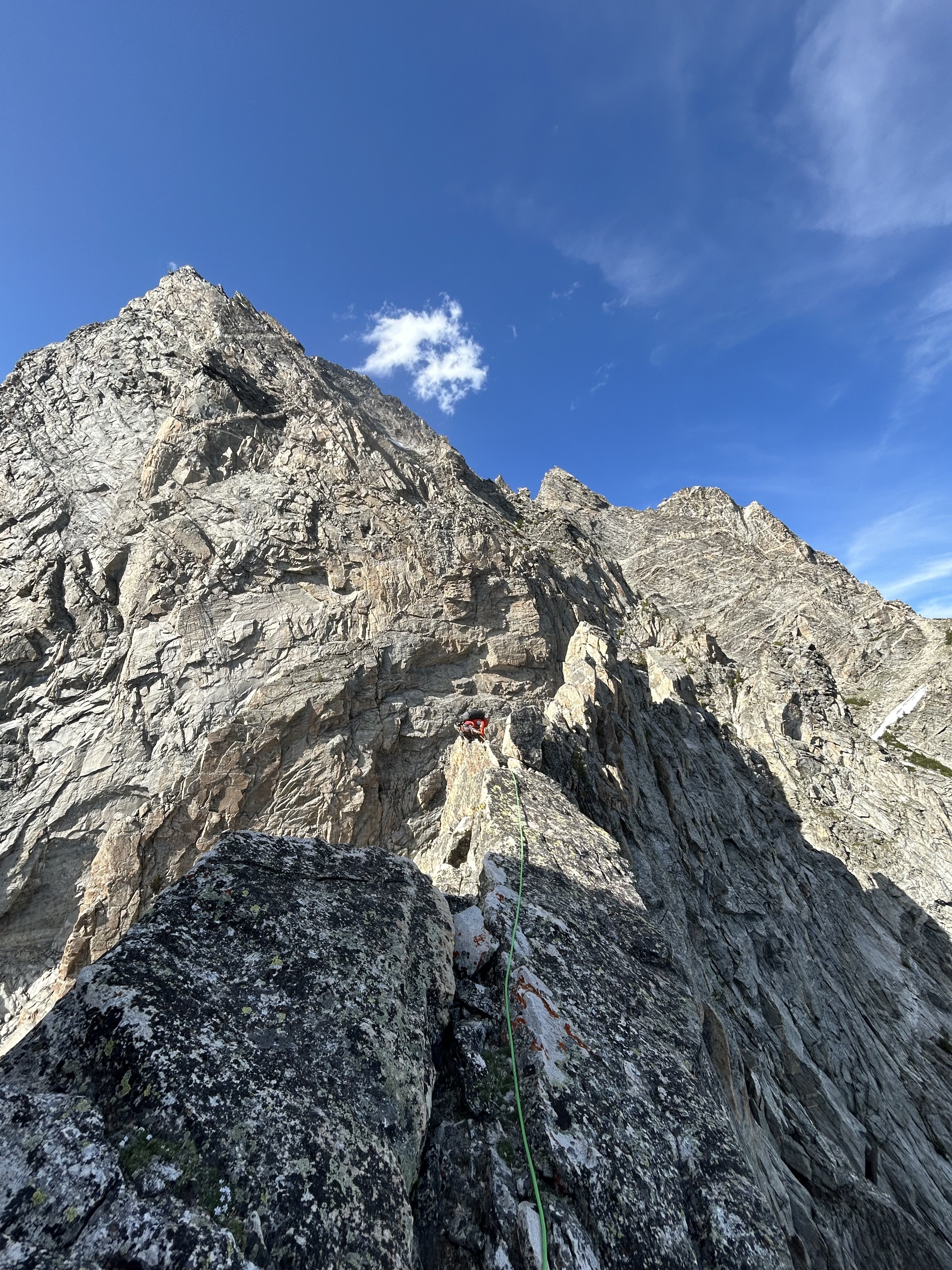
Trip: Tetons - Black Ice Couloir to West Face on the Grand; Direct South Buttress to the summit on Moran Trip Date: 06/23/2025 Trip Report: Dallin and I had gotten skunked by climate change two summers ago in Canada, so this year we decided to book a week together in late June and go wherever the weather looked best, with the goal of climbing long routes to summits. We were just starting to get really excited for Roger's Pass when the weather changed and we bailed to a more southerly range, the Tetons. The week was starting cold so we decided to prioritize ice routes. We had reliable intel that Run Don't Walk was out, but Black Ice had seen a mixed ascent 10 days prior and temps/precip seemed to suggest it would only grow. Wanting to do all the things, we hiked up to the Lower Saddle prepped to link into the West Face. The Black Ice/West Face linkup is George Lowe's pick for the 50 Favorites book. In his topo he cuts left on a snow field to the West Face, missing the crux of BIC. Since BIC is hard to find in condition in this age, we opted to climb BIC through the crux if it looked good and then cut out left higher, if possible. This strategy worked out well. The crux of BIC was thin ice on slab to neve sticks above a chockstone, very fun. A long, snow covered slab/ledge system allowed us to traverse out onto the West Face, starting with the rock climbing on pitch 4. We only brought a single pair of rock shoes, so Dallin lead everything and I followed in full shank boots, making the old school 5.8 traverse pitch quite exciting. After 5 difficult (for me in boots) and wandery pitches we reached the end of the difficulties on the Lowe topo. At this point the weather came in, snowing and thundering. After dead ending a couple times on the scramble to the summit I downclimbed into a snow filled gully, reattached crampons, and climbed a tenuous verglassed slab to snow only to find it was powder on featureless slab. Luckily, a leaning flake crack provided a good torques and we topped out in a white out. The sun poked out again just in time to allow a quick navigation of the raps. After a night at a friend's house in Jackson, we repacked for a sunnier objective. That afternoon we paddle boarded over to Leigh Canyon and bushwhacked up the drainage until we were under the South Buttress of Mt. Moran. We bivied on cleared camp spots in some cottonwoods next to the creek. At 4am we rolled out of bivy bags and headed up through the brush and scree to the Direct South Buttress route. We had heard the first pitch of Blackfin was the preferred first pitch which accessed the second ramp. However, after looking at various options and downclimbing off one horror show of stacked blocks, we just scrambled higher on the first ramp and did the original low 5th start. More route finding difficulties slowed us and ate up time, but we persisted and gained the main line of pitches up nice cracks which appeared to be a lovely white granite in places. The traverse pitch and crux was not too bad, we opted to simply pendulum and aid at this point in the day. We reached the hanging bowl at 3pm and thought maybe we could still do the remaining 3000' to the summit before dark (oh hubris). Wet and vegetated slabs, sandbagged old school climbing, and extremely exposed tower ridge traversing in high winds saw us reach some good bivy sites in the second hanging bowl with a little bit of daylight left. We cut our loses and settled in for a cold and windy bivy. The next morning we were up and moving by 5am. Many more route finding difficulties lead to an off-route, overhanging, bomb bay chimney that ended with a mantle on to the summit plateau. We tagged the summit at 1:30pm and had a quick snack/water break before descending the CMC route. Neither of us had climbed the CMC or Moran before so this made for some interesting and surprising situations as we down-simuled and rappelled, culminating in realizing we had to rap into the Drizzlepuss notch and climb up the peak on the other side to escape. Once over the annoying DP, we raced down to the lake and paddle boarded leisurely back to the car with a beautiful sunset until hoards of mosquitoes found us. A dunk in the cold water and shivering night drive into Jackson with the windows down let the bloodsuckers escape. We got late night pizza slices and then had to drive 2 hrs around through Alpine to reach Driggs because Teton Pass was closed for construction... always one more problem to surmount! I passed out in the back of my car in Driggs at 2am and drove home the next day. Thanks to our families for letting the dads go big for a week! Double rainbow in Driggs was a good omen. Dawn on the Valhalla Traverse to reach BIC. Dallin on Valhalla Dallin finishing the Valhalla traverse Dallin's pic of me leading the mixed pitch to access the BIC Lookind down the BIC before it started getting more icey. Crux on BIC Dallin switching to rock shoes on the West Face Me following on the W Face Looking down the W Face on the BIC IMG_4881.MOV Dallin's video on the summit in a whiteout First rap off the Grand Enclosure with the clouds blowing off. Below the DSB on Moran Dallin's pic of me catching Z's below the DSB, I'm too soft to go with the rope bivy these days. Myself following one of the better pitches on the DSB Dallin's pic of me leading the penji to aid crack pitch. Dallin getting ready to follow the crux/aid pitch This is the "5.5" exit pitch from the DSB... friction slab feet and a jug rail... 5.9 in Squamish for sure and pretty consistent for the grades on this route. Endless 4th/low 5th on the upper SB. Dallin getting water at the second bowl before going looking for a good bivy site. Dallin cheesing when we thought it was almost over. Dallin leading what we thought was the last hard pitch... turned out to be a few more and lots of shenanigans. Myself following said pitch... quite good. IMG_3646.MOV Summit of Moran, finally! Gear Notes: All the toys... really, all of them. Approach Notes: Standard beta available on the interwebs.


-
[TR] BULLEN! - via Squire Creek/Bullen Lakes 06/01/2025
bedellympian replied to JasonG's topic in North Cascades
Yeah, so good! -
Yeah, seems like his suggestion of trail work and re-vegetation, coupled with a public apology would be enough. Still, I get the importance of making an example of someone so people take things seriously. Still, seems like there are much worse things they could go after.
-
https://www.timberlinelodge.com/conditions#webcams I think it will be fine with an early start and the cooler temps forecast later this week... if they materialize.
-
Agreed, but in this case I suspect an editor who lives out of state and doesn't care or know anything about Bellingham?
-
It's not local journalism when a rando in Phoenix gets tossed a few bucks to write up something they have absolutely no clue about.
-
Full disclosure: I have not been on Luna or done the traverse to East Fury. However, based on other experiences in the Pickets, my first thought is that as snow cover melts away and choss/scree is exposed the ridge becomes a more appealing option. But that could be off-base.
-
[TR] Gothic and Del Campo - Standard Routes 05/17/2025
bedellympian replied to Lucas Ng's topic in North Cascades
You didn't go into her bedroom and ask her to dry them for you at midnight? ? JK Hope you made it up to her? If not maybe consider rope gunning up Hard Mox on the next rainy weekend! ? Sorry, can't help myself. Glad you got out Lucas! -
Shkhara, Georgia Highpoint, Partner Search
bedellympian replied to Eric Gilbertson's topic in Climbing Partners
Looks fun but won't work for me this year. To clarify some things in the hopes of attracting some partners for you... looks like multiple pitches up to mid-5th but nothing harder if I'm reading this right? Grades are UIAA? Over 7k' of vert from just below 10k' to 17k' summit? Honestly sounds like a rad adventure. -
Trip: North Sister - Thayer HW Trip Date: 05/18/2025 Trip Report: Went out to North Sister on Sunday 5/18 to have a look-see in mediocre weather. I was excited to see some ice hanging on and forming up from this past week of weather. I played on it a bit but most was sun rotten and delaminating. It will all be gone quick once the sun comes back out. Skiing conditions were pretty terrible due to wind packed pow over old frozen sun crust and wet slide debris and some rock sharks too. Though I did talk to two splitboarders who went over to the SW side of the peak and found consistent wind-packed powder in a bowl. Here's some pictures... Thayer HW area Cool little pillar... bigger than it looks and solid but the top out was pretty terrible. Second pitch above the pillar... gross delaminating ice... downclimbed and did some gross scrambling up snow covered choss to the L Looking down on the Thayer Cirque from near where I was able to traverse to the main gully and descend. Storm cell over Broken Top on the hike back to the car. Gear Notes: Sneakers for the approach, skis kinda pointless in the conditions I found, tools and pons for ice, bringing a rap cord to escape via bollard would have been smart. Approach Notes: Pole Creek TH
-
- 1
-

-
Some of you might be interested in this guide... Central Oregon Rock
-
How old is your son? Post us some pictures and dad beta!
-
Hadn't heard of it but just looked it up. Looks great! Would love to see a TR of good scrambles/hikes/camp spots you do.
-
So you're sending the Troll Wall on a weekend right?
-
What are you doing between the volcano alpinism season and Squamish?


