obsydian
-
Posts
175 -
Joined
-
Last visited
Everything posted by obsydian
-
Did the North route with friends last year, took the boat to May creek, hiked in from there to the bottom of the glacier the first day, some bushwhacking on the final traverse, up the glacier then on the ridge the next day, steep traverse of snow/ice to protect just below the summit block, then 1 rock pitch to the top, back to camp the second day. 3rd day hiked out, met boat at 11am. Here's the link to that trip: Jack Mtn Trip Report
-
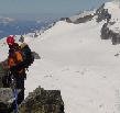
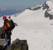
Took my 2 teenage boys and 3 other friends that like scrambling up to Black Peak. Started out in the fog and light drizzle, more drizzle when setting up camp at Wing Lake. Could see the look in their faces of "what is dad doing taking us out in the rain, this sucks!". Woke up Sunday morning to heavy fog, sat around, just about decided to pack up and head out when the fog began to lift. About 8:30 headed out, became a beautiful day, gorgeous views, could see very clearly the NE Buttress of Goode that we had climbed in July, had a great time. Black Peak is a great route to take newbies who can scramble, nice approach, lakes, good views, whets the appetite for the North Cascades.
-
Climb: Goode-NE Buttess Date of Climb: 7/9/2004 Trip Report: Climbed Mt. Goode NE Buttress July 8-10 with a team of 3. Since road from Stehekin washed out 2.5 miles before High Bridge and shuttle not running, decided to just hike in and out from Rainy Pass. Looked at the weather all week, final forecast was for chance of rain on Thursday, partly sunny Friday, improving over the weekend. Drove up Wednesday evening, stopped to eat in Sedro Wooly, saw a local paper which was calling for rain on Friday, not a good sign. Got to the Rainy Pass lot at 11pm. Gear: Packed light, took small pocket rocket stove for emergencies and snow melt on the summit, but otherwise prepared for 3 or 4 days of cold food. Since we were turned back by broken up glacier and very icy conditions last year in late August, we took lots of ice gear: 2 pickets, 3 ice screws, and 1 ice tool. Ended up using the 2 pickets because we had them, but could have made it without any of the ice gear. Took large rack, full set of nuts with double on the large nuts, several hexes, 2 tri cams, 4 cams, 13 double slings with biners, glad for the large set, allowed for long running belays, could have used a couple more slings. Day 1: In the morning, made a good last breakfast of pancakes and eggs in the parking lot. Got hiking down the PCT at 7:30am, stopped for long lunch at Grizzly Creek. The recent floods have made major changes to the approach and descent. Grizzly Creek is 300 yards of rock washout. Major drainage is crossed by hiking up creek 100 yards to a log crossing. The trail just before turning up-hill to Goode is eventually taken over by the washout, we found traditional route, log is still there but doesn’t reach the other side, we put a couple of small logs down and crossed. Major washout gulleys were encountered in the ensuing bushwack. Looking at the approach from the bivy site, a better attack would be to go 200 yards past the last trees where a major rock wash from Goode nearly reaches the creek, would save all that bushwacking at the bottom, but would have to find way to cross creek. Arrived at bivy site at 5,600’ about 4pm, after 15 miles of hiking. Clouds started rolling in during the evening, settling in over all the peaks, wondered if the local paper was going to be right after all. Day 2: Woke up middle of night, clear sky, saw the space station make its way across the sky. 4am and all was still clear, looked great. Got up and hit the glacier at 5:30am. Glacier has receded 25 to 75 feet from last year, but is in good shape. Nice easy ramps straight up from bivy site, which is left of the buttress, hit 20 feet of ice, then easier going. Popped up about level with the buttress but far left. Traversed over to buttress, crossed a couple of crevasses. Set pickets on final approach just above first red band on the rock, was able to step right onto the rock. Not sure what would happen later in the season, may have to rappel off the glacier into the moat and climb up the rock, would be tricky. Kept a rising high traverse (looks like many parties stay low), set up first rock anchor, then one fixed pitch (had hardest move of the climb) up and over the ridge to the 4th class climbing. Did running belays the whole way to the top, did stop short a couple of times up high where the leader decided a fixed belay would be appropriate for the next move, but each time continued the running belay. Believe there were 7 pitches altogether over the 2,500’ of rock, gaining 200 to 700 feet in elevation each time. Looked East and could see clouds circling in, by 10am fog was rolling in from the summit, anxiety about the weather quickened our pace. Hit the fog at about 8,000’, luckily it wasn’t windy or wet, we just couldn’t see very far. Route is easy to follow, stayed on the left hand side 50 to 200 feet below the ridge until we popped over at about 7,800’, ridge steepened so traversed a bit right to find easier climbing, then straight up again. Passed bivy site at 8,600’, then ended right up on ridge from 8,800’ to notch just below summit block. Very poor visibility, started to sleet, wanted to get to the top and get out of there. Hit the summit at 4pm, weather improved but still poor visibility, signed register, were second party to sign this year, not many names in there. Broke out the summit pizza, then started downclimb at 5pm. Read descent directions several times trying to get our bearings, can be confusing with no visibility. There was snow within one pitch of the notch between the East and West summits blocks for melting water. Did running belay down to rappel slings at notch just below summit, in retrospect would have been faster to rappel from summit due to wet rock. Rappelled to next station (which we passed on the way up) just above the Black Tooth Notch, 60m rope just made it. Rappelled down to shelf, there are a couple of rappel slings just above the shelf, not sure why they are there, kind of confuses things. Walk off shelf to the Black Tooth Notch, downclimb 3rd class rock to rappel station, one blind single rappel will take you to final rappel station, beware of pendulum, last station is very slick. Rapped on down to steep gully, beware of rockfall, very steep downclimbing, hung left under the buttress, came out in SW Couloir, saw a good campsite at 7,600’ left of the ridge in the middle of the Couloir, set up bivy on nice flat spot with dry heather and running water. Very grateful to be off the summit in that weather, still poor visibility to 500 feet, got to bivy site at 8:30pm. Day 3: Had already decided to hike out the SW Couloir route because we figured the extra 4 miles of hiking adding 1:15 time would more then make up for any technical problems we’d encounter on the Goode-Storm King Col descent. Woke up at 5am, still foggy, but started to lift and had good visibility with 8,000’ ceiling at 6am. Started descent at 6:15am, bearing straight downhill. Descent involved careful routefinding skirting cliff bands, until we were finally clear of the main cliff band. Made a gradual descending traverse to the right to gain the treed ridge, hiked down the ridge several hundred feet and ran into climbers trail, no real bushwacking. Followed trail on ridge to Park Creek Trail. Mark complained of swelled Achilles heels, he finally stopped and cut off the back of his boots, not much else to do with 18 miles still to go. Trail is washed out for several hundred yards, pick your way across the rock washout, several deep ravines, new log crossing at 2 mile camp. Hiked down to road, imagined a shuttle coming to pick us up, then back to reality and the 15 miles hike out. Picked up the PCT at Bridge Creek, ending up at Rainy Pass at 5:45pm. Figured about 20 miles for the day. Great climb, would have been more enjoyable with better weather, climbing is easy, extreme exposure, very committing. We figured that with our combined ages of 141 years, we didn’t do too shabby! Gear Notes: Took: 2 pickets, 3 ice screws, 1 ice tool, large rack, 13 double slings. Didn't need the ice gear, glad for the large rack. Approach Notes: No snow on trail, cross several washouts from recent flooding.
-
Anyone have beta on the NE Buttress of Goode? Haven't seen any trip reports posted, Marblemount Ranger didn't have any reports, wondered if anyone has been up there recently? Planning on going next week.
-
Climb: Silver Star-Burgundy Col Date of Climb: 6/13/2004 Trip Report: We saw that weather was coming in and knew the forcast wasn't good for Saturday night, decided to camp at Burgundy Col for the higher elevation to be in snow instead of rain, took about 5 hours from the road to the Col with full packs and leisurely pace. We set up 3 tents on snow at the Col, appeared to be several established bivy sites, only a couple large enough for a small tent. Wind blew hard all night, received about 1" of snow, still sustained winds of 35mph at 7am, finally cleared enough to start the climb at 9am. Very glad we camped high. Very steep descent from camp on the East side of the Col, the traverse around to the right is on a steeper slope then many will be prepared for, could be very difficult if icy. Continue rising right traverse to a saddle, then rising traverse to saddle between East and West peaks, quite steep on final approach, will pass one or two crevasses. We found snow and ice all the way to the summit block, stayed roped up, used 2 pickets and 3 slings on rocks to protect with running belay. We stayed left and climbed the 5.4 crack (not hard) protected with 2 nuts, variations are the middle face (5.4?) or traverse 30 feet to the right and up an exposed 3rd class gully. Stayed roped up on the summit area, belayed each climber over to the final summit pyramid 15' away, let them touch the top. Downclimbed the 3rd class gully while roped up, placed protection for running belay back to the saddle. All in all a very nice alpine climb, has lots of variety, a recommended objective. Gear Notes: Glacier gear, pickets, few pieces of rock pro & slings. Approach Notes: Trail starts about 300 yards downhill from mile marker 166, the old Silver Star road marker sign has been swept away by avalanche, but you can find the metal footings, trail starts there. Good log crossing, foot trail bears a bit right, eventually becomes a well distinguished path. From the main camp on the 6,400’ plateau, follow the boot path, will go up a gulley, then rising traverse to the right, will continue this pattern in two more gullies, eventually coming out about 500’ below the Col.
-
If a person uses 9/16" webbing as a personal anchor and takes the hardest fall available, what is the force excerted and does this system have enough redundancy to be considered strong enough? What has been published so far: ---------------------------------------- 160 lb climber - 72.6 Kg Climber Gravity Acceleration - 9.8 m/sec^2 Time to fall 4 feet - 0.5 seconds Peak velocity - 4.9 m/s sudden deceleration from 4.9 m/s to 0 m/s A newton is the force required to impact a 1 kg mass to an acceleration of 1 m/sec^2 Applied in opposite - to decelerate a mass from gravity (9.8 m/sec^2) to zero velocity 72.6 kg x 9.8 m/sec^2 = 711.2 Newtons or .7112 kN strength is decreased with knots -- including the water knot - 20-30% reduction per FOH This would drop the strength of the webbing from 6.8kN to 4.8 kN. This also assumes no knicks in the webbing or other areas where the webbing is bound that would further weaken the strength of the personal protection. Factor of safety for 9/16" webbing - 6.8. However, this does not take into account accelerations due to falling in an arc and additional accelerations and shock that would occur. Repeated stressing of the webbing. Any weakening of the webbing that may occur due to UV exposure over time Knicks in the webbing Suggest only daisy chains or 1" webbing. ----------------------------------------------------- What is wrong this logic? Thanks
-
I bought one of the light tt ones from pro mountain. 141 grams for 19cm, it is lighter, but is harder to get in, seems to be "sticky", have to take the axe and use to turn in, the BD express go in like a flash, 200 grams for same length, they are worth the extra weight if you are on steep terrain and need to place a screw fast. If you just need a screw once in awhile, have a good stance and can take the time, then the lighter one will do.
-
The route should be fine all summer, I hear folks climb in August, the ice might be softer then, but the approach to the base of the climb would have more open crevasses. The approach to camp is pretty short, about 3 or 4 hours.
-
Hmm, this looks easier, we went left and up the nose as described in Nelson's book, looks like this is right, cheater for sure!
-
If someone got hurt, would be a real chore to get them off the cliff, particulary the traverse. Also, the seracs were ominous, several gave way across the valley, we didn't like climbing underneath those. It all comes down to experience, we were under the assumption the commitment wasn't too high, but felt it was certainly at our level of experience. I'm sure some folks can bust right through without a thought, for us, it was a good go but near our limit, wanted others to be aware. As for srews, again, depends on your experience and skills and comfort with exposure. If you do this all the time, I guess hardly any screws are needed, I'm glad I had 9.
-
On this approach picture, we were further left trying to go around the lower approach route, but ended up joining this direct route about half way up, staying left in the rocks. How do you post those pictures, I have two in the gallery I'd like to get on this page?
-
Here's the first pitch: Here's the second pitch traverse: Hmm, not working out like I thought, how do I get pictures from my gallery in here?
-
Climb: Baker-North Ridge Date of Climb: 5/13/2004 Trip Report: May 12 - 13.We camped at 6,000 feet as it was protected and flat, you could camp a few hundred feet higher where you traverse left. We had no problems traversing, crossed a couple of crevasses, but straightforward. We took the lower route left around the rock nose but ended up climbing right and through the rocks and actually did about half of the upper shortcut route, steep but good snow, used pickets. The approach to the ice section at 9,600 was straightforward. The ice there is very hard and brittle, harder then we were expecting. Very exposed. Take as many ice screws as you have unless you are comfortable climbing ice with long distances between protection and no runout. We had 8 or 9 screws per team. The first pitch is straight up to the ridge and then a bit right, about 60 degrees, quite airy. We did a left traverse underneath the overhand on the second pitch, there may be an option to climb a chimney which you will see, believe a shorter route, the first few feet are vertical. Our third pitch went a bit more left, and then straight up, near the top about 20 feet of 70++ degree (seemed vertical!) ice to just below the ridge proper, better ice in here. The 4th pitch was short, 45 degrees, tops out on the ridge. Climbed the ridge with pickets, some might do without, but very exposed. We had whiteout conditions on the ridge (perfect day until then, the low clouds just gathered around), fortunately we did get a look on the left fall line, no cornices, so we followed that line to the schrund. Pretty much went straight up and through the schrund up as we couldn't make out any other path, it topped out on the first summit. Two of us stepped in a crevasse near the schrund. It took us 14.5 hours from tent to summit. We didn't think we were that slow, but the technical ice climbing was harder then we expected, and the whiteout didn't help with routefinding. I'm sure folks could do it faster if your team are very strong ice climbers, we were a bit new. We took 2 pickets per person, seemed about right, but we protected everything above 9,200 feet. And you will want two tools (at least I was glad I had two tools). The climb is very committing, not many options if someone has trouble on the ice section. Great outing though, learned lots, got back to tents at 10:30pm, hiked out the next morning. I'll try and post a couple of pictures. Gear Notes: 2 pickets per team, 8/9 screws per team (more the better), 2 ice tools Approach Notes: Road open to about 1/2 mile from trailhead
-
Hey Lowell, thanks for the beta on your climb 25 years ago, which is the second ascent described in Becky's guide. Doesn't sound like many folks have followed, the NE Route is the most popular technical route. I'll have to go up there and check it out this summer. Again thanks.
-
Anyone done the NW Face of Black Peak or have any beta on the route? Becky says 5.5 and not much else. Rock sound? Good route or stay away? Also, looks like a few have climbed the NE Ridge route since Nelson published, can't tell from descriptions if the climb is all running belays or fixed pitches, any beta on # of pitches and actual ratings? Thanks!
-
So what happened last year to make you increase the worth of your life so much?
-
1) First to sign the register on Jack this year (N Ridge route) 2) Mt. Rainier with wife and two boys (age 16 and 14) 3) Spickard & Redoubt, what a beautiful place
-
On this low snow and high temperature year, the glacier is so melted out (as of Sep 6) that a 4' band of lava rock is exposed about 200' from the top and extends across the entire glacier (in addition to the normal hard rock band exposed about 300' from top). This band is producing water and is actively sluffing off with rockfall of gravel size to grapefruit size and larger raining down in 5 minute intervals. The lower part of the route is a challenge to dodge the rockfall. Two party members sustained hits of baseball sized rocks, with no injuries. Teams are advised to stay home if this presents more objective danger then acceptable. Our teams did a running belay moving as quickly as possible through this lower section, setting up the first belay above the rock band. The top section was pleasant climbing, but anxiety about rockfall persisted so climbed expeditiously, completing the section with another running belay.
-
This thread is long (been out climbing!) but I'll answer the first question. I started climbing in '97, friends say to ward off a midlife crisis. Did a lot of hiking before then. A freind talked about climbing Mt. Rainier, which sounded interesting, said I already had all the gear (ha!, several thousand $ later found out he was wrong!) and so we practiced on a Mt. Hood climb, turned around at Muir etc. that year, but my appetite for climbing was aroused. Climbed Hood again in '98 with friends, was a bad experience or a real wakeup call, the party separated, lost a climber on the mountiain in a whiteout for a few hours (eventually found safe), shook me up, let me know this was serious business and that I didn't know what I was doing. So I joined the mounties, took the basic class (yeah, I ran into a Nazi or two, but the experience was well worth it). The basic class is where I was introduced to rock climbing, which I really liked, didn't know it was even tought as I was just wanting to climb volcanoes. Anyway, took the intermediate class so I could learn to lead rock (just graduated), and over the last couple of years have discovered the wonders of mixed alpine climbing in the North Cascades, and in introducing others to climbing by leading climbs. I expect to keep at it until my knees give out, current goal is to bag the top 25 and then top 50 peaks in the state. I'm not a high end rock climber, but sure enjoy the mixed alpine routes necessary to bag a peak. The more I go out the more I realize how much there is to see and learn. Just a wonderful sport.
-
We were the 4th team to turn around at the glacier underneath the NE Buttress of Goode (8/15), very broken up, very very hard ice, ice chunks falling down. Just a very hot summer on low snow year, would be a real serious ice climb for anyone thinking of an attempt. The group ahead of us had ice tools and still turned around. We had ice screws but the ice was too hard without real tools and stiff crampons. Maybe next year.
-
Wow, what a beautiful area, the view South from Spickard is about as good as it gets, viewing all of those North facing glaciers. We had a good trip, was surprised at how good of shape the trail was, we were expecting worse. Climbed Spickard on the 2nd day in clear weather, saw Klenke & friends signed in the register, which needs replacing. Then the clouds came in on the 3rd day, went up Redoubt in a whiteout, took an extra hour to get to the flying buttress, felt out way up the steep gulley with terrible loose rock, couldn't tell that the gulley went all the way (we were within 50' of the slot but believe it or not couldn't see it, thought we were at a headwall as we headed left onto a snow patch. We felt around for a bit, I climbed the 4th class notch and face on the left, topped out on the ridge, checked things out for about an hour trying to figure out where we were. Finally a break in the clouds, saw the summit block, climbed up the ridge and found the route, climbed down and guided the rest of the team by voice. Finally everyone was on the shoulder after two hours in the fog, rest of climb uneventful, summit at 3pm. Beautiful view of Baker and a couple of other peaks sticking out of the cloud layer. Only saw a couple of entries in the register, didn't see Klenke in there, maybe on a back page, the register seems like folks are signing in all over the place, several entries from the N Ridge route. Back to camp in a whiteout, next day clear as we came on home. Great trip, spectacular views. We are psyched Thanks for everyones beta, came in handy.
-
It will be one of the greatest endevours you will do, at least with the Tacoma branch, unless of course you know everything already. If you are sketchy on what constitutes a safe anchor, absolute bombproof protection, and want to climb with a bunch of great people, then the intermediate class is for you. Have heard that the mothership of Seattle has a big class, not so personal. Wouldn't recommend for experienced climbers unless you want to lead for the club.
-
You guys are awesome! Will let you know how it goes when we get back.
-
Drive down to Mt Whitney, no glaciers, heck no snow even and get to stay at 14,000'
-
Klenke, great beta! Did you also go and do Custer/Rahm in a day? Which route? Or combine with Spickard in one day? Also,what were your times on Custer/Rahm and/or Spickard?