

obsydian
-
Posts
175 -
Joined
-
Last visited
Everything posted by obsydian
-
I've had a wonderful experience with The Mountaineers, I joined the Tacoma branch in 1998 to take the Basic class. Met a great bunch of life long friends, took the Intermediate course, became a long time leader and instructor. I decided to be involved and help change the culture from one slightly "militaristic" to one that safely gets people into the outdoors and has a lot of fun. I volunteer a couple of weekends a year instructing at the Intermediate level to develop the next round of leaders, then lead a few trips for the students to get experience, and then do many private climbs with Mountaineer friends. It's a great organization for those that want to learn, and then give back over the years. And I've seen the techniques and culture change as new volunteers step up and influence the organization in a positive manner. I would highly recommend if you want to be part of a community.
-
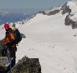
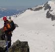
Trip: Mox Peak SE Spire (Hard Mox) - Becky Date: 7/22/2013 Trip Report: Finally got the right folks, a rope gun to lead the hard stuff, great weather window and opportunity to climb Mox Peak SE Spire (Hard Mox) on July 22, 2013. Was part of a trip that climbed all top 100 peaks in the area (Mox Peak NW Spire, Redoubt, Rahm, Custer, Spickard) over a 6 day period. Tyler and Nelson completed all 6 on their first try, might be a first. Curt and I had done Redoubt and Spickard 10 years ago. Headed out at 6am from high camp on the Redoubt Glacier, beautiful area. From Col of the Wild, head up climbers right on a scramble path to minor ridge, follow cairns. From minor ridge continue traversing higher. Here's a picture of modest step Becky describes, good hand holds. After topping out on Ridge of the Gendarmes,scramble down and left heading towards snow filled gully. Pretty good set of cairns, but have to keep a watch out as little traffic in this area. Cross pretty hairy ledge, some handholds, got to trust your feet. Come to snow filled gully, downclimb or rappel, about 130' Cross over to next gully on nice broad flat section, this is now the gully system with rotten loose rock you will need to climb. You will see a left and right fork in the gully above, stay right (looks terrible), work your way to the right side above the right gully. 5th class moves part way up, we did a lead. Lead or scramble up the right side, do your best to not rain rocks down on your partners (may have to take turns climbing key sections) until you attain the col, this is the start of the main rock climb. Here is the start of the first pitch with our rope gun Tyler leading out Picture of entire first pitch up to the detached white column, Nelson belaying. Low 5th class climbing, but loose rock, difficulty setting pro, so long runouts. Second pitch heads up the ridge, if in doubt stay left. Third pitch is straightforward, can pitch to summit or stop halfway and scramble. On the summit! First page of register has copy of Fred's first ascent notes. We did 3 single rappels down to col, then 2 double rappels down the gully. First rappel station at top of gully looked pretty weak, so built another with cordellette and big steel rappel ring. Worked out well, good rappel station halfway down gully, can get out of the gully while others descend and stay out of rockfall. After last rappel, can walk off back to flat spot between gullys, then climb up snow filled gully and scramble back over Ridge of Gendarmes and back to Col of the Wild before you feel safe again! Took us 14.5 hours from high camp and back. And did this on my 55th Birthday, what a great birthday present! We were 41st party to ever sign in, but 3rd this year, and two more parties were in the valley getting ready to give it a shot, so getting more popular. Gear Notes: Standard rack, two ropes, ice axe and crampons for snow filled gully, extra slings to leave behind for rappelling. Approach Notes: Depot Creek to Ouzel Lake, then up to high camp on Redoubt Glacier, high camp is a beautiful area, we spent 2 nights there, good breeze, few bugs.
-
[TR] Queets (with Christie & Seattle) - NE Face 9/6/2011
obsydian replied to obsydian's topic in Olympic Peninsula
OK, that might have been the problem, the setting is now "Public on the web", see if that works, learned something! -
[TR] Queets (with Christie & Seattle) - NE Face 9/6/2011
obsydian replied to obsydian's topic in Olympic Peninsula
Looks like you have to be logged into gmail for the link to work now. Used to be able to get into Picassa albums anonymous, but no more. Log in, then click the link. There are about 30 pics (too many to load into CC). -
Trip: Queets (with Christie & Seattle) - NE Face Date: 9/6/2011 Trip Report: Haven't seen a trip report on Queets so posting one from this weekend. Have been thinking and trying for this summit for 10 years. Got first good look in 2001 while climbing Olympus, a Bailey Range trip in 2004 got weathered out at Dodger Point, another trip got weathered in at the base of Barnes in 2007. Finally got the weather window. This was a 5 day trip from North Fork of the Quinalt, stayed 4 nights at Low Divide (day 2 climbed Christie, day 4 climbed Seattle). Our third day went for Queets, left Low Divide at 5am, climbed up the NE face but since it was so steep we decided to climb down the Queets glacier and slog back through Dodwell-Rixon Pass and then back up to Low Divide. 17 miles and 7,400' gain, 15 hour day. The route up the glacier looks very easy as our downclimb was simple. Full pictures are at my Picassa Album Queets pics Here are a couple pics of the route: View of the NE Face Looking down at the steep hard surface on NE Face On summit of Queets! Descending the Queets glacier Gear Notes: Ice axe and crampons Approach Notes: Got into some steep brush and hard hard scree on the NE face
-
The way to go is straightforward, but the descent from Ferry is somewhat hairy, very steep with no trail, some rocks jutting out to climb down through, very doable if OK with exposure.
-
Trip: Norton, Wilder, Dana, Barnes, Childs, Ludden,Scott - Elwah to Bailey to Dodger Point to Elwah Date: 8/4/2007 Trip Report: Three of us took a 6 day trip to bag several remote peaks in the Olympics. Norton, Dana, Ludden & Scott are climbed about once every 3 or 4 years according to the registers. The views were fantastic from these seldom climbed peaks. Day 1: Started at Whiskey Bend, 17 miles to Hayes ranger station. Day 2: On up trail, dropped main packs and climbed Norton, then on up to Chicago Camp. Day 3: Up trail past Happy Hollow, then left trail for cross country travel up ridge between Barnes and Wilder. Climbed Dana and Wilder, camped on ridge, long day. Day 4: Climbed ridge to Barnes and then camped below Bear Pass. Day 5: Hiked South on Bailey, climbed Childs, exited Bailey at Ferry on Ludden Ridge, climbed Ludden, then camped at Scott/Ludden saddle. Day 6: Climbed Scott, then traverse to Dodger Point, hiked back to trailhead. Found route descriptions and times in Olympic Climbing Guide lacking, here are some additional notes: Norton: Leave trail just South of Leitha Creek, head up ridge to 5900', traverse North and then Northeast to gain ridge South of Norton, follow ridge to summit, about 6 hours RT. Dana & Wilder: Leave trail West of first major creek after passing Happy Hollow camp, steep climbing through brush and trees to ridge between Barnes & Wilder at 4900', took 3 hours for 2500' with full packs. Dropped packs and ran ridge to Dana, then back to Wilder, took 9 hours RT, a lot longer then we thought. Ridge to Barnes: class 3 moves near summit of Barnes, took 5 hours with full packs, needed to bypass part of ridge between peak 6024 and Barnes to South. Scott: Avoid rock face of false summit by staying right, then gain false summit, left of final ridge until last few hundred feet, then stay on ridge to summit. Posted several pictures and more details here: Olympics Summit Fest 2007 Really nice to climb these remote peaks, the views were awesome.
-
Have gotten a lot of good feedback about this event, since it is kind of an extreme event, several folks believe we could make it a charity event, maybe raise some bucks for Mountain Rescue? Look for a charity event same time next year, Pro Mountain Sports will help sponsor.
-
We've been training just to pull this 4 bagger off, no other real objective other then to be in shape for the climbing season. Last year we did a trifecta (3 peaks) and wanted to see if we could do 4. I think I've reached my limit! Just wanted to do something to tell my grandkids about.
-
Trip: I-90 Corridor - Quad Burner Date: 4/1/2007 Trip Report: We made it! Bill, Joel, and Dan completed the "Quad Burner" of 4 conditioner peaks in a day: Granite, Washington, Mailbox, & Mt. Si. 14,870' elevation gain and 31 miles RT, 15.5 hours from start to finish. Started 5:30am and finished 9:00pm. The weather was great, cold enough that we had snow flurries all day long so didn't get too wet. Total ascent times (hours:minutes): Bill - 7:08, Dan - 7:22, Joel - 7:26, for about 2,000' gain an hour while climbing. We started out 5:30am at Granite MT. trailhead, Jeff and Peter joined us for moral support on this peak. The snow was very hard and crusty, so crampons and ice axe came in handy, Bill was first to the top in 1:49, Dan 1:50, Joel 1:52. The snow was too hard and dangerous to glissade, so we tromped on back to the cars. 4,050' gain and 7 mile RT. Back at the cars Dan opened a can of Spaghetti Oh's, wow that cold can sure tasted good at 8:30 in the morning! Washington was a new route for Bill & Dan, we were originally going to shoot for Bandera but we didn't know where the winter route started so did Washington instead. Since Joel was the only one who knew the route we stuck together and all make the top in 2:00. 3,320' gain and 9 miles RT. Halfway done! Back at the cars Dan opened a can of vegetarian beans, and that cold can sure tasted good also, but would bode an ill wind for the rest of the day. Mailbox is mountain we know all too well, being our main training route. Bill took off while Joel and Dan huffed and puffed. Bill to the top at 1:52, Dan & Joel at 2:00. 4,200' gain and 7 miles RT. One more to go! We put on approach shoes and packed light in our camel packs and away we go. Some sun breaks and cheerful weather. We kept up with Bill for the first 3 miles but then had to let him go, stomach ache and just plain getting tired. Bill in at 1:27, Dan at 1:32, Joel 1:34. 3,300' gain (to the benches) and 8 miles RT. Took us longer to descend in the dark with headlamps then to climb! Back at the cars at 9:00, what a day!
-
Has anyone used the North Side to descend after climbing The Tooth South Face (as opposed to rappeling down the climbing route)? Detailed description and any pictures? How many rappels? I've read about this descent route but haven't heard of anyone actually using. Thanks.
-
This response from the Mt. Baker Ranger District: Here is the information about the plane crash. An internet search of Bellingham and Everett newspapers may reveal more information. Thank you for the heads up that more material is appearing. On August 29, 1943 a NAS Whidbey PV-1 Ventura plane crashed on the west side of Mt. Baker at the Thunder Glacier, killing all 6 crew members. It had taken off at 1:30pm under light rain and fog to practice navigation between Everett and Bellingham. At 3:30 the plane radioed in that they were running on only one of its two 2,000 horsepower Pratt & Whitney engines. That was the plane’s last communication. The Navy spent hours of searching, but found no trace of the wreckage, and it was assumed that it had crashed and sunk in the waters of Puget Sound. On October 6th, 1994, Chuck Eaton, a hiker from Bellingham with his dog Candy hiked up to the area and at noon discovered the plane wreckage, that for 51 years had been buried under the ice of Thunder Glacier. The Navy S& R helicopter flew up to the site in late October and removed the bones of the 6 crew members, lots of live ammunition and other plane parts.
-
Here is the route drawn in with red line, dashed lines mean climbing on other side. Basically we went about as far South as we could, backtracked a bit, then started up the SW face, 4th class to the ridge, then dropped on the East side of the ridge and followed that all the way to the summit. Only found a little film canister with wet paper and hard to read names from 1988 and 1991 so don't know who's been up there lately. Did see fresh tracks and a new sling, so somebody beat us up this year already.
-
Thanks graupel, interesting story, a piece of history.
-
Sorry, it is Mt Baker.
-
Climb: Seward Peak-SW Ridge Date of Climb: 7/24/2005 Trip Report: Decided to climb seldom done Seward Peak (now I can see why seldom done) with some friends on Sunday. Seward is nearly the Southernmost peak of the Black Buttes, below Colfax and Lincoln. Drove to Baker trailhead Saturday night, bivied in the woods, starting hiking at 4am. At the top of Heliotrope Ridge where lower climbers camp is, we traversed up to the right and gained the ridge. Then downclimb 800' to Thunder Glacier, very loose and hazardous, went around bottom of glacier, ran into an old plane wreck that the glacier has released. Dropped on down the valley below Lincoln where we got a view of our objective (peak in the middle): Started gaining elevation again (had lost about 1,200') heading for SW ridge. Took awhile to find the start of the route, is not obvious, doesn't look like something one would want to climb, lava formations with lots of round rocks stuck in the wall, almost like concrete with stones sticking out, most holds were solid (!). Class 4 climbing, no real way to protect, just careful climbing. One harder move to gain the ridge proper, then downclimb other side on narrow ledges to bypass an obstruction on the ridge, turn the corner and see final technical hazard, "how we going to get up that!" Once you approach, it does go, walked around the moat, then up first gully you see, then ramps to the left and switchback to the right up sketchy handholds. Beautiful views all around from the summit: Clouds then gathered, then 1,500' of careful downclimbing, no slip zone on the ledges: One rappel, more careful downclimbing and finally at the base of this big lava pile. Then long climb out, heading up to the ridge about 1/4 mile West of our downclimb to hit better rock conditions, about 1,500' of gain to get out, then back to Heliotrope and cars. About 7,600' elevation gain, 15 hours. Gear Notes: 2 30m ropes for glacier travel and rappel, used for one rappel
-
Went by the bottom of Thunder Glacier on Sunday, looks like the glacier has given up a plane wreck. Anybody know the story, when it happened and the circumstances? Wonder how long it's been in the glacier?
-
Looking for beta on Mt. Seward (near Mt. Baker), any pictures, route description? Thanks
-
Reply from PI: I'm sorry you found the article so offensive and lacking sensitivity. That wasn't the intent in any way. And I received messages from Tacoma and Seattle Mountaineers who understood that, including friends of the climbers. Most, at least among the messages I received, liked the piece and understood it for what it was. And a few didn't. Yours, obviously, is among those. As a climber myself who has written about many climbing accidents, I'm regularly surprised by the emails I get when I write about an accident. Many notes have compassion and understanding about the injured or deceased. Others essentially carry this theme: Tragic but they got what they deserved by tempting fate. Some also complain about rescue costs and the rest. Obviously, these folks don't understand what climbers are about and why they climb (and about what really absorbs the bulk of rescue costs, i.e., hunters and hikers). As you know, the reasons people climb are complex and extend well beyond the information in the news story and the reasons you cited in your note to me. The article was an effort to discuss one aspect of those reason, -- an aspect that is cutting edge behavioral science. It was not not meant to reflect the sum total of the pursuit. To that end, I talked to people who had dealt with death first-hand, older climbers, not 20-something adrenaline junkies. Climbers accept risk when they climb, as they accept the potential for number of factors well beyond their control. I've not met one who's asked for pity about the accepted risk. And I've not met one who didn't consider the problem-solving to minimize risk part of what makes it compelling. This story was a slice of that. Nothing more. You found it appalling, offensive and lacking in sensitivity; Others didn't. It wasn't my attempt to offend anyone, particularly members of the families. If you know that they are offended, tell them to feel free to contact me (or I can contact them) and I'll offer my apologies for their unintended reaction. Moreover, I'll offer a clear explanation why I wrote the piece. Thanks for your note. -- Mike Lewis
-
Letter to the PI editor, sent 7/18 Am writing in response to your article titled "So that's what fuels the psyche of a climber", published July 13 I'm really appalled at the lack of sensitivity that the PI would show to headline such an article with the accident that happened on July 10 that claimed 3 lives and injured a 4th. The article is a pretty breezy piece, almost tongue in cheek, with carefree quotes from Viesturs, Simonson, Wickwire and Gauthier and suspect science from Zuckerman. To tie this article to the tragic accident is tacky, shows a great lack of understanding on the authors part, and questions the oversight of the editorial board of the PI. The climbers on the Sharkfin Tower outing were not adrenaline junkies seeking the latest thrill, as implied by the author. They were middle aged folks climbing very modest routes technically, just trying to enjoy the great outdoors. The North Cascades National Park is one of the great wonders of the state of Washington that very few take the effort, or have the capability, to enjoy. These folks were trying to participate in that enjoyment when a tragic set of circumstances overtook them. So why do folks like this take up climbing? This is a fair question, although sometimes hard to answer. I climb for the following reasons: 1) Wonder. I've climbed over 120 peaks in the great Northwest, and I'm continually amazed that each time I sit on a new summit and soak in the glorious views around me how I'm filled with wonder and awe at the world we live in. The mountains are so massive, the glaciers so beautiful, it’s a wonderful place to be. 2) Spirituality. I find that I'm closest to my creator and have the sense of a higher being in control, when I'm viewing the beauty of the high peaks, I feel so small and insignificant, and become grateful for the things that matter most. 3) Mortality. Many of us have taking up climbing at middle age, some would say a mid-life crisis, but we reach 40, see that we've used up half our years, and don't want mortality to overtake us. We start exercising, stretching ourselves to the limit, gain good health, and feel that we're holding off old age as long as possible. 4) Friendship. The circle of companions I climb with are my closest friends, we share very close moments together, knowing our safety depends on each other. We truly enjoy each others company, share jokes along the trail, kid each other about our abilities, and have a great time. 5) Health. Climbing is one of the most physically demanding exercises one can do, and keeps me healthy. I really feel good when I'm in climbing shape. 6) Get away. I have a stressful job, getting away where there is no cell phone coverage and no connection to all the problems of work completely refreshes me. These are probably the most important reasons I climb. Taking on risk and seeking that adrenaline rush is not one of them. In summary, the profile of the climbers on the Sharkfin Tower accident don't fit the implied profile of the high risk taker published in the article in question. The PI has done a great disservice to the families of the victims by tying this article to them, and a disservice to the general readership with a sensational article. The PI owes the families of these victims an apology.
-
Climb: Logan-Douglas Glacier Date of Climb: 5/28/2005 Trip Report: Did seldom climbed Douglas Glacier route on Mt. Logan over Memorial Day weekend via Easy Pass, fortunate to have perfect weather. Could not find much beta on route, so looked at the map and went for it. Day 1: Obtained permit at 7am, started hiking up to Easy Pass about 9am, beautiful views from the pass, could see Mt Logan and Douglas Glacier. Descended to about 4,000', turned South, crossed Fisher Creek and followed the drainage towards Mt. Logan, see map: Had a terrible bushwhack to the lower basin, but on the way out found a reasonable approach. When you pass some very large (30') rocks, keep right, cross a tributary and stay on the stream, sometimes hiking in streambed, sometimes on the bank, stay left of the stream, there is an old dry overflow stream up the left hand side of the waterfall: Eventually came to lower basin, camped at about 4,600' by large rock, found some small tent sites, great view of the basin and Douglas Glacier, route will be way to the left and then a traverse to the right, 10 miles, 3,500' gain, 2,500 loss, a 10 hour day. Day 2: Started climbing at 5:30am, head upstream until on left side of rock bands, climb scree and then snow to glacier, traverse across upper glacier, staying high to avoid sluffs off lower cliff bands. There is a headwall, 60 degrees, 30' high at the Col, could need ice screws later season if got icy, but able to kick steps with no problem. Summit block is very exposed scrambling, not for the faint of heart! Reached summit about 1:30pm, great weather, beautiful panoramic views, great view of Mt Goode's north side. Back to camp by 5:30pm, 4,500' gain and loss, 12 hour day. Day 3: Left camp at 7am, back up and over Easy Pass, took long break, then down to cars at 3pm, 10 miles, 2,500' and 3,500' loss, for an 8 hour day. This was a great climb, is a great route, would highly recommend, is actually the shortest route into Logan now that the road and bridges are out, just involves some routefinding and brush to the lower basin (one other route report describes going up sharply to the left at the large rock, following the left fork of the creek, this looked very steep and appeared the route would go too far left, am glad we stuck to more direct lower basin approach), a great 3 day climb, 24 miles 10,500' gain. Gear Notes: Took pickets, didn't use.
-
Wanting to do the Douglas Glacier route on Logan later this spring, only found a sketchy paragraph or two on the subject, anyone have beta on the route, pictures? Thanks!
-
Have seen a Randonne binding for mountaineering boots but can't find the brand or find any at the on-line shops. What is a good brand, and where can you find them both on-line and at local shops (Sea-Tac). Thanks in advance.
-
[TR] Old Desolate- South face(hang dog ally) [FA] 7/24/2004
obsydian replied to skyclimb's topic in Mount Rainier NP
There is no trail, but several ways to get to the top. I was just out there this Labor Day weekend, we went right up the South rib off the Wonderland Trail (after scrambling Mineral), stayed a bit to the right until we got to the ridge proper, then ran the ridge staying on or just to the West of the ridge all the way to the summit, the ridge is a boulder hop, very nice views. Register has few names. You can also start up the valley to the West of the ridge, run up the valley as far as you can, then up the scree field to the summit. Good option is to continue on North to Vernal Park, then up the Crescent/Sluiskin col, down to Windy Gap and out the Northern Loop trail. -
See this thread Jack Mt 2003
