
Leaderboard


Popular Content
Showing content with the highest reputation on 08/18/22 in all areas
-
Trip: I90 Corridor - Mailbox to Granite Traverse Trip Date: 08/11/2022 Trip Report: I did the Mailbox to Granite Traverse after work last week, skipping Bandera and Pratt. It was a pretty full on adventure, and a ton of fun, although I probably won't revisit it for a little. Nothing is ever that hard, but there was just a lot of bush bashing and boulder hopping. To have such an adventure so close to home is pretty special. https://climberkyle.com/2022/08/11/nordkurvengrat-mailbox-to-granite-traverse/ A little after Dirtybox. The Dirty Harry's fixed line. That primo Web to P3 section. Beautiful sunset near Granite. Gear Notes: Running shoes, vest, filter, headlamp Approach Notes: Mailbox old trail3 points
-
Trip: PRIMUS PEAK (8508'), TRICOUNI PEAK (8102') - EAST RIDGE & NORTH RIDGE Trip Date: 08/13/2022 Trip Report: PRIMUS PEAK (8508'), TRICOUNI PEAK (8102') – Thunder Creek Trail Approach – AUG 13-15, 2022 (Sat, Sun, Mon) Another perfect weather weekend for climbing. Temp was right around 80 all days. I originally planned to climb Tricouni, Primus & Austera Peaks. After climbing the first two peaks and doing the math, I would have needed another full day and more supplies to bag Austera from this side of the mountain, which wasn’t going to happen. Saturday: I started from the Colonial Creek Campground area at 9:00am. I headed up the Thunder Creek Trail to McAllister Camp arriving at 11:30am. I planned to cross the bridge over Thunder Creek to the McAllister Camp on the other side of the creek. That is where the start of the climber’s trail up to Primus Camp is located. Having climbed Primus before, I knew this was the best option. I walked right by the trail to the creek because it was covered under a pile of sticks and the old signage was gone. I doubled back and headed down the trail to find that the bridge is completely gone too. Not damaged or collapsed, but completely gone. I looked up and down the creek nearby for a possible log jam crossing. No luck at all, the creek was high and deep and moving fast. There was no way I was going to attempt to ford the creek. I decided to move on to Tricouni Camp since the camp is located before Fisher Creek feeds into Thunder Creek, hoping this would mean the creek would be more crossable. I headed through Tricouni Camp to Thunder Creek and lo and behold, a fantastic log crossing with three big trees together all the way across the creek. It was 12:45pm by this time and the new plan was to cross the creek and go straight up the mountain side to connect with the climber’s trail on the ridge. I knew it was going to be steep the whole way. The bushwhack started out good, the terrain was pretty easy going. That ended pretty quickly. I came across a well established game trail mostly of goat tracks. The goats have always been good to me, so I followed the game trail up the best I could. I started to hit vertical cliffs around 4000’ so I traversed toward Tricouni Peak and through several steep gullies, again following the goat trail. I finally made it to a boulder field and headed straight up. It got steeper and more loose but I kept fighting my way up. Finally at around 7:30pm I popped out onto a familiar looking plateau at about 5700’. Sure enough, the climber’s trail to Primus Camp was a little way up from me. I reached Primus Camp at 8:15pm. Time enough to setup camp, eat and go to sleep. The climb up was tougher that I had expected and took much more time. The goats are a bunch of crazy tough bastards, thank god, just my type. Sunday: I was up and moving at 7:00am. Tricouni was first on the list. I headed for the toe of the North Ridge and started up. The ridge start is class 3-4 rock then it eases up a bit to cIass 2-3. I looked down the side of the ridge to see a mountain goat hanging out on the cliffs below. He looked surprised to see a human in the area and got the hell of a dodge in a hurry. I headed up to the main snowfield. The snowfield is moderately steep and gets steepest at the top. Snow conditions were pretty good and firm. Once at the top of the snowfield I was staring at the ridge up to the top. Exposed class 3, 4 rock, somewhat loose in sections. I took my time and made sure my holds were good. The ridge got narrower, down to about 2’ wide in one section. I climbed along the side of the upper snow section with an overhanging cornice to the summit area. The cornice was ready to come down. A 6’ wide section came down as I was working my way to the snow gully. I climbed up the left hand side watching the cornice carefully for any movement. The rest of the cornice will probably come down this week. Once above the cornice section, it was easy climbing to the summit arriving at 11:15am. Beautiful views in all directions. I found a summit register from 2004 with only two party entries. One entry only had the date listed. I’m assuming they must have lost the pencil at that point because there was no name and the pencil was gone. The register is a zip lock bag with a vitamin bottle inside, hidden in a small pile of rocks on the summit. Bring your own pencil and maybe an extra to leave behind. I started down from the summit heading toward Primus. There is supposed to be an “easy” snow finger down to Lucky Pass. Easy my ass! The snow finger was steep with halfway soft snow and shitty moats on both sides. I was about 75% down the snow finger before seeing that the bottom section had a 20’ gap with 10’ of vertical snow. I had to climb down into the moat and wedge myself between the smooth rock wall and the snow. The snow was not solid enough to climb down with crampons safely, so I alternated between the snow and the smooth rock until I was close enough to jump down if I slipped. I didn’t slip but it wasn’t fun. I finally made it down to Lucky Pass at 1:00pm. The name is fitting. The pass is in a perfect location with great camping and a nice little stream for water. The view is fantastic. Klawatti Lake below would make a great camp area. Looking back at the “easy my ass” snow finger on Tricouni, I noticed a goat path down the side closer to the pass. If I had known it was there, I would not have taken the snow finger down to the pass. Next stop was the Primus summit. I climbed Primus before via the North Ridge in 2014. That was low 5th class rock. The East Ridge of Primus is mostly class 2 bouldering with a little class 3 here and there. I made it to the summit at 2:40pm. I was back to Lucky Pass at 4:00pm. I looked over at Austera Peak and looked at my watch and went through my supplies. There was no way I was going to get to that peak and make it back to camp in any reasonable amount of time. So I headed for camp cutting across the glacier in front of the South Face of Primus. The glacier was in OK shape, soft but manageable. I wrapped around down to the glacier above the lake and over to the glacier below Tricouni. It’s a bit of a bowling alley below Tricouni so I opted to climb on the glacier halfway floating on the Lake. It worked out well, I saw several boulders on the glacier around that area so I knew it would hold my weight fine. I made it back to camp at 6:45pm. Monday: I packed up camp and was up and moving at 7:00am, heading for home. I didn’t want to follow the same route that I came up on as the gully crossings were not fun. My plan was to drop down the climber’s ridge trail a ways and then drop off the side into the Thunder Creek area, hopefully running into the Tricouni Camp’s huge log crossing. I dropped down the ridge trail to about 5000’ and decided to make my turn down toward the creek valley. The route started as a fairly steep gully down the side of some cliffs. It looked somewhat well traveled, probably by goats. Careful vege belay technic was crucial. After the initial loose steep start down the gully, I spotted what looked to be a dried creek bed down the middle. I follow this dry creek bed as far down as I could. There was some wet mossy sections along the way. I was using vege belays the whole way down. I reached a cliffed out section in the creek bed and turn right into the forest to get around the cliffs. The forest vege belays didn’t work very well. Most of the branches were dry and brittle and tended to break when you needed them the most. So I aimed at the areas that had the most trees to grab onto. I stayed close to the creek bed but in the forest. There were cliffs mixed in here and there put they usually had hidden shelfs that allow me to get around them. Again I was following goat trails most of the way down. The steepness started to ease up and I knew I was close to Thunder Creek. I popped out onto the creek side and checked my elevation (2060’). This was close to the Tricouni Camp log crossing. I looked up and down the creek and didn’t see the huge log crossing. I decided I must be a little too high up so I followed the creek down thinking I’d run into the Tricouni log crossing soon. After about a half hour going down stream I came across another nice log crossing the creek. It wasn’t the original log crossing but it was too good to pass up. I was on the main trail side of Thunder Creek at 11:00am. I wasn’t sure if I was above or below Tricouni Camp. I wandered around massive amounts of downed trees in a swampy area until I saw a sharp turn in Thunder Creek. I pulled out the map to look for the turn in the creek and it put me closer to McAllister Camp than Tricouni Camp. I knew the main trail was close even though I could not see it. So I just marched straight up the hillside and sure enough I ran right into Thunder Creek Trail at 12:00 noon. I was on the trail just above the old bridge crossing that has disappeared at McAllister. The trail back to the parking area was uneventful and actually kind of boring compared to the bushwhacking. I was back at the vehicle at 3:20pm. Since the McAllister bridge is completely gone and probably will not be rebuilt, the route I took up and down will probably be the new way to Primus Camp for the future. Hopefully with more use by goats and people there will be a more clear cut path to follow up to and down from the Primus area. Right now, it is one hell of a workout getting up and down. I was beat by the end of each day. Some Tips and Notes: 1. The McAllister bridge over Thunder Creek is gone and there are no log crossings nearby. 2. Tricouni Camp has an excellent log system crossing Thunder Creek. 3. Climbing up the hillside toward Primus Camp from Tricouni is steep and loose. 4. If you see a creek bed on the way up, follow it. If you see a well worn goat path on the way up, follow it. They will be the easiest ways up. 5. Bring work gloves for the extensive vege belays needed both up and down. 6. There are bivy / camp options near the Tricouni Summit, the Primus Summit and at Lucky Pass. Travel Time for reference: Saturday: Trailhead to Primus Camp (6000’) – 11:15 hours. Sunday: Camp to Summits to Camp – 11:45 hours. Monday: Camp to Parking Area – 8:20 hours. Total Mileage: around 26 miles Total Elevation Gain: around 8100’ Gear used: Trekking Poles, Ice Axe, Crampons, Helmet. Logs crossing over Thunder Creek at Tricouni Camp. Bushwhacking around 4000' on way up to Primus Camp. Finally on the climber's trail with the objectives in sight. Tricouni and Primus from camp. Tricouni North Ridge. Snowfield on Tricouni. North Ridge to Tricouni Summit. Looking down the North RIdge route from Tricouni Summit. Looking back at the Tricouni snow finger down to Lucky Pass, notice the goat trail on the right side. Lucky Pass view. Klawatti Lake below. Forbidden in the background. Primus East Ridge, basic class 2-3 rock. Primus summit memorial. I have to admit I had a lump in my throat and a tear in my eye. One simple line "We Miss You Son". I couldn't image losing a son so young and trying to move on in life. I climb in the mountains to get closer to heaven and it seems others do to. Austera, Klawatti & Eldorado from Tricouni. Primus on the way back to camp. Tricouni on the way back to camp. Back to Camp. Some nice views right off the side of the main trail. A very beautiful area that charges a hefty fee in the form of suffering. Well worth the effort. Gear Notes: Trekking Poles, Ice Axe, Crampons, Helmet. Approach Notes: Park near Colonial Creek Campground, head up Thunder Creek Trail, cross logs over Thunder Creek at Tricouni Camp.2 points
-
Trip: Argonaut - South Face Trip Date: 08/14/2022 Trip Report: I've been out to the Teanaway (Teanaways?) several times this summer and it's been pretty awesome to become better acquainted with the area! For this trip, D and I decided to haul gear up to Argonaut's south face for a supposed "5.3" route. "What is the difference between 5.3 and 5.6?" I asked myself... We hiked in via Beverly Creek then over Fourth of July Pass on Saturday late afternoon and camped at Ingalls Creek. In the parking lot, we met Jennifer and Chris, also heading to do the same route! In the early evening, two climbers came down back to their camp at Ingalls Creek from Argonaut and gave us some approach beta, said that there's a legit "climber's trail," and shared that it took them 3 hours from camp to summit (via the 4th class scramble route; they soloed everything/didn't rap). Wow, we thought! Maybe we will be out of here way earlier than we expected! We set off from camp a bit past 7am and quickly found a solid trail up through the scrubby open-ish eastside forest. Very unfortunately, it did not last forever, and some B2ish schwack ensued between pieces of game trail until we got into more open meadow with sandy trails. OK, all good. Not my favorite part of the approach: A much more scenic part of the approach: At this point, we aren't sure what happened, but we clearly did not pay enough attention to the navigation/GPS and we crossed into a gully too far east, thinking it was the main gully, and started ascending. We realized our mistake a bit on the later side and tried to carefully poke out a way to traverse west into the gully that we wanted, but after some 4th class stuff ("accidents often happen when people are off-route..."), we decided to go back, down, and around. Welp, that was fun exploratory bonus el! Up and up the gully, D and I being careful not to trundle things onto each other, then finally at the base of the south face. We used a Mountain Project photo overlay to locate the start the 5.3 route, and it really looked like the picture.. but anyway, that first pitch we ended up calling 5.8. Lots and lots of options on the face, lots of cool features (some chicken knobs, crystally ledges, etc), cracks, and good pro. Definitely plenty of lichen and lots of loose and jumbled blocks in cracks, as expected. I ended the first pitch at a small alcove with a giant block that was slung that I stumbled upon (the sling looked kinda old). I apologized a bunch to D for clearly getting us off-route, but she was grateful we were getting up it and safely. Very nice of her The second pitch was much easier -- I did go around a chimney feature due to the pile of microwave blocks sitting in it and then I traversed right at the top, all to keep the rope from dislodging rocks onto D. I chatted a bit with Jennifer and Chris, who had started where we did but had followed cracks trending to climber's left and had topped out a bit before us. Bringing D up to the top of the second/last pitch: Anyway, we scrambled to the top, got cool, up-close views of Colchuck and Sherpa plus FOUR volcanoes, and then we scrambled down to the rap station for the 50-foot 4th class gully. One of the amazing views from the summit: Some photos of the face, from below after rappelling: Descending the gully: As the talus gully became meadow and then forest and stripes of slide alder, we started on solid trails and then...very unfortunately, had a hell of a time finding our way down to the main trail. Time is meaningless when you're trying to be zen in slide alder, but this was some of the more memorable schwacking I've done in awhile.. and on the east side! Oh, but we did come across what I think were some bones of a mountain goat? Skull: Finally made it down to camp, apparently our friends hadn't fared much better than us on the descent. Our 6-ish mile hike out went very quickly due to D's blazing speed and pace-setting which I was so grateful for! Good bye, Argonaut, I am glad to tick you off my list. I wish I could get a ride up and just play around on that south face, but I probably won't be going up there again (at least until this memory fades). Jennifer and Chris, it was lovely chatting with you two throughout the weekend and it was very sweet of you to wait until my Civic cleared that washout/rut on the forest road before driving off on Sunday night. Thank you! Gear Notes: 60m rope, single light rack, rock shoes, fully engaged trail-ish senses, fully engaged quiet feet Approach Notes: up, down, up, up, up...I'm sure you're better than me at finding those trails!1 point
-
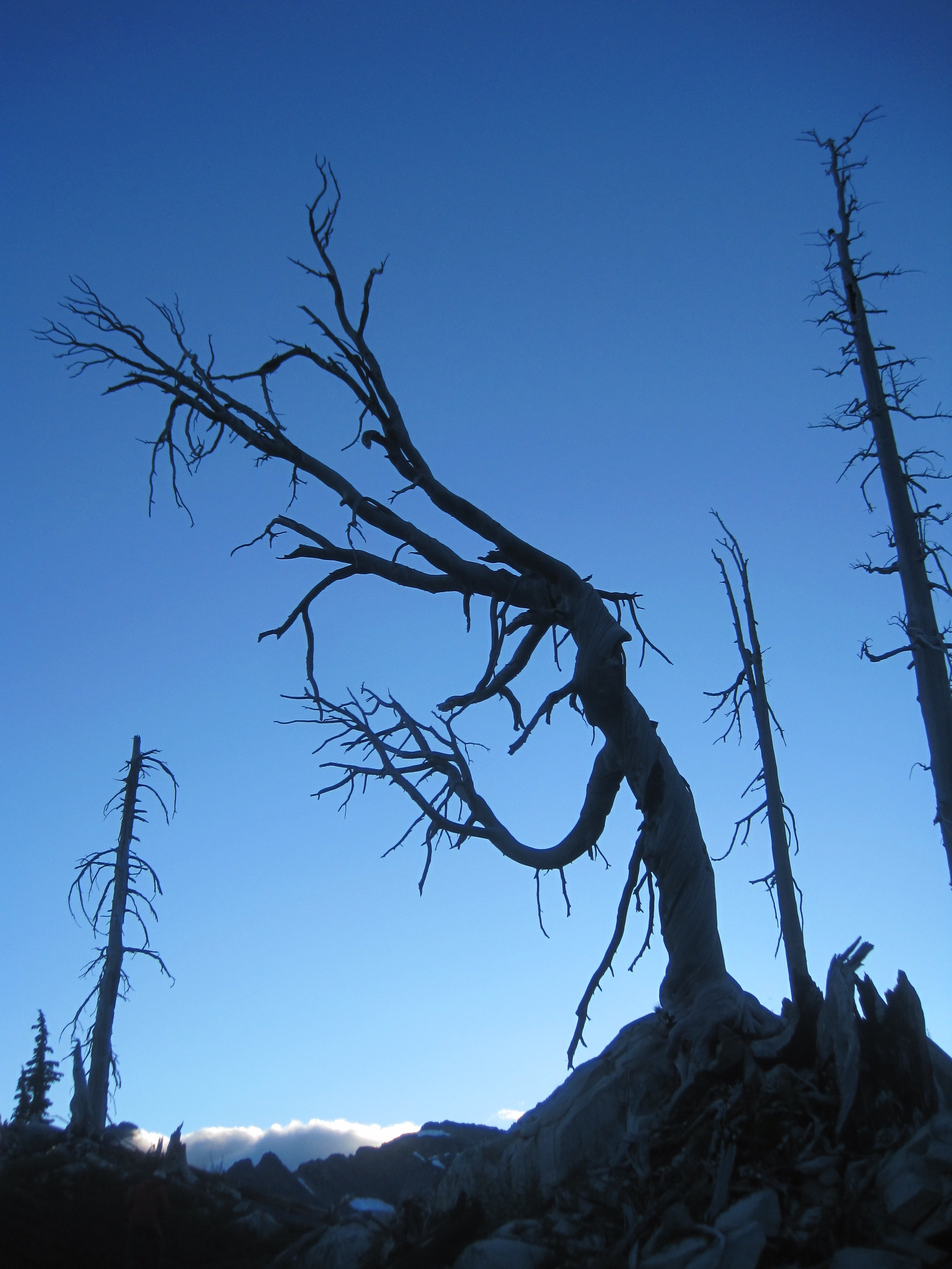
Trip: 3 days north of Snoqualmie - Thomson W Ridge, Huckleberry W Face, Alaska, Kendall Trip Date: 08/11/2022 Trip Report: Blue collar alpinism. I am many things, and as a climber, only a few (tree beautifier and occasional murderer, recently unmotivated pebble wrestler, occasional *blue*collar*alpinist, and mostly a steep cave sport choss wrangler), and recently all of those climbers inside my earthly shell have been tugging around the term blue collar alpinism. All that goes with it - lack of aesthetics, a sugar bowlful of chossy andesite, a bunch of unpleasant walking, rarely visited (or often visted) summits, frequently climbed (or never climbed) paths to those summits. Actually, this term has been bouncing around my head since more than a year ago, when @JasonG off-handedly awarded myself and Zach the 'blue collar award of the week' for some stupid romp up Guye. I read trip reports on this site for truly outstanding ascents and FA's in the NC's, where ice and snow and rock collide for national-park-worthy pictorial territory - like @waynesaid at some point recently the golden age of the Cascades is now. I spent a delightful 5 or so hours once reading through a collection of TRs that @Blake collected on his blog more than a decade ago, so many under the radar hard, cool, scary, cutting edge routes going up in corners of the range yet-undiscovered. But as I venture from the truck to explore even more deeply my corner of the range, the 3 forks of the Snoqualmie (a blue-collar river if there ever was one), and find hidden crags, secret swimming pools, a wealth of dramatic glacier-carved terrain, rarely visited peaks, goat carcasses, hard new bolting & scrubbing experiences.... I am reminded how Cascadian they truly are. Walking up the PCT and staring over to the basin to the north of Alta Mountain: how many people have ever been there? It doesn't go anywhere, only a 800 foot bushwhack from Gold Creek or a chossy traverse & descent from Alta would get you there. And now that I've visited the Wasatch and other such ranges, I'm eternally grateful that this backyard I happen to have is so damn crazy. The Wasatch is predictable, the Rockies are predictable, the Sierra is predictable, but the Cascades deliver stunning amounts of unclimbed ridges, faces, steep heather slopes... yall know what I'm trying to say here... even along the PCT as far south as Snoqualmie Pass. Blue collar alpinism, yes! But blue collar in the best sense of the word. The idea for such a trip had been floating around since last year between Zach and I, and he finally lured me out of World Wall and the Actual Cave to sack up and ride the trail to the choss wonderland that is Thomson, Huckleberry and their compatriots. As we began tromping, heavily laden, up the Commonwealth trail, I thought more about the blue-collar nature and where it would lead after this trip: more 'white collar' climbing at WA Pass? Forays into the North Cascades to test our finger pads? Getting ahead of myself, I thought. We made great time to Gravel Lake and hurriedly pitched camp at 11am. Part 1: The Blue? Our first thought was to Thomson, and off we went to pluck it, I with a rope, Zach with a rack, and no one (yet) with the shivers. Bumblebee Pass was a slog after 8ish miles of hiking but thoughts of water in the basin gave wings to our feet. Immediately, we wished we'd camped there instead..... Surprisingly pleasant talus kept us moving up to the base of the west ridge. Zach took the first pitch sliding up through some discontinuous corners. It wasn't here where this realization came (that was back at camp Day 2 with a joint), but the andesite we have at the crest in this part of the world is a Blessing in Disguise. Granite doesn't overhang the way this metamorphosed andesite does. Finding the safe and clean path through a maze of chossy andesite roofs (so good if bolted, if only...) is a Blue gift from the mountain gods. I wholly appreciated the challenge of P2, though a small challenge it was, getting to pull a roof even at the end! Zach led up to the base of the slab mid-route, which provided good picture opportunity. Knowing the hard part (hard? more like Blue) to be behind us I romped on up the slab and pranced happily toward a steeper bit of choss - too much prancing perhaps, Zach called up behind me 'are you gonna put a piece in?' Doubtless it wouldn't hold, but that isn't sad, it is Blue, and a challenge to be appreciated. The belay ledge had a detatched block I threw two cams in and tried not to weight as Zach ran up to the false summit. Once in the notch, a further fun (Blue) pitch brought us to the final summit. A text was sent to let my sport-choss-wrangling buddies know that we weren't swallowed by the Blue just yet. The descent was straightforward, some raps, an inappropriately timed coiling of the rope, an inappropriately timed uncoiling of the rope, another rap, an appropriately timed coiling of the rope, and some marmot-like gamboling across the talus during which I decided I didn't want to hear anything for the rest of the trip that wasn't about marmots. Zach responded with 'a sizeable middle finger approaches.' Back to camp, swallowed food, water pumped, and the great chase of Sleep began as the Blue faded, and gave way to the Collar. Part 2: The Collar? I awoke to a chorus (that I neither heard nor heeded, but which was there all the same....): The Blue has been summitted and the Collar rises in your horizon to provide a test for the ages. Breakfast was eaten and a start was made at 7:30. (No indeed, an alpine start it was not...) Along the PCT heading north we made a simultaneous impulse decision to scramble the clean white granite ridge of Alaska Mtn. A pure joy to bring us back to reality: humans don't belong in the Andesite Choss World, and we tread there lightly and quickly. Back down the ridge we went and along to the west side of Joe Lake, where a decision was to be made. Toppling Tower sits on the ridge to the north of Edds Lake, which sits below the northeast side of Thomson and about 900 feet below the PCT. We had the thought of combining its summit with Huckleberry, that day, but peering over the ridge at the bushwhacking, and elevation, and talus, and then the climb, then the talus, the elevation, and the bushwhacking we'd have to do.... Huckleberry seemed a much more certain objective for the day, and less painful! What can I say... we're only human. (Certainty? Lack of Pain? Did the Collar win, so early in the day? Not so... a branch of the Collar provided a sunburst of humility we walked through with grace, leaving the true mountain to climb... being the true mountain itself.) So on to Huckleberry! I'd vaguely read this TR on the west face of Huckleberry being a more pleasant option than the classic east ridge. It was also closer to us, and I hate hiking. We dropped off the PCT in a nice meadow, leaving my pack for the return journey, as I took up the rope yet again. (And still, no shivers....) After a short detour where we realized we had no water and I returned to the pack for the filter so as not to raw dog dirty swamp puddle filth, we began up another talus field to a short 3rd class step, then delightfully into the shade, and not so delightfully into the mosquitoes. Bug Boy, we call him. I'd forgotten much about the TR except the pitch description, so we started, as directed, left of a large loose chimney. When Zach was halfway up the pitch, I started simuling to escape the mosquitoes, which were horrendous. It hurts to call them Collarful; too soon, they were simply horrendous. What was Collarful was the first pitches: vertical to overhanging tree and moss climbing up about 250 feet to a big ledge. At this point the Collar was upon us, and Zach and I were certain to be off route. I scouted the upper headwall for something that would go; there were cracks I was confident I could climb, but where would they lead me? Not to anywhere I could rappel from if necessary. Eventually, I traversed the ledge (and perhaps the Collar as well) to find exactly where we needed to be, at the base of a fourth class ramp. I lead and brought Zach up to below the final pitch, 2 small steep dihedrals cutting up to the summit. Now it was time for my superior rock skills to shine. While still folded in the Collar we may be, I saw the light on the outside and had only to claw my way skyward. I began up a dihedral placing on the left and the right. Standing in a stem for what must have been 10 minutes, I cleared dirt from a crack to place my first bomber piece of the day, a #1 in a well-attached big slab/block. With this confidence, I put my knee in my armpit, my right forearm on dirt, and mantled hard. Now I was standing on heather. The last dihedral looked BIG, and detatched, and overhanging, but not dirty. I bumped a #2 up the nice hand crack until the final moves. It was clear I could pull up and over, but how attached was the block above me? (The Collar had been flicked closed, and I was losing sight of the light...) The other option was a high step, roof pull, and mantle to the left. I extended the #2 and reajusted the placement to hopefully hold a fall. A cackle arose in my throat, remembering the adage about the Mox Peaks: 'If you don't like where the hold is, just pick it up and move it to where you do!' I warned Zach and started pulling holds of the ledge I was to mantle on, scrubbed some lichen off a foothold, and committed to the move. Rubber met the road, chalked fingers met welcome jugs, and I was on the summit. The descent was an adventure involving poor rappel anchors, limited tat, breaking old tat with my hands, and downclimbing 800 feet of scree. But by that point we were out of the Collar, and almost on to the Alpinism. (Or, from here on, the Alpinist.) Part 3: The Alpinist If there's one lesson we might've learned from the movie, was it 'know when to stop?' No, it wasn't, that kind of oversimplification does poor justice to LeClerc's memory, but it's the lesson I'm choosing to drag out and apply here. We could have gone on to Toppling Tower the next day; I'm not sure what was in Zach's head, but he clearly wanted it, and so did I. A rarely visited summit with many unknowns and challenging climbing? Of course we selfishly desired to have said we'd done it. The glory of such a climb is fleeting at best and nonexistent at the real state. But the lessons we'd internalized (never verbalized until now) through the Blue and the Collar were clear, when doing our little corner/pitiful imitation of blue-collar Cascades alpinism, know our limits. It wasn't the tower that would stop us in our tracks. Dropping over Bumblebee Pass and 1200 feet down to the lake, around the bushwhack of Edds, up to Toppling Tower itself, doing a climb, getting off some way or another (20 year old rap anchors?) then all that back again, then down the PCT 8 miles.... we simply weren't fast enough at navigating such blue collar Cascadian terrain. Such was the decision we tentatively made before we even went up Huckleberry. The ascent of the Berry Mountain confirmed it even more (the 3 hour descent) and when we awoke to mist and fog, we didn't even have to discuss plans. We ate, packed up, and headed homeward. A scramble up Kendall (which neither of us had enjoyed before) took some of the sting out of it, but there was no sting, really; 4 summits in 3 days plus 28-ish miles of travel is nothing to sneeze at for us at least. Thus ended the trip of the PCTfor Zach and I; we must have passed 130 people on the Saturday morning way out (big yikes...) Shakes at the Dairy Freeze, shower, and a long period of photo organizing and trip report writing, and here we are. If you read all that, thanks, it was essentially a very long way to justify posting this TR at all on what is increasingly a Cascadian all-star roster, so if you enjoyed this truly blue-collar trip report (if maybe not a blue collar trip? although I quite seriously tried to convince you it was), you're welcome. Anyone been up Toppling Tower recently? How was it? As I discovered 35 minutes ago, we did go the correct way up the west face of Huckleberry. Anyone else repeat that route in the last two decades? What was your experience? I think @Kuckuzka1 did a route on the south face maybe? How did that stack up? Gear Notes: we kept it pretty fuckin light Approach Notes: feet1 point
-
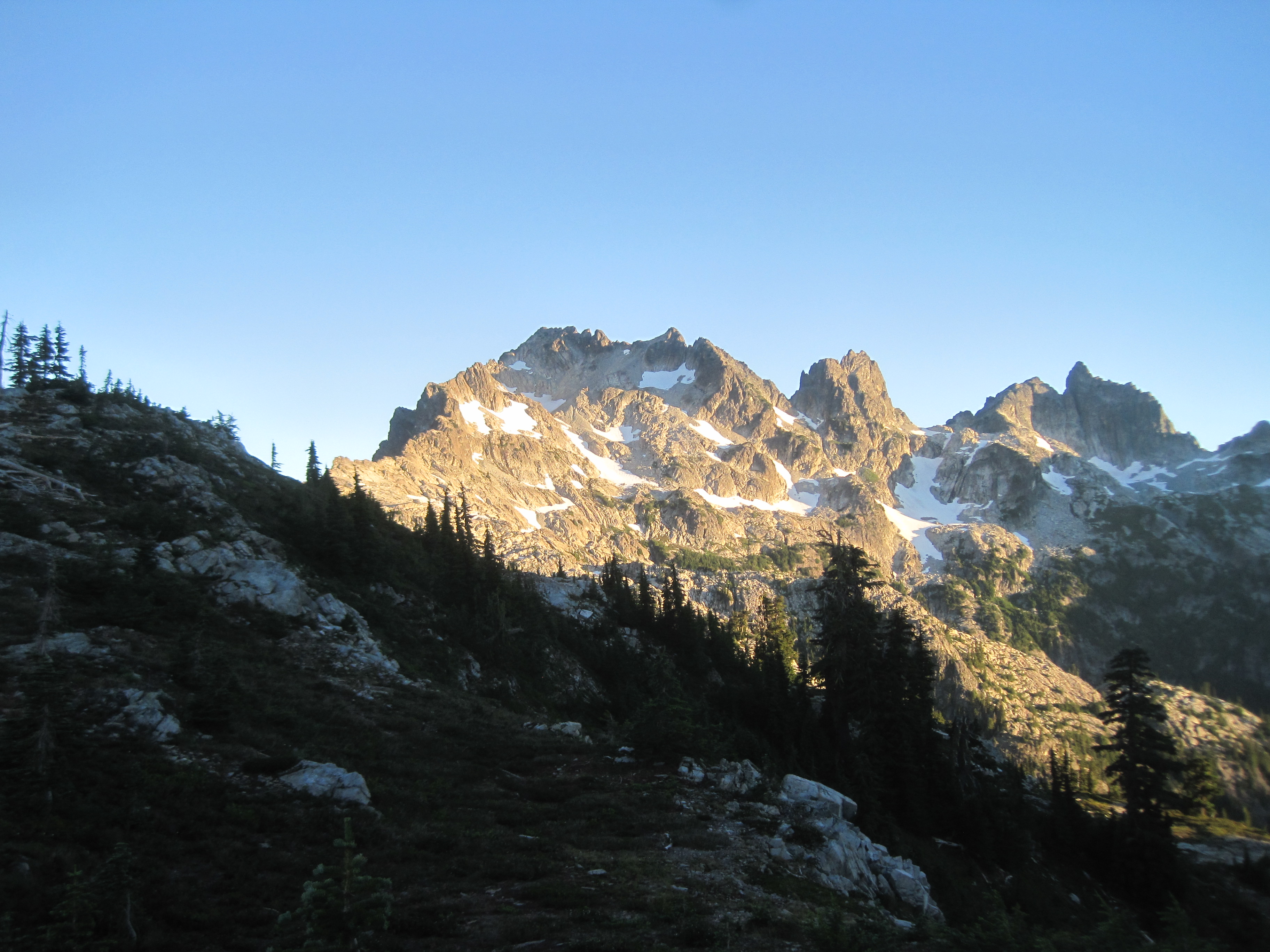
Like certain people at the bar, Thompson looks better from a distance than up close...1 point
-
Did the Chuck Spiekerman Memorial Ascent of Summit Chief yesterday with another buddy of Chuck's, and followed (sort of) his beta here -- in that we went in and out via Escondido Ridge and mostly made sure to find the trail along the ridge. We did make the ascent more interesting by selecting the wrong notch and climbing a false summit first before traversing to the correct one. Tons of people camped at the first of the Vista Tarns right off the PCT but not a soul at the second which was maybe 5 minutes more walking. So nice. Good day out and it was only 12 hours tarn-to-summit-to-trailhead but those last two mosquito-infested miles to the trailhead were INTERMINABLE. Fortunately fish n chips at The Brick dulled the memory.
 1 point

