
Leaderboard


Popular Content
Showing content with the highest reputation on 07/29/25 in all areas
-
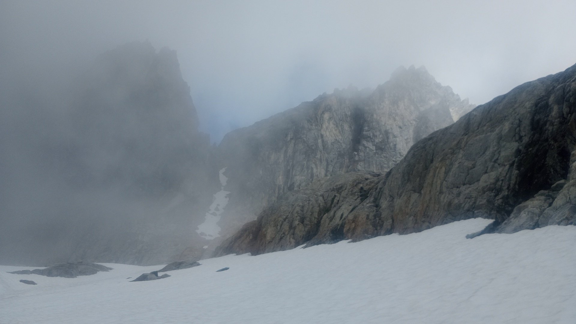
Dan Mcnerthney and I climbed the Stoddard buttress exactly 10 years ago in mid July and here is my few cents. 1. The approach from the Crescent creek basin to the base of Stoddard buttress IS long. It took us 9! hours which included climbing the snow/ice couloir plus dry rock to the col, 2 rappels into a moat, ice climbing out of the moat (steel crampons and boots were highly appreciated here), followed by traversing Mustard glacier on cl. 4 - low cl. 5 ledges and more ice climbing to get on to the buttress. 2. The climb itself to the true summit of Terror IS much longer and more complex than most descriptions make it sound. Simul climbing was feasible on the bottom half of the route but climbing becomes harder higher up.3 points
-
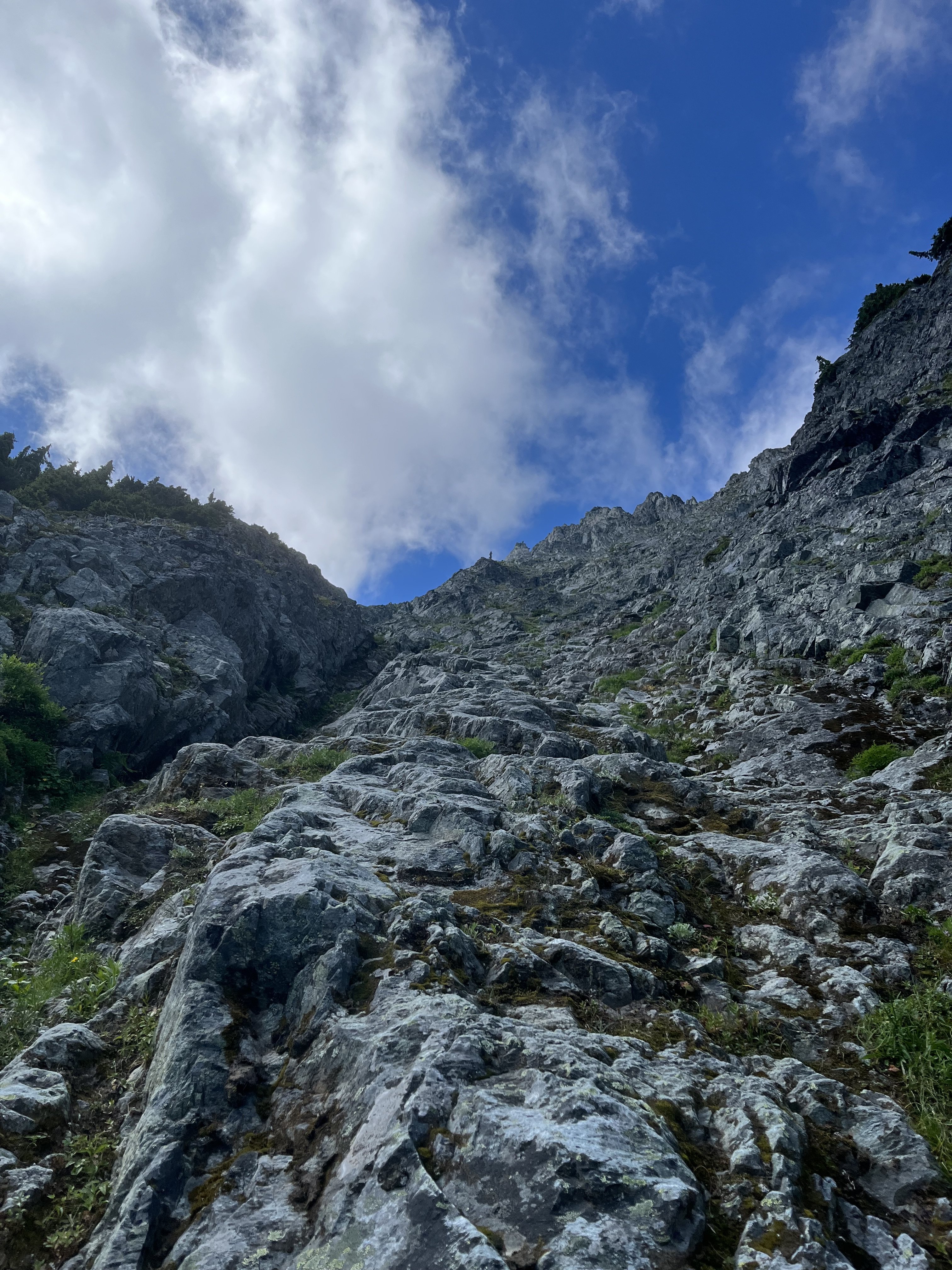
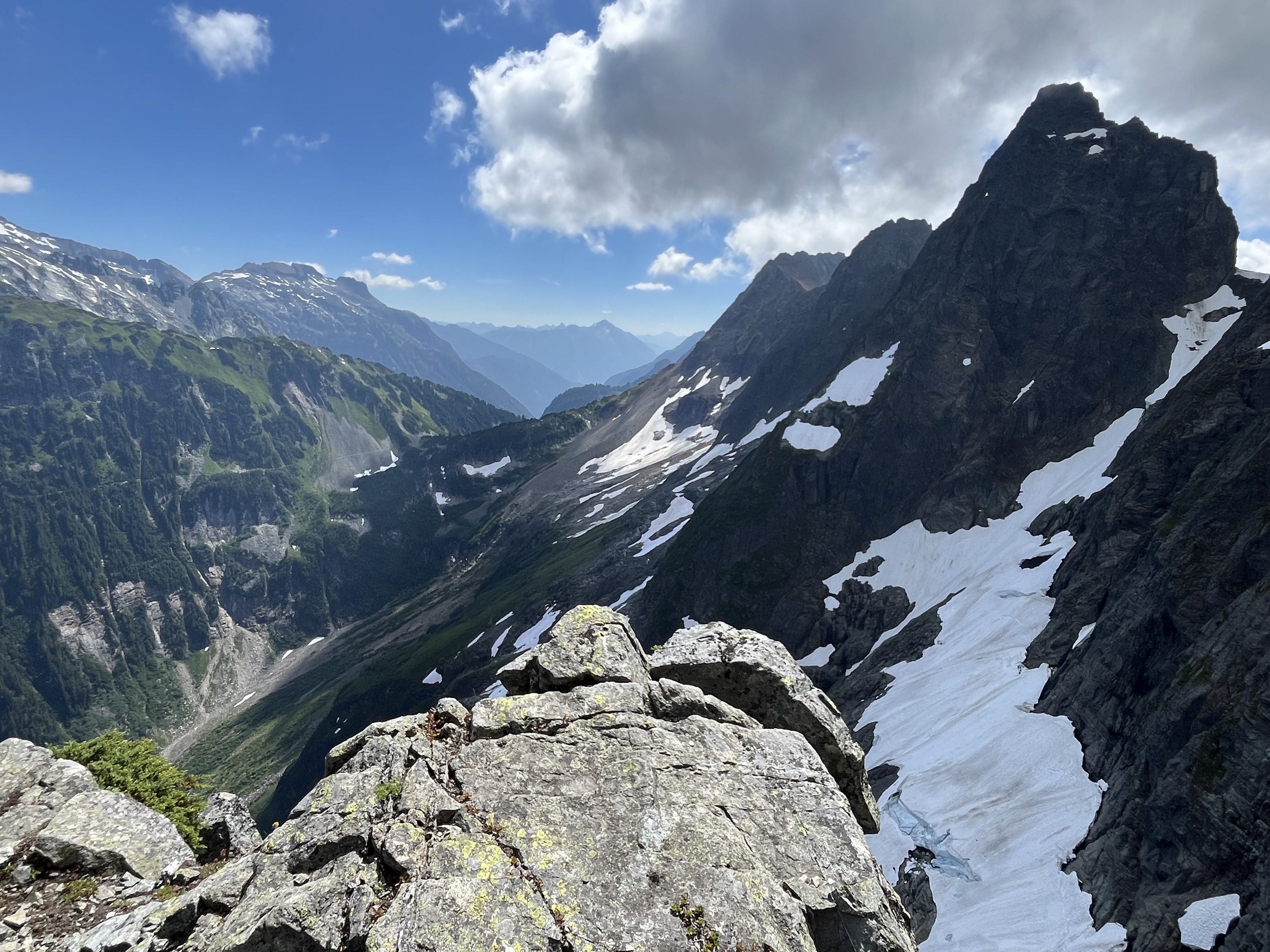
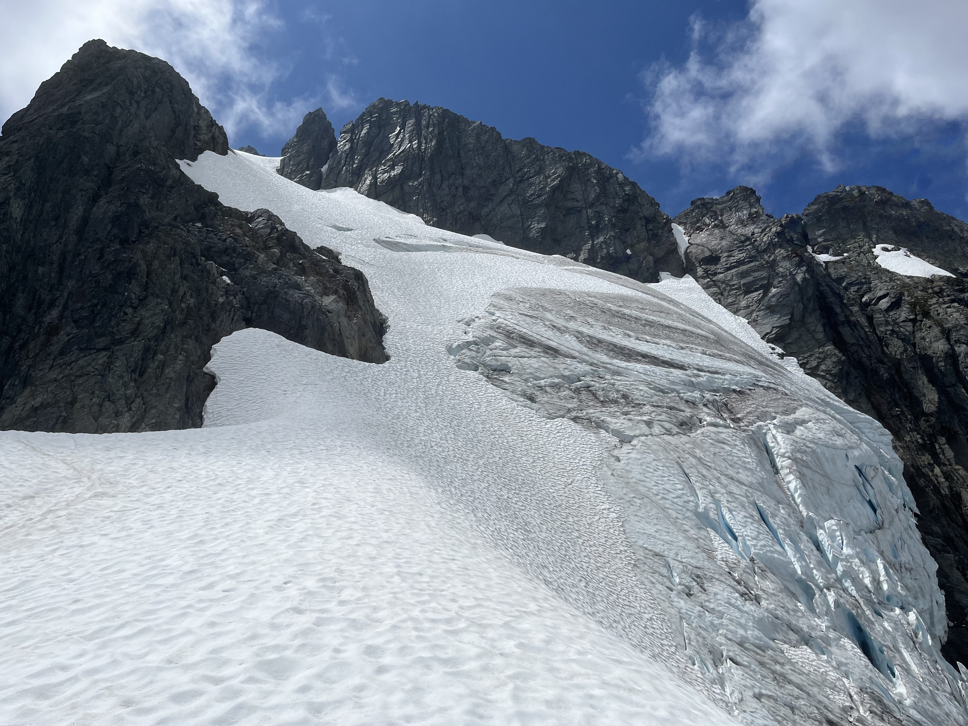
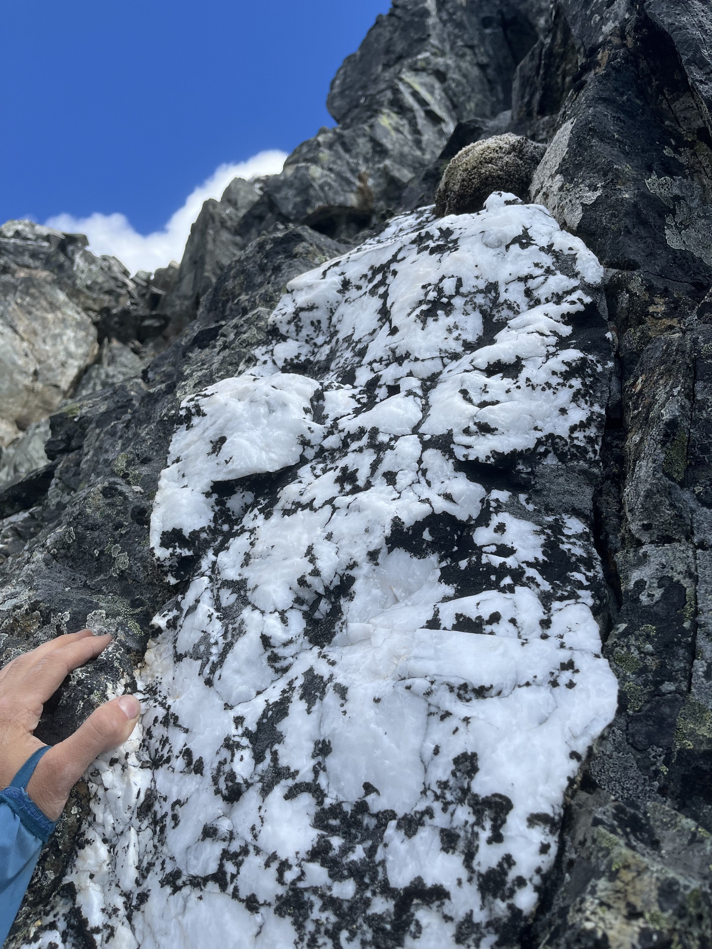
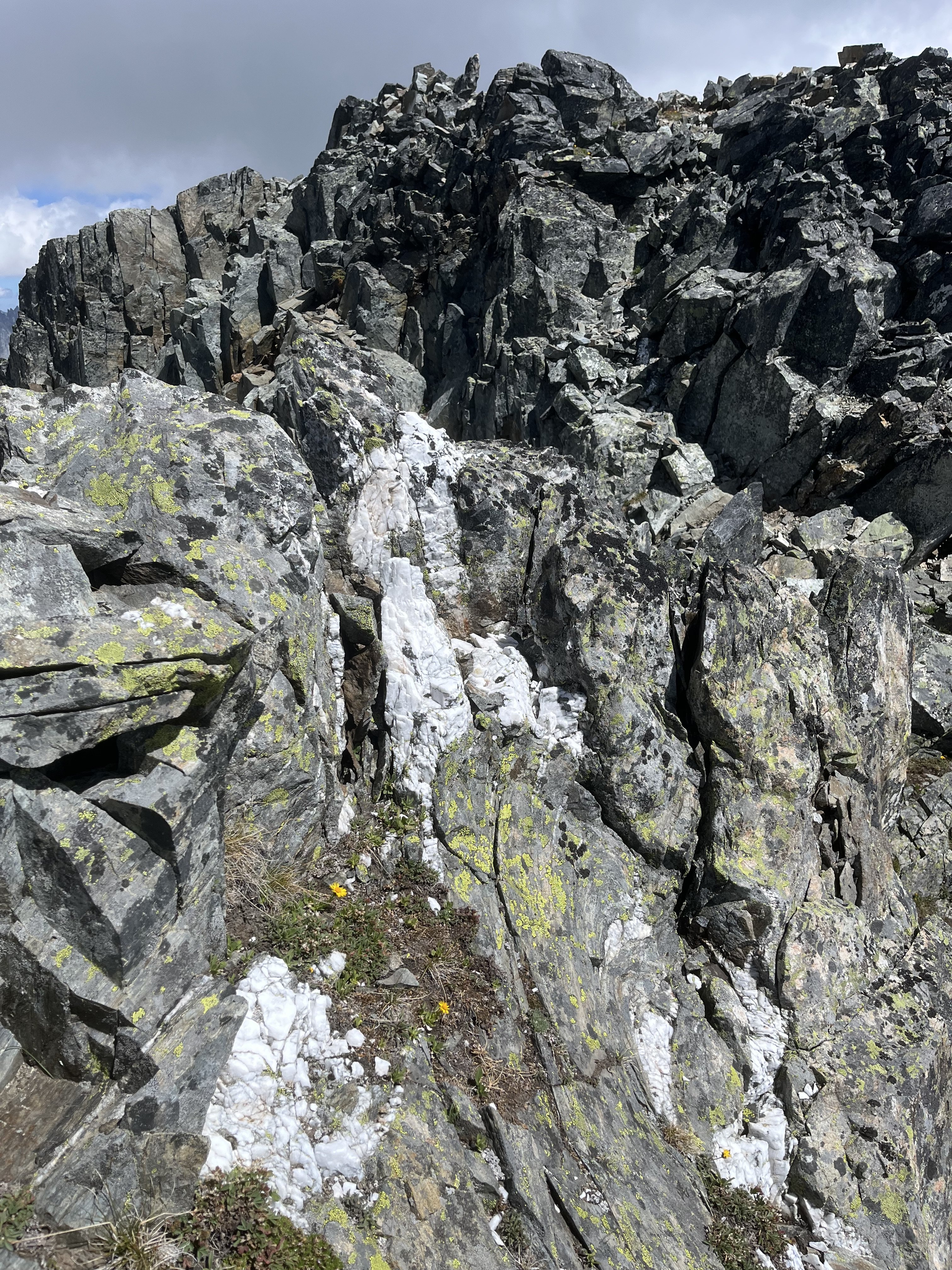
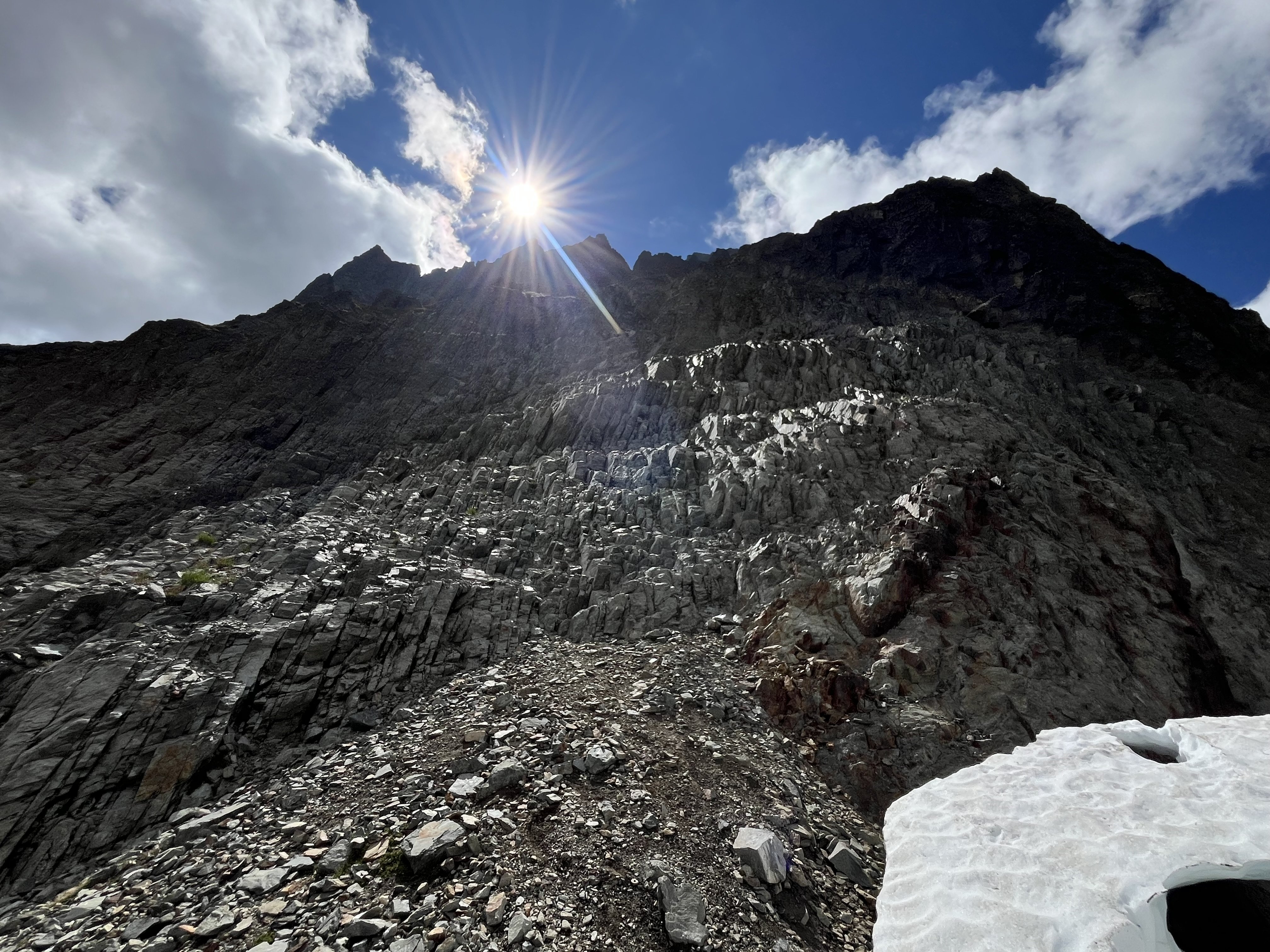
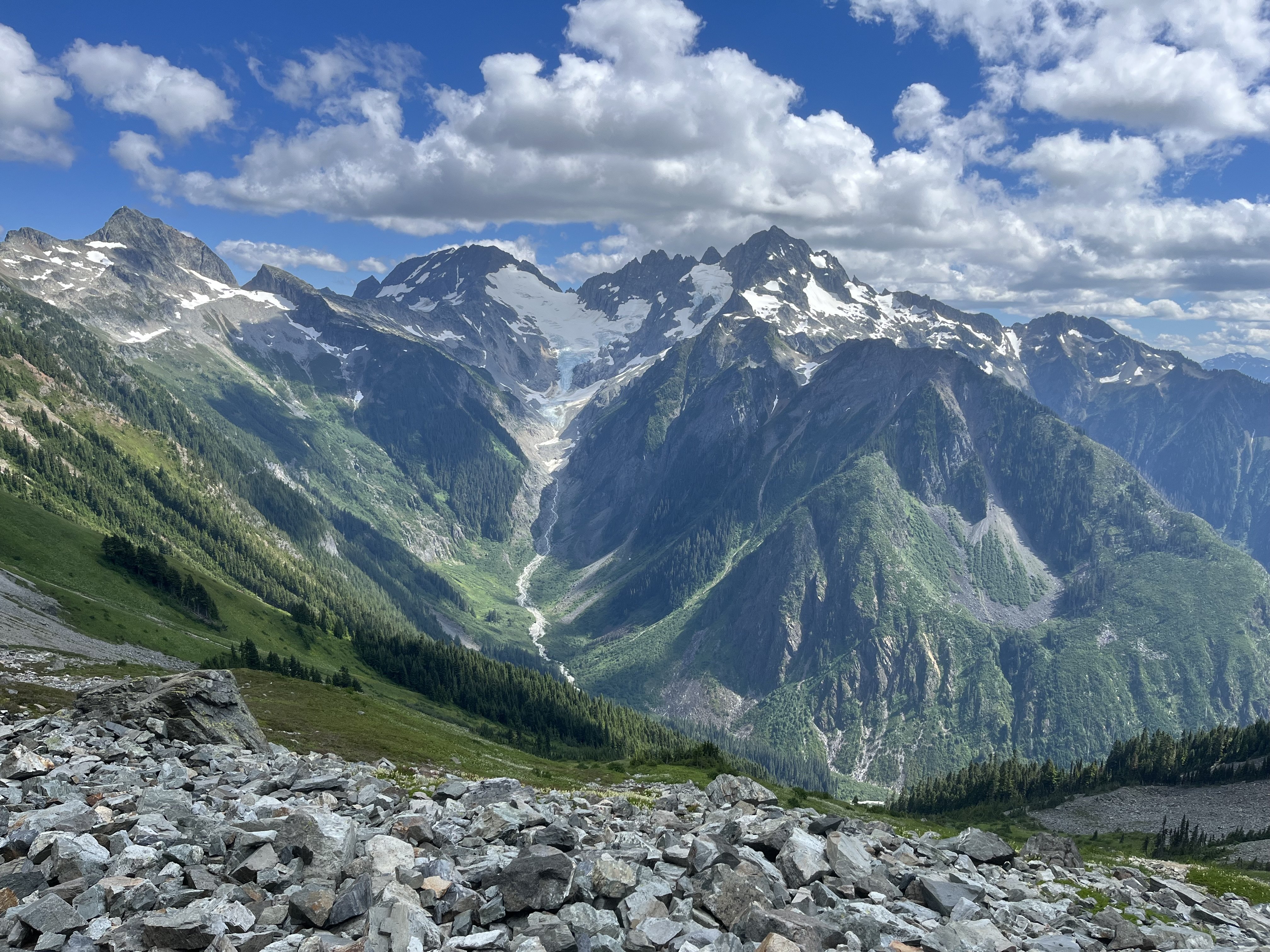
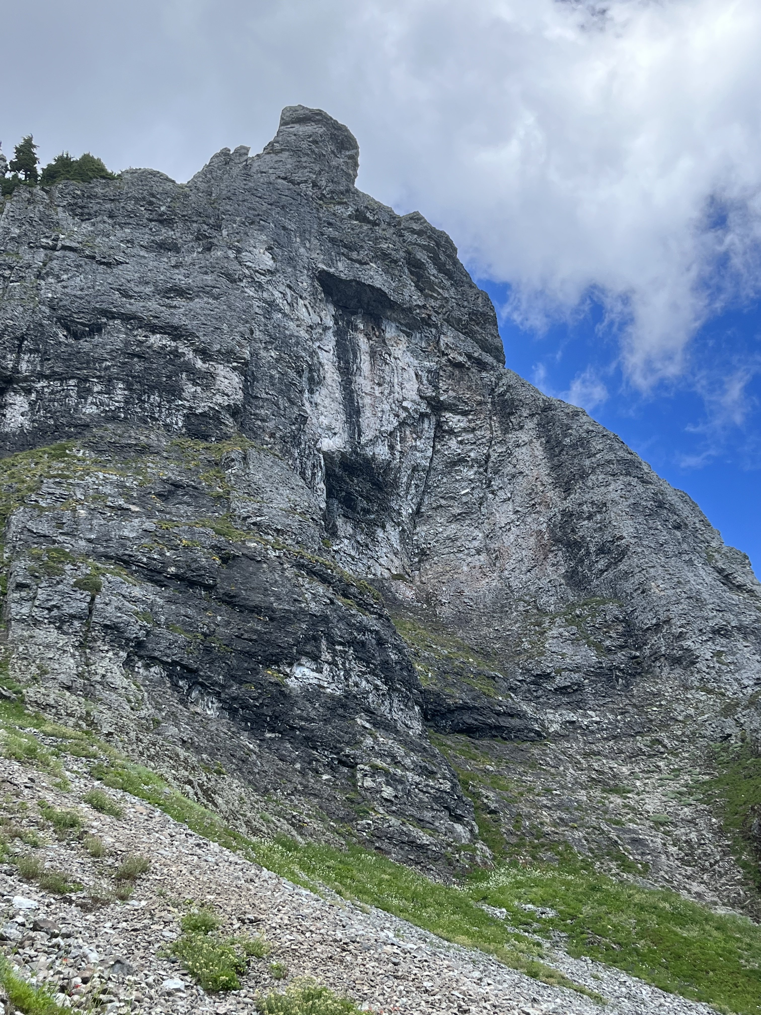
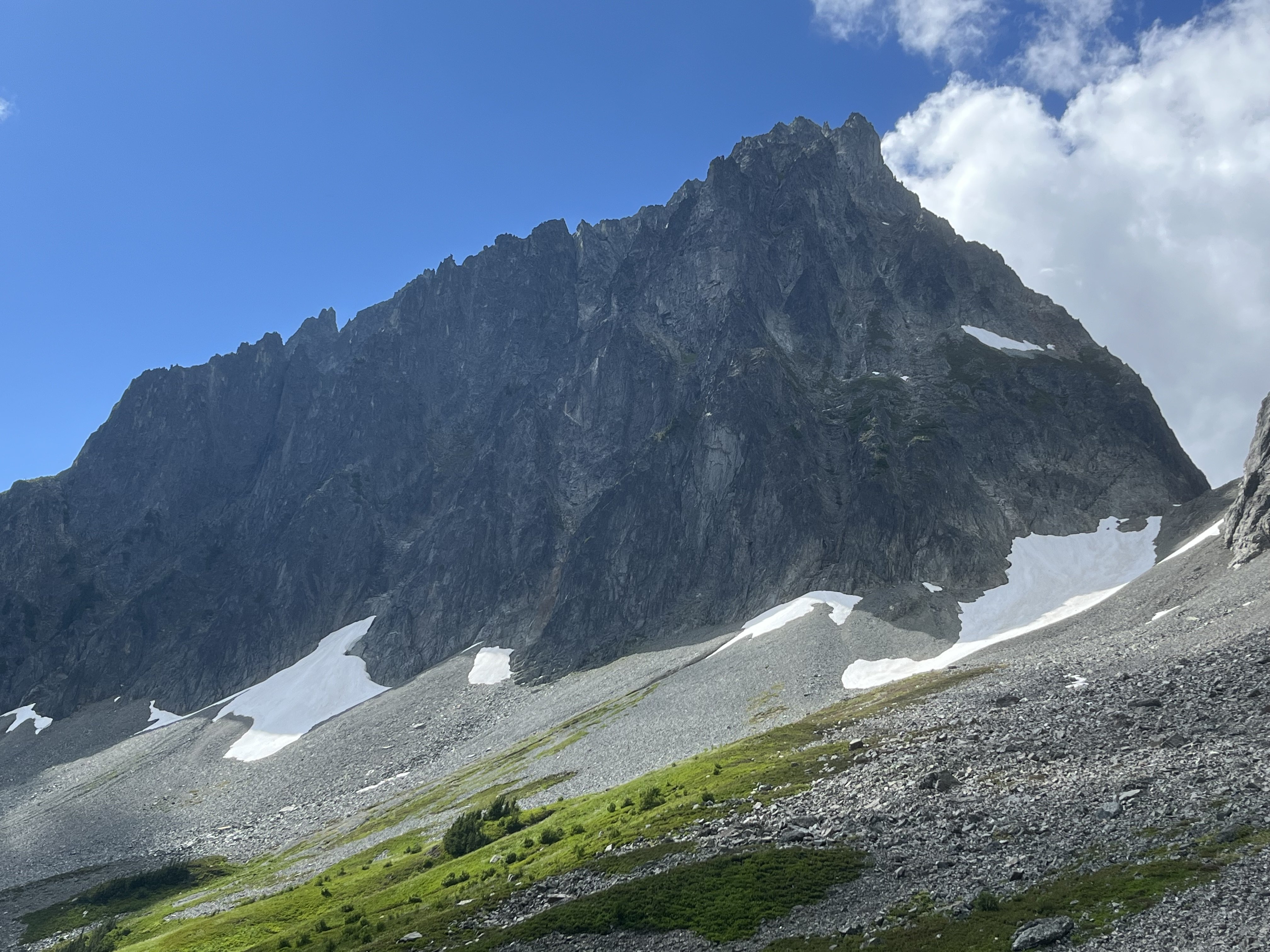
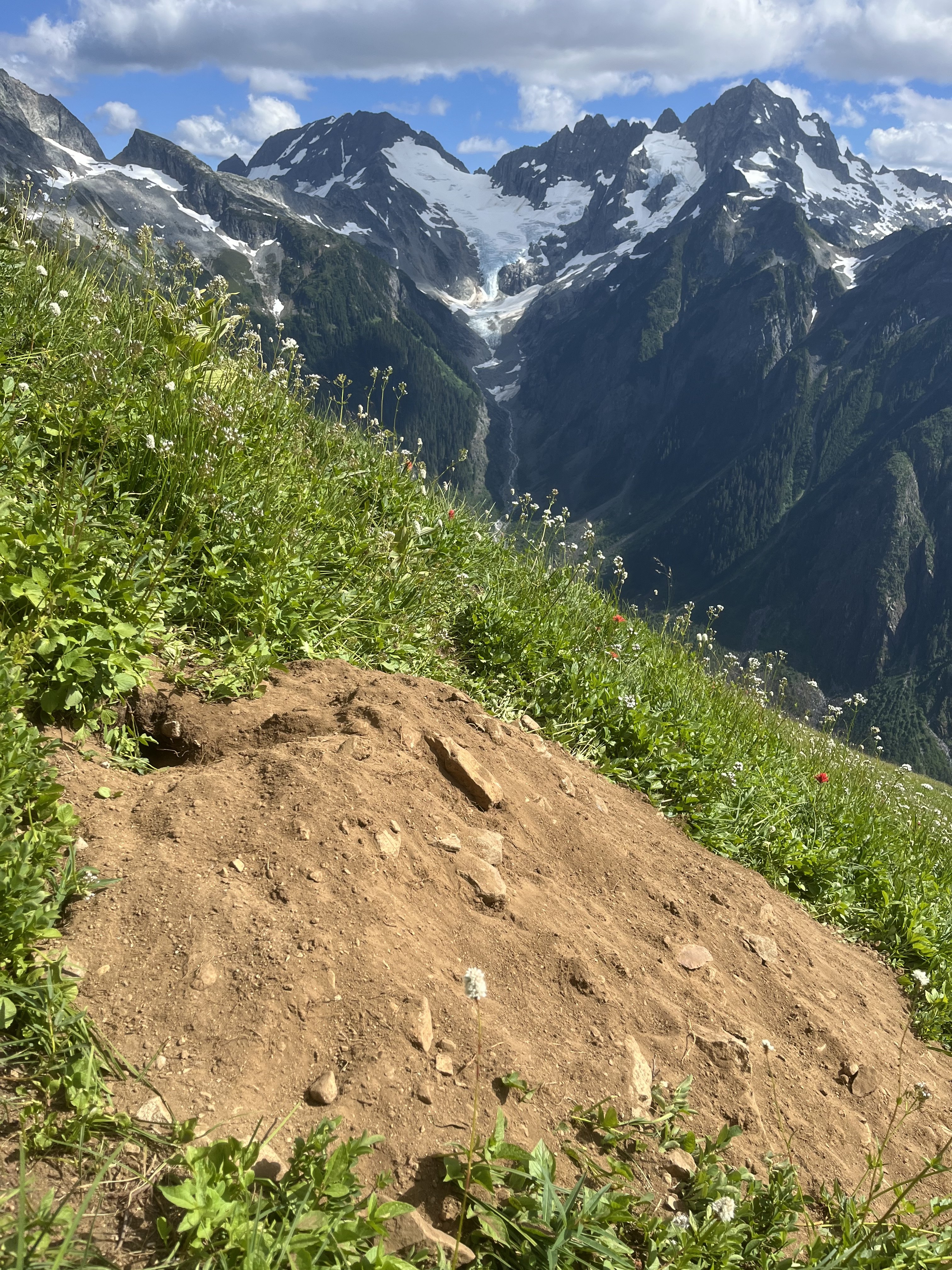
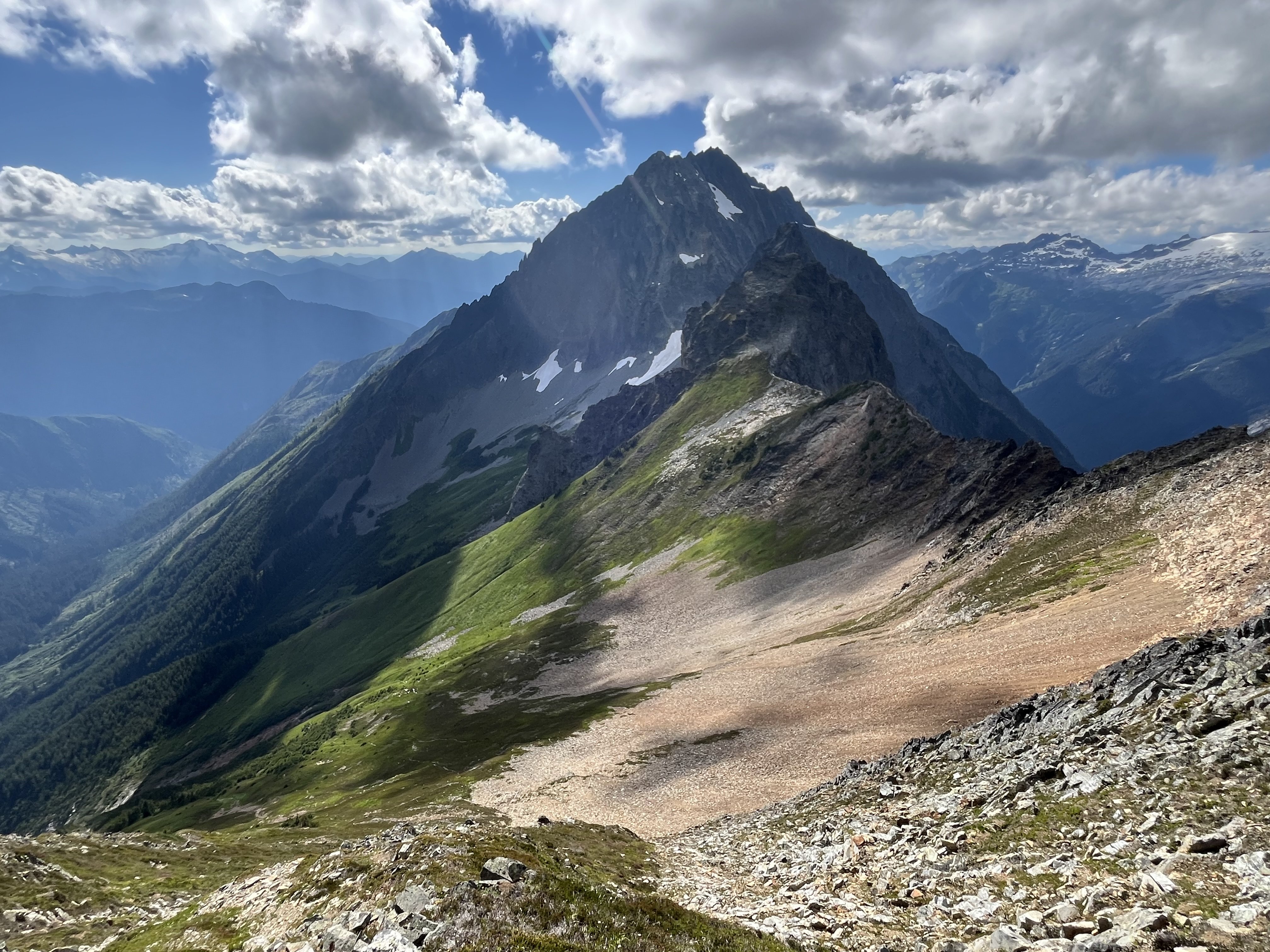
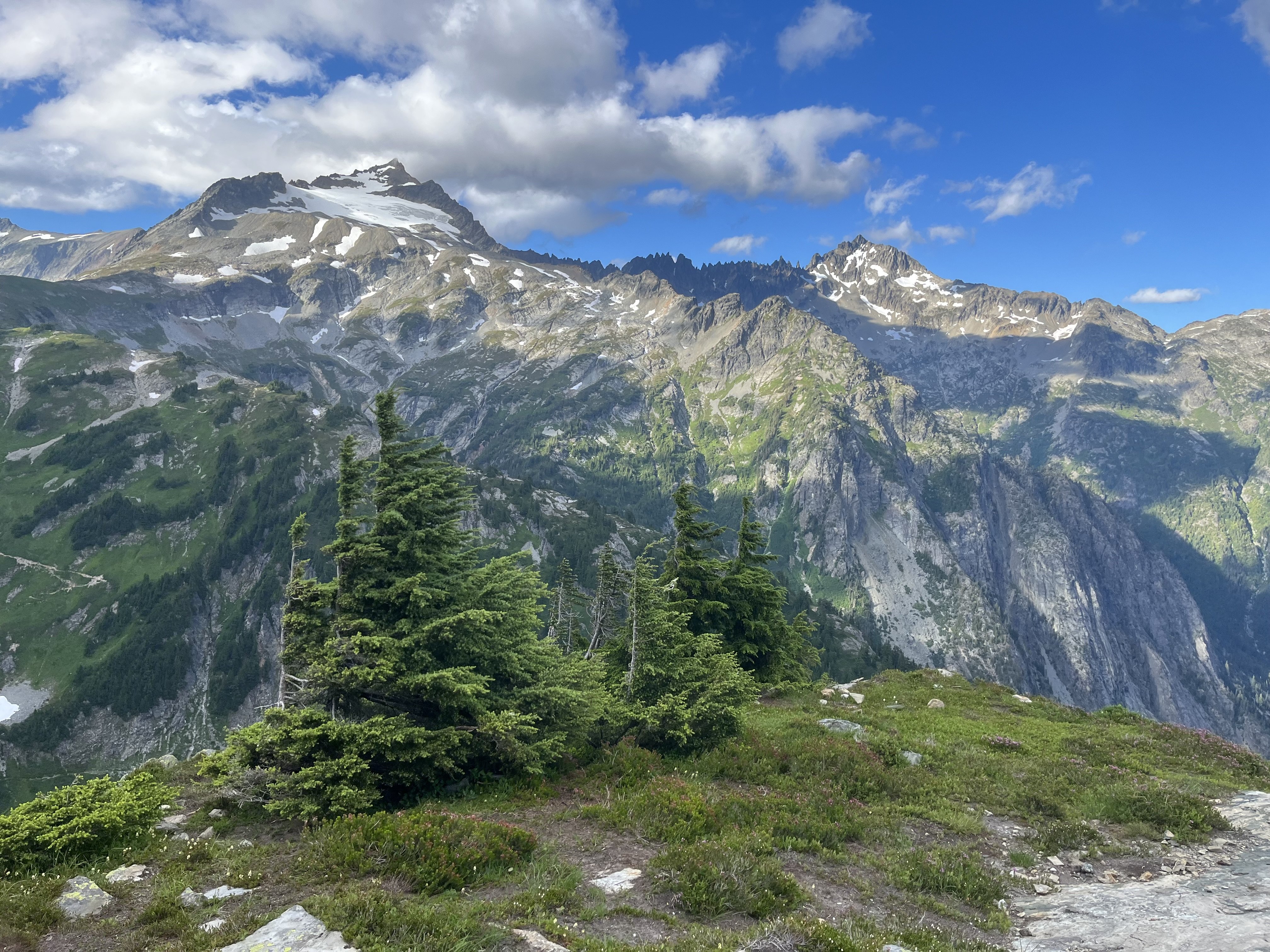
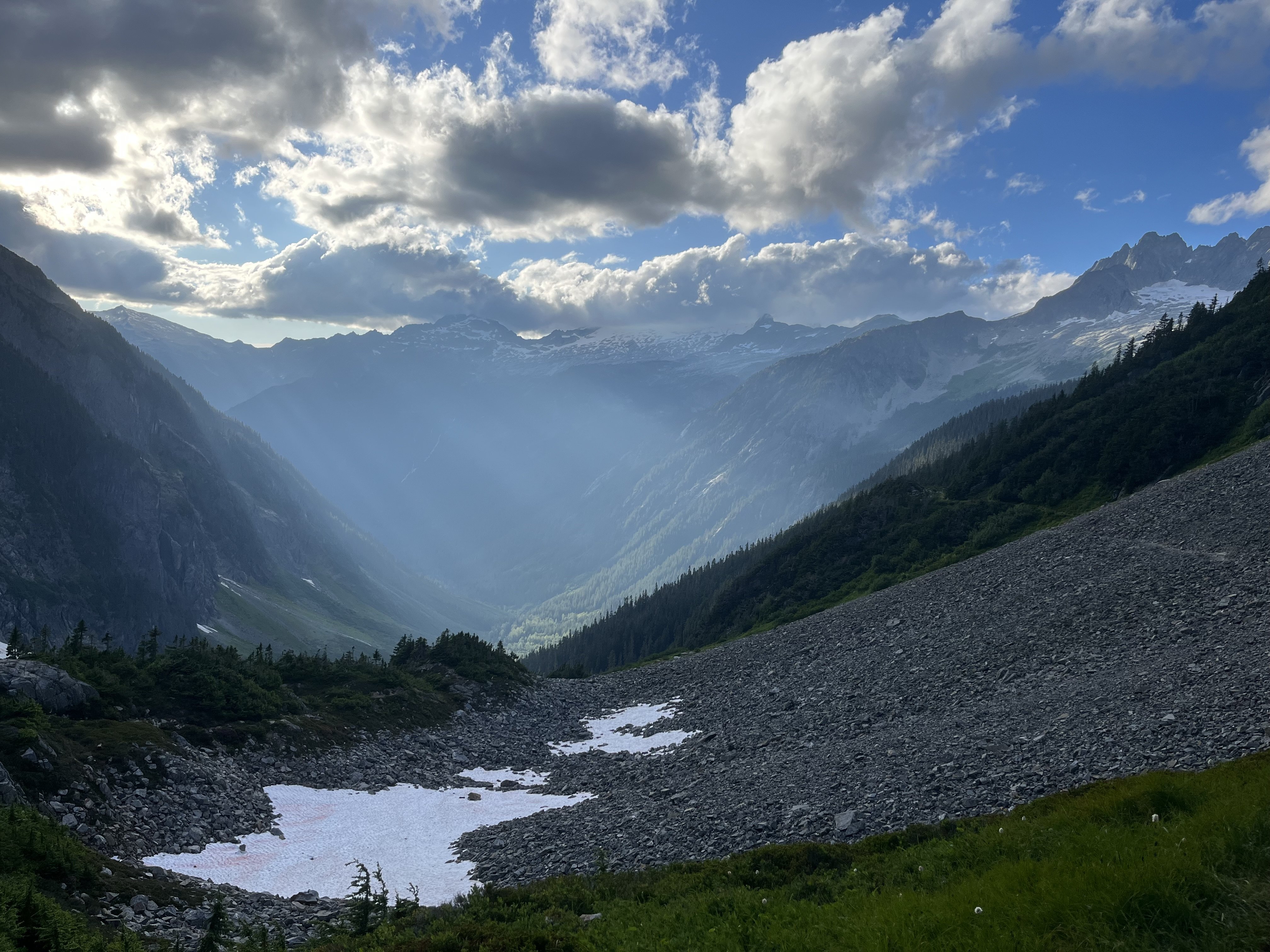
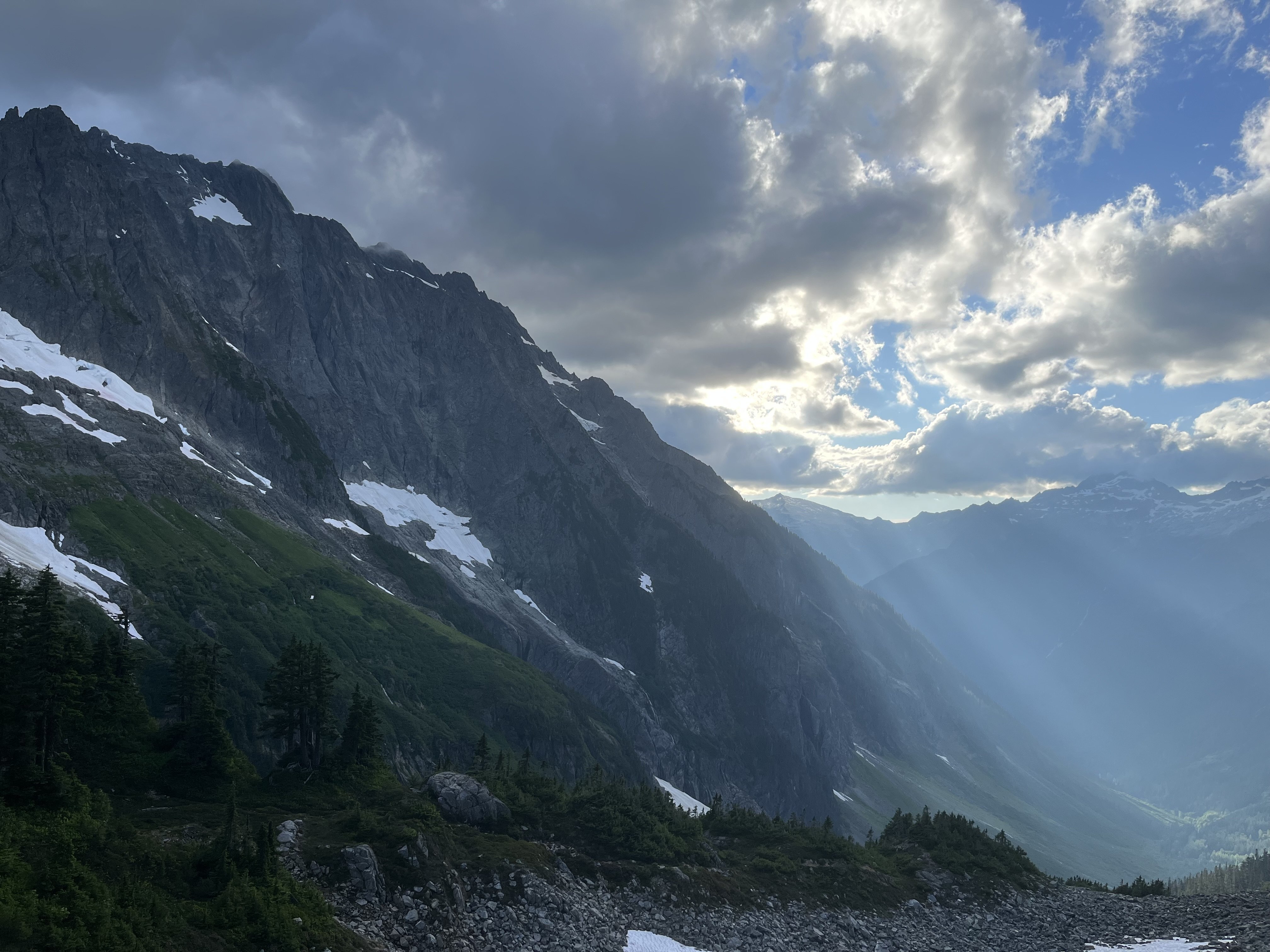
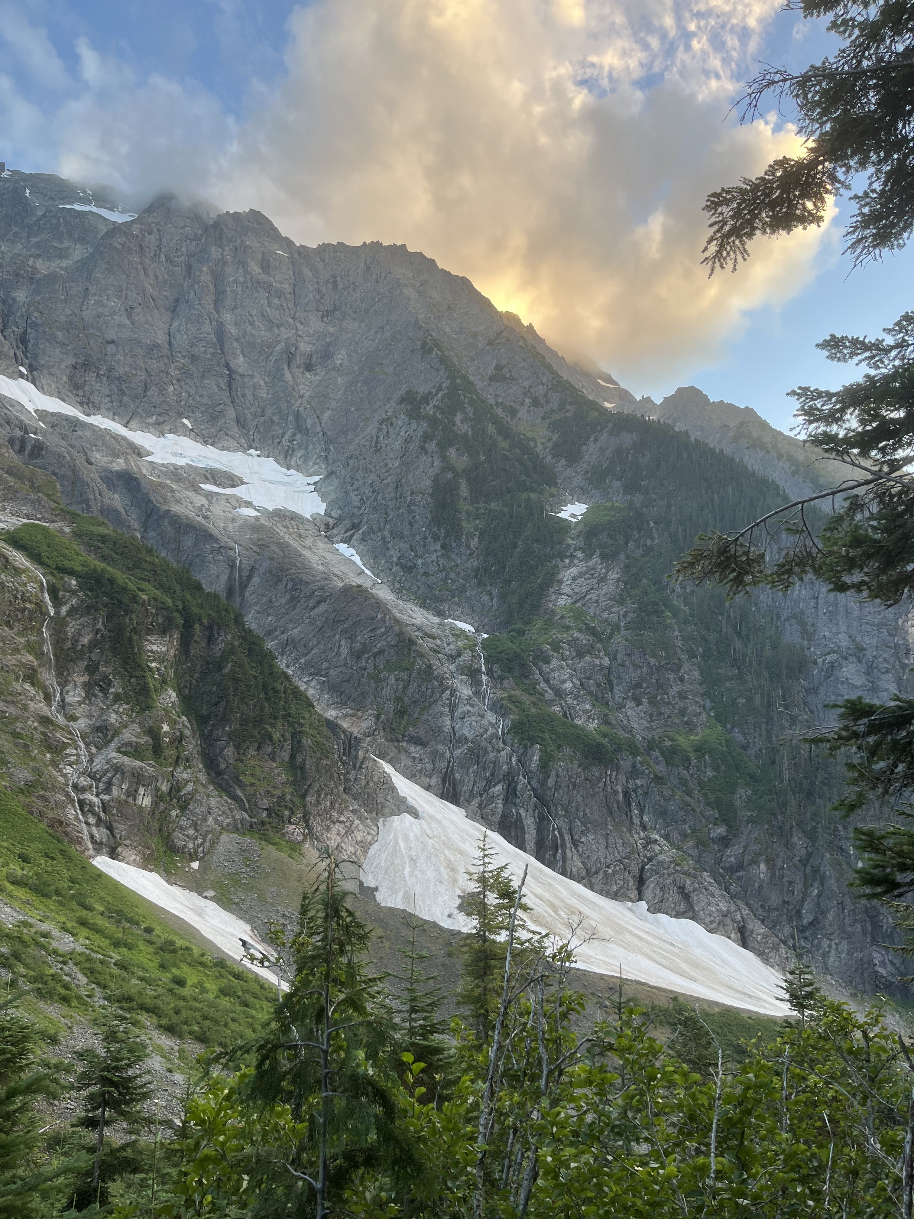
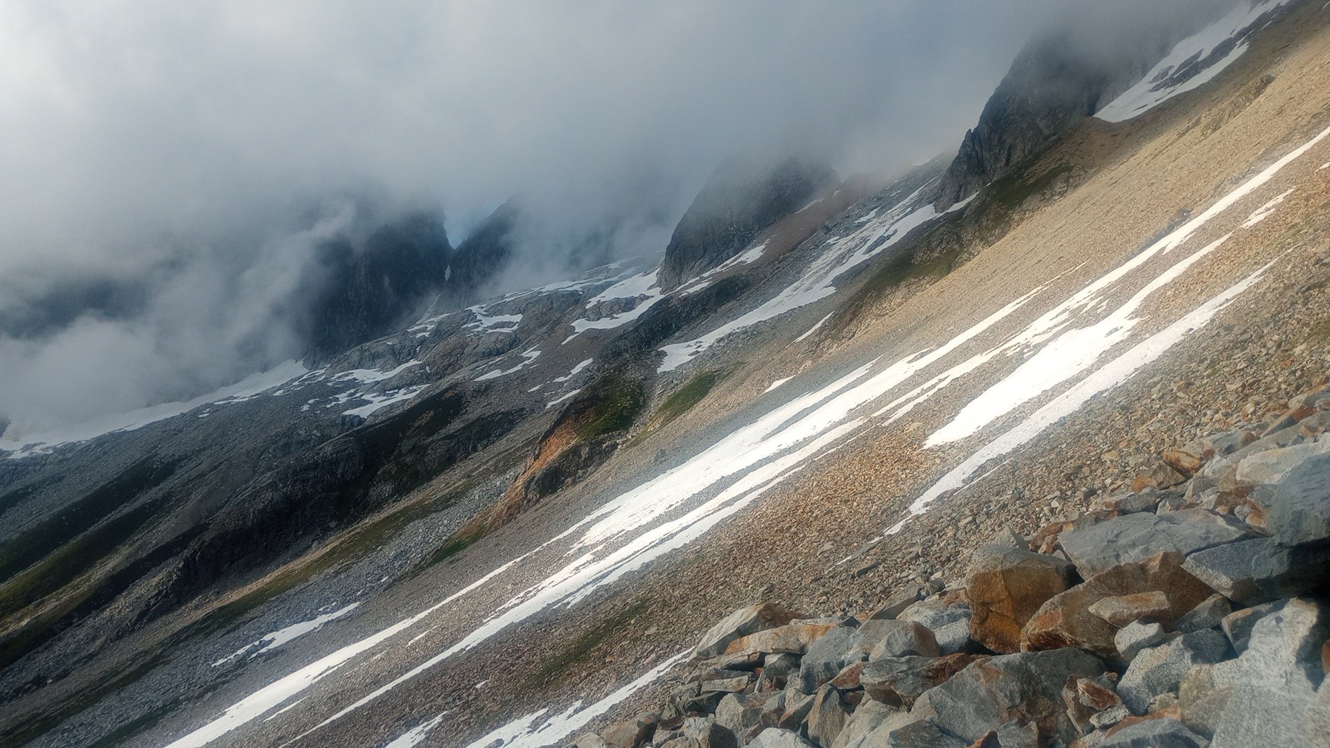
Trip: Johannesburg - NE Rib Trip Date: 07/24/2025 Trip Report: Another Johannesburg NE rib trip report is something the world likely doesn’t need but I’m in a bit of beta happy mood lately. Certain kinds of climbers might find the endless scrambling pretty enjoyable. And with perfect route finding the route doesn’t have to be especially sketchy, though as I found, navigation errors might be punished severely. The steep dirt embankment right off the road is a heads up rude awakening that foreshadows what lies ahead. And for such a short approach the bushwhacking is not insignificant. Steph Abegg has a good photo of the start of the route but the snow fan cuts off the very bottom of the slab and the elevation is wrong. You gain the rock more like 4100’. This confused me back in early June when I came to try the route. I got spooked off the slabs at the start. Thinking I may have missed something due to the “4400’” annotation, I climbed snow higher, but found only sheer cliffs above. On my way back down I saw from Steph’s picture that I had been in the right place after all but it turned out to just be really hard instead of easy class 4. During my second attempt I began by trying to follow blocky terrain on the left side of the slab. It started out good but when it came time to move right, a drip formed an impossibly slimy 10 foot wide barrier to passage. I retreated nearly back to the bottom and instead headed up to a right facing corner left of a roof with a wet slab below it. I went this way on my first attempt before bailing. It starts with a bit of lieback on a jug and a high reach to another jug, after which you can pull up to easier ground. Right after I took this photo my feet blew on slime. It’s a low angle stance, so fortunately I didn’t go far. Humbly I reapplied and was accepted on the second try. This short sequence felt like 5th class though as my fall demonstrated, maybe not exposed enough to count as true 5th. Though I’ve spent more than my fair share of time on that slab by now, I still have no idea where the path of least resistance is. Having failed to find the “easy class 4” I also failed to find the “sketchy 5th”. At the top of the slab next to the waterfall I found good solid rock and was on my way. Worse was yet to come in the jungle section. From the stream below I noticed some tall cedars and guessed that it wouldn’t be too crowded at their bases. This was true, I was able to move between them and the rock buttress without any real entanglement (18L pack with ax and tool covered in socks and just barely stuffed inside). However I was getting further and further west and not gaining enough elevation. Finally I saw something I was hoping to find, a steep, rocky and mostly dry bed. But guarding access was minor cliff band maybe 15’ tall. Overly committed, I explored three fairly terrifying options at 5.forest and managed to get through, relying far more on good fortune than I’d like. The episode left a bitter taste on an otherwise umami day. I definitely prefer my climbs not avoidably harrowing. Above that section I tended to stay in or just to the right of the gully between the two ribs, with a wider diversion to the right just above the last major snowfield. Where the vegetation finally gives way to solid, polished rock beginning around 6K’ was the highlight of the route for me, both because this was the best quality rock for the day, and because of the sense of relief for escaping what was just below. At about 6450’ I found a promontory with a great view of the northeast face. Beyond this point the rock quality declined some (but not terrible) and the route complexity increased. I saw that I needed to move diagonally up and right to get to where the snow was on my map. I found reasonable ramps and ledges cut with interesting quartz bands. There was one more section of minor drama with steep, exposed choss to get around the corner. Then I could see the snow and ice spilling down from Johannesburg’s north face. I gained the snow at 7200’, maybe missing the famous bivy, though I noticed one small one at 7000’ with good but not panoramic views. The snow arete was AWOL. My guess is the high heat has melted it down to a boring broad shape. Passage on the left was a little narrow but in good shape. There were no real difficulties with shrunds and crevasses and no mandatory hard ice. At the upper face especially the snow was steep enough that I was glad to have sharp things on each limb. Unlike my first time here, I couldn’t locate the summit register. Before long I began the descent to the east. It was helpful to have been up and down this way before. I had forgotten how much griffin shit is in this zone. I seemed to take a long time descending. Probably I was mentally fatigued from all the no fall terrain. It was a lovely afternoon as I traversed the basin over to the ridge off of Mixup, pierced with many marmot cries dying off with slow haunting decay. Industrious workers of the underworld, unite! More mental fatigue descending the slabs coming down from that notch, then a long overdue water break below the snow (though somehow I didn’t get dehydrated despite running out shortly after the summit). Pretty straightforward and gratuitously beautiful from there back to the trailhead. It took me slightly less time than going up and down Doug’s direct had, a little under 15 hours. I think I lost at least an hour with the slab and forest cliff navigation fiascos. Many reports say this climb is best done once. I think that’s not untrue but if you really like scrambling this could be a good one, because the scrambling goes on and on hypnotically. That said, it’s a slippery one. Gear Notes: Approach shoes, steel strap-on crampons, one tool, one light ax. Approach Notes: Last hair pin before the Cascade pass trailhead. Don’t fall down the very steep hard dirt.
 1 point
 -
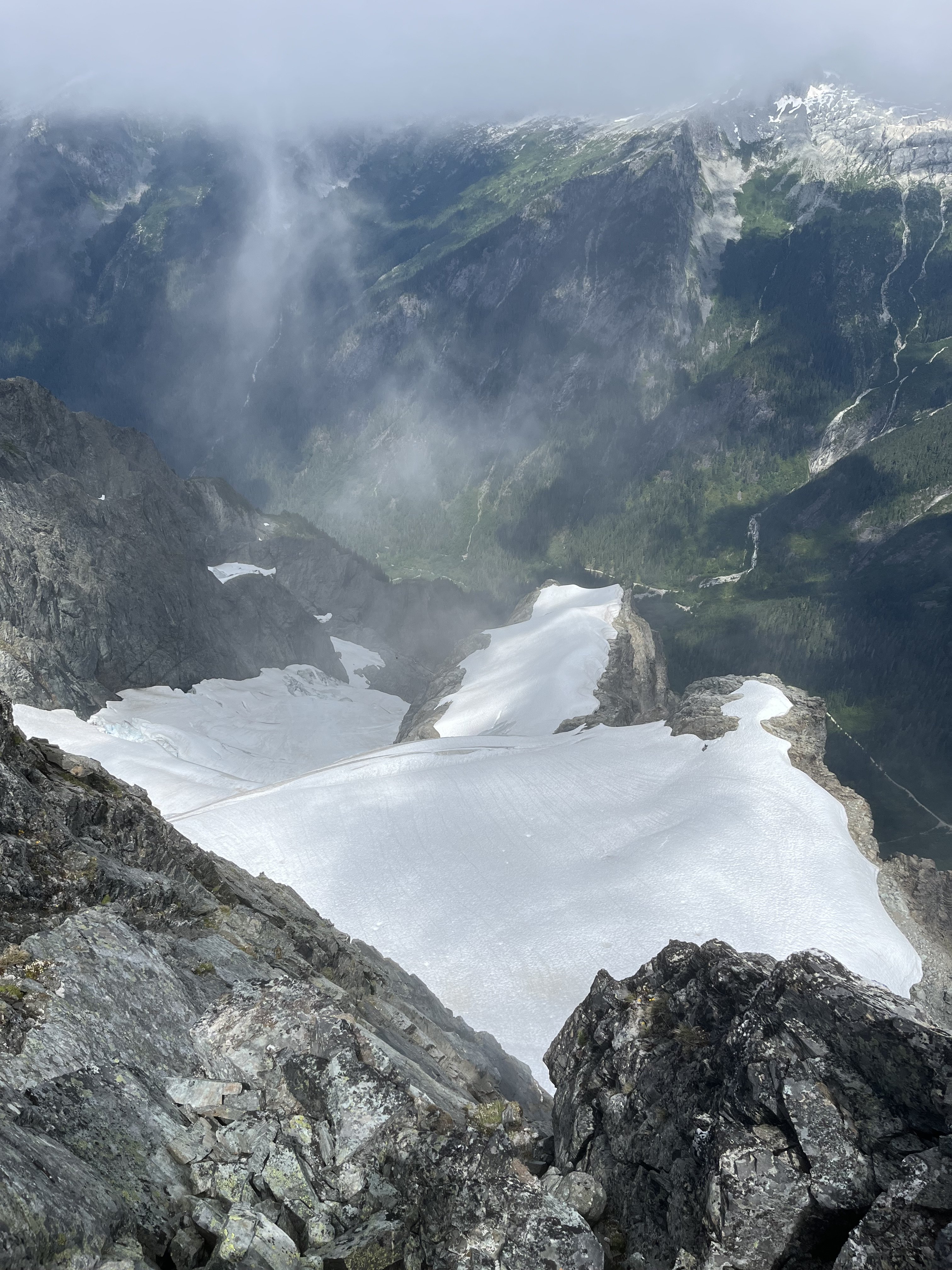
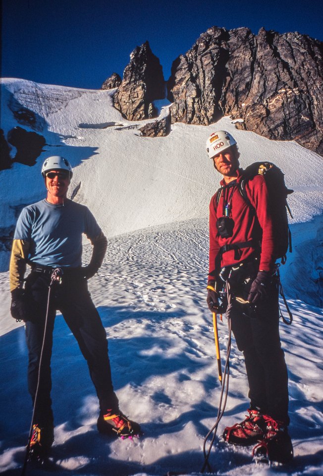
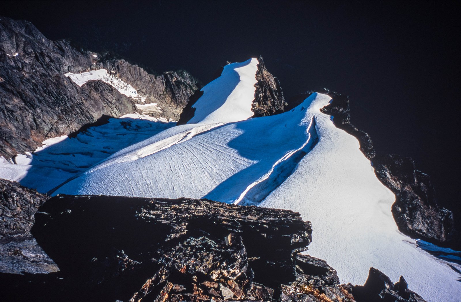
@Phil K and Rod above the snow arete 2006 (check out the glacial differences from the photos above): Looking down from near the top onto the glacier: Strong work @JonParker!!
 1 point
 -
Trip: Johannesburg mountain - Northeast buttress ‘51 rib Trip Date: 07/26/2025 Trip Report: I drove to the parking lot Friday night, threw my sleeping bag in the back of the truck, and fell asleep staring at Johannesburg. About an hour after sunrise I locked the truck and started walking down the road with just a hipbelt loaded with microspikes, ul rain jacket, ice axe, garmin, work gloves, 6 gu’s, and 500 ml of water. Getting to the snow was quite straight forward. I stayed on talus, just climbers left of the moraine for as long as I could, and then traversed straight across the moraine to where I could step onto the initial slabs to gain the rib. Figuring out these initial first pitches before the brush was slightly tricky, perhaps requiring the most thoughtful climbing of the whole route. Just above the slabs was a large patch of snow. I drank some water and filled up here and then started tree climbing. I was elated to not have a pack on for this section. The work gloves and trailspikes also made life much easier through this part of the route. Once I made it to the steep heather section I was able to mostly stay on the ridge crest with semi decent rock. I did not end up joining the 1957 route near the top like I’ve read in some trip reports, and instead continued up the 51 rib. This section contained the highest quality rock and climbing of the entire route. The crux of this section was probably a bomber near vertical handcrack(5.6) that lasted a couple body lengths. Suddenly, I was on snow. The glacier and snow conditions were nearly perfect, firm but not icy. I transitioned to rock close to the top of the glacier where it became too steep for 1 axe and microspikes. Moments later I was on the summit, 3h 40m from the car. I snapped some photos, and then started down the east ridge. The cairns were quite nice to have for encouragement. Less than an hour later I was at the C-J col. The heather up to Mixup was quite unstable, frustrating, and exhausting, but it was over soon enough. Meeting up to the Ptarmigan “trail” was mostly straight forward. I feel I could have found a slightly better way, but what I did worked just fine. Just above Cascade Pass, I emptied the rocks from my shoes, downed the rest of my water and a GU, and battened down the hatches before running down to the lot. The parade of hikers were true obstacles, but it was pretty fun blasting past them. Made it to the lot 6h 49m after leaving the truck. A very good day. Gear Notes: Work gloves, microspikes, axe Approach Notes: Short and sweet1 point
-
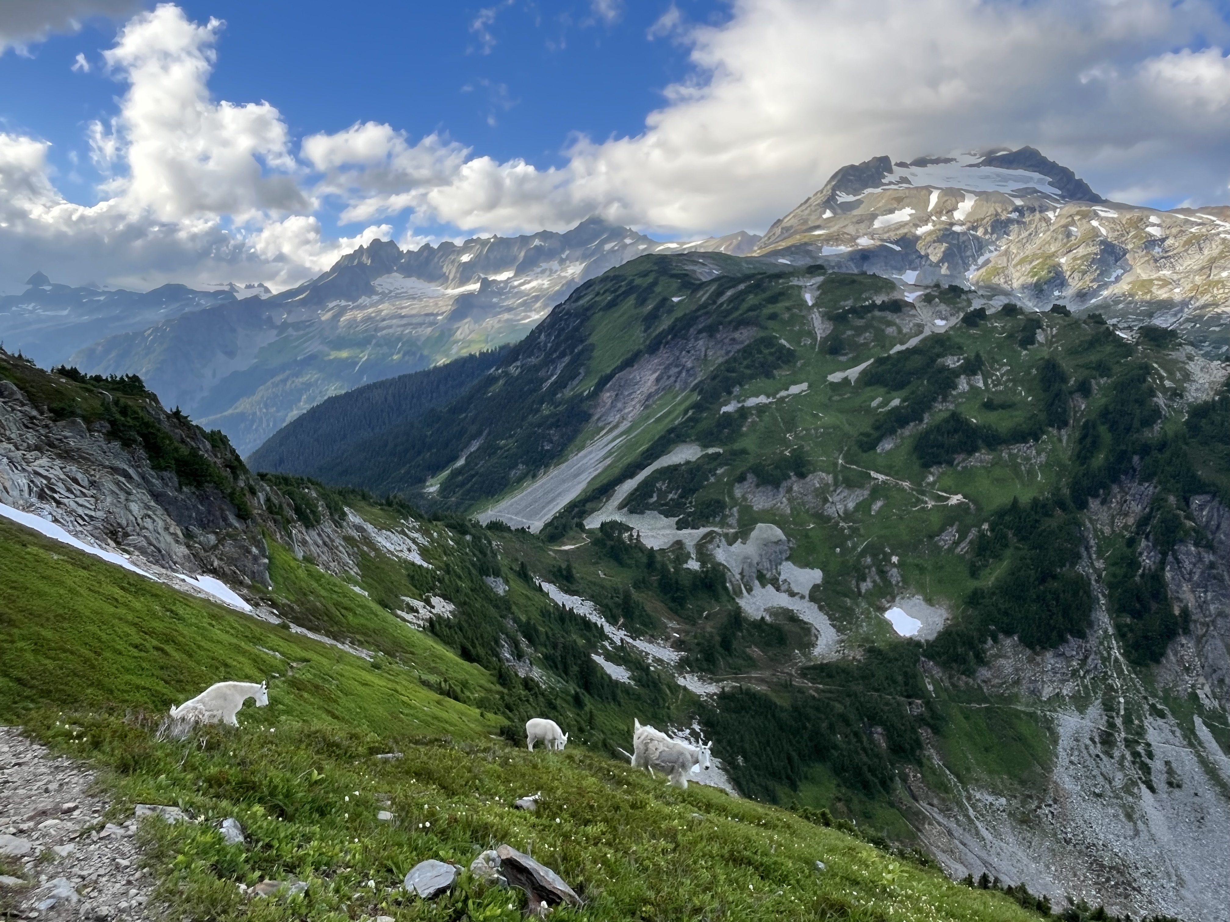
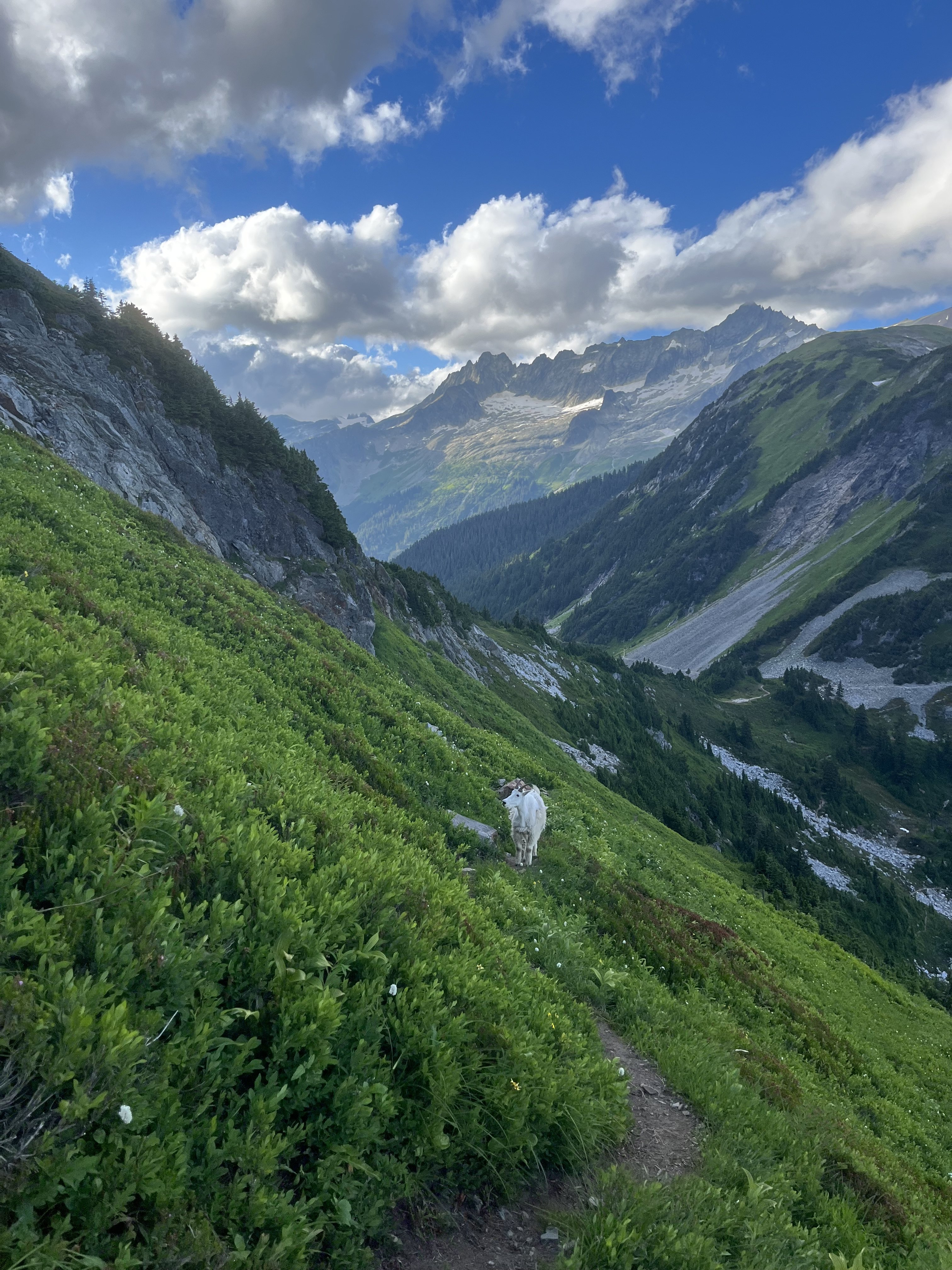
If anyone sees this and is looking for West Ridge Terror beta, here's what the couloir looked like last Saturday 7/19: There is a bail rap station near a moat not too far up on climber's left You'll see it as soon as you get up a little bit. Getting down into Crescent Creek Basin and making the traverse was pretty chill: Snow was in EXCELLENT climbing conditions, even for aluminum pons on Altras! The left-side snow finger at the Y in the gully felt exposed with the moats, but the step into the dry gully was chill. Crossing Terror Creek was very chill. There is a thimbleberry bush that offered us an abundance of amazingly perfect thimble berries. Last, there was a family of goats (mom, auntie, other auntie, and BABY) at the bivy which is very important beta. If you're as lucky as I was, you'll see a baby goat and a pika hanging out -- at the same time!! No, we didn't summit.
 1 point
 -
this depends of what the values of climbing are. if the value is one of pure athleticism then your list makes sense. But if the value is of pure adventure and/or being at one with the rock/ice with confidence, then Fred (lifetime dedication), Honnold and LeClerc are high in that list. I would add that DArin Berdinka get added to my personal GOAT list though.1 point
-
Royal Robbins Fritz Weissner Fred? Marc-André Leclerc1 point
-
Trip: SOUTHERN PICKETS - Vacation of Inspiration and Terror Date: 7/18/2015 Trip Report: Ever since I sprained my ankle on the approach to Inspiration peak in August 2014 and painfully hobbled out to the car, I knew I had to be back to this legendary and remote place. The place where reality and expectations do not line up, where terrain traps constantly weigh on your mind, the place that just does not let it go until you finally escape it…If you escape it. Fun and scary, wet and cold, never monotonous and always abusive: there would be ice, snow and rocks – solid and loose, moats, screaming barfies, the Aleutian stares, the disbelief stares, rock fall, ice fall, death gullies – we got it all this time. In the New Climate of Eternal Summers, no less. Back in August 2014 and dreaming of my return: Dan McNerthney joined me on this trip. It’s been a while - 30 or so years ago – since he has been to the Pickets. Dan and Pat McNerthney on the approach to Inspiration (early 80s): This time he was eager to check out the Stoddard Buttress on the north side of Mt. Terror. John Stoddard was his long time partner BITD who put up a solo FA of the buttress exactly 31 years ago: AAJ-Stoddard Day 1. After getting the O/N permits for Terror and Crescent Creek basins, we blasted off the Goodell Creek TH with the monstrous 8 day packs in the marginal Wx forecast. After 4 uneventful miles along Goodell Creek, the main highway to the Southern Pickets begins here: Finally above the T-line: First view of the Inspiration group: At the Terror basin campsites: Thickening clouds and the last view of the Pickets for the next few days: Day 2. Rain, hail and lightning T-storms. Not that you expect anything else. One of our most pleasant days in the Pickets but it’s an acquired taste. Tent-bound. My tent that never leaked before, did leak this time. “If you are ever seduced by the wilder and more dramatic charms of some remote, glaciated, major league range, you risk finding yourself incarcerated in a tent, a hostage of the elements, for days…” (Eiger Dreams). The Aleutian stare: The sunglasses apparently work great in the lightning T-storms: Infinity stream: Wildflowers: In spite of the deluge, I ventured outside for a reckon of the “path” to the Terror creek from the Terror basin (last year we did get cliffed out after downclimbing west too soon and ended up soloing some cl. 5/waterfalls – not recommended). I did get cliffed out again this time but backtracked and came across a cairn 1/4 mile away that marks the location for downclimbing the easy benches leading to the Terror Creek crossing. The cairns are a rarity in the Pickets, and one got to respect them. Day 3. Raining hard until 2 p.m. The barometer pressure is dropping – not a good sign. In the afternoon we succeeded to move the camp higher up to the Terror Glacier Icefall below West McMillan Spire. What a wild spot: Room with a view - Triumph: The good thing was this wild spot has a Verizon reception so I was able to get Wx updates from a friend (thanks Bob!). The next day update was for “mostly sunny and 20% chance of precip”. How cool is that? Day 4. Attempt of the East Ridge of Inspiration. This was “mostly sunny and 20% precip” on the Terror Glacier. Back to the tent. Day 5. East Ridge of Inspiration – 18 hrs camp-to-camp. The New Climate of Eternal Summers took its toll on the glaciers everywhere in the Cascades, i.e. expect longer travel times or turn around. Our circuitous approach (red) and deproach (yellow). The peak is so close but so far. For the approach, we dropped down on the rock below the Terror gl. Icefall, traversed over to and up the ice ramp (steel crampons!) leading to the shelf between the first and second ice shelves, end run a bunch of crevasses before reaching the moat for the East ridge “approach”: Finally, some sunshine in the morning felt good for a change: The normal start of the “approach” to the notch for the East ridge is now blocked by waterfalls. As all of you know, I love climbing waterfalls but only if they are frozen. Too bad - not this time. We chose a dry but harder start to the right; through the roofs and up on the big ledge (40 m pitch). Dan is changing into the rock shoes after the moat start on P1 of the “approach”: The second pitch of the "approach" involved 10 feet of loose downclimbing into waterfall, crossing waterfall and getting on the clean and dry white arête to the right (55 m pitch). A good pitch, although I was bitching a lot at the time. Dan is coming up the second “approach” pitch: At this point we merged with the standard Cl. 4-easy 5 approach (grass on the right) which was loose and wet. Finally, we are at the notch for the ridge proper at noon. It is about time the clouds would close in and I instinctively begin to search for the hideout caves. There are a lot of those caves on the East ridge. The second “5.8” pitch from the notch up the ridge proper now has a loose sharp flake on the left hand start which is ready to come down any time. We did not get rid of it but someone should. The right hand start is solid but harder (10a). Dan on the ridge proper: Looking down on the Azure lake and our tent 2000' below: Dan on the crux P3: Terror and Northern Pickets from the east ridge: 2 more easier belayed pitches and 2 pitches of simul-climbing on the beautiful ridge crest followed to the summit. On the summit at 4.30 PM: The descent down West ridge and the west ridge approach gully was a bitch with a single rope: 13 rappels (two - through waterfalls and suffocating mind-boggling slots) plus downclimbing. It took us freaking forever. It seemed like the most rap stations are set up for the double ropes, while we had to leave gear and tat to replace/build the new ones. Finally we touched down the moat at dusk. The rope gets stuck in the moat and it took us an hour to free it. Every single thing on that descent was coming together nicely. The Terror Glacier Icefall at night is not a welcoming place. Really. We were shooting for the second ice shelve and I am fairly sure it is where we ended up. More elevation gain and more wandering with headlamps around crevasses, seracs and moats very close to the Barrier and more downclimbing to the rock bands and then finding our way towards West McMillan Spire. The tent was successfully located at 1 AM. Day 6. I sleep in until noon and there is more rain on the way in the PM. Bob texted me the good news about high pressure coming in for the next 3 days and encouraged to move into the Crescent Creek basin. Day 7. “The next 3 days” is a vague term as the rain never stopped until 2 PM the first day. We did however move (or more precisely, “crawl”) over the upper Barrier crossing to the Crescent Creek basin that day. What a retarded idea on my part. I feel the upper crossing should be specifically reserved for those doing Degenhardt-Terror group traverse only. It is a total suck. Not only this crossing is blocked by moats and has more elevation gain on the Terror gl., it is a steep death couloir on the other side (Crescent Creek Basin) without snow. Dan jumps into the moat off the Terror glacier and leads a wet steep cl. 5 pitch to the left of the standard crossing: We then re-connected with the easier grassy ramps heading right and merged with the regular cl. 3 route with the abundance of the rappel slings. Once on the top of the Barrier, the real shit show begun. We did a 30 m rap off the slung boulder into the slot – do not touch anything in there or else it will come down on you or your partner. The most solid parts in the slot are the walls. After some horrendously loose and adrenaline releasing downclimbing, we transitioned and soloed the snow couloir (1000’): 65 deg at the top descreasing to 45 deg at the base. The couloir was nearly 2 feet wide at places with collapsing snow bridges and with a waterfall running underneath and along the sides of the slot. Good luck with that and do not die. Mt. Terror is finally around the corner so we traversed over to the rock band below its south face and pitched in the tent on a flat boulder next to a waterfall. Killer sunset views at the Crescent Creek basin: Day 8. Stoddard Buttress, Mt. Terror. We woke up at 4 AM, and headed over to the Himmelhorn-Ottohorn couloir at 5 AM. I know, I know it is late, but I was traumatized by the Barrier just a few hours ago and could not possibly get up earlier. Despite the ball-bearing and ankle-wrecking terrain (tape the ankles, tape the ankles!) as we traversed below the Rake, Twin Needles and the Himmelhorn, this was probably the best part of the approach that day. Dan heading up to the base of the couloir: That thing is mean and time-consuming in the current conditions. It reminded me of the CJ couloir on J-burg, but way sketchier at the top. My facial expression says it all: When snow/ice at the top transformed into thin jumbled flakes, we roped up (another one of those Pickets “approaches”) and Dan led a sketchy mixed pitch on the left vertical rock wall of the couloir almost to the notch. After two rappels on the other side and sketchy downclimbing in between, we are finally down in the moat of the Mustard Glacier - vertical alpine ice with the cornice at the top: I was really happy to have steel crampons, boots and two axes for this one. After I crawled over on the glacier, I rigged a haul off one axe and a Ti-bloc (that step was not very conducive to the approach shoes Dan was wearing) and tossed him my Aztarex which along with the rope successfully get stuck in the moat – the recurrent theme on this trip. Once the Aztarex was recovered and we reunited on the glacier, we headed down on hard snow and blue alpine ice while end-running the crevasses and holes. At about 6400’, we started traversing over to Terror below the Twin Needles and the Rake: some rocks benches, crossing a million of ridges and waterfalls, downclimbing slabs, more steep snow traversing and downclimbing, plus one steep cl. 5 belayed pitch along the way – in the rock shoes. Tedious and slow. The exhaustion sets in. The Buttress comes into view. About time – it is 1 PM at this point. In the meantime, I get myself stuck in the Cl. 4 crappy gully which falls down and takes me with it. “It is how people die” crossed my mind as I begun tumbling down the slope. Not sure how far. Probably, not far since I slowly emerge above the rubble like a ghost. Thank gawd, there is no blood anywhere. Which is a good thing, because you really really want to have two functional pairs of extremities to climb the buttress. Dan is not happy: “John! John, you are f-ing nuts!” Or may be not, as I bet 31 years ago John did not climb his buttress in the New Climate of Eternal Summers. We cross the final snow slope that quickly changed into the slow ice slope as we approach the buttress. The base of the buttress is wet with water run offs everywhere. And it is painfully late: after a 9 hr debilitating “approach”, we are about to start a grade IV route at 2 PM. Not awesome. Climbing was pleasantly easy at first and we simul-climbed to the notch until the first prow blocked the way. Following the rappel, we got to the ledge below the light grey face dividing the Stoddard Buttress and the North Buttress. We were wigged out by the “approach” and somehow did not pay attention to where we were supposed to merge with the crest again, so we continued up on the clean grey face for a few pitches as it looked more obvious to us albeit had the hardest climbing we did that day: 5.8 – 5.9 with 0 - 3 pieces per pitch. That seemed to go on forever. Here is the line we took: Typical face climbing: Merging with the buttress proper at the top: The sun however was merging too - with the horizon, as we finally got our asses to the base of the false summit block: Scored the existing bivvy site next to the snow slope for a few cold hours of “sleep” – a good example of how the New Climate of Eternal Summers changes a grade IV into a grade V: Terror sunset: Day 9. Summit of Terror. I did not realize that the false summit – the true summit transition is contrived and I am still not positive we got it right. First pitch on the false summit block in the morning from the bivvy site: Pitch 2 – a left traversing pitch - stemming (5.8-5.9) through the towers Pitch 3-4 – mid 5 simul climb on the left trending loose ledge system, and the dead end 200’ class 2 on very loose flakes traversing right to the base of the prominent tower Pitch 5 – clean face and the roof (5.9) to the top crest of the false summit Cl. 3 downclimb to the first notch 30 m rappel to the second notch (connecting with the west ridge) Looking down on the Mustard gl. below: Cl. 3 to the true summit of Terror. On the summit: The Terror summit register is not very crowded, I wonder why: The descent of the cl. 3 West ridge went surprisingly smoothly until the notch. The orange death gully back to the base of the south side however was the exact opposite: 7 horror show rappels on the rotten rock through waterfalls and loose downclimbing back to the snow. Happy to survive the Terror: Day 10. Descent to the car at the Goodell Creek TH – 12 hrs. We slept in, packed up and headed to the base of the grey ramp leading to the saddle to the left of the Chopping block on the rolling boulders, avalanche snowfield, heather slopes. Back on the top of the Barrier (the low crossing, I presume, and way more reasonable than the upper crossing) to some sweet bivvy sites but without water. Crossing the “Stump Hollow” to 5200’ was the most enjoyable part of the descent but you really want to locate that “trail” on the crest of the ridge. And stick with it for as long as you can. A few steps off that “trail” and your life gets real bad real fast. Somehow, we had a 300’ discrepancy (3800’ – 3500’) between the altimeter and a phone GPS and missed the junction for the steep switchbacks leading down to the Terror creek crossing. Had to backtrack the bushwhack for an hour, oh well. The log crossing at 2100’ cannot longer be used, but 100’ upstream we just waded through the Terror creek. Crotch-deep, not bad really, but footwear is strongly recommended. The “trail” on the other side was mostly a hint of it, the going was slow but the orange surveying tape we occasionally stumbled upon was very appreciated. Final escape from the Pickets (still 4 miles to the car) - back to the same junction where we started 10 days ago but no smiles this time: Gear Notes: Alpine rack to #3, doubles #1 and #2 C4. Beal 8.1 mm x 60 m double dry iceline Steel crampons Boots/approach shoes Approach Notes: Goodell Creek TH1 point

