Leaderboard


Popular Content
Showing content with the highest reputation on 01/25/25 in all areas
-
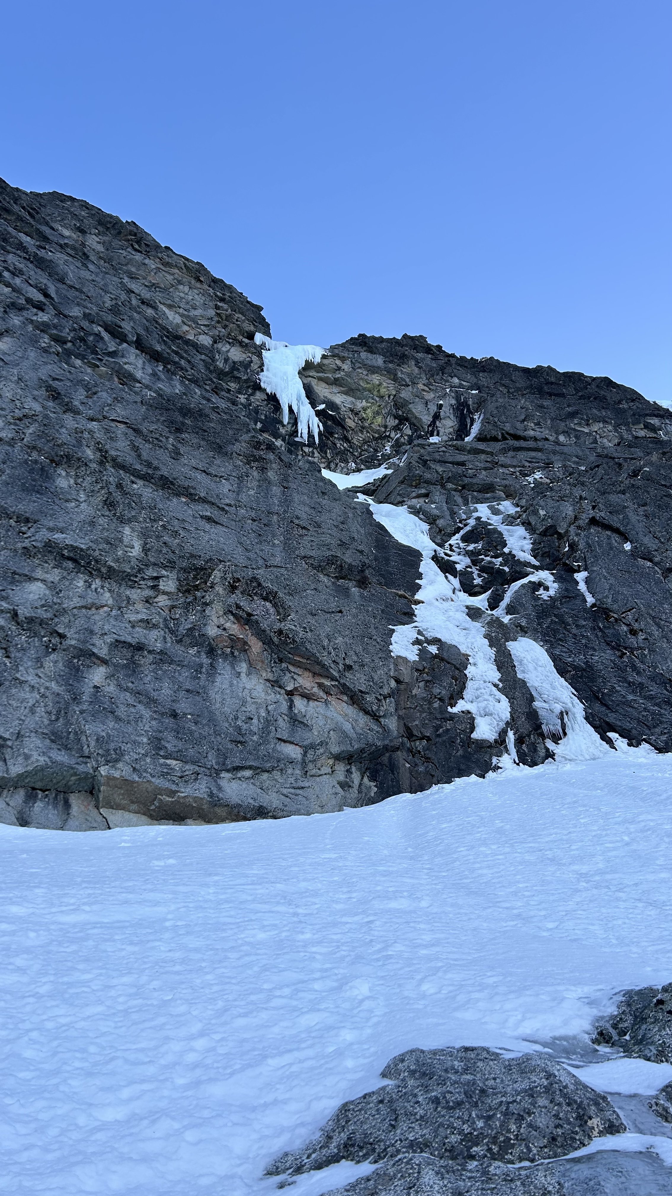
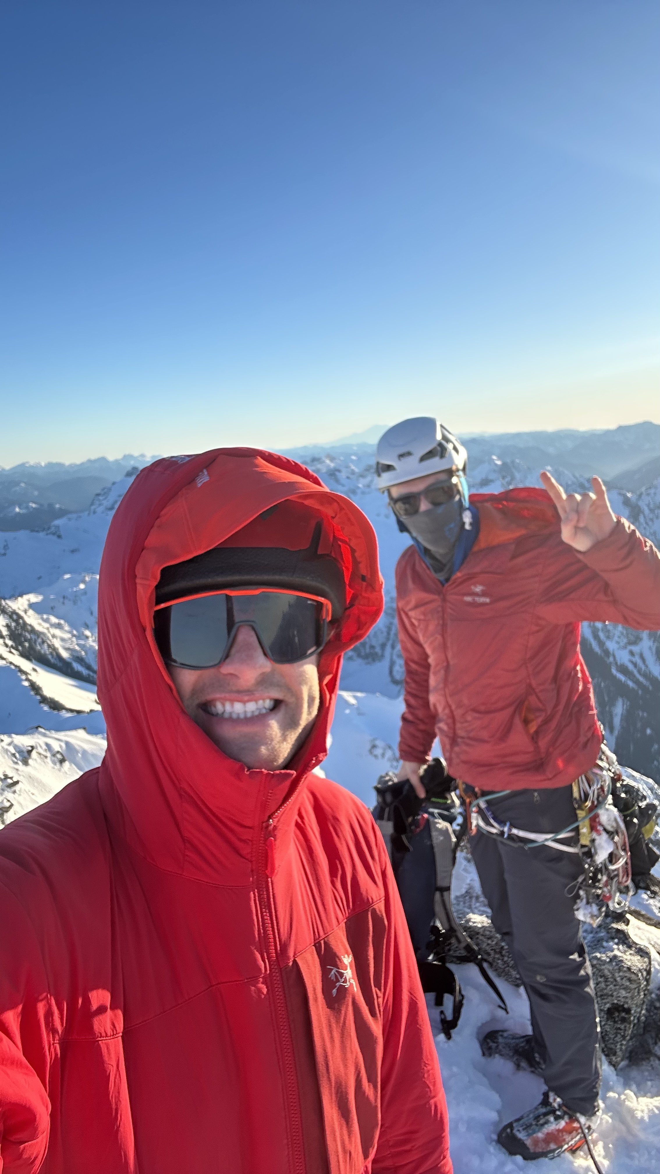
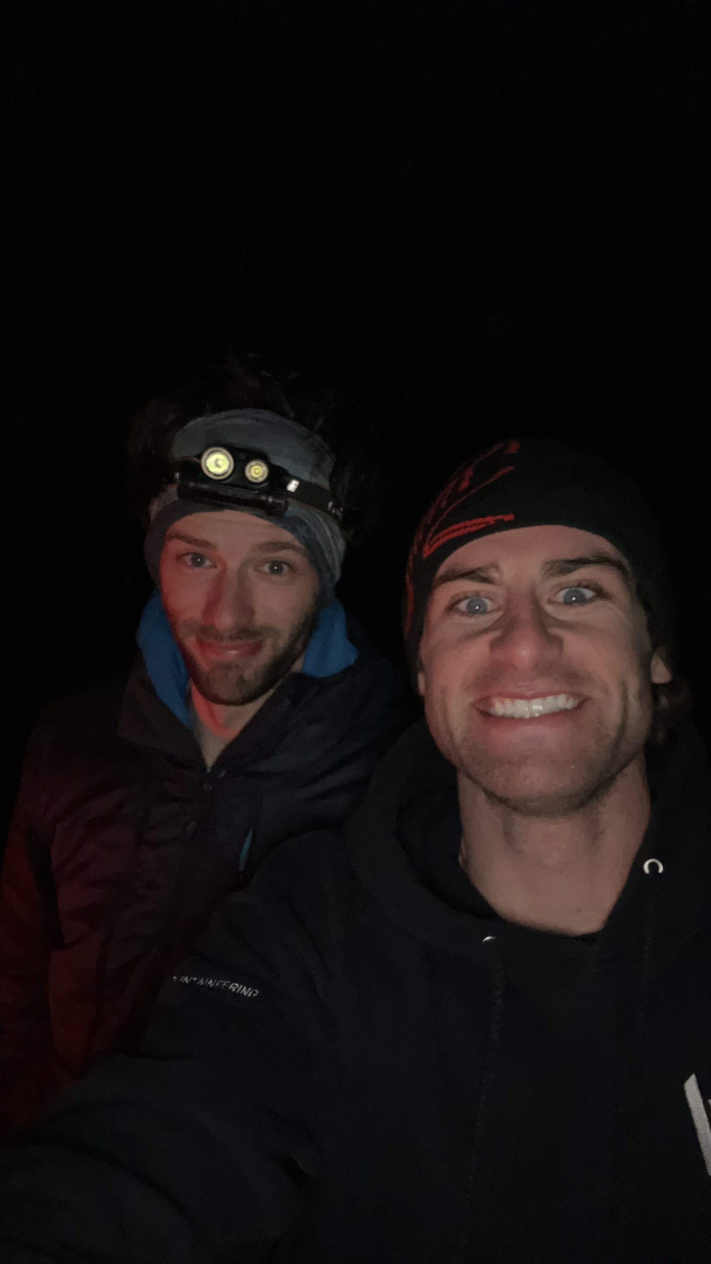
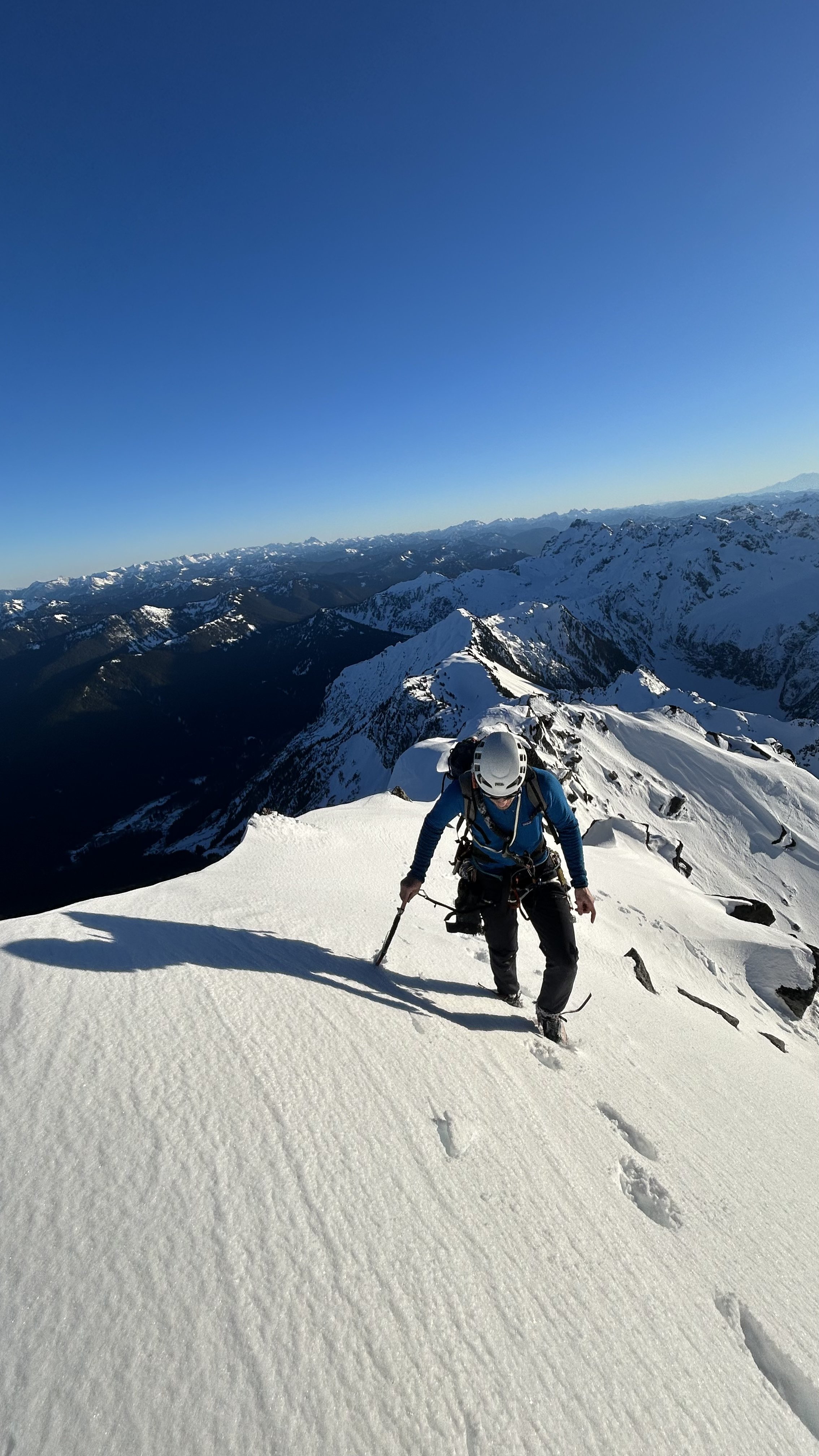
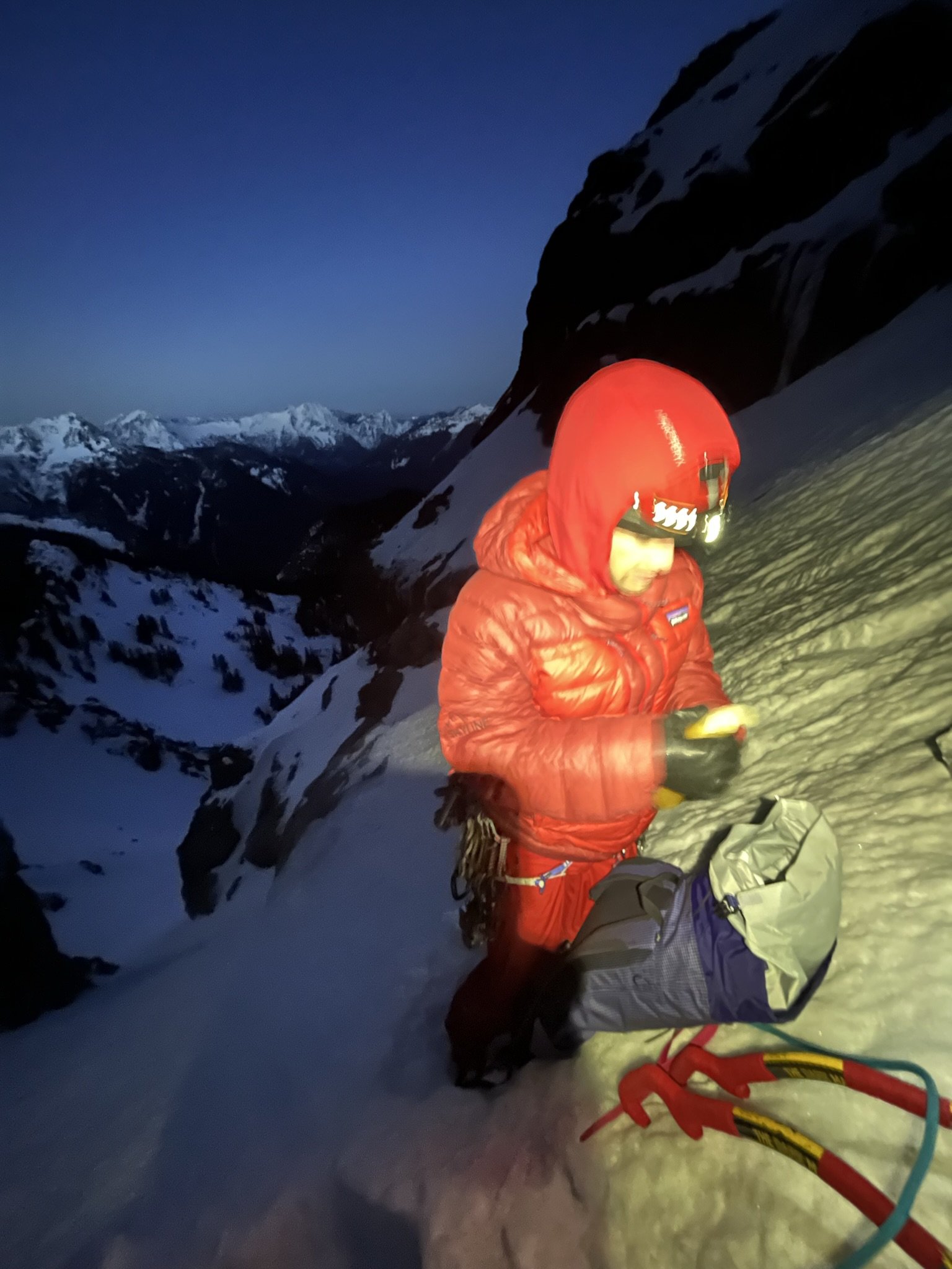
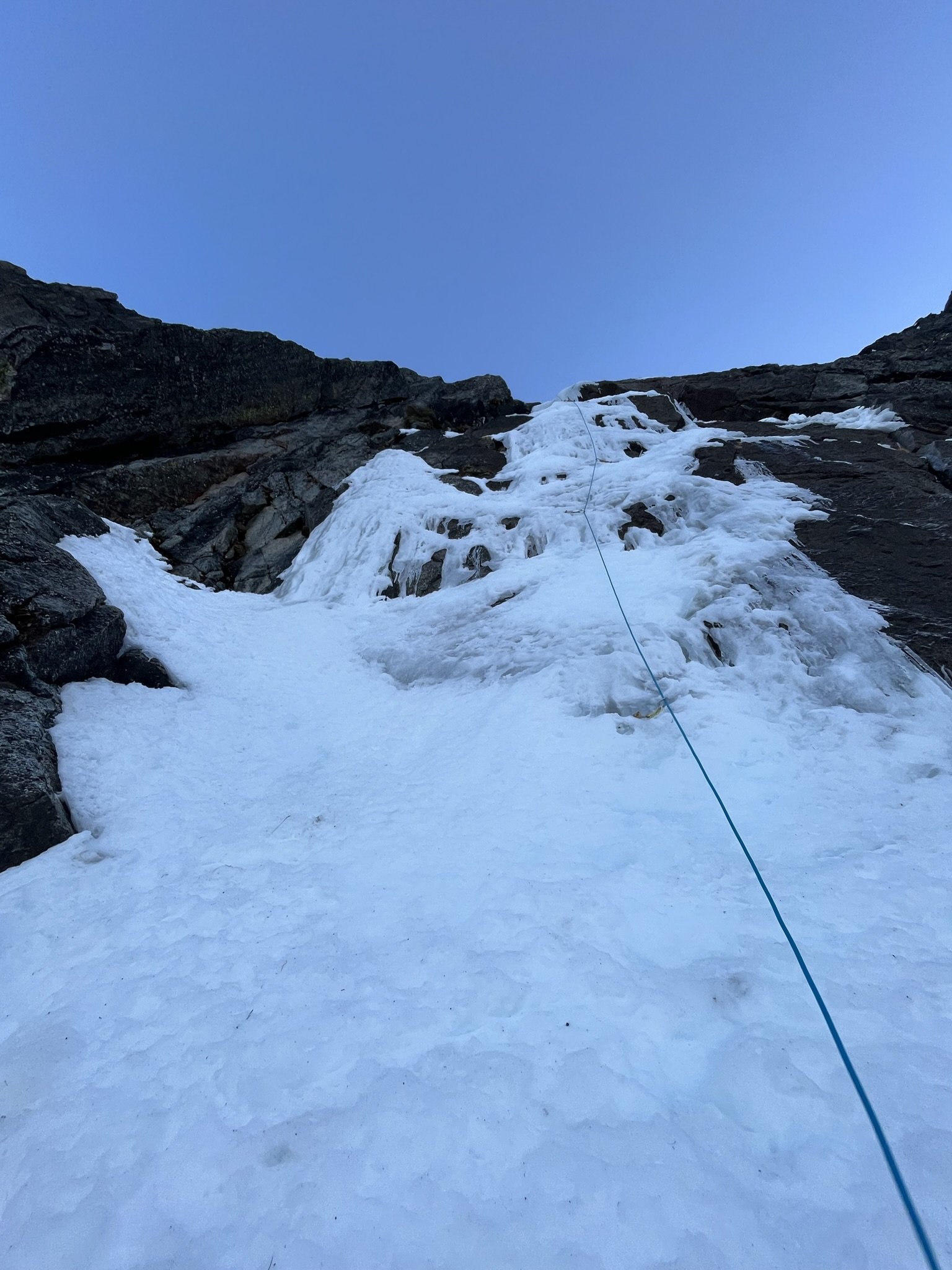
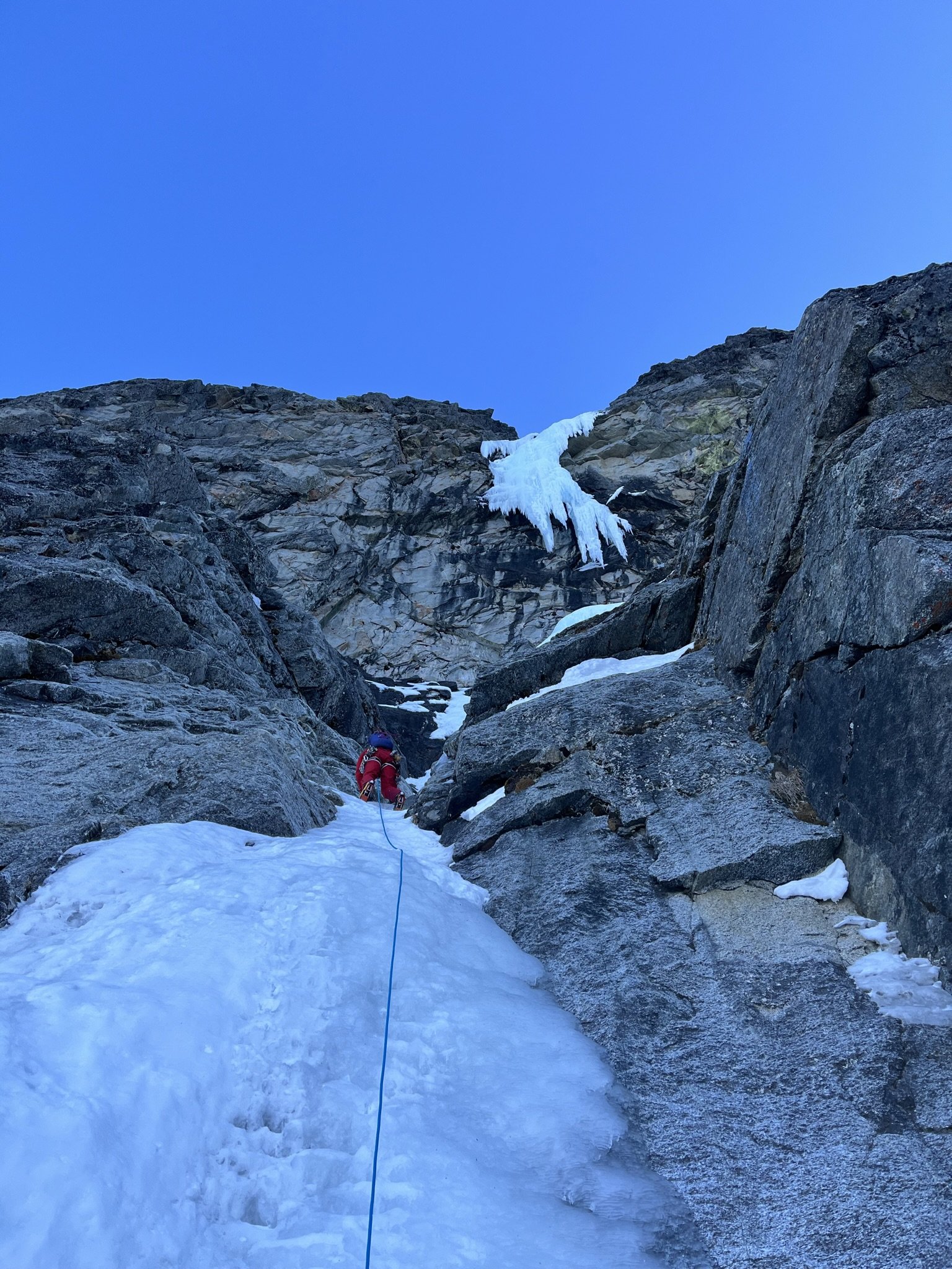
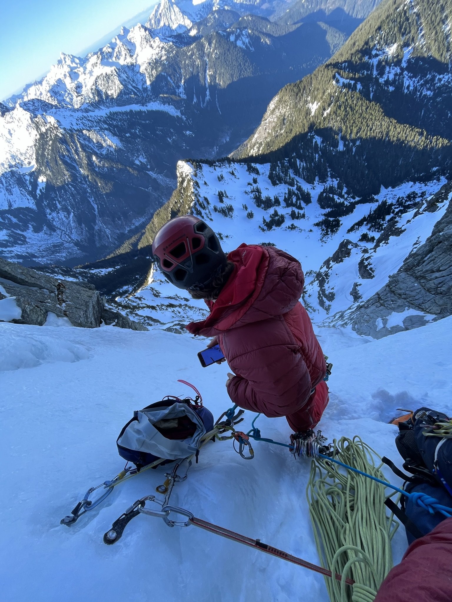
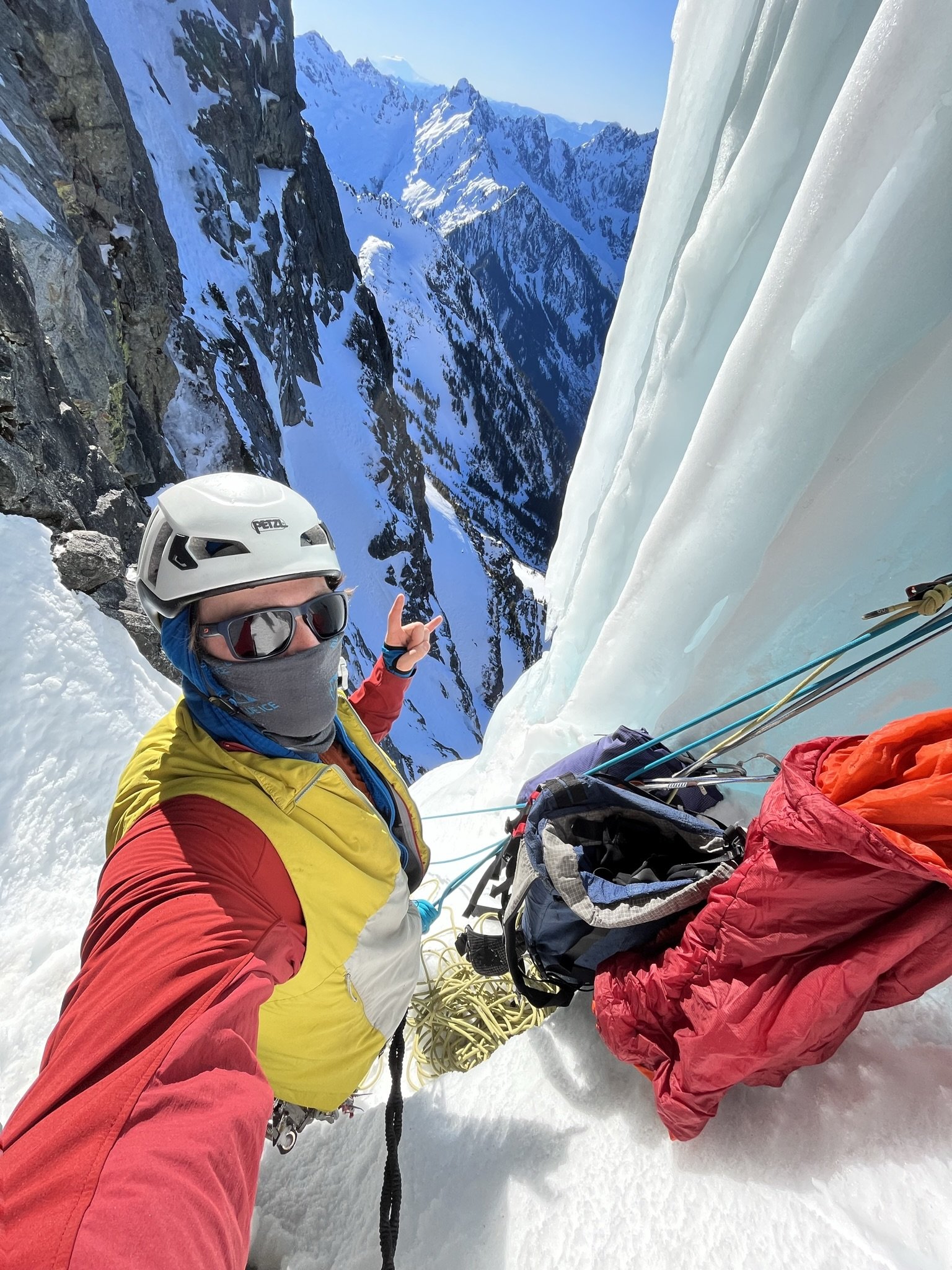
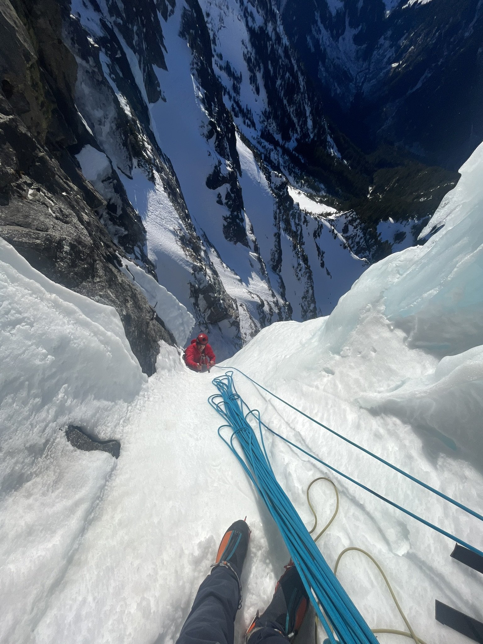
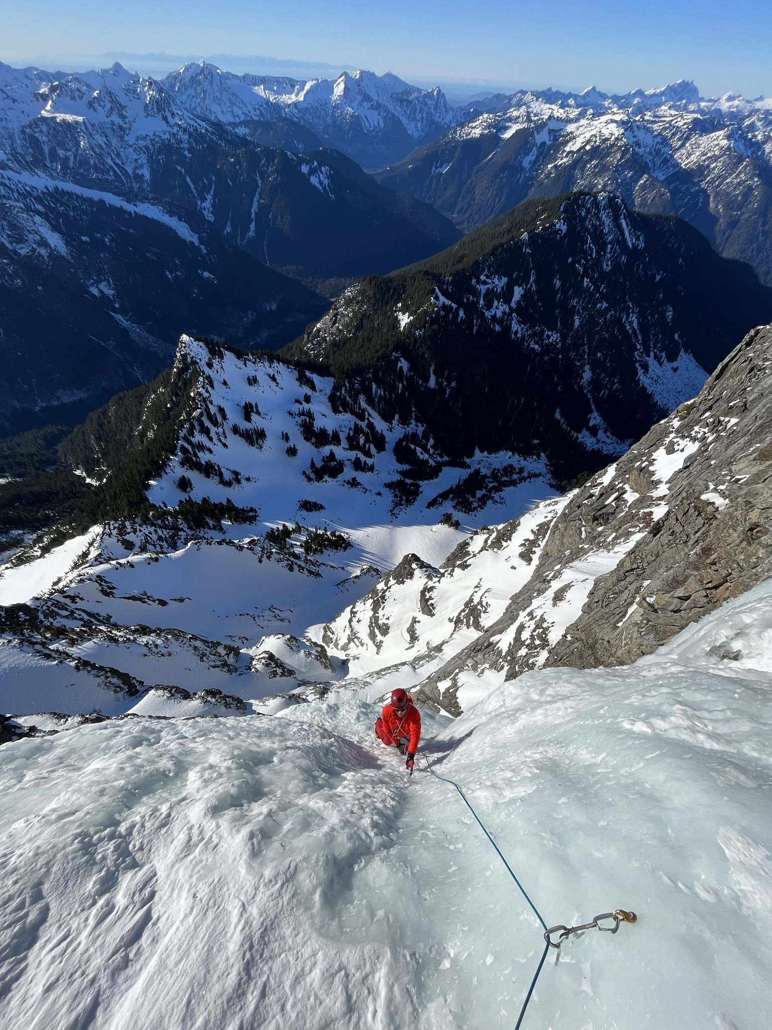
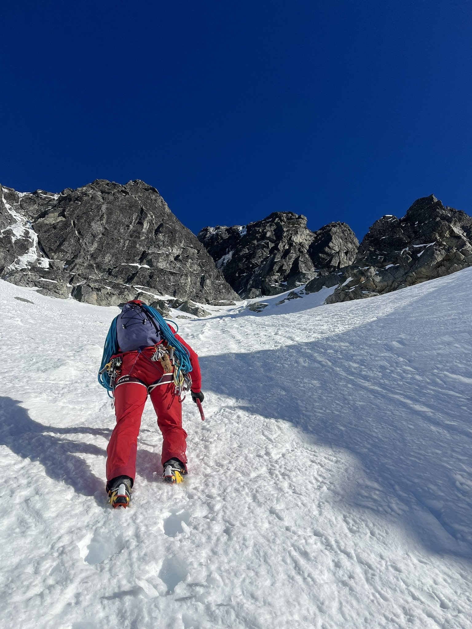
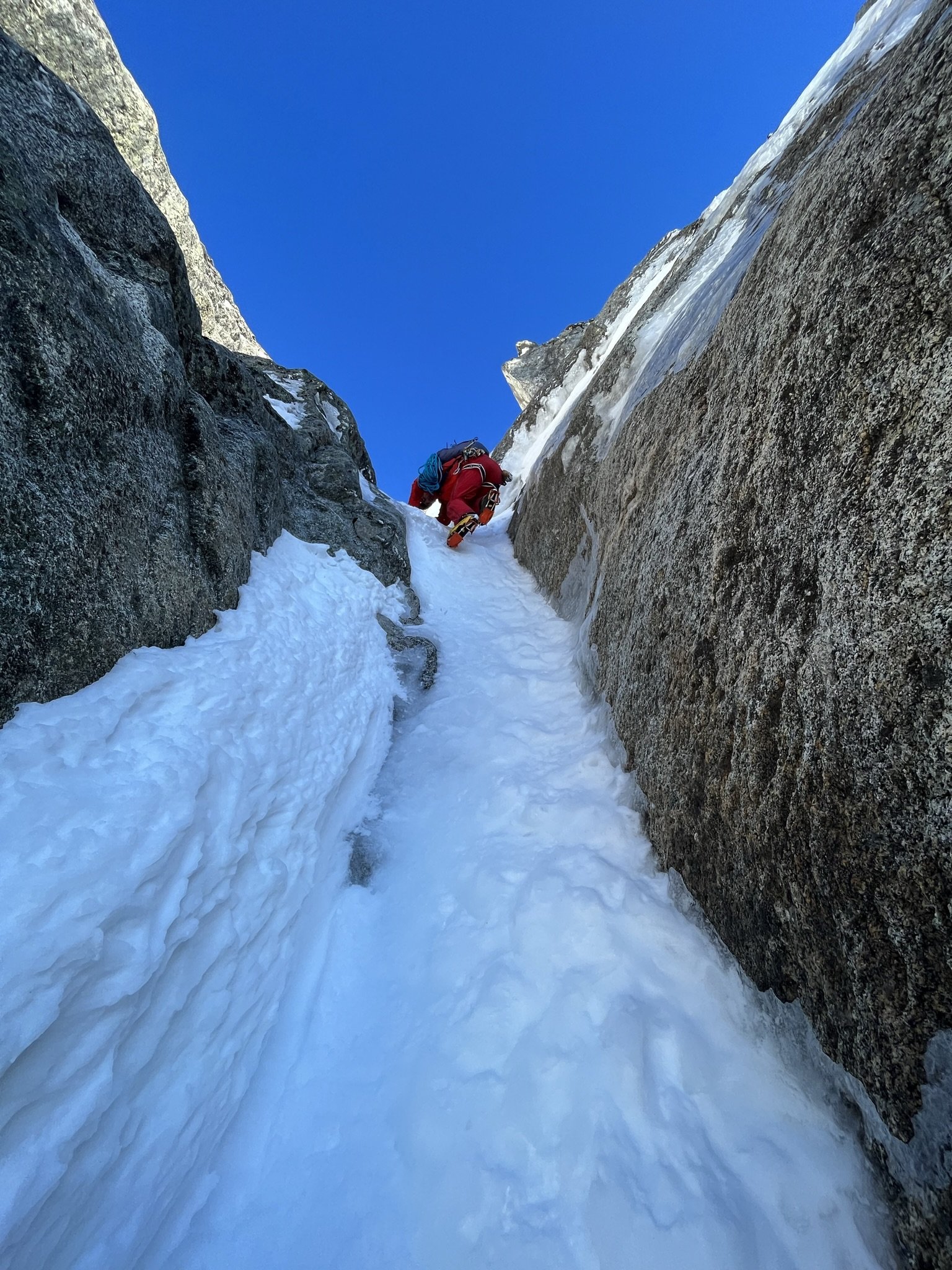
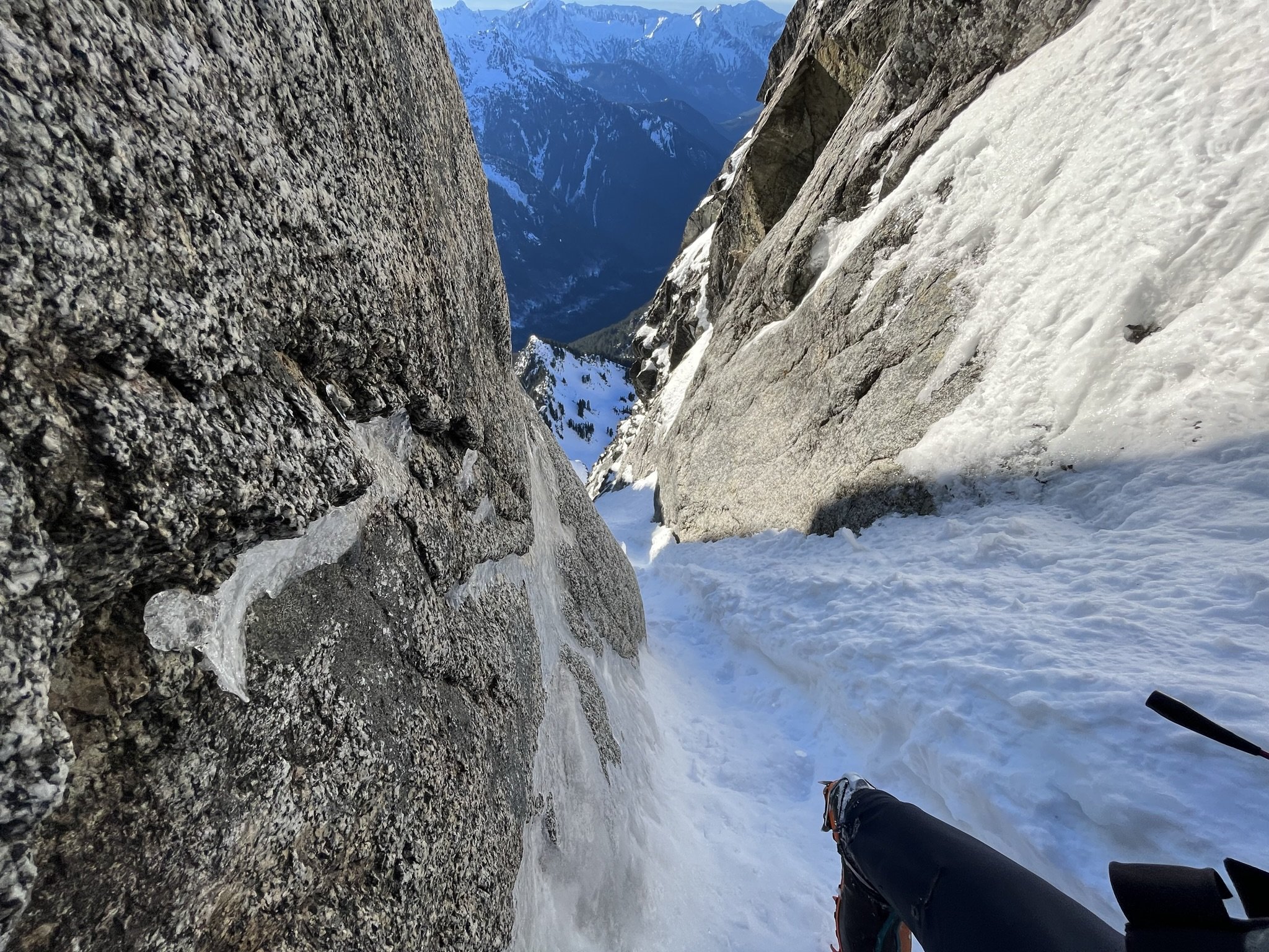
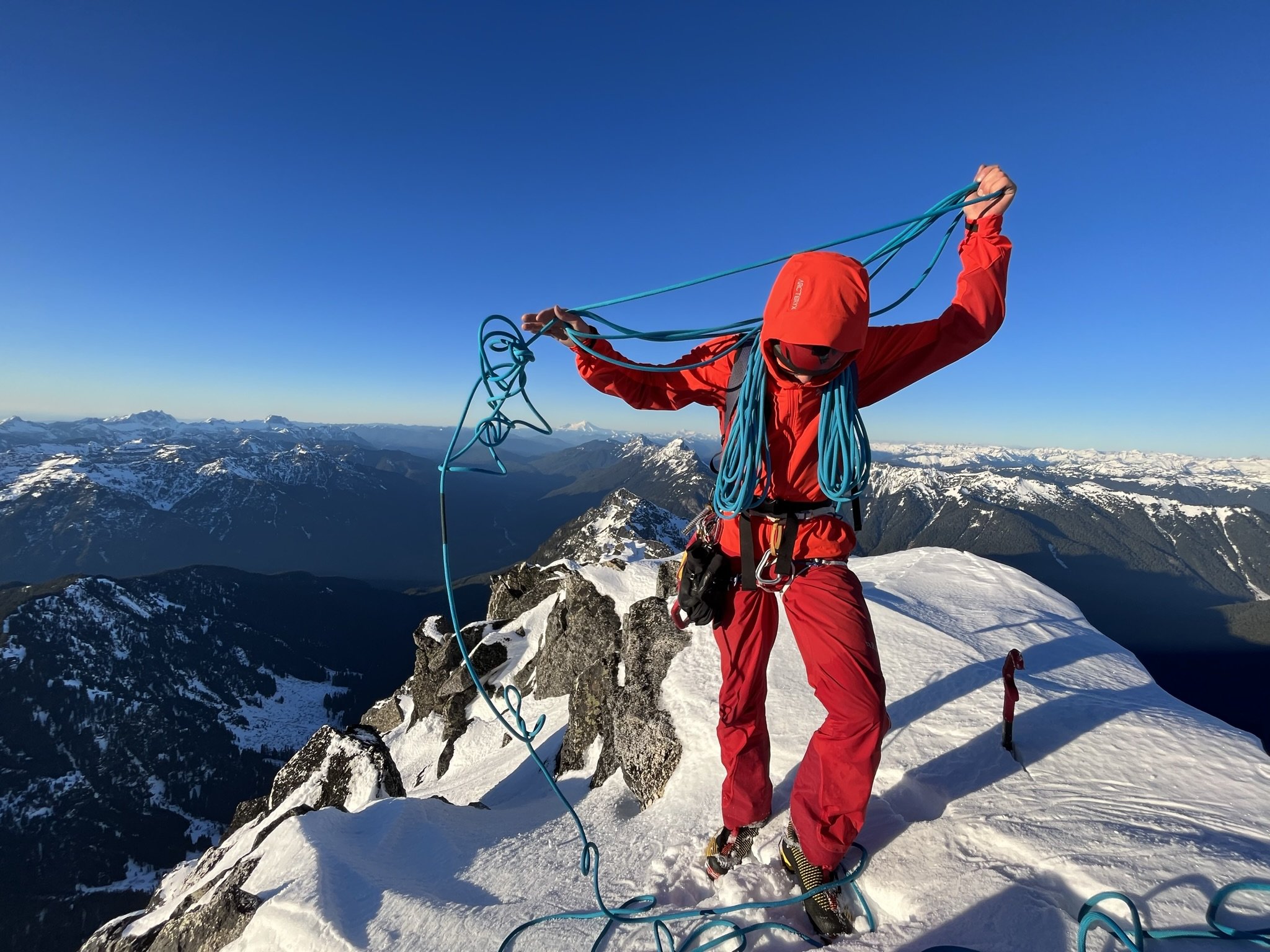
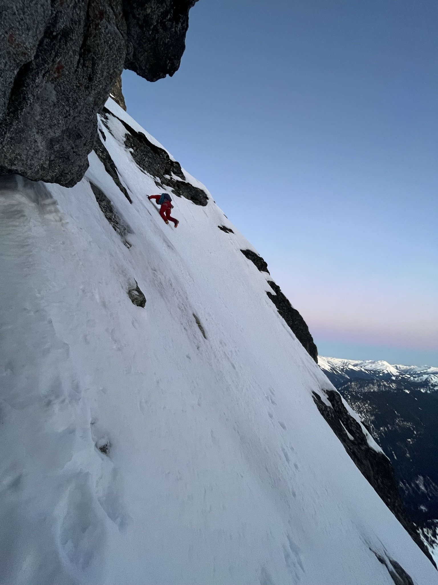
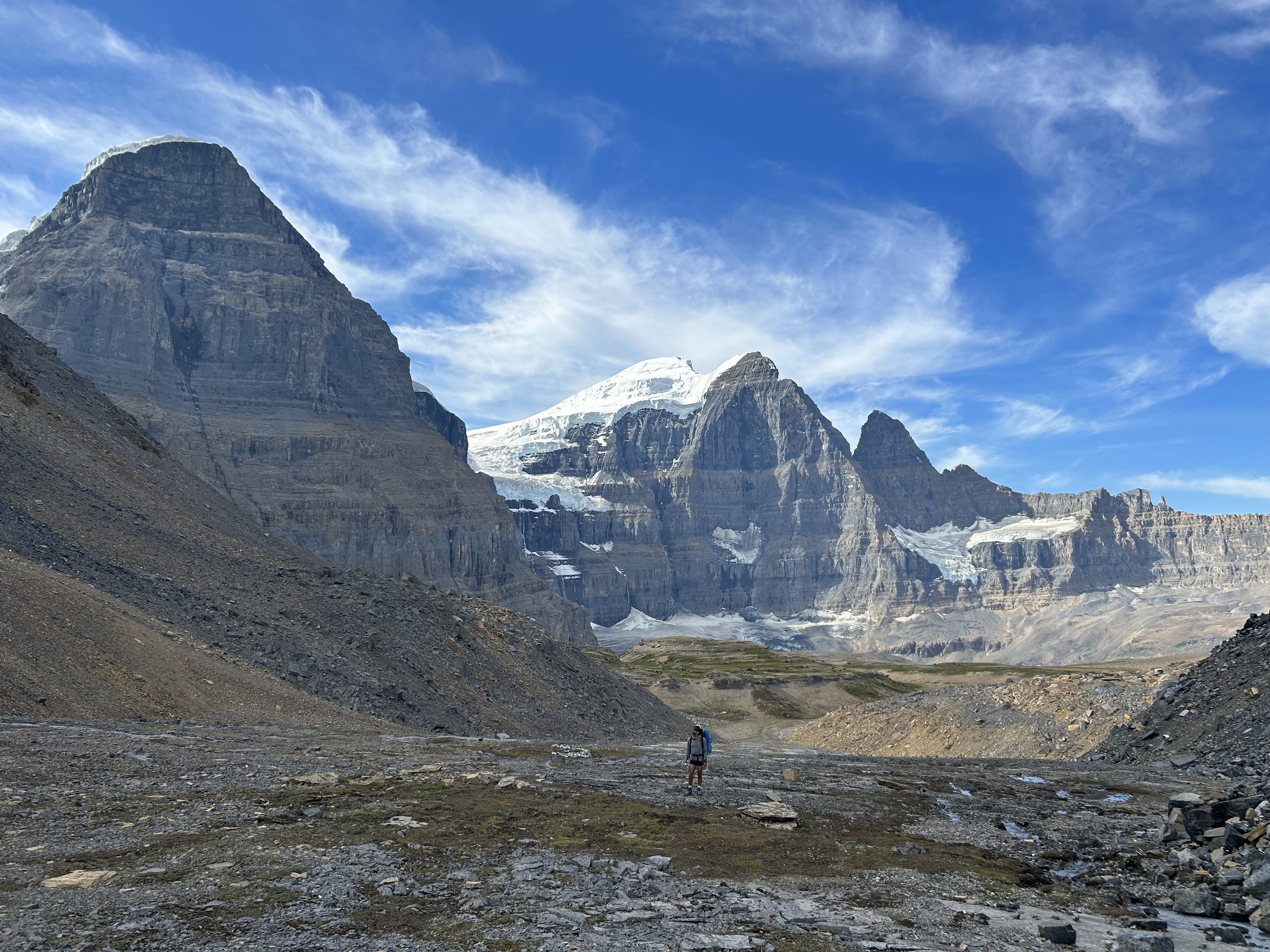
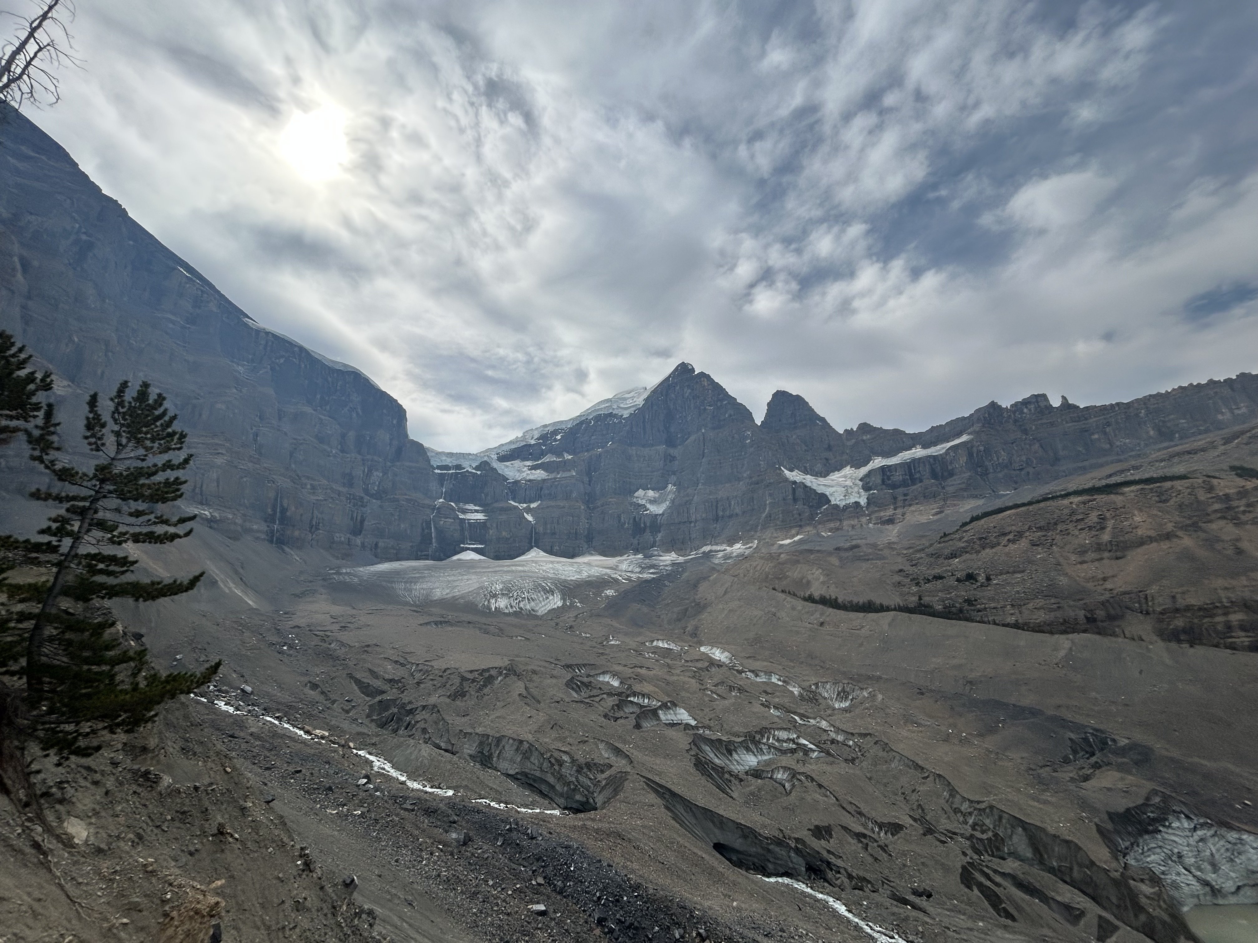
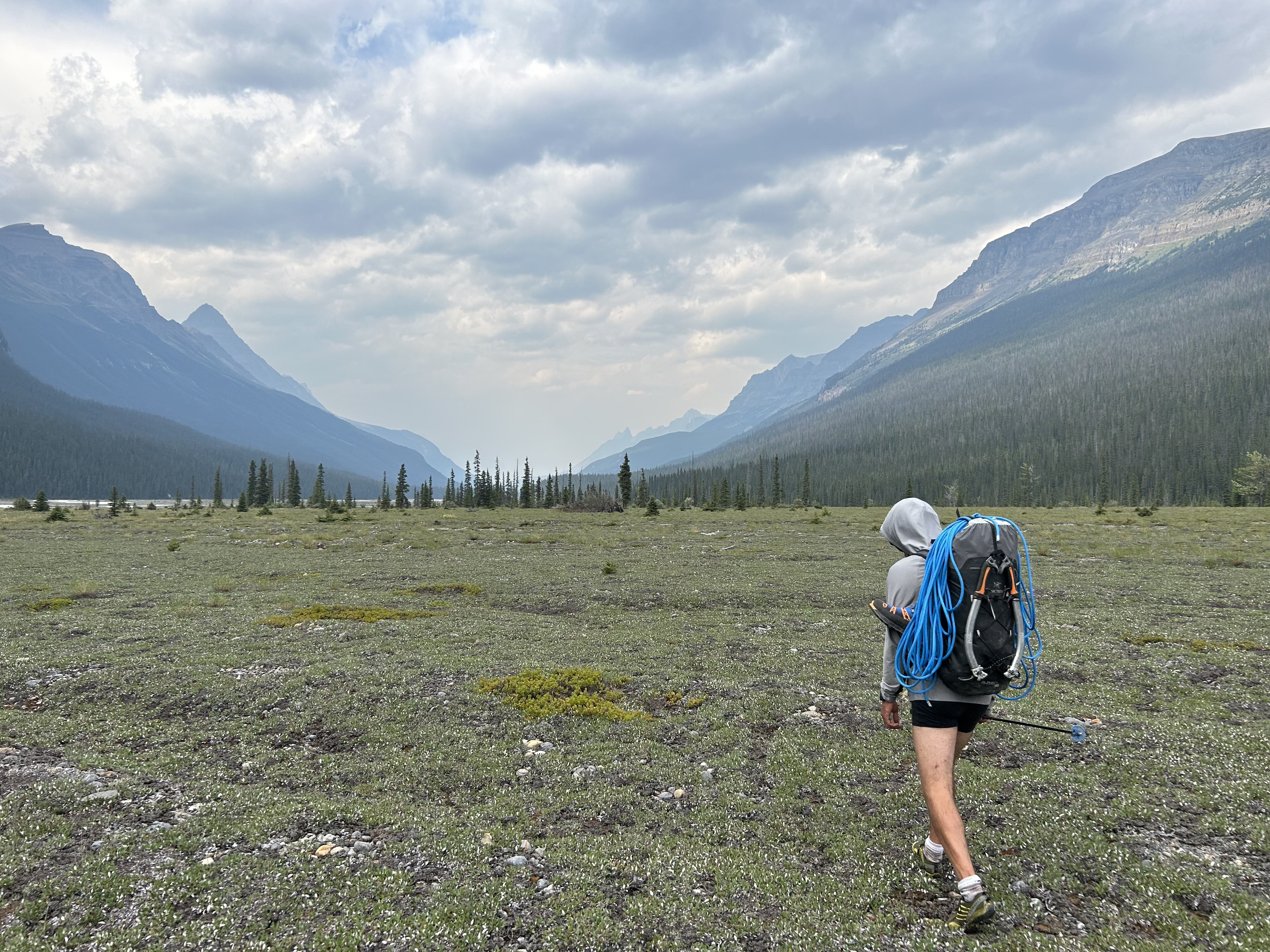
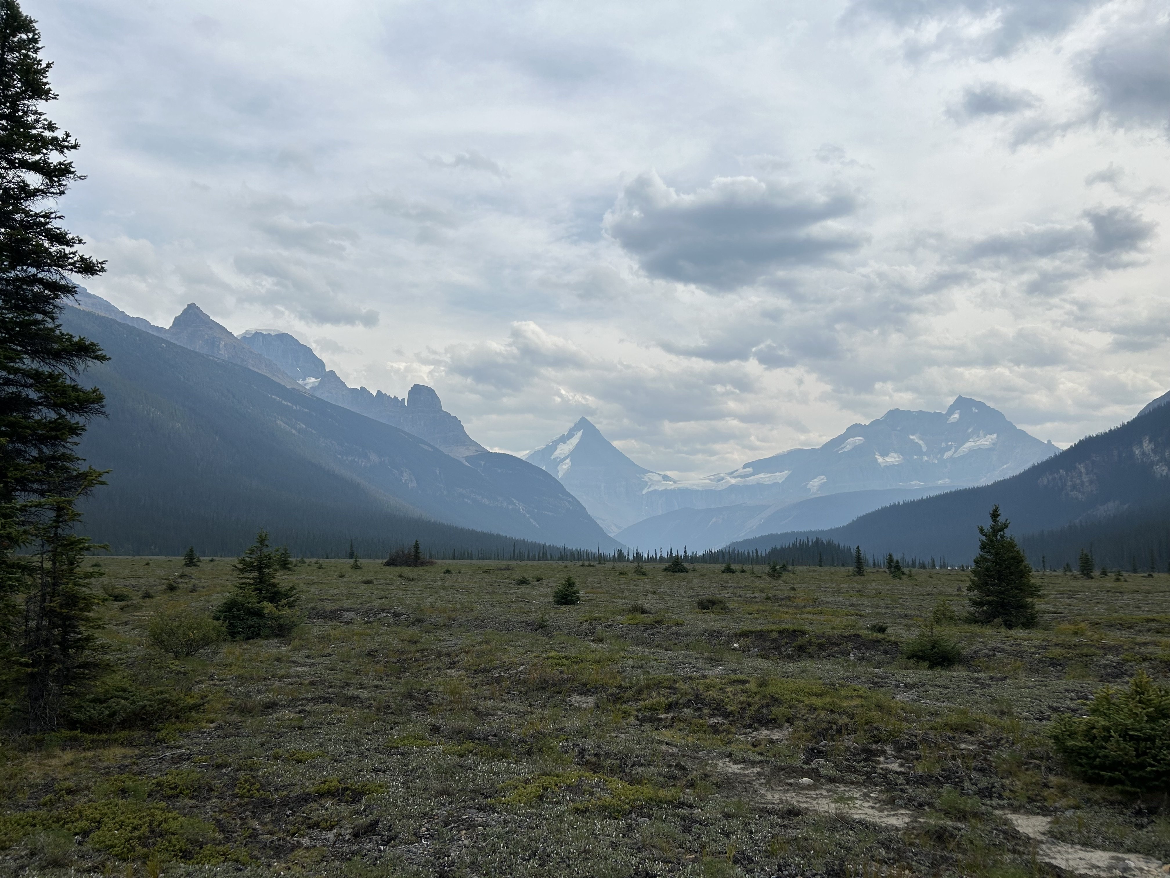
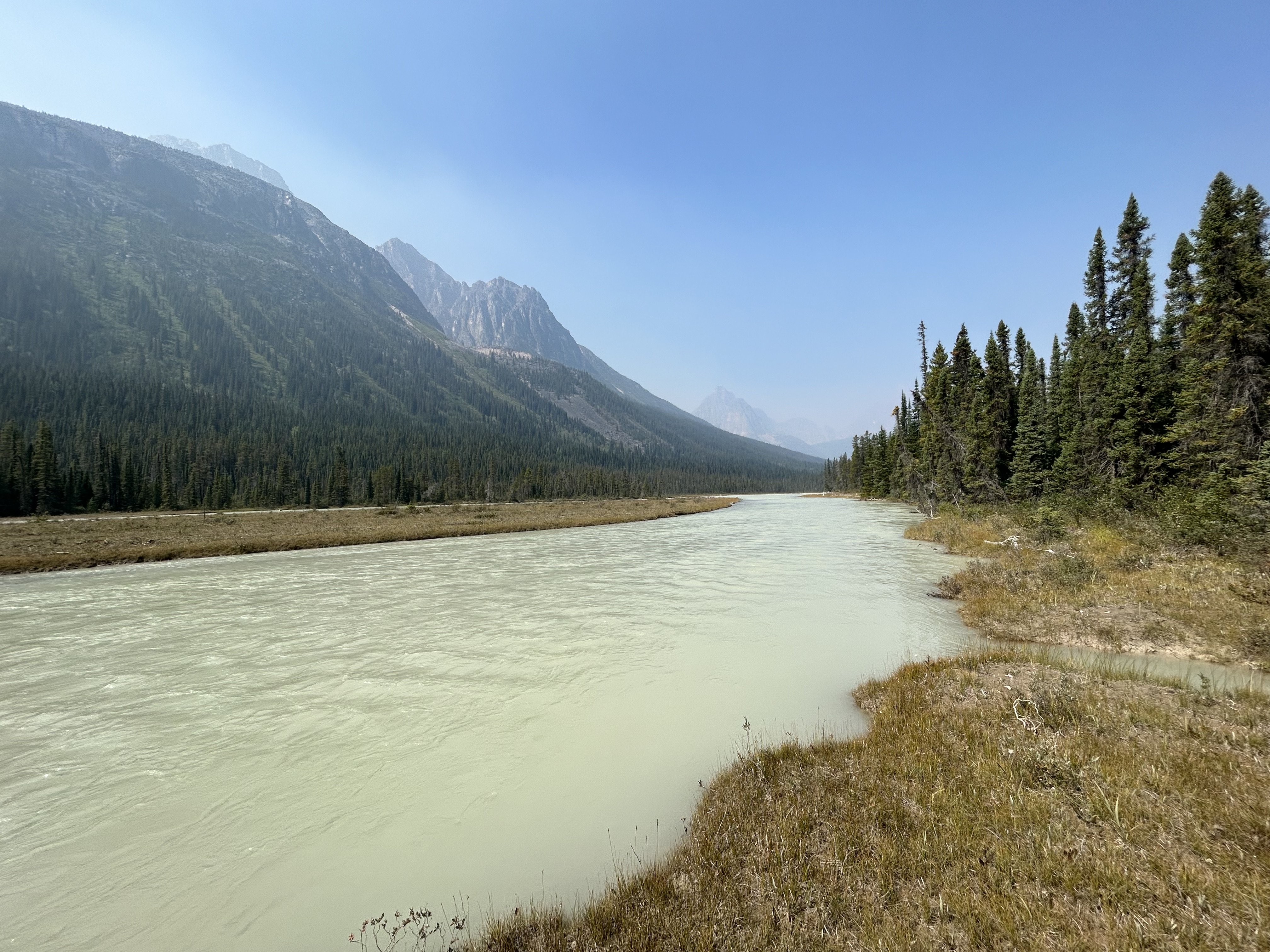
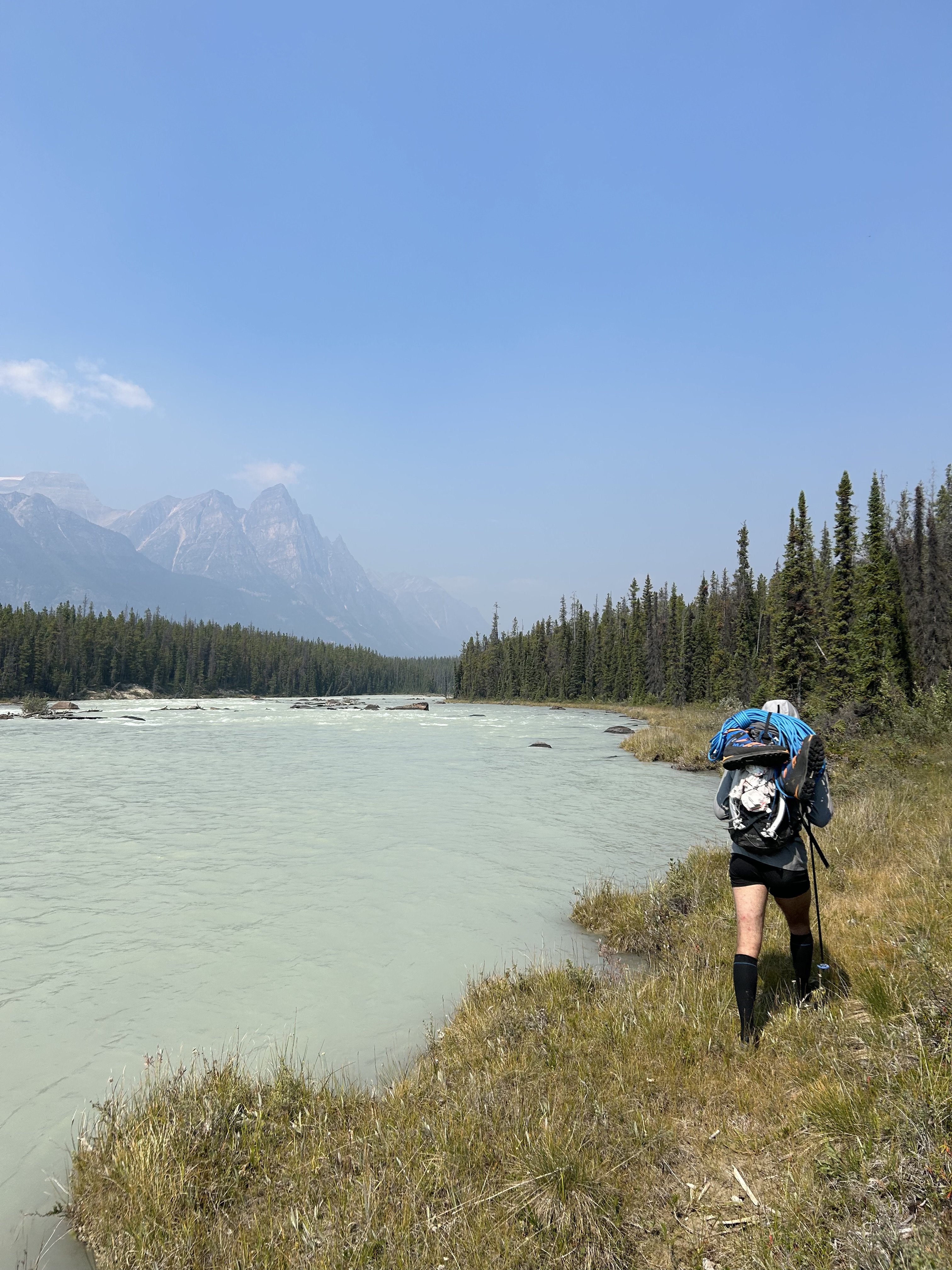
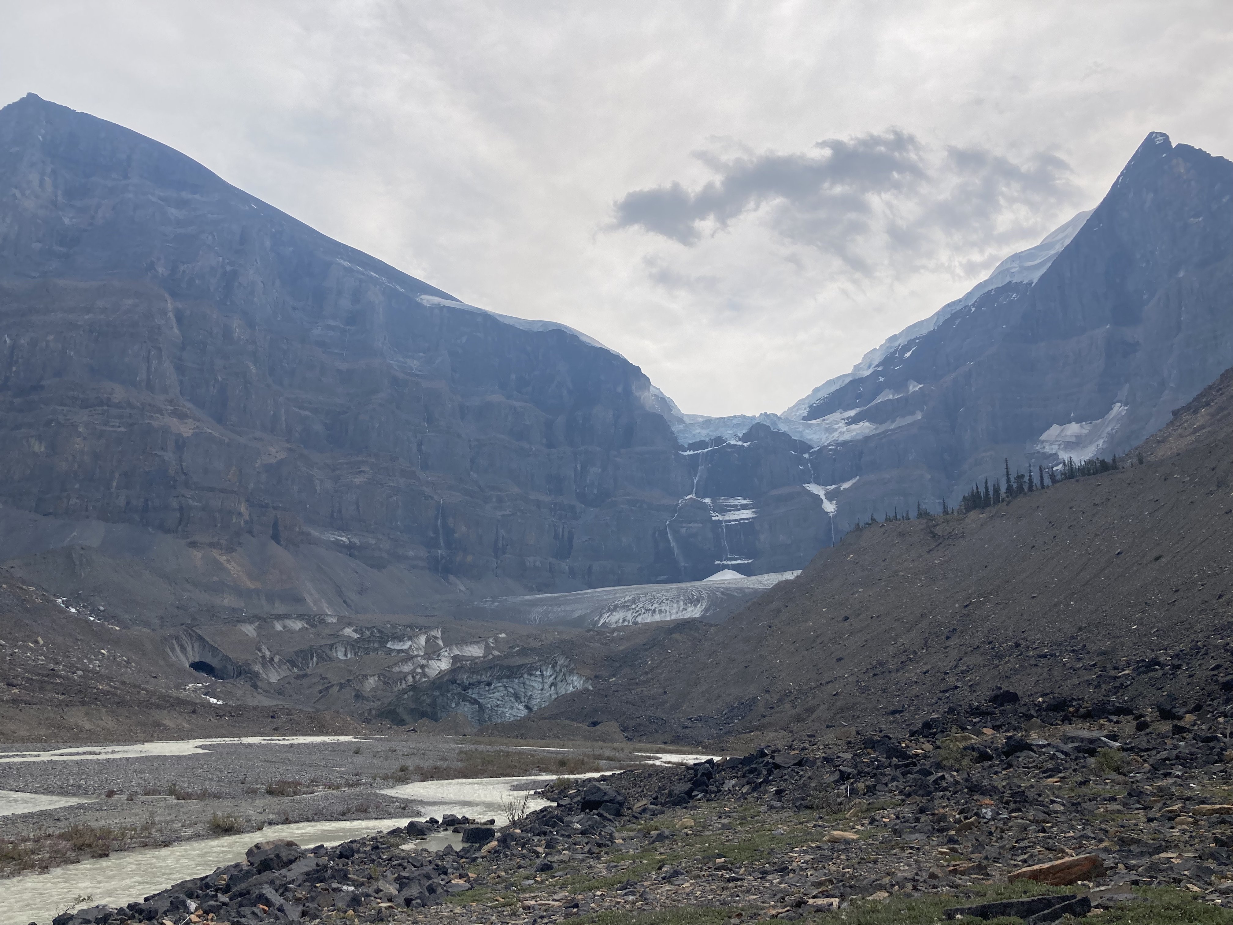
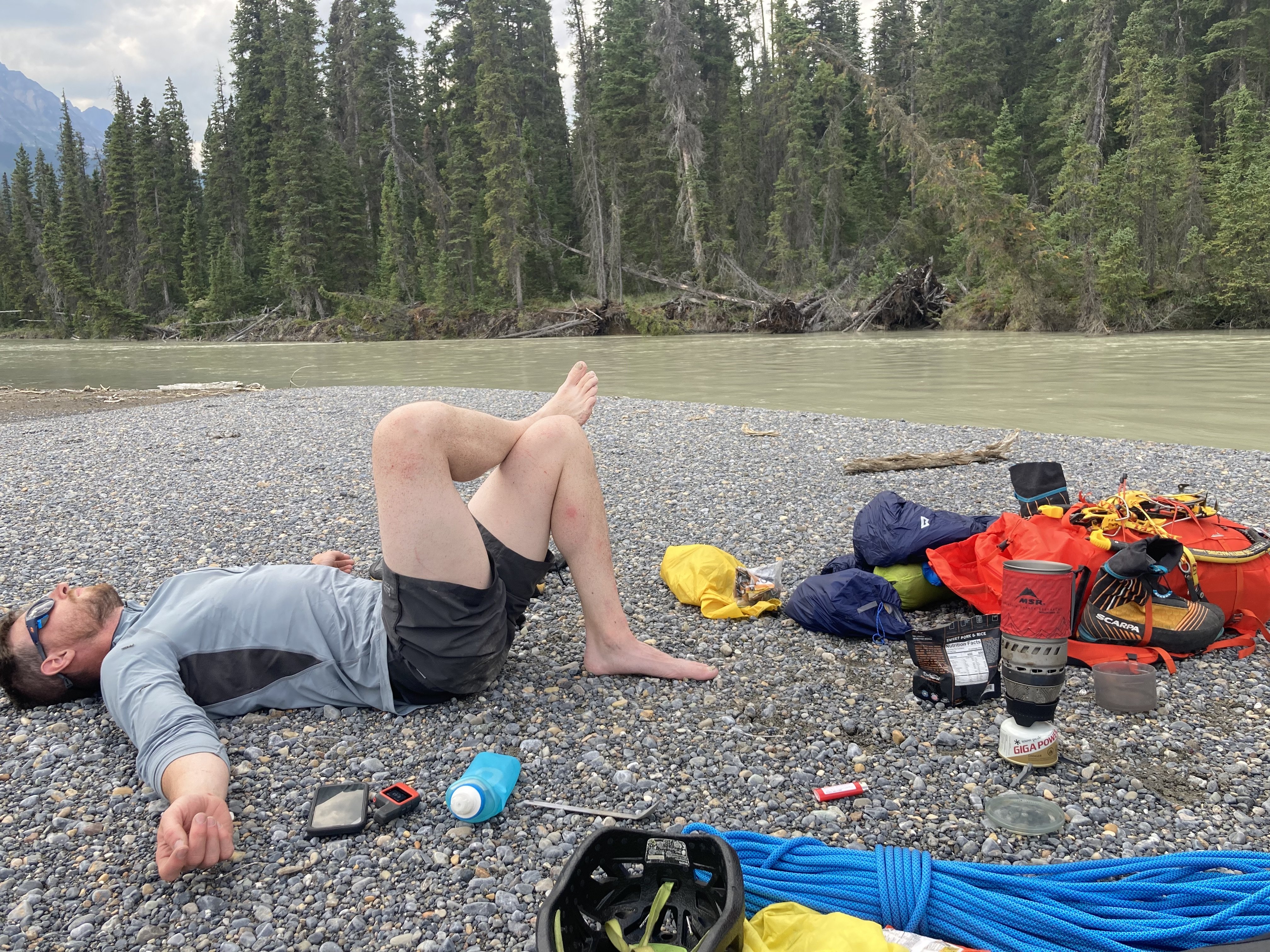
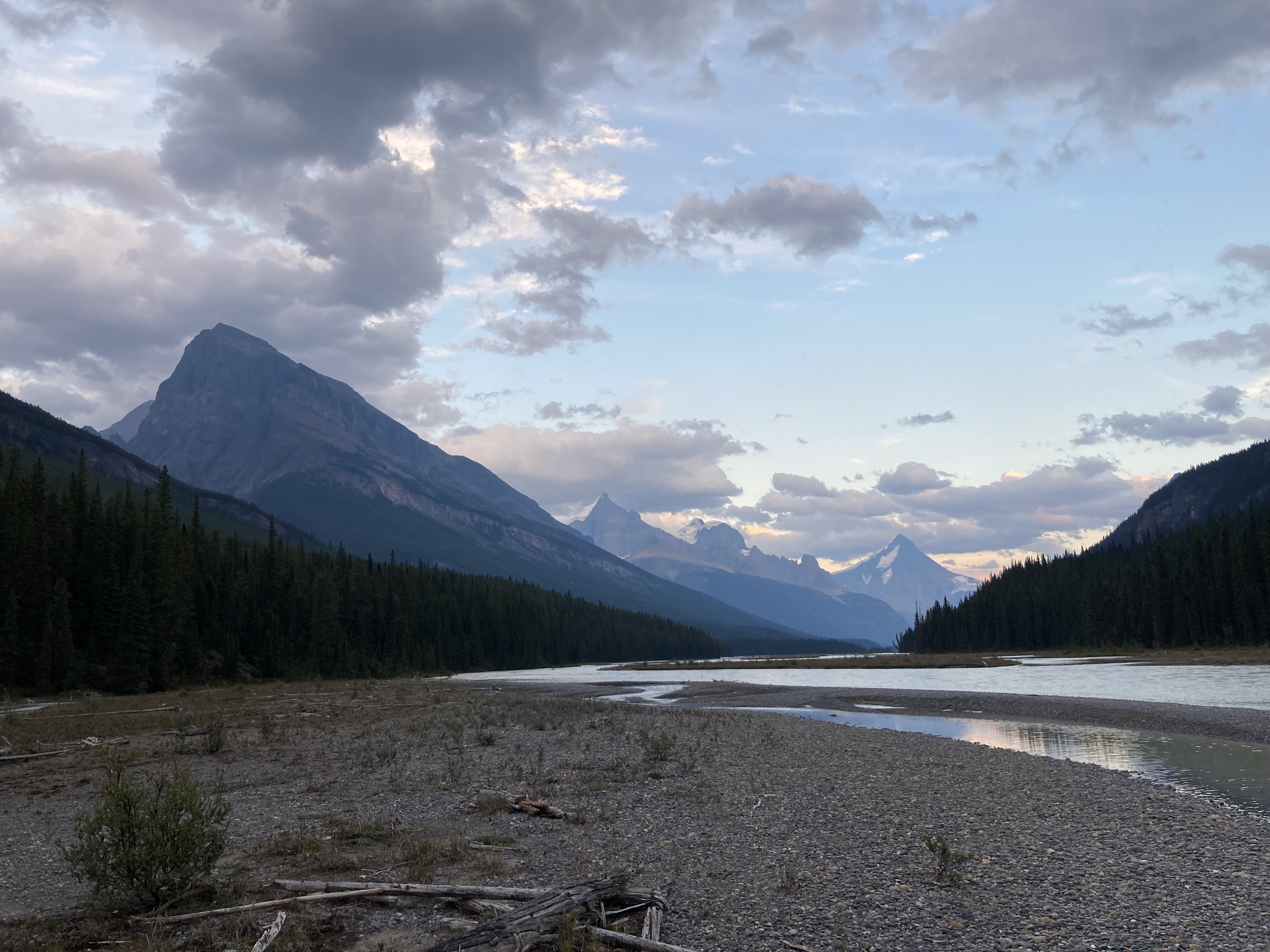
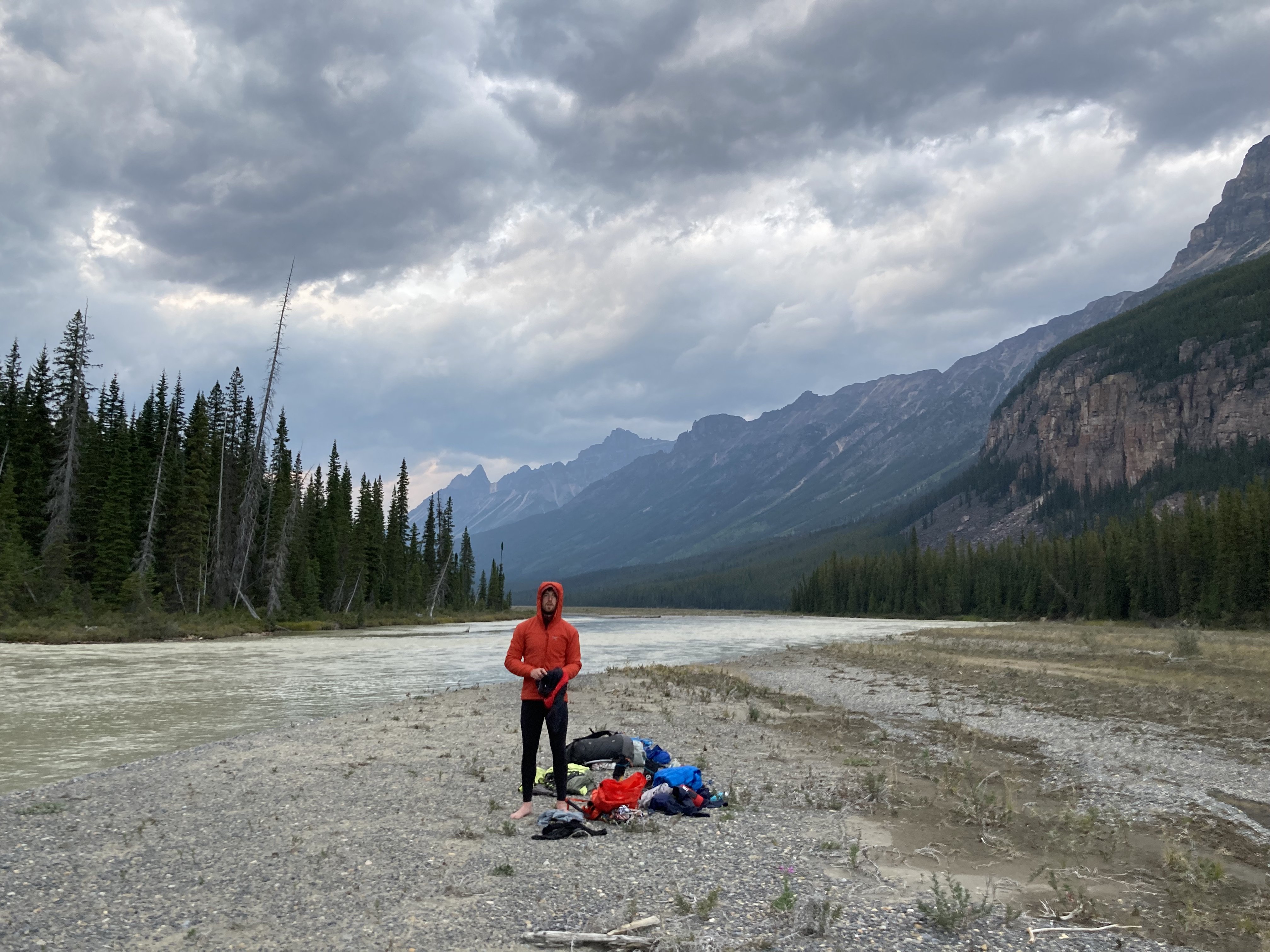
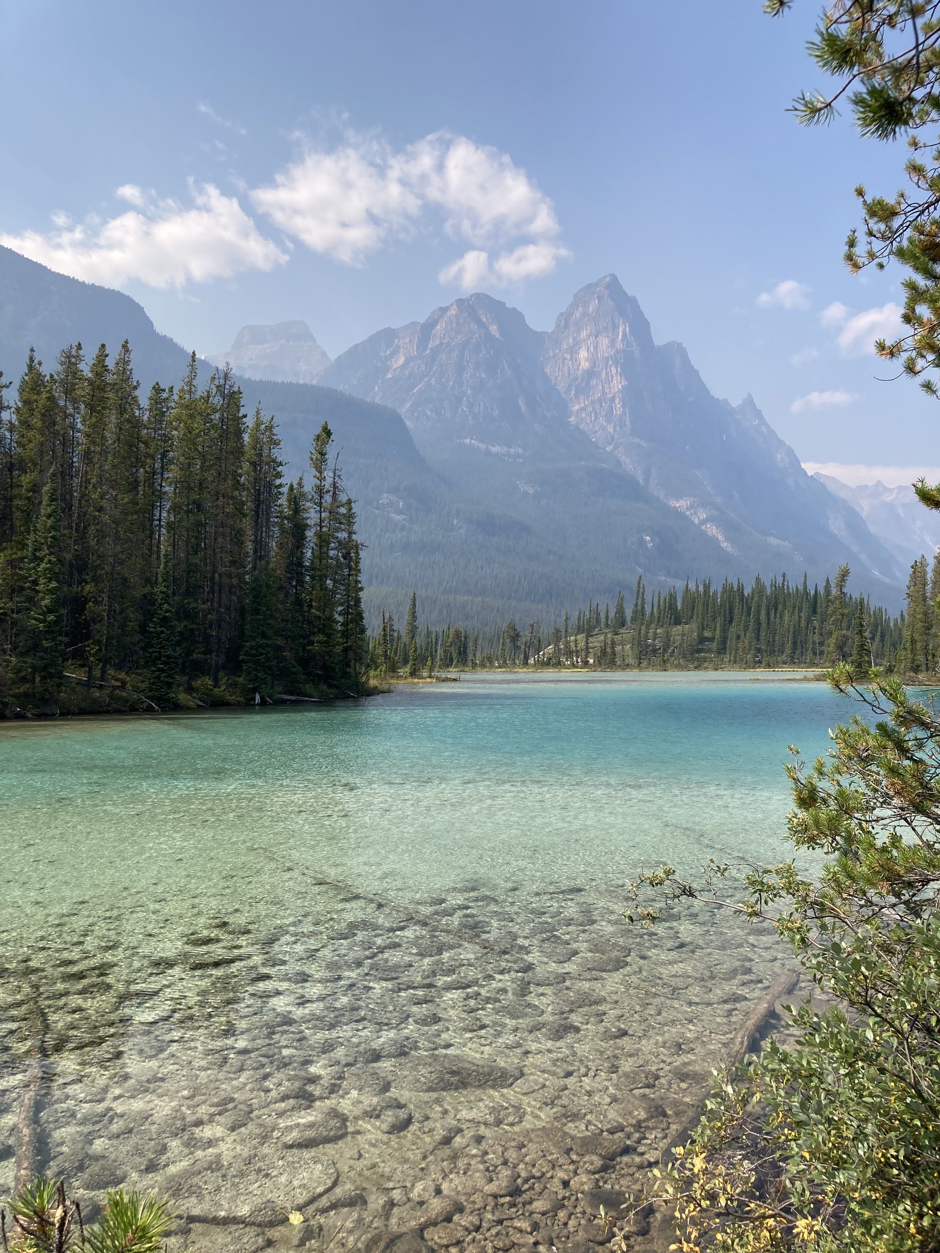
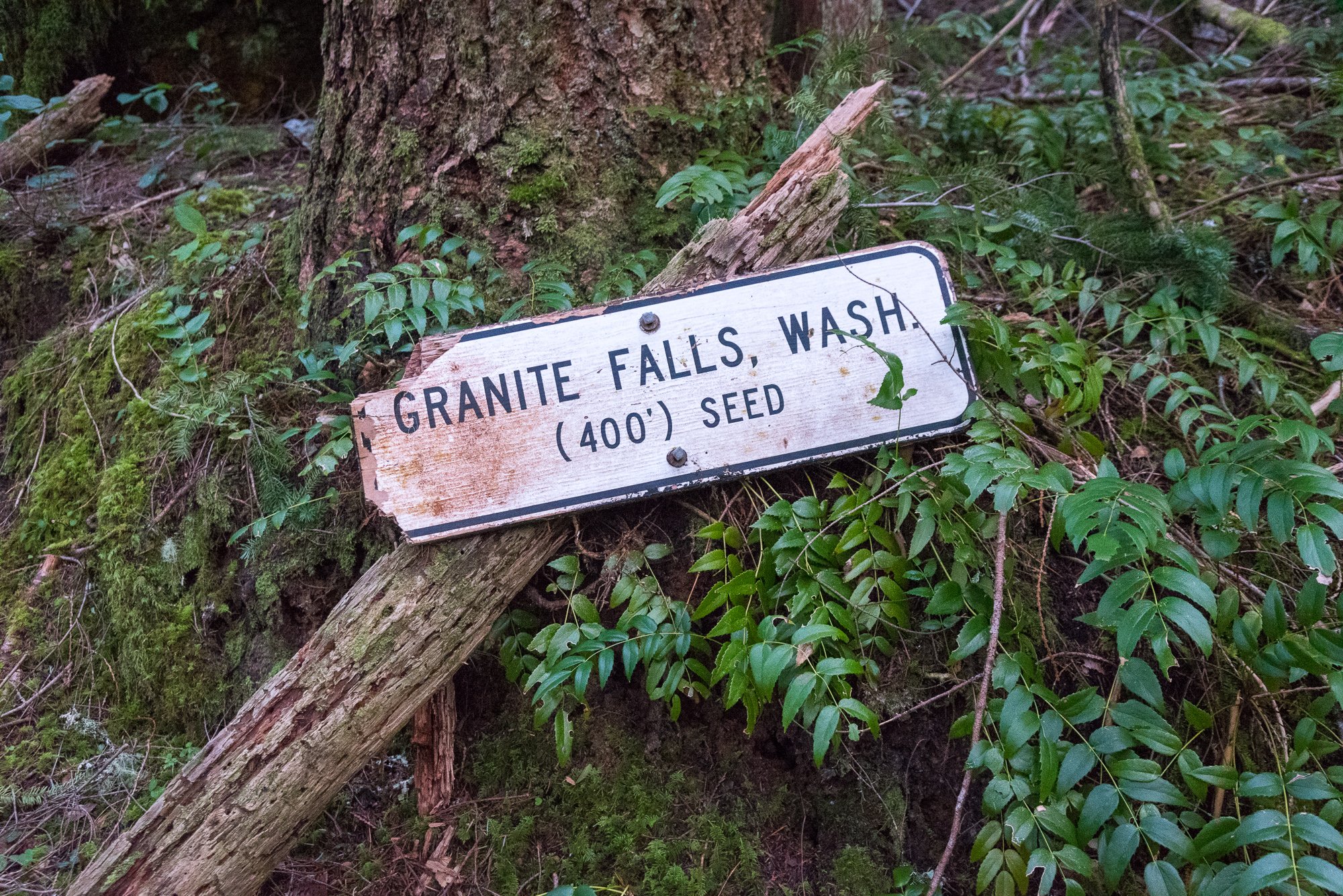
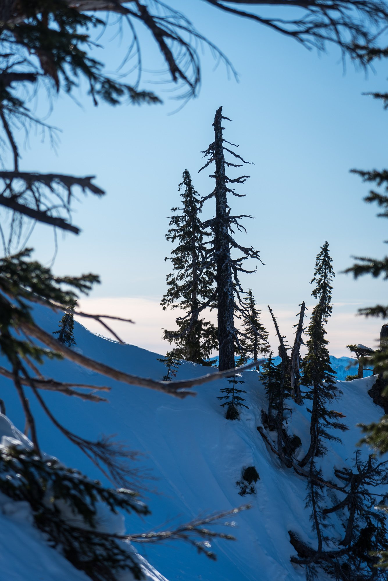
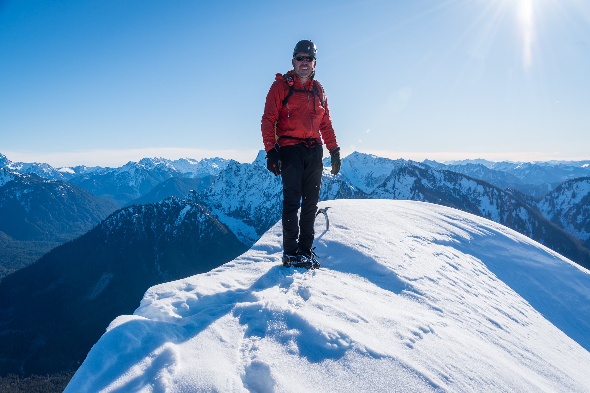
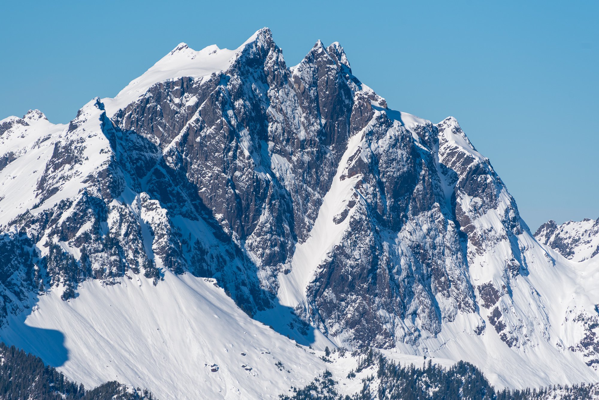
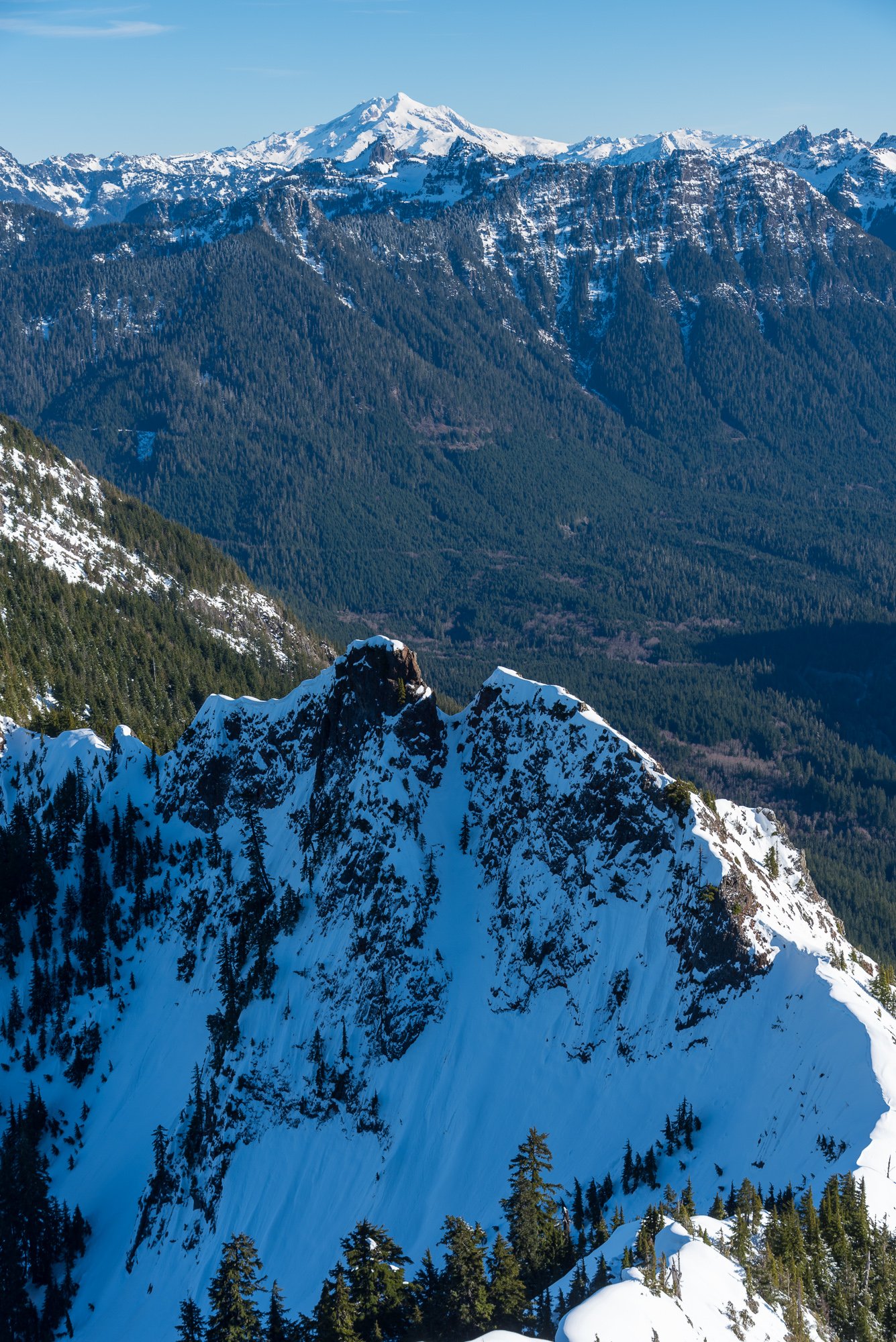
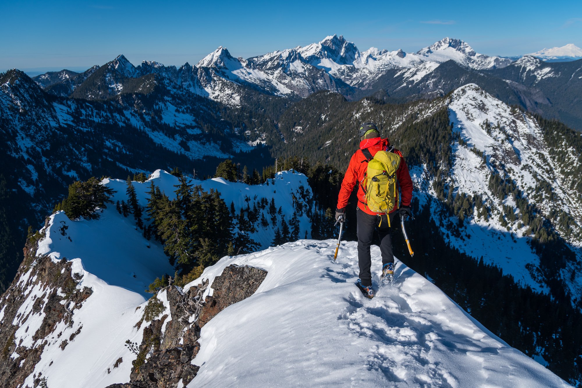
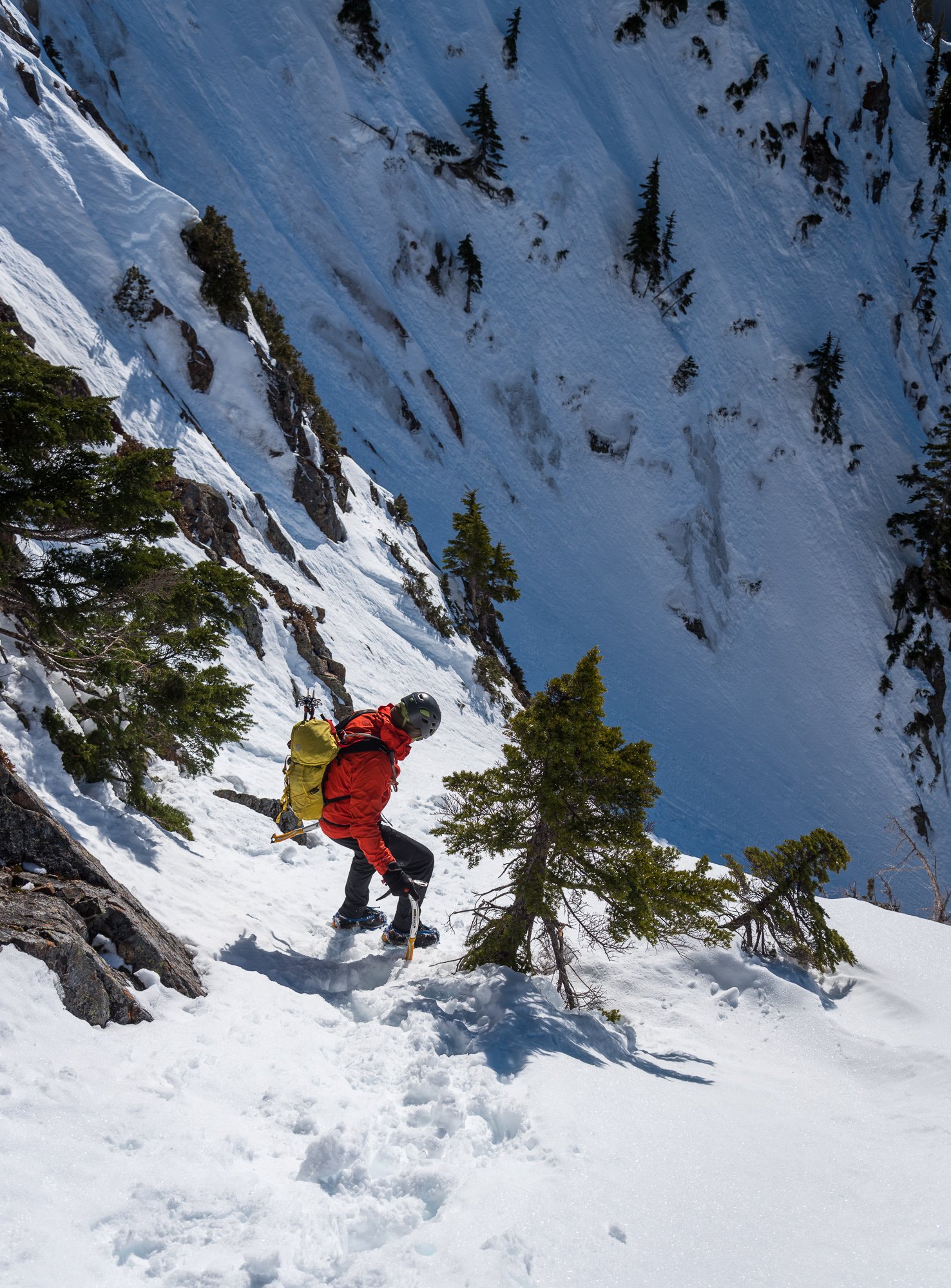
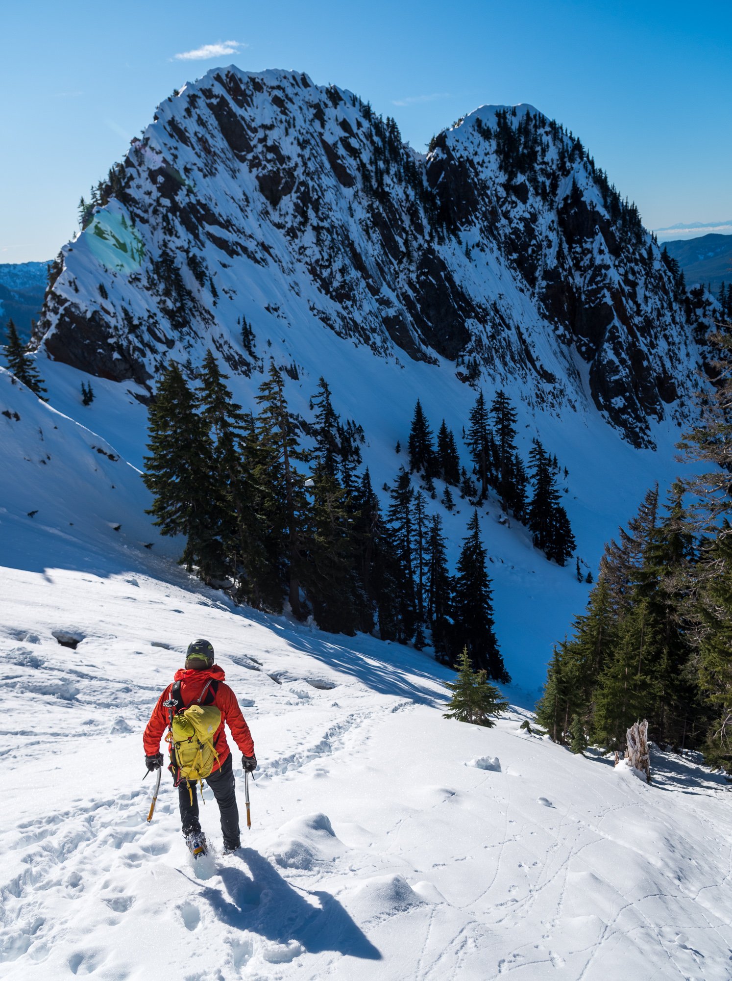
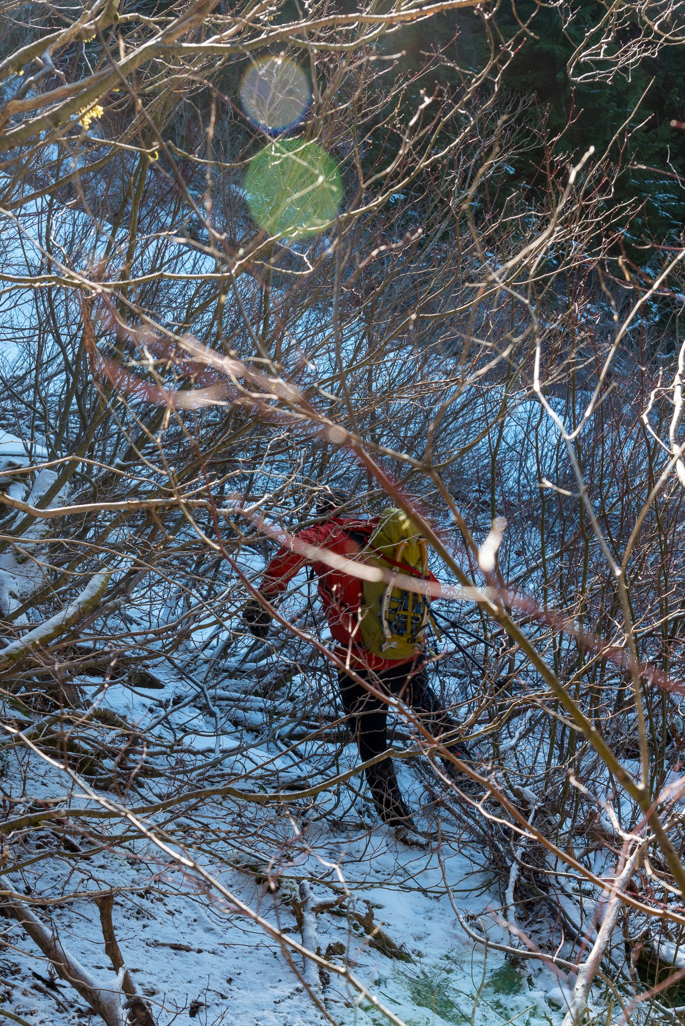
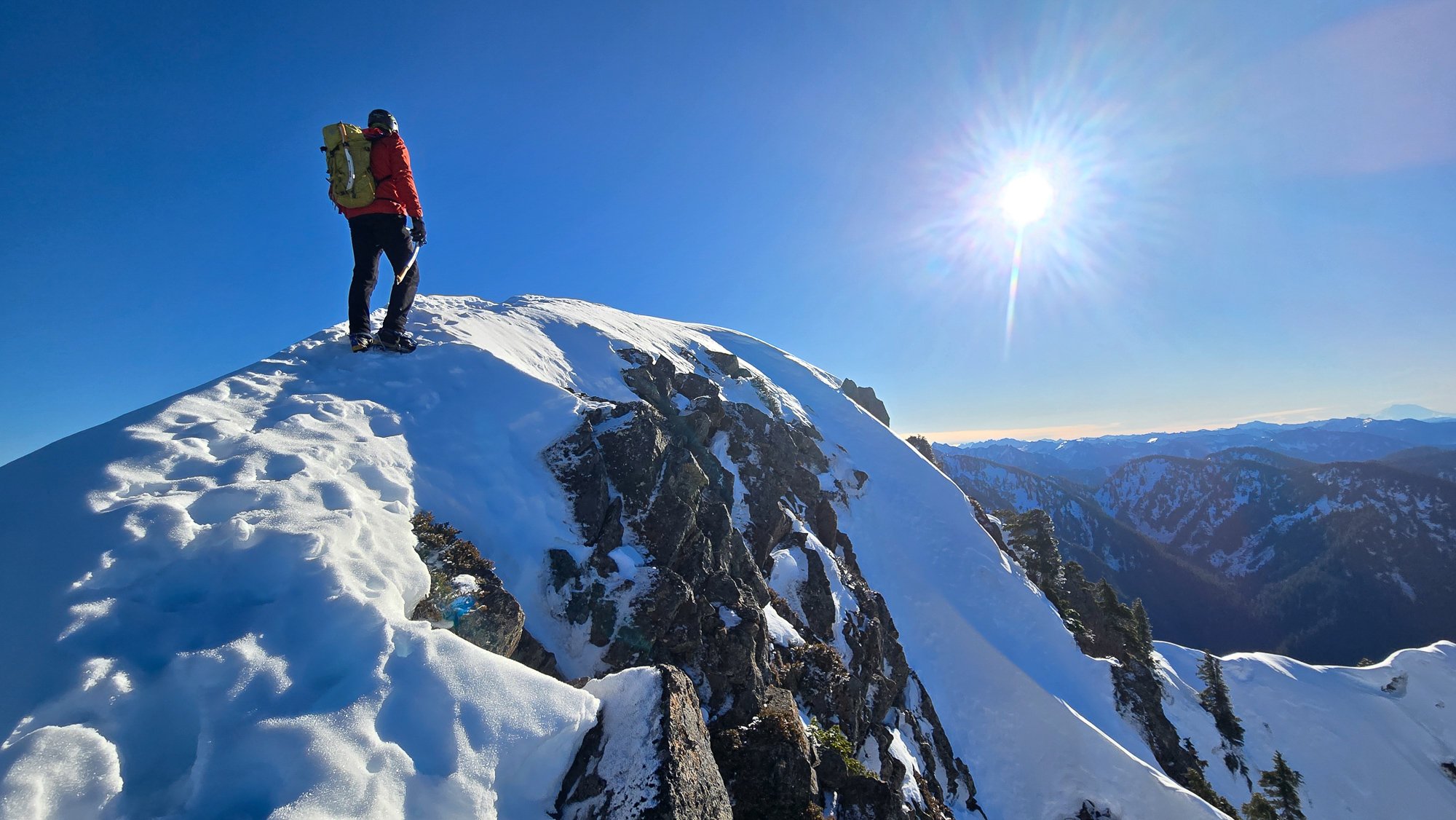
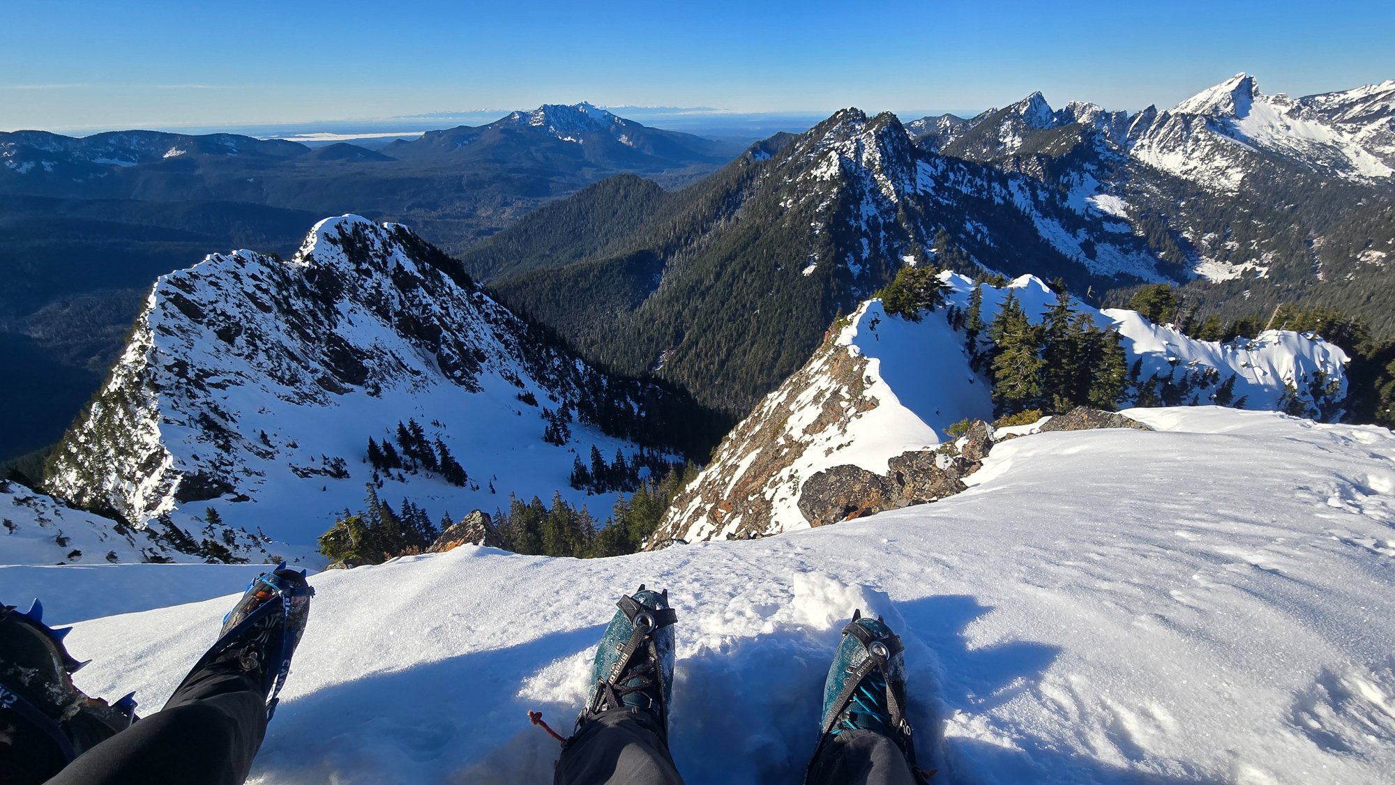
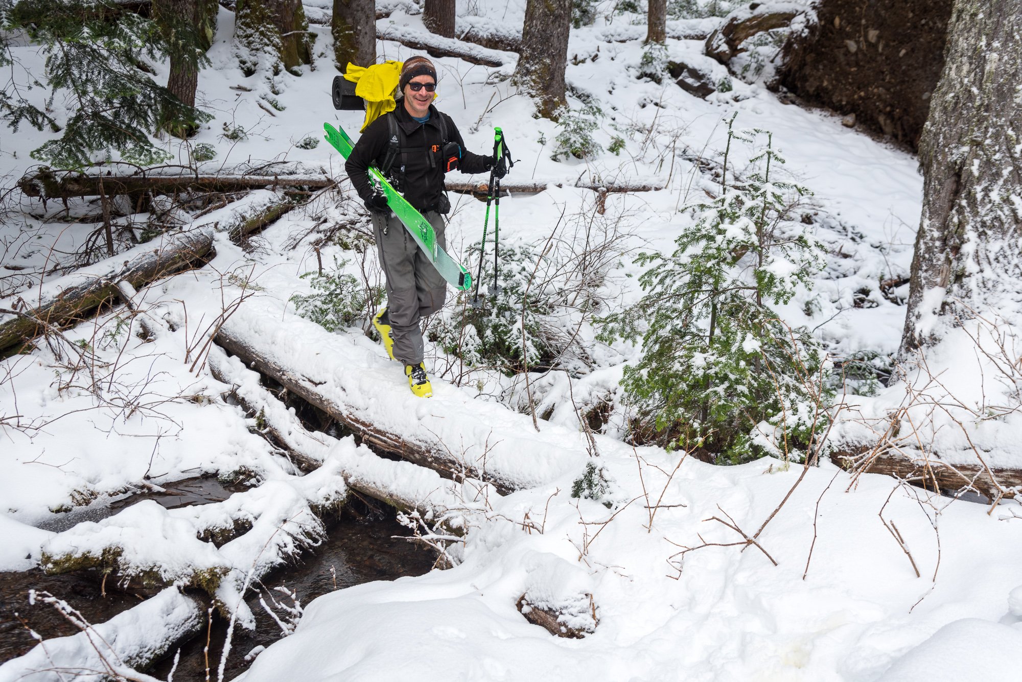
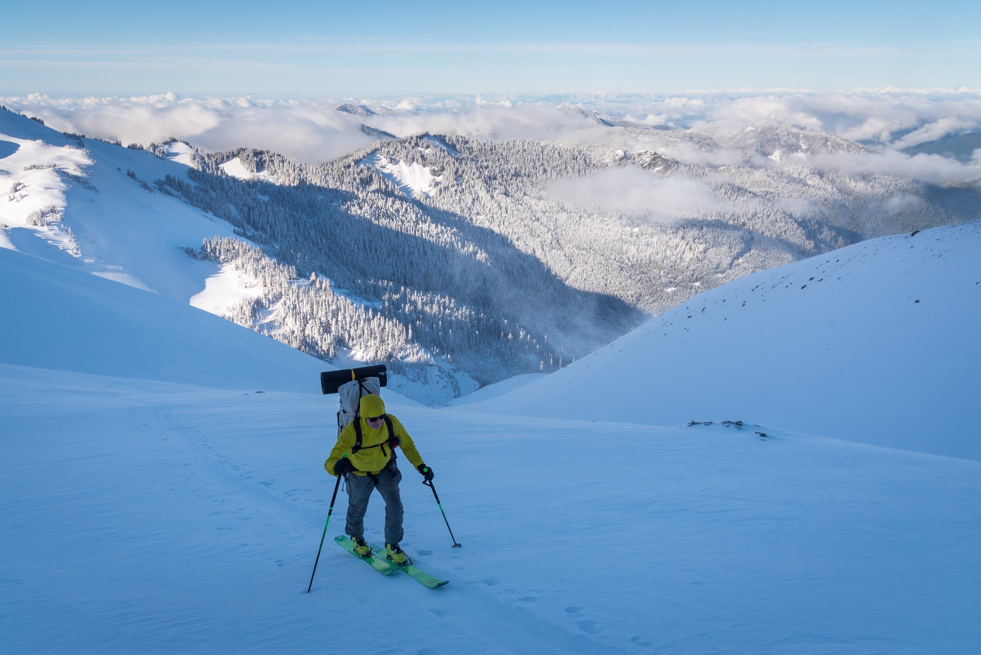
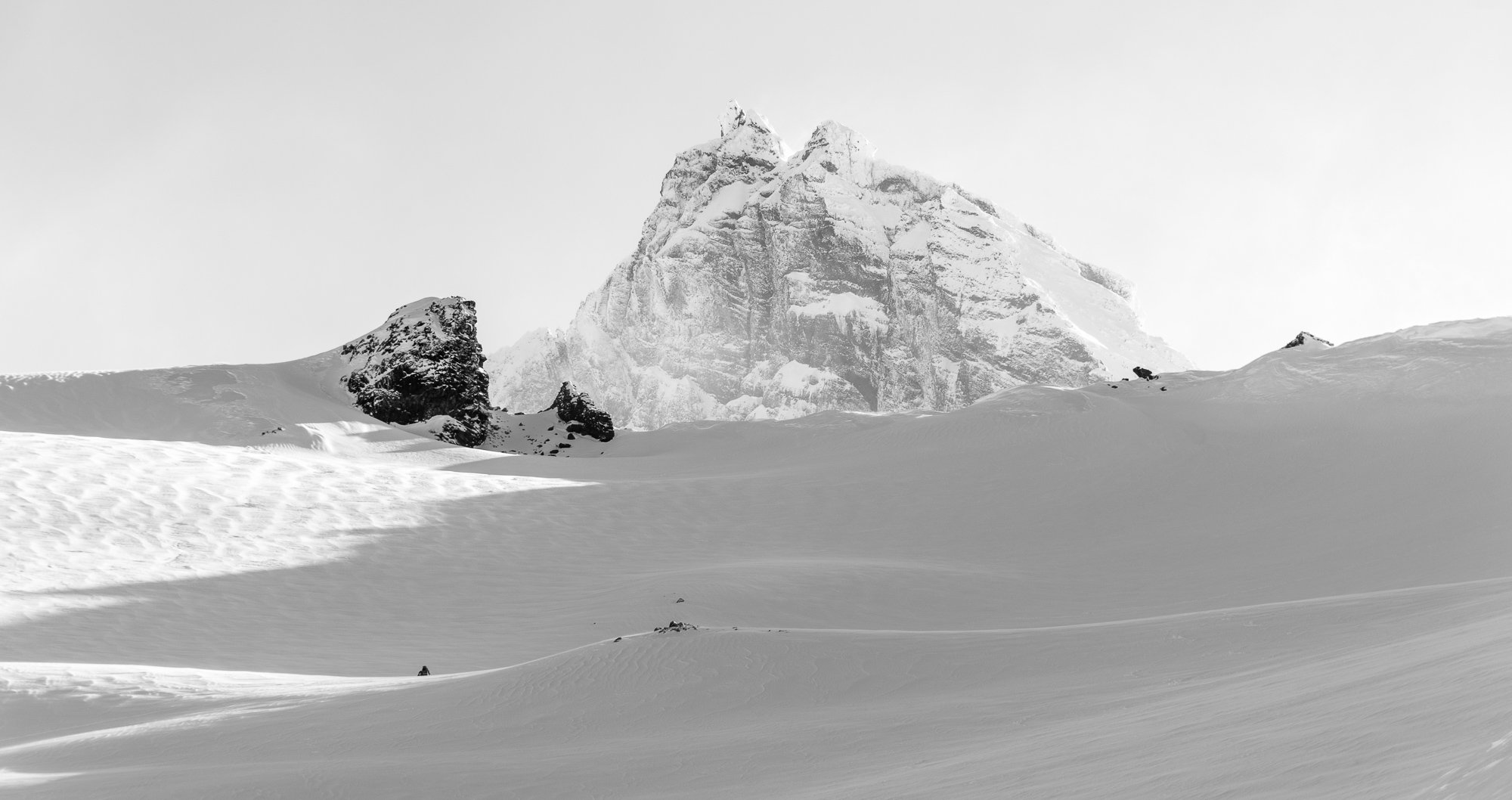
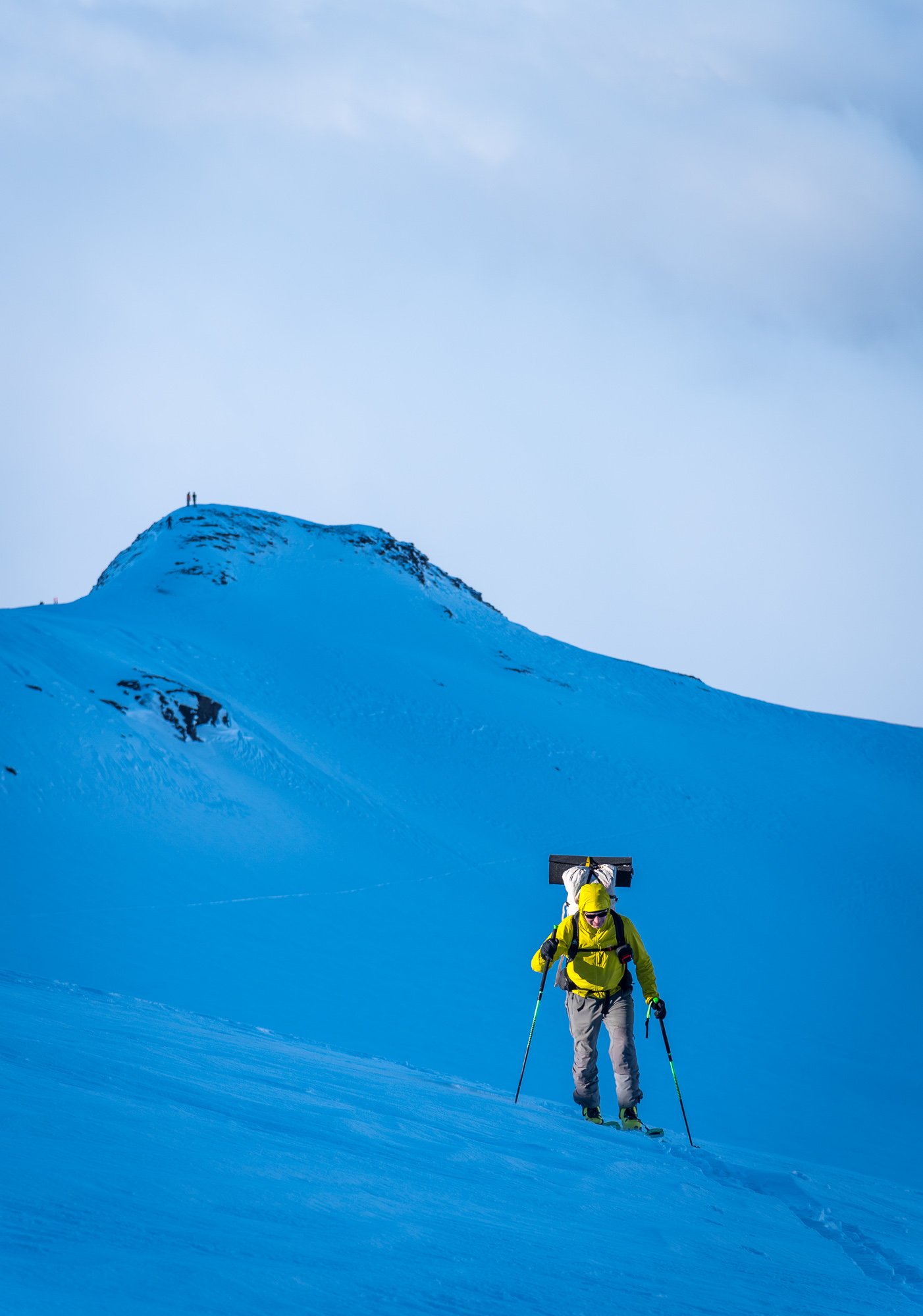
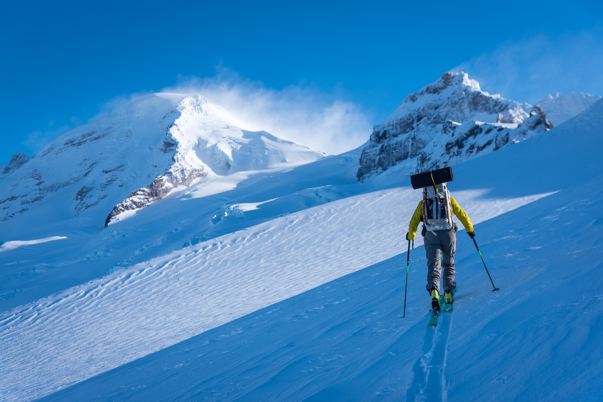
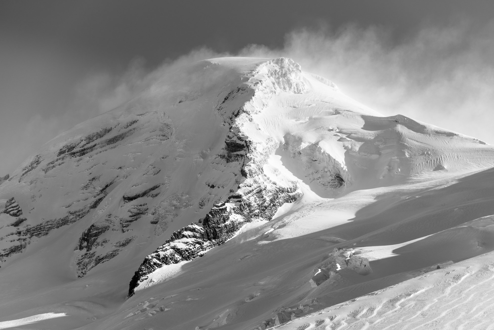
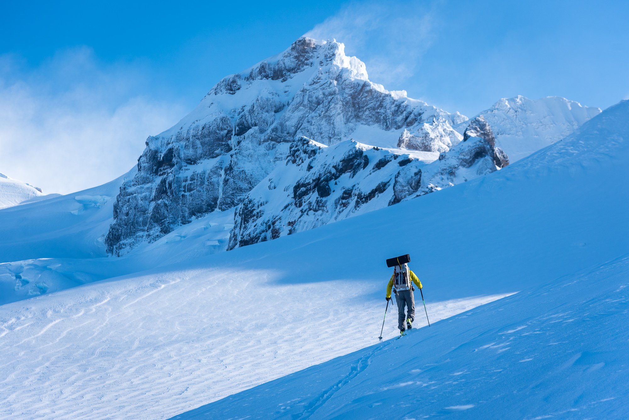
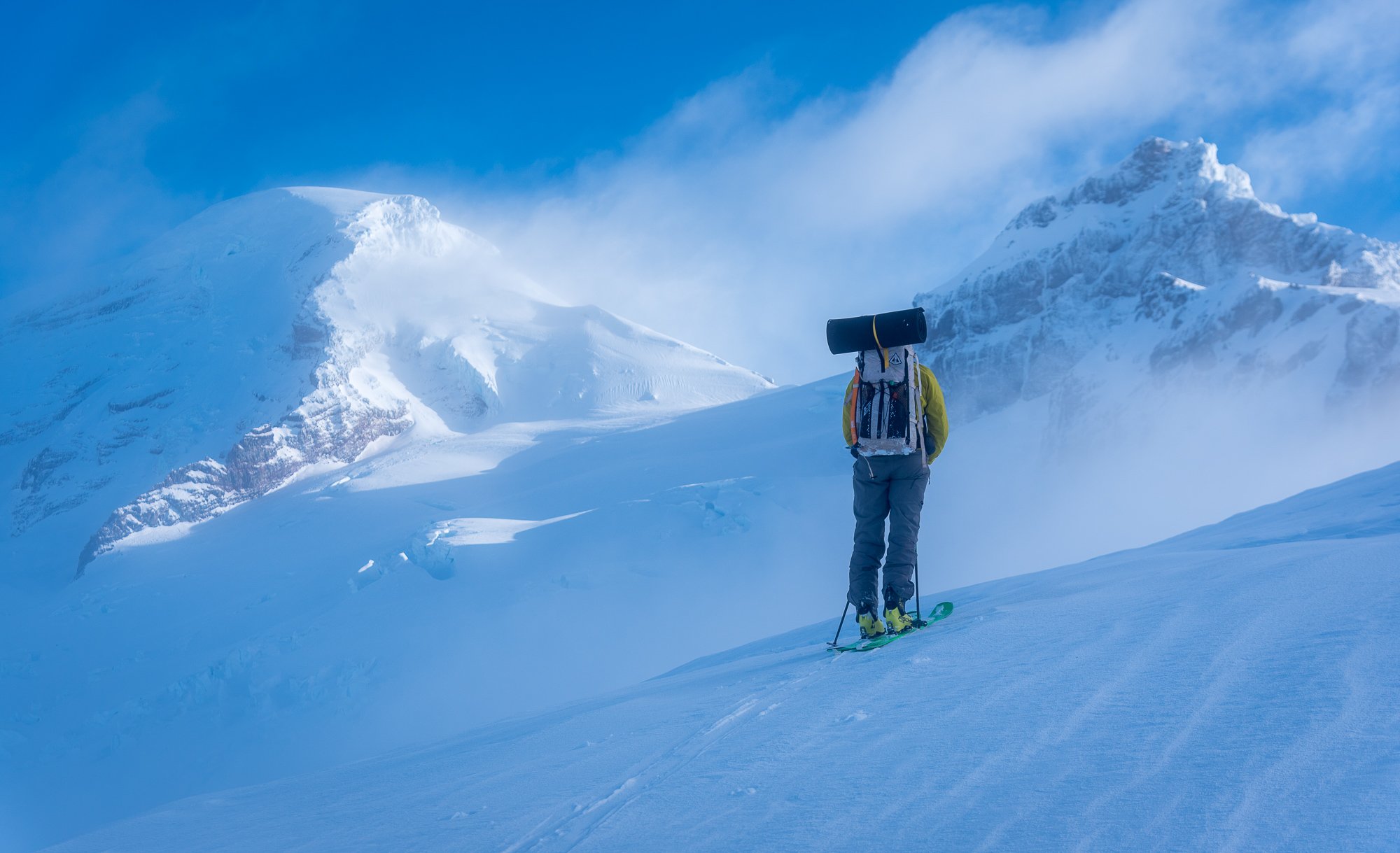
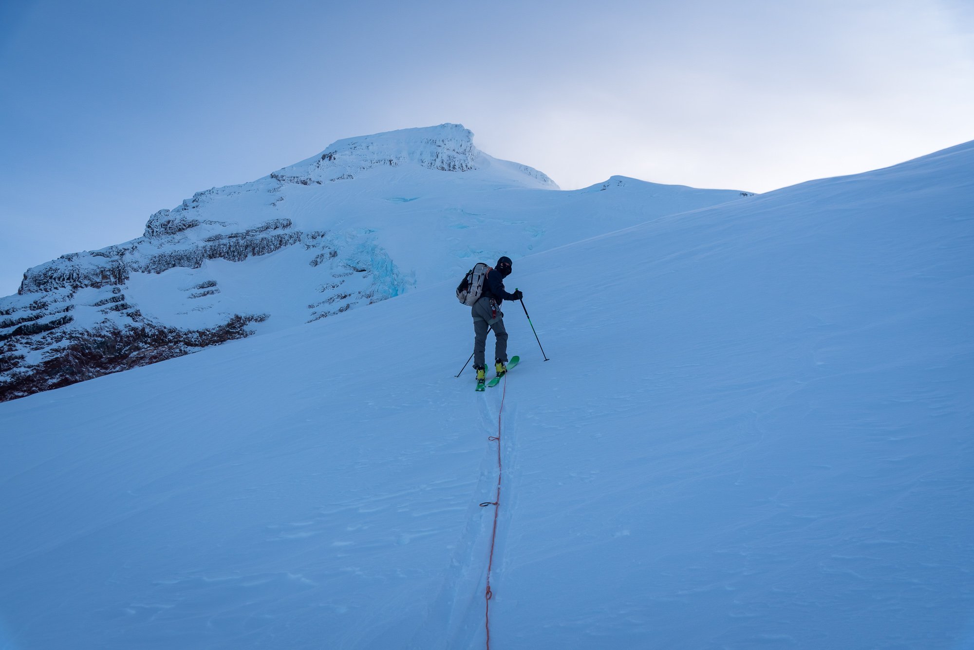
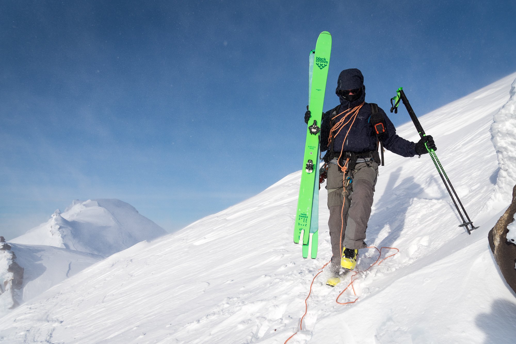
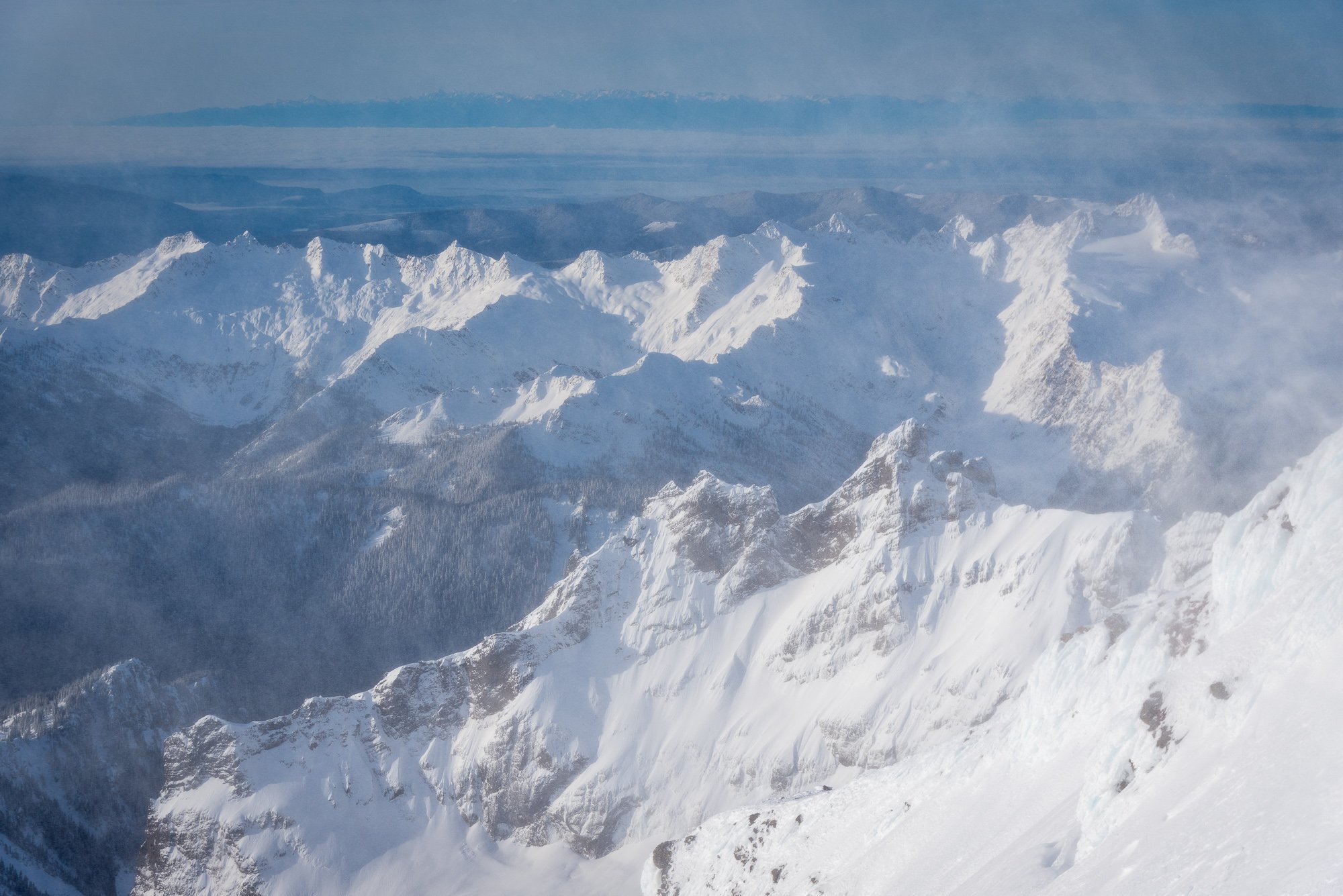
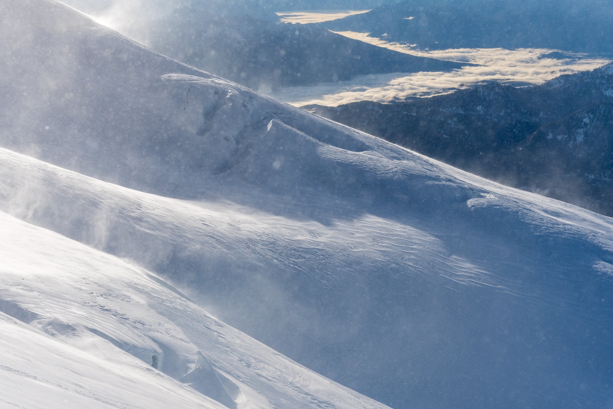
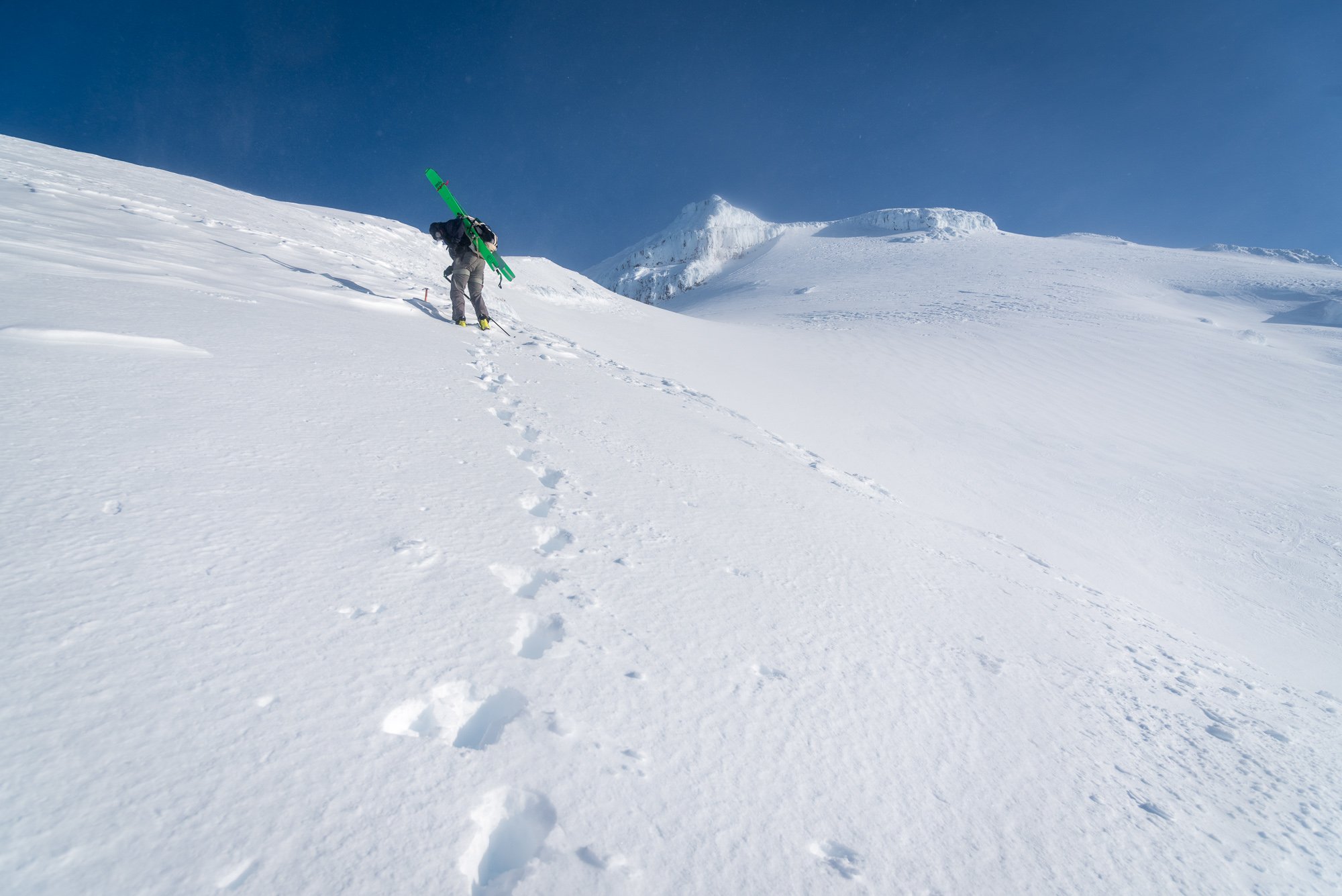
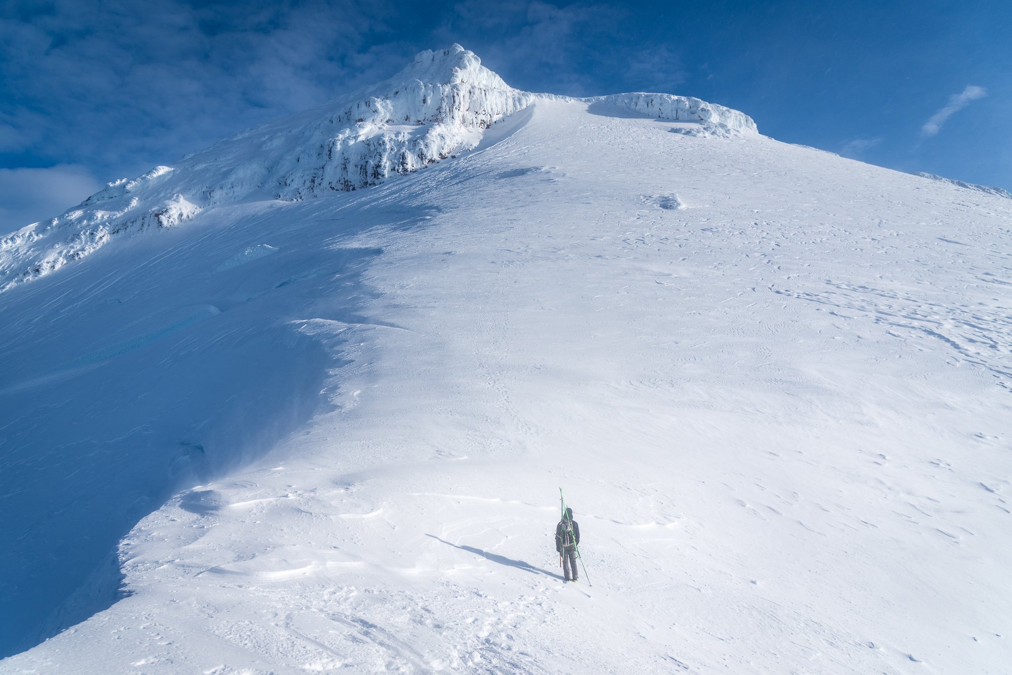
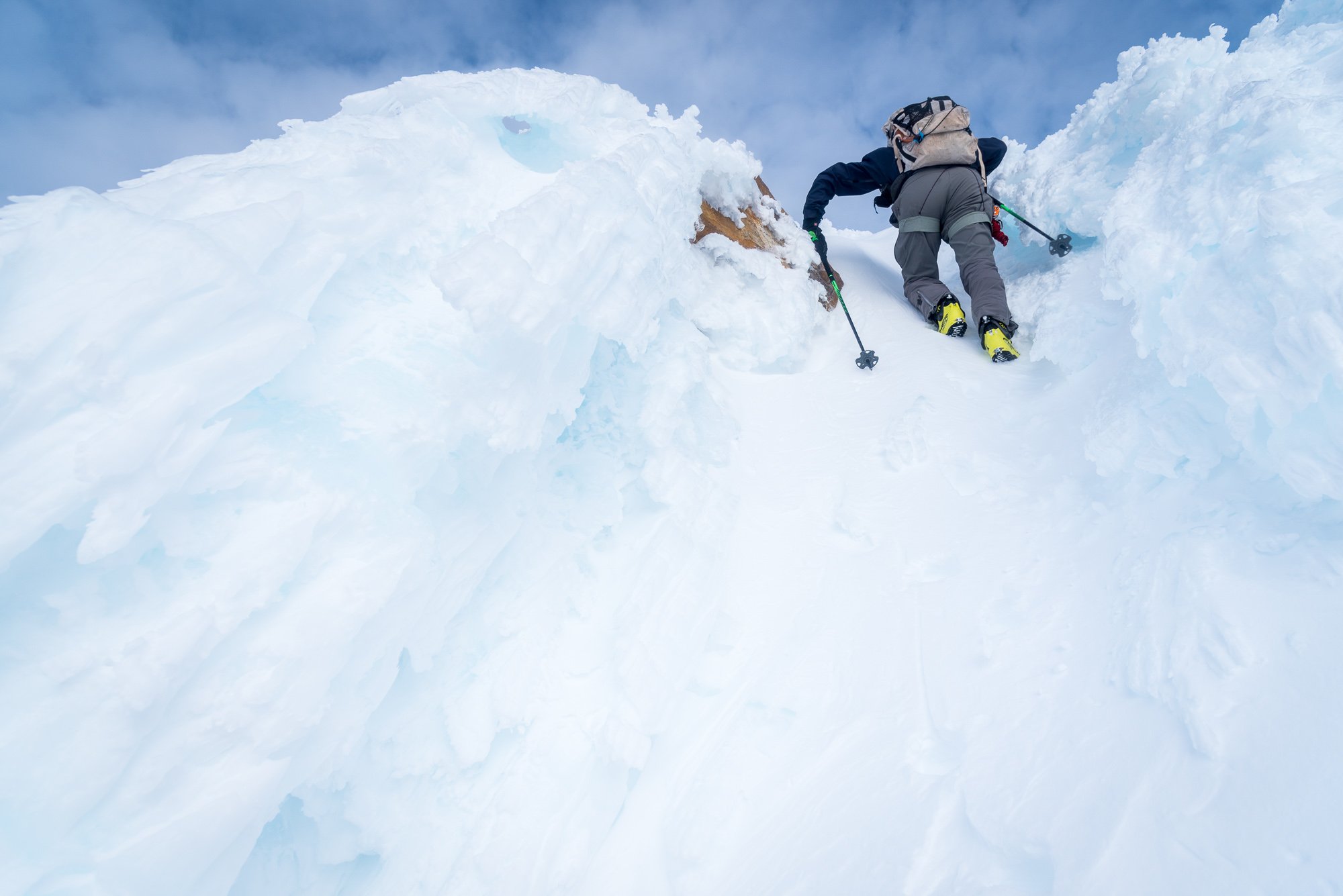
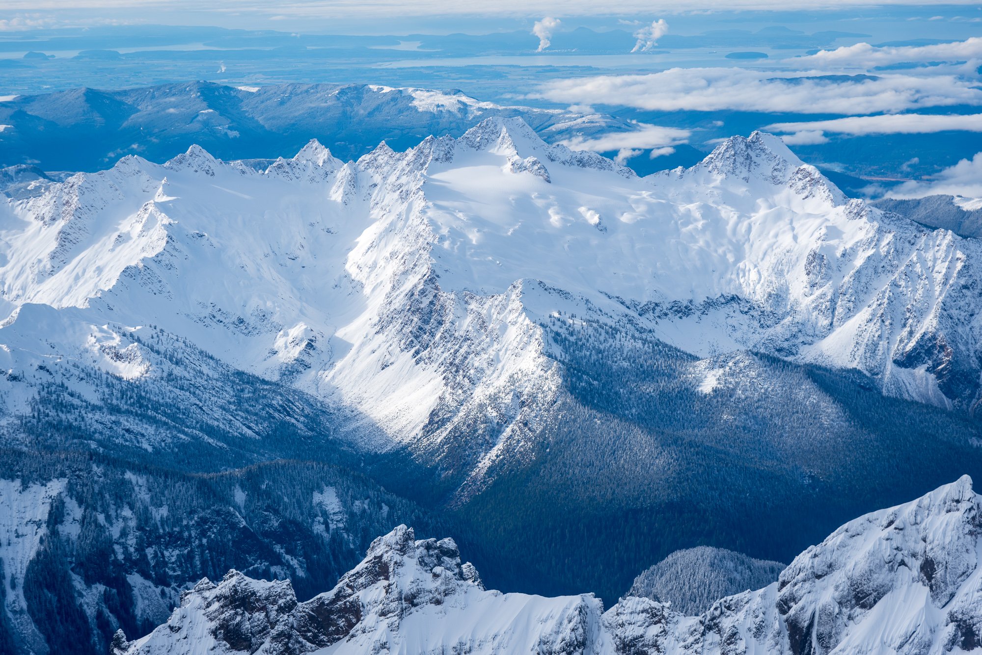
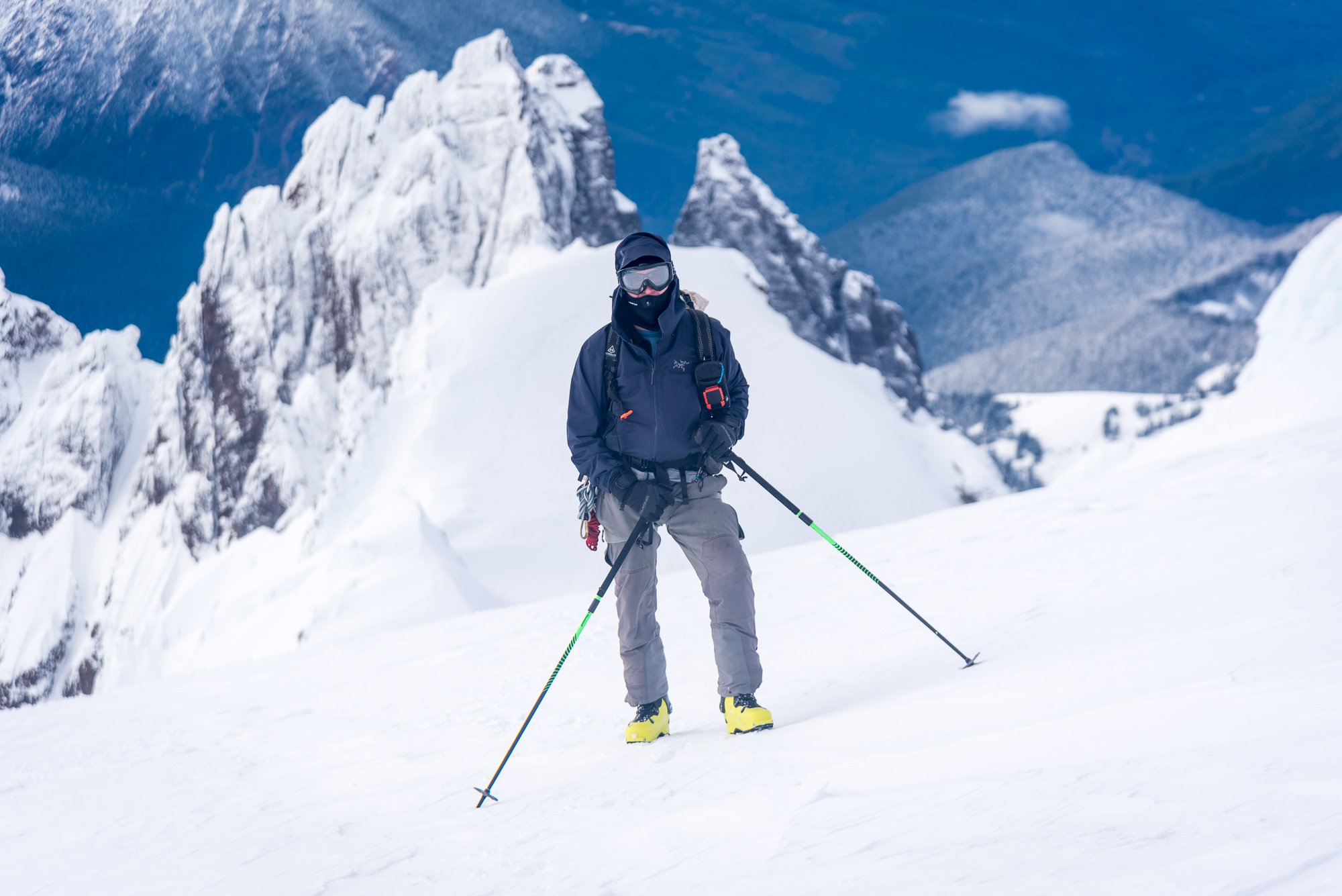
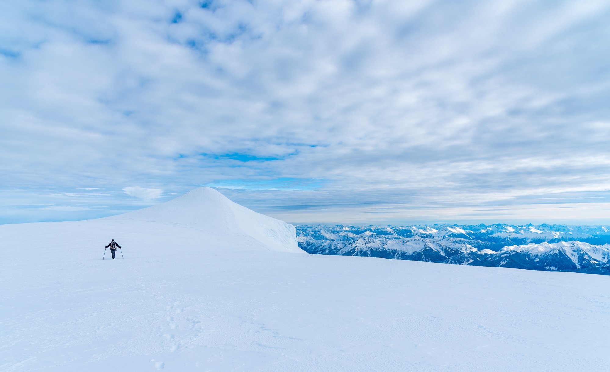
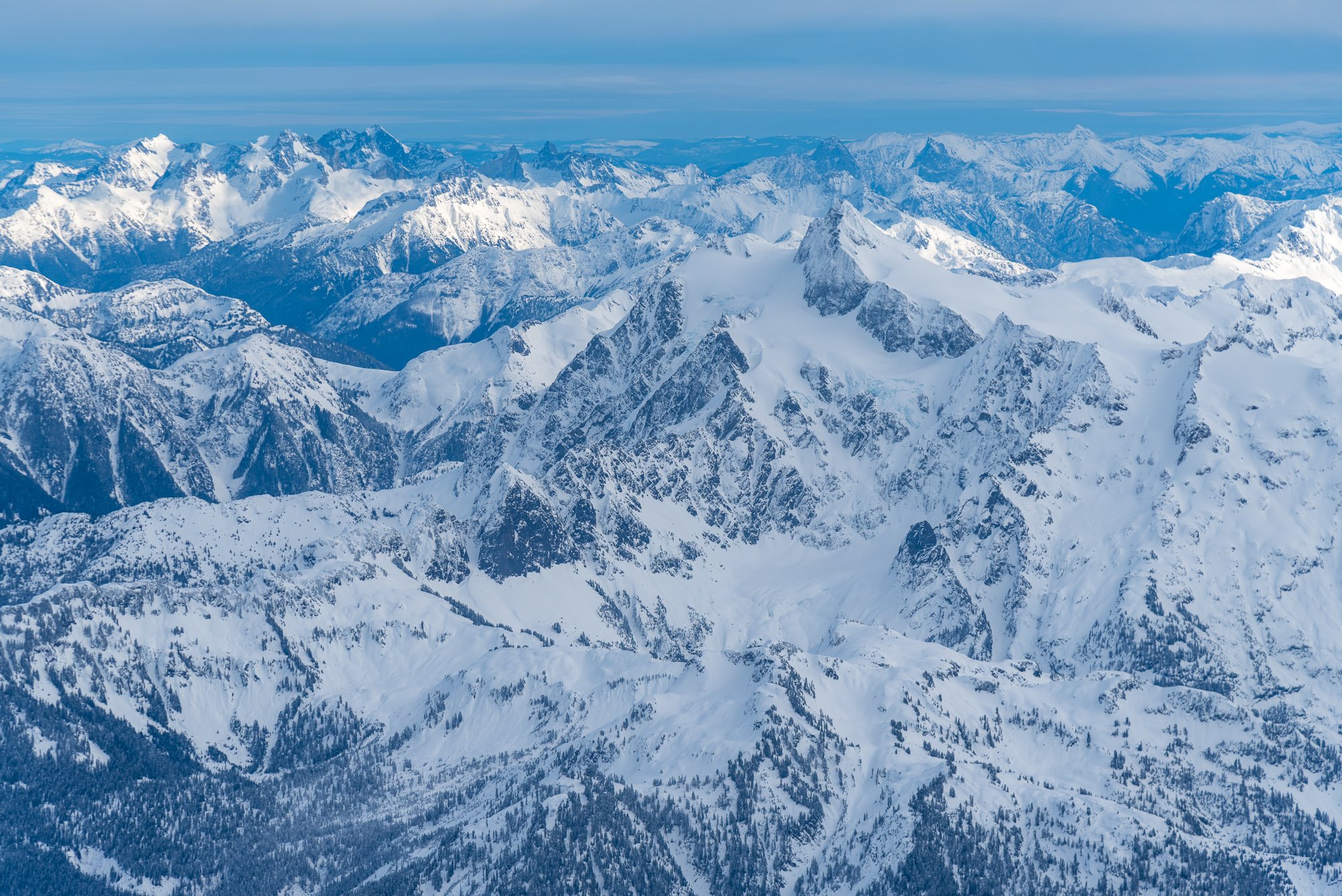
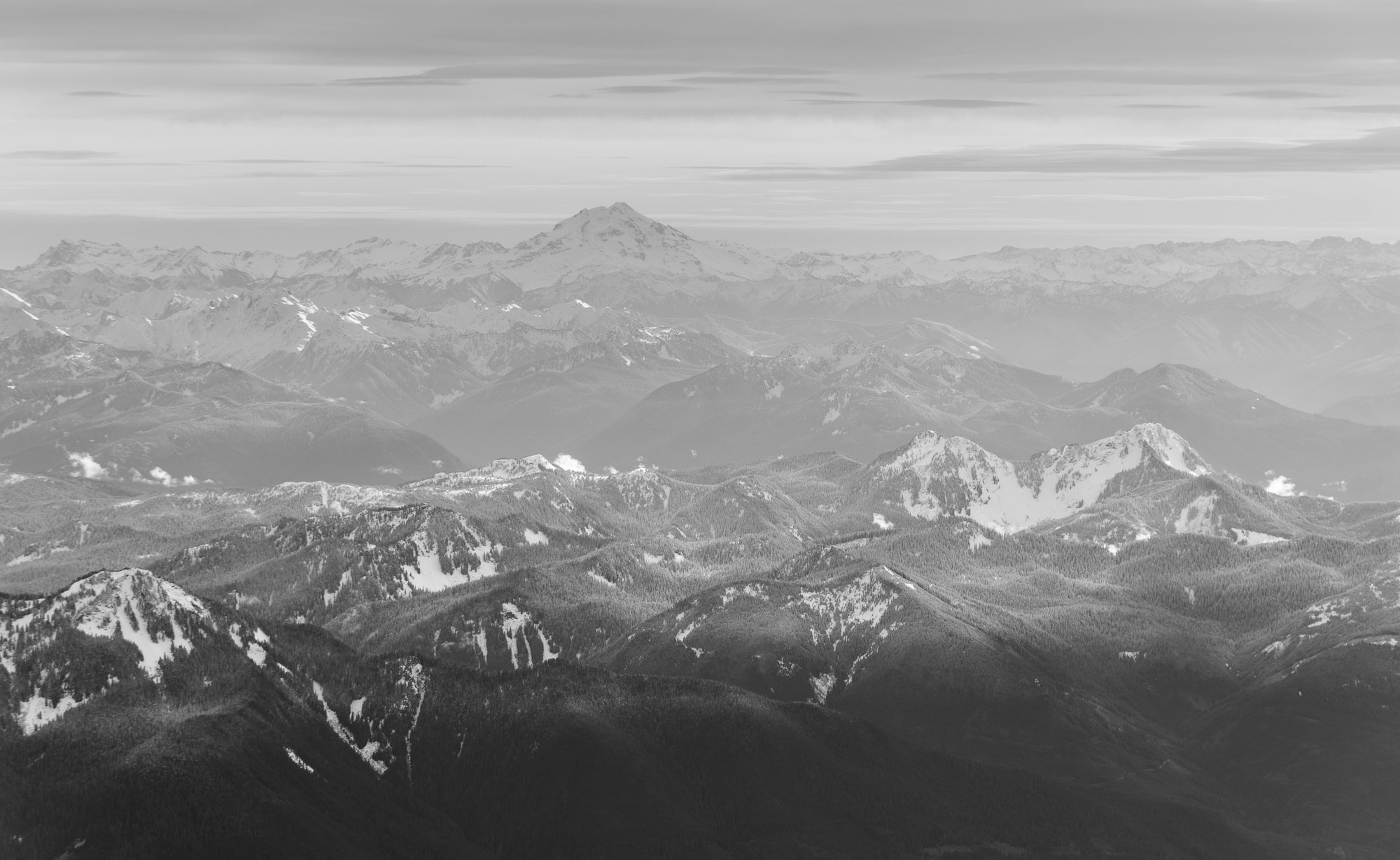
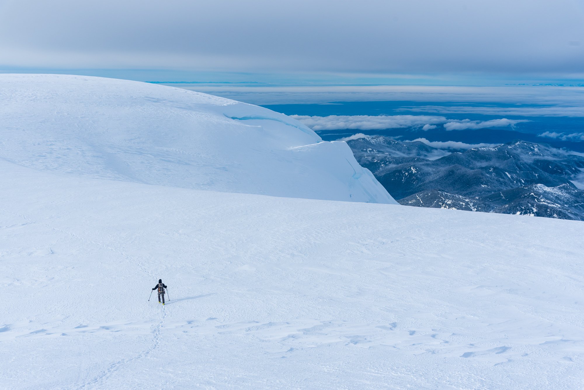
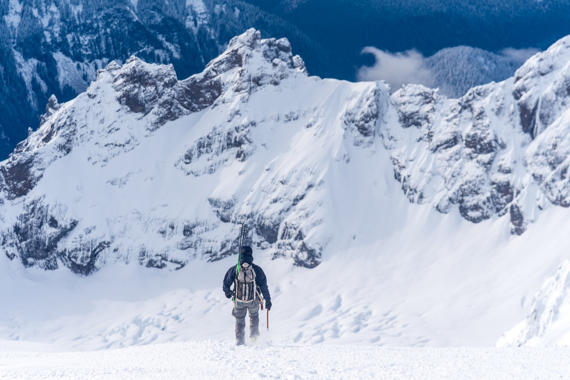
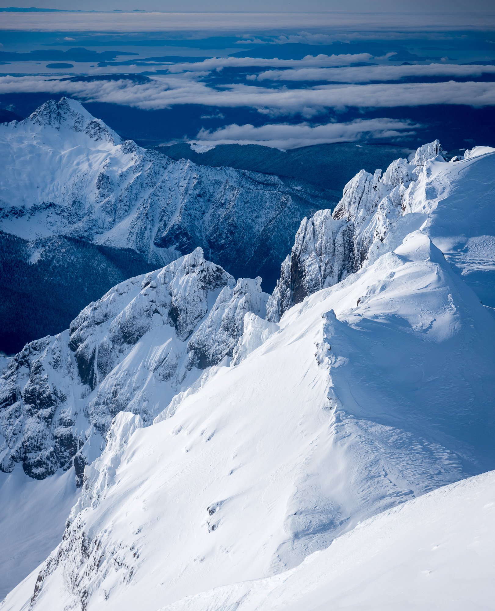
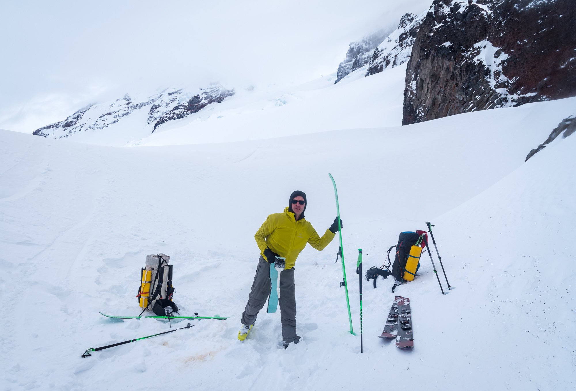
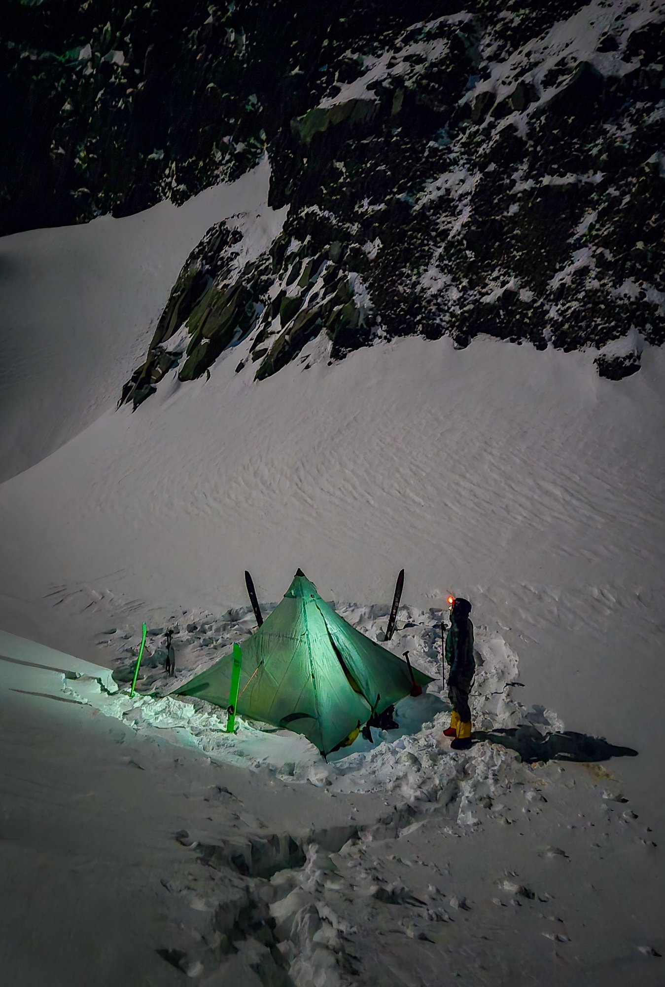
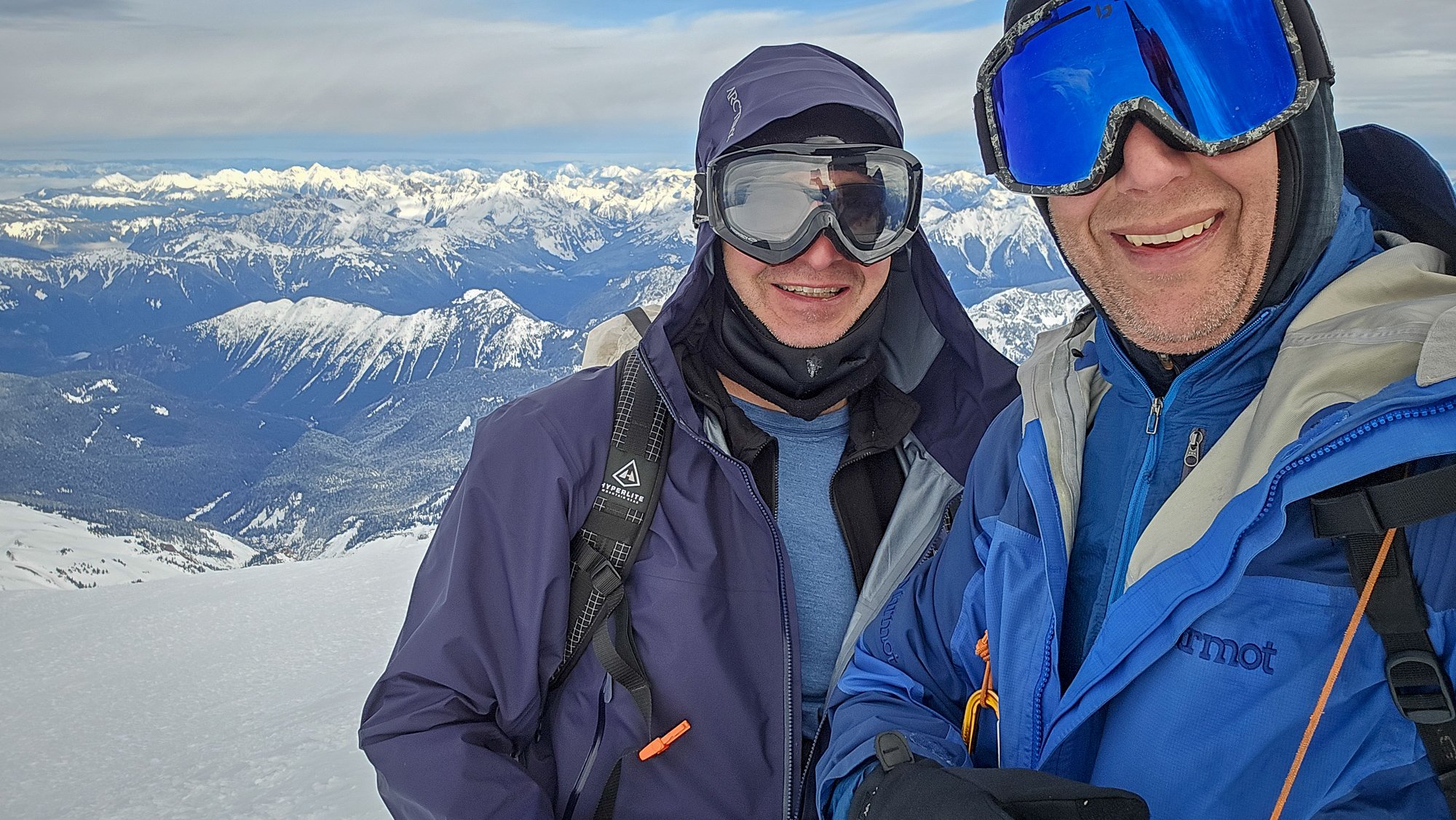
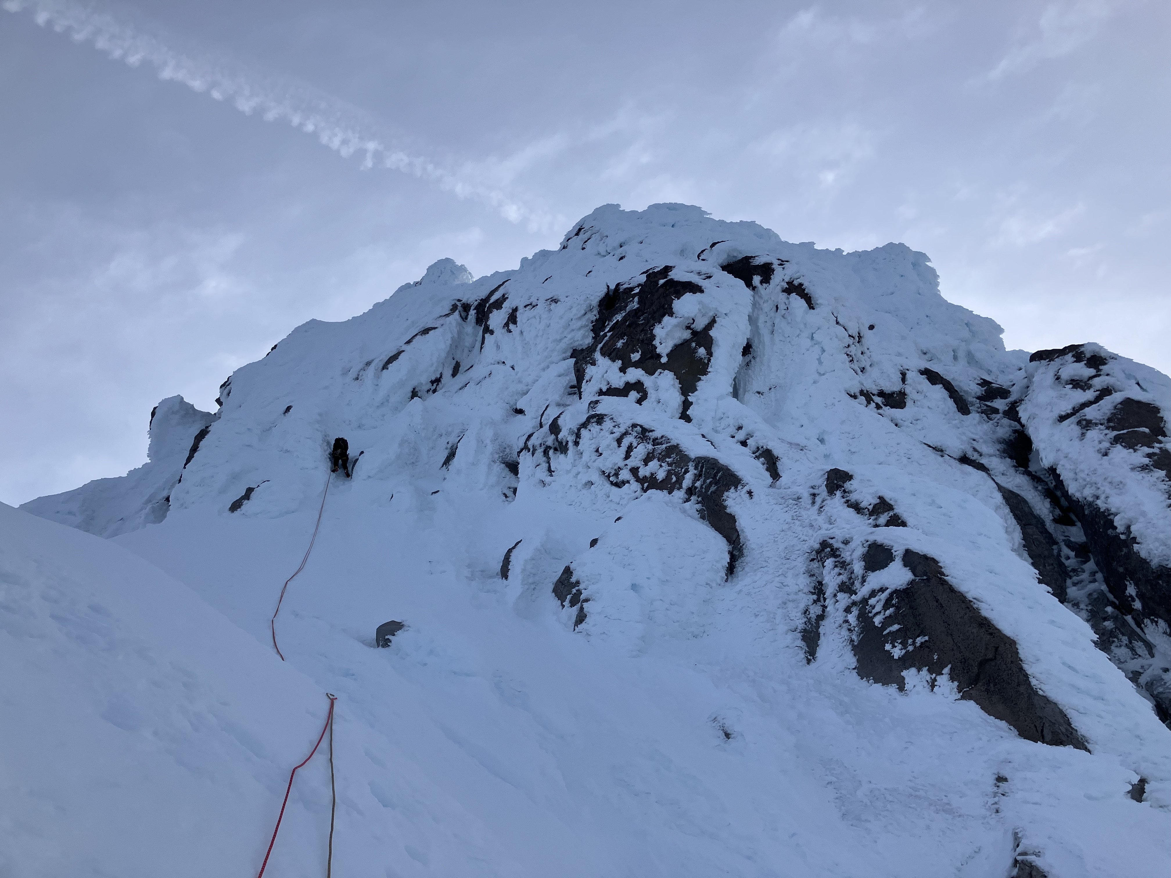
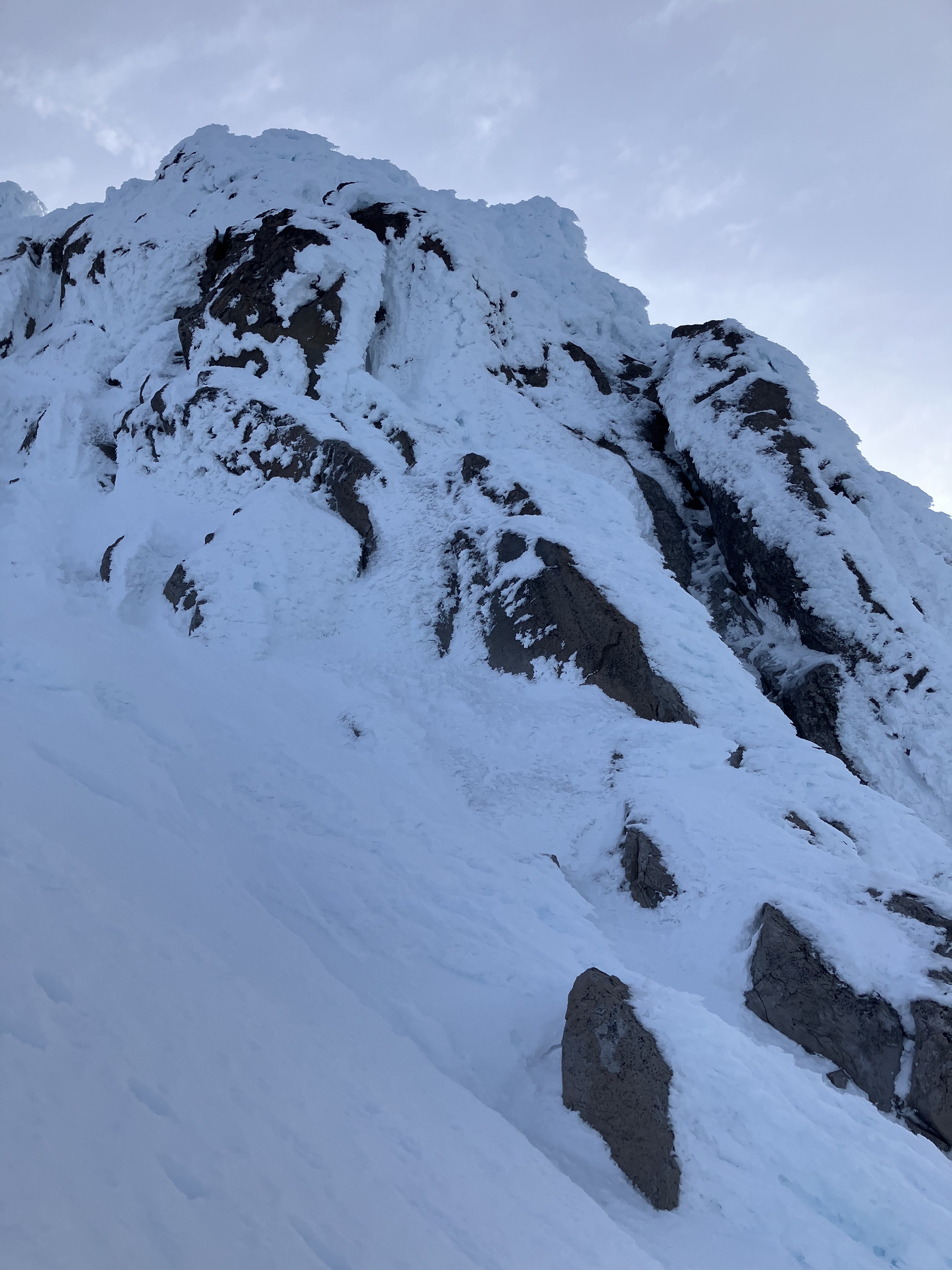
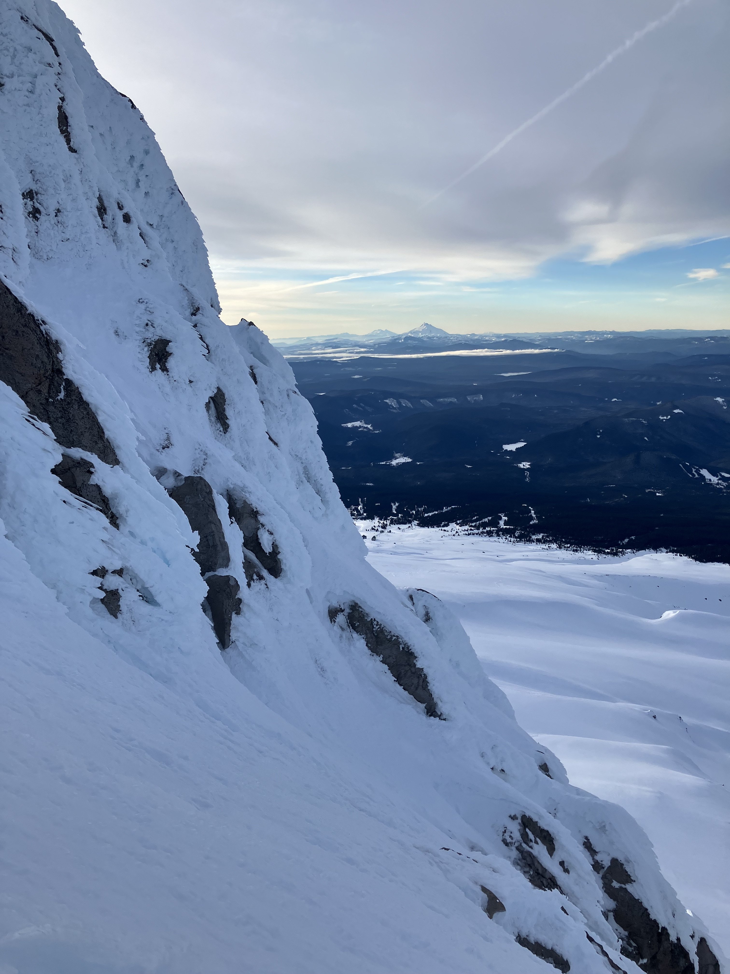
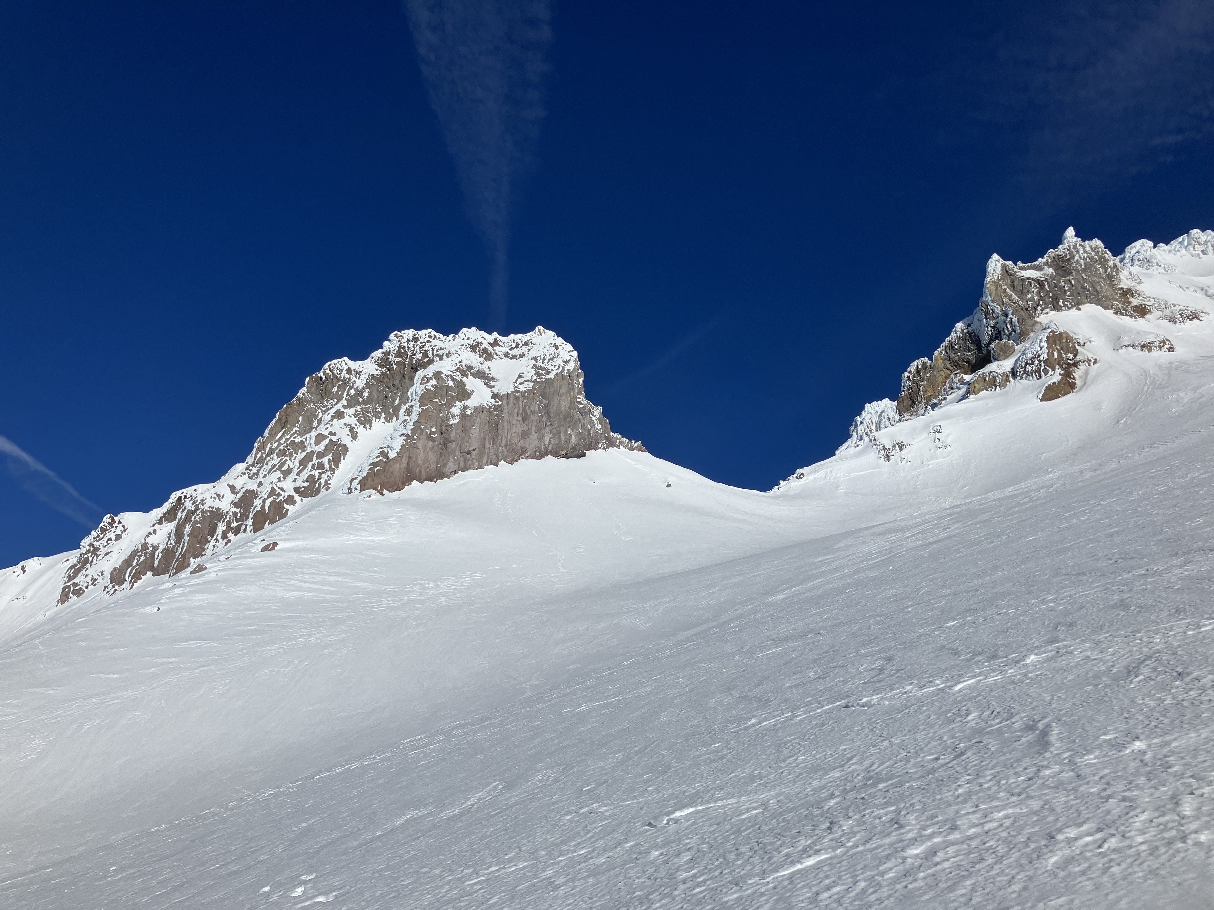
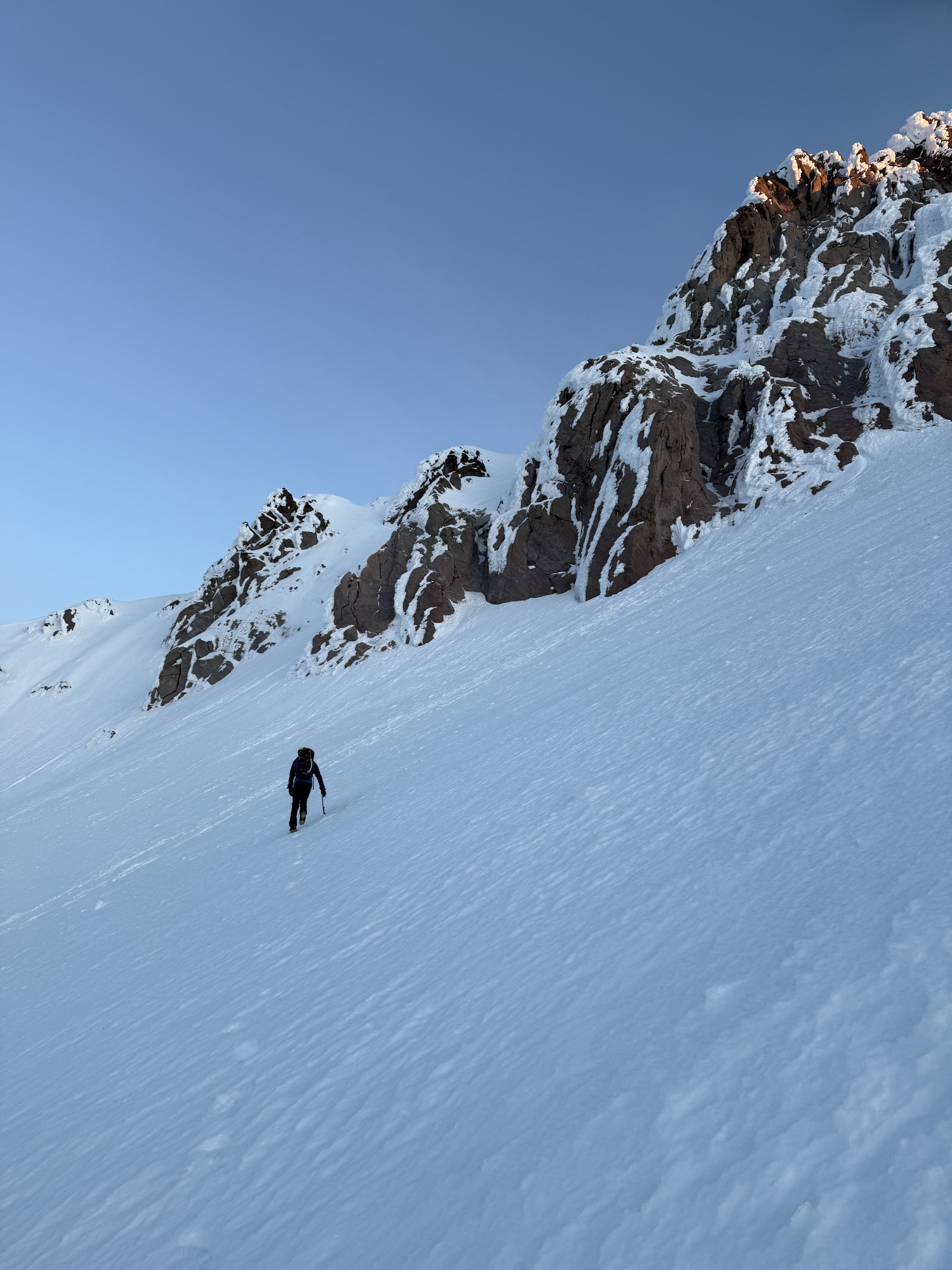
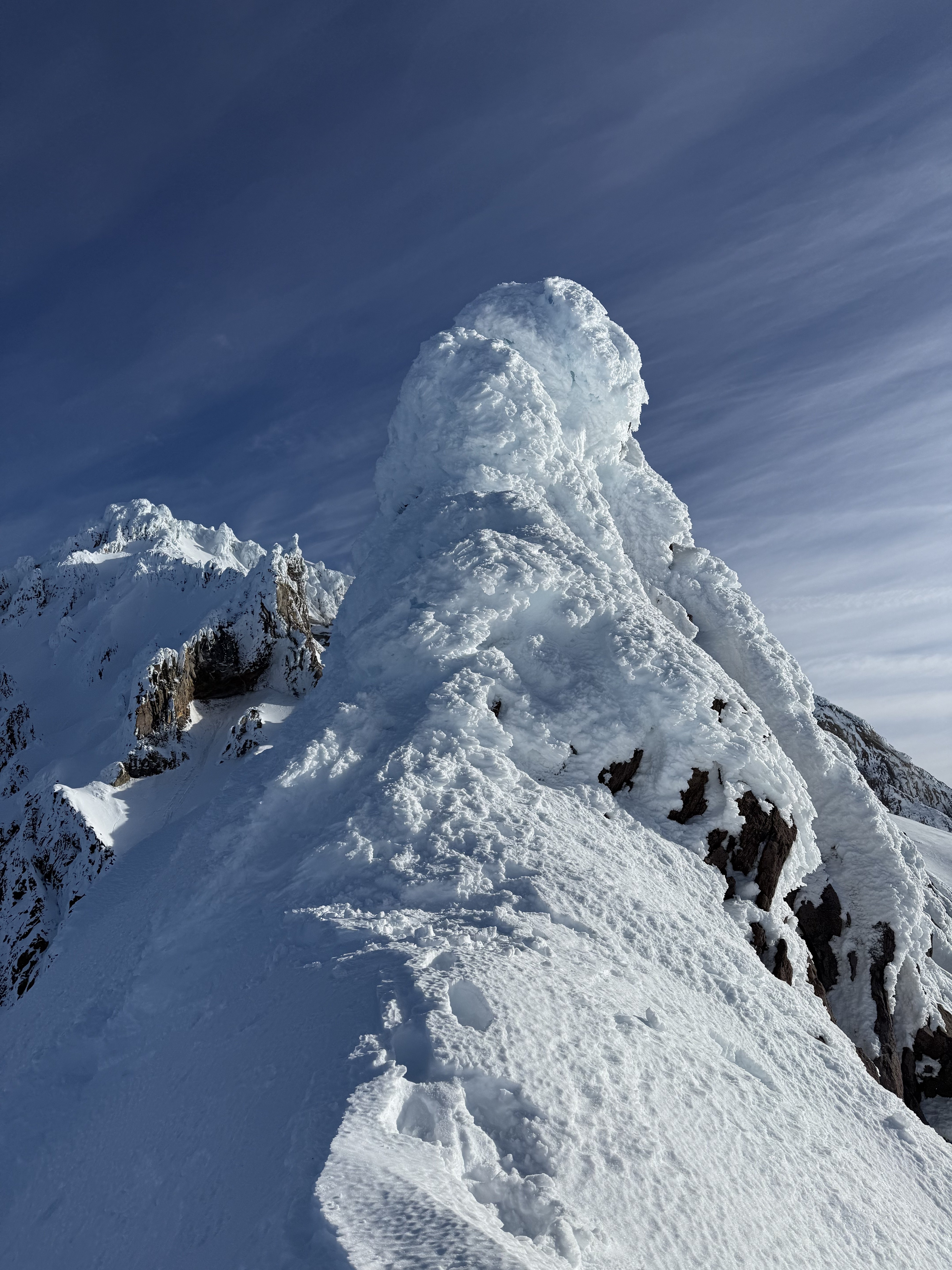
Trip: Redoubt, Easy Mox - South Face (Redoubt), NE Ridge (Easy Mox) Trip Date: 01/19/2025 Trip Report: Mount Redoubt and Easy Mox First Winter Ascent of Easy Mox, Second Winter Ascent of Redoubt. Jan 17-21, 2025 42 miles hiking, 37 miles boating Eric and Nick 79/100 Winter Bulgers Jan 17 – double carry boat, motor, gear from Ross Dam trailhead to Frontage Road, sleep at trailhead Jan 18 – Carry remaining gear to boat, drag on wheels down Frontage Road, boat up lake 18 miles to Silver Creek, bushwhack to Silver Lake, hike to basecamp below west face of Solitude Peak Jan 19 – Climb Redoubt via south face (M1, steep snow, two roped pitches), return to camp Jan 20 – Climb Easy Mox via NE Ridge (M3, simulclimbed most of route), rap down south face to Col of the Wild, return to camp Jan 21 – Hike out, boat back, double carry boat up to trailhead On the northeast ridge of Easy Mox Some of the most difficult peaks in Washington to climb in winter are located in the Chilliwack range of the North Cascades, near the Canada border. I think these are likely some of the most difficult peaks to climb in winter in the entire contiguous US. Access is extremely difficult, weather is notoriously bad, snow conditions are rarely stable with unavoidable avalanche terrain, the peaks are technical, requiring ice and mixed climbing, and beta is scarce. Most peaks in this area have not previously been climbed in winter. The route I’m working on a project to climb all the Washington Bulgers (hundred highest peaks) in winter, and six of these peaks are in the Chilliwacks. This is the crux subset of project. I’ve spent several years in preparation for winter ascents in this area. I’ve previously climbed all the Bulger peaks in the summer, and that is critical but still not sufficient for success in winter. The first challenge is simply accessing the Chilliwacks area in winter. I’m following a rule that all ascents must be made legally, so I won’t sneak into the area from Canada. Starting in Fall 2020 I began scouting out the optimal winter approach to the area. Detailed route The closest trailheads are Hannegan Pass and Ross Dam, but these require 20-30 mile hikes on trails that are likely snowed over and unbroken. I skied up the Hannegan Pass trail in December 2020, and learned that the last 5 miles of road to that trailhead is closed to snowmobiles in winter, so the approach is even longer. I hiked the approach from Ross Dam in November 2020, and assessed each of those approaches would likely take multiple days in winter. Packrafting Ross Lake, Nov 2020. One option to save time and reduce the approach to a single day is to take a water taxi up Ross Lake to Little Beaver or Silver Creek and bushwhack up from there. However, the Ross Lake Resort water taxi does not run in winter. Ross Lake has no public road access in winter (or summer it seems, until the road in from canada gets completely fixed), so getting a motor boat to the lake is challenging. In November 2020 I packrafted the length of Ross Lake, and that took a full day and is highly dependent on wind conditions. That would be unreliable in winter. I considered a canoe, but that is also highly dependent on wind conditions and is too risky for capsizing in winter. Finally I settled on taking a zodiac boat with outboard motor up Ross Lake. The boat is wide enough to be stable in heavy wind and waves, with enough capacity to haul hundreds of pounds of gear. It can be deflated into manageable loads of a 70lb boat and 60lb motor. Each can be strapped to a backpack if needed. Ross Lake is in the unique situation where it is connected to a lower lake, Diablo, by road (Frontage Road), but the road is not connected to any other roads. Diablo Lake has road access, though. First test voyage on Ross Lake, Oct 2022 I first did a practice trip in October 2022 where I launched the zodiac at Diablo Lake, boated to Frontage Road, then dragged the boat up Frontage Road on deployable wheels, then launched in Ross Lake. I boated up 15 miles to the Little Beaver takeout, then hiked and bushwhacked in to the Chilliwacks. That option depended on Frontage Road being snow free, though, which wasn’t guaranteed in winter. I later did another practice trip where I double carried the deflated boat and motor down the 0.6 mile trail from the Ross Dam trailhead to Frontage Road, then dragged it down on wheels to Ross Lake. I settled on that as the optimal winter solution since the trail could be hiked in snow, and the boat could also be carried down the 0.5 mile road section in snow. The boat has a 5hp outboard motor, which goes 5-6mph when fully loaded. This is as fast as you want to go on Ross Lake in winter, since the lake level is lowered enough that tree stumps stick out of the water (and sometimes are submerged just a few inches under water). The motor is 4-stroke propane, which is clean enough to meet the strict environmental regulations for Ross Lake. The 5-gallon propane tank gives a 50-mile range for the fully-loaded zodiac boat. This is perfect for the ~40-mile round trip to Silver Creek with a little bit of safety factor. And I’ve been told be expert polar mechanics that propane is more reliable that gas for winter boating in sub freezing temperatures. This boat access method meant the hiking access component could be shaved down to 10-15 miles, which made the peaks much more accessible. From Ross Lake there are three main drainages to access the Chilliwacks – Redoubt Creek, Perry Creek, and Silver Creek. I scouted out Perry Creek in October 2023 and made a practice climb of Hard Mox from that approach. Perry Creek provided good access for Hard Mox and Spickard and was accessed from the Little Beaver takeout 15 miles up Ross Lake. First winter Chilliwacks attempt – thwarted by ice, Jan 2023. Redoubt Creek is also accessed from the Little Beaver takout and provides access to Redoubt and Easy Mox. I was not able to scout this approach, though I heard from Cascades expert John Roper it has the most difficult bushwhacking of all the drainages. Silver Creek provides access to Rahm and Custer and is on the north end of Ross Lake, and 18 mile boat ride up. I was not able to scout that approach, but have friends who had made the approach in summer. With the approach logistics sorted out, the next step is waiting for six stars to align. There must be stable snow conditions, stable weather on the peaks, low wind on the lake, no ice on the lake, long weekend, and partner available. Second Winter Chilliwacks trip – bail on first pitch of Hard Mox, Feb 2023 In January 2023 Nick and I made an attempt on Hard Mox Peak with five out of six star apparently aligning. Unfortunately Ross Lake was iced over 0.5 miles before the takeout. We attempted to bushwhack the remaining distance to Little Beaver around the lake, but that took 6 hours and we eventually bailed. That’s when we learned the ice-free star absolutely had to align. In February 2023 we returned when it appeared all six stars aligned. We made it up the first pitch of Hard Mox, but then bad weather unexpectedly came in early and we bailed. Winds were high on Ross Lake and we nearly capsized navigating through whitecap waves in the middle of a stump forest. The low wind and stable weather stars were not in alignment. Third winter Chilliwacks trip – success on Hard Mox, Dec 2023. In December 2023 all stars finally aligned, and we successfully climbed Hard Mox and Spickard via the Perry Creek approach. This was the first winter ascent of Hard Mox and the second winter ascent of Spickard. (The first winter ascent team for Spickard was Bond and Johnson in March 2023, approaching from Canada). On the return trip the outboard motor wouldn’t start, so Nick and I paddled back for nine hours. I couldn’t figure out the problem, so I bought a used gas outboard motor for the next attempt. In February 2024 all six stars aligned and Josh and and I went for Rahm and Custer. But the gas motor failed to start (I later learned residue from ethanol fuel in the used tank I’d purchased had made its way into the carburator and clogged it). One oar lock also broke because it got brittle in the cold. We ended up paddling 10 hours up lake to Silver Creek anyways, using a ski strap to fix the oar lock, then bushwhacked up and still climbed both peaks. We then paddled out 10 hours back. I subsequently started carrying spare oar locks on trips. Fourth Winter Chilliwacks trip – paddling up and down lake with broken oar lock to climb Rahm/Custer, Feb 2024 By January 2025 I had just two winter Chilliwack Bulger peaks remaining – Easy Mox and Redoubt. I had made eight trips up Ross Lake with the zodiac by then either climbing Bulgers in winter or doing practice trips. That month I was fortunate enough to meet Stephen, an expert polar mechanic. He got the propane and gas outboard motors back in working order, so I was good to go back on Ross Lake whenever the stars aligned. After all of these winter trips on Ross I learned a few lessons about the motors. For the propane motor it cannot be carried upside down, it is necessary to use an aluminum tank instead of steel so no rust gets in the fuel line, and the fuel line must be disonnected and excess pressure released before leaving the boat for days on shore in freezing conditions. This prevents liquid fuel from entering the system, freezing, and messing up components. The gas motor absolutely cannot touch ethanol fuel. Different valley options to approach Redoubt and Easy Mox With the boat motor fixed I started doing research on Easy Mox and Redoubt. The shortest approach would be Redoubt Creek, but that also was supposedly the most difficult bushwhack so might actually take the longest. In theory the peaks could be accessed from Perry Creek if we could cross Col of the Wild. However, in December 2023 we noticed the Perry Glacier was melted down significantly from historical levels. This meant accessing the col required climbing a pitch of downsloping snow-covered slab and surpassing tricky cornices. So that approach was likely out. The Silver Creek approach was the longest distance-wise. However, from February 2023 I learned that there is an old trail the first few miles to an abandoned cabin. Beyond that the bushwhack is easy through mostly open forest. That would likely be the optimal approach, with predictable timing to Silver Lake. We would then cross to the Lake Ouzel cirque and access the peaks from there. For the routes I researched that Mt Redoubt had previously seen one winter ascent in February 1977 by Barely and Rowatt via the NE Face. They approached from Canada. I had previously climbed the standard south face route in summer, and I suspected that would in fact be the easiest winter route. But it crossed long stretches of steep snow and required very stable conditions. Easy Mox had never been climbed in winter, and I wasn’t sure what the optimal route was. I’d previously climbed the standard NE Ridge route in July, and that is the least technical route. However, it requires climbing one slab pitch to gain the ridge, and that might be sketchy if only thinly covered in snow. Also, the ridge looked corniced in February 2024 when I saw it from Custer and Rahm. However, in December 2023 it was not corniced when I saw it from Hard Mox. So it was possible it would be climbable in late December or January. Another option was the southeast face route directly from Col of the Wild. This was more direct and not corniced. However, the upper section is slabs that might be sketchy if thinly snow covered. Finally, the west ridge route was a possibility. The only known ascent was the first ascent in 1964, but it appeared to be only a few pitches, though likely the most technical of all the routes. By mid January it appeared all six stars would align over the long MLK day weekend. The snow was very stable with high pressure parked over Washington for the forseeable future and low wind over the weekend. Washington had experienced above-normal temperatures over the previous few weeks, and satellite images confirmed upper Ross Lake was completely ice-free. Nick and I decided to go for Easy Mox and Redoubt. Easy Mox was my crux remaining winter Bulger, and would be great to check off the list. The Monday before the weekend I picked up the propane motor from Stephen up near Bellingham, and he did an amazing job getting it up and running. I did a test ride for a few miles in Lake Sammamish on Tuesday and everything worked fine with the boat. Our plan was to boat up to Silver Creek, then bushwhack in to a basecamp. We would climb Redoubt first since it was easier and would give us views of Easy Mox to plan out the route. We would then climb Easy Mox and hike and boat out. We would use snowshoes to avoid relying on a seventh star to align – skiable snow. On our first Hard Mox attempt we’d brought skis and bailed at Perry Creek when the snow conditions weren’t good for skiing. By using snowshoes we could plod up even if the snow was icy. The only possible question mark was whether it would be getting too cold. The peaks were forecast to be between 5F – 15F, which was cold for technical climbing but doable since the wind was forecast to be low. However, at upper Ross Lake the lows were forecast to be around 15F-20F for multiple nights with low wind. That is the shallowest part of the lake, and with calm nights there was a risk it would freeze over. We could likely boat up on Saturday since that would be the first cold morning and the water would likely still be warm from the previous weeks. But there was a risk we’d return to the boat at the end of the trip and be blocked in by ice. But, daytime temperatures were supposed to be slightly above freezing and we expected the sun would help melt any thin ice. So we decided to go for it. Worst case, if we got blocked by ice getting out we could hike around the north edge of the lake to Hozomeen and hike back out the 30 miles to Ross Dam down the east bank trail, which was likely snow-free. That would not be ideal, of course. Packing up at Ross Dam trailhead Friday Friday I set my NWAC-scraping Python code running to send me daily avalanche forecasts to my inreach. Then we loaded up in my truck and drove to the Ross Dam trailhead by 4pm. That evening we made two carries of loads down to Frontage Road – the first load was the boat and boat accessories bag, the second was the motor and propane. We then inflated the boat and got it set up for a quick getaway. I considered storing the propane tank in the truck overnight to keep it warm, but we decided it would be smarter to leave it out in the cold. This would be the coldest temperatures I’d ever run the motor (~15F). If it started up in the morning from being that cold, we’d have confidence that it would also start up for our return trip. But if I kept the propane in the truck over night we wouldn’t get that data point. We did, however, put the propane tank in a duffle bag next to the boat overnight to protect it from frost, and wrapped a tarp around the motor to keep it a little warmer. Dragging the boat down Frontage Road We slept in the truck that night at the Ross Dam trailhead, and were the only ones there all night. Saturday Our plan was to hopefully make it all the way to basecamp on Redoubt Glacier by Saturday evening, so we needed to start early. However, boating in the dark was risky because of the submerged stumps on Ross Lake. From all my trips on Ross I know the problem areas at different water levels. The water height is controlled by dam operators based on the energy needs of the greater Seattle area, and this varies throughout the year and is hard to predict. But it is published online by USGS (https://waterdata.usgs.gov/monitoring-location/12175000/#dataTypeId=continuous-00065-1922206742&period=P7D&showMedian=false). My usual strategy is to compare current lake level to past levels when I’ve boated on Ross. This weekend was 1564ft, which was 5ft higher than in February 2024 when I’d boated up to Silver Creek. On that trip the only problem areas for stumps had been Devil’s Creek and Silver Creek. (For reference, when it is below 1550ft there are many more problem areas throughout the lake, both near the shore and in the middle, down lake and up lake, and this is very scary at night). With this water height it was ok to boat in the dark until Devil’s Creek, but we wanted daylight beyond that. I’ve previously tried boating with super bright off-roading headlights connected to a motorcycle battery on the front of the boat. But it seems like Ross Lake is always so foggy at night in winter that visibility still isn’t great, even with the special yellow fog lights. That battery is really heavy, so we’d bring two smaller bike lights instead. They could last a few hours on the highest setting, which would be sufficient. And we’d be boating through safe areas at night anyways, so it should be ok. Loading up on Ross Lake This meant we got packed up to go at 4:00am. Just before leaving I remembered to set up four mouse traps in the truck. Ross Dam is one of the top ten mousiest trailheads in the state, and I usually come back to find mouse poop in the truck if I don’t set up traps. We ferried the last load of climbing gear down to Frontage Road, then loaded up the boat. We put the gear as far back as possible over the wheels, then rigged up a climbing rope on front so we could both drag it down the road. It’s important for our steps to be synchronized when walking for maximum efficiency. Down at the lake edge we wheeled the boat around the resort truck parked there, and we were grateful that it was far enough to the side to allow us to squeeze by (this is not always the case). We layed the big tarp in the boat, then put the two packs in. Then we put a bag of sharp objects (snowshoes, ice tools, poles, crampons) double duffled on top, not touching the boat at all. We then folded the tarp over top and strapped it down with bungees. This would protect the gear from water spray in case we encountered heavy waves. We each layered up, put on our dry suits, put on life vests, then put down jackets over everything. Nick wore his 6000m Scarpa double boots and I wore my 8000m Olympus Mons double boots. We knew the boat ride would be about 3.5 hours sitting in the cold, so needed to dress as warm as possible. I got in first, then Nick got in and pushed us off. I retracted the wheels, then rowed out into the middle of the lake and tried to start the motor. It was very reluctant to start, likely because of the cold. I would do 15 pulls, then rest, then repeat, then rest. This went on for about 10 minutes. I started talking about backup options, but then it finally started! One trick is that it needs to be a very sudden jerk for the pull, not just a slow continuous pull. By 5:30am we were finally cruising up the lake. I started out slow so we could make it through the water bar. The resort strings up a bunch of floating logs as a wave break, and there’s one narrow gap for boats to squeeze through. If you were cruising up at night it would be very easy to not see the logs and crash into them. The gap gets moved to different locations every time I go there, so I had no idea where it was. Luckily they place reflective cones on each end, though. This day it was on the far north side. Boating up lake, looking back at Jack mountain We carefully made our way through, then on the other side I turned the motor up to max and we reached cruising speed of 5.7mph. I’ve gotten pretty familiar with all the features of the lake over the years. We soon rounded Cougar Island, and I resisted the urge to cut through the gap with the shore since the submerged stumps were risky there. We went past Roland point, and Big Beaver on the left, with Pumpkin Mountain sticking up in the dark. We then rounded rainbow point and then reached the bridge over Devils Creek just as the sun was coming up. Taking out at Silver Creek Luckily there were no stump problems, but we had enough daylight by then to see at least. We beelined to Tenmile Island, then past Lightning Creek and on to Cat Island. Beyond that we started encountering wind and waves that were apparently coming out of the Little Beaver valley. This was unexpected, and we got sprayed with water as the boat cut through the waves. It was so cold the water instantly froze into verglass on our jackets and on the boat. Luckily the wind was localized and by Jack point it had died down again. Walking to the campground Finally, we could see the fan-shaped outlet of Silver Creek. I wanted to land as close as possible to the campground, but it was located on the north side of the fan. We could see the lake ended just north of that, with many stumps sticking out. That meant shallow water with a higher risk of freezing over, and also more danger from stumps. So at 9am we landed on the south end of the fan where the water was deeper and less risky. We quickly unloaded and left all the boat supplies in a duffle in the boat. We wrapped the motor in a tarp to protect it, then I disconnected the fuel line and used a screw driver to depress a valve to release excess gas. We then put the propane tank in a black duffle so the sun could help warm it. At Silver Creek After a 10 minute walk through beach covered in 5ft tall stumps we reached the official Silver Creek campground. It had a dock that I don’t think has seen water in years (judging by all the grass growing around it). We had a quick snack at the picnic table and left a little bit of food in the bear box, then headed out at 10am. Our packs were very heavily loaded with snowshoes, double boots, and ice tools strapped on the outside. Based on my previous trip I knew the optimal route up Silver Creek was to cross near the outlet to the north side, then pick up the old miners trail. We carefully tiptoed over icy rocks and frosty logs, and made it into the woods on the north side. I had my previous GPS track loaded on my watch and soon picked up the old trail. The woods are generally very open, and the trail long ago abandoned, but the trail still allows for quicker progress than bushwhacking. Bushwhacking to the cabin We cruised up the trail for a few hours and hit snow starting around 2500ft. Shortly after that the trail disappeared at the old cabin site. Unfortunately the cabin got smashed in by a tree and is now just a few wall sections providing no shelter. Beyond the cabin the woods are generally open and travel easy. The ground soon got icy enough that we ditched our hiking boots in a bag tied to a tree and switched to double boots and crampons. The snow eventually got deep enough to switch to snowshoes around 3000ft, but the snow was consolidated enough to not be difficult trail breaking. We took turns and by 3:30pm we reached the head of the valley at the base of the cliffs below Silver Lake. Here we roughly followed my February route, which was to climb up the right side of the drainage following the lowest-angle treed slopes. We got halfway up in snowshoes, then continued in crampons as the terrain steepened and the snow got more firm. Nice open forest above 3000ft. Darkness set in half way up, and we continued breaking trail through mostly consolidated snow on the south-facing slopes. By 7:30pm we crested the outlet of Silver Lake and stopped to top off our water bottles in the surprisingly unfrozen outflow. That would have been a nice place to camp, but would not be close enough to our objectives. We switched to snowshoes and continued across the frozen lake and up through the Spickard-Custer col. On the other side we dropped down to 7000ft and traversed on low-angle slopes to the base of the west face of Solitude, just before the Redoubt Glacier started. We decided that was close enough to be our base camp, and it would be nice to have a camp not on a glacier so we wouldn’t have to worry about crevasses. So we dropped our gear at 9:30pm and set up the mega mid tent. So far everything was going very smoothly and mostly according to plan. Starting up Sunday morning Sunday We left camp the next morning at 7am and roped up for the Redoubt Glacier. We generally stayed on the shoulder at 7000ft traversing underneath Solitude and past Easy Mox. Interestingly, we noticed the slab pitches up to the Easy Mox – Solitude col were covered in snow, which meant that might be a viable route option. Also, the northeast ridge appeared to be uncorniced. We kept that in mind for selecting our Easy Mox route. Approacing Redoubt We transitioned between crampons and snowshoes, but never sunk in the snow too much. Within a few hours we reached Redoubt Col and our first sunshine of the day. Beyond the col we unroped and scrambled through the rocky gap between Redoubt and Redoubt southeast peaks. On the other side we traversed steep snow slopes and decided to ditch the snowshoes and poles. As expected, the steep south facing slopes were well consolidated making for very secure cramponing. At the cannonhole We continued to the middle of the base of the south face, then I led the way kicking steps up with both technical tools out. Around 7900ft when the slope angle eased I traversed left over a ridge then continued up on lower angle slopes. By then clouds rolled in and it started lightly snowing. So much for the sunny weather forecast. I think in the Chilliwacks you always have to round the weather forecast a bit worse than expected. I had last climbed Redoubt in 2018, so my memory of the route was a bit rusty. But Nick had just climbed it in summer 2024 and rememberd the route. He led the way up the appropriate gully on the right. (I’m not sure if this is the normal route, but it certainly worked). By 8500ft we encountered a cliff band, and we did a few mixed moves hooking rocks to climb up and traverse left through it. We then encountered a complex set of snow/ice gullies leading up. Nick leading out of the cannonhole In general we climbed up and left, linking gullies together, and the climbing was fun and secure. With umbilicals on the two tools I was always connected to the mountain. Finally we traversed left to a broad gully I remembered with a big cannon-hole rock at the top. We slung a hurn and Nick belayed me across and up into the cannon hole. This section was 5th class in summer but was covered in snow now and no problem. I found a rap anchor under a chockstone and belayed Nick up. I then passed him the gear and he got the honors for the last pitch. Nick climbed over the chockstone and pass through the canonhole to the north face, then led a short pitch up to the summit. I followed, and was blasted with wind. We both topped out at 1:30pm, and wrapped a cord around the snowed-over summit cairn for an anchor. On the summit Our timing was just as planned, to be doing the technical pitches during the warmest time of day. The views were amazing of British Columbia to the north, Bear Mountain to the south, and the Moxes to the east. The wind surprisingly eased up enough that we hung out for 5 minutes admiring the view. Then we started planning our retreat. Nick remembered a rap anchor on the south edge of the summit ridge, but I dug around and couldn’t find it. That’s a common problem in winter. So instead we slung the summit cairn and rapped off that. I think someone climbing in the summer will be surprised to find that anchor there, but in the winter it’s just as good or better than a snow bollard. Downclimbing the south face The rope barely reached the gully below. From there we slung another horn and did one more rappel down our ascent gully. We then downclimbed unroped, following our up tracks. The temperature felt surprisingly pleasant on the sunny south face with no wind, even though it was probably in the teens. We traversed back over the rock col, and then entered the shade. The wind picked up and it got significantly colder. We roped back up at Redoubt col and returned back to camp through heavy wind that at times jostled us around. That was unfortunately not in the forecast. We got back by 7pm for a 12 hour day. We had removed the poles from the mega mid tent and dropped it down to the ground so it wasn’t affected by the wind, but we knew it might struggle once we put it back up. So we spent an hour building solid 5ft tall snow walls around the tent. Fortunately the snow was compact enough to make excellent bricks. After melting a few liters of water we stuck in our earplugs to help with the flapping tent noise and soon got to bed. Hiking back to camp Monday Easy Mox was the crux of the trip and we knew it would require more techincal climbing. The temperature was still supposed to be cold, so we planned to hit the technical climbing during the middle of the day for maximum warmth. Based on the conditions we’d seen Saturday with the uncorniced NE ridge and snow leading to the col, we planned to climb the standard NE ridge route. I think the West Ridge might have been faster and more direct, but having never climbed it before it seemed like a lower chance of success with too many unknown variables. Approaching the first pitch to the NE ridge We left camp at 7am again and broke trail over our windblown tracks back to the Redoubt Glacier. We kicked steps up to the edge of a bergschrund below the Solitude-Easy Mox col and ditched our poles and shovels there. I don’t recall this bergschrund existing in 2018, so it appears the glacier has been receeding significantly. Luckily there was a good snow bridge on the right side, but I bet late season that is difficult to cross. I took the first pitch, crossing the bergschrund ont the right then traversing way left to a rock outcrop to get a piece in. The snow got very thin at times on the slab, and I was careful to work around those sections. We shortened the rope to 15m for efficiency and simul climbed up, always making sure to have a piece between us. I eventually topped out at the col and belayed Nick up. Starting up the northeast ridge looking back towards Solitude Amazingly, there were fresh mountain goat tracks leading up the ridge in the snow! They came from farther towards Solitude, but I’m not sure how the goat accessed the ridge. The lower ridge was covered in deep snow but was not corniced. I know that will likely change later in the winter, as I observed last February. In summer the ridge is class 3/4 and easy to scramble solo, but there was enough snow and ice that we decided to simul climb it. We lengthened the rope a bit and Nick took over, trying to always keep a piece of pro between us. The ridge was very fun, with great views of Hard Mox and Lemolo to the left and Lake Ouzel down to the right. The wind occasionally blew the rope over the ridge, and I had to be careful it didn’t get snagged. There were a few sections we stopped to belay, and I think the winter route differed from the summer route here. Nick leading the crux pitch Near the summit we dropped down to the south face to avoid a few gendarmes, and the slabs were well-covered in consolidated snow. This was an area we had been concerned about, but it turned out to be no problem. We finally reached the base of the crux pitch to get back on the NE ridge. Nick offered to lead, so I belayed him off a slung horn. The pitch was melted down to rock, so we climbed in crampons with the tools holstered. Nick ended up leading the whole way to the summit, and I followed. The pitch felt like M3 and was the crux of the route. By 1:30pm, right on schedule, we topped out. It was amazing to finish my last winter Chilliwacks peak, and conditions had been perfect. We paused in the pleasant conditions to admire the view over to Hard Mox. Interestingly, this time the whole upper route on Hard Mox was melted down to rock. When Nick and I had climbed it in December 2023 it was plastered in rime ice and completely white. We soon started planning our descent. We had originally planned to descend the NE ridge route, but that sounded sketchy now, requiring simul downclimbing long sections of ridge. It reminded me of descending the west ridge of Forbidden Peak in winter. That took just as long down as up and demanded a lot of care. On the summit of easy mox Another option, though, was to rap down the southeast face to the col of the wild and hike back from there. That sounded like a much faster and safer way down, and gave us a better chance of getting off the mountain in the daylight. Nick had just climbed the southeast face in summer 2024 and remembered it well. That was the fastest and safest option, so we went for it. Downclimbing the southeast face From the summit we soloed down to an existing rap anchor, then rapped down to our slung horn that we’d left our packs at. From there we did a somewhat complicated and non-obvious route of traversing, downclimbing, and traversing back between different snow gullys. If Nick hadn’t recently done that decent I wouldn’t have tried it, but he remembered it well. We soon reached an anchor and rapped down over an ice bulge. We had to leave one new anchor to rap a short distance to a ledge, then were able to traverse across back above the col. We did one more rap off an existing anchor to a lower ledge, then Nick tunneled a path through the snow on a very exposed ledge. Finally we downclimbed a short 5th class step and got back to the col. Hiking into the sunset It took about 2.5 hours down, and we still had daylight. We traversed around back to Redoubt Col as the sun set, then followed our tracks back to camp a few hours after sunset. The wind had shifted to the north, so I spent some time fortifying another snow wall, before we went to bed. Tuesday We wanted to be back to the boat Tuesday early enough so we would have time to paddle out if absolutely necessary. So we were were up and moving by 4am. We made good time back to Silver Lake, which by now was scoured down to ice in the heavy wind. At the outlet we picked up our tracks and cramponed back down, reaching the 3400ft basin by sunrise. The bushwhack out went smoothly following our tracks, and we managed to exactly find our stashed hiking boots without issue. Back to the boat. Just a little bit of ice nearby After the cabin it felt great to switch back into the hiking boots, and we were back to Ross Lake by 11:30am. We ate a quick snack at the picnic table, then headed back to the boat. Boating out There were a few patches of shoreline north of the boat covered in ice, but luckily the area near the boat was ice free. Our strategy of landing in the deeper water had paid off. By 12:30pm we had the boat loaded back up and we pushed off into the lake. Interestingly, the lake level appeared to have dropped by a foot or so in a few days we’d been out. I rowed out until we were well-away from stump danger, then tried to start the motor. This time it started after only ten pulls! I think it helped that it was the warmest time of day, close to freezing, and the propane and motor had been heating up in the sun a while before we got there. Carrying the motor back up the trail The lake was completely calm, and we cruised down making excellent time. After a few hours, though, the wind started picking up between Ten Mile Island and Rainbow point. I guess it’s not possible for every single star to align on a winter Chilliwacks trip, but they almost all did. The waves got big enough to spray us as they hit the boat, and I steered us closer to the east bank just in case we needed to escape to shore. But the waves stayed manageable, and we made steady progress. I definitely appreciated the dry suit. Finally by 4pm we cruised through the water fence and landed on shore. We each did a bunch of jumping jacks to warm up, and stripped off our soaked dry suits. We made fast progress pulling the boat back up Frontage Road, then double carried the gear back up to the truck by 6:30pm. All my mouse traps were empty, so I think the mice have different winter foraging grounds. We were soon driving back home at a surprisingly reasonable hour. The trip had gone amazingly according to plan. Gear Notes: Zodiac boat, 60m rope, rock pro to 2" included hexes (very important for icy cracks), two tools, snowshoes Approach Notes: Boat up Ross Lake to Silver Creek, bushwhack to Silver Lake, hike to base of peaks6 points
-
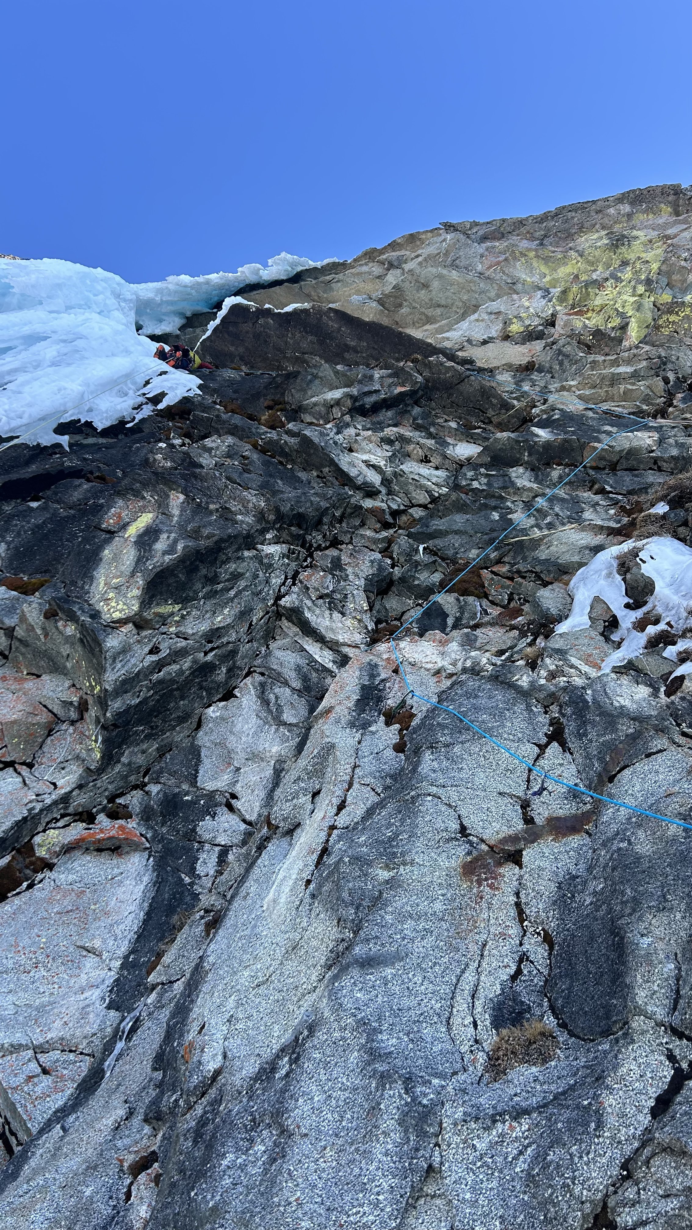
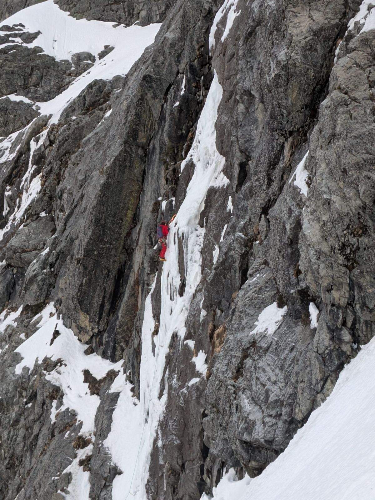
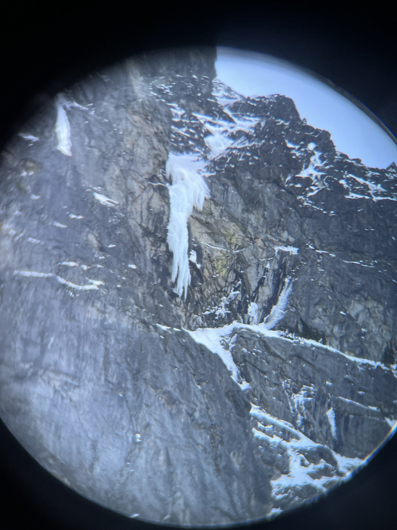
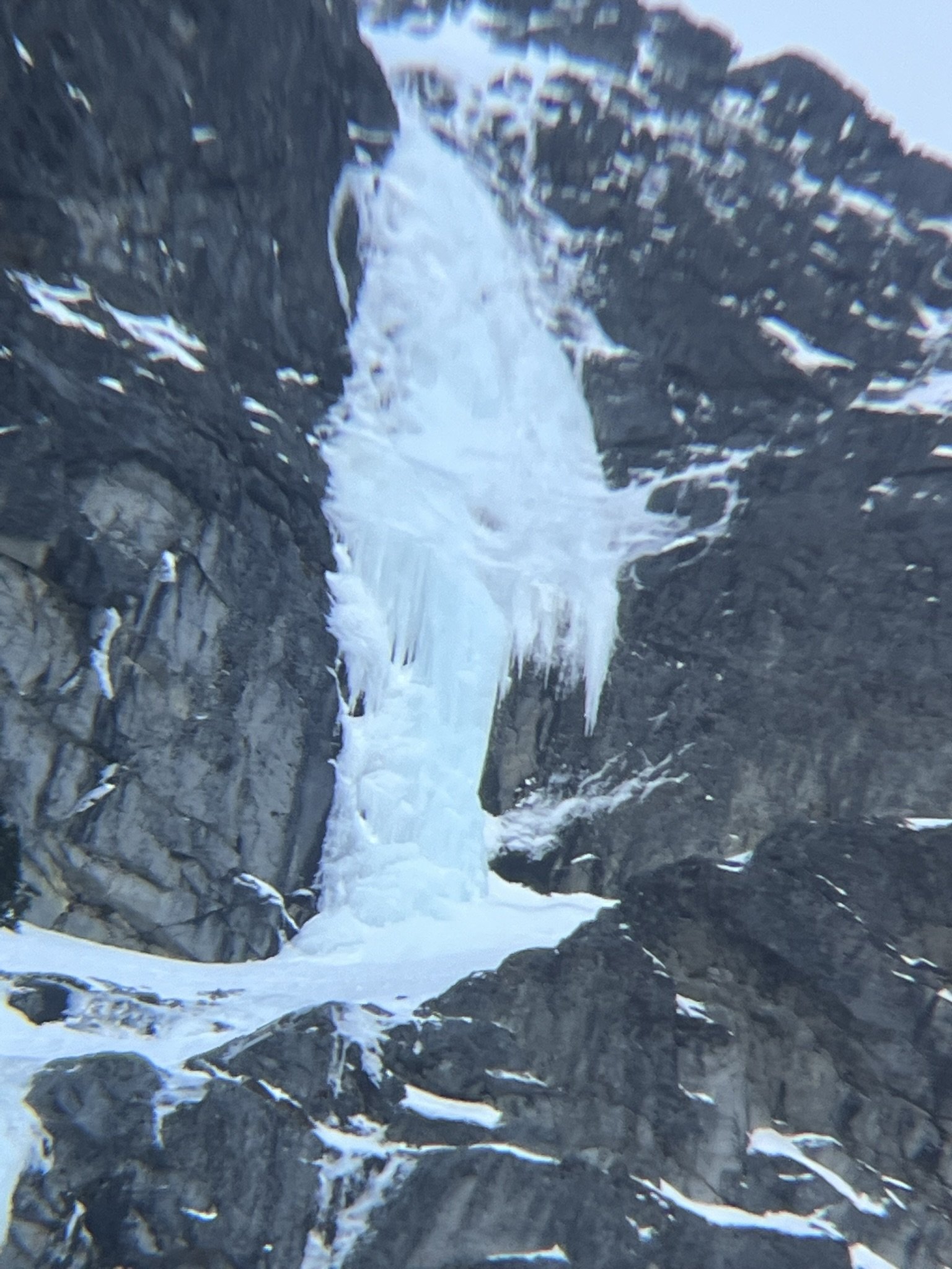
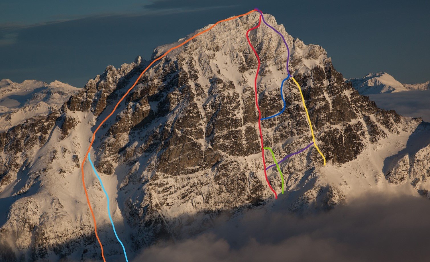
The often-discussed west face of Sloan has been in the forefront of my mind for about as long as I've been winter climbing. When I first came across the stunning Scurlock photos of the face, I was blown away to learn that there had been no successful ascents of any of the major ice lines. Rumors of poor-quality ice came with every attempt up until Kyle and Porter's climb in 2020. I'm not going to lie, I was somewhat disappointed when I heard someone got to it first, but it was only a matter of time. A few weekends later I skied in with @sfuji to try and take their route to the summit. Weather changed rapidly and we spent the night in the basin listening to avalanches rip down the face as it continued to snow. We skied out the next day after some consolation pow turns. My attention then turned to the prouder lines on the main face. Still not yet entirely sure I was ready for the direct line, I set my eyes on what would become the Slither (Merrill-Minton). When that high pressure system hit in late Jan 2023, I knew it was the perfect window for the face but had committed to some other obligations. When I got a text from Tucker asking if I thought their line was previously unclimbed, I felt that same pang of disappointment mixed with the psyche for my friends. It had taken a while, but the plums were slowly getting picked. At this point I knew I had to make this a priority, If the window showed up, I had to at least try. In the summer of 2023, I went out and climbed the SW face rock route Fire on the Mountain. It was my first time actually touching the peak, and I was impressed by the rock quality. This gave me hope that the pitch up to the dagger would be possible but might need a few bolts. It also gave me the opportunity to experience the upper mountain and SE shelf descent. Fast forward to about two weeks ago when this massive high pressure system rolled into the forecast. A brief but deep warmup followed by a long stretch of cold high pressure. THIS was the system I'd been waiting for. Bozeman and Patagonia had stolen the majority of my go-to alpine partners for the winter, so I quickly exhausted my list of regulars. I began reaching out to friends of friends who I'd never climbed with before but seemed up to the task. Finally, I convinced Justin Sackett, a guide based in Portland to make the drive up for the weekend. On Wednesday the 15th I woke up in my car along the Mountain Loop and began pushing my bike up the Bedal creek road. At the time, there was a large tree fallen over the road that was impassible in a car, not that my Prius would have made it much further. I hiked in with a tag line, some pins and a small hand drill bolt kit to stash below the face. Along the way I cleared some branches and did my best to establish an easy to follow boot pack. It also confirmed that skis would not be worthwhile to bring. I snapped some photos through my binoculars and booked it back down trying to get a few hours of work in that afternoon. Scoping the dagger. The Slither is also fat for anyone keen on taking this one to the summit. That day I posted trying to get someone to go chop down that tree, and to my surprise @Manheartmountain was already on his way out there to do the work. This saved us about an hour on either side of the day, and a good bit of suffering. Our alarms blared at 2:40 am on Sunday, early enough that my body hadn't quite realized I was sleeping. We crawled out of the car and set off a little after 3am. The Redbull, gas station muffin and last night's Chipotle fought for dominance in my stomach. The approach went smoothly with the refrozen snow surface, and we found ourselves in the basin around 5. Here we ran into Rob who was planning to make a solo attempt on Superalpine. We shared trail breaking duty up into the lower gulley of the face. Below the first ice step we stomped out a platform and pulled the rope out, after taking a short break Rob continued out right across the ledge towards the Superalpine gulley. Described as WI3 in Tuckers Slither report, our first pitch involved a heinous aerated delaminating pitch of WI5. This was by far the hardest pitch of ice we climbed. It can be bypassed by walking around to the left, or possibly the ramp to the right climbed by @Marcus Russi on his 2017 attempt. It also looks like a good pitch of M5-6 climbs just parallel to our ice smear connecting at the top where the ice is better. Lots of options here, we don't really recommend climbing the same pitch as us in the conditions we found. Photo courtesy of soloist Rob. Justin on the first pitch. Deceivingly steep. The rock on the left looks very climbable, or you can just walk around. I took over for the second pitch and found the start of this pitch to also be aerated shampoo ice at the very bottom. I placed a beak and made a few rock moves to establish on the good ice a few feet up. From there a WI4 groove took me to the top of this step where I made a good screw anchor. The aforementioned beak was unable to be cleaned so it's still in place. I'd like it back if anyone else goes up there soon. Another pitch of harder than reported ice, either we had more different conditions or Tucker is a sandbagger. Likely the latter. Looking up at P2. Once again, we swapped and Justin Lead a pitch of WI3 up through a groove and out onto the onion skin cone below the dagger. Not a whole lot in terms of pro here, but incredible one swing hero ice for the follower. Now below the dagger, we took a short break and got prepared for battle. When racking up in the basin I chose to leave the bolt kit behind. This route deserved an honest attempt on natural gear before being sieged. After traversing back and forth a few times I finally chose my line and started climbing. The rock on this portion of the wall is highly featured, but extremely compact. Due to it being wet so much of the year, every crack and seam was full of frozen moss. This made climbing easier in some ways, but finding decent protection a real challenge. I slowly picked my way up, getting gear wherever I could. The terrain was pulling me right, but I eventually needed to cut back left to access the ice. Once a decent option showed itself, I made a hard traverse towards a hanging face under a roof. Finally getting a piece I was really happy with, I plugged in an additional garbage cam for good measure and committed to the steep footless traverse under the roof where I got myself a bit overcommitted. With my last pieces below my feet, and an arm wrapped around a small spike, I made a last ditch effort to press onto and sit on the thing the best I could. Barely getting enough of my mass onto this perch to go hands free, I pounded a KB into a seam right in front of my face. Finally able to relax a little bit, I knew that if I could keep it together just a little longer, I'd be on the ice and home free with the onsight and both my ankles intact. The final traverse went smoothly and I made it into the belay cave just before the sun peeked around the corner. In the warmth of the sun, I was able to revel in what I had just accomplished while Justin followed the pitch clean, securing our team onsight. The Beartooth Alpine picks still climbing ice well after a long game of "turf or rock" The gloves had to come off for this one. Unbelievably psyched. Also the point I realized I forgot sunscreen. The actual dagger ice pitch ended up being quite moderate. A steep traverse on fantastic quality ice took me to a WI3 ramp. If your biceps aren't cramping by that point, a stunning direct pitch of WI5 can be taken instead. It looks like in some years, a tunnel forms behind the pillar allowing for you to cut through, instead of around to access the easier climbing. From there we unroped and slogged up the snow slope up into the major corner at the top of the face. The occasional step of easy ice, and some snow offwidth climbing in a runnel took us most of the way up this feature. Near the top, the corner chokes down to a squeeze chimney directly up to the ridge, or you can cut right up easy snow and scrambling to gain the summit from the south ridge. I started up the chimney dreaming of the super direct but was turned back by BS sugar snow caking one side of the chimney. A fun challenge any other time than now, I backtracked and opted for the path of least resistance. We arrived on the summit at 3:45. Mooses Tooth or Sloan? We started down the corkscrew a few minutes later, and finally had the sun set on us near the bottom of the SE shelf. The diagonal steep snow downclimbing seemed to drag on forever, but we eventually made it down to walking terrain and slogged our way back around the mountain. We got back to the trailhead at around 8:20. Back at the car. Rack: 8-10 screws, handful of KB's, beaks and at least one small angle. Nuts, Single rack .1-2 (doubles would have relieved some stress). 60m rope & tagline was great for hauling the packs on the crux pitch. All the winter routes and variations I know about Photo credit: John Scurlock Orange: Full Moon Fever (AI4R, 5.8, 50deg) Crux pitches out of view Light Blue: NW face ski line Red: Borrowed Time (WI5 M7) Green: 2017 attempt Blue: Merrell-Minton AKA Sloan Slither (WI4) (AAJ) (CCTR) reportedly a sandbag by Aaron. Yellow: Superalpine FA w/out summit Purple: Superalpine with summit and better access ramp Not Drawn: Corkscrew route & Ryan Hoover's attempt to just below dagger.
 1 point
 -
Trip: Peak Argonaut - NE Couloir (with East Summit) Trip Date: 01/12/2025 Trip Report: Peak Argonaut: North East Couloir (with East Summit). 01/12/2025 Gear Notes: 2 technical tools each 60 m rope 1 picket – did not use Single rock rack up to #2 3 middle sized hexes Nuts – did not use 8 draws 3 pins – did not use Rappel webbing with rings Approach Notes: Snowshoes1 point
-
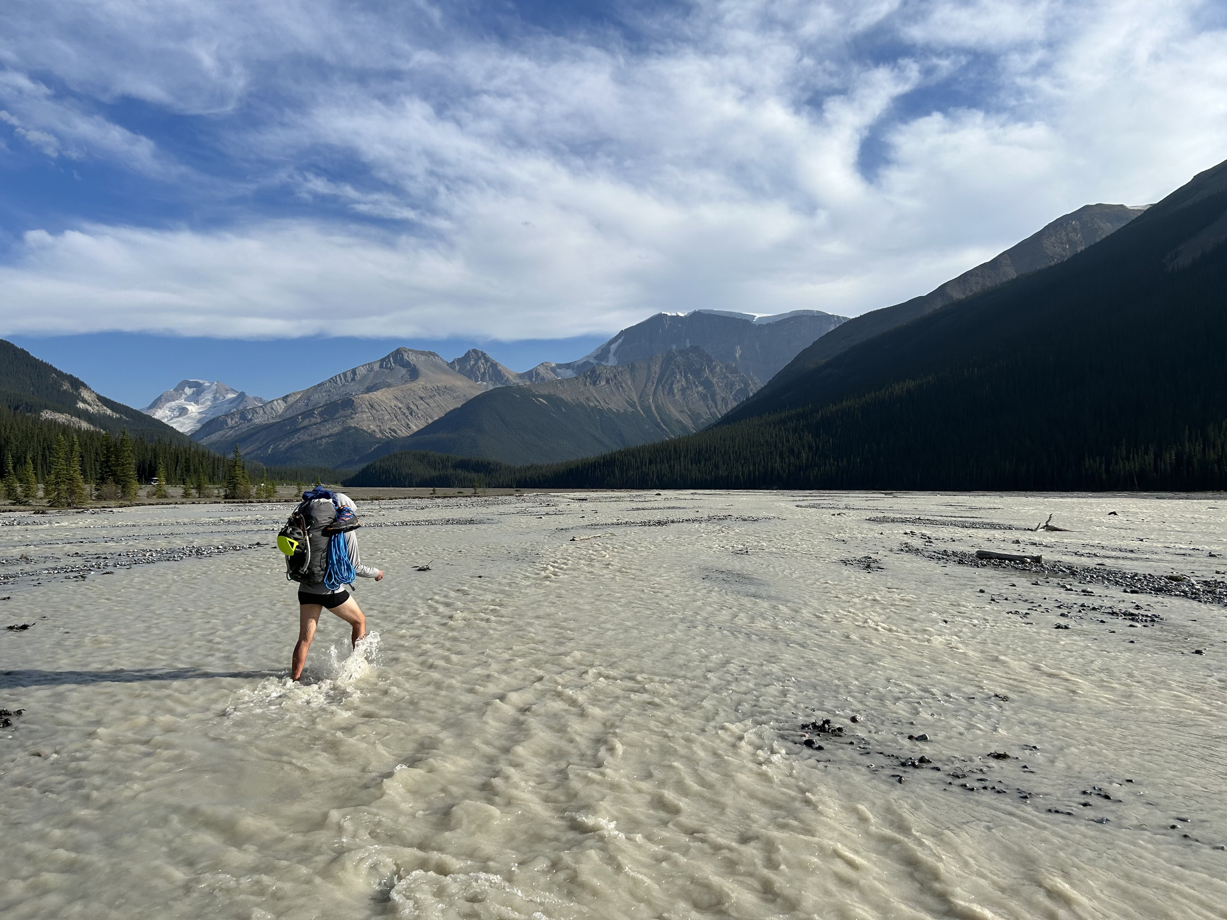
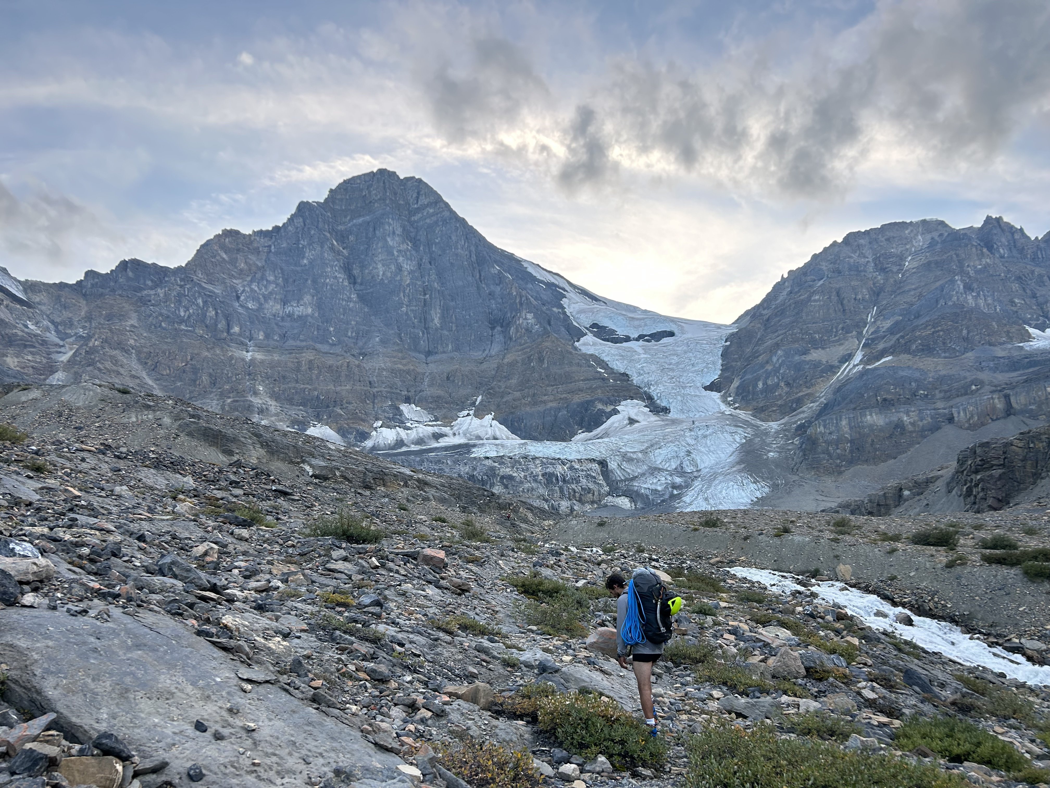
Trip: Canadian Rockies - Feeling down? Like you're in a Black Hole? I've got a solution for you: Go on an Athabasca Bar Crawl! Trip Date: 08/14/2023 Trip Report: Dallin Carey and I took the gear to go see about the North Ridge of Mt. Columbia. We were attempting to repeat this itinerary by Colin and Ian, albeit in much warmer/drier weather. Long story short, everything took longer than anticipated, there was much less snow/ice than anticipated, and we ended up doing the coolest backpacking trip of my life around some of the most incredible mountains on the continent. It was awful, but in a really good way. Day 1 - We got a later than anticipated start and hiked up and over Wooley Shoulder. Pretty much every source from climbers we could find just says "go up and over" with no mention of the shenanigans involved. This is only 5ish miles... It's also 4.5k' vert, involves wading a very cold Sunwapta River at the start, traveling over multiple glacial moraines and up some steep and exposed scree. We thought it would take us 3-4 hrs, but it took us 6 and involved some harrowing traversing on atrocious scree by headlamp. We didn't sleep until after midnight. Day 2 - We figured we had plenty of time to get to and up onto the N Ridge. Colin made it sound easy; how hard could it be? We started by traipsing through Sound of Music-esque meadows towards the North Face of North Twin. The topo maps were not revealing of the topography below and Colin's TR didn't mention this... maybe it didn't seem like a big deal since he was just hanging with a super-loc/guide who'd been that way before. Anyway, the meadows ended with a cliff of choss and a whole bunch of f*&%ery dropping thousands of feet down scree and forest to the raging torrent through more old glacial moraines that is Habel Creek... this is the actual Black Hole of legend. We wasted a good while figuring all this out and after down climbing, shwacking, and scree sliding we emerged creekside where the water pours out of the glaciers. Now we only had to wade the cold water, climb over more glacial moraines, and bushwhack out the creek, dropping another 2k' vert to the Athabasca River. This 4.5 mile section from our campsite to the Athabasca, which was entirely down hill, took us almost 6 hrs. I think I could shave an hour or two off this time with perfect beta, no more. As we emerged into the Athabasca River Valley, Habel Creek spread out over its alluvial fan creating swamps deep into the forest. We were wading through ice cold water filled with silt and simultaneously bush whacking. Breaks on gravel bars finally showed our route... no snow in the lower snow gully, bare ice on the lower snow field, massive black schrunds guarding the top, no ice or snow in the Scottish gully, big icy seracs overhead, and no snow at all on the ridge: climate change sucks a big one. It did not inspire confidence. Finally, while shwacking through more icy swamp water and having made 400m of progress in the last 30 minutes we decided to pull the plug. The N Ridge is probably the easiest(???) exit from the upper Athabasca to get over the Columbia Icefield and back to the car, we were well behind schedule and the likelihood of getting up the route was looking somewhere between Certain Death and Russian Roulette. We really didn't want to go back over Wooley Shoulder for a variety of reasons so Dallin suggested we could just follow the Athabasca River all the way out to the road... It's only 20+ miles of river walking, mostly with no trail. That sounded lovely, which gives you an idea of how totally F'd the other stuff was. We started wading back across Habel Swamp (as we had dubbed it), emerging on to gravel bars and made decent progress, walking/wading/schwacking in a much more leisurely manner until it was almost dark and we found a nice campsite on a gravel bar in the river. Day 3 - This day was delightful and felt like a pleasure cruise... If you consider constant glacial river wading up to your waist, swamp wading, moose/bear track following, and bushwhacking to be easy while carrying an alpine climbing pack and being swarmed by mosquitoes and horse flies. The average American would probably just lay down and die; a PCT thru hiker would probably declare us insane and never go back... but we did genuinely enjoy ourselves... though I still might not ever go back willingly. We finally stumbled out of the brush onto the so-called Chaba Cabin Trail and had a mere 12km of rolling single track to hike back to the Sunwapta Falls TH. A delightful young woman named Pam let us cram in the back of her live-in van (despite our stench and grime) for the 20 miles back down the Parkway to Dallin's truck. We then had to wade the Sunwapta twice at 8:30pm to retrieve our running shoes from the first day, which left us mildly hypothermic, and then the adventure was truly over. We cooked dinner at 9pm in the Ice Fields Visitor Center parking lot and watched rich old people sip their zina on the balcony of the $40 entree restaurant as the alpenglow faded over the Athabasca Glacier, which we had envisioned ourselves triumphantly descending after our rad send. Such is the roller coaster of life. Gear Notes: Light-weight running shoes for hiking were clutch. We did not use the tools, pons, rope, pins, cams, nuts, slings, or screws in any way. The boots were on my pack for all but the few miles up and over Wooley. In Colin's TR he hiked in his underwear as I understand he does from time to time to save weight. I cannot recommend this strategy in this terrain due to the sea of scabbed-over scratches that now forms the front of my legs, and the sea of massive red insect bite-induced welts that covers the back of them. Let's just say this may well be the first and last annual undies hiking trip for me. And also, screw you Colin! But maybe also thanks, for inspiring an awesome adventure. Approach Notes: Don't trust topo maps, don't trust Colin's TR, don't trust the rock, the scree or the dead trees. Definitely don't trust the deep holes between roots covered in 6" of moss that are totally hidden. Basically, don't trust anything you can touch, they will all betray you. Just become a wild animal, cease all higher levels of thought, and simply exist. This is the way. Pictures: These are mostly taken by Dallin, cause !!NEWS FLASH!! undies don't have pockets. Actually, we discussed in detail how Patagonia should make Colin Haley Limited Edition Approach Undies with pockets. But I probably wouldn't buy them. Well, maybe. Yours truly wading the Sunwapta. Screaming barfies for the feet. Yay. Yours truly approaching Wooley shoulder, Wooley peak behind. Yours truly walking down towards the Black Hole and the North Face of the North Twin. Looks easy, just go over there. Too bad you can't see the massive chasm of glacial, torrential, choss gnar that splits the ground just after the lovely marmot meadows. Almost down into the Black Hole. The moraine in the left foreground gives an idea of what the last bit down to Habel Creek was like. In the Black Hole after fording Habel Creek. Note the thousand foot waterfall getting blown sideways as it falls off the Ice Field. Finally getting views of Columbia. Phones take crap photos but very little snow, lots of exposed ice, more exposed rock. Blah, blah, blah. We are chickens. I have dishonored you Dave Cheesmond. We are unworthy. Forgive us. Let the scenic river cruise begin... The Athabasca Bar Crawl! Miles later this is still the alluvial fan coming out of Habel Creek and the Black Hole. We thought the whole thing was going to be connecting stuff like this. River views back towards Columbia. Dallin avoiding mosquitoes at our camp location for the night. He's wearing full alpine winter kit despite the fact that it's like 70F. Following what we called the Moose Highway. There were clearly many moose. Also bears. We did not see them, thankfully. But their tracks were numerous. Dallin almost stepped on a porcupine the size of a golden retriever. I may be exaggerating that last bit, but it was huge. Dallin at a rest stop on a gravel bar. Kinda speaks for itself. Swimming at a cold lake shortly after hitting the trail. Glory, glory, we are free at last! The lake was pretty. Then we walked a bunch more. Then it was over and we didn't die. The end.
 1 point
 -
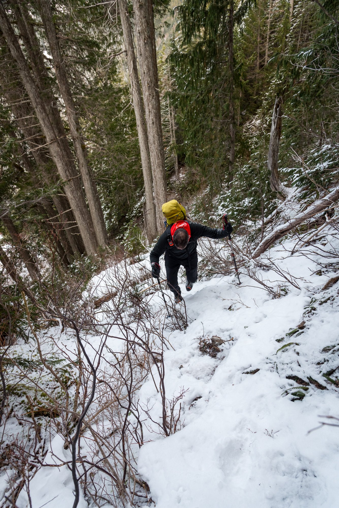
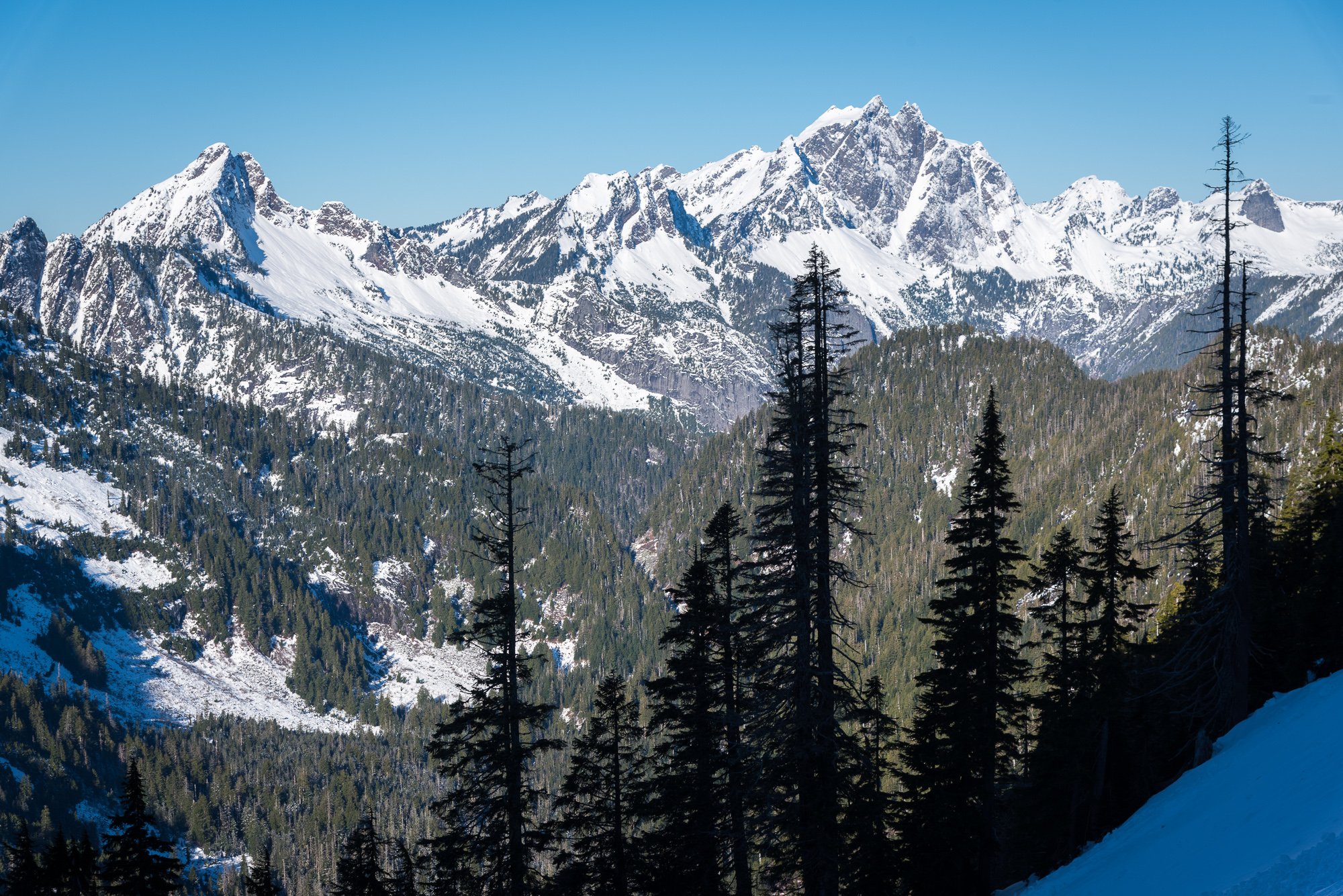
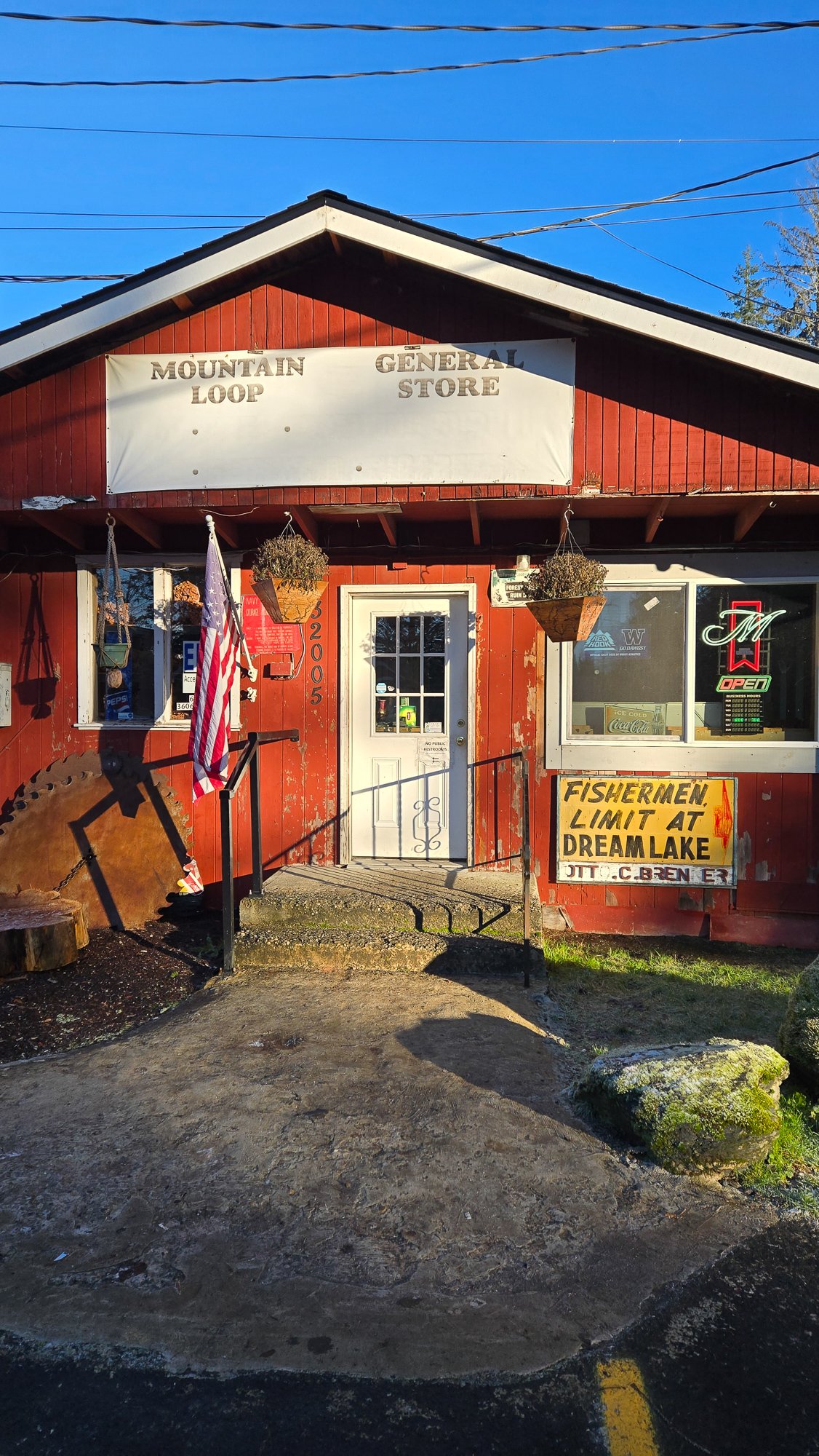
Trip: Long Mountain - West Route via Marten Creek Trip Date: 01/18/2025 Trip Report: The January 2025 Drought continues! In times like these, the desperate turn to Kloke's Winter Climbs guide, self published by Dallas in the mid 90s. I recently picked up a copy of my own and began perusing for a reasonable winter day scramble for the mature mountaineer. And I stumbled upon Long Mountain, which I had never heard of until about a week ago. But no matter, @cfire long gave up on trying to judge the merits of my ideas and so it was an easy sell to convince him to give it a go this past Saturday. And... dare I say, it was better than expected? But maybe that was just the beers afterwards at the Mountain Loop General Store (back open!). Or maybe the summit whiskey that clouded my perception. Still, what's not to like about the sublime position, an exposed finish, and solitude on a windless winter's day? 1912 Doug Fir test plot along the Marten Creek Trail: This is what @cfire came for: Or maybe this was it? (Liberty, Big Bear and Three Fingers): A lovely finish: Yeehaw! Three Fingers East Face....Paging @lunger and @danhelmstadter: Pilchuck and the Olympics: East to Glacier: Mind the exposure on the way down: Not fun: Fun: Gear Notes: ice axe, crampons, helmet. Approach Notes: Marten Creek trail for a couple miles and then choose your own adventure to get into the west basin. Follow your nose up to the exposed finish for the last bit.
 1 point
 -
Trip: Mount Baker - Coleman Deming Trip Date: 01/12/2025 Trip Report: @dberdinka and I have been skiing together a bit more than normal this season and a few weeks back I offhandedly mentioned that I would like to climb/ski Baker in the winter sometime. Turns out, Darin had been thwarted a couple of times prior and was still interested in making it happen. It didn't take much convincing to hatch a plan during the first part of this long January drought.....and one Sunday morning we found ourselves driving unusually far up the Glacier Creek road (for midwinter), parking a little less than a half mile from the summer TH. We opted to go up Grouse Creek, figuring that the avy swath would allow for skinning a bit lower than if we followed the summer trail. Not sure if this was true, but it was what we did. The higher we got, with windier it became, with worse snow. But no matter, we weren't here for the skiing and we made good time to camp at 7k in a wind scoop on the glacier. @dberdinka had brought his fancy 'mid and this proved perfect to hunkering down out of the wind while being able to melt snow in relative warmth. Brandy and whiskey didn't hurt either. Nor a lot of insulated clothing. Did I mention the wind? Baker was being stripped of all loose snow right before our eyes and I was a bit apprehensive about our chances if the wind didn't calm down. But in the 'mid, with a lot of food and spirits, the vibes were good- the wind was a problem for another day- and we had 16 hours to kill! A nice sunset and full moon lent a nice touch to the evening. The long night eventually ended, with both Darin and I catching a bit of sleep and staying pretty warm overall. But it was time to poke upwards and into the wind and so we plodded slowly out of camp in the dark at about 0630. As the day began to break a lenticular formed over the summit and then lowered almost to the col. Uh oh, this wasn't in the forecast! The wind continued to howl and we dug a hole in the glacier to wait and discuss our options. I was pretty sure I wanted nothing to do with climbing up into a lenticular (bad experience on Hood 25 years ago), but @dberdinka wisely pointed out that we may as well go until we couldn't safely, and the forecast was favorable. Maybe it would evaporate? We were getting cold after stopping for a long while and so we packed up. And, much to my amazement.... as we stiffly began to plod upwards again, the lenticular vanished! But it remained quite windy- maybe steady 30 with gusts to 45? I was getting cold and scared but @dberdinka seemed to get more optimistic the more unruly it got with wind and spindrift. He was in his element! Sensing that I definitely was not in my element, Darin memorably asked me, "Well, what did you think it was going to be like climbing Baker in the winter?" Right. Upwards we go! But not with skis. We left them about 9800' at the top of the Pumice Ridge when it became obvious ski conditions were bad and not going to get any better. View into the maelstorm: The spindrift got better as we got higher since all the loose snow was already gone, but the wind remained strong. Still, @dberdinka was right, we were going to make it! We just needed to suffer and not lose heart. But what a wild feeling it was being so high on Baker in the wind and cold! It was just the two of us and I paused a few times on the summit plateau to take it all in, grateful that @dberdinka had pushed me to continue through my discomfort. We reached the summit a bit before noon, feeling like we were standing on the moon. A few quick photos and we began the plod back towards our skis and camp. As expected, the skiing back to camp wasn't anything to rave about, but it wasn't horrible either. Much to our surprise, 15 minutes after arriving back at camp, the summit was lost in another lenticular, showing just how narrow the windows of success can be in winter..... Gear Notes: Normal ski mountaineering kit plus much warm clothing! Brandy and whiskey were helpful as well. Approach Notes: Grouse creek. Could drive within half mile of TH, snow was thin down low but got rapidly better, higher. Mostly carried skis until the avy swath.

 1 point
 -
Trip: Colfax Peak - East Ridge Trip Date: 01/18/2025 Trip Report: Me, @Albuquerque Fred, and Mike (the 3 amigos) climbed Colfax Peak on Saturday the 18th. We camped at the trailhead and woke up early enough to be able to get beers and dinner at Graham's in Glacier that afternoon (this alleviating thys of the need to eat and food on route). Which was good since it was so cold none of us really ate or drank anything all day. We were able to drive to maybe .5 miles from the summer TH before we stopped at the snow park berm. Others chose to drive past this but I believe it is bad form, the snowmobilers are our friends, let's play well together. All users of the outdoors share more than they differ. The Grouse Creek approach worked well, booting for a short time through the forest before switching to skinning. The skin to Colfax Saddle was easy on firm wind packed snow; some areas required ski crampons so we just wore them most of the time. The wind at the saddle was brutal, making the already cold air almost unbearable. We left skis at the saddle and cramponed over the false summit to the true summit of Colfax. We spent 30 seconds, then returned to the skis in the lee of a rock at the saddle. The sun and shelter were amazing, but we had to descend some time, so back into the maelstrom we went. The ski was actually excellent... If you are a connoseur of ski mountaineering skiing, not laps. Firm wind pack, but smooth, with patches of re-worked powder, and, lower, dust on crust. The exit was amazing, 3 hours total from Colfax to the car with a nice long break in the lee. We called it the best skiing on a mid-winter ski mountaineering trip. So in short, excellent***. Cosley-Houston is out, Polish looked ok, but I'm not good enough to knowuch about it. The upper ice ribbon was continuous but narrow: Baker from Colfax: Gear Notes: Skis, ski crampons, crampons, axe, helmet, glacier gear. Approach Notes: Grouse Creek in ski boots.1 point
-
Trip: Illumination Rock - West Ridge Trip Date: 01/18/2025 Trip Report: Damon and I went up the West Ridge of Illumination. We got to the West Gable quite easily but the rime mushrooms along the ridge were uninspiring. Here are some pictures... Gear Notes: Not much was useful. South side routes would take rock gear. Lots of rime on North side. No ice sufficient for screws was observed. Approach Notes: Standard
 1 point