Leaderboard
Popular Content
Showing content with the highest reputation on 04/29/24 in all areas
-
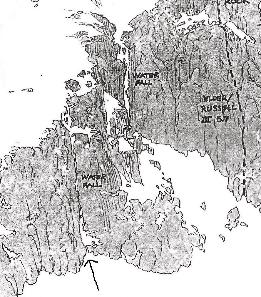
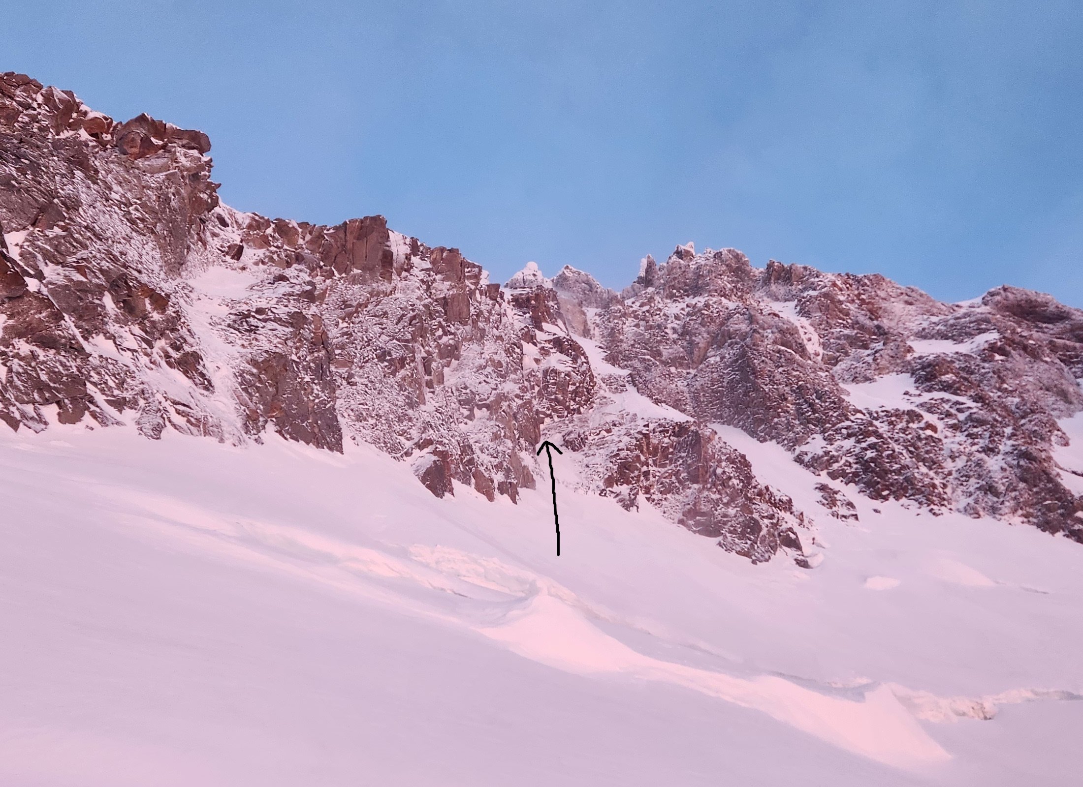
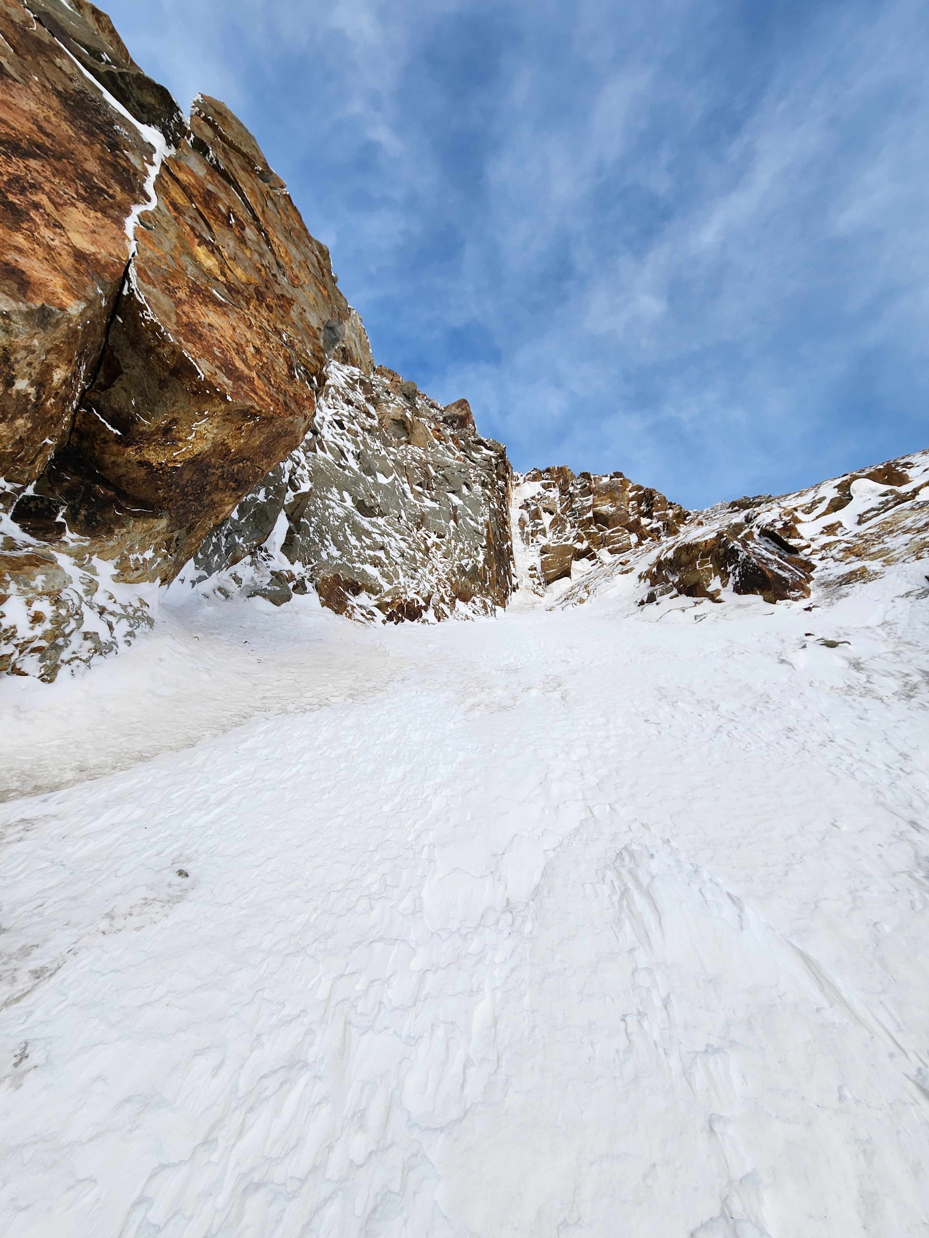
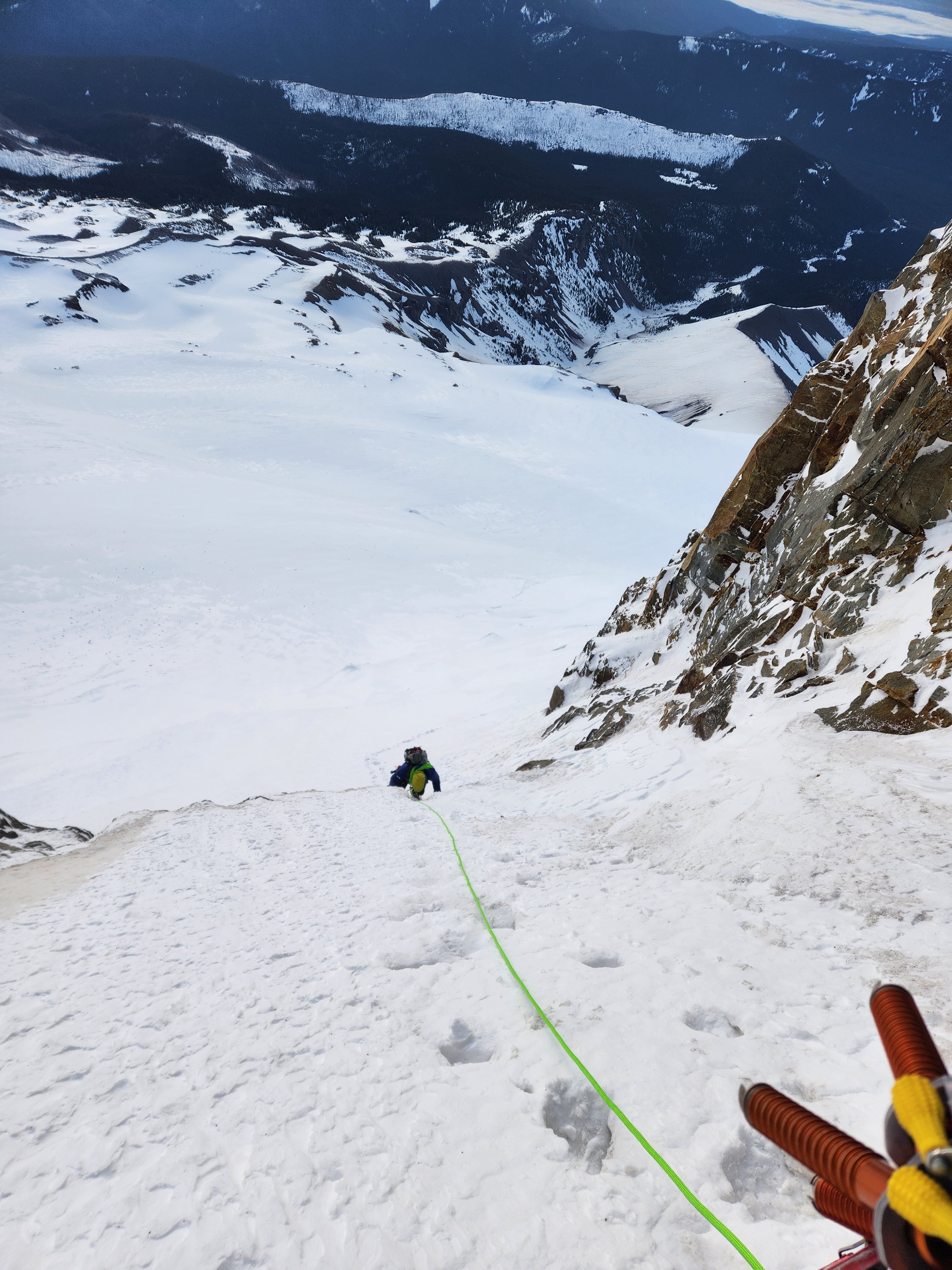
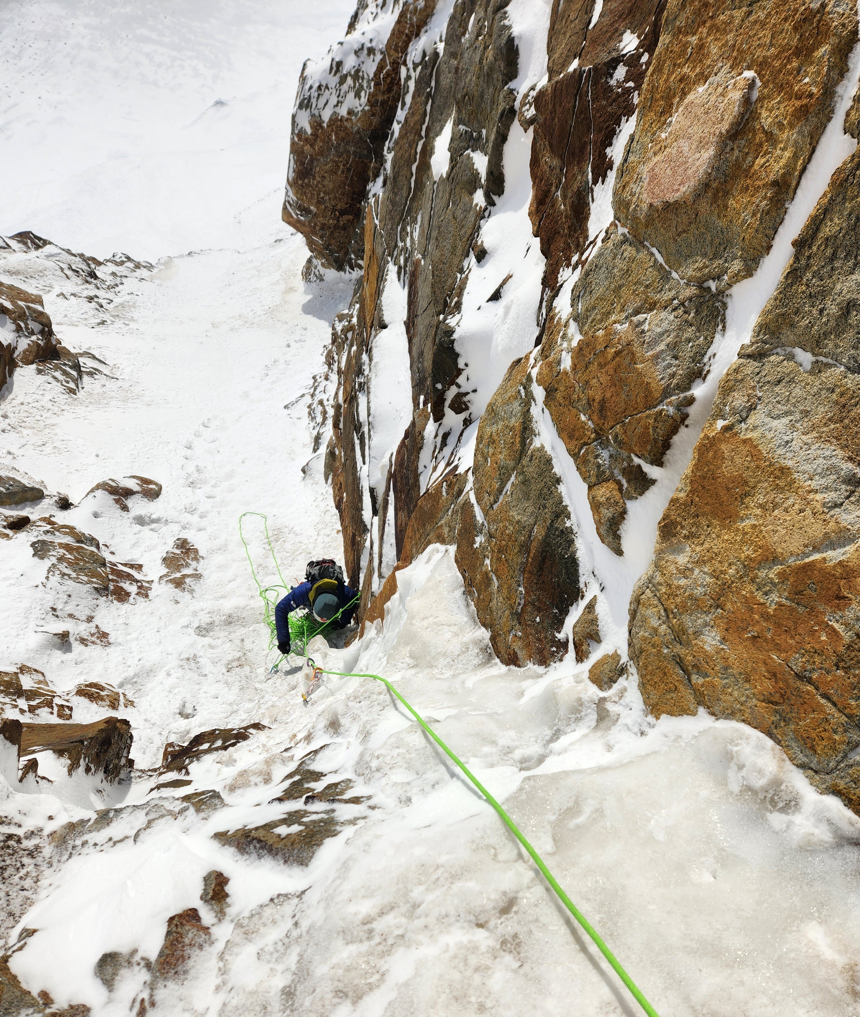
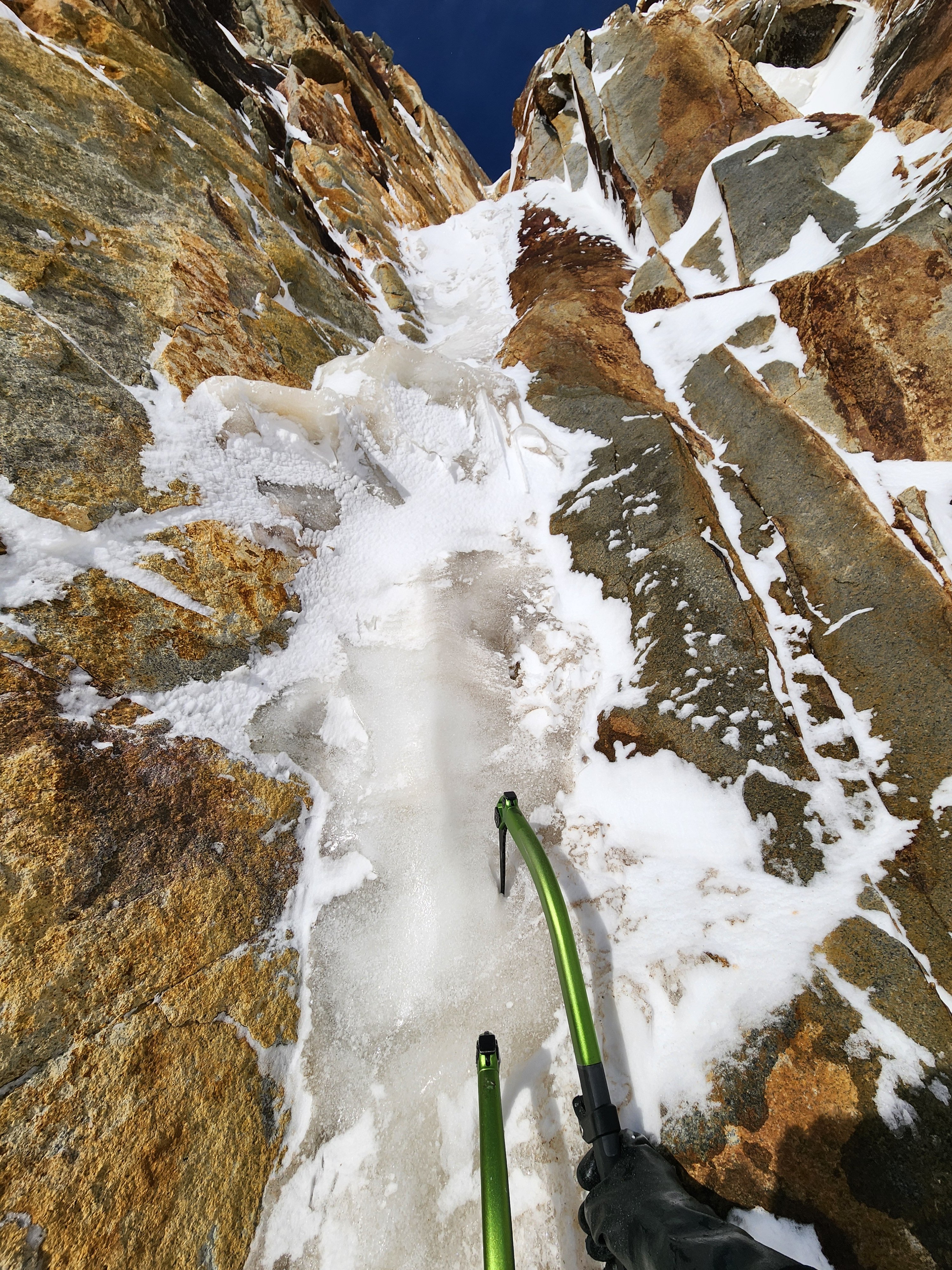
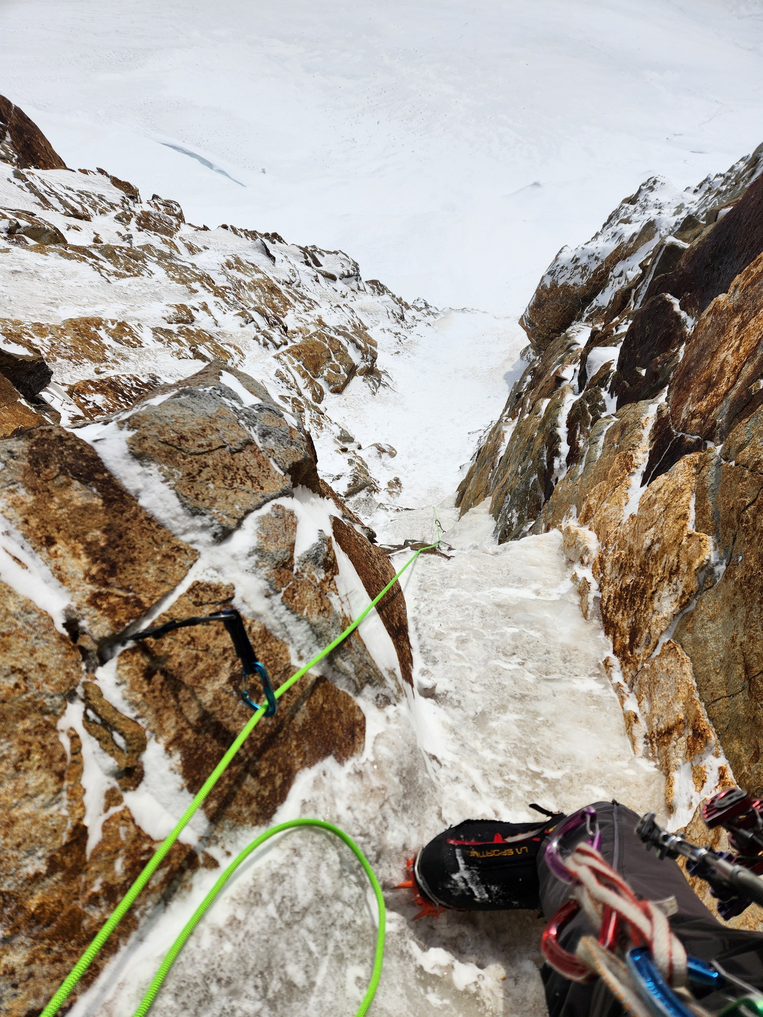
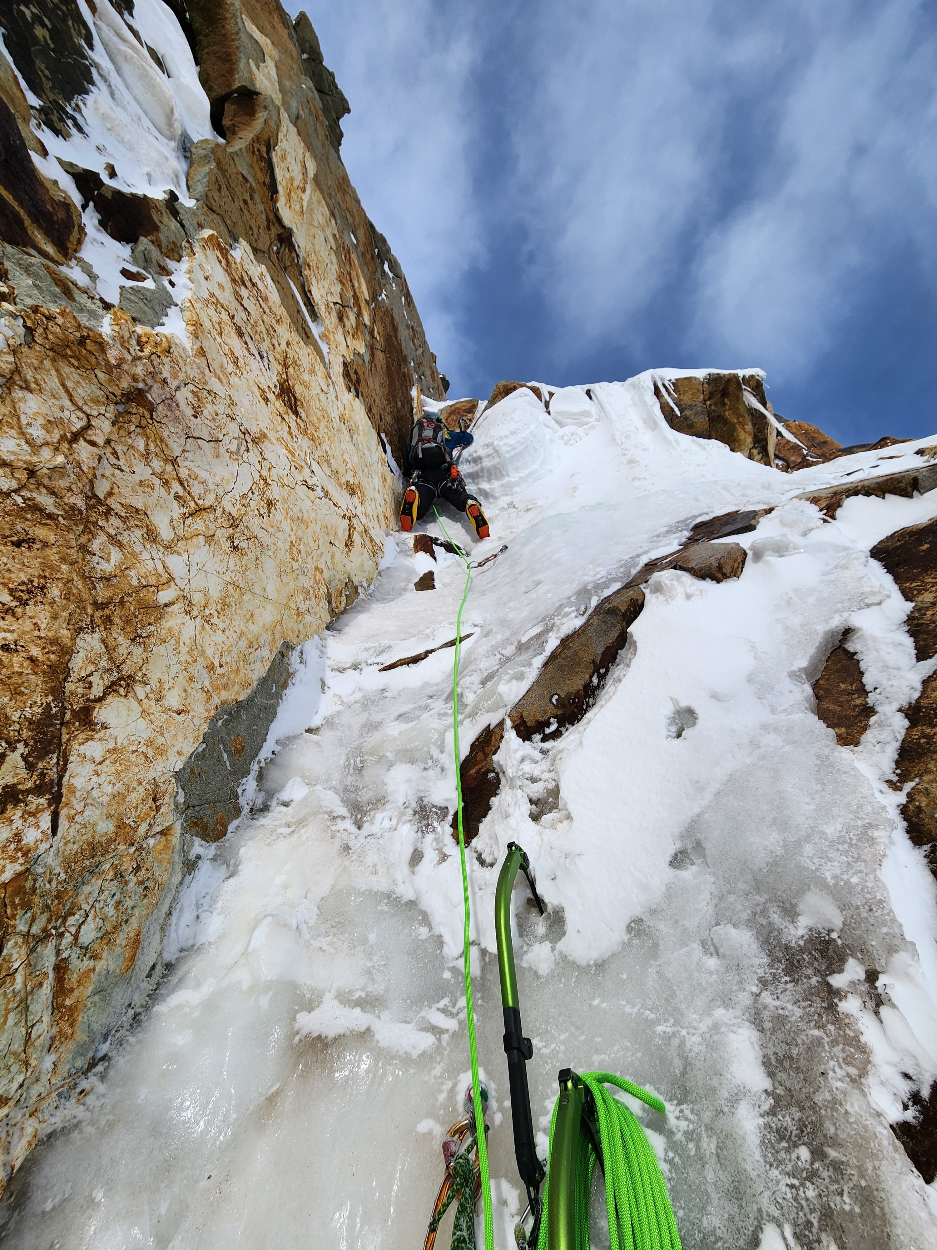
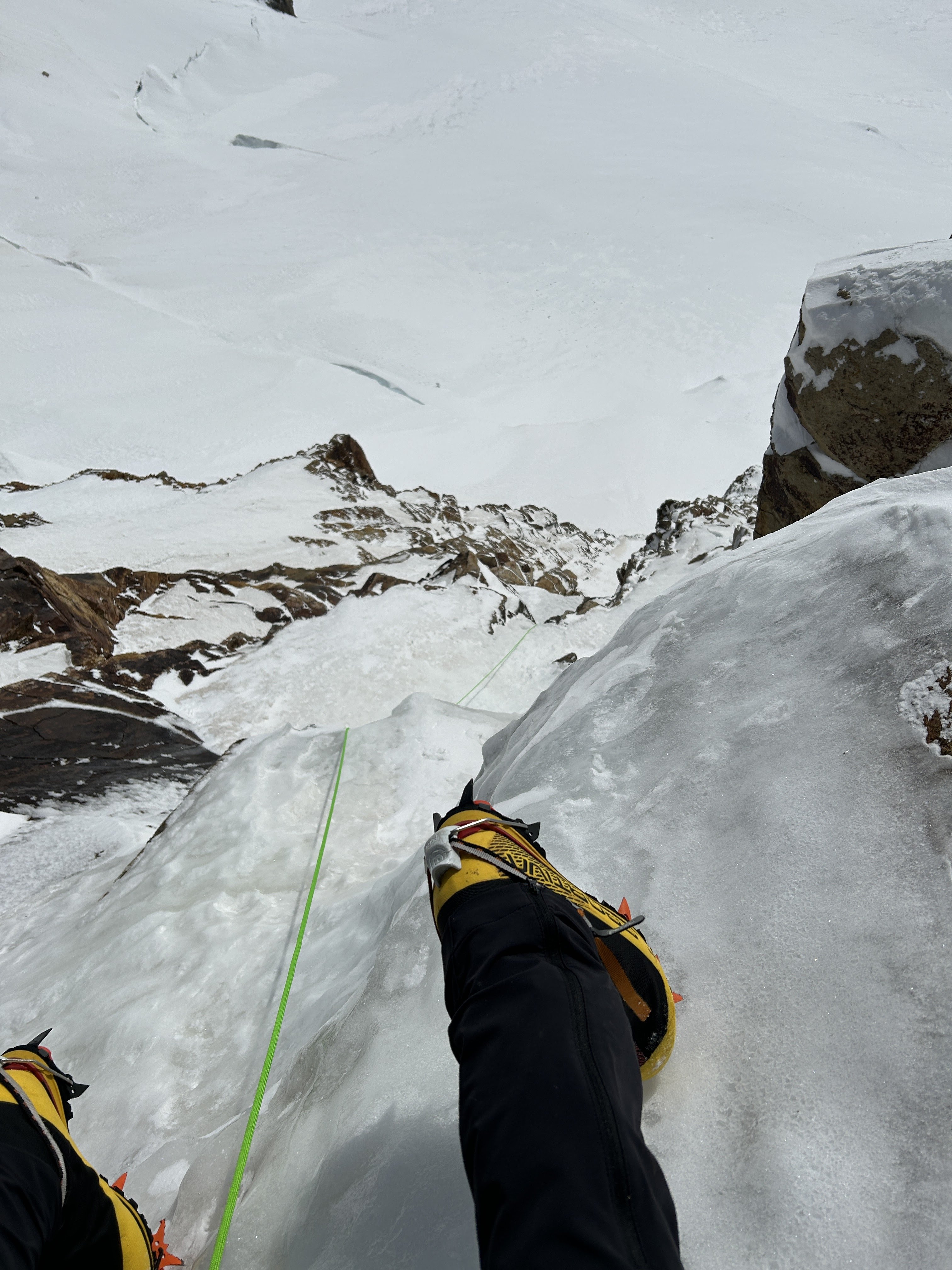
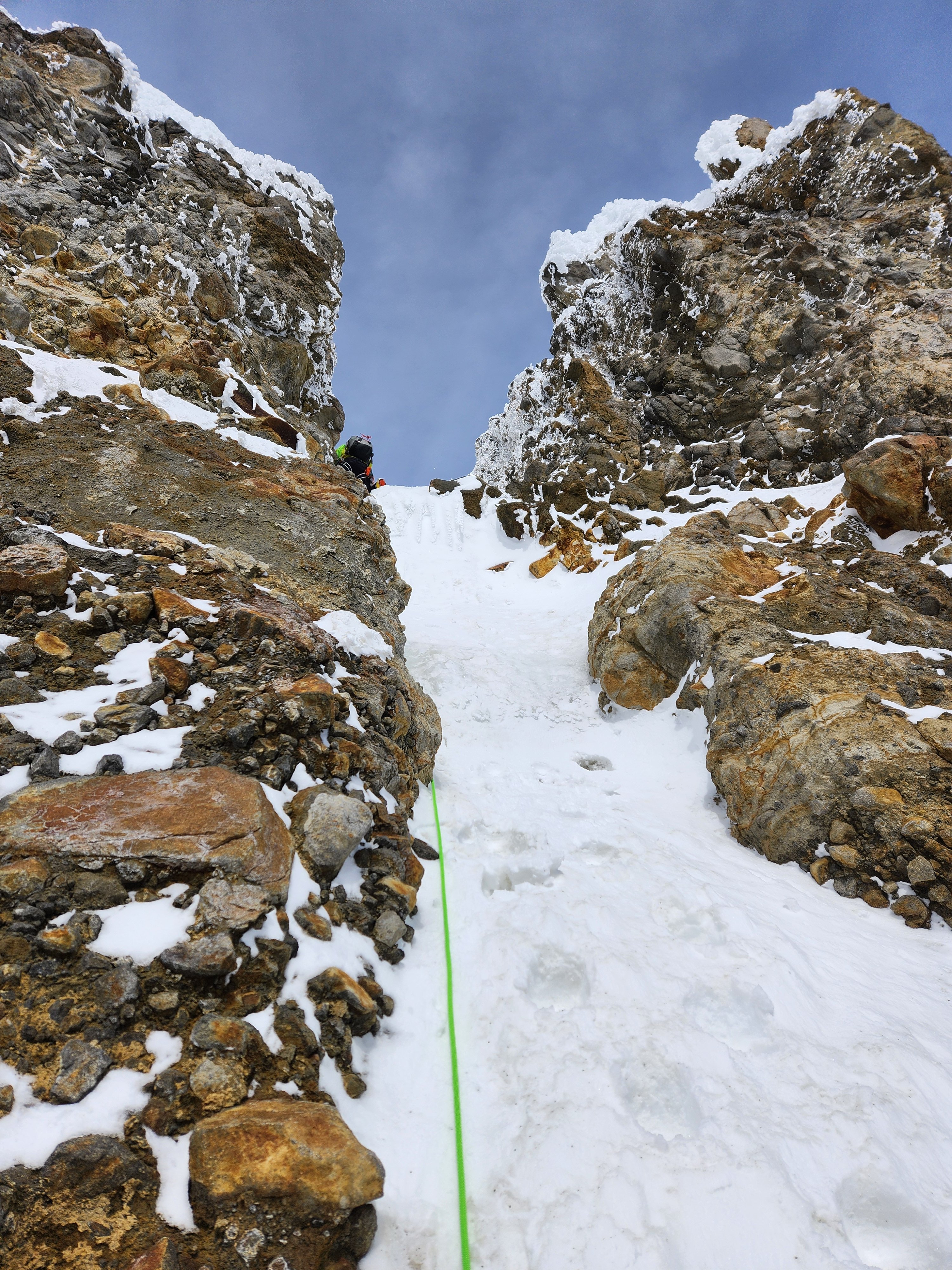
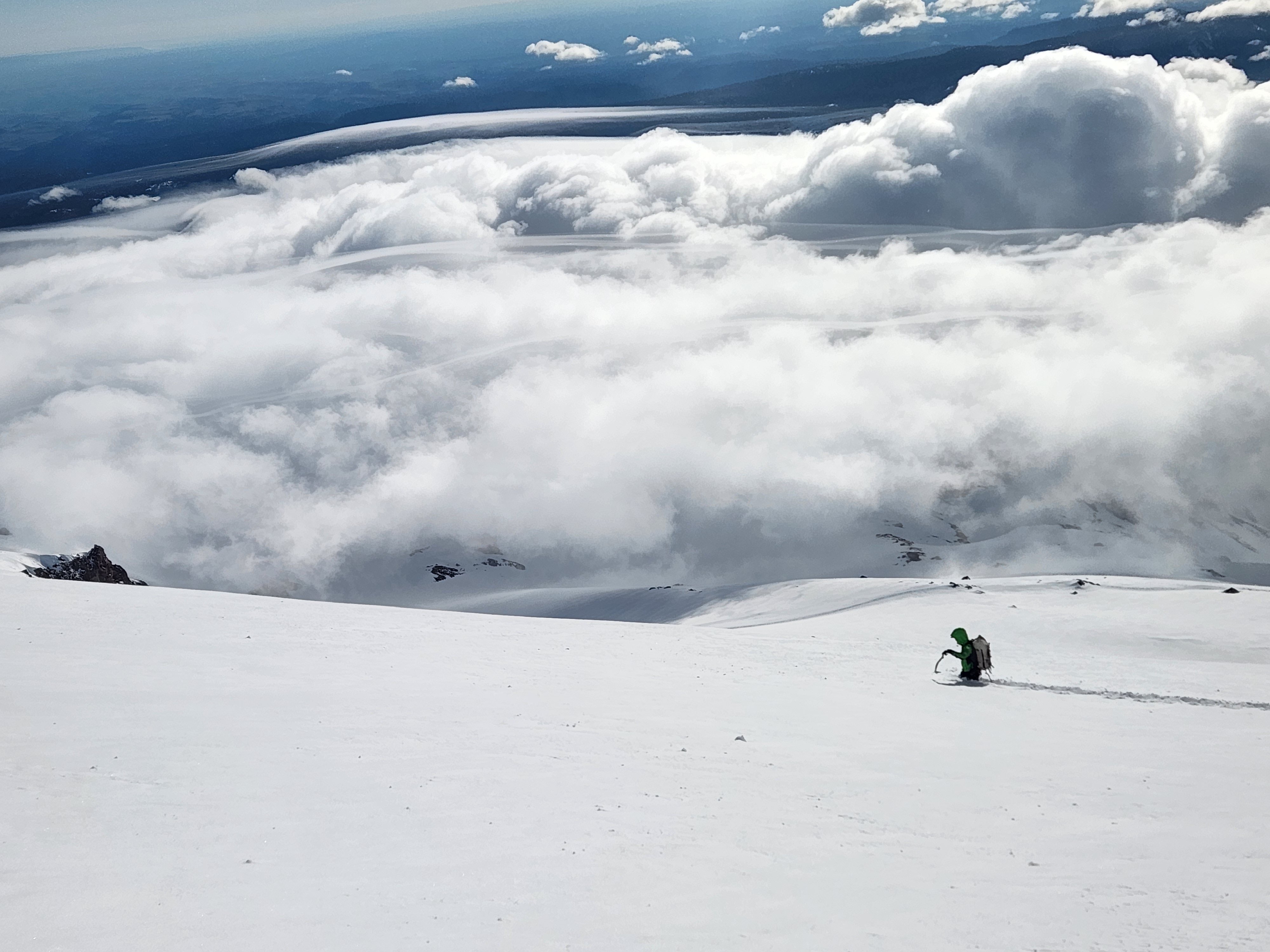
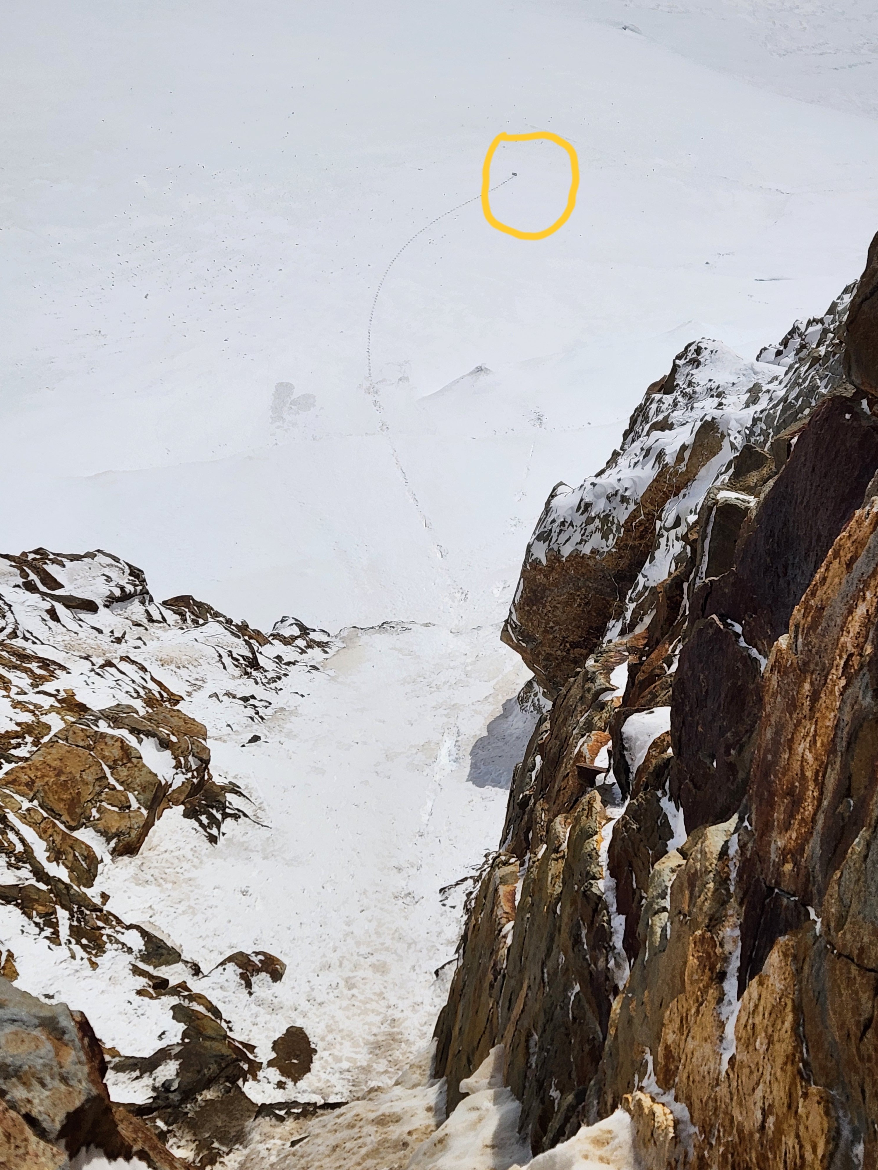
On April 13th Koby Y and I climbed what we believe is a first ascent on the far-left side of the Black Spider. We humbly submit this report for the historical record and for review by the fine netizens of cascadeclimbers. If you know of this line being climbed before, please let me know and I'll PRINT this trip report and then EAT IT (and appropriately redact our claims here). This route is labeled "waterfall" on the hand-drawn topo, left of the "waterfall" that later became the Fric-Amos route: Here's the route from the side, photo taken from the base of Cooper Spur in December (side note: despite looking fat in this photo, Fric-Amos was 100% unprotectable snice): This is a bit of a "lite"/"diet" Black Spider route, not tackling the entire face but rather topping out onto the Newton Clark Headwall about halfway up. Despite this, we did about as much technical climbing as on the neighboring Fric-Amos route and found it surprisingly engaging. It's a bit tough to grade as the ice was quite thin but we'd say it goes around WI4 with a couple M3-4 moves thrown in. I assume that like other routes on the Spider it could become easier and perhaps go entirely at WI3 in fatter conditions. On to some photos of the climb. Here is the face from below with the Arachnophobia second cliff band looking quite fat for April. Our route (which you can't really see as it's tucked in the corner) above the arrow: Next photo, approaching the route. There's currently a LOT of snow over there so the first steep bit visible in the side view above was totally buried. We just walked up into the little snowfield though there were a couple patches of low-angle water ice. Koby coming up into the snowfield: At the top of the snowfield we built an anchor and pitched out the rest of the climb. Here's looking down after the initial steep bit (WI4-ish?) of pitch 1: A couple photos from higher on pitch 1 below. Somewhat tricky climbing up a series of brief vertical steps with some thin/snicey/delaminating sections: I only led about 25 meters before building an anchor, as there was a patch of fat blue ice, a decent pin placement, and I guess I had already used all but one of my screws, sewing it up out of fear in my typical style. Here's Koby leading out above the anchor, about to do perhaps the hardest move on the route involving a brief torque in a horizontal crack to reach the good ice up above: Above this was mostly mellower, typical Mt Hood WI3-ish: Pitch 2 ended up being about 35 meters before joining the Newton Clark Headwall. In reality, we may have been able to squeeze all of our serious climbing into 1 60m pitch, though in more typical conditions (less snow) it looks like gaining the snowfield could require a bit of ice climbing, so it seems reasonable to expect to do at least 2 pitches. We simuled up the rest of the headwall, climbing one last short bit of WI2 between two gendarmes to join the upper Wy'East route to the summit: A couple final notes: First, thanks to Zach and Artem for trying to get this done with me the week prior. The wallowing was, unfortunately, insurmountable: Second, we did have one scary rockfall encounter that I feel obligated to mention. While belaying Koby on our second pitch, shortly after he topped out, a microwave-sized block spontaneously detached in the bowl above me and narrowly missed my head (I ducked), instead hitting my pack and ripping out the picket I had racked in the side pocket. A good reminder that climbing on the Spider sucks and to put the belays in more sheltered spots. This is really my fault for putting the anchor right in the fall line, I thought that we were much closer to the top of the route than we were in reality and that there wasn't that much overhead hazard. Thankful to emerge unscathed. Picture of the rock below: Thanks for reading.3 points
-
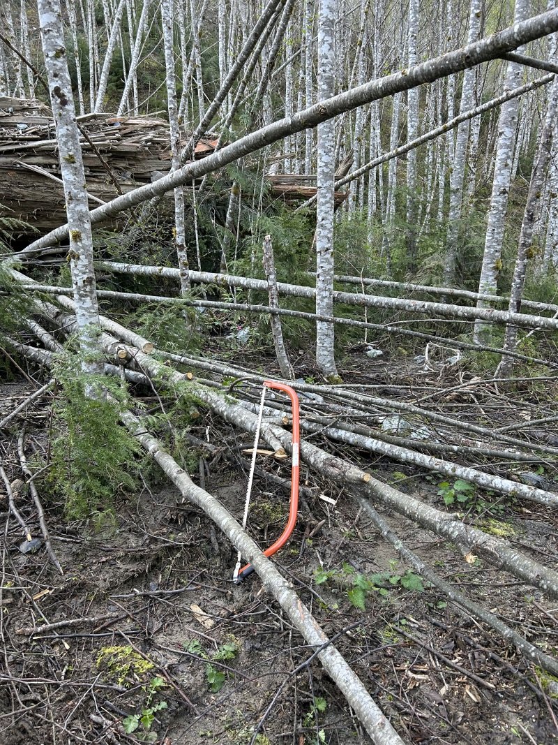
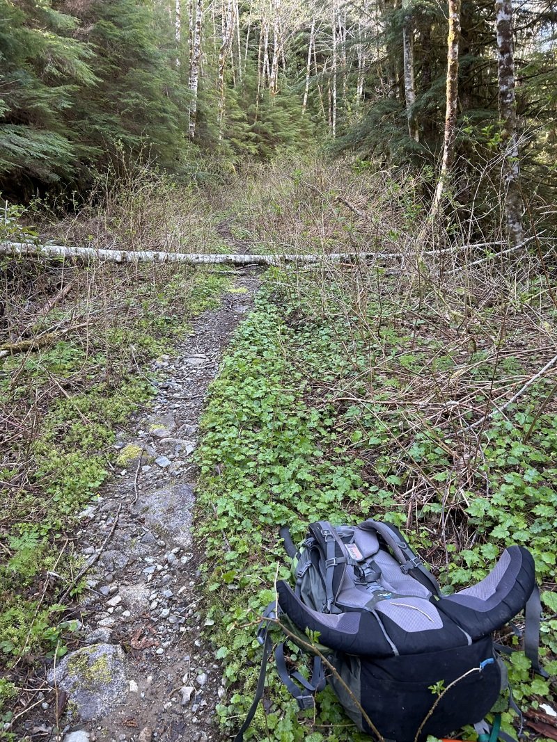
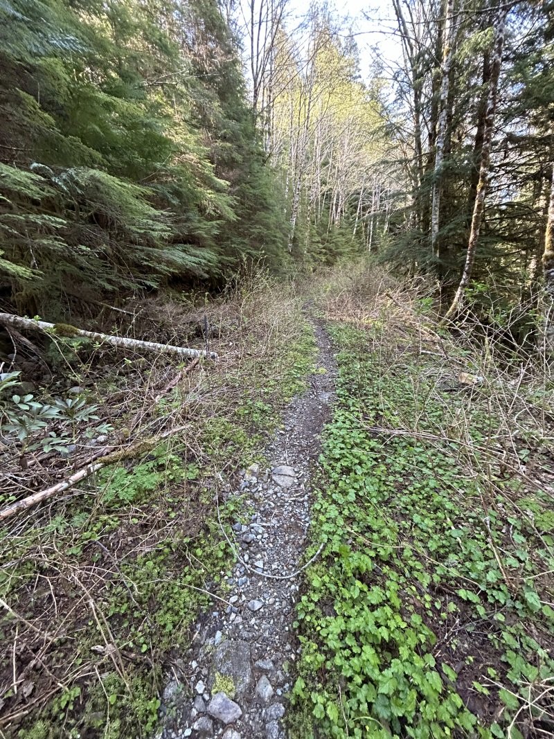
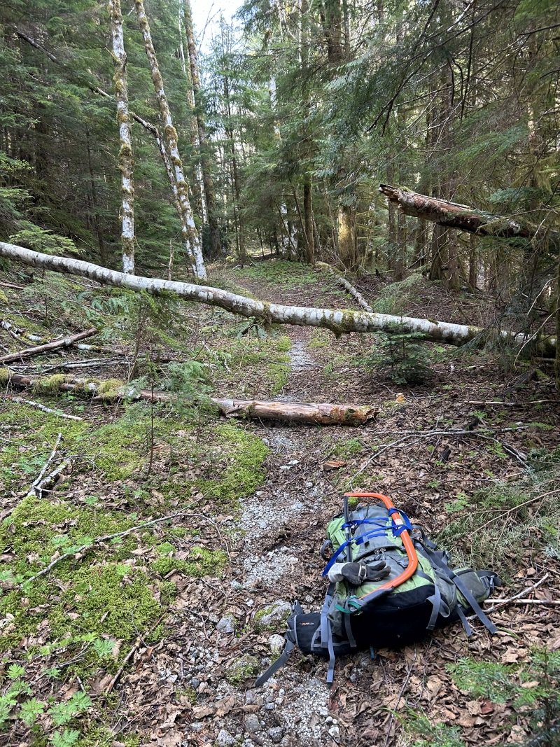
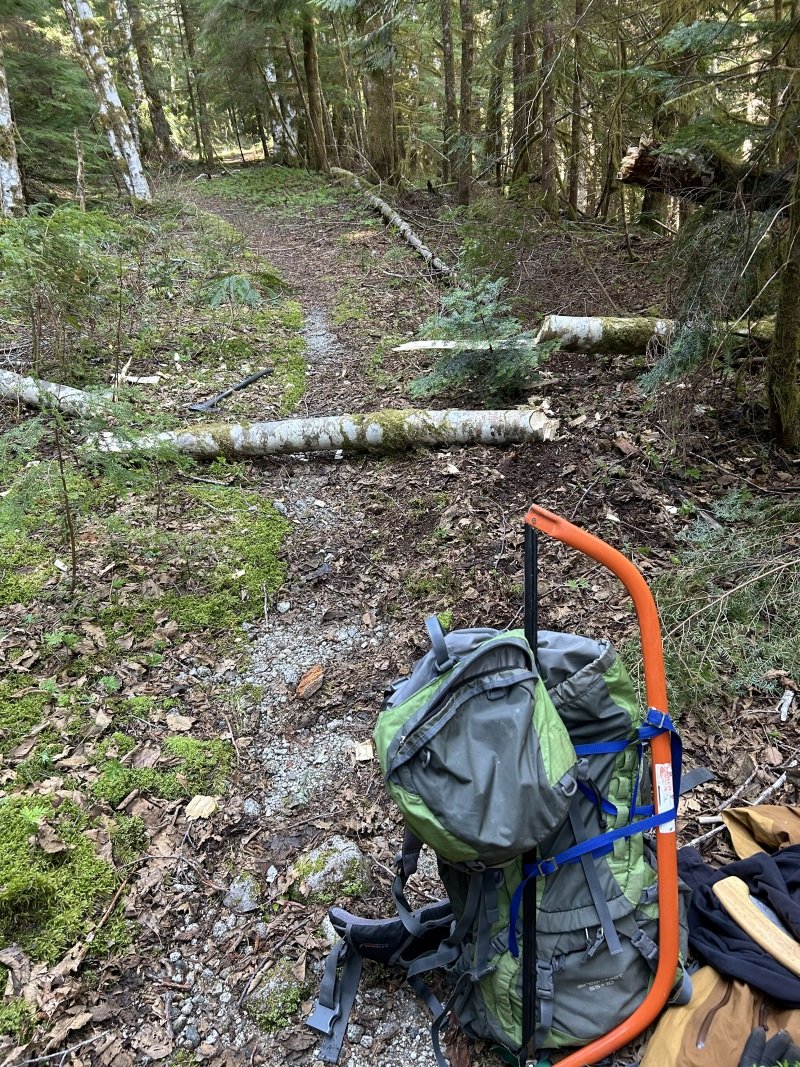
Drove up on Tuesday, April 23 to check on any winter's damage. The road to the parking lot is in great condition, with no new damage. Hiking up found a lot of new rocks have slid down into the area which has stopped all car traffic in recent years, about a quarter-mile up from the parking lot. I dragged many of them away to form a smooth path through the rock pile. Further up, used the axe to clear away several large alder and one fir log. The road/trail is now clear for bike riding to all turnoffs to the Squire Creek Wall routes. A huge log came down in the landslide area, pushing small alders over the trail: Further on, logs across the road were easily cut with the axe: I spent the rest of the afternoon moving rocks from the rockslide area just a quarter-mile above the parking lot. The resulting path is smooth but much higher than before; I'm not sure I can ride it with my meager bike-handling skills.1 point
-
1 point
-
1 point
-
Trip: Williams Peak - Standard Trip Date: 04/13/2024 Trip Report: Over the past year of so I've gotten reacquainted with the Chilliwack Lake environs. It is just as close to my house as many areas of the Cascades and offers some new peaks to ponder and some unfamiliar views of familiar peaks. And, for whatever reason, I've been able to mostly have these mountains to myself on the handful of trips that I've taken up there. Williams Peak was no exception a couple weeks ago - I didn't see a soul after leaving the car. For such a striking peak on a fine spring day, I was a bit surprised. But there was definitely slogging, and that probably explains the solitude. The trail gains almost 3000' in the first mile and a half, and then there are two miles of undulating ridge to slog in snowshoes. But the scenic rewards, as you'll see below, were quite great beyond that. Plus, it did get more entertaining for the final 1000' up the steepening gully to the summit, dodging small wet slides and eyeing the cliffs above me suspiciously. I had read about annoying talus and steep heather once the snow melts off so a spring ascent might be the ticket on this one, even if it is more work. For me, being able to get a good look at the north faces of Rexford and Slesse draped in the think mantle of a late season snowpack more than made up for any discomfort. Williams from the valley bottom. Prepare to work! First glimpse of North side of Slesse: Chilliwack Lake: North side of Rexford with Shuksan in the distance: Slesse with Baker behind: Welch and Foley (gotta get in there next!): Look back at Williams from the slog out the ridge: Gear Notes: Snowshoes, I'm afraid. This wouldn't be a great ski with the up and down and endless forest. Crampons, helmet, and axe in early season- it is steep in the final gully Approach Notes: Chilliwack Lake Road is paved to the TH1 point
-
1 point
-
Trip: West Face, North Howser Tower - All Along the Watchtower Date: 8/26/2012 Trip Report: Where to start? This route was a significant one for me on a lot of levels: first grade VI, first time in the Bugs, first planned bivy, first unplanned bivy, and definitely the most committed I've ever been in the mountains. In the end it was an amazing experience with a great partner in one of the wildest settings I've ever been in. It's difficult to communicate the turbulence of thoughts and feelings I experienced during this climb. Anywho, the timeline format seems to work well for TRs and this one starts in April. I was sitting in the St. George Public Library wishing it would stop raining in Zion and learned about the AAC Live Your Dream Grant. I thought "Finally! A grant for us normal people. What's an appropriate objective for that sort of thing and who could I do it with?" (ironically, we didn't end up getting any money...) I'd definitely heard about Watchtower, but had only recently looked at it as anything other than a route that was hopelessly beyond me. In the light of that day it now looked like the perfect objective: definitely a reach, but with minimal potential of being totally crushed by it. I'd cragged with Jonathan a bit at Trout and felt like he was a strong partner who also had a compatible attitude and personality-something pretty important for stepping into bigger terrain. Long story short, I sent him an email: what's your August looking like and what do you think of this route? Months of email exchanges ensued. Jonathan went off to Ashford to walk up and down a hill all summer and I did more or less the same down in Oregon. Things wore on and the likelihood of our schedules aligning simultaneously with eachother's, as well as a forecast that would allow us to tackle this seemed decreasingly likely. By early August, this trip had become an almost forgotten hope in the back of my mind. And then, amazingly, in mid-August I got the email. Things would finally match up for about a week at the end of the month. With the Bugaboo Provincial Park weather forecast loaded as my homepage, I started obsessing over the weather. A week went by and it actually looked like the it might be stable enough for us to push the button. It was happening! 8/23: The goal for the day was to drive from Eugene to Kennewick. In PDX, I got a call from Jonathan with some bad news. It turned out his passport was in storage in Bend. Thankfully someone was able to find it and meet me with it in hand at 10:00PM. What's a few extra hours of driving when you're en route to climb something as awesome as this? 8/24: We met in the REI parking lot and sorted stuff. On the way to Canada we made a quick stop in Spokane to fortify ourselves with frozen mango from Trader Joes. (1 lb for 3 bucks!) Yardsale in the Kennewick REI parking lot. 8/25: Not really knowing what to expect, we had a pretty fluid plan in terms of overall strategy. We weren't sure how the approach would go, so we didn't want to commit to camping at East Creek, the Howser Bivy Boulder, or on the route. In the end, it turns out after walking up and down hill all summer, getting to the B-S Col in two hours was no big deal and it wasn't far to East Creek from there. We faffed around East Creek caching our camping gear in anticipation of bivvying on the route after Pith 3. Jonathan posing down in front of the Kain Hut. Heading down to East Creek Basin. The raps in went smoothly except for a slight core-shot to our lead line sustained while pulling our rope on the second rap. Nothing a bit of athletic tape couldn't fix. (out of site out of mind!) It's worth noting that the basin below the raps is very active in terms of rock fall and large amounts of it were raining down the cirque we had to cross every 10-40 minutes. Jonathan psyched to commit. Our repaired rope at the base of the route. There were also a couple of others on the West Face. Looks like they did Spicy Red Beans to a newer line put up by some locals out of Golden. We started up the line late in the afternoon and just made it to our bivvy in the last light of day. There are some very compelling crack systems that pull you too far left on the face into a dead end. We found a sporty traverse that allowed us to connect our mistake into the left end of our intended ledge just as the light was fading. Thankfully it was a warm night, so cold wasn't much of an issue. Sadly, the ledge was far from deluxe and the real limit on sleep was from general discomfort. Splitter climbing that sadly wasn't part of our line. Tucked in for the night. 8/26: Not much to say other than we woke up and started climbing. Thankfully, it wasn't too cold and the shady western aspect actually offered pretty pleasant temps. We accidentally climbed another bonus pitch up to the ledge underneath Armageddon and had to rap back down to our line. Eventually we worked up into the base of the corner in the early afternoon. The corner was absolutely stellar climbing on splitter rock. The meat of it is rated 11+ and, to be honest, felt like Trout Creek 10+. Slabby lie-backing and stemming all with super good friction. In any case, very good fun on warm, dry rock. (I imagine it'd be a different story if it were wet and/or cold) I gave up on the free effort one pitch below the crux and started french-freeing for speed. Throughout this section of the route and especially on the crux pitch, off-set aliens were absolutely crucial gear. The sun set just after I finished up the crux pitch and Jonathan pulled out the lights before cleaning it. This left us with 250 more feet of corner which we were eventually finished with by 12:30. The beginning of the corner. Fading light below the crux pitch. The forecast had called for a storm to roll in the evening of the 27th and throughout the day a system had been visible far off to the west. That, combined with a dramatic increase in wind in the evening, prompted us to forgo the bivvy and keep pushing up the last 1000' of ridge after a short break. Eventually exhaustion caught up with us a few hundred feet short and we napped for a few hours through very minor flurries of graupel. Thankfully the morning dawned relatively clear and calm and we tagged the summit and headed home. Time to go down. The only other notable event was finding wolverine tracks as we were headed up the Pidgeon-Howser Col over top of the boot track we'd put in coming down the Col only an hour prior. Wild! The Bugs are an amazing place with a massive volume of high quality climbing packed into a very compact zone. I'm definitely psyched to go back! Thanks to Lee (aka luvshaker) for the off-set loan. They were key! Also thanks to Tay for putting up with my beta-mining/pestering as we were hammering out the final details. Gear Notes: 1x 00 and 0 TCUs 3x 1-4 TCUs (including 1 set of off-set aliens) 2x .75-3 C4s 1x 4 C4 Double Set Stoppers + Brass Lightweight crampons and axes. Approach Notes: Surprisingly compact and straight-forward. It's pretty mellow to get from the car to the raps in half a day.1 point


