Leaderboard


Popular Content
Showing content with the highest reputation on 10/02/23 in all areas
-
maybe they should focus on reintroducing glaciers.2 points
-
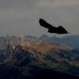
Followed JayB up the Kone route yesterday. Beautiful weather and dry rock provided for an enjoyable day out. We received a tip at the trailhead from Jared(?) to take some small cams for the runout sections and were glad we had some. Updated rap route is down the Magic Bus anchors, all newish chains and bolts on climbers left side of the Great Arch. Also, there's been a bunch of bear activity along the base of 3 O'clock rock so consider maybe hanging anything left at the base off a bolt out of reach or take everything with you up the climb. PS, I fumbled my belay device at the top of the last rap so good reminder to practice your Munter.
.jpeg.3aced6043758782b0cca4b9cf7b9bd99.jpeg) 2 points
2 points -
Trip: Reconnoitering Tower Mountain - None Trip Date: 09/12/2023 Trip Report: Tower mountain, like Mt Baring, has an impressively steep face whose profile tends to taunt from a variety of easily accessible viewpoints. After years of staring at its leaning silhouette, I had developed a minor obsession. To my knowledge, attempts at the central part of the NE face have been ended quickly by poor rock quality. But, I thought, perhaps an approach less focused on going ground up and boltless might yield some decent climbing? There is, after all, a third class gully to the top. Encouraged, then, by a friend's gorgeous aerial photos, I finally schlepped my way in (twice) this Summer. The first view coming down Hardy shoulder, with Tower's tower obscured: Looking back at the business side of Hardy: not as steep, and by reputation just as chossy, as Tower: Tower's normal route goes up to a large cave on the west side, then traverses to access a west-facing couloir. It's straightforward (albeit with some steep loose dirt) to keep scrambling at this level all the way around to the SE-pointing shoulder/arm overlooking the NE face. All the blocky south- and west-facing terrain under which you pass here seems to be composed of solid granite with amazing splitters. You also pass a glorious bivy site: The SE-pointing shoulder/arm has a nice vantage point for the wall, accessed by a few moves on absolutely classic Wa Pass kitty litter. That vantage point, amazingly, has a survey marker, which must have been... interesting to place, with tremendous drops on all sides of a barely larger than butt-sized summit: At this point, you have to understand I'd built up quite a lot of excitement to finally see the face. Unfortunately this evaporated entirely within seconds of actually seeing it up close, along with any desire to actually lay hands on the rock. It's hard to appreciate at the image quality of my ancient (but pleasingly teansy) climbing phone, but the face just looks like... all loose blocks. There's tons of cracks, but I don't think I saw a single one that looked solid enough that I'd want to plug in a cam without a fat bolt a few feet below me. But I mean, hey, I could be wrong; here's some pictures to motivate someone else to go in and check it out. Or to avoid it, ha ha. Here's the upper and lower face, presumably you'd start with the steep bit off the frightening-looking ledge: And a few binocular shots. The solid/splitter granite that predominates on the West/South aspects disappears almost immediately on the NE face, although if you squint, the tippy top of the wall doesn't look so bad (I've got a lot more of these, of the whole face, if anyone's curious): But it wasn't so bad. Just as I was going to sleep a coyote-like wail pierced the nearby air, solidifying the wilderness experience. And I was treated to sunrise on Black Peak and its neighbors on the way out: Finally back at swamp creek near the highway (it's not swampy here -- what's it like higher up?) after several thousand feet of largely face-in heather descent: Gear Notes: Shoes, poles, and binoculars. Approach Notes: Having gone in and out both via the PCT and Hardy shoulder, if I went in again I'd try swamp creek. The PCT is straightforward, of course, and probably the easiest and least technical way to access the face is by leaving the PCT at the 6350ft col a mile or so past Granite Pass. This SE/NW trending arm has a short bit of screescalator but no real scrambling. The Hardy shoulder approach is overall much more direct and much much faster (coming in this way you'd want to access the face by traversing past the W face cave), and if you stay well left on the way up to avoid a burn scar there's almost zero bushwhacking. But the traversing below Hardy near 7200ft is steep, loose, and unpleasant, and the efficiency with which you gain elevation going up Hardy is less enjoyable once you remember you're gaining an extra 1000 feet that you'll then have to lose compared to swamp creek.1 point
-
Great day out with a perennially great partner. I think we first roped up together as a consequence of meeting on this website back sometime around 2002?! I feel like we need to have a separate "Off The Couch" thread commemorating the longest interval someone has gone without climbing while still vaguely identifying as a climber. Hopefully the span from 2017 to just a couple of weeks ago will be my personal record. I also feel like I could probably burn up all of the remaining climbing time/energy I've got left in me at Darrington. Whenever I've been out there, I almost always feel like it's been too long, no matter how recently I climbed there.1 point
-
Swamp Cr. & Pine Cr. are about the same distance & elevation gain. Swamp Cr. was preferable to Pine Cr. but we may have just been knackered by the heat/bugs when going up Pine. Blake Herrington had an amusing write-up on his blog as did Rad Roberts here.1 point