
Leaderboard


Popular Content
Showing content with the highest reputation on 08/28/23 in all areas
-
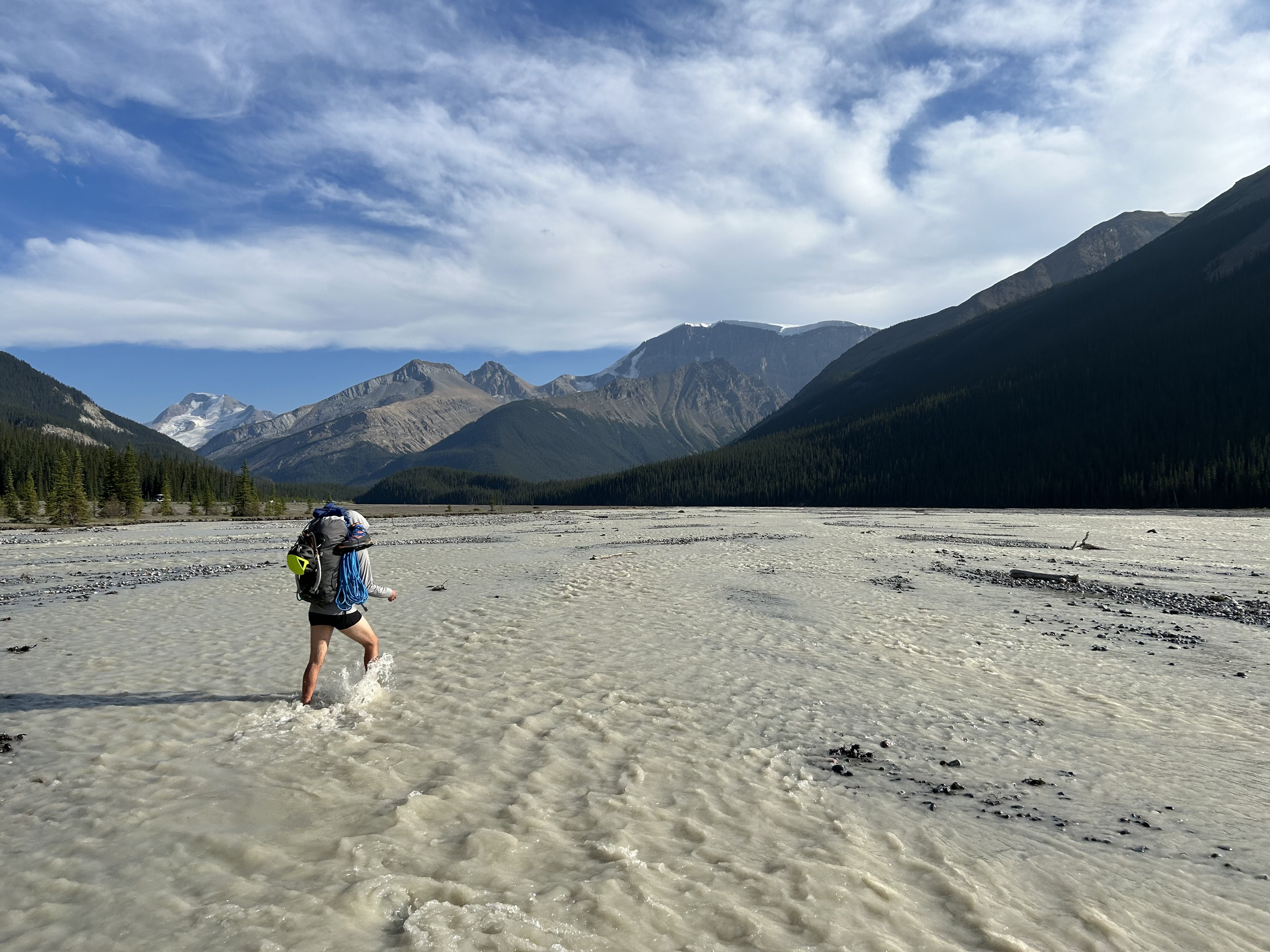
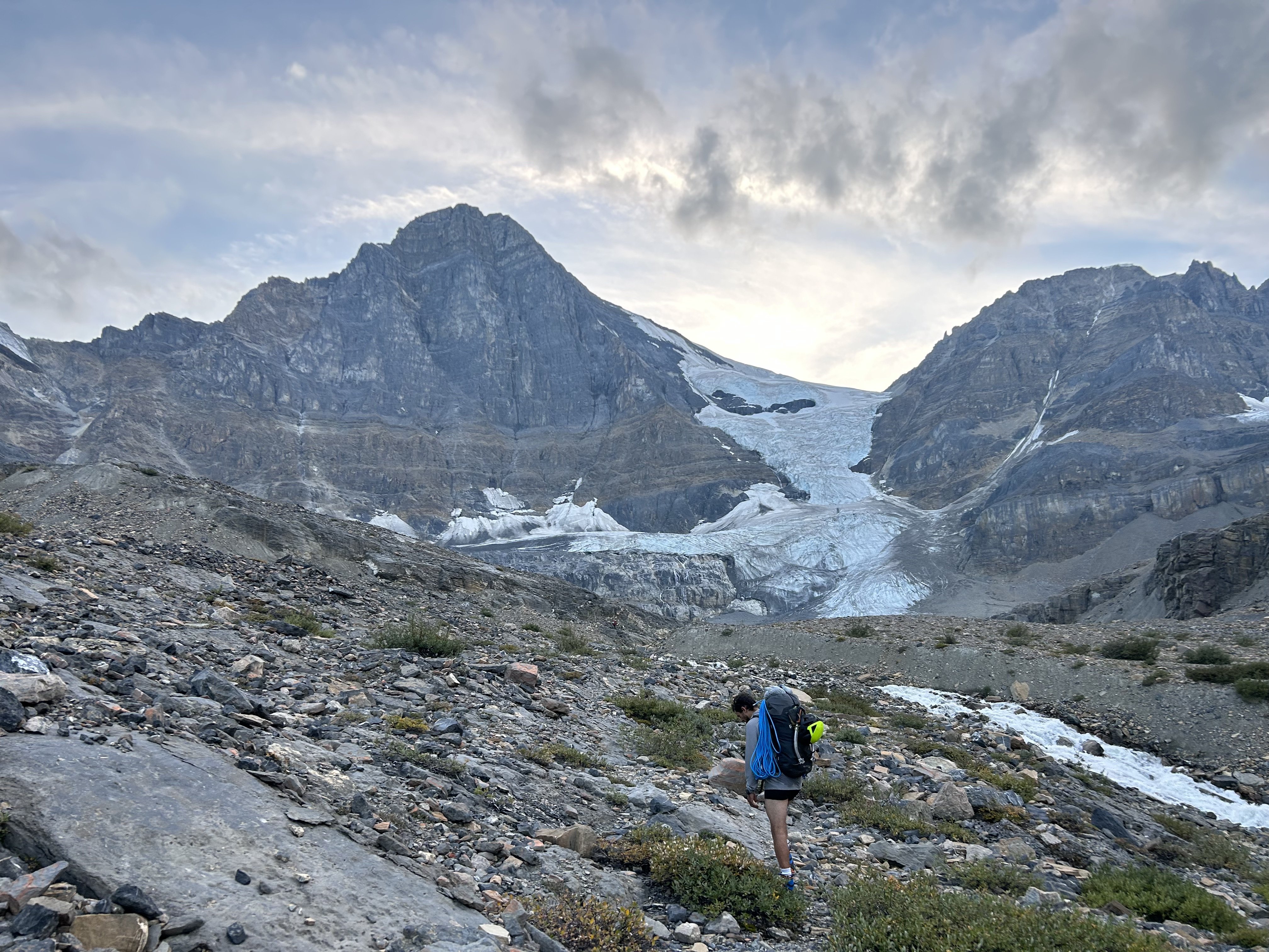
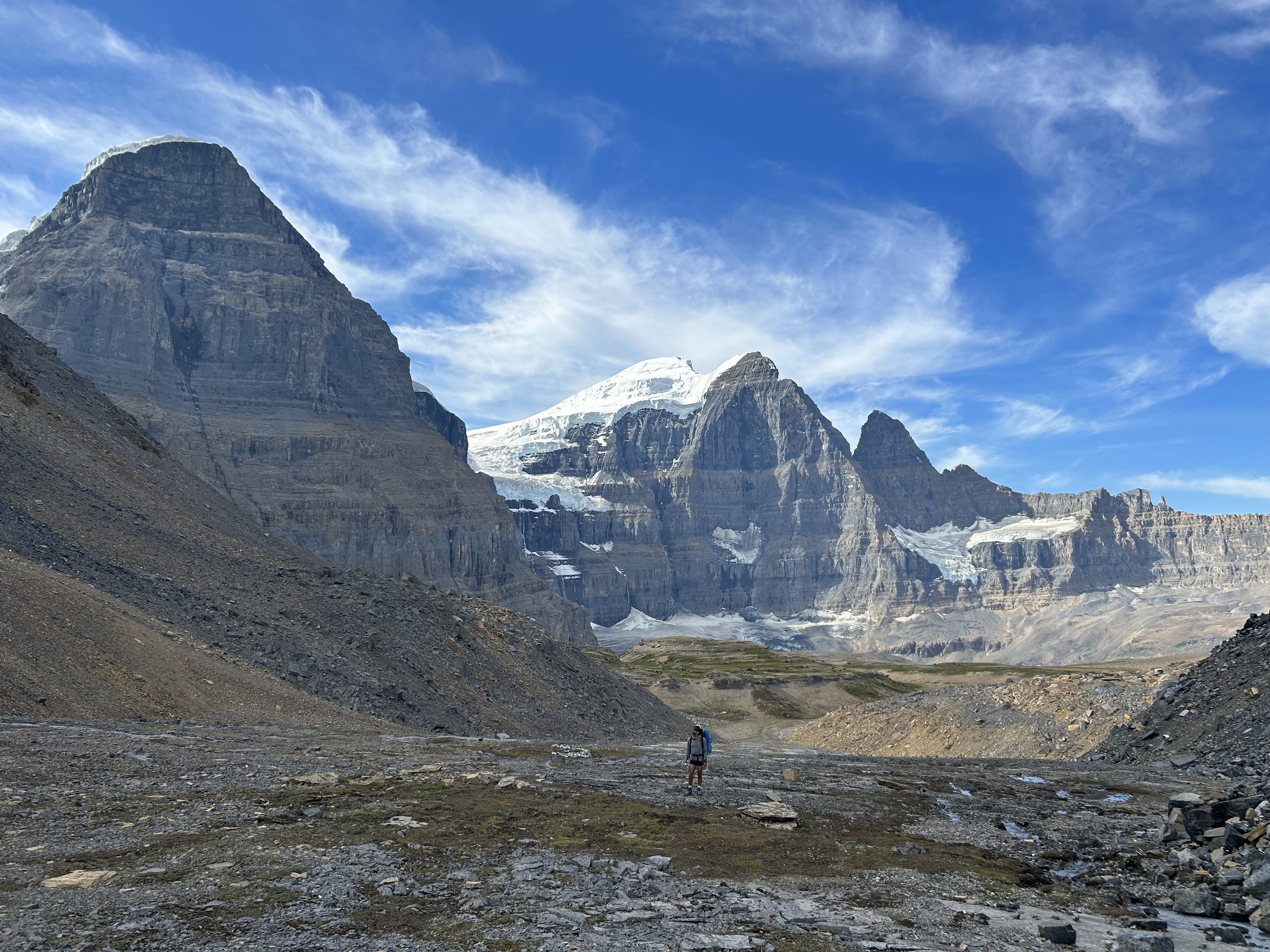
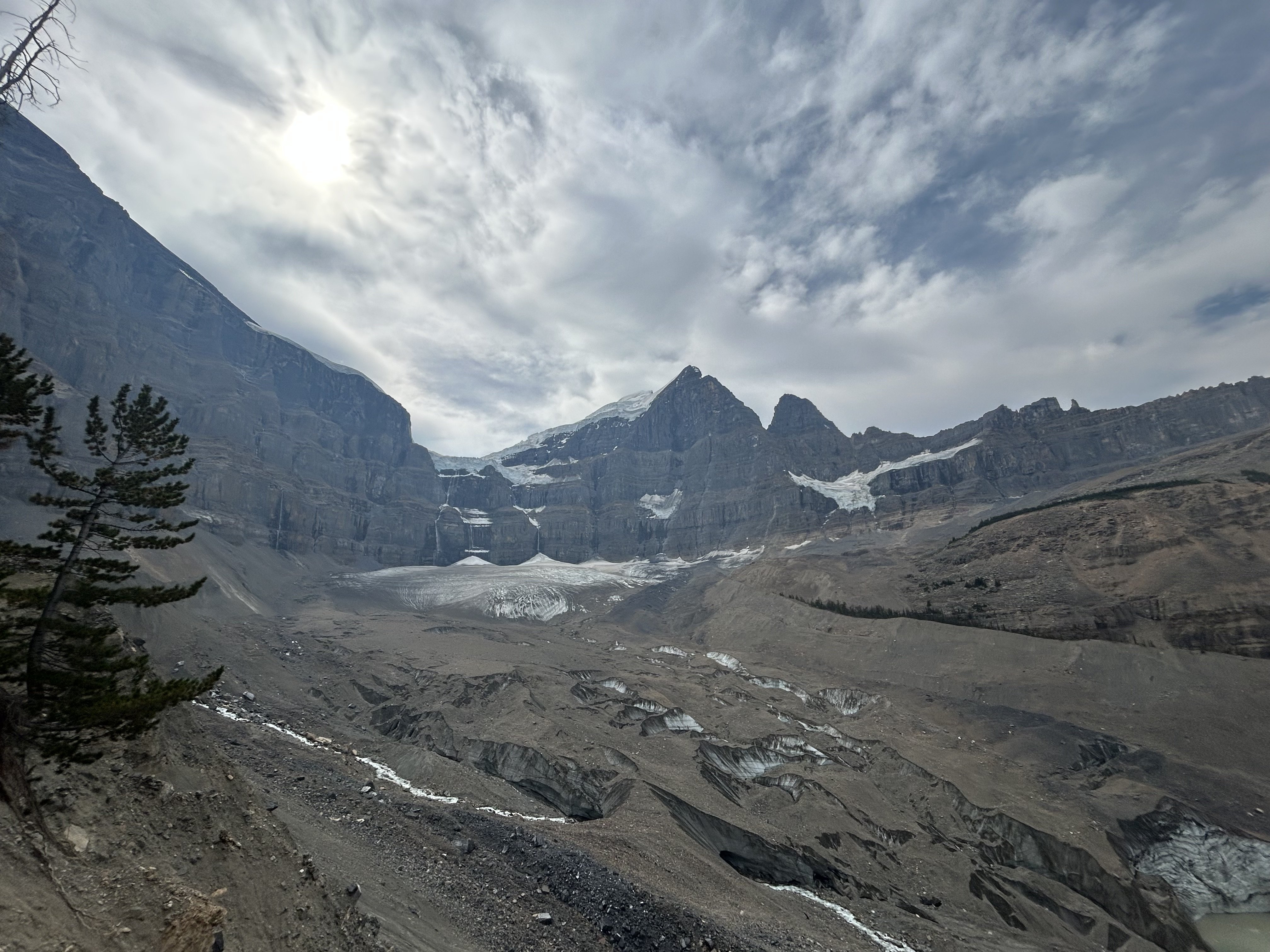
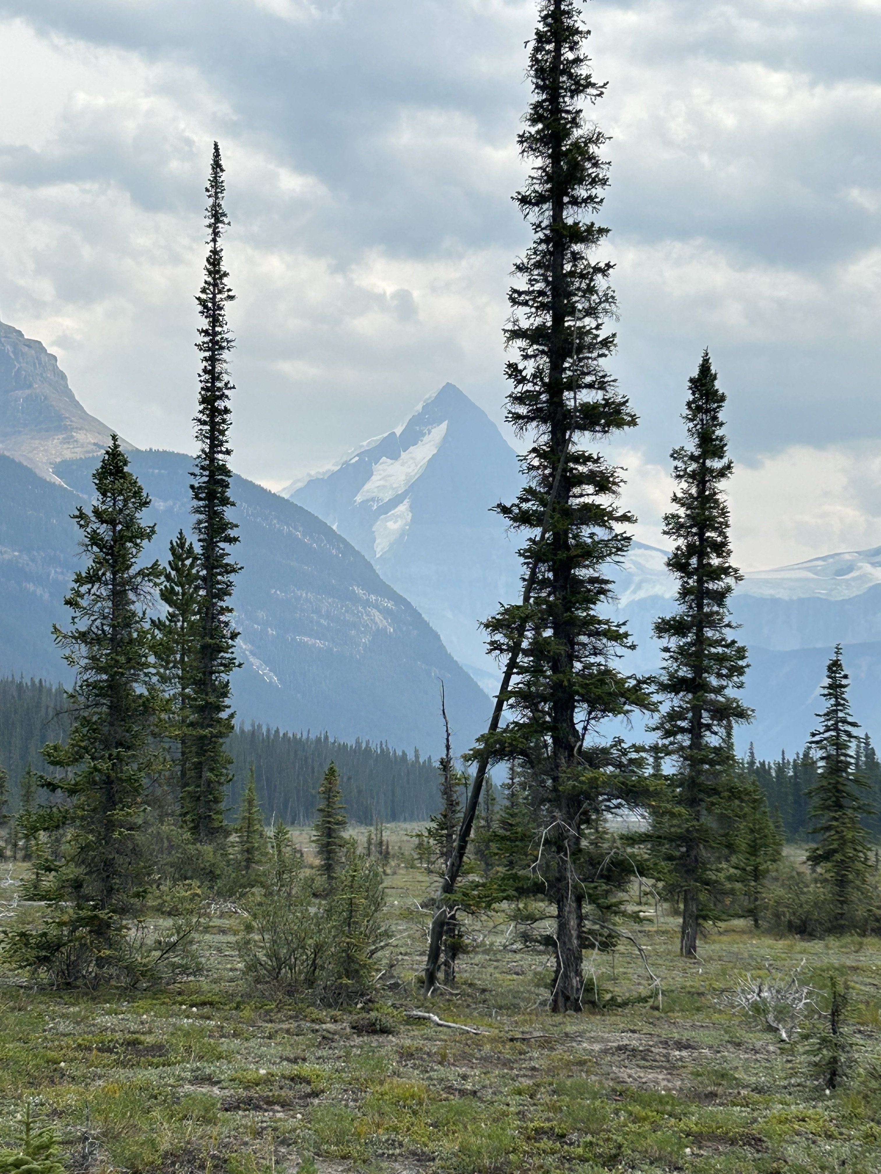
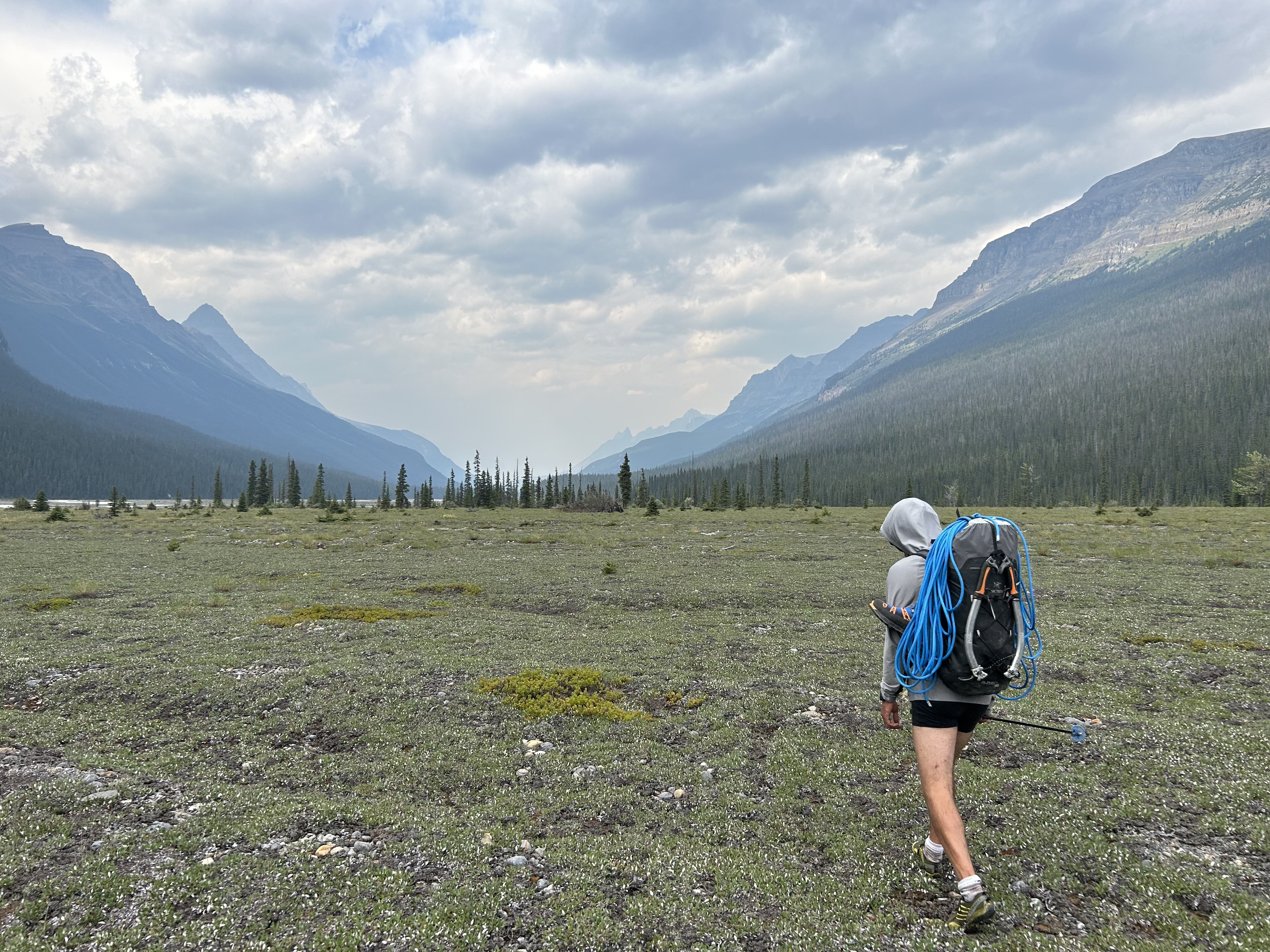
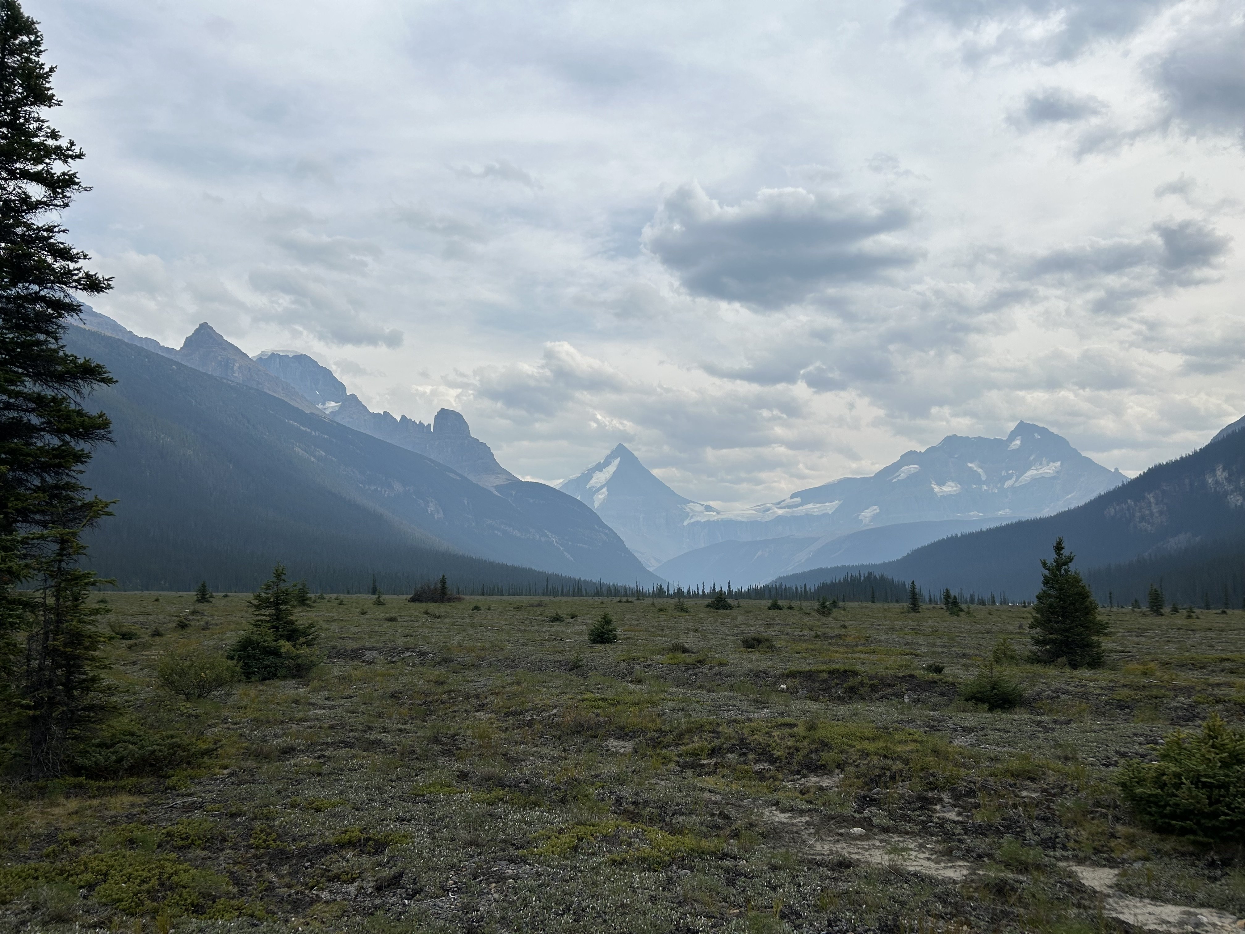
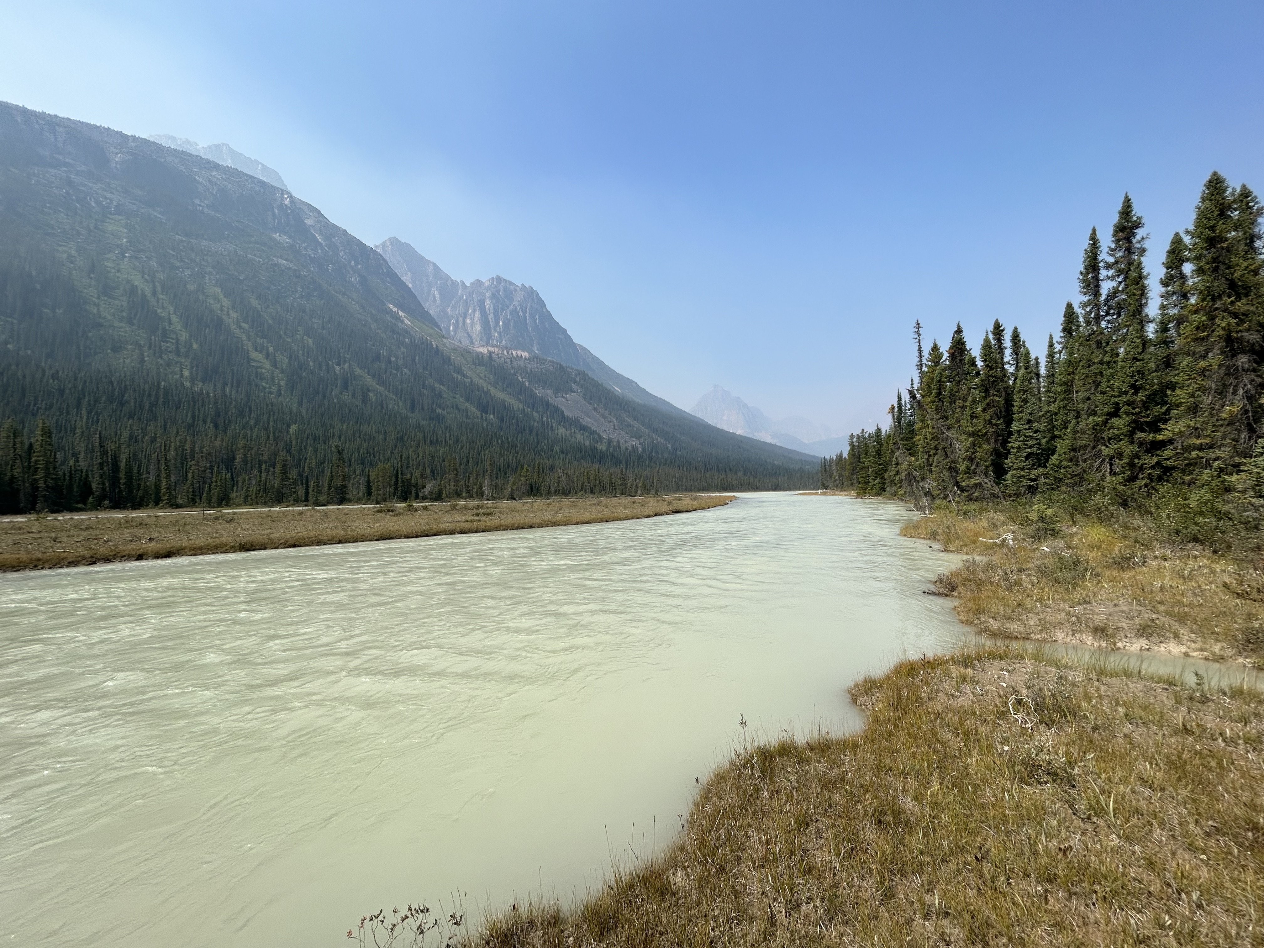
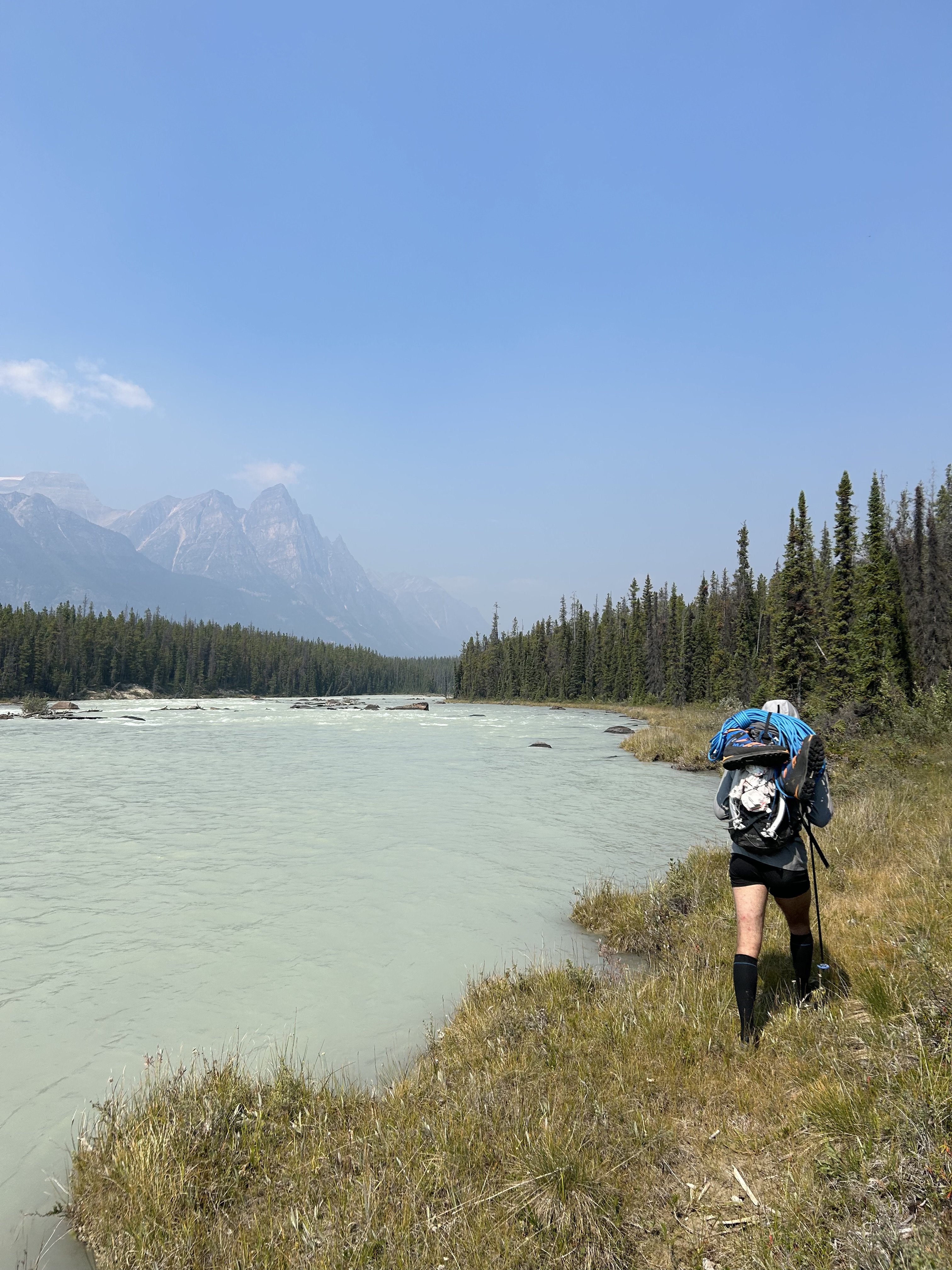
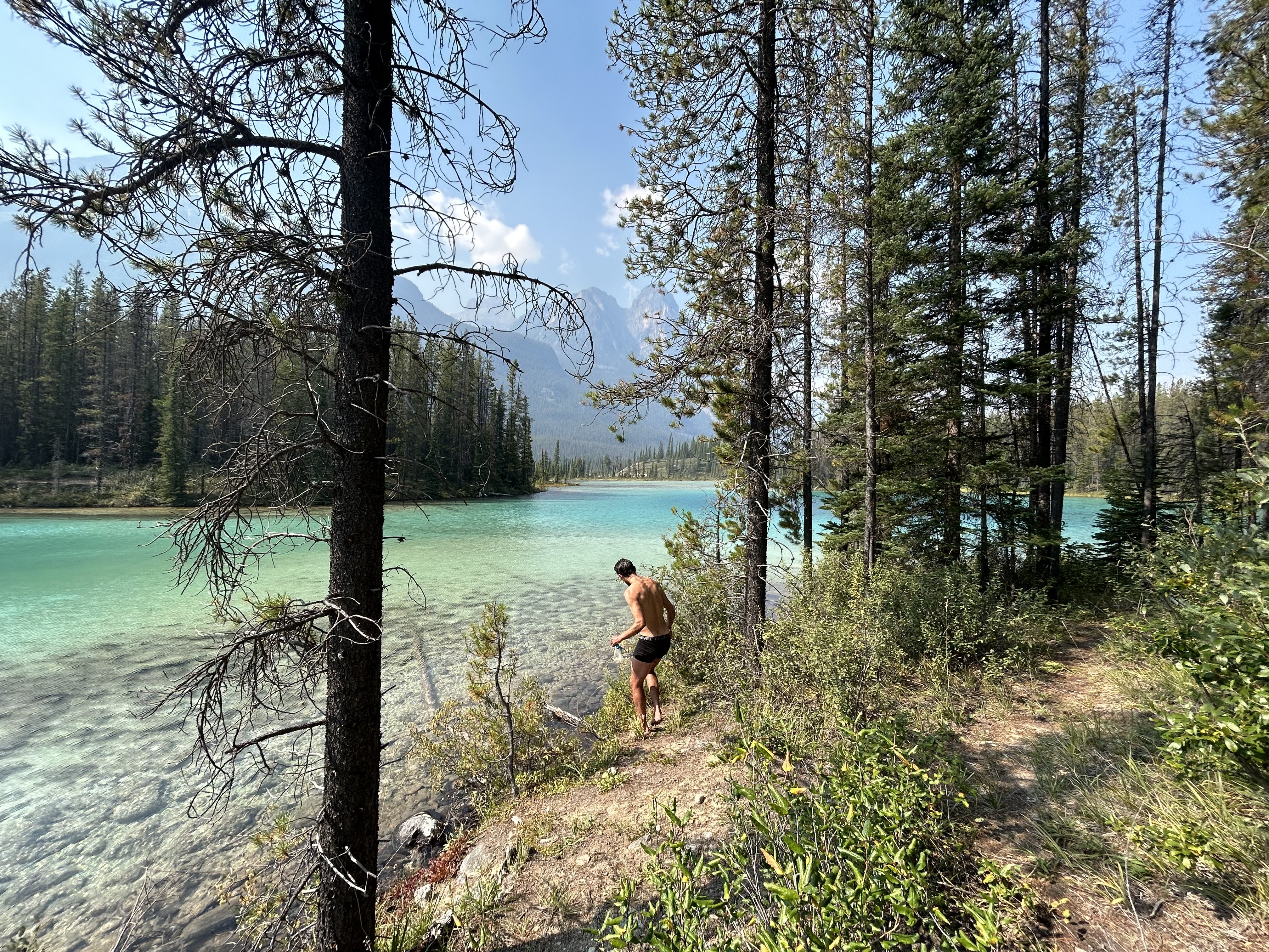
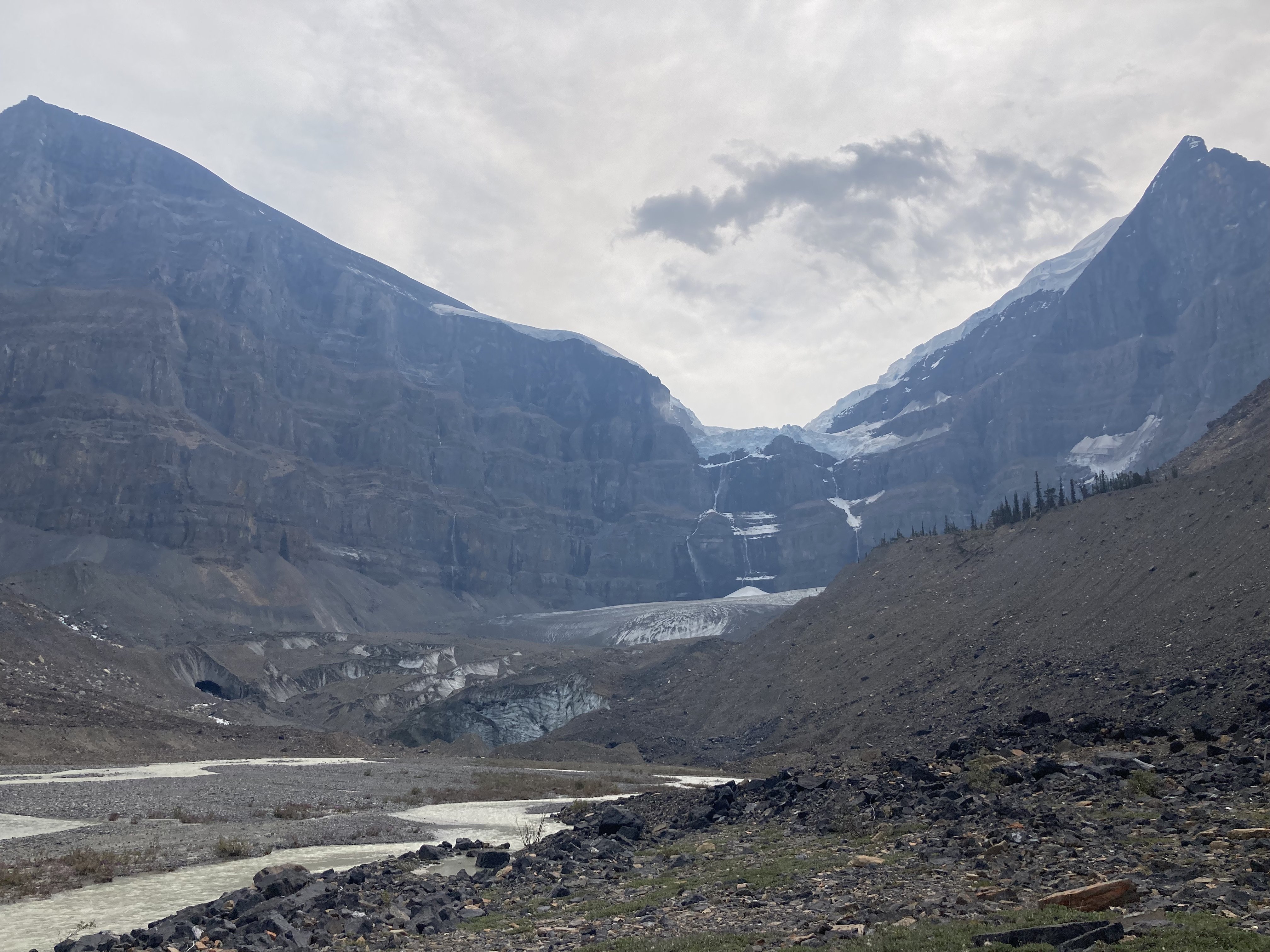
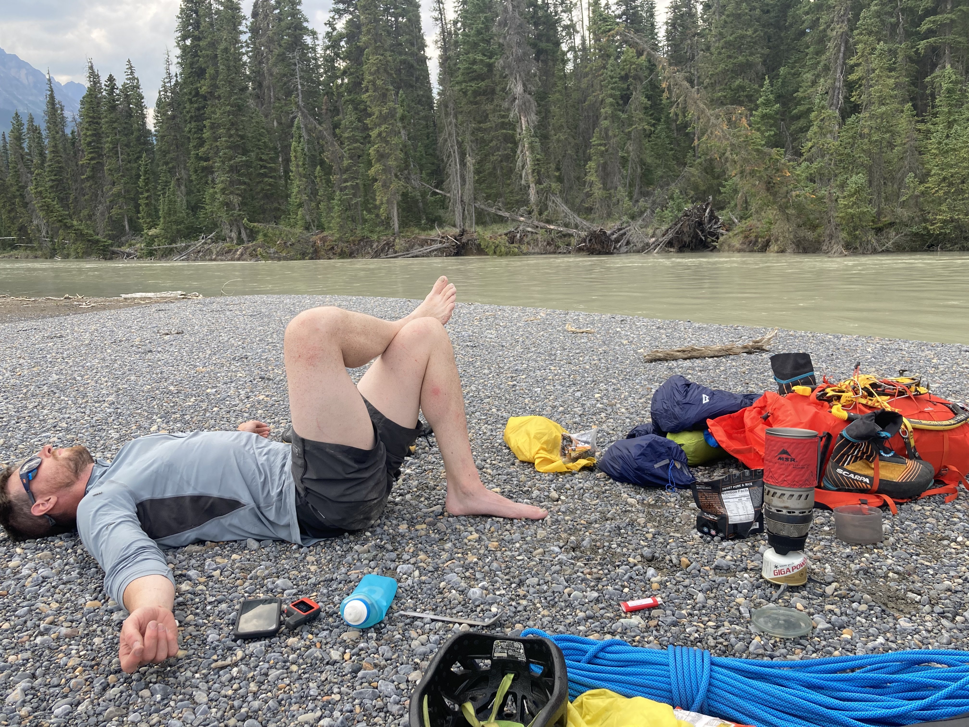
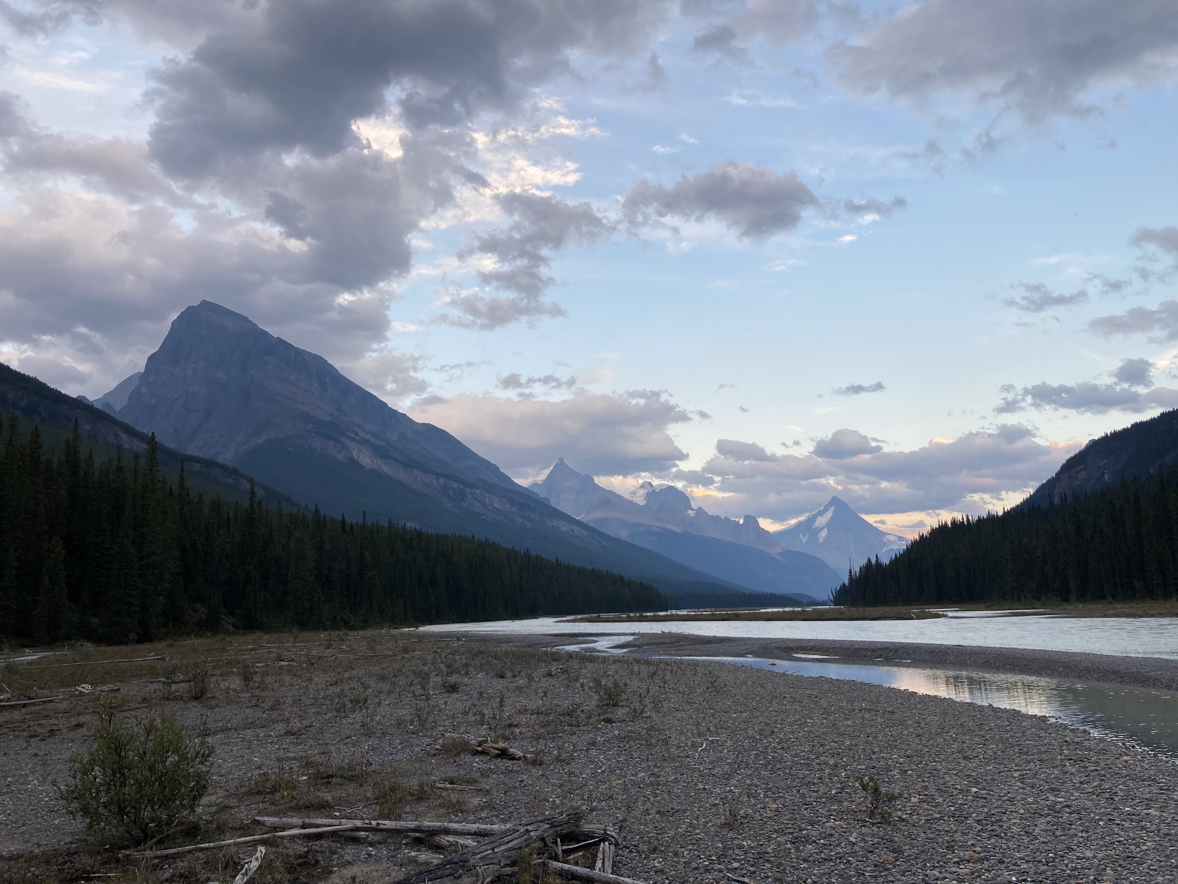
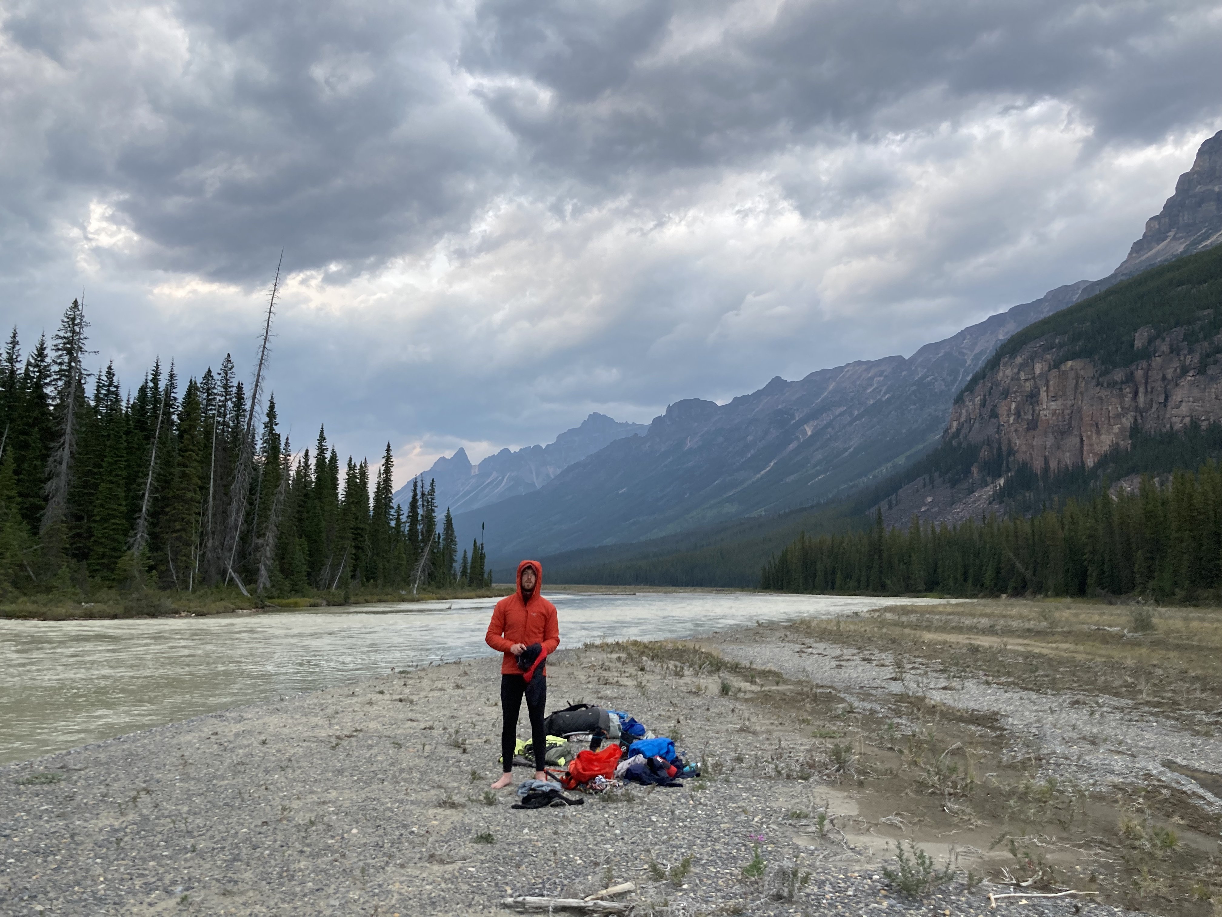
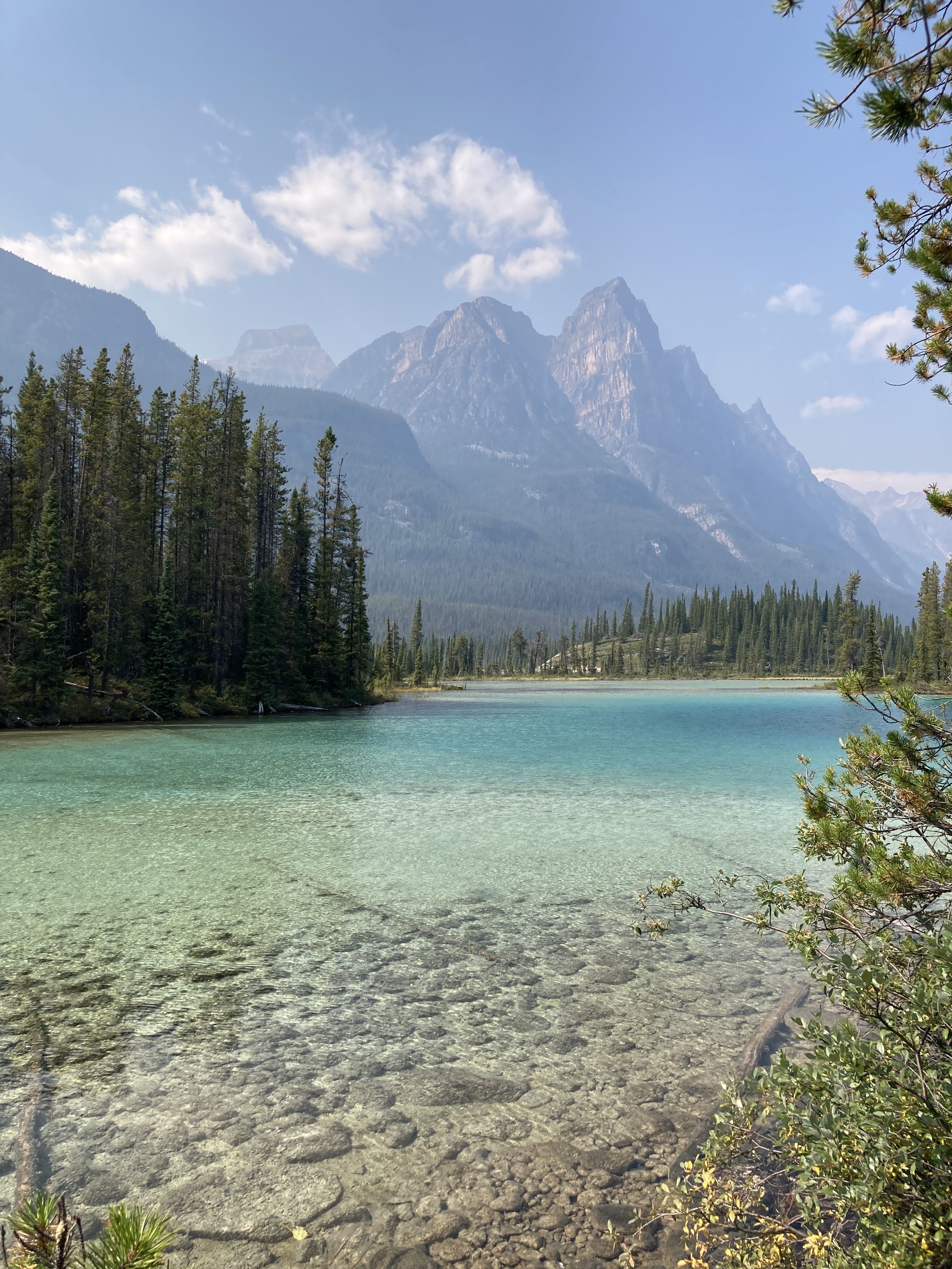
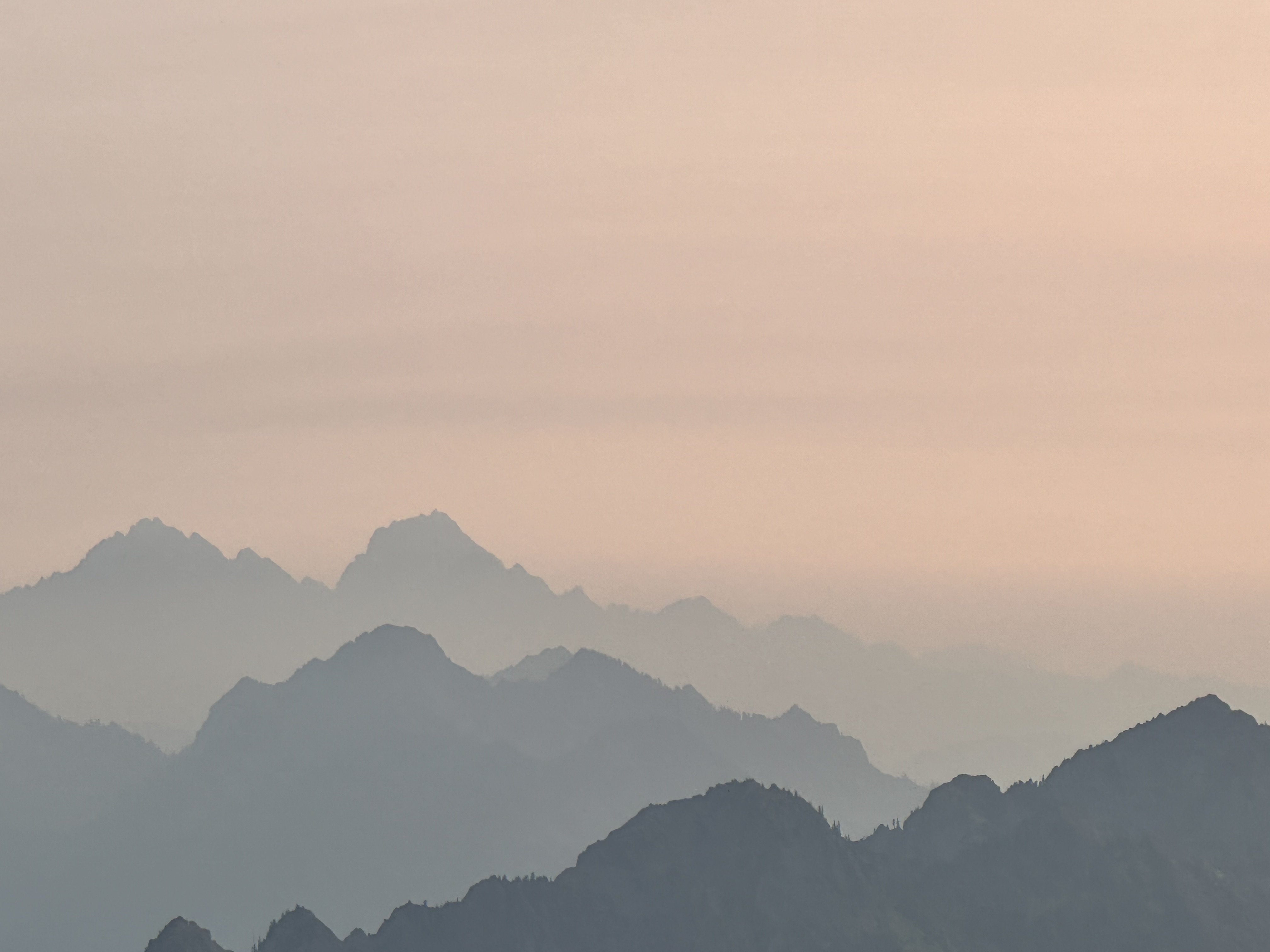
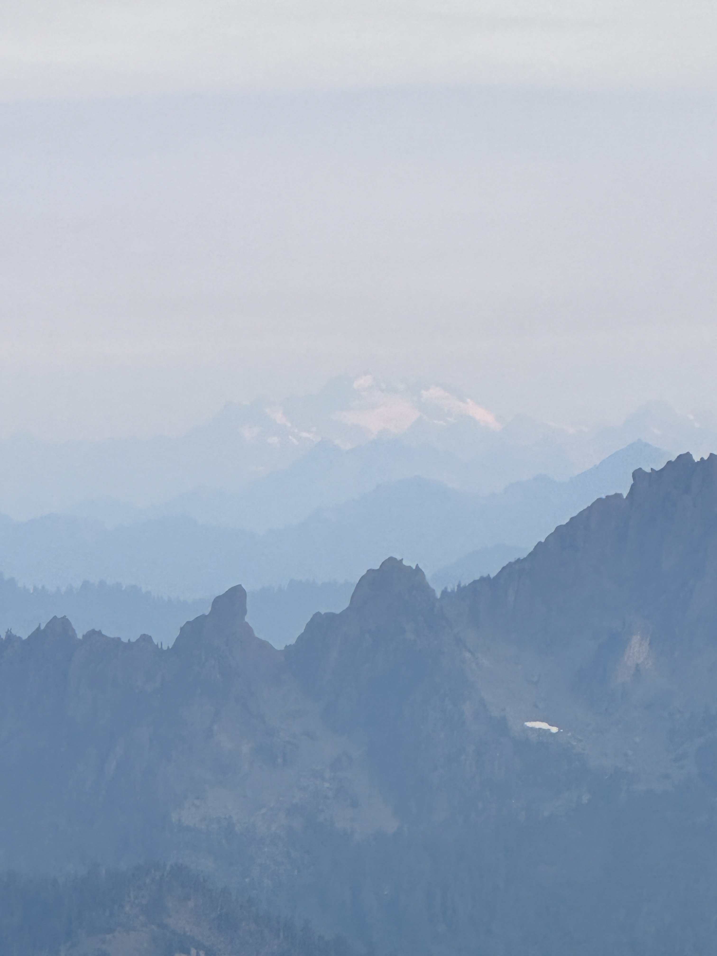
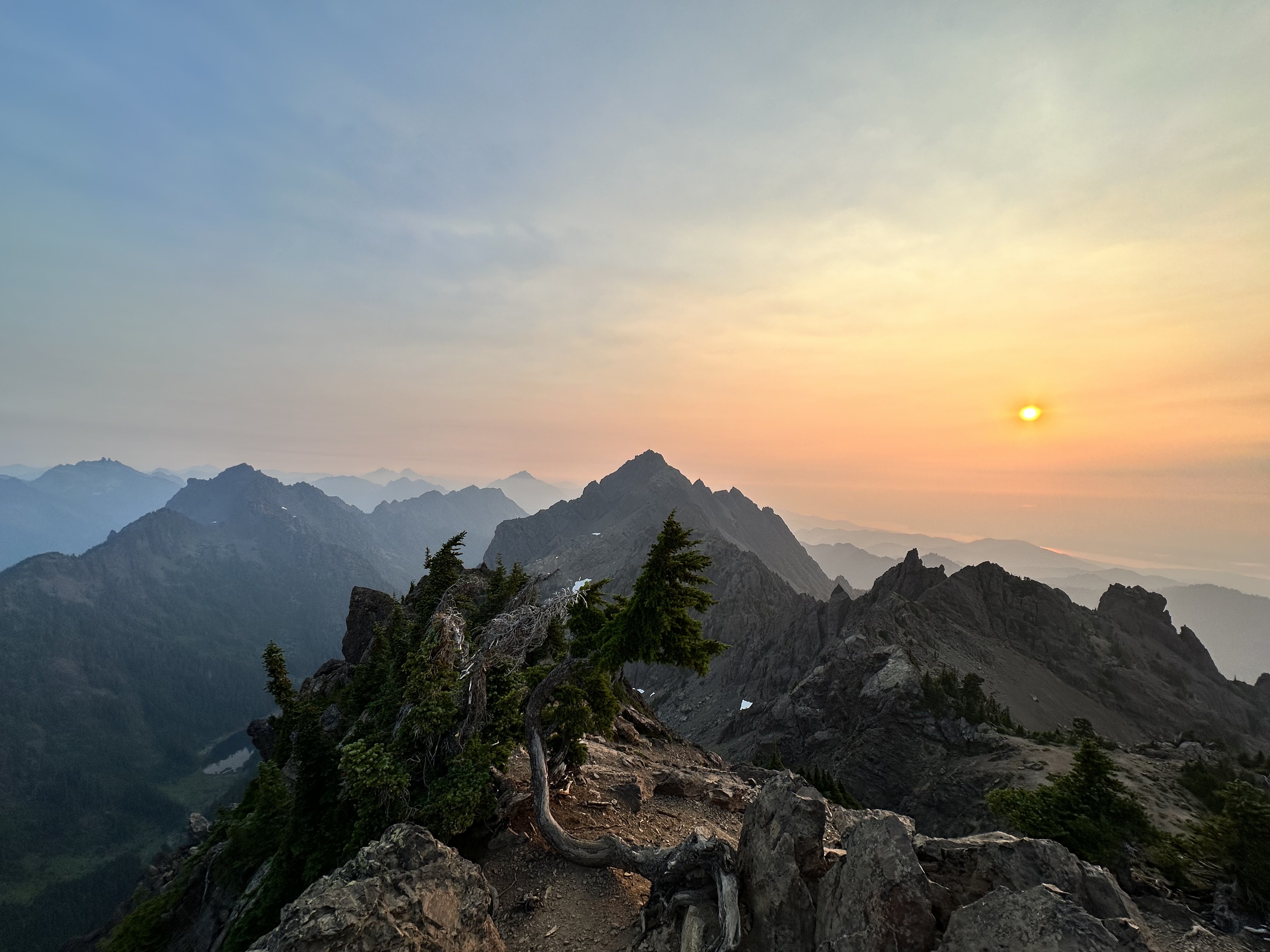
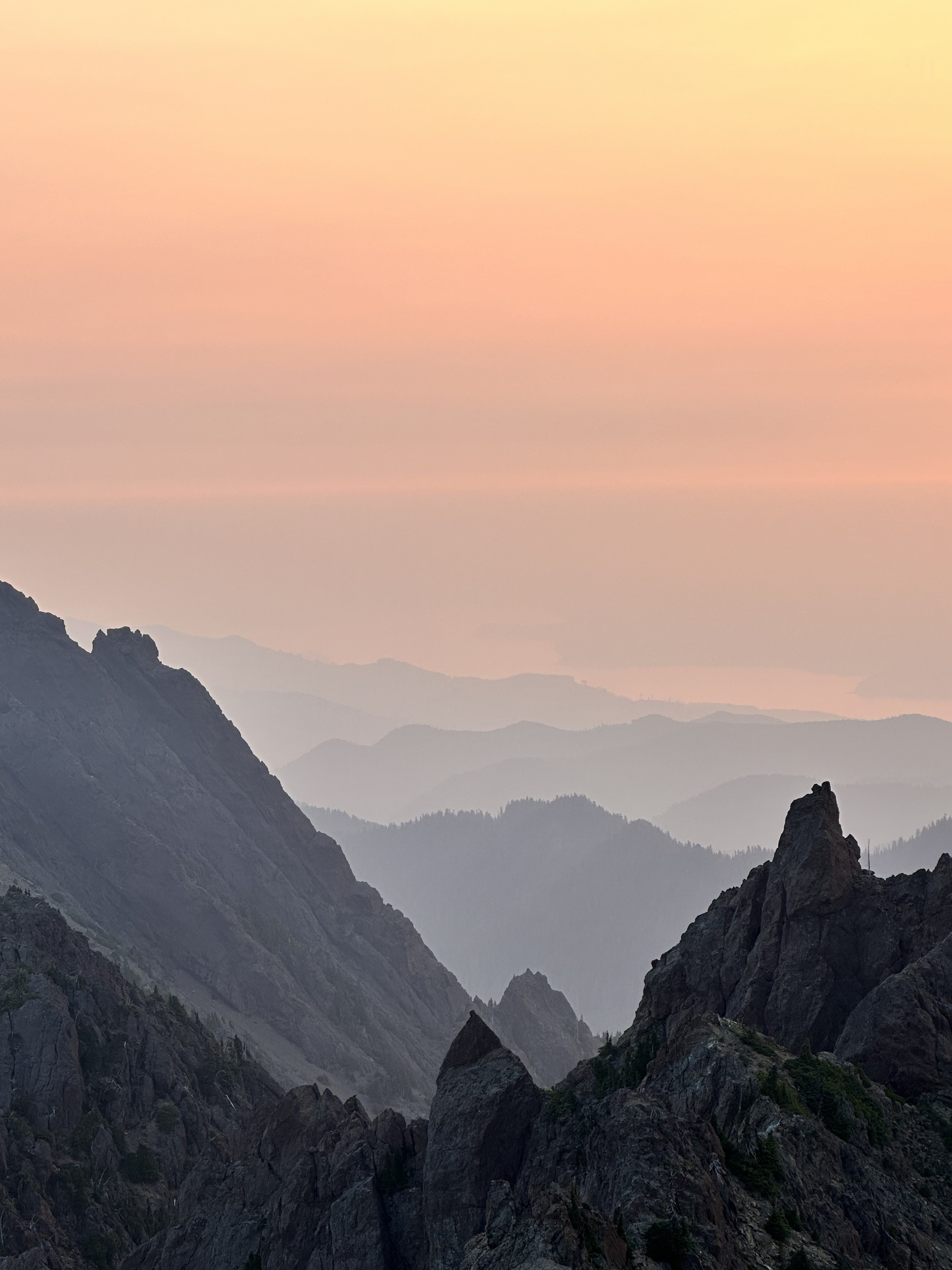
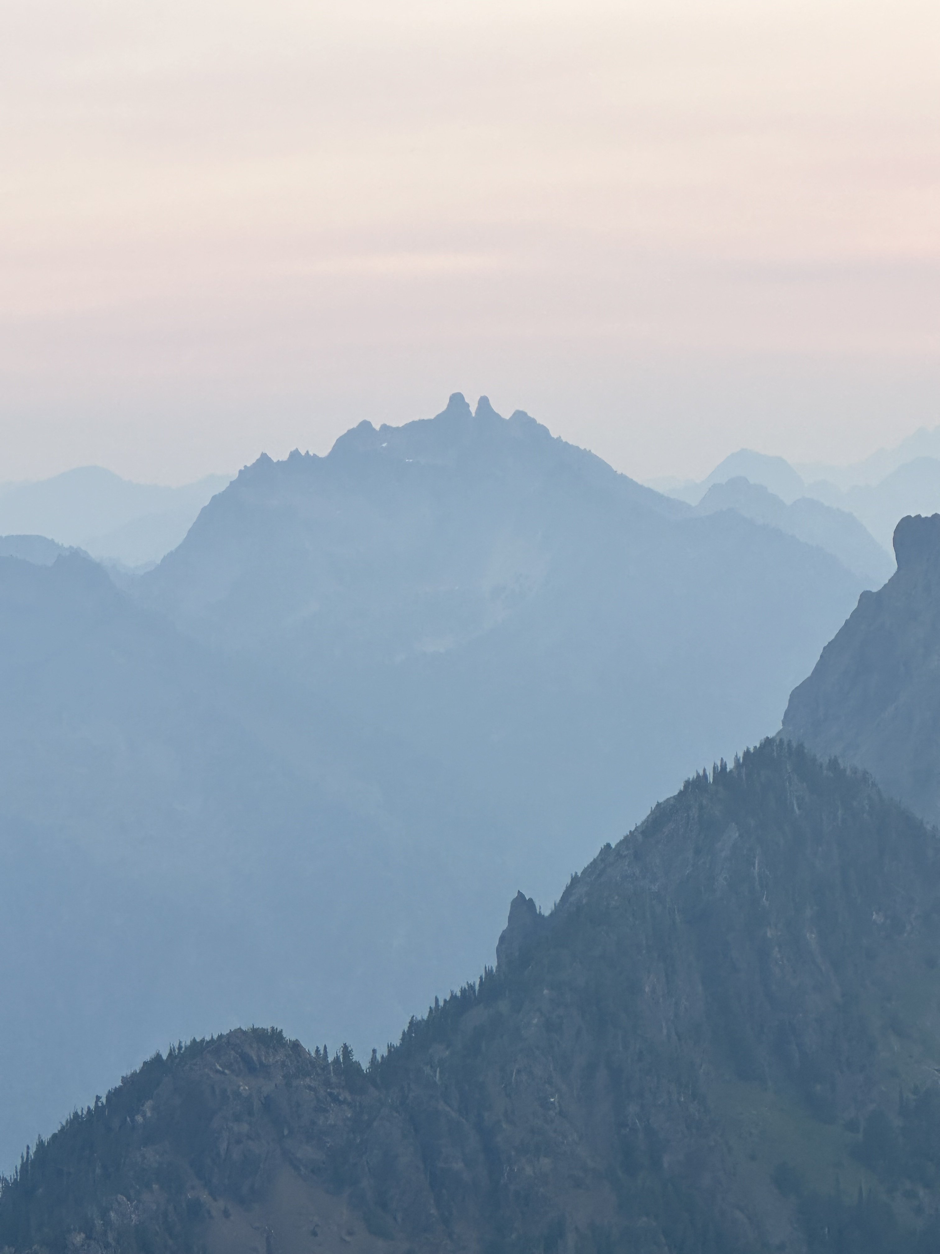
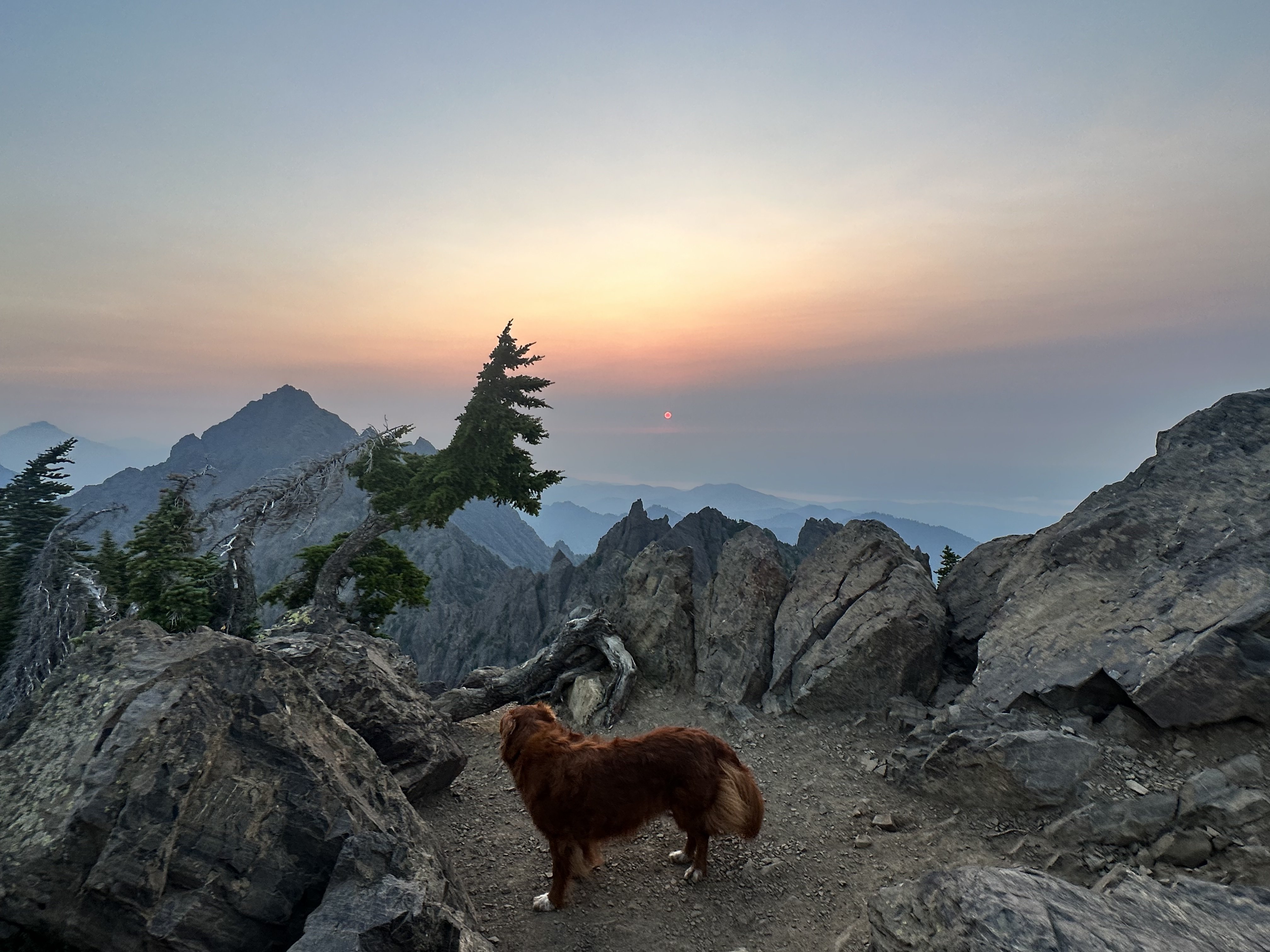
Trip: Canadian Rockies - Feeling down? Like you're in a Black Hole? I've got a solution for you: Go on an Athabasca Bar Crawl! Trip Date: 08/14/2023 Trip Report: Dallin Carey and I took the gear to go see about the North Ridge of Mt. Columbia. We were attempting to repeat this itinerary by Colin and Ian, albeit in much warmer/drier weather. Long story short, everything took longer than anticipated, there was much less snow/ice than anticipated, and we ended up doing the coolest backpacking trip of my life around some of the most incredible mountains on the continent. It was awful, but in a really good way. Day 1 - We got a later than anticipated start and hiked up and over Wooley Shoulder. Pretty much every source from climbers we could find just says "go up and over" with no mention of the shenanigans involved. This is only 5ish miles... It's also 4.5k' vert, involves wading a very cold Sunwapta River at the start, traveling over multiple glacial moraines and up some steep and exposed scree. We thought it would take us 3-4 hrs, but it took us 6 and involved some harrowing traversing on atrocious scree by headlamp. We didn't sleep until after midnight. Day 2 - We figured we had plenty of time to get to and up onto the N Ridge. Colin made it sound easy; how hard could it be? We started by traipsing through Sound of Music-esque meadows towards the North Face of North Twin. The topo maps were not revealing of the topography below and Colin's TR didn't mention this... maybe it didn't seem like a big deal since he was just hanging with a super-loc/guide who'd been that way before. Anyway, the meadows ended with a cliff of choss and a whole bunch of f*&%ery dropping thousands of feet down scree and forest to the raging torrent through more old glacial moraines that is Habel Creek... this is the actual Black Hole of legend. We wasted a good while figuring all this out and after down climbing, shwacking, and scree sliding we emerged creekside where the water pours out of the glaciers. Now we only had to wade the cold water, climb over more glacial moraines, and bushwhack out the creek, dropping another 2k' vert to the Athabasca River. This 4.5 mile section from our campsite to the Athabasca, which was entirely down hill, took us almost 6 hrs. I think I could shave an hour or two off this time with perfect beta, no more. As we emerged into the Athabasca River Valley, Habel Creek spread out over its alluvial fan creating swamps deep into the forest. We were wading through ice cold water filled with silt and simultaneously bush whacking. Breaks on gravel bars finally showed our route... no snow in the lower snow gully, bare ice on the lower snow field, massive black schrunds guarding the top, no ice or snow in the Scottish gully, big icy seracs overhead, and no snow at all on the ridge: climate change sucks a big one. It did not inspire confidence. Finally, while shwacking through more icy swamp water and having made 400m of progress in the last 30 minutes we decided to pull the plug. The N Ridge is probably the easiest(???) exit from the upper Athabasca to get over the Columbia Icefield and back to the car, we were well behind schedule and the likelihood of getting up the route was looking somewhere between Certain Death and Russian Roulette. We really didn't want to go back over Wooley Shoulder for a variety of reasons so Dallin suggested we could just follow the Athabasca River all the way out to the road... It's only 20+ miles of river walking, mostly with no trail. That sounded lovely, which gives you an idea of how totally F'd the other stuff was. We started wading back across Habel Swamp (as we had dubbed it), emerging on to gravel bars and made decent progress, walking/wading/schwacking in a much more leisurely manner until it was almost dark and we found a nice campsite on a gravel bar in the river. Day 3 - This day was delightful and felt like a pleasure cruise... If you consider constant glacial river wading up to your waist, swamp wading, moose/bear track following, and bushwhacking to be easy while carrying an alpine climbing pack and being swarmed by mosquitoes and horse flies. The average American would probably just lay down and die; a PCT thru hiker would probably declare us insane and never go back... but we did genuinely enjoy ourselves... though I still might not ever go back willingly. We finally stumbled out of the brush onto the so-called Chaba Cabin Trail and had a mere 12km of rolling single track to hike back to the Sunwapta Falls TH. A delightful young woman named Pam let us cram in the back of her live-in van (despite our stench and grime) for the 20 miles back down the Parkway to Dallin's truck. We then had to wade the Sunwapta twice at 8:30pm to retrieve our running shoes from the first day, which left us mildly hypothermic, and then the adventure was truly over. We cooked dinner at 9pm in the Ice Fields Visitor Center parking lot and watched rich old people sip their zina on the balcony of the $40 entree restaurant as the alpenglow faded over the Athabasca Glacier, which we had envisioned ourselves triumphantly descending after our rad send. Such is the roller coaster of life. Gear Notes: Light-weight running shoes for hiking were clutch. We did not use the tools, pons, rope, pins, cams, nuts, slings, or screws in any way. The boots were on my pack for all but the few miles up and over Wooley. In Colin's TR he hiked in his underwear as I understand he does from time to time to save weight. I cannot recommend this strategy in this terrain due to the sea of scabbed-over scratches that now forms the front of my legs, and the sea of massive red insect bite-induced welts that covers the back of them. Let's just say this may well be the first and last annual undies hiking trip for me. And also, screw you Colin! But maybe also thanks, for inspiring an awesome adventure. Approach Notes: Don't trust topo maps, don't trust Colin's TR, don't trust the rock, the scree or the dead trees. Definitely don't trust the deep holes between roots covered in 6" of moss that are totally hidden. Basically, don't trust anything you can touch, they will all betray you. Just become a wild animal, cease all higher levels of thought, and simply exist. This is the way. Pictures: These are mostly taken by Dallin, cause !!NEWS FLASH!! undies don't have pockets. Actually, we discussed in detail how Patagonia should make Colin Haley Limited Edition Approach Undies with pockets. But I probably wouldn't buy them. Well, maybe. Yours truly wading the Sunwapta. Screaming barfies for the feet. Yay. Yours truly approaching Wooley shoulder, Wooley peak behind. Yours truly walking down towards the Black Hole and the North Face of the North Twin. Looks easy, just go over there. Too bad you can't see the massive chasm of glacial, torrential, choss gnar that splits the ground just after the lovely marmot meadows. Almost down into the Black Hole. The moraine in the left foreground gives an idea of what the last bit down to Habel Creek was like. In the Black Hole after fording Habel Creek. Note the thousand foot waterfall getting blown sideways as it falls off the Ice Field. Finally getting views of Columbia. Phones take crap photos but very little snow, lots of exposed ice, more exposed rock. Blah, blah, blah. We are chickens. I have dishonored you Dave Cheesmond. We are unworthy. Forgive us. Let the scenic river cruise begin... The Athabasca Bar Crawl! Miles later this is still the alluvial fan coming out of Habel Creek and the Black Hole. We thought the whole thing was going to be connecting stuff like this. River views back towards Columbia. Dallin avoiding mosquitoes at our camp location for the night. He's wearing full alpine winter kit despite the fact that it's like 70F. Following what we called the Moose Highway. There were clearly many moose. Also bears. We did not see them, thankfully. But their tracks were numerous. Dallin almost stepped on a porcupine the size of a golden retriever. I may be exaggerating that last bit, but it was huge. Dallin at a rest stop on a gravel bar. Kinda speaks for itself. Swimming at a cold lake shortly after hitting the trail. Glory, glory, we are free at last! The lake was pretty. Then we walked a bunch more. Then it was over and we didn't die. The end.
 2 points
 -
I've been reading The Bold and Cold by Pullan after my Rockies trip and it got me thinking about what a similar list would look like for my home range... the Oregon Cascades. For those that don't know, the Bold and Cold is 25 climbs, 5 groups of 5 routes, in the Canadian Rockies. Each group is supposed to be training for the next tier. The list was developed by famous climbs Urs Kallen and Dave Cheesmond. The five categories in the book are: Shakedown Routes, Maiden Routes, Middle Earth Routes, Galdiator Routes, Titans. All the routes are quite serious and the categories progress in commitment, length and remoteness. The crux pitch grade seems to have little to do with it. I think it would be fun to make a similar list for Washignton or the North Cascades... I think the routes would be more diverse there and the "Titans" category would actually be a bit more legit. Though still no where near what the Rockies offer. Curious to see other folks routes. Maybe for other ranges too. Here is my incomplete list. It is grouped more by category as that seemed to make more sense for this range. The Dumb and Chossy: Routes in the Oregon Cascades Crag Routes: (could include some from Smith, Beacon etc. here but wanted them to actually be in the range, once you add those two the list is kinda endless, any other multi-pitch adventure routes in the Oregon Cascades that form a decent challenge?) Exploring the Axis, Cougar Crag Dod Route, Turkey Monster Barad Dur, Wolf Rock (mostly) Snow Routes: Reid Headwall, Hood Thayer Headwall, North Sister High Noon, Broken Top Jeff Park Glacier, Jefferson Right Gully, Hood Technical Mountain Routes: (need one more, but Oregon is pretty lacking is this dept unless you have suicidal tendencies) West Ridge, Illumination Skylight, Illumination West Ridge, Washington East Buttress, Washington Ice Adventures: Eliot Headwall, Hood Center Gully, Hood Full Richardson, Broken Top Fric/Amos, Hood Emde/Ablao, Middle Sister Big Lines: Yocum Ridge, Hood Complete East Buttress, North Sister Arachnophobia, Hood Brainless Child, Thielsen After Image, Strawberries (not technically in the Oregon Cascades or in character with the others but I wanted a 5th and this is head and shoulders above other routes in sustained technical difficulty, and more remote)1 point
-
Trip: mt ellinor - summer trail Trip Date: 08/27/2023 Trip Report: Kiba and I hiked up the summer trail Sunday morning, joining the other million of visitors this peak has every summer. I've always avoided Ellinor and Washington because of the crowds, so I've never been up either before, but due to the fact that I had never been plus that I could bring Kiba....well we had nothing better going so we went up Sunday morning. Its just a less than two mile hike, but still a cool position to view the rest of the Olympics. The trail is unreal, especially up higher. The Mt Rose Trail Crew really put in an insane amount of work to make this accessible to the masses that go up in every year. How many bolts did they drill to put in the wood steps? Also just some innovative trail building methods in use. Also...the first via ferratta I've even seen the Olympics! Webbing hanging on bolts right by their trail tool box or whatever it is. Anyway, while it was smokey, we watched the sunise from near the summit and saw all my old mountain friends. The Sawtooths and Cruiser, Mt Olympus holding court in the distance. Mt Skokomish, Stone, Lena, Bretherton, Constance, the Bros, etc. I think it would be fun to climb Ellinor with a guide as recommended at the bottom of the comment section here: https://www.summitpost.org/mt-ellinor/151552 What do you think Bob would charge to guide you up Ellinor? What do you think Bob looks like? I'm going to guess he will be wearing a hickory shirt, arms cut off at 3/4 length. Wearing Romeos, and Carhartts with holes in them. Or at least that is how hope he would look like. Maybe a can of Copenhagen. Due to inflation I could see Bob charging you $200 plus a 6 pack of Hamms. Gear Notes: wear shoes Approach Notes: fine European trail
 1 point
 -
Trip: Bearpaw Mountain and Church Mountain - Uh, whatever Trip Date: 08/19/2023 Trip Report: Looking for an easier day after some hard trips and also breaking in a new partner I settled on the very much discussed but seldom climbed Bearpaw Mountain, with a side of Church on the way out. We quickly hiked up the Church Mountain trail then at the meadow turned up slope and went cross-country crossing over several ridges towards Bearpaw Mountain. The final scramble of Bearpaw is a couple moves of easy class 3 along the ridge, there is a trail from the saddle above Church Lake. The entire area was devoid of humans, very pretty, and lots of fun cross-country rambling, generally very easy. We discovered a surprising and very distinct outcrop of limestone that is very interesting and just rock is not common in the North Cascades. After Bearpaw we decided to take the easiest line and dropped to Whistler Lake, passing several lakes and wandering around the meadows at around 5600 ft. From kidney lakes we ascended to the notch on East Ridge of church mountain and joined the standard scramble route. I haven't done this in many years and summer conditions and it was a bit more complicated than I remembered but still not more than class 3. After the summit we headed down the standard route, over the church lookout, and down the trail to the car. The whole trip took 9 hours over about 13 mi and 6, 000'. It was a great day out in our mountainous backyard (for Bellinghamsters) in an area that I've talked about going to for years but never gotten around to doing. More of a cross-country high route days and actual peaks but very enjoyable! I did this TR on my phone and can't figure out how to put spaces between the photos, it's not actually one vertical panorama. Note: this whole report took me about 10 minutes, so let's see your reports! Gear Notes: Trail shoes. Poles. Approach Notes: Church Mountain trail. Made it to the trailhead in a Pontiac Sunfire, the creek crossing required some driving skill.1 point
-
The crowds were heinous, as to be expected on a "50 Classics" climb, but it was a wonderful day out. I already want to go back to the Tetons... Full TR here: Grand Teton – Complete Exum (III 5.7) – SPOKALPINE1 point