
Leaderboard


Popular Content
Showing content with the highest reputation on 08/22/23 in all areas
-
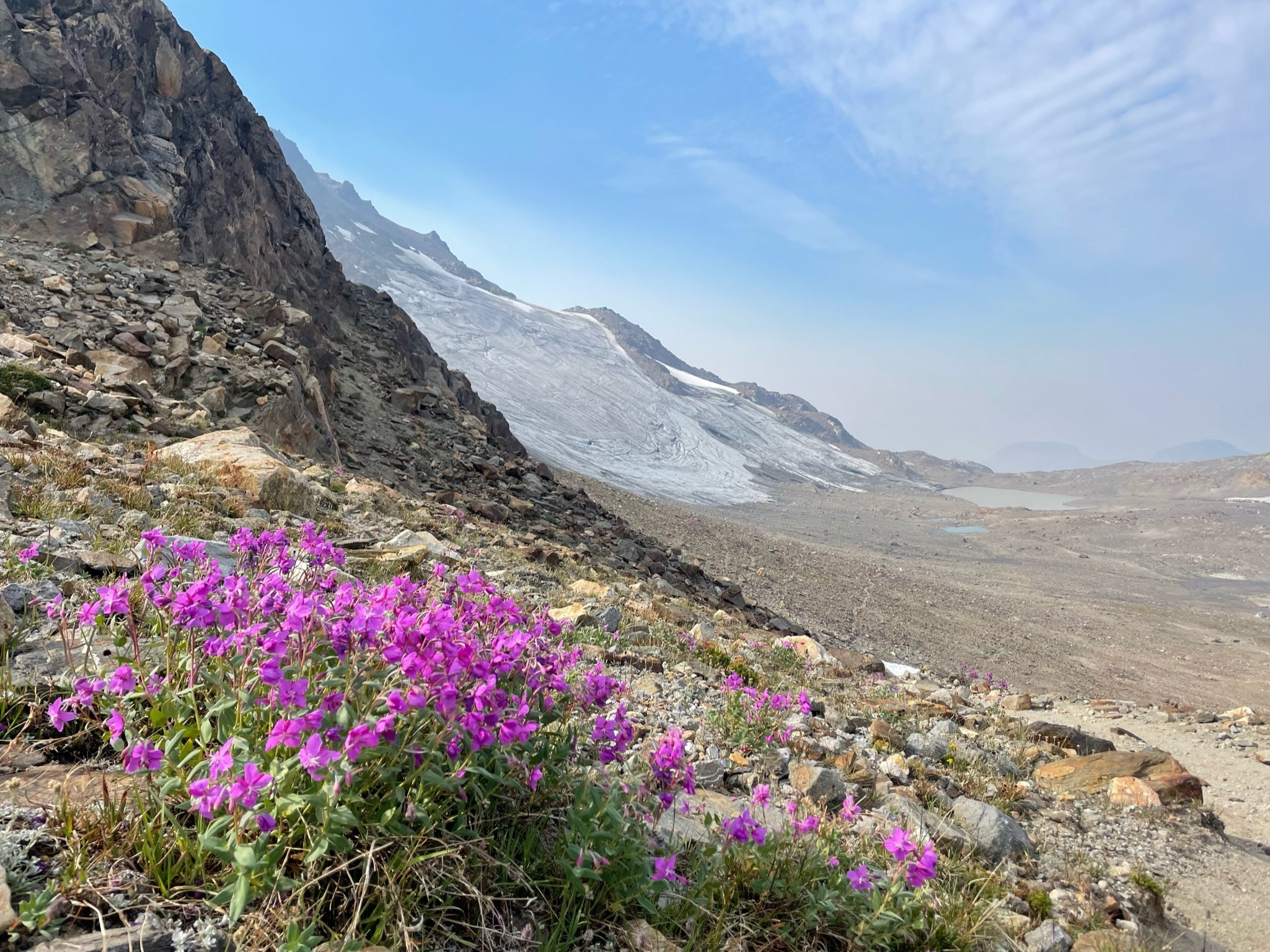
Trip: Graywolf Ridge to Walkinshaw - Standard Trip Date: 07/16/2023 Trip Report: When it looks like a hot and hazy weekend, I often catch myself looking west to the Olympics. If the Cascades are baking and smokey, the Olympics can often be a good deal cooler and clearer. Such was the case a couple weekends ago when I was casting about for solo trip options for a couple days. After reviewing a too warm (for me) forecast for the North Cascades, I settled on a traverse of Graywolf ridge to Walkinshaw. My brother, @ZakG , signed on last minute, gear considerations and meeting time discussed, and we met early on a Saturday to catch the Edmonds ferry to Kingston. The hike up to Baldy was uneventful, if steep, warm and muggy. We lunched on the lower false summit and headed up to the true summit for mug shots and a gander at the route ahead We had only seen a couple people so far on the trip and we headed off into solitude to the top of Graywolf For whatever reason, the USGS marker on Graywolf looked immaculate and solid gold, despite being placed in 1930??! And then it was off to South Graywolf, and our bivy for the night. Strangely, we couldn't find any flowing water below the large snowfields on the peak, and had to scrounge slushy water from a depression near the base of one. Water is an issue on this ridge! We arrived on the summit of South Graywolf in the late afternoon and settled in for a beautiful evening. Great flat summit for a bivy, but no shelter and no water nearby. The night was clear and relatively calm, with no snaffles. We awoke to another beautiful day, though it promised to be warm. Off we headed to Walkinshaw. We stopped at the col south of South Graywolf to drop our overnight gear. Lo and behold we ran into a soloist, Derek, from Longview, WA. I'm not sure who was more surprised. And so, being neighborly, Derek offered to join forces with us to keep rockfall under control. We had a great time getting to know each other, while conferring over the best way upwards. It was a bit steeper than any of us were expecting but never really severe. There was maybe one small section of 4th class low down on the face, but mostly it was reasonable, if exposed, Cl. 3 ground. The rock was solid, for the Olympics, but a helmet was definitely warranted. Within an hour or so, we found ourselves on top. Anybody know who these "Truckers" are who placed this register Cool peak history in there... And great views into the Needles After almost an hour on top we carefully retraced our steps down the peak and back to our gear. We bid Derek adieu as he headed up South Graywolf, and we hammered the knees down to the Royal Basin trail. No brush on the descent from the South Graywolf-Walkinshaw col (if you are on the right path), but plenty of hard dirt and cemented scree- we were glad to be down that slope and onto the unexpectedly pleasant trail. I had forgotten how nice it is! And then, the usual- chips, beer, change of clothes at the car, followed by battling the masses back to the busy Puget lowlands. 2 hour ferry wait! But a pleasant weekend all around.... Gear Notes: Boots, poles, helmet, maybe ice axe and crampons early season Approach Notes: Baldy trail up and Royal Basin trail out1 point
-
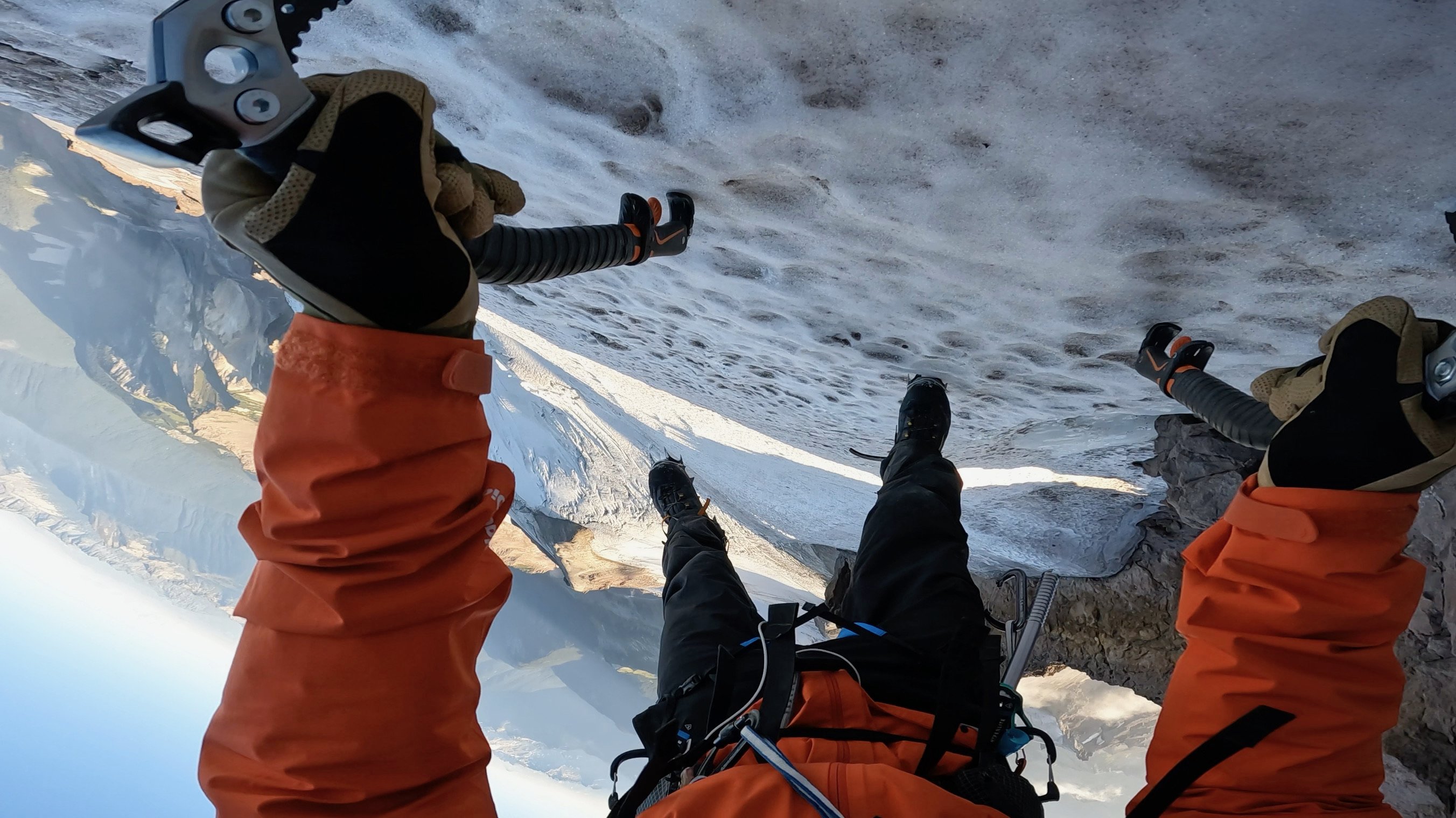
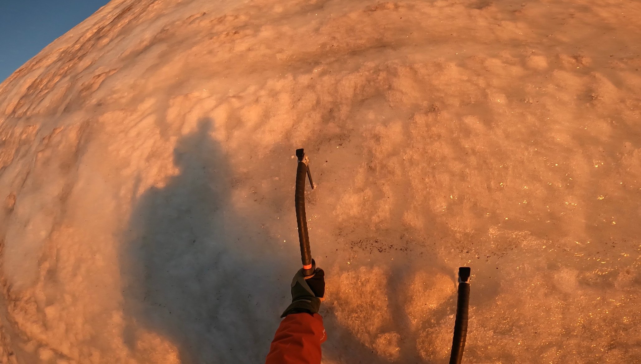
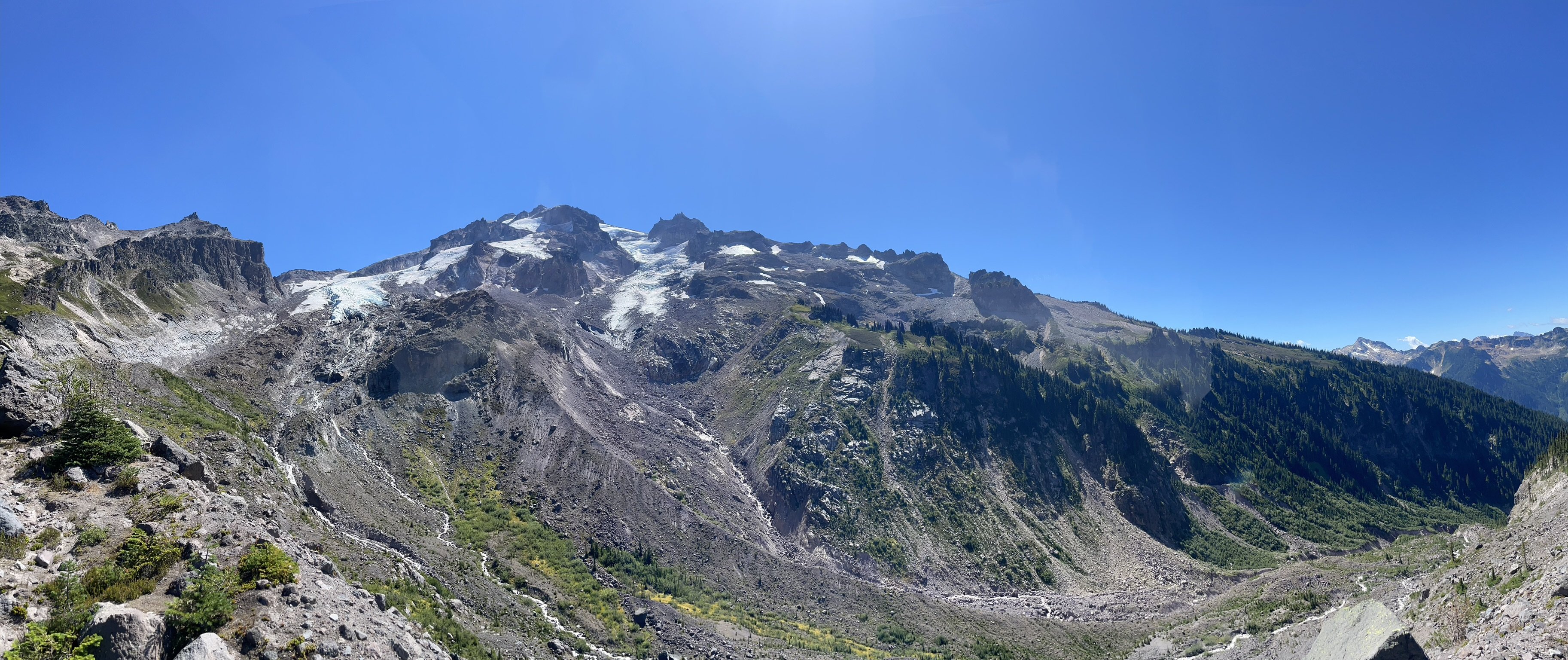
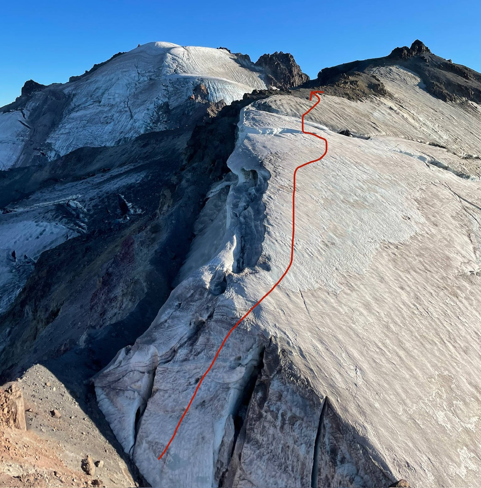
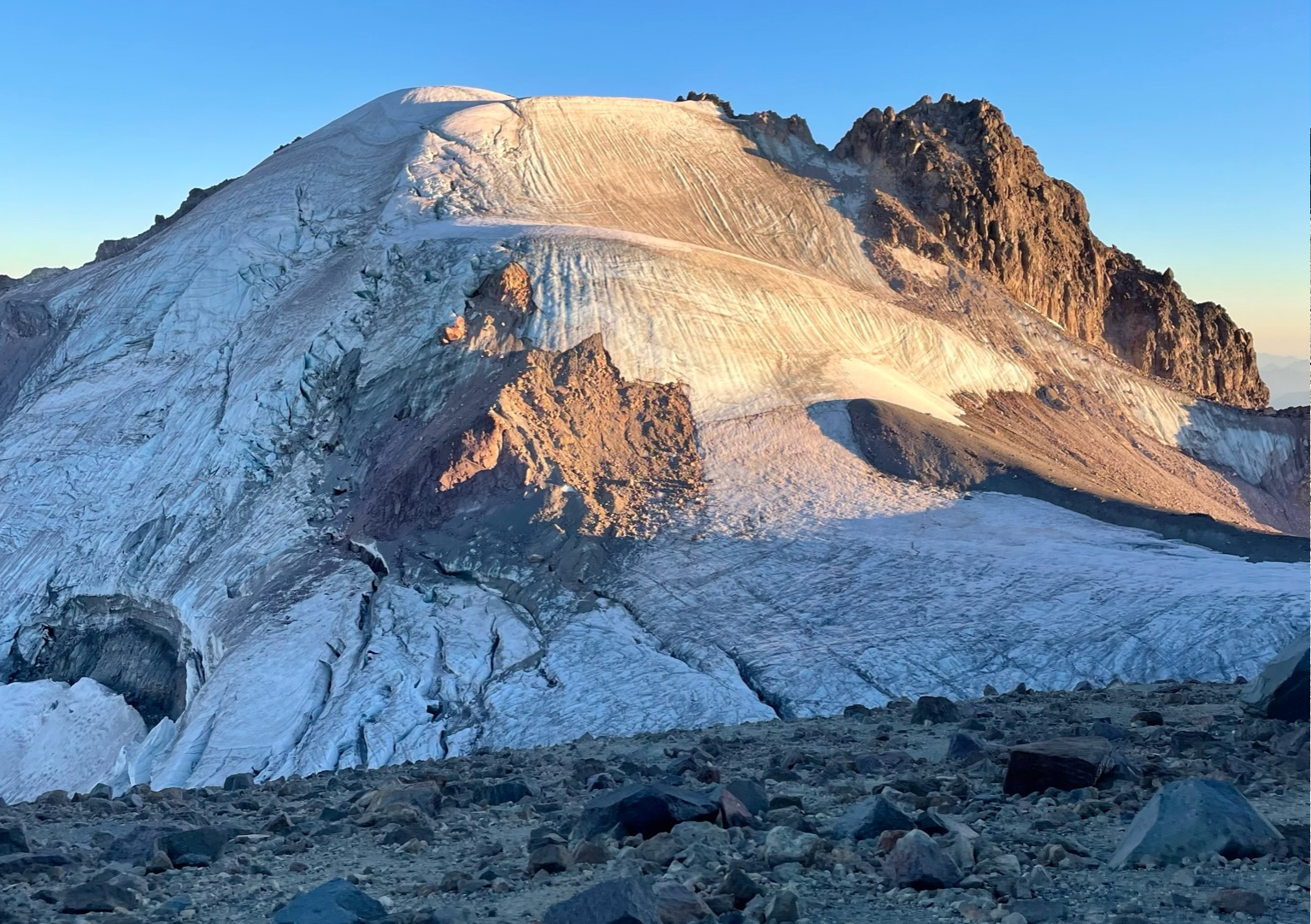
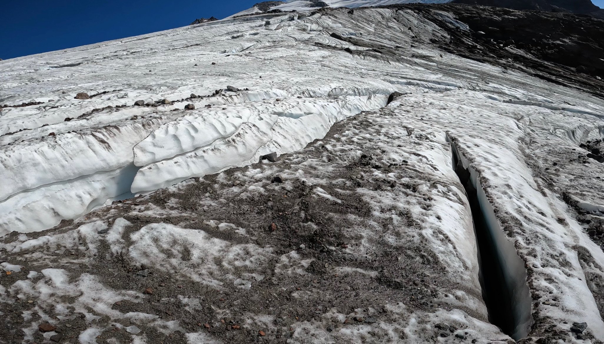
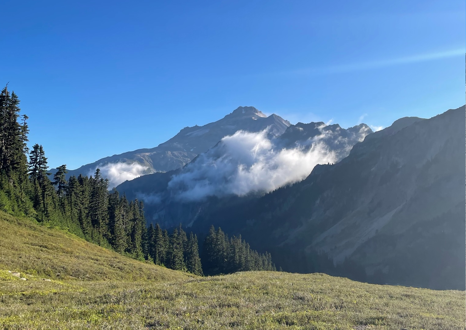
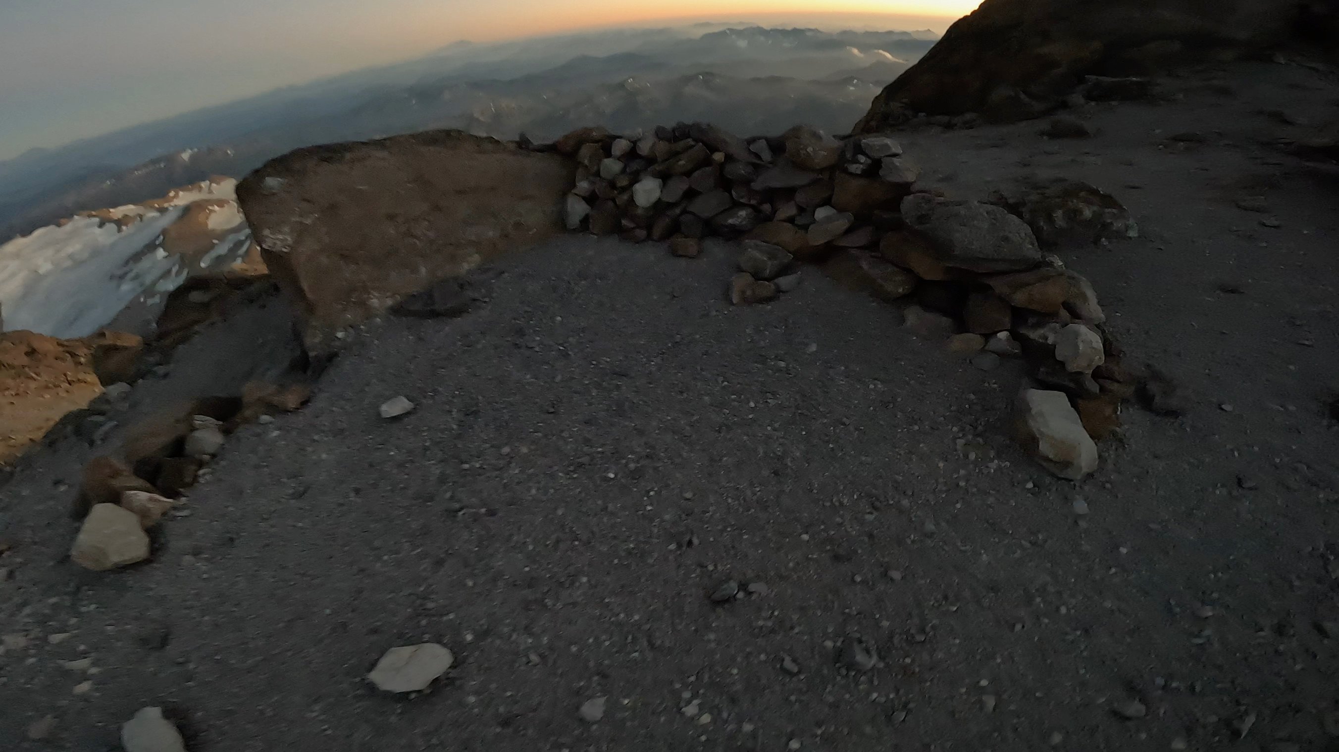
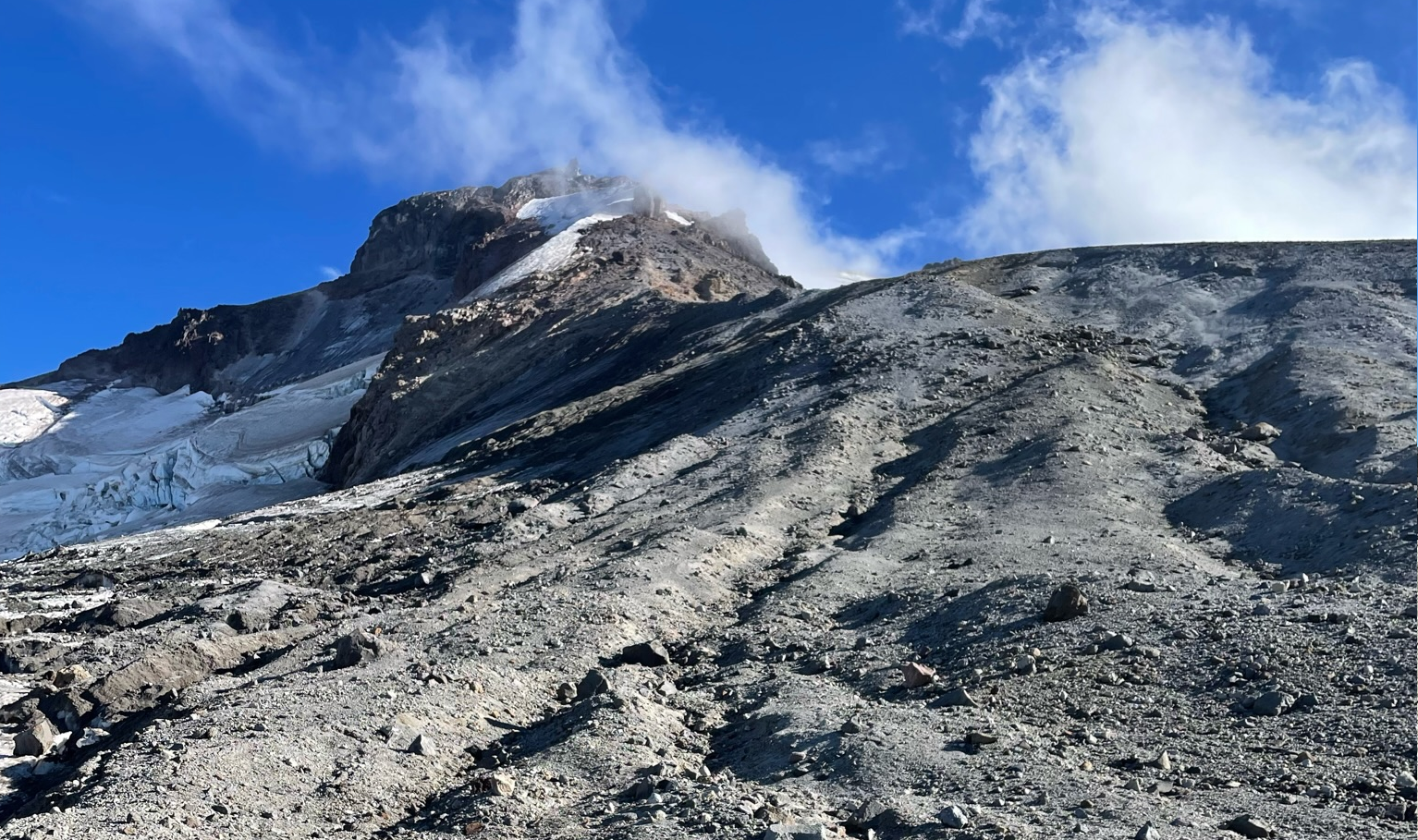
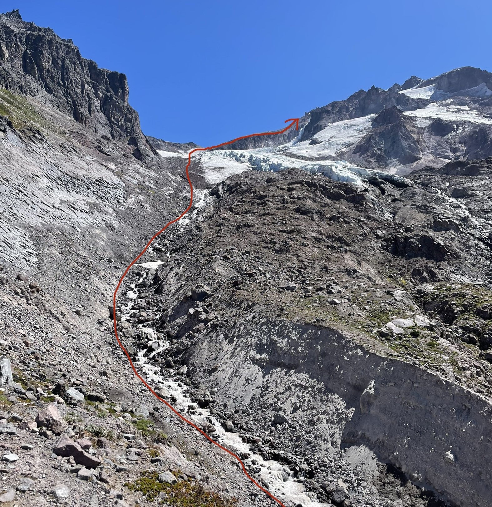
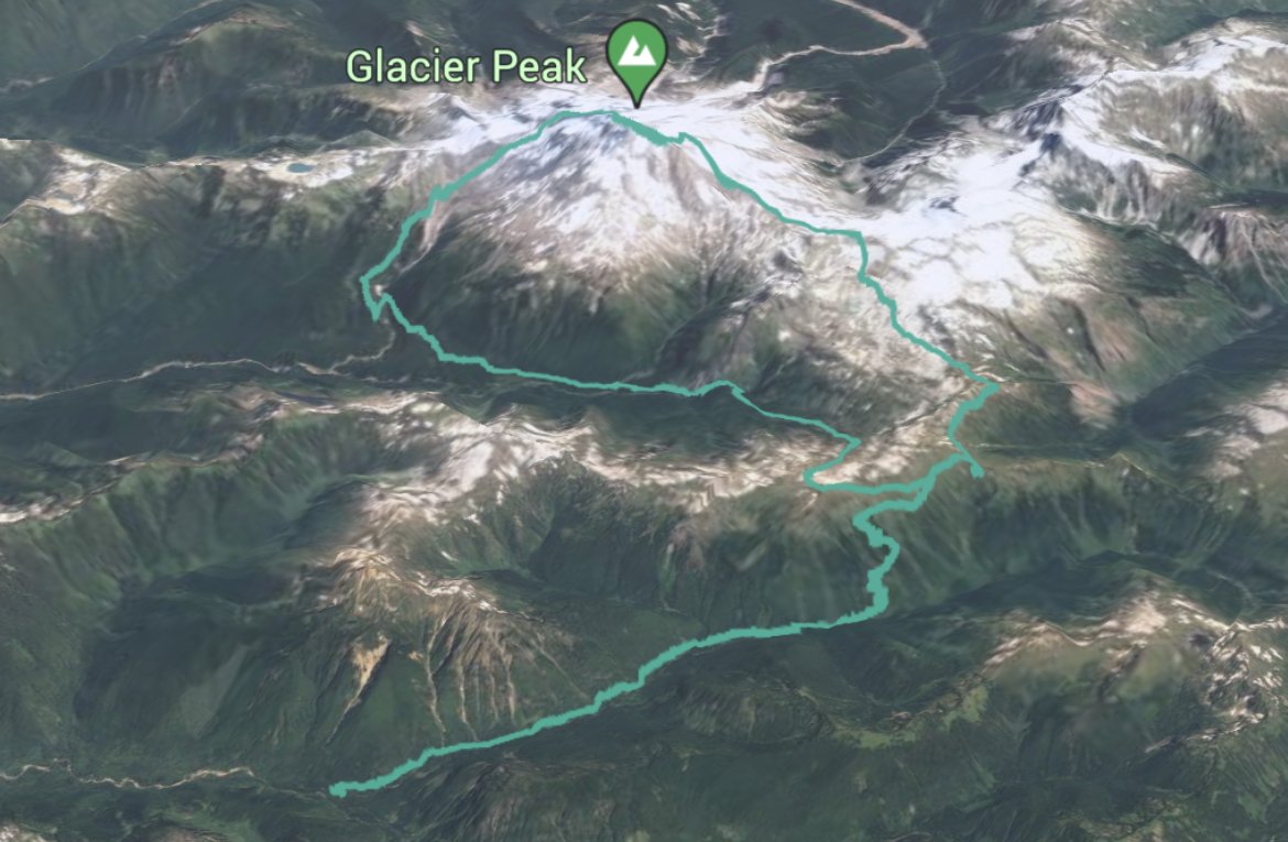
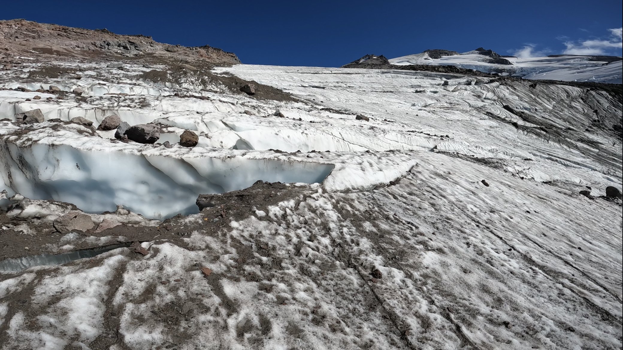
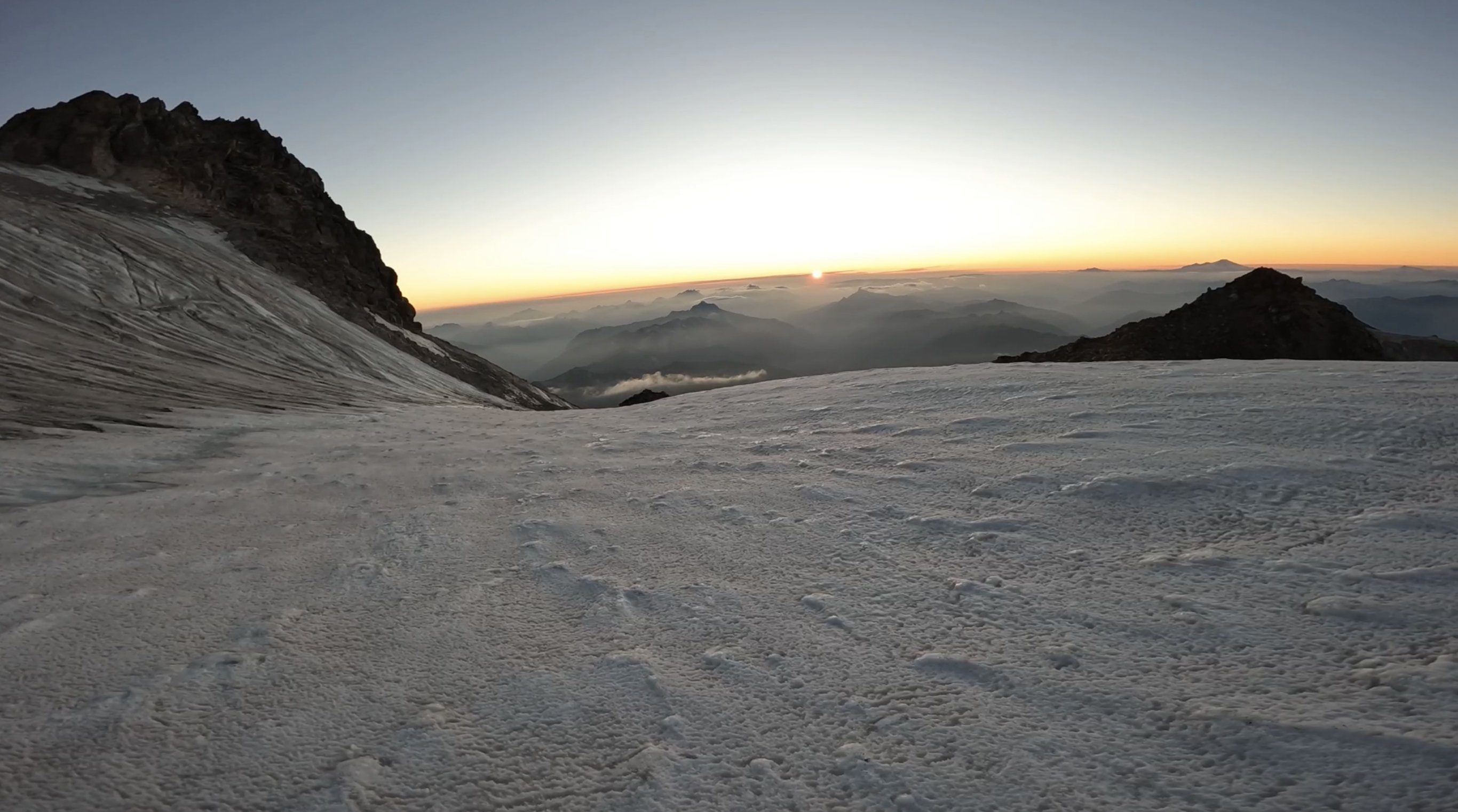
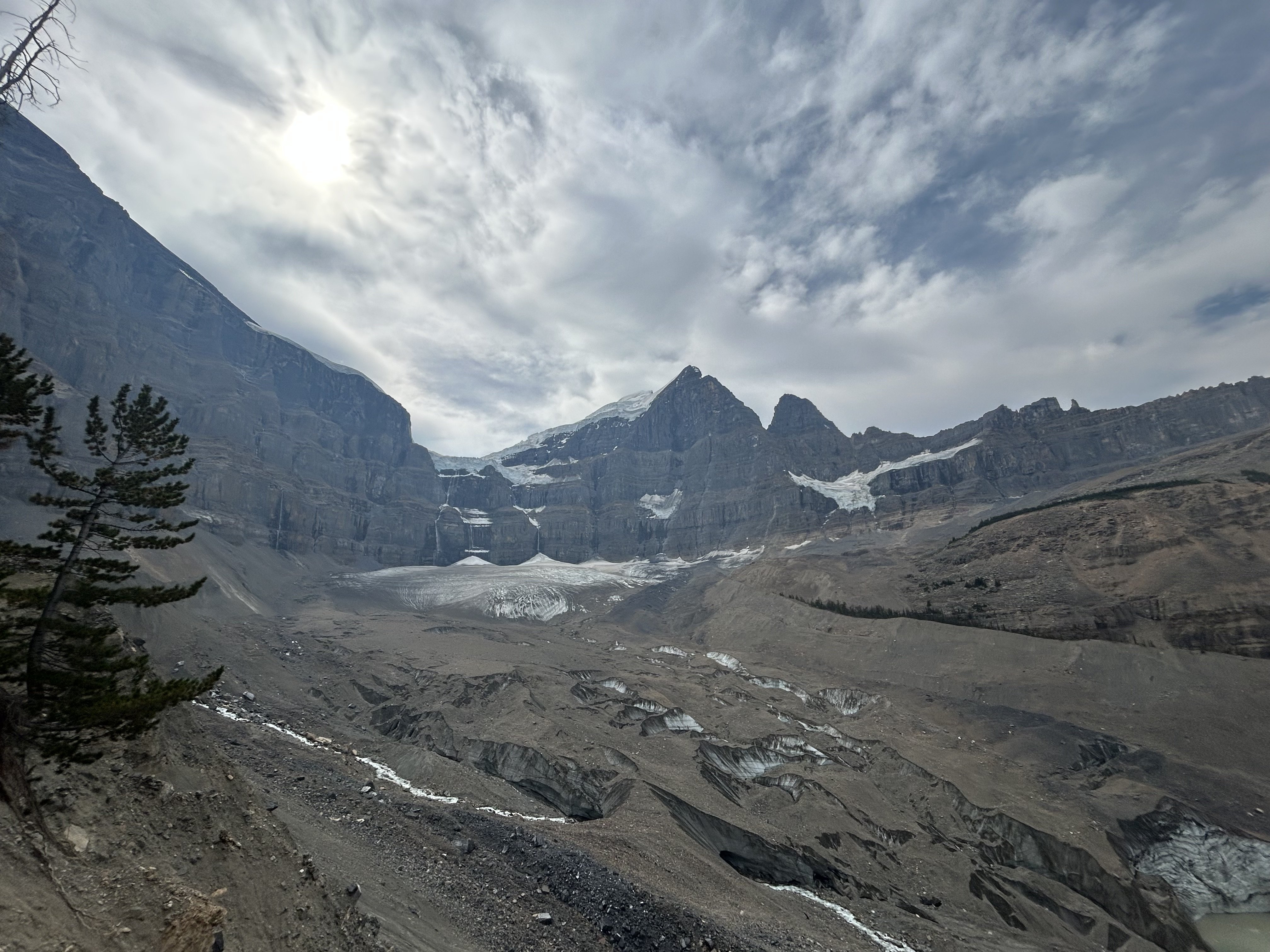
Trip: Glacier Peak - Frostbite Ridge Trip Date: 08/18/2023 Trip Report: North Face of Dakobed Solo (4th AI2 Steep Snow) I had been eyeing this route all summer and finally the weather and ice conditions lined up for an attempt. The varied terrain felt like a good alpine test piece for me. Day 1: Frostbite Ridge (Kennedy Glacier Approach) Day 2: Descent via Gerdine Ridge Direct/Disappointment Peak Cleaver Started the day at 3:01am from the North Fork Sauk Trailhead weaving through the forest by headlamp. Thoughts of rogue black bears and mountain lions were looming as it tried to keep about a 3mph pace. After about 3 hours and several water stops I made it to the PCT N-S junction. I tried my hardest this time to hydrate the day before and during the approach to be able to save on water consumption at the top and on the descent. The trail then continues on the PCT heading N over a ridge towards portal peak. Eventually descending to a beautiful meadow before being swallowed by the forest. I made it to Fire Creek Pass at 1130am, stopped for lunch and to fill up on water, the taste of a fresh roast beef sandwich while deep in the wilderness was pretty primal. At 12 I left the PCT up the Glacier Creek drainage for some light bushwhacking. Soon I gained the ridge that overlooks the remnants of the Kennedy glacier and saw the bivy site everyone mentions. This would be a good stopping point (about 22 miles in) but i knew a summit bivy would make this climb more special. The climb up the left side of the stream was half ultra loose rocks and dirt and moraine covered remnants of the glacier. Rockfall on the left and seracs on the right. pick your poison here. I followed the rocks on the edge of the ice for what felt like forever until finally putting my crampons on at the foot of the glacier. It looked like a bomb went off here, glacier broken to pieces, rocks everywhere, and somehow the loose rocks even had dirt and smaller rocks on top of them too. Had to zig-zag across the glacier to find connected pieces, moved slowly and deliberately through here. Only had to really step on 2 snow bridges, the rest was connected ice of the glacier. Eventually the glacier joins with Frostbite ridge where I left my crampons on and pretended this was like DC. This “Ridge” is simply a pile of scree, every step felt like walking in ankle deep powder and dislodged tons of debris. Struggled up the ridge, broke a trekking pole, and finally got on the little knife edge under the “rabbits dick”. Every step here raining rocks down both sides of the ridge. Really glad i was the only person out here for this section. Finally got to the feature and took the recommended bypass to the left across the steep snow slopes. This section was quite exposed and the wind blown neve was fun to climb. Finally got to the rabbits ears. The downclimbing here was way less sketchy that i thought it was going to be. Simple scrambling down to the steep snow field traverse, running water here. Motored up the upper Kennedy glacier and traversed around a hole to get to the ridge above. Then the unnamed headwall came into view, glowing in the evening sunshine. Sharing a sunset with the North Face of most remote Cascadian Volcano was special. I was racing the sun at this point, it was beginning to set and I only had about an hour to make it to the top before it was going to be getting dark. The base of the head wall was all exposed ice, all the snow was gone. I climbed the first ice step in the sunset, and on the ledge feature that splits the headwall the sun went down. Almost every stick was a hero swing, maybe 1/10 shattered some surface rot. The ice was steep enough that you couldn't walk up it, definitely at least AI2, but also had lots of features to rest on if you needed. I got some sweet gopro footage of the climb that shows the conditions/difficulty encountered. https://youtu.be/lv3px5eKino?si=-lHOC3Eju77gPPuO Climbed the second step and topped out at 830pm. I crested the snow dome in the back using both my axes as canes and out of breath from racing the sun up the headwall. I was completely worked but the summit was just steps away on a rock formation to the right. I got to sign the register in the last rays of sun for the day. Magical. It was incredibly windy, maybe 40+ mph gusts, and afterwards I retreated to the bivy site and set up my bag in the howling wind with shaking hands. I didn’t end up eating my dehydrated meal because boiling water in this wind was going to virtually impossible with a Jetboil. I settled for a pop tart and fell asleep to the whipping sound of my bivy sack in the wind. Woke up around 1am and it was dead silent, poked my head out of the bag and the vast array of stars greeted me. Just the starlight was bright enough that I didn't need a headlamp to see around me. I slipped in and out of sleep until finally getting up at 630am to pack up. Chatted with a nice guy who made it to the summit for sunrise and got some beta for the scramble. I started the descent at 7am and made it to the car at 4:15ish. Opted for the loose scramble on disappointment peak since the Cool Glacier looked completely shattered and apparently the downclimbing isn’t that bad. I figured if there is an option to avoid soloing a glacier it should be taken. Some super chill people gave me cliff bar at the campsites by the base of the Gerdine Ridge, this was much needed as I just ate my last stinger moments before. If i thought Kennedy Glacier looked like it got carpet bombed, then the south side of the mountain looks like its been through a nuclear blast. The shattered landscape seemed to stretch on forever, but the occasional wildflower was nice to see. Doing this big lollipop loop had such varied terrain which added to the classic feel. It was also interesting/sad to see how much the ice/snow has receded from past trip reports on here. This felt like a blue collar Mt Olympus, a little more rugged but overall similar vibes. Instead of finishing with mellow rock climbing, you finish with mellow ice climbing. Instead of a pristine NP trail to get to the glacier, you have PCT linked to a bushwhack chossfest. Instead of paved NP roads, you have the 10 mile potholed forest service road. No Cascades alpine ascent is truly complete without a margarita and Carne Asada stop at Dos agaves in Darrington. Gear Notes: 2 tools made sense for me since I'm not a super strong ice climber. Unsung hero was the bag of salt and potassium i brought. Packing List: https://lighterpack.com/r/0phmnc Approach Notes: Stats: 36hr51m c2c, 17.5hr car to summit Tracks: https://www.alltrails.com/explore/recording/afternoon-hike-a62344a-60
 1 point
 -
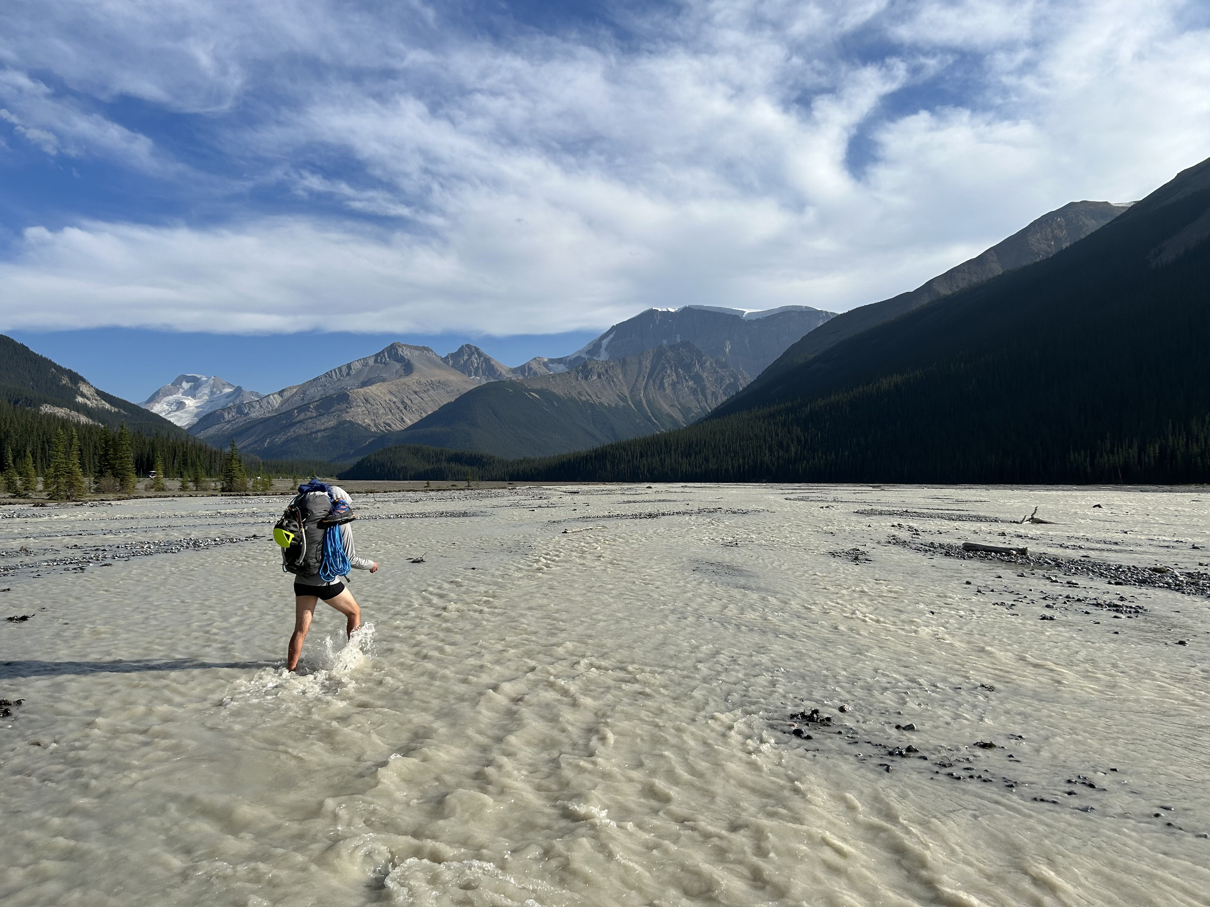
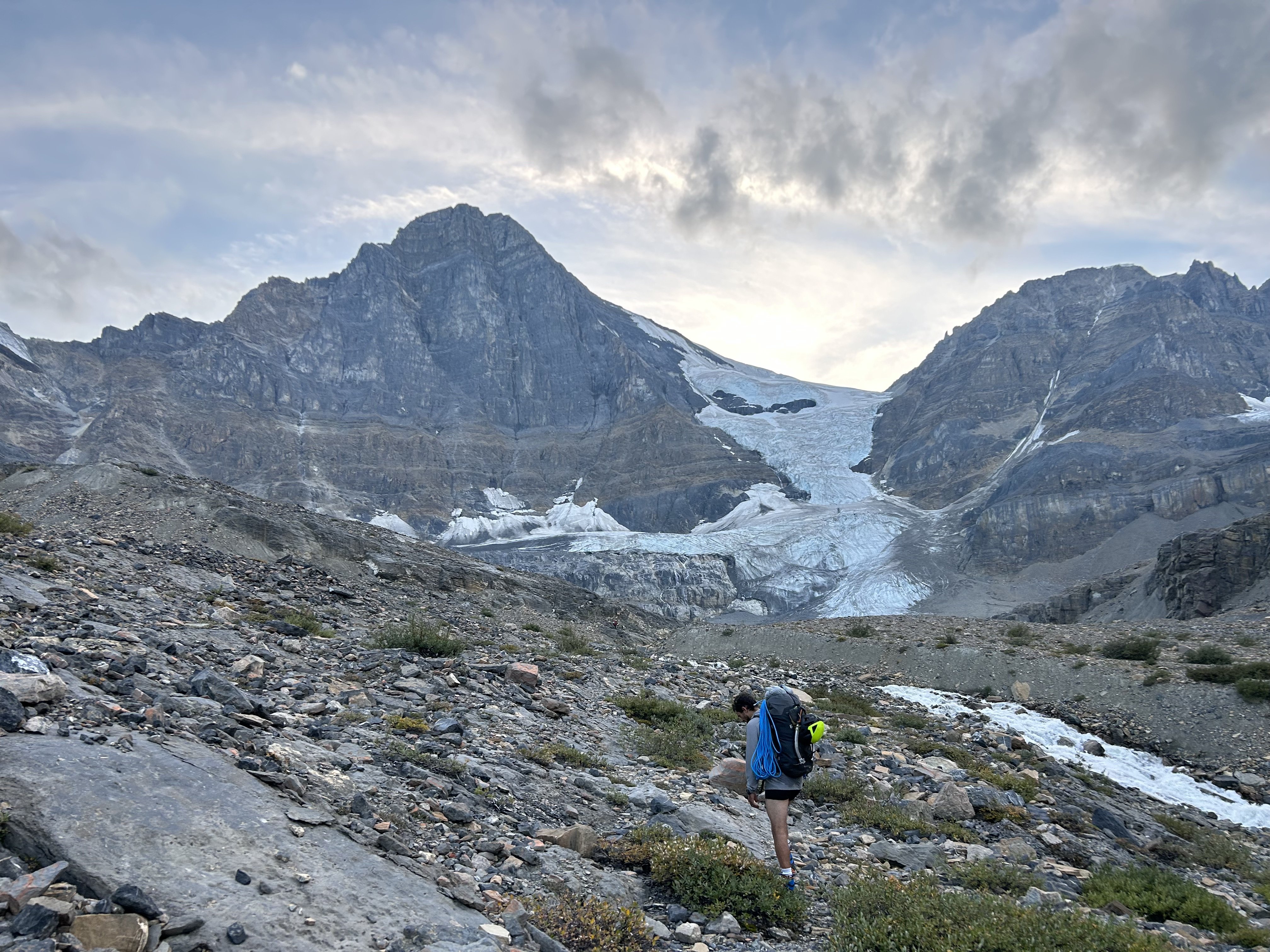
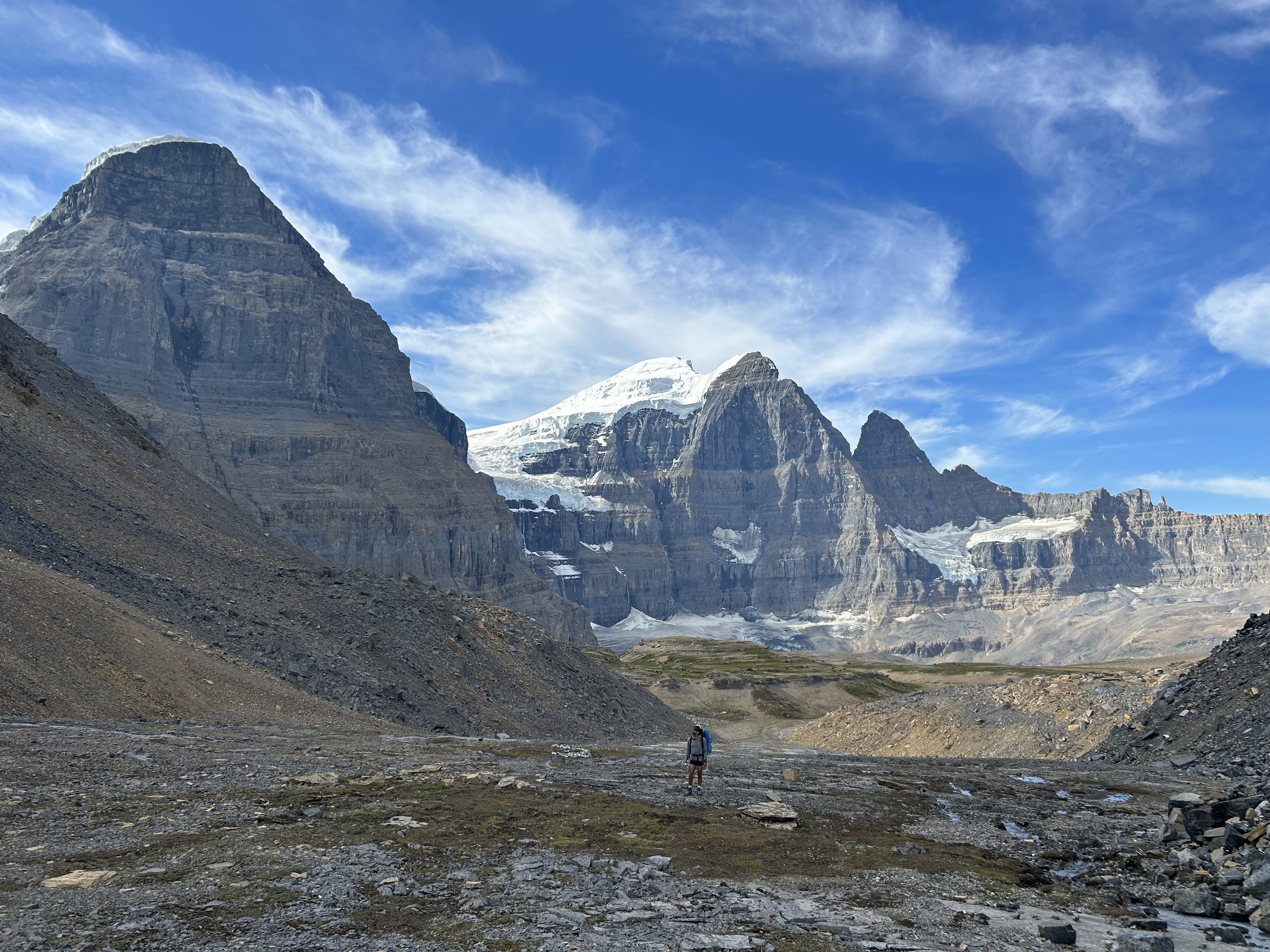
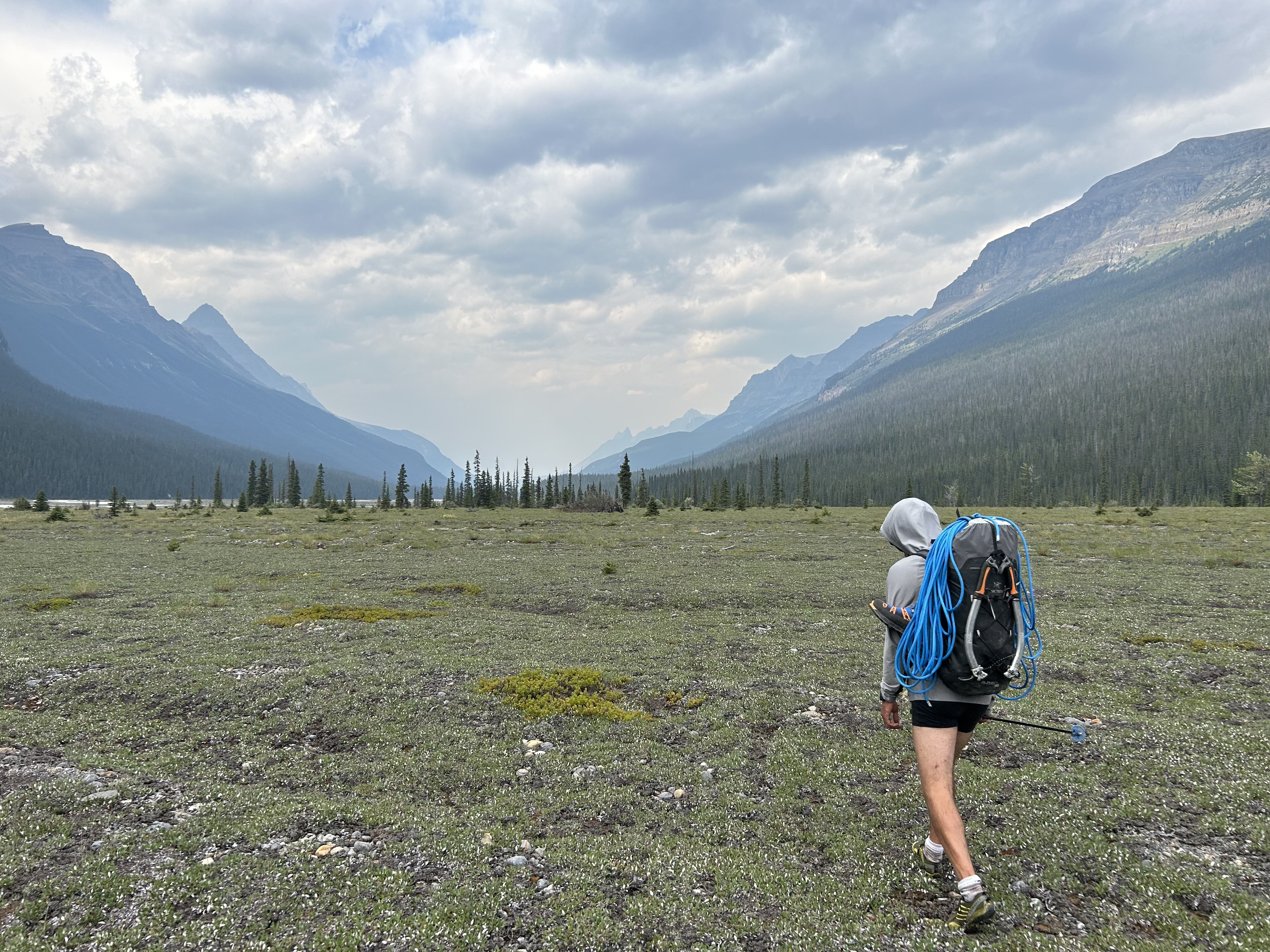
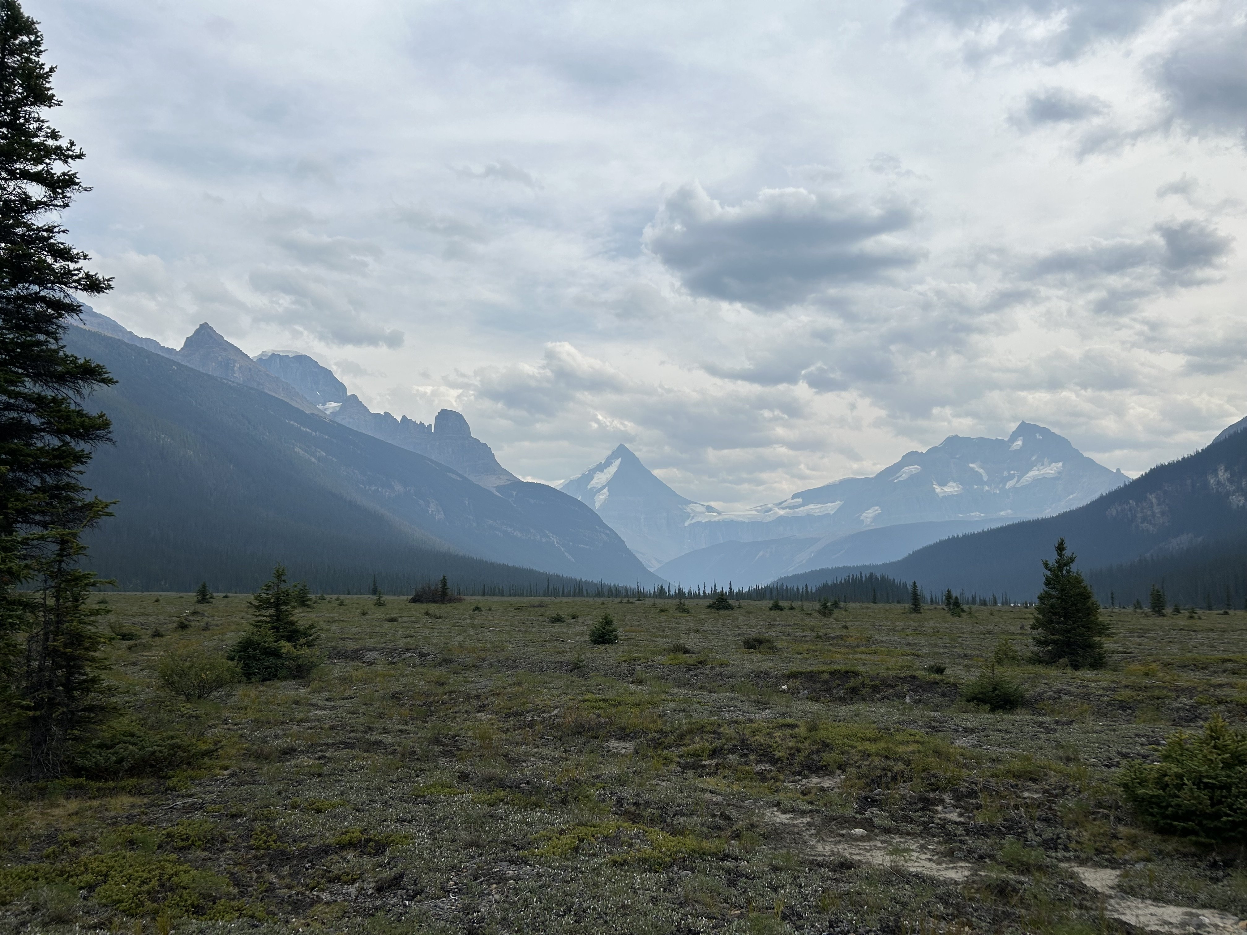
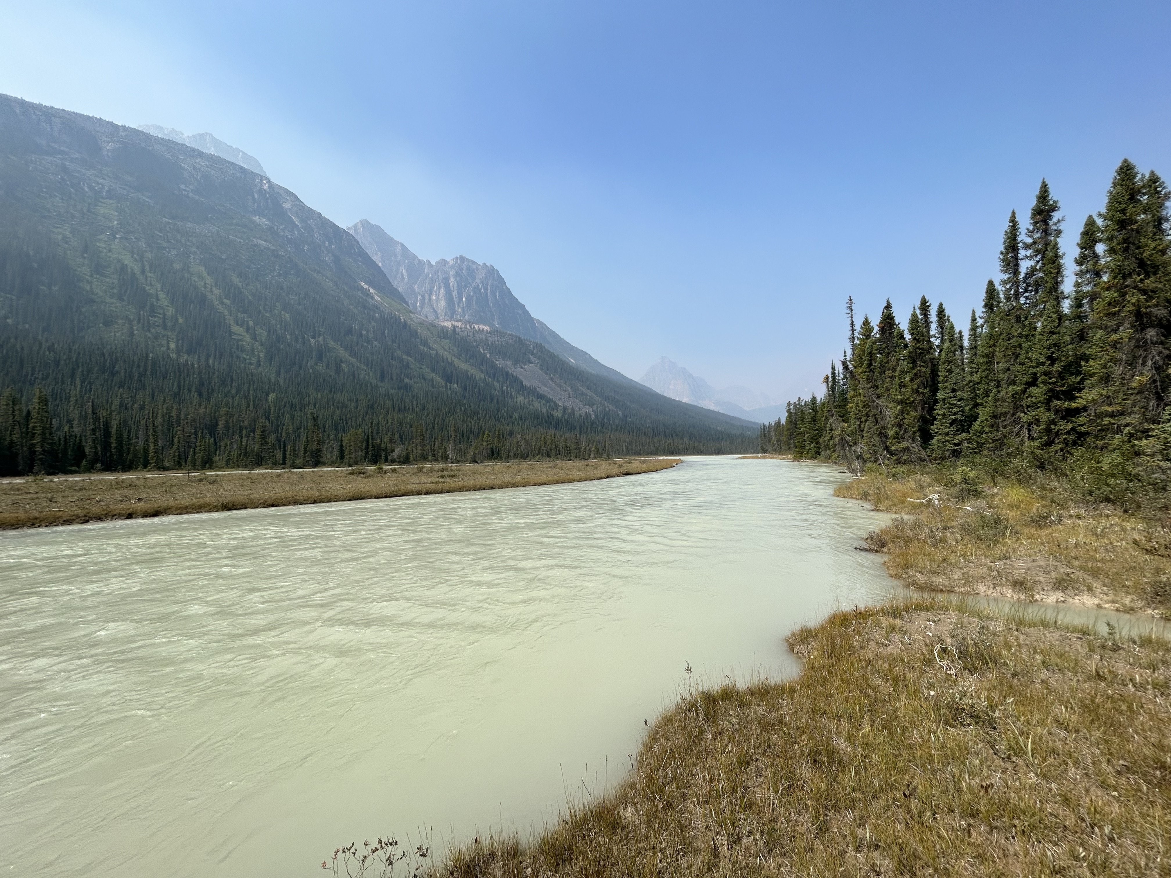
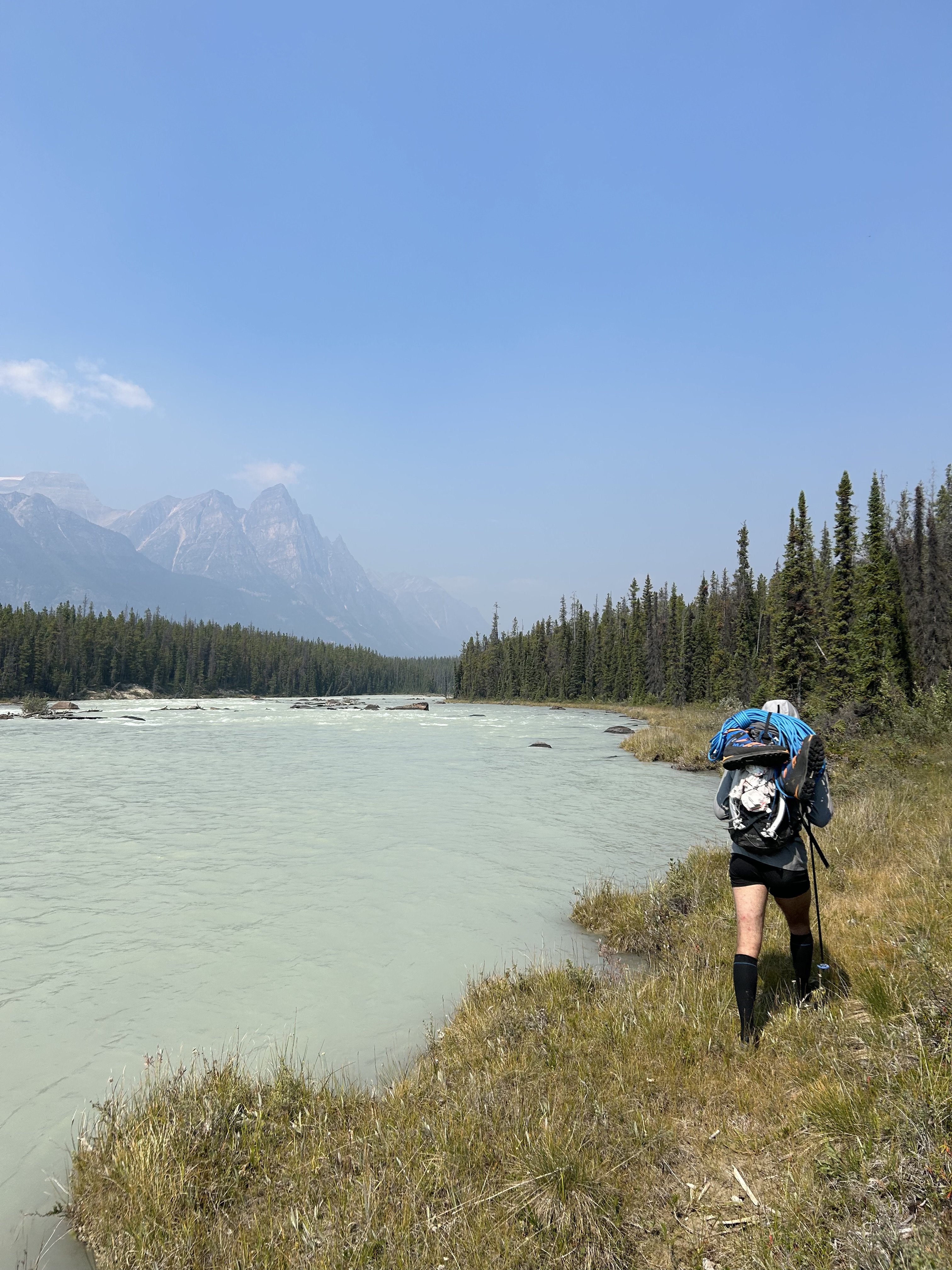
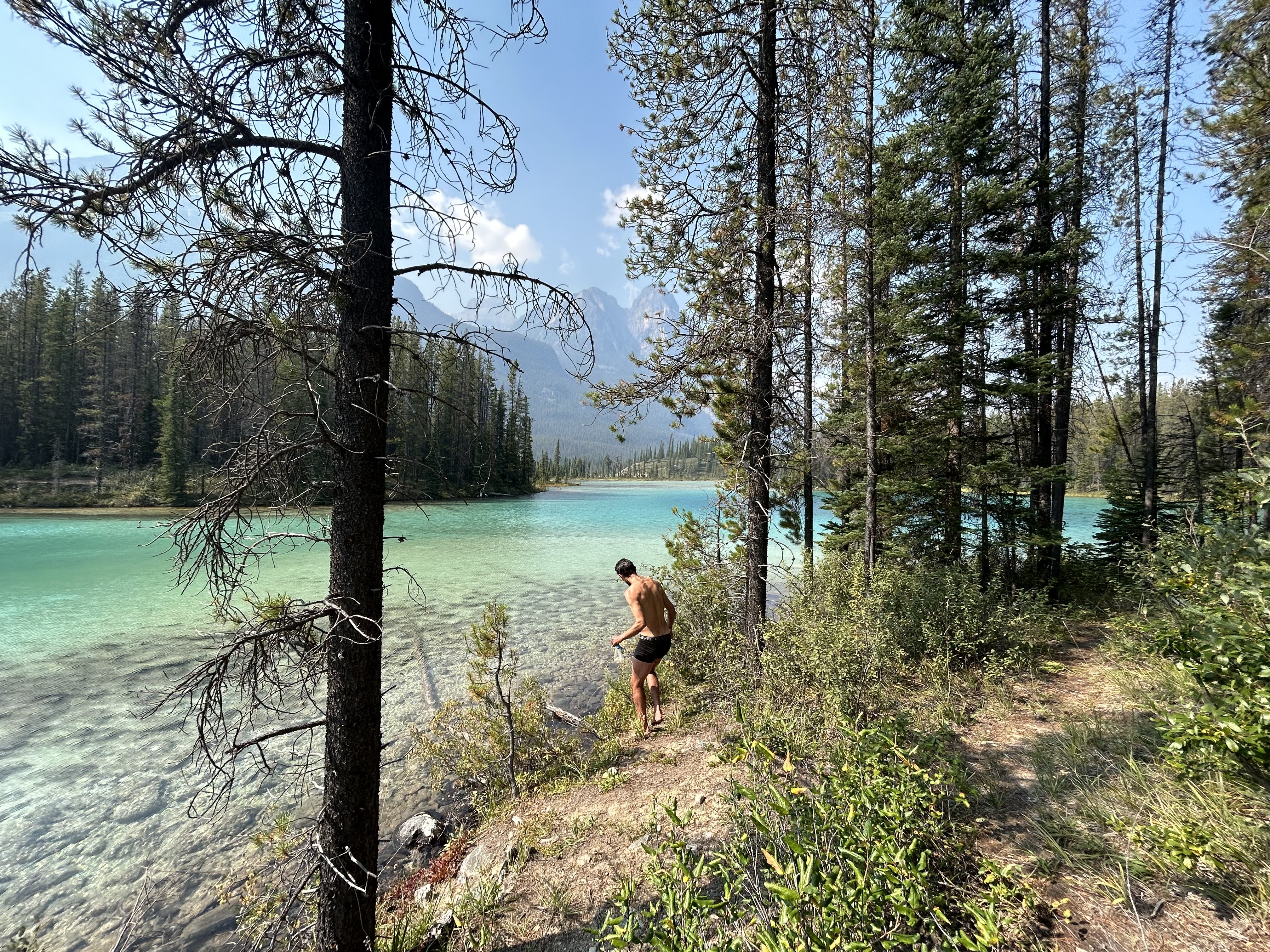
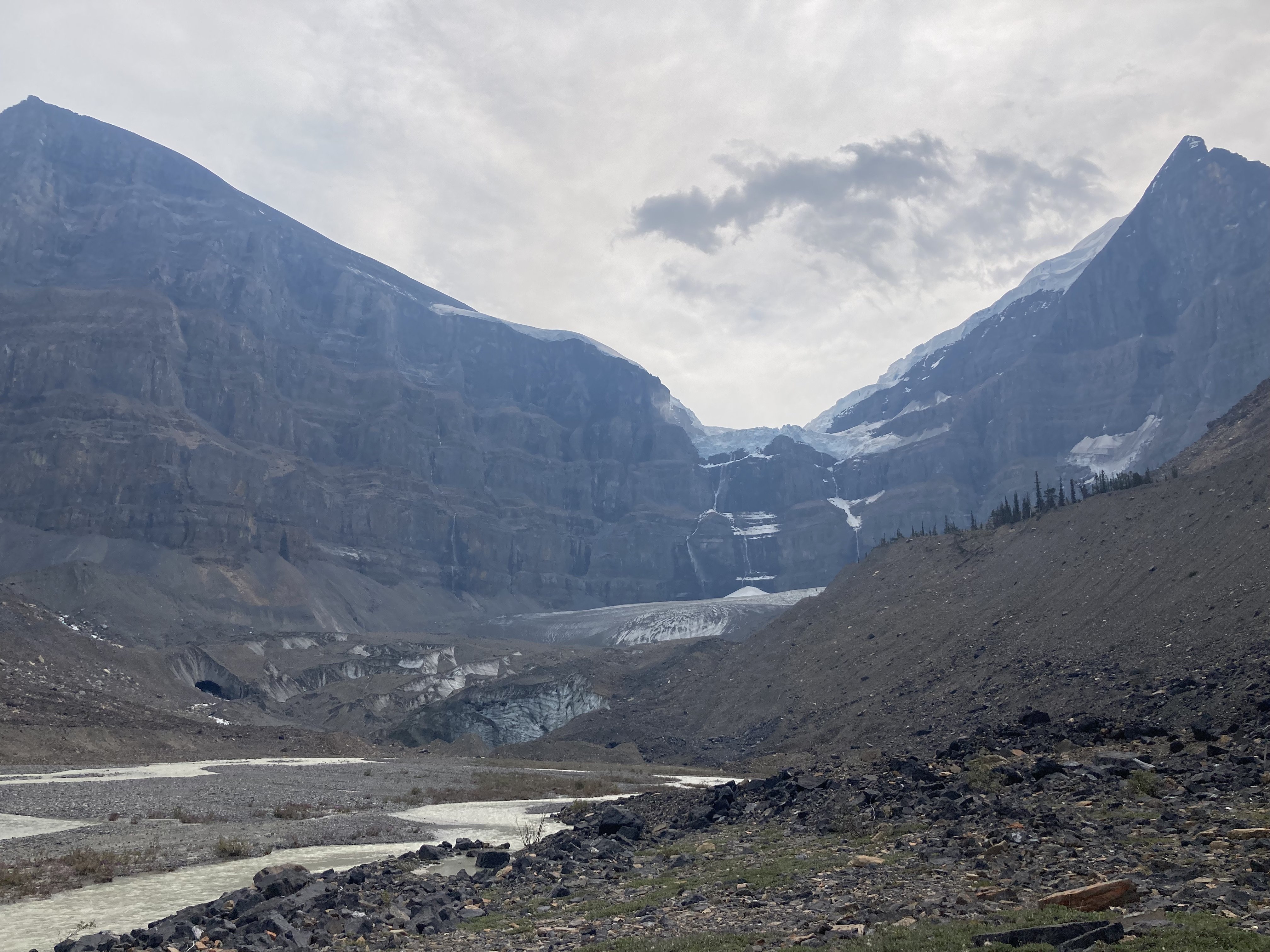
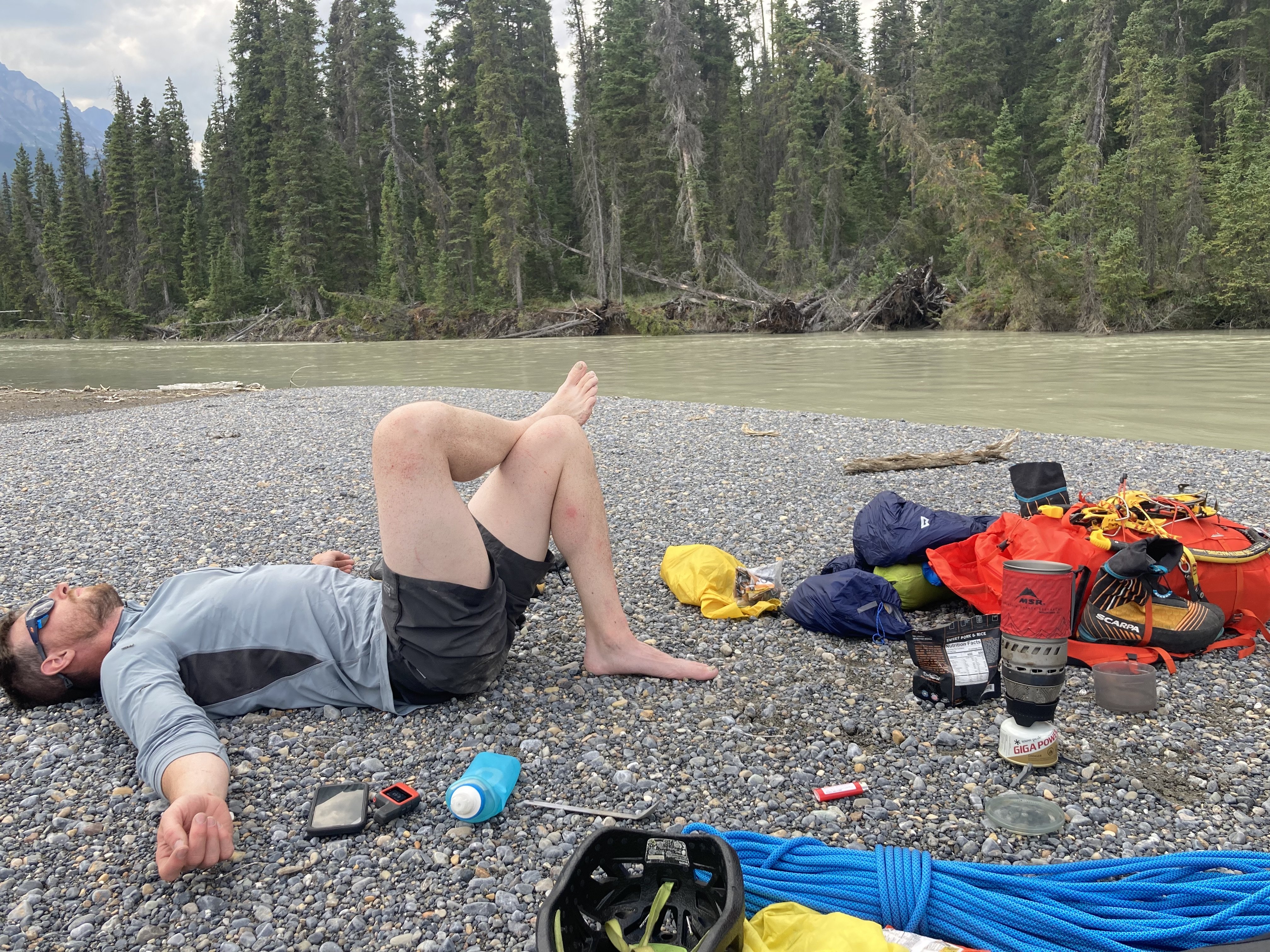
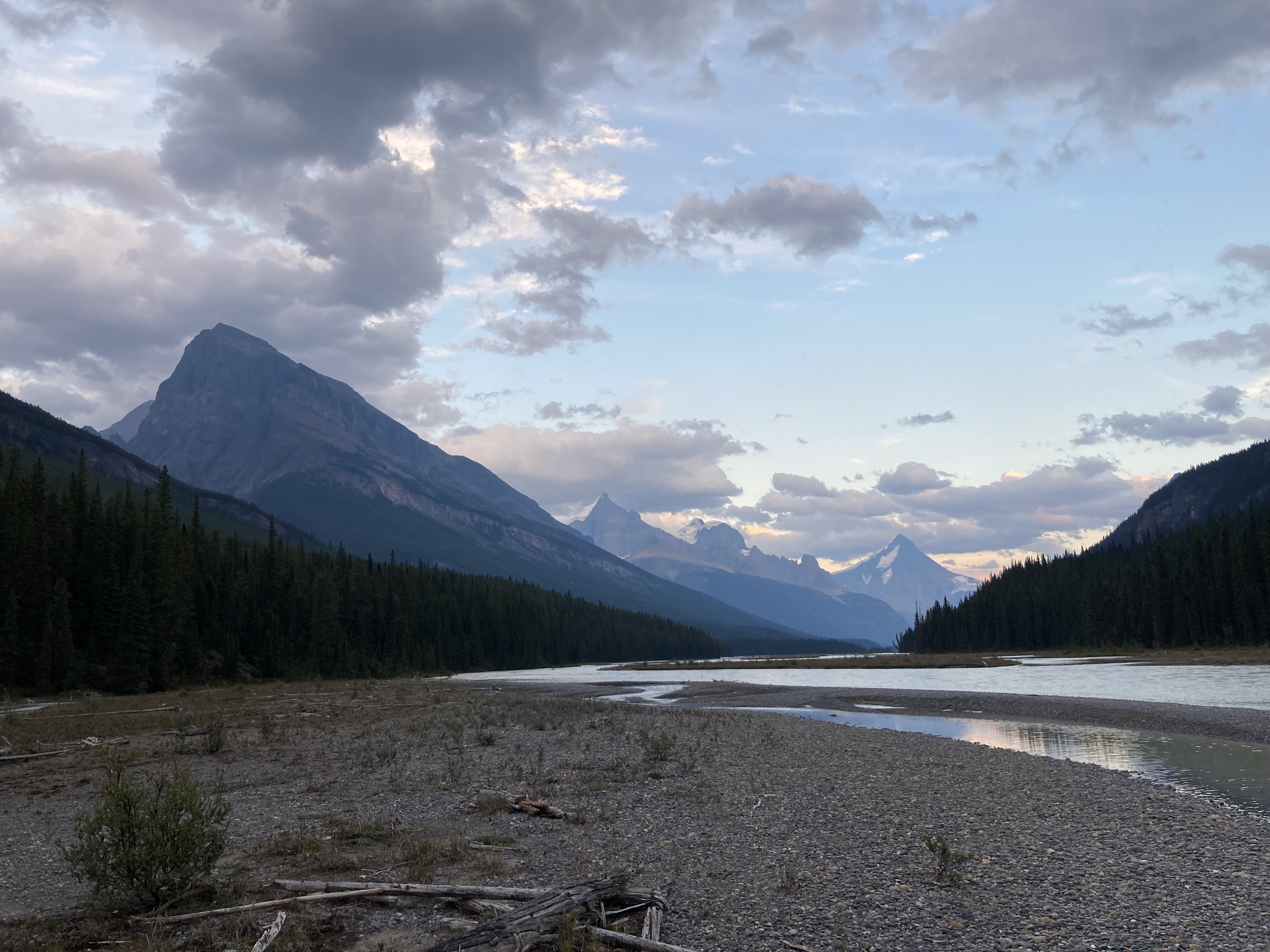
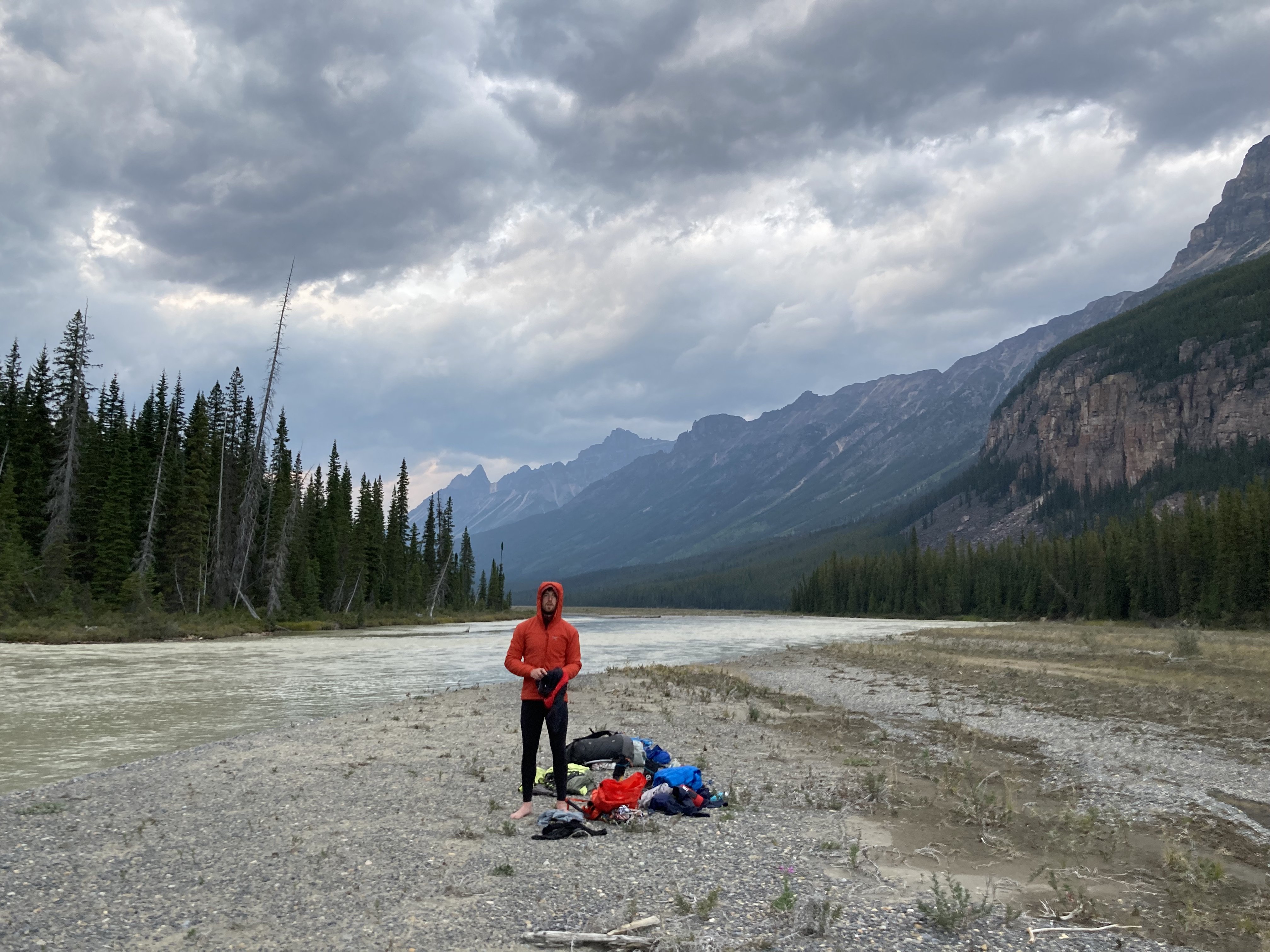
Trip: Canadian Rockies - Feeling down? Like you're in a Black Hole? I've got a solution for you: Go on an Athabasca Bar Crawl! Trip Date: 08/14/2023 Trip Report: Dallin Carey and I took the gear to go see about the North Ridge of Mt. Columbia. We were attempting to repeat this itinerary by Colin and Ian, albeit in much warmer/drier weather. Long story short, everything took longer than anticipated, there was much less snow/ice than anticipated, and we ended up doing the coolest backpacking trip of my life around some of the most incredible mountains on the continent. It was awful, but in a really good way. Day 1 - We got a later than anticipated start and hiked up and over Wooley Shoulder. Pretty much every source from climbers we could find just says "go up and over" with no mention of the shenanigans involved. This is only 5ish miles... It's also 4.5k' vert, involves wading a very cold Sunwapta River at the start, traveling over multiple glacial moraines and up some steep and exposed scree. We thought it would take us 3-4 hrs, but it took us 6 and involved some harrowing traversing on atrocious scree by headlamp. We didn't sleep until after midnight. Day 2 - We figured we had plenty of time to get to and up onto the N Ridge. Colin made it sound easy; how hard could it be? We started by traipsing through Sound of Music-esque meadows towards the North Face of North Twin. The topo maps were not revealing of the topography below and Colin's TR didn't mention this... maybe it didn't seem like a big deal since he was just hanging with a super-loc/guide who'd been that way before. Anyway, the meadows ended with a cliff of choss and a whole bunch of f*&%ery dropping thousands of feet down scree and forest to the raging torrent through more old glacial moraines that is Habel Creek... this is the actual Black Hole of legend. We wasted a good while figuring all this out and after down climbing, shwacking, and scree sliding we emerged creekside where the water pours out of the glaciers. Now we only had to wade the cold water, climb over more glacial moraines, and bushwhack out the creek, dropping another 2k' vert to the Athabasca River. This 4.5 mile section from our campsite to the Athabasca, which was entirely down hill, took us almost 6 hrs. I think I could shave an hour or two off this time with perfect beta, no more. As we emerged into the Athabasca River Valley, Habel Creek spread out over its alluvial fan creating swamps deep into the forest. We were wading through ice cold water filled with silt and simultaneously bush whacking. Breaks on gravel bars finally showed our route... no snow in the lower snow gully, bare ice on the lower snow field, massive black schrunds guarding the top, no ice or snow in the Scottish gully, big icy seracs overhead, and no snow at all on the ridge: climate change sucks a big one. It did not inspire confidence. Finally, while shwacking through more icy swamp water and having made 400m of progress in the last 30 minutes we decided to pull the plug. The N Ridge is probably the easiest(???) exit from the upper Athabasca to get over the Columbia Icefield and back to the car, we were well behind schedule and the likelihood of getting up the route was looking somewhere between Certain Death and Russian Roulette. We really didn't want to go back over Wooley Shoulder for a variety of reasons so Dallin suggested we could just follow the Athabasca River all the way out to the road... It's only 20+ miles of river walking, mostly with no trail. That sounded lovely, which gives you an idea of how totally F'd the other stuff was. We started wading back across Habel Swamp (as we had dubbed it), emerging on to gravel bars and made decent progress, walking/wading/schwacking in a much more leisurely manner until it was almost dark and we found a nice campsite on a gravel bar in the river. Day 3 - This day was delightful and felt like a pleasure cruise... If you consider constant glacial river wading up to your waist, swamp wading, moose/bear track following, and bushwhacking to be easy while carrying an alpine climbing pack and being swarmed by mosquitoes and horse flies. The average American would probably just lay down and die; a PCT thru hiker would probably declare us insane and never go back... but we did genuinely enjoy ourselves... though I still might not ever go back willingly. We finally stumbled out of the brush onto the so-called Chaba Cabin Trail and had a mere 12km of rolling single track to hike back to the Sunwapta Falls TH. A delightful young woman named Pam let us cram in the back of her live-in van (despite our stench and grime) for the 20 miles back down the Parkway to Dallin's truck. We then had to wade the Sunwapta twice at 8:30pm to retrieve our running shoes from the first day, which left us mildly hypothermic, and then the adventure was truly over. We cooked dinner at 9pm in the Ice Fields Visitor Center parking lot and watched rich old people sip their zina on the balcony of the $40 entree restaurant as the alpenglow faded over the Athabasca Glacier, which we had envisioned ourselves triumphantly descending after our rad send. Such is the roller coaster of life. Gear Notes: Light-weight running shoes for hiking were clutch. We did not use the tools, pons, rope, pins, cams, nuts, slings, or screws in any way. The boots were on my pack for all but the few miles up and over Wooley. In Colin's TR he hiked in his underwear as I understand he does from time to time to save weight. I cannot recommend this strategy in this terrain due to the sea of scabbed-over scratches that now forms the front of my legs, and the sea of massive red insect bite-induced welts that covers the back of them. Let's just say this may well be the first and last annual undies hiking trip for me. And also, screw you Colin! But maybe also thanks, for inspiring an awesome adventure. Approach Notes: Don't trust topo maps, don't trust Colin's TR, don't trust the rock, the scree or the dead trees. Definitely don't trust the deep holes between roots covered in 6" of moss that are totally hidden. Basically, don't trust anything you can touch, they will all betray you. Just become a wild animal, cease all higher levels of thought, and simply exist. This is the way. Pictures: These are mostly taken by Dallin, cause !!NEWS FLASH!! undies don't have pockets. Actually, we discussed in detail how Patagonia should make Colin Haley Limited Edition Approach Undies with pockets. But I probably wouldn't buy them. Well, maybe. Yours truly wading the Sunwapta. Screaming barfies for the feet. Yay. Yours truly approaching Wooley shoulder, Wooley peak behind. Yours truly walking down towards the Black Hole and the North Face of the North Twin. Looks easy, just go over there. Too bad you can't see the massive chasm of glacial, torrential, choss gnar that splits the ground just after the lovely marmot meadows. Almost down into the Black Hole. The moraine in the left foreground gives an idea of what the last bit down to Habel Creek was like. In the Black Hole after fording Habel Creek. Note the thousand foot waterfall getting blown sideways as it falls off the Ice Field. Finally getting views of Columbia. Phones take crap photos but very little snow, lots of exposed ice, more exposed rock. Blah, blah, blah. We are chickens. I have dishonored you Dave Cheesmond. We are unworthy. Forgive us. Let the scenic river cruise begin... The Athabasca Bar Crawl! Miles later this is still the alluvial fan coming out of Habel Creek and the Black Hole. We thought the whole thing was going to be connecting stuff like this. River views back towards Columbia. Dallin avoiding mosquitoes at our camp location for the night. He's wearing full alpine winter kit despite the fact that it's like 70F. Following what we called the Moose Highway. There were clearly many moose. Also bears. We did not see them, thankfully. But their tracks were numerous. Dallin almost stepped on a porcupine the size of a golden retriever. I may be exaggerating that last bit, but it was huge. Dallin at a rest stop on a gravel bar. Kinda speaks for itself. Swimming at a cold lake shortly after hitting the trail. Glory, glory, we are free at last! The lake was pretty. Then we walked a bunch more. Then it was over and we didn't die. The end.
 1 point
 -
Thank you, it was a blast for sure. there was running water all throughout the glacier creek drainage, below the glacier, and up on the kennedy glacier. There were murky pools in the glacier as well as surface streams running down. Don't remember the very upper portion of the glacier below Frostbite ridge having water but there was plenty just below. Yeah go get it while the glacier is still connected!1 point
-
Please see the TR on the TAY website for this momentous FFA: https://turns-all-year.com/trip-reports/tay-69-46-3-home-lake-snowpatch-mt-constance1 point
-
Just please answer the question @sulinelanie.1 point
-
So @sulinelanie, can you explain how AI can keep me safer when rock climbing?1 point