
Leaderboard


Popular Content
Showing content with the highest reputation on 03/01/23 in all areas
-
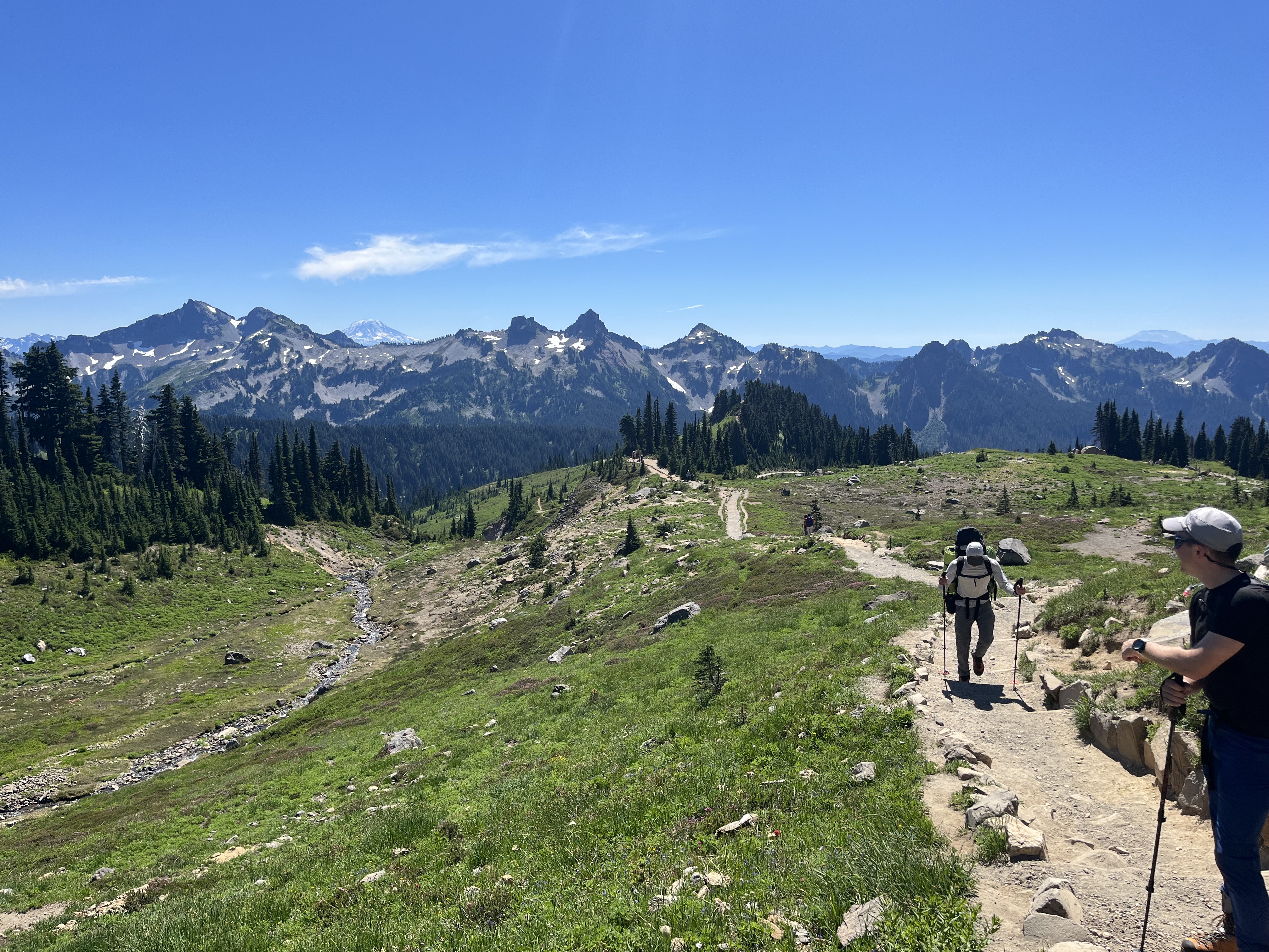
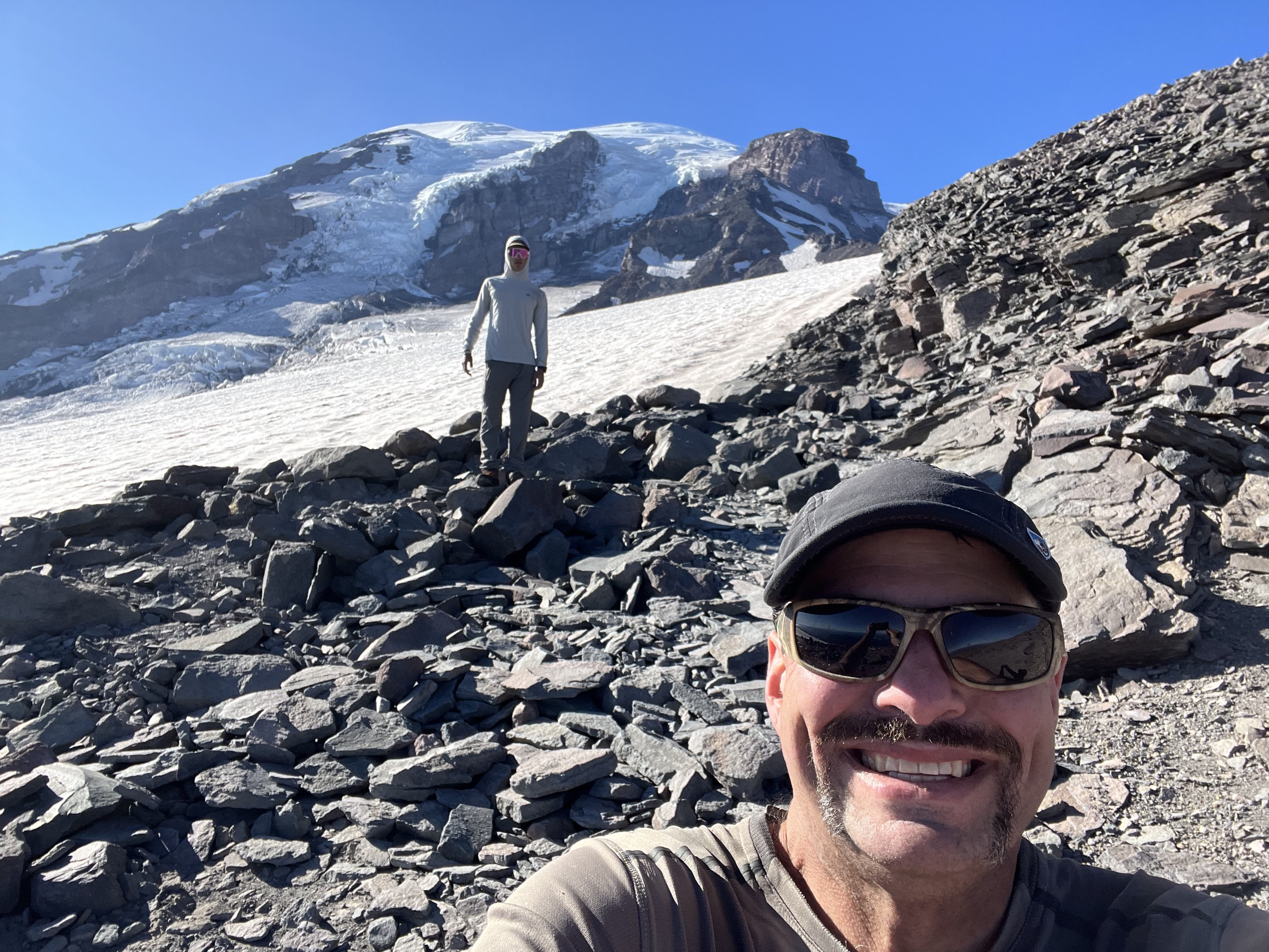
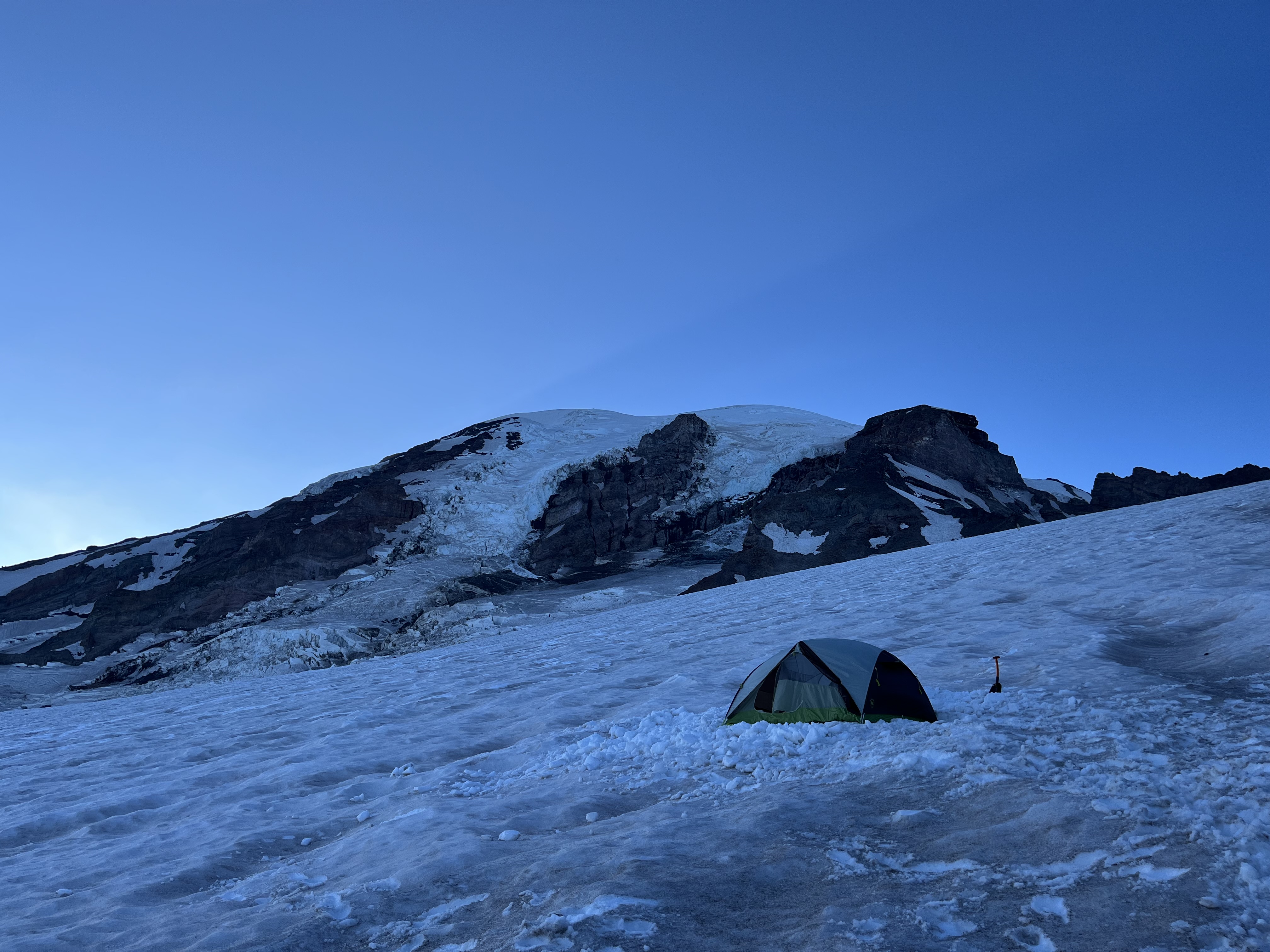
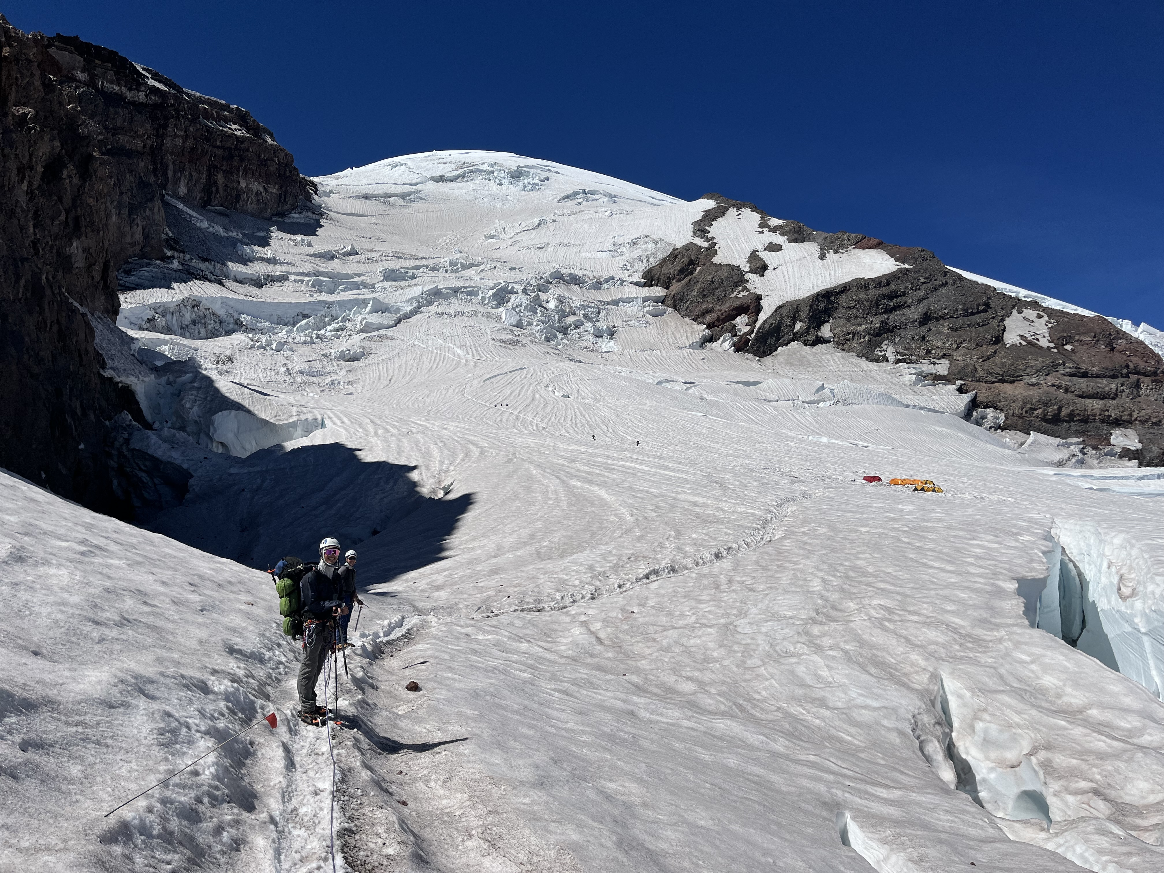
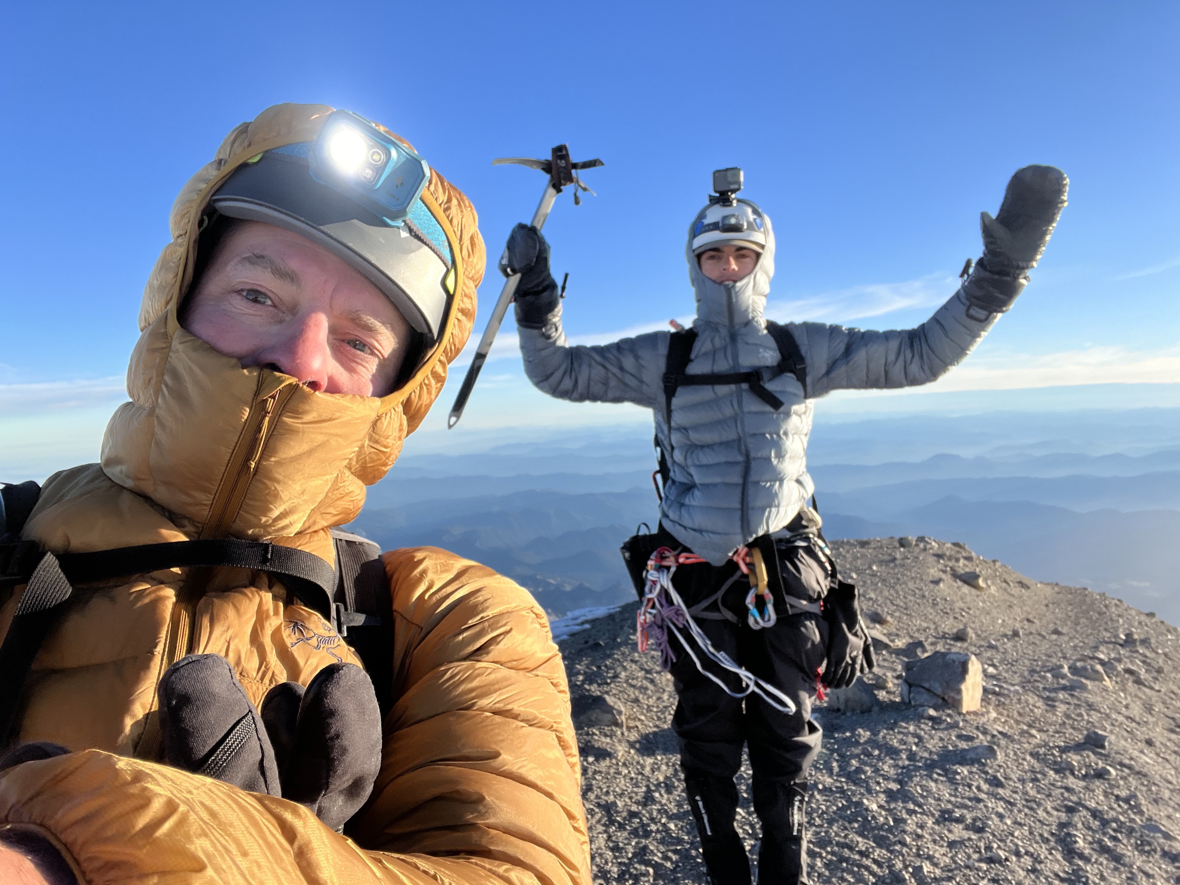
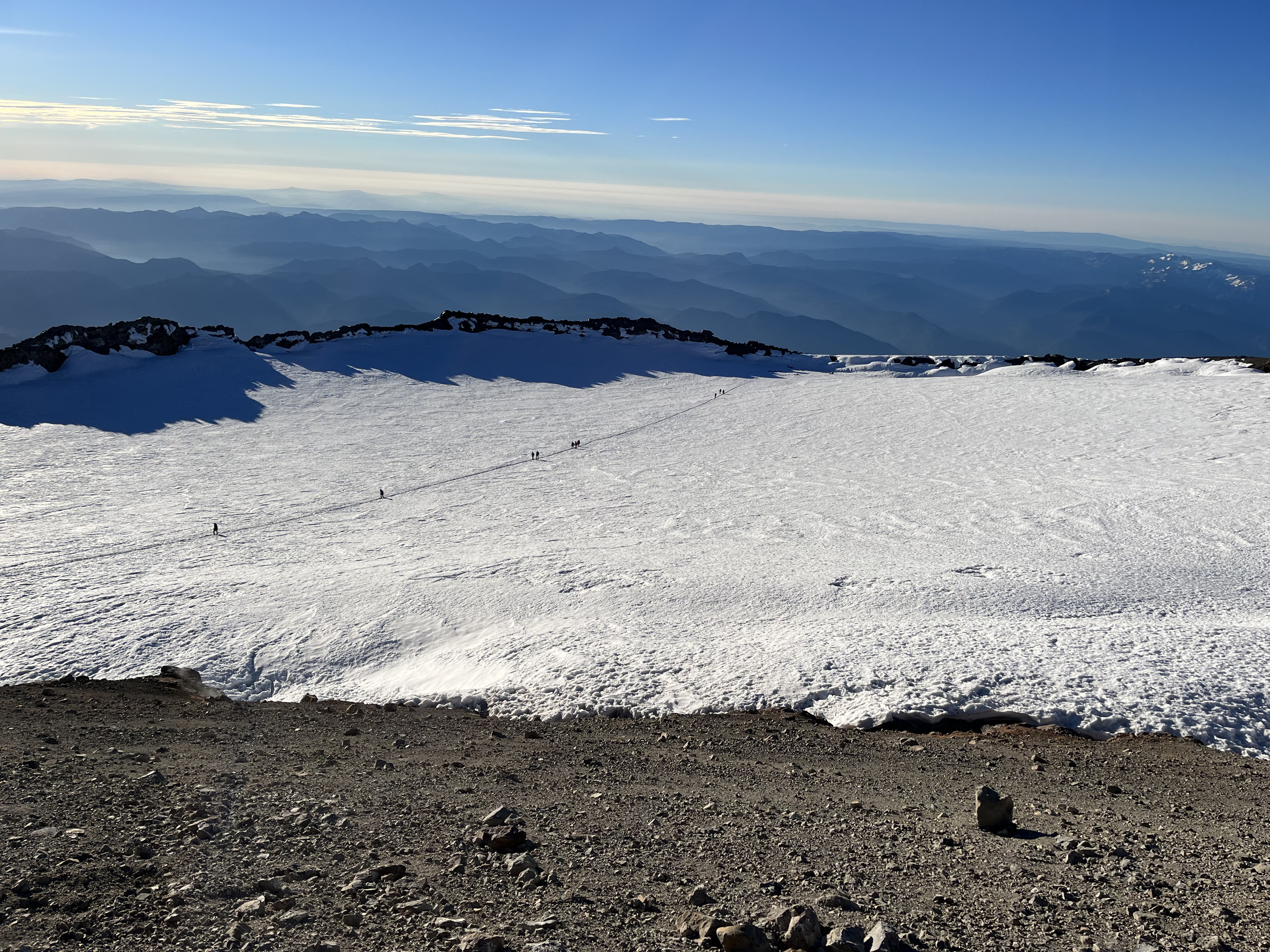
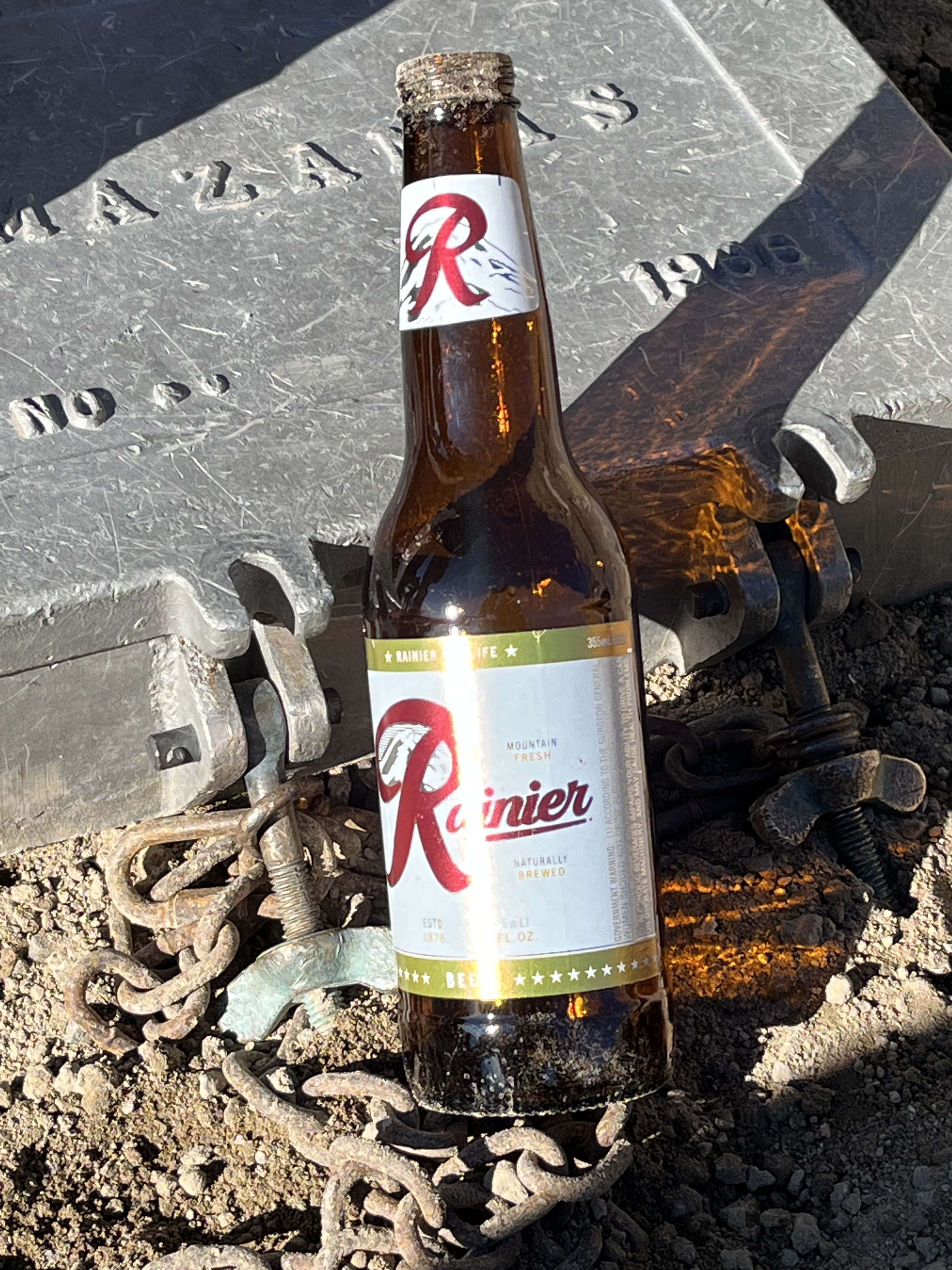
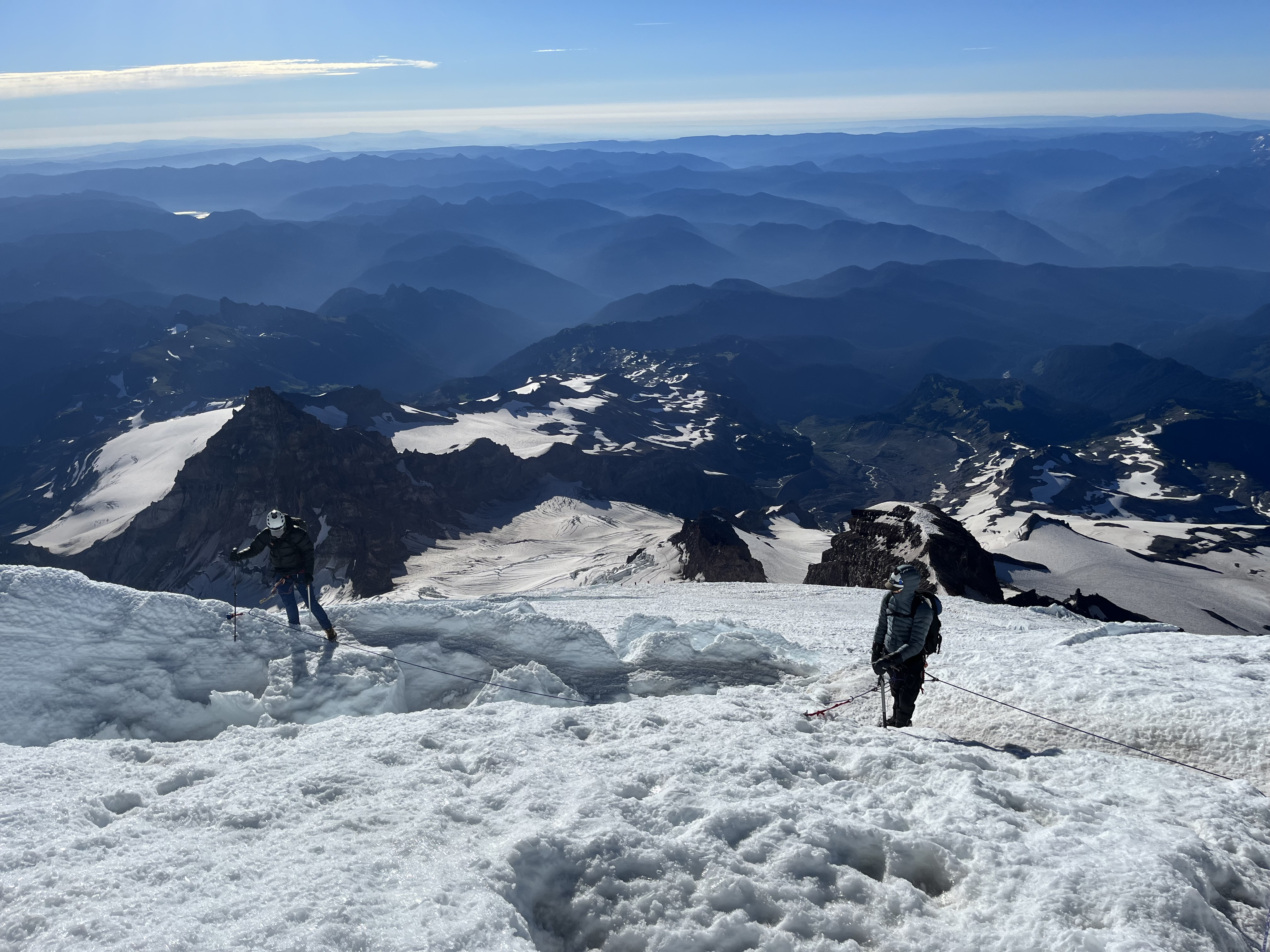
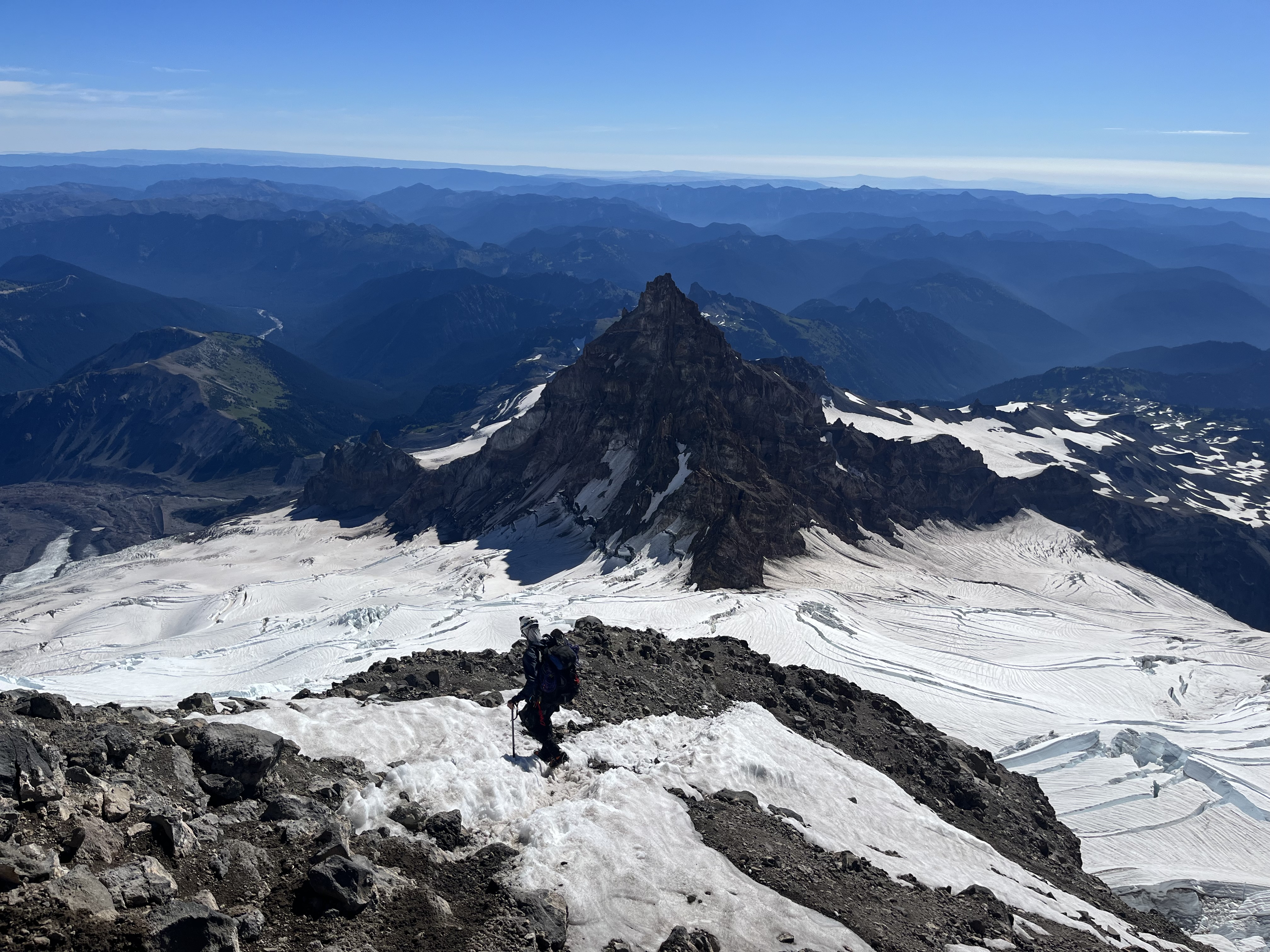
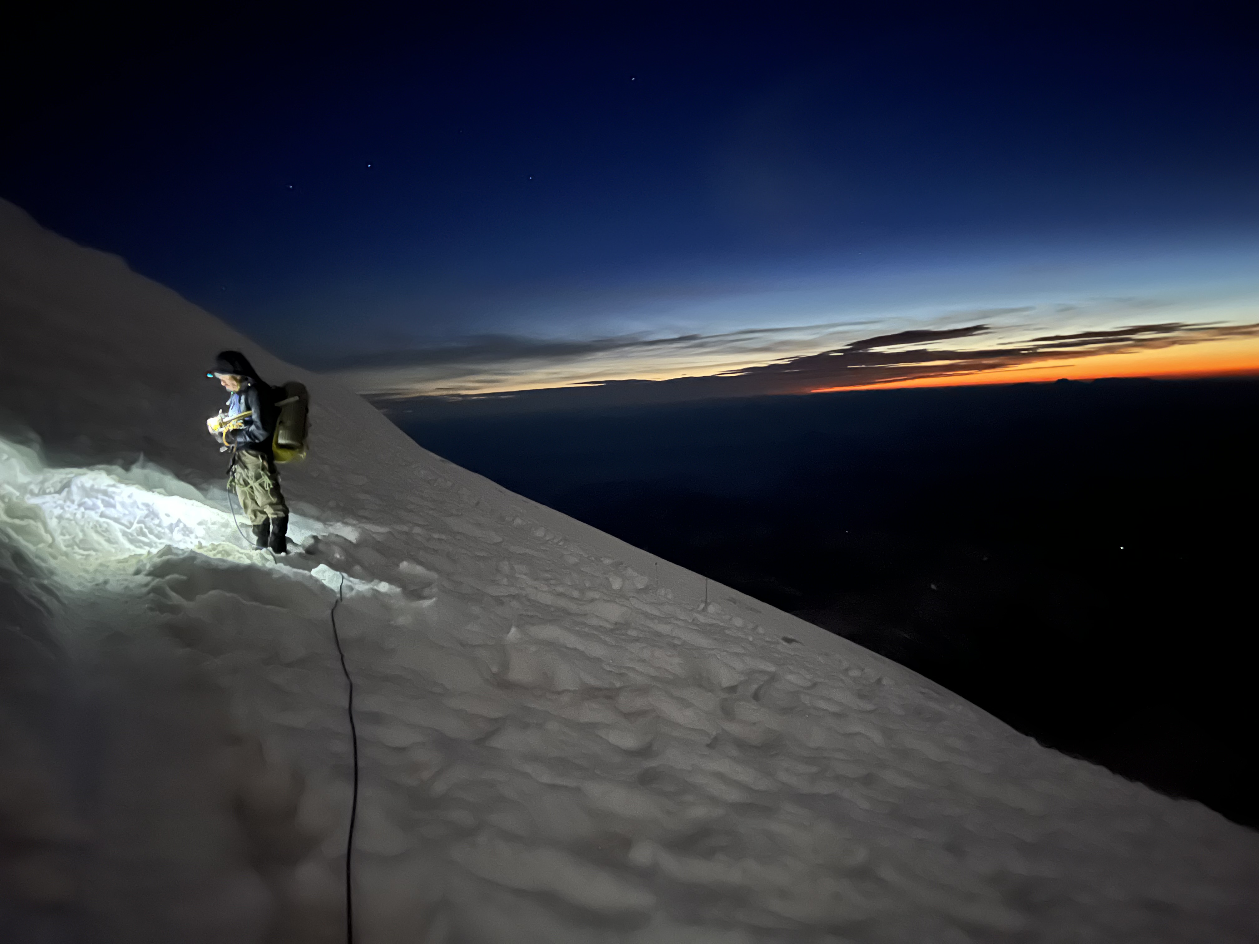
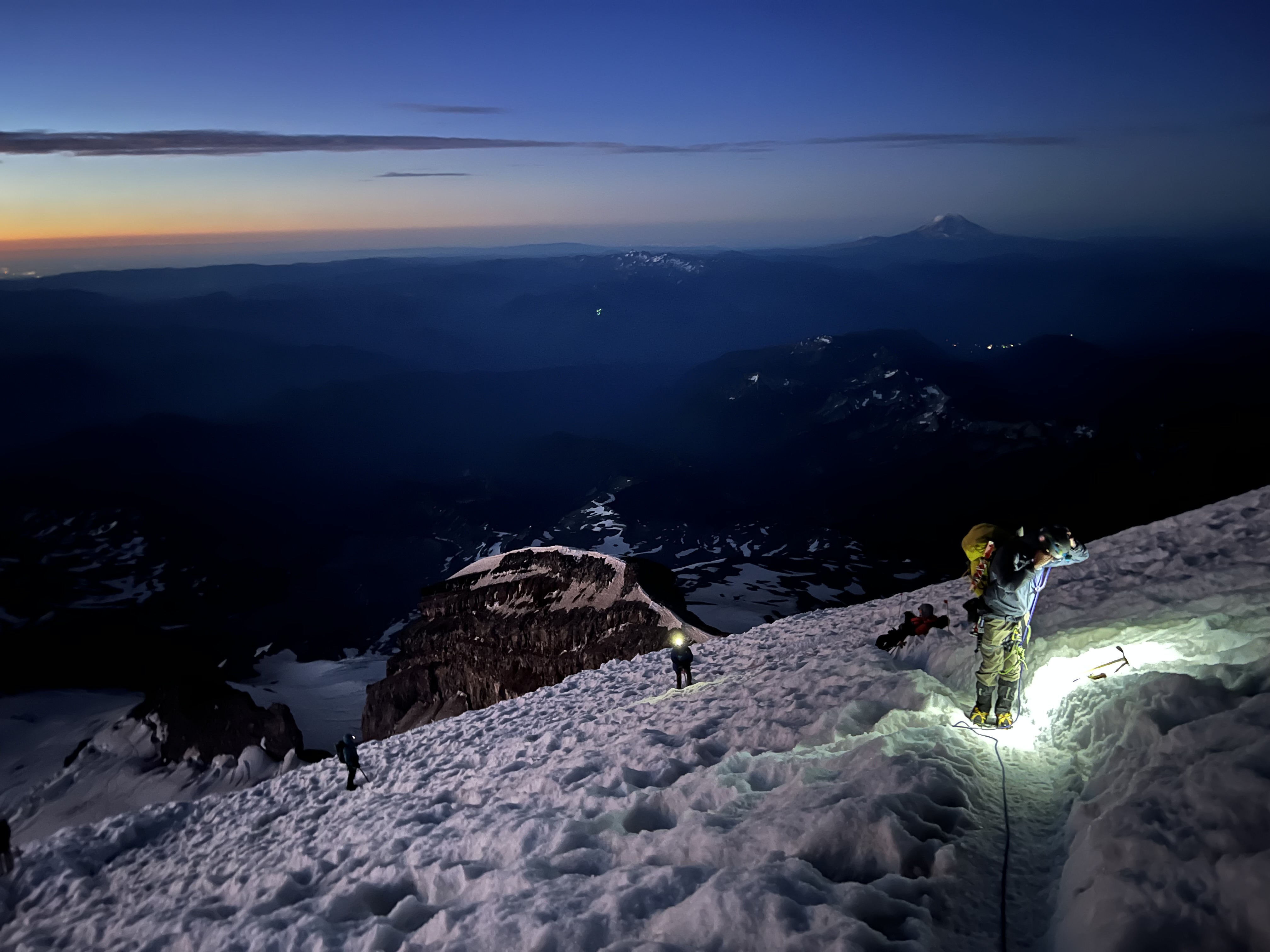
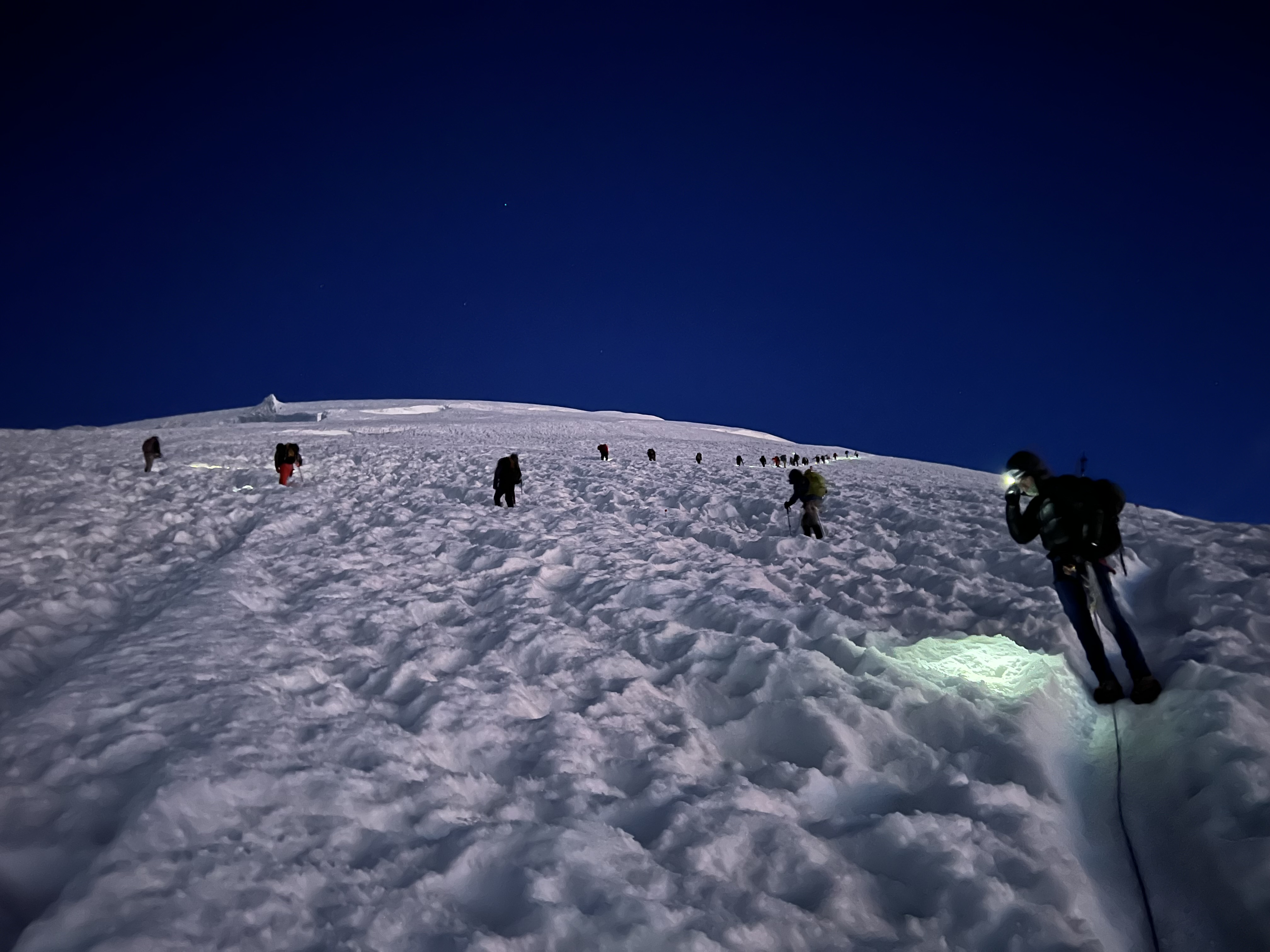
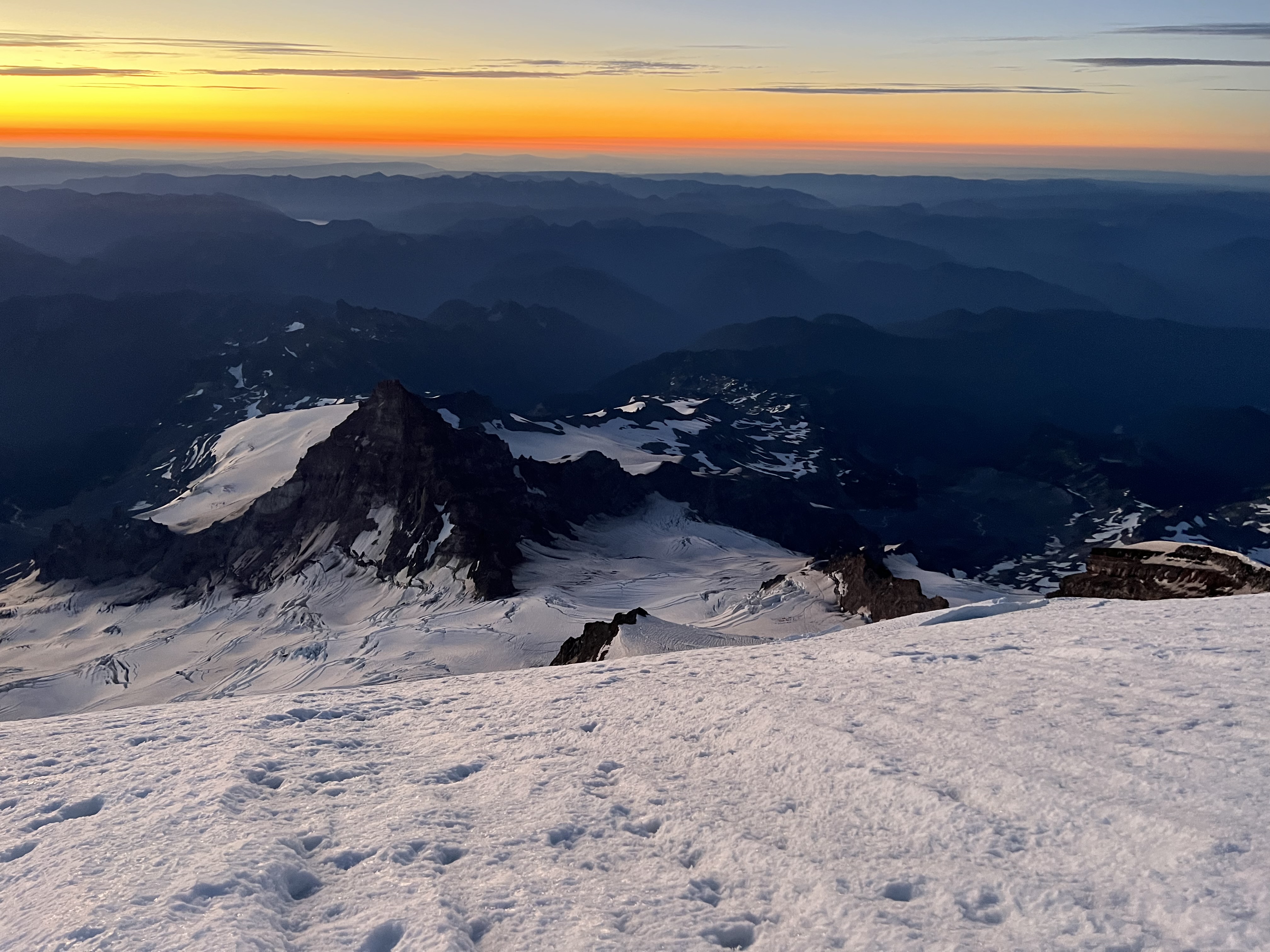
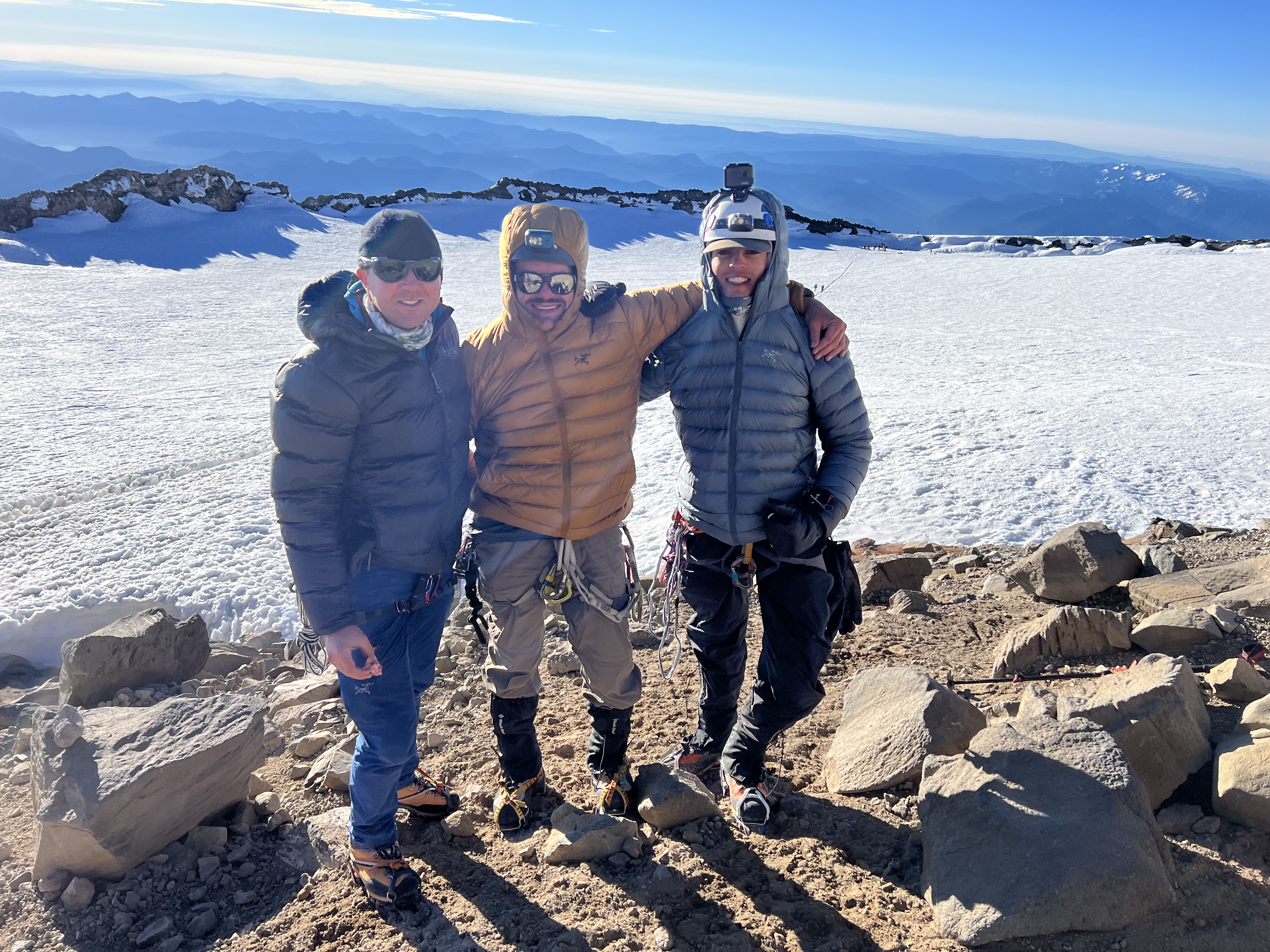
Trip: Mount Rainier - Disappointment Cleaver Trip Date: 08/16/2022 Team: @Stefan B @Thomas G @KaskadskyjKozak Trip Report: It goes without saying that Rainier is a rite of passage for many alpinists in the PNW. I myself attempted the Emmons route in 2004 with the Mounties, when I first got into climbing, and got AMS at 12500' and turned around. I headed back to the Emmons the next year (private party of 4) and bagged it. I returned a couple more times (2008, Fuhrer Finger, turned around at 13000+, 2011, summitted via the Kautz in late season conditions). Soon after I had moved on to bigger, better, and well, just different objectives and priorities. I vowed I'd only go back to Rainier to climb Liberty Ridge or the Tahoma Glacier routes, or maybe do a spring jaunt up the Gib Ledges. None of those ever transpired. It seemed every year they never worked out for one reason or another. The years flew by and I ticked off a long list of other peaks. My son had been itching for his own Rainier experience. Last year we went up the S spur of Adams - a good altitude trial. He crushed it. This year, I said I'd climb Rainier with him, but only if we could get up the Tahoma glacier. Once again the weather did not cooperate in June. And soon enough, the window had passed. Then my conscience kicked in. Who was it that had stuck with me for thick and thin, year after year, one shitty Bulger choss pile after another? Who suffered in the heat, smoke, wasp-infested bushwhack approaches, year after year? So, before my son had to leave for school, transferring to Boulder, CO, I committed. And fuck it, why not make it fun and relaxing. I pulled in a third, and planned a day off work and we set the date for a three day ascent via the good ole DC (which I had never climbed, but had descended back in September 2011 after climbing the Kautz). We had a perfect weather window, and conditions were reportedly still excellent on the route. We arrived noon-ish, with the multitude of tour-ons and a full parking lot at Paradise on 8/14. I dropped off my son and partner at the ranger station, then drove around and found a spot in the overnight lot and we registered for the climb. The ranger didn't seem thrilled about us for some reason, until I filled out my prior experience on Rainier. Then her mood changed ("nice" was what she said). We headed up around 1 and found a flattish spot at about 9000' on the Muir snow field in a few hours. We slept in and hiked to Muir early-ish (well after sunrise). I felt a bit nauseas and lethargic for the first hour or so, but perked up with a second wind at Muir. We continued on to Ingraham Flats, arriving mid-day. There was one other independent party at Ingraham from the East Coast who had made several annual attempts on Rainier with no success. The rest of the people there were guides and clients. We crashed early (6 pm) and set alarms for 1 am. However i woke up at 12:15 hearing the crunch crunch of the first party from Muir and the stoves from our neighbors. Time to roll, motherfuckers! I woke up my son and other partner, and we determined to get a move on. We were boots on the trail, roped up just after 1:30. The conditions were mild until the top of the DC, where it got windy and cold, but tolerable. The route was in good shape, with an obvious trail, and only a little sketchiness. Higher up (13000 and up) it got progressively colder and windier. It was in this area where we navigated some crevasses and used two ladders set by the guides, protected by pickets. As the slope mellowed, the sun came out, and the guided party in front of us stopped twice in a short amount of time for breaks, once for photos. I cursed them loudly and repeatedly, as well as the cold fucking wind, with half my face freezing from the prevailing wind. Overhead by a guide, he radio'd the party to step off the trail, and we passed on by. Moving faster, I got warm quickly and we soon were at the crater rim. My son and friend wanted a rest stop so we unroped and I continued ahead for the summit. They joined me within a few minutes. It was 6:40 am. We took pics, then dropped to the register and split a bottle of Rainier that my son had carried. I had more than my 1/3 share. It was so fucking refreshing. After copious time on the summit we knew it was time to go. The descent was smooth and without incident or problems. We got some cool shots of the crevasses, ladders, and views. My old body started to feel it after we got to camp Muir and I slowed down. I knew I'd be sore the next day, but it was more than worth it. What a way to end a season and send my son off to school! Gear Notes: Standard glacier travel gear Approach Notes: Mostly snow free until Pebble Creek

 3 points
 -
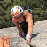
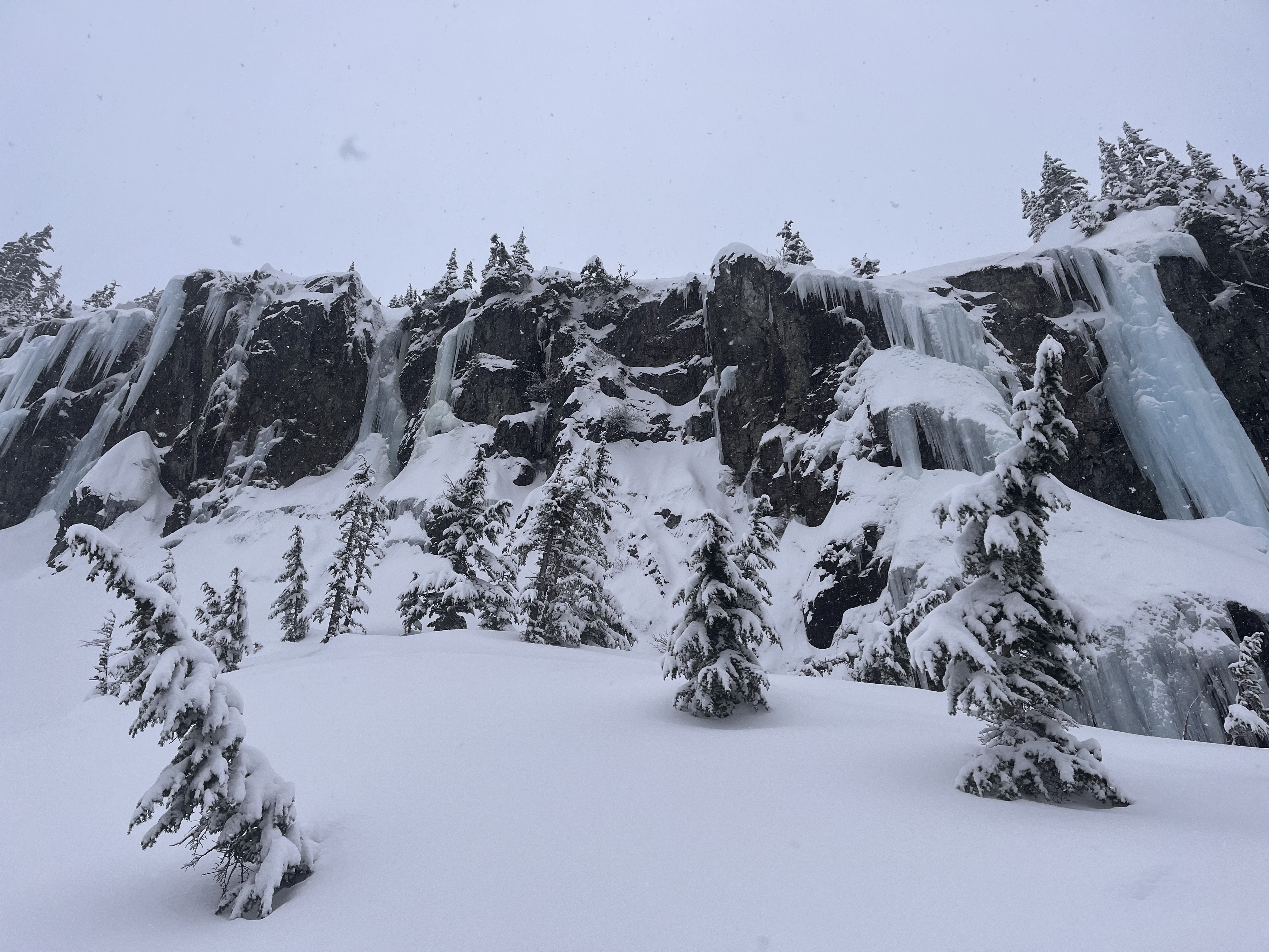
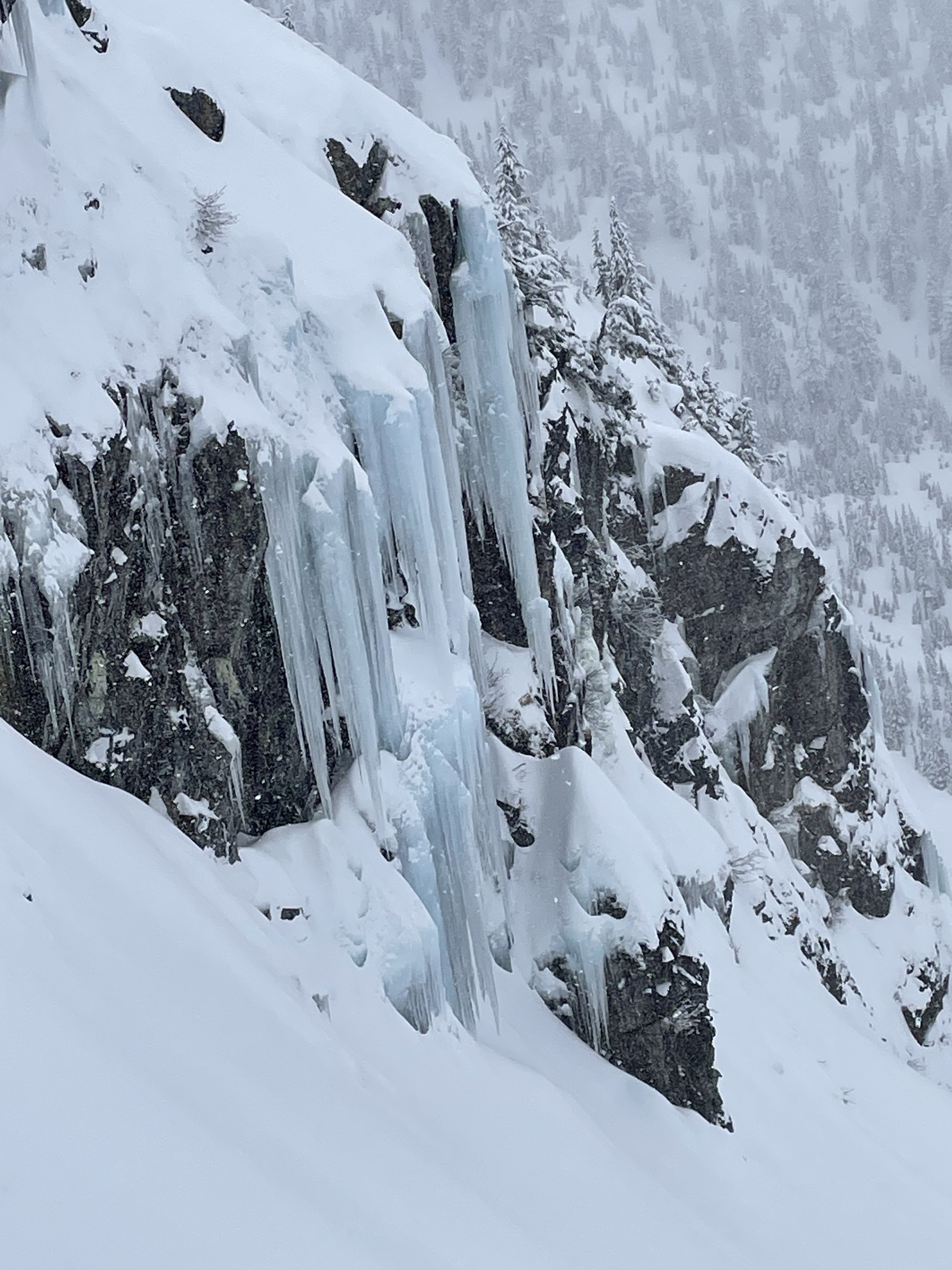
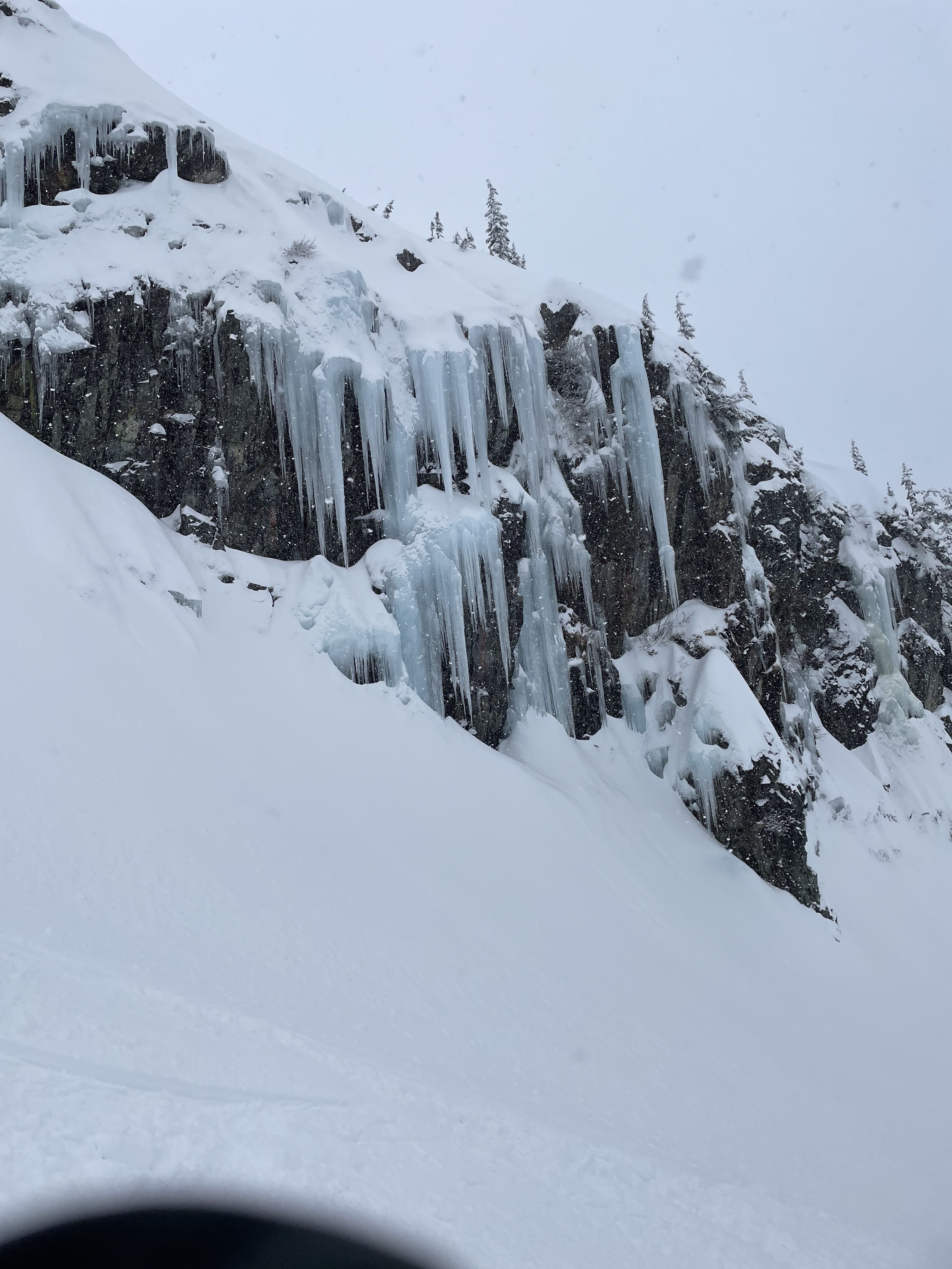
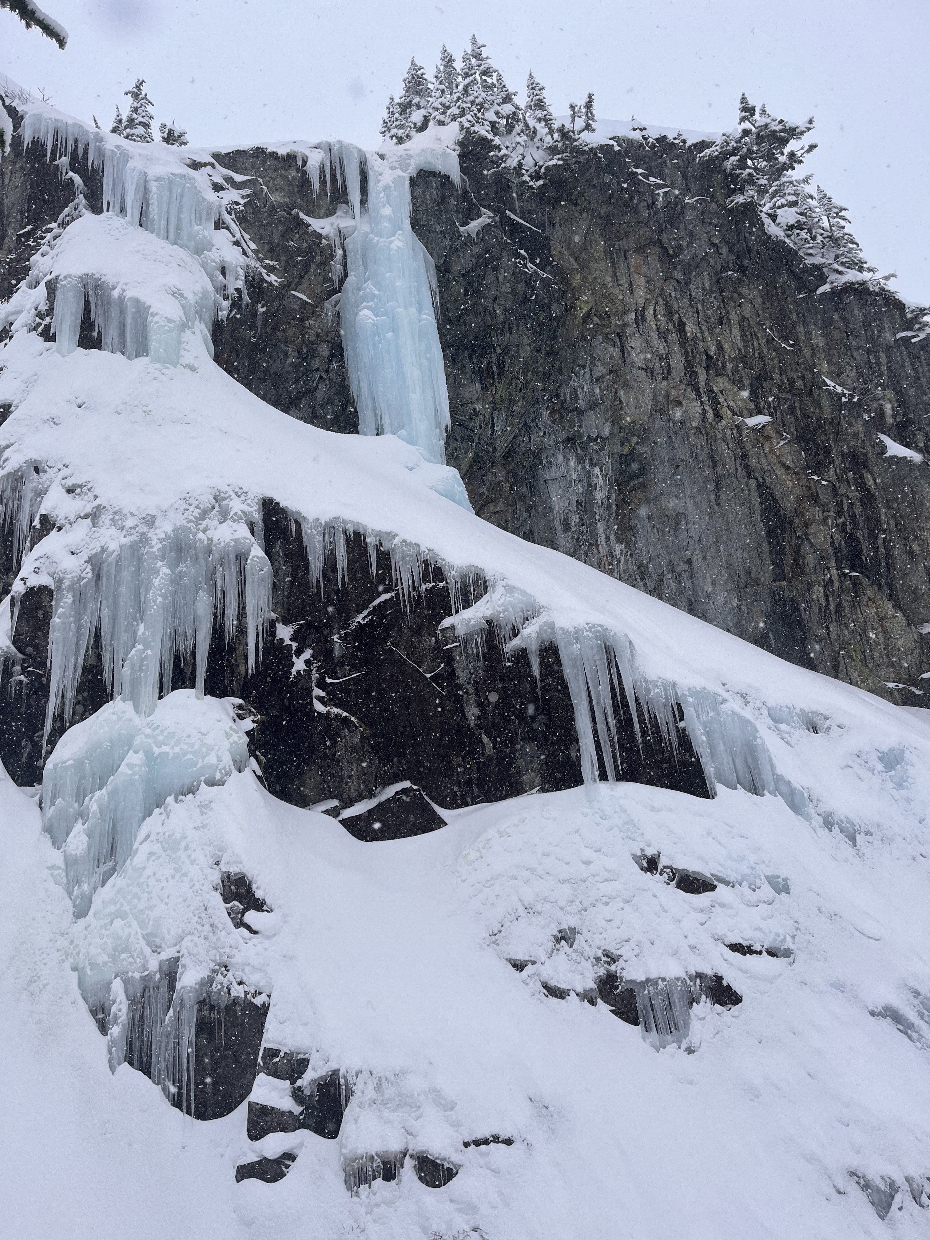
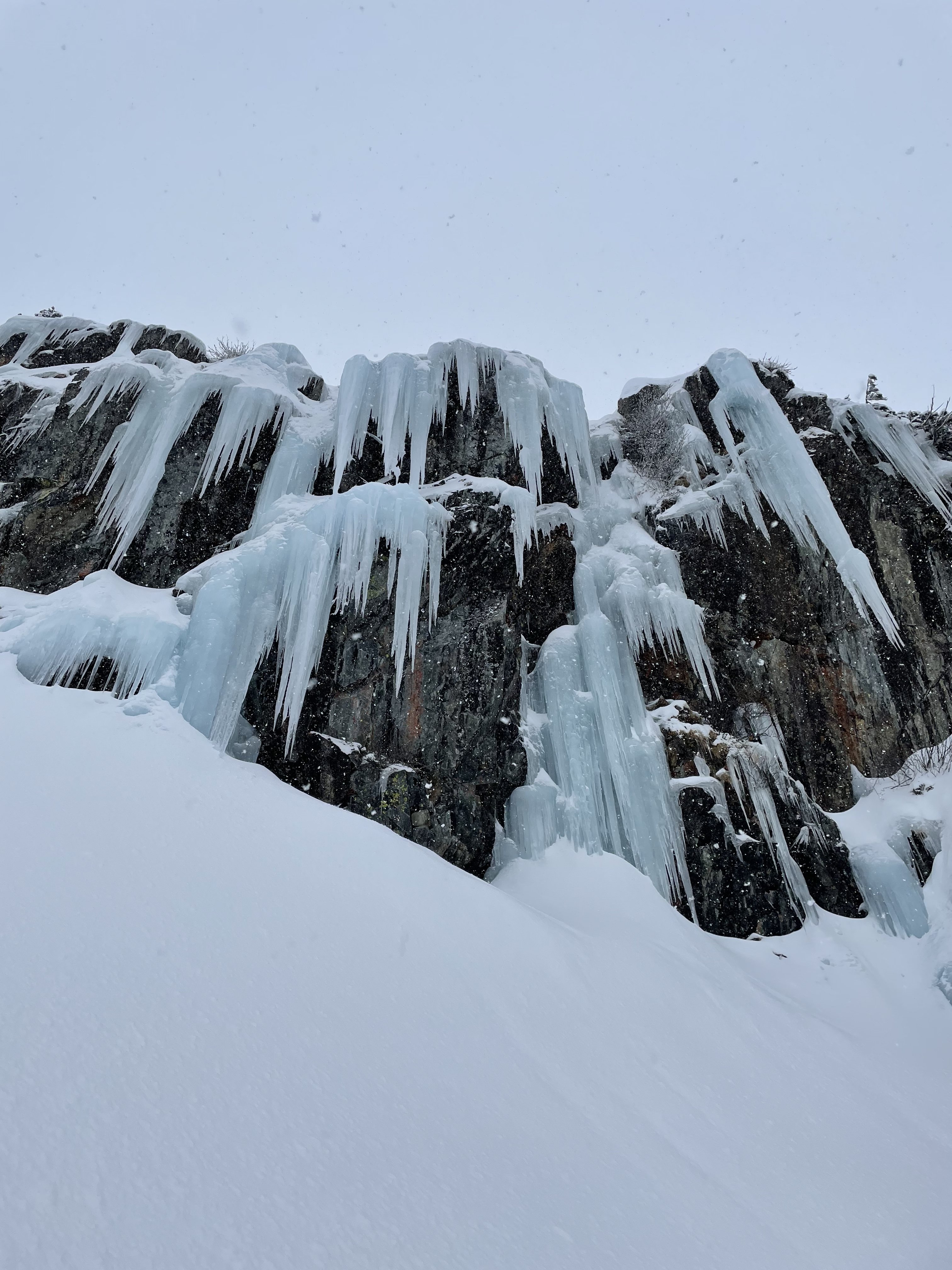
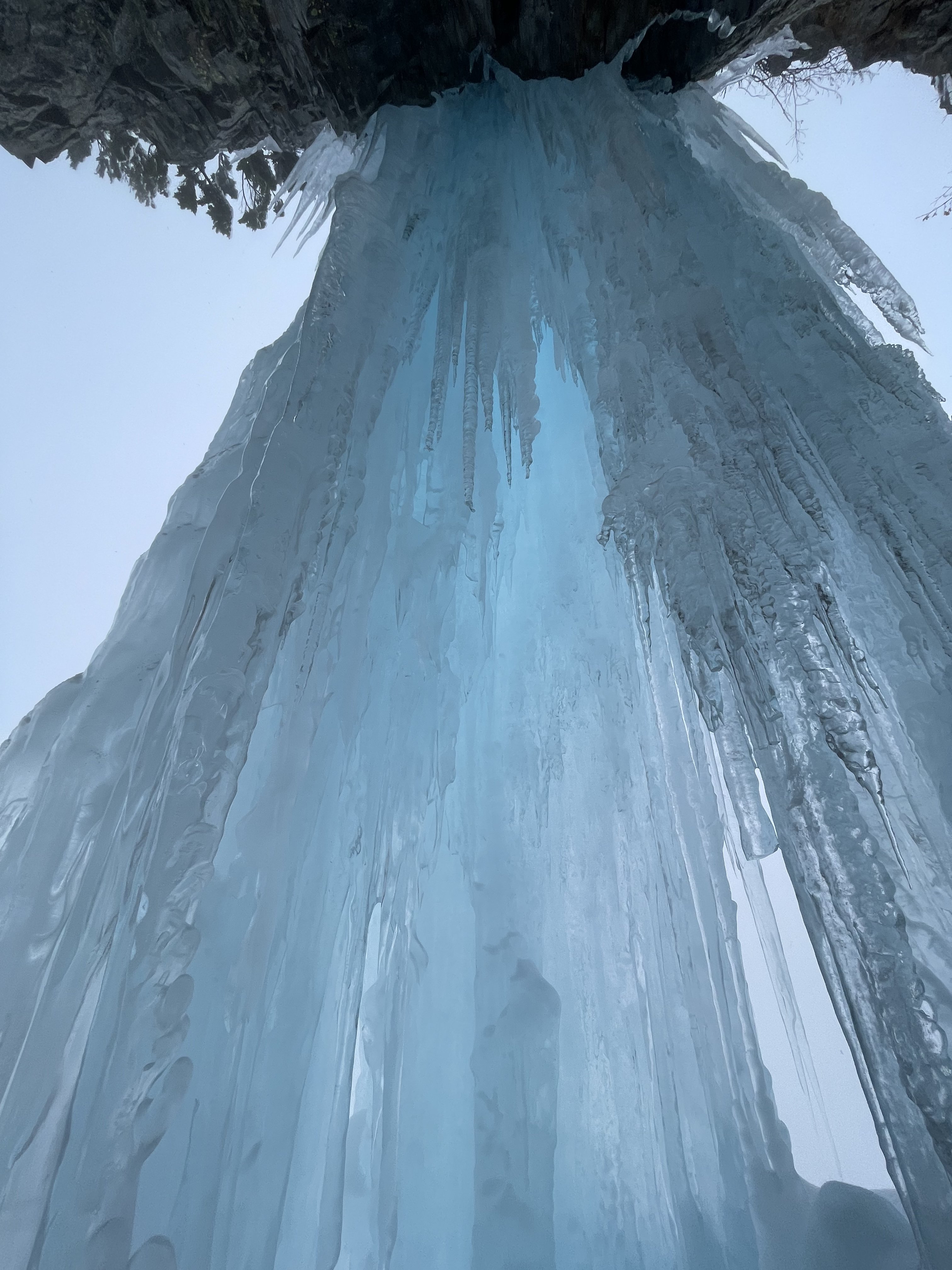
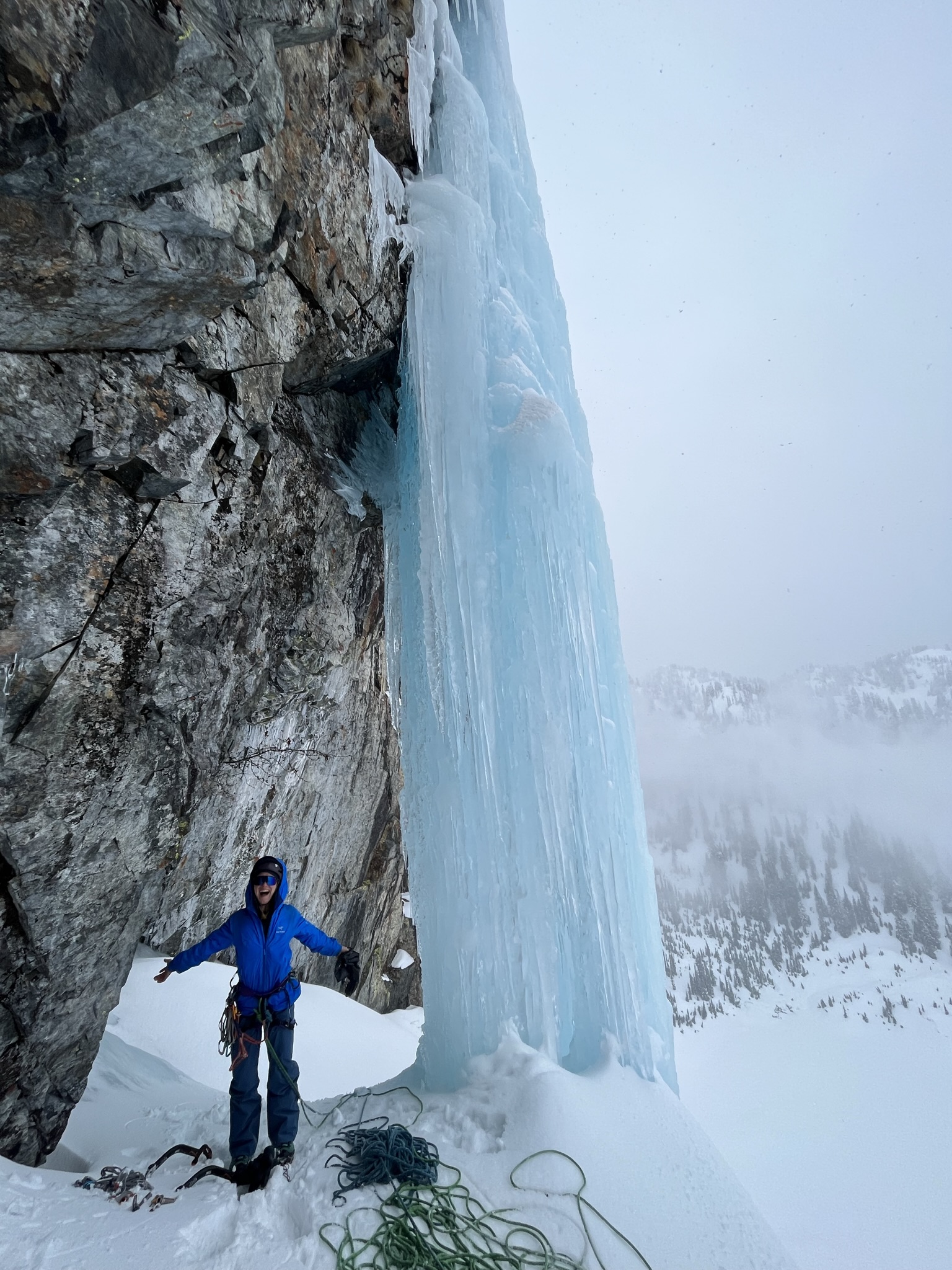
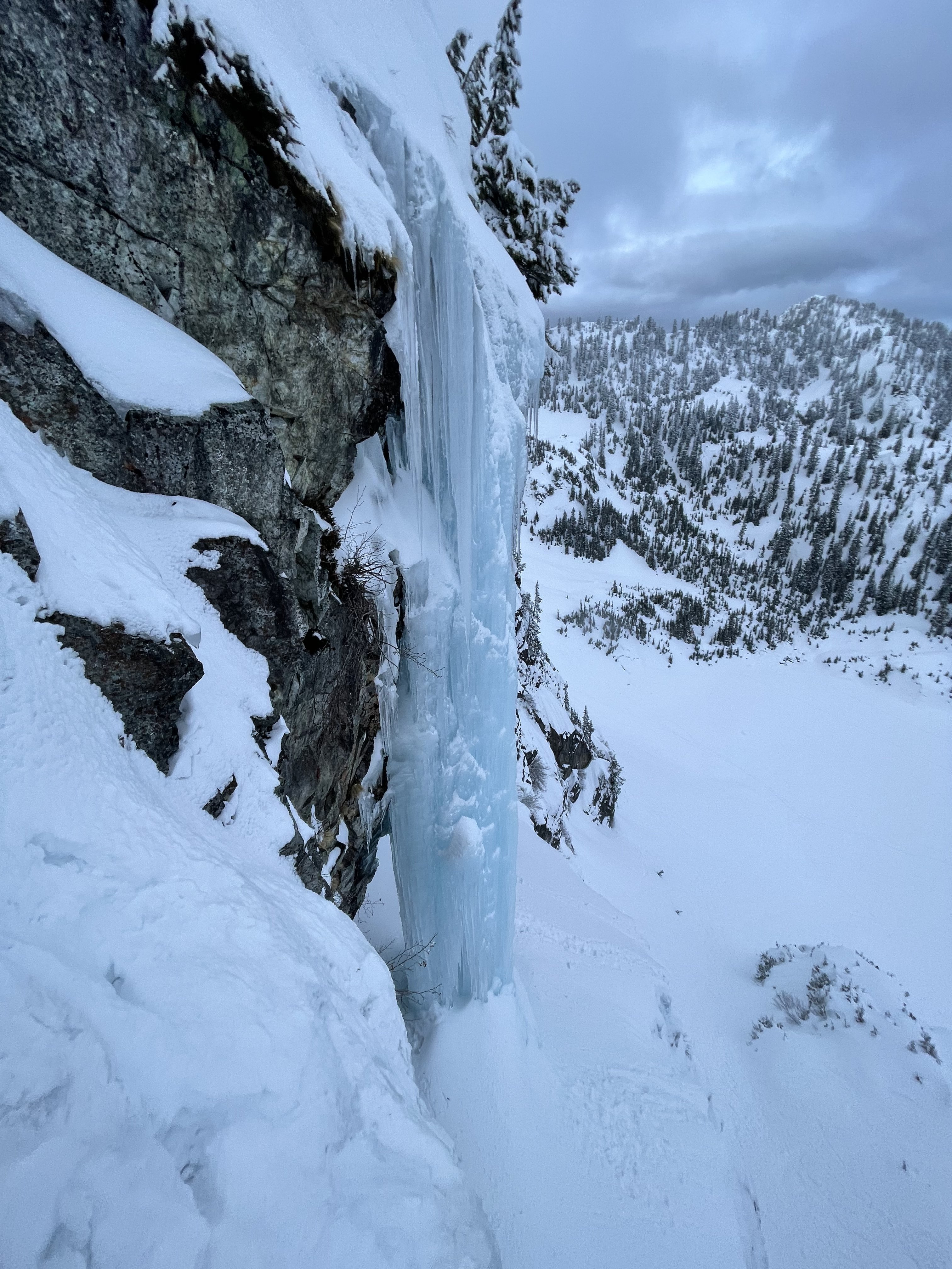
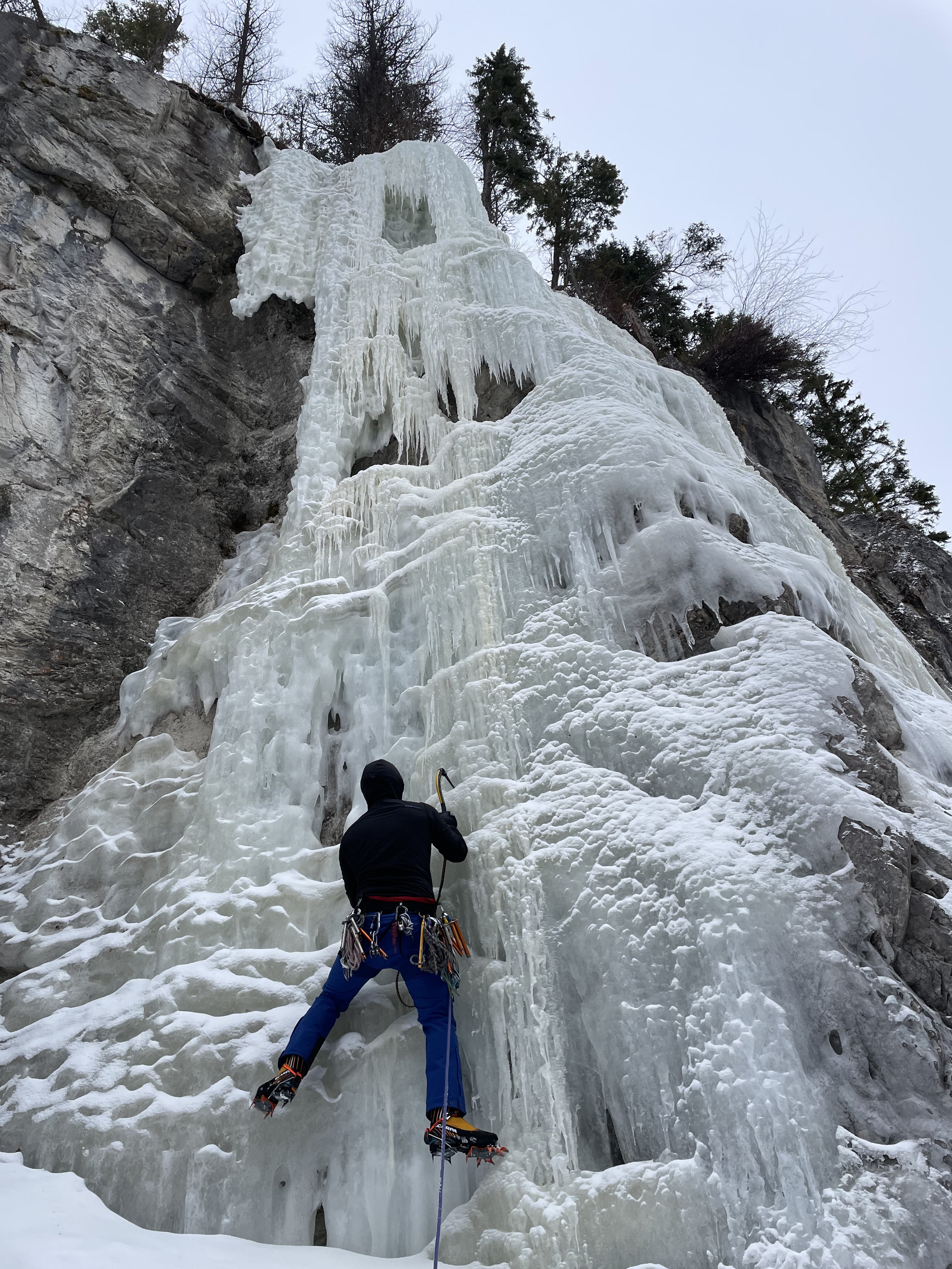
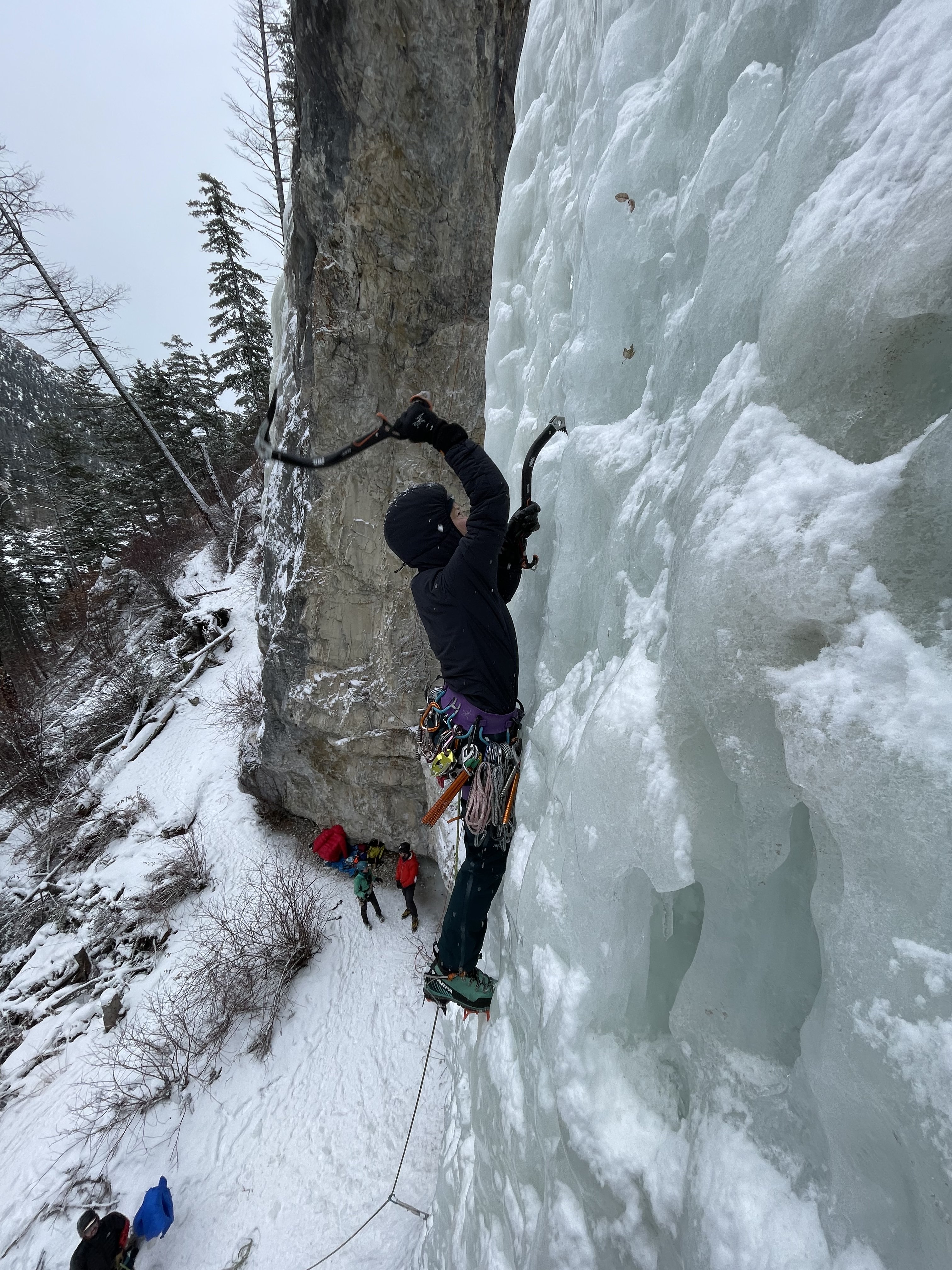
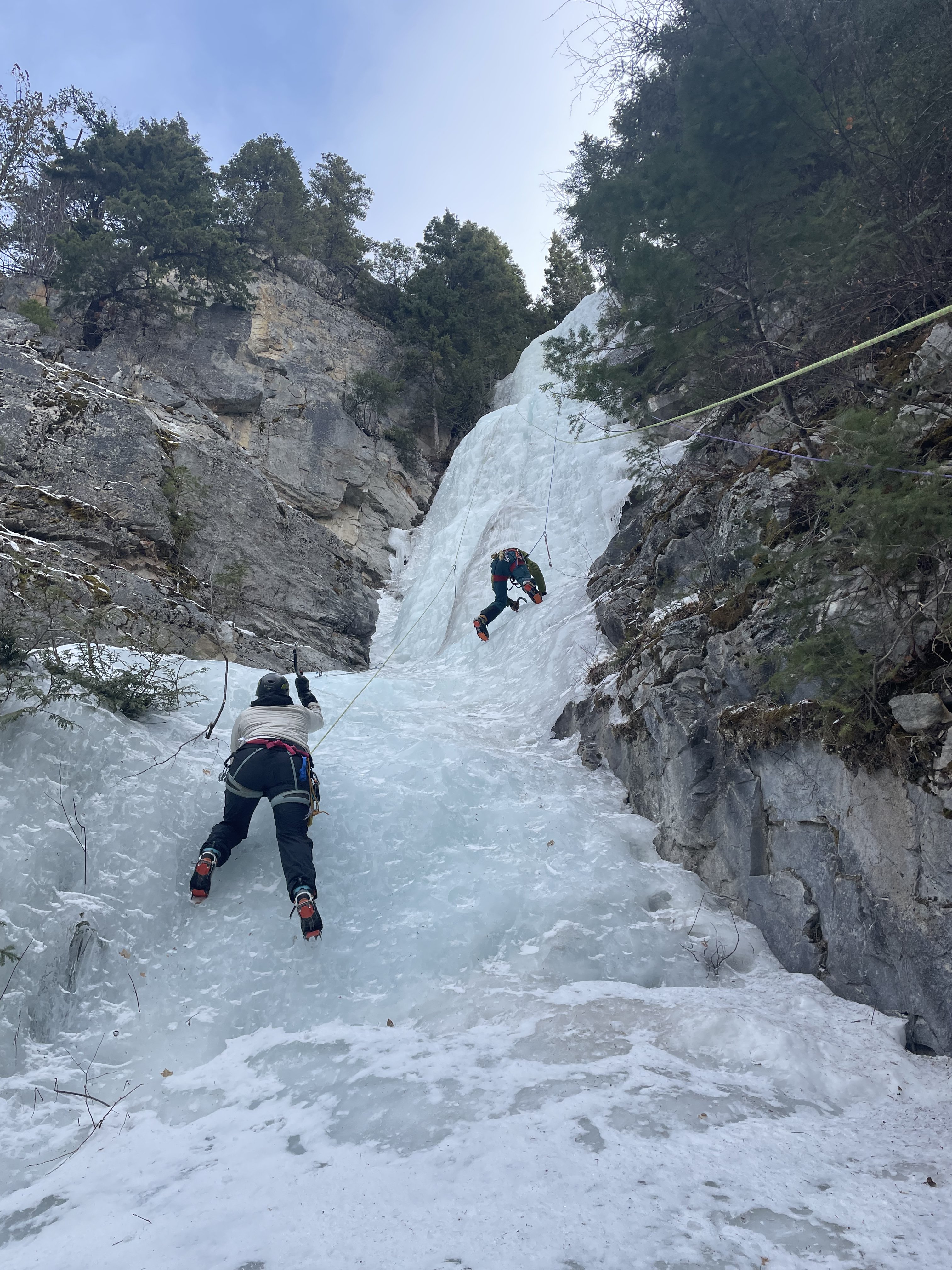
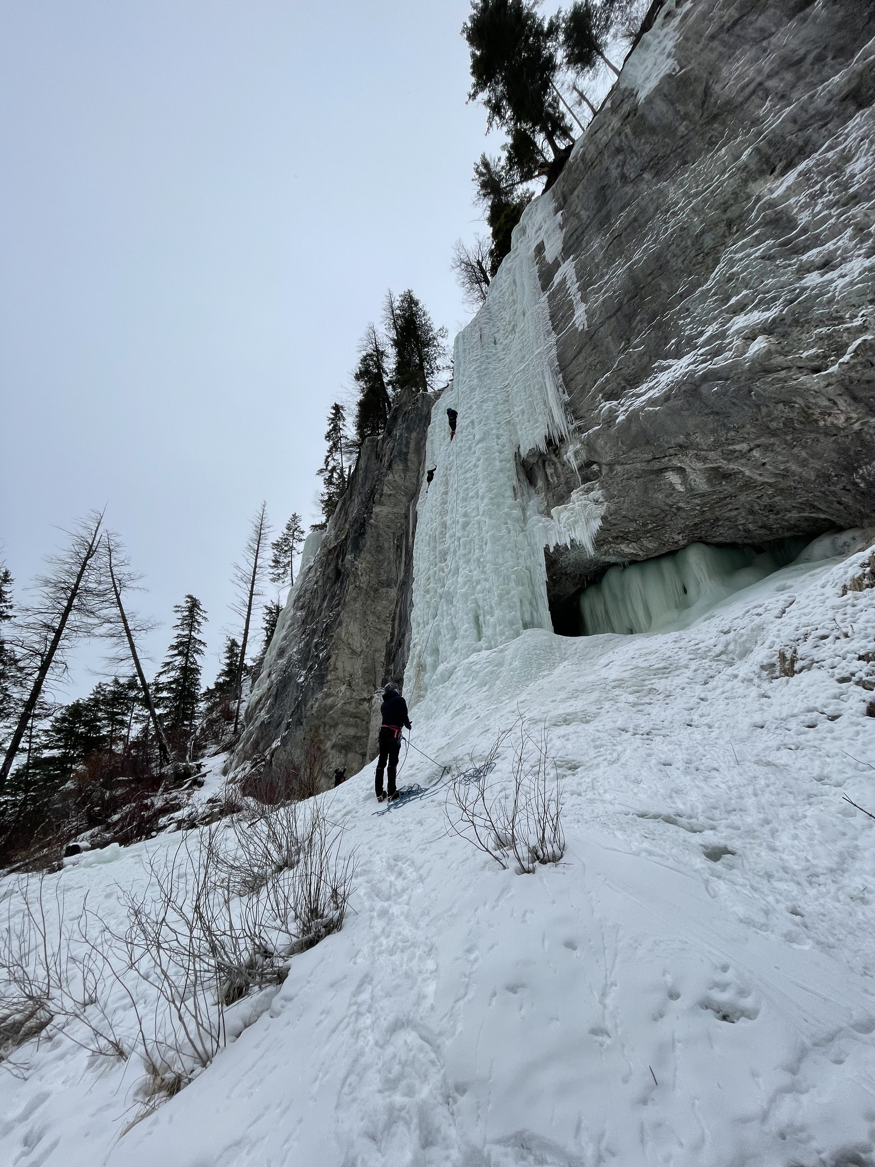
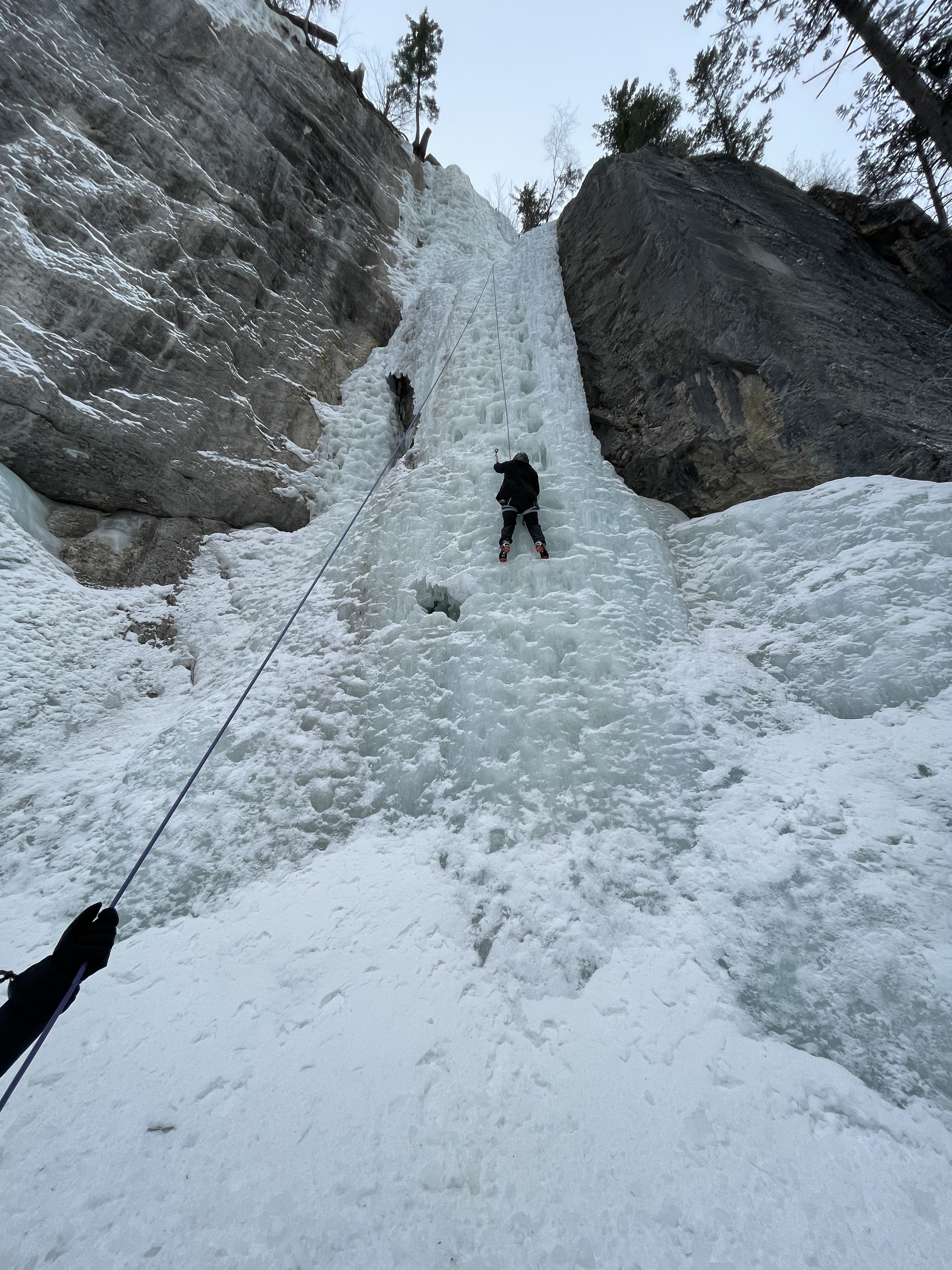
Here’s some photos from when Andreea, Nick and I climbed Steppenwolfe. Should have climbed the pillar but didn’t for various reasons, including uncertainty on the stability of the ice.
 2 points
 -
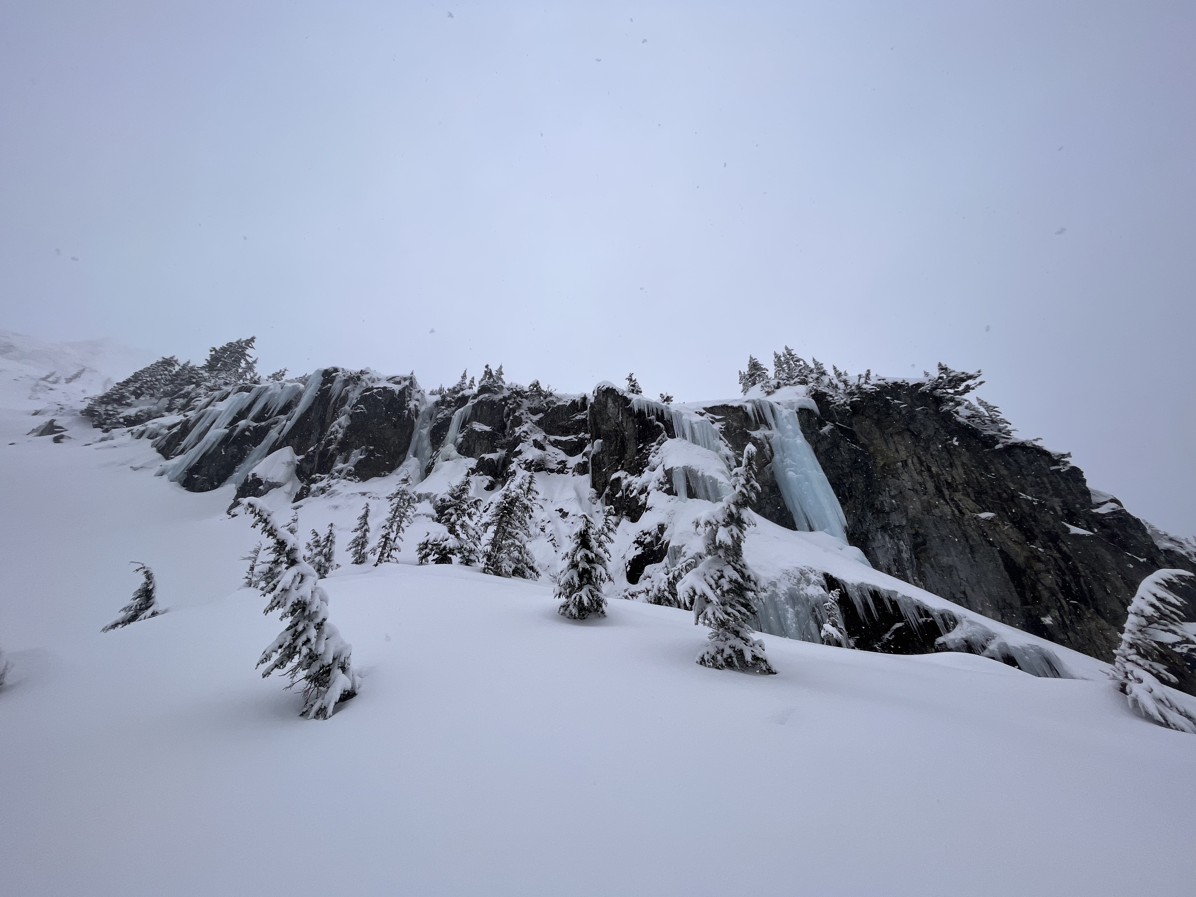
Climbed Icy BC and Deeping Wall on Sunday, both pretty picked out but all there. Dale's Route was pretty good and not picked out too. Icy BC in Standard conditions Deeping Wall Deeping wall Dales Route Rambles Center Rambles Left and Center were in as well. I've heard that Loose Lady is in, but thin and/or delaminating at the top (report from Friday)
 2 points
 -
While climbing the left arete of Little Sister last week I noticed shiny new anchor bolts on the right arete (two aretes pictured below). Seems pretty unnecessary: the route is 5.4, most parties are simul-climbing or soloing, and there is usually lots of natural pro in this rock. I'm not interested in stirring up drama but I am curious if anyone knows the intention and reasoning behind these bolts. I personally would prefer we didn't have these bolts in this specific situation, but I am open to a good reason I don't know about!
 1 point
 -
Trip: South Spectacle Butte - SW Ridge Trip Date: 02/25/2023 Team @Eric Gilbertson Trip Report: South Spectacle Butte (8,392ft) 60/100 Winter Bulgers Feb 25, 2023 Eric, Anthony, Andrew 22 miles hiking, 25 miles snowmobiling 3:30am – 1:30am Andrew belaying my down from the summit (photo by Anthony) South Spectacle Butte (SSB) is a Bulger peak nestled deep up the Entiat River drainage in the east central cascades. It is high enough to be among the hundred highest peaks in washington and is thus on my to-do list for the winter. I’d previously climbed South Spectacle Butte in September 2017 and remembered it as a fun scramble with a few exposed moves. I couldn’t find reports of previous winter ascents but I suspected it would a much more difficult climb when covered in snow and ice. The route In December 2020 Fred and I had skied nearby Pinnacle Peak and contemplated tagging on South Spectacle Butte since it looked so close, but decided to leave it for the future. On that trip I got some pictures of the south face that would be valuable for planning a future winter mission. There are two main approaches to climb SSB. The first is to start at Phelps Creek trailhead and hike over ice lakes to access the standard southwest ridge route of SSB. This requires a 23-mile snowmobile approach and 20 mile round trip hike. The alternative is to snowmobile in 12.5 miles to the Cottonwood trailhead up the Entiat River then do a 22 mile round trip hike. While the Cottonwood approach has a bit more hiking, it has the advantage that it doesn’t cross any avy terrain to get to the base of SSB and has much less elevation gain. Anthony and Andrew were interested in joining and we made the final call on the objective for the weekend after the Thursday evening NWAC forecast. This peak would make an excellent ski objective, but I’m trying to reduce chance of injury before a spring expedition so we decided to all snowshoe. It looked like some bad weather coming in Sunday so we decided to do the trip as a single push Saturday. We would bring a 60m rope and light rock rack just in case the exposed bits I remembered warranted roping up. In general I’ve found if something is 4th class or exposed 3rd class in summer it generally warrants roping up in the winter for me. Leaving the sno park at 3:30am Friday evening I discovered my avy beacon was broken, so I made a last minute purchase of a new one at a nearby shop then headed out. I made it to the Entiat Sno Park at 10pm and managed to get a short nap in before our midnight meetup time. Andrew was there at midnight, but unfortunately I had screwed up my trip plan document and Anthony was at a different sno park! Luckily we sorted things out and were all at the correct sno park a few hours later. By 3:30am we had my snowmobile all loaded up and headed out. Andrew would wear ski boots and get towed in then snowshoe the hike with us so we could most efficiently split trail breaking duties. We rode up the freshly-groomed road with me and Anthony on the sled and Andrew getting towed behind. I kept a constant 20mph speed, which I’ve found is the sweet spot for towing. A little bit faster and I tend to lose the skier behind me, and any slower and the ride takes too long. Andrew wore my bike-tube belt with 3-1 z-pulley setup for a hopefully smooth and comfortable experience. First views of the peak We made good progress up the road, and after the Duncan Hill turnoff we appeared to be only the second set of tracks on the road since the 2/17 groom! There was one major tree across the road but I was able to ride around it and didn’t need to get the chainsaw out. After 45 minutes we made it to Cottonwood trailhead. I took a few loops around the lot to hit the high RPM bands then we all unloaded. The trailhead register didn’t have any sign ins since October but I was sure to add our names. We were soon heading up the trail, which was surprisingly easy to follow in the dark. It appeared a few snowmobilers had gone up the trail not too long ago, making a nice trench that was easy to follow. At the ice creek – entiat river confluence I suppose I could have easily continued a ways up the trail on the snowmobile (it’s legal since it is not wilderness), but I’m following a self-imposed rule to only take motorized transport to the trailhead for winter Bulger climbs, and do human-powered transport beyond that. Amazingly the snow was very well consolidated. It was basically a firm icy base with just a few inches of powder on top – dust on crust. So we managed to average around 2mph! That certainly helped make up for any lost time a the sno park. Usually in winter I estimate around 1mph breaking trail through deep snow, as had been the case a few weekends earlier in the next valley over climbing Dumbell and Greenwood peaks. We alternated leads and the snowmobile tracks ended a few miles in near the Duncan Hill turnoff when the terrain got steeper. The trail was still pretty easy to follow. Just before sunrise we’d passed Myrtle Lake and got our first glimpse of SSB in the pink alpenglow. This is one of the rare peaks that presents itself well in advance and we all appreciated the views of the route. It looked incredibly steep, but I knew the foreshortening was likely deceptive. Hiking up At the ice creek – entiat river confluence we left the trail and headed up the ice creek drainage. Travel was easy in the open forest and we made good time. The snow got slightly deeper above 4500ft but not enough to significantly slow us down. My original intended route had been to spiral around to the northwest side of the peak to gain a low-angle basin that was the standard summer route. But with the snow conditions were stable we decided to make up a little bit of lost time by taking a slightly more direct route. On the southwest face we found a route on mostly mellow tree-covered slopes that would be safe from avy danger. I led the way snowshoeing up the slope. Nice views back towards Ice Box, Freezer, and Maude As I got higher the clouds started to dissipate and the sun actually felt very warm. Andrew was even delayering to shorts and a T-shirt, though I didn’t go quite that extreme. We got excellent views of Ice Box and Freezer peaks across the valley, and eventually of Maude and Fernow farther to the north. Starting across the crux gendarme (photo by Anthony) We eventually reached the skyline ridge at 7200ft and stopped to take off snowshoes. The ridge was scoured down to rock with icy snow nearby, and crampons were the right tool for the job. I led the way up a bit to 7400ft, then traversed right around the first gendarme following my old GPS track. The snow was well-consolidated and stable, with only a few small isolated pockets of 3inch wind slab that was very stubborn to trigger. I rounded the south face of the gendarme then kicked steps up the steep snow slope to the base of the next gendarme at 7,700ft. This was the crux I recalled, and it also required traversing around on the right. I got up to the edge of a flat subsidiary south ridge bench with a small tree on it and stopped to scope out the route. The slope was very steep and exposed to get around the gendarme, but after that it looked much more mellow. I actually saw a small cairn poking out of the snow on the traverse, and this confirmed it was the correct route. I was certainly happy to have the rope for this climb in those conditions. Partway across I volunteered to lead and I was soon racked up and we had the 60m rope flaked out. Andrew tied on to the tree and started belaying me over. The plan was Anthony would tie in the middle and if the rope reached the other end I would belay him across, then he would belay Andrew across on the other end. If the rope didn’t reach all the way around we’d just simul climb across. I got in a solid cam at the start of the traverse, then carefully kicked steps in. The snow was nice and consolidated, but it still felt good to have the security of the rope and gear placements. I got in anothe piece just before the steepest bit, then I made a delicate traverse above big exposure. I carefully kicked steps in the snow and rounded the corner. Then I got a solid nut in and continued on sligthtly easier terrain. Anthony following across I continued traversing while digging out snow with my hands and knees before kicking steps in. I got in a few more good cams but then ran out of rope. So Anthony followed behind simulclimbing. Soon I reached the mellower ridgecrest on the other side and built an anchor with a cam and my ice axe. I belayed Anthony over the rest of the way then he belayed Andrew over. The ridge above us looked mellow enough to do unroped, and I didn’t recall anything particularly worrisome beyond that traverse. But I’ve been burned too many times in the past thinking the difficulties were over and ditching my climbing gear. So I made the call that we should still take the rope and rack up just in case it was necessary higher up. I started kicking steps up the slope while Andrew and Anthony coiled the rope and sorted gear. I made it a ways higher, but then the terrain became a very steep and exposed snow slope on the south side, which is the standard summer route. The north face was a sheer cliff. The ridge crest proper looked safe, with exposed rock, but would definitely warrant a rope. Climbing up the ridge I stomped out a platform just below the exposed part and let Andrew and Anthony catch back up. We were getting close to the summit, but were also starting to get short on time. The three-hour delay in the morning had put us a bit behind schedule and I was nervous about summitting before sunset and before the storm rolled in. So we decided to simulclimb the remaining ridge all the way to the summit. This would be much faster than pitching things out. I took all the gear, built an anchor in some rock, and was soon climbing. I kicked steps up to the ridge and had to scramble up some icy rocks to reach the crest. I got a cam in there then followed the edge of the rocks near the crest. A bit farther I got a solid picket placement, then continued. Soon I ran out of rope and Anthony joined, and he was then followed by Andrew. We took our time, and I was generally able to have at least two pieces between climbers at all times. Crossing onto the north side (photo by Andrew) Around 8000ft the south side looked very steep and sketchy and I crossed over to the north side. This is definitely not the summer route, but the north face was scoured down to rock and offered better gear options. Luckily it wasn’t quite as steep up at that elevation. I eventually wove back onto the south face to get around the highest gendarme, then on the other side I gained the final knife-edge snow ridge leading to the summit. The final knife edge before the summit After about five ropelengths I made it to the snowy and flat fore-summit and built and ice axe anchor to start belaying. It was very windy by then, and I think the evening storm was approaching. Mt Fernow had been stuck in the clouds for the past hour and Mt Maude was just starting to get cloudy. I imagined SSB would suffer a similar fate soon and I didn’t want to be there when it happened. On the summit (photo by Andrew) Andrew soon followed, then we switched roles so he belayed Anthony up. I then carefully made my way over to the true summit. The east face of SSB appeared to be a huge cornice but the west face was scoured to rock. So I made sure to tiptoe just on the rock. Interestingly the summit cairn was actually exposed, so I was certain I tagged the highest rock and didn’t need to go near the cornice. I hastily dug around but had no luck finding the summit register. This is pretty common on winter Bulger climbs. On the summit As I headed back as Anthony reached the foresummit. We exchanged high-fives and took turns going over to tag the summit cairn. It was 4:30pm by then and we had an hour left of official daylight. That meant the lighting was getting very colorful, but we were also getting short on daylight. I really wanted to be off the technical section before getting hit by darkness and the storm. We snapped a few final pictures, then I took all the gear back and Andrew started belaying me down. Climbing back down (photo by Andrew) I carefully walked down the knife edge, then started puting gear in. The ridge wasn’t steep enough to rappel so we would need to simulclimb the whole way back. The return would be much faster, though, since I’d already kicked steps in and I remembered all of my previous gear placements. As before I got in generally two pieces per 30m rope section. I got in a good variety of cams, nuts, pickts, slung horns, and the occasional slung bush. We were very effifcient going down, and even stopped to take occasional pictures of the brilliant sunset over Glacier peak and Mt Maude. Climbing back down (photo by Andrew) Back at the edge of the crux traverse we stopped to regroup and I collected all the gear back. Andrew then belayed me back over. I put gear in the exact places as before, and was soon around the exposed corner and back to the tree belay. Anthony and Andrew soon followed, and we all made it across with a little bit of daylight still to spare. From there we downclimbed the snow slope, traversed around the lowest gendarme, then followed the ridge back to our stashed snowshoes. By then it was finally dark enough to need headlamps. I’d say our timing was perfect, since we were up on the summit ridge at the right time to see a great sunset, but still got off the technical part before we needed headlamps. Heading down in the dark As we were packing up the snowshoes the wind picked up and it started snowing. That was the start of the storm coming in. We finished up quickly then cramponed all the way back down to the trees. That would have been a fun line to ski, though the patches of breakable crust would probably be challenging. Back in the trees at 5200ft we transitioned back to snowshoes and started cruising down the trail. The rest of the hike out was cruiser snowshoeing on autopilot. It was nice to not have to think about navigation at all – just follow the up tracks. At lower ice creek I stopped at an open hole to go fishing for water. I tied my nalgene on paracor to the end of my hiking pole, tossed it in the water, bobbed it up and down, and reeled in a nice full liter. The rest of the hike out went smoothely, and we reached the trailhead by exactly midnight. There were no other snowmobile tracks in there, and I guess it’s not a super popular location. We were soon loaded up and Andrew had his skis on ready to get towed. I started slowly then eased up to 20mph and started cruising out. Back at the sno park (photo by Anthony) The ride out went smoothely, and I saw a lot of fresh snowmobile tracks going up the Duncan Hill turnoff. The road was still nice and smooth, and by 1:30am we were back at the sno park for a 22 hour round trip. Anthony had to be at work that morning so soon headed out. Andrew and I ended up just sleeping a few hours at the sno park before heading home in the morning. Link to more pictures: https://www.countryhighpoints.com/south-spectacle-butte-winter-ascent/ Gear Notes: Rock pro to 2", 2 pickets, 60m rope Approach Notes: Snowmobile from entiat sno park to cottonwod trailhead1 point
-
All I did was format the "Team:" part with bold and then added us with the "@" and then our. user name with no space.1 point
-
I can state that -- as far as I know -- it wasn't an Alpine Institute guide that put in the bolts. It would certainly be unnecessary to place bolts there for a skilled guide. As far as bolting in wilderness in Washington, that is still allowed as long as you use a hand drill. It is not allowed in North Cascades National Park. Jason1 point
-
The Doves: Kingdom of Rust1 point
-
I thought immediately of this Have only been in this gully once, in very different conditions. Still the hazard was significant. Hard to stay out of the path of anything that cuts loose anywhere above. That experience was enough to make me steer clear of this spot in winter. I wish I knew what motivated this team to travel from NY to WA at this time of year and choose this specific objective over the many others they might have chosen. So many options are available, even in winter, that offer significant challenge and satisfaction with far less chance of dire consequences.1 point
-
We are getting a constant and consistent wave of spam in the forums. Me and the mods are knocking it down, but they keep coming. You can really tell when a forum isn't maintained as it just accumulates. Not here. I'm going to reach out to the software vendor to see if they have any tips for improving our ability to not have it. Thank you to those of you that report it and help us keep that crap off the boards.0 points


