Leaderboard


Popular Content
Showing content with the highest reputation since 07/10/25 in Posts
-
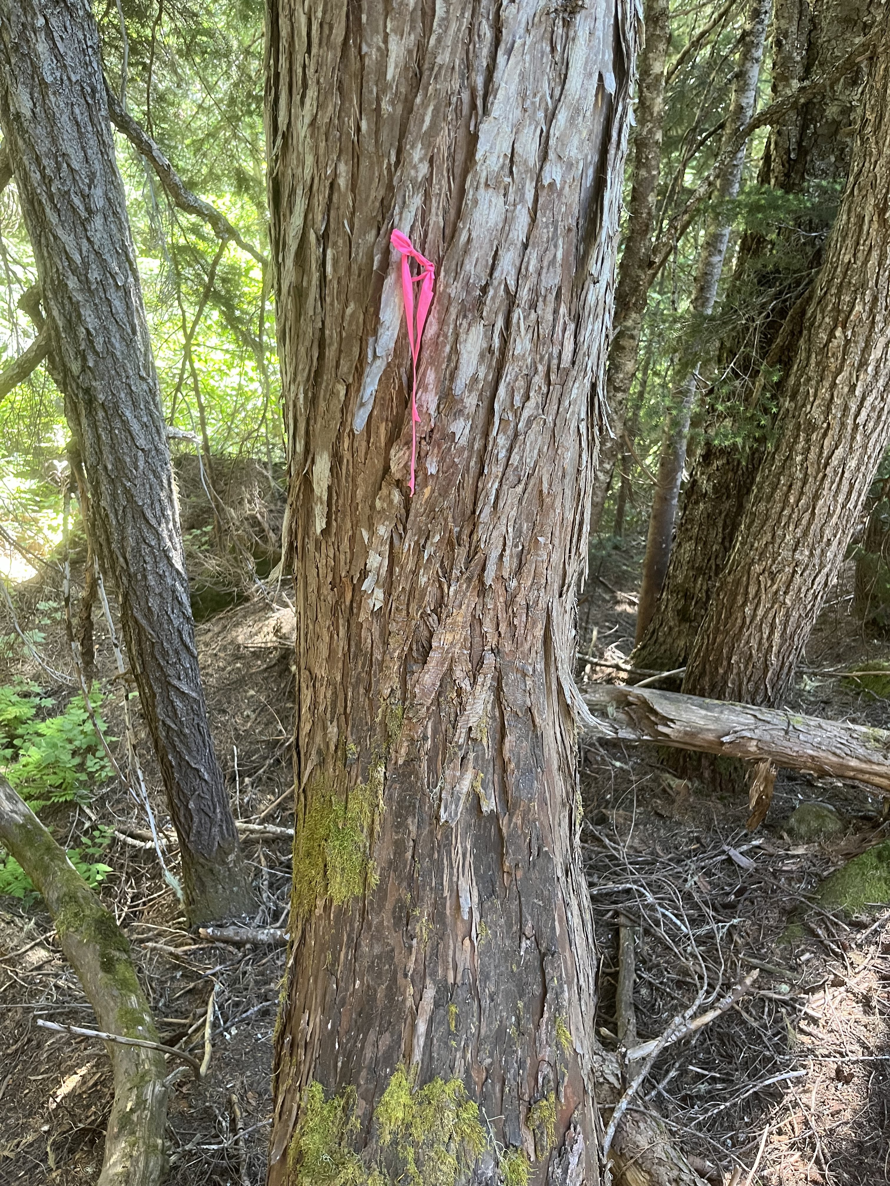
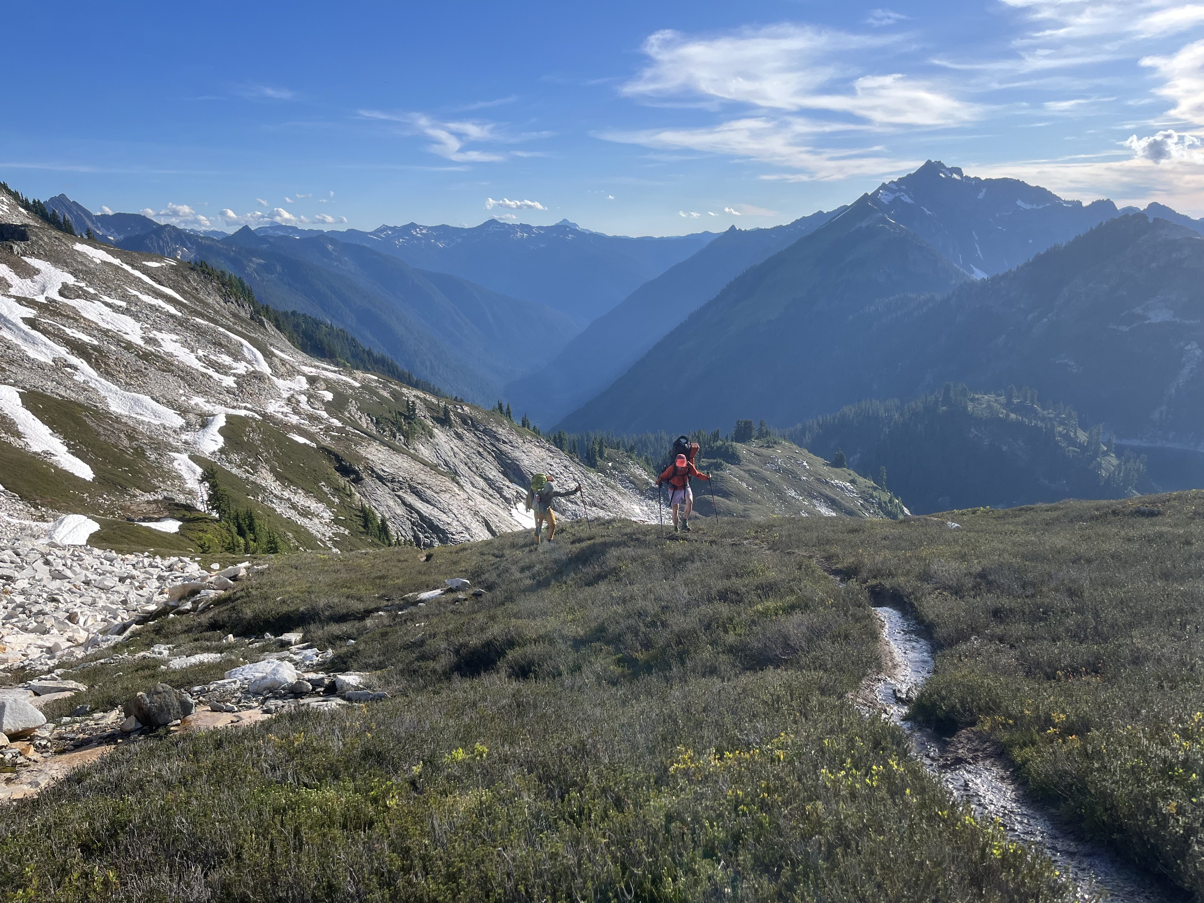
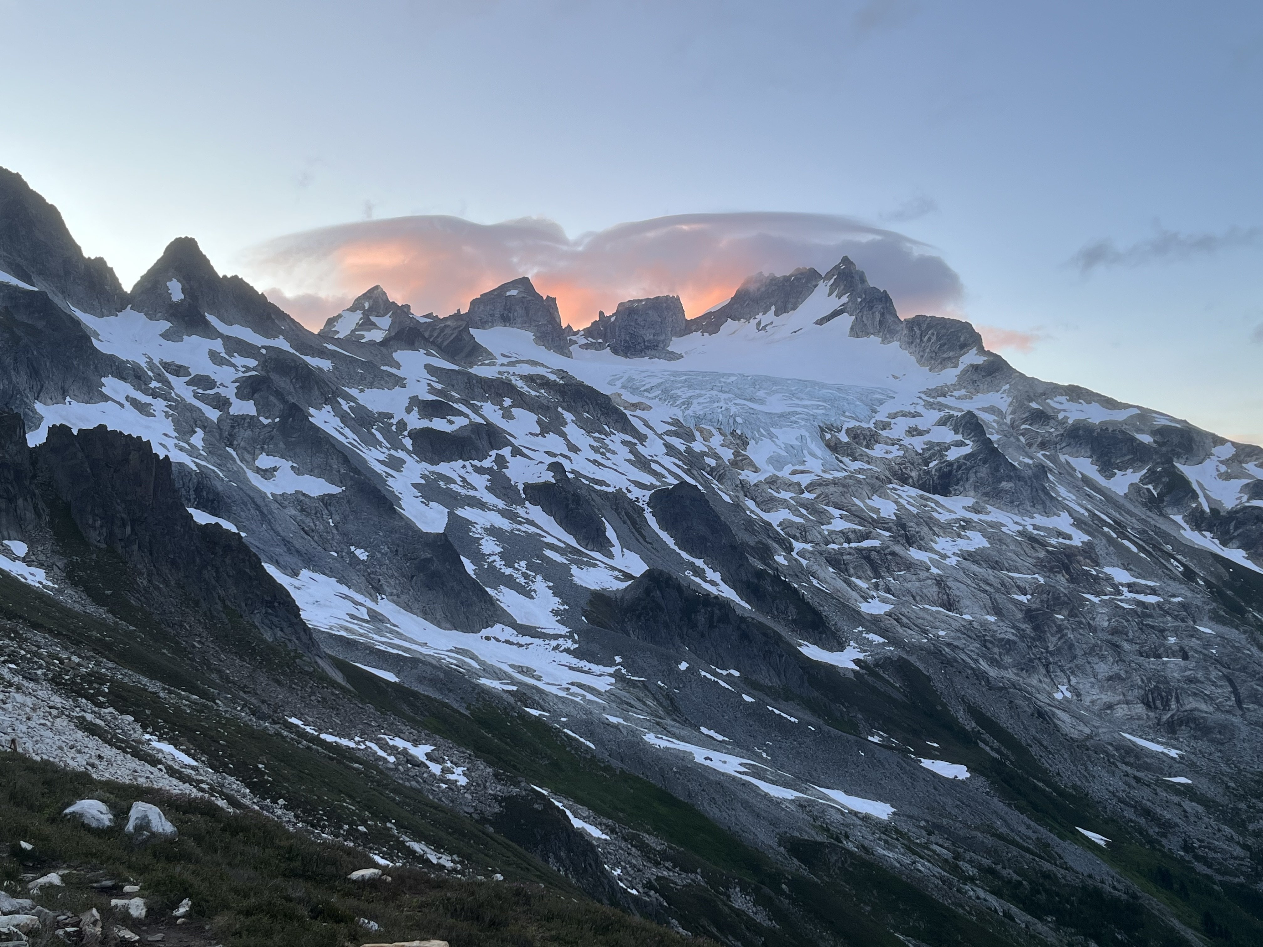
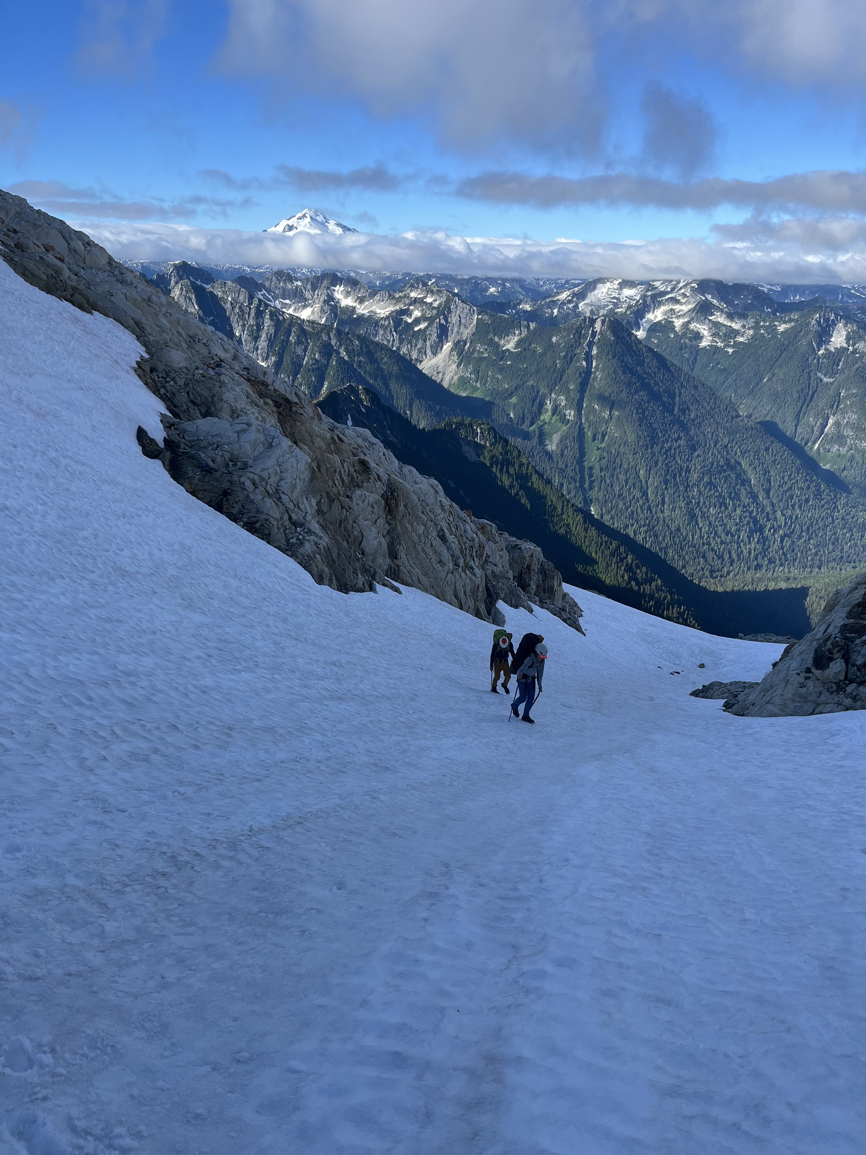
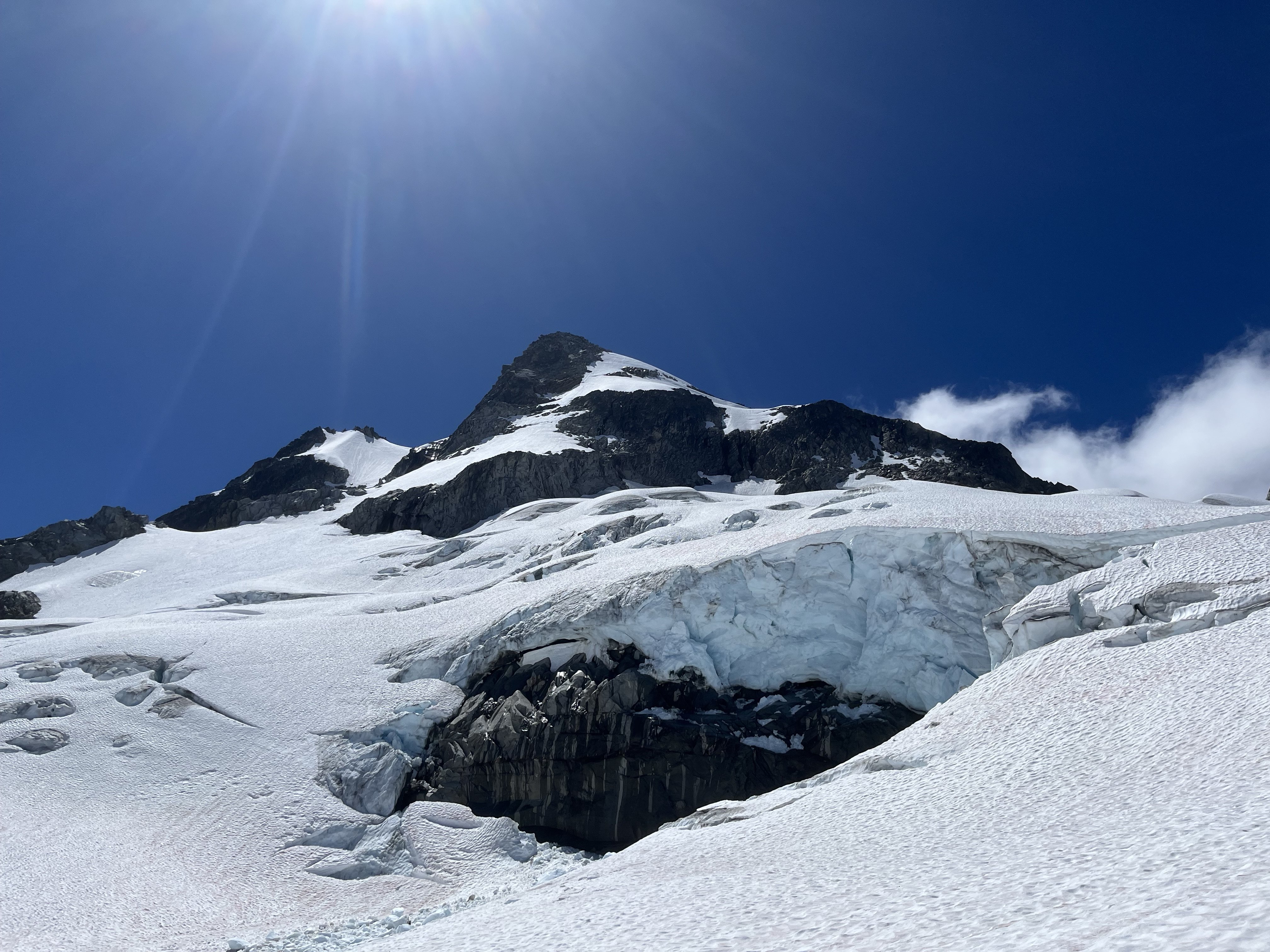
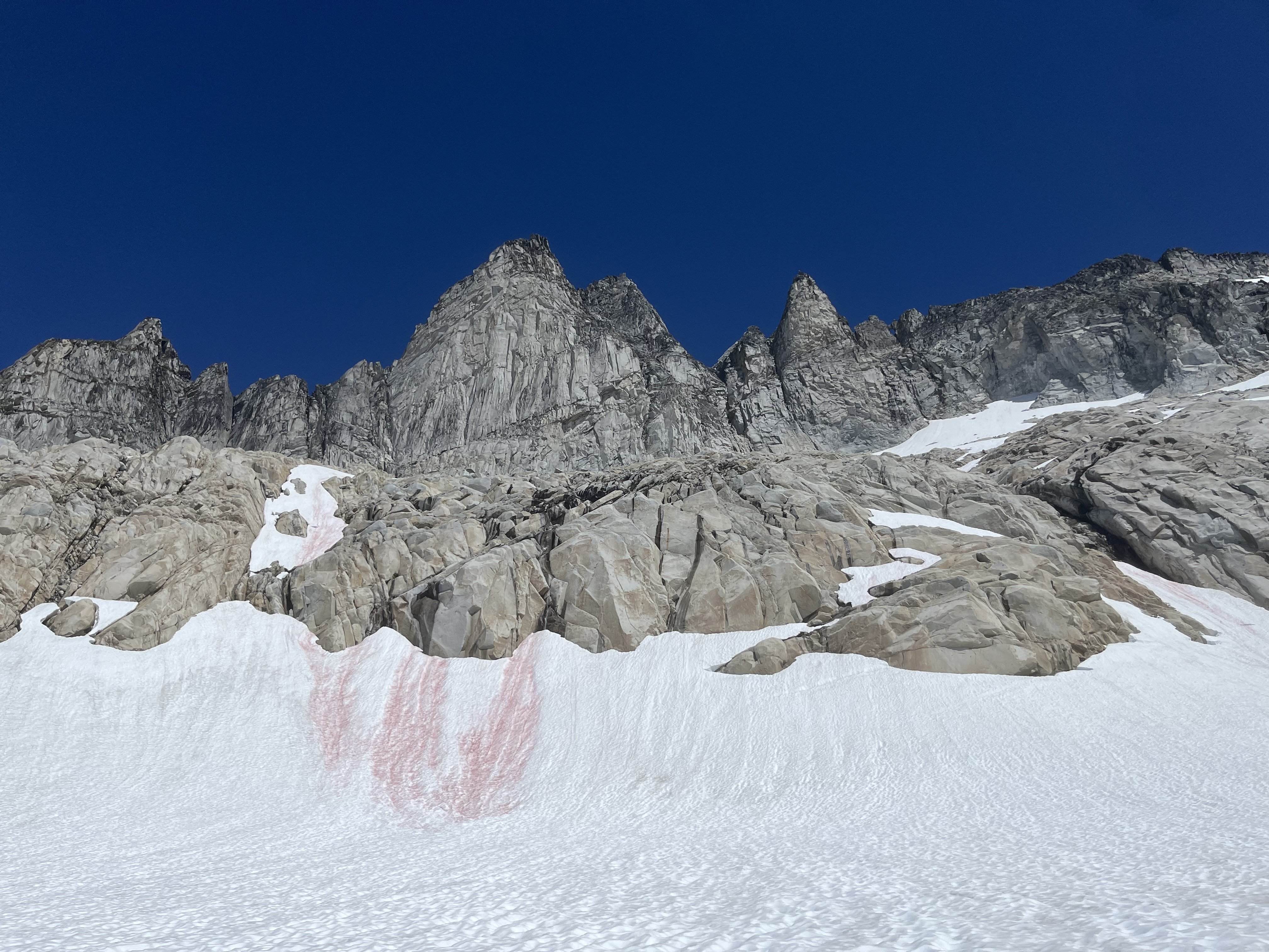
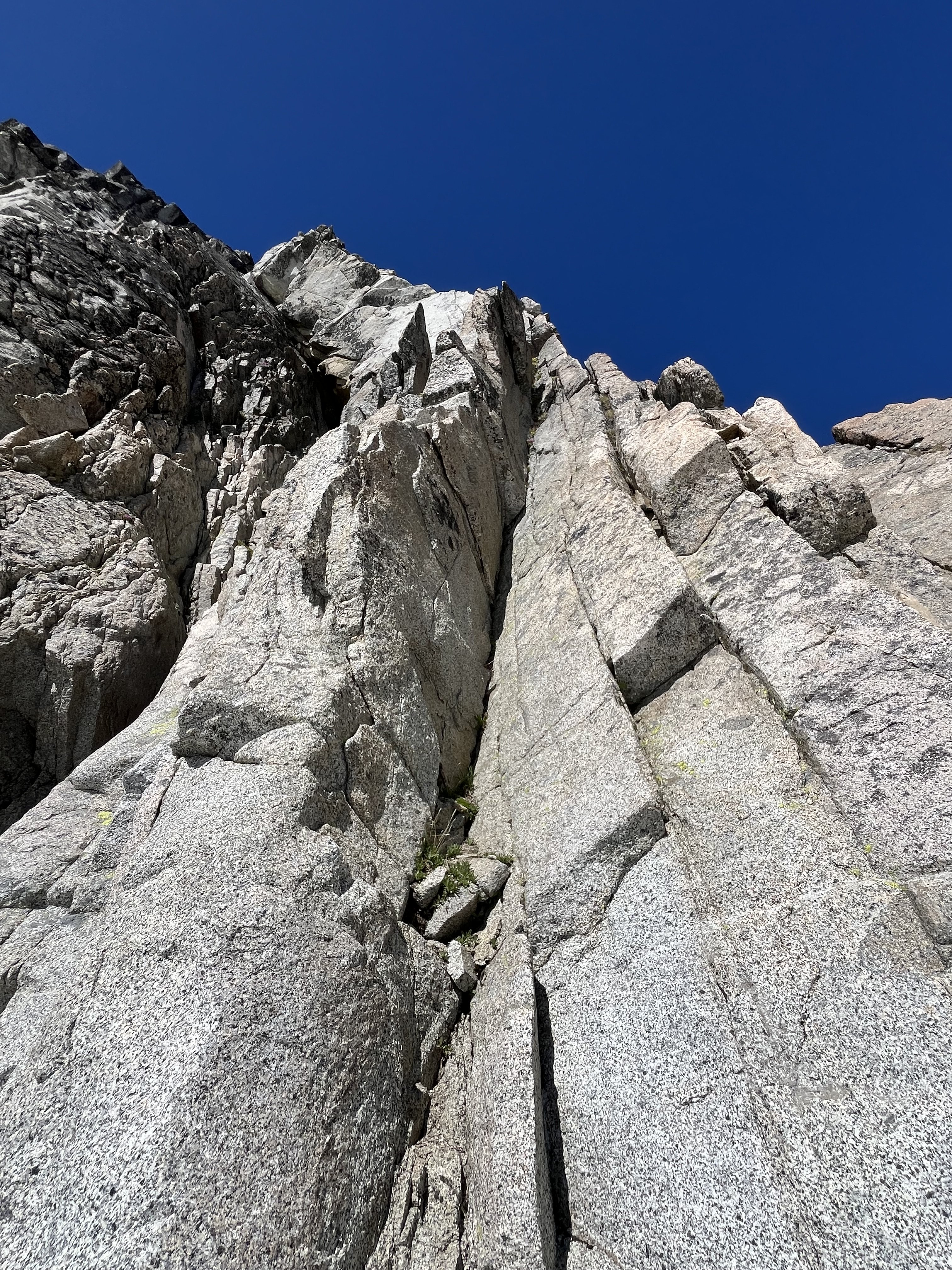
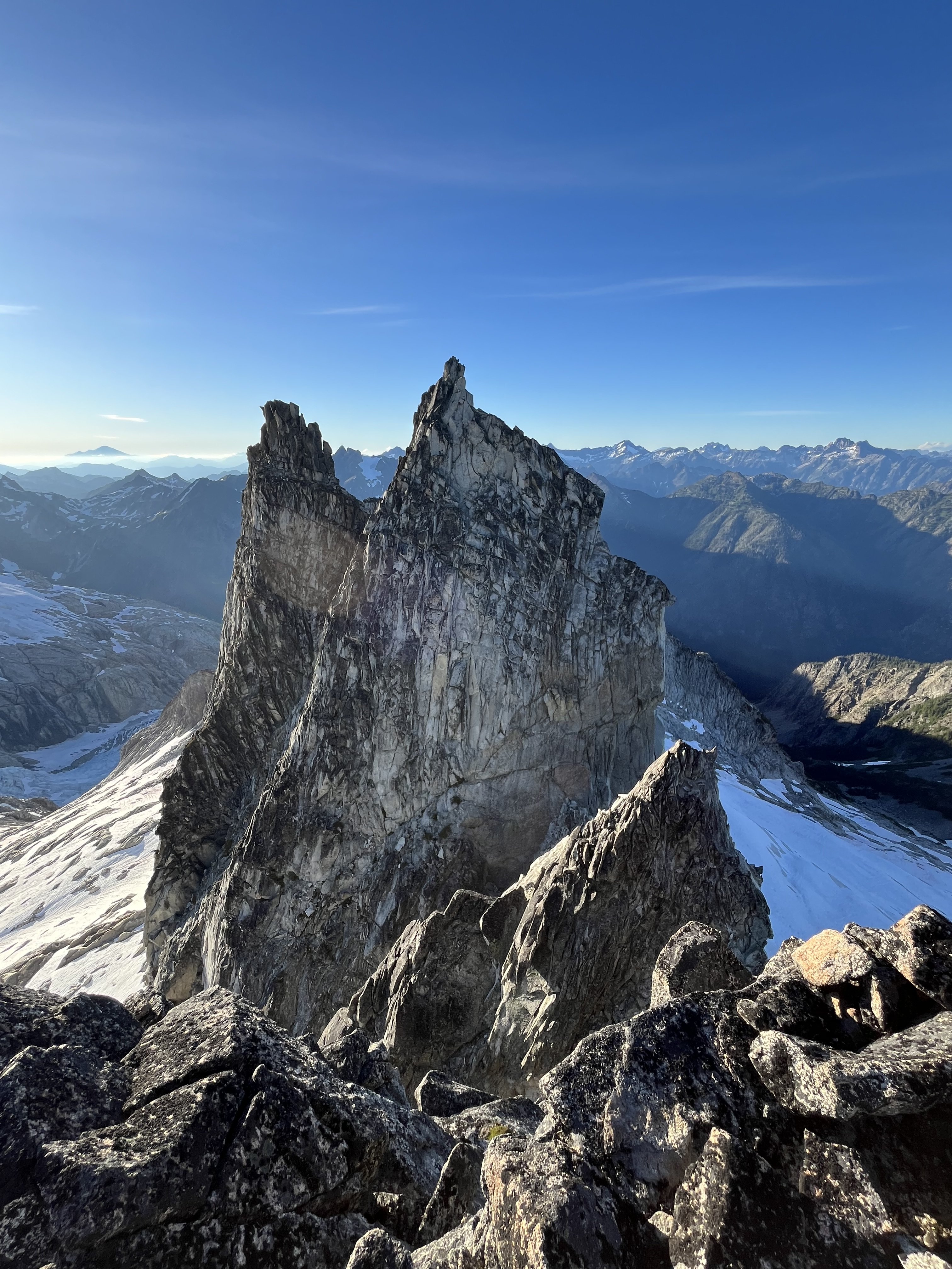
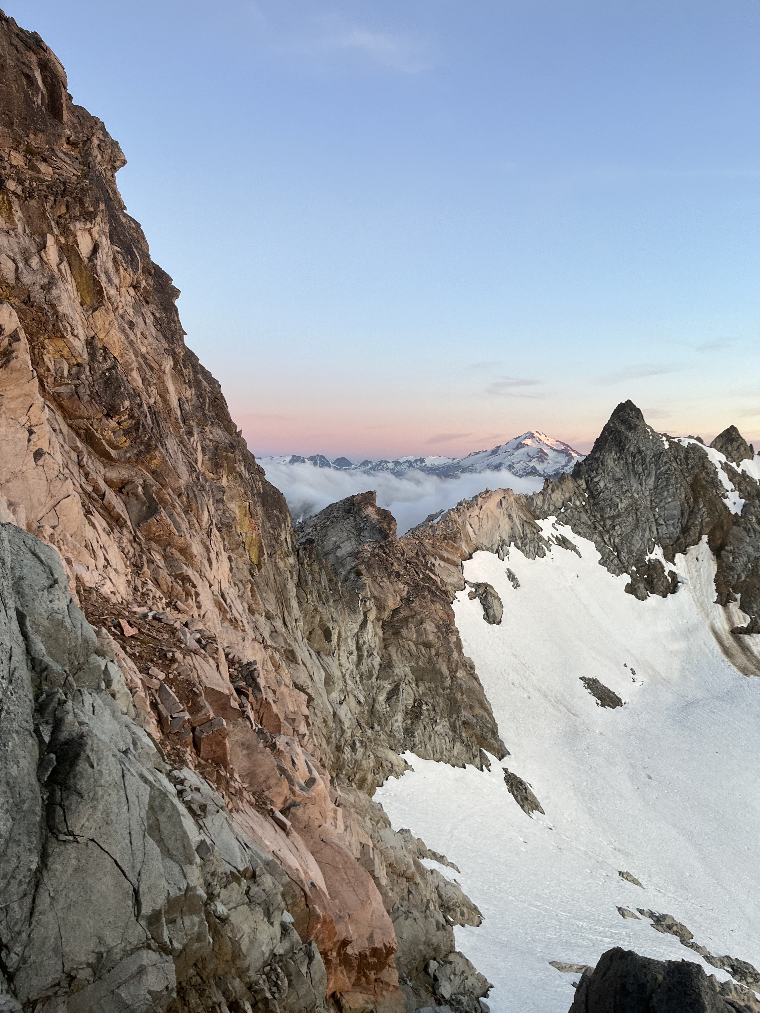
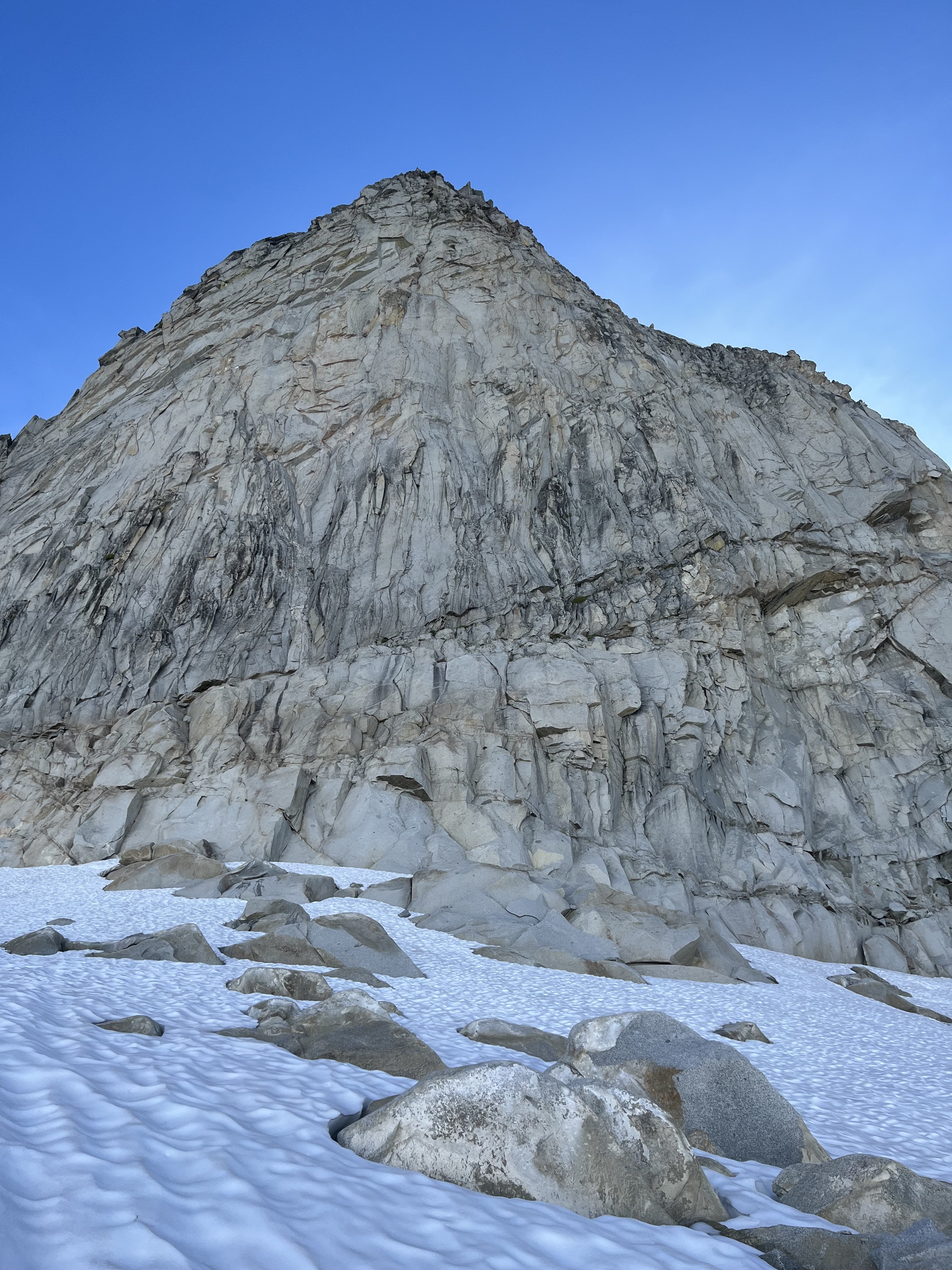
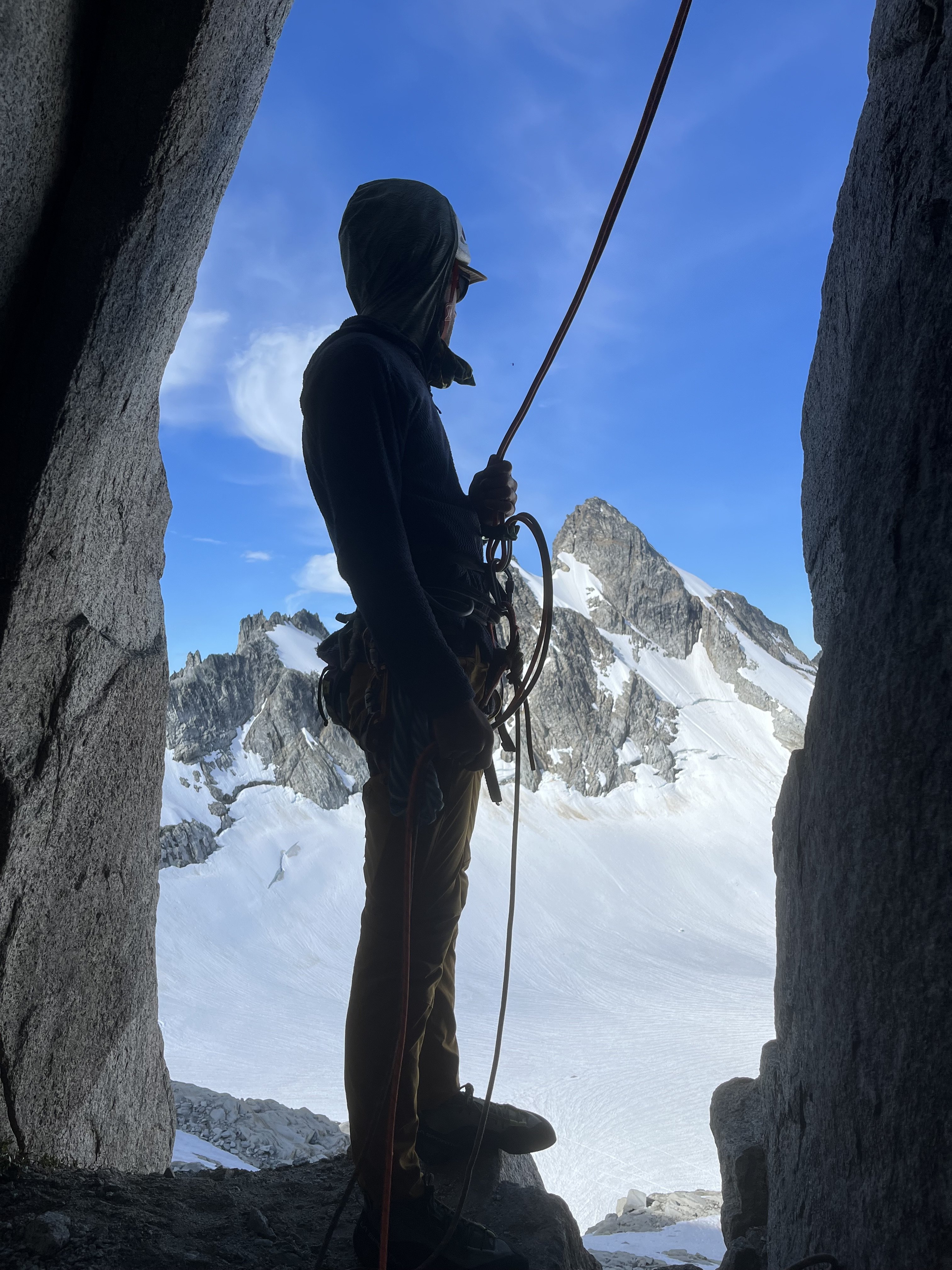
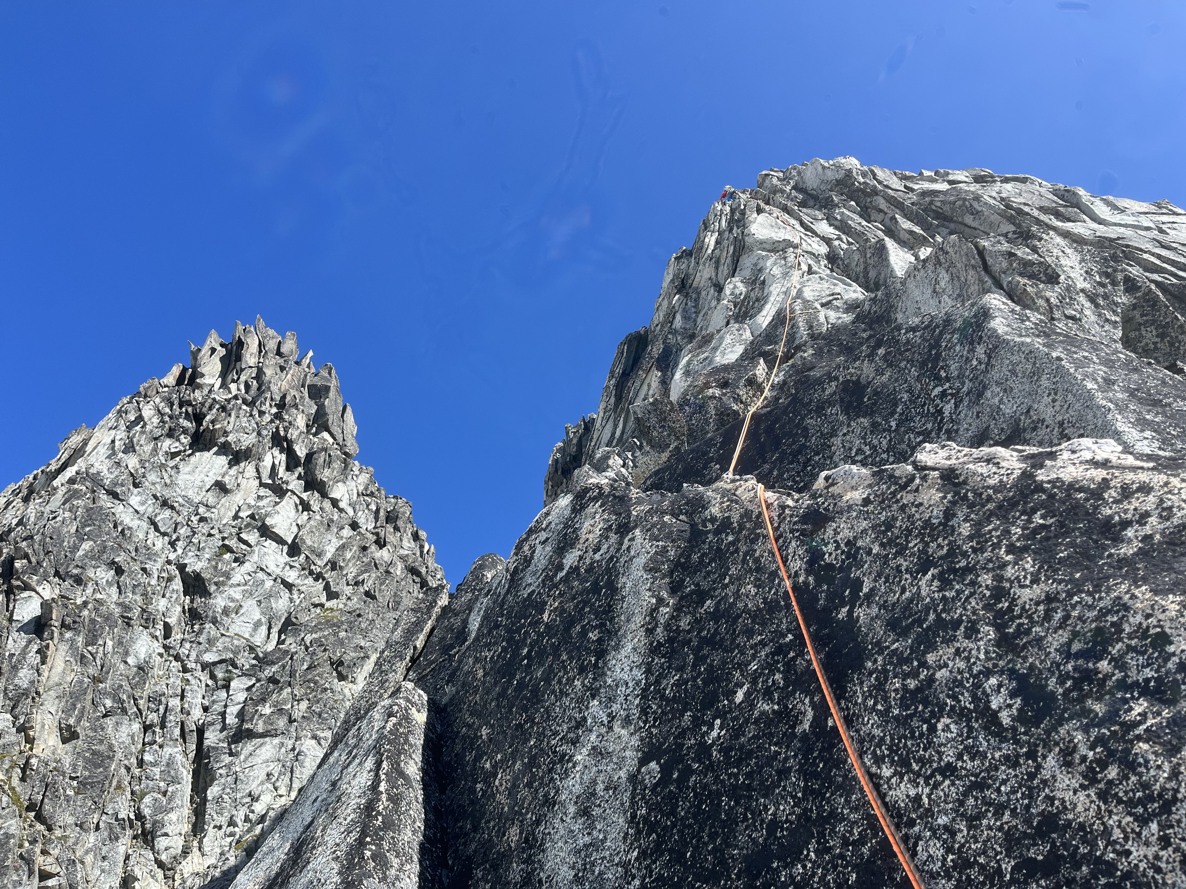
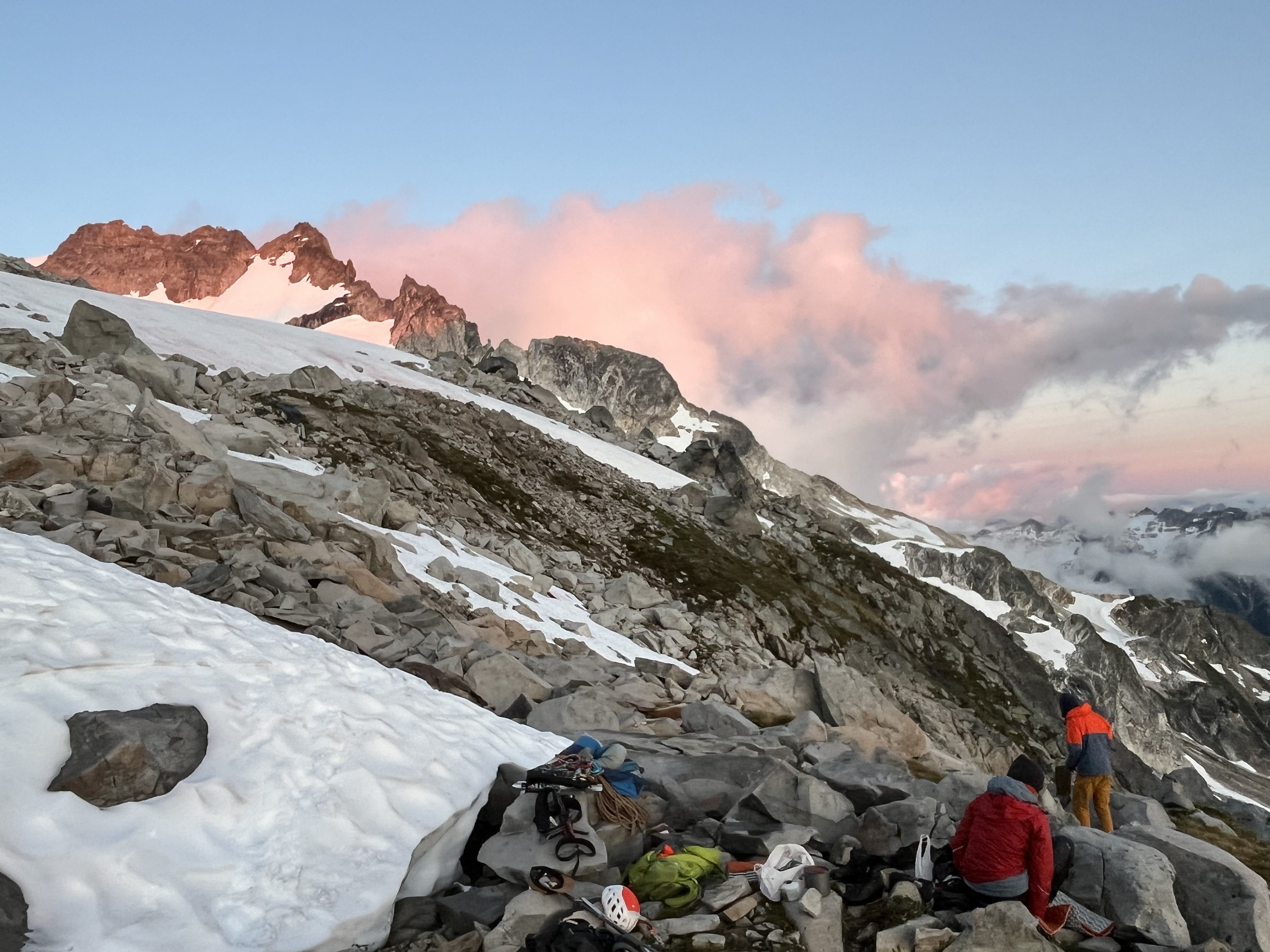
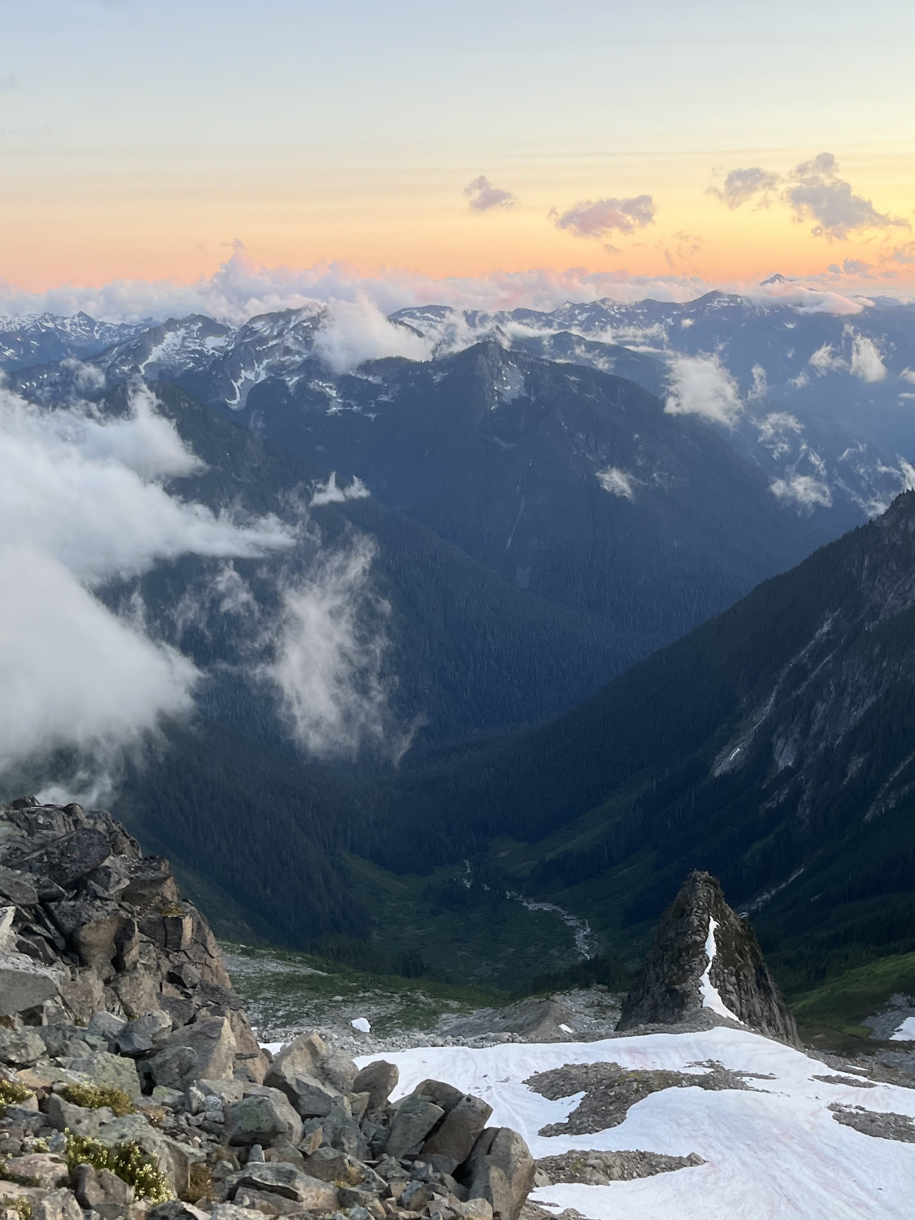
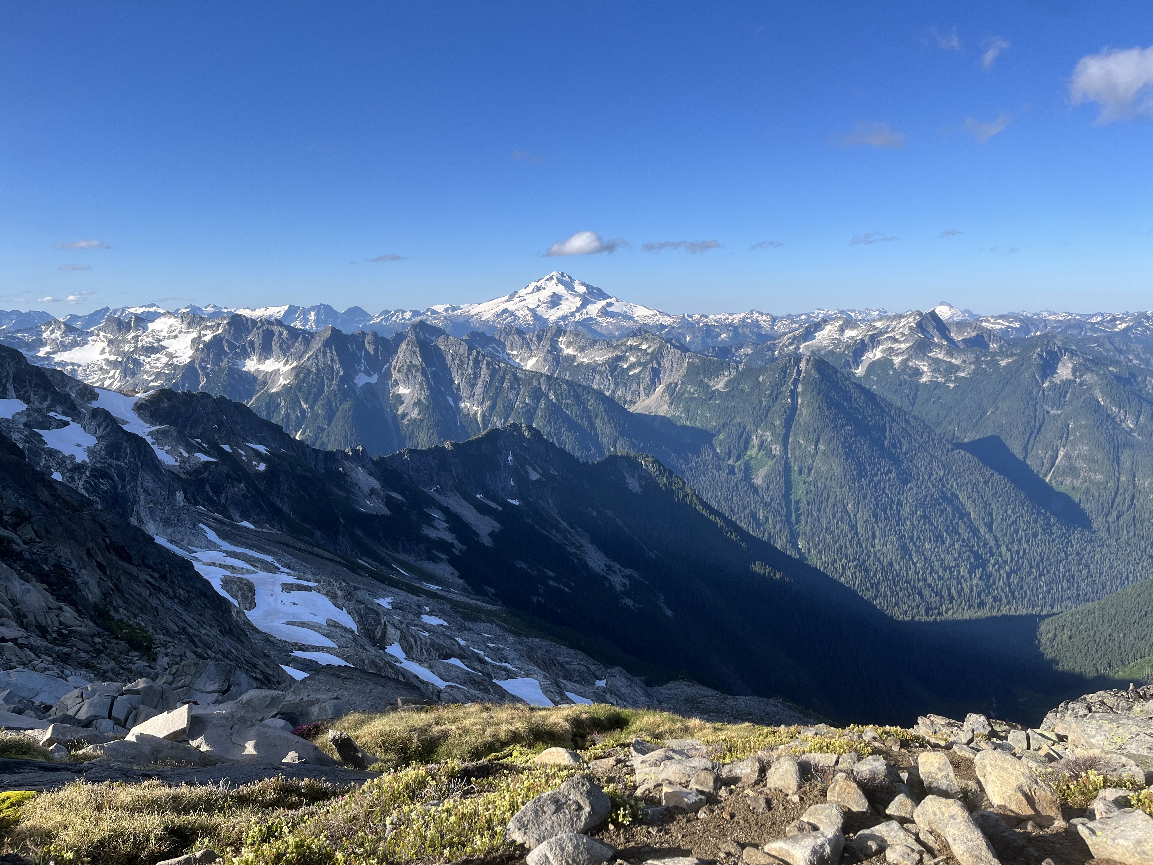
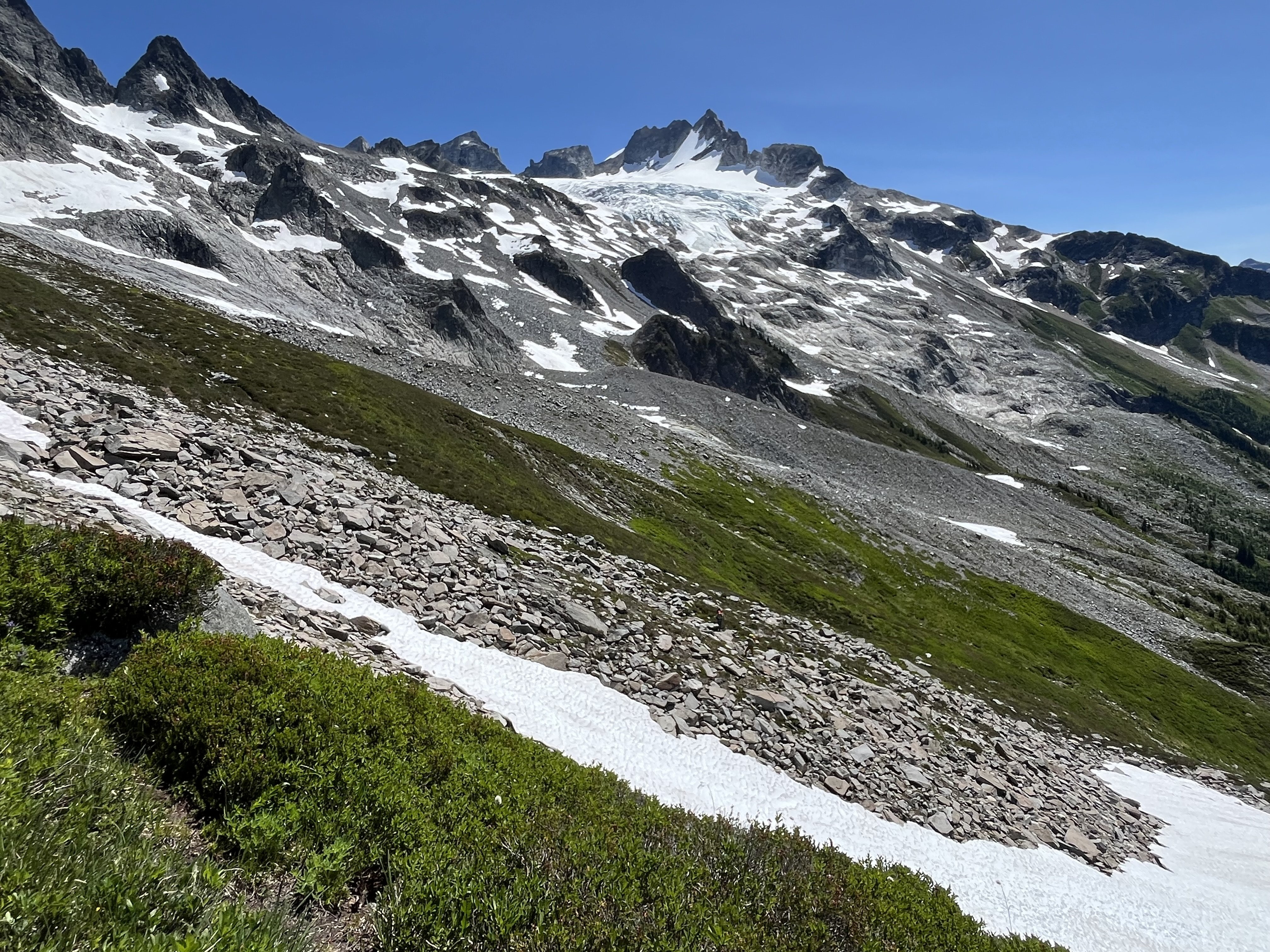
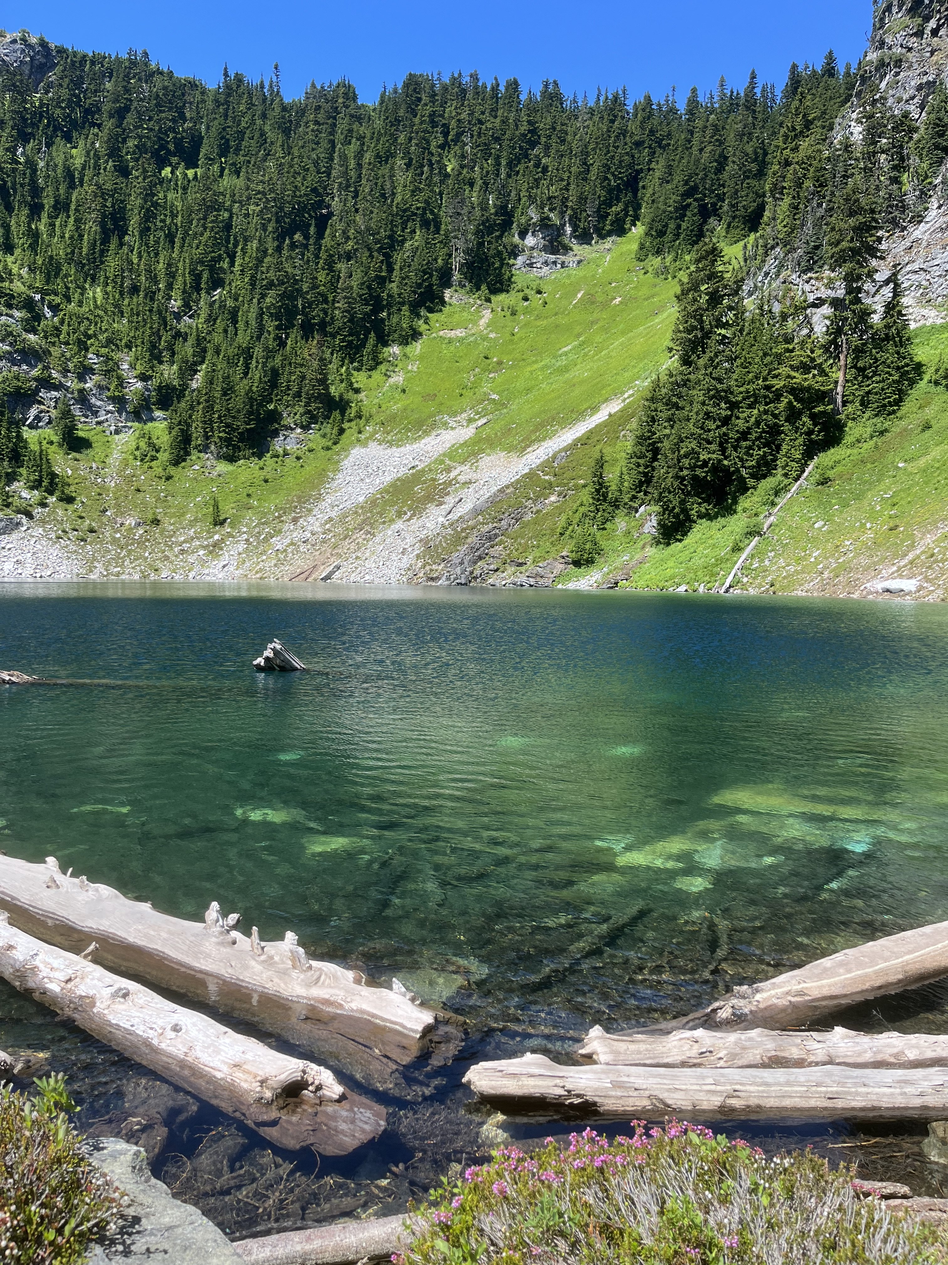
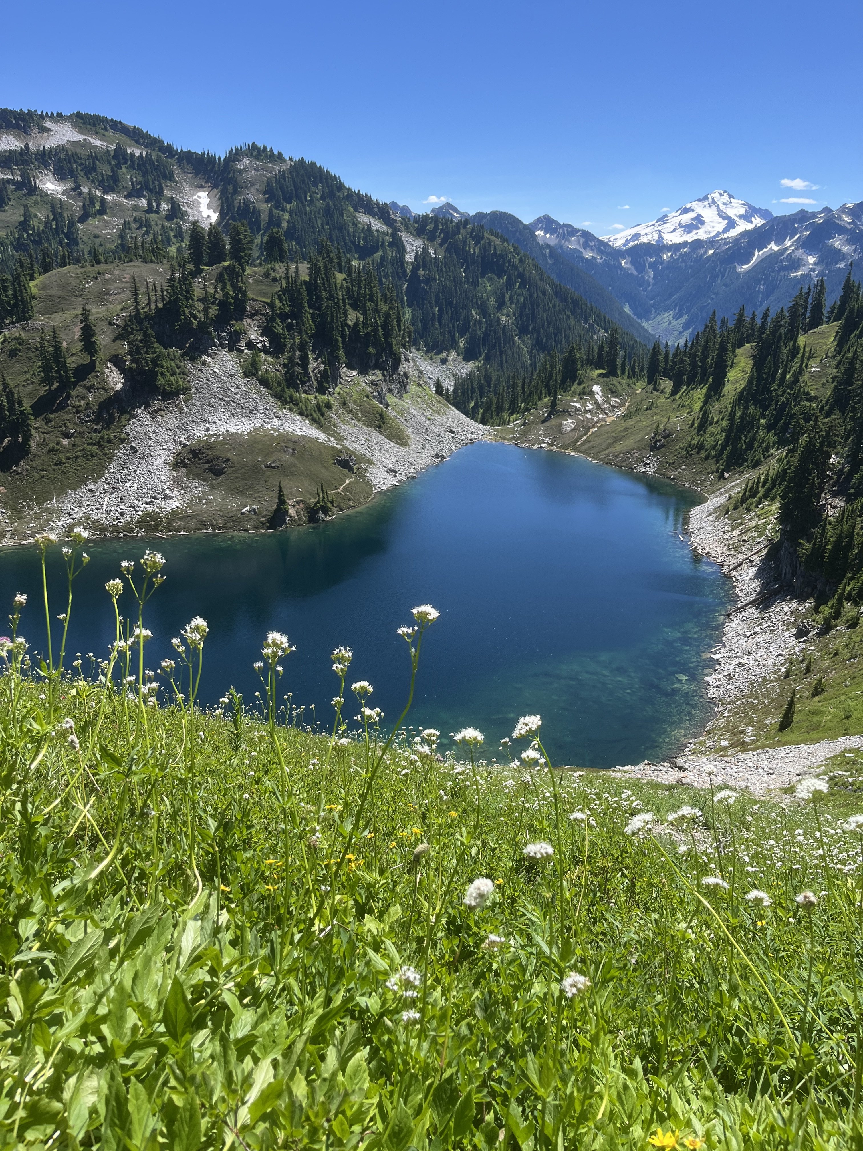
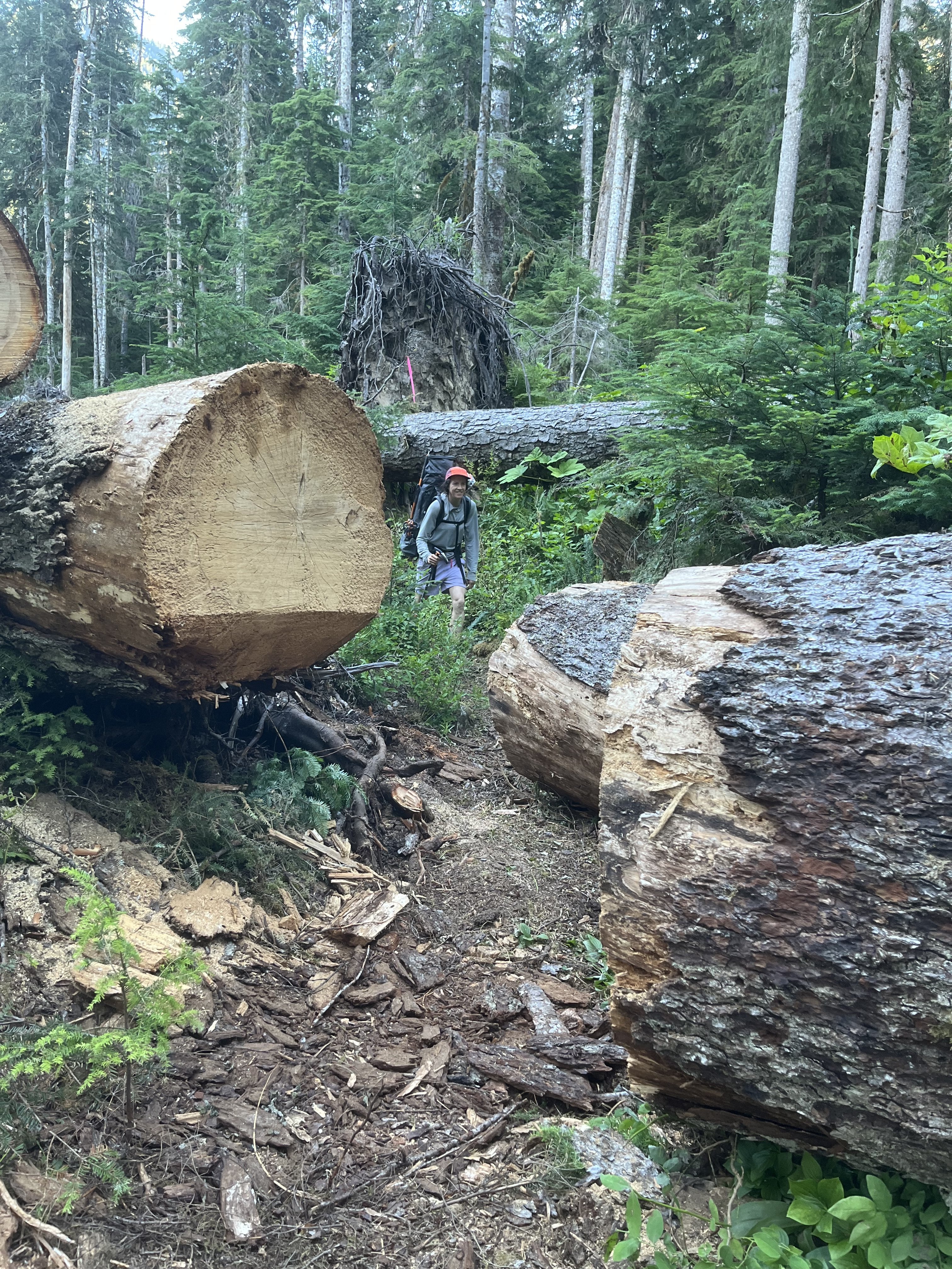
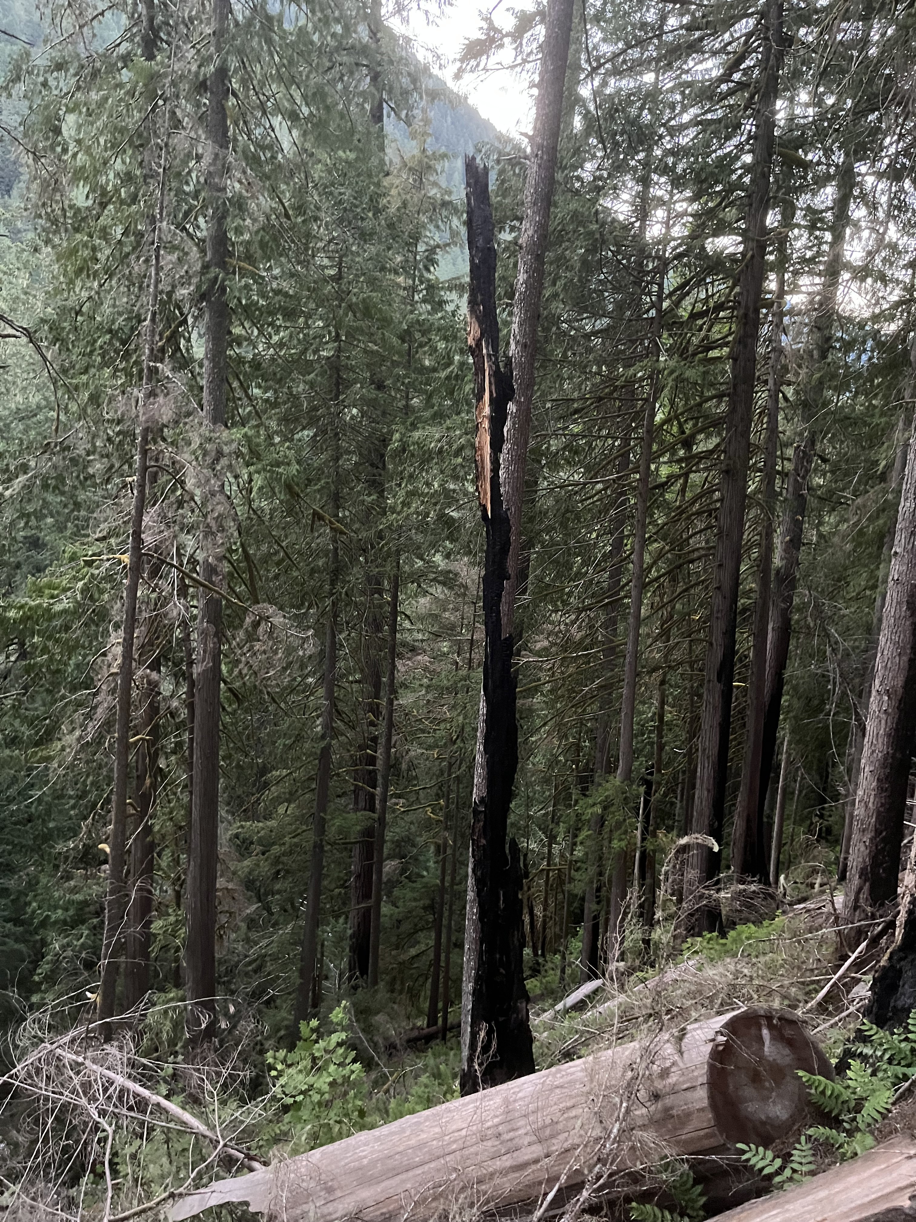
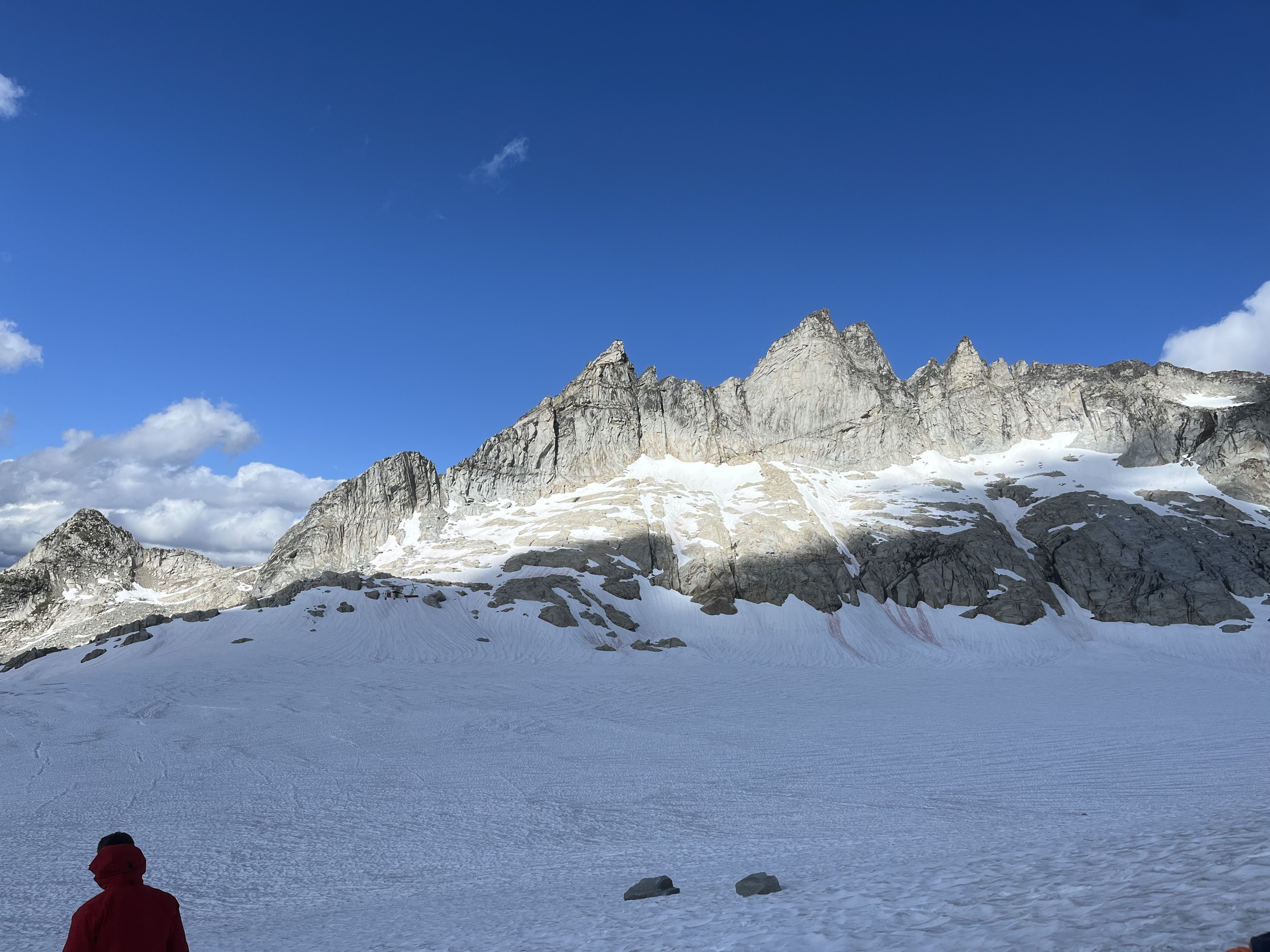
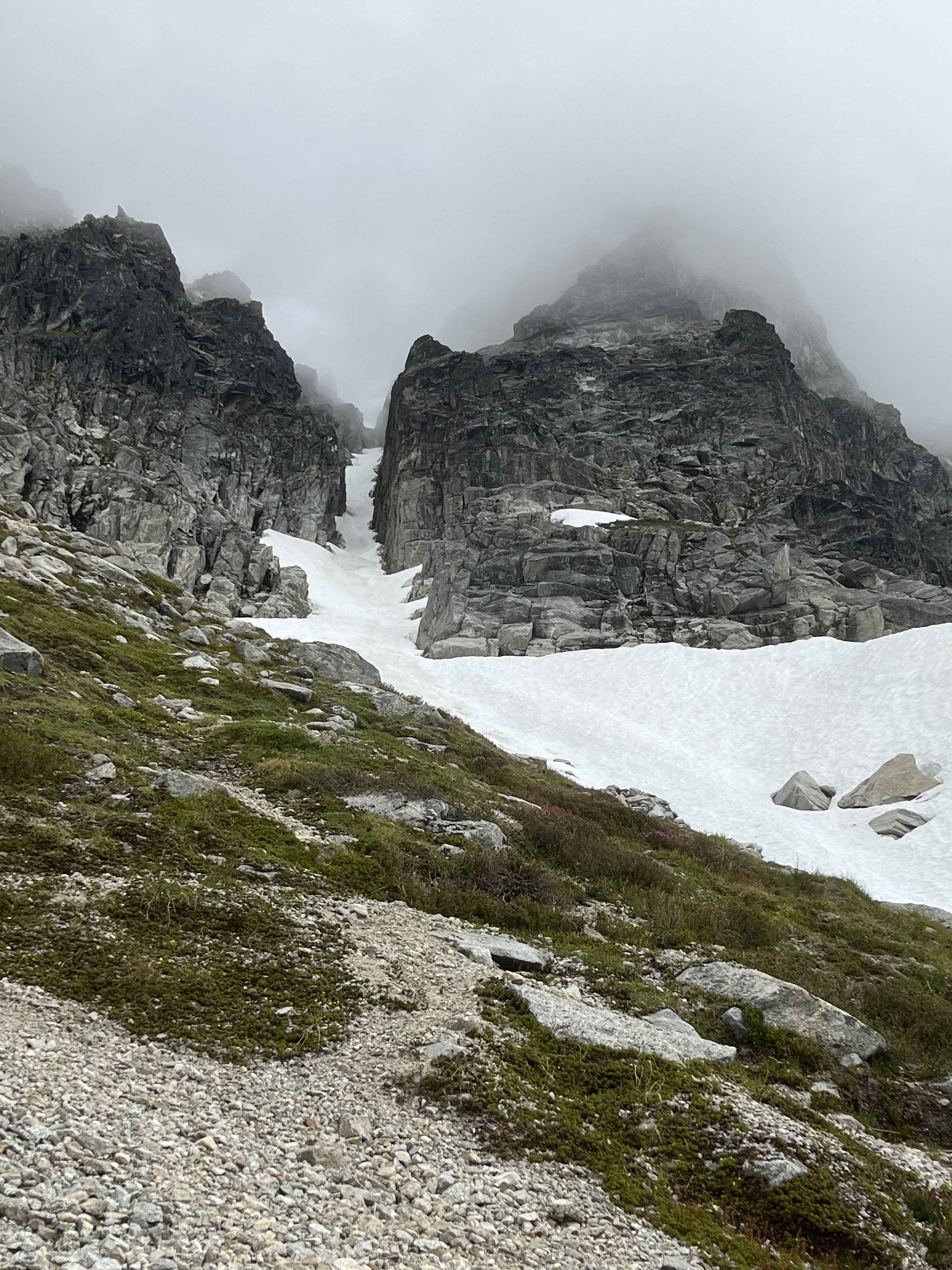
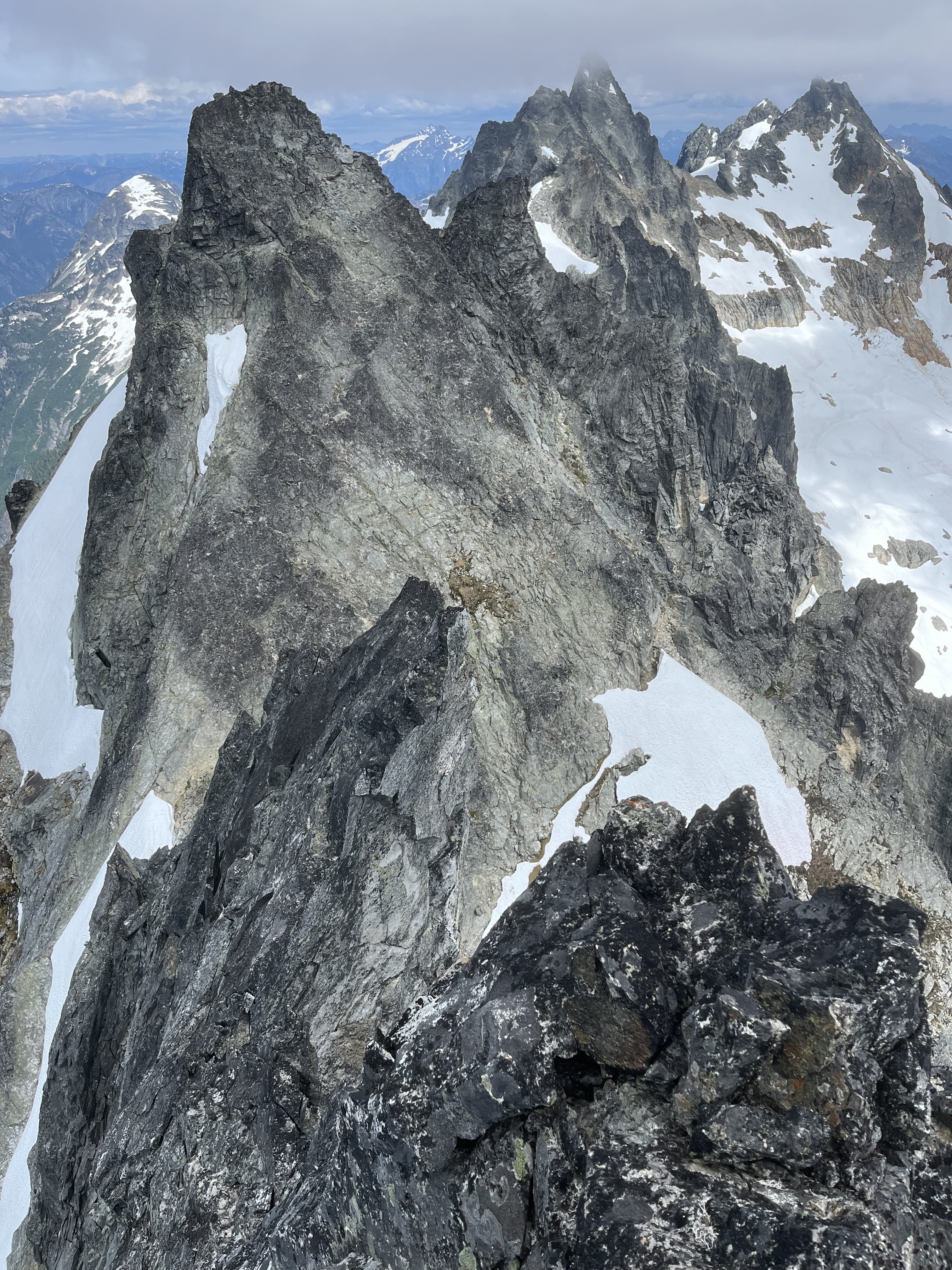
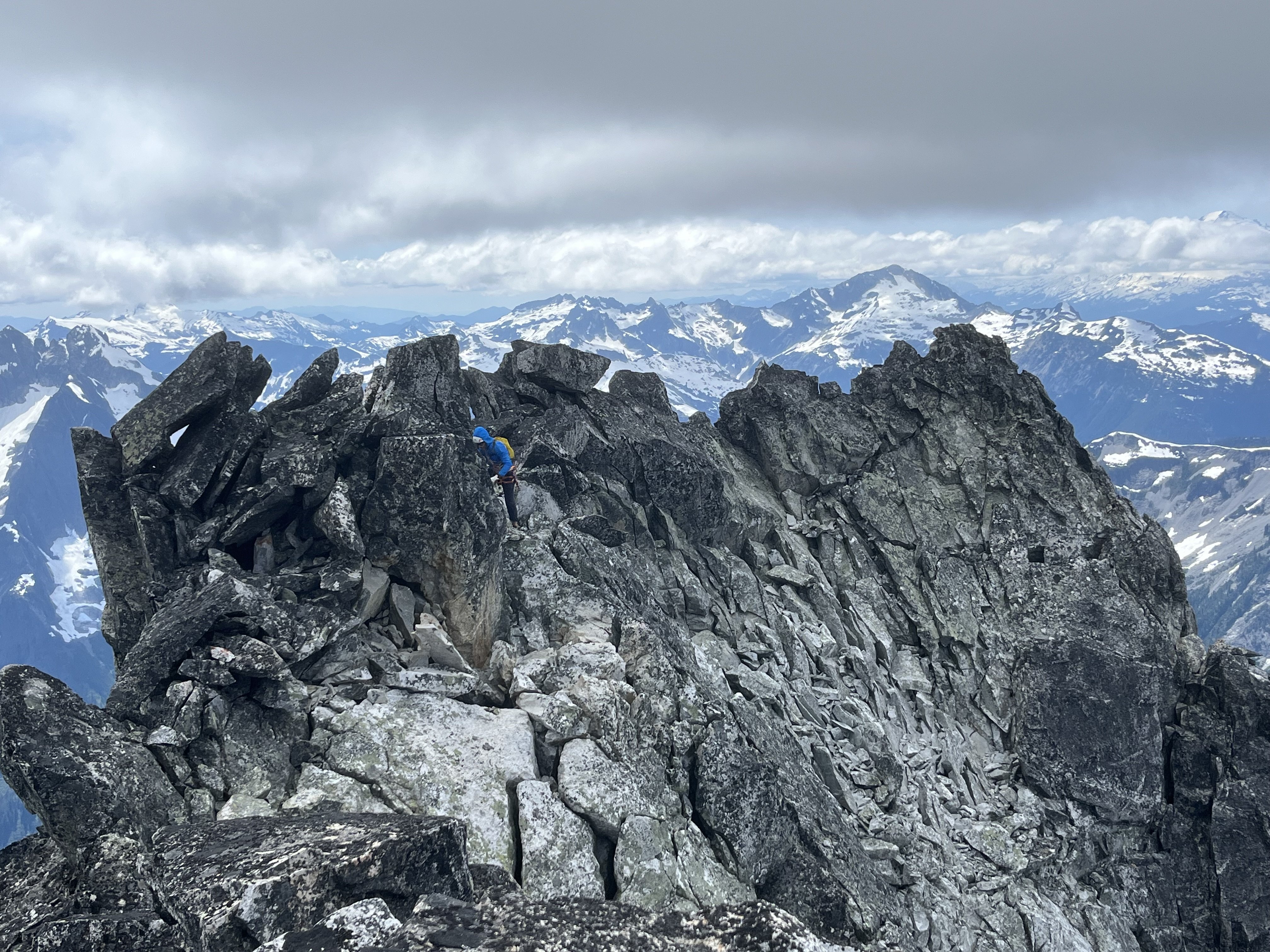
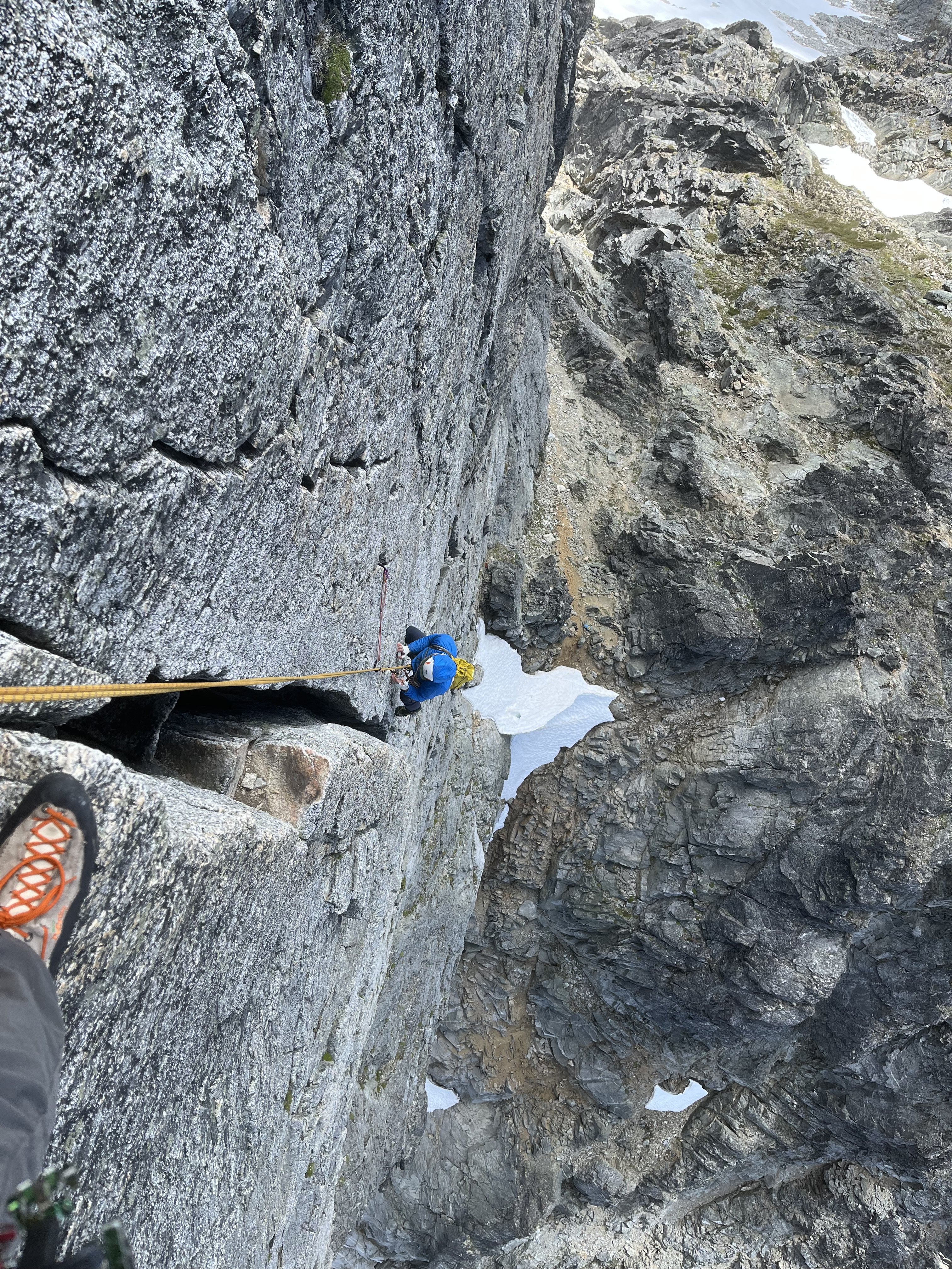
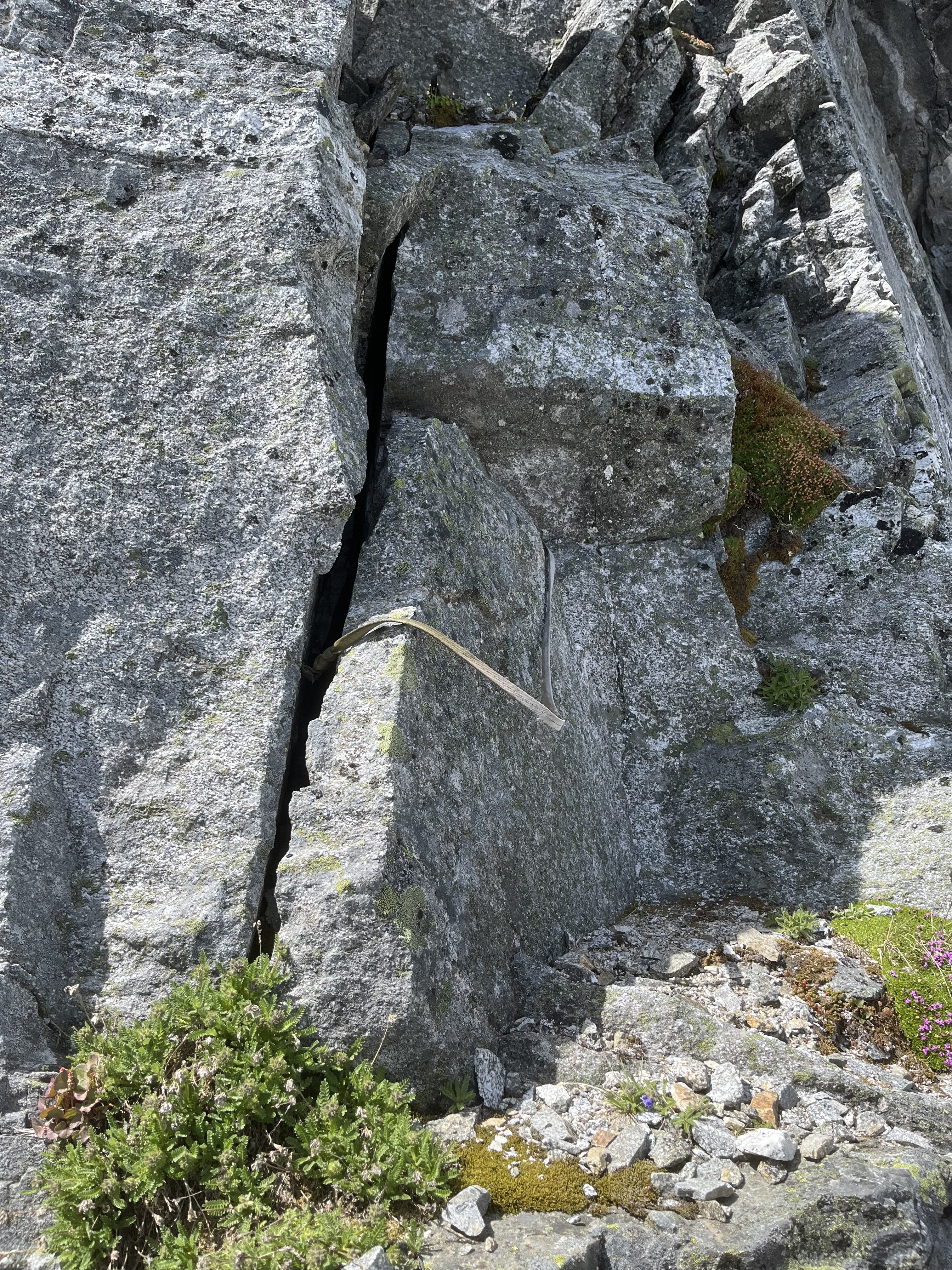
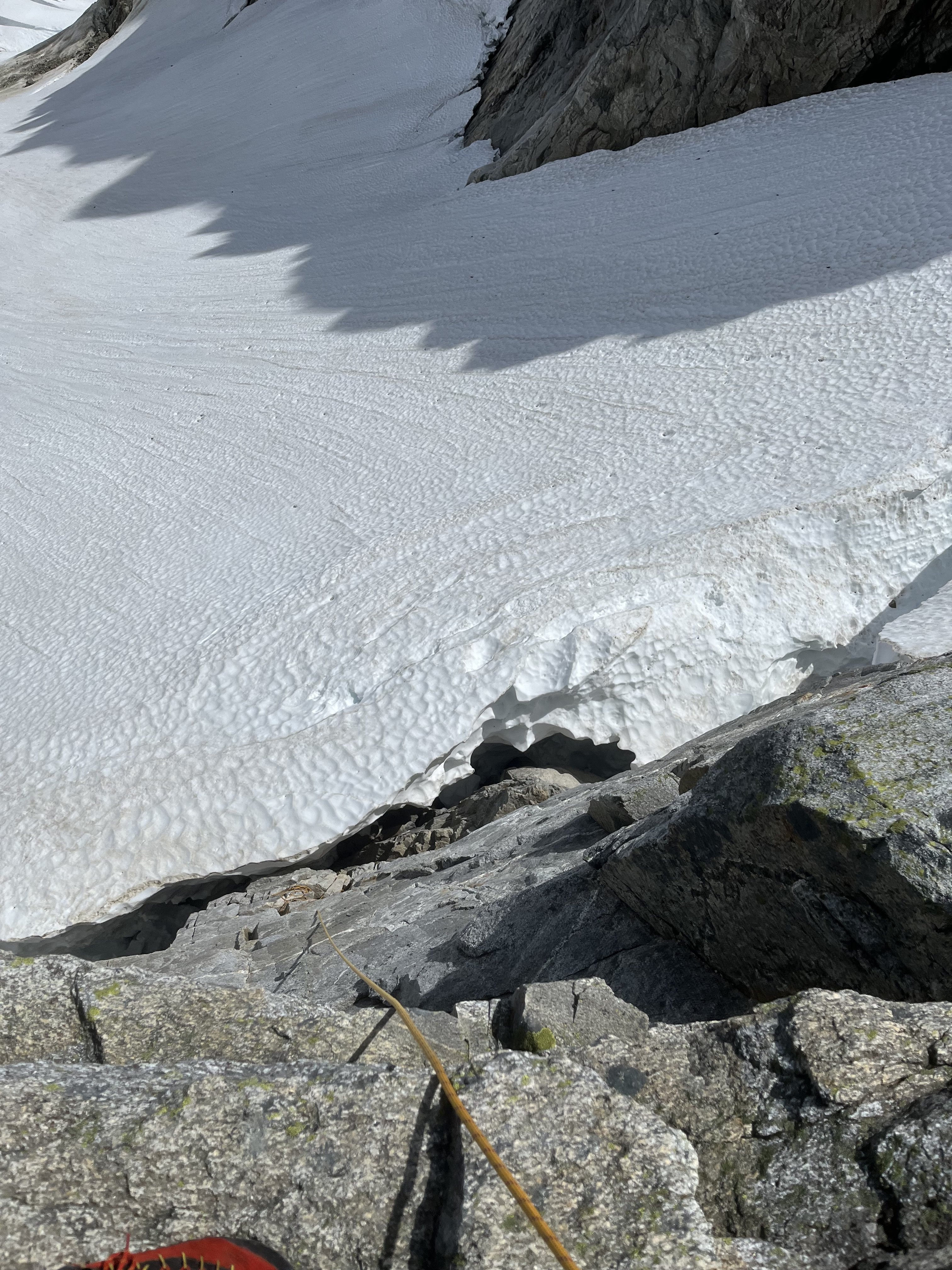
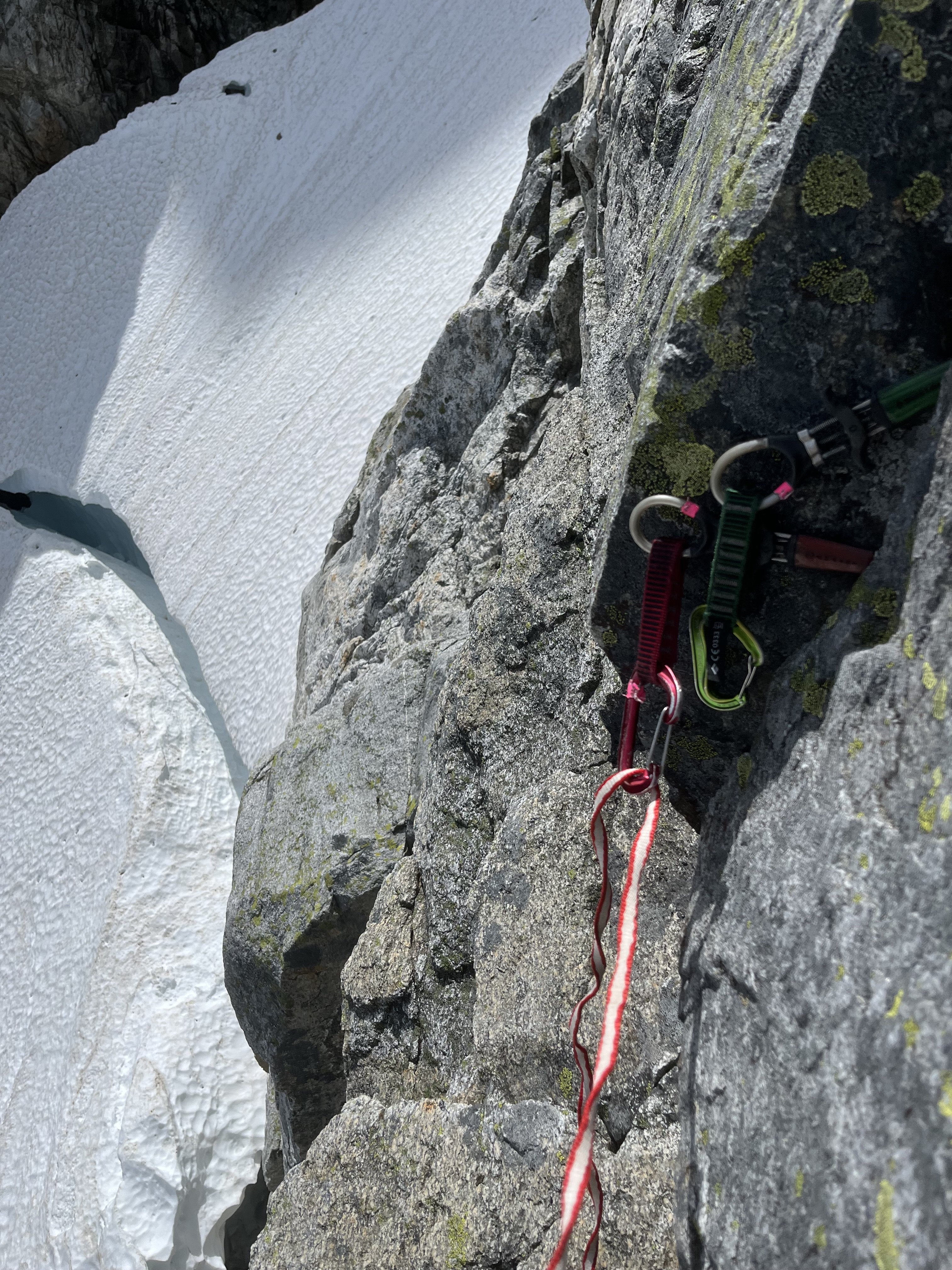
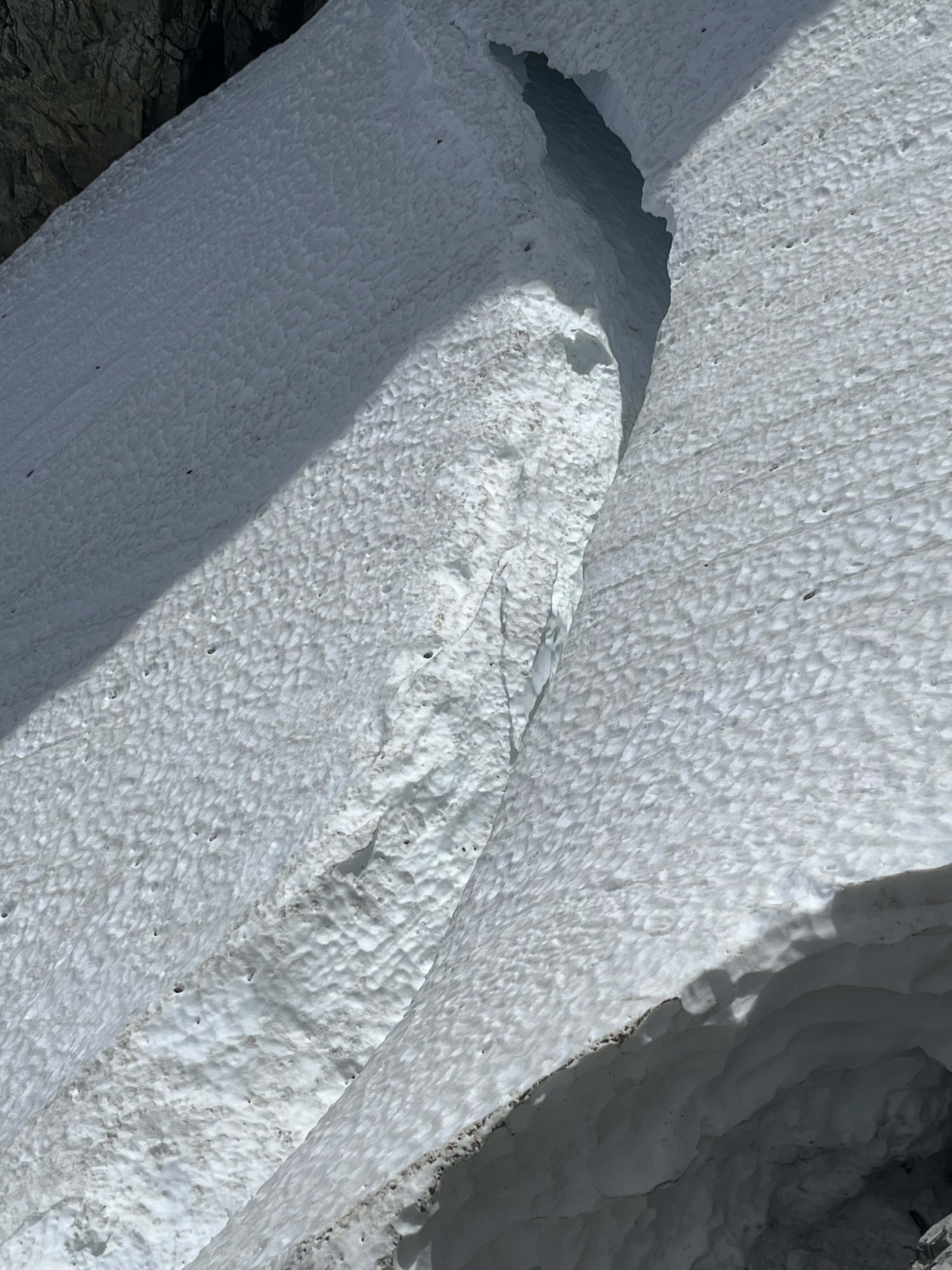
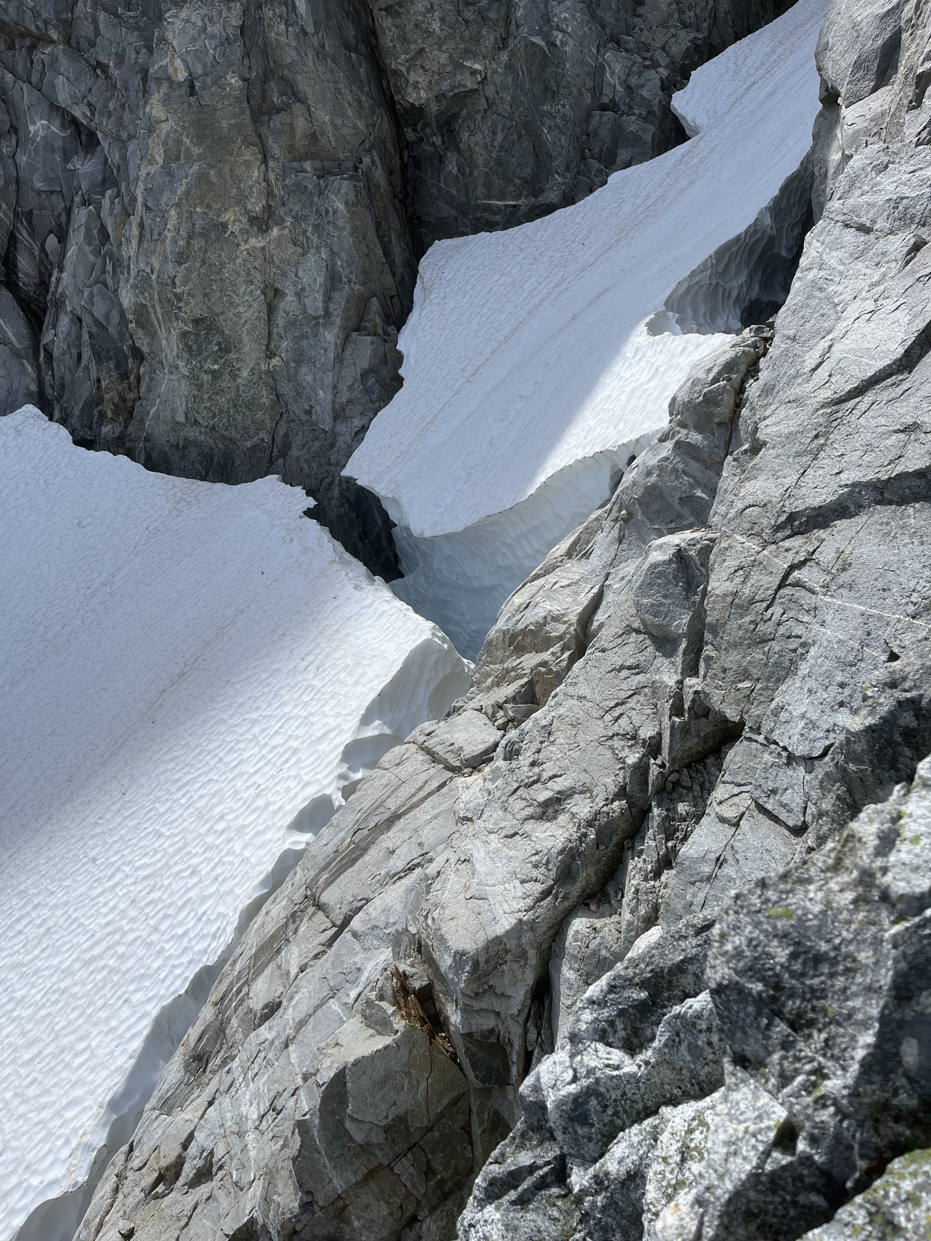
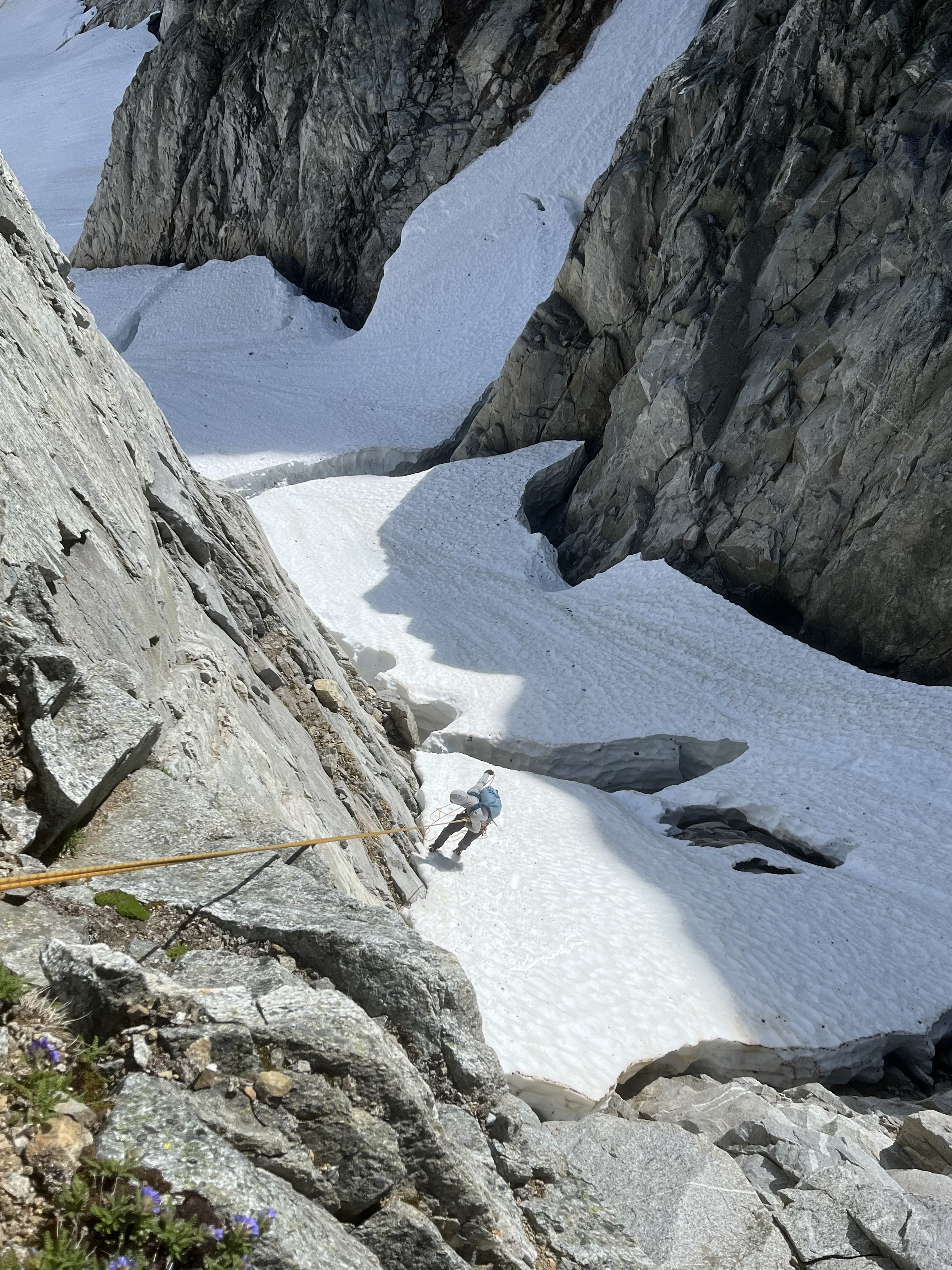
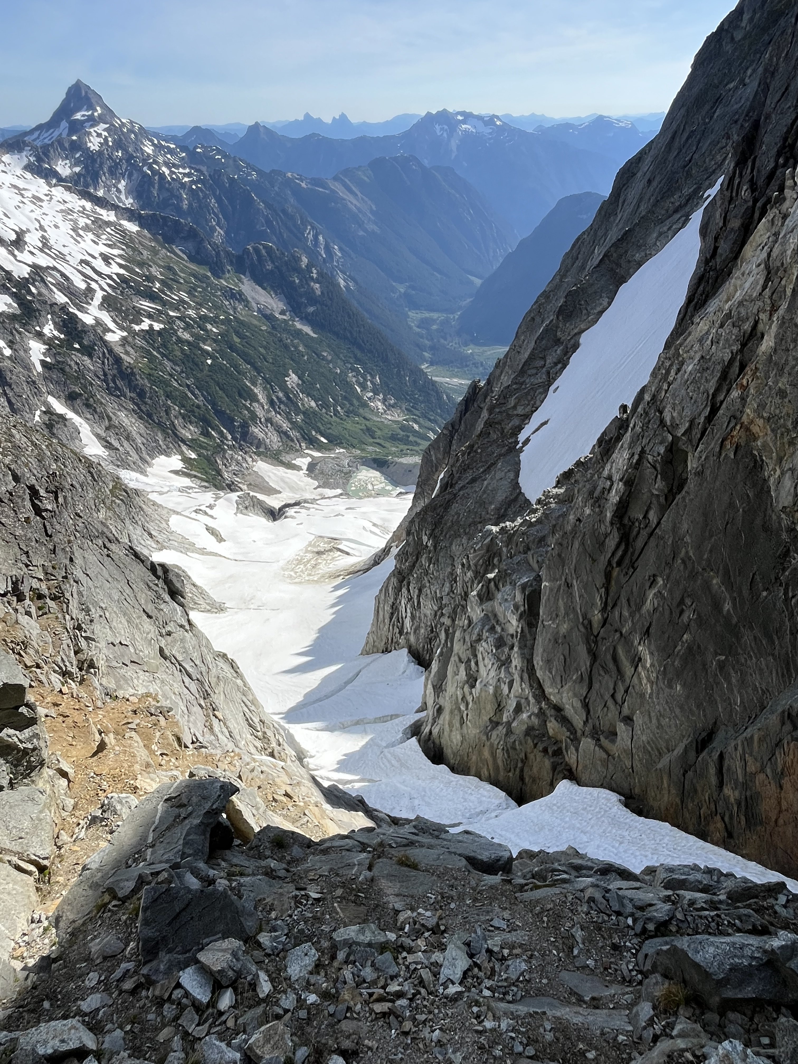
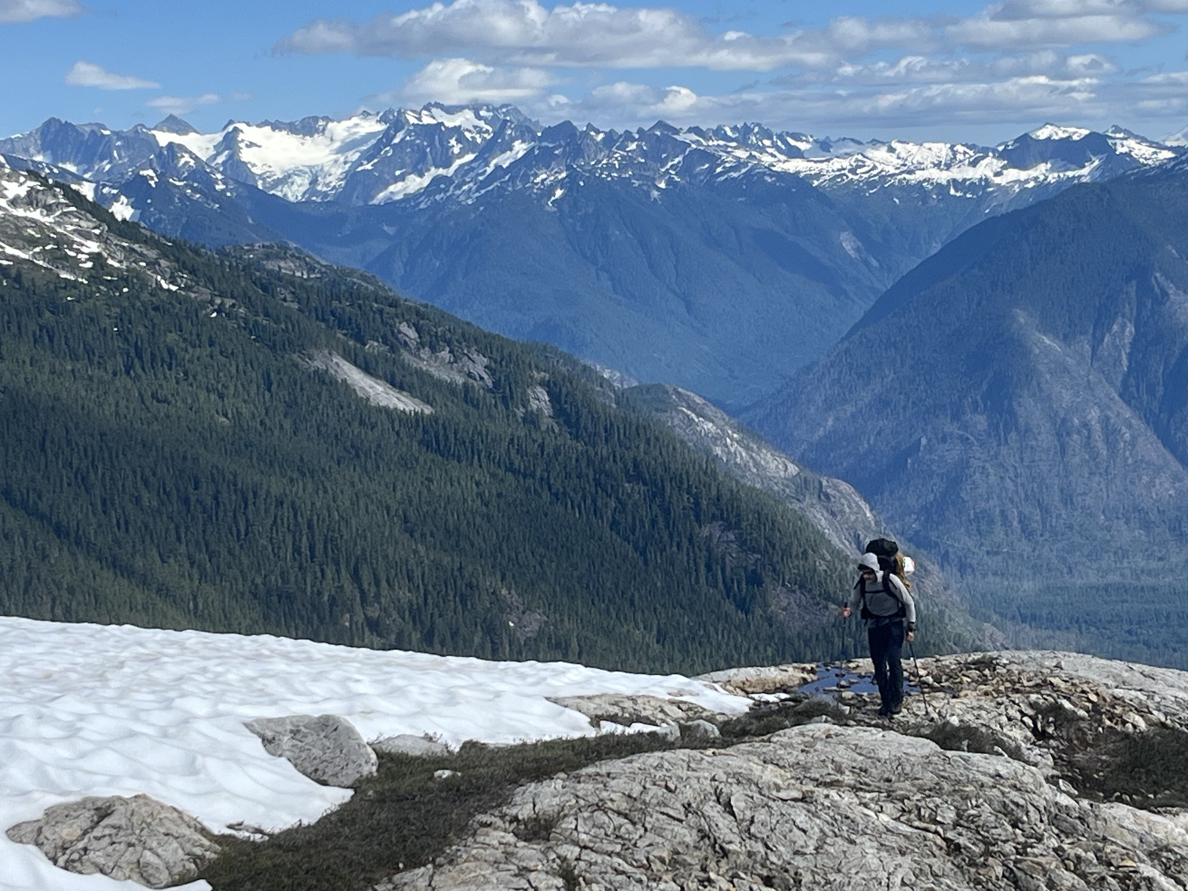
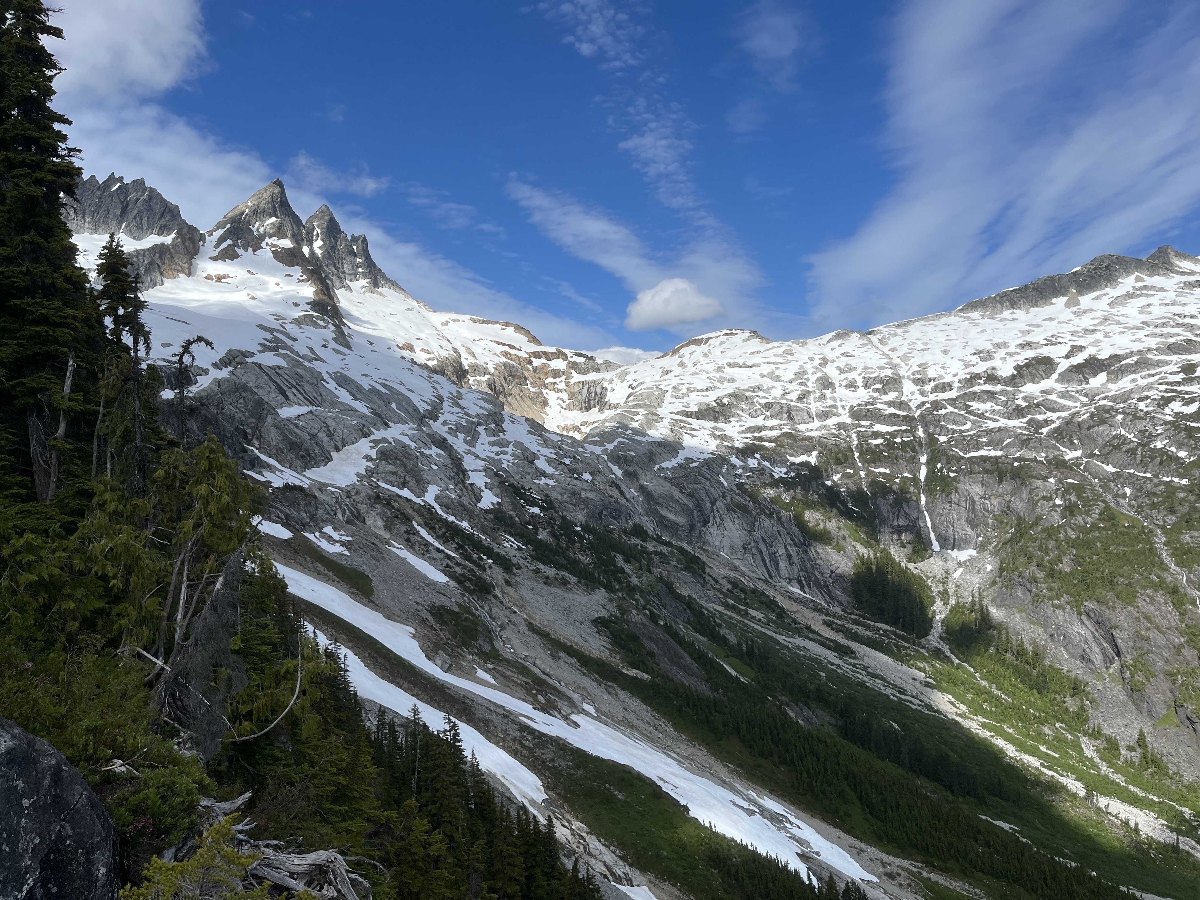
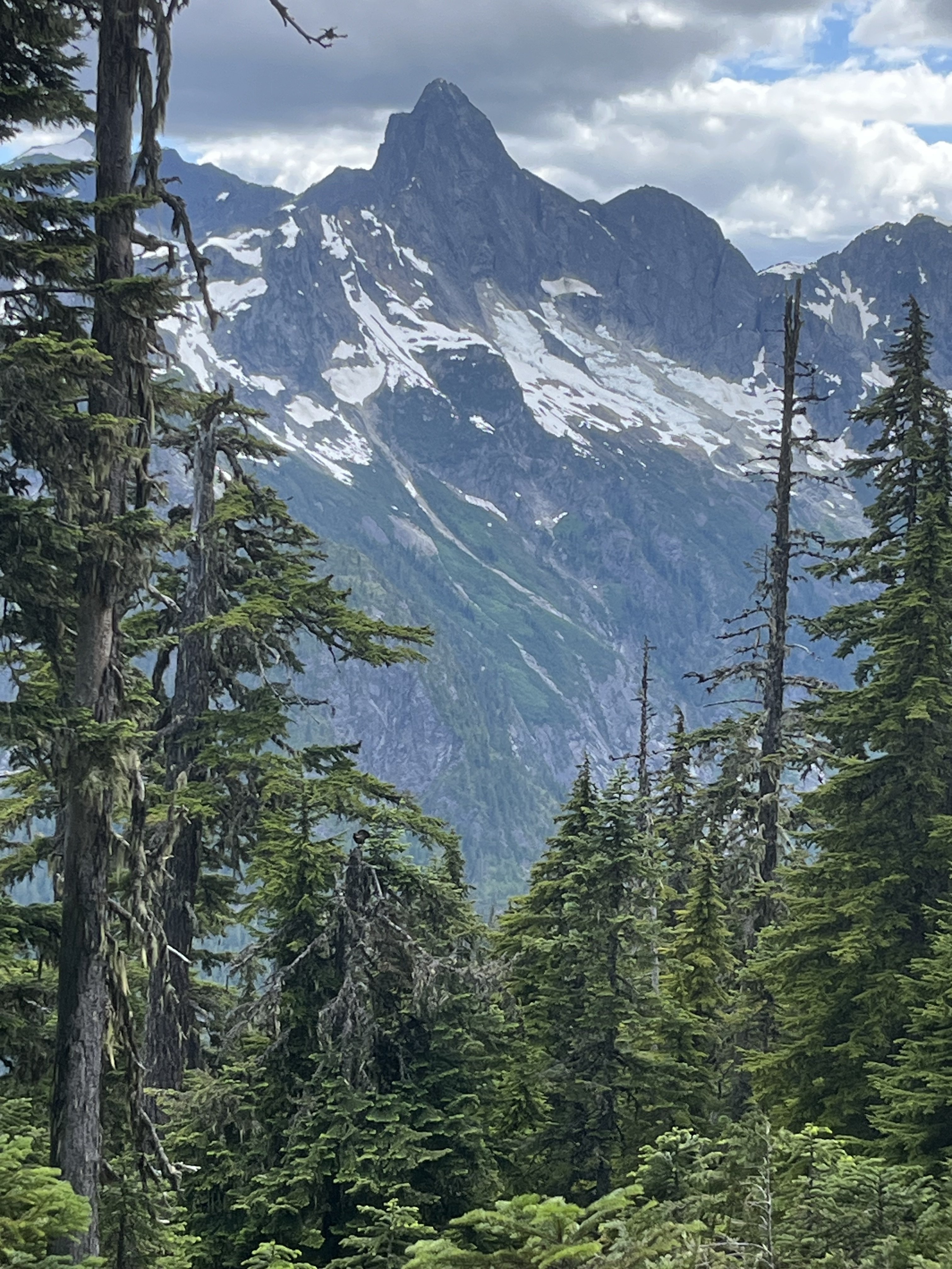
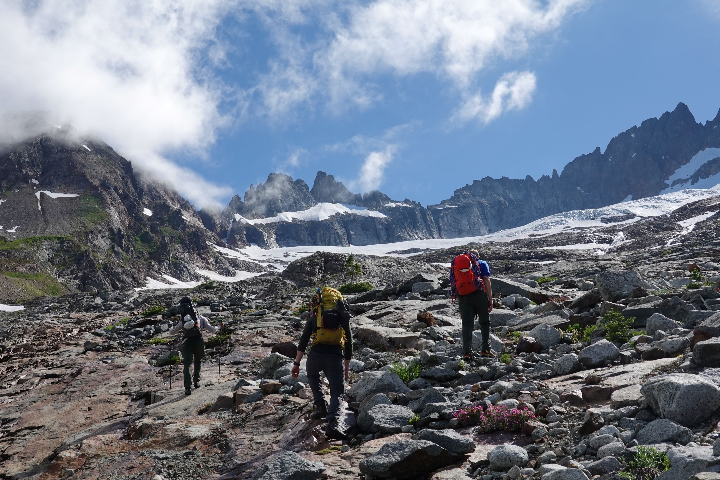
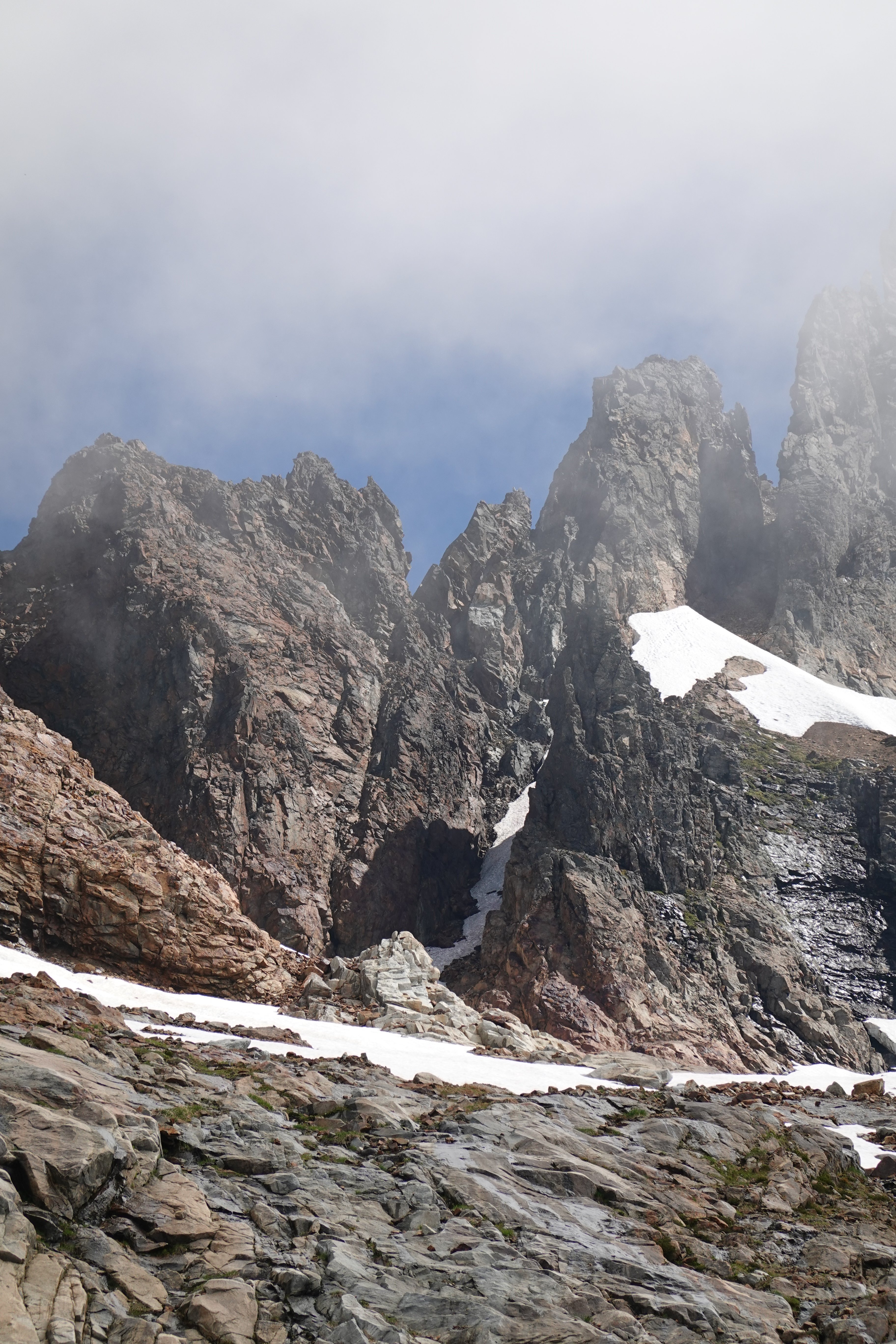
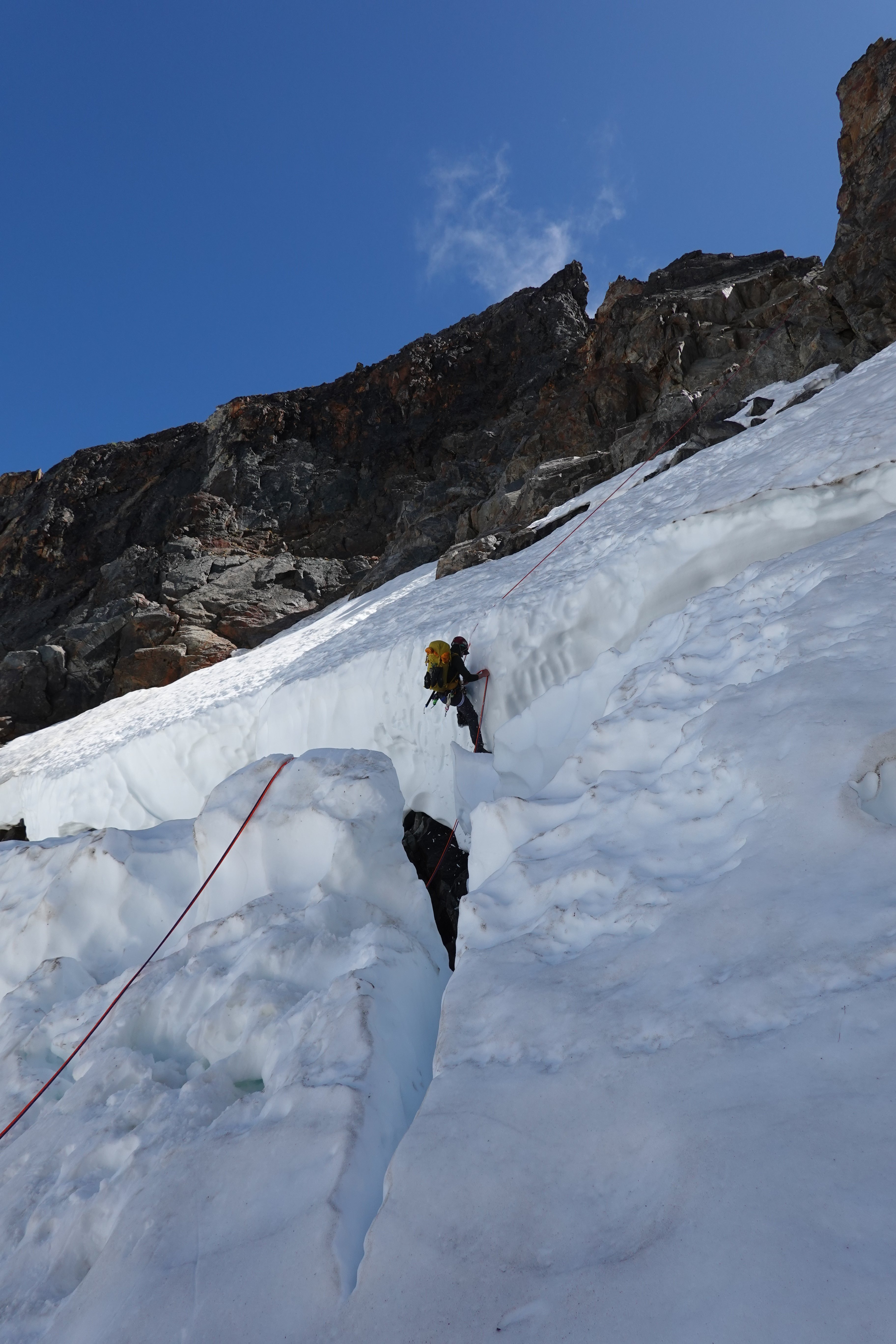
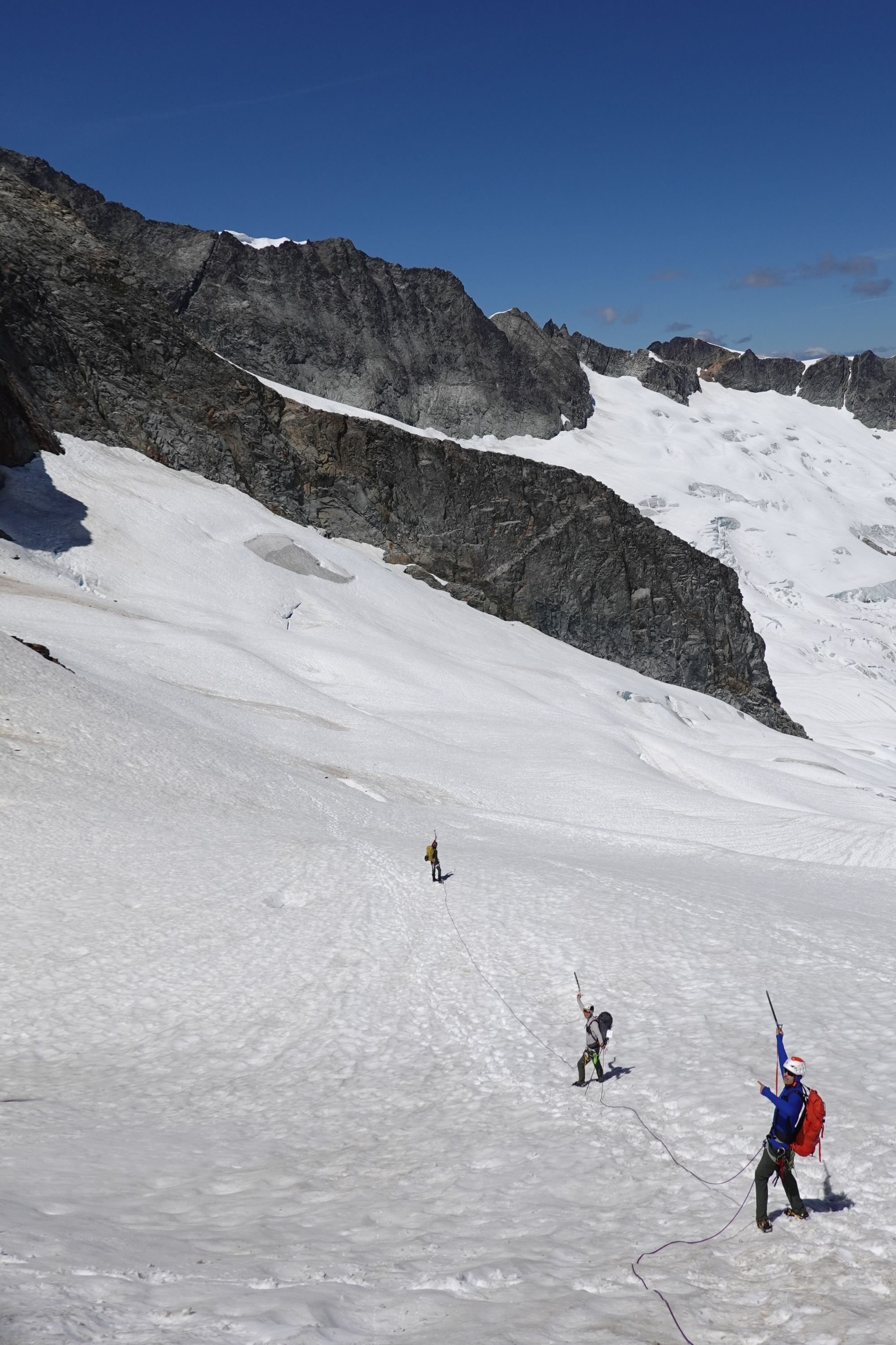
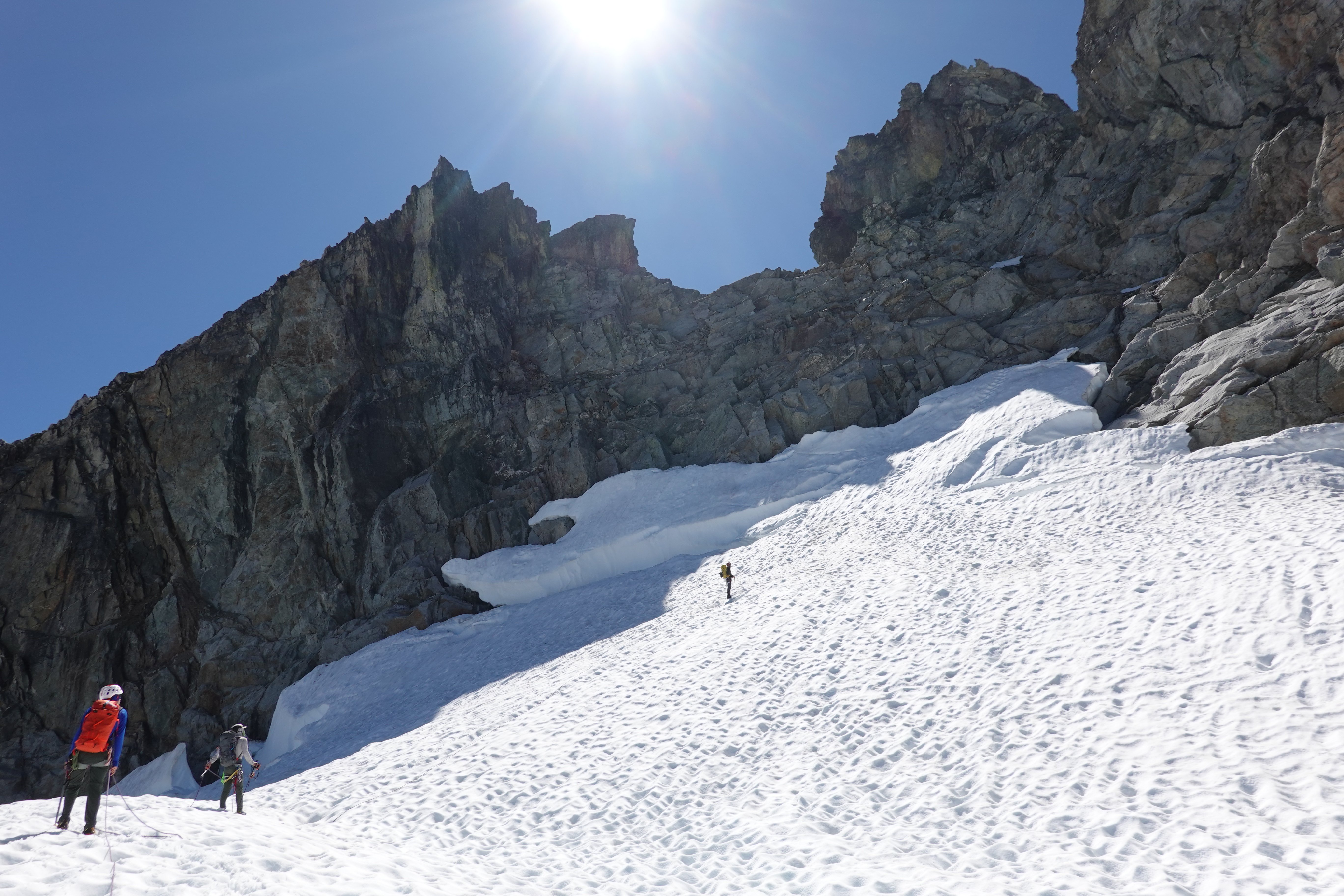
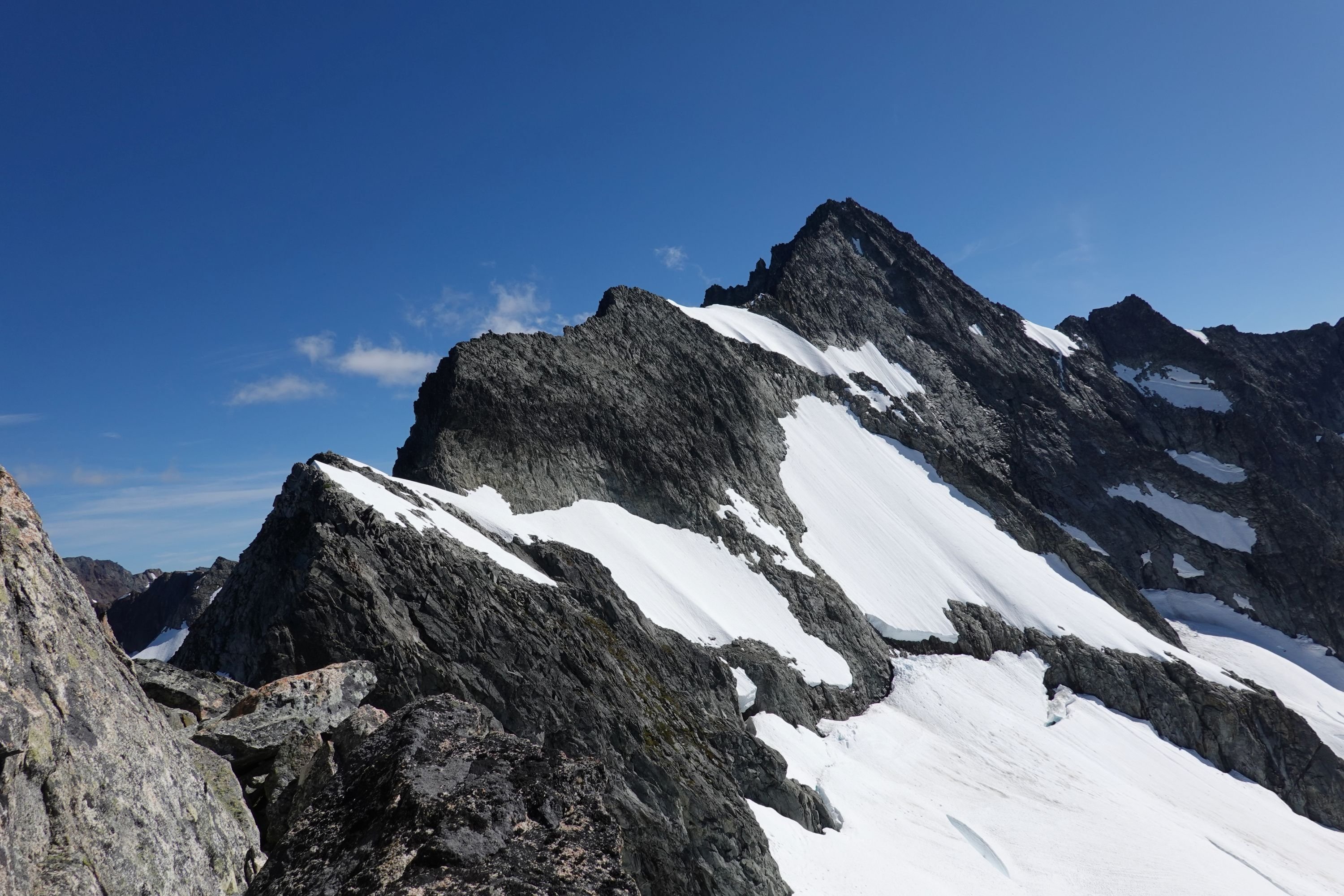
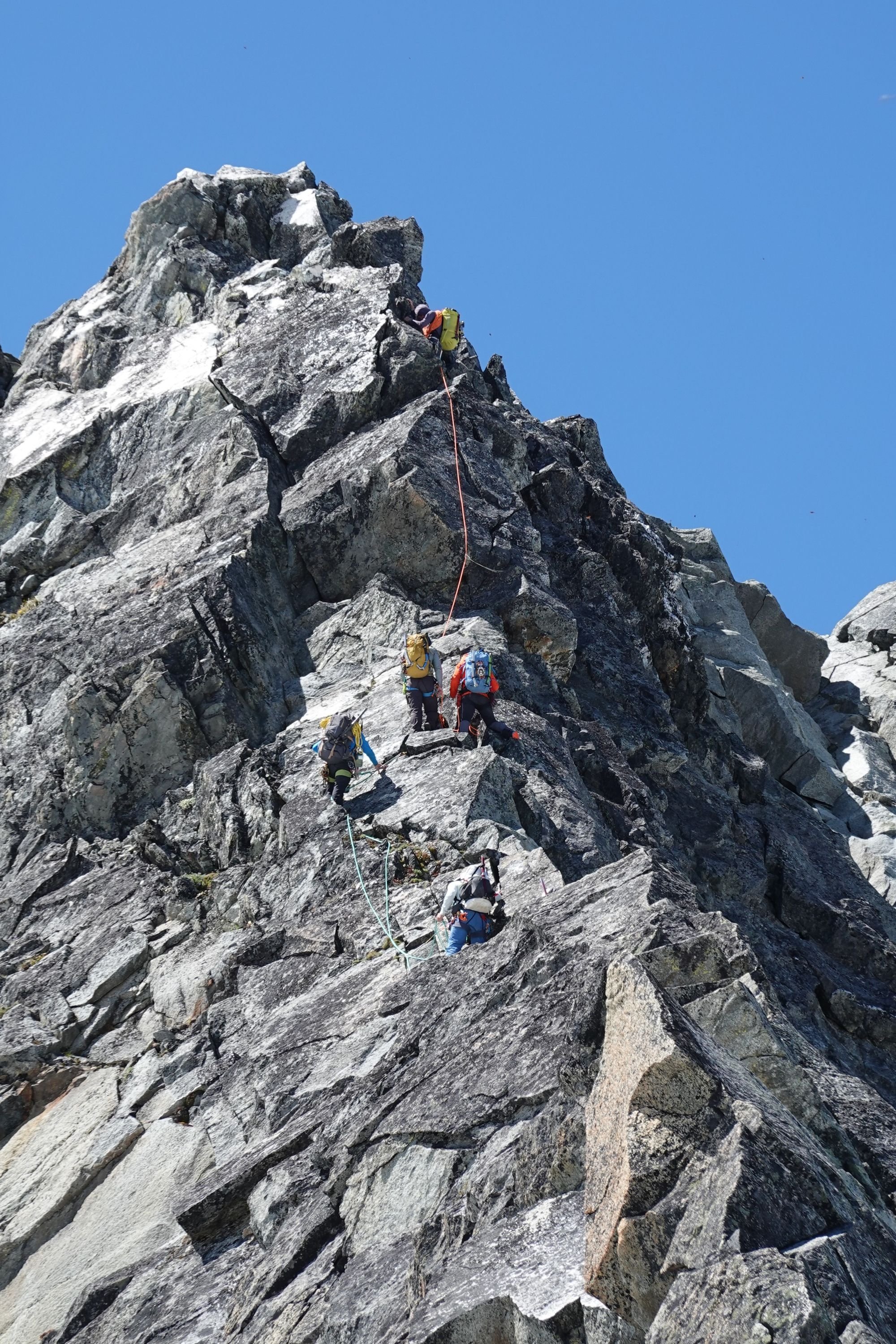
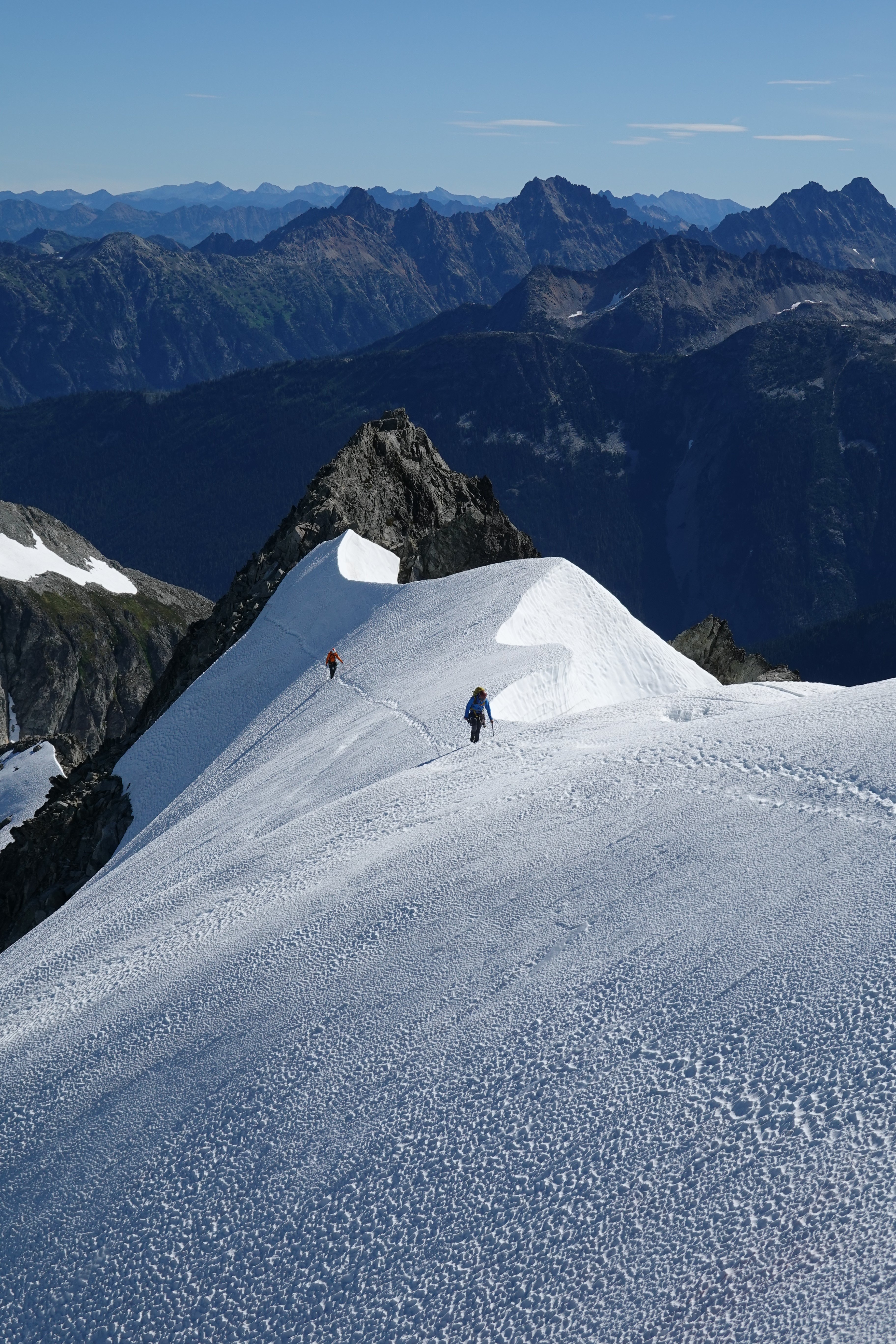
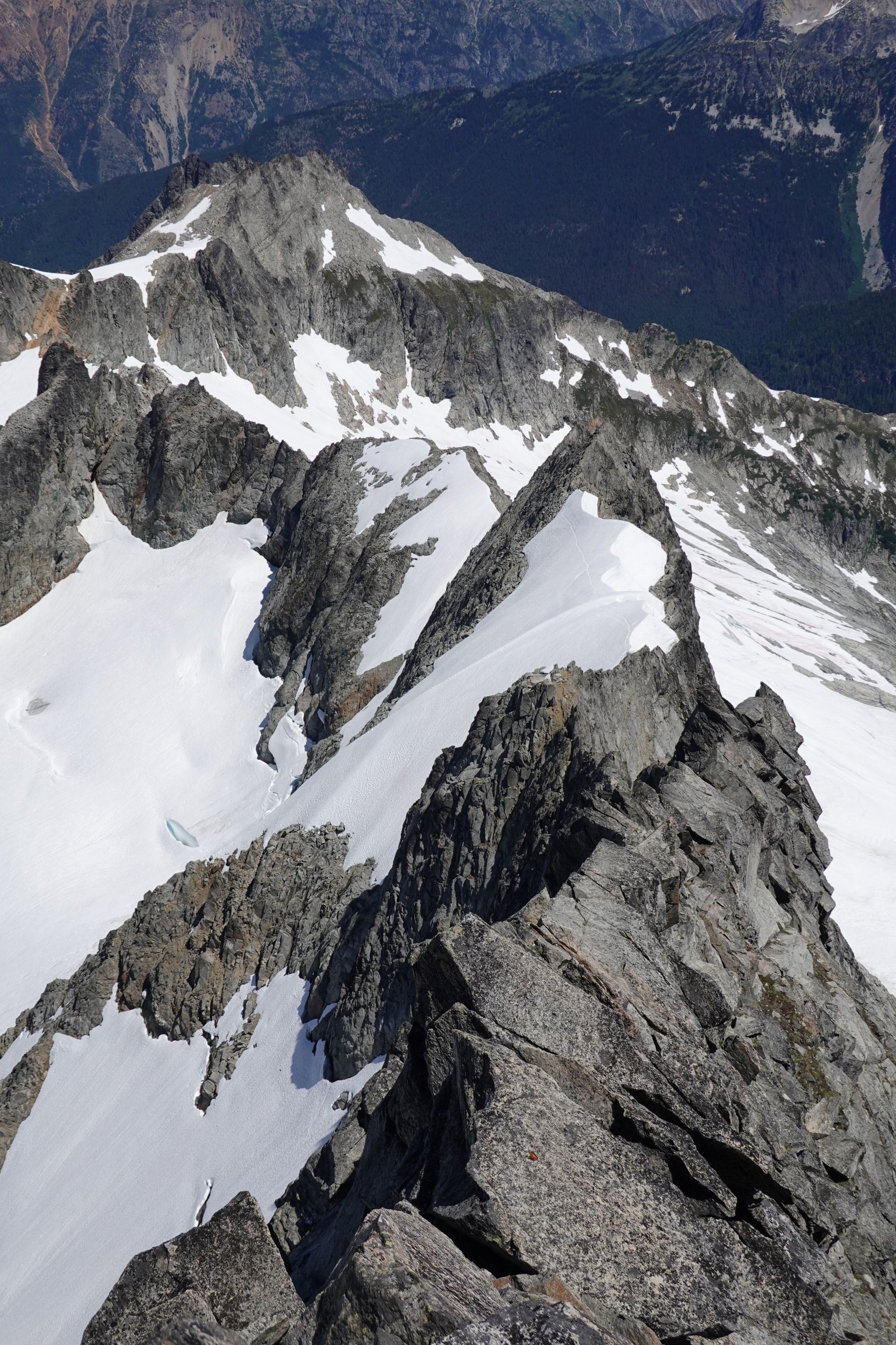
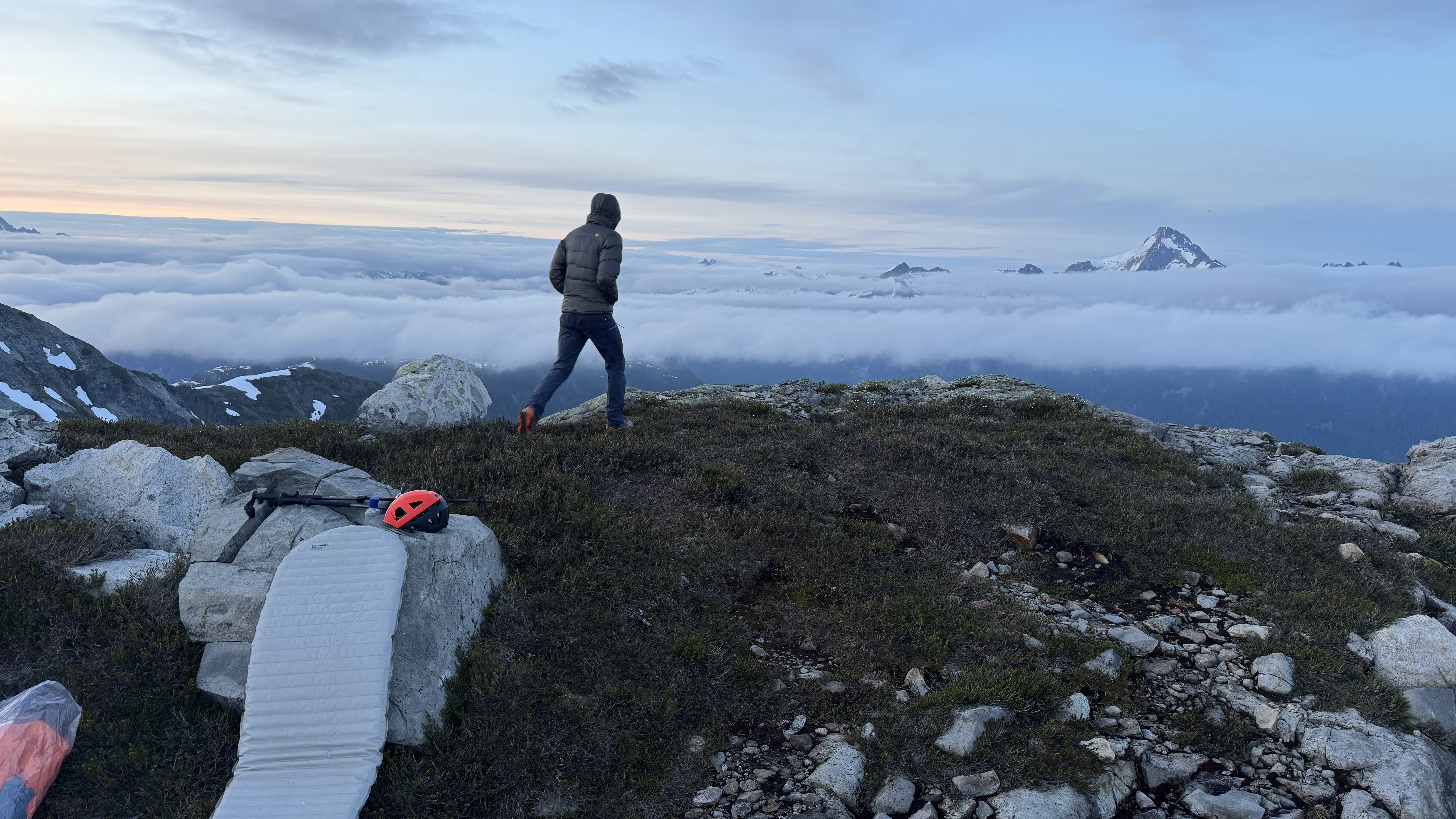
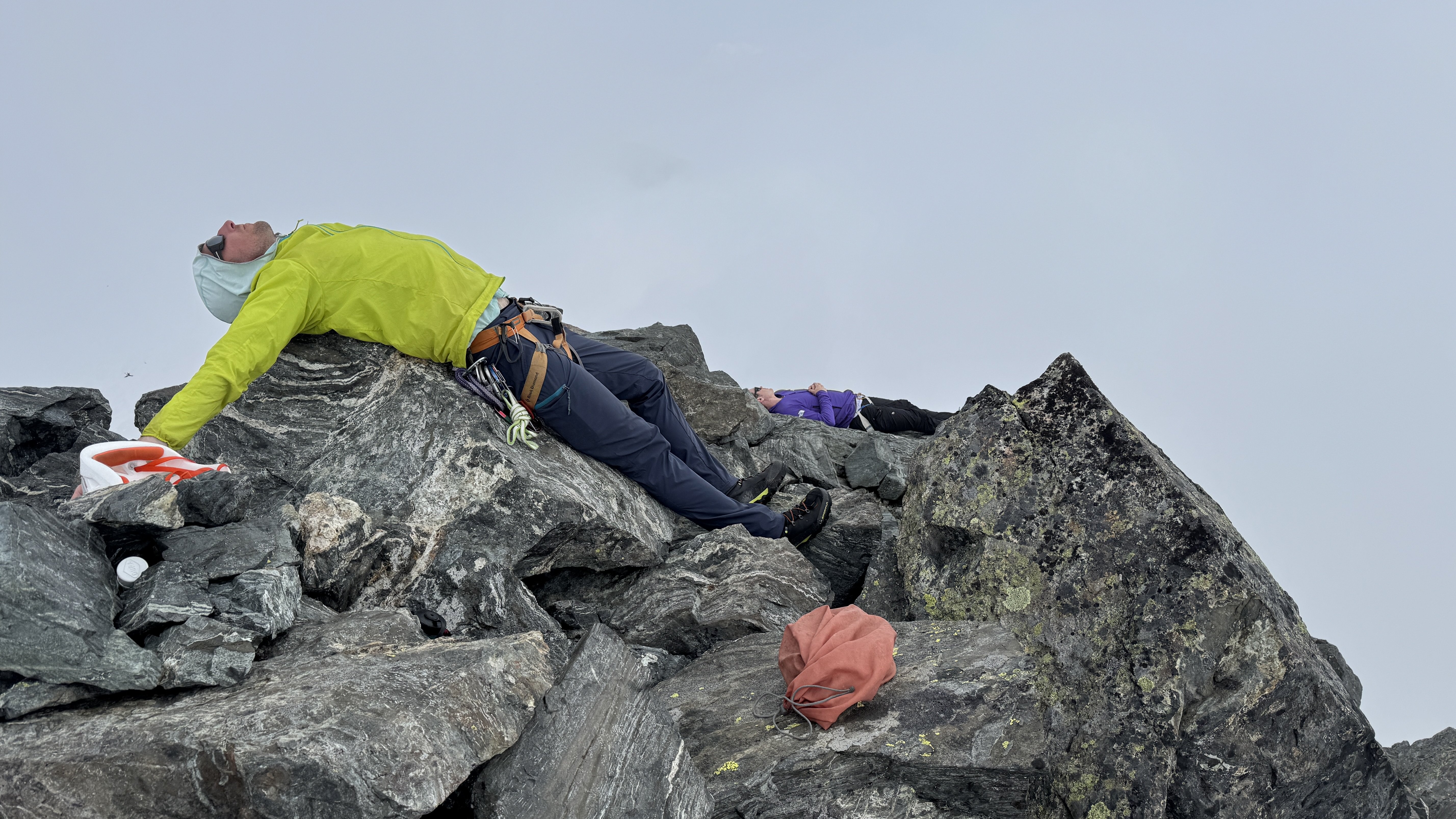
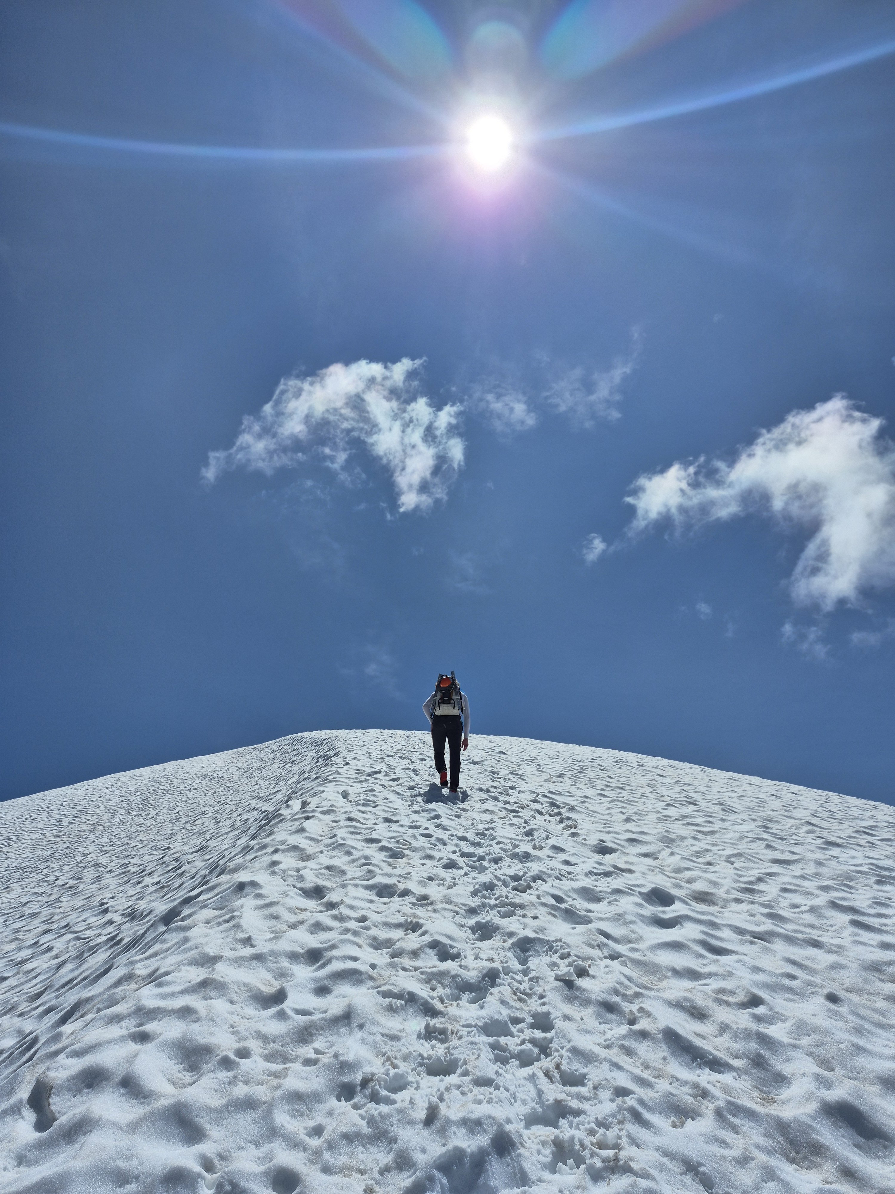
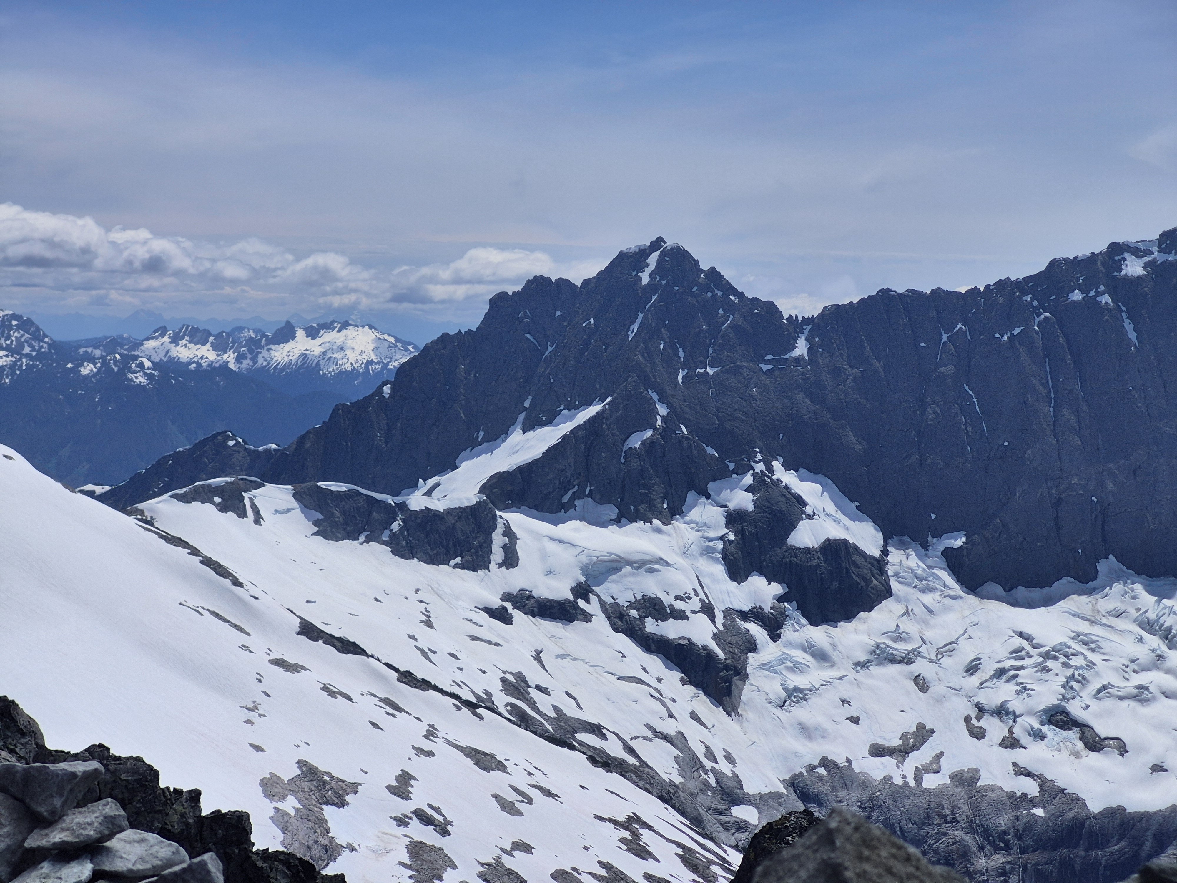
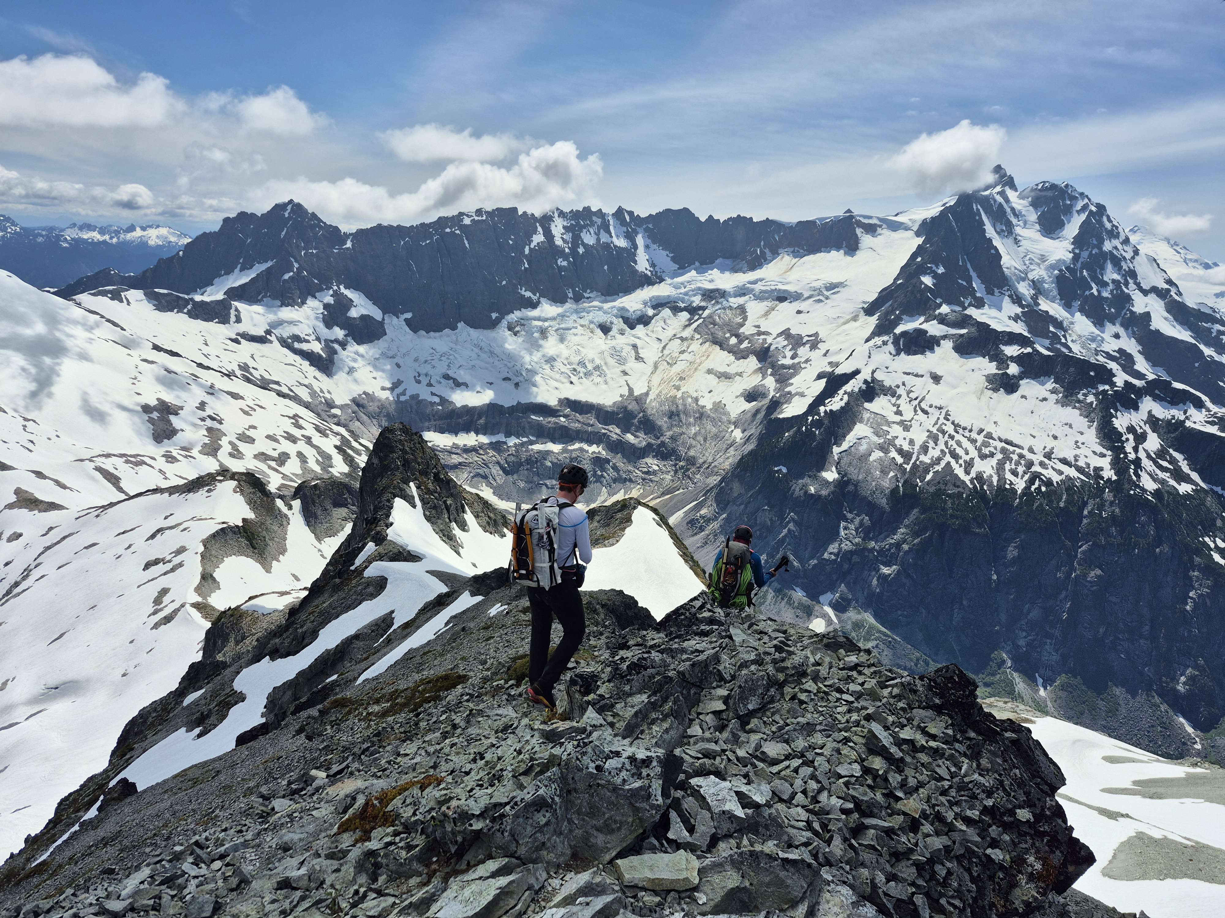
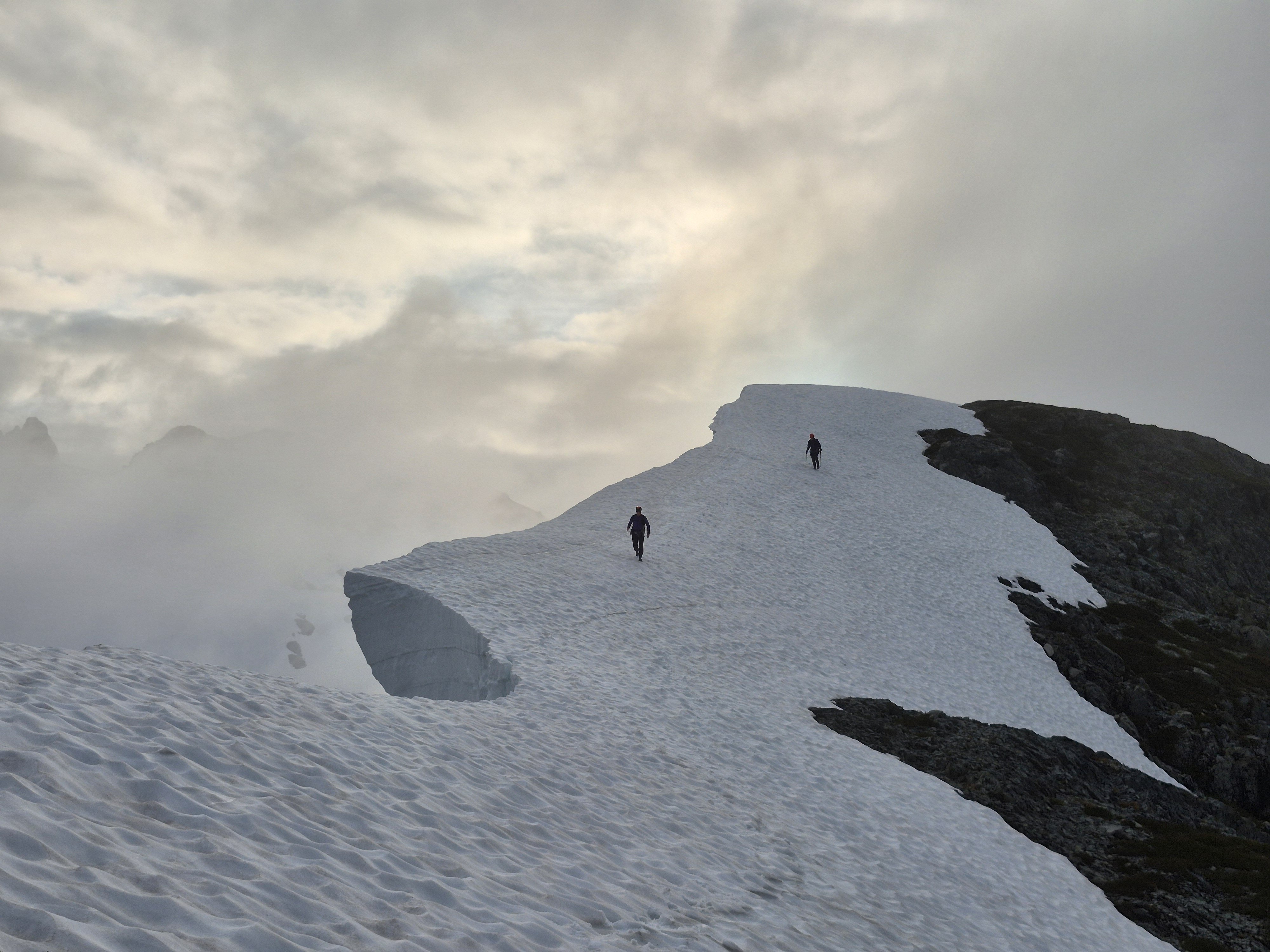
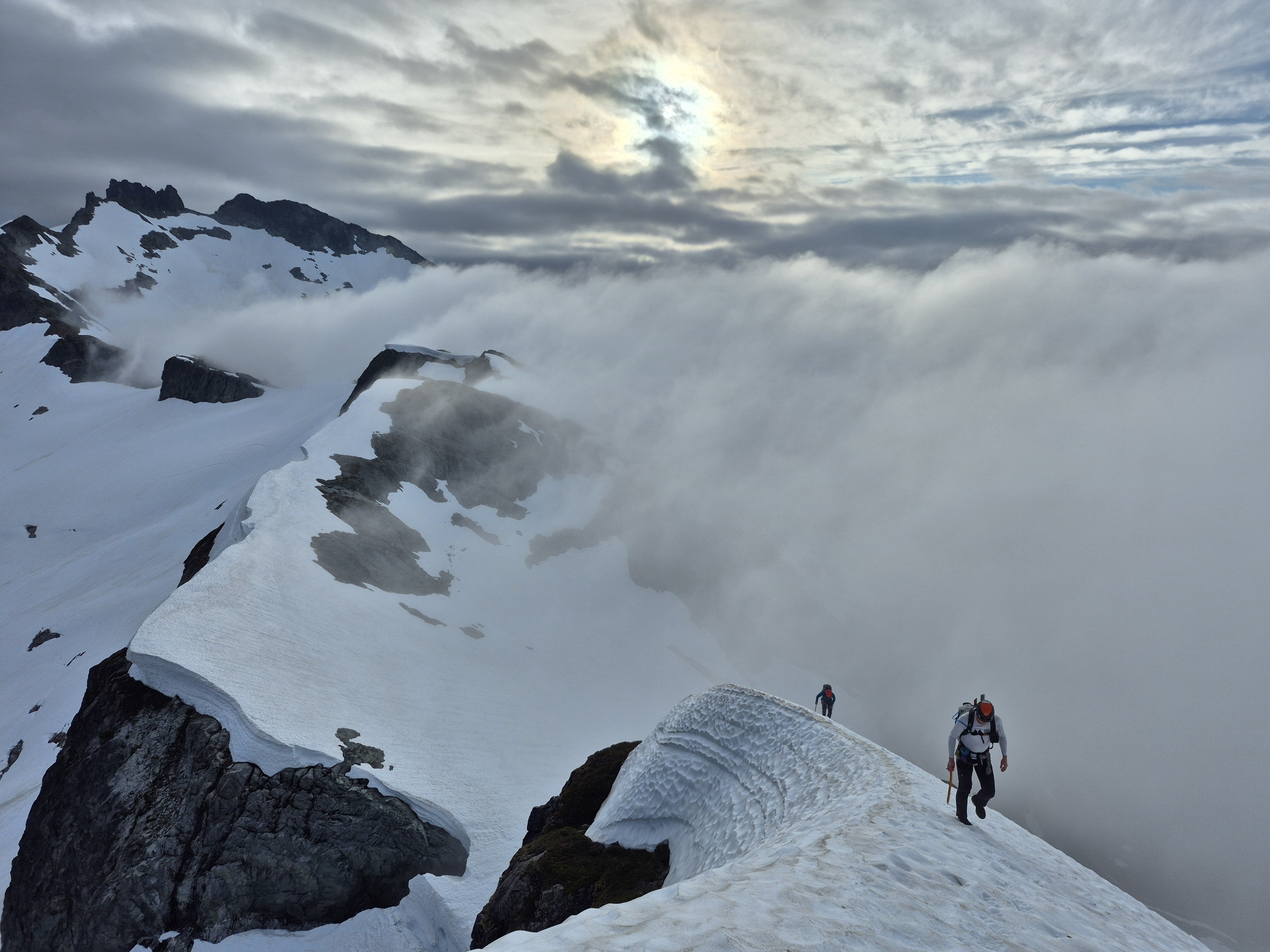
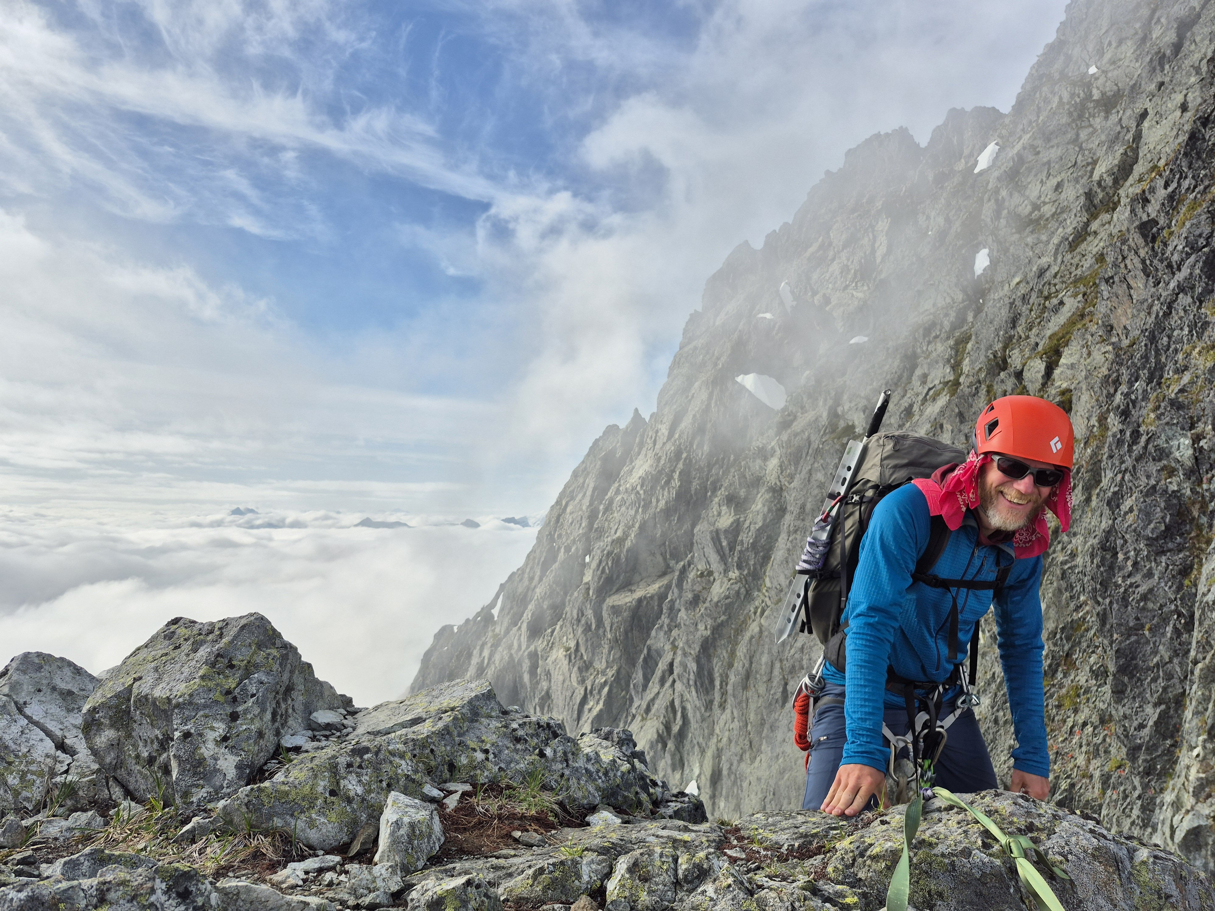
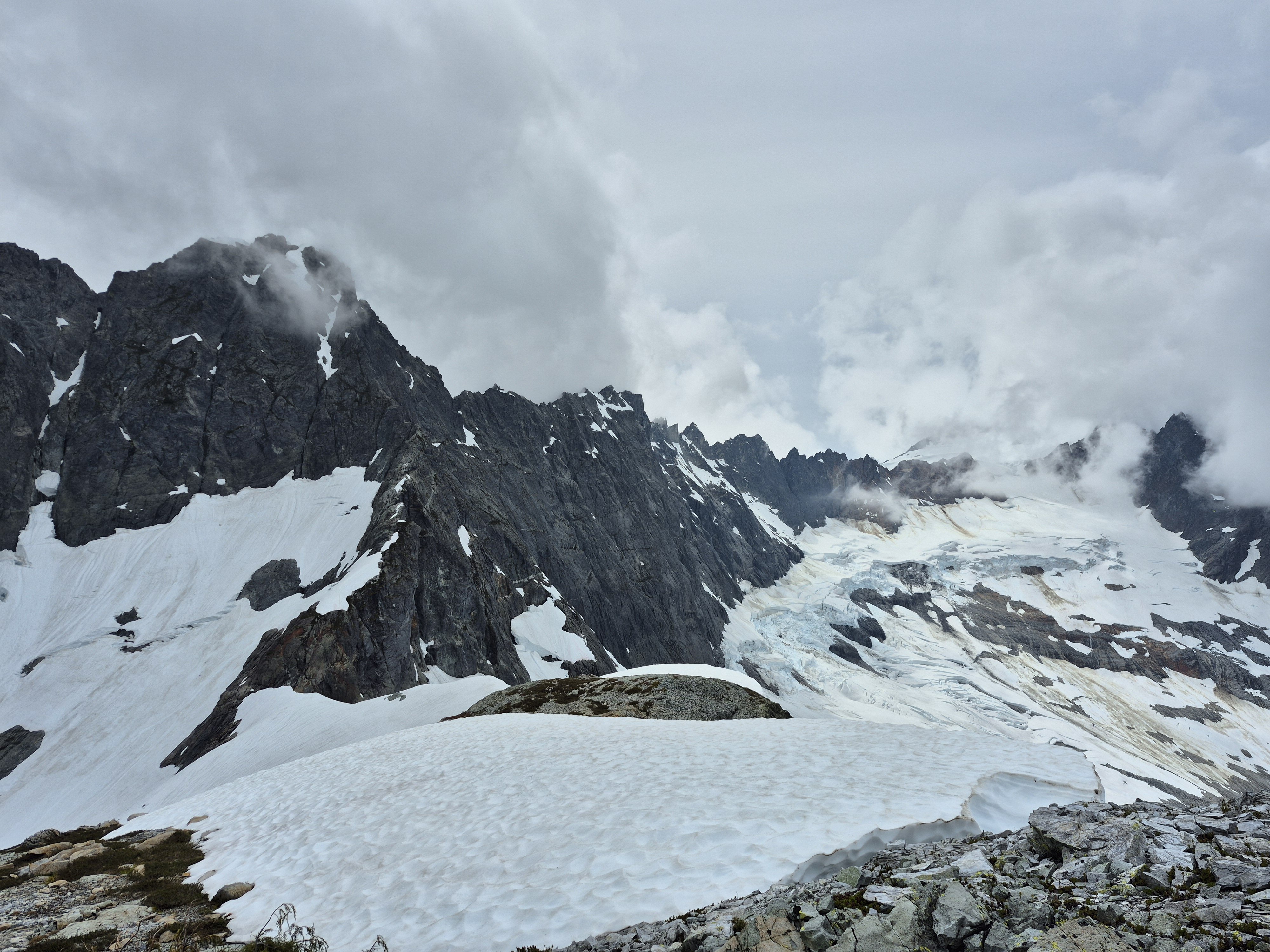
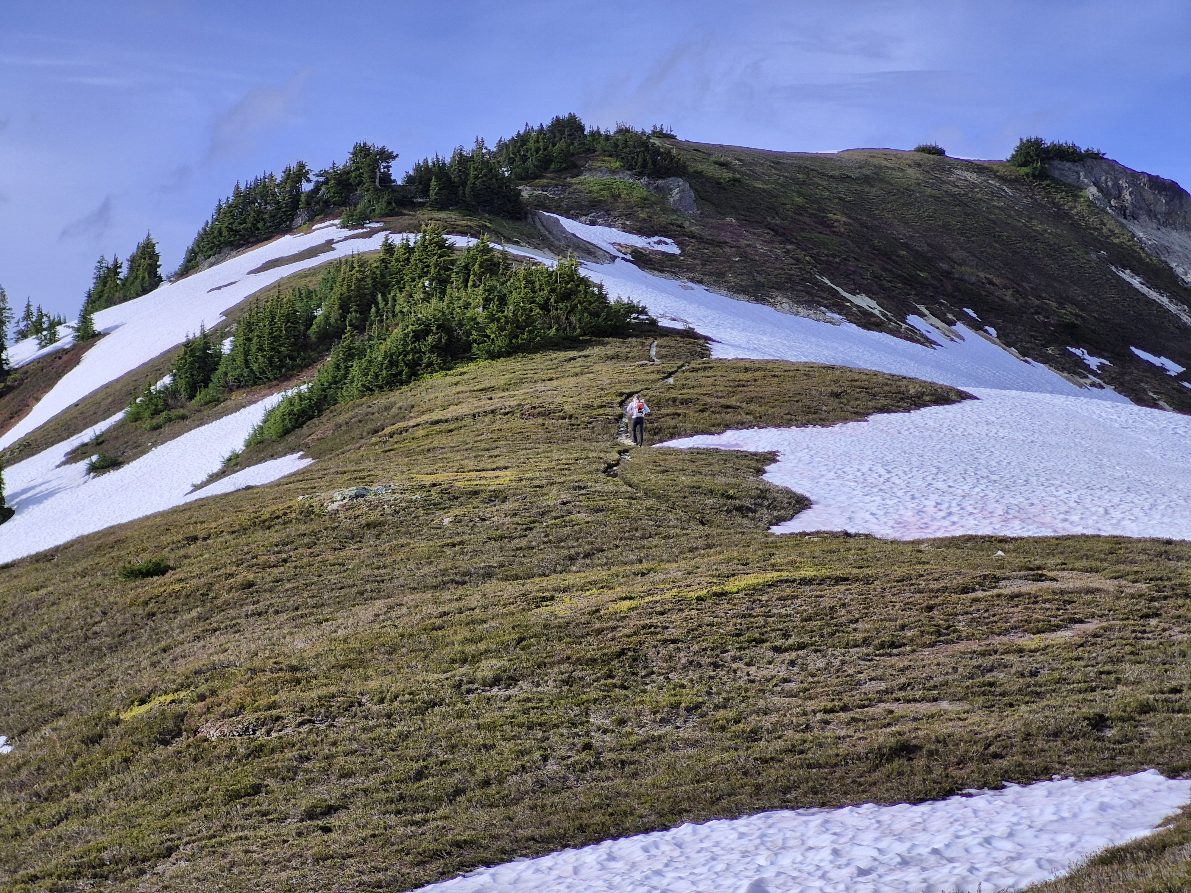
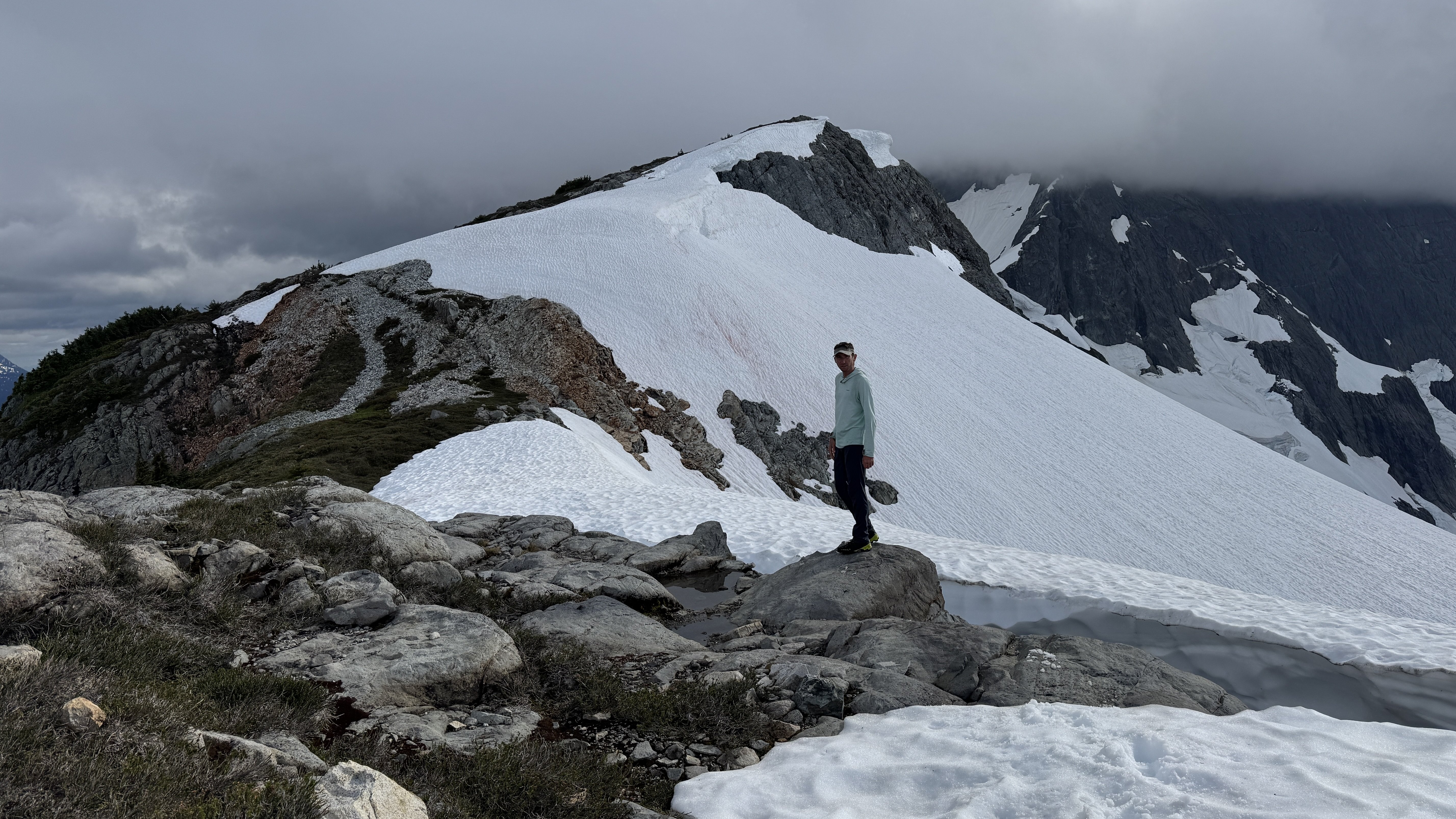
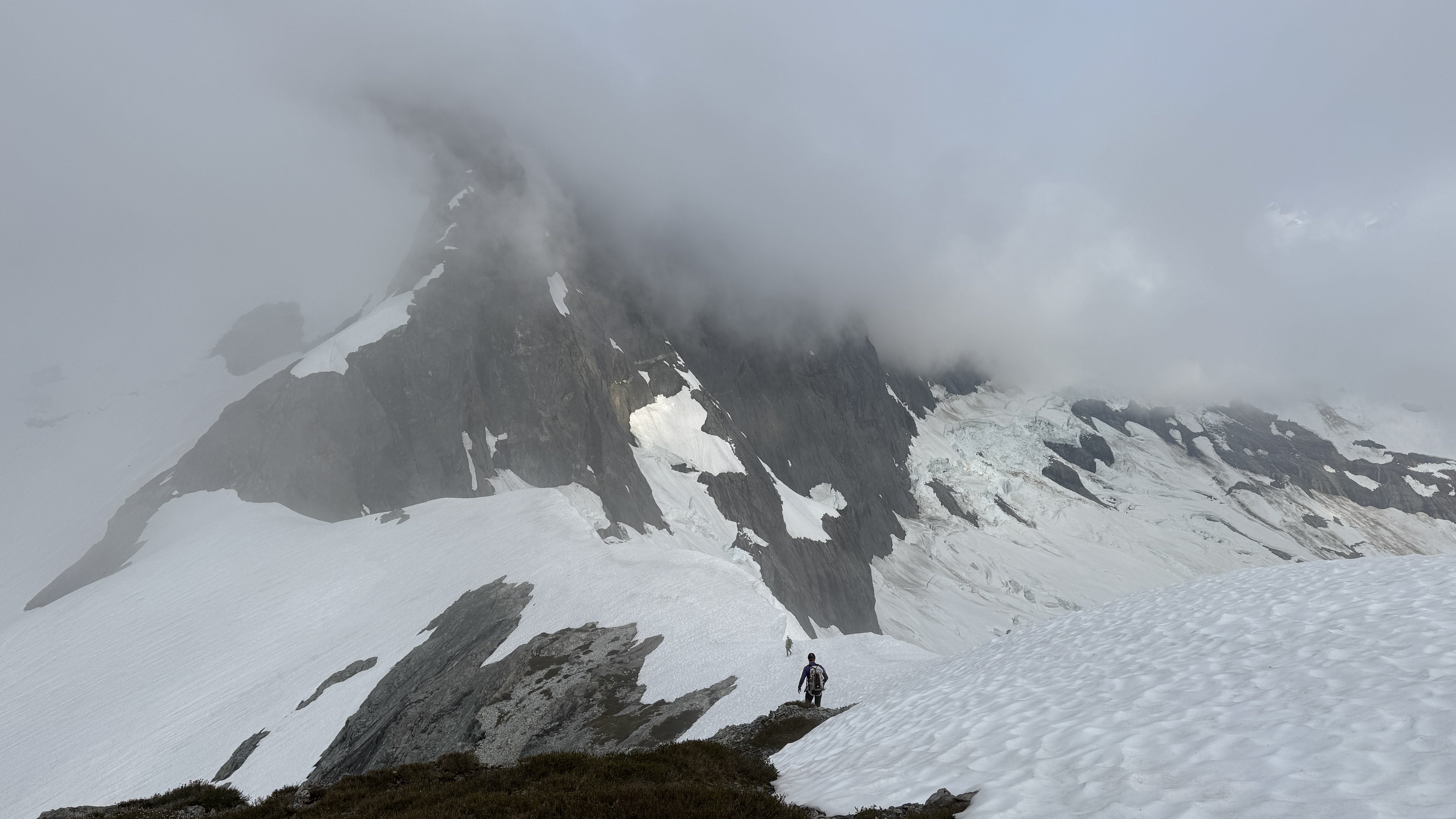
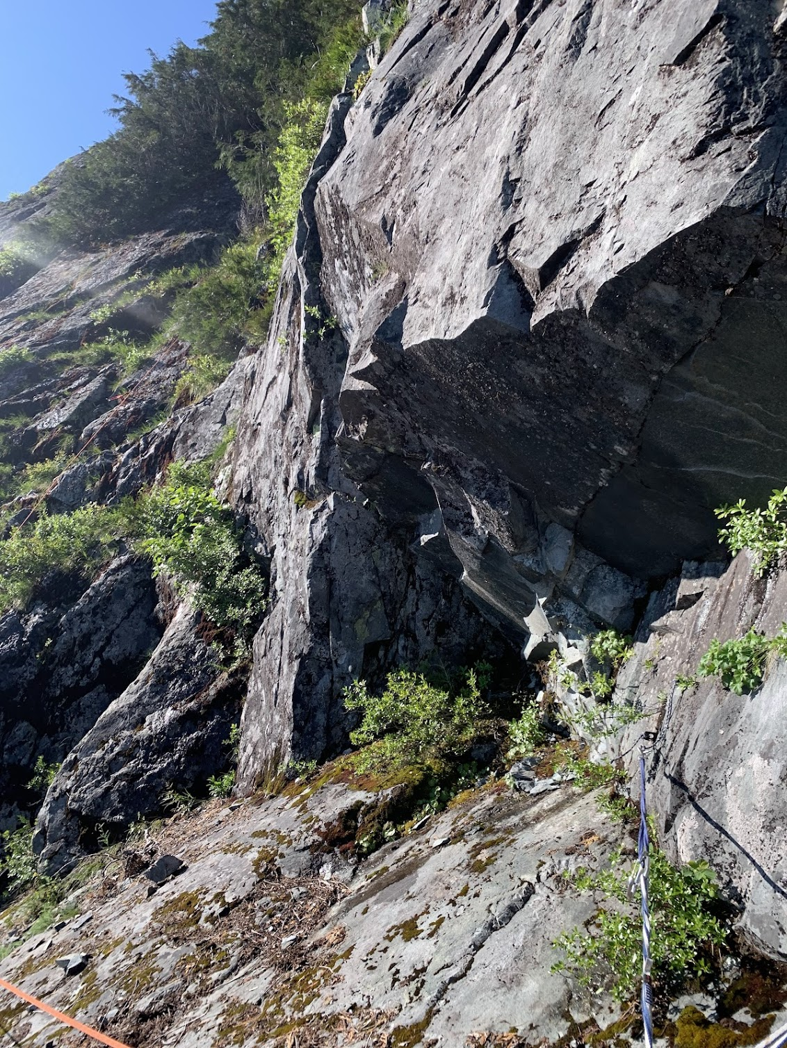
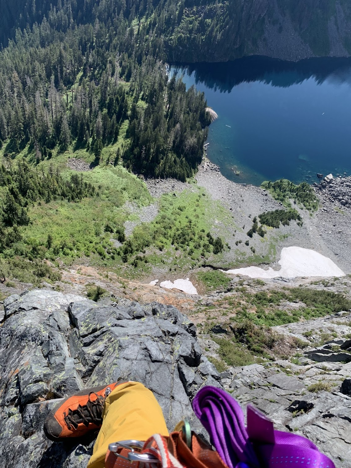
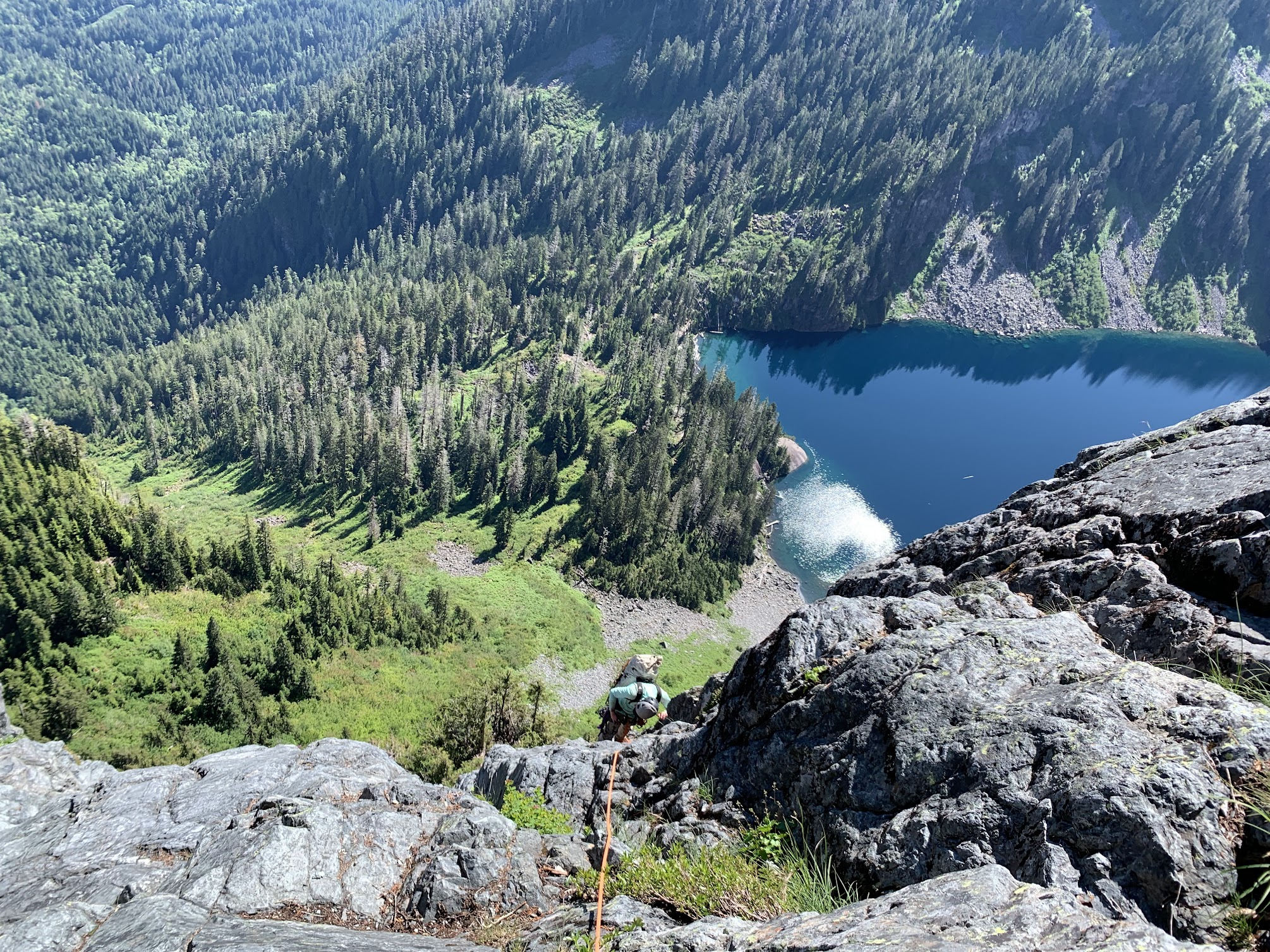
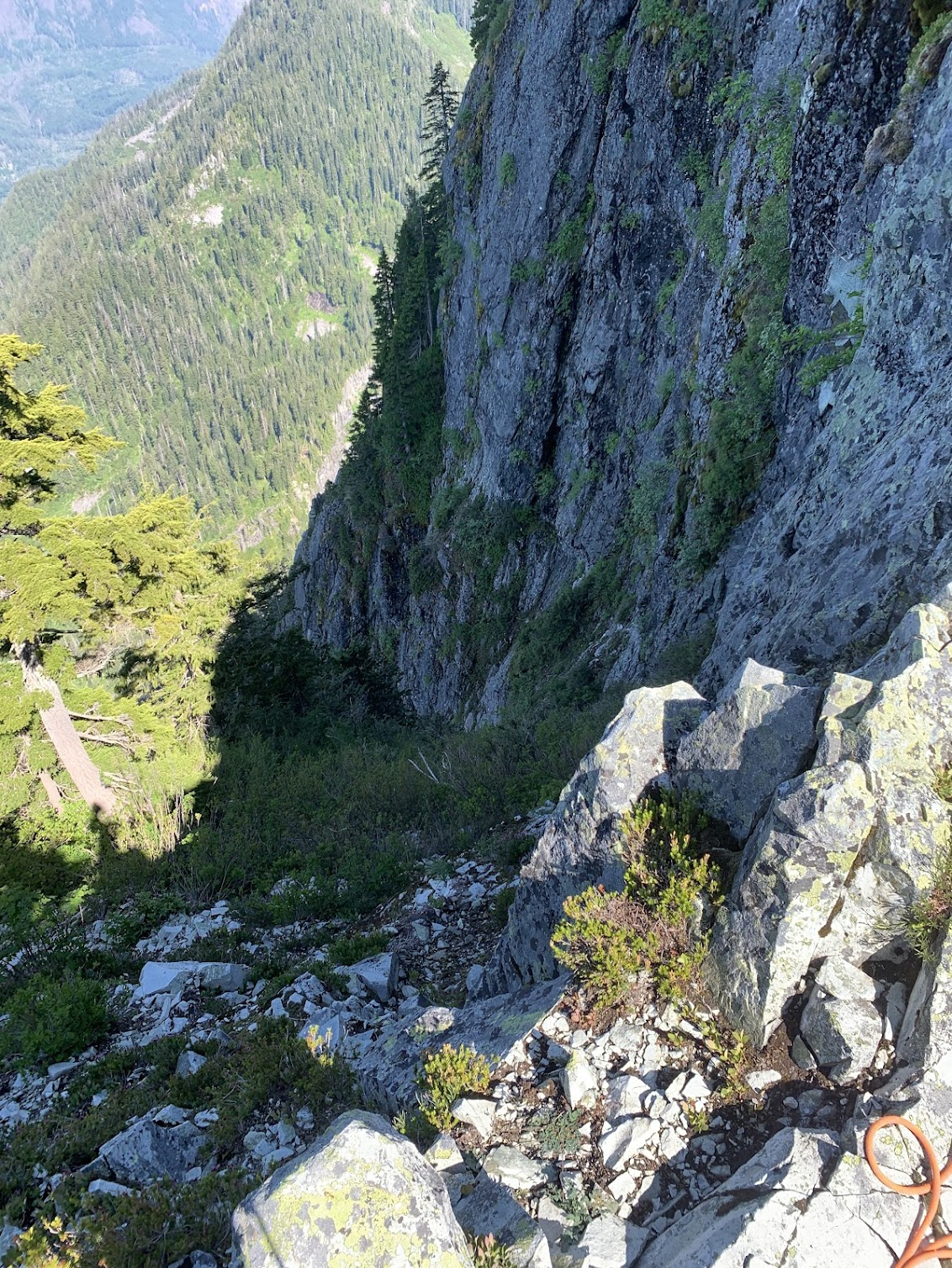
Trip: Spectre Peak - Spirited Away (IV, 5.9, ~2000 ft, 10 pitches) Trip Date: 07/07/2025 Trip Report: "Spirited Away" Second Ascent Spectre Peak & Exploring the North-Western Pickets Adam "Mo" Moline & emilio Taiveaho Peláez Itinerary: Day 1: Camp on Easy Ridge Day 2: Perfect Pass & Whatcom Day 3: Perfect Pass to Phantom Ridge Day 4: Climb “Spirited Away” (2000’, IV, 5.9) on Spectre Peak Day 5: Push Camp to Copper Creek Day 6: Hike out from Copper Creek First is a pitch-by-pitch description of the climb, written by Mo, followed a trip report written by both of us in collaboration. We climbed ten pitches, including a long (~600 ft.) simul of 3rd-low 5th to the summit block. Several of our pitches (p.4-6) diverged from the first ascent route. The Climb: “Spirited Away” (FA: Sam Boyce, Joe Manning) is an excellent remote alpine climb with stunning features in a hauntingly beautiful landscape. Pitch 1. From the notch, Emilio leads right and up 4th class ramps to a chimney, then opts for going right to the 5.7 face with good high feet moving up to the tree ledge. ~35-40 meters. Pitch 2. Emilio finishes tower 1 by first scoping the 5.9 chossy overhang, then opting to shoot left for the clean Gully. We both wanted to add to Sam and Joe’s incredible line by exploring places they mentioned, and we’re happy to report the gully was a very enjoyable and clean 5.6 romp up Tower 1. Pitch 3. (Mo) I, who haven’t yet realized we’ve bypassed SJ’s crux, eagerly take the lead after moving the rope further along the large ledge. The long pitch starts with moving the rope along the large ledge and travels up the 3rd-4th class ridge with nothing close to a 5.9 chossy overhang, odd. Very enjoyable climbing though! At this point, I stay along the ridge crest completely enchanted by the tower and therefore diverge from Sam and Joe’s (SJ) line for the first time. I anchor in at the base of the obvious and impressive Tower 2. Pitch 4. Emilio leads up the tricky face with bad pro. They shoot for the corner to find good gear for the steep headwall. The options from below appeared to be a steep and potentially overhanging crack up the middle, or heading to a notch on climber’s left between the 2 spires into overhanging face climbing. Emilio picks an inspiring line up to the notch through the corner followed by 20-30 feet on the steep but surprisingly juggy face, 5.8. Pitch 4.5. After the tower and an awkward belay, Emilio lowers down 15 feet climber’s left off a slung horn to a ledge below to set up an anchor for the “sky bouldering” pitch. Mo down-leads easy but chossy terrain. Pitch 5. (Mo) Along with the tower, this divergence (??) is also a complete treat. Comparable to the Rooster Comb on Mongo, or climbing in the Fisher Towers, the sky bouldering pitch involved some of our favorite climbing. Along with a series of easy V0- boulders, the ridge presents a perfect hand crack splitting an impressive boulder. Climb up and over this 4 star boulder, gymnastically flow through more boulders digging your hands into serious lichen, and finish with a reachy smear onto extremely licheny rock suspended over air. Belay on one of the golden slabs below the next gendarme. Like the RC, it’s hard to put a grade on this type of gymnastic climbing, top shelf fun though. Pitch 6. Emilio climbs the corner block with good pro, up and left of the gendarme until they meet SJ’s line once again. After lowering off nut/horn pro left by the FA team, Emilio sets up an anchor out of the shooting gallery and I lower down to the very redundant anchor deep in the gully. The only pink tricam placement of the trip. The kind gear left behind by the FA party for this pitch. Pitch 7. (Mo) Lead up 4th class to a left trending ramp where 5-moderate begins. Future climbers take the larger, earlier ramp rather than be entranced by the huge bulgy crack splitting the face (like I did). After returning to the ramp, it meets the beautiful hands/fist crack. With many alpine draws, continue up to meet the slightly overhanging crux of the pitch with a mix of choss and bomber jugs. Physical wandering with cautious choss dancing leads right, up, then left through stellar holds to a clean finish. Steep and committing but surprisingly good holds made this feel like 5.8+. Good pro. Let the choss sleep here for the sake of your follower! Looking down from above the hand/fist crack. Pitch 8. Emilio climbs up the heather ramp with choss for roughly 30m but not great pro until the blocks. Follow 5-moderate blocks up and left. After running low on rope and scoping options, Emilio belays on choss 20ft below the ridge crest. Looking up at the heather ramp. Pitch 8 Notes: Continuing on the ridge crest could be an alternative to the heather ramp. To avoid rope drag on the Hoodoo pitch, belay from the ridge crest if possible. Pitch 9. (Mo) Hoodoos. 3 options presented themselves to reach the ridge crest. Follow Emilio’s wisdom and take the chimney to the right or the easy ramp to the left, or my idea to shoot straight up the white 5.9 face. With my hopeless delusion being prevention of rope drag, I shot up a few cruxy moves and pulled it without showering Emilio with choss. All of a sudden, the spirits are all around you. We traversed low around many of the hoodoos both out of a fearful respect of their haunting beauty and temporary nature. We didn’t stop for any pictures and quietly danced around their north sides when possible, or climbed over when it wasn’t. After this steep, exposed, licheny, and hauntingly beautiful traverse, rappel off the furthest Hoodoo for 25-30m to a nice grassy ledge, then move to avoid rockfall. Pitch 10. (Simul, Emilio then Mo). 600ft of 2nd, then 4th, then 3rd class stellar scrambling following heather ramps and solid rock. Emilio leads what was some of our favorite climbing of the ridge moving efficiently up to the headwall. Emilio hands me the kindest gift of finishing up the 5.0 pitch. We finish this climb in memory of Teemo (Chad) the Cat who was spirited away weeks before this climb. An inspiration of our climbing, style, and backcountry meals (Chad’s Backcountry Catfood), and who lived with Emilio and me over a decade ago. With Love, for Teemo. Climb Descent: We now realize Emilio has accidentally stached their ice axe at the base of the climb. However, before we tackle this challenge, we must figure out how to down climb the east side which appears ledgy at first, but then becomes 5.moderate and steep. We navigate and beta share our way down after some interesting 5th-class moves on good holds. This side of the rock was significantly harder climbing than the side we summited. Now, the fun begins. We read SJ’s report of steep snow and early conditions and see this to be true. However, we have luckily navigated somewhat similar situations where on Mongo Emilio traverses steep snow with sharp and flat rocks for aid. I (Mo) kick some deep steps down a short steep section in similar style. After a few minutes of thoughtful snow travel, it eases up to walking a beautiful snow ramp down to a heather and slab rib. From here, a gorgeous dyke ‘Thank God Ledge’ becomes obvious and points you directly home to the base of the climb. Walk the 2nd class dyke admiring the unique rock and granite eggs. This section feels like walking towards Minas Tirith. Follow until the dyke turns into heather ledges/ramps at the base of the climb. 10/10 descent, would maybe rap in the future, or find the actual route down. Ascent ~11hrs Descent ~1 hr Trip Report Introduction (written by emilio): “When you get to the top of the mountain, keep climbing.” Nothing embodies this mantra more than a trip to the Northern Pickets, with its endless folds, valleys, and ridges. Summertime in the northern hemisphere means it’s high time for licheny choss and remote alpine meadows. For me, the solstice brings a yearning for good snowpack and godly glaciers, and despite my attempts to think or dream of other mountains, climbs, and ranges, the Pickets keep calling me. Throughout the year, I often wake up in the middle of the night longing for their surreal gendarmes, gnarly towers, towering spires, and self-willed wildness. Last summer, Mo and I climbed the climb we’ll never come back from, Mongo Ridge on West Fury. The three nights we spent on route mark some of the most significant moments of my time here on Planet Earth, so it was difficult to tell what would unfold after that experience. But, as it often does with these things, the idea of returning to the Northern Pickets for a seventh time as a team came organically. This is a blessing, because nothing is better than going into the mountains with Mo, the strongest free-climber I know and one of the very best all-around humans I’ve ever met. Although for the last few years we’ve been entering the park through Ross Lake, the first time Mo and I went into the mountains together we went in through Hannegan Pass, embarking on the long trek up Easy Ridge with a group of six. That year, we ate hearty servings of humble pie as we crossed the Challenger Glacier, climbed Challenger, dropped down to Luna Cirque, hiked up the other side, and tumbled down Access Creek. Photo I took on a disposable camera on our first trip to Challenger (2018). This was the first any of us had roped up together, the day after Mo's first rap ever. Jake Johnson, secret hero of all our trip reports, leads the way. Returning to Hannegan Pass in order to visit those places of intensity where our love for the Pickets began—the Imperfect Impasse, Perfect Pass, Whatcom Peak (where I was first benighted), and the Challenger Glacier—with all these years of hard-earned experience felt right. Also, filling in the lore of Mongo, we knew that Wayne had first seen that mythic ridge while climbing the mind-boggling “Haunted Wall” of Spectre Peak. We had to at least see the Haunted Wall in person, to trace Mongo backwards, and get to know this obscure and remote peak we had seen from the neighboring ridge. The call from Spectre was coming from several directions. Beyond the opportunity to climb exquisite choss, the pleasure of going to such a remote country and live, even if momentarily, in the freedom of the hills, is hard to pass up. As a team, Mo and I have been on a little tour of second ascents across Washington (summiting Lemolo, “Sharpen the Saw,” and going up the Rooster Comb), often setting SKT’s in the process (slowest known time), so even if we didn’t yet have the gumption or cojones to repeat Mike Layton and Wayne Wallace’s insane line, we figured we could celebrate Sam Boyce’s remarkable achievement, “Spirited Away,” the South Ridge of Spectre, and enjoy our time in the process. The hoodoos, gymnastic traverses, and time spent on the ridge, made this line appealing. At the same time, Sam’s recent climbs in the Pickets have been inspiring to follow, and the beta he and Lani provided from their climb of Mongo made our experience on that ridge much more pleasurable, so our ascent of Spectre is a celebration of this current Picket Renaissance. As opposed to the ultra-light mentality we brought to Mongo, for Spectre we shouldered heavy packs, bringing extra food, creature comforts, and redundancy (including an additional pack stuffed inside my pack, which strangely came in handy) for the ~50 mile round trip and ~20,000 ft of elevation gain. We started our trip on the Fourth of July and budgeted the entire week ahead in order to adapt to the weather and be able to luxuriate like sybaritic alpine lizards. Trip Report (written in collaboration by both of us): Approach (days 1-3): We left the Moline Compound in Olympia early in the morning, driving steady to the Hannegan Pass trailhead to get there and get walking by 8:30 a.m. Surefoot miles brought us past hikers and trail crews hard at work. Crossing the Chilliwack was a treat in the heat and we zig-zagged the long diagonals up to Easy Ridge, encountering Chaga, old COTW, and copious Calf’s brain while admiring a solitary hand-crack along the way. For the return, we knew we’d have fresh berries Bilberries and Huckleberries. Like everything in the Cascades it seems like Easy Ridge is sandbagged because it’s a serious hike, but it also lives up to its name in the views it affords–though on our way up it was mostly clouds. We camped at a nice bivy before Easy Peak proper and drink some fresh Chaga tea. We stop after 15 miles and 7 hours of moving. The following morning we slept in and made coffee in the morning, taking our time before getting moving. Right as we pack up to take off, Mo’s side backpack zipper breaks exposing all the innards. After several seconds of perseverative thought, the universe reminded us that we have, in fact, 3 total backpacks between us! Not being able to decide which pack to climb in, Emilio serendipitously packed double bag includes both a 35L pack with a 30L pack stuffed inside. Mo’s pack is strapped shut with some climbing equipment (reminiscent of the broken crampons on Mongo attempt 1) and we ramble scramble onward without any anxiety of gear for the climb ahead. The scree-step up to the summit of Easy Peak brought us to more walking and descending, before reaching the threshold that the Imperfect Impasse provides. What a chasm! It’s hard to believe Mo’s first rappel ever was into the snow down below, though there was no need to rap today. Fourth class ramps and early season conditions were in our favor and we were able to quickly move across and head up the slab and heather to Perfect Pass. It’s nice to imagine what evaporating dew must feel as it ascends, but gravity in a human form is more easily navigated in diagonals. On the way up we ran into a group who had just summited Challenger, having camped at the bottom of the Impasse, but they were the only group we saw and from there we had Perfect Pass to ourselves. Given our odd timing at PP, to warm up for Spectre, and because it seemed ridiculously fun, we decided to drop our stuff and romp up Whatcom. The snow conditions were great and the sun was shining. Whatcom is a stunning mass and a wonderful teacher, and as specks on her summit we lingered admiring the landscape. The way back down to Perfect Pass brought joyful plunging leaping running down the mountain and we made twelve minutes of it, even after stopping to take pictures and laugh. Deciding Perfect Pass lives up to its name we made camp and stopped here for the night sleeping once again under chossy stars. emilio bouldering at perfect camp trying to strengthen the toes after descending from Whatcom. There are some quality blocs to be found out here! I’m wondering if FKT.com will allow for the Pass-to-Pass FKT to be submitted up to Whatcom, here we humbly submit 1 hour for our time. The next morning brought us to search for the somewhat mysterious Challenger Col. It’s mysterious because there are several possibilities for which one it may be and we had been overconfident on the beta for this section of the climb. After weighing our options we decided to go up high to the (later identified) West/Middle Challenger col and found some vintage tat. A slung horn of rope fibers suggested the way down a dihedral next to a stunning arete, and the glacier below seemed to provide ample access to the Western slopes of the Northern Pickets. We slung the same horn with fresh webbing and went down for a 35 meter rap. On the way down we found an offset nut with some red tat. The full rap was a little longer than 35 meters, but luckily it ended in a hungry offwidth so we were able to untie and downclimb a few extra feet to the snow, which provided a welcome ramp into the glacier. Here, again, we benefited from early season conditions. We navigated the glacier down to the south ridge of Phantom where we made a gorgeous rockside camp on clean slab near drippy snow. Sleeping early brought thought-dreams of the climb ahead and brief periods of waking up (at 8 pm) to gape at the Haunted Wall. Seeing the Great Gendarme that adorns the South Face and thinking about the bold, committing, and cerebral nature required to climb such an audacious route left us floored. For what it’s worth it’s worth remarking that Wayne Wallace and Mike Layton’s climb of the Haunted Wall of Spectre is perhaps one of the most impressive feats not just in Cascade climbing, but in USAmerican climbing more broadly. Mo enjoying an ice bath on Phantom Ridge preparing for the climb ahead. Harvesting Water on Phantom ridge. In lieu of prayer flags we adorned our camp with the tat we had found along the way. Mo with Mongo. Day 4 (climb): An alpine start at 3:40 has us moving to arrive at the climb with the sunrise. [See Previous pitch by pitch section] Descent (days 5-6): An alpine start at 4:00 a.m. has us moving well before daylight, as we hope to cross the Chilliwack by the end of the day in order to avoid the incoming weather. Cold coffee gets us moving and we go back up and down the rhyming patterns of scree, talus, and heather, scree, talus, and heather, until we hit the snow. We had debated whether we would try to find the actual “Challenger Col” that ostensibly did not require a rap to go down, or retrace our steps and retravel our known road up the glacier, and lead the pitch back up to the Col. The thought of leading the pitch back to the col had Mo full of energy so the decision to retrace our steps up to Solar Glacier was an easy one to make. Snow brought us back to the rock where Mo put on the rock shoes and racked up (only to place minimal gear). The arete provided excellent, though not well protected, 5.4 / 5.5 climbing. What an incredible way to get back on the Challenger Glacier! Back on the glacier we stayed high to scope out additional low points on the glacier. A stacked cairn gave indication that we had perhaps found Challenger Col. After reading several other trip reports, it’s hard to say which col is indeed the standard col to access the western side of the Pickets, but perhaps someone can help us piece this together. Looking up at the arete from the solar glacier & Mo leading the way. The rest of the day brought long miles up and down, through scree and talus and snow and heather, next to waterfalls and tarns, zig zagging under the sun. The snow on the imperfect impasse had melted so the way back was far spicier than the entrance. Thoughtful moving on steep terrain brought us back to the other side, having once again crossed that threshold into the Pickets. The moving kept going all day, as going down is often more of a climb than going up. Thankfully, the trail on Easy Ridge fed us bountiful berries, bringing out the bear in us. Blistering feet peeled and the miles eventually brought us to a solitary and welcome camp on Copper Creek. The Imperfect Impasse! Or is it the Perfect Impasse? Either way, it's awesome and steep. Easy walking along Easy Ridge. The next morning we woke without an alarm, made coffee and leisurely made our way out in a welcome wetness. Rain brought out the technicolor of the plants and clouds clad the peaks in true Cascadian fashion, dramatic and graceful is this ruggedly delicate corner of the world. We walk out in a delightful drizzle with clear pee. Some strange snake staring at us on the way out... We stuffed our pockets full of rocks for games and drove back to Olympia in the early afternoon. An additional note is that we were able to cook most of our meals with Chaga, which seems like a huge aid to pulling this off. Our climb was supported not only by all the manufactured goods we used and the infrastructure required to access this wilderness, but by the countless unseen helpers who made the trails, mapped the land, have lived with the land, and enabled the great privilege that it is to go into the backcountry. There is no such thing as an unsupported climb. Looking back on Mongo Ridge. Gear Notes: Singles from Micro - Large Supercam (no #3), doubles from .1-1, one Offset 10 Alpine Draws Rack o’ Nuts & Tricams 70m Beal Opera & 80m 6mm tagline 60 feet of Tat (used 30). 3 Backpacks 7 meals of Chad’s Backcountry Catfood, 6 freeze-dried meals, 2 ramen, 5 containers of fish Too many bars Copious sports beans and electrolytes to avoid the coca-cola piss Bivys, Pads, light bags Many other creature comforts Gear breaks down when you push it to the limit. Bringing cord, duct tape, and climber’s tape has been enough so far to fix any mishaps between the pack, crampons, or other gear failures in the past. However, the importance of proper gear planning is proving to be more and more crucial. The backpack luck was the universe smiling on us, but being creative and over preparing is often a psychological luxury deep in the alpine. We may have brought too much food and some silly luxuries (not crocs, those are essential), but we also frequently find immense health, physical, and psychological benefits from being properly fueled, rested, and prepared for huge days covering rugged terrain. Luckily, I have a sherpa, Emilio, who seems un-impacted by carrying weight, and I’ll continue to train my pistol squats to validate that extra tin of lemon-caper mackerel. A note on Time. Time continues to be one of the most influential variables that moves the needle on risk in the mountains. With recent epics of friends and horror stories of accidents in our home range, it’s ever important to weigh the gravity of certain decisions. For example, that extra push to get to the base of the climb rather than bivy and the subsequent exhaustion can lead climbers, from amateurs to experts, to make tragic decisions. We both frequently weigh our luck as we’ve gone on 7 and 8 trips to these rugged and gorgeous North Cascades. One considers the roll of these dice weighing the sheer audacity of accessing these ranges with the intense spiritual home that this place has become. There is certainly a time for absurd ultra-marathon style pushes and we frequently love those, but to commune in the mountains with a pace to properly appreciate the weight of these spaces is key. We added on a day on the approach to feel rested on the climb and walked out in the rain to avoid destroying our feet. I feel deeply lucky to have teachers like Emilio, Monica, and Jake who have prioritized a sense of truly enjoying Quality time in the mountains. As we work towards being adequate mountaineers, what matters most is returning home to tell the tale and give back. Approach Notes: Long10 points
-
Trip: Forbidden Peak - NW Face Trip Date: 07/13/2025-07/14/2025 Trip Report: This has been on my list for a while given the high praise in guidebooks. Checking rec.gov on Monday, somehow permits to Boston Basin were available for this Sun-Mon that Alex, Liza, and I had saved for this route. With Liza and my previous experience on W Ridge, we figured this would go smoothly, but as is tradition with Forbidden, we were a bit slower than expected. Day 1: Approach to bivy on base of NW Face We left the Boston Basin trailhead at 8:45 am. The trail was brushy as usual and the river crossings had easy rocks to hop over. After a bathroom break at the lower boston we made our way to Sharkfin Col. We shot up a snow finger arching right towards Sharkfin and scrambled up and left in a gully about 200 feet before the big notch at the end of the snow finger. Two raps down to Boston Glacier over/in and out of the two bergschrunds. We made quick work of the Boston Glacier (thanks to some faint tracks likely from the day before) and scrambled the classic “potato chip” gully/col up to the Forbidden Glacier. With the crumbling rock/sand combination, this required the full body tension of precarious slab climbing with the added bonus of explosive holds that kept things spicy. Walking down the Forbidden Glacier was very chill and there were some rocks that were poking out in the middle that had water flowing over them which allowed us to fill up before crossing below the route and ascending the glacier on the other side. We saw tracks from a team that did the NW Face Var of the N Ridge (Scary!). We then navigated around crevasses on the west side of the rib to a snow ramp onto the rib at ~7,600 feet. This was smooth sailing for the most part, but the little snow finger to get onto the rock is thinning out so threw in a picket given the large bergschrund right below us to ease our nerves. The snow finger didn’t look like it would last much longer than a week or two, so additional shenanigans may be needed later in the season. By 8 pm we found a small bivy, which we adjusted to make decently comfortable for all three of us and set up camp under clear skies with views of Moraine Lake. Luckily we had no bugs or snafflehounds overnight, just very gusty wind and the occasional sound of rockfall echoing around the cirque. Day 2: Ascent and descent We woke up and made breakfast as the clouds came and went, occasionally completely surrounding us in grey. After breakfast we made a quick 4th/low 5th pitch to the base of the knife edge starting around 8 am. All of us were stiff from the day before and were grateful for the warmup. The knife edge was very fun and super chill! A short section of crumbly rock, but otherwise quite solid. Clouds rolled in and out making it hard to suss out the route above us. The crux pitch took some figuring out and I’m still not sure if I did it right. The first bit was one quick 5.8 move that was quite fun above the old piton and perfect finger-sized gear. The second bit was a weird overhanging hand/fist crack that felt burlier than I expected. I pulled up into the crack then switched to the face to make use of some great footholds. The chimney pitch was quite loose, with multiple death blocks that I stepped on to avoid the crumbly rock-sand. I did not enjoy leading that…. After the chimney pitch it was fun ridge romping up cleaner rock. I was a bit gassed so I handed the lead to Liza. Luckily the clouds cleared and we had some fun sunny climbing. Liza made the mistake of shooting left onto the face rather than staying on the true ridgeline once the ridgeline got more licheny. This led to harder climbing on what looked like cleaner rock, but it had minimal protection and hid multiple death blocks that threatened a scary rope-cutting incident. She shot back over to the ridgeline on the right for more fun and cleaner rock climbing to the summit by 4 pm. No major mistakes happened, but we were way slower than expected with the fatigue, weather, and figuring out our simul dynamic with this trio. We ended pitching out more than we needed to. At this point the clouds started rolling in, so we decided to high tail out. As we began the rappels along the ridge, the wind picked up and it started to rain. This was probably the low point of the day as sideways rain blasted us along the knife edge rappels. After two raps along the ridge, we did two raps down the west side to an easy 4th class ramp that meets the first ⅓ of the W Ridge. We added some tat to some of the weathered stations. Four double raps down the Cat Scratch and we were out hiking! It was great knowing the descent beta from when we did the W Ridge four years ago. Luckily it was still light when we navigated the snow field and slabs below. We got back to the car by 11 pm. Overall: This was an engaging adventure that required a bit of everything. Knowing the W Ridge descent was very helpful. The climbing was not as good as we expected, but the knife edge and some of the upper ridge were a blast. The position, line itself, and the approach are amazing. 4 star line with 2 star climbing (though with more traffic/trundling could be 3-4 star climbing). Overall, an engaging experience, but we are still quite confused as to why this route isn’t called NW Rib because the only time we were climbing what I would call a “face” we were definitely off route… Heading up the snow finger towards Sharkfin (rap we used is just to the left, rather than up in the notch straight ahead): Chossy scramble up to Forbidden Glacier: Snow finger to access the base of the route: Looking down on the the snow finger and the bergshrund below it: Morning at the bivy spot: Looking back down the knife edge: Cruxing: Alex pulling the weird crux move: Liza following the crux: Solid exposure! Summit selfie: W Ridge descent: Gear Notes: Singles 0.2-2 with doubles 0.4-1. 1 picket. Axes. Crampons. Having another 0.3 would have been nice. Approach Notes: Boston glacier approach
 6 points
 -
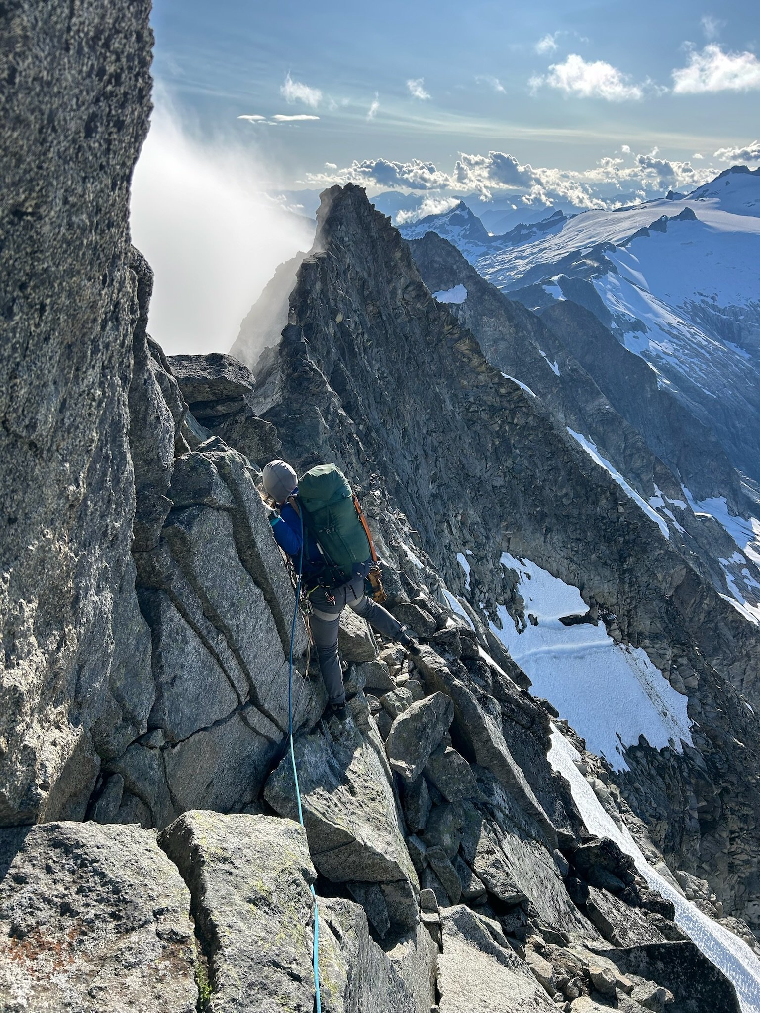
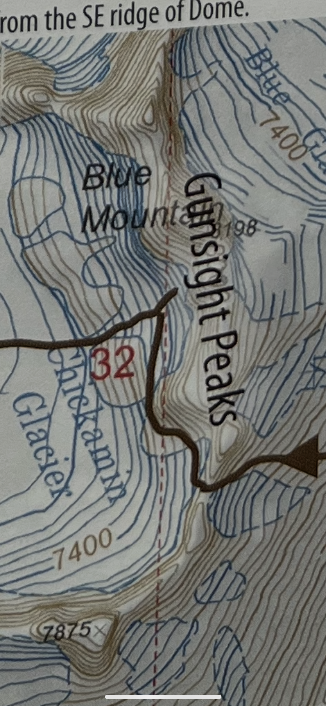
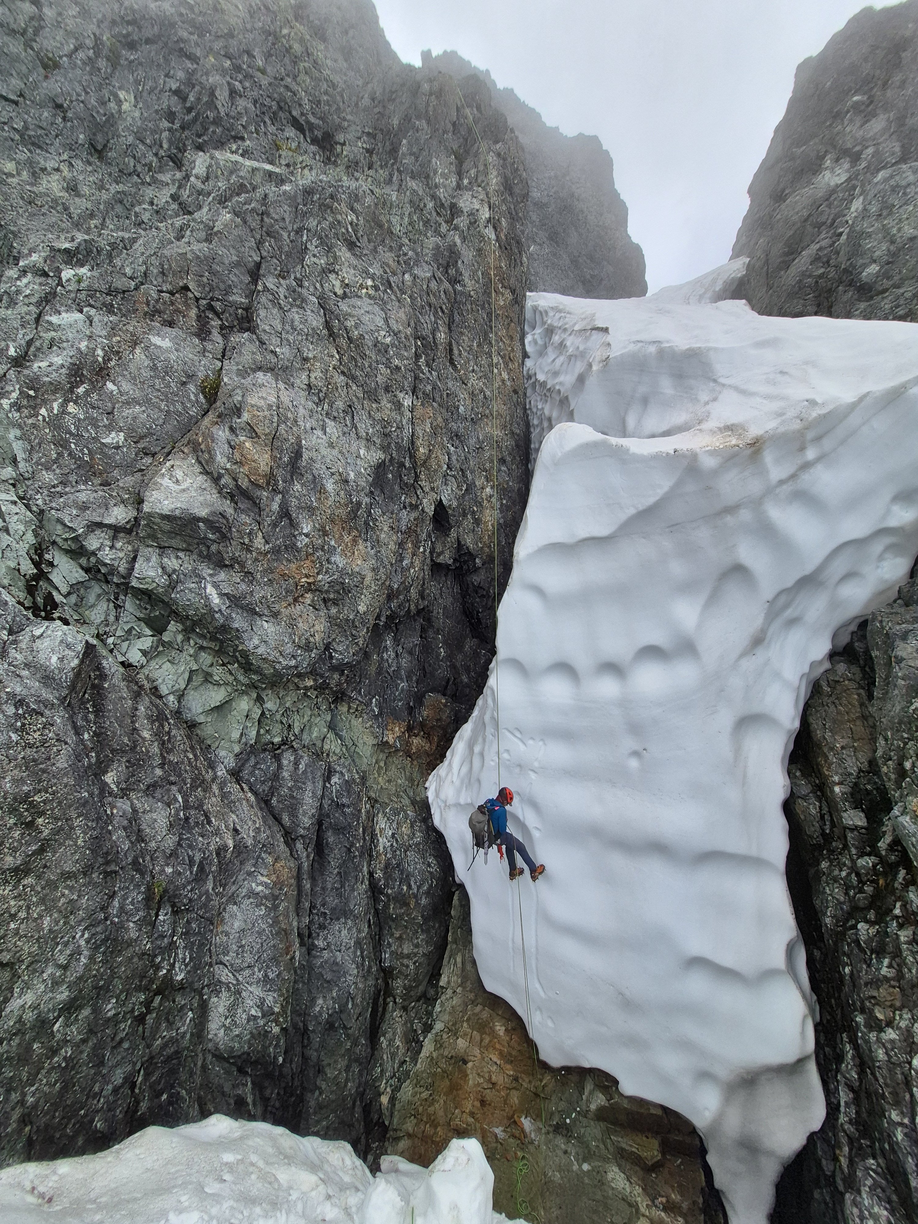
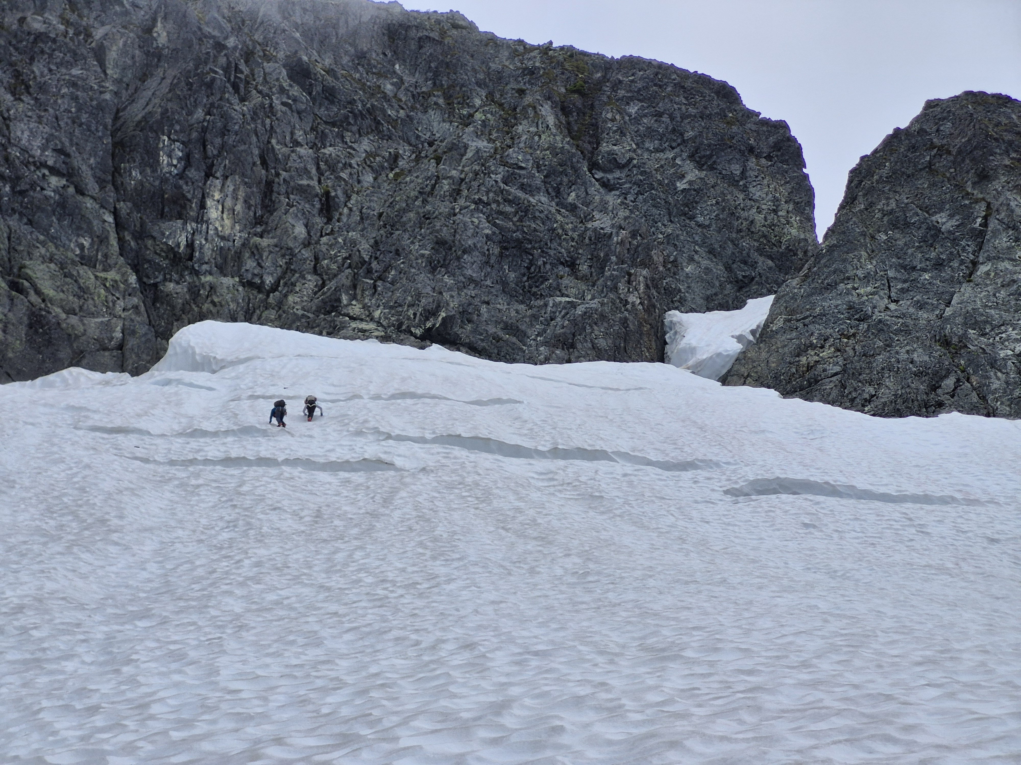
Trip: Gunsight - E and SW faces of Middle, S ridge of South Trip Date: 07/13/2025 Trip Report: I had the tremendous luck of finding a pair of climbers (Rebecca and Shane) who wanted to check out the Gunsight range using a rope team larger than 2 for the Chikamin. We climbed as a party of 3. They turned out to be excellent climbers and excellent company. First I’ll stick mostly to the things I wish I knew beforehand, inaccurate beta, etc. On our second day we blindly followed tracks of a party about a half hour ahead of us in the Chikamin which led to the lowest pass. Getting on the rock it seemed like possibly low 5th slab and too far south of Gunsight. We decided we were in the wrong place. I briefly scoped the next gully north which was terrible. We then found the right path, using mostly clean slabs. In Blake’s book the arrow isn’t quite in the right place, we were one notch north of his line, in the “s” in “peaks”. We had hoped to climb E face of Middle this day but with the lost time settled on S ridge of S peak. We would later find out that doing E face of Middle on day 2 is doable only if everything goes right, no route finding issues, climbing and descending efficiently. A better day 2 plan that I’d recommend to most coming from Downey is to aim for SW face of Middle for your day 2. S ridge of S Gunsight is a garbage climb. The first pitch is not terrible but the face after an ok corner is covered in black lichen and any pro seemed worthless. Hard to find an anchor on top of the choss ridge. Much less than the reported 45m. The next very short pitch, again much shorter than in our description, has an exciting leap from the chockstone (my first trad dyno I think). From there we expected 5.4 to finish the climb. I went back and forth, high and low, repeatedly dead ending near a notch with lots of tat. Finally I committed to a delicate and highly exposed 5.8-5.9 stem around a corner to get to a downclimb to the notch. From there I ran the rope out to the summit at somewhat dirty low 5th. Looking back I saw how the follower would be exposed to a big pendulum and deck, so I encouraged my partners to just rap that step off the existing tat. With a couple raps we were back on the east side retracing our steps to the notch. Numerous steep hard snow interruptions to the slabs involved time sucking crampon on-off transitions. I was grumpy about 2 days of effort to climb 3 pitches of choss but we caught a gorgeous sunset just as we reached the notch. From there we traversed high on snow and slabs below Gunsight to get to where we had stashed our bivies. The next day we tried again for E face of Middle. Rather than circle around the peak again Rebecca had the great idea of climbing the SW Beckey route, rapping S to the notch, then rapping E to get to the E face. The Beckey route was straightforward low-mid 5th choose your own adventure on fun solid rock with lots of knobs, which we began from a small cave just above the best moat crossing we found. The summit register’s last entry was from 3 years prior, a party doing gunrunner. We did one rap south beginning a little below the summit, backing up the slightly suspect block. From there a double rope rap from a higher confidence anchor got us to the notch. The anchor we found there wasn’t very great but we couldn’t find better options. I immediately found the e side to be mostly steep dirt. Angling slightly south I found an ok nut anchor maybe 45m down from the notch. A double rope rap from there got us down to the very dirty snow. This might have been the dirtiest gully I’ve descended up to that point. The high quality of the E face lived up to the hype, though misleading beta vexed us at times. Our first pitch was quite long due to low snow and glacial recession. Comparing our photos to some from 15 years ago there was some thing like 50-100 feet of rusty rock that had been covered in snow in the earlier photos. The pitch 2 crux is right off the deck and maybe sandbagged (or I was just tired). Awkward, tricky, exposed to decking, it took me about 4 tries to lead through it. I don’t think the pitch was more than 15m. This was another ledge where a good anchor was hard to find. Pitch3 (10c) was actually easier than pitch2. Shane had stopped one ledge short of the proper start of pitch 4. We worried about linking that step into pitch 4 because it’s supposedly 45m. In reality pitch4 turned out to be more like 30m. Oh well. The pitch 4 climbing was fantastic and its crux (10d) was another possible sandbag. I could not have led it. Very demanding powerful moves finally got me through it after a few attempts. By now the hour was late and we were looking at the mental crux of the runout 5.9 slab. Shane led this one too. Rebecca went second and I came last. I was glad to have watched them for beta on the subtle step down crux at the most run out point. Brilliant colors lit up the horizon while it was my turn but I could give it only fleeting attention as I concentrated at the crux. Once through I ran up the ridge (low 5th? Didn’t notice any 5.8) in the twilight, basically a full 60m rather than the 15m our beta advised. We repeated the rap sequence south to the notch as it grew dark windy and cold. The rope got stuck during the pull here. With much effort Shane finally freed the rope. The descent to the east was a known thing at this point but I argued that it was so bad that the descent to the west couldn’t possibly be worse. About this I turned out to be wrong. We did one short rap to an anchor south of the main gut/vomitorium of the gulley, with resident snaffles greeting us at both ends of the rap. From there Shane plunged into the unknown, over an overhang, choss diarrhea of all sizes being released. At a full 60m we went off rope and I took a clean slab ramp around a corner and found good cracks while they pulled the rope. Somehow that rap didn’t destroy us or the ropes. We placed a cam anchor and got past the steep icy snow onto lower angle stuff and began the traverse back to camp, arriving around 2am. We made dinner, celebrated, and tucked in around 3. Next morning I went back with the suspicion that our anchor could be reached on class 4 slabs that we couldn’t see well in the dark. It turned out to have a little low 5th, so rapping was definitely the right call for the circumstance. But I was glad to recoup our gear. Having encountered the worst and second worse gullies of my life on either side of middle gunsight I now think that the best way to retreat is probably down the SW Beckey route. It’s ledgey so it would be best to downclimb most of it with some raps where it makes sense. And best done in the daylight, after climbing it at least once so you know the way at least approximately. Faded from the unexpected epics our only goal for day 4 was to get back to Itswoot ridge, beginning around noon. But around 1:40 at about 7K’ we heard a voice from a distance. We stopped and listened. Heard it again. Could barely make out words like “broken ankle” “helicopter”, “alone”. We pressed the SOS. The voice seemed to be vaguely in the Sinister area but we couldn’t tell where. We started backtracking and did some Marco Polo every few minutes without success. Finally passing east of the north face of Sinister we saw what we realized was a person. He was not moving and covered in a gray sleeping bag so we hadn’t been able to tell him apart from a rock at a distance. Maintaining some privacy here, we found that he was indeed immobilized and in severe pain and needed rescue. His inspiration and his equipment were in disharmony and this had culminated in a long and presumably very rapid slide down snow NE of Sinister. Fortunately over cracks, unfortunately meeting some rock(s) along the way. A little while later a father and daughter were coming down the Chikamin. It was nice to have more help. We did our best to keep him warm and as comfortable as possible as we waited for SAR. When the helicopter came we were surprised that it took so many laps through the area (maybe 5?) before two rescuers finally were lowered down with a litter. The morning had begun mostly cloudy but the afternoon was quite brilliant. Some rain approached quickly from the north and reached us just as the helicopter took off with the victim and SAR people aboard. We restarted our ascent in the rain, reaching our turnaround point >4.5 hours after we had stopped. This guy was quite fortunate that several people happened to be in ear shot on a week day in such a remote area. The rain cleared half way up the Chikamin and gave way to that kind of really clear atmosphere that seems to come on the heels of misty alpine weather. We found a wonderful spot past Dome glacier, well before Itswoot and called it a day. The highlights of our last day included a brief swim in cub lake, the flora above cub lake, and the many berries along Downey. Less fun was stuffing our pockets full with entirely unnecessary flagging all along very obvious trail along Bachelor. Some of it quite haphazardly stuffed onto bark like so Gunsight delivered adventure in more ways than I could have anticipated. For people going there for the first time I’d advise to stay the fuck out of the gullies on both sides of Middle, bring lots of gear for rap anchors because there seems to be little traffic there, skip south gunsight, and expect everything to take longer than you’d think. Photo dump will go here: Gear Notes: Double to 2, one 3, one 4. 2x60m twin. In reach (please people). Knife for tape. Approach Notes: Downey approach is currently straightforward. Trail work has been done all the way to Bachelor
 6 points
 -
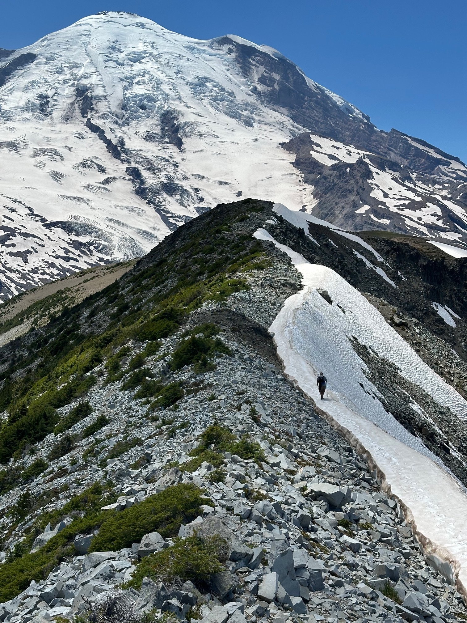
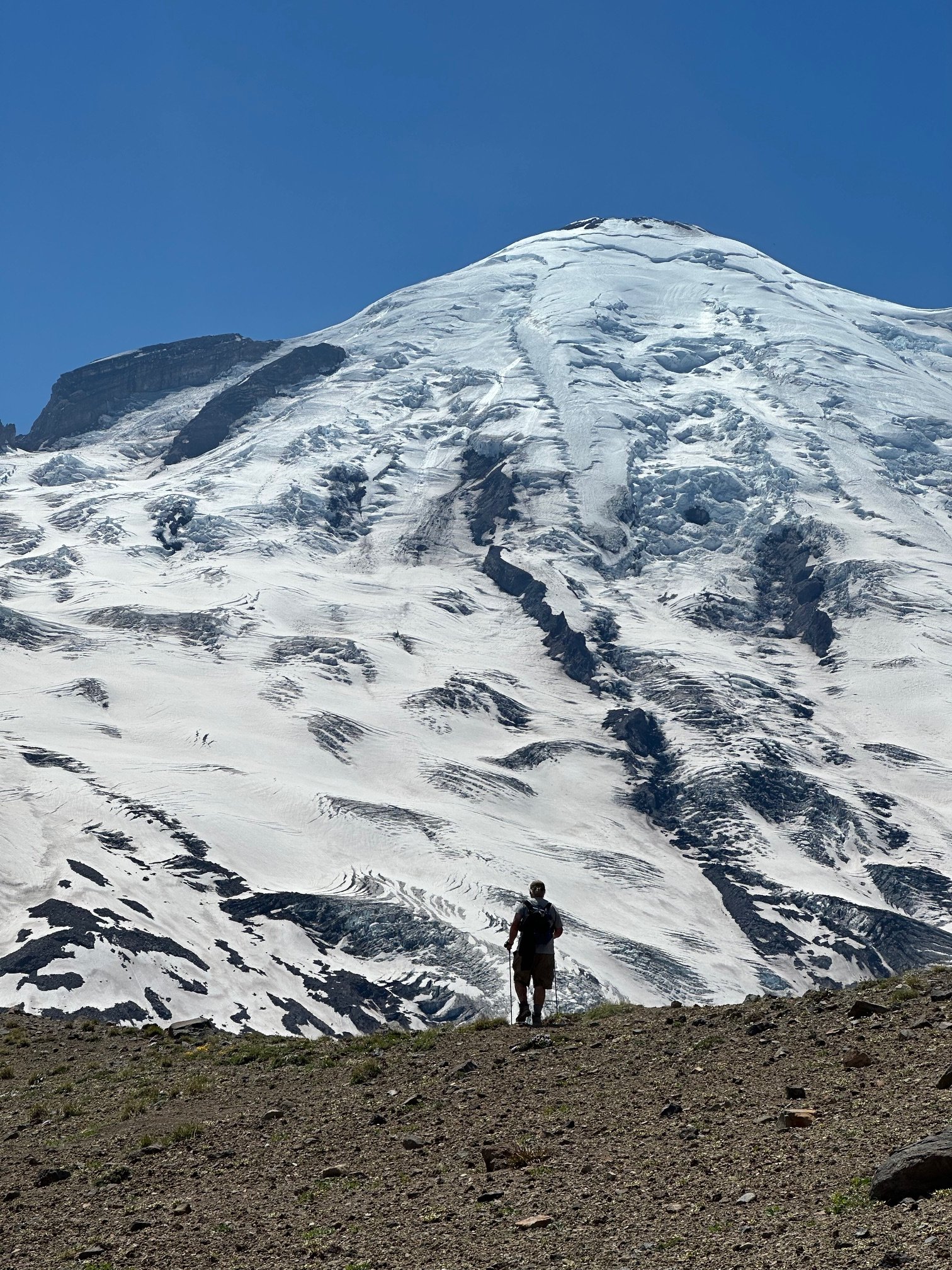
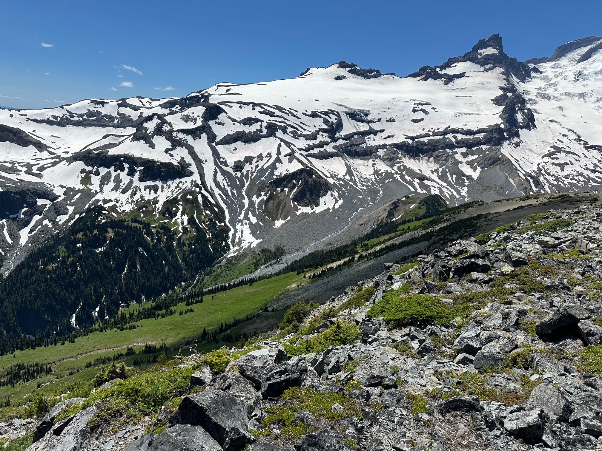
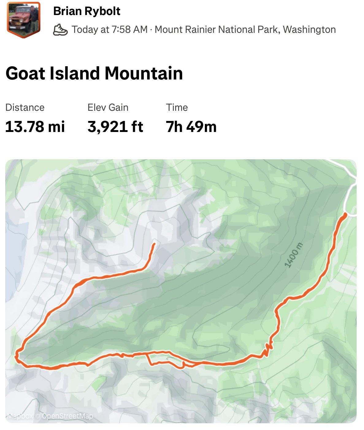
Trip: Goat Island Mountain - West Ridge Trip Date: 07/11/2025 Trip Report: Another MRNP Peak with Dwayner today! Left the Summerland trail about half mile above the creek crossing and boulder-hopped up Fryingpan Creek until we were forced to cross. The water was pretty high. Up to the saddle above the giant chock stone, then along the long long long ridge to the highest point. Some of the best views in the park--or anywhere on Earth IMO. Gear Notes: Boots Approach Notes: Trail to Summerland, then XC
 4 points
 -
Trip: Terror - N buttress (attempt), Himmelhorn - Wild hair crack, Degenhardt NW+E route, Pyramid - W route Trip Date: 07/04/2025 Trip Report: Drawbridged again in the pickets for the second time in a week. After the standard rap into the couloir north of Otto-Himmel col my partner @aikidjoe encountered a moat that appeared impassable. He ascended back to the station and I took a look down the next gully skiers left. From lower down I could see it would have been no good to try the moat (which would have required an absurd running leap) because another moat was not far below that one. I kept descending adjacent to the couloir, finding mostly solid, even fun, exposed class 4. There was a short low fifth corner with a lemon cake sized block that kept it secure. I passed a slung block with old webbing. Where things cliffed out I found some good .1-.2 cam sized cracks that could be used for a rap anchor. My 60m rope easily reached continuous snow from there (maybe 20m rap). Last year at exactly the same time of year I downclimbed continuous snow down this couloir without even needing the first rap. And last year was a low snow year too. So I was pretty surprised at the state of the couloir. This workaround skiers left seems viable to me. Posting it here in case it helps anyone. The false start and exploration ate up enough time that we decided to bail on our plans for the Stoddard route and head back up to climb WHC instead. My partner was bemused because he expected a crack climb The day had started clear. On our way back down from O-H dark gray clouds moved in to block the ridge. I was glad we weren’t somewhere high on the north buttress of Terror. Next day was quite socked in. We headed off for Degenhardt, accidentally heading up from the south before correcting course for our intended NW route from near Terror’s east col. To gain the couloir there was short choke that steepened at the end to maybe 80 degree snow. We underestimated the angle from below. Odd, usually it’s the opposite. We were able to bypass this on slabs on our return. The foreboding weather and lack of visibility gave the climb a serious feeling. As it gradually cleared on the way back the route started to feel easier. There is plenty of choss on Degenhardt but I recall the scramble being pretty fun. While extracting the summit register I dropped its pencil down some hole. Sorry. From there we groped our way slowly toward Pyramid. The route finding in the clouds was trickiest near Degenhardt. Was glad to carry ax/whippet all the way due to about ten steps through a narrow and steep snow couloir to get to Pyramid’s rock pyramid. We had peek a boo views into McMillan cirque but could see nothing at all to the east. By the time we passed back west of Degenhardt the clouds were lifting and it was a relief to see where we were going. The weather kept improving and the sunset was a real mind melter. UFOs came out in force. Next morning greeted us with more clear weather but having had our fill we bid adieu to the goats and our impeccable camp. After the bruising descent we enjoyed copious berries south of terror creek. Gear Notes: 60m rope and light rack, crampons, ax or whippet Approach Notes: Goodell
 4 points
 -
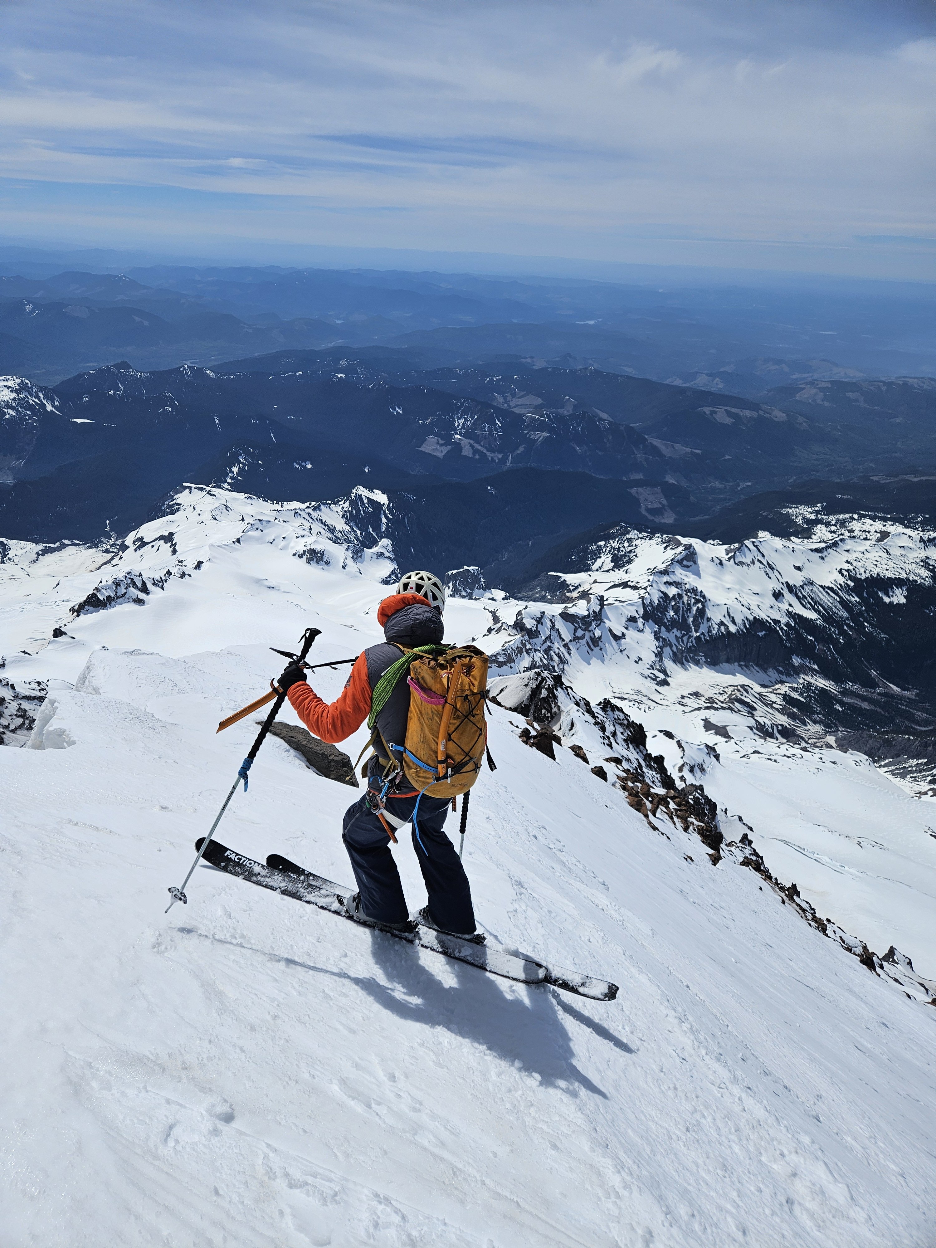
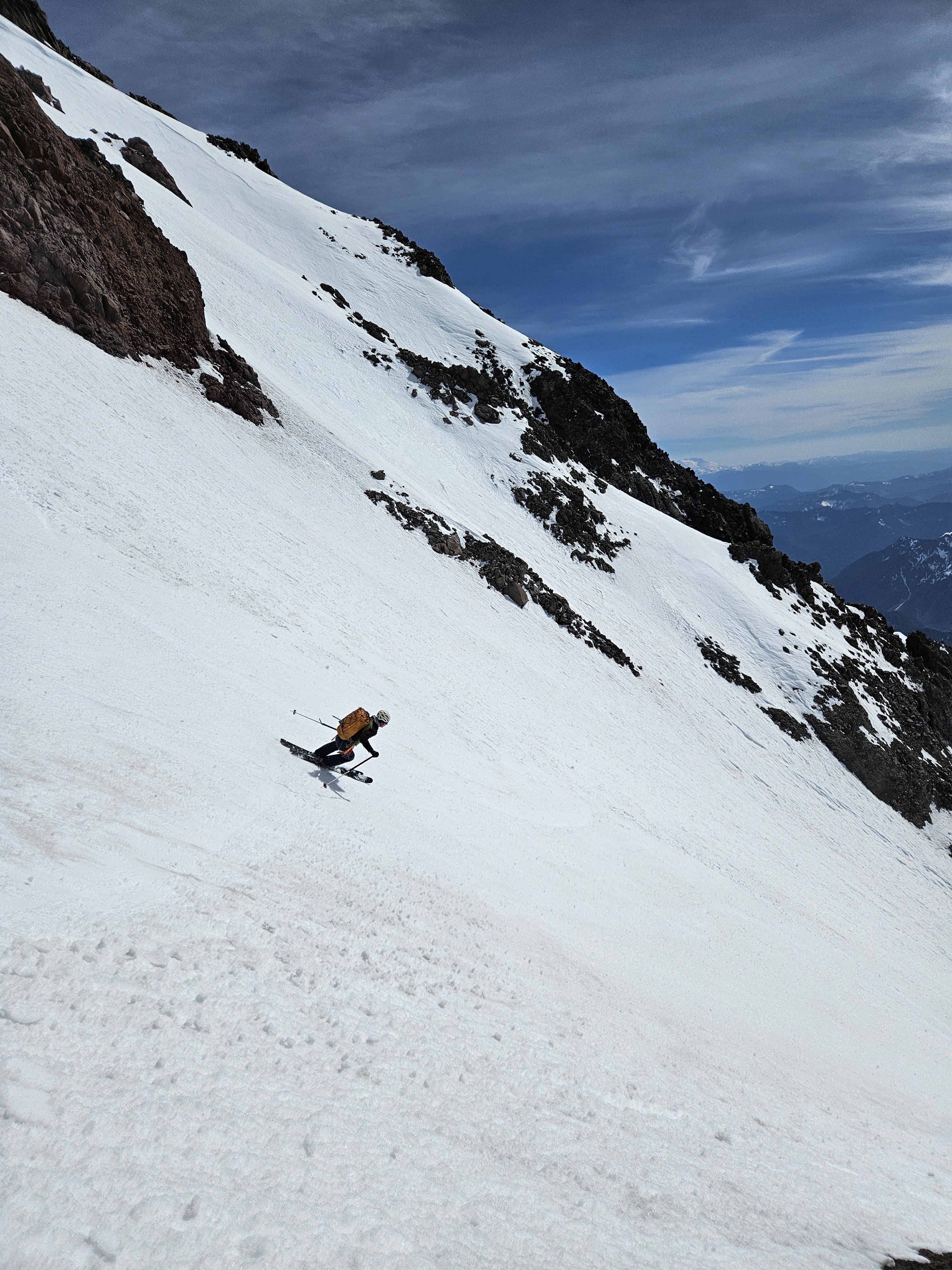
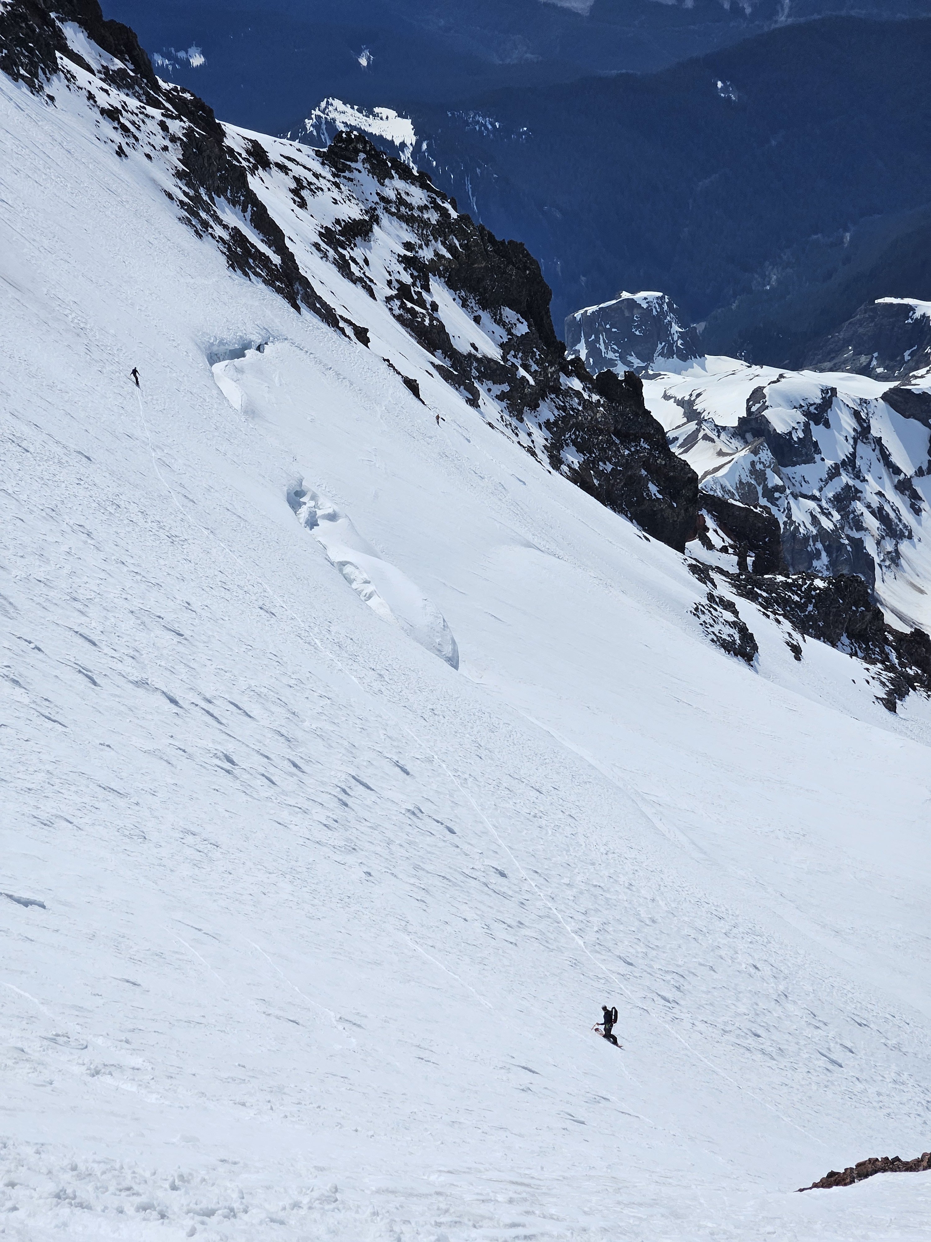
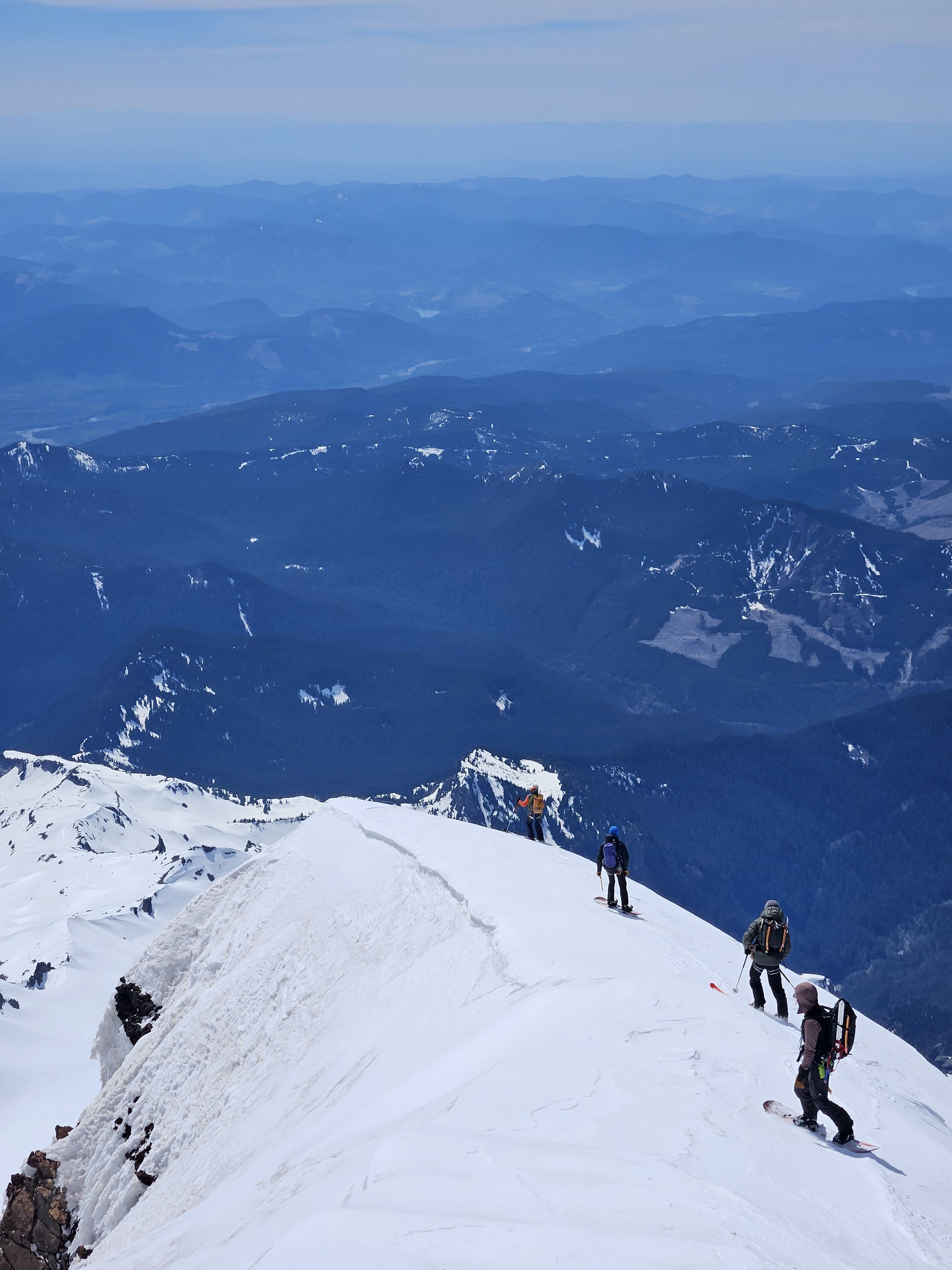
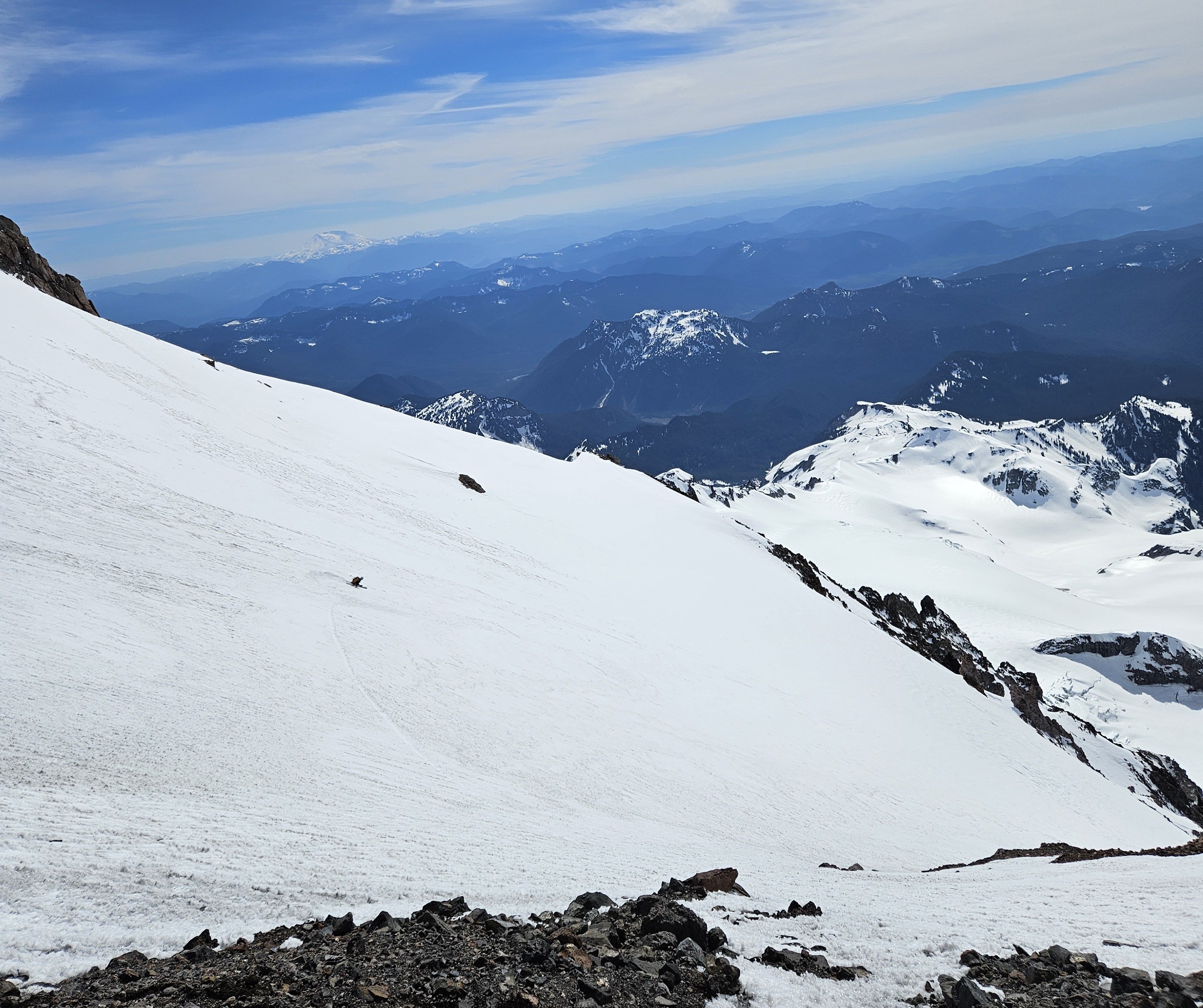
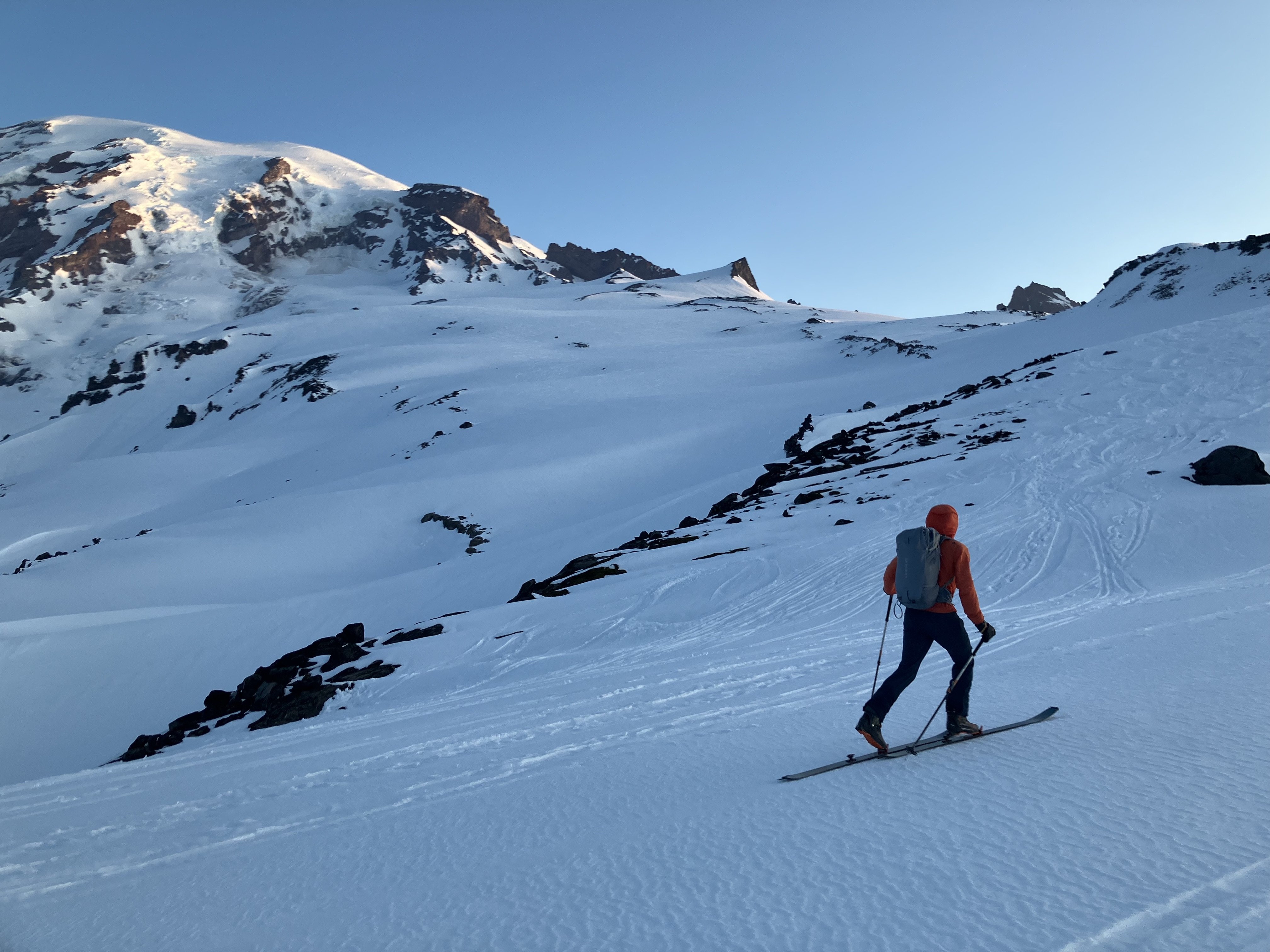
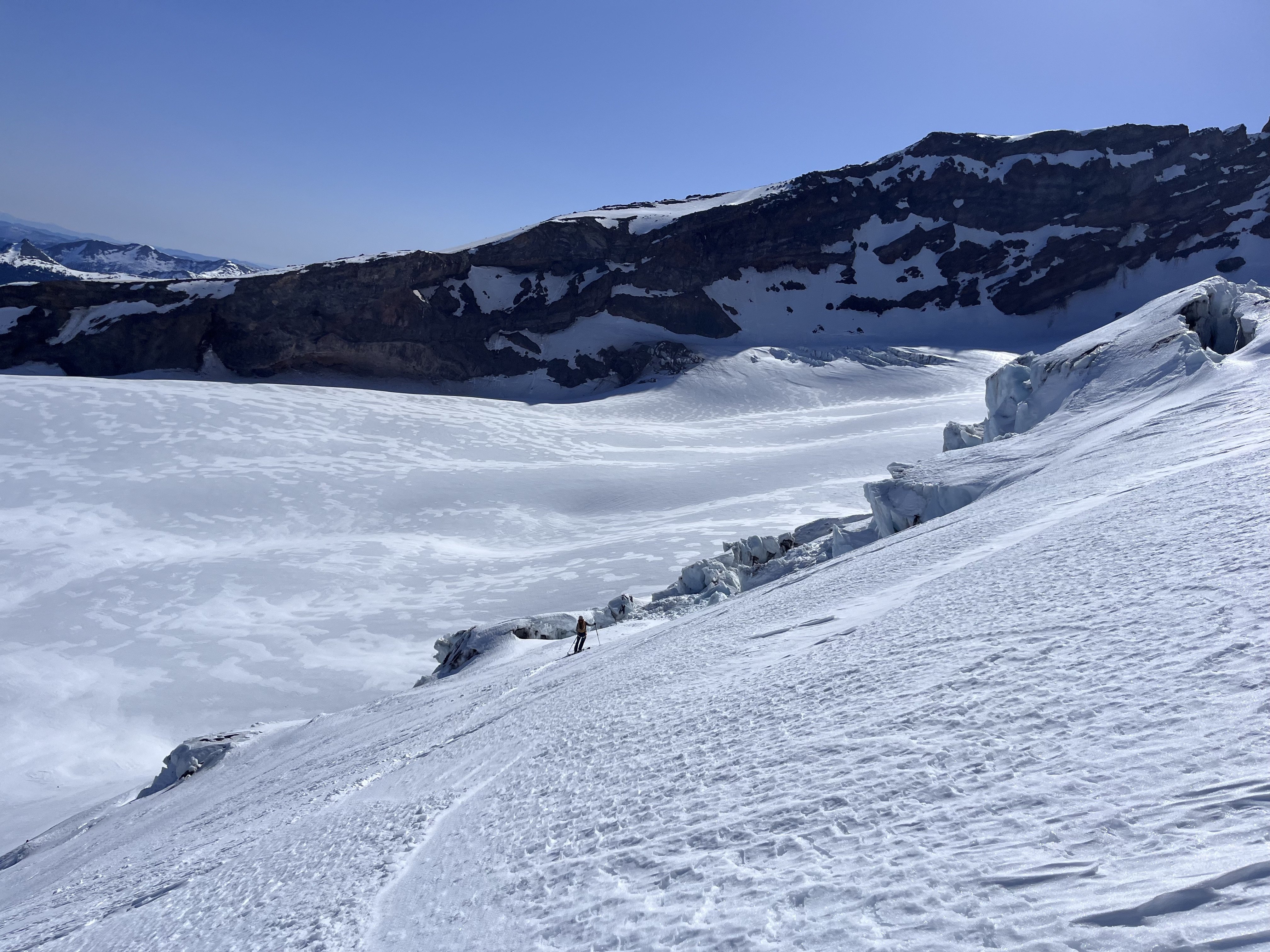
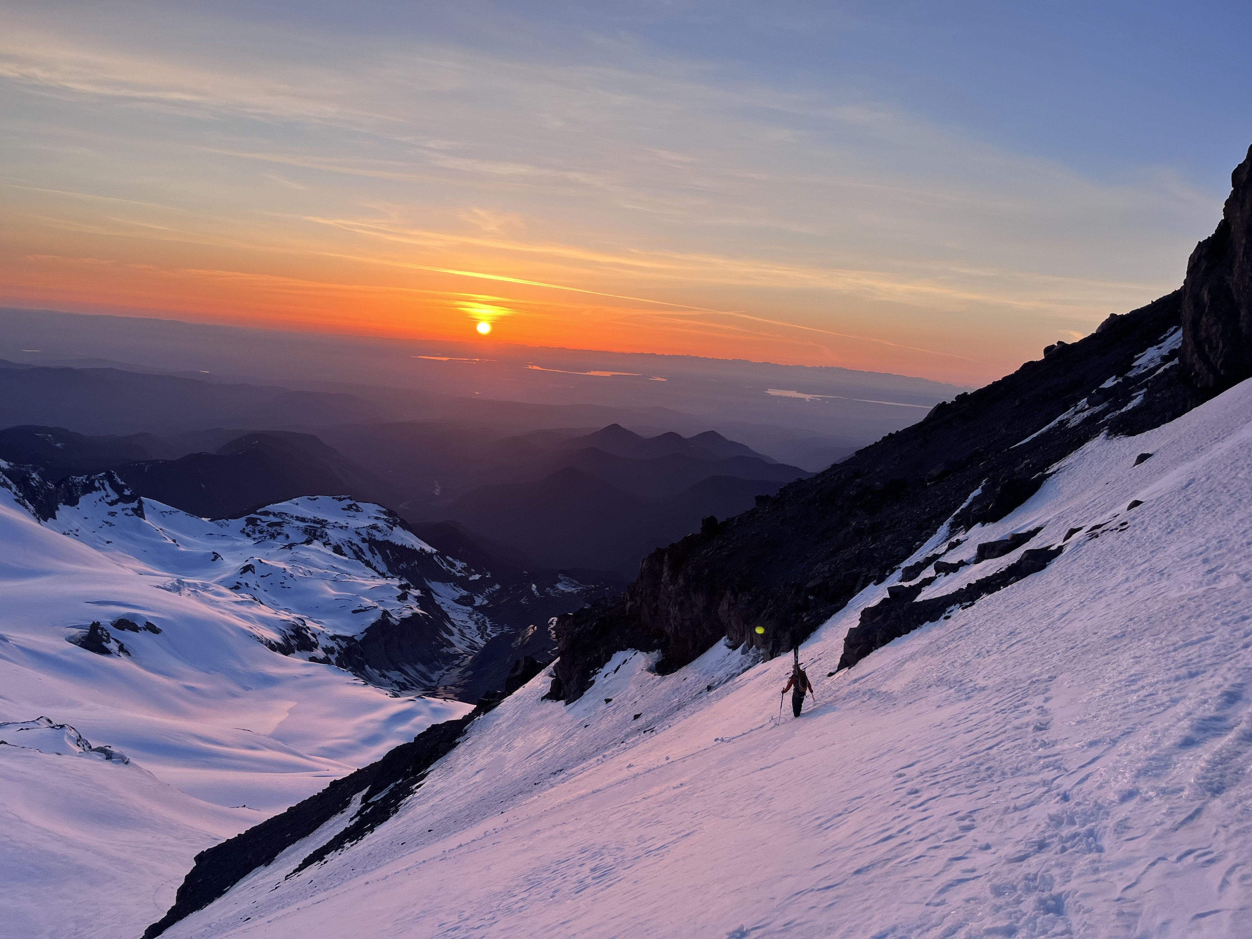
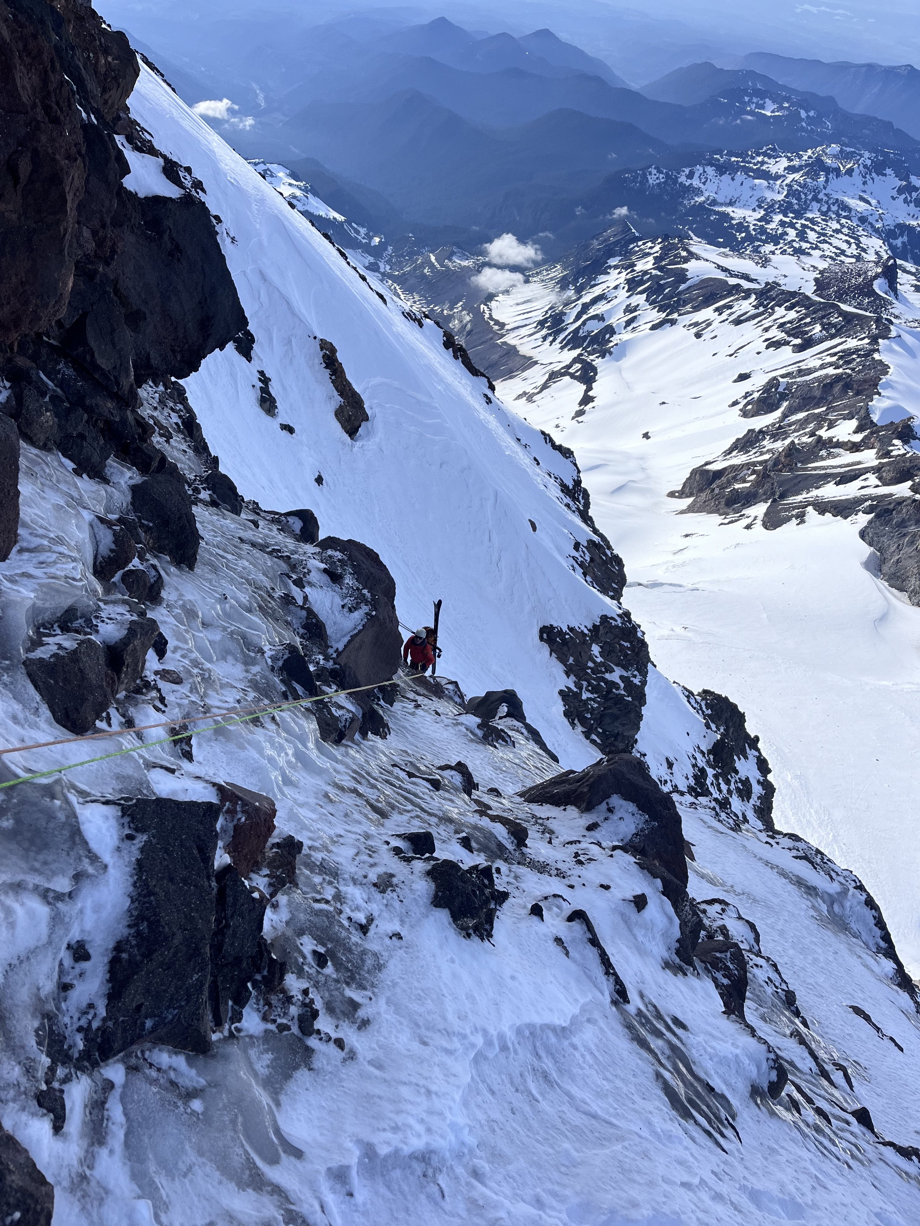
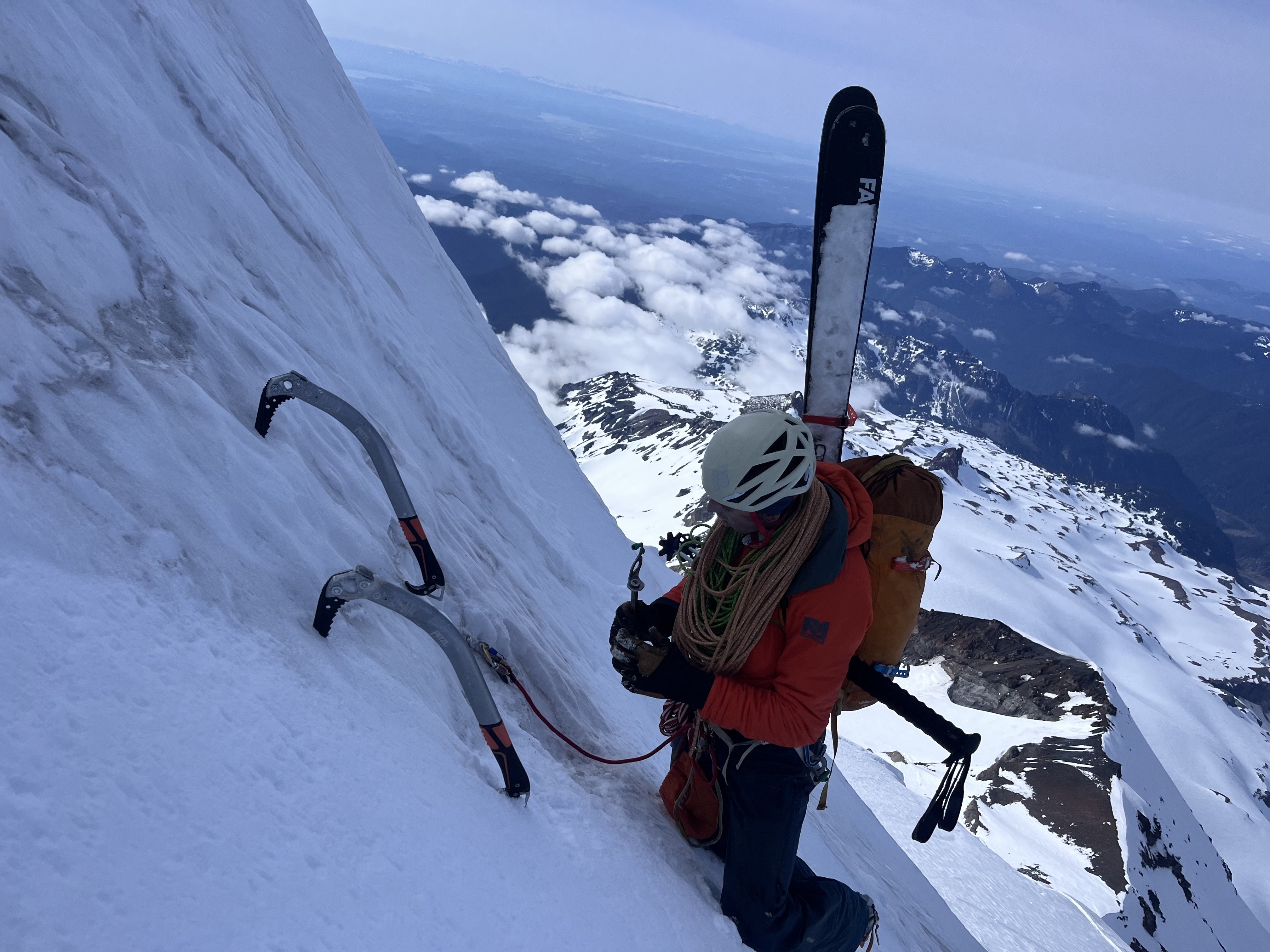
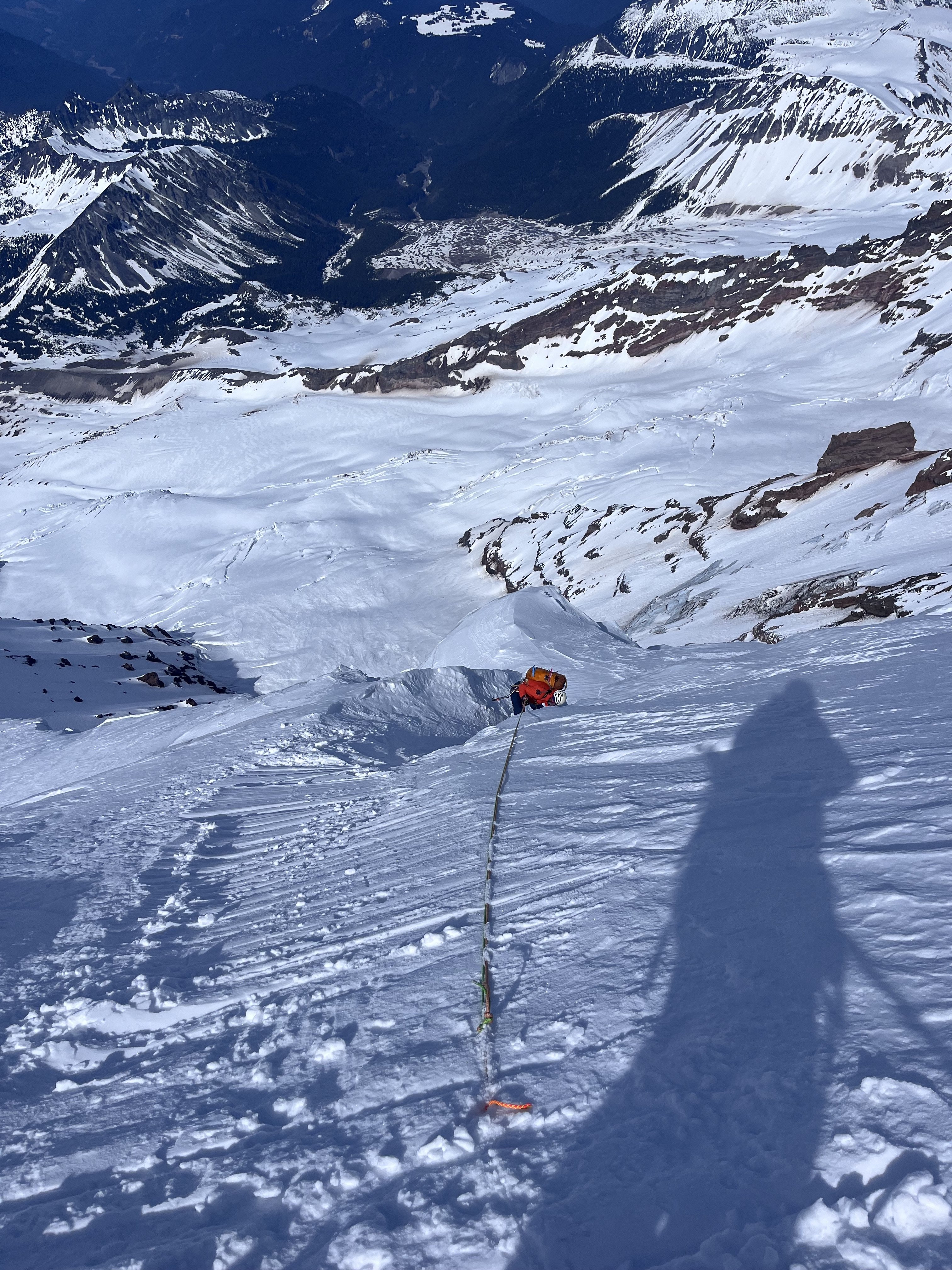
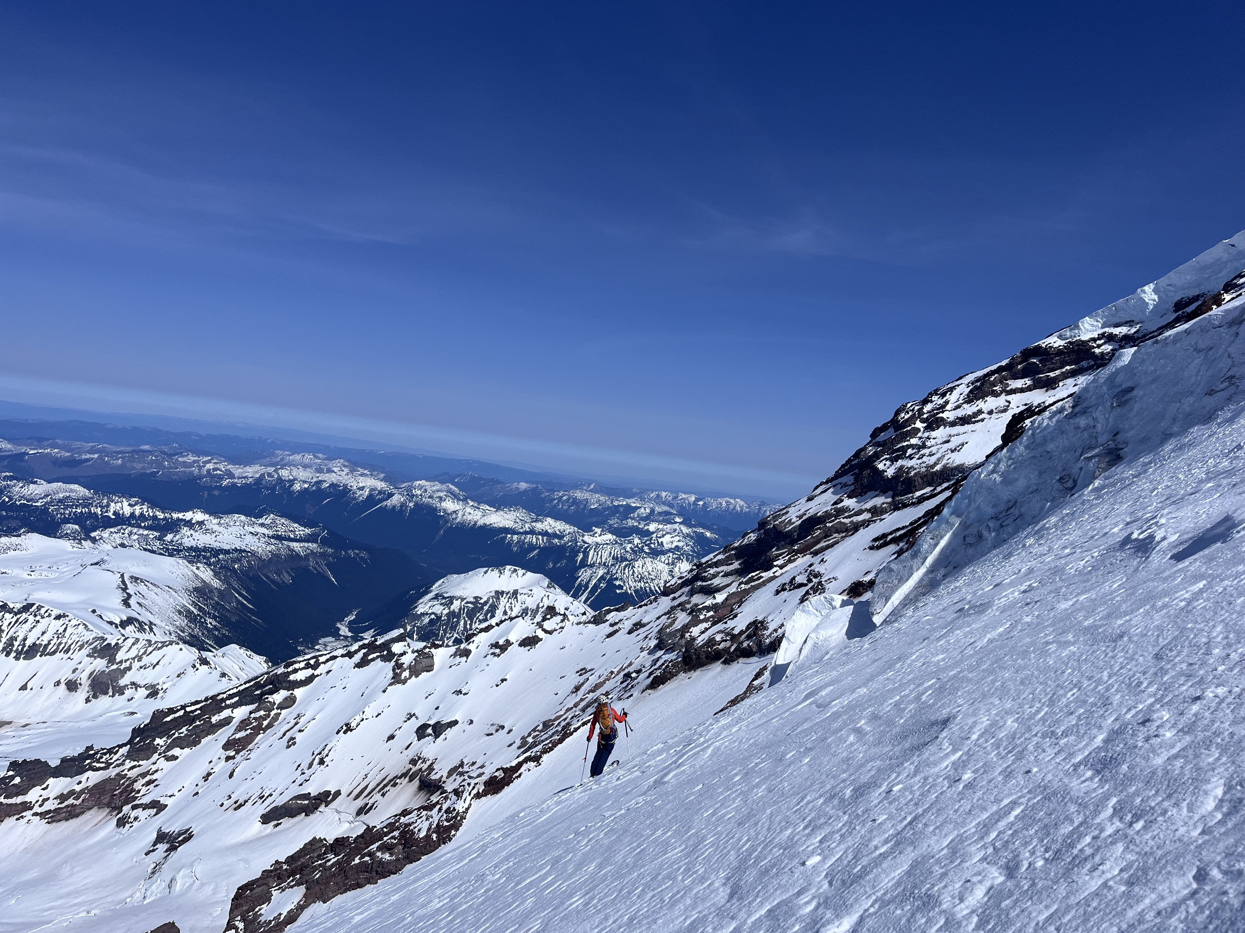
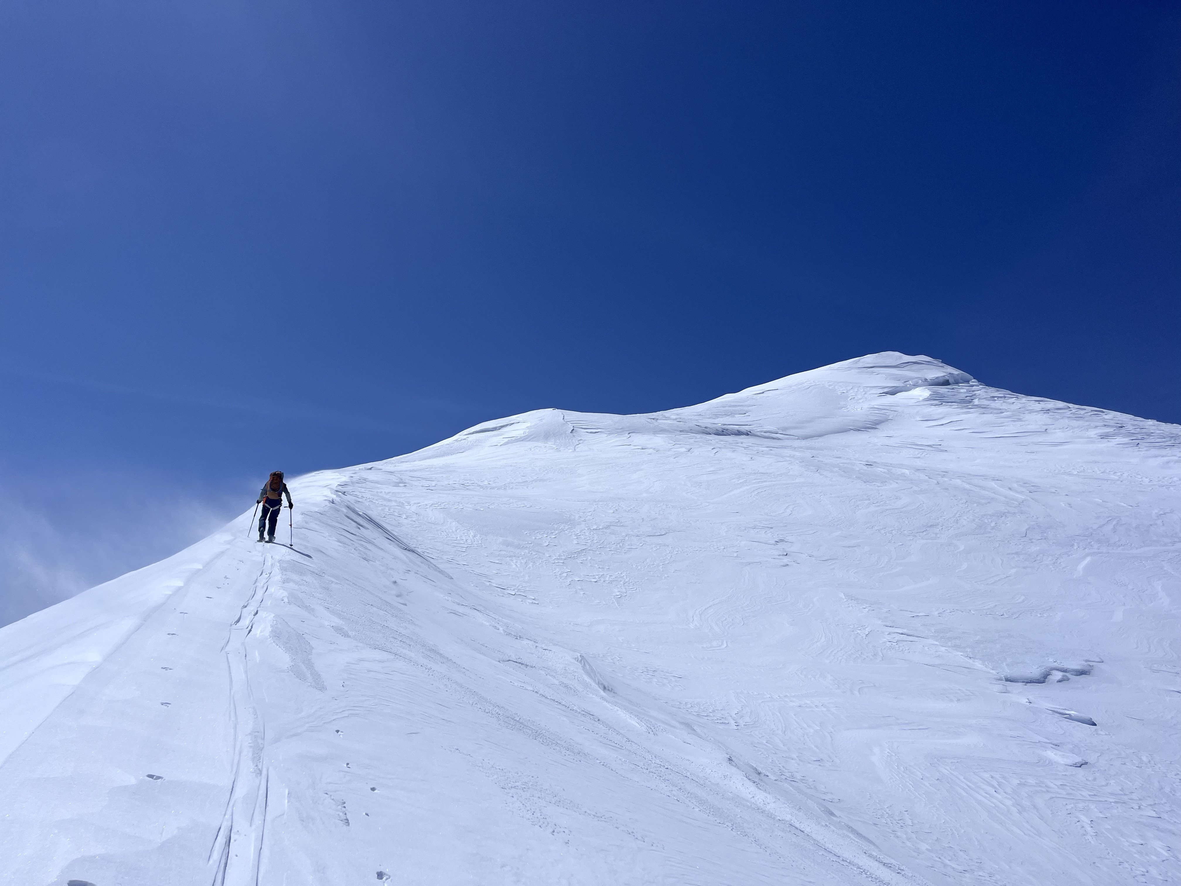
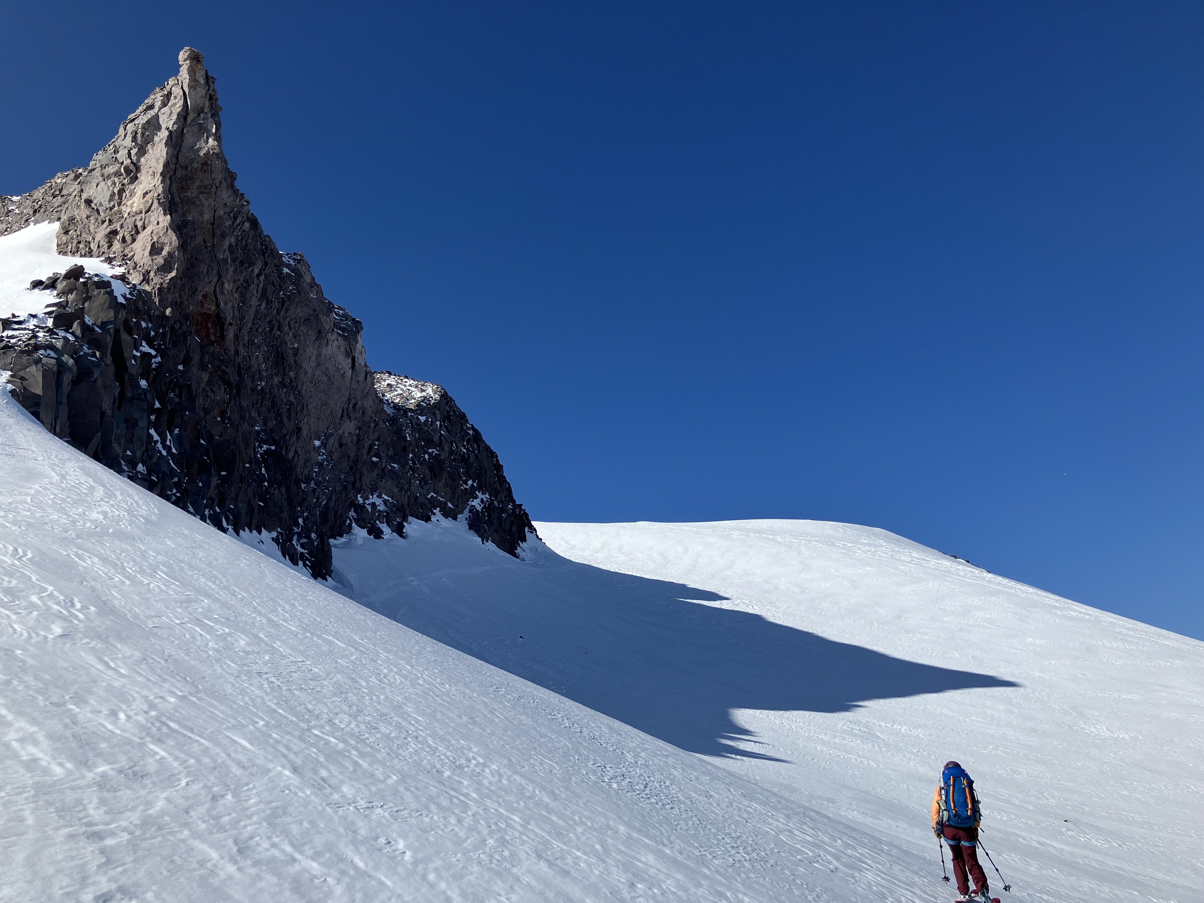
This spring, I spent some time climbing and skiing up on Mount Rainier. I have gone back and forth on whether I cared to share any of my ski activity on Rainier this spring as it felt deeply personal, but I ultimately thought it would be fun to collect some of my thoughts and experiences as well as to provide some entertainment and inspiration. https://sam-marjerison.blogspot.com/2025/07/rainier-roundup-2025.html I'd like to give a huge thank you to everyone who has supported my spring ski season up here on Mount Rainier including Henry Coppolillo, Bailey Servais, George Hedreen, Sam Hoffman, Calvin Jirico and Kiira Antenucci. I'd also like to thank and recognize all of the people that have paved the way for big mountain skiing on Mount Rainier including Andy Bond, Sky Sjue, Aaron Mainer, Peter Dale, Eric Wherly, Dan Helmstedter and many, many more. Your style and vision for the mountains is incredibly infectious and we all aim to humbly carry on the legacy you have established here on Mount Rainier. I've attached some high res photos down below! On top of Sunset Ridge. Crewed out, heading over to the Edmunds Headwall (Upper Sunset Ridge). In the gut of Sunset Ridge. Skinning up to Liberty Cap. High on Ptarmigan looking over at Liberty Ridge. Rappel #1 on Ptarmigan Ridge. Rappel #2 on Ptarmigan Ridge. Rappelling into the traverse of Ptarmigan Ridge. Booting back up onto the Russell Glacier. Our camp below Ptarmigan Ridge on the Russell Glacier. Russell Glacier. Carbon Glacier. Central Mowich Face!
 3 points
 -
Dream team 😍2 points
-
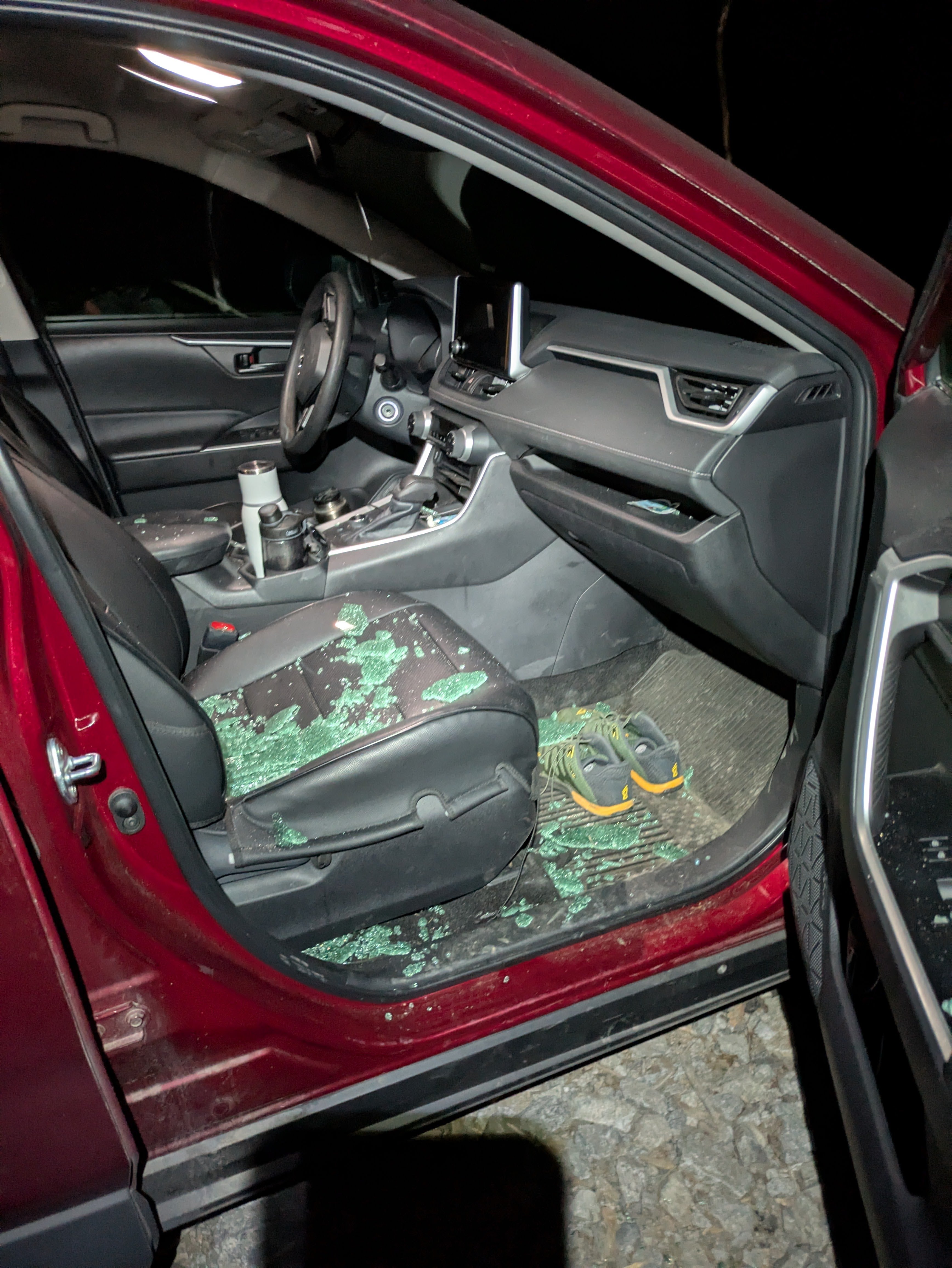
Trip: Forbidden Peak - North Ridge Trip Date: 07/12/2025 Trip Report: Spent the weekend climbing the North Ridge of Forbidden Peak (a climb so remote you have to climb over another ridge just to get to it) with a team of 4! It was a full value Alpine climb that doesn’t go too hard at any individual point, but requires the full suite of mountaineering skill sets, and is jam packed with them. This comes out as one of my all time favorite climbs, but had a bittersweet ending due to coming back to the trailhead at 1:30AM only to find two of my car windows smashed, and our happy bags stolen. Rough end to a 21 hour day climbing. GPS tracks here Our timeline was roughly: -7:45AM departure from trailhead -12:00PM Base of the gulley to go up Sharkfin Ridge -1:30PM over the ridge, and rope up for crossing Boston Glacier -3:45PM on the North Ridge -6:15PM stopped at bivy site -5:15AM Sunday started climbing -3:00PM Both parties summited, starting descent -7:00PM Arrived at the Notch of West Ridge Coulier -9:15PM Finished rappelling down the WRC -10:40PM Past the last major creek crossing and back on the main trail -1:30AM back to cars The approach was straightforward up through the Boston Basin. The creek crossings were reasonably low in the morning. As we got up to the start of the snowfield we caught sight of the gulley we were aiming for to get over sharkfin ridge. We briefly lost sight of the gulley we were aiming for as the cloud cover dropped, but thankfully we already had a general sense of where we needed to go before that happened. The gulley up to the notch we needed was thankfully still fully snow covered, but was quite thin in sections, and will probably start melting out soon (the exposed sections we saw in the gulley had very unconsolidated dirt and rock, and I’m glad we didn’t have to climb it). We did a double rope rappel down into and out of the bergschrund onto the Boston glacier (there was a 2nd rappel station for single rope rappels). We then roped up as a team of 4 to cross the Boston Glacier. Crevasses are definitely opening up on the glacier, but we didn’t have any major issues moving around them. Reading up on beta, there are two primary entrance points to get onto the North Ridge, and we chose the first and steeper option. This seemed to be the right call as we had minimal issue transferring from the snow onto the rock, and talking with another team heading out to do the NW Face who took the other option, they didn’t have kind things to say; it sounded like the other entrance point was sketchily wet and hard to protect when getting on the rock. After a scramble up to the ridge proper, we got our first sight of the full climb! Ryan C on Peakbagger very graciously marked bivy sites on the North Ridge. We stopped at the 2nd to last bivy site on the ridge. Our timeline was going well enough that we decided to start the climb and see how far we could get before dinner. We ended up simul’ing up to the first snowfield, where we opted to stop for the night. The snowfield was nice as we were able to melt some snow on the ridge for the next day. There was no running water between Boston Basin and the end of the rappels down the West Ridge. Sunday morning we got up and did the rest of the climbing, mostly simul climbing. Most of the ridge was 5th class fun with ~4 sections of 5.5-5.6 climbing (a fun challenge with mountaineering boots and a carry over pack, but still manageable), and longer stretches of class 3 scrambling on the flatter sections. Almost all of the climbing stayed close to the ridge, but there were a couple notable spots you had to get off the ridge slightly to stay in the low/mid class 5 climbing. We could have been a couple hours faster on this section, but a combination of a traffic jam right before the summit + one of our rope teams getting off route, and having to deal with some spicier sections pushed our summit time back a bit. Snowfield crossing on the ridge Summit traffic jam View close to summit looking back down on the North Ridge I found the crux of the climb to be the descent (via the west ridge), possibly the hardest mountain I’ve had to get off of. I think a major portion of the challenge was descending a 5th class route other than the one we went up. We made the mistake of trying to rappel right off the summit (should have downclimbed the section), and ran into some shenanigans. Once we were done with that, we did 3 more rappels down the face, traversed back left to the ridge, and did 1.5 pitches of downclimbing on the ridge to get down to the notch of the West Ridge Coulier. There were plenty of rappel stations down the gulley, almost too many (it made it challenging to find the right one). We found a big one that seemed to have more tat then the others, and rappeled off it4-5 single rappels later, plus a final double rappel, and we hit the snowfield below! We finished the rappels right at sunset, and had to break out our headlamps as we finished the snowfield and started hitting the slab. Getting down the slab sections almost became a serious navigational issue in the dark, as we couldn’t easily tell where the slab bands cliffed out, and it was very easy to slip on sections. Thankfully, with some aid from GPS racks we had, we were able to trend down and right until we found a weakness in the rock face that allowed us to go down and left below the cliff bands. We found a trail leading back to Boston Basin that faded in and out. Then with the aid of GPS tracks + plus another team that rappelled down just after us, we managed to find crossings through the two fastest flowing creeks. And the rest of the way down was just a normal slog to the trailhead. We got back to the trailhead around 1:30AM, only to find two of my car windows smashed open, and our happy bags stolen): Thankfully most of our valuables were locked away, but the loss of our happy bags were devastating after a 21 hour day climbing. And when it rains, it apparently pours, because about 1 hour into our drive back my car’s low tire pressure light came on. Turns out I managed to puncture the sidewall of my back right tire. Best guess is that it was from a rock on the turnout I parked my car on. Thankfully I had an air pump stowed just for this (and it wasn’t stolen!). It took three stops to refill my tire, but we were able to limp home on it so that I could deal with it later. All in all, one of my all time favorite Alpines, but a very expensive weekend for my car! Gear Notes: 60m rope, mountaineering boots, stove for dinner and melting water on the ridge Approach Notes: See GPS tracks above
 2 points
 -
Where's the "love" button? Thanks for the time you spent conveying all the pieces of your journey!2 points
-
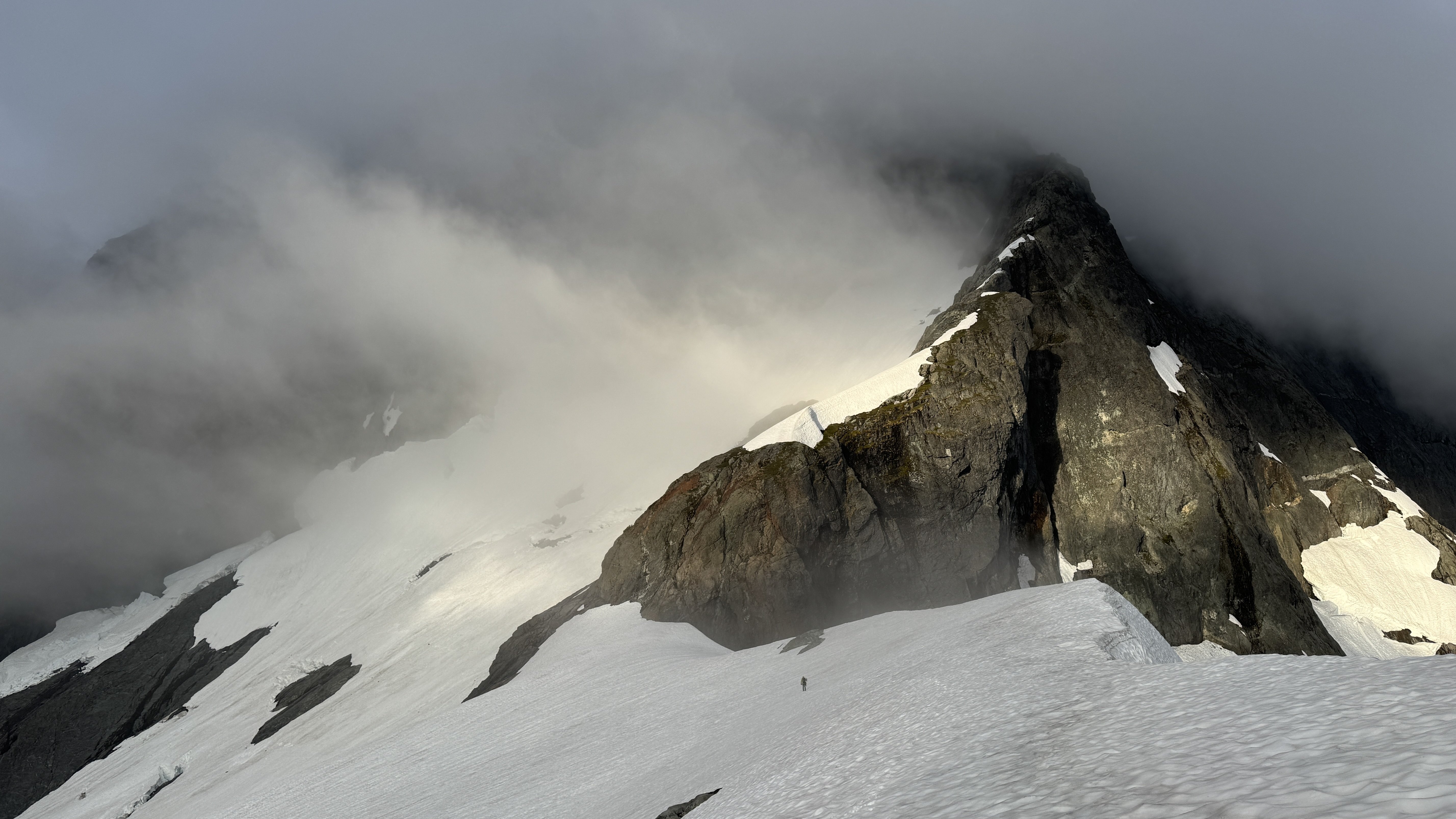
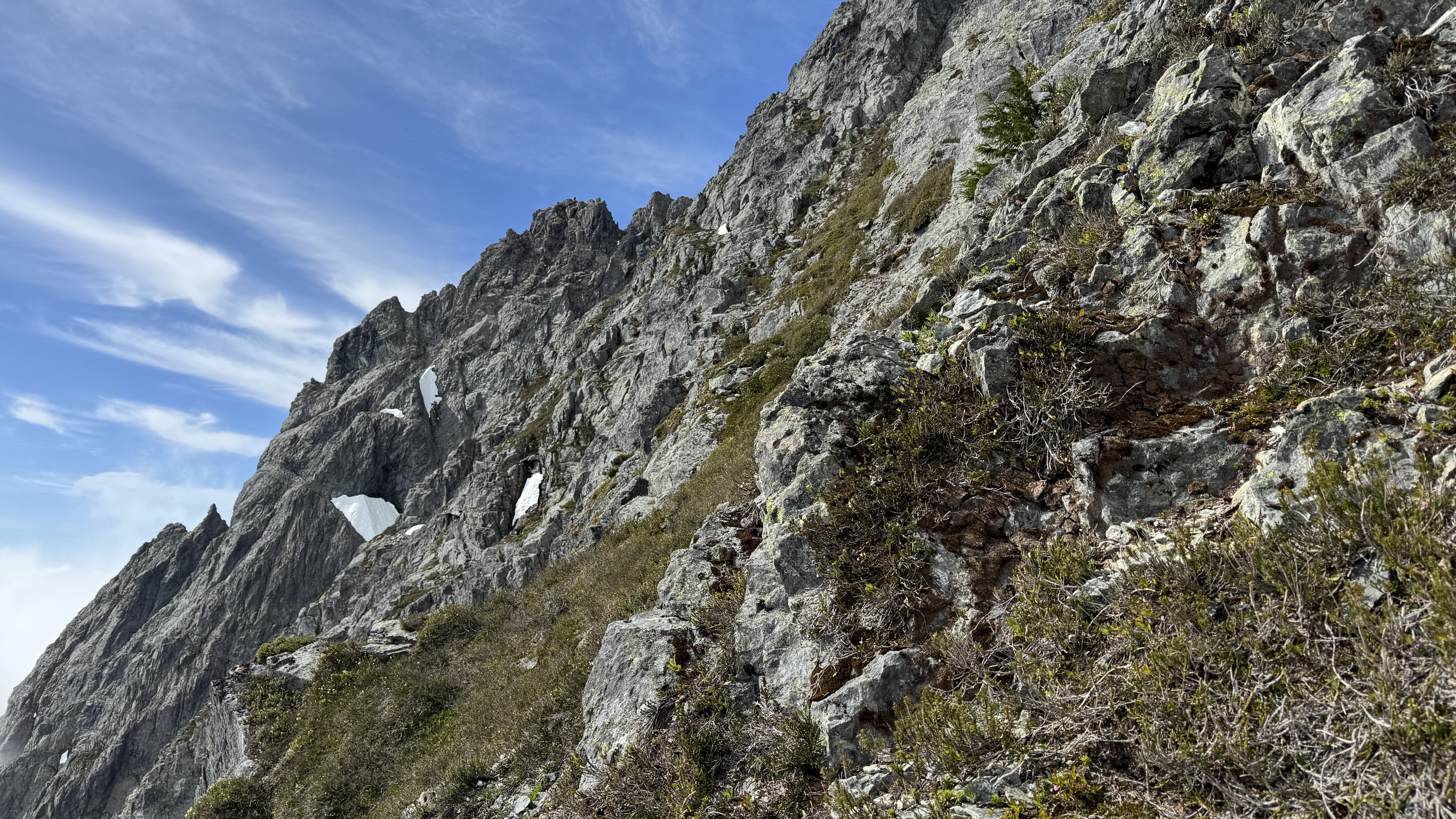
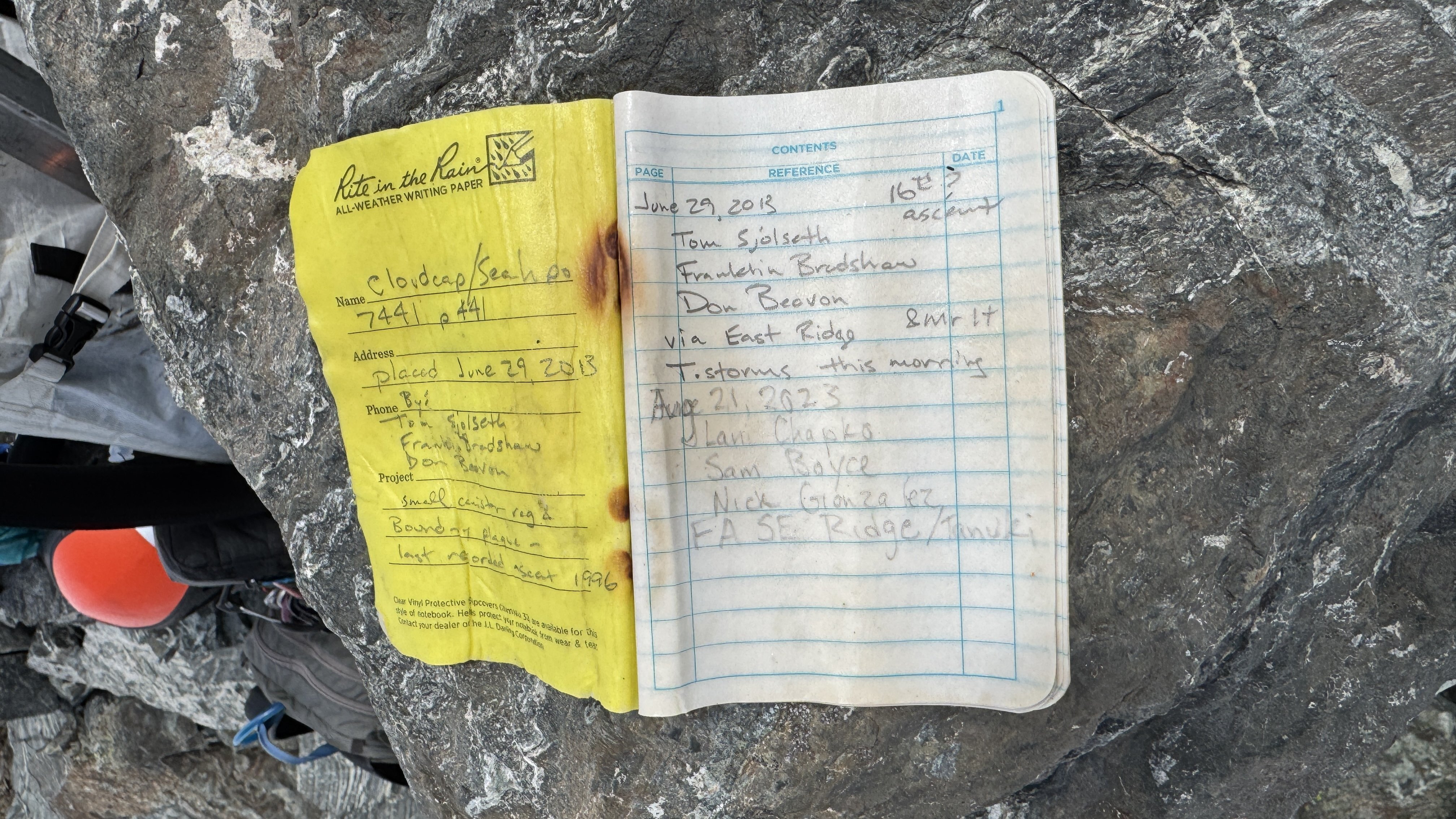
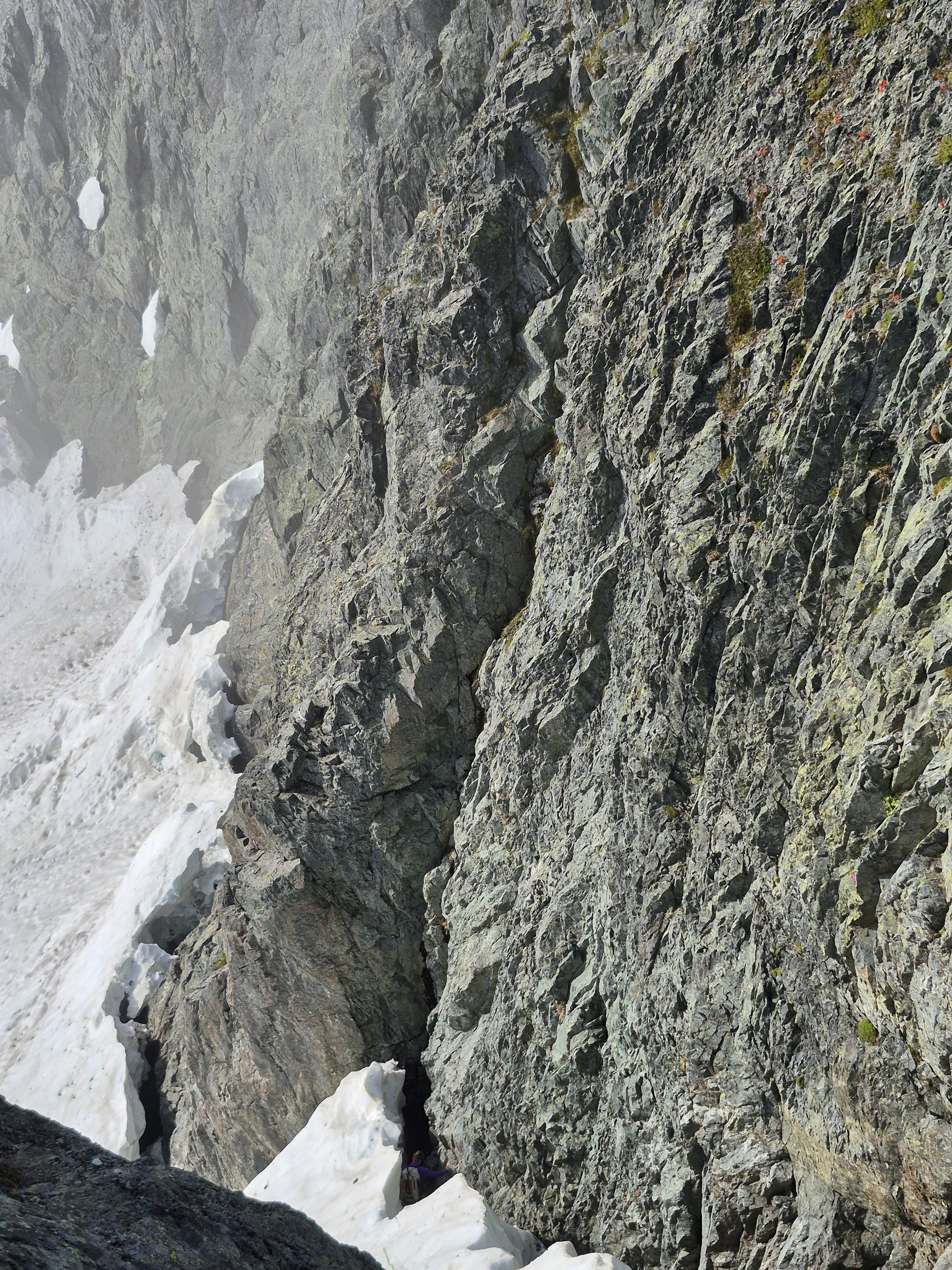
Trip: Seahpo / Cloudcap Peak - NE Ridge Trip Date: 07/05/2025 Trip Report: After much discussion and planning and two planned weekends that didn't happen due to weather, and even a scouting trip with binoculars, me Fred and Dylan finally climbed Seahpo / Cloudcap on July 4th and 5th. I had been on a mission the last few years to climb Dallas Kloke’s Difficult 10 peaks and completed the list this past winter with Lincoln. Now as part of my midlife crisis alpinist proving I'm after the self declared Difficult 10 Bonus Peaks. Basically anything that the consensus says ought to be on the list but since it's Dallas's list it doesn't change (much like the bulgers). I consider these so far to be Gunsight and Seahpo. We hiked up through the crowds on the 4th of July with heavy packs loaded with all kinds of climbing gear since we didn't actually know much about the route. We passed a lot of day hikers and Ruth climbers that all asked us where we were going with all of the gear on our packs, I grew somewhat tired and only half jokingly suggested we tell people either Shuksan or Icy just to make it simple. Bizarrely then we met somebody who replied that they had climbed Seahpo!! We went up and over Ruth, then Icy just for fun and made camp near the northeast ridge of Seahpo, making camp in just about 8 hours. We had plenty of time to study the route as it came in and out of the clouds and were pleased with what we saw. On a scouting trip a month earlier the route had ample snow on the ridge which we weren't prepared to deal with. On the 5th we were up at 5:00 and hiking just after 6:00, thus allowing for plenty of sleep to make up for a week of extremely early mornings for work for me. No one argued with that concept. We took the Beckey variation of getting on the northeast ridge at the first opportunity instead of the glacier which we assumed would be in rough shape this far into the 21st century. The scrambling on the lower ridge was excellent class 3 with some easy snow walking, then we got to the top of a tower before a major notch. This notch was the main unknown of the entire route since there's not really any good way to scout it and we had no beta at all. It proved to be troublesome. Naturally we assumed we would just be able to rappel into the notch and climb out the other side, but it took us about an hour to discuss, scout for a descent, and then eventually build an adequate repel anchor. You repelled into the notch, over a moat, down some easy snow, and into the moat on the far side. The moats were deep but not wide at this time. We huddled in the upper moat a little ways down from (south of) the top of the notch, where we had scouted the only fusible way out of the notch. There was a groove/gully that looked feasible to climb up and regain the ridge beyond. The plan was for Dylan to rope gun the rock in his approach shoes and me or Fred to kick steps in any snow in our boots. Nobody wanted to bring boots, shoes, and rock shoes. Tom Sjolseth mentioned in the comments of his Jagged Ridge TR that the northeast ridge of Seahpo was 5.6 or 5.7, so we figured we needed to be able to do that at least. Dylan was confident that he could lead up the groove, but I stated not so subtly that I wasn't confident I could follow it. He made it look hard but doable, and got a good belay 55m above at a rap station. I'm not sure I have ever climbed on a single rope cow tail style until now, and me and Fred were very very concerned with how little rope we had left, hollering constantly as Dylan finished out to the anchor. (Naturally as in most of the Cascades pro was very sparse and anchor opportunities more so). There was exactly enough rope left for me to stand at the last stance while Fred made it through the most difficult part that the receding glacier had just vacated before I had to step on to the wall and make the hard moves. It was extremely doable on second but I'm glad I didn't have to lead it. Definitely 5.7R. We all made it up to the belay and determined that it looks solo-able above, so we put away all the gear, never to use it again. The rest of the route above was no more than class 4 if you made the right choices, a couple of times just for ease/fun we maybe made it 5.2. Jim Nelson’s book Classic Cascade Climbs must have forgotten about this first pitch, Tom gets a Redding credit in the book so Dylan is convinced that he intentionally sandbagged the route old school alpinist style, not sure, but the first pitch is definitively mid 5th. The book calls the whole route 4th class. We encountered some pretty solid rock on the ridge, easy steep heather on the south side, and a short cruddy gully crossing per Beckey. As I have discovered on most of the more difficult routes Fred Beckey usually pretty reliable. We crossed the gully on a ledge and followed some heather slopes to a short rock finish to the summit. We launch it around for a while hoping the mistwood break and we would get some views but it was not to be. The route finance straightforward enough that it wasn't a big deal in fog but it's always nice to have a good look around. I found out later that we would have been able to holler across to Tim Halder on Nooksack Tower if we could have seen it. The climbing was easy enough that we downclimbed everything to the belay station then made a double 60m rappel to a horn above the moat, south of the initial groove pitch. From here we made another double rope rappel down to the top of continuous snow at the top of the glacier. The upper randkluft it was melted down to where we could land on rock and simply walk out onto the glacier. This rap was long and extremely steep, overhung over sock and then transferring to overhung over snow, pretty wild! I went first and was collecting myself at the bottom of the rap until I thought about the 30+ feet of more than vertical snow directly over my head, so I skedaddled a ways back to the top of the glacier. We all gathered back at the bottom, stowed the ropes and cruised down the glacier, and back along the ridge to camp. The glacier was chill with just a couple of moat cracks to walk around, nothing I would call a proper crevasse, in fact I would hesitate to call it a real glacier anymore; still potentially dangerous though. We took some time packing up camp and congratulating and thanking each other, caught a few last minute views and then headed back up the slog over the shoulder of Icy, back over Ruth, then cruised down the very familiar route to the car. We hit the car about 8:30 for just over a 14 hour day. More congratulations (real this time since we made it back properly), thanks all around, then back to civilization and “reality”. The holiday weekend made it so I could lounge around and nap the next day feeling glad to have pulled off another very challenging mountain. This one definitely ranks in the difficult 10 peaks in Washington in my book, when taken as a whole. I would rate the mountain above the first pitch as pretty enjoyable scruffy fourth class rock and heather, similar to other Cascade peaks; Jberg, Triumph, Klawatti, etc. I think if there wasn't the tough first pitch it would be a pretty enjoyable mountaineering route in a remote location, to me at least, 5.7 ads a level up. The approach was extremely enjoyable and pleasant, better than any of the Difficult 10. We pretty thoroughly scouted the pitch out of the notch both on the way up and down the route and determined that the way we climbed it seems to be the most doable line. If you want to do this mountain you need to be sure you can climb someone insecure 5.7R for half a rope length. If I had to do it again and it was up to me to lead I would take rock shoes. Gear Notes: Half rack, 2x 60m ropes, light MTN boots or approach shoes and wet feet, axe, helmet, others wore crampons, not I, extra axe and pickets for steep snow we didn't need. Approach Notes: Trail to Ruth, over west Icy (the truth summit now thanks to lidar BTW), down the other side. Follow the ridge the whole way. Dylan ascending to heaven on Ruth: The whole deal with my partners looking badass: Seahpo: From camp: Camping in an awesome setting: Morning. Clouds rose up to greet us: Approaching the line: Atmospheric weather: The lower route calls to us: Fred on rap: First pitch from the notch, Dylan for scale: On route: Easy: Break time on the summit: Part of the register. The pencil crumbled in my hands as I signed us in, so take a new one: Fred on the last rap: Descent of the glacier: Strolling out beyond Ruth:

 2 points
 -
Trip: Mount Index - North Face Trip Date: 06/29/2025 Trip Report: Kinda tired but figure I should write some stuff down while it’s fresh in my mind. I’ll split this into two parts, the story and the beta. The Story is pretty simple, me and a partner decided to go for the Index traverse on Sunday and Monday. We had extra time on saturday so we hiked into lake serene to make for an easier morning. Without light on Saturday night, we made the mistake of trying to bivy at the flatter spot in the topo on the north of lake serene. This is very schwacky. Don’t do it. It wasted a lot of time. Anyways, Sunday am we worked our way up the talus and then up to the ridge. It was still a little wet and loose so we decided to rope up. Halfway up, my partner bonked and our pace slowed considerably. We made it to the summit late and decided that in his condition it wouldn’t be safe to commit ourselves to the rest of the traverse. A nice summit bivy ensued and then 16 rappels + downclimbing the next day. We chilled in by the lake and hiked out at a reasonable time. In the descent we also realized it was prolly a good idea we didn’t commit ourselves to the traverse. It fingers were beat and the rock was so warm that touching the rock was truly painful. Wouldn’t be fun to be forced to climb in that. My partner has a brain and realized this blue collar suffer climbing aint for him, but if anybody wants to get on something suffery with me, let me know. I got a lot of time this summer and like to put my head down and work. Anyways on for the beta Beta: Approach via Lake Serene. Take the trail around the lake to the talus field. Follow the talus field up, eventually getting near the cliffs on the left but not on them. Eventually you will be forced into the bush to the right of the cliffs where there is a faint climbers trail. At times it can be decent but often, its only marked by the fact that you can see the ground every once in a while. Bushwack 4th class up onto the NE Ridge, pulling on lots of branches. Eventually you’ll get out of the schwack and onto the ridge. Take the easiest looking route up, roping up if you feel necessary. Climb this until you reach a slab with two pitons under a roof. Once here take the leftward brush filled ramp for about 50ish meters until you reach a short E facing exposed rock rib. This is a great pitch with exposure above lake serene. It will quickly ease up into a nicer gully below an open book feature. Climb to the treed ledge on the left side below this open book where you’ll find the crux pitch of the route. Start up on left side of the open book before traversing right on smaller holds to get to the easier gully above the open book. Here you’ll find a block with a lots of slings for a nice belay. At the block, climb hard right out of the gully and then climb straight up the steep trees and brush until it gets too steep. Here you should see a small hidden ledge going around right. Take the narrow, exposed ledge around the right skyline where you’ll finally see the North Bowl. Traverse, pulling steep brush, to get into the open bowl. Once in the bowl, the route goes up the steeper long gully on the left. Work your way up this thing, staying on the right side of it for most of the time. Eventually, before the gully turns right, you’ll find yourself on a nice ledge to the right of the gully with a slung tree and a piton + nut anchor above it. Climb up here and then to the left back into the gully. From here(when the gully turns right) it is 60 meters of steep bushwacking up to the toe of the North Rib. The North Rib is the highlight of the route. Stay right on top or barely(a few feet) to the right the entire time. This can be led in 2-3 pitches or one easy simul. It is exposed, but the holds are great unlike the rest of the route, and the location is amazing. Once at the top of the ridge, quickly climb up the small slabs onto the summit ridgeline. Scramble this, along, or slightly to the right for most of it until you reach the summit. slab with pins below roof. Ramp off to the left great exposure on E facing rib topping out of open book looking down rightwards turn at end of gully filled with steep branches. Taken from toe of N. Rib ig I'll have to come back for these guys summit bivy summit ridge scrambling(taken on way back) Gear Notes: Double rack to #2 but a single would probably be fine. Bring lots of double length slings, you'll be slinging a lot of shtuff. Approach Notes: Lake Serene -> boulder field -> Shwack
 1 point
 -
Holy moly pictures I love it!!!1 point
-
Awesome climb and report! Glad you could leave those chossy death blocks sleeping. Solid adventure for a single overnight!1 point
-
Ugh sorry about your car. Thank you for putting in those boot tracks, they were great to follow! Navigating the snow and slabs in the dark is a classic! We did the same 4 years ago on the West Ridge and didnt get to lower camp until 3am....1 point
-
Really thoughtful and inspiring TR. Rest in peace, Teemo.1 point
-
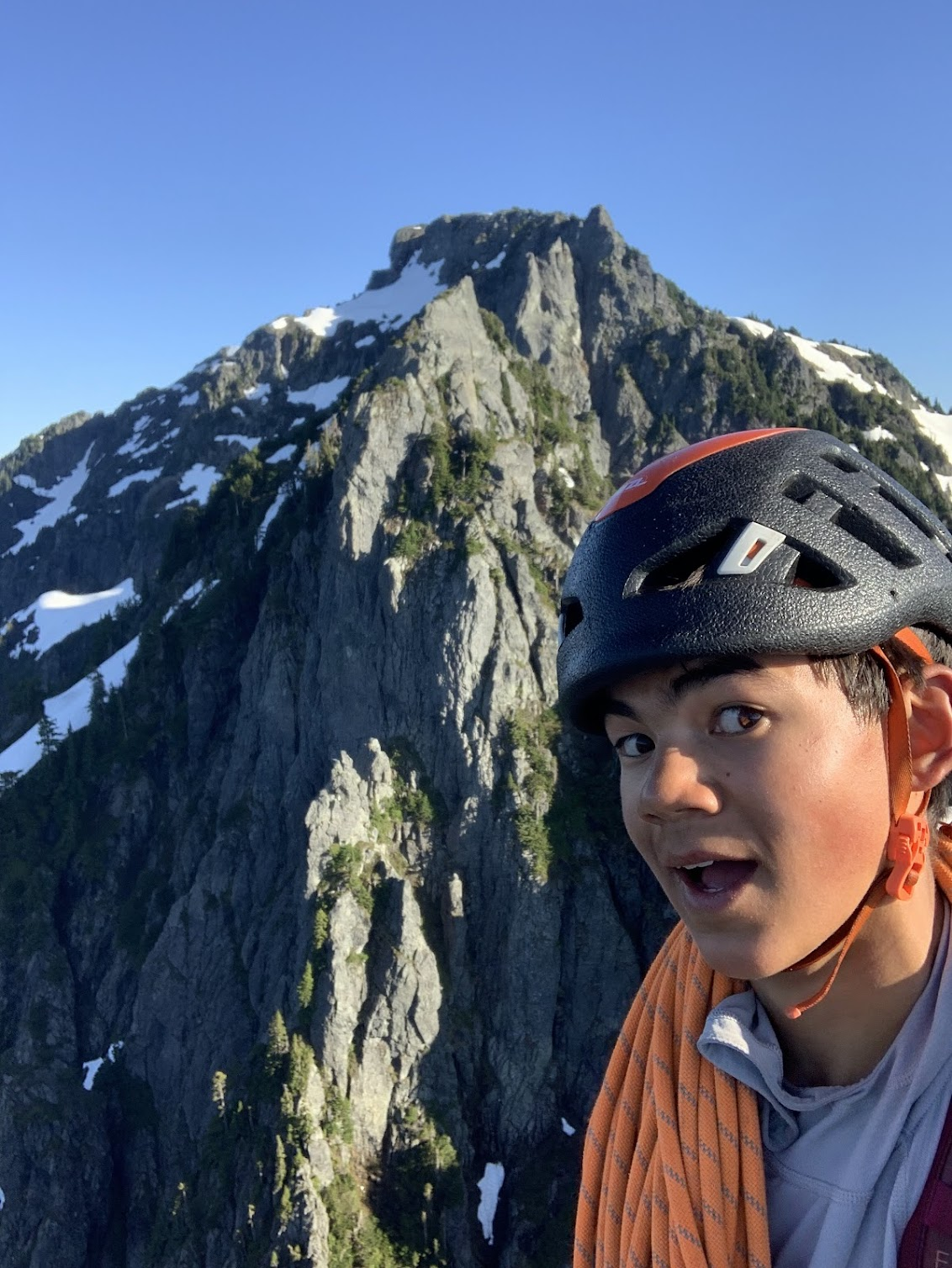
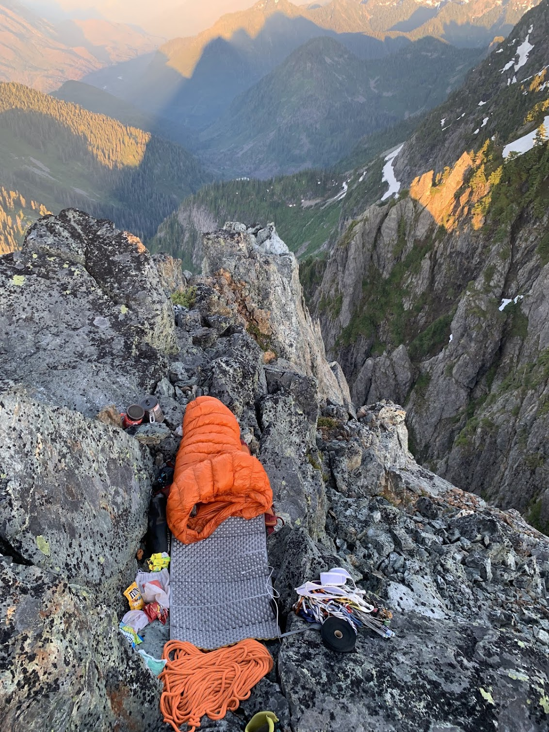
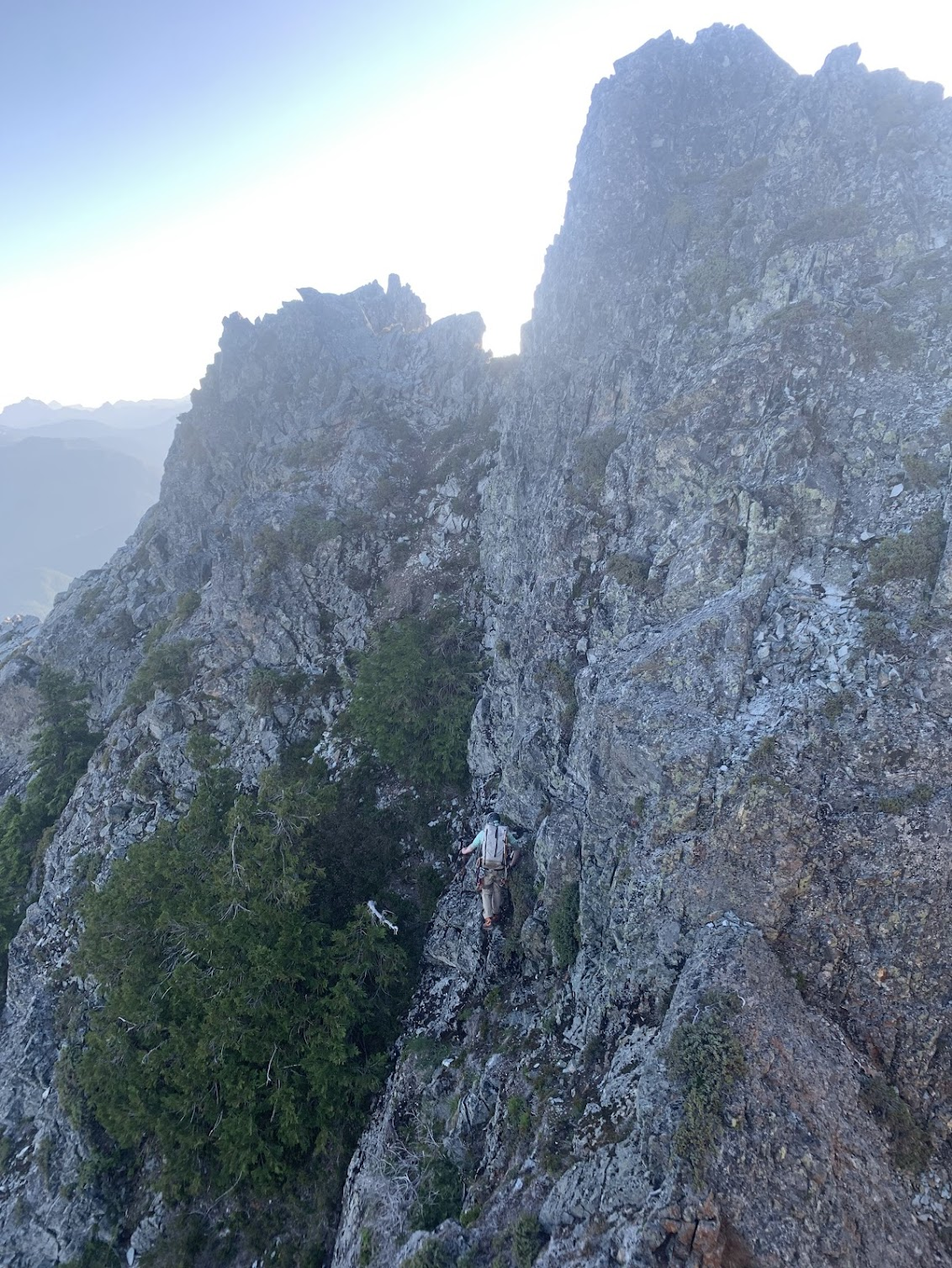
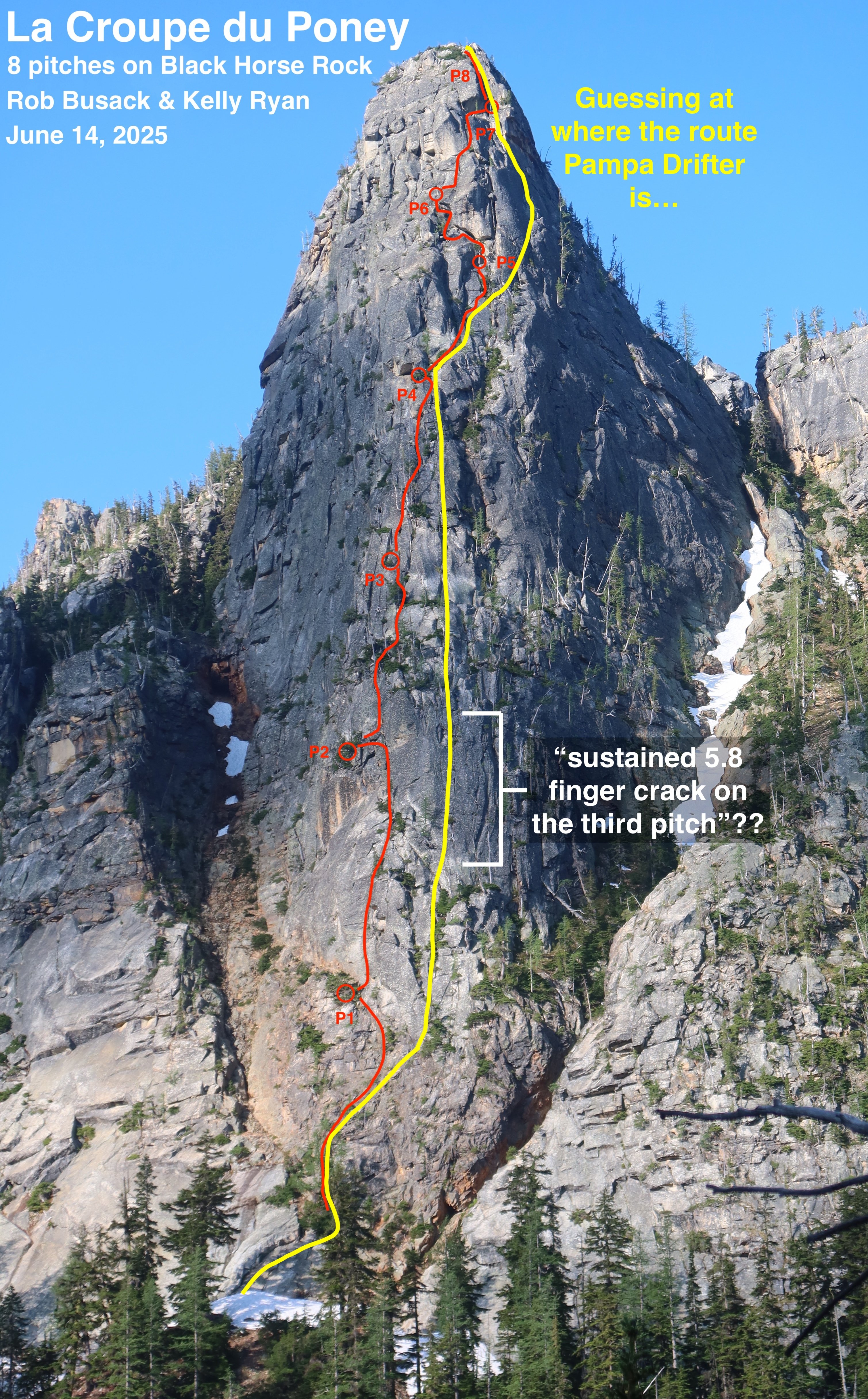
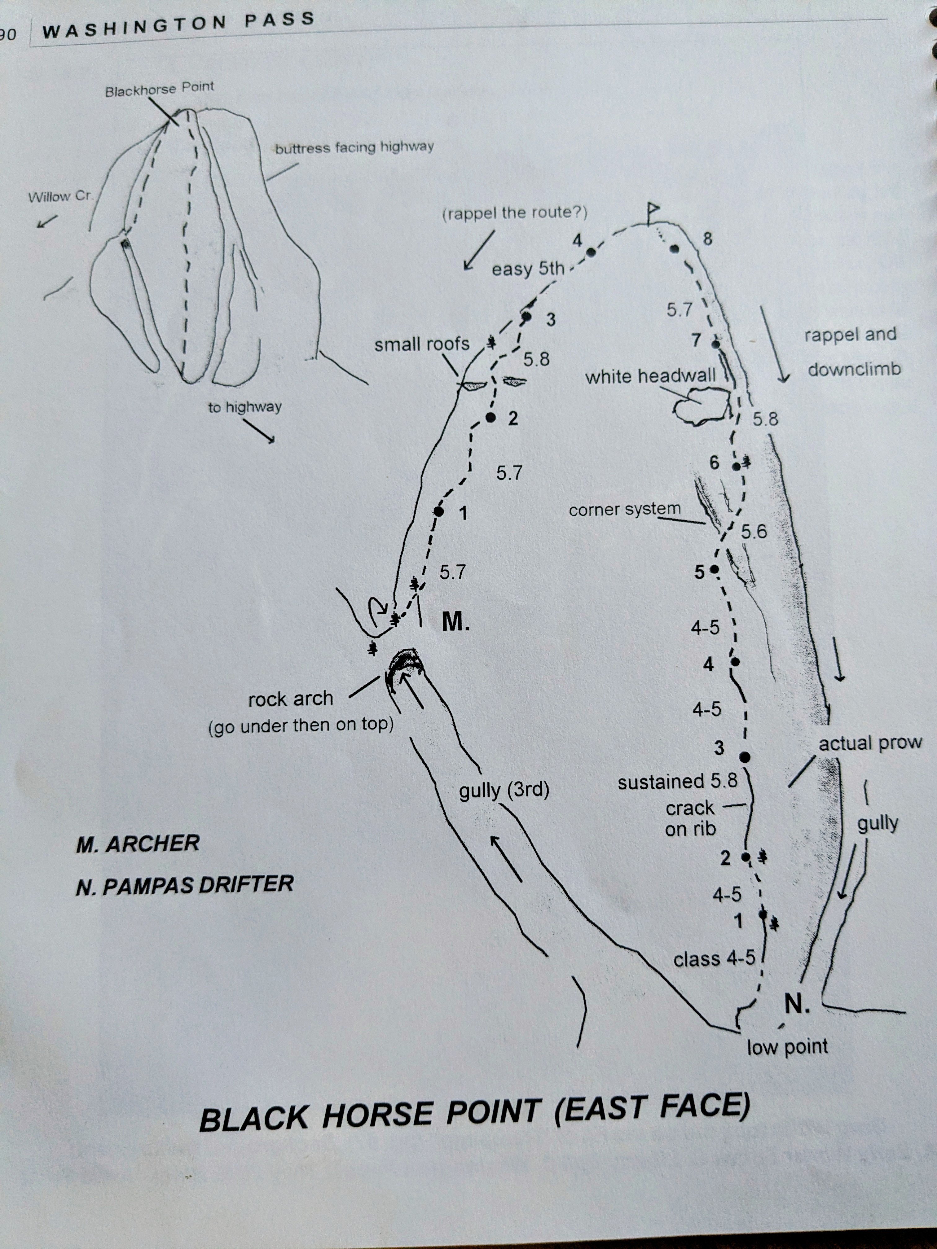
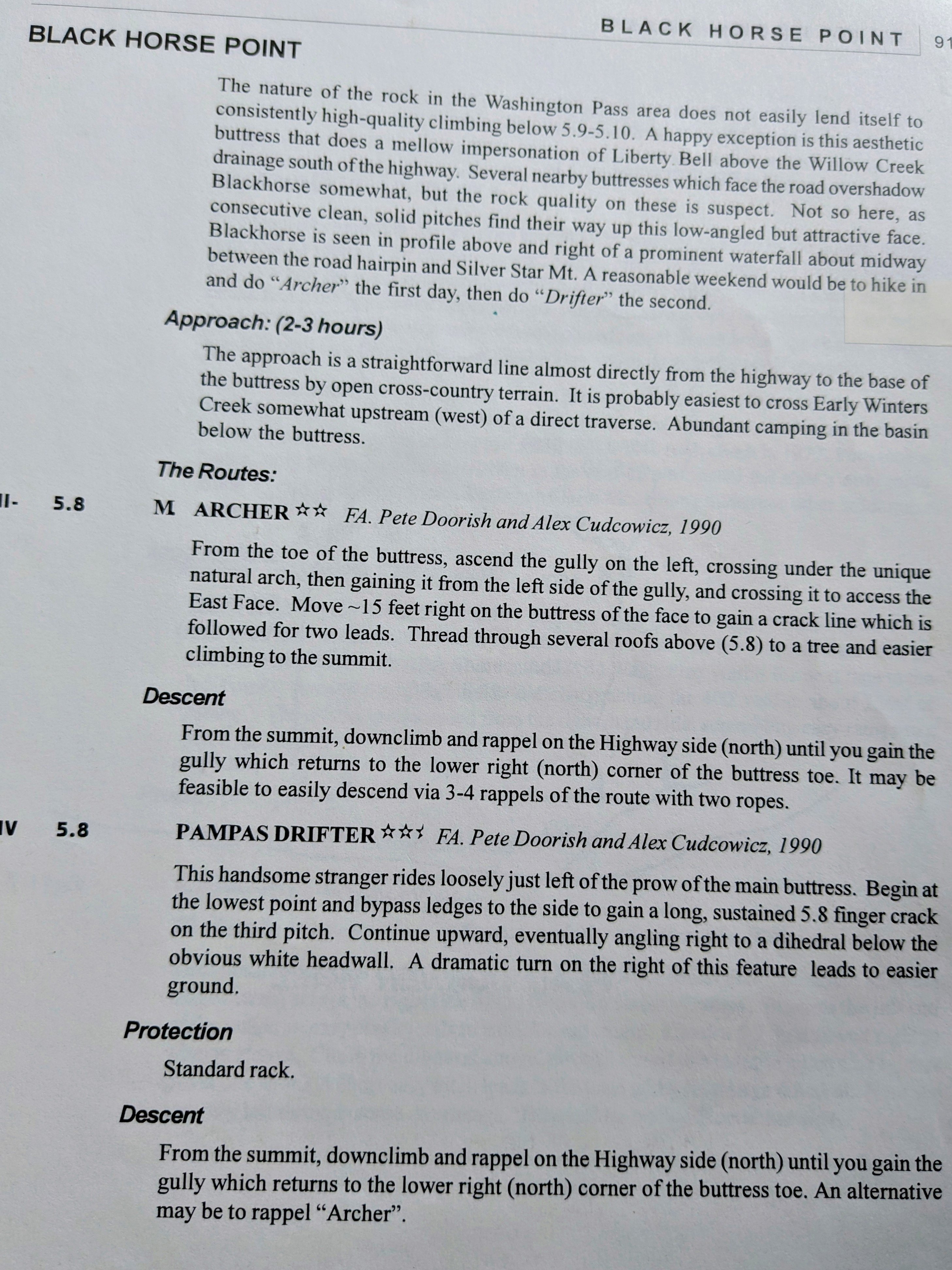
After having thought about this more (and having gone and climbed La Croupe du Poney a second time to make it a little more "ready" for other climbers,) this is, to the best of my understanding, my best guess about where the route Pampas Drifter is relative to La Croupe du Poney: I think Pampas Drifter made a direct-start from the toe of the buttress, starting climbing about 100' lower than La Croupe du Poney (whereas we started La Croupe by scrambling up the easier right side of the buttress to a big larch.) The bottom of the drawn line in the guidebook has a rightward-arching shape that appears to match the shape of a rightward-arch on the friction slab at the very bottom of the buttress. So Pampas Drifter's first pitch starts lower than La Croupe du Poney's first pitch starts, which leads to pitch numbers being half-offset the remainder of the way up. Shared segment: Although the 1st pitches of the two routes start in different spots, likely the majority of the middle of those first pitches are the same. A divergence: Pampas Drifter describes "a long, sustained 5.8 finger crack on the third pitch". Wherever that is, it is definitely unique from La Croupe du Poney. My best guess as to where that "long, sustained 5.8 finger crack" could possibly be is a clean section of rock with a number of vertical cracks that's 50ish feet to the right of La Croupe du Poney, and in terms of height, lines up with La Croupe's upper-half of our 2nd pitch plus the lower-half of our 3rd pitch. Since Pitch 3 of Pampas Drifter is definitely unique from La Croupe du Poney, it somewhat suggests that Pampas Drifter's pitch 2 and pitch 4 are also unique from La Croupe du Poney, since Pampas Drifter's route diagram doesn't show any sudden jogs to get to or from it's pitch 3; the route diagram implies that the pitches before & after pitch 3 are roughly vertically in line. Coming back together: I believe that La Croupe du Poney's pitches 3 & 4 and Pampas Drifter's pitches 4 & 5 are close neighbors, which slowly come back together and probably eventually share the same line at some point; most likely near the end of La Croupe's P4 and Pampas Drifter's P5. It's quite plausible that those pitches end at the same belay location. Shared segment: I guess the corner system marked in Pampas Drifter's diagram on their P6 has to be the same as the small right-facing-corners that La Croupe du Poney's P5 climbs through. So La Croupe's P5 and Pampas Drifter's P6 are mostly the same thing. A divergence again: Depending on where exactly Pampas Drifter's "dramatic turn on the right" is, it's likely the routes diverge again near the end of La Croupe's P5 & Pampas Drifter's P6. It's unclear to me if Pampas Drifter the huge chimney with a giant chockstone that's directly above Shish Kabob Tree, or if the "dramatic turn" is indeed further right, since further right does indeed look more likely to "lead to easier ground" out there. In either case though, it's clear that Pampas Drifter's P7 goes somewhere very different, and La Croupe du Poney's P6 & P7 are definitely new and unique. Another coming back together: Unfortunately, Pampas Drifter gives effectively no information at all about where its pitch 8 happens to be. If it had been my brain planning the route for Pampas Drifter back in the 1990's, I know I would have chosen to go for the "Incredible Dihedral" that's also La Croupe du Poney's pitch 8. So I'm guessing they made that decision?? But I'm surprised they didn't make at least some even small note at all about this striking last dihedral in their route diagram or description. It seems like if they had climbed it, they would have made at least a little mention of such a striking feature, so maybe they didn't climb it and went some other way?? But I'm going to assume they did climb it, even though they didn't say so, just because it is a probable way they might have gone. Based on that assumption, that would make pitch 8 of both La Croupe du Poney and Pampas Drifter the same. In summary: These two eight-pitch-routes would appear to have three pitches that overlap (some of the P1, some of La Croupe's P5 is the same as Pampas Drifter's P6, and to make an assumption: all of P8,) leaving each route with its other 5 pitches of climbing being unique and separate from the other. Considering that: The routes have more pitches that are separate than they do that are shared… And that I went out and climbed La Croupe du Poney as if it were a first ascent, with no beta at all except some of my own photos I had taken a few weeks prior, as there wasn't a single shred of information available about other routes on this buttress at the time that I climbed it… And that these older routes seem like they had been forgotten to time long before I got here… (I can't find any internet-evidence of anyone having climbed Pampas Drifter at all in the last 25 years) …the combination of all those things (especially point #1) makes me feel pretty good about saying "La Croupe du Poney is indeed a new first ascent" here! I've posted La Croupe du Poney to Mountian Project: https://www.mountainproject.com/route/201307606/la-croupe-du-poney If anyone has more-conclusive information / better beta about those historic routes, Archer and Pampas Drifter, it would be cool if you posted those to Mountain Project too, so that they aren't totally lost to time!
 1 point
 -
Rip Teemo. Quality as always gentlemen! What a trip!1 point
-
Trip: The Chopping Block - NE Ridge Trip Date: 07/25/2021 Trip Report: Climbed the Chopping Block in bomber bluebird weather on Sunday. Actually saw another party on the route (!!); two young guns who had left the trailhead that morning and were doing it in a day. Overall saw seven people during our three-day trip, which exceeds the total number of people I've seen in all my previous Picket trips put together. There are a lot of people out there these days. We managed to lose the trail once on the way up and once on the way down, thus providing us with hours of additional enjoyment. As has been stated by others before: DO NOT LOSE THE TRAIL. Drop your packs and scout, the time you spend will save you sooo much more time. When descending the broad ridge from the basin to the snag with the crosspiece and flagging (see pic in Jeff and Priti's Pickets Traverse report), stay left; don't stray to the right. There was a mellow place to wade Terror Creek just upstream of the trail; clearly many have done it before because there was a bit of a trail beat in back downstream to the trail up to the ridge. High points: camping in Crescent Creek Basin with not another soul up there except us, views from everywhere above treeline, nice solid rock and enjoyable climbing on the route, not being mauled by the bear hanging around the TH in the salmonberry bushes, not being nailed by the 10-inch-diameter tree that fell across the trail 15 paces in front of us (I counted) right after I said, “Hold up, I hear something in the bushes.” Thanks to Jim Nelson for the new cams, they're light as a feather. Thanks to Marko, the second-handsomest alpinist I know, for the rack 'n rappel beta. Gear Notes: 70 m rope (some shenanigans to rap back down but nothing out of the ordinary) Light alpine rack to #3 Camalot (really #9 Metolius Ultralight Master Cam) Tat Approach Notes: DO NOT LOSE THE TRAIL!1 point
-
Great effort and some really good beta for folks. Thanks @JonParker! I am a bit shocked by the approach as well, esp. this early. I know @therunningdog and @sparverius approached via the Terror call some years back and said it wasn't that bad? Maybe it would stay in longer?1 point
-
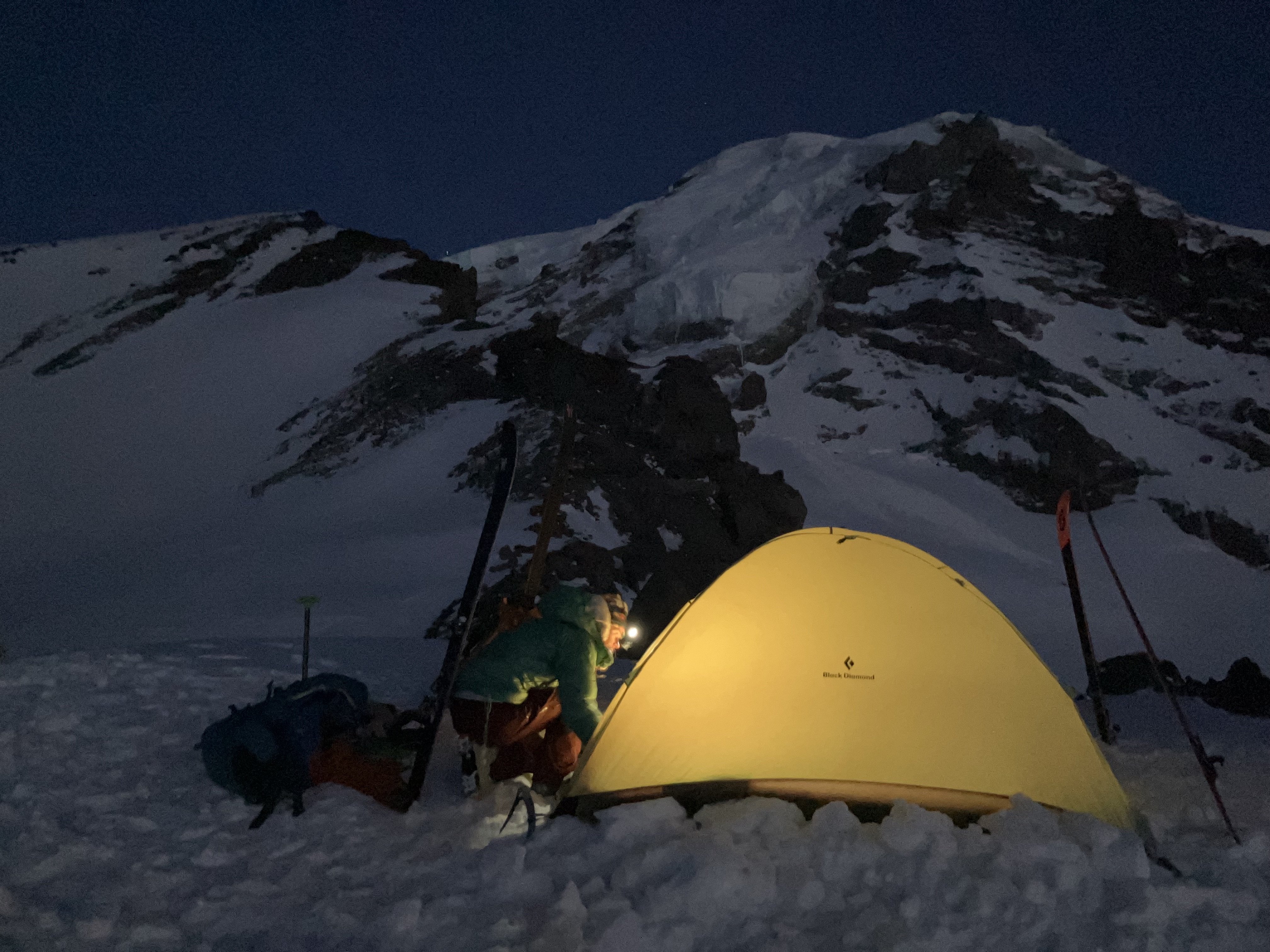
Trip: Mount Rainier - Emmons Central Trip Date: 06/30/2025 Trip Report: When looking at Emmons from Sunrise, Andrew got the idea of trying a route that would connect with a feature similar to the Emmon-Winthrop route corridor but positioned in the middle of the expansive glacier. This feature starts around 10k and provides easy direct access to the upper mountain. I was skeptical about the idea until I had a closer look myself a few weeks ago while climbing Cowlitz Chimney. We could not find any information about this route and decided to refer to it as Emmons Central. Please, let us know if you know the history or previous ascents. To spice things up Adrew pitched starting the glacier terminus. We scouted access to the moraine Saturday afternoon and took closeup picture of the route to weight our options. The pictures did not show any clear paths to the corridor but the “right” side variation looked the most promising. Sun morning, we hiked and shwacked to the terminus and started making our way up the glacier. The idea was to skirt very broken up lower section on the right, then hook left trying to ascend to a rocky ridge in the middle of the glacier. We could then follow the ridge for a little bit until being able to push right to access the start of the corridor. We identified one potential make-it-or-break-it crevasse below the rocky ridge but did not see any clear dead ends along this option. After leaving the moraine and getting on snow we started aiming for a nunatak at 9400 following open slopes with minimal crevasse issues. From here we initiated our left hook as the glacier became more broken up. After some navigation we reached the crevasse with a question mark and were able to get across on an exposed but solid bridge far left. This brought us to the rocky ridge where we set up the camp at exactly 10080ft. Being in the middle of a glacier with the largest area in the contiguous US and having dry ground to sit on was awesome. Looking up from camp revealed crevasse problems we did not see in the pictures. The general plan was to keep going right and that is exactly what we did in the darkness the following day. It was obvious when we finally gained the ramp because there were no crevasses in sigh as far as the headlamps could shine. The angle starts around 40 degrees and gradually eases off with elevation as it trends slightly left. Around 12.5k the route connects with the late season DC route variation. To our luck we ran into set of boot prints around this elevation. Later on the boot path became marked with wands so my guess is that the guides or rangers prepared the route for when the regular DC gets too broken up. We followed the boot prints and wands until connecting with the regular DC and the well beaten path to the summit. We descended via the standard Emmons-Winthrop route. Gear Notes: pickets Approach Notes: Moraine trail to "End of maintained trail" sign then follow a boot path down. We then hiked along the vegeration up until it looked more open1 point
-
I have a copy of that Burdo guide and it looks like the route you climbed follows a fair bit of "Pampas Drifter" (5.8, Grade III-IV). FA was by Pete Doorish and Alex Cudcowicz in 1990. Not the greatest pictures, but the topo and (brief) description are attached. That team also had the first ascent of "Archer", which Dale Farnham told me was named after a dog Pete had at the time. I think the main difference is that you jogged left under the "white headwall" and Pete and Alex kept to the right? Regardless, I have been really curious about this route (and Archer) since I came across it in the old Burdo guide. Hope that your TR puts some more traffic on it. Nice work!
 1 point
 -
Oh, and post up a TR when you get back (unlike me)!1 point
-
Trip: Sloan Peak - Sloan SE Face Trip Date: 08/14/2022 Trip Report: I'm writing this trip report to put some more information out on an old Fred Beckey and Jerry Fuller 1965 route that is falling into obscurity. The only trip report I could find on the route is 6 or 7 years old and the route description in the Beckey Guide book. There is maybe 5 sentences between the two of these on the route, no hand drawn topo, no pictures or any other information. The best approach description I could put together is listed below which I recommend paying attention too seeing how my brother and I burned 2 to 3 hours between the 3 river crossings and the bushwacking between and after to get to the new trail. The old trail on the map that goes after the river crossing is a path grown over and no longer in use. . See map picture below which I snagged off a blog before the climb and the screen shot off the route above I put together on Gaia after the trip. We chose Sloan SE Face because we wanted a less crowded peak with a glacial crossing and some technical climbing, and the Matterhorn of the Cascades has always been high on own list. My brother and I wanted a full value adventure so we chose this obscure route and decided to do the original approach of Cougar Creek with the river crossings. We left the car around 9am after waking up at sunrise to get packed for the climb and drive to the trailhead after doing "research" the night before. Colin and I arrived at basecamp around 5pm after 3 river crossings and bushwacking which burned a ton of time and numerous down trees to hop or slide under. The further up the trail we got the more overgrown it got. We were surprised to find a guide with 2 clients at basecamp around the corner from where we setup camp. They were making their second attempt on the corkscrew route. We filled up on water and stuffed our faces with dinner and prepped our bags for the morning. We woke up around 3:30-4 am and got going probably around 5ish. My brother and I opted to scramble up the slabs up to where we would start the traverse on the glacier while the guided group started up the steep glacier basically right out of camp maybe 20 minutes after us. We traversed across the glacier to Southwest corner of the glacier where it meets the horizon you view from camp. At the top of the glacier we let the guided group pass on the corkscrew route below us before we started up what we thought was the first pitch of the SE Face route to prevent knocking rocks on that party. I will describe the proper approach and original first pitch to the SE Face before I describe the variation 1st Pitch I accidentally put up. Pitch 1 Original Start (5.7): About 40 paces or 100 feet from the edge of the glacier and underneath(not directly, roof is up and to the right) an enormous roof is where you will locate the start of the route. Approximately 40 feet of scrambling above the corkscrew route boot trail is a platform to belay from. From that platforms left edge ascend a slabby crack system referred to as rightward traversing in the Beckey guidebook(where we had our confusion), up and to the left of the enormous roof, you will come across a sandy ledge where the original party belayed off an arms width 2 foot tall boulder sticking out of the sand(bleached slings), I recommend you climb 20 feet above the ledge next to the roof in a crack system. This sets you up perfectly for pitch 2. Above: Pitch 1 (5.7) to the left of the enormous roof is where pitch one ends, you cannot see the sandy ledge from here. Pitch 1 Variation (5.10a): About another 20 paces or 50 feet past the original start in the next gully-ish system is where I accidentally established a variation pitch. Scramble 30-40 feet above the corkscrew boot trail to a dirty heather ledge to belay from. Climbing up a slopey arete/rib, about 15 feet above the belay is where I found my first gear placement, continue climbing up the rib up to a small roof where I had to dig out some placements for gear(I realized then that these cracks had never seen the light of day and we were off route). Climbing out right around the roof (crux) traverse up and right through crack and slabby climbing up to a sandy ledge, for the best belay climb another 20 feet above the ledge to a crack system to the left of the enormous roof. This put us back on route at the base of pitch 2 which Colin realized when he was climbing up to the belay where the proper first pitch started(bleached slings). With the 60m rope I had approximately 20 feet left of rope and used about 8 pieces of gear. Above: Pitch 1 (5.10a variation) me climbing up the slopey arete to the small roof before making the crux move. Pitch 2 (5.4/5.5) Climb straight up and veering left from the belay up a chimney/gulley system with great protection. Once you leave the chimney it opens up into blocky terrain until you pull onto a 6ft deep heather ledge with a good belay using overhanging cracks. This Pitch is about 200 feet long. Once your second has followed move the belay up and to the climbers left(West) following the sandy ledge about 50 feet or so to the base of an obvious chicken head rock face. You will probably walk past it and notice it when you look back towards your old belay. See Pictures. Above: Picture found on Wayne Wallaces Cascade climber trip report of his SE Ridge climb, used for the overlay above. Thank you Wayne, We forgot to take a picture of pitch 2. Above: Chicken head/dish face, start of pitch 3 Pitch 3 (5.5/5.6) Start up the chicken head/dish face about 20 feet before chicken heads disappear. Becomes blocky terrain before a flared open book corner, above the corner you have the protectable option to do a single chimney move to the climbers right or an unprotectable lichen covered arete(full value according to my brother you climbed it when following) to the left, with one or two bolts it would really add to the pitch. The only loose block on route was just before the chimney move, about the size of a microwave that was in a heather ledge began to rotate out under my weight to fall down towards my brother and I used my foot to push it back in place. We should have kicked the thing off when he made his way up but I forgot to mention it to him. Either way you go reconvenes and traversing right and up to a very big sandy ledge buidling a belay where ever you can find. This was a rope stretcher almost full 60m pitch. Move the belay again and walk about 150-200 feet to the climbers right to where the cliff face suddenly drops below to the glacier. See Photos below. Above: Sandy ledge where you build your belay at the top of pitch 3, move the belay basically to the horizon of this cliff in the picture for the last two scramble-y pitches to the top. Pitch 4&5 (4th class/5.2) Having moved the belay 150-200 feet over to the climber right, climb generally up and right to the top of the ridge on heather ledges with the occasional 5.2 mantle. We opted to stayed roped together and at least have the rope attached to the belay if worst case, one of the heather ledges collapsed under our feet. It was approximately a 60m scramble and maybe another 20-30m scramble after that. The 4th pitch is an incredibly exposed position where you can look down on the glacier and basecamp. Wild mountain with incredible rock quality. Above: Pitch 4 and 5 scramble, generally climbing up the skyline in the photo, mostly looks like chose your own adventure to the top at this point. We passed by another ancient belay with an old bleached sling of cord sticking out of a heather ledge, completely overgrown. We hit the summit at noon. Above: Colin on the Summit!! Above: Another photo I swiped from Waynes trip report to add an overlay to give an approximation of where the route goes and where the belays are. Those last to scramble anchors are on the other side of the ridge, the other side of the horizon of the ridge. Yes this route wanders but not as bad as it seems, a very worthy route with awesome rock. We descended the corkscrew route, roped up for the glacier, hustled back to break down camp then sped our way down the Cougar Creek Trail to get across the river crossings before dark. We ended up back at the car at 7pm, we took our time on the summit enjoying the weather and views. This is a good route which deserves traffic. In Beckeys Guidebook and on the American Alpine Journal for his First Ascent trip report Beckey said this is "Some of the best technical Alpine climbing available on the Western side of the Cascades" AAJ 1966, "The Rock on this route is superb." I'll leave it at that! Great route with Colin White. Gear Notes: We brought an ultralight ice axe each, ultralight harness, Crevasse rescue kit, crampons, headlamp, GAIA GPS, inReach Beacon, UV water filter pen, trekking poles, a 60M rope for Glacier crossing and technical climbing, 5 single length alpine draws, 3 double length slings, 1 triple length sling, set of ultralight cordelette cord each for trad anchors, ATC each, a set of stoppers, and cams: a black totem up to a black diamond number three, doubles in .3, .4, .5 Approach Notes: There are 3 river crossings. The correct path through the river crossings is to take the first log that you see across the river approximately 1/3 to less than a 1/2 of a mile from the trailhead. After the first cut straight through the woods to the next portion of the river, work your way upriver to the next log crossing, next cut up river to the next big river crossing if you are lucky you might run across a few flags at the third river crossing. Once you are across and on a large sandy dry stream bed head upriver approximately 200 feet before ducking into the forest where a pink flag marks the start of the faint new trail rather than trying to find the old trail. You can trust the flags you see here. Trail starts faint at first but becomes more established the further up the trail you go. You will eventually run across an old forest road that you will not stay on for long, follow the cairns and flagging. It cuts sharply uphill with lots of switch backs until reaching an amazing waterfall where we crossed the creek and continued up the trail. The further up the trail you go the more overgrown the trail is, a GPS is advised but most of the time if you watch your feet its clear enough, and we did a fair bit of whacking back the bushes on the way up and back to help whoever comes this way next. Lots of downed logs manageable, it's not the worst I have come across. Getting from the the car to basecamp is just over 4 miles and approximately 4,100 foot elevation gain. There is 3 rock windwalls we came across with decently flat ground for camp for 2 or 3 person tents. Giant cairn pile marks the basecamp area which is in the general below the lower NE corner of the glacier. From basecamp to the summit the mileage depends on the route but the elevation is approximately 1,400 foot elevation gain with the Corkscrew route usually used as the descent route. If you are doing the Cougar Creek approach highly recommend doing the North Fork Sauk river crossings in daylight. Some people do it in a day but we advise spending the night because the views are incredible and it's less stressful to make the river crossings before dark, plus this became one of my favorite spots I have camped. Camps are between 5000 and 5300 foot elevation. There was water run off just below camp the time of year we went. Most people are approaching Sloan regardless of the route from the Bedal Creek Trailhead at the time of writing this trip report but we decided to take on as much adventure as we could for this climb.1 point