Search the Community
Showing results for tags 'first ascent'.
-
 Trip: North Cascades - First Ascent N Arete of Varden Creek Spire Date: 6/22/2007 Trip Report: After looking at this fantastic piece of rock for several years while skiing around Silver Star Larry Goldie and I finally overcame our sloth and made the long trek up to try to climb what we thought would be the N Arete of pk 8252. This striking piece of rock rises up from the head of Varden Creek and forms a significant high point along the complete E ridge of Silver Star. We made this foray late last Sept and were sent packing by very thin pro and a thin coating of frost that did not melt. After two longish and very run out pitches on slippery lichen we rapped off trees vowing to return with knifebaldes. The rock quality, position and asthetics of th eline were irresistable. In mid June of this year we ventured back armed to the teeth. The climbing turned out to be all we had hoped and so I think others might like to know about a route of this quality. We reached the toe of the buttress proper and stayed very close to the arete all the way to the last pitch. The rock quality is some of the best I have seen in the WA pass area. And it remains such all the way until a short very easy section just below the summit tower. The climbing is consistantly 5.FUN with a few spicey moves thrown in to keep you on your toes. We placed (and left) around 7 knifeblades in strategic locations so that you won't have to lug in pins and a hammer. Just stick close to the arete unless the climbing becomes harder than 5.9 then follow the easy way but steer back the arete ASAP. We never went more than 20 feet or so off the ridge and most of the time were right on the arete which gave great climbing and nice exposure. I'll post a few photos and a topo here but there are more photos on ncmountinaguides.com. The climbing in general is not sustained with just the odd hard move here and there. The exception to this is the 5.9 variation on P7 which is a sustained finger crack and licheny. View looking up Varden Creek at the proud line Sorry for the squiggly line Sweet rock typical of the whole route Larry following P5 Larry leading P6. Yep, it goes up the RH skyline Larry next to the summit Gear Notes: Light rack of single small cams to number 2 Camalot, runners etc. Like I said we went in loaded for bear and were way to heavy. Most hard pitches have crux protected with fixed pin. Approach Notes: We are nothe guys to ask about approaching this thing as we went the hard way both times. What I suggest would be one of the two following options. 1)Camp at the Larch bench below Burgandy col and approach over the col and cross SS glacier and over the Varden/ SS creek divide to the toe of the route. 2)Ascend Varden Ck but reputed to open trees and not bad by moderately reliable local source. We went up Mudhole lake trail and then cross country to the base. Took us 4 hours to the base. DESCENT; It turned out that this was not the N ridge of 8252 but was its own seperate little sub summit and hence the unique name. So we did two short raps to get us back to the start of the last hard pitch and then down climbed to the snow basin below the E side to the Arete. Pretty easy down climing but it could be rapped from tree anchors too.
 -
 Trip: Mount Shuksan - Northwest Arayete III 5.9 Date: 8/6/2007 Trip Report: On August 6th Matt Alford and I climbed an enjoyable rock route on the northwest side of Mount Shuksan. The route follows the crest of a fine arete on good rock for nine pitches to the summit of a prominent horn above the White Salmon Glacier. Though dirty at times, the position is incredible, the rock is solid and every pitch is sustained for it's grade. I had first seen this arete at least twelve years ago while descending the glacier and thought it both beautiful and improbable due to a lack of features. Ever since the idea of climbing it has been knocking about in my head. I'm not sure what took so long but it was great to turn that idea into a reality! As it worked out the rock here (Green Schist) is horizontally banded and the rock is just littered with positive jugs and pockets that allow moderate climbing up imposing walls. We left the car at first light and reached the base of Winnies Slide four hours later. From here a short descent led to the base of the arete. There was significant shrund that made accessing the rock a bit problematic. We end up rappelling off a bollard to reach a ramp on the left side of the arete. A good ledge system on the right side could probably have been used as well. Matt takes the first pitch. Fun, juggy face climbing was followed by a 100' of 5.8 friction right up the crest of the low angle arete. The gear grew increasingly sparse until he had to run it out maybe 40' to the belay. A second short easy pitch led to a much steeper wall. P1 Frictioning up the crest of the Arete The third pitch exemplified what makes establishing new routes such an amazing experience. We're at the base of a steep blank wall. On the left is a filthy corner system full of grass. Out right a few weaknesses lead towards a steep arete and the possibility of good climbing around it's edge. The grassy corner will go, but the climbing will suck. The traverse out right is a total mystery. Will it go? Is there any gear? Whats on the other side? What if I can't make it? P3 Working things out on the crux traverse Intending to head up the corner I find myself heading out right instead. Focusing on protection I find that the apparently blank wall has a few narrow seams obscured by lichen that allow me to place several solid pins. Soon I'm at an obvious crux move. Cleaning some loose blocks off a small ledge I watch them freefall to the glacier. Hesitating I close my eyes, focus on my breathing, feel the chill in the cool shade, listen to the ice creaking and groaning below. Eventually I just run out of reasons to stand still so I commit, stemming wide, finding a small uncling, shifting over and reaching for the crest of the arete. Grabbing solid jugs I pull over the corner and find myself on a beautiful wall of clean, orange rock. IT GOES! P3 Matt pulling around onto the beautiful orange wall So many intense experiences tend to just slide away. Things no longer "stick" like they once did. But this one is different, this one set deep. I'm going to remember exactly how wonderful it felt to pull around that corner for a long time. The fourth pitch was the best of the climb, awesome juggy 5.7 climbing on near vertical rock with great gear. Soon we're at the base of the imposing upper arete. The climbing looks improbable but once again the rock turned out to be covered in positive holds. Staying about 40 feet left of the arete Matt is able to climb more or less straight up the wall on 5.7 rock to a belay in an alcove. P4 More Arete P6 Starting up the steep upper wall Climbing through a grungy 5.8 roof I find super featured 5.6 rock on the crest of the steep arete for a full ropelength. Matt quickly leads another long pitch of fun corners to a fixed pin belay at a small roof. A final short pitch up clean slabs ending with an easy arete brings us directly to the summit. Unreal, the route unfolded far better than we could have imagined! P7 Stellar climbing on the crest of the Arete P9 It Ends like it Begins…. It's late in the day so we snap a quick summit shot and get moving. An easy scramble down the backside gets us to the Upper Curtis Glacier. After following some mountain goat tracks we picked up the boot track leading back down the mountain. In my exhausted state the entire descent seemed somehow timeless as if it took no more than half-an-hour. Yet many hours and a beautiful sunset later we reached the car with the last of the dieing light. Well there's already a Northwest Arete and a Northwest Rib on the mountain so Matt (grudgingly) agreed to name our route the Northwest Arayete after someone I know. Gear Notes: Rack to 3.5" with a double set of very small to medium nuts and small to 1” cams. A few short knifeblades and bugaboos recommended. Approach Notes: Follow Fisher Chimneys Rt to edge of White Salmon Glacier (bivi sites) then descend a few minutes on steep snow or ice to the base of the arete. Potential Shrund problems getting on the rock.
 -
 Trip: Gunsight range - West face-north peak Date: 7/25/2007 Trip Report: Inspired by CC.com trip reports Jens (Holsten) and I got on a boat last week and headed towards the fabled gunsight range. Though this website can sometimes be a waste of time, even a repository for spray and slander (mine own included) I feel sort of obligated to return the favor, as without the info gleaned here our trip may have never been. Anyway, enough bullshit. The trail up Agnes creek was uneventful right up to five mile camp, where the trail crew had stopped. Immediately after this we encountered the aforementioned hundreds of blow-downs and developed a cowboy like posture after so much straddling. A light cloud cover didn't do a whole lot to abate the heat, but it was better than nothing. We had hoped (foolishly) to knock off the approach in a marathon afternoon, but after reaching the spruce creek turn off decided to bivy. This was a smart decision, as darkness would have found us stranded on a 50 degree hillside suffering in the rain. Instead we camped on the river and ducked in the tent when the light showers hit. Not a whole lot to say about the next day, just some straight suffering up a hill. Blake and company humbly understated this phase of the journey, we were just glad to find the mountain. Several hours later we hopped onto the blue glacier in the afternoon heat, hoping not to get creamed by an ice fall. We walked right by what was to be our basecamp, intent on making it over to the chikamin. After some sketchy recon we discovered our mistake and settled in to one of the most amazing bivies ever. Wednesday morning we ambled over the pass above our camp and roped up for the super loose step down onto the gigantor chikamin glacier. A mellow crampon session found us at the base of the west face, I only fell into one talus hole where I nearly lost control of my bowels. The route is gained off a rad traversing ledge which beats the hell out of some ungainly moat. As almost everyone else has said the rock quality is superb, if a bit grainy the higher you get. If this wall was a little closer to the road I don't think this would be the case. Anyway, I headed up just to the right of Blake's cairn and wound my way towards the fabled crux pitch. It seems like Nelson and Dietrich (I think that's his name) veered right on the second pitch and climbed a very thin corner before moving back left to the belay which supposedly needs bolts. Again, no bolts were found in situ, leading us to conclude that Jim Nelson had a bad memory. The second belay would be more comfortable with bolts, but they certainly aren't necessary. Jens tentatively made his way upwards, made a tenuous move left of thin flakes and was still unconvinced that the pitch would succumb to our assault. However, move by move, he found unanticipated decent holds, good gear, more positive flakes (a trademark of this wild wall) and uncanny knobs, all of which took him past the crux to a well deserved victory whoop. Here he is crushing. I also managed to scrap my way up this stellar pitch, which left us exhilarated but also a little nervous about the rest of the climb, which wasn't quite over yet. The next crack system looks sort of like a hand crack off the belay, unfortunately its a shallow flaring flake. It does accept gear however, and after a little bit of pansying around I commited to the steep lieback. Another flake follows the first, and I did a little more pansying, unsure if our relatively light alpine rack would get me to the next stance. Luckily the crack finally turns into hands, where I was able to recover enough to run it out to a little knob belay where I plugged in the last of my gear, the four camalot and a blue alien. Here's Jens following. The final bit of steepness supposedly contained some crux wideness, which Jens so graciously allowed me to lead, but it ended up being a little less difficult than the third pitch, which didn't dissapoint me in the least. Jens led one more shorty to "flat ground" and we eventually found a way up onto the crazy summit blocks. The library is about to close so I'm just going to leave it at that for now. I'll give everybody some time to slander and wrap it up when I get the chance. Suffice to say, the rock is good, almost as good as Index. Maybe even better than Mt. Stuart.
 -
 Trip: Sawtooths - Chockstone Peak - Beggars Can't Be Choosers (FA) Date: 7/19/2007 Trip Report: Summary : Chockstone Peak - Beggars Can't Be Choosers 5.9+ Grade III+ - Nick Dolecek and Elisif Harro - July 19th, 2007 Note: To the best of our knowledge and research this climb is a first ascent. I'm still waiting on hearing back from a few inquiries to cover all of my bases. Feel free to chime in if you've heard anything as well The Route The Trip: A Team Harro planned vacation had to get batched due to Daniel's Fire Academy for the entire month of July. Unfortunately, this left me with either a week's worth of time to either get to know myself really well or divide up the team. I chose the latter and made plans with an old friend from OSU, Nick, to do some climbing in the Sawtooths. I climbed in my trusty Subaru and drove all night to meet Nick in Lowman Wednesday morning. After the requisite gear sorting, we headed to Stanley to catch the boat. The quintessential approach shot: Hiking in we had tentative plans to do a route on Warbonnet. My tank was already pretty empty from being up for 24hrs accompanied with my solo 8hr bender of a drive , so as we stopped for a break during our climb up to Alpine Lake after the trail junction we looked across the Creek gully and thought hmmm...that looks like fun We set up camp at this sweet campsite by the creek and though didn't get any climbing in that day still ended up having quite a good time. dStigz5eLWk The next day we crossed the creek and started our climb at the left base of the granite dome following an easy approach. We started off soloing about 80 meters of fun 4th class climbing and then started our first belay past a large Lodgepole Pine. Some highlights were an exciting face traverse on pitch 2 and some great, clean-granite moderate climbing on pitch 3. Some challenges of this lower dome was just the large amount of cleaning that needed to be done in order to get to the crack systems, which probably is what led to us taking such a long time on this lower section. However, once unearthed there were some amazingly fun features to be had. 4th class Nick on 2nd pitch before 5.9 traverse into dihedral Nick on traverse out of dihedral - 3rd pitch This entire granite dome (1st 5 pitches) could be potentially bypassed by hiking up Chockstone Basin, although I'm not sure how one would get to the base of the West Face of Chockstone Peak this way. (The established routes I have found thus far are on the East Face of Chockstone). Take home message: While a bit meandering in places and requiring some cleaning, I though it was worth it to do this bit To get to the Peak (Pitches 6-9) from the top of the dome we scrambled across a boulder field to the base of the West face. The Goods on pitch 6 Pitch 7 has a fun tunnel Coming around to the East face for the last pitch The last pitch has a fun chimney and then a sweet traverse Yay Summit The descent was about 10 double-rope rappels down the Iowa Gully on the East side, which unfortunately the last two were done in what could definitely be classified as the dark. Luckily, there was a surprising amount of bolts and other asundries to help guide the way. Then a hike, fondly known as bushwacking down Chockstone Basin, back to the creek, and then back to the trail. This alderfest might have been better in the daylight. Oh well, gives me some fun scratches to pick at We slept in the next day, then some more fun in the creek, followed by a hike out to some great beverages and bluegrass music at the lodge and then some hotsprings soaking Who loves Idaho? Gear Notes: We took a set of doubles which we are glad we had for the epic rappel descent. 2 x 60meter ropes are definitely mandatory if you want to get down in a timely manner. RPs are also useful for some of the crack placements. Otherwise, pretty standard, pm me if you want specifics. Approach Notes: Drive Drive Drive. Get gas, go to the bathroom, drink redbull. Repeat x 1. Recommended: Have a driving buddy so you don't start to go crazy on the way back home:crosseye: or deaf from rocking out too much. See the attached topo for specific approach and descent notes.
 -

first ascent [TR] Gunsight Peaks Traverse - "Gunrunner" IV 5.10
Blake posted a topic in North Cascades
Trip: Gunsight Peaks Traverse - "Gunrunner" IV 5.10 Date: 7/11/2007 Trip Report: John Scurlock Photo A long-winded TR from a long, windy climb... The Gunsight range is a N-S trending ridgeline of fantastic granite near the southern end of the Ptarmigan Traverse. With four named summits over 8,000' tall and several intermediate pinnacles, it made the perfect candidate for an early July destination. Dan Hilden (Dannible) and I spent 3 full days climbing up there this week, and completed 2 new routes, plus the second ascent of the E. Face. The first day we were tired from the approach, so we didn't aim for anything too big, but found an exciting climb anyhow. I'll let the pictures tell the story... The route begins in the obvious corner which splits the face. We had to downclimb into the icy moat, so the first pitch is about 15' longer than it looks. The first pitch was splitter fingers/hands and ended at a nice ledge. Dan escapes the moat... The next pitch Dan lead around to the right, then straight up through wild loose overhanging chimneys. Here's looking straight down past my shaking toes: The last pitch was an easy romp to the summit where we found great views of Dome and Sinister. Artsy rope throw photo on the descent After playing in the spotlight of a natural cannonhole, we headed back to camp and sorted gear out for the next day. On July 9th we circled around the range along the Chickamin Glacier to the north end, well past the NE peak. We found some great hand cracks which lead to the ridge crest at its terminus and began the traverse. Wide stemming into a perfect hand crack... From the ridge crest we climbed south on fantastic granite above the Chickamin and Blue Glaciers. N->S allows you to climb the steep North faces and descend the south sides of the peaks. Pitch 2 climbs to the left (East) side of the crest and featuresan amazing 5.8 corner and face crack. The day definitely had more of a "climb" feel than a level traverse, and we'd both fully recomend it if you have a complete day in the area. Along the way we had one single rap from the NE peak and one double rap from the middle peak. The fourth pitch on the route was a well-protected face climb leading to an exposed roof on golden rock. We summited the Northeast peak in 7 or 8 pitches, and the climb to there would be a fun grade III. The last pitch to the NE summit actually began by circling around to the right (West) and climbing a chimney and then through the hole in the back of an enormous roof to the top. From there it was on to the North and Middle summits. The West face, in profile on the right, is still awaiting a FFA. There was one spot while climbing up the the North Peak where we were in a face crack which ended, so we pendulumed to the right to join other features. Apart from this bit of aid, the entire climb was done free, and I think we could have avoided it if we had looked ahead more carefully. By the time we summited our third peak (the middle one) I was feeling dehydrated and exhausted, but Dan found his second wind and led on as the sun set. He lead up to the top of the South Peak as the stars came out in force, and we rappeled down onto the Blue Glacier in the dark. The next morning we went to the East Face of the middle peak to climb the route which Sol (Frosty_the_tradman) and friend did last summer. (By the way, congrats to Sol on getting married last weekend, your route is fantastic too!) We broke up the pitches differently, and belayed on comfy ledges. See their trip report for more details. Above this splitter hand crack step right then up the finger crack and continue up the crack in the R-facing corner, over the lip(crux .10d), and to a big ledge. This elminates the need for a hanging belay and as long as you save one hand-sized cam for the last 15', it should be easy gear-wise, because of changing crack sizes. The second to last pitch features a beautiful delicate slab climbing. This face is in shadow all afternoon, and the sunset topout gets a Blake-and-Dan thumbs up. This was a fun trip and Dan is a great partner and camp chef. It was nice climbing with another young punk for once, as we have a combined age of only 41. [edited to add topo -porter] Gear Notes: Single cams Blue alien, #3 Camalot, #4 Camalot Double cams Green alien - #2 Camalot One set of nuts Crampons, Ice axe Should have brought more pringles... Approach Notes: Agnes Creek via Stehekin 3786-3784-Gunrunnertopo.doc -
 Trip: Cathedral Park, BC - Macabre to Grimface Traverse + possible F.A. Date: 7/1/2007 Trip Report: Quick photo TR of a trip to Cathedral Park over the weekend. I had heard great things about the Matriarch to Grimface Traverse and with the weekend forecast looking soggy for Canada Day on the coast we decided that we would head to the dry side of the Cascades and hope for better weather. First day we hiked in via Wall Creek. The Wall Creek approach is highly recommended. It's a cruisy 4 hour affair to the meadows with excellent camping and bouldering! There are a lot of blowdowns but it's still a great approach. The next day we went up to look for things to climb on Matriarch, Macabre, or Grimface. We were looking for a nice line to climb, and preferably something that might be unclimbed. We didn't have the beckey guide so we were going by what we had seen on bivouac and the pages I had cut out of the Fairley Guide. The description in Fairley is vague at best and didn't help much. The buttress just to the right of the South Buttress looked quite nice and we thought it might be unclimbed so we decided to give it a go. The climb was 8 pitches long and mostly easy except for a very short but difficult roof we rated at 5.11a. Most of the climbing was pretty easy 5.6, 5.7, 5.8 type of stuff. We finished the climb just below the bolt ladder on Macabre. From the summit of Macabre we continued on the traverse to Grimface. With the exception of two rappels we kept the rope in the pack the rest of the day. We were back in camp a few hours later. Gear Notes: set of nuts, full rack of cams from #0 tcu to #3 camalot. Approach Notes: Wall Creek Trail from the Ashnola River Road
 -
Trip: Salish Peak & Roan Wall linkup - 17 pitches 5.10+ - Date: 6/20/2007 Trip Report: Yesterday Darin Berdinka and I climbed two new grade III routes near Darrington. The are both recently completed and feature flawless granite in a beautiful spot. We did them in a day 16 hours round trip. Approach using the Squire Creek Trail towards Three Fingers, and the Roan Wall is on your right, easily noticeable from the head of the valley. Ours was probably the 4th ascent of both of the routes, but they deserve lots of visitors. The Roan Wall has a 5.8 bolted pitch, a 5.4 cracks pitch, then a bit of scrambling before 8 more pitches up the steep wall. Mostly small edgy face climbing, although the last 3 pitches have cracks mixed in. Locate bolts on the above bulge to begin climbing. The 5th (crux) pitch involves a leftward move close to the belay The last 3 pitches have fun crack climbing. Then you top out and are a short walk from this: Scramble off the top of the Roan Wall by walking along to the left, then across to the base of Salish Peak. Every pitch is mixed crack and face, with lots of fun exposed moves. The 3 hardest moves are all somewhere in the 5.10 range and you could AO on a draw. Pitch 1 Darin had told me that the face move was 5.11something and I A0ed without trying it out. He freed it on TR and said it was more like .10c The 6th pitch was spectacular face and crack... maybe the best of the route. You can rappel the route in 5 double-rope rappels, using fixed stations. The black webbing/grey mammut runners are ours. From the base of the route, we high-tailed it back to the car in 3:40, because I insisted to Darin that we complete the day wihout headlamps. After all, the solstice is good for something, right? (The trailhead is at the base of the landslide in the distance) Cheers to Chris Greyell for putting up the routes, and to Payless Shoes, whose $20 sneakers passed the test. Also, the gas station in Darrington gives out all its hot food for free after 10pm:hcluv: , so thanks to Darin for putting up with my erratic driving when my hunger-crazed brain payed more attention to Taquitos than turns on the highway. Darin was a great partner even though he originally tried to get me to leave Bellingham at 2:30 AM! This linkup is one of the best rock climbs I've done, it should be high on the to-do list!
-
 Trip: Mt. Robson - Emperor Face, House-Haley (FA) Date: 5/25/2007 Trip Report: Excited by a good forecast, Steve House drove north from Bend on Wednesday afternoon for his 7th attempt on Robson's Emperor Face. Fortunately all of the more talented climbers he approached could not go, so we met up in Seattle and hit the road up to Robson on Thursday morning. On Thursday afternoon we flew with Yellowhead Helicopters to the Helmet-Robson col, and left the col at 4:30am on Friday to approach the Emperor Face by descending the ramped ice-fall above the Mist Glacier. We climbed the face in two long lead blocks, both seven pitches long. My block had longer pitches (about 80m on average) and moderate climbing, then Steve's block had normal-length pitches (about 55m on average) and much more difficult climbing. Our route roughly followed the gully system immediately left of the Stump-Logan, but on the last pitch we suddenly encountered 3 fixed pitons. Presumably Stump and Logan finished a little bit to the left of the arete that is shown in most photos. Our route shared at least the last pitch with theirs, and perhaps the last two pitches. I reached Steve's belay at the top of the headwall at 11:30pm, and we spent the short night sitting on a small ledge chopped from the ice. In the morning Steve led two easy mixed pitches up to the crest of the Emperor Ridge, which we then crossed onto the upper SW Face. We traversed across the South Face, me now feeling very sick for some reason (I think a bug that I have had ever since Patagonia), and joined the Wishbone Arete in deteriorating weather. The upper Wishbone Arete included some funky gargoyle climbing, and we topped out in a whiteout at 1:00pm. We descended the Kain Route and then Steve hiked up to retrieve our camp at the Helmet-Robson col while I sat and contemplated vomiting. Our camp-to-camp time was approximately 36 hours. On Sunday we descended the Robson Glacier (sometimes stressfully off route due to the whiteout), and then hiked down to Kinney Lake, leaving the last 7km of walking for Monday morning. I probably won't have time to post pictures until July, unfortunately.
 -
Trip: Mt. Stuart - Lara Kellogg Memorial Route (FA) Date: 4/29/2007 Trip Report: Yesterday Dylan Johnson and I climbed a route on the NE Face of Stuart that I believe is a new variation. We had made an attempt last Saturday but bailed up the Ice Cliff Couloir after realizing we weren't prepared for the difficulties. The succesful ascent yesterday took about 19.5 hours car-to-car, using bikes for Mountaineers Creek Road. The route we took ascended various bits of previous routes, with what I believe were two new ice pitches. The lower portion of the face is comprised of horizontal bands of vertical to overhanging rock seperated by snow ledges. The first rock band we climbed via a short pitch of WI4. The second rock band had a spectacular free-standing ice pillar, but it looked very difficult (probably WI6) and at risk of collapsing, so we traversed right to join the original route (Mahre-Prater, August 1959) for one pitch. This had a move of aid, and there were 3 old pitons. From the top of the aid pitch we traversed back left to the ice line, and climbed the last rock band by a difficult waterfall pitch that I felt was WI6. It was not very long, but steep, narrow, and very chandeliered. Perhaps in some years it is nonexistant, and perhaps in some years it is WI4. Above the rock bands we joined the Nelson-Klewin May 1978 route for the middle snowfield and a short step of ice. We diverged from the 1978 route to the right for several hundred feet, and then joined back up with it for the finishing bowls and gullies to the ridge crest (this finish also established by Mahre-Prater, 1958). Although I think our route is only a new variation and not an independent route, it is an aesthetic line with challenging ice climbing on Stuart's cleanest face. We wanted to name it in honor of a wonderful friend and excellent climber who Dylan and I both were fortunate enough to know. Following the tradition from Mt. Index, we would like to call this route the Lara Kellogg Memorial Route in the hope that the name will help carry Lara's memory to future climbers in the Cascades.
-
 Trip: Squeah Mountain (1798m) - NE Couloir to N Ridge (FA?) Date: 4/1/2007 Trip Report: Jordop, J_Mace, Stemalot, Dr.Hook and I climbed this route on Sunday via Deneau Creek. We could 4wd to the first fork in the road at around 540m elevation. From there it's maybe an hour and a half of walking to get to the road end in the bowl east of Squeah. The most obvious couloir imaginable leads to the col north of Squeah. Good potential for a ski descent. (550m vertical, 35 to 40 degrees). From the col we wandred up the north ridge of Squeah (NTD) in a whiteout until we reached a highpoint that could have been the summit. With visibility about 2m in all directions, we decided that it was, and descended rapidly. Da route In da gully. Summit ridge whiteout. jordop froze an eye shut. Stemalot doing some extreme jeeping on the way out with jmace giving guidance. Gear Notes: One ice axe and crampons sufficient. No technical climbing. Approach Notes: Deneau Creek requires 4wd-hc and narrow vehicle to fit past large stump (see photo). Snowline currently 600m +/-. Road driveable to 540m.
 -
Trip: Abercrombie Peak - SW Face (First Ascent) Date: 3/20/2007 Trip Report: Colin Haley and I skied up the Valdez Glacier to the base of the 1450 meter SW Face of Abercrombie Peak (circa 2130 meters) on March 19. The forecast was for "a major change in the weather pattern" to hit in a day, so we knew we would be racing the weather. We left camp under clear skies at 6:40 on March 20 and climbed steps of water ice and mixed terrain to around WI4- and 5.4b. Although we wore harnesses and carried a rope and some rack, we never used it. Good training, I guess. We reached the summit at 15:00 in a whiteout and began the descent. We reached camp at 19:00 and coaxed enough water out of our dying gas cylinder for a Ramen each. We were very pleased that we had gone high class and brought Maruchan rather than Top for this recovery meal. We believe this to be the first ascent of the face. Some photos are at http://59A2.org/valdez/200703/
-
Trip: Mt. Huntington - Nettle-Quirk Date: 3/12/2007 Trip Report: On March 10th, Jed Brown (Fairbanks, Alaska) and I flew from Talkeetna to the Tokositna Glacier below Mt. Huntington. On March 12th we climbed to the summit of Mt. Huntington via the West Face Couloir (Nettle-Quirk), and descended via the same route, in just under 15 hours roundtrip. We believe this might have been the first ascent of Huntington during the winter season. Although many teams descend from the top of the ice ramp, we found it to only be half-way to the summit, in terms of time and effort. Conditions and weather were excellent, although the temperatures were quite cold; we both frostnipped a few digits. After a few days contemplating other objectives, we gave in to the cold nights and flew out of the range on March 16th. A few lessons learned: -bring two pee bottles instead of one -bring mittens that you can actually do technical climbing in -bring a face mask that covers your nose -bring a sleeping bag rated to -30F instead of -10F -bring a larger than 2-person tent to basecamp -bring a thermarest to basecamp -muffins are very difficult to bite at -20F -bring basecamp down booties -don't go to Alaska before April!
-
Trip: Yukla Peak (6000' sub peak) - Chugach Mountains - Gank'd and Slay'd - 2800', V, WI6, M6, A2 Date: 2/10/2007 Trip Report: John Kelley and I made the hike out to the Icicle Valley from the Eagle River Nature Center again last week in an effort to attempt another new route on Mount Yukla. The hike out there took us just under eight hours and involved a little bit of fourth-class terrain once we accessed the Icicle Drainage. We arrived at the boulder bivy site at about 12:30 at night and set up camp. The entire next day we relaxed and rested in preparation for our coming climb. At 3:30 in the morning on Thursday, we were up and heading out to the base of our objective. After 700 feet of third-classing steep snow and grade-three ice, we reached the fork where the three routes split. Our original intent had been to go for the left trending ramp, but we decided upon reaching the fork to go for the ice line on the right, which had already seen several attempts by other parties. Instead of starting on the ice at the base of the climb (which looked grade 3-ish from far away but looked very thin and unprotectable from up close), we decided to gain the route from a ramp just to the climber’s left of it. I led up the ramp, which was perfect styrofoam ice. The ramp ended in a 15-20 foot tall rock headwall. I attempted to get over it and was able to get most of the way up it (mostly 5.9ish laybacks), but was thwarted up high by down sloping rock and poor feet. After trying in vain for roughly an hour, I had John lower me and give it a go. He quickly got to my highpoint and decided it would have to be aided. He placed a few bird beaks (one of which blew out on him) and pitons and after about an hour was able to get through the crux moves. He followed the narrow chimney up to the rope’s end and set up a belay. He hauled the bags while I jugged up and cleaned. Once I got up there, he gave me the rest of the rack and after sorting it, I was on my way, already on virgin ground. It was getting dark by this point, so we were definitely looking for a bivy spot. I led up a narrow snow chimney to a thin WI4 step. “Not so bad,” I thought. Upon getting to the top of the step, I saw I was in for quite a pitch. It had snowed just enough to make things annoying, and all the cracks and holds were covered. I scratched and picked my way up to the base of another snow filled rock chimney. I went right initially, and got about 10 feet up and couldn’t find any protection. The holds became nonexistent and I was facing a 20+ foot whipper into a shoulder wide chimney that would not end well. My last piece was a snarg hammered into some frozen veggies. I doubted it would hold. I considered retreat, but decided that I needed to man up and go for it. Once I had my man pants on again, I down climbed 10 feet and went left. After a few desperate and dicey moves, I was up and over the technical crux of that pitch, which went at M6. I scratched my way up to a belay and spotted a good bivy site 20 feet below and to the right. 20 minutes later we were shoveling out a small, protected ledge for our first night on the wall. After a cramped night on the small ledge, we brewed some water and were on our way again. John took the first pitch of the day over a sketchy dihedral to a right trending corner system, then up a slough gully to a rock outcrop where he set up a belay. I followed and on the way up, my tool popped off my harness while I jugged up. (Note: do not use those stupid Ice Clippers, they fucking suck) Luckily John had a third tool, so we were able to continue. I took the next lead over a grade-three ice step and was sloughed on the entire time. After getting through that, I climbed steep snow to the base of a grade three ice pitch. I led up the ice without any difficulties and set up a belay for John. We were sure we were getting close to the top. At this point in time, we were racing the light. “This is probably it,” he said, in reference to the next pitch that he was going to lead. With that, he took the rack and started up the ice, which appeared to be grade-five from the bottom. With almost no pro and long run outs, he got near the top and was faced with thin overhanging ice with unconsolidated snow above that. He placed two equalized screws and pumped himself up for the committing moves. “I guess I’ll just go for it, “ he said, and with a couple impressive moves he dominated his way up the crux ice pitch, which went at WI6 due to its thin condition and unprotected run out, all mixed together with the 15 foot overhanging section under a powder snow mushroom. John got to the top and let out a triumphant scream. “We must be near the top,” I thought. Once I got up there, I saw that we still had a few pitches to go. We traversed right over a snow slope that would be atrociously dangerous in different conditions and began digging a snow cave for our second bivy on the face. Although our bags were soaking wet and our food was low, we remained decently comfortable and kept ourselves entertained by spitting out songs and lyrics from NWA and Easy E. We awoke in the morning and got going. The weather had finally turned in our favor and there wasn’t a cloud in the sky. Anxiously, we packed up, and John took the WI3 pitch, which we knew would put us close to the top. It was a rope stretcher, literally, and I had to lean forward just so John would have enough rope to reach a belay. The rope got caught on a rock and I had an interesting pendulum swing and drop when it popped off of the rock as I jugged up the rope and freed the packs that had been caught on an outcrop. This pitch put us on top. We were very excited and packed everything up, then headed towards the 6000-foot sub peak of Yukla. We descended down the Northeast Ridge back down the Icicle Glacier to our camp at the boulder bivy. Tired, but determined, we left our camp at 5:30 and were back at the car by 10:30. This was John’s third new route on Yukla within the past year (AAJ 2006) and my second attempt on the peak. Our route Gank’d and Slay’d, went at 2,800’, V, M6, WI6 A2. Gear Notes: Full set of cams, Nuts, 4 Lost Arrows, 4 Bugs, 4 Angles, 1-2 Snargs, Smokes, Don't use those stupid clippers on alpine routes unless you want to lose your tools
-

first ascent [TR] Abiel Peak - Spindrift Daze (FA) 2/3/2007
kurthicks posted a topic in Alpine Lakes
Trip: Abiel Peak - Spindrift Daze (FA) Date: 2/3/2007 Trip Report: Matt (NYC007), Bob (Tazman) and I established a new route on the north face of Abiel Peak yesterday. Thanks for making the slog guys, it was worth it. We were indecisive about where to go and what to climb, but Abiel held that "I have lots of unclimbed lines" appeal for us. We had also heard that lots of people were interested in Kent, so that added to our decision. The road to the trailhead was slicker than a skating rink, so we had to bivy in Bob's sweet camper at the Granite Mountain parking lot across I-90. Beers were swilled until too late in the night. A short night with inadequate sleep later found us tromping up the trail, sliding all over the place and falling on our asses, until we got to the valley. We reached the base around 10:00 and scoped out our options. Compared to last year, routes are very thin, but most will go with some work. approaching the route (with hanging daggers below the slab) we picked a line left of the North Face Direct, but right of the 1984 route. We tried the direct line up the hanging daggers, but it was unprotectable and just out of reach. ultimately, we went right a little ways and I took us up the first pitch (AI3X) to a semi-hanging belay under an overhang at about 30M. I think I used a couple of my nine lives on that pitch. it is one of the few where I almost puked upon reaching the belay. two more pitches of ice took us up to a steep snow couloir filled with mostly great neve. starting up the first pitch Somewhere in there it started snowing, then it turned into a freezing mist...Then the spindrift started. Bob cresting the difficulties into the couloir...happy to be out of the firing line Matt took us on a long simul pitch up the couloir; after which I took us up to the top. we gained the 1984 route for about 50' at the top of our route. Matt finishing up We skipped the half ropelength walk to the summit and walked off down the west ridge to the descent gully since it was getting dark and we were soaking wet. A long and dreamlike trudge out the valley brought us back to more beers in the early evening. FA: Abiel Peak, "Spindrift Daze" III, AI3+ Kurt Hicks, Matt Cusack, Bob Masasi blue - 1984 route orange - Spindrift Daze yellow - North Face Direct Green - North Face Couloir Only the lower half of the routes are visible. Gear Notes: Gear to 2" pins (mostly LAs, Angles) 10 screws Approach Notes: I-90, exit 47. Annette Lake Trailhead, go up the valley bottom to the face. 3 hours. no flotation needed. -
 Trip: Highway 270, WA - "Death by Chocolate" WI 5+ M7 Date: 2/4/2007 Trip Report: Finally I got a first ascent!!! After getting kicked off the 'bouldering curtain' behind Shop-ko in Pullman, we (Lee Neer and I)found these two pieces of Ice hidden behind a new, (6 months old) Rock pit on the way back to Moscow. The climb on the left is for tomorrow morning as early as light will allow, and hopefully will be another successful F.A. The one on the right was option 'B', but looked safer, (relatively, lol), because it was not quite as overhanging as the left one. I'm just excited, sorry. . . .. . .pulling out of the cave scared the shit out of me, and the whole 'climbing on very brown ice' was totally foreign. The one nice thing about the beginning was the amount of 'hooking' available due to the heinously thin/new/overhanging ice, but it meant the burn held off till the end. . . .. . .now to work on some endurance. . . Going to get a couple of second opinions tomorrow, but as far as Big John (hyperspud sports), and I have figured it would go around WI 5+ // or M7-8 and I named it "Death by Chocolate", approx. 60-70ft. short, but oh so sweet. Pun intended. Going to pull a repeat and then a couple second ascents tomorrow morning and hopefully the left climb. . .hopefully. . . (Photos by Amanda Wiebush) CRAIGMAN Gear Notes: short screws approx. 5 and a BD spectre, (or 2), a couple small nuts, and a Trango 'ballnutz' size 3 if you care. Approach Notes: tomorrow
 -
Today my girlfriend, suckbm, and I decided to find some ice. The approach was a five minute uphill walk wich left me gasping for air, seriously. The crux was getting through a barb wire fence while suckbm tried to grop me. We found some undocumented ice to the right of the "Beer" routes. We first climbed the middle route, which we named "Pink Panty Dropper," 35 feet tall, WI 3. Then the route to the right, which we named "Gummy Bear Martini." 25 feet tall, WI 3. We were going to climb the far left one as well, but I walked to the base and the top out was only 6 feet above my head. Perhaps Capallini would find it a significantly tall climb. The FA is up for grabs. We then trecked over to the far left of the Beer routes and found a climb wich to our knowledge had not been climbed. We followed foot prints to the base of the climb and topped out to some fresh webbing. It was an excellent climb though. I really wanted to do Bavarian Dark, but it was to chandeliered for me. Lastly, we climbed Sody Pop which was in great condition, Rainier Light was not in, it could be climbed but you would just bash your picks up. My little darling.
-
Trip: Snake River - Higher Learning (FA) Date: 1/18/2007 Trip Report: Justin and I decided to skip our formal coursework and take our education outdoors today. We climbed what we believe to be a new route along the Snake River, about 3 miles east of Granite Point. "Higher Learning" WI4+/5-, 65' of ice. Side view of higher learning About 2/3 up the route. The pillar above was fully detached and shook throughout whenever I swung into it. We decided to walk off to the right (which included horrendous berrybrush bushwacking and a crotch deep creek fording). It is better to rap the route with 2 ropes from the bush we slung. Justin post climb. It is the hardest route he's ever done. FA: Kurt Hicks, Justin Hougham Higher Learning WI4+/5-, 65' Gear Notes: A half dozen screws Gear to .75", mostly stoppers and pitons 2 ropes to rappel Approach Notes: At milepost 19 on Wawawai River Road, a couple miles toward Lewiston from Granite Point.
-
best of cc.com [TR] - Cerro Torre, 1/5/2007
Colin posted a topic in The rest of the US and International.
Trip: Cerro Torre - Marsigny-Parkin-West-Face Date: 1/5/2007 Trip Report: I'm just recently back in Seattle from a three-week trip to Argentine Patagonia. Kelly Cordes and I based out of Campo Bridwell, and quickly established a gear cache up at the Niponino bivouac below El Mochito. For most the trip the weather was very bad, and we passed the time eating, drinking, bouldering, sport climbing, hiking, and sleeping. Finally, when our return flight was approaching, an excellent weather window arrived at the last moment. There were four days of almost perfect weather. The best weather window I had seen in two previous trips was about 48 hours of good weather. On the first day of the window, Jan. 4, we hiked up to the Niponino bivouac and tried to go to sleep early. We left Niponino at 2:30 am on Jan. 5 and hiked up the glacier below Cerro Torre's South Face to the base of the Marsigny-Parkin route (aka "A la Recherche Des Temps Perdues"). We started up the route at about 5:30 am, and climbed it in 8 hours, with 5 really long simul-leads, using ropeman ascenders to make the simul-climbing safer. The crux of the Marsigny-Parkin was moderate at perhaps M5, but the route was very sustained: consistently WI3-4, with almost no snow-patches on which to rest calves. We divided the climb into two massive lead blocks: Kelly led all 800m of the Marsigny-Parkin to the Col of Hope, and I led all 600m of the West Face from the Col of Hope to the summit. Just above the Col of Hope we stopped to melt snow, rest, eat, and drink. Soon above the col we reached The Helmet, which provided some tricky routefinding and steep unconsolidated snow, but we were able to surmount it on the right side. The mixed pitches beyond, in the dihedral, were moderate and went quickly. I started up the headwall pitch at 9:30pm, and finished just before dark. It was difficult considering how tired I was by then, and because of the angle (sustained vertical ice. Other parties have claimed overhanging, but I don't think it was quite that steep.), but the ice was actually very good. Above the headwall we decided that routefinding in the dark would be too tricky, so we dug/chopped ourselves a little ice-hole to get out of the wind. We spent about six hours melting snow, eating, and "homo-huddling" (we hadn't brought sleeping bags). The first pitch on Jan. 6 climbed up a natural tunnel in the ice to above the first mushroom of the summit ridge. The second pitch wormed into another tunnel to climb the second mushroom. The third pitch of the day was the crux of the route, and involved vertical and then overhanging snow climbing, followed by two aid moves off of pickets. The best peice of pro was a gigantic V-thread that I made by tunneling through the ice for about 3 meters. The final pitch climbed the summit ice mushroom (same as the Compressor Route finish), and was quite easy. We were surprised on top to not see any sign of ascents via the Compressor Route, given the beautiful weather. The view was spectacular, and it was surreal to stand on top of a mountain that I'd been dreaming of for 10 years. We descended by the Compressor Route, using a single 70m rope most of the time (for anyone attempting the Compressor Route, I would reccomend taking just one 70m rope for both the climbing and rappeling), and eventually stumbled back into Niponino at 2:30am on Jan. 7, exactly 2 days after leaving. We believe that we were the first party to succesfully link these two routes together. Also, I believe that our link-up is one of three routes on Cerro Torre that have been finished to the summit without using Maestri's headwall boltladder (the other two being the standard West Face route and Arca de los Vientos). -
 One week ago my partner and I attempted the unnamed and unclimbed Strobach D on page 220 of the WA Ice book. The begining of the climb begins with a 25 foot free hanging ice curtin, aprroximatly 95 degrees. While attempting the route a loud bang, like a gunshot came from the curtin and a fracture line appeared. I bailed. We returned one week later (12/29/06) to find the hanging ice in a little better condition, resulting in the FA of a fine route. Name/Difficulty: Tower of Power - WI 5 FA: 12/29/06 Length: 50 meters Avalanche Danger: Moderate Approach: The right most flow in the Motherlode Area Route: Ascend the 25 foot 95 degree free hanging curtin leading to moderate ice climbing above Descent: Rappel the route
 -
Trip: Banks Lake - Brush Master II, WI4+, 5.7 (FA) Date: 12/28/2006 Trip Report: What do you do at Banks when it's not "in"? You go mixed climbing. Today Matt (NYC007) and I established a new route that is mentioned as a "rumor of ice" in the Washington Ice Guide. It is located between "The Cable" and "H202". We named the route "Brush Master" after it's slight resemblance to Mixed Master (which we just climbed last week). We found no traces of prior ascents. The route starts on fractured basalt, by the road, left of the ice runnel to gain a snowy ledge. Traverse out right to the icicles and ascend the brushy ramp, protected with many many crappy knifeblades, to thicker ice above. I belayed after about 50m, just after the first ice step (yellow/gray aliens helpful). The last 50' of ice were sunbaked and partially detached, but the sun was shining and it was a great, although quite technical, pitch. After that, one double rope rappel from the now slung bush brought us back to the ground. A nice little mixed route. Brush Master (click for topo) Me leading the first mixed crux Higher up on the sun baked and detached pillar. A good day out "Brush Master" II, 65M WI4+, 5.7 FA: Kurt Hicks, Matt Cusack Gear Notes: An arsenal of knifeblades (8 or so) small cams #1 or 2 camalot (optional for last pitch) a couple screws & screamers slings double ropes to rappel Approach Notes: Park about 100m south of H202.
-
Trip: Hedley Ice - Private Reserve WI3+ 45m FA Date: 12/9/2006 Trip Report: There are some advantages to knowing a meteorologist. Jmace is a meteorologist. On Friday night he told us that a 200 foot thick layer of freezing air would persist in the Hedley area through Saturday when it was +5C and raining in Lillooet and Pemberton. Fuck ya! So Jordan and Steve and Jesse actually woke up at 4 AM and picked me up at 6. Off to Princeton. Somebody said that they emailed Serl about ice climbing this weekend and that he told them a lobotomy would help if you wanted to find climbable ice with this weather Surprisingly enough, we got to Princeton and it was still cold. Actually Landmark Gully was even in at Sumallo Bluffs albeit a bit gray and melted looking. Drove from Princeton to Keremeos scoping for ice. When driving to Rossland to visit snoboy last year, I remembered seeing some ice on the wrong side of the river. We even brought hip waders in case we had to cross the river. But we saw the ice, looked in the Backroads Mapbook, and it turned out that there was a road to the base. Fuckin' A! It turned out that the road crossed native reserve lands. Well, I'm 1/32nd First Nations so I figured it would be Ok if we drove up the the "Private Keep Out" signed road. We did. We did run into a truck with two native guys in it while racking up. They smiled and waved. We smiled and waved. They didn't stop. End of access worry for the day. The hike up Larcan Creek to the route sucks. Jordan, Steve and I got covered in tiny burrs. Jesse dodged it somehow. It took us about an hour to make it to the ice. We roped up. Jesse got the sharp end. 45m of blue plastic goodness. Knowing that it was +7 and raining in Vancouver made it all the sweeter We ended up taking two laps apiece to fill out the day. You could climb this rig at WI3/3+ on the left or chandeliered WI4 on the right, good stuff. I forgot my camera but everyone else remembered theirs. Pics will come. Hiking out we found a better way out via game trails on the north side. No prickle bushes but "approach crampons" might help. Ate dinner at the Greek place in Princeton and drove home. Steve went to some party and got hungover. End of story The name of this thing is "Private Reserve". Seemed appropriate somehow. It went up to +2 in Princeton today Gear Notes: Fat ice takes good screws. Approach Notes: Drive to Keremeos. Take Ashnola Rd. Just before pavement ends go right and follow dirt road through reserve to Larcan Creek. Park and gain 300m on slopes right (north) of drainage then contour on game trails to the ice. 45 minutes to an hour from vehicle. Ice cannot be seen from parking area or most of approach but can be scoped from Hwy 3 about 8 km east of Hedley. LENGTH OF DRIVING: ~600 km LENGTH OF ICE CLIMBED: ~2 laps @ 45m per person
-
Trip: Hope - Frost Heave (WI2+ R) - F.A Date: Today Trip Report: So I drove out to Hope today to meet my friend Justin Brown. Justin has done rock and alpine climbing but never water ice. He showed up with a pair of old straight-shafted Grivels with tied webbing leashes. "Ok, let's climb something easy. Warm up, first route of the season, yup!" So pretty much everything in Hope is in and fat right now except for Rickets. JLTR is quite big. Moustrap is solid. But we headed over to the gas pipeline crag on the north side where there is this big low-angle flow set up that I had only seen formed once before. On close examination the big flow does not really touch down, it vanishes into some turf about a pitch up. But a subsidiary flow on the left ran up to more or less the same height so we thought maybe we could climb that and traverse over. JB at the bottom This thing had a short steep start (WI2+) and then a long slabby section with some turf and scary thin ice (WI2R). I had a couple of 10 and 13cm screws mostly in and one tied off 16cm halfway in . At the top there was a comical mantle onto a huge moss blob and then a traverse left to a belay tree (40m). Justin finishing the pitch into the bushes. Getting across to the rest of the ice looked kind of sketchy with some snow-covered prickle bushes and bare slabby granite to contend with, also Justin had just bent the tip of his Grivel at 45 degrees So we decided to call it a day. Descent was a walkoff to climbers left down a ramp. Fun fun Hope might not be in by this weekend because of this warm front coming in but it should still be in tomorrow if you need an ice fix cxlose to Bellingham or Vancouver. Like I said, pretty much everything is in and climbable at Hope*. Bridal Falls area is still forming, only Never a Bridge and the Fox/Webb looked climbable. Bridal Falls itself was running in the middle, Decent Divorce was not touching down on the middle pillar, and White Wedding had 2 or 3 icicles waiting to touchdown. Easy Intro was in but really chandeliered. There was some unclimbed stuff in and fat by the Diviner and Hunter Creek looked fat and sassy except Medusa looked a bit thin at the bottom (maybe harder than 4 right now?) Seabird is in. Tailwind is in. * Hells Lake Falls is forming, looked too thin to lead but could be toproped? Gear Notes: Stubbies Warthogs for turf if you have them Strong rated picks (I can never remember if B or T are the thicker ones) Approach Notes: Drive Highway 7 east from Hope and park at the gas pipeline. Walk back on the gated road on the north side of the slough about 200m to the obvious roadside ice.
-
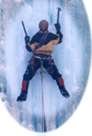 Climb: WA Pass: LA PETIT CHEVAL-F.A. NW FACE : Paul Revere II+5.9+ Date of Climb: 10/22/2006 Trip Report: LA PETIT CHEVAL Northwest Face Paul Revere II+ 5.9+ FA Mark Allen, Ben Mitchell October 22, 2006 Trip report by Mark Allen Northwest Face of Washington Pass’s La Petit Cheval showing the new line Paul Revere a II+ 5.9+. Photo By Ben Mitchell It is hard to drive down the 20 without noticing it. As one travels over the pass it is staged in front of the Silverstar Massif and under the Shadow of the Liberty Bell Group. The three almost triplet flatiron features have caught the eye of many. The group form the three “Chevals” making the Western and Northwestern base of the Big Kangaroo Massiff. Being the main paleoglacial valley these walls have overstepped and exposed solid granite for the taking. Little exploration has been done here. The faces have been subtly documented first in the Red Fred as the “Pale Horse Rock” and the “White Horse Rock” on the Washington Pass overview map (p.292 ). The next time they are mentioned would be by Bryan Burdos North Cascades Rock guide showcasing the Black Horse Point Buttress. Burdo references the Chevals by calling them the “Buttress that faces the highway” in the Black horse figure. After reviewing the references it would seem that we have more names than features. I reckon that Black Horse Point Butress and White Horse Rock to be the same feature. This is the North facing long lichen-black buttress in the Willow drainage (best seen from the approach to the Wine Spires on the Burgundy Creek trail) and white it is not. The Pale Horse Rock seems to be the right (southern most) and highest of the three Chevals. The 2000ft of 2nd and 3rd class approach to this feature extinguishes any desire to climb the grade II face. The central Cheval has a similar approach but looks to yield far better climbing. The left Cheval (northern most Cheval and southwest of the Black Horse) is the closest and has an approach that is quite tangible. The first time any of these features were climbed and named wasn’t until Larry Goldie and Scott Johnston in June of 2004. Their account mentioned driving to climb the East Buttress of SEWS and caught the Southern arete of this feature and turned the car around and sent it. They named the feature the La Petit Cheval sticking to the horse theme and their route appropriately named Spontaneity Arete II+ 5.7. A farmed guide-route that has received several ascents and mixed reviews some love some maso manos. Exploratory and noteworthy for now climbers simply refer to these three-like features as the Chevals. Here is the Large Format link for Higher res prints or files http://www.cascadeclimbers.com/plab/showphoto.php?photo=22375&size=big&sort=1&cat=500 On October 22, 2006 Ben Mitchell and I would no longer drive past the Northwest face of the La Petit Cheval. For years I was curious about its character. To be honest I am surprised nobody has ever bothered. So many times I have stared up at it. So many times I have just climbed something else just like everyone else. Its close proximity to 20 and its relatively short stature looked like a last good fall project for the closing short days. Ben and I made it to the base in 1.5 hrs. Instead of parking at the Mile post 165 for Spontaneity Arete we chose the next northern pullout directly in front of the NW face. We dropped directly into the forest and headed across the creek to the drainage climbers left of the walls center. To say that it was chill would be a bold faced lie, but very do-able. 75% was rather quick and uneventful. The later 25% would have 3rd to 4th sections covered in moss and needles. The green belay was helpful. 5th class bush wacking. Finally we made it to the landing just below the center of the face at 10:30am. Mark Allen on the second pitch 5.9 fingers aiming for the twin cracks on the skyline. Photo by Ben Mitchell We both had an uneasy feeling. The face was not riddled with obvious cracks or fantastic weaknesses but rather crackless dihedrals, impossible cracks to nowhere, or unfeatured slabs. Yet, the wall did have a main weakness looking like an easy 5th class scramble. Both freezing we settled on starting the wall simul climbing to gain better terrain. Pitch 1.After 200ft Ben established a belay on a good ledge with a tree. We had a few interesting options. We switched to pitching.Pitch 2 I cast out trending right into a super fun hand to finger crack. I got to fingers and was getting schooled. I still had a rope in my pack …clipped it and pulled a stiff 5.9 finger crux on solid rock through a small tricky bulge and set up the belay at 70ft to deal with the pack. Pitch 3 I told Ben that since my pitch was so short I would take the next pitch also. Now set up for success I left the belay with doubles and up a fun short dihedral. After gaining a small ledge I saw the remainder of the weakness to the near summit looking to be easy fifth class again. I climbed 15ft and passed twin hand cracks splitting the upper shield of the feature for the next 350ft. “Oh my…” I would have to be mad not to try. I stepped in and for the next 70ft would be pure 5.9 crack bliss. I wouldn’t say that I styled it. I had a lot on my mind. The cold, my pack, my pump, my last shity piece, not having any gear that I needed to ease my mind in this sustained size. “Thank-God” jams finally! The pain was over and I could see a stance. I pounded a knife blade, set up my belay. Ben wondering what the hell is taking so long since my last report of chill 5th to the top. Dink, dink, dink, ping, ping, ping! His patients is admirable. Once Ben climbed the cracks himself he was happy with the new deviation that launched us into classic cracks. Ben reached my perch. He looked cold. Pitch 4: I tried to take as much of the hard climbing to not sand bag him on his lead but it was stiff right off the anchor and definitely the routes crux. Ben launched into a hard 5.9+ lay-back off width and cruised into the rest of his relatively sustained pitch. Hand cracks, jugs, diherals, fingers…this 130ft pitch was full value and fantastic climbing. Ben did had an amazingly cool head and just hypnotically climbed it. At my belay I had time to admire the steepness that the wall took on. I had a fantastic view of the East faces of the Liberty Bell group and Tower. I knew now that the wall was going to fall to this ascent and I felt the pressure instantly release. Now my focus turned to fun. Ben was jazzed and got chatty once he reached the belay. Pitch 5 It was time to jam now it was 3:30 and finally made high enough on the wall to be in the sun. Moral was getting much better. The climbing let up and I strecthed out the last 200ft of 5.6 crack and block climbing pulling a final 5.8 move before the lines end. Ben showing the horns before toppin out pitch 5. Photo Mark Allen Ben came up and we celebrated and I was warm for the first time since leaving my house. Much rejoicing. We scramble to the summit and topped out at 4:30pm. 7 hours from the car. Knowing darkness at 6:30 we waisted little time and jammed down the Spontaneity Arete raps and deviated into the gully for the down scramble after the 5th raps. Grabbed the fixed lines and out. Car at 6:30 beer by 7. Mark Allen (left) and Ben Mitchell (Right) on the Summit after completing there new line Paul Revere on the Northwest Face. Photo-self It was the first time Ben and I have climbed together. We had a great time and look forward to it again. The line is alpine dirty and will not need much cleaning to be classically fun. The simul-climbing we did in the begin could be potentially avoided and replaced with a much classier crack pitch to the left. This would yield 4 really nice 5.9 pitches in a row taking a central line up the face. Adventure climbing is a constant theme in the approach and stays with you all day! ROUTE INFO Paul Revere II+ 5.9+ Pitches: 5 (5 new) Pitch style: free Date/Time: Oct 22, 2006: 8 _ hrs total car-to-car Trad anchors: one KB (still remains) Paul Revere (January 1, 1735 – May 10, 1818) was an American silversmith and patriot in the American Revolution. Because he was immortalized after his death for his role as a messenger in the battles of Lexington and Concord, Revere's name and his "Midnight Ride" are well-known in the United States as a patriotic symbol. Revere later served as an officer in one of the most disastrous campaigns of the American Revolutionary War, a role for which he was later exonerated. After the war, he was early to recognize the potential for large-scale manufacturing of metal goods and is considered by some historians to be the prototype of the American industrialist. Later he would help write one of the Beasty Boys most renown tracks. ~Wickapedia Gear Notes: Rack: Cams: 0.3”-4” Doubles sizes: 0.5-3” Triples sizes: .75” and 1.0” Nuts: Single set A few with slings 1X 60M Rope
 -
Climb: WA Pass: South Early Winter Spire-F.A. Mojo Rising III 5.11 A1 Date of Climb: 10/14/2006 Trip Report: NORTH CASCADES: WASHINGTON PASS South Early Winter Spire (S.E.W.S) F.A. Northwest Face Direct “Mojo Rising” III 5.11 A1 Mark Allen, Joel Kauffman, Tom Smith Oct 13-14th 2006 Trip Report By Mark Allen I am reminded that the warm Indian summer is slipping. “Line is fixed!” My hands are nipped by the cold as I turn up the ibox. Not accustomed to classic wall style I impatiently wait at the belay but the Doors bootleg is helping me pass the time. The wall being technical it’s faster for both seconds to jug the line. We have been in this style for three pitches on a new line that the group had been cleaning from fixed lines days prier. I look down mouthing the words to Break on Through to Tom Smith as he jugs past the first three pitches covered on Friday Oct 13th. He gives me the thumbs up. Joel and I are re-racking getting him ready to cast off into the unknown pitches. Our excitement is highlighted by the strange tunes of Jim Morrison. Joel Kauffman Jugs fixed line on pitch 2 during the First Ascent of Mojo Rising. Photo By Mark Allen The Northwest Face of SEWS dominates the Western side of the Liberty Bell group in Liberty bowl. For years I have admired the aesthetics of this face. Its solid golden granite holds the afternoon light bringing out the contrasting black water streaks. The moonlight on this face is even more impressive. I never thought of climbing it until this year. During many trips to other spires I kept drawing lines on the face and then referencing the Red Fred. It seamed that several proud crack lines had been explored in the 70’s and 80’s. C. Northwest Face: FA Boving and Pollack 76’ FFA Boving & Kerns 77’ route III 5.11a begins low on the NW face and traverses to the West face into the famous Boving Roofs pitch finishing on the SW Rib. E. Northwest Face Var: Riders on the Storm FA Jim Yoder & Lee Cunningham August 15, 1989 A route that Becky recorded little about (but strangely knows exactly when it was climbed). From what I can piece together from studying the face, Becky’s description, and several topos of the Boving & Pollack 76’ route I can only see one available option. It appears that the party deviated from the Boving route during the third pitch into a vertical flake forming a flaring chimney or OW (This feature looks like a hand crack from the ground). At mid-pitch the crack doglegs left up an undercling ramp to a large ledge located directly plum under Dolphin Chimney. Then the most obvious thing to do was to get on the direct splitter 5.9ish corner hand crack to the Dolphin Chimney. I stood under this hand crack pitch several times and every time was disappointed it was not a part of our line. A. North Face: FA Doug Ingersoll & Andy Selters August 88’ III 5.10 A2 (5.12?) A steep face starting just below the chock stone raps takes a nearly straight line in cracks then traverses left on an arching crack. This leads directly to the false summit and avoids the SW ridge climb. Others seem to have attempted this line by the looks of the bail-tat that I always spy on the first pitch when coming of the N.E.W.S. After comparing the references to the rock it seemed the main breadth of the Northwest face appeared to remain undescribed and more importantly unclimbed, and for good reason. The most fantastic feature was a massive golden right facing dihedral that magically continues arcing across the top of the face intersecting high on the SW ridge just above the infamous Dolphin Chimney. Below the golden dihedral ramps and cracks incipiently completed a line except one area, the first pitch. This blank section guarded the upper pitches. During a climb of the NW corner of NEWS with Paul Butler earlier this summer I got a closer look at this crackless first pitch. Our imaginations were intrigued by the fun sporty face as our eyes moved from feature to jug to seam to finally crack. My hopes were now rekindled that this could and just might go. “Wow, that looks sweet!” I exclaimed then and the next three times I stood under the face this summer. But it would have to protect with bolts. The thought of bolting from the ground looked sketchy due to the nature of the face. I spoke with several route setters and first ascentionists that are historically prolific in the Methow valley to get their thoughts from a separate generation on the best approach. All thought that the classic nature of the pitch deserved to be properly (perfectly) bolted. So the approach was top-down for the first pitch. The rest of the climb would be discovered on the first attempt. Joel Kauffman on the first ascent of Mojo Rising Pitch 1 going at 5.11 sport. Photo by Mark Allen The second week of Oct I rap-reconed the face to confirm the lines continuity before one hole was drilled. It looked good. The belay stances rocked but not the gear. I established bolt anchors at three belays and we all cleaned/gardened the cracks that needed it the most, Pitch 3 and down (the steepest section). The first pitch required seven pre-placed bolts over 90ft and a short A0 bolt ladder to the belay. We pulled the lines and took a rest day. Mark Allen on pitch 2’s A1 seam. It is thought that this will one day go free. Photo by Tom Smith We left the car at 8:45am. Alpine starts were not an option during the fall cold temps and the dark morning of October 13th. The face does not get sun until afternoon. This made the first pitch a little sand bagged until the morning air warmed the rock. Pitch 1: Joel started climbing Pitch 1 at 10:30am. Joel just coming off his RMI guiding season was feeling floored by the sustained pitch but climbed excellent. We jugged the fixed line and congratulated Joel. Everyone raved about this classic pitch and can’t wait to get on it separately. Pitch 2: I left the anchor in full aid-mode and scrambled up the first ten feet plugged in my second cam and weighted it. It has been a while since my trip with Tom to the Valley but my aid skills were resurrected and then somehow peaked during this pitch. While top stepping fully extended off my fi fi I somehow slotted a stopper with the tip of my middle finger. The gear was good but small and sometimes tricky. We originally hoped that this pitch would go free. After the gardening recon it was not the 5.10 hand crack we had hoped but a steep aid seam. It appears to look freeable for some unearthly climber. With this futuristic vision in mind, I wanted to cater to a free ascent but thought it should go as clean as possible. We did not use pins. At mid-pitch the crack fades to a closed seam where a pin or gear could not be placed for two moves. I fixed a 3/4 inch bolt here for the aid and free ascent to come… Pitch 3: Tom Smith is off up a wide crack and moves over to a small ledge were he stares up at a short overhanging dihedral with a limited fingertip layback crack. His gear is just as cruxy as the climbing he reckoned at 5.11PG. Not able to trust his stances for placements he submitted to aid for three moves then pulled the roof of the dihedral on stellar finger locks at 5.10. He continued up for 30ft on ring locks and traversed left on a rail to the third stance. It was getting late in the afternoon, and we knew darkness fell at 6:30pm. At 4:15pm we fixed the lines to the ground. We knew we didn’t have enough time to explore and clean the last three pitches. Joel Kaufman on the “skywalker pitch” headed for he Golden Dihedral. Photo by Tom Smith On Oct 14th at 11:45pm Joel left the belay to the sound of the Doors on the ibox. Pitch 4: This is the traverse pitch to the Golden Dihedral. This is a fun exposed 5.7 ramp we called the “Sidewalk in the sky” shortened to the “Skywalker pitch”. Joel lowered 15ft from the anchor and pendulumed over to the ramp. Along the way he gardened for placements and established a belay. Tom and I separately rapped of the bolt anchor and pendulumed over. Mark Allen working Pitch 5 just below the 1 Ton belayer slayer. Photo by Tom Smith Pitch 5: I’m up. Originally I had planned to work the line up the laser corner crack formed by the dihedral. This did not directly connect with our summit cracks. On the other hand, just to the left was a much simpler 5.9 crack that did connect. The choice was simple. I got into an insecure layback with dirty flaring ring locks. This led to a dihedral with a cool stem box on edges while lay backing the wide crack. I climbed to the top of the dihedral and examined the status of a wedge shaped 1-ton block precariously perched in the corner. Touching on two points it seemed to levitate. There was no way not to climb on it. Planning my moves I committed to the hand jams with the same deliberate way I used to sneak back into my house in high school. Uneventfully I did not kill everybody. Good. I now entered the money section. A 100ft 5.8 finger crack dihedral. “This is the End my only Friend the End” Jim sang confidently with each brain-off finger lock. After 160ft, I clipped my old recon anchor. I brought Tom and Joel up hooting and hollering the whole way. Tom Smith enjoying 100ft of finger crack bliss on upper pitch 5. Photo by Joel Kaufman Pitch 6: The last new pitch took us to the simul-climbing ridge of the SW Rib. I was most familiar with the terrain so I cast off to seal the deal. We stashed one rope on Tom’s back and tied in like glacier climbers to the other. I pitched out the last 100ft on classic dirty alpine 5.6 and brought every one up to the ridge. Pitch 7: I re-racked with Tom. We were now staged for Simul. The three of us finished to the summit at 4:00pm. This was a fantastically fun line. Tom likes to refer to it as our Mini-big wall commenting on the classic wall style, the technicality, and the steepness. The rock is some of the best in the area. This was a worthy project that we are glad to have completed on the last day of Indian summer. Mark Allen on the summit after completing Mojo Rising. Photo by Tom Smith Storm front over Cutthroat Peak marking the end of Indian summer. The last clear day in our two-week streak. Photo by Tom Smith My approach to the Mojo Rising project was with the vision that in the future the route will go entirely free. So I made the effort to create a user-friendly line. I left cracks that were just protectable bolt free and bolted the faces to preserve an honest free ascent. The first three belays are bolted and rigged to rap with one 60M so it can be easily worked. I am guessing the 20M A1 pitch 2 will free at hard 5.12 or in the 13’s yet classic. ROUTE INFO Mojo Rising III 5.11 A1 Pitches: 7 (6 new) Pitch style: 1-4 climbed classic wall style. Pitches 5-7 the seconds freed Date/Time: 1-3 climbed on Oct 13th in 5 1/2 hrs. Pitches 4-7 Oct 14th in 4 hrs: 9 _ total (Due to party size and the fact that we are Gumby wallers, plus dirty cracks, and cold temps this is a recommended max time) Belays: Bolted at 1-3. Rigged for rap with one 60M. Trad anchors 4-7 (It is easy to bail during pitches 1-3. I suppose a party could bail into the NEWS gully from the 4th belay with one 60M rap or two 30M raps requiring a hanging stance and left gear) Gear Notes: Rack: Cams: 00”-4” Doubles sizes: 0.0, 0.4-3” TCUs helpful. Nuts: Single set with doubles in smaller sizes to 4 (Pitch 2) RPs a good range of smaller size 11 draws a few with slings 1X 60M Rope
-
Sorry this post is a little late. The route was done on labor day weekend with Trevor Bowman and Neil Kaufman in the Beartooths, up rock creek outside of Red Lodge. The Pensive Spire on had one other route on it that followed the left ridge on the picture below. The route was a good rock and went farily well. We hiked in on saturday and set up camp and took our spoting scopes for a little hike and went out to pick a line and this is what we cam up with. The route we choose faced north west and did not get sun until noon so the first few hours were pretty cold to say the least. The pitchs were long we had two 70 meter ropes and five of the pitchs were a full 70 meters. Here is how the pitchs went: Pitch 1: 5.6R 120 feet scramble across scree Pitch 2: 5.4R 140 feet up to the firt step Pitch 3: 5.9 65 meters up the thin crack Pitch 4: 5.8 70 meters up around the corner and back on to the step Pitch 5: 5.9 70 meters up the around corner up the inside corner Pitch 6: 5.8 55 meters up the corner system Pitch 7: 5.10 70 meters through the roofs and chimney Pitch 8: 5.9 70 meters up the corner and scramble to end of rope. Scramble to the top Descent: Hike over to whitetail pass and take the easy switch backs back to camp. Gear Notes: Doubles of everything up to #2 and one #3, many small cams and nuts. Topo: Some other photots from trip: There was a crazy layer of smoke one night and it reflected the light weird and gave us these crazy colors on the range behind us.