
-
Posts
99 -
Joined
-
Last visited
-
Days Won
40
Content Type
Profiles
Forums
Events
Posts posted by Kyle M
-
-
Footwear is the most important of gear, no question. I've taken some time to think about all kinds of different footwear in the Cascades, from trail running to ice climbing and skiing. Here are my thoughts and strategies. I welcome diverse opinions!
https://climberkyle.com/2020/09/15/footwear-in-the-cascades/
-
-
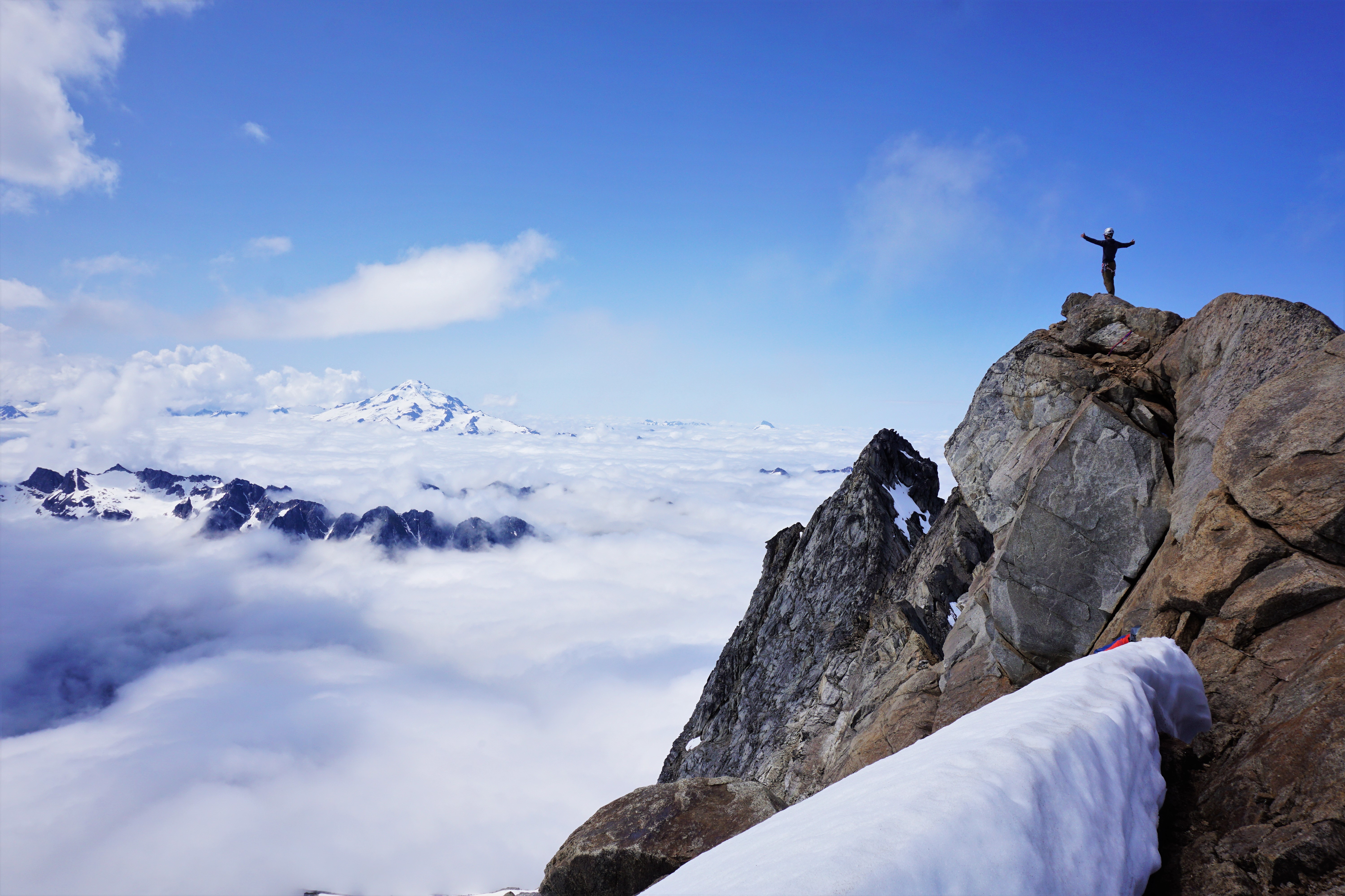
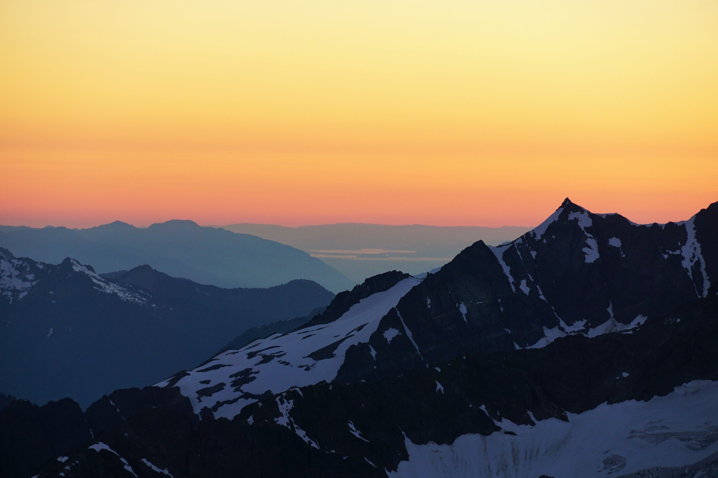
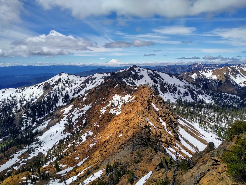
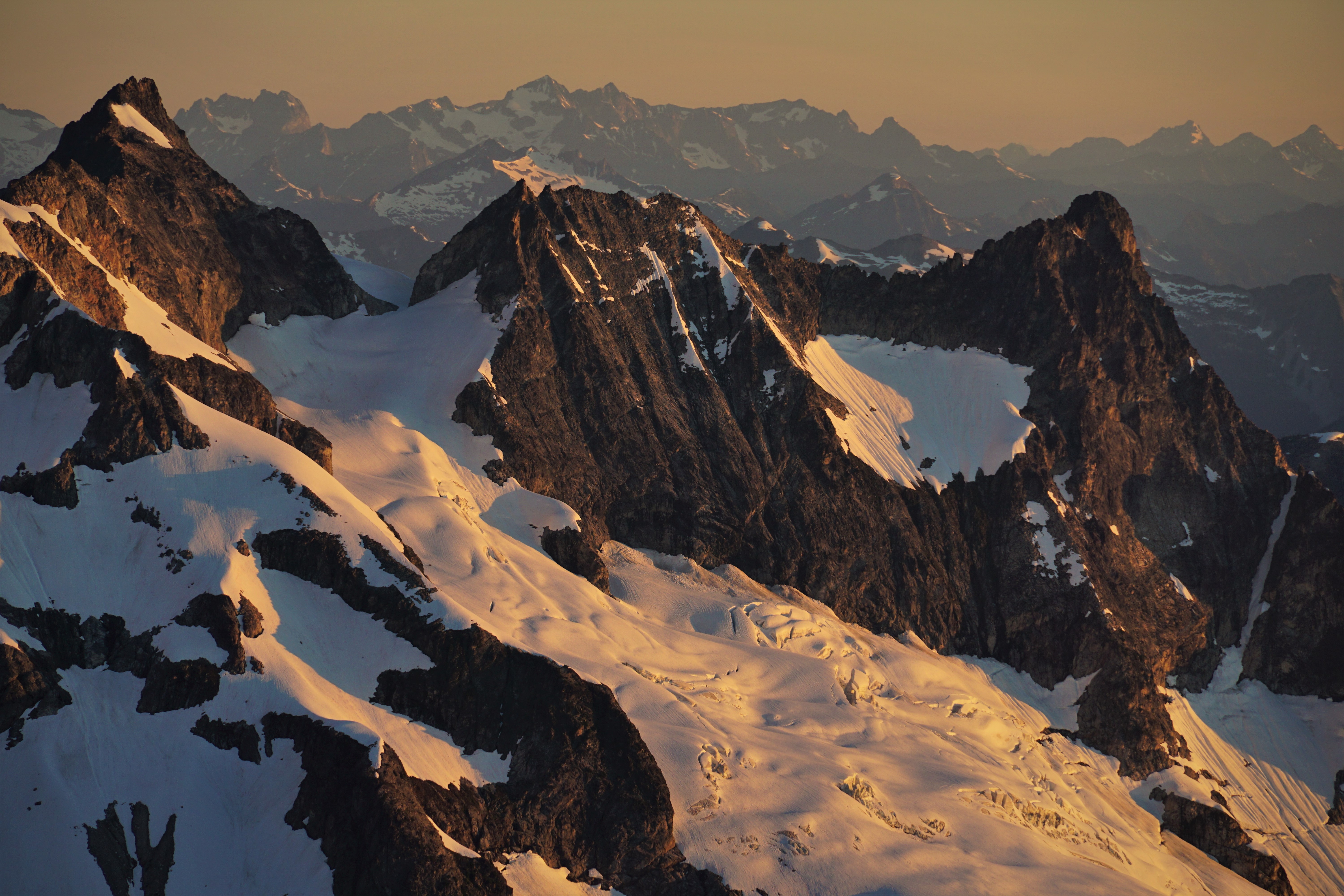
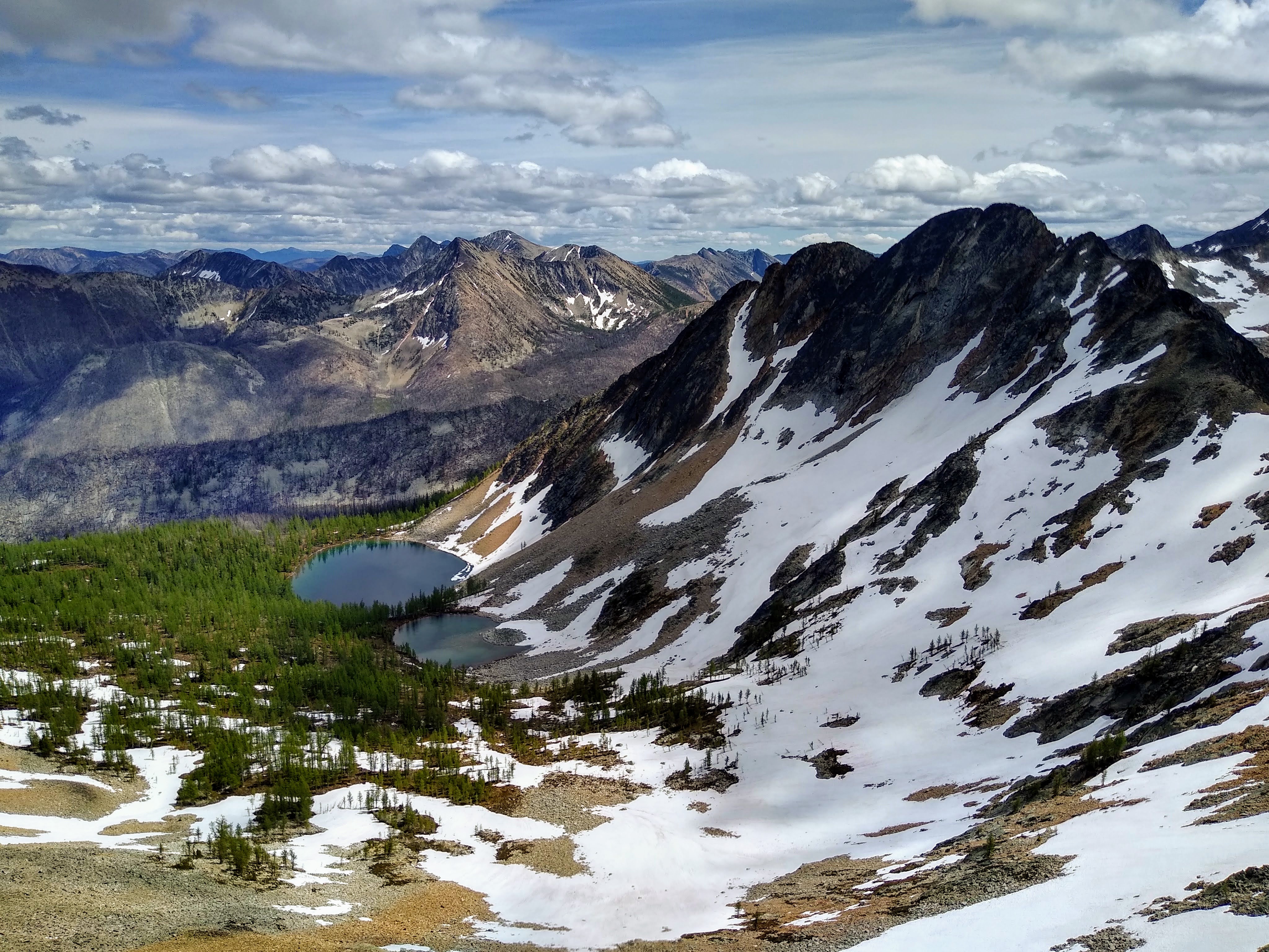
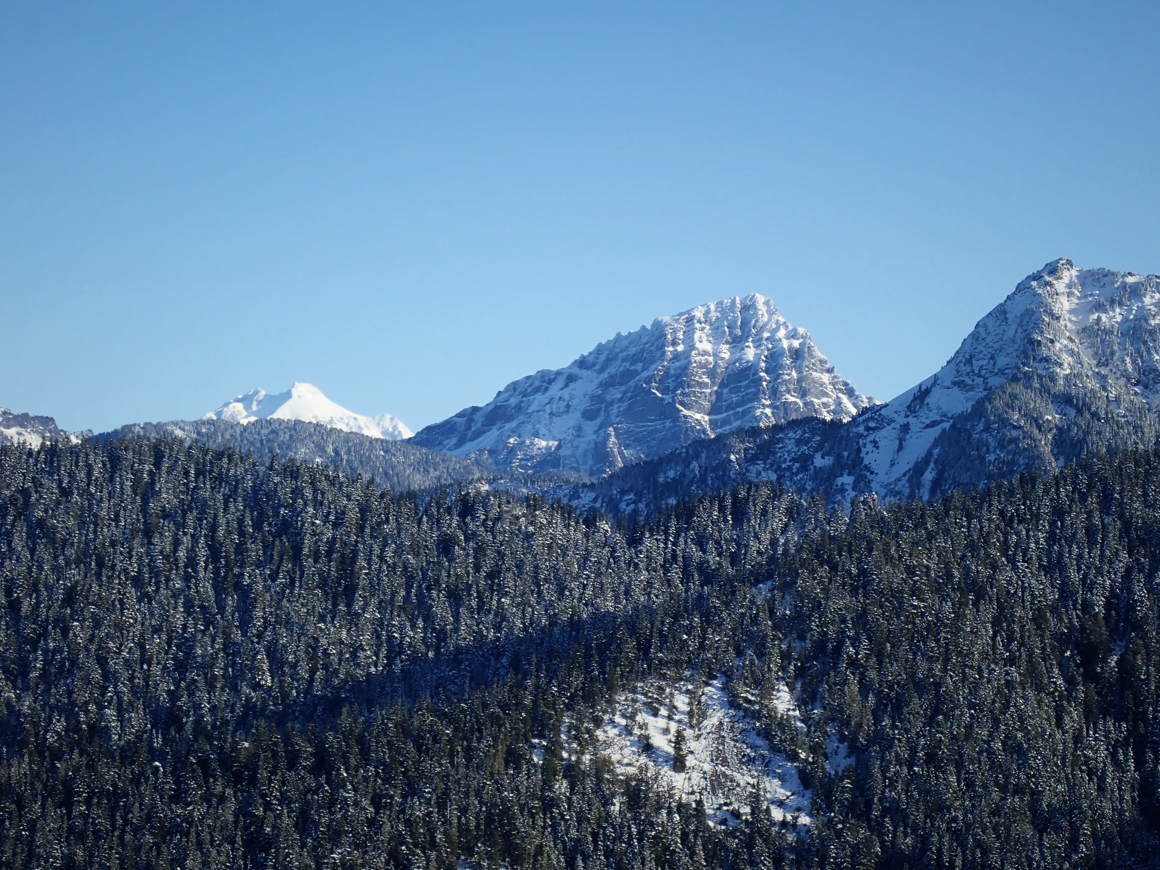
Trip: Mt. Goode - NE Buttress
Trip Date: 07/18/2020
Trip Report:
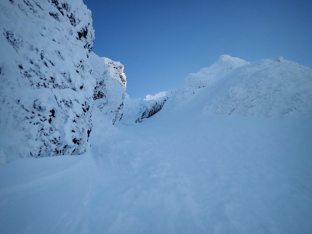
Climbed the NE Buttress with Steve July 18-20. The trail from Highway 20 was largely brush free until Grizzly Creek, which we crossed easily on a log. From there, it was a brushy caterpillar orgy. The direct approach, climbing just right of the leftmost waterfall, was easy and fast. Glacier navigation was simple, although we did cross some blue ice and bridges. We were able to gain the buttress just below the red ledges via a collapsed snow moat.
Climb was great! Plenty of snow patches on the route to fill our bottles with. From the summit we scrambled NW to the next notch and found a huge patch of snow which we melted for abundant water.
Descent was a long day but not too bad. Once down at the 7400 ft heather benches, keep traversing skier's right until reaching the burned ridge that divides the drainages between Storm King and Goode, take that down to the Park Creek Trail.
https://climberkyle.com/2020/07/18/mt-goode-ne-buttress-5-5/
On a side note, it appears from the summit logs that quite a few parties have climbed Megalodon Ridge. Most mentioned that they never found the 5.10 pitches, so perhaps it is easier than 5.10 or these difficulties are simple to circumvent.

Goode Glacier and NE Buttress.

On lower route.
Le Conte and Sloan.
Forbidden, Eldo, and the Twin Sisters.
Sahale and the sound.
Silver Star.

Douglas Glacier on Logan.
Rapping down.
Gear Notes:
Trail runners, aluminum crampons, and ice ax for the approach. Climbing/approach shoes on route. 60 m 8mm rope. Cams .4-2, 9 slings, tricams, nuts. Oh, and 10 lbs of camera gear (including a full sized tripod) for Steve.
Approach Notes:
When you reach the open valley beneath Goode, ford the river, ascend up easy boulders/snow. Climb the 4th class slabs just right of the leftmost waterfall. Continue upwards through the magical alder tunnel. Eventually you'll emerge into wildflower meadows and then the camps atop the lateral moraines.-
 2
2
-
 2
2
-
-
@kukuzka1 nice climb! Beckey lists some mega long routes on the right side of that face I think. I'm tempted to go back and try the gully route in the summer just to familiarize myself with it but it also looks kind of slimy in the summer.
-
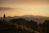
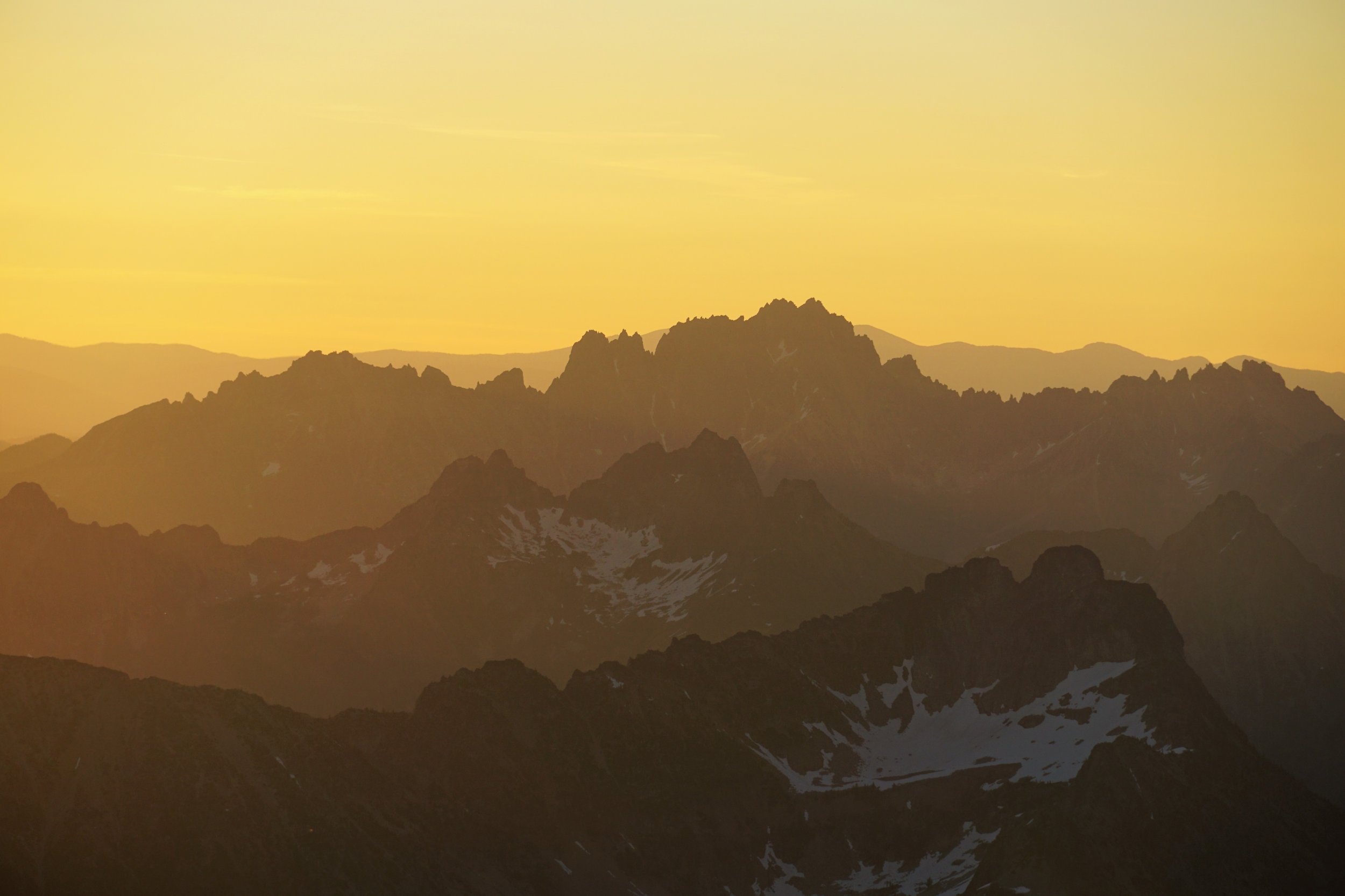
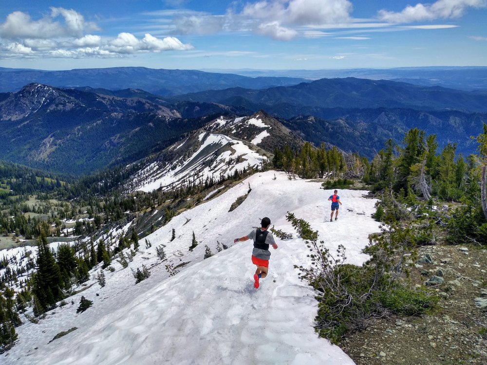
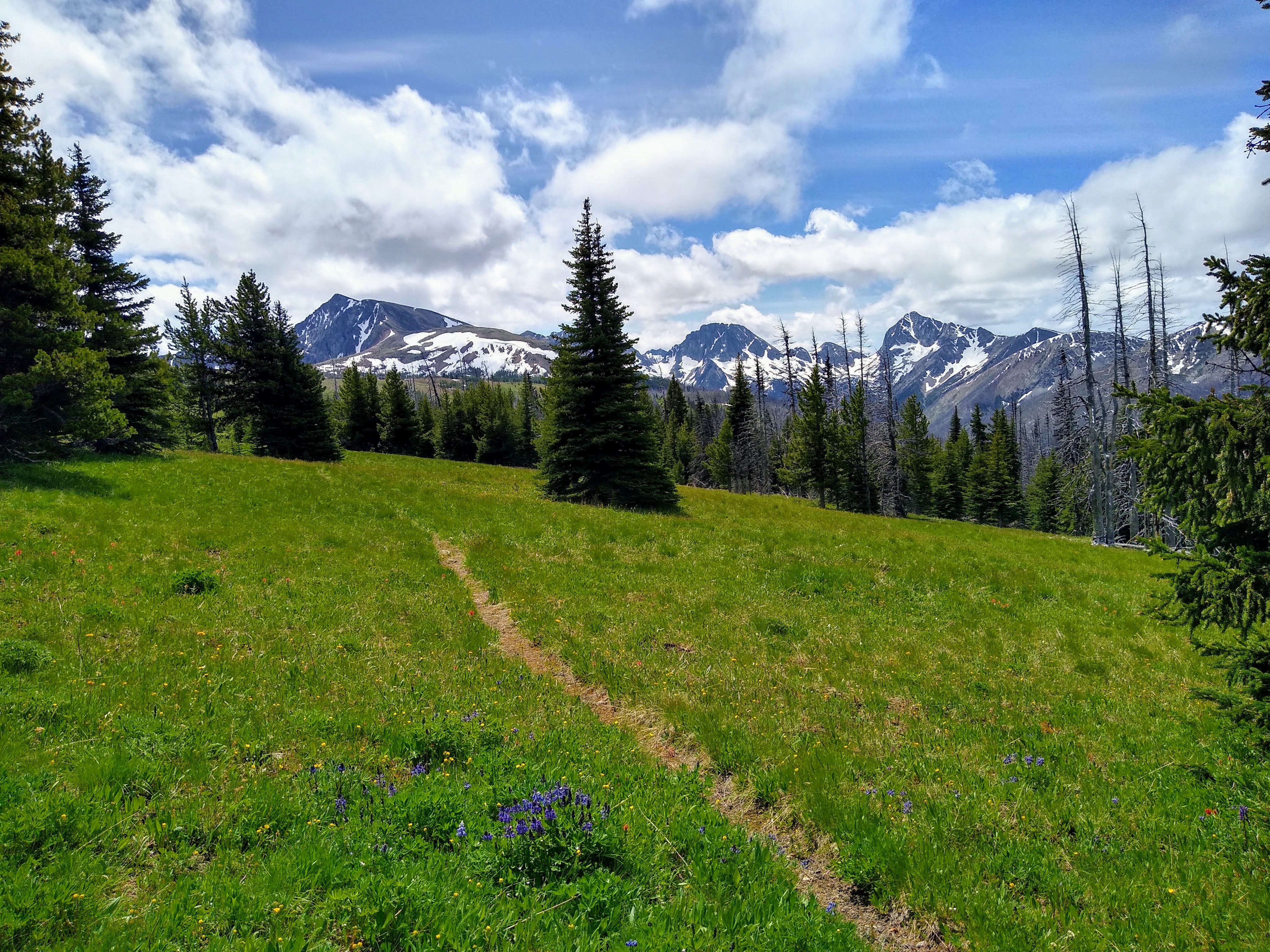
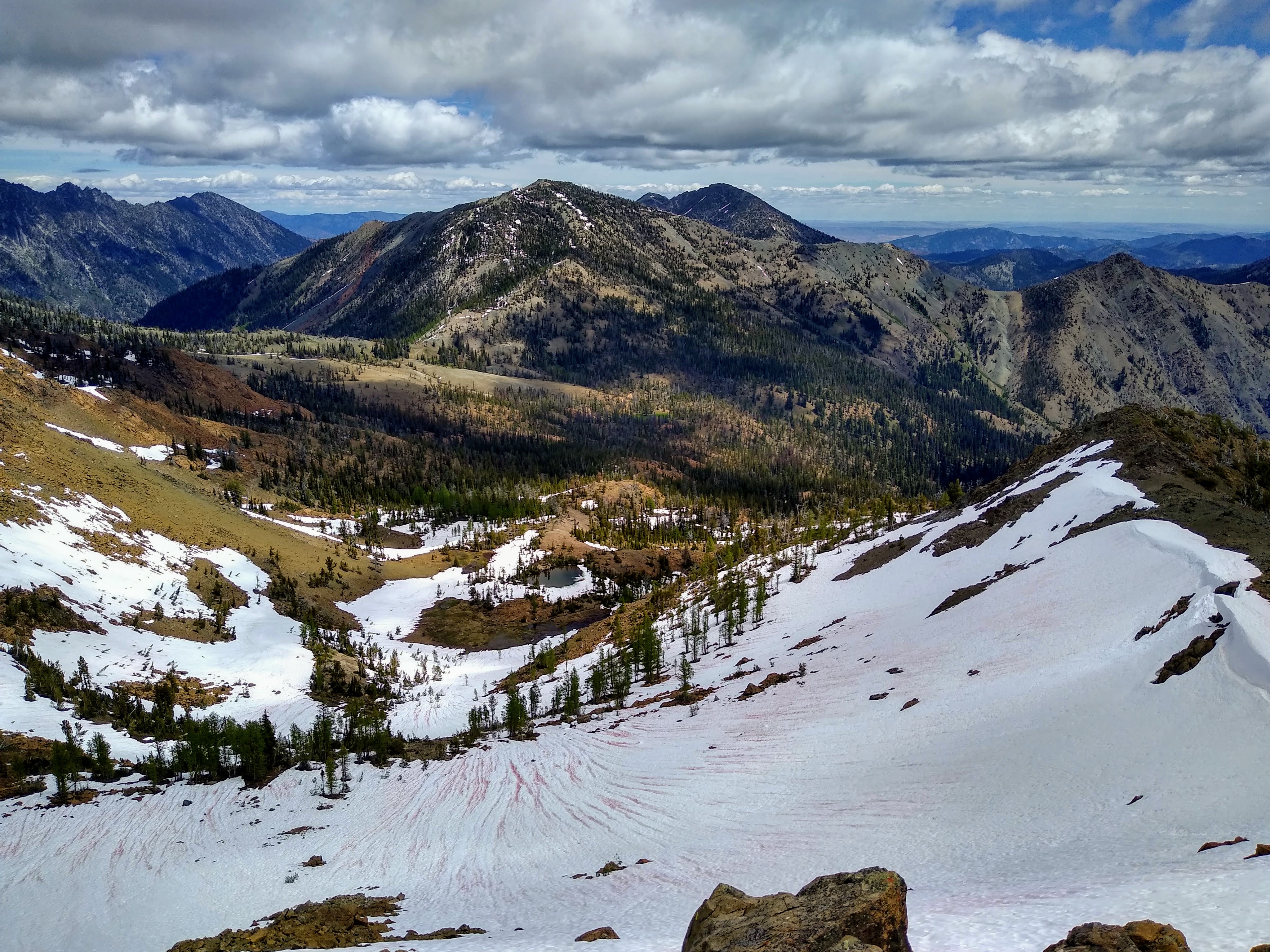
Trip: Pasayten Wilderness - Tatoosh Buttes - Ptarmigan Peak - Lago
Trip Date: 07/08/2020
Trip Report:
Last week, Anthony Marra Danny Bradley and I ran an incredible 42 mile, 11k gain loop in the Pasayten Wilderness. Took us 14 hours. We started at Slate Pass, ran down the Middle Fork for a long ways, traversed the ridge from Tatoosh Buttes over Ptarmigan Peak to Mt. Lago, then back out. The ridge between Dot and Lago has some class 3, and is very aesthetic and fun. It was the quintessential Pasayten experience, with broad valleys, wildflower meadows, epic ridges, tundra, and a helluva lot of blowdowns. To me, this was one of the most wild and stunning routes I have ever done. Bless that Pasayten magic.The Middle Fork Pasayten trail has a ton of blowdowns past the Fred's Lake turnoff. Tatoosh Butte trail is fine, once you get above the burn. Descent down Lago sucked.Gear Notes: Middle Fork Pasayten from Tatoosh Buttes.
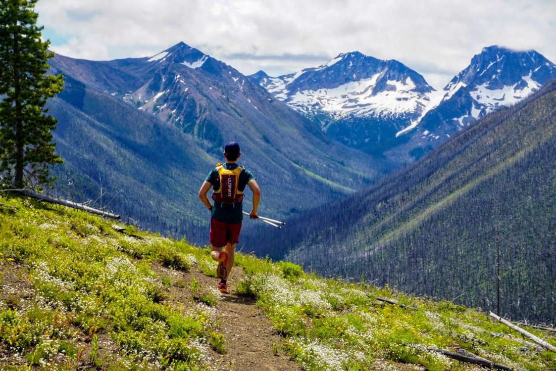 Cruising along the buttes.
 Magical trail.
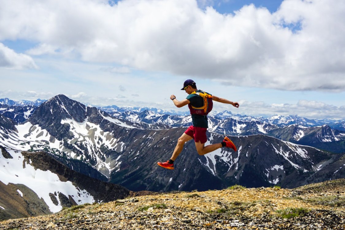 Running down Ptarmigan Peak.
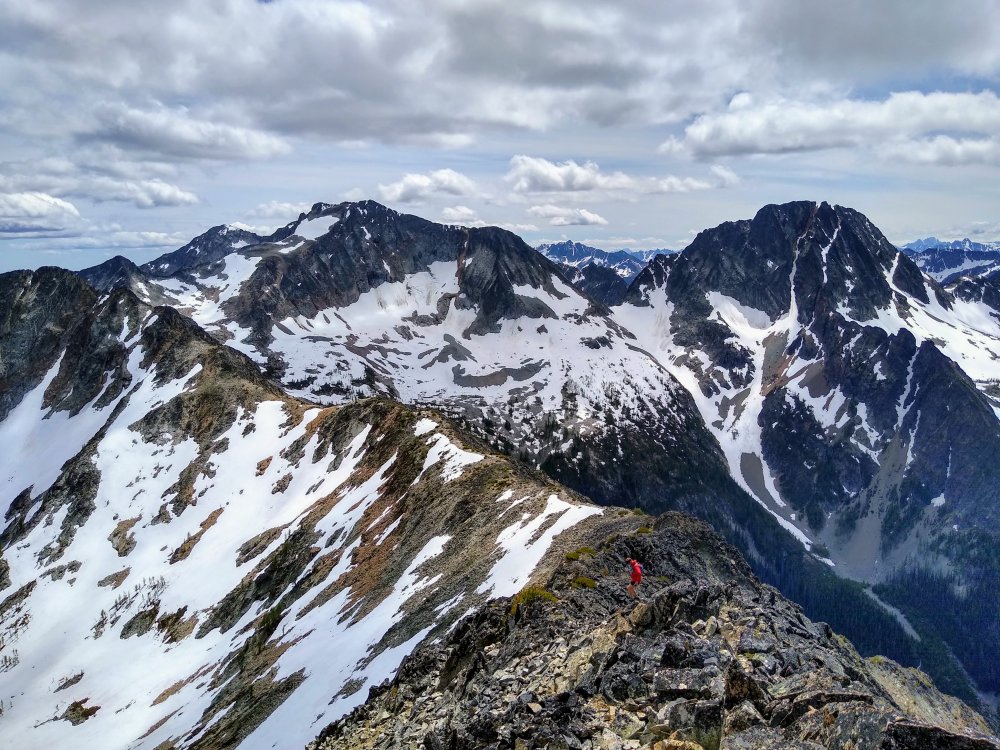 Dropping off Dot Mountain.
 Epic tarn on south side of Ptarmigan.
 Dot Lakes.
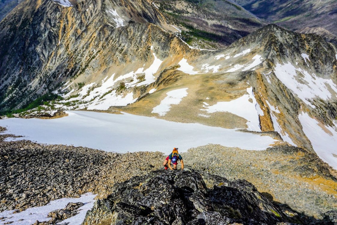 Final ridge to Lago.
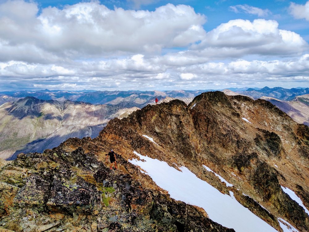 Lago summit.
 Sunset near Slate Pass.
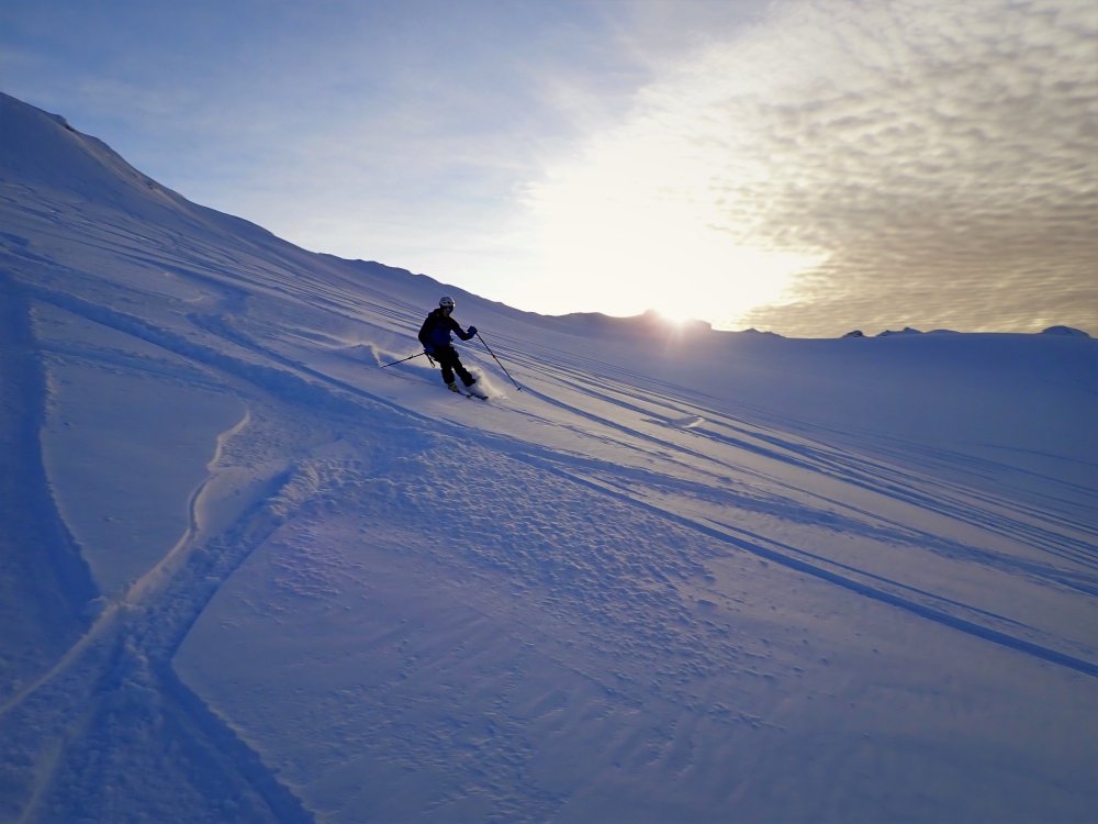
Trail running gear.
Approach Notes:
20 ft up to Slate Pass, and then down down down!-
3
-
-
@Zackw7 good call. Definitely some rotten gullies to be aware of.
-
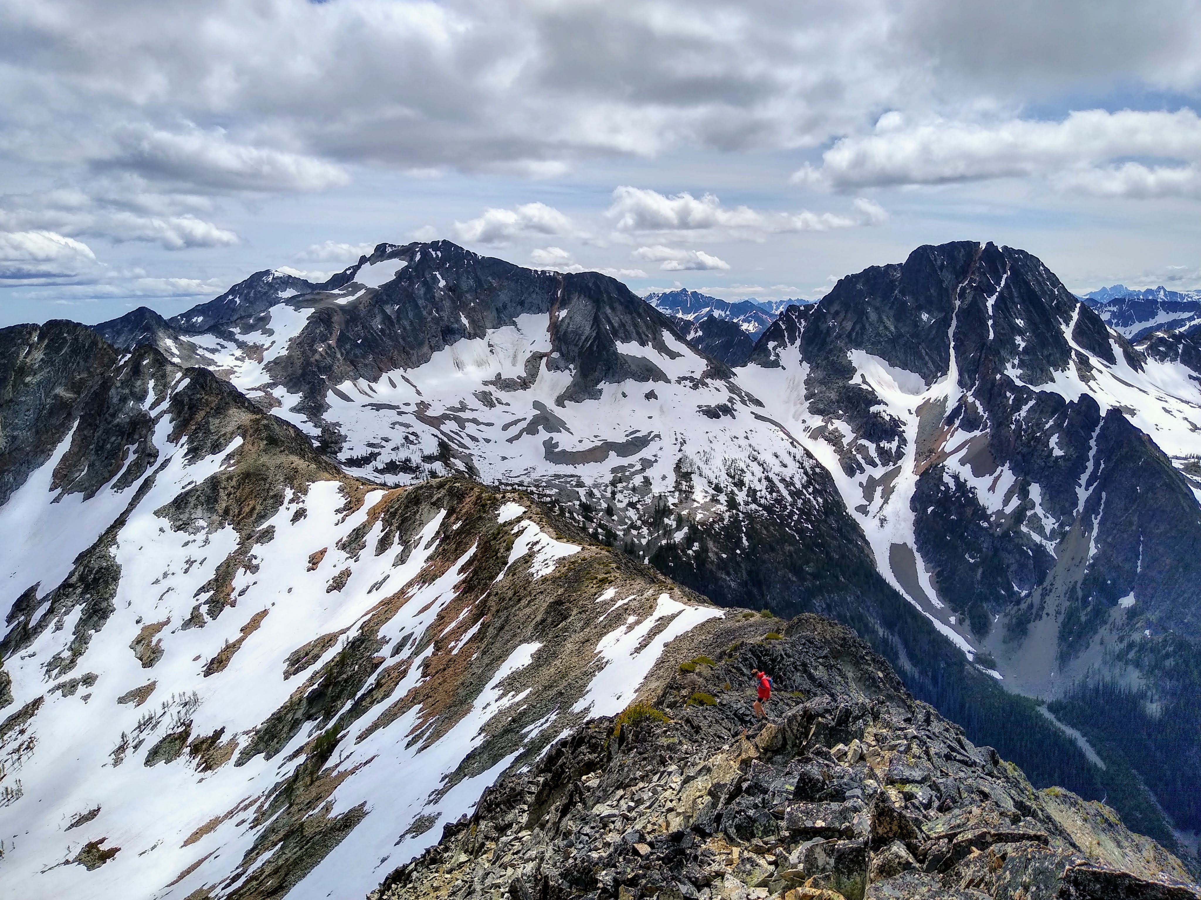
Trip: Teanaway - Iron, Teanaway, Bills, Marys, Bean, Earl, Navaho, Freedom, and Miller
Trip Date: 06/21/2020
Trip Report:Peter, Matt, Steven and I climbed nine peaks in the Teanaway on the solstice, starting at the Iron Peak trailhead and ending at the Miller/Bear trailhead. We stayed true to the ridgeline the entire way, with the exception of Earl to Navaho. Snow conditions were primo, supplying water and excellent boot skiing. The technical crux was definitely the ridge between Marys and Bean, which yielded some class 4-5 on excellent rock. The SW ridge of Bills also had some steep, exposed class 3.
It came out to 20 miles and 10k gain and took us 9:20. So much great bang for your buck in this area. Nice way to kick off summer!
https://climberkyle.com/2020/06/21/the-teanaway-traverse/
Iron Peak.
On the ridge between Marys and Bean.
Looking back on the Marys Bean traverse.

Navaho from Earl.
Great boot skiing down Navaho towards Freedom.
Gear Notes:
Running shoes. 1L water.
Approach Notes:
All pretty straightfoward.-
1
-
3
-
-
New ice guidebook is live!
-
1
-
-
Initial release of the new Cascade Ice Climbing guidebook!!! https://cascade-ice.com/.A few weeks ago, I shared a list of obscure alpine ice climbs in Washington. It was met with a surprising amount of enthusiasm. @DPS, who has climbed many of these routes himself, reached out to me about turning the list into a true online guidebook. So I went out (more like hunkered in my room) and built us a website. It includes detailed route descriptions, caltopo approach maps, and tons of great photos. Currently, we only have 8 awesome routes up, mostly just routes I've done, but we hope to have 20+ routes by next winter!We're still early on in the development of this site, so I welcome feedback / advice. If you have info/pictures for a specific route you'd like to see here, we might be able to work together to get it up!To follow along with updates, new routes added, follow our Facebook page: https://www.facebook.com/Cascade-Ice-106832897688029/.And for the computer nerds out there, yes, our code is open source and you can check it out here: https://github.com/Washington-Ice-Climbing/ice-conditions-map.
-
2
-
-
I took some more time to reflect on the whole experience with Sloan: the mistakes, the aftermath, the criticisms, and ultimately, what this climb means to me. If you want to get real deep: https://climberkyle.com/2020/03/25/life-after-sloan/
-
1
-
 1
1
-
 1
1
-
-
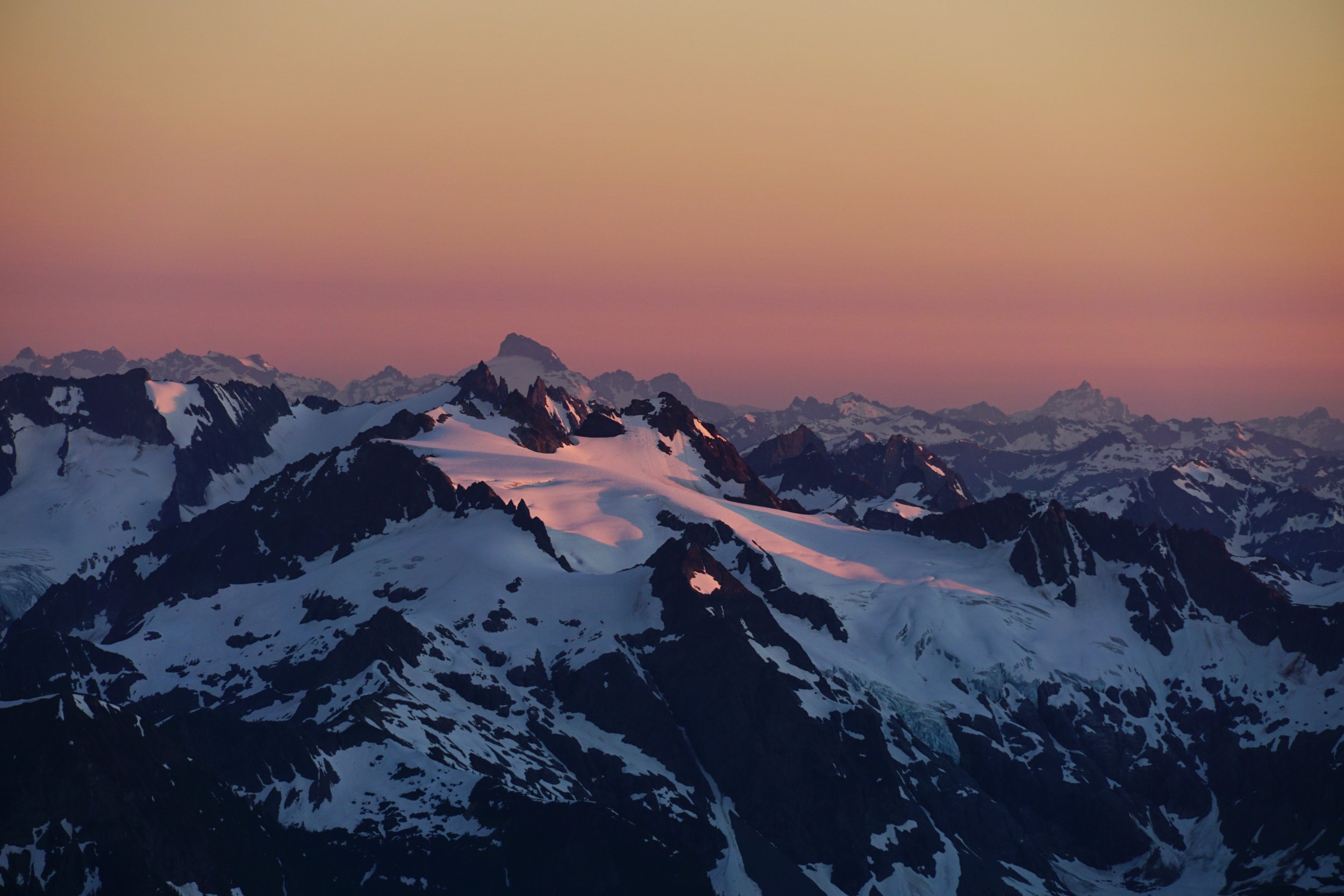
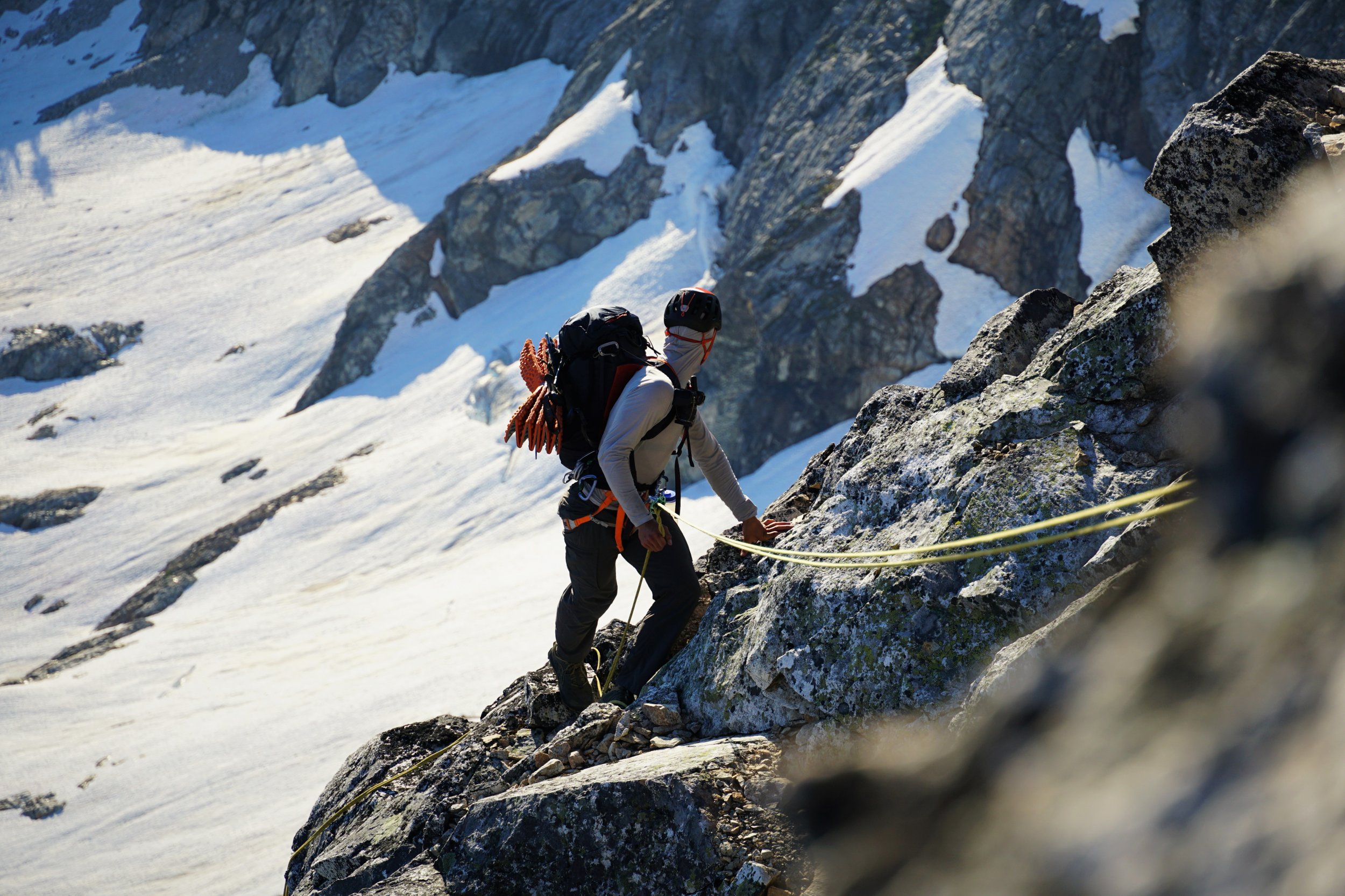
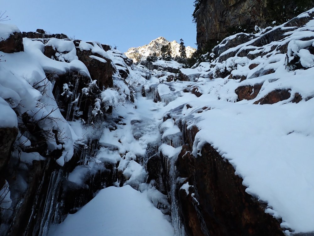
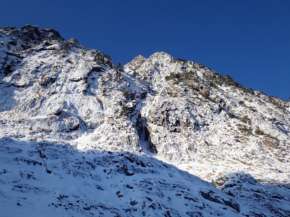
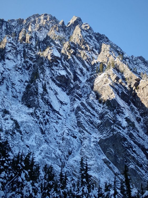
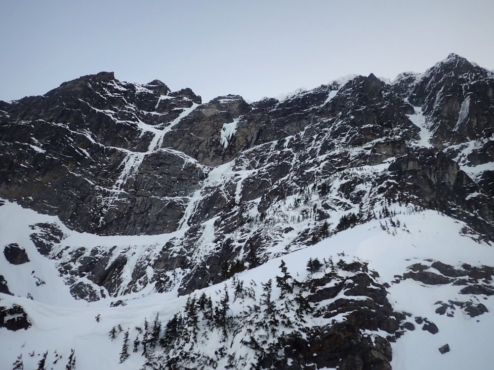
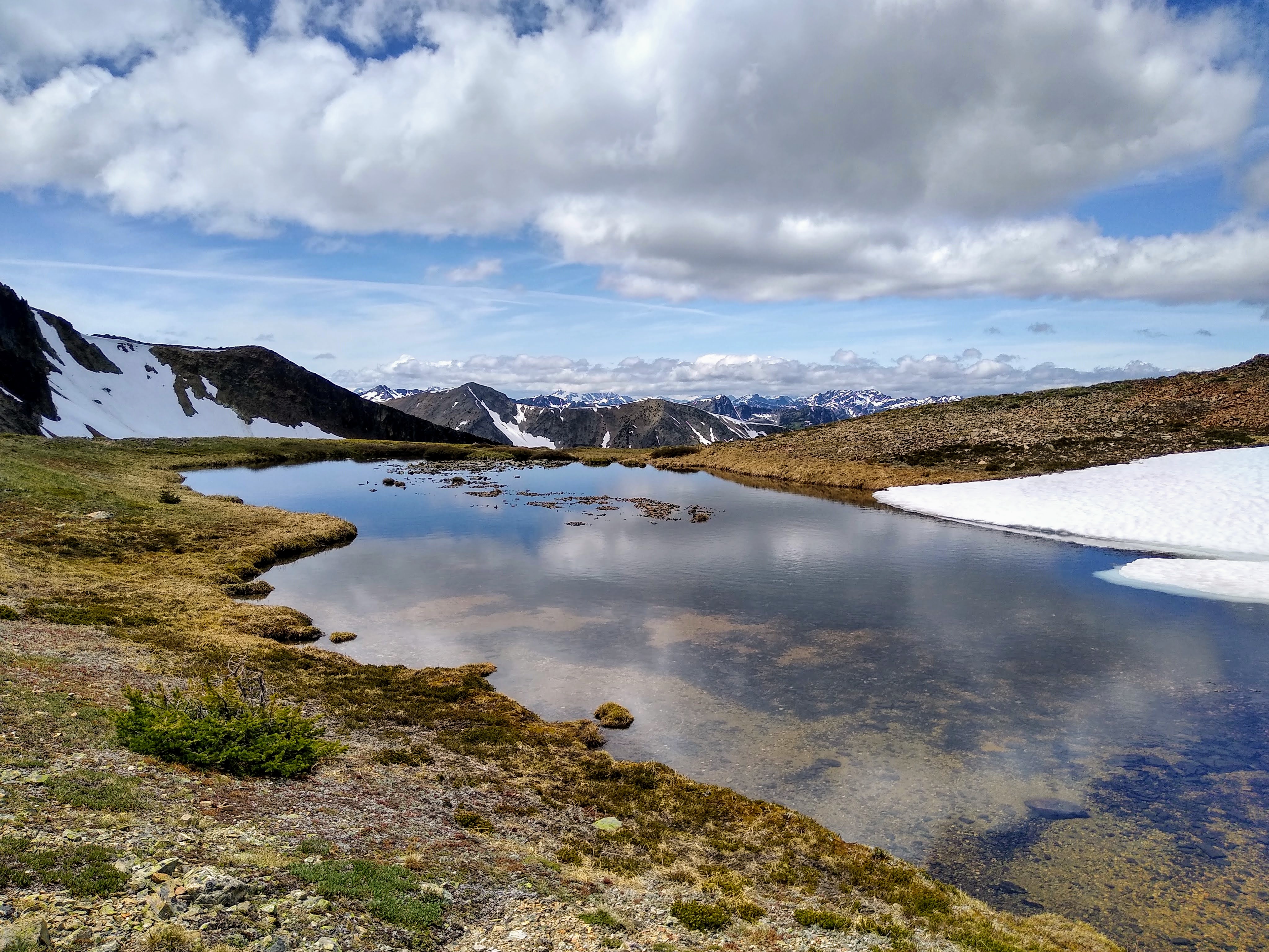
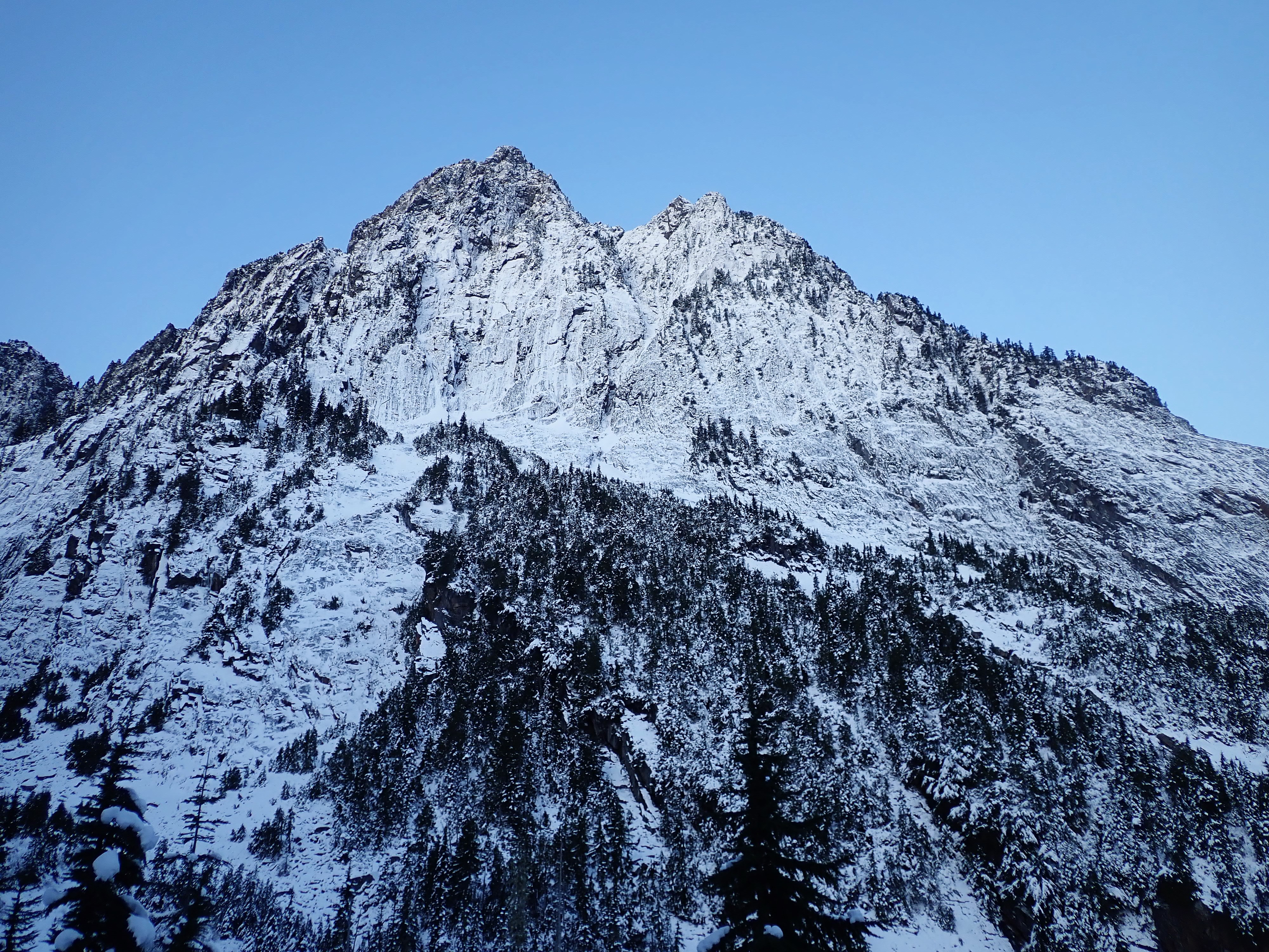
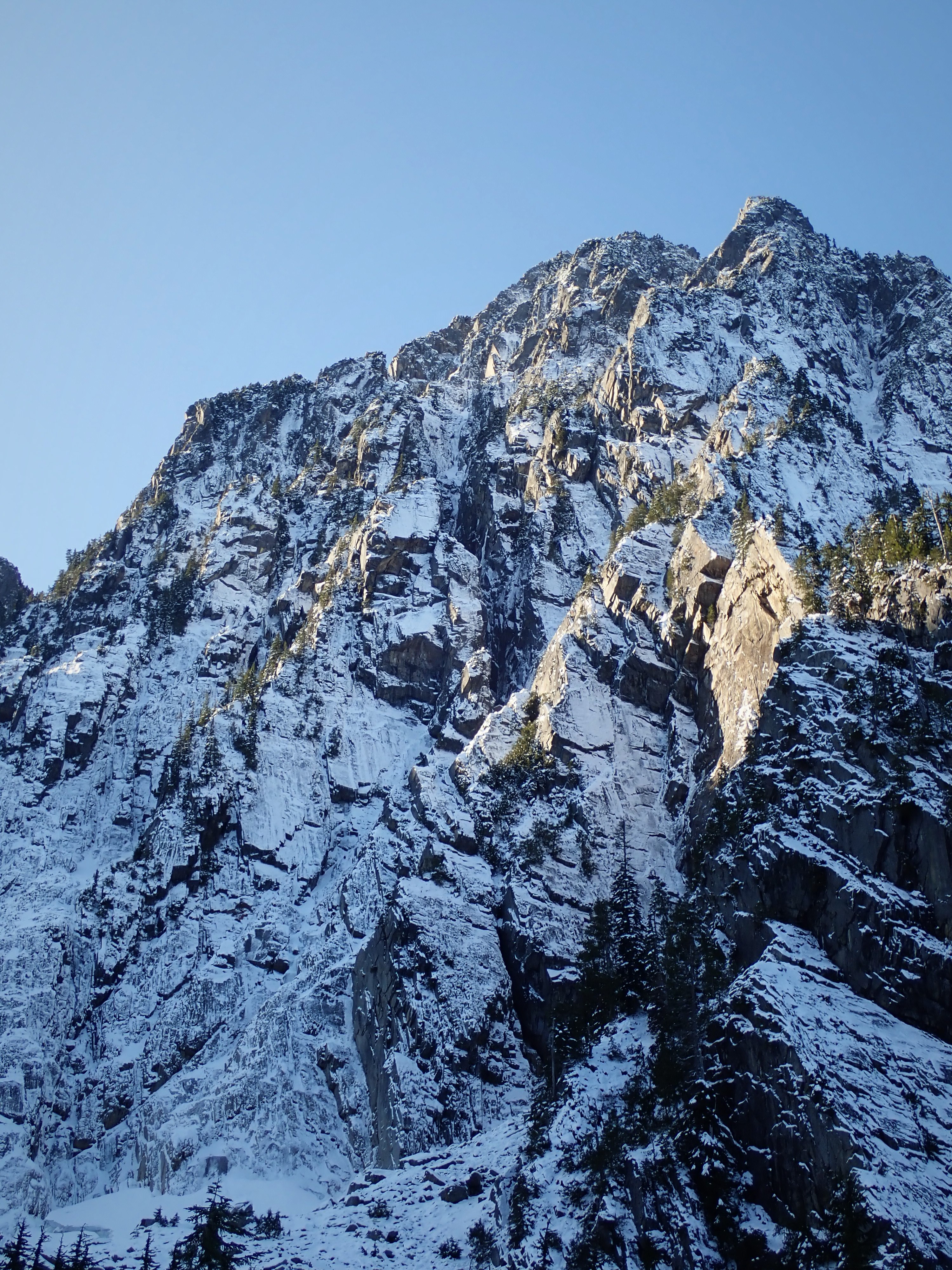
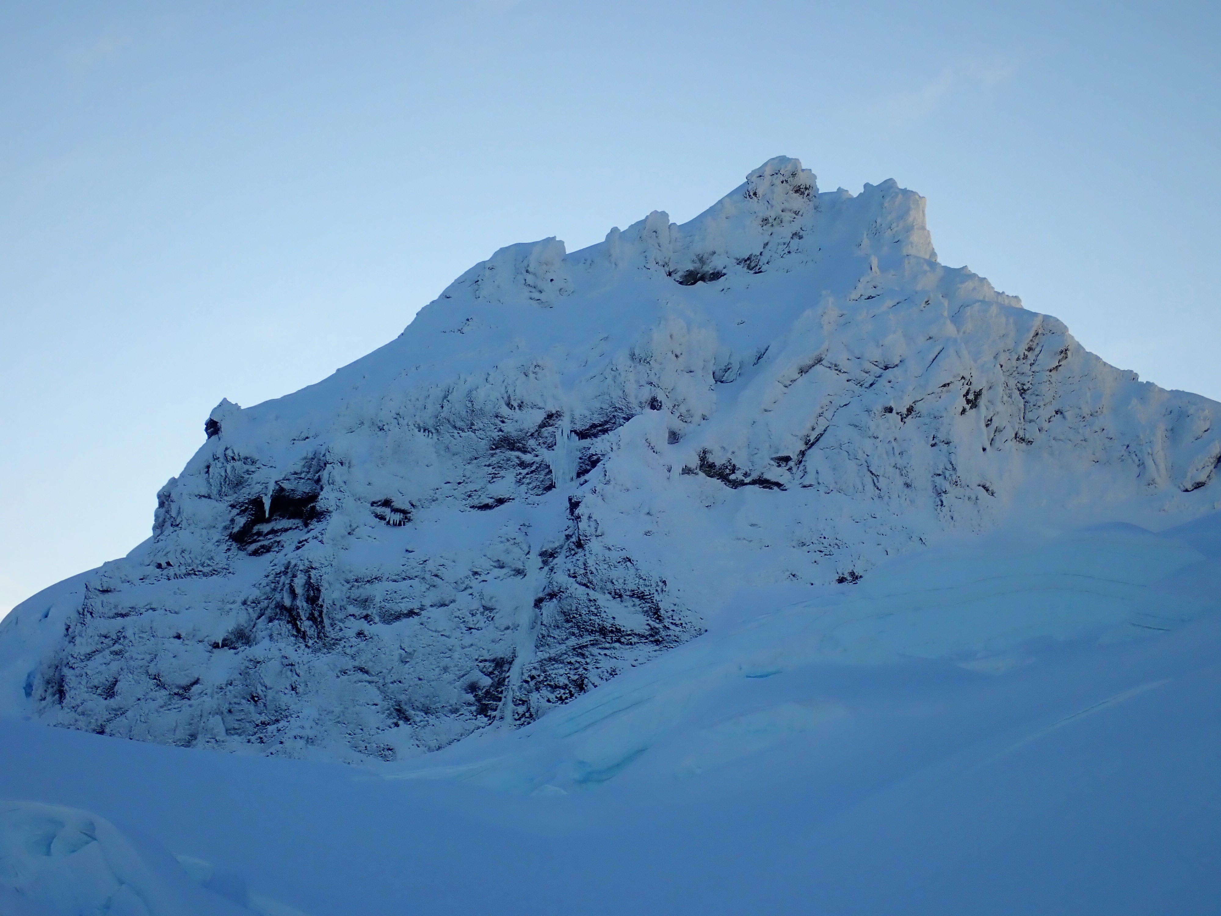
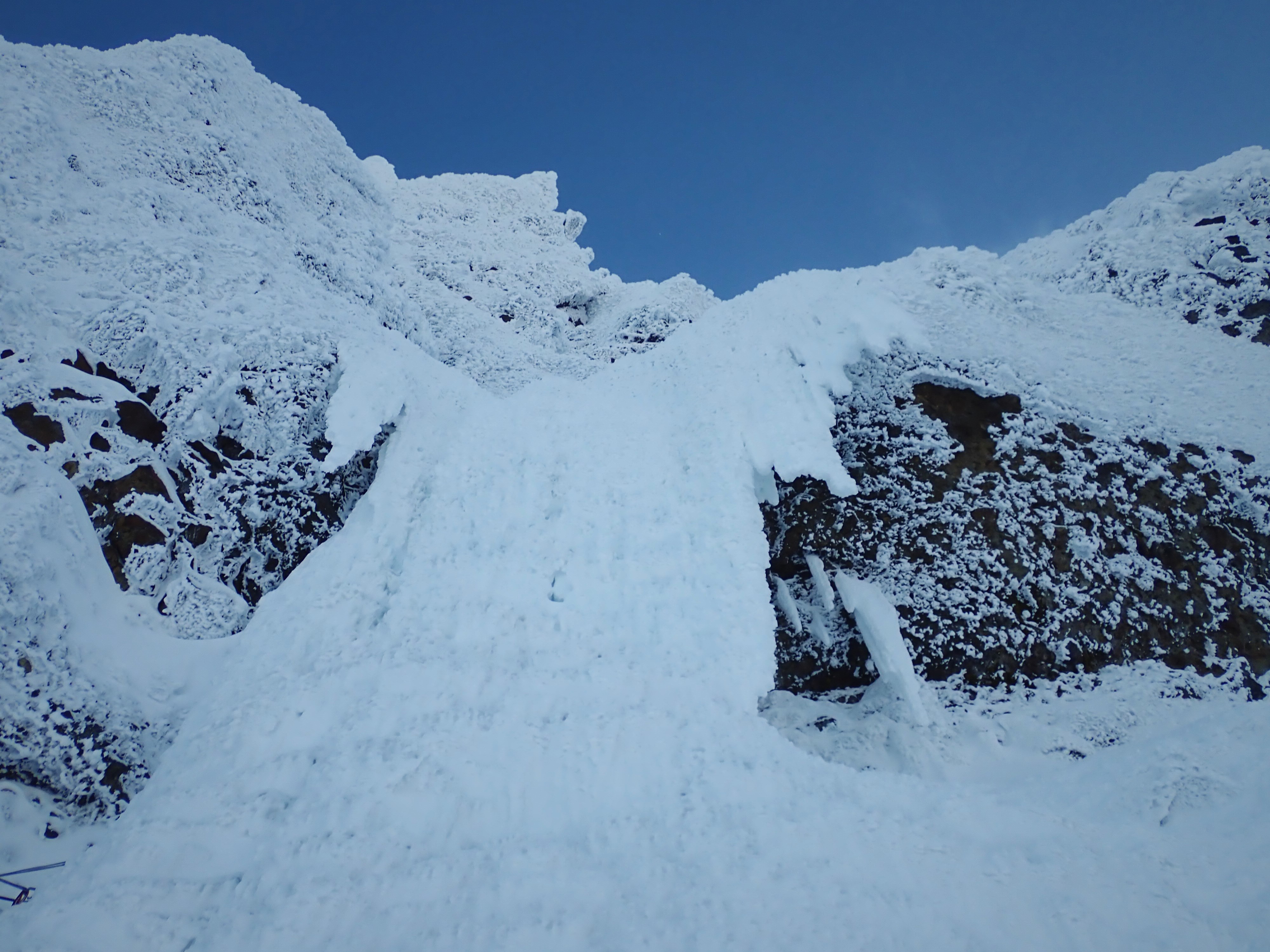
Trip: Sperry Peak - East Face Gully Attempt
Trip Date: 11/29/2019
Trip Report:Sorry I didn't post this for a few months, but basically I was scared of others going up there, turning around and seeing the massive ice flows on Sloan, and poaching our prize. But what's done is done so now I want to share what I learned from an attempt of the East Face Gully of Sperry over Thanksgiving 2019.
This trip report (http://www.nwhikers.net/forums/viewtopic.php?t=7980139) caught my attention and Sperry became the focus of my fall alpine efforts. The east face is a beautiful 3000 ft wall with just an hour approach! This gully looked absolutely sweet, like some moderate mixed/snow/ice route. This was the only report I could ever find, so it was hard to know what to expect.
Fall 2019 was very dry for us. At elevations below 5000 ft, there was no snow come mid November. Then, right before Thanksgiving, it dumped about a foot down to 3000 ft and got extremely cold (highs in the 30s in the lowlands). Good for ice right?
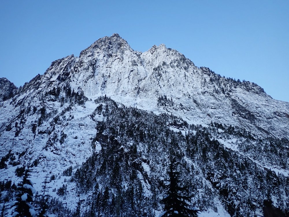
Sperry. Approach slabs on the left. Gully obvious in the middle.
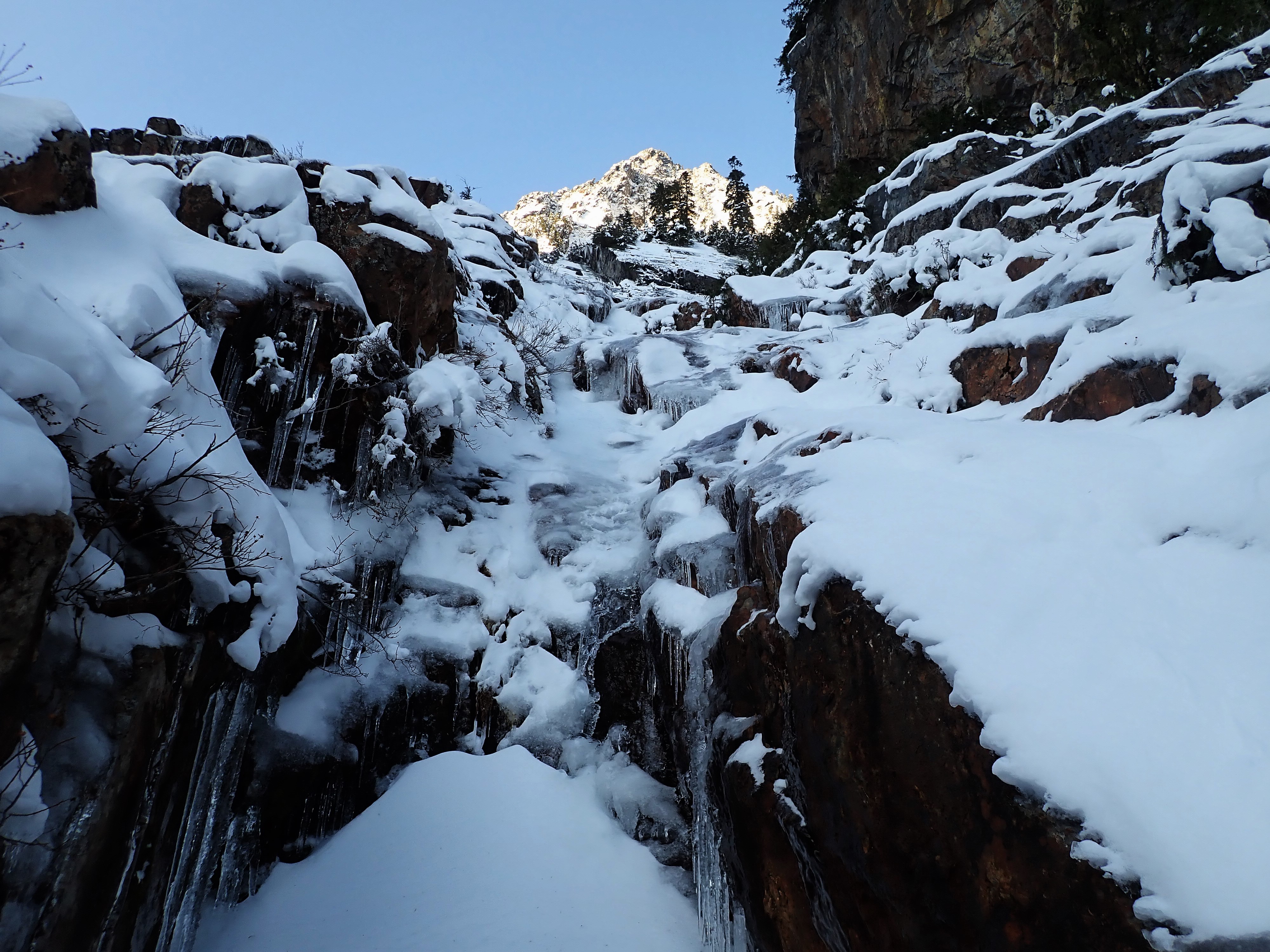
Daniel and I drove up to the trailhead and hiked into Wirtz Basin around sunrise. We could immediately tell we were in trouble. The 3rd to 4th class approach slabs looked like they were covered in thin verglass and fresh powder. We started up them, but decided we wouldn't be soloing them (Daniel was pretty new to ice climbing at this point) so we tried going through the dense trees to the right. This was impossible, running into steep cliffs and powder on no base. We bailed back to the slabs.
Typical climbing in the approach slabs.
We broke out the rope and I led up the right side of the slabs on WI1-2 R where sometimes your crampons would bust through to the rock. It was very insecure, albeit easy. Just not what Hyalite prepares you for. I belayed Daniel off a small bush and then we scrambled up higher. Then to the right there was a little WI3 near vertical step for 20-30 ft that might have taken 6 cm screws. I now realize this was the "little icy step" Jim referred to in his trip report. Damn, those guys were tough. Another veggie belay brought Daniel up.
The next section involved climbing atop branches while getting soaked in powder. Then we traversed across more 3rd class slabs covered in fresh powder in crampons. My crampons were brand new and suffered dearly.
Finally, we were staring up the gut at the gully, around 4000 ft. It was near noon and the strong sun was causing snow to constantly cascade down the gully. It looked absolutely icy and beautiful! Certainly one of the most beautiful gullies I've ever seen, but we were too late to continue. The powder would have been heinious.
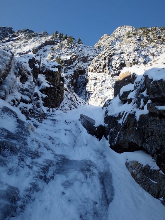
We stopped here. But the ice looked so good!
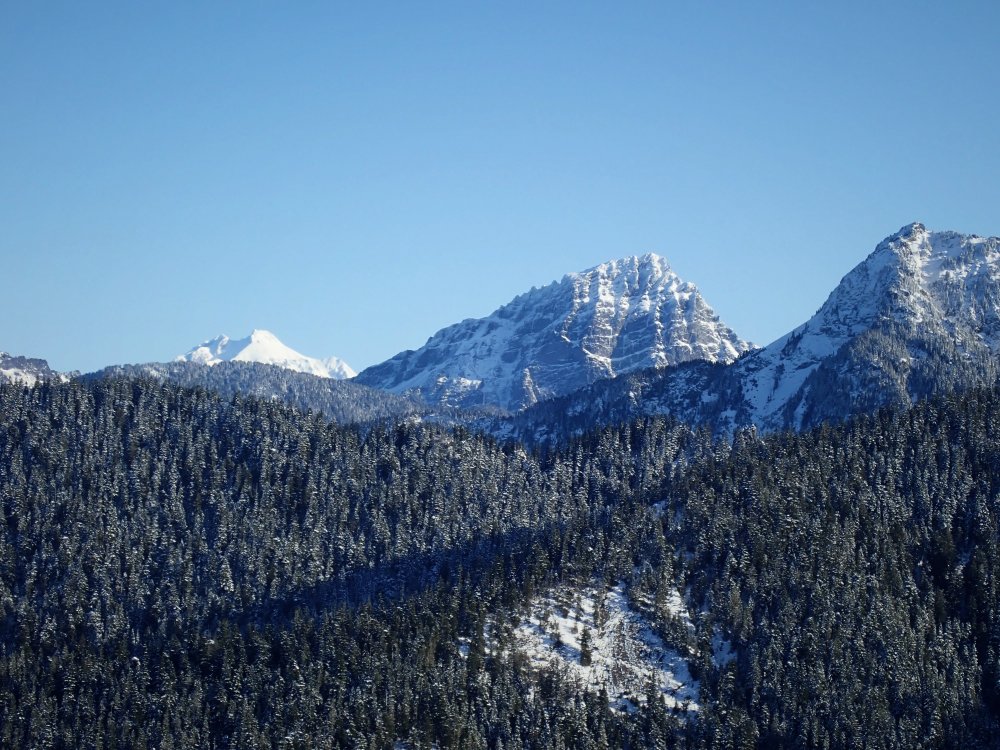
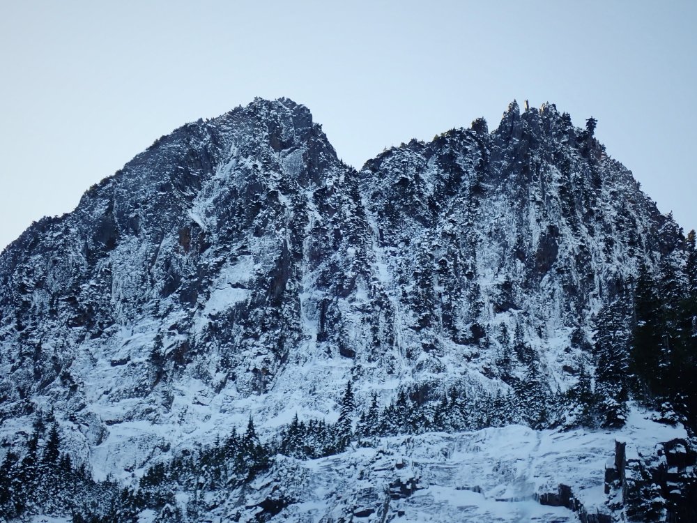
Sloan, with the lines already forming.
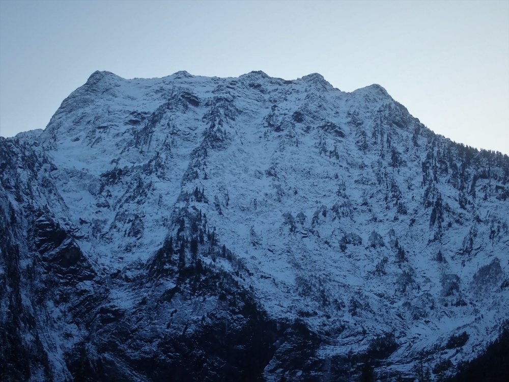
We rapped off trees back down to the valley floor. We took a walk further up Wirtz Basin and admired the incredible geometric features of Sperry. It is truly one of the underrated great mountains of the North Cascades. There were all of these cutting edge mixed ice routes that went 1000 ft up the SE face in the deep chimneys and cuts, but then they just petered out into nothing. There were even some chimneys like hundreds of feet deep and perfectly angular. I could just imagine Colin Haley deep in the darkness, climbing some great new route. I'd love to come back in the summer and climb one of the huge 2000 ft rock routes Beckey mentions that never get climbed anymore. I think the east face gully could be a great summer scramble, 3000 ft of scrambling with basically no approach. This is an incredible mountain. This looks like an incredible route. We'll be back!
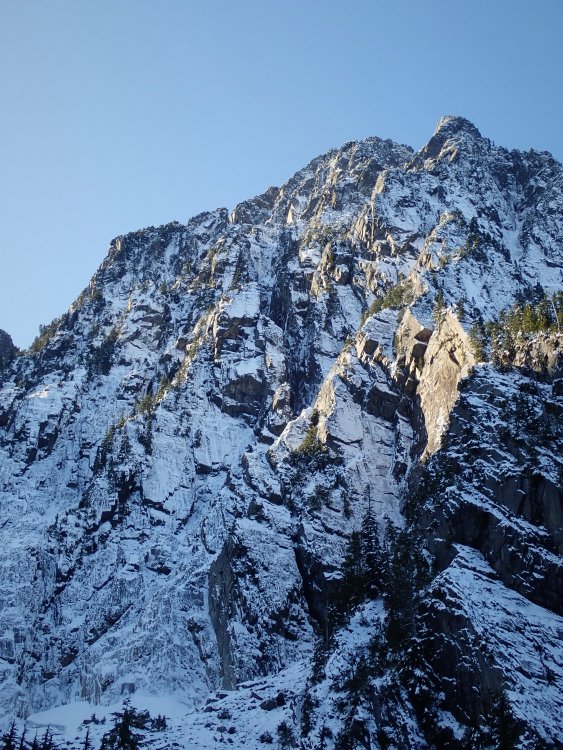
Inspiring SE side of Sperry. I've seen another mountain like it.
Serious ice potential further up the valley.

Cool easier ice potential up on Morning Star.

Great north face of Sperry. Wonder if that route has seen a repeat?
North face Big Four.
Lessons learned:
* this is a tricky route to nail in proper conditions. If that low snow hadn't fallen, the approach slabs would've been dry (like they were for Jim), but would the gully had been filled in? Probably not this year. We needed more snowfall above 4000 ft. Or if just a bunch of snow falls to 3000 ft and consolidates, but you can still drive to the trailhead, that'd work also. Or just climb this route in mid winter consolidated conditions with a sled access.
* The approach slabs are really the only way to go. Don't try to go around.
* those old timers are tough mothertruckers.
Gear Notes:
A few screws, some rock gear.
Approach Notes:
Short, probably one hour if you can drive to the trailhead. But the slabs can be cruxy...-
5
-
1
-
-
@DPS a new guidebook will be awesome! I sent you an email. If anyone else is interested in contributing or being in on this discussion, let us know!
-
I decided to rename it to FACTs (Forgotten Alpine ice Cascade Testpieces) to give the list a little more oomph. @PorterM has suggested we make tiers in the list (easy, middle, hard) and let people tick it off! Because who doesn't love lists?
-
With some time on my hands with the quarantine and all, I decided to compile some research. Here's a list of "forgotten" Cascade alpine testpieces (ice focused) or FACTs. Feel free to add some others I left out! Who's gonna be the first to tick the entire list?
I apologize for all the weird formatting. I just copied this post from my blog https://climberkyle.com/2020/03/22/forgotten-cascade-alpine-ice-routes/.
I90
I90 climbs offer the best access and easiest conditions to predict. There are undoubtedly many more climbs to be discovered in this area with easy access, generally good rock, and surprisingly rugged little mountains.
- Mt. Kent, North Face (multiple variations): the greatest north face in the Snoqualmie region with many long 1000 ft lines. Bonus: you can see conditions from I90 near exit 42 while driving west! This has been super high on my list to explore.
- Snoqualmie Mt, North Face (multiple variations): an abundance of mixed ice lines like the classic New York Gully and the lesser known Pineapple Express and Blue Moon.
- Abiel Peak, North Face (multiple variations): the “Ben Nevis” of the PNW has many shorter alpine ice and mixed lines.
- Bryant Peak, Hot Tubbs: Maybe this route hasn’t been around long enough since Jacob and I published it, but it reportedly hasn’t seen much action, so I think it’ll be forgotten soon enough…
- Summit Chief Mountain, North Face: Colin Haley said this line had “more ice climbing than any other Cascade ice climb” he had ever done at the time. Big compliment. The North Face is much like Dragontail, just fatter.
- Peak 3964, False Idol: An incredible 10 pitch ice route off the Middle Fork Snoqualmie that needs very cold temps to form. I believe this is just scratching the surface of the ice potential in the Middle Fork.
US2
US2 offers some hotspots like the Stuart Range, with its steep granite peaks, and a sprinkling of other incredible routes in the Lake Wenatchee area. Weather is generally colder and drier on the east side, which is good for ice.
- Chiwawa Mountain, Intravenous: Cutting edge Colin Haley mixed route deep in the Glacier Peak Wilderness.
- Buck Mountain, Buckshot: Another bold line in a wilderness setting. One of the great underrated north faces in Washington.
- Mt. Index, North Face: Steepest peak in Washington, visible from the highway. Always an involved matter for a sub-6000 ft peak. Another huge route is Murphy's Law.
- Dragontail Peak, NE Couloir: This route feels much more full on than Triple Couloirs next door, and seems to be difficult to get in proper (fall) conditions.
- Colchuck Peak, NE Buttress Couloir: Often overlooked with Triple Couloirs and the North Buttress Couloir next door. Ends with a cornice-tunnel!
- Argonaut Peak, NE Couloir: Also a rock/snow route in early summer, this can be a fantastic mixed/ice route in late fall.
- Mt. Stuart, Ice Cliff Glacier: a technically easy but deceptively committing and full-on climb in a wild setting.
- Argonaut Peak, Chad Kellog Memorial Route: Challenging new age mixed route in the heart of the Stuart Range.
- Mt. Stuart, Lara Kellog Memorial Route: Climbs the incredible NE Face of Stuart above the Ice Cliff Glacier. Looks directly across to the Chad Kellog Memorial Route.
- Mt. Stuart, Stuart Glacier Couloir: A classic route where the crux is arguable climbing the west ridge in mixed winter conditions.
- Nason Ridge, Alpine Dropout: A fantastic looking ice route that sits just above Lake Wenatchee.
Mountain Loop
Close to Seattle but tragically overlooked, the peaks of the Mountain Loop are as rugged as anywhere in the North Cascades but with surprisingly decent winter access. The myriad of big climbs in this little region speaks volume to the incredible terrain.
- Big Four Mt, North Face (multiple variations): multiple routes, including the famous Spindrift Couloir. This is a mighty north face, and routes often take multiple days.
- Hall Peak, North Face: little brother to Big Four supposedly has some ice routes.
- Three Fingers, NE Face: This is a big route on a surprisingly big mountain. I believe there’s much more potential on the east side of Three Fingers.
- Whitechuck Mt, E Face Couloir: A very aesthetic couloir ice/mixed route. Access can be challenging unless it is a very low snow year.
- Whitehorse Mt, E Couloir: This steep route splits the Squire Creek Headwall for a fantastic line. I think it might even be visible from Darrington?!
- Sperry Peak, E Face Gully: Another beautiful, long, moderate ice/mixed route that likely varies in technicality from fall to spring.
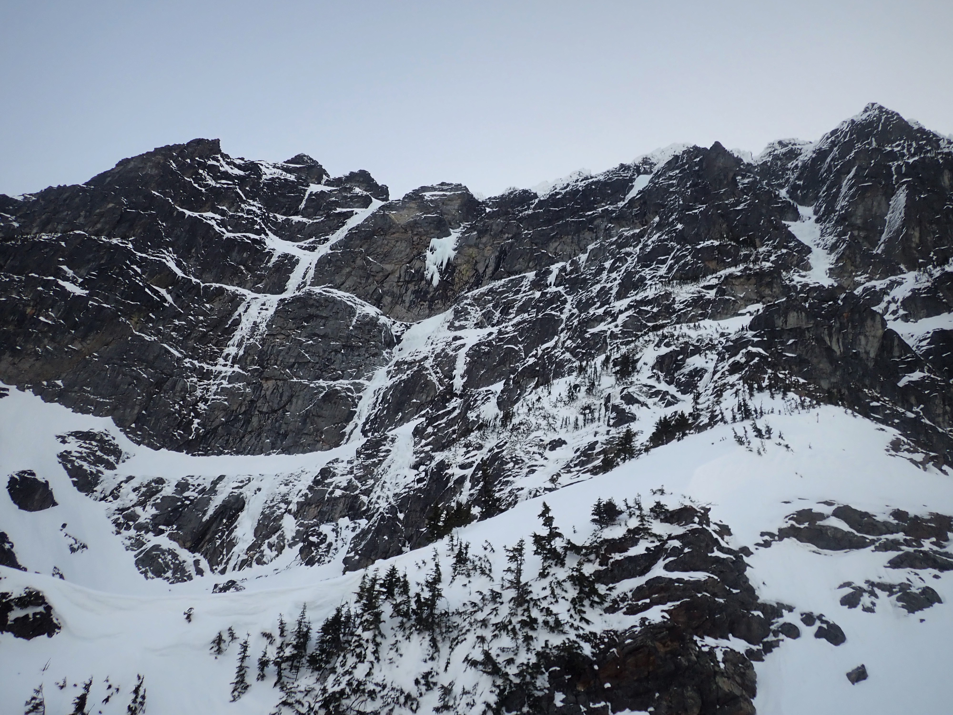
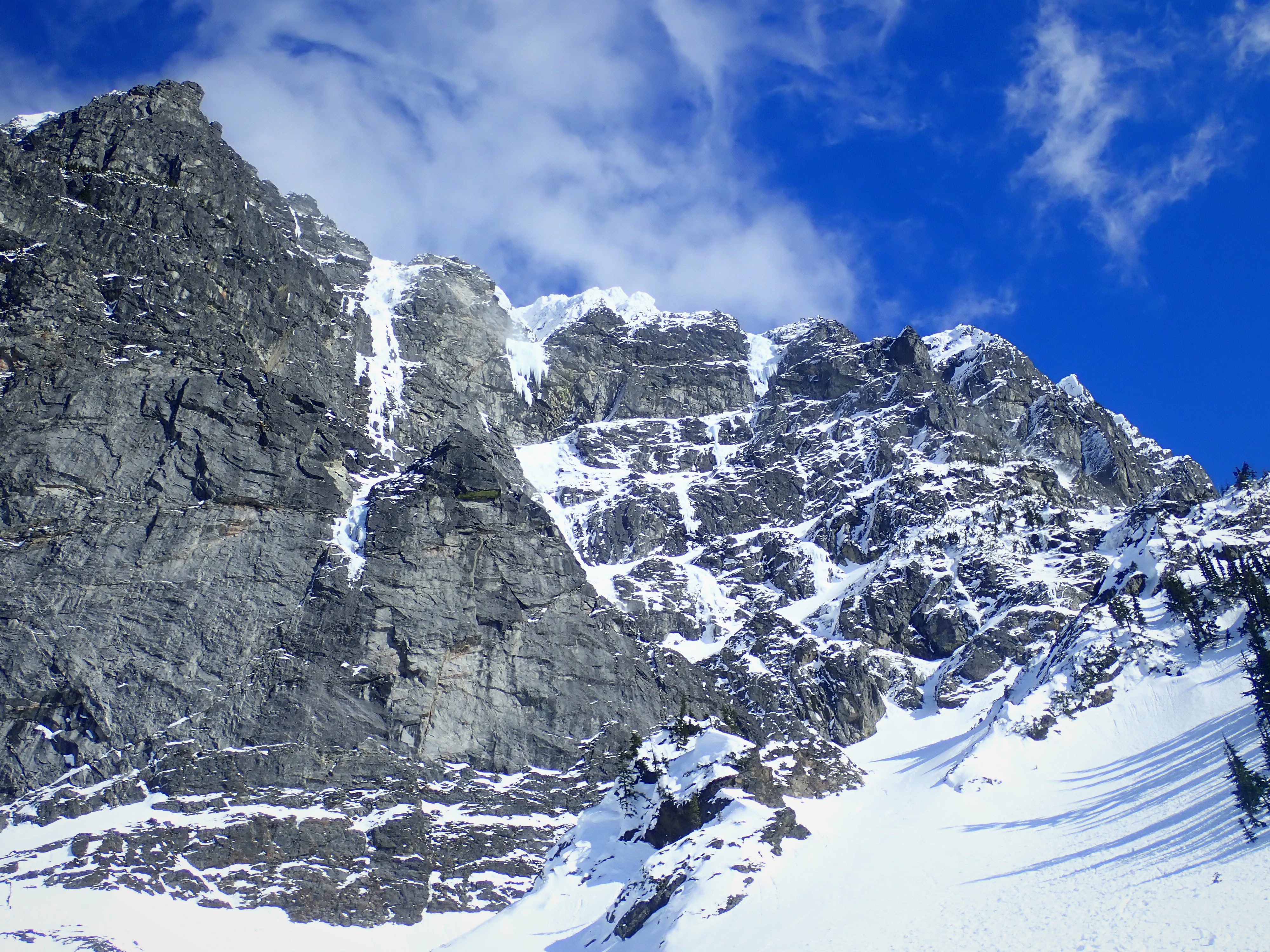
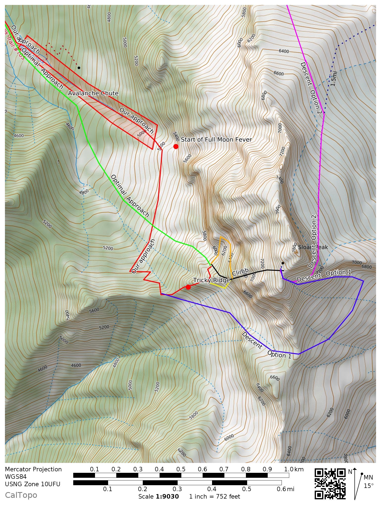
- Sloan Peak, Full Moon Fever: This route climbs the weakness on the NW Face of Sloan. Having been at the base, I can say there is HUGE potential all over the place near the route.
- Sloan Peak, Superalpine: I certainly hope this climb isn’t forgotten, as Porter and I believe it is truly the best moderate alpine ice route we have climbed in the Cascades (better than Cosley Houston or the NW Couloir of Eldorado), but I know how things go around here…
- Lake 22 Headwall: who would think that one of the greatest alpine walls in the Cascades was just a short hour drive and hike from Seattle? There are so many unclimbed 2000 ft lines up this face, and you can get conditions updates by searching Instagram!
Highway 20
Highway 20 undoubtedly has many huge ice lines, but difficult winter access has limited exploration. During lower snow years, the Cascade River Road could be a great area for exploration and development.
- Eldorado Peak, NW Ice Couloir: This route was sort of “remembered” in Fall 2019 when probably 20 parties climbed it (me included), but it’s a fantastic easier route, so I’ll leave it here.
- Colonial Peak, North Face (multiple routes): The mega line Watusi Rodeo offers 4000 ft of front point terrain and is “easily” accessible all winter. First Date is another attractive route.
- Pyramid Peak, NE Face (multiple routes): Home to some challenging mixed/ice routes on a wonderfully aesthetic peak.
- Graybeard, North Face: Everyone seems to report this deceptively big route deepened their sense of mortality.
- Davis Peak, No Milkshakes: the north face of Davis Peak is supposedly the steepest vertical mile drop in Washington.
- Silver Star, West Face Couloir: Originally planned as a ski descent, it actually turned out to be a huge ice climb! Visible from the highway, but you probably need a sled to get up there.
- Cutthroat Peak, Cauthorn Wilson: Gaining popularity lately, can be climbed right before the highway closes or after it opens.
- Early Winters Couloir: This one is sort of a classic and can be climbed in both fall and spring.
Highway 542
The areas around Baker and Shuksan are generally well explored, but still offer great adventure. The Black Buttes are one of the centerpieces for hard alpine ice climbing.
- Lincoln Peak, Wilkes-Booth: A huge, challenging route on one of the hardest peaks in Washington.
- Assassin Spire, NW Face: Considered by many to be the toughest summit in Washington, this was also the first peak where the first ascent was made in winter.
- Colfax Peak, Ford’s Theater: The “forgotten” next door neighbor of the ultra classic Cosley Houston.
Mt. Rainier / Tatoosh
This area is dominated by the mountain, but I’m guessing the Tattosh have good stuff and certainly easy access.
- Rainier, Mowich Face: A long moderate route on the “quiet” (NW) side of the big hunk-a-hunk.
- Rainier, Ptarmigan Ridge: A steeper, more sustained route than its next door neighbor, the world-renowned Liberty Ridge.
Mt. Hood
I don’t know much about Hood, but I’m sure there are some great routes that are infrequently climbed, so I’ll take suggestions here!
-
4
-
6
-
@PorterM and Tavish went back and finished the step where I fell and got a few hundred feet higher onto the upper snowfields. Check it out:
-
1
-
-
Way to go boys!!!! It's cool you guys found a different start variation this time, since I know the pitch we climbed the first time probably isn't in most of the time. Hopefully others get on this route, it's a true gem of the Cascades. Best moderate alpine ice route in the Cascades IMHO (I'm not biased, right?).
-
1
-
-
@Ryan Hoover which line did you attempt?
-
@Michael Telstad exactly, that's why we waited until the face had not seen fresh snow in 4-5 days before going up. Hard to get sometimes. We waited all winter for it. There was still a lot of spindrift. The other (ideal) condition would be a high rain event, then hard freeze to lock everything up. Then you'd be able to boot everything.
-
3
-
-
@Michael Telstad glad you gave it a shot! Definitely snowed more than was forecasted. I hope you can give it another shot since the weather is staying cool. Next weekend looks good! I think it'd be a FCA (first complete ascent) since our FA is debatable...
-
Thank you to everyone for their support! It was a wild adventure, that's for sure.
-
Here it is boys:
-
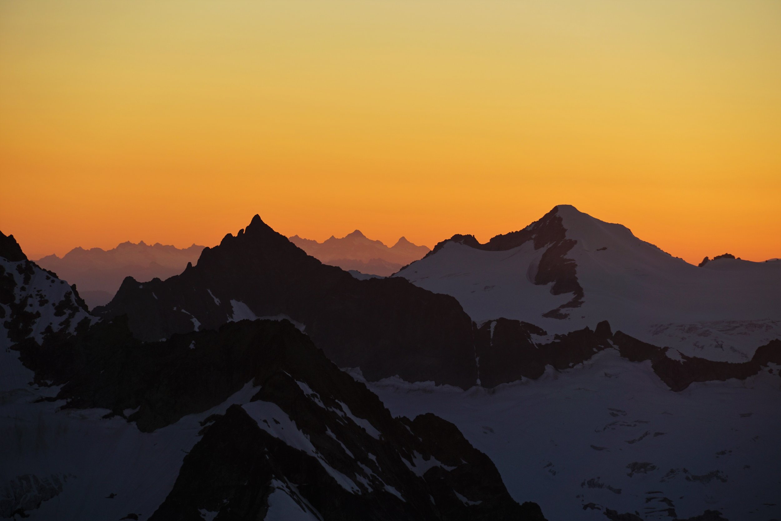
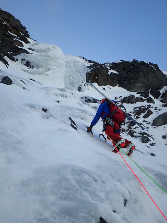
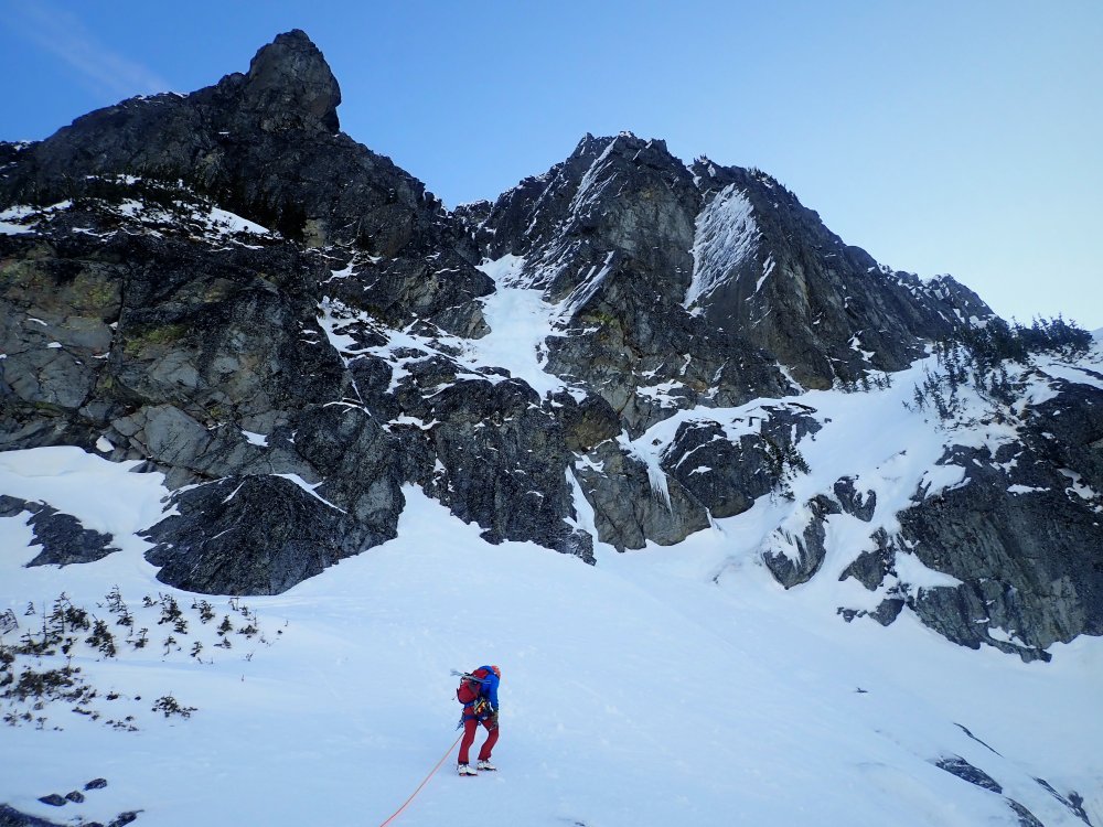
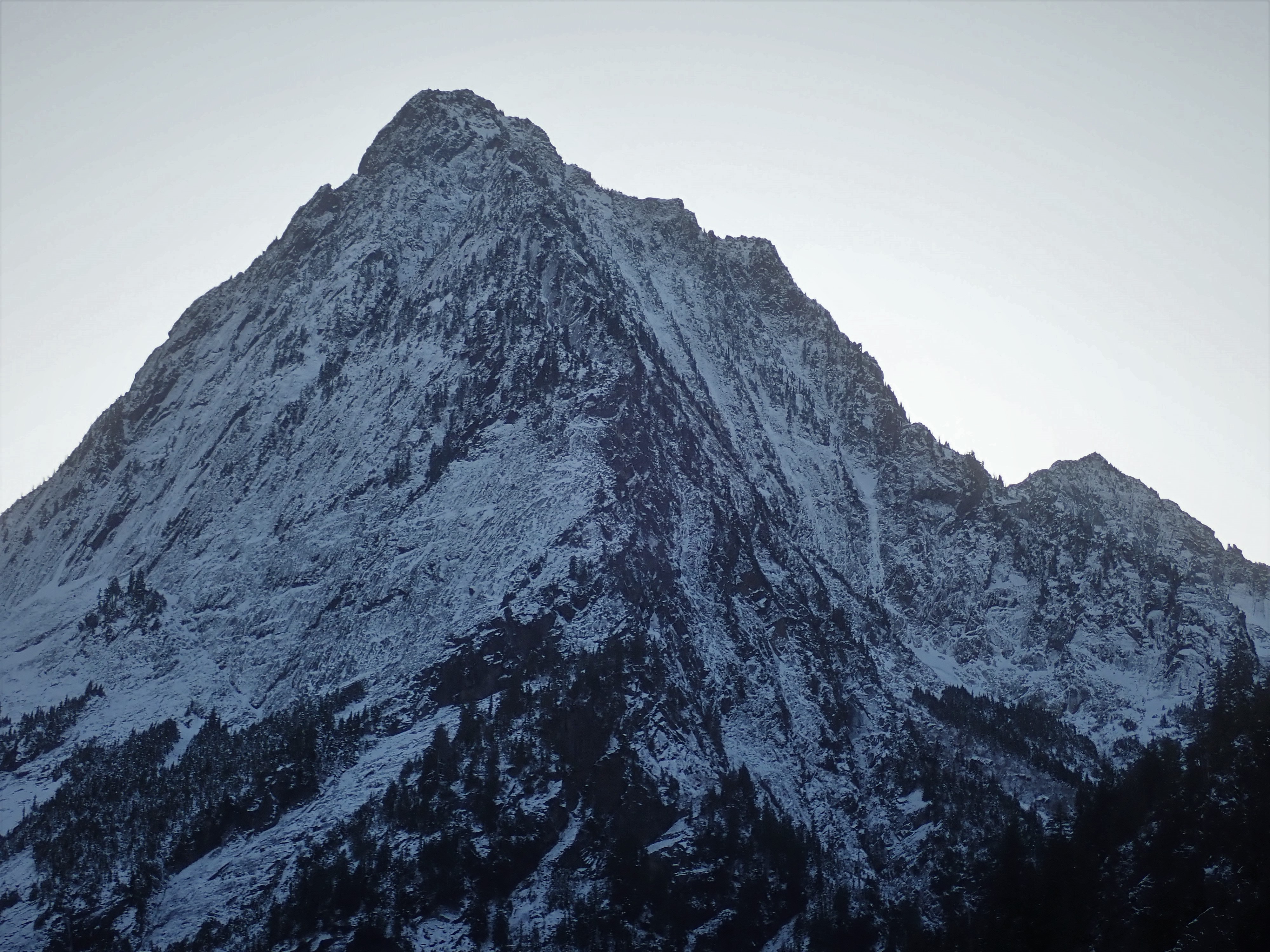
Trip: Sloan Peak - FA: Superalpine (WI3-4, 1000')
Trip Date: 02/28/2020
Trip Report:On February 28th, 2020, @PorterM and I made what we believe to be the first winter ascent of the West Face of Sloan Peak. We climbed an incredible line approximately 1000 ft long of WI3-4 and steep snow climbing before our route joined the final 600 ft of snowfields to the summit. On the very final ice step, I suffered a short fall on rotten ice and a heinous top out and broke a few bones in the right side of my face. We bailed down the route and skied out. So technically, I guess we didn't finish the route, so say what you want about it.
Our route started with a WI4ish pitch followed by hundreds of feet of stellar WI3 rambly flows in a gully just to the climber's right of the true west ridge spur on Sloan Peak. In our eyes, this was the only way up the true west face under WI4+/5. The whole face is loaded with huge free hanging daggers and wild lines. A competent WI6/M6 climber in the right conditions could send some absolute world class lines up there.
I shared a lot more details, reflections on the accident, and route beta on my blog: https://climberkyle.com/2020/02/28/fa-sloan-peak-superalpine-wi3-4-1000/. Hopefully some others can get up there and finish this magnificent climb or poach some of the other unclimbed lines.
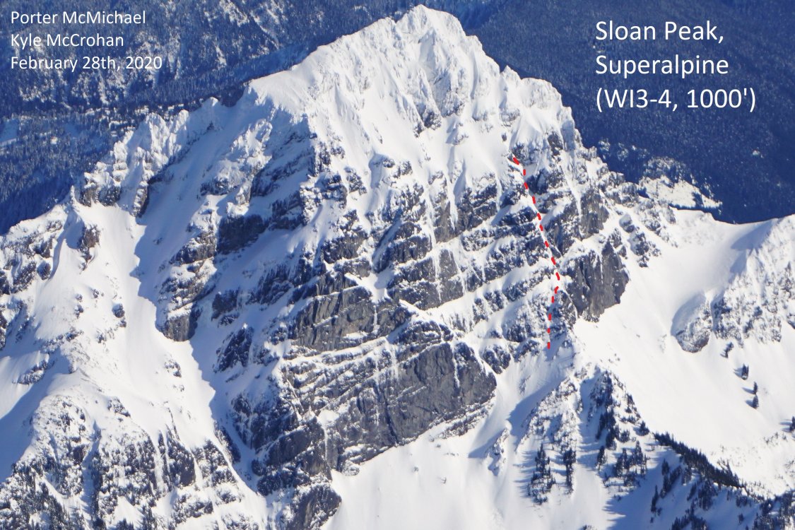
Our route. up to where I fell. We were about to join the corckscrew route and head out.
We climbed the gully on the right side of the photo.
First pitch crux.
Moving into the wonderful ice gully.
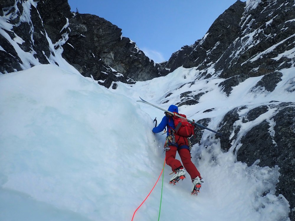
Porter leading on that fat, fun, rambly WI3. The climbing in the gully was generally easy, sustained, and super fun!

Incredible flows on the west face.

Some helpful beta.
Gear Notes:
Screws, maybe a few small rock pieces and a picket.
Approach Notes:
Skin/hike forest service road 4096, then meander up Bedal Creek to the base of the west face.-
5
-
8
-
-
@Alex789 was that late winter / early spring when you climbed it?
-
Trip: Colfax Peak - Cosley Houston
Trip Date: 12/09/2019
Trip Report:
Andrew Dyer and I boarded the last car on the Cosley Houston train this fall and climbed it on a beautiful December day. The route was in good shape, it seemed. 60m pitch of easy ice and snow to the crux. The crux was probably 15 feet of near vertical and then 15-20 feet of vertical to slightly overhung, pretty real for an ice newb like me. It was definitely the hardest lead of my life. I played it safe and placed 6 screws, increasing the pump greatly but at least I felt safer. I stopped a few feet short of the end of the ice so I could build a solid belay with screws. We bypassed the second ice crux, instead taking AI2 to the right. Overall, the snow conditions we quite good on the route, boot top pow with firm snice beneath.
The descent down the Coleman was a little tricky. We had to go far skier's right to find some key bridges across some huge crevasses. Skis from 8000 ft down to the Heliotrope Trail made things rather pleasant. My first turns of the season were pow turns!
Thanks to Andrew for a rad day in the alpine. It took us 12 hours, but we definitely lost time booting in the pow, my super slow crux lead, and wandering down the Coleman, looking for bridges. Obviously, conditions will be changing very rapidly with the storm currently, but at least we found no real signs of instability up there. Let the snow begin!
https://climberkyle.com/2019/12/13/colfax-peak-cosley-houston-wi4/

Colfax, Polish route looks good to go.

That infamous pillar.
Snowfield above the crux.

Final steps, Lincoln in the background.
Sunset pow! Much wow!
Gear Notes:
10 screws, 60 m single rope. I would do a 60 m twin rope next time and just double it over for the crux.
Approach Notes:
Hiked to the top of the Hogsback, skinned to 8000 ft, booted to the start of the route. It would definitely not be worth it to carry skis over at this moment, too many zig zags and ups and downs on the descent.-
2
-
3
-


Footwear in the Cascades
in The Gear Critic
Posted
@kmfoerster I personally just cannot hike in approach shoes. I know some people can. I wish I could! Then approach shoes would be great for me. I also think that you're a little more technical climber and thus can tackle most alpine rock routes in them, whereas I know I have to bring rock shoes anyways for anything 5.6 and harder. Also, I try to run more, and you definitely cannot run in them. Our styles are different, so approach shoes are more valuable to you.