


Lazyboy
-
Posts
65 -
Joined
-
Last visited
Everything posted by Lazyboy
-
What is the definition of obscure?
-
Camp Muir--April Conditions and Advice Request
Lazyboy replied to florida_climber's topic in Mount Rainier NP
The park service provides a map with compass bearings. Go to this web page and click on "map available with compass bearings" to download it. http://www.nps.gov/mora/trail/bearings.htm -
Check out the Valhallas to Olympus Trip Report.
-
Your link takes me back to this page at cascade climbers.
-
I was up there today and looked with my binoculars but was unable to see a pack.
-
I think Verizon has an antenna at Crystal Mountain.
-
Here is another Liberty Ridge adventure worth the read web page
-
I don't know how much time you have but another possibility would be to take your route to Dose Meadows and then go ahead and go over Lost Pass and Cameron Pass and then instead of heading over Grand Pass follow Cameron Creek down to Three Forks then go to Deer Park and follow Grand Ridge back to Obstruction Point. That way you would not have to deal with the permit thing in Grand Pass and Grand Valley area. I suppose there could still be snow on Cameron Pass that time of year but maybe not this year.
-
There are a couple of reports at the Alpine Lakes section of this website.
-
If you have some time to waste there is more information about the story at this web page Someone who claims to be Ted even comments on the story.
-
Beautiful I knew I should have gone hiking today. Was this weather in the forecast?
-
Found sunglasses near the bottom of the shute on Mt. Ellinor in September.
-
There is one I have heard of. I think the name is Beckey or something like that. I don't know how to contact him.
-
The original high bridge was wood that grew weak over the years. It was replaced in 1998 by a steel bridge and then the record snows of the winter of 1998-1999 led to its demise. Could be a tree fell on it also but I don't know. The present bridge I think was just put in last year or the year before.
-
Great trip report. Sounds like you made the right decision. I am looking forward to seeing your pictures
-
[TR] Mt. Constance- Chute's Notch/Finger Traverse 5/1/2004
Lazyboy replied to olyclimber's topic in Olympic Peninsula
Nice panorama shot. Thank you for posting it. What peaks are the lines pointing to? -
With that much time it seems like a high altitude circumnavigation might be an idea. High Altitude Circumnavigation
-
[TR] Gladys Mtn, Henderson Mtn- from Black & White Lakes 3/12/2004
Lazyboy replied to dkemp's topic in Olympic Peninsula
That sounds like a fun trip and nice picture. Is that Alpha to the left of the cruiser? That area around Gladys Mountain was where they wanted to put a ski area. The ski clubs in Bremerton and Shelton had a cabin at Flapjack Lakes. Of course this was a few years ago. The road extended 4 miles beyond Staircase at that time but they still had to hike in 4 miles to do some skiing. -
There are old mountaineers and there are bold mountaineers but there are no old bold mountaineers
-
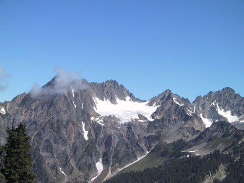
That sounds like a great trip. When do you plan on going? How many days do you figure it will take? I have not heard of anyone doing the whole route as one trip but I have read reports about parts of it. Does your intended route go over or around Mt. Anderson? Here is a picture of Mt. Anderson taken from Fisher's Notch.
-
There is also flagging on the North Fork of Tunnel Creek or there was last year anyway. It can lead you astray. I was trying to get to Charlia Lakes and the flagging appeared to be marking a route towards Mt. Constance.
-
Mountain Weather Data has hourly data from many areas. Mountain Weather Data
-
How come all that titanium stuff is made in Japan? Are they the only ones that know how to do it?