
Leaderboard


Popular Content
Showing content with the highest reputation on 07/25/23 in all areas
-
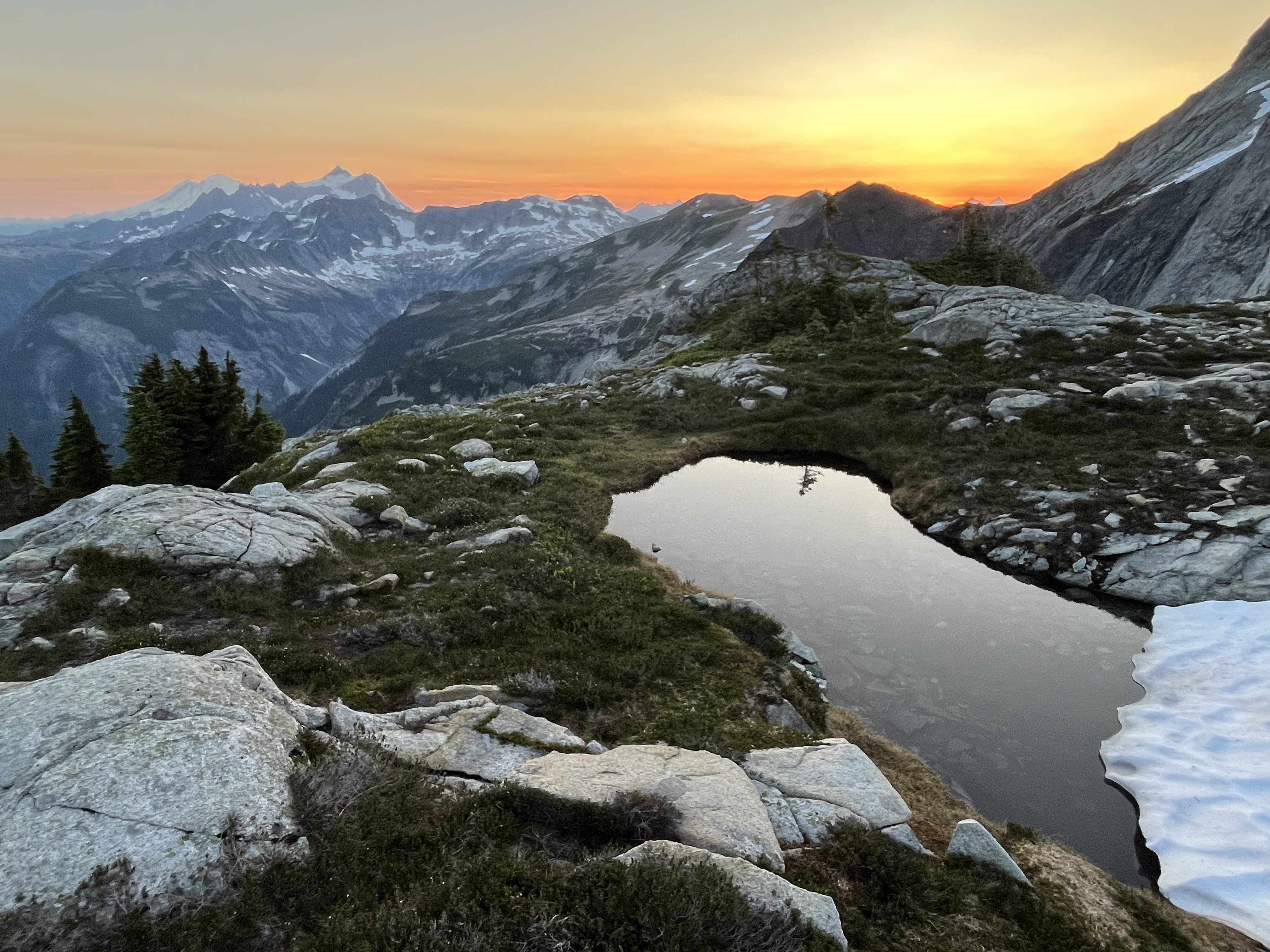
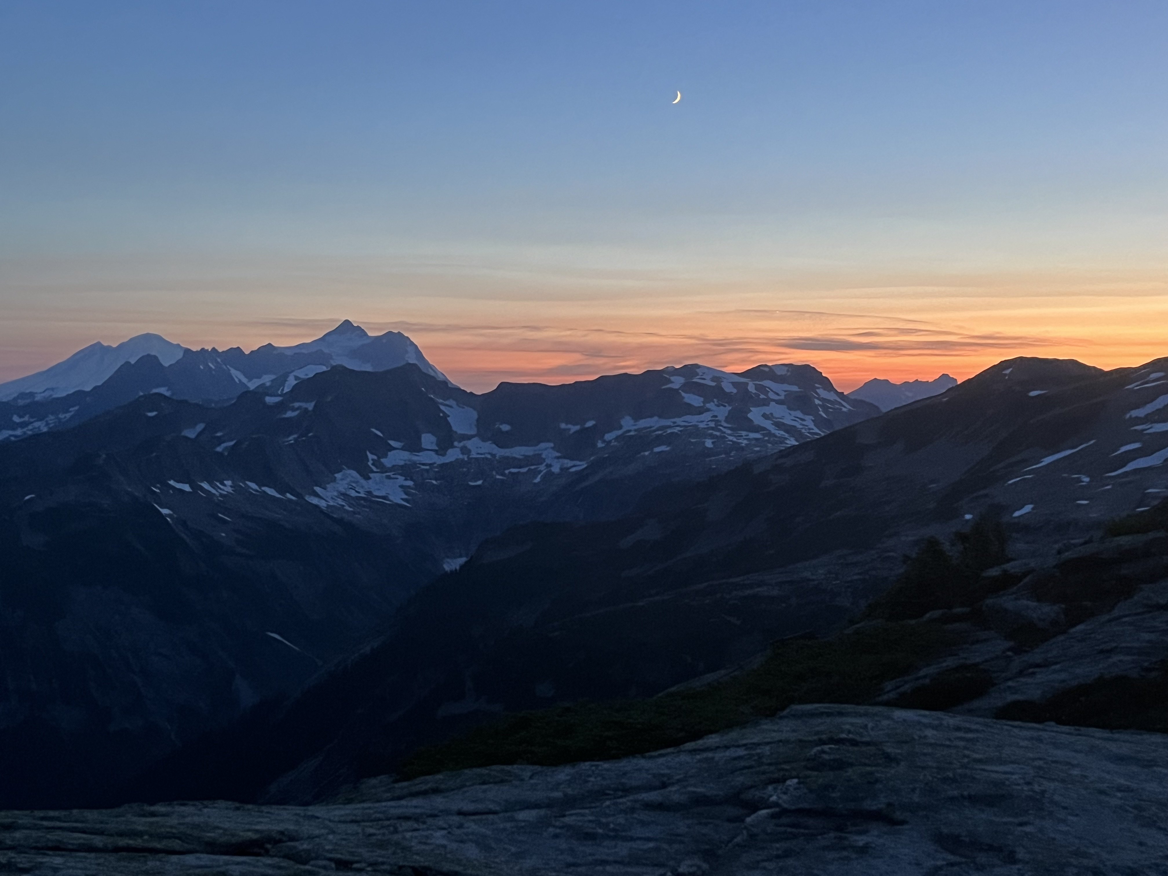
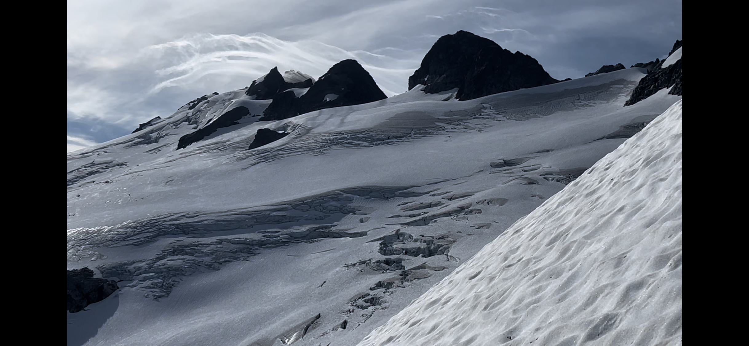
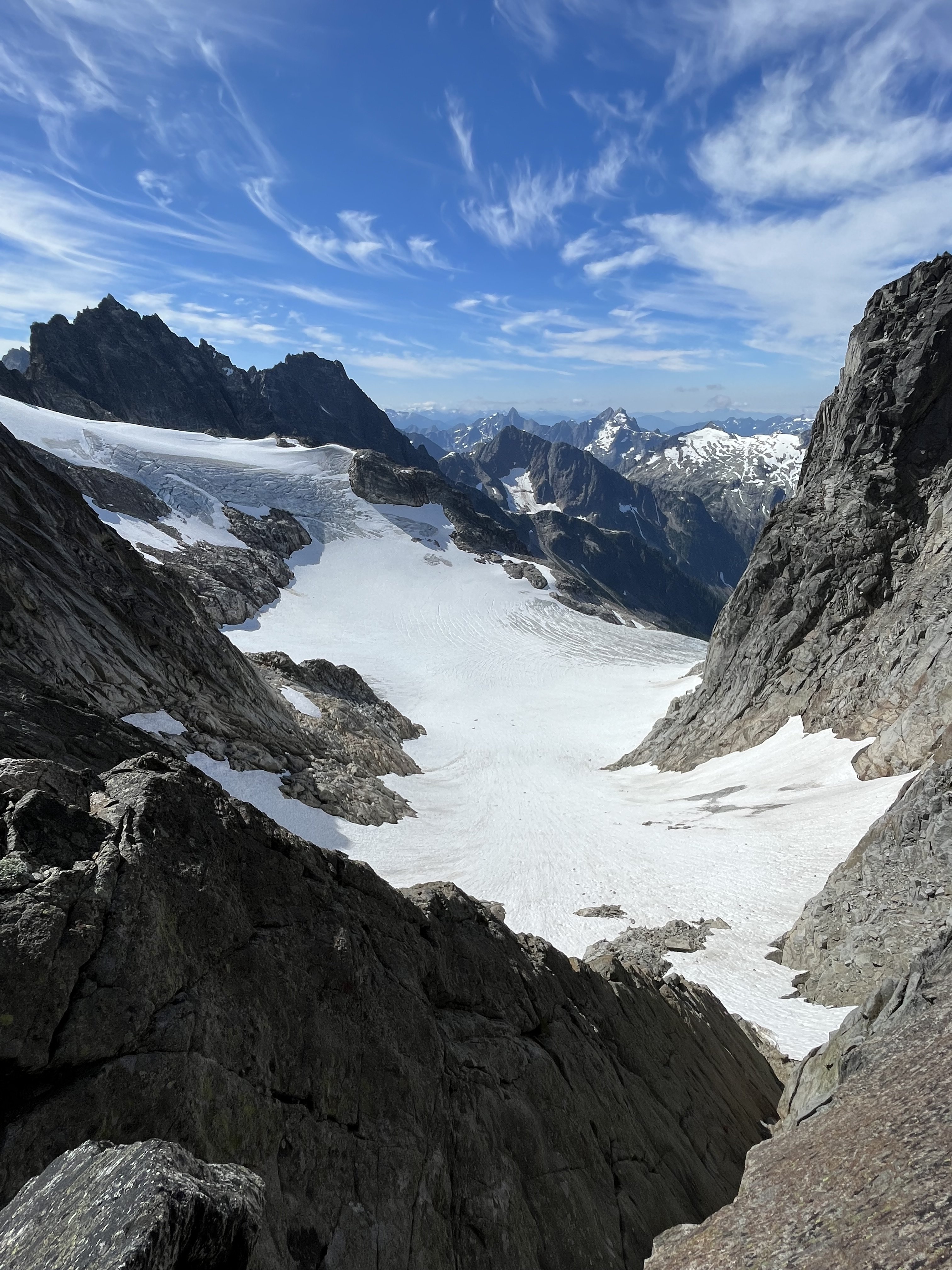
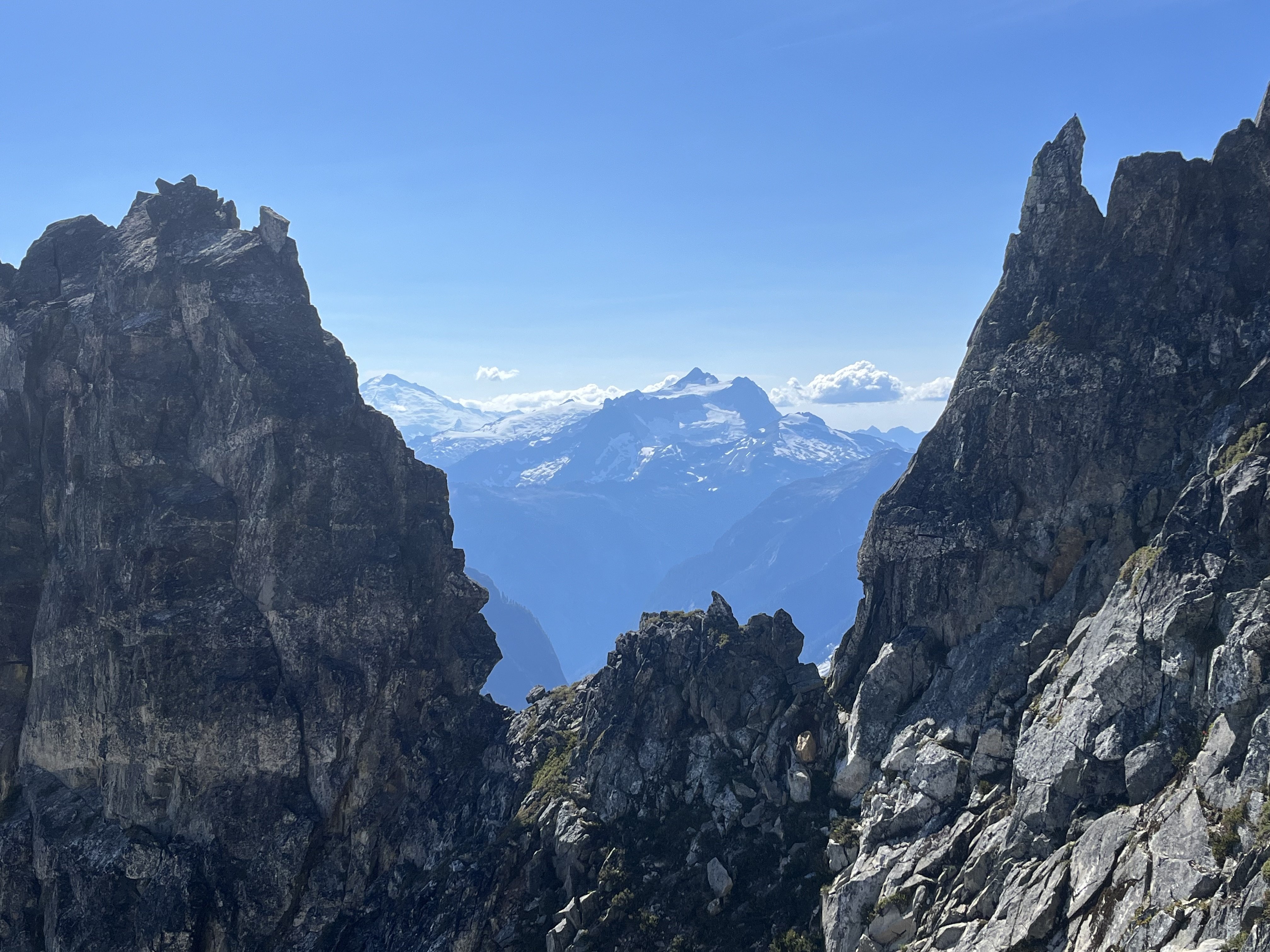
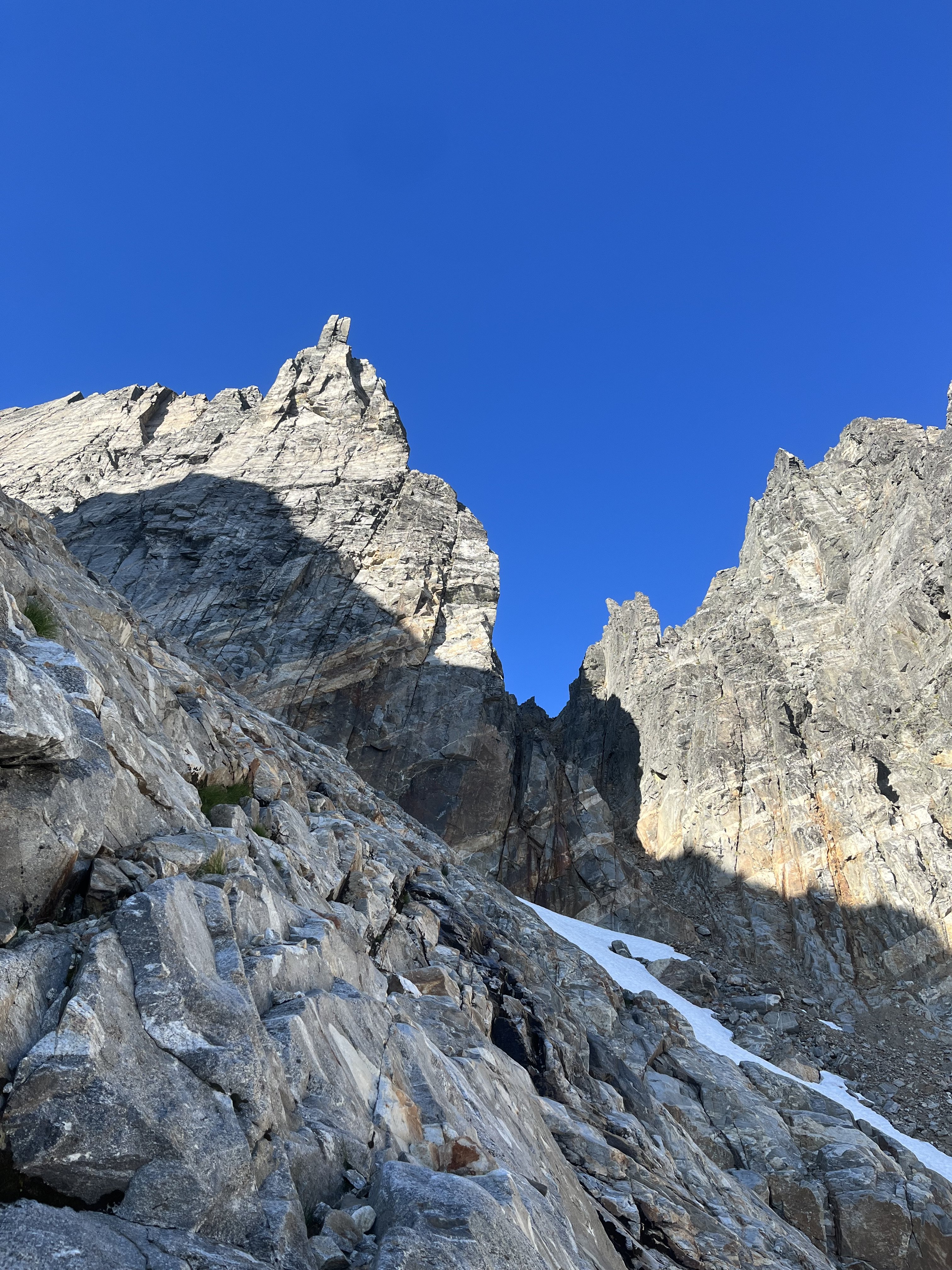
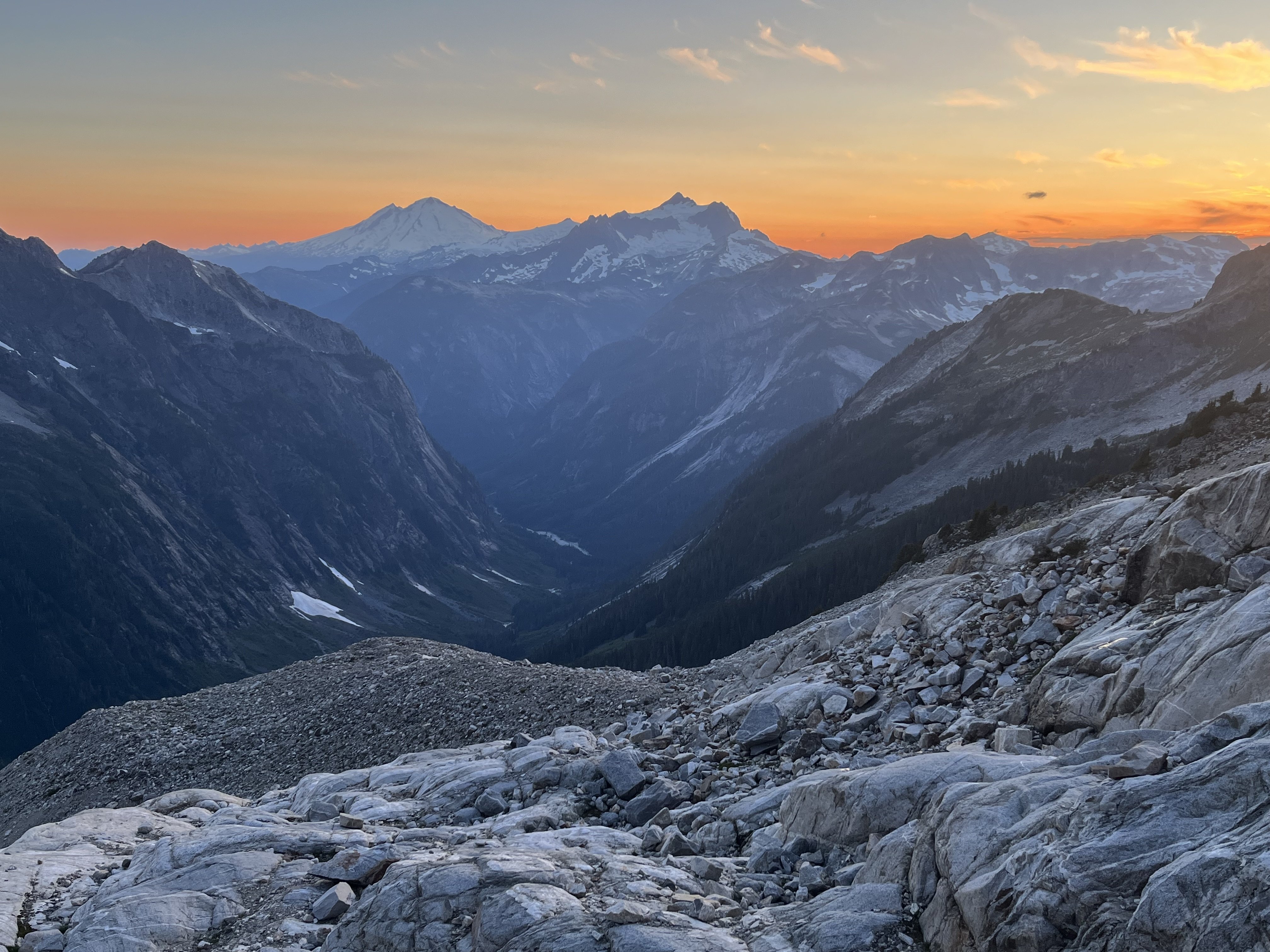
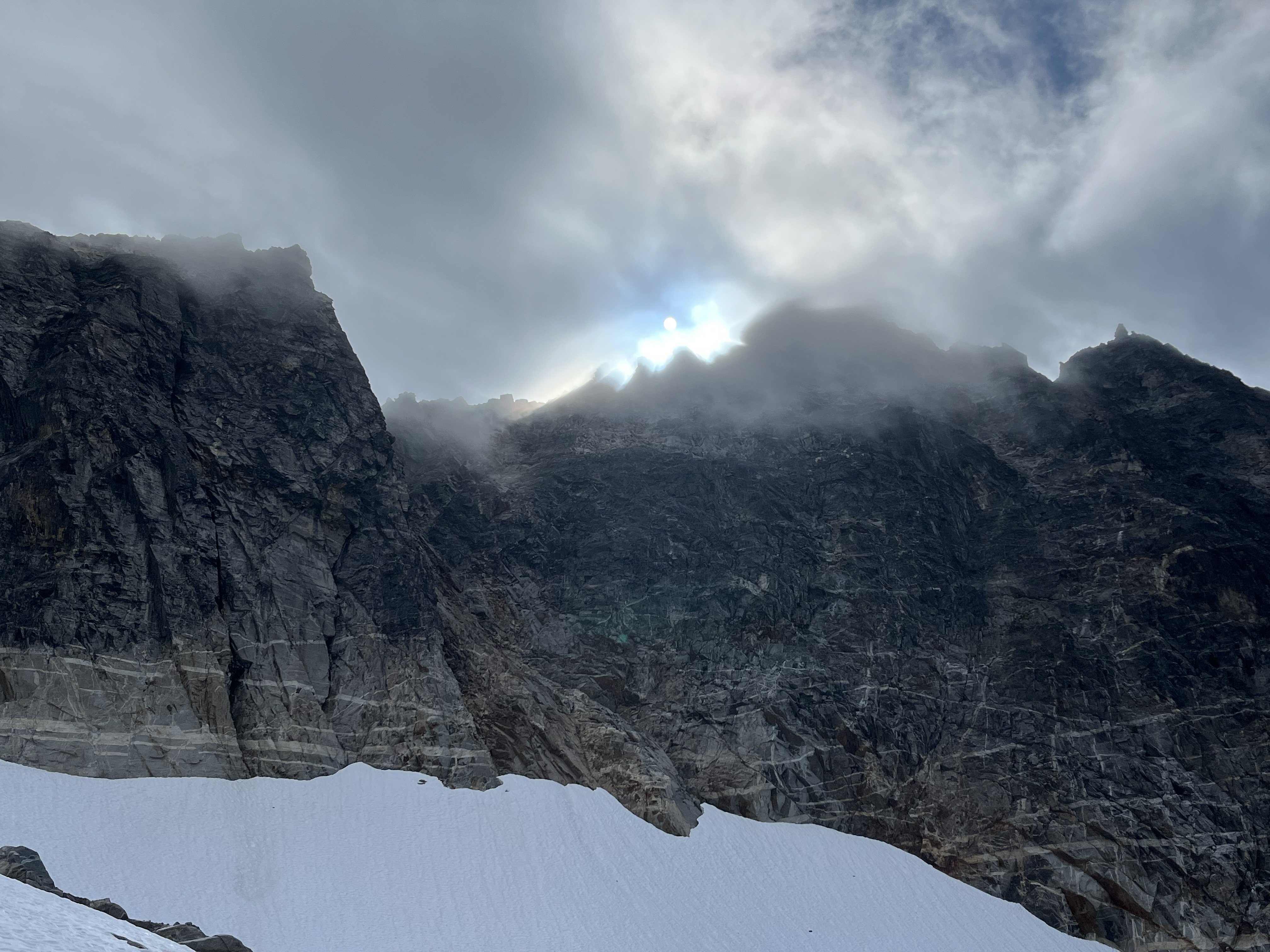
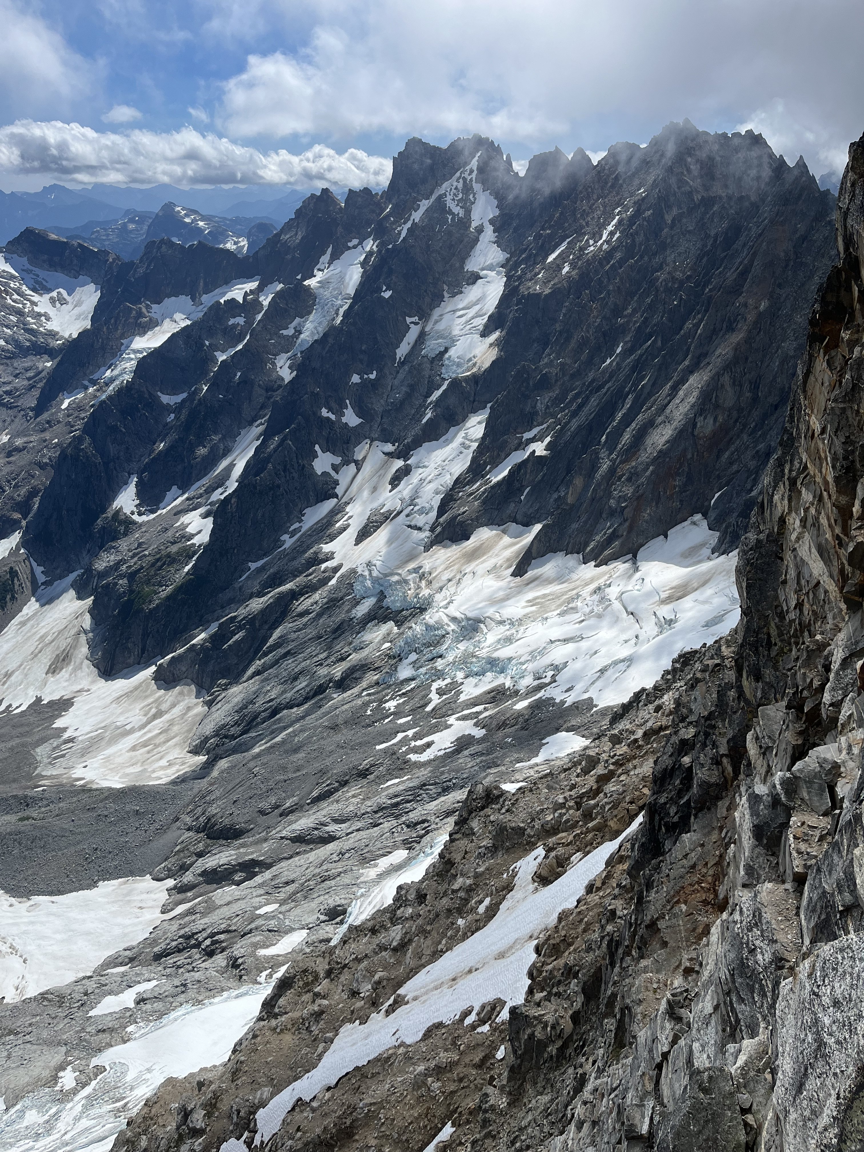
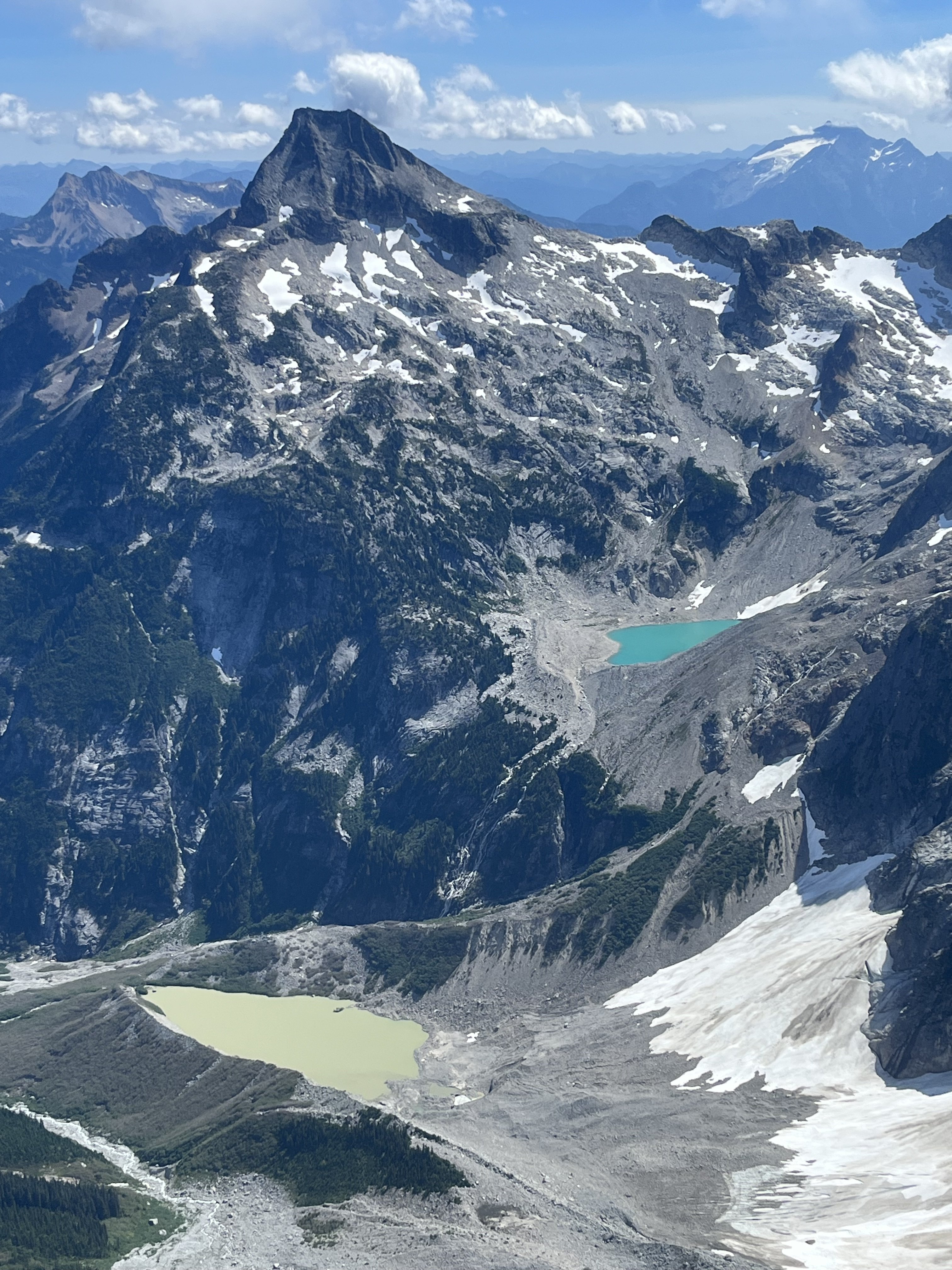
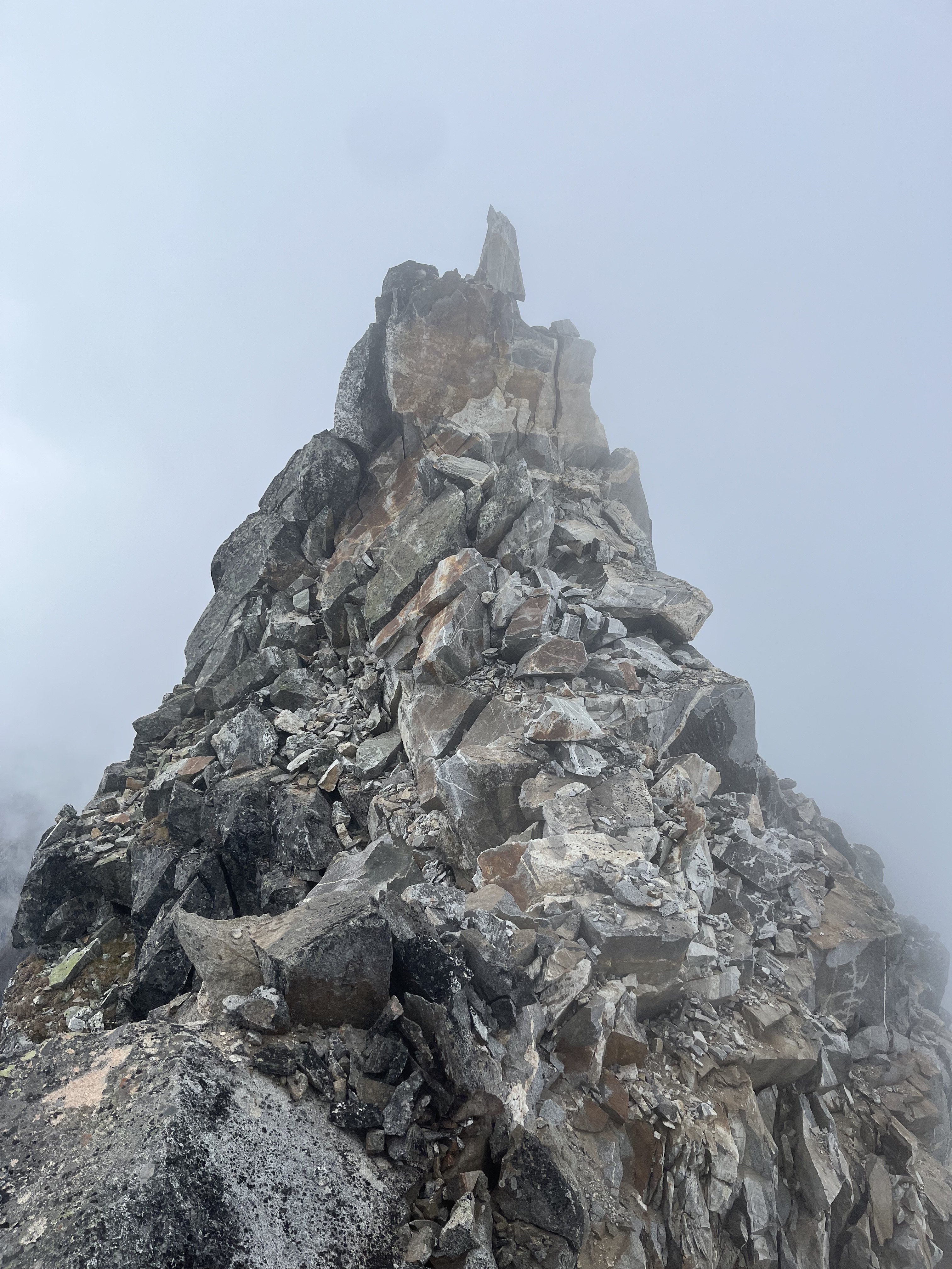
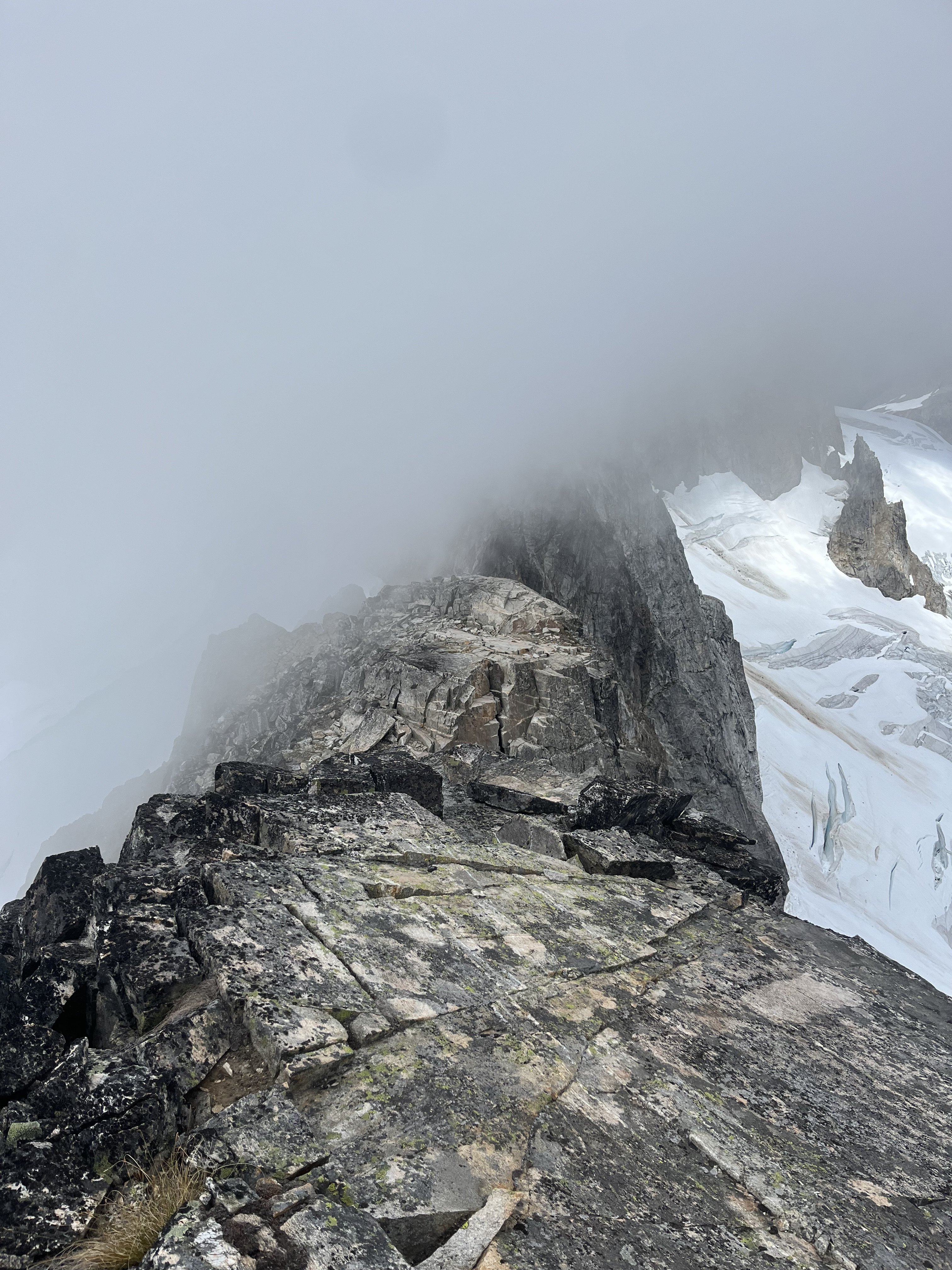
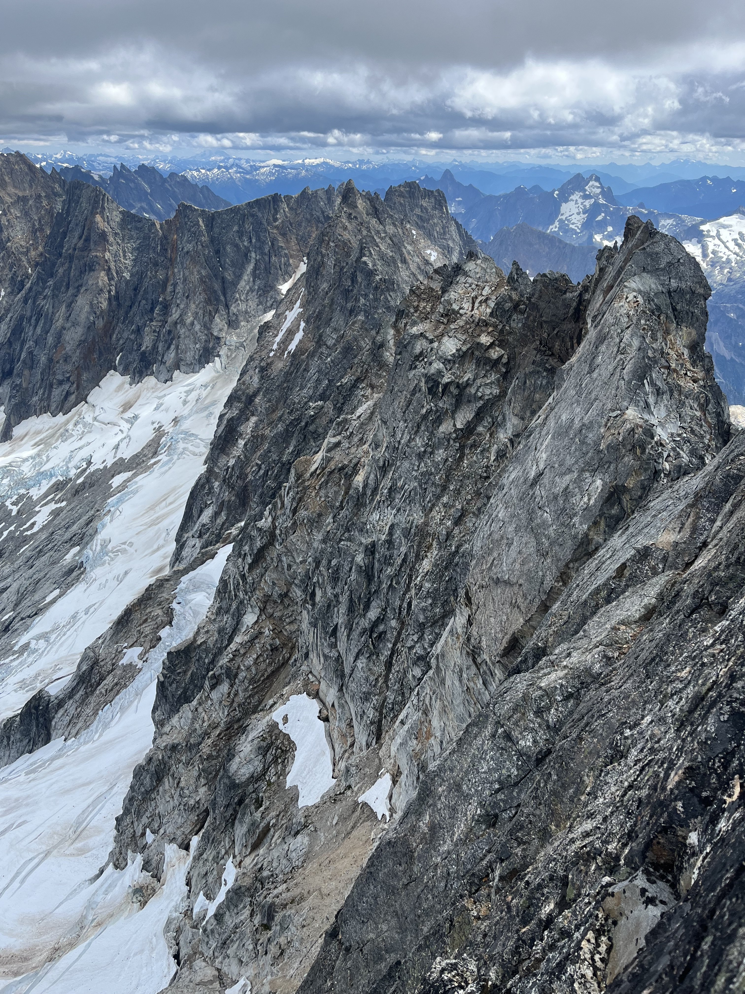
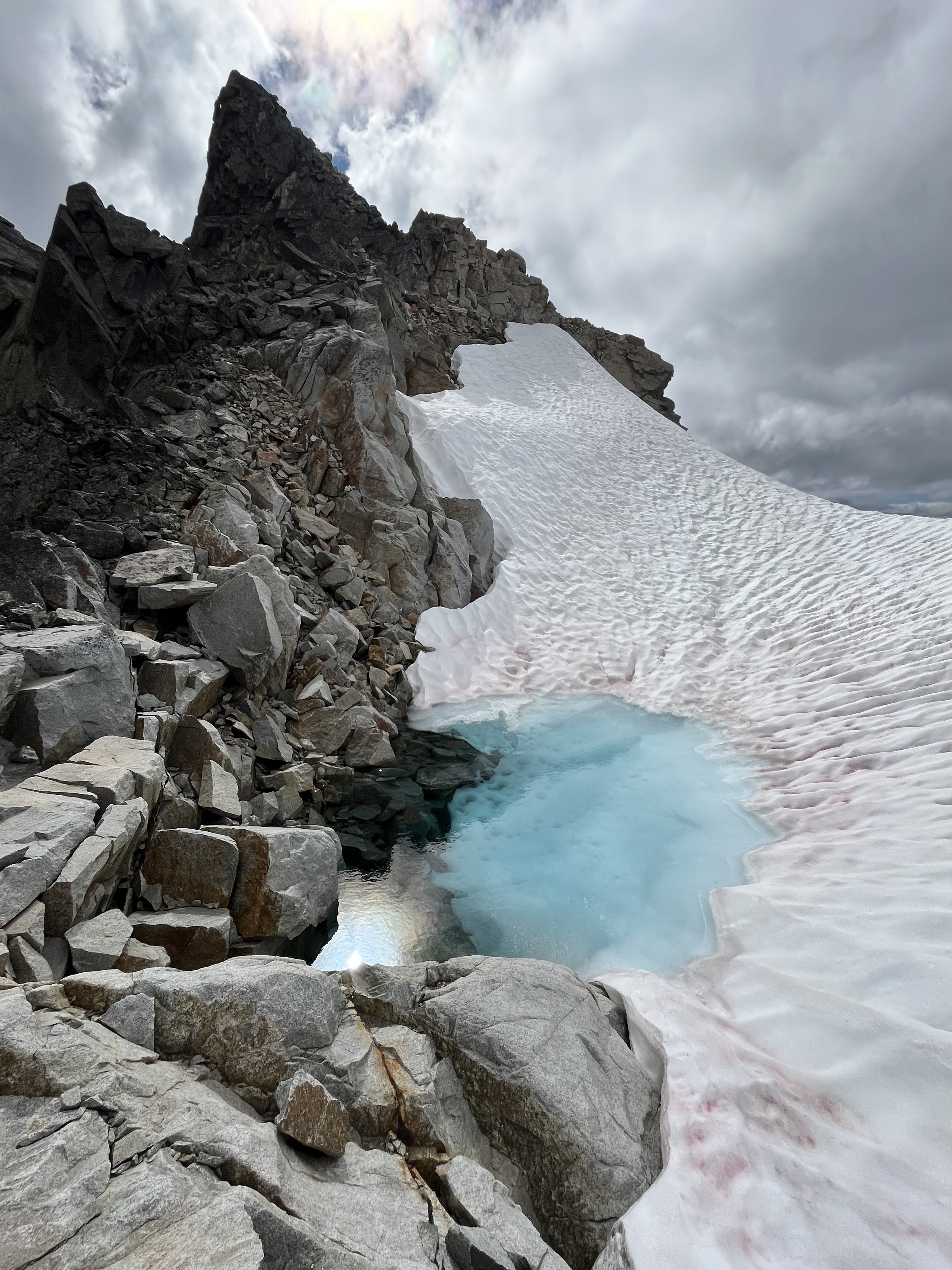
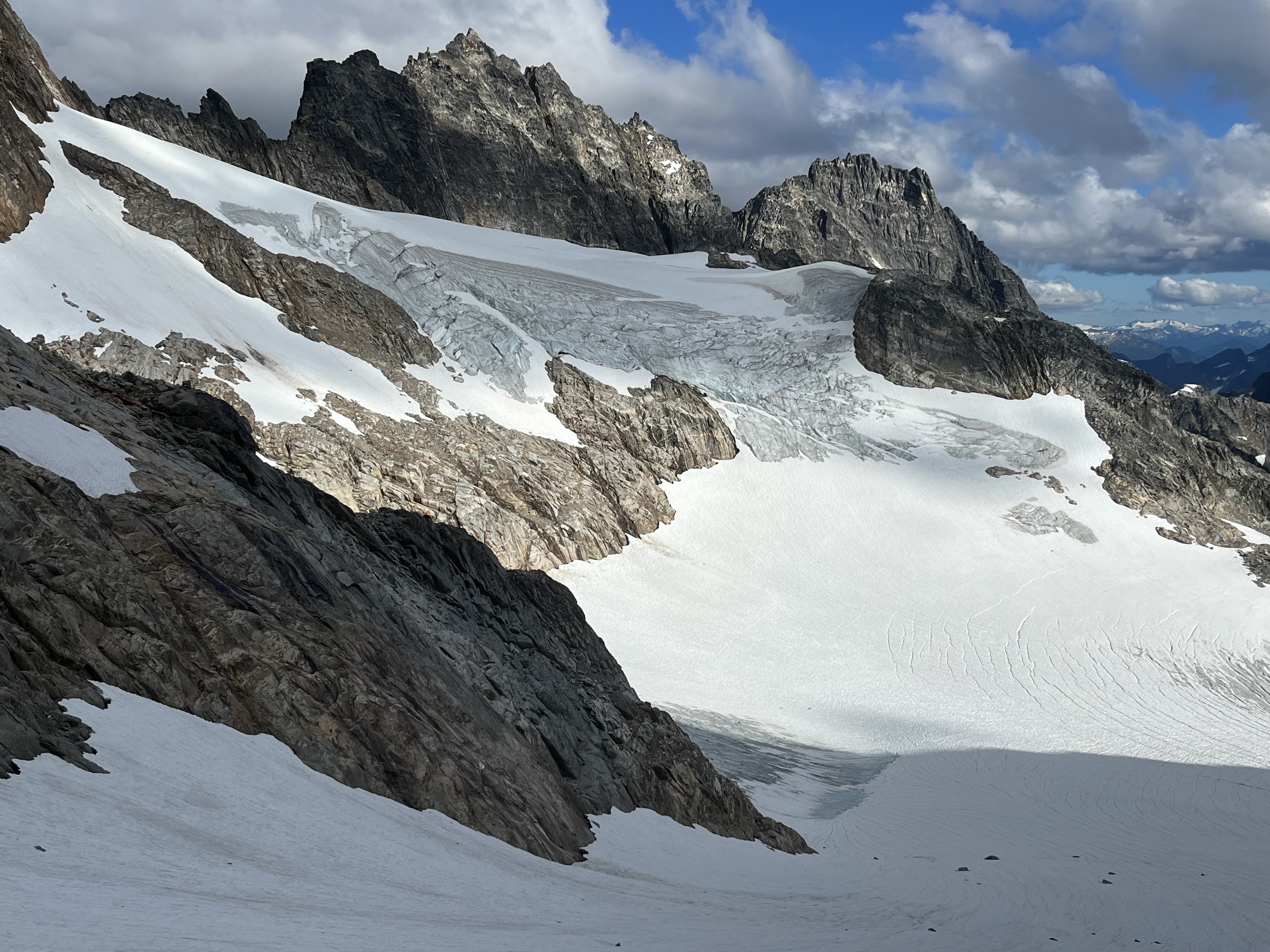
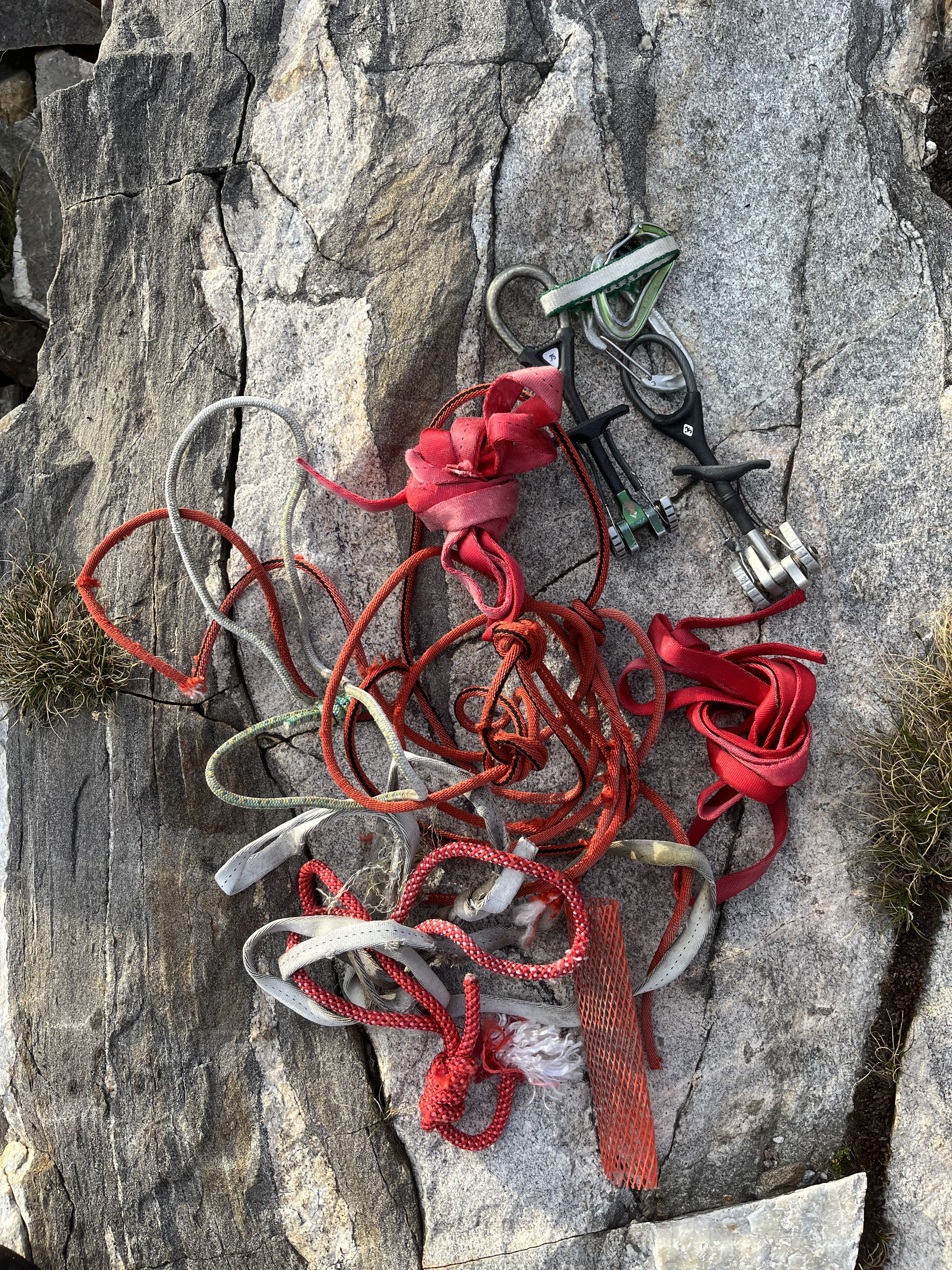
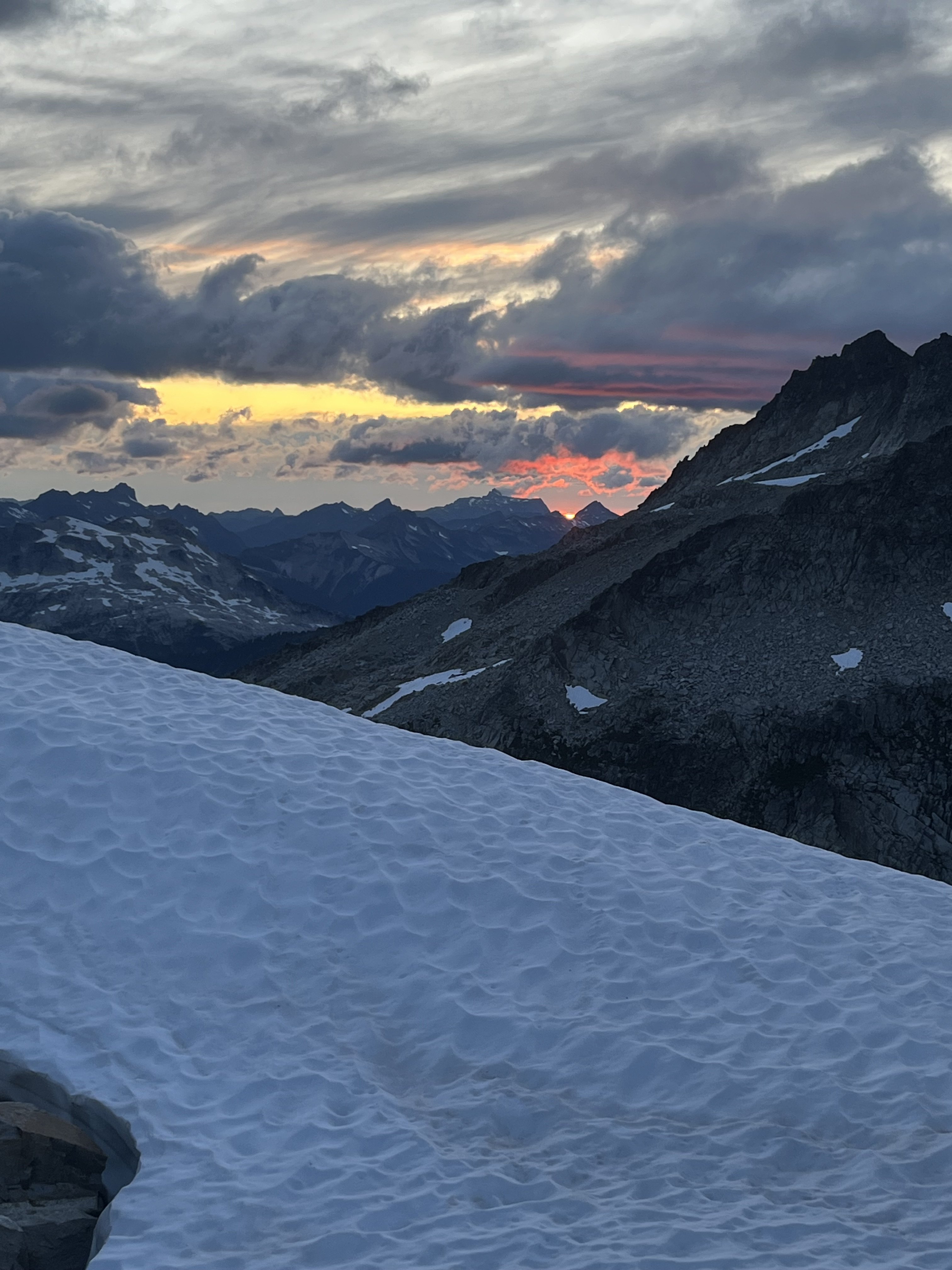
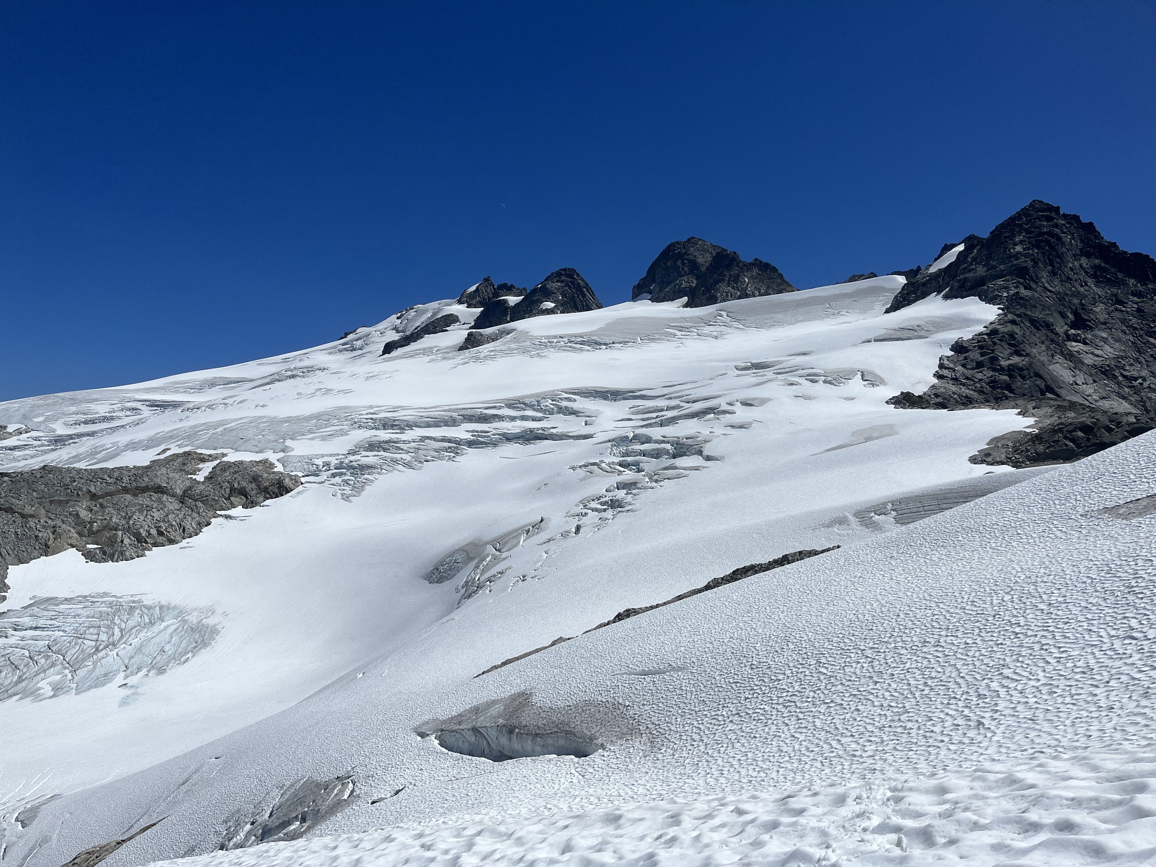
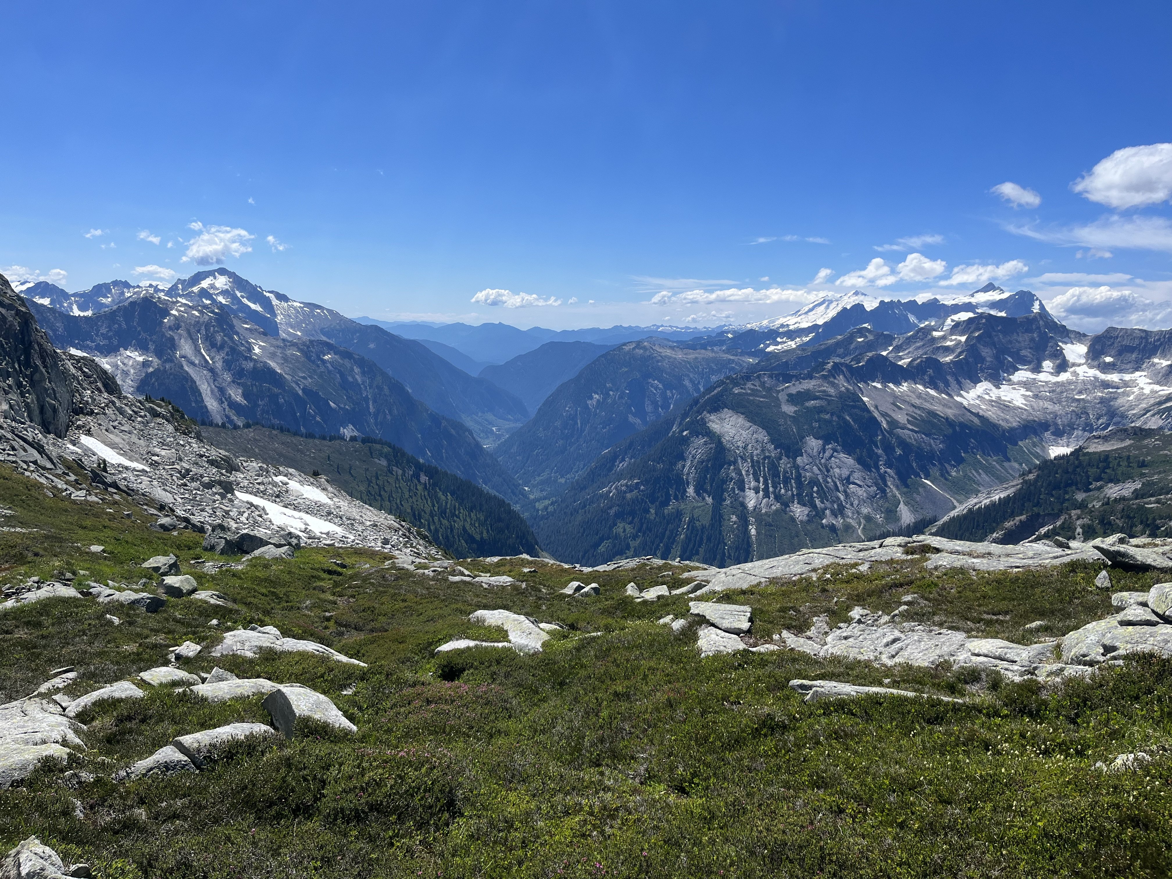
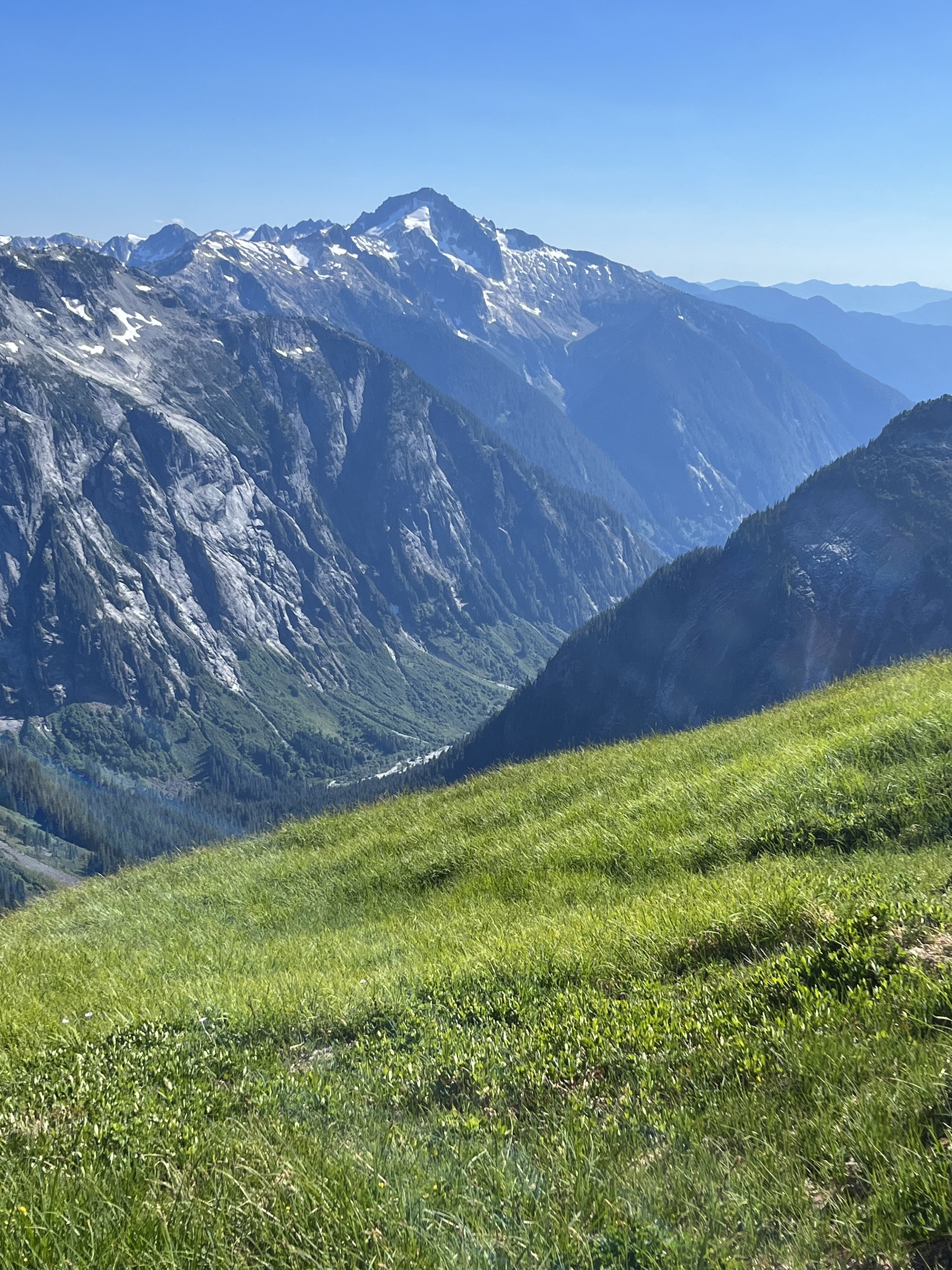
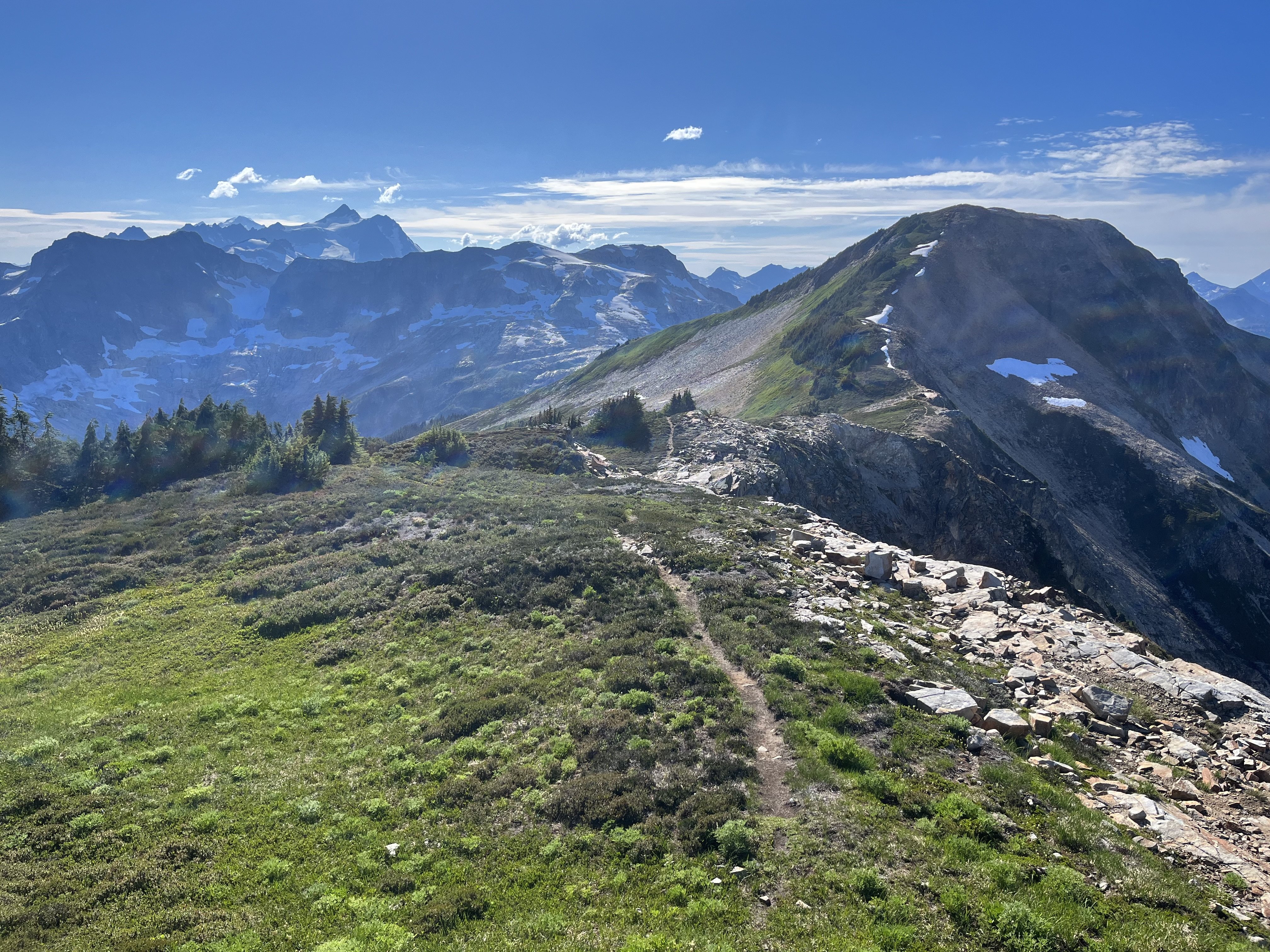
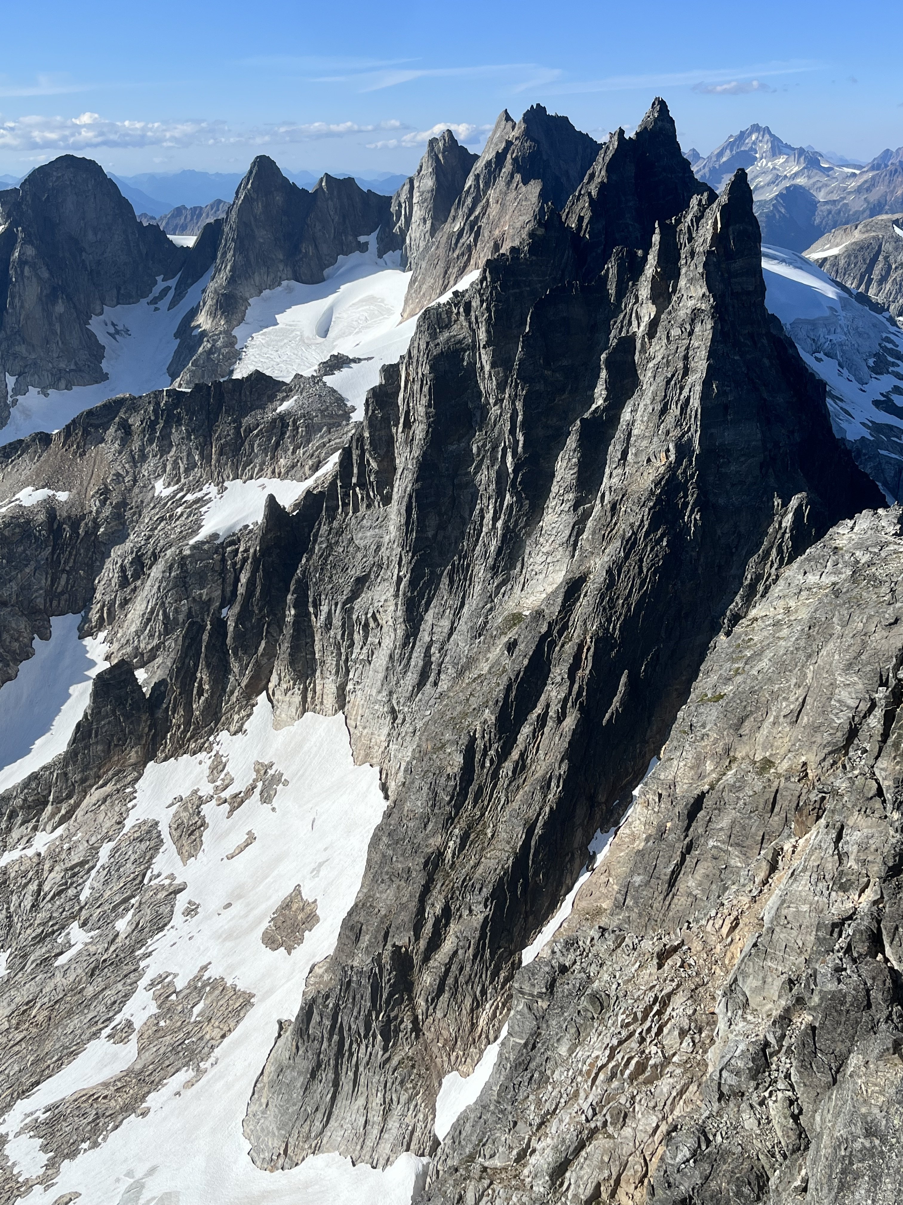
Trip: Crooked Thumb to Challenger, Phantom, Middle Challenger - Various Trip Date: 07/20/2023 Trip Report: Just because you can doesn’t mean you should. This thought arose as I was headlamp hiking in my underwear back to the trailhead to wrap up 4 days in the N pickets that were amazing, exhausting, and occasionally nerve wracking. I don’t intend to endorse solo itineraries such as this one, but I’ll share a few notes. Sorry I don’t know how to be more succinct Will add some photos later. Day 1 Hannegan Pass TH to Perfect pass. Got to the ranger station before 8am to try to get in and out as quickly as possible given the distance. Pretty smooth sailing except for leaving my pole at the Chilliwack and having to return for it (1/2 hour penalty). There are two logs across so it’s not necessary to wade, but I didn’t notice this until my return trip. That said the crossing is not difficult. The trail is faint near the creek but overall hardly any shwacking required. I found crossing the impass on ledges a bit higher than what I’ve seen in beta to be trivial, so didn’t pay close enough attention, and this would haunt me 3 days later. Got to the pass before dark, and found just enough snowmelt to get by. A new moon sliced its way into the dusk. Nightfall was clear and beautiful and the location outstanding. Day 2 Ascended Challenger glacier in the morning. No surprise if you’ve been out and about, it’s already late summer conditions out there. A somewhat direct SE line towards Middle and West was still feasible though. Once on the upper glacier I detoured E to scope out a possible descent in the Challenger 2 vicinity (I think that’s the name of the one just to the W of the main summit). It looked involved but plausible. Steep snow, two crevasses, good snow to rock transitions above and below, and rock that looked ok for scrambling. I then headed back towards Middle and scrambled fun clean rock to the top and back. I wrapped around to Solar pass and glacier and tried to find an easy way down to the bowl SW of Challenger. The way I took ended up having some spicy slabs. On my return on day 4 I would find an easier way that starts at a lower elevation than my crossing this day. Once in this bowl I saw that the glacier leading up to Crooked Thumb was quite gnarly with snow barely continuous on the presumably normal climber’s right. I made camp on rocks at about 7400’. My only complaint was having to descend 1-200 ft to find running water. I got a little too relaxed and didn’t head towards Phantom until 2pm. Easy snow travel led to lovely ledge/boulder/stream zones. When I passed SW of Ghost I took out binoculars and stared for too long at Ghost. In CAG Beckey succinctly describes a W face route involving gullies. From a distance the first half seemed possible but then seemed to run into roofs and cliffs. @SeanO commended Ghost to Challenger in his mind blowing/ nauseating northern pickets traverse trip report, so I was interested in trying that on day 3. But after much deliberation I decided I didn’t like what I saw and that I’d probably leave Ghost out. This was cemented later in the day after my troubles on Phantom. I would end up in no mood for any extra wandering up gullies. I got to Phantom arm and took heather and blocks upwards. I understood the SW route to be a scramble, and entered a decent looking gully at about 6800’ on the SW flank. The terrain didn’t align well with the few photos I had screenshots of, but I didn’t worry too much about it. I ditched my pole here (guess where this is going) and headed up. The SW to SE aspect of this mountain turns out to have quite a few gullies that prove to be difficult to cross between. I hit trouble in the 7400-7500’ range. Things were getting steep and I seemed to be blocked from traversing over a rib to try a different way. Upwards seemed like the best option at hand but got more and more tenuous. The sunk cost fallacy had me foolishly exceeding my comfort level for downclimbing, so I got pretty committed. There was an intense section of exposed traversing on edges. Maybe 5.6-5.7, I don’t know. Some scramble. I finally got through it and back on easy terrain. At the summit I saw that the register is open, with the lid or base (don’t remember which) down in some crack. I believe this was the original, so that’s too bad. For the descent I headed back to the false summit then S on nice staircase ledges reminiscent of Mix-up’s, then a SE aspect towards the main gully separating Phantom from Spectre, and got on snow. This was much easier than what I had climbed but is a S/SE route. I don’t know, didn’t have a lot of beta for this one. The snow passed 500’ below where I had ditched my pole so I got another half hour pole retrieval penalty. Heading back towards camp I had some regrets for not camping nearer Phantom. Spectre to Crooked thumb jut up ahead, Picket creek plunges steeply below and Baker and Shuksan flank the far end side by side. But it would be an impractical launch pad for my other plans so I had to make do with my 7400’ camp. I arrived after dark, mentally and physically taxed. Day 3 - Days 1, 2, 4 had clear and calm weather but today, on the climax, the height of my adventure, I’d be treated to some light drama. Very localized weather blew in around the Pickets, providing a thin and constantly shifting layer of clouds pensively twisting around the towers. This made me nervous but it never got menacing. It just made things a little cooler and more exciting. Having decided not to start from Ghost I instead began with Crooked Thumb via its NW couloir. The snow was totally melted out, but luckily this couloir turns out to be just fine without it. Plenty of loose rock but I’ve seen much worse. Near the top of the gully I veered S to climb the N ridge. There was one notably rotten section on my route but it was just a few moves. Near the summit, blocks and ledges led to cliffs guarding it. But there is a key SE facing low angle wall with useful edges, barely 5th class, that leads back to the ridge and bypasses the cliffs. The rock on top is an amusing feature. I was leaning on it to take photos then thought better not. Saw about 10 parties in the register in the past decade, including Sean’s crazy traverse. I downclimbed the way I came, got a free lesson 10 feet from the gully. From there I headed N. Other than the rock being fun/good and one possible diversion to the W, from Sean’s report I didn’t know what to expect. At first things went smoothly, with some TFT-style sidewalks. But complex pinnacles soon returned and route finding was generally not easy. I never did make much of a W diversion, though this may have made life more difficult. On the N end of Crooked Thumb I did go W slightly but I recall this ending with a sketchy squirm down a backpack shredding chimney. Not ideal. In my gpx you can identify route finding episodes where the line goes from straight to scribbles. There are about 10 of those between Crooked Thumb and the true summit of Challenger. I agree with Sean’s description of generally fun and good rock (though in a traverse of that length there’s bound to be a ton of loose stuff and it’s hard to be appropriately paranoid every single time) but I would add that the route finding is far from trivial. Not heinous but I had to think a lot. When bypasses seemed prudent, they tended to be on the W side of the ridge. I don’t know how many points I went up and over, but there were a lot. These keep the true summit blocked from view most of the time. It was a little demoralizing to so frequently surmount a point and realize I was still so far away. In this light I still can’t wrap my head around Sean’s traverse. Not just the distance but the diligence and patience to handle so much loose rock and route finding uncertainty. It took me nearly 4 hours to get between Crooked Thumb’s and Challenger’s summits, which are less than a mile apart from the air. Not exactly easy. At what seemed like the final false summit, I considered tackling it head on. It was narrow and very exposed but juggy and mostly solid. But 10’ below it’s crest I hit a crux where there was no feet. After playing with it I decided it was crazy (at least 5.8?) which was too bad because it would have been an awesome way to go. Instead I delicately traversed on the W side to some dirty loose blocks that I gingerly scaled. This was dubious but less exposed. The summit’s lack of prominence from the S is kind of funny. I saw a slung block and thought I guess this must be it right? Yeah I guess I don’t see anything taller. Downclimbed the summit block (rap line, harness, and rock shoes were just sweet sweet training weight I guess; well that and some peace of mind), bootied a cam that looked somewhat fresh (lmk if it’s yours) and headed down dirt and rock to the glacier where I scored some water from a pool cradled between it and the ridge. Because I was returning to my bivy near crooked thumb, not perfect pass, I didn’t explore to see if the standard route was blocked by schrund, though I heard a rumor that’s the case. I traversed on rock, passing below Challenger 2 to the area I scoped out the day prior. Exposed face in downclimbing with my light tool and a pointy rock ensued. The snow was in good shape for this, not too slick or punchy. The rock turned out to harbor one little crux at the bottom but it was all right. Good snow bridge got me back on the glacier. Since I found the solar pass descent harder than expected the day before I decided to try the Middle-West descent. There are slung blocks but the angle looked mellow and there seemed to be plenty of holds. Stemming and smearing worked well (but would have been hard in boots) until it deteriorated to dirt for the last 10-12 feet. Crap, I bet this part is often covered in snow. I got through it one way or another, but learned that I wouldn’t want to ascend this way due to the dirt. The route I had taken to camp the day before seemed like it may have given its last gasp, at least for a soloist without a lot of gear. The snow was still continuous on the left side, but was steep and passes above cliffs and crevasses. There were also still hidden cracks starting to materialize in the flattish section leading to the left side. For these reasons the right side would be much more preferred (more direct, shorter duration of exposure) but didn’t look so viable anymore. So I carefully went up and around the left side. This was the most adventurous day of the trip but at <10 hours the shortest and least physically difficult. I relaxed at camp and for some reason didn’t do the math for how long of a day awaited me. Day 4 - a funny thing about this bivy spot is the W aspect, with tall cliffs above it. Sun didn’t reach me till 8:15 and it was pretty cold before then. I was in no hurry, took a while to pack everything up and didn’t leave till close to 10. This was pretty dumb, I should have started much earlier. And part of the route was still in shade even at 10am, so waiting didn’t help. The snow was pretty frozen and I was glad to have a tool and my steps from the day before stamped in the snow. It was an hour of tedious face-in diagonal downclimbing, swinging my tool and kicking feet for most of that time, to cover 1/4-1/3 of a mile. When I bottomed out I tried the Solar pass strategy again, but started lower, finding really nice and fun granite. I wrapped around that ridge and followed it a little too high. Because a portion of the glacier between me and the pass had melted down to ice, I had to a slight ascent, traverse W, and descent to access the pass. On Challenger glacier I had my tracks from 2 days prior for reference, but things seemed significantly different. Probably some combination of noonish instead of morning, down instead of up, and 2 extra days of melting. It was stressful and I regretted being there, could not wait to get off of it. It was quite apparent that the crevasses were deep and wide and snow between them was not confidence inspiring. One of the sketchier looking parts was on the edge of the glacier, only 100 feet from reentry to rock. I didn’t notice on my way up to perfect pass how non-obvious the route is. Steep and weaving. At the impass I made a nominal effort to locate where I had crossed but got lured too high up the face. From there a horizontal traverse seemed possible but what would it look like on the other side? I had endured so many tenuous traverses in the past few days. Instead i downclimbed and reassessed from below. I tried again, finding an easy ledge but still ended up crossing too high. This ended with a short but slick and featureless slab at the bottom of the chute on the W side of the crest. Not fun! Rubble on the way to Easy peak was easier on the ascent than it had been coming in. I got to the old lookout, digging the views and checked the time - 5:30. Wait didn’t it take 8 hours to get here on the hike in? Crap! I ate caffeinated jelly beans and became a reluctant participant in mountain running, slow jogging down easy ridge. Great spot for it. Knees took a beating but handled it surprisingly well. I reached Chilliwack before dark, crossed on logs this time and tried to get stoked for the hike back. I had perfectly natural and reasonable feelings like this sucks and why I am doing this, but I was able to dispel these with counter arguments like hey it’s just walking, walking is no big deal. Maybe this is fun. This worked well until Hannegan pass when I couldn’t ignore that every part of my body ached. I reached the car at 1230, so far all that ass busting it was only an hour faster than on the way in, so maybe not worth it. Gear Notes: Approach shoes, steel strap-on crampons, light tool Approach Notes: Hannegan-easy-perfect
 4 points
 -
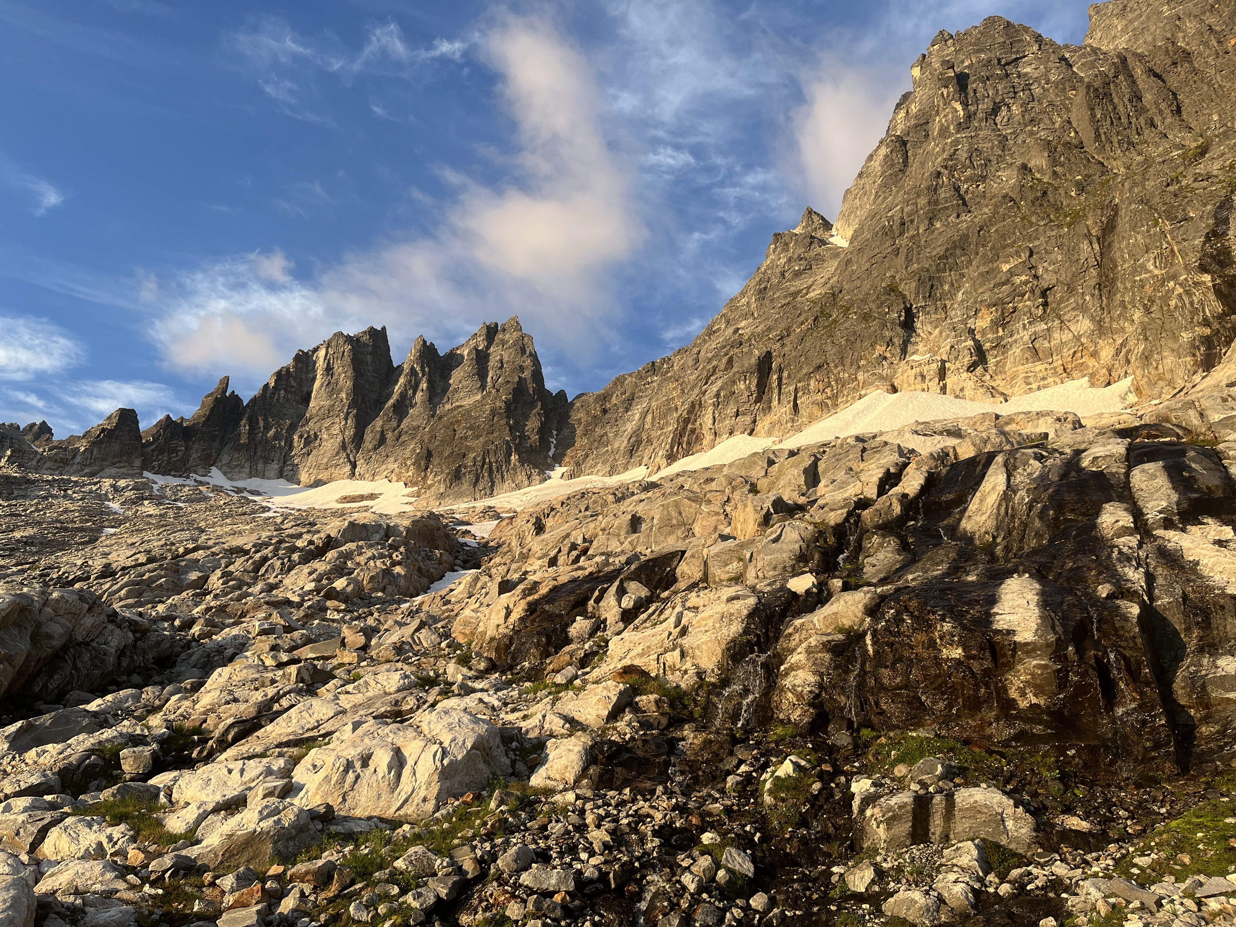
Trip: Nooksack Tower - Beckey-Schmidtke Trip Date: 07/23/2023 Trip Report: Hi, I'm going to try to keep this brief as my eyes are still dry from the long sunny dry day yesterday. Me and @thedylan climbed the "easy" route on Nooksack Tower over the weekend of July 22-23. We had a pretty easy time on the tower, especially compared to basically every other report out there. I don't believe we followed Beckey's beta exactly, but we climbed camp to summit in 4.5 hours and never anything harder than about 5.0, and that was the last 30' to the summit. I would recommend our route highly (if you insist on climbing the tower at all). We hiked in to camp at 6100' in 5.5 hours without pushing particularly hard. The hike was beautiful and the camp spectacular, if one had to retire from climbing but still wanted a good mouthful of it this would make a spectacular backpacking trip. Our campsite was at 6100' at a minor notch in the ridgel it had close water, immediate access to the glacial snow slopes, no bugs or rats, and perfect flat smooth slabs for sleeping and lounging, even backrests! It was weird having time to lounge, eat, drink and etc while on a serious climbing trip. But this route isn't broken up well into approach and climbing day. We were up at 2:30 am, hiking by 3:30. We found an easy bridge through the bergschrunds and were headed up the gully by first light. I had laughed at Tom Sjolseth's 2009 report that suggested the snow was 60-70° at the top, but it was! If only for about 20'. Fortunately, there was a fantastic moat to change out equipment in. A lot of people seem to get on the rock too early, we went to the top of the summer snow, "where the couloir narrows" per Beckey means really narrows, not just a little narrower. We climbed right up a crappy "slabby" corner, actually a chockstone gulley to access the obvious class 3 right leaning gulley, after 200-300' we worked a bit right out of the bottom of the gulley to keep the terrain moderate as the gulley steepened. We climbed a steepish wall here that might have been 5.0 but it could have been bypassed lower and right. This working right felt like wrapping around a rib at the time but isn't really when seen from above. After "wrapping around the rib" we were on a face and this is where a LOT of people go wrong. We passed lots of rap stations that apparently lead up and right to the north face route (BAD, insert frightening those emoji). We climbed up class 3 and 4 open terrain for ~250', then started working left and up. Lots of left. In this open class 3-4 area keep looking left, the multiple ribs and gulleys below you and left are steep, once they start to mellow out and the terrain above begins to steepen work left across multiple ribs and gulleys. We found this to be very positive incut hands class 4 ground with some ramps in places leading you up and left. Once you get into a distinctly bigger gulley you are in the zone, this leads to the ridge crest 200' north of the summit, or, I believe, you could keep traversing one more large gulley over and climb straight up to the summit. This looked easy from above but we didn't go that far over. The big gulley we climbed up was mostly class 3 with some 4th class steps. We hit the ridge and put on the rope for the first time. Dylan lead out, simuling to the summit in about 150' of rope length. There was massive air on the west (right) and plenty on the left that I'm glad we used the rope even though I think the only 5th class part was 20' or so up a wall to the very summit. There were some familiar names in the summit register. Bizzarely, we signed in right below @Albuquerque Fred from 5 years ago!! Can that be true!? In this case the summit really is only about half way there, so we headed down after some snacks and photos. We did 2 raps in a row off the summit back into the large cl 3-4 gulley, then downclimbed it and the traverses back to the NF rap line. We did 3 more raps to the snow moat and our gear. "We" decided it was OK to downclimb the top scarry steep part, so Dylan went first since it was his idea. It was actually OK, the snow was soft enough for good steps but firm enough for solid high dagger sticks. This was extremely tedious after about 800'! My hands hurt today from stabbing my axes into the snow. When we got back to the compound bergschrund situation we couldn't figure out how we came up, Dylan kept climbing down where I insisted I had lead up, but there was nothing obviously right. I kept insisting it was there and that it had been easy but he kept insisting what he saw below was steep icy climbing into the cracks. Eventually we traversed between some cracks and set up a rap off a bollard on the lip, we then realized the bridge we had come up on had collapsed and was lying in the bottom of the 'schrund! The hike out was uneventful but didn't take much less time than the ascent did, bizarrely. Once above the moraine, we did different routes up and down and I think this added to the increased exit time. On the way up we followed the boulders at the base of the trees as in the red line below. This was a mostly flat traverse between 4600 and 4700'. Then we turned up to traverse at 5200', below the buttress to the right of Dylan in the photo. The ascent from 4600 to 5200 was lousy climbing pulling on blueberry, if you can find a good way to do this it would be way faster than the ridge crest. There is a perfect goat path through heather and a ledge through the steeper slabs, then easy clean slab walking to camp. The slabs were amazing, beautiful clean rock, easy walking and fantastic pools and streams of water tracing intricate routes along the rock fissures. On the exit we reversed the slabs and the traverse at 5200' but then gained the ridge and followed it all the way down to the moraine, the last steep part was as bad if not worse than the way we went up but the ridge was also brushy and tedious. I would recommend our ascent route in red below: OK, so not so short, but it was a long trip. Car to camp: 5.5 hours. Camp to Summit 4.5 hours. Summit to camp 6.5 hours. Camp to car 4.75 hours. Apprach: Moraine and first look: Slabs below camp: At camp: Changing systems: The sun rises from Redoubt Camp from the snow moat: Shuksan from the summit, the Price looks tough: Dylan on rap: Last look: Gear Notes: 60m twin rope, 60m tag line, 2 axes, steel crampons, e-bivys, small rack (placed 2 pieces), tat (used none), 2 pickets each (didn't use), approach shoes for the hike and rock, boots for the snow, poles for the river. Approach Notes: River was fordable, tough on the way out, crossing is flagged. Trail largely flagged, not bad.3 points
-
I haven't been on the ridge nearly as much as you, but yeah, maybe the craziest thing that has been done in the range in a loooooooooong time. Glad you made it out safe, that's a lot of choss by yourself!!2 points
-
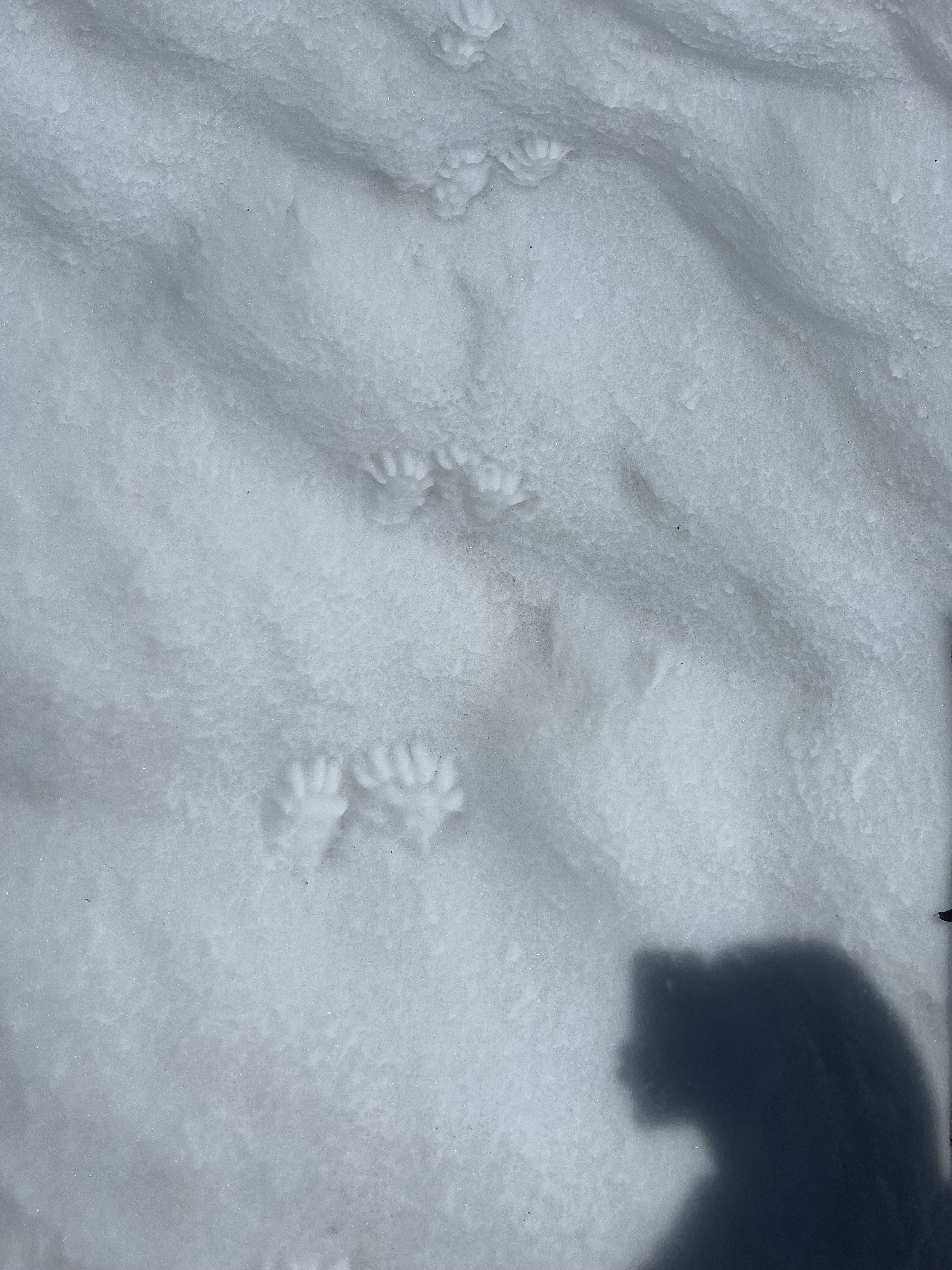
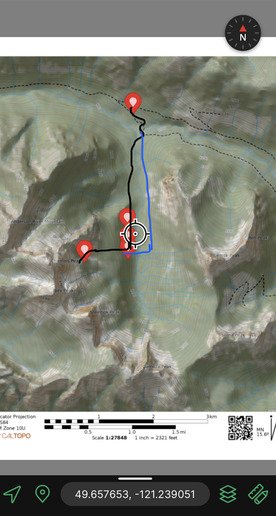
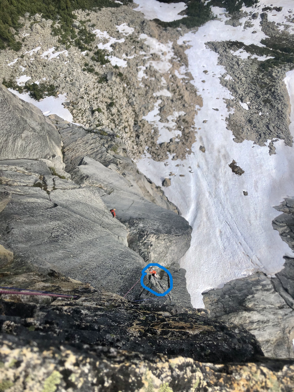
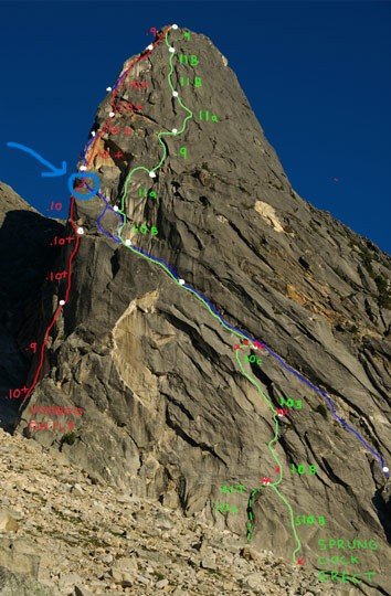
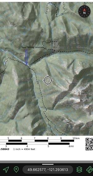
Dan and I had quite the adventure on Sprinbok Arete! We climbed on 07/02/2023. There is plenty of info on the route already so I'll just give a brief update on conditions of the road, approach, and route. ::The route:: The first major thing to note is right now we would consider this route a death trap!! I would strongly advise avoiding Springbok Arete and Voodoo Child until 2 massive blocks are trundled. Using mountain project pitch descriptions of Springbok Arete::: at the end of pitch 7 the slung horn previously used as a belay is gone. I decided to keep climbing before setting up my anchor. The route goes up a chimney feature with 2 large blocks wedged in it. Each block is about ~10 feet tall 2-3 feet wide and 3-5 feet deep. The only way up at this point is climbing directly up the blocks. As I was hand jamming up between the right block and the main wall, I could feel it just barely move. The movement was small enough I wasn't entirely sure it happened. Maybe my hand just slipped a little? Maybe the noise I heard was just standard noise of minor rock flex we've all heard in the mountains? I made it to the top of the blocks without incident, but decided to build a belay at that point so I could clearly talk to Dan when he climbed through. My belay was slightly to the left in a solid crack and I could stand on the left block and thought this would be fine. As Dan came up the pitch I warned him that the right block may be a touch loose, but I wasn't sure. As he climbed, both blocks shifted out from the wall about 6 inches. We both immediately fully weighted the anchor. I lowered Dan rope and he jugged up the wall touching them as little as possible. Fortunately we made it to the top without any incident, but these blocks are definitely loose, want to shift out from the wall, and could come down under the weight of the next leader, which would for sure kill them. We didn't try to trundle them as there was a party below us (we yelled down to them and they rappelled) and honestly we were a little sketched/shook and just wanted to get out of there. I unfortunately didn't take any photos from this point, but below are some photos from online with the approximate location marked. Voodoo Child joins the route at this exact location (I think) so should be avoided. Sprungcock Erect splits before this section so should be safe to climb. The Gatekeeper is fully to the left so is safe from this. Location of loose blocks ::The road:: There is a major washout at approximately mile 11.4. Immediately after, there are two river crossings (one crosses the Anderson River and the other crosses an unlabeled river running east/west), both bridges are gone. Dan and I decided to bring E-bikes thinking we could quickly and easily ride the 3ish mile road to the old parking location. Crossing the two rivers with the heavy ebikes was a huge pain the in butt, but we made it. Subsequently the next five or so creeks were also washed out. Carrying the ebikes up and down the washouts was slow and tiring. Looking ahead at the map we had many more creek crossings to go so we decided to ditch the bikes. Of course none of the next creeks were washed out and we could have had a fun, and fast 2 mile ride. Instead we walked.... Oh well now we know.. I drove my rav4 which was fine. You need something with a little clearance because there are a lot of tank traps dug up on the road. There is one area where brush is growing into the road. Don't bring a car that you care deeply about its paint job. New Parking Location ::The approach:: Its pretty much what everyone describes. Alder schwacking for a few miles.. Its not fun, but honestly wasn't that bad. If you just put your head down and go, it doesn't slow you down that much. We saw bear scat on the road/hike every couple hundred feet until we broke up into the mature forest. This is the lower edge of grizzly country... We had bear spray with us (fortunately Sam from Waddington Outdoors gave us the heads up on bears), but only ever saw scat and tracks. Fortunately bushwacking is relatively noisy so any bears probably heard us coming from a ways away. There are 2 old roads that run north/south up the valley from the old parking location. We accidentally took the one on the west side of the river. Its not what is recommended in Cascade Rock, but I'd do it again. Either way, you have to schwack up an old, overgrown road. The one we took was more direct, involved one less creek crossing, and had less gain/loss of elevation. I haven't hiked the other side so I can't compare. Black was the approach we took, blue is what is described in Cascades Rock, Steph Abegg, etc.. The last bit of excitement we had was on the descent, which involves going doing the chossy gully between the two mountains. About halfway down a basketball-sized rock came down and narrowly missed Dan's head while he was rapping, but did manage to core shot our rope in 4 places. Fortunately we had a unicore rope, which worked very well. We rapped with one 70m rope, which took us 10 or 11 rappels. Steph's rap beta is perfect. We had to rap one or two more times at the end than she describes because the bottom of the gully was choked in steepish snow. Overall we had a great time, but were happy to be down safe! Someone needs to put up modern routes on Steinbok Peak. It looks amazing!
 1 point
 -
I had an incredible backpacking trip in the Selkirks earlier this month. Among other things, we climbed Twin Flakes on Harrison Peak. The South Face Standard and Keystone routes get all the attention on this peak, but the locals agree that Twin Flakes is the best route up there. Check it out! Full trip report with photos: https://spokalpine.com/2023/07/25/harrison-peak-twin-flakes-ii-5-8/ TR text: I had my first “vacation alpinism” trip of the season recently when Larissa and I backpacked up to Harrison Lake to climb some of that delicious Selkirks granite. Our first day was spent swimming, eating bread rolls, and questing up a few routes just above the lake. On July 2nd, we trekked over to Harrison Peak for Larissa’s first mountain climb: Twin Flakes! After a quick approach, I racked up and quested off onto the first pitch of Twin Flakes. Among hardcore Selkirks aficionados, this route has a reputation as the best route on Harrison Peak and I was excited to try it out! The typical Selkirks first pitch experience was in full effect: somewhat run out, ambiguous climbing is often required here to gain significant features. I found a comfortable belay and brought Larissa up. The second pitch is among the better alpine rock pitches that I’ve climbed in Idaho. Full commitment laybacking and stemming brought me up a perfect corner to a stance, before another interlude of attention-grabbing climbing. Excellent protection allowed me to enjoy the climbing and sunshine, despite some lichen-covered rock. This ain’t the Cascades… this route might only get climbed a time or two per year. The final pitch had some sweet face climbing before I found myself below the “rock cornice” mentioned in the Laird guidebook. Feeling the exposure, I traversed slightly right, placed two good cams under the overhang (safety first), and made a committing throw out right that allowed me to snag a secret hold and mantle onto a ledge. A few more meters of climbing brought me to the summit ridge. The walk off descent went quickly and brought us back to camp at the lake in time for a big dinner on the lake shore. The next day, we returned to Harrison Peak to repeat the South Face standard route [ Harrison Peak – South Face (II 5.7+) ]. The final pitch of the South Face is just as good as I remembered! Gear Notes: We brought doubles of .3-3, a single .2, and a set of nuts along with a single rope. Strategy Notes Harrison Peak is easily climbed car-to-car, but camping in this area is worth seeking out. The Beehive Five Traverse [ Beehive Five Traverse (III 5.4) ] is right in the neighborhood as well! We climbed one route per day on Harrison, but experienced teams could easily climb two or three in a day on this wall, stashing gear at the base of the Standard Route.1 point
-
"Maybe this is fun." HAHAHAHA, nice try at positive thinking, I like the effort. Thanks for the post, I've been trying to get in to that area for a few years. It looks amazing. Quite the solo effort, I think I'll take a partner! How was the camp below Crooked Thumb, aside from less than ideal water access?1 point
