
Leaderboard


Popular Content
Showing content with the highest reputation on 08/29/25 in all areas
-
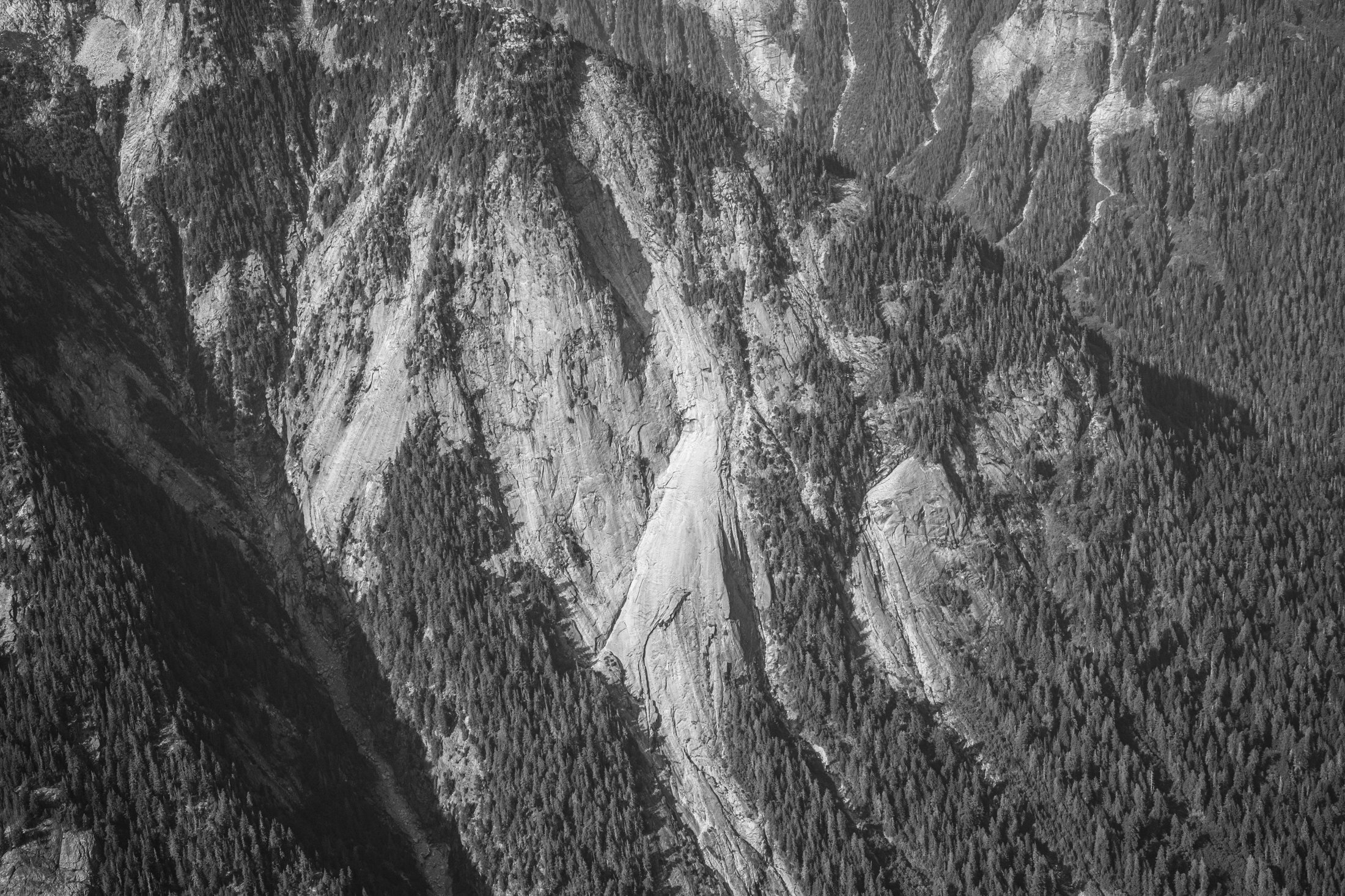
I was coming down the Baker River yesterday afternoon and passed by the slab feature shown in the photograph. I've seen it many times before but this time decided to grab a quick snap of it. It's located on the north side of the river at approximately 48.82863, -121.43918 if you want to google earth it. I'm sorry to say that it would be a hellish ~seven miles of vicious travel up the river from the trail end at Sulphide Creek. The view looks to the north. This is on the south-southeasterly trending ridge that extends from Mineral Mountain to the Baker River. Has anyone heard of anyone visiting or otherwise investigating it? From the air it looks much like something you'd see in Darrington. The photograph was taken from 48.80671, -121.43873, while at an altitude of about 6400'. The slab extends below the bottom of the frame, but not all the way to the valley bottom.
 2 points
 -
Another 2 weeks and there would be zero bugs. Bugs die fast in the far north as summer ends in late August. I think that might not have been so aytpical for mid August.1 point
-
Yeah, we were really surprised at the bug situation. We all brought bug nets and deet, but never really used them much. The bugs were about as bad as the Cascades in July/August. I'm still confused about it, maybe just a good season, or possibly reverse sandbagging by Alaskans to keep people out (but I doubt it). I think we just got really really lucky.1 point
-
It’s just me reading the TRs 1000s of times1 point