Leaderboard


Popular Content
Showing content with the highest reputation on 02/05/25 in all areas
-
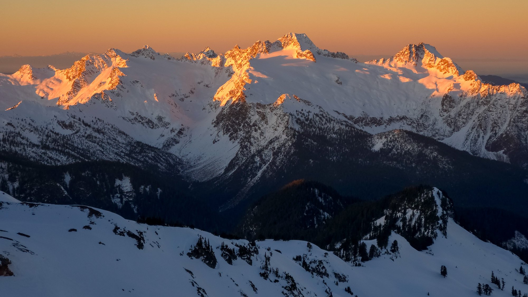
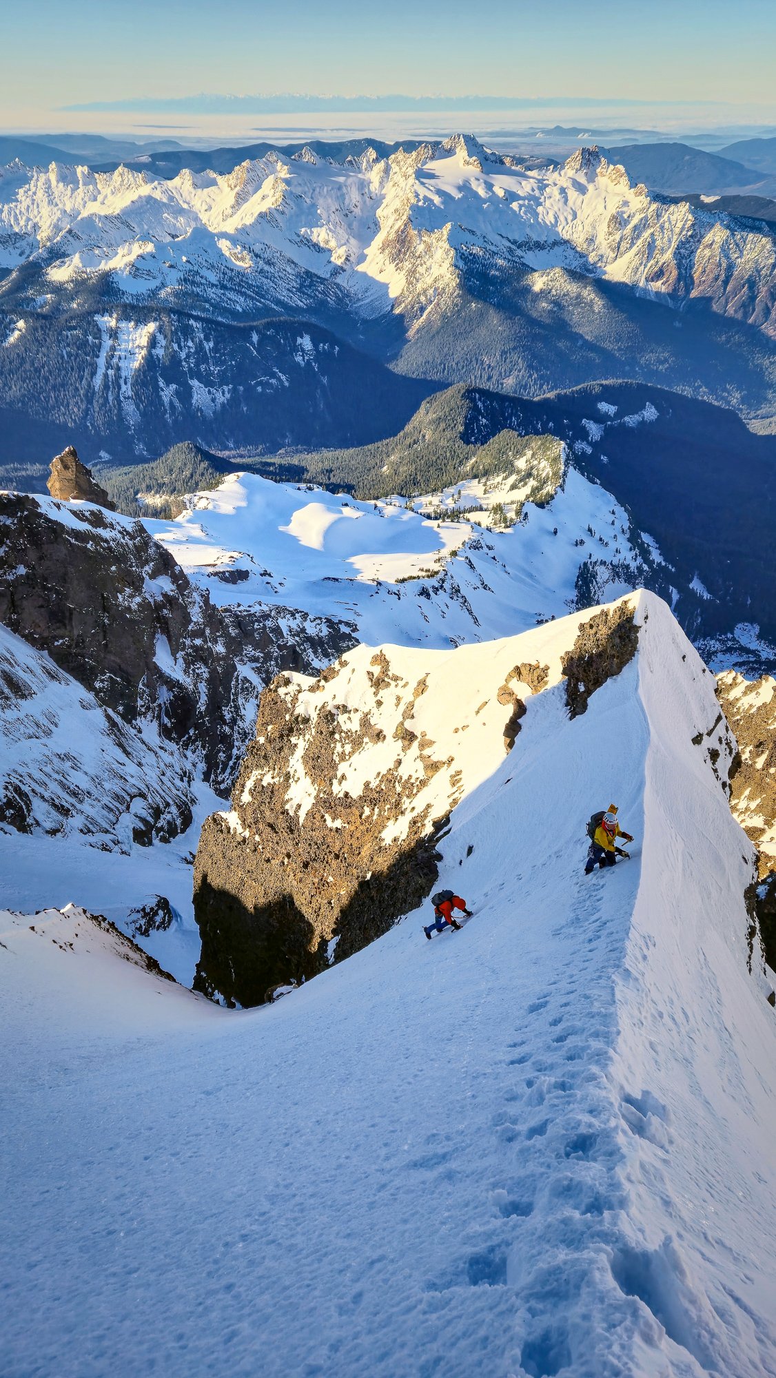
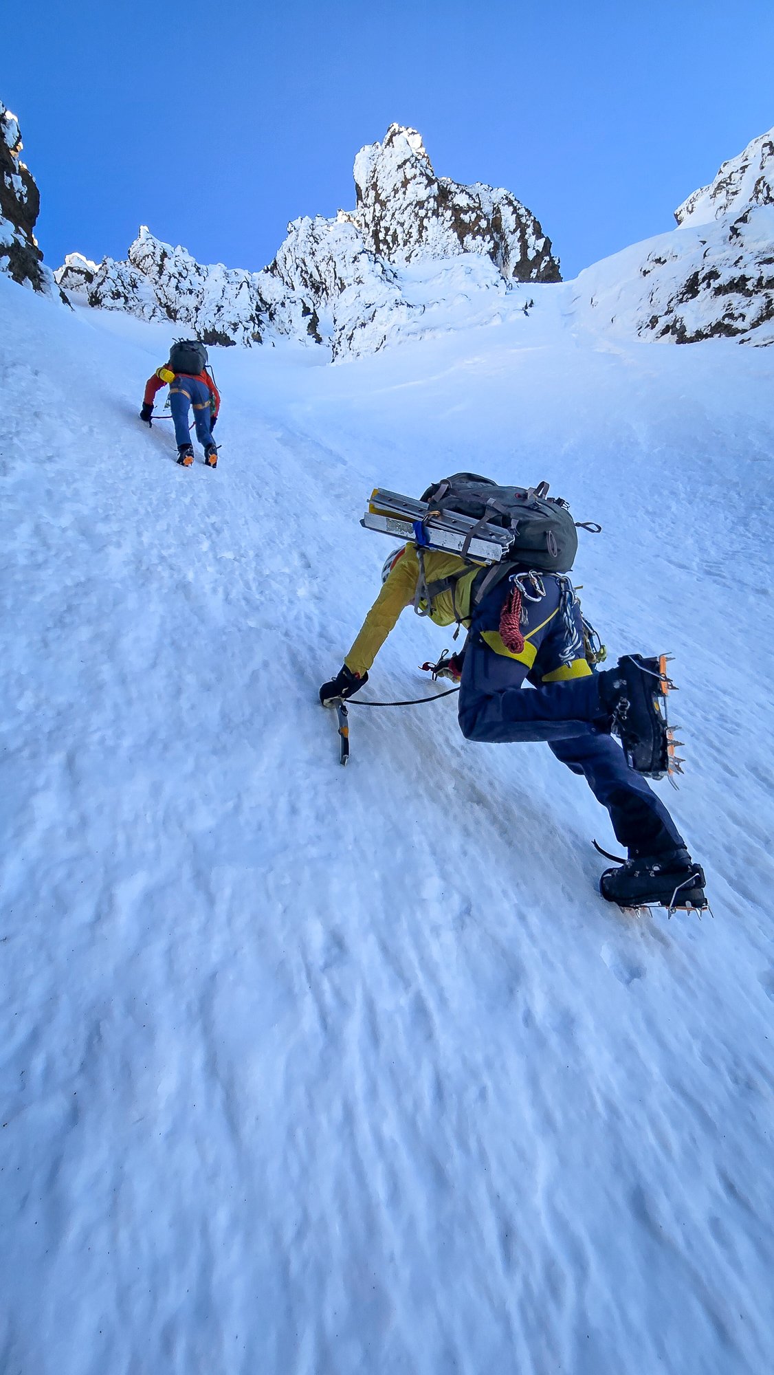
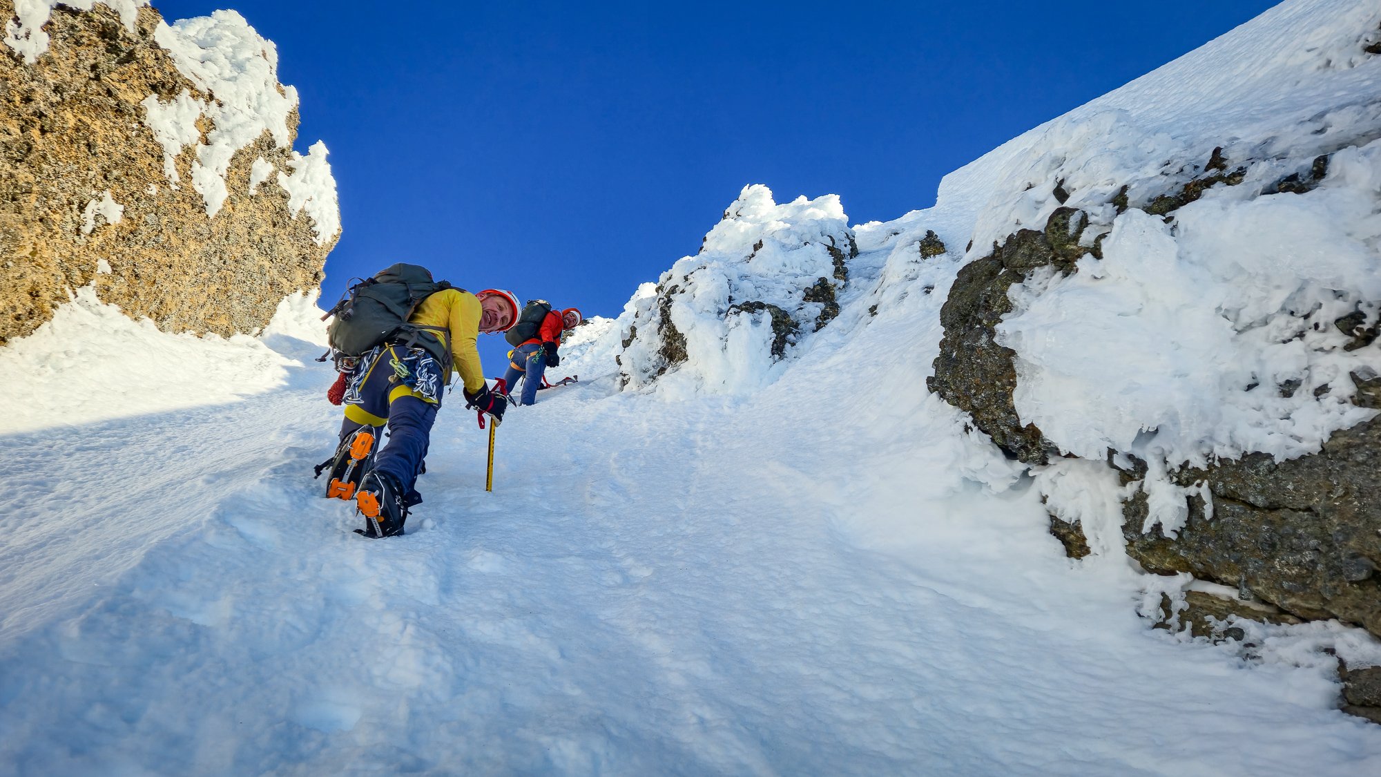
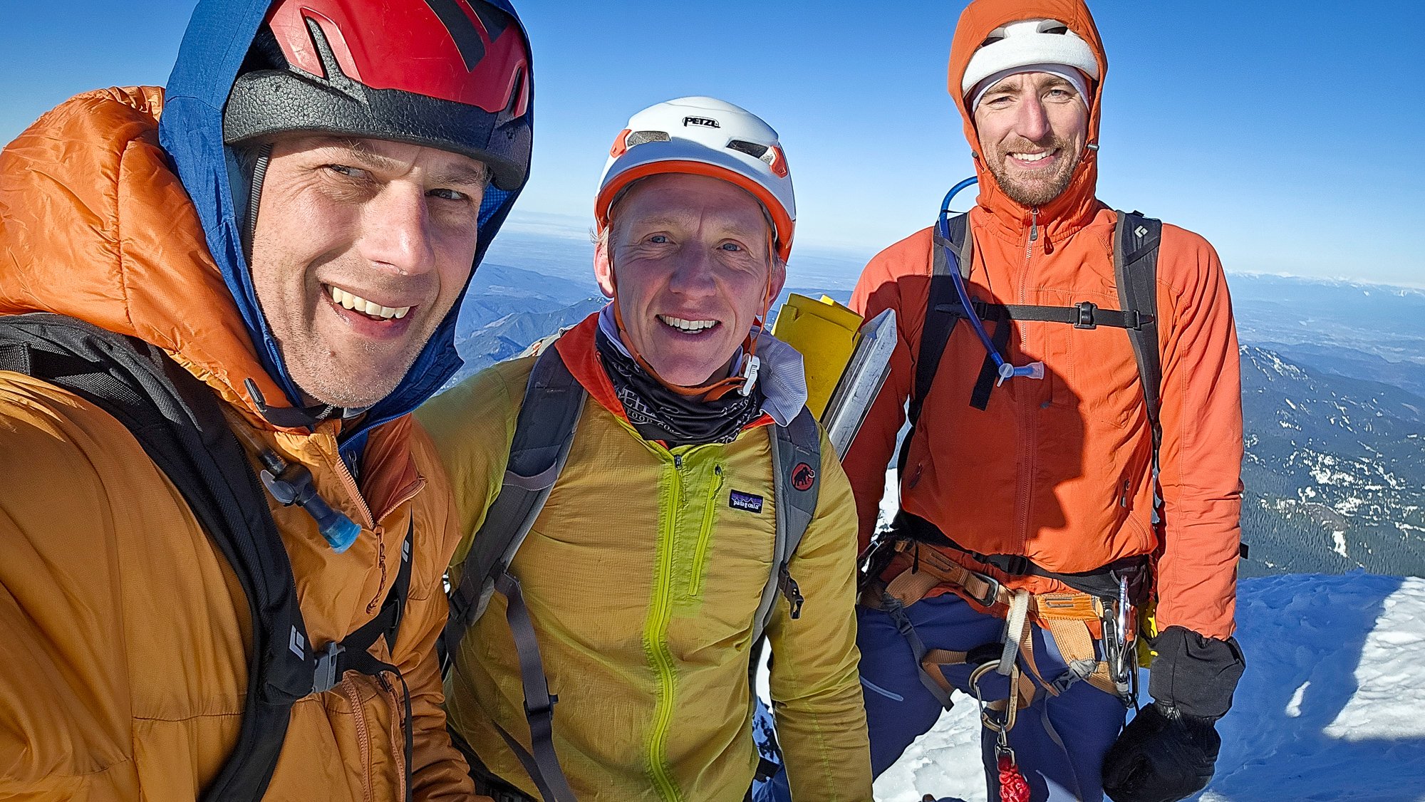
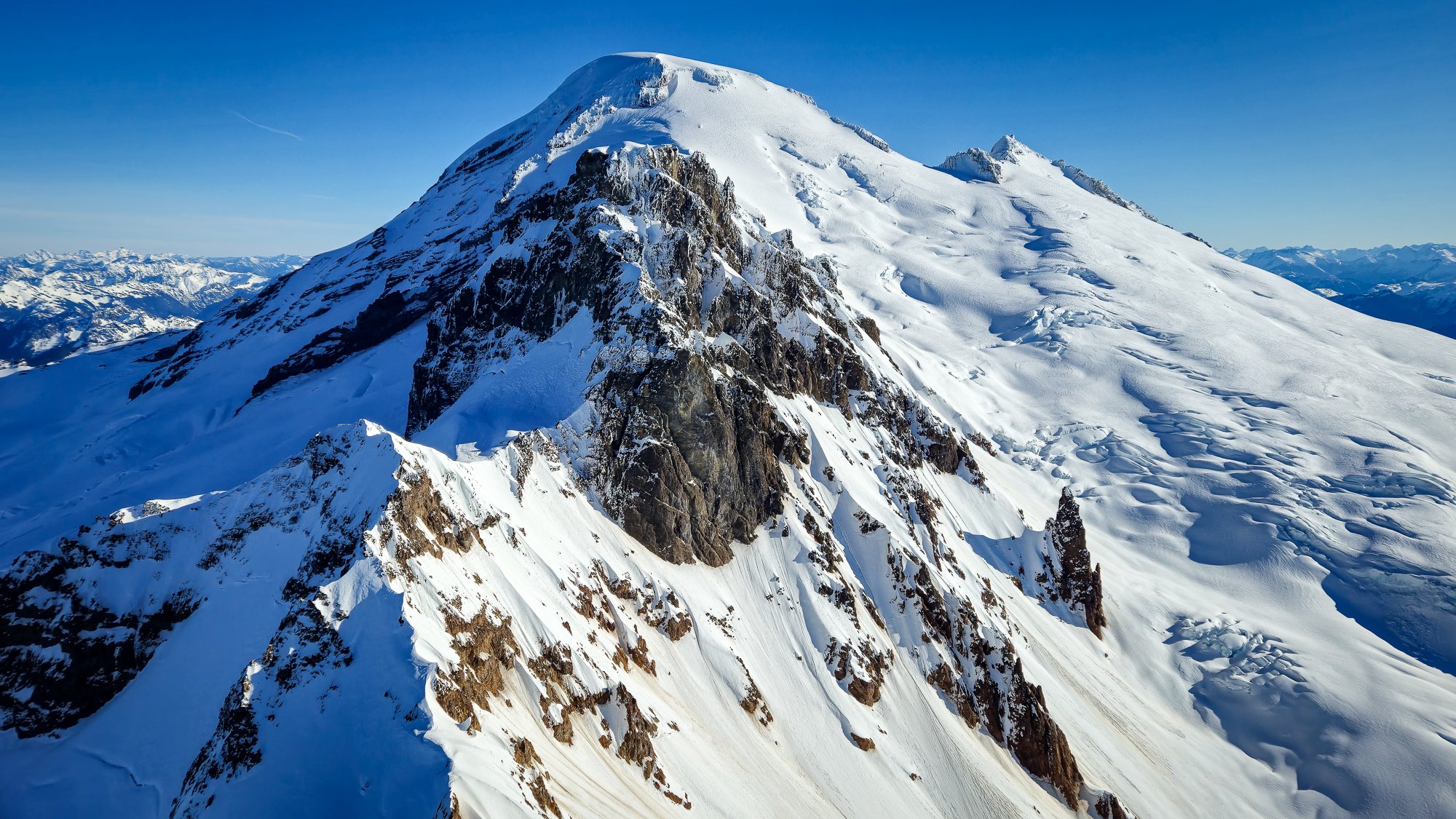
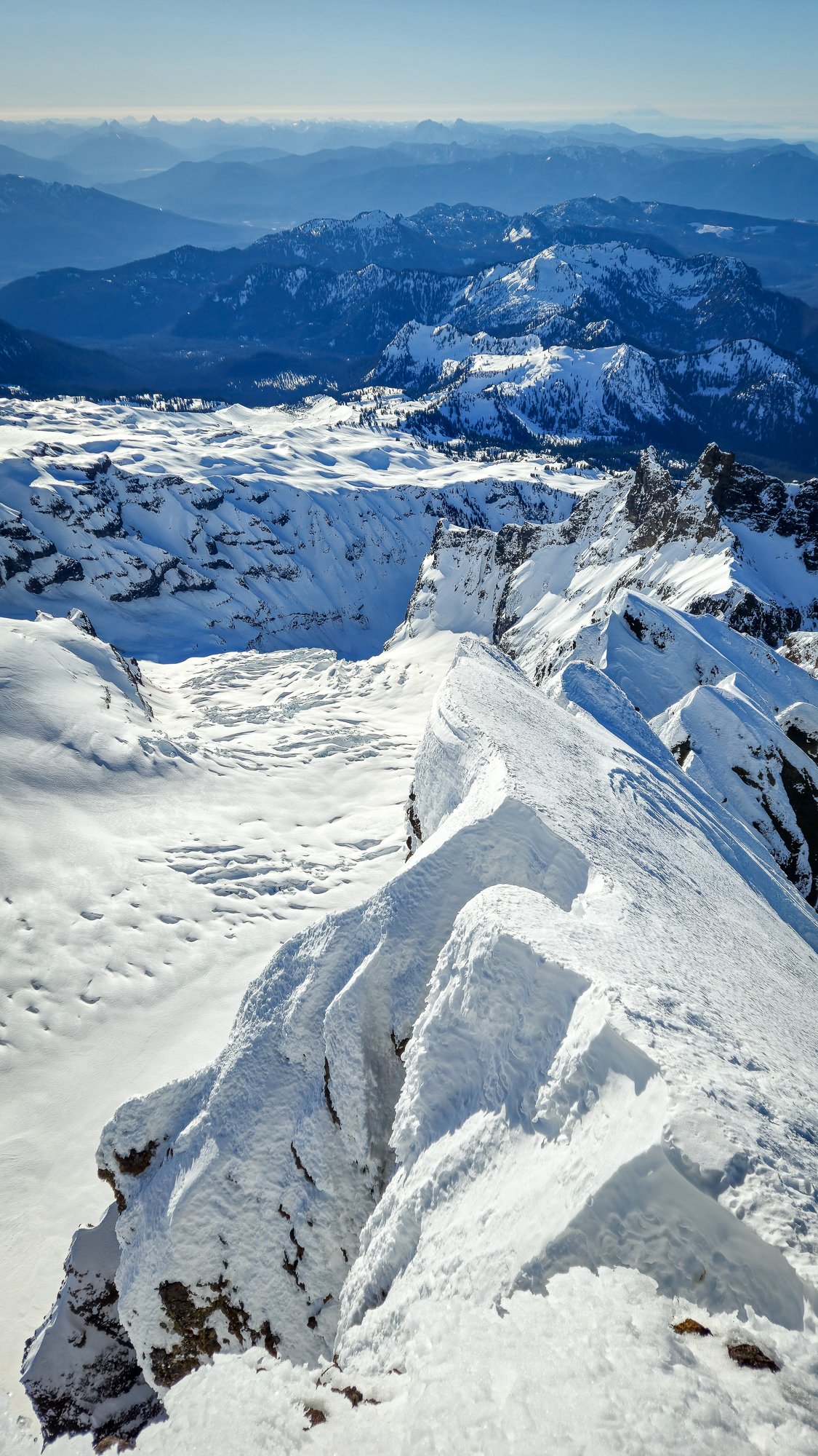
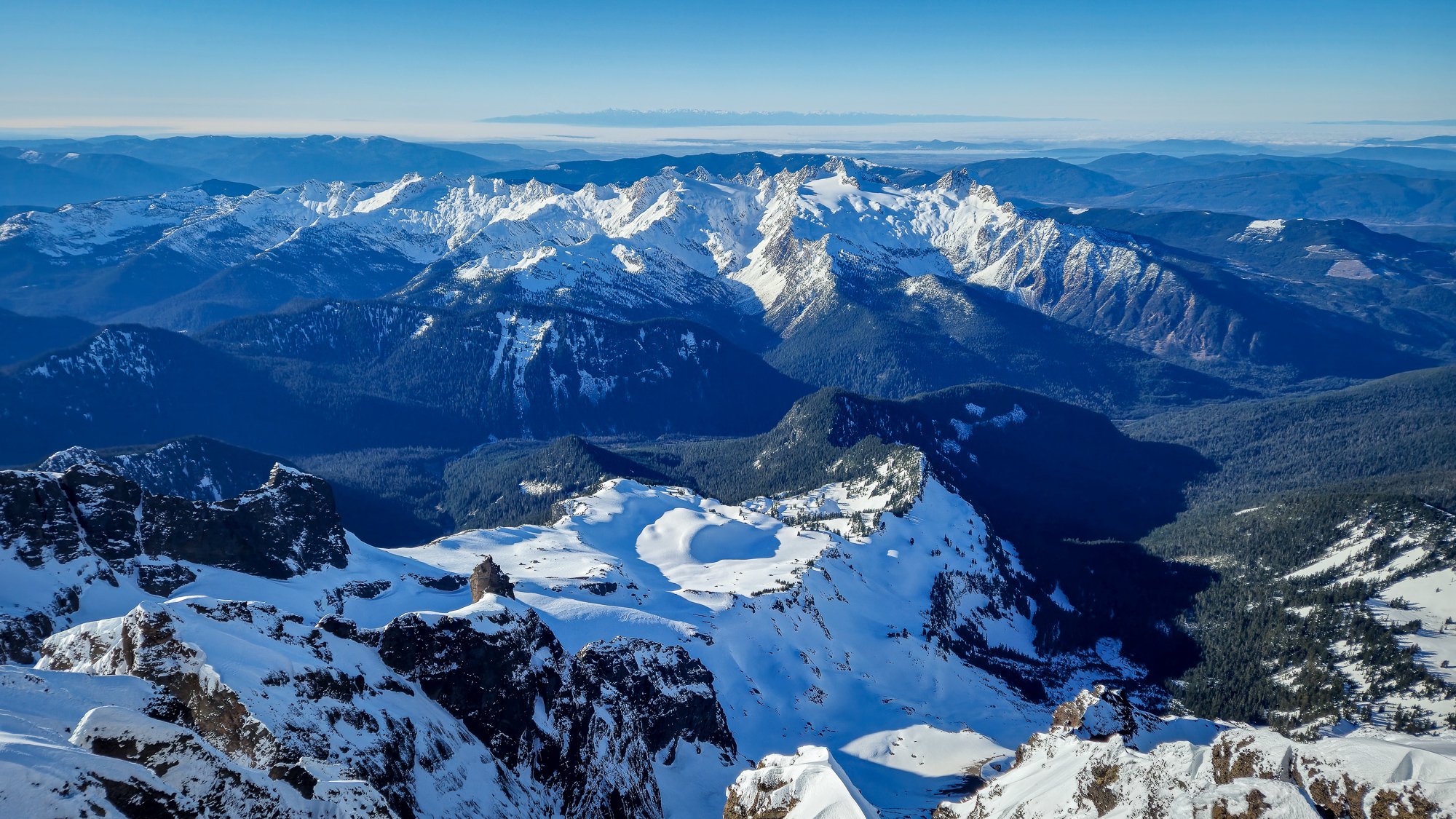
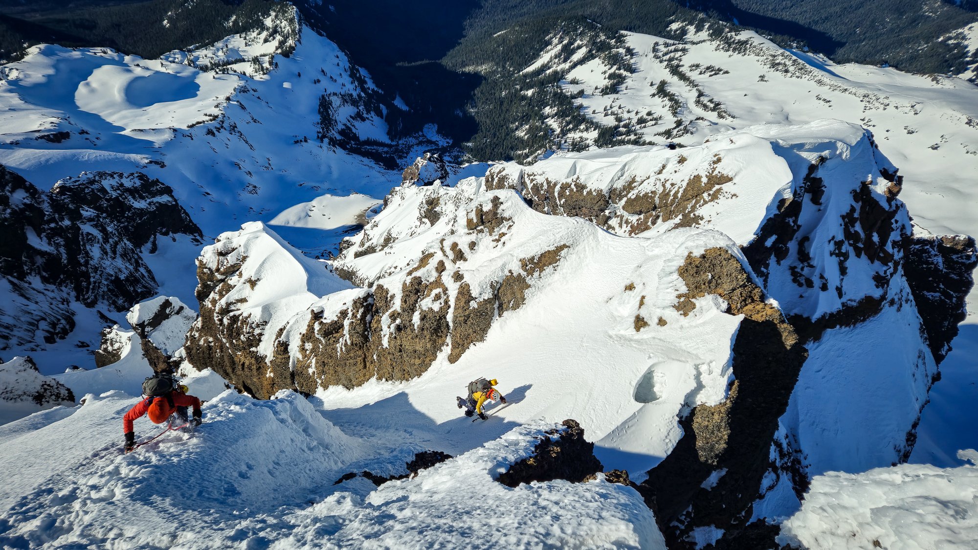
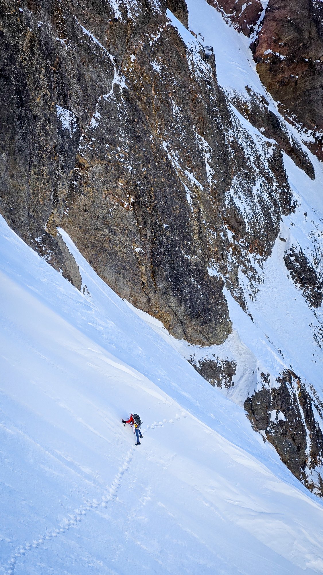
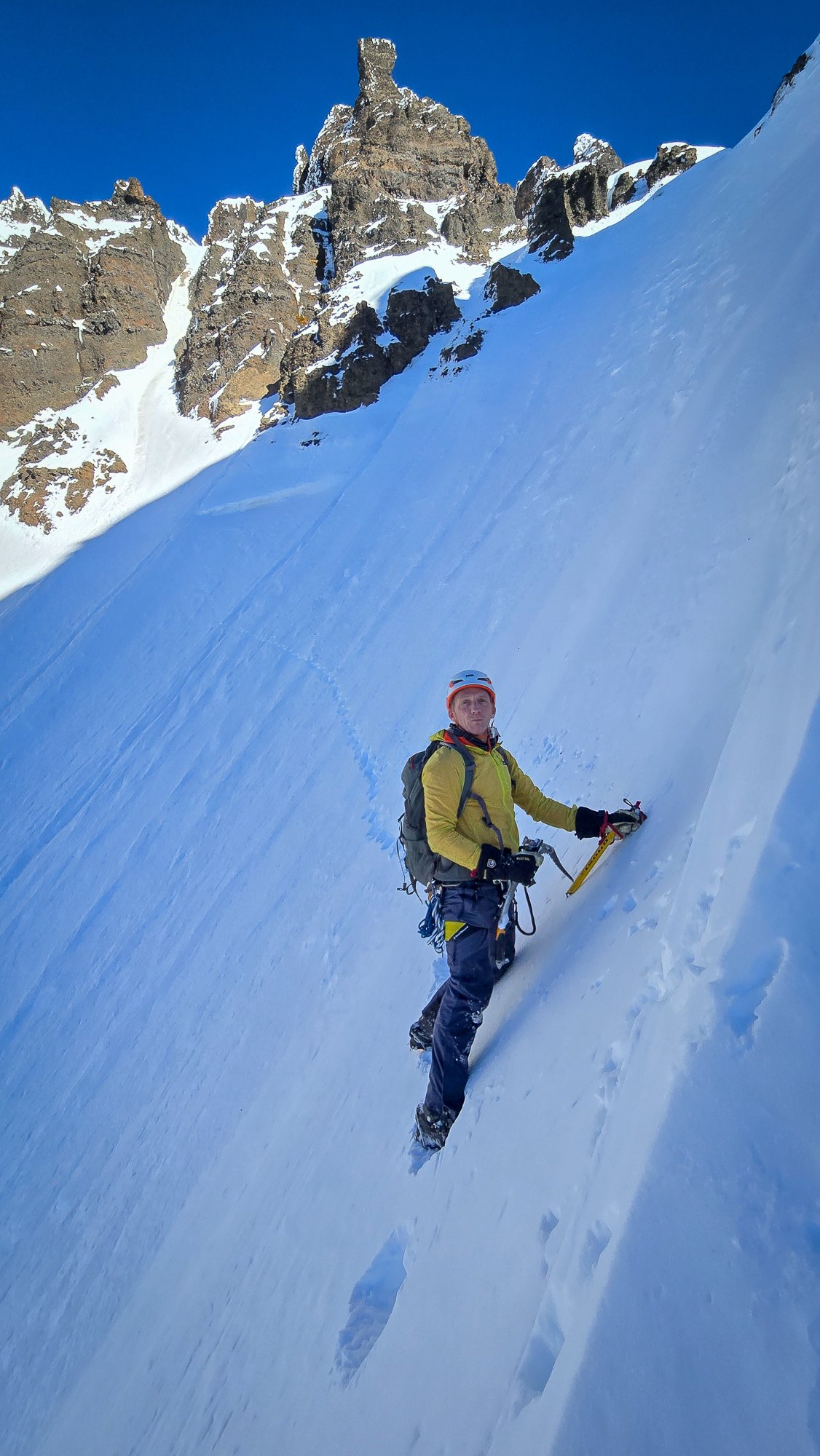
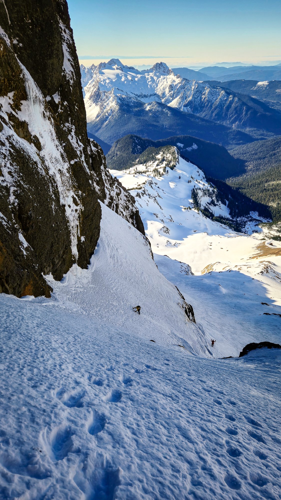
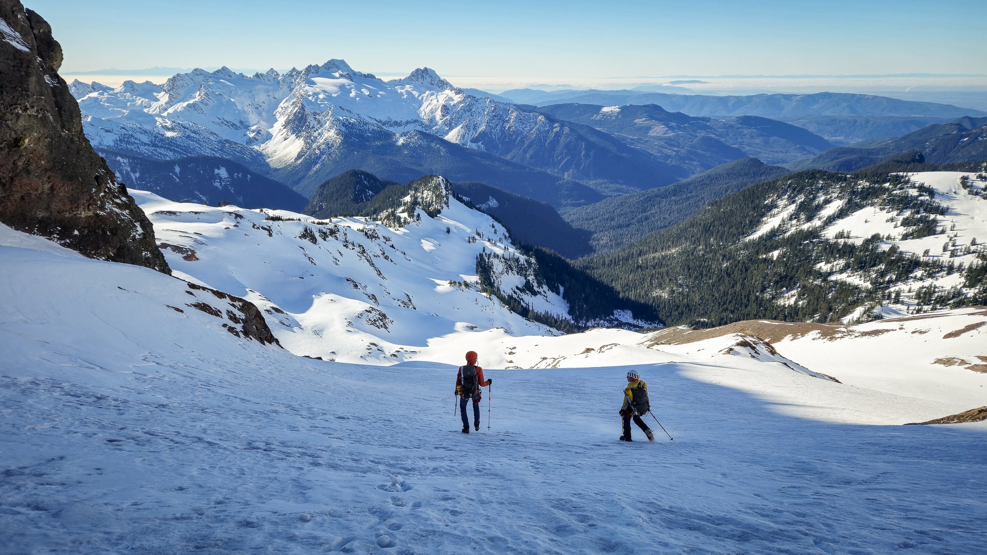
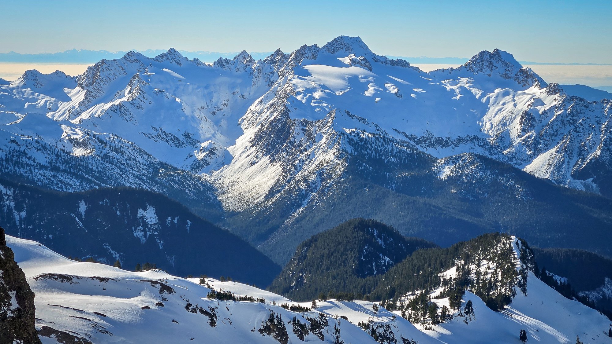
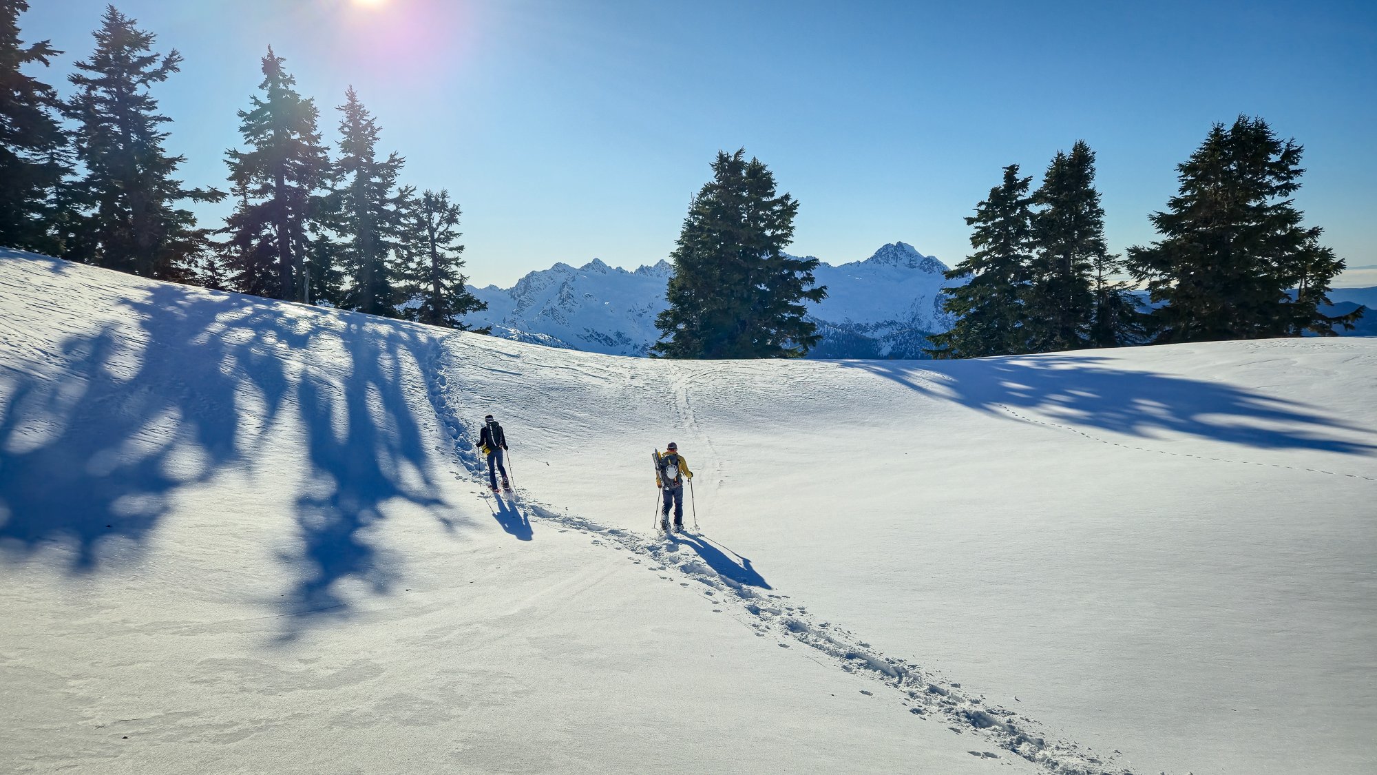
Trip: Mount Harvey - North Face Ramp Trip Date: 01/25/2025 Trip Report: What a nice spell of climbing weather we had to start off 2025! I'm glad that @geosean suggested the NF ramp of Harvey, a climb I had done a couple of times before, but not for a long while. Last time I was on it, it was quite thin and sporty, but the word on the street said it was in fine nick and so plans were hatched to make a trip north and see if Canada was still allowing Americans to enter. @BrettS and Mike rounded out our team and we all met early in Bellingham Saturday morning. I think it only took about an hour and a half, including border crossing to make it to the TH from Bellingham- it is easy to forget what great options exist just a little bit north. The Trailhead was already filling up when we arrived a bit before 8 and we quickly paid the parking fee and started up the dry logging road at something like a dispiriting 650' elevation. It is a bit of a grunt up to the start of the route, but you get good views early on the hike in: In the 13 years since I'd last climbed it, the route has gotten mildly popular and there were several teams in front of us and at least one behind. A steady stream of ice and snow chunks rained down the ramp as we geared up and started off simul-soloing. We had the gear and rope ready, just in case, as @Don_Serl recommends in the link above, but they stayed packed away as we climbed higher and higher with perfect conditions and ample steps to draft off of. I was reminded what a great and pleasant climb it was, in a fine position! But almost too soon, the angle mellowed and we were at the top of the ramp, looking across the steep traverse that guards access to the easy ridge that finishes on the summit. Some times this portion is a crux, but not this day. It was practically a sidewalk and we enjoyed posing for some photos with dramatic views of Howe Sound below: And then we hit the final ridge, sun and views. @geosean walking just below the top: We stopped just short of the summit to eat lunch, take off the technical gear, and admire the excellent views all around. The Standard route on Harvey (our descent) is quite the popular outing on a nice winter's day and we didn't want to be in the scrum on the actual summit. This was a good call on busy Saturday, and we could look south to Baker, Puget Sound, and the Lions in peace: To the west were the endless Coast Mountains, Howe Sound, and Anvil Island: But, a winter's day, even a perfect one, is over too quickly, and we had to begin the descent before we tired of the views and position. The good thing is that the first quarter of the descent is almost as spectacular as the climb: And then it was back to the road, the car, beers, and chips. I think it was less than 7 hours car to car and was entirely one of the more pleasant winter climbs that I have done in years. I hope that it isn't another 13 years until my next visit! Gear Notes: helmet, axe, second tool, steel crampons. If it is in thin shape you may want a rope and some snow/ice pro, but it is also a comfortable solo for a lot of fatter winter conditions. If you need snowshoes it is probably not in great shape. Beware avy danger! Approach Notes: The Lions Trail. Arrive early to get a spot and don't forget to pay!5 points
-
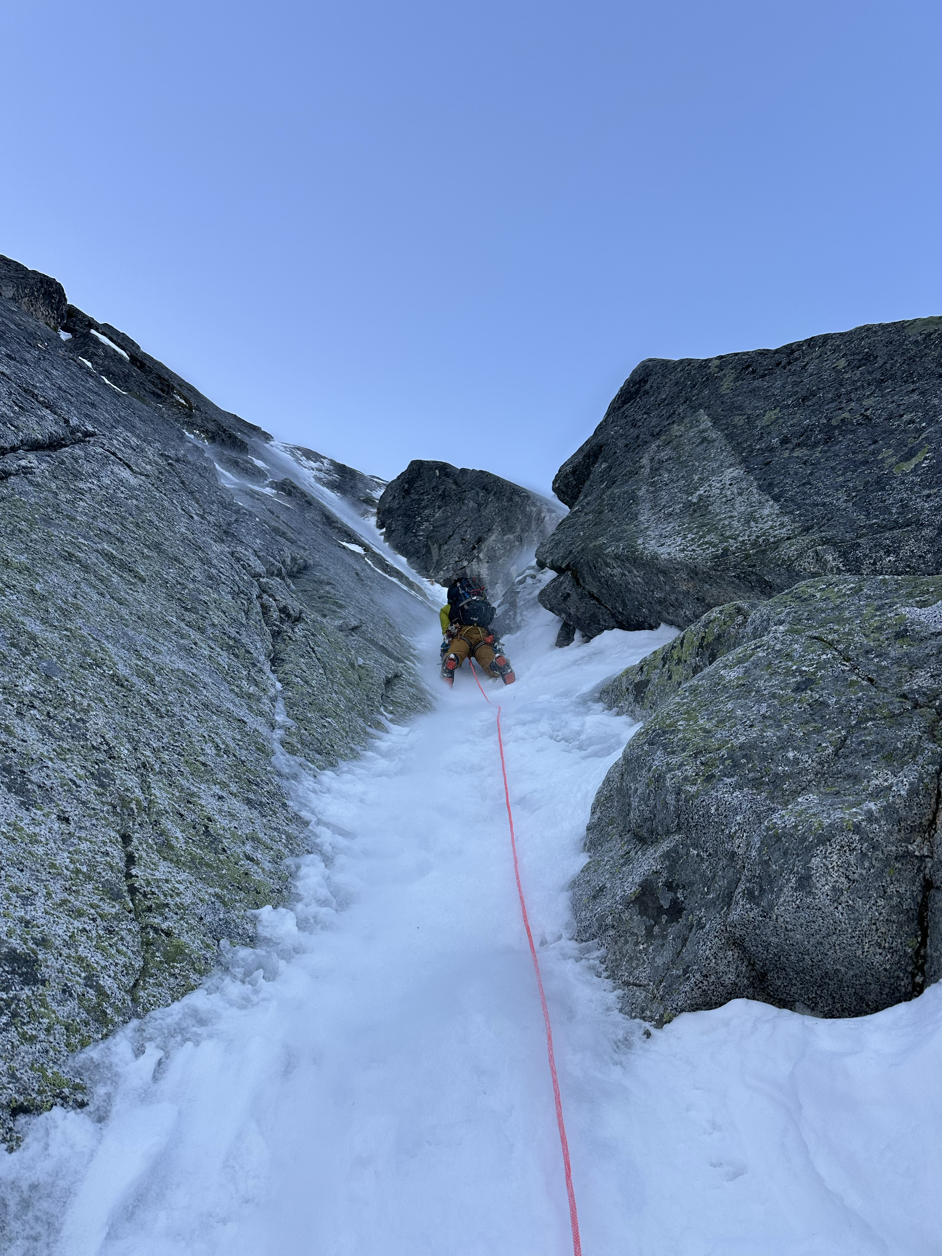
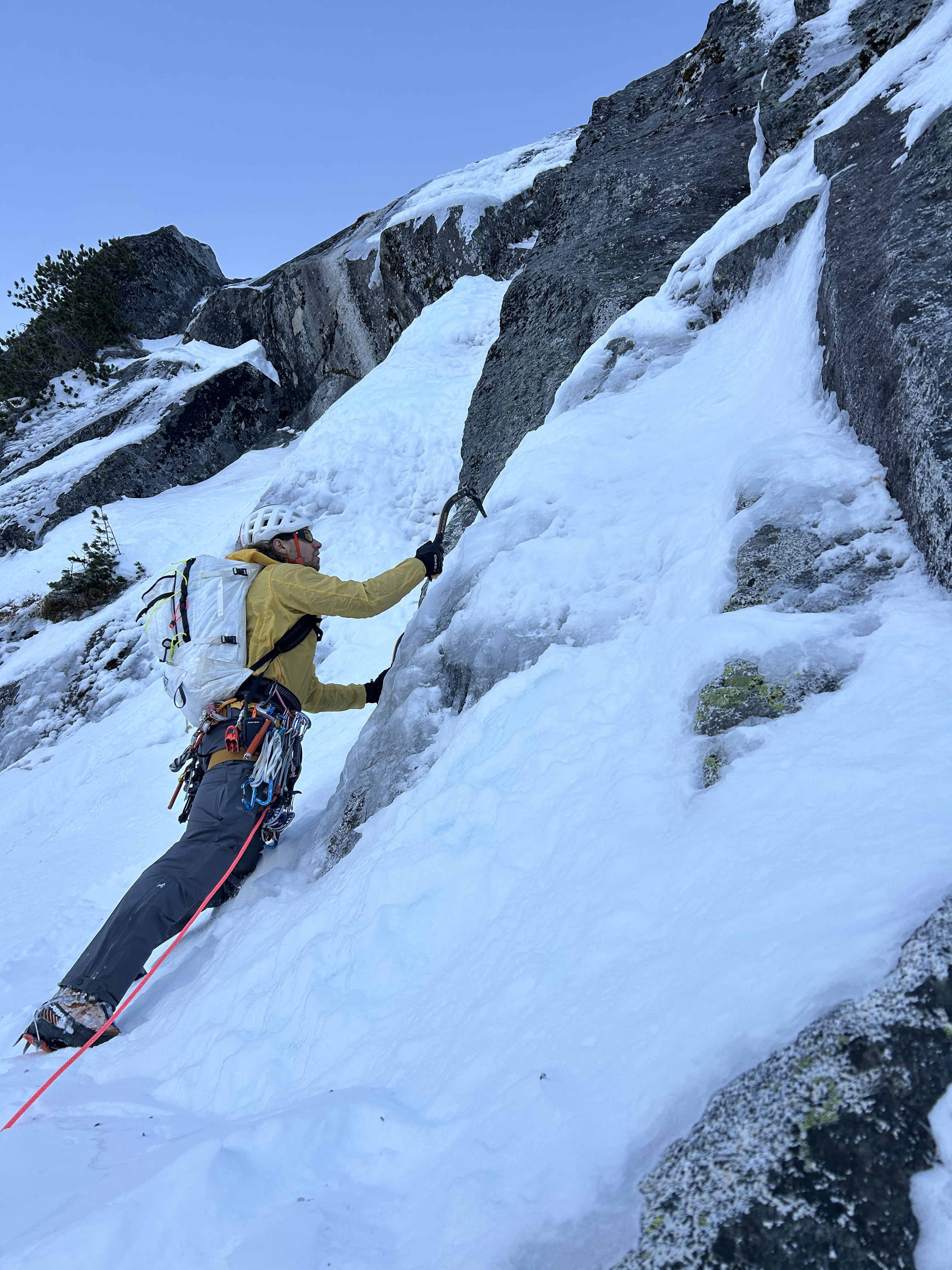
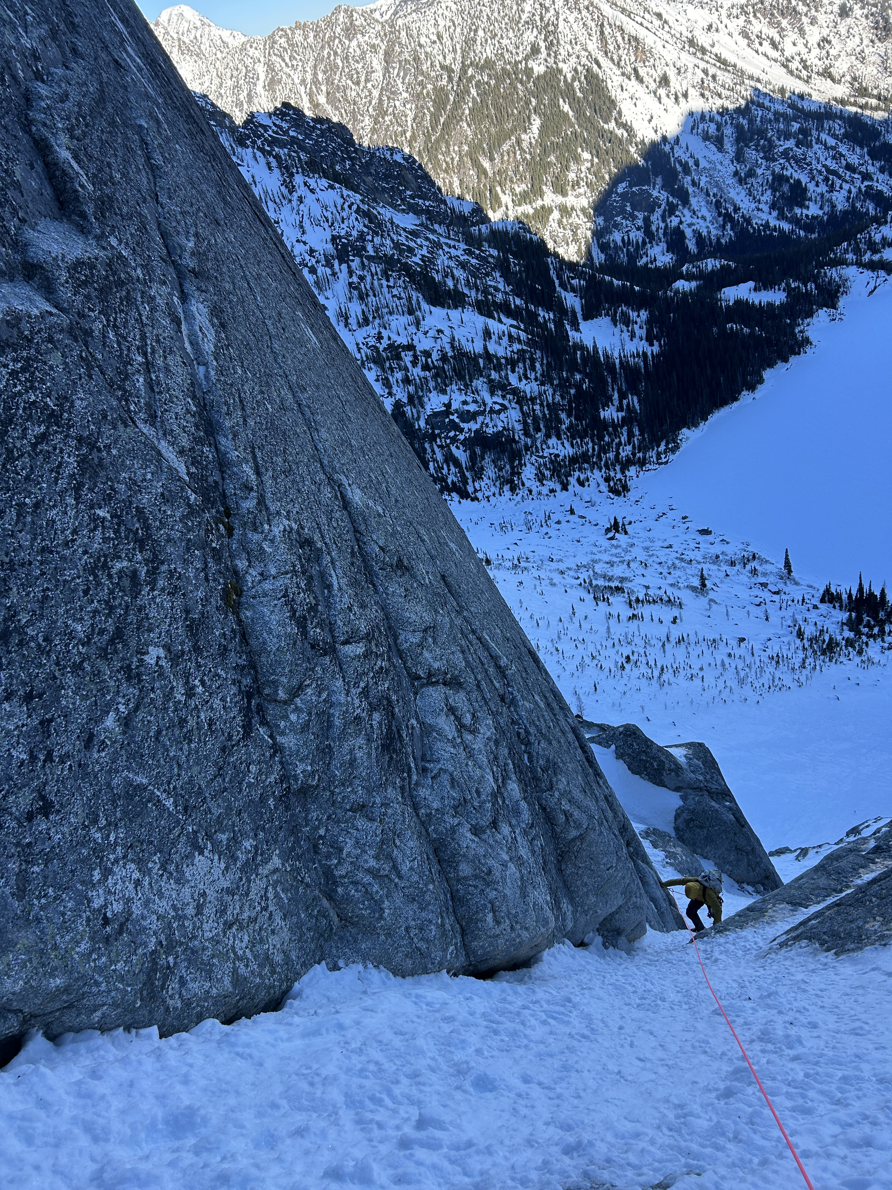
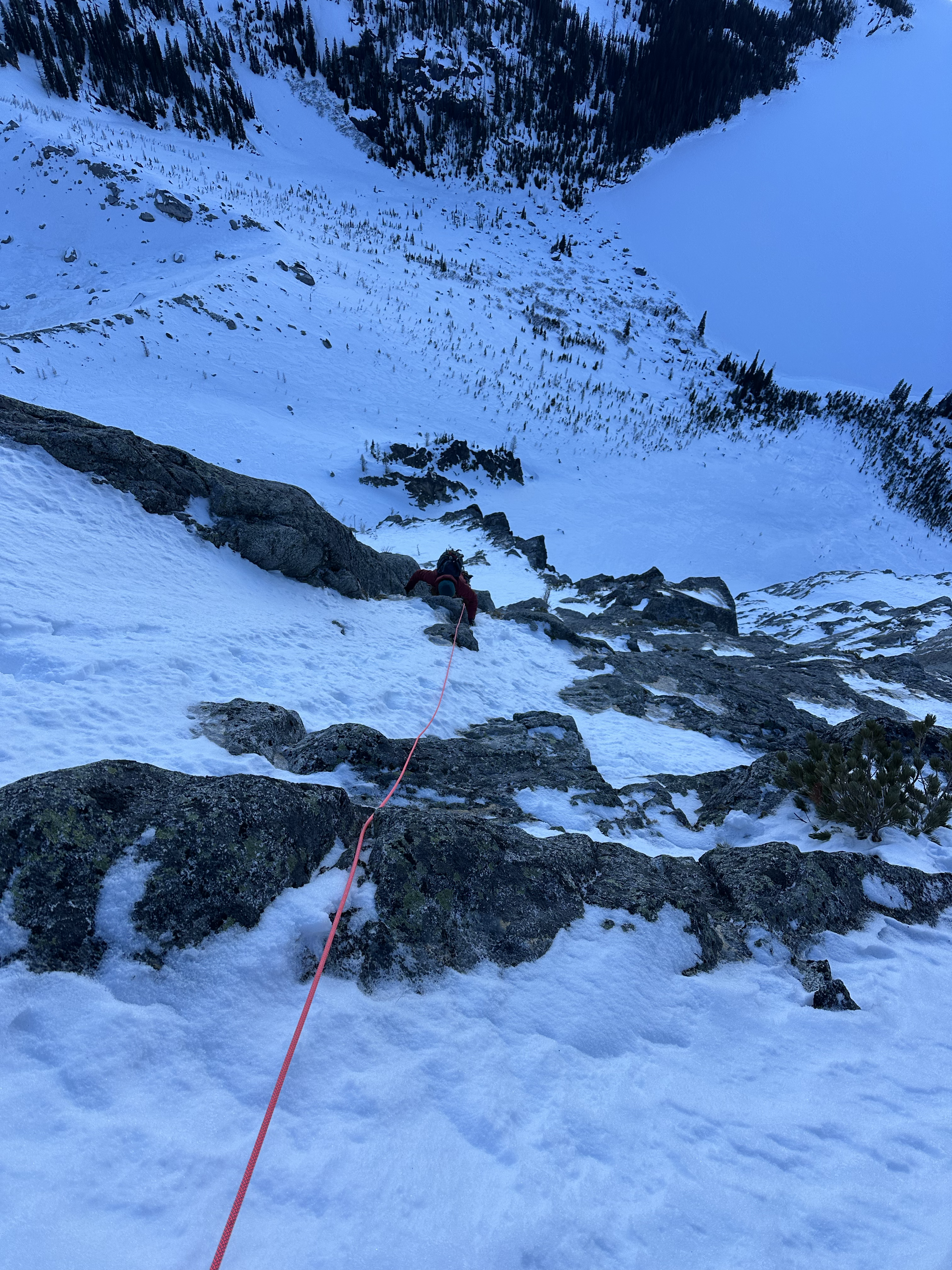
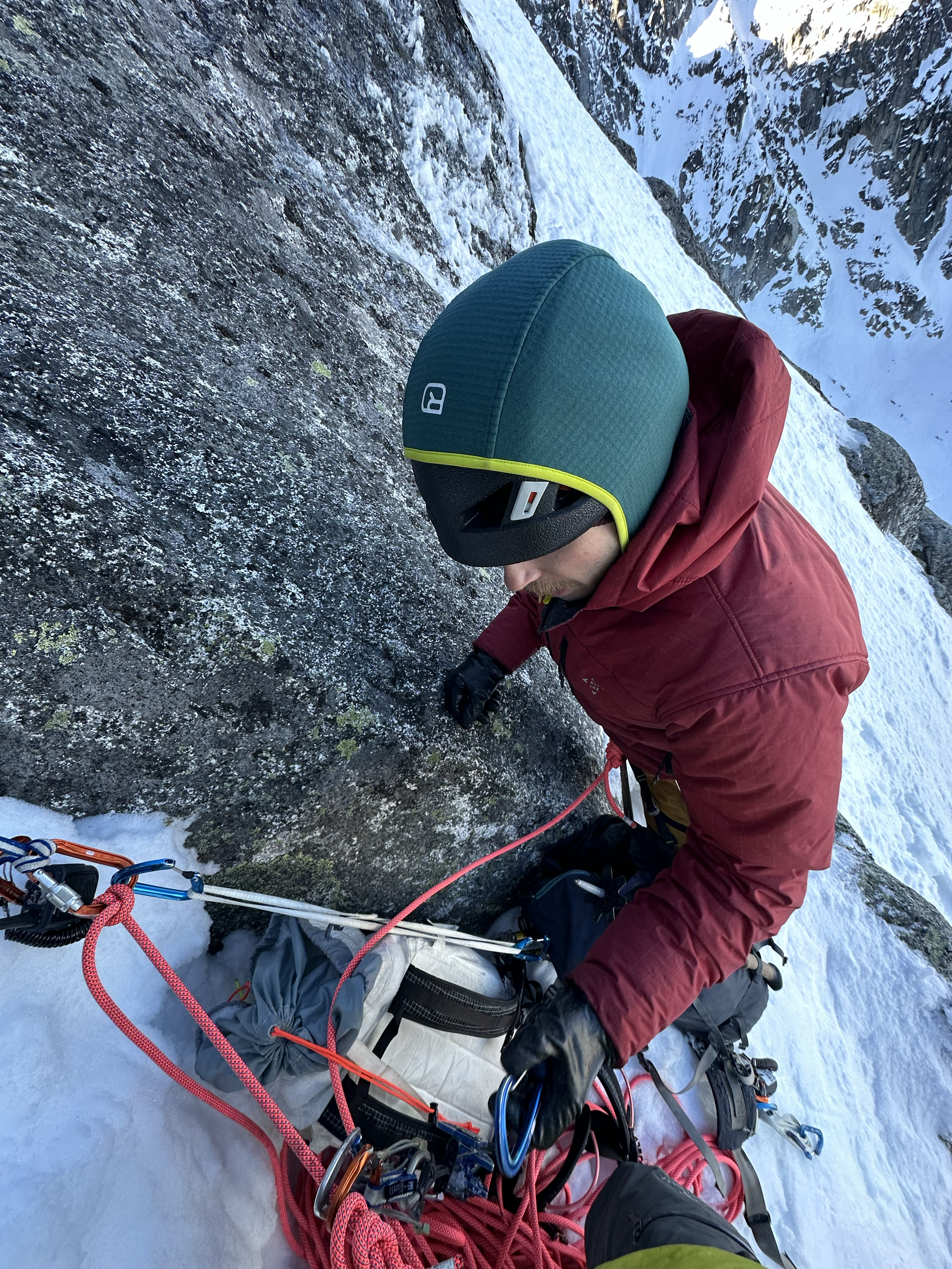
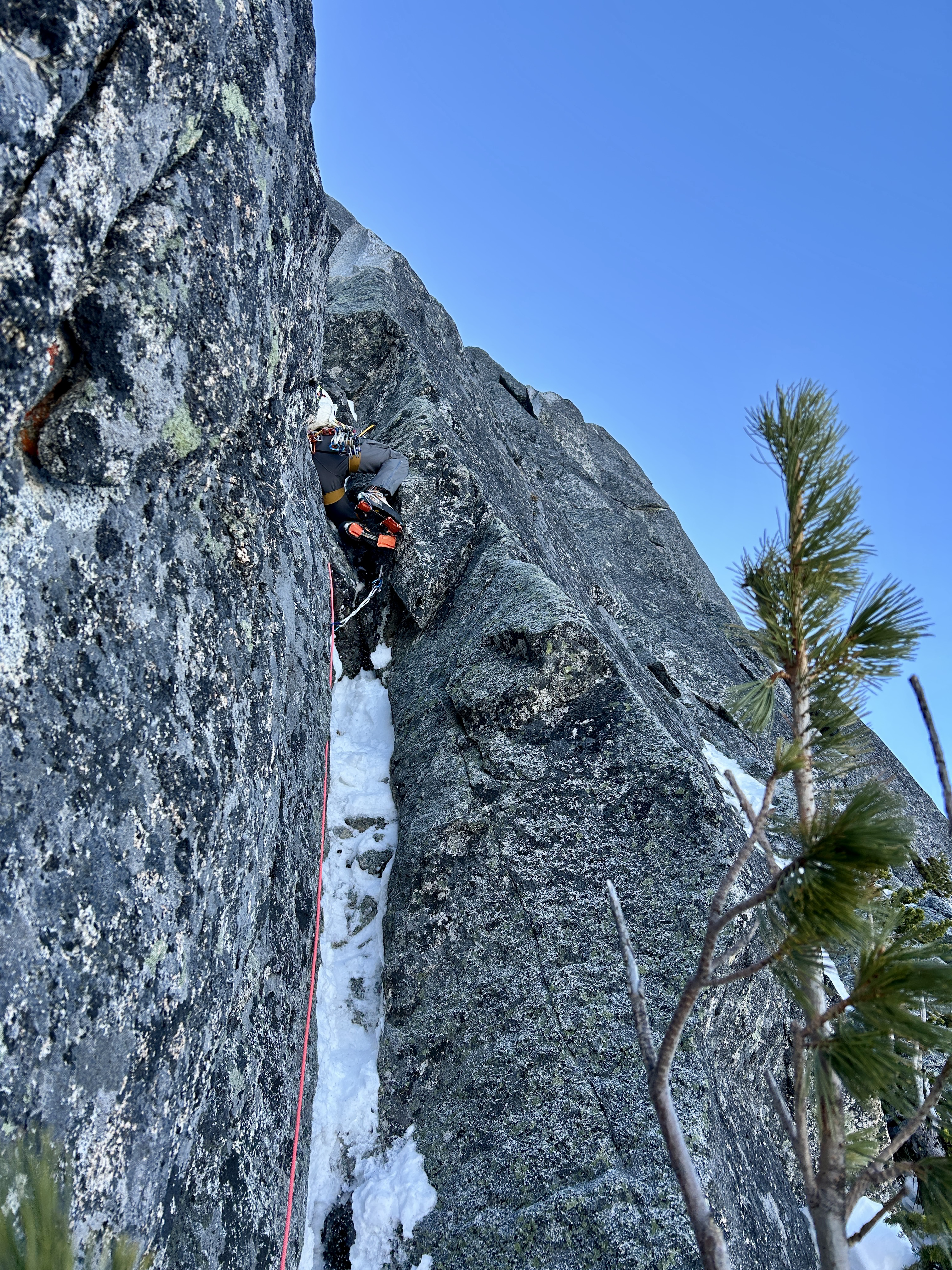
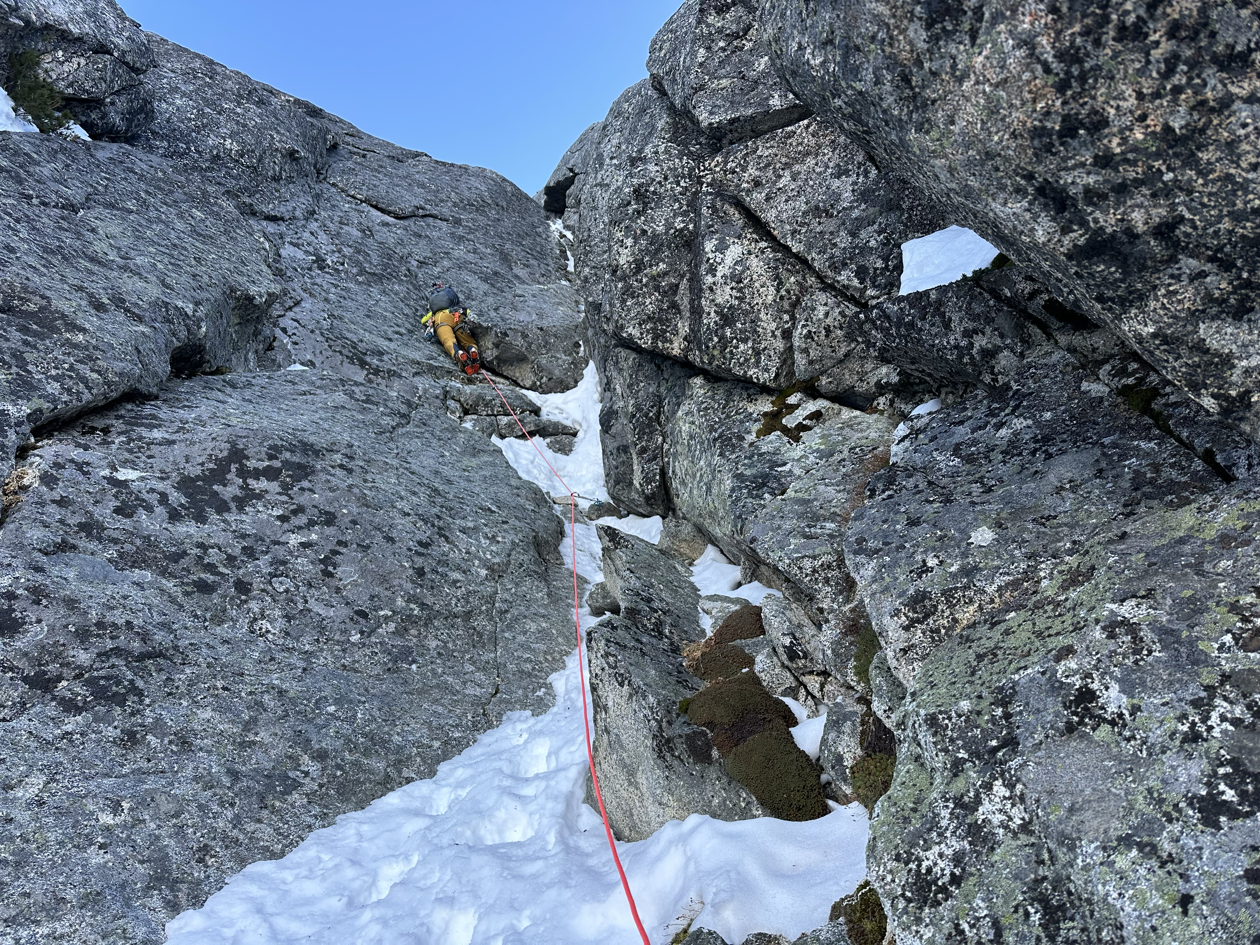
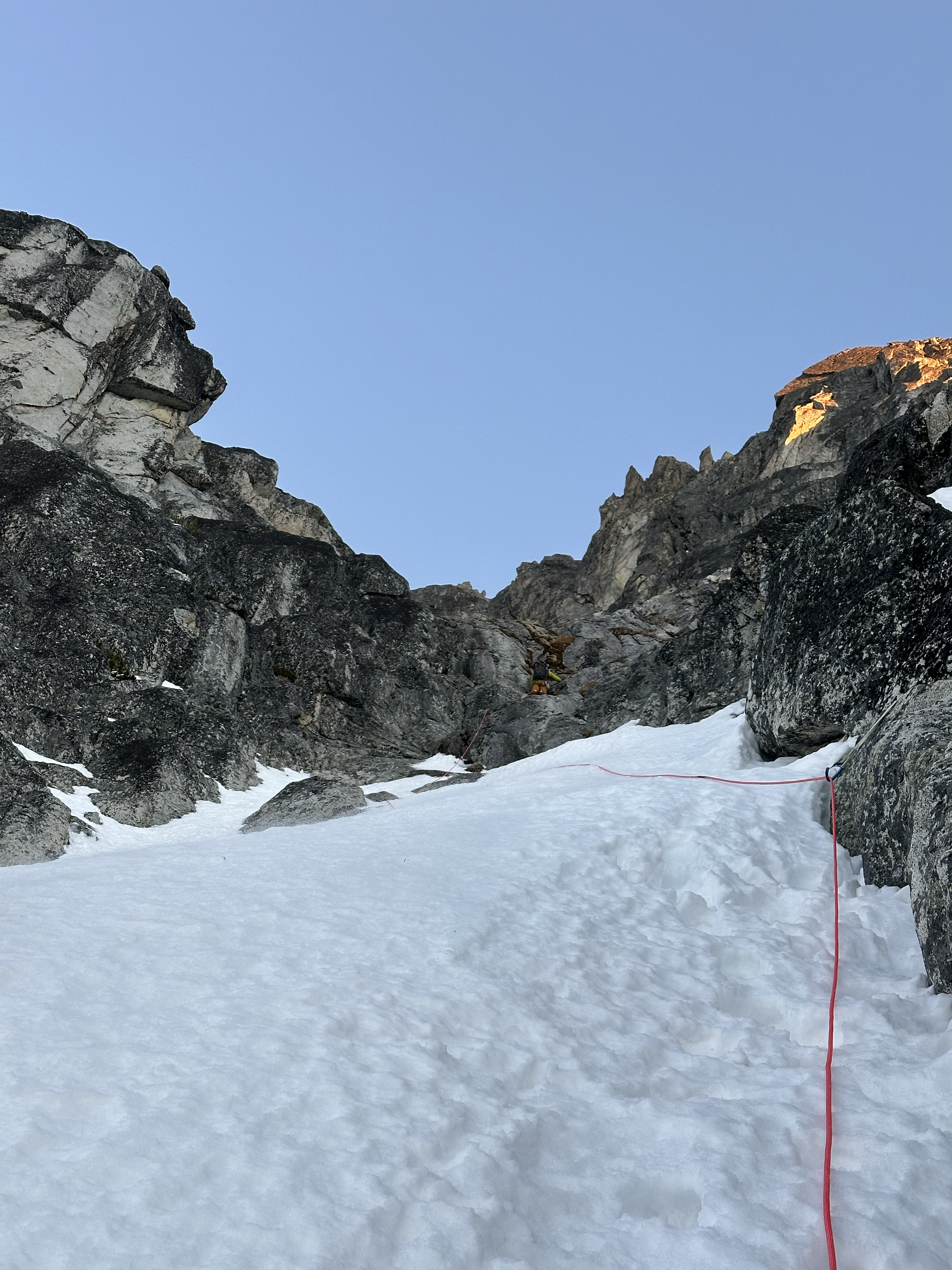
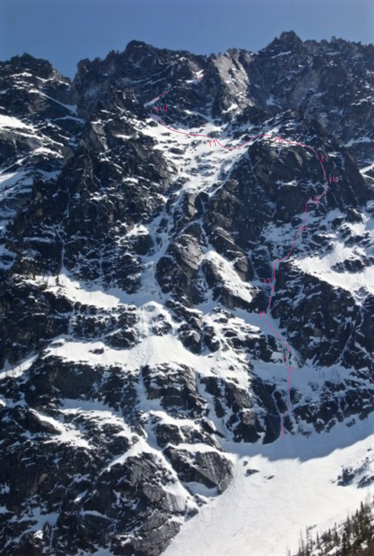
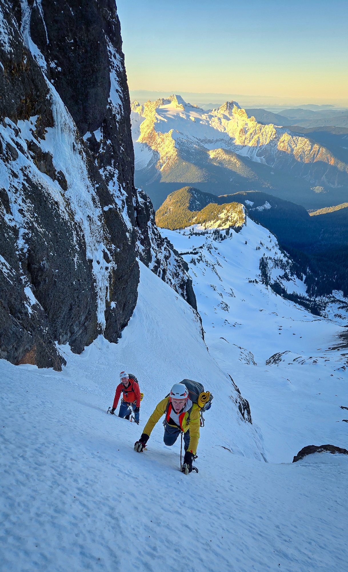
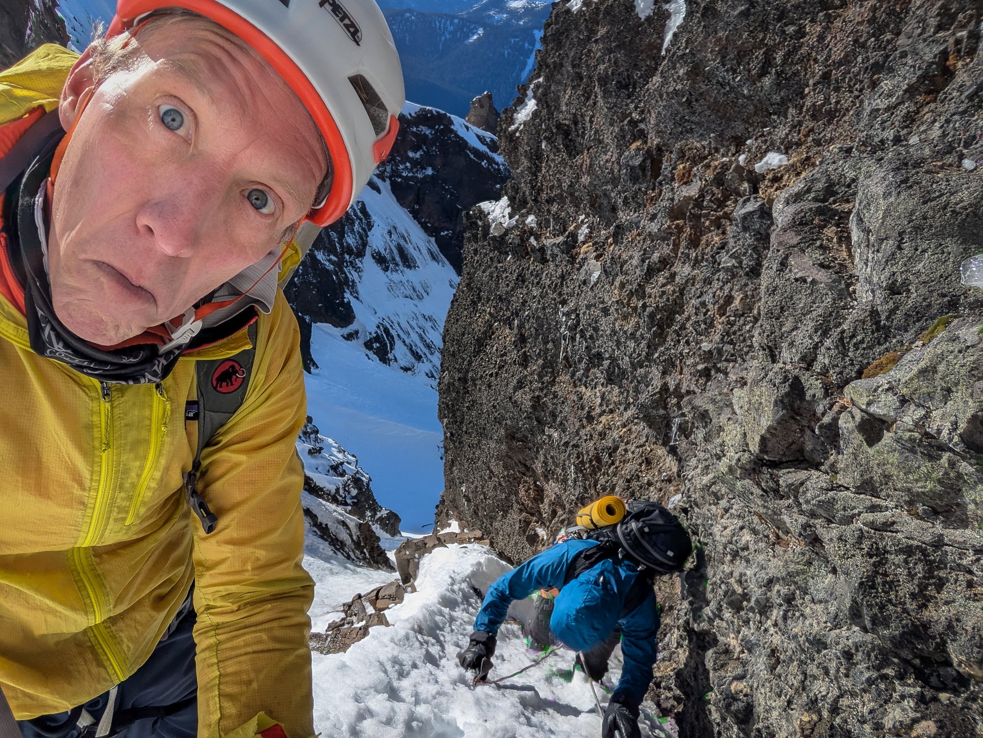
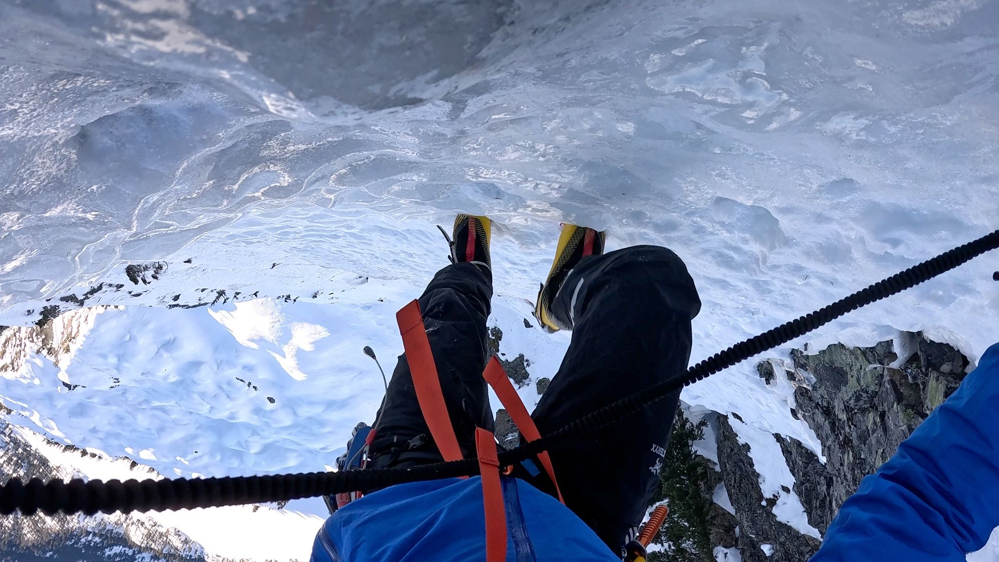
Trip: Serendipity on Dragontail Trip Date: 01/29/2025 Trip Report: In the afternoon of January 28 myself and Koby Yudkin skinned up Eight mile road to the Stuart Lake trailhead. We elected to stash our skis in the bathroom at the trailhead and hoofed it up to Colchuck lake, albeit in good time. We walked across the frozen lake and posted up in the trees near the toe of Dragon tail around 1900, approximately four and a half hours after leaving the car. The temperature inversion that evening made the bivy quite pleasant, and as we set up our tent we joked that we may in fact have come to visit the “colchuck spa” instead of going climbing. Alarms set for 0500, sleep rapidly ensued. We left the tent the following morning at 0640 and arrived at the base of the route about an hour later. Racked up, shortly before 0800 Koby led us off on what we thought was the Cotter-Bebie. It turns out we didn’t boot high enough on the pass, and began up a weakness somewhere in-between the start of Gerber sink and that of Cotter-Bebie. Blissfully unaware, or just excited to be in the ‘pine on a good weather day, the ~1000ft that we climbed before traversing left into the main upper snow field proved to be enjoyable climbing. From the ground, about a rope length links two snice filled corners and continues to a snow field where, at the top, Koby brought me up on a short KB. (P1) Above: Koby leading off on the first pitch. From here, 30 feat in an unconsolidated snow filled corner with smatterings of ice on the side got us to another snow field. No protection on this pitch, but the belay was inspiring; number 1 & 2 BD ultralights. (P2) Above: Nate beginning P2 Next Koby surmounted a collapsing snow moat into a small chimney, and up through a runnel to a good stance. I managed to avoid the chimney on this pitch with some stem moves followed by steep snow/neve to the runnel. (P3) Above: Nate coming up the runnel on P3 From the belay, I lay-backed a left facing corner for a couple moves and traversed left into a right facing Neve filled corner. Following this corner up and out to the right led me to an easy moss/ice filled runnel. We had to simul a bit this pitch to find a stance that protected the belayer from the ground to follow. (P4) Above: Koby topping out the runnel P4 Koby came up, munched a snack, and took off into a steep, rather imposing looking chimney feature about 30 feet from the belay. He managed to shuffle his way up, despite his…large…backpack, slung a tree about another 30 ft above the chimney and brought me up. This pitch was our first crux, which I followed free with hand jams, hooks, torques, scraping and grunting while contorting myself to fit the feature. (P5) Above: Koby snacking and sorting. After joining Koby atop the fifth pitch, I led up another mixed corner, traversed right across a slab and up a snow filled gully to find a protected belay on the right, putting the belayer out the the firing line for pitch seven. (P6) Above: Nate on the start to P6 Koby delicately made his way up through two bulges here. Good pro, mediocre feet, hooks and slots, and some alpine trickery brought him to a 4 piece belay in a large left facing chimney about 40 meters above me. I followed this pitch free at what felt like M6+/M7. (P7) Above: Koby on P7 From here I scraped my way left out of the chimney. A few insecure moves off the belay put me in a good spot where I could stand and make a plan to weave my way up through some slabs. I trended generally up for 15 meters through slab terrain with a good pin for protection, and then 15 more meters up and left where I slung a tree to bring Koby up. From this belay we got our first view of the fin. (P8) When Koby joined me at the top of P8 it was around 1500 and the sun was getting low, and set to dip below the horizon around 1700. We made the decision to traverse the snow field and exit into the bottom of the third couloir of Triple Couloirs in the interest of time. Two rope lengths of traversing up and left through the main snow field brought us to the easy, but difficult to protect, rock bit to gain TC. As Koby made his way up the last bit of mixed climbing, I admired the alpenglow. Once in the couloir we put the rope away and booted to the top. We arrived around 1740, snacked, un-racked and made our way down to the col and out of the building wind. Above: Koby exiting into TC. Above: Nate soaking up the sunset. We stomped back into our camp around 2000, brewed up, packed our things and made our way back across the lake and down to the trail head. After wrestling frozen ski boots back on to swollen feat, we skid Eight mile road back to our car and arrived shortly before midnight. Gear Notes: 70m single, 3 KBs, 2 beaks, set of small brassies, misc. nuts, a black totem, singles in Camelots from 0.3 to #3, 6 alpine draws, 3 quick draws. Approach Notes: Standard approach from the bottom of Eight mile road.
 2 points
 -
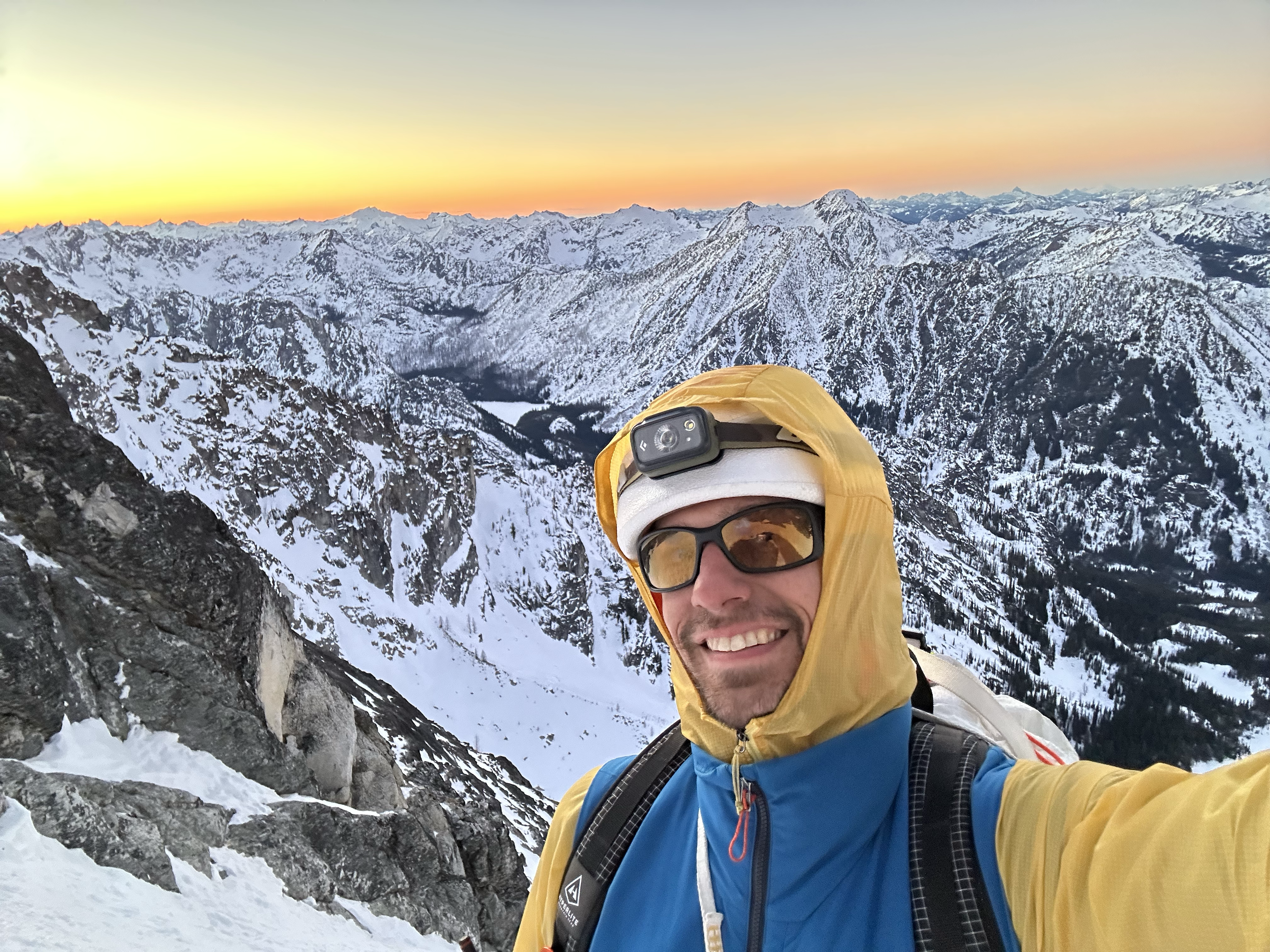
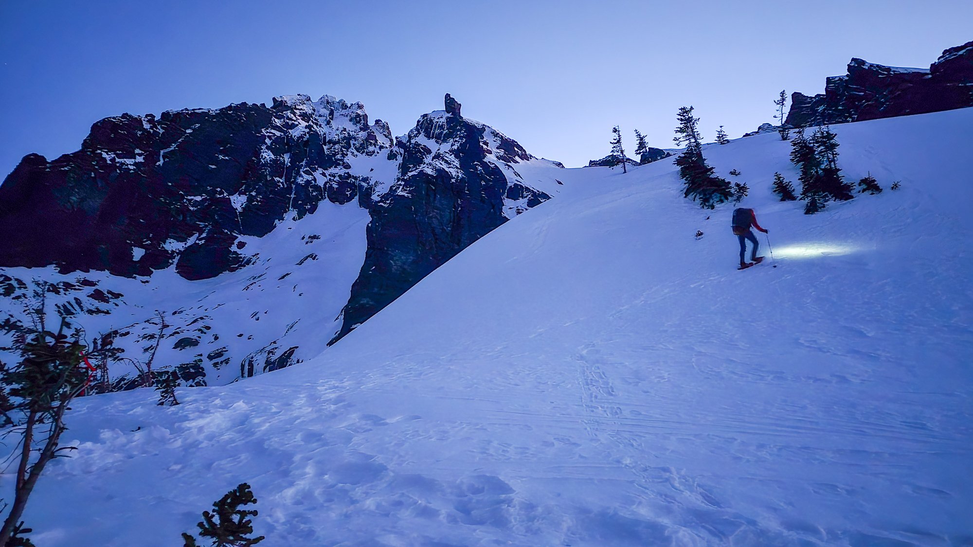
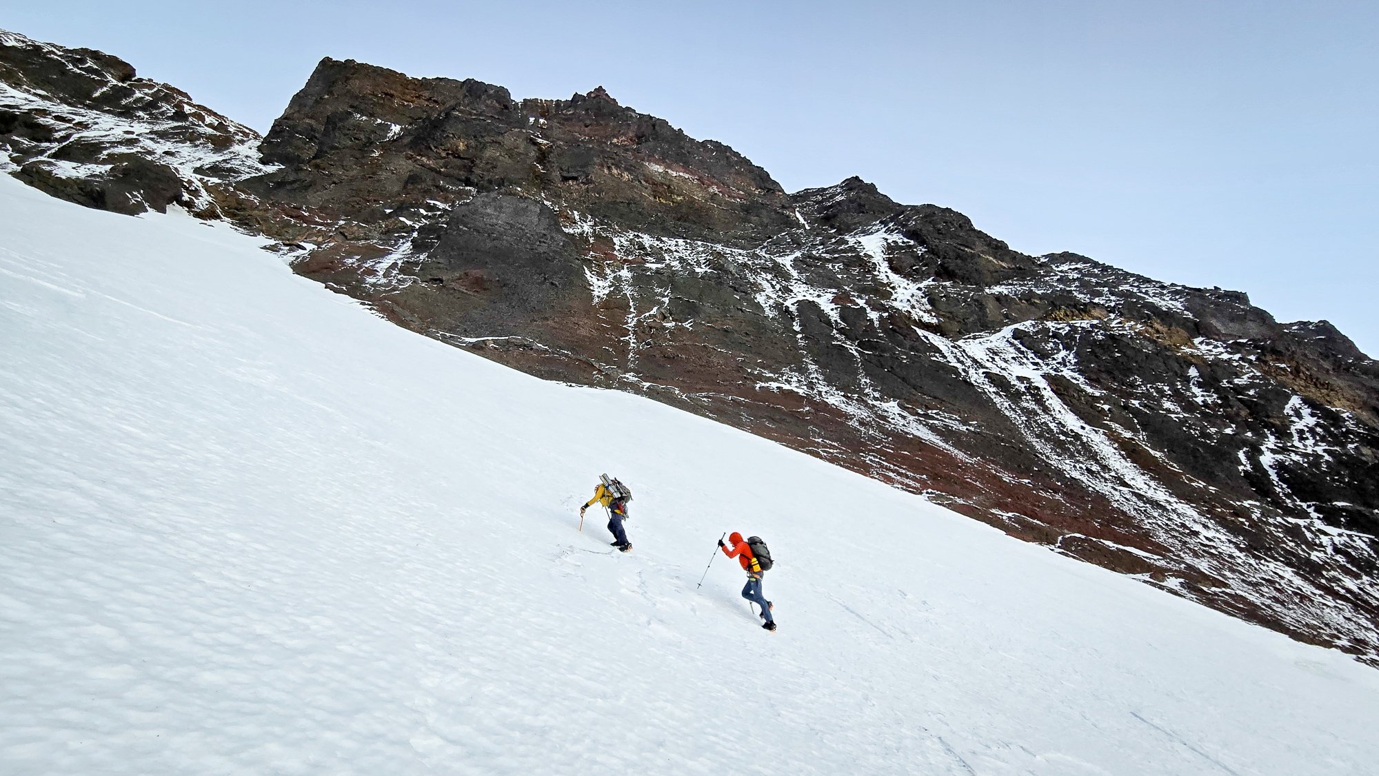
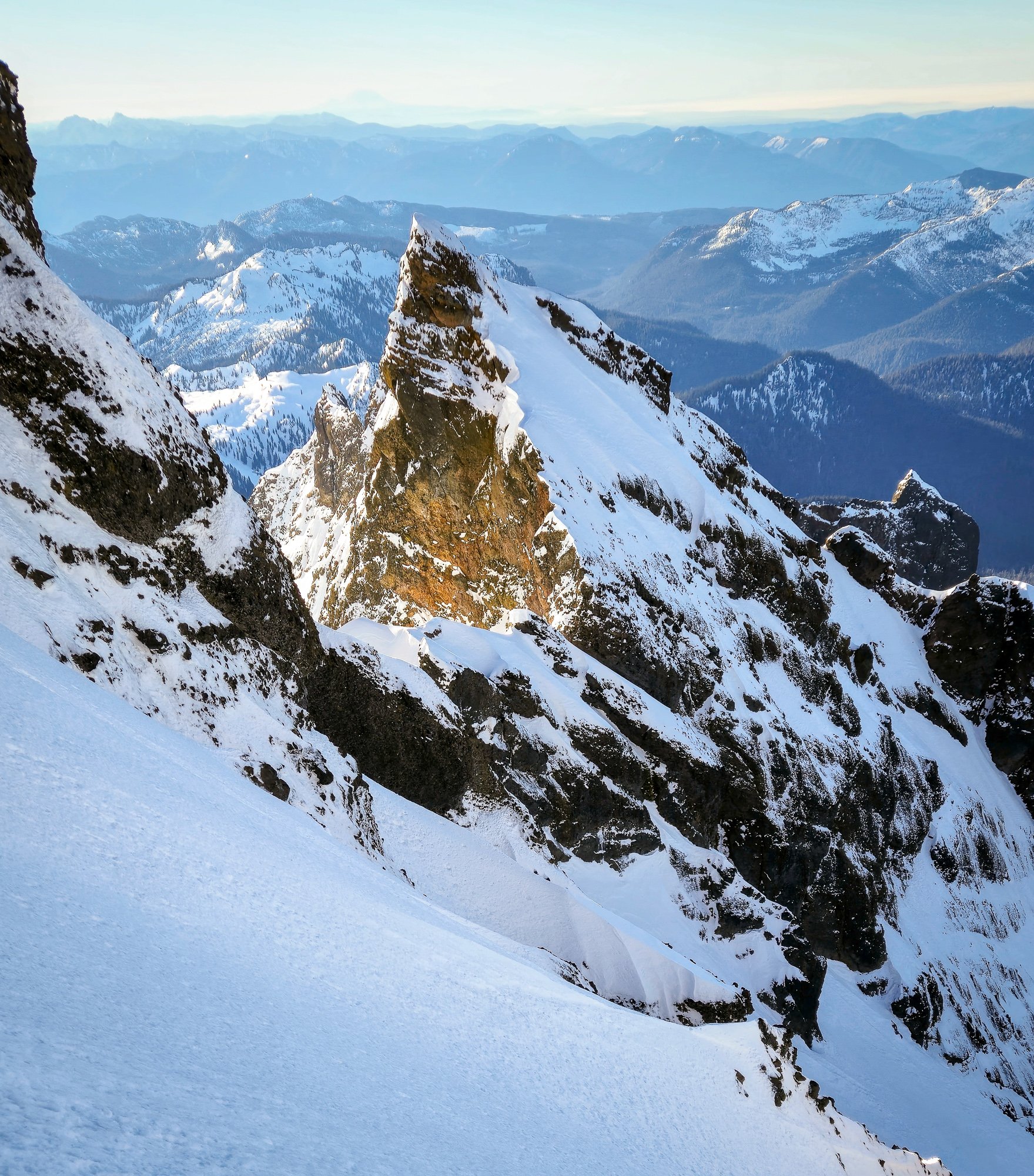
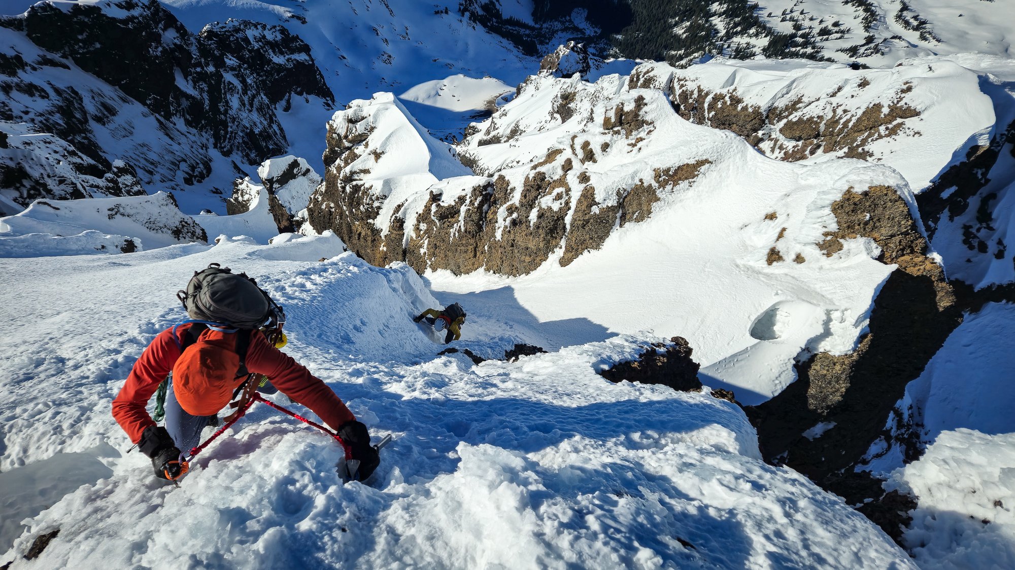
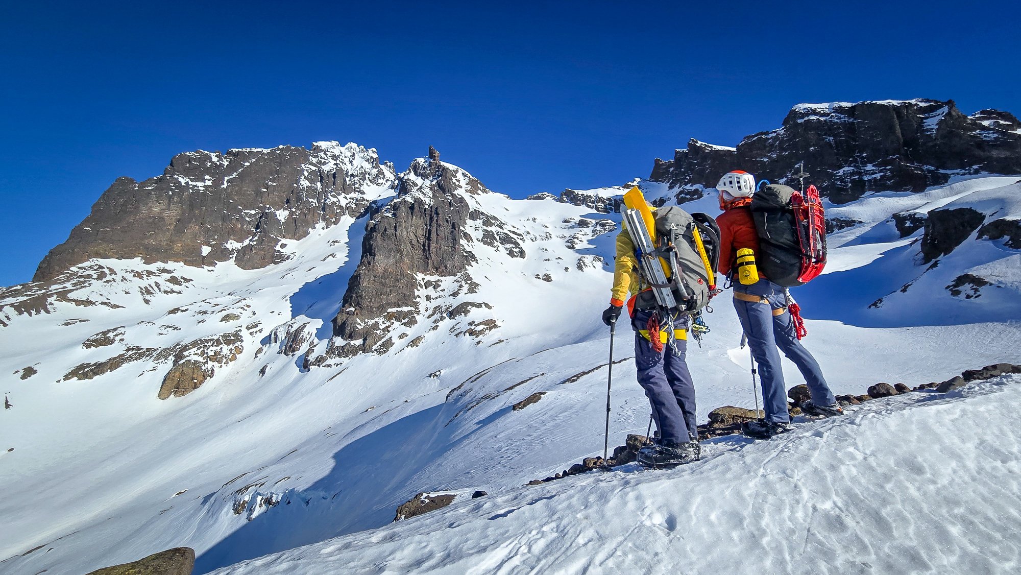
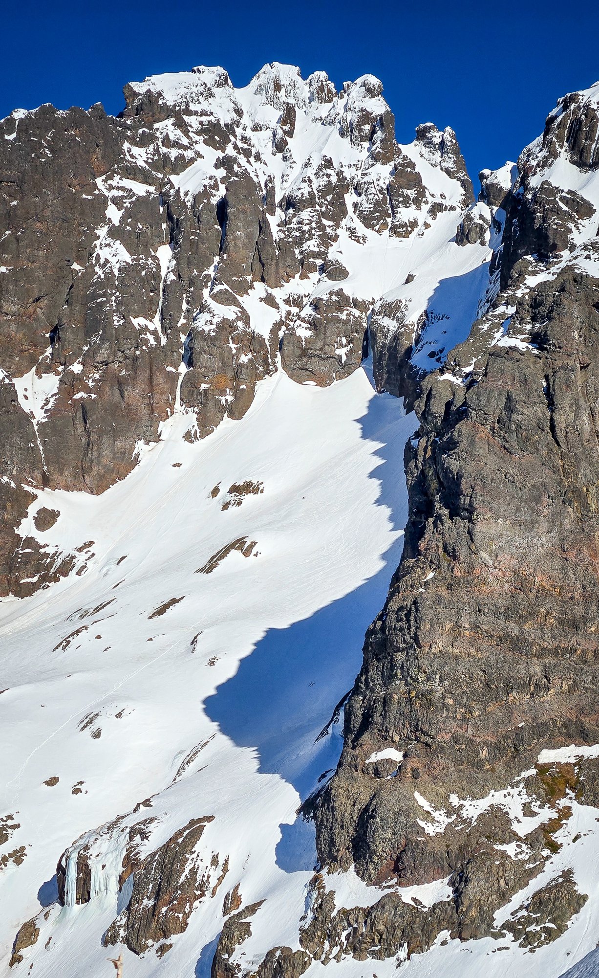
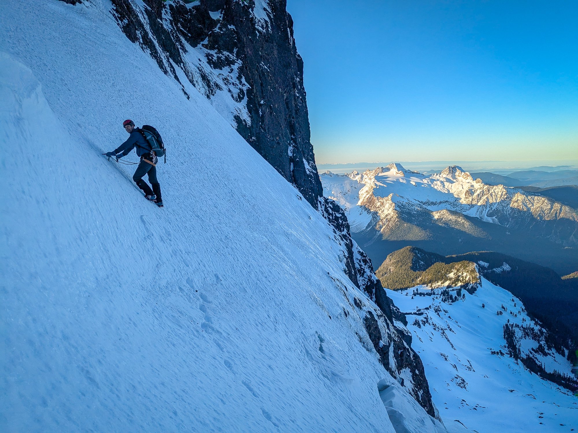
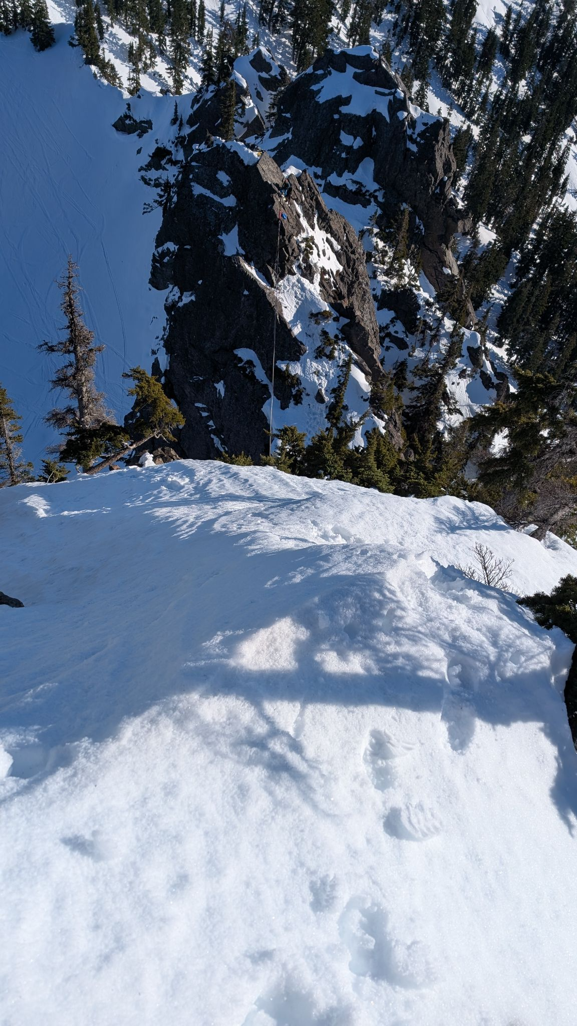
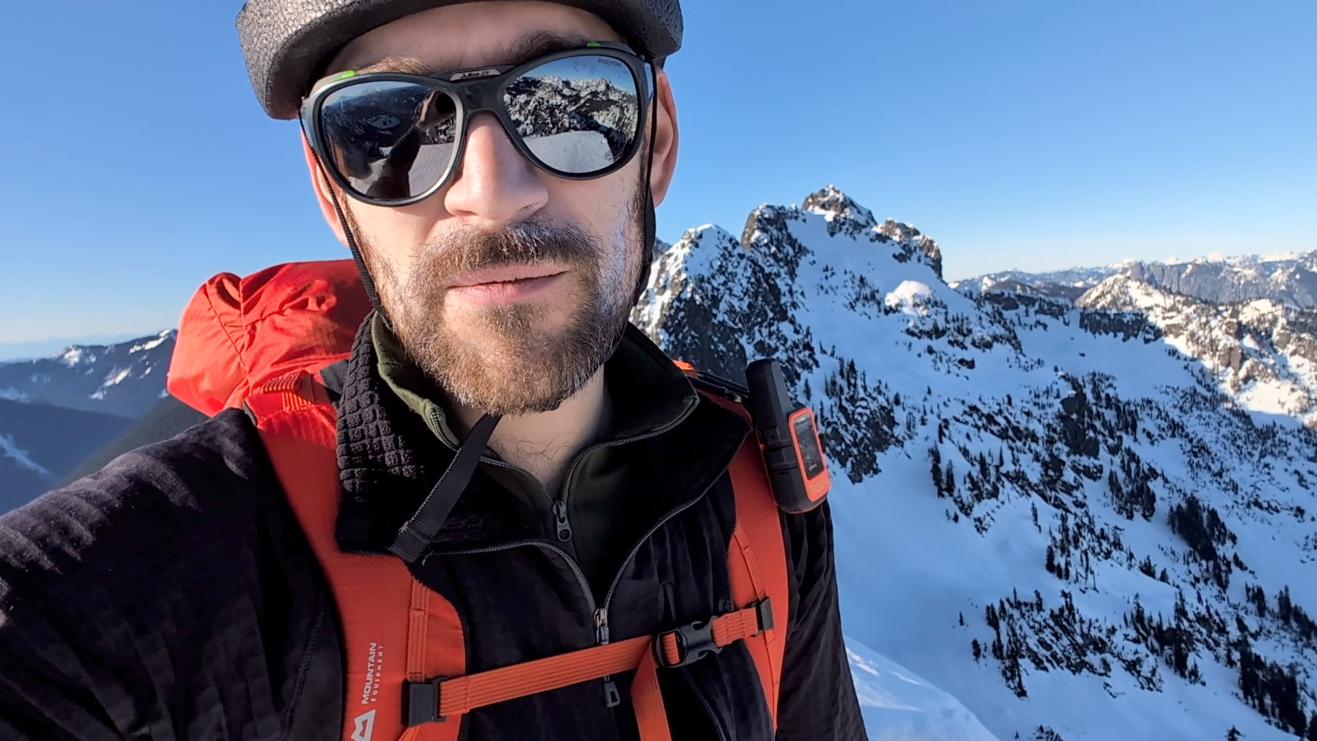
Trip: Lincoln Peak - Southwest Face Trip Date: 01/29/2025 Trip Report: Lincoln! A peak that had been haunting my subconscious for decades, always taunting me on clear days as I drove home from work across the Skagit flats. Try as I might, I could never completely ignore it. It didn't help that it was on "Dallas's Difficult Ten" list, or that by a few years ago, it was the LAST one on the list for me to climb. By 2023 I had tried and failed on it with @kmfoerster. By the end of 2024 I had turned 50 and figured I may as well get on with some long term climbing goals. It didn't hurt to learn that @geosean also had this one peak to go on his run at the Difficult Ten, nor that @Trent was within one peak of finishing as well (South Hozomeen- he's looking for partners!). That, coupled with seeing "Lincoln" on @therunningdog's whiteboard, planted the seeds in my brain to make it happen in 2025. As @Trent would say, "It must be climbed!". And then last week we got a window and hatched plans to give it a go on Wednesday as a day trip. This was going to be a bit ambitious, we knew, and I would be lying if @Lucas Ng's TR didn't make me think maybe too ambitious? There would only be one way to find out. We started, as all good mountain trips do, with a home cooked meal with my family and @therunningdog. My son admonished us to start early for the Middle Fork so we could "get a workout in before bed". Tim and I declined and delayed as long as possible. It was cold out there! But we did eventually find our way to the Middle Fork about 9pm, settling in to a bivy at the Elbow Lake Trailhead to meet @geosean at 3:45 the next day. Sean was right on time and we bounced our way up the rough spur to where continuous snow started about 3500'. By the time we got geared up and rolling, it was about 4:15. From here, the day was pretty much a blur. We got to treeline a bit before sunrise, which was spectacular on the Twin Sisters Range We snowshoed from treeline over to the glacier where we ditched them and the stove and switched to harnesses, helmets, axe, and crampons. I think I crossed the 'shrund first about 8:30. And then it was game-on for a couple hours up to the summit. Lucas and Cole's tracks were basically gone and we kicked new steps the entire way, running across a few of their rap stations up high. The going was pretty steep the whole way, but conditions were very secure and basically perfect. We kept the rope in the pack and carefully traded trailbreaking duties up the various sections of the climb. What a position! Seward: Approaching the summit: And then, like in a dream, all three of us were at the summit block! It was 10:22am- about 6 hours from the car- meaning things had gone waaaay better than expected. @geosean and @therunningdog on the summit: The views, of course, were staggering. What a small and wild summit, especially in winter! But also, what a descent lay ahead of us. That's why I was a little concerned to see Tim start to downclimb while Sean dug the summit picket out of the snow. Uhhhhh....we're not rapping guys?...... "No Jason, let's go!" And so, I took a deep breath, put on my big-boy pants, turned around, and started down. It was a stimulating descent. Especially in this particular spot: But, by moving slow and steady, we made it safely down about as fast as we had gone up. Tim and Sean had to wait a bit for this mature mountaineer on the descent. I'm not going to lie....it was quite a relief it was to finally get back past the 'schrund and start the slog out! We stopped at treeline for almost an hour to melt snow and admire our tracks on Lincoln. It felt good to be down safe in the sun with a couple of good friends, marveling at the grandeur of the North Cascades. What a day! But January days are not long, and we had a bit of scruffy ground to cover before dark. So the snowshoes went back on, the brains turned off, and down we went. We arrived at the car a bit before 4pm, in the light, to all of the windows intact, a change of clothes, and snacks. It doesn't get much better than that..... Edit- Well, we could have remembered beer. THAT would have been better. Oh well, can't always have it all! Gear Notes: snowshoes (in winter), crampons, axe, helmet, second tool. We brought a rope and pickets but didn't use. Approach Notes: 4x4 will get you to 3500' or so up the spur.

.jpg.665b3db19993070594beeb7877f8f0c9.jpg)
 1 point
 -
Trip: Jack Mountain - Nohokomeen Headwall Trip Date: 01/26/2025 Trip Report: Jack Mountain via Nohokomeen Jan 25-26, 2025 Eric and Ryan 25 miles hike/ski, 8 miles biking 80/100 Winter Bulgers On the summit Jack Mountain is a 9,000ft peak in the cascades and one of the Bulgers peaks, so it’s on my list for a winter climb. The two most common routes on the mountain are the south face and the north face nohokomeen headwall. The south face is a class 3/4 rock scramble that is generally climbed in summer or early fall when it is snow free. The Nohokomeen Headwall is generally climbed in spring when it is a steep snow climb. The route As far as I’d researched Jack had previously been first climbed in winter by Anderson and Wald on Jan 4, 1981 via Nohokomeen. I’d previously climbed the Nohokomeen Headwall route in early June 2018. At that time it was a pure snow climb, and there were problems crossing a bergschrund which usually shuts down the route in summer. While boating back from Easy Mox and Redoubt on Ross Lake the previous weekend I got a good view of the Nohokomeen headwall and it looked like there might just barely be enough snow on it to provide a smooth route to the summit. That route is very steep so requires stable snow, which luckily has been the case in WA for most of the month. Ryan and I decided to go for it before the stable snow window shut. The route involves bushwhacking up May Creek to access the glacier. There are a few options to get to May Creek. The first would be to boat up Ross Lake, and I have a zodiac boat that would work for this purpose. (Note: The Ross Lake Resort water taxi does not run in winter). Biking up highway 20 The other option is to bike or snowmobile 4 miles down highway 20 from milepost 134 closure to the east bank trailhead, then hike or ski from there along the east bank trail to May Creek. Both approaches start from the Ross Dam trailhead. Since I had just been there the previous weekend, I knew highway 20 was snow free, and the east bank trail would also be snow free. Based on my June ascent I estimated 3.5 hours to get to May Creek via biking the road and hiking. Boating would take about the same amount of time, since it takes a few hours to triple carry and drag the zodiac to Ross Lake, and an hour to boat to May Creek. Mostly open forest I had just finished a big boating trip for Easy Mox and Redoubt, so decided to mix things up a bit and instead do the bike approach. We would do an overnight trip camping up on the Nohokomeen glacier since that would give amazing views across Ross Lake. We planned to ski since that would increase fun and the snow on the north aspects would likely be skiable, based on my experience in the adjacent west north zone a few days earlier. Friday night we slept at the Ross Dam trailhead and we were moving by 4:30am Saturday. I estimated that timing would get us to camp in the daylight so we could enjoy the sunset view over the Pickets and Ross Lake. First view of Jack The road was frosty as expected, so we brought mountain bikes for improved traction. The first mile was slightly up hill, but the remaining 3 miles were down and went by quickly. It was very chilly biking in the predawn cold and I wore mittens and my down jacket. After half an hour we reached the East Bank trailhead and locked up our bikes. We hiked up the bare trail in hiking boots and trail runners, and were only slowed down occasionally by a few blowdowns. By 8am we reached May Creek, just after sunrise. I recalled the forest was generally nice and open in 2018, and that was luckily still the case this time. We followed my previous route up to a gap in the cliff band around 4,000ft. There we made a short but steep scramble and found a rap anchor around a tree above. It appeared we were on the standard route. Skinning up the glacier Just above the cliffs the snow started, so we ditched our approach shoes and switched to ski boots and crampons. Around 4500ft the snow finally got deep enough that we could put the skis and skins on. At 5000ft we crested the ridge and got our first good views of the summit. The lower glacier was very icy and cracked up on the right side, and the headwall looked thin, with lots of rocks poking out. But there appeared to be a viable snow route up, as I’d seen the previous weekend. We generally traversed around 5000ft east to May Creek, then skinned up aiming for the left side of the glacier. The cold temperatures and a few wind squalls made us consider sleeping in the trees, but the view would be so much better up on the glacier that we continued with the plan. Sunset views We took turns breaking trail up, and passed through an interesting half-pipe feature before reaching the glacier. There we roped up, and continued up. The left side looked very steep, so we angled more towards the middle of the glacier. Unfortunately up higher we got partially blocked by crevasses, but we found a way through and made it to a nice flat campsite at 7800ft by 4:30pm, right on schedule. The sunset was amazing, and I set up a timelapse with my gopro360 camera as we set up the mega mid tent. The headwall We got to sleep early, and decided to sleep in a bit to climb in the daylight. The forecast lows were in the single digits, and that sounded really cold to be climbing in the dark. But hopefully it would warm up once the sun rose. Sunday morning we left camp at 7:15am and skinned up to the headwall. Unlike in June 2018, when the face was mostly snow, this time there was a cliff band near the bottom that spanned nearly the entire face. There was luckily one narrow snow/ice finger crossing the cliff band, located directly beneath the summit. So we aimed for that. The final push to the summit Just before the wall got steep we ditched skis and switched to crampons. I led the way up with a solid rack of four pickets, cams, nuts, hexes, and screws. One way or another I was determined to find pro on the climb. We each climbed with one technical tool and one straight shafted tool for plunging. I made it through the narrow icy gap in the cliff band, then in general climbed up and right. I made a huge traverse right until just below the low point in the ridge, then climbed directly up to the ridge. In general there were enough rock outcrops that I could get rock gear in between us most of the way, with occasional picket placements. After 3 hours I topped out on the ridge and ran out of gear. So I found a flat area out of the wind and belayed Ryan up on an ice ax anchor. By then we were in the sun, out of the wind, and the weather felt pleasant. Ryan took over and led one last simul pitch up to the summit by 10:45am. Summit panorama We had great views north to Ross Lake, and I could pick out Redoubt and Easy Mox in the distance, where I had been a week earlier. The south face was very snowy, and it looked like possibly-recent avalanches debris at the base. Inerestingly, there were mountain goat tracks on the SE ridge almost reaching the summit! I’d seen tracks near the summit of Easy Mox the previous weekend, and it’s amazing what the mountain goats can climb in winter. I don’t really know if they’d find any food up that high with all the snow though. Downclimbing the headwall We soon simulclimbed back down to the low point on the ridge. From there it made most sense to just downclimb the route, since our 60m rope would require many rappels and leaving lots of gear. I led the way simul downclimbing, placing the exact same gear as before. Skiing out By 12:30pm we were back at the base of the route, and made a quick ski back to camp. After packing up we skied back out, this time hugging the skiers right side of the glacier to avoid all the crevasses. The snow was wind affected and kind of tricky skiing up high, but lower we encountered some pockets of powder. The half pipe was very fun skiing. Back in the woods we transitioned to crampons around 4500ft, then rapped down the cliff and bushwhacked out to the trail by sunset. From there it was an easy hike back to the road, and we biked back to the trailhead by 9:30pm. Gear Notes: Skis, 60m rope, four pickets, rock rack to 2" Approach Notes: Bike to east bank TH, hike to May Creek, bushwhack up1 point
-
oh that's right!!! No, we weren't hiding it from you. No beer, that was a bit of a miss to the day. Will edit. I was mixing up the Harvey trip a few days before Lincoln, where we def. had beer....need to get that TR up tonight!1 point
-
Nice, congrats on completion of the Difficult 10!1 point
-
Nothing like ticking a long sought objective in good style and good company. L'chaim!1 point
-
Dang ya show offs! ? well I guess you had good conditions for the down climb. Beautiful pics as always Jason looks like you got a really nice day there.1 point
-
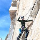
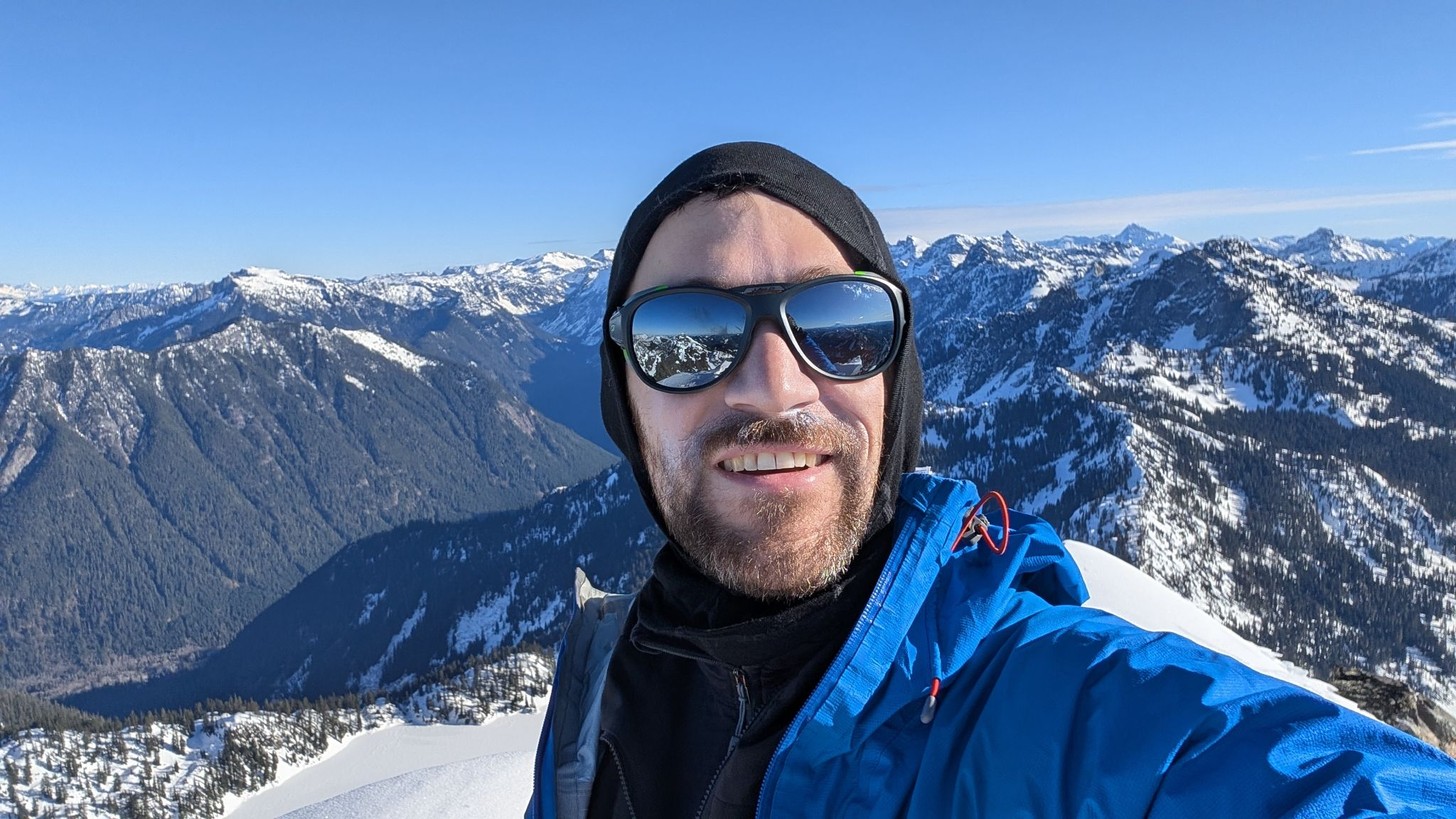
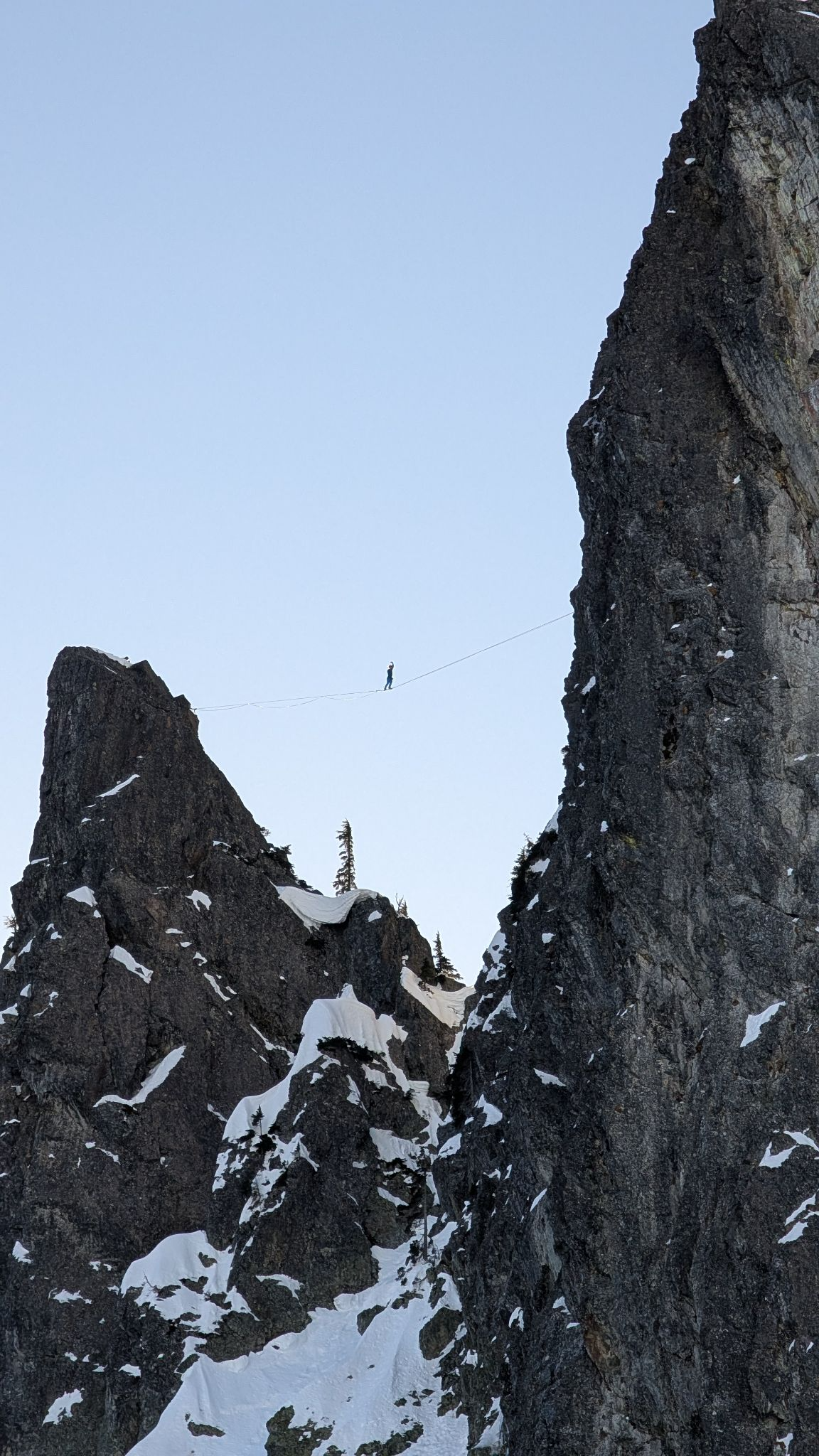
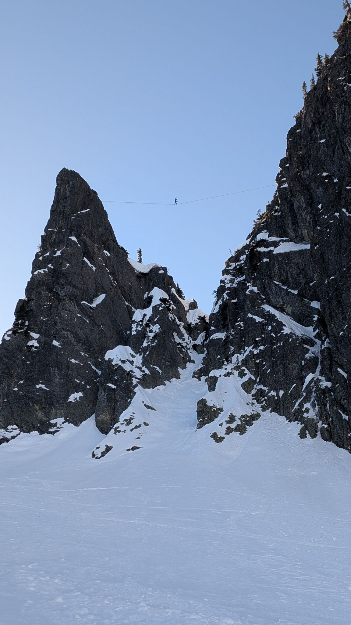
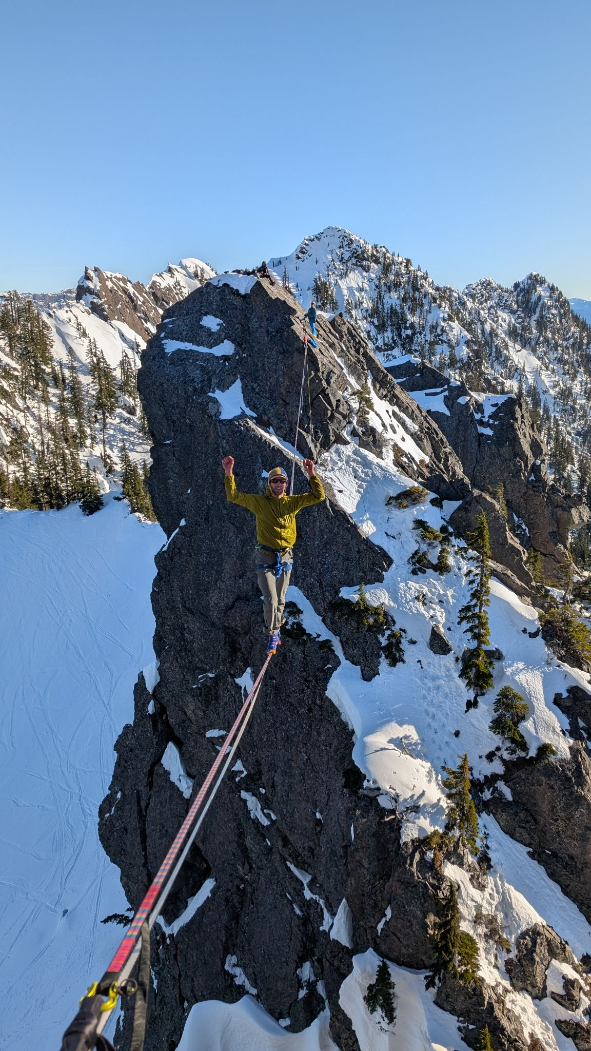
Chair Peak North Face Solo + Tooth South Face Solo I woke up at 5am in Seattle, made coffee, and drove over to Alpental. I parked in A7 (which sucks) and headed up at 7am. I got to the base of Chair Peak around 9:30am. Took a few minutes to warm up my hands as the wind had cut through my skimpy fleece layer and I had removed my gloves during the hike. NE buttress looked like it was getting a conga line started and one other soloist went up that way. I was pleased to find no one had started up the North Face yet. After making a delicate move from the snow moat onto the start of the route I started up. The first pitch has a cruxy move where an icy smooth rock bulges for about half a body length. This felt slightly committing to make solo because I felt I wasn’t going to be down climbing that move (I had rope for rapping). But it was easy enough and I was soon under way. The ice felt good with my sticks although it was thin in some parts and I dulled an ice pick by accident. The route had some interesting steep snow traversing on what felt like hollow snow but it was over rather quickly. I summited the North Face around 11am. I got back to source lake around 12:30pm, where I sat around wondering if I should head back to Seattle or make the day more epic by soloing the Tooth. I decided to head to the Tooth to check out my friend’s (Danny Schlitt, Ben Fusel, and Jaro Novak) alpine highline rig and snag the Tooth South Face. I got there around 1:45pm. The booting was chill, with minor post holing. I was stoked to see Danny and Ben each send the highline that they had poured a ton of effort into scouting. Nice work, boys! Such an epic line! The South Face was mostly dry with snow in pockets and sections. I climbed in my boots without crampons and gloveless hands. I summited the South Face of the Tooth with plenty of light to spare. I got back to the car around 5pm. 12.5 miles, 10hrs, 8hrs moving time, 4787ft elevation gain Youtube link: https://www.youtube.com/watch?v=hFm2yetj960&ab_channel=DavidBlaszka I forgot to turn my GoPro on until after the 1st pitch of climbing (and the crux), but at least I have this footage. Looking up the 2nd pitch. Looking down from the North Face pitch 3? Summit of Chair Peak. Danny cruising on the Tooth highline. Another angle. Ben making the send in socks! Looking down the Tooth. Me summiting the tooth in my heavy bag. Top of the Tooth


 1 point