Leaderboard


Popular Content
Showing content with the highest reputation on 08/04/21 in all areas
-
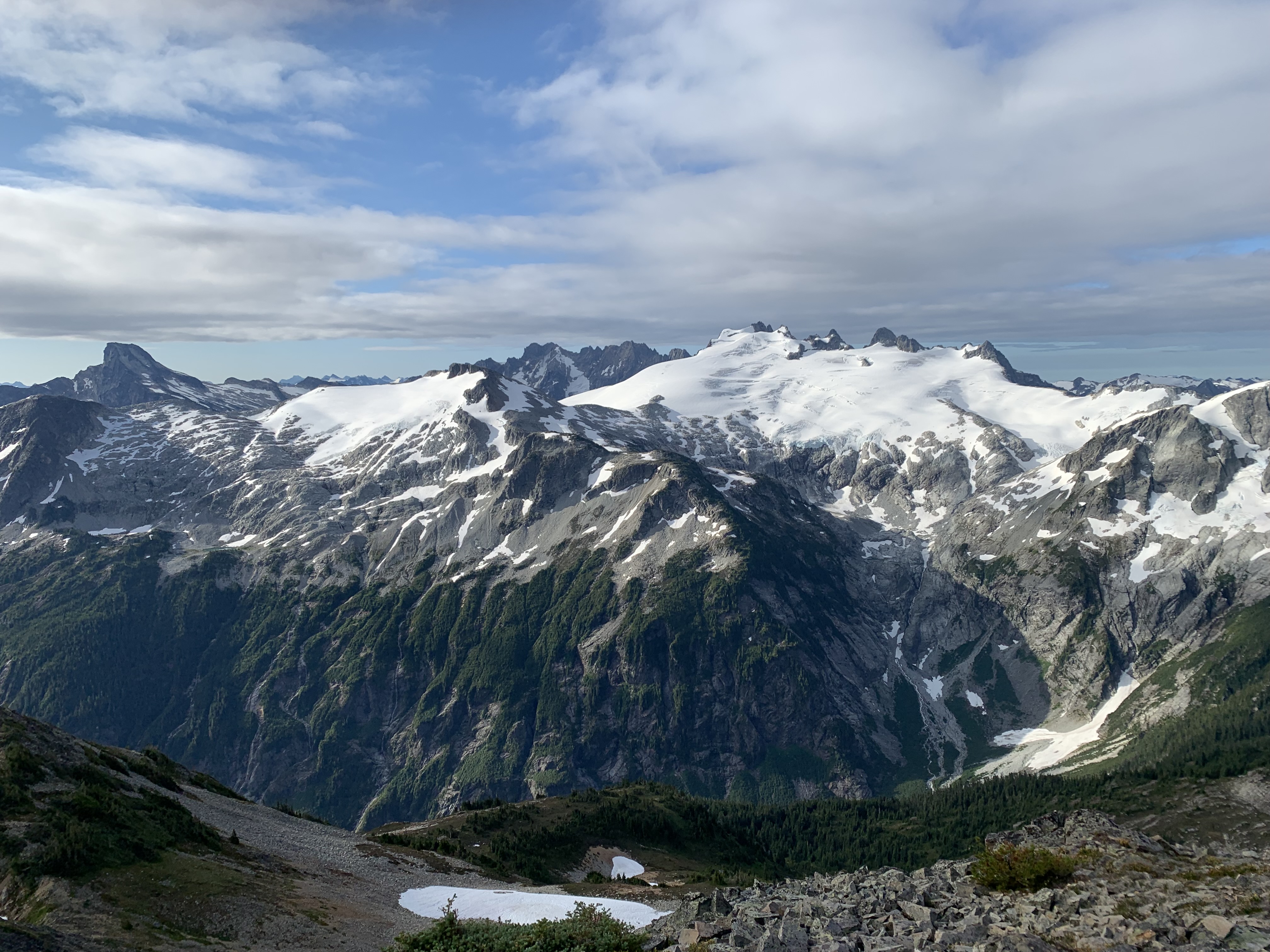
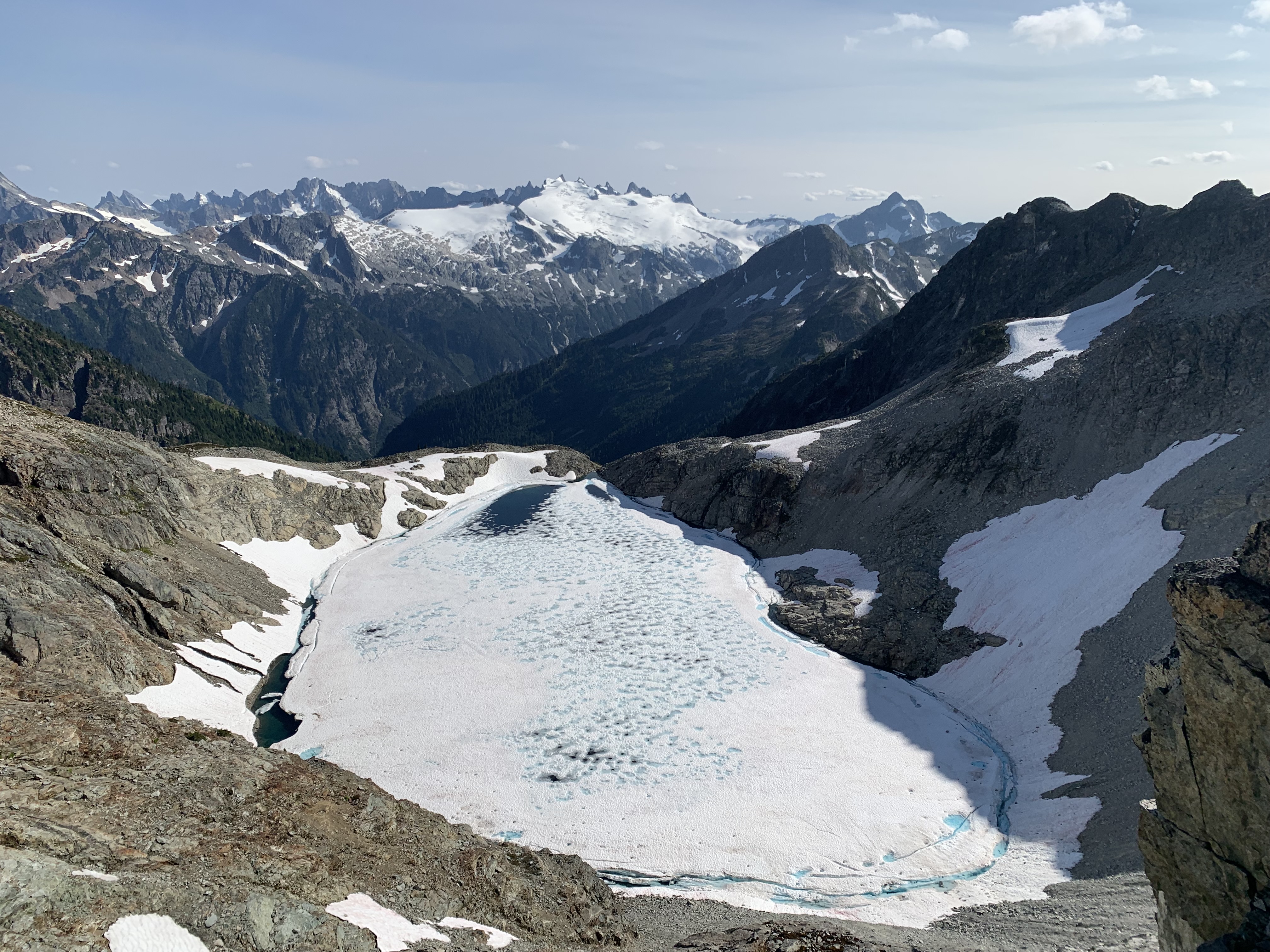
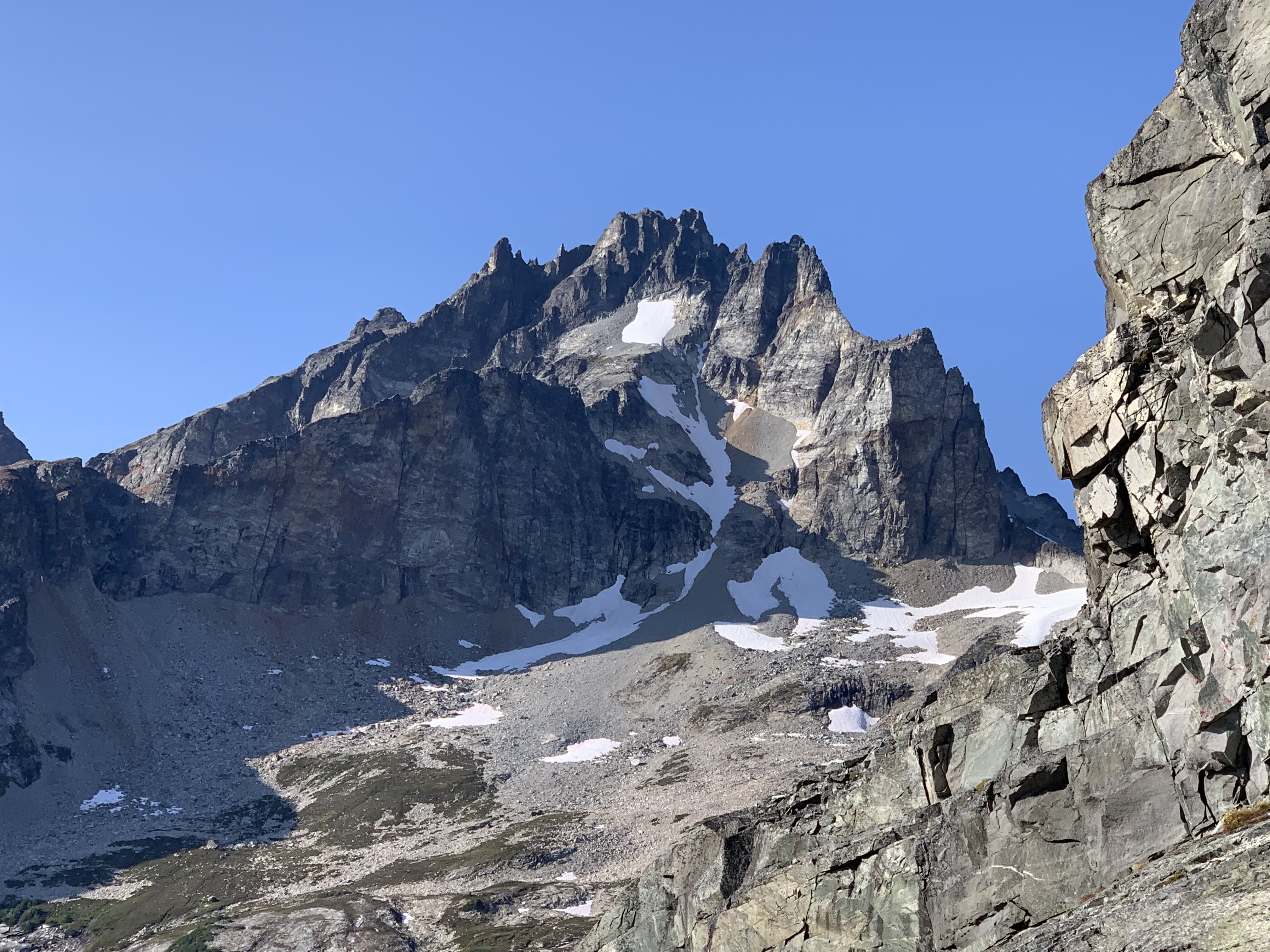
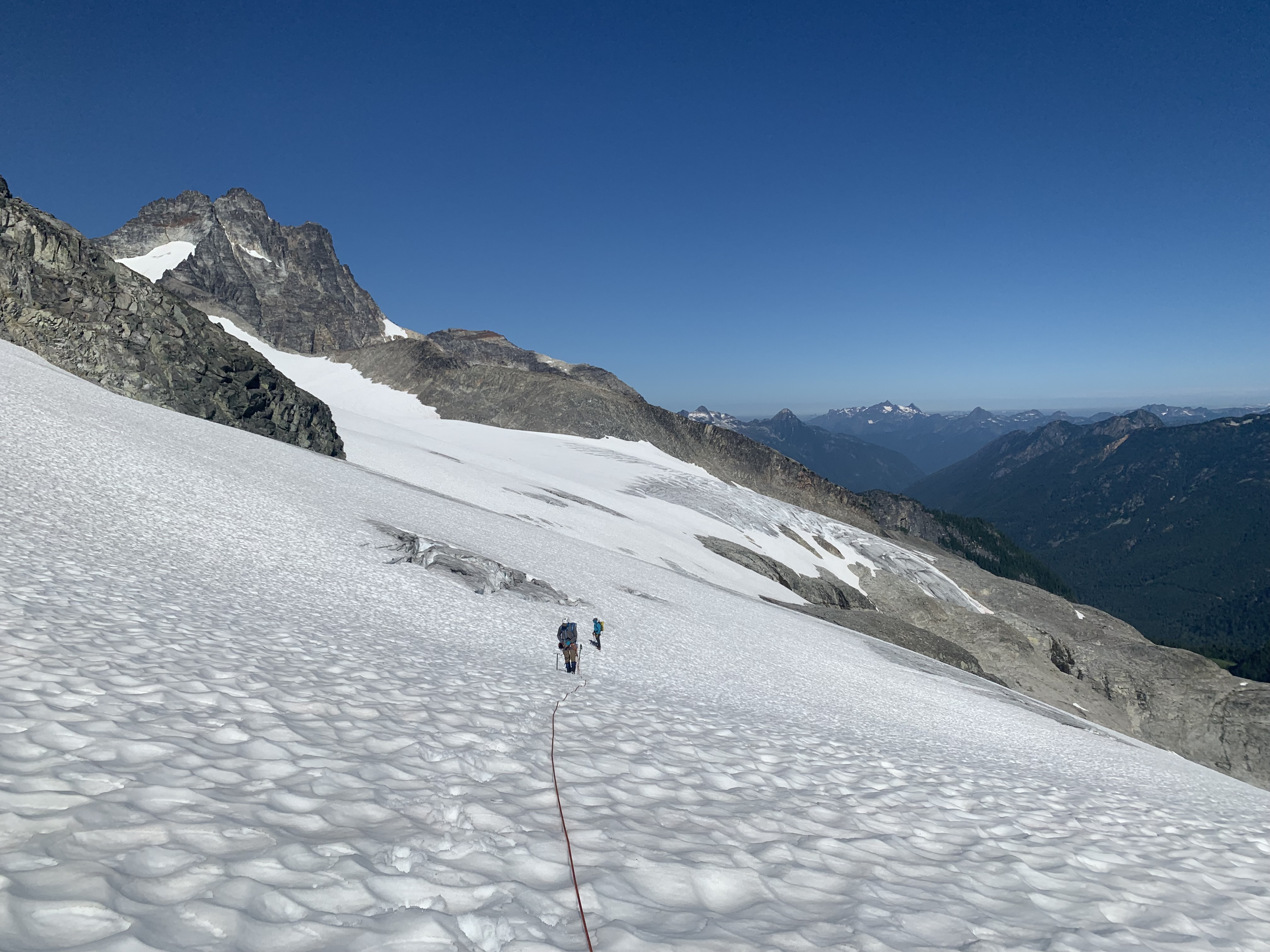
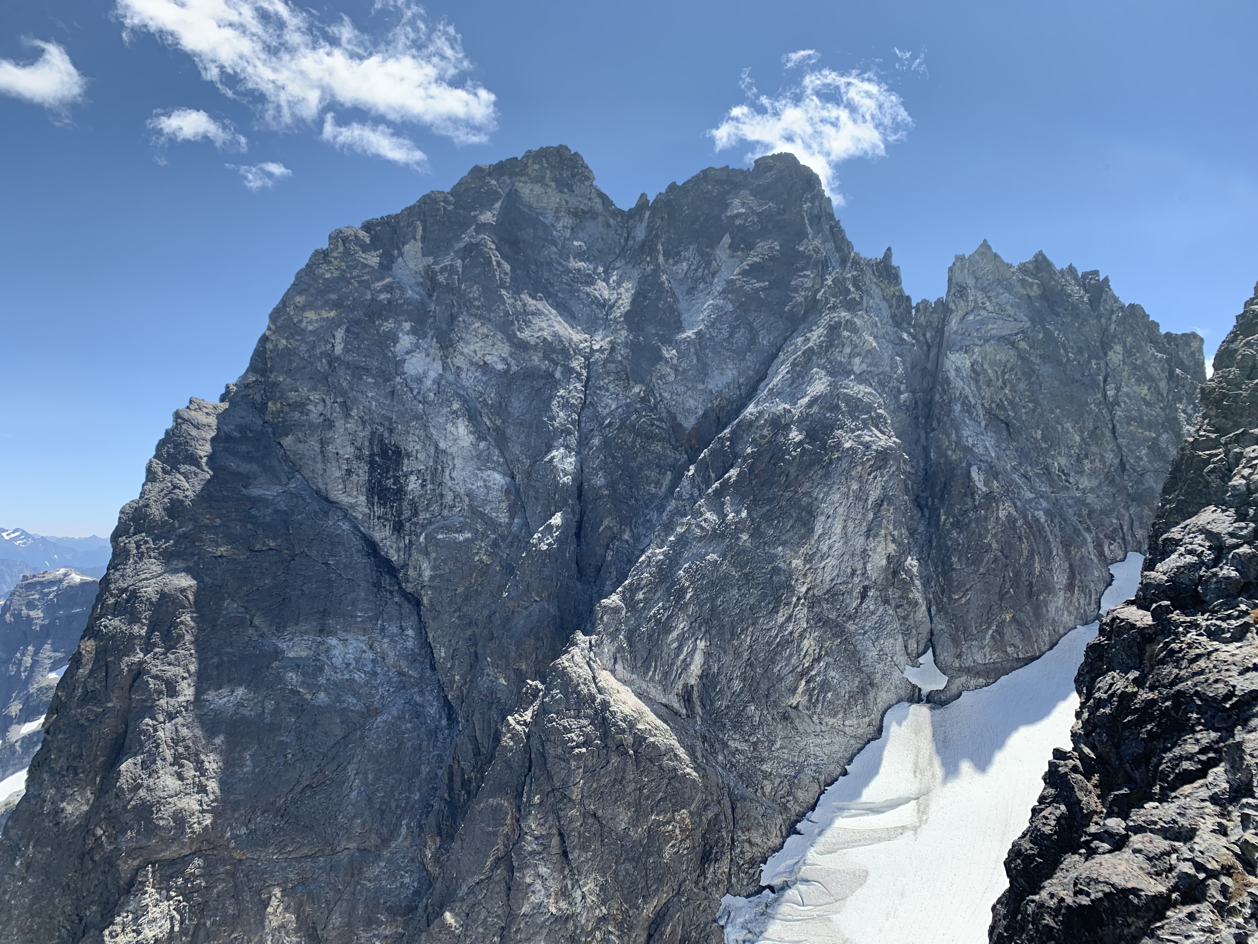
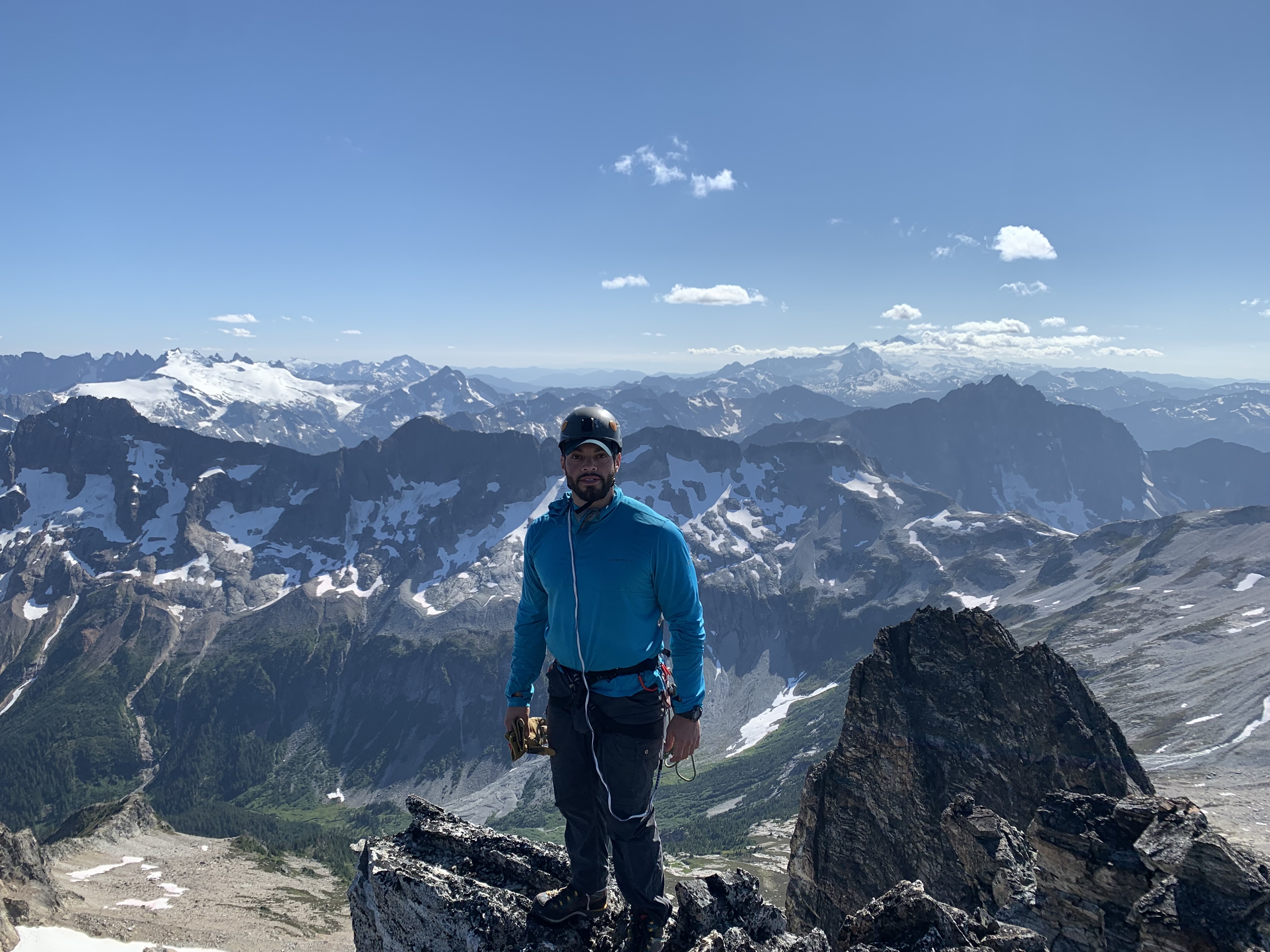
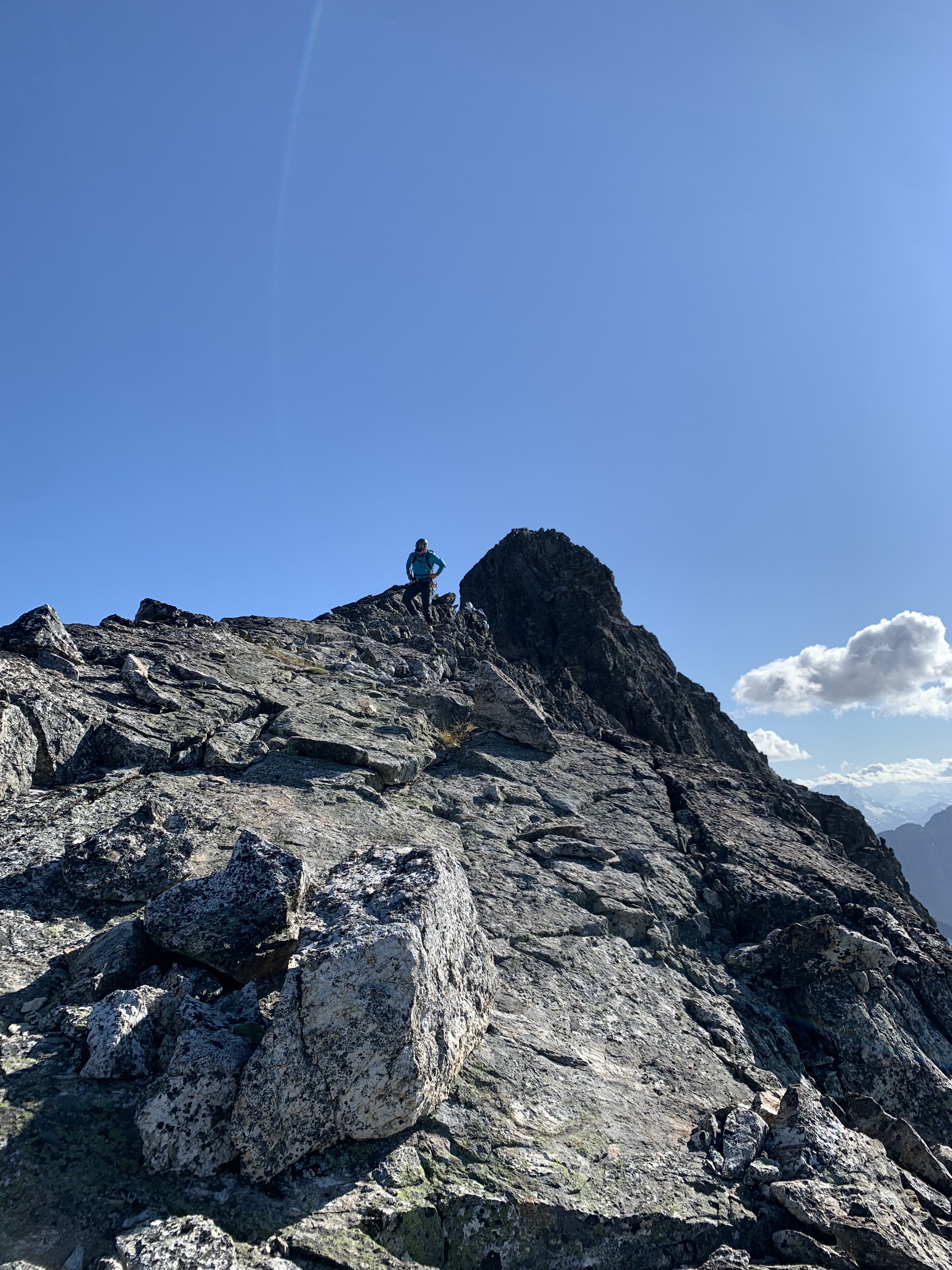
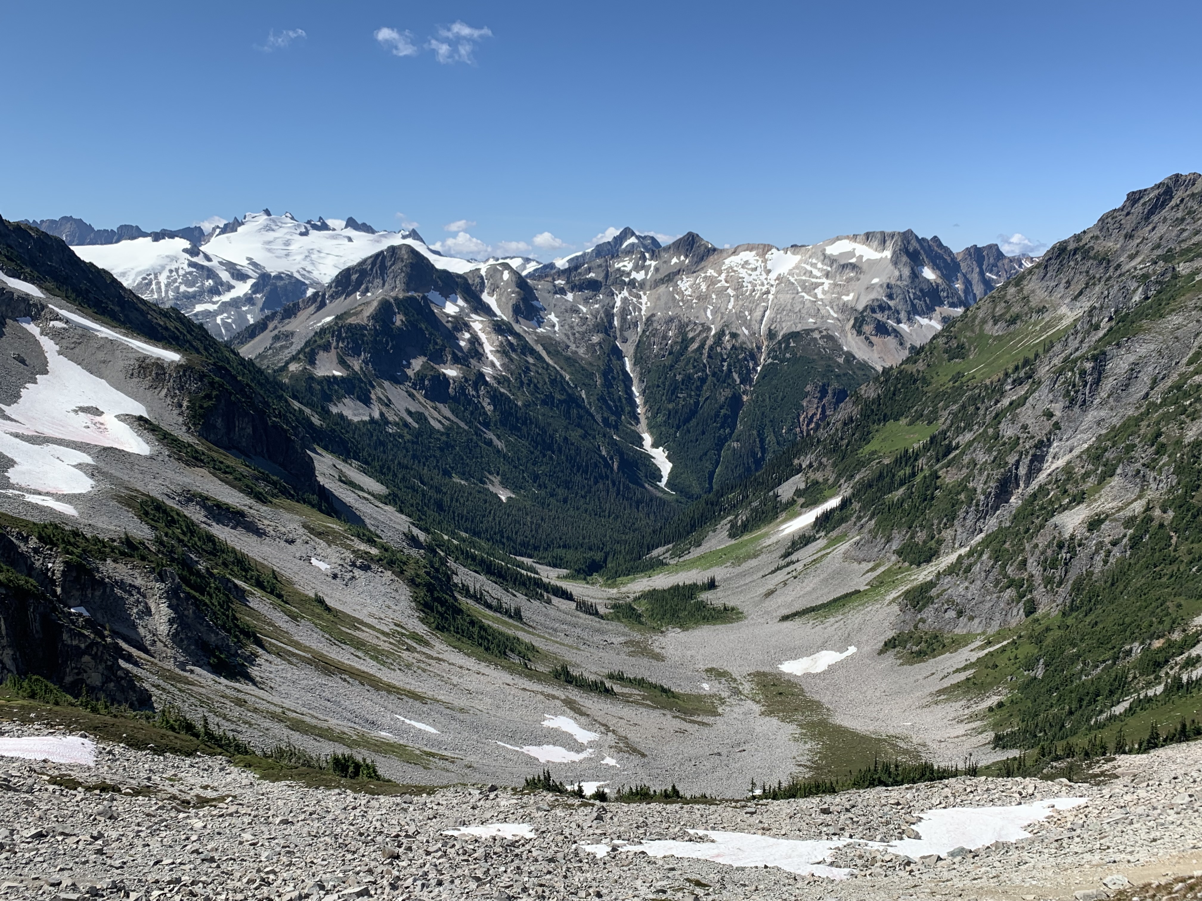
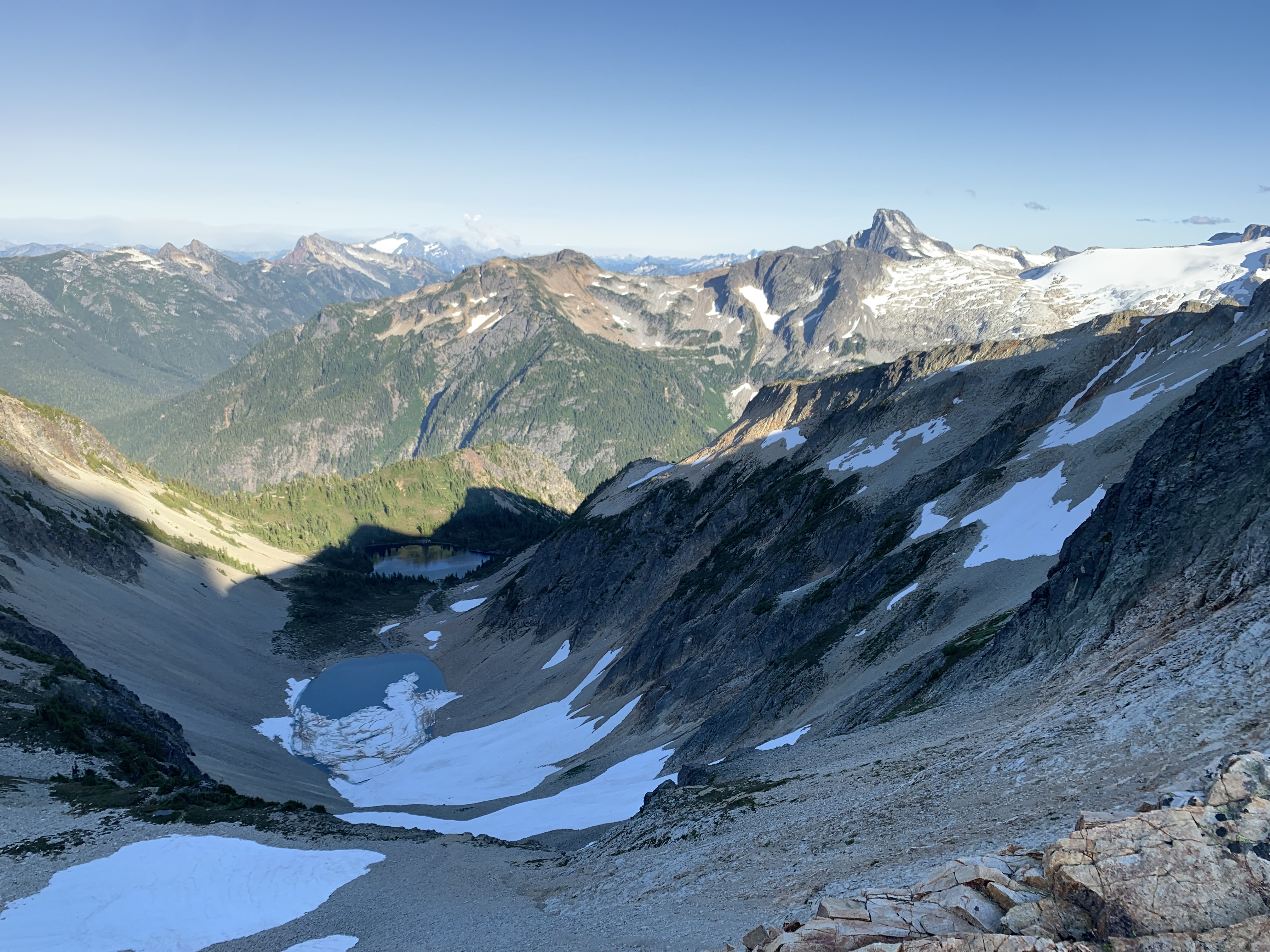
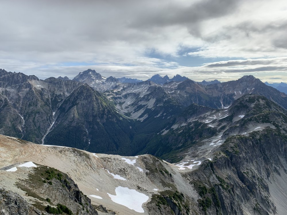
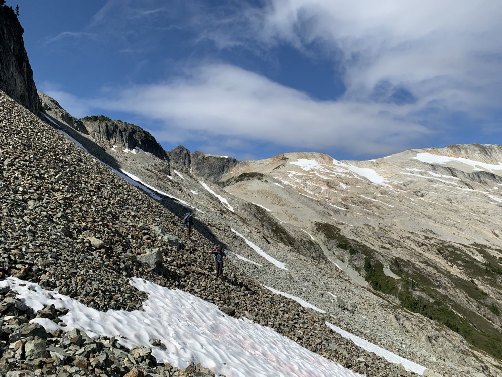
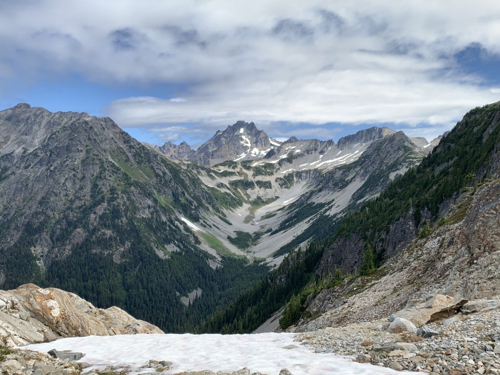
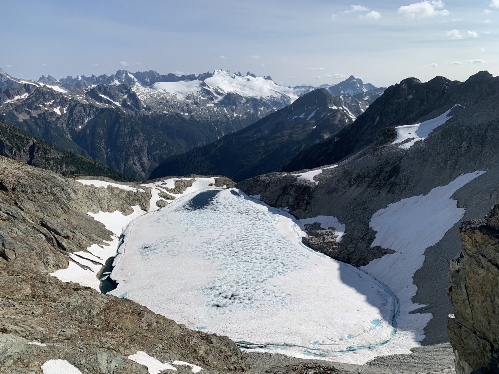
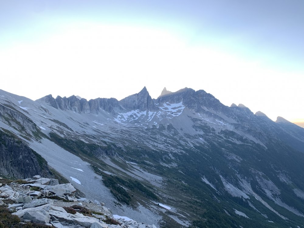
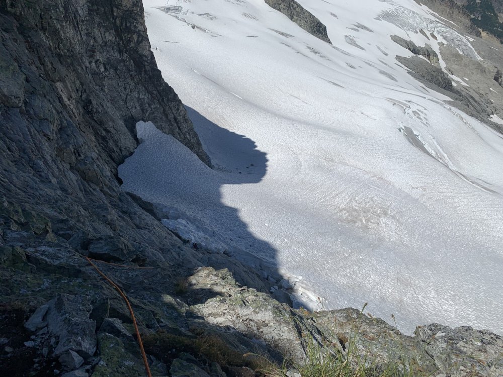
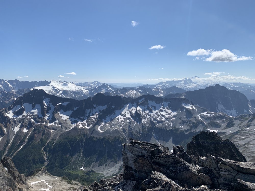
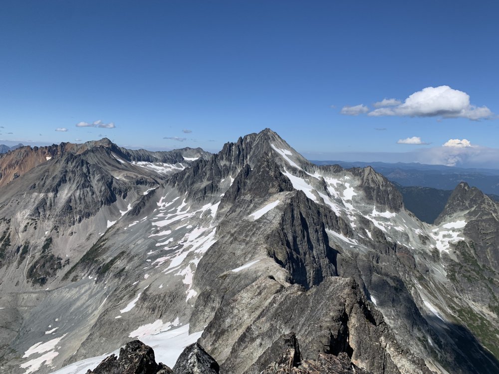
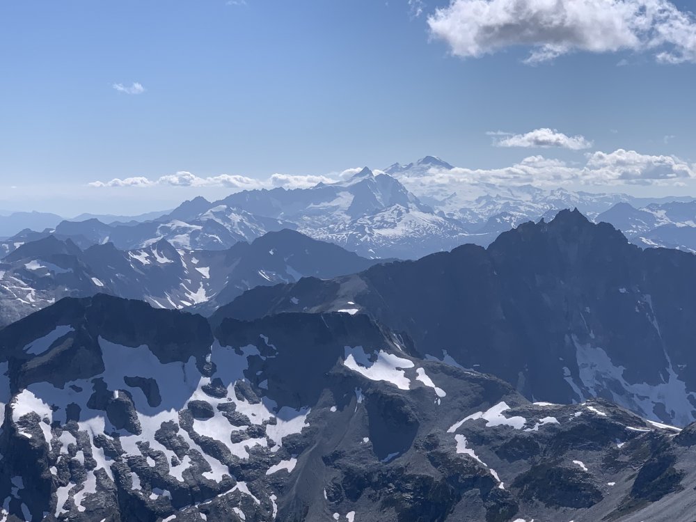
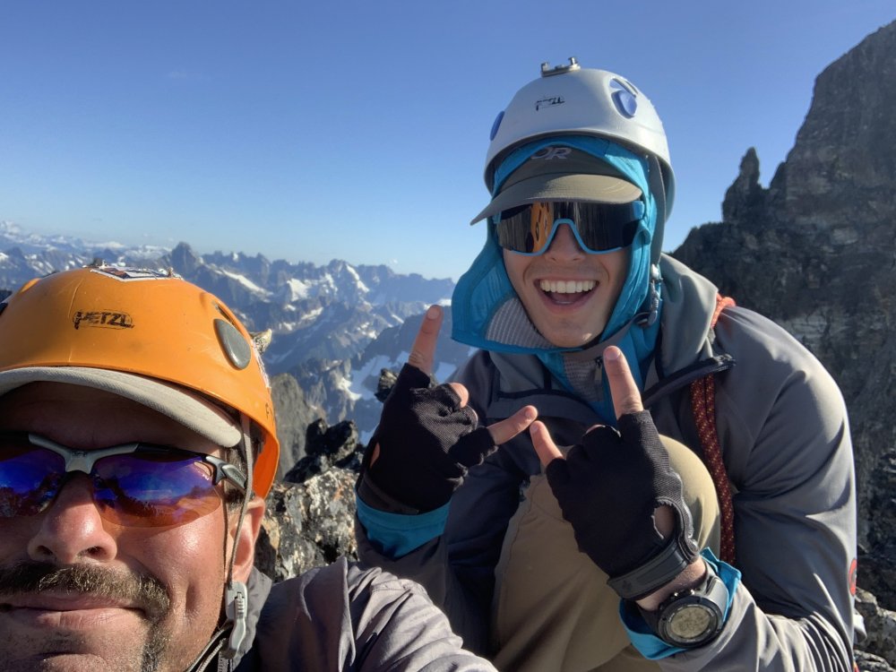
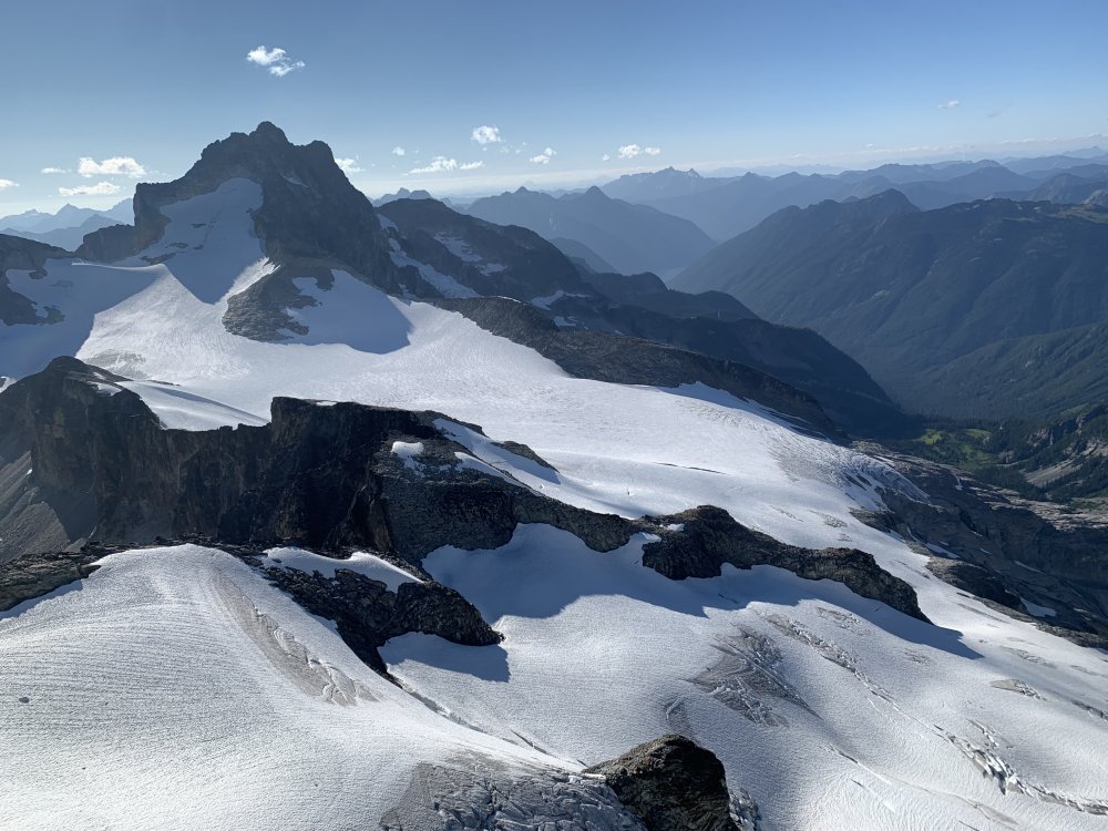
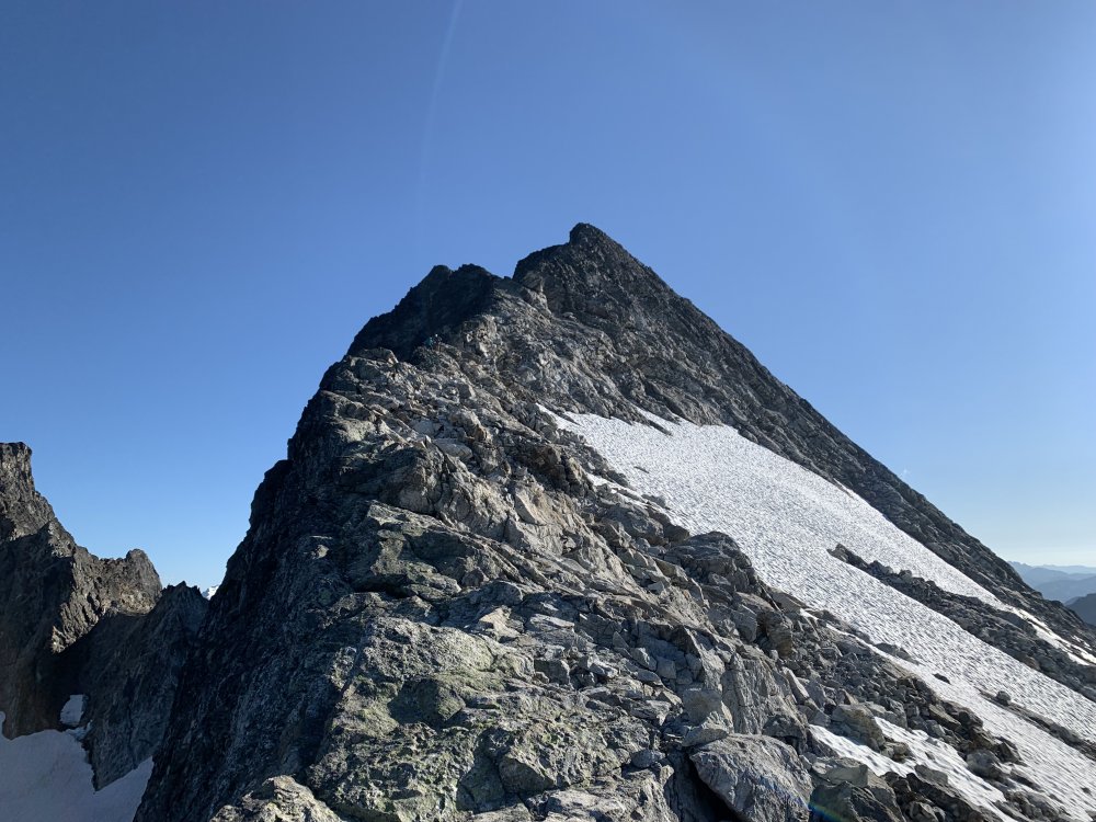
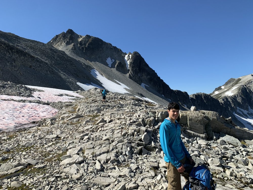
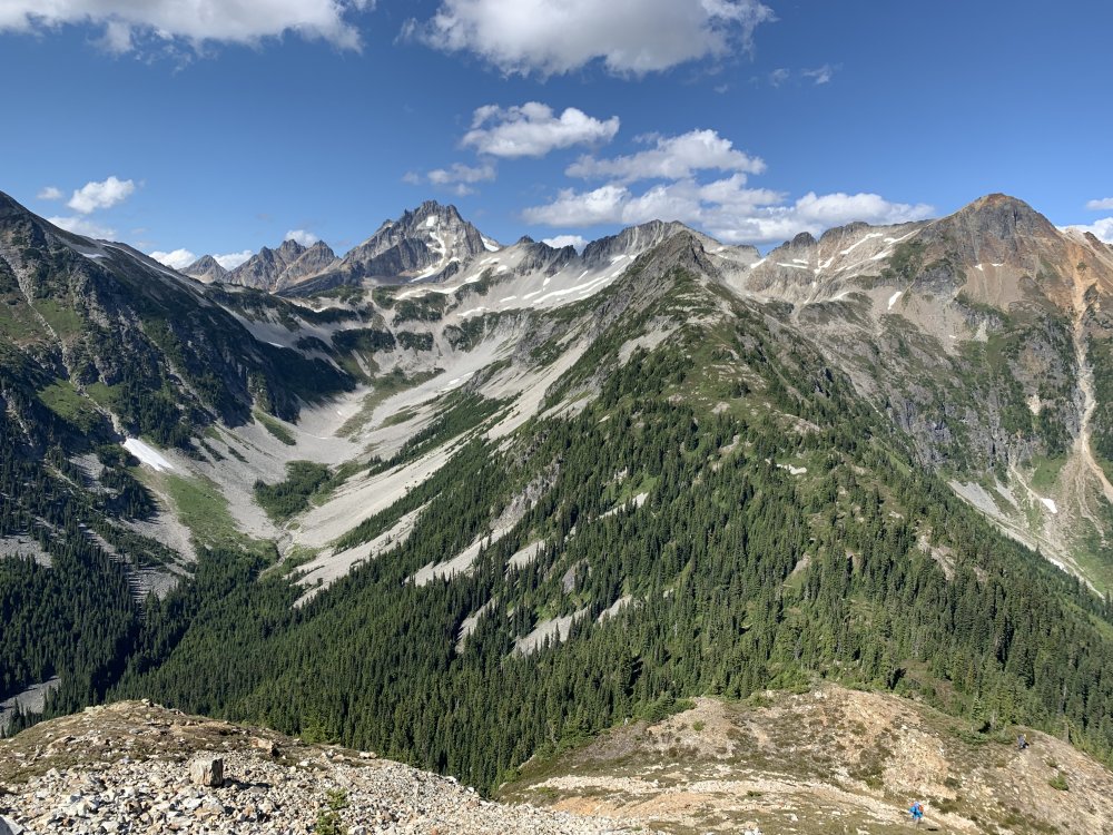
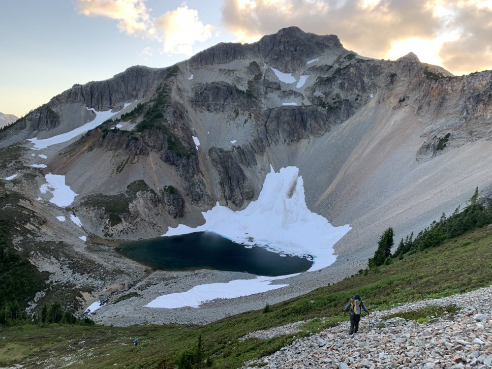
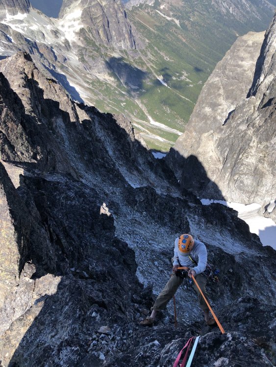
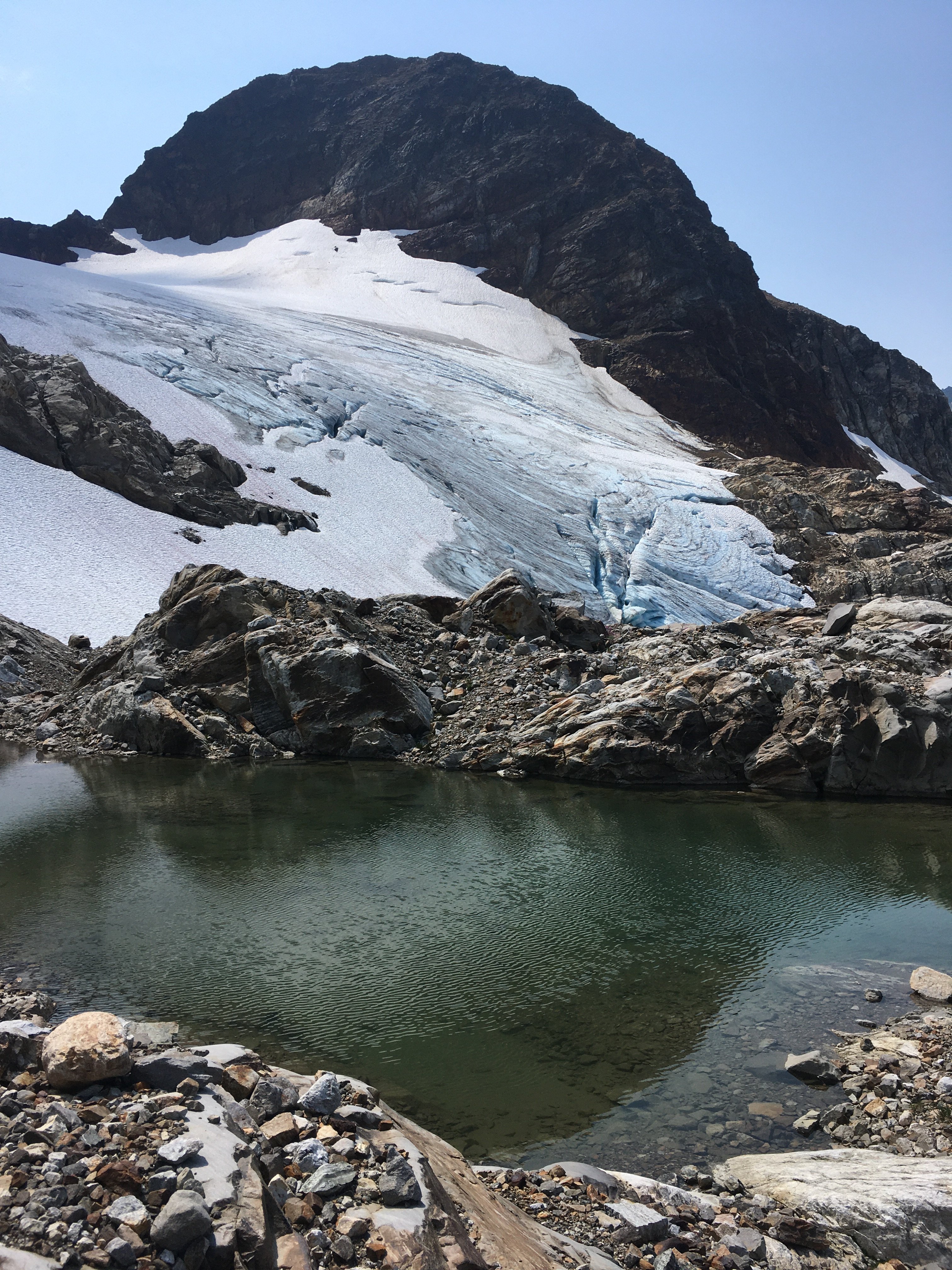
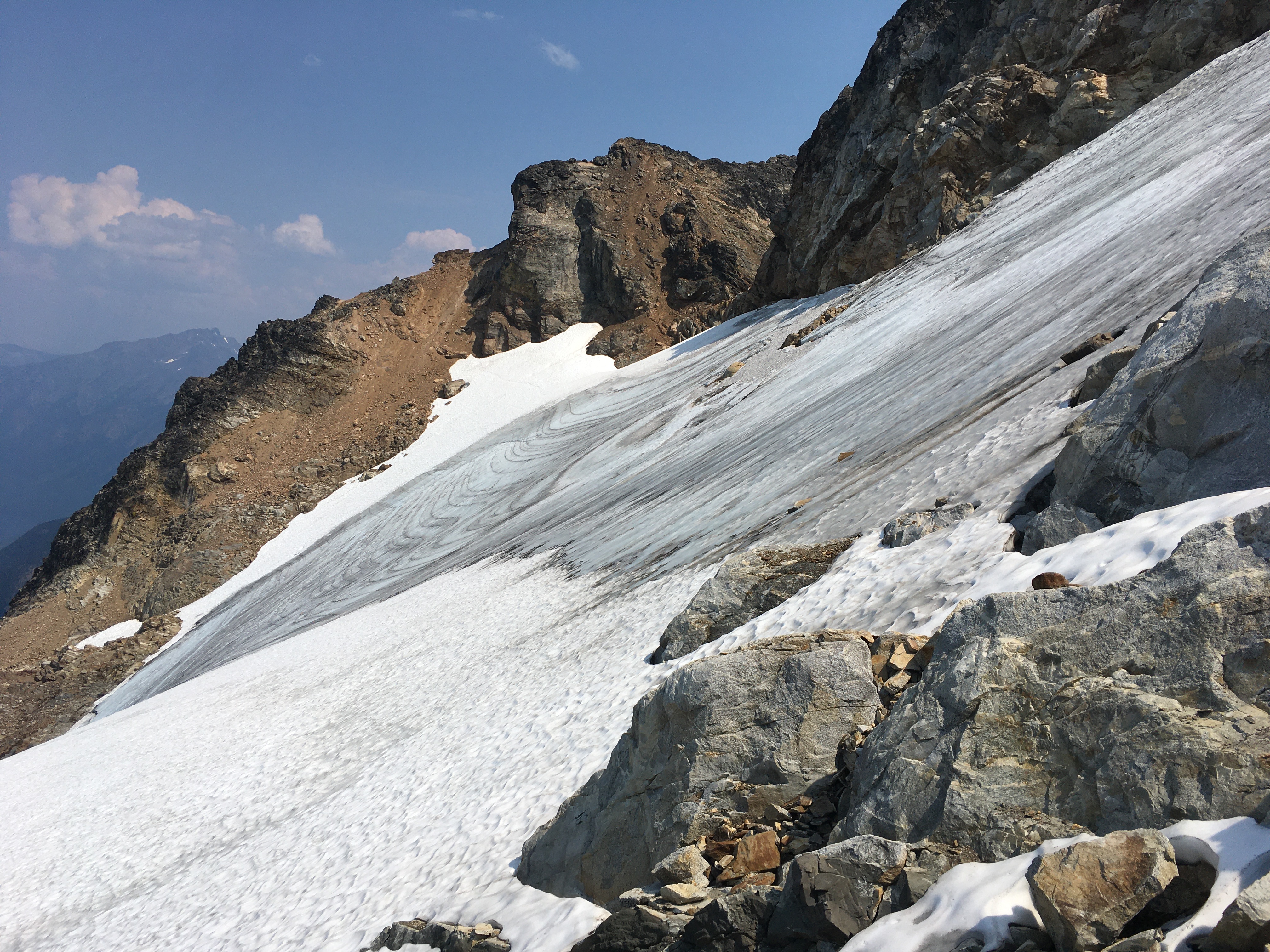
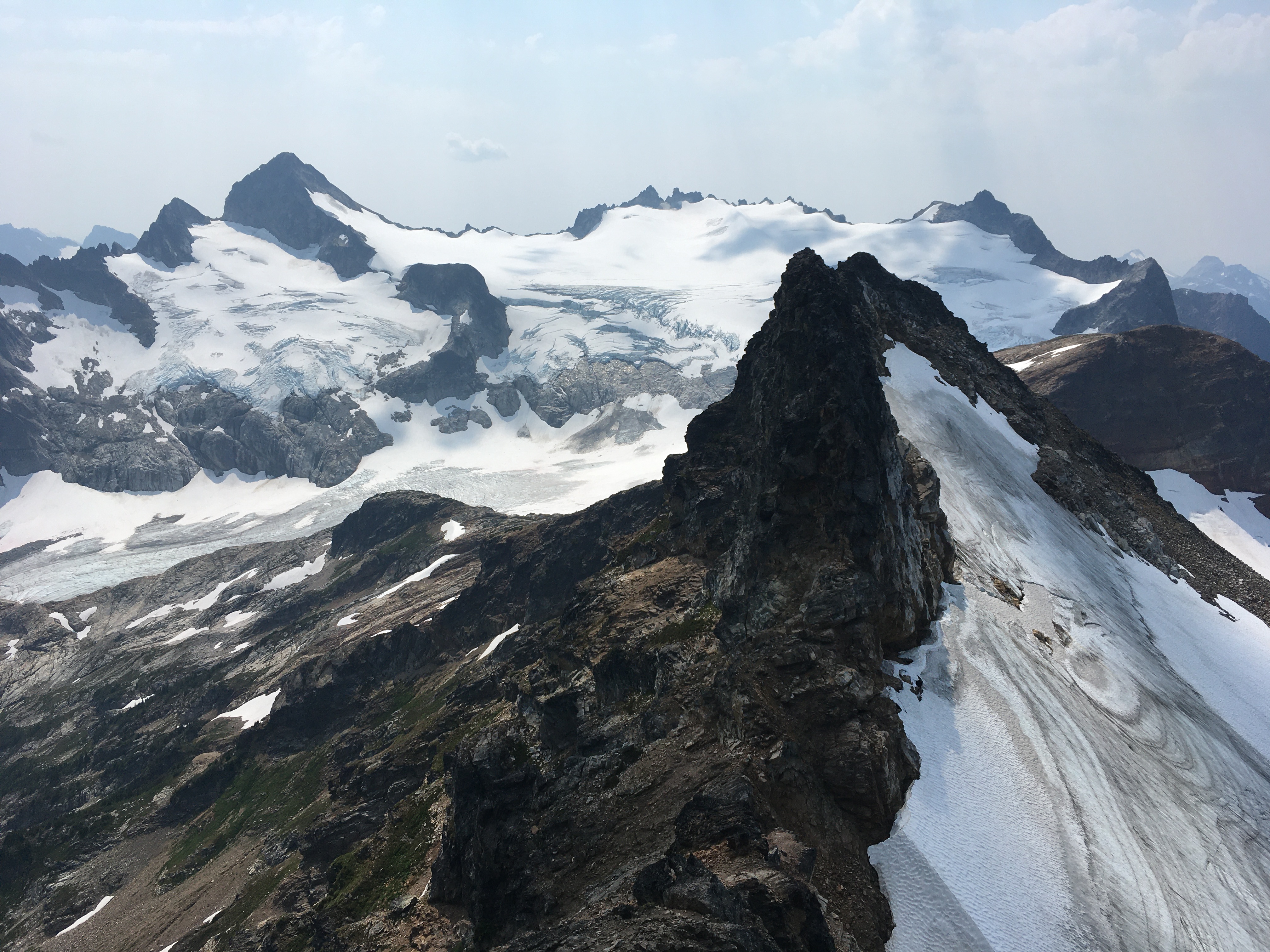
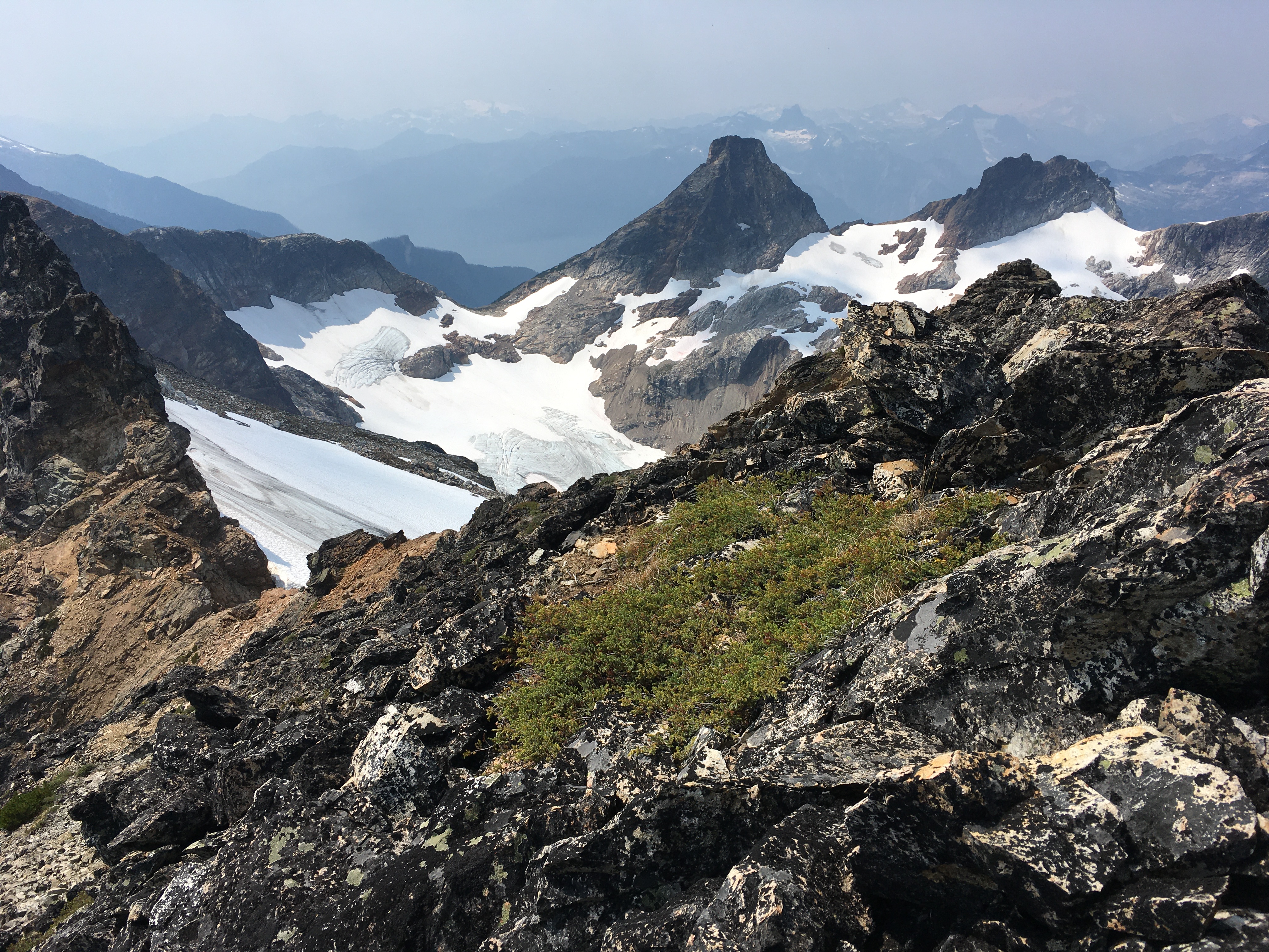
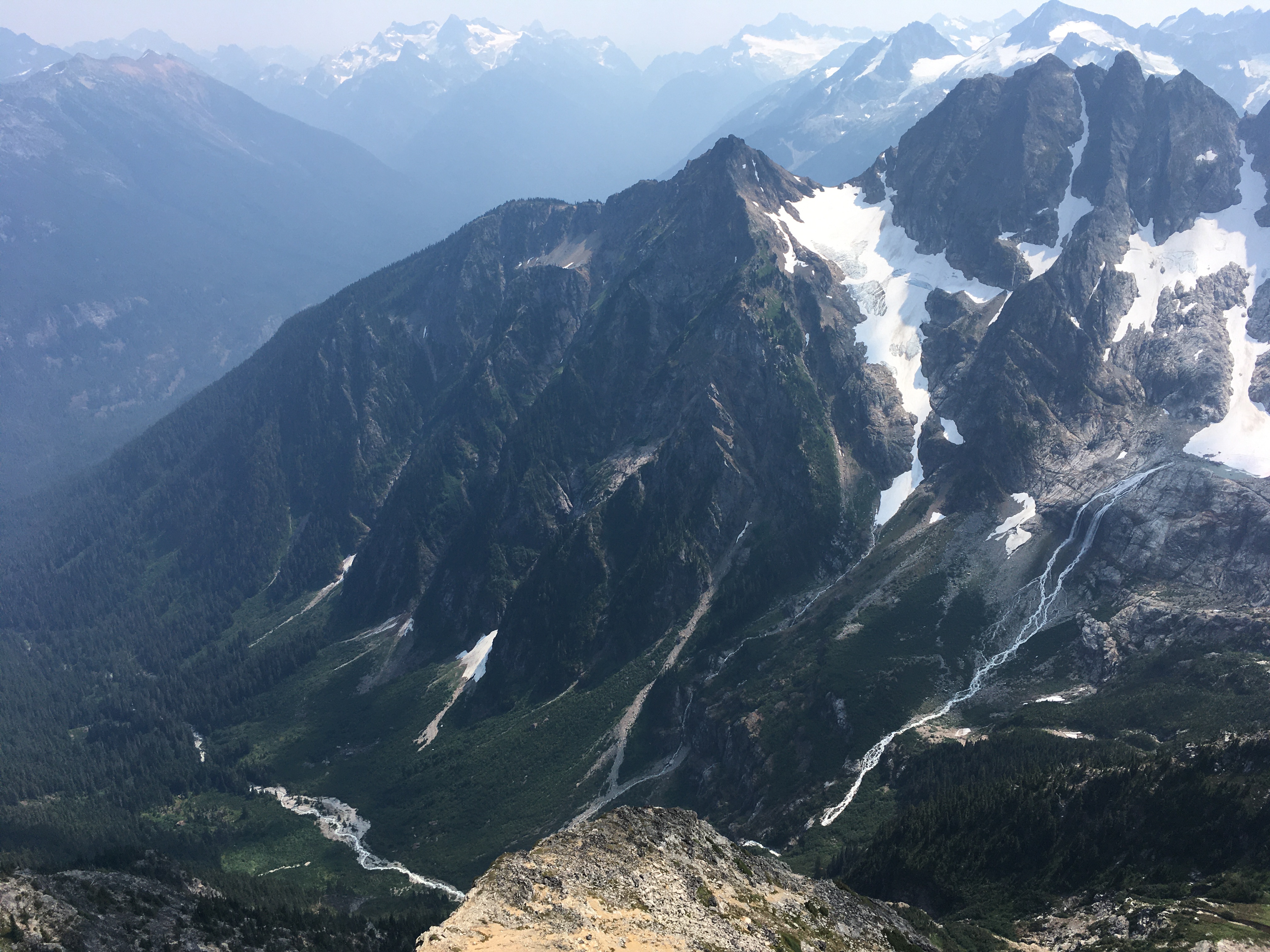
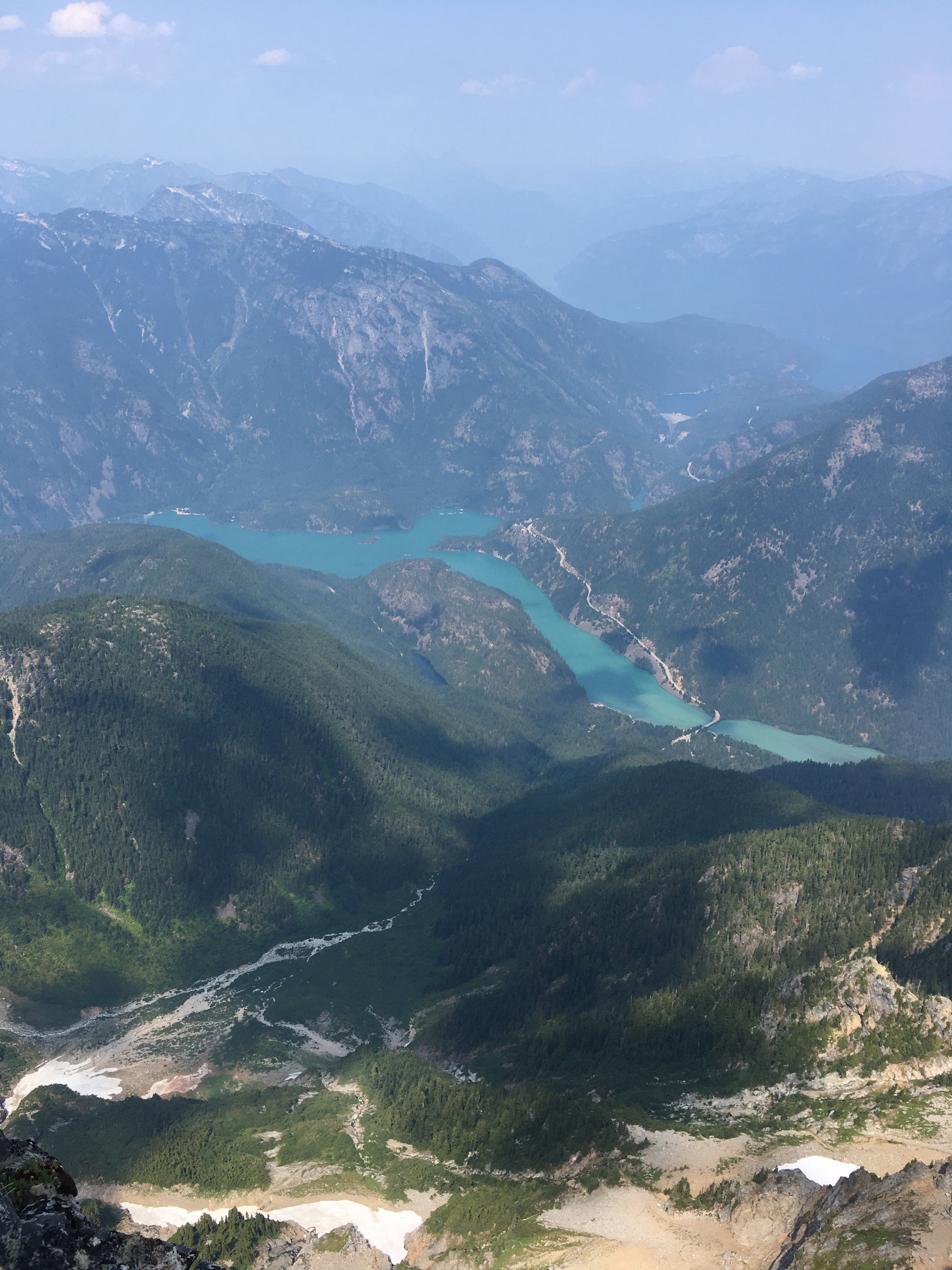
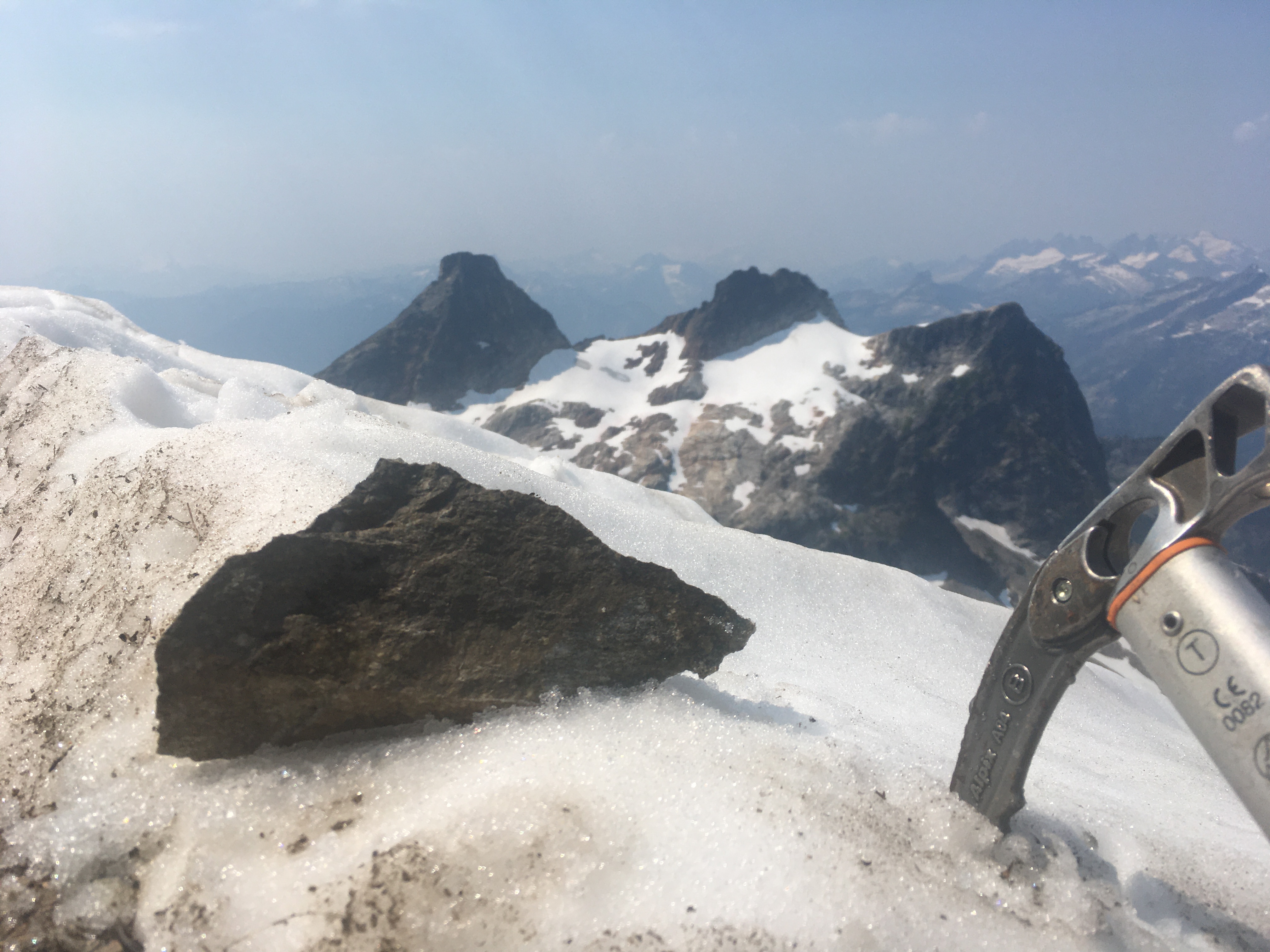
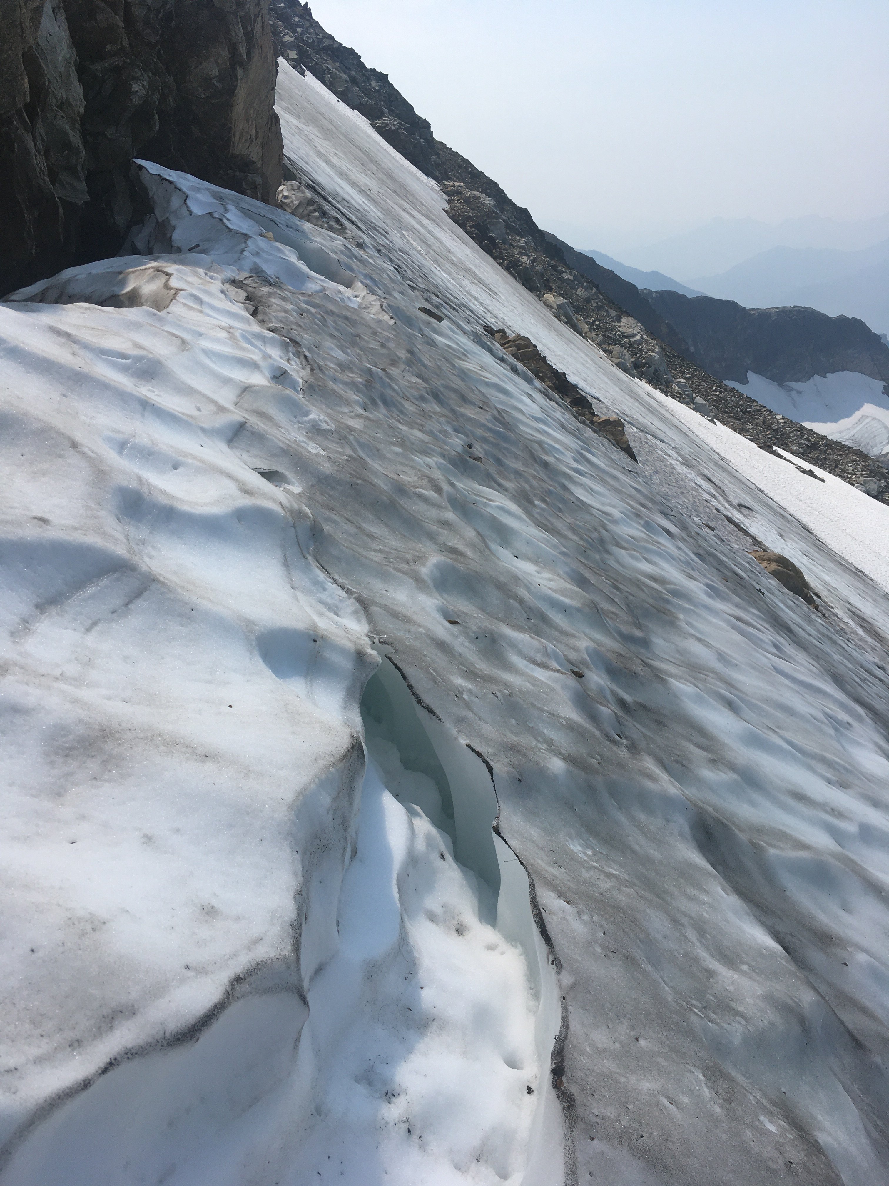
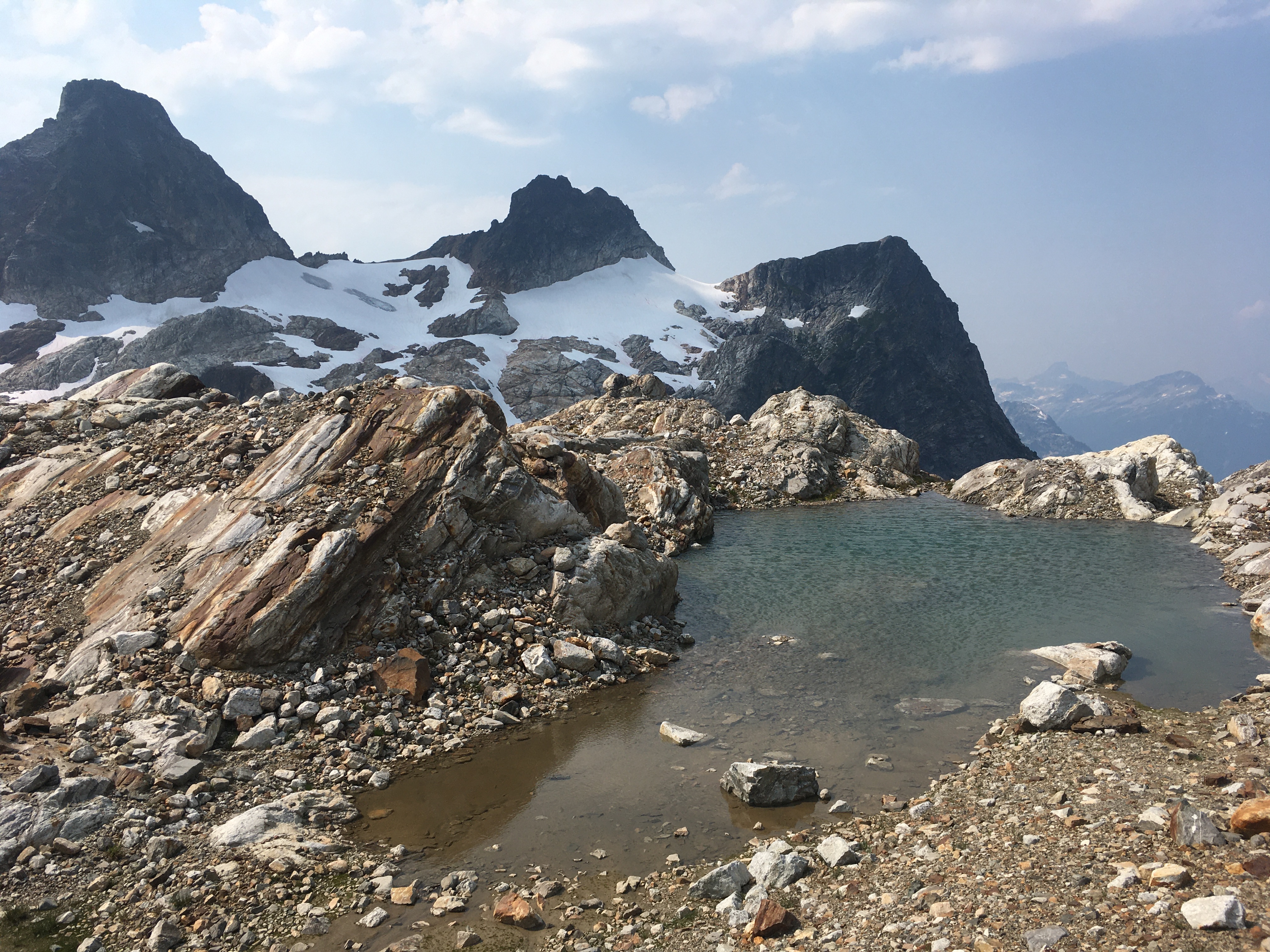
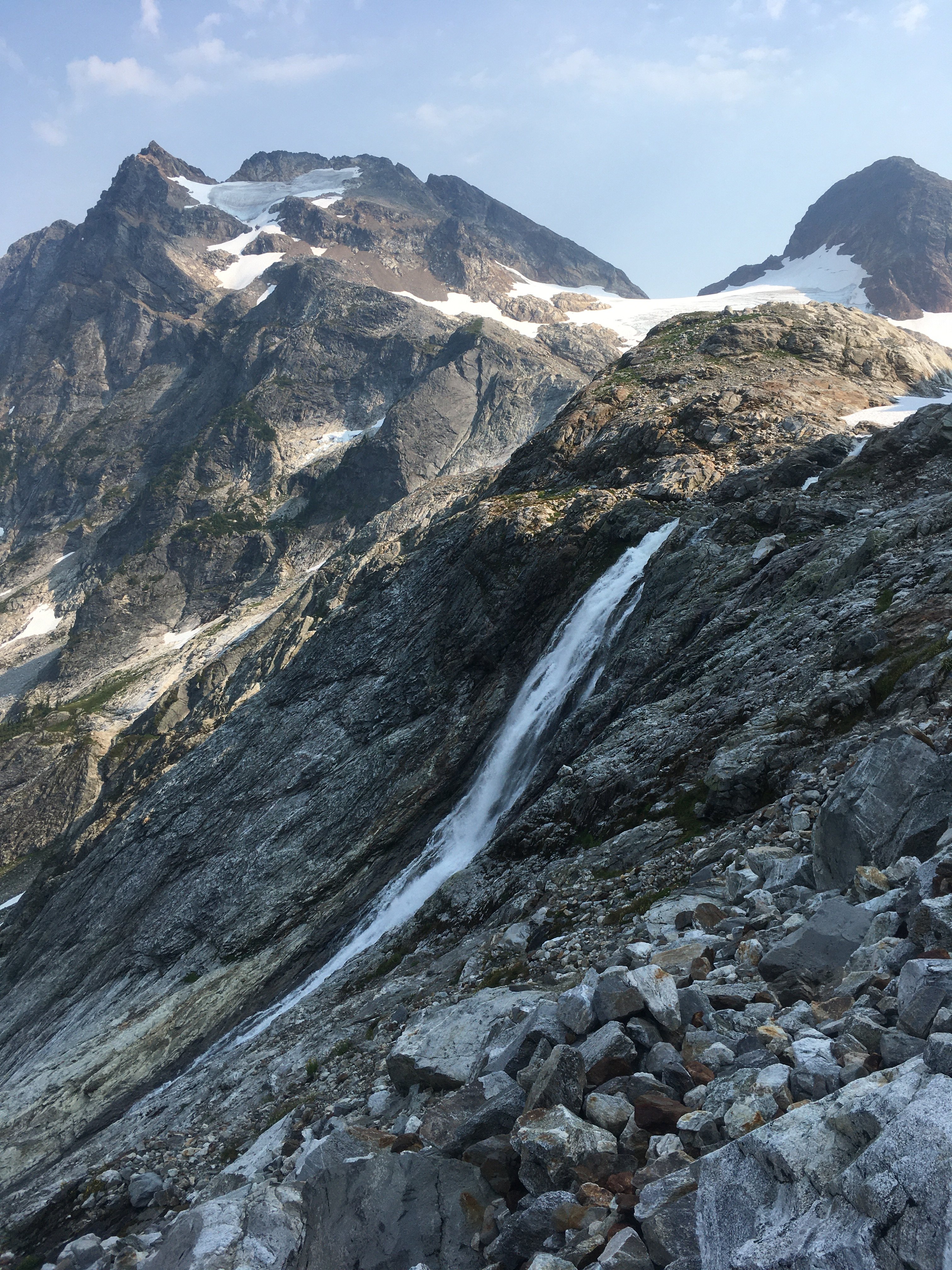
Trip: Mox Peaks - NW Peak (Easy Mox) - NE Ridge Trip Date: 07/24/2021 Team: @Stefan B @KaskadskyjKozak Trip Report: It's been a long journey tackling the Bulger list. And what a way to end it - with a long journey! A long fucking journey! In 2019 I was committed to slaying the beast, tackling 14 of 16 remaining Bulgers only to get blocked in late August in the Chilliwacks when we cut the trip a day - and a Mox - short due to an injury. Oh, well, that just left me with just two peaks to clean up in 2020 - Buckner and Easy Mox. Easy enough. Then there was COVID. As the border closure continued into June 2020, I began researching approaches from the US side for Easy Mox. No option seemed appealing, but two stood out as viable options: a high traverse via Whatcom or approaching via Silver Creek. I procrastinated, hoping the border would reopen, then finally tried each - and failed - in late summer. I utterly underestimated what these approaches would take, and despite being in great shape by that time of year, fell short. Oh well, I could just do the standard approach in July 2021, right? When it was obvious the border would not reopen in July, I began planning again. I coaxed and wheedled friends to try to join me for weeks - after all, who wouldn't jump on such an opportunity, especially to take multiple days off of work for a death march? The amazing weather we have seen in July held and held and held. The stars aligned on climbing partners. I pulled the trigger. There were three of us: my son, Jorge, and me. Applying lessons from my failed attempt in August 2020, I split this trip into a 5.5 day itinerary, which went as follows: Day 1: Evening hike to camp at Hannegan Pass. Not much to say here except we arrived later due to traffic and started up at 8 pm. So glad I built in buffer to my itinerary! Day 2: Got up early-ish and hiked trails to Whatcom Pass, then took by-trail towards Middle Lakes, camping by a small tarn with awesome views of Challenger and Whatcom. The tarn was warm and we even got to clean up before dinner. (7:15am - 5:15pm). Day 3: Got up early and did the high traverse, camping on slabs above Bear Lake, SW of the saddle extending below the SW-trending ridge extending from the SE peak of Redoubt (6 am to 7:30 pm). We had a small pool with running water *at* camp. The high traverse was inspired by a TR from a few years ago. In summary, we summitted Taps mountain, then traversed ridges NE-ly to the lake below Cave Mountain (Pass Lake?). We then traversed NW towards Bear, then NE towards Redoubt. Our biggest time sink on this day was due to bush-whacking through hideous, thick trees on steep slopes getting to the upper basin above the Pass Creek drainage. We took 3 hours in this section. Day 4: Long fucking day (6 am to midnight). This involved traversing to the ridge on the Depot-Redoubt Divide, traversing the Redoubt glacier, climbing the route, then doing it all in reverse. Some detail on our long climbing day: We ascended the SW ridge of the SE peak of Redoubt until about 7200', then downclimbed about 100-200' to talus and traversed to the first point we could cross on the E ridge of the SE Peak of Redoubt, roped up, then walked the glacier over to a fine snow ramp leading towards the low point on the NE ridge of Easy Mox. I led a full 60m pitch up the slabs above the snow ramp, only to be stopped about 30 feet short of scramble terrain, and then led a very short second pitch to the top rap anchor. We then scrambled the ridge. Holy shit, what an amazingly exposed, improbable ridge! We found the gully off the ridge easily and scouted out the final pitch and settled on two options. I tried the easier one (we had a picture from an online TR that made it look like the right start) but it dead-ended on the ridge so I downclimbed. Jorge then led the other option (which was correct) and set up a belay at the bottom rap sling. We then solo'd the final 25 feet or so (up to the higher rap anchor). We did two rappels, downclimbed the ridge, then did two more rappels. We were super careful to not get any ropes stuck on our pulls! It was now around 8 pm. We roped up and crossed the glacier which was very soft after a full-day of sun exposure. We essentially retraced our boot path, but punched through opening crevasses twice (on the eastern lobe of the glacier). As we rounded the rock spur to get to the W part of the glacier, the sun set and we unroped by headlamp. We then miraculously scrambled boulders, talus, and scree back to camp with minimal issues. Day 5: Slept in (8 am) and did the traverse back to our camp from Day 2. We got a late start due to the previous long day. It was hot and sunny - the hottest day so far, and we were grateful for lingering snow patches and fresh running water in many places. We followed a much better contour from the upper Pass Creek drainage back to the NE ridge of Peak 6874 which took us less than half the time to do. Bugs were bad at camp - noticeably the worst of the trip so far. (10 am to 8:30 pm) Day 6: Got up early and did the full 17.5+ mi hike out to Hannegan Pass. Bugs were hideous in the final few miles to Hannegan Pass. (6:30 am to 6:30 pm). Bulgers done. 100/100. Now for the pics! View of high traverse from the summit of Taps Mountain. Redoubt looks *far* from here: Views South from Taps Mountain. We were surrounded by these amazing views above treeline continuously for four days: Looking back at the first part of the high traverse from near and below Peak 6874 Indian Creek Drainage from the traverse. Bear Mountain on left: Traversing the lake above Pass Creek and below Cave Mountain. I believe it is called Pass Lake: Nearing the end of our traverse and camp. Redoubt is finally close! Summit Day taken just above our camp. The Moxes still look far. We had a lot of talus to traverse just to get to the glacier! Finally on the Redoubt Glacier! Looking down P1: Hard Mox as viewed along the N ridge of Easy Mox. The exposure and views are unbelievable! Summit views from Mox back towards our traverse: Spickard, Custer, Rahm. Been there, done those: Shuksan, Baker. Ruth looks far! TBH, I was not looking forward to the long walk back to Hannegan when I took this pic: Jorge on the summit: My son and I on the summit. KK rappelling. This, along with one I have from Storm King are my two favorite rap photos ever! Redoubt as the sun got lower in the sky and we downclimbed. The sidewalk in the sky: Longer view up the NE ridge: At camp on day 5, getting ready to traverse back to Middle Lakes: Looking down the Indian Creek drainage. Taken on the traverse back to Middle Lakes: Taken from a point about 6400' - the high point on the NE ridge of Peak 6874 that we climbed after the traverse above the Pass Creek drainage (right of frame, mostly out of view, blocked by the ridge): East Lakes as viewed on the traverse, near Taps Mountain: Descending to upper Middle Lake: Gear Notes: 60m rope, mid-sized rack, helmets, glacier climbing gear Approach Notes: Long, brutal, epic.


 2 points
 -
Trip: Mount Constance (7756) - SOUTH CHUTE - STANDARD Trip Date: 07/31/2021 Trip Report: Mount Constance (7756') – Lake Constance Approach Trip Report – July 31-Aug 1, 2021 (Sat, Sun). I climbed Mount Constance (7756') over the weekend. I started the climb from the Dosewallips River Trailhead (Rd. 2610) outside Brinnon, WA. I attempted this climb a month ago and did not do enough research. I ended up trying to climb Warrior Peak thinking that it was Constance and having to turn around after running out of time. The West side of Warrior Peak is not fun, shitty rock and steep. The weather was looking somewhat iffy with the potential for thunderstorms predicted with a weather window for summit day. The other potential climbs all had worse looking weather so Constance got the green light. I planned for a 2 day climb. Saturday: I caught the 9:35am ferry at Edmonds over to Kingston. I made it to the trailhead at 11:30am. On last month’s attempt I decided not to bring a bike for the first 5 miles to the Lake Constance Trail, resulting in 2+ hours of boring road hiking. This trip I brought the bike for the first and last 5 miles of the trip, huge difference. The bike ride took 45 minutes to the Lake Trail, saving me about 1.5 hours and the extra wear on my feet. Great start so far. Lake Constance Trail is a workout. It climbs 3300’ in 2.2 miles and has a couple Class 3 sections on the trail itself. I was shocked how much the water situation changed since my last trip up the trail at the end of June. June was a raging torrent of water coming down Constance Creek, July the same creek was bone dry where the trail meets up with it. The first water available on the lake trail is about 2600’. It was cloudy with a little bit of light rain here and there, I made it to the lake at 4:45pm. I decided to proceed up to the base of the thumb to setup camp, right at the turn to go up the South Chute of Mount Constance. Last month this area was 70% snow covered with plenty of running water. By the end of July the snow is less than half with minimal water options. The only water available was coming from the section of the mountain just before the Thumb. One good flowing creek and one minor flow coming down a rock face. I set up camp below a running water source at 5200’ in a nice flat camp area that was under snow the last time through. I counted about 6 good spots for a tent of bivy in the area. I got as much water as I could before going to sleep to be ready to go in the morning. Sunday: I woke at 4:00am planning to be on the trail by first light. It started to rain. Shit. I was thinking I might be 0 for 2 on this peak when the rain started to let up and the clouds started to clear out. The weather was starting to look nice so I headed for the summit at 7:15am. I headed up the South Chute. The talus was loose so I tried to stay as close as possible to the sides of the cliffs where I had better traction. 8:45am I reached the top of the South Chute. The gully up to the E-W Notch was more of the same down low so I climbed onto rock on the left side as soon as possible arriving at the Notch at 9:45am. The snow finger on the other side of the Notch has melted out enough that it can be avoided. 10:45am I made it across the Finger Traverse. The snow finger dropping down after the Finger Traverse has melted out substantially. I cut across diagonally to the shelf heading to the summit avoiding the snow. I arrived at the summit at 11:45am. The views were pretty limited due to all the smoke in the sky but I didn’t care, the climb was fun and worth the trip by itself. Summit register was in good shape and fairly new (placed July 2020). I headed back down the way I had come up. The loose talus that sucked on the way up was really nice on the way down, a love hate relationship. I arrived back at camp at 2:45pm. Packed up camp and was on my way down by 4:00pm. I was very happy to have the bike waiting for me at the end of the lake trail. The last 5 miles went quick and I was back at the trailhead at 7:45pm. I was able to catch the 9:40pm Kingston ferry back to Edmonds. This is a challenging climb with plenty of loose rock and navigation required. Great climb! Some Tips and Notes: 1. The only running water above the lake is from the creeks flowing down the side of the mountain before reaching the Thumb. There was no running water on the route on summit day. 2. Some have said that bringing a bike is not worth the hassle. I would disagree. I would definitely bring a bike, it makes quick work of the boring ass 5 mile road hike in and out. 3. I brought Crampons and an Ice Axe and didn’t need either one. The snow has melted out enough that it can be avoided for the most part. 4. There are good camp options above the lake, before the Thumb, with running water above. 5. I came across a trail runner on the way to the summit, he was doing the climb in one long day going light and fast. He was figuring about 12 hours. Travel Time for reference: Saturday: Car to Camp – 5.5 hours. Sunday: Camp to Summit, back to Camp, back to Car – 12.5 hours Gear used: 1 Trekking Pole, Helmet - brought Crampons and an Ice Axe and didn’t need either one. Waterfall along Lake Constance Trail, one picture from Late June the other from Late July. Amazing how fast the water dries up. Trail sample going to Lake Constance. Heading up to the Thumb camp. Nice camp at the base of the Thumb (5200'). South Chute from camp. Big Ass Spider on the way up South Chute. Looking down South Chute to Camp and water sources. Gully to E-W Notch. E-W Notch - narrow, loose and steep going over. Looking back across Finger Traverse. Trail Runner coming across Finger Traverse. Ledges leading to summit (back right peak). Ledges to Summit. Looking back over route traveled. Summit of Mount Constance. Nice Summit Register! I didn't leave my address, but I did leave my blood type and a stool sample. Summit view looking back over route traveled. Great Climb! Gear Notes: Gear used: 1 Trekking Pole, Helmet - brought Crampons and an Ice Axe and didn’t need either one. Approach Notes: Start: Dosewallips River Trailhead (Rd. 2610) outside Brinnon, WA. Lake Constance Approach up South Chute to Standard Route.1 point
-
Trip: Colonial - standard Trip Date: 08/03/2021 Trip Report: After various plans fell through over the last 2 weeks for various reasons, including life, rain, and smoke, I was itching to do something, anything. On Monday I checked the next day forecast on windy and saw a pocket of good air predicted over the area including Snowfield, etc. On a trip to Snowfield a few years ago we skipped Colonial. A pika had obliterated my partners backpack straps at night. We improvised something out of our glacier gear, which my partner deemed suitable for getting back to the trailhead, but not inspiring enough to add another climb on our way out. Given the favorable smoke forecast I thought this must be my chance to go back for Colonial. Popping out above the trees I could see the forecast was spot on. Haze all around in the distance, but plenty clear locally. I could also see that the face below Colonial was mostly bare ice. It looked intimidating, maybe impossible to do solo with my one axe, approach shoes, and kahtoolas. But I thought I’d proceed for a closer look, and just go as far as I thought I safely could. Upon reaching the face I assessed. The ice was probably unavoidable, unless you down climb steep exposed snow, where it might be possible to skirt around the ice to some choss and back onto snow. The ice was steep at the bottom, below the point where the approach intercepts it. But higher up, from where the approach meets it to the notch looked about 40 degrees. And the runout wasn’t too bad at the beginning of the ice (gets bad 1/3 way across) so I grabbed a sharp rock for my 2nd tool and tried it out. The going was ok and I soon reached a crack in the ice that I used as a kind of ledge to traverse to the notch. I’ve never seen a route described as AI1 or WI1. Maybe this was it. There was a little snice here and there. The cracks in ice had a little snow on the border. When this snow is gone, which won’t take long, the route will require a real ice pitch. I couldn’t have got away with my single axe and light crampons if not for the ‘ledge’ system bordered with snow at the margin. There was a chance of thunderstorms beginning in the afternoon, and I wanted to avoid headlamp time anyway, so didn’t overstay my welcome on the summit. Military jet or two came by to desecrate the area for a little while. Too bad the wilderness act doesn’t cover air space. Traversing the face back the way I came was about the same difficulty as the way up. Definitely required some concentration for the no fall zone. Checked out a small glacial spring on my hike back. The water was quite warm, and the floor was extremely slick, glad I didn’t get stuck in there. The slabs on the way down the ridge made travel enjoyable, as did the knobbier granite from 5800’ down to 5400’. But I felt old on the hike down as knee pain started to kick in (maybe too much fun on the slabs earlier). The winds aloft started picking up and thunder began to rumble in the last mile to the car. Gear Notes: Crampons, two tools would have been good Approach Notes: Be prepared for ice if going now/ late season


 1 point
 -
Thanks for sharing. Despite your suffering, I see a lot of things you should be proud of here: no serious injuries, a classic summit via a classic route, and lots of learning and growth.1 point
-
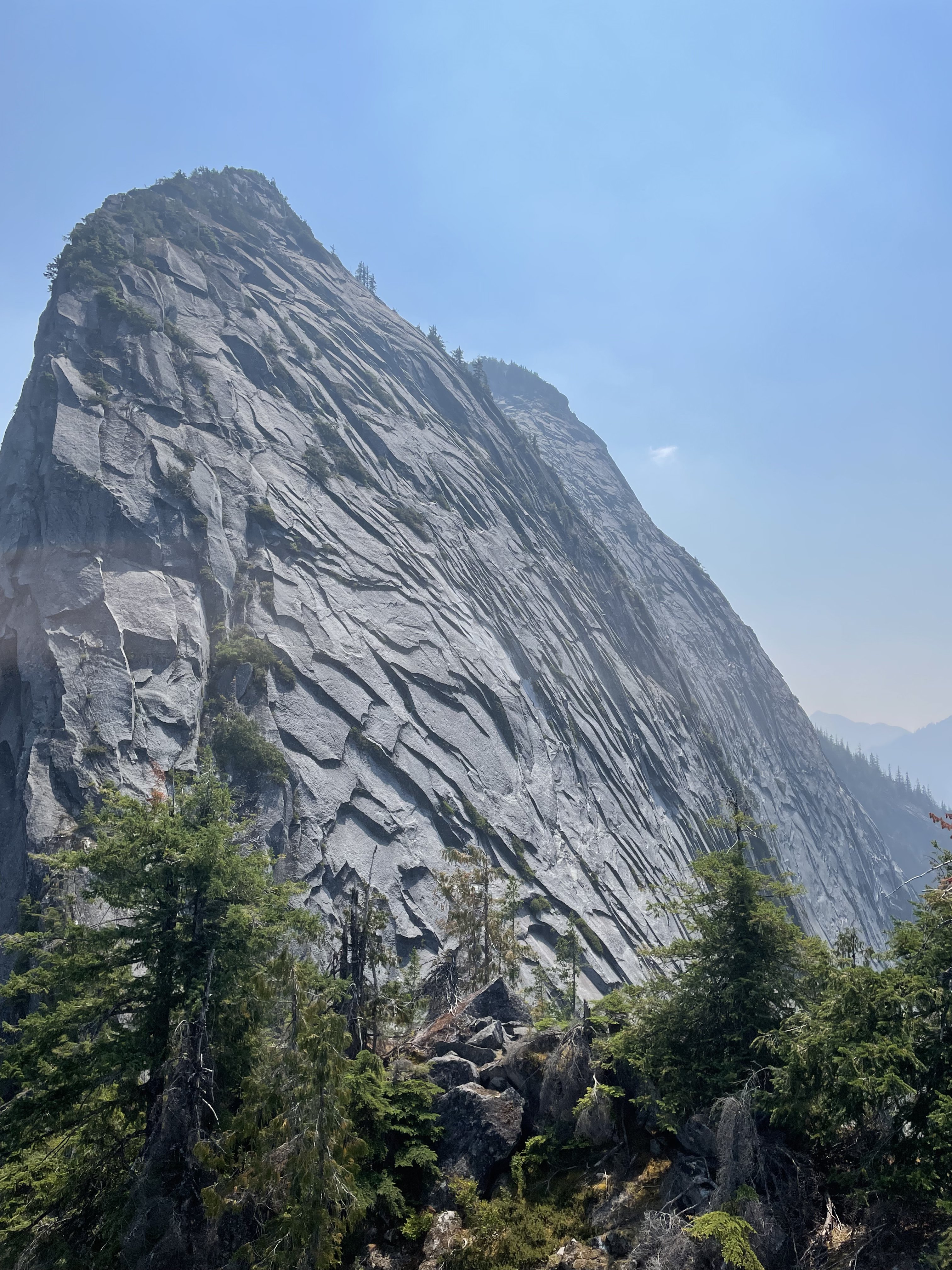
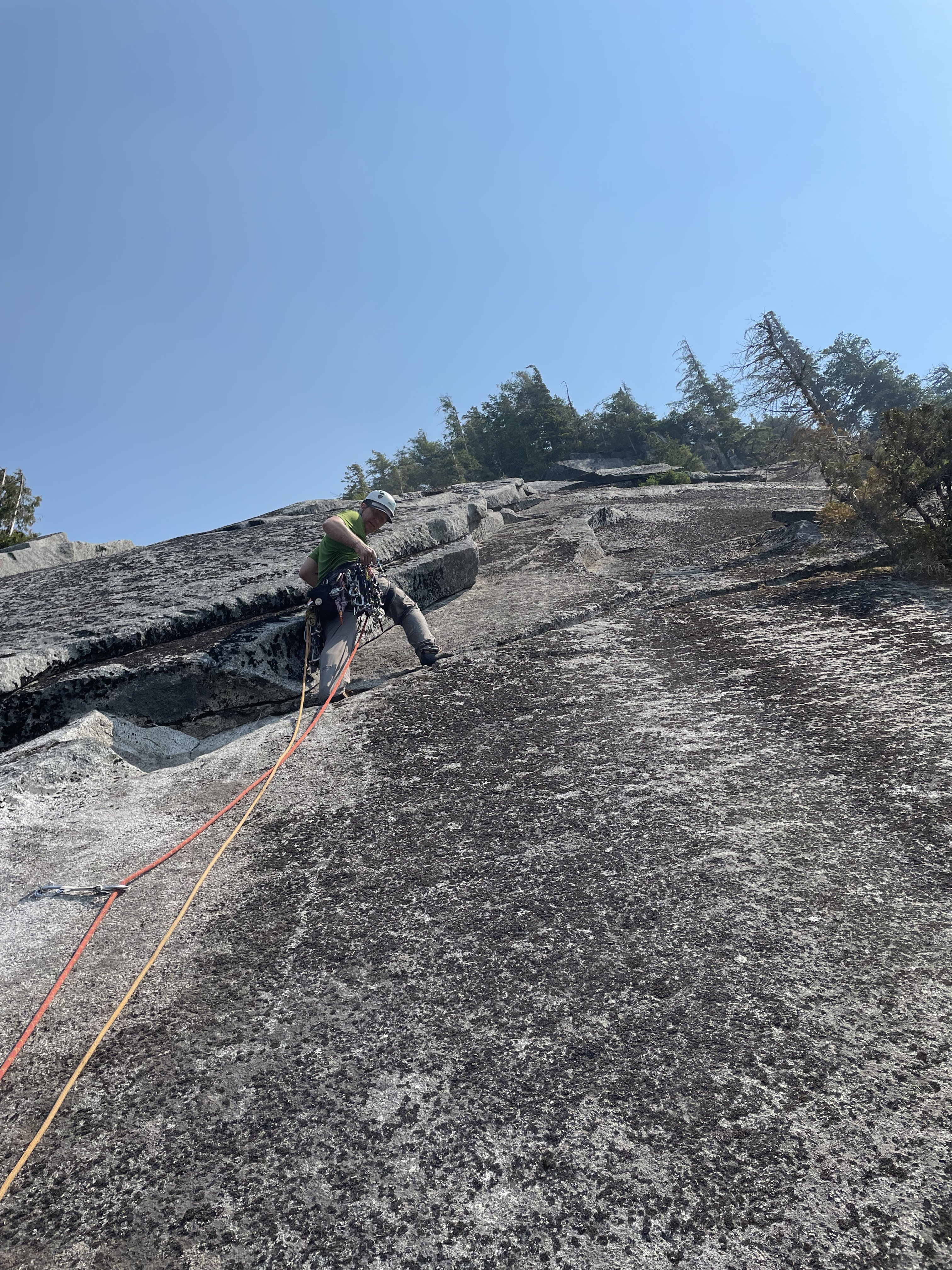
My friend and I climbed this route the other day along with the 2 pitch “Top Cat” above. Overall we found the climbing fun and cruiser. It felt like the easiest multi pitch in the darrington area. The perspective gives you great views of exfoliation dome. Even though it was dirty in spots, we thought the best pitches were pitch 2 of Top Cat (photo below) …and pitch 5 of Snagglepuss. We added one last horrible adventure pitch above Top Cat to reach the top of the formation. Cool place!
 1 point
 -
No, this is part of a shift in the site becoming a one stop shop for all things alpine climbing, plagiarizing, and mail order brides. I cant wait for the final version!!1 point