Leaderboard
Popular Content
Showing content with the highest reputation on 06/14/21 in all areas
-
Looking for over-50 climber(s) to partner with for Rainier this coming season. I (59 yo male) can't be the old guy on a team of 30-somethings, so I'm looking for partner(s) who are closer to my age for better compatibility. Thanks! Theo1 point
-
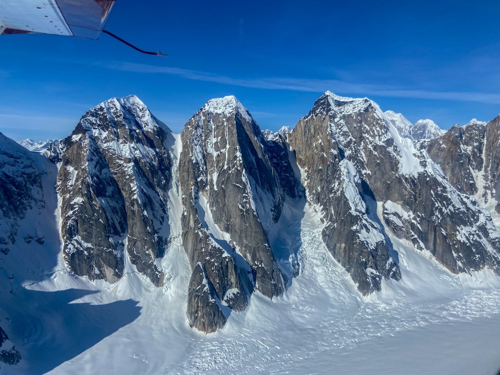
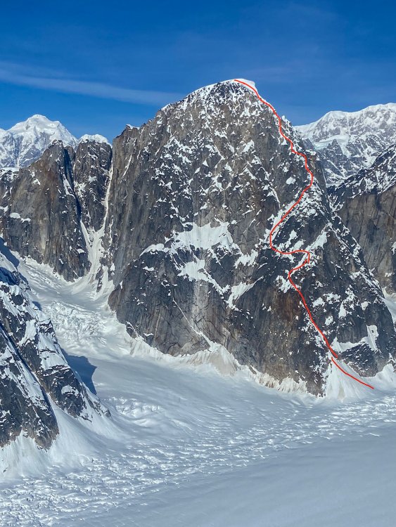
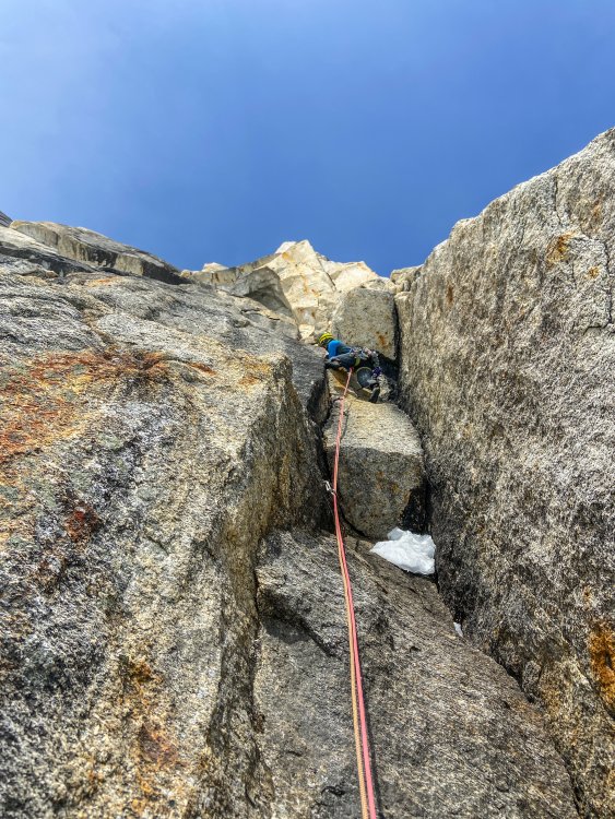
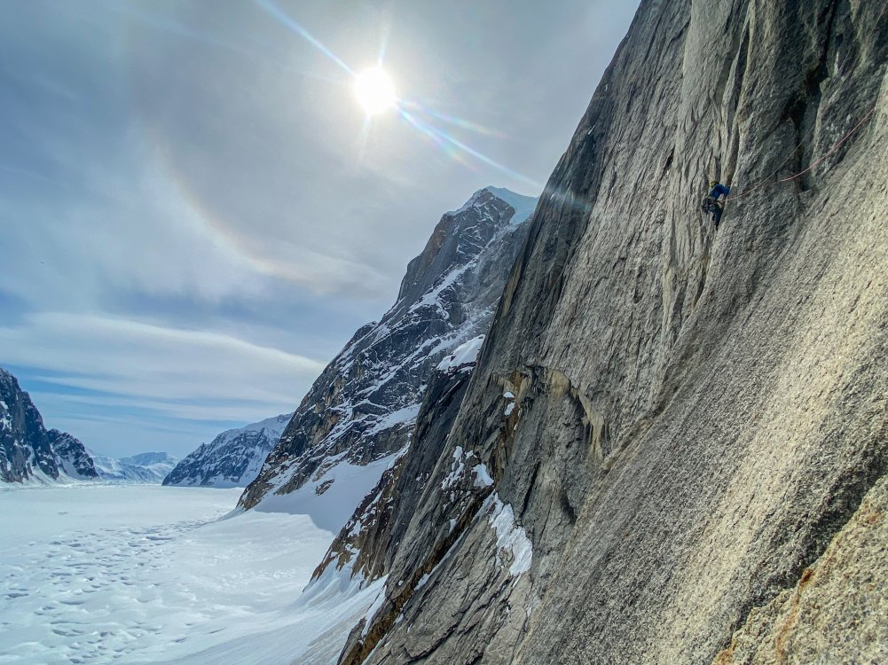
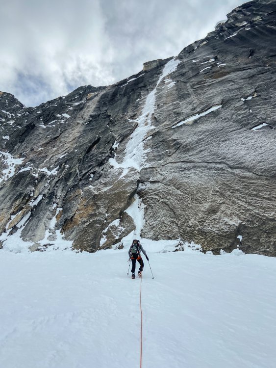
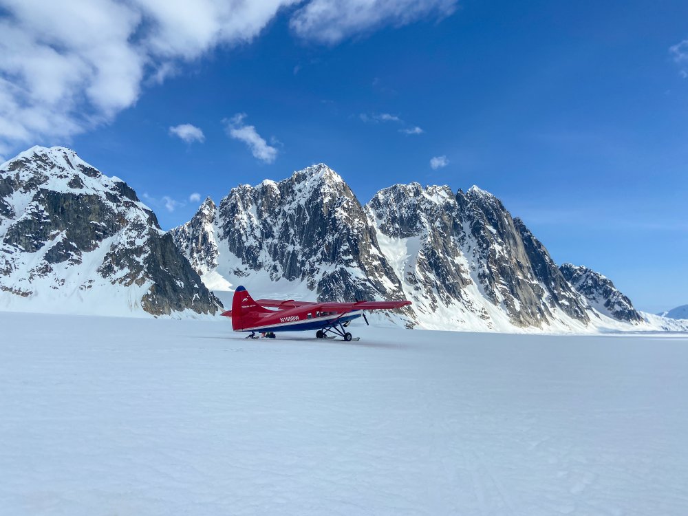
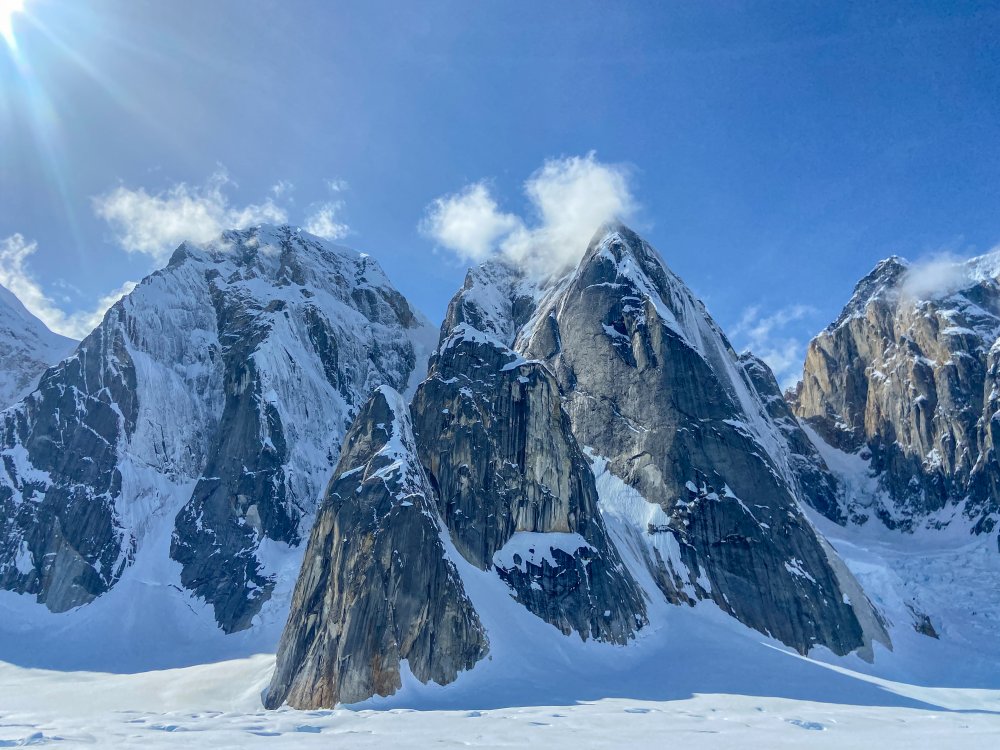
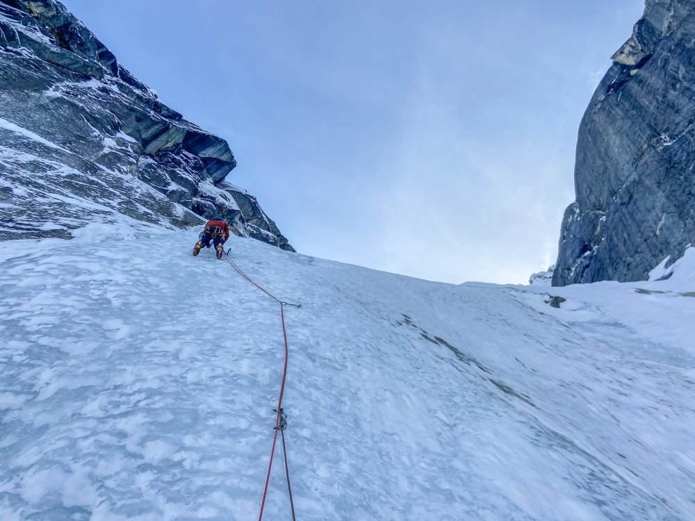
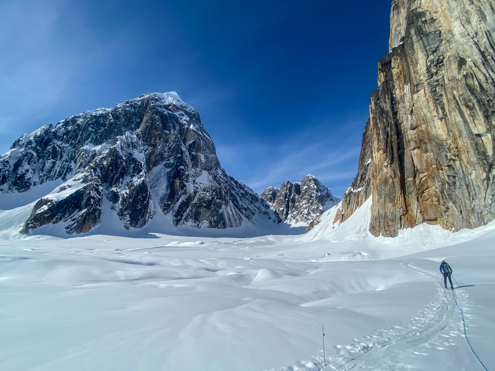
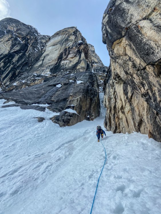
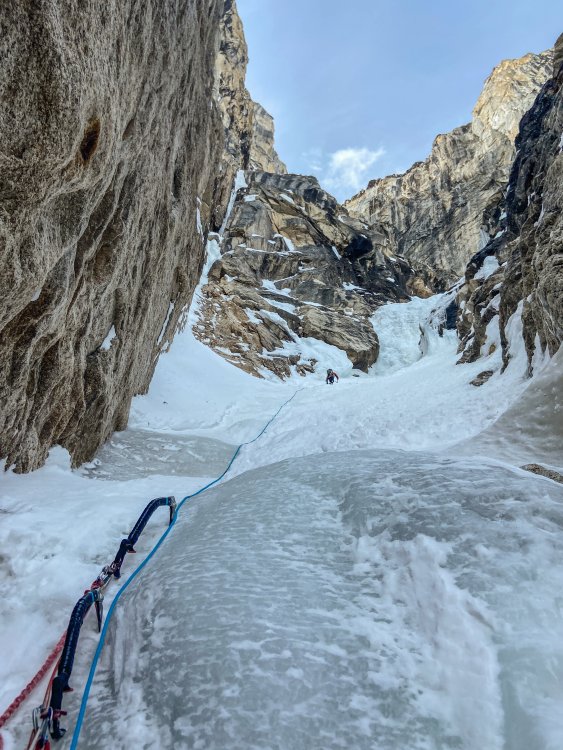
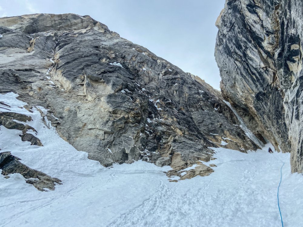
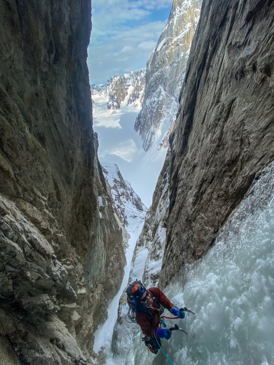
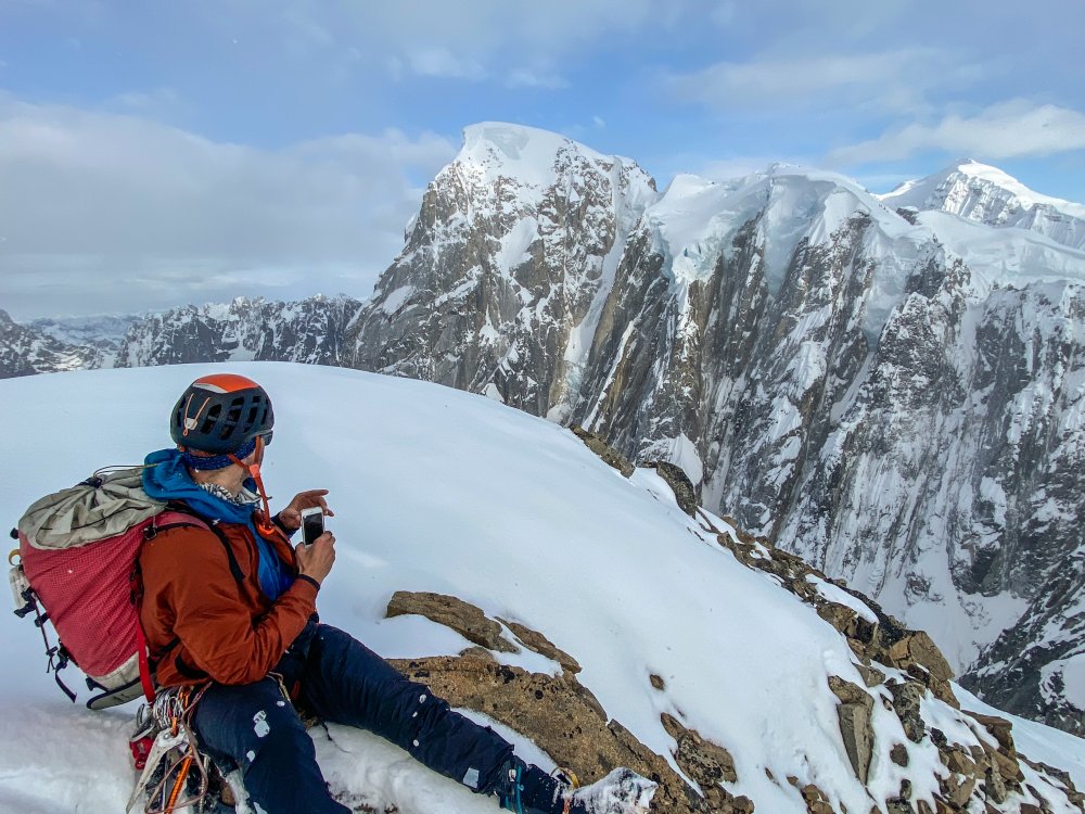
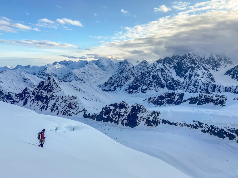
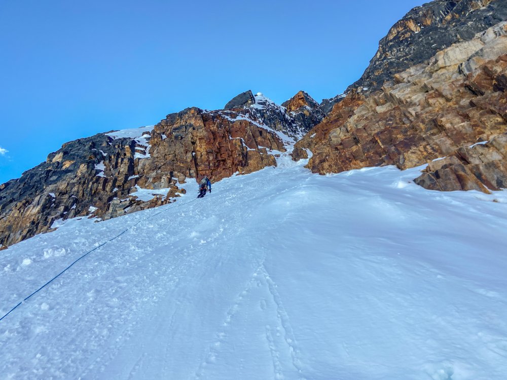
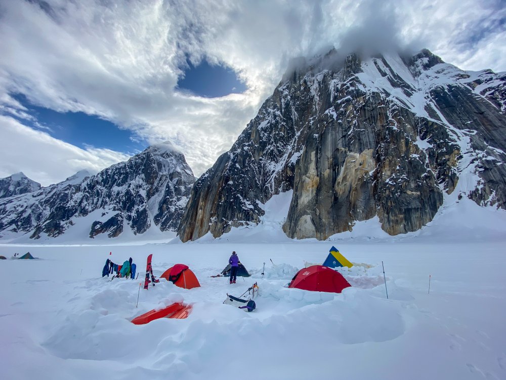
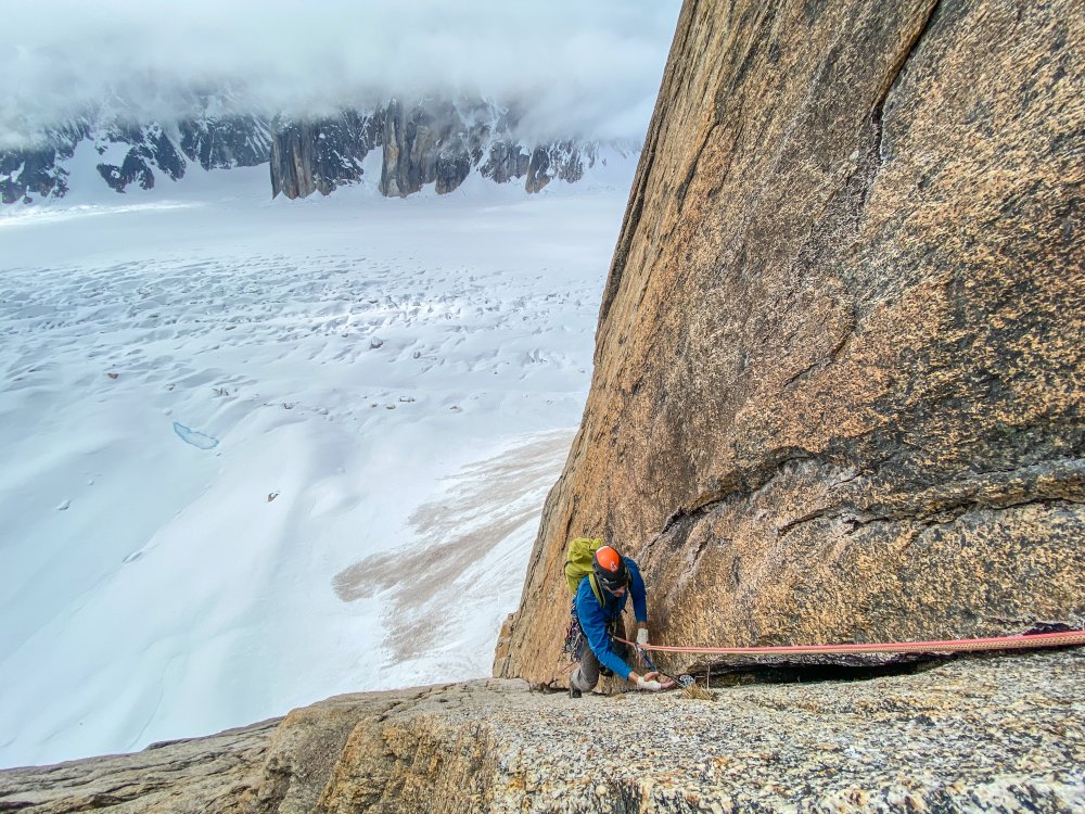
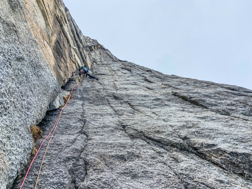
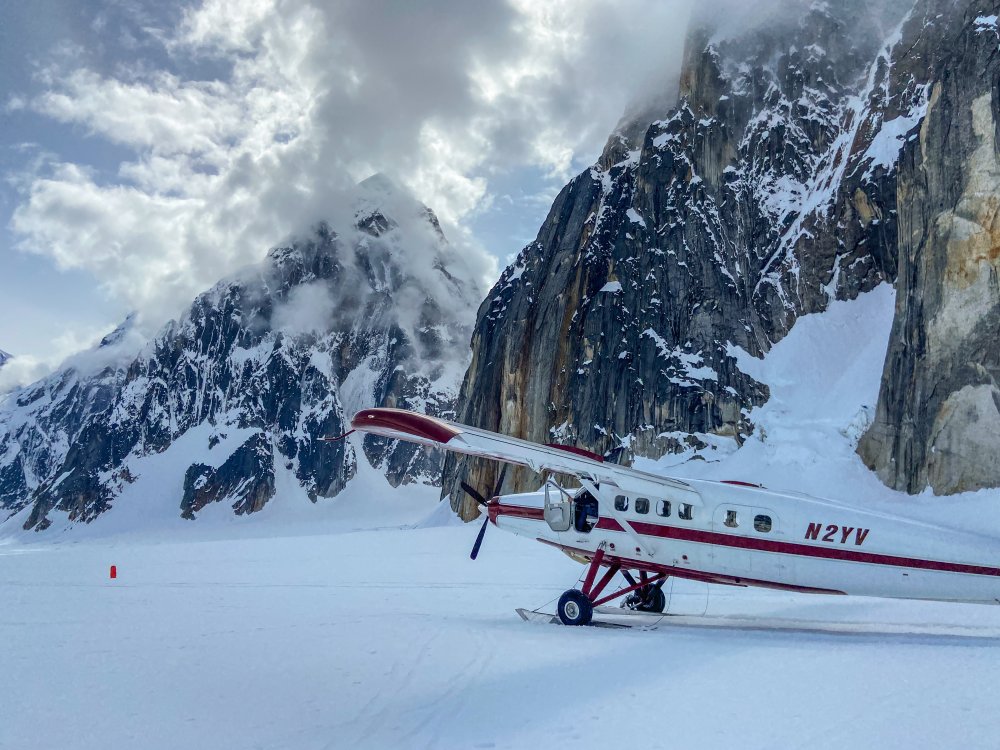
Trip: Ruth Gorge - Kuriositeten and Mount Bradley plus others Trip Date: 04/26/2021 Trip Report: I am a little late in posting this because I had a 3 week Denali expedition right after this trip. So I am just now getting back into the swing of regular life and unpacking. Anyway I figured I would post up a trip report from the Ruth Gorge. We flew in on April 26 to the Ruth Glacier just below the East Face of Dickey. Man that is a face to dream about!! We were a team of 4 that functioned as 2 teams of 2. We just changed up partners a few times based on people’s route choice. The Ruth Gorge was Plan B and we didn’t know we were going to the Ruth until about 4 days prior to flying in. So we were pretty ill prepared with route research and overall beta (with the exception of the classic lines). Grosvenor, Johnson, and Wake (left to right), from the flight in. Talkeetna Air Taxi on the Ruth Glacier with Peak 7400 and London Towers in the background. April 27 - Our first full day on the glacier. It was warm and sunny and I teamed up with Robbie to head for Cobra Pillar and just see how the climbing was. We got up to the top of pitch 5 when the sun disappeared behind the mountain and it started to get cold. We were also less than impressed by the first 5 pitches. When the guidebook says “C1+ rotten or 5.11” you should probably just avoid that pitch! I led it and was literally kicking new footholds into the large granite crystals and hoping they wouldn’t crumble under my bodyweight. Needless to say we had no desire to go back with so much other good looking rock. Robbie on the 2nd pitch of Cobra Pillar. Robbie just after the traverse on Cobra Pillar April 28 - We scoped several lines and tried to generally figure out what lines had been done. Thankfully we had used our phone to screen shot several AAJ articles so we were able to figure out some of it. Our efforts were mostly focused on Dickey and Peak 7400 since they were the closest to camp. Scoping a potential ice line. April 29-30 - weather days. Snowed about 18 inches. May 1 - We scoped lines going south on the Ruth Glacier. Looked at stuff on Bradley, Wake, Johnson, and London Towers. We were starting to get a good sense of snow conditions based on aspect and finally figuring out where everything is. We did climb the opening 2 pitches of The Escalator on Mt Johnson. It was really fun alpine ice and it gave us a good excuse to use the ice tools and screws. There were a couple of steeper smears to the left that we hoped to climb but the ice was only about 2-3 inches thick and there wasn’t any rock pro available. Scoping "The Escalator" on Mount Johnson. Climbing up the first couple ice pitches on The Escalator on Mount Johnson. Great alpine ice! May 2 - Based on the conditions we found yesterday we deemed it prudent to give the mountains one more day to shed snow and get some freeze/thaw going so it wouldn’t be a postholing nightmare. We had brought a telescope so we looked very closely at a couple of lines that interested us and talked about what line to do tomorrow. A couple people of our group went over to check out the first couple pitches of “The Wine Bottle” on Mt. Dickey. Man that is an inspiring looking line! We watched them through the telescope. May 3 - I teamed up with Duncan to climb Kuriositeten (AI5, M3+, 800m). It is a “smaller route” that was first put up in 2008 on peak just left of 747 Pass. At 2500ft it isn’t really a small route but when you see how it looks sitting between the giants of Dickey and Bradley it appears small. The route follows a couloir splitting the east face of the peak. It is a lot of snow climbing but also contains some mixed steps and 3 distinct ice steps ranging from 15m to 70m tall. Honestly it reminded me of some of the climbing in Cody, WY, where you follow a twisting canyon/couloir always excited about what might be around the next corner. The crux is the final step. It is about 70m+ and the first half is pretty dead vertical. Thankfully the ice quality was great and we throughly enjoyed the position deap inside the slot. We had very little beta about this route so had only brought 7 screws. We were able to find rock gear for the beginning belay and then I just ran it out as far as I dared between screws. We still had to break it into 2 pitches as I found myself with only 2 anchor screws left after 35m. Duncan took the upper half and soon we found ourselves on the snow slopes above. This is a fantastic route in the Ruth and should see more traffic! One of the reasons we wanted to climb this route was to recon the decent from Bradley. One of the reports we had regarding Bradley, was to descend the “standard west ridge” but that party bailed down a face after not being able to descend the west ridge. Another report talked about descending to the Backside Glacier and walking way back around through 747 pass. Another report talked about descending the Bradley/Wake Col. To complicate matters CalTopo and Gaia both showed some weird topography anomalies on their topo maps. In fact both showed a 800-1000ft cliff coming off the back side of Bradley that looked very complicated to navigate around. The problem was the topo lines didn’t seem to match what we had heard in reports. Needless to say we were very interested in looking at the descent from the top of Kuriositeten. In the end we discovered that both Gaia and CalTopo were very wrong in their topography. In places it was off by 1000ft. What appeared to be a huge cliff was just a small snow slope that was easily walkable. We couldn’t see the whole decent but we felt much better about things after this day. Skiing over to Kuriositeten. It climbs the big gash on the peak in the middle back. Even though the line is 2500ft tall it looks small in comparison to Bradley (left) and Dickey (right). Duncan starting up Kuriositeten. Looking up from the belay at the top of the first ice step. Approaching the 3rd ice step crux. It is the narrow looking ribbon of ice way up in the slot. Duncan climbing up through the crux pitch on Kuriositeten. A fantastic route in the Ruth. From the summit of Kuriositeten looking over towards Mount Bradley. Descending the back side of Kuriositeten in the late evening light. May 4 - Rest day. May 5 and 6 - For the big goal of the trip we picked Mount Bradley. A couple of our party had started up the East Ridge of Bradley the day I had climbed on Cobra Pillar. They found deep unconsolidated snow on all northern aspects. Even though it is called the East Ridge the first 1/3 of the route is mostly on the north side of the ridge. So with no desire to go up that unconsolidated snow we searched for a new route. While looking through all of our screenshots from the AAJ we found John Frieh’s report about a linkup on Mt. Bradley. He and Dylan Johnson had also found bad snow on the start of the regular East Buttress. So with high hopes we set our eyes on their Link of “Season of the Sun" and the “East Buttress”. They rated it M5/6 and the route is 4500 feet tall. It was warm so our plan was to leave camp in the late afternoon and start the route in the evening. We were hoping that by this time the snow might start freezing back up from the day and we could avoid some nasty postholing by climbing through the night. We left camp at 4pm and but 5:15pm we were in crampons working our way up the initial snow slopes. The Season of the Sun route climbs on the right side of the SE face of the mountain and was originally put up by the Giri-Giri Boys. We were a little concerned about the reported M6 offwidth crux but figured we would take it one step at a time. After about 1000 ft of snow with short steps of rock and ice we arrived at the “crux”. We were pleasantly to find it full of ice (AI3). So after a quick romp up great ice and another pitch of low angle rock we arrived at the 2nd couloir. From here route goes up right then back left across snow slopes and around the end of a big buttress. This leads you into the big central gully about mid height on the face. The original Seasons of the Sun route cuts up and back left to stay on the face while we followed Frieh/Johnson’s variation back towards the East Buttress proper. It was somewhere in here that it got dark. Not pitch black but dark enough to warrant a headlamp when technical climbing. Several mixed pitches in the dark brought us to the East Buttress proper. From here another 2 long fun mixed pitches deposited us underneath a huge boulder. By this time it was getting light again and we were out of water. So we spent an hour brewing up and resting. The rest of the east buttress went by in a blur of simul-climbing including one section where I ran out of carabiners and slings and literally clipped the carabiner with all my nuts to a piton just so I could clip the rope in. We topped out on the summit about 10am. The decent was pretty straight forward although with more uphill than we liked. We just followed the main ridge to the west and then cut down and south to follow a different ridge line back towards the Bradley/Wake Col. Unfortunately this led us to wallow up several northern aspects of unconsolidated powder snow. Nothing like trenching in the afternoon sun when you have been up all night! We finally reached the col and took a short break to drink the last of our water and finish up our food. Then it was 2000ft of easy walking down to the last obstacle…the icefall between Wake and Bradley. From the top of the col it appeared to be less broken up on skiers left. But when we arrived skiers left there was only sagging “snow bridges” and open crevasses. We were able to end run everything far left and then rappel over the last bergshrund by leaving a bomber fixed nut in the rock. Finally home free we trudged wearily back towards the base of the route. The snow was like a trap door. Most steps you were fine but every few steps the door would open and suddenly you would be postholing to your thigh. We were excited to be back to our skis were the going suddenly got easy! Rolled back into camp at 7:30pm for a 27.5hr RT time. Starting up Seasons of the Sun. The M6 offwidth crux....we got lucky with fat ice conditions and easy climbing. Typically route conditions...soloing steep snow. About 1/4 of the way up the route now. Nearing the top of the East Buttress proper......during one of the long simul-blocks. The route up Bradley's 4500ft face. This is a linkup of Seasons of the Sun and the East Buttress first done by John Frieh and Dylan Johnson. Descending back down from the Bradley/Wake Col after climbing Mt. Bradley. May 7 - Weather day. Snowed off and on all day. May 8 - Snowed a bit then cleared up in the afternoon but wasn’t enough time for much more than a casual ski. It was warm again. We watched several ice lines we had been looking at fall off the walls. Our camp below the east face of Mount Dickey. Mount Bradley is just to the left of center in behind. May 9 - With the warm weather we opted for rock climbing. But the sun didn’t burn the clouds off until noon so we got a late start. We decided on Goldfinger which is on the Stump. We started climbing and were happy to find good quality rock. The rock quality was WAY better than the first few pitches of Cobra Pillar. Unfortunately due to our late start we lost the sun and our warmth about the top of pitch 6. We contemplated going a few more pitches but opted to just call it since it was unlikely we would top out anyway with such a late start. The climbing was very good though and it would be a classic anywhere in the lower 48. Coming up to the belay at the top of Pitch 2 of Goldfinger. Climbing pitch 6 of Goldfinger. It is fantastic climbing on very good quality rock! May 10 - With bad weather in the forecast for the next several days we opted to fly out. Several of the team members had flights out of Anchorage on the 13th so we didn’t want to be stuck on the glacier and miss flights. TAT here to pick us up. The ever changing clouds giving Mt. Bradley a moody look as we departed. Gear Notes: Alpine rack, heavy on screws for ice routes, heavy on cams for rock routes. Approach Notes: Fly in with Talkeetna Air Taxi, then ski/hike to climbs.1 point
-
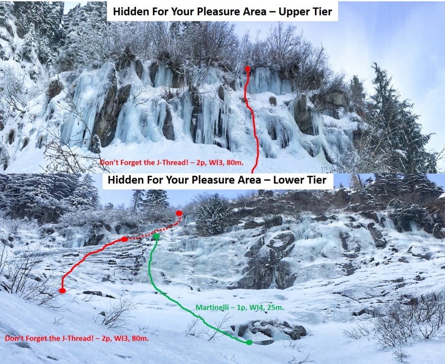
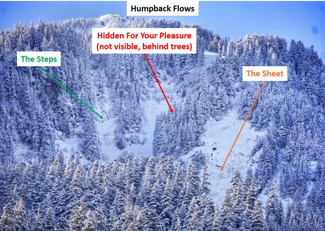
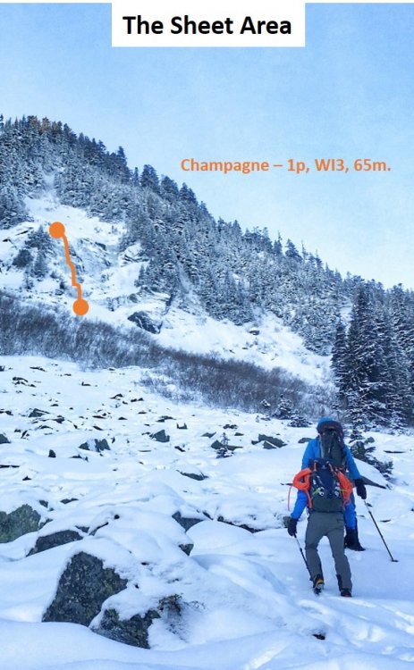
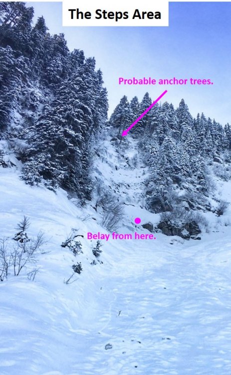
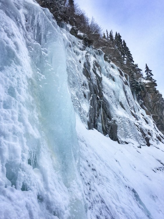
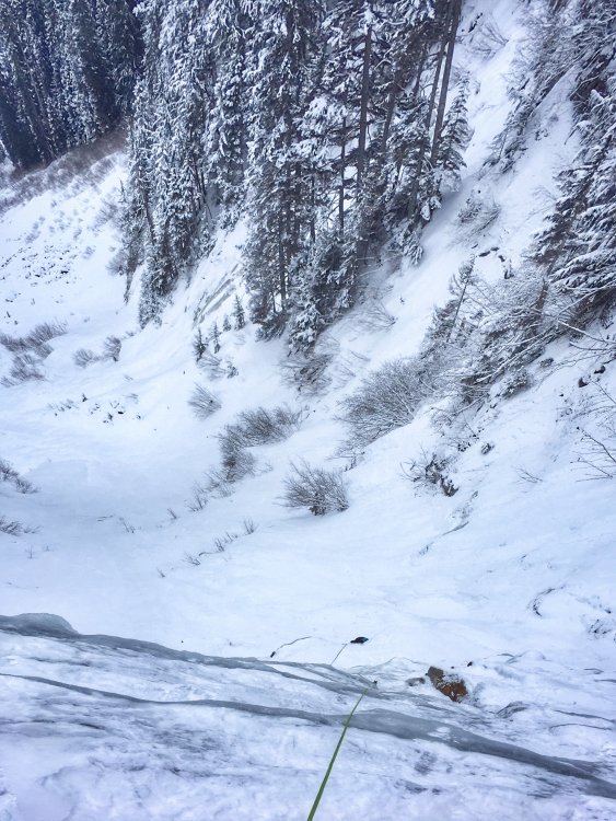
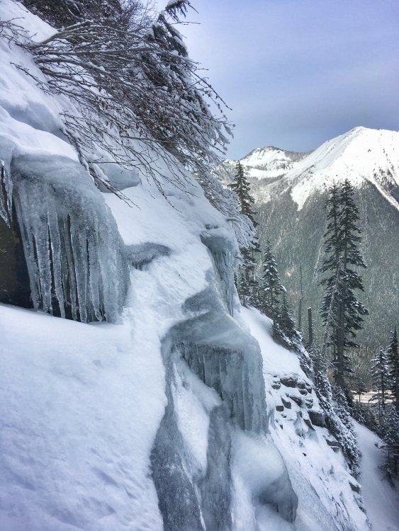
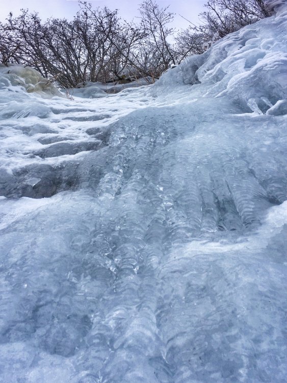
Trip: Humpback Mountain - Humpback Flows. Possible FA's on three ice routes - Champagne, 1p WI3, 65m. Don’t Forget the J-Thread, 2p WI3, 80m. Martinelli, 1p WI4, 25m. Trip Date: 02/07/2019 Trip Report: [TR] Humpback Flows, Possible First Ascents: Champagne, 1p WI3, 65m. Don’t Forget the J-Thread, 2p WI3, 80m. Martinelli, 1p WI4, 25m. Climbers - Raider Rob, Caleb Mallory, Alex Stolpovsky, Jessica Sagnella, Justin Pucci. View of Humpback Flows from I-90 Exit 47. Introduction: On my way back from ice climbing in Hyalite two weekends ago, my friends and I spotted what looked like ice up on the North Face of Humpback Mountain from westbound I-90 at Exit 47. I added this to my list of areas to check out and drove on… A few days later, my friend Chris Patrick posted a picture of the same thing on Facebook and several of us got into a conversation surrounding whether there was anything worthwhile up there. Thursday rolled around and the conditions appeared to be perfect, so my partner Jessica Sagnella and I decided we’d give it a try. Friends Raider Rob, Alex Stolpovsky, and Caleb Mallory were also planning a trip, so we decided to team up and lay siege to Humpback Mountain in the hope that we’d find something worthwhile to climb. We got to the Asahel Curtis parking lot off of Exit 47 at 7AM, geared up, and began the approach. There are no trails up this side of Humpback so it was a fun and interesting trailblazing and bushwhacking exercise to get to the ice. Climbing Area Descriptions: To get to The Steps or Hidden For Your Pleasure, ascend the avalanche path directly. This approach is approximately 600-800 vertical feet of steep no-fall zone snow up to 60 degrees, so please assess conditions as you go and use your best judgement. About midway up the avy path, you’ll see The Steps on the left and now the full lower tier of Hidden on the right. At this point, it becomes clear that The Steps is considerably steeper than the approach photo represents. It consists of a 15-meter wide gully with two nearly-vertical 5 to 8-meter ice steps separated by a snowfield. The top out appears to be protectable via anchoring to a large tree directly up the center of the gully. To get to The Sheet, traverse right from the tops of the bushes with very little additional elevation gain, but be weary of the final portion of the traverse to the base of the ice, as it is a no-fall zone on steep snow. The Steps Area from half way up the avy path. The Sheet Area from the lower boulder field with Champagne highlighted on the left. The Hidden For Your Pleasure Area showing the lower and upper tiers and the two lines we put up. The Sheet Area Champagne – WI3, 65m, possible FA by Alex Stopolvsky, Caleb Mallory, and Raider Rob. Avalanche danger: Serious. Approach: Traverse right from the tops of the bushes with very little additional elevation gain, but be weary of the final portion of the traverse to the base of the ice, as it is a no-fall zone on steep snow. Route: Climb the major flow on the right along the left side of the slab. There is a possible variation starting left up the first step and then traversing to the far right to what looked like fat ice. For a top belay anchor, sling the horn on a large slab just left of the route at the end of the pitch. Another 20 meters above the anchor is a protected cave with plenty of level ground. Descent: Rappel from the anchor or from here, you can get to the right side of the lower tier of Hidden For Your Pleasure by traversing 60-degree snow through the trees climbers left of the cave. Looking up Champagne from the base. Caleb following Alex on Champagne. The belay horn at the top of Champagne. The entrance to the flat and comfy cave another 20m above the top of Champagne. The Hidden For Your Pleasure Area Don’t Forget the J-Thread! – 2p WI3, 80m, possible FA by Justin Pucci and Jessica Sagnella. Avalanche danger: Serious. Look for signs of wind slabs as you ascend the lower section of the approach and loose dry surface snow in the upper section. Approach: Climb 50 to 60-degree snow up the avalanche path to the belay station tucked away in a shallow cave under the large rock outcropping on the left. Route: P1 - WI2+/3-, 40m: Start up climbers right from outside of the belay cave on a short step of near-vertical ice. Continue up the ice steps from here and look for spots to place stubbies (at best) as you progress. There are a couple of variations here depending on ice conditions and how you’re feeling. The left side of this line is thin and stepped with a couple of mixed moves off of a large flake (WI2+/3-) and the right side has interesting and fun blobs (WI3-/3). Be careful of knocking down the large, dinner table-sized ice sheets that look more like “snow patches” from below. Reach an obvious and wide shelf where you can build a screw anchor on the ice blobs and prep for the next pitch. P2 - WI3, 40m: Start up the blobs that make up the top of the belay shelf onto a small, but steep snowfield. You’re aiming for the curtains directly above you. Again, there are a couple of variations – the main line has a small slab of ice leading to a steep gully on the left or a steeper step with a large bulge at the top on the right. Both variations lead to a final 5-6m curtain of beautiful and featureless ice. The top-out can be tricky in the snow above the curtain. Anchor off of the trees or on the ice bulge above. Descent: Rappel both pitches via threads. We used naked threads on both raps. Looking out from the belay cave at the start of Don't Forget the J-Thread. Justin getting started with the first screw above the first step on p1. Justin reaching the belay ledge at the top of p1 on Don't Forget the J-Thread. The characteristic blobs toward the top of p1. Jessica getting ready to follow on p1. Looking up p2 of Don't Forget the J-Thread. Left variation on p2. Right variation on p2. A naked thread in beautiful and clear ice at the top p2. Martinelli – WI4, 25m, possible FA by Alex Stopolvsky and Caleb Mallory. Avalanche danger: Serious. Look for signs of wind slabs as you ascend the lower section of the approach and loose dry surface snow in the upper section. Approach: Climb 50 to 60-degree snow up the avalanche path to the belay station tucked away in a shallow cave under the large rock outcropping on the right or traverse climbers left through the trees from a top-out on The Sheet area. Route: This is the obvious line to the right of Don’t Forget the J-Thread and runs right up the middle of the wall. Climb a brief section of steep snow to the base of the wide ice sheet. Climb the sheet toward the small pine tree above. The top-out can be tricky in loose snow. Sling the small pine tree at the base for an anchor. Descent: Rappel off of the small pine tree (we left a sling on it). Caleb following Alex on Martinelli. Summary: The stoke was high on this trip and I have to say that it ranks as one of the best days I've had in the alpine in a while. Not only did we have an awesome adventure with friends, but it resulted in finding some amazing ice climbing that is so close to home! Between the three areas I have discussed in this report, we believe there is potential for another 15-20 lines to be put up depending on creativity and the conditions. The Sheet has lots of fat ice with plenty of interesting features to play around on. The Steps appears to have at least two or three obvious lines to the anchor trees at the top of the gully. The lower tier of Hidden offers from mild WI2 to thin and delicate WI4 with some mixed climbing potential too. Finally, the upper tier of Hidden is a real gem...some of the most beautiful and clear blue ice I've seen anywhere. It can be combined with some of the lower pitches as we did on J-Thread or you can climb to it, set up home base and choose which of the gullies, curtains, and pillars you want to send. Who's ready to get some?! Gear Notes: We brought 70-meter ropes, screws from 10-21cm, a set of tricams, and a few 24” pickets. While we didn’t use the pickets, I could see them being handy for the steep upper sections of the approach or on a couple of the steep snowfields depending on the snow conditions and how comfy you are in that kind of terrain. There were a couple of spots for tricams that I found, but didn’t end up using them. Aside from when we had the luxury of thick anchor ice, 10’s and 13’s were the screws of choice. An avy kit is absolutely mandatory in this area. Approach Notes: From the Asahel Curtis parking lot, follow the forest road past the gate and up to the hairpin turn. Go west beyond the turn up a rougher bit of road for another few hundred feet until you see a big tree stump (4-5 feet in diameter) on the hillside and enter the forest. Now just go up! After 400 vertical feet of steep moss, devils club, and other fun bushwhacking, you’ll hit the Palouse to Cascades State Park Trail. Use this as a good stop for layer checks and snacks and then continue up through another 600-700 feet of the same stuff until you hit a boulder field. Stay west of the obvious and large gully on climbers left and you’ll break out of the trees and into the lower basin where you’ll start to get a view of the ice. The next 200-300 vertical feet is on snow covered boulders and begins to steepen as you hit the big patch of bushes above the trees. From the top of the bushes, the terrain steepens substantially. You’re now standing at the base of a large avalanche runout from above and need to carefully assess conditions from this point forward. Looking around you from left to right, you’ll see a large rock wall followed by The Steps – a steep, two-step ice gully, then a small bit of ice way up high that is the second tier of Hidden For Your Pleasure, and finally, on the far right is The Sheet, a wide slab of ice topped by a steep snowfield. In total, the approach from the parking lot covers about 2200 vertical feet over one mile of ground distance. We hit this in perfect bluebird conditions…clear skies, temperatures in the teens, a slight breeze, and with very little snow on the ground down low. Once we got into the upper sections of the approach near the ice, the snow ranged from kick-steppable styrofoam to an icy crust perfect for fast mid-dagger climbing with patches of softer and deeper powder that allowed for kicking out a bit of a rest stop.1 point
-
Hey. Good to hear there are “middle aged” climbers out there! My Seattle plans are set, and airline tickets purchased. Should be available August 9-13, but depends on routes and conditions, of course! Would be interested in most anything ‘reasonable’. Haven’t been up Baker or Olympus yet, and would certainly like more time on Rainier. Would even entertain short climbs, just to get outside! I know August can have issues with route deterioration, but my first summit of Rainier was in August, and it was still climbable. Post here if anything develops, or can PM me as well.1 point
-
1 point
-
1 point
-
this is beginning to look like a promising thread. we got a handful of seventyish antique hardcores in the Wenatchee-Leavenworth area who are always lookin' for fresh meat. we move a little slower each year, but still get on the "interesting" routes -- just take longer. should we establish a "geezers'" thread? -Haireball1 point
-
I'm over 50 and still enjoy climbing. I have been waiting for 4 years to do Liberty Ridge with IMG but every year it gets cancelled. I've done various routes on Rainier and Baker etc... Shoot me an email/message if you would like. I'm on the waitlist for Fuhrer Finger (Love this climb with a detour up the Wilson Headwall) in June. My son and I are planning a Kautz carryover in July so I'm up for something. Who knows???? Cheers James LeBouef1 point
-
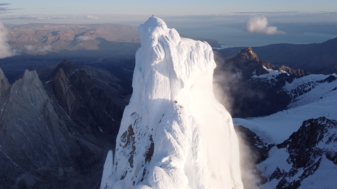
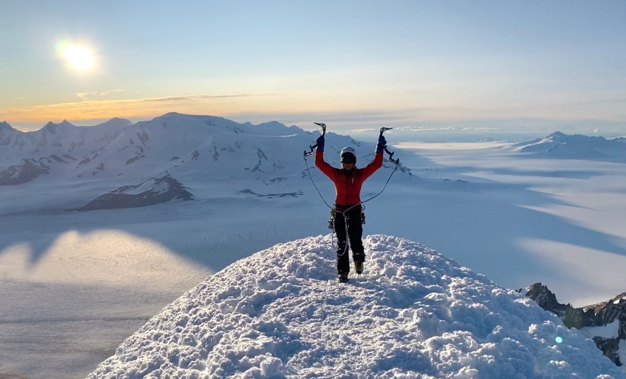
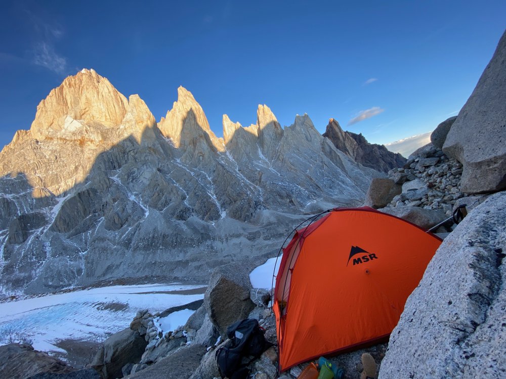
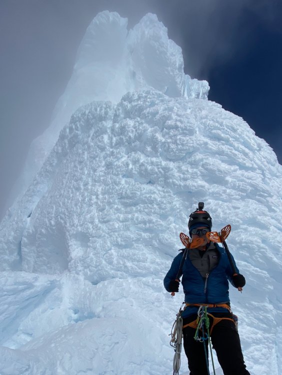
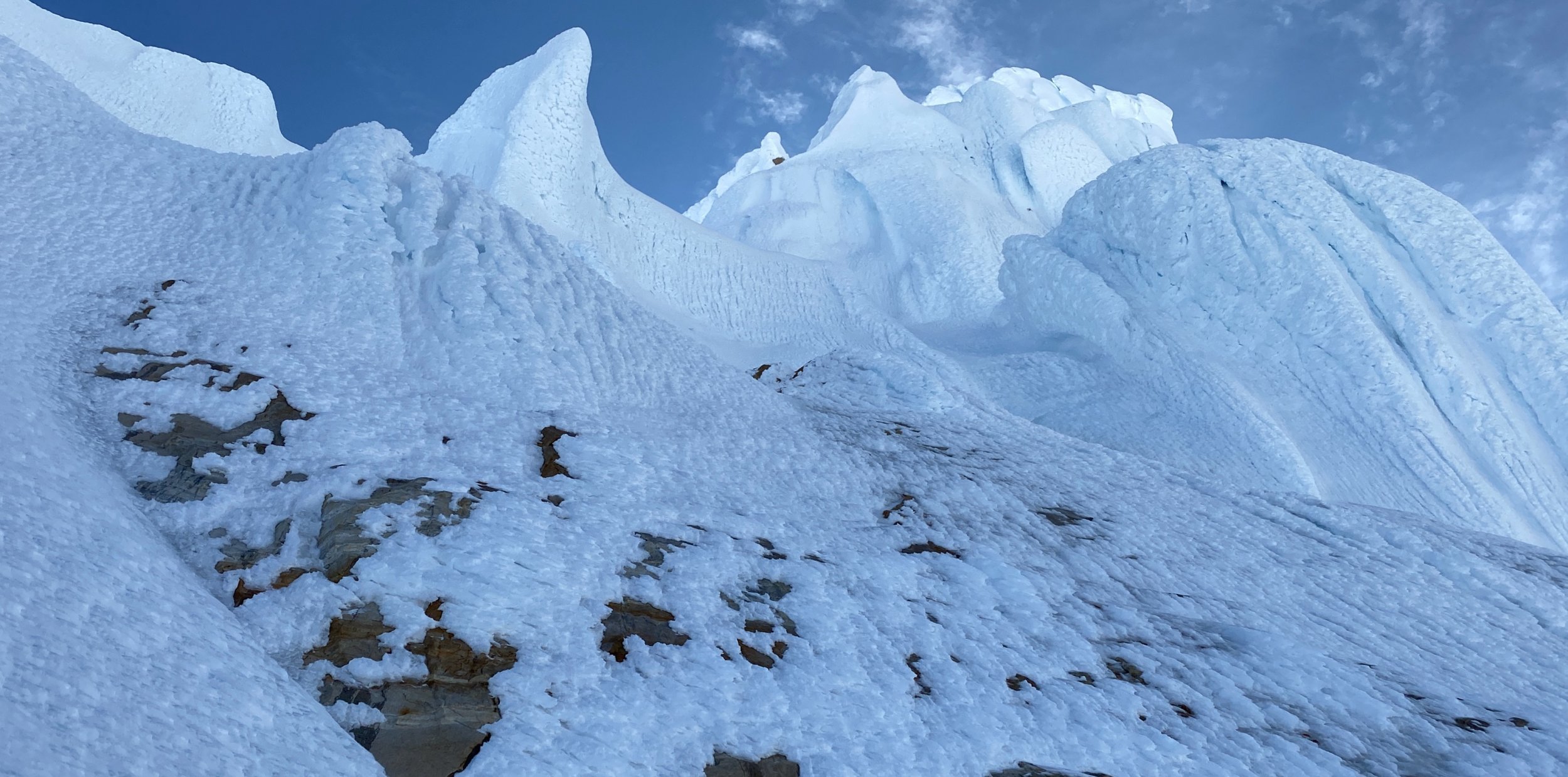
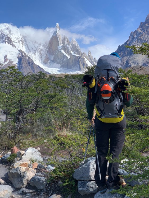
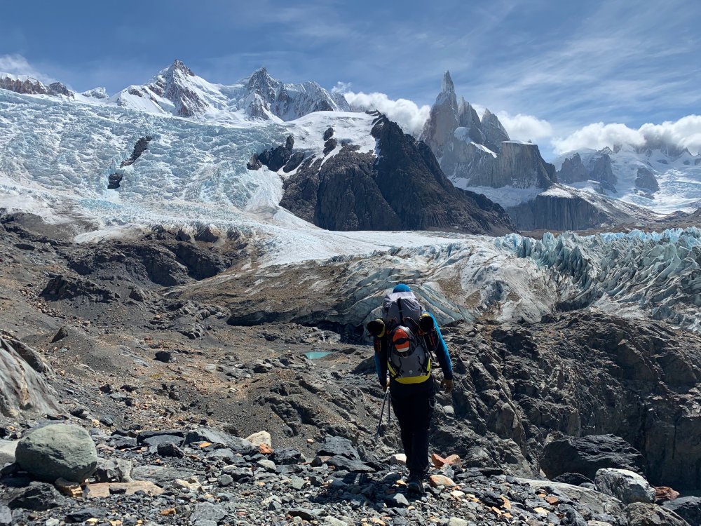
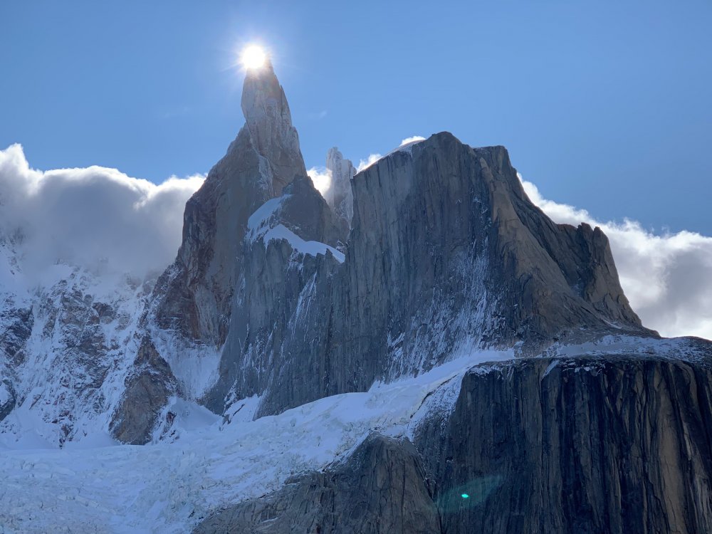
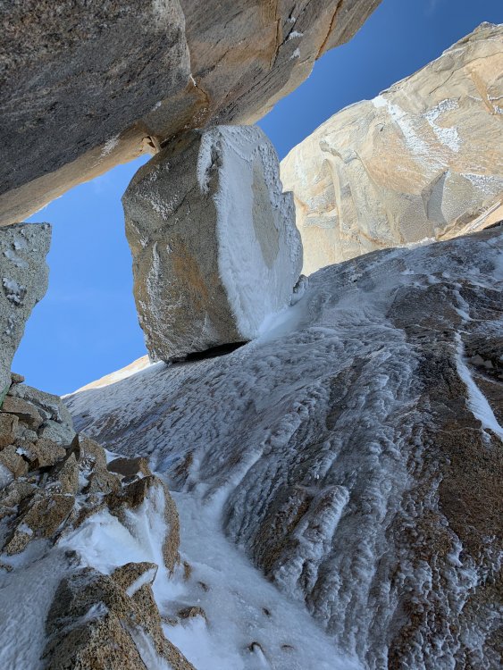
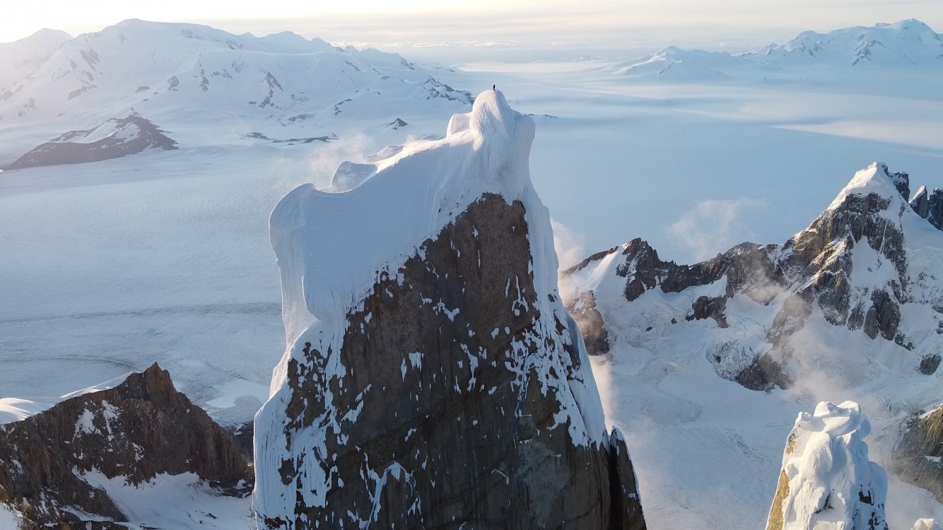
Via dei Ragni: Grade VI, 95deg snow/rime/ice, M4, 1000m Scribe/Photos/Climbers: Jeff and Priti Wright Google Street View: Cerro Torre Summit 360 Panorama https://youtu.be/nZ4O199GfAo?si=Kr-etK2F4MSCGxVn https://youtu.be/RNNtXFuI_RQ?si=DDMqTiOcCEcDAJGP https://youtu.be/iRWR_DQoL3A?si=ebEbe75BW4pbSuKz We’ve had a picture of Cerro Torre on our desktops, phone wallpapers, and posters above our bed for the past 5 years. It was the reason we took up ice climbing in the first place. In February 2016, we made our first attempt on this route, hoping to at least get a glimpse of the scale of the mountain and understand what it took to climb it. The weather was too hot by then for the climb, and after three days, our high point was below the hard technical climbing. Previous trip report: The road to El Chaltén The Fitz Roy Massif These past two months were our fourth (and longest) climbing trip to the Chaltén Massif, and sixth year of watching the Patagonian weather patterns. We wanted to return to attempt Cerro Torre again, but the next two seasons were not possible because of bad weather. Last year, at the beginning of February, we saw a fantastic weather window, and the stars aligned. We flew down to Patagonia in a 9-day magical whirlwind of constant movement, and summited Fitz Roy via the Franco-Argentina route. While on the summit of Fitz Roy, looking down at the surreal summits of the Torre, we were determined more than ever to come back the following season. Day 1. We arrived in El Chaltén on New Years Eve, the last day of a 4-day weather window (brecha)…we missed it! Since then, January was filled with short stints (8-12hrs) of good weather in the mountains, and the arrival of a 6-day mega window in early February sent an electric buzz throughout town. We were a couple of bats out of hell with our 40lbs packs each as we set towards Laguna Torre. The plan was to pass through the Niponino base camp in the Torre Valley and bivouac at the higher Noruegos (Norwegian) bivouac, which would put us closer to Col Standhardt (the next day’s objective)…the passageway to the West Face of Cerro Torre where the Via dei Ragni route begins. Our bivy site at Noruegos Day 2. From the Noruegos bivy site high on the slopes of the Torre Valley, we traversed near the base of the Torres, under the celebrated SE Ridge (perhaps the greatest climb in the world) and also the 1959 Maestri line to the triangular snowfield where so much history and controversy took place. From the East, all of the Torres stand impossibly steep and impassable. To get to the Ragni route on the West side, we would climb up and over the Col Standhardt where an implausible car-sized chockstone sits interminably between the col’s steep walls. From the col, one gets the first glimpse of the Southern Patagonian Ice Cap (Hielo Continental), a massive expanse of ice 200mi long. On a rare, clear day such as this day, we could see green Chilean fjords across the Ice Cap between large, snowy volcanos. A Lighthouse Several rappels deposited us down to the Circo de los Altares (Cirque of the Alters), an impressive crescent of white-capped peaks and toothed spires. From there we headed up another glacial ramp on Cerro Torre’s West Face to a high camp, 150m below the Col de la Esperanza (Col of Hope), first reached by Walter Bonatti in 1958 who hoped that this col would one day blaze a path to the summit. It wasn’t until 1974 that a team of Italians from the Ragni di Lecco (thus the name “Via dei Ragni”) completed Bonatti’s vision. Circo de los Altares Steep snow climbing and easy mixed terrain led us towards the camp at Col de la Esperanza, the camp we hadn’t reached on our last attempt. As we hiked past our previous high point, our hearts soared. This time around, the climbing felt much easier with 4 more years of climbing experience under our belts. Day 3. This day was a rest day of sorts. To set ourselves up for success on summit day, we were moving to the highest camp a few hundred meters up: El Elmo (“Helmet”), a prominent plateau below the steep, technical climbing. Those who were faster and stronger than us had gone straight to the highest camp the day before and were now going to do the hard work of battle-axing the bullet-hard blue ice and cleaning the cotton candy mushrooms of the summit. As we came over the Col of Hope, we entered an otherworldly expanse of mangled rime towers and precarious exposure. These deformed blobs of ice towers with icicle branches and feathery leaves seem like something only God or Dr. Seuss could conjure. It’s something so beautiful and terrifying at the same time. We were face to face, looking up at thisbeastly Tower. A spectacular nightmare. Day 4. Summit Day! We were pretty antsy to get going on the summit push. Falling snow greeted us when our alarms went off at 2:00AM as the mountain was enveloped in a cloud. All over camp, alarms went off and were snoozed as the precipitation discouraged movement. When the stars finally came out again, we were the first to muster our strength and get to work. Walking up to the base of El Elmo in the darkness, the first overhanging rime ice mushroom of the route, we gave a sigh “ah, breakfast!” The last 10m didn’t actually have any good protection (besides maybe a horizontal picket), and it was a sequence of cutting the feet loose, campus’ing from questionable tools, and shoving knees into the soft rime to make upward progress. Once at the top of El Elmo, a crowd had formed at the base, chomping at the bit. All of camp was finally up. The snooze button had proved an epic failure of our collective, strategically staggered alarms. We all watched in awe and gave whooping shouts from this low perch as our friend, Fabi Buhl, paraglided from the summit in the wee hours of the morning, slowly swirling in front of the spectacular sunrise over Lago Viedma. He was the first ever to fly off the summit of Cerro Torre having climbed the mountain first (and not dropped off via helicopter). After El Elmo, the mixed pitches zig-zag through a maze of rock and ice up to the base of The Headwall. Two pitches of blue, overhanging, bullet-hard ice. The final pitches mount three tiers of giant rime mushrooms facing the Ice Cap. This high ridge gets pummeled by the wet, freezing storms that race around the Southern Ocean to create these crazy rime formations. The first and second rime mushrooms had formed spectacular, natural blue-ice tunnels created by vortices of wind spiraling up the ridge, clearing a path through the thick outer layer of soft rime ice. Climbing into this vertical subway tunnel for 60 meters felt like entering a portal into another world. It eventually funneled up to an elevator shaft and spat us out of a squeeze tube. For the second and third mushrooms, we attached Petzl prototype “wings” to our ice tools to make purchase in the soft, overhanging, cotton-candy rime. These wings are horizontal plates that bolt onto the picks of our ice tools like Dilophosaurus gills. The Final (Summit) Mushroom was a beast. The previous day, it had taken the other parties many hours to clear a natural half-pipe, then dig a tunnel through the steepest part for many hours. Their line then exited their manufactured tunnel out onto the overhanging summit lip. Walking up to the steepest point on Cerro Torre on a perfectly still, clear day was absolutely surreal, basking in the bright orange-red glow of the sunset. The 200 miles of the Continental Ice Cap stretched before us and the Pacific Ocean now clearly visible. Behind, on the other side of the Torre Valley, small, wispy clouds hovered over the summit of Fitz Roy. We were lucky to get perfect lighting to fly our drone around for 30 minutes alone before we headed back down to our tents at El Elmo for the night. Days 5 and 6. To get back to town, you can reverse your way up Col Standhardt (M7 shenanigans), or take one of two trekking passes along the Ice Cap. We had experience taking the Northern pass (Paso Marconi) which was now in really bad shape. We opted for the Southern pass (Paso del Viento) to try something new, and hopefully be able to turn our brains off for a few days (sadly, this was not the case). The Hielo Continental spans 50mi across and crawls 200mi north to south across Southern Patagonia. It looked so beautiful and serene from our climb. Now, face to face with this beastly crocodile, it was the stuff of horrors. Canyons after canyons of impassable crevasses, we zig-zagged our way in no logical direction under a bright, unhelpful, full moon. From the air, our tracks must have looked like the random scribbling of a toddler on a massive, blank white floor. A sun dog greeting us after our descent. Finally reaching the pass and seeing people again after such a mental test of sanity was nothing short of jubilant. A popular trek is to take the pass South to Lago Viedma: the Huemul Circuit. We were now on a delightful trekking path and could now…finally… turn our brains off and just put one foot in front of the other for a mere 14 miles back to ice cream and showers and safety. Thanks: We had good confidence in the forecast and the length of the window, but it’s still important to have daily weather updates to anticipate the inconsistencies between each day. We’re so grateful for our weathermen who sent us updates to the inReach and gave us both confidence and peace of mind each day that we spun ourselves further from civilization: Dan Berdel, Devin Monas, and Rolando Garibotti. We’d also like to thank Dave Burdick (Alpine Dave!) for his support, inspiration and beta on the route. Also thanks to the American Alpine Club Live Your Dream Grant for supporting this trip. Recommended Reading: The Tower, Kelly Cordes Patagonia Vertical, Rolando Garibotti Enduring Patagonia, Greg Crouch Gear Notes: 13 ice screws (including 3 stubbies) 1 Picket (to place horizontally in vertical rime!) small set of nuts (Wildcountry Superlight) small rack of cams (Black Diamond Ultralight cams .4-1, Metolius Mastercam 1-3) 2 Petzl Nomic Ice Tools + Petzl prototype wings (rented from Viento Oeste gear shop in town) Petzl V-link Umbilicals 2 stuff sacks (gear management in pack, and also to leave for snow anchors) The North Face Phantom 50 backpack 4 double-length Petzl Pur'anneau runners with 2 Camp 22 biners each 2 double-length Petzl Pur'anneau runners with 1 Camp 22 biner each 7 single-length Petzl Pur'anneau runners with 1 Camp 22 biner each (can’t have too many runners) Patagonia R2 Jacket Patagonia Micro Puff jacket Patagonia Macro Puff jacket Patagonia Kniferidge hardshell jacket (didn't use)...also, it's now the "Ascensionist Jacket". Mainly wore the Micro Puff for outer layer Patagonia Nano Air Pants Patagonia Softshell pants (bibs) Patagonia base layer (top+bottom) Platypus 2L soft bottle Garmin inReach Mini (love this little guy!) Petzl Dart Crampons 2x Mammut Twighlight Twin Rope (7.5mm) Petzl Sirocco helmets Petzl Sitta harness (for him) and Arc’teryx harness (for her) Metolius Feather Nut Tool (each) Mammut Smart belay device (not the Alpine Smart) 3 lockers for group: Grivel Tau K12L, Grivel Lambda HMS, Grivel Plume 2 medium fuel canisters Jetboil Sol stove Safety ‘biner (each) – Edelrid 19g caribeener, Petzl Micro Traxion, short Sterling Hollowblock, Trango Piranha knife Bivy setup – Full Length Thermarest NeoAir XTherm sleeping pad, Exped Air Pillow UL, Feathered Friends Spoonbill sleeping bag MSR Advance Pro 2 Tent (amazing!) La Sportiva TX4 Approach shoes La Sportiva G2SM boots Petzl Reactik headlamps (each) + 3 extra AAA batteries + Petzl e+LITE headlamp Other things: 1 long spoon to share, chapstick to share, small Joshua Tree sun stick to share, Frog's Tung phone leash, lighter, whistle, duct tape, Thermarest repair patches, Voke tabs, Nuun, pain killers, 1L Platypus soft water bottle (for her) and 750mL HydraPak Stash (for him), warm headband, glove liners, 1 pair thick long socks (each), sunglasses, ear plugs, WRFA emergency form, small pencil, cotton handkerchief, wad of toilet paper, ID, Credit Card 1 Swix alpine pole (with snow basket) Arcteryx ball cap Adidas Sunglasses (with nose sun guard), no longer available iPhone 11 Pro (with route beta downloaded) GoPro HERO 5 Session (with helmet mount) DJI Mavic Mini Drone (remote and drone stored in USPS Tyvek bag) Dinner: 2 AlpineAire meals, 3 Near East Couscous boxes repackaged with small olive oil packets in ziplock bags, salt Day food was mostly bulky, yummy snacks: vegan jerky, dried mango, nuts, Cheese-Its, sesame sticks, Gu, nut butter, etc Approach Notes: Approached via Col Standhardt. Also possible to approach via Paso Marconi (currently in difficult/sketchy conditions) or Paso del Viento (long). We came back via Paso del Viento, but it's also possible to climb back over Col Standhardt (M7 shenanigans with old fixed ropes here and there).1 point


