Leaderboard


Popular Content
Showing content with the highest reputation on 01/28/19 in all areas
-
Trip: MT. HOOD - Wy'East Face Trip Date: 01/26/2019 Trip Report: With the warm inversion taking place and fairly certain most other routes would be full of falling ice Mike and I decided to climb the Wy'East. We left the car at 4:30am with the temperature in the mid 40's, but the surface/snow temps fairly reasonable. Mike and I left the car with the intention of getting to the top of palmer in under and hour but unfortunately for the 5th time so far this year we just missed it and managed to hit the top of palmer right at 5:36am. Once at the top of palmer we traversed slightly up as we made our way over to the White River glacier. We did rope up to cross the glacier although everything is pretty covered up right now. From here we had a quick look at the South face of the steel cliffs just to see if it might be in condition and it definitely was not so we continued down and around to the standard Wy'East route. This was our first time climbing the full Wy'East route and overall we think that the conditions were pretty good. The guide book is pretty spot on with the description although the traverse really inst that exposed and the overall climbing is extremely straight forward and mellow. With surface temps being a lot better than we had planned we topped out and then decided to run down to illumination rock and see if we might be lucky enough to hit one of the south west side routes before they became ice/rockfall funnels. Unfortunately once we got there and started to head down we quickly realized that we might be a dollar short and a day late as ice was just screaming down. Overall it was a great day with stellar spring like conditions. Gear Notes: 2 x pickets (didn't use them and not really any need for them on this route) Approach Notes: Standard south side route up to Palmer then traversed up and over to the White River Glacier. We roped up for this crossing although everything is pretty closed up right now.2 points
-
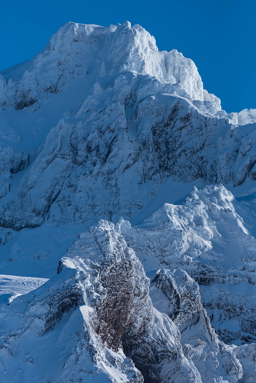
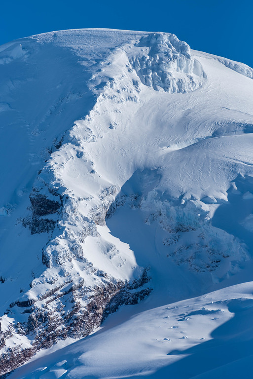
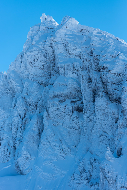
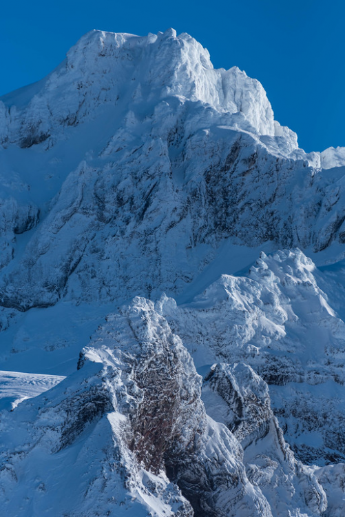
Lincoln is waiting for someone to climb this face: Colfax will watch: Kulshan (the Coleman Headwall is looking remarkably smooth right now): Conditions as of yesterday....you can drive to within about a mile of the Heliotrope TH, though that may be changing with the storm. Ski conditions were terrible at every elevation and aspect up to 7000' (very icy). Figured people may want some images for the high pressure to follow!
 1 point
 -
They didn't extend the road, they just paved it. So instead of bouncing an hour in potholes you drive smoothly in 15 minutes. There are a variety of trails, but they mostly run along the canyon floors. Not sure there will be any new tours to be had, but then I'm not an expert in tours in that area. Maybe someone will give you ideas - and I'll take note. Finally, if I were you, I'd post the same question on Turns All Year. More skiers there.1 point
-
Ah, that explains the tire tracks! Yes, the winter closure is clearly signed (and we stopped at it).1 point
-
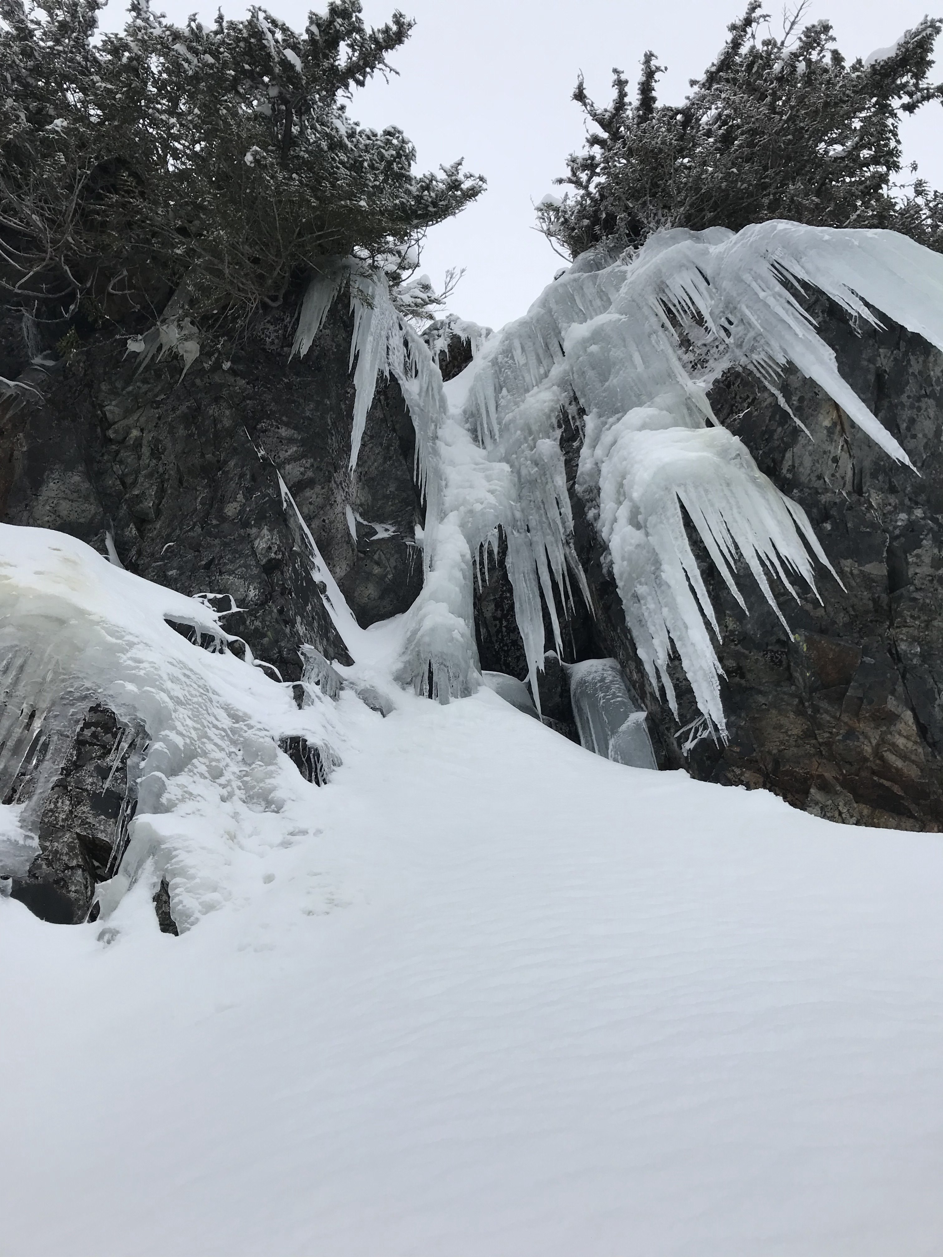
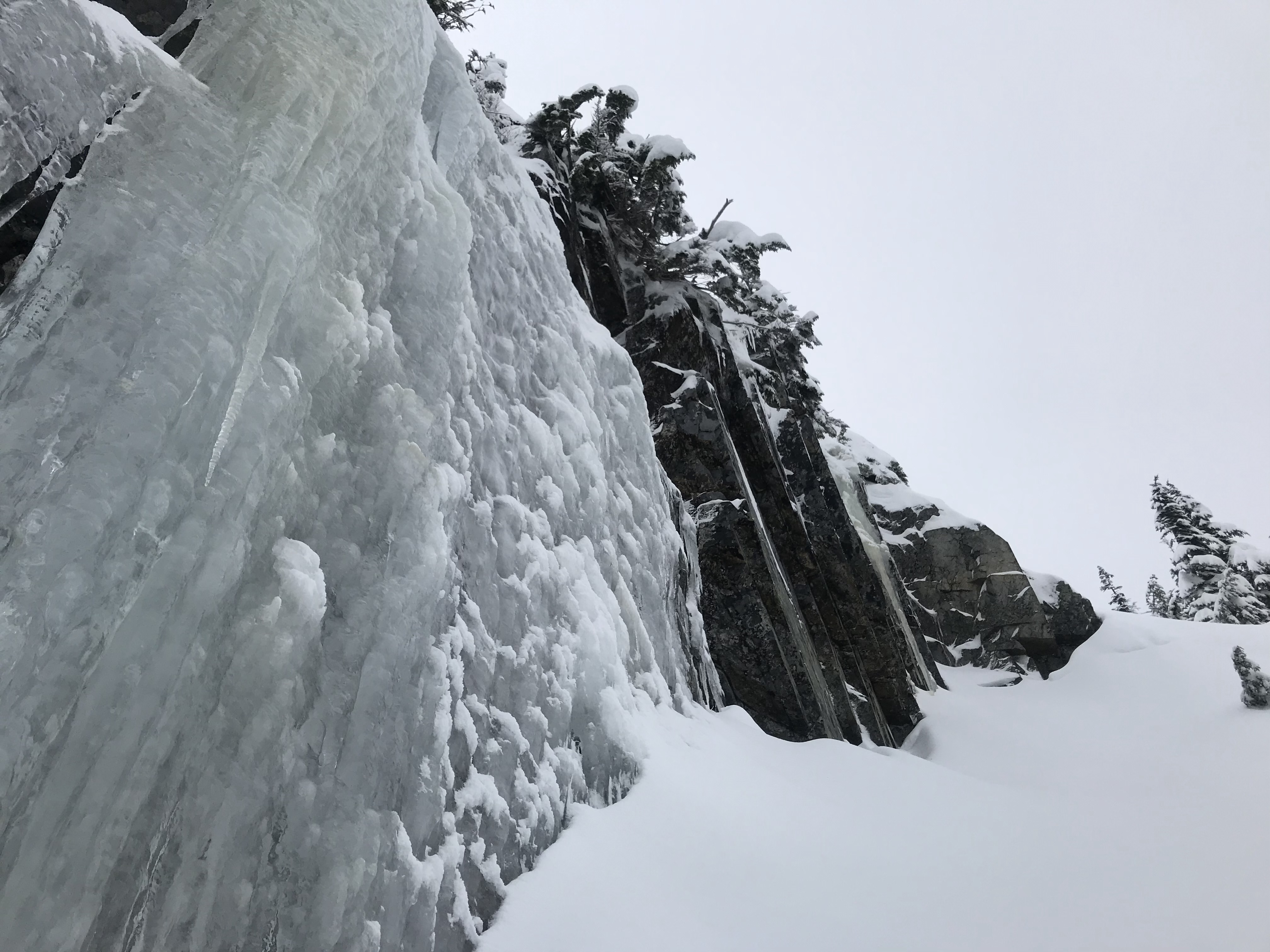
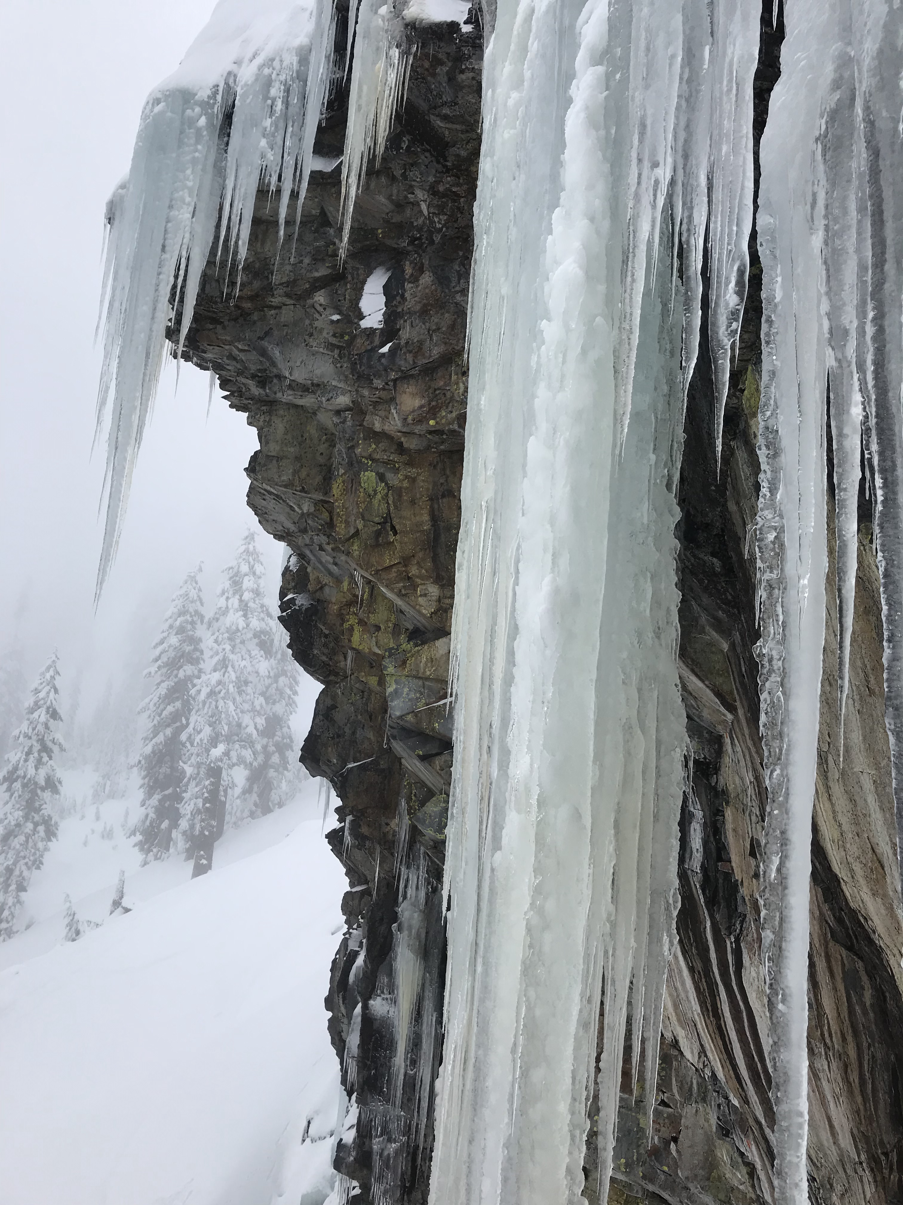
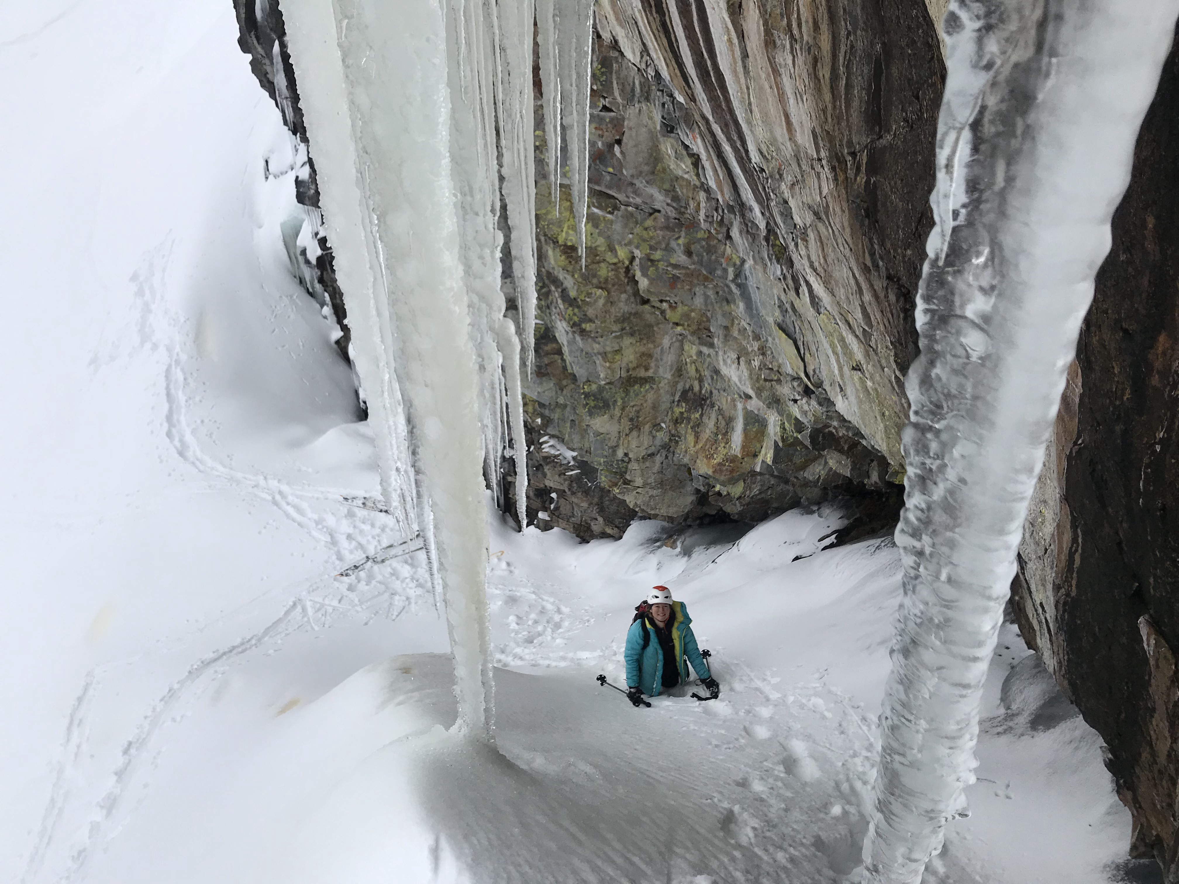
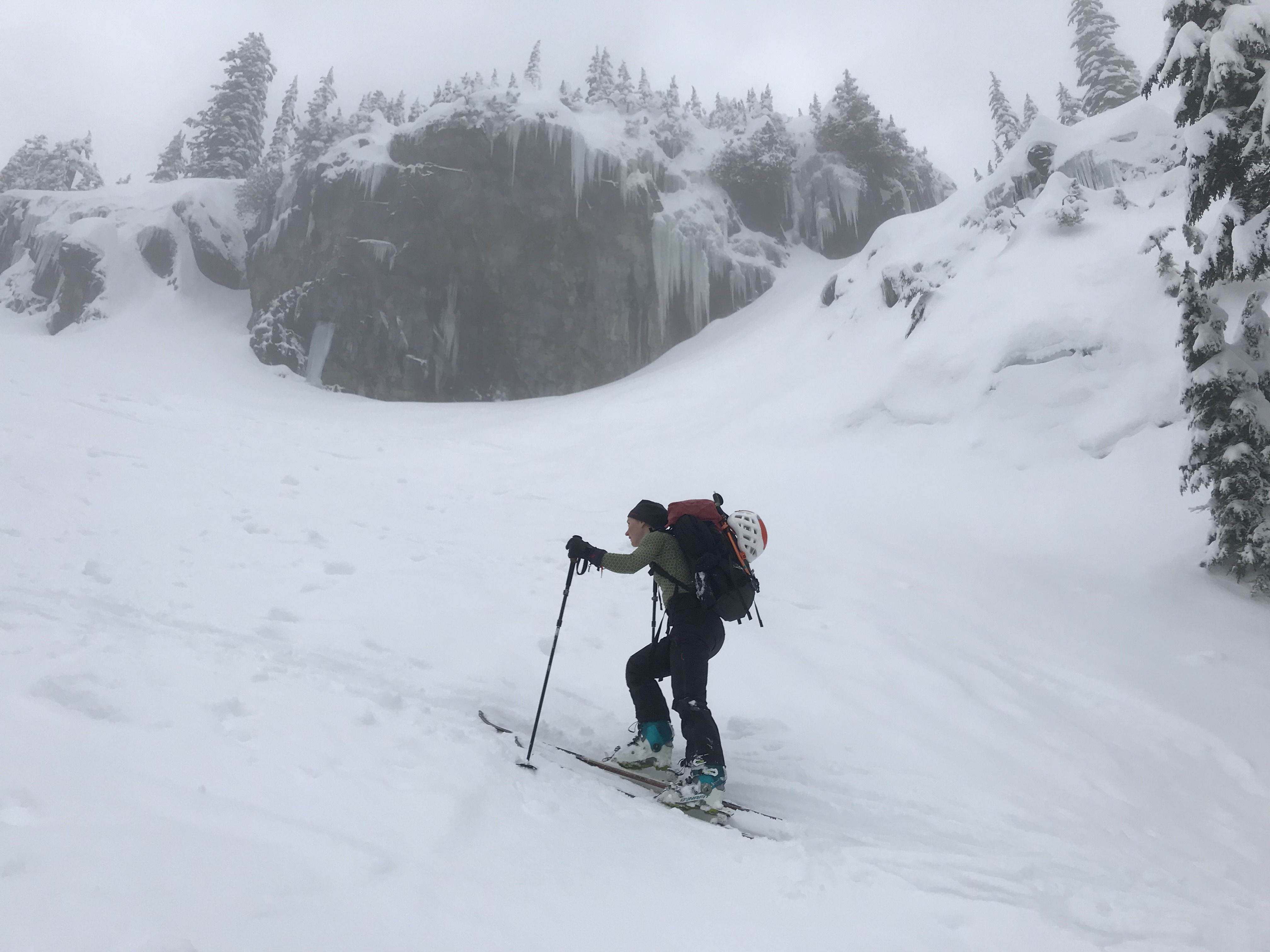
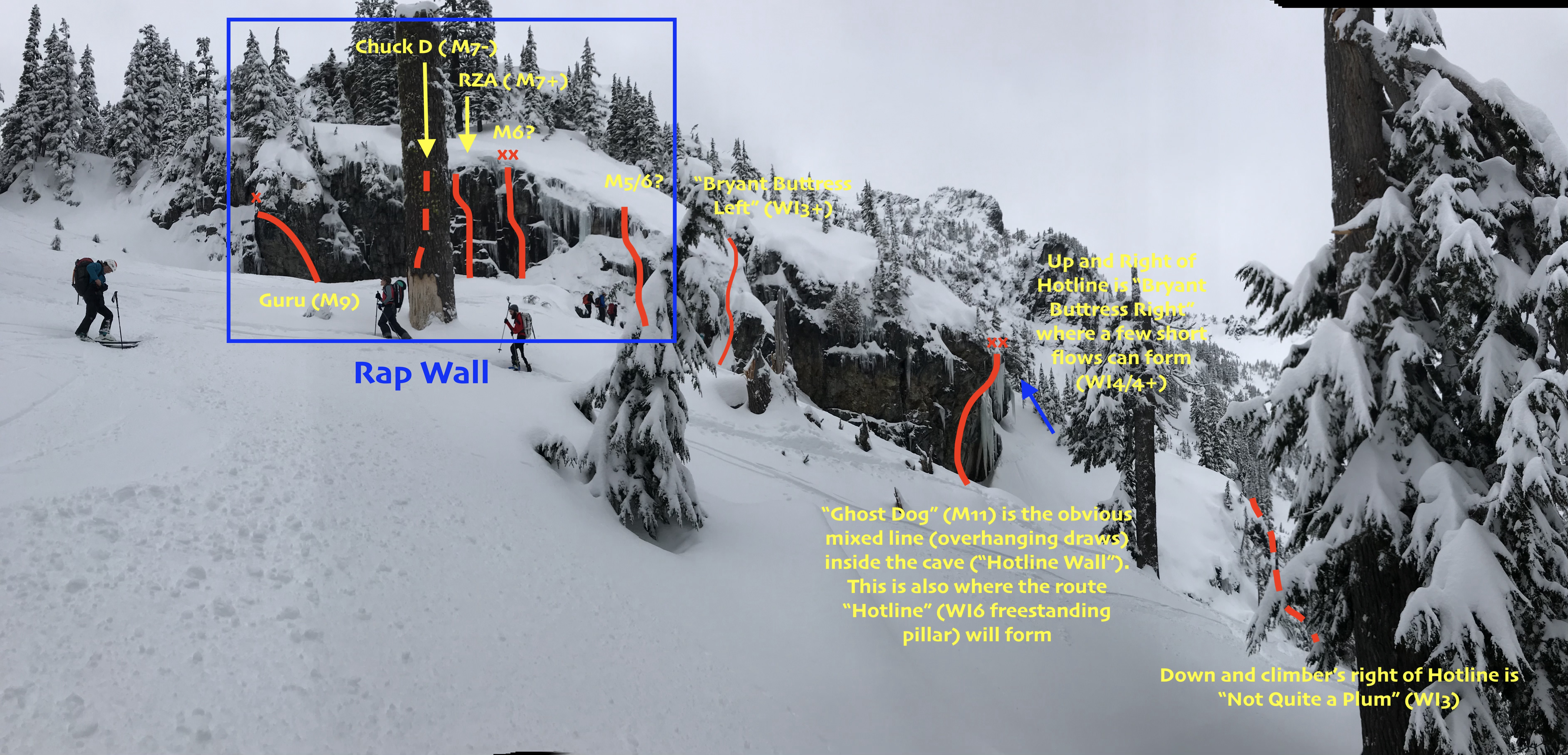
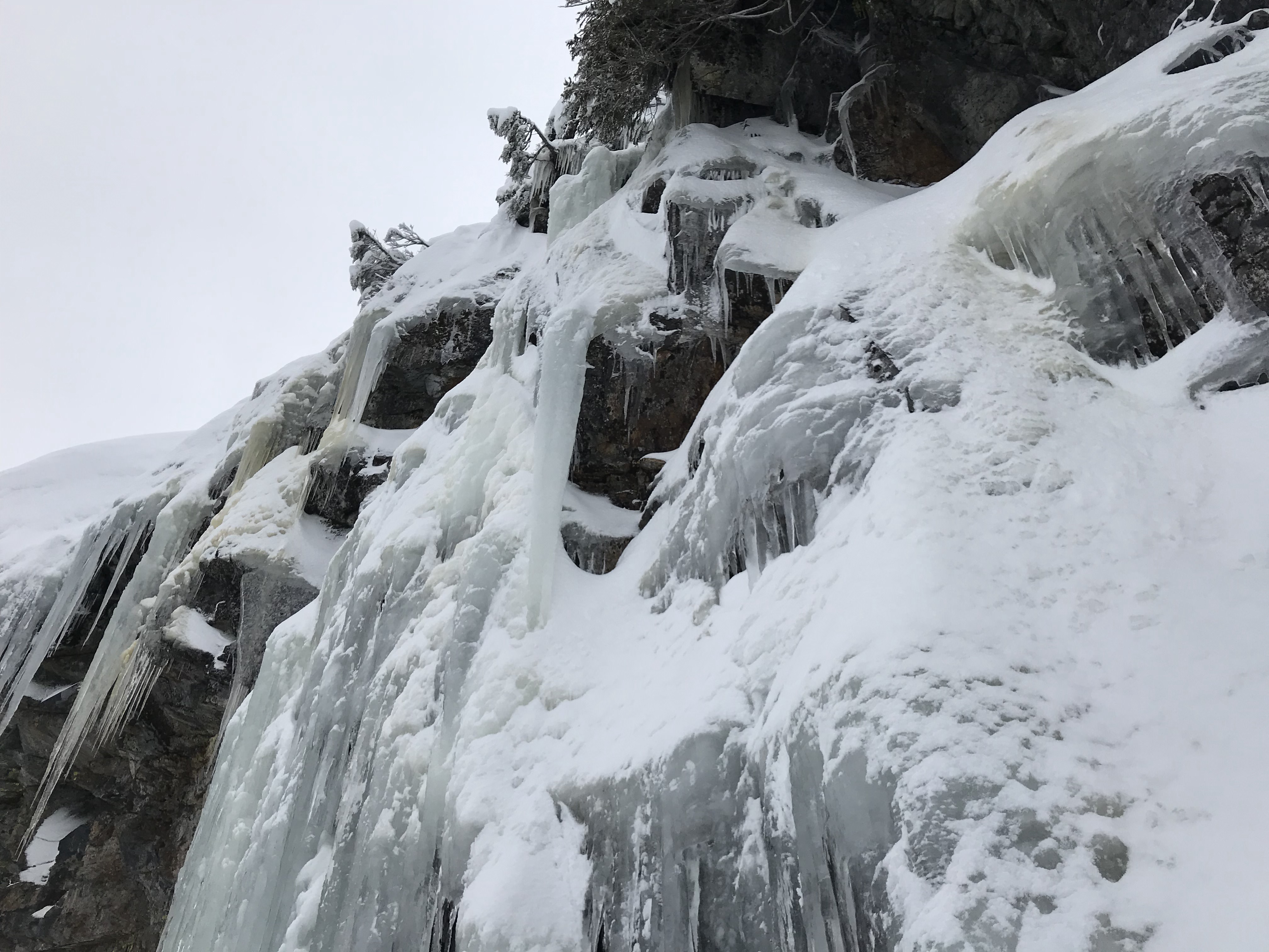
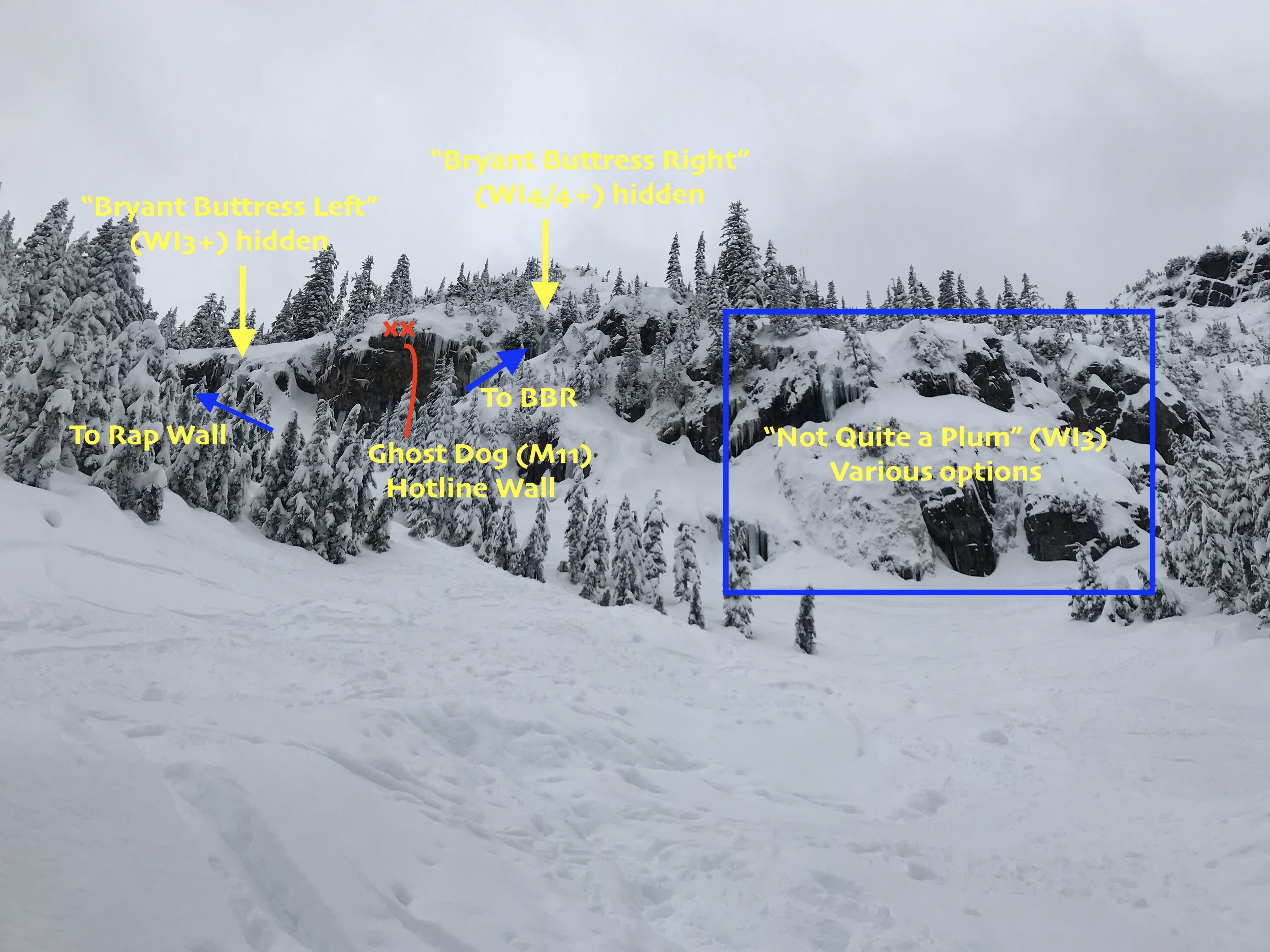
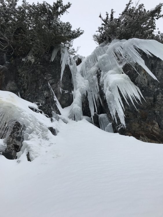
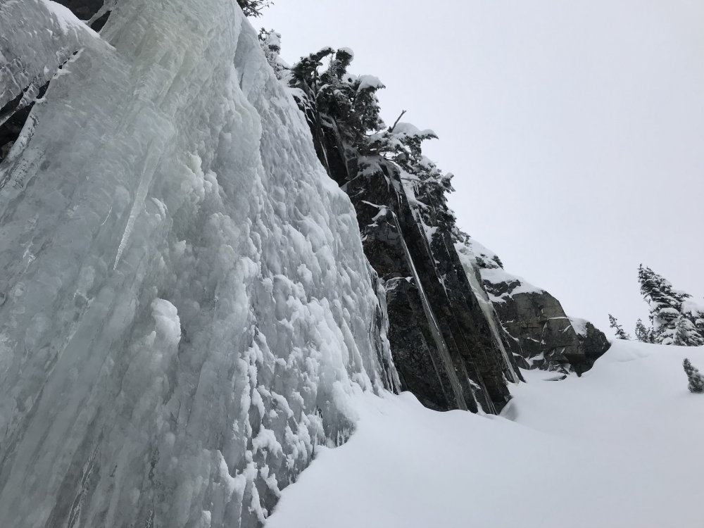
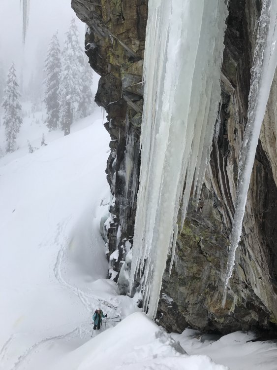
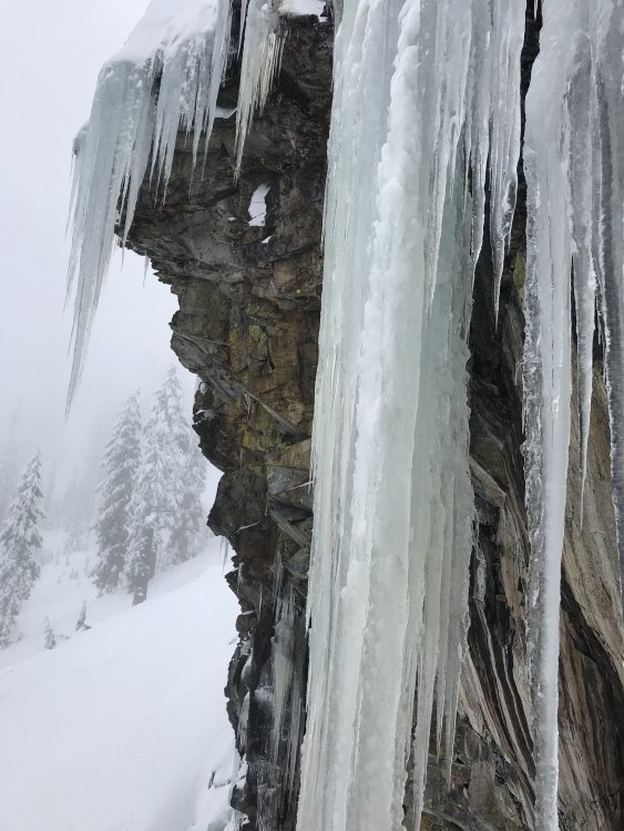
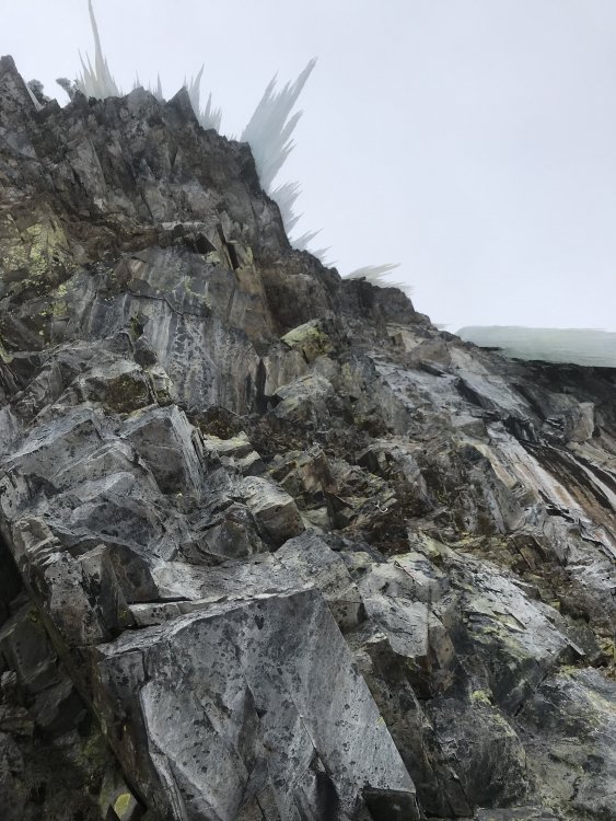
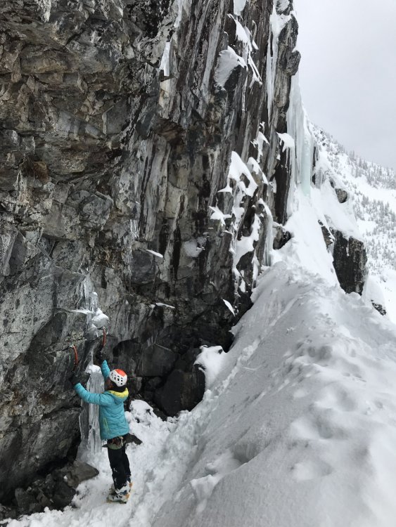
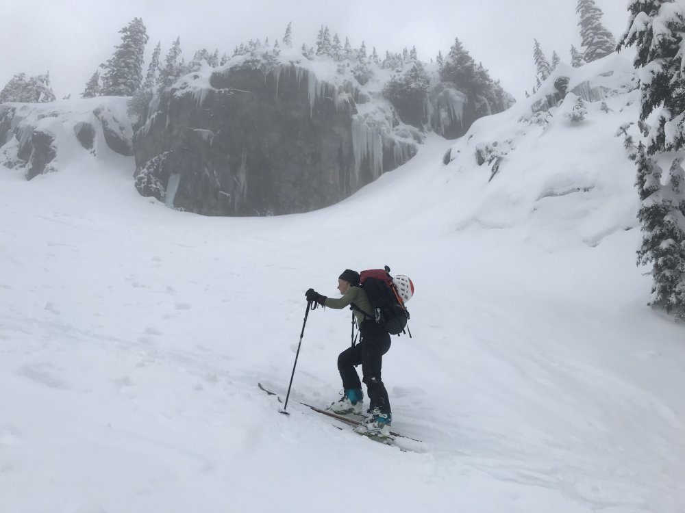
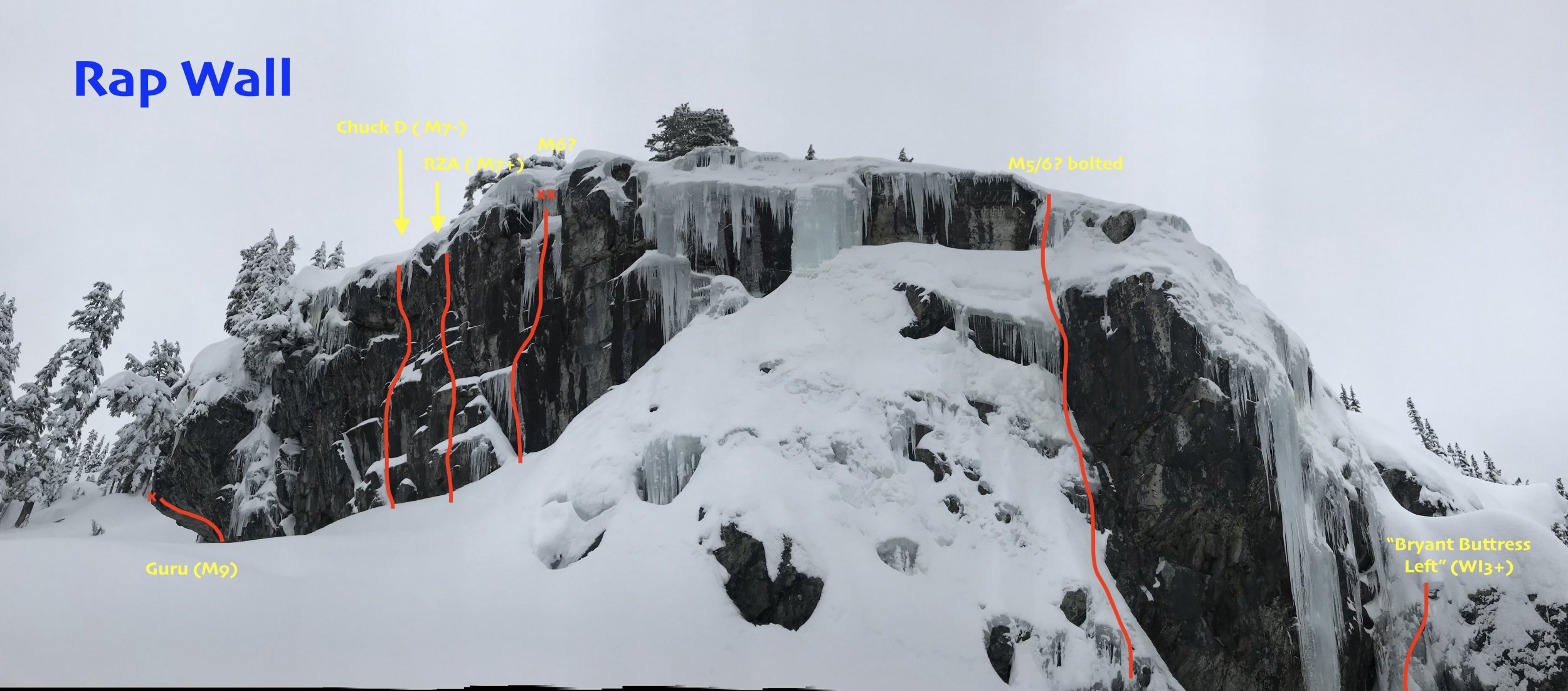
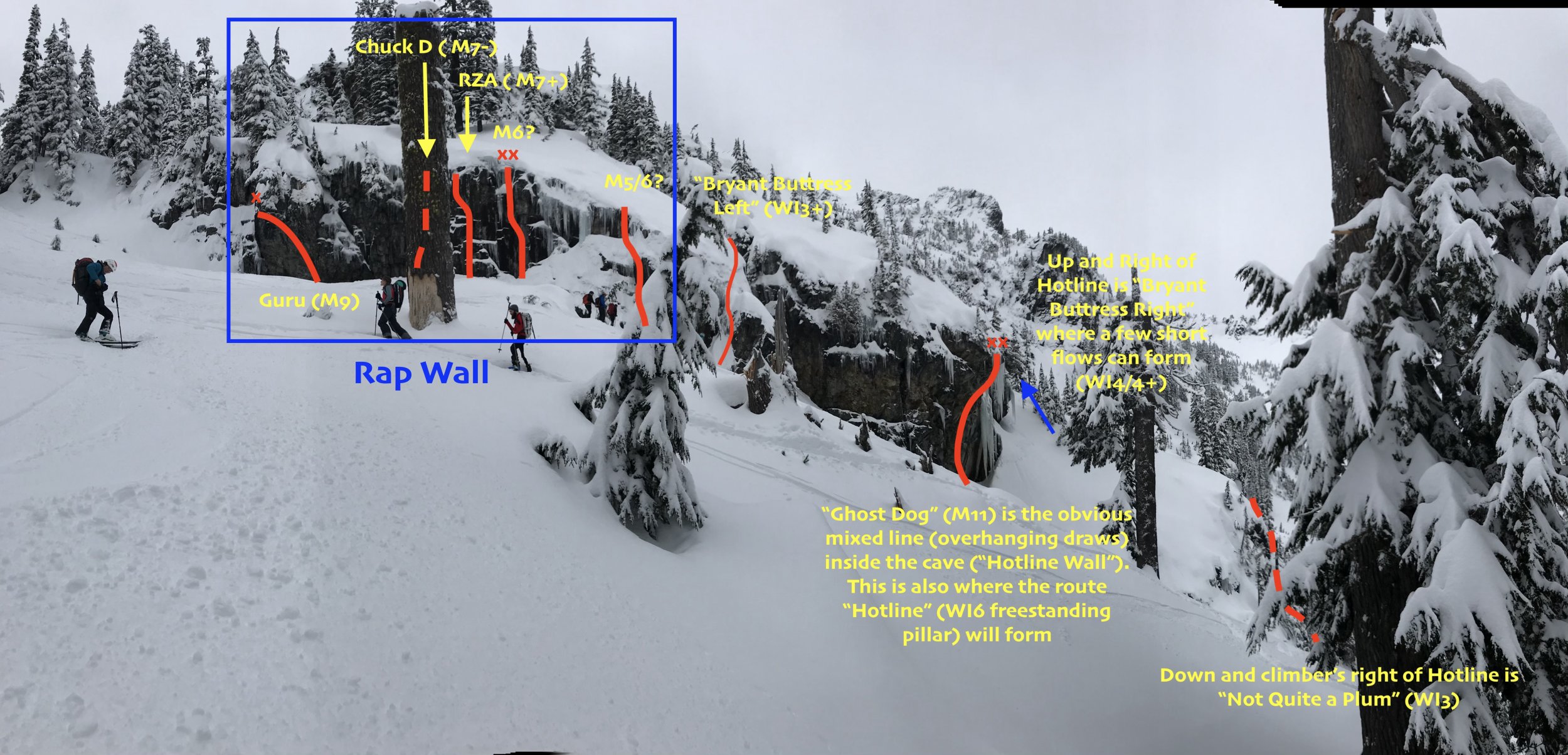
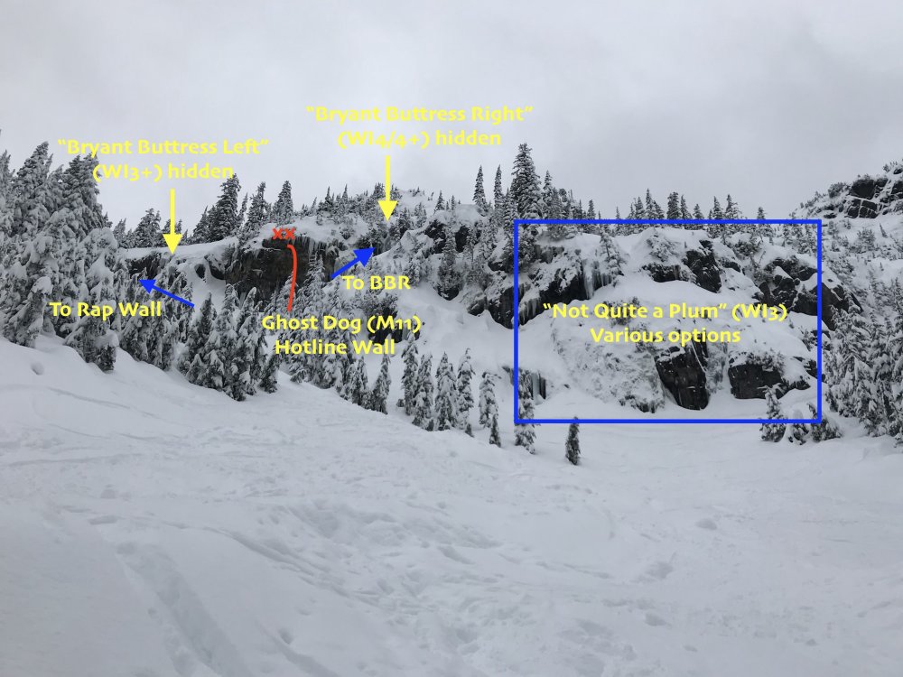
Trip: Alpental Source Lake - Rap Wall Trip Date: 01/20/2019 Trip Report: This was Priti and I's first pilgrimage to lay eyes on and pay homage to Rap Wall. We brought the tools and rope for a walk but had no idea what we were in for. This was a scouting mission to a get a lay of the land. I've since pieced the various Bryant Buttress routes together using the Washington Ice book and various trip reports/blog posts. The GPS Coordinates in WA Ice are spot on, btw. For an aerial view, see page 24 in the book "Backcountry Skiing Snoqualmie Pass": the number "2" is just over the climber's left-most flank of Rap Wall. Also, GerritD has a good far-away look in his comment here: Route Overlays: Since I couldn't find a good topo of the area anywhere, I overlaid some photos with some of my guesses. Please *respectfully* correct me, and I will update the overlays. Left to Right: Rap Wall, Bryant Buttress Left, Ghost Dog (the only route in the cave, aka "Hotline Wall"; the "Hotline" route is a freestanding pillar that will occasionally form over the cave), Bryant Buttress Right. Below Hotline Wall is Not Quite a Plum Conditions: -Alpental Falls: Not in -Kiddie Cliff: Not in (some short, thin ice on the right?) -Not Quite a Plum: short ice steps and deep snow -Bryant Buttress Right: Interesting, thin WI4/4+ flows! -Hotline: the right side of the Hotline Wall has an interesting-looking, steep WI4 traverse-y thing -Bryant Buttress Left: In mixed conditions (gear?) -Rap Wall: Icicles at the top of the cliff band. May want to rap in and hack them off first, so you protect the belayer? Some interesting WI3/M4 lines on the right side of Rap Wall (visible in pictures above) Approaching just beneath Hotline Wall (Ghost Dog) Interesting traverse up and right of Hotline Wall. Looks like WI4 traverse out left, then up for ~15m with good stubbies. Short, wide, thin sheet of WI4 on Bryant Buttress Right (further up and right from Hotline Wall). Continuing even FURTHER up and right from Hotline Wall (right of Bryant Buttress Right) is little mixed gully which could be fun. The cave at Hotline Wall Overhanging top of Ghost Dog Peering up at Ghost Dog. Can you pick out the swaying quickdraws? Very comfy spot to stash packs at Rap Wall (between Guru and Chuck D) Approach: Park in the furthest lot up Alpental, then take winter trail to Source Lake. Once you arrive at the lake and the terrain flattens and opens, up and climber's left is an open gully (visible in the third picture below) and you will see "Not Quite a Plum" and "Hotline Wall" (the cave where "Ghost Dog" is). You can easily skin up the left side of this gully. Gaze upward at the visionary line of Ghost Dog in the cave and pick out the dozen or so quickdraws blowing in the wind up and through the roof. In the book "Backcountry Skiing Washington Pass", this line is called "No Fog" and is also the approach to The Tooth (which cuts back way climber's left). If you were to continue up and left, you will get to Great Scott Bowl, Pineapple Pass, and The Tooth. If you are skiing down, stay in the open glade just below Rap Wall ("one of the best pow runs in the valley") since the open gully on skier's left (just below "Not Quite a Plum" is chunky and unpleasant right now. Gear Notes: Bring lots of stubbies. An adze to chop out bolts and anchors. Pickets if you're trying to rap in and set a top rope. Some routes are truly mixed, so sharpen those points. Approach Notes: Deep snow. Floatation required.


 1 point
 -
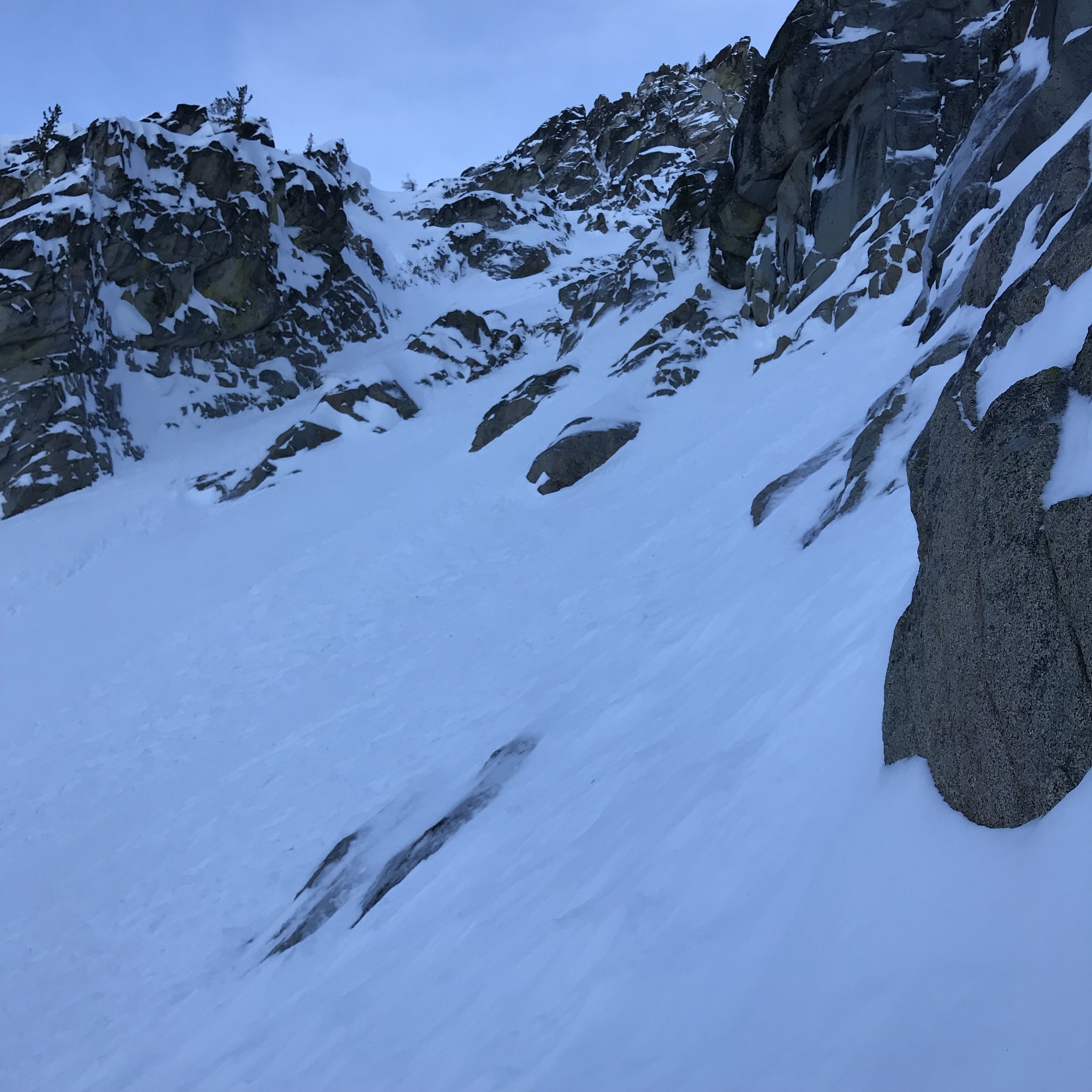
Trip: Alpine Lakes Wilderness - North Buttress Couloir Trip Date: 01/12/2019 Trip Report: Began ascent around 0615, cruised up the road following tracks to trailhead for Cashmere mountain. From there broke trail all the way to turn around point. Navigation through the forest was quite poor, even though done this portion plenty of times, still got lost at certain portions. Took about 5 hours to reach Colchuck Lake, was humbled by process of breaking trail and poor skinning skills. Opted to not cross on the lake just wasn’t vibing with it. Sat around for around 40 min. warming hand and waiting for visibility to open up. Pushed out towards far side of Colchuck Lake where weather was much better even just 100’ higher. Hugged skiers’ left on boulder field proved worth it, wish I would have ascended even more on this side rather the Colchuck Glacier moraine, although it did have a handful of cornices which seemed solid and inactive. Transitioned into climb mode near entrance of couloir. Snow was not compactible at all, ice tools were more shovels making room for better steps. Had crampons on with intention of reaching higher and avoiding a difficult spot to slip them on but were not necessary. Overall snow seemed good until I transitioned from one aspect to another, where, the snow seemed to be even more bottomless and inconsolable. It was this point where I opted turn around – just did not have margin for my own solo attempt. The ski descent from this portion (see below) got to my nerves a bit. Due to the inconsolable snow, arresting was not an option. Your tool would simply slice right through, yet your skis would still float relatively well on the surface. Between this, the steeper grade and the looming cliff below, it was survival skiing until I reached my transition point. Dropped into the skiers left of the moraine and threw down my line. Opted to follow standard trail out so to avoid the lake. The descent through the forest was much better, skating out on skins proved much timelier with even portions of skiable slopes. The road out as also super, a little frozen at places, bit hard to turn and crashed but oh well. Upon arrival at the car, totaled 13:23 hrs. 16.6 miles & 6000’ gain with high point of 7000’. Gear Notes: Tools, crampons, self-belay setup, two screws, 30m 6.1mm rope, picket, used only tools for pushing down snow Approach Notes: Tunes highly recommended IMG_0434.HEIC Bailing on Colchuck NBC.mov
 1 point