Leaderboard
Popular Content
Showing content with the highest reputation on 09/16/18 in all areas
-
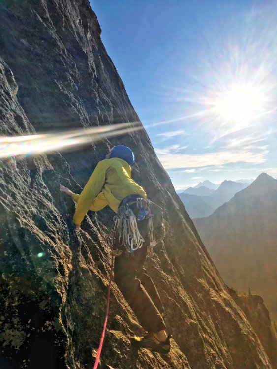
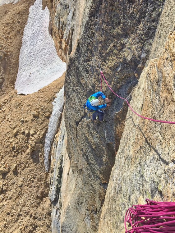
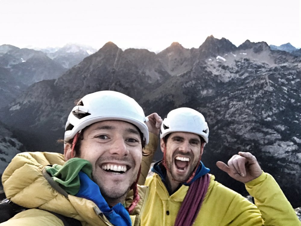
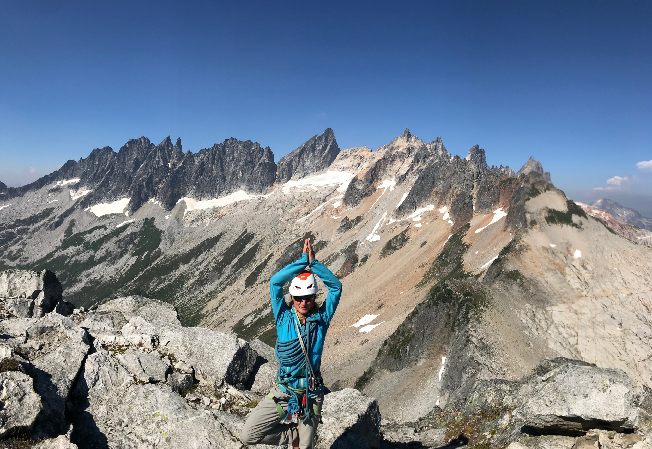
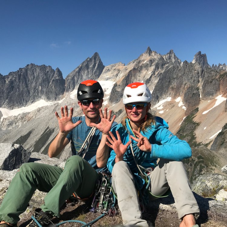
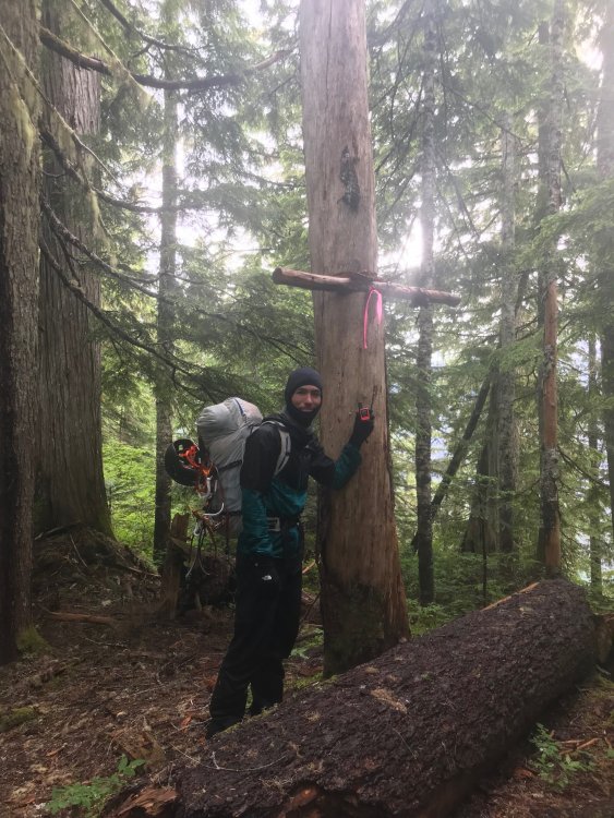
Trip: Bear Mountain - North Buttress: Beckey Route Trip Date: 07/15/2018 Trip Report: Bear Mountain: Two new dads trying to keep a 10 year dream alive For me, mountains can become obsessions, sometimes to the point of irrationality. In my life, no mountain, or route has been more indicative of this than the North Buttress of Bear. I stumbled upon Bear in 2007 in my early days of climbing WA by devouring each page of the Beckey guides like they were some gripping novel. Trip reports from this site only further set the dream of someday ascending this monster objective. Being nothing but a budding sport climber at the time, this peak seemed out of my grasp. As the years went on, I honed my mountain skills. I learned to trad lead, sent my first few alpine rock routes, got on my first glaciers, and began developing the mind for the rigors of schwacking in the cascades. By 2011, I began thinking this dream could possibly become a reality for me. I even found a climbing partner, Andrew, who shared my dream. Each year we'd talk about making our dream a reality but each Summer would come and go without an attempt. For 5 years in a row we'd try to make plans only to see them fall through. Timing, schedules, obligations, weather, forest fires, and work all conspired against us. Fast forward to 2016, and each of us became fathers of our first children. Yet another reason to push Bear farther from our grasps. During the first year of fatherhood I discovered, although not surprised, that being a father does not easily co-exist with committing alpine objectives. My fit physique, lead head, and drive for summits began to recede like the glaciers surrounding the peaks I had grown to love so much. Over trail runs, occasional crag days, and family outings, Andrew and I still spoke of our mutual dream contrasted with our diminished abilities. One thing was clear from these conversations: the dream, and our stoke was still alive for our beloved Bear. Spring of 2018 came around. It had been a dismal Winter of training. Trips to the crags confirmed, family obligations and our lack of training over the Fall and Winter had left both of us less than prepared to crush in the coming Summer, but we began to discuss plans for Bear as we did every year. We settled on the dates of July 13-15 and began attempting to play catch up with our training. As the dates drew closer, one thing became certain, neither of us felt strong. But the week of July 4th came and still nothing looked to foil our set plans. So early July 13th we made the early morning drive to the end of the Chilliwack road along Chilliwack Lake in British Columbia. The bushwhack across the border and out to bear camp lived up to its dreaded hype. Six hours of magical, rarely touched old-growth forest contrasted with the torturous efforts required to navigate and move through said forest left us bewildered and uncertain. This uncertainty as well as the contrast of beauty and torture would be a reoccurring theme over these 3 days. From bear camp to the bivy on the western shoulder of bear is 4000 vertical feet up. A quarter of the way up, late afternoon, and we were beat. I am on liter 5 of water, schwacking in my underwear due to the heat and effort. Both of us are bonking and cursing ourselves for thinking we could pull this objective off. We were not fit. We had not trained enough. Doubt began to dominate our thoughts. It has already been 8 hours of this shit and we still had 3,000 feet of trail-less hell ahead of us. Who were we kidding? There was no way we were going to make it to camp before dark. We sat, uncomfortably, on a steep slope, in the middle of nowhere and began talking of retreat. "Squamish isn't too far away, is it?" "I guess we could always just crag at Mt. Erie on our way back to Seattle." Inside, a voice screams at my exhausted brain, "MT. ERIE!!!!???? Are you fucking serious!!?? I am never coming back into this valley again. It is now or never for Bear. The dream either lives or dies on this shitty, viewless, insignificant slope." My senses kicked back in. Remember, anything too big to fathom all at once needs to be broken into digestible chunks. The decision to push on grew from this and we decided to at least try to make it to the lake for the night and we would make the next decision from there. Two hours later, after 1,000 feet of extremely steep blueberry bush pulling, we broke out into the alpine and our spirits began to soar like a vulture in a thermal updraft. It’s amazing how something as simple as alpine views can change the mindset and determination of a climber. I began to feel rejuvenated. Maybe we could make the bivy site before dark. A heather-strewn meadow on a gentle shoulder gave us the first real physical break of the day. Panoramic views of remote North Cascade summits rose all around us. A mother Ptarmigan and her brood of chicks sprinted out of the bushes, snapping me from my alpine daze. Discussions of a potential closer bivy site gave us a closer goal. Running on fumes, past the lower bivy spot, and we still have light. Must, keep, moving. At last, 12 hours after leaving our car, we collapsed at the col. We had made it. I promptly gave the double middle finger to the valley below, clearly showing the shit-show we just wallowed through. We promised ourselves we would not make a decision about what to do about the next day until after we ate. Dinner went quick. As we crawled into our bags, we listened to the cacophony of a thousand tiny flying vampires trying desperately to find a way through our netting and into our skin. Twilight lit the sky with a rainbow of color. We both agreed that since we had overcome the uncertainty and brutality of what many, including us, consider the hardest approach in the Cascades, we felt obligated to throw ourselves at the North face the next morning even as our bodies screamed in opposition. We awoke with the sunrise. I shook the heaviness of last nights sleep from my head and felt somewhat shocked that yesterday wasn't some dream/nightmare. I was here. We were about to start our summit day. A day we have both been dreaming of for at least 10 years. With each sip of coffee, my stoke began to rise. We strapped on our crampons and make a quick and pleasant descent onto the north side of the mountain. We turned a corner to catch our first glimpse of Bear's north buttress. Ominous, glorious, stunning, perfection on ice. Words cannot really describe the feelings I had, but these are close. Upon seeing both the direct north buttress and the north buttress couloir, we checked in. The direct looked safer as the couloir looked broken up near the top, but our energy levels and dismal cumulative rock pitches for the year had us thinking that the extra rock pitches might not be reasonable. We settled on following the couloir and Beckey's footsteps. In hindsight, this might this might have been a bad idea, but I am pretty sure I would have said the same thing if we had taken the other option. Either way we felt the collective weight of our dreams, the debilitating approach that we vowed never to do again, and the sheer power of what we were trying to accomplish. I felt as if every step upwards tightened the grip of the vice we were in. Committed, for better or worse, to move upwards. We switched back and forth from approach shoes to crampons a few times and quickly found ourselves in irreversible territory. There is terror and clarity in realizing the only way out of a predicament is forward. We broke out the rope to lead our first pitch out of the couloir. A shit show of snow, poor pro behind detached blocks, and slopey ledges littered with rocks of all shapes and sizes. My rope skirted across a ledge and sent a microwave down towards Andrew. Our years of work together in the mountains gave us the foresight to expect such events and was glad Andrew had set himself out of harm’s way before I led. We had reached the 4th class ledge system that would get us up to the North buttress proper. Kitty litter, slopey ledges, and the exposure below made for careful, calculated movements while simuling, often without adequate gear between us. Trust in each other became paramount and again I found myself thinking that I was thankful to be climbing with such a trusted partner. At last, we reached the first real quality pitch of the route. Beckey's glorious left facing 5.8 corner. Andrew led and we both laughed at the idea of "5.8" at the top. It felt like index 5.9+ but would be an instant classic if situated at the lower town wall. We were finally finding some type 1 fun. I linked the next two pitches of fun and deposited us at the base of the infamous 10a offwidth. DE8DD876-06ED-4585-BEE2-4CF80B5ED29B.MOV It was at this point that we began to feel the efforts of the pat 36 hours. Dehydrated, low on energy, and stoke, Andrew reluctantly agreed to lead the next pitch and quickly made the decision to take the 5.8 bypass pitch. We ended up breaking this pitch into two because the lower portion of the offwidth took most of our small cams and the upper 5.8 portion looked to take nothing bigger than a .75 BD. Crap. We swapped leads under the only stance Andrew could find conveniently under a car sized detached block. I was tasked with leading over it and him without touching it. Yikes. I led to a nice ledge and brought up my partner. Both of us feeling both physically, mentally, and emotionally drained, we began to flounder. Neither felt the desire to lead the next pitch. Bonking hard, I finally took the sharp end. Staying on the crest I mantled to the base of a steep featured, but unprotect-able face. I began to lose my cool. 15 feet above a ledge and my last piece and seeing committing climbing and no cracks above me, I retreated. Reversing the mantle had me nearly hyperventilating but I, somehow, safely made my way back to the anchor. We discussed our predicament, spied a horn with rap slings 30 feet down to our right and consulted our beta. We both thought that this was the Beckey rappel that would take us to a 4th class gully exit but our position would not allow us to confirm it. Below us, the gullies looked vertical, smooth, and crack-free. Committing to the rappel felt serious. Andrew rappelled at a diagonal across ribs, at times placing gear as directionals to reach the farthest gully. Upon reaching the first gully, Andrew looked up. There is no way that is 4th class. Second gully. Sweet baby jesus! It goes! Relief washed over us like a warm caribbean breeze. I rappelled down and we quickly began to lead. We both just wanted to be done with this endeavor. How quickly a dream becomes dread. My mind screamed, "Get me the fuck off this mountain!" After two rope stretching pitches and some mid fifth climbing (another sandbag) the Sun hit our darkened spirits and the tomb I'd climbed myself out of was no more. A few hundred feet of 3rd class was all that separated us from the summit. Elated, exhausted, and emotional, we hugged. I looked over the edge, down the north face and wept. Tears of joy, relief, and sadness fell hundreds of feet down the alpine face of my dreams. I always pictured myself feeling triumphant at this moment, but instead all I felt was relief and the intense desire to hug my wife and two year old son. We had done it. We had fought through constant moments of fear and uncertainty to obtain our dreams, but I felt far from dreamy. As we began the descent, I turned around and gave one last look at the summit of my dreams and gave it the double middle finger. I was done. I could close this chapter of my climbing pursuits. Fatherhood has changed my drive, my dreams, and my abilities. I am unsure if I will ever climb anything like this again, but much like any overwhelming obstacle, I will take it one decision at a time. Who knows how I will feel about such commitment and risk taking in the future. We hit a mellow snow slope and just like any decision we made that day, we assessed the terrain and made the best choice for moving forward. The joy in the glissade took me by surprise and I burst out into a giggle fit. Type 1 fun!!!! What a wild ride of emotions. We reached our bivy a half an hour before sunset. We smiled and laughed as we recapped the day. Feeling thankful and shocked to have pulled the ascent off, we crawled into our bags, passed a joint back and forth and fell into philosophical ramblings about life and reality. What a life we live. The next morning we made the long march back down to bear camp and through what felt like endless old growth shenanigans pushed by the thought of a dip in Chilliwack lake and the beer stashed there. Upon reaching the lake we found the beer gone, hoards of people on what I thought would be a secluded beach, and leash-less dogs aggressively charging us while the owner continued to flirt with some bikini-clad girl. WTF. I thought that was the shit-cream on top of a long and miserable day, but oh no. Upon reaching the trailhead I saw my car in the distance but somehow it did not look like my car. The back window was missing! Someone had broken into my car! Son-of-a-bitch! As we got closer, the horrific reality set in. My car had not only been broken into, it had been set on fire. The tires, the windows, the interior. Everything that could have burned did. My car was a hunk of metal and nothing more! I was in disbelief. How was this possible!?? How are we going to get out of here? Is this a nightmare? Am I still in the mountain sleeping in my bag and this is some horrid hallucination fueled by the joint and exhaustion? Nope. This was reality. Whoever did this also nearly set the entire forest on fire based on the completely burnt cedar behind my car. Jesus Fucking Christ! We could have been trapped in that valley if they had succeeded in doing so! As my mind swirled with the gravity of our situation, the last car in the parking lot approached us and gave us a ride into town dropping us off at the Chilliwack police. After reporting what had happened, expecting surprise, they just smiled and said, "Yep, this has been happened a lot this Summer and there was little they could do about it. They gave us our police report number and directed us to a local bar and motel. I called the border to confirm they would let me back into the states without my passport (burnt in the car) and made arrangements for a friend to come pick us up. ”the urban mountaineer” This trip will live in my mind till the day I die and will hopefully entertain many. Journeys like this are great reminders for what is important in your life and just how lucky I am to be apart of this amazing planet. Get after what fuels your soul people! Gear Notes: 60 m rope Double rack tops to fist. Single 4 and a set of stoppers. Lots of alpine slings Approach Notes: Follow the tape till you can’t then turn on your zen and be one with the forest.6 points
-
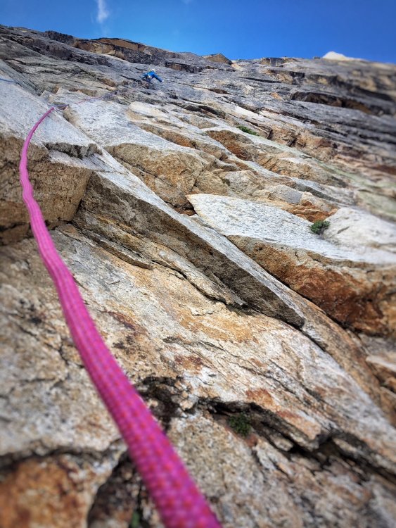
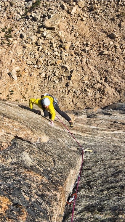
Trip: Washington Pass, Liberty Bell - Thin Red Line Trip Date: 09/01/2018 Trip Report: My buddy Andy Traylor and I had set this as a goal route to free for the summer season. Neither of us had really approached a bigger route like this with a redpoint mentality before and weren't sure exactly how to do it. With many different ways to consider an ascent "free," we settled on what we believe is a pretty commonly followed set of rules. We wanted to swing leads, and either redpoint or follow cleanly on every pitch, lowering back to the belay if necessary. Our plan was to spend one day and check out the first six pitches to get a feel for the moves and the gear then try and send the next day. On day 1 we took our time climbing the first six pitches, with no real pressure or time crunch. We TR'd the cruxes a couple times and feeling pretty good about going for it the next day, rapped off and headed down for a big dinner. The next day we set out a little nervous, but also feeling good about our chances. Once we were on the route we were moving and climbing well. Thoughts on the pitches for anyone that cares (some gear beta here so purists need not read on): P1. Straightforward crimping and edging straight up to the anchor. I actually headed right after the last bolt, going more directly to the anchor on day 2 and thought that was slightly better. Andy getting all artsy with the iPhone on P1 P2. Short pitch. Boulder problem over the bulge through the mini changing corners. Good pro and the pin at the end of the crux seemed in good shape, not tested. Belay on gear. P3. Awesome and memorable pitch I thought, shorter than it looks in photos. Super thin edging and stemming in the dihedral leading to a roof with wet holds that allow you to exit the corner and gain a stance. I basically punched myself in the face popping out of the wet locks first go round. Pin in the corner seemed good, I tested it and it held. Mostly finger sized cams. Belay at full on hanger. Andy in the corner/roof that ends the crux on P3 P4. Fixed gear in the roof seemed only ok, hard to tell with the tat and I didn’t spend much time examining it, but you probably won’t come off under the roof anyway, clip and go. Andy exiting the roof on P4 The last bit traversing back toward the anchor we both found a little awkward and harder than it seemed it should be. On the traverse back to the belay on P4 P5. Business #1. Super fun 5.10 traversing and edging to the corner. Corner gets progressively harder with the real business starting at the bolts. I will say on my initial go I was not super happy to have left basically all the rack at the belay, expecting only a few pieces then bolts. I'd take mostly finger sizes, but I was happy to have a black Metolius and a #2 C4 (certainly not necessary but provided me with some mental fortitude to try hard). Bring lots of slings, I think I had like 14 and ran out somehow, placed too much gear I guess. The crux moves are technical, a little powerful, desperate and amazing. The last move, while not the hardest, has the potential to be a heart breaker and I can only imagine being very desperate if you’re under, say, 5’9. Belay on medium sized gear above the bolts, significantly better stance. Andy sticking the last move, he never fell once climbing this pitch over the 2 days. P6. Business #2. No picture. First roof is super casual. Leading up to the second roof the climbing gets less secure but good small finger gear is there between pins. The boulder problem is powerful, but pretty straightforward cranking (V4ish?) on pretty good holds. We were a little confused by all the talk about a necessary and specific red C3 placement. We couldn’t find anywhere by the beak, or below the roof for that matter, where this would go. Any clues? However that piece or a blue Metolius or equivalent went in bomber just above the lip. If that’s the placement everyone is talking about, then there is no need to scavenge around for a red C3 if you don’t have one. We left it out in favor of a blue Metolius on round 2. Climb past the bolts (if not rapping from here) and belay on the better sloping ledge with hand sized pieces. P7. Only dog pitch on the route. Thought the rock was poor quality, basically a connector pitch. Ends on the scary looking “how is it still hanging there” block creating the ledge. P8. Another techy and pretty thin 11+ pitch. Really really good. Looks super thin but there is gear to be had and both the head and pin are in good shape, Andy tested both and approved. Some small hand sized gear higher. P9. Excellent and fun 10+ climbing again builds as you get higher. Looks like the seam dies out at the top, but keep going up instead of traversing left. That’s probably super obvious but I was getting tired and moving more timidly by this point. P10-12. Progressively easier climbing. Nice to have Scott's topo for P10 to know where to get started. The last belay sits basically on the arête between the east and north face, we came back into the sun here. There are brand spanking new bolts here instead of the pin/fixed wire combo some guide mentions. Maybe it’s obvious, but the climbing heads left up the lighter colored dihedral. This looked too steep to us to be the 5.7 climbing, so Andy headed out right on the lower angle terrain and we had a bit of an epic on the easiest and last pitch of the route. The rock quality deteriorated into kitty litter, so Andy tried to sling a chockstone to lower back to me, only to get the rope got stuck forcing even more shenanigans (face palm). All in all we wasted some hours and all hopes of pizza. Once corrected we soloed to the top without further incident. Don't go this way. Why is this photo so big? All in all, neither of us fell following any of the pitches. On lead, some of the pitches took a try or two, but in the end we pulled it out and nabbed a free ascent. We learned a lot about climbing in this style and really enjoyed the process. Thanks to Mikey Schaefer for figuring this out, it provided one of my all time favorite experiences in the mountains so far. Psyched for the next one! Gear Notes: Doubles from purple Metolius to .75 BD, singles to #3 BD. Our second set of cams were Metolius offsets. They worked amazing (as always for granite) and I always carry them as doubles, but far from necessary. Nuts. Placed 1 RP but probably not necessary. Lots of slings, like ~16. We used a 40M tag line and hauled the bag on most pitches. Approach Notes: Most casual "alpine" approach ever. Like 25min from the car.1 point
-
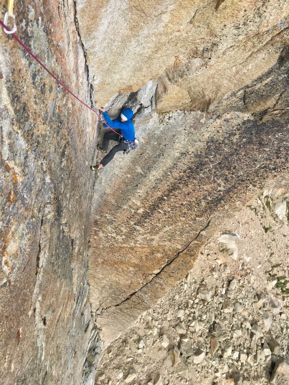
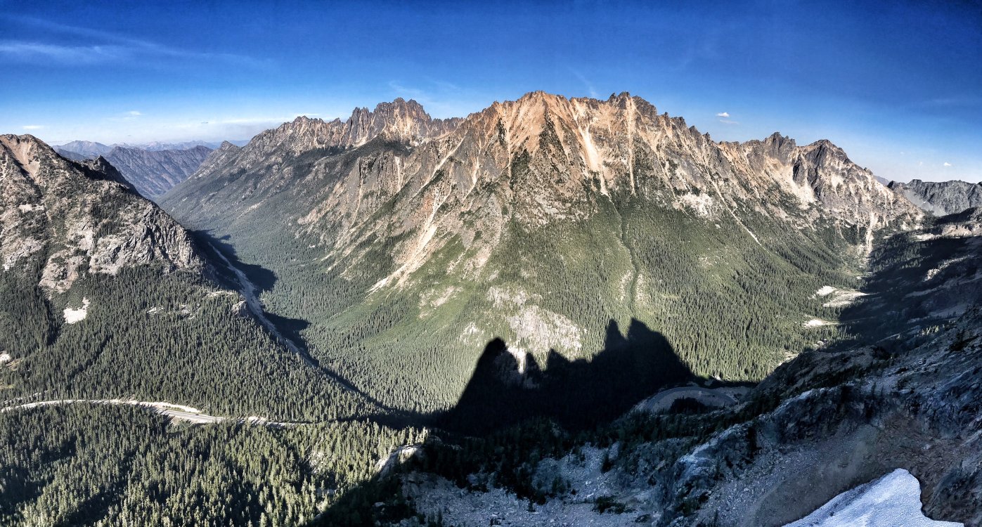
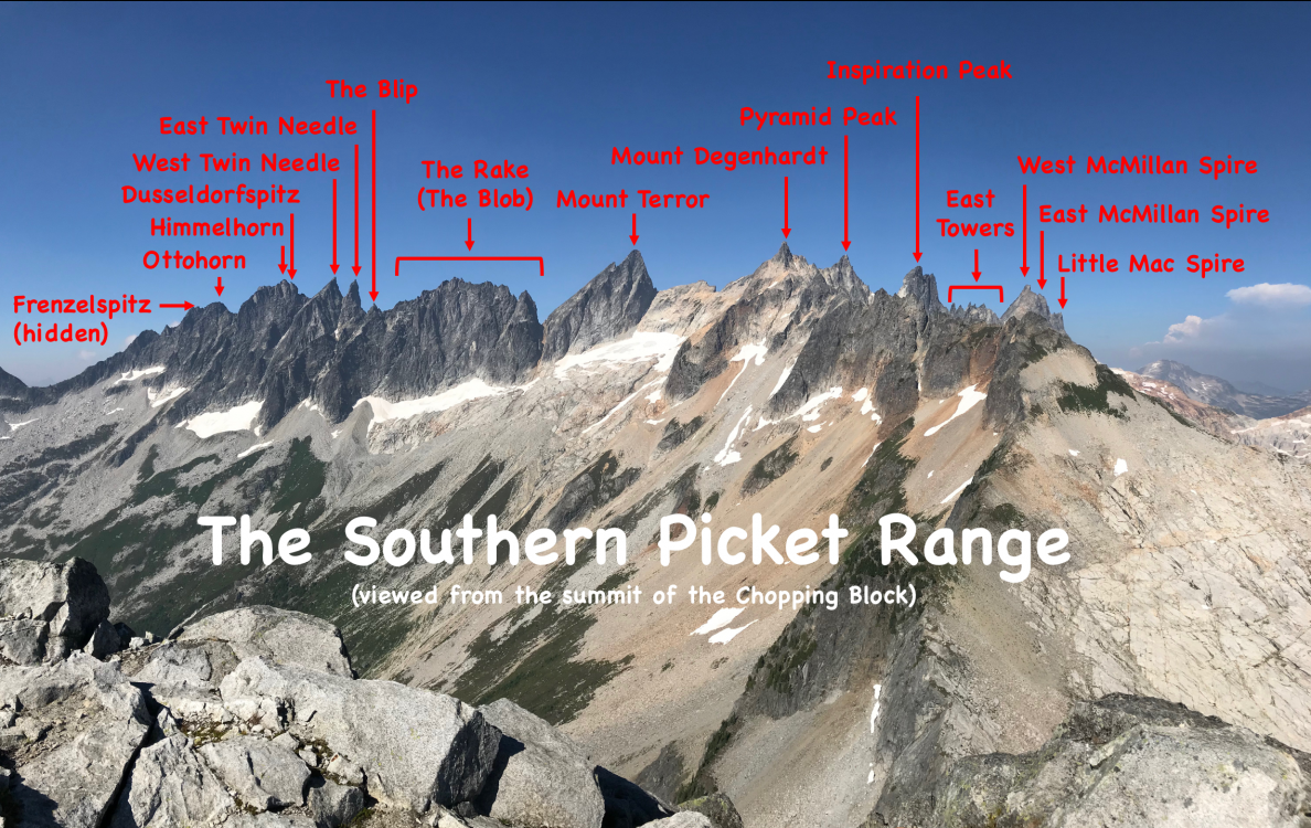
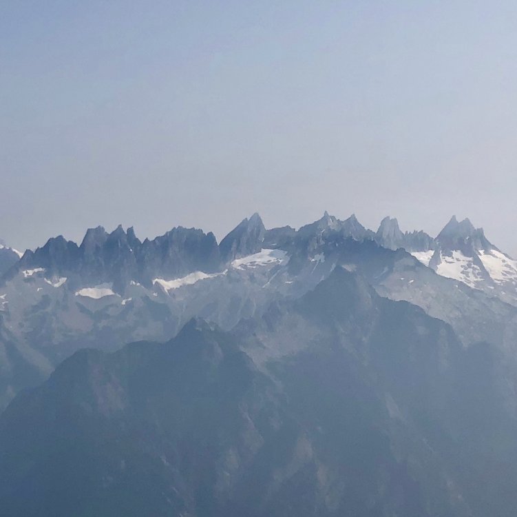
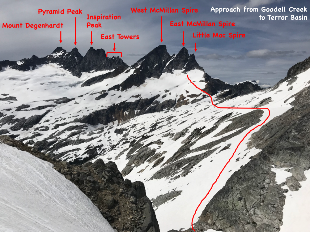
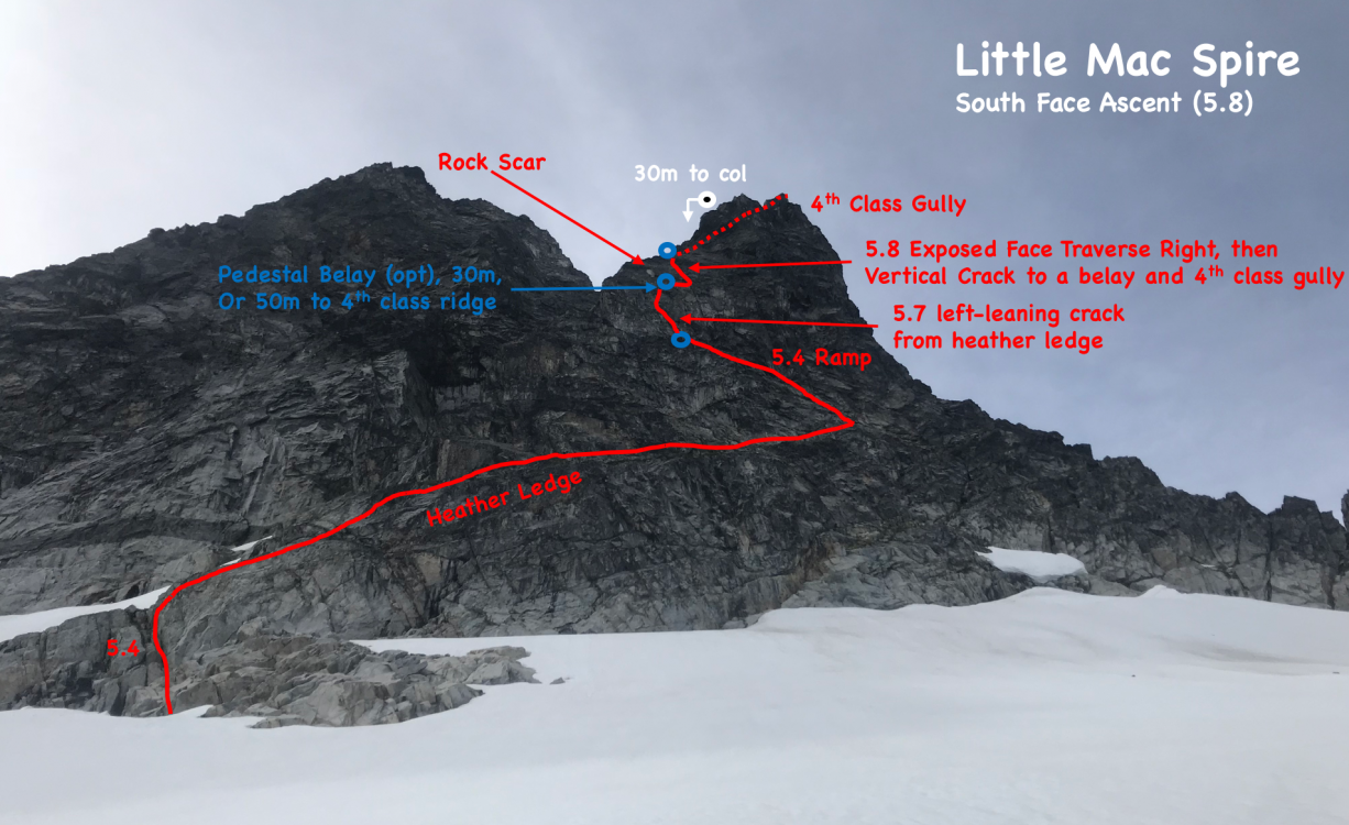
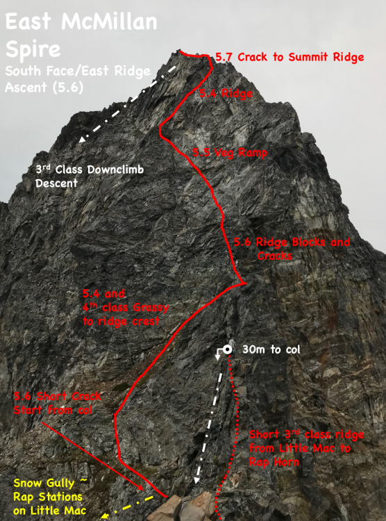
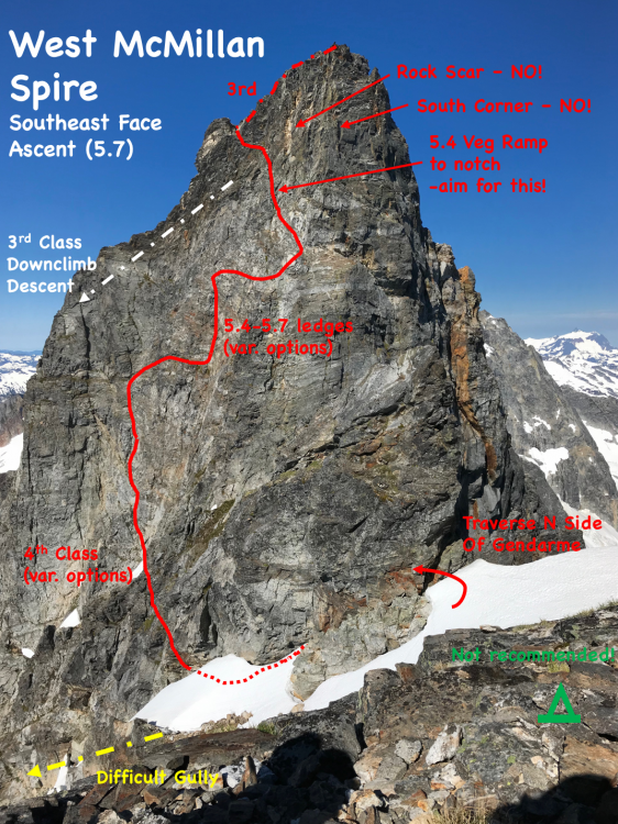
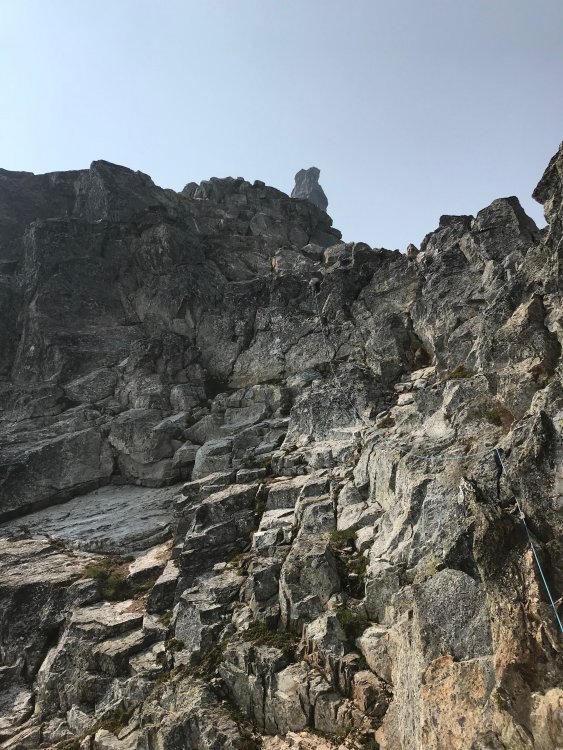
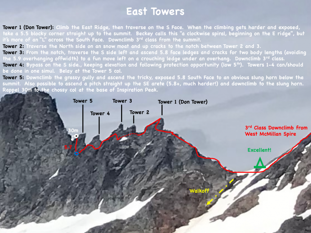
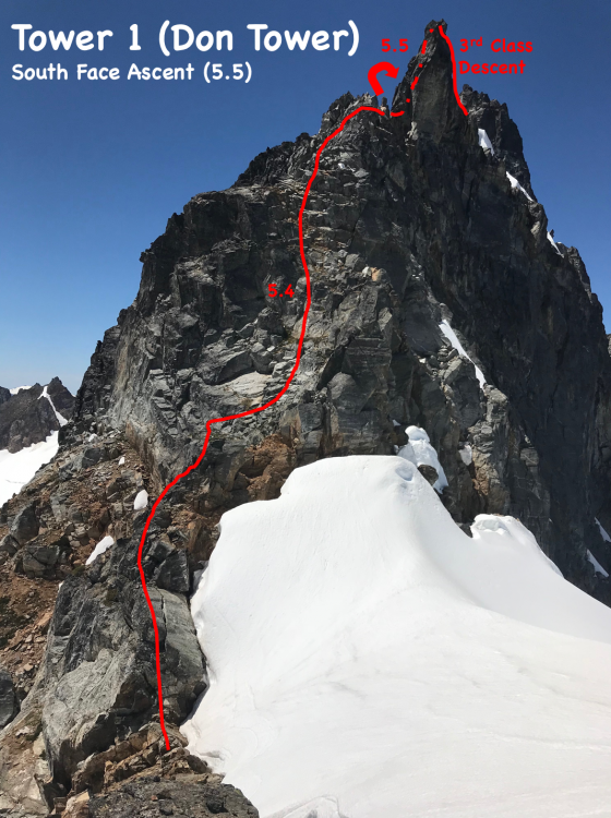
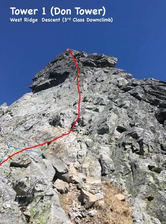
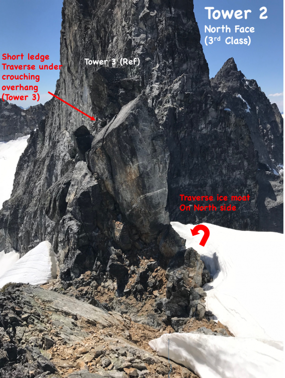
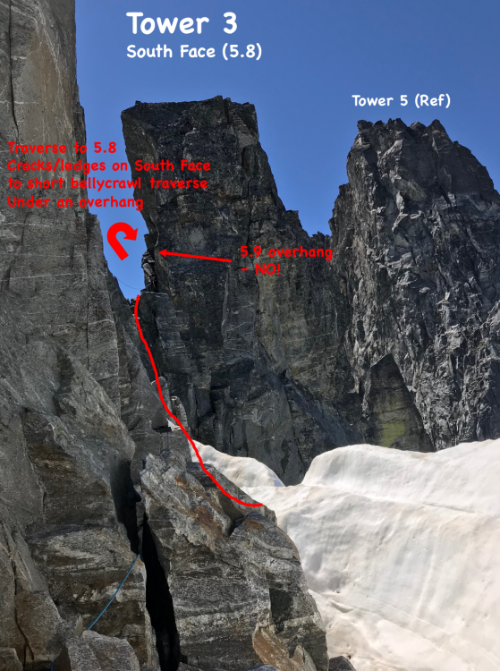
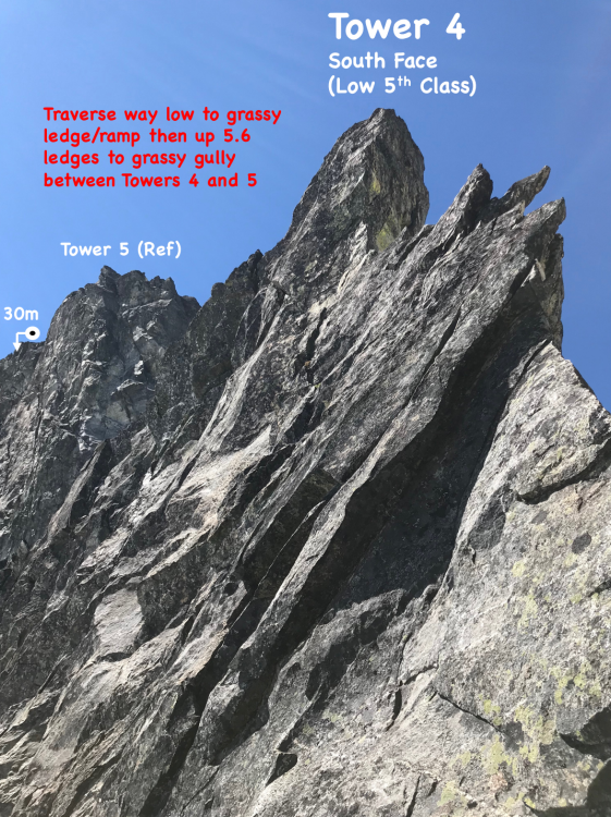
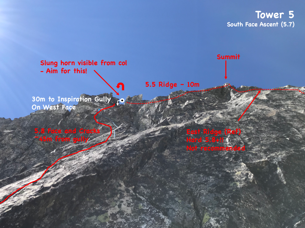
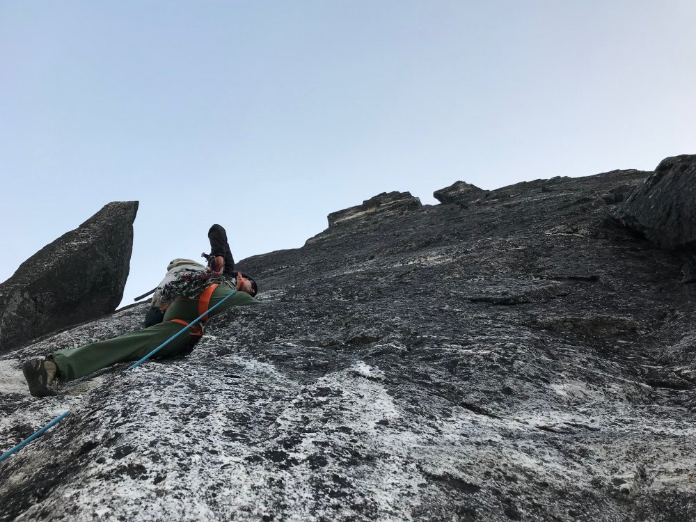
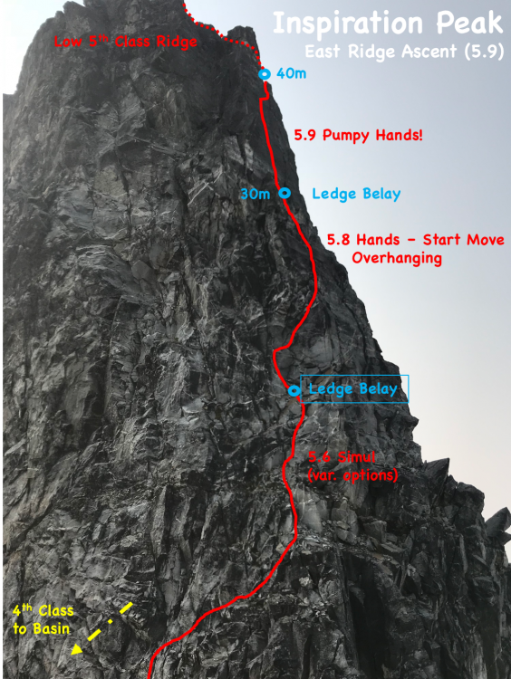
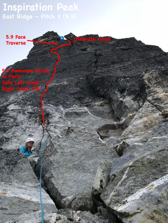
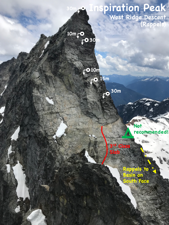
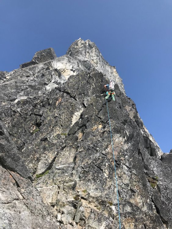
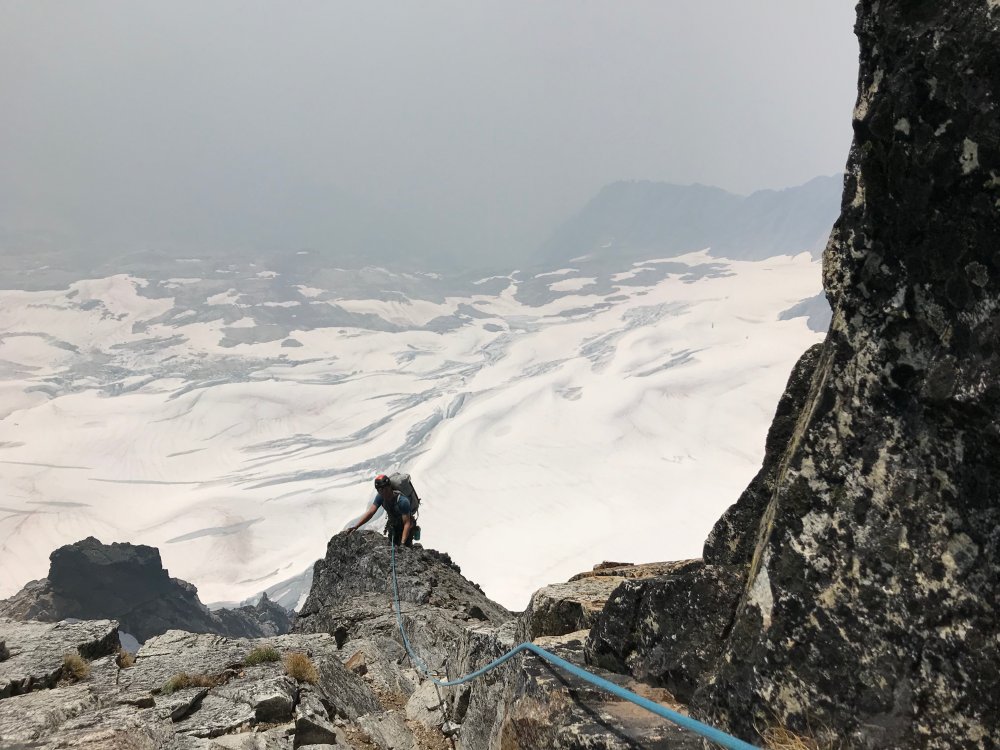
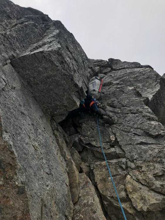
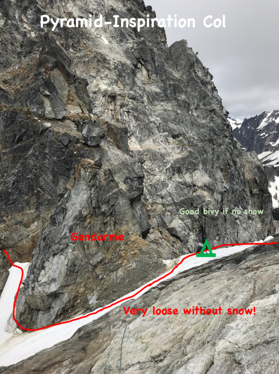
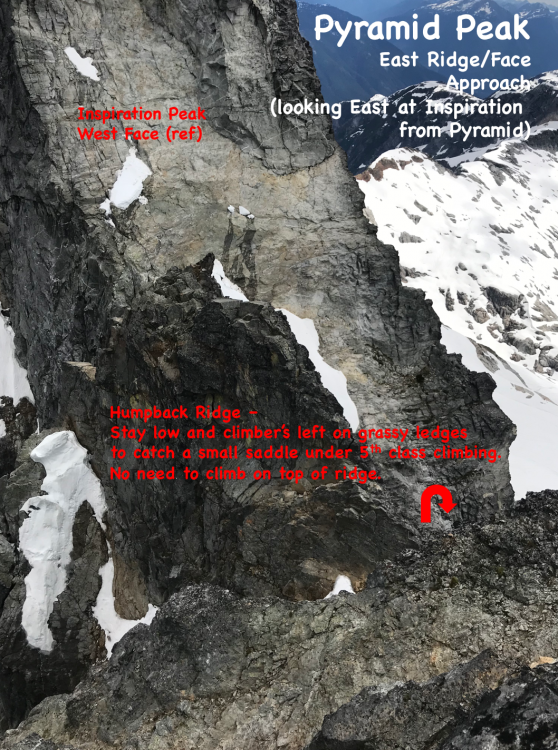
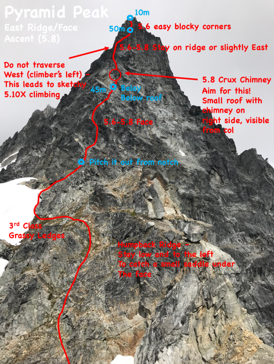
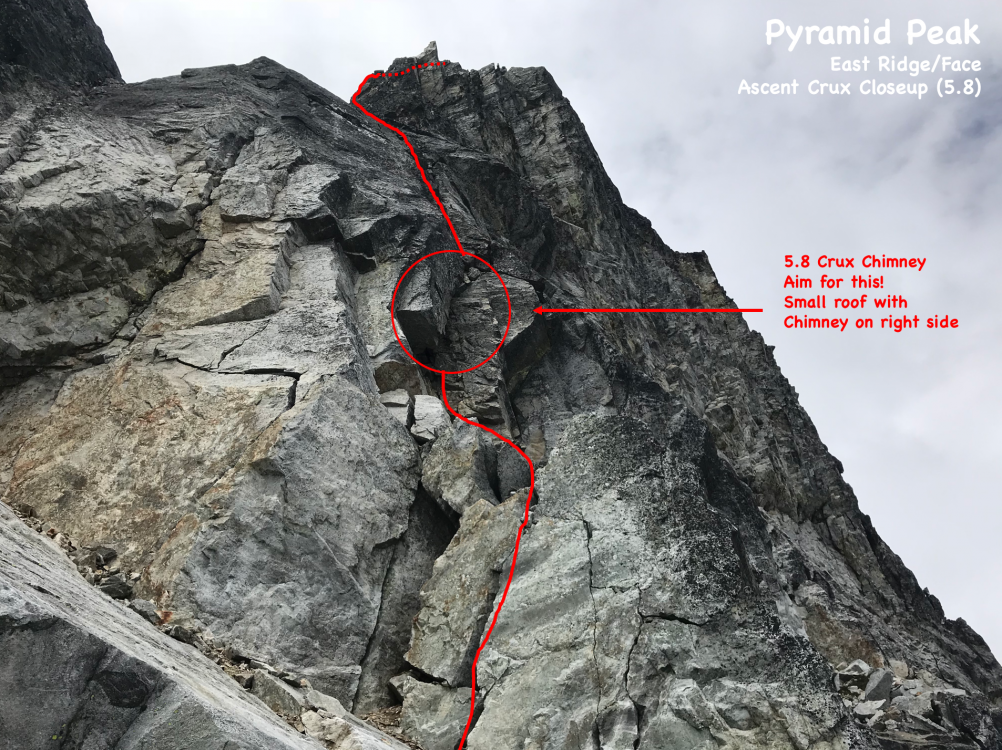
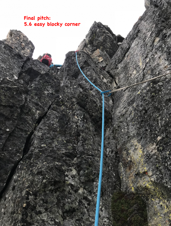
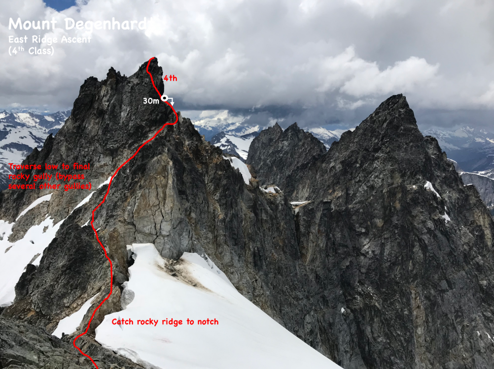
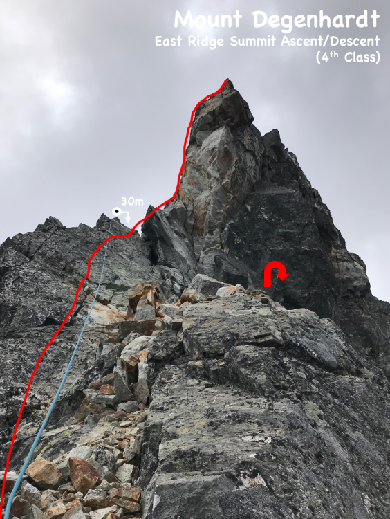
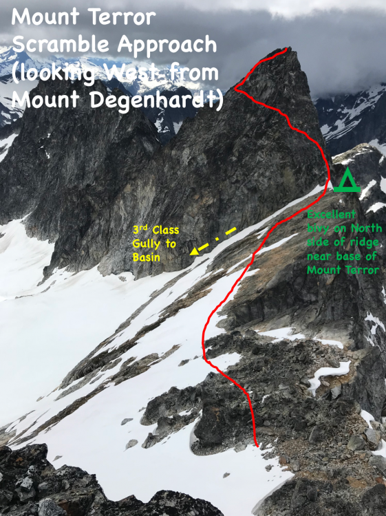
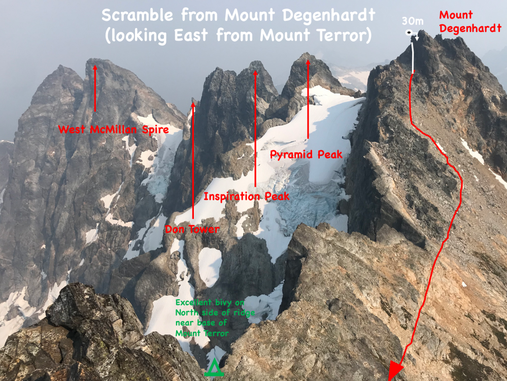
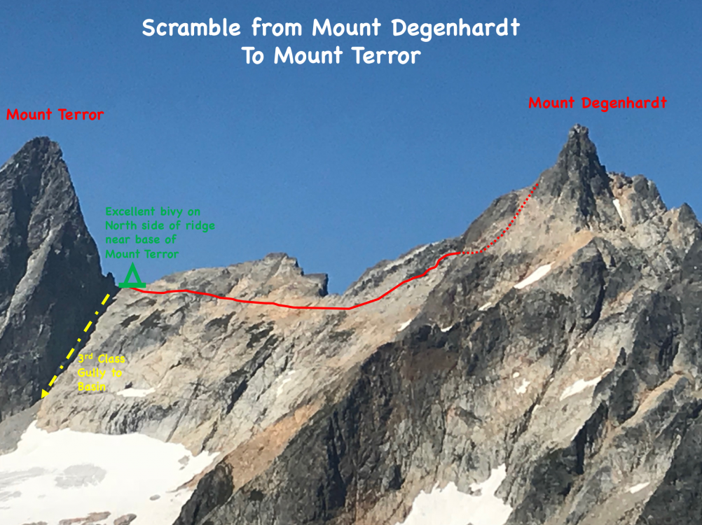
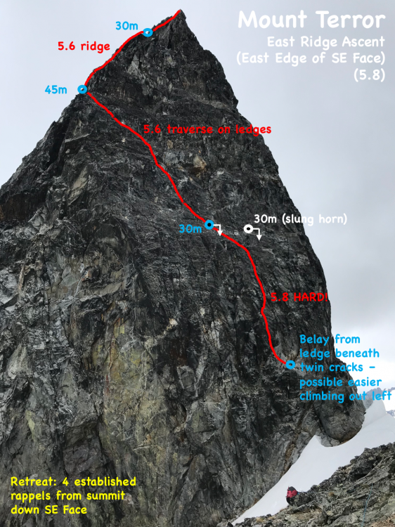
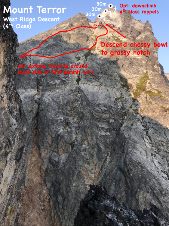
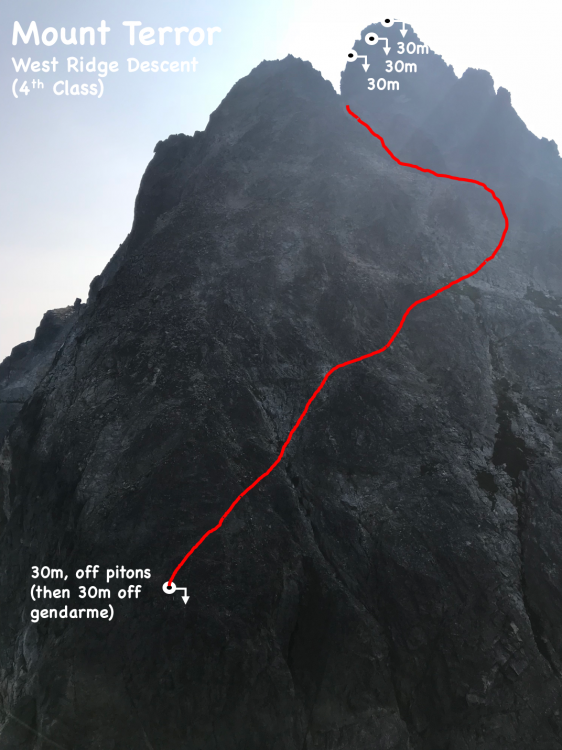
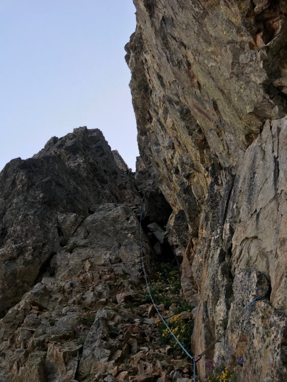
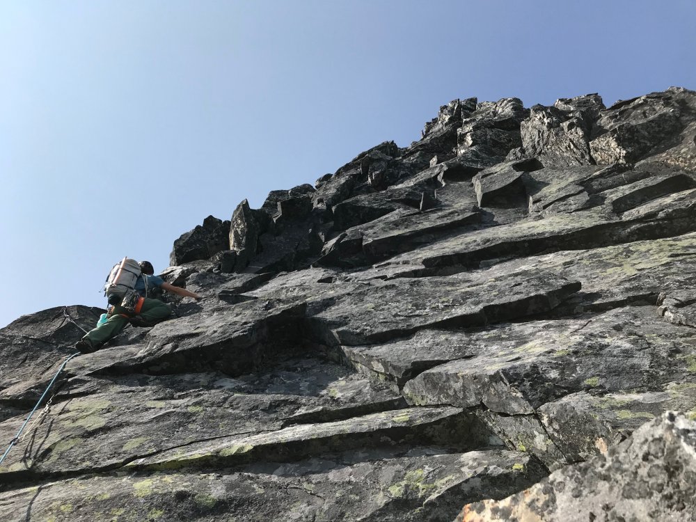
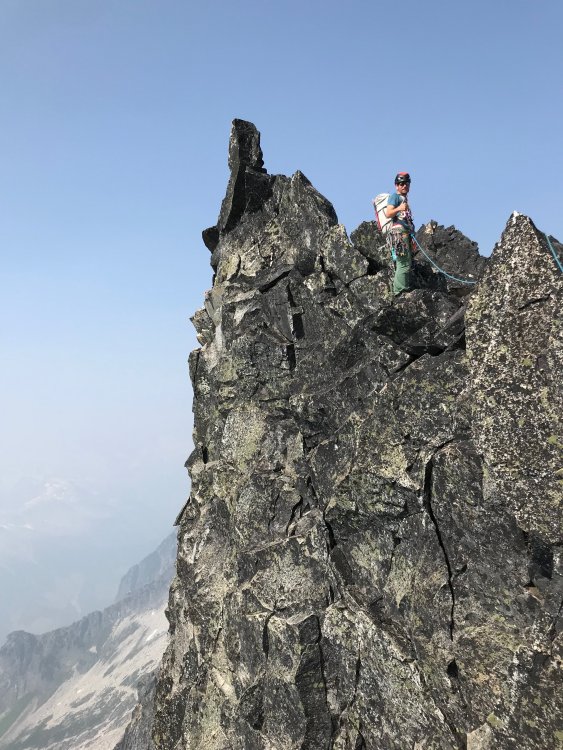
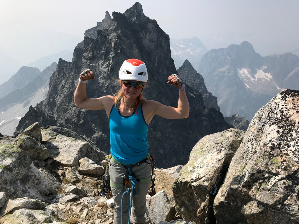
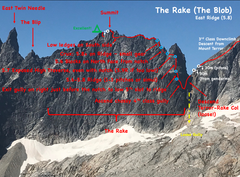
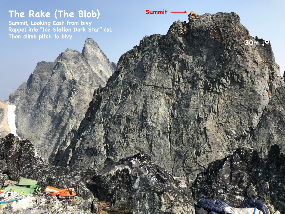
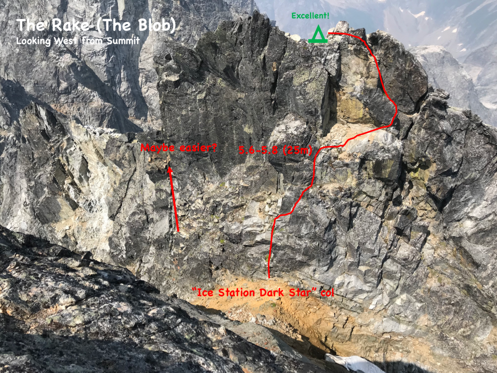
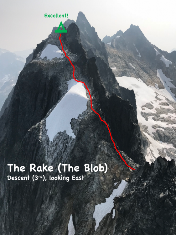
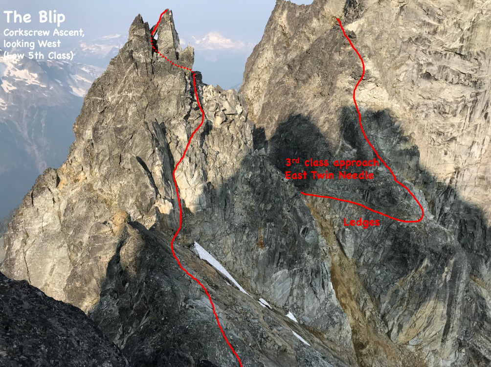
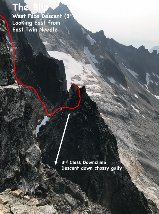
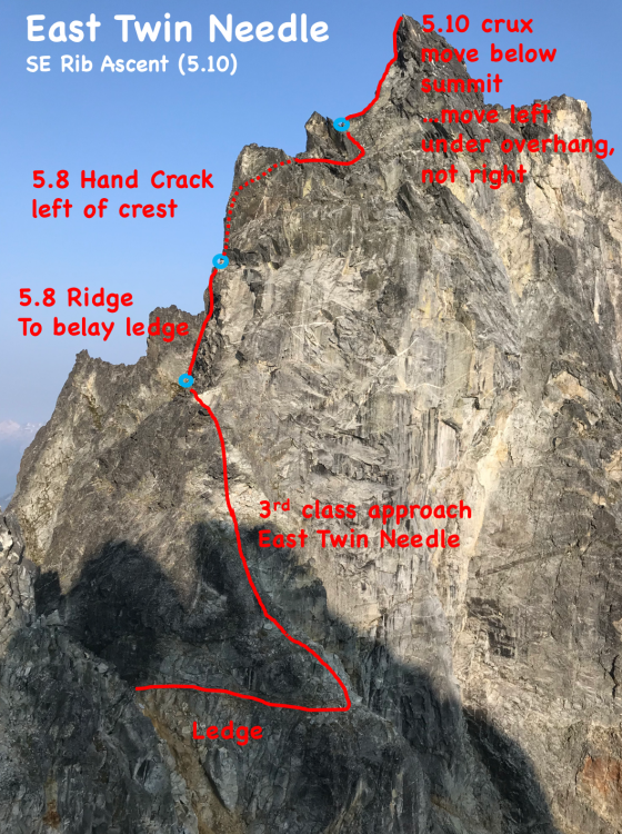
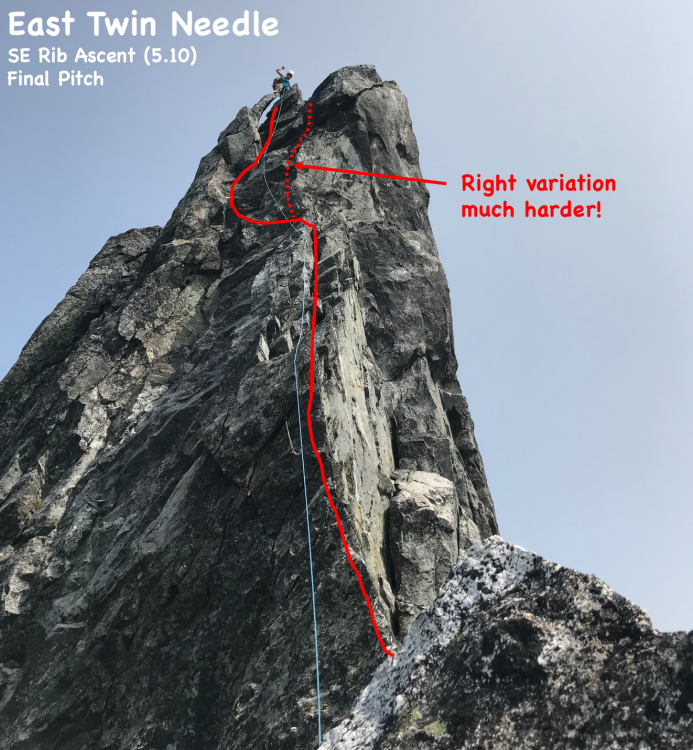
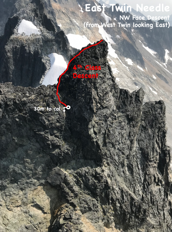
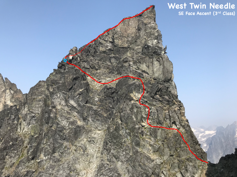
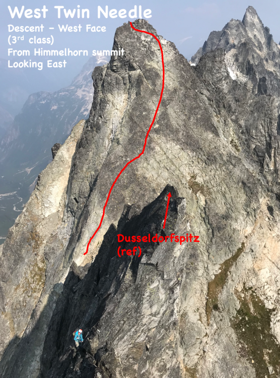
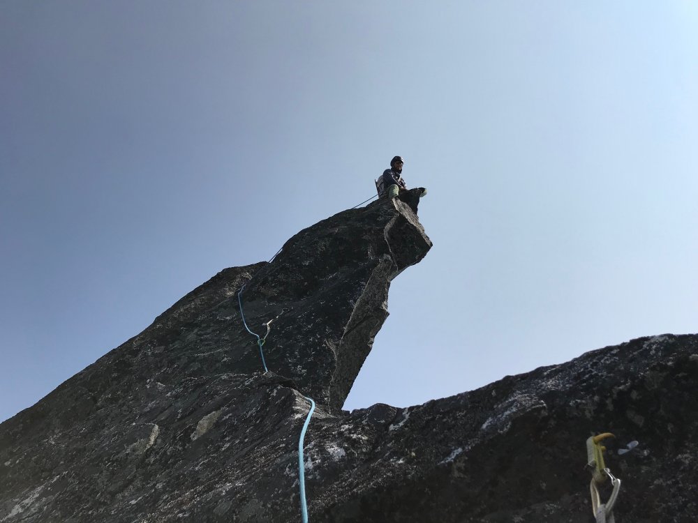
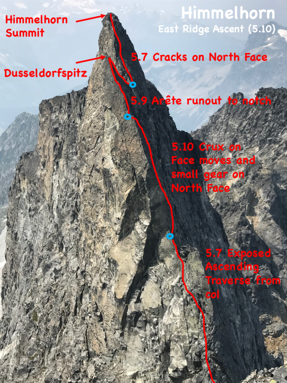
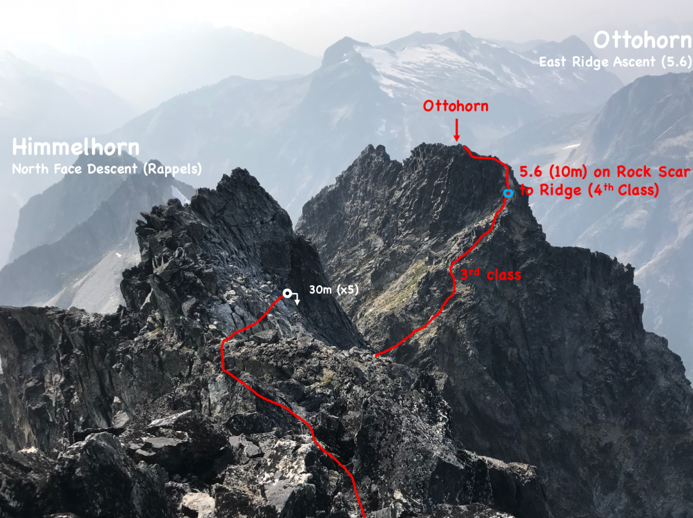
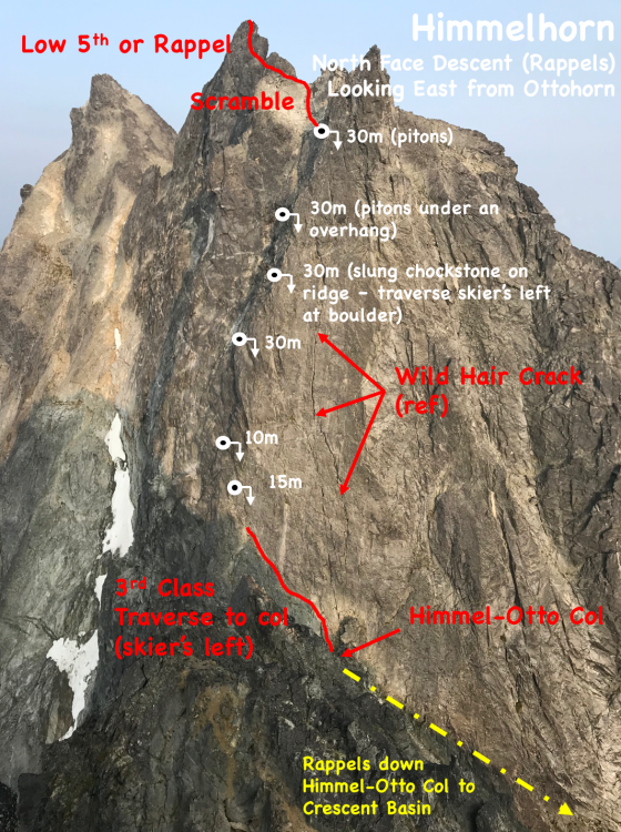
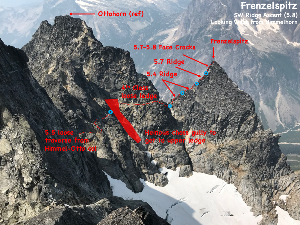
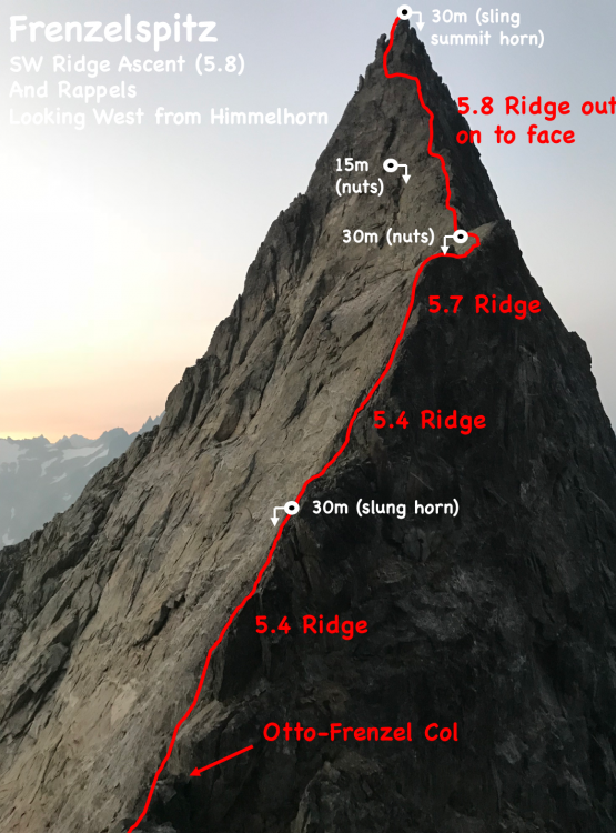
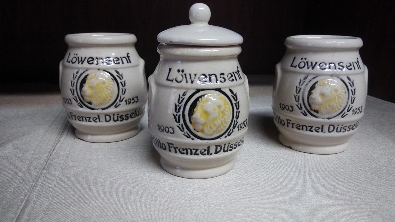
Trip: North Cascades - Southern Pickets - Southern Pickets Enchainment (Traverse) – Second Ascent Trip Date: 08/17/2018 Trip Report: Climbers/Scribe/Photos: Jeff and Priti Wright Priti and I completed the Second Ascent of the full Southern Pickets Enchainment (Traverse) between 8/12/2018 and 8/17/2018 via the first ascensionists’ agenda (VI 5.10+, ca. 3 miles). Thirteen peaks in four days staying on technical terrain enchaining every peak in the Southern Picket Range from East to West. The Chopping Block was our 14thpeak on the last day à la Bunker-Haley-Wallace. We were lucky to have splitter weather the whole time except for our approach day which was non-stop drizzling and kept us from jumping on the rock right away. We had previously attempted this climb during the July 4thweek earlier this summer but were stormed off at the base of Mount Terror. View of the entire Southern Pickets from Mount Triumph. Photo Credit: James Blackmon (1) Little Mac Spire, (2) East McMillan Spire, (3) West McMillan Spire, (4) Tower 1 summit of the East Towers aka "Don Tower", (5) Tower 5 summit of East Towers, (6) Inspiration Peak, (7) Pyramid Peak, (8) Mount Degenhardt, (9) Mount Terror, (10) The Rake aka "The Blob", (11) The Blip, (12) East Twin Needle, (13) West Twin Needle, (14) Dusseldorfspitz, (15) Himmelhorn, (16) Ottohorn, (17) Frenzelspitz, and (18) The Chopping Block The Chopping Block is on the left. History: FA: In 2003, this visionary line of 13 summits (Little Mac Spire to Frenzelspitz) was first completed by Mark Bunker, Colin Haley, and Wayne Wallace in an incredibly speedy 4 days car-to-car. http://c498469.r69.cf2.rackcdn.com/2004/34_wallace_pickets_aaj2004.pdf https://cascadeclimbers.com/forum/topic/15094-walking-the-fence/ 2011: Dan Hilden, Jens Holsten, and Sol Wertkin completed 12 of the Southern Pickets summits (Little Mac Spire to Ottohorn), but were halted by an impassable moat under the South Face of the final bookend peak, Frenzelspitz (a lesson we borrowed to not take the snow approach). https://www.outdoorresearch.com/blog/article/chad-kellogg-jens-holsten-tackle-complete-picket-range-enchainment http://www.alpinist.com/doc/web15s/wfeature-never-ending-holsten-kellogg https://cascadeclimbers.com/forum/topic/82900-tr-picket-range-complete-enchainment-attempt-922011/?tab=comments#comment-1029444 2013: Jens Holsten and Chad Kellogg traversed 11 of the Southern Pickets summits (Little Mac Spire to Himmelhorn), and carried on to the Northern Pickets to do a mind-blowing Southern and Northern Pickets traverse. Even though Jens humbly calls their climb an “attempt” since they left out three minor summits, their ascent was easily one of the greatest alpine achievements in the lower 48. https://cascadeclimbers.com/forum/topic/92032-they-made-it/?tab=comments#comment-1101276 http://jensholsten.blogspot.com/2013/07/desperate-country-seven-day-enchainment.html https://www.outdoorresearch.com/blog/article/chad-kellogg-jens-holsten-tackle-complete-picket-range-enchainment Legend In the topos below, note the following color codes -Blue circle: belays that we chose to take (all are optional, obviously) -Yellow arrows: Bail options, or ways to enter/exit shorter segments of the Enchainment -Green tent: bivy sites (note the comments) -Red lines: Ascent -White circles: Rappels -White lines: Descent Day 1 With our packs each weighing in at 28lbs, we hiked in to Terror Creek Basin via Goodell Creek through wet bushes and a light drizzle and bivied at the Terror Creek Basin High Camp. Day 2 As we roped up at the base of the start (Little Mac Spire) on Day 2, Priti glumly pulled two left-footed red Moccasym rock shoes out of her pack, but decided to keep going like the hardcore badass that she is! We climbed from Little Mac Spire (5.8) through East McMillan Spire (5.6), West McMillan Spire (5.8), the East Towers (5.8) summiting Don Tower and Tower 5, and finishing the day with Inspiration Peak (5.9). We had to climb up 1/3 of Pyramid to find a small snow patch for water and dinner. On our last trip in early July there was a lot of snow at the cols, so it was easy to find water. There was a lot less snow in the cols in August, making finding water along the traverse very tricky, to say the least. We filled our dromedary up every time we found snow. The smoke made the views hazy, but we could tell how far away the later peaks were, and how far we had to go. The base of Little Mac Spire The start of the technical climbing (5.7) on the face of Little Mac Spire The upper ridge of East McMillan Spire View looking West in July View looking West in August Upper face of West McMillan Spire Starting up Tower 1 Priti is belaying below Pitch 2 (5.8 with a hand/fist overhang) Inspiration Peak Summit is the impressive overhang on the left Day 3 On Tuesday (day 2 of climbing, day 3 of the trip), we started out on Pyramid (5.8), and traversed over Degenhardt (3rd class). We chose a steep face crack for the first pitch on Terror to start. This may be the 5.8 start Jens and Chad did. Starting further out left might go at 5.6. After finding the piton rappel off Terror, we downclimbed about half of the Rake-Terror col before starting up a loose gulley on The Rake (skier’s right). The climbing didn’t feel too hard, and we must have avoided the 5.9 R climbing described by previous parties. However we didn’t make it to the nice bivy at the summit, instead hunkering down on a slopey grassy ledge for the night. Snafflehounds poked me in the face and jumped on my feet to start the night out. The meteor shower sparkled above us. In the morning, Jeff found his helmet strap had been gnawed through, his crack gloves stolen and the nut butter munched. Nothing a little duct tape won’t fix! Starting up the technical climbing on Pyramid Peak Inside the crux chimney Day 4 On Wednesday (day 3 of climbing, day 4 of the trip), we only climbed for a few hours doing lots of fun ridge climbing on the Rake (5.8) which took us to the best bivy spot of the trip: on top of the West Rake Summit. It was so nice, we decided to relax the rest of the day and camel up for the next day. The choosy 4th class gully which exits the Terror-Rake col (about halfway down) on climber's right The entire Rake ridgeline is pictured here. Priti is on the initial ridgeline, heading to the Rake's deep, major notch (right of center). Stay high on this initial ridge to get to a 5.6 traverse about even with the notch to get over to the notch. Starting the traverse too soon may result in 5.9R climbing. The vertical ridgeline just left of the major notch is the technical crux. The technical crux of The Rake. This is the second pitch after getting to the major notch which takes you to the The Rake's ridge proper. 5.8+ ledges with small gear. Starting out on the Rake's ridge proper. Looking back at the Rake (Eastward) from the summit Guns out! Amazing bivy site! Don't stop at the col (aka "Ice Station Dark Star"), but continue to this bivy after a short pitch. Day 5 Thursday morning we woke up stoked for the Twin Needles and Himmelgeisterhorn. The Blip between the Rake and the Needles was a quick jaunt (5.6). In the descent gulley, Priti kicked a small rock down, which tipped a precarious car-door sized boulder over and core-shot our rope. She literally had two left feet! We just climbed the rest of the way with 40m of rope out. East Twin Needle (5.10a) had some of the best climbing on the trip, following an aesthetic line up the knife edge ridge, that looks like a gothic tower. There was a TCU that the previous party stuck behind a flake, and was reminded of the giant footsteps we were following. The last couple moves were extremely dirty though. The left variation of the crux is much easier than sticking right. West Twin Needle was chill 3rd Class. Then came Himmelgeisterhorn (5.10), the “Horn of the Sky Spirit”. The climbing was fantastic: engaging, with great position, and unique au chevaling! We climbed over Düsseldorfspitz, on the way to the summit of Himmelhorn. We rappelled down the North Face of Himmelhorn with our 60m rope which worked out perfectly. Ottohorn took about an hour to summit and get back down to the Himmel-Otto col. The 3rdclass route that Bunker-Haley-Wallace took is gone due to some fresh rock fall. Instead of taking the 2 pitch 5.7 variation that Hilden-Holsten-Wertkin took, we attacked the fresh rock scar directly which was splitter 5.6 hand cracks for maybe 15 m to the ridge and summit. In the fading light, we then headed over to Frenzelspitz (the final peak of the Enchainment) from the Himmel-Otto col, traversing along rock on the north side of Ottohorn. The ledge/gulley traverse had the most heinous, scary, exposed choss. Luckily the climbing on Frenzel was pretty great 5.7ish. We made four fresh rappel anchors, starting with a runner on the summit block, two double-nut anchors, and another slung horn. 5.8 ridge (vertical blocks) The fantastic climbing on the technical crux of East Twin Needle. Priti leading out onto the technical crux (and I mean technical!) - face climbing on crimps with small gear Looking up and over Dusseldorfspitz. Priti is belaying between Dusseldorfspitz (foreground) and Himmelhorn (background). The crazy outcropping (Dusseldorfspitz) just East of the summit of Himmelhorn Looking back down from the Himmelhorn summit at the belay. Left to right: Dusseldorfspitz (the small spire along the ridgeline, just below the summit), Himmelgeisterhorn ("Horn of the Sky Spirit", also a small suberb of the German city of Dusseldorf), Ottohorn, and Frenzelspitz...three names taken from the label of a mustard bottle brought along by Joan and Joe Firey (kindred spirits and personal heroes of ours) during their first ascent of these peaks in 1961. Ed Cooper, also on the trip, was "aghast" at the names chosen! The magnificent Northern Pickets Frenzelspitz, a perfect pyramid Day 6 The last day we climbed the Chopping Block via the NW Route (4thClass) and hiked out via “Stump Hollow” to Terror Creek. Mega thanks to Wayne, @solwertkin, and @jensholsten for their great beta, inspiration, and support. Priti and I have been dreaming of this climb for years now since reading Alpinist 47 magazine’s expansive article on the Picket Range and being inspired by Jens Holsten and Chad Kellogg’s 2013 Pickets Traverse (of both the Southern and Northern Pickets, 10 miles) after we had just taken the @boealps Basic Climbing Class. The next level of alpinism in the Southern Pickets may be to complete the entire enchainment in a day! This seems like an entirely reasonable feat (especially for a soloist) given enough familiarity and speed. Bivy Beta: Primo bivies (East to West) base of West McMillan Spire descent (snow through the summer, nice bivy walls) base of Mount Terror, cross over ridge to North side - late season snow available on top of the Rake sub-peak (1 pitch past the “Ice Station Dark Star”) – lots of snow just a short scramble distance away along the Rake descent. Himmel-Otto col (if no snow on the col, make one rappel toward Crescent basin to find snow) Terrible bivies (East to West) base of East McMillan Spire descent (sloping ledges, snow early season) slabby ledge about 1/4 the way up the Inspiration West Ridge (exposed) Pyramid-Inspiration col (no snow late season) grassy ledges down and climbers left when you first gain the ridge proper at the start of the Rake “Ice Station Dark Star” (as coined by Hilden-Holsten-Wertkin) which is the col after just rappelling from The Rake summit (snow early season, but rappel north late season to find snow down a heinous choss gully)…if no snow just at the col, then recommend continuing on to the Rake descent to find tons of easily accessible snow in late season Himmelhorn summit (no snow) Gear Notes: small set of nuts and some brassies doubles BD UL Camalots .4-2 single BD UL Camalot 3 (for Inspiration East Face) singles BD C3 000-1 (extra green 0) single BD Camalot X4 Offset 0.1/0.2 single BD Camalot X4 0.3 singles Metolius Mastercam 0-3 4 double-length runners with 2 Camp 22 biners each 3 double-length runners with 1 Camp 22 biner each 9 single-length runners with 1 Camp 22 biner each (can’t have too many runners) 30L Patagonia Ascensionist pack (for him) and 30L Black Diamond Speed pack (for her) Patagonia Micro Puff jacket (each) Patagonia Alpine Houdini jacket (each) Patgaonia Nano-Air Light Hybrid Jacket (for him) 2L MSR DromLite (essential!) Garmin inReach Mini (love this little guy!) Beal Escaper (for emergency bails) Petzl Leopard FL crampons (each) Petzl Sirocco helmets Petzl Sitta harness (for him) and Arc’teryx harness (for her) Metolius Feather Nut Tool (each) Camp Corsa Nanotech 50cm (each) chalk bag, each (didn’t use) tape gloves (for her) and OR Splitter gloves (for him) x2: Mammut Smart belay device (not the Alpine Smart) + Grivel Sigma Wire D carabiner 3 lockers for group: Grivel Tau K12L, Grivel Lambda HMS, Grivel Plume 60m 8.5mm Beal Opera rope 15m 5mm cord (did not use ever) 1 medium fuel canister 1 small fuel canister (did not use) Jetboil Sol stove Safety ‘biner (each) – Edelrid 19g caribeener, Petzl Micro Traxion, short Sterling Hollowblock, Trango Piranha knife Bivy setup (each) – Short Thermarest NeoAir XLite sleeping pad, Exped Air Pillow UL, Feathered Friends Vireo UL sleeping bag 8.5ft^2 tarp by Hyperlite Mountain Gear TC Pros (for him) and Moccassyms (for her) La Sportiva TX2 (for her) and TX4 (for him) approach shoes Petzl Reactik headlamps (each) + 3 extra AAA batteries + Petzl e+LITE headlamp Other things: 1 long spoon to share, chapstick to share, small Joshua Tree sun stick to share, Kenu iPhone tether, lighter, whistle, duct tape, Thermarest repair patches, Voke tabs, Nuun, pain killers, 1L Platypus soft water bottle (for her) and 750mL HydraPak Stash (for him), warm headband, glove liners, 1 pair thick long socks (each), sunglasses, ear plugs, WRFA emergency form, small pencil Dinner: 2 AlpineAire meals, 3 Near East Couscous boxes repackaged with small olive oil packets in ziplock bags, salt Day food was mostly bulky, yummy snacks: vegan jerky, dried mango, nuts, Cheese-Its, sesame sticks, Gu, nut butter, etc Approach Notes: Excellent Approach trail Goodell Creek to Terror Basin. The descent from Crescent Basin is tricky The luxurious tree marker where one descends from the ridge below "Stump Hollow" towards Terror Creek Log crossing Terror Creek on descent1 point
-
TR of the year!! Wow. Like Darin, I want to know about the aftermath of the car situation. That is absolutely insane.1 point
-
Wow! Thanks for the report. It falls into a special category of writing because it gives us a window into your minds and hearts. I see parts of myself in the mirror of your words and photos. In the earliest days of my climbing I told myself I wasn't willing to die climbing. I only climbed rocks and never free soloed, so it seemed safe, but over the years I still found myself in more than a few 'if you screw up you die' moments. In the Pacific Northwest, I learned that mountains harbor a lot more of those moments than cragging cliffs, and some are not easy to appreciate until you're in them. My risk tolerance changed when I became a parent but not a huge amount. I've been a dad for over a decade now. I still love alpine climbing, but there are lots of other things I love too. My partners and I recognize that every time we go into the mountains we are rolling the dice. We prepare, we stay on our toes, we talk things through, and sometimes we back off, but we recognize that you can do everything right and still die in the mountains. I'm blown away that Fred climbed for about seventy years without a major accident. I don't expect to be that lucky, and I know my abilities and risk tolerance will continue their downward trend. And yet, I still have alpine dreams and try to get out into the mountains every year. I'm guessing you will too. Thanks again. Cheers, Rad Edit: Ps. The part about your car is disturbing. I'm so sorry. Some humans suck. Karma will get them.1 point
-
So.....that’s a great fucking trip report......Jesus.....tell us more about the car! Insurance going to cover it? A now permanent fixture? Or are you in the hook to get it removed? glad you made it home safely, that gully approach is NOT daddy terrain.1 point
-
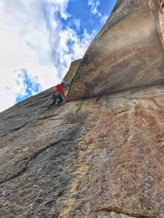
Trip: Early Morning Spire - Southwest Face Trip Date: 08/18/2018 Trip Report: David and I are masochists who love alpine adventures. We don't get many opportunities to get out into the mountains so we try to make them count. We left Seattle after work, got back country permits in Marblemount, found a great campsite near the Eldorado approach trail, sorted gear, went to bed at a reasonable hour. The next morning we started at 6am, which is late by our standards, but our goal was just to get in position for a big second day and to scout out the glacier approach we'd do in the dark the following morning. David was hoping to catch a flight 48 hours later. We crossed the river on logs and easily found the trail. It goes straight up through dusty forest, big talus, and lush meadows filled with wildflowers before bursting into the alpine. There is no water available until high in the talus. Everything is snow-free until you reach the glacier. We would gain about 5500 feet in ~4 miles, but great conversation distracted us from the effort. A cliff band runs along the West side of the steep talus and meadows. The talus field and meadows were smoky but still pretty. . Johannesberg in the smoke. Wild flowers and waterfalls made good excuses to stop for a few seconds to enjoy the alpine ambience. The small waterfall where the shot below was taken is the first water source you encounter when ascending late season. It's near the top of the talus. This waterfall is a little upstream of the smaller waterfall in the photo above. We crossed over to the Eldorado drainage, dropped down to glacier-polished slabs and made our way up onto the Eldorado Glacier, the first of five glaciers we would cross in two days. There were a few crevasses, but these were all open and obvious and we never broke out the rope. We only encountered one other party on the glacier. Eldorado from the South. We reached the campsites at the base of the E Ridge of Eldorado and dropped our packs. Our next goal was to scout out the approach to the Dorado Col as we planned to cover this ground in the dark the following morning. Crossing the Inspiration and McAllister Glaciers to the Col was pretty straightforward. Towers on the upper Inspiration Glacier. Crevasses on the lower Inspiration Glacier. We didn't go anywhere near these. Murder scene? Nope. Algae. The snow worms love it, and no, it does NOT taste like watermelon! Don't ask how I know. Old and new fractures in granite. Glacier Pass It was smoky, but the views of Forbidden, Torment, Boston, Sahale, and other peaks were still jaw-dropping. We didn't encounter any major obstacles on the glaciers and never used the rope. The biggest question for our trip was how we would get down off the summit the following day. There were multiple accounts that seemed to contradict each other. We talked through all the options several times and tried to envision where we would come back to the McAllister Glacier. As we retraced our steps back to camp, we laid down a GPS track we could follow the next morning. We had originally thought about tagging the summit of Eldorado, only 1300 feet above us via snow, but I'd been up there before and wanted to save my energy for the following day. David didn't feel like going up either. During dinner, we continued our discussion of descent options, and this culminated in me using rocks and drawings in the dirt to build a 3D map of our approach, route, and each of the descent options. We sorted gear and settled in for the night as soon as it was dark. Note the evil tricams. Easily placed by the leader (4 in one pitch, mind you), but they take two hands and a nut tool to clean if set properly (guess who had to clean those four tricams!). Best to leave those clanky beasts at home. Temps were mild, the air was calm, there were no bugs, and surprisingly no rodents raided our bivy spots. We lay out under the stars for a few hours. As is typical for me before big alpine outings, I found myself running through our plans for the approach, route, and descent before drifting off to sleep. We slept a few hours and left camp shortly before 4am. The snow worms were out at night. David had never seen them before. I told him they taste like watermelon Night ops. Crossing the glaciers was quick and easy and we arrived at the Dorado Col at first light. We scrambled down loose scree, hopped onto an unnamed glacier, and descended. This is a shot looking back up at Dorado Col (left edge) from the unnamed glacier on the approach. Eldo is out of frame up and right. This small lake at the toe of the glacier is where you start the traverse to the North at about 6100. The traverse starts on a bench and this fades into a moderate slope. We crossed into the trees and traversed to the snow below the Early Morning Spire. There was plenty of water at the lower elevations to drink and fill our bottles. We ascended snow to the base of the route, which is on the upper rock face here. The obvious vertical crack in the center of this image is where pitches 2-5 run. We started on the crack about 70 feet to the left that angles up and right about 45 degrees before joining the main crack. I belayed David as he stepped across the 50+ foot deep moat between snow and rock. I changed into my rock shoes, crossed the moat, grabbed the rack, and led off on the first pitch. This is a shot looking back down the snow approach. The upper portion was about 35 degrees. David led the second pitch, which included a vertical 5.8 section with nice features. The rock was clean and solid. I led pitch 3, which was physical because I kept placing the #3, climbing up to place another piece, climbing down to clean the #3, continuing higher, placing the #3, placing another piece, cleaning the #3, and so forth. I probably climbed up and down the first 40 feet of the pitch at least twice before getting to the crux roof. Thankfully, there is a jug right where you want it and the troubles are over quickly. The #3 was indeed the key piece to protect the roof moves, so I was glad to have it. Above the roof there was a mossy 8 inch crack above that looked unpleasant. I headed 20 feet right to the splitter crack below that angled back left and climbed that instead. It was nice. I did a mossy mantle and scrambled up a face to some large blocks (maybe 180 feet for this pitch?). Towers to the South. David led pitch 4, a rope-stretcher that the book said was 5.6. At the crux, you had to stem between a vertical wall and a steep slab with few features, jam your fingers into an undercling, and reach for a hold at the lip of a 4 foot roof. Felt hard for 5.6, but it was fun, well-protected, and we didn't fall. I then led a full rope length P5 up ledgy broken terrain, looking for the 4th class ledges leading to the right. David took the sharp end for P6. He wandered off to the right, looking for the lost ledge, and then came back and climbed straight up next to a dark gray dike pictured below. About a hundred feet above me he stopped. "David, the crack above you looks steep and vegetated." "Yes". "Is it protectable?" "No" "OK, then I'm not leading it". Do NOT go straight up from the top of P5. David did an aborted lead and had to downclimb. It looked like it would be a long and ugly retreat from our position. Surely that was a last resort. David down-climbed the entire pitch next to the black dike back to me and we swapped leads. Hoping to go up rather than down, I channelled my alpine mindset and asked where I would go if I were heading up from here. There: a crack behind a flake that seemed solid and looked like it might lead to lower angle terrain above. I decided to try it. Given David's experience, I placed a fair amount of gear so I'd be protected in the event I had to down climb the entire pitch. But this was exactly the passage we needed. The rock was clean, protectable, moderate, and 5.fun. It may have started with 3rd/4th class, but it was not the 4th class section described in the guides. This pitch 6 led to a large ledge consistent with the 4th class rightward traverse described in the guides. We were back on track. We were going to make it to the top. For me, the best climbs are ones where the outcome is in doubt. There is typically a turning point where you realize you're going to succeed. This was it. For those of you coming this way, 50 feet right of the vertical dark gray dike in the photo above you'll find the overlap and a flake above its right edge seen in the photo below. THIS IS WHAT YOU WANT. It leads to the 4th class ledge mentioned in guides. Follow that up and right to the base of steep cracks. We chose the left-most crack, a vertical hand crack just left of a left-facing corner. This is very short and could be linked with p8, though that would be less fun. David then led an amazing thin rightward traverse on excellent finger ledges and small but good footholds on a steep slap (a joy!). This eventually reaches an engaging move off the slab into a scoop with a crack. Follow that straight up 20 feet and then move right to a belay just right of the ridge crest. There was another crack higher on this slab but it looked licheny and less fun. We were doing well, but it was already 6pm. The summit was several pitches above us and a long descent and return to the car still loomed over us. Our hopes of covering all that ground in 13 hours was slim, but life was good. One step at a time. Eldorado from the North. I led a full rope length up solid blocks and cracks on the crest. David led another rope stretcher, and then I led the final pitch to the summit. In all, it was three long 60m rope pitches between where we joined the ridgecrest and the summit. Some parties may wish to simulclimb this section. The final few hundred feet was spectacular, with the headwall dropping away to the West, exposure to the East, and solid rock and large blocks to follow on the crest. We arrived at the summit at 7pm and got our first glimpse of the Marble Creek Glacier we might have to cross. The sun was sinking into the smoke, and we still had a long way to go. Did I mention that David had a flight out of Seatac at 7am the following morning? There was no way he was going to make that, but he wanted to be in cell service by 6:45 so he could change his flight without a penalty, so I popped a caffeine pill and we started on the descent. We scrambled down to the East and looked around until we found the rap station on the North side of the formation a few hundred feet down from the summit. A single rap brought us down onto the Marble Creek Glacier. The sun had disappeared into the smoky haze and we knew that darkness would soon be upon us. It would be hard to cross new glaciers in the dark because you can't see far enough to choose the right path through the crevasses. We moved with a sense of urgency in the fading light. Our first choice descent route was to get onto the glacier remnant South of the Marble Creek Glacier and retrace our steps back to the Dorado Col via the red line above. We didn't know if that was feasible. Some parties said it looked too ugly to attempt. David went to check it out. Meanwhile, I went to scope out our second option, which was to make our way North across the Marble Creek Glacier to a notch that would lead to the McAllister Glacier. This would likely involve a long slog through heavily crevasses terrain followed by fifth class climbing on unknown terrain, one or more rappels down to the McAllister Glacier, and a long traverse between large crevasses on a glacier we'd photographed from a distance. I've found photos can be valuable navigational aids in the dark. But first we needed to work out how to get across the upper Marble Creek glacier. The key was passing through several large crevasses. Maybe if we walk from the left onto that ridge in the middle... While David explored option #1, I carefully descended onto the ridge in question. It ran out between two giant crevasses and got narrower and narrower. The top was flat, but it was about 18 inches wide and a slip in either direction would be bad. The whole thing looked like a snow-covered freight train frozen in mid-flight as it shot off the track and rolled off the mountain. I'm calling it the Crazy Train. Here is the start of it. I knew the snow under my feet hid thousands of tons of glacial ice. Surely, my additional weight wasn't going to send the train calving off down the slope, but I didn't want to linger. We could go this way, but it wouldn't be fun. We'd have to walk out to a point near the end of the train, rappel off a piece of webbing I'd just buried in the snow, likely with me going first with David's belay as a backup. I would get down 25 feet to a sloping area between crevasses and belay David as he down-climbed or rappelled down steep snow above a gaping crevasse. If the upper snow anchor failed I'd have to catch David with my ax anchor or we'd both end up in a large crevasse. I was visualizing and planning this as the sun was setting somewhere behind the smoke to the West. This is about where I set up the buried sling anchor Then I heard a voice up above me: "Rad!" "Yes?" "It goes!" David had found the anchors that would take us down our first choice gully to the glacier that led back to our approach. Phew. We gathered the rope, headed over, and rigged the first rappel. The gully wasn't pretty, with running water, brown muck, and a river of small and large stones that moved with every step. David said it was the ugliest gully he's seen, but it wasn't steep enough to be dangerous. The West gully of Inspiration in the Pickets is still the worst gully I've had to descend, but that's another story. We made it to an intermediate anchor on the right wall and stood on a tower of cemented mud and rock. The water cascaded into a hole at our feet of unknown depth. I imagined when we pulled the rope it might catch on some blocks so I tossed a few into the hole. They clattered into the abyss and we could hear them come crashing out under the snowy moat below us. David had said he's seen light near the bottom of the hole, confirming that it was open at the base. I wouldn't want to have to go through there. I'm calling it the Pit of Despair. I closed my eyes and clicked my ruby slippers together, "There's no place like sport climbing, there's no place like sport climbing." But when I opened my eyes I was still standing on a pile of choss above a moat in the gathering darkness deep in the mountains. I rappelled down into the moat and this is where I had my most exciting moment of the day. The top of the glacial remnant was shaped like a ship's prow, with a wall 6-8 ft high that would need to be scaled. It was separated from the rock by a 10 foot wide moat. Inside the moat was a pathetic and putrid pile of loose pebbles running with water. They sloped down toward a dark overhang under the rock I'd just descended. As I got to their height, I had to spring over to land precariously on them. I perched on the pitiful pebbles, which crumbled and rolled away under my feet, threatening to toss me into the void. I was on the rope, but if I slipped I'd swing under the overhang. From there, I'd likely have to rappel into the darkness and try to climb out using the rope. I didn't want to think about that scenario. Instead, I focused on a small ledge in the snow about ten feet from me. That could be my path to freedom, but first I had to get there. I pulled an armful of rope through my belay device, planted a foot on what appeared to be a solid foot hold, and leaned over toward the pebbly patch below the ledge. The prow refused to let me pass. It overhung above me and pressed me out into the void. I had to crouch low and spring like a desperate animal toward the sacred solid ground, simultaneously hunching over my torso and lifting my legs in a hurdler's lunge. But I crashed into the icy bulge and came up short. I paddled my feet and wormed on my elbow through the muddy pebbles. Blood ran down my forearm where I'd gouged it on something sharp, and a muddy slurry ran through the wound and down several parts of my clothing, but I'd made it. Sometimes climbing feels like one part ballet and two parts MMA. I stuck my ax into the frozen prow, high stepped up onto the snow ledge with my cramponed boot, and threw my body up onto the snowy apex of the unnamed glacier. Safe. Now we had to cross the glacial remnant below the Pit of Despair back to our approach route. We headed skier's left in the photo below to the rock and were able to get back without incident. We scrambled down a waterfall through boulders and made it onto the snow, passing the last of our unknown obstacles. From here on out we would be on familiar ground. At this point it was 11pm, and we weren't done yet. We had to ascend a thousand vertical feet to the Dorado Col, cross the McAllister, Inspiration, and Eldorado Glaciers, and descend a vertical mile to the car. I was pretty spent and knew I'd go too slowly for us to get back in time for David to change his flight. On a trip a few years ago, I paid David $20 to carry both the rope and the rack on our descent. It was well worth it for both of us, and my knees were thankful for the break. This time, our descent would be much more physical and our packs would be heavier. So we struck a similar deal. David carried the rope and rack. He would later carry much more... .We thought if we made it to the car by 5:30am we'd have a fighting chance to get to cell service by 6:30. And that was the stretch goal we needed to push us into overdrive. We made it to the Dorado Col by 11:40pm. We crossed the glaciers and made it back to our camp at 12:40 AM, where we ate, drank, and sorted the gear. David stuffed as many heavy items into his pack as possible, and I took everything else. We estimated that David's pack weighed about 60 pounds while mine was closer to 20-25. David was glad for the extra challenge, my spine and knees were glad to have less weight, my ego was not a factor, and I was glad to make a contribution to the climbing fund. We started across the Eldorado Glacier at 1:40am. The glacier gave way to snow slopes, then to polished granite slabs, then to the jumbled lateral moraine. We had just one steep uphill scramble to gain the notch between drainages, and then we were back in the meadows West of Mount Torment. We nearly bumped into two deer in the meadows that acted like deer in the headlights - literally - they stood still, starting at our lights until we were almost on top of them. Finally, they sauntered off into the night. Moths flew up in my face, drawn to the luminous moon of my headlamp that seemed to float through the meadow. We passed a group of 6 sleeping out in the meadows - illegal and lame. We danced from stone to stone down the talus and tried not to stir up the dust in the forest. On the last stretch, we passed a pair of climbers ascending in the dark on their own alpine adventure. We arrived at the log crossing at 5:01am, well ahead of our 5:30am target, having descended 5500 feet over 4 miles in 3 hours and 40 minutes. The reward I'd been anticipating was at hand. I quickly stripped off my boots, removed all electronics, and plunged into the river fully clothed. It felt so good. Fine silt squished between my toes. I waded out to where the river ran swiftly over polished stones. Heaven. David slumped on the log in near delirium, having kept is heart rate aerobic for nearly four hours on a treacherous trail trying valiantly to keep up with me. In our parlance, it was civil twilight, the time before sunrise when you can walk without a headlamp. We crossed the logs together, David with a heavy beast on his back, me barefoot and refreshed. I stripped off my wet clothes, put on fresh clothes, and we zipped down to Marblemount, arriving around 6am. Thankfully, David had cell reception. He called Southwest and changed his flight. No fees. I had ice cream and Tim's Jalapeno chips for breakfast and opted for V8 instead of beer for fear the latter would put me to sleep. We drove home feeling dead but very much alive. Gear Notes: Doubles to #2 Camalot, single #3 Camalot. Single 60 meter 9.2 rope, ax, crampons. Leave the tricams at home Approach Notes: Climber's trail to the E Ridge of Eldorado, cross Inspiration to McAllister Glacier to Dorado Col. Descend to an obvious bench around 6000 feet. Traverse right, cross a short bit of forest, cross talus, then ascend a snow tongue to the base of the route. Day 1: Ascend 5500 feet in just over 4 miles on the climber's trail to the camp at the base of the E Ridge of Eldorado (red line). There was running water, a toilet (in rocks SE of tent sites), and tent/bivy sites. We scouted the approach across the Inspiration and McAllister Glaciers to Dorado Col (purple). Day 2: we crossed the glaciers on the purple track in the dark, descended and traversed to the base of the route (blue), climbed the route (green), and descended (red) before retracing our steps back to Dorado Col. To descend, we followed the red line in the image below. We made our way to a rap station on a ledge on the North side of the summit buttress. We made a single rope rappel (left red arrow below) from this station to the Marble Creek Glacier (red line). The moat did not present an obstacle. From there, we contoured East along the top of the glacier toward a notch that leads down toward the unnamed glacier. We found and used two rap stations. One was on a pyramid-shaped block in talus in the center of the notch (second red arrow). The second was on the wall skier's right of the gully at a ledge. The gully was filled with loose stones, running water, and mud. From the second rap station, we rappelled into a moat and scrambled onto the snow of the unnamed glacier. We stayed skier's left and followed a path we'd scoped out from below and from the summit that led us back to the glacier below Dorado Col. We ascended to the col, returned to camp, and retraced our steps to the car.1 point


