All Activity
- Past hour
-
Will some areas be closed temporarily - I'm sure they will but some on this thread make it sound like the park will shut down. That is not the experience in YNP, Tetons, Grand Canyon or in AK so there's that. Yes, my priority is wildlife. Read the mission of the park service: to preserve and protect resources while providing for the enjoyment of the same. It is a balancing act. Traditionally the park service leans toward preservation in part because there are so many other public resources and because too much "enjoyment" is seen to threaten conservation (I think this is often overstated). I think it is interesting that you are so willing to go on the attack of my motives but seem not to question your own. Who is being superior here? As for behaviors post bear reintroduction - I suspect there will be more bear proof containers in campgrounds and communities. There will be calls to carry bear spray and bear proof food containers and/or bear poles to hoist food in the backcountry. The most important change will be your behavior. Will you go into bear country with the frame of mind of getting along and appreciating the experience or not. If not, that's on you. If yes, your experience will change in my opinion for the better. BTW - this is very likely far down the road for the Cascades, bears do not reproduce quickly.
- Today
-
This is a potentially ignorant question, but what changes in behavior would be expected of climbers now that reintroduction measures have been approved? Would it basically be along the lines of carry bear spray and double down on responsible storage of smellables. From an admittedly naïve perspective, these two factors would seem relatively negligible, so I would see the potential negatives of reintroduction as being primarily focused on potential mismanagement by NCNP, rather than the factors inherent in the reintroduction itself.
-
I am considering climbing Mount Rainier...if I can find a climbing partner around Memorial Day weekend or the several days after with similar fitness and experience. May 25-30 is my schedule window. I have a lot of the personal equipment, plastic mountaineering boots, ice axe, crampons, helmet, harness, carabiners, prusik cords, pulley, and snow pickets. I do not currently have a dry-treated rope. I would like to do the DC route/Ingraham Direct route, depending on which route is currently in. My experience includes 37 Colorado 14ers, 67 New England Peaks in winter, various snow gullies on Mt. Washington, Mount St Helens, Mt. Adams, Mt. Thielsen, South Sister, Mount Hood(2 attempts), and Mount Whitney in snowy conditions. Daniel
- Yesterday
-

[TR] S Pickets - Himmelhorn - Wild Hair Crack? 08/20/2022
JasonG replied to bedellympian's topic in North Cascades
I crossed the Barrier in summer of '09 from Terror Basin and I don't remember a snow gully. I do remember steep compact dirt and a lot of whining. Maybe it is just a seasonal snow thing? Snowpack seems to be going away earlier each year. -
And how are you sure of this? The NPS has shown in the North Cascades that they prioritize bears over recreation, most recently with the Terror basin closure this past summer. And yes, I am selfishly focused on recreation in our national parks, while you're focused on wildlife and think that is a superior attitude (by your lecturing and scolding of alternate viewpoints). Not quite sure how you figure who is superior in these arguments, but you seem to have drawn the line @jdj.
-
Nor should it be. I've been around Grizzly bears nearly my whole life. I've worked in their habitat, I've recreated where they live, I frequently ski and climb in their backyard, etc. The amount of pissing and moaning on this thread is a disappointment. There won't be trails closed, there won't be any significant disturbance to your recreation, and you are not going to be torn to bits. Chances are in the Cascades you will never see one. Even here in the GYE we rarely do and we have somewhere north of 700 around here. In the old days most climbers and lovers of wild lands were, to some degree, conservationists. They supported national parks, public lands, and restoration of those lands. That seems to be less true today. Now it seems many want better trails and access but could care less about the land and ecosystem itself - sounds a bit selfish to me. Any by the way - money for trails does not come out of the same fiscal pot as money to restore bears.
-

[TR] Williams Peak - Standard 04/13/2024
manninjo replied to JasonG's topic in British Columbia/Canada
Really nice photos, very cool Slesse/Baker overlay especially -

[TR] S Pickets - Himmelhorn - Wild Hair Crack? 08/20/2022
bedellympian replied to bedellympian's topic in North Cascades
I tried to cross the barrier in August 2015, but not by the way you describe. I did not see any obvious snow gully and my guess is that snow/glacier recession has left it nonviable... but I could be wrong. -
The outcome was never in doubt.
-
Alternative C was approved. It will be interesting to see this play out over the next decade. Joint Record of Decision With a Record of Decision signed in April 2024, the National Park Service and U.S. Fish & Wildlife Service have decided to actively restore grizzly bears to the North Cascades of Washington, where the animals once roamed. The agencies will restore grizzly bears to the North Cascades ecosystem through the translocation of grizzly bears from other ecosystems in the Rocky Mountains or interior British Columbia. The decision is the culmination of an Environmental Impact Statement process that began in 2022. Under the decision, grizzly bears in the North Cascades will be designated as a nonessential experimental population under section 10(j) of the Endangered Species Act. The designation will provide authorities and land managers with additional tools for management that would not otherwise be available under existing Endangered Species Act regulations. The U.S. Fish & Wildlife Service will publish a final 10(j) rule in the Federal Register. GrizzlyBearRestoration_ROD_Final_Signed_ForPosting.pdf
-

[TR] Williams Peak - Standard 04/13/2024
Bronco replied to JasonG's topic in British Columbia/Canada
💩 -
PM'd on harness
-
 strongsexysmart joined the community
 -
I would like to upcycled unwanted/used/broken climbing rope. I'm looking for both dynamic or static, all colors, any length. Do you have some? Do you know where to get some? Please share with me! Renee.
-
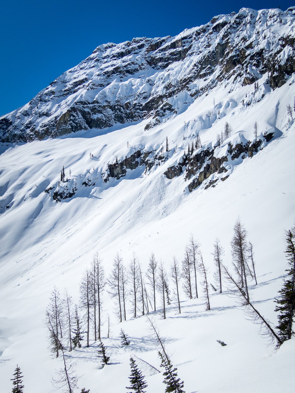
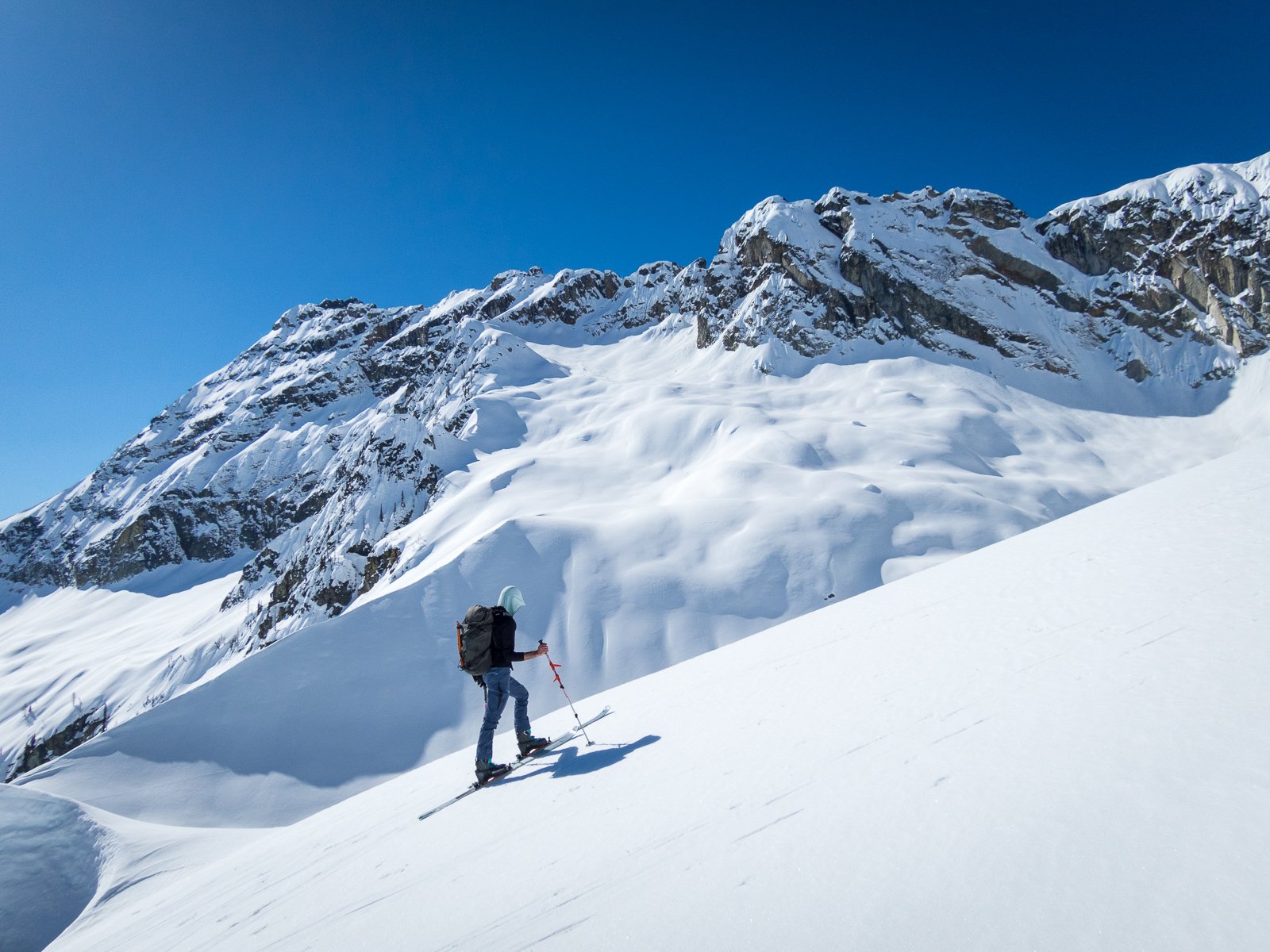
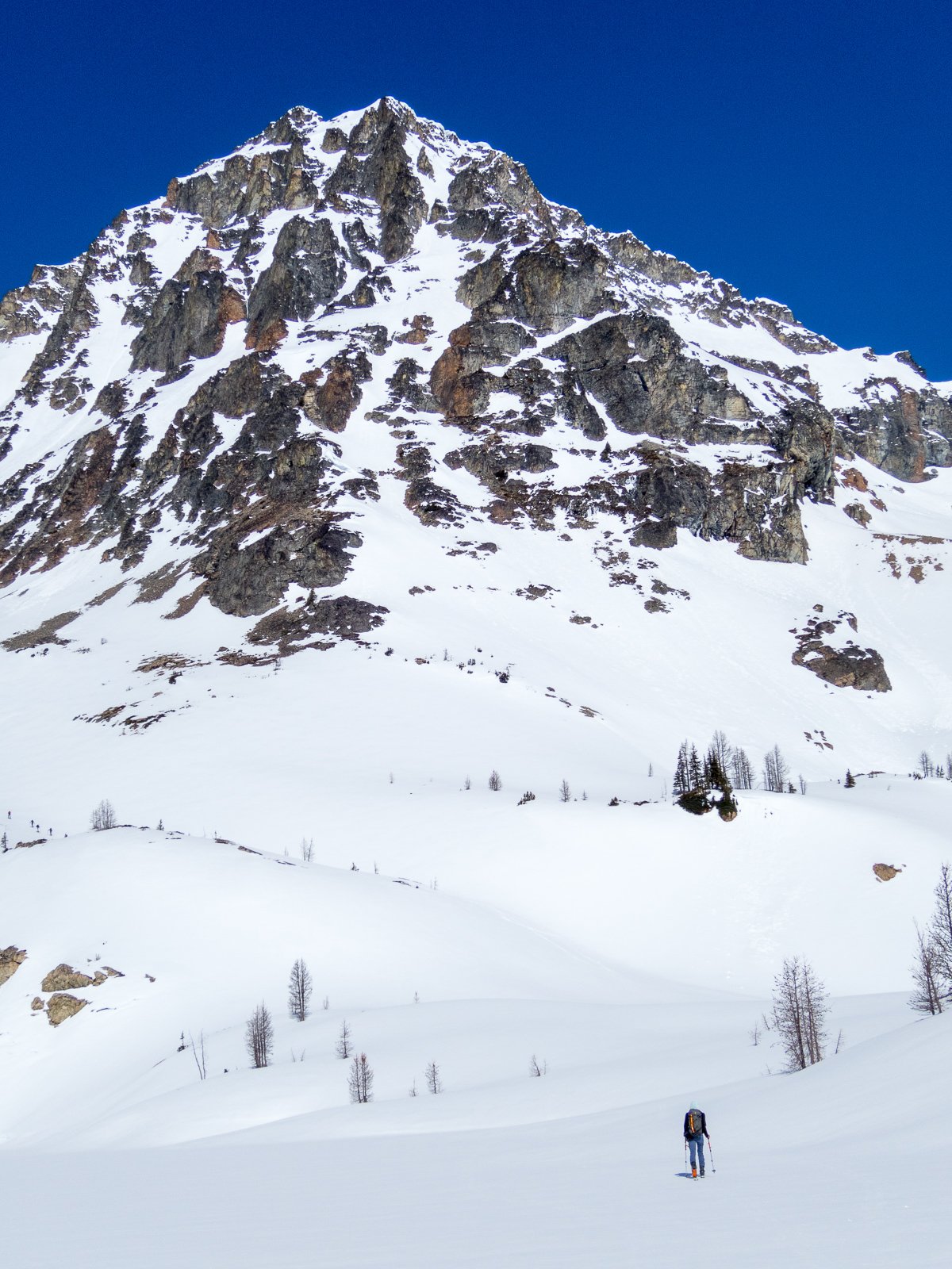
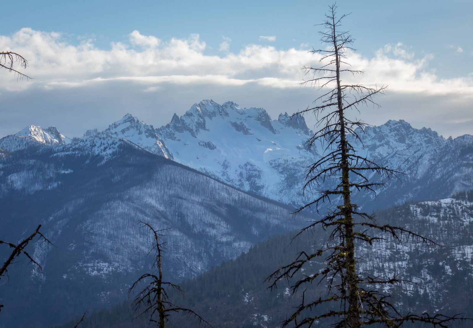
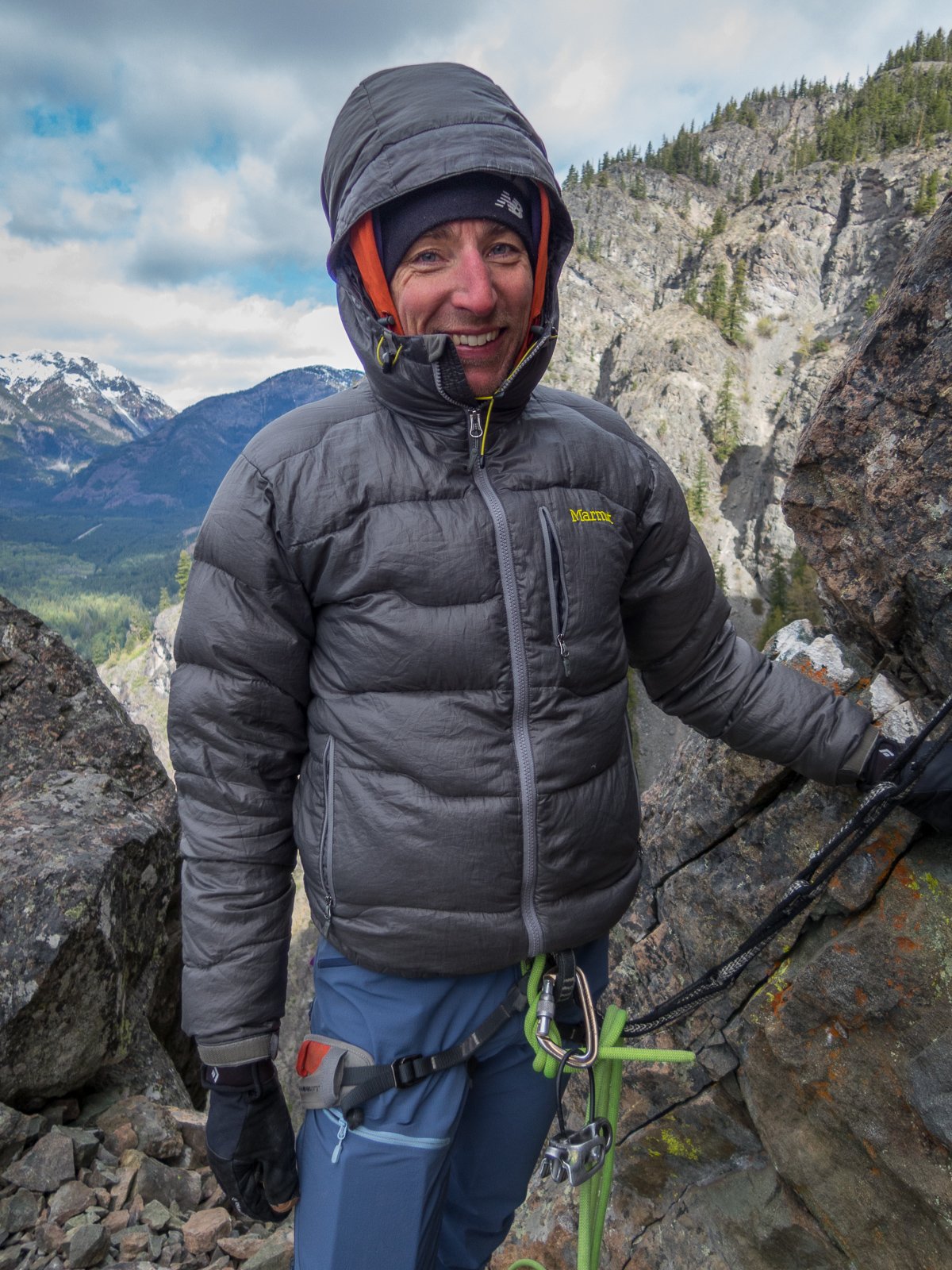
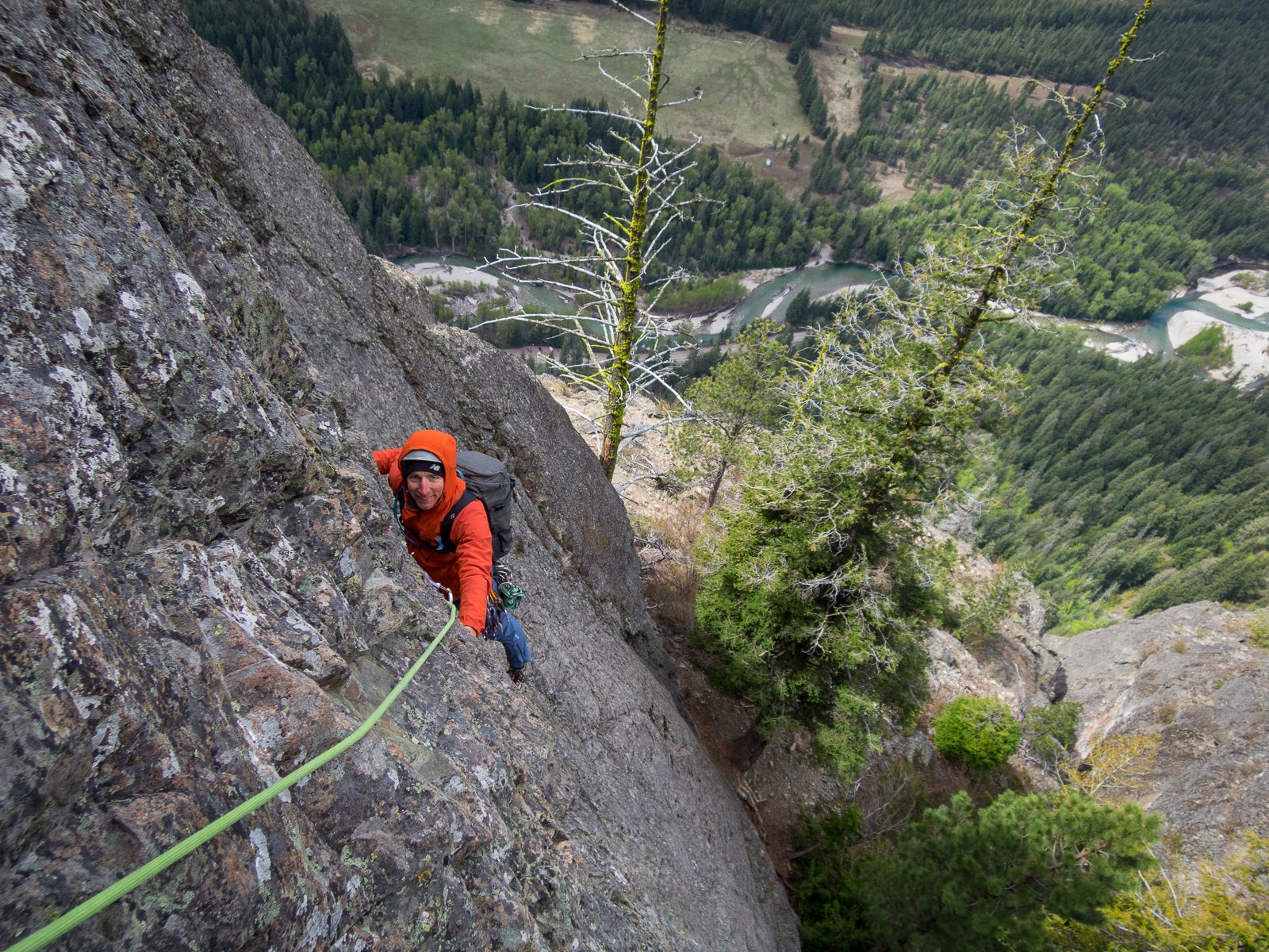
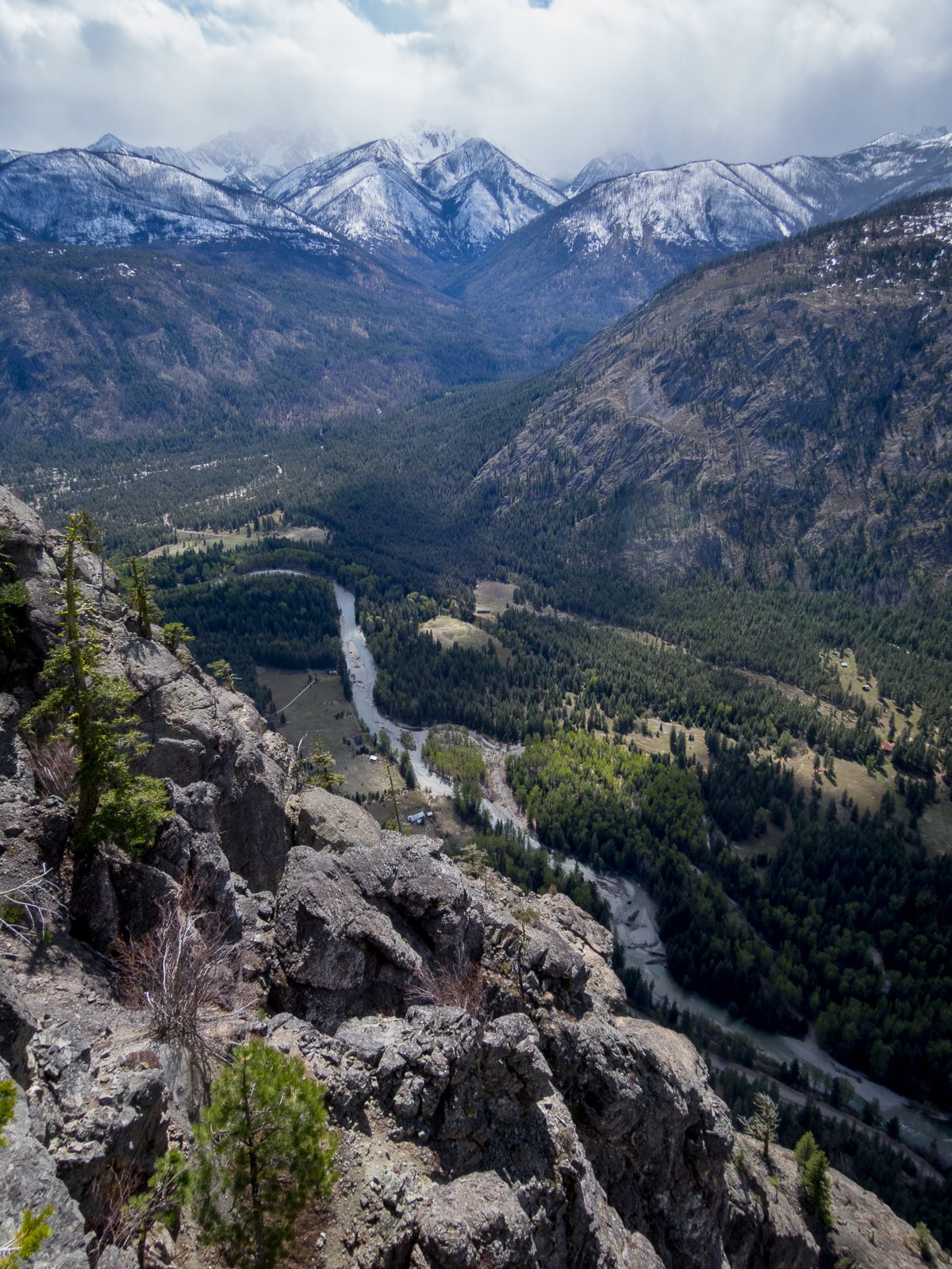
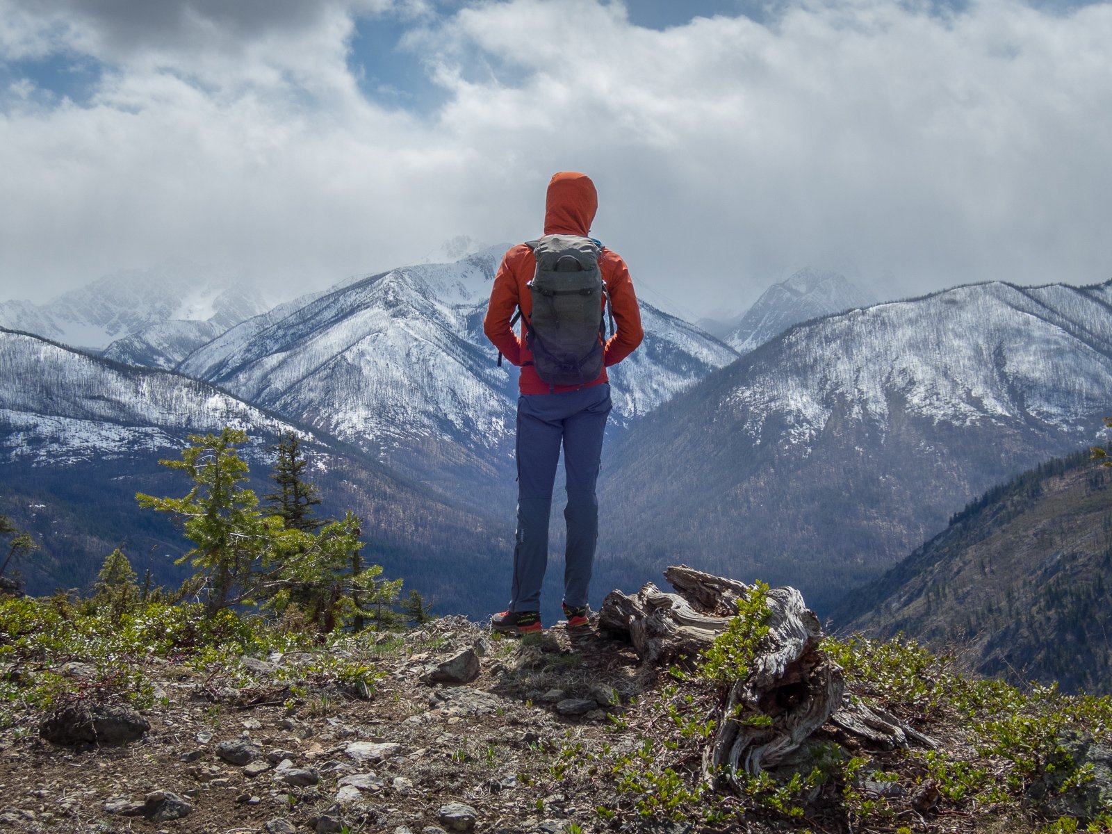
Trip: Williams Peak - Standard Trip Date: 04/13/2024 Trip Report: Over the past year of so I've gotten reacquainted with the Chilliwack Lake environs. It is just as close to my house as many areas of the Cascades and offers some new peaks to ponder and some unfamiliar views of familiar peaks. And, for whatever reason, I've been able to mostly have these mountains to myself on the handful of trips that I've taken up there. Williams Peak was no exception a couple weeks ago - I didn't see a soul after leaving the car. For such a striking peak on a fine spring day, I was a bit surprised. But there was definitely slogging, and that probably explains the solitude. The trail gains almost 3000' in the first mile and a half, and then there are two miles of undulating ridge to slog in snowshoes. But the scenic rewards, as you'll see below, were quite great beyond that. Plus, it did get more entertaining for the final 1000' up the steepening gully to the summit, dodging small wet slides and eyeing the cliffs above me suspiciously. I had read about annoying talus and steep heather once the snow melts off so a spring ascent might be the ticket on this one, even if it is more work. For me, being able to get a good look at the north faces of Rexford and Slesse draped in the think mantle of a late season snowpack more than made up for any discomfort. Williams from the valley bottom. Prepare to work! First glimpse of North side of Slesse: Chilliwack Lake: North side of Rexford with Shuksan in the distance: Slesse with Baker behind: Welch and Foley (gotta get in there next!): Look back at Williams from the slog out the ridge: Gear Notes: Snowshoes, I'm afraid. This wouldn't be a great ski with the up and down and endless forest. Crampons, helmet, and axe in early season- it is steep in the final gully Approach Notes: Chilliwack Lake Road is paved to the TH
- Last week
-
July/Aug for the north ridge by foot (not skis) may be best this year May/June?
-
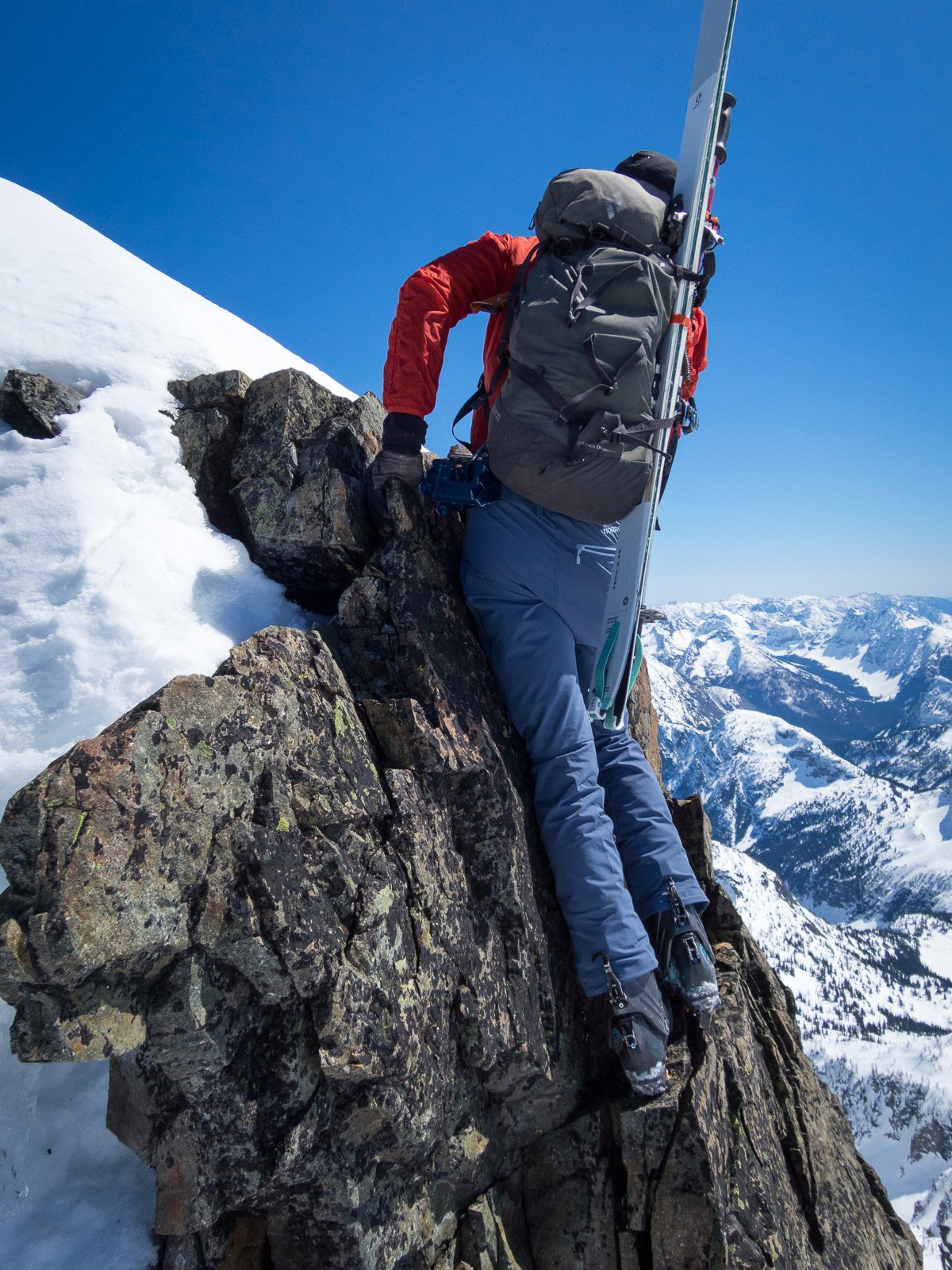
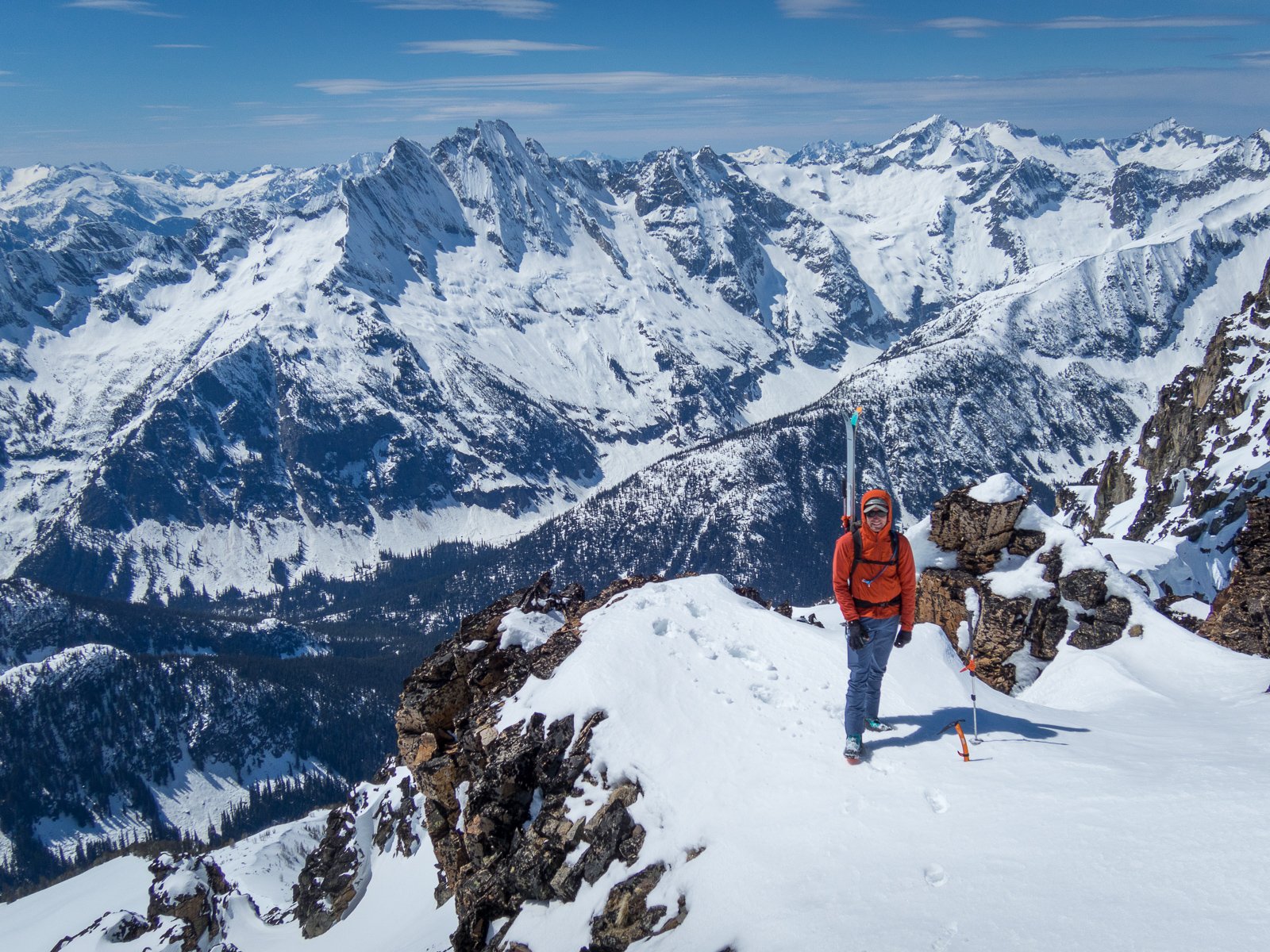
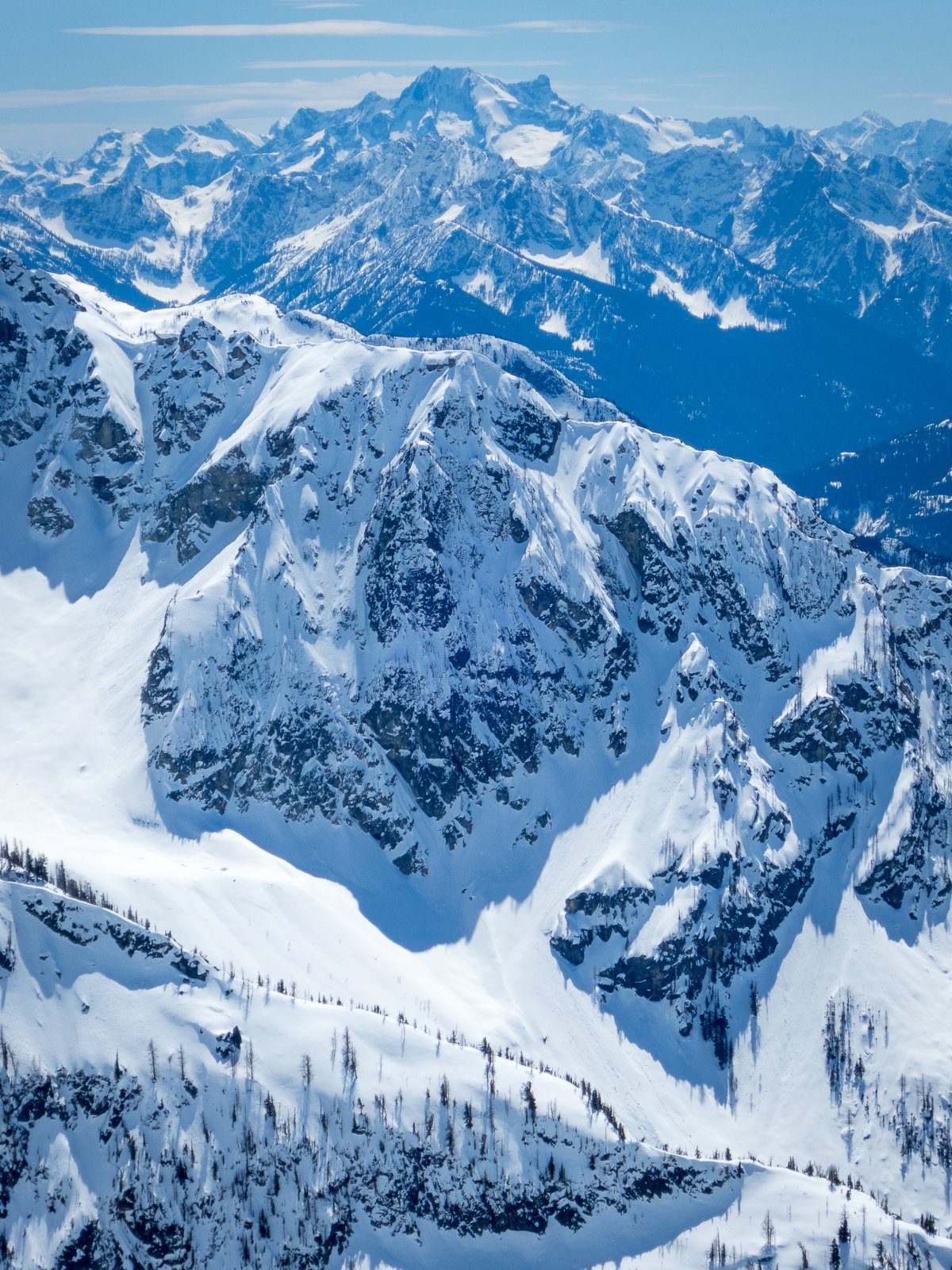
[TR] Black Peak and Prime Rib - #methowmultisport 04/20/2024
JasonG posted a topic in North Cascades
Trip: Black Peak and Prime Rib - #methowmultisport Trip Date: 04/20/2024 Trip Report: For those of us up here in the north sound, it is hard to ignore the gravitational pull when Hwy 20 opens for the year. It is like someone pulls the plug in the backyard pool and we are inexorably pulled east into the vortex of Sprinters and Teslas. But not this past weekend. It was like older, mellower times. Maybe it was the front moving through in the middle of the weekend. Maybe everyone was like my brother and were caught unawares of the opening? Whatever the reason, I'll take it. It was a good thing that the masses weren't up there though. @geosean and I myself weren't terribly original with the plan- a ski of Black on Saturday followed by Prime Rib on Goat wall on Sunday. We even brought bikes to enliven the descent from Goat Wall (this is a good bit more fun than rapping the route). And, mostly it went off without a hitch. And by that I mean we had fun, didn't get hurt, and came home friends. However, we did stop a few feet shy of the true summit of Black due to the typical spring shenanigans of steep snow, exposed rock, and no climbing gear. But, that slight disappointment was soon forgotten amidst the better than average corn skiing down to Lakes Ann and Wing. I think it has been over 20 years since I've been up on Black and I can see that I need to return more frequently. Thankfully the weather on Goat Creek Road was reasonable, though chilly, Saturday night. We started early to beat the crowds the never arrived and shivered in the wind and snow squalls as a result. It felt distinctly alpine, climbing in long johns and belaying in puffys all day. I'm sure it would be good training for something hard and high, if I still cared about those sorts of objectives. Mostly though, I shivered and muttered. But, it had been about 11 years since I had climbed the route, and so Prime Rib felt sort of like a new and interesting experience. This pronounced alpine amnesia is definitely one of the benefits of entering my "mature mountaineer" phase. Maybe I need to climb things all over again. Except Nooksack Tower. @geosean at Heather Pass: @geosean and Black at Wing Lake: I was not having this and turned us around: #methowmultisport: Dispersed camping views of Silverstar from Goat creek road: @geosean living the alpine dream on Goat Wall: The hordes will descend next weekend! Gear Notes: the full kit Approach Notes: Follow the herd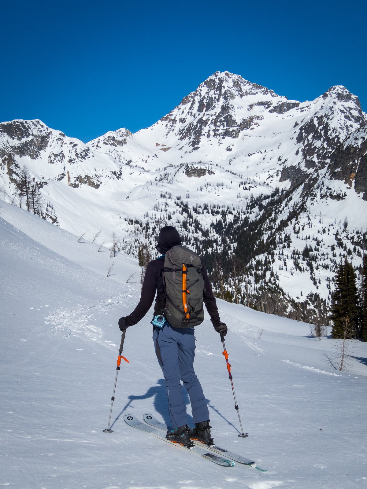
-
 Jamie Yelland joined the community
 -
I just have regular health insurance which paid (outside of deductible) for my collarbone break last year .
-
Another link to the declaration in case you ran into a paywall: https://ecology.wa.gov/about-us/who-we-are/news/2024-news-stories/april-16-drought-declaration#:~:text=In Washington%2C drought is declared,water right permits and transfers.
-
Oh wow... "Seasonal snowfall of 430 inches at the Mt. Baker Ski Area in 2023-24 was among the lowest since records started being kept there in 1970-71"
-
Hi Sara, I will be staying outside of Portland around that time and could potentially be up for a day trip! Sounds like our experience and style may be similar. I'm not sure if Hood conditions will be good at that time, but certainly Adams or something else could be fun. If you'd like to connect and discuss further, send me a message here or email me at dmill629@gmail.com. David
-
 David Miller joined the community
 -
I can vouch for the Sony A7rii. I switched from a Canon 6D years ago and managed to save a bit of weight with the body. The lightest full frame setup I've found is the A7rii with a 50mm F1.8 kit lens, coming in at about 27 ounces. The 24mm F1.4 GM is also super lightweight for its aperture, and the Tamron 70-300 F4.5-6.3 is a good light option for telephoto. The 24mm GM from a climb in the Boston Basin area:
-
Trip: Aconcagua - North Face Trip Date: 12/22/2023 Trip Report: On 12/11 I hiked to Confluencia to start the trip. Winds have been the major prohibitive factor affecting summit success this year, and from the start even getting to Confluencia winds were gusting in the 20 mph range. For acclimatization I hiked to Plaza Francia the next day, which was even windier, but being lowish on the mountain still temps were great. 30mph gusts with wind chill bringing temps to about 40F at coldest near Plaza Francia. Apparently a few days later winds were so severe that folks were skipping the hike to Plaza Francia all together, reporting 50+ mph gusts. Make sure to check in with the ranger when you arrive at Confluencia to get the sign off on the permit, and get a medical check before moving to Mulas. Confluencia itself is a really nice camp. If you use a logistics service like I did (Inka basic package) you’ll get fresh food, a place to hang out, and even a bunk if one is available. If you’re fully guided I think the bunk is usually included. There are legit bathrooms there with running water. The following day 12/13 I moved to Plaza de Mulas. On 12/14 I cached at Camp Canada. A bit of a blizzard rolled in, hammering the high camps with wind, snow, and even collapsing the medical tent (for the second time this season) at Mulas. The camp docs ended up just going tent to tent doing the medical checks. The next day I took as a rest before moving to higher camps. 12/16 I moved to Camp Canada. I met a lot of climbers who skipped this camp for two reasons: 1: to get water you need to walk about 10-15 mins to collect snow to melt. 2: the camp is extremely exposed to wind If you don’t camp here one or two nights you’re looking at moving strait from 14k to 18k, which in my experience isn’t ideal for acclimatization. I chose to deal with the wind for two nights to use Canada as a stepping stone for higher camps. Definitely stand by that decision. Just make sure you have a tent that can handle 40-50 mph gusts from time to time. After caching at Nido 12/17, on 12/18 I dropped to Mulas to get more food and gas for an expected long stay at Nido (weather window seemed to have disappeared), and moved camp from Canada to Nido. Nido has great wind protection and even a water source. You dig a hole in the ice of a nearby pond and can extract water from underneath without needing to melt snow. My acclimatization schedule worked pretty well and I wasn’t feeling any AMS symptoms by the time I reached Nido. 12/19 was another rest day. A brief weather window opened up for 12/20 with winds dropping to the 30-40 mph range up top. Wind chill about -20F, which is about as good as it got the whole trip. Around 5:30AM on 12/20 I set out from Nido for the summit. With 4 layers on the bottom, 5 on the top, and full skin coverings the cold temps and windchill were entirely manageable. Up until Plaza Independencia the ascent tracks just to the east of the ridge. Most of the wind on Acon comes from the west, so up until this point there is some wind protection. Above Plaza Independencia, however, you walk on the west side of the ridge with full exposure to wind until you reach La Canaleta. Be prepared for extremely cold temps on this traverse when conditions are windy. There were two snow traverses requiring crampons. At worst the slope angle was about 40 degrees with a good boot path. Not sketchy by any means but still something I’d want an ice axe for. The Canaleta is this loose path through dust and rock where the dirt is so loose it helps to have crampons on to maintain good footing. One of those “one step forward half a slide back” kind of paths. Above that is the cave, where lots of people will rest before the final summit push. A very important thing to know - the official turn around time for the summit is 3PM, and on good summit days rangers will usually be there turning people around if they don’t reach the summit by 3PM. Once you get to the cave it is about 2 hours to the summit, and unfortunately I reached the cave at 1:45PM. Because of the 3PM deadline, I turned around and got back to Nido by 4PM. Another good window was forecasted for 12/21 and I moved camp from Nido to Colera. Like Canada, expect high winds. 12/22 around 4AM I set out again for the summit, this time reaching it by noon. Similar conditions with wind and temps. On the way down at 22k ft I ran into a woman who looked hypothermic, dehydrated, and suffering from altitude. Along with another climber and a nearby guide we assisted her down to Colera where she was airlifted to a nearby hospital. Getting from Colera back to the park entrance took only two days. One to get all the gear back to Mulas, and the next to hike out. The beer in Mulas is $9 but in Confluencia it is only $5 FYI Gear Notes: Ice Axe, Crampons, Headlamp, Ski Poles, Animal/Pet, Tent Camp Approach Notes: Maintained Trail, Unmaintained Trail, Open Country, Snow on Ground, Scramble
-
Trip: Goode Mountain - Northeast Buttress Trip Date: 07/29/2021 Trip Report: We started from the PCT junction near Rainy Pass. This is not far from the wildfires currently burning on the eastern slopes of Silver Star and North Gardner, but luckily a westerly wind kept the area mostly smoke free. The hiking is easy and straightforward all the way to the ford of North Fork Bridge Creek. With the dry temps and the heat waves of June and July, the river crossing was trivial. At most the water was just above the ankles. We took a rock gully strait from the crossing to the waterfall, which saved us any bushwhacking. The waterfall slabs were also not bad. A bit exposed at times but easy climbing. We followed the climber's trail through 90% of the alder above the slabs, losing it just at the end. But the bushwhacking is not hard even without the trail. We made camp at 5600' at a bivy site just below the slabs. To get onto the glacier we crossed over an icefall, which despite being broken to bits was fairly solid. Had a close encounter with rockfall off the cliffs above the glacier, a reminder to minimize time spent getting onto and crossing it. The moat crossing was also easy. A collapsed snow bridge gave us good access at 6800'. From there we ascended a class 4 ledge climber's left for a hundred feet or so. Above that was only one pitch of low 5th class climbing to gain the ridge crest. Ridge crest itself was easy 3rd and 4th and we soloed/simuled through it staying just left of the crest. When the ridge steepens we stayed right in the gully, climbing the low 5th class to reach the bivy ledge. From there we climbed left to gain the final summit ridge, low or mid 5th class leading to 4th class. No snow on the route whatsoever. We took the Southwest Couloir down, which redefined how I think of loose rock. Made camp at Park Creek, hiked out next day. Weather was fantastic, the westerly wind persisted and kept us with clear skies and clean air. All around a great trip. Gear Notes: Ice Axe, Crampons, Rope, Headlamp, Ski Poles, Bivouac Approach Notes: Road Hike, Maintained Trail, Unmaintained Trail, Open Country, Bushwhack, Stream Ford, Snow on Ground, Scramble, Exposed Scramble, Rock Climb, Glacier Climb
-
Definitely interested in doing some skills review and potentially a climb or two this summer. If we can get a group together let me know!
-
 Guye changed their profile photo
 -
Guye joined the community
-
 Hey, sent you an offer/request for the sleeping bag via PM. Please let me know.