All Activity
- Today
-
 oldclimber137 joined the community
 -

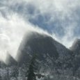
[TR] Coleman Pinnacle - Standard 12/30/2025
bargainhunter replied to JasonG's topic in North Cascades
Great write up and beautiful photos of Steve Barnett's favorite July ski tour! I've been meaning to do it but that southeast side of Table after a good snow spooks me. You hit it right in terms of timing. I was sitting on top of Hadley Peak in late July taking in that view (seen in your Chowder Ridge pic, but from the opposite view). Such dreamy ski touring terrain for an extended snow camping trip! In Barnett's 1987 book "The Best Ski Touring In America" (highly recommended!), he talks about the winter avalanche risk on that SE aspect of Table (hence his preferred time to do it is in summer), and how a party got caught in a storm on the way back and buried up to their necks by an avalanche off that side of Table. Instead of continuing to Artist Point, the party turned back and made an epic exit via Wells Creek drainage, stumbling over logs and through icy water and devils club thickets in freezing rain. Barnett wrote: "They spent the night keeping warm by wringing their clothes out". Type 2 fun. Even when you hit the Wells Creeks logging road it's still a looong slog back to Nooksack falls and the 542. Coming back via Chain Lakes and Herman saddle is less avalanche risk but that group probably hadn't done it before and the route finding through the trees and hillocks covered in snow can be circuitous. I believe Chowder Ridge is actually the ridge barely seen in shadow on the right skyline of the photo. The rounded ridge in front of it I believe is Dobbs Cleaver, draining into Bar Creek. It's wild terrain up there, so close yet feels so remote when you are back in there. The peaklet to the left of Hadley on the connecting ridge is Peak 7842 and continues up Bastille Ridge to the Cockscomb just north of Grant Peak. That view of the bowls of Wells Creek in your "coming back up over Table" photo look amazing! Ted Mueller wrote in his 1968 book "Northwest Ski Trails" (with great B&W photos from the Spring brothers): "These north-facing slopes are smooth and unbroken between 4800 feet and 6200 feet. The variety of runs is unlimited throughout this entire area." Rainier Burgdorfer wrote in his 1999 book "100 Classic Backcountry Ski and Snowboard routes" : "Whether or not you decide to reach Coleman Pinnacle, there are abundant possibilities for runs over 1,500 feet in length." Thank you for posting up! - Yesterday
-
 Tim resca joined the community
 -

2025-2026 Mt Hood Speculation Thread
bedellympian replied to Albert_Pynstardt's topic in Oregon Cascades
Hopefully you got on it or plan to. Probably all time on the N side. -
 tomR129 joined the community
 - Last week
-

[TR] Coleman Pinnacle - Standard 12/30/2025
FrancisBailey replied to JasonG's topic in North Cascades
Hahaha yes fair enough well looks like it was worth dragging up for this occasion -
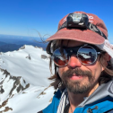
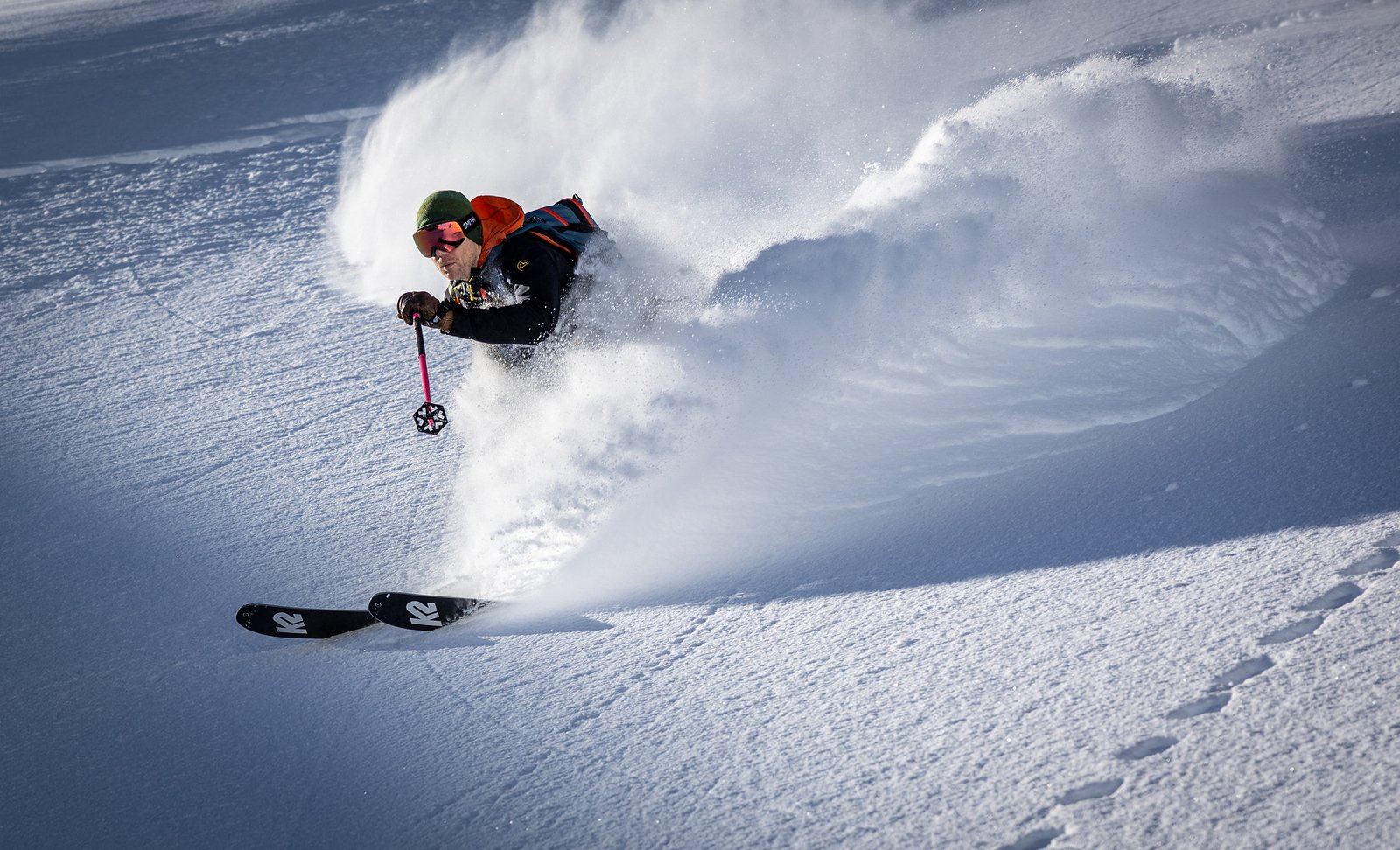
 LOL, are those golf gloves? (Apparently they work.)
 -
Thanks! Those were shot with a Canon R6 MarkII with Canon RF 24-70 f2.8 and 70-200 f4 lenses 🤓 And no, this isn't a reasonable kit to drag around the mountains. I recommend an iPhone.
-
[TR] Coleman Pinnacle - Standard 12/30/2025
FrancisBailey replied to JasonG's topic in North Cascades
What did you use to take these photos by the way? They look really great. -
 buktijp joined the community
 -
.thumb.png.542ee3acef7cd3957586b02ecd4eb35c.png) respectegypttours joined the community
respectegypttours joined the community -
-
Thanks for checking on the overboots!
-
2nd Ropedude found a home
-
Three weeks ago, when it was still winter:
-
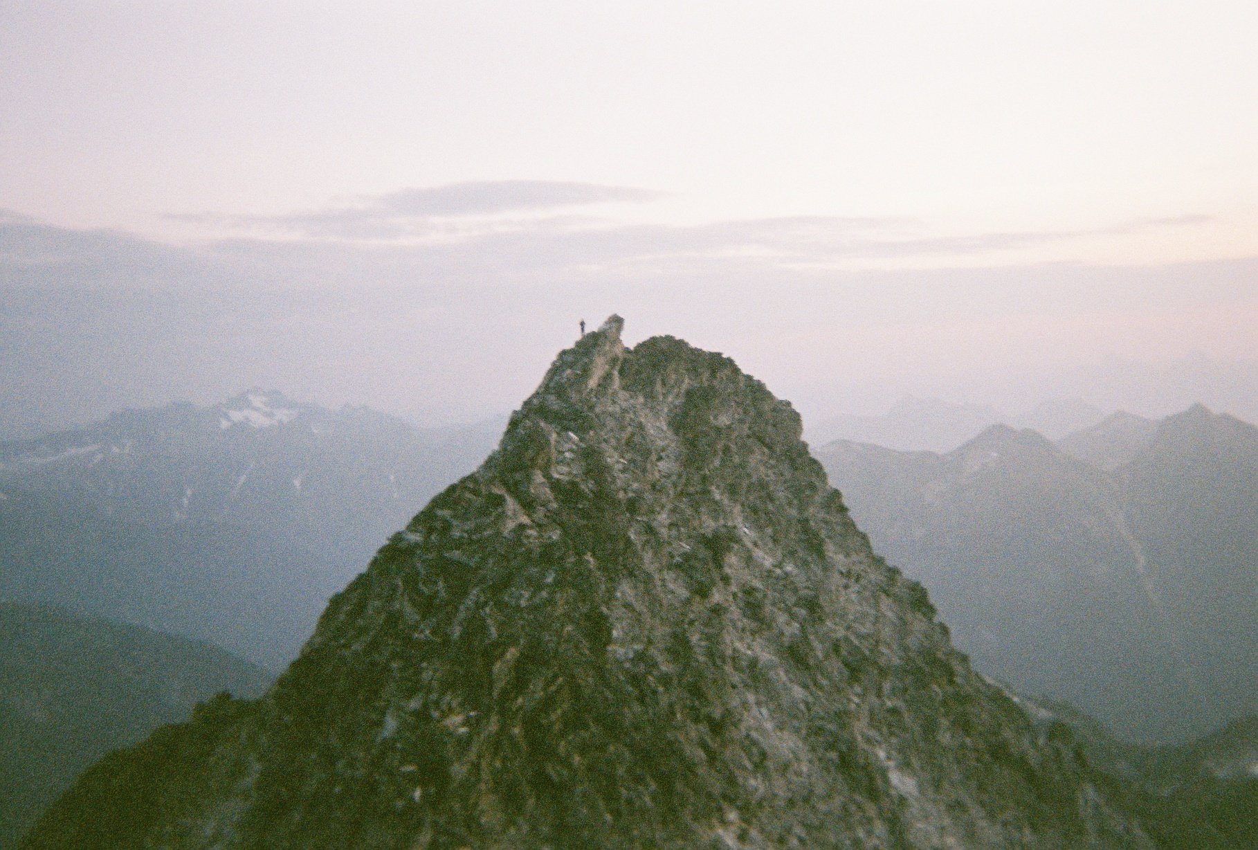
SJake on the summit of Luna, taken from the false summit with a disposable camera in 2018. One of those perfect mornings in the alpine.
- Earlier
-
Speaking of what we want to preserve on this site....this thread is a great read. Here's to you Mr. Stoddard!
-
 Brooks Hennessy joined the community
 -
Historically, a solid gold thread. This is what we’re fighting to preserve, but also to continue. The free flowing exchange of ideas represented.
-
Good times! Long live cc.com!
-
 yaret joined the community
 -
COME ON TWARK! BE A MAN.
-
 madcat joined the community
 -
2026 and I come back this post and find inspiration! Thank You!
-
@Bronco @JasonG @Alpinfox Thank you all for the information. Obviously this is no simple route. If you have any more websites and sources of info whether it be weather, route updates, and especially reports. That would be greatly appreciated! Again thank you so much! Much more active than my pnw Facebook post. Best, James
-
We took the standard three day schedule, early June 2003: Day 1: at the White River ranger station when they opened for permits, bivy at the Curtis Ridge bivy sites. Scouted a route through the Carbon that evening. Relatively easy day. Day 2: Moving at first light through the Carbon glacier. We packed light so we could haul ass and reached Thumb Rock by late morning. Down low on climber's right side of Liberty Ridge encountered lots of individual rocks wizzing by at high speed. After reaching Thumb Rock quicker than expected, we had a brief discussion about attempting to complete the route that day but decided it was hot and we could use the acclimation and hydration time. While at Thumb Rock, we witnessed a huge serac calving from Liberty cap that swept both sides of Liberty Ridge. Anyone on the route between Thumb rock and the schrund that afternoon would've been in trouble. We thought we were toast at the bivy but only were blasted by a cloud of spindrift. I think some folks had to change their shorts. Day 3: Moving before dawn, no issues until reaching the schrund. Leader took a fall onto the (boot axe) belay attempting to climb the snow wall across the schrund. Fortunately he was able to push off enough to land on the glacier instead of into the shcrund. Finished the climb and made the descent with no other shenanigans. I know global warming has changed the route but you have some advantages nowadays such as: access to current weather forecast any time, up to date route conditions, gps routes on your phone, better and lighter gear. It used to be popular to attempt this route right when the White River entrance opened. Some folks will take an extra day and hike in before the vehicle entrance is open. You'd have less competition for permits and probably better conditions on the route IF you get a good weather window.
-
Nope, too small. I could squeeze an 11.5" long sneaker in them but a bulky 12" boot would be a no-go. Sorry about that.
-
NPS Liberty Ridge guide pdf Some TRs:
-
22.5y ago, holy shit! Trip report from 2003
-
@Alpinfox @olyclimber @JasonG @Bronco @aikidjoe Thank you all for the information! I didn't expect this many replies. I don't get many replies on my local Facebook climber group. I must ask, to those who have done Liberty Ridge in the past, could you go through your route. How long it took, when you started, hazards, and just what happened each day. I know I'm asking for quite a bit but I would greatly appreciate it! Also I'm assuming you guys haven't done it in the past couple of years but if you could give your two cents on what the condition might be like now since with global warming speeding up 2015 is nothing like 2025. Thanks Best, James
-
I'll measure 'em tonight
-
Hi - are the overboots available and do you think they will fit a pair of bulky doubles with a 12” long sole? if so, would be happy to put these to use on Denali this spring.
-
 Hi, trying to decide between these two jackets, just wanted to get people's experience with either of them, my main concerns are: waterproofness, breathability, and hood fit w/ and w/o helmet. Thanks a ton!