
All Activity
- Today
-

[TR] Tokaloo Rock (Sunset Ridge bailure) - Standard 06/29/2025
Fairweather replied to JasonG's topic in Mount Rainier NP
0 for 2 on Tokaloo Spire. The old piton is there, but looks pretty worthless--and the fall is a big swing. Next time we will try climber's left. -
White Saddle is being more selective. The BC Government puts them on the hook for missing/rescue/recovery costs associated with anyone they fly. They will not fly any climbers into Waddington who they feel are not qualified to safely complete their stated objective. When I flew with them in 2019, I got the impression their bread & butter is now skiers and provincial fire fighting contracts--and climbers were becoming too much of a liability.
-
 Trip: Terror, Degenhardt, Pyramid - N buttress (attempt), NW and W routes Trip Date: 07/04/2025 Trip Report: Drawbridged again in the pickets for the second time in a week. After the standard rap into the couloir north of Otto-Himmel col my partner encountered a moat that appeared impassable. He ascended back to the station and I took a look down the next gully skiers left. From lower down I could see it would have been no good to try the moat (which would have required an absurd running leap) because another moat was not far below that one. I kept descending adjacent to the couloir, finding mostly solid, even fun, exposed class 4. There was a short low fifth corner with a lemon cake sized block that kept it secure. I passed a slung block with old webbing. Where things cliffed out I found some good .1-.2 cam sized cracks that could be used for a rap anchor. My 60m rope easily reached continuous snow from there (maybe 20m rap). Last year at exactly the same time of year I downclimbed continuous snow down this couloir without even needing the first rap. And last year was a low snow year too. So I was pretty surprised at the state of the couloir. This workaround skiers left seems viable to me. Posting it here in case it helps anyone. The false start and exploration ate up enough time that we decided to bail on our plans for the Stoddard route and head back up to climb WHC instead. My partner was bemused because he expected a crack climb The day had started clear. On our way back down from O-H dark gray clouds moved in to block the ridge. I was glad we weren’t somewhere high on the north buttress of Terror. Next day was quite socked in. We headed off for Degenhardt, accidentally heading up from the south before correcting course for our intended NW route from near Terror’s east col. To gain the couloir there was short choke that steepened at the end to maybe 80 degree snow. We underestimated the angle from below. Odd, usually it’s the opposite. We were able to bypass this on slabs on our return. The foreboding weather and lack of visibility gave the climb a serious feeling. As it gradually cleared on the way back the route started to feel easier. There is plenty of choss on Degenhardt but I recall the scramble being pretty fun. While extracting the summit register I dropped its pencil down some hole. Sorry. From there we groped our way slowly toward Pyramid. The route finding in the clouds was trickiest near Degenhardt. Was glad to carry ax/whippet all the way due to about ten steps through a narrow and steep snow couloir to get to Pyramid’s rock pyramid. We had peek a boo views into McMillan cirque but could see nothing at all to the east. By the time we passed back west of Degenhardt the clouds were lifting and it was a relief to see where we were going. The weather kept improving and the sunset was a real mind melter. UFOs came out in force. Next morning greeted us with more clear weather but having had our fill we bid adieu to the goats and our impeccable camp. After the bruising descent we enjoyed copious berries south of terror creek. Gear Notes: 60m rope and light rack, crampons, ax or whippet Approach Notes: Goodell
 - Yesterday
-
 White Saddle was slightly cheaper but had a max of 4 climbers in their helicopter. If you could round up 5 climbers for West Coast, it would be a little cheaper. Not opposed to White Saddle if I can only find 4 total.
 -

[TR] Tokaloo Rock (Sunset Ridge bailure) - Standard 06/29/2025
bedellympian replied to JasonG's topic in Mount Rainier NP
Kyle Tarry and @Nick Sweeney tried it a few weeks ago too. Sounds like they had a similar experience. -
Just curious, was White Saddle more expensive? I thought they were the go to heli operation for going into the Wadd.
-
Hi there, I’m planning a trip to Mount Waddington and was looking for another group to split flights. If we flew with West Coast Heli, we could get 5 people total for <$1,000 each. I can have a group of 2 or 3. If there was a group of 2 or 3 interested, could be nice to help each other out. Thinking early-mid August, but can be flexible with dates.
-

[TR] Tokaloo Rock (Sunset Ridge bailure) - Standard 06/29/2025
olyclimber replied to JasonG's topic in Mount Rainier NP
Sorry it didn’t happen for you brother, and I hope you can get to it in better conditions. But a nice hike regardless. -
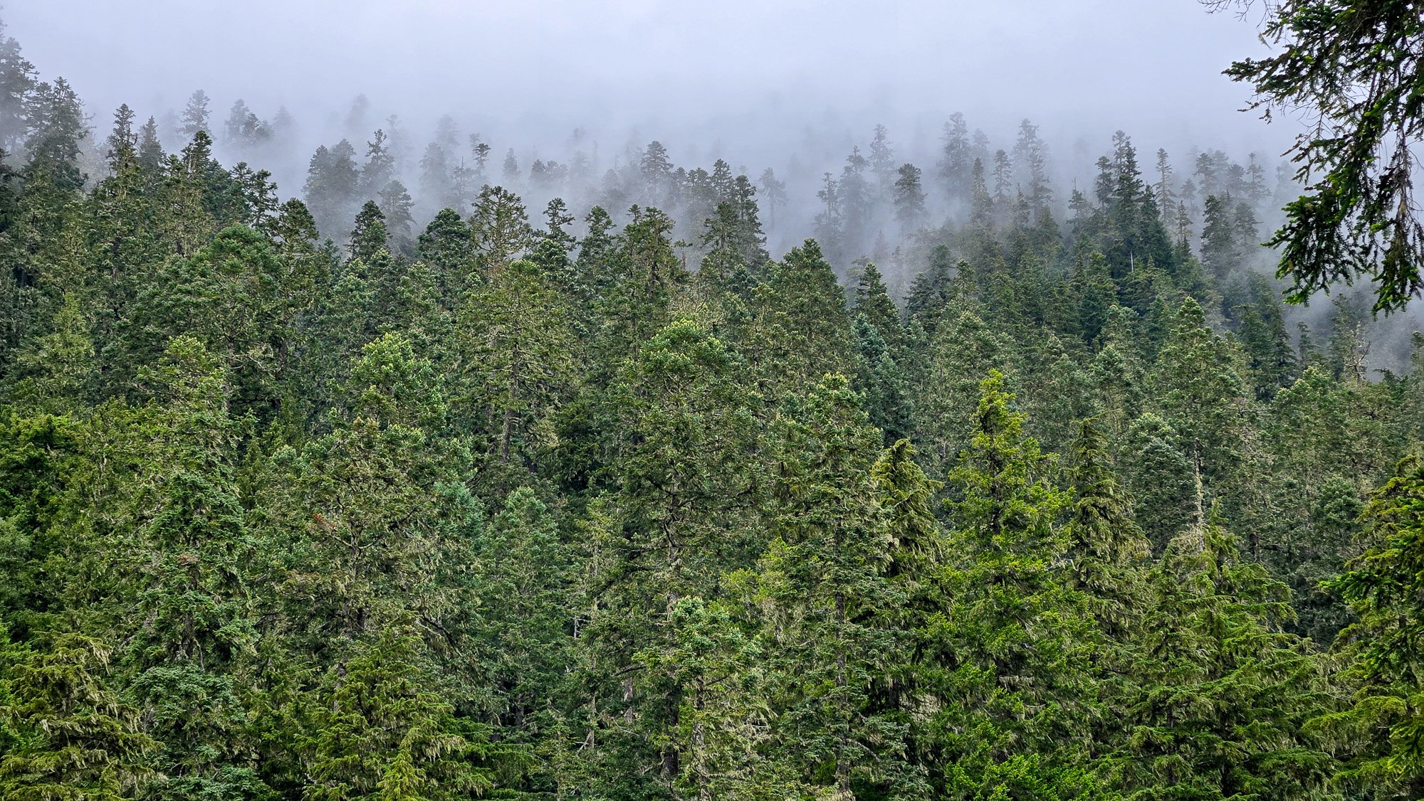
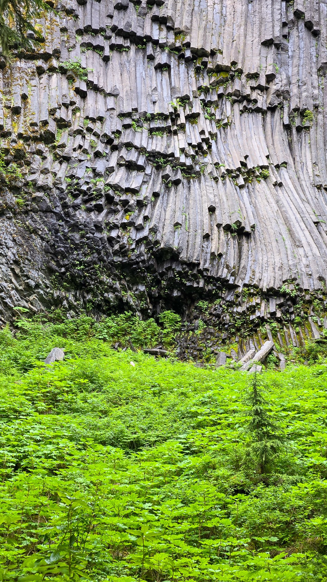
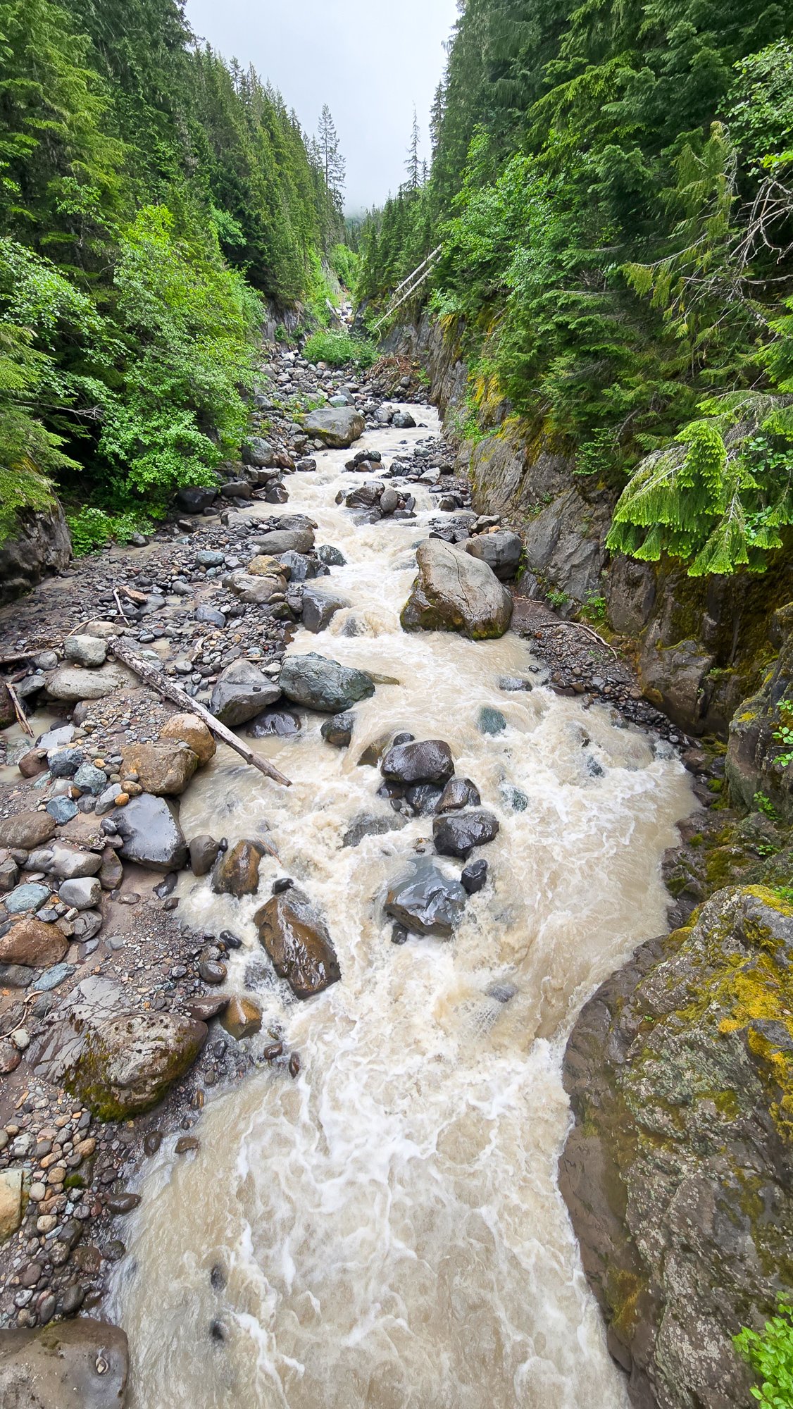
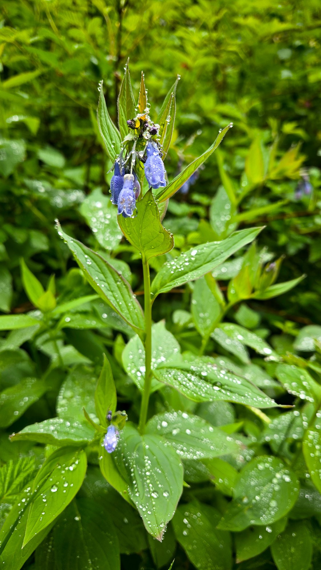
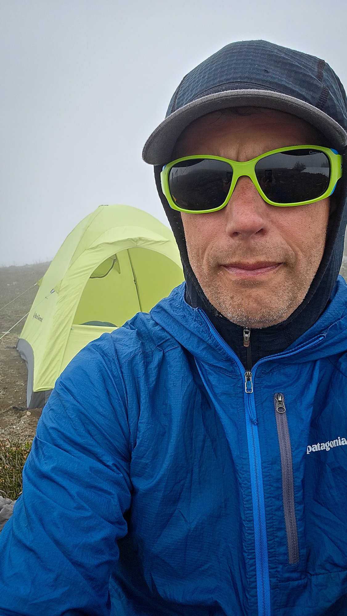
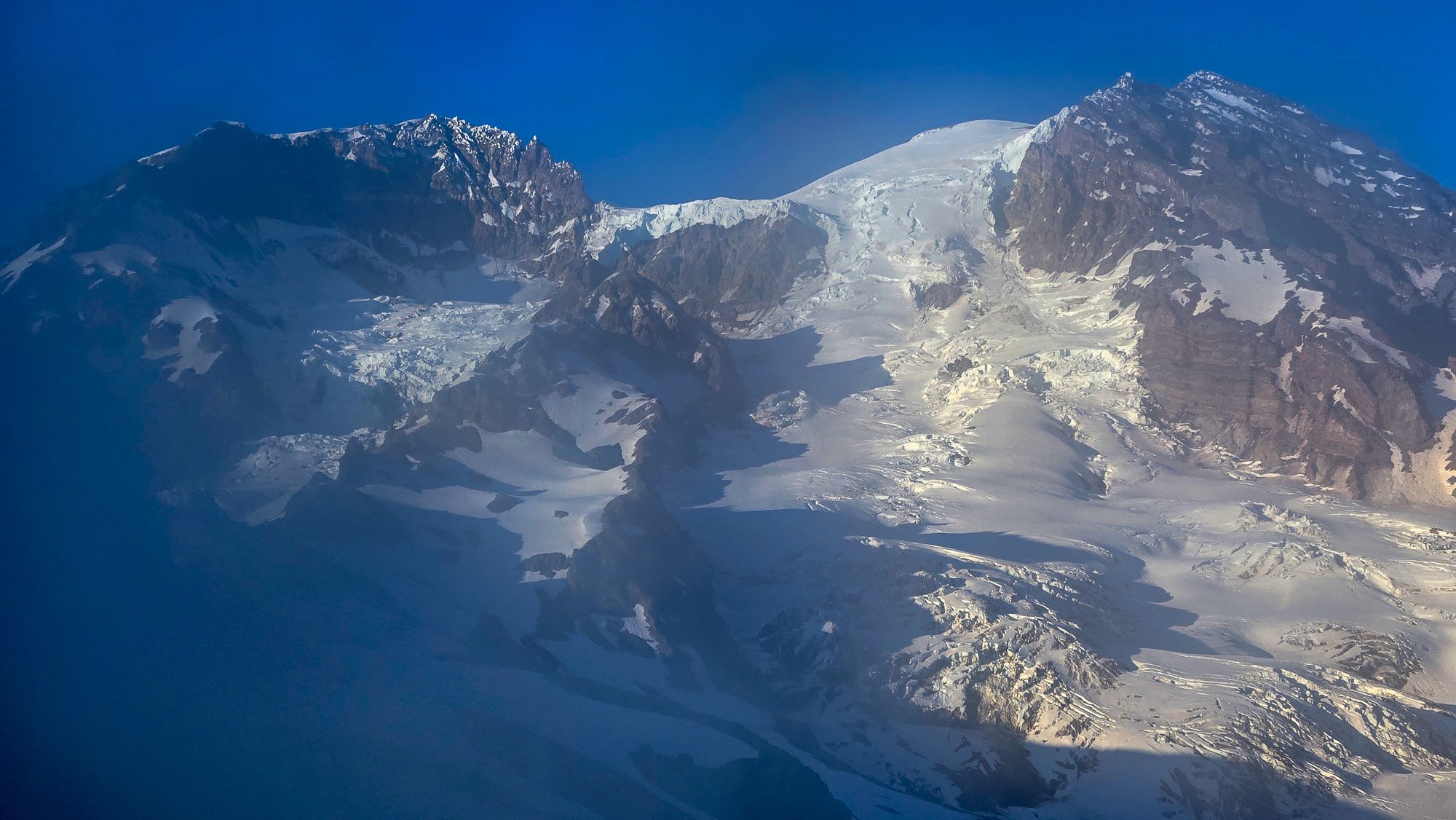
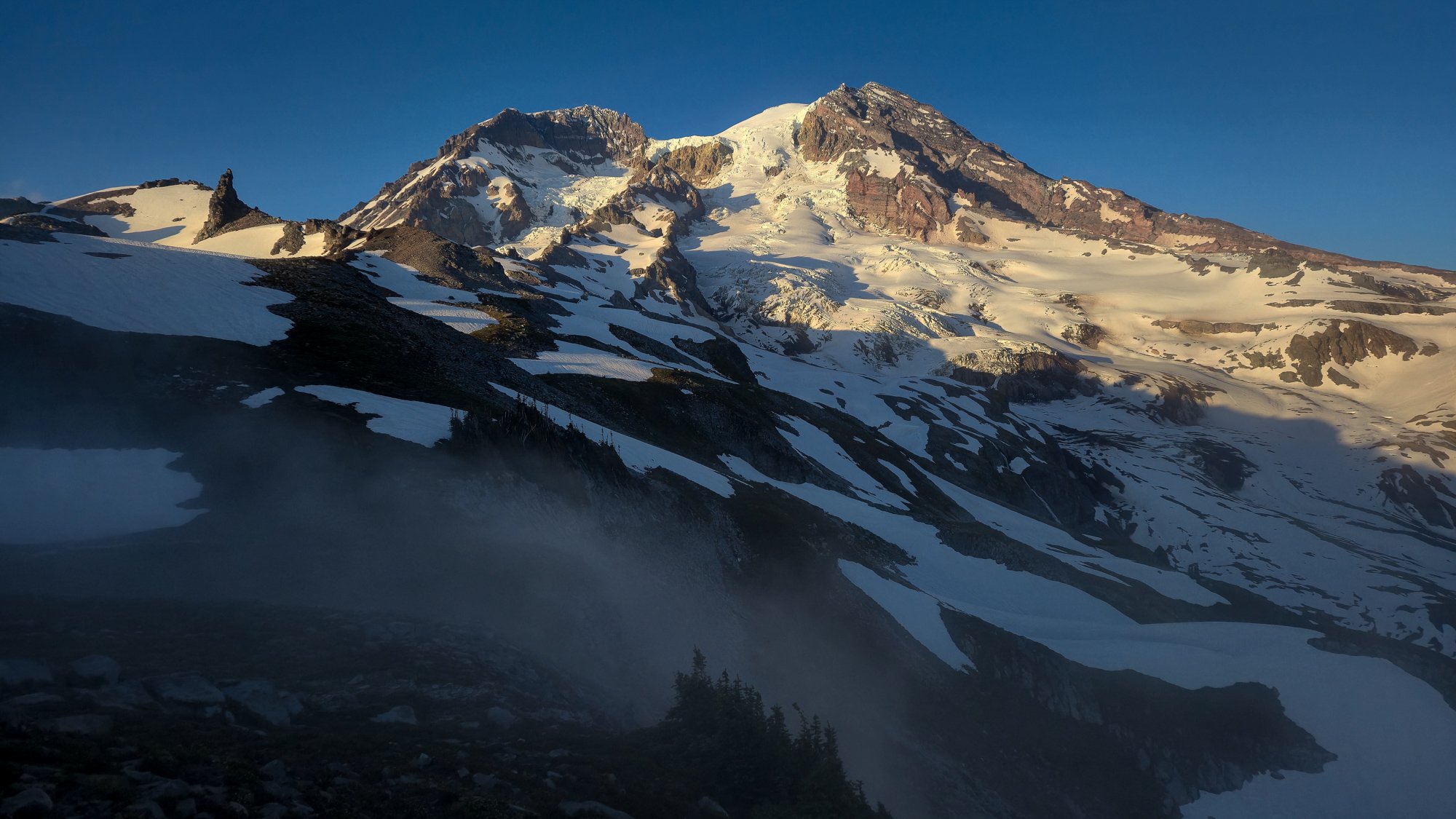
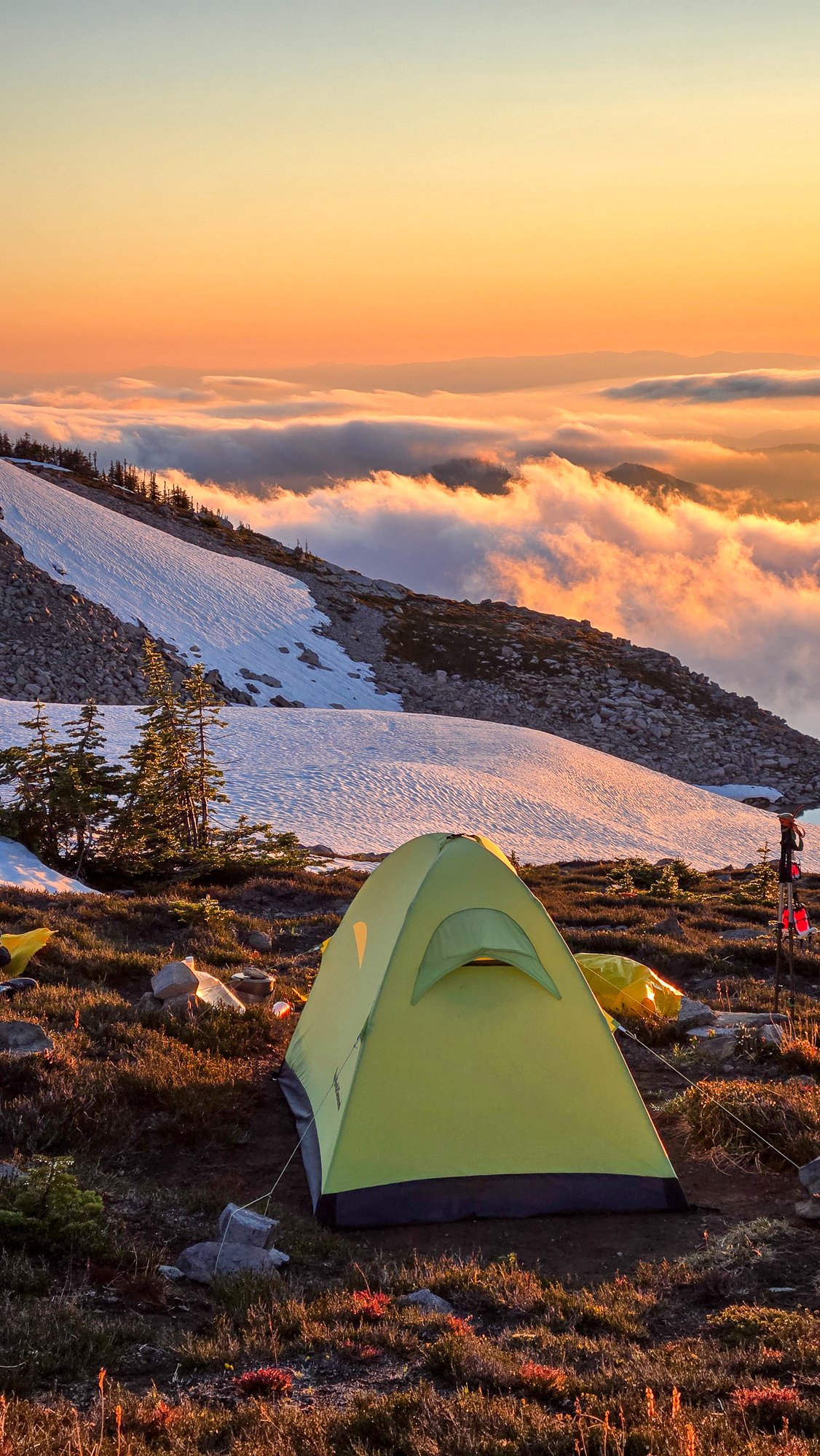
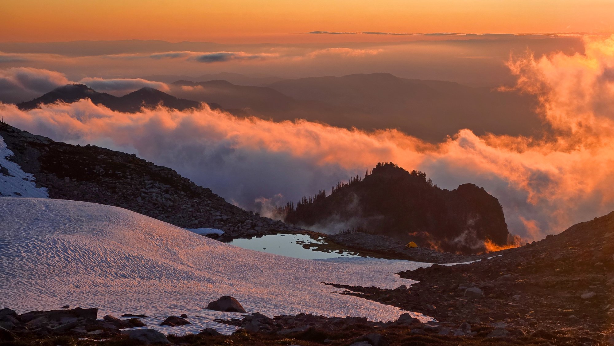
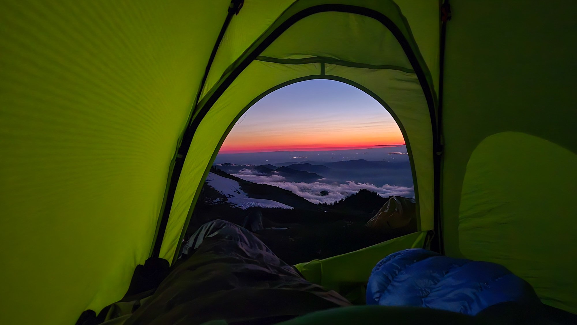
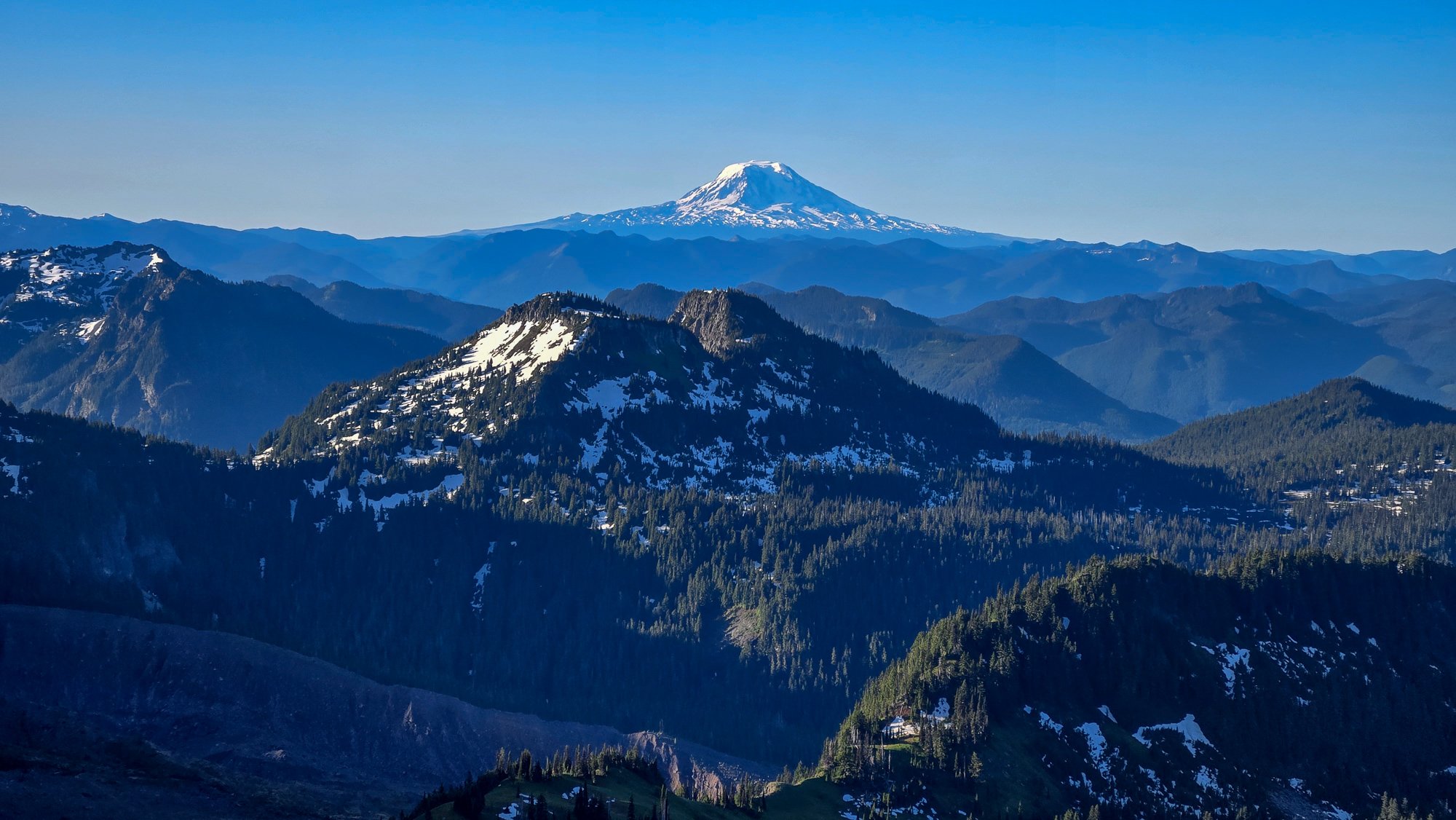
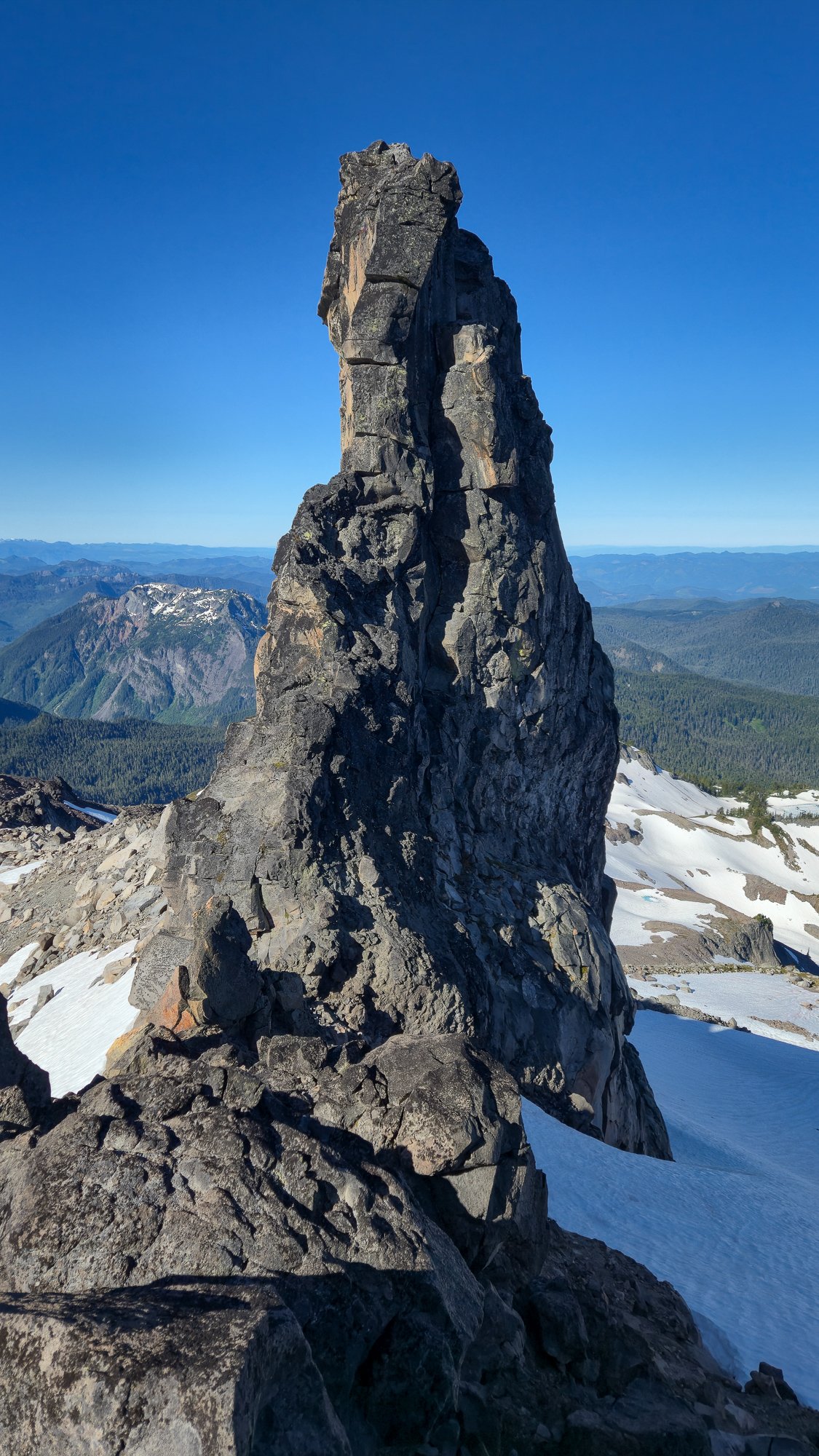
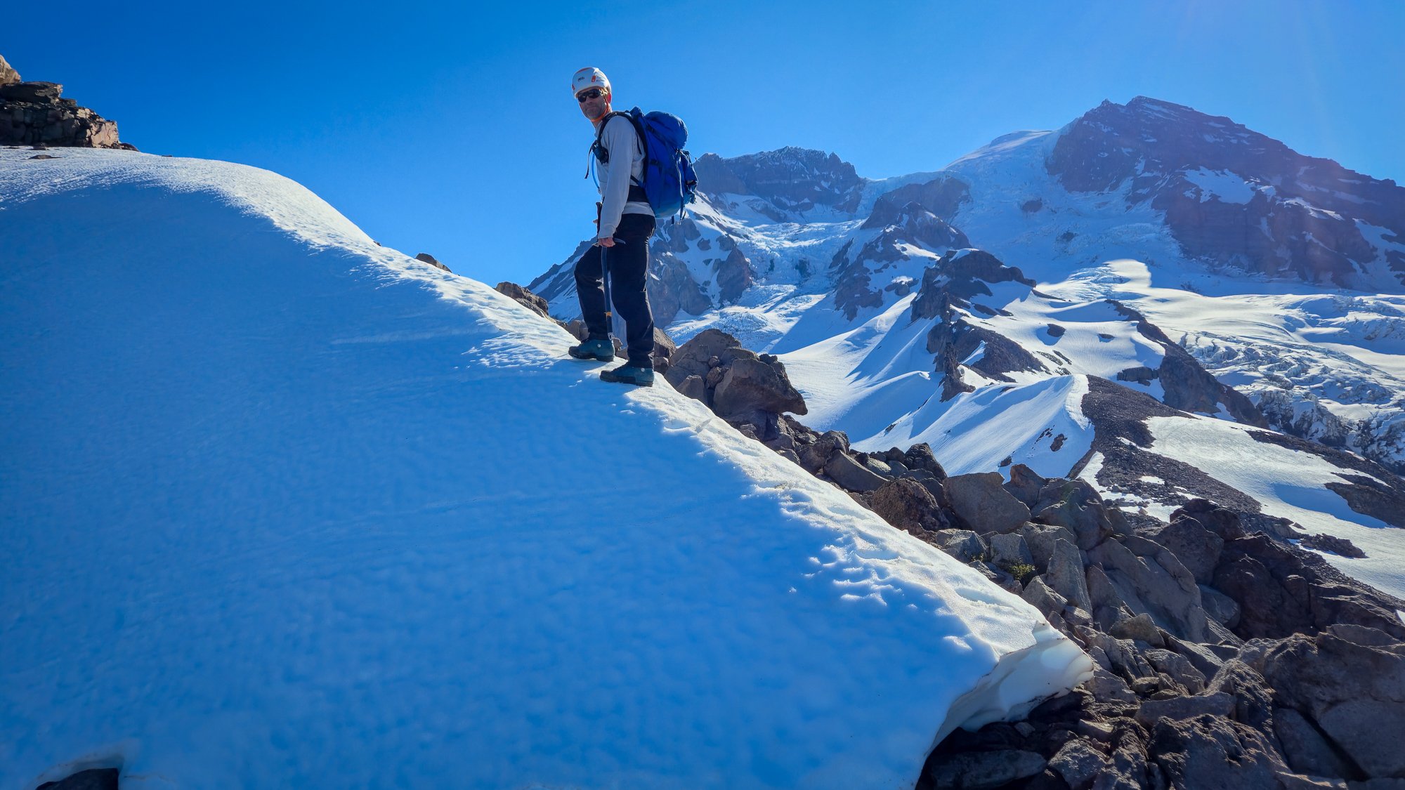
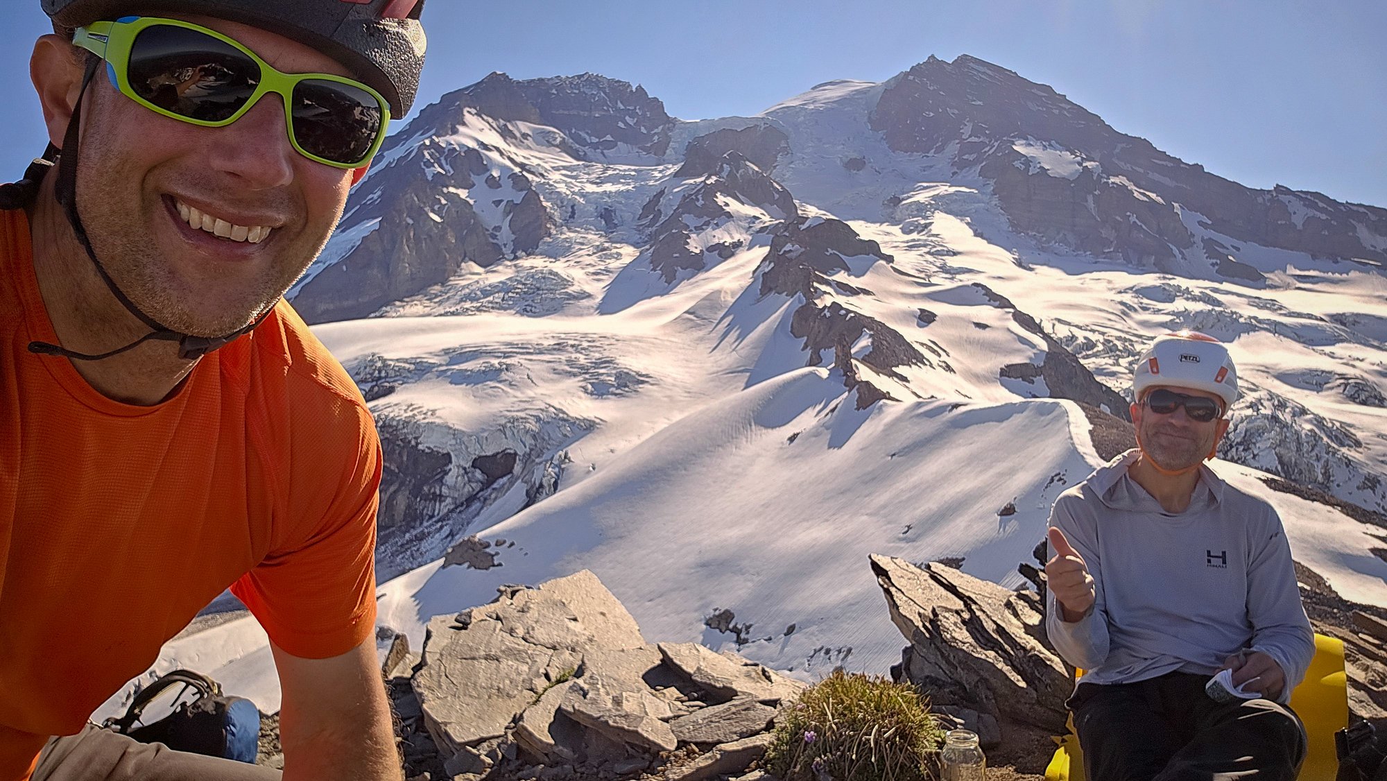
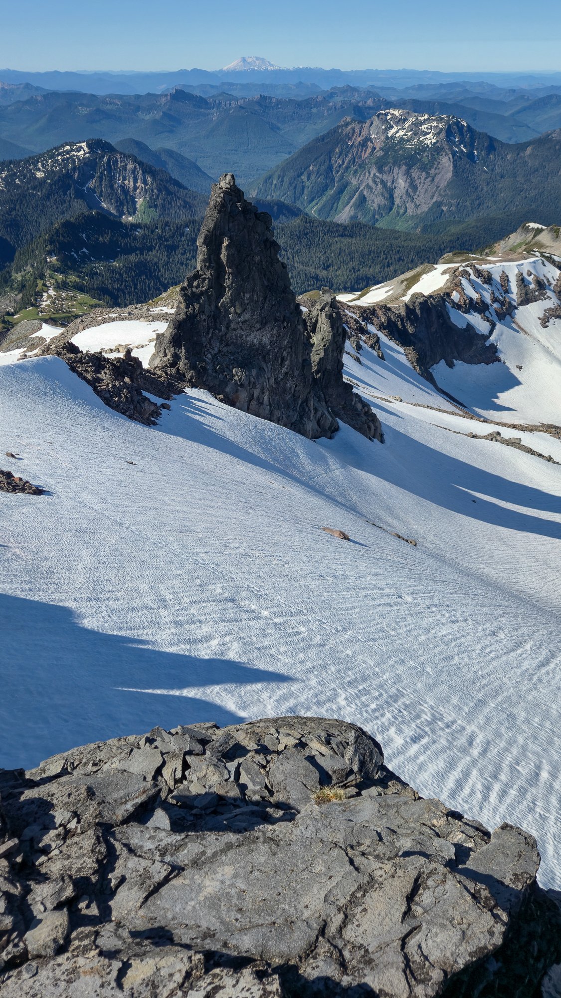
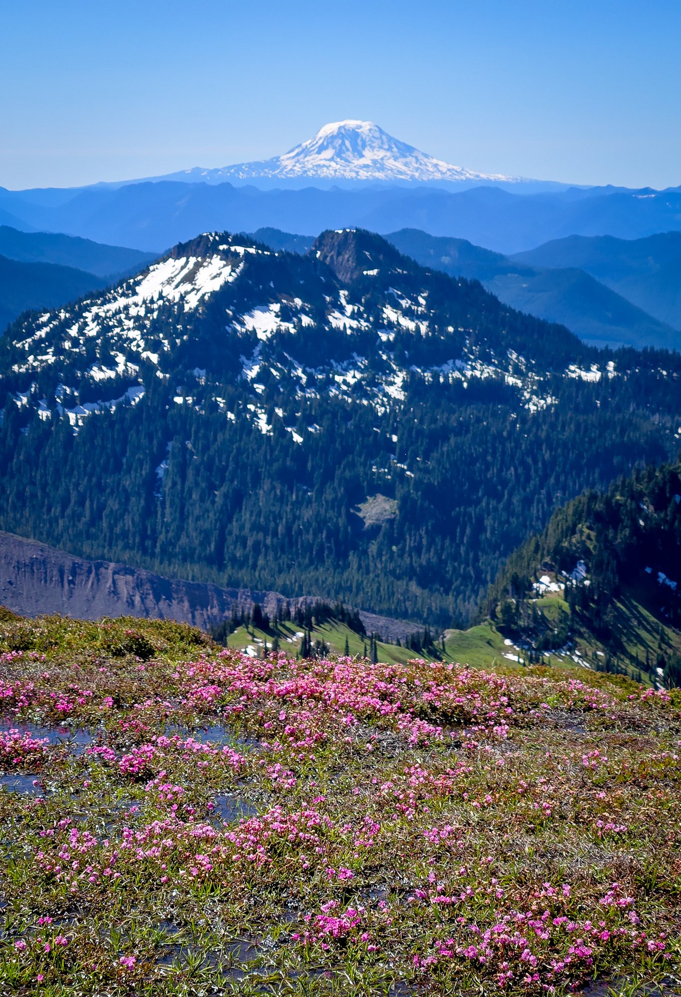
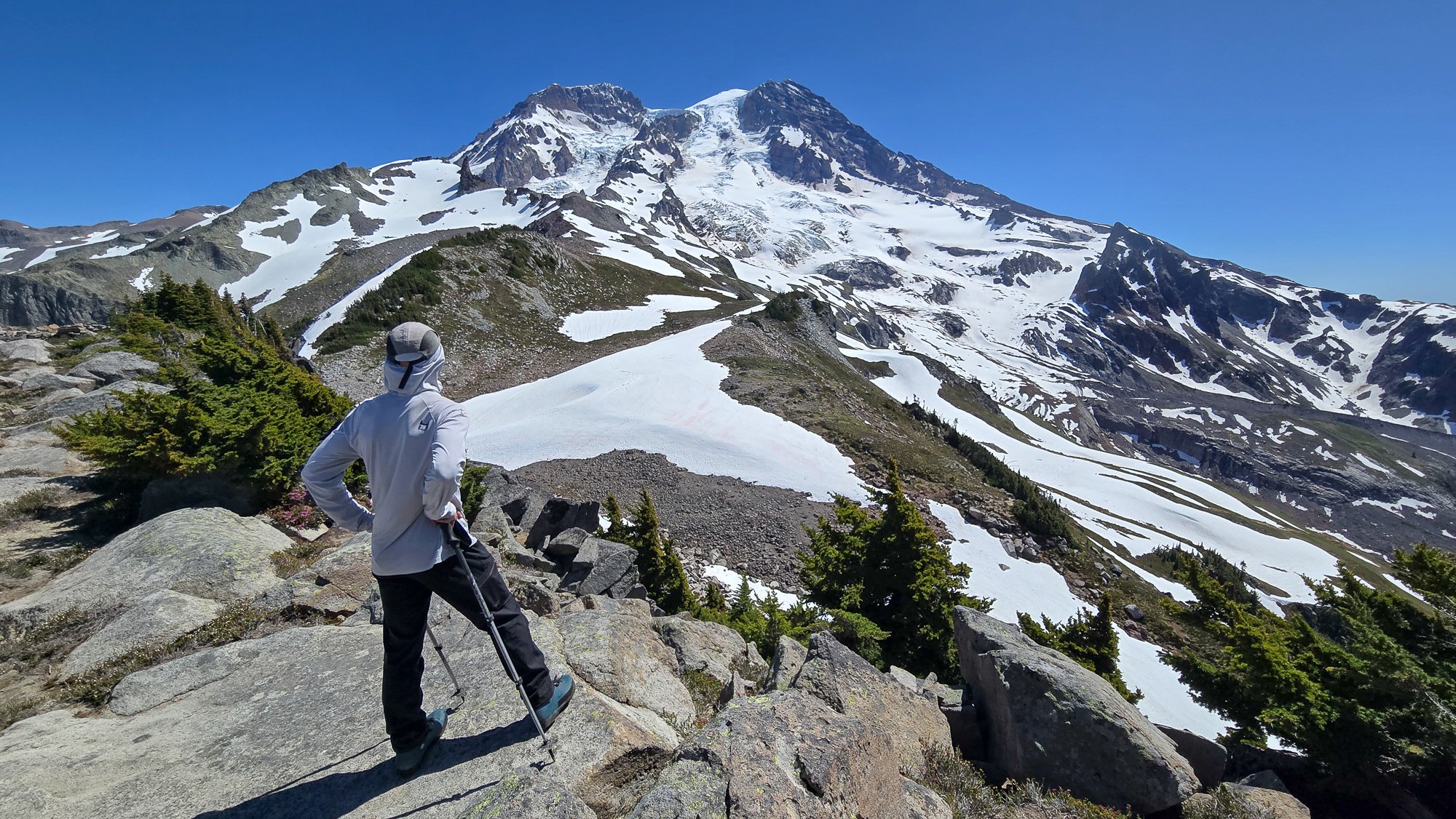
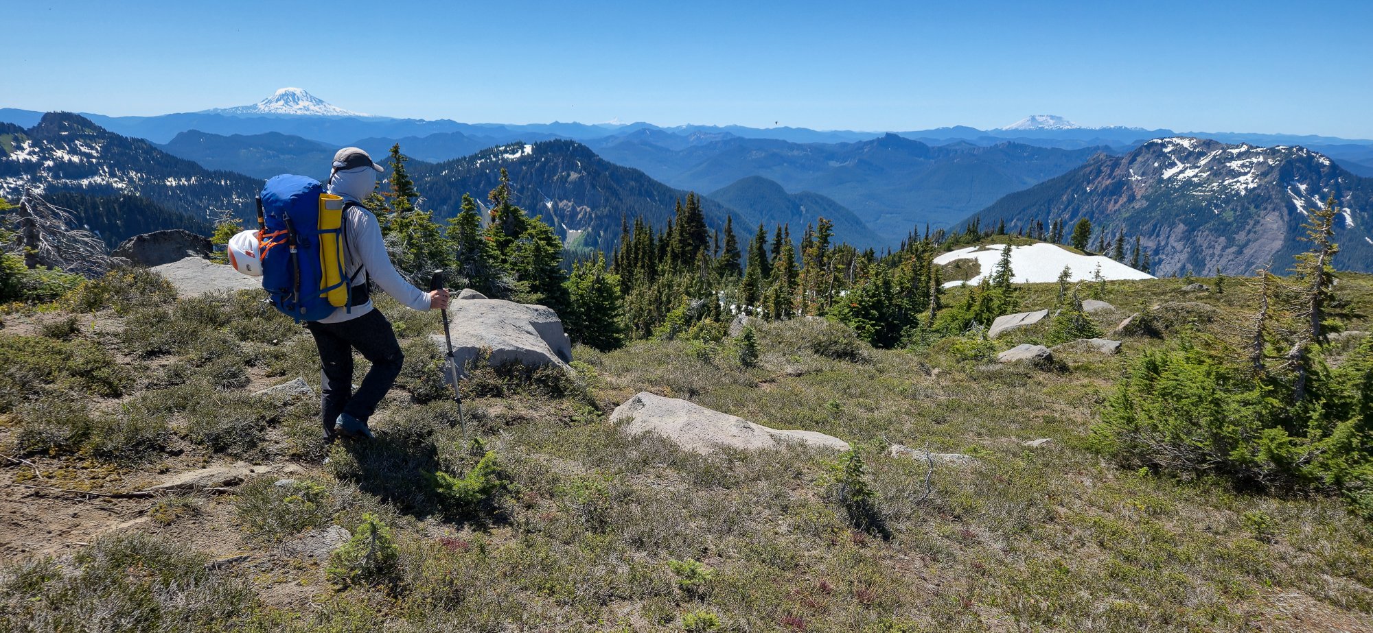
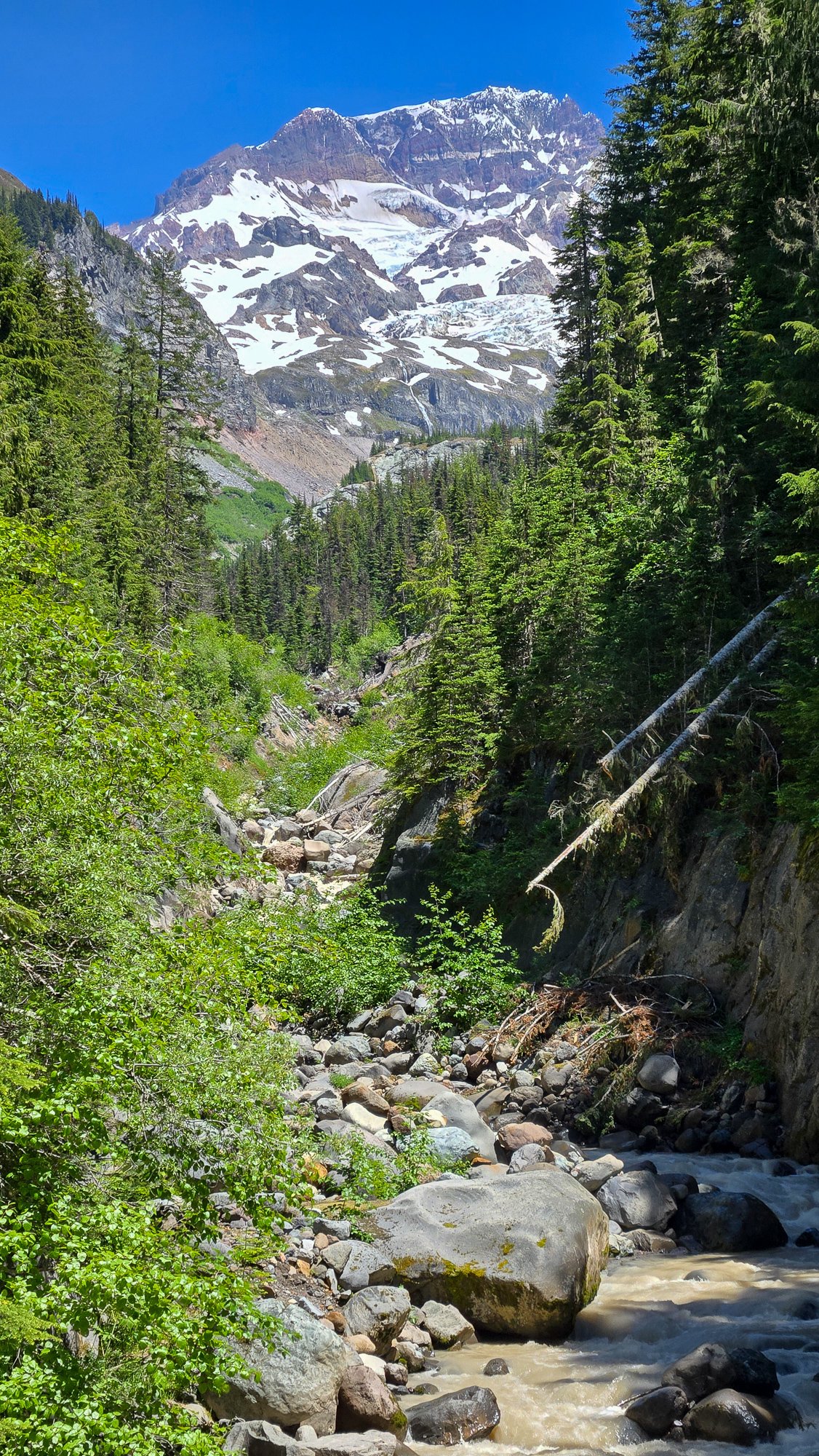
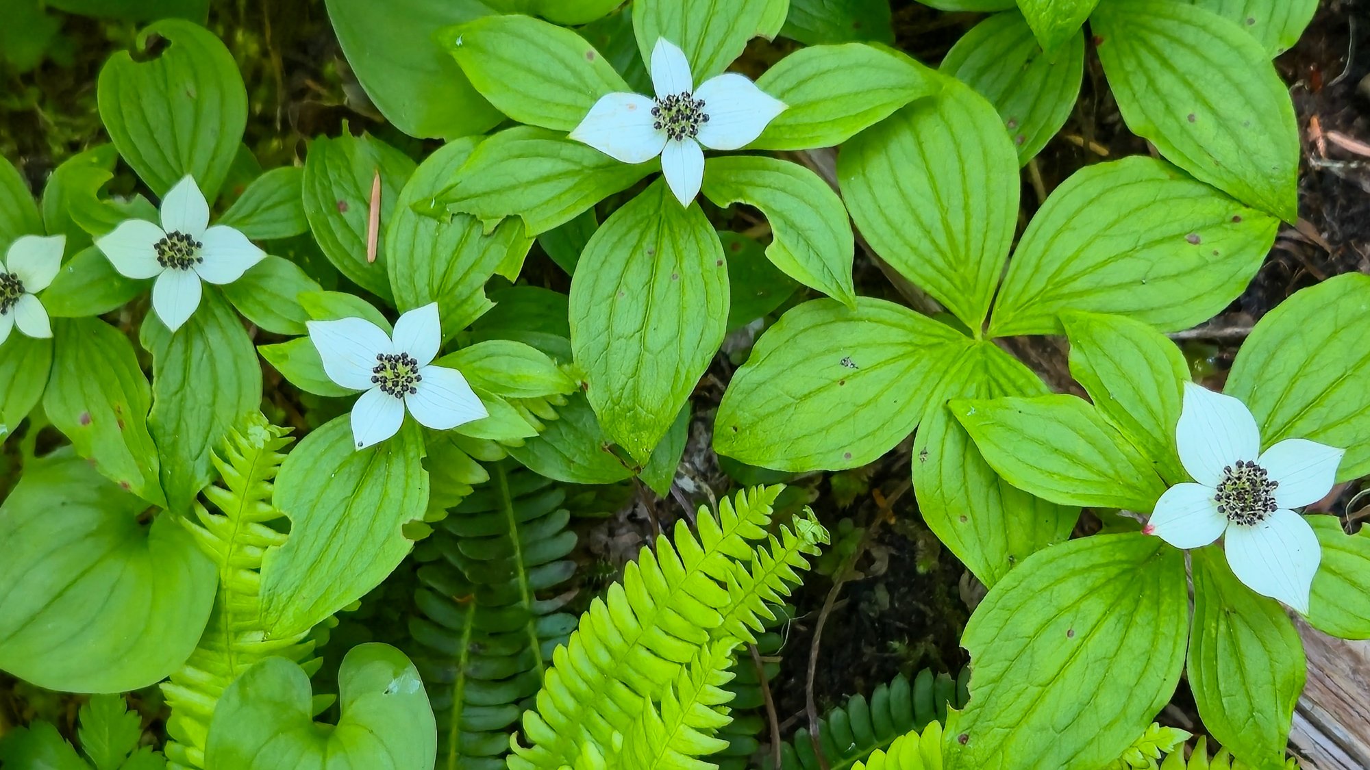
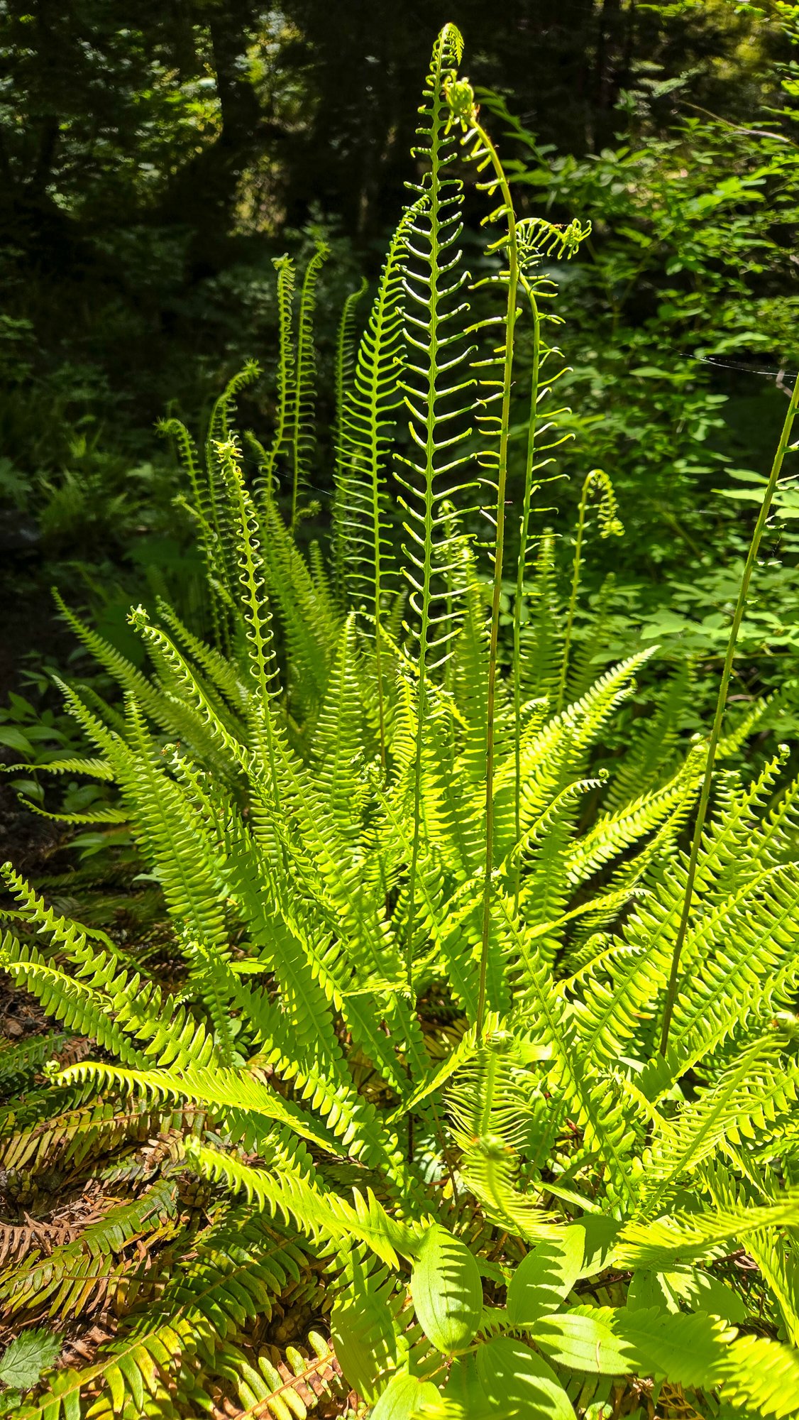
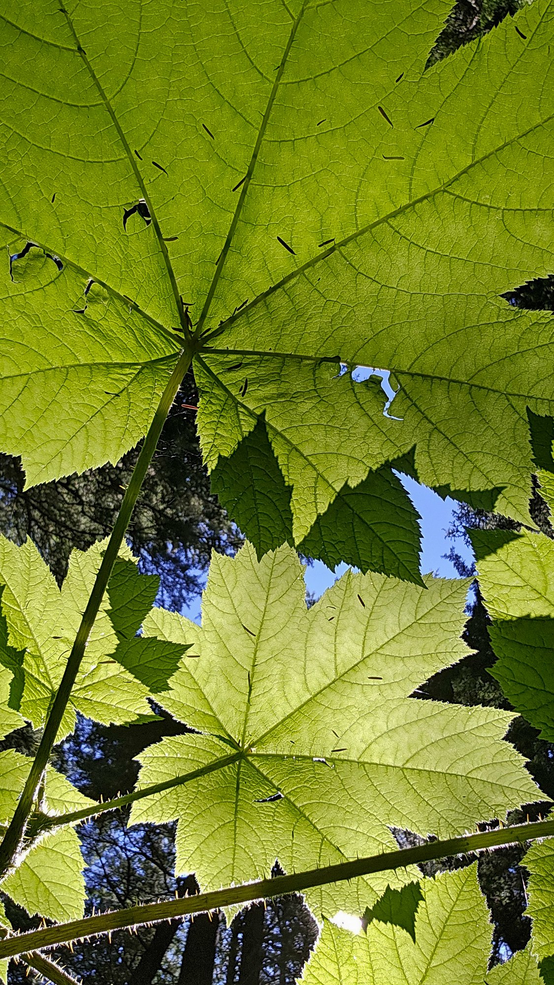
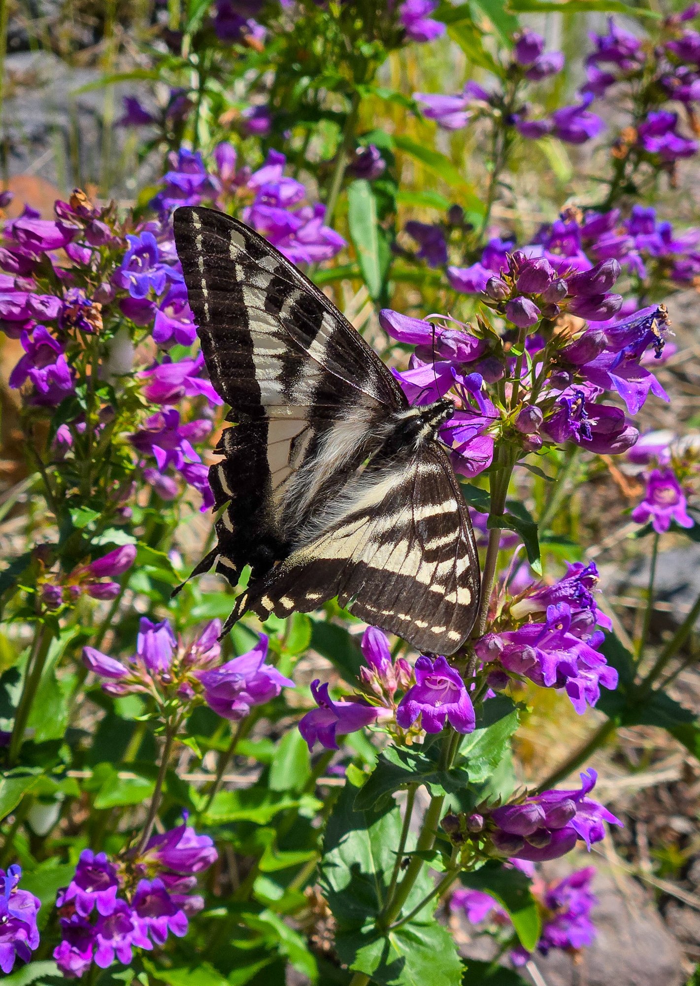
 Trip: Tokaloo Rock (Sunset Ridge bailure) - Standard Trip Date: 06/29/2025 Trip Report: Sometimes prudence is the better part of valor....or at least that is what @Trent and I told ourselves as the murk cleared and we had our first good look at Sunset ridge after walking in for 10 miles in our venerable Lowa Civettas. We were camped at what we thought was going to be our "low" camp, next to some partially melted tarns to the NE of Andrew Benchmark, above St. Andrews park. Our high camp was planned for about 11.1k on Sunset ridge the next day. However, the entire upper mountain was very boney in the fading light and it looked like a several hundred vertical foot section of the ridge where the route went was completely bare of snow (~11.5-12k). Hmmmm. We had enjoyed the scenic ramble in from the NPS gate at their chosen spot on the still very drivable West Side Road earlier that day. Lush forest, interesting geology, wildflowers, and swirling mists, it was unlike most approaches to the highest point in WA. But then we got to camp and the predicted clearing didn't materialize and so we sat, napped, and stewed. But then, like magic, the veil was lifted and Tahoma was revealed! As was the camp of a neighbor, who had snuck up on us in the mists. We would find out the next day that it was none other than our very own @DPS, who I had last climbed with back in 2005! But as we turned in for the night, @Trent and I both agreed that we didn't want to climb Sunset the next day. We wanted to climb it in good conditions, not just climb it, and it was plain that it was not in good nick. To be continued.....I'll add some words to flesh out the photos below..... Gear Notes: snow gear if there is snow.... easy class 3 scrambling to the top of the rock. The Spire is considerably harder Approach Notes: West side road to South Puyallup Trail to Wonderland Trail to off trail near St. Andrews Park. Good camps at tarns just NE of Andrew Benchmark
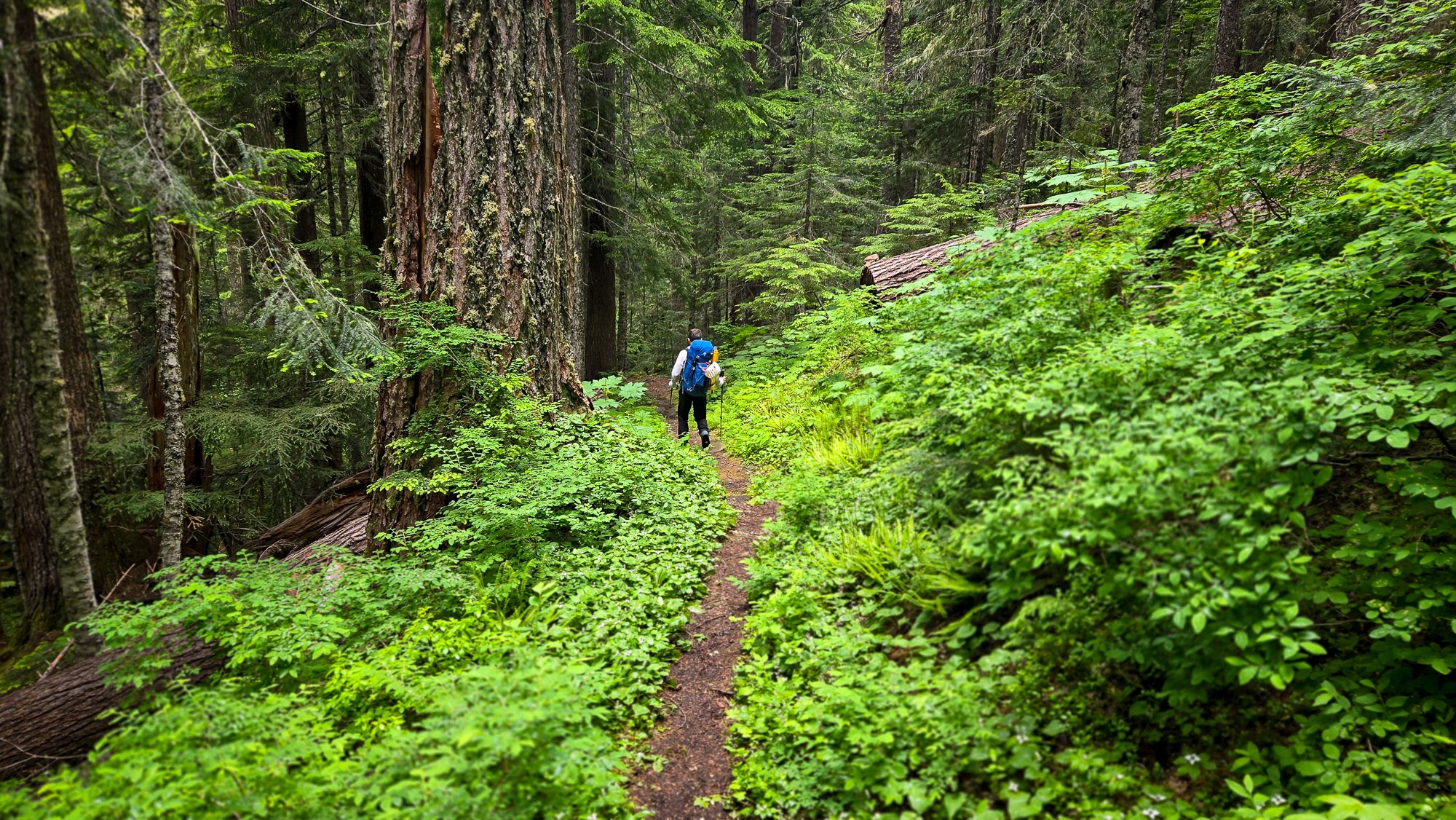
-
Tahoma Glacier - 6/21-24/2025 - with crevasse fall
Fairweather replied to mthorman's topic in Mount Rainier NP
Great report! Well done on the self-rescue too.👍 -
[TR] Mount Rainier - Emmons Central 06/30/2025
Fairweather replied to jiri's topic in Mount Rainier NP
Outstanding! Just when you think there's nothing new under the sun, someone like you goes out and finds it! - Last week
-

[TR] East Fury - North Buttress attempt 06/29/2025
simlikestoski replied to JonParker's topic in North Cascades
huge effort Jon, and great write-up -
 Sean503 joined the community
 -
Super cool to have solitude on that side! Thanks for the report....
-
Cool route, especially the camp spot. It looks like about what these guys skied this spring: https://turns-all-year.com/trip-reports/emmons-glacier-to-terminus-mt-rainier
-
 gfos joined the community
 -
 Lutian75 joined the community
 -
 Cole Cascadian Fulton joined the community
 -
Пожалуйста (I don't speak Russian and I looked that up) it's a long single-day trip for sure. Many people camp at Lunch Counter on night one and then make their summit bid the next morning. not sure if you need permits for that but probably. space to camp at the trailhead can be tight - i had to cowboy camp on some open grass by the road once, but it all worked out. good luck!
-
[TR] East Fury - North Buttress attempt 06/29/2025
JonParker replied to JonParker's topic in North Cascades
Yeah that west side looks real sketch -
spasibo! Thank You. I have attempted one time at the end of May, reached 9986 feet and went down. but we started around 5 am. it was car to car, driving in the night. This time planing about getting there the evening before and staying in the camp or car.
-
 Leon h joined the community
 -
[TR] Tetons - The Grand Traverse 8/31/2015
Leon h replied to nutsandbolts's topic in The rest of the US and International.
I know this is 2015 but curious I want to solo the traverse but was wondering about the 5.8 /5:7 climbing I have the whole last week of July off so want to take advantage -

[TR] East Fury - North Buttress attempt 06/29/2025
Alisse replied to JonParker's topic in North Cascades
Beautiful 😍 -
there will be plenty of people up there. take more sun protection than you think you need (hats, buffs, glasses - sunscreen never lasts long enough). Take lots of water and start early. 3 AM from the parking lot is probably early enough if you're fast, otherwise it is more pleasant as a two-day trip. take a trash bag or waterproof pants for the glissade down! (remove crampons for the glissade)
-
[TR] East Fury - North Buttress attempt 06/29/2025
JasonG replied to JonParker's topic in North Cascades
Hmmmm....important distinction....let's see....I think the west side? -
Trip: Mount Rainier - Emmons Central Trip Date: 06/30/2025 Trip Report: When looking at Emmons from Sunrise, Andrew got the idea of trying a route that would connect with a feature similar to the Emmon-Winthrop route corridor but positioned in the middle of the expansive glacier. This feature starts around 10k and provides easy direct access to the upper mountain. I was skeptical about the idea until I had a closer look myself a few weeks ago while climbing Cowlitz Chimney. We could not find any information about this route and decided to refer to it as Emmons Central. Please, let us know if you know the history or previous ascents. To spice things up Adrew pitched starting the glacier terminus. We scouted access to the moraine Saturday afternoon and took closeup picture of the route to weight our options. The pictures did not show any clear paths to the corridor but the “right” side variation looked the most promising. Sun morning, we hiked and shwacked to the terminus and started making our way up the glacier. The idea was to skirt very broken up lower section on the right, then hook left trying to ascend to a rocky ridge in the middle of the glacier. We could then follow the ridge for a little bit until being able to push right to access the start of the corridor. We identified one potential make-it-or-break-it crevasse below the rocky ridge but did not see any clear dead ends along this option. After leaving the moraine and getting on snow we started aiming for a nunatak at 9400 following open slopes with minimal crevasse issues. From here we initiated our left hook as the glacier became more broken up. After some navigation we reached the crevasse with a question mark and were able to get across on an exposed but solid bridge far left. This brought us to the rocky ridge where we set up the camp at exactly 10080ft. Being in the middle of a glacier with the largest area in the contiguous US and having dry ground to sit on was awesome. Looking up from camp revealed crevasse problems we did not see in the pictures. The general plan was to keep going right and that is exactly what we did in the darkness the following day. It was obvious when we finally gained the ramp because there were no crevasses in sigh as far as the headlamps could shine. The angle starts around 40 degrees and gradually eases off with elevation as it trends slightly left. Around 12.5k the route connects with the late season DC route variation. To our luck we ran into set of boot prints around this elevation. Later on the boot path became marked with wands so my guess is that the guides or rangers prepared the route for when the regular DC gets too broken up. We followed the boot prints and wands until connecting with the regular DC and the well beaten path to the summit. We descended via the standard Emmons-Winthrop route. Gear Notes: pickets Approach Notes: Moraine trail to "End of maintained trail" sign then follow a boot path down. We then hiked along the vegeration up until it looked more open
-
[TR] East Fury - North Buttress attempt 06/29/2025
JonParker replied to JonParker's topic in North Cascades
Yikes, yeah that would do it. I’m curious was that on the west or east side of the buttress? -
Pretty great, the force is strong in this one.
-
[TR] East Fury - North Buttress attempt 06/29/2025
JasonG replied to JonParker's topic in North Cascades
Well done surviving an attempt on that one! It was on the list until it I saw it firsthand in 2007 and realized I wasn't nearly tough enough.... but maybe it was the massive/serac rockfall that strafed the approach while we watched, or at least that was the mental excuse I used all these years.


