
All Activity
- Past hour
-
Looks much more interesting than the NW Ridge! Thanks -- I'll have to check it out
-
 Sounds like a great adventure! Thanks for the photo beta!
 - Today
-

[TR] Seahpo / Cloudcap Peak - NE Ridge 07/05/2025
sepultura replied to geosean's topic in North Cascades
Nice work! No personal experience on that beautiful beast, but it’s reported to deserve a well earned place on the Repulsive 69. -

Tahoma Glacier - 6/21-24/2025 - with crevasse fall
OlympicMtnBoy replied to mthorman's topic in Mount Rainier NP
Great rescue pics as well! Glad everyone was safe and it ended up good practice! -
Thanks for the report, fun stuff up there. And terrifying chess as well. Amazing how quickly it changes when you can see where you are going or not!
-

[TR] Tokaloo Rock (Sunset Ridge bailure) - Standard 06/29/2025
Fairweather replied to JasonG's topic in Mount Rainier NP
Less than 35 feet to go! I guess it would be the east ridge as our backs were to the Tahoma Glacier. Whether to go right or left here was beyond us.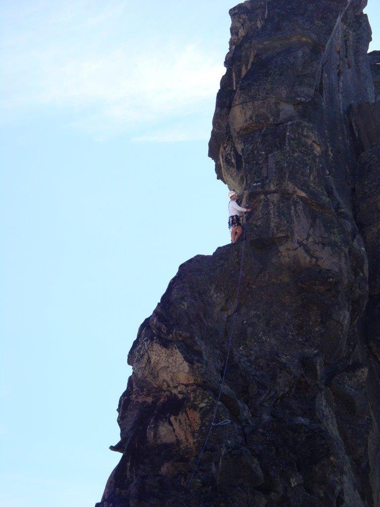
-

[TR] Tokaloo Rock (Sunset Ridge bailure) - Standard 06/29/2025
JasonG replied to JasonG's topic in Mount Rainier NP
Was that up the NW side? That thing is pretty impressive! My first time up close... -
[TR] Tokaloo Rock (Sunset Ridge bailure) - Standard 06/29/2025
JasonG replied to JasonG's topic in Mount Rainier NP
Ha! Well, @Trent and I may be old but at least we still can armchair mountaineer with the best of them. Sorry to hear about your trip @Nick Sweeney (and happy you survived!), but glad to know we made the correct call. Thanks for the write-up! I'll finish this, this week. -
 MattyG402 joined the community
 -
 Reminds me of an August trip with similar plans and outcome a few years back! Yikes!
 - Yesterday
-
 Great effort and thanks for the beta! I was really stoked to try the N Buttress of Terror this season but those approach conditions are atrocious. Hmmm.
 -
I checked out the East Ridge of Dorado Needle. For choss dogs like me, it was kind of fun and definitely a good way to spend a day on a multi-day mission in that area. Full report and photos here: https://spokalpine.com/2025/07/07/dorado-needle-east-ridge-iii-5-7/
- 1 reply
-
- 2
-

-

-
 For contrast to the double moat encountered on 7/4/25, the 7/6/24 conditions are pictured in the TR linked here. No moats, easy downclimb.
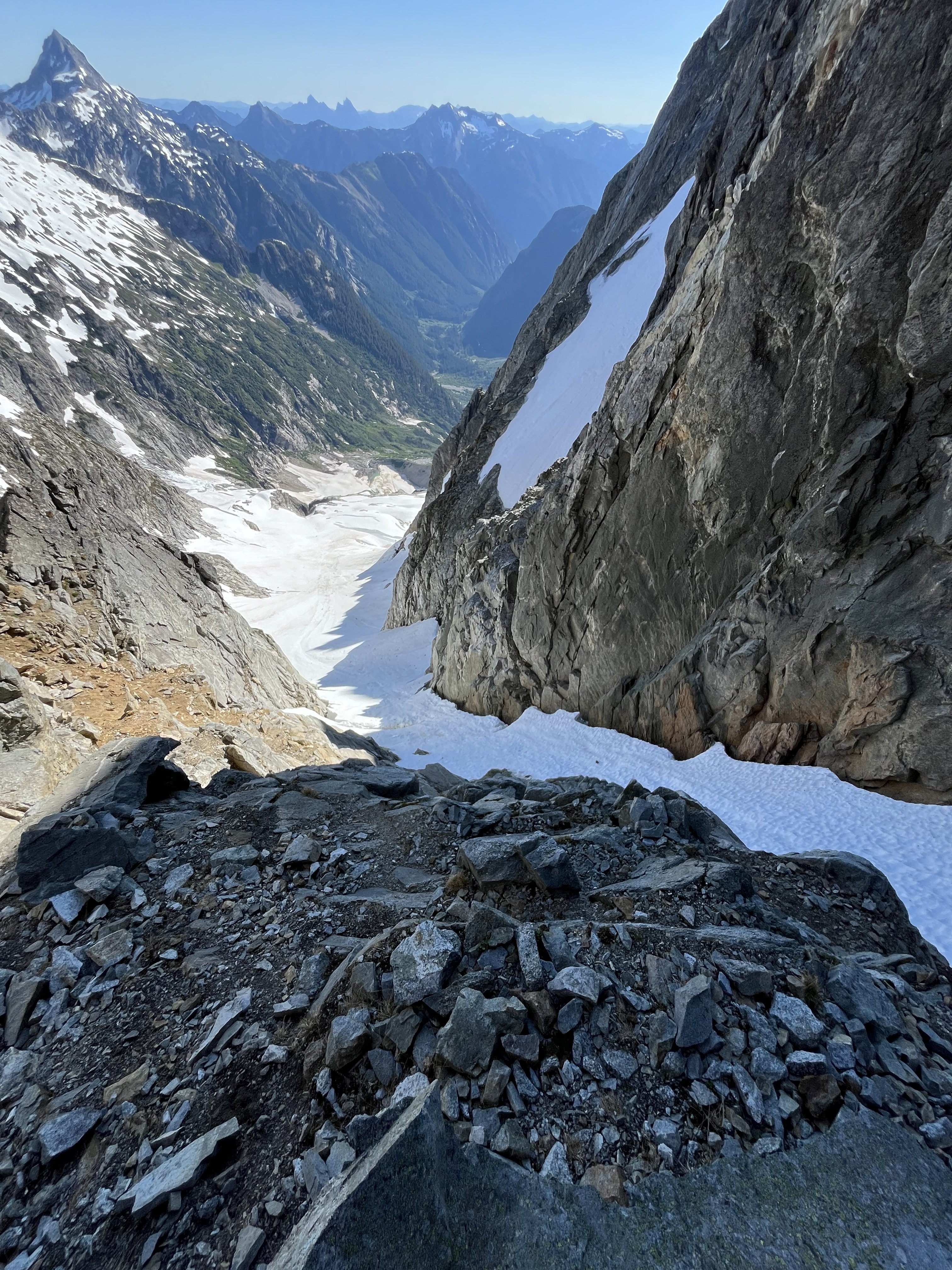
-
[TR] Tokaloo Rock (Sunset Ridge bailure) - Standard 06/29/2025
Nick Sweeney replied to JasonG's topic in Mount Rainier NP
Some notes and photos from our attempt to 12,400'. Definitely not a good year for it, that couloir descent was pretty scary with all the rockfall. https://spokalpine.com/2025/07/03/rainier-sunset-ridge-attempt/ -
Ah, that's unfortunate to hear.
-
 I saw that photo, but I hate it, it makes the buttress look terrifyingly steep! Thanks, amazing shot.
 -
I don’t, I’ve never looked into it. This is the best recent photo I have of the area
-
Nice trip, thanks for posting! If that had been you plan it would have been a fantastic outing, too bad about not getting you first choice though. It's good to know about the couloir bypass also. Someday I'll pass through that way. On another note, do you know anything about the north butterss of the Rake? Beckey says 4th and low 5th. I'm intrigued but can't find any info except that the Fireys did it in '74.
-
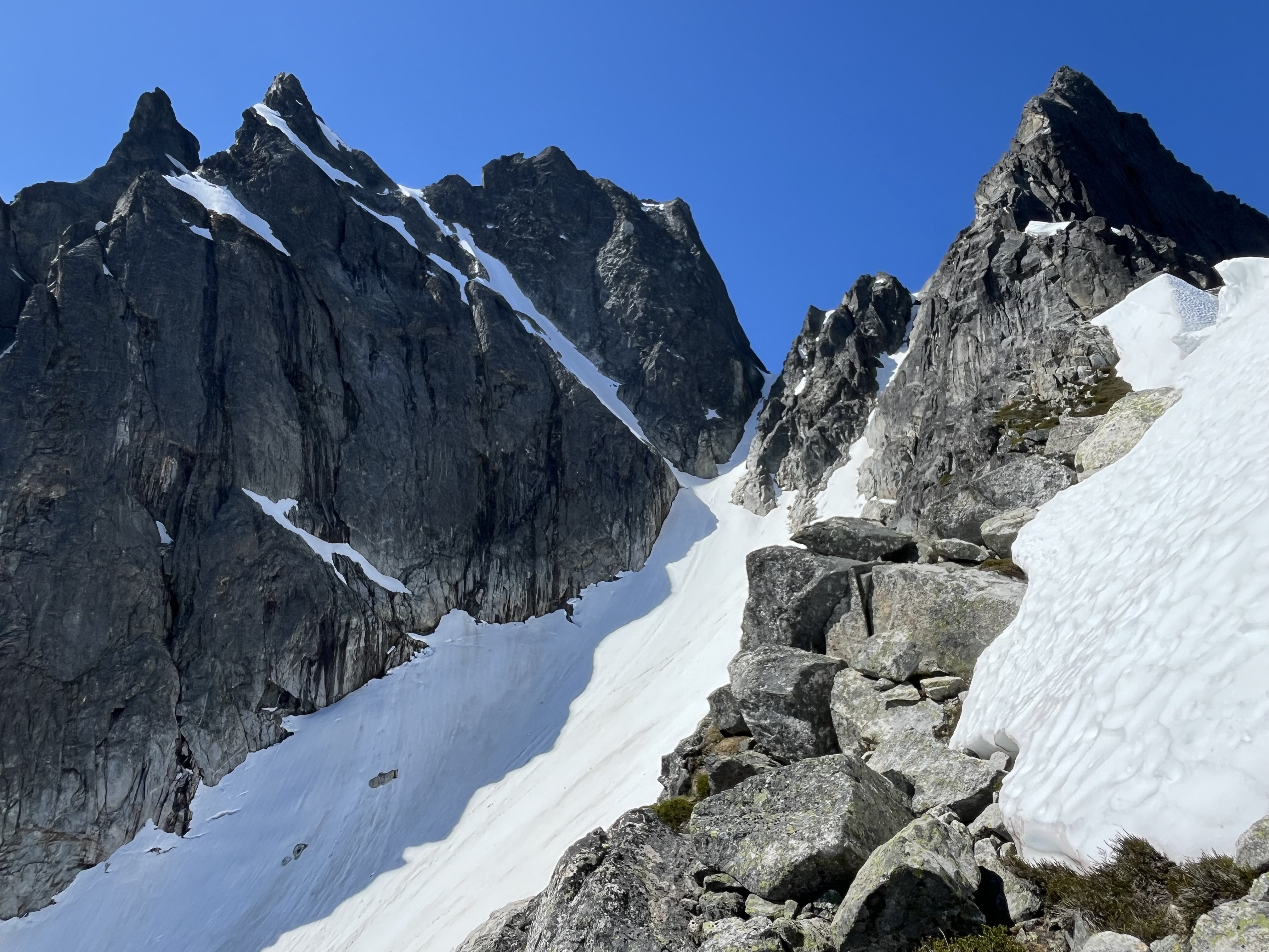
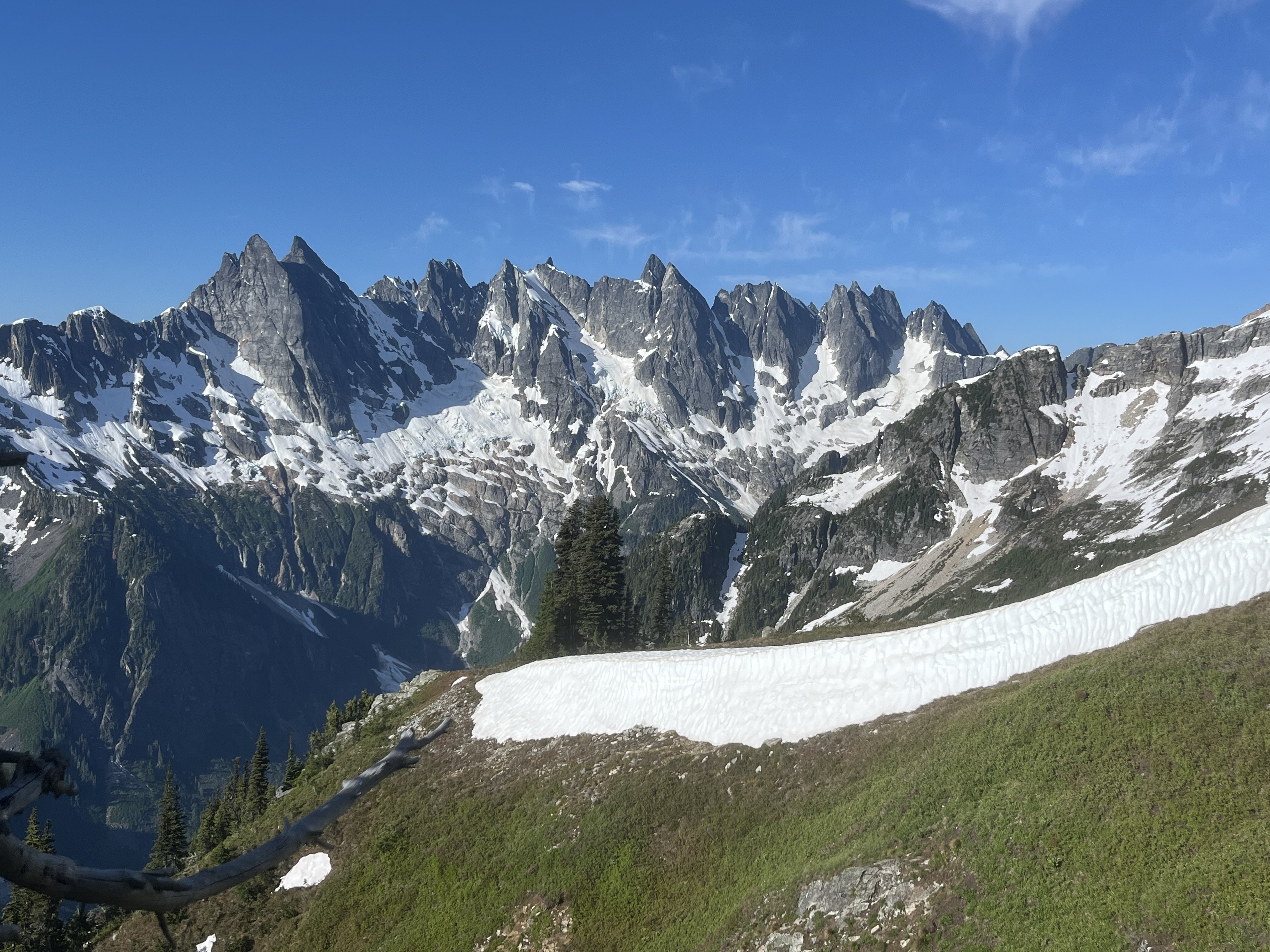
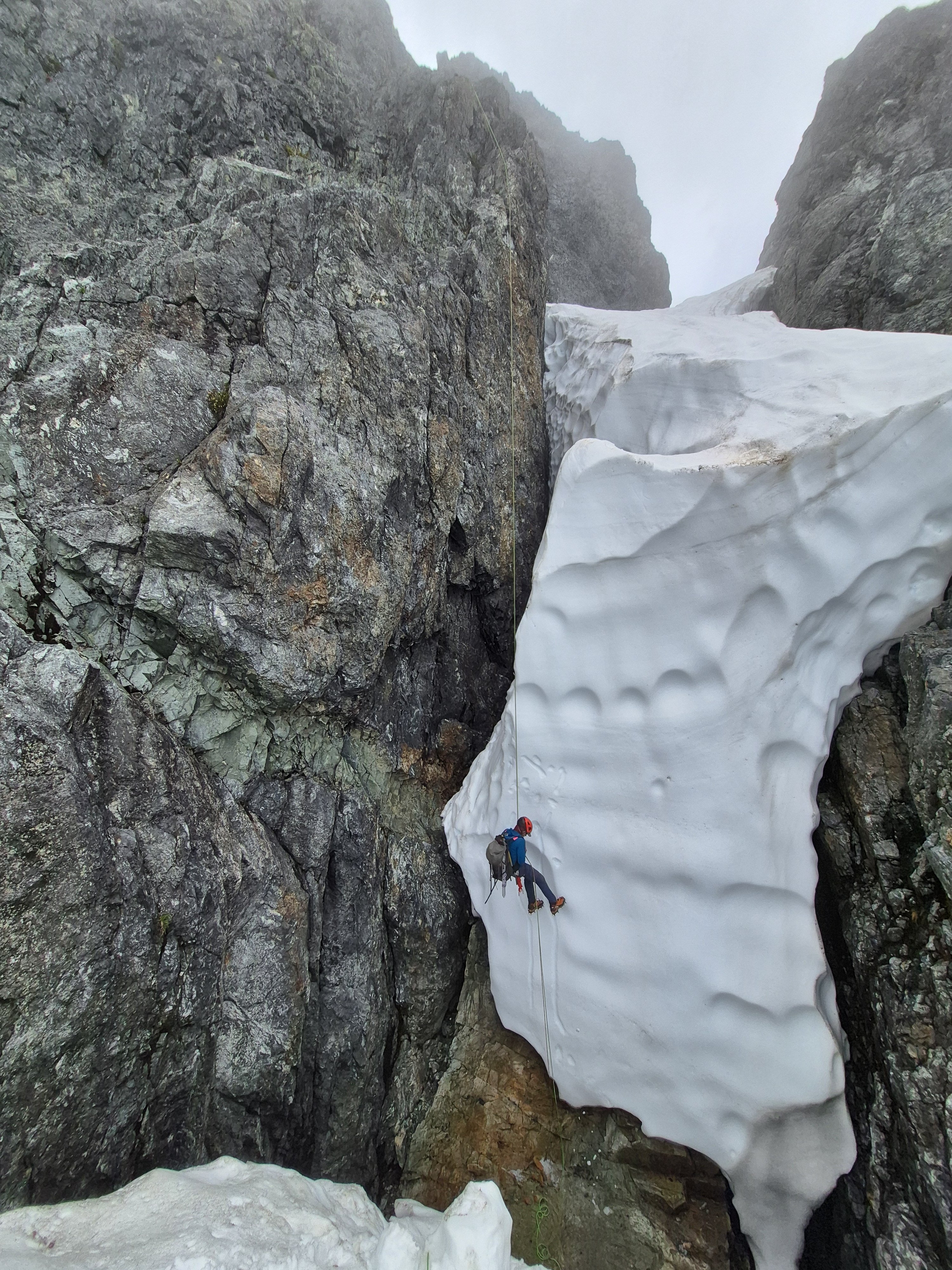
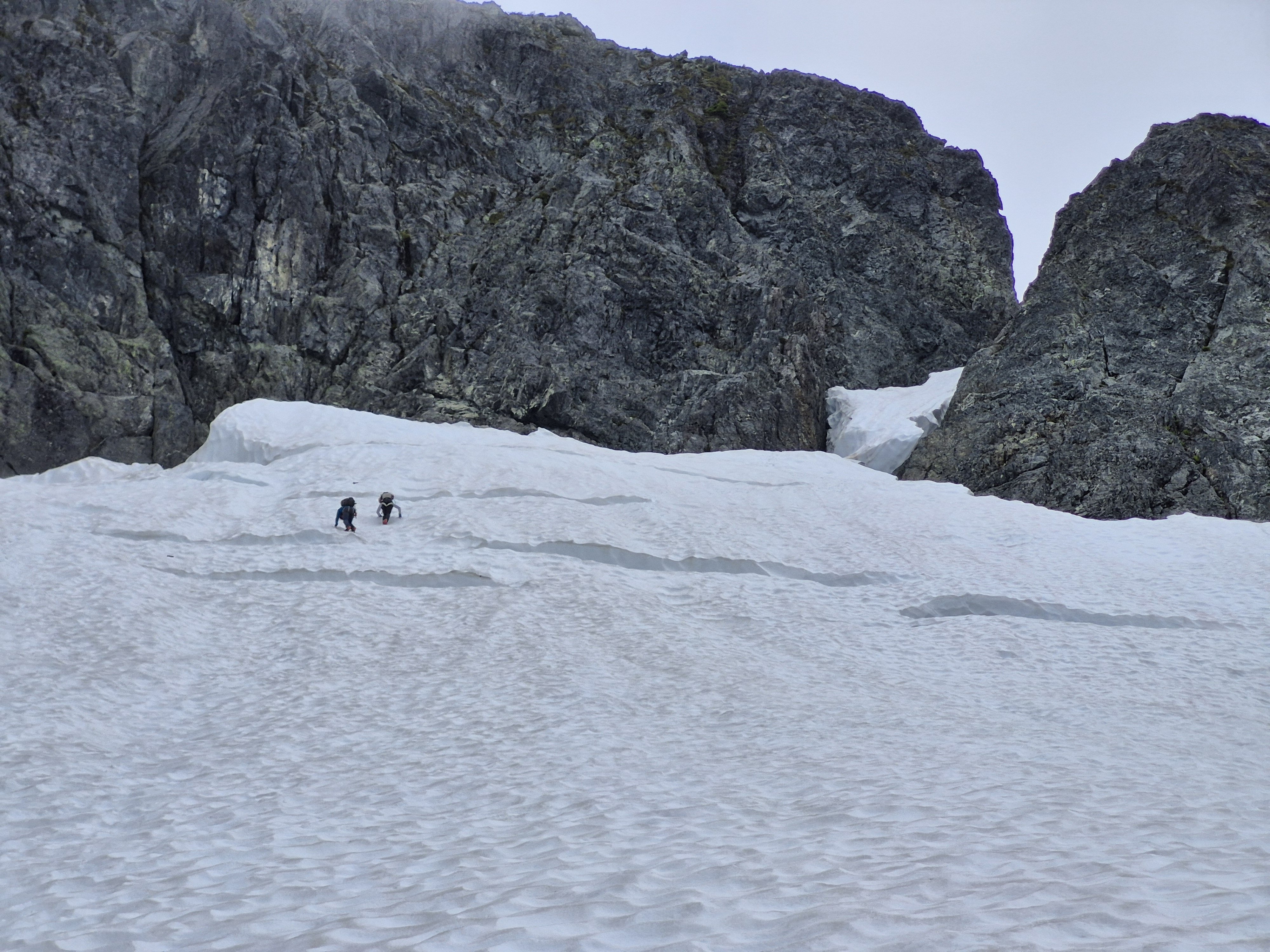
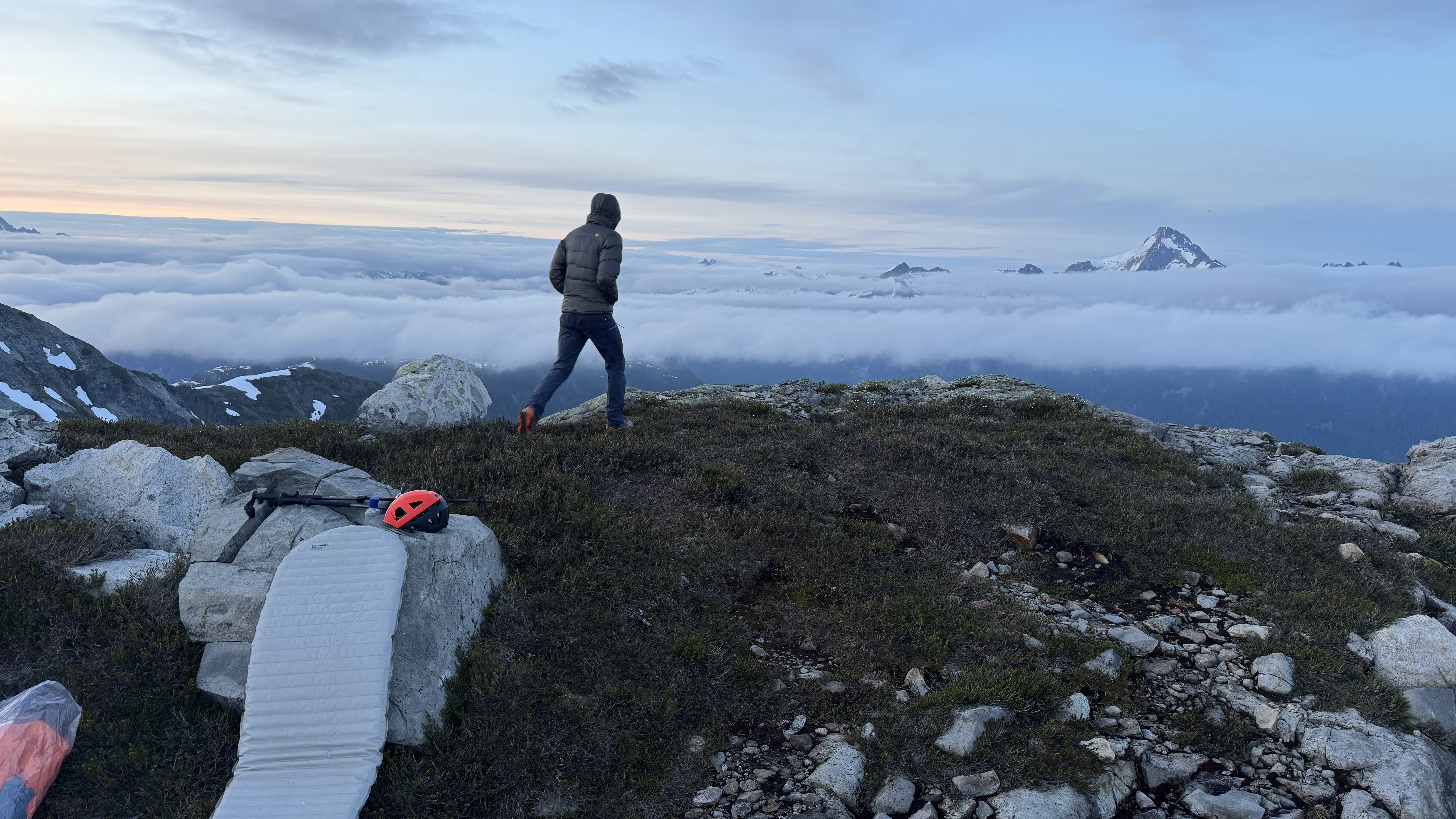
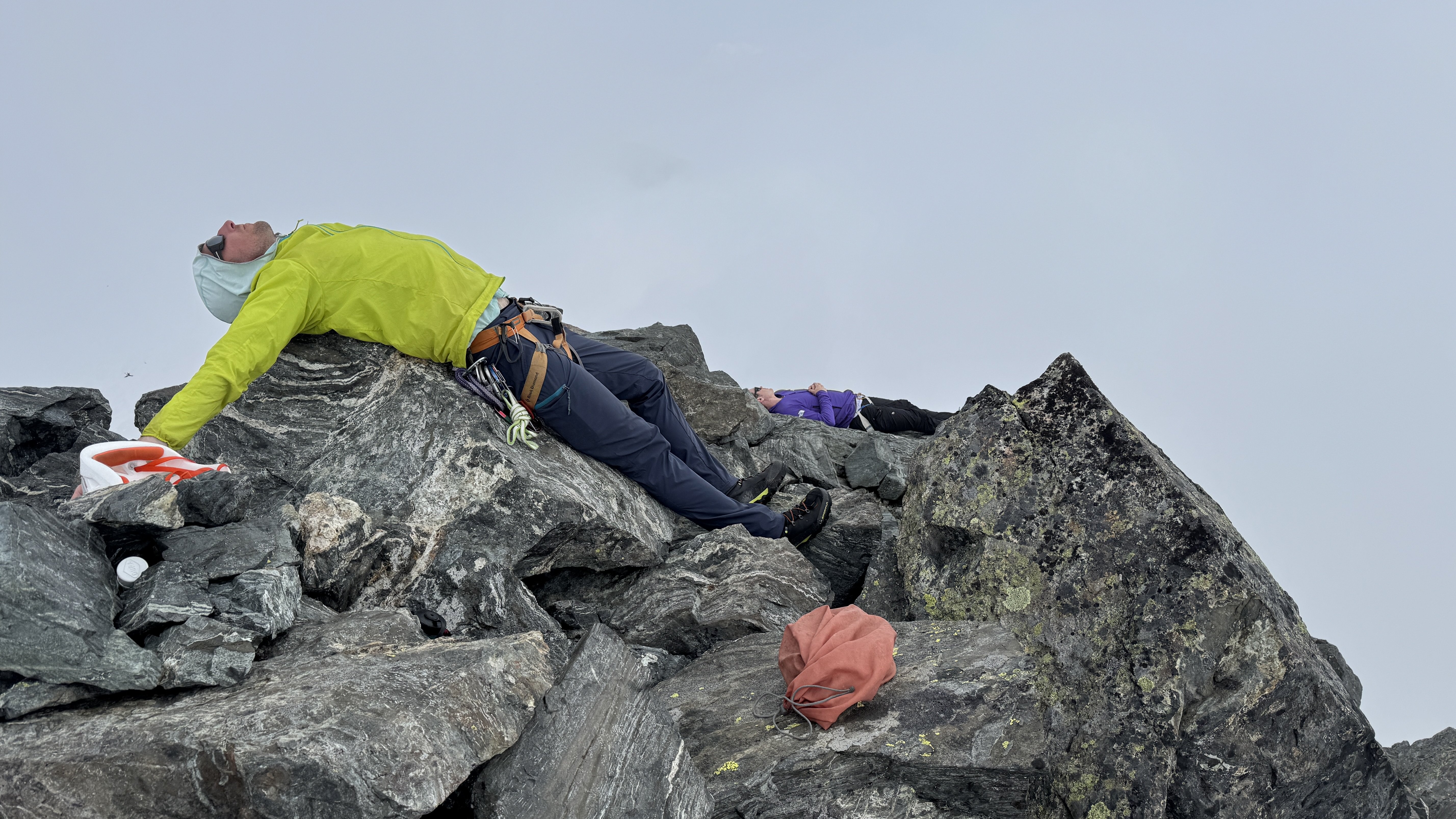
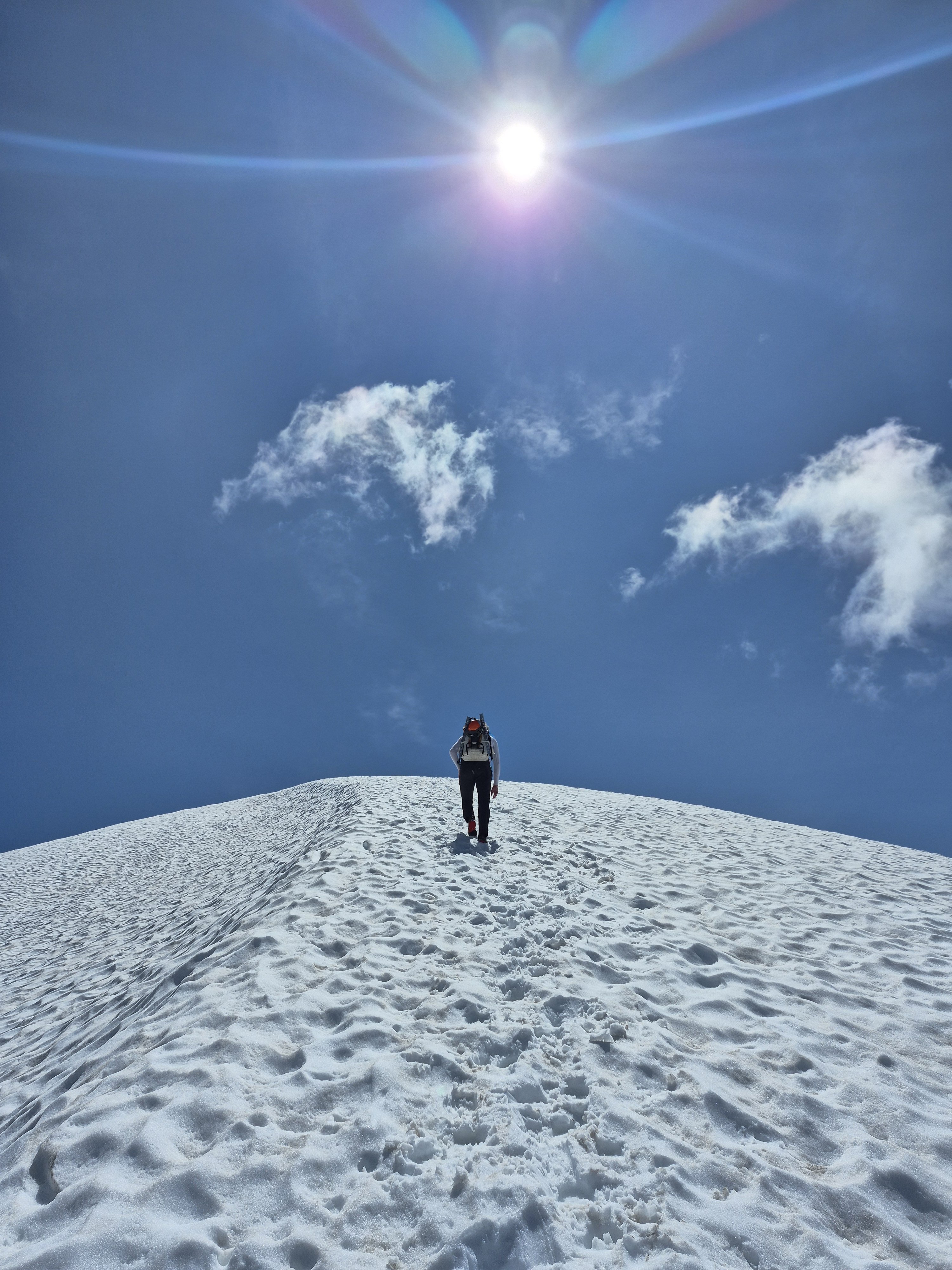
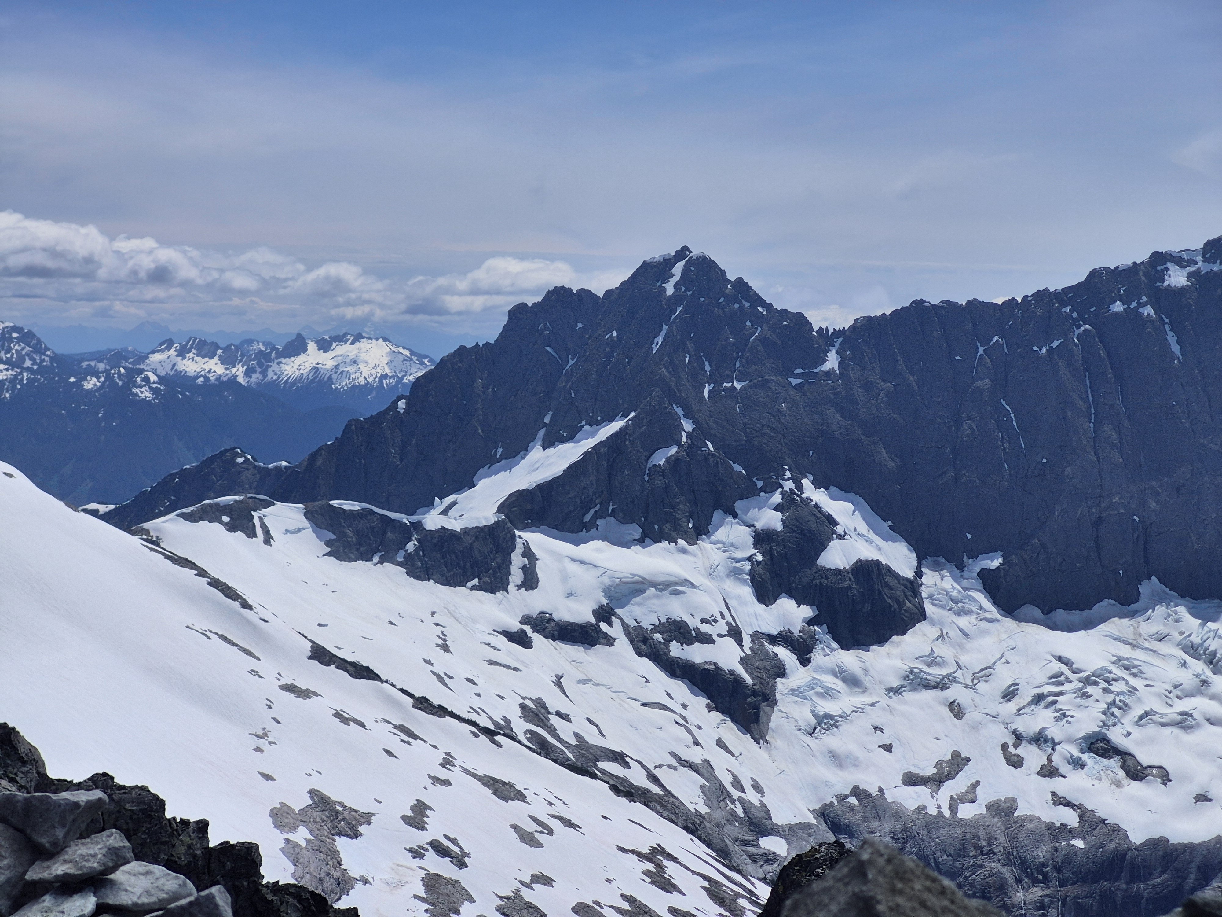
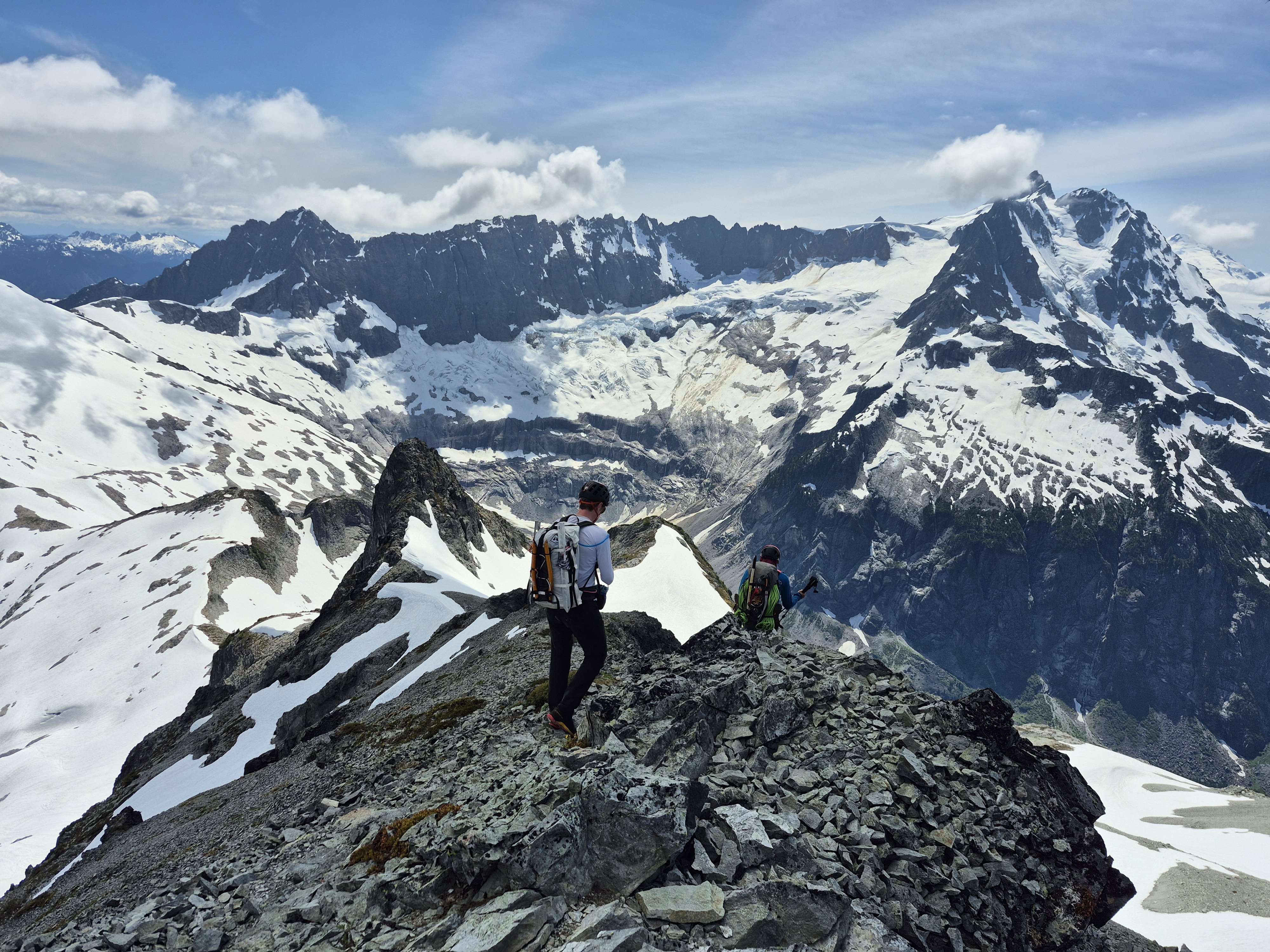
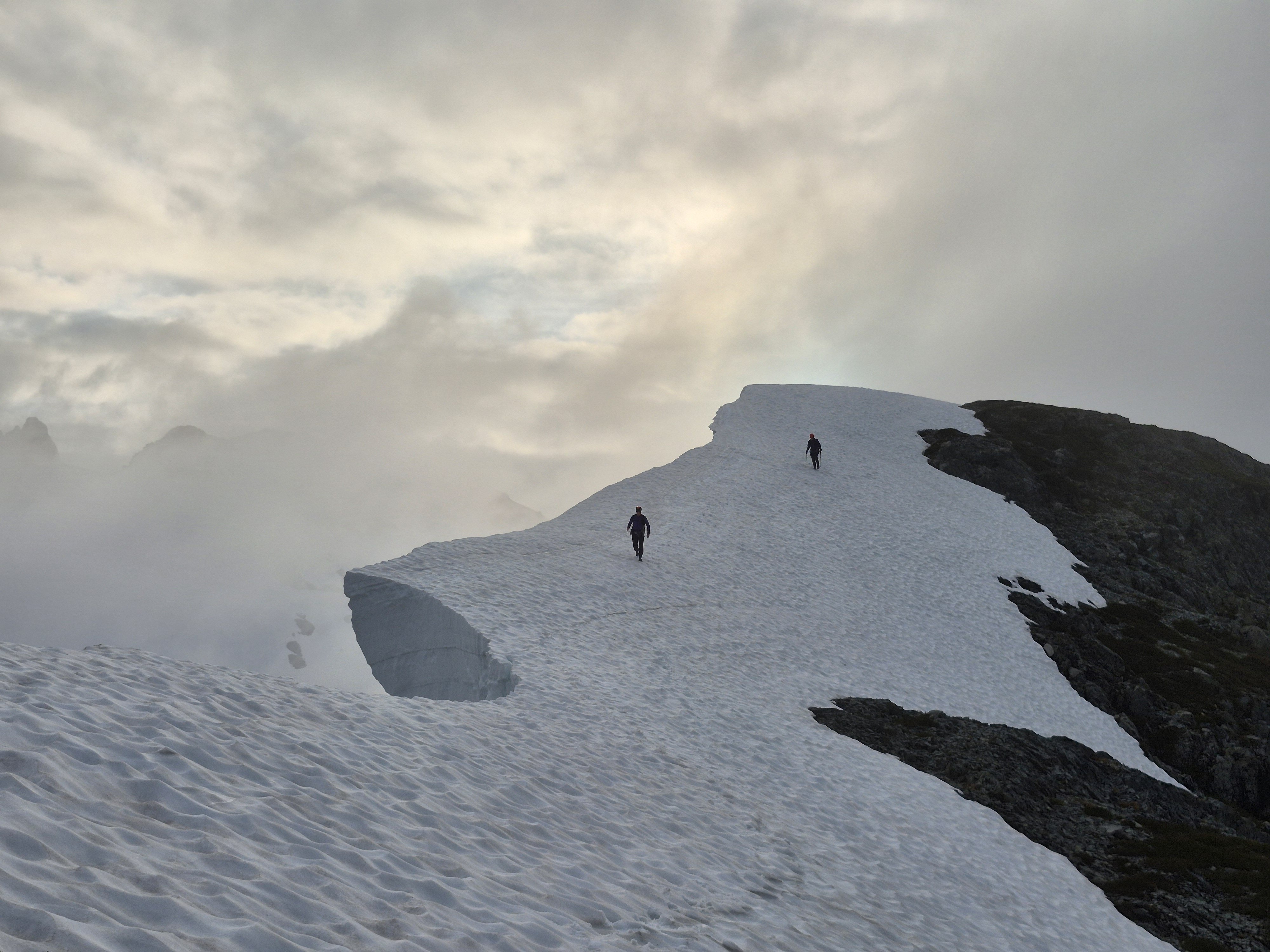
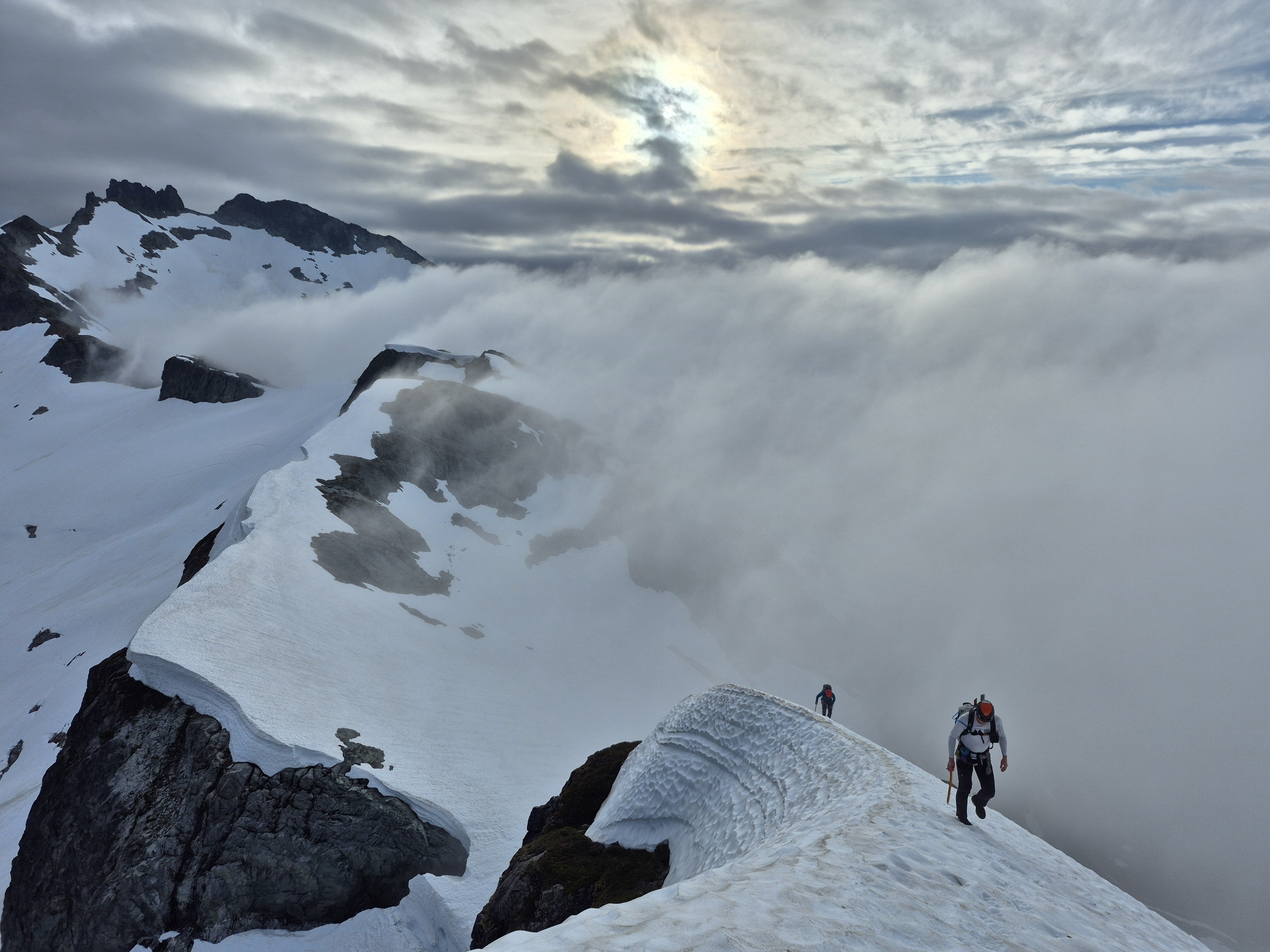
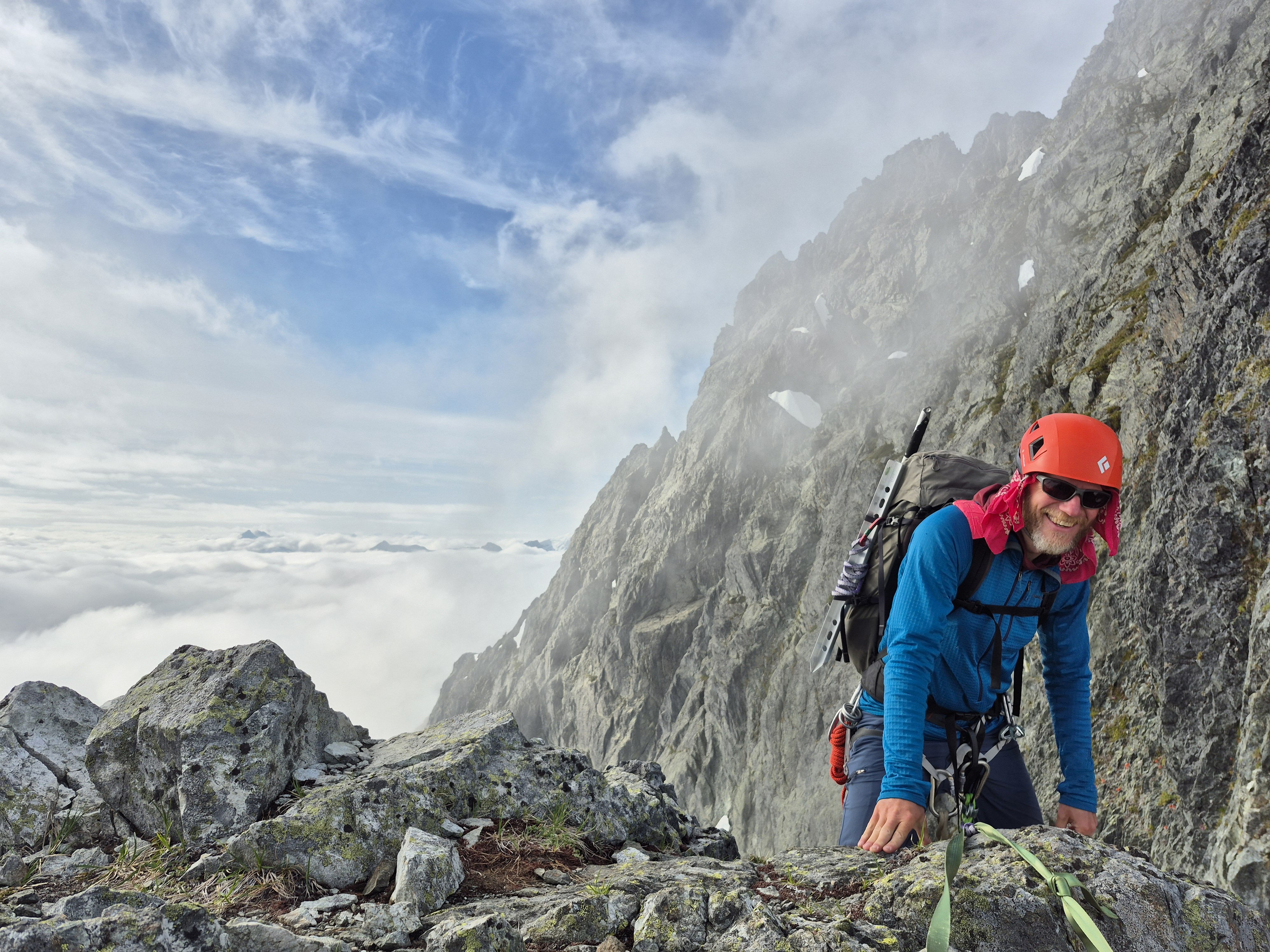
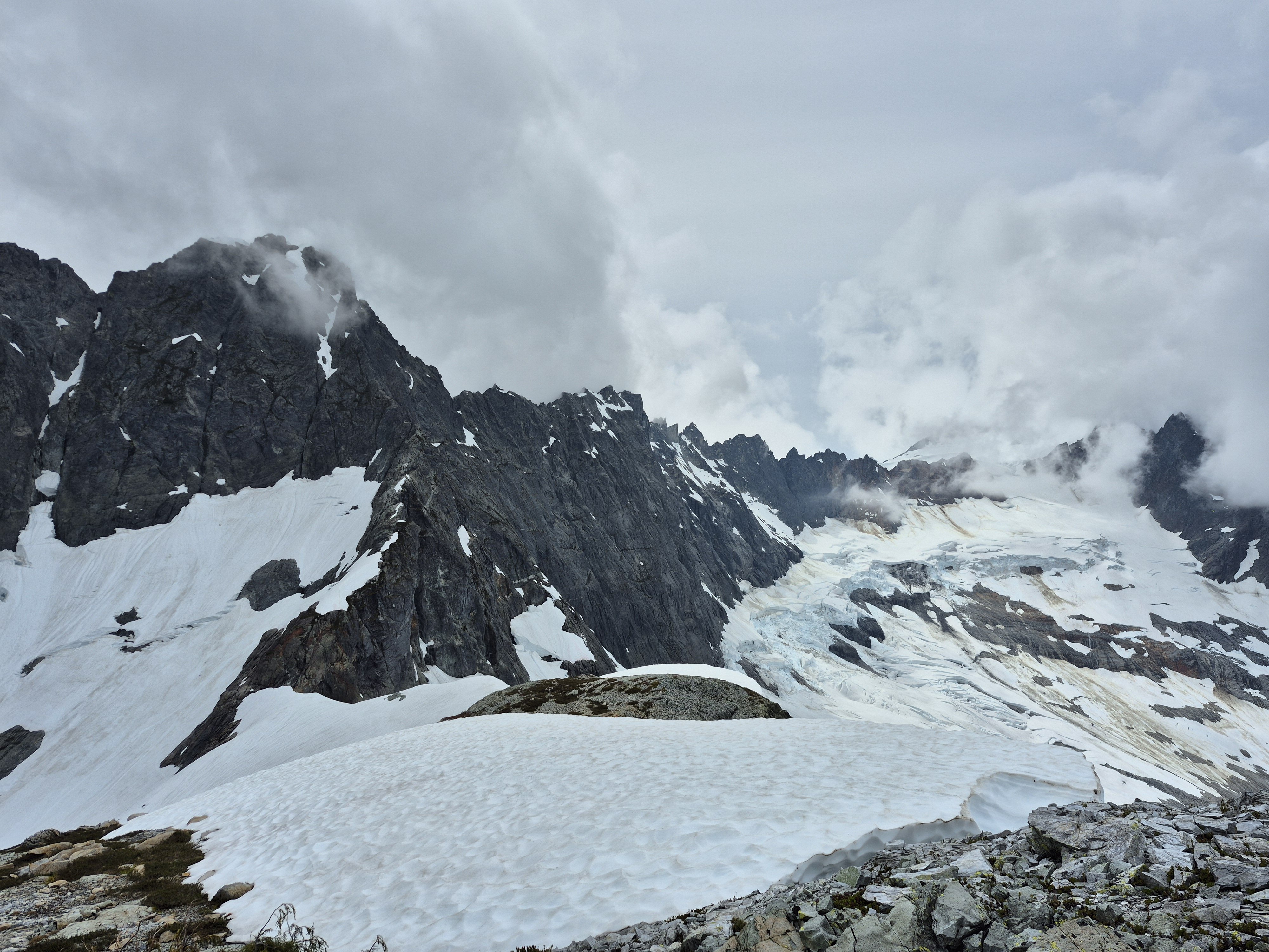
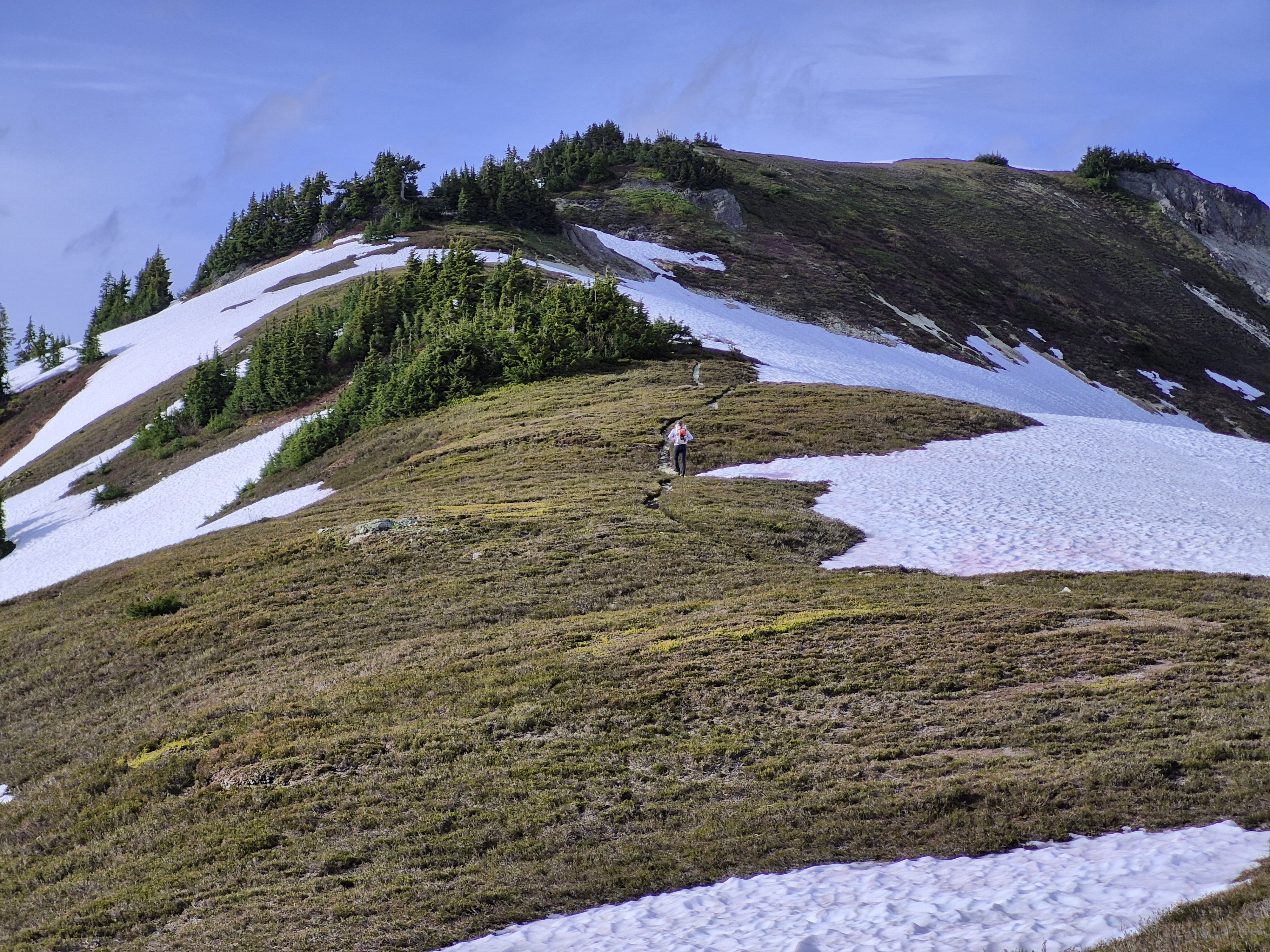
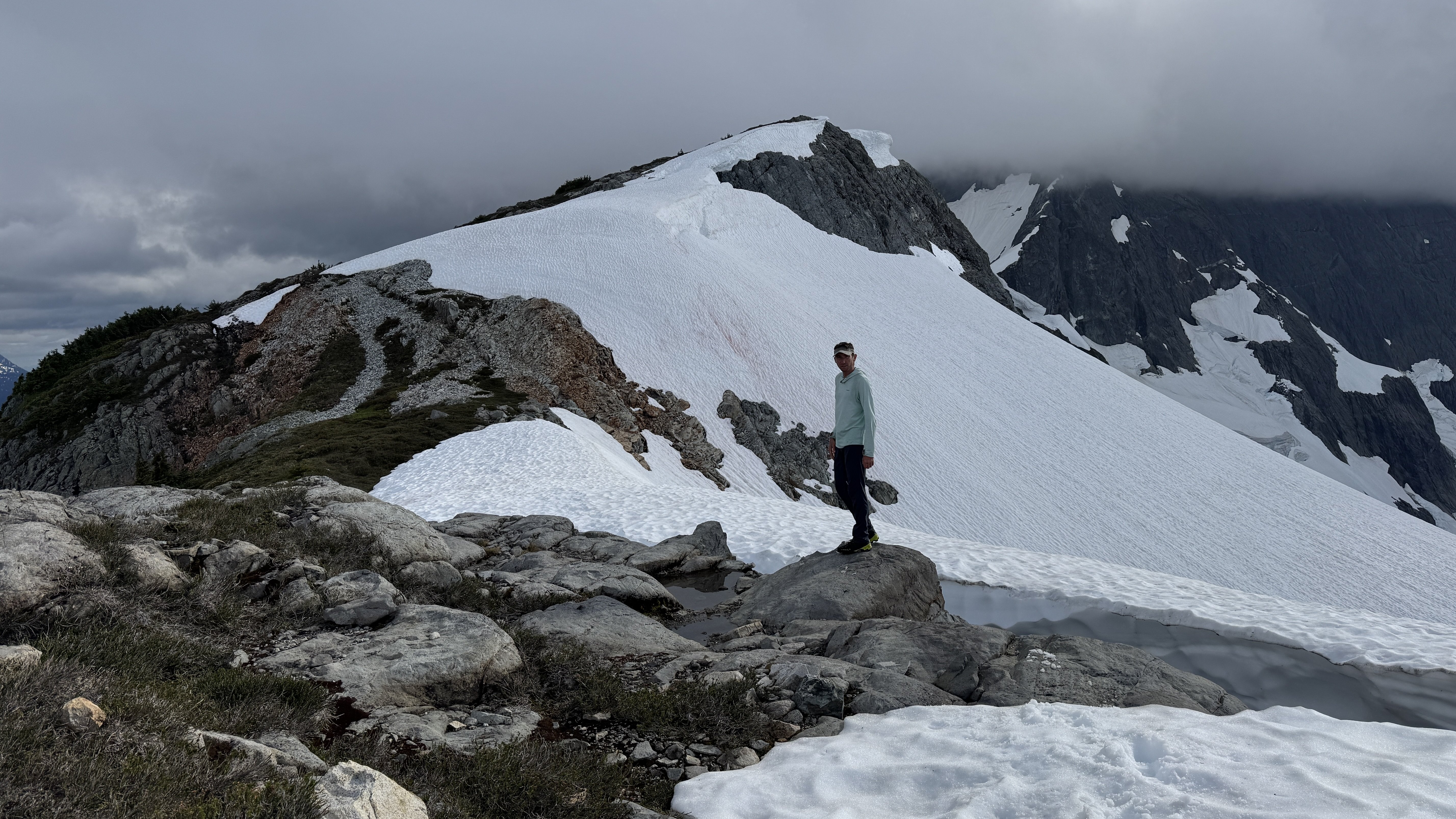
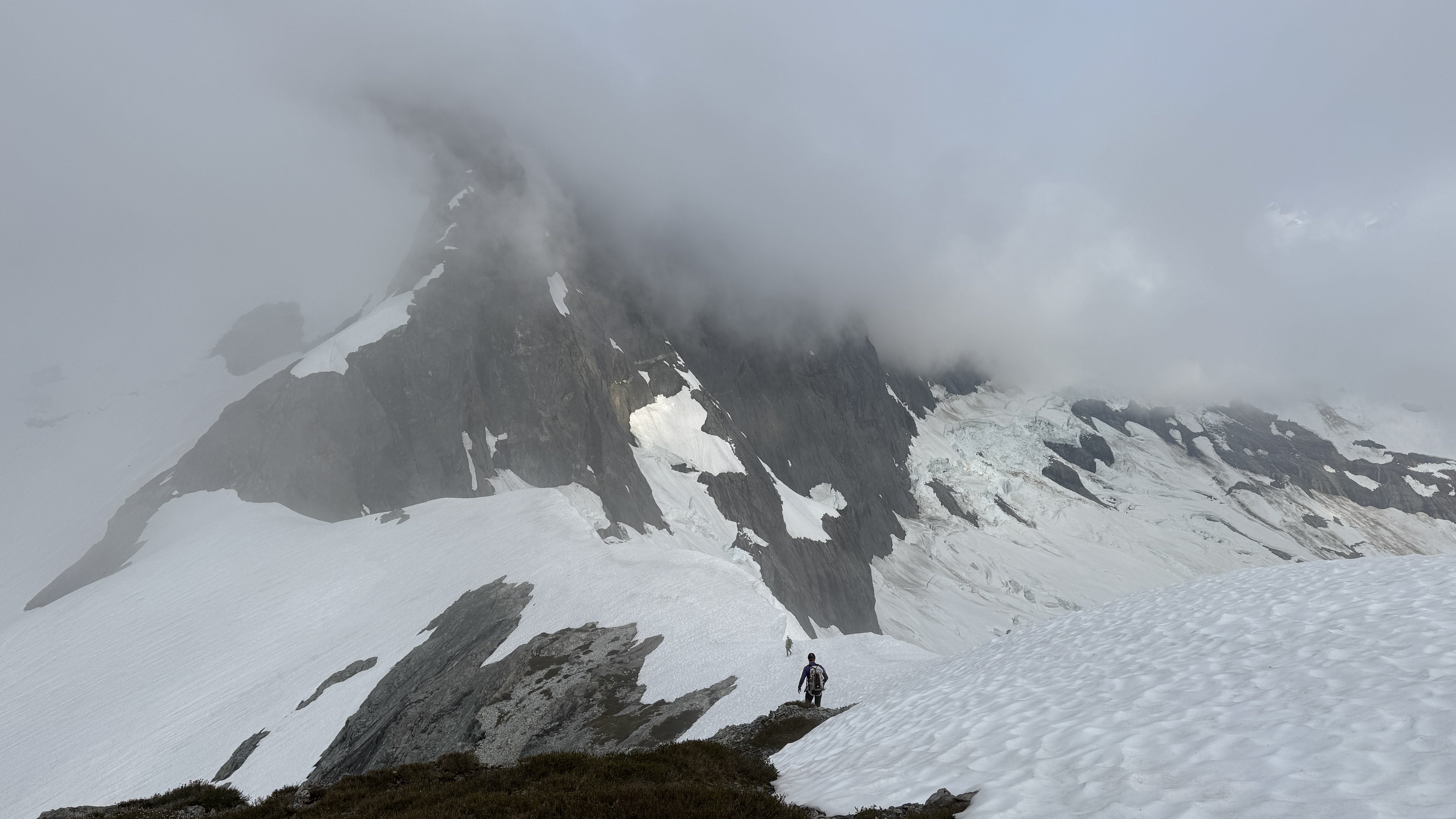
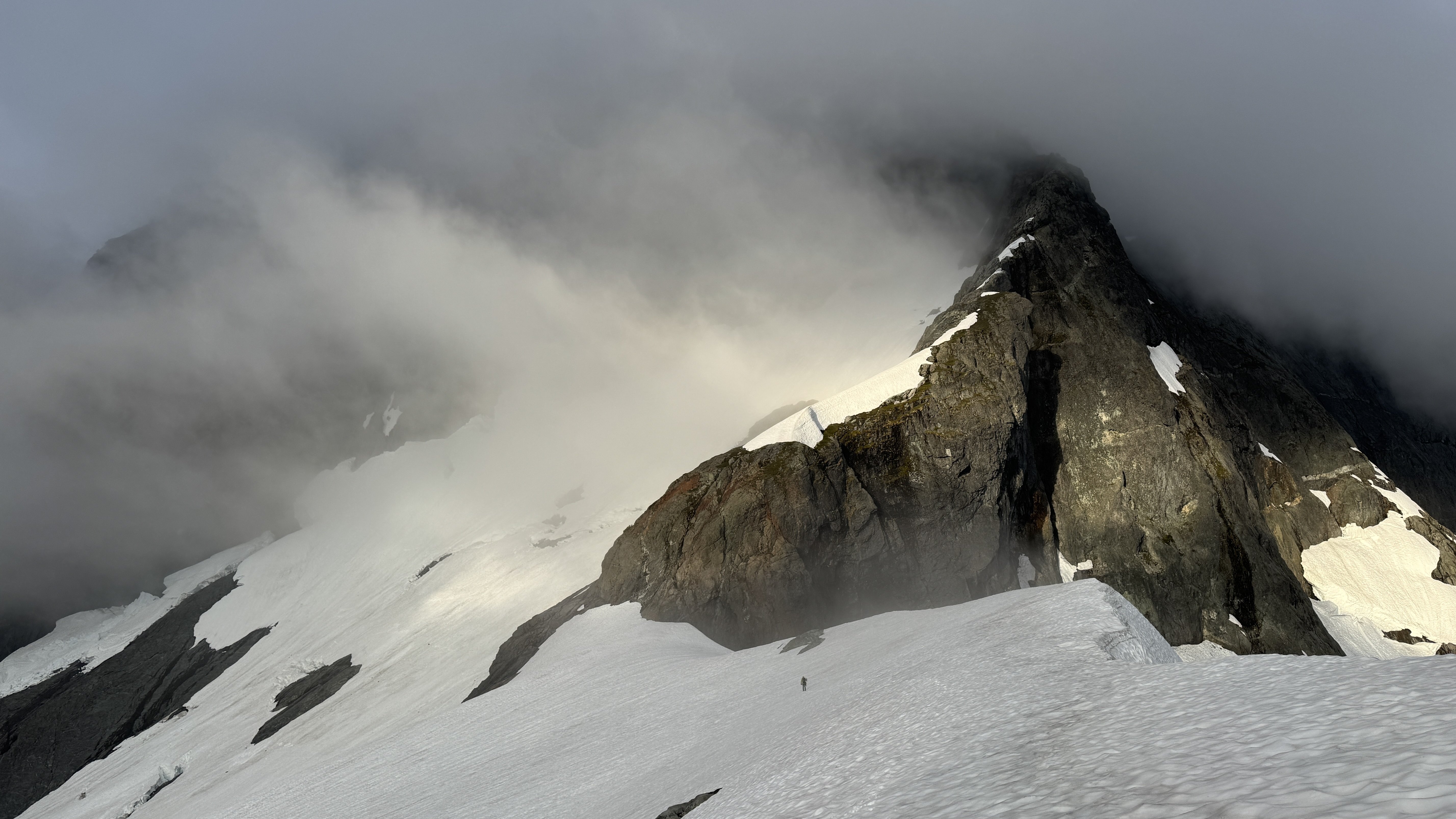
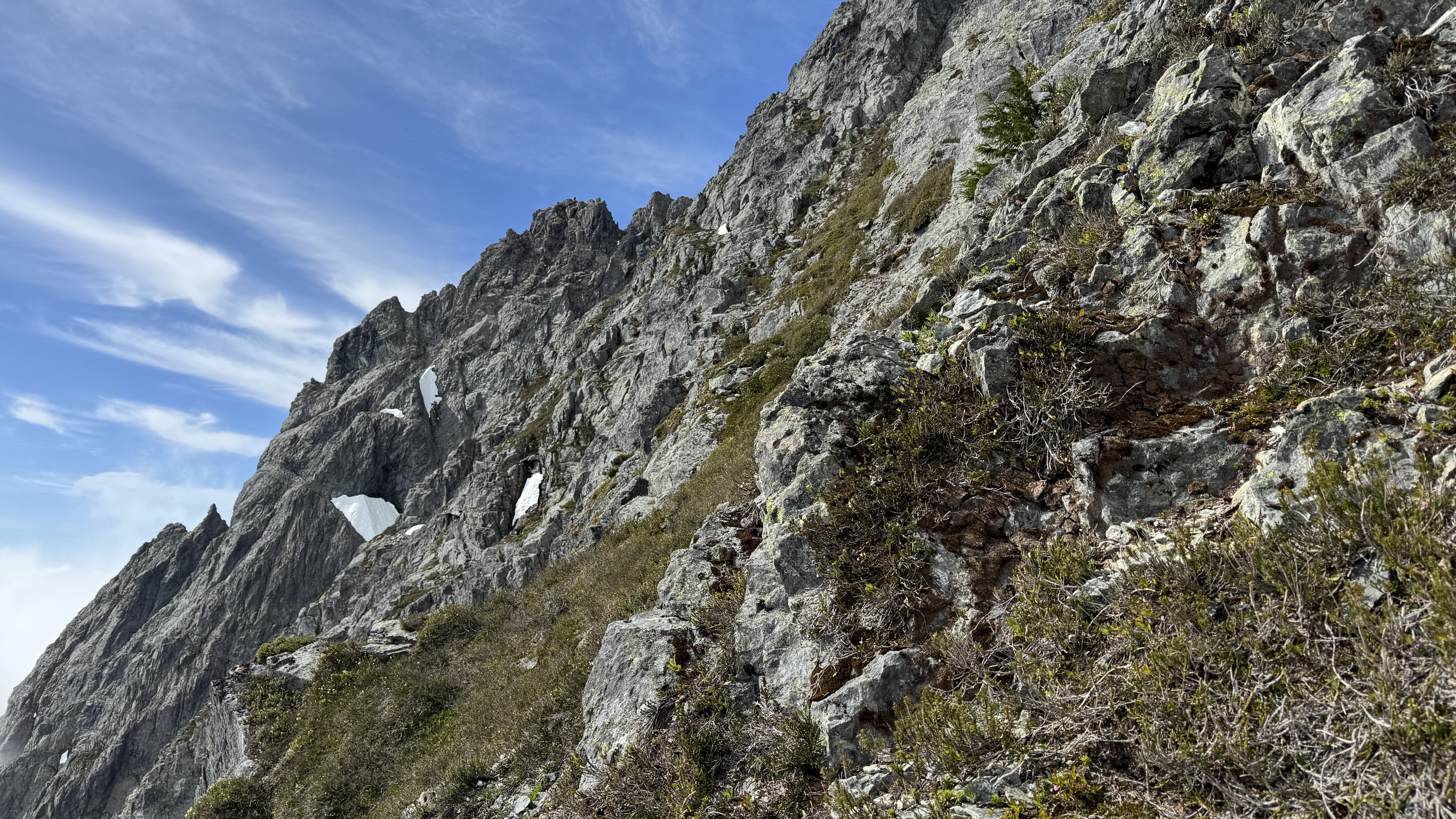
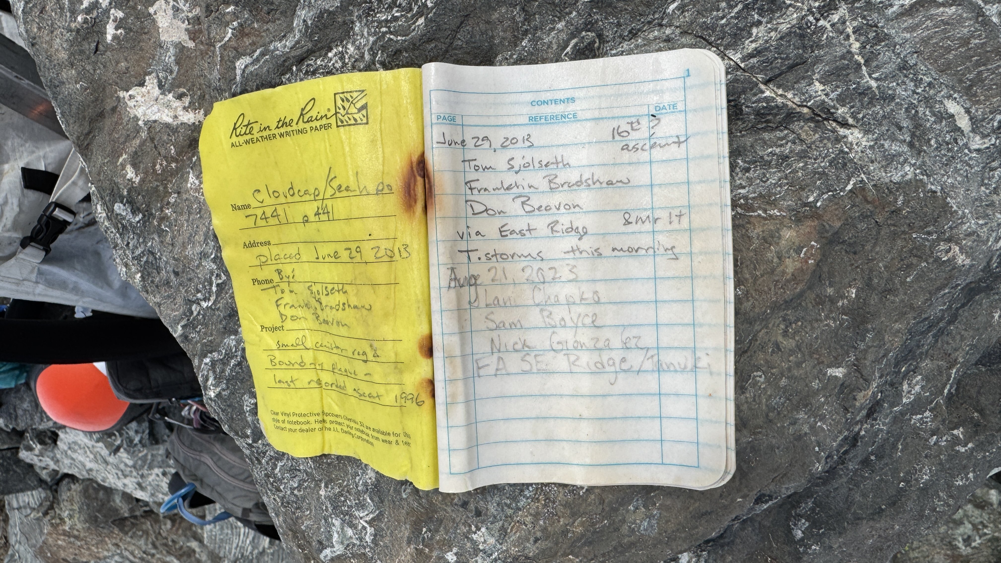
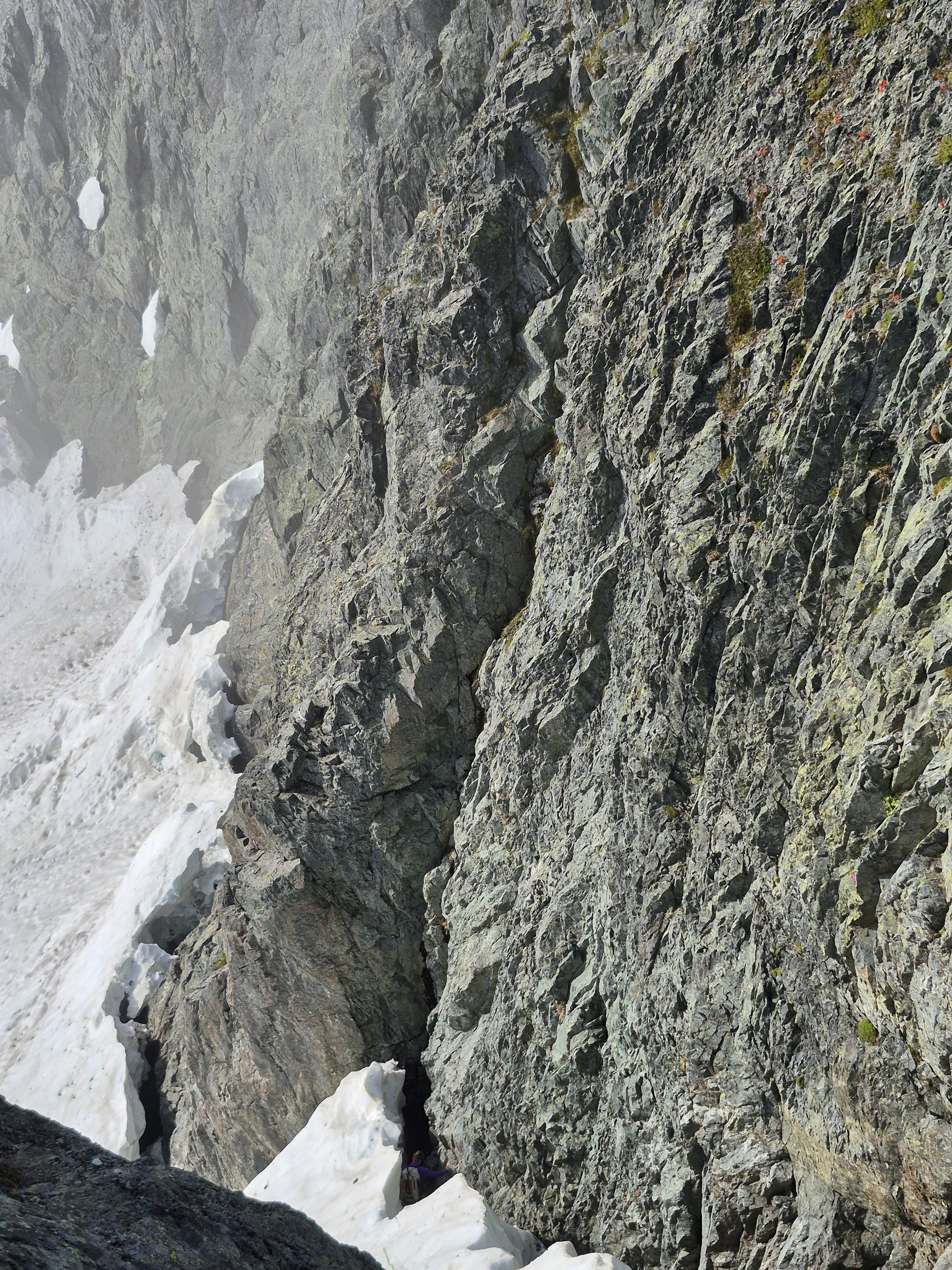
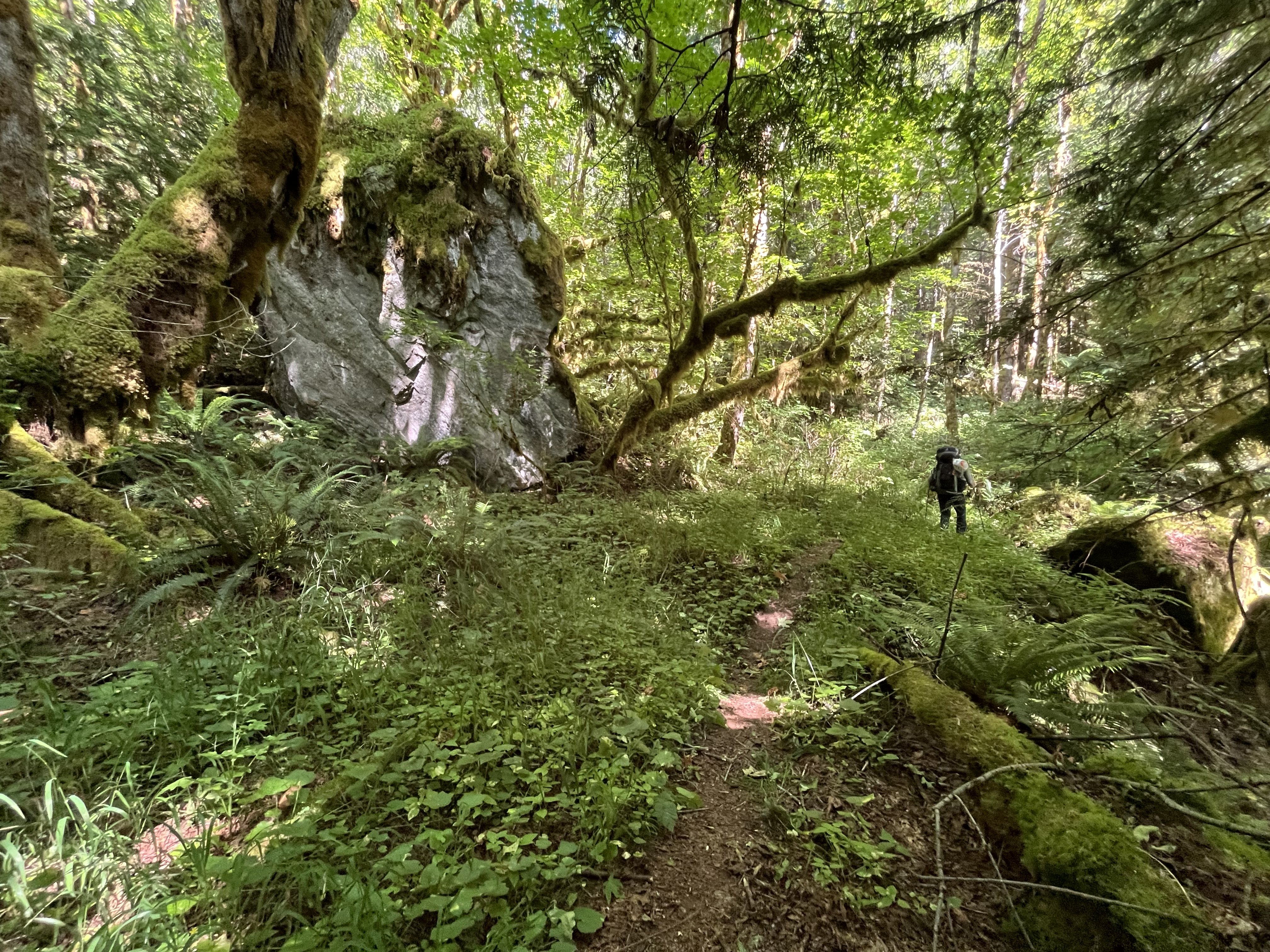
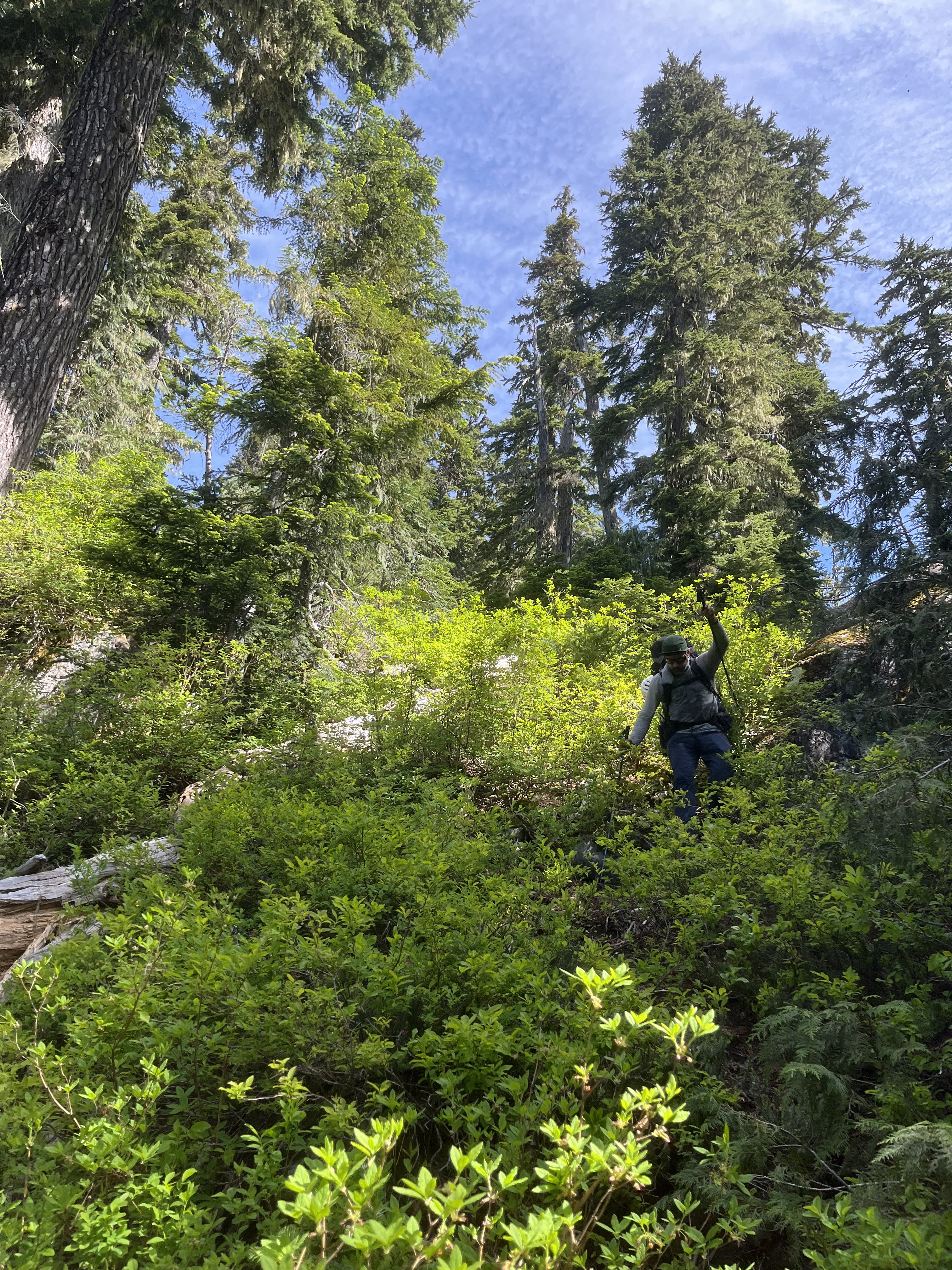
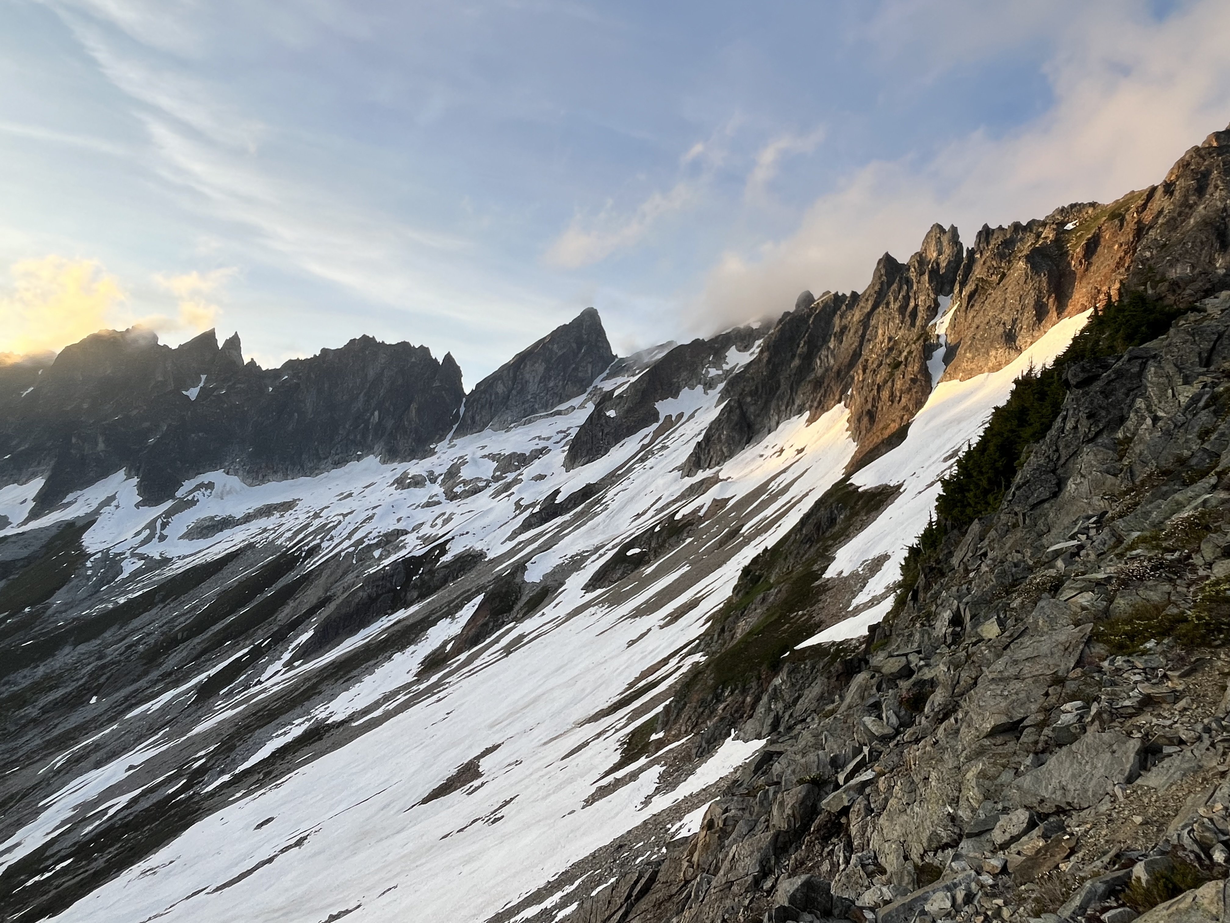
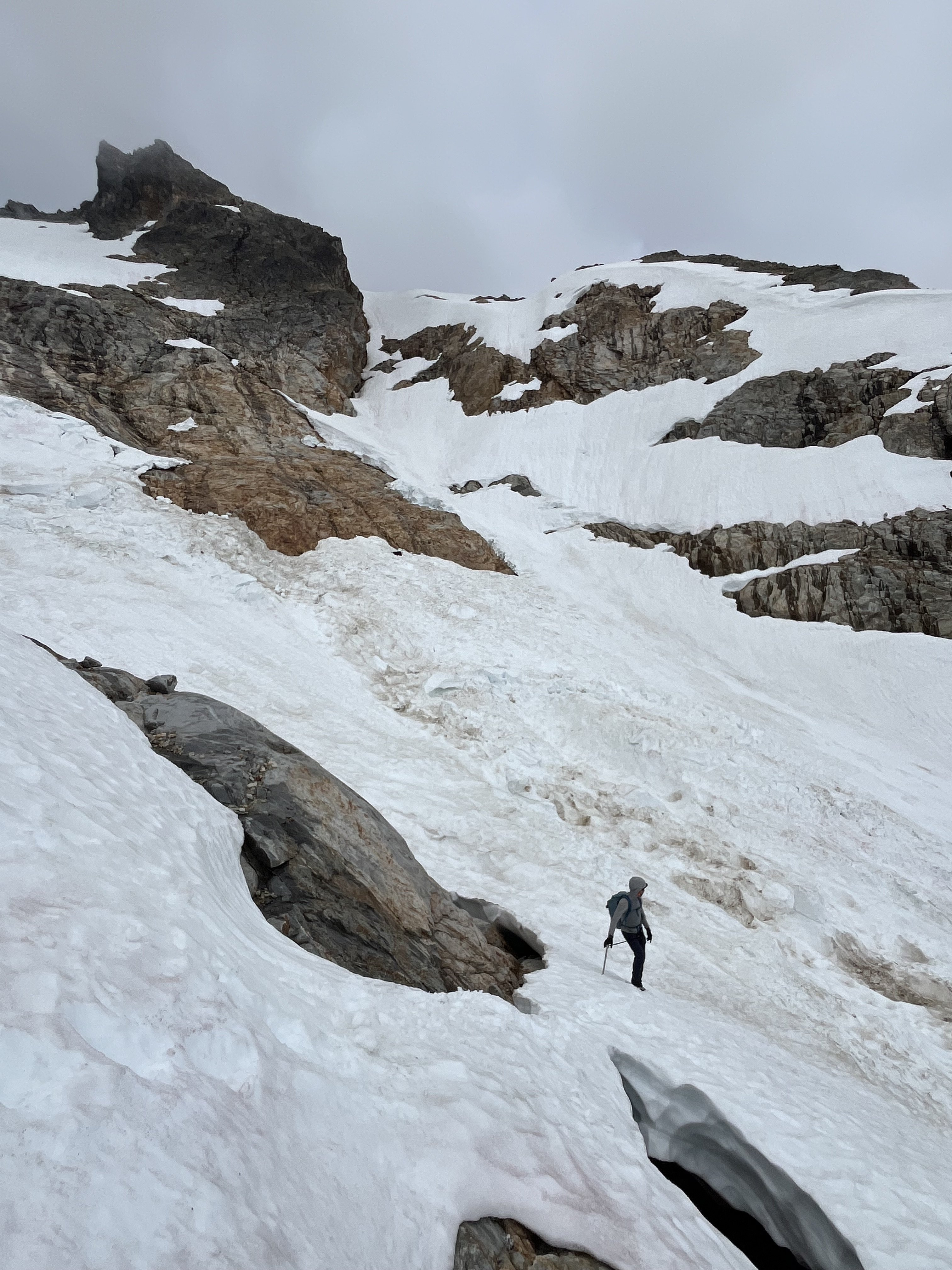
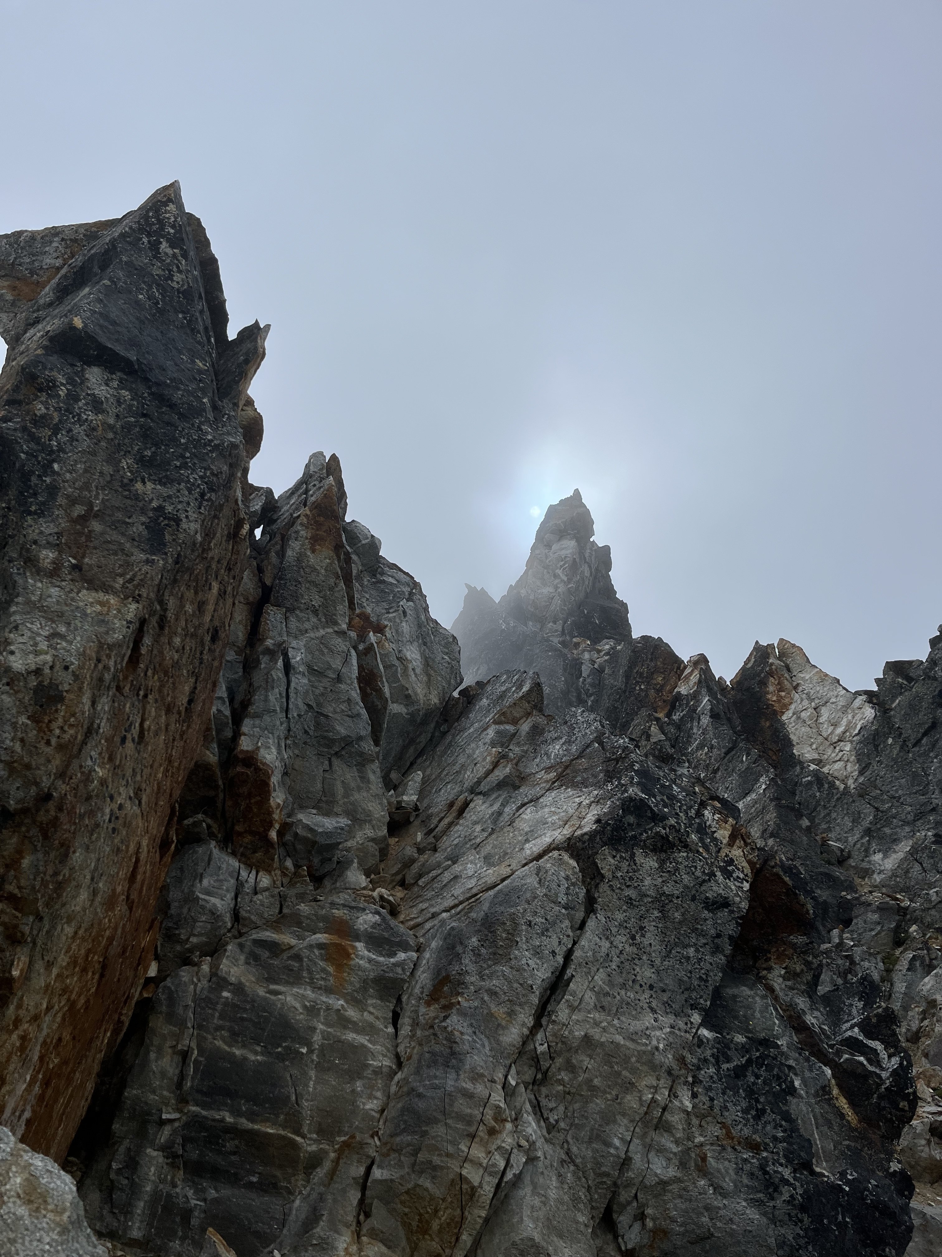
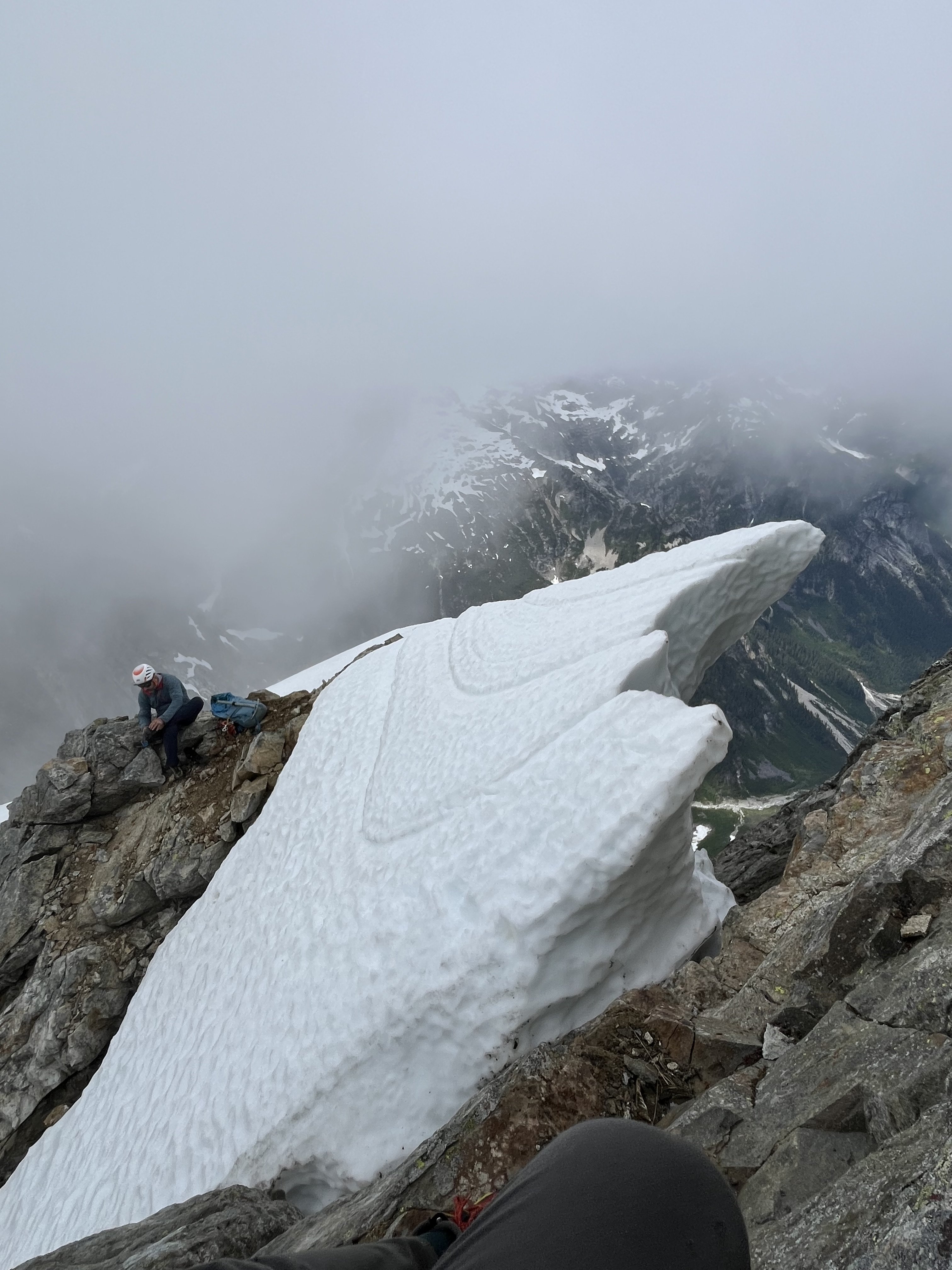
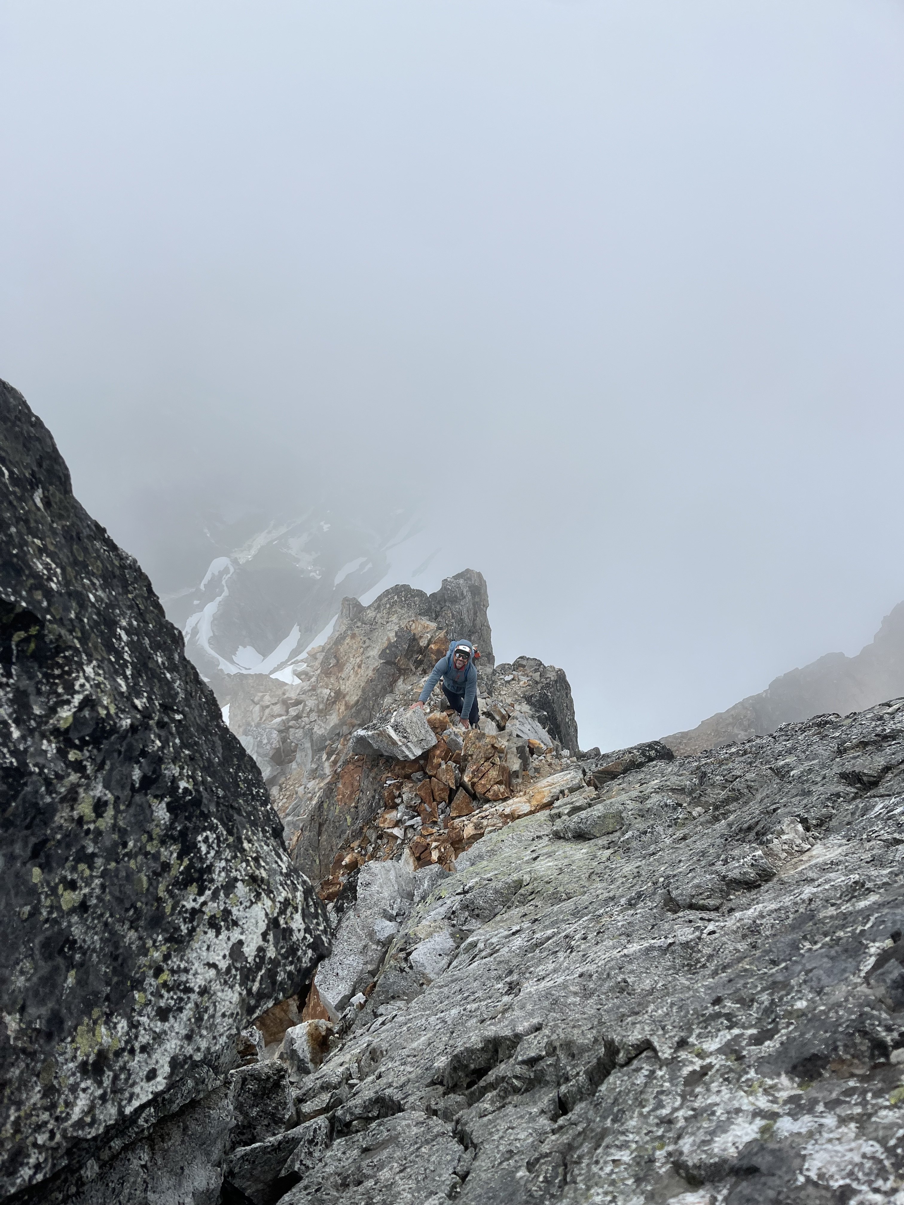
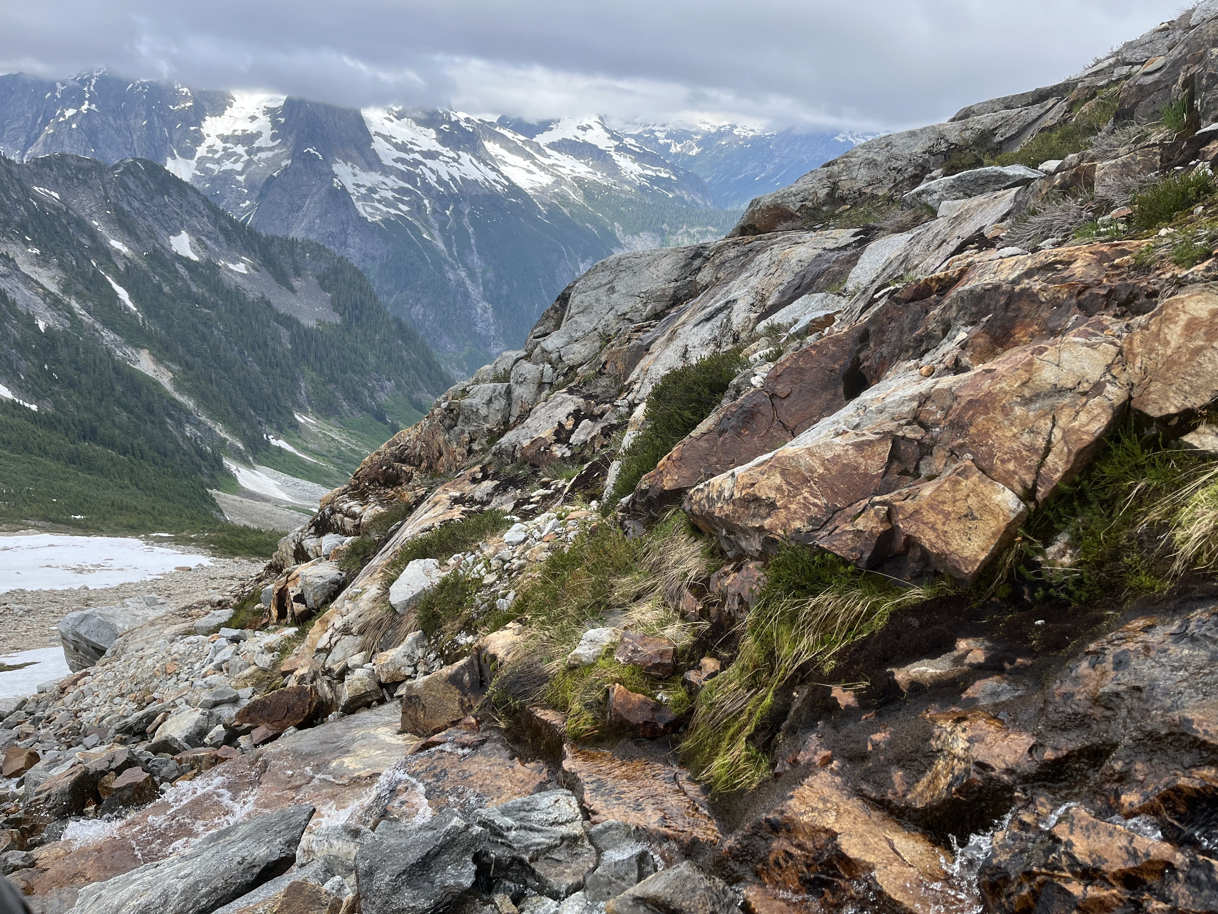
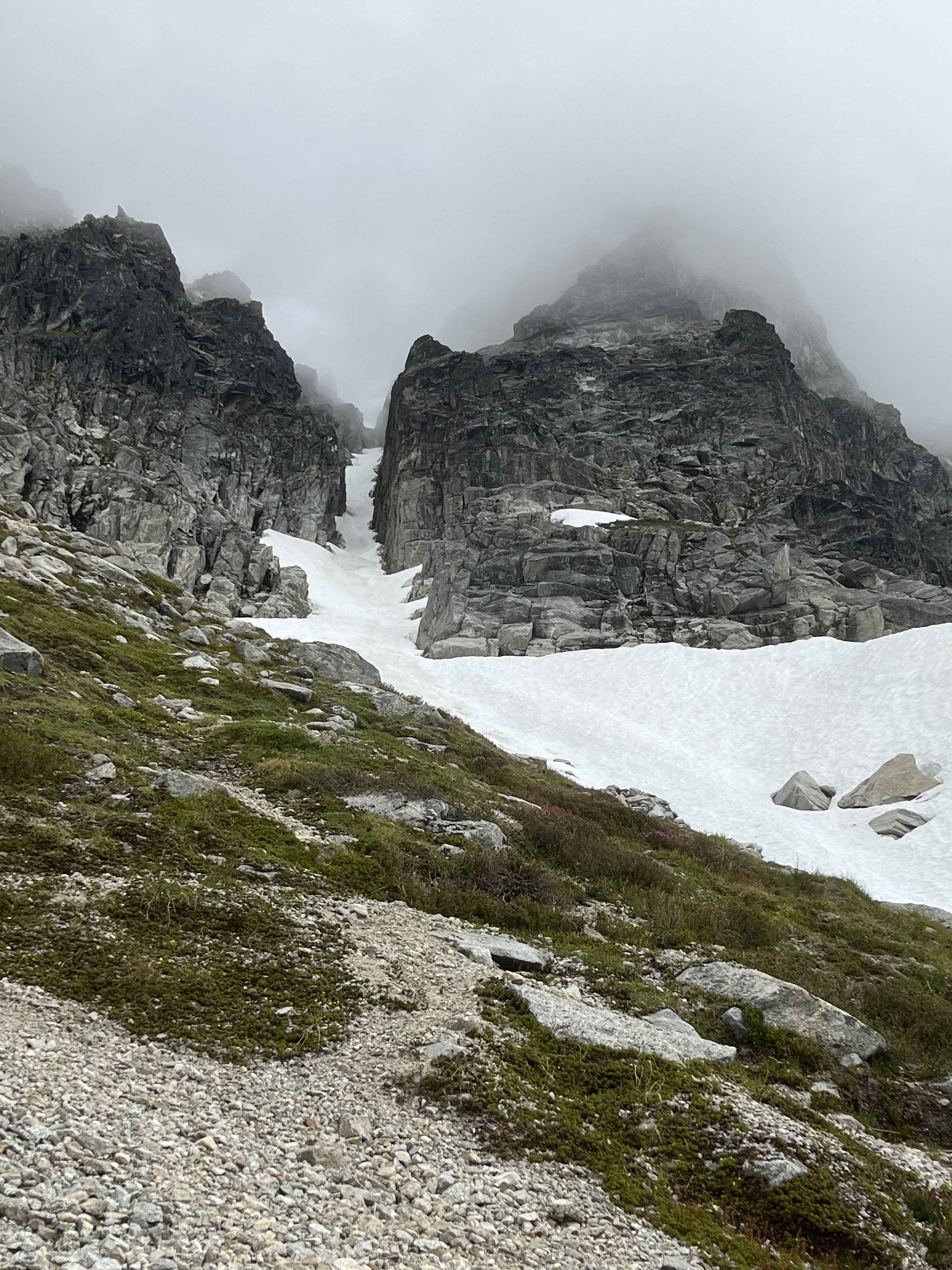
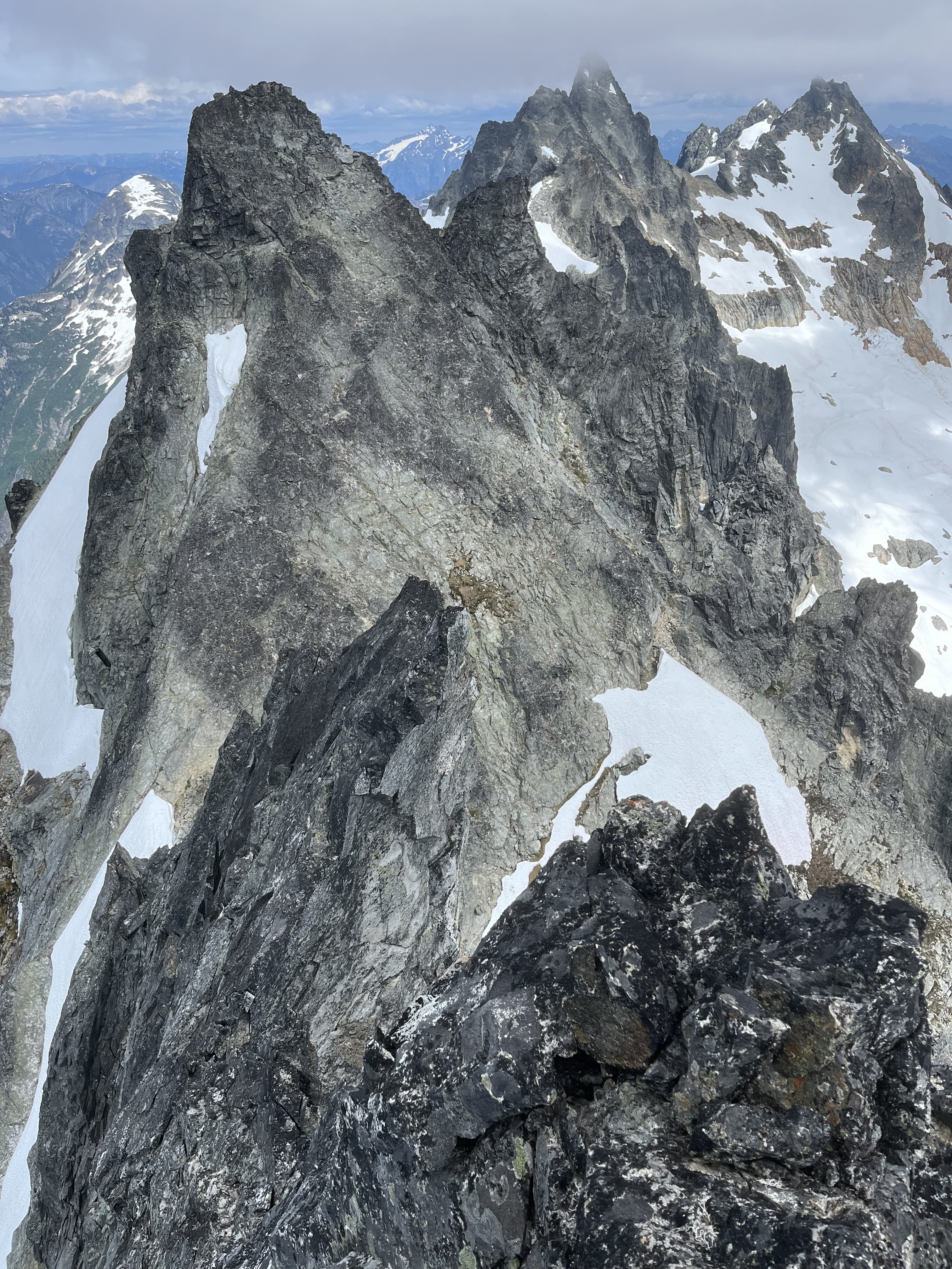
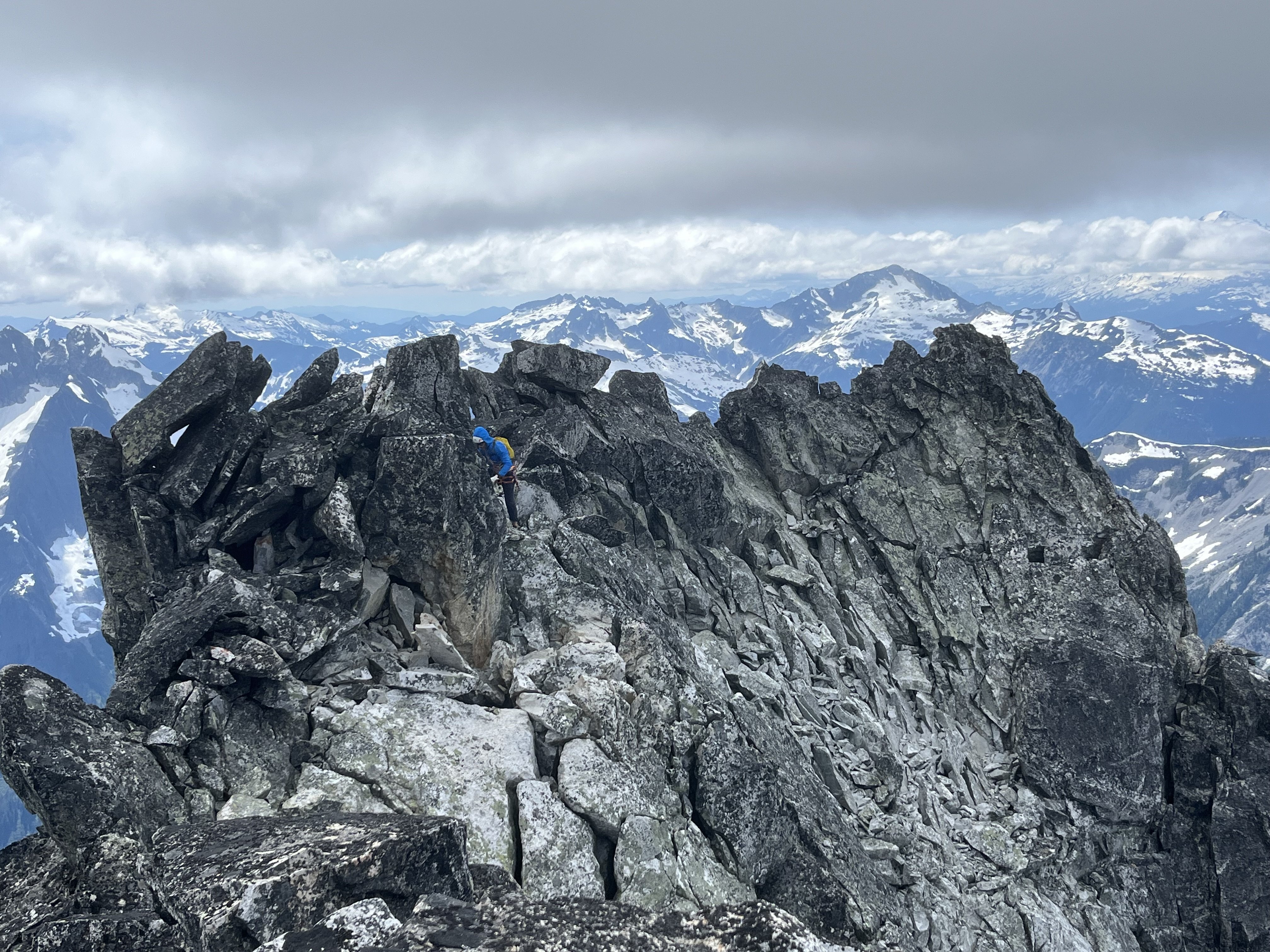
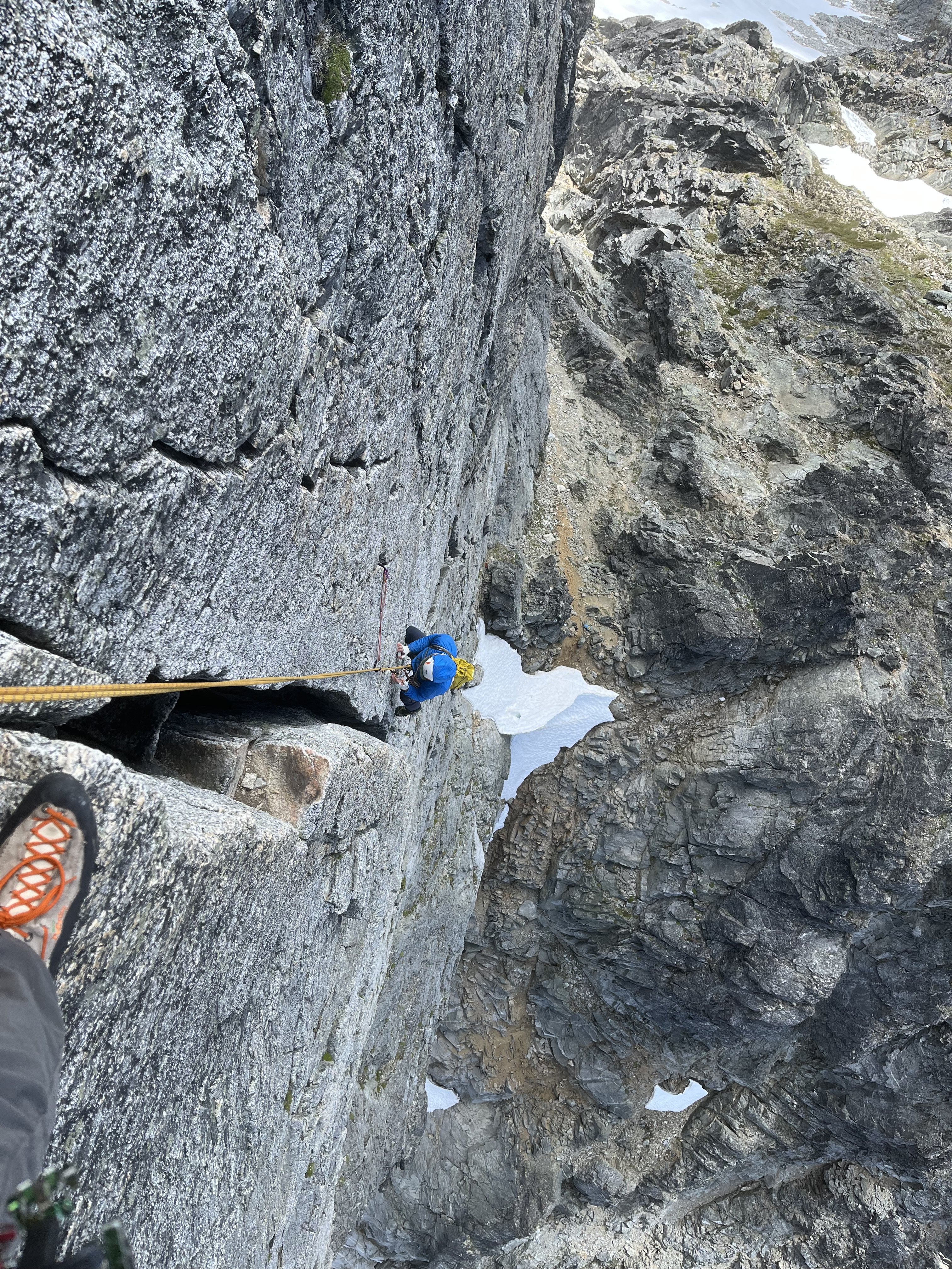
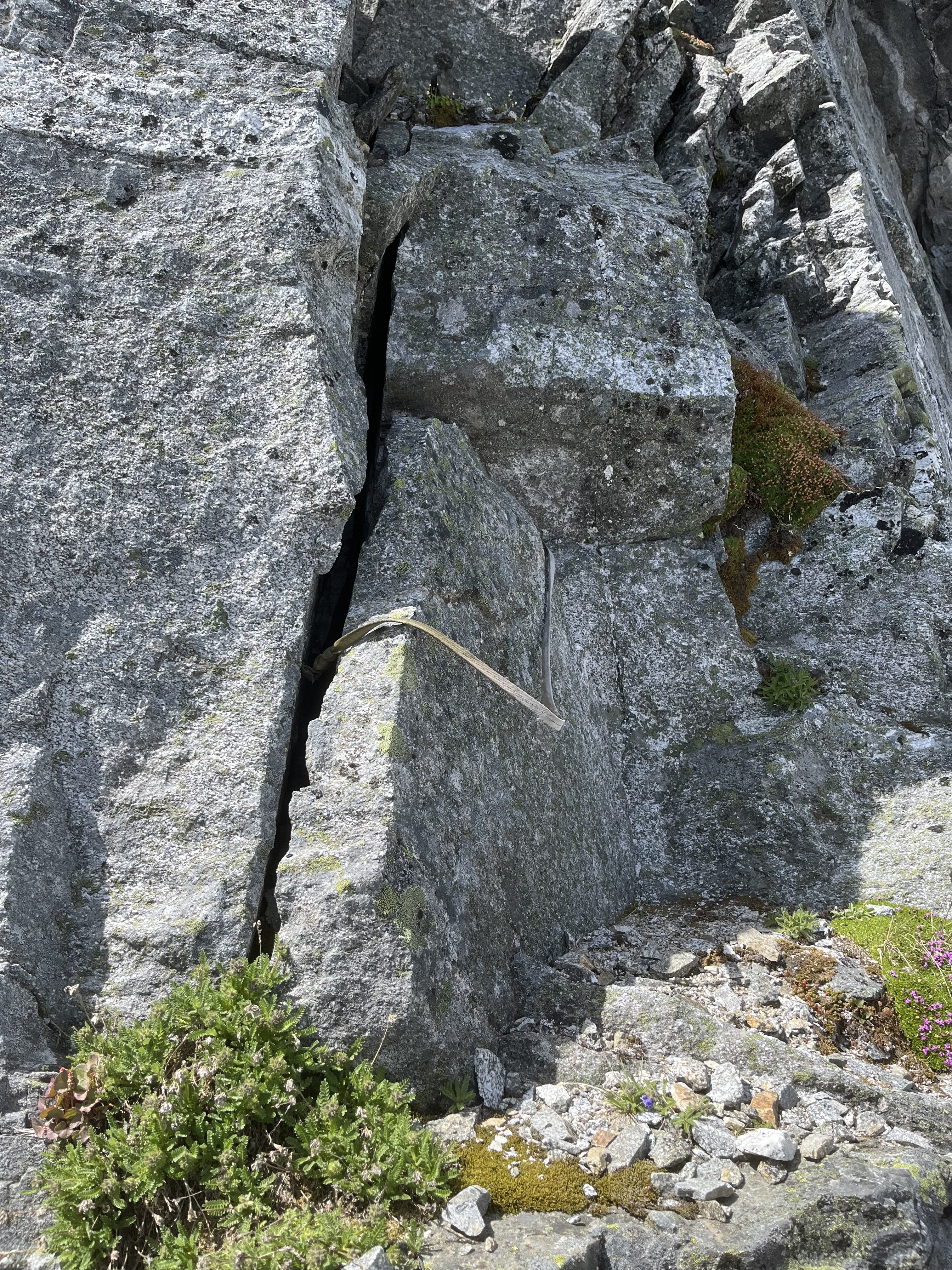
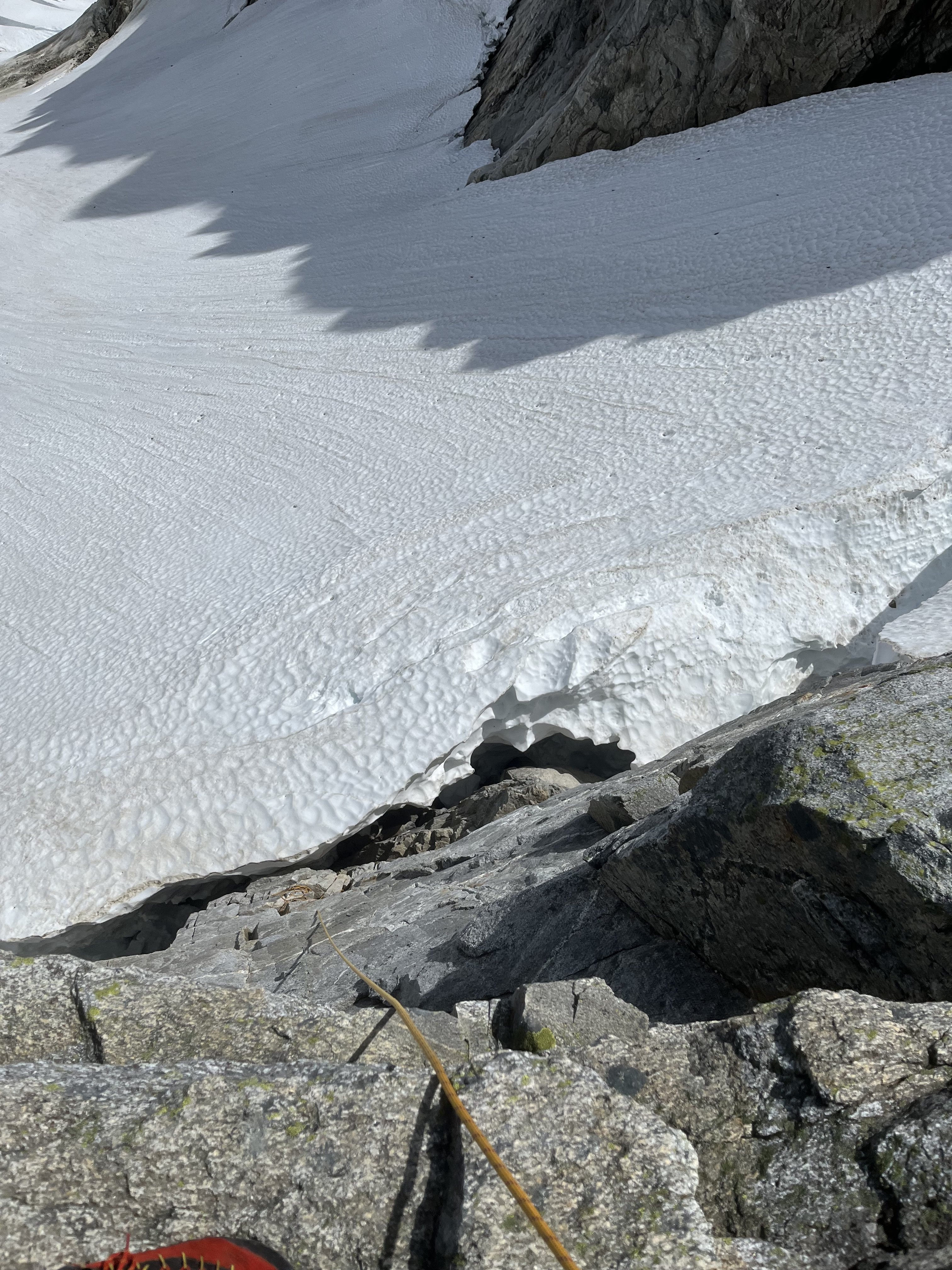
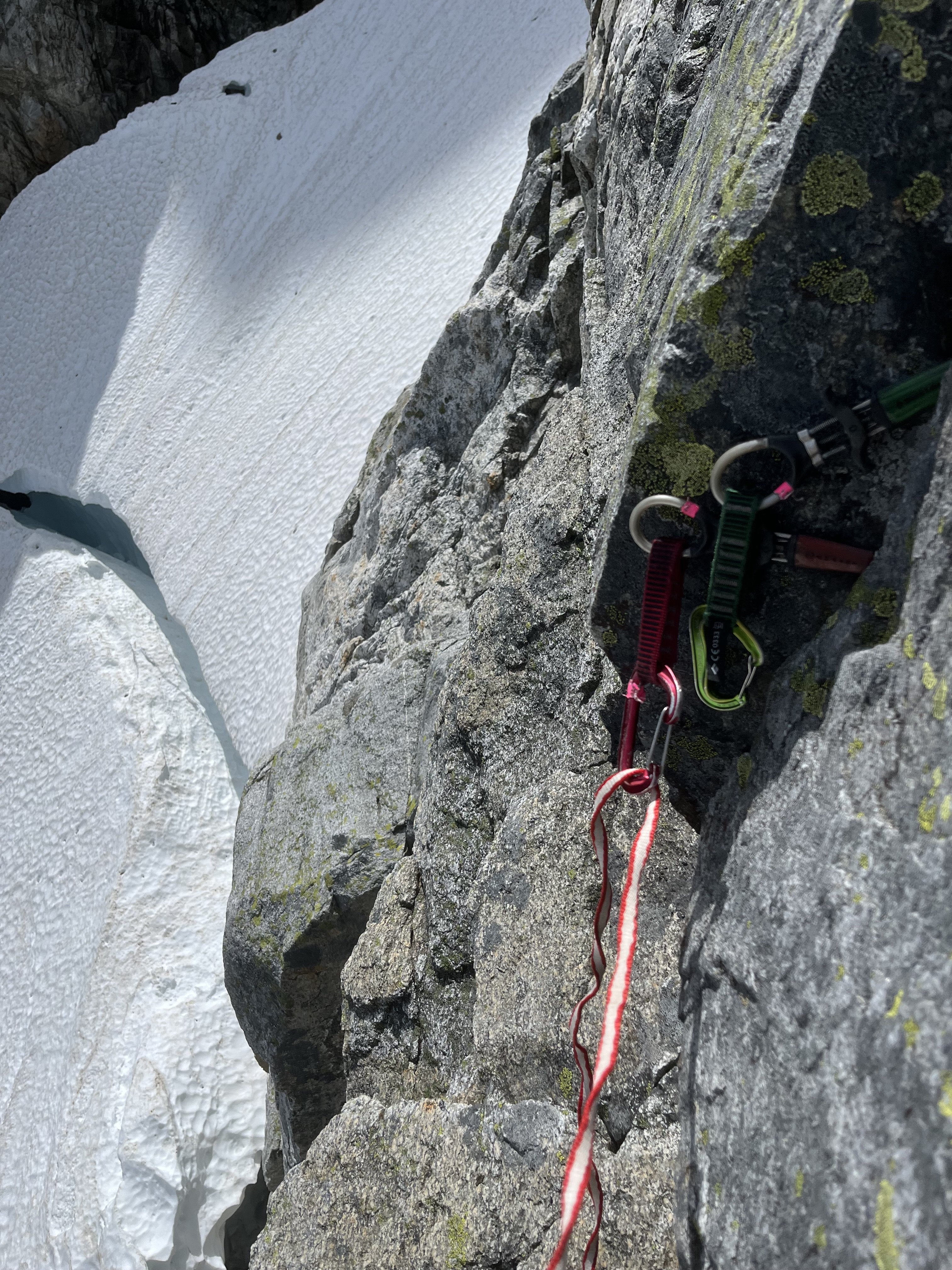
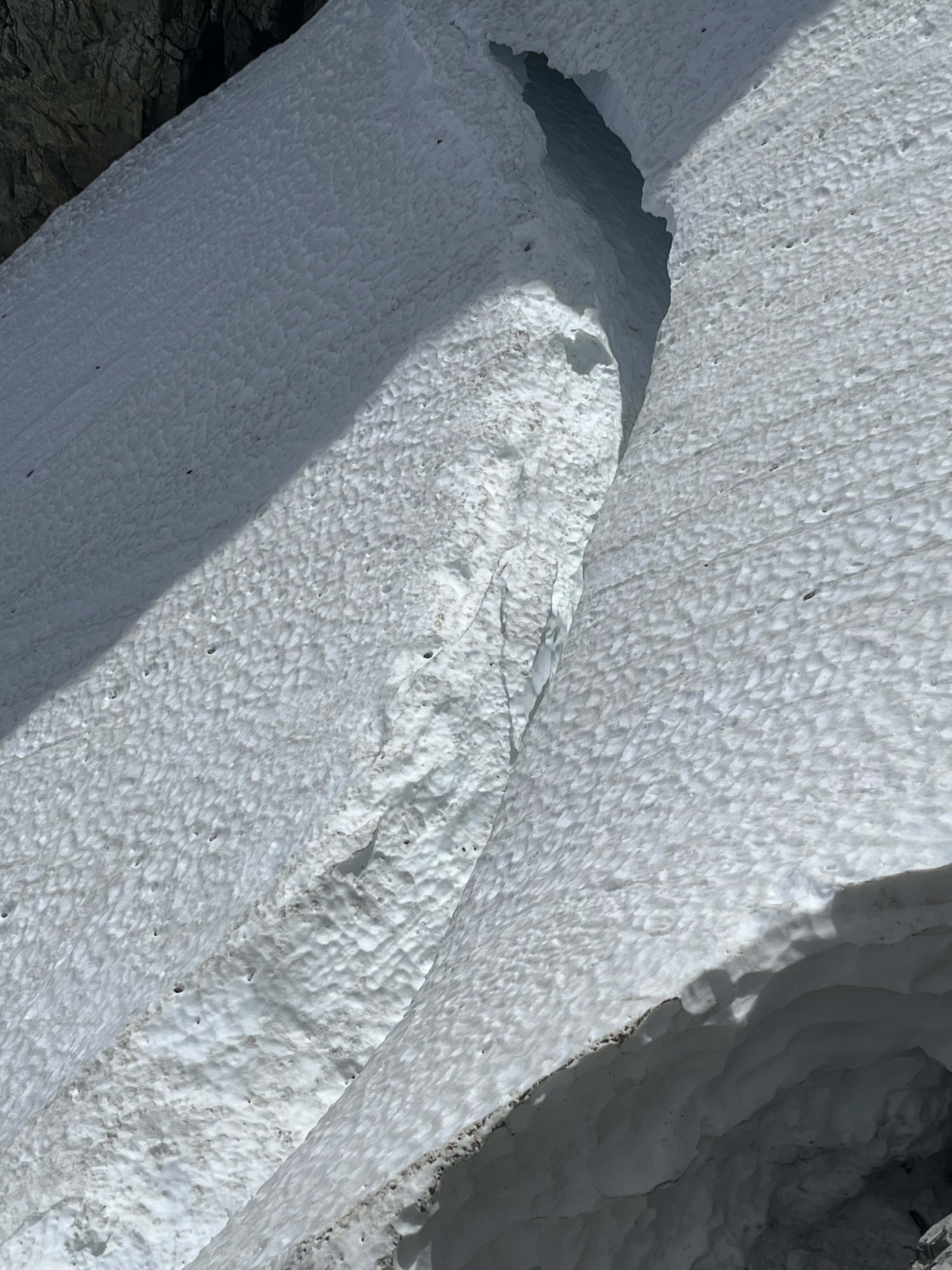
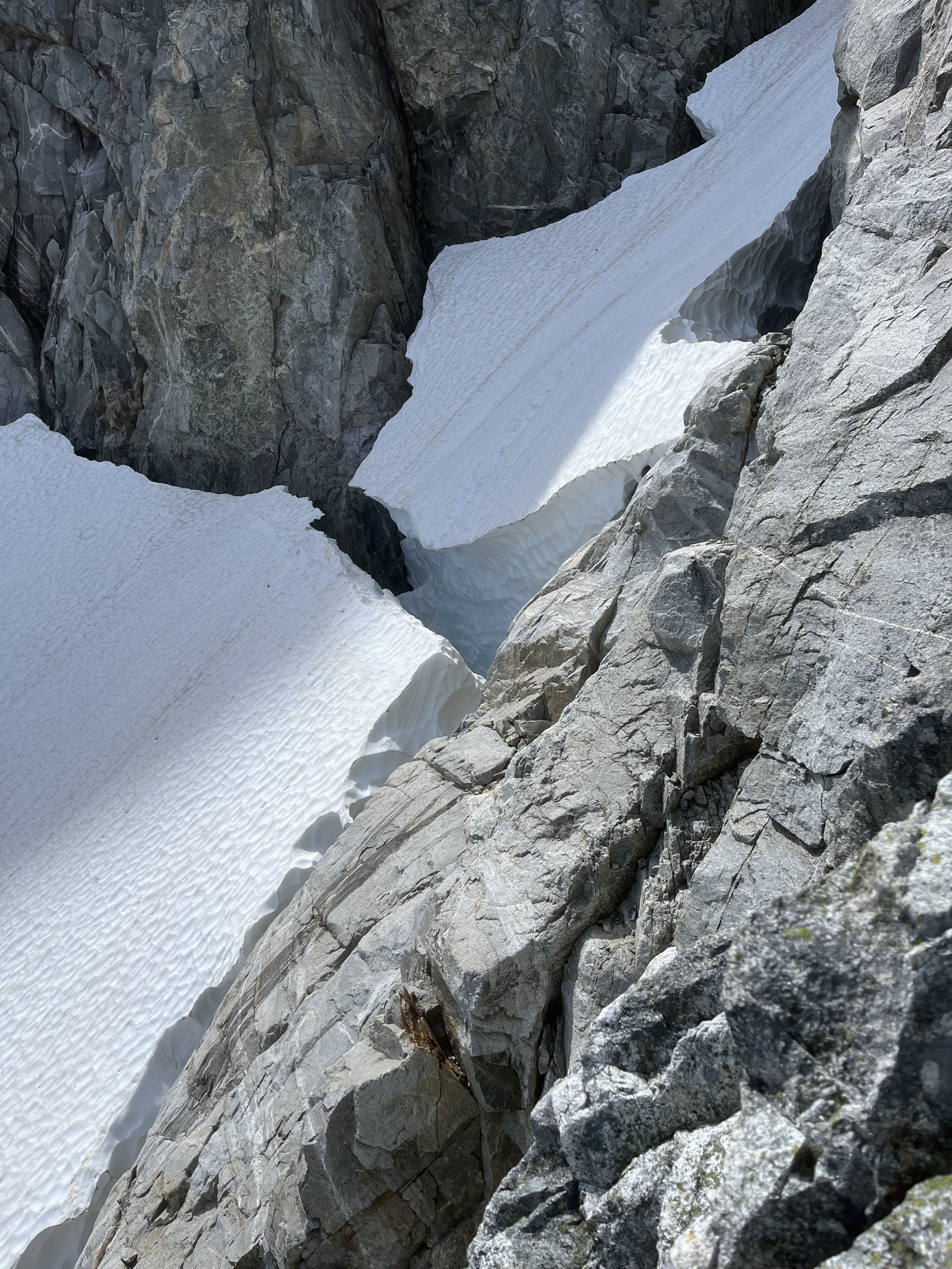
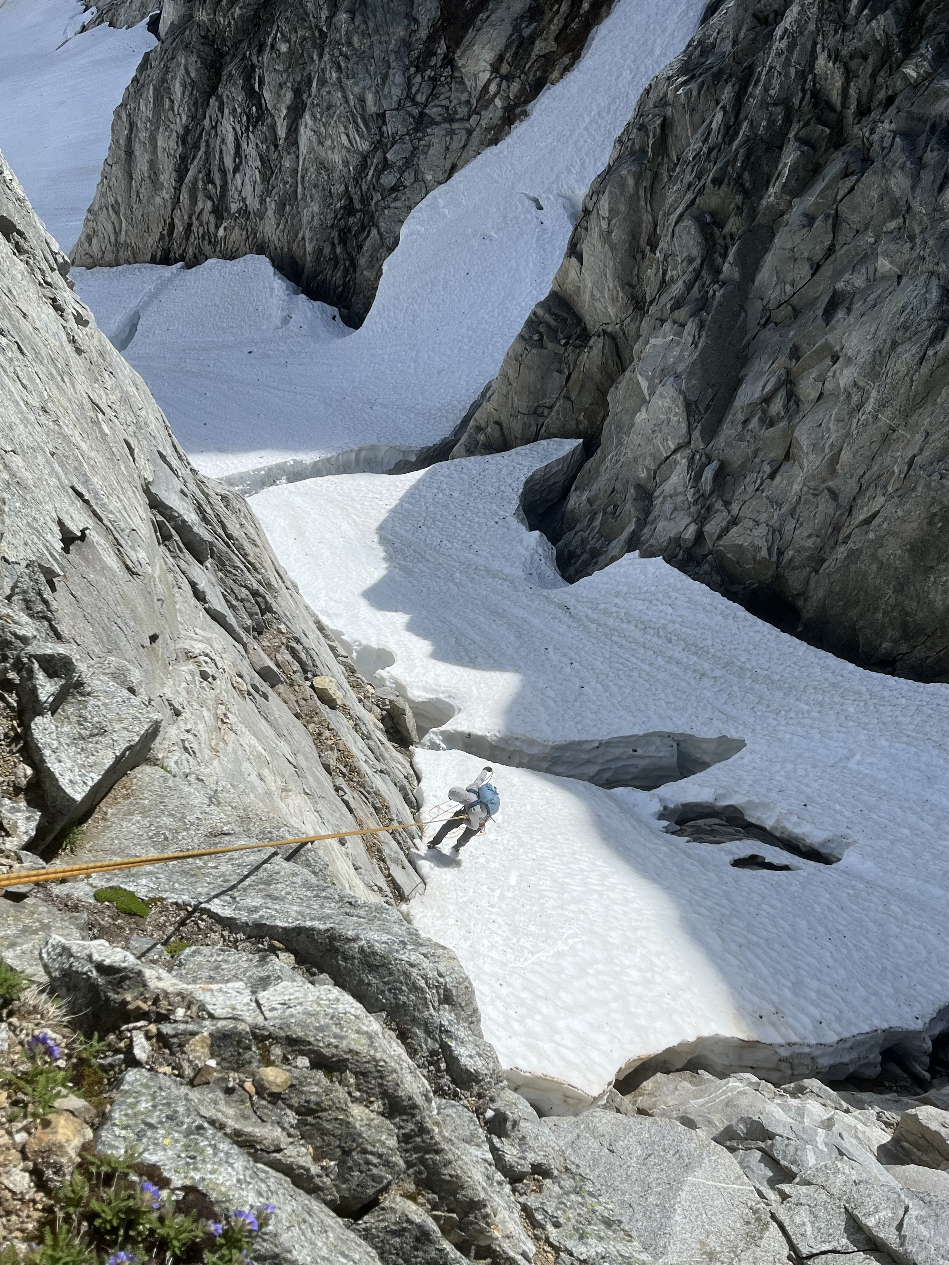
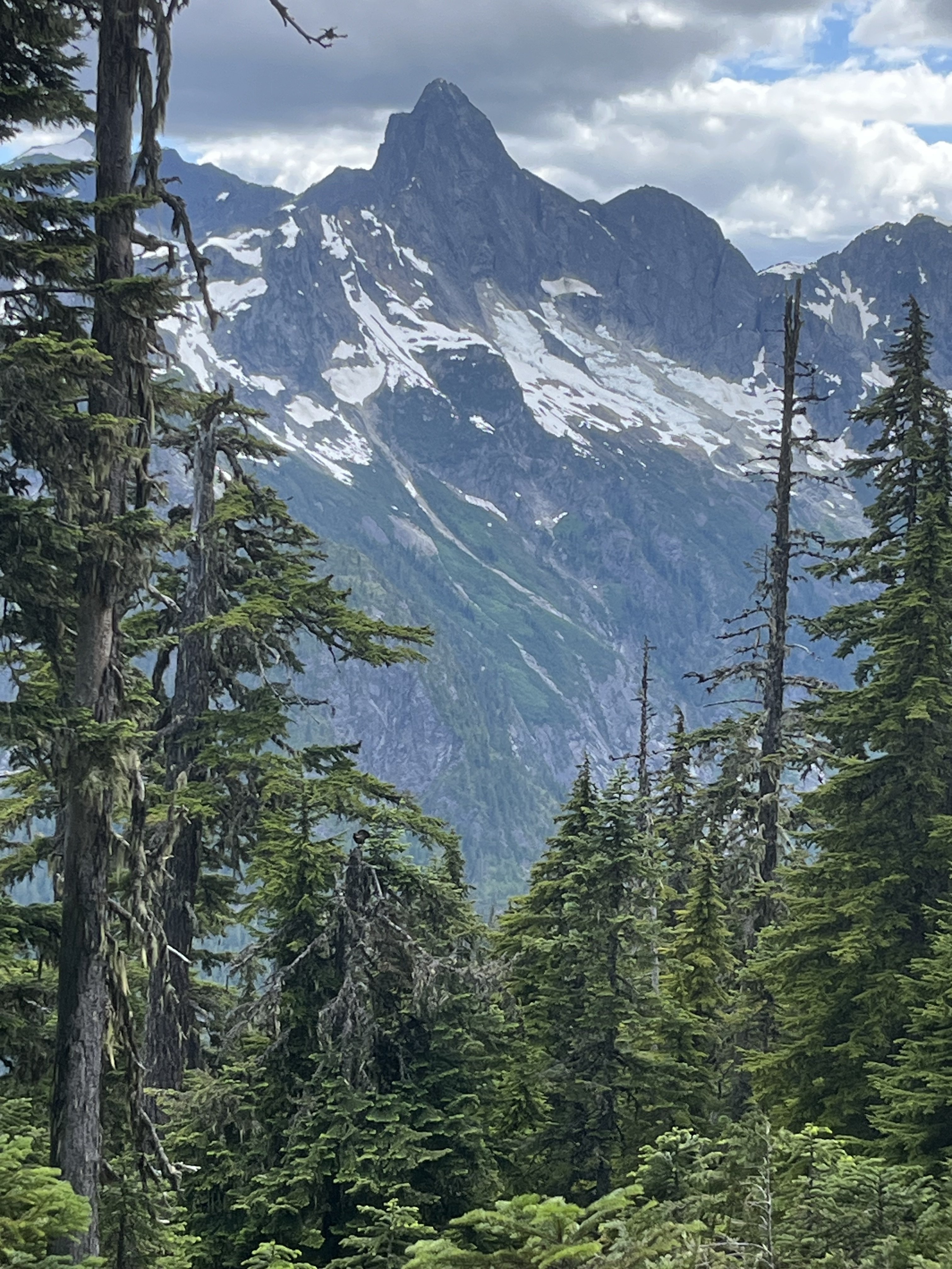
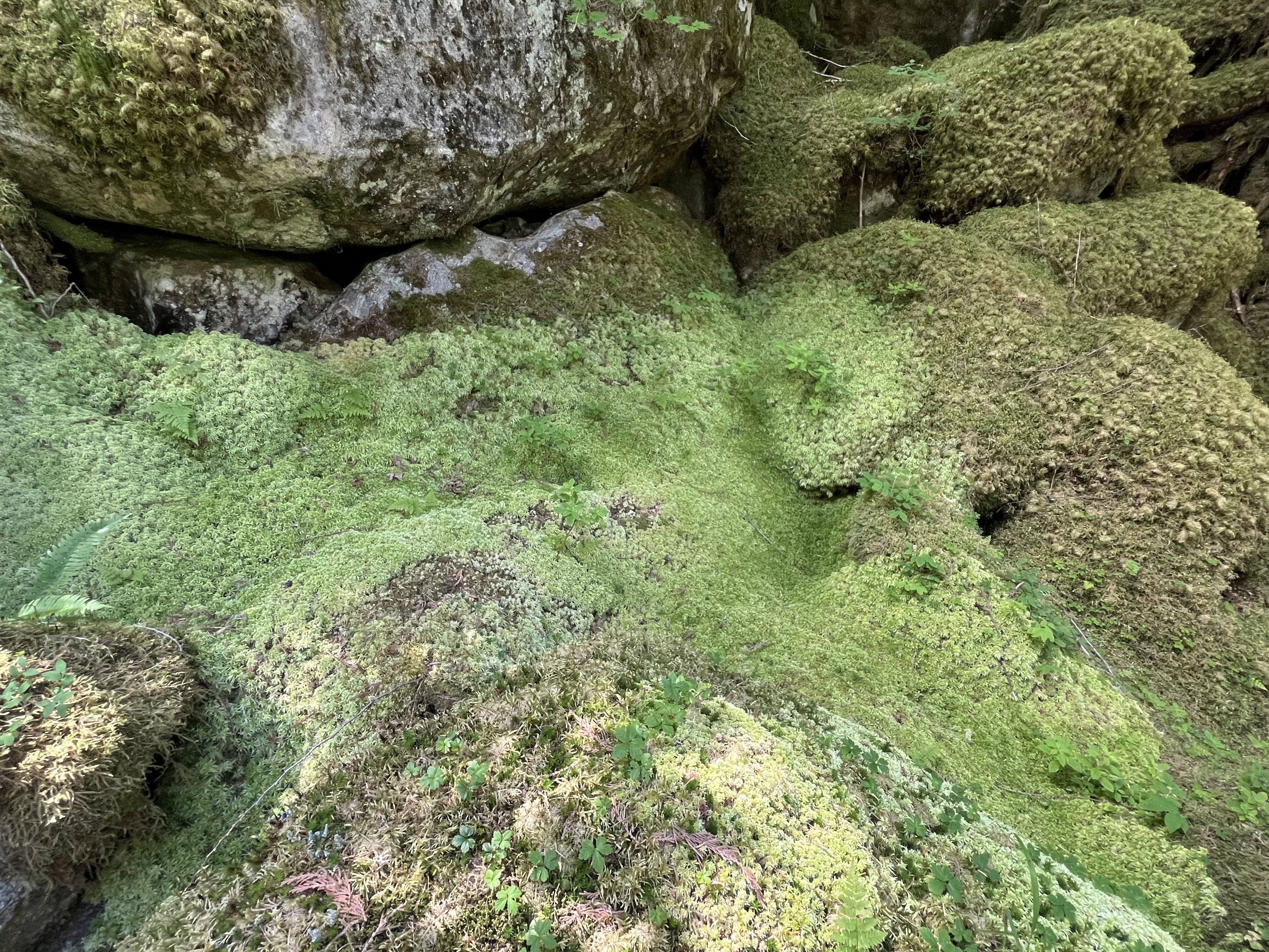
Trip: Seahpo / Cloudcap Peak - NE Ridge Trip Date: 07/05/2025 Trip Report: After much discussion and planning and two planned weekends that didn't happen due to weather, and even a scouting trip with binoculars, me Fred and Dylan finally climbed Seahpo / Cloudcap on July 4th and 5th. I had been on a mission the last few years to climb Dallas Kloke’s Difficult 10 peaks and completed the list this past winter with Lincoln. Now as part of my midlife crisis alpinist proving I'm after the self declared Difficult 10 Bonus Peaks. Basically anything that the consensus says ought to be on the list but since it's Dallas's list it doesn't change (much like the bulgers). I consider these so far to be Gunsight and Seahpo. We hiked up through the crowds on the 4th of July with heavy packs loaded with all kinds of climbing gear since we didn't actually know much about the route. We passed a lot of day hikers and Ruth climbers that all asked us where we were going with all of the gear on our packs, I grew somewhat tired and only half jokingly suggested we tell people either Shuksan or Icy just to make it simple. Bizarrely then we met somebody who replied that they had climbed Seahpo!! We went up and over Ruth, then Icy just for fun and made camp near the northeast ridge of Seahpo, making camp in just about 8 hours. We had plenty of time to study the route as it came in and out of the clouds and were pleased with what we saw. On a scouting trip a month earlier the route had ample snow on the ridge which we weren't prepared to deal with. On the 5th we were up at 5:00 and hiking just after 6:00, thus allowing for plenty of sleep to make up for a week of extremely early mornings for work for me. No one argued with that concept. We took the Beckey variation of getting on the northeast ridge at the first opportunity instead of the glacier which we assumed would be in rough shape this far into the 21st century. The scrambling on the lower ridge was excellent class 3 with some easy snow walking, then we got to the top of a tower before a major notch. This notch was the main unknown of the entire route since there's not really any good way to scout it and we had no beta at all. It proved to be troublesome. Naturally we assumed we would just be able to rappel into the notch and climb out the other side, but it took us about an hour to discuss, scout for a descent, and then eventually build an adequate repel anchor. You repelled into the notch, over a moat, down some easy snow, and into the moat on the far side. The moats were deep but not wide at this time. We huddled in the upper moat a little ways down from (south of) the top of the notch, where we had scouted the only fusible way out of the notch. There was a groove/gully that looked feasible to climb up and regain the ridge beyond. The plan was for Dylan to rope gun the rock in his approach shoes and me or Fred to kick steps in any snow in our boots. Nobody wanted to bring boots, shoes, and rock shoes. Tom Sjolseth mentioned in the comments of his Jagged Ridge TR that the northeast ridge of Seahpo was 5.6 or 5.7, so we figured we needed to be able to do that at least. Dylan was confident that he could lead up the groove, but I stated not so subtly that I wasn't confident I could follow it. He made it look hard but doable, and got a good belay 55m above at a rap station. I'm not sure I have ever climbed on a single rope cow tail style until now, and me and Fred were very very concerned with how little rope we had left, hollering constantly as Dylan finished out to the anchor. (Naturally as in most of the Cascades pro was very sparse and anchor opportunities more so). There was exactly enough rope left for me to stand at the last stance while Fred made it through the most difficult part that the receding glacier had just vacated before I had to step on to the wall and make the hard moves. It was extremely doable on second but I'm glad I didn't have to lead it. Definitely 5.7R. We all made it up to the belay and determined that it looks solo-able above, so we put away all the gear, never to use it again. The rest of the route above was no more than class 4 if you made the right choices, a couple of times just for ease/fun we maybe made it 5.2. Jim Nelson’s book Classic Cascade Climbs must have forgotten about this first pitch, Tom gets a Redding credit in the book so Dylan is convinced that he intentionally sandbagged the route old school alpinist style, not sure, but the first pitch is definitively mid 5th. The book calls the whole route 4th class. We encountered some pretty solid rock on the ridge, easy steep heather on the south side, and a short cruddy gully crossing per Beckey. As I have discovered on most of the more difficult routes Fred Beckey usually pretty reliable. We crossed the gully on a ledge and followed some heather slopes to a short rock finish to the summit. We launch it around for a while hoping the mistwood break and we would get some views but it was not to be. The route finance straightforward enough that it wasn't a big deal in fog but it's always nice to have a good look around. I found out later that we would have been able to holler across to Tim Halder on Nooksack Tower if we could have seen it. The climbing was easy enough that we downclimbed everything to the belay station then made a double 60m rappel to a horn above the moat, south of the initial groove pitch. From here we made another double rope rappel down to the top of continuous snow at the top of the glacier. The upper randkluft it was melted down to where we could land on rock and simply walk out onto the glacier. This rap was long and extremely steep, overhung over sock and then transferring to overhung over snow, pretty wild! I went first and was collecting myself at the bottom of the rap until I thought about the 30+ feet of more than vertical snow directly over my head, so I skedaddled a ways back to the top of the glacier. We all gathered back at the bottom, stowed the ropes and cruised down the glacier, and back along the ridge to camp. The glacier was chill with just a couple of moat cracks to walk around, nothing I would call a proper crevasse, in fact I would hesitate to call it a real glacier anymore; still potentially dangerous though. We took some time packing up camp and congratulating and thanking each other, caught a few last minute views and then headed back up the slog over the shoulder of Icy, back over Ruth, then cruised down the very familiar route to the car. We hit the car about 8:30 for just over a 14 hour day. More congratulations (real this time since we made it back properly), thanks all around, then back to civilization and “reality”. The holiday weekend made it so I could lounge around and nap the next day feeling glad to have pulled off another very challenging mountain. This one definitely ranks in the difficult 10 peaks in Washington in my book, when taken as a whole. I would rate the mountain above the first pitch as pretty enjoyable scruffy fourth class rock and heather, similar to other Cascade peaks; Jberg, Triumph, Klawatti, etc. I think if there wasn't the tough first pitch it would be a pretty enjoyable mountaineering route in a remote location, to me at least, 5.7 ads a level up. The approach was extremely enjoyable and pleasant, better than any of the Difficult 10. We pretty thoroughly scouted the pitch out of the notch both on the way up and down the route and determined that the way we climbed it seems to be the most doable line. If you want to do this mountain you need to be sure you can climb someone insecure 5.7R for half a rope length. If I had to do it again and it was up to me to lead I would take rock shoes. Gear Notes: Half rack, 2x 60m ropes, light MTN boots or approach shoes and wet feet, axe, helmet, others wore crampons, not I, extra axe and pickets for steep snow we didn't need. Approach Notes: Trail to Ruth, over west Icy (the truth summit now thanks to lidar BTW), down the other side. Follow the ridge the whole way. Dylan ascending to heaven on Ruth: The whole deal with my partners looking badass: Seahpo: From camp: Camping in an awesome setting: Morning. Clouds rose up to greet us: Approaching the line: Atmospheric weather: The lower route calls to us: Fred on rap: First pitch from the notch, Dylan for scale: On route: Easy: Break time on the summit: Part of the register. The pencil crumbled in my hands as I signed us in, so take a new one: Fred on the last rap: Descent of the glacier: Strolling out beyond Ruth:

- 1 reply
-
- 6
-
-

-
-
[TR] Tokaloo Rock (Sunset Ridge bailure) - Standard 06/29/2025
Fairweather replied to JasonG's topic in Mount Rainier NP
0 for 2 on Tokaloo Spire. The old piton is there, but looks pretty worthless--and the fall is a big swing. Next time we will try climber's left. -
White Saddle is being more selective. The BC Government puts them on the hook for missing/rescue/recovery costs associated with anyone they fly. They will not fly any climbers into Waddington who they feel are not qualified to safely complete their stated objective. When I flew with them in 2019, I got the impression their bread & butter is now skiers and provincial fire fighting contracts--and climbers were becoming too much of a liability.
-
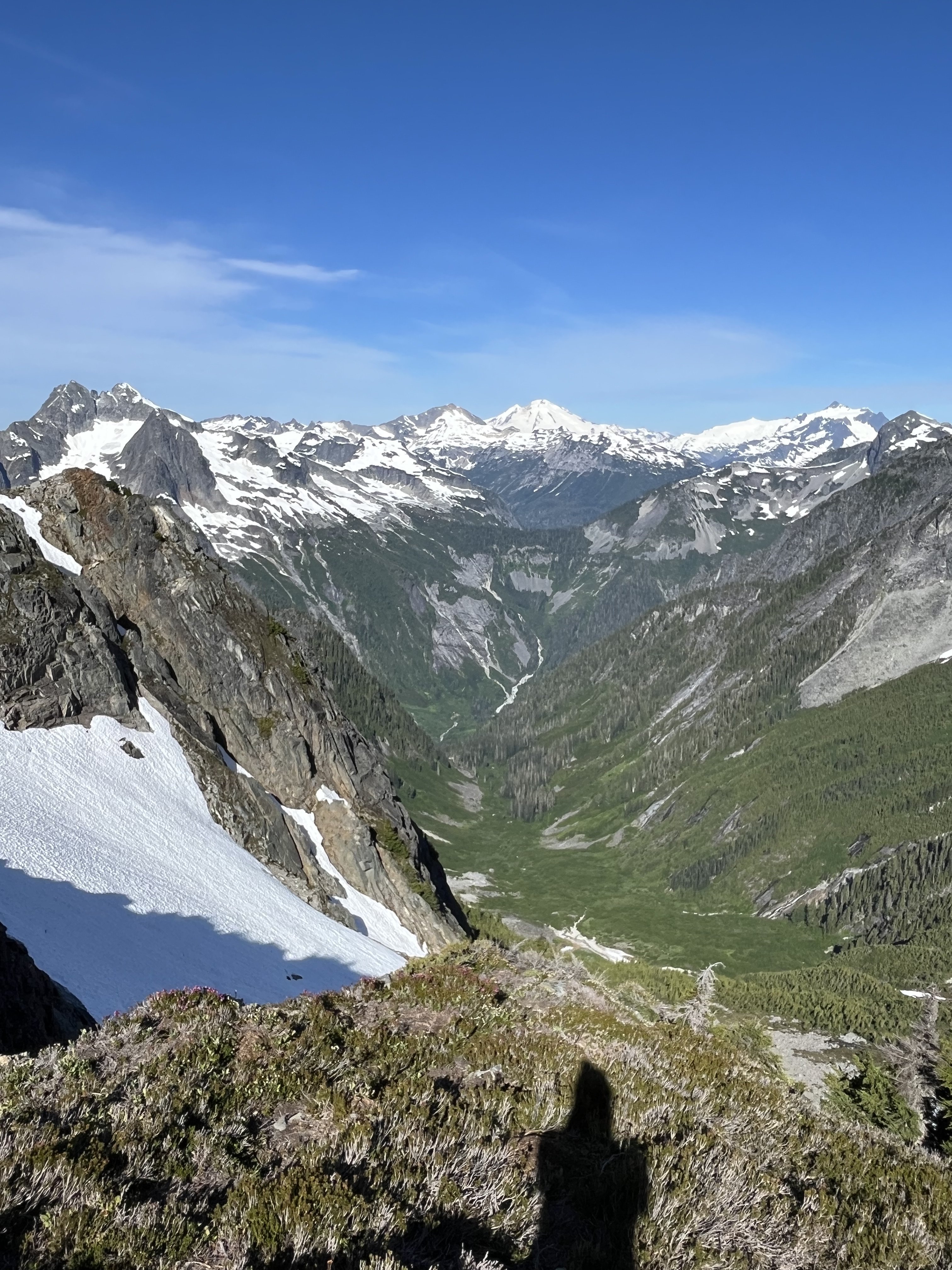
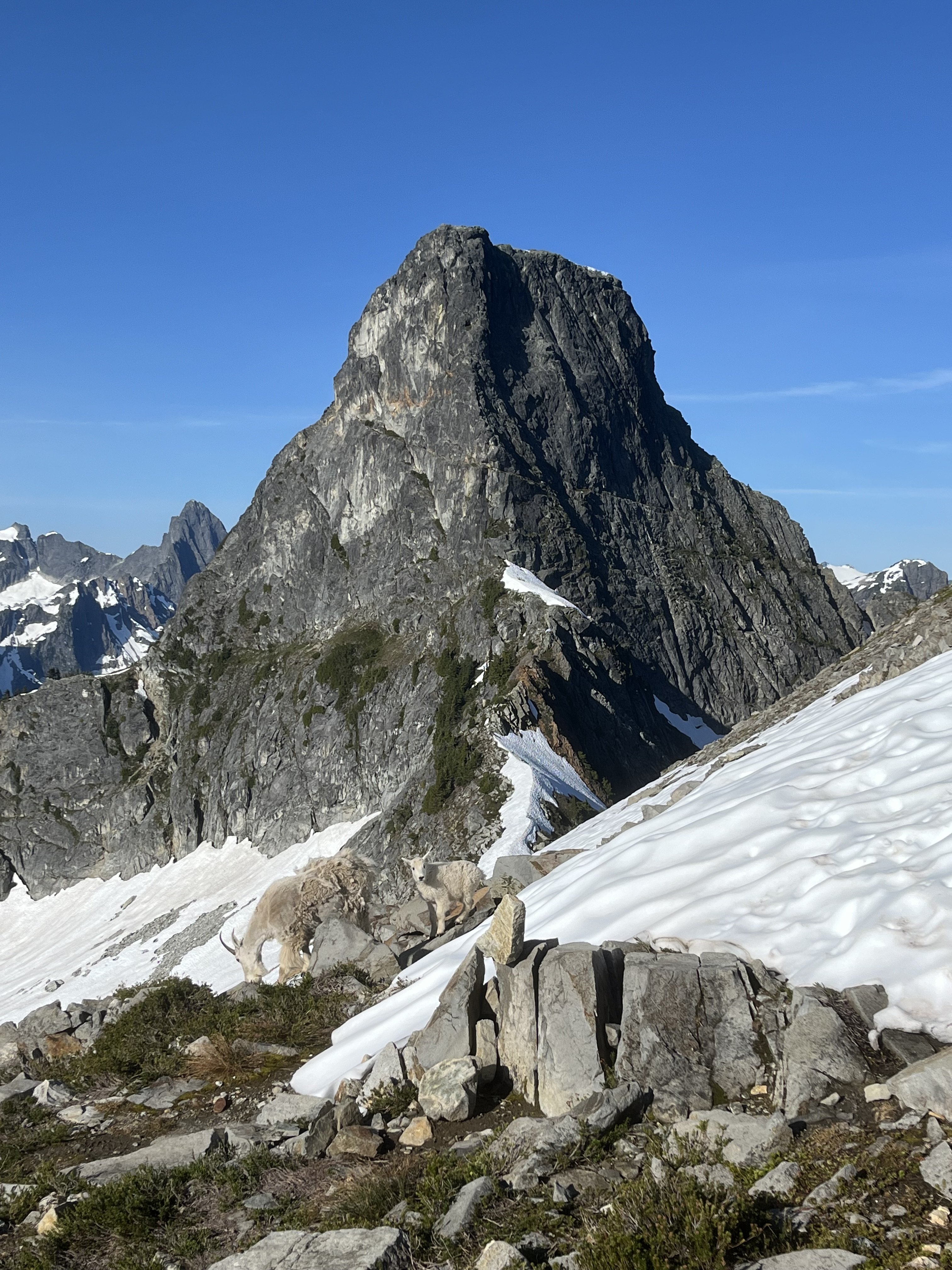
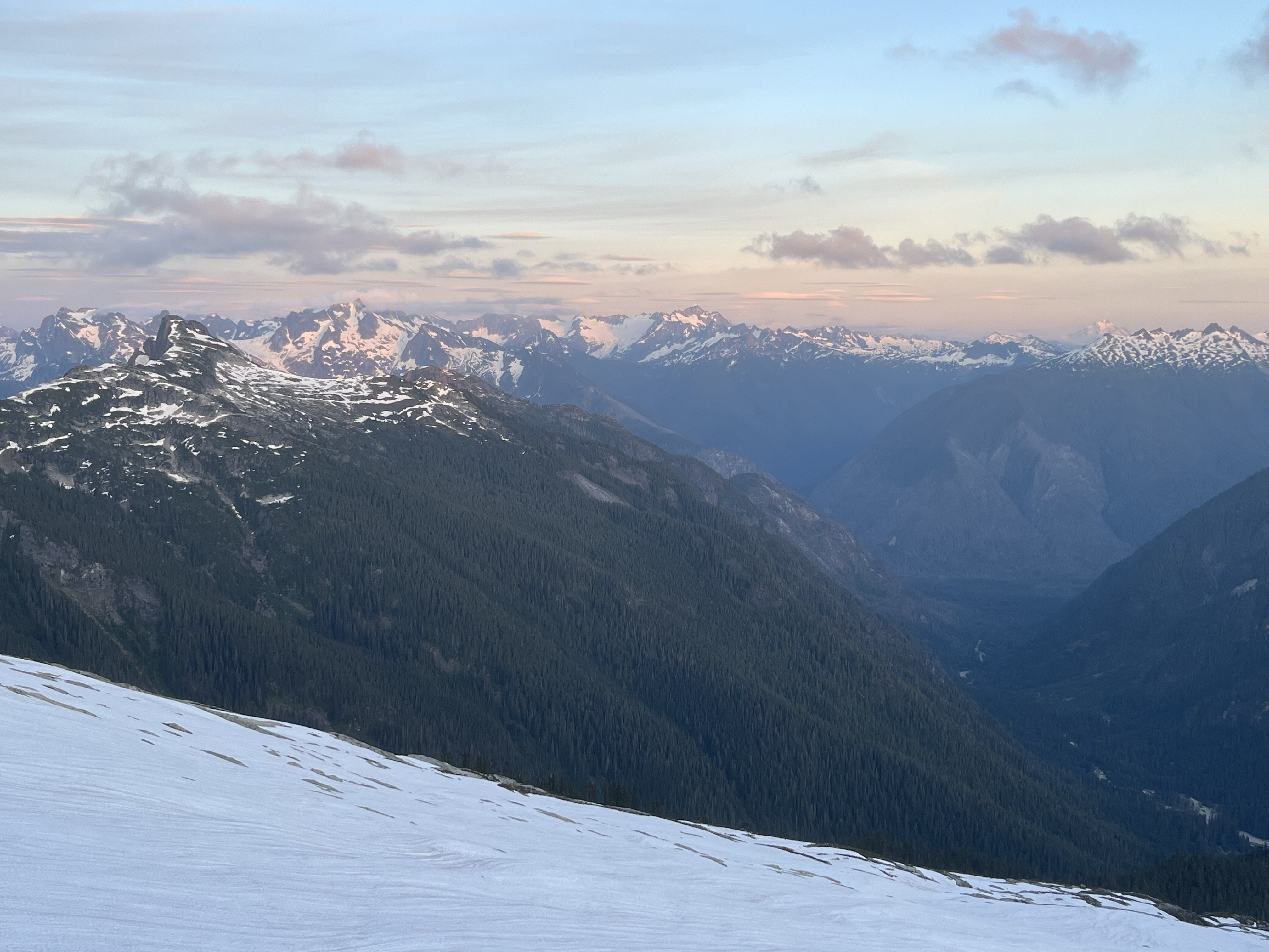
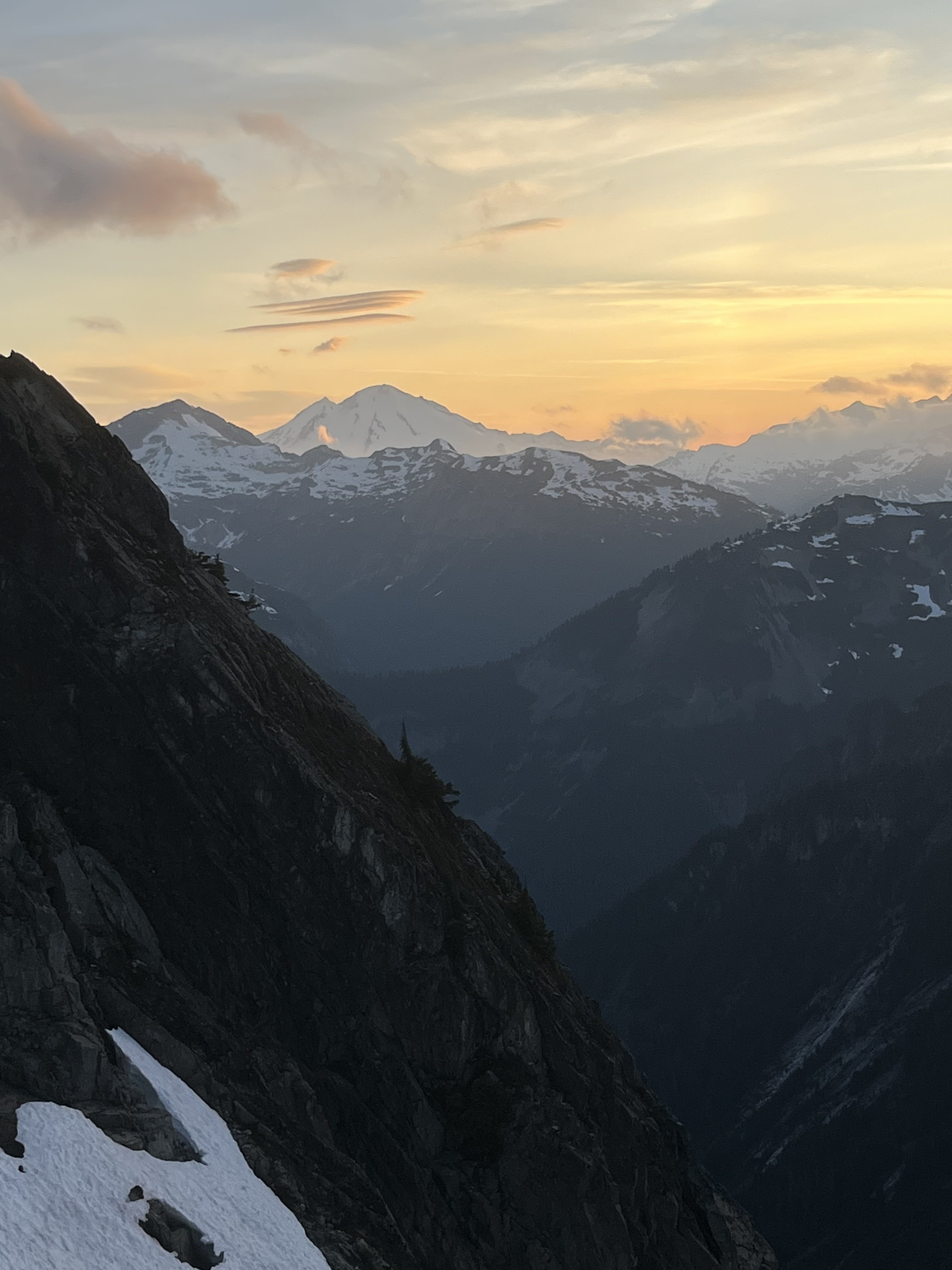
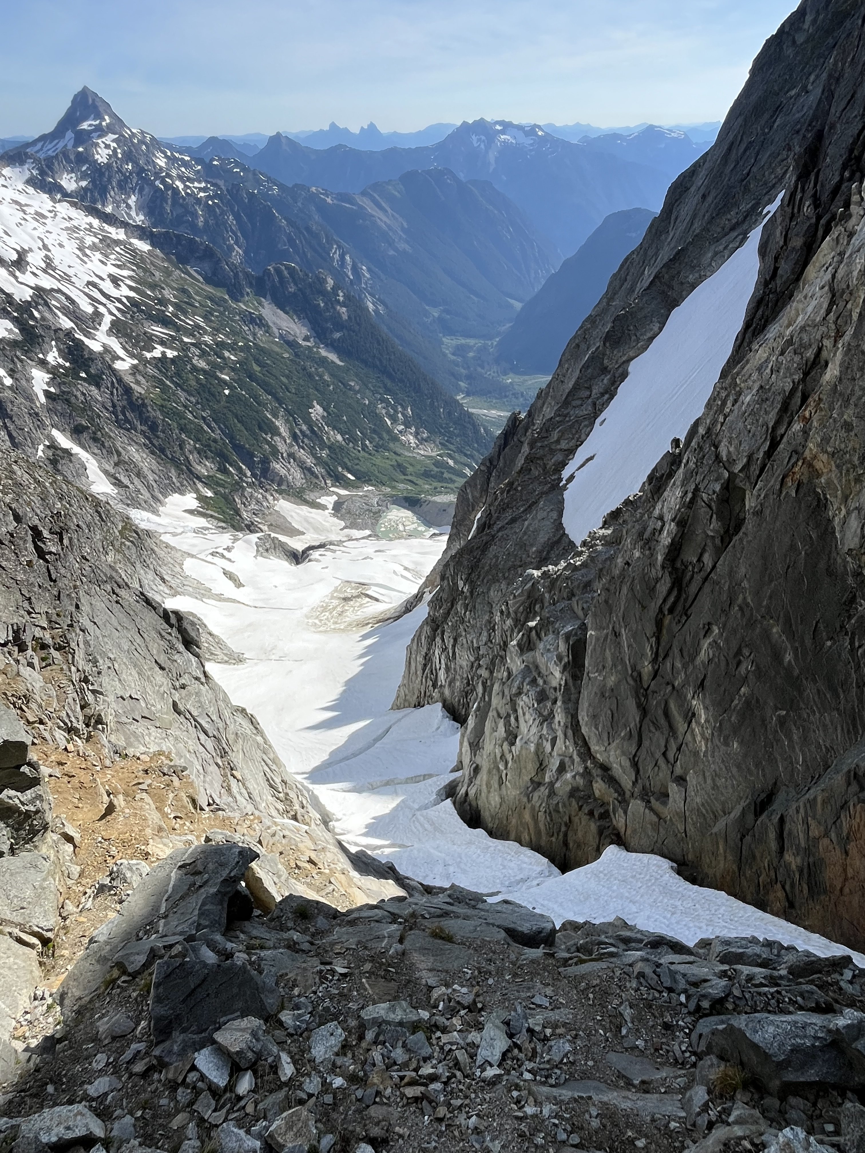
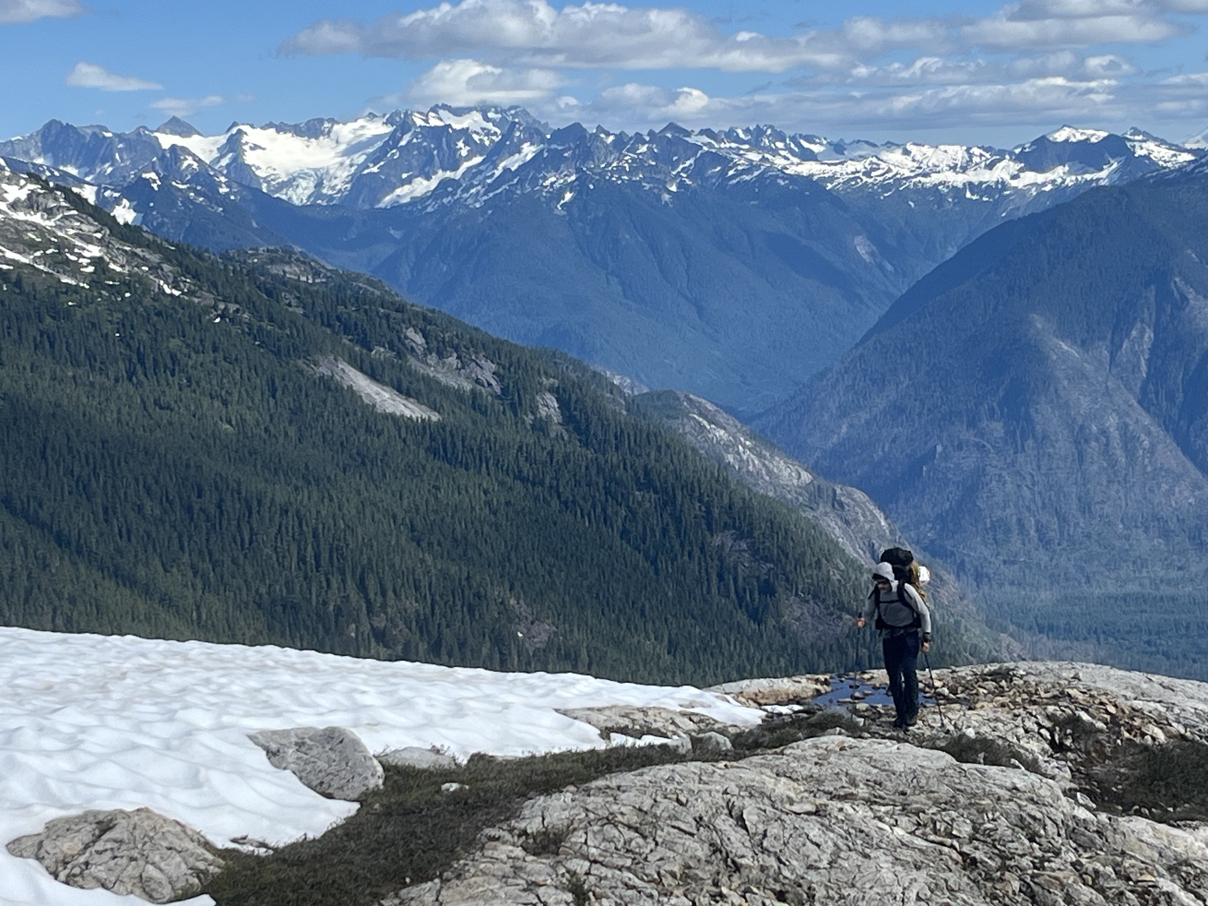
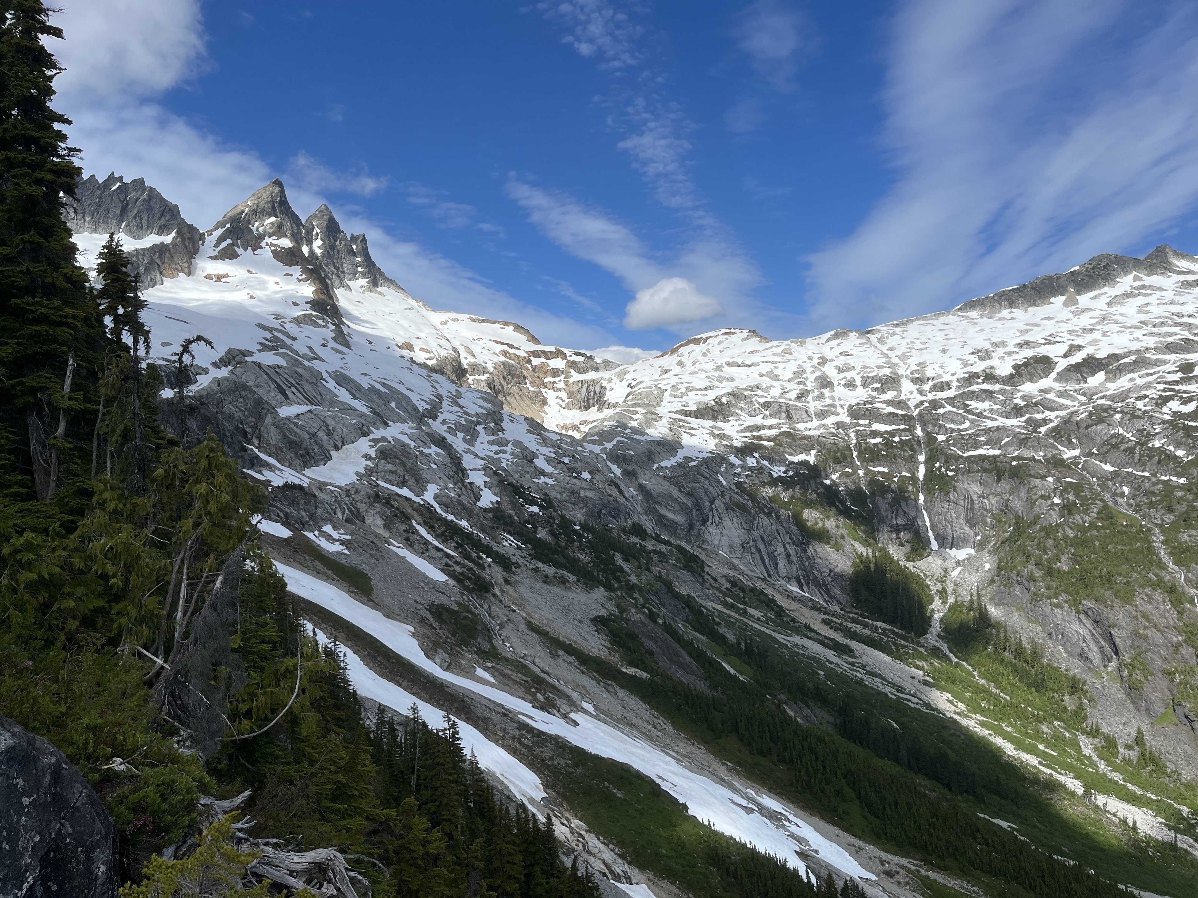
Trip: Terror - N buttress (attempt), Himmelhorn - Wild hair crack, Degenhardt NW+E route, Pyramid - W route Trip Date: 07/04/2025 Trip Report: Drawbridged again in the pickets for the second time in a week. After the standard rap into the couloir north of Otto-Himmel col my partner @aikidjoe encountered a moat that appeared impassable. He ascended back to the station and I took a look down the next gully skiers left. From lower down I could see it would have been no good to try the moat (which would have required an absurd running leap) because another moat was not far below that one. I kept descending adjacent to the couloir, finding mostly solid, even fun, exposed class 4. There was a short low fifth corner with a lemon cake sized block that kept it secure. I passed a slung block with old webbing. Where things cliffed out I found some good .1-.2 cam sized cracks that could be used for a rap anchor. My 60m rope easily reached continuous snow from there (maybe 20m rap). Last year at exactly the same time of year I downclimbed continuous snow down this couloir without even needing the first rap. And last year was a low snow year too. So I was pretty surprised at the state of the couloir. This workaround skiers left seems viable to me. Posting it here in case it helps anyone. The false start and exploration ate up enough time that we decided to bail on our plans for the Stoddard route and head back up to climb WHC instead. My partner was bemused because he expected a crack climb The day had started clear. On our way back down from O-H dark gray clouds moved in to block the ridge. I was glad we weren’t somewhere high on the north buttress of Terror. Next day was quite socked in. We headed off for Degenhardt, accidentally heading up from the south before correcting course for our intended NW route from near Terror’s east col. To gain the couloir there was short choke that steepened at the end to maybe 80 degree snow. We underestimated the angle from below. Odd, usually it’s the opposite. We were able to bypass this on slabs on our return. The foreboding weather and lack of visibility gave the climb a serious feeling. As it gradually cleared on the way back the route started to feel easier. There is plenty of choss on Degenhardt but I recall the scramble being pretty fun. While extracting the summit register I dropped its pencil down some hole. Sorry. From there we groped our way slowly toward Pyramid. The route finding in the clouds was trickiest near Degenhardt. Was glad to carry ax/whippet all the way due to about ten steps through a narrow and steep snow couloir to get to Pyramid’s rock pyramid. We had peek a boo views into McMillan cirque but could see nothing at all to the east. By the time we passed back west of Degenhardt the clouds were lifting and it was a relief to see where we were going. The weather kept improving and the sunset was a real mind melter. UFOs came out in force. Next morning greeted us with more clear weather but having had our fill we bid adieu to the goats and our impeccable camp. After the bruising descent we enjoyed copious berries south of terror creek. Gear Notes: 60m rope and light rack, crampons, ax or whippet Approach Notes: Goodell
- Last week
-
 White Saddle was slightly cheaper but had a max of 4 climbers in their helicopter. If you could round up 5 climbers for West Coast, it would be a little cheaper. Not opposed to White Saddle if I can only find 4 total.
 -
[TR] Tokaloo Rock (Sunset Ridge bailure) - Standard 06/29/2025
bedellympian replied to JasonG's topic in Mount Rainier NP
Kyle Tarry and @Nick Sweeney tried it a few weeks ago too. Sounds like they had a similar experience. -
Just curious, was White Saddle more expensive? I thought they were the go to heli operation for going into the Wadd.
-
Hi there, I’m planning a trip to Mount Waddington and was looking for another group to split flights. If we flew with West Coast Heli, we could get 5 people total for <$1,000 each. I can have a group of 2 or 3. If there was a group of 2 or 3 interested, could be nice to help each other out. Thinking early-mid August, but can be flexible with dates.