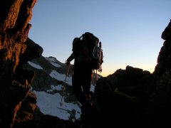
jordansahls Posted September 30, 2009 Posted September 30, 2009 (edited) It seems very likely that this route is just a repeat of an obscure Brian Burdo route. It is still being looked into, but if this is the case, I apologize for jumping the FA gun. I thought I had done my research. apparently, I was wrong. Trip: Whitehorse Rock (Wa Pass) - Flint Lock, 6p 5.8 (FA) Date: 9/12/2009 Trip Report: While scouting for beta on climbing the Paisano Pinnacle/ Burgundy link up, I saw a few pictures showing this beautiful looking piece of granite right on the backside of La Petit Cheval. I did what all climbers from the NW do, and opened up my Beckey book to see what I could see. It seems that the rock I had in question was given the name of Whitehorse rock, but other than that, there was nothing as far as routes or prospective climbs. Photo courtesy of Alpinfox, taken from the trail leading up to Burgundy/Pasisano (guess what rock I'm thinking about). So, we did Burgundy and took some bigger picture of the rock on the approach, it looked good. It was decided that an attempt would be made before the end of the season. Here is a poor topo map of the area, Whitehorse rock is circled (If not obvious already), the other arrow is pointing towards Silver Star for reference. Here is a picture of the route we took with a description by Brian (BCross). ******************************************************** Start by scrambling up the talus to the route. Begin Scramble in the right gully. Ascend Gully about 100 ft then climb out onto a ledge on the face for the first belay. Pitch 1 begins on a low angle crack 5.6ish working your way left toward the e/ne face and finishes with a chunky 5.7 dihedral. Pitch 2 began with another crack. The pitch was slow, as pine needles needed to be cleaned in order to place adequate protection. This crack was a soft 5.7. After the crack continue trending leftward to a belay on the e/ne face with a little exposure. Pitch 3 climb up to a step, crux1 of the climb, an awkward but soft 5.8 move. From here we went directly upward and had to descend as it became unclimbable. So pitch 3 became very short as a consequence. (Dead end of pitch 3) Pitch 4 we worked our way to the ridge proper and for the remainder of the climb remained directly on the ridge never trending toward one face or the other. Pitch four began with some scrambly rock then a walk to crux 2 of the climb. (Stanislav following the crux) A slightly over hanging move on a crack system. It feels intimidating, but there are plenty of very bomber holds making the move suprisingly easy (5.8). For pitch 5 continue upward climbing some low class 5 cracks before hitting another fun step, with 1 or 2 solid 5.7 moves. (Brian working pitch 5) After the step there is a nice little tree to set up a belay. Pitch 6 was all low class 5 climbing turning into class 3 and on to the deluxe, and flat summit. We descended down the gully on the east/north east side of the route without any rappels and made it back to camp within an hour. There are probably a few alternative ways to climb this arrete, and some probably easier/harder than we chose, but we tried to find the nice rock to make it fun. Beer at camp, Necessary? I think so (Brian with a Bodds) The route quality is ok. There is not too much loose crap, but you do have to contend with lichen and pine needles. The route can be done easily in 1 day. *************************************************************** Brian's words sum it up nicely, it was a fun climb, but nothing extreme. It reminded me a lot of a slightly more difficult/dirtier version of Spontaneity arete. Also, there are definitely harder variations that can be done. I backed down from what looked like a 5.10+ roof with a crack running through it (its near the top, you can see it in the route photo). I'm almost positive that people with stronger climbing skills can find what they're looking for on this wall. Also, we thought that Flintlock would be a good name to keep with the Colonial theme. Approach Notes: Approach, begin your approach at the turnoff about 1/4 mile before the wine spires trailhead when heading east on hwy 20. Head directly into the valley and aim for the creek bed coming out of the valley. Get on the left side of the creek, as the terrain is much easier to navigate. Stay close to the creek, but not so close that you are traversing the steep slopes and fighting thicker brush. My rule of thumb was, if I can't hear the creek then I am too far left, otherwise find the path of least resistence. At about 5200 ft, it is easy to cross the creek, and on the opposite side of the creek there is an obvious talus field leading directly to the route. We camped on the flat at the base of the talus field right next to the creek. Gear Notes 1 set BD stoppers set of cams, doubles in the 1.5-3 inch range pink Tricam Beer Edited October 2, 2009 by jordansahls Quote
Pilchuck71 Posted September 30, 2009 Posted September 30, 2009 (edited) Nice Jordan. You seemed to have had a great season this year. I enjoy reading your TR's. ....and beer at camp.....a requisite...well, yeah! Tyson Edited September 30, 2009 by Pilchuck71 Quote
NoahT Posted October 1, 2009 Posted October 1, 2009 Nice, I've always looked across to that thing and wondered. Quote
goatboy Posted October 1, 2009 Posted October 1, 2009 There are some routes on this formation described in the old Burdo "North Cascades Rock" Guide. I did a 5.7-ish route off to the left of the one you drew, about ten years ago, and like you, found reasonable rock and a fair amount of pine needles and lichen... some things don't change. I think it might have been called, "The Archer" or something like that - but my guidebook is currently buried in a cardboard box. Anyway, nice job and thanks for the inspiring photos. Quote
jordansahls Posted October 1, 2009 Author Posted October 1, 2009 Thanks everyone. goatboy, I would be very interested in hearing about the routes described in the Burdo book. I couldn't find anything anywhere in the Beckey book. We found bivy ledges on the top of the rock formation, but we saw no signs of anchors or anything while on "route". I did see some slings on the smaller rock formation sitting just left of the main one (Whitehorse rock)in the route photo. People have definitely climbed around this area. Quote
mountainmatt Posted October 1, 2009 Posted October 1, 2009 Sweet! Another moderate on WA pass is always good. Did you get a chance to do any cleaning while on route? . Quote
goatboy Posted October 1, 2009 Posted October 1, 2009 Hey Jordan, when I move into new place and unpack my guidebooks, I'll take a look at the Burdo reference for you. Quote
jordansahls Posted October 1, 2009 Author Posted October 1, 2009 Matt- We Cleaned a bit, but neglected to scrub thoroghly. For the most part, the route is fairly clear. The real pain was dealing with the lichen (as I'm sure you well know). A saw might have been handy at a few spots to prune the shrubbery. I think with a little more traffic and cleaning, the route could be a good, slightly more difficult alternative to Spontaneity arete. goatboy- No rush, thanks for taking a look. Quote
BCross Posted October 1, 2009 Posted October 1, 2009 Also with regards to the approach, it is about an hour from the road to camp, and maybe an hour and 15 minutes to the base of the route(I made it from camp back to the car in 40 minutes, moving at a fast pace). It would also be an option to start lower on the route, but we opted not too because the pitches would be very short with brushy ledges in between. Jordan, I wrote class instead of close in the approach notes, maybe you could change that when you get around to it. Quote
Alpinfox Posted October 1, 2009 Posted October 1, 2009 In Burdo's "North Cascades Rock" book (1996 spiral bound) he has a picture labeled on p.89 that seems to identify your "Whitehorse Rock" as "Black Horse Point". Page 90 of the same book shows a topo of two Doorish/Cudcowicz routes on the East Face of BHP called "Archer" (4p, 5.8) and "Pampas Drifter" (8p, 5.8). I'm a little confused about the locations of these routes relative to yours, but if you can get a hold of a copy of Burdo's NCR book, it would be worth a look. If you are in North Seattle, you are welcome to come take a look at mine. The crude map in Red Fred 2nd edition p.292 does show a "White Horse Rock" in the approximate proper location. Quote
Kyle_Flick Posted October 1, 2009 Posted October 1, 2009 Brian Burdo's book identifies the area, I think you were climbing, as Black Horse Point. There are two 5.8 routes mentioned in his guide. Hopefully, I didn't rain on your FA parade. Quote
jordansahls Posted October 2, 2009 Author Posted October 2, 2009 No raining on the parade, I put the TR with the purpose of seeing if it could hold against scrutiny. It seems that we either did the same route as the Burdo book, or took a variation of his route. Can someone post a description of the 2 5.8 pitches? Anyway, I will look into it. Quote
goatboy Posted October 3, 2009 Posted October 3, 2009 In Burdo's "North Cascades Rock" book (1996 spiral bound) he has a picture labeled on p.89 that seems to identify your "Whitehorse Rock" as "Black Horse Point". Page 90 of the same book shows a topo of two Doorish/Cudcowicz routes on the East Face of BHP called "Archer" (4p, 5.8) and "Pampas Drifter" (8p, 5.8). I'm a little confused about the locations of these routes relative to yours, but if you can get a hold of a copy of Burdo's NCR book, it would be worth a look. If you are in North Seattle, you are welcome to come take a look at mine. The crude map in Red Fred 2nd edition p.292 does show a "White Horse Rock" in the approximate proper location. Yes, thanks for confirming - it's the 4p 5.8 (felt like 5.7 I recall) called "the Archer" which I did back in the day. I am guessing, but it seems to be so named due to the unusual stone arch which one walks across to get to the start of the route. A very unusual feature for this part of the country. Quote
jordansahls Posted October 5, 2009 Author Posted October 5, 2009 (edited) In Burdo's "North Cascades Rock" book (1996 spiral bound) he has a picture labeled on p.89 that seems to identify your "Whitehorse Rock" as "Black Horse Point". Page 90 of the same book shows a topo of two Doorish/Cudcowicz routes on the East Face of BHP called "Archer" (4p, 5.8) and "Pampas Drifter" (8p, 5.8). I'm a little confused about the locations of these routes relative to yours, but if you can get a hold of a copy of Burdo's NCR book, it would be worth a look. If you are in North Seattle, you are welcome to come take a look at mine. The crude map in Red Fred 2nd edition p.292 does show a "White Horse Rock" in the approximate proper location. Yes, thanks for confirming - it's the 4p 5.8 (felt like 5.7 I recall) called "the Archer" which I did back in the day. I am guessing, but it seems to be so named due to the unusual stone arch which one walks across to get to the start of the route. A very unusual feature for this part of the country. I can tell you that we did not take that route. If you look in the route photo, the arch is on the gully opposite the one we took to get on the arete (look left in the picture). What about the 8p route Burdo is talking about, can anyone link me to his description or maybe paraphrase it for me? I'm having a hell of a time finding his book anywhere in Bellingham. Edited October 5, 2009 by jordansahls Quote
goatboy Posted March 6, 2010 Posted March 6, 2010 (edited) I think this route is indeed a variation on a previous route, but not a Burdo route (though it is in his out-of-print old guidebook). Burdo calls the formation Blackhorse Point. The route just to the left of the obvious prow is called "Pampas Drifter" (III-IV 5.8). "This handsome stranger rides loosely just left of the prow of the main buttress. Begin at the lowest point and bypass ledges to the side to gain a long, sustained 5.8 finger crack on pitch 3. Continue upward, eventually angling right to a dihedral below the obvious white headwall. A dramatic turn on the right of this feature leads to easier ground." I will try to scan the topo later. Sounds to me like Jordan's route may well be a very close variation of the original line (Doorish and Cudcowicz, 1990) Edited March 6, 2010 by goatboy Quote
jordansahls Posted April 23, 2010 Author Posted April 23, 2010 Its hard to say. We at most climbed a variation, and at least repeated the route. Some of the stuff doesn't quite line up, but the climb was a while ago and my memory isn't all that great. Anyway, thanks for digging up the info, it sure is helpful. Quote


Recommended Posts
Join the conversation
You can post now and register later. If you have an account, sign in now to post with your account.