
.jpg.40c348b15c9f900ce022401fa0dfd570.jpg)

YocumRidge
-
Posts
1230 -
Joined
-
Last visited
Content Type
Profiles
Forums
Events
Posts posted by YocumRidge
-
-
To Ivan:

-
Trip: Forbidden - West Ridge
Date: 9/12/2011
Trip Report:
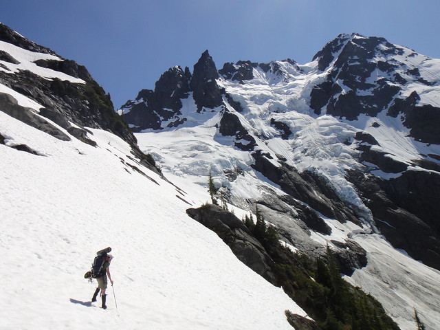
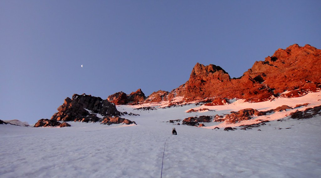
So, west ridge on Forbidden, another NA classic that everyone raves about and that I never seen in person until this last Sunday.
My friend Nick and I climbed it car to car after getting 1 hr of sleep at the TH for Boston basin.
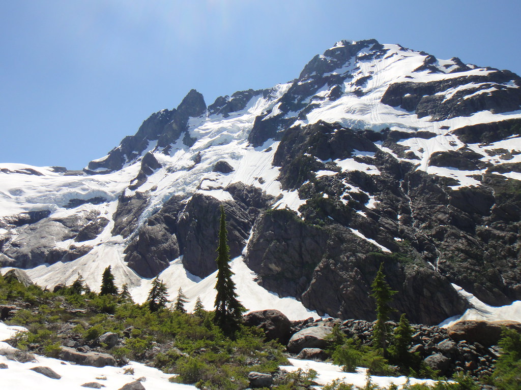
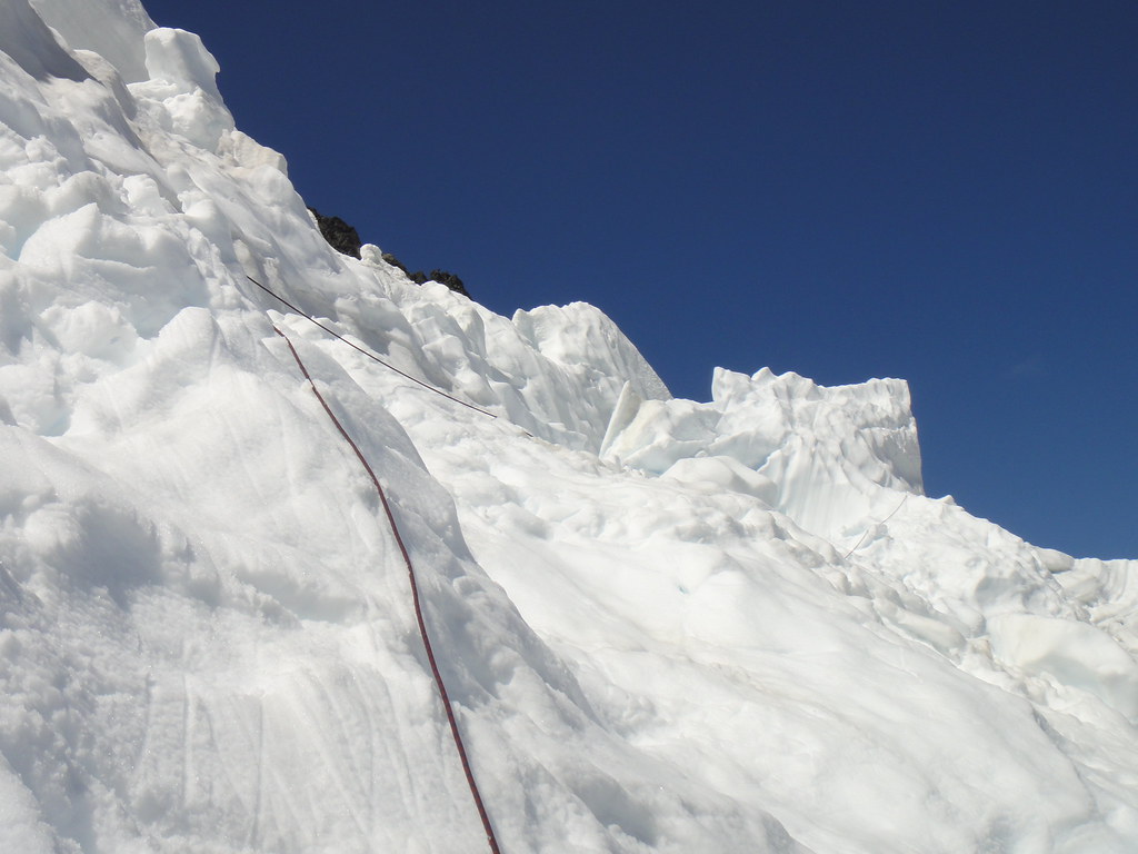
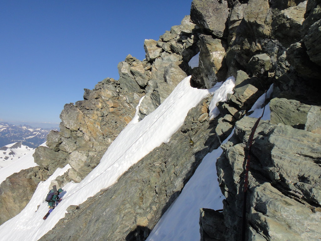
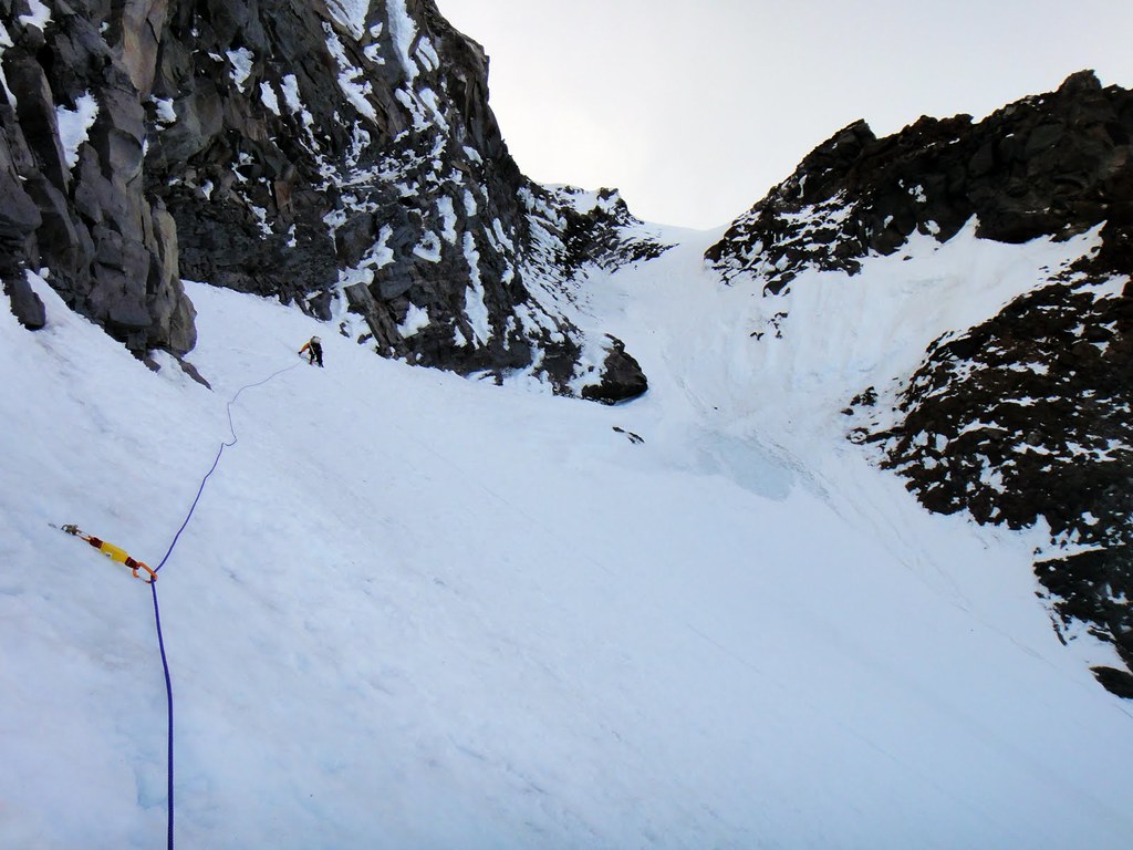
Feeling like tourists with day packs, we reached the base of the West ridge couloir in 4 hrs. The couloir is currently broken up and out of shape for the season:

Good morning J-burg!

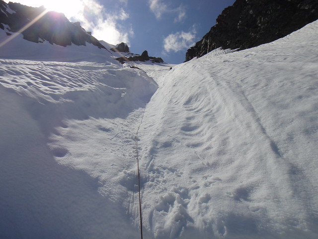
Fueling up before heading up the cl. 3/4 bypass gully next to the moat:

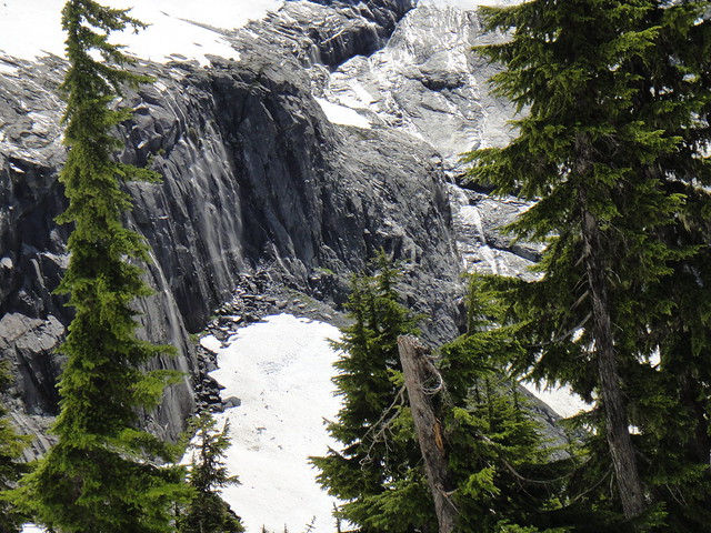
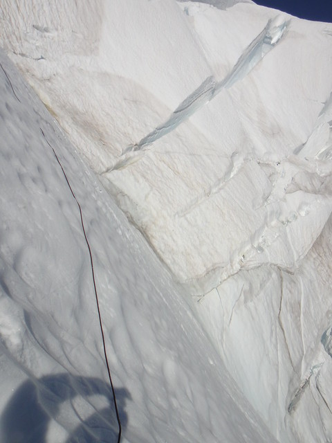
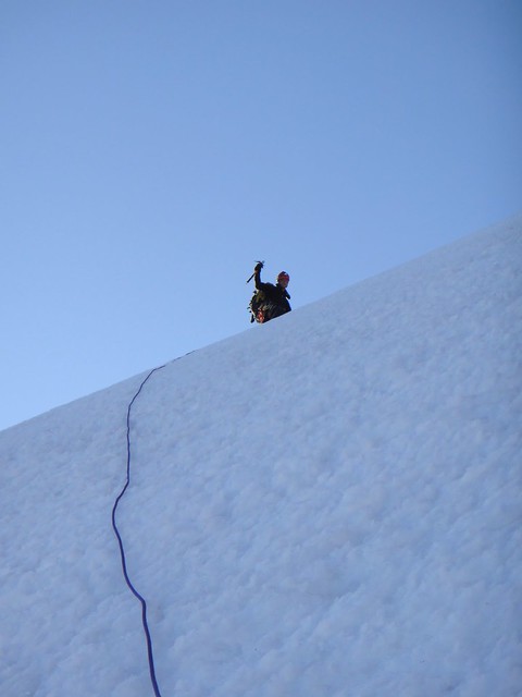
After stashing crampons and axes in the moat, we begun soloing the aggressive gully (must be another classic on its own) when part of its left wall produced a refrigerator-sized manky relic (I am fairly sure being a transplant from Oregon cascades) which missed us by a couple of inches from sending into the abyss down below.
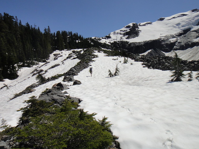
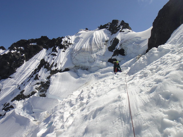
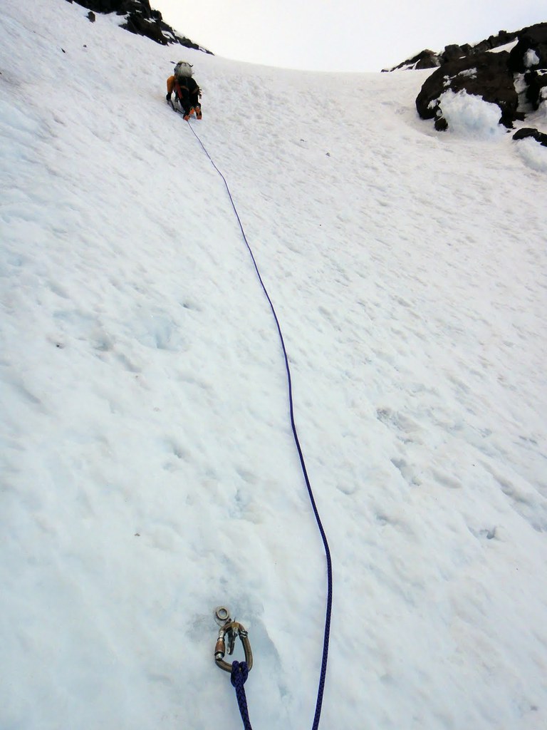
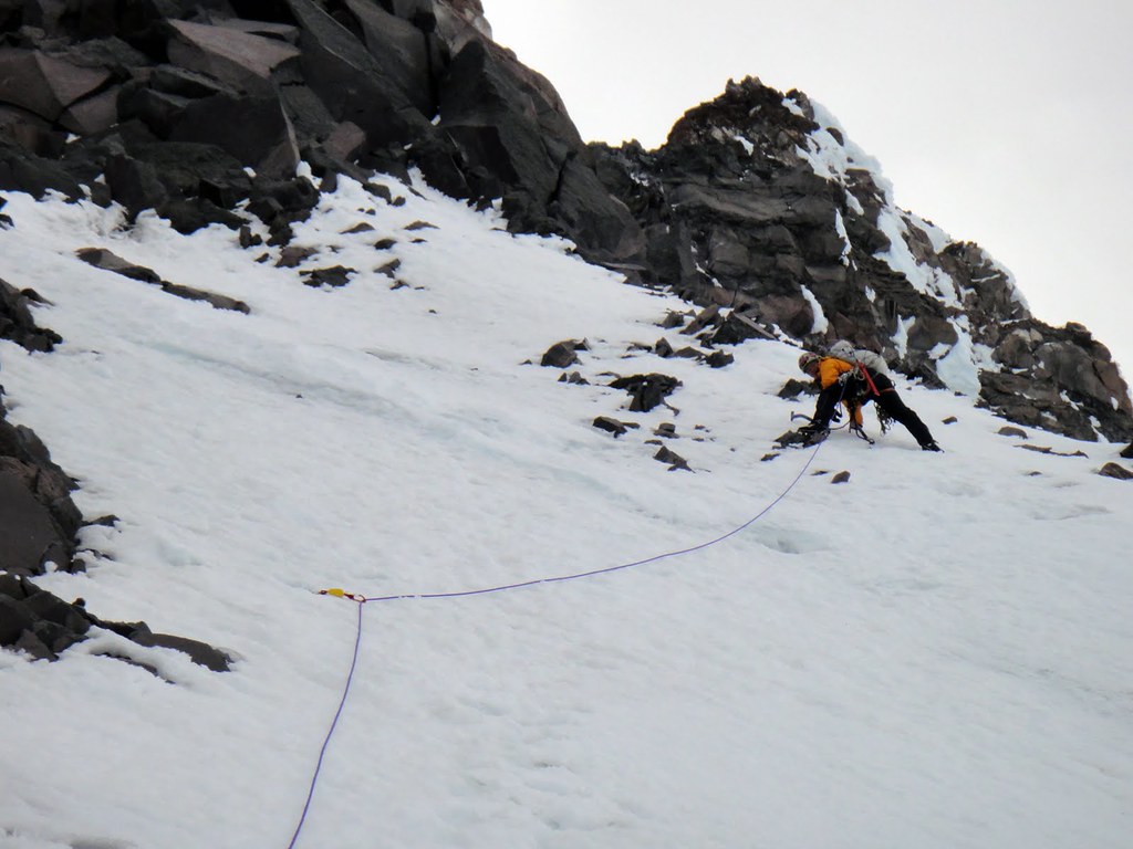
At this point, we roped up and simul-climbed the classic gully to the notch and then the classic ridge.
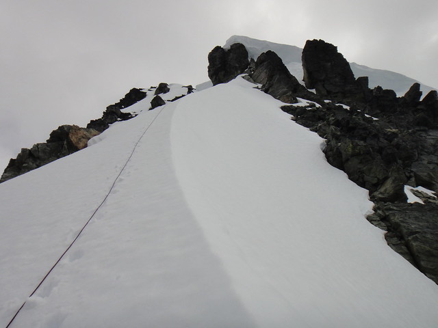
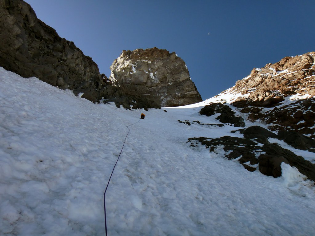
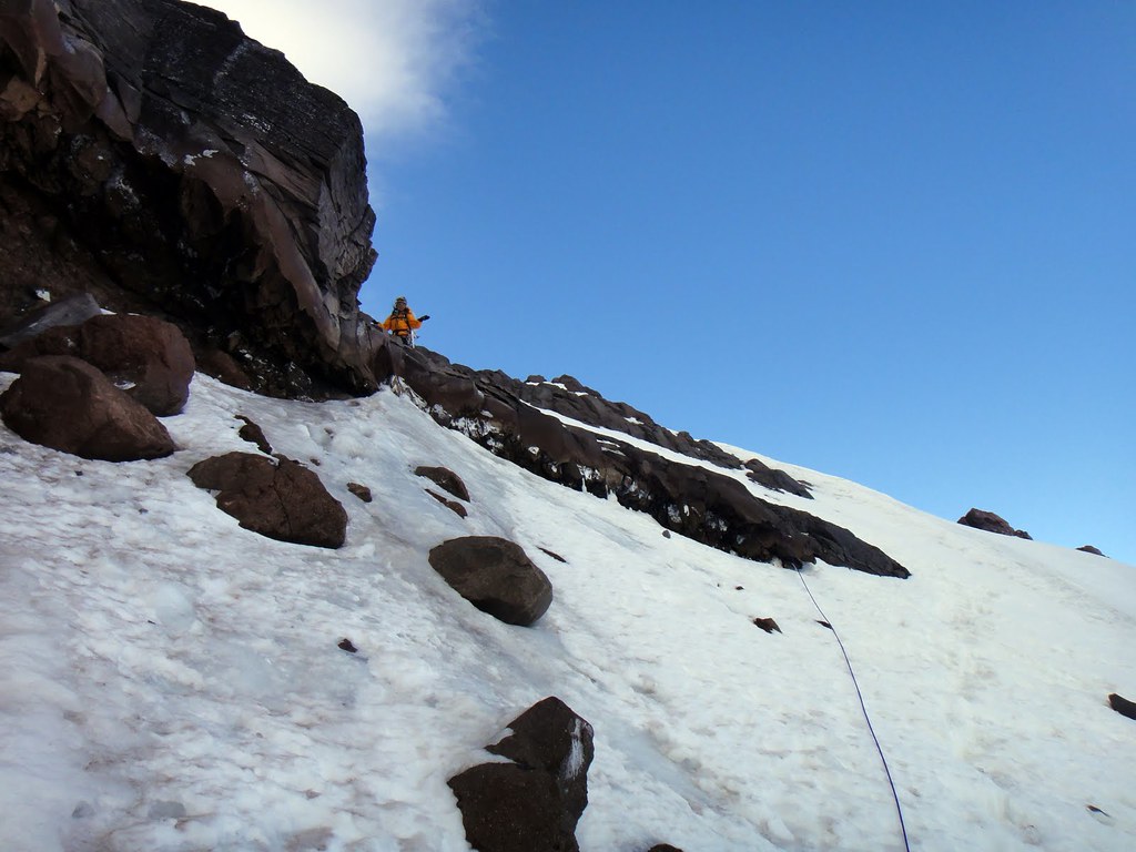
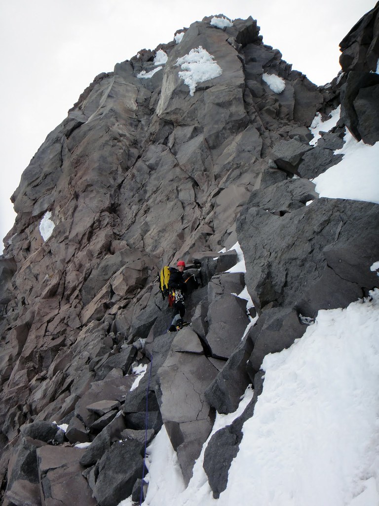
Getting up on west ridge:

Finally happy on solid rock:

Approaching west summit:

On the east summit:


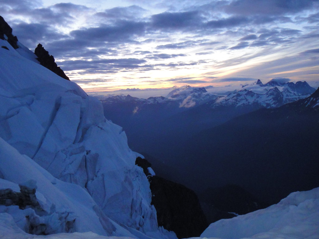
Boston glacier and Buckner on the background:

Looking back on west ridge from the east summit:

Downclimbing and rapping (with one stuck rope) west ridge turned out to be more time consuming than going up but the only available option. The setting in sleep deprivation was really wearing us out by the time we got back to the car but was well worth it in the end
 .
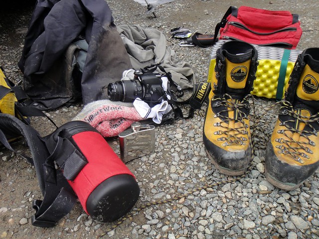
.Gear Notes:
Small alpine rack to #3
-
Nice run and good beta, Steopa!
Routefinding? Ha, did you see me waving you from here:

-
Thanks all for the input.
Having visited the NCNP over the last weekend, I stopped at the Glacier RS to thank the staff again and was told about the error in the start date in our permit. Due to adverse weather on Sun 07/31, we did not start the Nooksack approach until Monday 08/01 with the permit being issued for Sun-Tue (07/31-08/02).
However, we did deliberately drive from the Nooksack Cirque TH to the RS that Sunday (no cell reception) and requested the permit change to Mon-Wed (08/01 – 08/03) which was granted but NOT entered in the park’s computer system or our actual permit.
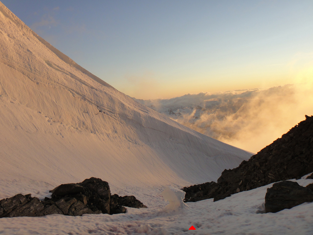
Did we know the heli was going to be sent out on Thursday morning (08/04) while we were on the way down from the summit pyramid to FC and 1 day past the “revised” return date ? NO.
Obviously, if we did, I would have found ways to prevent this one way or another.
-
Nice effort guys!
I second what GB said though. FC is class 3-4 with the obvious rap slings in both left and right variations. It sounds like you guys were off route if you went up 5.6/5.7?
We descended FC 2 weeks ago when the route was partially snow covered and the rock was wet but with a good tool it went pretty smoothly.
I would however add that the second moat on the deproach to lake Ann was less straightforward and required rapping down in the moat in crampons and then getting up and over steep snice sections to get to the snow covered boulder field above.
-
Nice work guys!

-
Oleg, thanks for the inspiration, man!

Soon, when I will get on a path of permanent dirtbaggery, I will consider this.
-
I would say, two very long days if you head up the NE chute and have a snow free deproach to the Austin Pass TH.
The upper east face variation of Price currently cliffs out at the shrund and did not look easily passable in any of the three usual spots.
-
Ahhh... again that new camera of yours does wonders.
Next time make it lead the "disappearing seam" for ya.
-
Another nice one, S!
-
Beautiful, S. Thanks for the stoke!
I never been up there but was looking at it just last week from Price gl for two days in a row. Did not see you though.
-
-
Does anyone want to climb Jefferson Park Glacier with KER finish and summit pyramid on Mt. Jeff this coming weekend 08/13-14?
Or steeper ice in the Silver or North Face Couloirs on South Sister? Last year in July, water ice on that aspect was in great shape and hopefully with the lack of summer this year it will be too.
Or longer alpine rock routes? But I am not interested in cragging though.
-
Good to know, thanks Rad.
-
I agree Rad.
I have a Verizon cell but still there is no reception at the both trailheads.
-
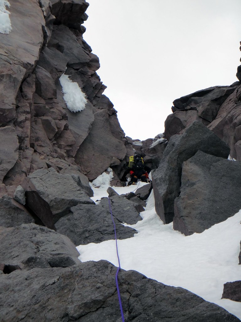
Trip: Shuksan - Price Glacier via NE Chute+NE Rib linkup
Date: 8/3/2011
Trip Report:
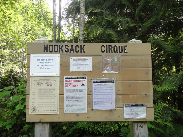
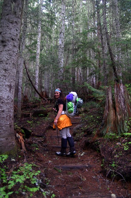
Zloi54 and I climbed one of the 50 classics of NA list – the scary Price glacier on Shuksan - over 08/01 – 08/04/11. After my arrival from PDX on Sat 07/30, we arranged for a car shuttle between Nooksack Cirque TH and Bagley lakes picnic area. Hwy 542 was then blocked by snow and gated to Austin Pass, but is reopened now.
A 30% chance of showers predicted for our Sunday’s approach turned out to be 100% full on rain and meant open biving in the ditch for two nights at Nooksack cirque TH while waiting for the weather to clear.
Day 1. Approach to the Nooksack Tower.
Nooksack Cirque TH (2200’):
Two whitewater crossings of Ruth Creek right off the TH are currently in the brand new “fir tree” state:
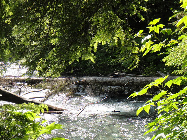
After about 3 miles on the Nooksack Cirque trail, we took the climbers trail down (just past Wilderness boundary sign) to the Nooksack river. Getting to the old log crossing along the riverbank sucked - due to high water level this year I guess, but traversing 20’ above it made the trick.
Nooksack River crossing (another classic by itself) is still solid and welcomes visitors:
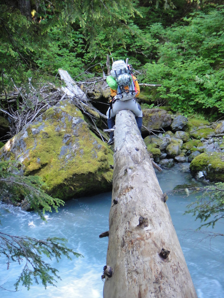
Sticking with the faint trail in the alder (about 50 m to the left of Price Creek) on the other side of Nooksack river was not that bad and brought us to the open moraine above Price lake.
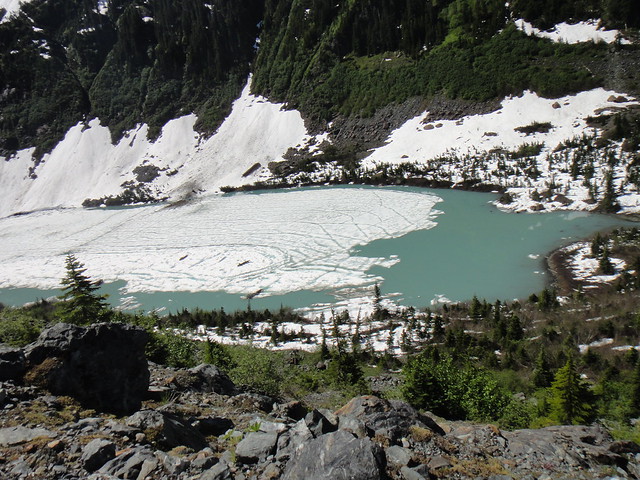
Price Lake down below:
North side of Shukshistani represents:
“Open moraine” quickly turned into snow moraine as we continued towards the glacier:
Some beta advised NOT to head up to Price gl before the cirque seriously cliffs out. Probably being retarded, this is what we ended up doing: we headed up way early through the steep moat-mined snow, and then climbed nearly vertical muddy rock with tools and hauling packs. Getting to Price glacier somehow came at high price of wasted energy and time.
The cirque below from the approach:
Approaching Nooksack Tower on Price gl:
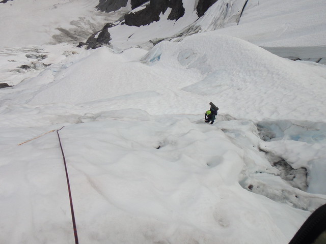
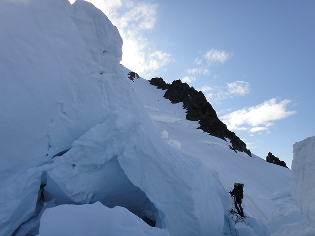
Getting to the Nooksack Tower bivy sites took some imagination for crossing the crevasses below.
The approximate line, looks easier than it was in reality:
Camping out by the Nooksack Tower (6600’):
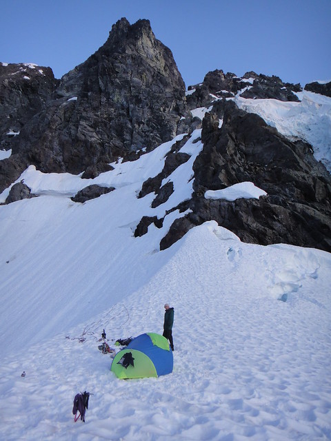
Sunset and dreams about Canada:
Day 2. Upper Price glacier.
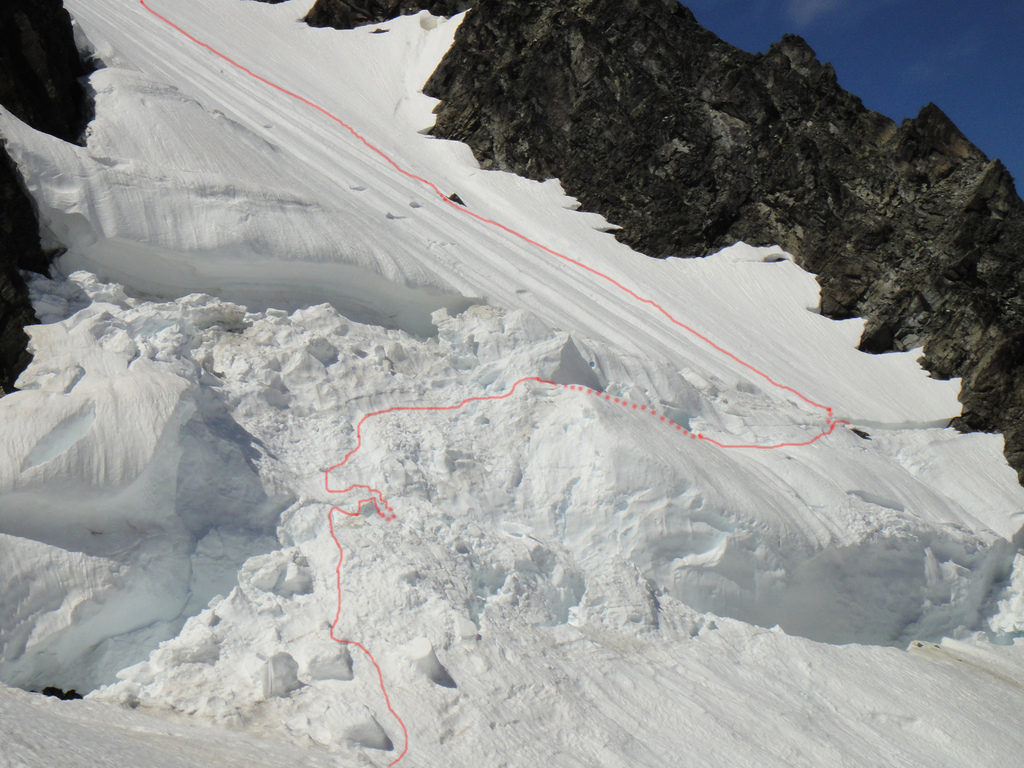
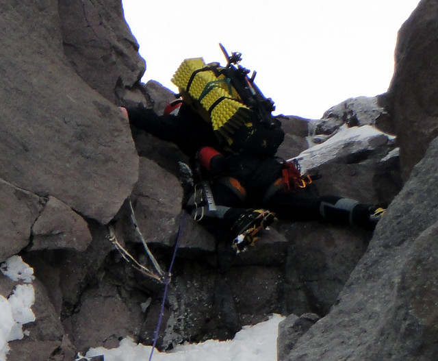
We started at the base of Nooksack tower at sunrise, sprinted through the sketchy ice chute being constantly fed by the material from the looming above ice cliff, and then squeezed through a couple of fragile chimneys before hitting safer ground somewhere in the middle of Price gl:
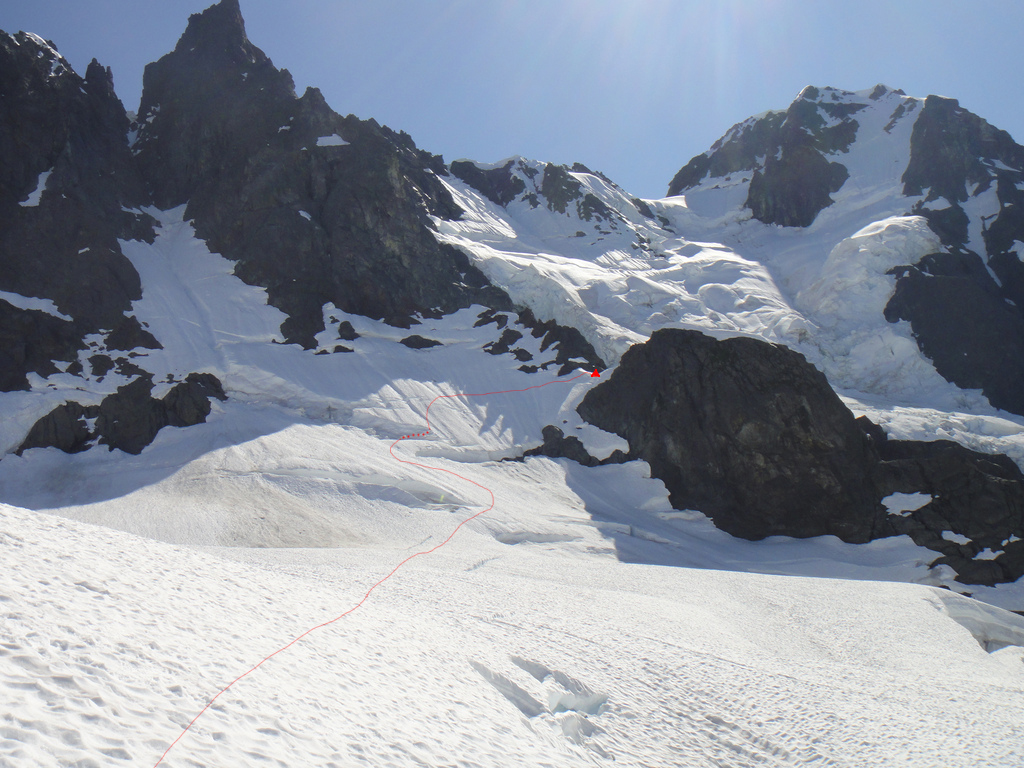
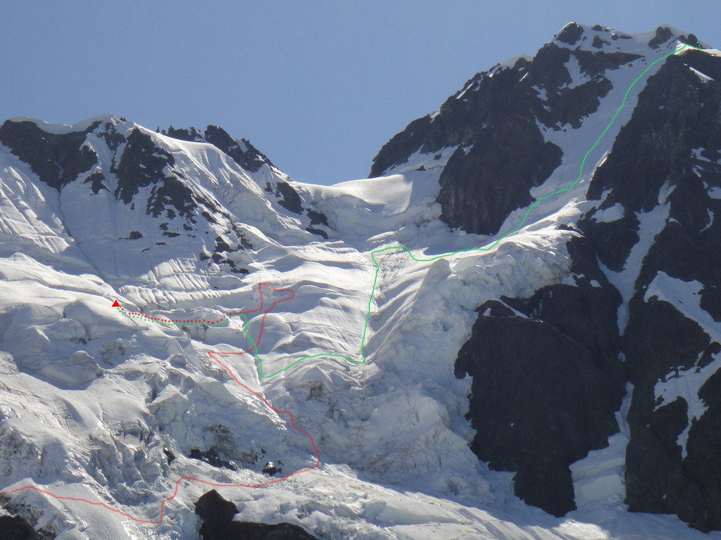
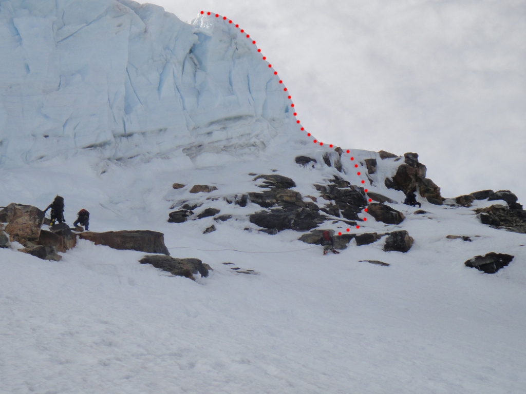
At this point, routefinding choices had to be made and while trying to compromise between the contradictory beta “to stay on the left” vs “to stay on the right” of the gl, we went up in the center (red line):
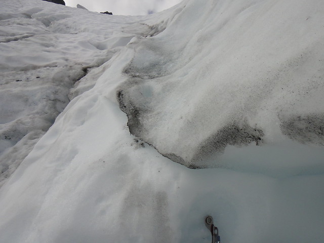
The ice was good, took screws well and we could not see any major obstructions ahead. Yet.
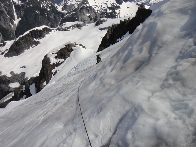
Z coming up first ice pitch:
More ice above:
Z coming up on the traverse:
I then led an 80 deg snow dome and hit a dead end in the maze of overhanging ice walls and our further progress had significantly slowed down. After trying a few options, we rapped down in the underground and begun traversing east (left) through the system of corridors and chimneys, most of which we soloed. The plan was to somehow get on the above snowfields to approach the rock band by the main shrund from the left where things were least broken up.
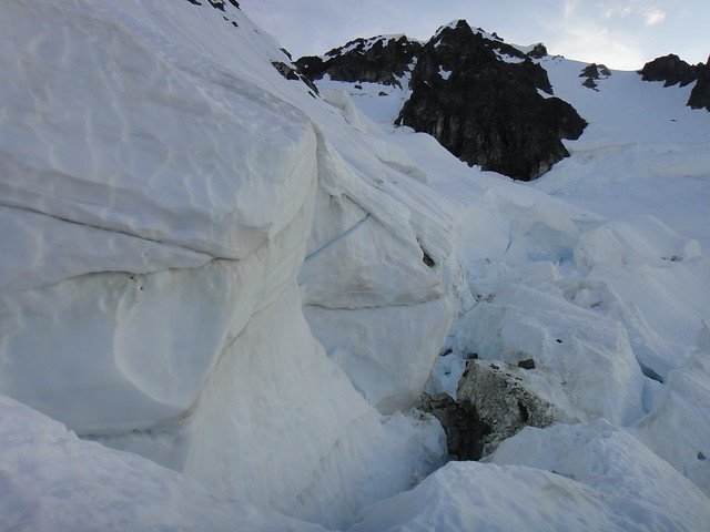
Rapping down off ice features:
In the crevasse chimneys:
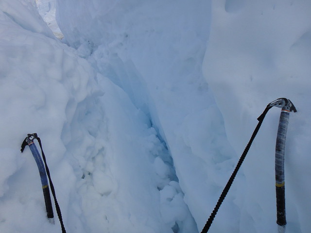
Contemplating the overhangs:
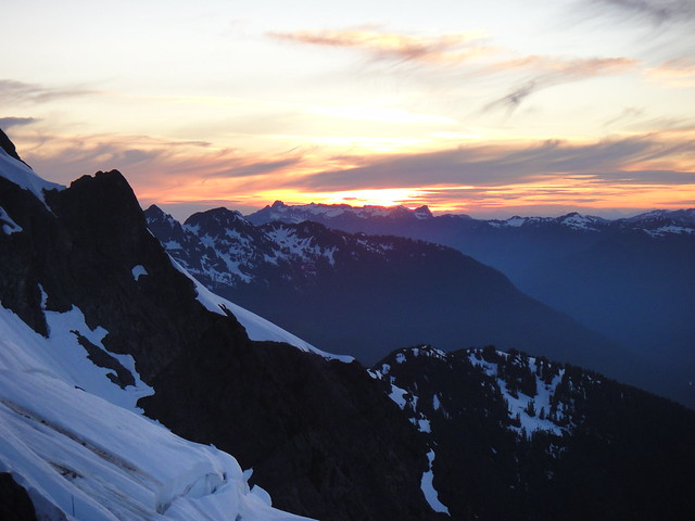
By 7 pm we run out of options and pitched in the tent in between the ice walls with the haunted Nooksack Tower watching us for the second night in a row. I am not sure how often people do that, well we had no other choice:
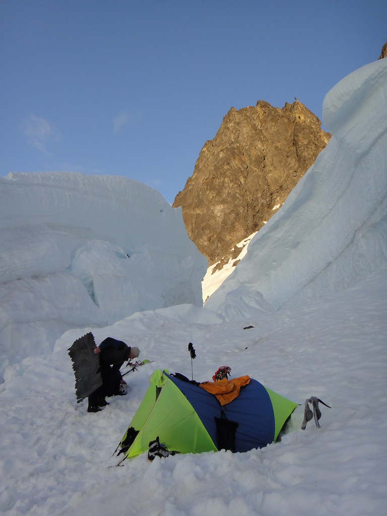
Another sunset by Nooksack Tower:
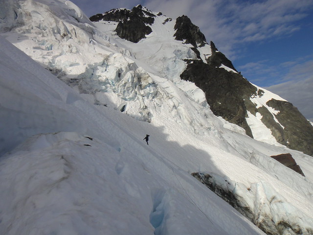
Day 3. Upper Price gl., NE chute and NE Rib.
For the lack of options on the east side of Price gl, we retraced our steps through the chimneys in the seracs, downclimbed and rapped down to the point where we could get to its west (right) side framed by a vertical serac wall and steeper snice slopes.
Z heading up the right side of Price:
West side of Price:
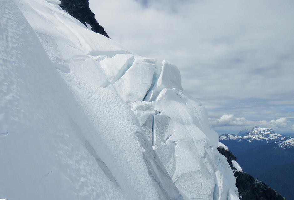
Finally we got to the main shrund on Price, passing through which would have taken multiple overhanging raps as was later confirmed from my vantage point in the NE chute.
The green line to the main shrund and traverse to the NE chute:
We made a good call on the safest option of all: the NE chute with its scary entrance made of delicate soft ice flutings over 100 feet deep cracks and its monstrous ice roof right above our heads ready to collapse at any moment.
The entrance to the NE chute:
Typical terrain:
Z coming up on the traverse to the center of the NE chute:
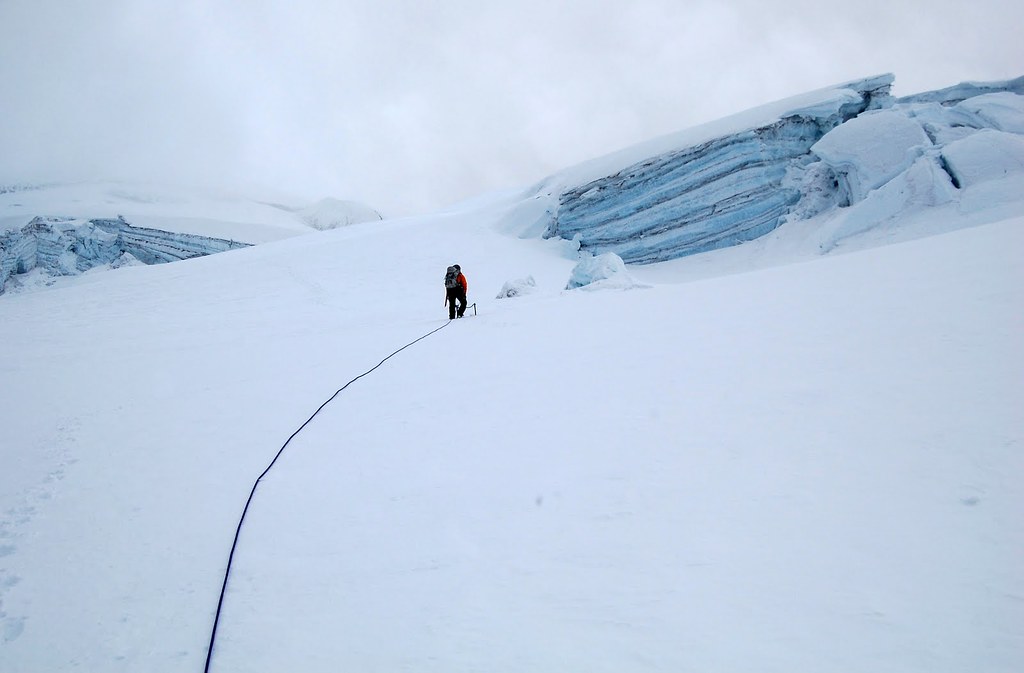
Z heading up the easy snow above the second shrund in the NE chute:
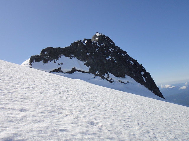
Z climbing up to the NE shoulder to find a bypass to the Crystal glacier – a “no go” in the current conditions:
After he downclimbed the snow, I traversed and went up the NE Rib made of good and bad rock.
Z traversing to the NE rib:
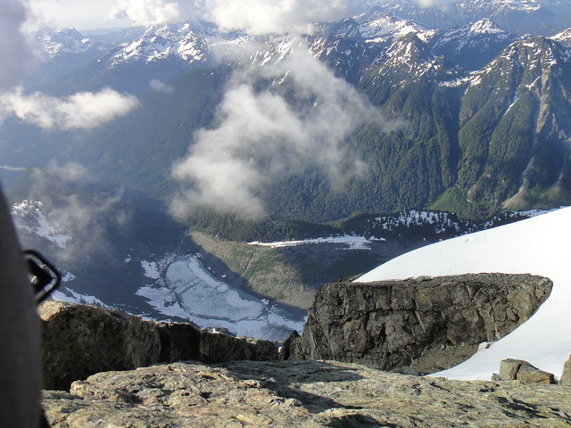
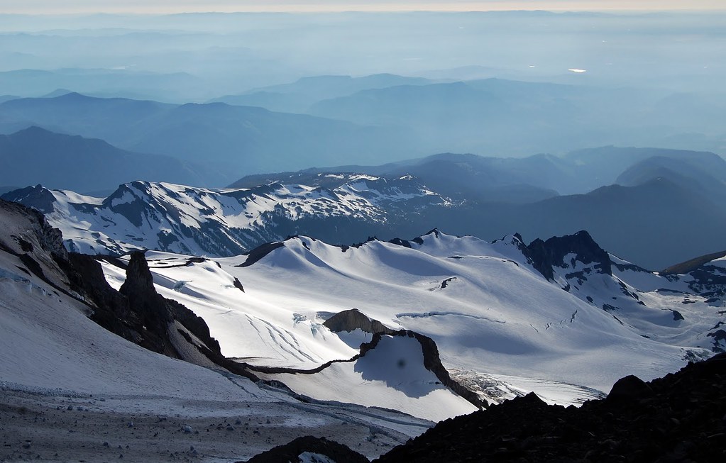
Amazing views of Price lake down below:
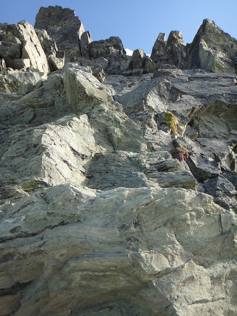
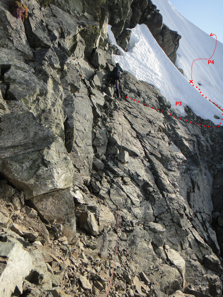
Solid alpine rock above on P2 - highly recommended:
Z starting up on the P3 of the NE rib finish:
After we had finally crawled across one of the endless knife edge snow ridges, we found no summit pyramid to our delight, but another corniced ridge which I think is a part of the Hanging glacier.
So, we camp again. By the Hanging glacier snow ridge this time. And we run out of food.
Day 4. Summit Pyramid and Fisher Chimneys descent.
Next morning we climbed up and over the Hanging glacier cornice and thank god landed on the easy slopes of the North face top out. Just about time.
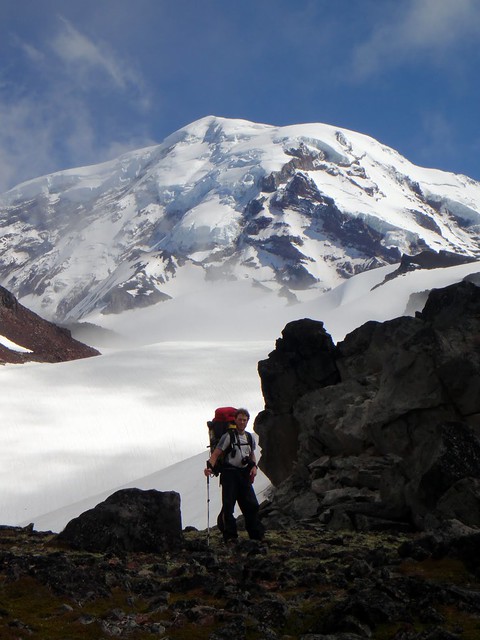
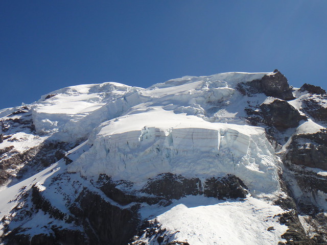
The Summit pyramid from the north is looking mighty:
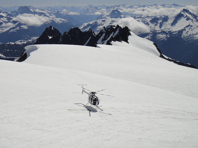
While traversing across the Crystal gl and up the summit pyramid, we spotted the chopper making its way towards us. It turned out the authorities were concerned that we are 3 days overdue (including one extra day we bivied at the Nooksack cirque TH waiting on weather) but provided us with so needed food for our descent! What a treat!
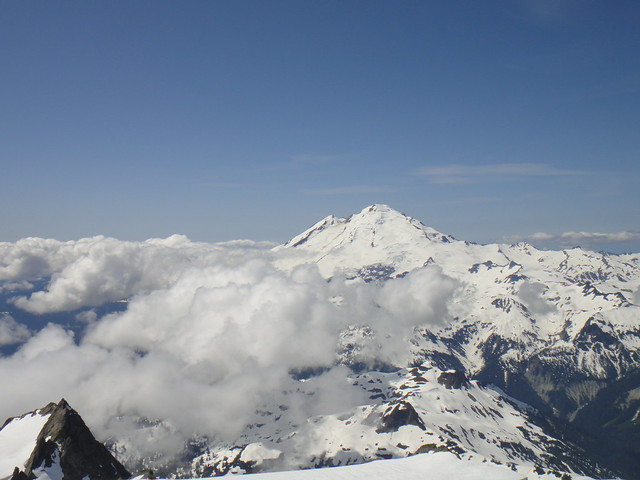
Baker from the summit pyramid:
Hells highway was in the straightforward shape as was the lower crossing to Winnie’s slide.
We took the skiers right variation of the Fisher Chimneys. After two raps over snow covered rock, we downclimbed 50 deg snow with a tool (no crampons were needed), and then merged with the left FC variation and downclimbed the rest on more often than not dry rock all way down to the moat.
Traversing the snow covered boulder fields was OK, but getting through the moat on the last rap off the tree took more time than expected. There are a couple of options here: either shorter 10’ overhanging steps to get on the snow slope or a 20’ vertical section, both requiring crampons and a good tool.
The descent to lake Ann was under snow, and will probably be for another month. We took the shortcut through the snow-covered slopes rather than sticking to the trail in the trees.
Gear Notes:
5 screws, 3 pickets, rock pro to 1 inch, KBs could have been helpful, and were brought but not used because I am lazy.
Approach Notes:
Nooksack Cirque to Lake Ann carryover
-
Thanks for the update.
It is nearly August and there is so much snow on the mountain. Wow.
-
Don't forget about lugging up the tripod as well!
Yeah, I first thought it was some fancy snow anchor, Mark
.We could have used it to stake the tent on the windy summit saddle though.
-
They (climbing rangers)'re just one of the many good reasons I don't mind paying the fee for climbing that mountain. Well worth it...
I totally agree with you. I was personally stoked to go down to Shurman with them, although as a patient
-
Thanks Water. That might lighten the load quite a bit!
Looking forward to check them out.
Course of action? To start descending next morning, probably short roped, and hoping that at some lower elevation point I will consume more than 1 Gu per day to eventually crank the pace up.

-
I am glad you enjoyed the approach Mark!
And thanks for being an awesome partner!
-
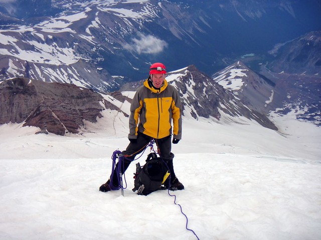
Trip: Rainier - Ptarmigan Ridge rock variation
Date: 7/24/2011
Trip Report:
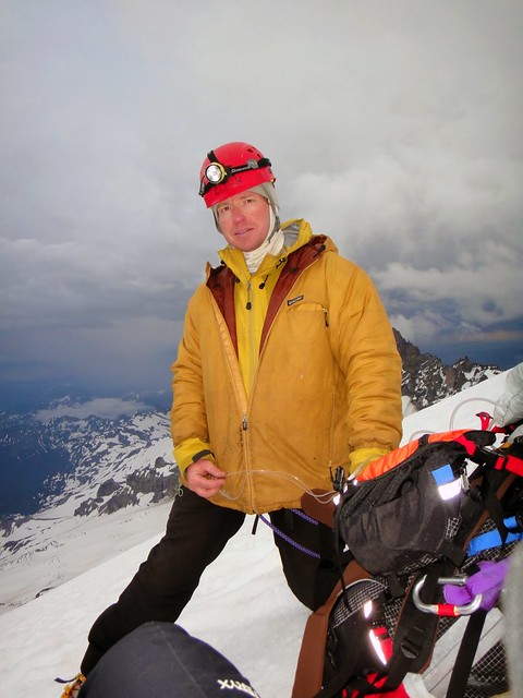
Over the last weekend my kalifornikan friend Mark (aka PellucidWombat), who came to visit PNW for 2 weeks, and I climbed the mean classic on the north side of Rainier – the Ptarmigan Ridge.
Having thoroughly enjoyed its rainforest character, alpine meadows and bears in the area before, I had successfully talked Mark into approaching Ptarmigan from the Mowich lake via Spray park and Observation rock. For this to happen, we had to arrange for our car shuttle between Mowich lake and White River which took a few hours but I was hopeful it was worth it after all.
Day 1. Arrival at the Observation Rock.
Looking forward to a “mostly sunny” NOAA forecast that does not happen often on Rainier, we started at the Mowich lake TH later than desired, around noon, but at least we did not forget the crucial pieces of gear.
The booze, the boots and other things:
On the Wonderland trail approach:
Once we reached over the T-line, we got to admire the standard “mostly sunny” conditions in the cascades, great visibility and Spray park being transformed into a snow park for a change in mid-summer:
All looked the same but thank god for the GPSes we brought. Mark was concerned that we will have nothing to observe at Observation Rock while I was lamenting about lack of bears. At last, blue sky begun to emerge as we crossed Flett glacier morains and that planted some meaningfullness in our upward progress to Ptarmigan.
Mark at the Flett glacier morain:
The prime piece of the north side real estate is officially open to visitors but for some bizarre reason is rarely visited. Why is that?

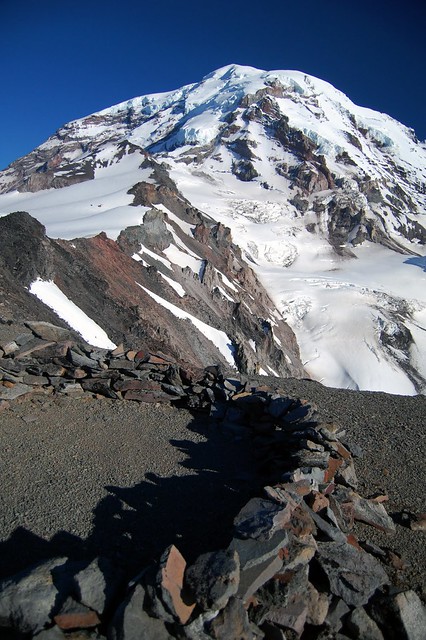
Lib Ridge, Lib Wall, Ptarmigan Ridge and Mowich face (the pic was taken by Mark from Observation Rock):
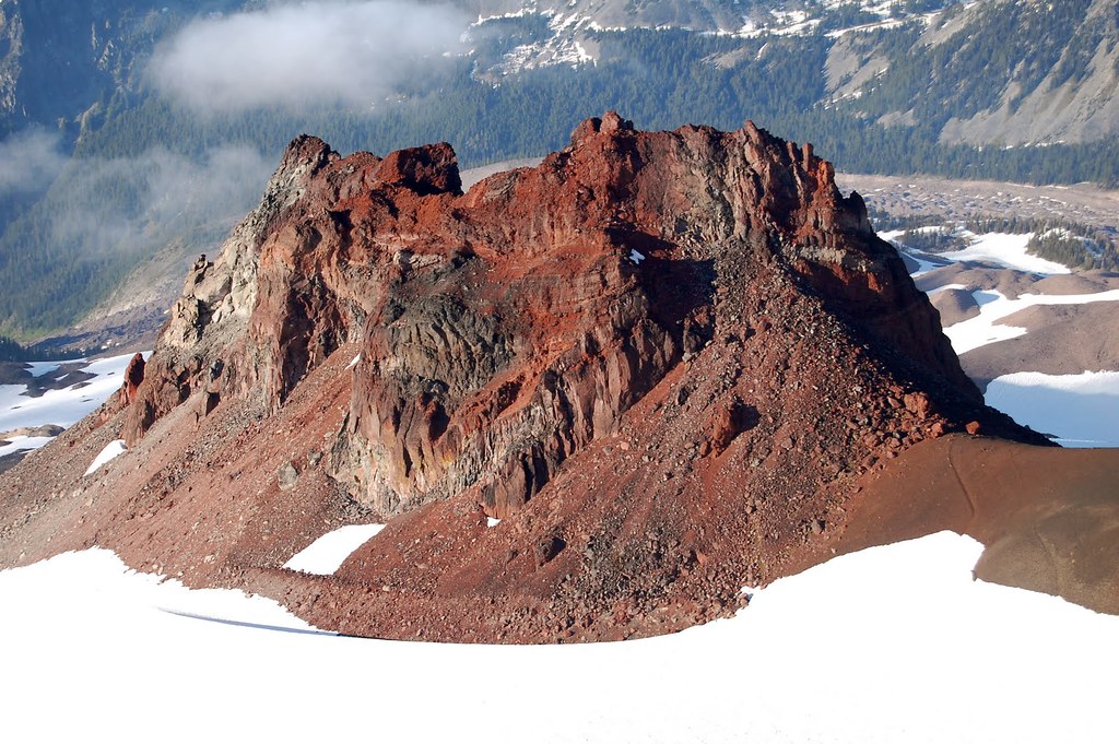
After we settled in on the flat bivy spots between the Echo and Observation rocks, we spotted a few boulders made of high quality material – surprisingly for volcanoes - and so we went bouldering.
Alpine bouldering in the mountain boots:
While I was getting over my bruised ass that landed on the rocks below, Mark went and tagged the Observation Rock to observe things and took a sweet power nap on the summit in the warm volcanic gravel to be ready for night photography later on.
Observation Rock summit register:
Observation Rock summit bivy sites:
Echo Rock from the summit of Observation Rock:
Artsy shots of the North Mowich Glacier from Observation Rock:
[font:Arial Black]Wonders of the Mark’s night photography at our bivy.[/font]
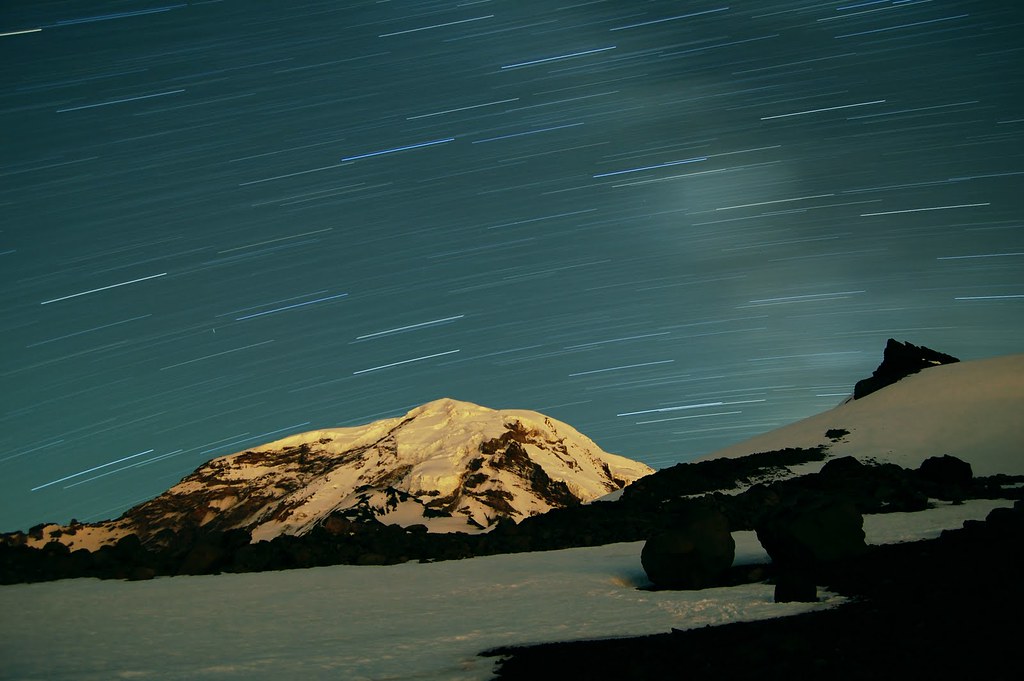
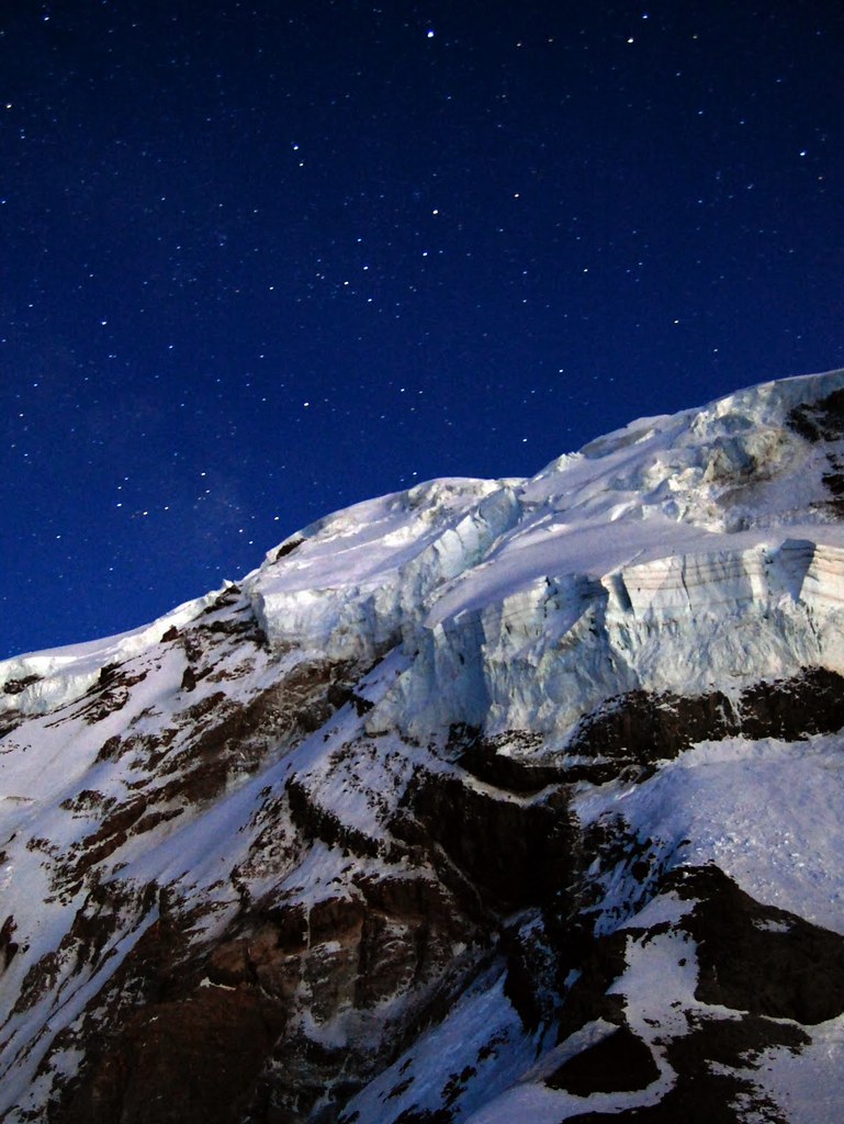
Milky Way over Rainier:
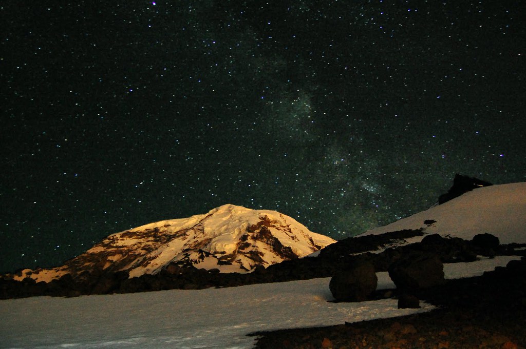
Starry night on Rainier:
Day 2. Ptarmigan high camp 10300’
We slept in and started up the Russell gl around 11 am and quickly made it to the knife edge.
Solid and straightforward, the dogturdite ridge never is. We hit the loose overhang around 2 pm and bypassed it on the Carbon gl side by downclimbing and traversing around the moat and up on the ridge again - a much saner option with some snow cover remaining.
Mark downclimbing the lower Ptarmigan towards Carbon gl.:
Bypass of the dogturdite section:
We merged with the ridge again – and got to the bivy sites.
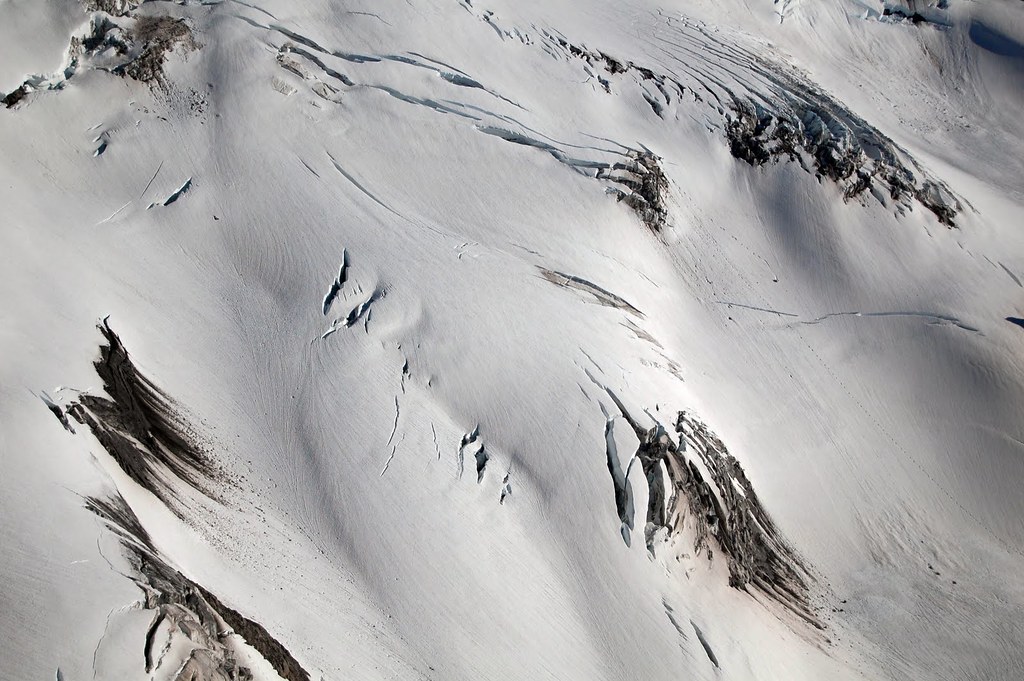
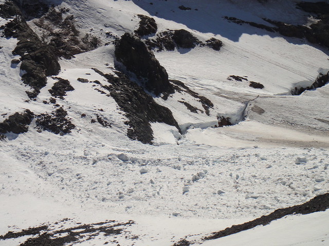
The Ptarmigan Ice Cliff is still up there, alive and well. And shedding the projectiles, albeit of a smaller caliber than the scary ones I got rained on at the Nisqually Ice Cleaver last month, but still good enough to kill:
Mark Twight in action:
Sunset Ridge as seen from the Ptarmigan high camp:
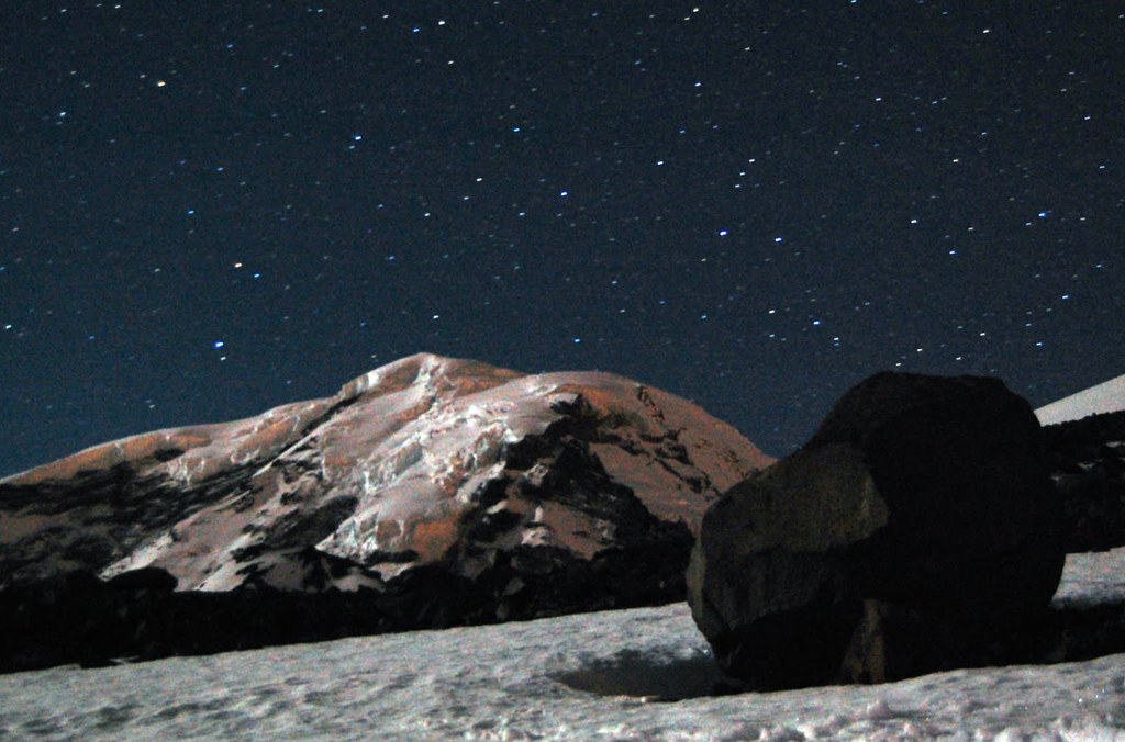
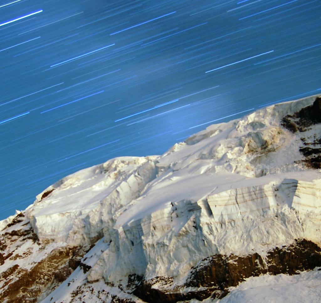
[font:Arial Black]More wonders of the Mark’s night photography.[/font]
The Ice Cliff gleaming at night:
Day 3. Upper Ptarmigan to Lib Cap.
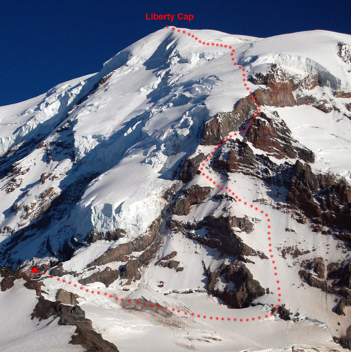
The line (the pic was taken by Mark from the summit of Observation Rock):
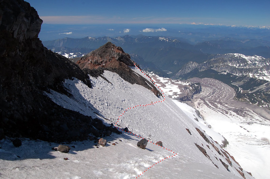
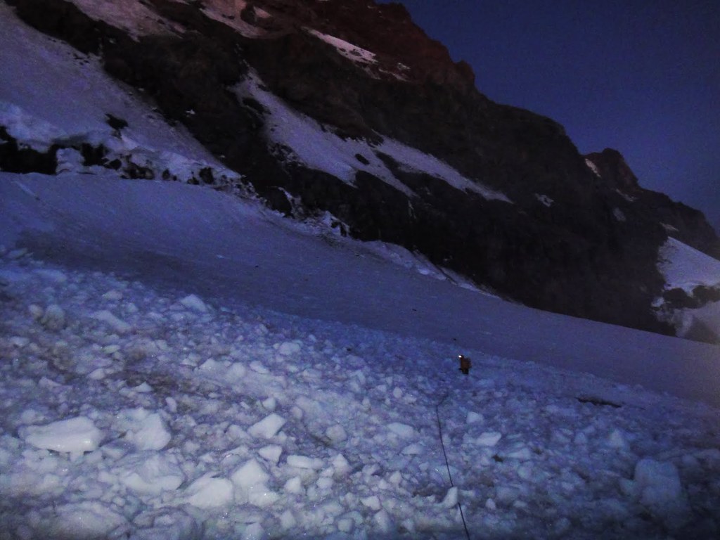
We started at 5 a.m. (I know, I know - late), dropped down to the North Mowich Glacier and crossed the shrund at the base of the route through the middle rock band.
Myself crawling across the field of ice televisions:
We simul soloed the start of the face on crappy snow and occasional ice to the rock bands:
From this point, continuous alpine ice and some water ice took over pretty much all way to the base of the Lib cap. I wish I brought longer rope and more screws.
Mark getting over the rib along the eastward traverse to the first ice chute:
Myself heading up to the buttress in the first ice chute:
Sweet water ice was enjoyed again in July:
Circling the amphitheatre en route to the second ice chute:
At this point, I was mentioning to Mark how much I like color “Blue” in this chute (instinctively referring in my mind to the 4 stubbies I brought).
Heading up the second ice chute.
Deficit of gear sucked (however, the 5 extra pounds of the photo equipment was sitting well in the Mark’s pack
):
On the last traverse en route to the rock pitch:
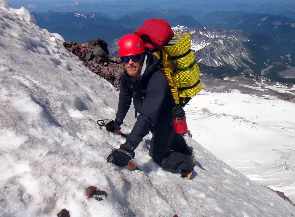
Being spoiled by Sierras blonde granite, Mark is happy on good rock:
Mark midway in the chimney:
Mark at the crux:
After two more pitches of water ice (that can be bypassed on snow on the left if needed), we got on a final slog to Liberty Cap:
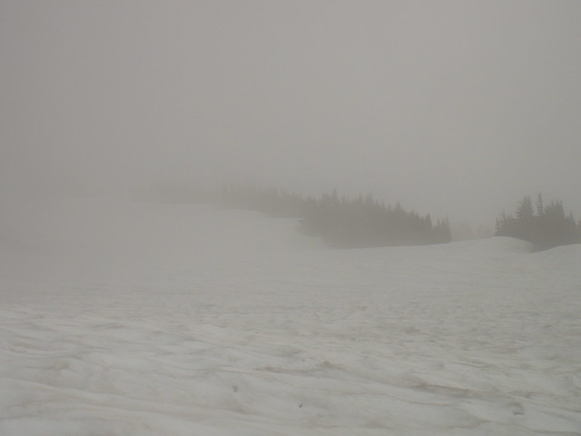
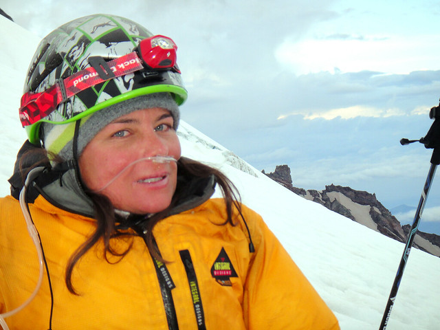
The standard fare awaited us – visibility was decreasing to 10 feet and winds were increasing to 40 mph which would not have been a problem if I did not develop a bad case of AMS at this exact moment at around 14K feet.
[font:Arial Black]Why Does the Liberty Cap Hate Me So Much?[/font]
It took us 7 (SEVEN!) hrs to carry over from the Lib cap to 12200’ on Emmons/Winthrop! First I slowed down to the snails pace and then I stopped doing even that and was pretty much rolling on the snow and throwing up all the food and liquid I tried to consume. My idea to dig in at the summit saddle did not meet much of the Mark’s enthusiasm, so we kept on going. I am glad we did since weather was really turning into a big disaster. Thanks to Mark, the GPS track from the Lib Cap to the Emmons wanded trail in whiteout was successfully re-applied again just one week after this case
After I almost fell into a crevasse on the descent, we pitched in our tent on screws over some crevasse bridge at 12200’ and just before we hankered down for unknown time, we caught up with a solo skier at 8 p.m.
“Are you guys having fun?”
I said: “Yeah, trying not to die from AMS and thence camping right in the middle of the tourist trail”.
Being puzzled with my simple answer, he skied down to the camp Shurman to talk to the rangers about the situation. Greatly appreciated!
I am still trying to forget about the next few hours that followed: snoring Mark and myself being in delirium with alternating headaches and stomach sickness. At 2.30 am three headlamps approached our tent - the climbing rangers they were. Oxygen is food, and I felt I was turning into a human being again.
Huge thanks to Nick, Mike and David for the oxygen masks, assisting on the descent and hospitality at the hut.
In the climbing rangers hut at camp Shurman:
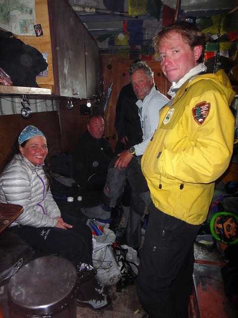
After a few hours of recovery in the hut, we headed down to the car.
Snow is melting and the spring has finally come at White River:
Gear Notes:
4 stubbies, rock pro (used 0.5 C4)
5 lbs of photo equipment
Approach Notes:
Mowich Lake and White River, MRNP
-
Thanks for the detailed TR and amazing pics!
For what its worth, there is also a mixed variation of getting on the NR without enduring the pleasure of being a rotten ice clearing machine on the ridge per se: through the middle rock band (but dont count on much rock though!) and WI2 step and then up the AI2 pitch or two to the immediate start of the summit plateau.
-
Bad. Ass.
Encore!
[TR] Forbidden - West Ridge 9/12/2011
in North Cascades
Posted
Dan, for whatever the obvious Ivan is doing his best: