
.jpg.40c348b15c9f900ce022401fa0dfd570.jpg)

YocumRidge
-
Posts
1230 -
Joined
-
Last visited
Content Type
Profiles
Forums
Events
Posts posted by YocumRidge
-
-
I am multi-tasking, KK

-
Oh, and I thought the best climbing was at Beacon
-
Trip: Stuart - Stuart Glacier Couloir/West Ridge topout
Date: 6/12/2011
Trip Report:
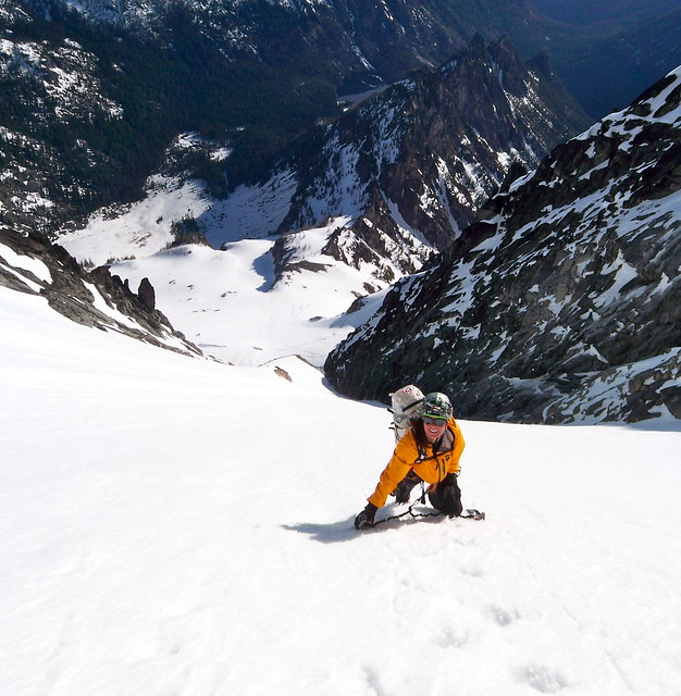
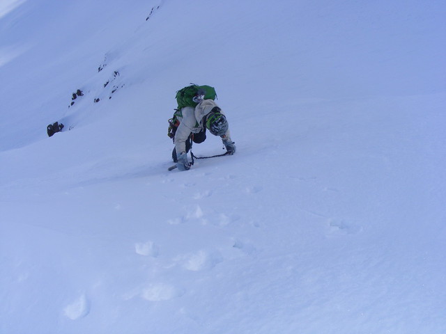
Still being in a recovery mode after freezing my ass off in a snow cave on the Sandy HW, I bailed on Rainier and was looking for some warmer objective for a change. One of my favorite partners Phil Wesseler (LowLife) and I decided to head to Stuart and try the John Frieh’s “warm-up” route for Alaska – Stuart Glacier Couloir. None of us climbed Stuart before, so the “warm-up” (well, its extra bonus West Ridge in the current mixed conditions) turned out to be hmmm – stressful.
I left PDX at 3 am on Sat, picked up Phil in Tacoma and we started at the Stuart lake TH at 9.30 am. Thanks to Kaskadsky Kazak for the north approach GPS track, we reached the Sherpa glacier basin at around 1.30 pm.
Stuie from the approach:
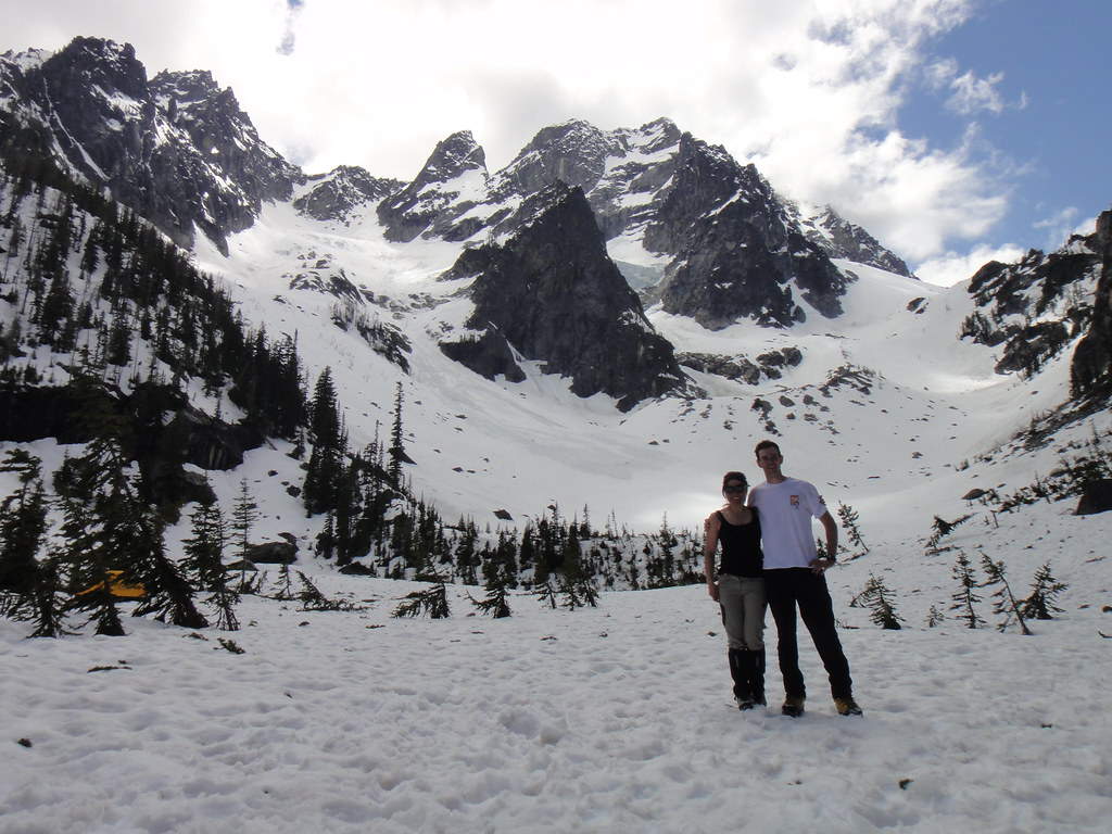
At the Sherpa basin:
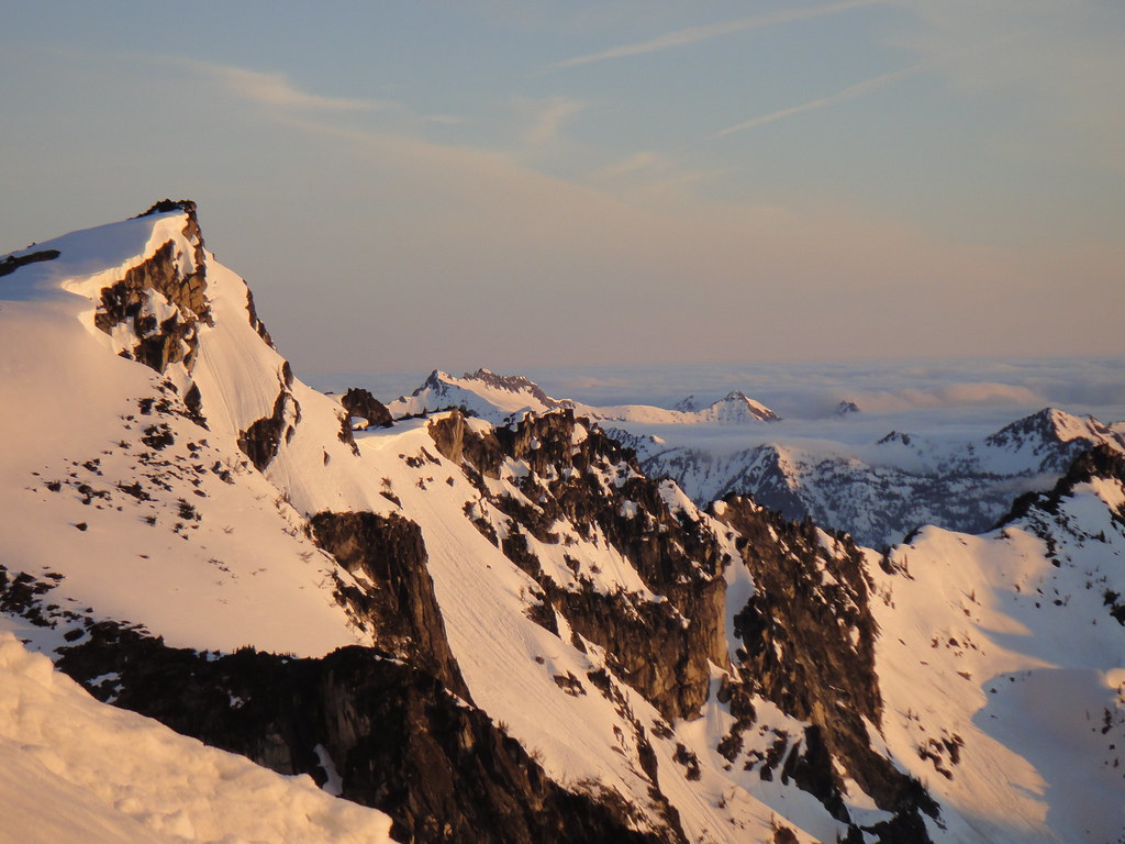
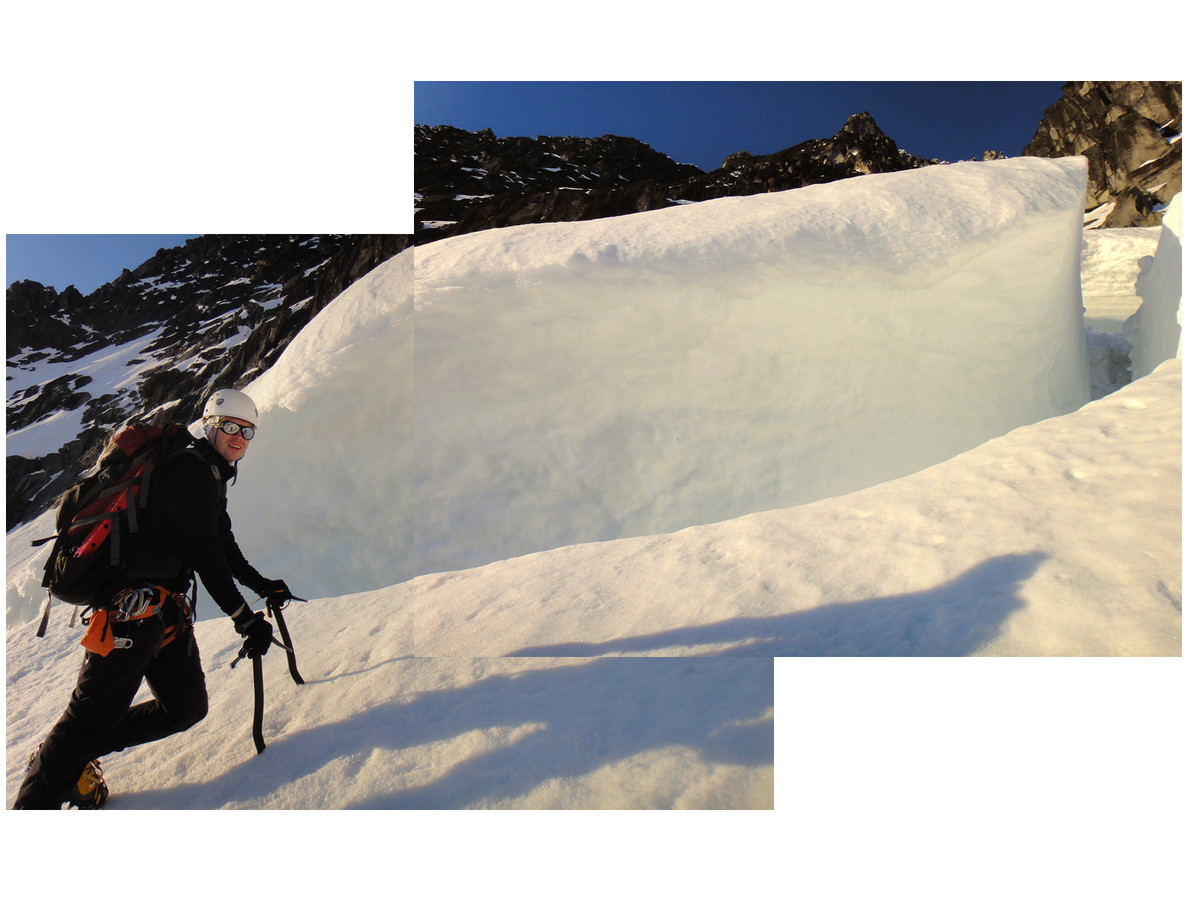
Next morning, still in the dark, we delivered cramponed ourselves to the Stuart glacier and got to the shrund at sunrise.
Myself on the Stuart glacier:
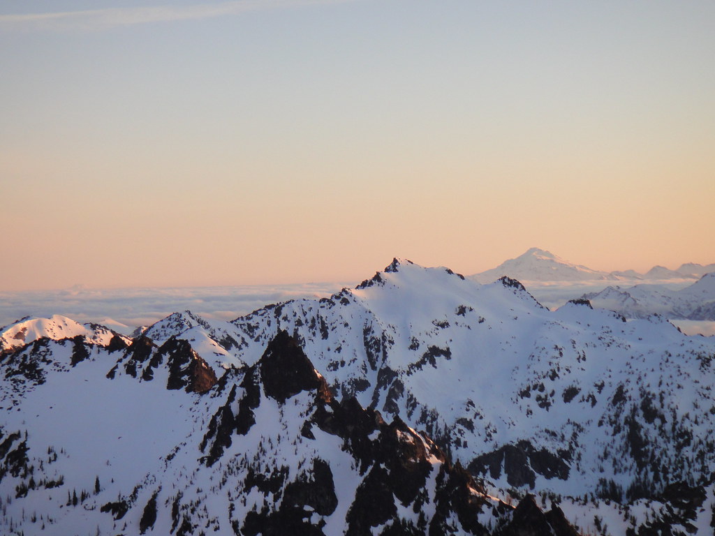
Great views:
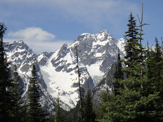
Stuart range:
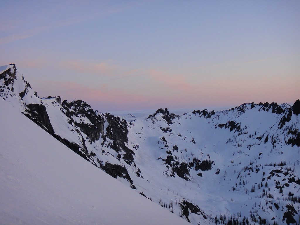
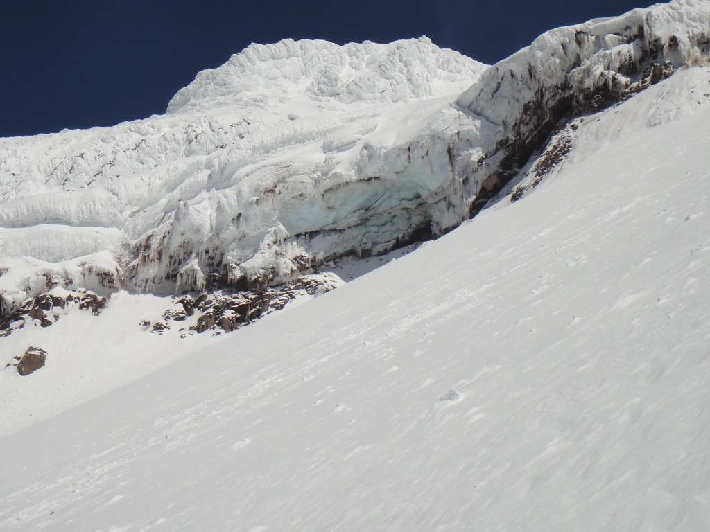
SGC from below the shrund:
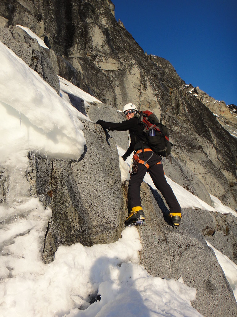
Phil approaching the shrund:
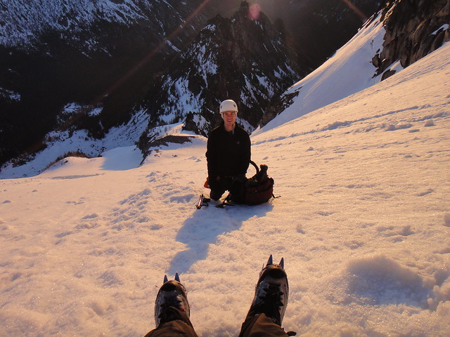
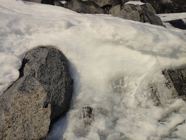
The shrund is passable on the right - on rocks, snice and rime - before moving left back in the couloir.
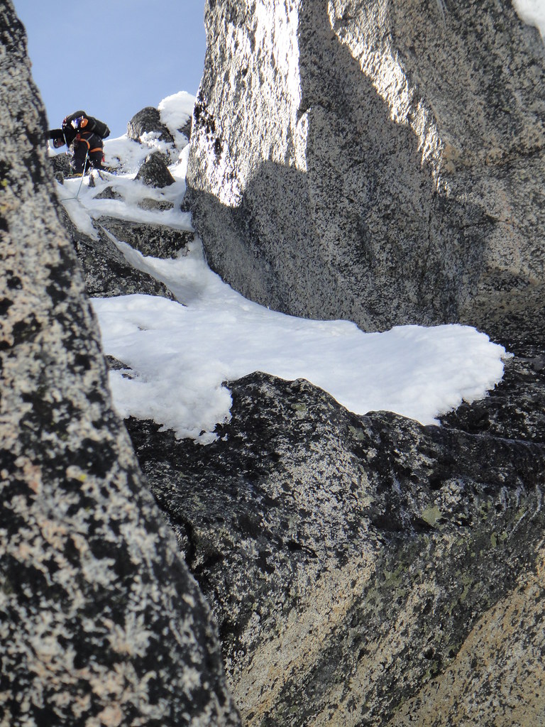
Phil soloing the crossing:
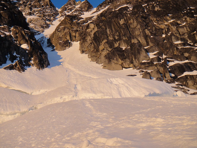
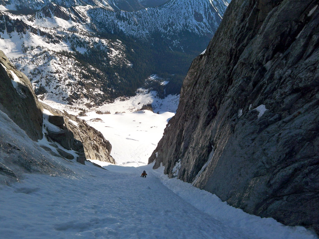
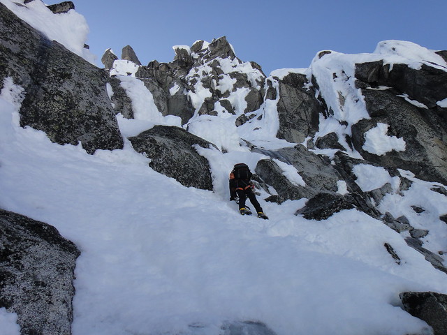
The rest of the couloir was a composite of alpine ice and snice, the constriction was in decent WI shape and the topout to the summit ridge – melting snow.
Lower in the couloir:
Myself midway:
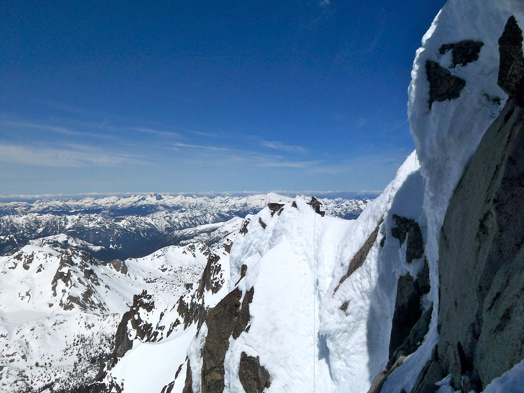
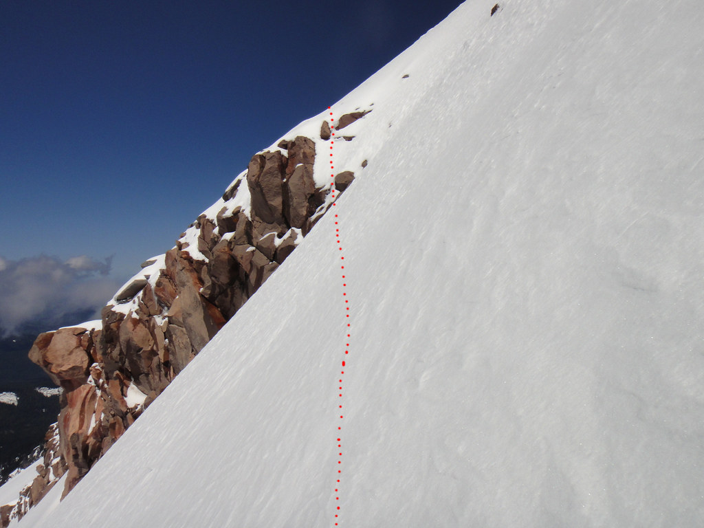
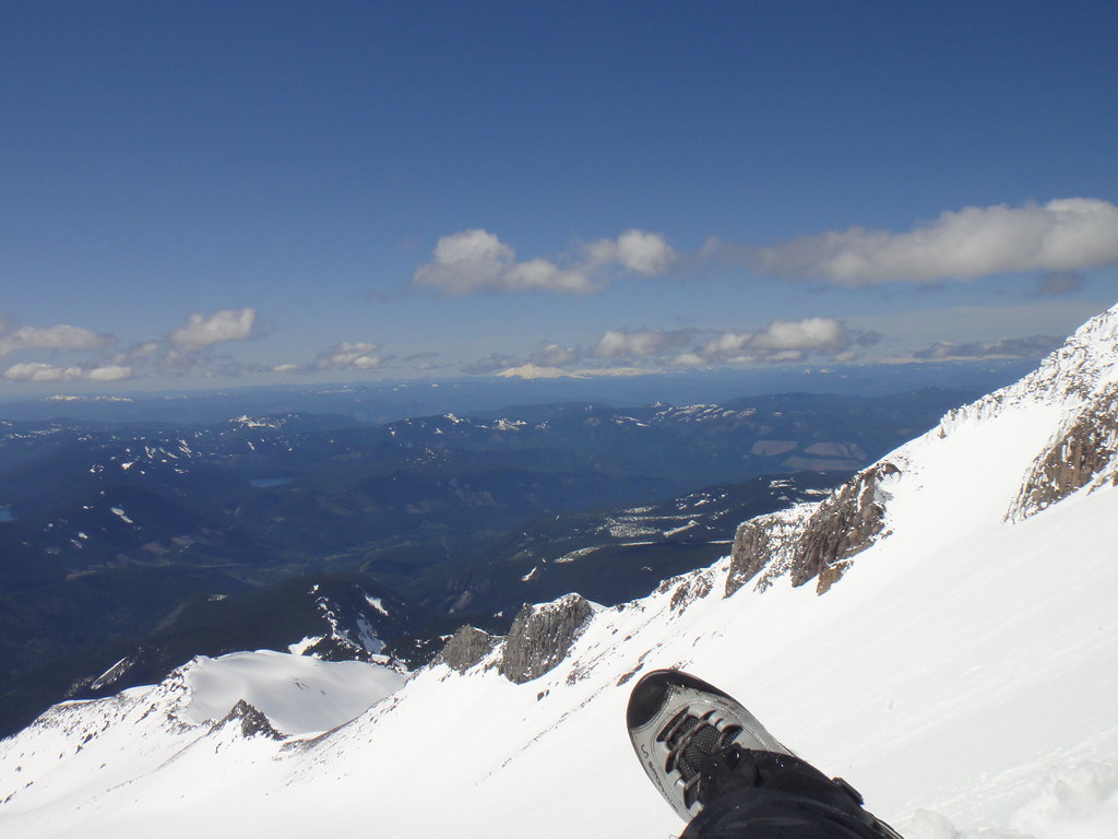
Top out:
We had soloed the entire couloir including the shrund crossing and the constriction, and so did Jens Holsten and his partner who were behind us (my apologies guys for raining ice down on you). Apparently, the couloir is supposed to be only the approach.
West Ridge was up next. What a bitch, a great bonus for sure. We traversed the south side and simul soloed the snice/thin ice/rock steps to the twin horns. First 15 feet off the notch were shaky with tools blowing through the rime but things improved higher up or perhaps we became more immune to the terrain.
Roping up for the north side:
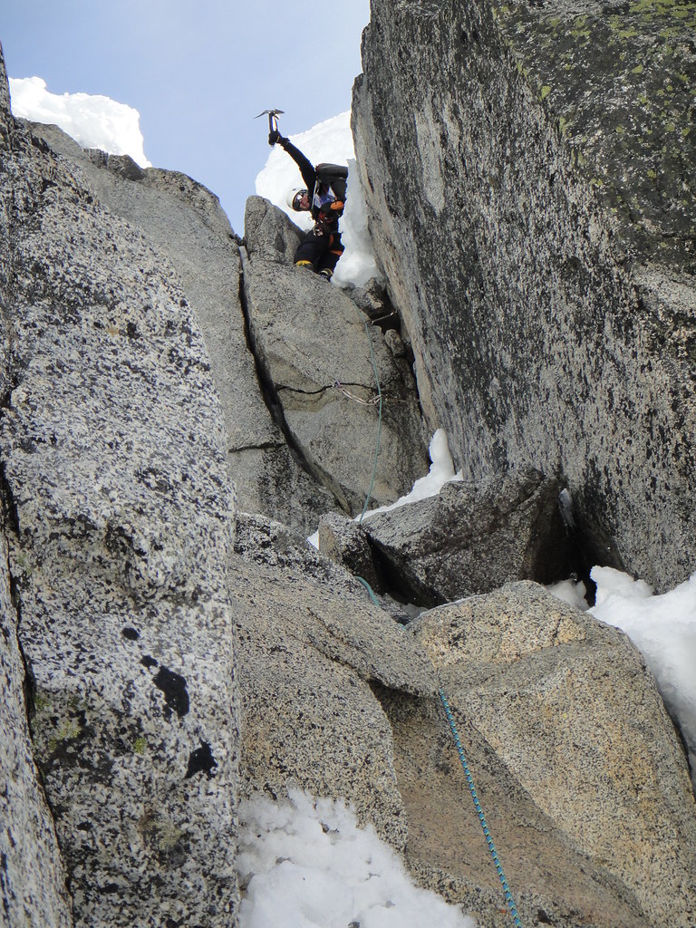
Phil is leading the double crack pitch:
More ridge traversing follows:
Phil has freed the crux. No hangs! Stoked!
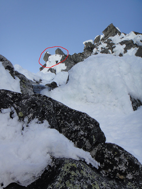
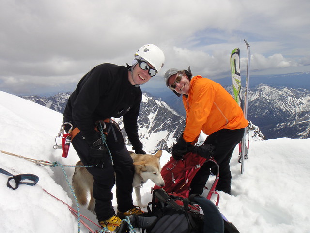
Finally, the rimey summit ridge and badassed dogs who will be skiing the Ullrich Couloir later:
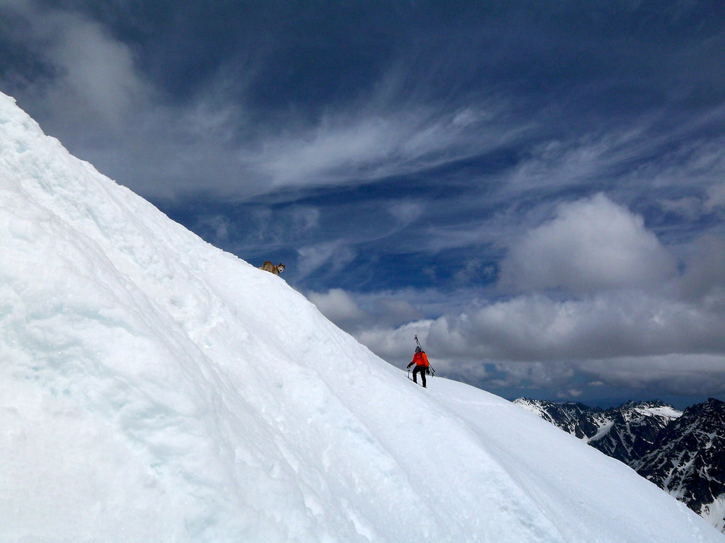
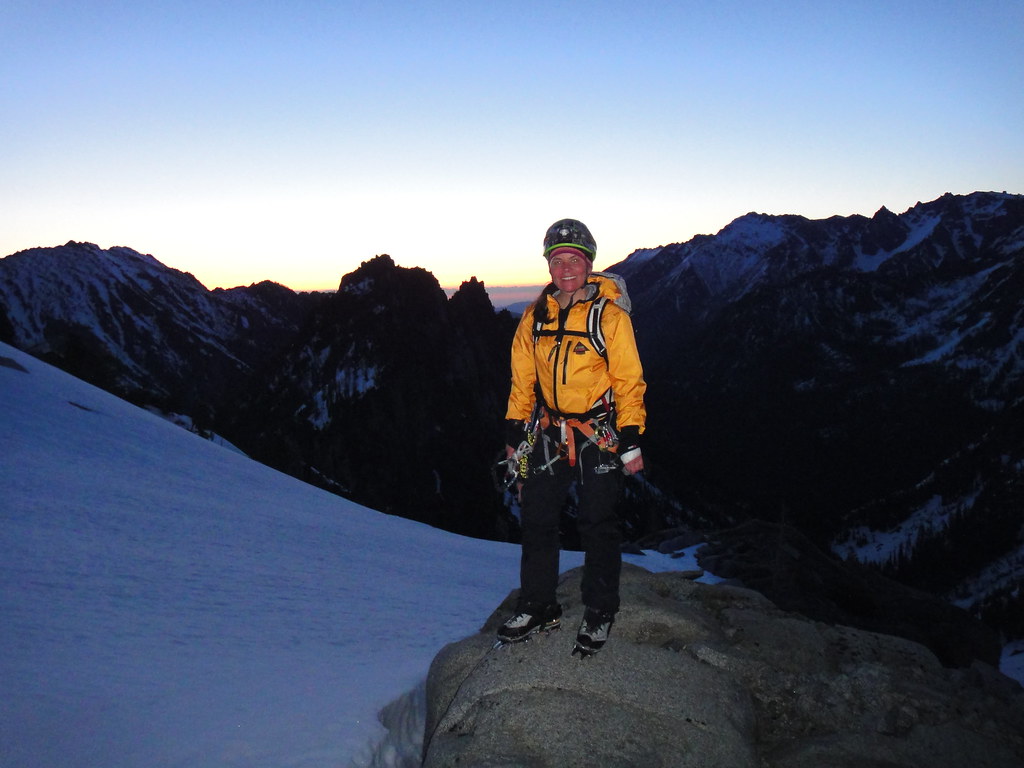
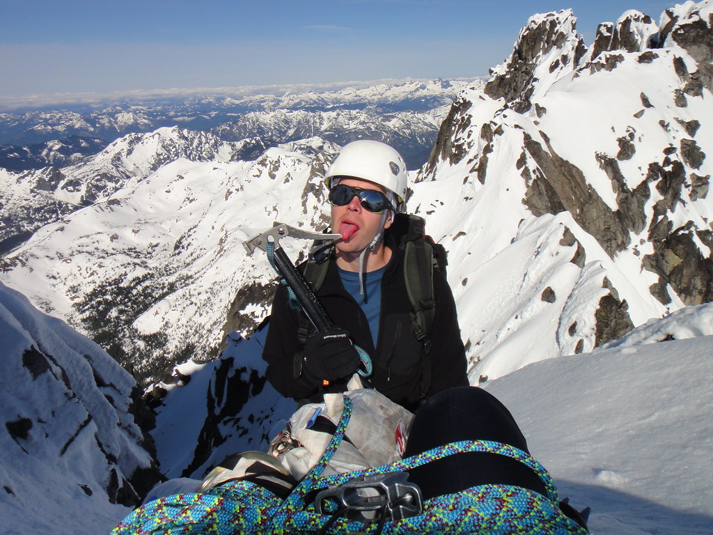
On the summit:
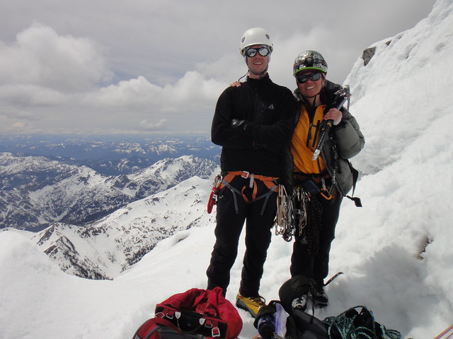
Thanks Phil for being an awesome partner!
Gear Notes:
Used: Master cam #0, C4s 0.3-2, stoppers.
Brought but not used: 2 ice screws, 1 picket, russian Ti pins.
Approach Notes:
Stuart Lake TH
-
It was nice to meet you guys too.
Glad you made it!

-
I would just camp on the Collier gl at the base of the west face and get to the gendarmes in the dark.
When we did the North last year, we overslept, started late, and once the sun hit the ridge, the posthole fest had begun - it took freaking forever. The Terrible traverse and the bowling alley were in the shade for much longer than we expected, but still, we got to the gendarmes on our way back at 1 p.m. Horrible slow descent, like you said "interesting" - in our case we triggered a wet slide off the ridge down the SE slopes (the ones that would go at 45 deg) and rode it for 1000' to get down to the camp.
-
Yes Alex, it took me a couple of days to digest the events but no regrets except I really wish I had brought a tent instead of planning on the "sweet" open bivy at 10K. In the end of the day, my intent was to spend 2 days on the mountain and an extra 2.5 lbs is a reasonable trade off to minimize the pain of the conditions.
-
What an awesome outing Doug and Aaron! Sketchfest at its best!
Now Doug you are really really ready for the Yocum ridge!

And that horrible orange linkcam is still following you around

I thought your B-day is in August, or you guys decided to speed things up for the SGC treat?
-
There is a famous Dog Direct route on Hoodie.
You should check it out - no restrictions for 4 y olds

Badass soloist on the summit ridge in 2008:

-
Off White.
People stop talking to me once I say the word "Yocum ridge". Apparently, my marketing skills suck or something

Come here and climb it with me instead of your warm cragging.
-
7 years later, maybe i should try again?
No, Eric. We would rather see what will happen to you on the top of Yocum gendarmes
. -
you need more facial expression photos on your solo adventures so we can really see how badly you are suffering

-
Clear evidence that if Red Dawn ever played out in real life you know the other side would win, we would all be drinking a lot more, speaking a differnet language, and rolling our "R"s.
It is all about the technique

-
What's the story with the paw?
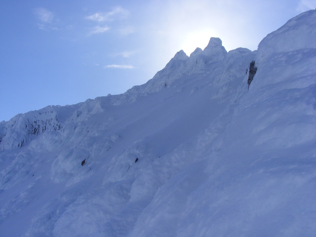
60 mph wind gusts and more rime hammering me from above:
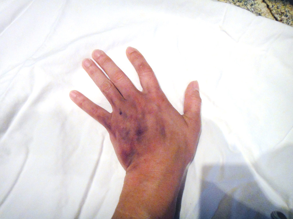
Yeah, one of the projectiles off the headwall. Could be worse. No bones are broken
-
A sweet ski line, Dan
-
Very sweet, - V!
Glad you have finally took him out.
So, Pavel is not into clubbing anymore?
-
I'm at timberline now, was sleeping in my vehicle. The wind keeps shaking my fj.
Have you been sleeping there for a couple of days now? I might had fallen down under your truck with my pack on when I got out of my car on Fri morning. It was so icy in the lot. I hope there are no scratches and I apologize for waking you up.
-
Thanks Water. Logically speaking you are right, but with the massive abnormal glacier expansion we have been seeing for the last couple of years, there is no logical prediction on shedding or serac calving for that matter. Totally random.
This last Friday was warm and windy but suspiciously quiet everywhere on west side. One exception was Sandy HW at sunset and after - spitting sizable chunks.
Sat was colder and windy, and Yocum was the worst bitch producing waves of volcanic powder and rime below 8500' but nothing above.
-
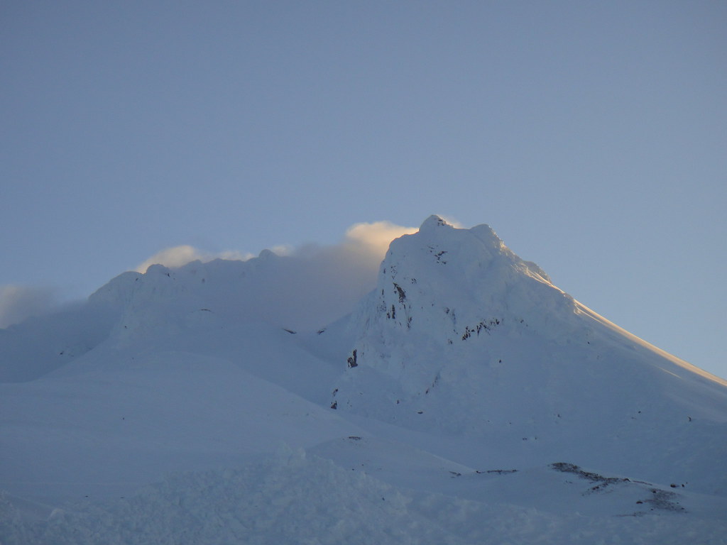
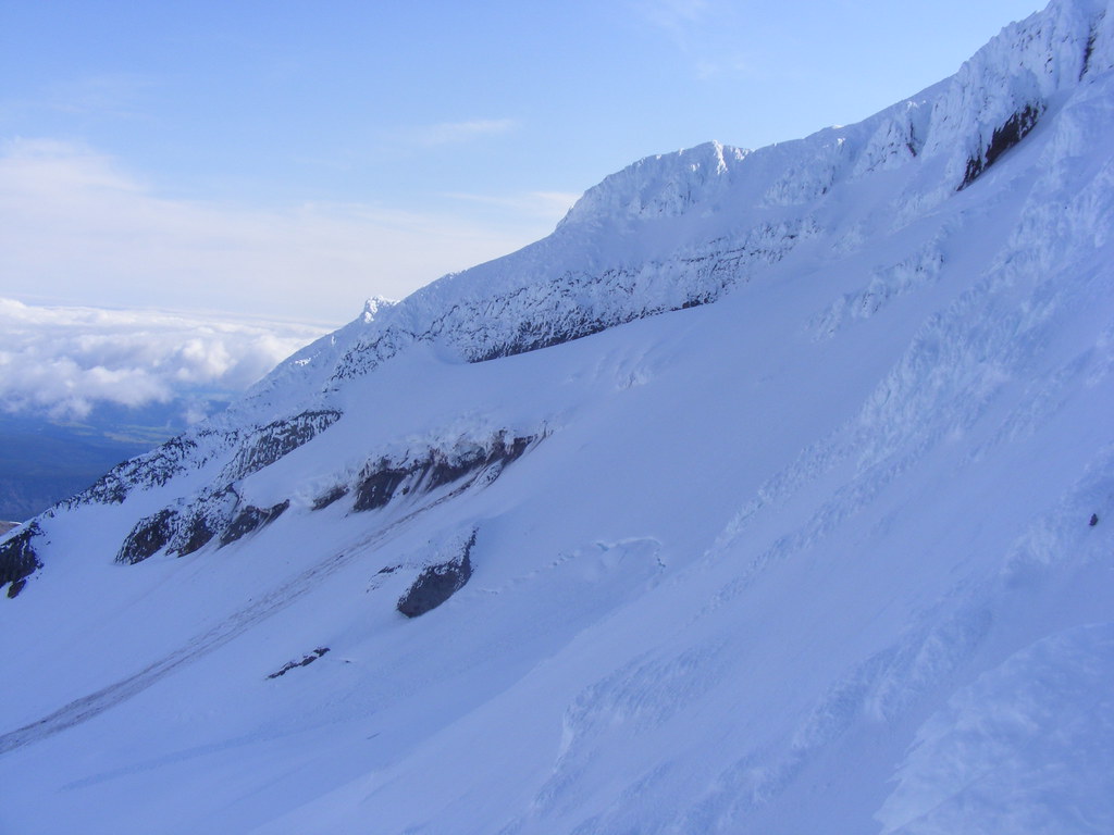
Trip: Hood - Misterium Tremendum Sandy Glacier Headwall solo
Date: 6/3/2011
Trip Report:
In the best traditions of multi-act marlezonique ballets, Sandy HW on Hood just does not let it go. In the act #1 a month or so ago, Ivan and I ended up getting our asses up the Leutholds as a reasonable at the time sub for Sandy.
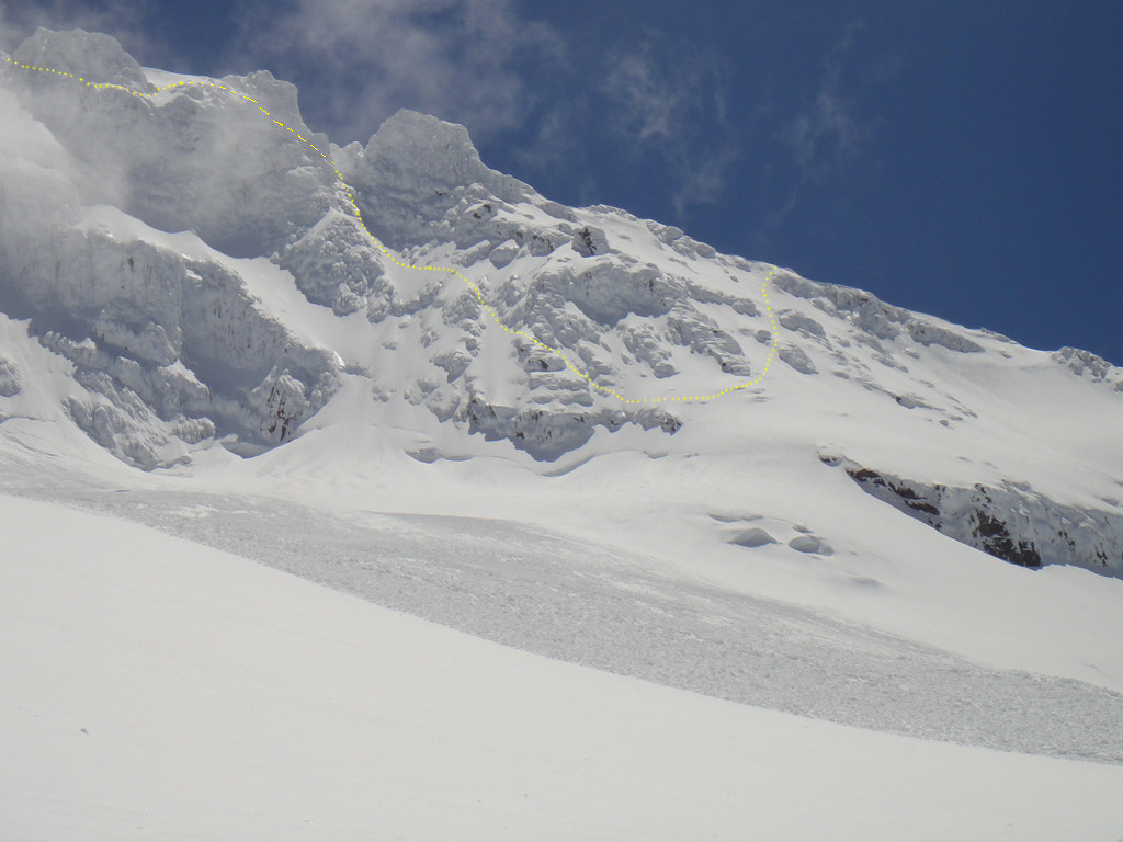
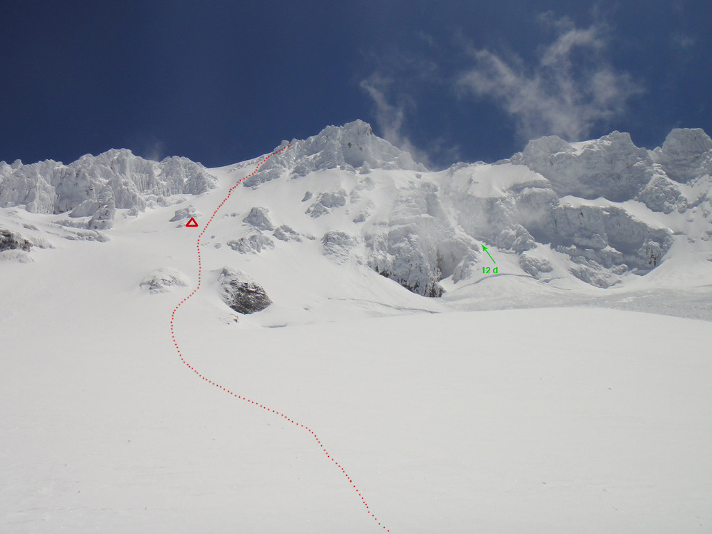
Two weeks ago, with another partner in the act #2, we made our rimey way up to the third gendarme of Yocum ridge via the north aspect thereof and downclimbed it in the nearing whiteout the same way we came up. The scariest thing I have ever done in my life. It turns out, Yocum has crevasses too (that I mistakenly took for the one connecting down to Sandy at 8600’) and crawling over 80 deg skinny snow bridges took some motivation. Go figure.
Our line (yellow) on the north side of Yocum ridge which felt harder than the bona fide Sandy/Yocum gully “12d”:
This Friday was act #3 and by myself.
I had a weird late start and only made it to the T-lot at 5 a.m. Yes, I was wasted after work, not fully awoken and still with blurry vision after my Yocum fiasco, but come on peoples, not to the point that I would send my rig into a spin on the T-line road! In June. With studs on! Yeah right, the T-lot turned out to be one solid sheet of ice with no possibility of walking without falling. If the trend prevails, the North face will sprout some sweet water ice in the gullies shortly. Just about time to get on it. Pretty stoked.
So, finally I start on the slog with a 2 day pack, slowly breaking my own trail and only reach the I-gap at 8.30 a.m.
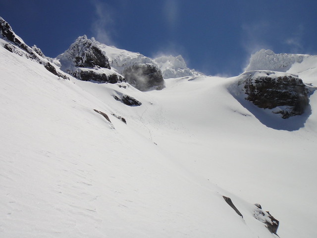
Steel Cliffs at sunrise from the south approach:
A superb day but winds are picking up and blowing fresh powder in mini-tornadoes. Not a good sign.
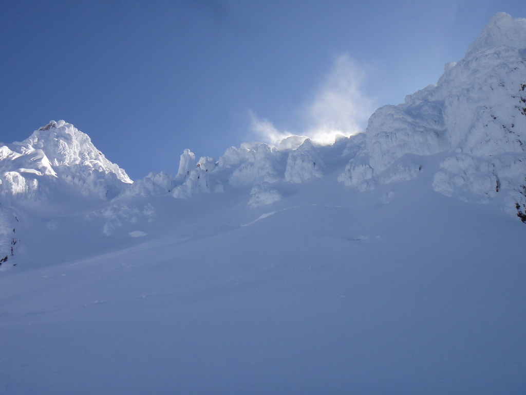
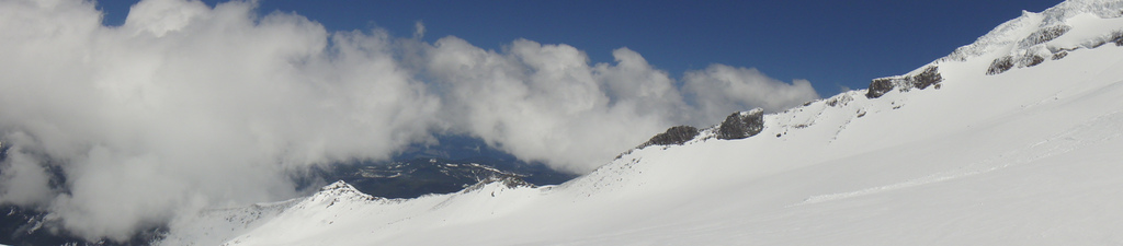
Yocum Ridge, Leutholds and Reid headwall are as good as it gets in full-on winter conditions. In June.
I descend down on Reid and traverse towards Yocum. Although Yocum crossing at 8600’ which I have partially done before is the quickest way of getting on Sandy, it is far from being the best. Perhaps one day I will acquire Ivan’s sketch factor to solo steep rime ice and fly over the shrunds, but in the meantime I choose the low crossing at 8200’.
Heading down the Yocum and loosing precious elevation:

Passing more crevasses to the south:
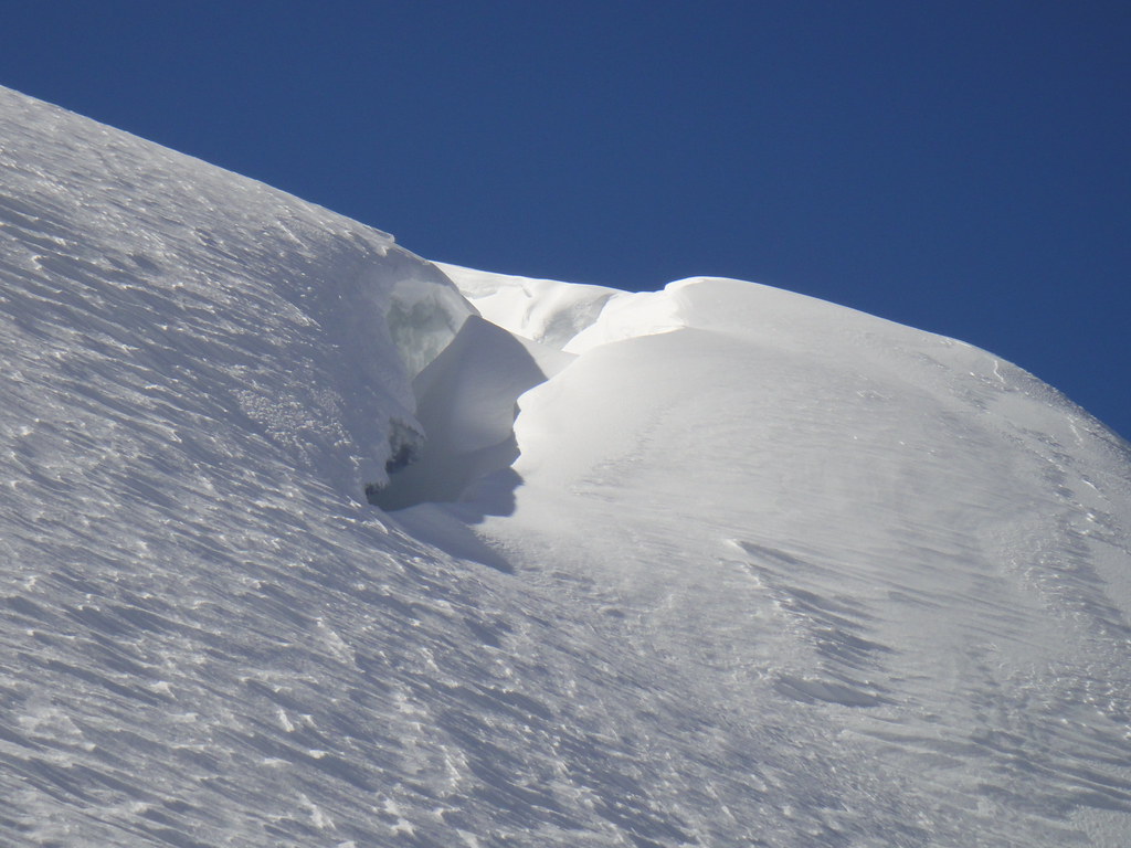
Traversing some slopes and trying to find the low crossing. Not sure, it feels kind of steeper than I expected. I might have done the upper crossing just as well and rap the shrund – thank God I brought the “Oh shit” rope.
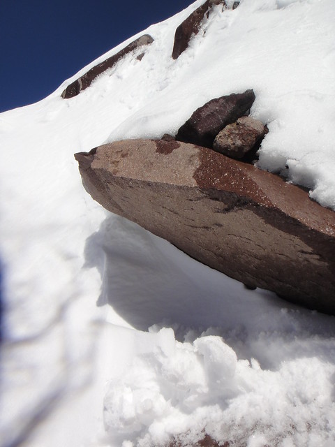
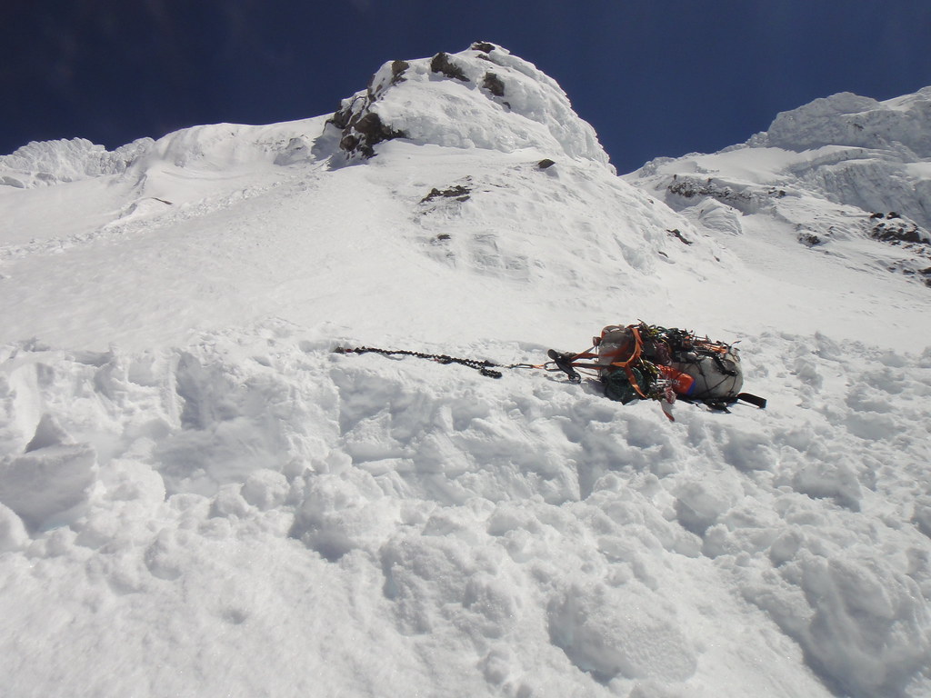
Movable rocks placed in wet snow and volcanic sand underneath. The best thing ever - well recommended
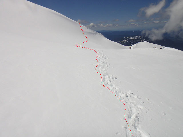
I know life is going to be all right after that and sure enough once I top out, the going gets more mellow,
I quickly make my way towards the Sandy and downclimb on the other side of Yocum next to a cornice:
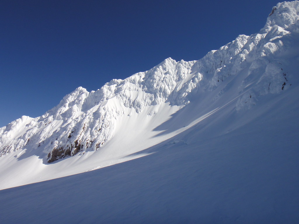
West side: Cathedral Ridge, Sandy HW, Upper Buttress and Yocum Ridge.
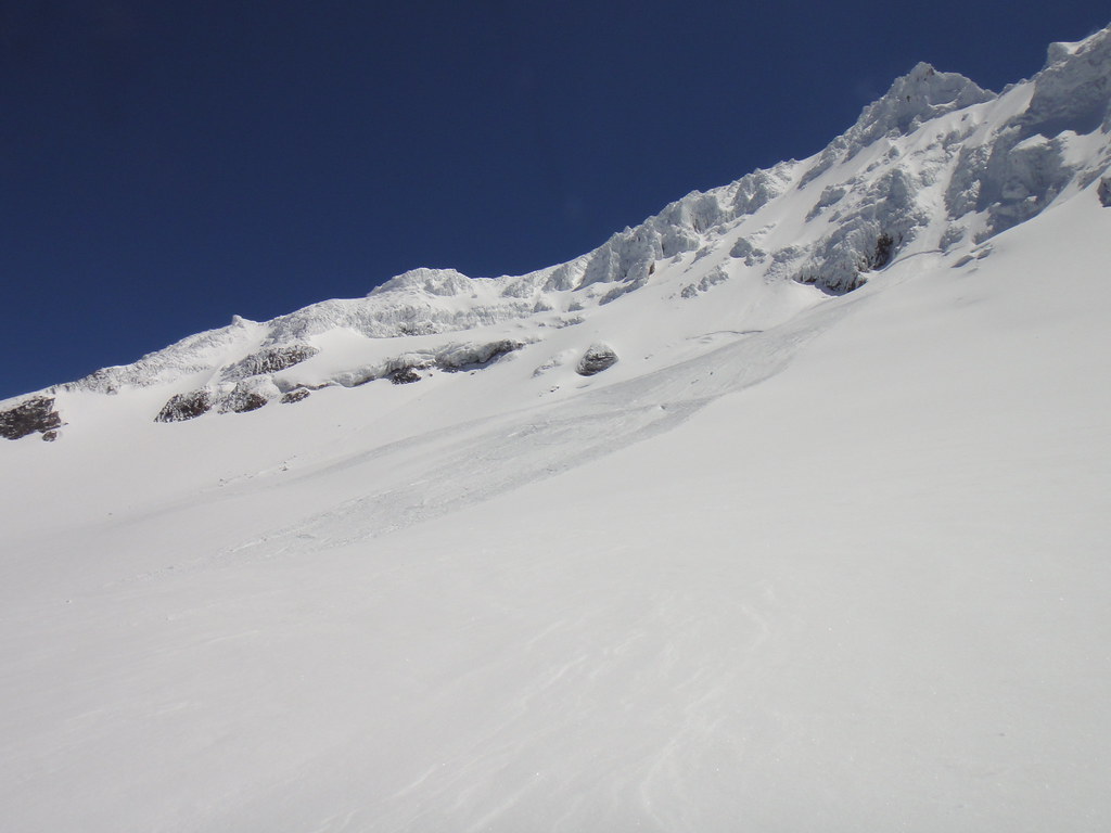
Avy paths off the 12 d and south Sandy HW are not looking impressive:
I cross the Sandy gl in the center, pass three shrunds on the left and head up the standard HW variation (red line). Pretty much a dog route (as compared to the Yocum’s crossing) with some icy sections at the Queens Chair:
One third up the HW, I feel I am running out of steam and in need of a break before continuing up. Besides I better find a bivy spot cuz I have plans for the next day – may be to get on the “Early season variation” to the Cathedral Ridge or traverse the 12 c below the Upper Buttress to Yocum and check out some rime ice.
So, I settle at the base of one of the towers and dig out sweet balcony with a view.
“Cathedral” room next door:
The last I checked the NOAA promised 32F at night and low winds - so the open bivy was in order with a 35F bag and bivy sack. I melted one gallon of snow and consumed a dehydrated meal - things are looking good again. What was not looking good was the density of the clouds gathering from nowhere and “low” winds showering me more and more with snow and ice powder.
I guess it was when OlegV from his couch in west Portland observed a “white tail” crossing Hood at 10K+ and e-mailed me his concern over my well-being. As known to mankind, “white tails” or any other color “tails” can ruin otherwise perfect day in an instant as was already brought up to your attention here http://cascadeclimbers.com/forum/ubbthreads.php?ubb=showflat&Number=1000812
It gets colder too – I have all layers on me and the only way to bear the misery is to keep moving. Visibility goes to shit, so I waypointed the bivy location and start getting my ass up the HW. Slow, very slow, waiting for those rare moments of intermittent clearings, it goes like that: 100 feet up, stop, and wait, and wait, and wait. Repeat. It took me freaking forever to reach west summit ridge at 10 pm with a headlamp! I skipped the 20’ vertical step to get to the summit and painfully headed back to the bivy retracing my steps.
And here comes the best part. By the time I got down there, the bivy sack and food for the next day were ripped right out of my hands. GONE with the wind. And are probably now buried in the midst of Sandy for future generations. But I was happy to have sleeping bag and the stove.
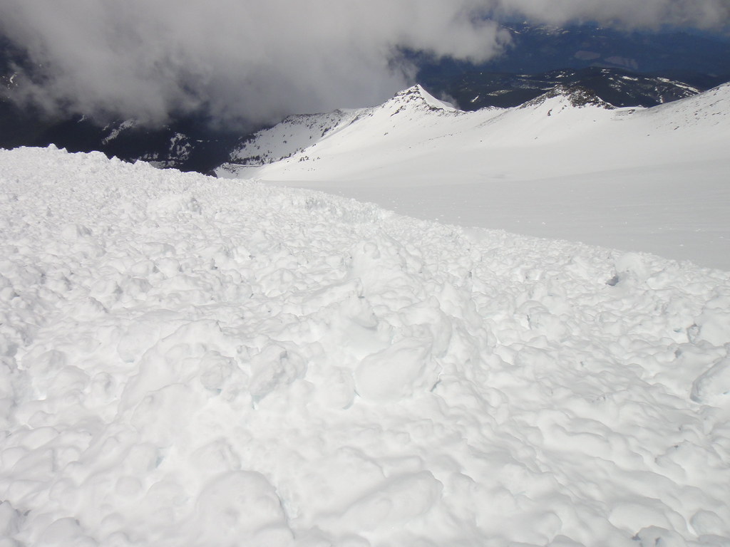
60 mph wind gusts and more rime hammering me from above:
Now officially things are not looking good anymore. I dig a primitive snow cave – whatever I can fashion with the two tools – and wedge myself into THAT. The ceiling is one inch from my face and I am barely able to move being stuck in fetal position. My brain is numb as is the rest of my body. I do manage to get some delirium-like sleep with weird dreams where I am turning into a snowman. OMG. The snowman is trying to get up, but cannot – the sleeping bag is encased in ice.
A couple of hours later I notice two headlamps crossing the Sandy and stopping below the shrunds. I was convinced these must be OlegV and Ivan’s who came to check on me, brought some adult beverages and food so that we all can go and climb Yocum ridge when the winds will finally subside. But no, after 10 min, I see them leaving. I cant believe my eyes. THEY ARE LEAVING! And I am still stuck in the snow cave on that freaking headwall freezing my ass to death.
I do get up when the sun hits the glacier and it becomes slightly warmer. A tremendous effort on my behalf. My apathetic mind does not care about melting water or putting the pons on. So, I walk down just like that, starving and eating snow on my way back. Too bad because I start falling and that becomes a theme of the day. Like in a slow motion movie: Yocum traverse, up on the Reid, reaching the I-rock, dragging myself over to the south side.
I must have been looking very pathetic - someone helped carry my pack to the Palmers, put me in the lift chair, then another free ride in the Magic mile. The T-lodge. Alles.
Approach Notes:
Yocum ridge
-
Looks awesome!
Glad you guys got some warm alpine rock at last.
-
OK, ok, OW - not much to cough it up really but when/if I ever finish the route I will do my best, to cough it up that is
The original idea was to have a casual C2C walk to the west side, cross Yocum ridge at 8600' which we did and crawl down onto the Sandy glacier over the shrund and then head up the Sandy HW gully "12 d" (the closest gully to Yocum ridge from the north) to the Upper Buttress, link up the "12 c" traverse below the buttress (apparently, not recommended due to extensive rime) and finish via "1937" exit to the Queens Chair.
Little did I know at the time that Yocum has 6 subridges with the second one being the sketchiest.
Well, somehow we missed the 12 d entrance and instead headed up the 5th subridge of Yocum all way to the 3rd gendarme
Sustained 60-65 deg with lots of rime (and thank god, nice alpine ice underneath) and decent knife-bladeable rock here and there. A serious whiteout was frightening our further existence so we chose to downclimb, although taking the Retreat Gully 12 b to bail down to the Leutholds on the other side might have been a better idea. The camera got hit by fallen rime, so only a few pics survived.
Up on Yocum:
Myself at the base:
-
Thinking Cathedral Ridge instead.
Certainly a worthy objective that was also in great shape when we looked at it from Yocum. Do consider its "early season variation" starting at the Sandy glacier - it seems to be officially open for the season and will only get better with more snow on its way.
The Sandy's shrund is easily passable on the left next to rocks.
The mighty Cathedral ridge as seen from Yocum:
Purty Cathedral taken out from the canadian rockies theme:

-
and so ya'lls tr is in the werks?
Ha, Ivan - I am currently half blind and when I recover after the ER visit... I'll tell ya the 3rd gendarme is what a bitch!

-
That said, I have no intentions of attempting this route again until it's well below freezing, that is to say, next winter.
Nothing was shedding/sliding off Leutholds and Reid HW today as we passed them en route to Yocum which was in great shape too until mid-day! But then again just a few would enjoy being out there in the marginal forecast with 30 mph winds
-
What a nice solo trip
and beautiful pictures as always!
[TR] Stuart - Stuart Glacier Couloir FBA 6/6/2011
in Alpine Lakes
Posted
Yes. And some of them arriving from Portland!
Thanks Doug!