
Leaderboard


Popular Content
Showing content with the highest reputation on 12/11/22 in all areas
-
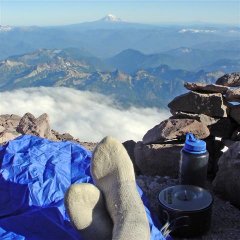
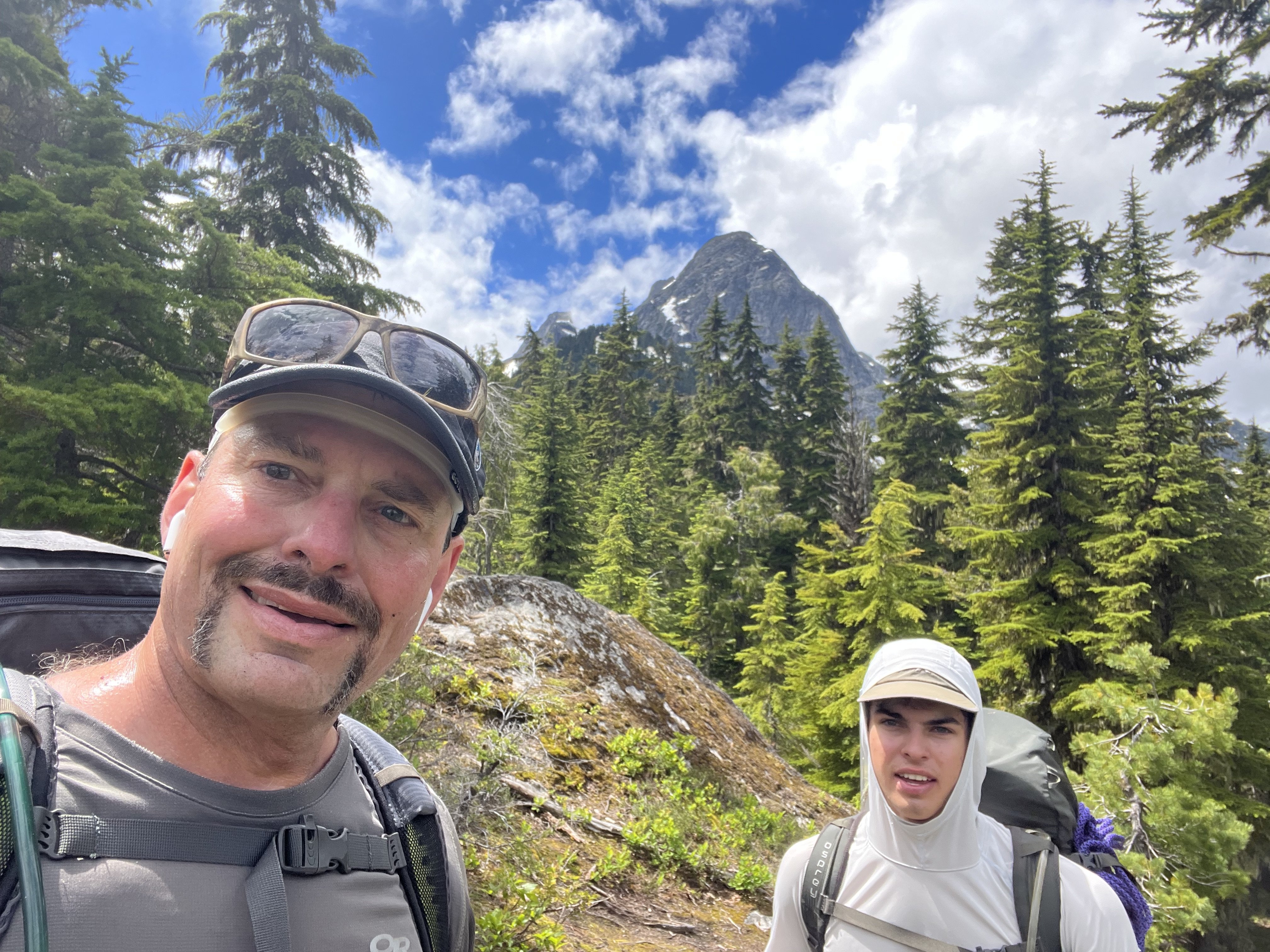
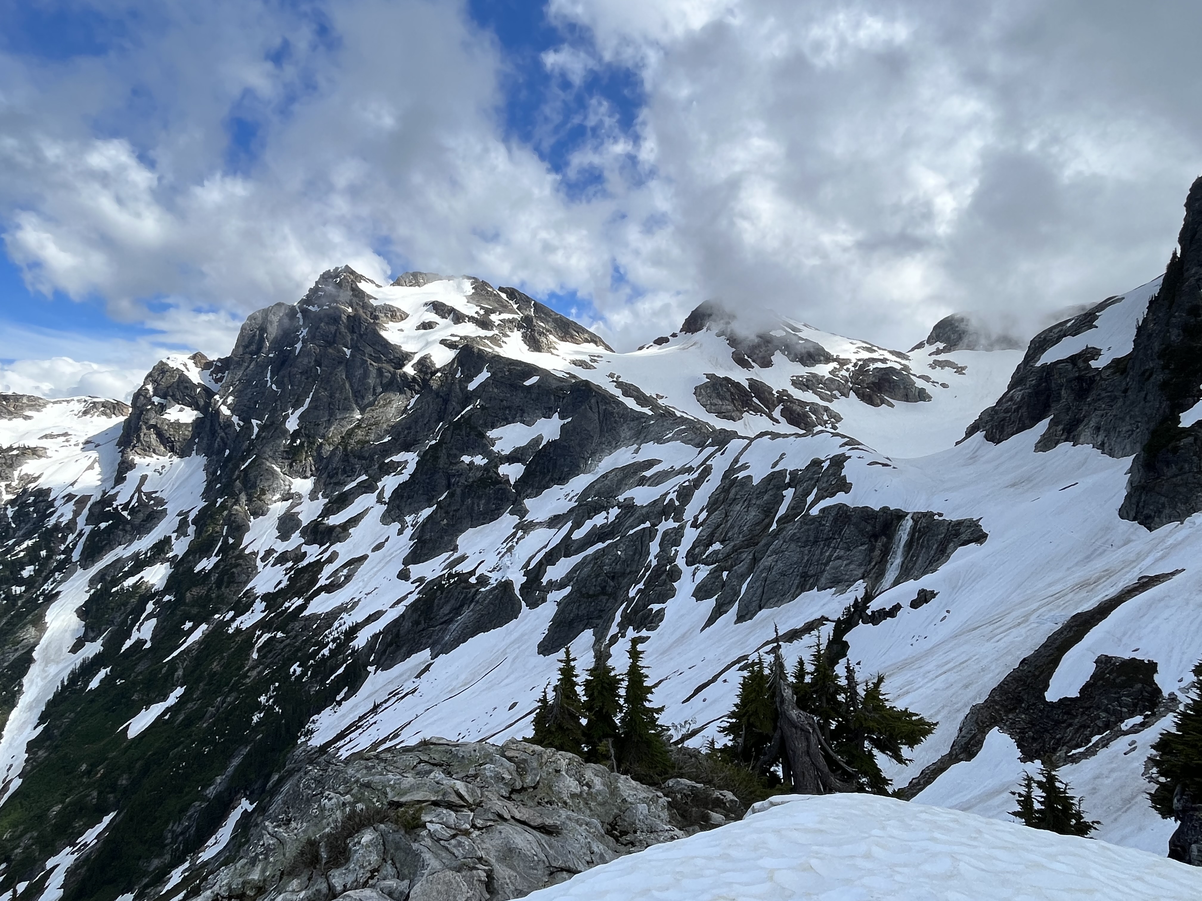
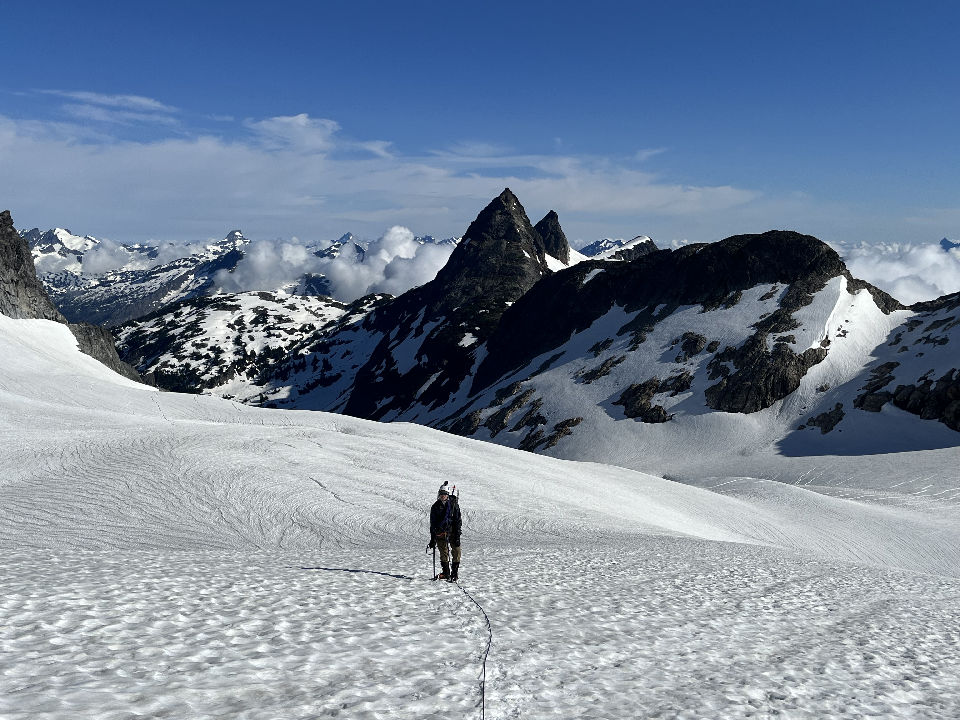
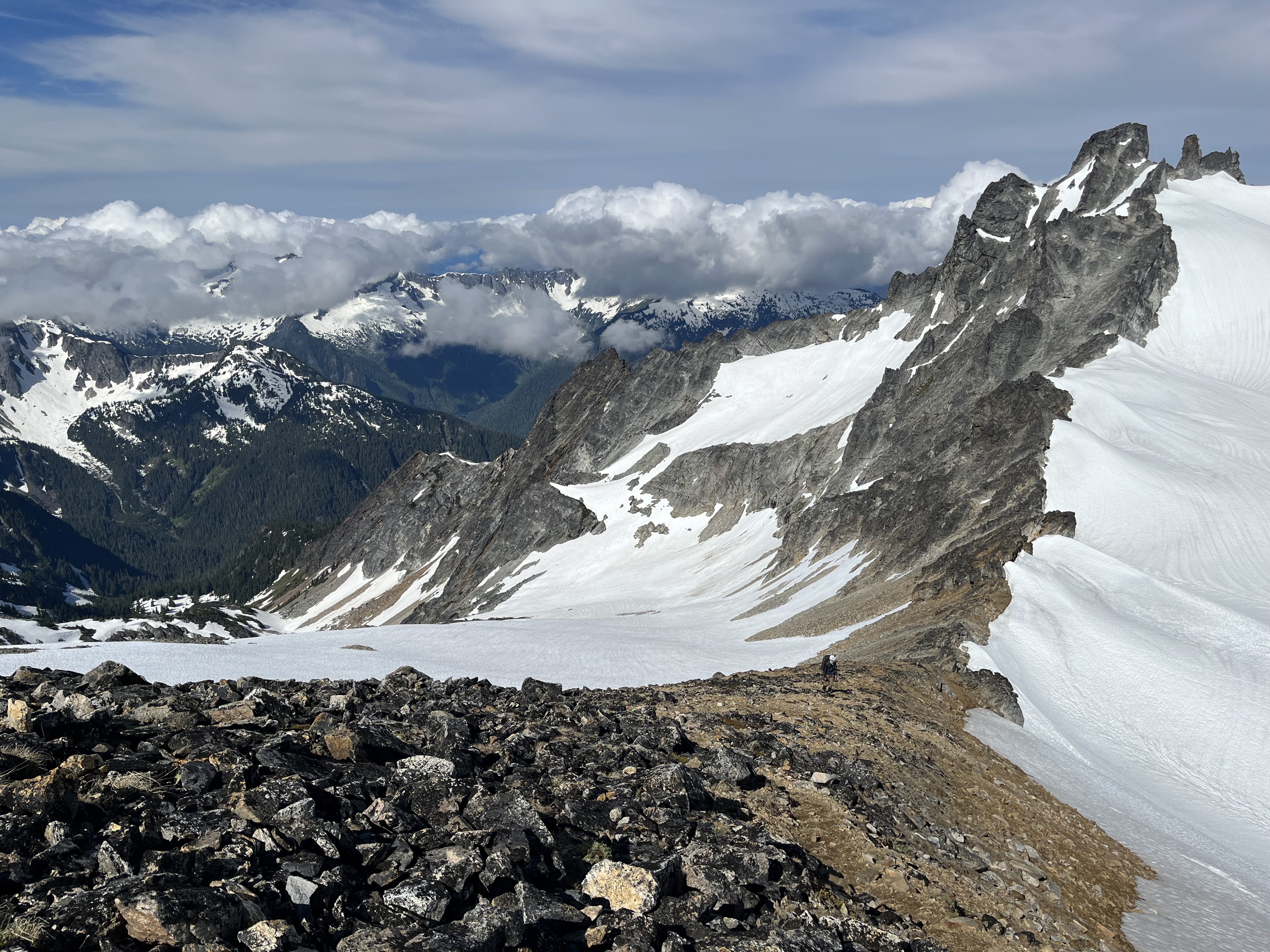
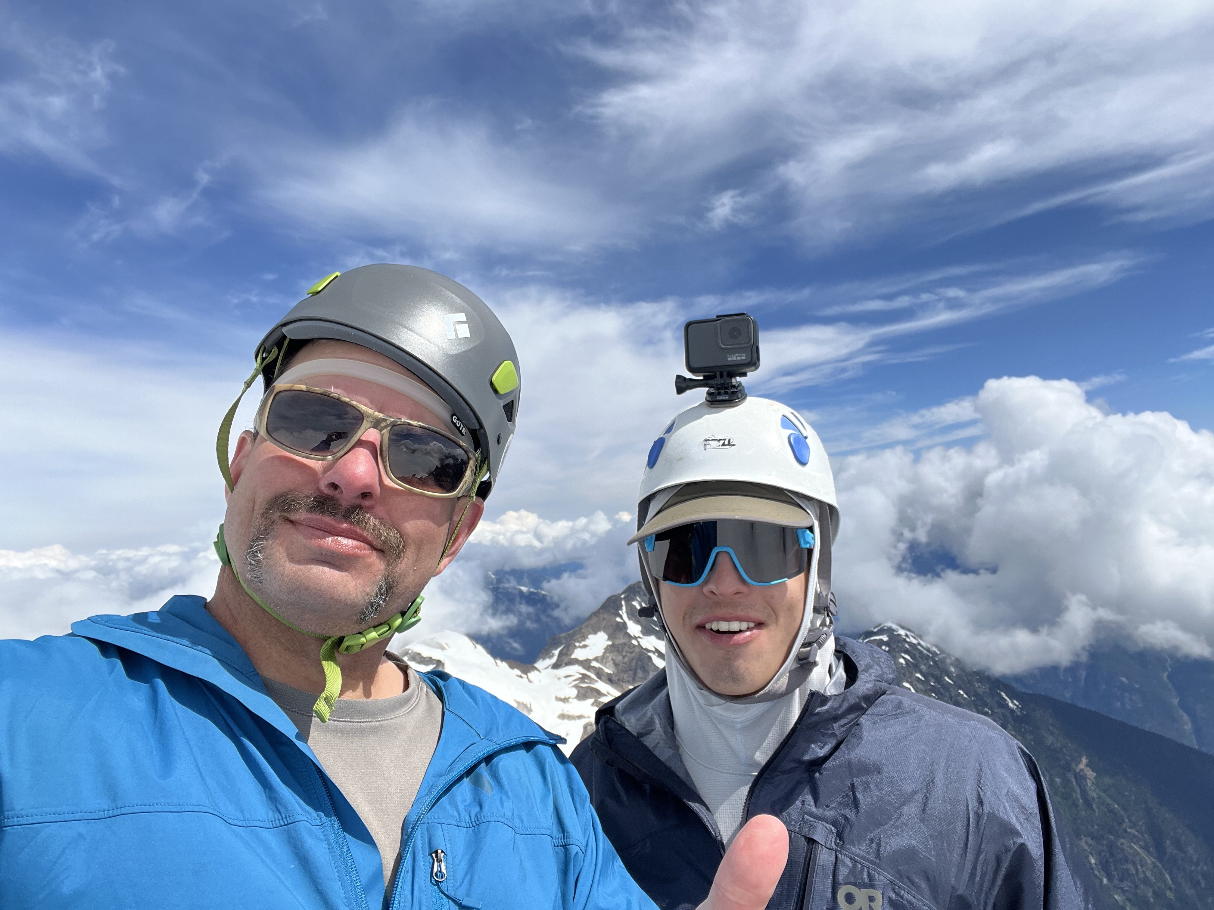
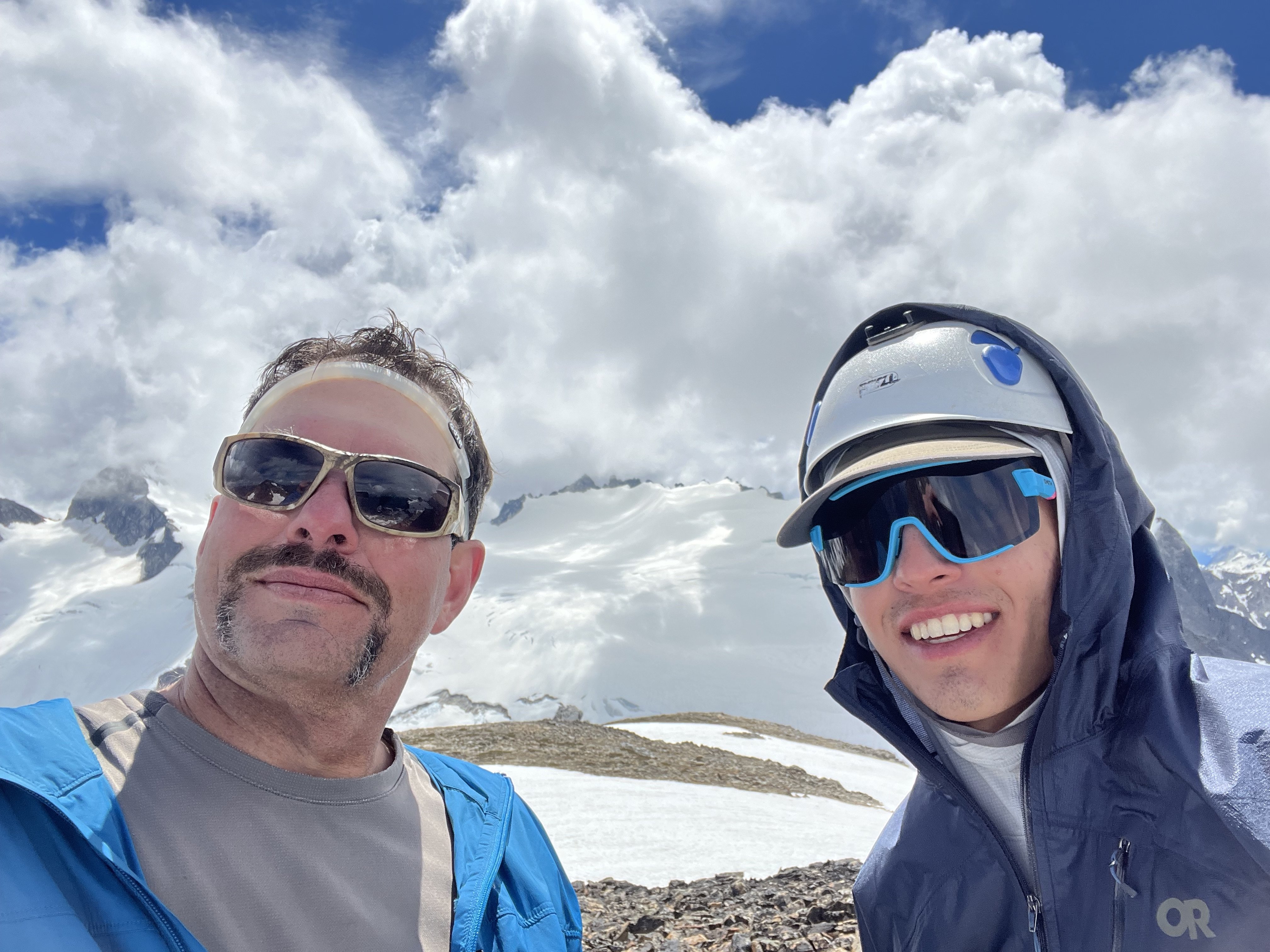
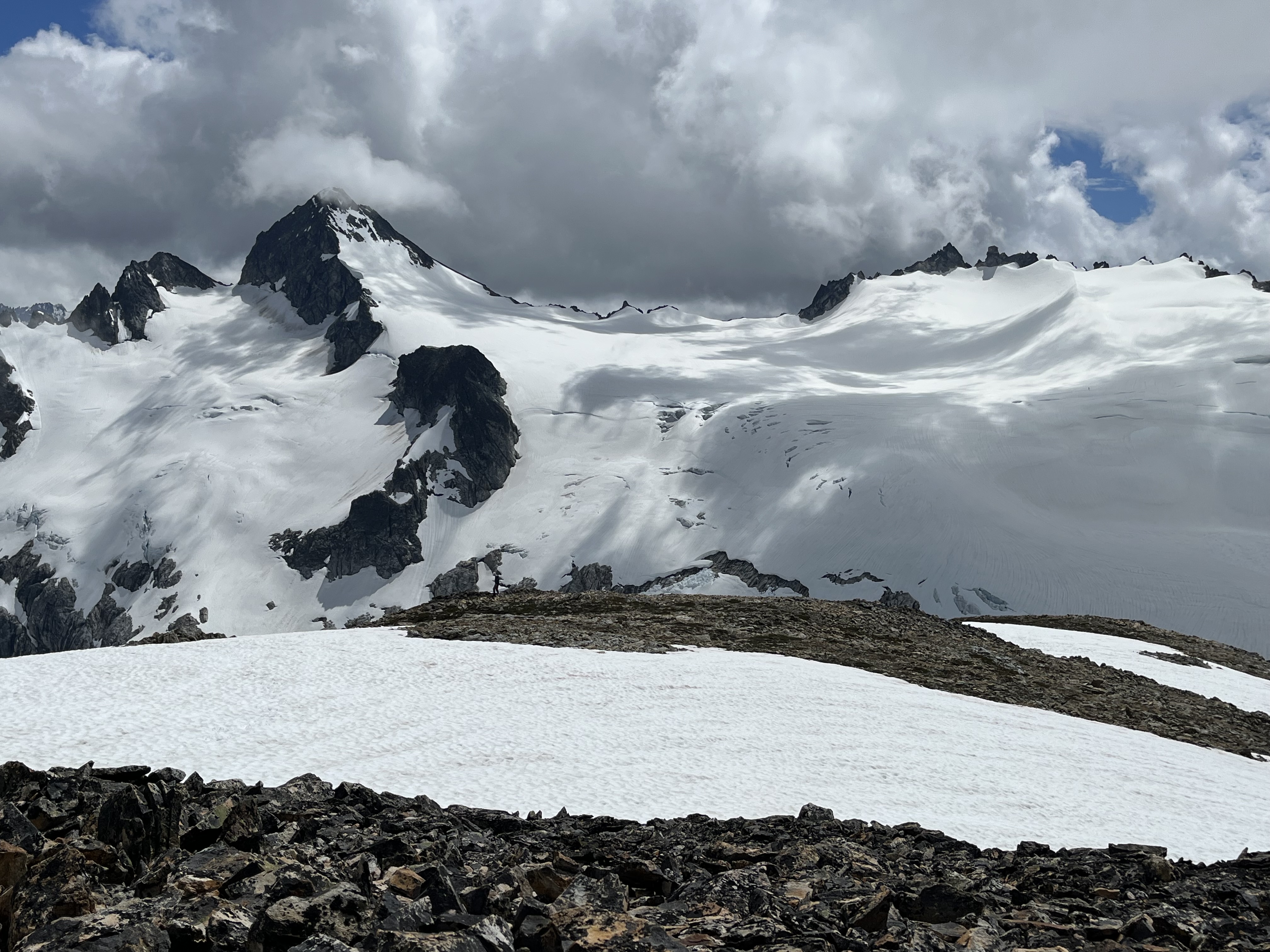
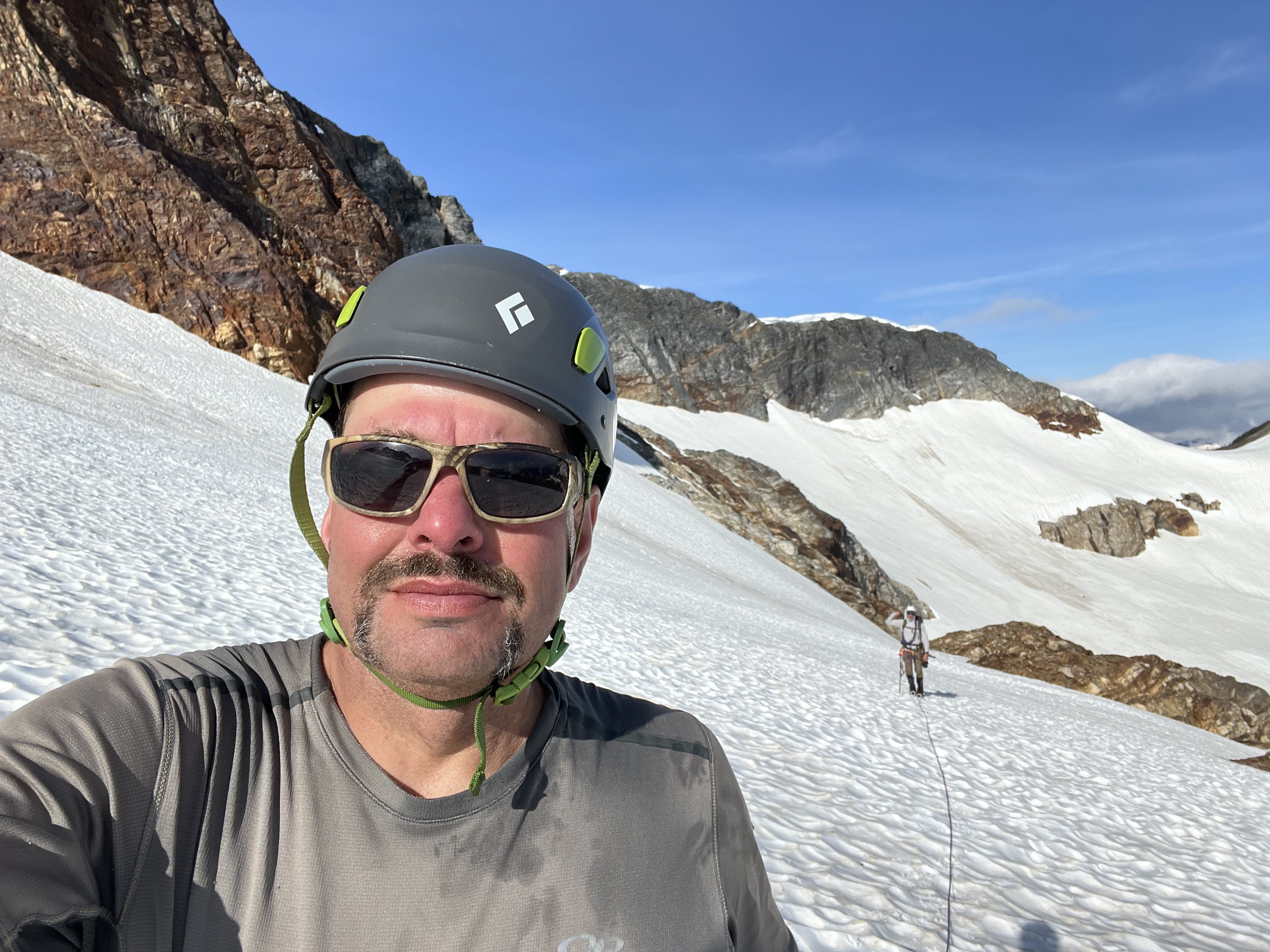
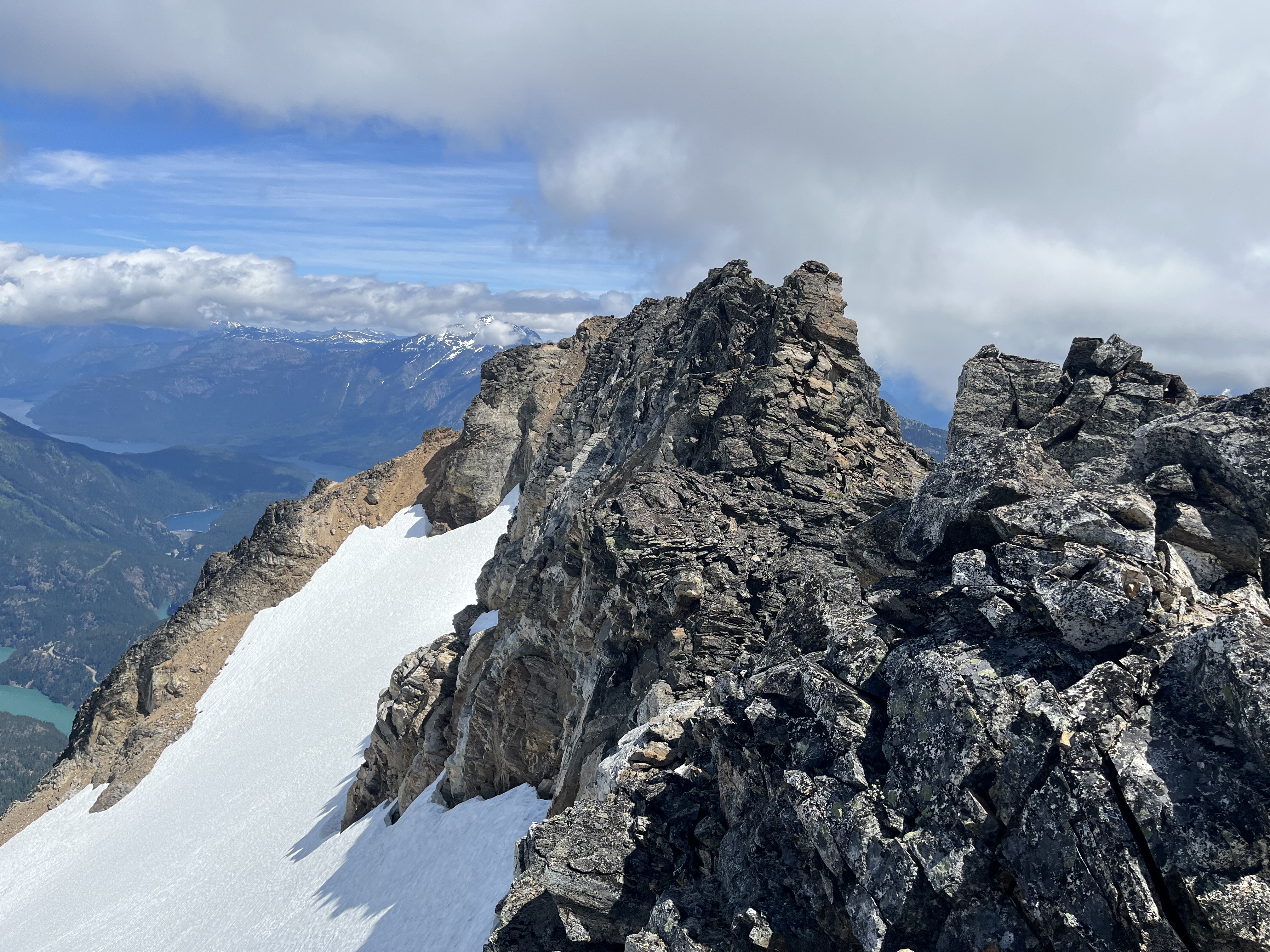
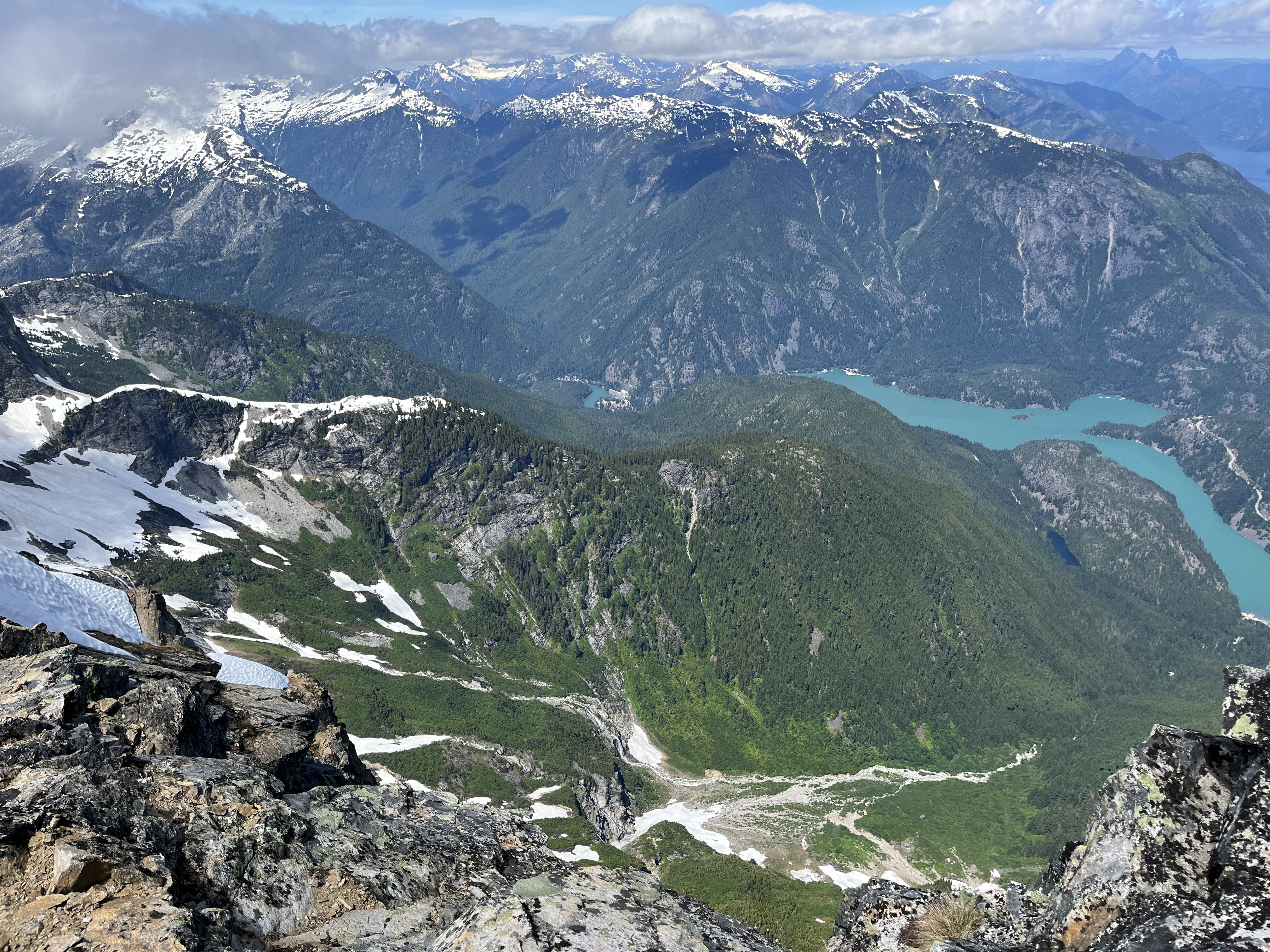
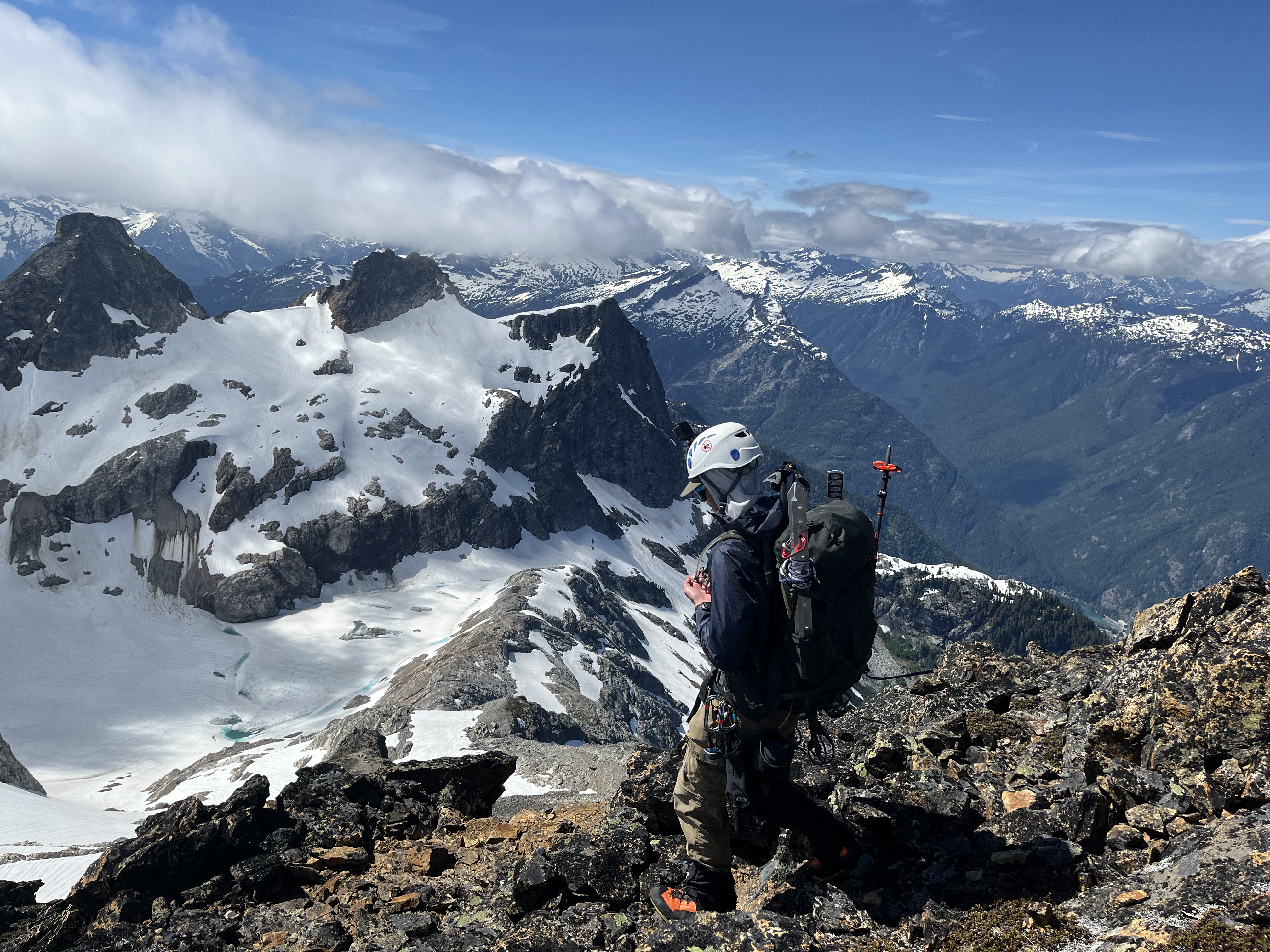
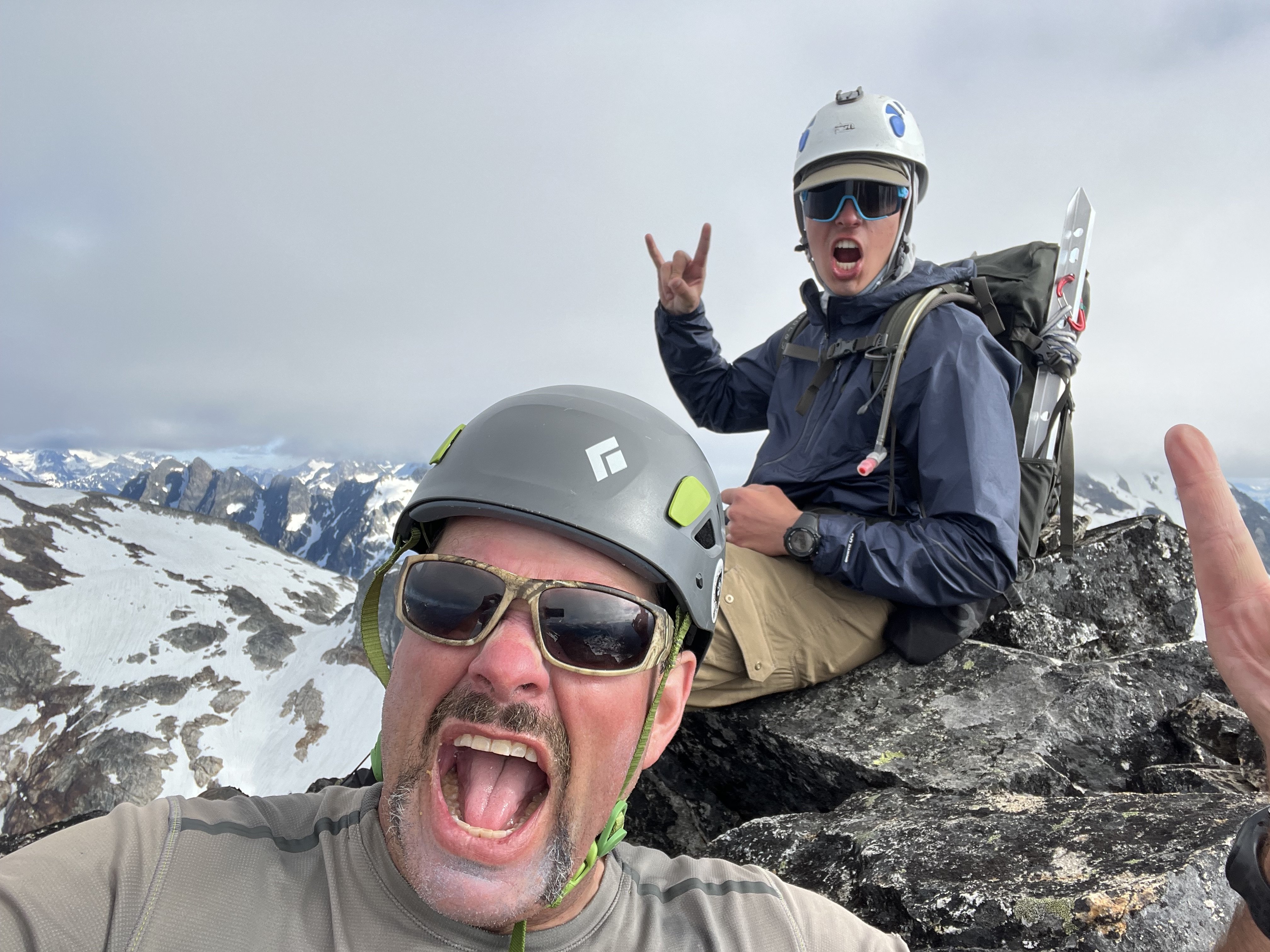
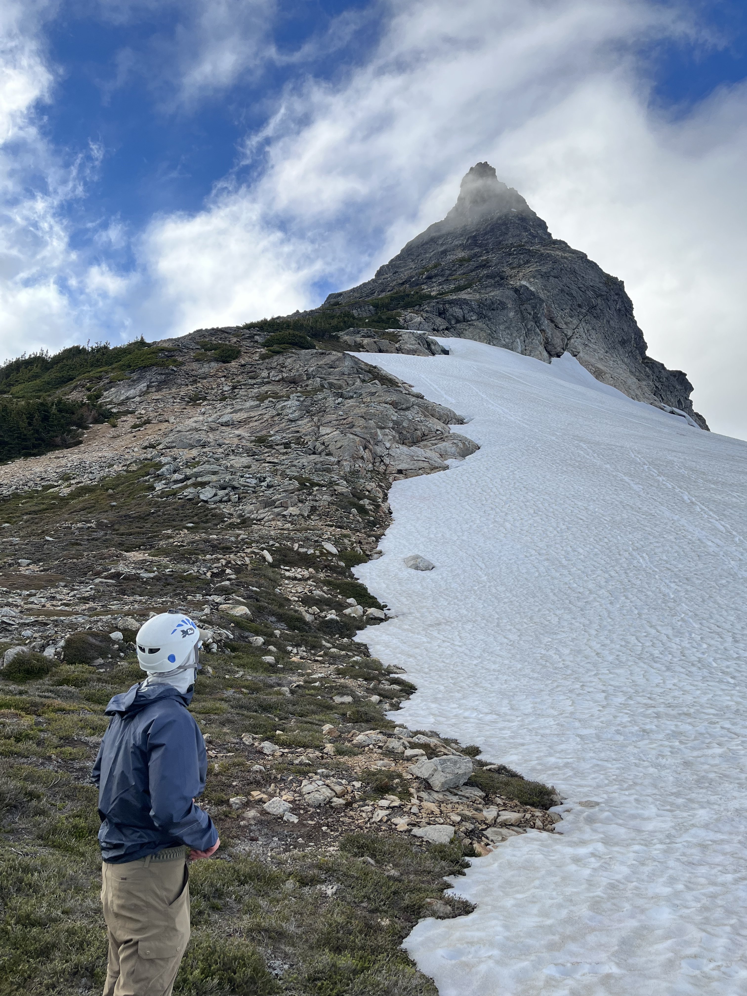
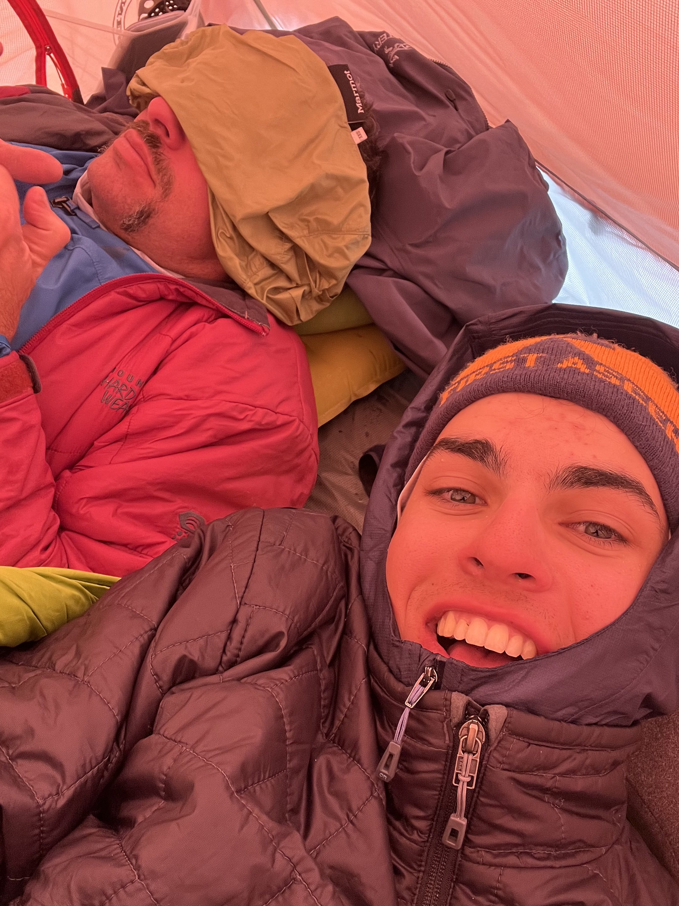
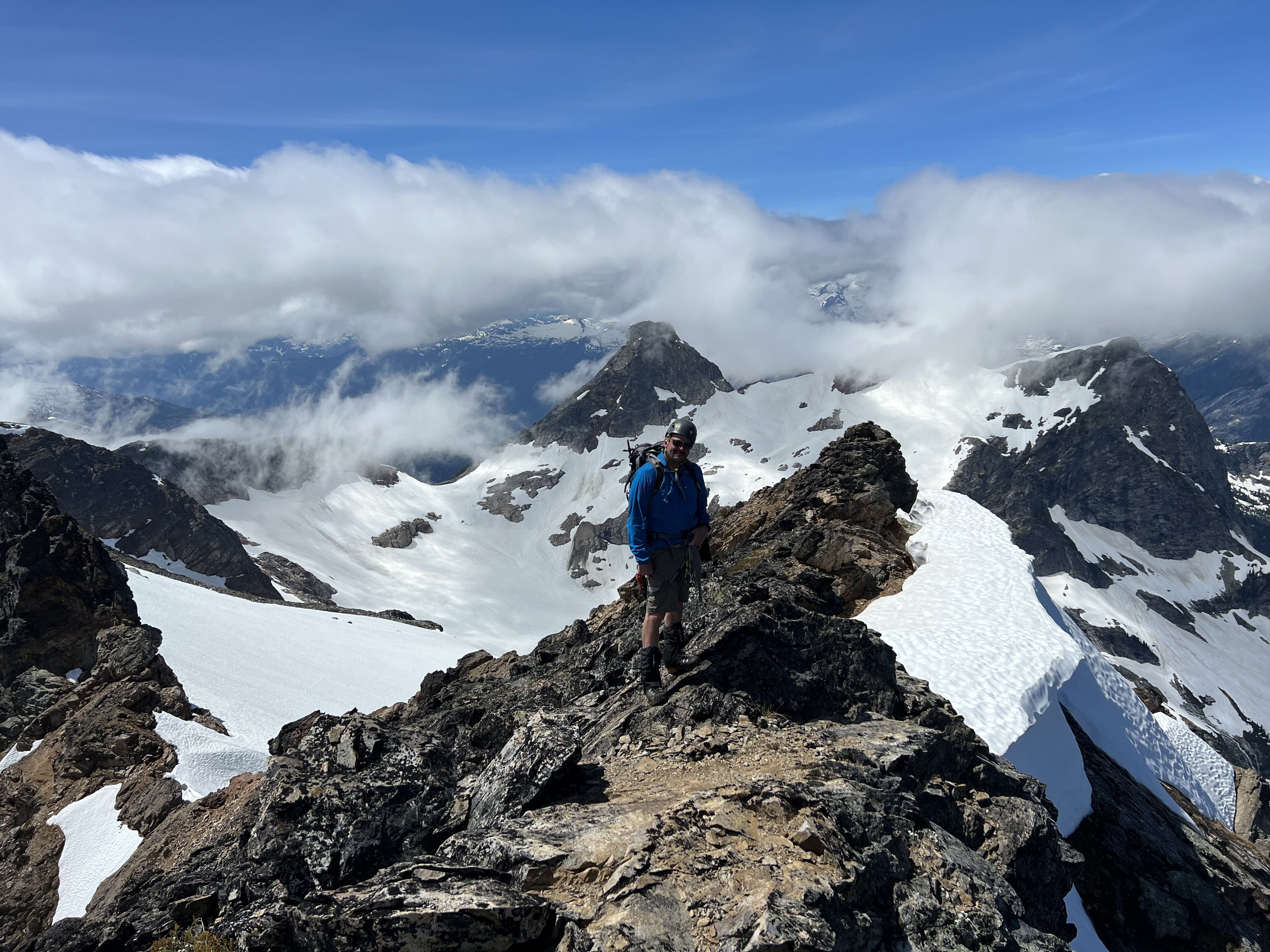
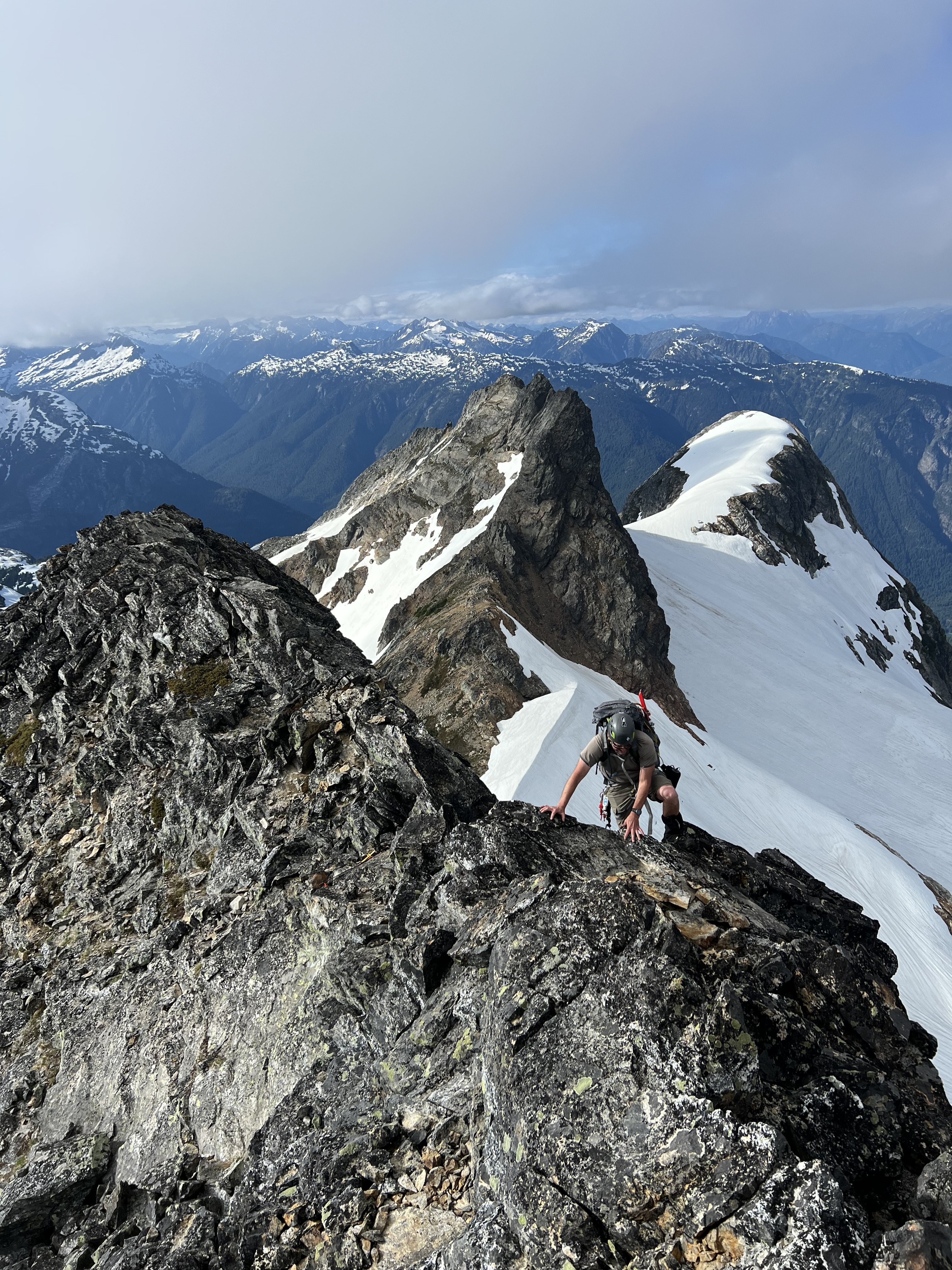
Trip: Colonial Basin: Snowfield Peak, Colonial Peak, Neve, Paul Bunyan's Stump - Standards Trip Date: 07/08/2022 Trip Report: What to do after finishing the Bulger List - was I done? Actually, in addition to a handful of Smoots, I have a long list of adventures I'd like to do, most notably some high alpine traverses and trips to the pickets. For July I had planned to do the Isolation Traverse with my son and 1-2 others. Unfortunately partners had to bail shortly before the trip leaving just two of us. My son has limited glacier experience and I felt a little anxious about a remote alpine traverse with just us two. So we opted for a less committing trip up to the beautiful Colonial Basin area where we could do some peak bagging. We figured we would probably have some company too, which ups the safety factor a bit - and we were right. I had been to this area once before as part of a two-day trip up Snowfield Peak back when I was in the Mountaineers and just starting to climb. That trip went less than ideal - and although we had summited I really wanted to return and have a better experience. As you'll see, I made a great choice! So, we headed up to Marblemount early-ish on a Friday, got a permit and drove to the Pyramid Lake TH where we ran into a familiar face from a separate party of three. We headed up in the warming temps and grunted out 6000' gain in just under 9.5 hours, all the way to the col below Neve Peak and overlooking the Neve glacier. The approach between Pyramid Lake and the bumps below Pyramid Peak were as heinous as I remembered, however with many other unsavory approaches under my belt in the intervening 15+ years, it seemed more run of the mill heinous, than extreme (ahem Silver Creek ahem). Unfortunately, the party we had met at the parking turnout hours before had beat us to the one primo spot at the col, and a second party (who had passed us) took the next optimal spot about 50-100' below on the N side. So we dug a platform in a semi-exposed area just N of the ridge. There was a nice stream of running water in the nearby rocks which made getting dinner and water much quicker. The night was colder than expected, windy and a bit miserable in a 30 degree bag. Between that and the long day before, we slept in a bit. We headed onto the Neve Glacier towards Snowfield well after sunrise. Glacier travel was straightforward with minimal crevasses. It took 3 hours from high camp at the saddle to summit. No issues with routefinding. The little class 3 step/moves above the gully seemed way more tame than when I did this climb years ago. We enjoyed the summit then headed back to camp. It took about 2+ hours. At camp we were a bit tired - more from the day before than today's efforts, and chilled a bit. It was still early and we opted to tag Neve Peak. This went way faster than expected (25 min up, 15 down, and we lounged on the summit for at least an hour, enjoying the views). We decided to go for Colonial Peak the next day, though we had done minimal route research. We had another cold and windy night, and slept in again and set off at 7:30 or so. We ended up having a long day climbing both Colonial and Paul Bunyan's stump. We (I) second guessed the obvious snow gulley and tried the direct snow slopes on the left side first. Those led to scary runout on hard snow, so we backtracked and tried to go up the ridge on the right of the snow gully by looping around to the saddle between Colonial and Neve. We dead ended on class 4 terrain before the false summit, and finally just dropped to the upper snowfield and led out with pickets across the exposed slope we had attempted earlier from below. All in all I believe it took us 6 hours up with 3 hours wasted on shenanigans. We were pretty tired and tempted to just head to camp. But there was still daylight left, so we went for Paul Bunyan's stump, continuing straight up the higher traverse above cliff bands to the saddle below Paul Bunyan's. We then went up as quickly as we could (40 min from saddle to summit), probably going farther left than we should have on the upper slopes. After enjoying the summit we descended efficiently and got back to camp before dark. We followed a better path down, especially on the upper slopes (still took a similar time to the saddle - maybe 40 min?). All in all 12:20 and 4750' elevation gain on the day. By this time (Sunday night) the other parties were gone so we moved to the nice spot at the col. The last night was much warmer and quite pleasant and we slept well. We had considered tagging Pyramid during this trip but just wanted to get home at this point. We retraced our steps from the first day, with the exception of needing to go over the rocks to get around the lake. The lake was that much more melted out along the shore! Total time down, including rest stops and refilling water: 6:53. For once we got to eat a proper dinner and drive home in daylight. Another great trip with my boy! Gear Notes: Glacier travel gear, helmets Approach Notes: Strenuous, steep, hateful.
 1 point
 -
So I'll be working on stuff. TR search is broken, and I think it was Jon the made that but he can't remember doing it right now. So I'm working on figuring that out....but overall PROGRESS!1 point
-
Do as many of the following as you are willing: 1. Sign the change. org petition https://www.change.org/p/restore-mount-rainier-weekday-winter-access/ 2. Call or email your senators and house rep. 3. Call your local newspaper and ask when they will report on this. 4. Email the park and voice your concern and ask what they are doing about the situation. I'll post the super's email here when I find it.1 point
-
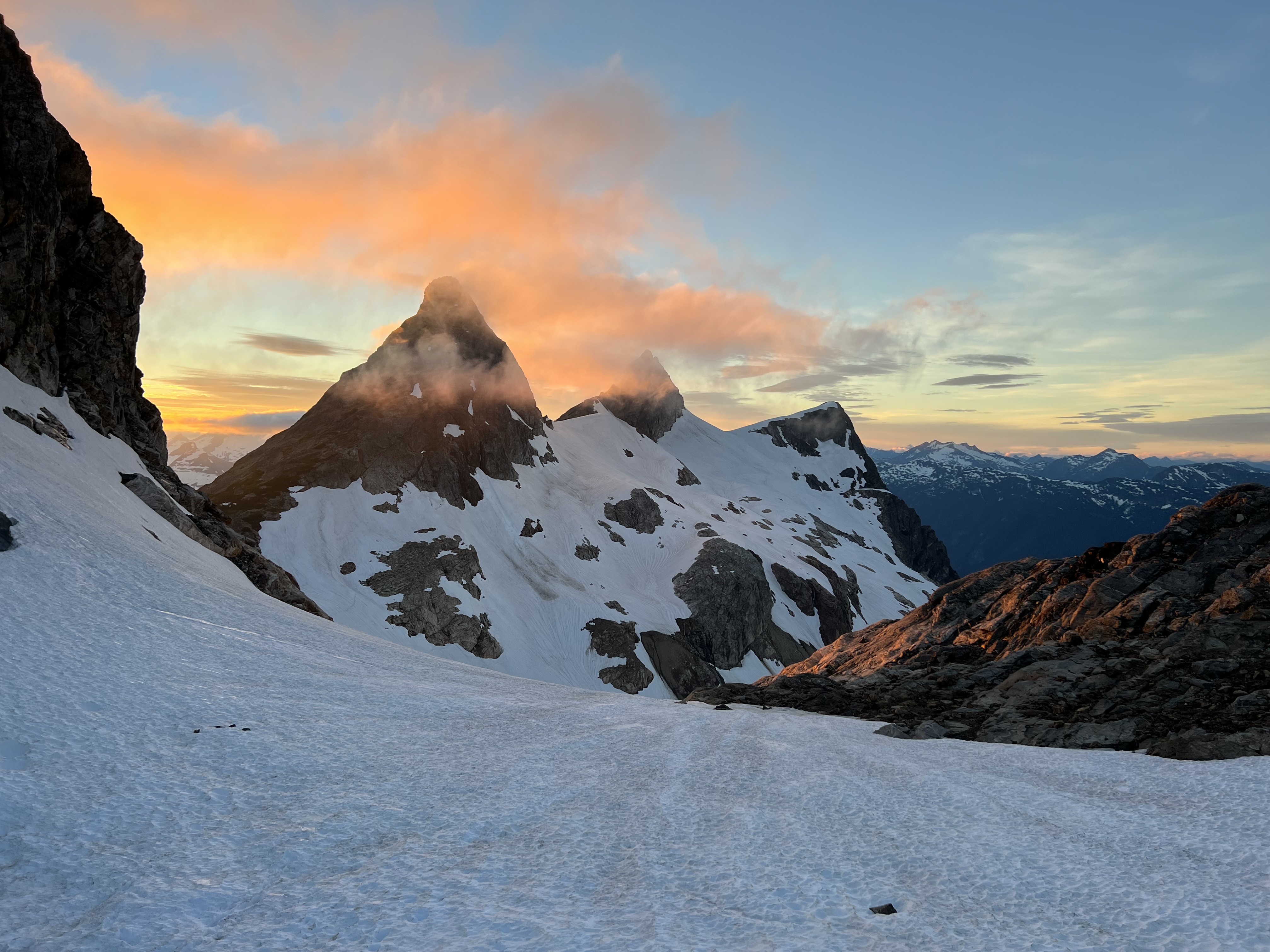
The Rat and I went clamberin' up the NE Face Central Buttress on Davis Peak the other day. It had been on my list for too long, plus it won the coin flip. The experience was full Cascades Immersion. Thankfully it hadn't rained in a few days so the moss and shrubs weren't totally soaking wet. If one found themselves ready to "hike" out in the rain, then one would be in for a real treat. The trip was a bit surreal due to the start in the Diablo Dam town site, or Zombie Town as I like to call it. The town is a pure Hollywood zombie film movie set. Perfect pretty little house, nice yards, new cars in the driveways, but not a soul or sound. The silence was broken by an air raid siren just as we started hiking. Opening scene: Perfect 1950's dream town juxtaposed by a piercing air raid siren. Intruder Alert! The zombies emerge from their homes desperately hungry for brains. Flashback: Pop is on the porch smoking a pipe while Mom comes out with a tray of ice cold lemonade. Billy is flying an airplane on a string in the yard. Then BLAM! Nuclear bomb mushroom cloud. Fade out, and back in to the family twitching on the yard as the radiation mutates their genes in to brain eating zombies. The airplane lays on the yard, its wings broken. It's weird being so close to civilization, but being so cut off in the back alley of the glacier basin below Davis. Nothing but rock, snow, and zombies patrolling the lowlands. Better get some pitches in while we hunker down and hope the situation changes. From the river to the camp spot, it's only a mile. And 3500' of elevation gain. Put your trekking poles away for this approach. Rolf and I got some early bonus pitches in on the headwall guarding the peak. Junglegym Jones. Crossfit in the Amazon. Wear your goggles, bush snorkel, helmet, and spiky toed shoes. The Stetattle creek trail is the famous site of the big bloody battle between to native tribes (history lesson someone?). The climb was interesting. We didn't use a guidebook for the climb (or approach/descent), and after reading it when I got home, it really wouldn't have helped. The go left, go right, go up instructions on a 2500' climb would have only confused and irritated. We wondered if we were doing the 2nd ascent. Actually, this climb was really not much different than doing a 1st ascent except that we knew that Doorish got up it and called it 5.10, so really, how hard could it be? I'll spare the details of the actually route itself. I'll just say it's fun, there are some fun moves, it's totally gorgeous up there (especially the top!), and there are some sections of routine mank. I busted out my ice tool on one pitch for a M5ish moss mantle. The rock was covered in mucous when both feet became disconnected from the mountain and I had to do a grab your wrist one arm lock off and claw/grovel/dolphin-flop my way up. I also gave up a lead to Rolf cuz I was being a total pussy, which he of course hiked and said it was easy. BUT WHAT ABOUT MY FEELINGS????????? One fun thing that happened was when a falling rock chopped the rope midway into the core at almost exactly half rope, and I didn’t notice it until Rolf was committed out of site on a particularly challenging section. It was equally fun following the pitch. “Take!”….SNAP! It slowed us up doing short pitches on the headwall sections, but what sucked was 60’ raps on the “hike” out. We switched to my 6m which is also fun to rap on. No pesky friction on the belay device, and plenty of fun knot puzzles. The other lines on the face look so/so. After looking at them and down them from the top, I'm glad with our choice. Burdo/Cairn's route looks the best since the upper rib it ascends looks pretty and clean, but the lower part looks way shittier and you'd only get about 4-5 pitches of climbing out of the deal. Since the face is a one route per lifetime kinda job (unless you have emotional problems....Pete?) might as well choose the most aesthetic line. Autumn gardens and Seraphin prow don't look like they are worth the effort. And of course the NE face couloir looks fun in winter (nice one guys), and there are other opportunities for winter lines too. Speaking of other routes, the NE face of "Jay Peak" aka "The Roost" is almost a carbon copy of Davis, albiet shorter. It's probably 1500' vs 2500' (the beckey guide is wrong). So someone should go do the NE butt on that guy. The approach looks very reasonable if you go up goodell creek and camp on top of the peak. The other way up Jay creek or Stetattle creek is according to the Beckey Guide, "only for those who have a guilt complex and wish to punish themselves". Looking down from the summit (we continued on to the actual summit adding a bonus pitch) is crazy. 6000 drop right down to the river in a bit over a mile! I'll give you a dollar if you base jump it. The summit register was visited by the ghost of Roger Jung. I keep running into him in the mountains. Spooky. The alpine meadows and rock walls all over Davis and surrounding areas is very pretty. Millions of ponds and camp spots. Also all the leaves and plants were turning, so the colors were great. Perfect sunny crisp fall day. Go get your girlfriend's hikin' boots outta storage and drag her up there. You'll have a very scenic pretty location for her to break up with you. Also, this is an excelling choice of routes for a cascades newbie, or those from Colorado on a road trip on their way to boulder in Squamish. The hike down was uneventful, and we had a blast hopping down the glacier with one strap-on crampon each. Gear: the usual up to 3.5”, pin aren’t useful, but a small ice tool is. RP’s or HB’s are usefull so you see pretty dangly things clipped to the rope when you stare down.1 point