
Leaderboard


Popular Content
Showing content with the highest reputation on 07/29/22 in all areas
-
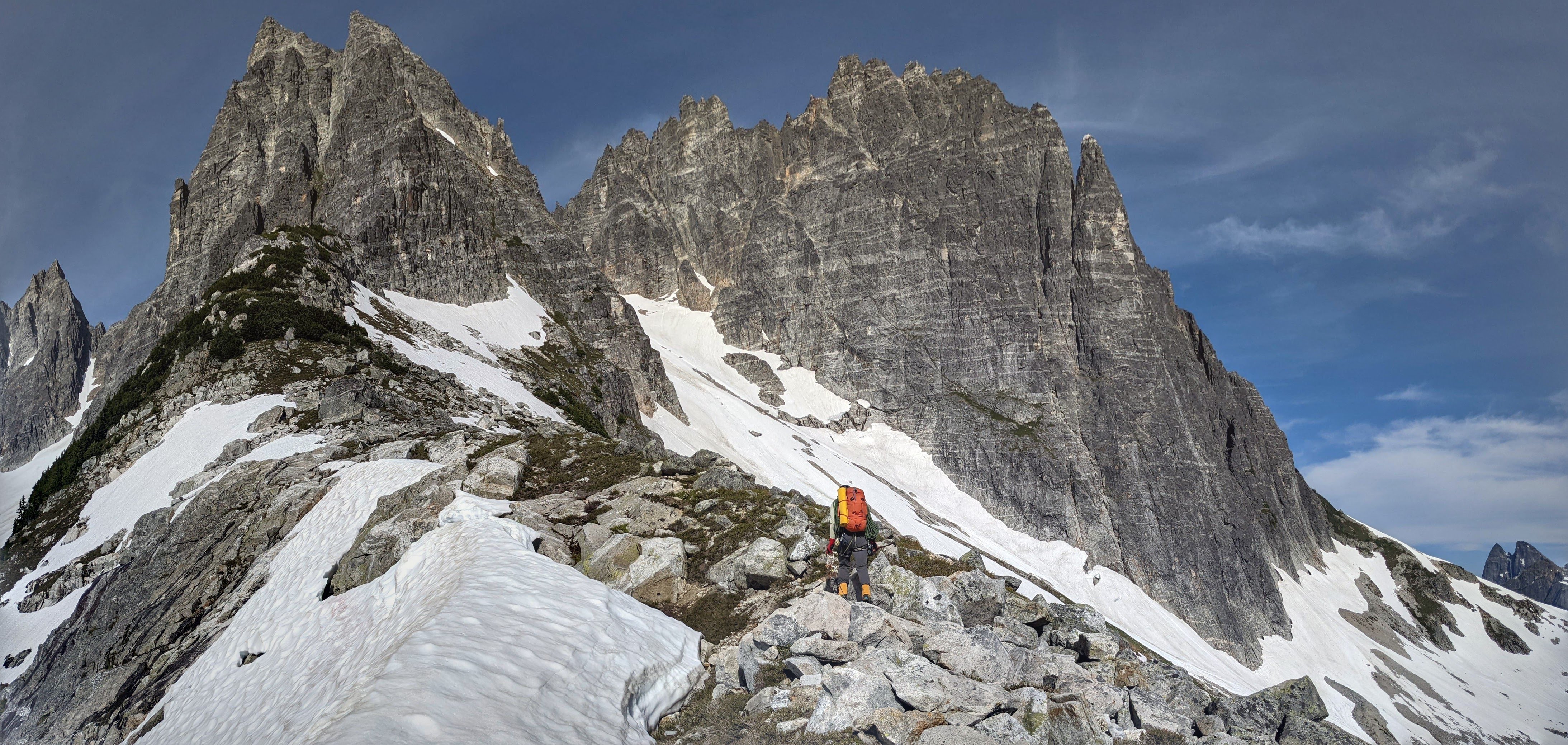
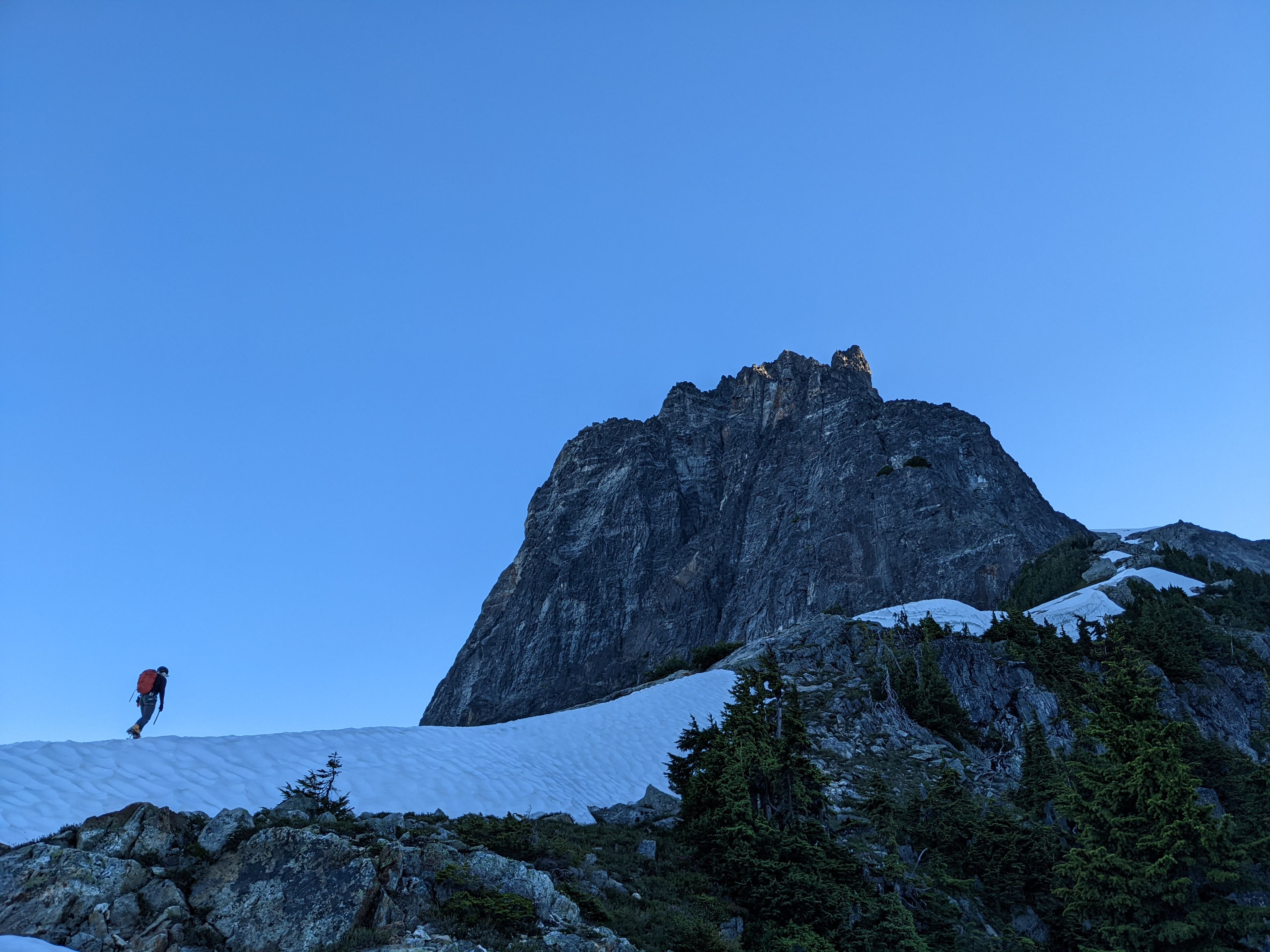
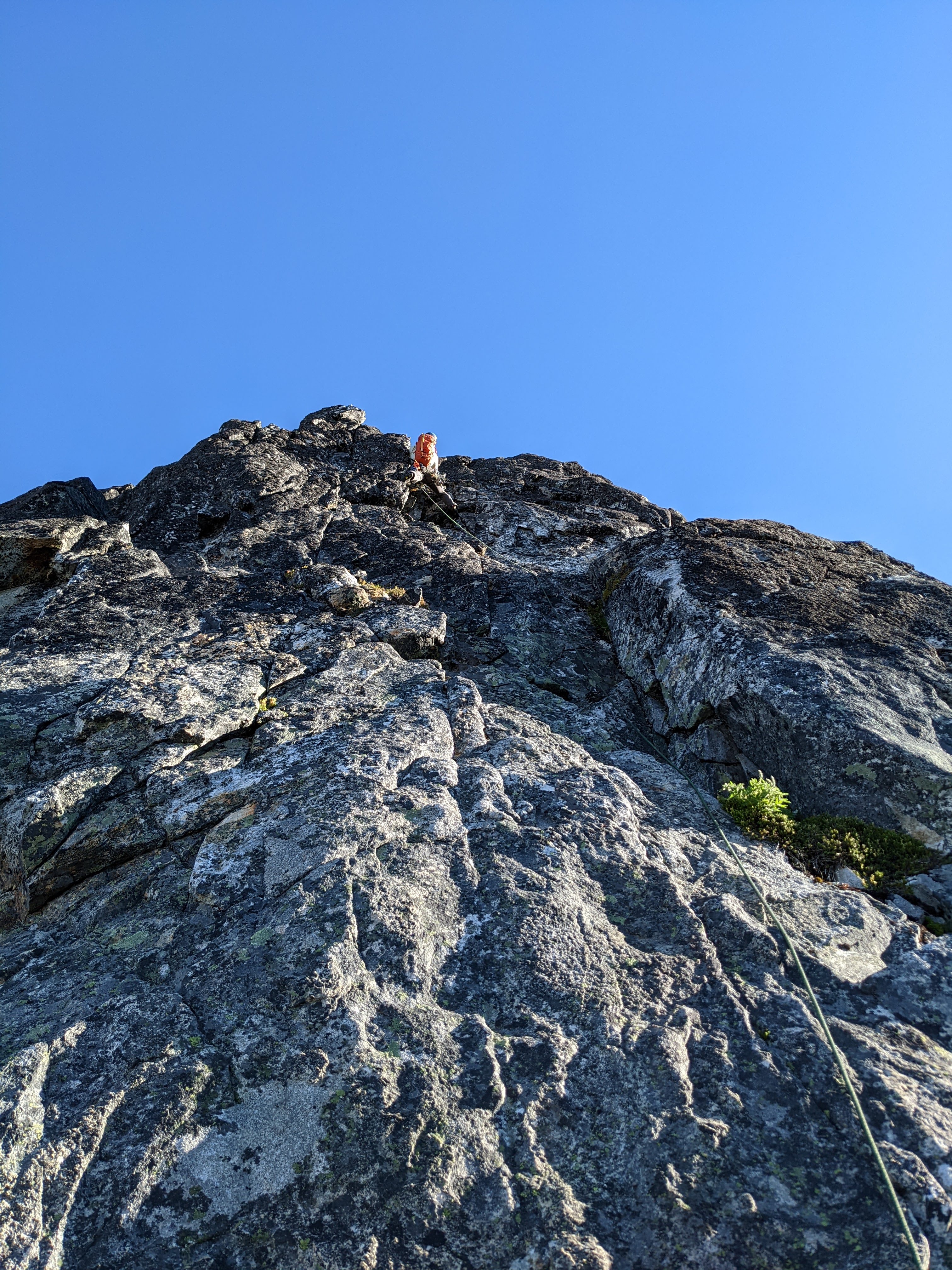
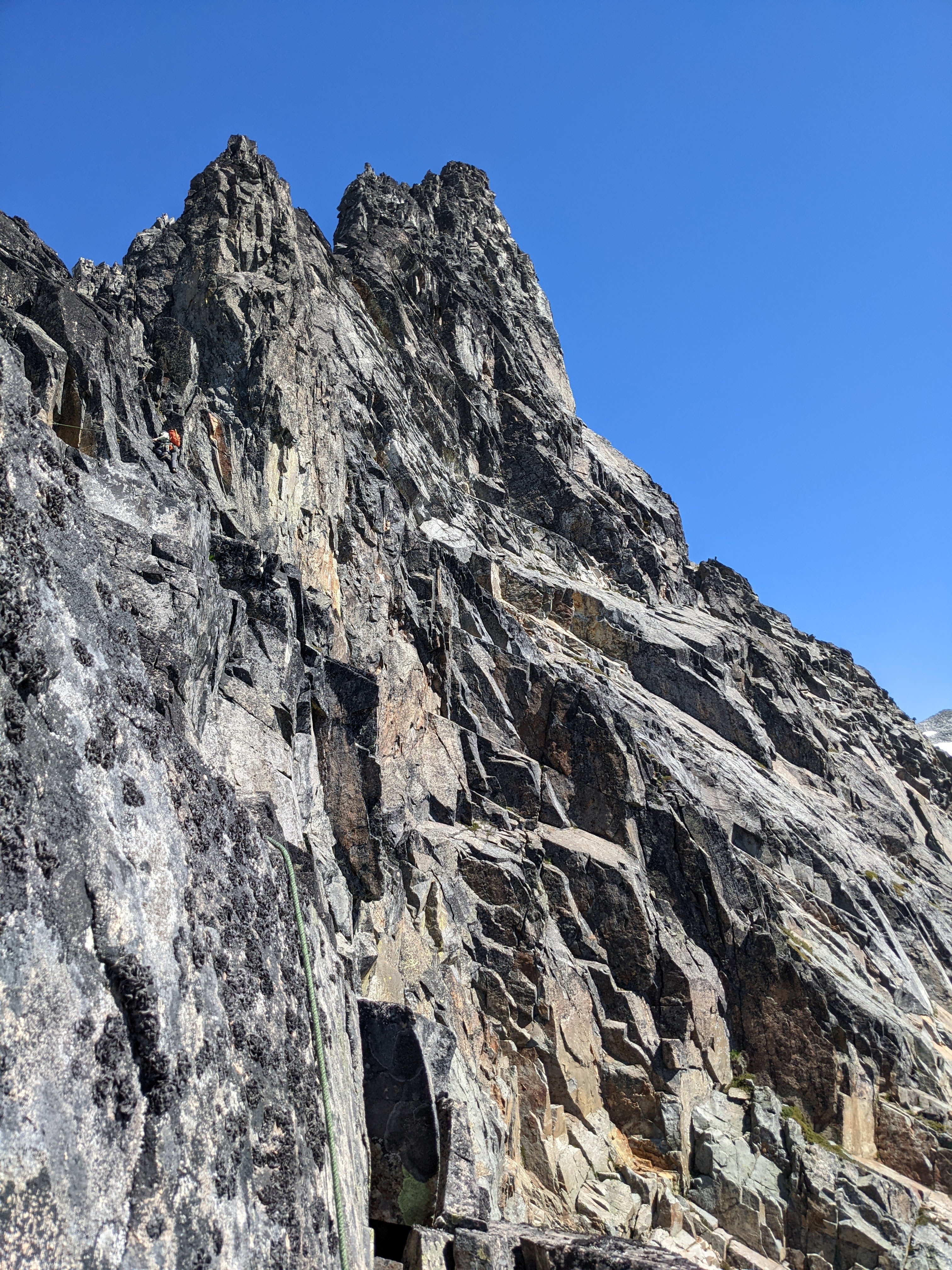
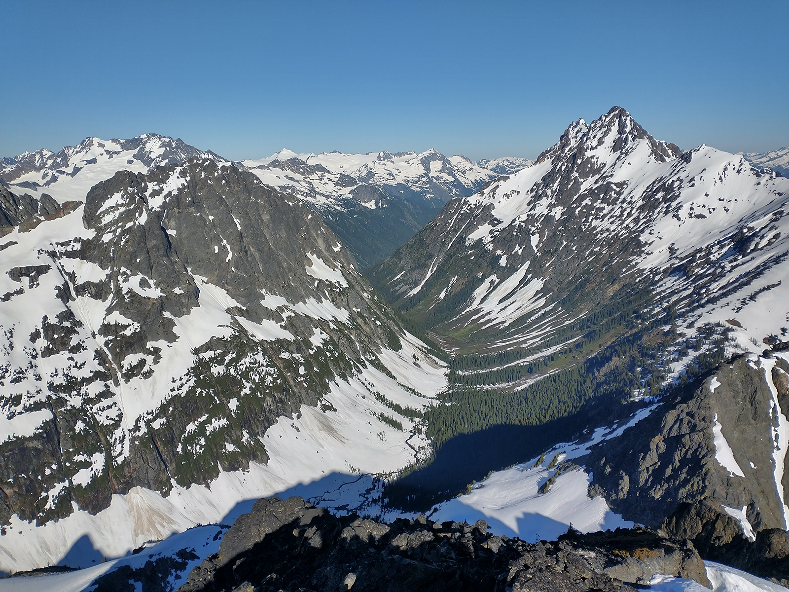
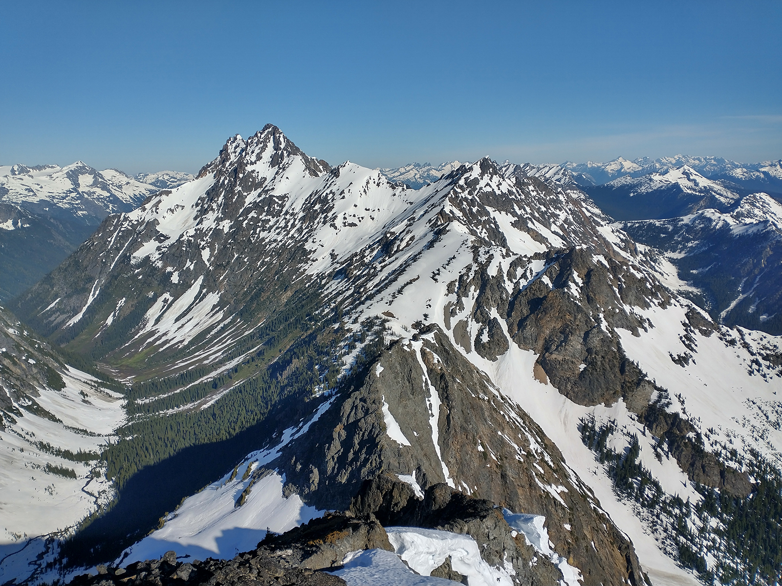
Few more photos: On Phantom arm, under west ridge (route looks very good), looking over to Haunted Wall; lower part of Spectre's south ridge partially visible above Pickell pass. Approaching the ridge Sam leading delicate 5.9 PG-13/R up bulging flakes on pitch 3 Spot the climber Summit!
 4 points
 -
Trip: Guye Peak - A slightly more improbable than usual ascent of the Improbable Traverse Trip Date: 07/22/2022 Trip Report: Late last Thursday Joe and I made the questionable decision to try and dawn patrol the Improbable Traverse. Neither of us had climbed the route before, nor did we do much research, which in hindsight may have saved us a headache or two. At the time we were blissfully unaware of the massive rockfall event that happened last November. A quick search here would have informed us. However lately CC isn't the place I go for up to date condition reports, being that i'm often one of three users logged on at any time . A quick mountain project browse provided no info other than it hadn't been climbed this year. Long story short the route has been obliterated, and it would take a heroic amount of trundling and sweeping to revive it. All the pitches up to the traverse got bombed and are absolutely plastered in dirt and loose rock. We'd heard it the route was loose, but this seemed a little extreme. The flexing pin at the start of the traverse is still there, and the only reason I knew where to go. The pictures and beta I had weren't quite lining up. It was at this point that I realized what had happened, and made the decision to try and top out rather than bail with our short 40m rope. Traversing out I came across a large 40x40ft rock scar where the routes 5.8R crux used to be. Already 20ft out, I snaked my way over and down some insecure sloping edges which provided the routes new crux at somewhere around 5.9+ downclimbing. Once on a larger foot ledge I was able to keep traversing to the end of the rock scar and onto the original route. All told it was somewhere around a 50+ foot mandatory runout off the old tied off flexing pin. If it was R before, it's likely X now. The worst part by far was the top of the left trending ramp that exits the main face. This section cuts straight through the middle of the main rockfall zone and is now composed of the loosest unstable blocks held in by dirt I have ever climbed. It's hard to state exactly how nasty it was without sounding terribly dramatic, but It was bad. I was worried the entire slope was going to fall away around me. This pitch had no acceptable protection. Basically what I'm trying to say here is don't be dumb and climb this like we did. The lower pitches are right beneath an active rockfall zone and we are lucky we didn't get taken out. We were both late for work. Gear Notes: Just don't. But if you do, a few KB's might be useful on the new traverse. Approach Notes: Same as is ever was2 points
-
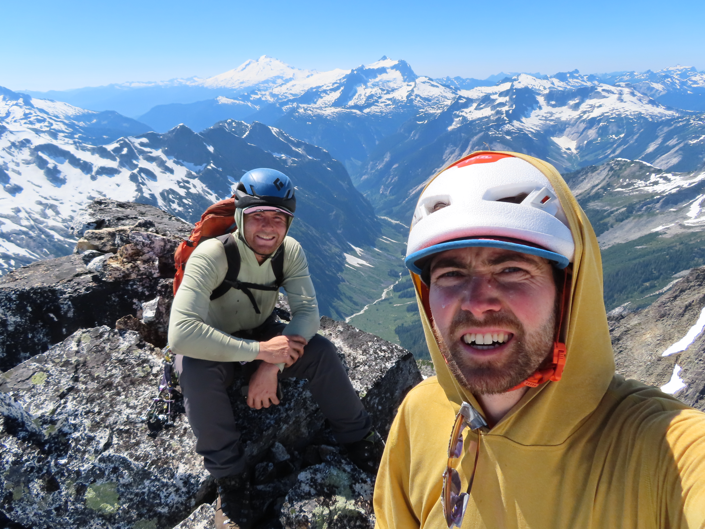
Trip: Mount Maude - North Face Trip Date: 07/23/2022 Trip Report: Kelsey and I were ready to move on from ski season but are in terrible rock climbing shape after pandemic years out of the rock gym, so we searched for snow routes. Mount Maude quickly shot up the list and we believed it would still be in shape despite it being late July, based on the snowpack we’d been observing this summer so far. We’d been up in the area to scramble Seven Fingered Jack before, and so the approach was familiar. We drove out Friday night in Kelsey’s van, getting a free, violent massage chair experience on the especially-bumpy access road, and conking out a bit after 11pm. We had decided that it would be nice to catch the route in slightly softened conditions and that its North-facing aspect should keep it from heating up too much, so we woke up at 5am and were moving by 5:30am. With just climbing gear, layers, and food for the day, we were reasonably light and banged out the approach to the meadow camp in Leroy Creek Basin in just over 2 hours. From there, we followed the climber’s trail until we hit snow, switched to boots, and made our way up to the Seven Fingered Jack / Maude col at about 10am. It was sunnier, warmer, and with less snow than we’d hoped on this side, but our view of the top of the route suggested it might still be in condition. We had a snack here, put on our harnesses and sharps, and started our downward traverse toward the route. We were on mushy snow for a ways before hitting a baked-out section for which we took crampons off and scrambled loose 3rd class until hitting snow coming down the North Face which looked more or less continuous. We got our crampons back on here at 11:30am and pulled out our second tools. The snow was softer than we were hoping for down low, but not demonstrating any signs of loose slide potential, so we scampered upwards unroped. The angle down low is quite reasonable in the 35-40 degree range. In the middle of the route, there was a brief bare traversing section we had to scramble through, but it was low-angled and pretty easy. From there, the route kicked up in steepness. We took our time, kicking in good steps, which varied in difficulty from a couple of kicks to five or six with some toe bashing. The last 75 feet or so was appreciably steeper and much more firm. We slowed further here to kick nice, secure steps. A nice consolation was that the firmer snow made for secure high-dagger tool placements. At 1:15pm, we crested the last steep snow of the North Face and high-fived on low-angle, rocky terrain that led to the summit. We had lunch and took a brief nap up here then started down at 2:15pm. After heading down the South Ridge for a ways, we decided to roll the dice and take a more direct, loose descent path to the West. It had efficient sections on loose scree and snow and a couple more painstaking sections on loose rock, but it went. By 4pm, we were back at the Leroy Creek Basin camp area and, by 6:15pm, we were back at the van for just under a 13-hour day. A fun day out, a beautiful area, and a nice transition out of ski season. The booter is in! I'd guess the route will still be in for another couple weeks (knowing how hot it's gotten since our ascent). Go get it. A few more photos and a GPS track are here: https://www.jeffreyjhebert.com/adventures/north-face-of-mount-maude Gear Notes: Soloed the route with crampons and two tools. Brought a few pickets, a few screws, and a 30m glacier line just in case. Only pickets would have protected it. Approach Notes: Head to 7FJ-Maude Col and then do a descending traverse across snow and loose 3rd class to ~7,750 to start the route.2 points
-
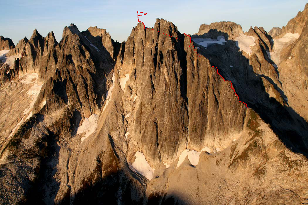
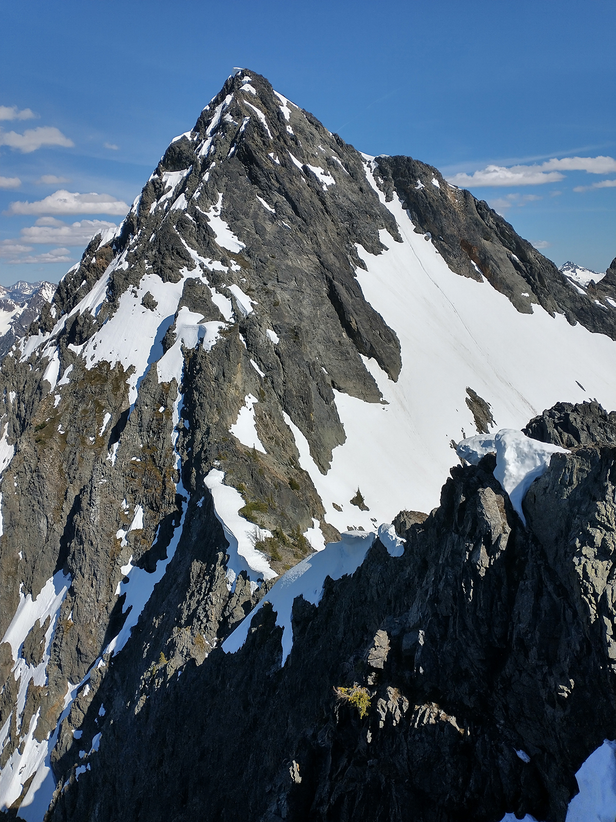
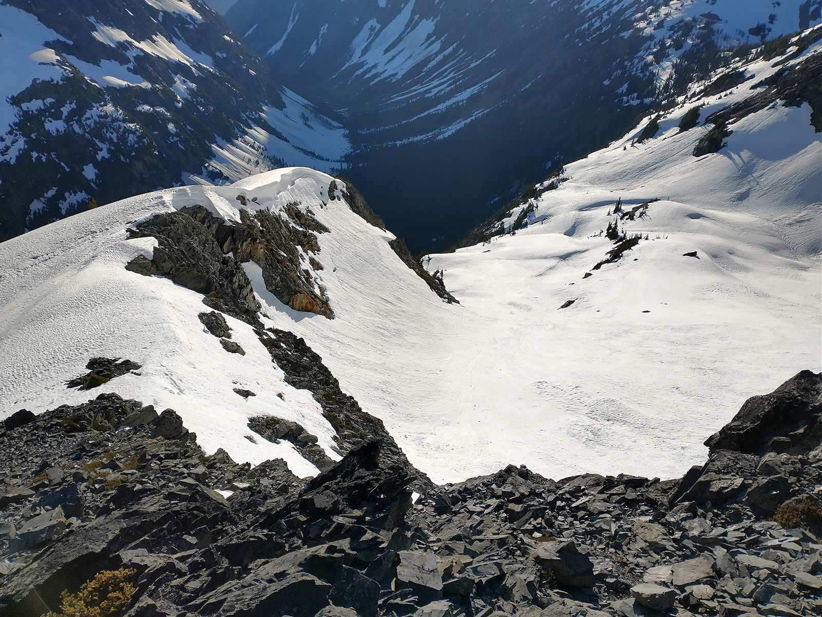
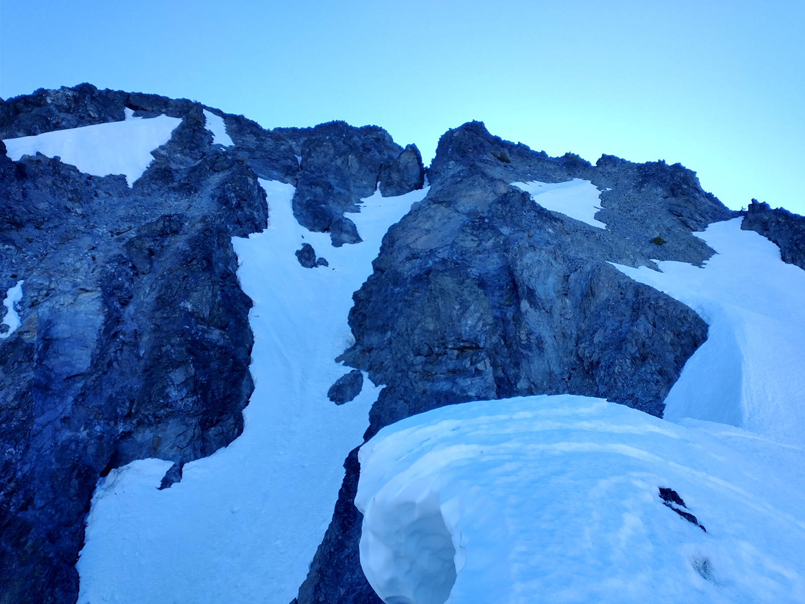
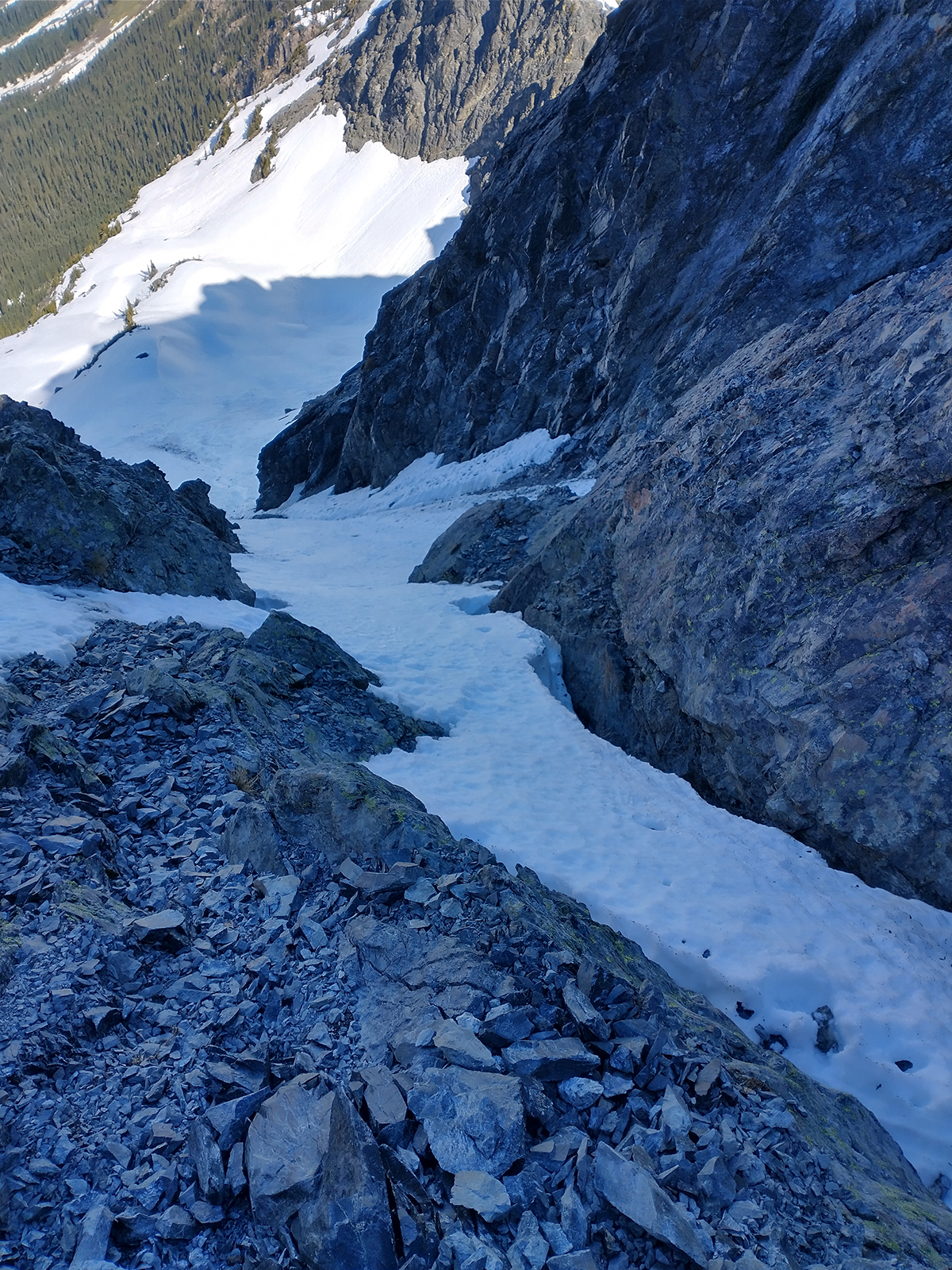
Trip: Spectre Peak - “Spirited Away” FA of the S Ridge of Spectre Peak 2000’ 5.8 Trip Date: 07/26/2022 Trip Report: Joe Manning and I just got out of the Northern Pickets. We did the first ascent of the South Ridge of Spectre Peak. We had excellent weather and were out for 4 days. I’m having trouble loading any photos from my phone on here so this will be super brief. For extensive photos and whatnot check out my trip report on our blog… https://www.theclimbingguides.com/post/spirited-away-first-ascent-of-the-south-ridge-of-spectre-peak-2000-5-8 Gear Notes: Singles .1-2 doubles .3-1 light rack of nuts and optional 3. 40-50ft of cord and a single 60M rope. Approach Notes: Easy peak to improbable impasse to perfect pass to challenger col to phantom to pickle pass.1 point
-
Awesome climbing again with you Sam after so many years, this climb went about as smoothly as I could have hoped! Great trip report on your blog, I recommend giving it a read. A few thoughts about the climb: Pleasant (and warm) temps made for light bivy gear and few layers needed Snow travel conditions and coverage were outstanding, mostly boot-sole to shoelace deep made for easy kicksteps and cramponing pretty much the whole time, never too firm or post-holely, with rubble, heather, and crevasses well covered We brought food for only 4 days/4 nights, and with meltwater never really carried more than ½ a liter of water at any given time (except on route) Certain sections of choss on the ridge required delicate climbing, alternating with heavy-handedness; we trundled a ton of stone, especially on the ridge crest Sam is an exceptionally strong and efficient partner who set much of the boot pack, led most of the pitches, and graciously humored me with belaying the Impasse both ways. We packed a lot into 4 days, with back-to-back 15-16 hour days including the full day climb and descent, followed by a marathon exit hike the final day all the way from the 7k ft moraine bivy south of Challenger to the car, leaving a little before 10am and making the trailhead around 2am. It was so hot the afternoon of our hike out, despite drinking 7-8+ liters of water and eating lots of salty snacks, by 10pm, what little urine I could pee was the color of motor oil. It was a little unsettling, to say the least. Fortunately, a couple days later and I’m no worse for the wear Here is a John Scurlock photo (used with permission) of the line, dotted sections were below the crest on the east. We did two rappels on route to get off or around gendarmes.
 1 point
 -
Trip: Crystal Lake Tower - SW Rib Trip Date: 07/03/2022 Trip Report: We two Seattle climbers made a pleasant 3-day outing to Crystal Lake Tower. Having climbed Whitehorse Mtn. with Kellie McBee the previous week, I imagined we'd be in shape for this. After gleaning details of the route from trip reports here, and, of course, Fred's Cascade Alpine Guide, we carried out the trip without any trouble. A leisurely hike up Ingalls Creek for 7.7 miles brought us to Crystal Creek. A ribbon on a log marks a spot to turn uphill. Blowdowns made the boot-track hard to follow at first, but we soon picked it up. It goes into big boulders on the way into the tarn basin, where I somehow had my camera out for this shot: Camp was found in some trees near the tarn, where we could see the objective of tomorrow's climb: Under clear dawn skies we made our way around the left side of the tarn to the left side of the route's toe. I have long been enchanted by the Nightmare Needles, having climbed Little Snowpatch with Mark Landreville in 1989, so I took some shots along the way: Easy simul-climbing starts the route, and here is Kellie coming up: Little Annapurna is just across the creek: We knew to aim for a large-looking white headwall and pass it on its left side. My partner expertly scoped it out: Wonderful, improbable ramps curve around the final block of stone to the summit. The obligatory summits shots were made: The Enchantment Lakes were still snowy in a mellow late-season way. Crystal Lake is bottom left: I once climbed McClellan Peak while trying for Argonaut in a whiteout, by myself, so I enjoyed the view of where I once stood: It was with relief I walked the easy descent along goat tracks to the area of Enchantment Pass. The snow was soft and giving, with no need for crampons, though we had brought axes for balance in case of ice. I had stashed my big pack at the base of the route, so I had to hike back up for retrieval while Kellie waited. Exhausted, camping was a relief until it began to rain. I had just finished boiling water for dinner and dashed into the tent with it while Kellie cooked hers. Lightning flashed and thunder rolled in the night, rain came and went in alternation with perfectly clear, starry sky. Next morning we abolished breakfast time and got out of there fast. It rained hard for a bit, we soaked up the water in the bush, slipped on lichened rock, tumbled over logs, slipped on roots and ferns, fell backward and forward, and hit the Ingalls Creek trail with gratitude. An easy seven miles to the car, hooray! Gear Notes: Single rack to 3", one 60m rope, ice axes Approach Notes: Legendary1 point
-
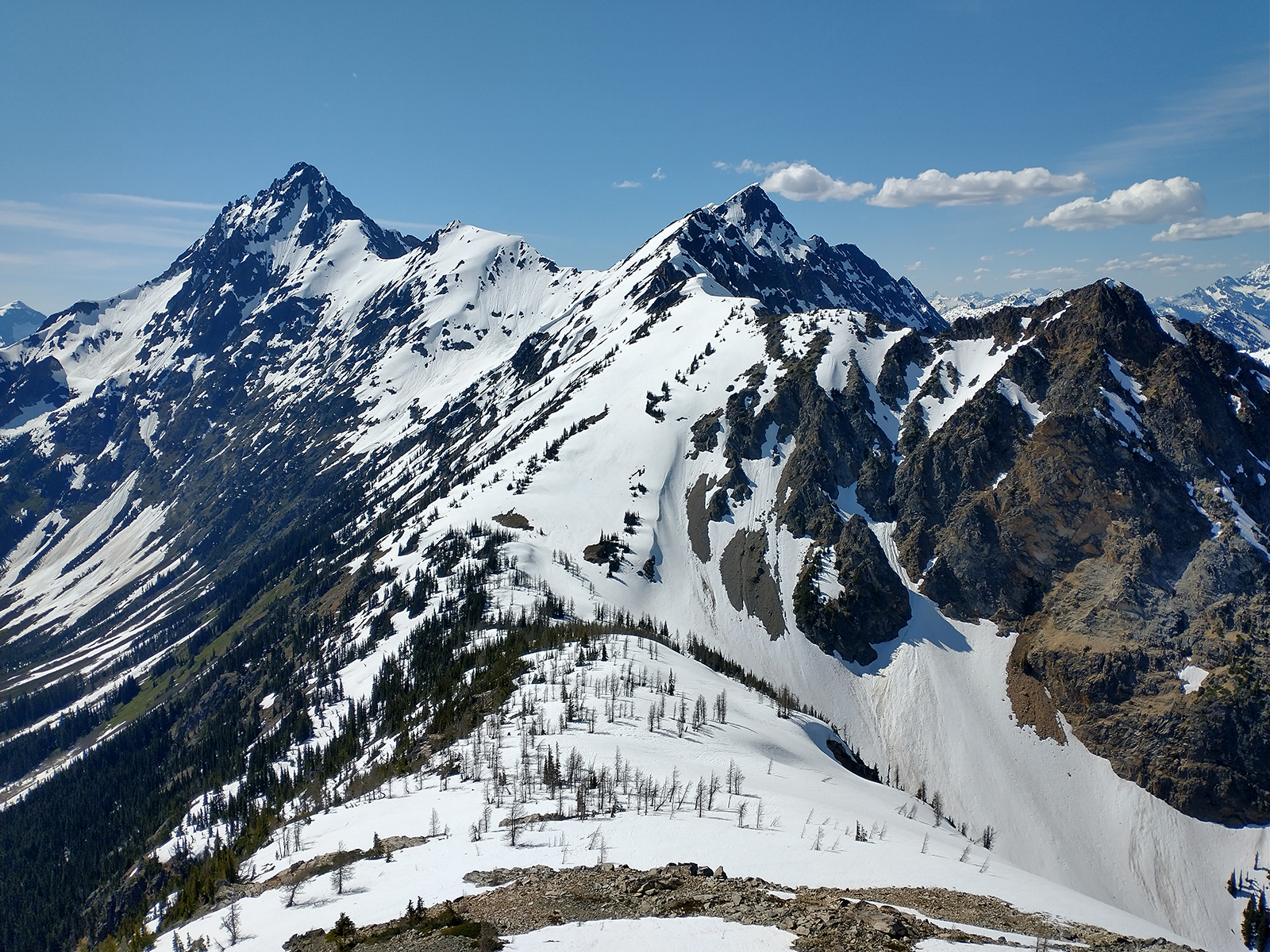
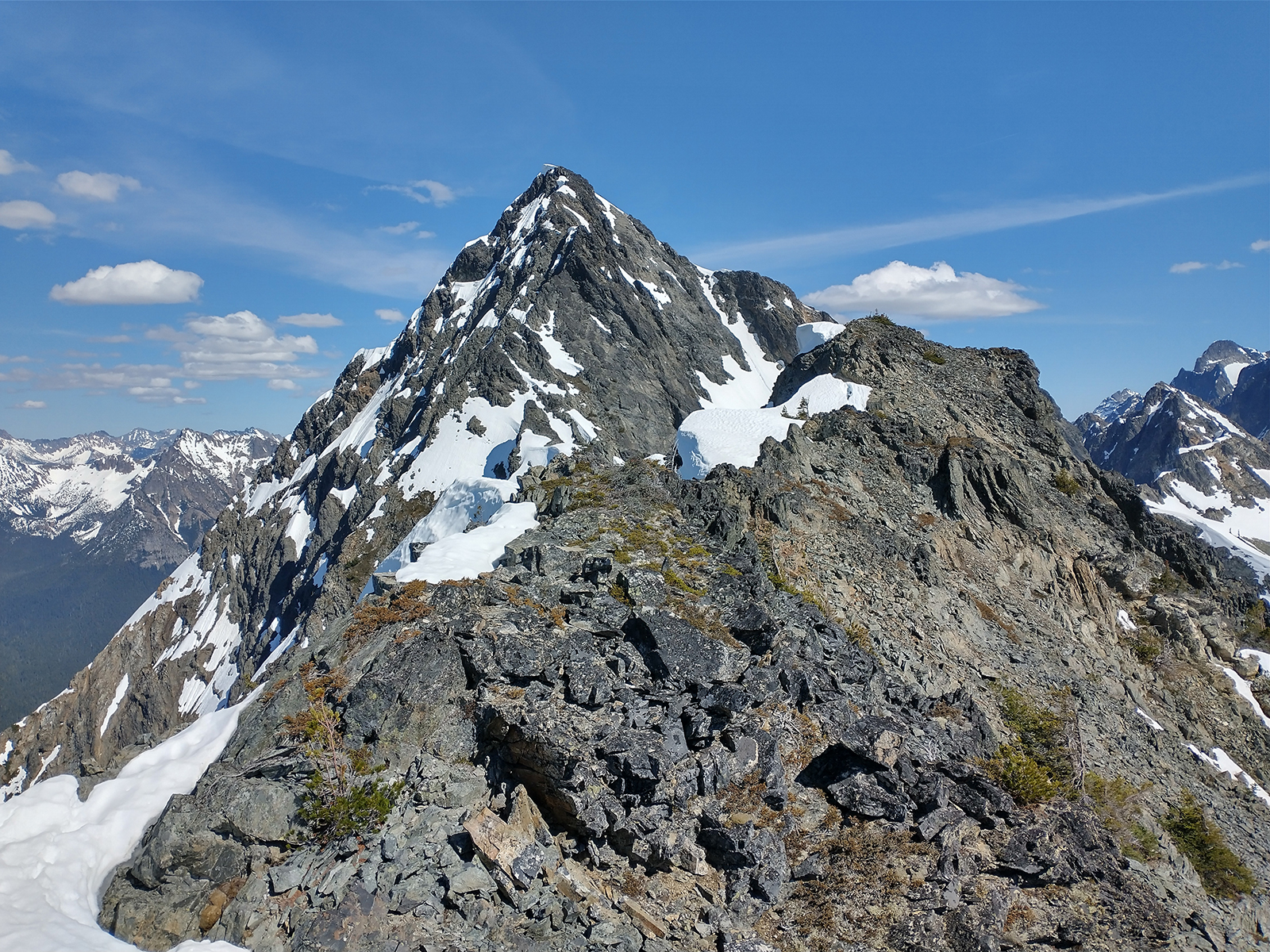
Trip: Graybeard Peak (7965') - Southwest Ridge Trip Date: 06/25/2022 Trip Report: Graybeard Peak (7965') – Easy Pass Trail Approach – June 25-26, 2022 (Sat, Sun). The weather was perfect both days, 70+ degrees and clear skies. Saturday: I headed out from the trailhead (3800’) at 9:00am. The trail is in good shape with some down trees to negotiate. The trial ran into solid snow at 4600’ and I promptly lost the trail. I decided to head up and to the right, as that looked like the best option at that point. The terrain got steeper and less forgiving, some bushwhacking was needed. I finally made it out into an open area on the slope at which point I realized I was far off to the side of the actual trail location. I headed across the slope to reach the correct wide snow basin heading to the pass. I should have turned left at 4600' and headed toward the snowfield visible through the trees. Oh well, live and learn. I finally made it to Easy Pass at 2:45pm thanks to my detour and being a bit out of shape. I was planning to climb Graybeard and Kitling Peak over the weekend but my legs where feeling it by the time I reached the pass and I was behind schedule. So I decided to hit Graybeard first and see how I was feeling the next day. I decided to attempt a climb of the Northwest Ridge of Graybeard straight from Easy Pass. I was burned out on side hilling on loose wet snow so I figured a rock route would be much more fun. I haven’t seen much information on the Northwest Ridge of Graybeard so I was on a reconnaissance mission as well. The ridge was going well with class 2 & 3 for the most part. I made it to the saddle between the sub peak and Graybeard. At this point there were a few deep sheer gullies separating the ridge. I didn’t bring a rope and down climbing into the gullies was too dangerous. I decided to drop down into the snow basin of the standard route up Graybeard. I looked up the main snow gully going up to the Graybeard summit area. The snow was soft and wet and the top of the snow gully was 40 degree snow. As I wasn’t feeling like a high speed glissade, I decided to climb over to the Southwest Ridge instead. I decided to call it a day and setup camp on the ridge at 7:30pm. Beautiful views and perfect weather, even though my legs were done, I didn’t really care. Sunday: I broke down camp and was on my way to the summit by 6:45am. The rock was mostly class 2 & 3 with a little class 4 toward the top. I reached the summit at 8:00am. Beautiful views in all directions. On my way back I was planning to take the snow gully down. I was able to tie into the snow gully below the 40 degree section by down climbing the ridge about halfway. The snow was still soft and loose but manageable. I took the standard way back across the snow basin toward Easy Pass. I was back to Easy Pass at 11:00am. My legs were still pretty tired from the previous day so I decided to hit Kitling Peak on another day. I made it back to the trailhead at 1:30pm. Some Tips and Notes: 1. There was very little water above Easy Pass and no water at the Pass. Best option for water was at about 6000’ from the big creek at the bottom of the snow basin heading to Easy Pass. 2. I brought too much gear being unsure of what to expect. I brought crampons and snowshoes. I used the snowshoes a little and found out that boots alone worked the best. 3. The route up the Northwest Ridge was looking to be fairly challenging. A rope is necessary for the route. I’d say it is good mix of class 3,4 & 5. 4. There was still a lot of snow in the area and probably will be for a while. Travel Time for reference: Saturday: Trailhead to Southwest Ridge Camp – 10.5 hours. Sunday: Camp to Summit back to the Trailhead – 6.75 hours. Total Mileage: about 10 miles Total Elevation Gain: around 5000’ Gear: Trekking Poles, Ice Axe, Crampons, Snowshoes, Helmet. Looking back at KITLING & MESAHCHIE PEAK on my way up the Northwest Ridge of Graybeard. Northwest Ridge of Graybeard. Northwest Ridge of Graybeard. I decided to head down to the snow basin at the end of the snow in the ridge saddle. Snow basin up to the Southwest Ridge of Graybeard. Main snow gully and Southwest Ridge to Graybeard. Snow gully branch that I used to come down the main snow gully, bypassing the steep 40 degree soft snow. Summit View down the Fisher Creek Valley. Lots of snow still. Summit View looking down the Northwest Ridge, KITLING & MESAHCHIE PEAK in the background. Gear Notes: Trekking Poles, Ice Axe, Crampons, Snowshoes, Helmet. I didn't need the crampons or snowshoes. Approach Notes: Climbed up Easy Pass Trail. When the trail goes under the snow at 4600' turn left toward the snowfield and follow the snowfield all the way up to Easy Pass.
 1 point

