
Leaderboard


Popular Content
Showing content with the highest reputation on 07/26/22 in all areas
-
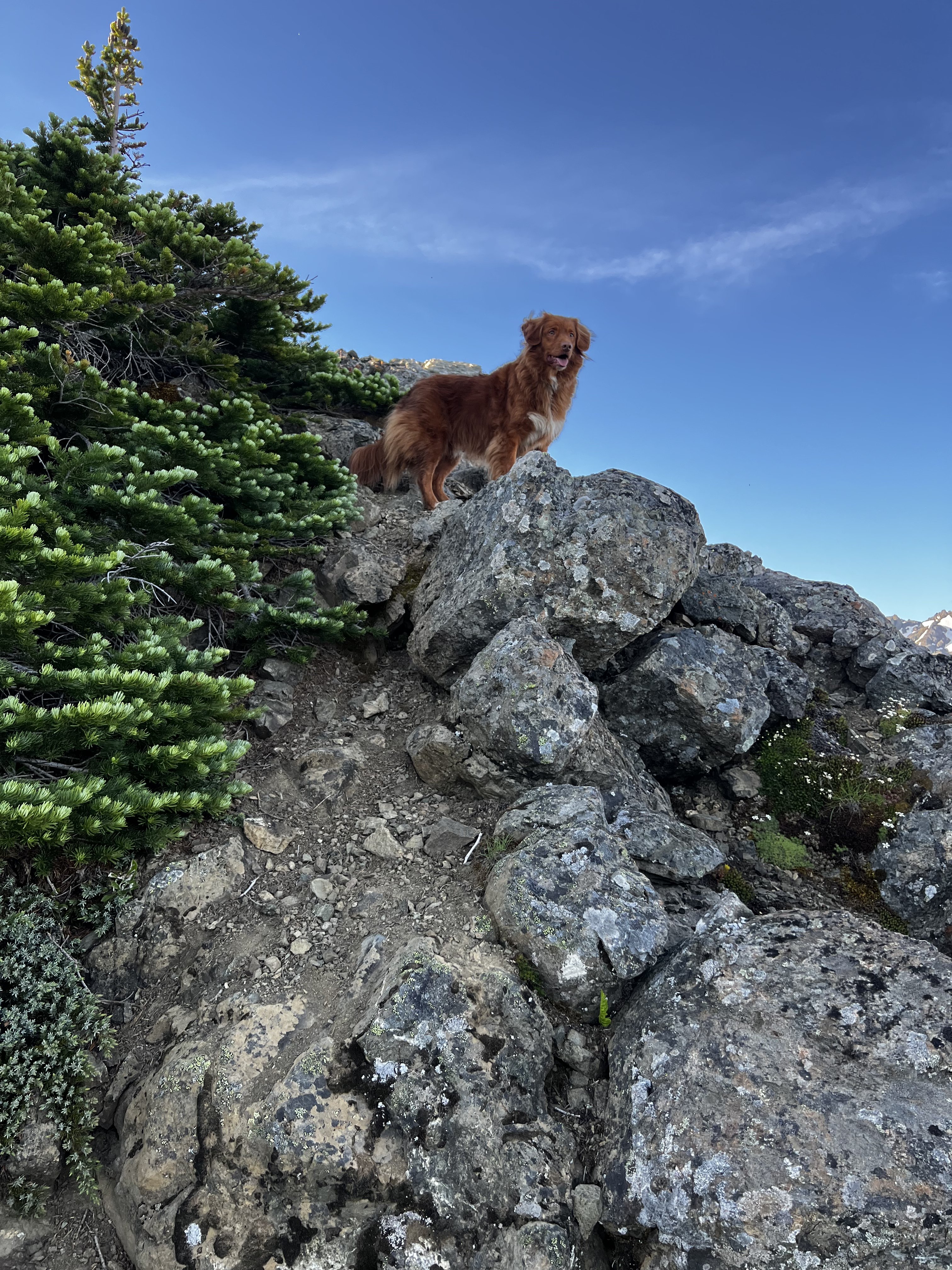
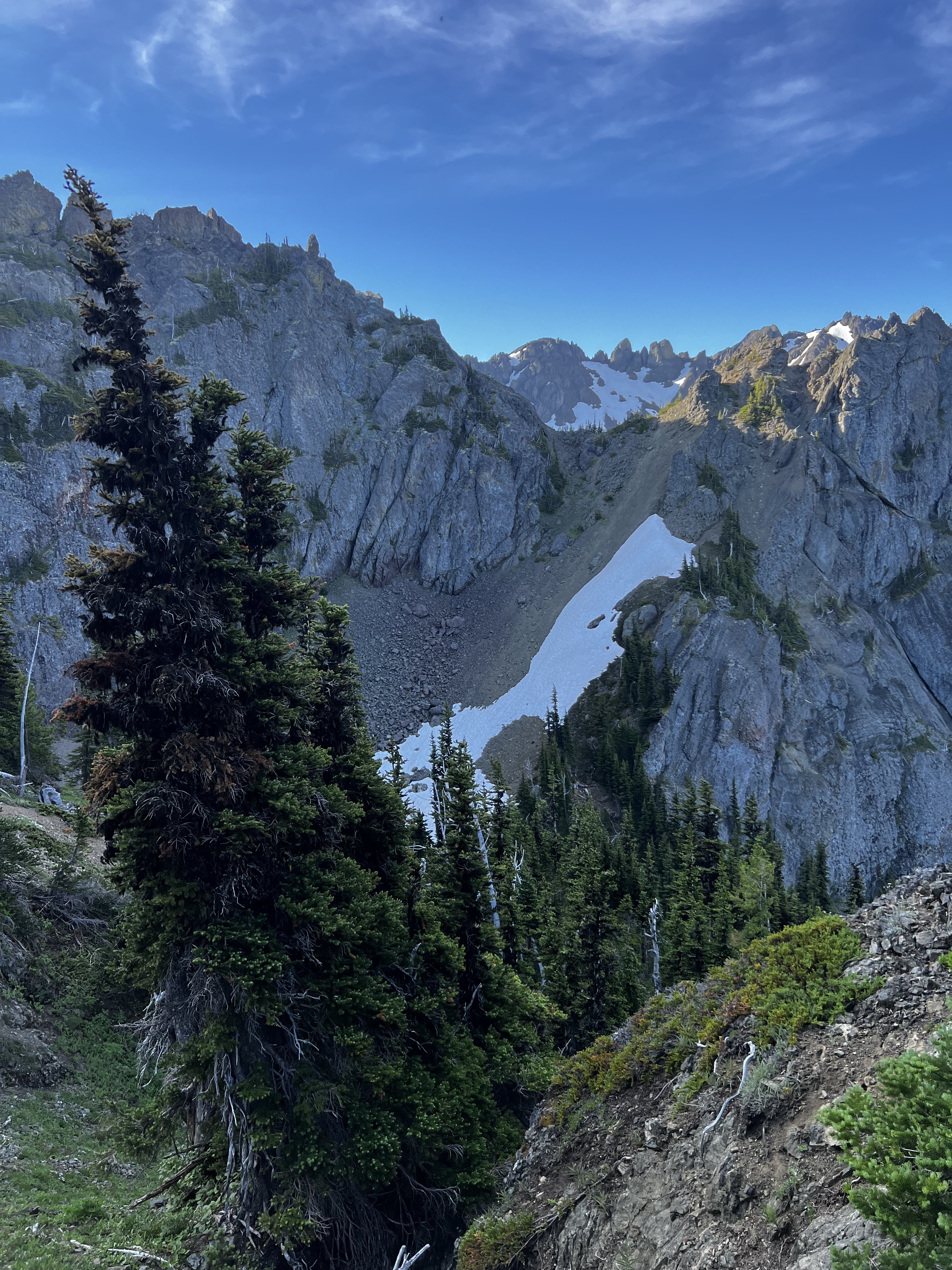
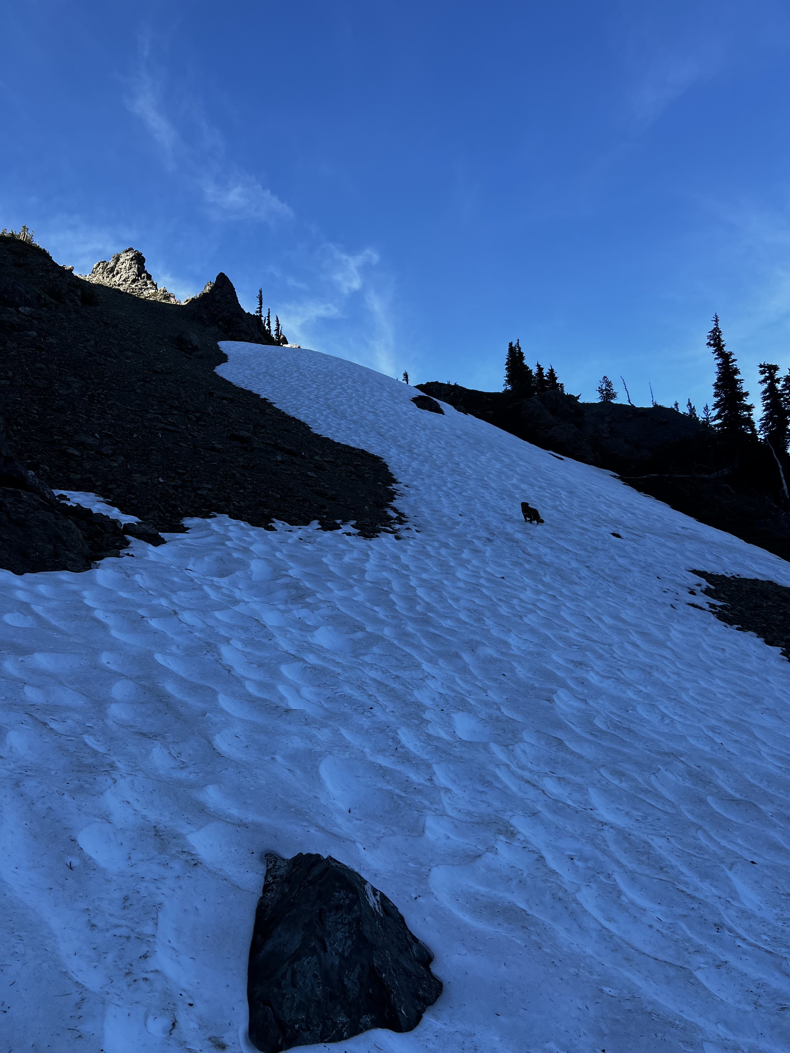
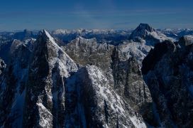
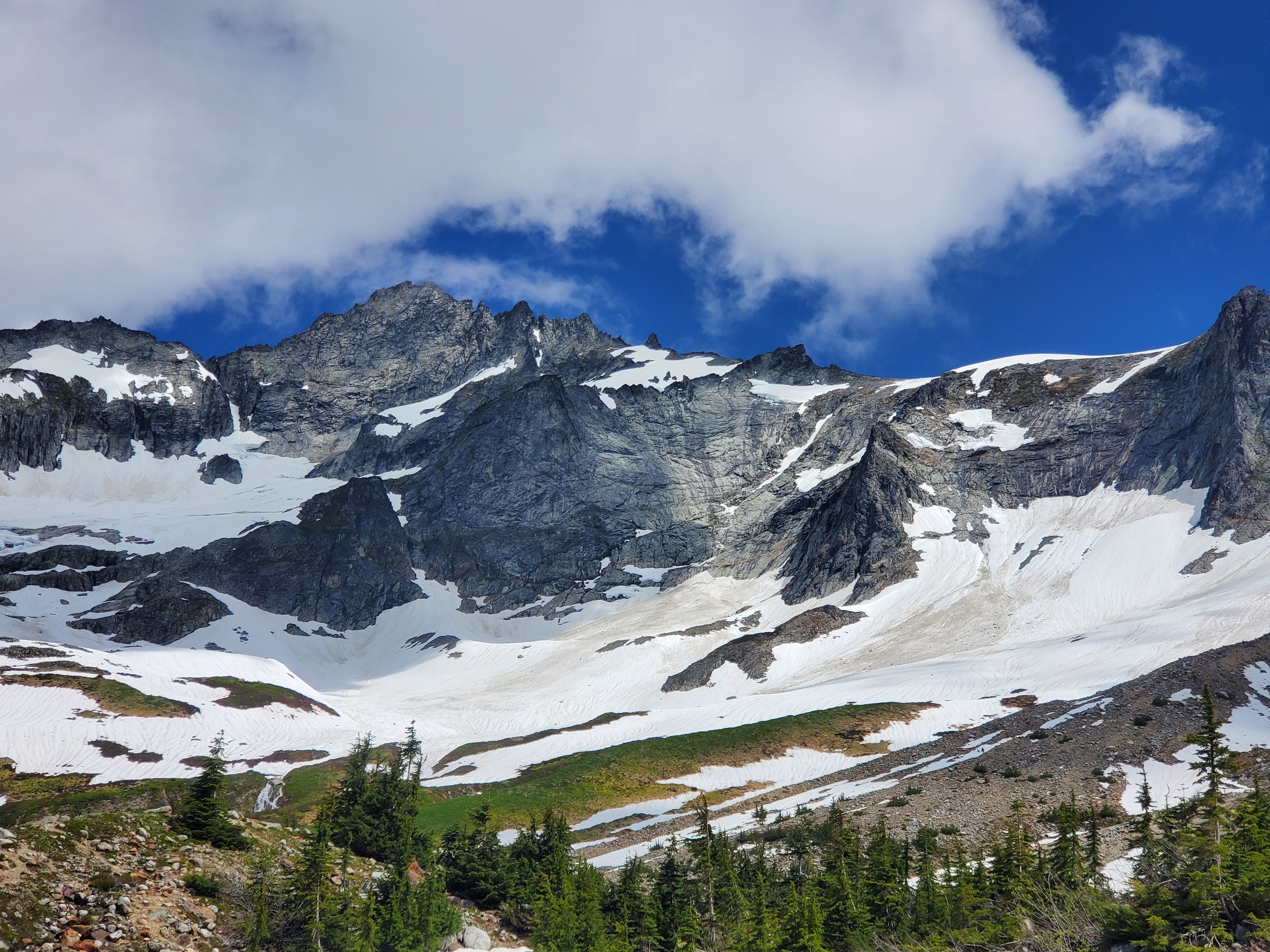
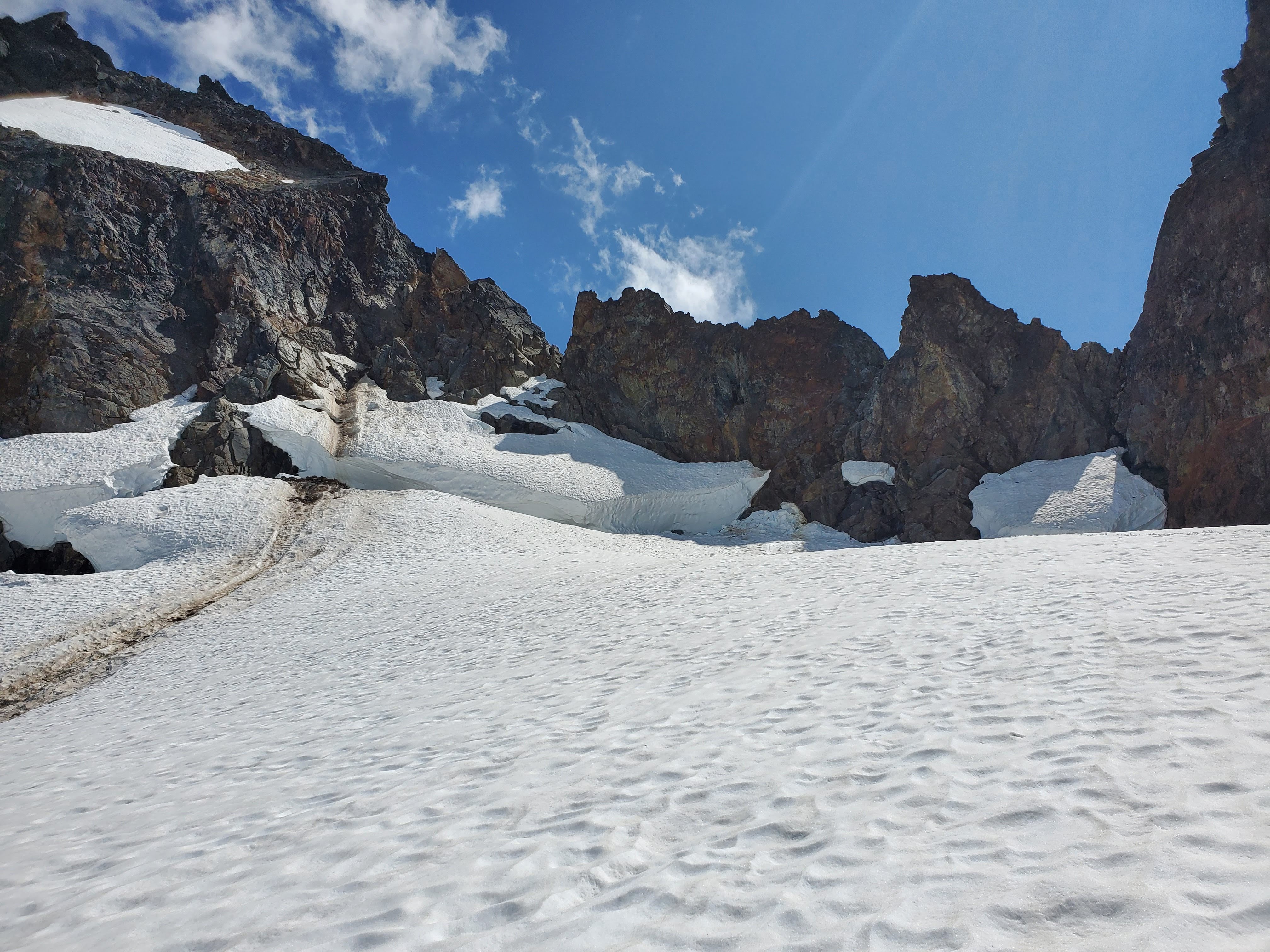
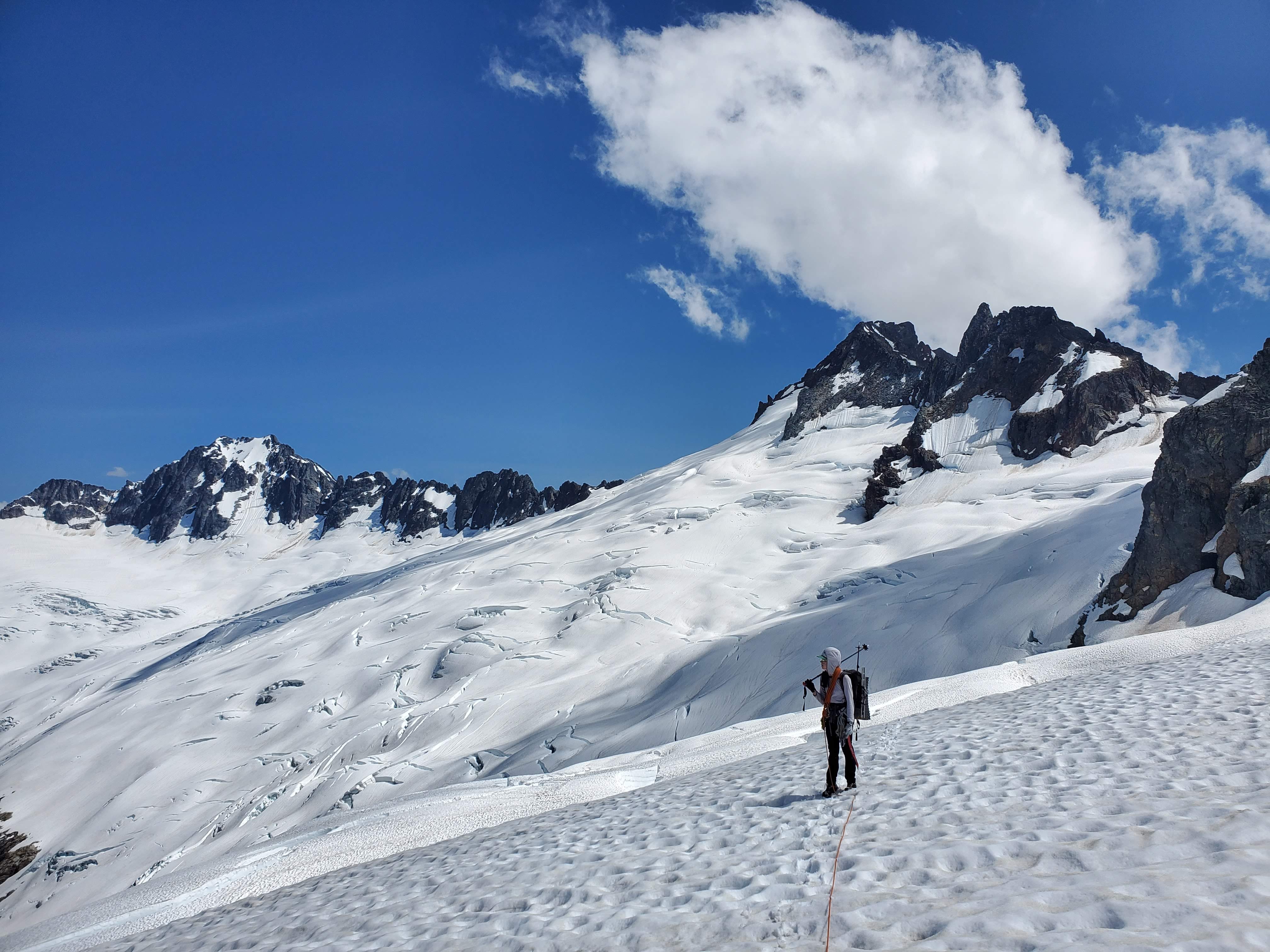
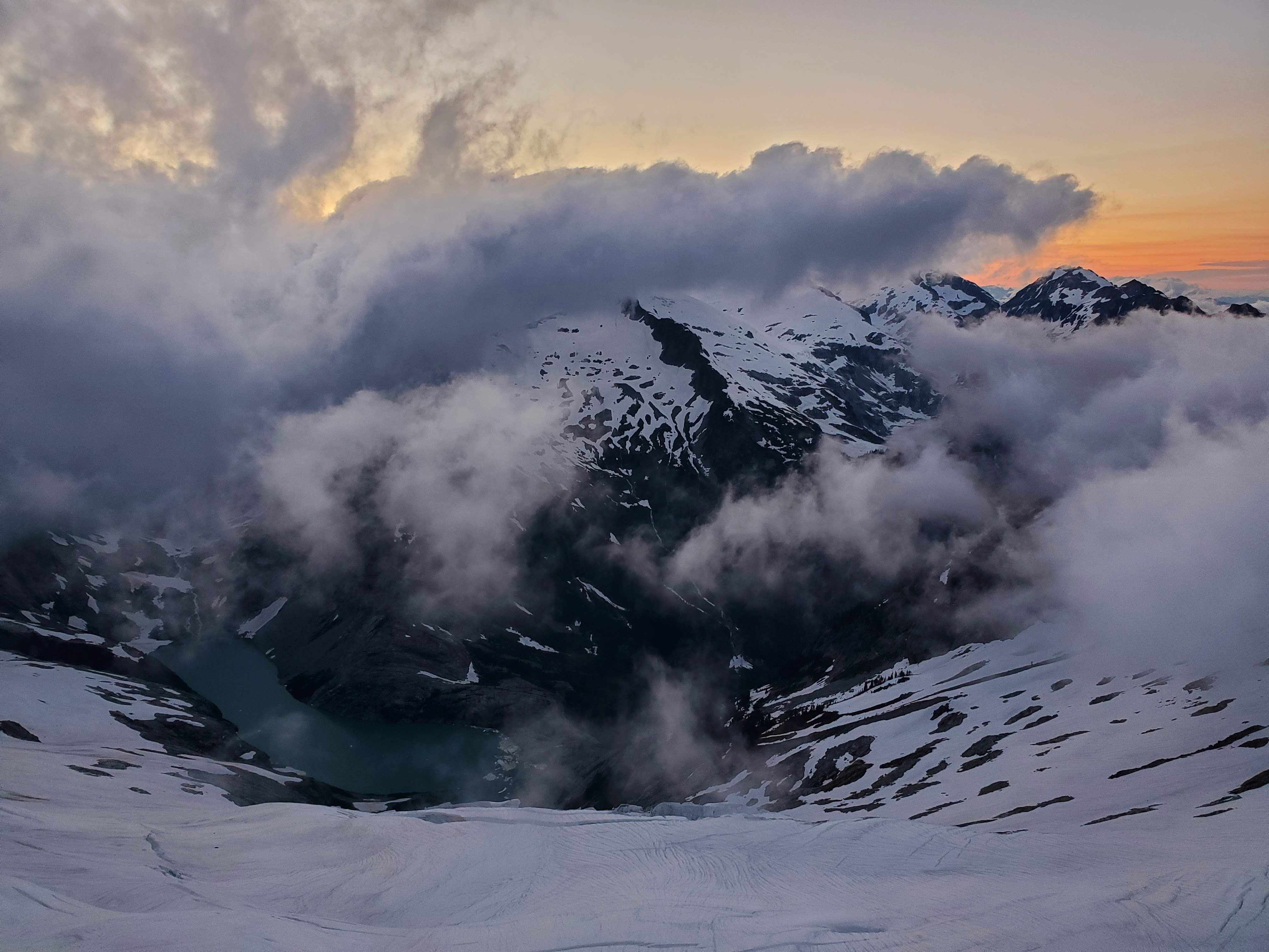
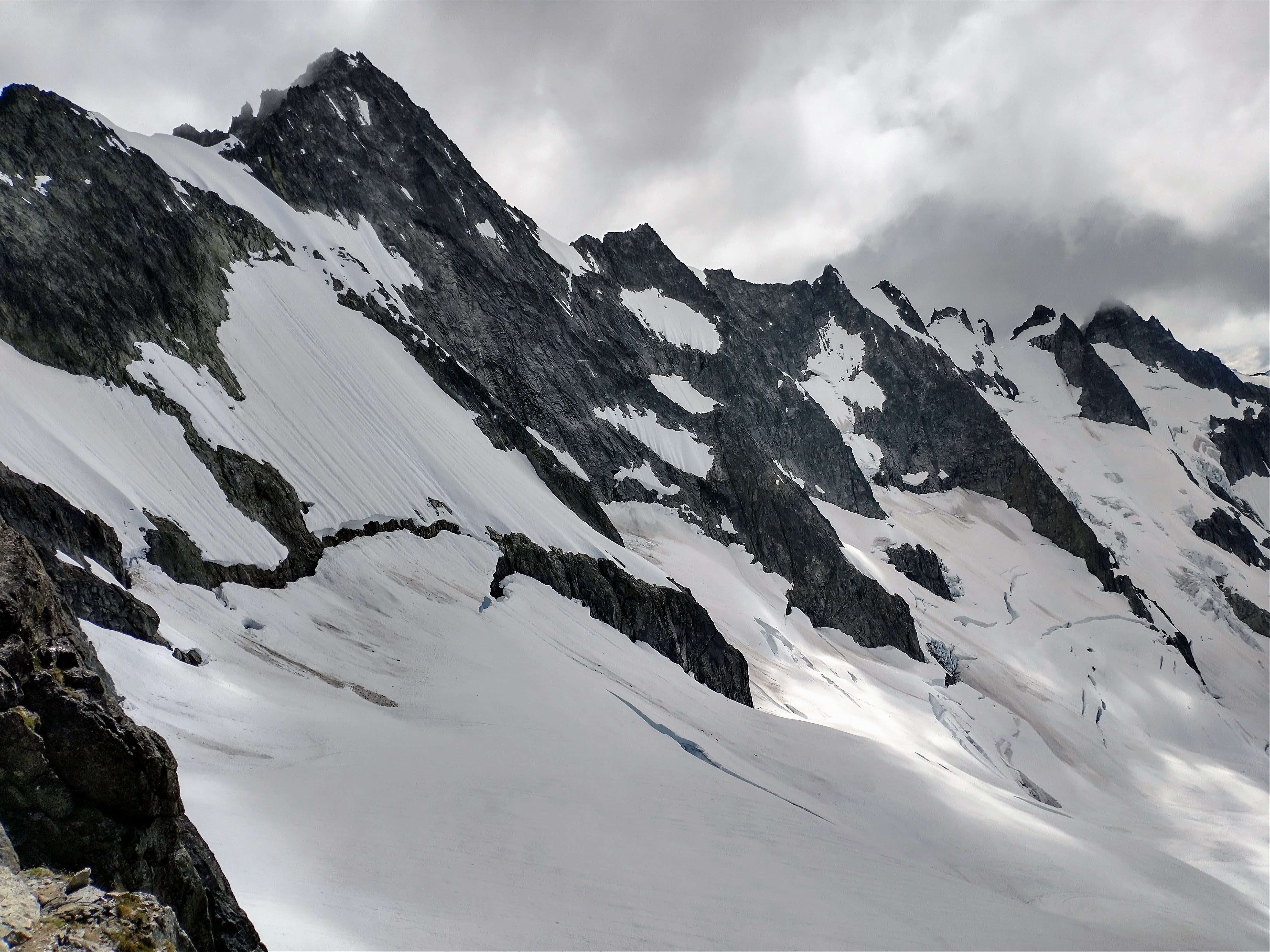
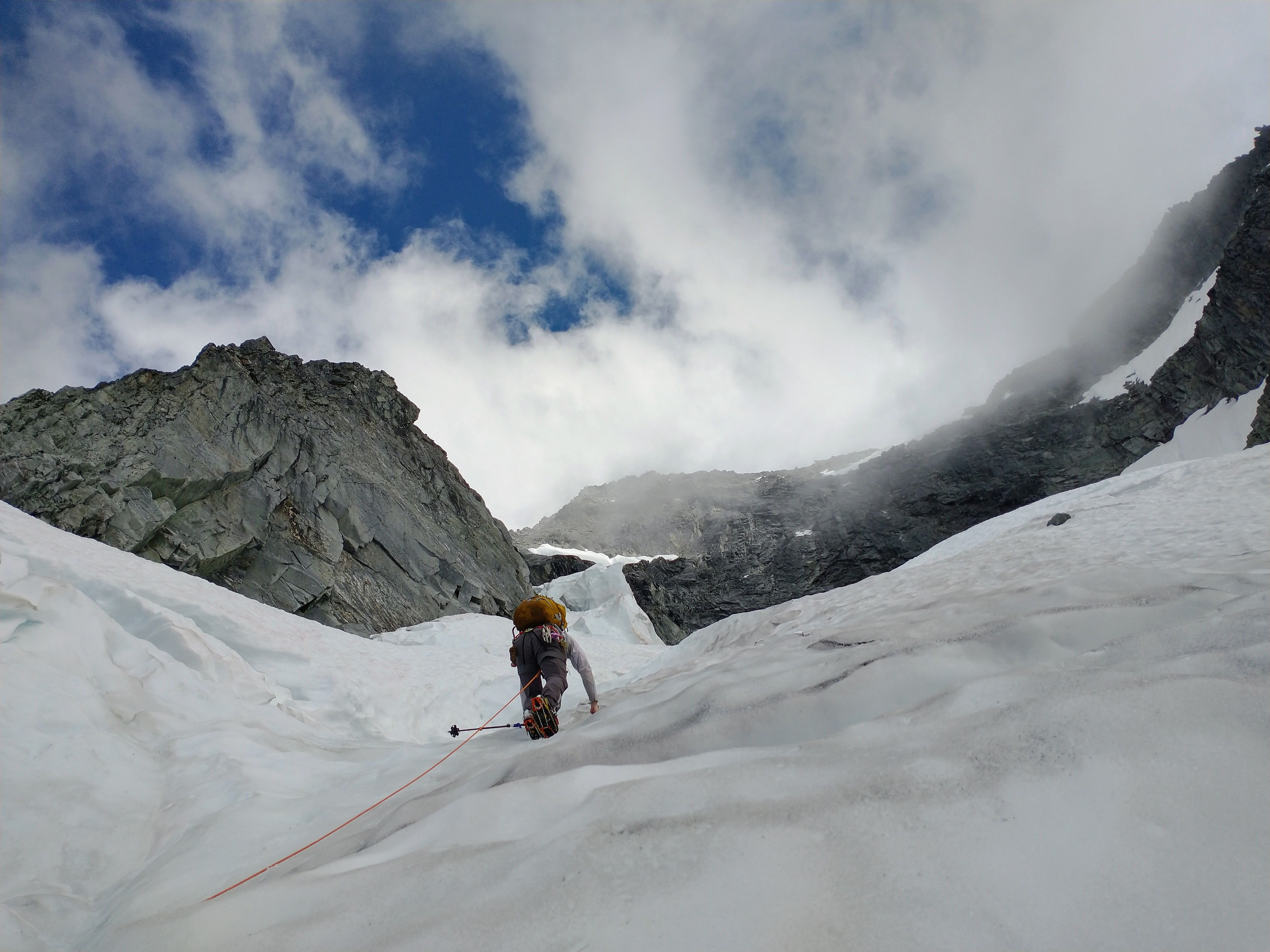
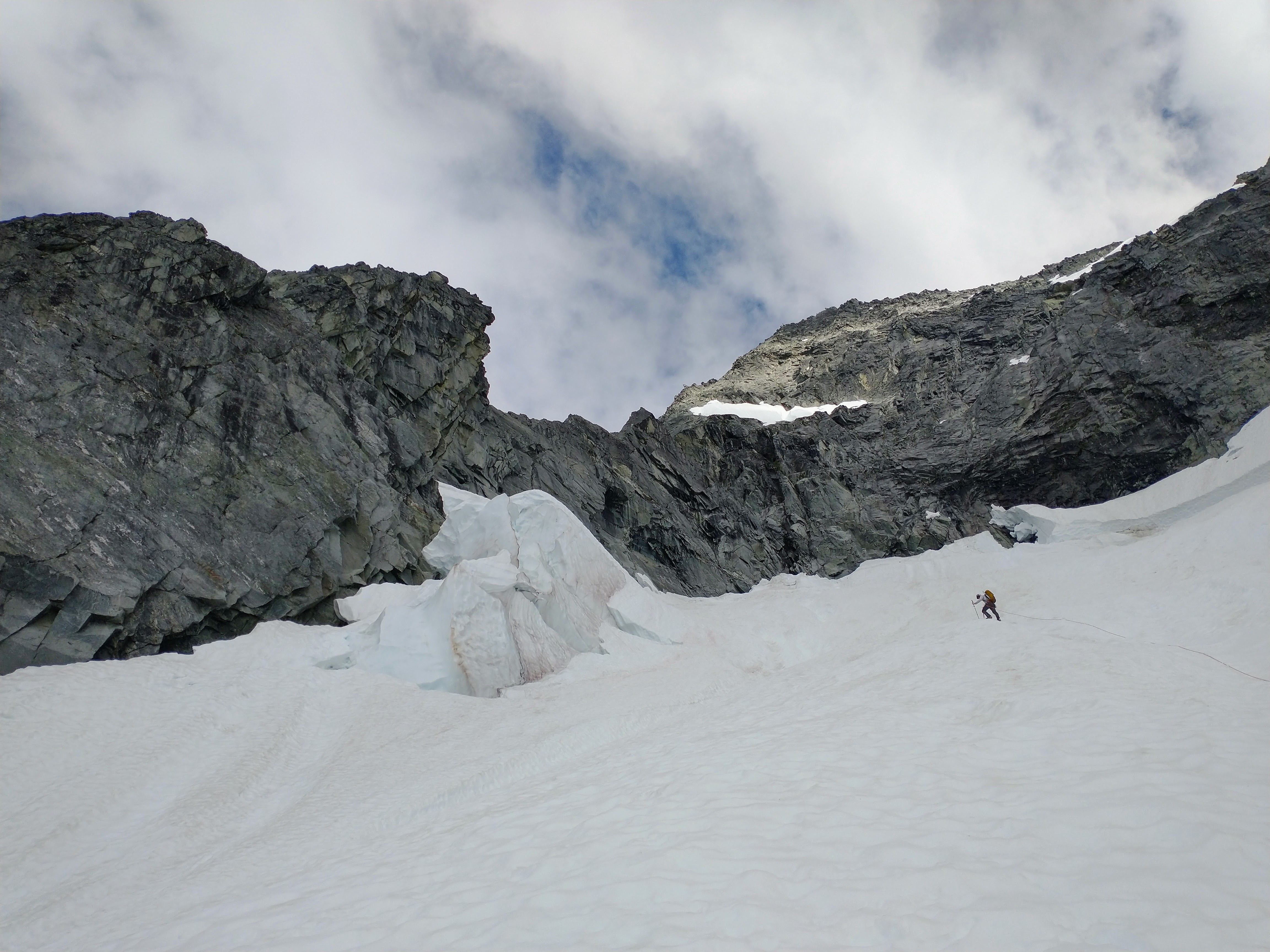
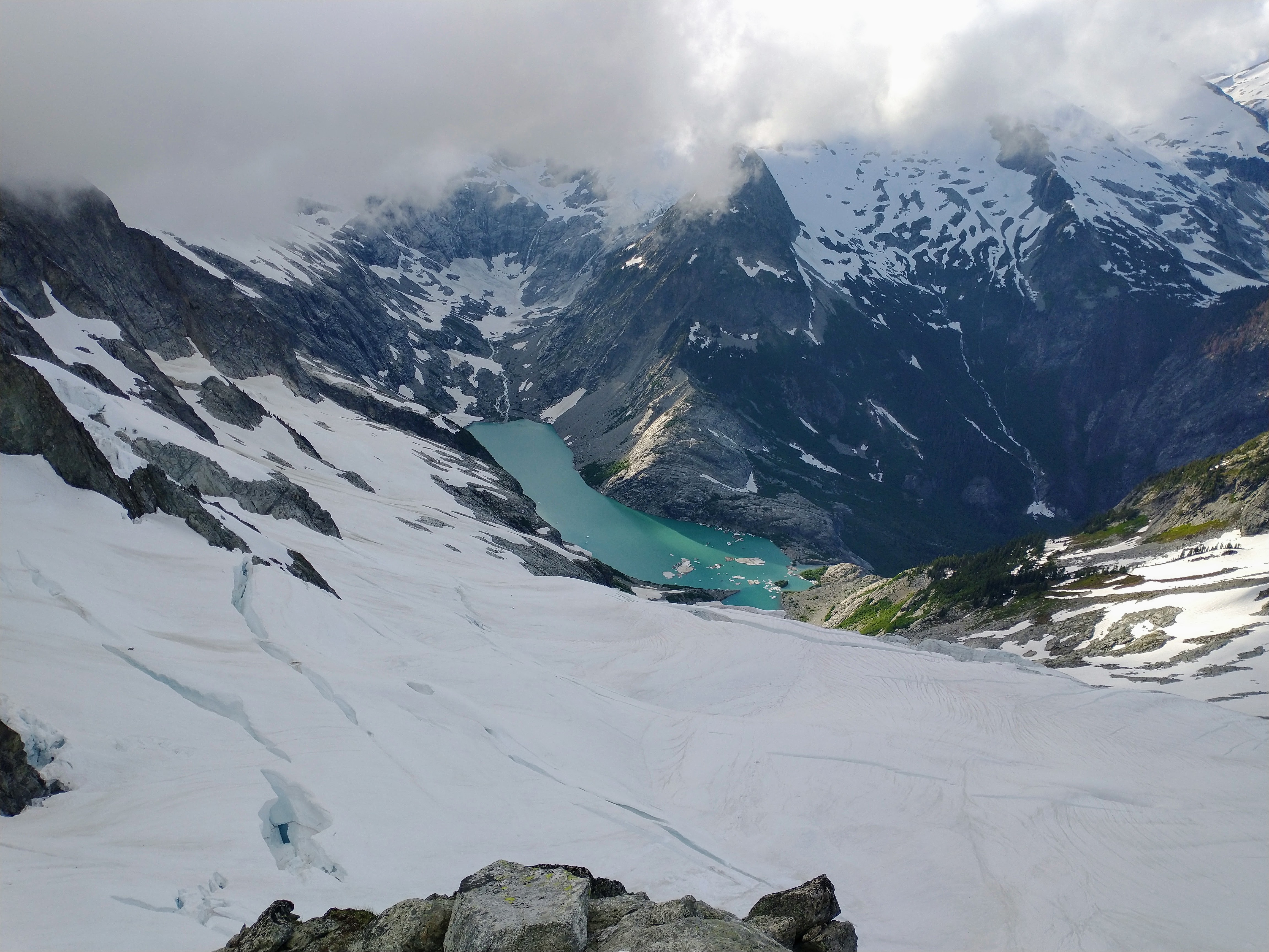
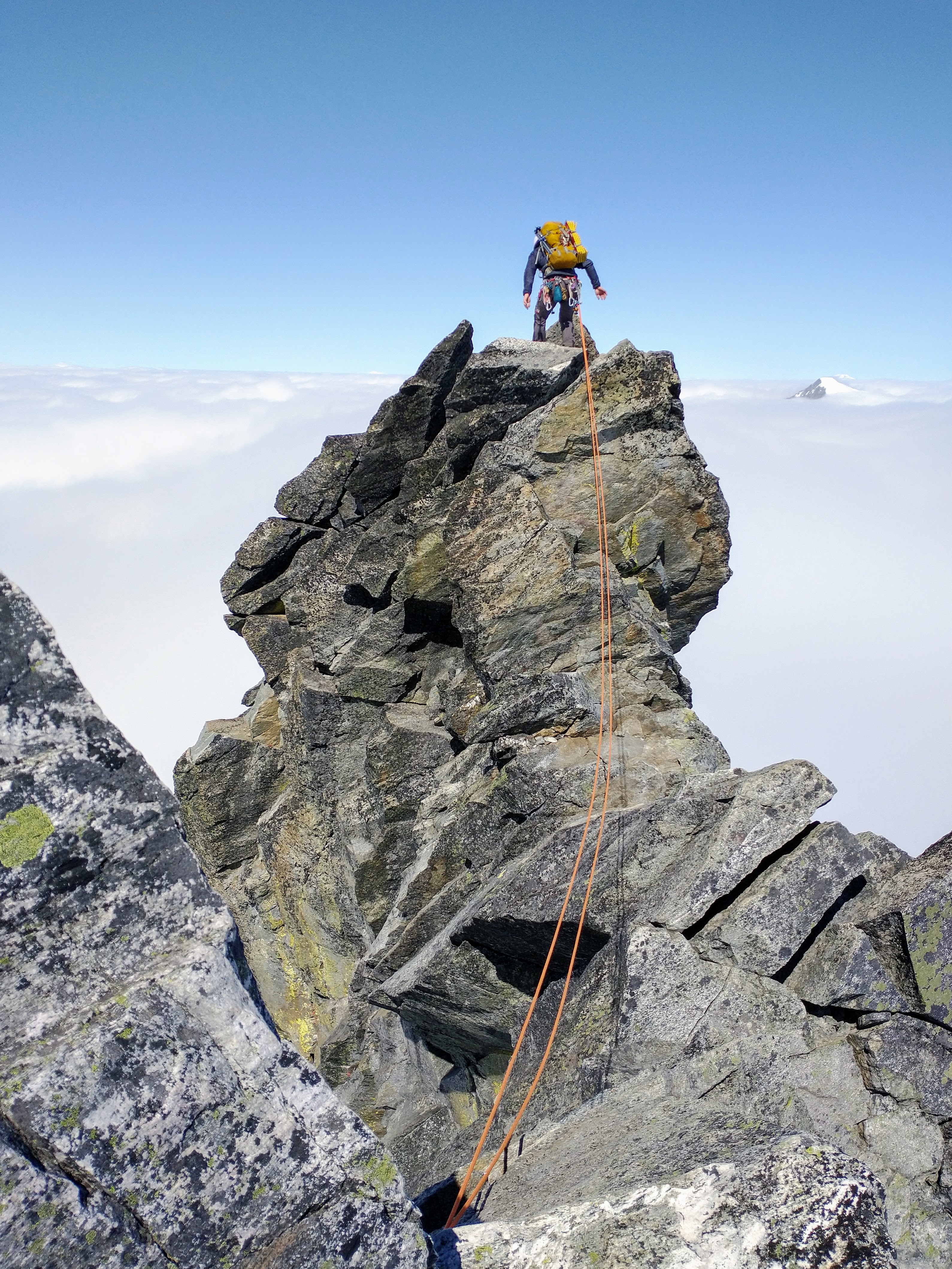
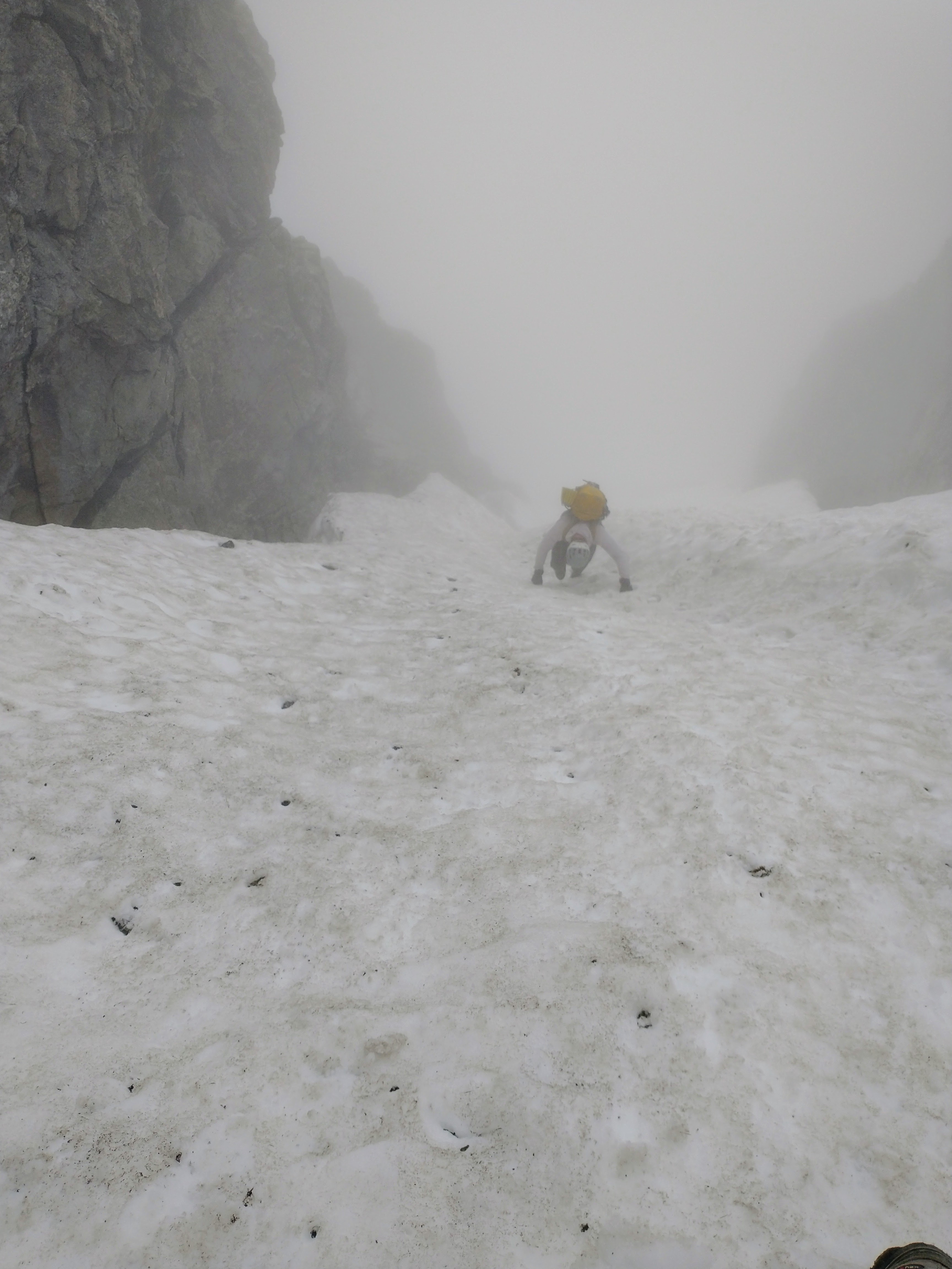
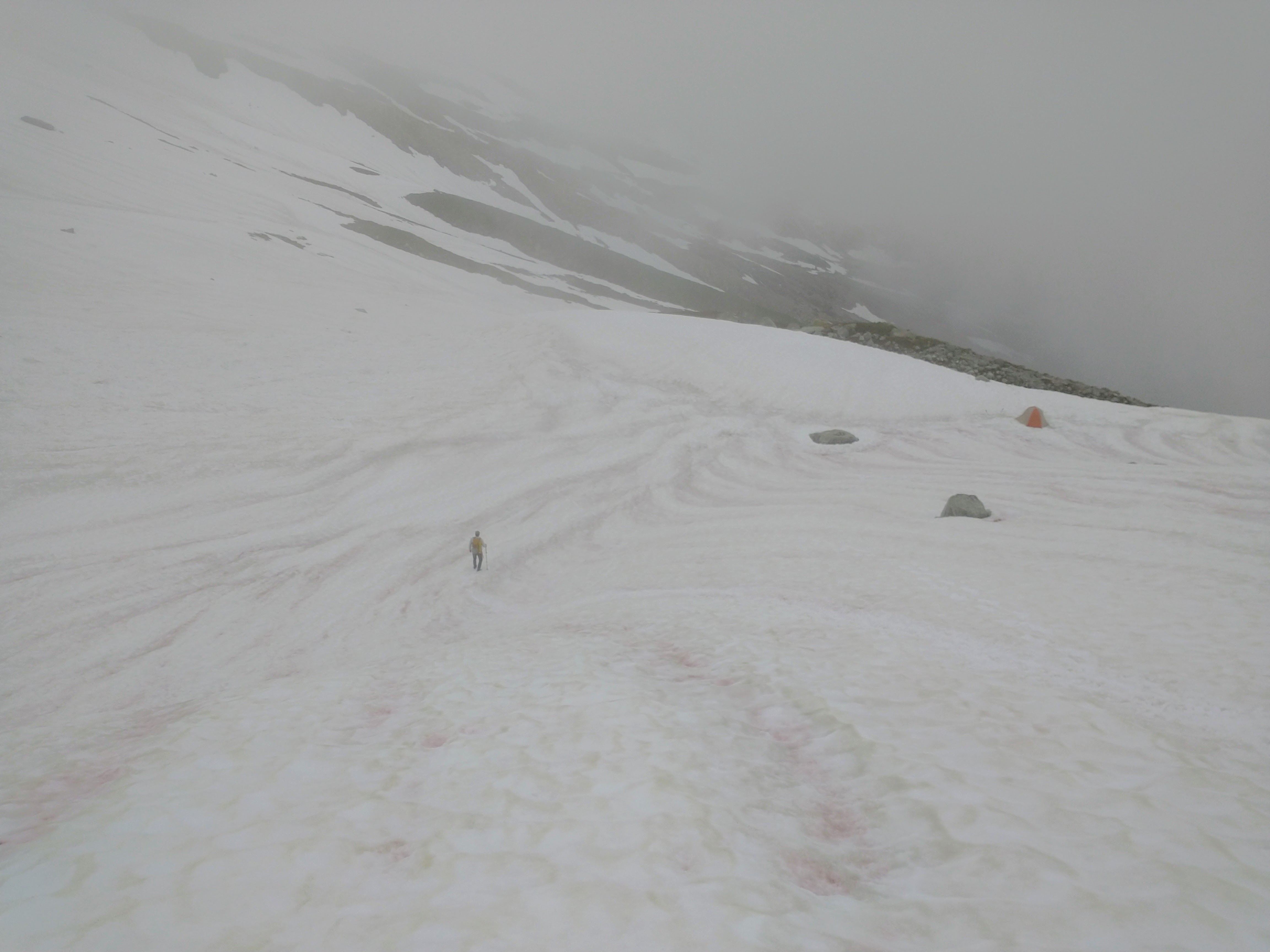
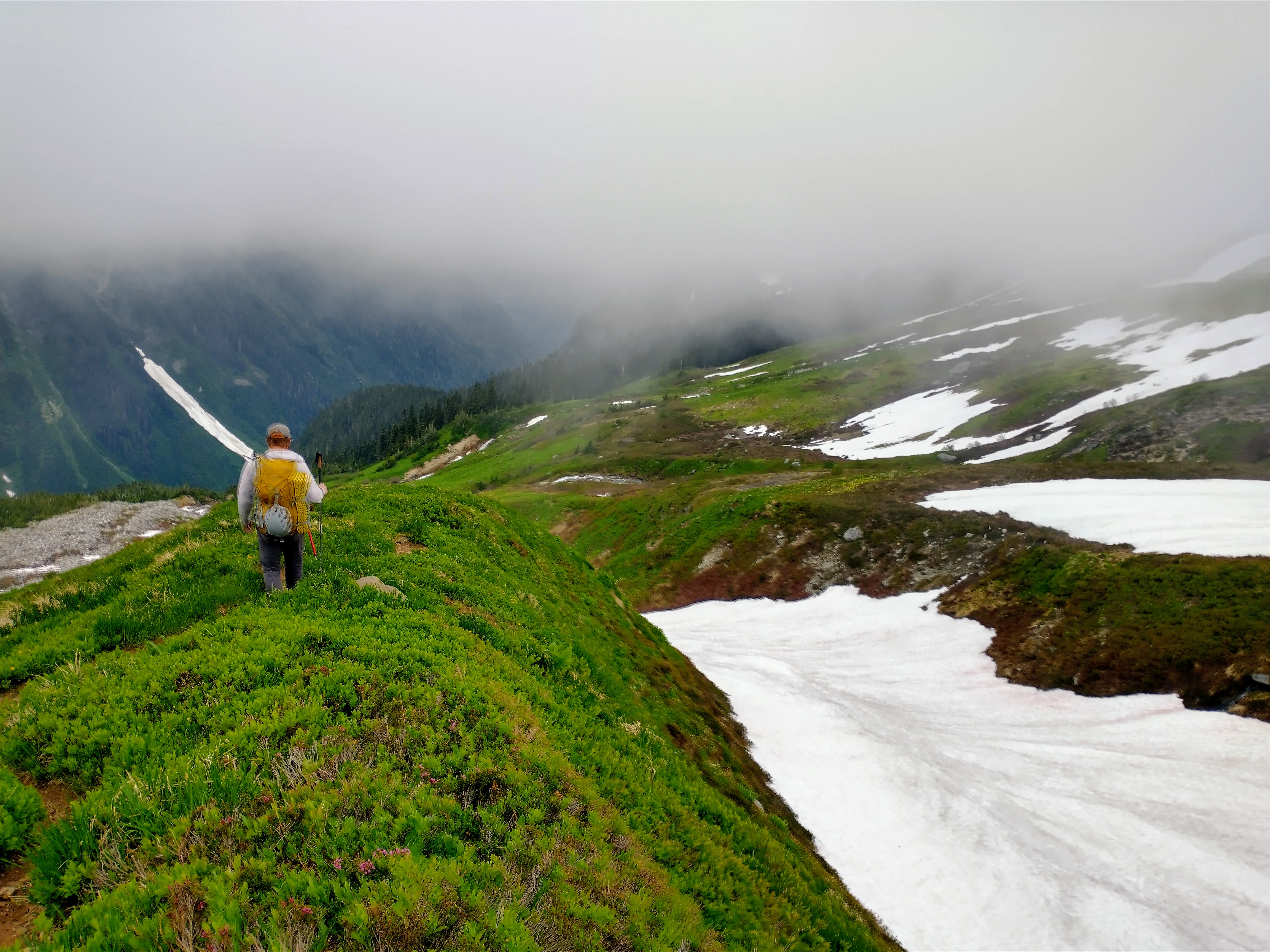
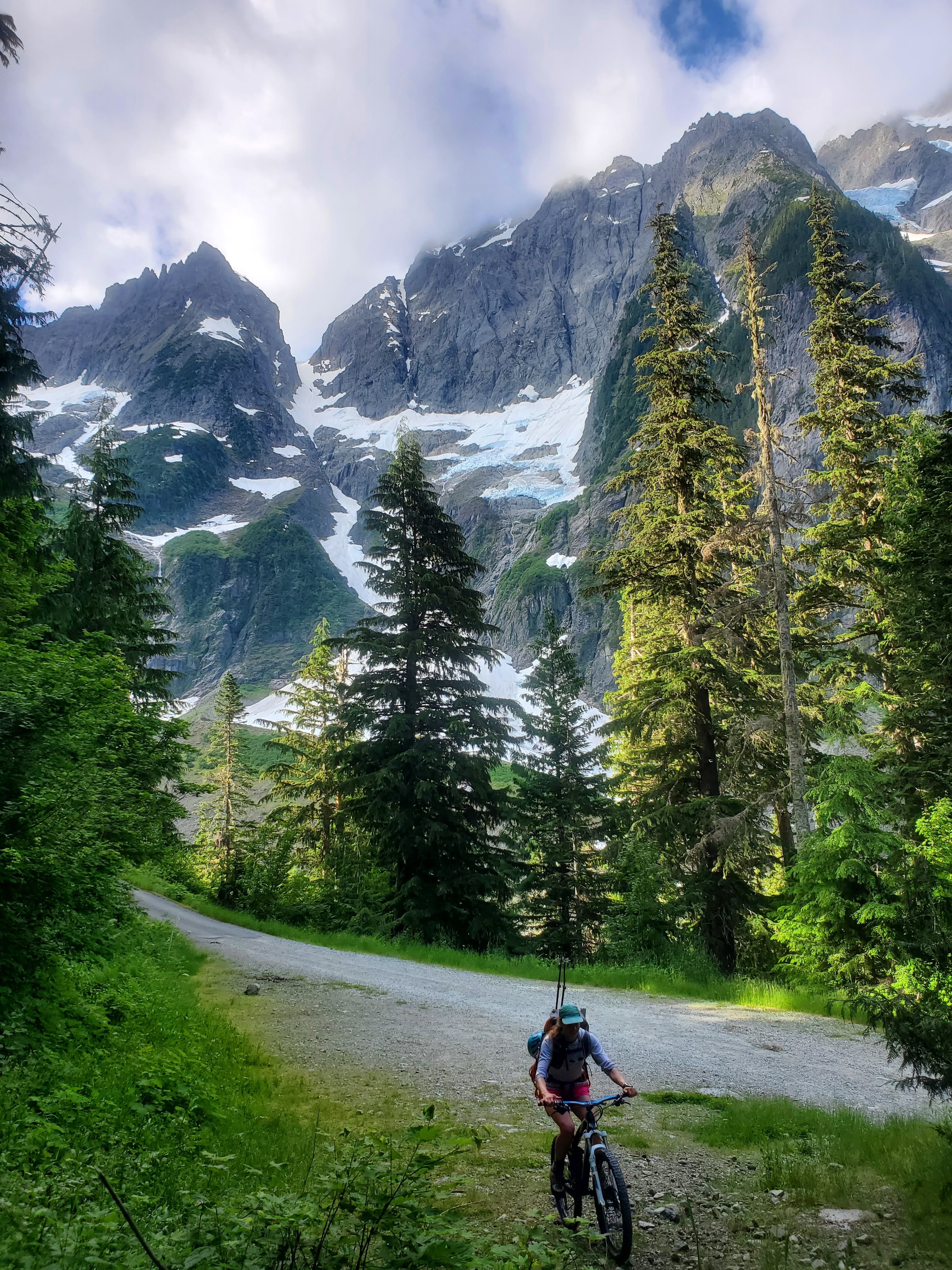
Trip: KATSUK PEAK (8425') - South Ridge Route Trip Date: 07/23/2022 Trip Report: KATSUK PEAK (8425') – South Ridge Route - Easy Pass Trail Approach – - JULY 23-24, 2022 (Sat, Sun) I didn’t have a lot of time this weekend so I needed a day and a half climb. Katsuk Peak sounded perfect. Saturday: I made it to the trailhead around 3pm and was starting up the trail to Easy Pass at 4pm. There were some rain clouds threatening so I was hoping to stay ahead. I made it to Easy Pass at 6:15pm. I was in this area for Graybeard Peak last month and the snow conditions have changed a lot since then. The trail is mostly clear with a few patches of snow here and there. I made my way down past Fisher Camp to my turn up the slope toward Katsuk at 5000’ at 7:30pm. I was planning to hit the bluff camp by sunset. I reached the bluff camp (6600’) at 9:30pm, still light enough to see without a headlight. The bluff camp is one of my favorites, great views and you are perched on the side of the mountain like a gargoyle. As I was settling into camp around 10pm I saw an orb of light coming over the top of Mesahchie Peak heading toward Easy Pass. I’ve heard of orbs of light out in the mountains but I’ve never seen one in person until this trip. It was about the size of a beach ball and looked like a giant star. It moved with a purpose and seemed to be checking out the area. It would move for a while then pause and change elevation and direction. It did this for about 10 minutes before moving out of sight. There was no sound at all coming from the orb of light. I was trying to figure out what it was and came to the conclusion that it was something strange and unique. Sunday: I was up and moving at 5:30am. The morning was looking glorious. I worked my way into the snow basin and over to the South Ridge of Katsuk. The snow was perfect for booting up, no crampons needed. The South Ridge was fairly nice quality rock by Cascade standards, lots of nice holds and options to get around steeper sections. The route to the summit is a bit of a maze, weaving around several spires. The rock was mostly class 3 with sections of class 4. I reached the summit at 8:30am. I climbed both the East and West Summits. The East Summit is the highest by a few feet. I didn’t find a summit register on either peak. I headed back down going straight down the snow arriving back to camp at 11:30am. I packed up and retraced my route back to the trailhead arriving at 5:00pm. This was a fun climb with great views. Some Tips and Notes: 1. The turn up the slope at 5000’ from Fisher Creek Trail is pretty obvious. After passing Fisher Camp, you will come into a section of the trail that is tall grass and flowers heading up the slope. 2. The route to the bluff camp (6600’) is mostly diagonal. The toughest part (after the climbing) is finding the best spot to cross the streams coming down the side of the mountain. I found good crossings around 5800’-5900’. 3. There is plenty of water along the way. Between Easy Pass and Fisher Creek Basin is pretty dry when heading up. 4. There is no summit registry currently. Travel Time for reference: Saturday: Trailhead to bluff camp (6600’) – 5.5 hours. Sunday: Camp to Summit to Trailhead – 11.5 hours. Total Mileage: about 15 miles Total Elevation Gain: around 8000’ Gear used: Trekking Poles & Ice Axe. Outrunning the rain at Easy Pass. Easy Pass View. Mesahchie Peak & view to bluff camp. Stream crossing on the way to bluff camp. View from camp. Start of South Ridge of Katsuk Peak. View on the way up, Mount Arriva in the middle. Ridge rock on the way up. Summit of Katsuk Peak. Summit view. A great peak for scouting future climbs and current conditions. Gear Notes: Trekking Poles & Ice Axe. Approach Notes: Easy Pass Trail to Fisher Creek Trail.3 points
-
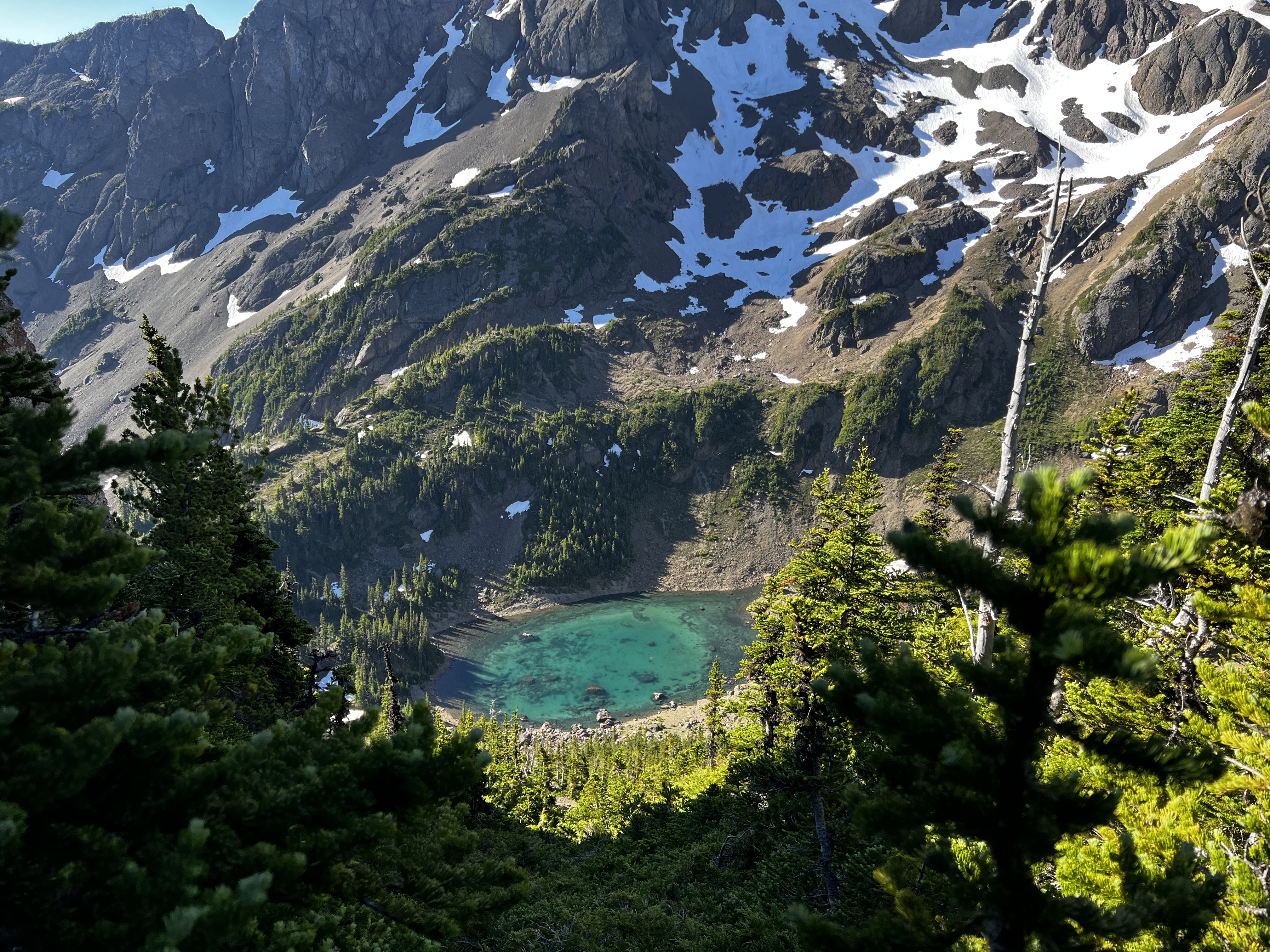
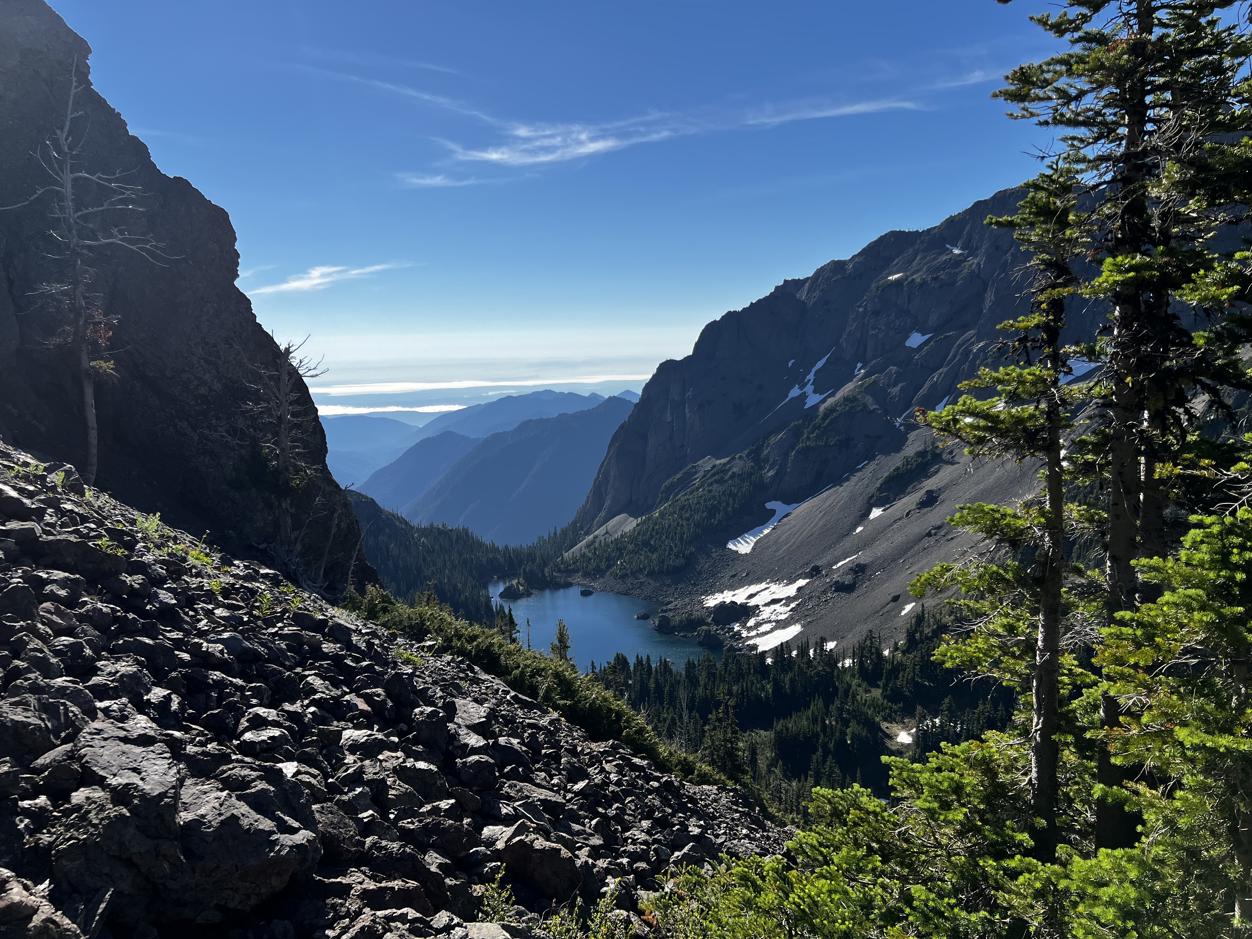
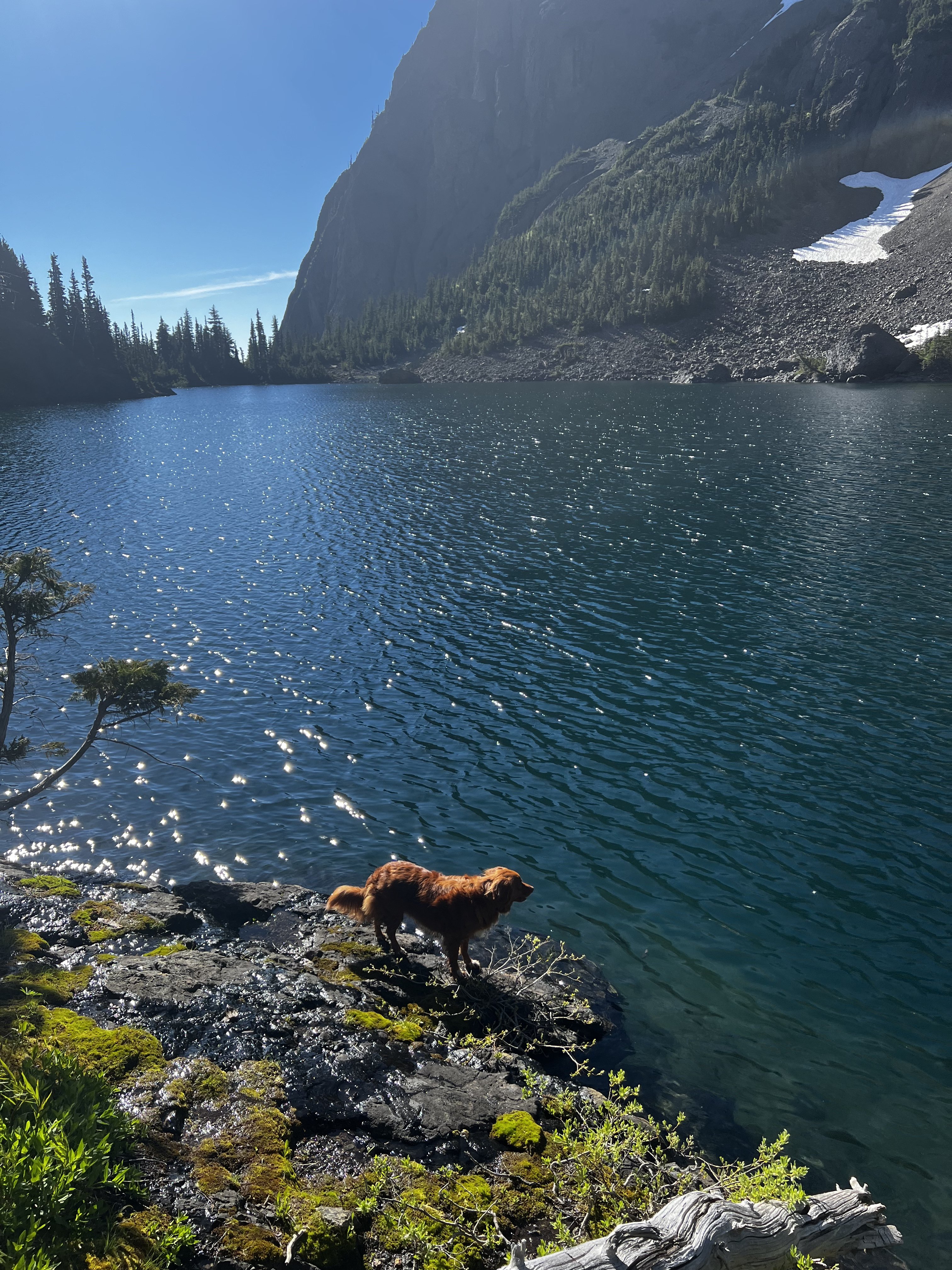
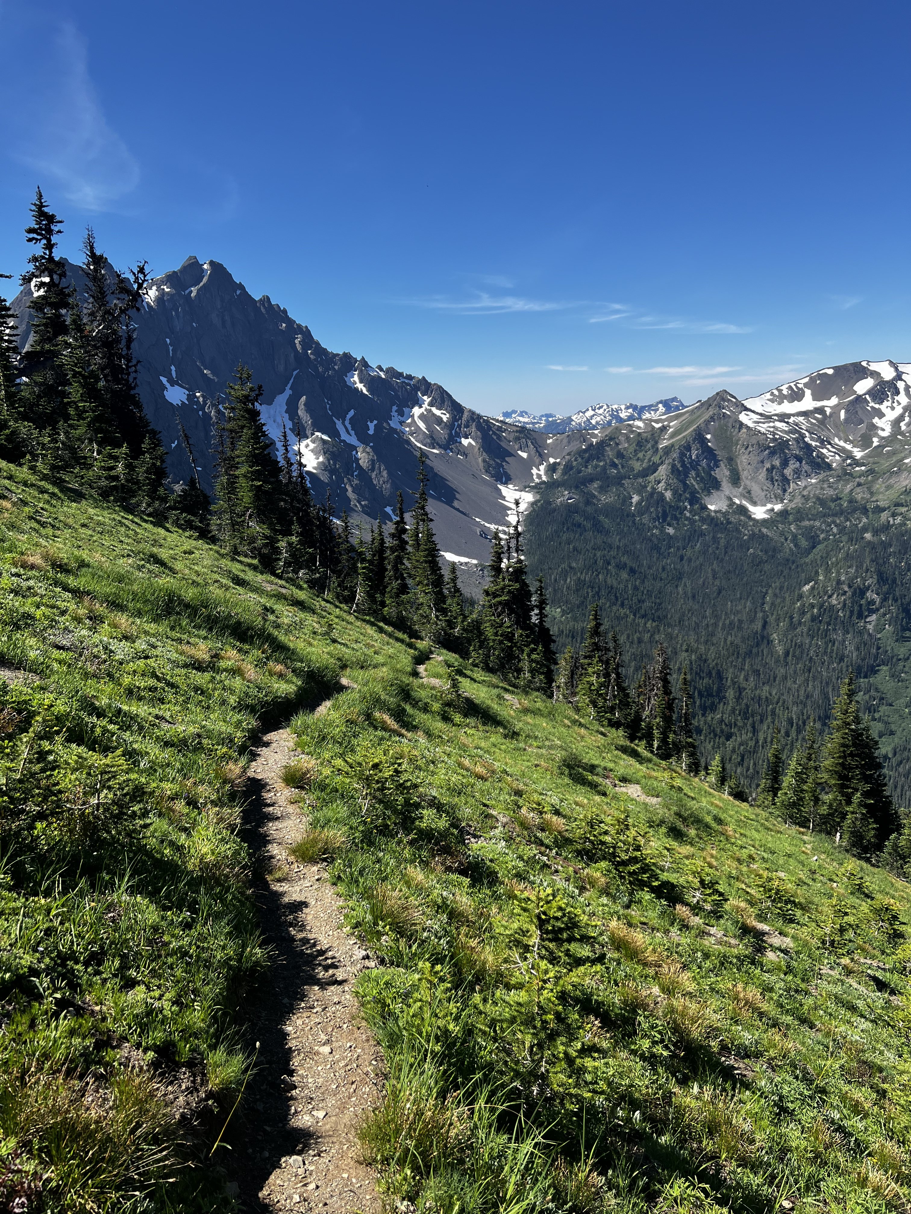
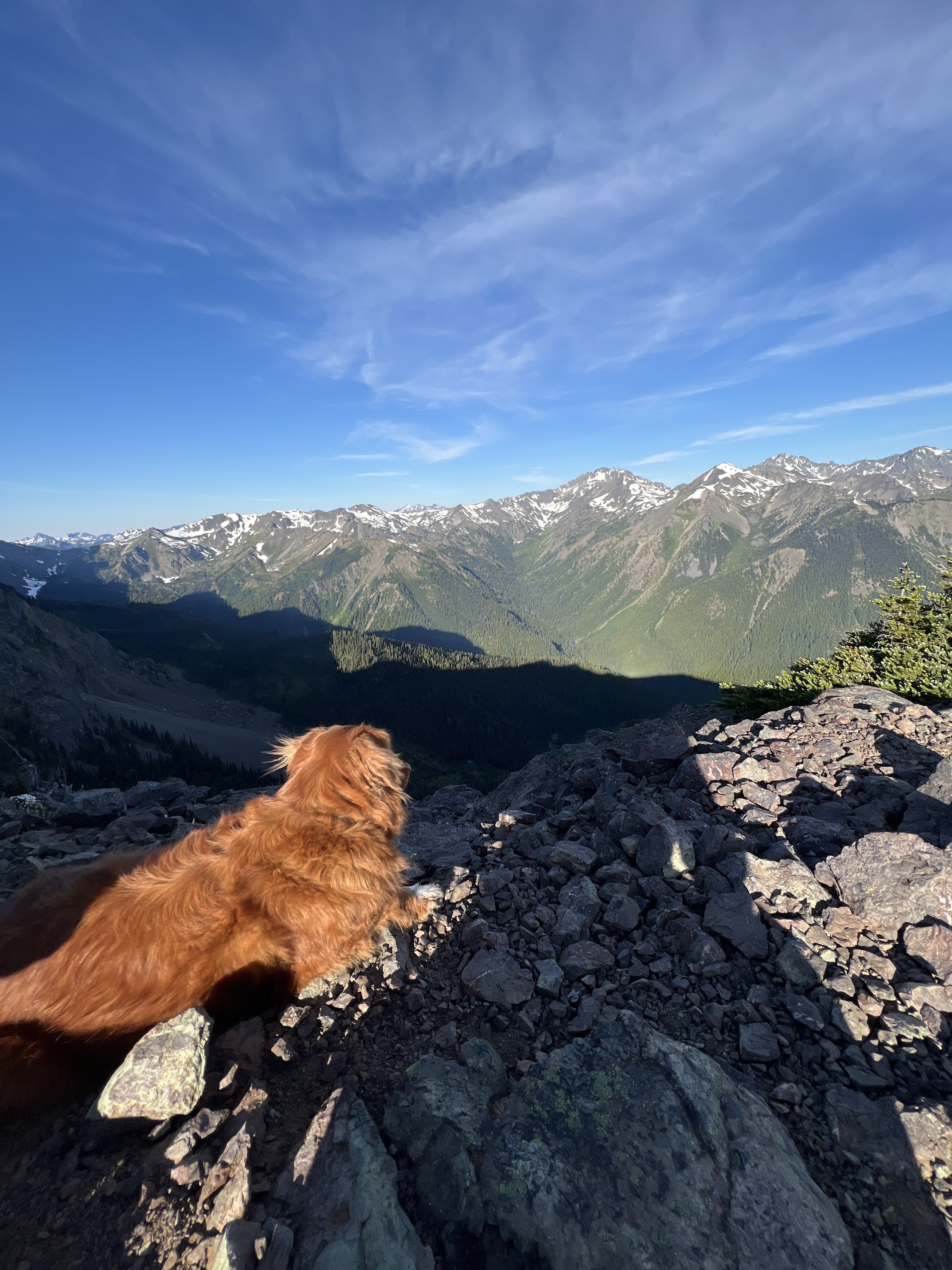
Trip: Marmot Pass to Charlia Lakes - Boulder Ridge Notch to lakes Trip Date: 07/24/2022 Trip Report: Not a climb but a nice day out so enjoy the photos. Kiba and I went up to Charlia Lakes via Marmot pass on Sunday. Woke up at 4 to hike in the cool of the morning, at Camp Mystery all the folks in the city of tents there were still asleep when we passed through. Up to Marmot pass, and then up the ridge to the south....it too littered with tents. We followed the ridgeline on the way trail till it ended. Can't be taking the dog on 4th class stuff. So we dropped down to the east in the scree, and contoured staying as high as possible. After a little while we could see a notch in the ridge, accessible by another scree field. Climbed up that and down below was the beautiful green tarn of upper Charlia. We headed down on more scree, and then boulder fields, and reached the Charlia Lakes trail in between the two lakes. Hiked down to the lower lake, big fish jumping down there. Then we headed back up to the upper lake then Charlia Pass, down to Boulder shelter, and back up to Marmot Pass and out. My watch died but I think maybe 17 miles. Not a soul at the lakes, unless you count the fish. Gear Notes: dog Approach Notes: up down up down up down up down


 2 points
 -
Local mountain pilot offering to take local climbers to scout new climbs in the PNW by single engine Cessna. Cost: Tasty beer Criteria: 1. You must be actively researching a specific new line in the PNW. 2. You must document that you have completed at least one first ascent in the past. That's about it.
 1 point
 -
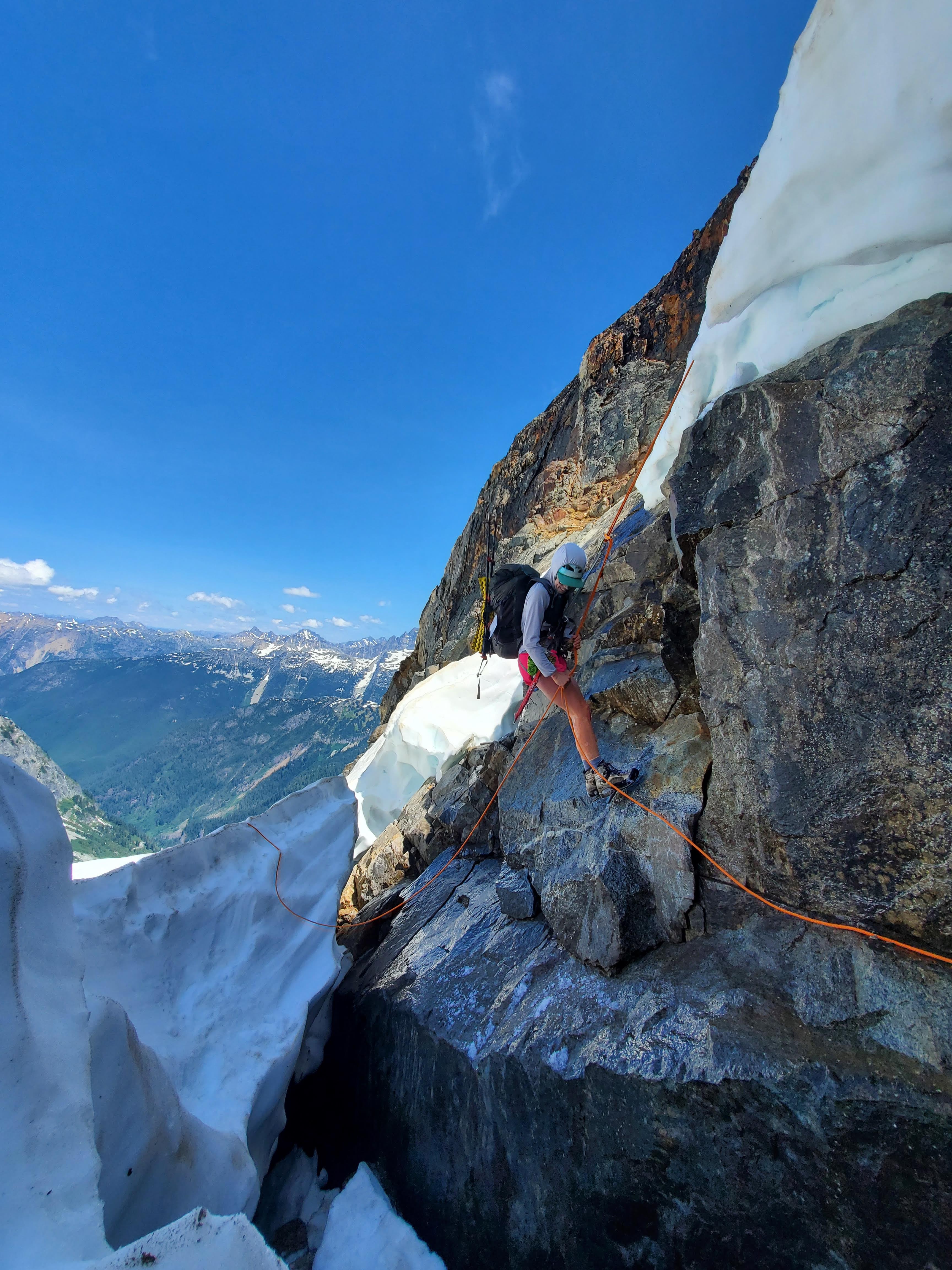
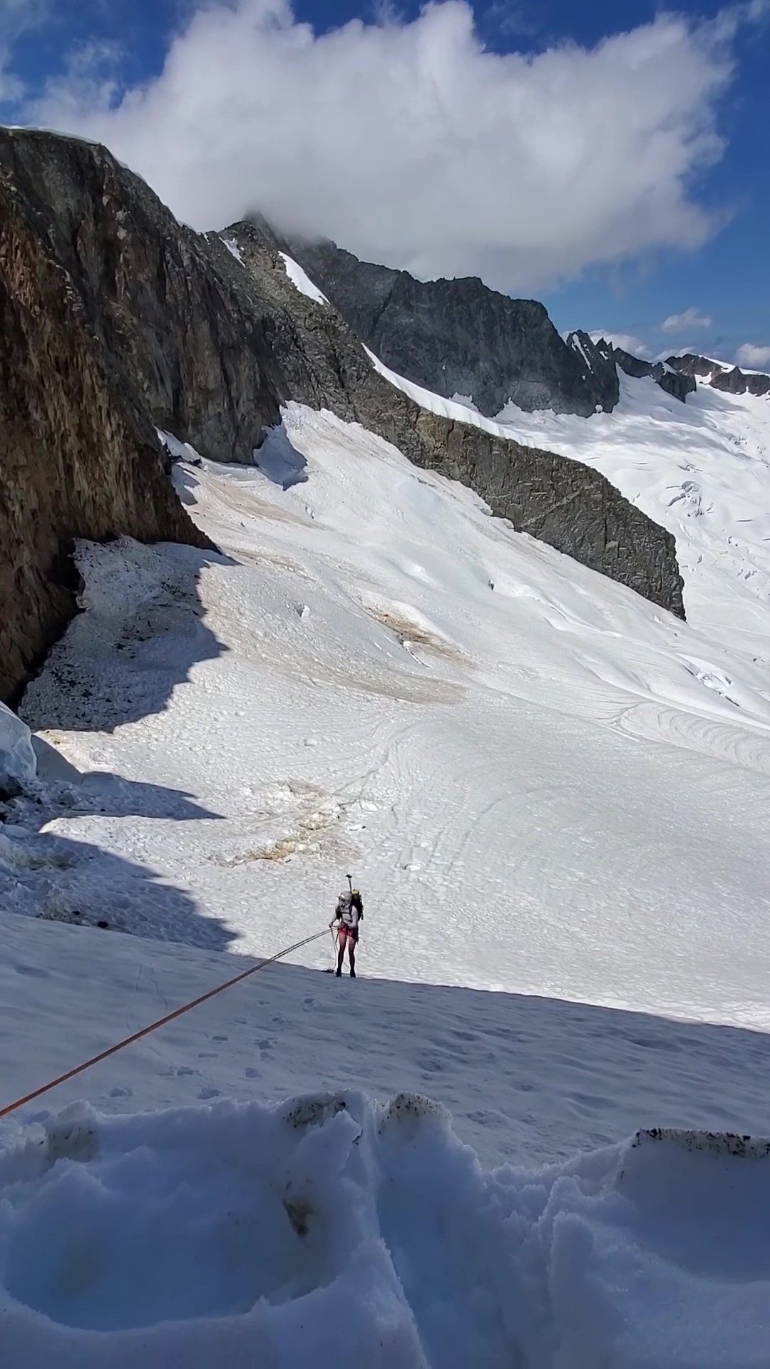
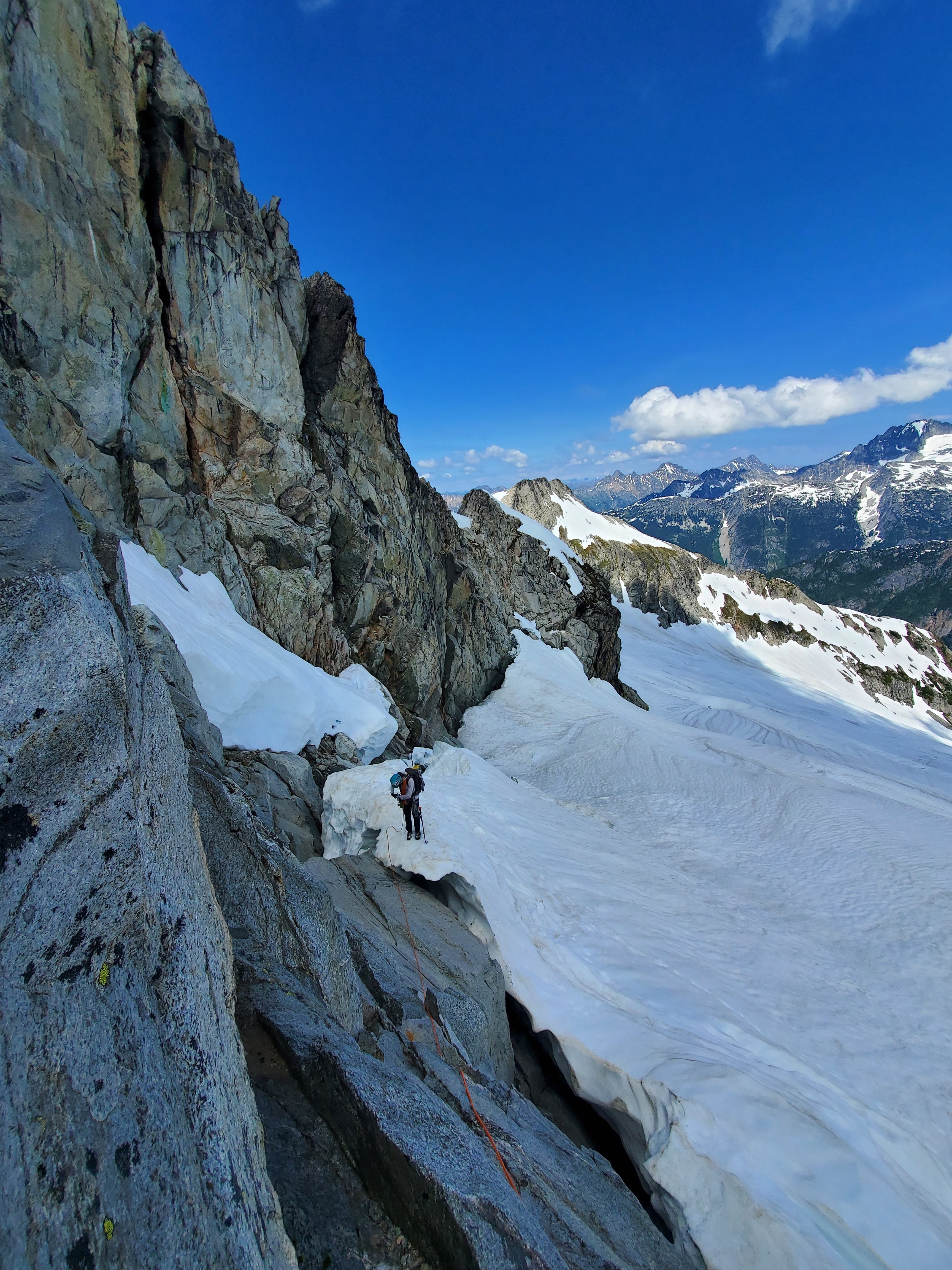
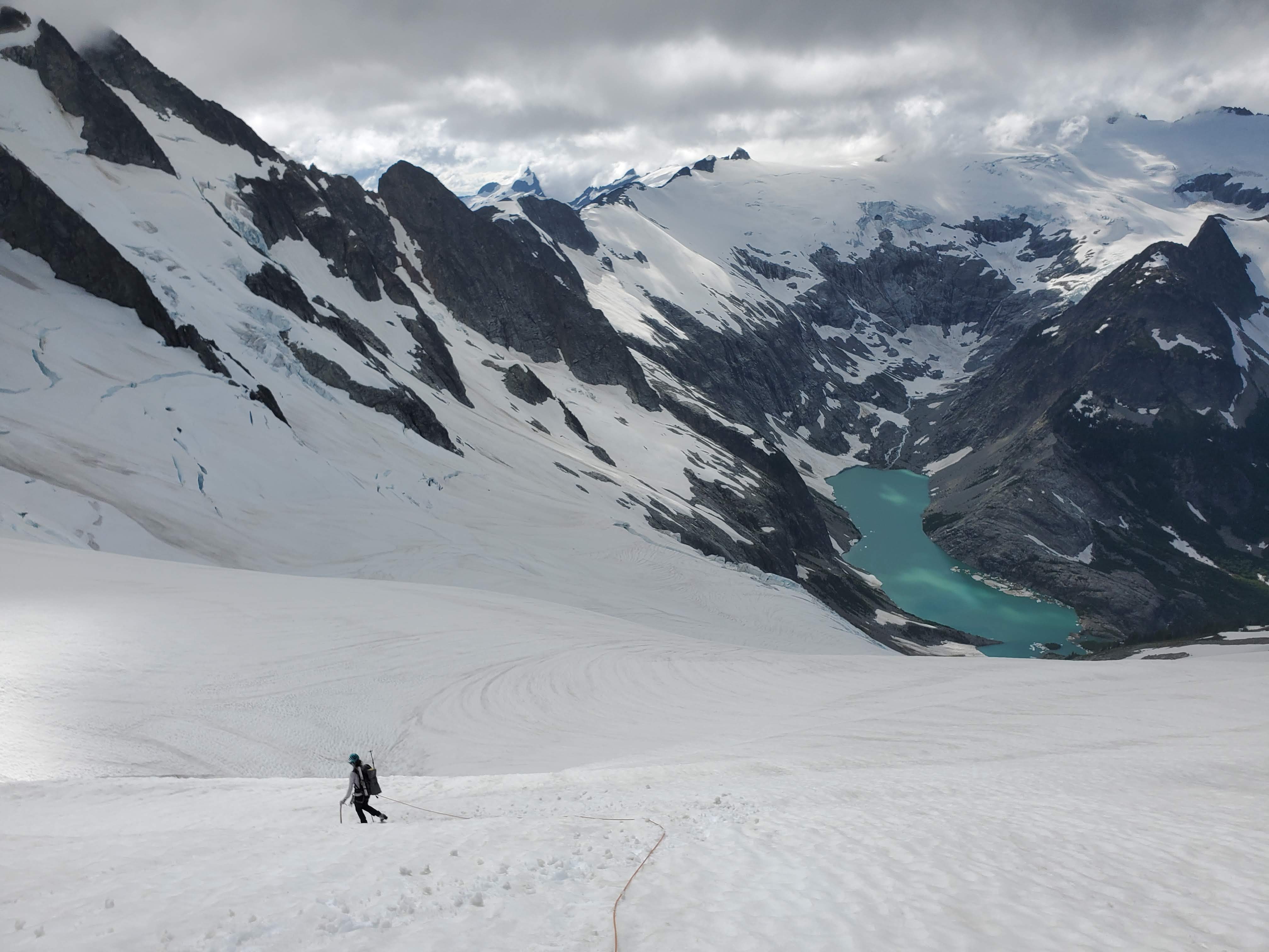
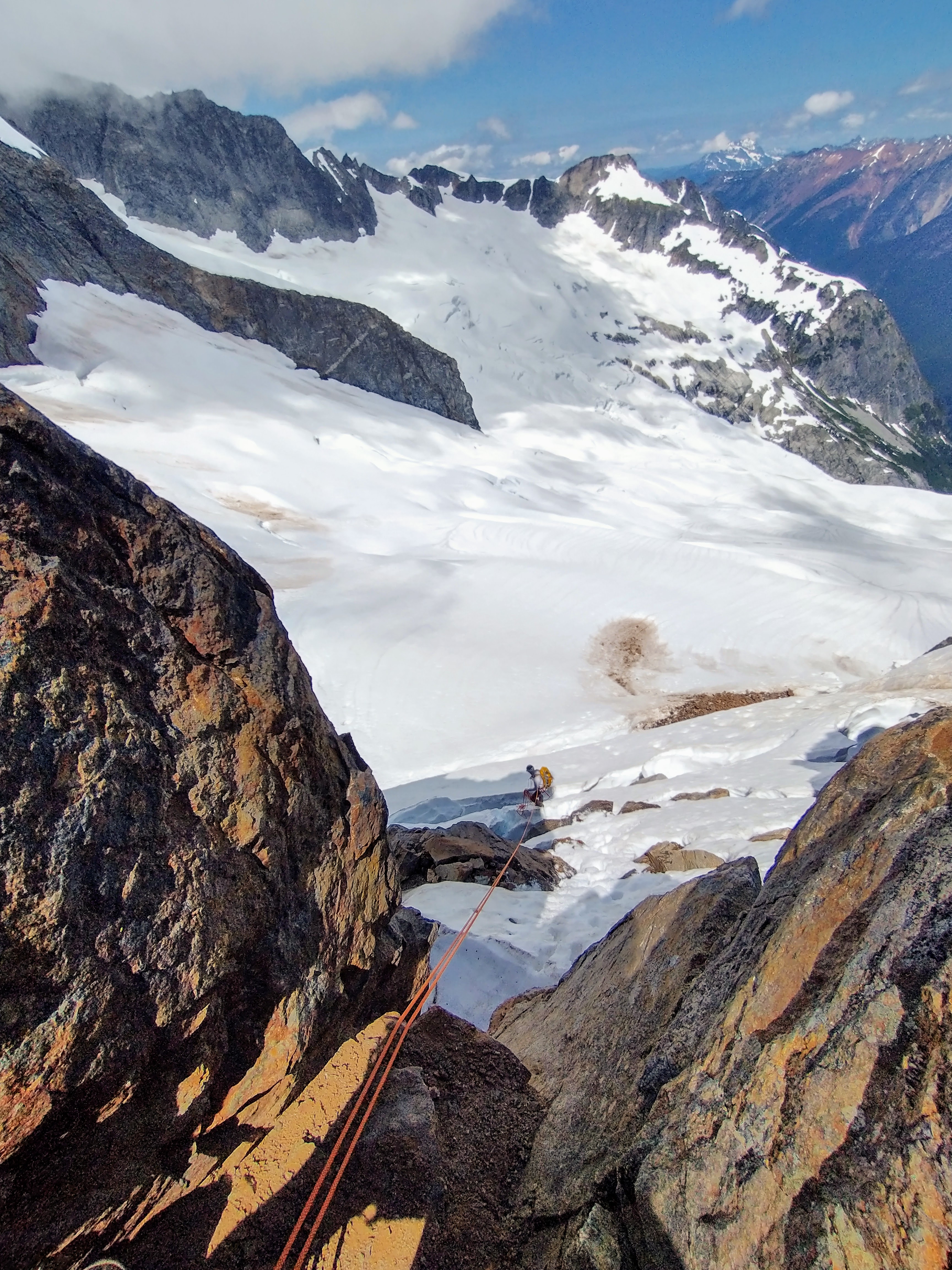
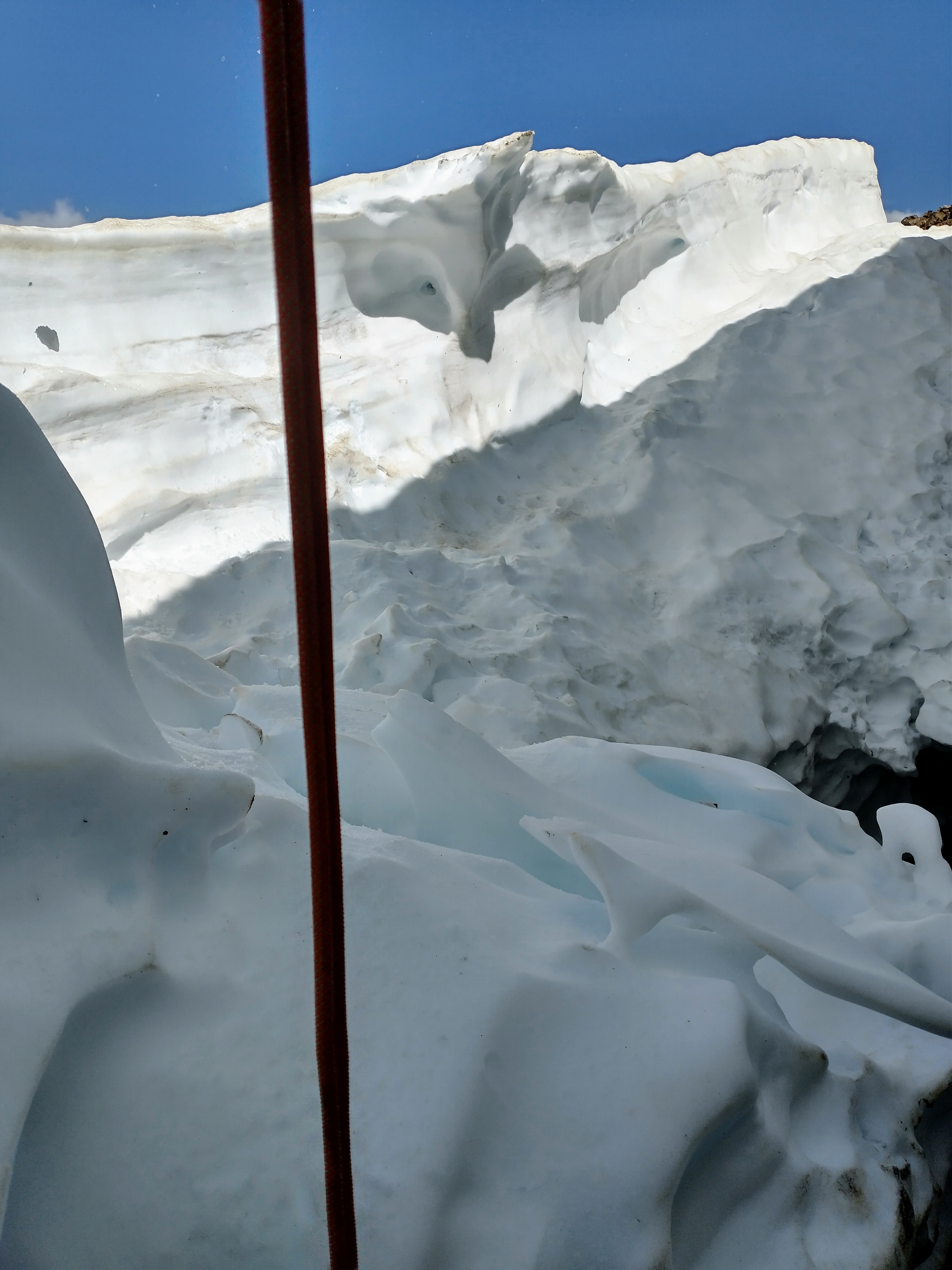
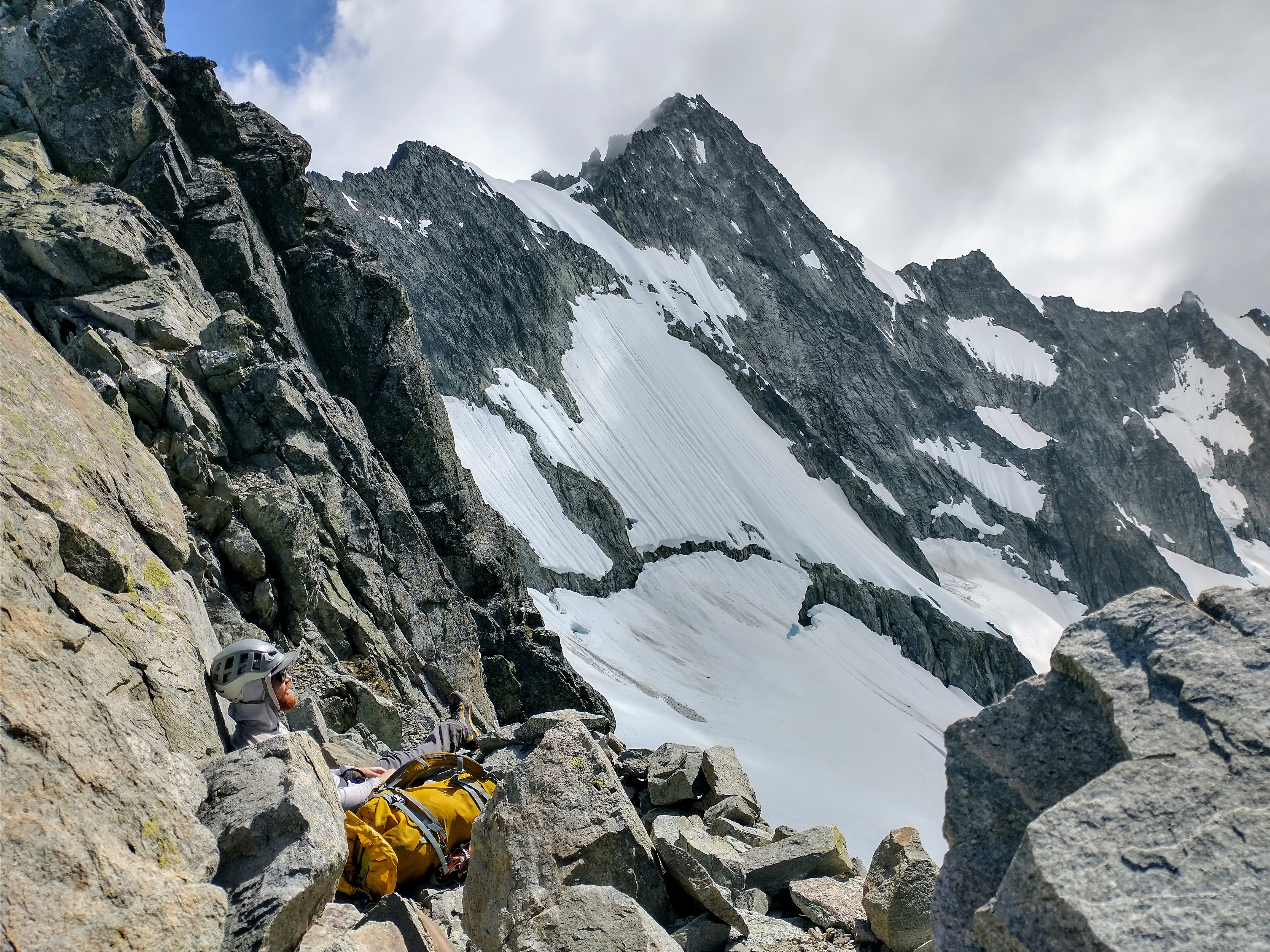
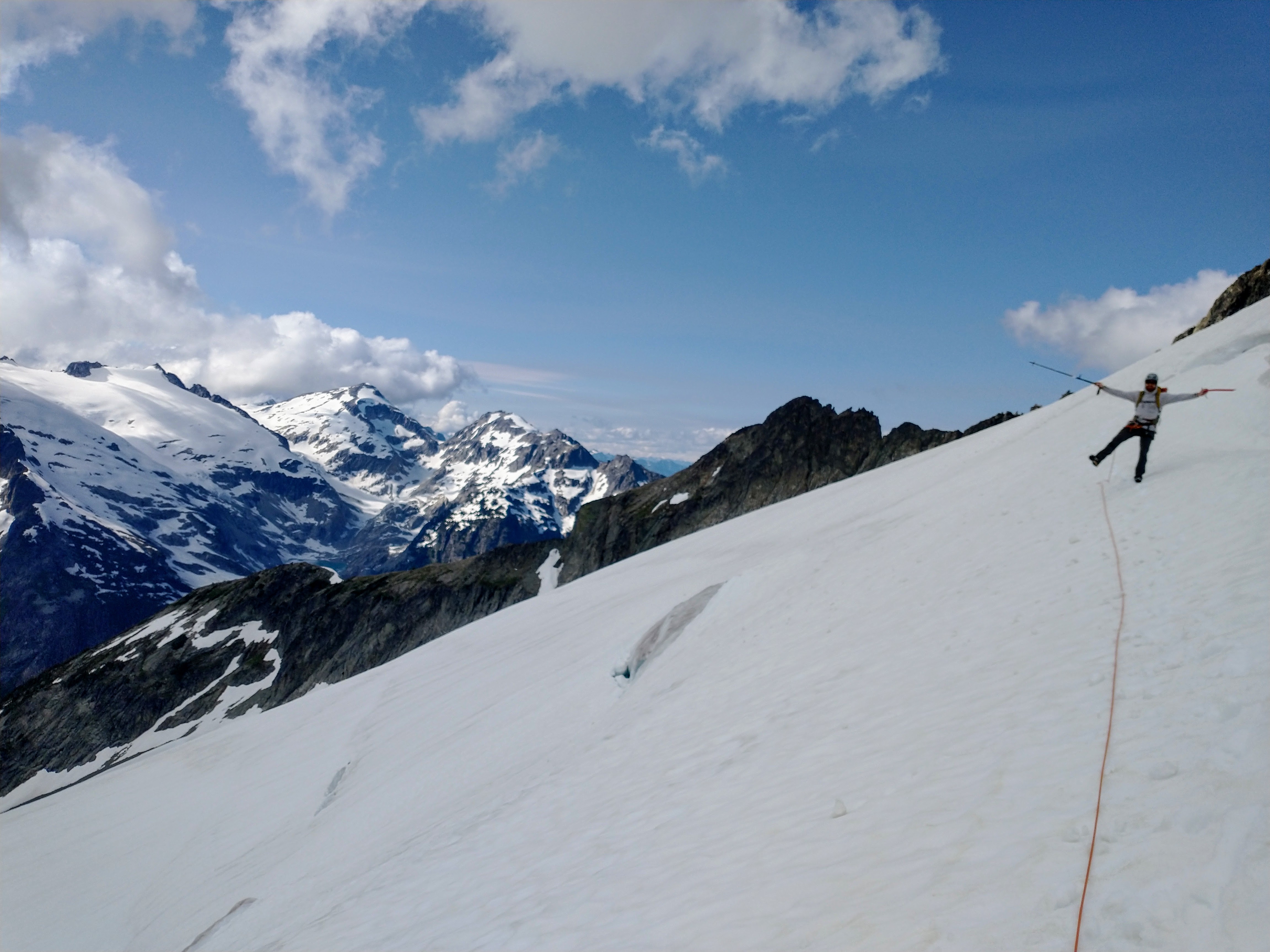
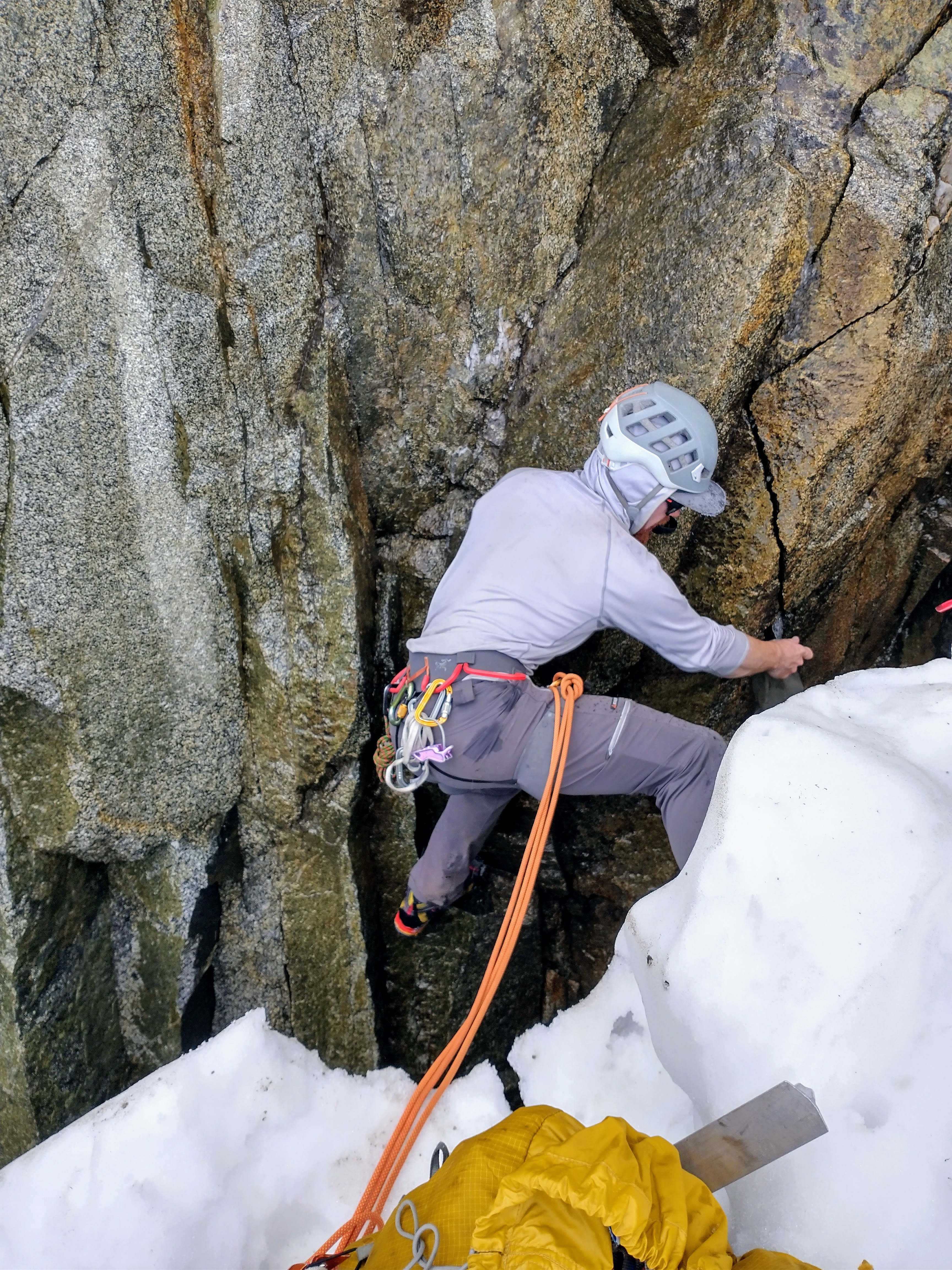
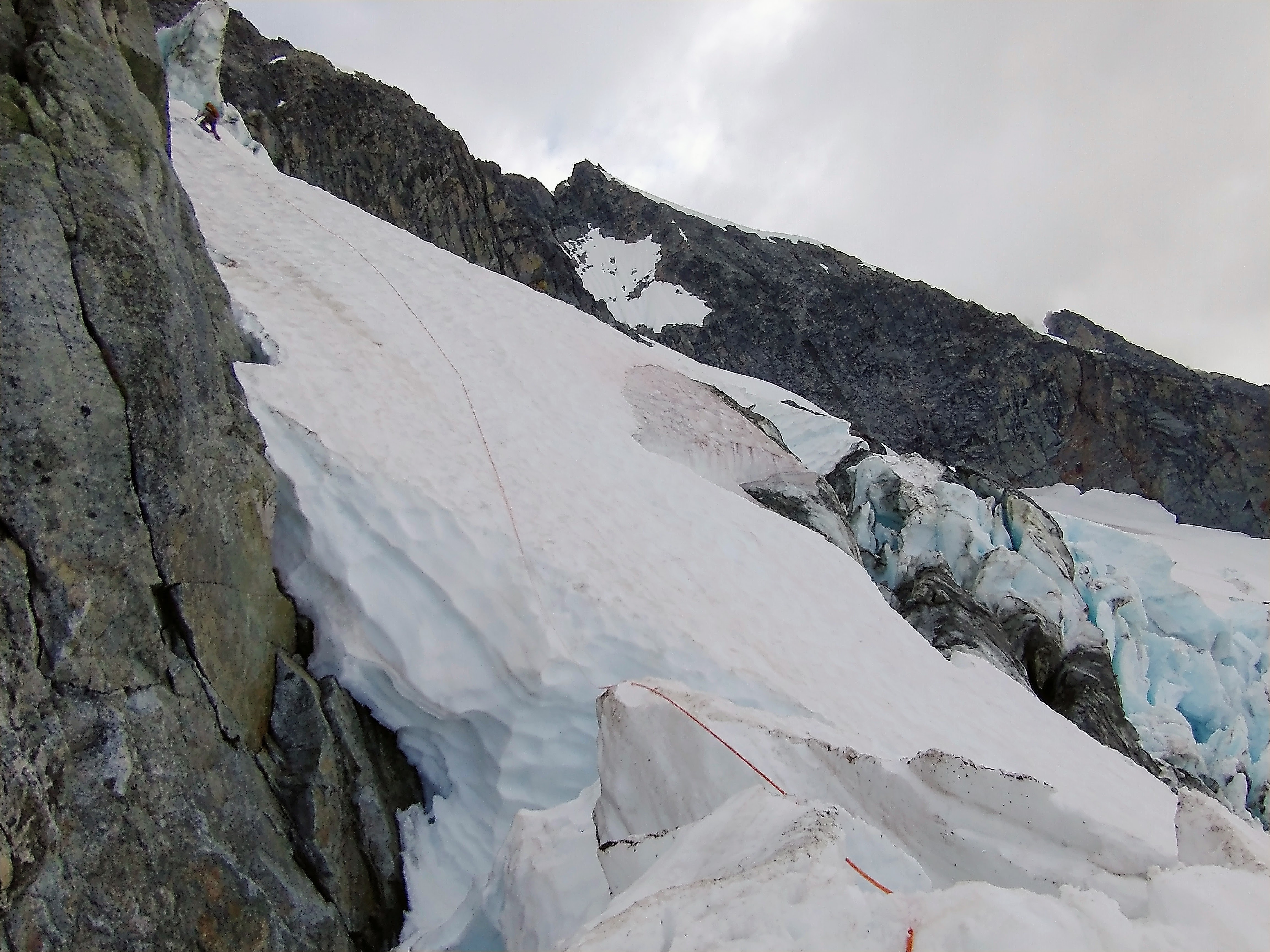
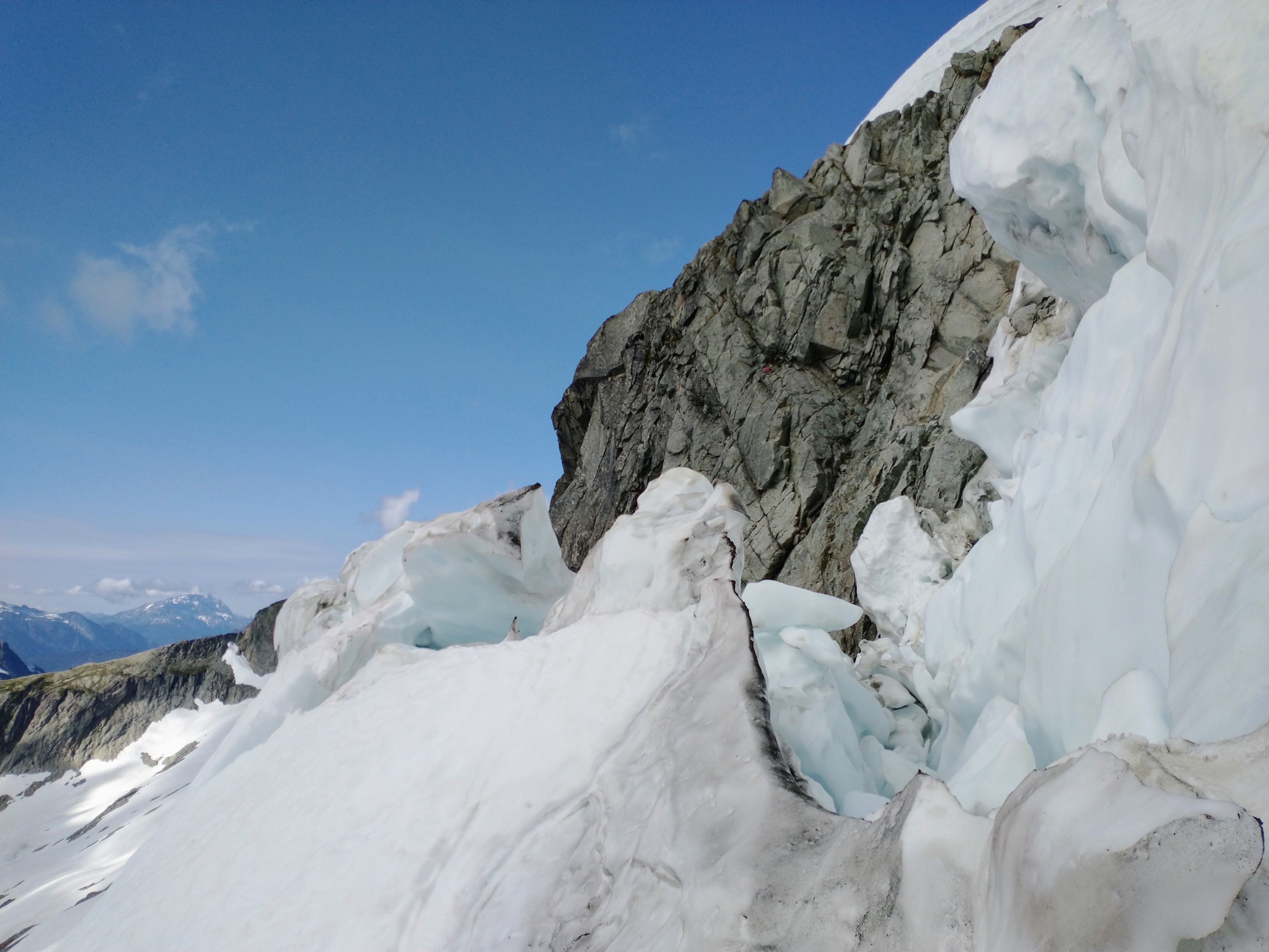
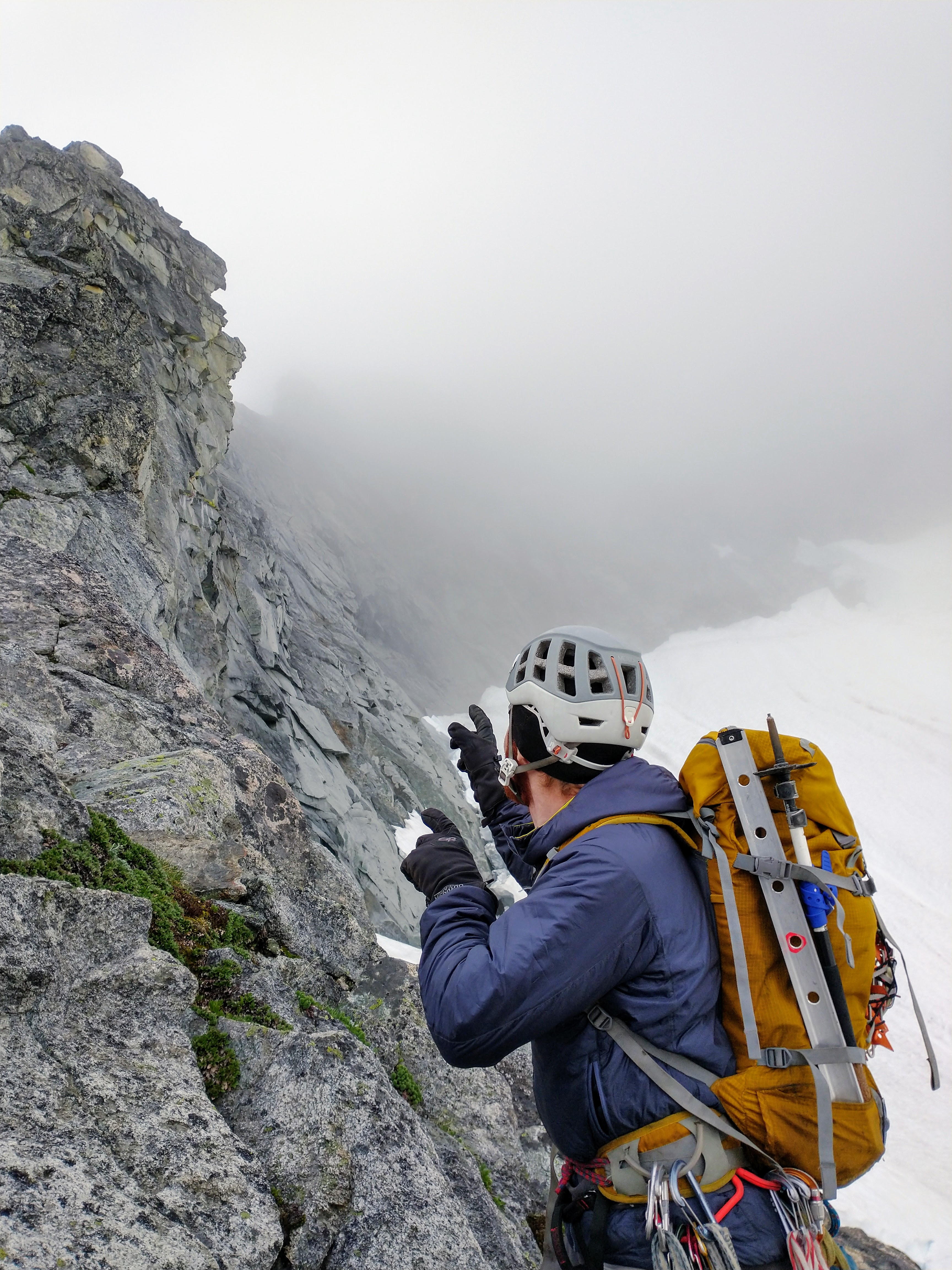
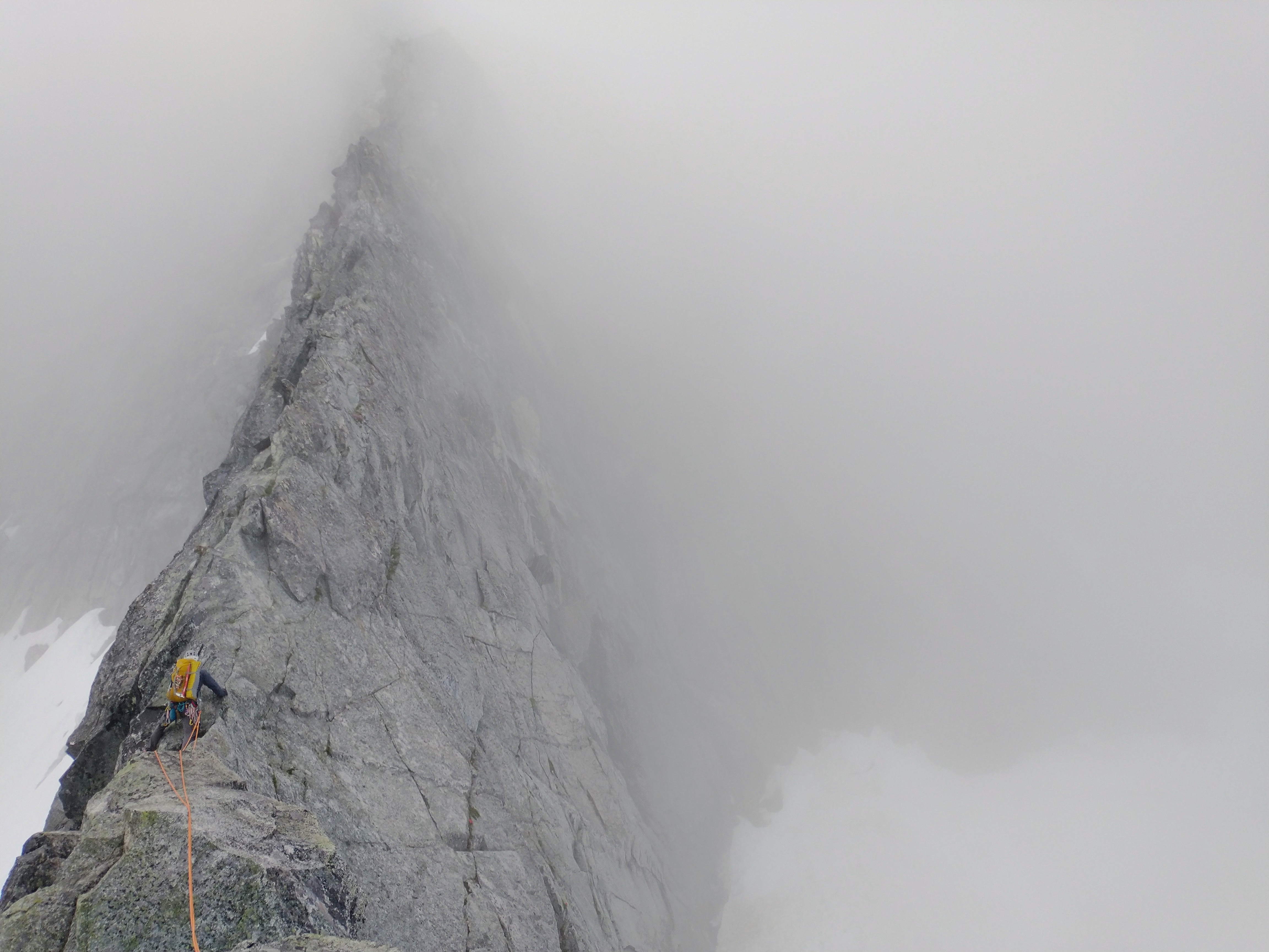
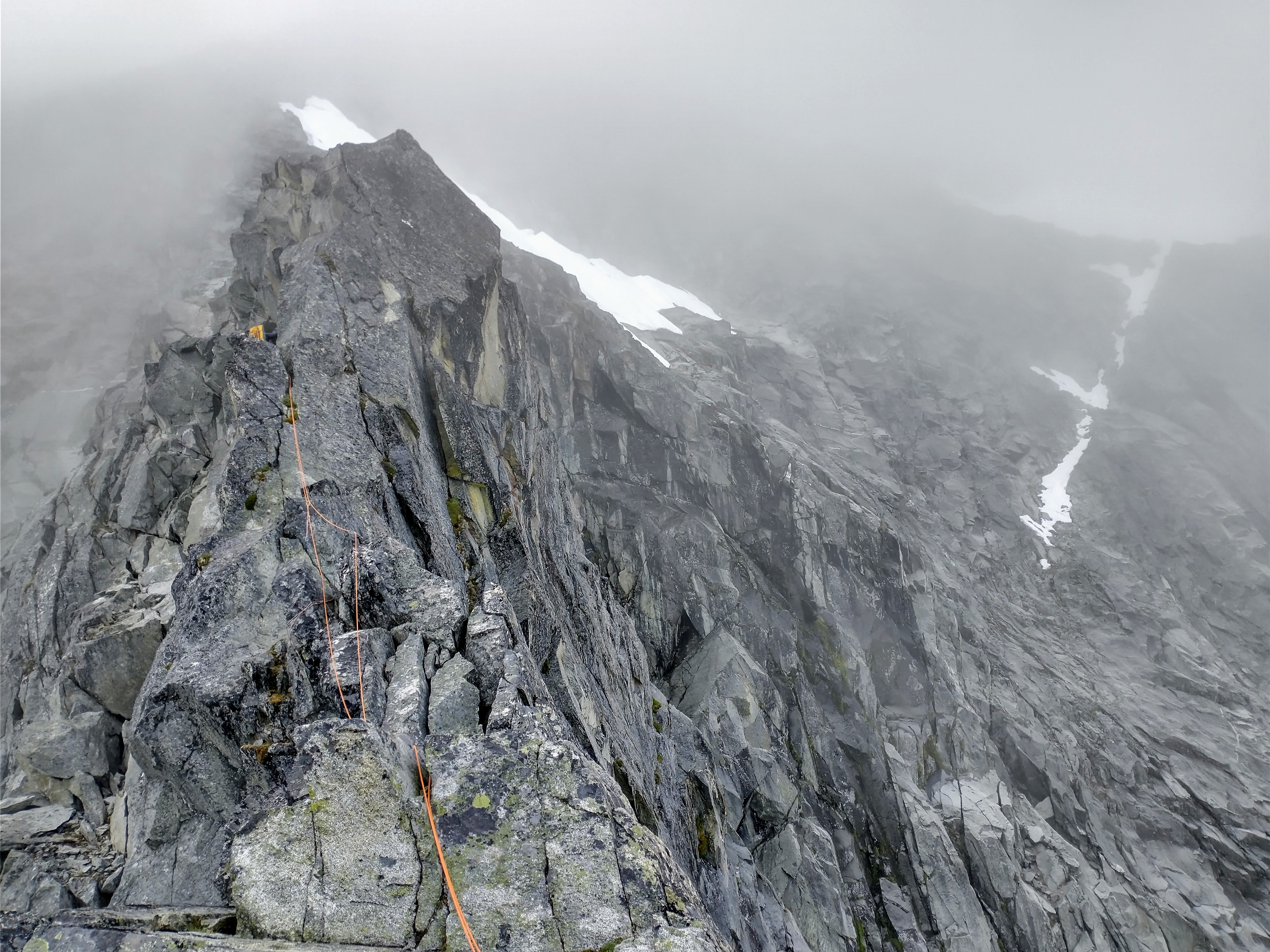
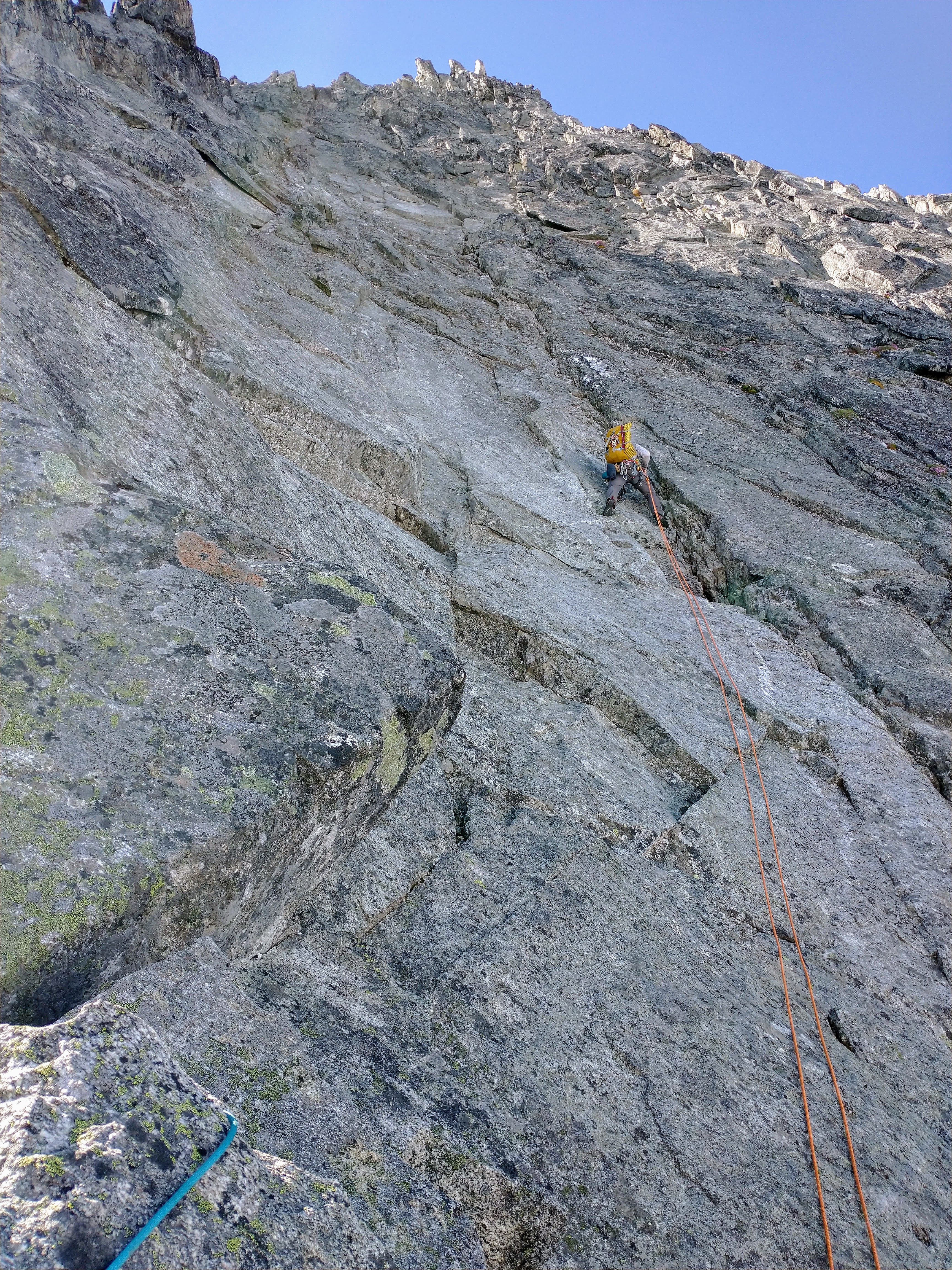
Trip: Forbidden Peak - NW Face Trip Date: 07/17/2022 Trip Report: @Hoo and I climbed the NW Face of Forbidden over the weekend. We had a grand alpine adventure with great conditions and we were happy we chose to take the loop overnight version for this climb. Thank you, Micah! On Saturday morning, we got to the ranger station armed with plans A, B, and C, but happily, snagged a permit for our bivy. The forecast for Sunday had deteriorated into a 30% chance of precip at 11am so we were concerned about low vis conditions on our summit and descent day, but we decided that we'd try to get to the higher bivy at the start of the route instead of just the N Ridge notch (our original plan). We had an invigorating uphill bike ride from the Eldo trailhead to the Boston Basin trailhead (road is still gated). Thank you Micah for loaning me your mountain bike for this! Quickly we were poking out into Boston Basin and feeling the alpine awe. The sun was shining behind light clouds and the temperature was great, the snow was soft but not overly so, and we quickly made our way up the Sharkin Col snow gully for the first approach crux in about four hours from the car. We aimed for one notch left of the notch right next to Sharkfin Tower. We scrambled up some loose 4th class to the notch but didn't see any rap stations so we scrambled down a bit and to the next one (climber's left) -- that one did have a rap station and looking down we could see two shrunds but they looked manageable. Micah led this rap and found another rap station hiding inside the shrund. I led the next one down and over/through the convexity toward the next shrund. Luckily it was still pretty filled in and we were able to easily get in and out of it and onto the mighty Boston Glacier! Note to self: change from shorts to pants earlier in the day. I was just reading Karsten's trip report of Ptarmigan Ridge and he spoke of his slogging cortex being overly activated. The amble across the Boston Glacier was so beautiful and enjoyable. "Is this a slog? It's pretty enjoyable for being a slog..." Micah and I discussed. If this had come at the end of the trip, it would have been a slog. Loved seeing Logan, Goode, and then Buckner across the way... Looking around at the amount of snow everywhere, we were cautiously optimistic about how we would get up to the N Ridge notch and onto the Forbidden Glacier. Identifying the notch was straightforward (to the right of the two towers; lowest point in ridge) and we were able to easily move from snow to rock and scamble up with just a short V0 boulder problem above the moat! This is all going too well! Views from the notch were fantastic. To climber's left we found a bivy spot we'd read about and then an exposed 4th class down-scramble led us to a rap station with a LOT of tat. Micah did a good mountain deed and cut out a bunch of trash tat. We made one <30m rap onto the snow and did a short bit of downclimbing before getting onto the flat glacier. We had not come across any water trickles or streams coming off the rocks (last big drips were in the shrunds after Sharkfin Col) but we finally found a real melt-off from rocks that we passed by (with a gaping moat guarding it). Micah was up for a kinda-sketchy moat-rock stem move to fill up our water. It was nice to be water-secure again! We walked over and decided to take the high/direct route around the base of the NW ridge toe. I think you could say we sandbagged ourselves with this routefinding choice, as we ended up climbing from steep soft snow with great feet up into AI2 territory. Luckily Micah felt confident about it and I was able to get a toprope from him (twice). Seracing above giant crevasses in aluminum crampons with just one axe, fun! Thankfully we were able to escape onto softer steep snow and then arc back over to the snow ramp getting us onto the rock/ridge proper. Hurray! We were definitely feeling the 7200' gain, ~8 hours from the car that we'd done according to Micah's watch. We ended up in a great bivy spot just a bit lower than where we got onto the ridge, with great epic-cloud views of Moraine Lake, Klawatti Lake, the Inspiration and Klawatti Glaciers, Primus and Tricouni, and all our best friends out there... the sun never really came out but it was an amazing place to be and relax and rest. We woke up with the brightening day but completely socked in as somewhat expected. We had seen a party at a N Ridge notch (one north of our notch) the evening before we wondered what they were up to. We definitely would not have wanted to cross the Forbidden Glacier with that kind of visibility! After scrambling up and over the tower, we roped up and set off into the clouds for the first simuling section on the knife-edge. So, so fun. I love this kind of easy climbing on ridges! Super fun scrambley, exposed, great rock! So fun. As others have noted, there's a fixed pin right before a hard-looking section right above (I think I read that probably rockfall had hit this section and now it goes at solid 5.8) so Micah took us climber's left and down a bit; there was a nice flake for me to have some terrain protection as I downclimbed the exposed 5th class moves... We continued onward and upward simuling and soon Micah shouted down, "I'm just going to climb through the chimney, it looks easy" (without pitching it out). And lo, it was! I was really surprised; I have found many 5.8 chimneys to be really tough for me. We agreed that it barely deserved to be called a chimney. Nothing physical, just some stemming with big hands and feet. The rock was the worst on the route here, though -- quiet, gentle climbing definitely necessary! Above and out of the chimney, there was a tight corner that was the crux for me but I was able to top rope it cleanly (my only point of pride with my rock climbing these days)! Above that, I took the next simul section and had a blast on easy climbing on mostly great rock, trying to continue trending climber's left toward the face while also not heading into the multiple snow patches that are still up there. Started getting into harder terrain with lichen as I began running out of slings, so when Micah took over again he took us farther left and up and toward the sunshine... And soon enough we were at the summit, above the sea of clouds! I think we must have been looking at Eldo poking out? Our original plan was to descend via the East Ledges but with all the snow, I was concerned about the 4th class ledge being snowy. We also knew that getting down from the East Ridge notch would be slow with such low visibility. We opted for the West Ridge descent, so we downclimbed the entire West Ridge route. I haven't been rock climbing much at all for the past months (and years) so a lot of this felt stressful/mentally taxing for me but soon we were at the notch. From there, we took two rappels down the cat scratch gullies (dry) and onto the steep snow gully skiier's left. Unfortunately, on pulling the rap, our rope got wedged into a notch -- well, we hadn't really had any shenanigans, so it was about time. Happily, it just took some finesse from a different angle to get it unstuck and no ascending the rope was necessary! We downclimbed steep snow and saw that the bergshrund at the bottom was open and couldn't see an obvious way across, so we found a rap station (skiier's left, in the moat, quasi iced-over) and were able to rap across to the other side with no issues. From there, we had a fair bit of downclimbing in soft but supportable snow. Downclimbing downclimbing... finally onto more level snow where Micah was a total show-off with his boot skiing skills. I think this is the part where I began feeling my slog cortex being taxed! But it was short-lived. We said hey to all the fat marmots in the basin on our way out, made our way quickly down the trail, and hopped onto our bikes for an AWESOME speedy ending to a lovely trip. What a way to end things! OK, you've really been waiting for the pics: Woo hoo, bike approach! Coming into Boston Basin Micah on first rap from Sharkin Col variation First rap from Sharkfin Col variation Second rap from Sharkfin Col variation From inside the second shrund Looking back toward Sharkfin Col variation Goddamn the Boston Glacier is so beautiful! Moving from snow to rock right below the N Ridge notch Taking a break before rapping down onto the Forbidden Glacier View showing the ridge toe On our way across the Forbidden Glacier Awww yeahhhh! Primus and Tricouni in the back. Thanks, Micah! Steep but great feet through this section! This is the kinda thing that all the TRs warn about... AI2 for a bit... Woo hoo, almost there! Beautiful views from our bivy.... Time to start climbing! First section on the rock Getting up into the sun! Starting our descent via the West Ridge Downclimb below the cat scratch gullies, above the shrund here Back to plain ol' walking Farewell, Boston Basin! Until next time... Gear Notes: Three-season boots, aluminum pons and axe, one half/twin 60m rope, small-ish rack and lots of slings, BIKES. Approach Notes: Up, over, across, up, over, across, around, up, up, up, down.
 1 point
 -
Great trip report! This peak has been on my list for years. The more beta the better.1 point
-
Reasonably inexpensive source for eva foam: https://www.foambymail.com/minicel-type-t-foam.html I just received a sheet of T200. It appears identical to the yellow hardman pad of yore.1 point
