
Leaderboard


Popular Content
Showing content with the highest reputation on 09/17/25 in all areas
-
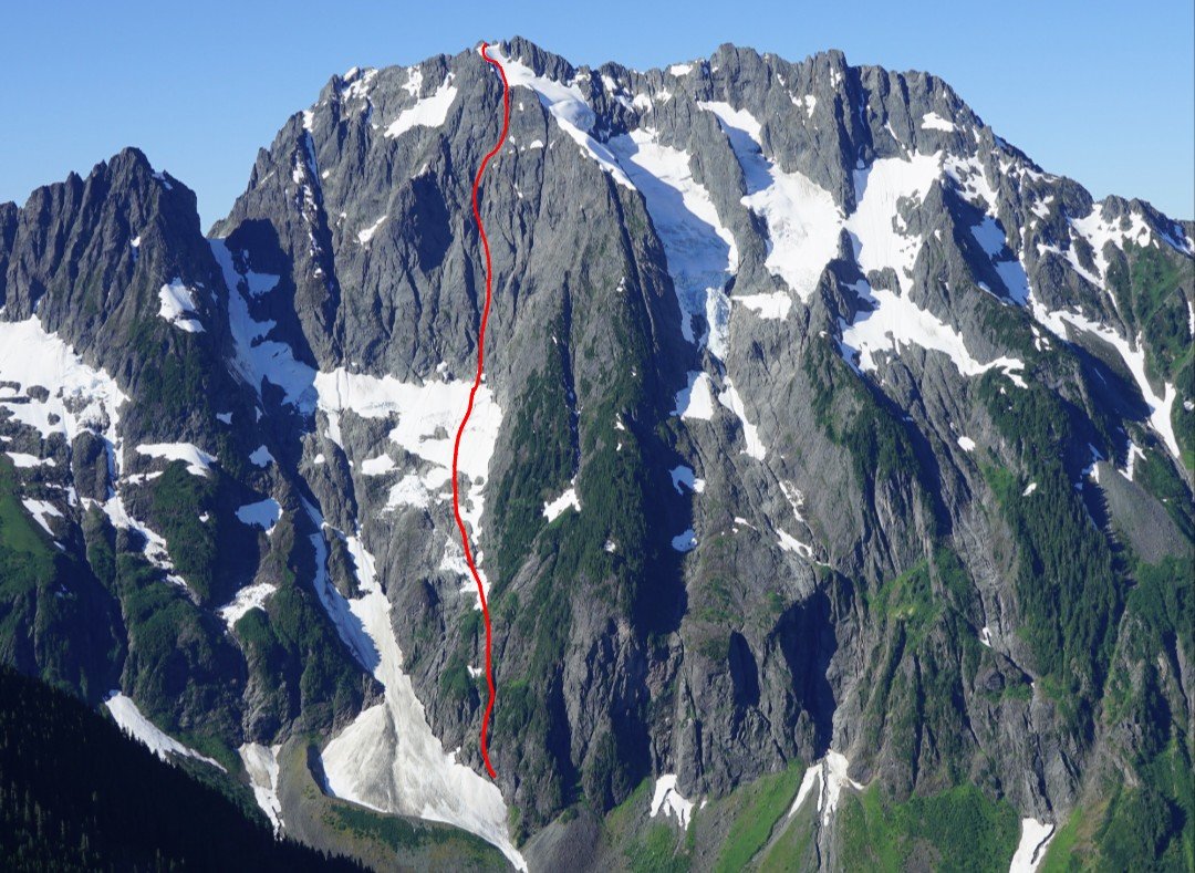
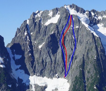
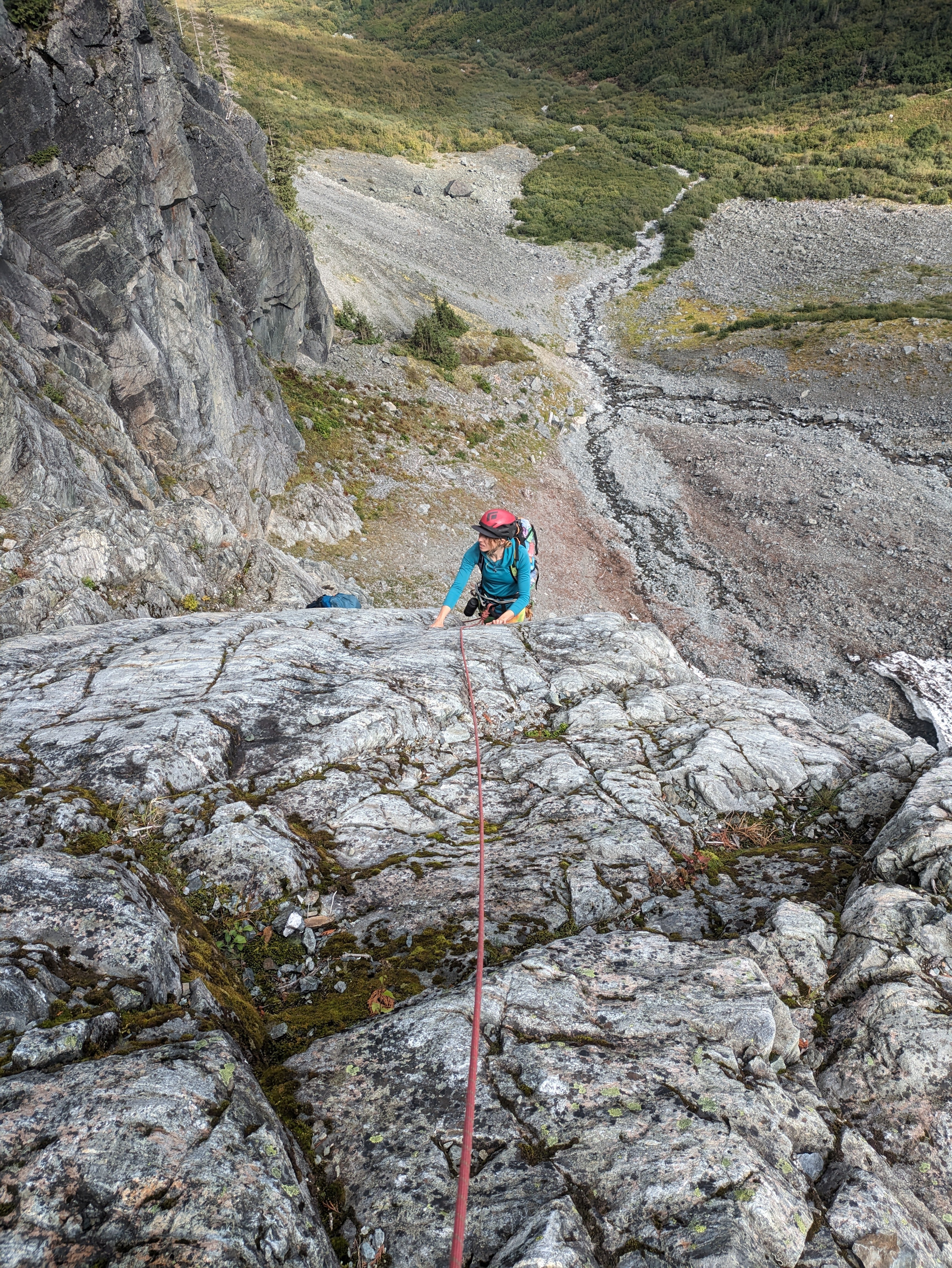
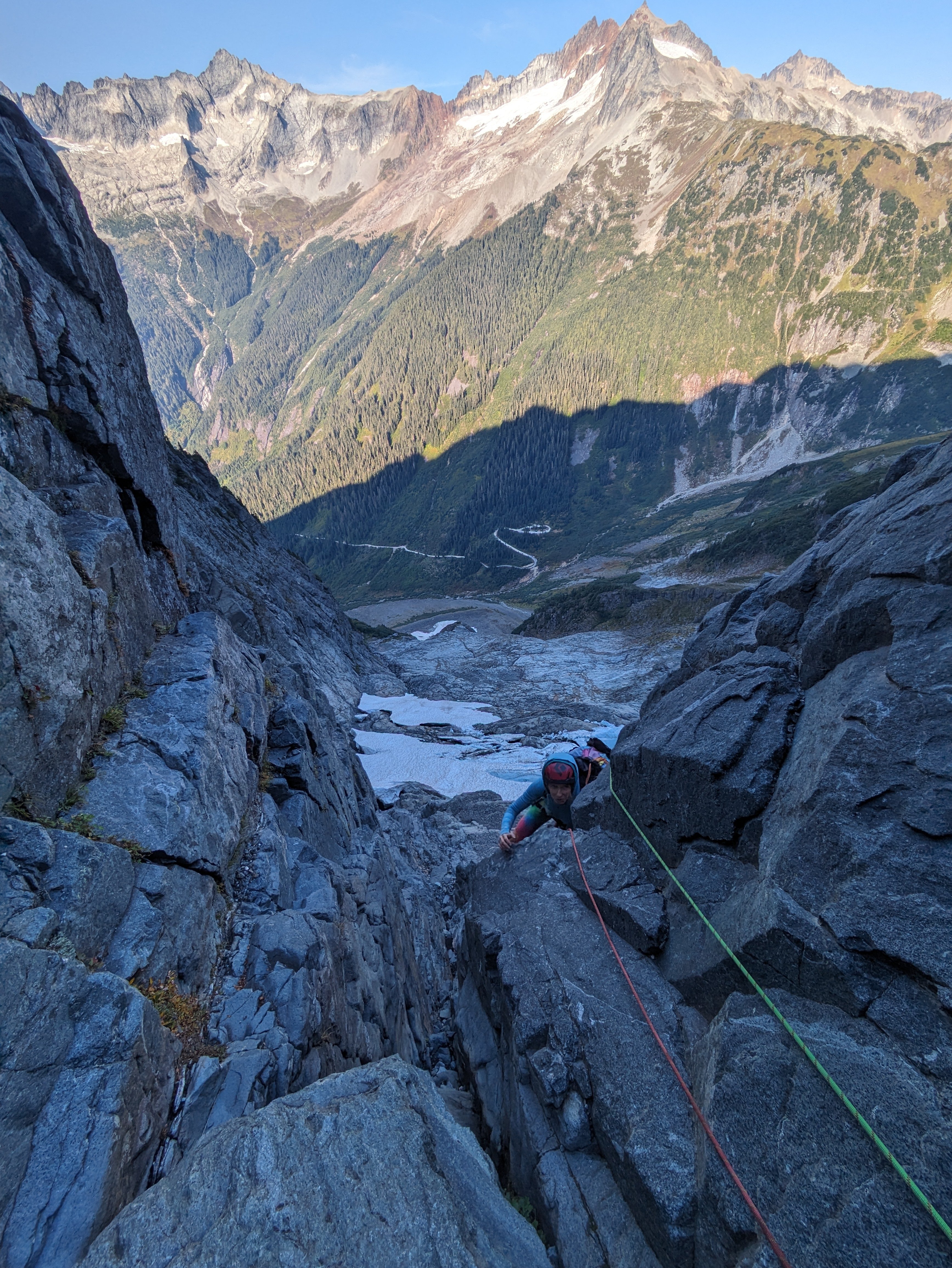
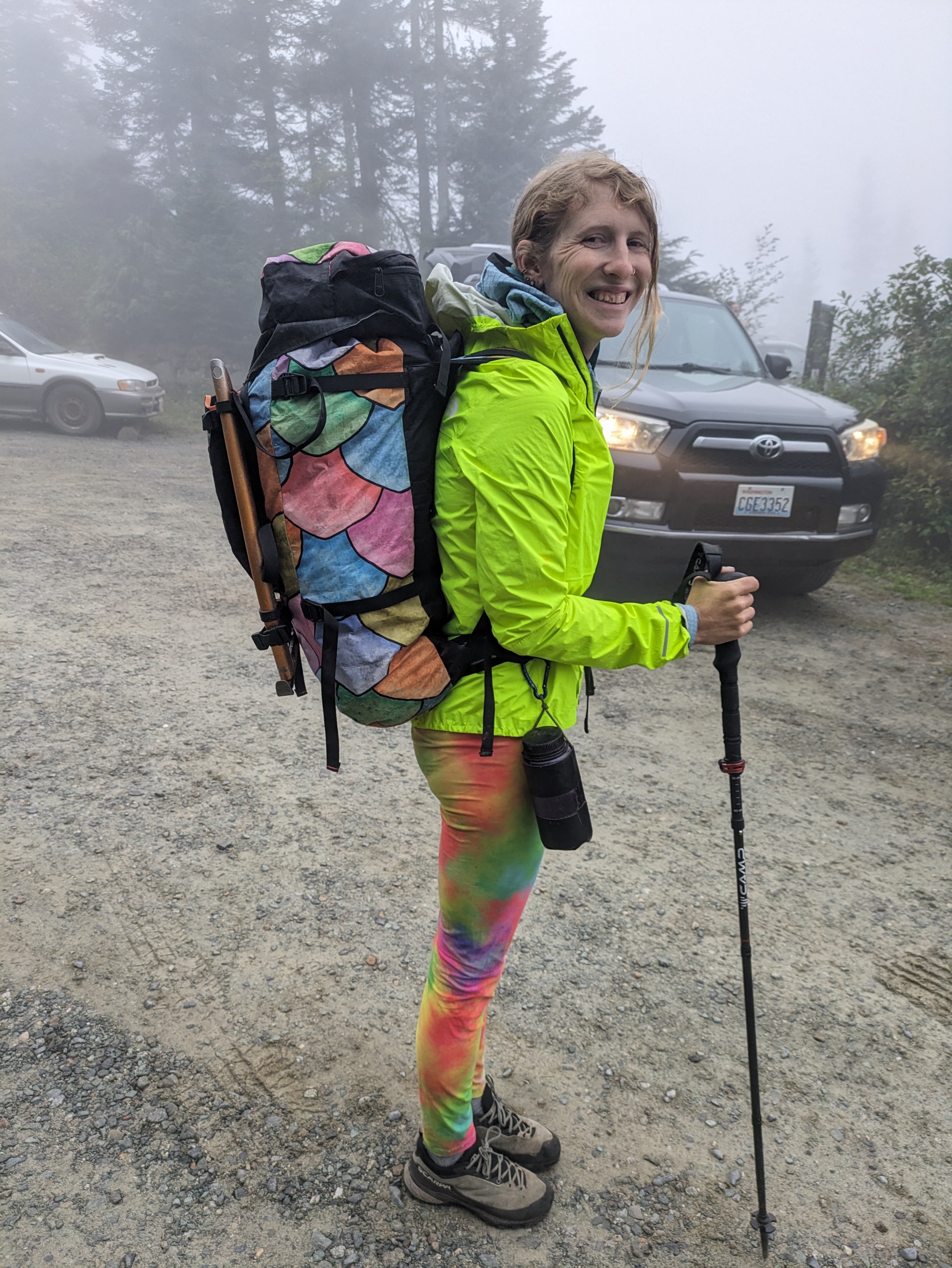
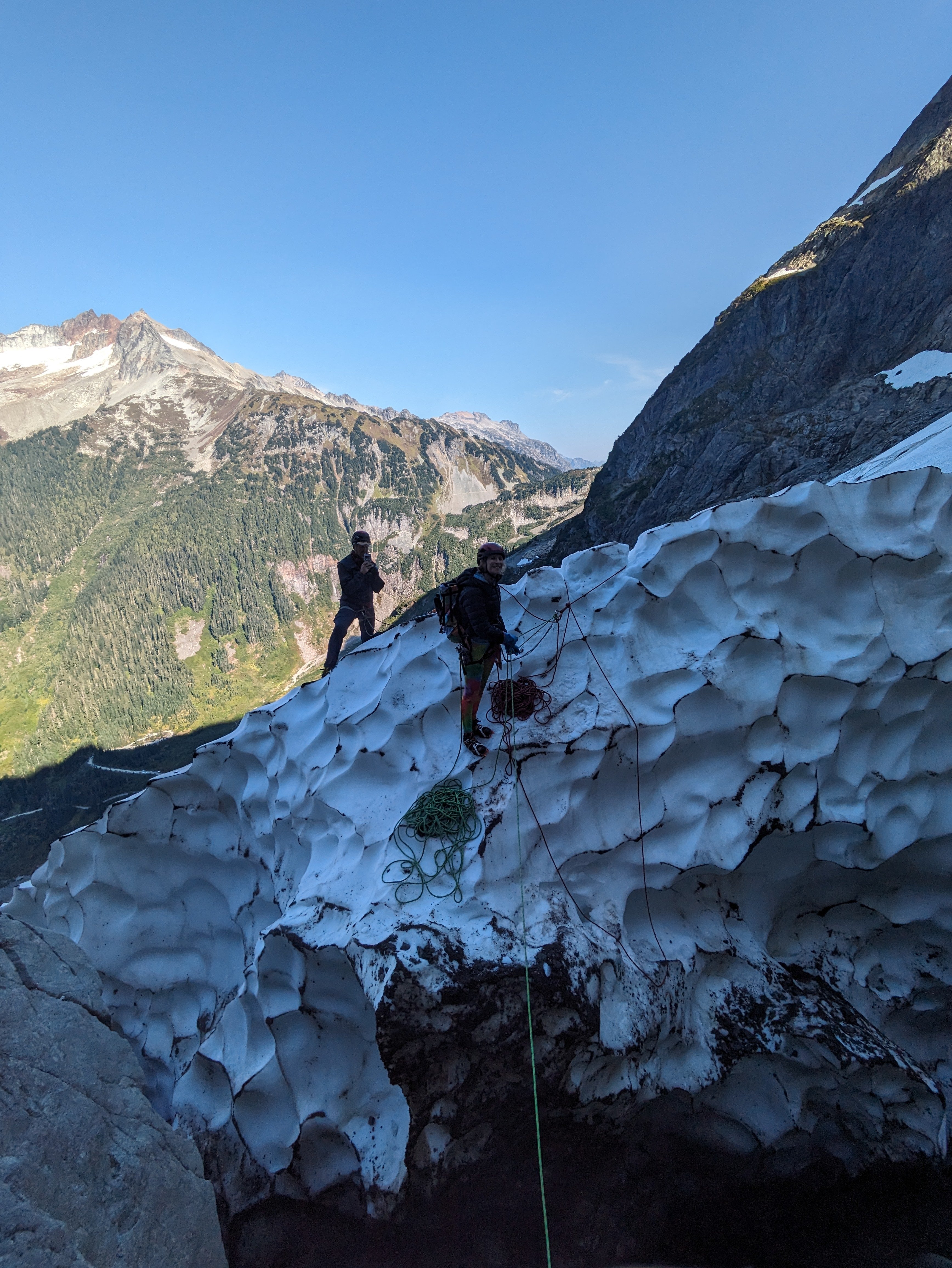
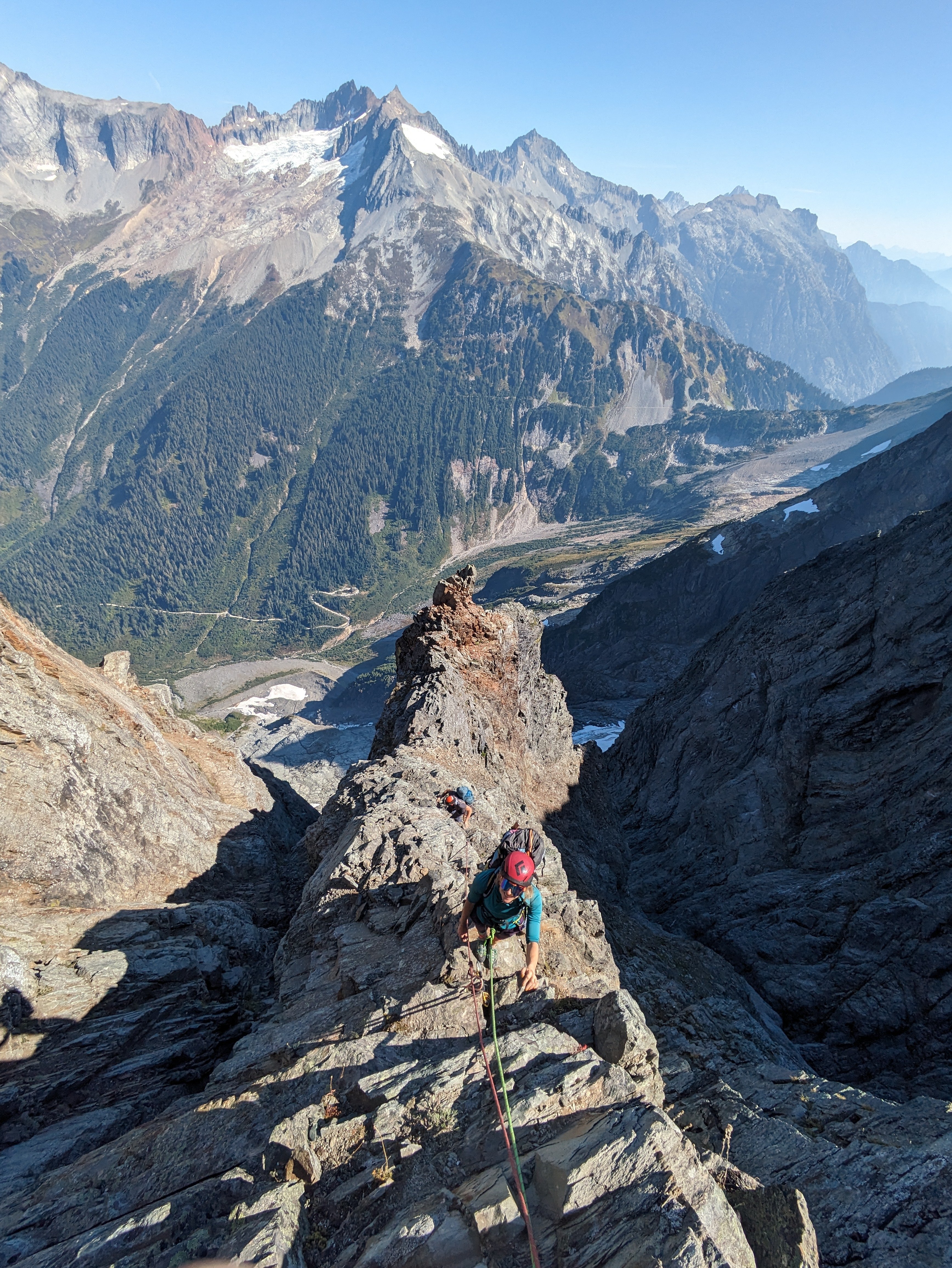
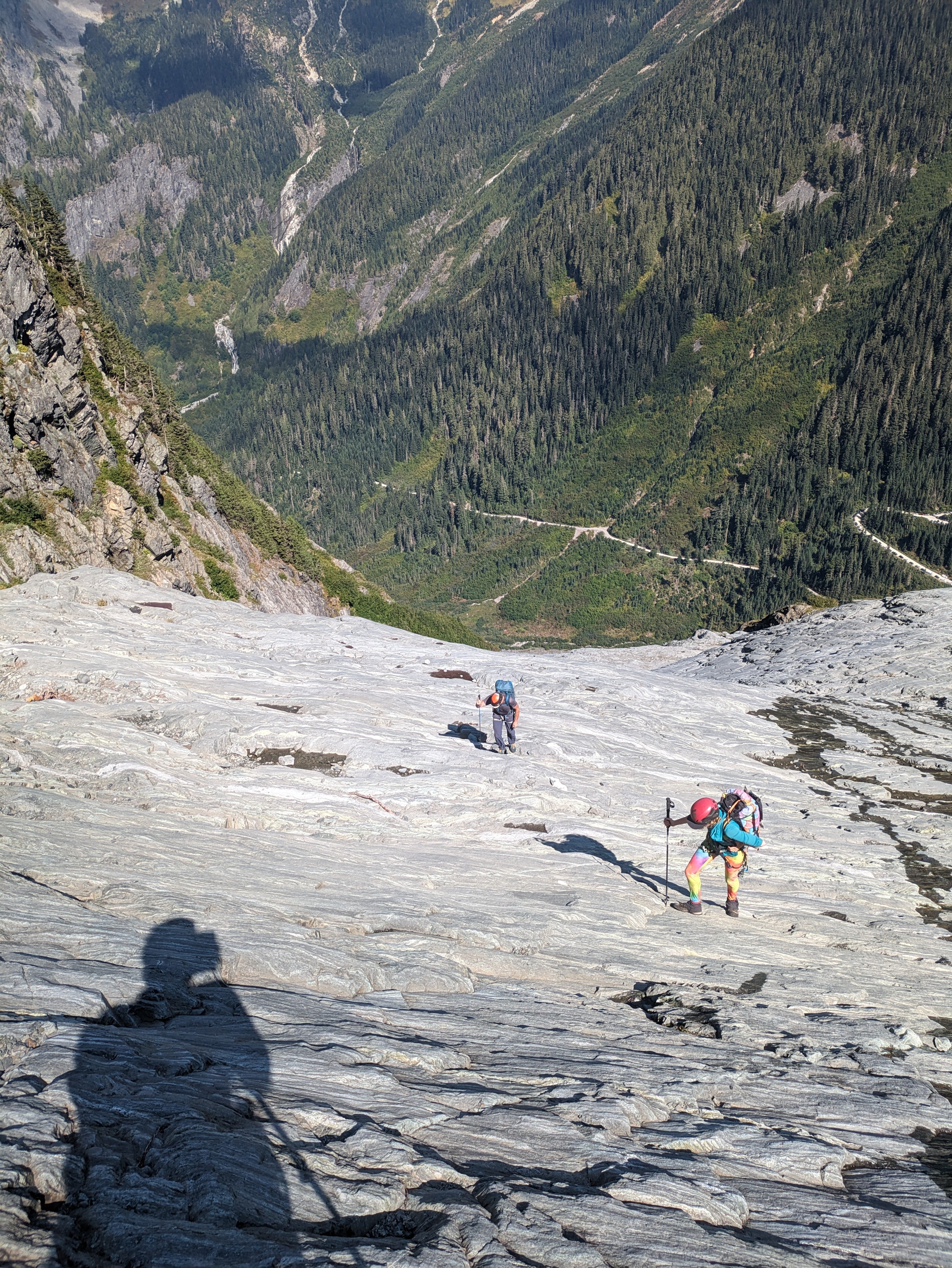
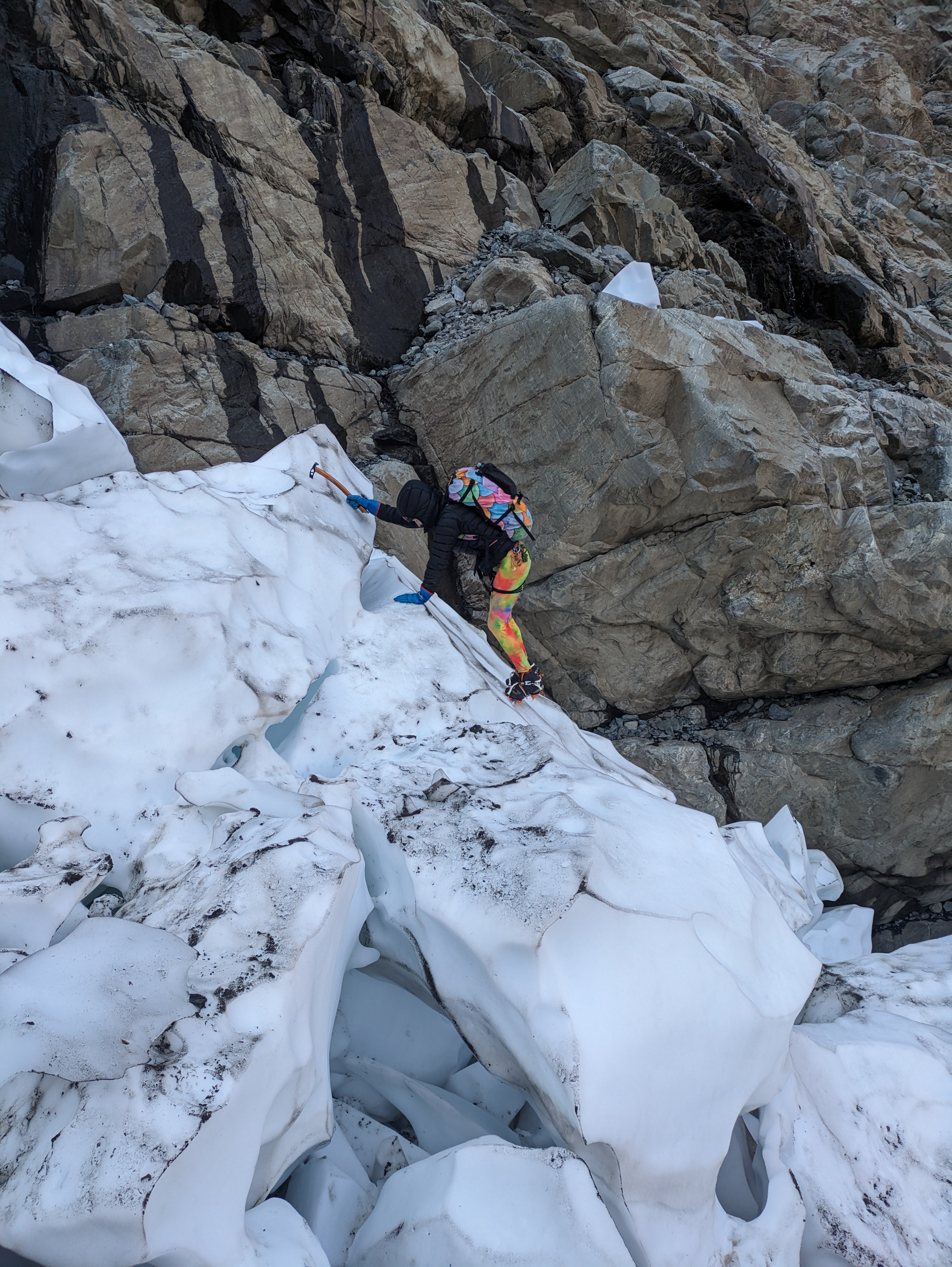
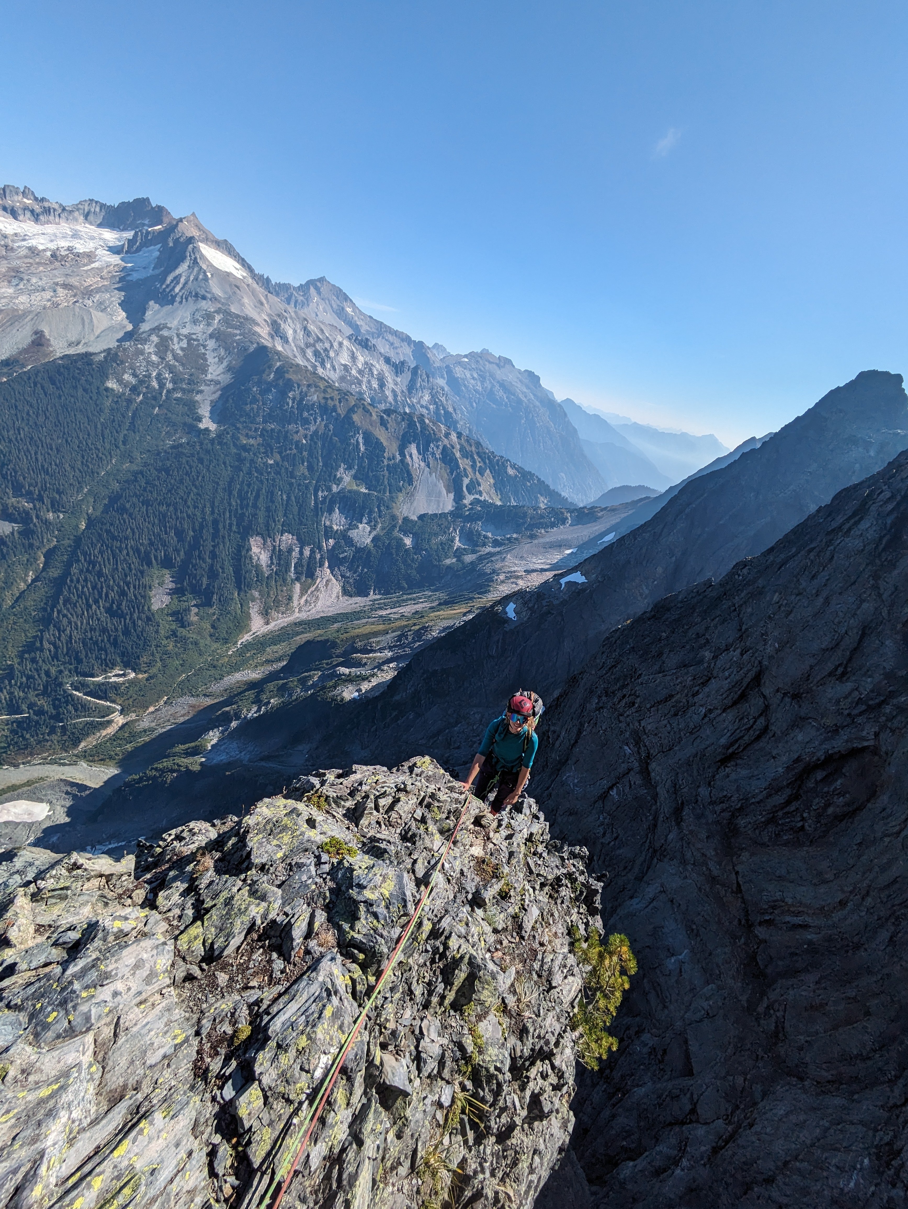
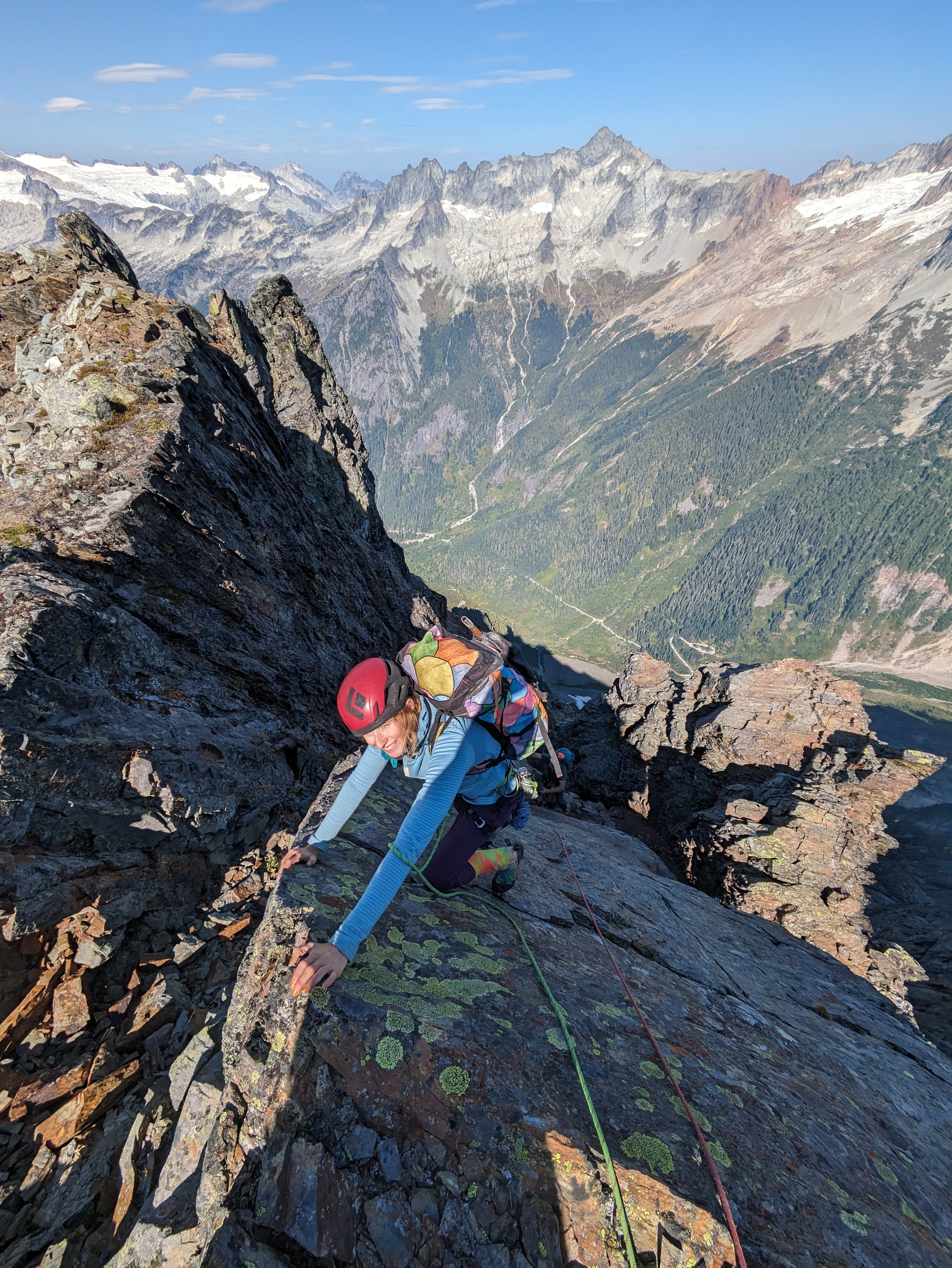
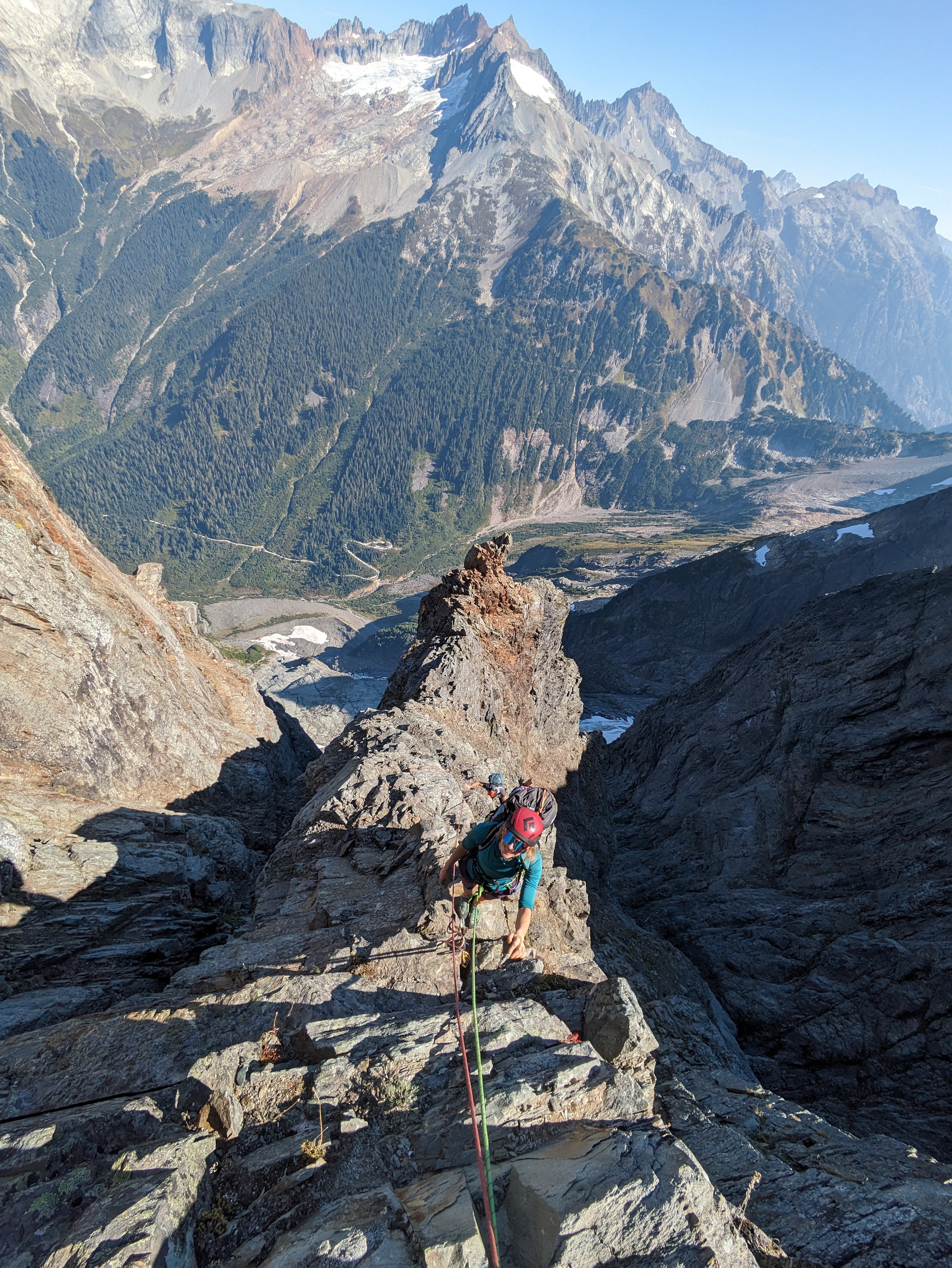
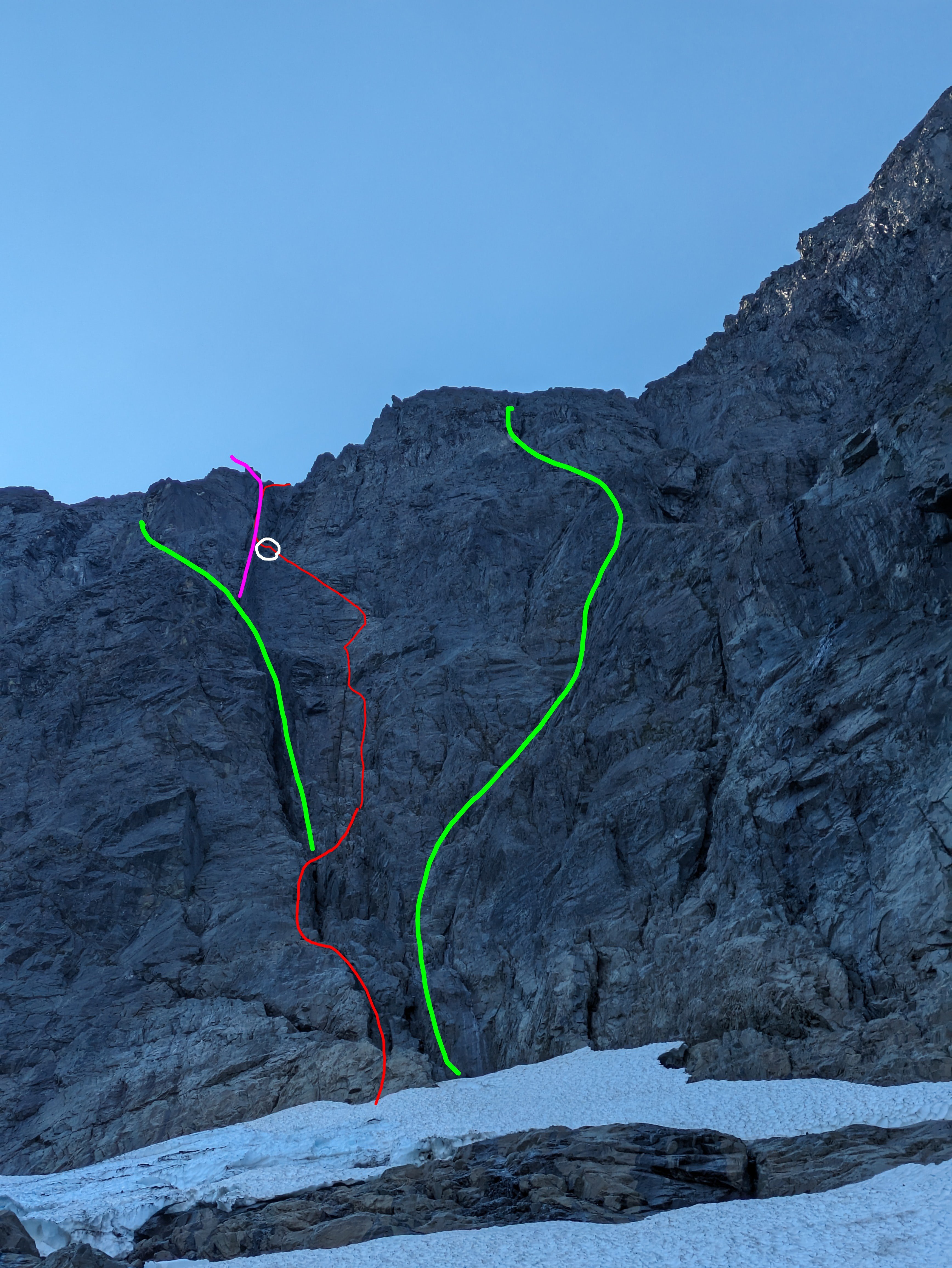
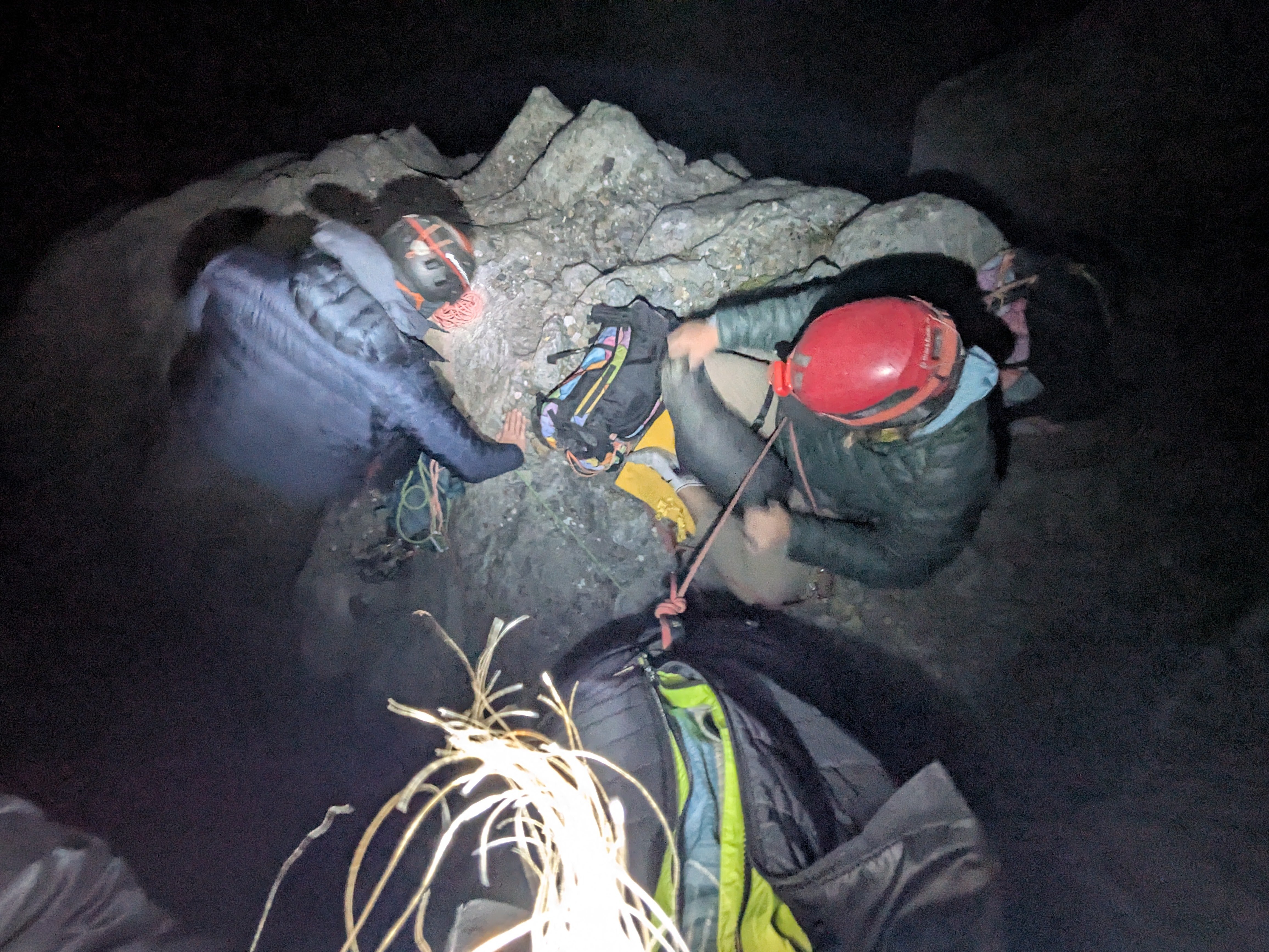
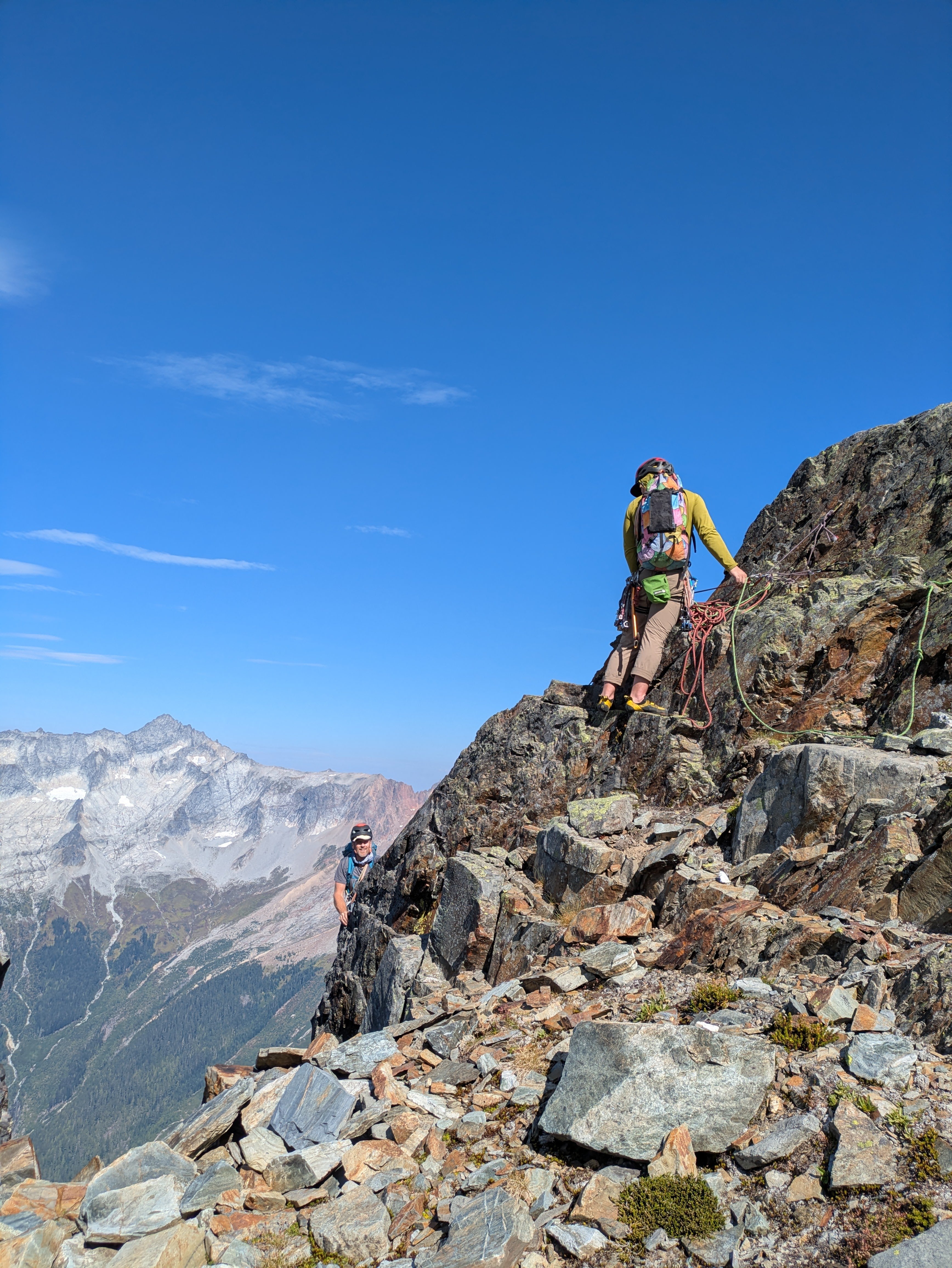
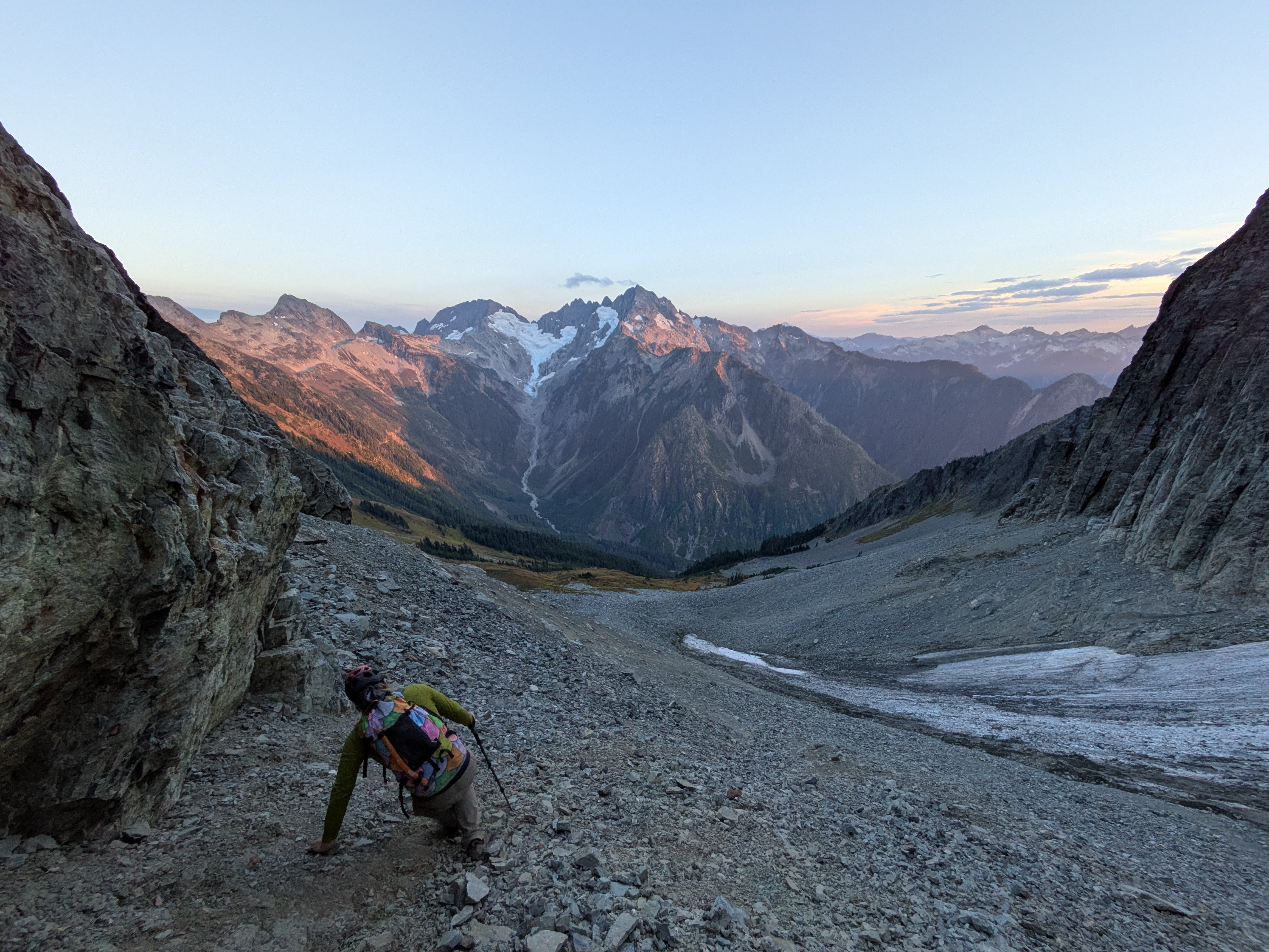
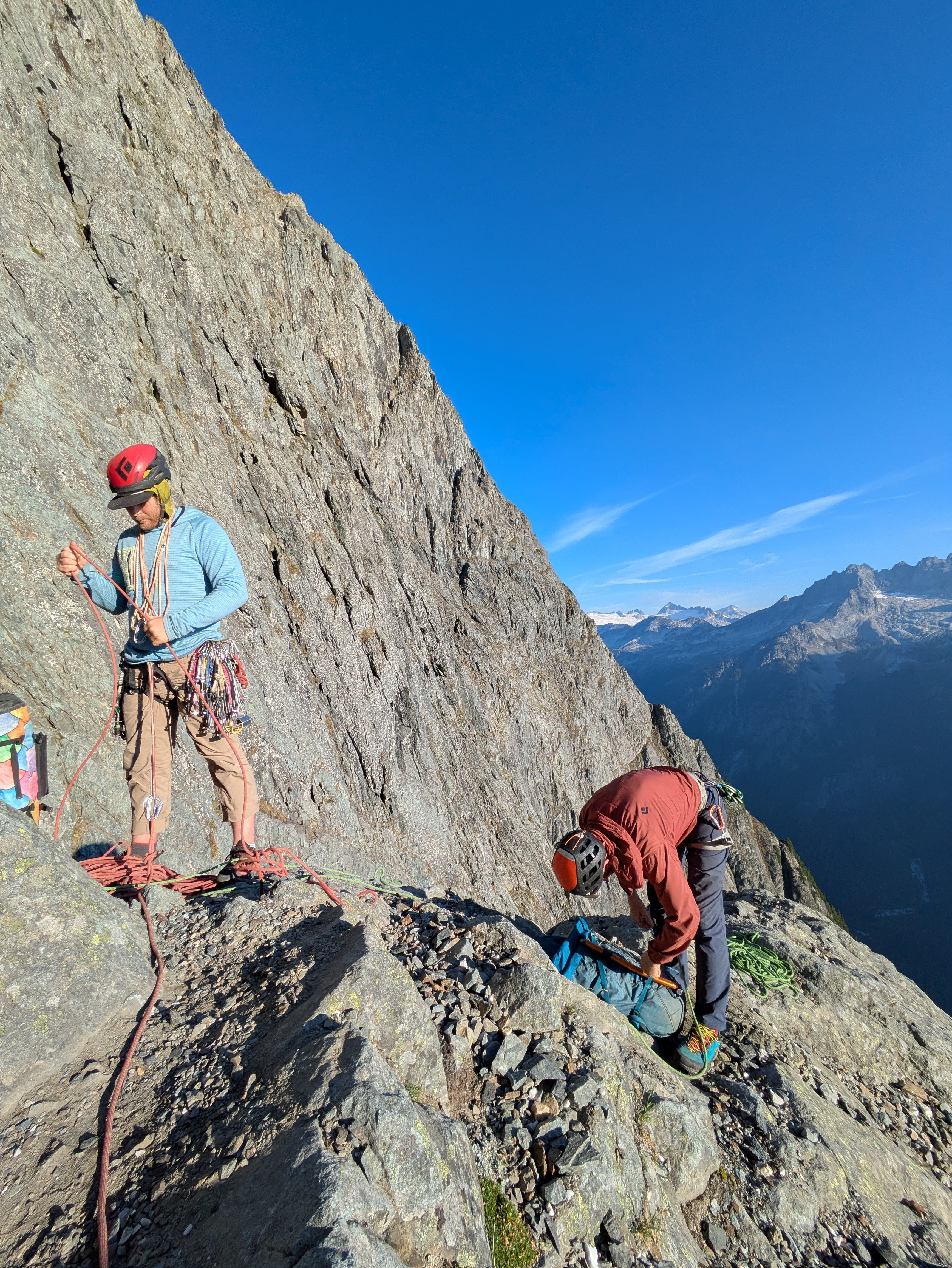
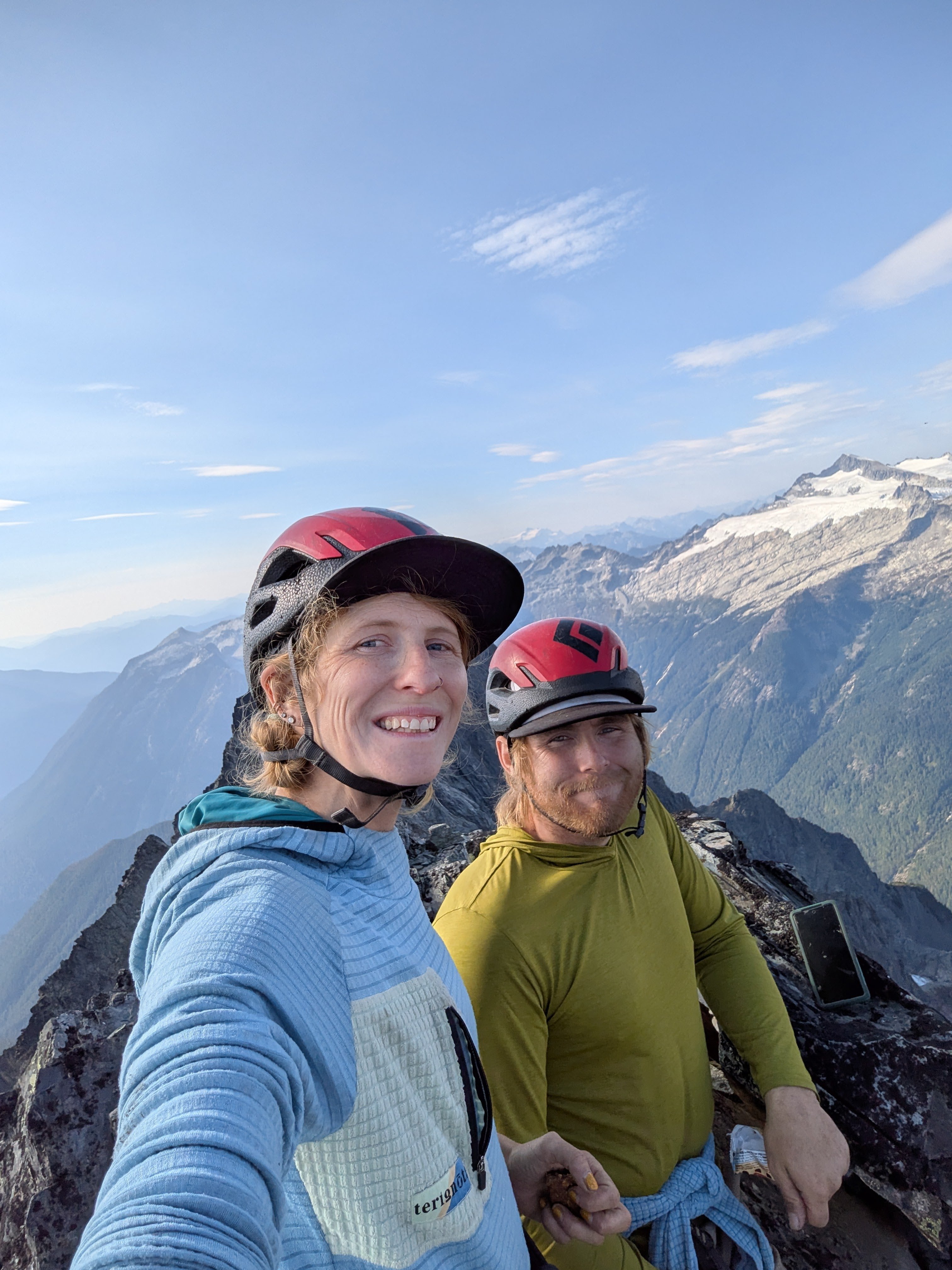
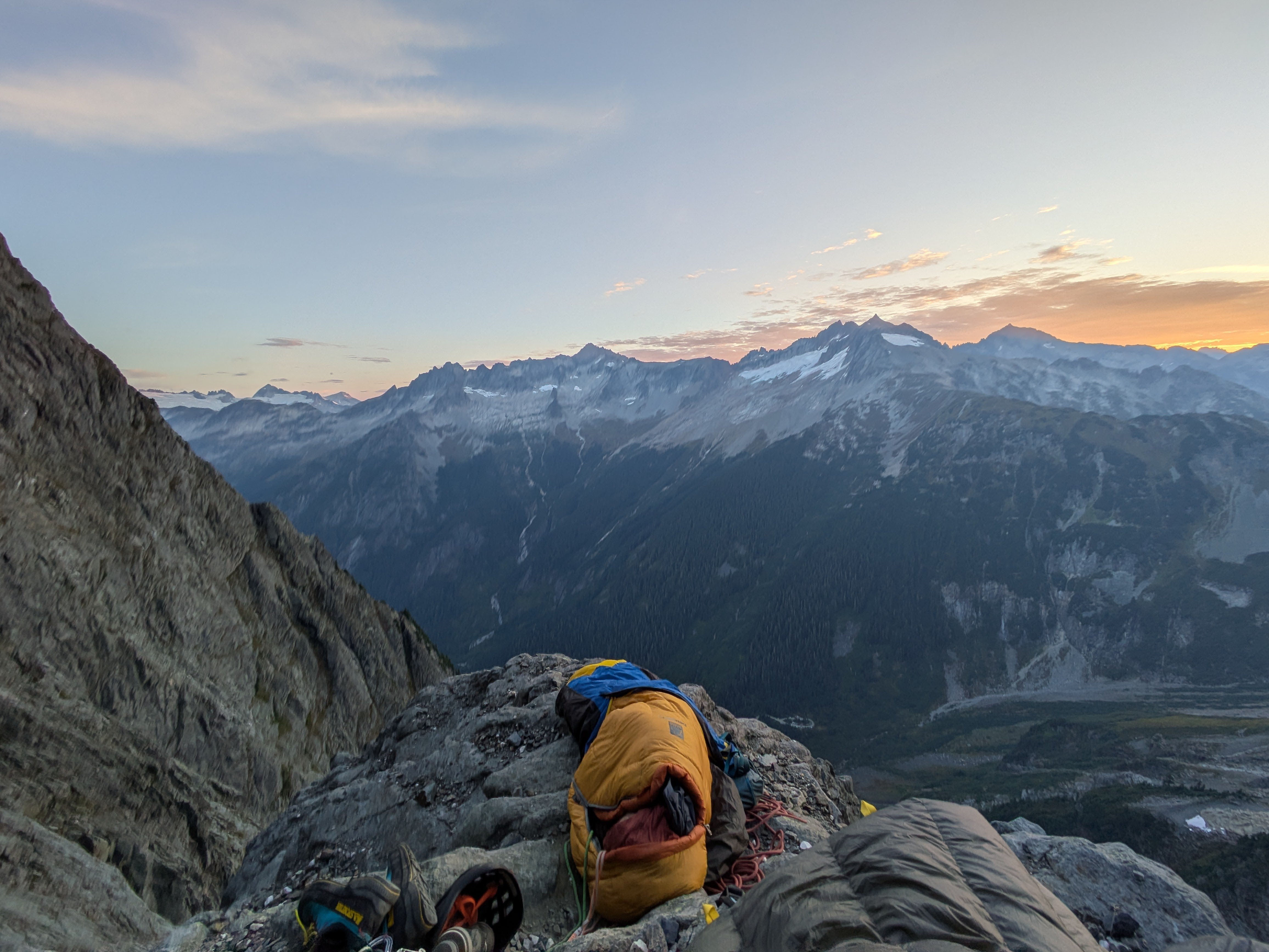
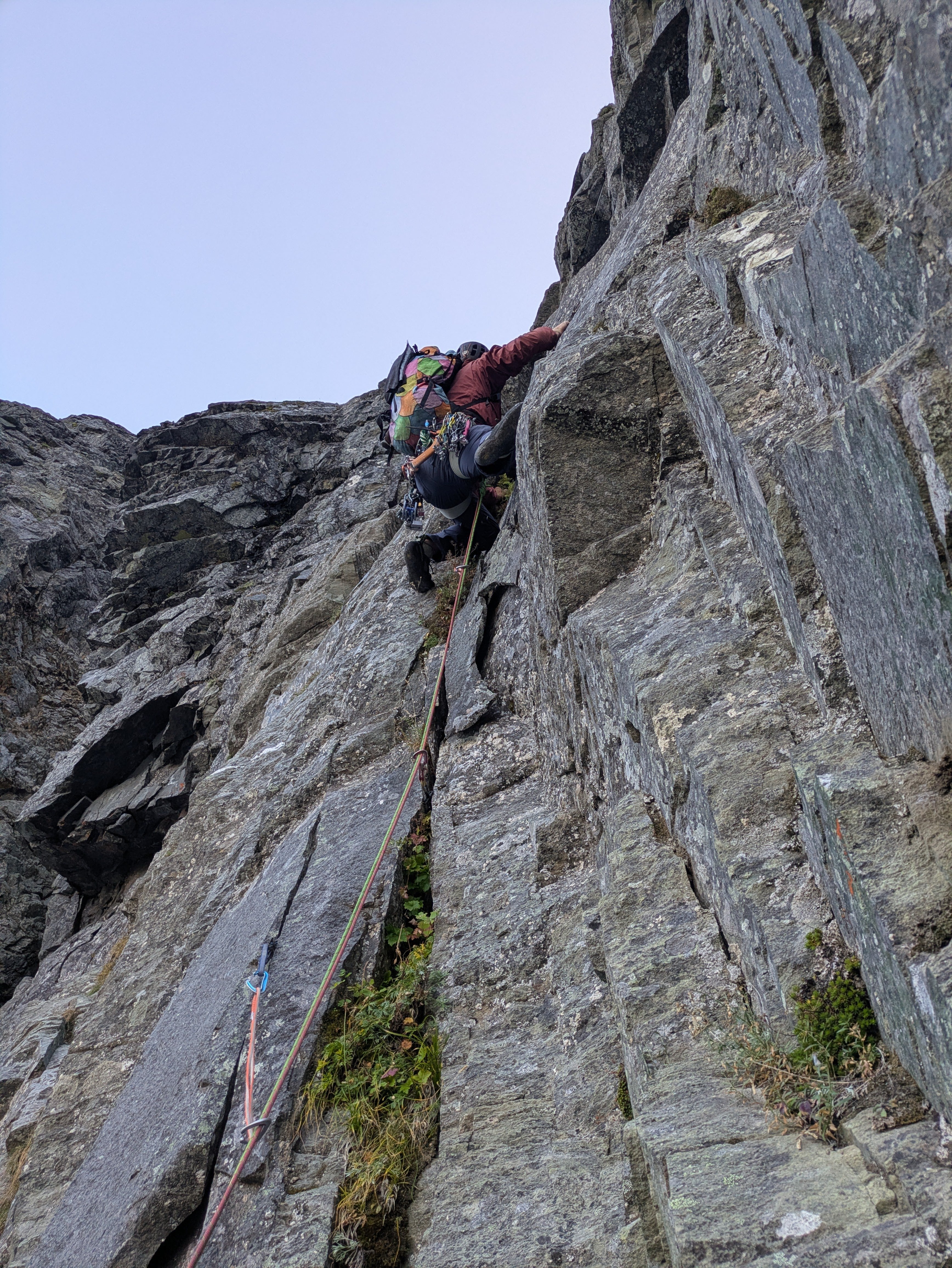
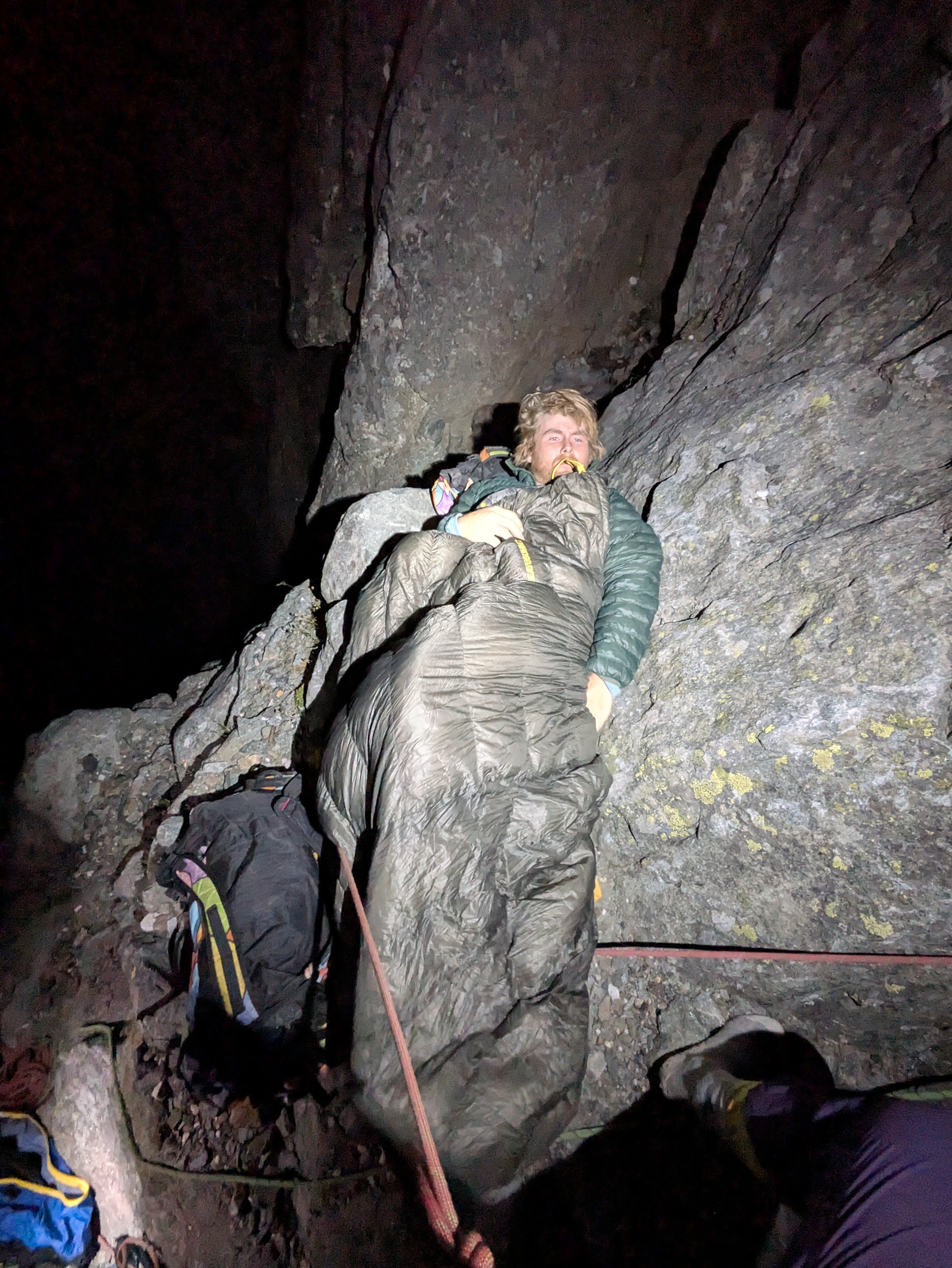
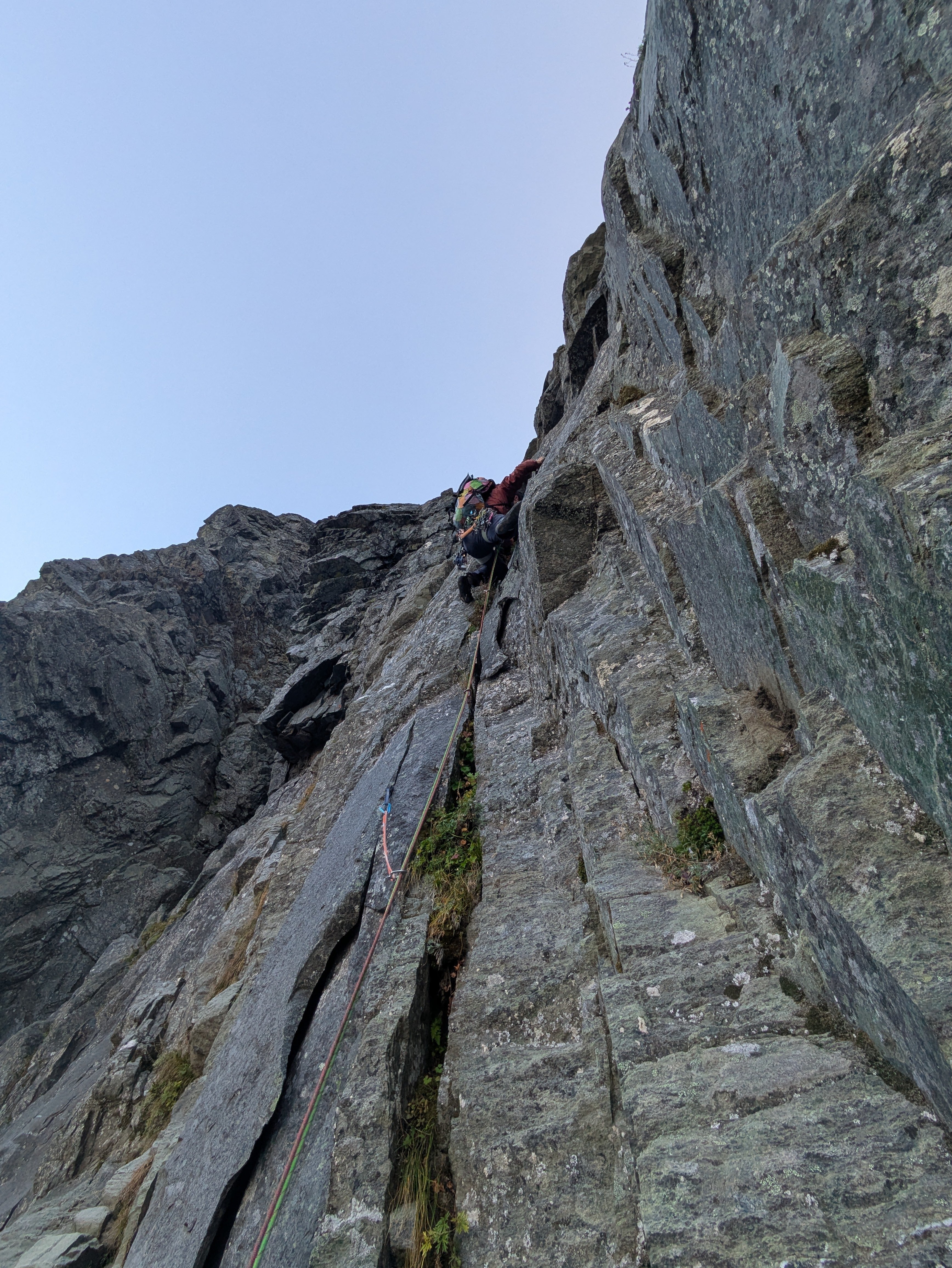
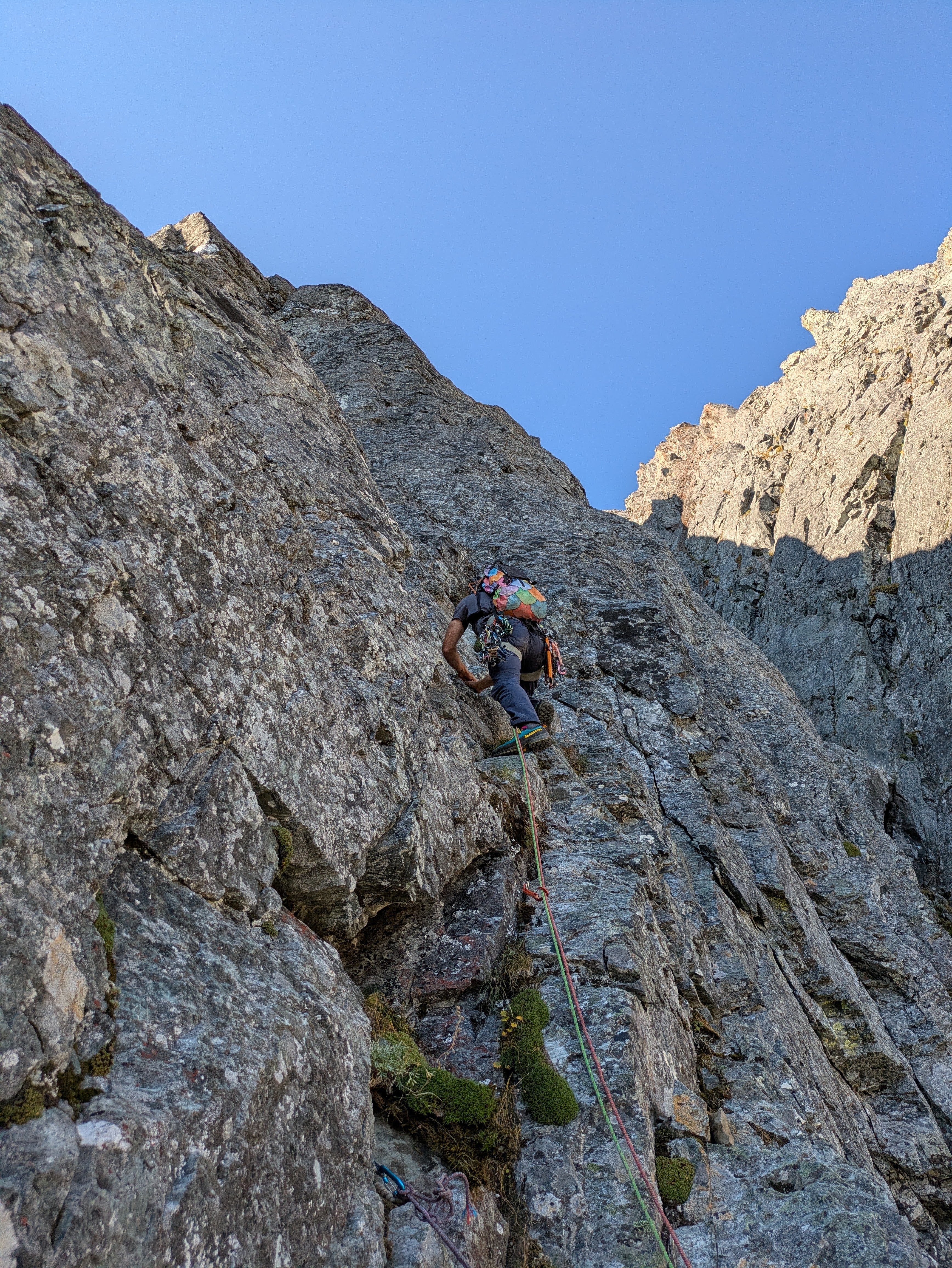
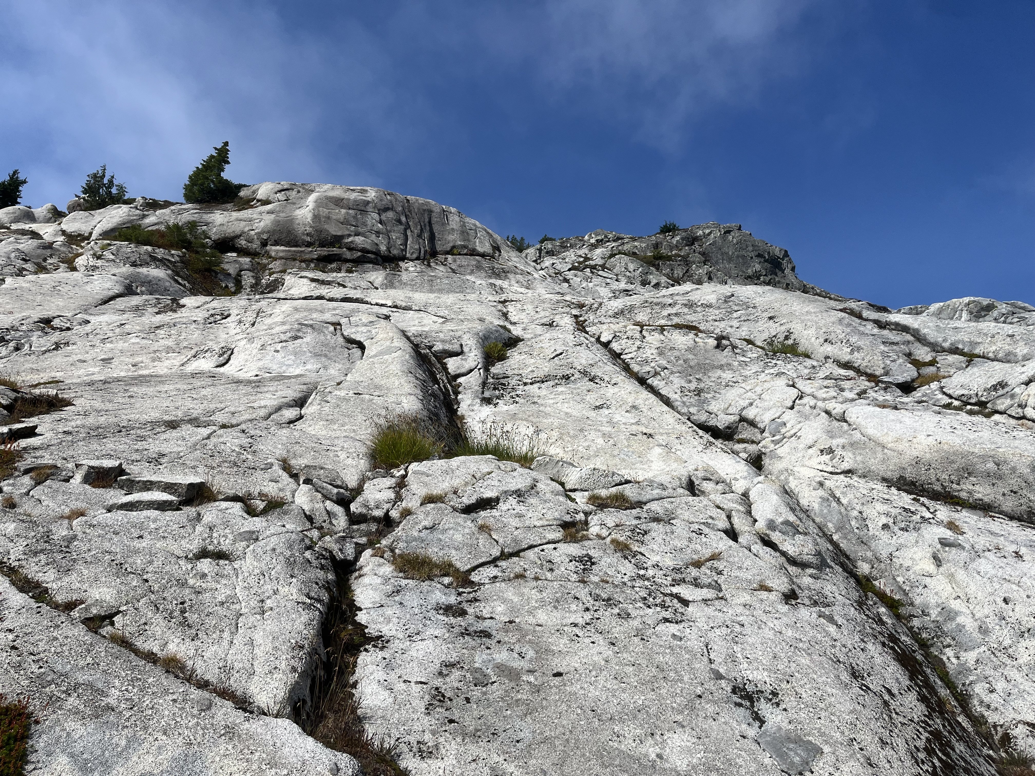
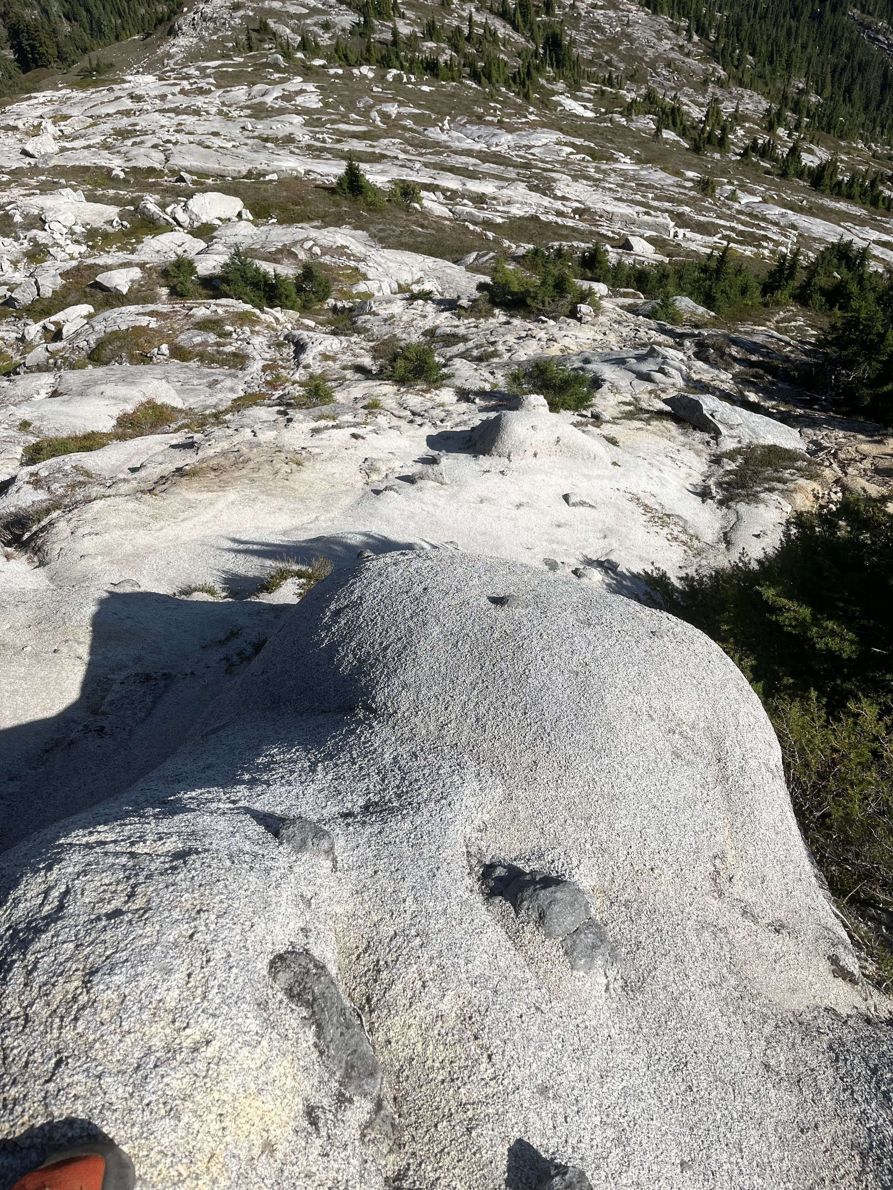
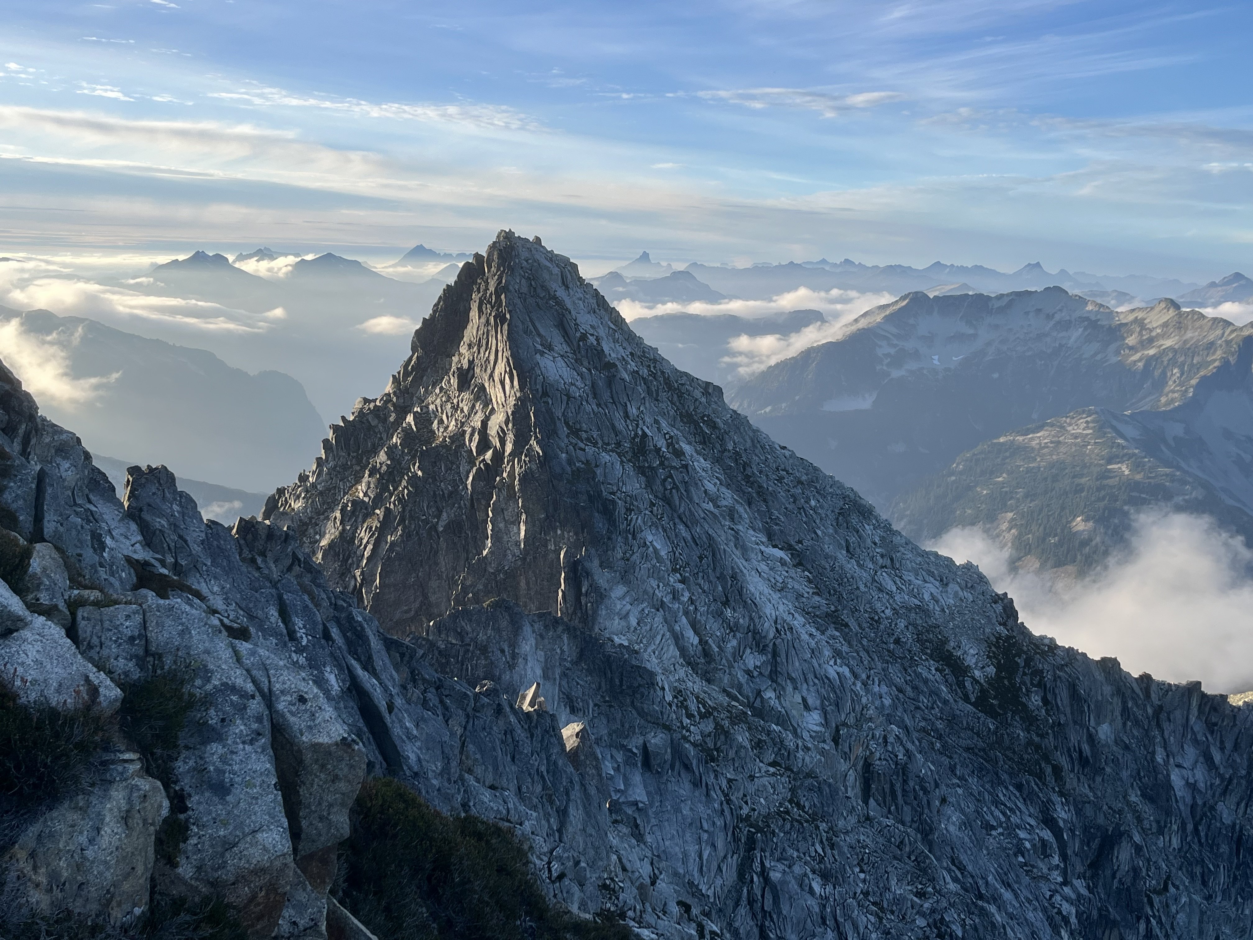
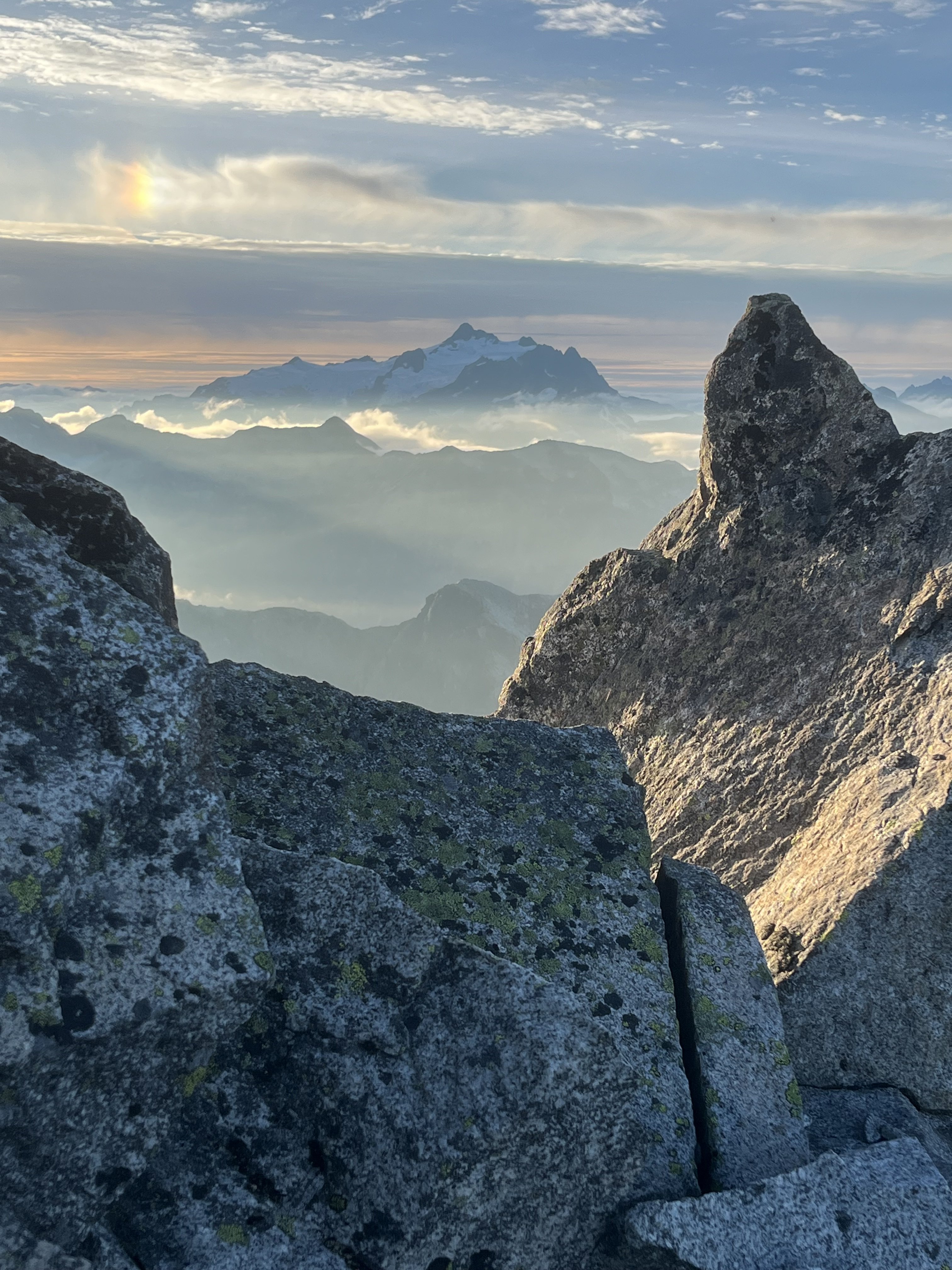
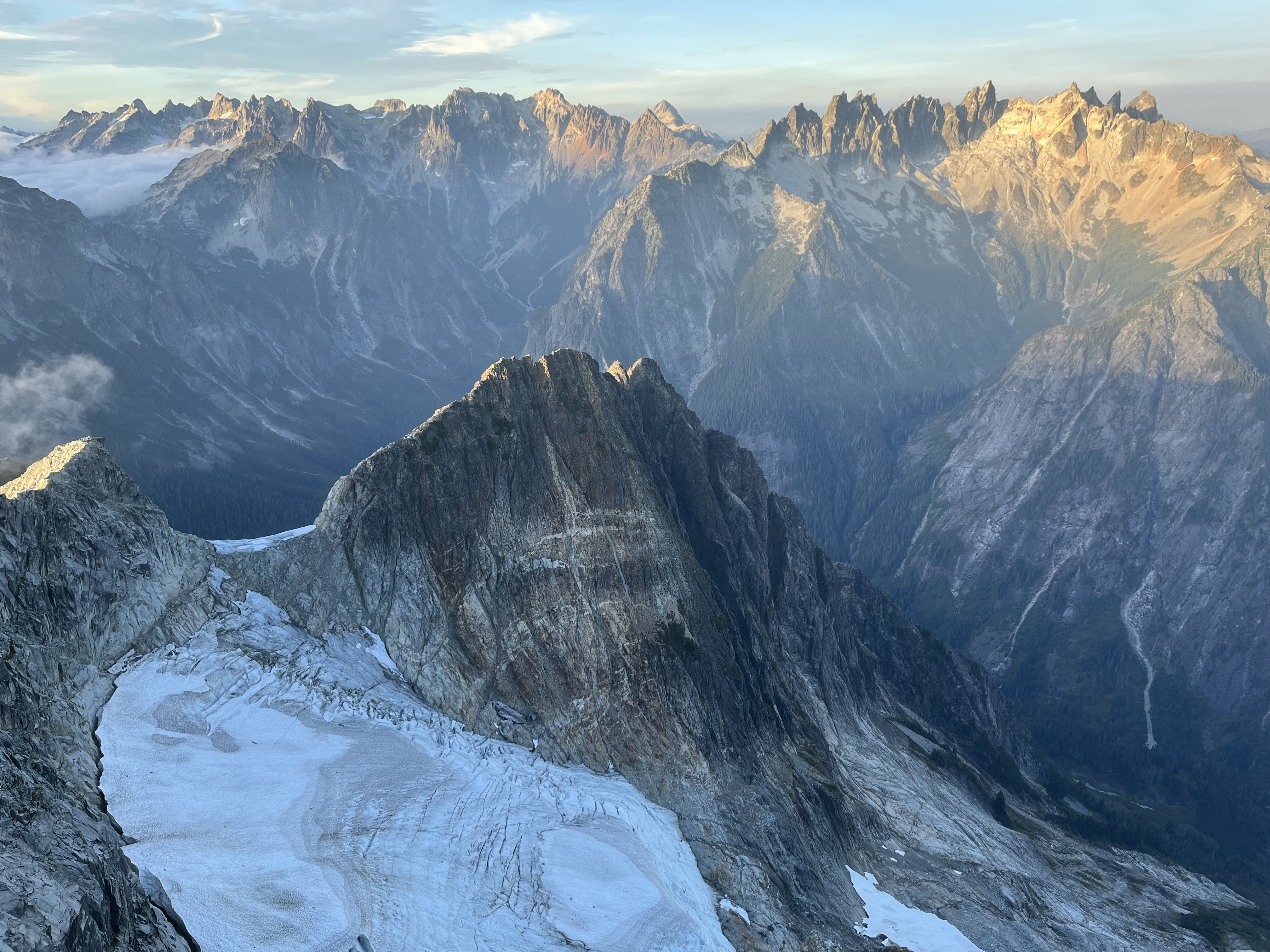
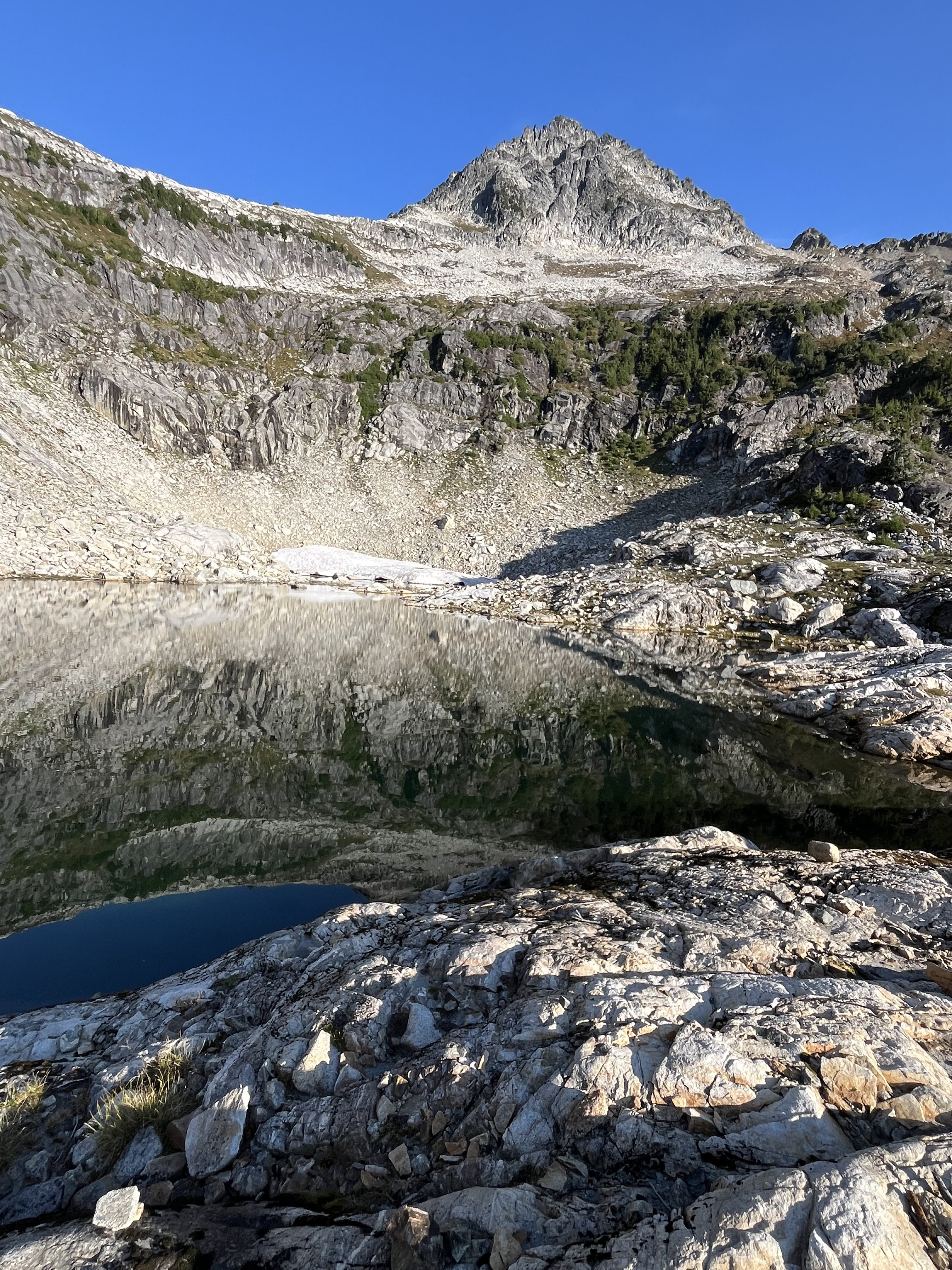
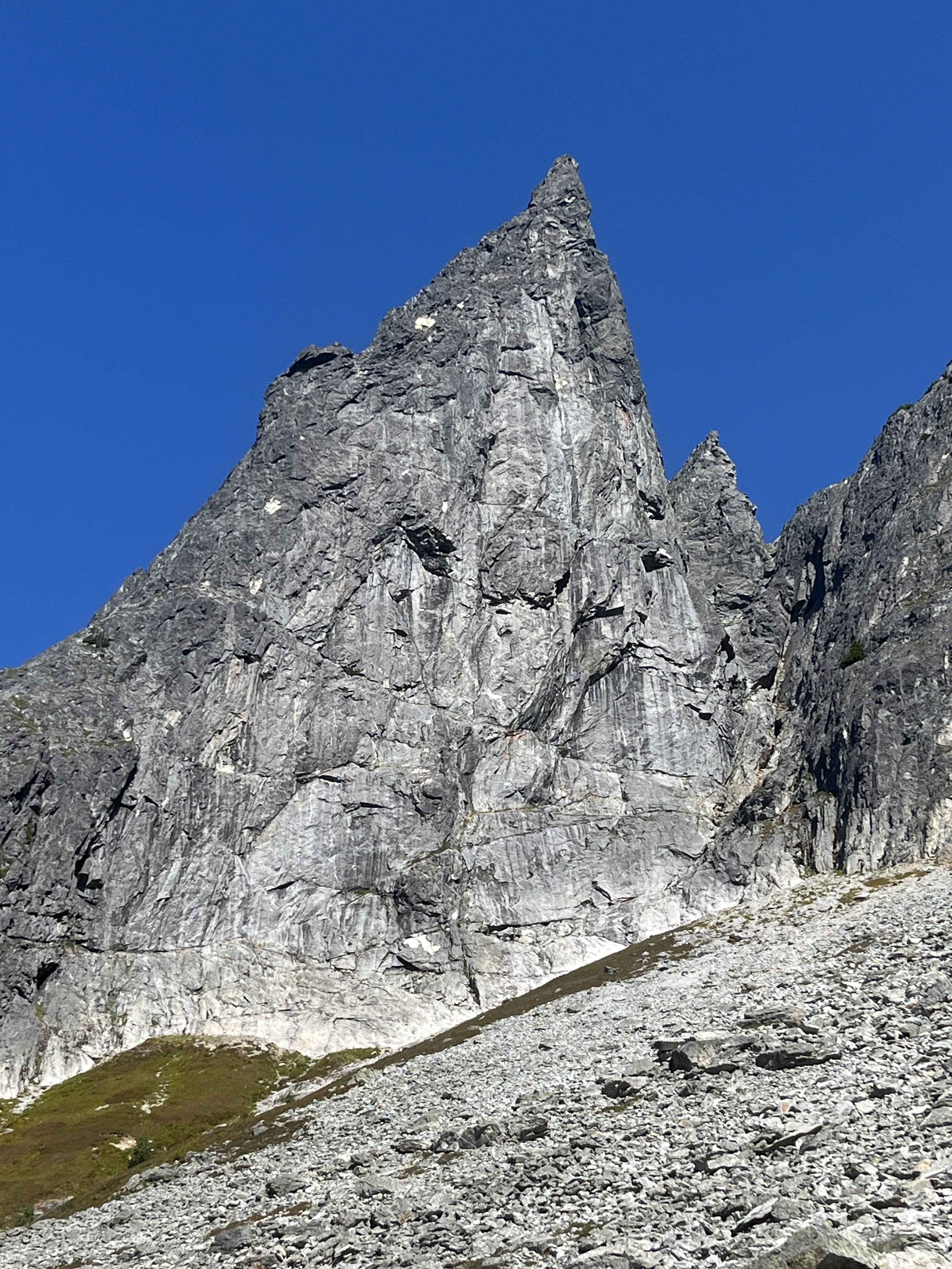
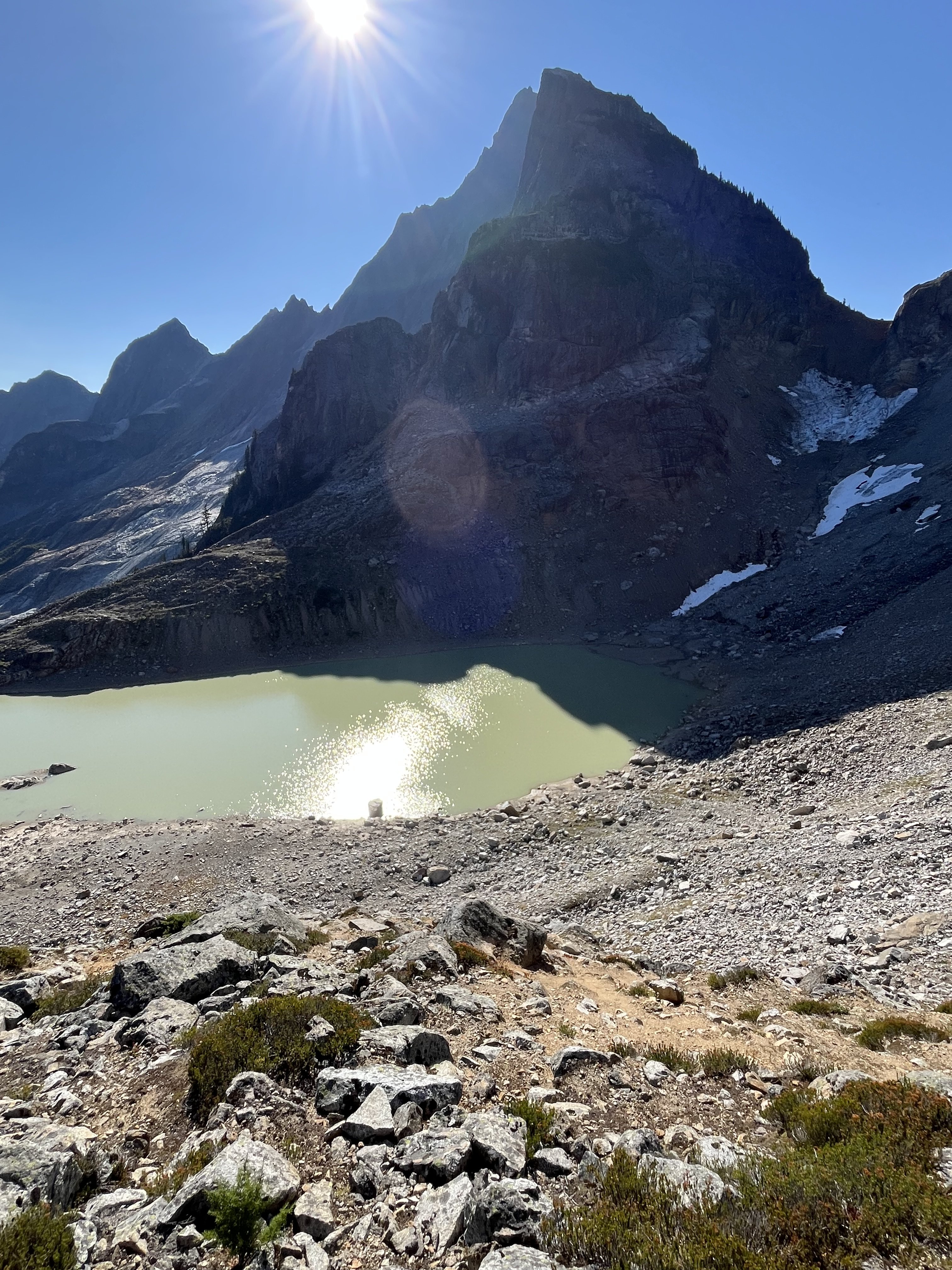
Over Sept 12-13 Eric Wehrly, Lani Chapko and I Climbed a new route on the NE face of Johannesburg. Like many features on J-berg, the scope of the NE face is overshadowed by the shear mass of the mountain. The face proper gains over 2000', with the entirety of the north face stretching nearly 5000'. We approached via the start of the NE buttress lines, then up glacial slabs directly under the hanging glacier, eventually climbing over the hanging glacier to access the face. We roped up for 23 pitches, totalling 3900' of belayed travel with 17 hours of climbing time split between two days. Our line of travel up the face Rough overview of the '65 route (left), Route 66 (middle), and the '67 route (right) Closer view of the 3 routes. Pink is where the Becky book shows the 65 route going (sharing a pitch with our line) but the green line is where we believe is more likely they went. The white circle is where we bivied. The forecast on the morning of the 12th showed fog, eventually clearing to blue skies. We opted for a somewhat late start and arrived at the TH to dense white out conditions. Our forecast all seemed to believe it would clear up, so we started hiking down towards the lower buttress hoping it would clear up. Lani going full euro The conditions did pretty quickly start clearing as we arrived at the base, but the rock and, more importantly, plant life was still wet. We decided to access the NE face via the first portion of the NE rib routes, as the CJ was an impassable death gully spitting rocks. The access climbing went generally pretty well, though we ended up unexpectedly roping up for a few pitches. None of us felt like dieing slipping off of wet moss... An early pitch on the approach Eventually we hit the hanging basin where the buttress lines turn right up into the thick cedar forest. We continued up slabs below the hanging glacier and found easy travel. The glacier presented with almost no hangfire this time of year, but early season, this would have the potential for overhead hazard. Lani and Eric on the nice approach slabs Broken ice on the hanging glacier The hanging glacier itself was mellow, though season and conditions will greatly impact this. We ended up chopping a bollard and doing a short rap into the moat at its top to gain access to the rock. Looking back at the bollard belay/rappel Climbing on the second pitch We likely shared some terrain with the 65 route here as we used the gully to access our intended crack system. The Becky topo makes it a little unclear where they went here, though you could probably assume they went up the gully. After a bit of gully travel we were able to escape to our objective face. The angle slowly steepened as we approached our "hand crack". The proposed crack turned out to be filled with gnarly munge, so we aimed for a thinner looking crack to its right. Eric leading the crux 5.10 crack The crack proved to provide the crux of the route, luckily it was relatively well protected... For the crux section. While perched here, a huge natural rockfall ripped down the 65 route gully, validating our concerns of gully trqvel and questioning the sanity of our ancestors. As Eric led the pitch, it became clear that we were about to loose the last bit of light, so we got our our headlamps and prepped for some night climbing to go in search of a ledge to sleep on. Two more 200' pitches gave access to a workable ledge. Lani and I somehow fit in this footprint, while Eric was on some downsloping round ledges below Morning at the bivy Racking up in the morning We all woke up a little creaky and waiting for the sun to warm us. Above presented with 3 options. Our original intent was to traverse right and climb a series of catscratch cracks. These however looked steep, and filled with munge. So we opted to work up and left to climb the top of a ridge feature (not even considering option 3, the unclimbed gully above). Its possible we share a pitch here with the 65 line, though the written description of their climb makes much more sense to have climbed an obvious ramp a couple hundred feet below (avoiding what would have been a gnarly mandatory impasse to gain their upper headwall cracks). Lani topping out the worst pitch on the route... A fun corner brought us near the ridge crest, where we climbed 2 awful choss pitches up to a gendarme, above here, the rock luckily turned back to decent quality shist. Eric starting up his choss ridge pitch Climbing on the pitch above the red gendarme Here we worked up and right on moderate terrain and eventually gained access to another big gully system that we believed to be the 67 line. We climbed this gully for 2 shared pitches to gain a notch on the NE buttress by the glacier. The final moves on the NE face Different view, same spot One mellow ice pitch brought us into some more easy scrambling to the summit. We all had approach shoes and aluminum crampons so ended up roping up for 3 total pitches of easy ice. Had we had boots or had early season snow coverage over the ice we likely wouldn't have needed to rope up for these pitches. Then we were in for the long descent down the East ridge and back over Doug's direct. Steep moraine dirt below the CJ We ended up getting back to the cars pretty late and made the rough late night drive home. Overall, the route only really had a couple pitches of bad rock. There were some tricky belays to build and some pitches were runout. Though very rarely was it hard and runout. It seems like the objectively safest route on the central part of the NE face as it climbs the least amount of gully of any existing route. We collectively give it a solid recommendation for the Cascades connesouir, or anyone keen on climbing the upper NE face. As always, here are my pitch notes.. Route 66 V 5.10 AI 2 Rack: Triples .3/.4; Doubles .1-.75; singles 1-3; full set of nuts; 3 KBs (used extensively for belays) P1-4 700' Alpine boulder problem pitches getting to the base of the NE face (up to 5.8 and AI2) P5 130' 5.7 A transition pitch up into the gully. P6 200' 5.6 Climb the gully, belay in the gully. P7 200' 5.9 Climb the rib left of the gully, stepping back right to belay in the gully again. P8 150' 5.6 Exit the gully to the right. Belay on a good, medium sized ledge below where the wall steepens. P9 100' 5.10- start with a steep, juggy roof to the right, then trend up ramps to a small ledge to the right of a large tombstone flake. P10 200' 5.10 Start up the flake (crux), then trend left on low angle terrain to meet the main weakness. Follow this up to a large ledge system. P11 200' 5.6 Traverse slabs rightward into a gully, follow it to a good ledge below a big roof P12 200' 5.8 "money pitch" Follow the gully, pulling the roof to its left, and continuing to another good ledge P13 250' 5.4 Scramble up the gully, exit left and belay at a ledge positioned below a big open book corner. P14 160' 5.9 Work your way into the corner, belay at its top. P15 170' 5.6 Ramble up loose terrain on the ridge crest P16 100' 5.8 Climb the super chossy ridge to a notch by a red finger P17 200' 5.5 Climb past the finger then scramble up to your end of rope P18 200' 5.8 Climb the grassy cracks above to gain the big chimney on the right, follow this to a stance in the chimney P19 200' 5.6 Trend up and right past two gullys towards the larger drainage feature P20 150' 5.9 Climb a face to gain a corner, follow this to a ledge at its top P21 200' 5.7 Continue up the gully P22 200' 5.7 Continue up the gully, belay at a notch on the NE butt by the glacier P23 200' AI2 one pitch up the glacier.
 2 points
 -
2 points
-
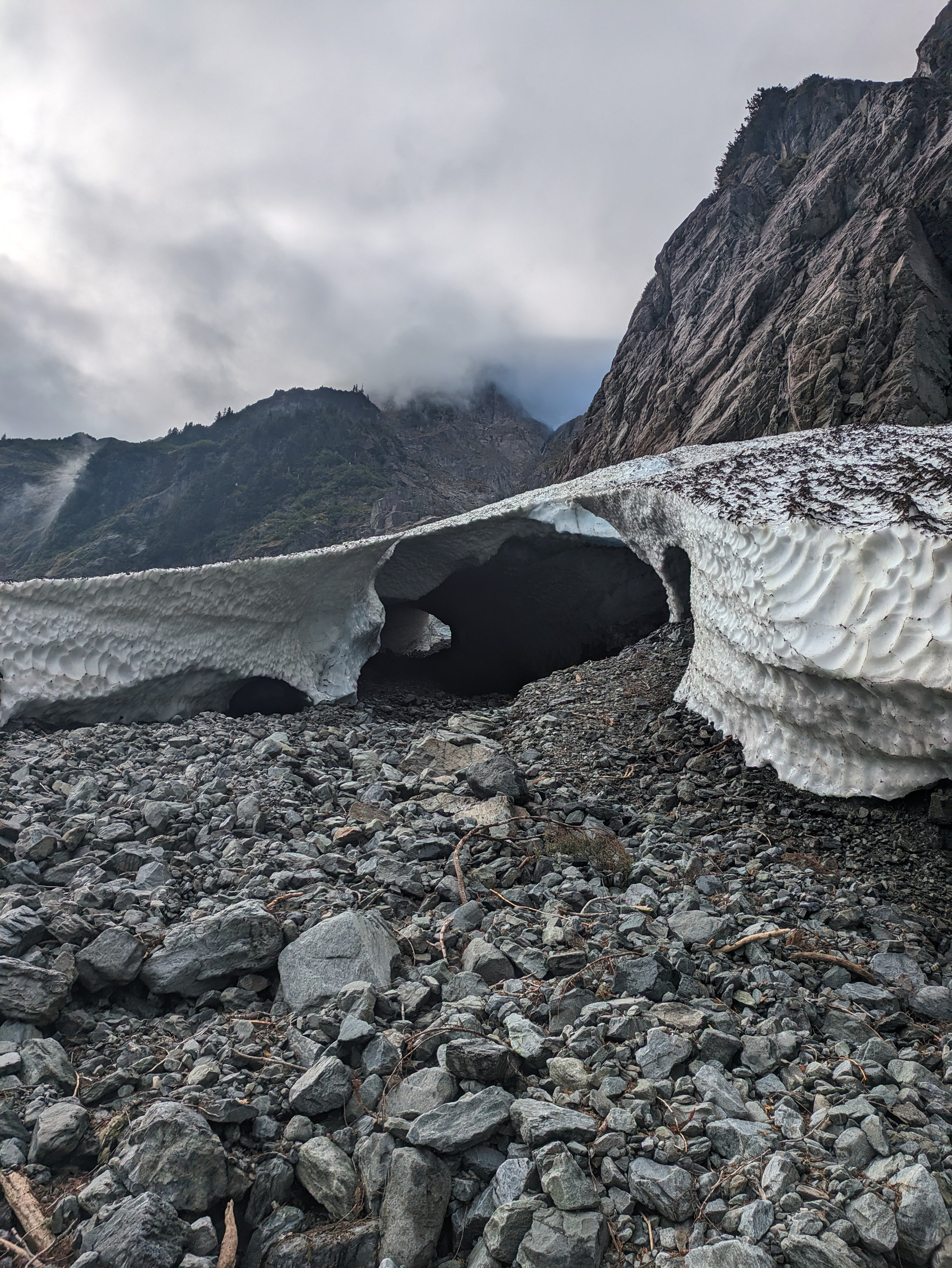
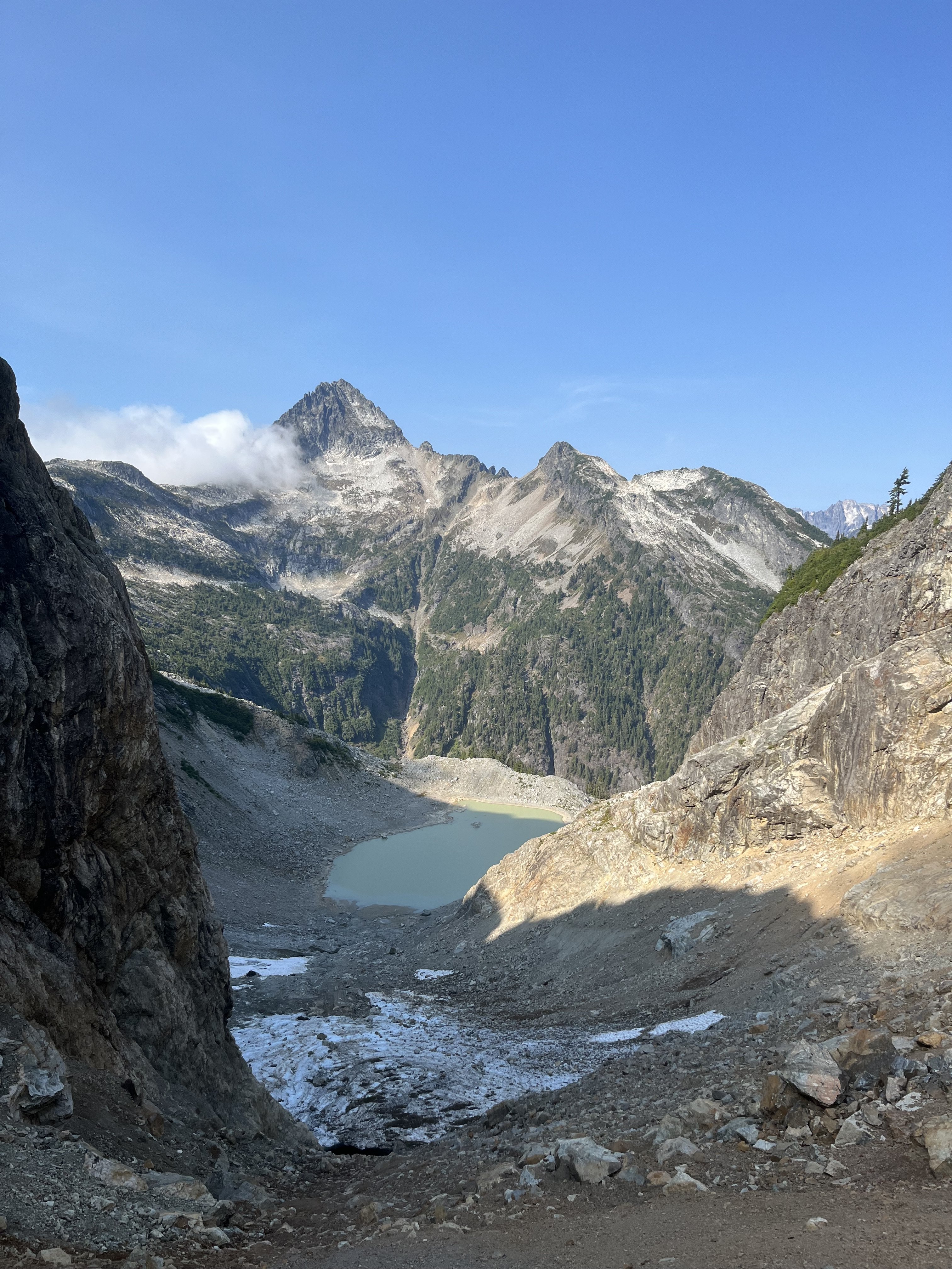
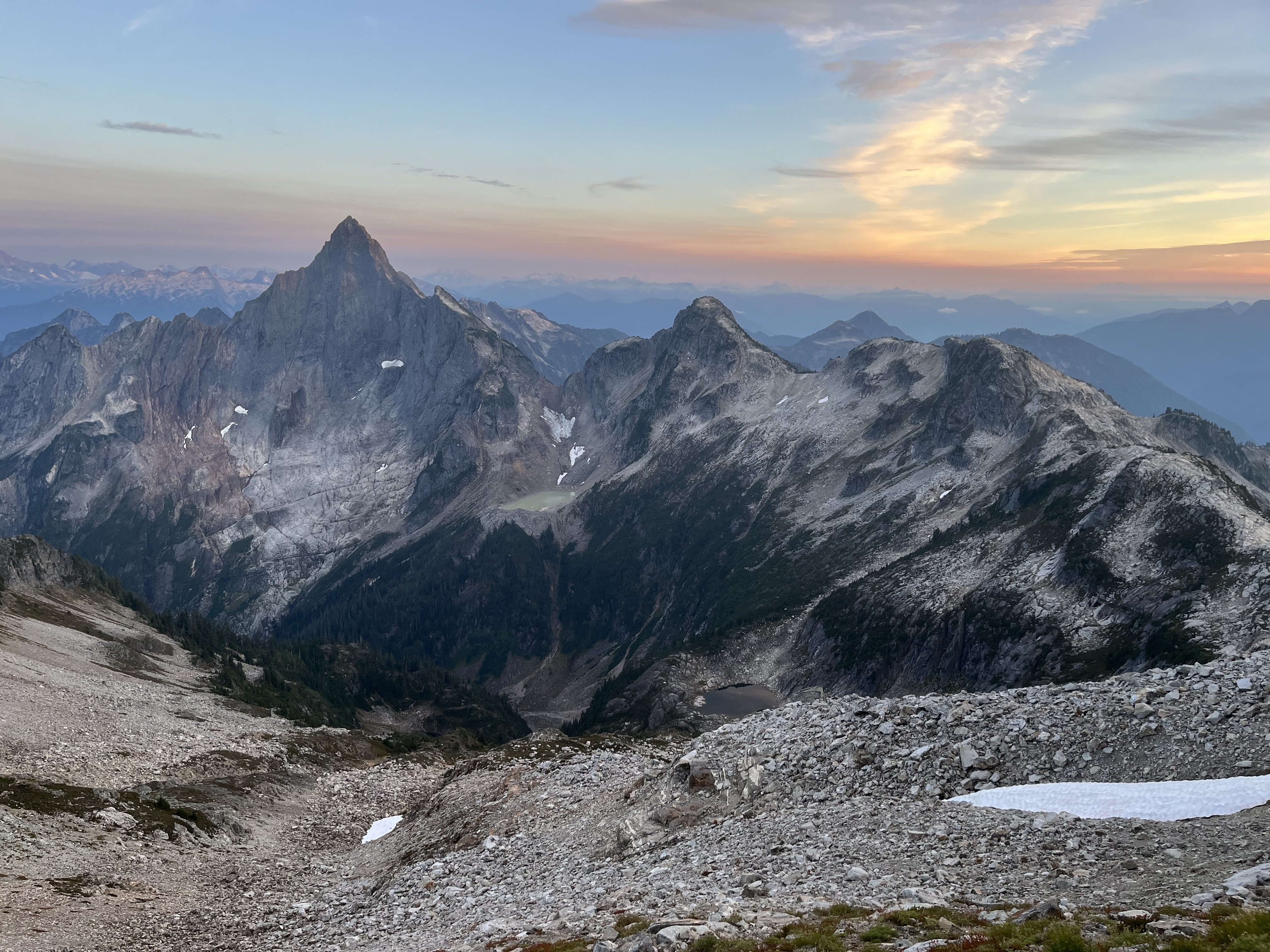
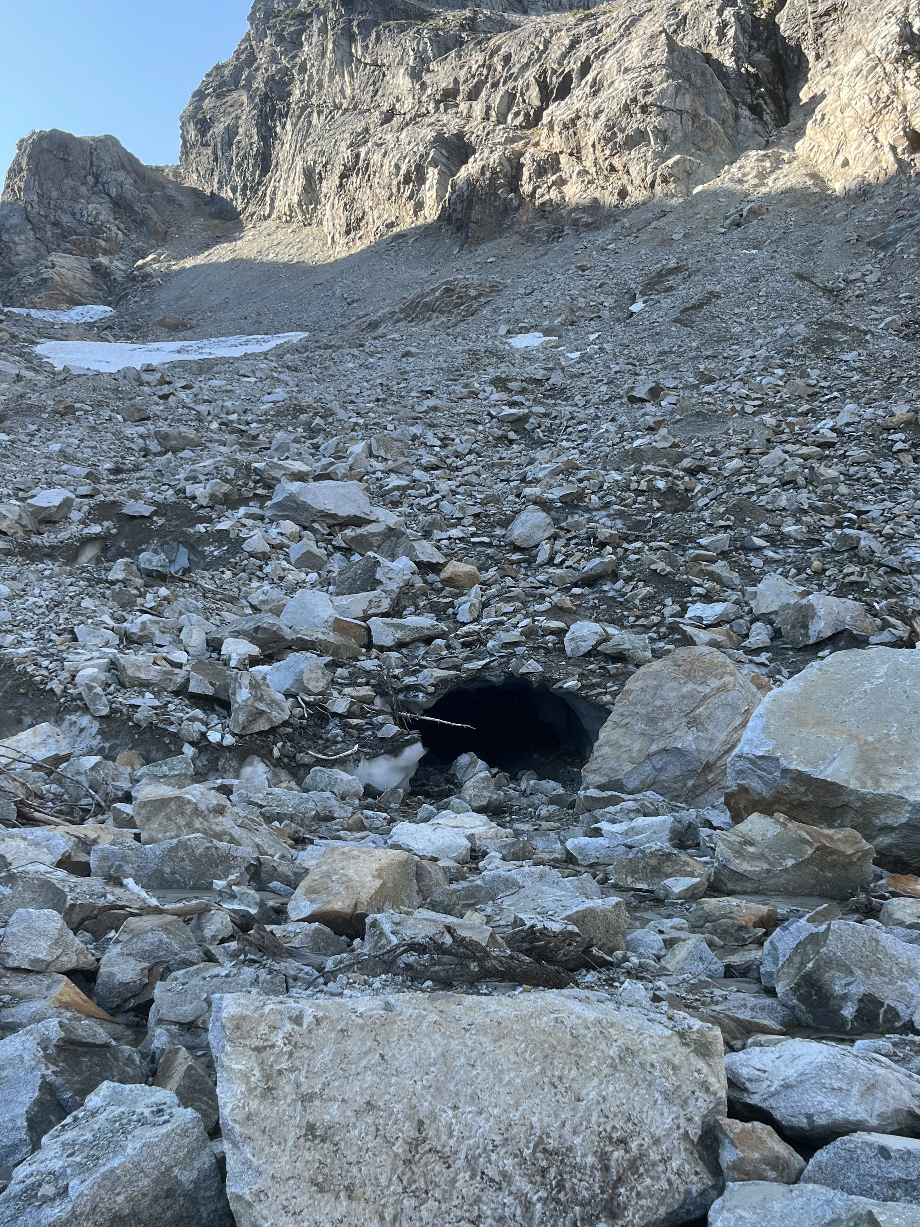
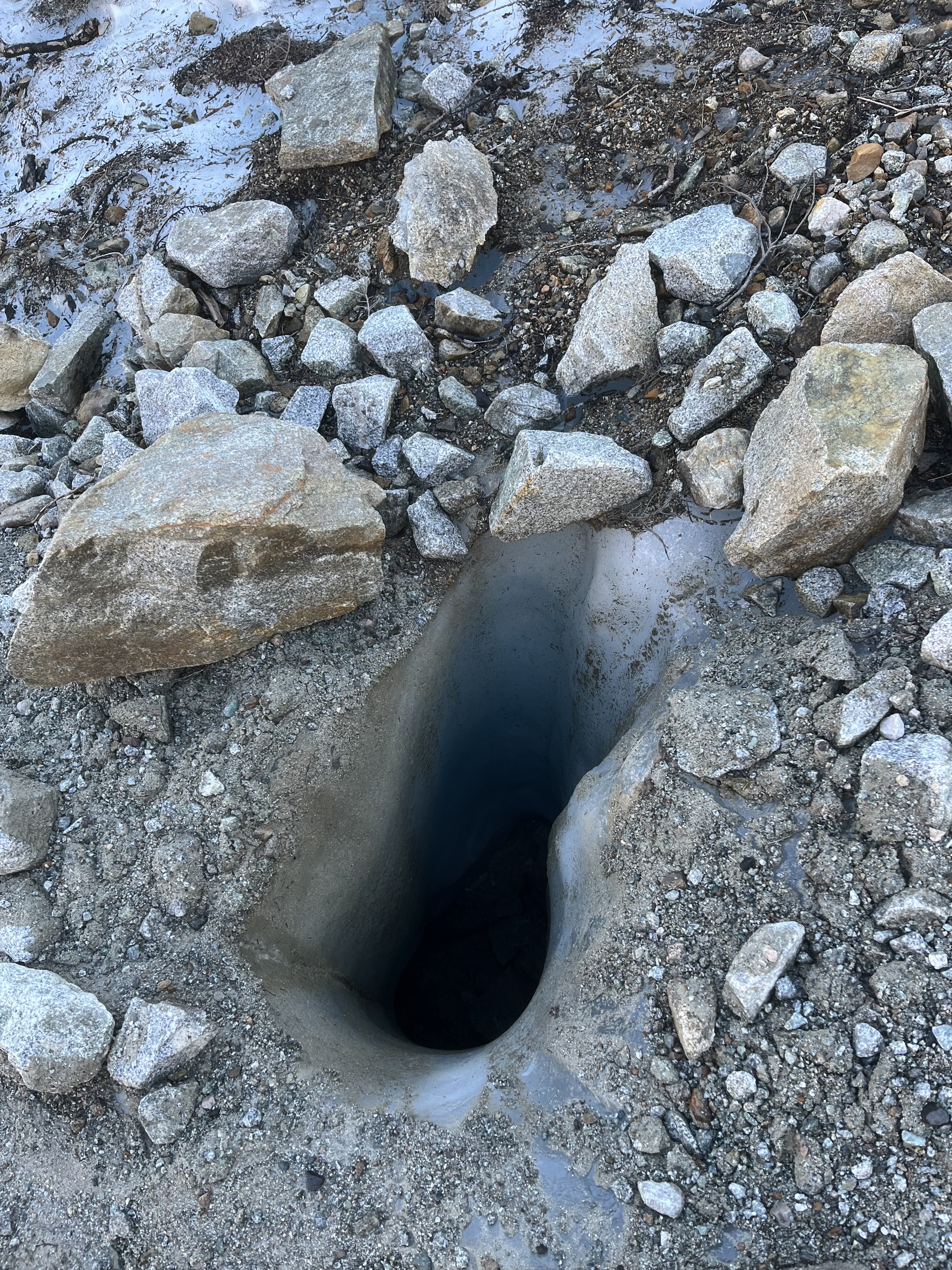
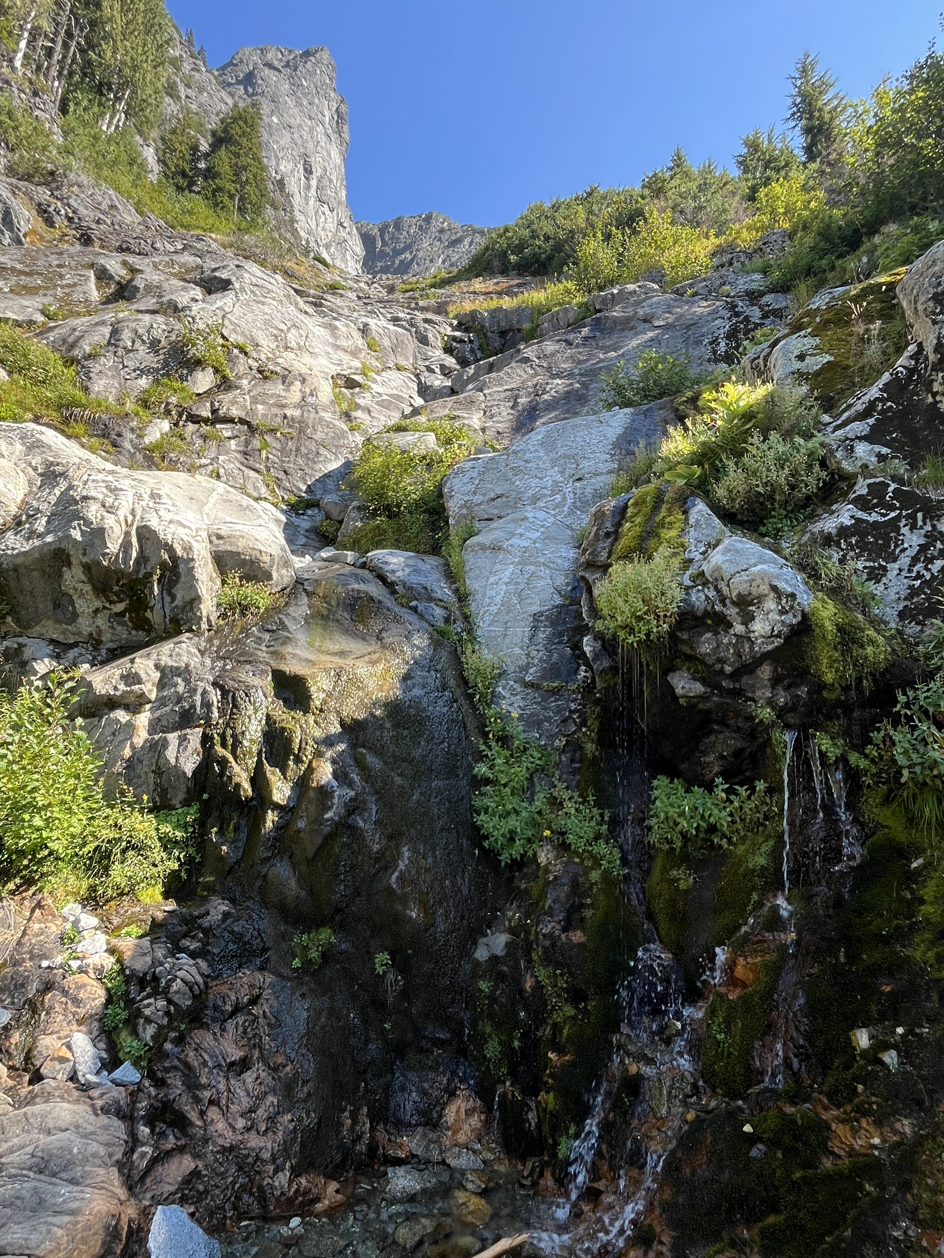
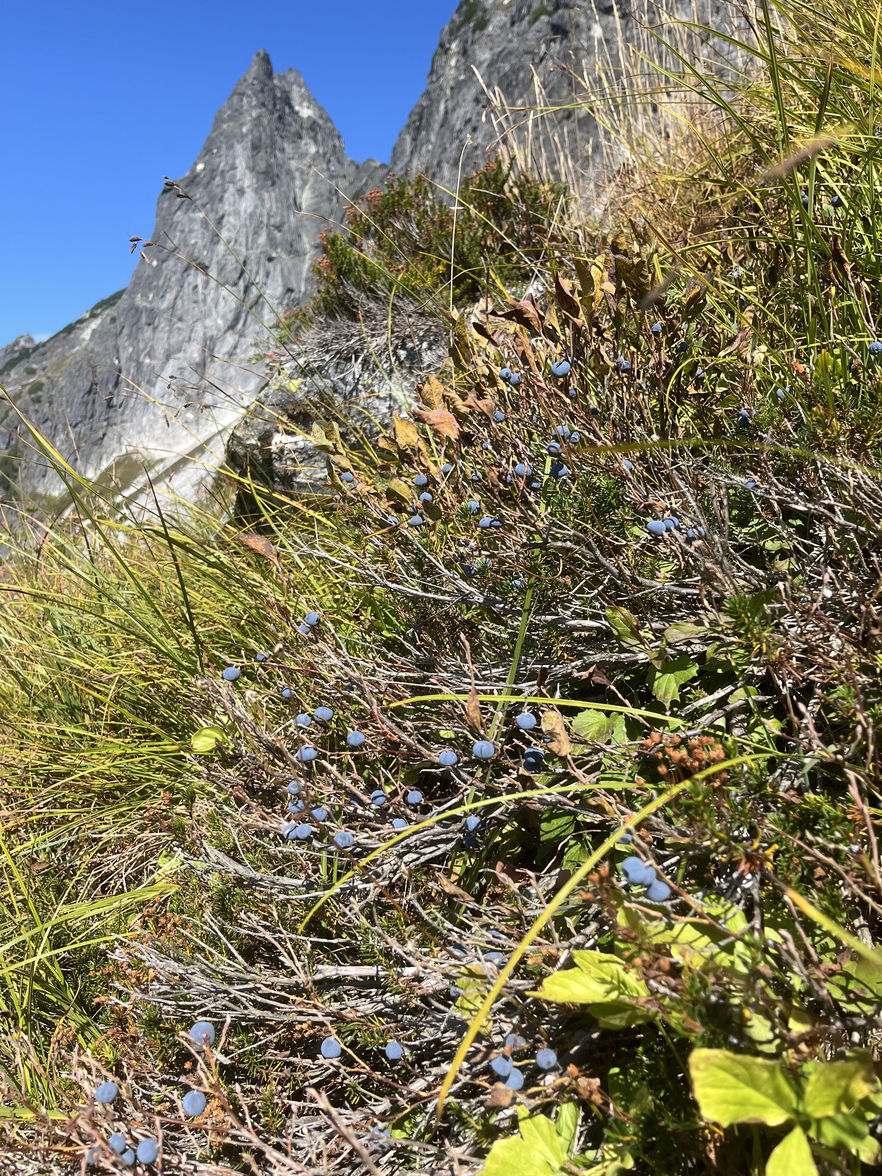
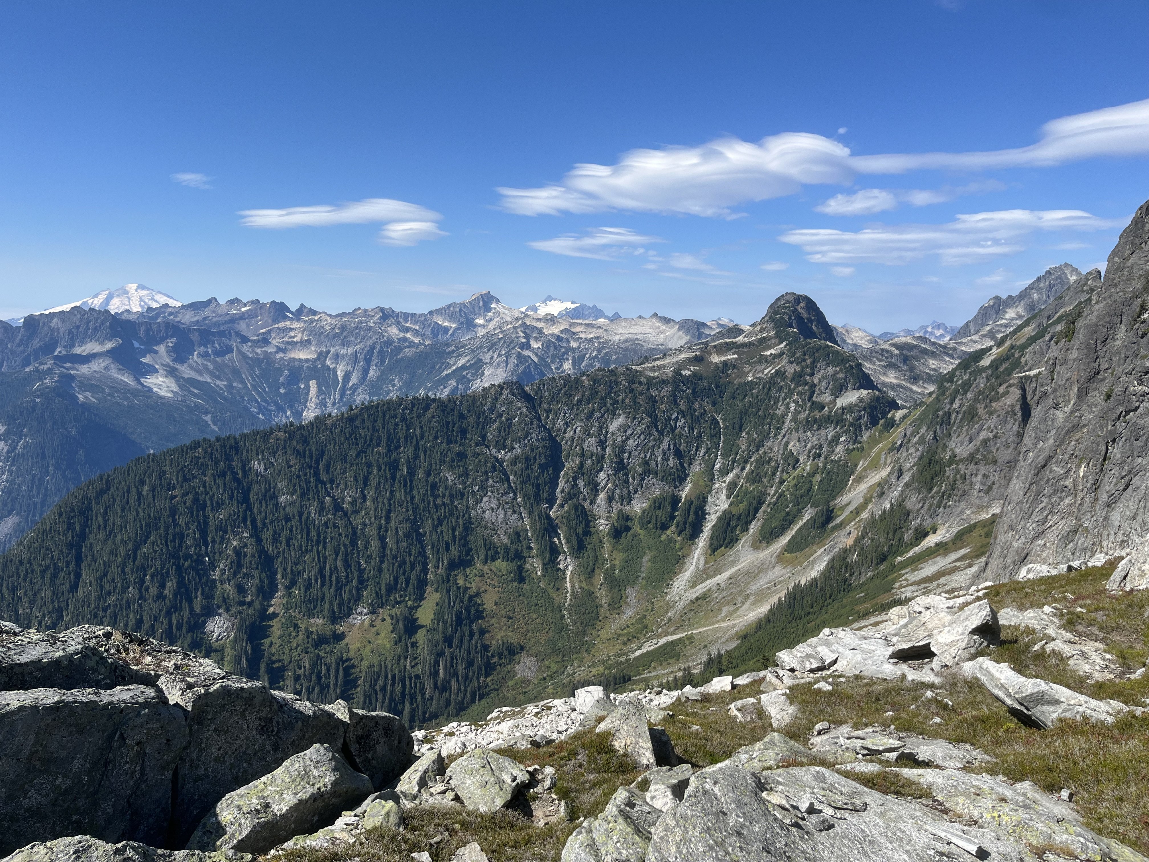
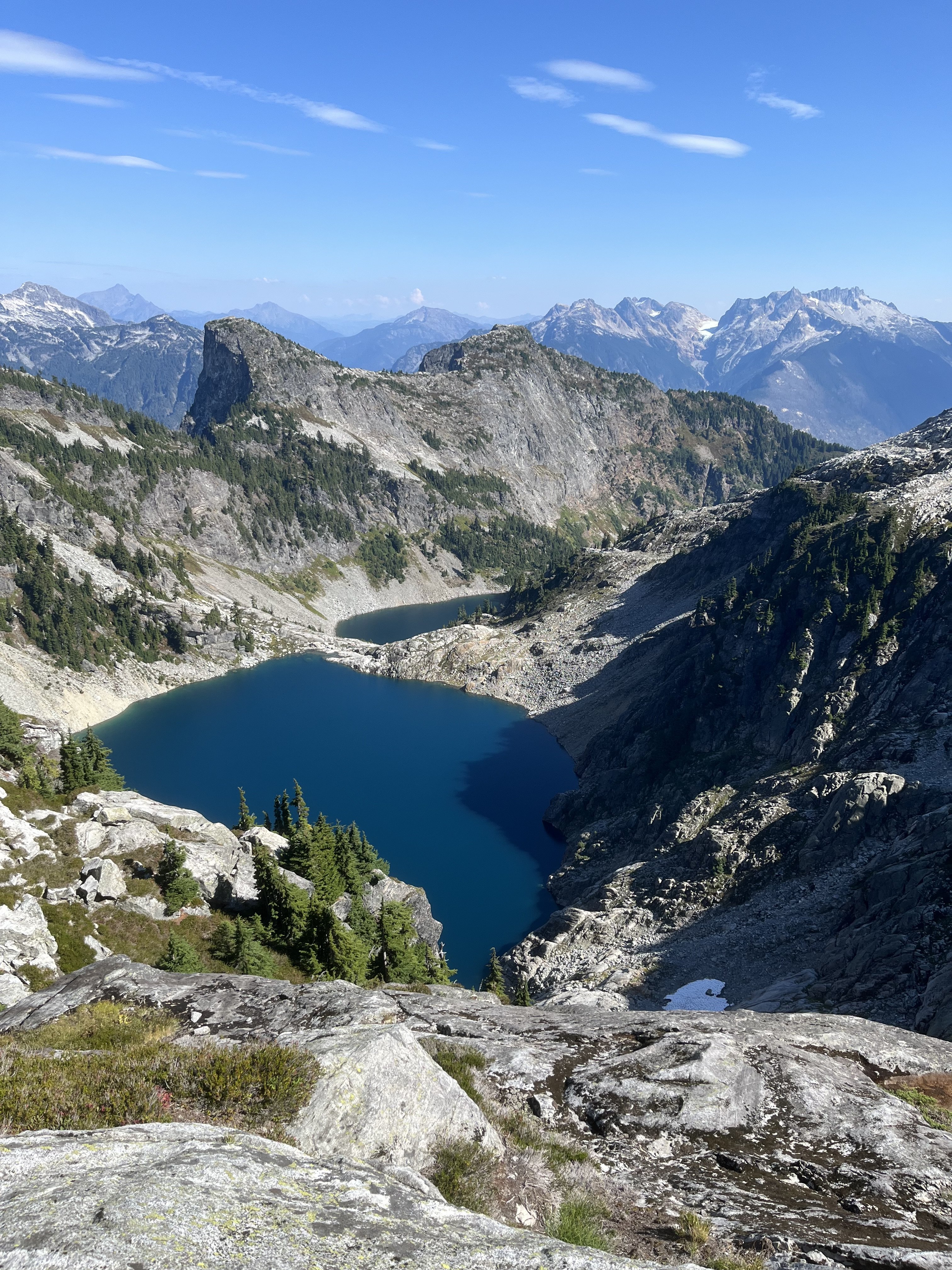
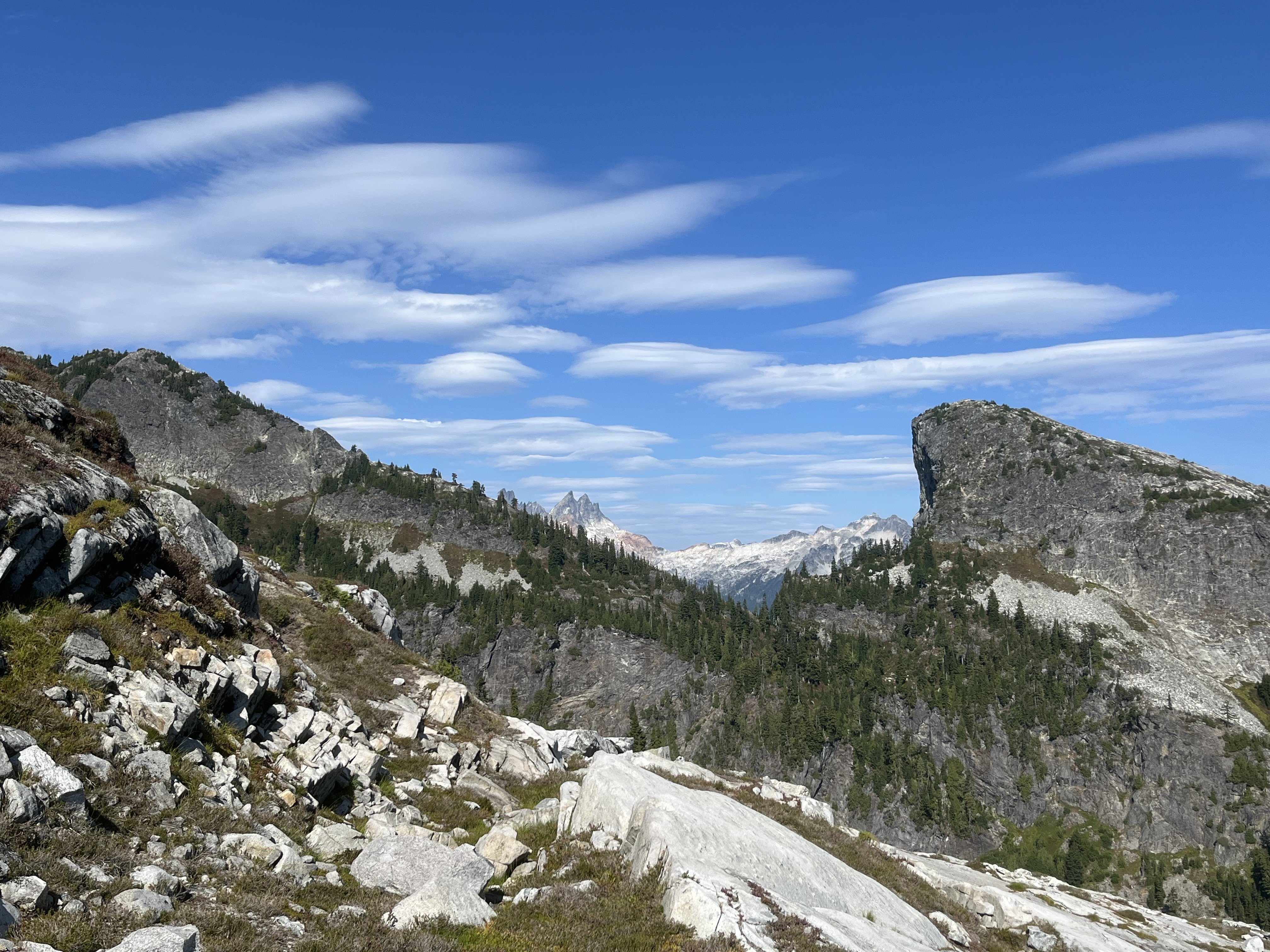
Trip: Despair (south peak) - East / SE side Trip Date: 09/12/2025 Trip Report: Strained pulley + nice forecast -> scramble somewhere new. South peak of Despair was my solution. As a late season climb it works pretty well. Not the most classic of routes though. Has more than its share of loose talus, and it’s a little stingy with views. For all the vertical and time involved, most of it is not very high, and wrapping around tall walls keeps much of the neighbors hidden. Started out dodging cones the squirrels were busily raining down. From Thornton lake it’s not obvious where to start heading up. I think all options would involve a little brush. Nice slabs are not far away. On my return I ended up a little farther skier’s right where there is some weird sandy gritty knobby sloping geology for several hundred feet. From the pass at 6150’ clouds blew in to obscure the way, which was pretty tedious talus side hilling. I did two different variations to and from the steep creek, each involving 300 vertical feet of shwacking, and both fairly bad. Maybe getting into the creek higher up would have been better. I traversed out of it into woods at 4660’. Another series of steep parallel dry stream beds led to Triumph pass. The snow and ice north of Triumph pass was not as easy to avoid as I had guessed from recent satellite imagery. At first I tried to cut though it to get to slabs on the left side. Though low angle it was down to pure slippery ice. Dirt patches initially provided traction but I dead ended when these ran out. Headed back up and off to slabs higher up. These slabs skiers left of the snow are of course dirty and exposed but fortunately featured enough to keep it at about 4th class. After the slabs the easiest way was to cross the steam back to the right, and then left once more at the bottom near the lake. On my return the next day I was able to avoid the exposed ice entirely by climbing the slabs farther past that stuff. In the traverse to the higher lake below Despair I came across two running streams, filled up at the first. Dropped the overnight gear at the lake and headed up to the east end of the peak. Took a pretty direct line near the ridge on the way up, and took easier and cleaner slabs on the SE aspect on the return. The next day I simply had to return to the trailhead without wiping out too hard on any of the loose talus. Hidden tunnel and weird negative column probably 15-20’ deep The steep creek with steep woods to its west and shwacking to its east. Impressive south face of Triumph, I wonder if there are any good routes. Safe to say there were millions of huckleberries in the basin at least. I find it hard to move efficiently in conditions like these. Cool lenticulars this day Gear Notes: One pole Approach Notes: Thornton lake then off trail
 1 point
 -
Nice write-up, Sam. Overcoming the myriad challenges with you two sure was fun. Being up on that wall made me feel small. Reflecting on climbing this and Little J-berg the same summer, a couple things come to mind: 1. the latter's name is apt; and 2. I think I should seek help.1 point
-
May I present a route conception of an old aid route that got dusted off. I wish to promote updating it further with modern anchors if the right person took up such a project, thanks Wayne. https://www.mountainproject.com/route/201702439/danas-arch-complete-aid#a_2017024401 point