Leaderboard


Popular Content
Showing content with the highest reputation on 09/03/25 in all areas
-
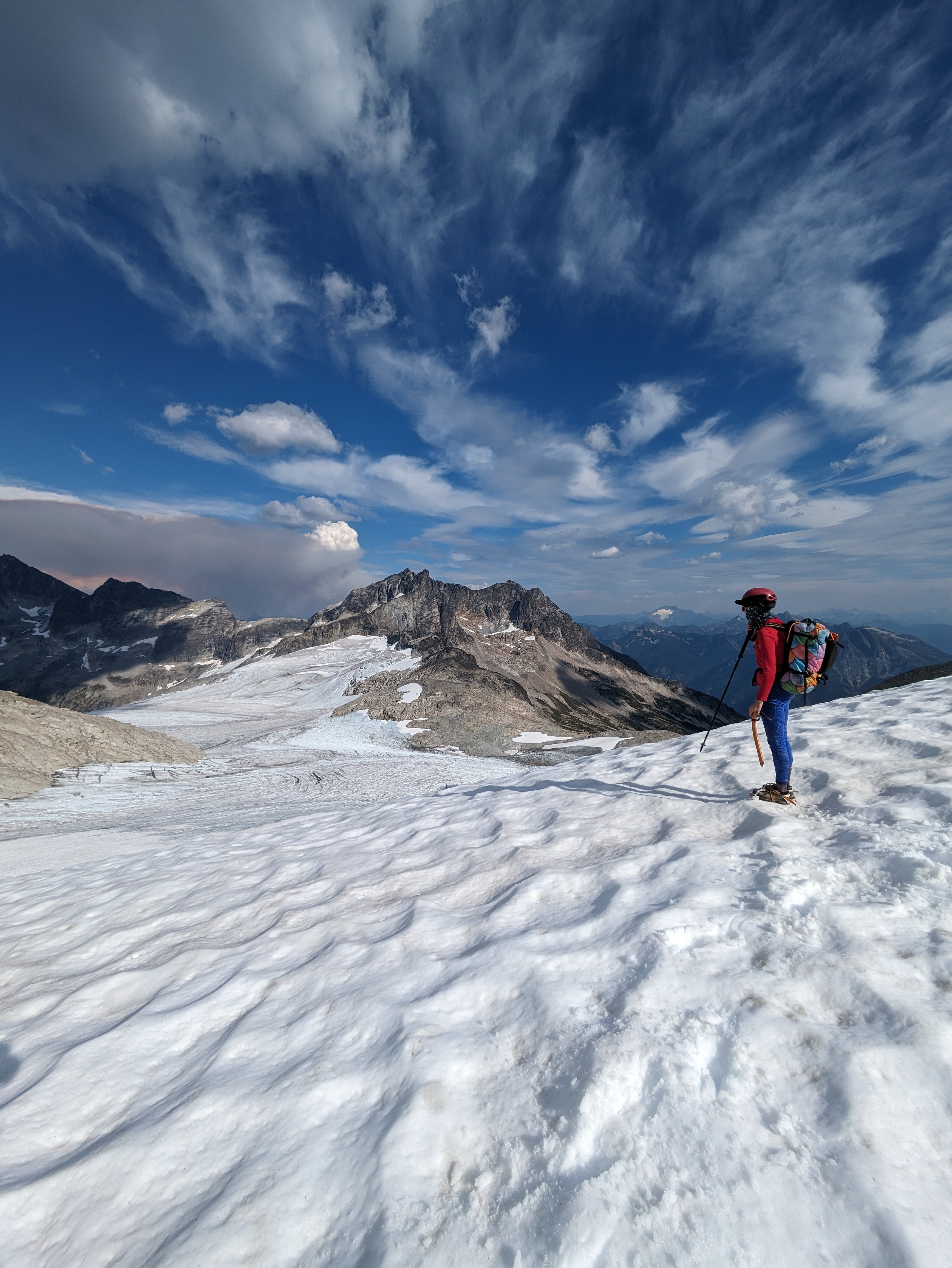
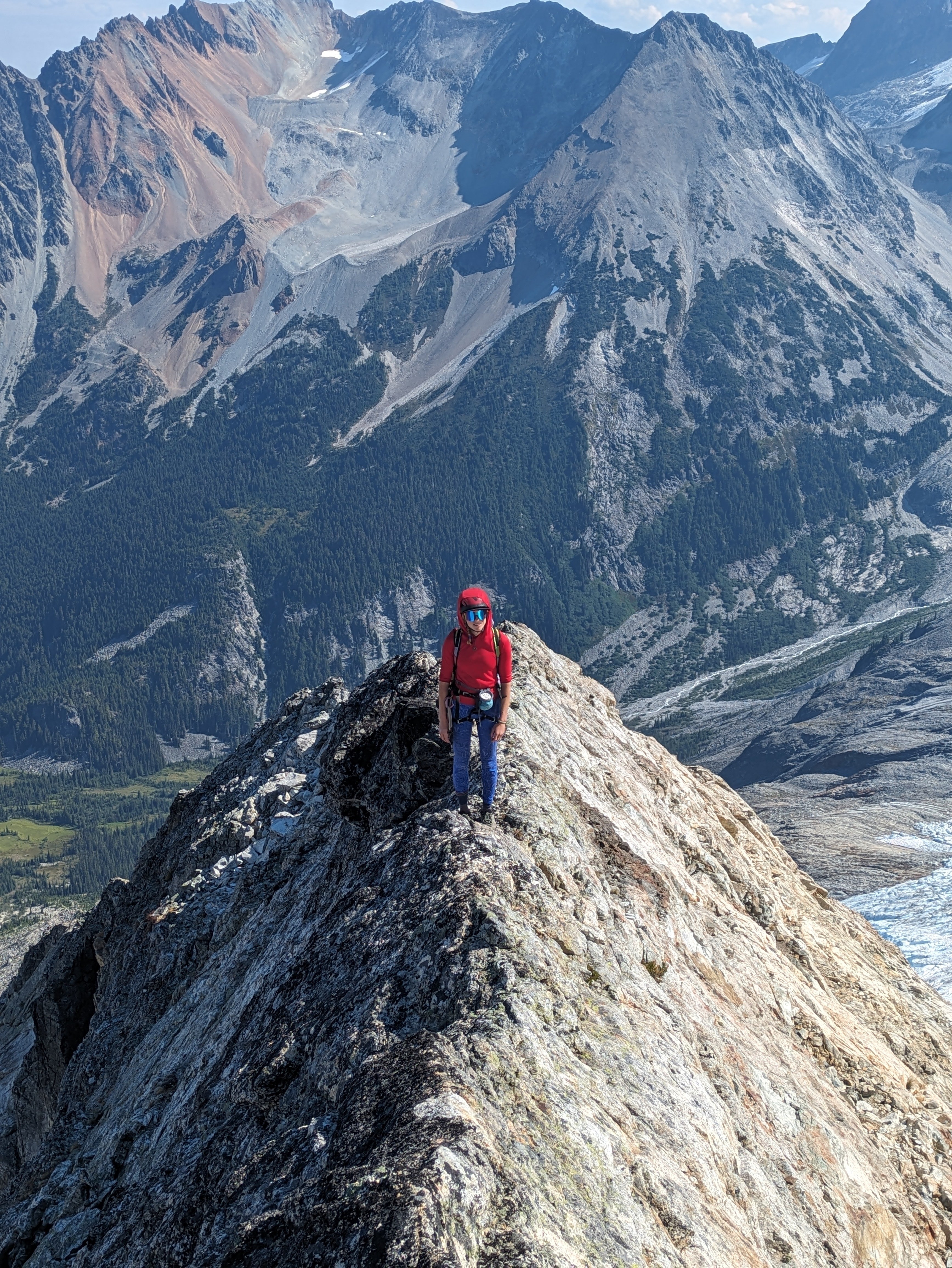
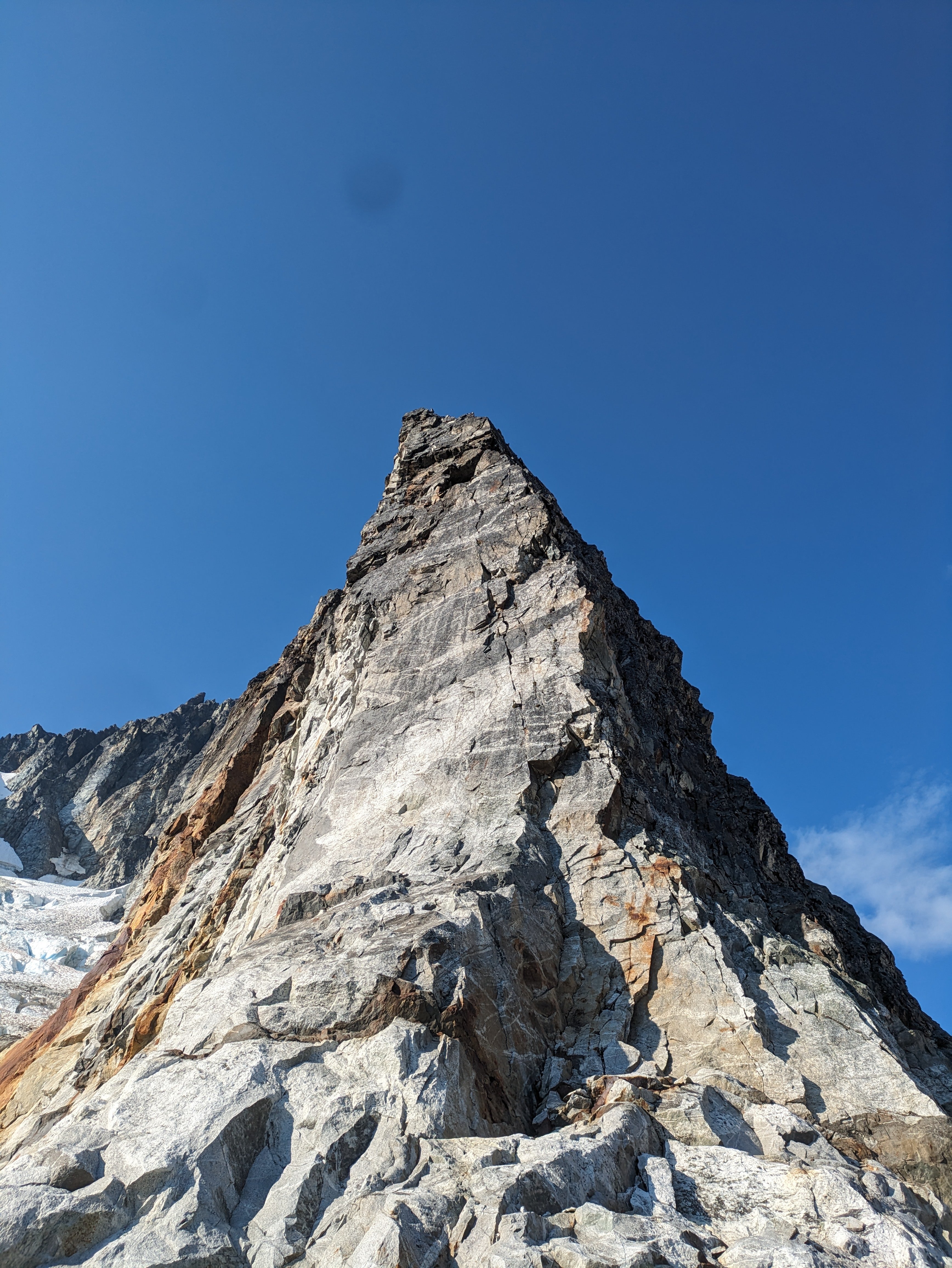
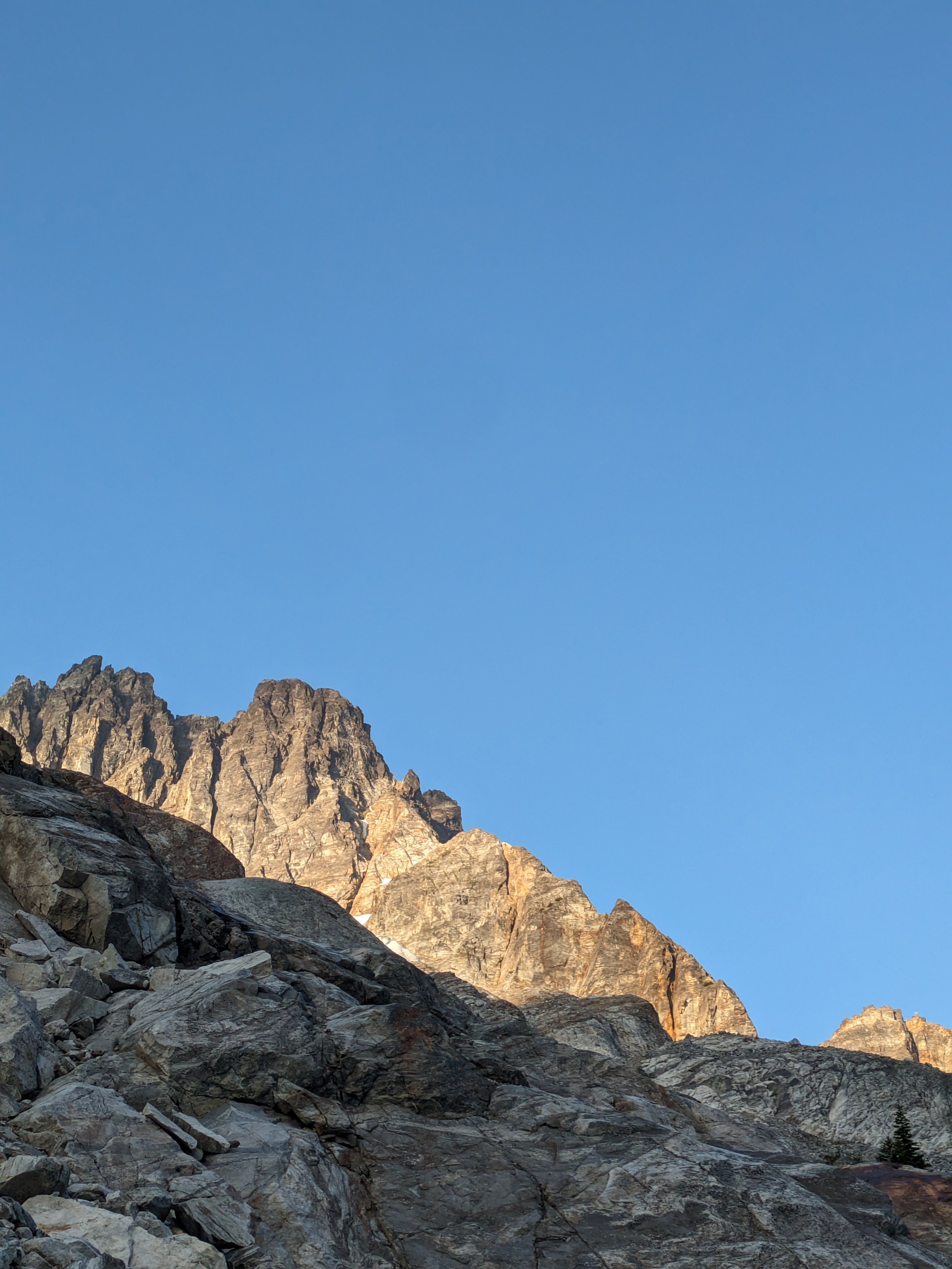
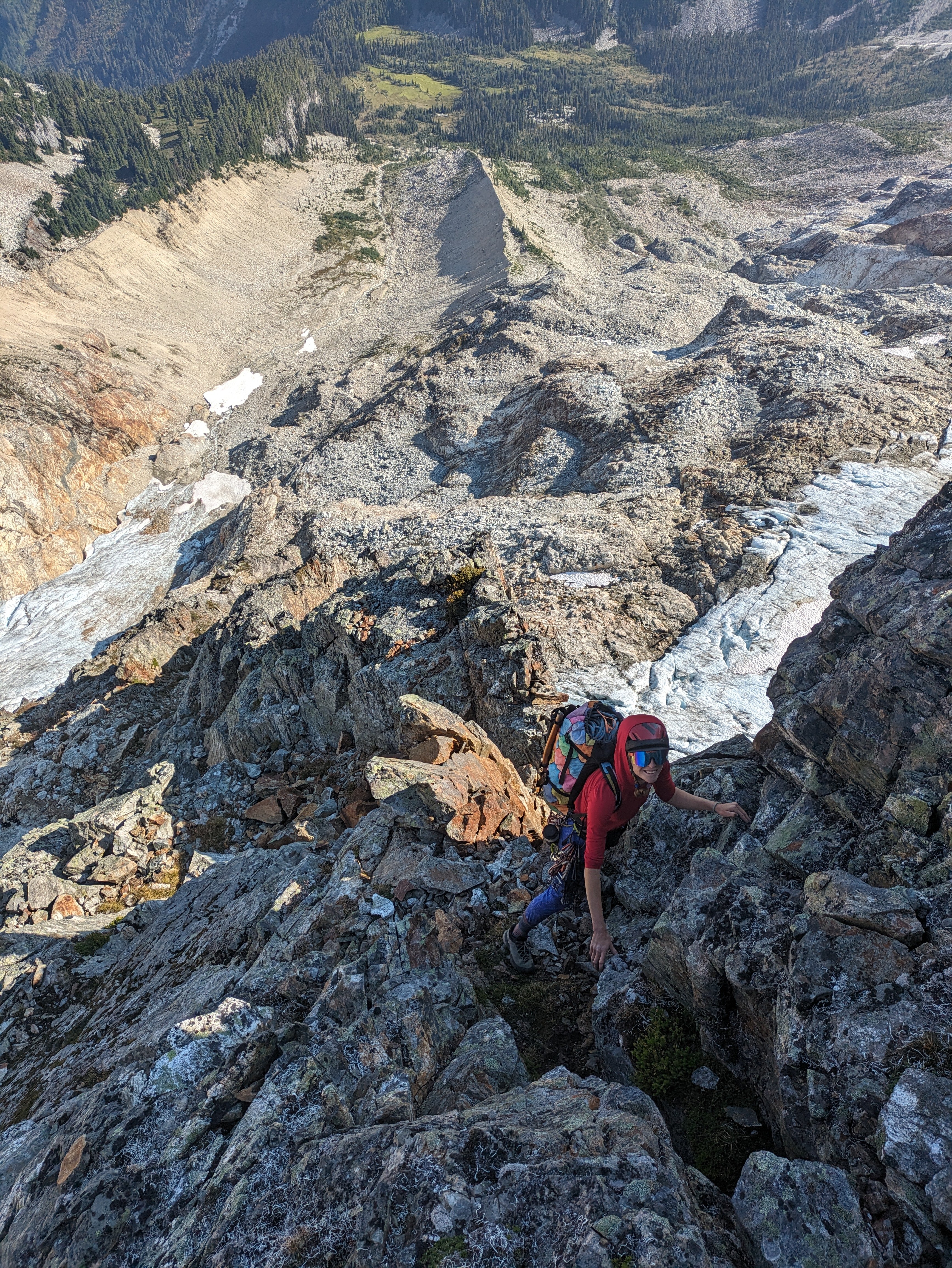
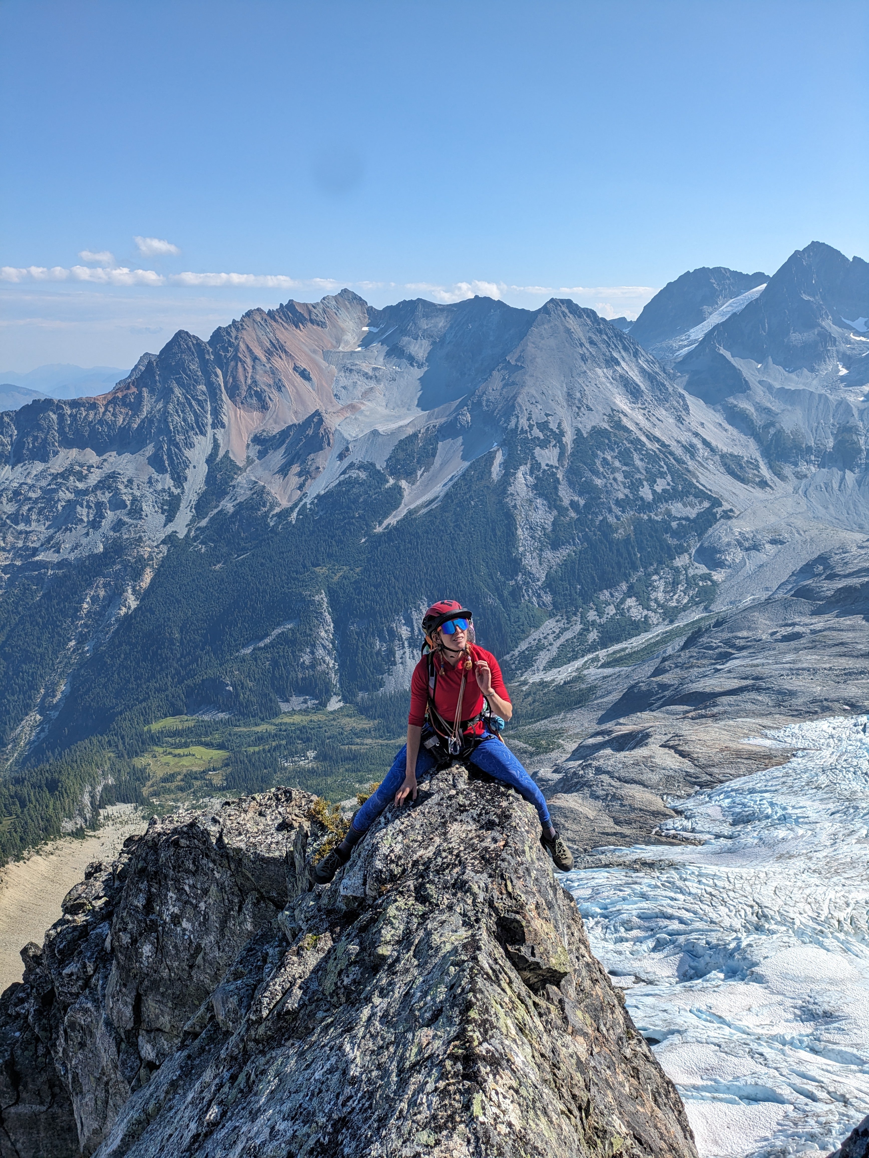
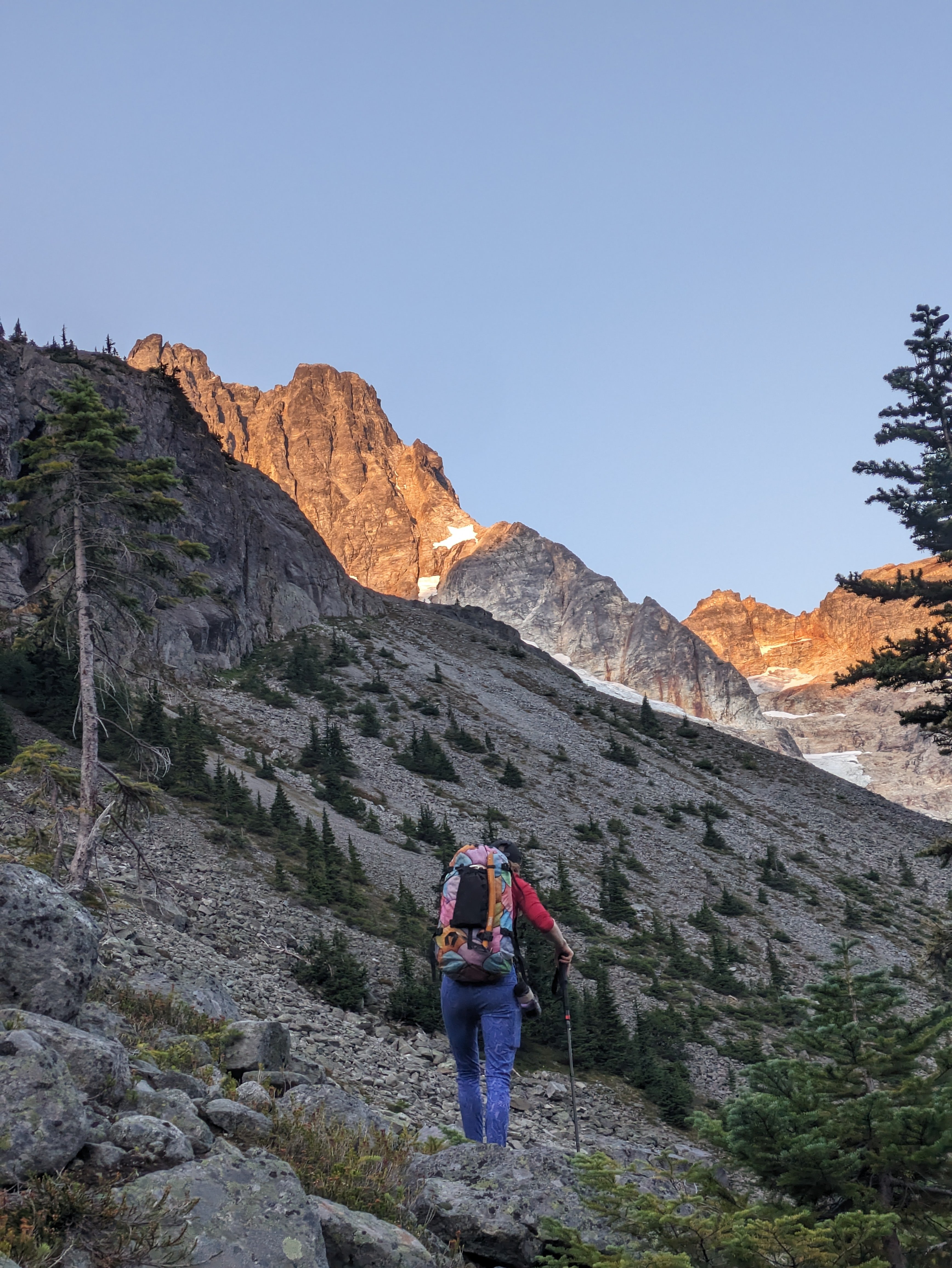
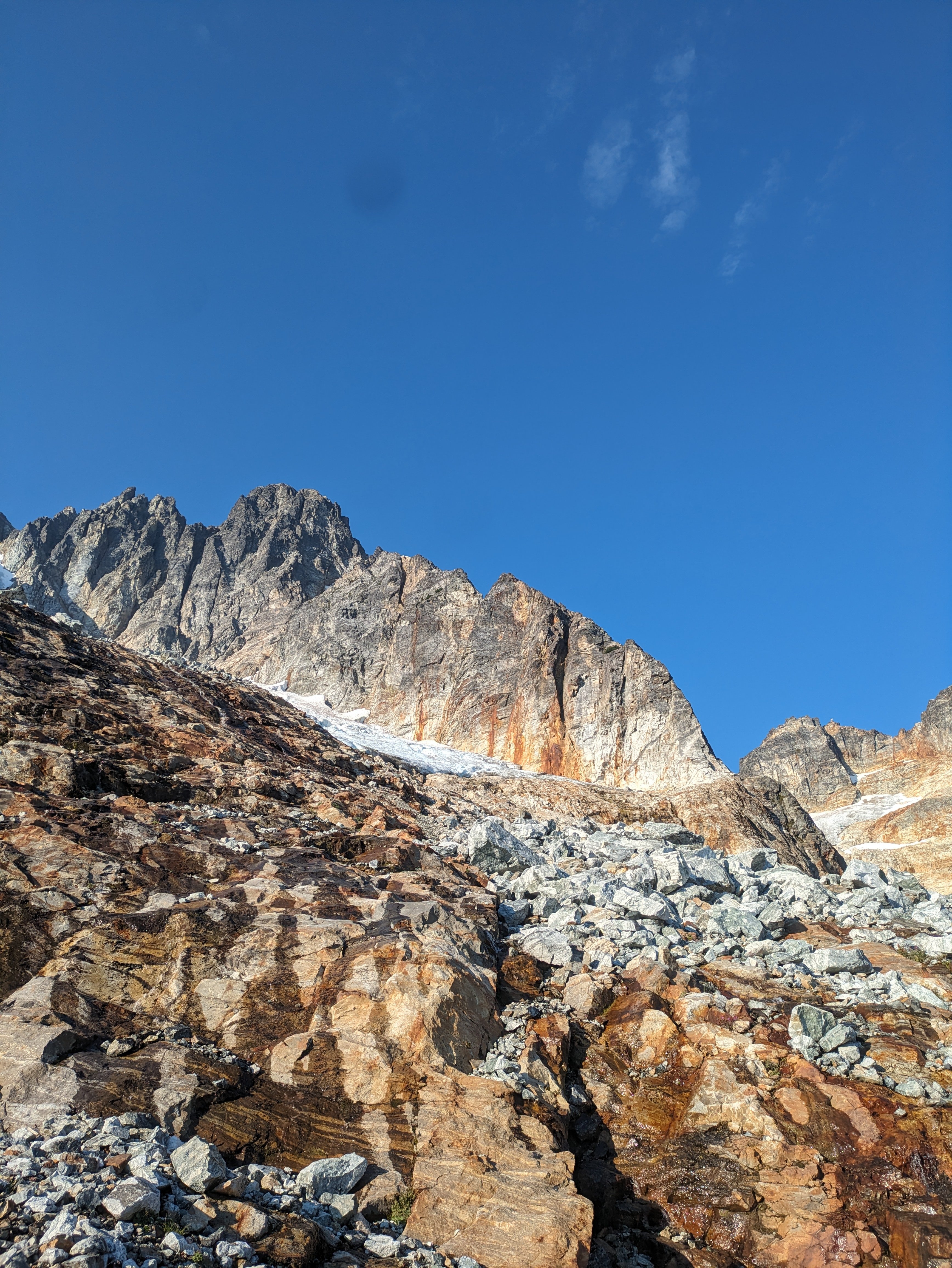
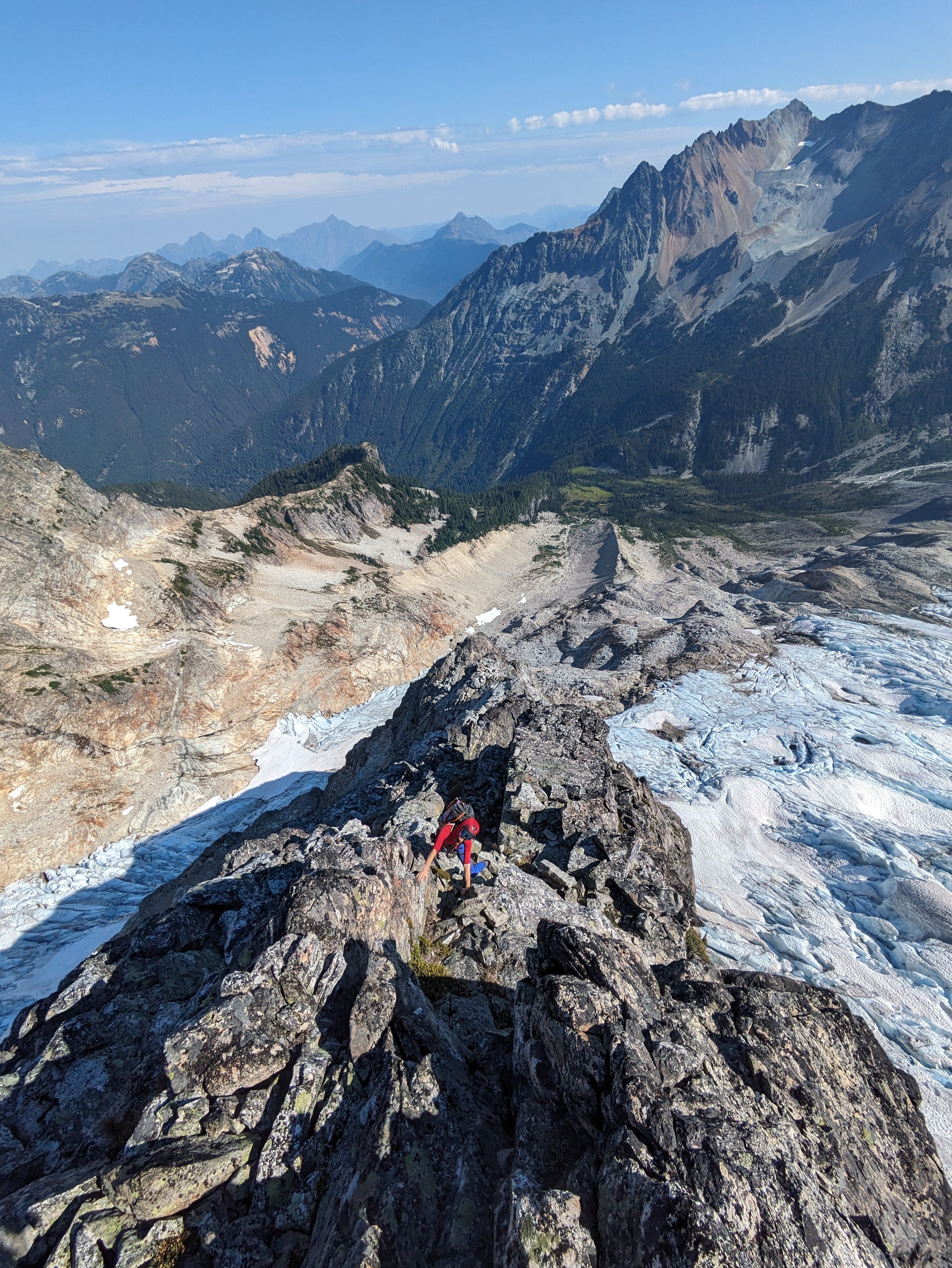
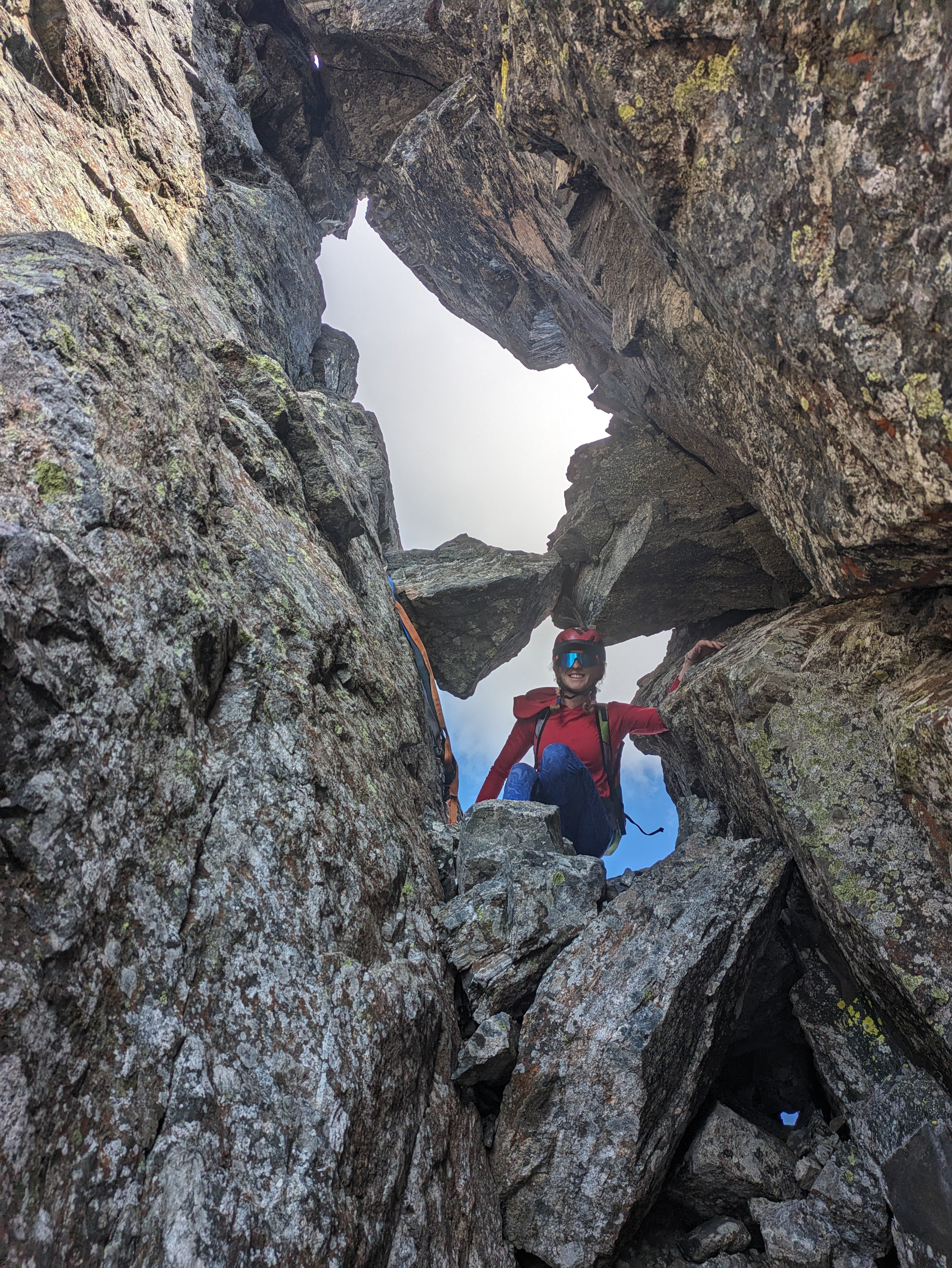
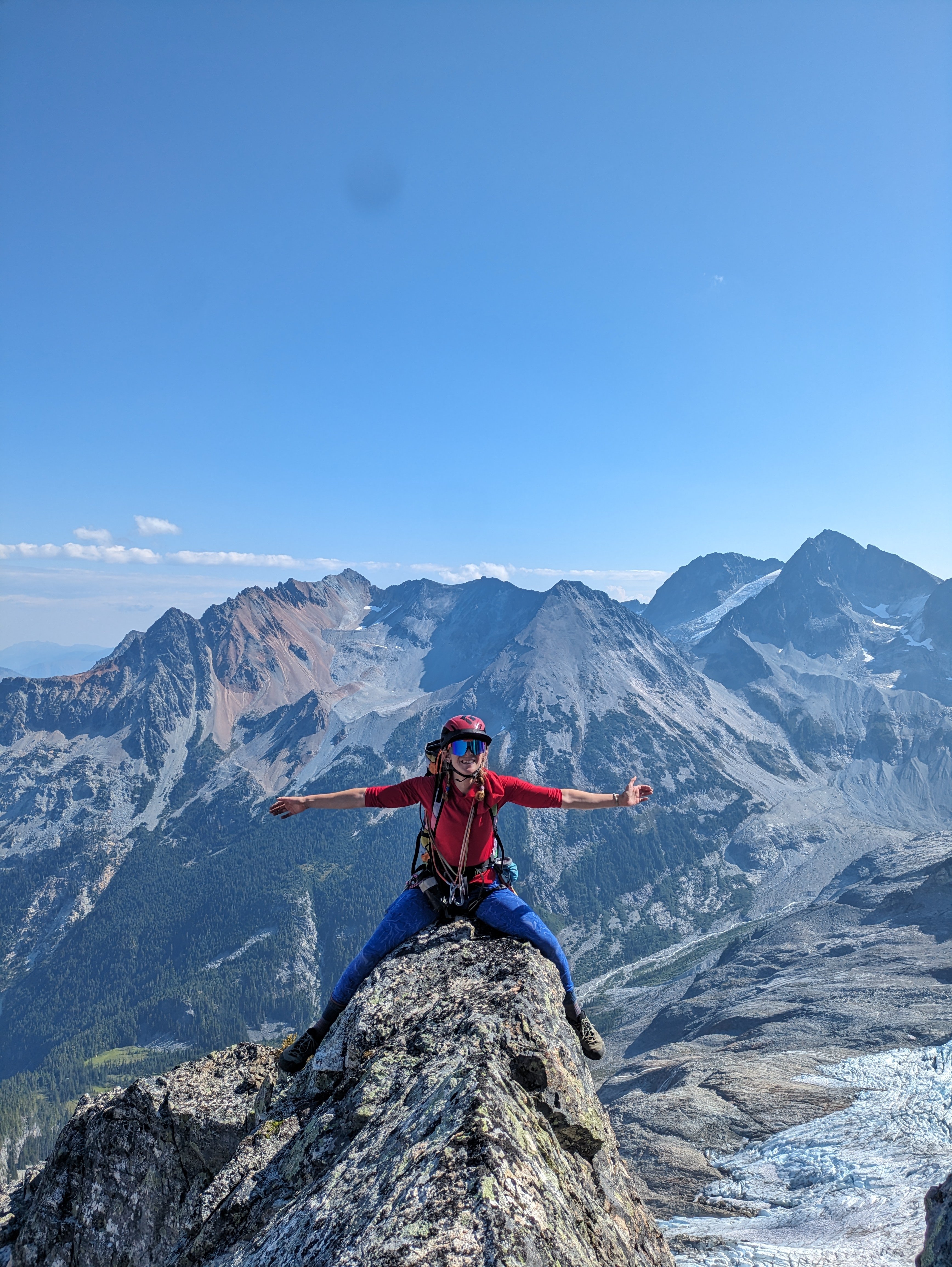
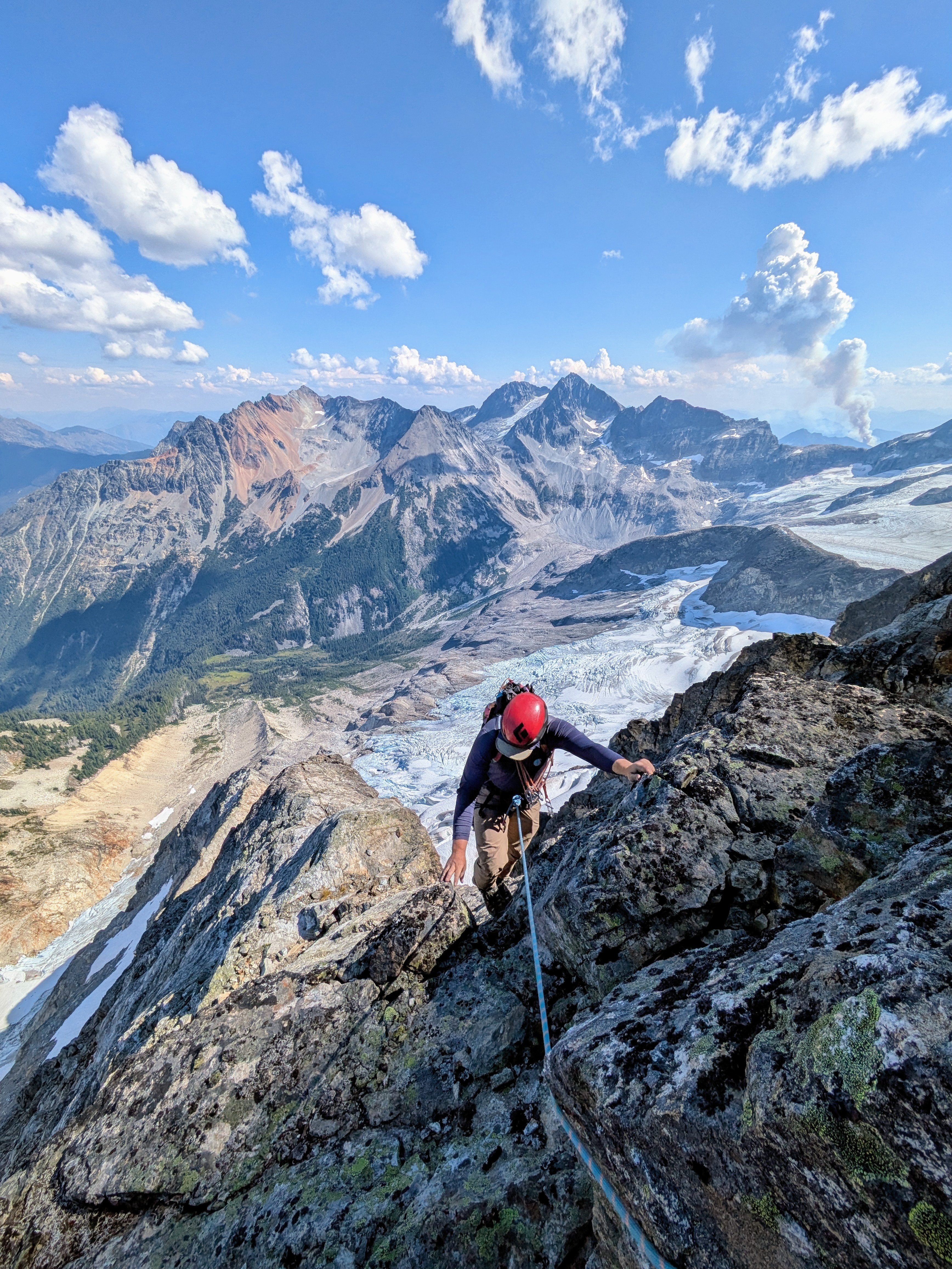
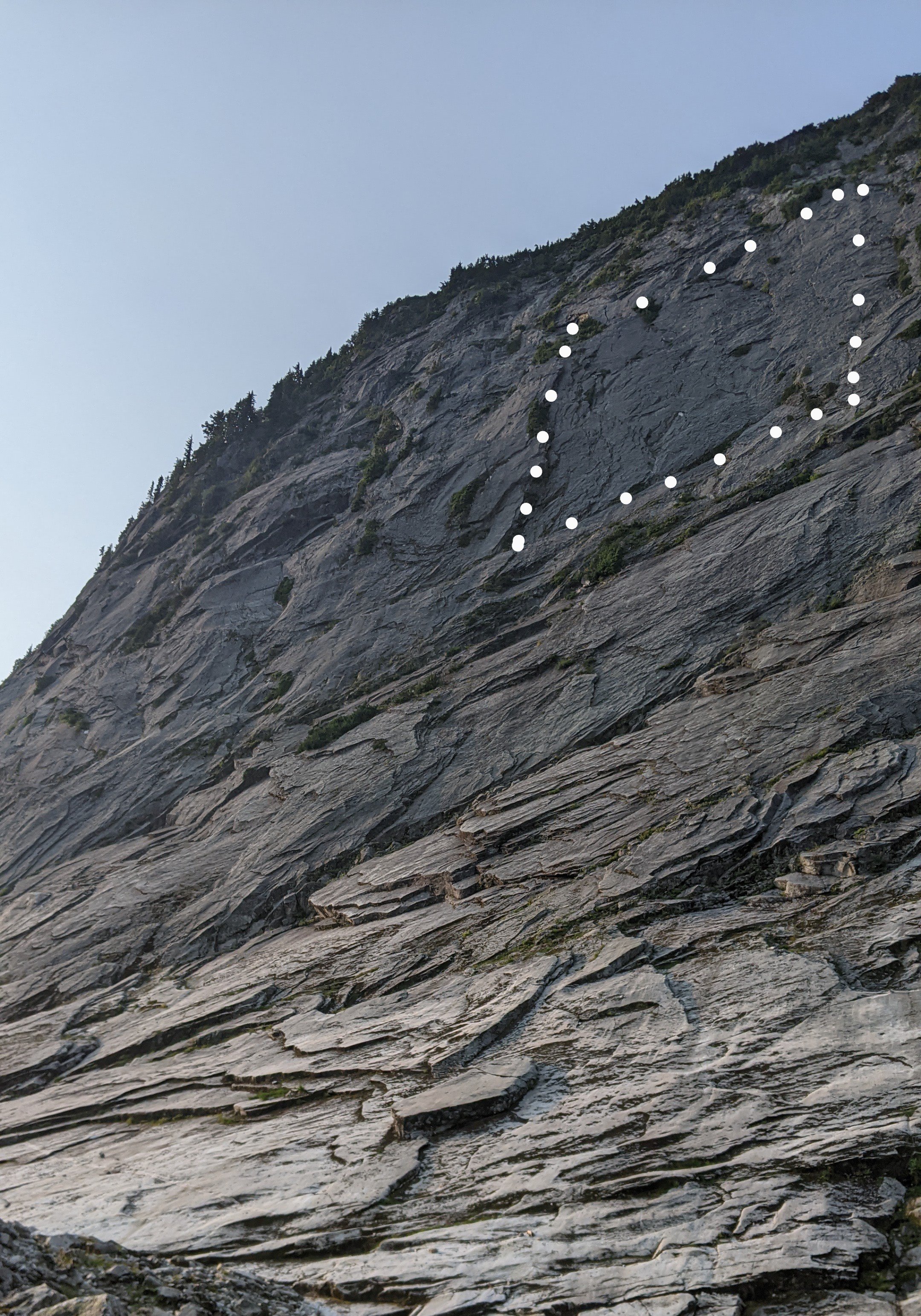
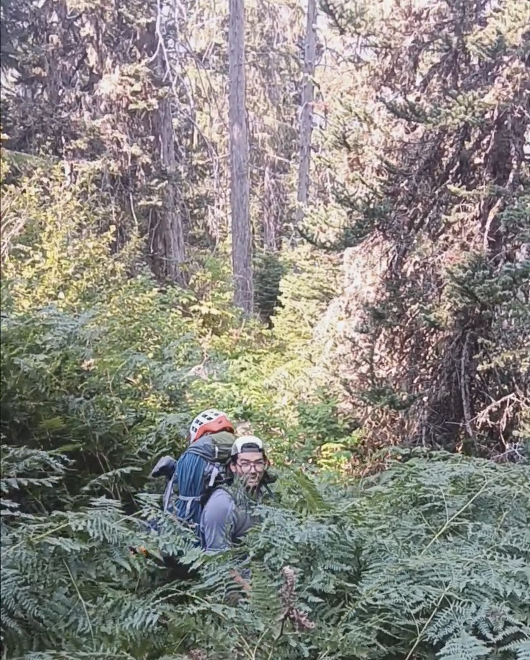
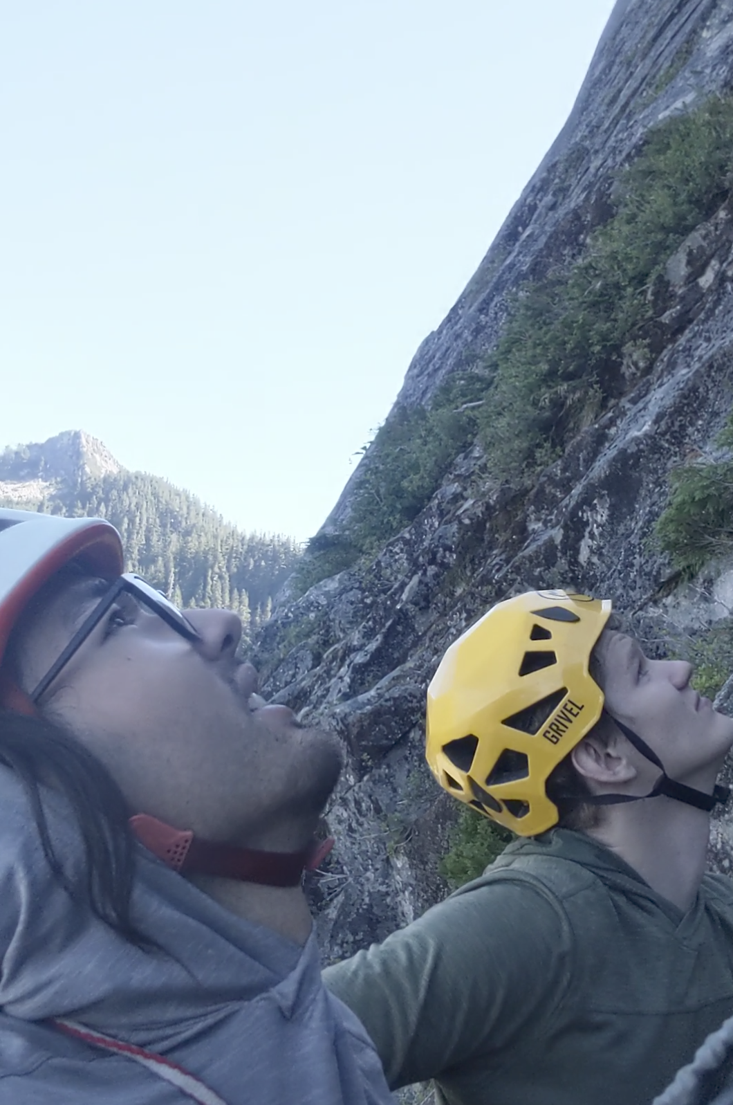
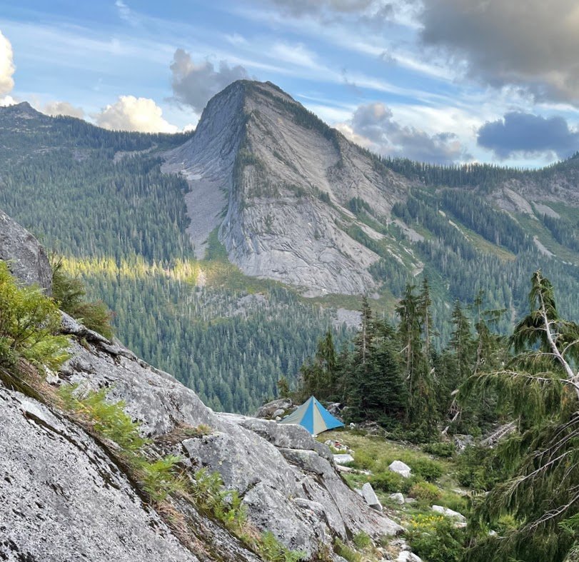
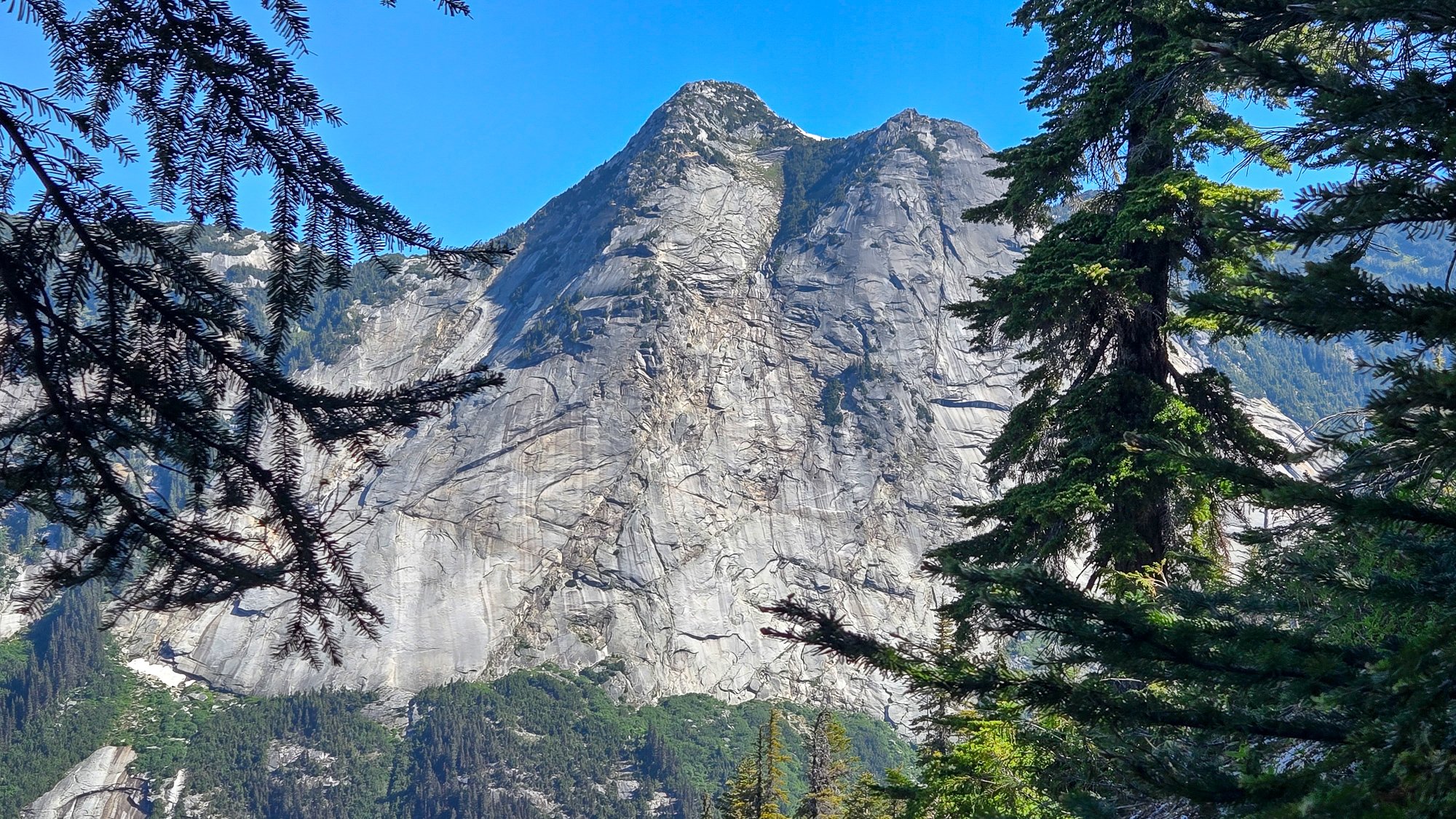
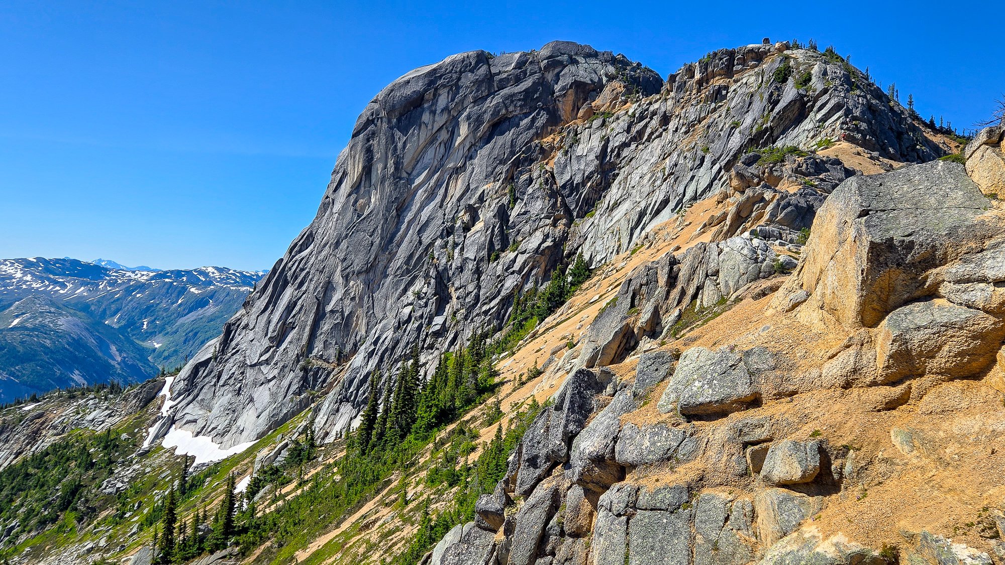
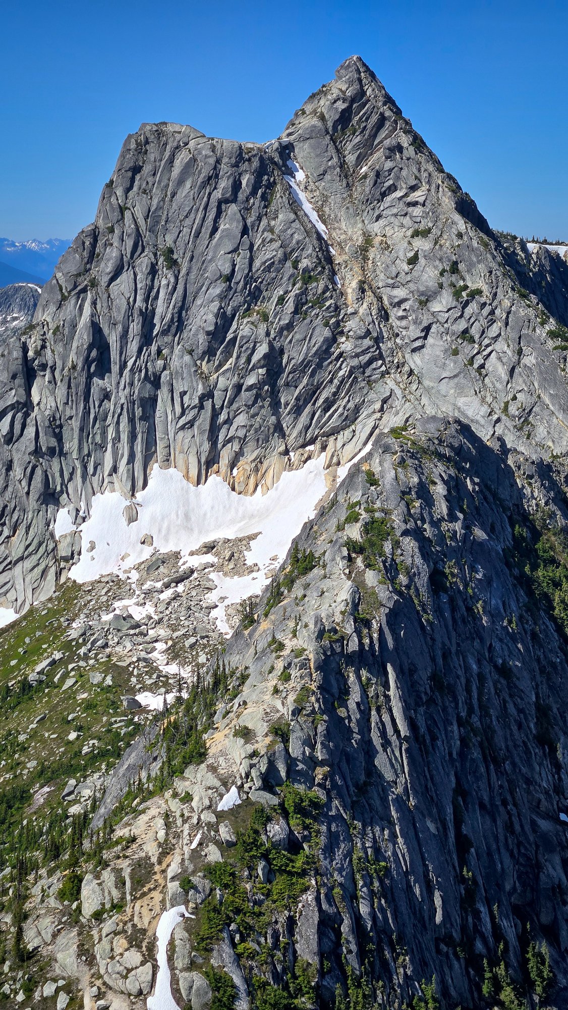
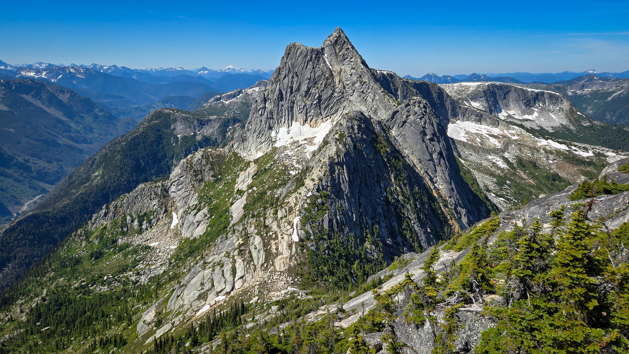
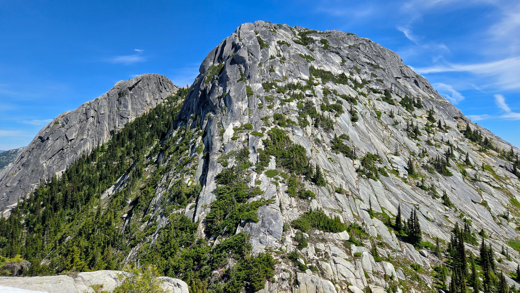
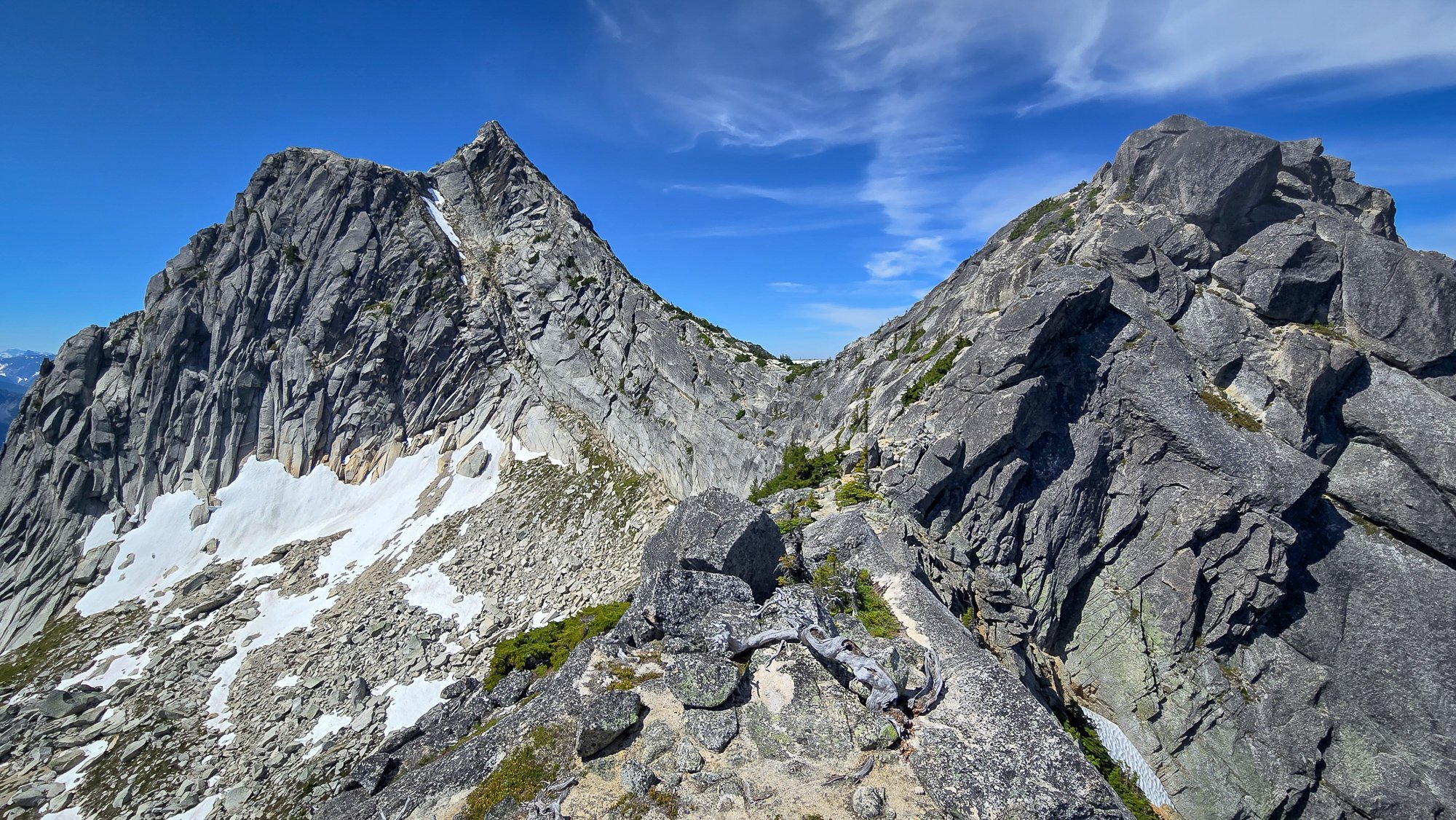
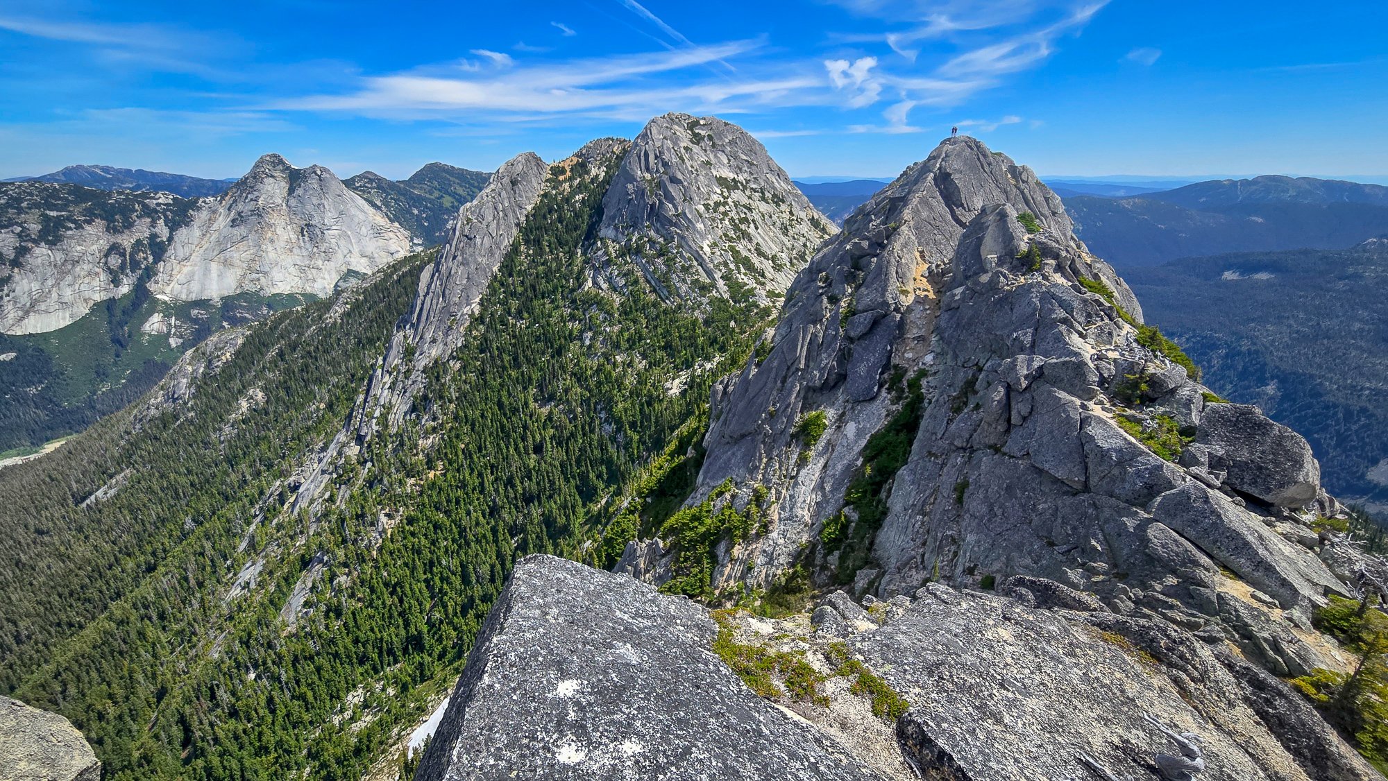
Over the last 3 days, Lani and I climbed what we believe to be the FA of the North Ridge of Redoubt. This is the long, NW trending ridge that looms over the North Face glacier route. The route was actually quite classic and comes with a high recommendation. It is by far more enjoyable than the standard route scree encountered on the descent. The route was primarily low fifth class and fourth class scrambling and we roped up for roughly 1100', though snow coverage and comfort sloping may drastically impact this number. The ridge gains a bit over 2000' over around .5 miles of horizontal. The name is inspired by the little ball of fire, Calcifer, from howls moving castle, as we watched the Perry Creek fire grow in the distance. Day 1 We approached and bivied at Ouzel lake. A bird tells me the Depot Creek "trail" is in particularly excellent condition, requiring NO bushwhacking, and they said handlines are even avoidable. The same bird mentioned that current logging roads take you all the way to the border, making the approach to Ouzel Lake 4.5 miles. We bivied all the way up at Ouzel lake as we were initially planning on climbing Spickard the next day, but growing smoke from the Perry Creek fire changed our minds on that plan. There is also an excellent potential camp at the top of Depot Creek falls, potentially allowing for a direct approach, though this would require bushwhacking of unknown taste... There are also potential bivy options on route to help facilitate a 2 day itinerary. Day 2 From the lake, we made a long contour on talus, loosing only around 400', once near and below the objective, we made our way up talus and slabs to the toe of the ridge. Excellent running water out of the toe of the glacier. We initially attempted the cracks smack on the toe of the ridge, I bailed around halfway up after encountering some 5.11 tips and entering unpleasant looseness. There is an obvious corner left of the toe that potentially holds a very classic potentially moderate direct start. The unsent directismo After bailing off the toe, we looked to the right and zig-zagged up ramps to gain the buttress crest. Snow coverage will drastically impact your experience here. Once on the ridge crest we found thousands of feet of enjoyable scrambling on mostly sound rock. Lani compared it to the NE buttress of triumph but with mostly better rock. We roped up for the occasional pitch, but mostly soloed. There is a broad saddle at 7600' where things begin to steepen subtly. This would also make an excellent bivy with a permanent snowfield for water access. Above the notch, the climbing steepened and we climbed a few back to back pitches until we were below a prominent gendarme. Unsure what the top of the gendarme would be like we traversed into the chossy gully to climbers left and climbed a short, overhanging pitch of surprisingly solid shist. After topping out the gully, we found the descent off the gendarme would have been chill, so Future parties should consider a direct line up the cracks on the gendarme for a more classic finish. Once at the notch in the ridge we met up with the large talus fields that define the slopes on the south summit. The traverse over the sub summits to the true summit was generally easy but involved a few sections of fifth class. Once on the summit, we began the "joys" of doing the standard route late season. Lani in the canonball hole Once at the base of the gullies we encountered awful scree, one could only imagine how much more awful it would be to go up, so there is that... The entire day we had been watching a fire grow in the East. Seeing it expand so quickly and already beginning to envelope spickard in smoke we decided early on our descent to forgo spickard and plan on hiking out the next day. Mordor to the East Day 3 Hike out, blueberries... Suggested Rack Single Rack .3-1, optional 2; full set of nuts; we had a single 60M rope, but it could be done with a 30M line to save weight.
 1 point
 -
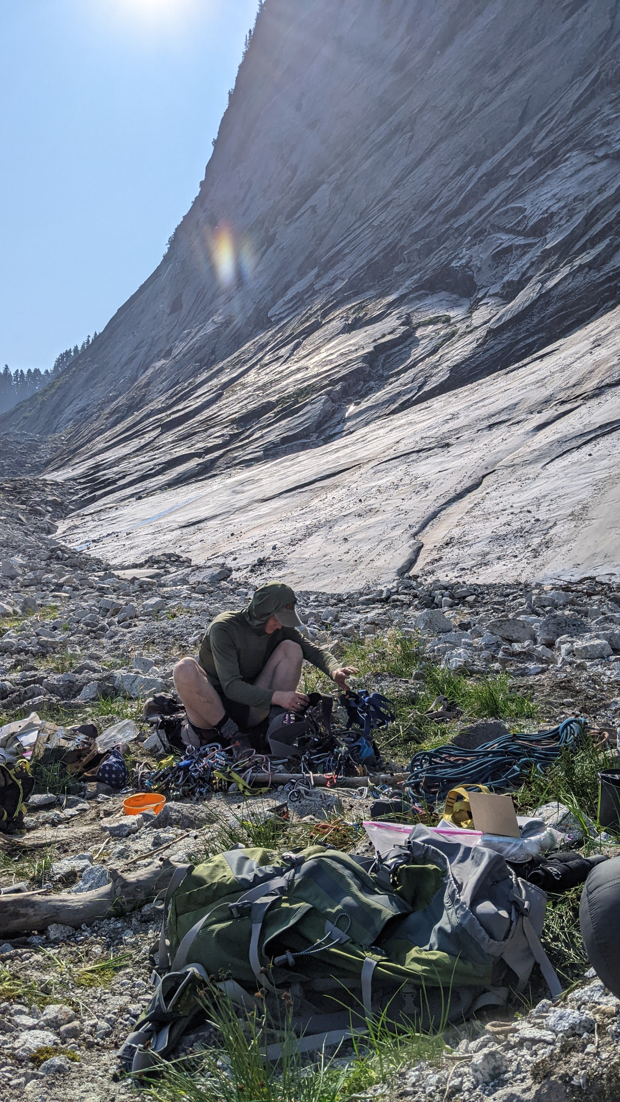
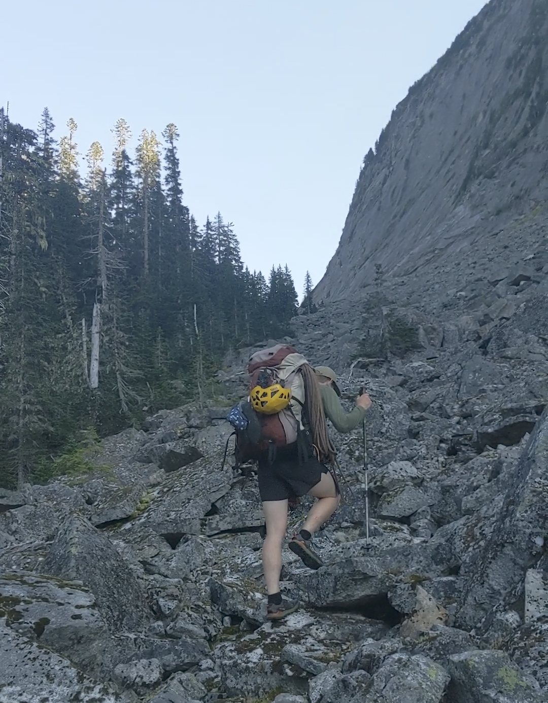
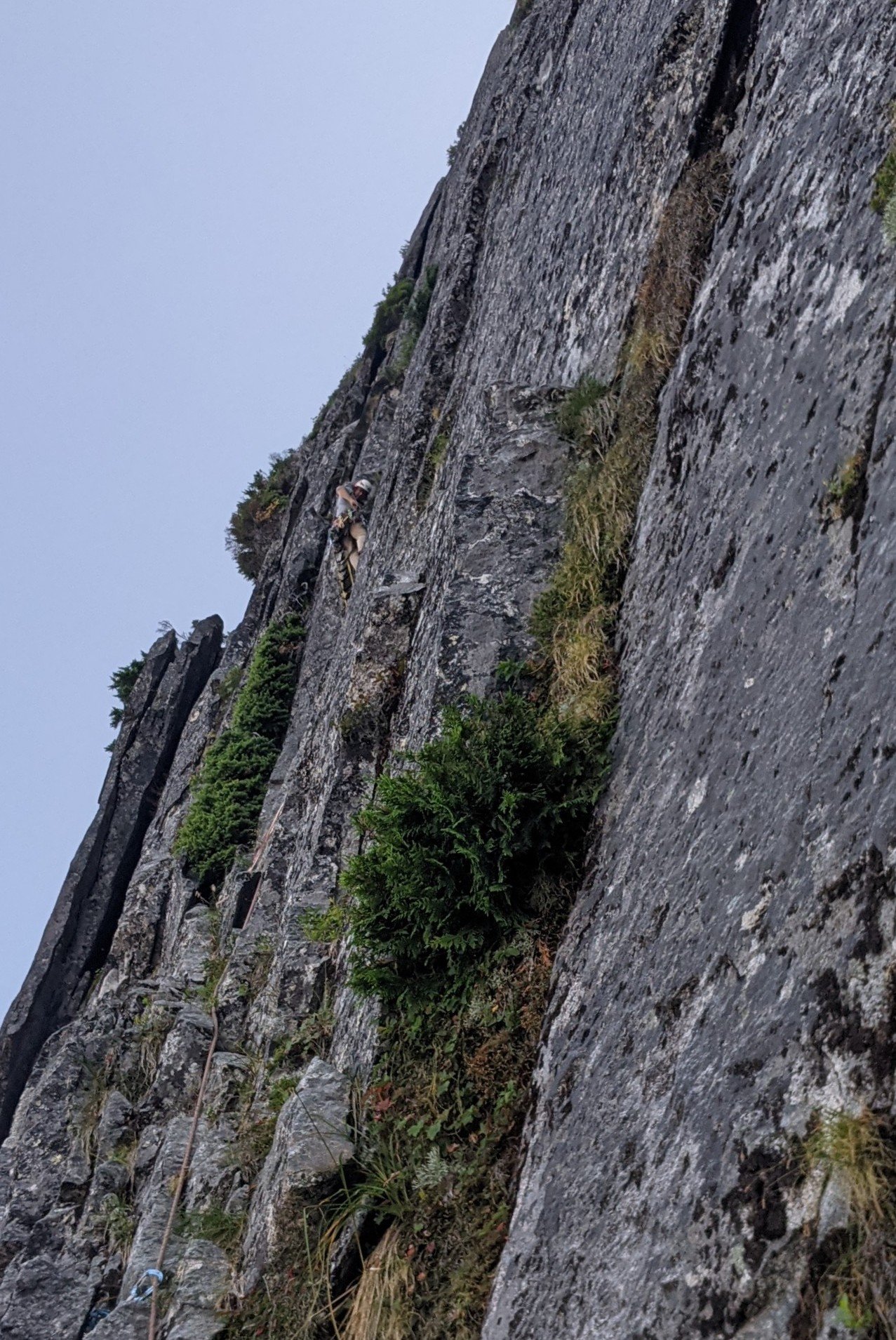
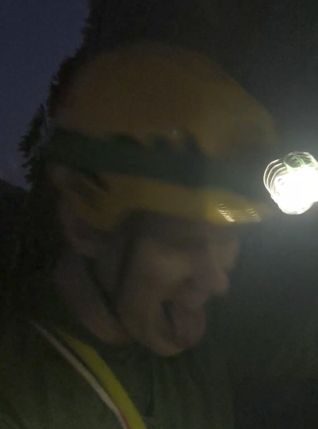
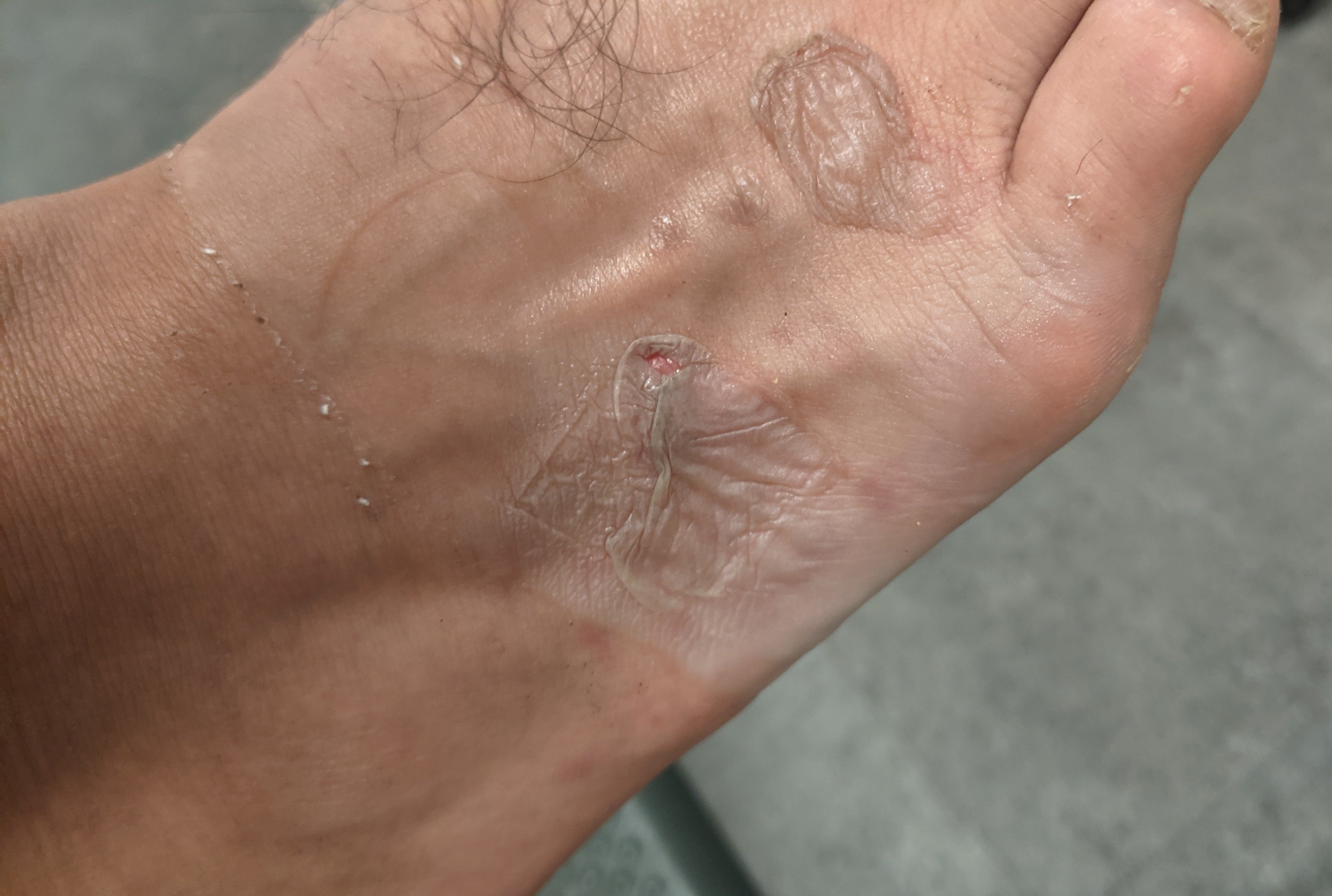
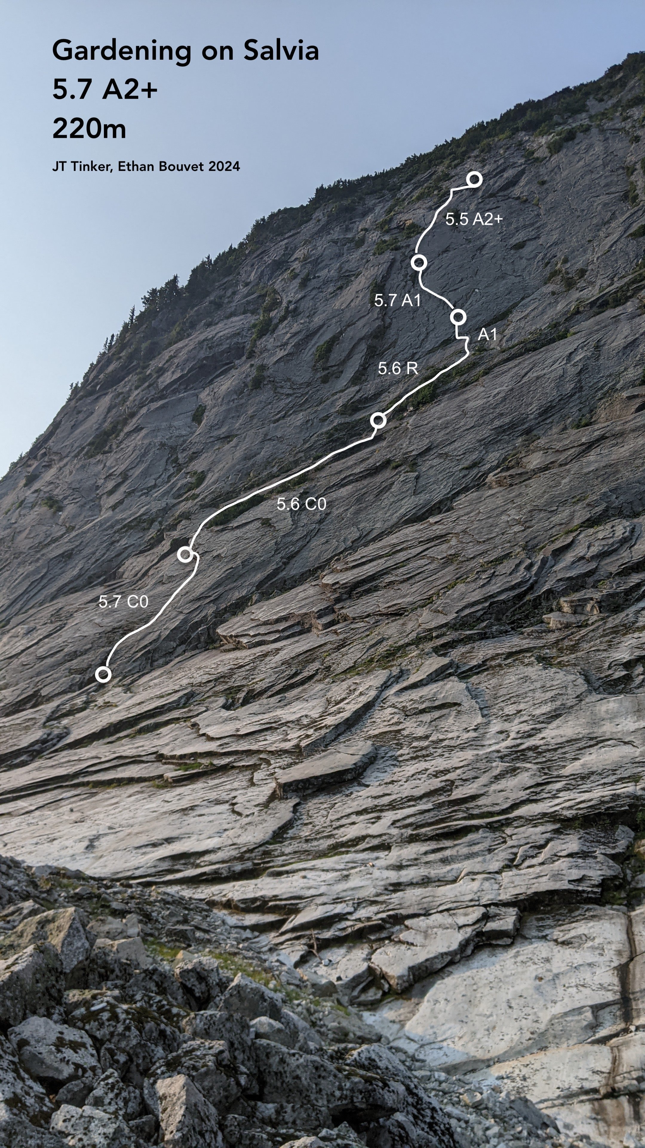
Trip: Darrington - Gardening on Salvia (5.7 A2+) (A Ground Up Scary Darry Adventure!) Trip Date: 09/05/2024 Trip Report: WARNING! LOW QUALITY PHOTOS AND FEET PICS! Back in September of 2024, I teamed up with my homie Ethan @macropipette to go on a ground-up adventure in Darrington. We set our sights on the NE face of Mt Ulalach, an 800-foot slabby face on a granite dome. As far as we knew, the face hadn’t seen a lot of climbing activity, and we later found out some pretty good reasons why. Ulalach from Squire Creek Wall (Nathan P, Mountain Project) We departed the car with our packs loaded with the kitchen sink, eventually finding a “good” spot to turn left and begin our shwack up the forest slope. Immediately, we started post-holing in the spongy mixture of thick moss, decaying wood, and tangled roots. After about 150’ of this, I started to realize that this approach was going to suck big time. Fresh off a week and a half bout with Covid, I was drenched and wheezing as we slogged upward through dense brush and ankle-snapping blowdowns. All smiles for the most mellow bushwhacking of the whole approach! I have to applaud Ethan for sticking with it with no guarantee of any quality climbing ahead. A final push through brutal slide alder led to a welcome respite, easy travel on a boulder field. While my body was thoroughly worked, I could let my mind relax as we trudged up the final 1000’ to our campsite. We dropped packs and began surveying the face, and decided that tomorrow we would start our ascent up a flaky left-facing corner/arch and then aim for the steepest, square-shaped part of the face we dubbed “The Box”. "The Box" After a few puffs on a spliff and a guide’s ration of some gas station vino, Ethan and I called it a night. The Climb: Ethan sorts gear in preparation for our excellent adventure P1: 5.7 C0 We scrambled up a low-angle ramp to a small ledge, where Ethan took the lead. After moving up some easy terrain into the left-facing corner, he found his way up a right-trending crack that petered out quickly. After questing 20ft up the increasingly blank slab, he was forced to retreat and perform a heady downclimb. After regaining the corner system, he followed it up the loose, flaky arch and pulled the final mossy undercling moves to a well-placed stance for two. P2: 5.6 C0 I took the lead, pulling a couple of fun moves up and right to exit the arch. A slabby, dirty, and vegetated ramp led to a short but splitter finger crack, then to a gently sloping ledge. I spent probably 15 minutes throwing clumps of dirt and grass down the face, looking for gear to no avail. 15 feet above the nice ledge, I dug out a good cam placement and got a decent pin. I fixed the rope and descended to the ledge for a snack break. P3: 5.6 A1 R I pushed through a dense clump of bushes just above the anchor, then started up a slab with good edges but no gear. I finally reached the bottom of “The Box”, where the wall started to steepen. I decided to aim for a right-facing corner with a thin crack in the back. Still without options for protection, I slung a small shrub and had a quick laugh. Between me and the corner was a precarious stack of flakes. I looked down and determined that they would miss Ethan and the rope if they fell. I traversed under the stack and was rewarded with a perfect #2 C4 that granted me access to the bottom of the corner. From here, I made good time on cam hooks and pulled up to a roomy stance, the best belay on the route. Me reaching the bottom of "The Box" P4: 5.7 A1 This pitch held the best climbing on the route. After moving leftward up flakes, I reached a sequence of free moves on thin, incut holds. This bit was only about 5.7 but so fun, and well-protected with a downward pin behind a flake. Directly above me lay another right-facing corner that I shuttled up with cam hooks. Exiting the corner and wrestling with some bushes, I stepped left to what would have been a 10/10 belay stance if it wasn’t built out of loose flakes with only small gear available between them. In hindsight, the anchor I built was sketchy, and I really should have taken the time to drill a bolt. Pitch 4 P5: A gumby gets gripped on moderate aid: 5.5 A2+ I stepped left around the large flakes and got established in a hand crack, which led to easy climbing with lots of big loose flakes and blocks. I tiptoed around bushes and looseness before reaching some slab moves below a roof (barely any good gear to this point). I found a good inverted cam hook and poked my head over the top of the roof. My heart sank as I saw a broad, featureless slab. It seemed our relatively moderate line had come to a dead end. Hanging from the hook, I looked around for other options. 6 meters to my right, I saw a pair of thin cracks splitting a slab above, but I would have to nail the thin, dirty seam under the roof to get there. The seam was packed with moss and grit, and the rock looked crumbly. My last okay piece was now well below my feet. I composed myself and started placing a beak, chips of rotten granite fracturing from the seam with each blow. I tried to block all thoughts of zippering the traverse and taking the big, ugly swing as I put in a foul string of upward-driven blades and beaks. I gingerly inched closer and closer to a shallow 0.3 placement and finally breathed a sigh of relief as I clipped. At this point, I was nearly to the end of the rope, and the drag was so bad I could barely stand up in my aiders. Yelling curses, I pulled on the rope as hard as I could to gain the last bit of slack the rope would yield, then pulled the last few moves up and over the roof. The cracks were too flaring to accept cams or nuts and too shallow to give a solid pin. I decided it would be stupid not to place a bolt, which took the last bit of physical and mental fortitude I had in the tank. I fixed the rope and yelled down to Ethan, then sat at the hanging belay sideways, my left cheek resting against the cool, gritty granite. The sun was just kissing the horizon next to Whitehorse, and I felt a surge of gratitude for Ulalach for teaching us, humbling us, and allowing us safe passage on its steepest flank. There was another pitch of densely vegetated slab between us and the summit, but I knew our push was over. Ulalach had won. Ethan: After finally hearing JT yell that he had made a belay, I was pretty overjoyed. It was starting to get dusky, and we both knew we were looking at a lengthy descent in the dark. Cleaning the pitch with my large pack was not an easy feat, and after jugging up hundreds of meters of slab, I was pretty spent. I was thoroughly impressed by the work JT had put in to lead the last pitch, as the roof traverse seemed like quite a piece of work. Once I reached JT, we enjoyed a beautiful sunset and were promptly in the dark on the wall. Ethan's thoughts about descending in the dark Bonus Reel: The next morning, I was boiling water in camp. I dropped the Fritos bag I was eating from onto the cook pot, which promptly tipped over and poured boiling water onto my shoe. I started yelling and ripping the shoe and sock off my foot, but I’d already received some gnarly burns. Just my luck! Free foot pics. Can you guess which approach shoe I was wearing from the burn pattern? Not too far from the car, we ran into local legend Bill Enger, fresh off completing another fantastic-looking new route (Miracle Ramps 5.8+) on the South Face of the Squire Creek Wall. I sprayed about our GNARLY NEW AID ROUTE… How embarrassing. This isn’t an FA of the NE face or even remotely close to being a good route, but we named it anyway. Suck it! Any of you old-timers climb this thing? Tell us about it! Gear Notes: Too much junk! Approach Notes: Approach to the base of the Squire Creek Wall and climb an actually good route.
 1 point
 -
1 point
-
Nice line. Here's what it looked like 54 years ago on July 10, 1971.
 1 point
 -
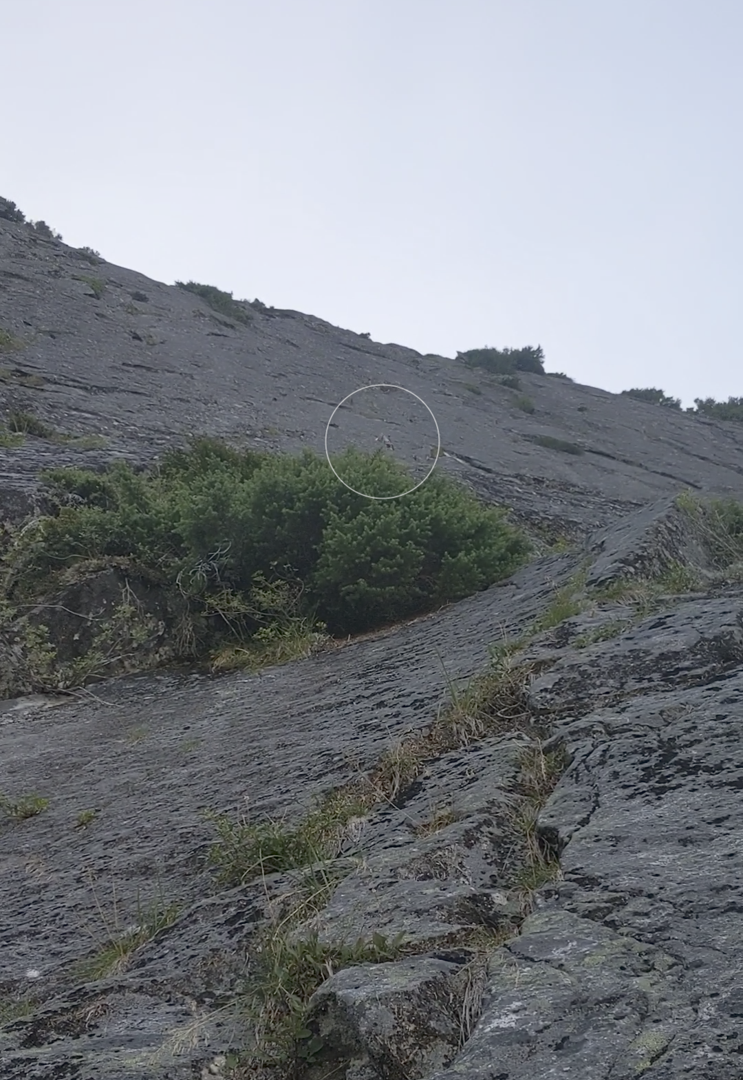
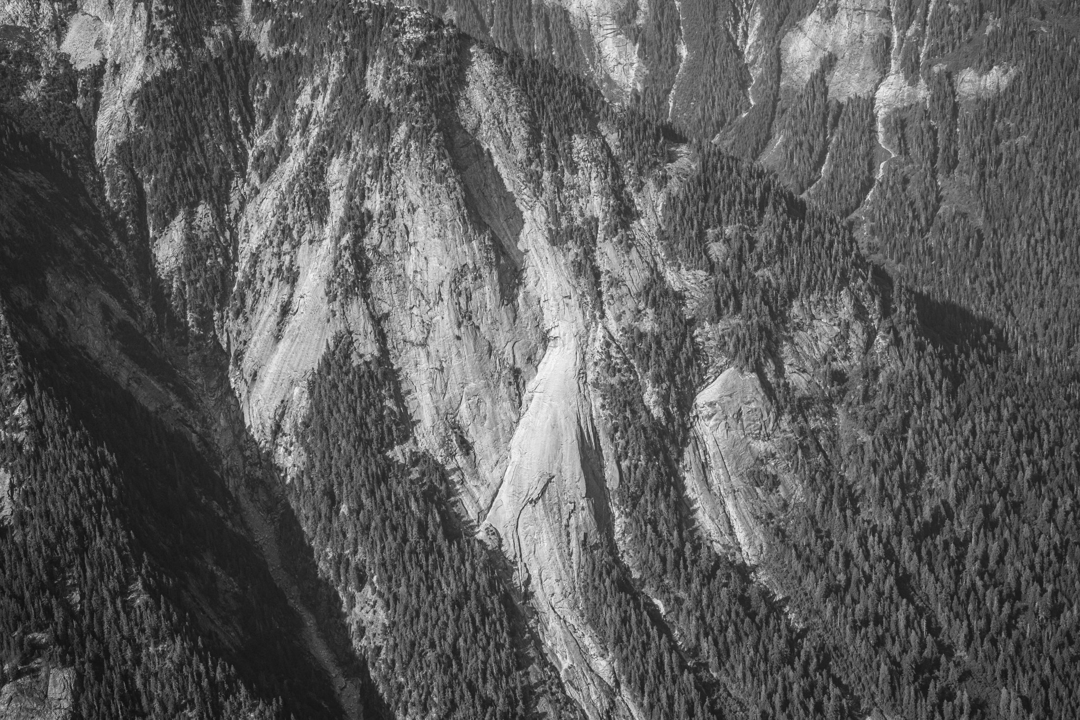
I was coming down the Baker River yesterday afternoon and passed by the slab feature shown in the photograph. I've seen it many times before but this time decided to grab a quick snap of it. It's located on the north side of the river at approximately 48.82863, -121.43918 if you want to google earth it. I'm sorry to say that it would be a hellish ~seven miles of vicious travel up the river from the trail end at Sulphide Creek. The view looks to the north. This is on the south-southeasterly trending ridge that extends from Mineral Mountain to the Baker River. Has anyone heard of anyone visiting or otherwise investigating it? From the air it looks much like something you'd see in Darrington. The photograph was taken from 48.80671, -121.43873, while at an altitude of about 6400'. The slab extends below the bottom of the frame, but not all the way to the valley bottom.
 1 point
 -
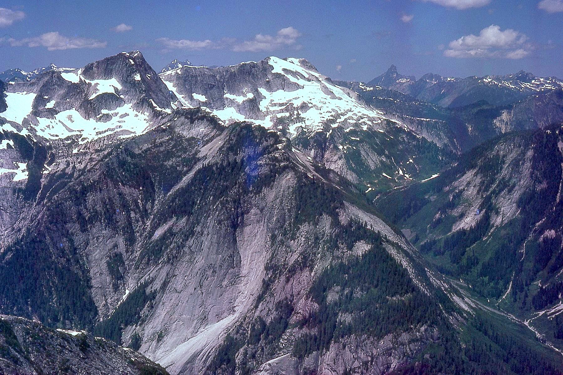
We looked at it from Pioneer Ridge in 1980 and thought of it as “Skateboard Wall.” First ascendants can call it what they want, of course. Pardon funky colors. Film got wet.
 1 point
 -
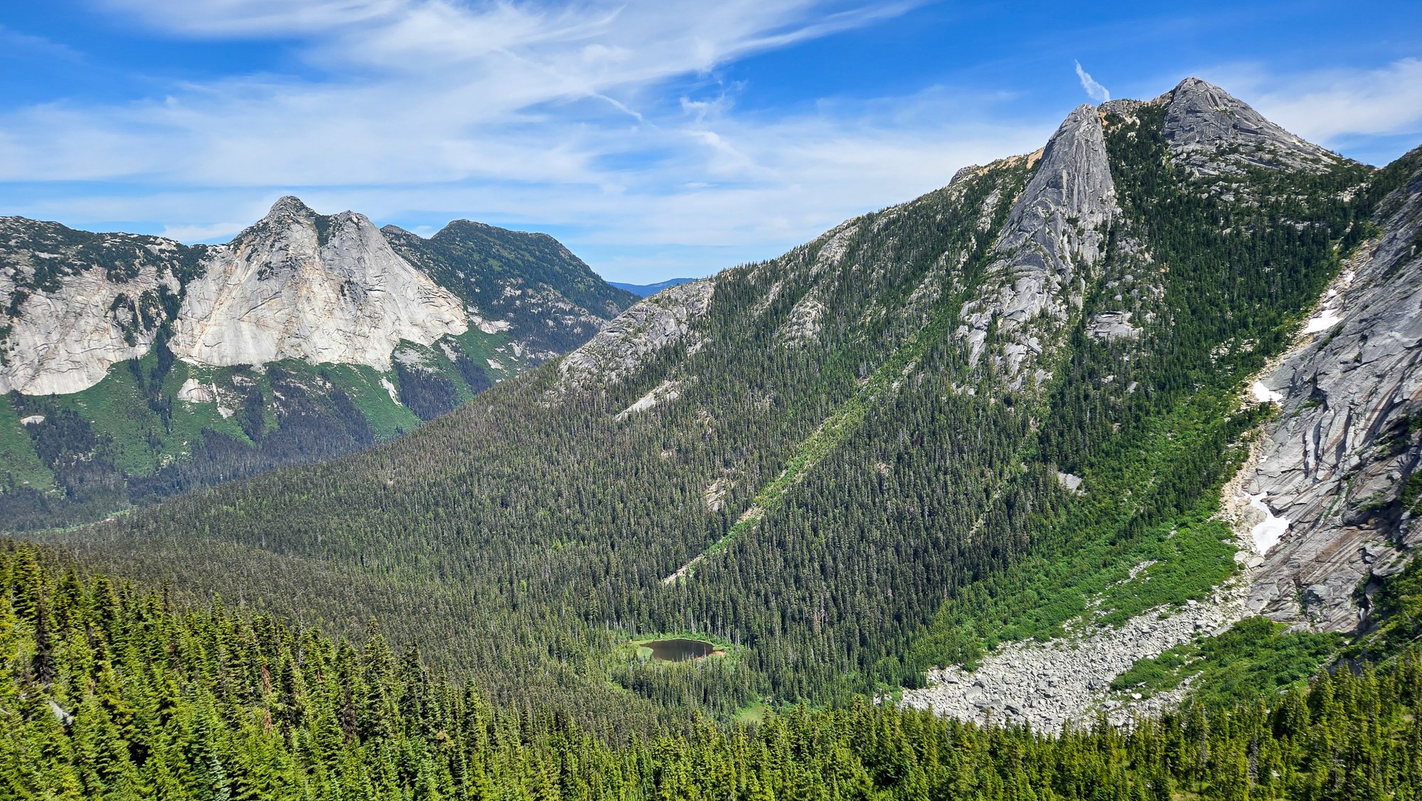
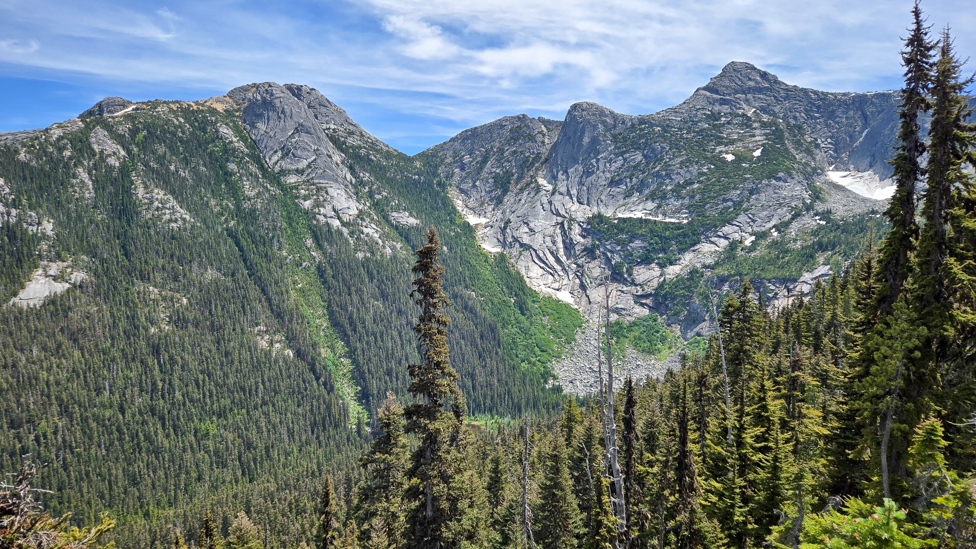
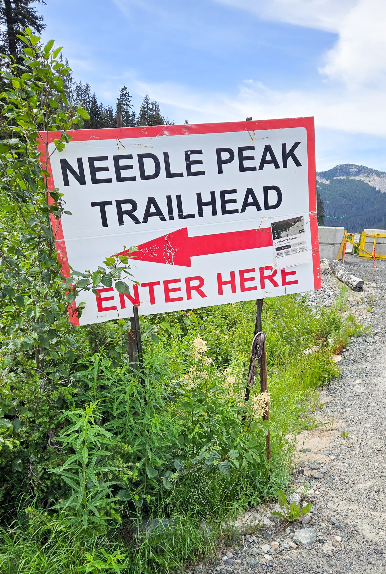
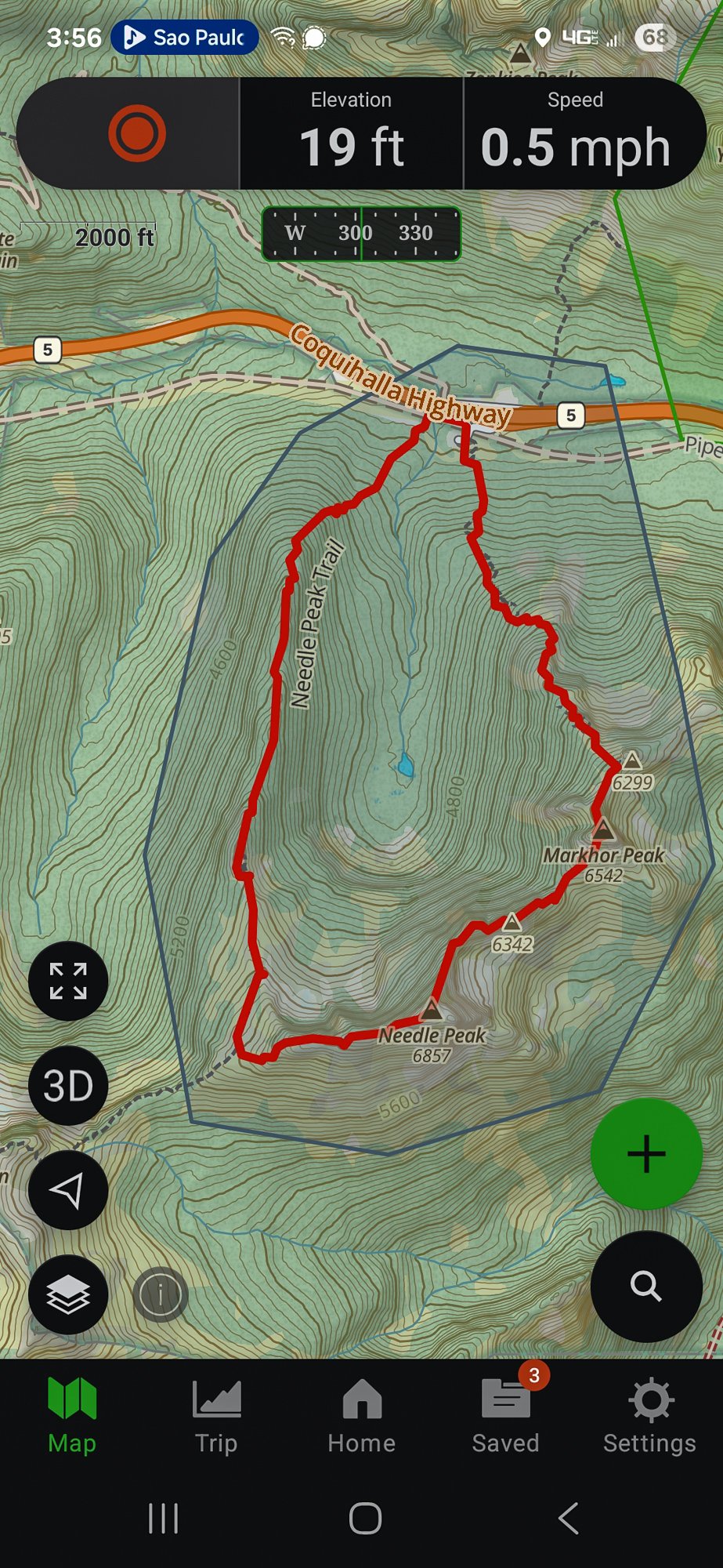
Trip: Markhor and Needle Peak - Traverse Trip Date: 07/07/2025 Trip Report: I am too behind on everything right now to write much, but I figured some of you may be interested in a lesser known romp across the valley from Yak Peak off the Coquihalla. It is quite the scenic and reasonable outing for the mature mountaineer, but I think most would enjoy the lovely ridgeline between Markhor and Needle Peaks. It starts with a steep grunt up the climber's trail up Markhor, with expanding views of Yak Peak across the way: Within an hour or two, the summit of Markhor comes into view, with nothing more challenging than some exposed class 3 standing between the car and the summit: The view expand greatly, with the shapely Needle peak beckoning across a kilometer (we're in Canada, eh) or two of ridgeline: The bugs were a bit on the bad side so I didn't waste much time picking my way down Markhor to a rap station and fixed line which greatly aided the descent down a slabby section. I wrapped a prusik around the thin line which was a nice hand hold as I slid it down and scrambled lower. Here's looking up at the slabby bit below the summit of Markhor after clearing it: And then the really good stuff lay ahead. Always scenic, often exposed, sometimes a bit on the kitty litter side, it was nonetheless "distinctly alpine and a pure joy" to quote Fred from some peak or other in the North Cascades (Logan?). It was usually pretty easy, although a few sections edged into exposed 4th class where a fall would end very badly: I caught a glimpse of another couple behind me as I scrambled along: And soon was on the summit of Needle, alone with the festive summit register: The bugs here were terrible as well so I didn't stay long, mosying down the well trod Needle Peak trail that was very scenic the entire way. Yak Peak on the left and Markhor on the right: Partway down there was a nice viewpoint where I could take in the entirety of the Markhor to Needle ridge traverse: And soon was spit out at the well marked Needle Peak trailhead: I think it took me about 5-6 hours for the loop, including stops, which was a bit longer than the drive, thankfully. The only bummer is that it isn't longer! Gear Notes: helmet and approach shoes. Brought a 30m RAD line to rap but fixed line in place on slab downclimb Approach Notes: Park at Needle Peak Trailhead and find flagged route up Markhor to the east, starting in pipeline swath. Descend well marked Needle Peak trail after traverse
 1 point