
Leaderboard


Popular Content
Showing content with the highest reputation on 07/03/25 in all areas
-
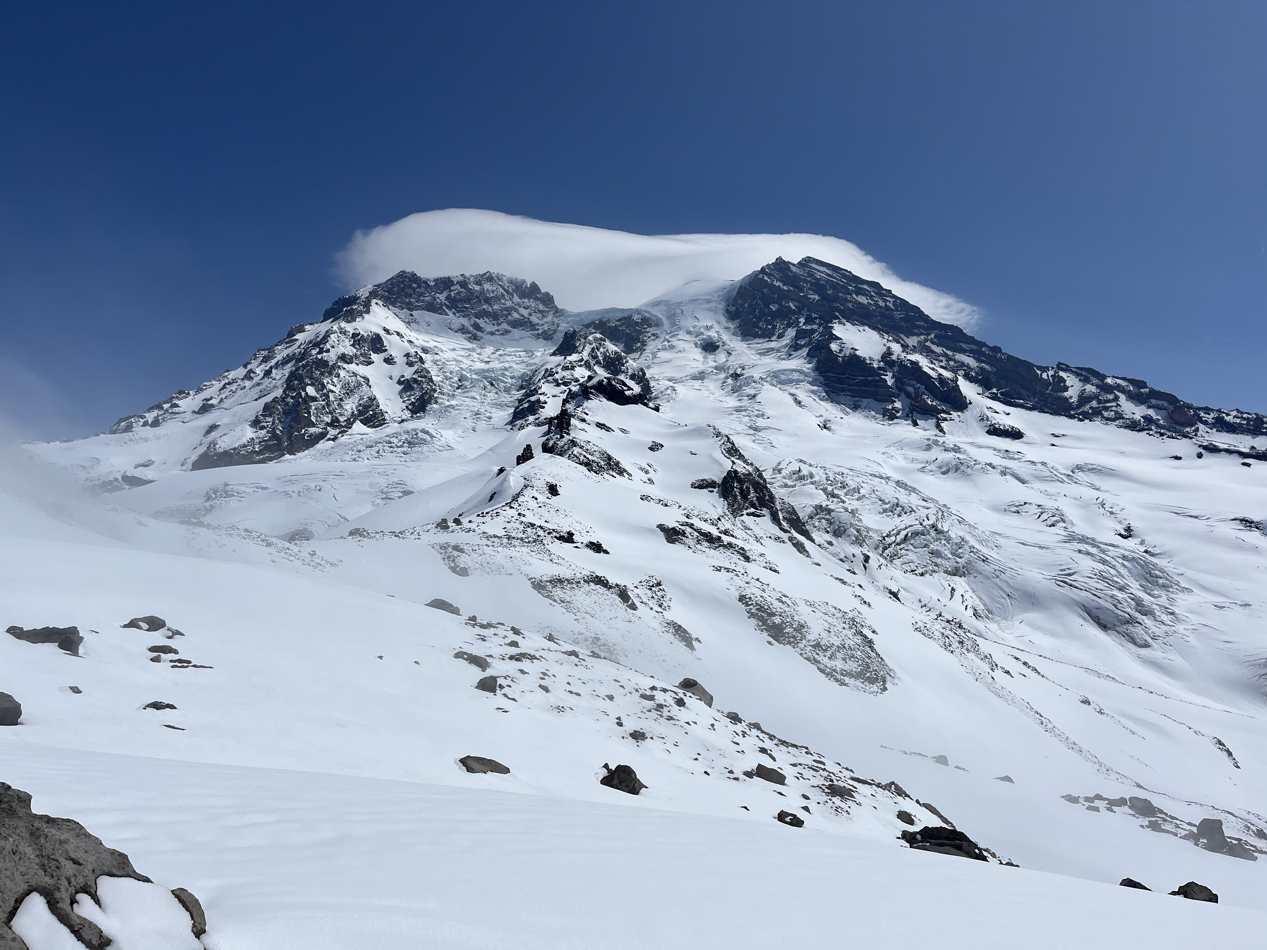
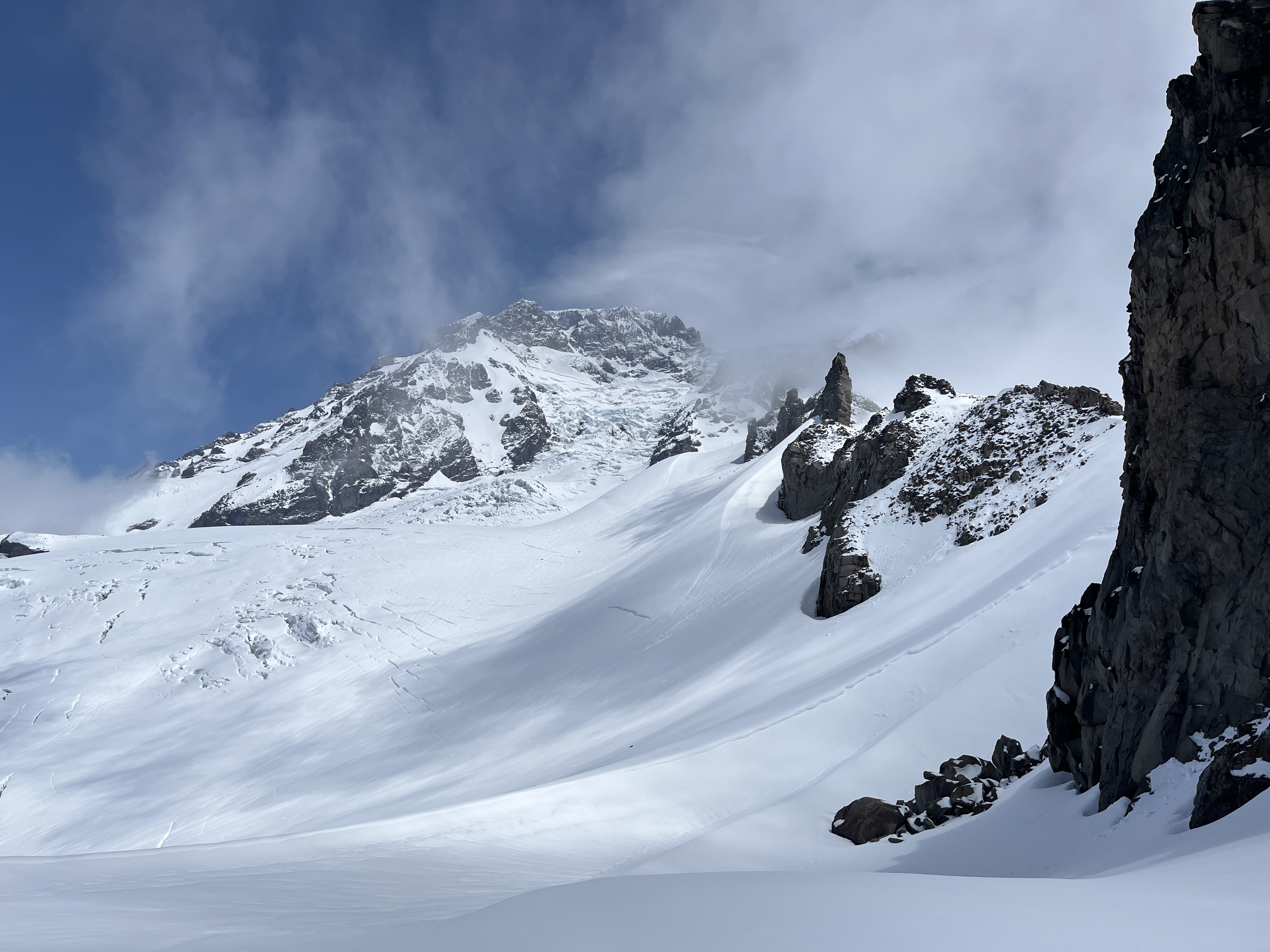
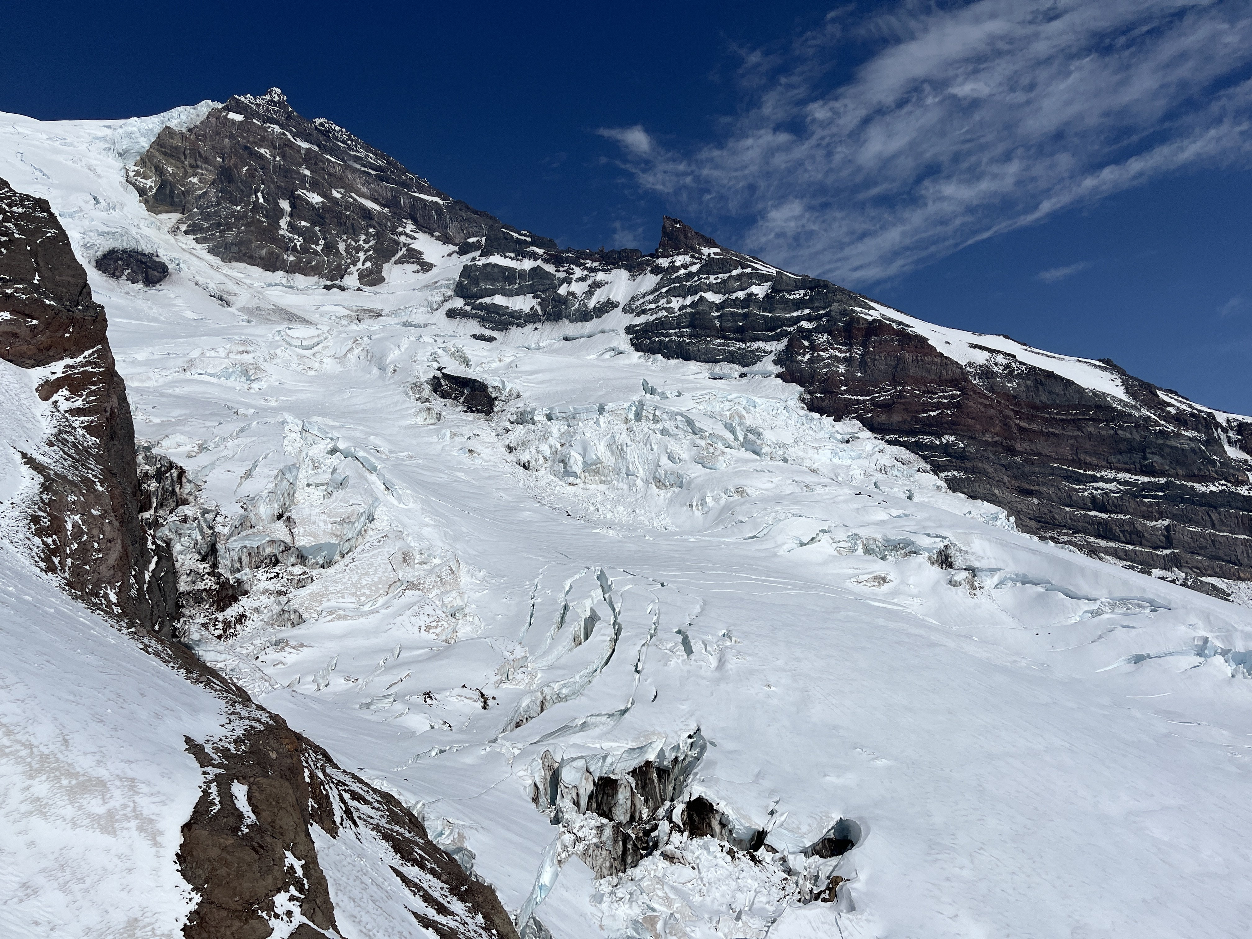
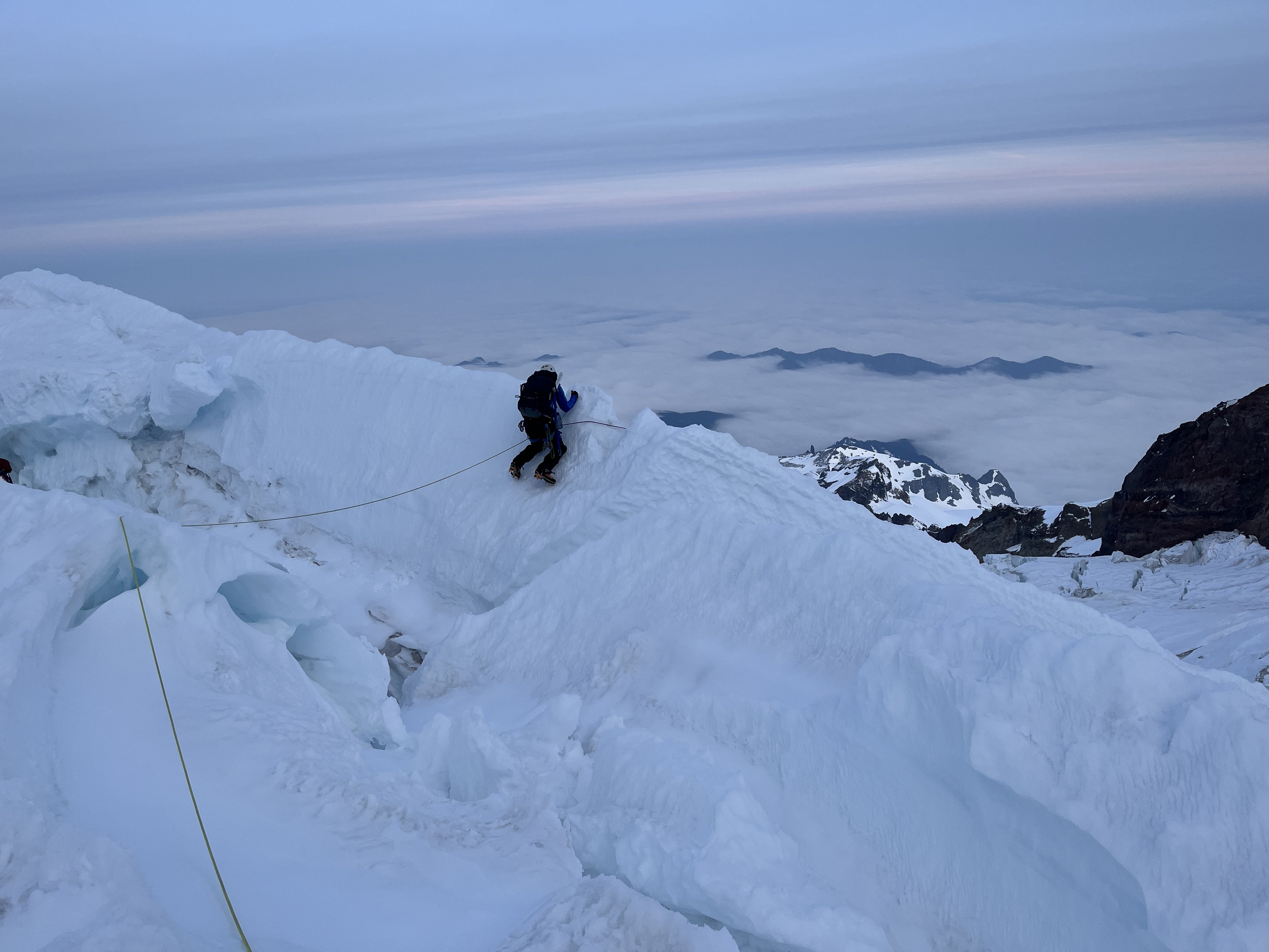
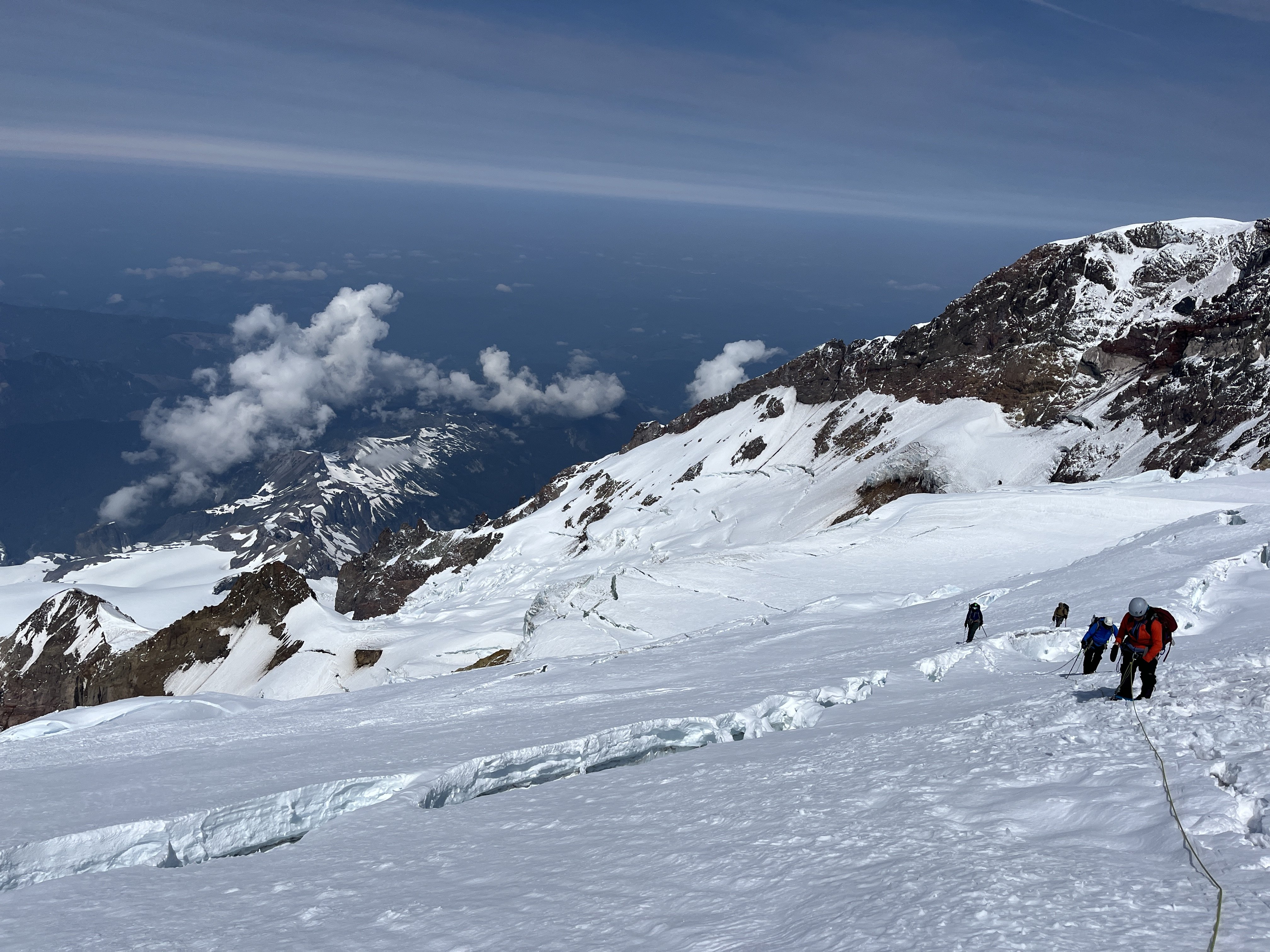
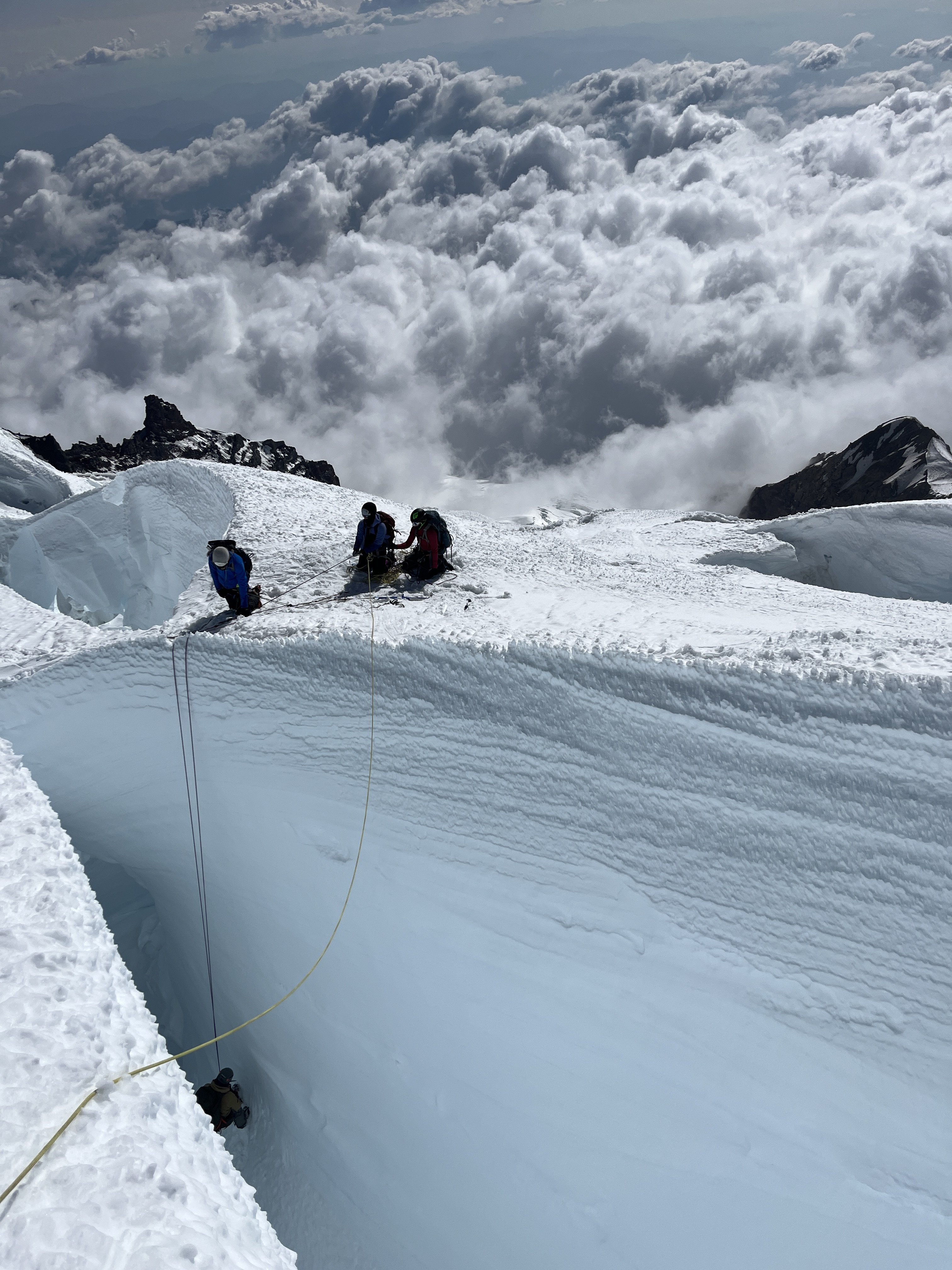
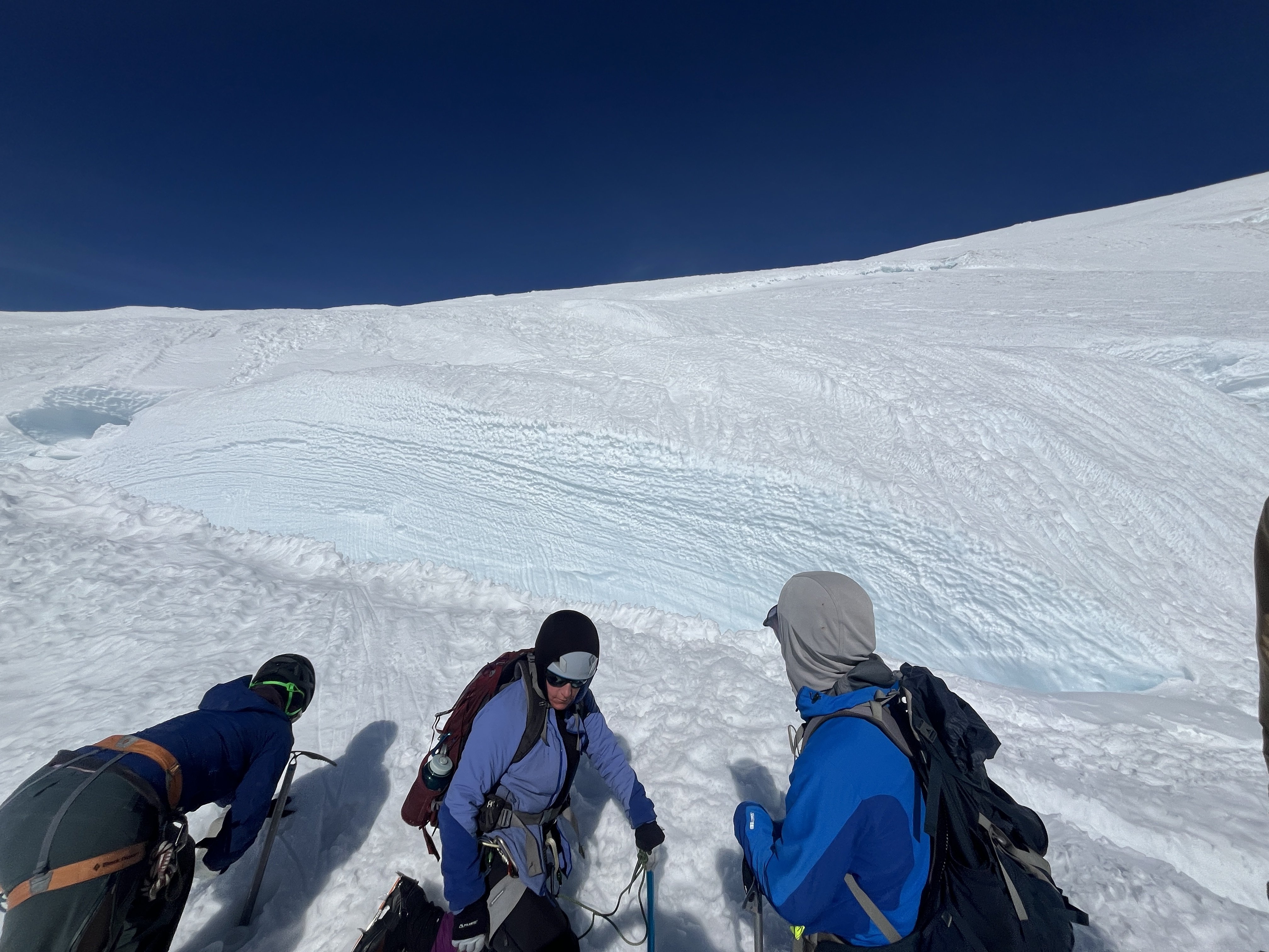
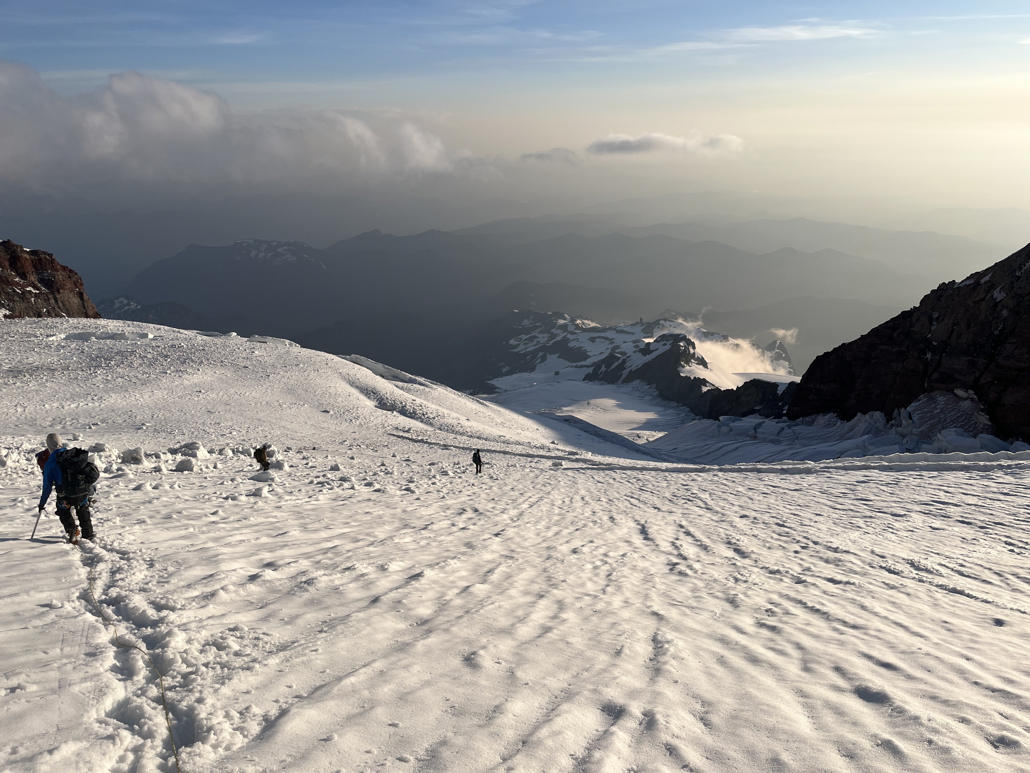
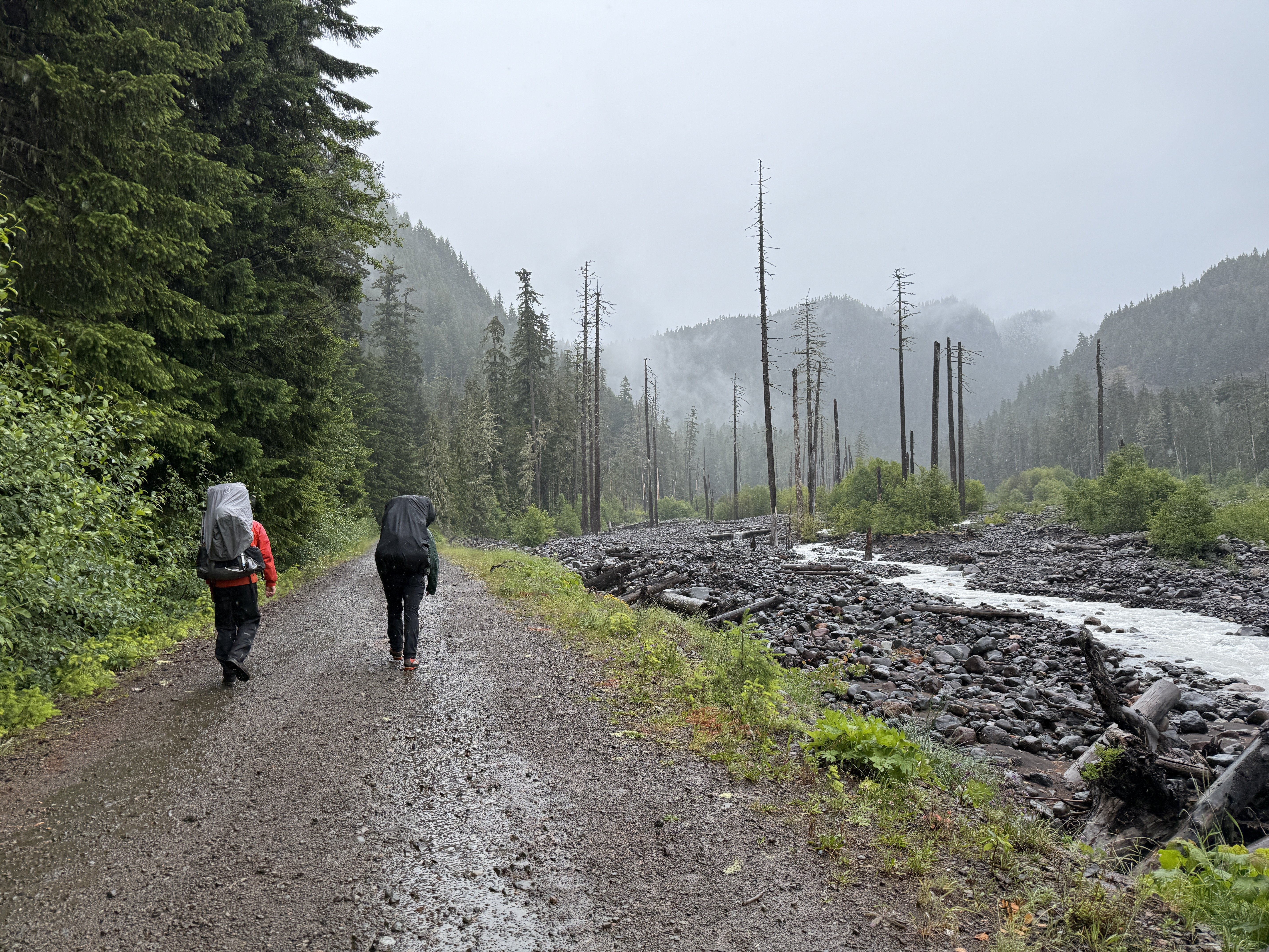
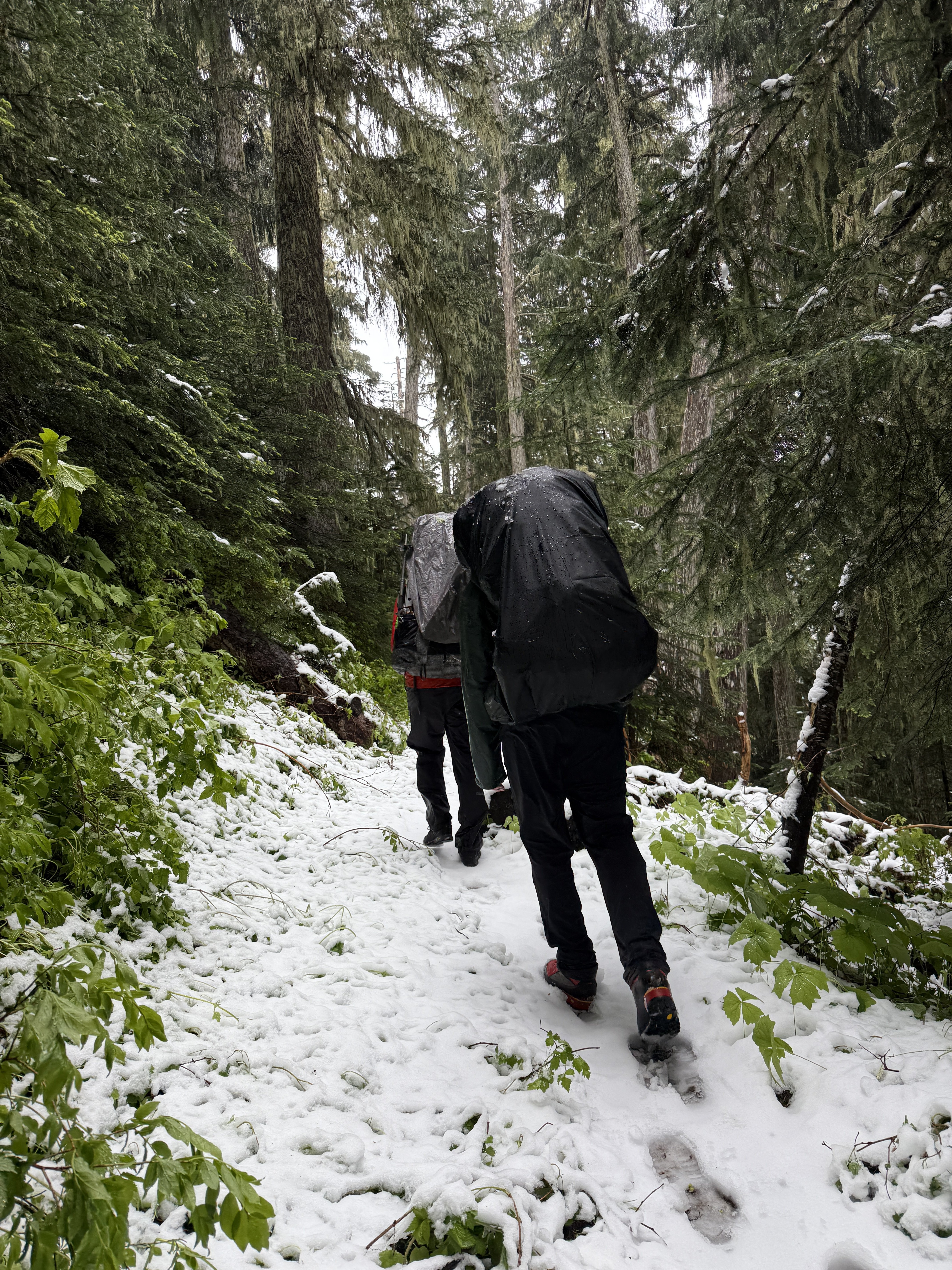
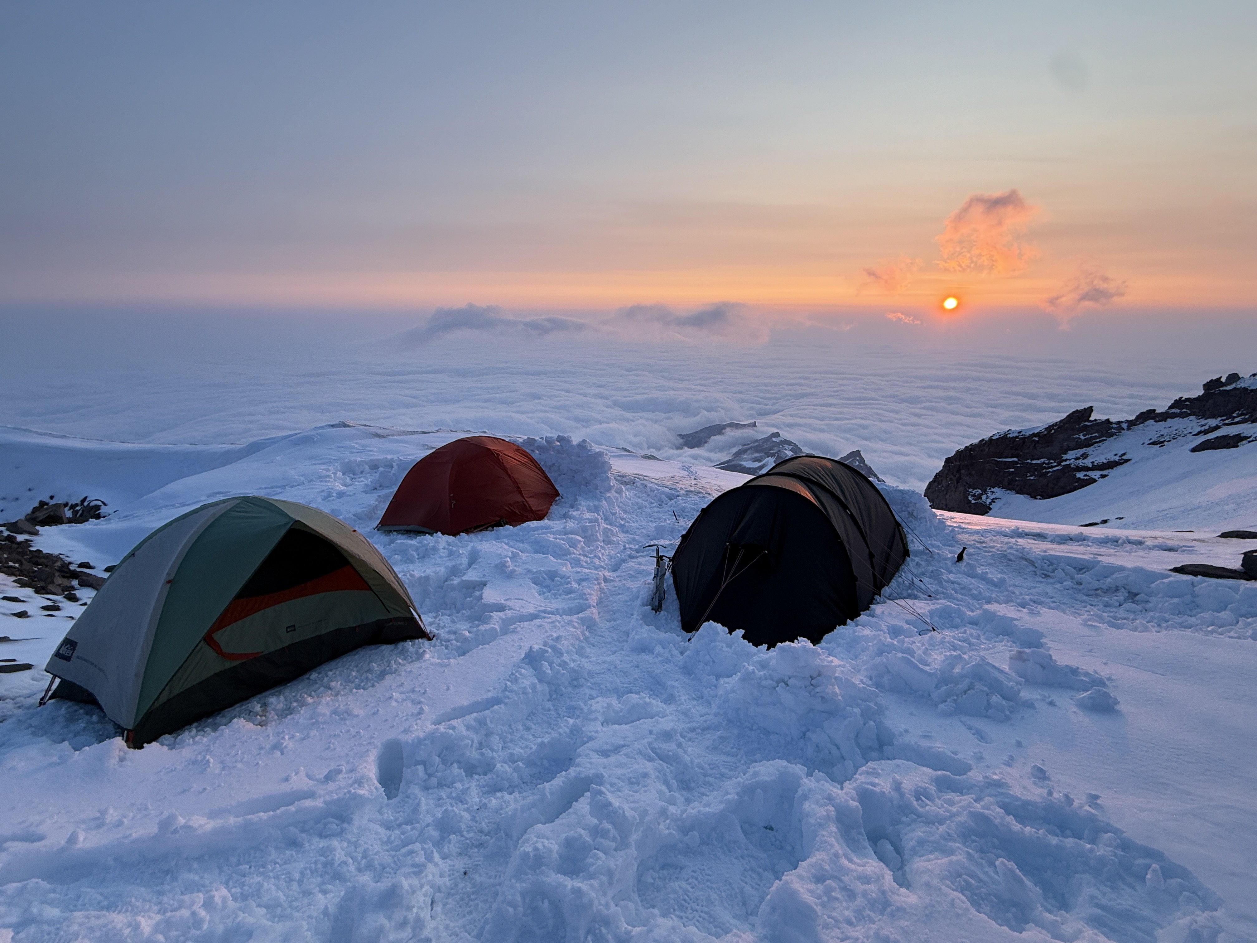
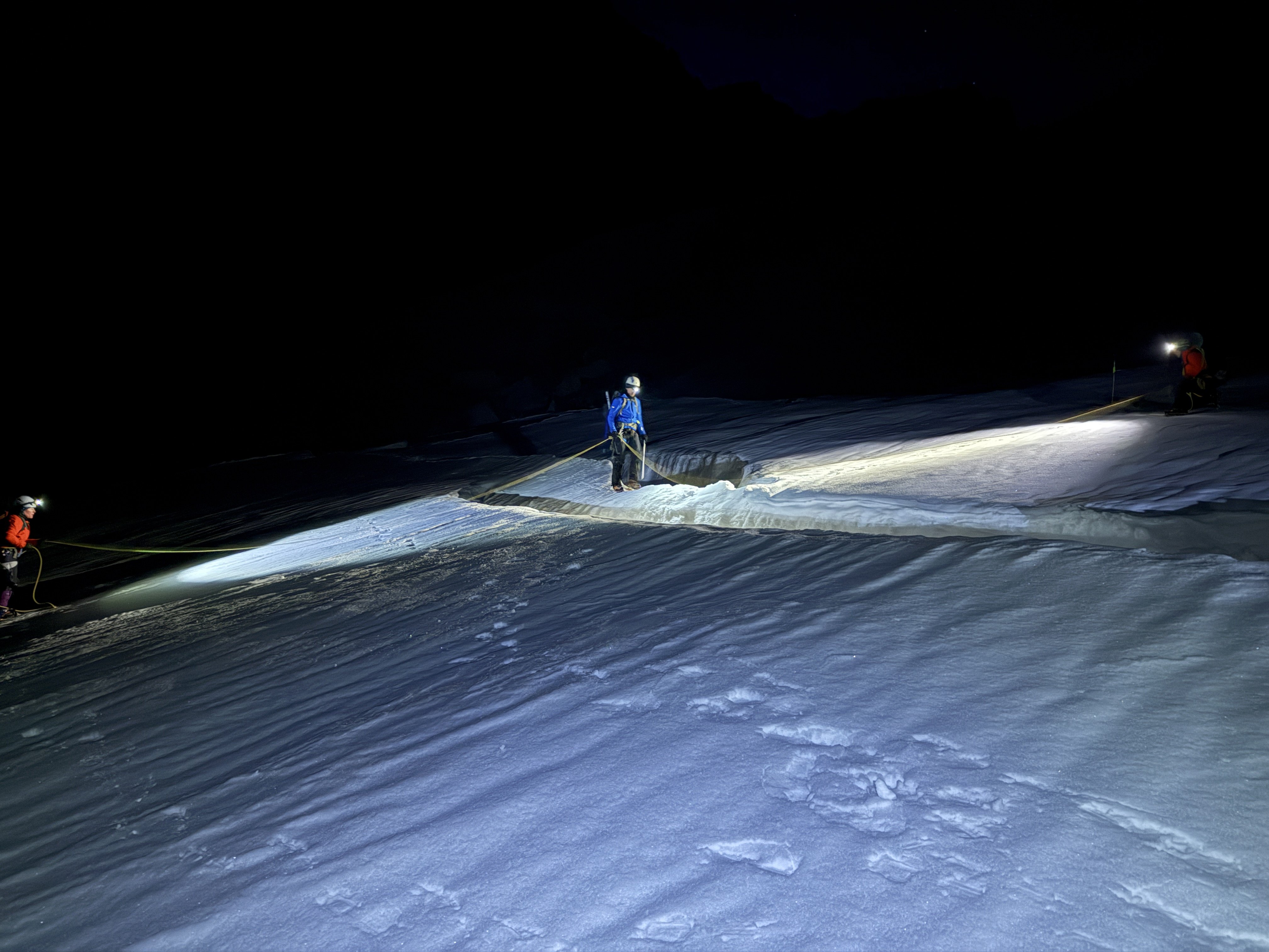
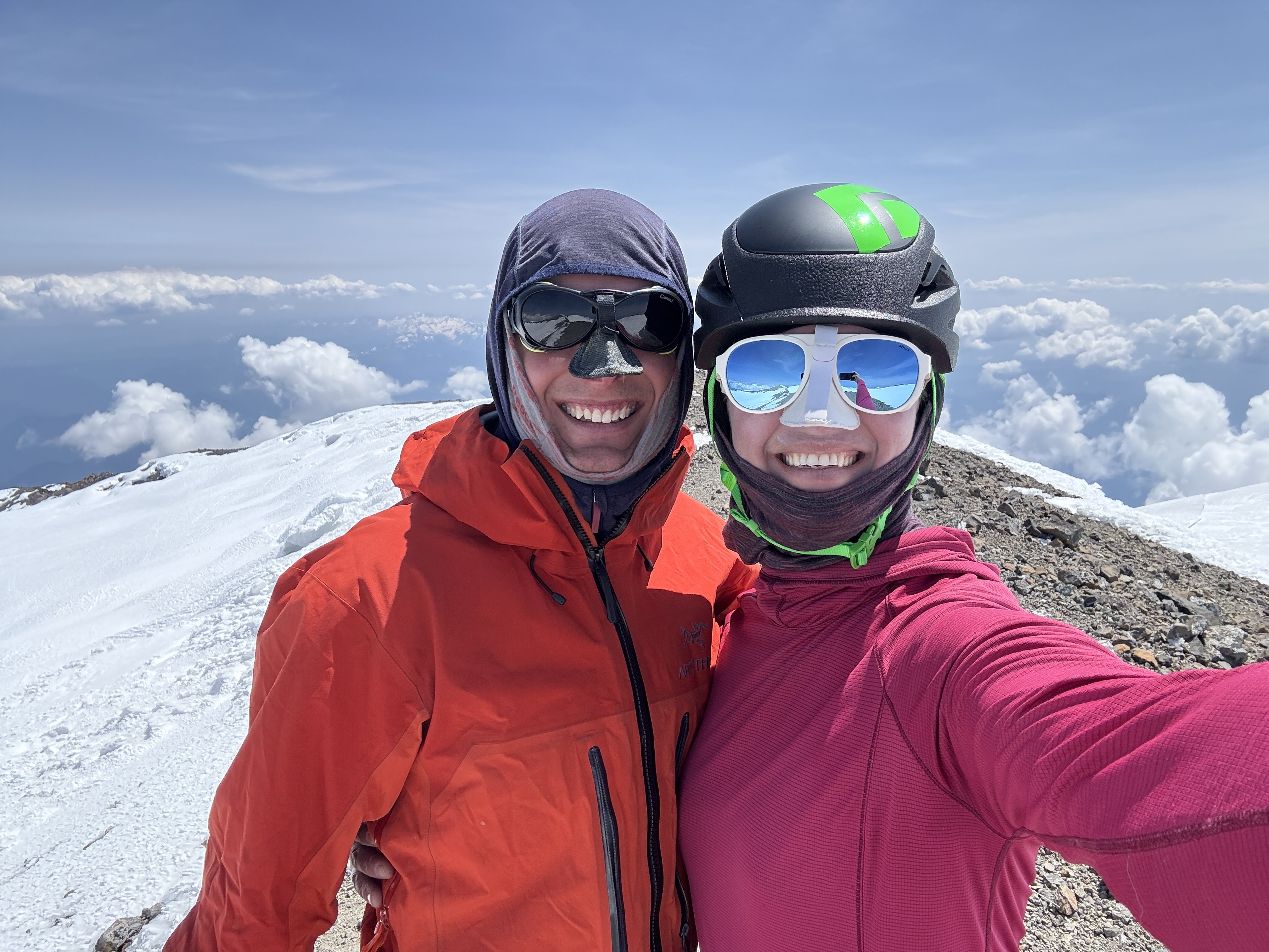
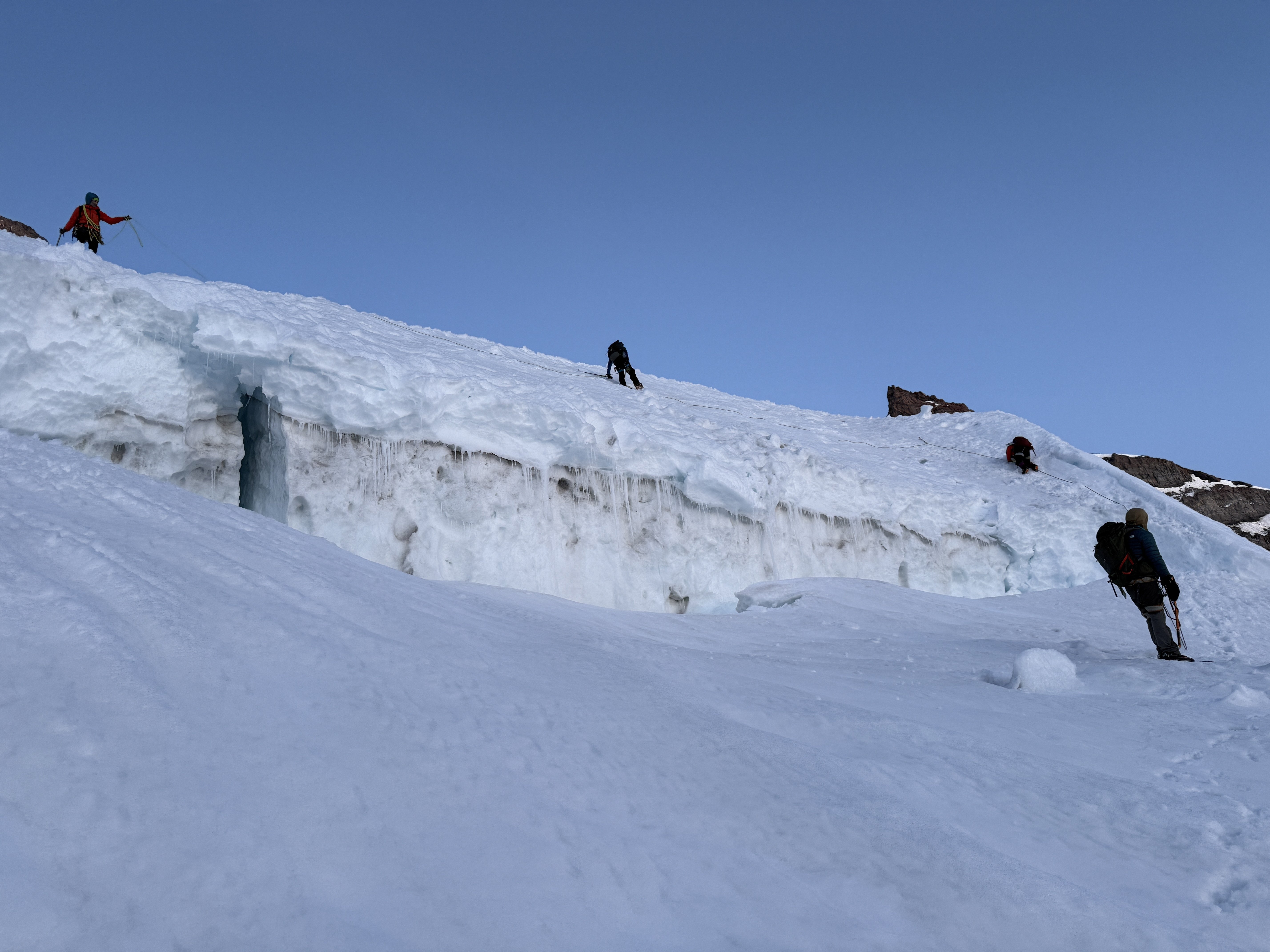
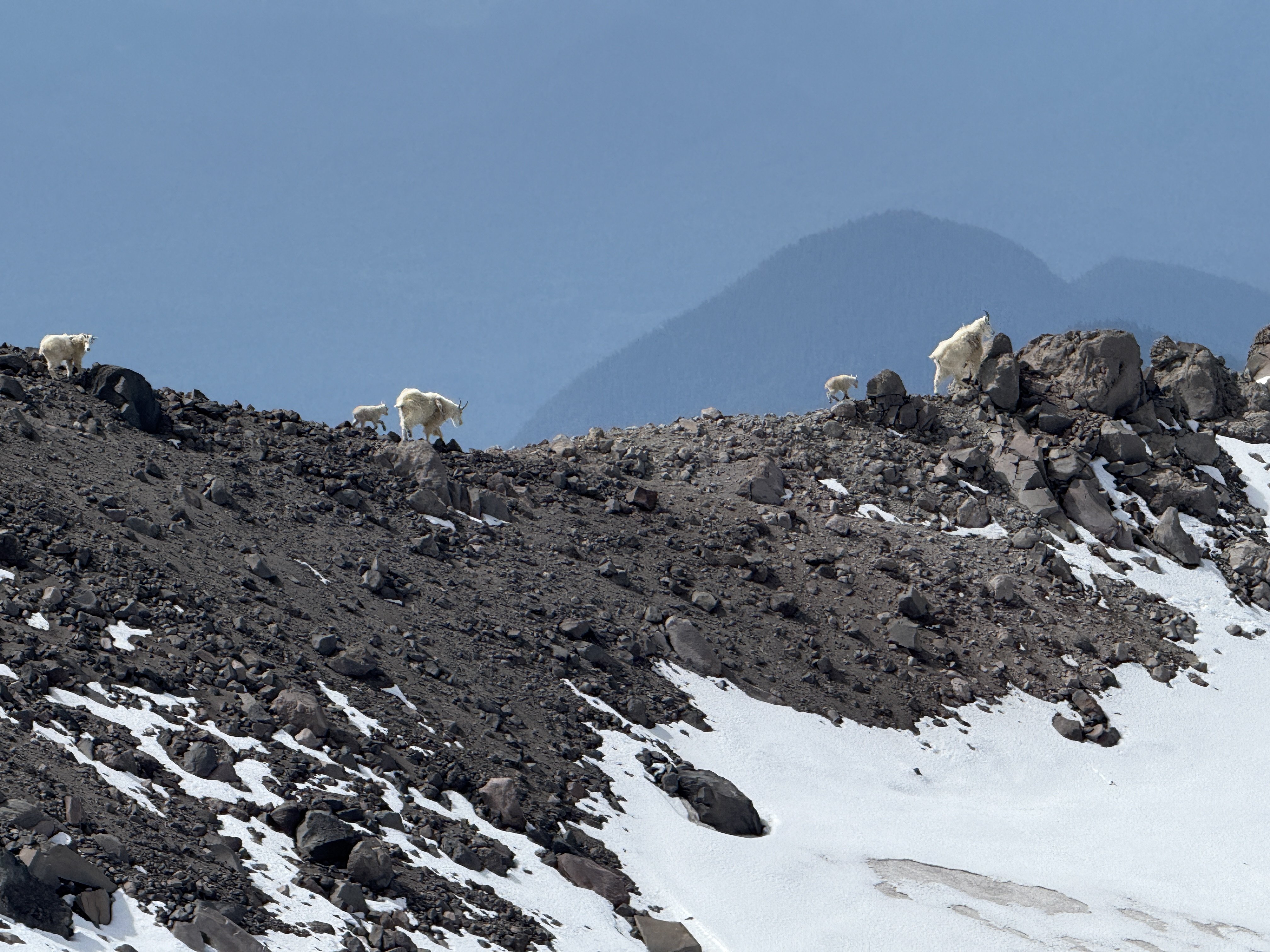
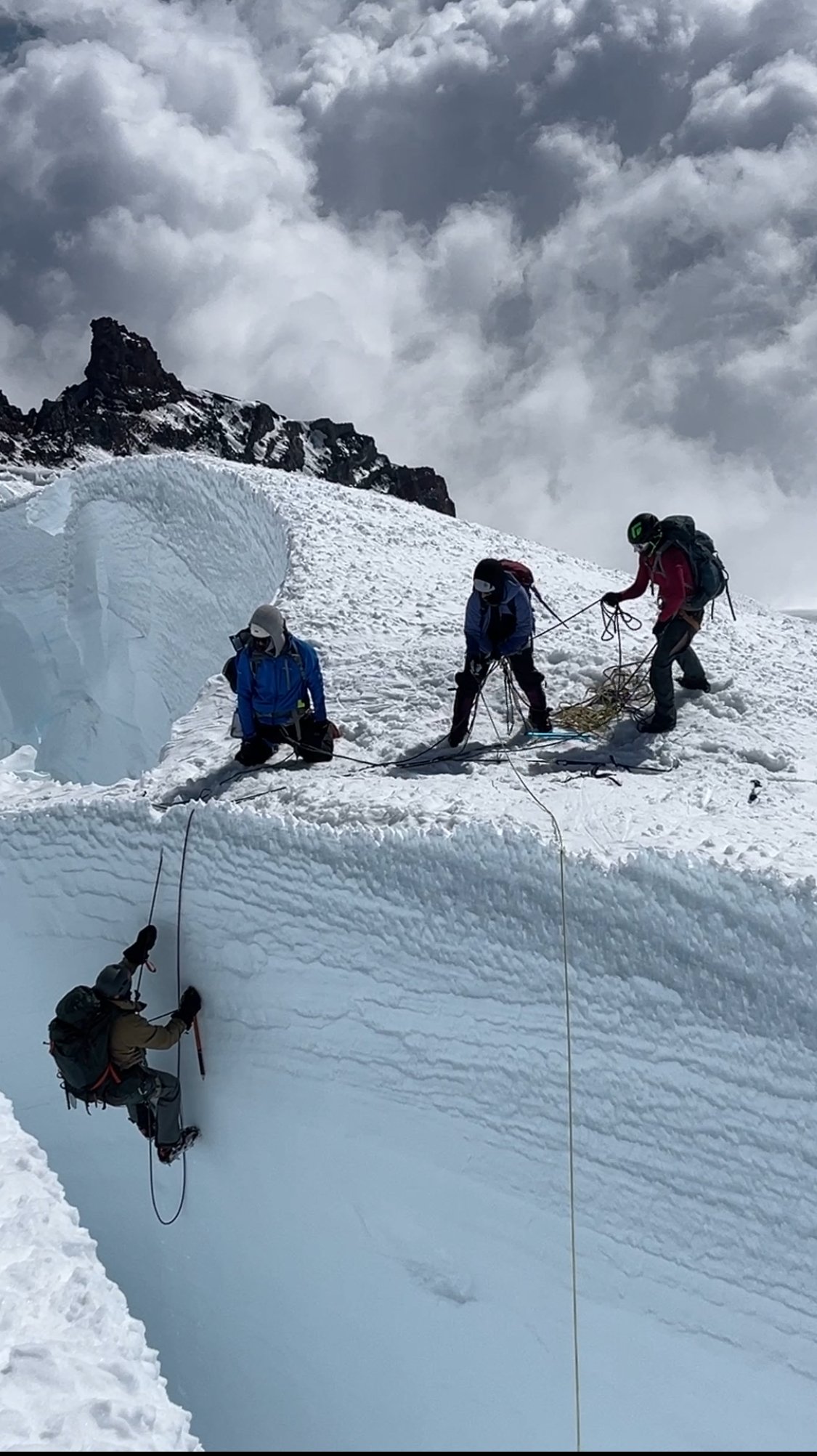
There are plenty of trip reports out there about the Tahoma Glacier, so I won't elaborate too much on the route. Last year we had planned to climb this route but with a very terrible forecast during our dates we postponed it a year. This year we braved the rain on day 1 in hopes of the promised good weather for summit day. Thankfully it paid off. Leaving the trailhead Saturday morning in the rain. (Photo by my wife) Found fresh snow from the previous night that was now a sloppy mess.....still raining. (Photo by my wife) Rewarded with this view on Day 2. We moved from Camp 1 at 6,200 ft up the Puyallup Cleaver to high camp at 9,800ft at the base of Saint Andrews Rocks. Looking at the Puyallup Glacier. It was well filled in and easy walking up to high camp at 9,800ft. Looking down at the Tahoma Glacier from high camp. You have to drop down the ramp to reach the glacier proper. Sunset at Saint Andrews Rocks at 9,800ft. (Photo by my wife) Early morning crevasse navigation. (photo by my wife) Some more crevasse shenanigans in the broken up sections. More crevasse zigzagging. (photo by my wife) The team nearing the top of the route approaching 14,000ft. The summit with my wife and I. At 13,100 feet on the way down our 2nd person (out of 5) had a sliding fall into a crevasse. I have always said that if you keep your intervals tight you shouldn’t have to worry too much about crevasse falls. And over the last 15 years this has proved true in both the PNW and AK. With multiple small punch throughs over the years nobody has ever gone farther than their armpits. But this time was different. This is because if you punch through a snow bridge you will likely go up to your waist or backpack but then be tight and climb out on your own. I think this is true for typical crevasse falls….bad snow bridge, or winded over crevasse. These are times were you are surprised and fall right in. There is an entirely different type of crevasse fall. This is when you take a fall in steeper terrain and are unable to arrest that fall prior to the crevasse. I never really thought much about this because I feel really confident on crampons and look at those short locations as “do not fall” sections. But clearly with a less experienced group I need to take those sections a little more seriously. Our #2 guy on the rope was very tired on the way down which I am sure contributed to the fall. He fell in just such a place on a traverse above a crevasse on terrain I would call “no fall zones”. He fell off the upper lip and into a big open crevasse. The rope wasn’t super tight but there wasn’t an excessive amount of slack in the system. It was in difficult terrain where there were multiple obstacles stacked right after each other so team members were navigating different technical obstacles all at the same time (not ideal). Looking back I think I could have potentially avoided the incident by the use of running protection. I just felt so secure in those sections that I didn’t really think it necessary. But when taking newer people out it is better to take a couple minutes to add running protection than a hour to pull someone out of a crevasse. Lesson learned for sure, and I am just really glad he was ok. When the fall occurred, my wife who was leading the rope team had just finished all the technical obstacles and was on the lower lip of the crevasse. #2 was working across a traverse 8 feet above the lip of the crevasse and then had a 10 ft down climb to a narrow snow bridge. #3 had just finished a down climb and was just making a step across a thin snow bridge and onto the traverse. #4 was at the beginning of a down climb. #5 (myself) was anchoring the back on the slope above. When #2 fell he was unable to arrest in those 8 feet and so fell off the upper lip. He stopped about 30 feet below the lower lip and just above a sloping snow ledge. The rope never came tight to my wife (#1) because #2 fell towards her creating slack. #3 was pulled off her feet across the snowbridge onto the traverse. She was able to arrest. #4 was pulled off his feet and into the down climb. Myself in the back was able to arrest and hold the fall helped by #3 on the traverse. Thankfully #2 who fell in was uninjured. We were able to give him a little slack so he could get his weight on his feet onto the sloping ledge and then we started working on a plan. It took a bit of time to get things setup since the terrain was complicated where most of the team had arrested the fall. But in the end we were able to get everyone except for myself to my wife's position on the lower lip where there was a great spot for rescue. They were able to equalize 2 pickets (1 deadman and 1 end SLAM) and then used a 3:1 system with an ice ax at the lip to keep the rope up. Once the system was set 2 people were able to haul out the climber in less than 5 minutes. Having various different levels of experience on the team we spent a few minutes afterwards discussing and debriefing the incident. Here were a few lessons people found helpful. Place anchors further from the edge so there is more room to haul. When moving downhill keep walking down past the obstacle (body belay) vs. a hip or ice ax belay. This allows you to quickly run downhill should someone slide towards you creating slack. You need room to walk around at the anchors when performing a rescue. If in a safe spot think about just being out of the system. If not then use cord or the back end of a rope. Both the first 2 rescuers got pretty pinned into short tethers that prevented much movement initially. Have 1 person take lead on patient care and tell the person in the hole to put on warm clothes…even in best case scenarios it is going to be 15-20 minutes in the cold crevasse. If there is a ledge in the crevasse consider giving slack to get the person off the rope and onto their feet. Use the rope for backup should the snow give way again. Think through all the steps that need to get accomplished and try to figure out what can be done concurrently to speed up the process and gain efficiency. Here is the rescue in progress from the top lip of the crevasse at the beginning of the traverse. I ended up be "stuck" on the high side and only helped through directions. I felt the team plenty competent and taking the time to get me to them would just delay pulling out the fallen climber. One more shot as the fallen climber nears the lip. A shot looking up at the top lip of the crevasse and the traverse above. You can see the top of the upper down climb above the traverse on the left. The thin snowbridge is hidden behind the traverse on the left. The final down climb and narrow snow bridge are on the far right after the traverse. The whole incident took about an hour from the time of fall to having everyone out and gathered up at the lower lip. From there we continued down the glacier without further incident. Although people's nerves were a bit shot and any steep terrain encountered further down was negotiated with slow care. This resulted in a very long but safe day. Farther down the glacier at about 11,000ft. We hiked out the next day in beautiful sunshine and tired bodies. But got to see some goats in the process. (photo by my wife)
 1 point
 -
Trip: Mount Rainier - Emmons Central Trip Date: 06/30/2025 Trip Report: When looking at Emmons from Sunrise, Andrew got the idea of trying a route that would connect with a feature similar to the Emmon-Winthrop route corridor but positioned in the middle of the expansive glacier. This feature starts around 10k and provides easy direct access to the upper mountain. I was skeptical about the idea until I had a closer look myself a few weeks ago while climbing Cowlitz Chimney. We could not find any information about this route and decided to refer to it as Emmons Central. Please, let us know if you know the history or previous ascents. To spice things up Adrew pitched starting the glacier terminus. We scouted access to the moraine Saturday afternoon and took closeup picture of the route to weight our options. The pictures did not show any clear paths to the corridor but the “right” side variation looked the most promising. Sun morning, we hiked and shwacked to the terminus and started making our way up the glacier. The idea was to skirt very broken up lower section on the right, then hook left trying to ascend to a rocky ridge in the middle of the glacier. We could then follow the ridge for a little bit until being able to push right to access the start of the corridor. We identified one potential make-it-or-break-it crevasse below the rocky ridge but did not see any clear dead ends along this option. After leaving the moraine and getting on snow we started aiming for a nunatak at 9400 following open slopes with minimal crevasse issues. From here we initiated our left hook as the glacier became more broken up. After some navigation we reached the crevasse with a question mark and were able to get across on an exposed but solid bridge far left. This brought us to the rocky ridge where we set up the camp at exactly 10080ft. Being in the middle of a glacier with the largest area in the contiguous US and having dry ground to sit on was awesome. Looking up from camp revealed crevasse problems we did not see in the pictures. The general plan was to keep going right and that is exactly what we did in the darkness the following day. It was obvious when we finally gained the ramp because there were no crevasses in sigh as far as the headlamps could shine. The angle starts around 40 degrees and gradually eases off with elevation as it trends slightly left. Around 12.5k the route connects with the late season DC route variation. To our luck we ran into set of boot prints around this elevation. Later on the boot path became marked with wands so my guess is that the guides or rangers prepared the route for when the regular DC gets too broken up. We followed the boot prints and wands until connecting with the regular DC and the well beaten path to the summit. We descended via the standard Emmons-Winthrop route. Gear Notes: pickets Approach Notes: Moraine trail to "End of maintained trail" sign then follow a boot path down. We then hiked along the vegeration up until it looked more open1 point
-
1 point
-
Hmmmm....important distinction....let's see....I think the west side?1 point