Leaderboard
Popular Content
Showing content with the highest reputation on 10/02/24 in all areas
-
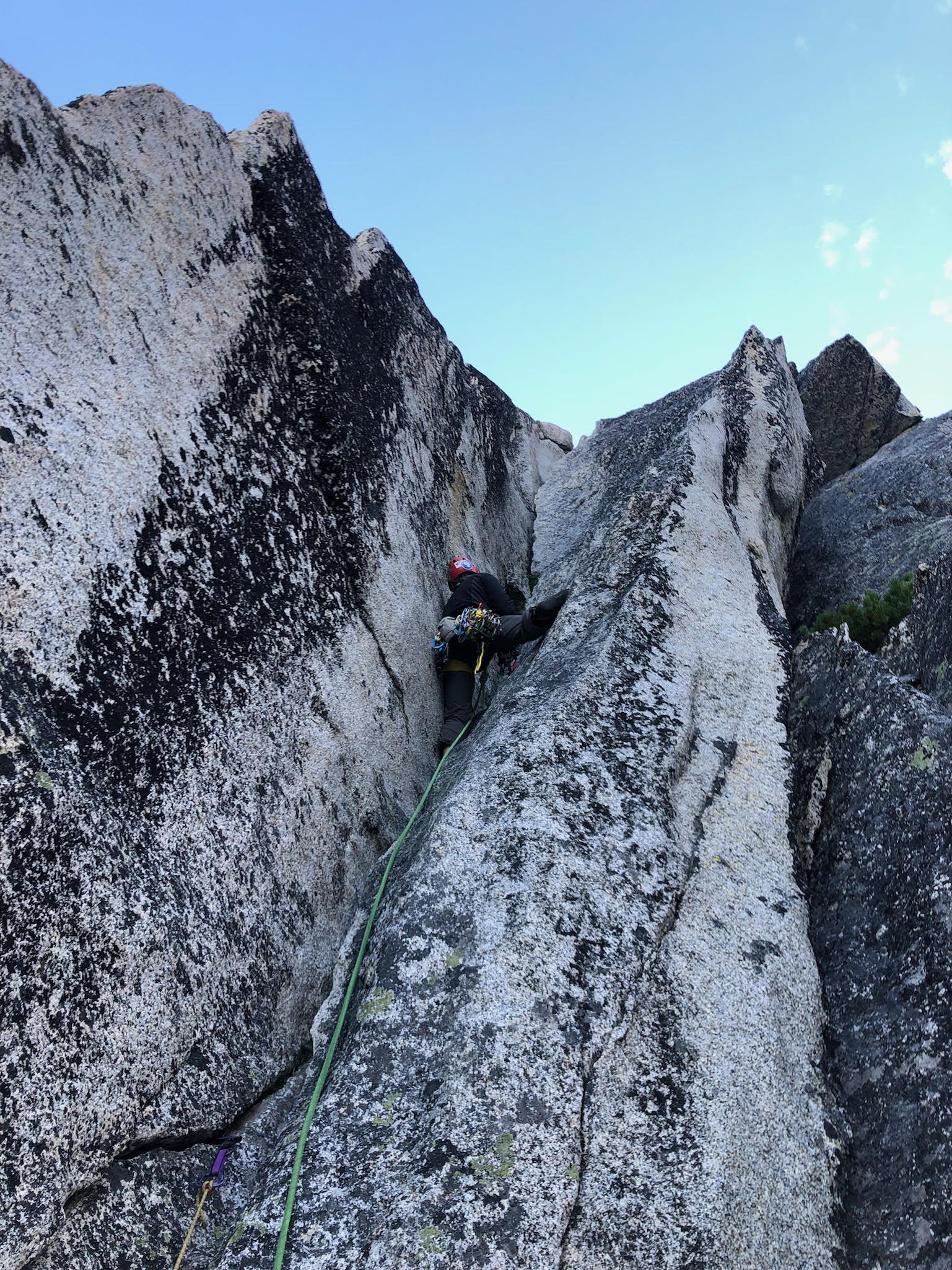
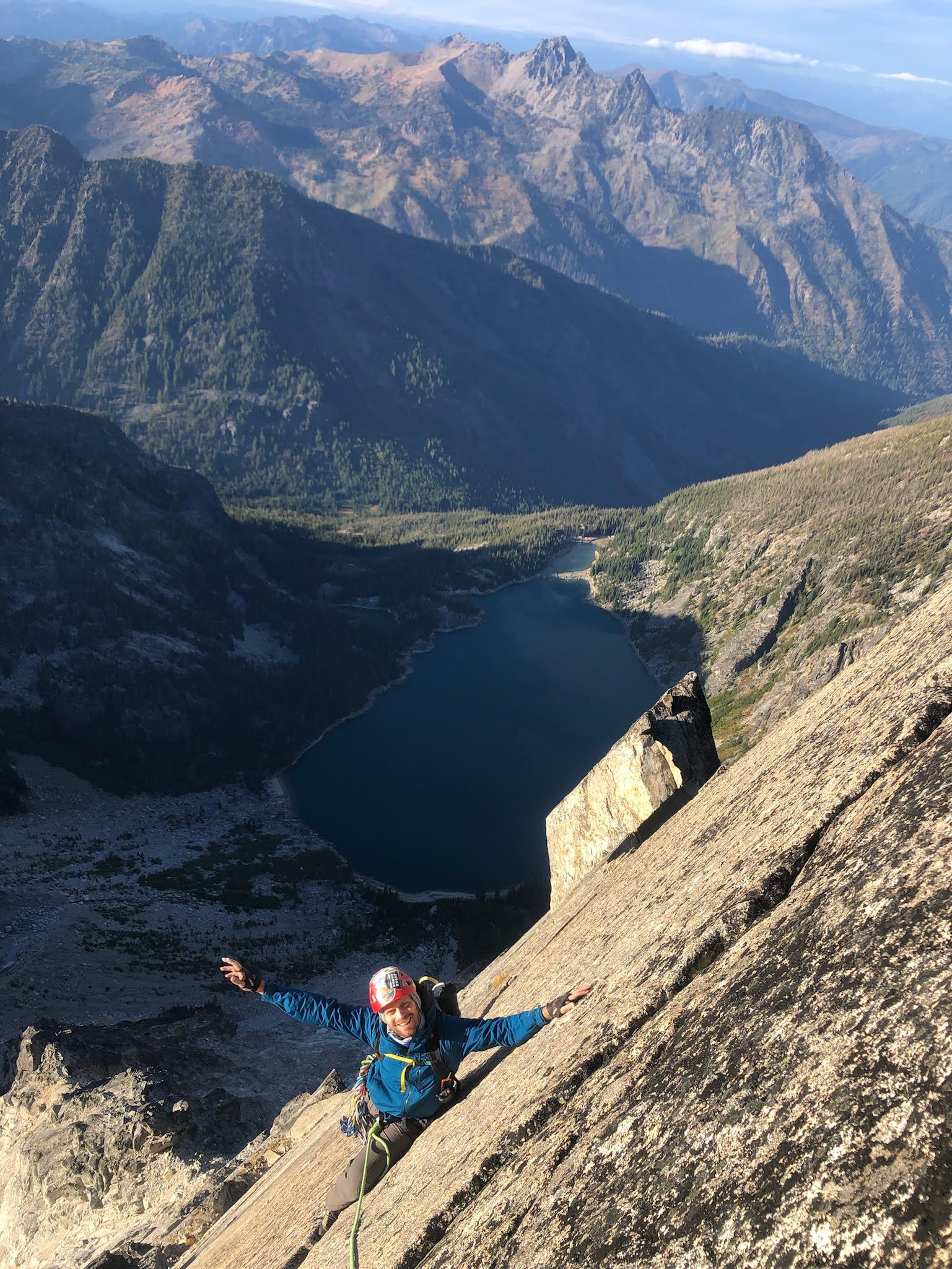
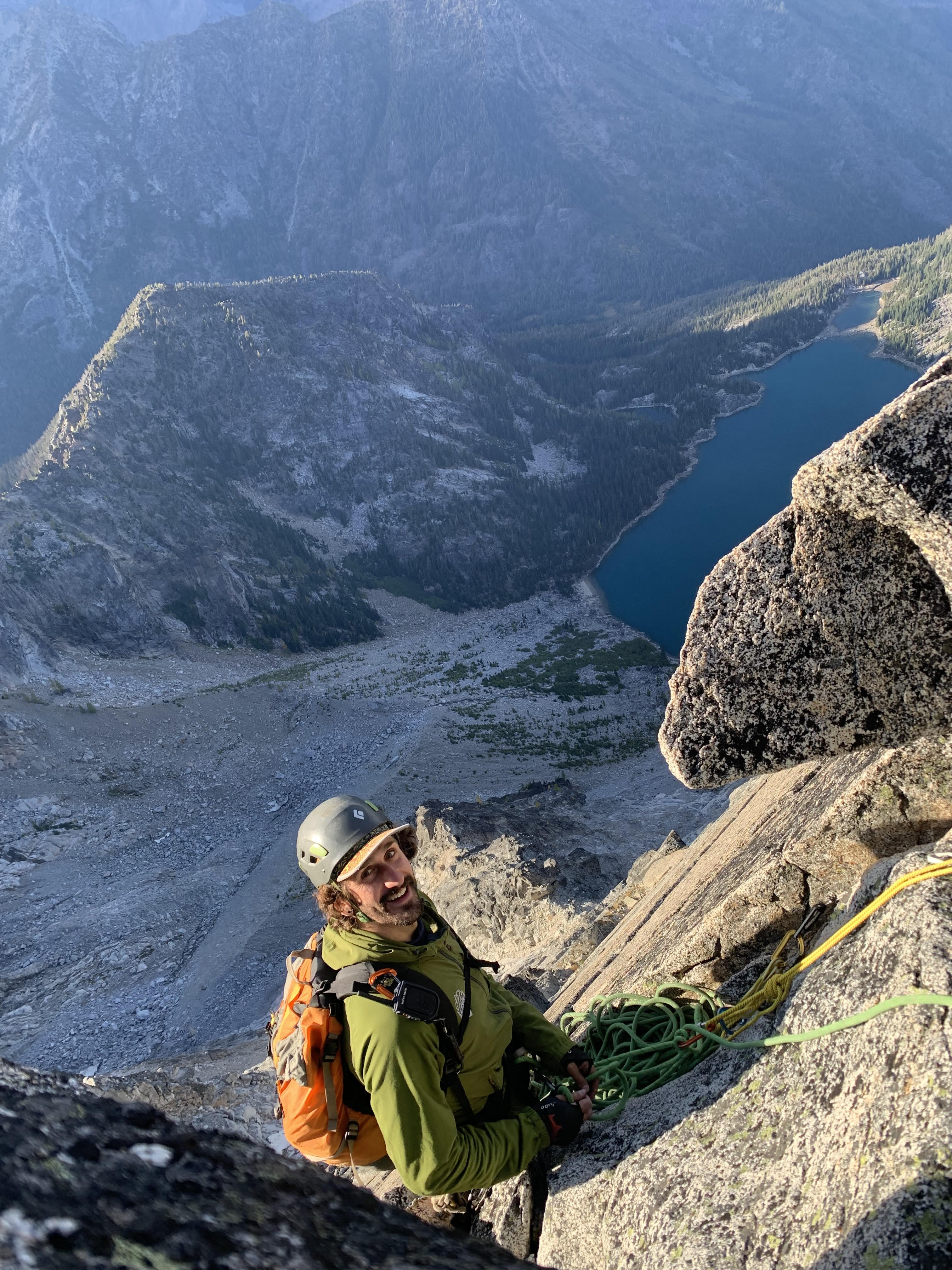
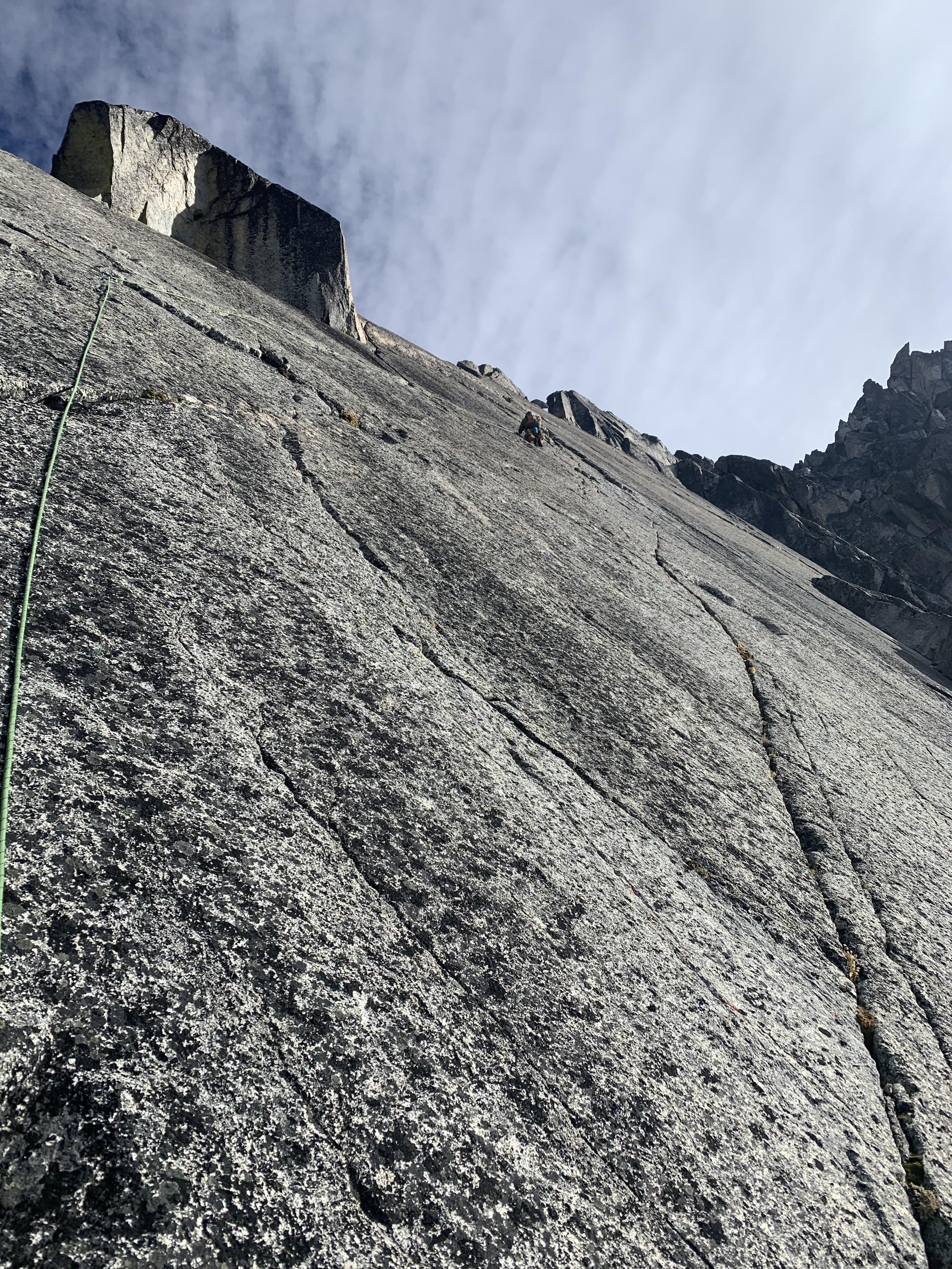
Not much new to say that hasn't been said about this classic route so made two versions. Short version: We ended up doing the left-side variation on the fin, per Blake Herrington's guide. It was a fun long day and a #6 and 70 m were great. Long version: I was intimidated by this route given the large number of reported epics and accidents, but it has been on my list of bigger Washington classic alpine climbs to attempt for a while. But after getting out of shape finishing up grad school while working full time for the past two years, it sat on the shelf. Well after graduating and having a summer returning to alpine shape repeating some familiar classics in the wind river range and washington, I was finally feeling fit and confident once again to give the route a go. Kurt and I briefly joked I'd climb the offwidth if he climbed the final fin/slab pitch. Kurt and I packed more layers, food, and water than we normally would just in case of an epic. But we were feeling good, and set off with our heavy packs at 5:00 am from the trailhead, jaunting past large early morning through hiker groups hoping to peep early season larches. We filtered some water at Colchuck Lake and made it to the base of the climb by 8:00 am. Luckily and sadly the snow and glacier have receded to the point where we could walk straight to the start of the initial scramble. Looking at the tree'd scramble and the OW above: Jolly at the start: Scrambling far left and then then up and right, Kurt set off from the base of pitch 1 at 9:00. The first 4 pitches were pretty straightforward using the beta from mountain project and blake herrington. Leading the offwidth pitch was easier, more secure, and more fun than I anticipated. It helped that I hauled my bag and having the #6 made it stress free. The 4th pitch was also super fun! A short 0.3 finger crack into a wide crack, then a thin step over to wild slabby layback. OW: From there the rock quality and navigation got worse. We looked for a downclimb described in Blake's book and a large ledge in mountain project, but everything looked like it would go. So Kurt ventured off trying to find a way to go and ultimately went up and left until finding the obvious saddle. I think for this section, its easy enough terrain that anything goes and just moving up and left on whatever looks fun and solid is the move. We moved across the saddle and up the large ramp/chimney to just below the twin cracks on the left side of the fin. I couldn't distinguish what cracks were the twin cracks as all the cracks on the left looked shallow and dirty, so ended up going to the high point on the ledge and climbing some 5.6/5.7 crack/face on poor rock to the next ledge, then moving back down and left. Looking down the top-out of what I guessed was the twin cracks was full of lose rock that would have been hard not to tumble, but maybe I am off? Kurt then led the right-facing corner to a ledge then a thin and tricky crack/corner back to the face of the fin, which was awesome and had a hero jug! At this point we had been in the shade most of the day getting blasted by wind. I was up next, but was smoked from carrying a heavy bag on this climb, so through less than honorable intentions I attempted to convince Kurt to stick to our original agreement and lead the final fin pitch. He was reluctant at first, but I finally wore him down with a bonus fruit leather offering. I followed and it reminded me of the no hands traverse pitch of thin air at Cathedral Ledge, but doubled! However, when I got to the belay, Kurt was less stoked on it from the less than stellar rock we were promised and not having the 4 to protect the final section of no hands traverse (he used it in the anchor). Kurt questing into the fin: Classic fin shot: Kurt on top of the fin: We finished by traversing over and then stupidly heading up on the south side of the ridge via the triple couloirs bowling alley. It took 40 minutes to move 60 m of 5.0 because the rock quality was so atrociously bad. Every other step and every other hold would pop off or crumble... we should have stayed on the north side climbing the ridge proper. We made it to the summit at 6 pm and after a quick selfie, we did 4 rappels off the back side to make our way down Asgard in the dark. This was the second time I descended Aasgard in the dark this season and I am still surprised by how much longer and worse it feels hiking Colchuck/Aasgard out in the dark than up in the dark! We made it to the car by 11 pm for a solid 18 hour day, so were feeling stoked to have been quicker than 20 hours! Though the last 30 minutes out I was starting to feel a bit loopy either from the exhaustion or caffeine pills, which was new... Overall I thought this was a fun route with some less than classic rock quality. It's a long day for sure, but less challenging than I anticipated (or maybe I'm getting better?). It's less travelled so it was harder to read the route and its lose, so slower going. I think the key for routefinding is to avoid overthinking in the middle-section and just keep moving up and left. It felt somewhat similar to the lower half of the direct north ridge of Stuart in nature, but with less solid rock (a few key pitches, but otherwise make your own way). Gear A 70 m and a #6 was clutch! We would have ran out of rope on the last fin pitch with a 60 m. I also tried out a new to me mountain hardwear scrambler 35L for the first time. It's a bit stiffer than I usually like to climb with, but performed great! The double handles on top were awesome for hauling. The normal sized brain was great and could be easily folded into the main pouch. The many strap on points was helpful for the approach and being able to clip the 6 to. Slightly less mobile, but much more effective than my old ascensionist 35.1 point
-
Trip: Mount Garfield - Southwest Route Trip Date: 08/31/2024 Trip Report: "As has been reported elsewhere, Garfield is a hazardous enigma. It offers more than a climb, for it is also a physical and orienteering challenge. It is important to get a very early start. While a 12-hour r.t. is generally considered a minimum, only during the long days of summer will there be sufficient daylight for what is a long, steep climb, with some very exposed areas." -Fred Beckey, Cascade Alpine Guide I first read the section above in the 1990s when I was just getting into climbing and frankly was both attracted and scared by the photos and descriptions in the Beckey guide. An early trip report by @CascadeClimber and @philfort did little to dissuade my apprehension of this peak and so it sat for decades on the back burner. Always there, always taunting, even long after I probably had acquired enough chossdawgery skillz to make an ascent a reasonable goal. Turns out, two of my long-time climbing partners felt the same, and somehow it came to all of our attentions this year that Garfield could no longer be ignored. In the words of @Trent, "It must be climbed!" Secretly, I was hoping that @klenke was still correct and the the route was dumbed down by a bootpath and flagging. But I wasn't so lucky- he can rest easy on the golf course or the workfloor of the Lazy B, knowing that the brush has returned, the flagging rotted away, and that the blue collar masses have moved on (or died?). This peak is probably once again nearly as lonesome as it was when Fred first penned those words (the register went back to 1987 and traffic really has dropped off the past 10-15 years). I can honestly report that it is proper challenge for a Cascades Connoisseur such as those that frequent this esteemed site. (If you want hardman or hardwoman points, read no further and just photocopy the pages out of Brown Fred for your trip. If you're someone like me....read on) But we didn't know any of that when @therunningdog, @Trent and I rolled into the "gravel wash" that marks the start of this 4500' off trail adventure, late on a Friday night in Trent's old VW camper (nickname "Speedy"). There was another car camping there, but given the smoking and drinking we were pretty sure that they weren't heading to Garfield in the morning. Then again, I think a late evening of smoking and drinking would probably have been fitting preparation for the peak. Next time. Alarms were set for crazy early, I think about 430, since we had heard ample stories of unplanned bivies, thrashing exits in the dark, and general mini-epics. We were thinking 13-15 hours would be about what it would take and planned accordingly. But it turns out, us old dogs (combined team age of 158) can still beat Beckey and we were back to the van in about 11.5 hours, including breaks. The early start gave us extra time for beer and chips, so it wasn't all for naught. To be honest, the way up was mostly a blur. A dark gravel wash to an impassible set of falls started things. We went left into the forest when we should have gone right (be sure to keep that Beckey topo in your pocket and consult at all junctures!) and then I somehow thought that the real "dirt gully" below, wasn't the right dirt gully and kept going past it. Trent and Tim kindly put us back on the right track without too much wasted time The "dirt gully" wasn't that bad, but it wasn't that good either. You don't want to be on this mountain with more than about 4 people. 2-3 is about right so you can move as one team. Shortly after the gully you climb up and hit some slabs that force you left. We went all the way left then found a weakness to scramble up and right back towards the ridge crest which is below the "rock outcrop" and "razorback" that you hit right before the "tiny notch". You will be referring to the topo many times in this section, wondering where in the hell you are while looking way down into the "Great Canyon". It is a wild mountain. Soon enough you will come to the "glade saddle" where you will see a short gully leading to the "wooded ramp": which will take you to the brushy "key ledge" where you will be thankful for the brush for hiding the significant exposure. The brush will also distract you from the fatality that occurred in this spot, presumably due to the "trecherous footing" that Beckey describes: And then the meat of it, the "no. 1 Gully is reached, with the "no. 2 Gully" just beyond it: We had already chosen no. 1 Gully as our line, even though Fred describes it as the alternate path up, mostly due to a few of the more recent TRs we dug up which we compared to older no. 2 Gully TRs. I am sure that both have their pluses and minuses. The no. 1 Gully starts out easy, but then a step is encountered where @Trent ably put the rope up for Tim and I. It was a bit trickier than it looked with polished rock and moss. I sort of wanted to do a shoulder stand in the spirit of this peak, but unfortunately I was the last one up. So I grunted and lurched my way up. Then it was mostly easy 2nd and 3rd class scrambling until you had to turn right under the Leaning Spire to ascend slabs to a small col that dropped you halfway up the no. 2 gully. Here the way got harder with some slabby 4th mixed in with the slabby 3rd. We were in boots/approach shoes, which I think is the correct footwear for this route. The slabbyness isn't sustained or hard enough to warrant rock shoes. Plus rock shoes are definitely not blue collar! Style matters. Soon enough we were established in the no. 2 Gully and began to chug upwards to the "crux" chimneys. The first one we soloed: The next one, @Trent led, again. It was wet and involved a lot of grunting and pack dragging. Still, I think it is preferable to the variations that others have reported to the right. The notch between the Leaning Spire and the summit was easily reached after the chimneys, and here we went a bit too far left. You basically want to go straight up a cl. 3-4 slab above the col until you can burrow into a brush tunnel (complete with trimmed branches!) that will take you up and left to the summit ridge. A short walk right will land you on the true summit. If ever there was a peak where the summit was "halfway", Garfield is it! We dug out the register and marveled at who had signed in over the years. Some famous climbers in there and it was fun to take the trip back in time. The views weren't half bad either. It is a long way down to the Middle Fork and the van, less than two miles horizontally from the top. But, like most summits where the descent is worrisome, we didn't stay very long. The descent was also a blur, though it went faster than expected. Several bolted stations in the no. 2 gully greatly helped by keeping us out of the path of the inevitable rockfall. I think we did 6 30m raps total, about 3 in each gully. We paused on the "key ledge traverse" to oogle the Great Canyon in better light as we passed again: And also stopped to admire the Doorish part of the mountain as well. Anybody know that guy? I have to say that he's a legend, at least in my estimation. The routes he did, in the era that he did them, are truly astounding. He had a funny entry in the summit register talking about "a bit of an epic" he and Alex Cudkowicz had in June of 1988 where they ended up spending 2 unplanned bivies (in the rain!) establishing a route that they thought would go in a day. Yowza. Yeah, this should go in a day: But soon enough we were back at the easy slabs, scrambling down to the forest, the dirt gully, the forest, the gravel wash, the forest..... and then....BEER. Gear Notes: 60m twin rope, helmet, light rack to 2", leather gloves. Boots or approach shoes. Best to go after snow leaves the gullies Approach Notes: Middle Fork Road to gravel wash. Page 214 in Brown Fred has a great topo of the route/approach, which is all the experienced chossdawg needs.1 point
-
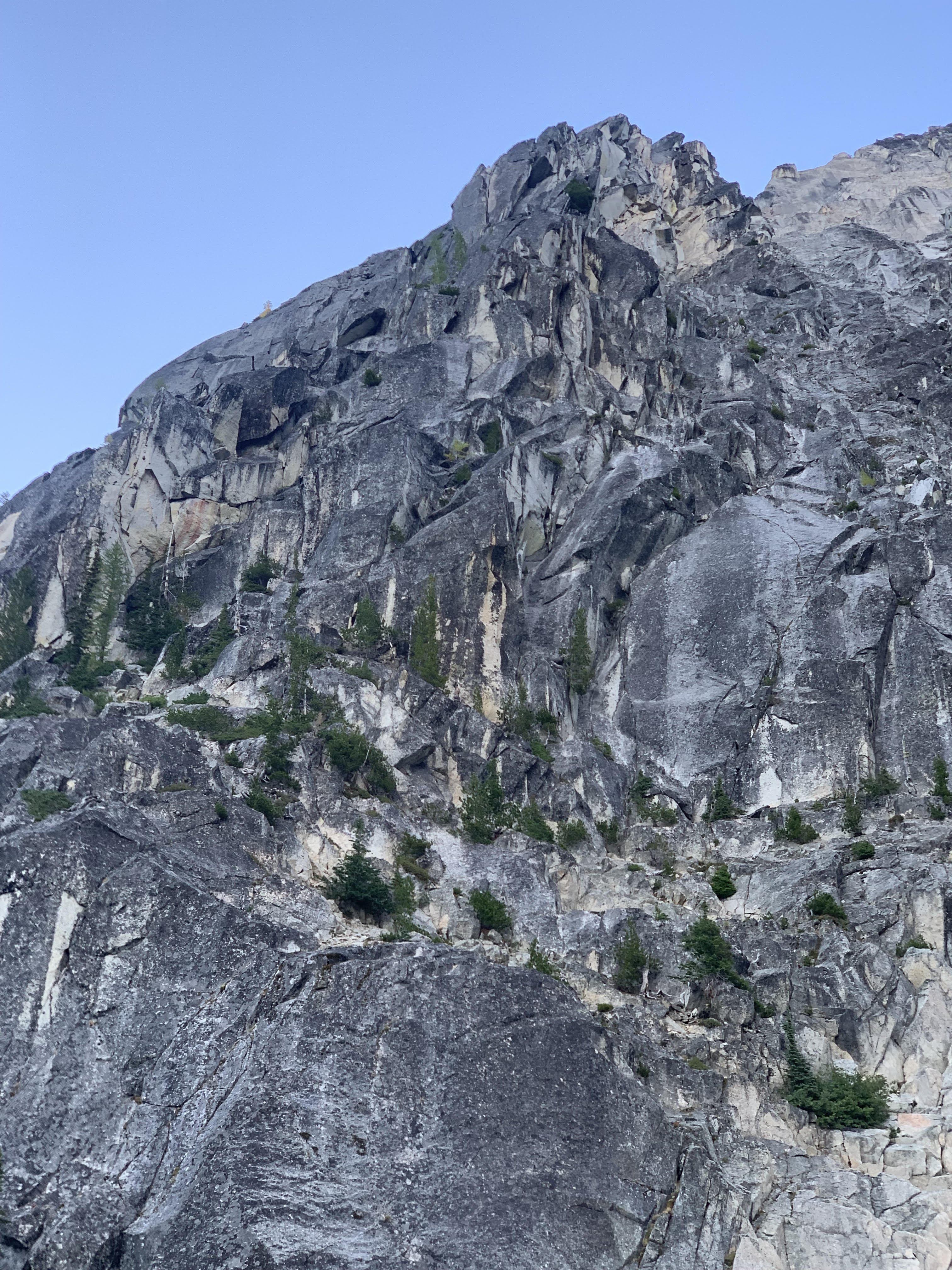
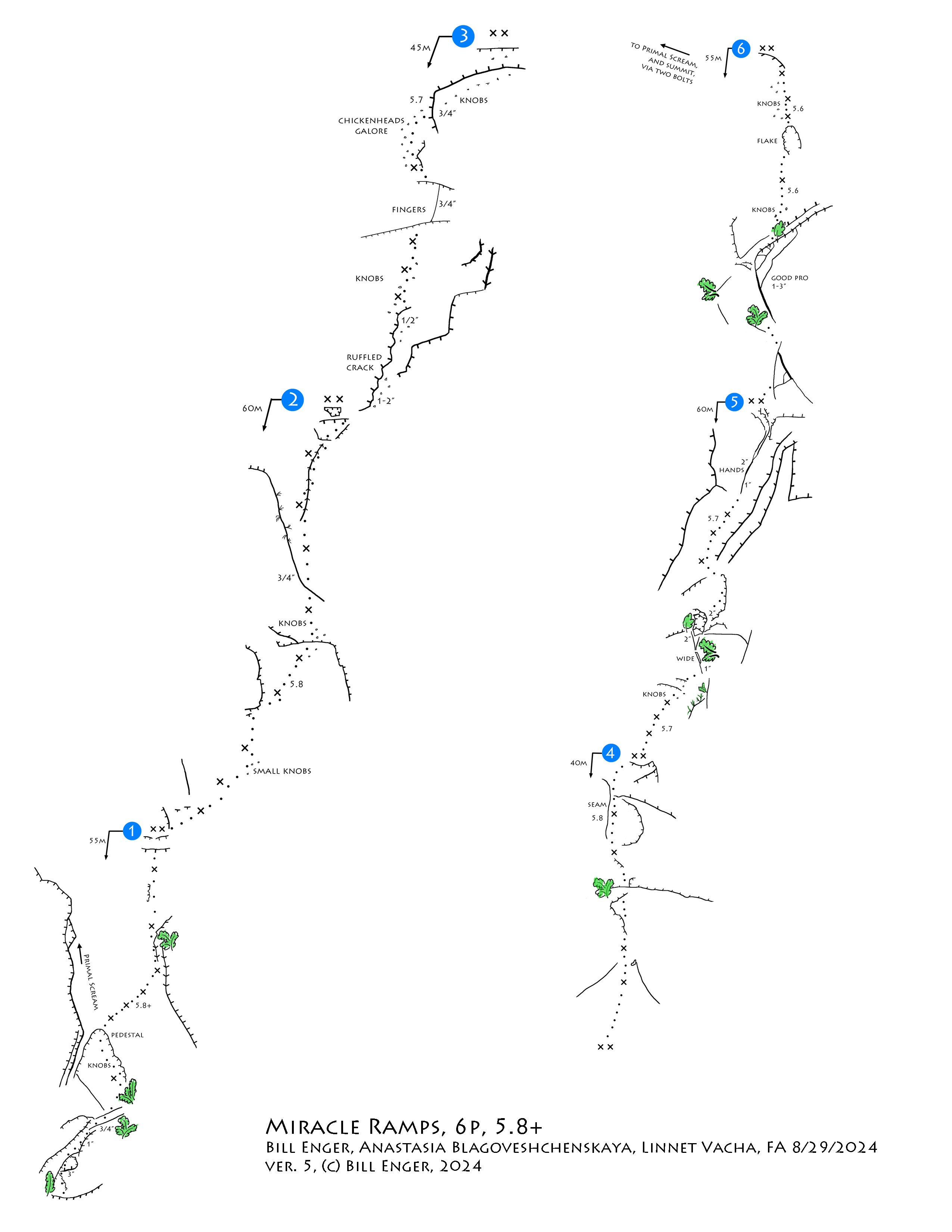
Yes, moderate granite is what I'm capable of, still. It seems that a steady grind, hiking up every week all summer, moving bits up and making a climb, can still happen at age 68. Why not? I went up with Yale Lewis again this week, forced by the weather to Monday/Tuesday. Biked and hiked up in the rain, at camp at 11am, when the rain stopped. We set up tents and slept for an hour. Waited for the clouds to lift. At 2pm we headed up, jugged the lines, carried them down, and were back in camp for dinner at 6. Next day, forecast was for 85 degrees and sunny! So we were up at first light, hiking up the clean slab ramp to the base of Primal Scream. I'd like to have an independent start to the new route, and not start on the established Primal Scream route. But the easy entrance to the buttress is so inviting that I can't complain. Thanks to the FA party for finding this way. After a simple padding up the humps and knobs at the start of Primal Scream, there is a pedestal ledge. The start of beautiful, white slabs is to the right, the start of Miracle Ramps. We had an uneventful climb of the six pitches. I made some notes along the way, and have edited the topo. The only major change is to remove a phantom bolt from pitch 6, below the flake. Here is the updated topo, ver. 4: Addendum: After reaching agreement with Anastasia about Pitch 3, I went up again on 10/12/2024. I added three bolts to access the field of knobs directly below the finger crack, and avoid traversing right to find pro. Here is the updated topo, ver. 5:1 point


