
Leaderboard


Popular Content
Showing content with the highest reputation on 07/17/24 in all areas
-
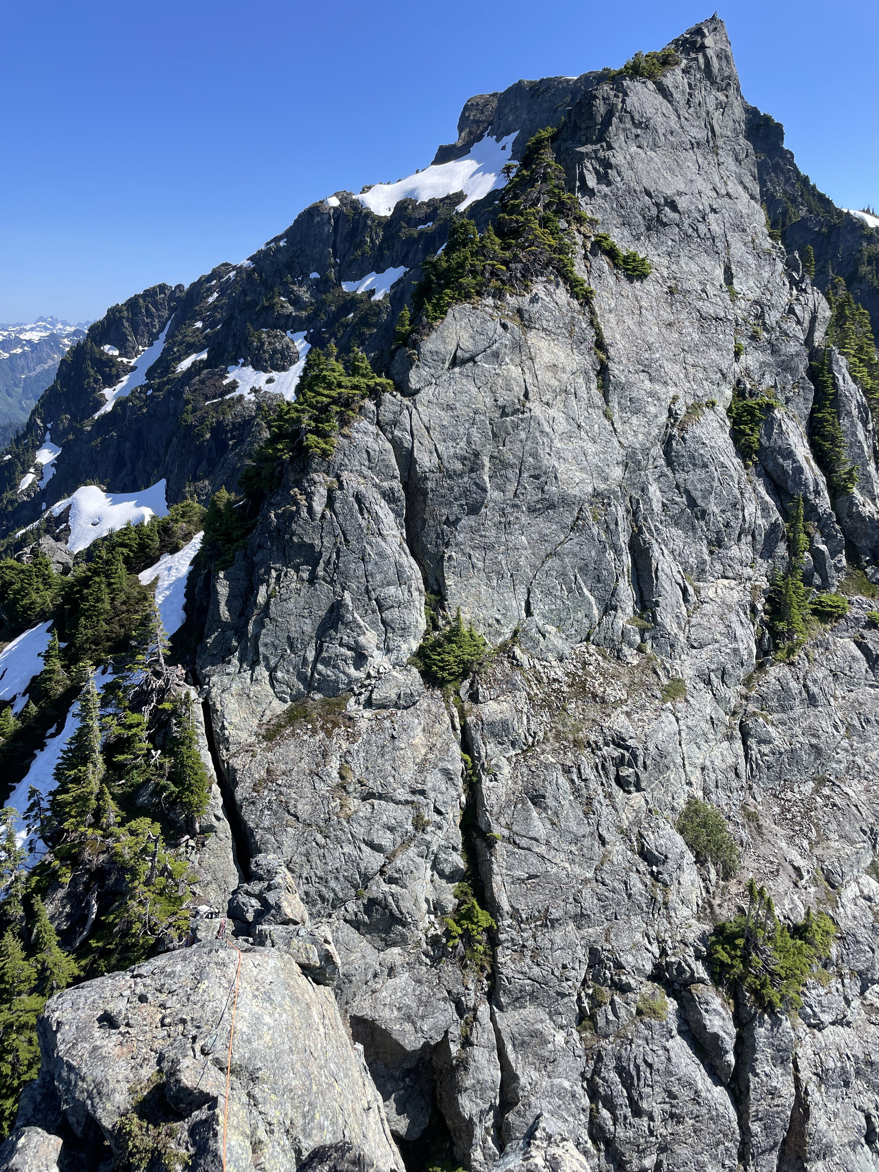
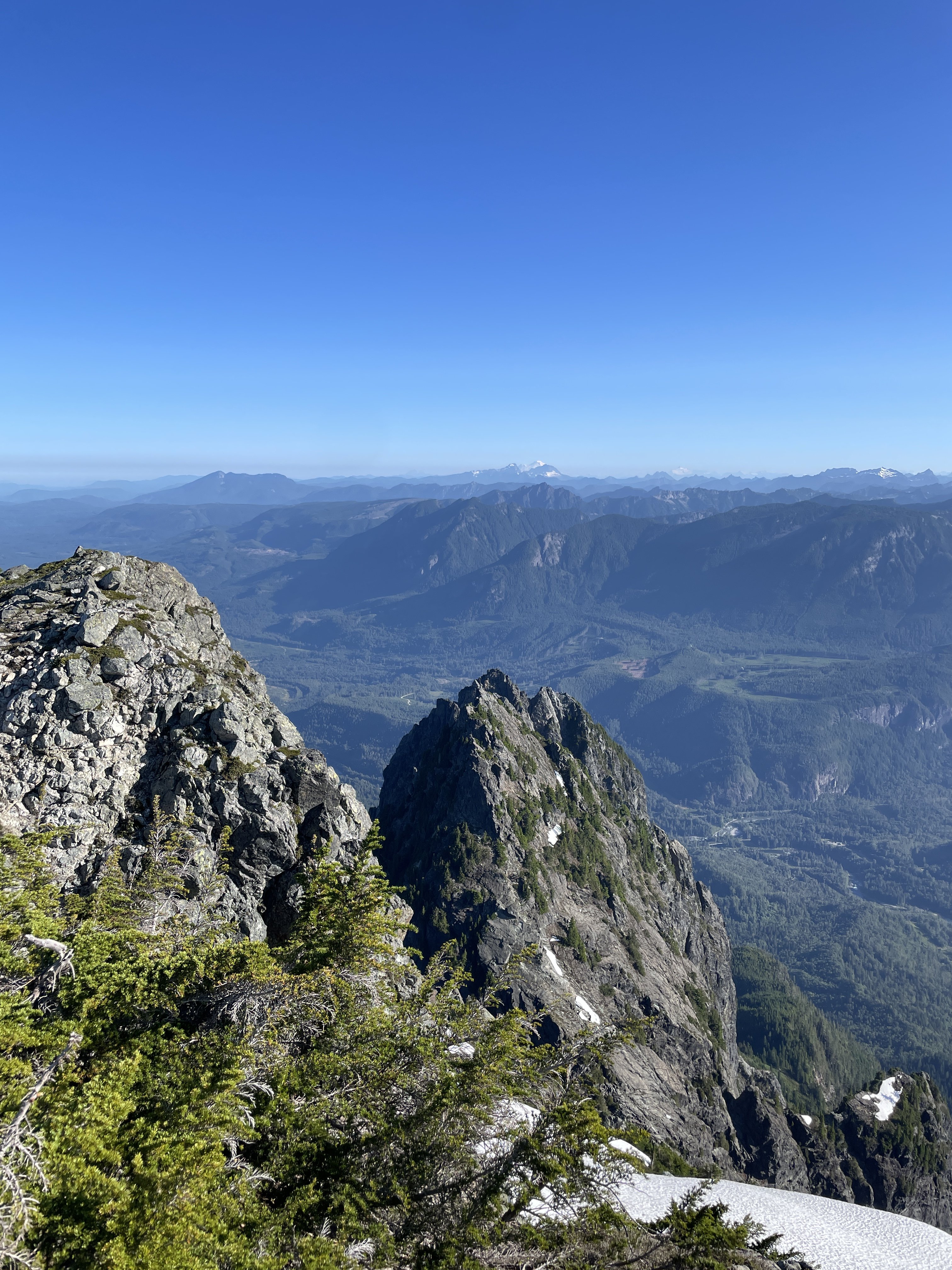
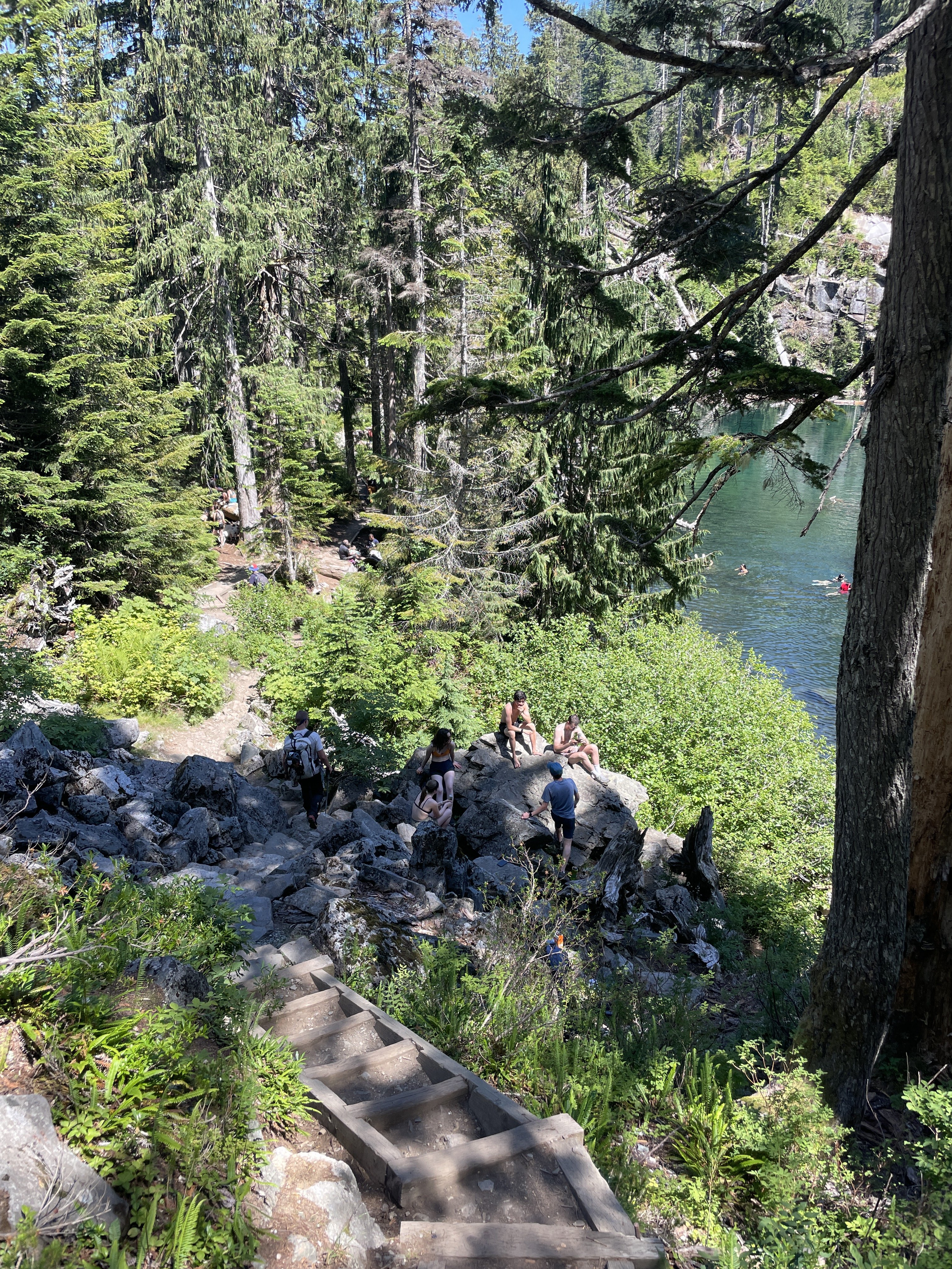
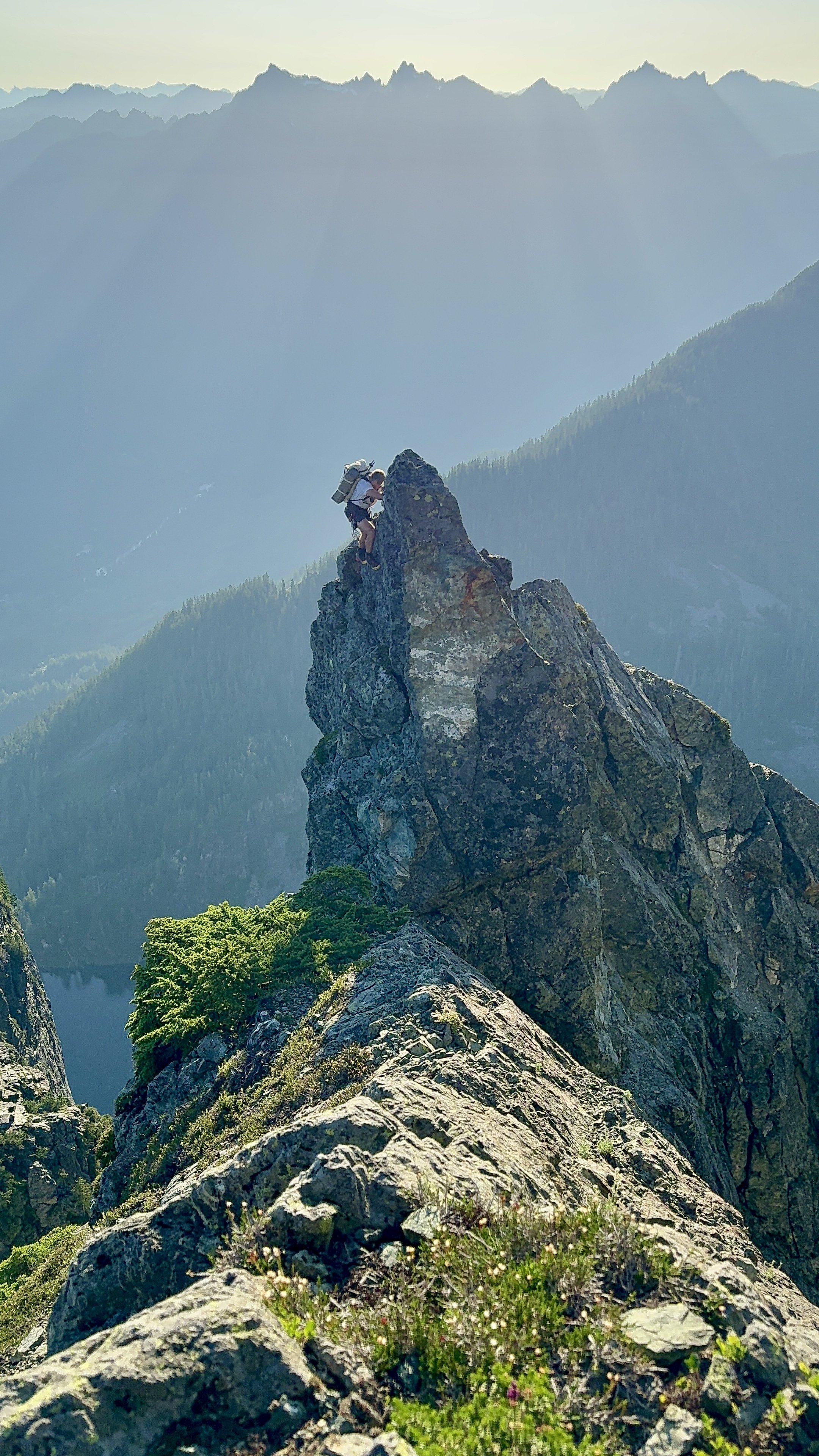
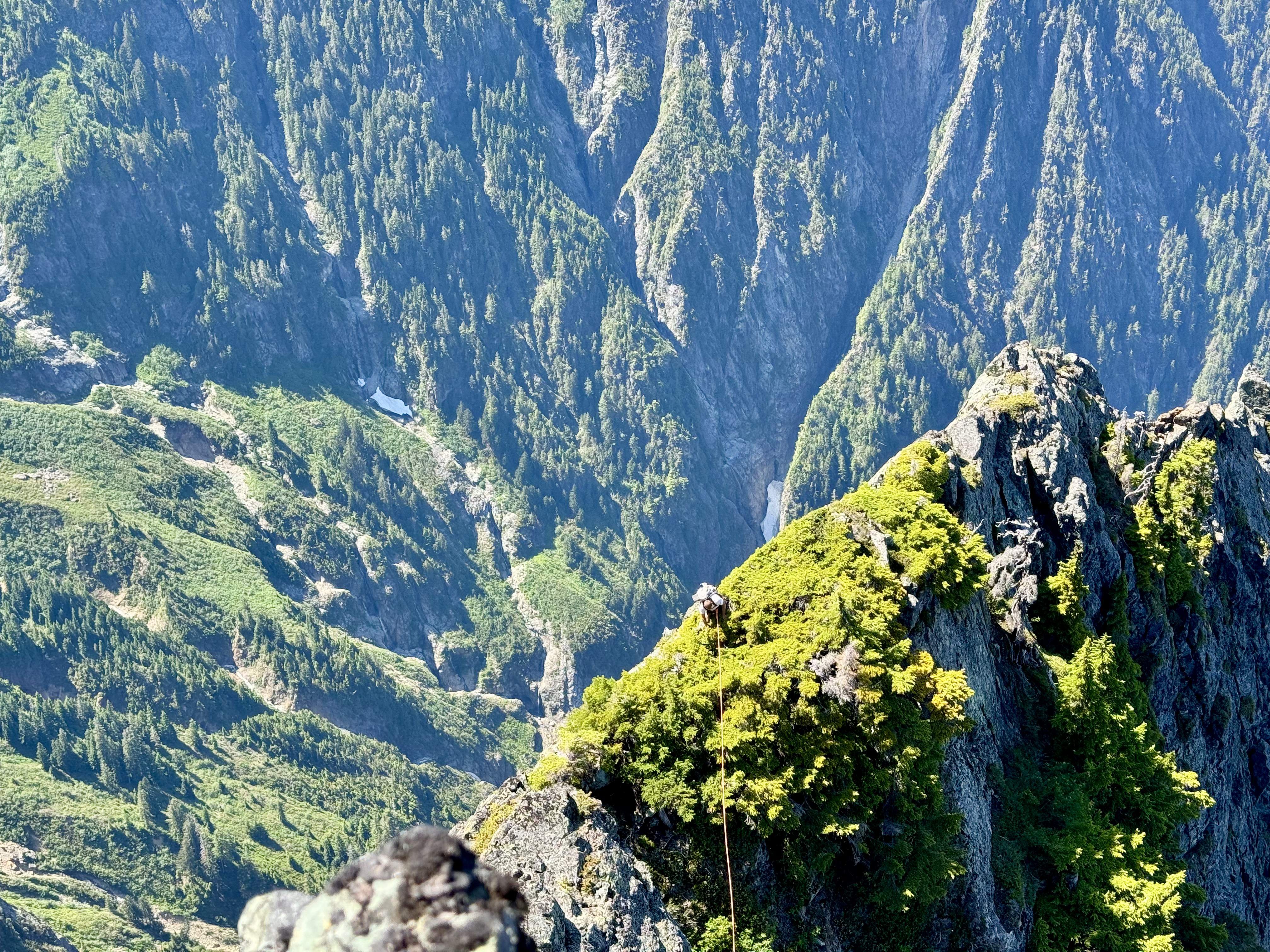
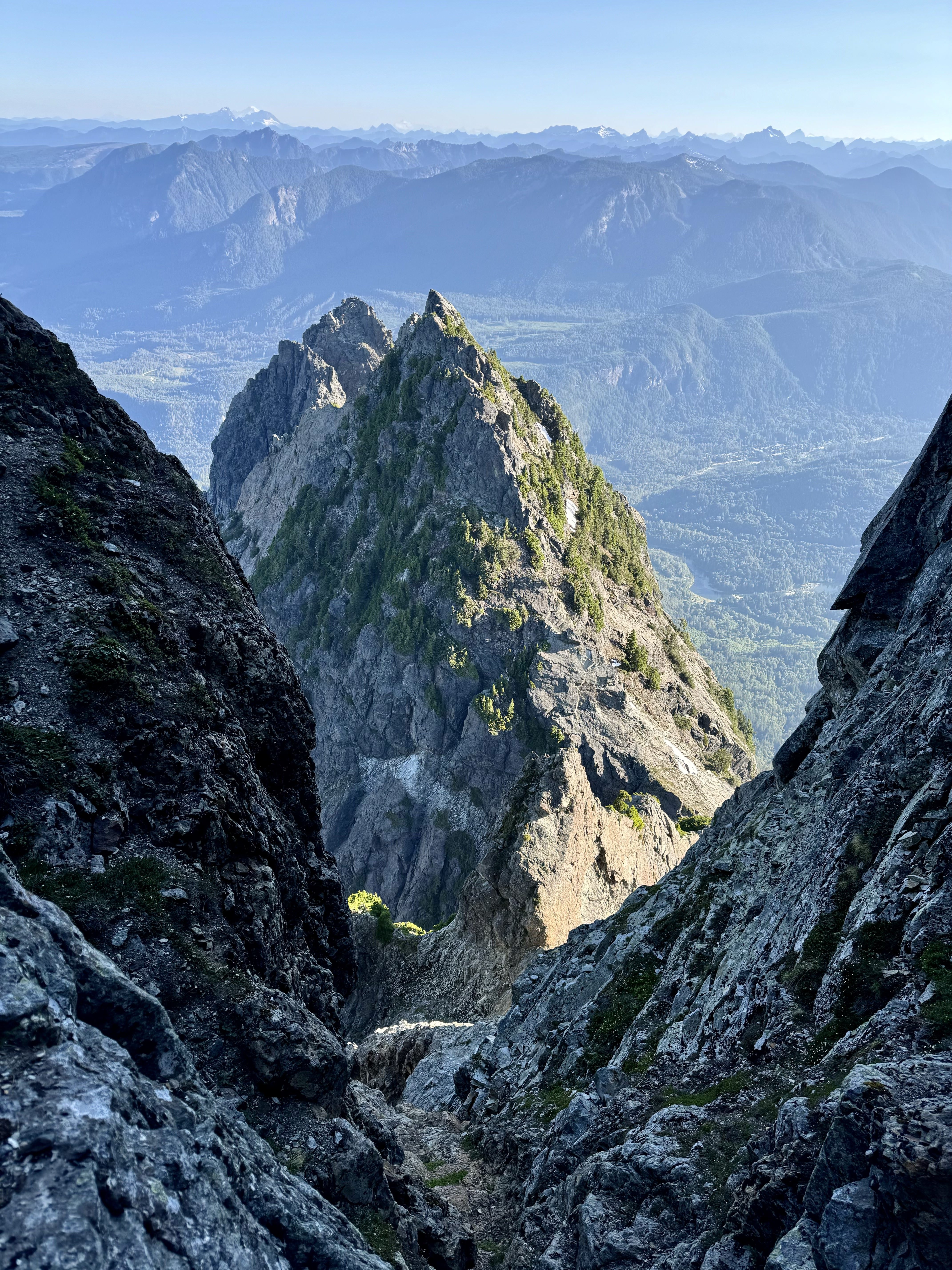
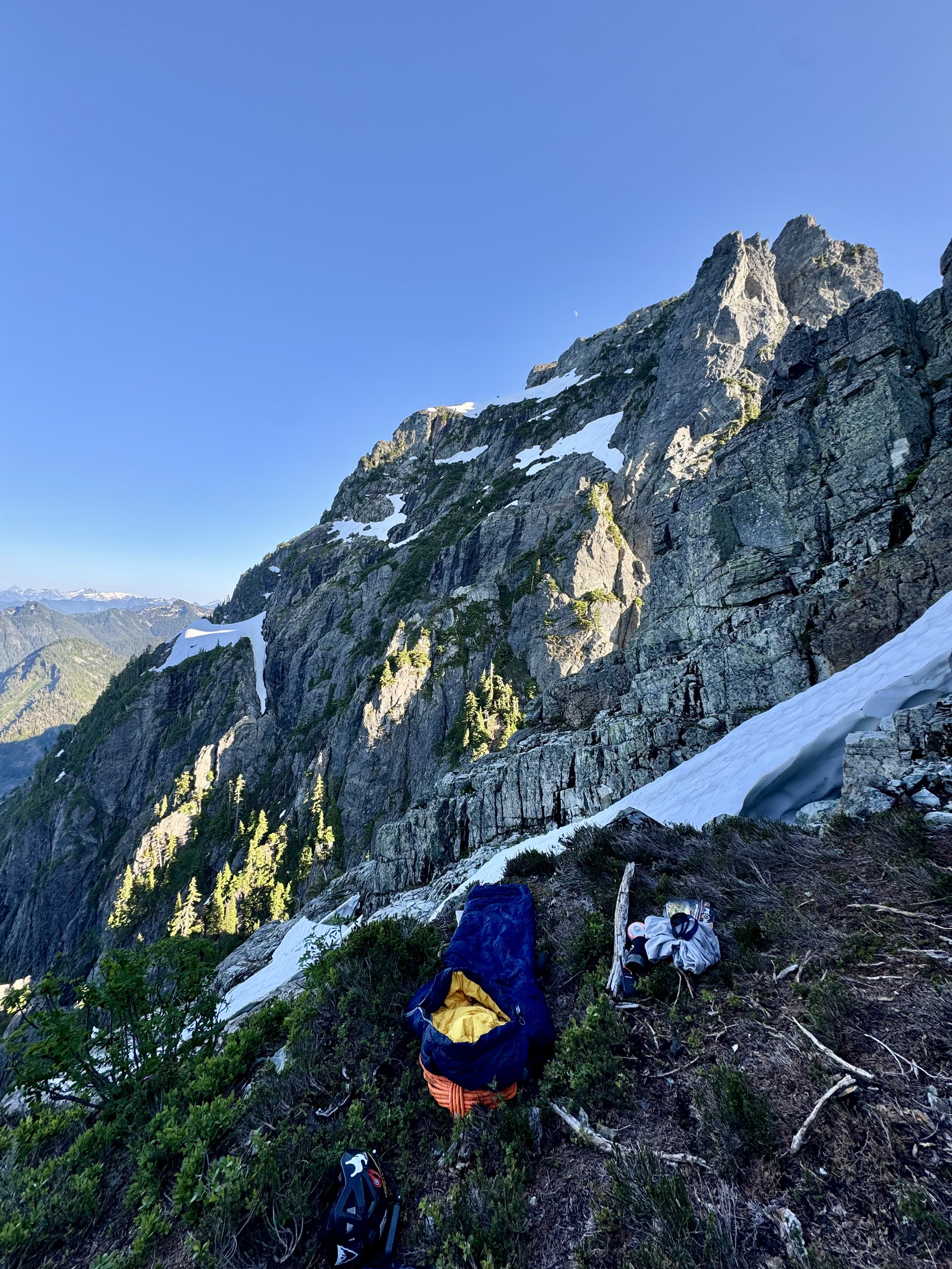
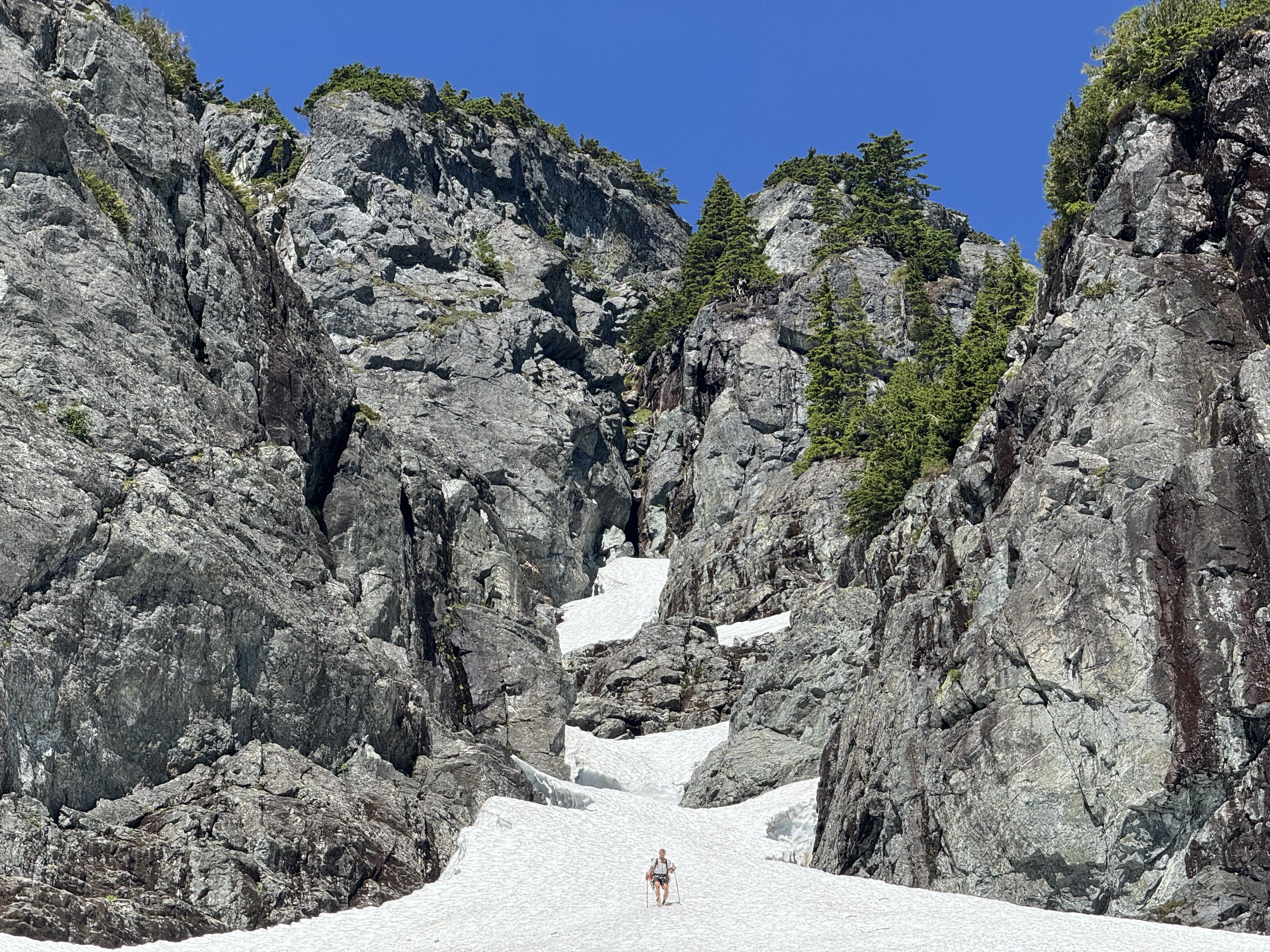
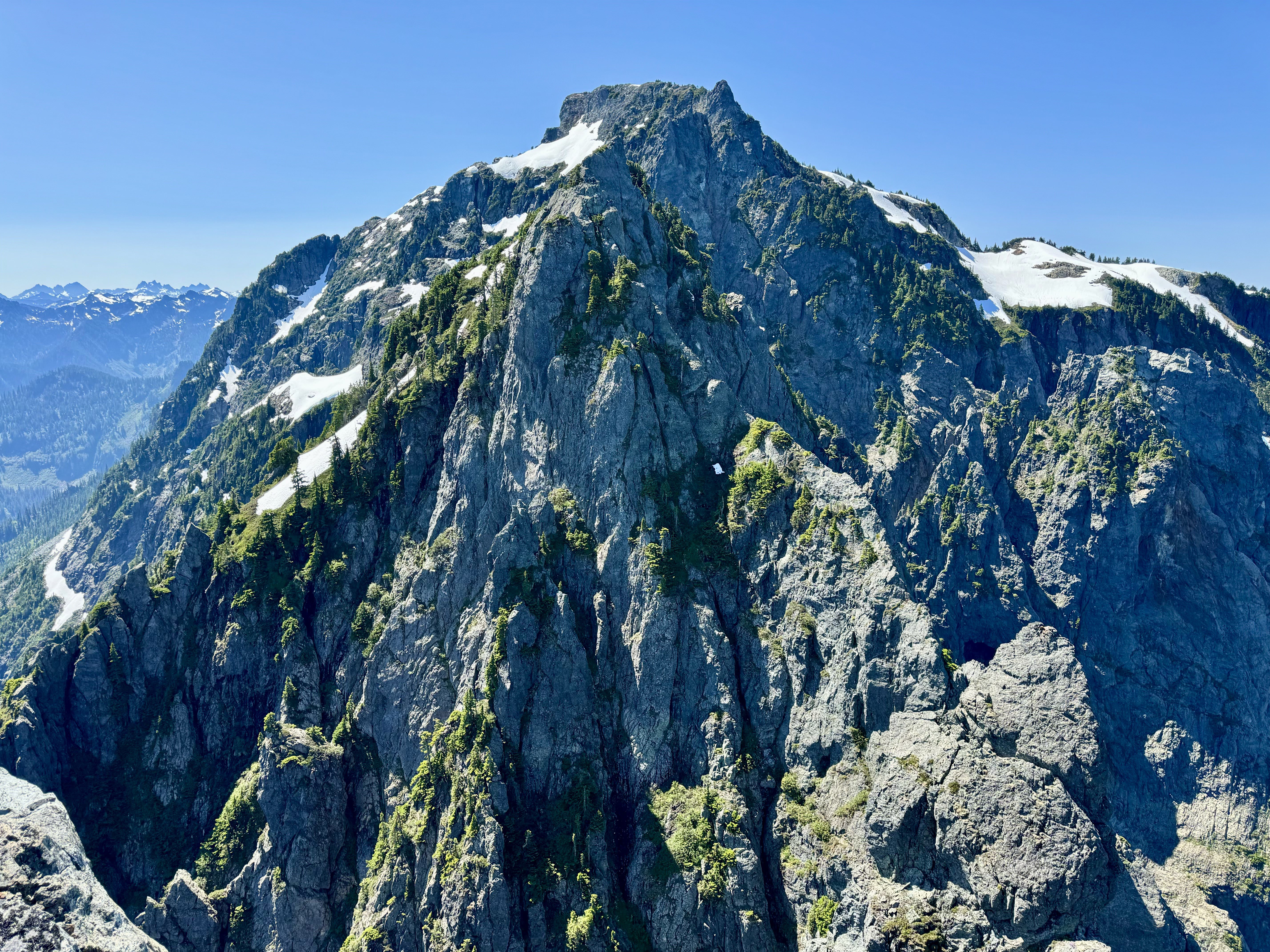
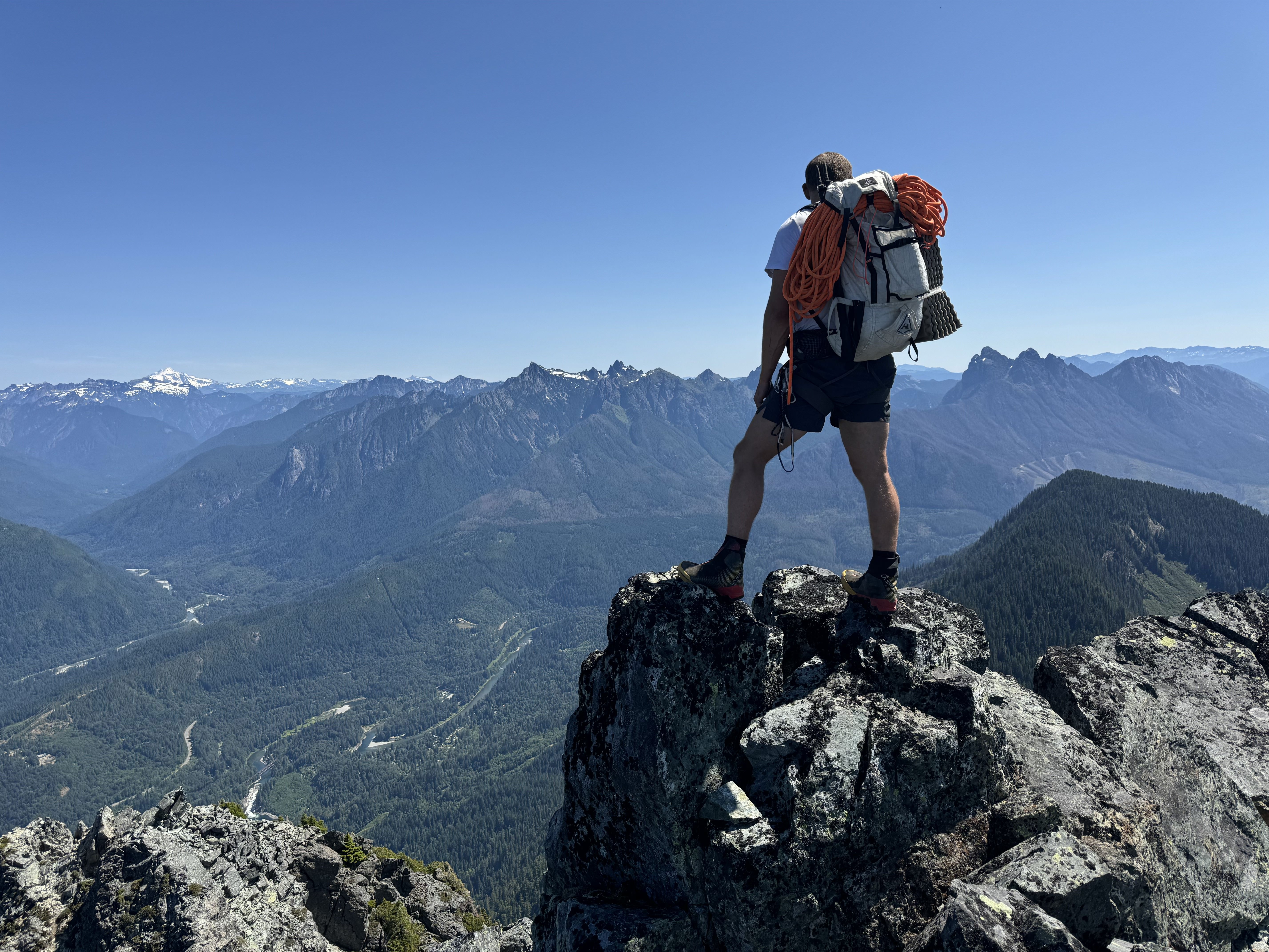
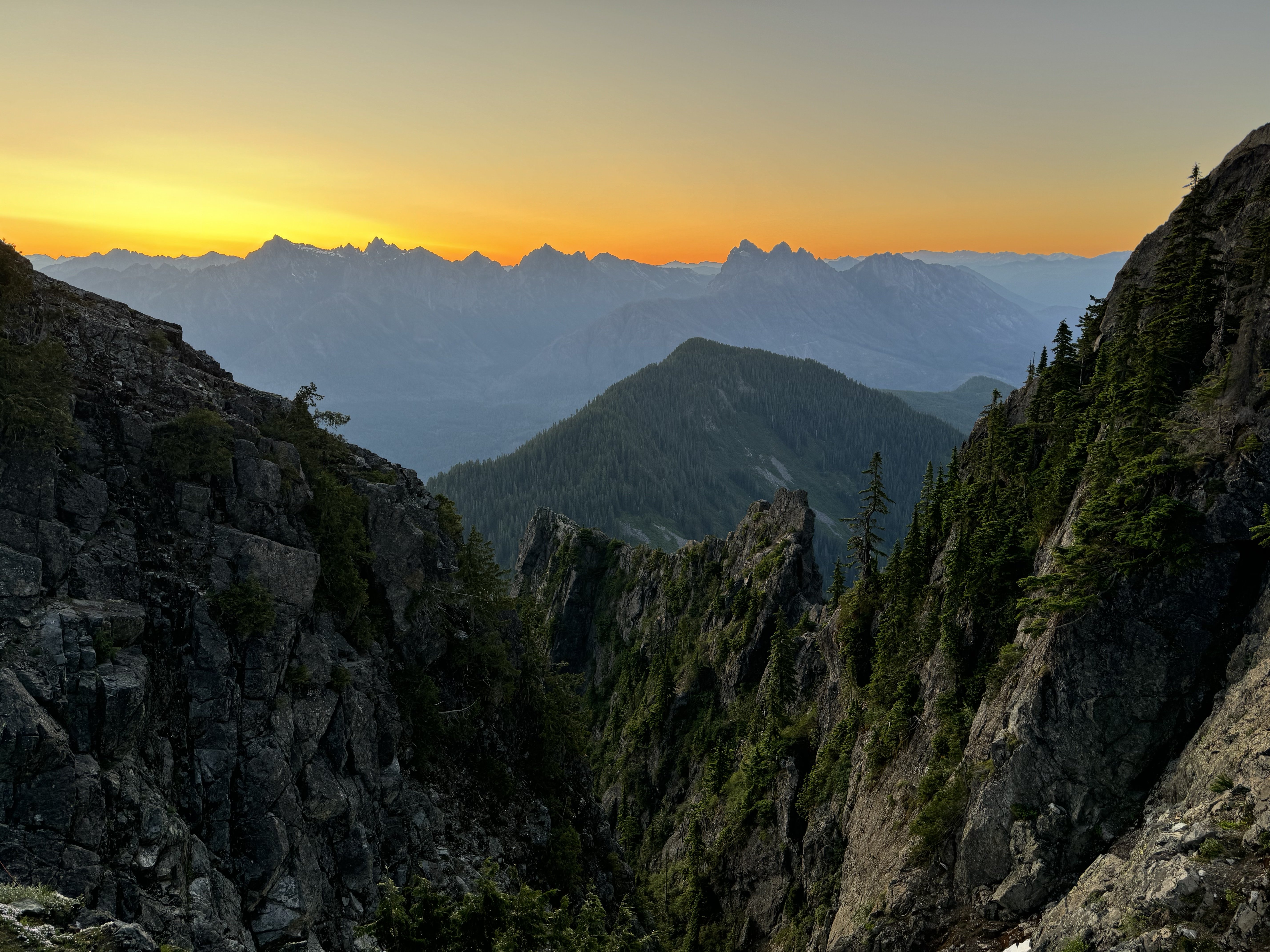
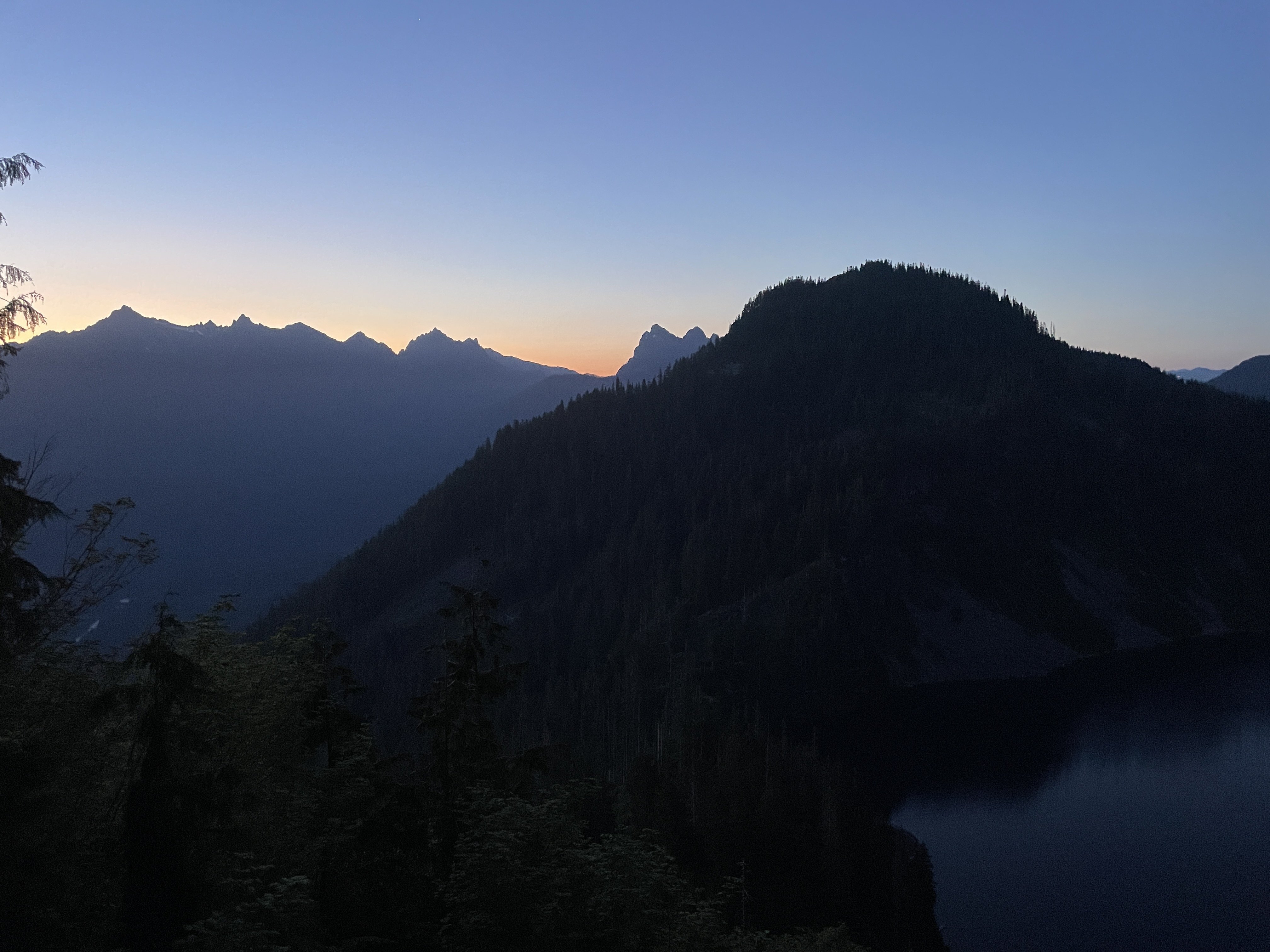
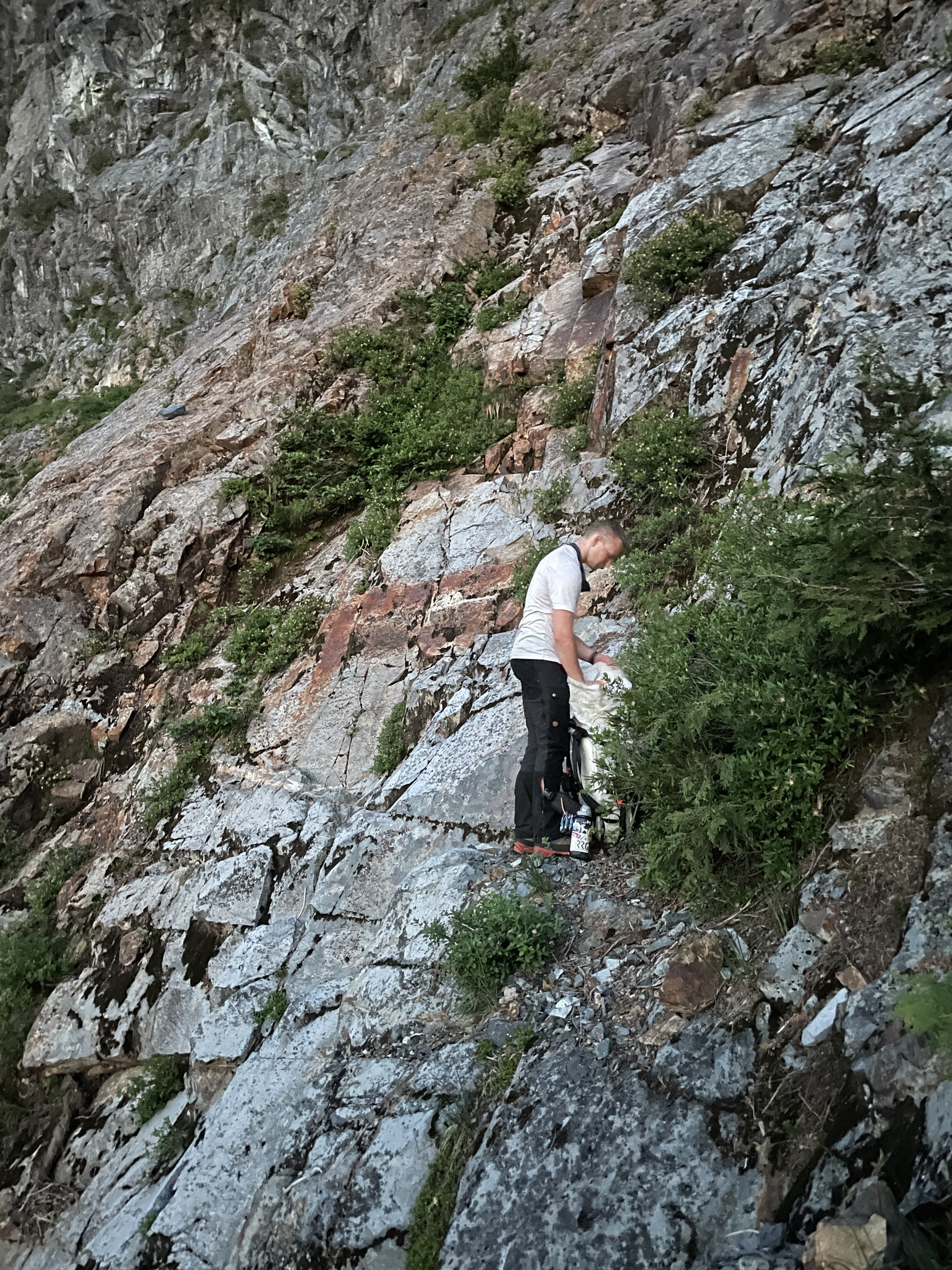
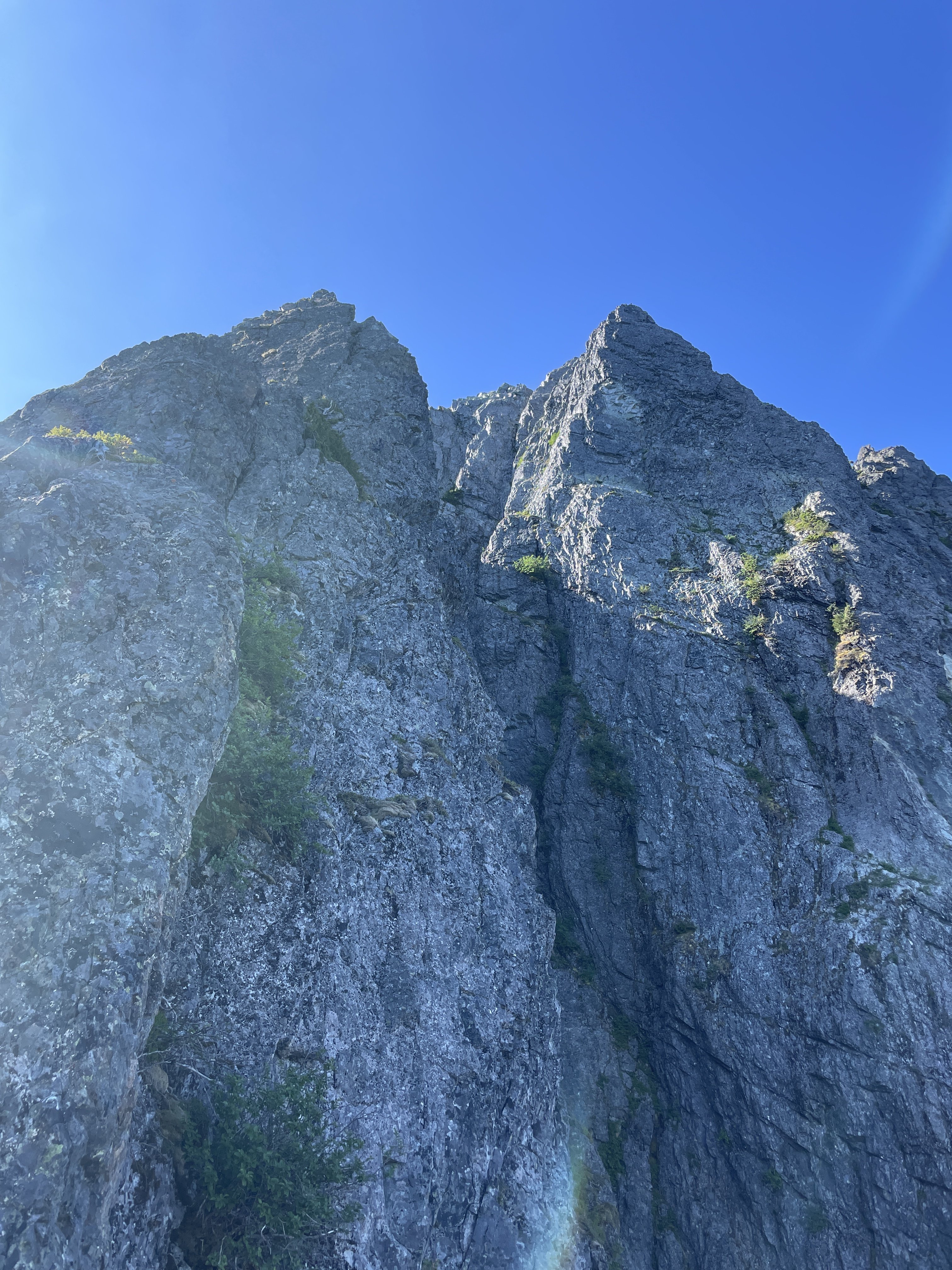
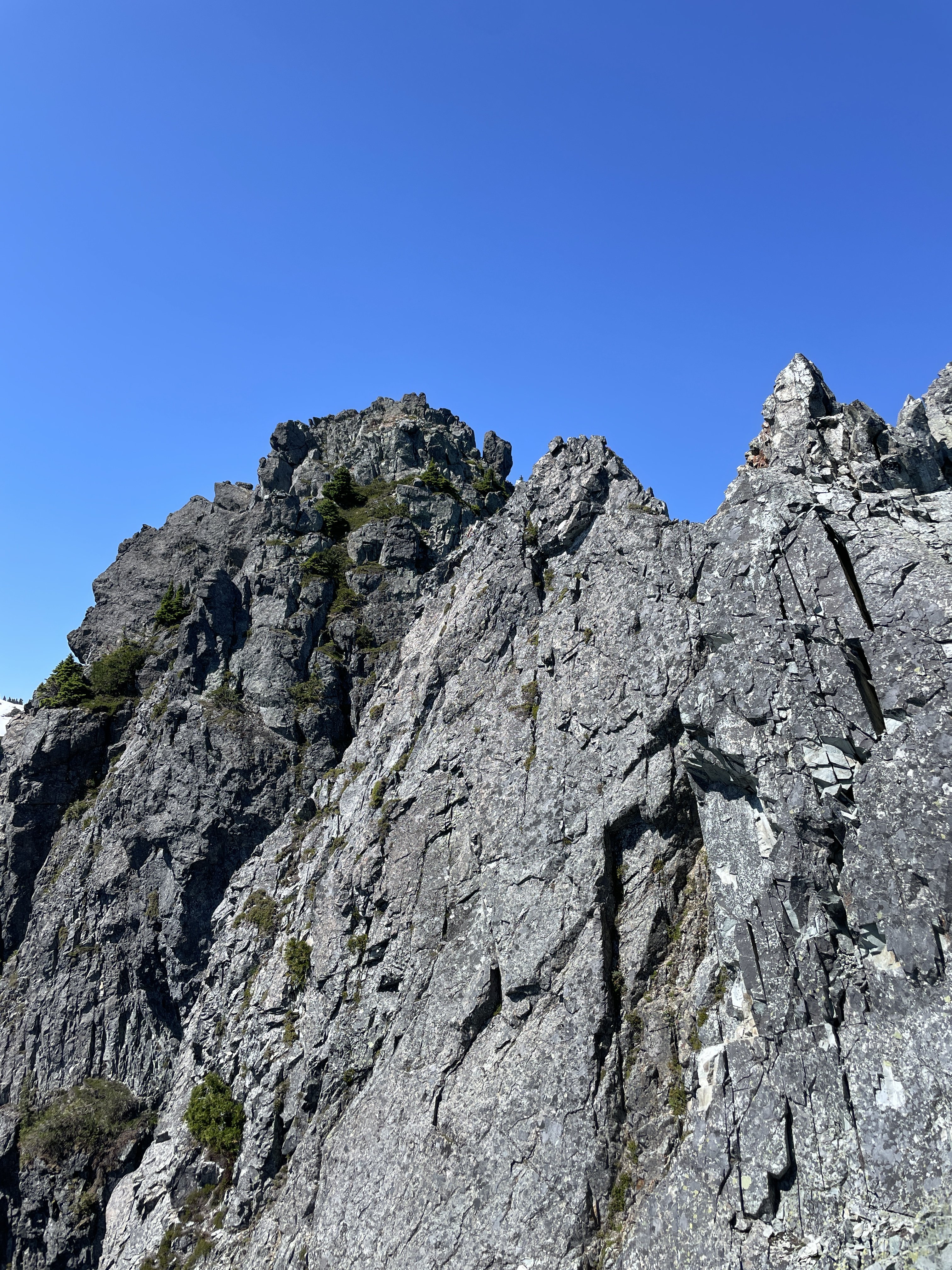
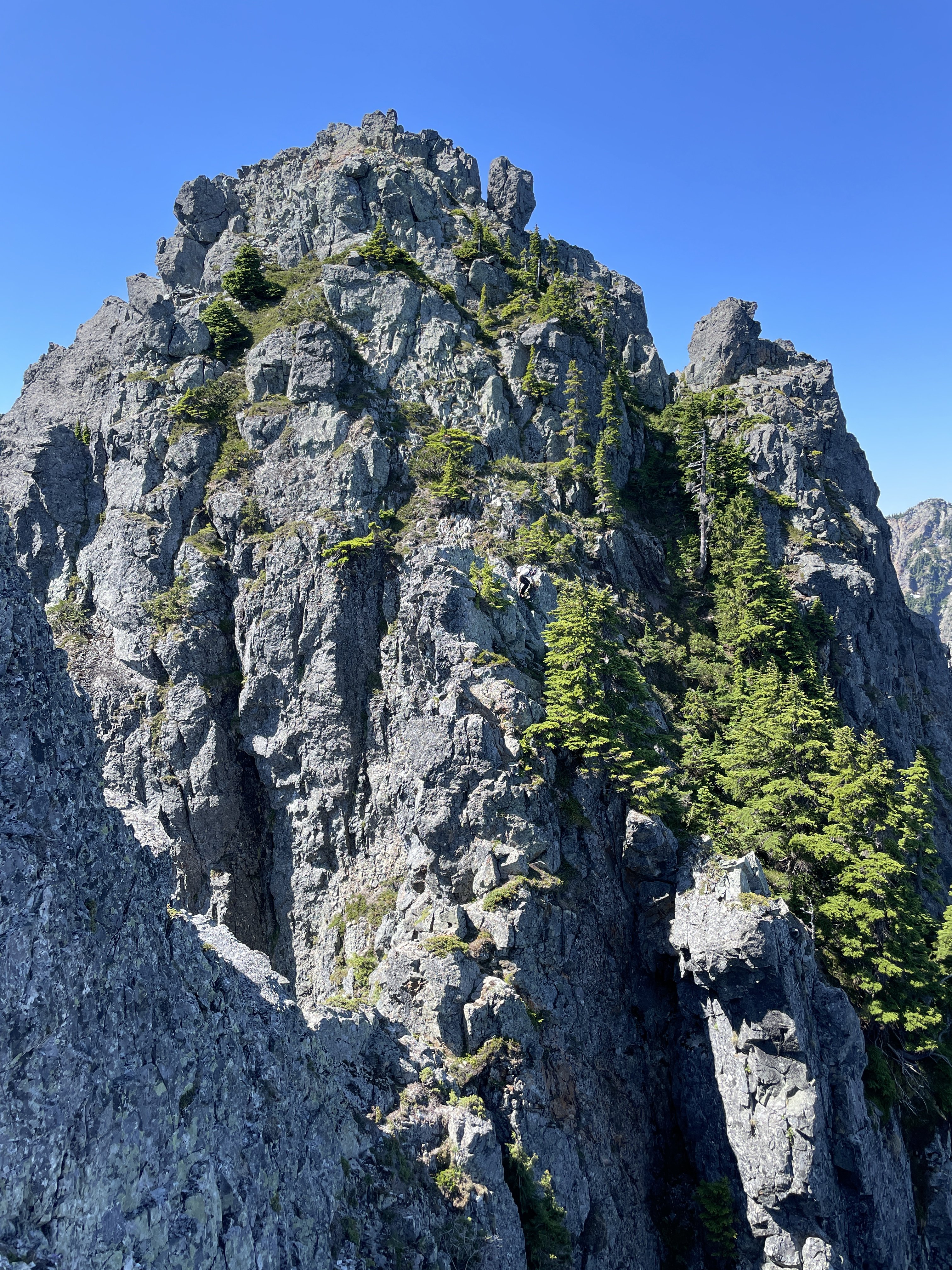
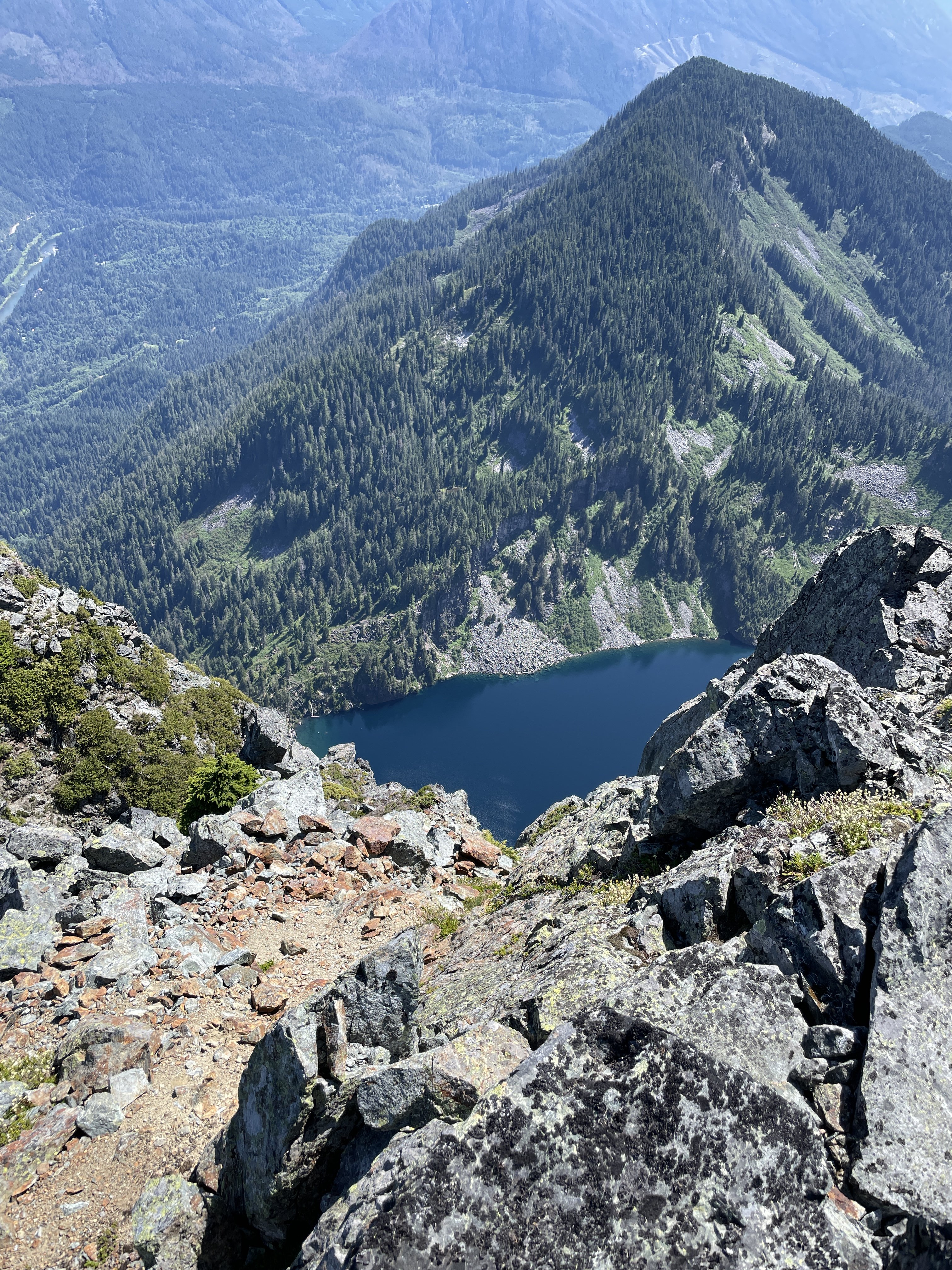
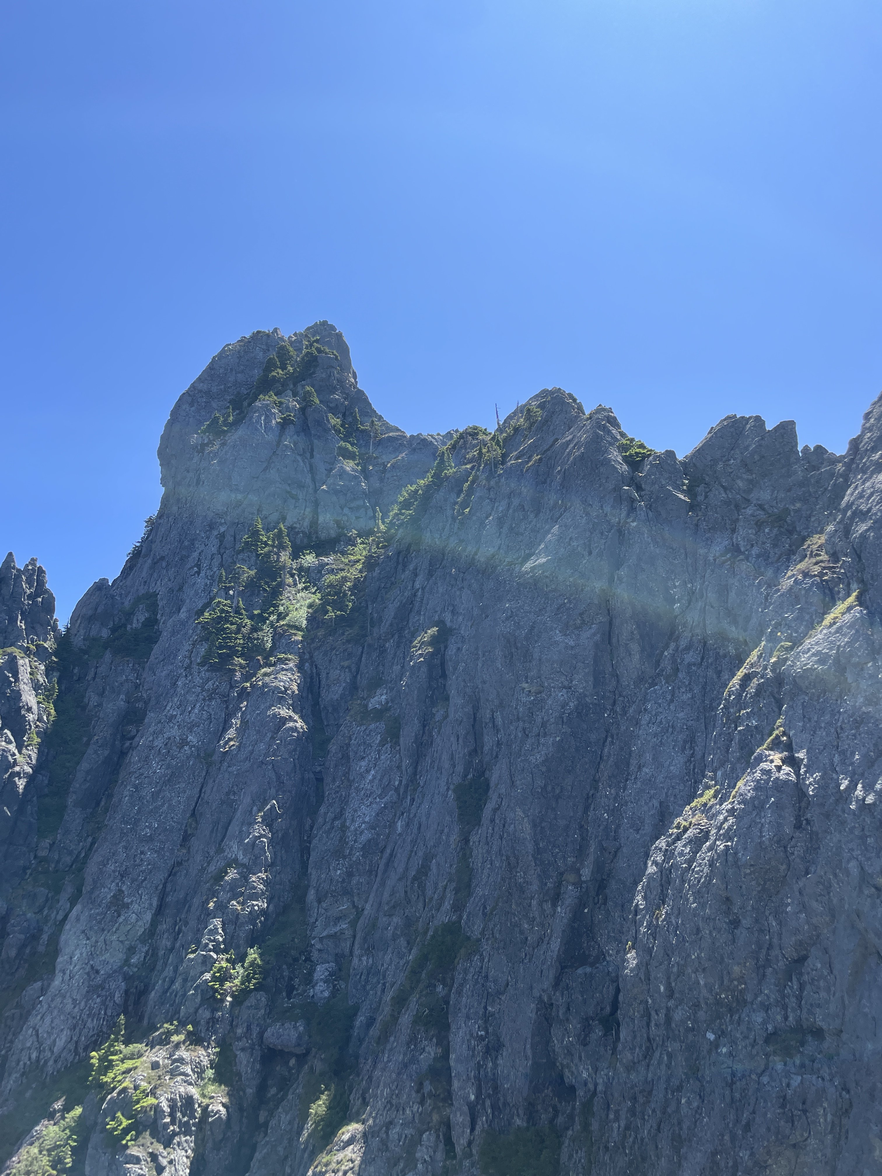
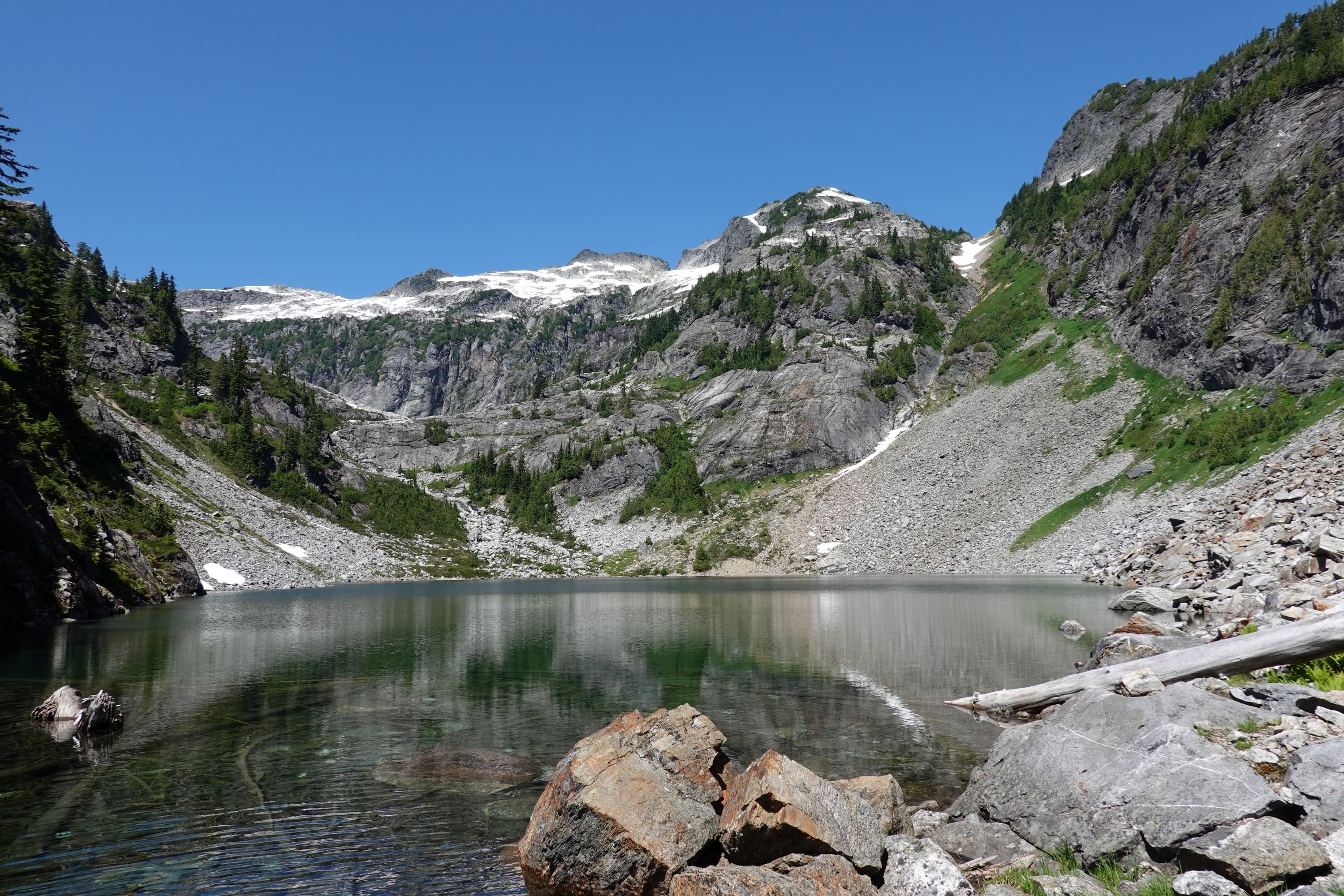
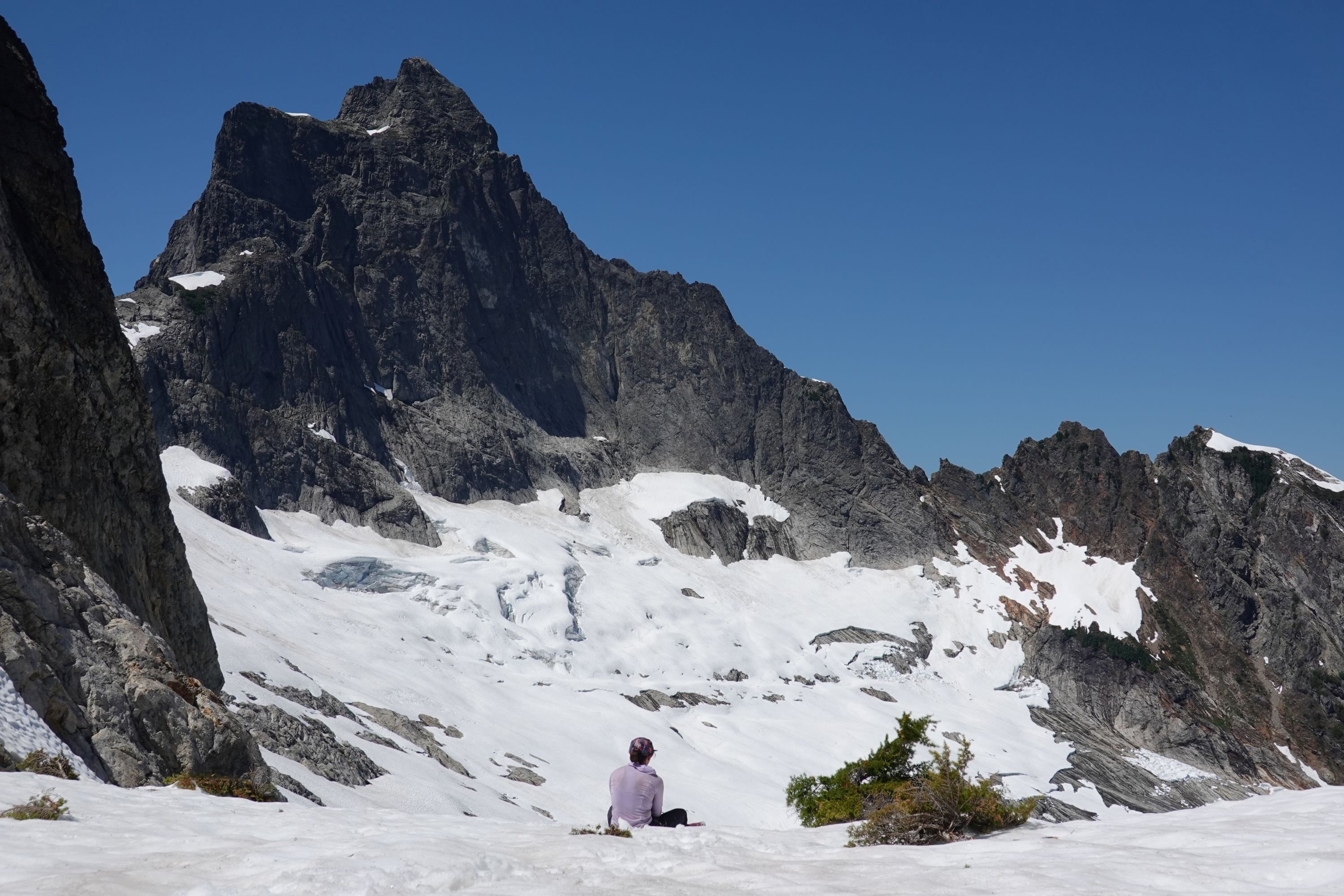
Trip: Inspiration Peak - South Face Trip Date: 07/14/2024 Trip Report: Me, @Albuquerque Fred and Mike climbed the south face of Inspiration Peak over two days July 13 and 14. We also walked up Glee on the way to camp since Inspiration in two days wasn't enough exercise for them. For beta we had @JasonG's TR: and @Steph_Abegg's beta, although I thought her suggestion to go past the base of the gash was crazy. We did so and it involved an insanely airy step across where the ramp disappears briefly just past the gash, then you climb up just to go back down to just above where you were before the airy step. I say go up the ramp to the gash, then go up, easy. This photo of Steph's was gold: The camp is melting out with about 5 good sites available and dry. We had excellent conditions on the glacier, easy navigating up a direct line, then a walk directly onto the approach buttress where we left the snow gear. A pitch, then simul traversing, up the ramp, up the gash, to the top. Easy route finding. We did like 12 or so raps with a tiny bit of down climbing right back to our snow gear. Many of the raps are tough. The big block to start the South Face raps has quick links going both directions, with additional stations below both ways. We went more westerly off the block but it was a hard steep traverse at the bottom of the rap to get to the next station. What have other people done here? The climbing was, I thought, great in the gash. A good, tough route to a tough peak. Crazily enough the mountain was getting tons of action this weekend. We talked to a group that did the east ridge the day before, another that did the south face, and then on the hike out another going for the east ridge on Monday. We were stupid and hiked out on the same day as the summit. Around 14 hours camp-summit-camp, 20 hours camp-summit-car. +2.5 home. Ew. In bed at 3:00 am with a 5:30 alarm for work. The trail: In camp: Fred finding the direct line through the glacier: Easy moat: On the summit, beautiful day: So happy to be on dirt again: Terror Basin conditions from Glee: Gear Notes: Single Rack to #2, 2 30m half ropes, crampons not really needed but used, rock shoes. Approach Notes: Grueling to camp, easy from there.5 points
-
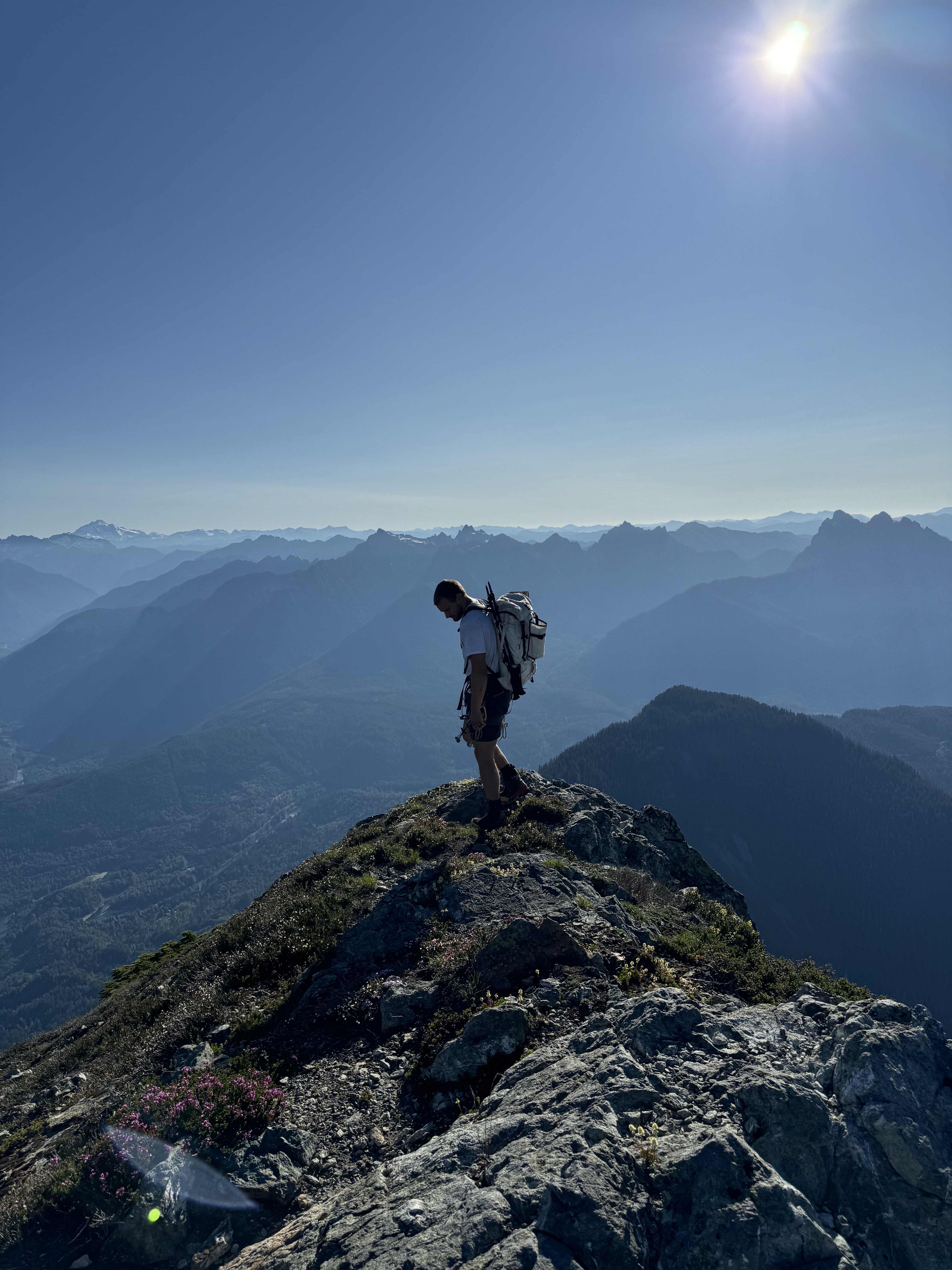
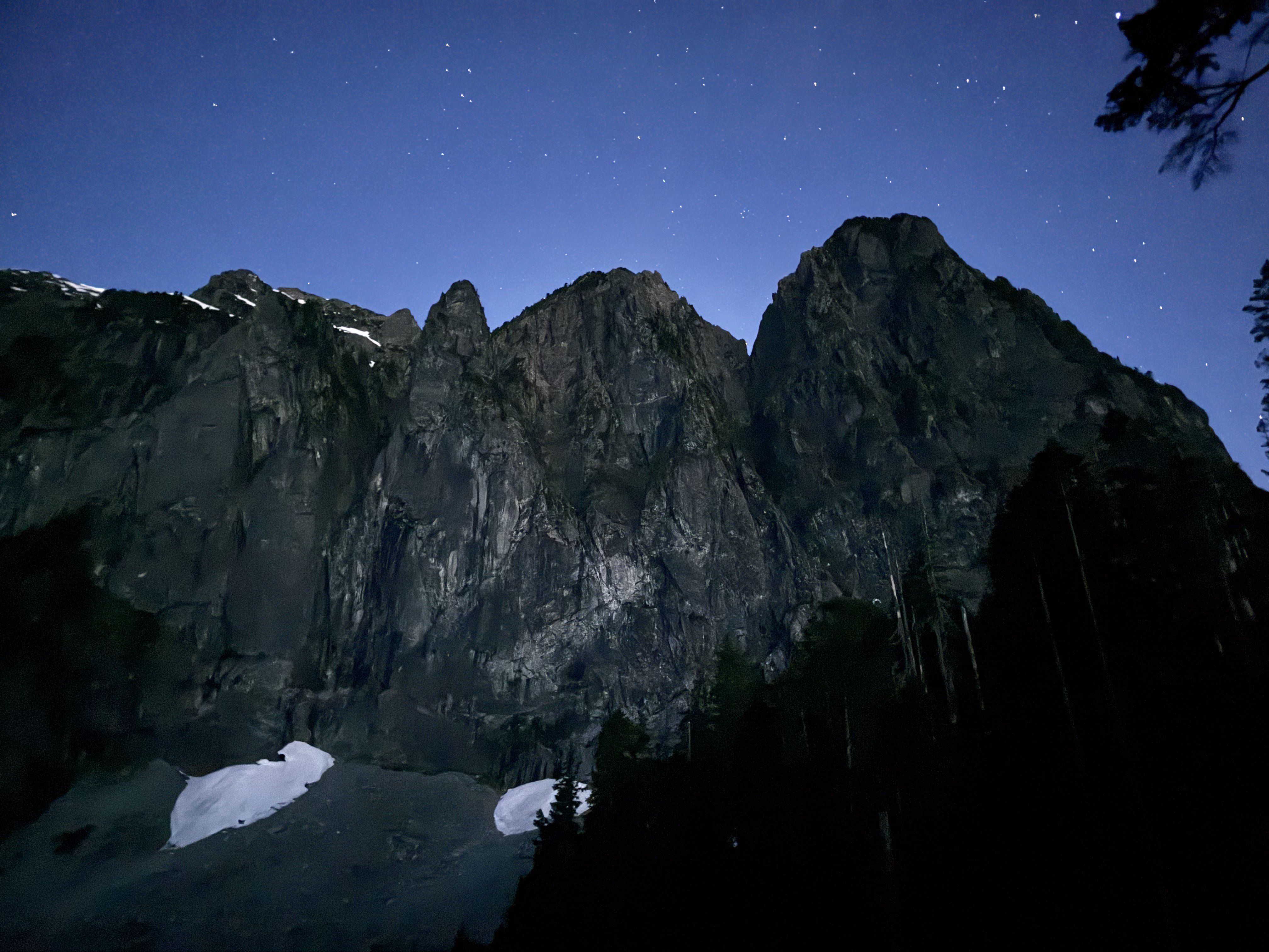
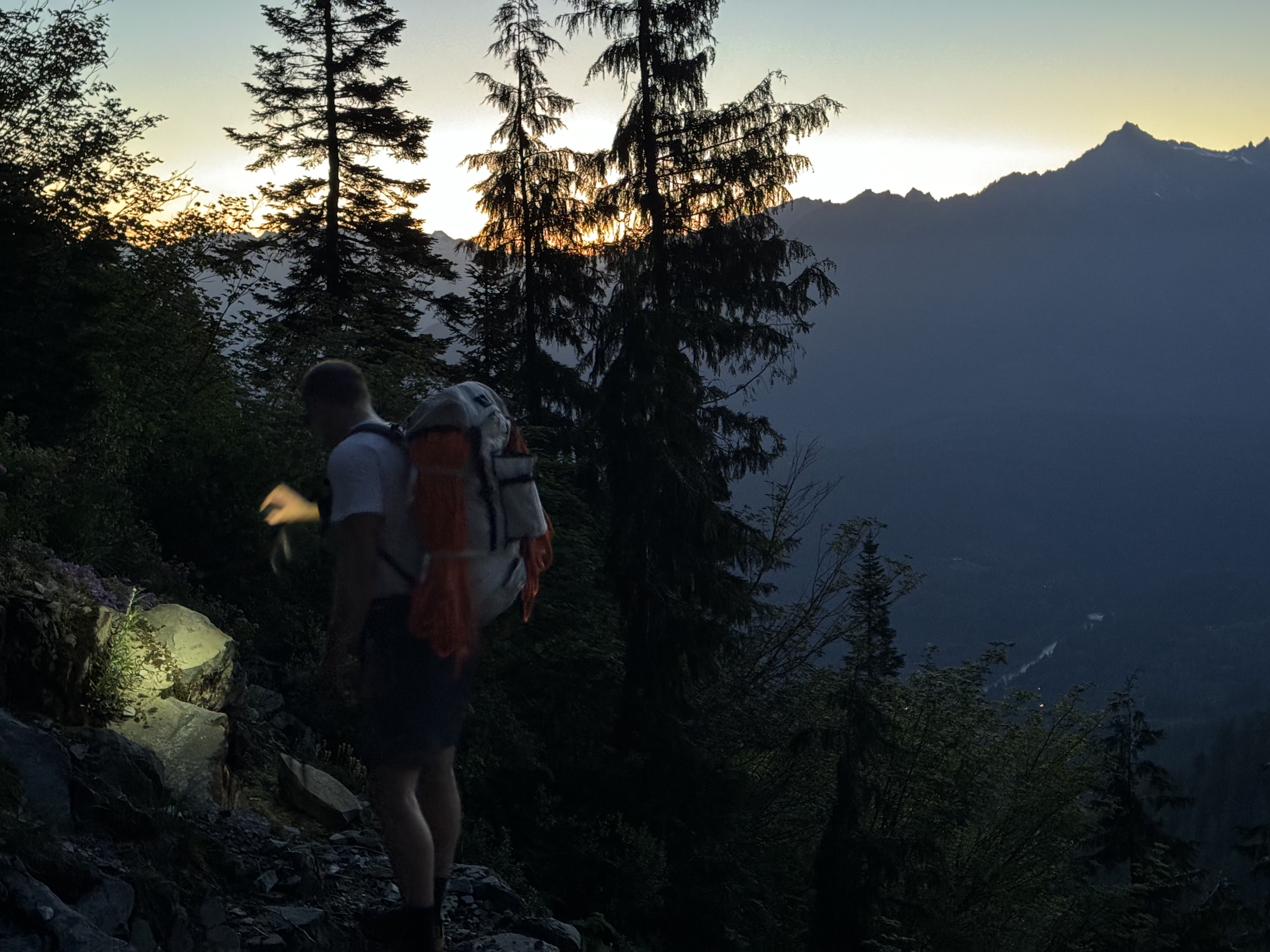
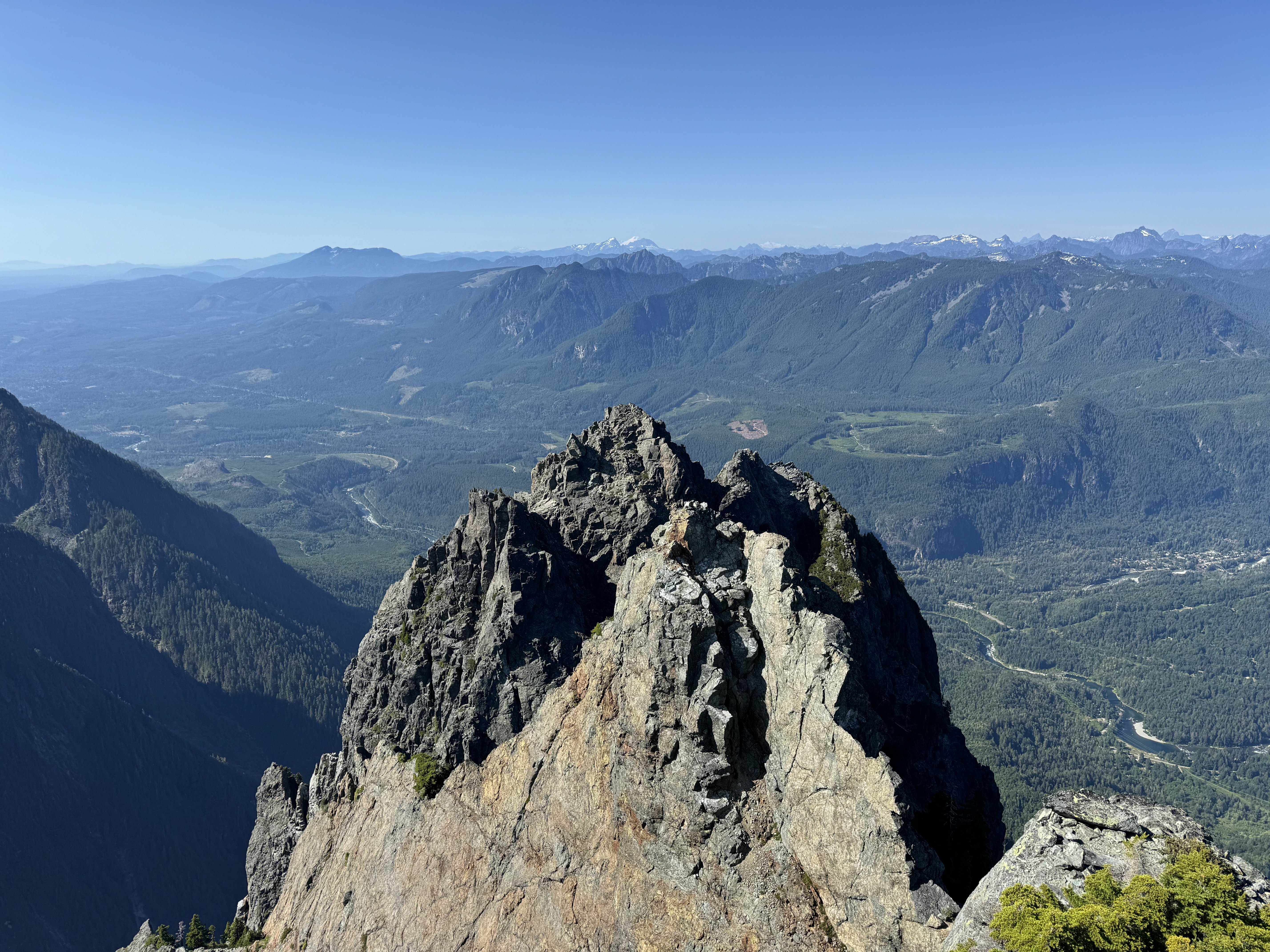
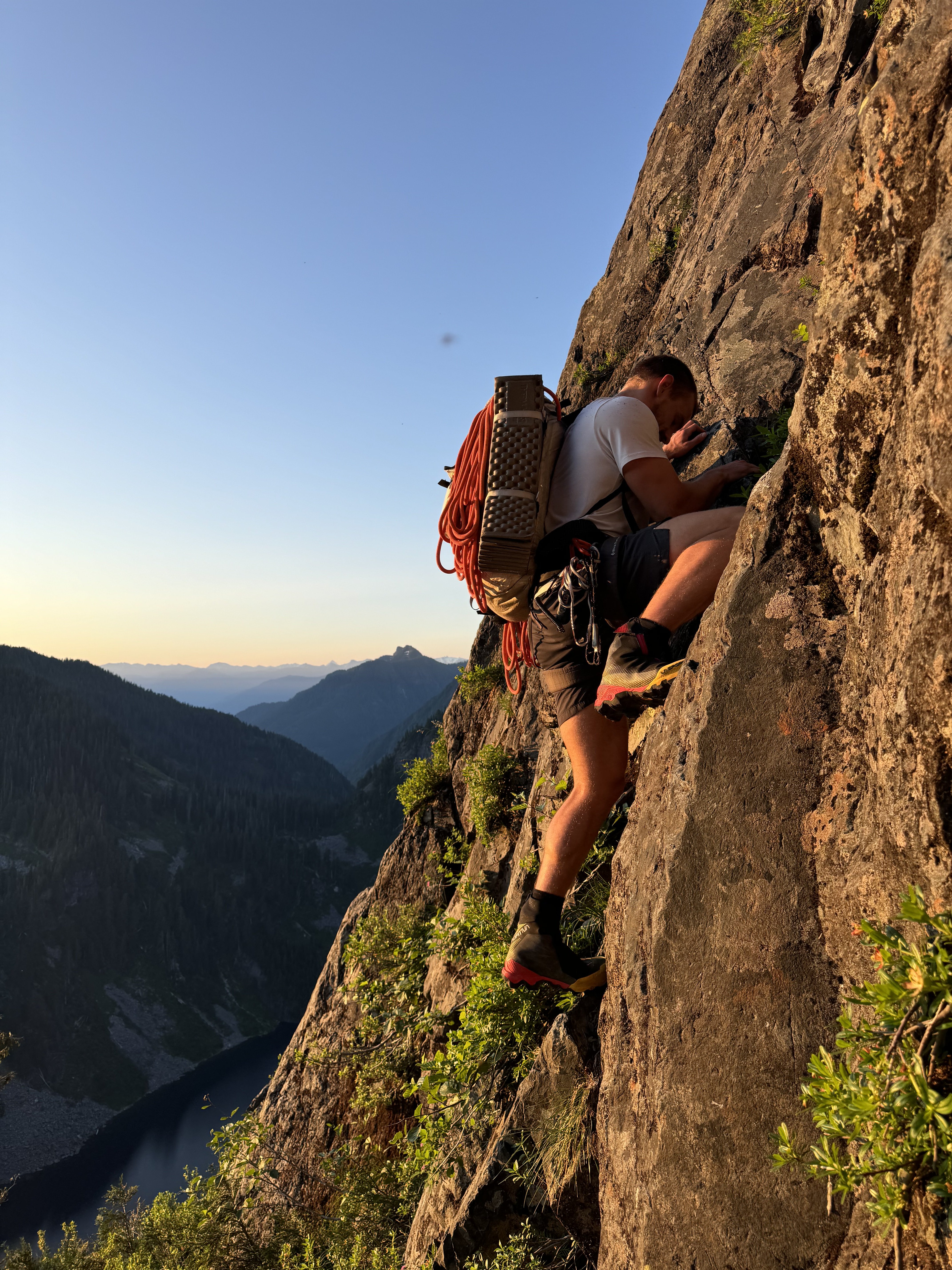
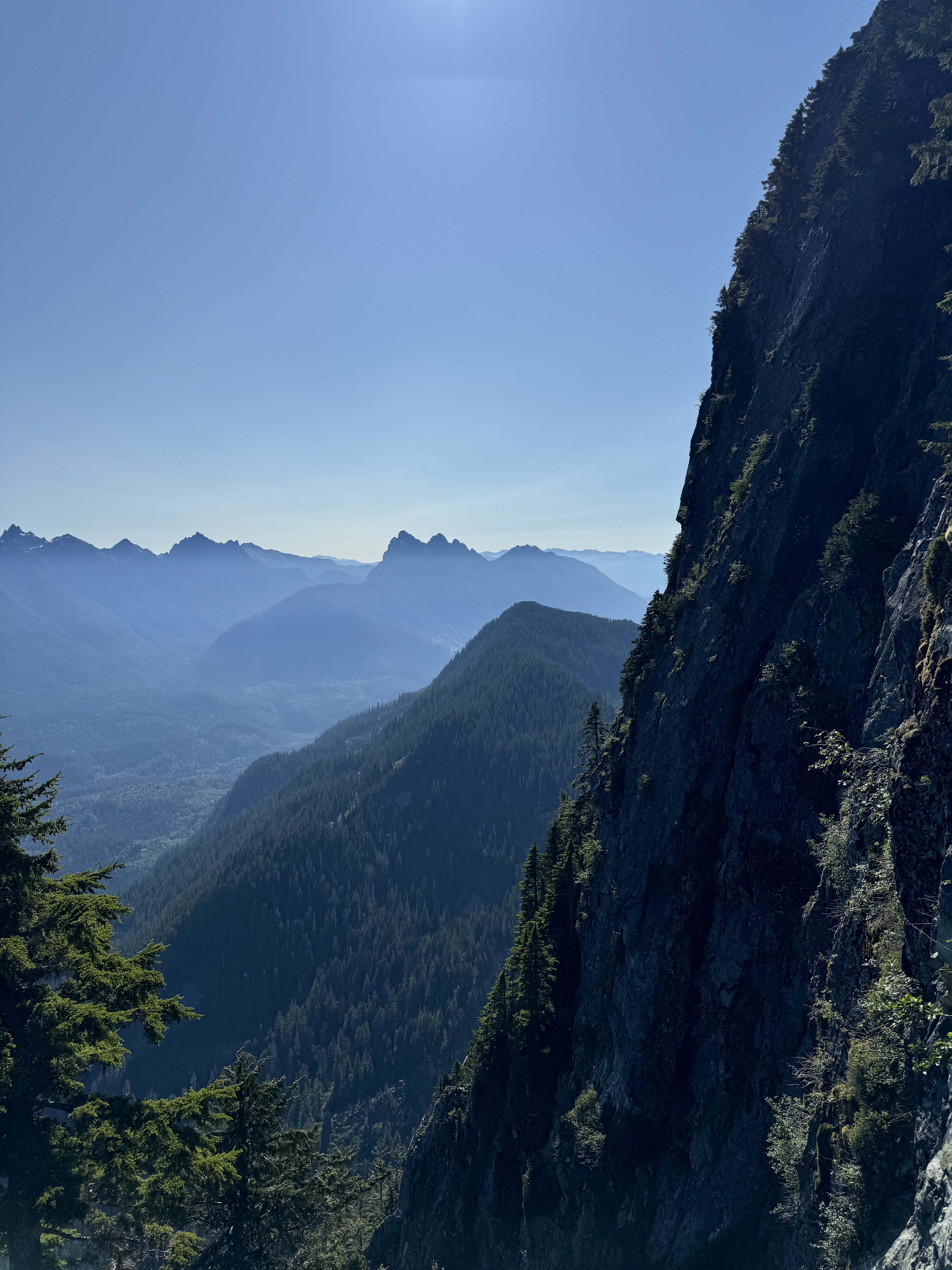
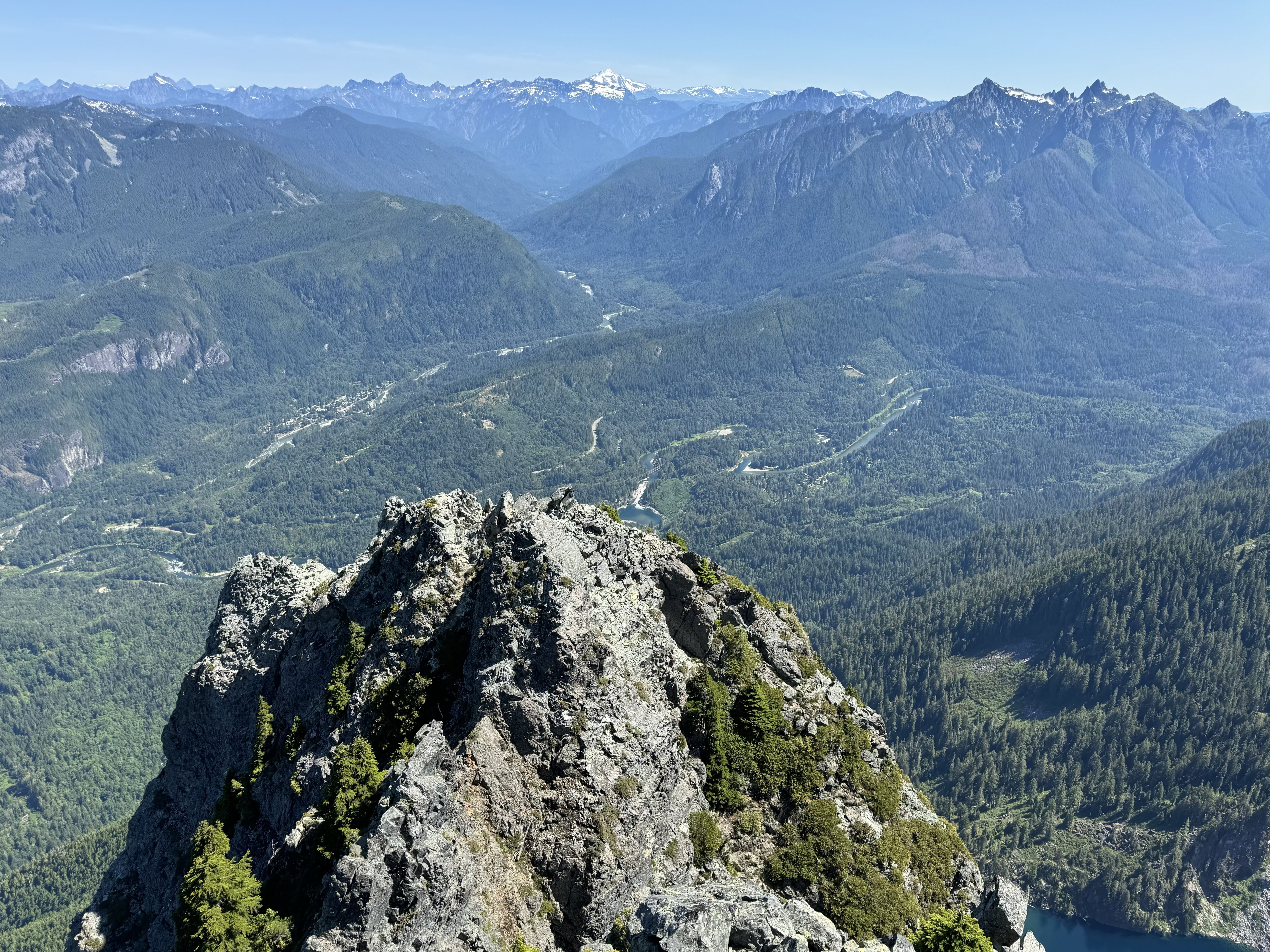
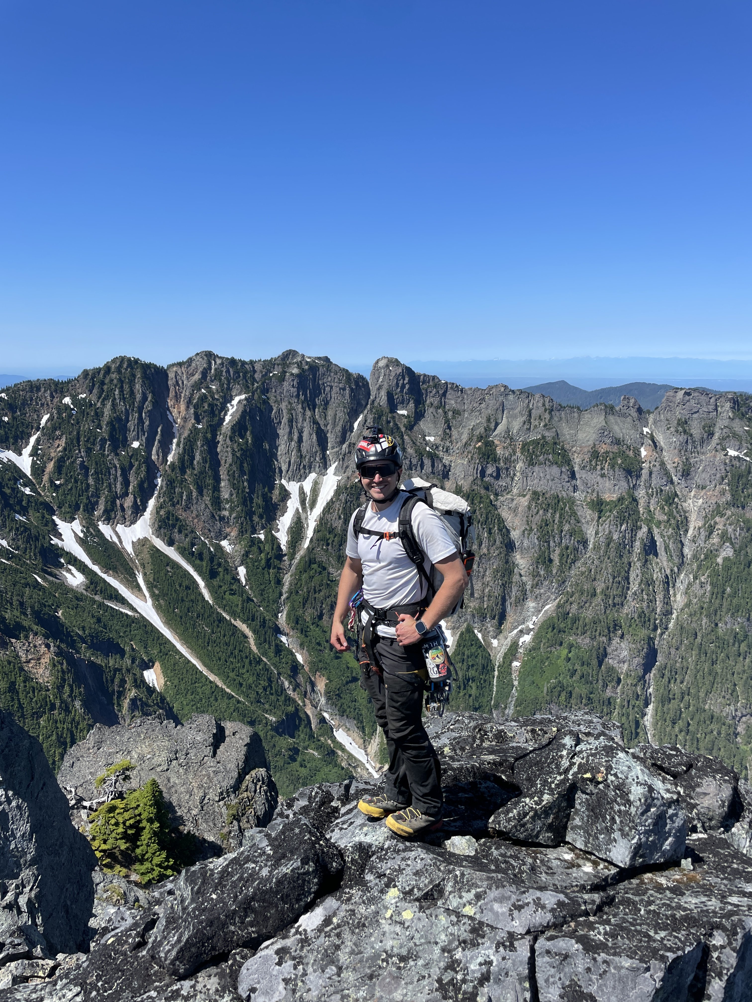
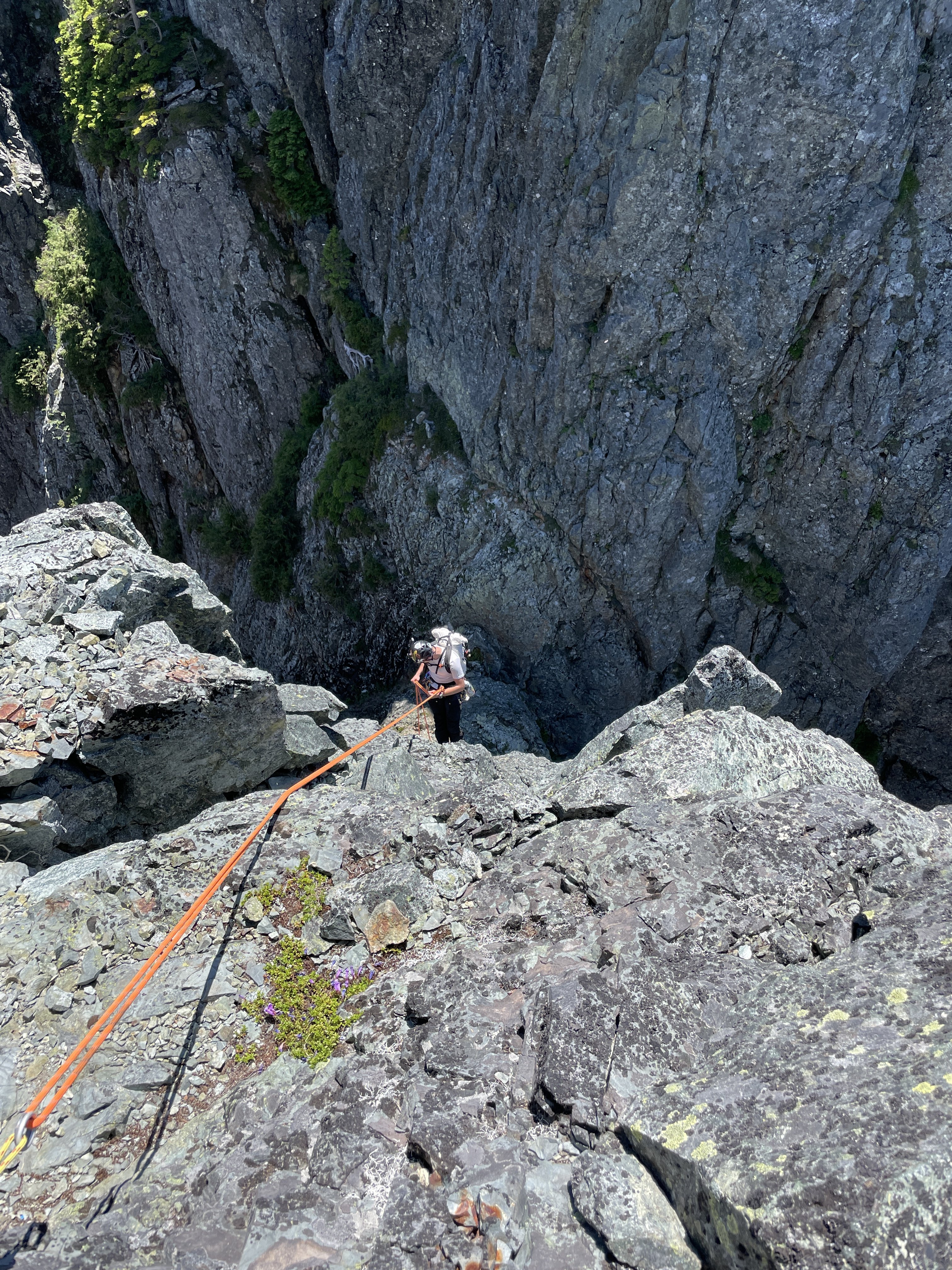
The traverse of Mount Index has been on Ian and I’s radar for over three years. It summits two of WA’s supposed “Difficult 10” peaks in one fell swoop, and has a legendary reputation in the WA climbing community. I first heard of it when I stumbled across the Difficult 10 list online. The climb immediately got my attention, but at the time I did not think I would ever have the skills or the partner to complete it. The exposure and route reports were pretty terrifying and looked so far beyond anything I had done up to that time. The route is very aesthetically pleasing, and can be seen from the highway. There are a few trip reports for the traverse online, most done by blue-collar legends of the WA climbing community. There is also Colin Haley’s report of doing the traverse in 24hrs in winter, which seems super-human to me at this point. Unsure of the technical difficulties that would be involved, we wanted two full days for the climb to increase our chance of success. Ian and I left my house at 1am Sat morning 7/13. We were hiking up towards Lake Serene by 2:30. At the lake, we followed the convoluted trail towards the West rim of the lake, then veered upwards for some bushwhacking until we reached the talus slopes. We followed them up towards the North Face of the North Peak until we reached around 3,300’. At that point we scrambled up easy but unstable red rock until things got bushy. There are rap anchors everywhere on the North Face from so many people bailing, and it is very hard to tell if you are going in the right direction. Ian and I basically foraged upward through very steep brush until we reached the saddle of the huge and distinctive gendarme feature. From there, we realized we were too far East and had skipped most of the easy “open bowl” section. We downclimbed slightly and traversed West into the hidden gully that becomes obvious at the top of the bowl. This easy gully led us straight up to a notch at the start of the North Ridge at 9am. The sun hit and it went from hot to very hot. The forecasts for the summit were in the 70s, but I did not believe it before we left. The rib climbing is super fun as stated in other trip reports and is around 5.5. Ian led the first section then we simuled up to the upper slopes where the brush begins again and a large snow patch is located. We were soaked in sweat and already dehydrated at this point. We melted and ate a meal there, then continued up some very vegetated terrain to the North Peak False Summit. From there it is a short and VERY exposed 4th class scramble to the North Peak. We arrived on top at noon feeling a bit fatigued but confident we could make it to Middle. We both agreed that North Peak by itself is quite a bit steeper, more exposed, and difficult than Johannesburg Mountain, to which it is often compared. After the North Peak summit, the traverse becomes even more exposed. There are massive cliffs on both sides the entire time, and even when the terrain is moderate near the ridge crest, there are still massive cliffs just below those slopes with nothing to catch you from falling. From the North Peak, we followed Riley81’s trip report on CascadeClimbers.com. His is one of the most helpful trip report for any climb that I have come across. Very concise and clear directions that made sense when we were on route. We downclimbed a bit from the summit, then made a rappel, then climbed back up to the East side of the ridge, then back down a long loose gully, then another rappel, this time overhanging, down into the North-Middle notch. A bit complex. At the notch, I finally grasped why the Middle Peak has such an intimidating reputation. Once you make that rappel, the easiest method of rescue is to finish the traverse, which is not easy even from that point. A helicopter rescue would be very difficult as well, and they would have to long-line you out. It feels like you are in a completely different world, with HWY 2 and the busy Lake Serene Trail at your feet. From the notch Ian led the technical crux pitch of the route. A full 60m gully with a few 5.7 moves. Ian led his way up like a champ and I grunted my way up like a chump. At the top of this gully we were on the ridge crest, and we simul-climbed 3 pitches to the false summit of Middle. We were totally out of water at this point and very thirsty. Luckily, we could see a snow patch ahead. We made a very overhanging rappel and made a beeline for the water source. We cruised right by the bivy site without even seeing it. We melted more snow, ate some snacks, then summited Middle via easy heather scrambling. At the top, we both agreed why this is at the top of the Difficult 10 list. The climbing on the peak itself is not terribly hard, it is more due to the amount of effort it takes to get there. I called Maddy to check in from the top around 4pm. Ian and I discussed going to bed, but we still had 6hrs of daylight. We started the complex descent from Main Peak by following the ridge crest and deviating to the East to downclimb a ~200’ long gully. From the bottom of this gully, we climbed up to the ridge crest via another gully and over to the West side. We then descended some easier slopes to a small gendarme where we crossed back to East side of the ridge. More complexities. There are some white colored slabs with snow, and a few vegetated sloping ledges. It was just after 6pm when we reached said ledges, and we were worried about the time/energy to reach Main Peak that day, as well as the availability of bivy sites at the Middle-Main notch (there were none). We brewed up and I spent 6hrs sweating profusely and trying to sleep on an angled 10 degree slope with swarms of mosquitoes targeting my exposed face all night. I somehow drifted off around 2am and awoke to Ian climbing down to my ledge at 4:45. I had overslept our 4am wakeup, and my punishment was skipping breakfast and just eating a Cliff bar. We were on our way by 5am after filtering water. We down-climbed the white slabs which were wet and sketchy, but they led us to a tree with a rap anchor leading down toward the notch. From the bottom of the rap it is a short scramble up and over a hump and down to the Middle-Main notch itself. From the Notch, Ian led again. The pitch was a shallow 5.6 gully, this time only 35m or so. Distinctly easier than the pitch coming out of the North-Middle gully. I quickly followed him and led the way up some steep brushy slopes while Ian flaked the rope. After 30min or so, we popped out on a ridge crest, which is actually the top of the South Norwegian Buttress. We simuled 3 very exposed but easy pitches to the “Wedge Gendarme”. From there we down climbed to a notch between the Gendarme and the North Face of Main Peak. From this notch, the route is actually quite obvious. The route up the face of Main is much easier than it appears at a distance, and we scrambled easy 4th class slopes until we were forced into the long red gully. We climbed in the gully for a few feet before starting the rightward traverse on a grassy ramp. After the ramp, a ledge takes you around to the West side of Main peak and the technicalities are over. It is a short hike up past the false summits of Main Peak to the top. We reached the summit at 8am Sun morning. We then put away the rope, ate a few snacks, and walked east to the top of the Hourglass Gully. At the top of Hourglass, we were about to make a new tree anchor when Ian found a new-ish sling already there. We rappelled down the first waterfall getting a bit wet in the process. We then pulled the soaking wet rope and made a second rappel on our own new tree anchor to the steep snowfields below. We then spent about an hour baking and slowly down-climbing the sketchy snow. Neither of us had an ice axe, and Ian didn’t have crampons. A light axe would probably have been worth the carry. After a short rock section, I found another tree anchor and made a full rappel down another waterfall and got completely soaked. This rap led to another very short rappel onto some less-steep snow. We glissaded down to the bottom of the snowfield, then picked our way down through the trees until we could make the traverse to the East Ridge route. From there, we stayed exactly on the ridge crest and proceeded with the hard-core bushwhacking descent for around 1,000’. My shorts and T-shirt were not very useful and my arms and legs got shredded by the spiky vegetation. Once at the saddle above Lake Serene, we descended towards the lake on boulders staying left to avoid vegetation as much as possible. As soon as we got to the lake I took off my boots and jumped in with my clothes on. My shorts and T-shirt were disgusting and the water felt amazing. After that we filtered water and made meals. Around 1pm we started our way around the lake. Around 2pm we walked past all the crowds of Seattleites at Lunch Rock. We were back to the car by 3:30pm and home by 5pm. My opinion is that this is a very good route. The traverse style, exposure, and amount of work required make it classic, and the proximity to civilization makes it unique. The climbing itself is a lot of work, but that is Ian and I’s specialty. I would recommend this route to any experienced climber in WA looking to test their abilities. It is certainly harder than any other route we have done so far in the state, with the Price Glacier + Noocksack attempt coming to mind as our other long effort. I am very satisfied to have this one done, and from now on my trips over HWY 2 will bring a sense of accomplishment, rather than anxiety. GPX Track: https://www.alltrails.com/explore/recording/afternoon-hike-6ecbdd6-436 Gear List: https://www.packwizard.com/s/Q0Fbxc1


 3 points
 -
Trip: Pickets - Picket High Route (Stettatle -> Wiley) Trip Date: 07/04/2024 Trip Report: Wyatt, Anthony, and I joined forces once again for a 4th of July Epic. We went for the Pickets this year, completing a south to north high route from Stetattle Ridge, through McMillan Cirque, to Luna Col, and out Wiley Ridge over 4 days. We summited Outrigger, Fury, Luna, Big Beaver, and a few other bumps along the way. For those curious, Outrigger is climbable from the south. We couldn't find any real info on this, but we found a bypass of the vertical section, climbing some low 5th around to the right. Wiley Ridge was incredibly pleasant and the bushwhack was short. Highly recommend this route. https://climberkyle.com/2024/07/04/pickets-high-route/ Gear Notes: Gaitered gore-tex trail runners, cycling out waterproof socks. Pink tri-cam for the knife edge on Outrigger. Approach Notes: We took the Pierce Mountain Trail up Sourdough since the main trail is closed due to the fire last year. Wiley to exit. Stay on the ridge between the two gullies on the descent, and it's not too bad with the exception of one cliff band at 4900 ft.3 points
-
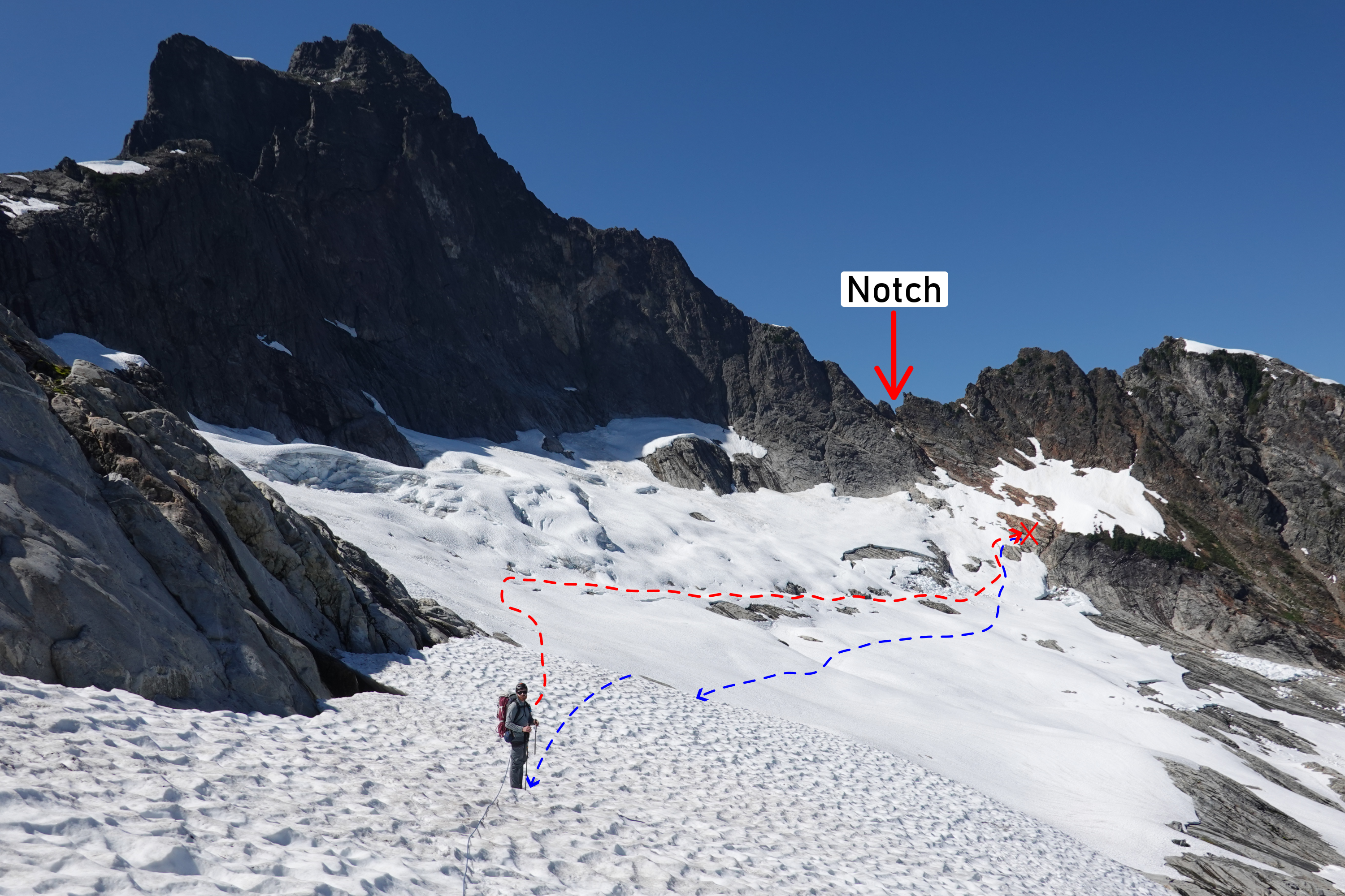
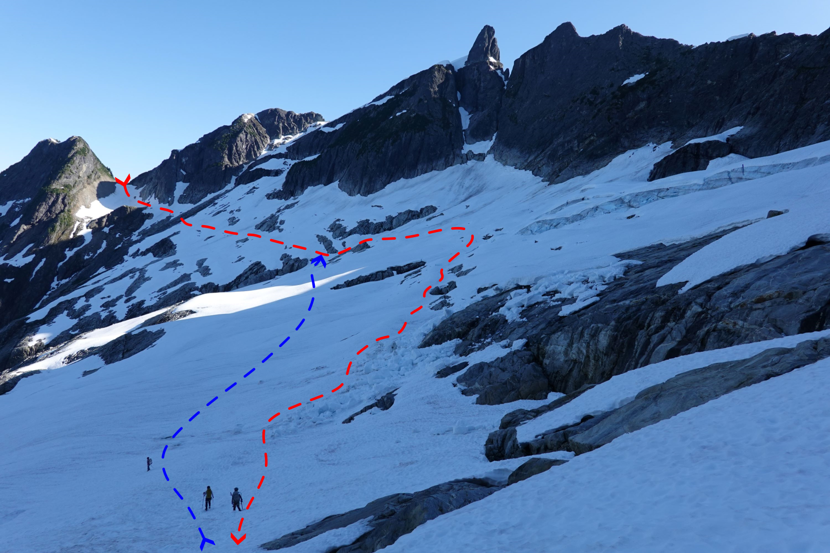
Trip: Mount Triumph - NE Ridge Trip Date: 07/13/2024 Trip Report: TLDR: The snowfield crossing to the NE Ridge still has significant objective hazards. I would expect hazards to be similar for a little while longer before enough snow melts/sloughs off that the risk is minimized. I believe I can claim the first trip report of Mount Triumph in 2024. Sadly, I can’t claim the first summit of the year. I was a part of a team of 4, and our plan was to climb Mt Triumph over 2 days, camping at the bivy site 2 pitches up the start of the NE Ridge climb. Our timeline was as follows: Depart Seattle Area 4:00 AM Leave Thornton Lake Trailhead 7:15 AM Reach the first Thornton Lake 10:15 AM Arrive at the top of the Saddle above the 2nd Thornton lake. 2:00 PM Arrive at the base of the notch 3:45 PM Departed the base of the notch 5:15 PM Returned back to the Saddle above the 2nd Thornton lake. 6:15 PM Back to the trailhead 11:15 PM Conditions on the way to the climb: -The trail up to the first lake is well maintained -The trail to the 2nd lake is a little bushwacky, but there is a defined trail up to it -There were a couple creek crossings, all were manageable (trekking poles were nice, but not required) -After the 2nd lake, you need to cross a boulder field that then transitions to heather/scree as you go up the col to the saddle above the 2nd lake. I’d recommend hugging the cliff to climbers right as you go up; the heather is easier than the loose rock and there is a faint trail to follow. Above the heather you get into much more loose rock, and though manageable, it becomes rather difficult to avoid dropping rocks on team members below you. -For the time being, there is still plenty of snow and running water nearby this saddle if you plan to bivy here. -The snow crossing was by far the most challenging part of the approach. After reviewing the objective hazards for a bit, and debating the best path, we opted to follow relatively closely to what I had read most trip reports follow, which is along the bench that leads to below the notch. Only one part of the bench showed any signs of recent snow/ice fall, which was unfortunately at the end, where we couldn’t travel too far below it since we need to start going up the face to get to the notch. We opted to move as fast as possible to minimize our time in the hazard zone. Even trying to minimize exposure, we still had a bit of excitement as some snow blocks broke off while our last team member was under the main hazard zone. Thankfully the snowfall behaved as we expected (if it were to fall) and stopped short of our crossing path. So the team member wasn’t in direct danger, but it certainly looked like it, and in the process of trying to get out the way, they unfortunately sliced their leg with a crampon. We took a break on a rock outcropping directly below the notch to bandage up the leg, and decide what to do. We decided the injury was significant enough that we didn’t want to spend another day on the mountain, and planned to make the descent back to the trailhead. We had dinner on the little rock outcropping, and spent the time re-evaluating our path on the snowfield. We saw one more exciting ice block fall, this time off the old glacier. This block made it all the way down to the bench that we crossed, and because of that, when we headed back we decided to traverse below the bench to better stay out of the path of any potential snow/ice fall. The snowfield was shaded on our way back, which helped with snow/ice fall risk. Also worth noting, the mosquitos were bad on the way up in the heat of the day, but were downright miserable on the way back; didn’t matter if we were stopped or moving, they followed us relentlessly. DEET had a minimal impact, I’d recommend bringing a bug head net. Lessons learned include: - We picked about the worst time of the day to cross the glacier (hottest/direct sun). Unfortunately, if you are trying to do Mt Triumph in 2 days, it’s very challenging to avoid crossing this snowfield mid/late day; your best bet is to wait for the sun to dip below the peak of triumph and cast a shadow over the snowfield, which happened around 5:15PM for us. You can push the first crossing to early in the morning day 2, but that will just push back the 2nd crossing on the way back. -We opted to rope up the first time we crossed the snowfield. This was to have a chance of protecting against additional glide avalanches. But because we were roped up, the last person on our team spent the longest time under the primary hazard zone as the steepness increased significantly above that zone and those of us in the front of the rope team slowed down on the uphill. This is why we opted not to rope up on the way back 2nd Thornton lake, col you go up on right First good view of Mount Triumph and the snowfield you need to cross View of the crossing we took on the way out (red), and back (blue) based on our changed opinions of the biggest objective hazards. Red X is far as we got View of our path from the opposite side Gear Notes: -Crampons were quite nice for the snow crossing, even with the heat the snow had some spots on the traverse that were quite firm -Brought a decent sized trad rack, but I didn't actually use it (so can't give any feedback there) Approach Notes: GPS Track available on Peakbagger: https://www.peakbagger.com/climber/ascent.aspx?aid=2573855 I also shared a few more pictures on the PNW Peakbaggers Facebook page: https://www.facebook.com/groups/209335589972834/?multi_permalinks=1572843873621992
 3 points
 -
Love it! And thanks for taking such good photos. I’m inspired to get to Luna cirque now. And the mystery of where the bootpack south of Outrigger came from is solved. I came through there the day after you from Otto-Himmel and had the impression of boot pack dropped in from the sky. Wouldn’t have thought of coming from McMillan cirque1 point
-
COME ON! That is just downright sadistic. Well done on a cool route! I can speak from experience that if you just go up from ramp to gash it is all fine.1 point
-
Nice work! I think the traverse is actually one to write home about.1 point
-
Daaaaaamn, nice work! We did two 16-hour days on that route. You guys cruised, it sounds like you soloed a lot more than we did. Very strong work and thanks for the writeup.1 point


