
Leaderboard


Popular Content
Showing content with the highest reputation on 10/25/23 in all areas
-
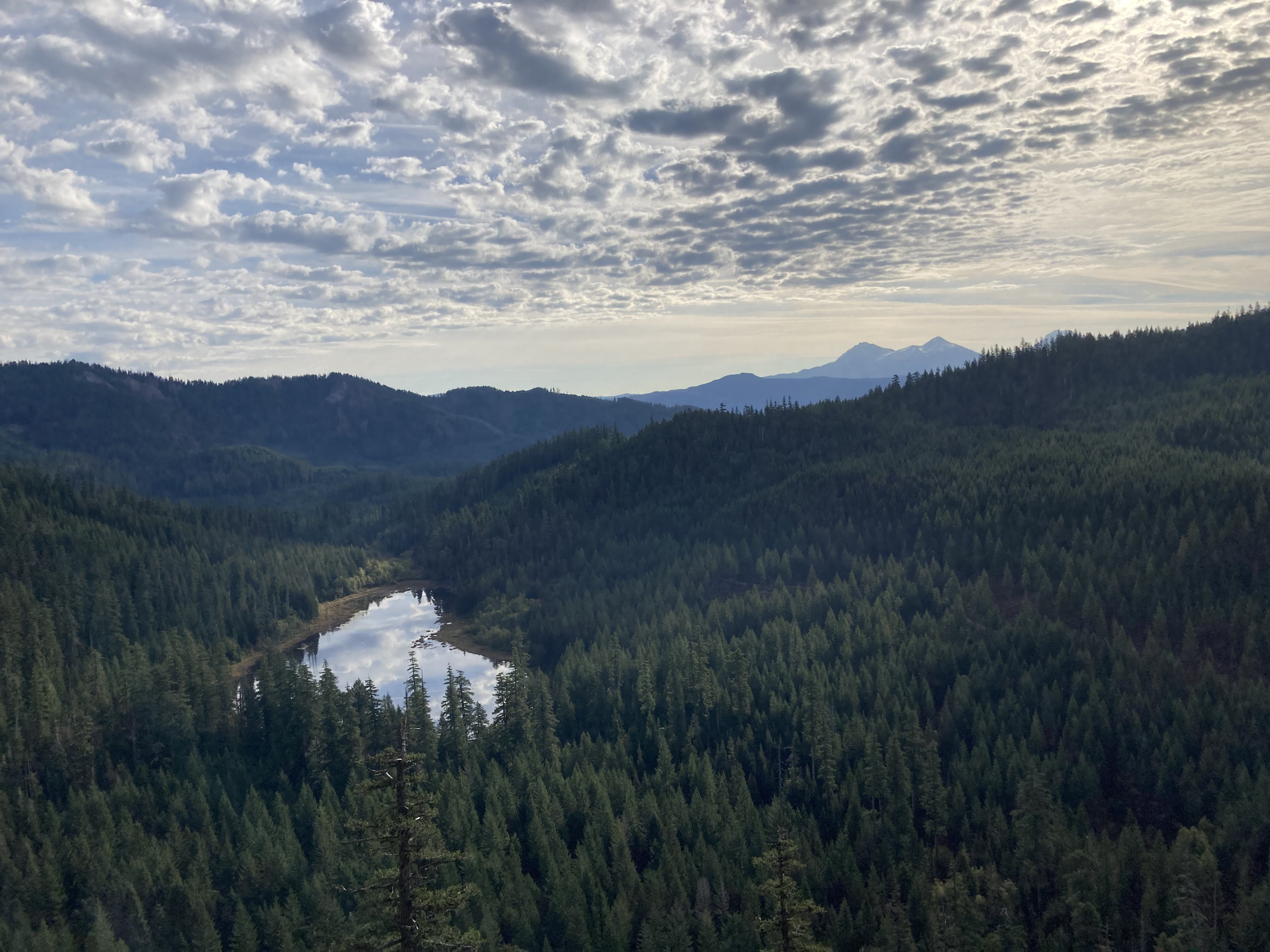
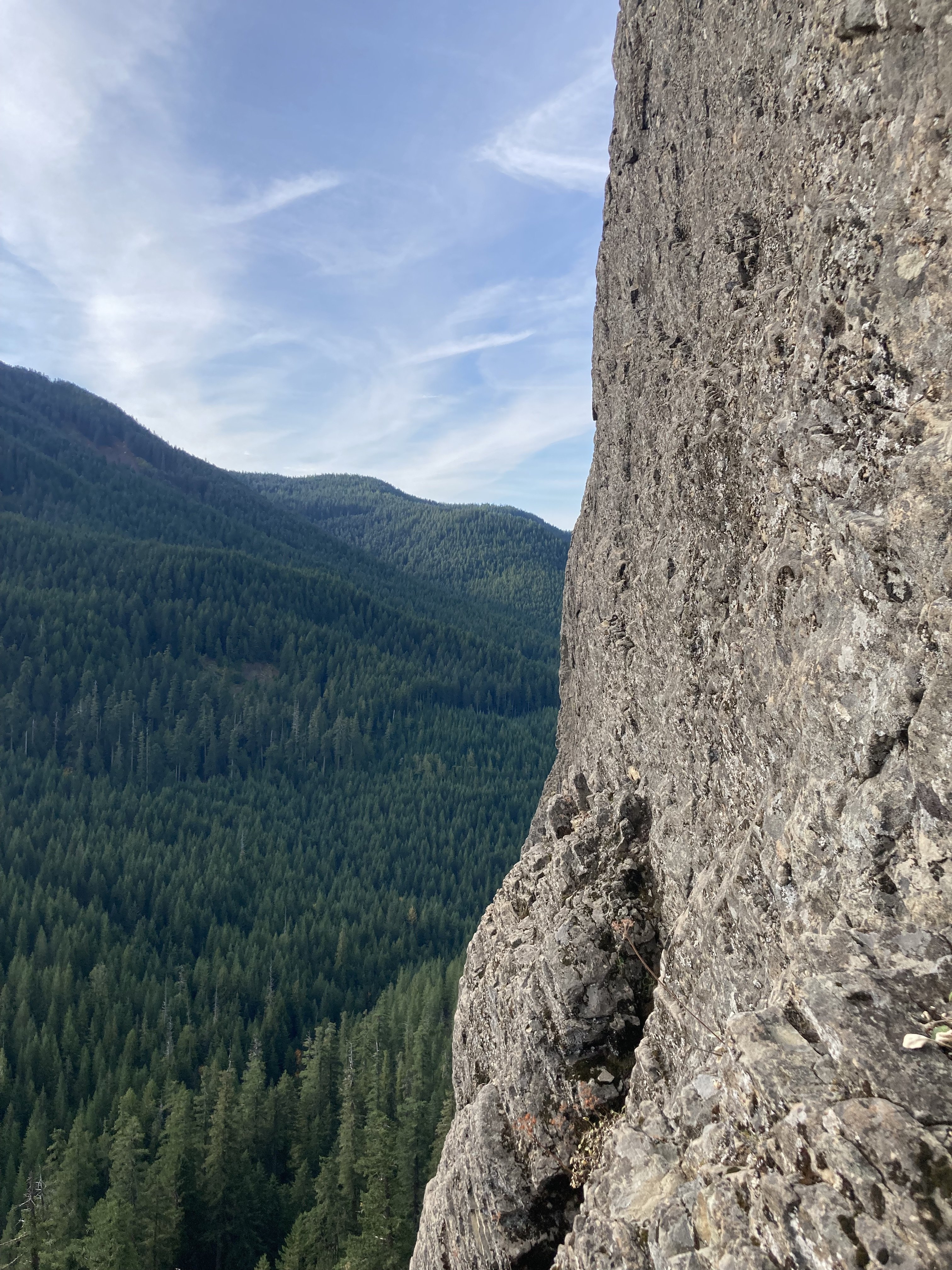
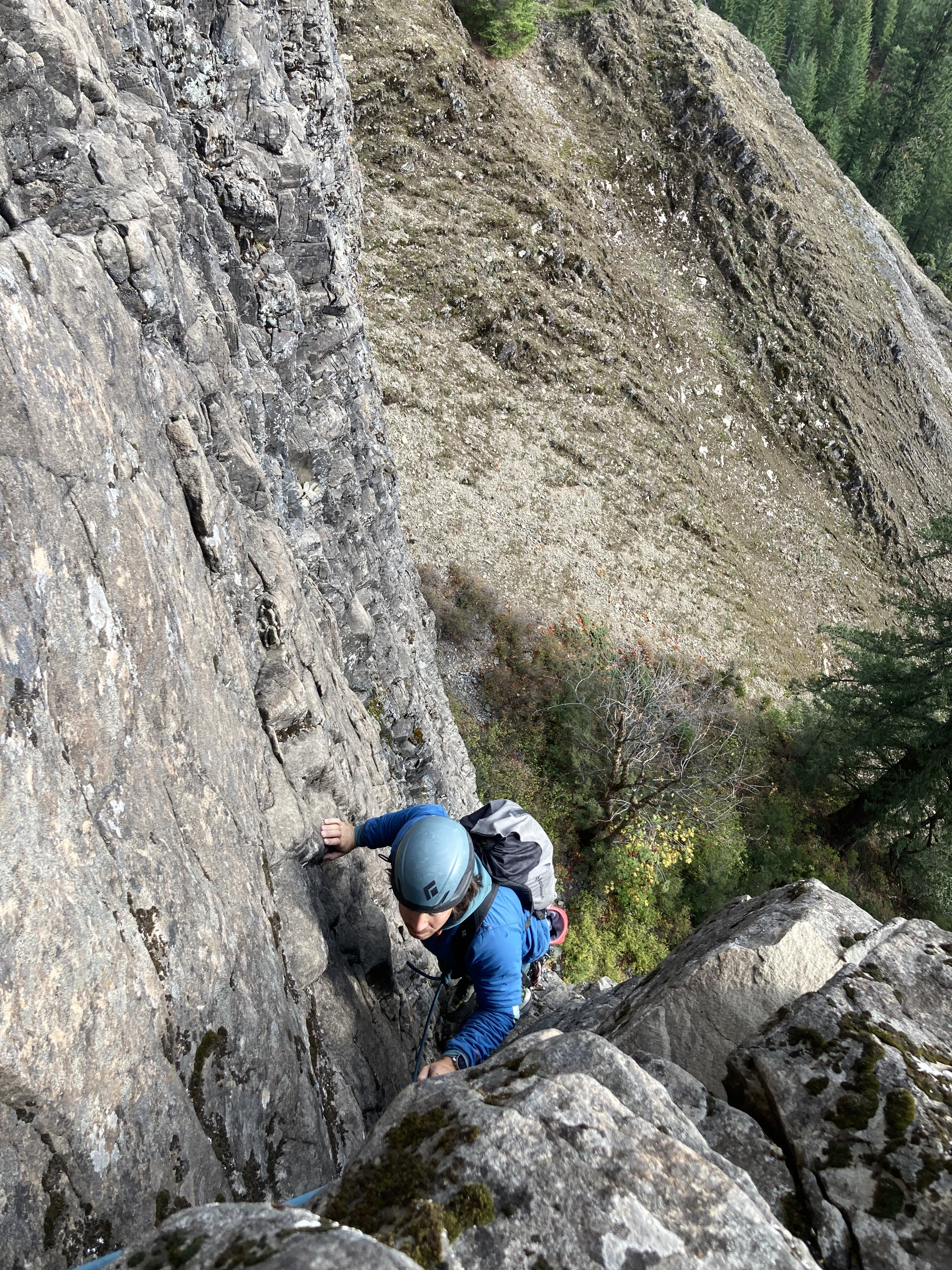
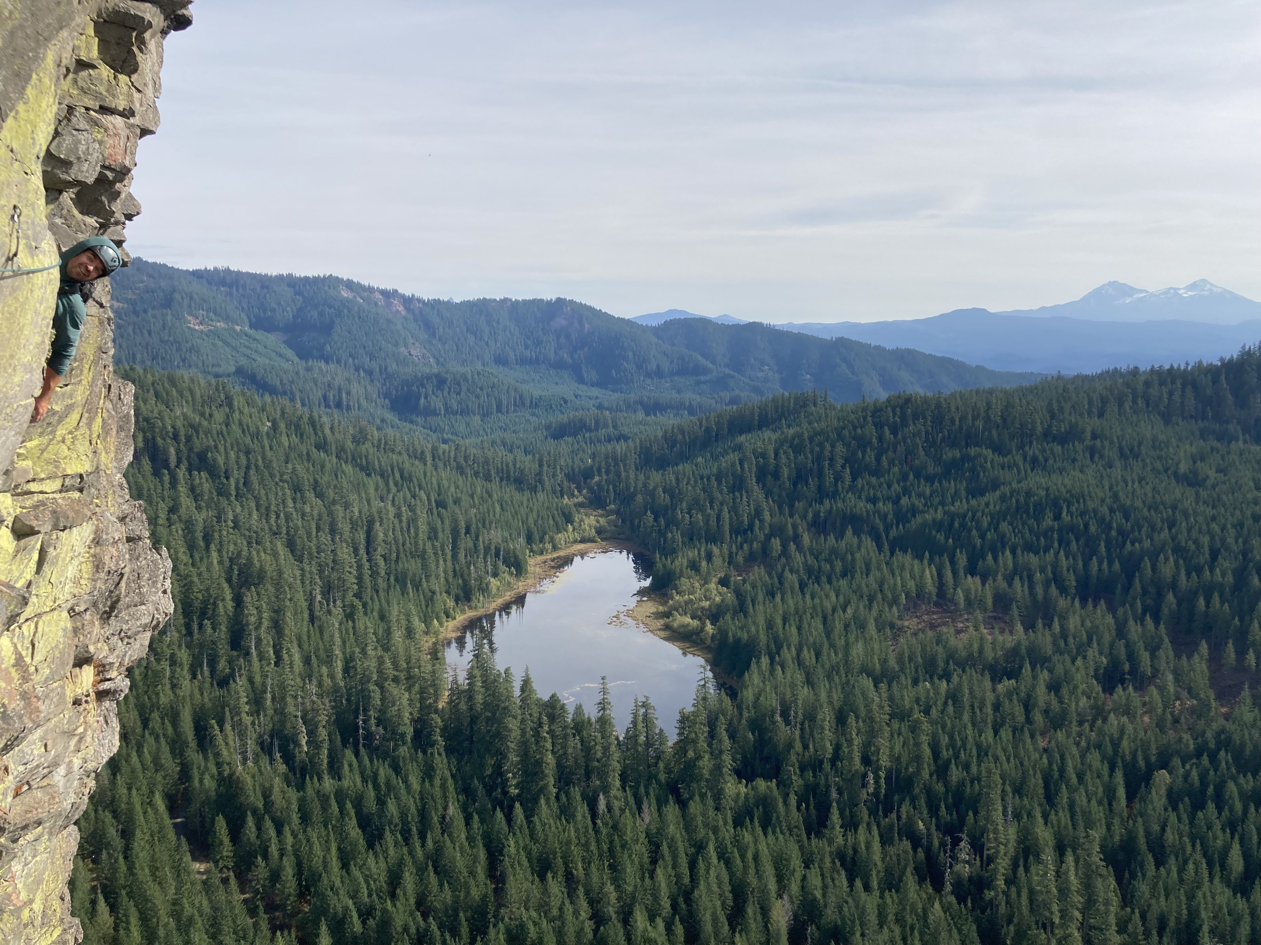
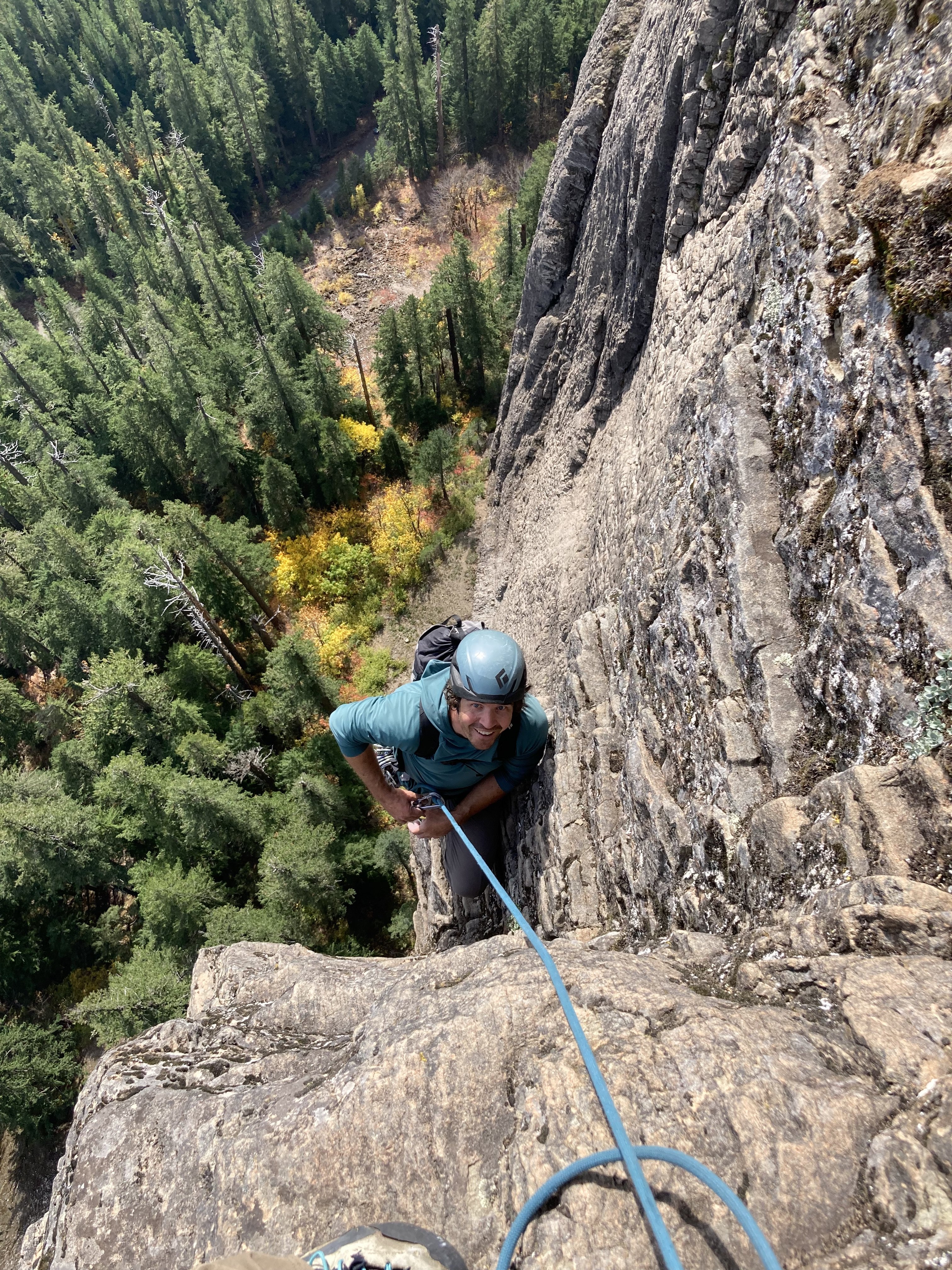
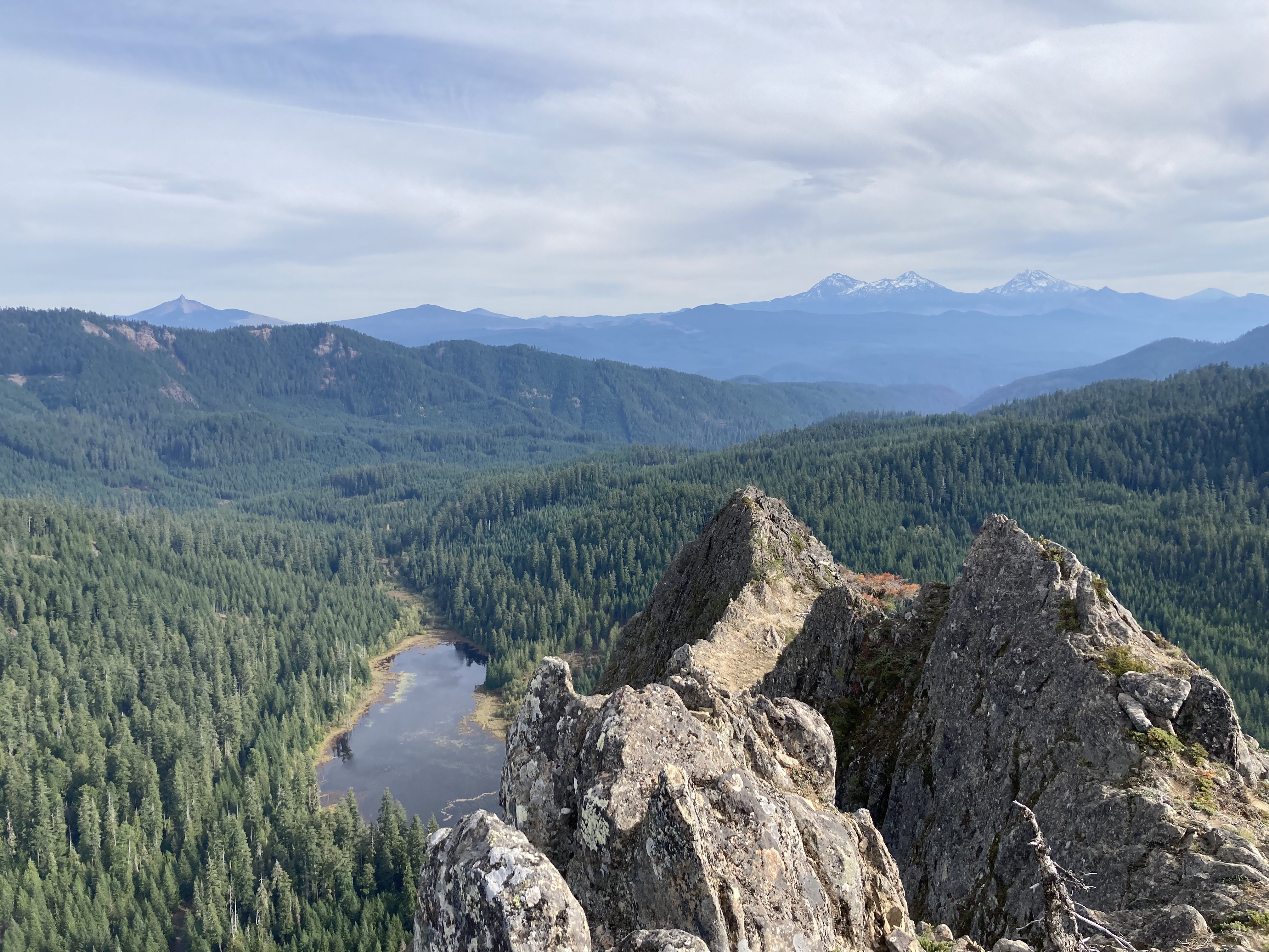
Trip: Wolf Rock - Barad Dur Trip Date: 10/21/2023 Trip Report: Climbed Barad Dur with Scott Saturday 10/21. Plenty of beta out there and no significant story to tell, but I will say that this is a great adventure route and should be on any Oregonian's list. While not as consistently quality as say Index or Snow Creek, it is still very high quality movement on steep rock with these lovely grippy incuts. I would recommend it to anyone who likes steep rock climbing and alpine-esque adventure climbing. Weather beta: Watch for dry spells with cool weather and a high cloud layer in fall. Route faces SE at 3500-4500'. Pics... Gear Notes: 1x 0.3-3 w/ doubles 0.4-0.75, lots of draws and slings Approach Notes: Check with FS for road closures this fall due to fire clean-up.
 2 points
 -
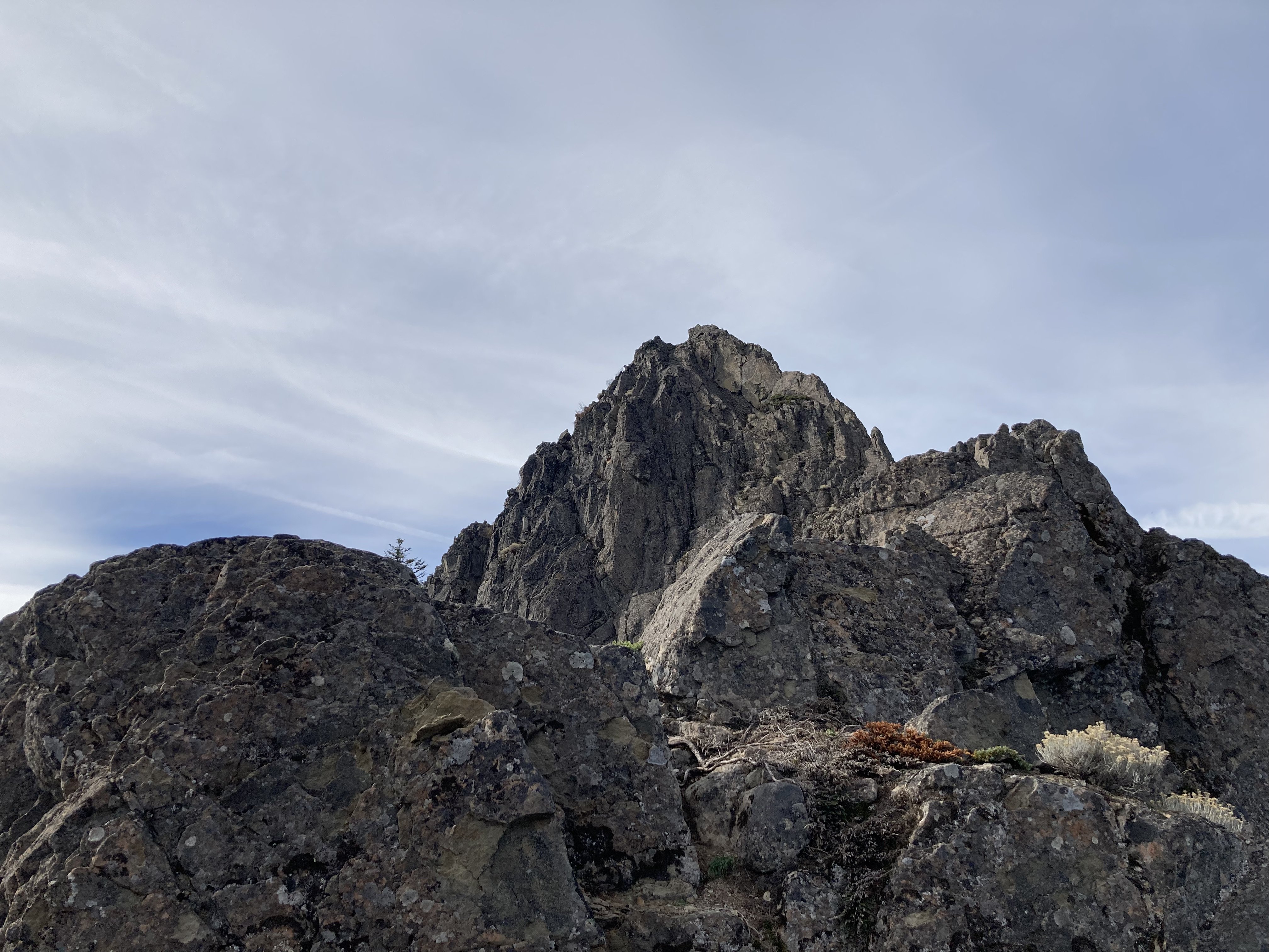
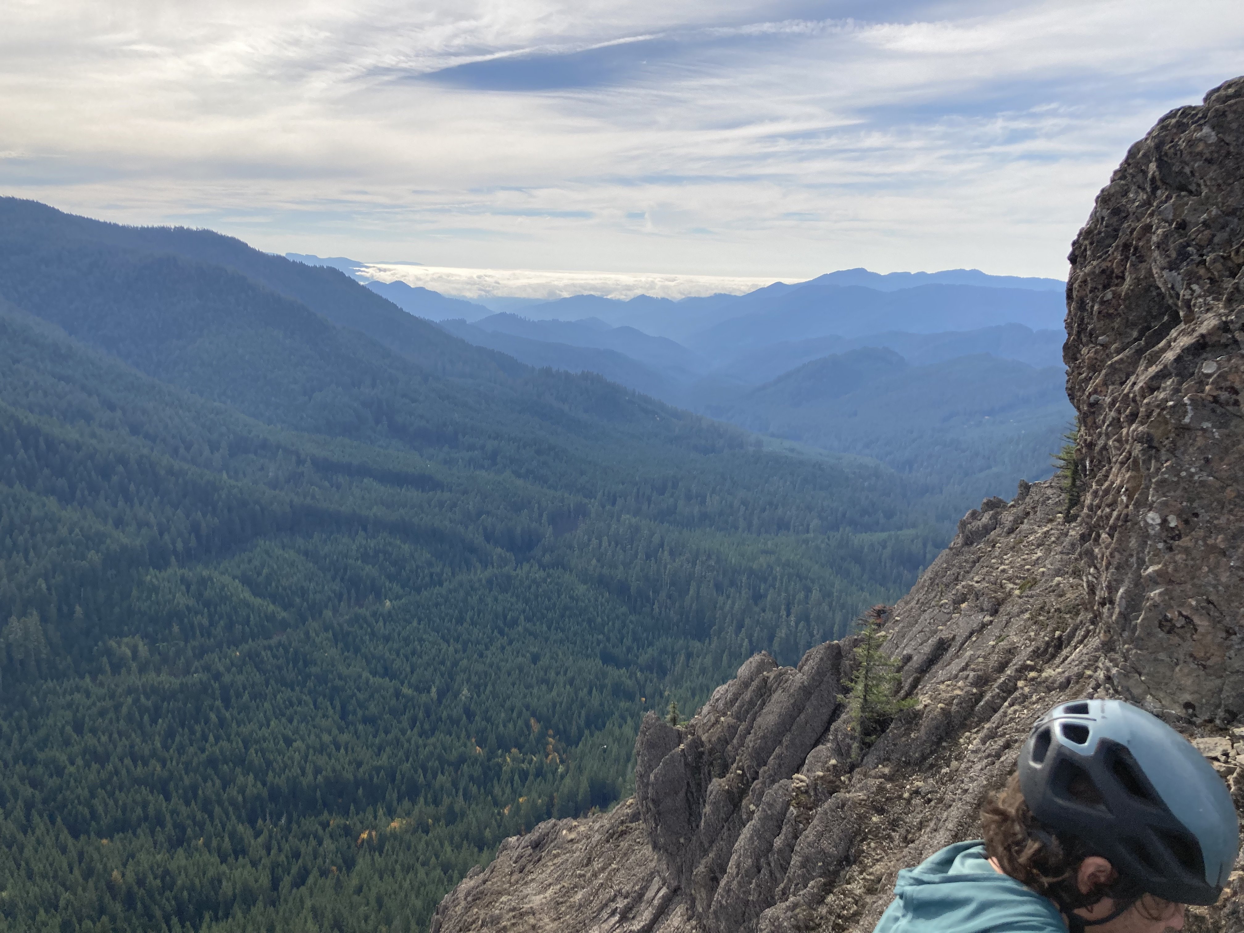
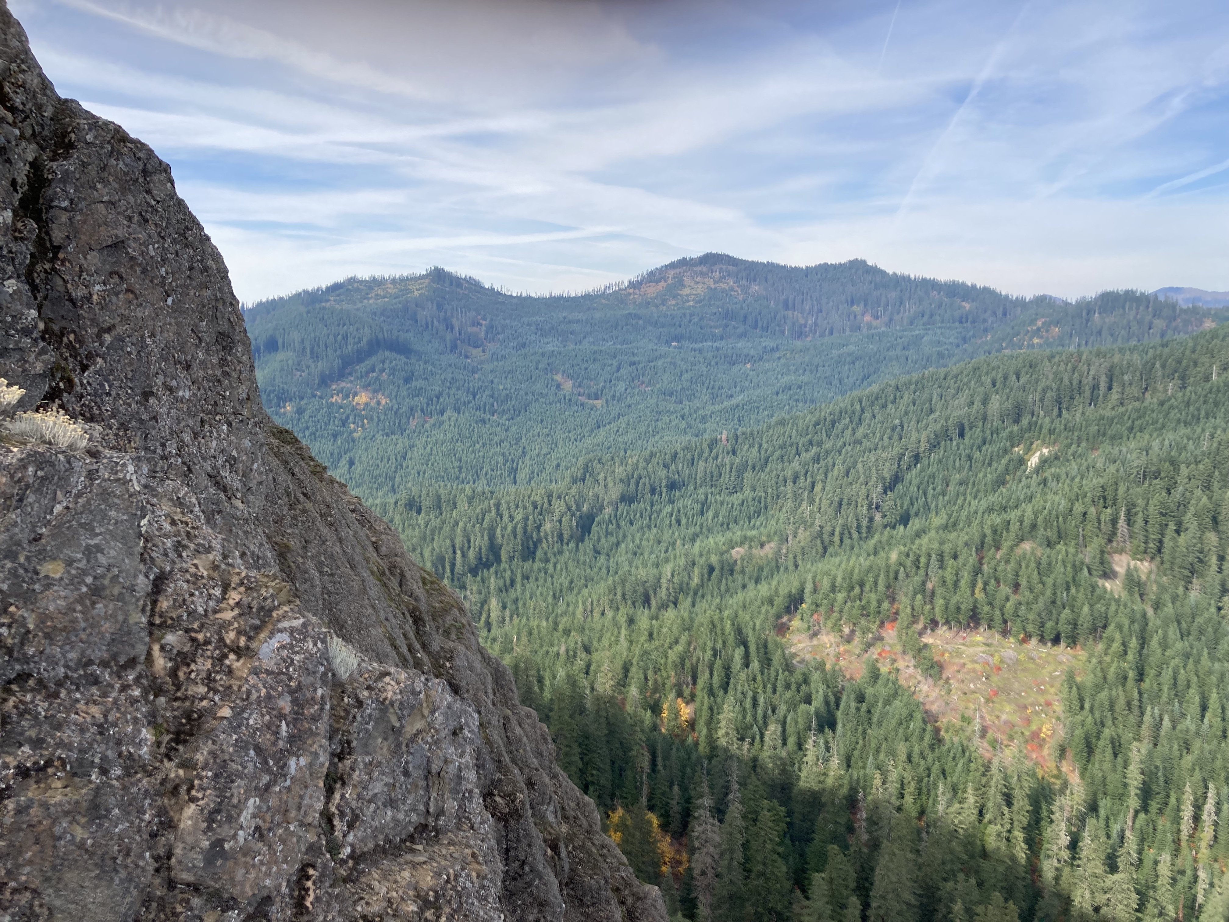
Trip: Nooksack Tower - Beckey-Schmidtke Trip Date: 07/23/2023 Trip Report: Hi, I'm going to try to keep this brief as my eyes are still dry from the long sunny dry day yesterday. Me and @thedylan climbed the "easy" route on Nooksack Tower over the weekend of July 22-23. We had a pretty easy time on the tower, especially compared to basically every other report out there. I don't believe we followed Beckey's beta exactly, but we climbed camp to summit in 4.5 hours and never anything harder than about 5.0, and that was the last 30' to the summit. I would recommend our route highly (if you insist on climbing the tower at all). We hiked in to camp at 6100' in 5.5 hours without pushing particularly hard. The hike was beautiful and the camp spectacular, if one had to retire from climbing but still wanted a good mouthful of it this would make a spectacular backpacking trip. Our campsite was at 6100' at a minor notch in the ridgel it had close water, immediate access to the glacial snow slopes, no bugs or rats, and perfect flat smooth slabs for sleeping and lounging, even backrests! It was weird having time to lounge, eat, drink and etc while on a serious climbing trip. But this route isn't broken up well into approach and climbing day. We were up at 2:30 am, hiking by 3:30. We found an easy bridge through the bergschrunds and were headed up the gully by first light. I had laughed at Tom Sjolseth's 2009 report that suggested the snow was 60-70° at the top, but it was! If only for about 20'. Fortunately, there was a fantastic moat to change out equipment in. A lot of people seem to get on the rock too early, we went to the top of the summer snow, "where the couloir narrows" per Beckey means really narrows, not just a little narrower. We climbed right up a crappy "slabby" corner, actually a chockstone gulley to access the obvious class 3 right leaning gulley, after 200-300' we worked a bit right out of the bottom of the gulley to keep the terrain moderate as the gulley steepened. We climbed a steepish wall here that might have been 5.0 but it could have been bypassed lower and right. This working right felt like wrapping around a rib at the time but isn't really when seen from above. After "wrapping around the rib" we were on a face and this is where a LOT of people go wrong. We passed lots of rap stations that apparently lead up and right to the north face route (BAD, insert frightening those emoji). We climbed up class 3 and 4 open terrain for ~250', then started working left and up. Lots of left. In this open class 3-4 area keep looking left, the multiple ribs and gulleys below you and left are steep, once they start to mellow out and the terrain above begins to steepen work left across multiple ribs and gulleys. We found this to be very positive incut hands class 4 ground with some ramps in places leading you up and left. Once you get into a distinctly bigger gulley you are in the zone, this leads to the ridge crest 200' north of the summit, or, I believe, you could keep traversing one more large gulley over and climb straight up to the summit. This looked easy from above but we didn't go that far over. The big gulley we climbed up was mostly class 3 with some 4th class steps. We hit the ridge and put on the rope for the first time. Dylan lead out, simuling to the summit in about 150' of rope length. There was massive air on the west (right) and plenty on the left that I'm glad we used the rope even though I think the only 5th class part was 20' or so up a wall to the very summit. There were some familiar names in the summit register. Bizzarely, we signed in right below @Albuquerque Fred from 5 years ago!! Can that be true!? In this case the summit really is only about half way there, so we headed down after some snacks and photos. We did 2 raps in a row off the summit back into the large cl 3-4 gulley, then downclimbed it and the traverses back to the NF rap line. We did 3 more raps to the snow moat and our gear. "We" decided it was OK to downclimb the top scarry steep part, so Dylan went first since it was his idea. It was actually OK, the snow was soft enough for good steps but firm enough for solid high dagger sticks. This was extremely tedious after about 800'! My hands hurt today from stabbing my axes into the snow. When we got back to the compound bergschrund situation we couldn't figure out how we came up, Dylan kept climbing down where I insisted I had lead up, but there was nothing obviously right. I kept insisting it was there and that it had been easy but he kept insisting what he saw below was steep icy climbing into the cracks. Eventually we traversed between some cracks and set up a rap off a bollard on the lip, we then realized the bridge we had come up on had collapsed and was lying in the bottom of the 'schrund! The hike out was uneventful but didn't take much less time than the ascent did, bizarrely. Once above the moraine, we did different routes up and down and I think this added to the increased exit time. On the way up we followed the boulders at the base of the trees as in the red line below. This was a mostly flat traverse between 4600 and 4700'. Then we turned up to traverse at 5200', below the buttress to the right of Dylan in the photo. The ascent from 4600 to 5200 was lousy climbing pulling on blueberry, if you can find a good way to do this it would be way faster than the ridge crest. There is a perfect goat path through heather and a ledge through the steeper slabs, then easy clean slab walking to camp. The slabs were amazing, beautiful clean rock, easy walking and fantastic pools and streams of water tracing intricate routes along the rock fissures. On the exit we reversed the slabs and the traverse at 5200' but then gained the ridge and followed it all the way down to the moraine, the last steep part was as bad if not worse than the way we went up but the ridge was also brushy and tedious. I would recommend our ascent route in red below: OK, so not so short, but it was a long trip. Car to camp: 5.5 hours. Camp to Summit 4.5 hours. Summit to camp 6.5 hours. Camp to car 4.75 hours. Apprach: Moraine and first look: Slabs below camp: At camp: Changing systems: The sun rises from Redoubt Camp from the snow moat: Shuksan from the summit, the Price looks tough: Dylan on rap: Last look: Gear Notes: 60m twin rope, 60m tag line, 2 axes, steel crampons, e-bivys, small rack (placed 2 pieces), tat (used none), 2 pickets each (didn't use), approach shoes for the hike and rock, boots for the snow, poles for the river. Approach Notes: River was fordable, tough on the way out, crossing is flagged. Trail largely flagged, not bad.1 point
-
https://ktvz.com/news/crime-courts/2023/10/20/background-emerges-about-portland-climber-accused-of-planning-mass-shooting-at-smith-rock-weekend-event/ that ain’t good!0 points