Leaderboard


Popular Content
Showing content with the highest reputation on 10/01/23 in all areas
-
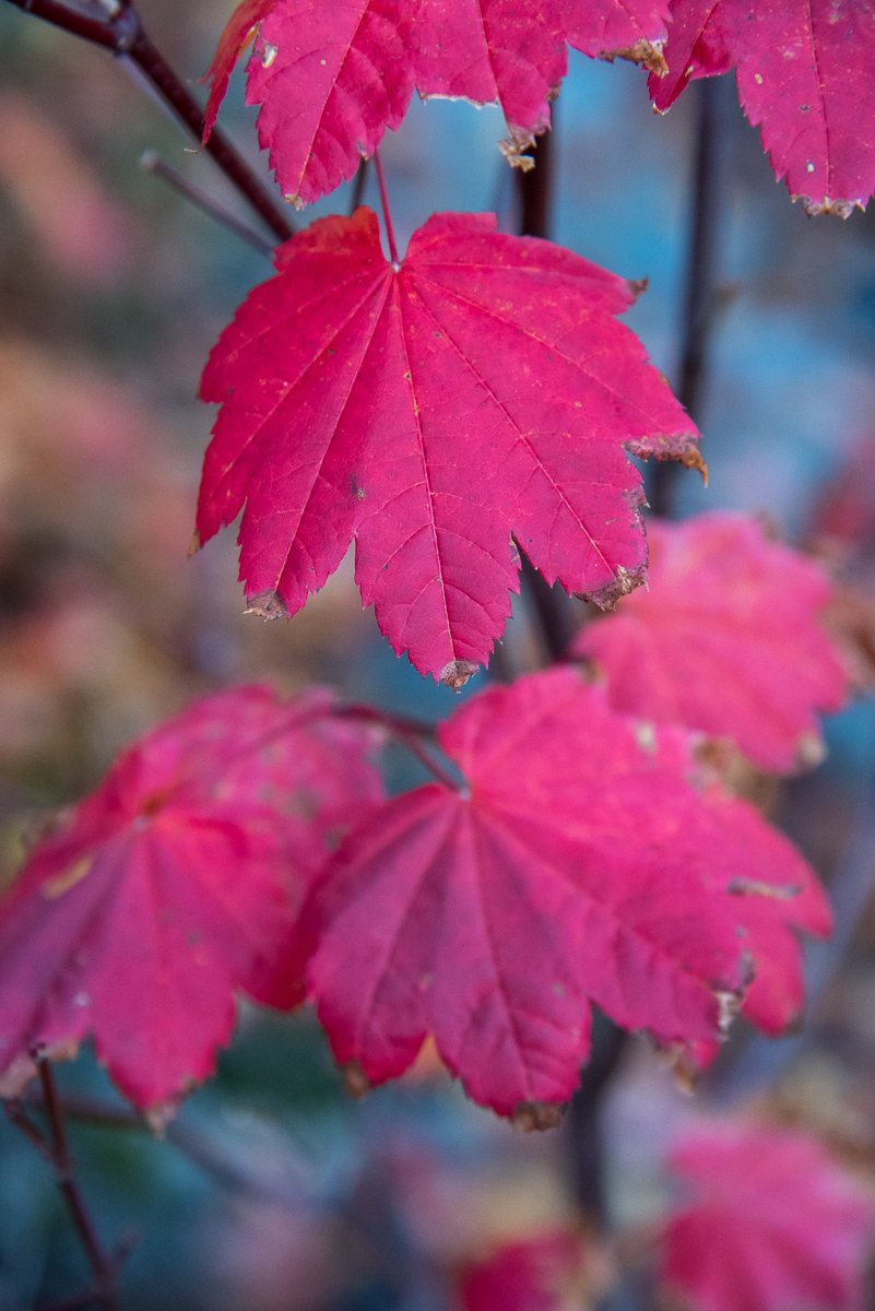
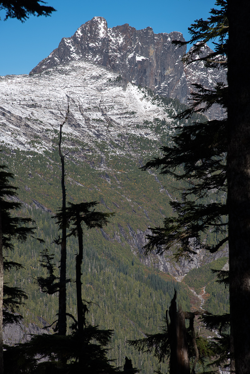
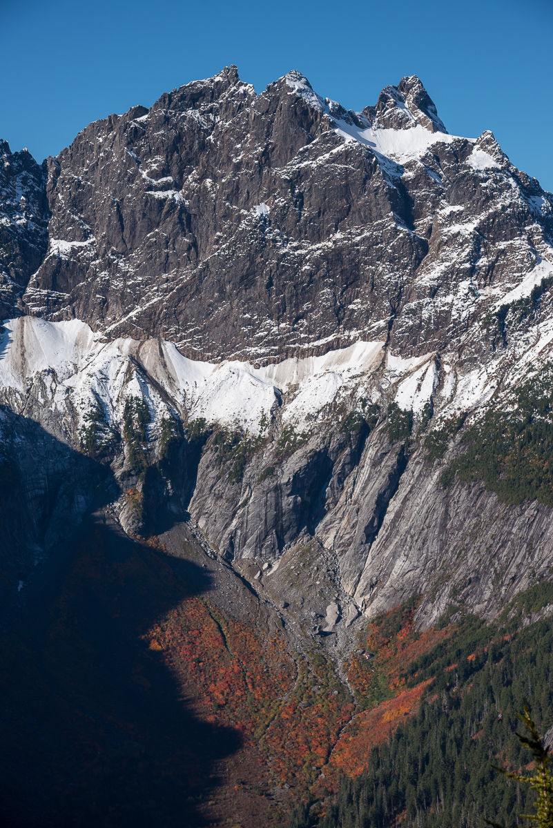
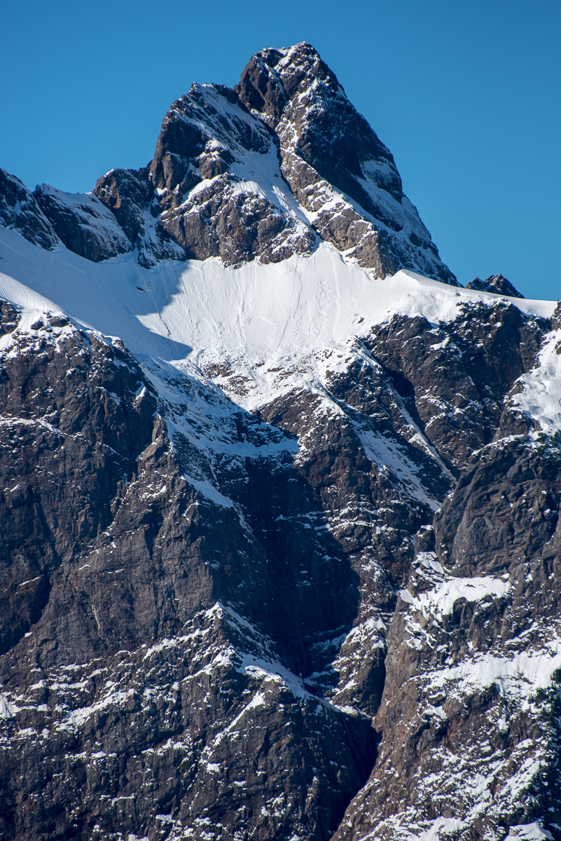
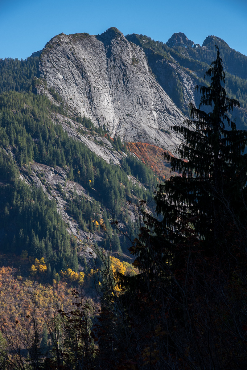
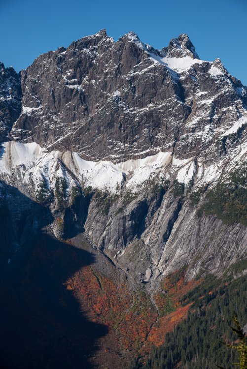
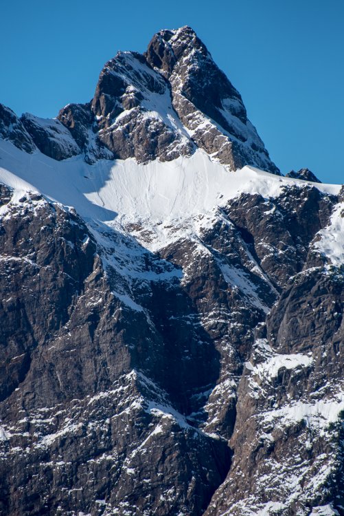
Trip: Big Four - Upper North Face Date: 12/5/2009 Trip Report: Justus_S drove up to the Mountain Loop Highway before work this past week, and took some photos of the N Face of Big Four. It looked like it could be in climbing shape given the great snow conditions and clear weather, but we weren't sure about the portion down low, so we were intent to check it out ourselves. Justus, therunningdog, and I left Seattle at 1:30AM this morning and drove to the parking area for Big Four Ice Caves. We walked out and looked at the North Face, basking in the bright moonlight. Although the upper portion of the face looked great, the lower face where polished slabs guard the way was absent of snow. We decided to check out a route up Dry Gulch that crosses over into the bowl below the upper half of the N Face. This would enable us to bypass the tricky lower portion of the face in the dark. We arrived at milepost 27 off the Mtn Loop at about 3:15AM. After 30 minutes of packing up our gear and remarking how cold it was, we were off. We headed downhill to cross the River, 'schwacking through brush in the dark. Once at the river, we could not find a suitable crossing right away, and so we headed up stream to find one. About a half mile later, we stumbled upon a suitable log (albeit iced over). Carefully, we made our way across without incident. From the river crossing, we headed up the hill in slide alder and devils clubs (still dark), aiming for the waterfall. Once at the waterfall, it was very tough to see the route, especially since the moon was crossing over the top of the peak and out of view. We poked around for about an hour or so, trying different variations through iced-over cliff bands, but eventually gave up and waited for sunrise. When the sun came up enough for us to see clearly, we spied a gully to climber's right that heads up into the basin below the Dry Gulch route. We climbed this gully about 600' to a leftward trending diagonal ramp. This ramp was great, because it offered us practically the only route up into the basin. Once in the basin, we traversed climber's left, then straight up into an avalanche cone coming off the E Face. From there, we cut right up another steep, diagonal snow ramp that enabled us to gain the bowl below the upper N Face of Big Four. We had not heard of anyone going this way before, but Justus spied it in hi-res photos and we figured it would go. The ramp leads into some very steep terrain (65 degrees) with very large drops below. The snow was perfect though, and so we felt fairly comfortable through here. Perfect styrofoam! At the end of the ramp, we cut straight uphill and gained a large saddle below Pt 4720+. From here, we could see the remainder of the route. 1500' of steep, beautiful ice leading right up to the true summit. We didn't belay any of the final pitches, but rather did running belays with me leading (tied into the middle of the rope) and Tim and Justus following (tied into the ends, staggered). I placed a total of 8 screws on the entire 1500', and slung about 4 trees. Other than that, all the sticks were bomber, so we felt pretty good about things. We topped out at 1PM, just as we had guessed from the get-go. We made our way over to the true summit, ate some food, re-hydrated, took some photos, then headed down to find the Dry Gulch route and descend. The descent was steep in places, and we had to down-climb one vertical WI pitch (15'), and several 80 degree WI pitches. We didn't make any rappels. Again, the placements were all very solid, so it was very confidence inspiring. We finally made it back to the car at 5:15, 13.5 hours after we left. What a great day in the mountains, one I will remember for a long time to come. Thanks to Justus and Tim for being such great partners. Big Four's East Face at sunrise. Tim happy to be out on such a beautiful day. Justus starting up the access ramp. Justus halfway up the ramp. Pt 4760+ The upper North Face of Big Four in stellar conditions. More of the upper North Face of Big Four. Justus and I heading up to the first pitch. Justus and I starting up the first pitch. Views from mid-pitch. Me on the first pitch. Zoomed out. Icicles on the North Face of Big Four. Looking up to the remainder of the route. Justus and Tim somewhere on the North Face. More ice! Tim, all smiles. Mountain Loop peaks in the distance. Nearing the summit of Big Four. Shadow of Big Four from just below the summit. Vesper, Sperry, and beyond from the summit of Big Four. More summit views. Tim and Justus traversing the summit ridge. Me on the summit of Big Four. Weather moving in? Me downclimbing from the false summit. Justus and Tim downclimbing to the notch. More downclimbing. The last of the downclimbing. Parting shot from the descent.1 point
-
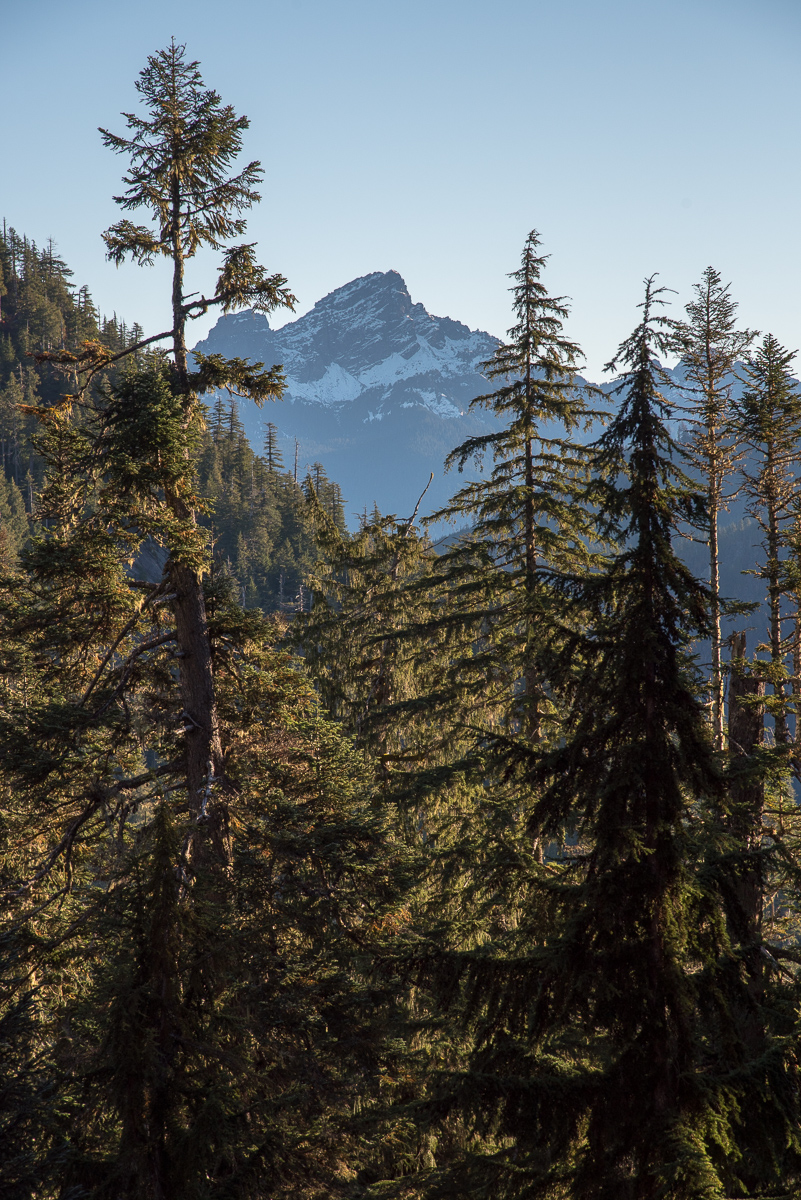
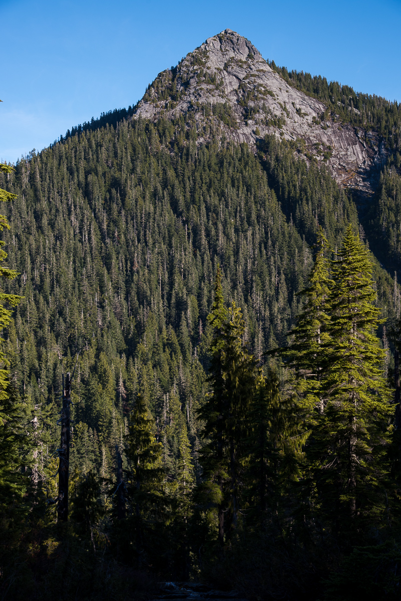
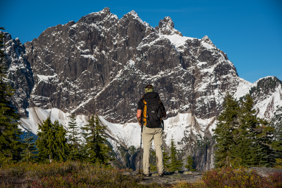
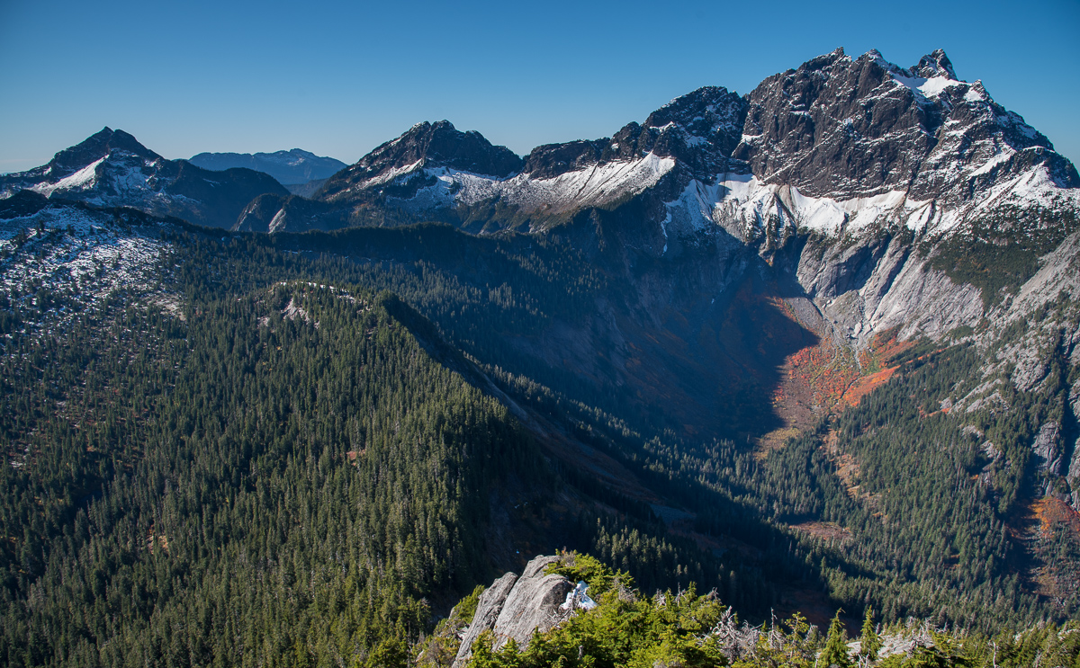
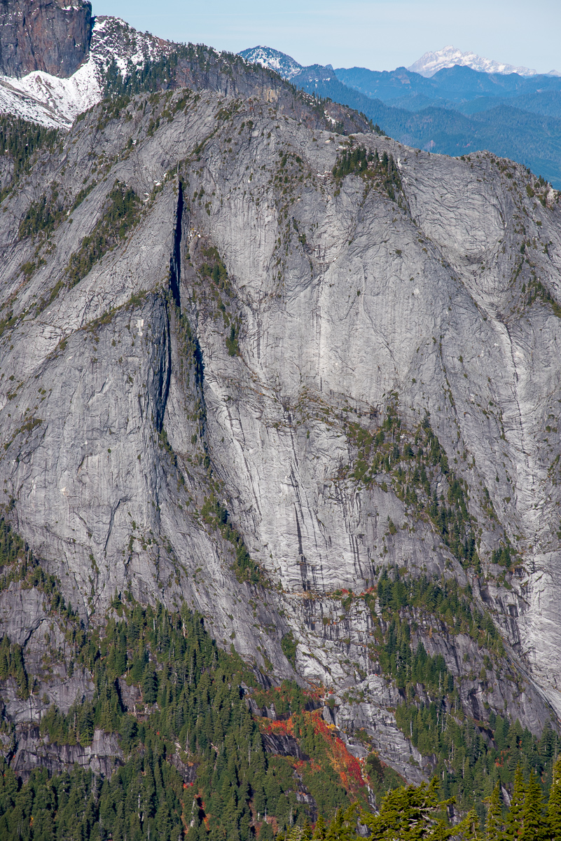
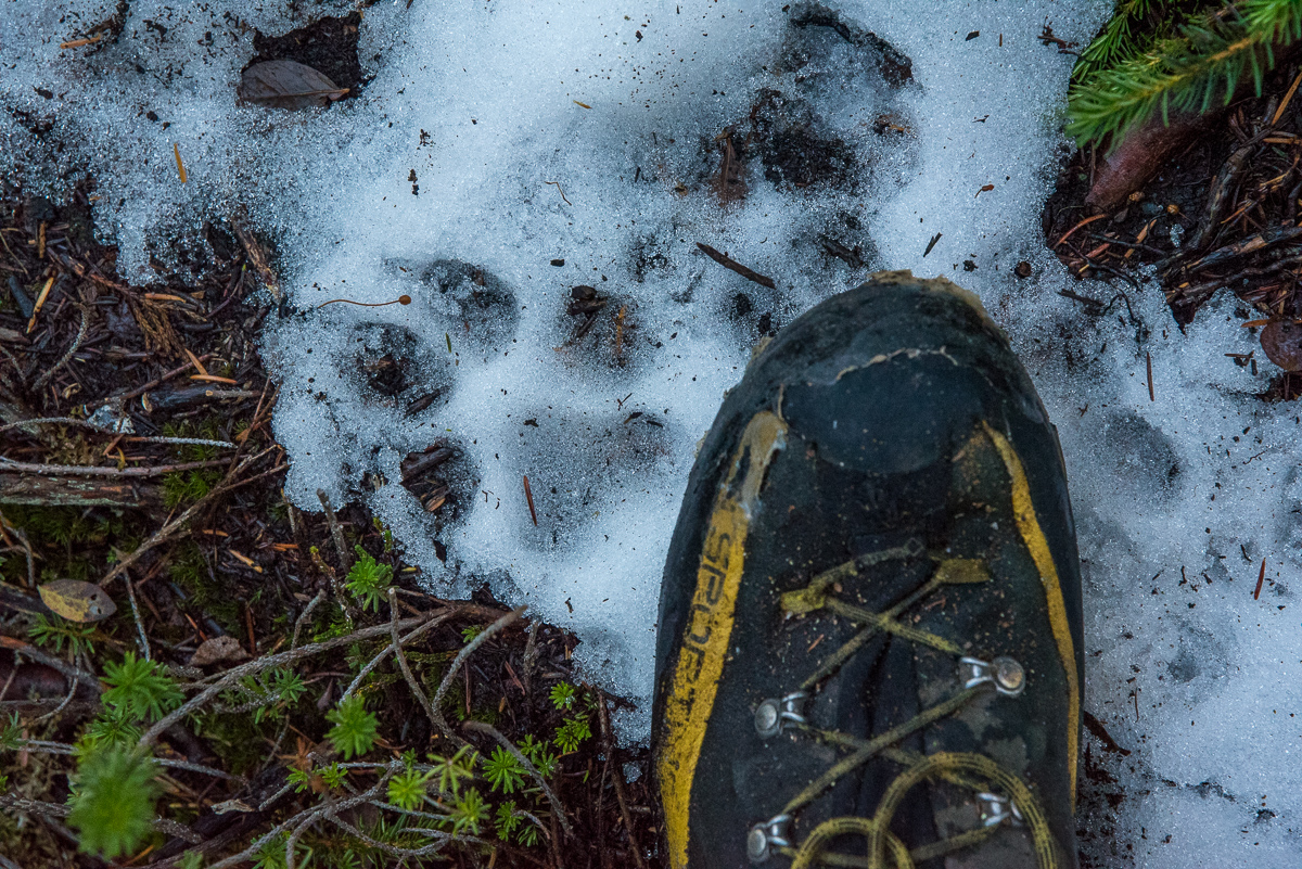
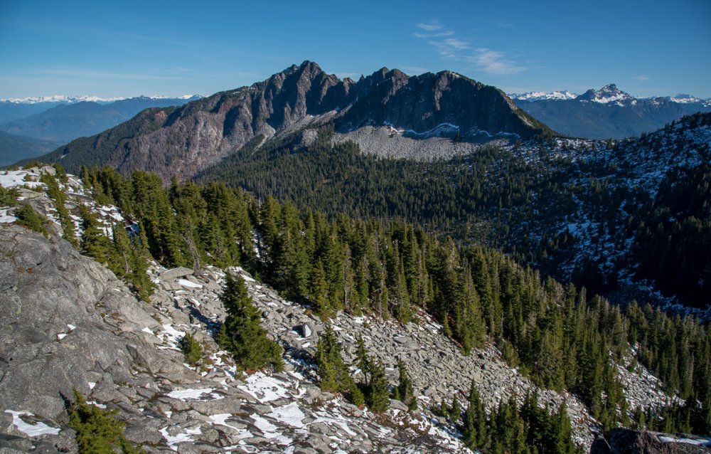
Trip: Ulalach - via Squire Creek Pass Trip Date: 10/24/2017 Trip Report: Long live the mighty Cascade Climbers! My first TR on the new software, so we'll see how this goes..... Remember when it hadn't rained in months? When summer just didn't seem to end? This harkens back to that time, when the call of the fall spirited us away from work midweek. When nobody but us and the wolves roamed the high country of the Darrington hills (see below). It was also an excuse for Scott and I to harass the rest of our crew from a North Cascades summit via modern technology. This is becoming increasingly important, I hear. In case you're wondering Ulalach (think Ooo la la- Chinook for "onion") has great cell service. But more importantly, it is lonely up there. We didn't see much in the way of evidence of passage, and we honestly had to think a bit to puzzle the way to the top. It helped that I've started to not research climbs as thoroughly as in years' past. In this age of ridiculous beta, tuning out is a great way to increase the adventure, even on a day trip. Even if I had done some research, I wouldn't have found out that we could expect to see wolf tracks superimposed upon ours on the descent. Apparently this was news to the USFS, NPS and tribal wildlife bios that I consulted upon our return. Hopefully the Darrington locals can tolerate their new neighbors. Viva la mystery of the North Cascades! And the new software makes captioning WAY easier..... I'll actually label these, where it makes sense to: Darrington's version of the deepwater solo: Whitechuck from the trail below Squire Creek Pass: Ulalach!: Scott admires the mighty east face of Three Fingers from Squire Creek Pass: Whitehorse: Three Fingers: Salish Peak! North Peak of Three Fingers: Del Campo (L) and Big Four (R): Put Jumbo on your list!: The upper Squire Creek Valley, with Liberty on the left and Three Fingers on the right: Squire Creek Wall: Scott breathing deep the oniony glory of Ulalach: The hills are alive! There were pup tracks with the mama. They followed our tracks for a half mile or so, just below the pass.: Exfoliation Dome, perhaps the toughest summit to reach in WA under 5000': Gear Notes: Helmet. Ample opportunities for 5th class climbing off the scramble route. Approach Notes: Squire Creek Pass trail from Clear Creek road. From the pass follow your nose north. Stay on the east side of the ridge at first, until you can traverse into a saddle just south of the peak. From here, you will want to stay mostly on the ridge until forced to a right side ledge at a step. Follow weaknesses up and left back to ridge and finish on the west (left) side, pulling on shrubbery.


 1 point
 -
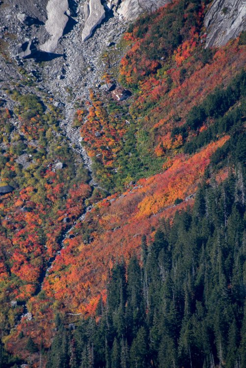
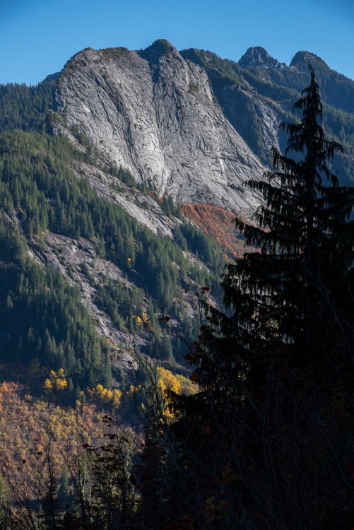
Trip: Big Four - north face Date: 3/25/2013 Trip Report: Eric and I left Sunday afternoon and bivied near the ice caves at the base of Big4. We got there just as the sun was leaving. I hadn't seen that part of the Mountain Loop before, and was in awe of the impressive face above. Ski conditions looked questionably thin in many places on the face, I think we both thought that our planned effort was likely going to result in us turning back from poor conditions, but we did have a light rack and thin rope to deal with minor shenanigans if need be. Early in the morning we started up through a tricky cliff band next to a resonant waterfall. The climbing involved some monkeying around on vegetation since there was a lot of rotten snow over rock. Once above, we traversed a broad sloping bench to gain the central rib. The rib held knee+ deep unconsolidated pow. The going was slow, and we alternated skins and booting. From the road, there looked to be a few potential options on the face. We climbed up with those options in mind, and let the conditions dictate our direction. We ended up making an unplanned climbers left traverse then up a right trending icy gully to easier ground that led to the summit. The skiing was great. We found some variable and ice in spots, but there was also a lot of powder. The rib especially held amazing quality snow and really fun featured terrain. We didn't want to exit the face via the waterfall cliff band we had climbed up, so we traversed left, but missed the snow exit and ended up making a short rap off a tree. our line on big four by danhelmstadter, on Flickr 100_2367 by danhelmstadter, on Flickr bigfour by danhelmstadter, on Flickr 100_2392 by danhelmstadter, on Flickr 100_2398 by danhelmstadter, on Flickr 100_2403 by danhelmstadter, on Flickr 100_2408 by danhelmstadter, on Flickr variable conditions in steep trees by danhelmstadter, on Flickr steep trees by danhelmstadter, on Flickr 100_2426 by danhelmstadter, on Flickr 100_2419 by danhelmstadter, on Flickr bigfourtwo by danhelmstadter, on Flickr1 point
-
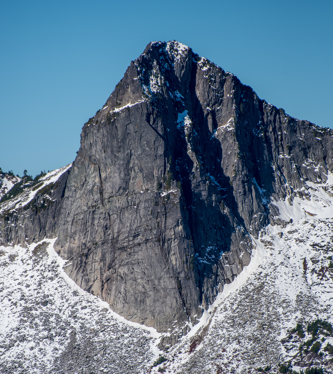
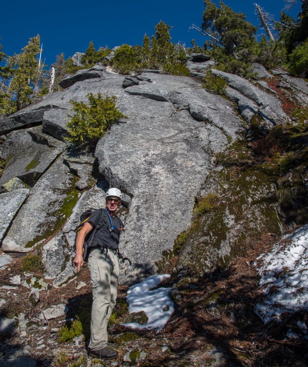
Trip: Big Four - The Mule Date: 7/14/2007 Trip Report: The Mule is a 5 pitch route at the base of Big Four, just to the right of the Ice Caves. Late Saturday afternoon DJ Dirty Ernie and I wandered up to do this route, a perfect shady choice for a hot day. I'm going to be a little exhaustive in the description, since it's not posted elsewhere here and isn't in any guidebook. All belays are fixed. Expect well spaced bolts and moderate runouts on this ground up route. route photo courtesy of Mark Hanna Pitch 1 starts right of the huge corner, right on the stepped arete forming a smaller right arching corner. A bit of pine needle accumulation coupled with wet shoes from negotiating the (minimal) moat make the 5.10a crux an attention grabber. A mixture of five bolts and some gear lead up past an overlap to a belay in a depression. A tricam that's maybe a couple sizes larger than Mr. Red would handily protect the last step, a #2 Friend just didn't cut it in the pocket. pitch 1 start Pitch 2 heads more or less straight up, runout delicate face climbing with some pockets and such, passing 4 bolts, a couple TCU placements, and a fair sized overlap. The rock is a layered combination of conglomerate that has been sheared smooth by glacial action, sort of like a terrazzo floor, and a dense fine grained sandstone. A little bit of honest 5.9 gains a perfect square edged ledge, directly under the looming 20 foot roof. Pitch 3 finds you moving the belay to the right, easily heading out the cedar tree covered ledge. almost cave like with the roof above. Everything changes as you emerge from under the roof and out onto spacious white ledges. Set up a gear belay near the base of the 20' long left facing dihedral. The pitch wanders up, following discontinuous cracks and bulges. There are a lot of options, just follow your nose seeking the cleanest rock and best protection opportunities. As you get on up the pitch, keep an eye on the stacked series of bushy right facing dihedrals. Towards the top of them is a relatively obvious cleaned up set of blocky steps, these lead to the next anchor. We missed this of course, and went up a good 220' to a big ledge and had to backtrack to the correct anchor. This pitch is 5.7 or 5.8 on good rock. At this point the lateness of the day forced a retreat and we began rapping. The route description for the next two pitches comes courtesy of Mark Hanna: Descent Notes: Third anchor was two 3/8 bolts connected with a fat swaged wire, a thin bit of perlon with a small link provided a back up to the Rapide link on the bottom hanger. Second anchor is a pair of 3/8 rap hangers, no problems. First anchor is one rap hanger and one regular 3/8 bolt. We removed the parachute cord backup from the upper bolt and substituted a piece of tied 1" tube. A good Samaritan would bring up an 18" chain/rapide set up to make this anchor more permanent. This was a fun outing, and after maybe 15 feet of somewhat dirty climbing at the base (wet shoes were a bigger problem) the rock was all very clean and solid. More people should go do this route, it's a worthy destination. Yes, there are more possible lines here too. Gear Notes: Med rack, tiny tcus to 3", slings to reduce drag, 50 M ropes (2)(doubles useful) Approach Notes: Take the cush Ice Caves trail at Big Four. The washed out bridge has a plush log crossing right where the bridge used to be. Only a little more difficult than the approach to Index Lower Town Wall. A stick might aid your tennis shoe ascent of the snow cone at the base if the snow is hard.1 point