danhelmstadter
-
Posts
404 -
Joined
-
Last visited
Content Type
Profiles
Forums
Events
Everything posted by danhelmstadter
-
[TR] Sloan Peak - NW Face and gully 4/16/2013
danhelmstadter replied to andybrnr's topic in North Cascades
sweet! nice work fellas, beautiful line! -
[TR] Big Chiwaukum - NW Face Couloir 4/1/2013
danhelmstadter replied to Dannible's topic in Alpine Lakes
Sweet, kick ass writeup Dan! -
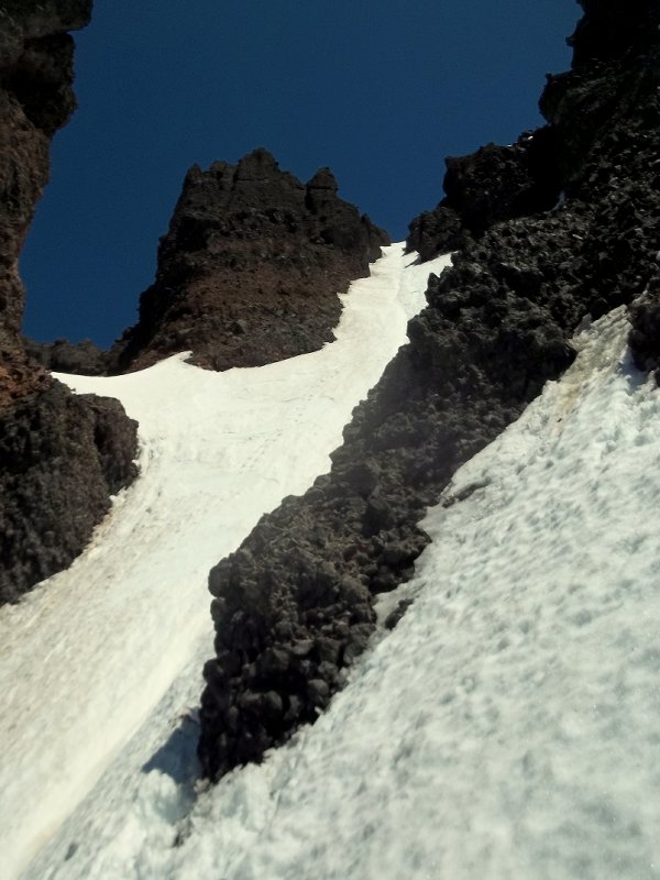
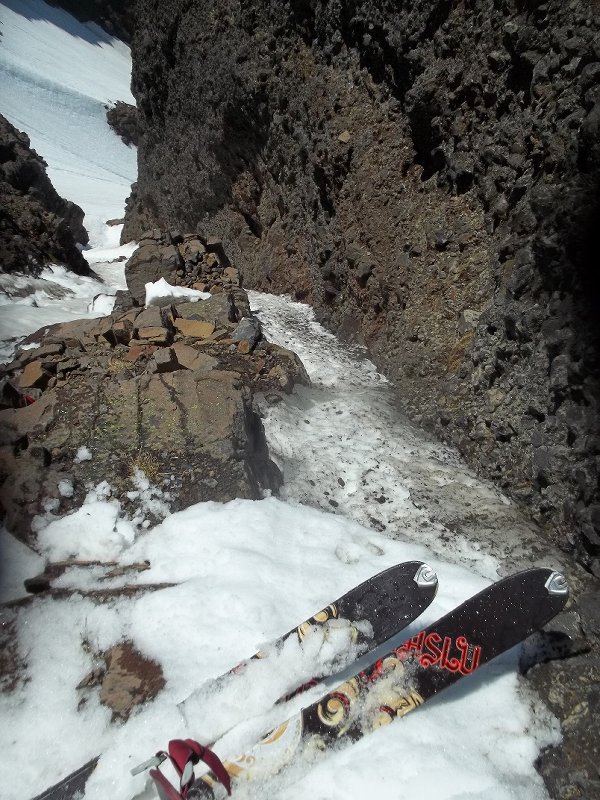
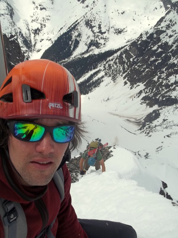
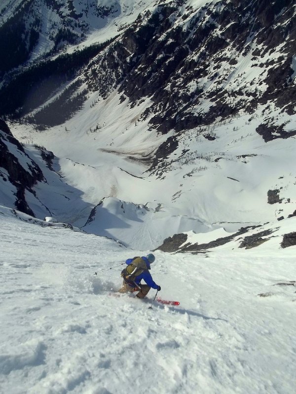
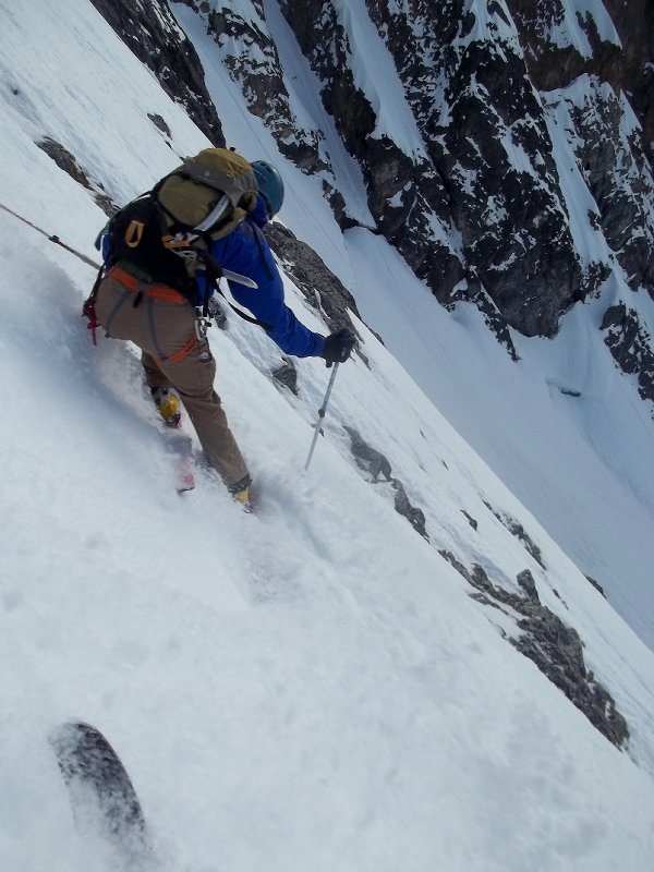
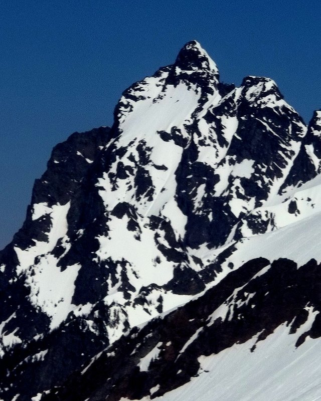
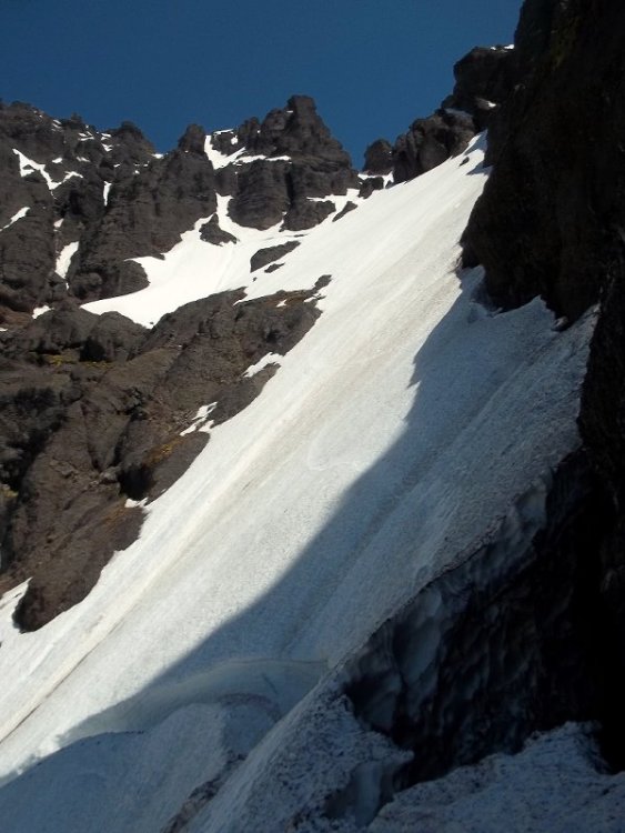
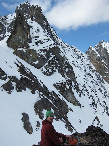
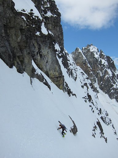
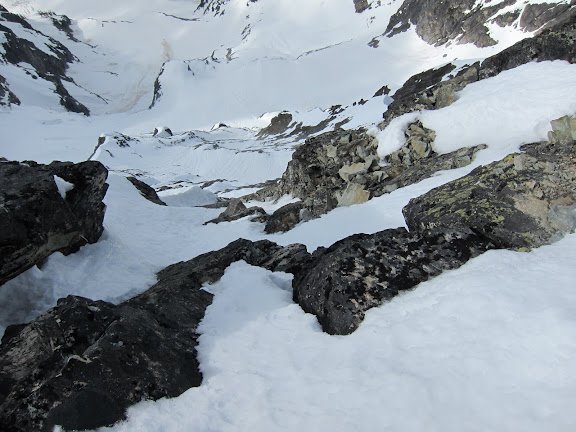
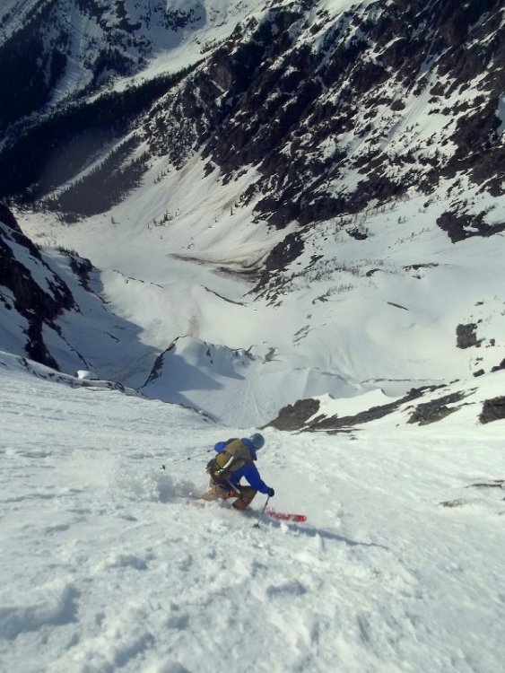
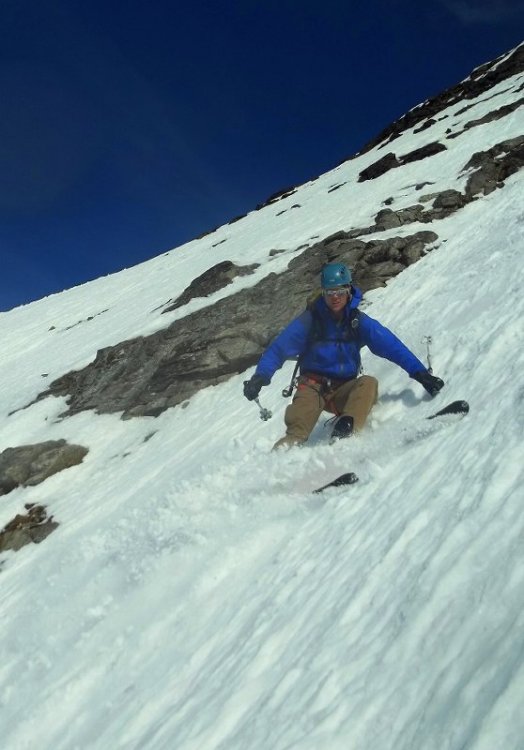
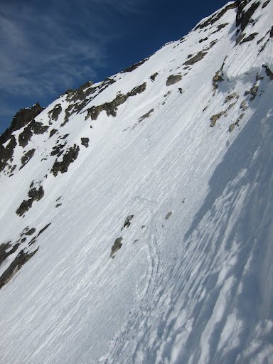
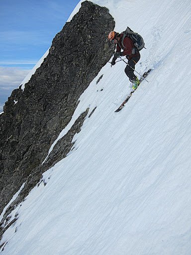
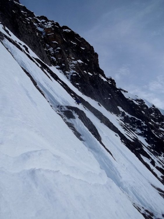
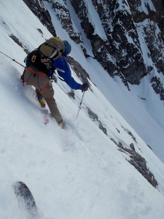
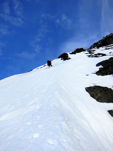
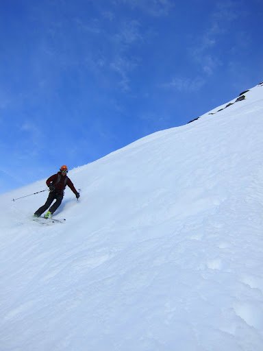
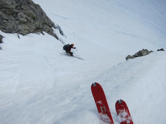
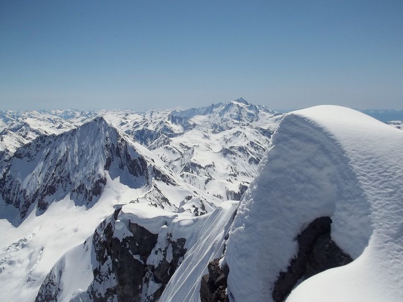
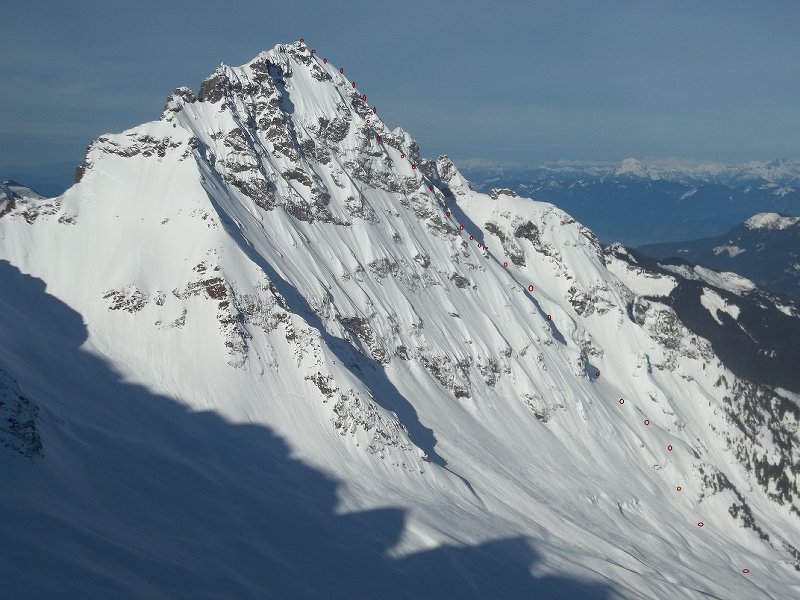
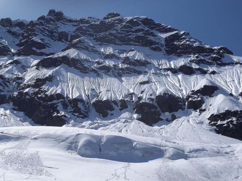
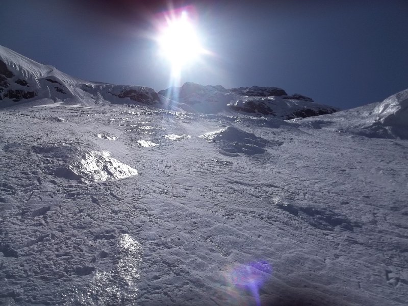
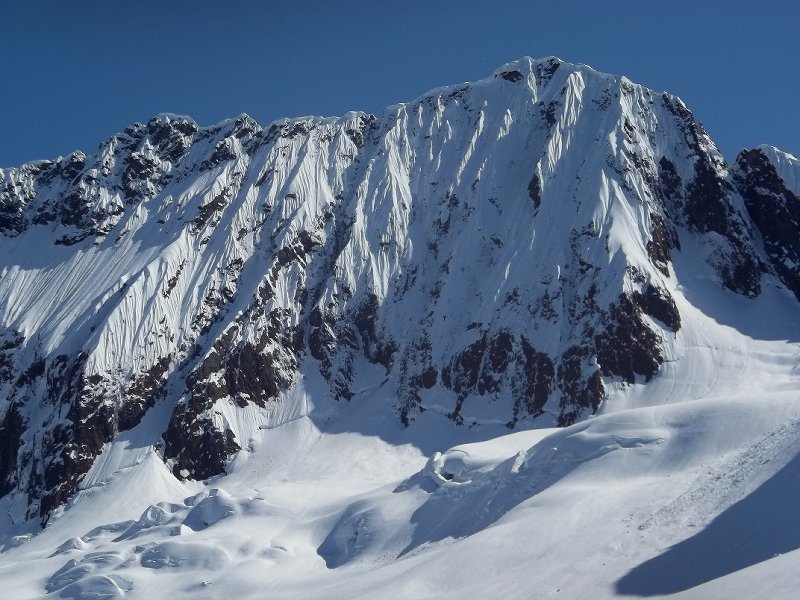
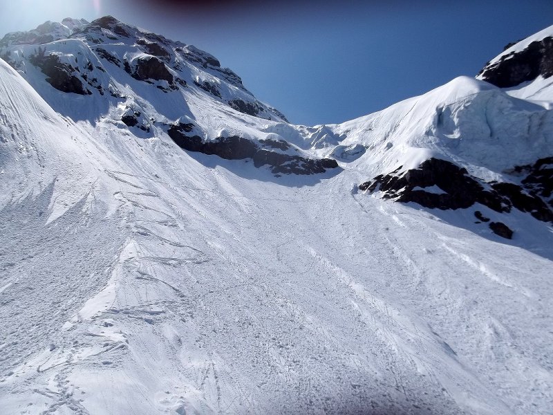
Trip: Mt. Deception + peak 7638' - east face, ne chute + east face Date: 3/31-4/2/2013 Trip Report: I left Sunday afternoon with plans to explore Royal Basin, stocked with several days worth of food an gas, a guitar, and plenty of stoke. I got there as the day was fading, and eyed a potential line on the East face of Mt. Deception. Got started around dawn and was happy to find good consolidated spring conditions low down, the snow got deeper with elevation. I was tempted to ski linked turns off the summit, but sluff management was necessary. The crux came in a gully low on the face. I first tried to ski the way I had climbed, but found it too awkward and icy so I climbed back up a little and went skiers left over a ice bulge, it was steeper but sun kissed unlike the way I had climbed. I skied down to the floor of the basin and was so stoked I decided to climb and ski the NE chute. Conditions were a little crusty in spots but not bad, it is a beautiful line and was very fun to ski. That night was cold and windy and I didn't get much sleep. In the morning I half dozed in my sun warmed sleeping bag for a while enjoying the sounds of the wind through the trees. My plan was to slog out that day. On the way out I saw an alluring east face and decided to go for it. It was awesome, a little shorter and steeper than the east face route I skied on Deception. On my drive in, I came across a stranded couple walking down the road, they had listened to their radio too long roadside camping and killed their battery. I didn't have jumper cables but I obliged to letting them swap out my truck battery for a few minutes. IMG_0010 by danhelmstadter, on Flickr Mt. Deception east face by danhelmstadter, on Flickr IMG_0031 by danhelmstadter, on Flickr IMG_0046 by danhelmstadter, on Flickr crux, icy neve in the shade. IMG_0049 by danhelmstadter, on Flickr IMG_0039 by danhelmstadter, on Flickr East face of Needles peak 7638' on left IMG_0081 by danhelmstadter, on Flickr needles by danhelmstadter, on Flickr View south to Deception IMG_0097 by danhelmstadter, on Flickr IMG_0104 by danhelmstadter, on Flickr 7638' from lower down IMG_0114 by danhelmstadter, on Flickr
-
[TR] Spider Mountain - North Face Chute 3/31/2013
danhelmstadter replied to scottrinck's topic in North Cascades
Awesome! beautiful pictures, solid work. -
Nice! great pics. Way to get it in prime conditions.
-
Trip: Big Four - north face Date: 3/25/2013 Trip Report: Eric and I left Sunday afternoon and bivied near the ice caves at the base of Big4. We got there just as the sun was leaving. I hadn't seen that part of the Mountain Loop before, and was in awe of the impressive face above. Ski conditions looked questionably thin in many places on the face, I think we both thought that our planned effort was likely going to result in us turning back from poor conditions, but we did have a light rack and thin rope to deal with minor shenanigans if need be. Early in the morning we started up through a tricky cliff band next to a resonant waterfall. The climbing involved some monkeying around on vegetation since there was a lot of rotten snow over rock. Once above, we traversed a broad sloping bench to gain the central rib. The rib held knee+ deep unconsolidated pow. The going was slow, and we alternated skins and booting. From the road, there looked to be a few potential options on the face. We climbed up with those options in mind, and let the conditions dictate our direction. We ended up making an unplanned climbers left traverse then up a right trending icy gully to easier ground that led to the summit. The skiing was great. We found some variable and ice in spots, but there was also a lot of powder. The rib especially held amazing quality snow and really fun featured terrain. We didn't want to exit the face via the waterfall cliff band we had climbed up, so we traversed left, but missed the snow exit and ended up making a short rap off a tree. our line on big four by danhelmstadter, on Flickr 100_2367 by danhelmstadter, on Flickr bigfour by danhelmstadter, on Flickr 100_2392 by danhelmstadter, on Flickr 100_2398 by danhelmstadter, on Flickr 100_2403 by danhelmstadter, on Flickr 100_2408 by danhelmstadter, on Flickr variable conditions in steep trees by danhelmstadter, on Flickr steep trees by danhelmstadter, on Flickr 100_2426 by danhelmstadter, on Flickr 100_2419 by danhelmstadter, on Flickr bigfourtwo by danhelmstadter, on Flickr
-
[TR] North Cascades - Isolation Traverse 3/23/2013
danhelmstadter replied to hefeweizen's topic in the *freshiezone*
nice photos and report, looks like it was a great trip! -
[TR] Three Fingers - east face couloir 3/9/2013
danhelmstadter replied to danhelmstadter's topic in the *freshiezone*
Thanks for all of your comments. Crazedmaniac, yeah I think my experience up there has affected my dreams and goals for the better. Cool to hear a little about your times up on that wall! Matt, there was danger of going over the east face above the couloir, but not in it because of it's sunken nature. Gaucho, thanks, yeah that's what I skied. -
[TR] Mt Hood - North Face, Right Couloir 3/9/2013
danhelmstadter replied to dave schultz's topic in Oregon Cascades
sounds like fun, those last two pics are great! -
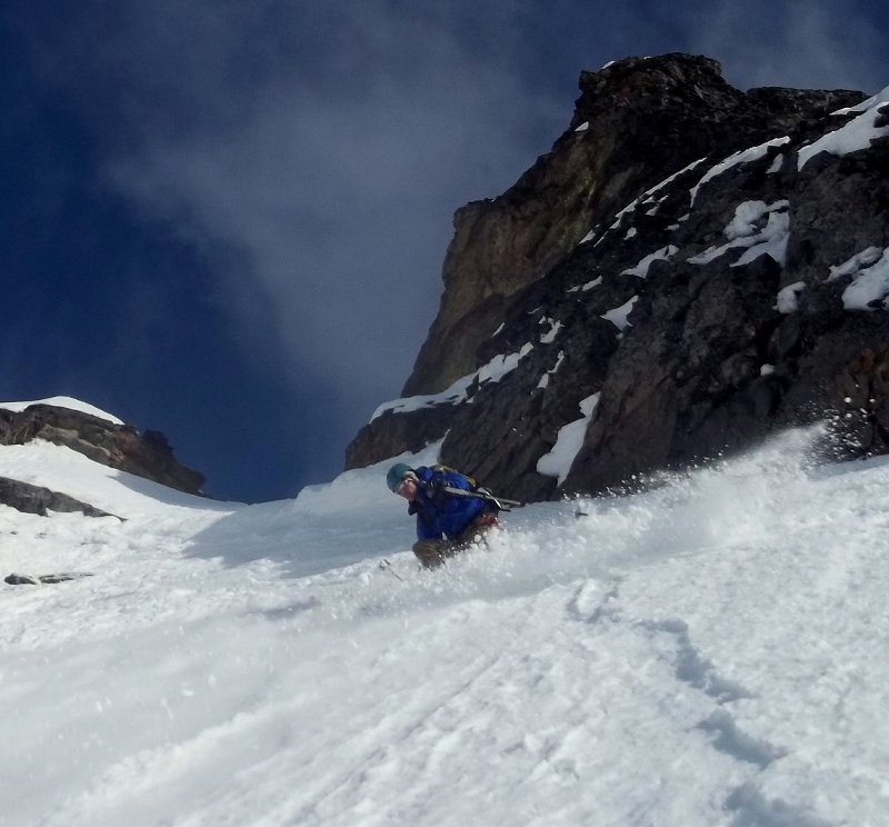
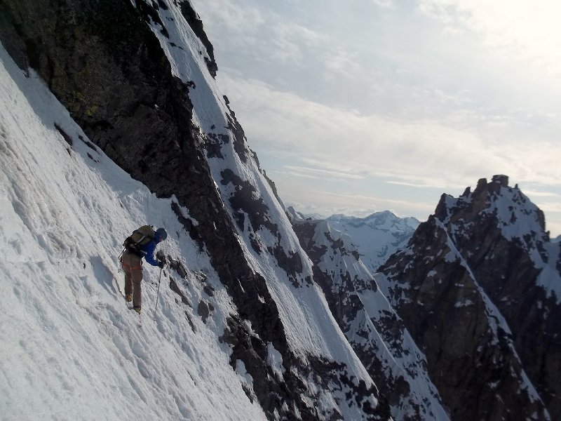
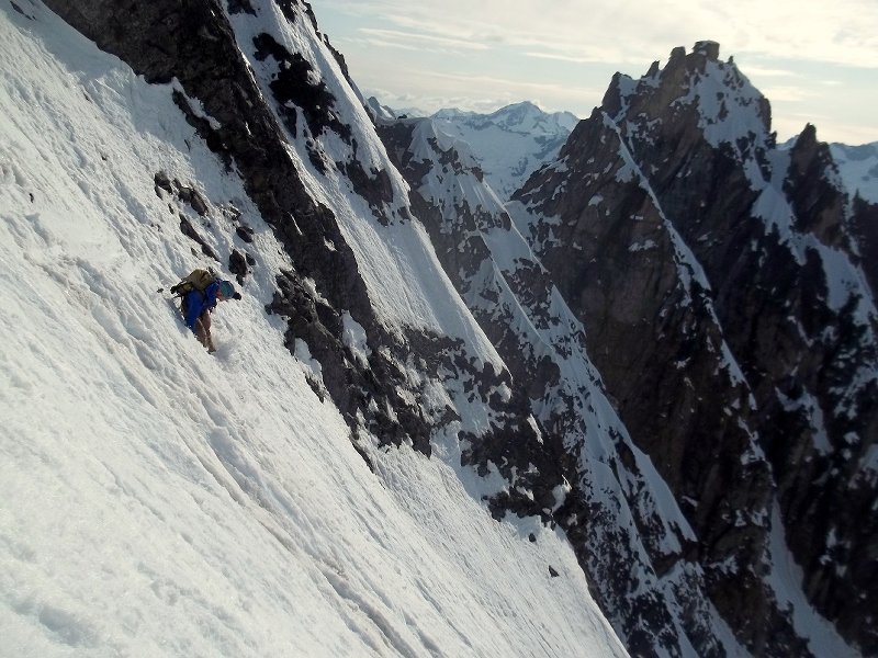
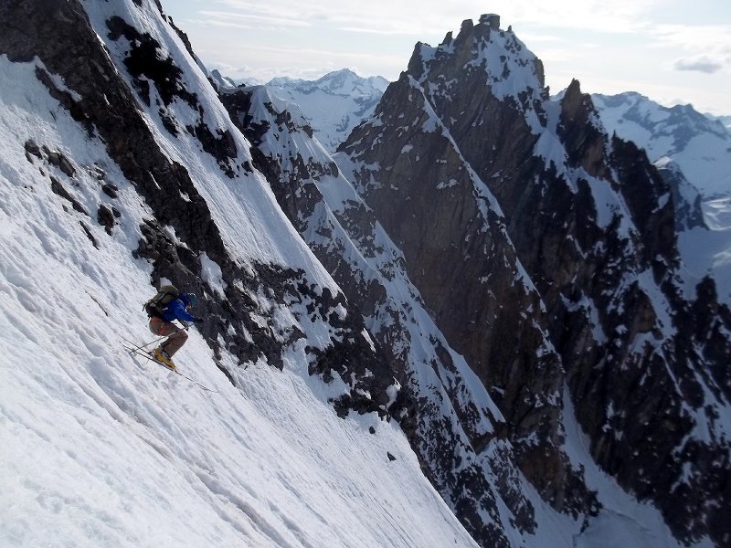
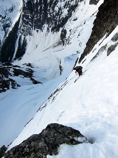
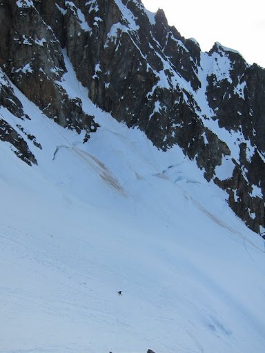
Trip: Three Fingers - east face couloir Date: 3/9/2013 Trip Report: On days when it's not raining, There's a great view of Three Fingers from eastbound 20 out of Anacortes. Sometime recently I made that drive on one of those days when the sky is fine art. Cool cloud formations and late afternoon sun hit the mountain just right, and got me thinking about going up there for a closer look. The approach went well, the bush'wackin wasn't very grim, and I made it to my bivy spot by a boulder near the foot of the slope below the east face with time left to kill. I started my ascent in the dark hours of the morning, and soon my decision to leave skins behind became a nagging regret. The snow went from supportable easy going, to variable knee deep, but with a few healthy curses I made it to the base of the couloir before the sun started really cooking the wall above. Conditions made for slow going up the couloir. To make it easier, I followed the edge of a runnel that hugged climbers right. I kept my head up as much as possible to watch for big sh*t, there was debris coming down everywhere. Most of it small, but I did get bashed a couple times. The couloir topped out on a high shoulder, and I continued up moderating slopes towards the middle summit. The snow was much different above the shoulder, about a foot of consolidated cold snow overlay an ice crust. The entire ridge line was corniced except for a little notch just right of the rimmed summit nub. I aimed for that notch. I was about about 20 feet below it when I felt and heard a sickening WUMPH. No slab cut out, but It was a clear indication of instability in those final feet below the ridge, and the consequences were high. I backed off a few steps and clicked on the skis. Ski conditions were good, the slight double fall line nature of the couloir naturally managed my sluff. Timing seemed about right since the sun had softened up the icy parts, and left the couloir just after I skied it, I suppose I could have got started a little earlier to help avoid the ice/rockfall on the climb. 100_2229 by danhelmstadter, on Flickr Stoked about my new crampons from Jim's shop. 100_2226 by danhelmstadter, on Flickr John Scurlock photo John Scurlock image by danhelmstadter, on Flickr climbing above shoulder shoulder by danhelmstadter, on Flickr 100_2243 by danhelmstadter, on Flickr 100_2254 by danhelmstadter, on Flickr morning sunhit morninglight by danhelmstadter, on Flickr 100_2228 by danhelmstadter, on Flickr
-
Trip: Distal Phalanx - Busted Distal Bicep Couloir Date: 2/10/2013 Trip Report: I woke in the bed of my truck five minutes before my alarm went off bleary eyed to headlights from an approaching car around the bend of highway 20 near it's west side winter closure. At that hour of morning it could only be my friends Ryan and Eric who had already been up and driving for hours. It didn't take very long before we found ourselves scrambling in the dark up steep muddy embankments and unpredictably punching through the shallow rotten snow in the bush of Colonial Creek. We reached it's headwaters at the crack of dawn, welcoming open blue skies and deepish light snow. At one point on our upwards zigzagging, I caused a snow bridge spanning a large glide crack to loudly fail just by getting too close. From a col high on Colonial, we looked far across the Neve drainage to the beautiful couloir on Distal Phalanx that was our ski objective. By that time, it seemed doubtful we'd make it since the day was already getting old. We talked about our options, and changed our minds several times. The difficult conditions and amount of elevation gained had ate up a lot of time, and we knew we would be setting ourselves up for an epic by continuing towards Distal Phalanx. Still collectively undecided, Ryan said something about epic days being memorable, the logic seemed right, the beautiful an slightly scary view of the couloir on such a bluebird windless afternoon seemed to call us at that moment of indecision, and we dropped down to the valley towards the Distal Phalanx with smiles. We alternated trail breaking up the deep snow in the couloir, dodged a couple ice chunks, found some wind affected snow, and topped out to find the sun low and red on the horizon. I was last to drop in, and triggered a slab after just a few turns. Eric and Ryan were in safe zones on the side of the couloir as the lanch trucked past them. It got dark quickly and we skied the lower section with headlamps. Hours of skinning back up to the col under starlight followed. We got a bit turned around high on the Colonial/Neve/Paul Bunion's Stump massif, but found the way with not too much sweat, and skied mostly enjoyable powder down through a developing marine layer to Colonial Creek. We milked what we could of the deproach through the woods on skis, we had to pack the skis when it got too patchy and clustered with deadfall to ski. We still had a ways to go. The snow was rotten in spots so every 20 steps or so, one of us would unpredictably punch through, with unseen hazards below, and we were sidehilling next to the creek which was steep in places. Somewhere near our creek crossing Ryan took an unlucky digger from punching through the shitty rotten snow in a bad spot, and hurt his arm. His bicep looked weird and he couldn't bring his forearm up very far. Ryan is one tough dude, I could hardly tell he was injured as we made our way out, even though I knew he was in pain. Eric and Ryan drove back to Seattle that night. I just heard from Ryan that his Distal Bicep tendon is torn. In all we gained 11,000+ feet of elevation and took 22.5 hours car to car. It seems that there are several approach options, and in 20/20 hindsight, it is clear that we chose an approach that given the conditions we found, may have not have been ideal. I didn't take many pictures, and this one below is courtesy of Ryan. The Busted Distal Bicep Couloir is in the distance. Ryan Lurie Image by danhelmstadter, on Flickr climbing by danhelmstadter, on Flickr lateday topout by danhelmstadter, on Flickr 100_2161 by danhelmstadter, on Flickr
-
[TR] Shuksan - Circumnavigation + Summit 1/21/2013
danhelmstadter replied to JasonG's topic in North Cascades
Awesome photos Jason! Chatting with you guys gave me a positive vibe that lasted all day. Great that Chad got to experience the cascadesin winter bluebird conditions! -
[TR] Mt. Shuksan - South Couloir 1/20/2013
danhelmstadter replied to danhelmstadter's topic in the *freshiezone*
Thanks guys! Jason, it was great running into you guys too! I haven't heard of anyone skiing over there. Ryan, my hip feels pretty good, a few pops today and some tightness but nothing like before. I'm interested in hearing about your trip to montucky. Dan, it's been too long bro, your welcome anytime. Andy, I've got to find my passport! We should get out soon for sure! -
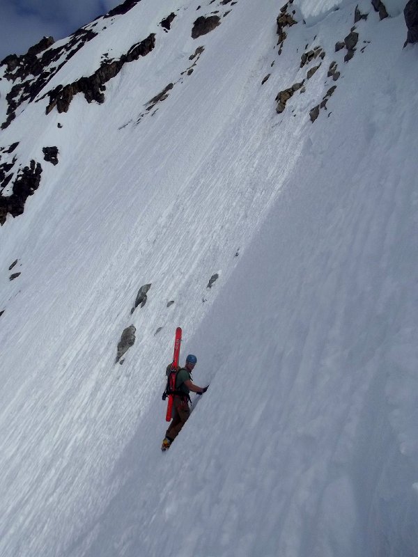
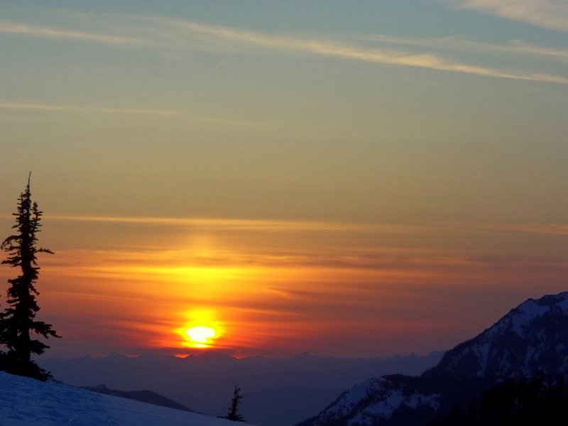
Trip: Mt. Shuksan - South Couloir Date: 1/20/2013 Trip Report: I am so happy to be out and about pain free in the mountains again. I've been plagued by a nasty debilitating hip pain since summertime. I tried a bunch of different treatments for it, none seemed to work until I got a shot of cortisone in the bursa at the top of my femur bone a few days ago. Phew. A couple days before I got the shot, I was taking a lackadaisical drive up the Baker Lake road with my dog. I noticed a striking line on the South side of Shuksan. south couloir by danhelmstadter, on Flickr I formed a plan to go explore it - if my hip ever got healthy, which I was doubtful it would. The first part of the day felt like a familiar Shuksan experience, I got a bit of a late start (but was able to grab a coffee and use the facilities at the White Salmon Lodge), snow was good for travel, good weather etc... I was stoked to run into my friend Russell Cunningham on the White Salmon. The summit was beautiful, and the pyramid gully skied ok. summit by danhelmstadter, on Flickr I was a bit reluctant to start sking towrds the South Couloir for several reasons, and almost wanted to go check out the NW Couloir. But with the thought that I could always turn around (moon + good weather) I proceeded as planed. I dropped in and enjoyed great springlike snow with some variable in places as to be expected. The couloir is about 2000 vertical feet, and the whole South face about 5500'. Towards the bottom of the couloir the slope steepened then cliffed out. I made a steep downwards traversy scramble on mixed shallow rotten snow, ice, and chossy rock. Luckily the rock had enough solid positive holds. It was scary and felt a little dangerous at times. scramble by danhelmstadter, on Flickr 100_2150 by danhelmstadter, on Flickr A bit more steeps after the scramble, then wide open slopes with heavy snow. I stuck to skiers left through the trees for the remaining skiing, to avoid cliffs that lie everywhere else at the bottom. It was getting dark as I reached the valley at 2000' elevation on the Baker Lake side. I skinned many moonlit hours up to, and over the Shuksan Arm back to my truck at White Salmon. More Photos... roll at top of the south face roll by danhelmstadter, on Flickr Couloir entrance couloir entrance by danhelmstadter, on Flickr zoomer zoomer by danhelmstadter, on Flickr sundown set by danhelmstadter, on Flickr
-
Way to tough it out Kurt! Awesome write up, I'm not sure I know anyone else who hitchikes to many/most of their climbs, I'll never forget the time I picked you up on 20 and droped you off at Greybeard, or the next year on 542, cool shit, good to hear your healing up.
-
wow, awesome report and pics.
-
[TR] Mt. Baker - North Ridge (Attempt) 8/19/2012
danhelmstadter replied to lukeh's topic in North Cascades
Great Pictures! -
best of cc.com [TR] Black Peak - NW face 5/19/2012
danhelmstadter replied to danhelmstadter's topic in the *freshiezone*
Wow, there's some really cool discussion and thoughts here, thanks for all your positive comments. -
wow! great to hear that your healthy again!
-
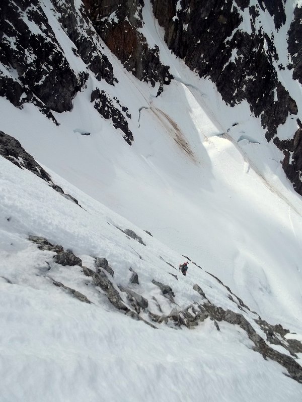
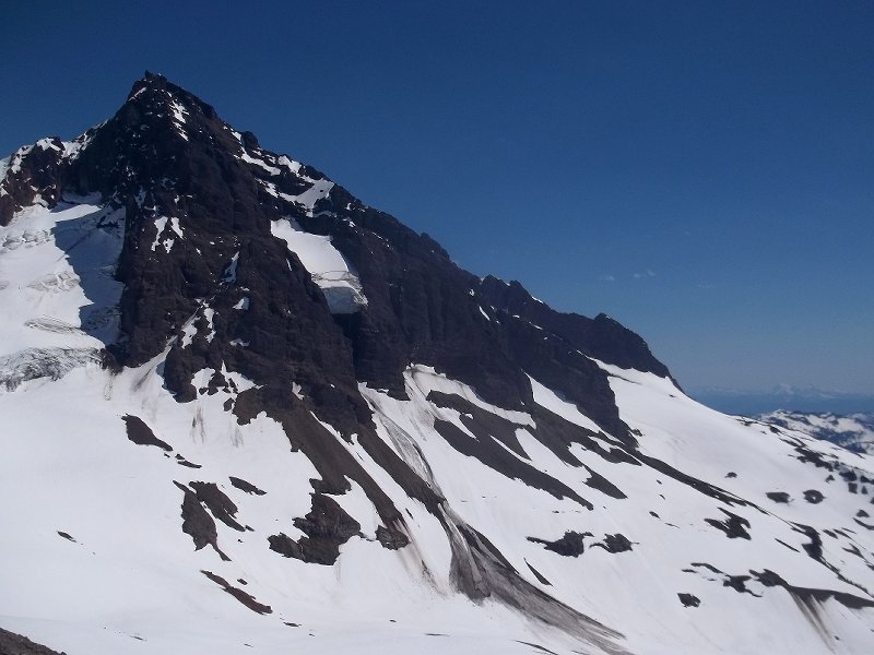
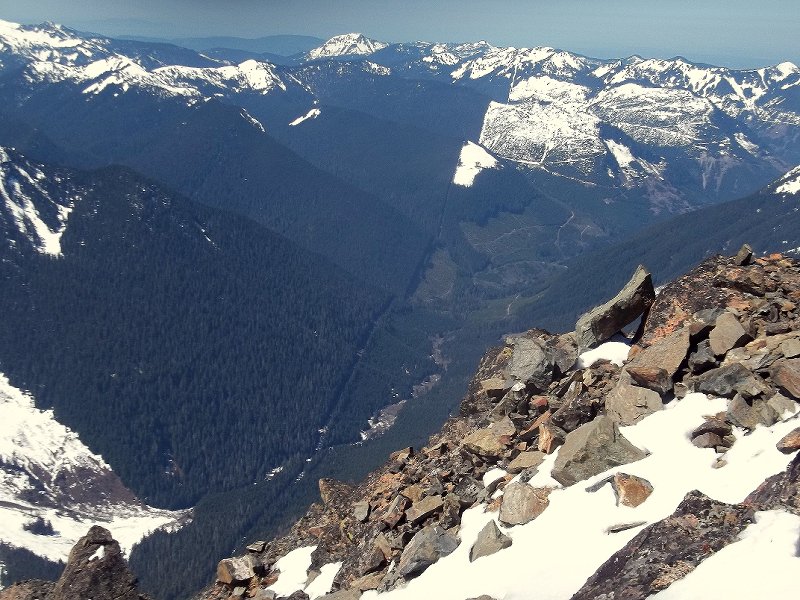
Trip: Lincoln Peak - x couloir (2nd descent) Date: 7/8/2012 Trip Report: Lincoln peak is difficult to see in profile, from Anacortes, it looks like part of Mt. Baker, from the Glacier area, it looks like a bump on Heliotrope ridge, A couple months ago, I was skiing north of Glacier in the Border Peaks region I saw Lincoln standing steep and prominent. My friend Aaron Scott had skied the X couloir a couple of weeks ago and took some pretty pictures, It looked like a fun route with plenty of steeps and a wild summit, I was excited to take a closer look. I ran into my friend Oyvind near the trail head, he said he heard that the grouse creek approach had melted out, so I parked at the picnic tables at the end of the road, then contoured around the ridge, shwacking in places to gain Heliotrope proper, then dropped into thunder basin enjoyed a tranquil bivy below Lincoln. I got going around 430am, there was rockfall from the start, Lincoln is quite the choss pile. I brought along a rope, some gear and a second tool, but didn't need to use any of it. The summit was awesome, I was stoked to soak in the view up there while the sun hit and softened the route below. I saw a large cornice softly let go from it's hold on a ridge-line ten feet away, I saw dozens of climbers filing up the standard route on Baker, I saw a lenticular over Rainier and smoke from the stacks on Fidalgo Island. The tip top of the summit was rock, but I was able to ski from about 10 feet below, where I quickly encountered a very steep and narrow-tricky choke that led to the top of the upper couloir. Snow was in good condition, pretty much predictable summer corn, the upper chute led to a steep snowfield then another chute. I had to take my skis off and down-climb 10 feet of unskiable rock and ice at the top of the lower chute, then enjoyed schlarping the exposed steeps all the way past the shrund, where slopes moderated. John Scurlock photo, higher reaches of Lincoln - Upper half of x couloir visible in photo. (link to another John Scurlock photo showing entire route, http://www.pbase.com/nolock/image/36437203) from summit looking down, shrund crossing vissible. colfax & grant looking back up the upper couloir short downclimb past rock lower snowfield alpine flora from heliotrope


-
[TR] Canadian Rockies Melange - 6/11/2012
danhelmstadter replied to Pete_H's topic in British Columbia/Canada
ahhh yeah -
best of cc.com [TR] Black Peak - NW face 5/19/2012
danhelmstadter posted a topic in the *freshiezone*
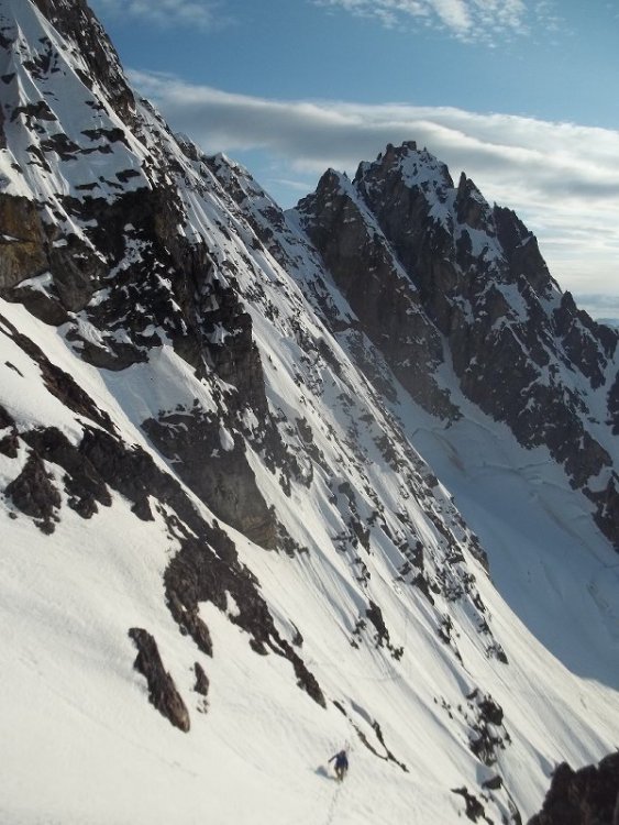
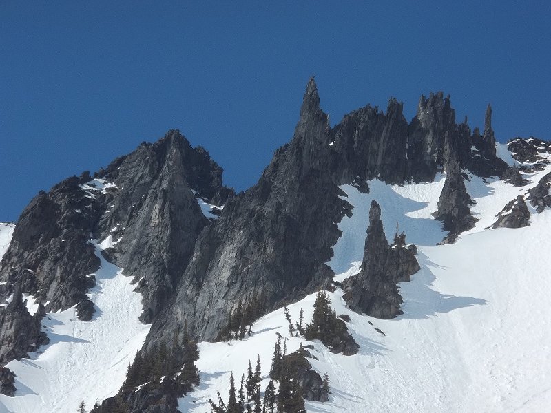
Trip: Black Peak - NW face Date: 5/19/2012 Trip Report: In a collaborative effort, Eric Wehrly and I climbed and skied the NW face of Black Mountain. There are ski lines that when viewed from a deceptive perspective, or through some camera trickery appear to be truly steep when in fact they are only moderate in slope angle. The Northwest face of Black mountain is not one of those lines. Steep, sustained, exposed, are words that come to mind when contemplating a description. Snow conditions were scary in places, but good enough for a complete descent in proud style. Rocks and holes shallowly buried with sugar snow, slick ice crusts lurking under variably meager depths, these conditions added spice to both the climbing and skiing. Little in the way of progress came easy, the ground we gained was fought hard for in places, and entailed many white knuckled / no mistakes hours of fun. As I write this days later, I am still in a daze of emotions and memories that will be long to fade. We got some good pictures, this is my favorite one, Eric shreds the knar John Scurlock photo Black peak NW face (left), and Black peak western summit (right). This was our first view of the NW side of Black, we had to make a long steep downslopeing traverse on variable snow to get to the beginning of the NW face (far right). Eric Wehrly photo On the traverse, Eric Wehrly photo E$ climbing lower face Eric Climbing steep sugar over rock and ice high on the face. cruxin Looking down on our route from the summit. Eric Wehrly photo $ $ $ Eric Wehrly photo Eric Wehrly photo Eric Wehrly photo $ $ $ Eric Wehrly photo E-Money crossing a runnell mid-face E-Money Eric Wehrly photo Eric Wehrly photo Eric Wehrly photo Eric Wehrly photo Looking back on the traverse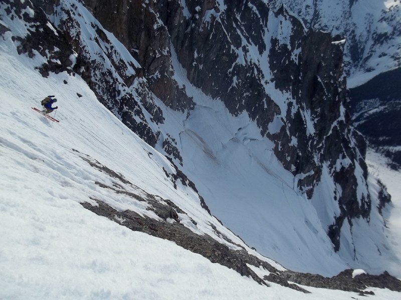


-
G-spotter, I didn't get any this time, here's one from mid December. Sure is an impressive face, most of the snow on it as of now looks rotten, runnelled and ready to slide off. Gaucho, I didn't see anyone else, except I'm pretty sure I saw John Scurlock's yellow plane flying nearby when I was on the summit of Larrabee.
-
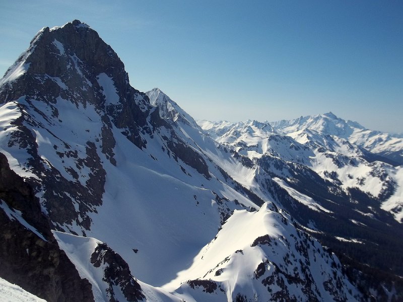
Trip: American Border Peak & Canadian Border Peak - abp - east face, cbp - sw face Date: 5/10-13/2012 Trip Report: I took this photo from the summit of Pleiades in early February, at first glance, a ski line on the east face of ABP seems improbable, but the photo captivated my imagination and eventually provoked me to attempt ABP, Twice I made it to the summit of Winchester in April, getting shut down first by a nasty cold, then by stormy weather. approximate route I climbed and skied on ABP (photo from feb 12) On Thursday I went in heavy with extra food and gas. Bivying by the south face of Larrabee, the night was cold, and snow solid the next morning for the approach. The first sight of the east face of ABP was not inspiring. Conditions appeared to have deteriorated considerably since February - melted out and runnelled. I decided to keep circling 'round in hopes of more coverage on the NE aspect, there was. I climbed up moderate glaciated slopes for about a thousand feet, then went left onto the steep east face, following what appeared to be the least icy way. The way was complicated, a few times I thought I would dead end in a chute and have to back track, but it went, twisting and turning up chutes and ribs. Conditions were a little scary. There was lots of icy slide worn neve, and lots of crust, with powder here and there shallowly burying the slickened neve. There was just barely enough snow clinging to the summit nub to make it skiable. Exposure was intense, especially looking down the sheer ~1000' cliff of the west face. I clicked into my skis and cautiously made my way down. Lots of crust, ice, death balls, and edgy runnels made catching a tip and taking a slide for life a frightening possibility. Friendly snow conditions such as pow or corn would have made this a much different experience, instead I was on edge the whole time. I headed back to my bivy feeling good, and decided to ski the cool looking southwest face of Canadian Border Peak the next day. Approaching CBP was somewhat of a pain in the ass - probably just a few miles, but lots of up and down getting over cleavers of high basins. The SW face of CBP was fun to shred, much less serious than the east face of ABP, and conditions were ideal for fast turns. I skied the sw face from 50 feet below the summit where the snow ended. The next morning I skied lookers left on south face of Larrabee, nice & friendly low stress conditions. South West face CBP Views from the summit of ABP east face abp, no bueno conditions low on abp turns on moderate slopes down low on abp north face of larrabee abp from somewhere on cbp view of international border cool formations I already miss the soft hazy red sunsets over Tomyhoi.

-
[TR] Mt. Shuksan Nooksack Cirque - Nooksack Ski Traverse 4/6/2012
danhelmstadter replied to JoshK's topic in North Cascades
nice tr! it was great to see you guys & provide well deserved beer!