Leaderboard


Popular Content
Showing content with the highest reputation on 02/26/23 in all areas
-
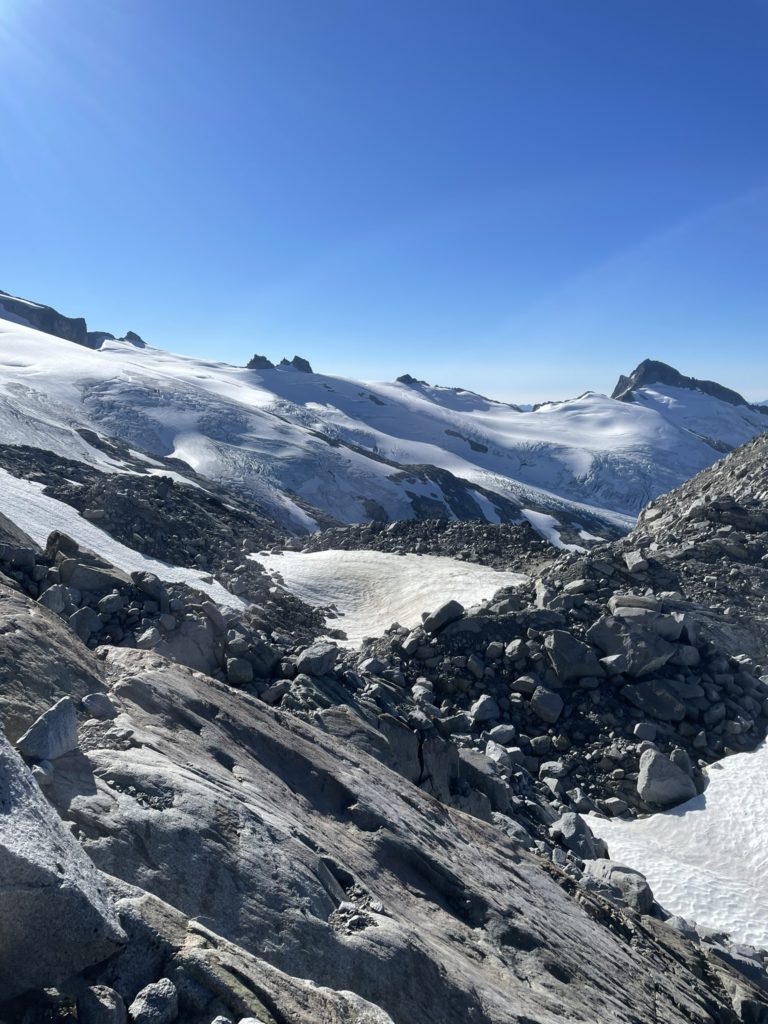
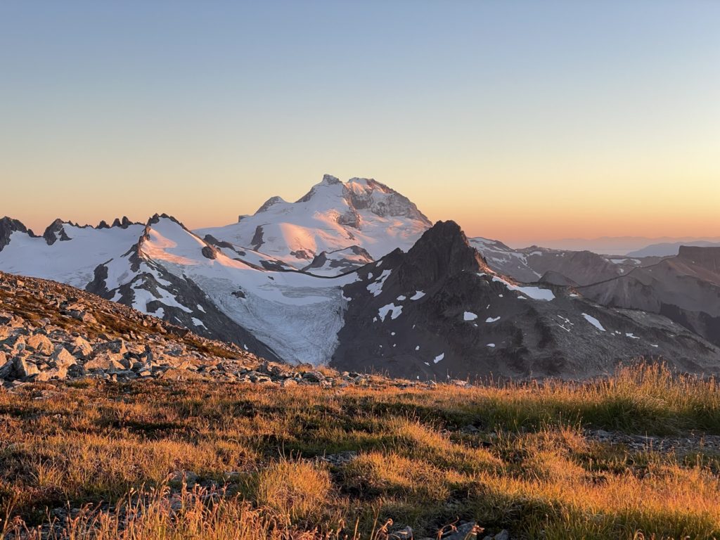
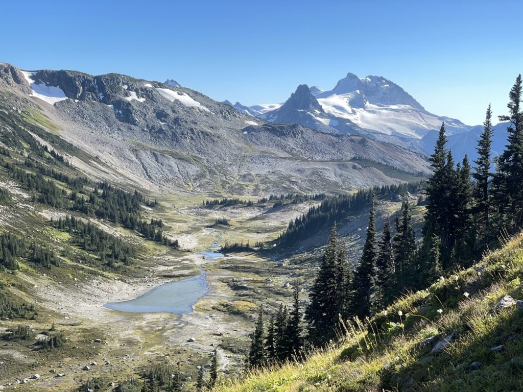
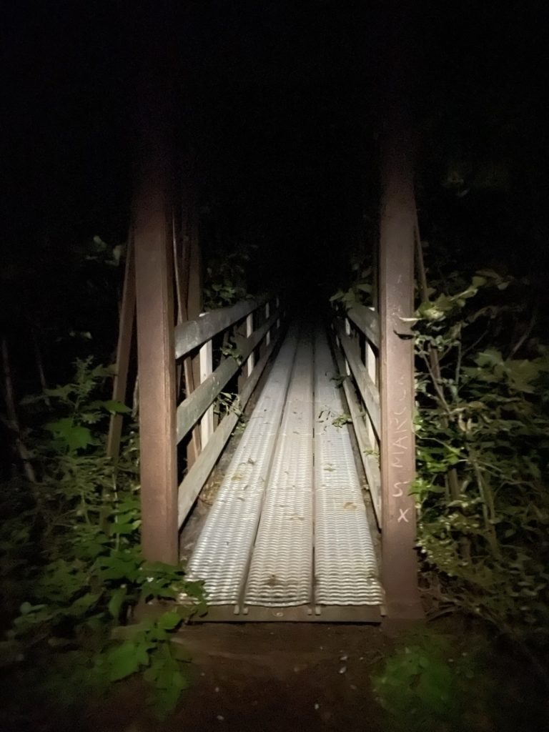
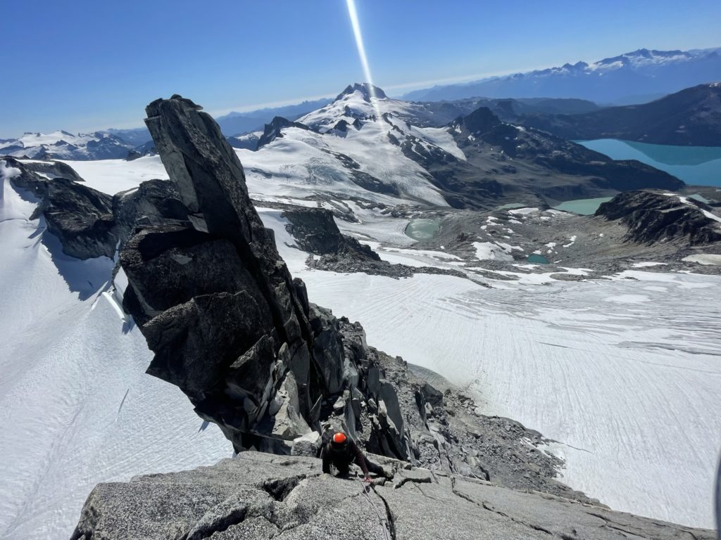
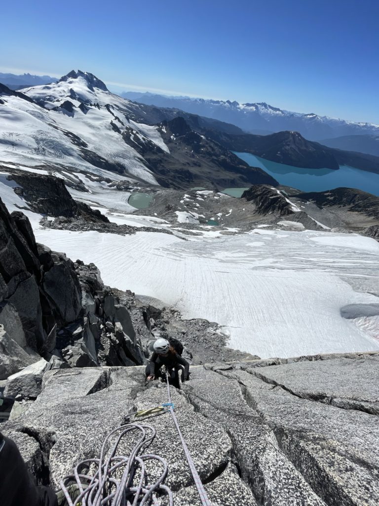
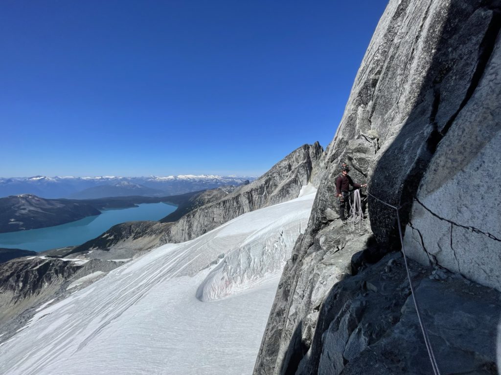
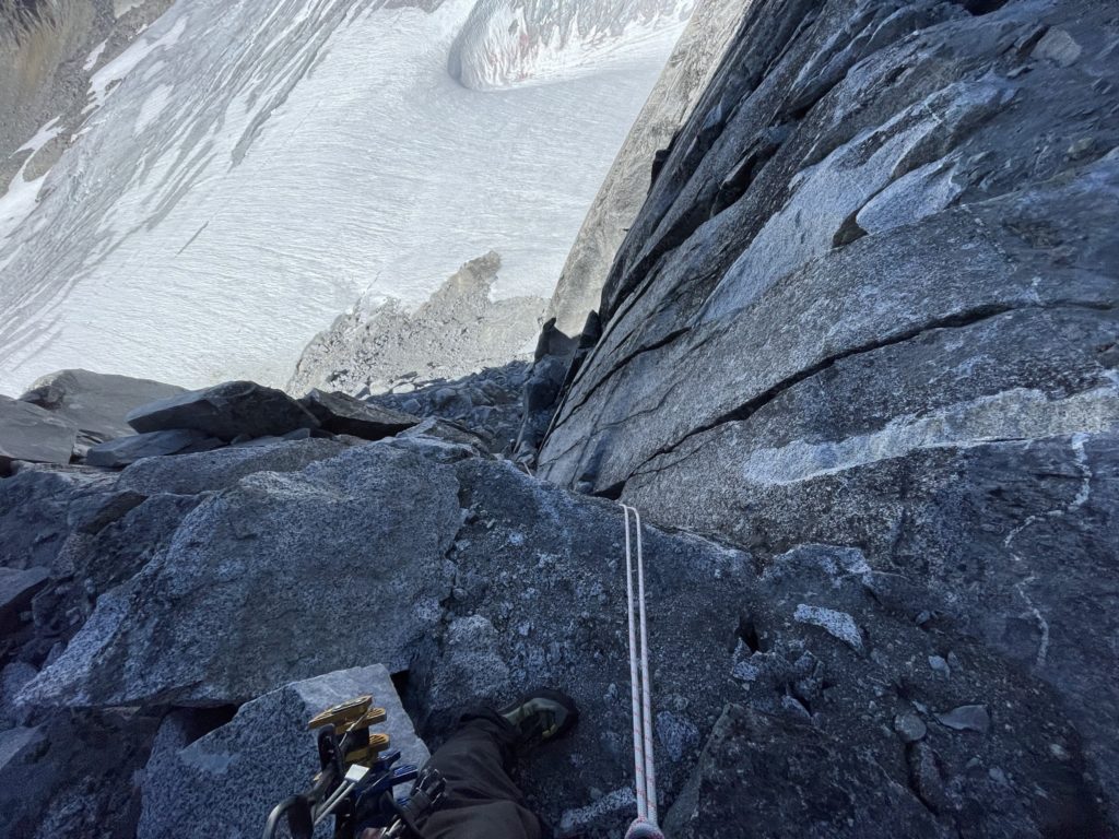
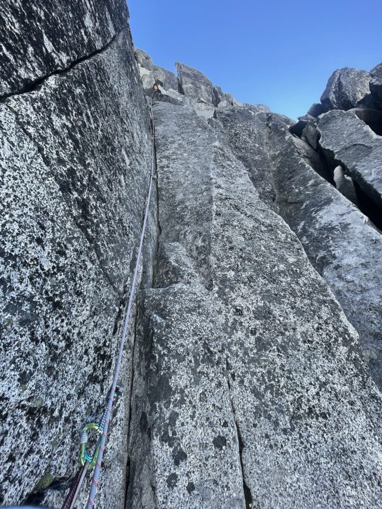
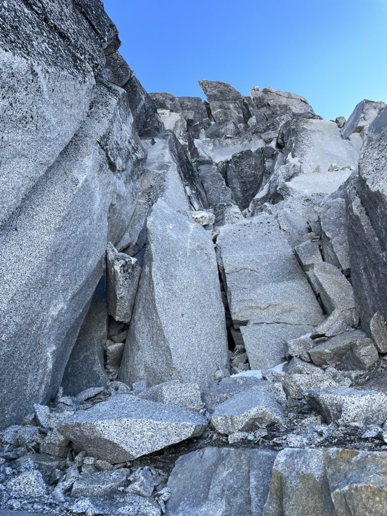
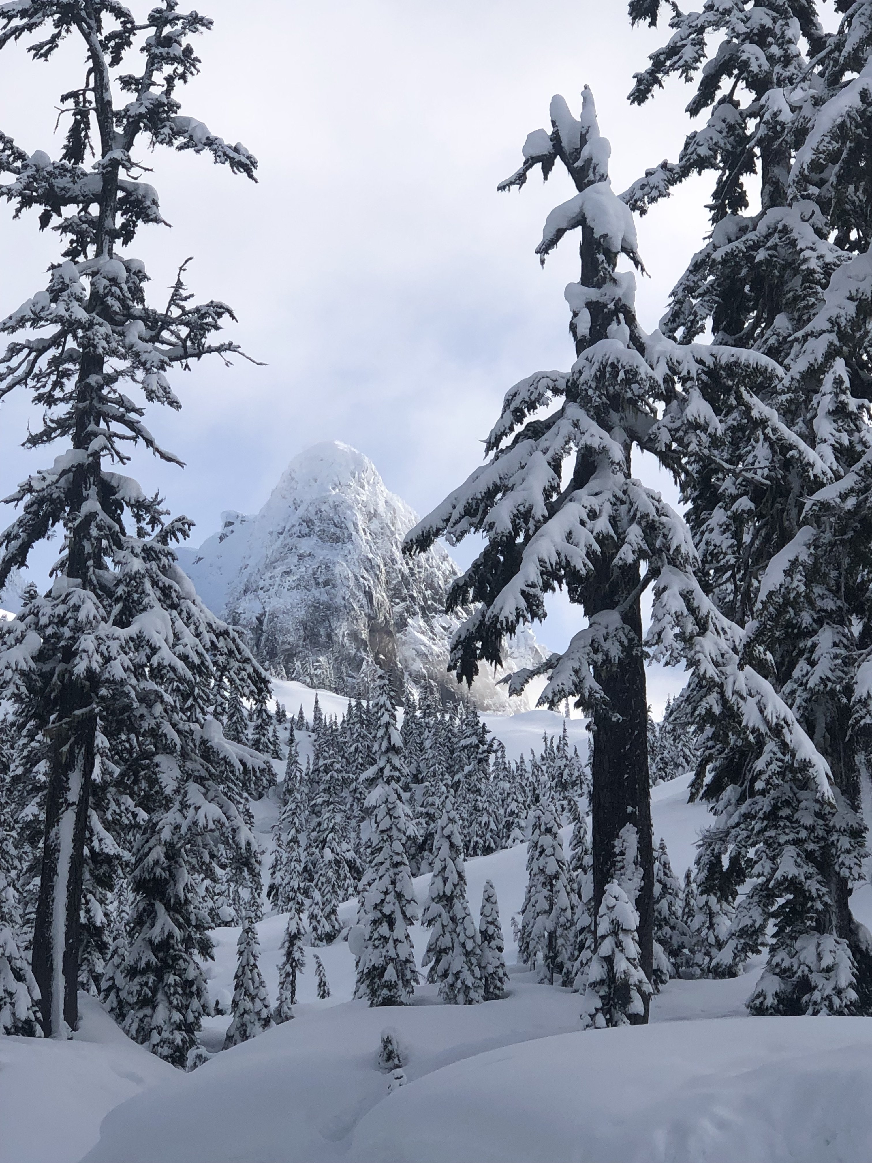
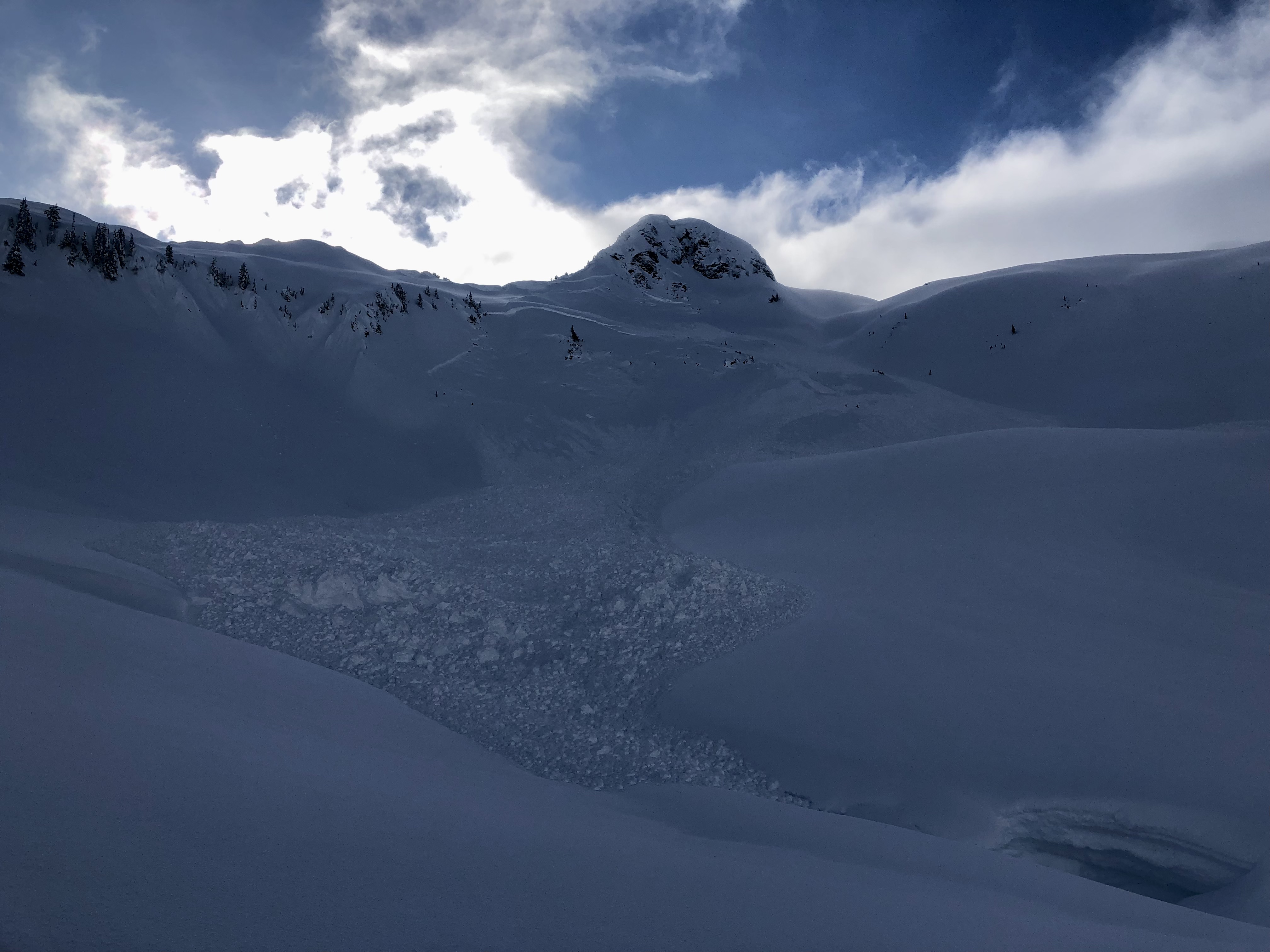
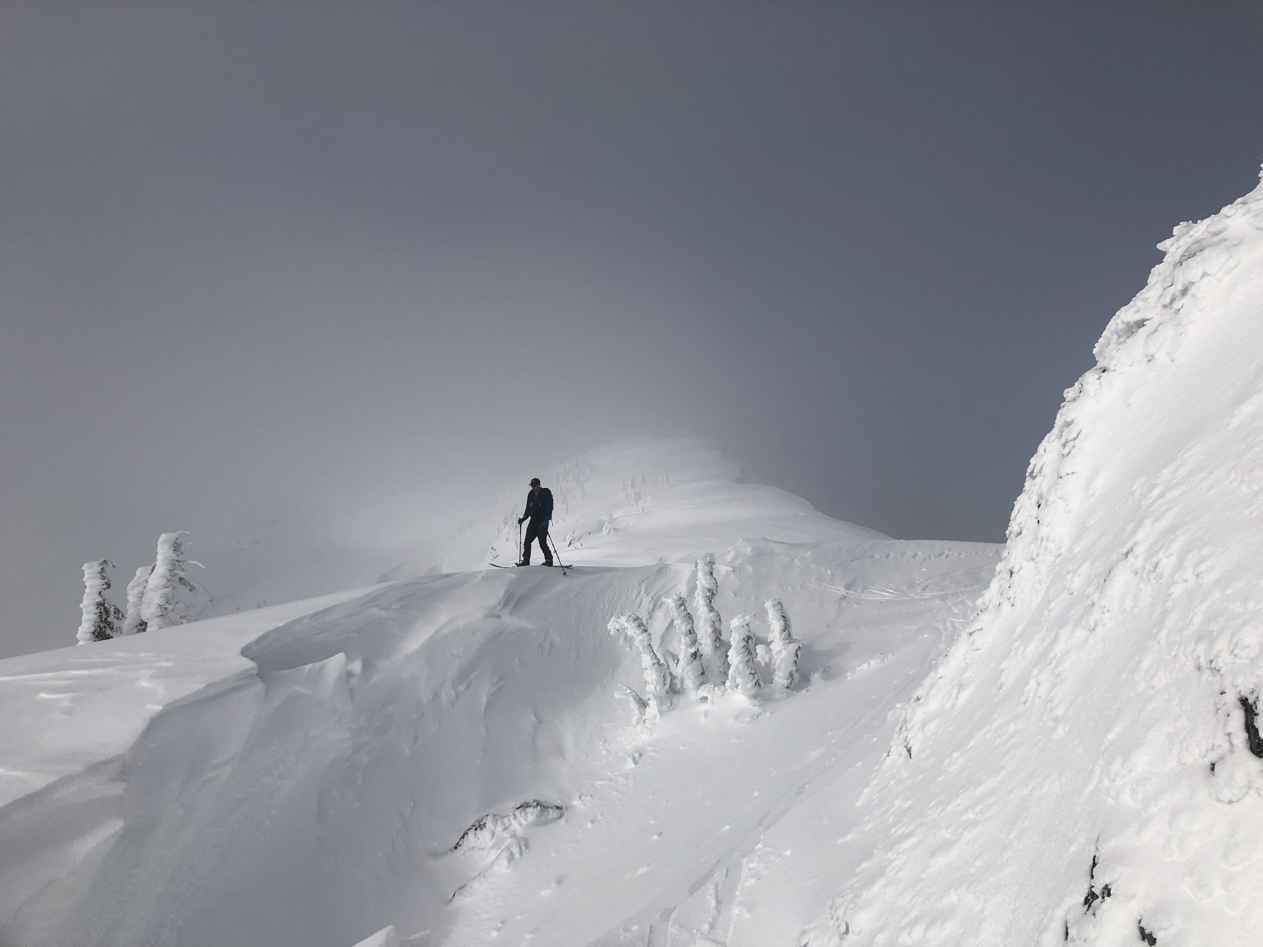
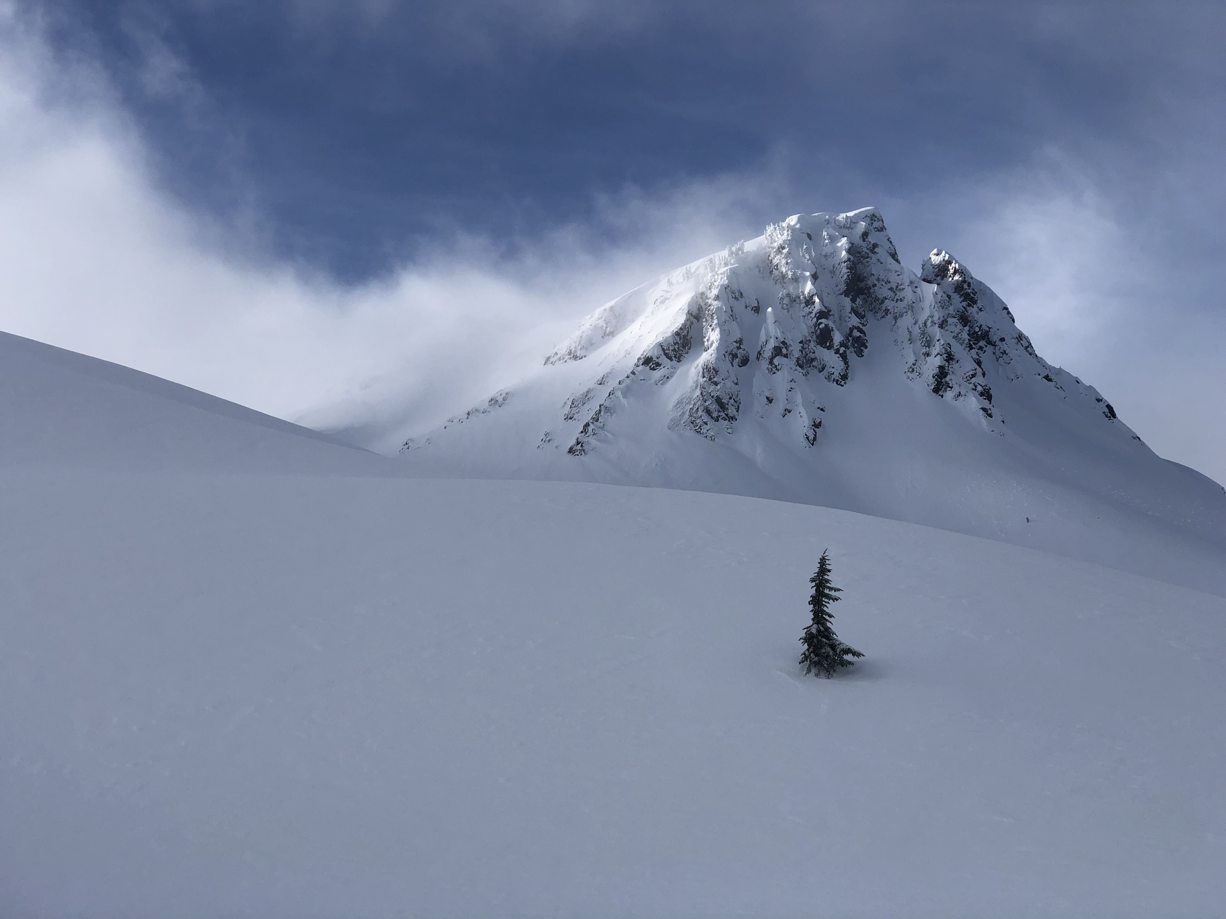
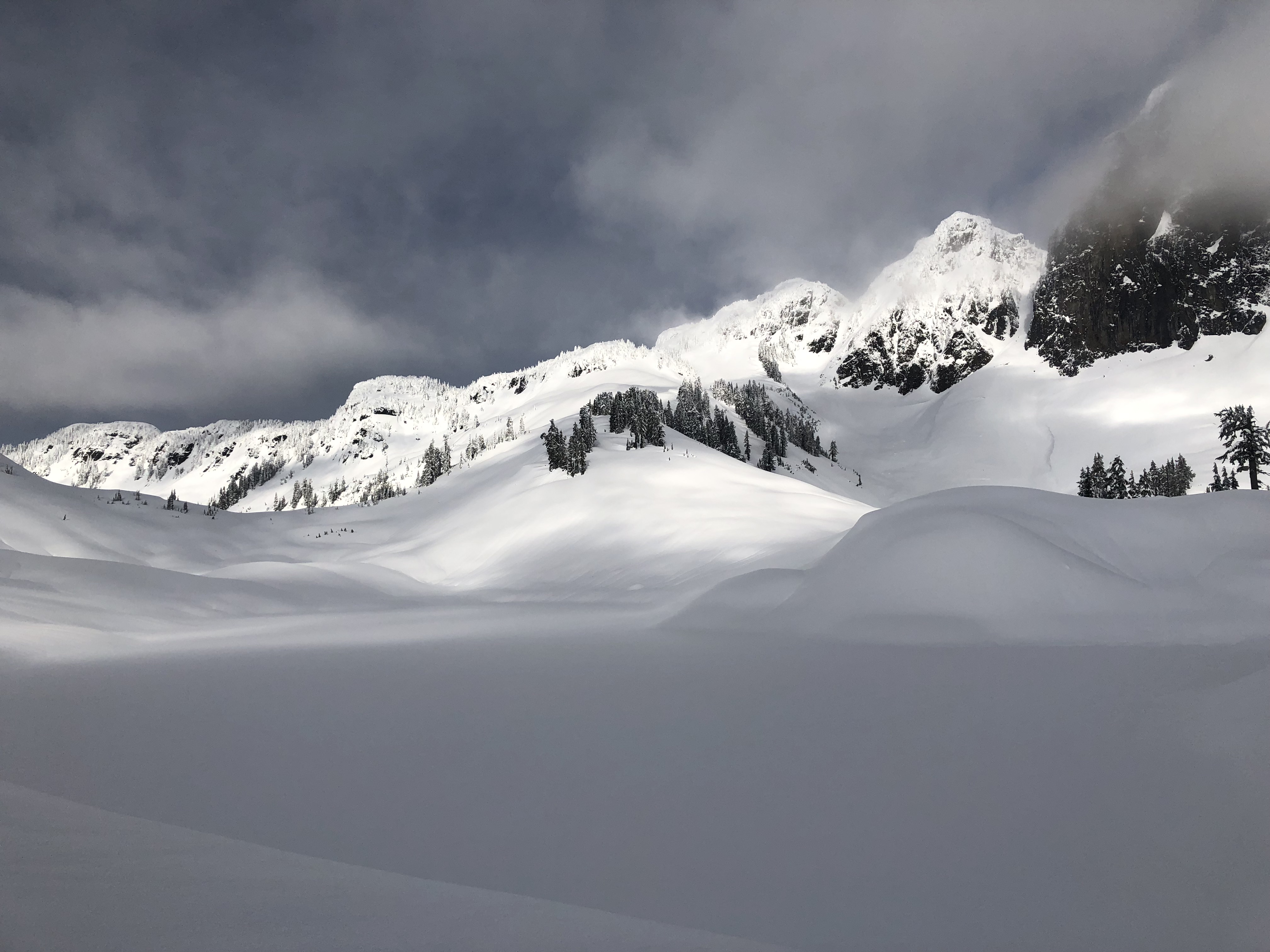
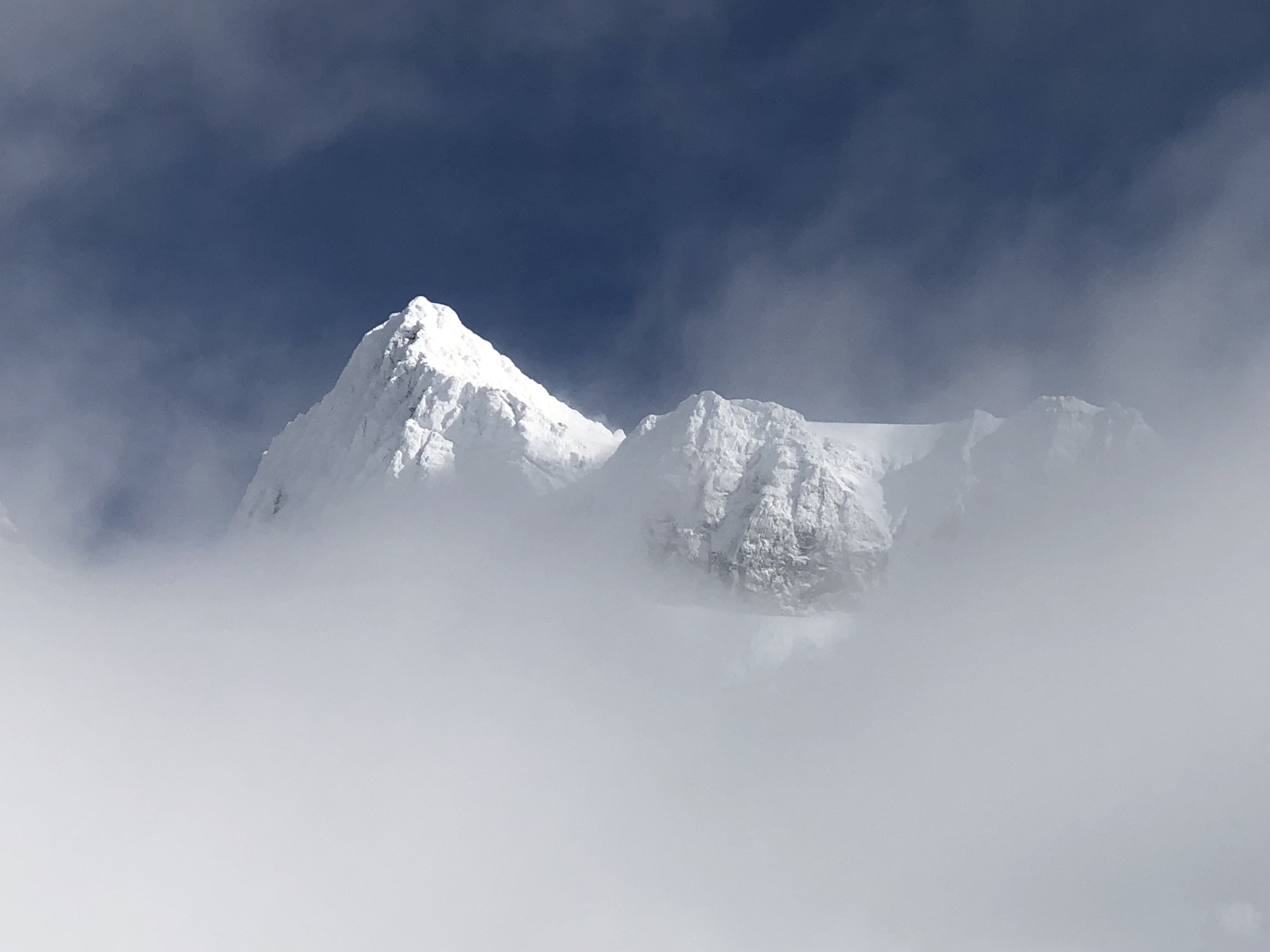
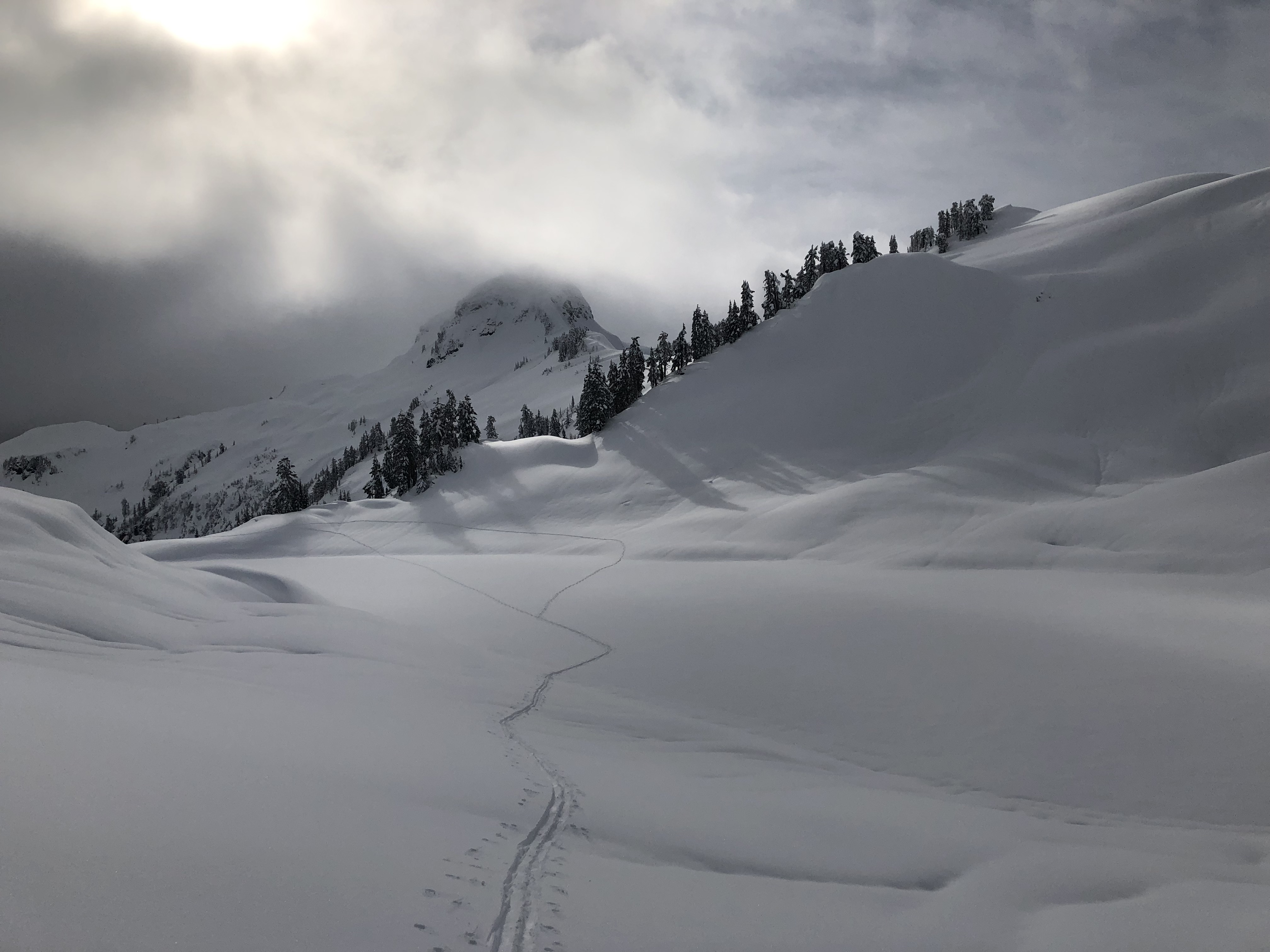
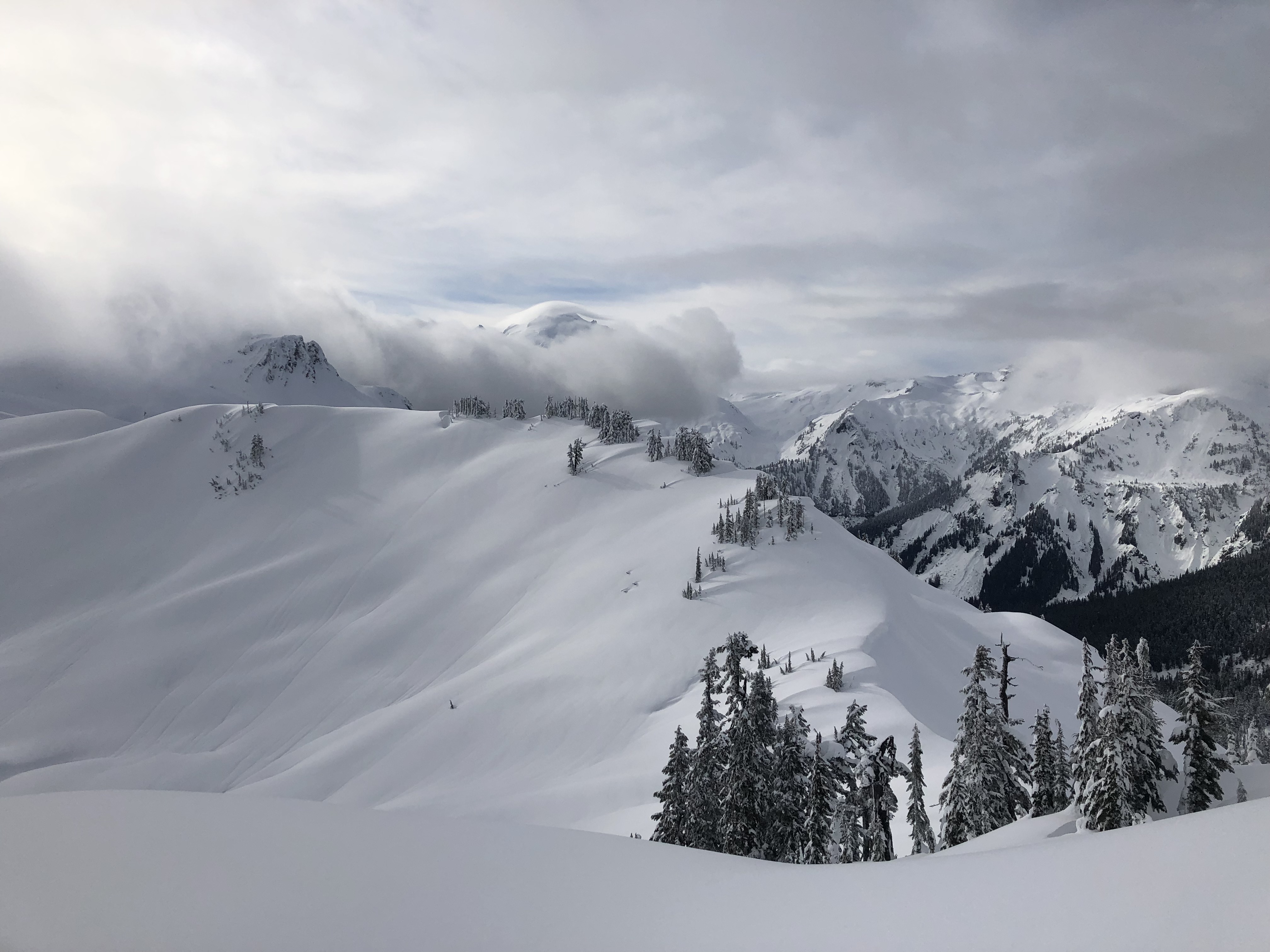
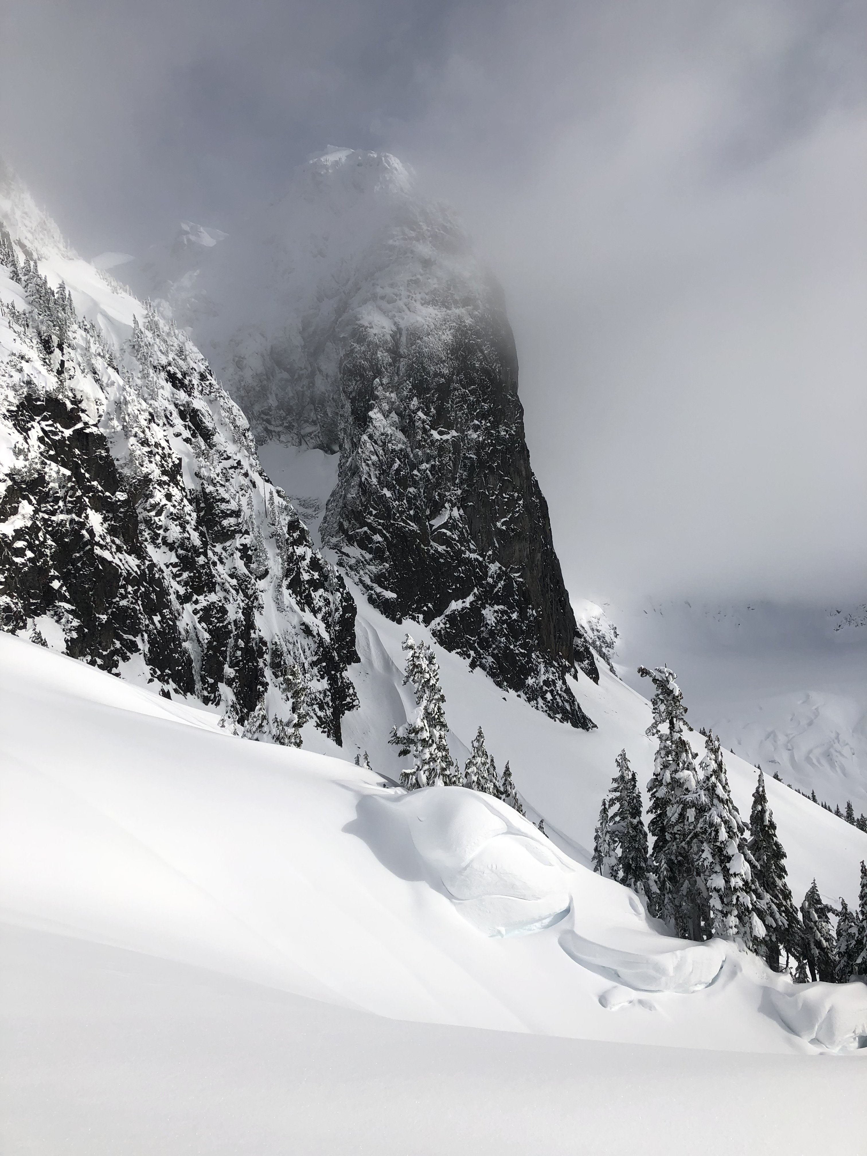
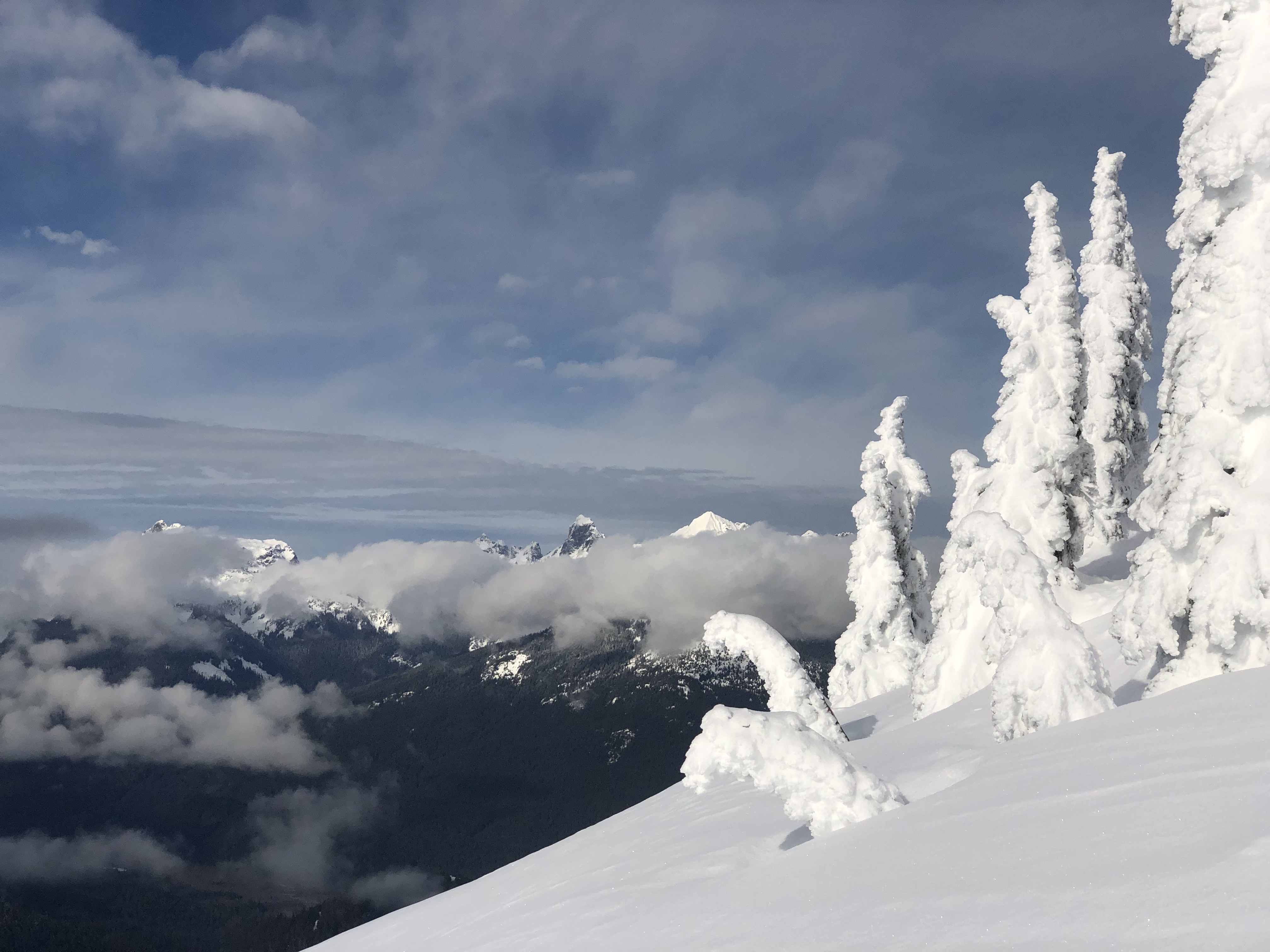
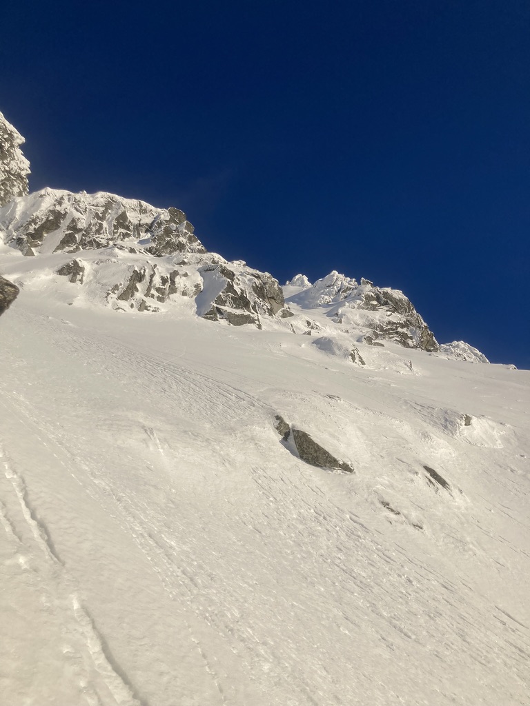
Trip: PRIMUS PEAK (8508'), TRICOUNI PEAK (8102') - EAST RIDGE & NORTH RIDGE Trip Date: 08/13/2022 Trip Report: PRIMUS PEAK (8508'), TRICOUNI PEAK (8102') – Thunder Creek Trail Approach – AUG 13-15, 2022 (Sat, Sun, Mon) Another perfect weather weekend for climbing. Temp was right around 80 all days. I originally planned to climb Tricouni, Primus & Austera Peaks. After climbing the first two peaks and doing the math, I would have needed another full day and more supplies to bag Austera from this side of the mountain, which wasn’t going to happen. Saturday: I started from the Colonial Creek Campground area at 9:00am. I headed up the Thunder Creek Trail to McAllister Camp arriving at 11:30am. I planned to cross the bridge over Thunder Creek to the McAllister Camp on the other side of the creek. That is where the start of the climber’s trail up to Primus Camp is located. Having climbed Primus before, I knew this was the best option. I walked right by the trail to the creek because it was covered under a pile of sticks and the old signage was gone. I doubled back and headed down the trail to find that the bridge is completely gone too. Not damaged or collapsed, but completely gone. I looked up and down the creek nearby for a possible log jam crossing. No luck at all, the creek was high and deep and moving fast. There was no way I was going to attempt to ford the creek. I decided to move on to Tricouni Camp since the camp is located before Fisher Creek feeds into Thunder Creek, hoping this would mean the creek would be more crossable. I headed through Tricouni Camp to Thunder Creek and lo and behold, a fantastic log crossing with three big trees together all the way across the creek. It was 12:45pm by this time and the new plan was to cross the creek and go straight up the mountain side to connect with the climber’s trail on the ridge. I knew it was going to be steep the whole way. The bushwhack started out good, the terrain was pretty easy going. That ended pretty quickly. I came across a well established game trail mostly of goat tracks. The goats have always been good to me, so I followed the game trail up the best I could. I started to hit vertical cliffs around 4000’ so I traversed toward Tricouni Peak and through several steep gullies, again following the goat trail. I finally made it to a boulder field and headed straight up. It got steeper and more loose but I kept fighting my way up. Finally at around 7:30pm I popped out onto a familiar looking plateau at about 5700’. Sure enough, the climber’s trail to Primus Camp was a little way up from me. I reached Primus Camp at 8:15pm. Time enough to setup camp, eat and go to sleep. The climb up was tougher that I had expected and took much more time. The goats are a bunch of crazy tough bastards, thank god, just my type. Sunday: I was up and moving at 7:00am. Tricouni was first on the list. I headed for the toe of the North Ridge and started up. The ridge start is class 3-4 rock then it eases up a bit to cIass 2-3. I looked down the side of the ridge to see a mountain goat hanging out on the cliffs below. He looked surprised to see a human in the area and got the hell of a dodge in a hurry. I headed up to the main snowfield. The snowfield is moderately steep and gets steepest at the top. Snow conditions were pretty good and firm. Once at the top of the snowfield I was staring at the ridge up to the top. Exposed class 3, 4 rock, somewhat loose in sections. I took my time and made sure my holds were good. The ridge got narrower, down to about 2’ wide in one section. I climbed along the side of the upper snow section with an overhanging cornice to the summit area. The cornice was ready to come down. A 6’ wide section came down as I was working my way to the snow gully. I climbed up the left hand side watching the cornice carefully for any movement. The rest of the cornice will probably come down this week. Once above the cornice section, it was easy climbing to the summit arriving at 11:15am. Beautiful views in all directions. I found a summit register from 2004 with only two party entries. One entry only had the date listed. I’m assuming they must have lost the pencil at that point because there was no name and the pencil was gone. The register is a zip lock bag with a vitamin bottle inside, hidden in a small pile of rocks on the summit. Bring your own pencil and maybe an extra to leave behind. I started down from the summit heading toward Primus. There is supposed to be an “easy” snow finger down to Lucky Pass. Easy my ass! The snow finger was steep with halfway soft snow and shitty moats on both sides. I was about 75% down the snow finger before seeing that the bottom section had a 20’ gap with 10’ of vertical snow. I had to climb down into the moat and wedge myself between the smooth rock wall and the snow. The snow was not solid enough to climb down with crampons safely, so I alternated between the snow and the smooth rock until I was close enough to jump down if I slipped. I didn’t slip but it wasn’t fun. I finally made it down to Lucky Pass at 1:00pm. The name is fitting. The pass is in a perfect location with great camping and a nice little stream for water. The view is fantastic. Klawatti Lake below would make a great camp area. Looking back at the “easy my ass” snow finger on Tricouni, I noticed a goat path down the side closer to the pass. If I had known it was there, I would not have taken the snow finger down to the pass. Next stop was the Primus summit. I climbed Primus before via the North Ridge in 2014. That was low 5th class rock. The East Ridge of Primus is mostly class 2 bouldering with a little class 3 here and there. I made it to the summit at 2:40pm. I was back to Lucky Pass at 4:00pm. I looked over at Austera Peak and looked at my watch and went through my supplies. There was no way I was going to get to that peak and make it back to camp in any reasonable amount of time. So I headed for camp cutting across the glacier in front of the South Face of Primus. The glacier was in OK shape, soft but manageable. I wrapped around down to the glacier above the lake and over to the glacier below Tricouni. It’s a bit of a bowling alley below Tricouni so I opted to climb on the glacier halfway floating on the Lake. It worked out well, I saw several boulders on the glacier around that area so I knew it would hold my weight fine. I made it back to camp at 6:45pm. Monday: I packed up camp and was up and moving at 7:00am, heading for home. I didn’t want to follow the same route that I came up on as the gully crossings were not fun. My plan was to drop down the climber’s ridge trail a ways and then drop off the side into the Thunder Creek area, hopefully running into the Tricouni Camp’s huge log crossing. I dropped down the ridge trail to about 5000’ and decided to make my turn down toward the creek valley. The route started as a fairly steep gully down the side of some cliffs. It looked somewhat well traveled, probably by goats. Careful vege belay technic was crucial. After the initial loose steep start down the gully, I spotted what looked to be a dried creek bed down the middle. I follow this dry creek bed as far down as I could. There was some wet mossy sections along the way. I was using vege belays the whole way down. I reached a cliffed out section in the creek bed and turn right into the forest to get around the cliffs. The forest vege belays didn’t work very well. Most of the branches were dry and brittle and tended to break when you needed them the most. So I aimed at the areas that had the most trees to grab onto. I stayed close to the creek bed but in the forest. There were cliffs mixed in here and there put they usually had hidden shelfs that allow me to get around them. Again I was following goat trails most of the way down. The steepness started to ease up and I knew I was close to Thunder Creek. I popped out onto the creek side and checked my elevation (2060’). This was close to the Tricouni Camp log crossing. I looked up and down the creek and didn’t see the huge log crossing. I decided I must be a little too high up so I followed the creek down thinking I’d run into the Tricouni log crossing soon. After about a half hour going down stream I came across another nice log crossing the creek. It wasn’t the original log crossing but it was too good to pass up. I was on the main trail side of Thunder Creek at 11:00am. I wasn’t sure if I was above or below Tricouni Camp. I wandered around massive amounts of downed trees in a swampy area until I saw a sharp turn in Thunder Creek. I pulled out the map to look for the turn in the creek and it put me closer to McAllister Camp than Tricouni Camp. I knew the main trail was close even though I could not see it. So I just marched straight up the hillside and sure enough I ran right into Thunder Creek Trail at 12:00 noon. I was on the trail just above the old bridge crossing that has disappeared at McAllister. The trail back to the parking area was uneventful and actually kind of boring compared to the bushwhacking. I was back at the vehicle at 3:20pm. Since the McAllister bridge is completely gone and probably will not be rebuilt, the route I took up and down will probably be the new way to Primus Camp for the future. Hopefully with more use by goats and people there will be a more clear cut path to follow up to and down from the Primus area. Right now, it is one hell of a workout getting up and down. I was beat by the end of each day. Some Tips and Notes: 1. The McAllister bridge over Thunder Creek is gone and there are no log crossings nearby. 2. Tricouni Camp has an excellent log system crossing Thunder Creek. 3. Climbing up the hillside toward Primus Camp from Tricouni is steep and loose. 4. If you see a creek bed on the way up, follow it. If you see a well worn goat path on the way up, follow it. They will be the easiest ways up. 5. Bring work gloves for the extensive vege belays needed both up and down. 6. There are bivy / camp options near the Tricouni Summit, the Primus Summit and at Lucky Pass. Travel Time for reference: Saturday: Trailhead to Primus Camp (6000’) – 11:15 hours. Sunday: Camp to Summits to Camp – 11:45 hours. Monday: Camp to Parking Area – 8:20 hours. Total Mileage: around 26 miles Total Elevation Gain: around 8100’ Gear used: Trekking Poles, Ice Axe, Crampons, Helmet. Logs crossing over Thunder Creek at Tricouni Camp. Bushwhacking around 4000' on way up to Primus Camp. Finally on the climber's trail with the objectives in sight. Tricouni and Primus from camp. Tricouni North Ridge. Snowfield on Tricouni. North Ridge to Tricouni Summit. Looking down the North RIdge route from Tricouni Summit. Looking back at the Tricouni snow finger down to Lucky Pass, notice the goat trail on the right side. Lucky Pass view. Klawatti Lake below. Forbidden in the background. Primus East Ridge, basic class 2-3 rock. Primus summit memorial. I have to admit I had a lump in my throat and a tear in my eye. One simple line "We Miss You Son". I couldn't image losing a son so young and trying to move on in life. I climb in the mountains to get closer to heaven and it seems others do to. Austera, Klawatti & Eldorado from Tricouni. Primus on the way back to camp. Tricouni on the way back to camp. Back to Camp. Some nice views right off the side of the main trail. A very beautiful area that charges a hefty fee in the form of suffering. Well worth the effort. Gear Notes: Trekking Poles, Ice Axe, Crampons, Helmet. Approach Notes: Park near Colonial Creek Campground, head up Thunder Creek Trail, cross logs over Thunder Creek at Tricouni Camp.1 point
-
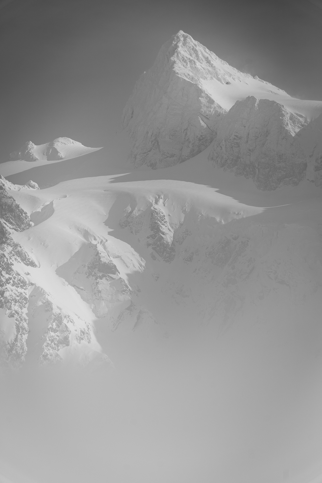
Granite Gl. icefall:1 point
-
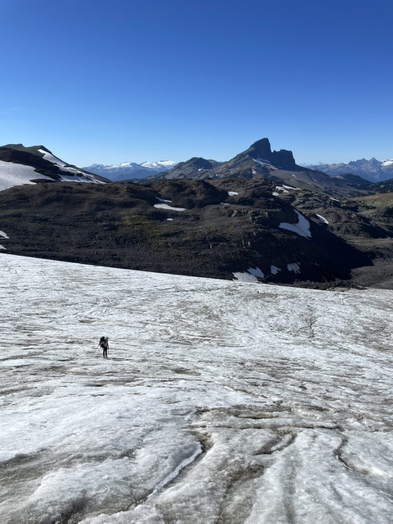
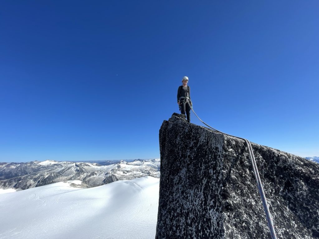
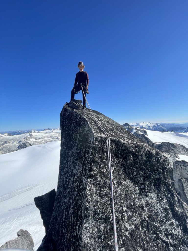
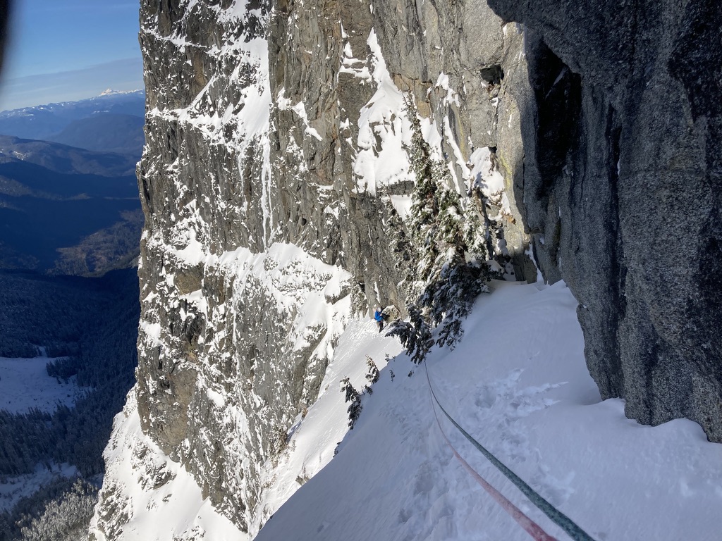
I've used this forum a fair bit for research in the past and figured it's time to contribute back! This is a post from the summer of 2022, but hopefully the beta is still useful. My partner Andrea and I set out to do Phyllis's Engine via the standard route in late September. The plan was to do the approach on day 1 up to Polemonium Ridge and then attempt our climb the following morning with a long hike out on the same day. Despite its inclusion in the Alpine Select, there's actually not a ton of beta (that I could find) on the standard route. Steven Song has a great report from the 5.9 variation and there was also one post on here from 2013 with some good beta as well, but otherwise there's limited details on what to expect. The one other detail that I read on numerous accounts was the cadence of ropes getting stuck on rappels. I had that in the back of my mind for the rest of the trip. On the 20th, of September we set out from the Helm Creek Trail Head and followed the well paved path all the way to the turn off for Helm Glacier. The glacier was in a very dry condition, so we didn't bother roping up and found it straightforward to navigate. When we reached the top of Gentian Pass we caught eye of the 250m elevation loss below, but the scenery is nice enough to distract from it all. We reached a suitable camp site around an hour before sunset and settled in for the evening. Andrea on the Helm Glacier Dropping into Gentian Pass Sunset at camp We got going around 9am, when the sun rose and followed the long side hilling traverse around to the Sphinx Glacier entry West of Phyllis's Engine. This glacier looked more complicated to traverse so we made the decision to rope up here. Andrea lead a great line up to the base of the Engine and then we transitioned over to climbing gear. From there we lead 3 pitches to the summit on solid rock, albeit the top of pitch 1 was kitty litter over slab. Reaching the entrance to the glacier The Engine off in the distance Getting closer Myself above the first part of pitch 1 At the top of pitch 1 looking down at Andrea The kitty litter slab traverse Andrea coming up pitch 2 Myself on pitch 2. I ran out of gear just before the top, so Andrea lead the remainder up to the base of pitch 3. Looking down the exposed and awesome pitch 3 Andrea on the summit Myself on the summit On the descent, we found our rope was too short to reach the second rappel station we spotted (on a 60m rope) and so had to build an intermediary rap station and then continue on. I held my breath on each rope pull, but thankfully it never got stuck. We swapped back into our regular gear and then roped up for the glacier again. We didn't reach our camp site until just before sunset. Andrea and I debated crashing for the night, but we had run out of snacks and we figured it's better to slog it out now then be hungry in the morning covering the same distance. With that, we packed up camp and made our way back towards Helm Glacier. We didn't arrive until well into the night and it was a touch spooky covering the glacier by head lamps only. It was a moonless night, which didn't help. Helm Glacier at night After the glacier, it was a long march back to the car, but we finally made it around 4am after 19 hours on the move. I drove us back home where we promptly crashed out for the day. I have a full recount of the details here if you're interested: https://www.francisbaileyh.com/2022/09/22/phylliss-engine/
 1 point
 -
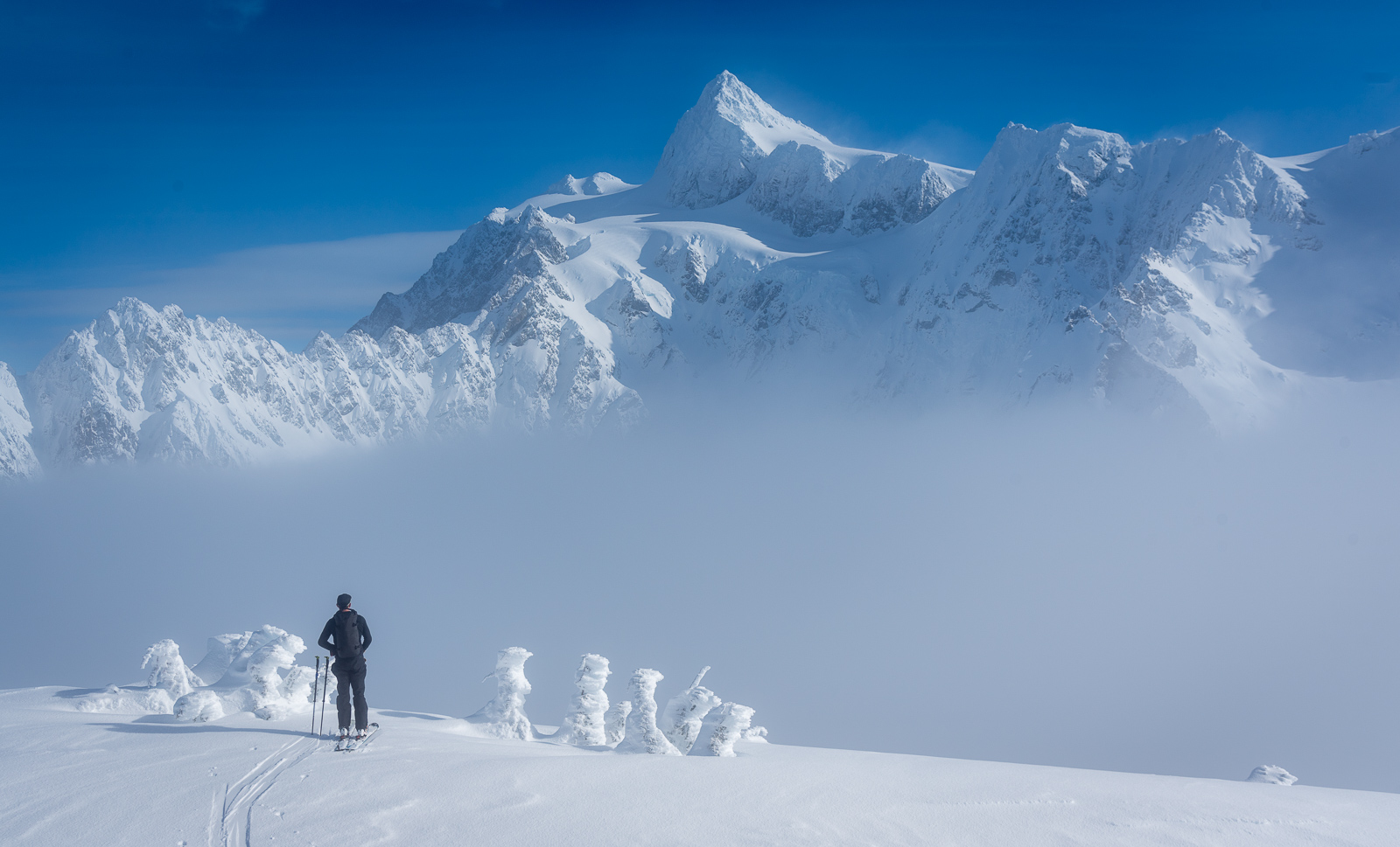
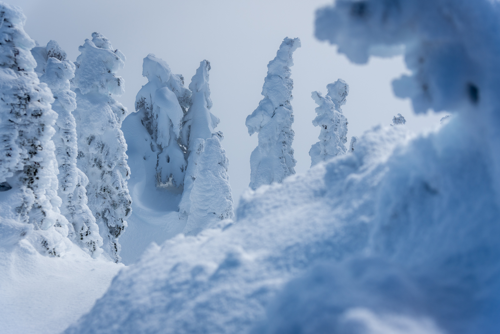
Oh, but you wanted more alpine fiesta photos? Well, here you go.....
 1 point
 -
South-end Baker bc environs with @JasonG on Saturday. We laughed, we learned, we fiesta'd forever.
 1 point
 -
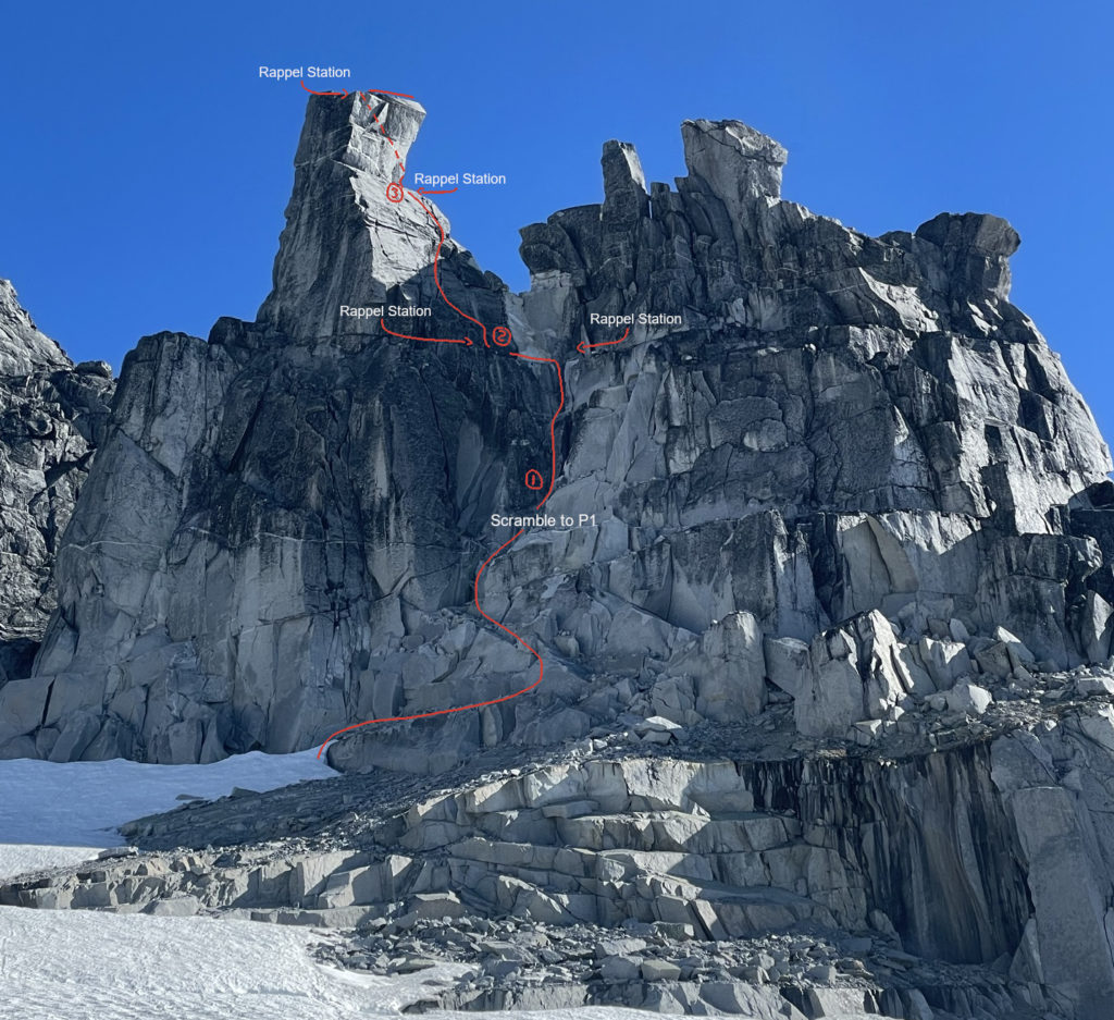
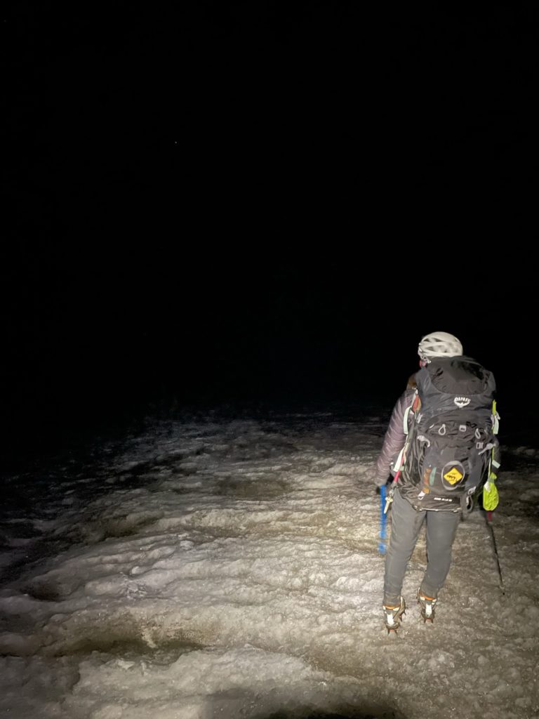
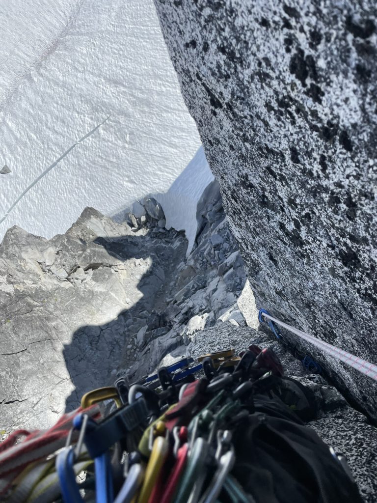
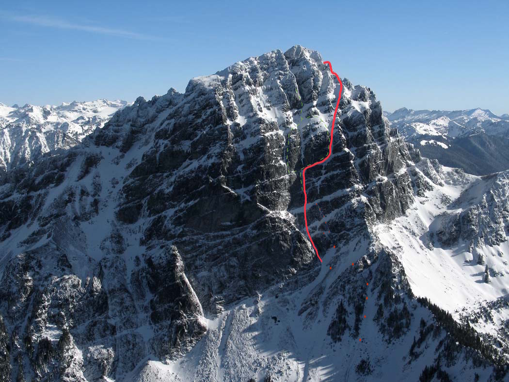
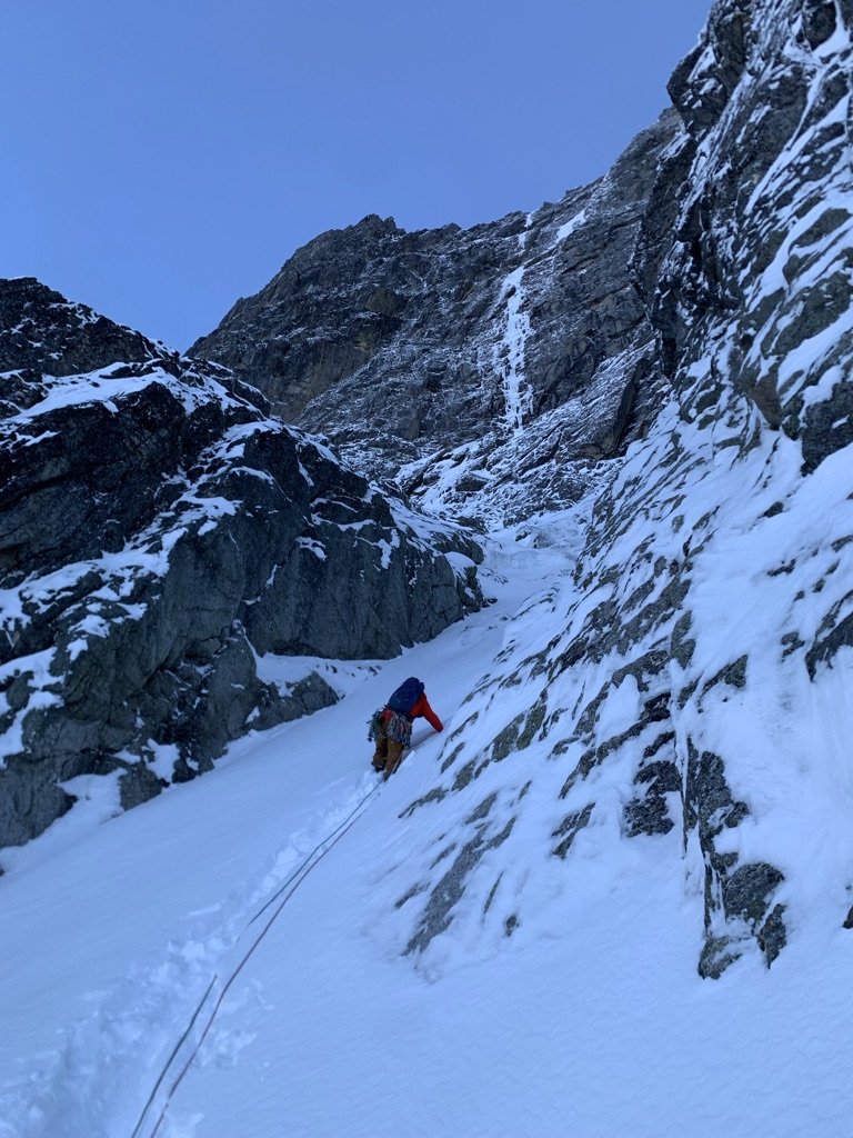
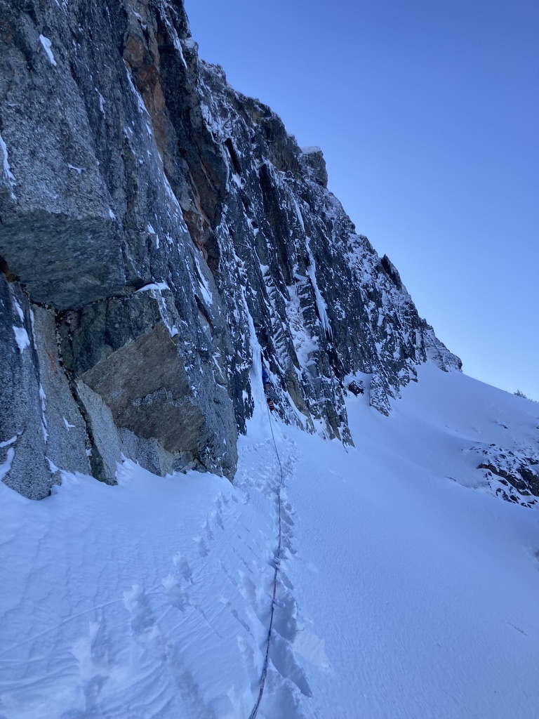
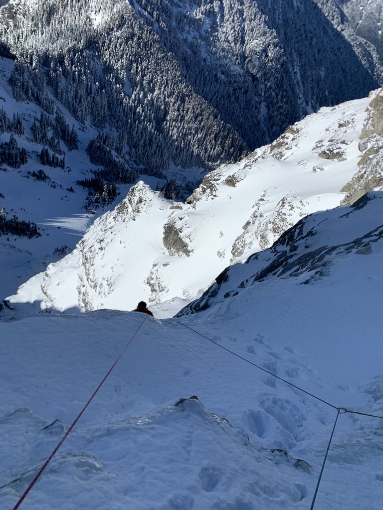
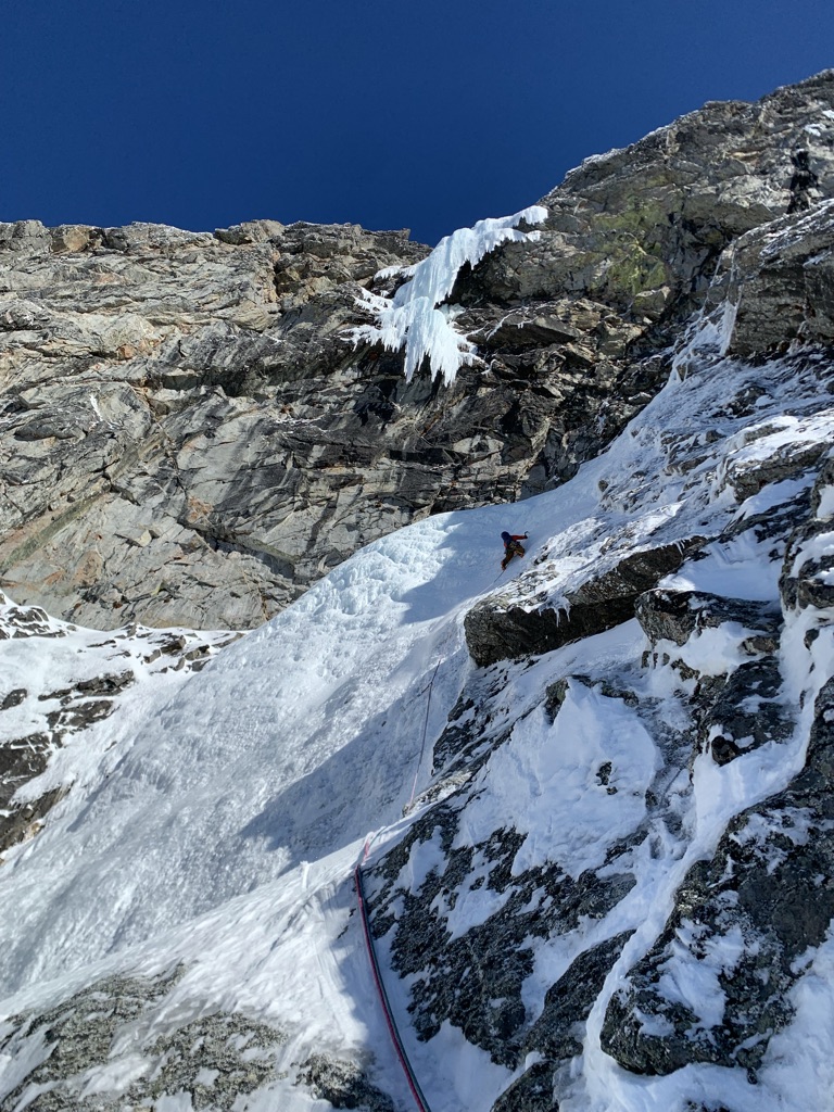
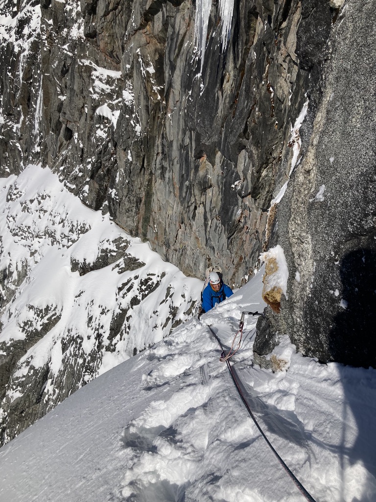
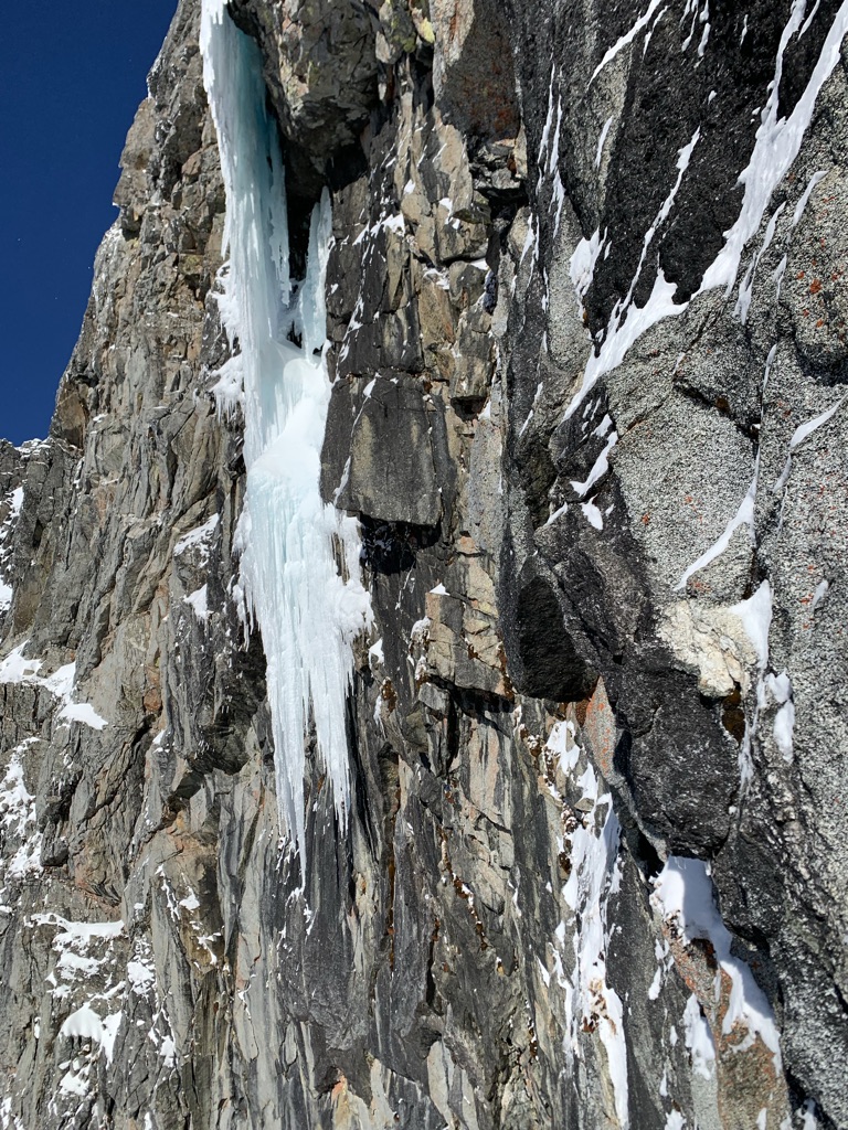
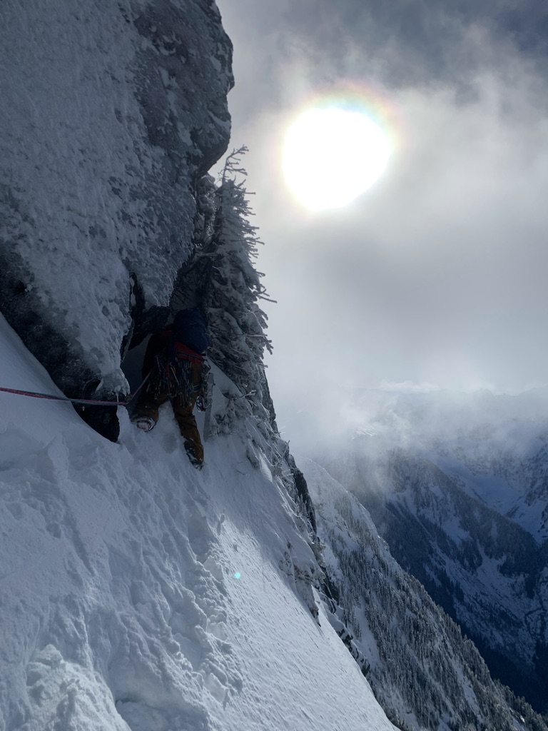
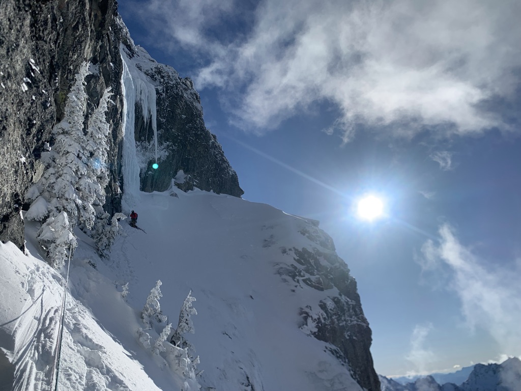
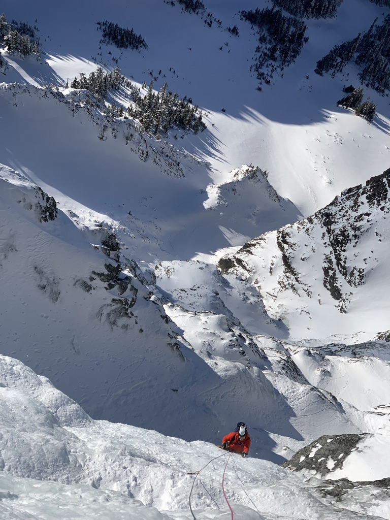
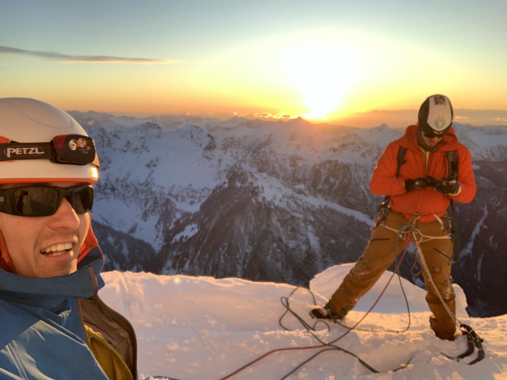
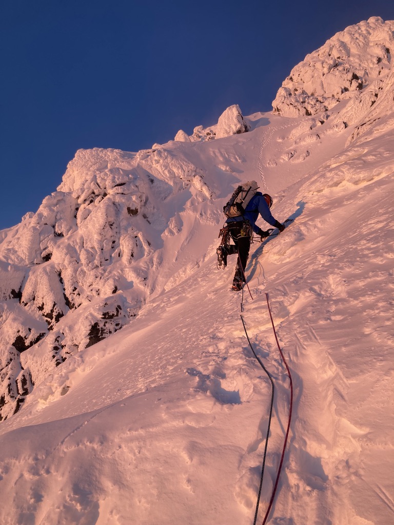
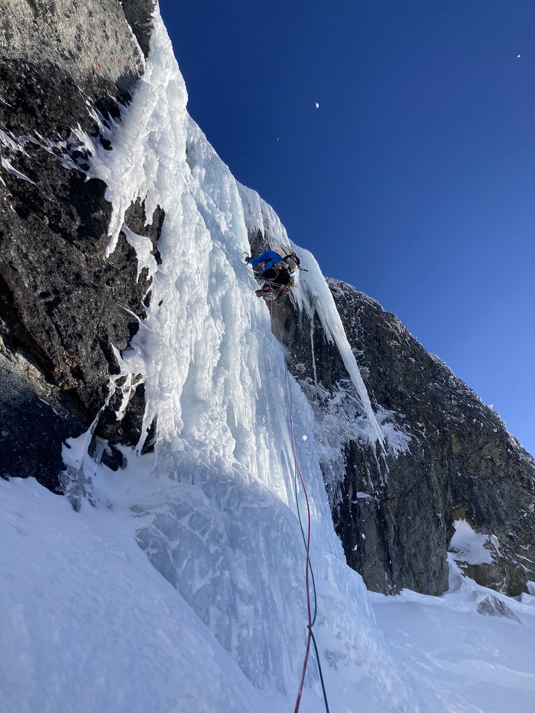
Trip: Sloan Peak - West Face "The Sloan Slither" Trip Date: 01/29/2023 Team @Tucker_Merrill Trip Report: Sunday January 29th Aaron Minton and I attempted an ice route on the West face of Sloan peak. The climbing involved difficulties up to WI4+ and we eventually linked up with the upper portion of the Superalpine route to attempt the summit. We reach 200 vertical feet below the summit before turning around. From photos and a scouting trip earlier that week I thought that a line would go following ice flows and traversing snowy ledges up the west face. I was able to convince Aaron to come try this line with me. We met in Darrington the night before organized our rack then headed to the TH. We found the road to be fairly clear. Someone had come and cut down the trees blocking the road up Bedel creek. As we drove our cars up NF road 4096 the minivan struggled but Aaron was behind me with his Rav 4 and gave me a push with his car up the steep sections. It worked surprisingly well. We drove our cars up to about 2400ft before we couldn't continue due to snow. We parked, finalized some packing, and went to bed. We woke up at 2:30 and left the cars at 3:15. I knew the conditions were primed for booting and skies would just slow us down on the way up so we left them at the car. We followed the approach beta from the Superalpine TR from Porter McMichael and Kyle McCrohen (Thanks guys!) and the boot pack I had put in previously that week with Jeff McGowen. PHOTO CREDIT: JOHN SCURLOCK a photo of our line to our turn around about 200ft below the summit We arrived at the base of the route around 7:20. It was quite cold as we unpacked and racked up. We took off around 8. Aaron heading up the snow gully The first section involved a snow gully with some low angle ice. Aaron dragged the ropes up easy terrain to the first steep pitch at the base of the amphitheater. There is a selection of ice flows at the start but the best option we decided was the one that took us directly to the next steep ice pitch. Aaron took off leading the first pitch finding hollow aerated ice. A great way to wake up the nerves in the morning! First pitch went at WI3 with less than ideal ice screws. After topping out the ice Aaron had to cross a snow slope to reach a rock belay. probably ended up being a 60m pitch maybe 62m (unsure if we simuled or not). Once at the belay it was my turn he handed over the rest of the rack and I traversed 15m over to the second steep ice pitch and took off finding another WI3 pitch with aerated ice and dispersed ice screws for protection. The top out puts you right at the next ice flow but I didn't want to belay right underneath it so I chose a rock belay to the right. The rock was a little less than ideal but you could manage to find better gear if you dug around. Starting up the 2nd pitch of steep ice Belaying Aaron up the 2nd pitch Next Aaron took over and ran the ropes up another short ice step and across some snow to belay staring up at the beautiful hanging dagger. With the dagger in full sun we were a little skeptical about climbing directly underneath it so we looked around at our options. There was another ice flow looking around WI5ish about 150ft to our right which we debated over. We finally decided to take the WI3 ramp for the sake of time and honestly neither of us were super psyched to lead a WI5 with questionable pro being weighed down by a heavy rack and packs. (definitely a sweet option for a stronger party!) We romped up the easy ramp as quickly as we could to get out of the overhead hazard and got to the big snowy ledge traverse. Aaron being the fearless monster that he is on snow traversed through a tunnel of trees and rocks, which turned out to be good fun! This ledge took us to the bottom of the money pitch. Aaron romping up the easy ice past the overhanging dagger Belaying up the easy ice with the hanging dagger just out of frame above the photo This is the best shot I have of the rock leading to the dagger Aaron heading into the rock and tree tunnel Looking across the snow traverse to the money pitch $$$ Looking back across the snow traverse I will mention the higher we got on the route the ice quality improved a lot. The money pitch is a sweet 30m WI4 flow with good ice and an engaging bulge at the top which leads me to give it a WI4+ rating. As I climbed I found myself enjoying the exposure and good protection. After pulling the bulge there was another 50ft of WI3. As I was putting in protection to climb up the last ice step I bumped a half placed ice screw with my tool and knocked it down to its final resting place somewhere up on the west face. Finders Keepers! After climbing up the final step I got 2 good screws and belayed up Aaron. He wanted to call the ice bulge WI7(satirically) because I had knocked the dagger I used as a foot off when climbing it and he had to pull the bulge at a much steeper angle than I did. We topped out the final ice flow and joined up with the Superalpine route. Working my way up the crux pitch! Really high quality climbing with good pro. Belaying Aaron up the crux Looking at the upper slopes of Sloan. Superalpine goes up the obvious snow slope on the right. To our advantage we found really good snow conditions up top. The wind had blown off any new snow and the freeze thaw had produced really nice snow climbing conditions. We took off simul climbing up to 200ft of the summit. We pondered taking it to the top but ultimately decided with the setting sun and the fact that we hadn't done the descent turned us around to go search for the rappels of the Superalpine route with the last of the daylight. Quick selfie before turning around Starting our down-climb. Someone solod up the corkscrew route and those are their tracks above. we did not make it that far. This was immediately after we decided to turn around. As the sun set the winds began to pick up sending spindrift down on us as we began rappelling Superalpine. This spindrift followed us all the way down the rappels. BRRRR! We made about 7-8 rappels using V-thready, a piton anchor we had to make because lack of ice at the end of a rappel, and a small shrub. This brought us back down to our trekking poles. Tired cold and wet we repacked and began the slog back to the cars. We eventually reached the cars at 1:15am for a total of 22hrs on the go. I subsequently drove the dirt road until I hit pavement parked at a random pullout slept for 3 hours then finished the drive to arrive at school just before class started. Overall this climb was my first of this kind where I wandered up unknown terrain with just a photo and psych. It was a really enjoyable experience and I hope this TR can inspire others to check out this awesome zone! Idk if it can be called an FA because we did not reach the summit, and we joined up with a pre-existing route. maybe a variation? All the more it was an awesome day out with good company and lots of stoke! Gear Notes: We brought a hefty rack singles .1-#2 rack of nuts and micronuts 5KBs 10 screws 3 (10cm) 4 (13cm) 2 (17cm) and 1 (21cm), 2 60m half ropes Approach Notes: See Kyle and Porters TR they have all the beta! Also plenty of running water in the drainage up to 4500ft
 1 point
 -
WILLIS WALL June 11, 1989 Old French Proverb: “God helps three kinds of people: Fools, Children and Drunkards”, Berthelin, Pierre Charles (1762) ************************** I enjoy the controversy which often follows postings on this site and I appreciate the links to tales of adventure. On the 25th Anniversary of the event, here is a tale of three days in the lives of four middle-aged, married-with-children guys who decided to attempt Willis Wall. We never were hard-core; just regular folks who like hot showers and cold beer and hate physical discomfort. The climbing was not very difficult, but it was scary. *************************** On the afternoon of June 9, 1989, a Friday, four aging mountaineers from Whatcom County, Washington departed to make an attempt on Willis Wall. The four were Anton Karuza (who talked us into it), 36, a podiatrist; Jeff Steger, 42, a psychologist; Joe Abbott, 47, an attorney and Howard Evans, 54, a University professor. We were not professional climbers and not young. Howard Evans and I met in the first mountaineering course for each of us when he was 45 and I was 38. Willis Wall, the Nordwand of Mt. Rainier, is a route known for loose boulders, cliffs of frozen mud, frequent rock fall and occasional massive ice avalanches from the 300’ ice cliffs which hang above the climbing routes. Anyone who sees Willis Wall hardly needs to be convinced of its danger. The wall encompasses the avalanche-scarred stretch of Mount Rainier’s north face between Curtis Ridge and Liberty Ridge. It rises from the Carbon Glacier some 4,000 feet to meet ice cliffs spilling from 14,112-foot Liberty Cap, the lowest of the three prominent nobs on the mountain’s broad summit. Chunks of ice and rock frequently careen down the wall in warm weather and scatter debris down its 50-degree sides. “Despite the objective hazards, the Willis Wall is a popular objective, in theory if not in practice. To climb Willis Wall and survive seems to elevate one to “”immortal”” status among Northwest climbers”. Climbing The Northwest Volcanoes, Jeff Smoot, 2nd Ed. We thought conditions on the mountain would probably be as ideal as they can ever be. There had been recent snowfall, daytime temperatures at low elevations only rose into the 60’s and we optimists opined that the Wall should be well cemented together and stable. We were probably over-educated and lacking in common sense. After late lunch and a fight with Friday afternoon traffic through Seattle we were able to leave the White River campground trailhead by 7:00 PM. We moved rapidly and soon reached Boulder Basin (5,000’) where a bivouac with sleeping bags and bivvy sacks was comfortable and uneventful. The large and sometimes aggressive marmots we encountered on previous trips to Liberty Ridge were not out and about. Anton was our most experienced climber and the one who dared to propose this climb. He and I had climbed Liberty Ridge and Price Glacier (Mt. Shuksan) together. Jeff had climbed steep ice on the North side of Mt. Hood and joined Anton and I on the NE Buttress of Mt. Goode. Howard was a strong outdoorsman with solid experience on the Cascade Volcanoes, including Mt. Rainier, in summer and winter. When asked whether he was interested in joining a Willis Wall climb, there was a long pause before the answer of “why not?” came. He knew what Willis Wall is. Until 1960 the National Park Service had prohibited climbing on the Wall believing it to be too dangerous. On day two of our trek the weather remained cool and bright as we crossed Curtis Ridge and slowly wound our way up the center of the Carbon Glacier East of Liberty Ridge to nearly 9,000’. We found what we were looking for; a 20-foot wide crevasse running from East to West to protect us from all but the largest avalanche (we hoped) from the Wall. We had all read “Beckey”, and Dee Molenaar’s “Challenge of Rainier”, heard a few additional tales and were well aware of what the Wall could do. A few years before his death I had the pleasure of meeting a fine gentleman, Mr. Pete Schoening . When we talked about the Wall he related that once, in his early climbing years, he and some friends were camped in a similar place on the carbon glacier, waiting to do the Wall the next day. About 10:00 PM they were jolted by a huge icefall coming down the Wall. He said that was enough for them; they couldn’t sleep at all and went home the next morning. However, I had not heard that story when we were on the route. As we lazed about on our sleeping bags in hot afternoon sunshine, we “scoped out” a solid-looking 45° snow ramp just left of the center of the Wall and concluded that was our starting point to access the Wall from the Carbon Glacier the next morning. At dusk we heard something and noticed a small cloud coming down the right side of the Wall near Liberty Ridge. It was obviously big enough to sweep away anyone in its path but nothing for us to worry about behind our crevasse barrier. We managed a picture or two of the “small” icefall. We were feeling smug about the lack of activity on the left half of the Wall, our intended route. Sometime after 10:00 PM, in darkness, something broke loose on the left half of the Wall. Thunder brought us half-way out of our sleeping bags and we searched the darkness upslope for any sign of movement toward our new friend; the 20’ wide crevasse. Soon the noise died away and no ice monsters had appeared. By 3:00 AM some of us were stirring and trying to rouse those who weren’t. By 4:00 AM we were roped up and ready to climb. Temperature was about 9°F and we were hopeful that the Wall would remain quiet. We angled leftward toward Curtis Ridge and our hoped-for ramp. Alas, as the light improved, we saw that our ramp was gone, smashed by the large icefall a few hours earlier. However, in its place was a pile of broken ice completely filling the bergshrund and covering the place where the ramp had been. In the early morning twilight we climbed over the ice block pile, then upward rapidly as a four-man rope on frozen snow, needing only crampons and one ice tool as the angle was never very steep, varying from 30° to 40°. We started up toward the crest of Curtis Ridge but soon angled to the right, aiming for the nearest rock cliff which would provide some protection from the objective danger of rock and ice fall. The morning sun was on the cliffs above and on us before we gained the shelter of a cliff but nothing substantial fell. We rested, then climbed upward through a break in the cliff band to reach what Beckey describes in his Cascade Alpine Guide as a “key ramp”, then followed it right on a traverse. At one point the ramp ended and we were forced downward on water ice interspersed with boulders. Only about one rope length of front pointing was required to pass around a cliff corner (East Rib?) and regain our ramp. The maneuver was one of only two or three where we belayed each other. We continued to gain height, climbing snow or ice chutes through cliff bands and generally moving upward and Westward toward the upper portion of the Wall. At all times we hugged cliffs when we could and moved fast when we could not. During most of the morning, the rock fall was sporadic, just an occasional clatter from small rocks. Then, as we were luckily hugging a rock wall, with no warning, there was an explosion on our scree-covered ledge no more than thirty feet from the nearest climber. The air was filled with rock dust and we were all shaken. However, we were high on the route and there was no thought except “let’s get up this thing and out of here”. We took a number of breaks through the day but tried to keep them short. Although we carried bivy sacks and sleeping bags we weren’t giving thought to a bivy on the Wall. We wanted this to be our one and only day on this rotten drainage of rock and ice. Pushing Westerly around a cliff corner on a scree-covered ledge we faced the obvious crux of the battle; a steep drainage coulier above where our ledge ended in a drop-off. The coulier is probably just East of the Central Rib. The upper coulier began some fifteen feet above our heads and appeared to be a narrow, perhaps fifteen-foot wide, “cannonball-alley”. To reach this dubious escape route someone would have to lead fifteen feet of vertical, frozen mud imbedded with small boulders. Everyone agreed Anton would lead the pitch, including Anton. While this conclusion was being reached an interruption occurred; a growing rumble, then a thunderous roar of what we estimated to be two, ten-yard loads of ice and rock, mostly ice, crashing past us down the coulier. We, of course, were pressed against the cliff on our ledge just short of the coulier. Although the sun was on the ice cliffs above we quickly decided it was now or never to tackle the coulier, the only apparent way up. A comment was made that we might have twenty minutes, or perhaps none!! Anton led the mud wall in five minutes or less, front-pointing with two tools. In the icy coulier above he placed one ice screw and belayed the second up. Quick climbing by all of us and we were above the crux and out of the gun barrel for a break on a small shoulder below the snowfield which lies below the summit ice cliffs. For the first time in hours we felt confident we would complete the route and escape it unscathed. However, the climb was not over and we could not relax. It was late afternoon and we gave no thought to climbing the ice cliff looming above us; instead opting for a leftward traverse toward the top of Curtis Ridge. The traverse turned out to be easy, walking on 30° snow compacted by frequent ice avalanches. We hurried as best as four middle-aged guys with packs can hurry above twelve thousand feet. Now, when we were all very tired, we faced one last obstacle, several hundred feet of steep, near knee-deep, soft snow. After taking inventory of energy levels, Howard, at age 54, took the lead and kicked steps to a shoulder where we could begin a descent down the Emmons Glacier. Howard had previously climbed Mt. Rainier from 6,500’ in one day and always performed well at altitude. I perform less well. As we started down near dusk it had been a 17-hour day following a short night. We came to a flat area on the glacier. I could go no further. I was down and on the ice, barely awake. I heard a voice say “I guess we’re bivvying here; Joe is out”. After I was rolled into my sleeping bag I began to warm up. I could hear Jeff fighting a sputtering stove. Soon I was handed a lukewarm drink. The next day was a pleasant descent in brilliant sunshine. Leaving St. Elmo Pass we met four strapping fellows; climbers know the type; six-feet two, slender, twenty-somethings; small high-tech packs. They looked like professionals. We looked like their fathers, or worse. After pleasantries they asked “are you the guys who signed out for Willis Wall?” Response: “Yes”. Then, “did you do the route?” Response: “Yes”. Then “ALL RIGHT!!!” Followed by high-fives all around. The twenty-somethings were headed for Liberty Ridge and bouyed by the knowledge that they could look forward to another thirty or forty years of climbing! When Pete Schoening saw our Willis Wall photos on a wall in my office he said “did you climb Willis Wall?” When I answered in the affirmative he began shouting “hard core, you are hard core!” I am proud to have an autographed copy of K2 The Savage Mountain by Houston and Bates where Pete wrote: “Joe – Best Wishes on your future climbing – And stay off Willis Wall – OK?” /s/ Pete Schoening 5-15-01 My Willis Wall companions and I are aging and feeling our injuries and limitations but we still hike, climb and share beer back at the trailheads. Life is good. The climbs are mostly scrambles. Howard is the recipient of a letter from then Park Superintendent Neal Guse stating (in response to my inquiry about a fellow his age climbing the Wall) that after sending my letter to various climbing rangers and those who have worked in the park for many years, although it is not certain, it is “very likely that Howard Evans is the oldest climber”. At age 78 I have little doubt that he could still kick steps for several hundred feet up a snow slope above 12,000’. In 34 years of climbing I climbed many routes and mountains requiring a higher level of climbing ability. I also encountered and survived several life-threatening weather situations, but no climb in perfect weather and conditions ever took more out of me than Willis Wall. Joe Abbott Tacoma News Tribune February 27, 2001 Mount Rainier’s Willis Wall – a 4,000-foot mountain face frequently bombarded by avalanches and menaced by a sinister overhanging cliff – isn’t such a popular hangout anymore. No brave soul has attempted any of Willis Wall’s five known routes in at least 10 years, maybe longer, Mount Rainier rangers say. While climbers on other parts of the mountain cope with crowds and bottlenecks, Willis Wall’s reputation as the most dangerous place on the peak has helped the forbidding face stand alone and aloof.1 point
-
Jens and I cross the gully that you can't see for the avalanche coming down it at least a half dozen times in 2006. We topped out on July 1, his birthday. First *summer ascent* of the East Rib of Willis Wall I should finish that TR...1 point