Leaderboard
Popular Content
Showing content with the highest reputation on 08/20/22 in all areas
-
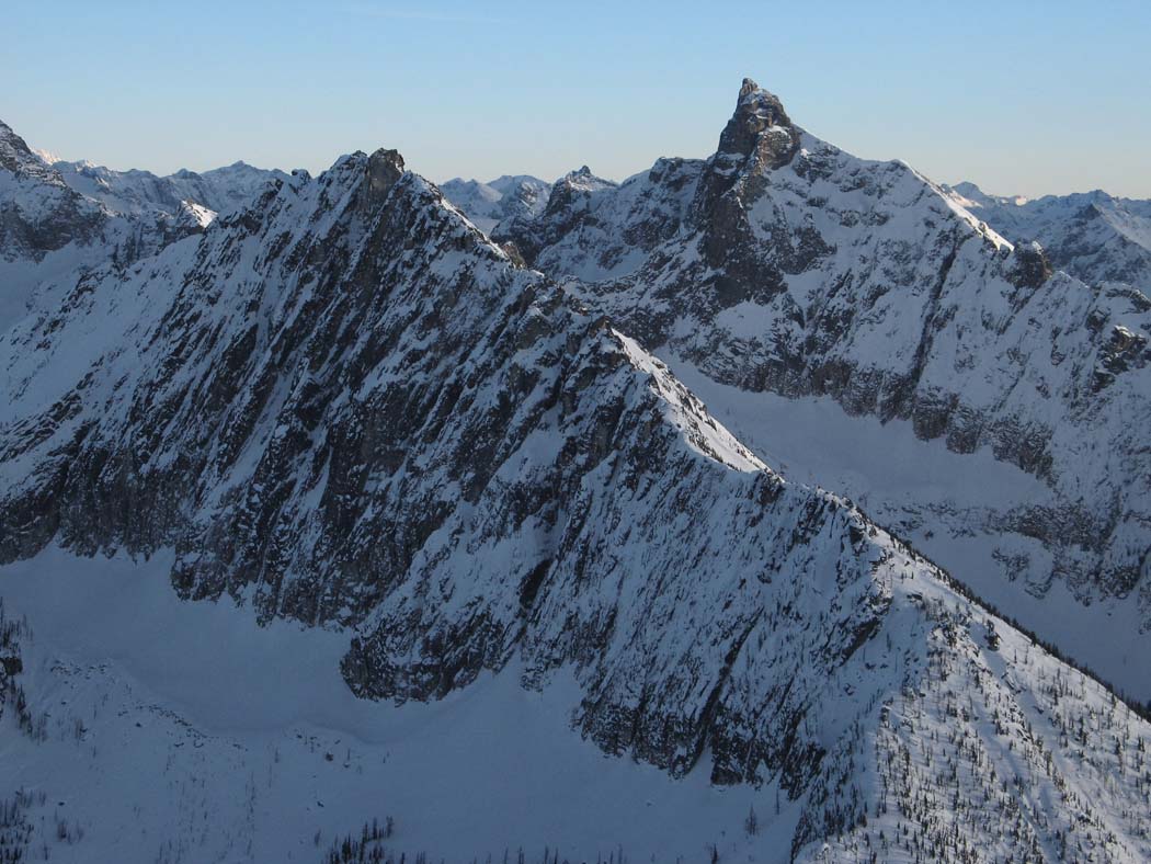
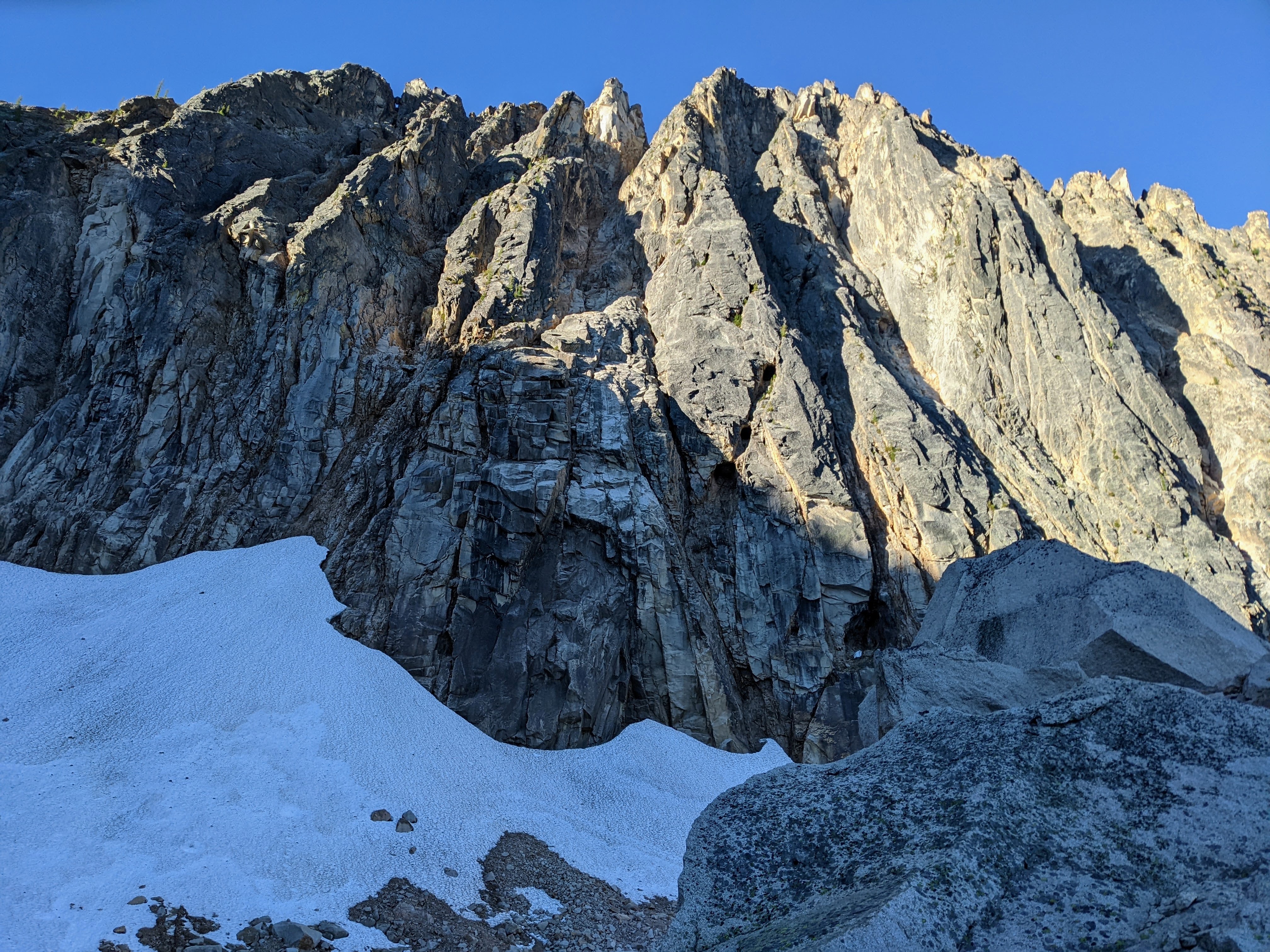
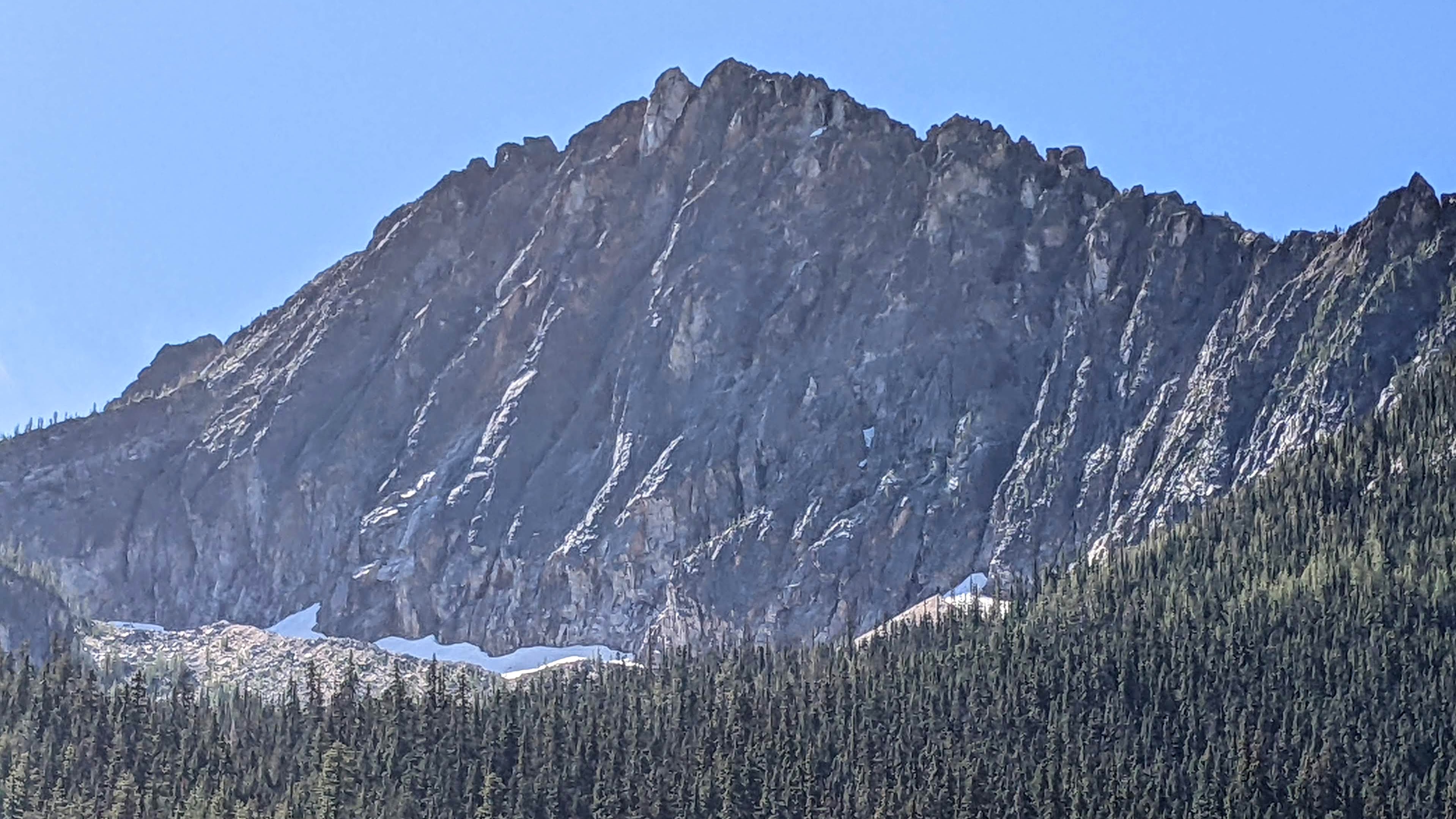
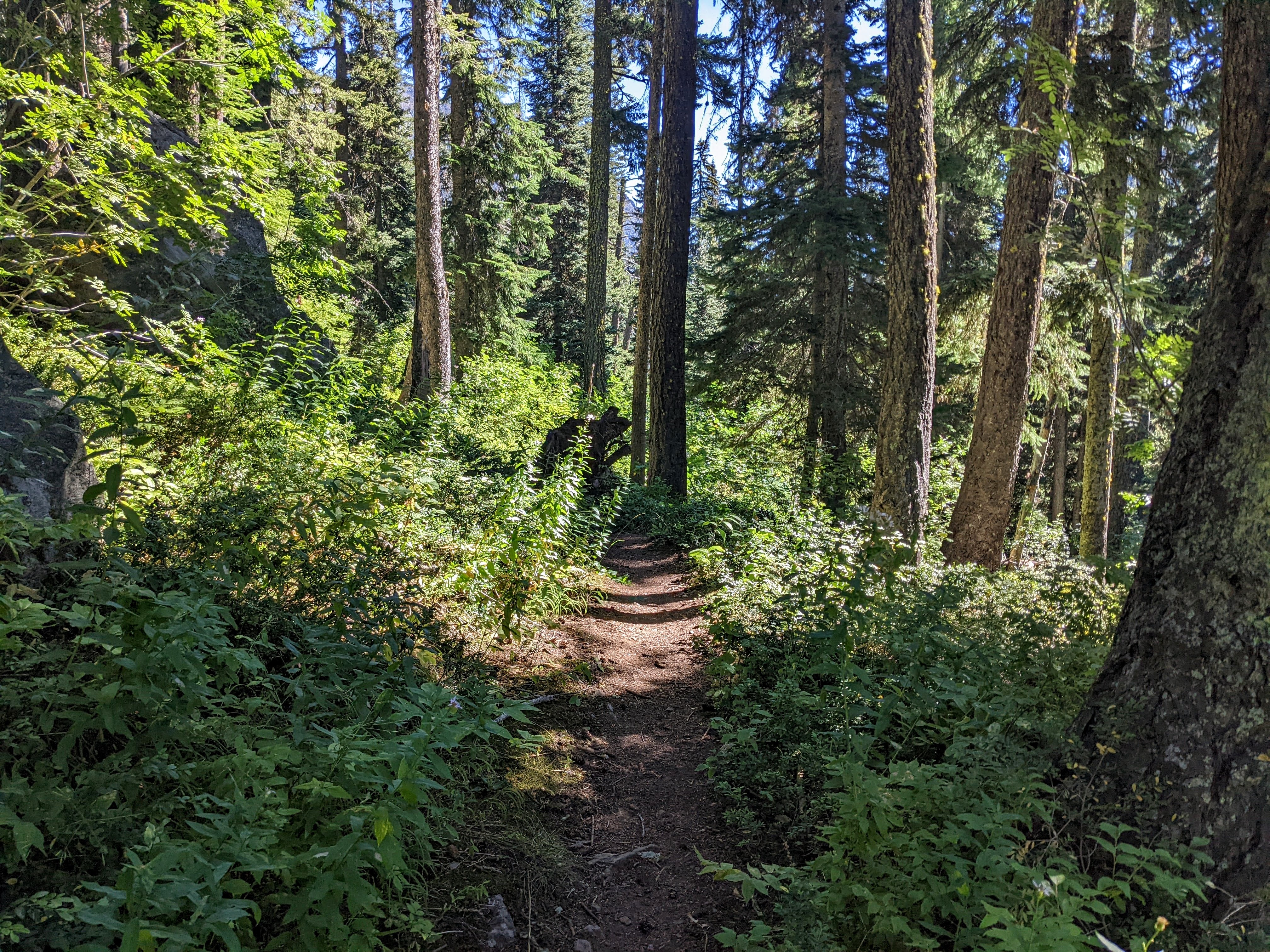
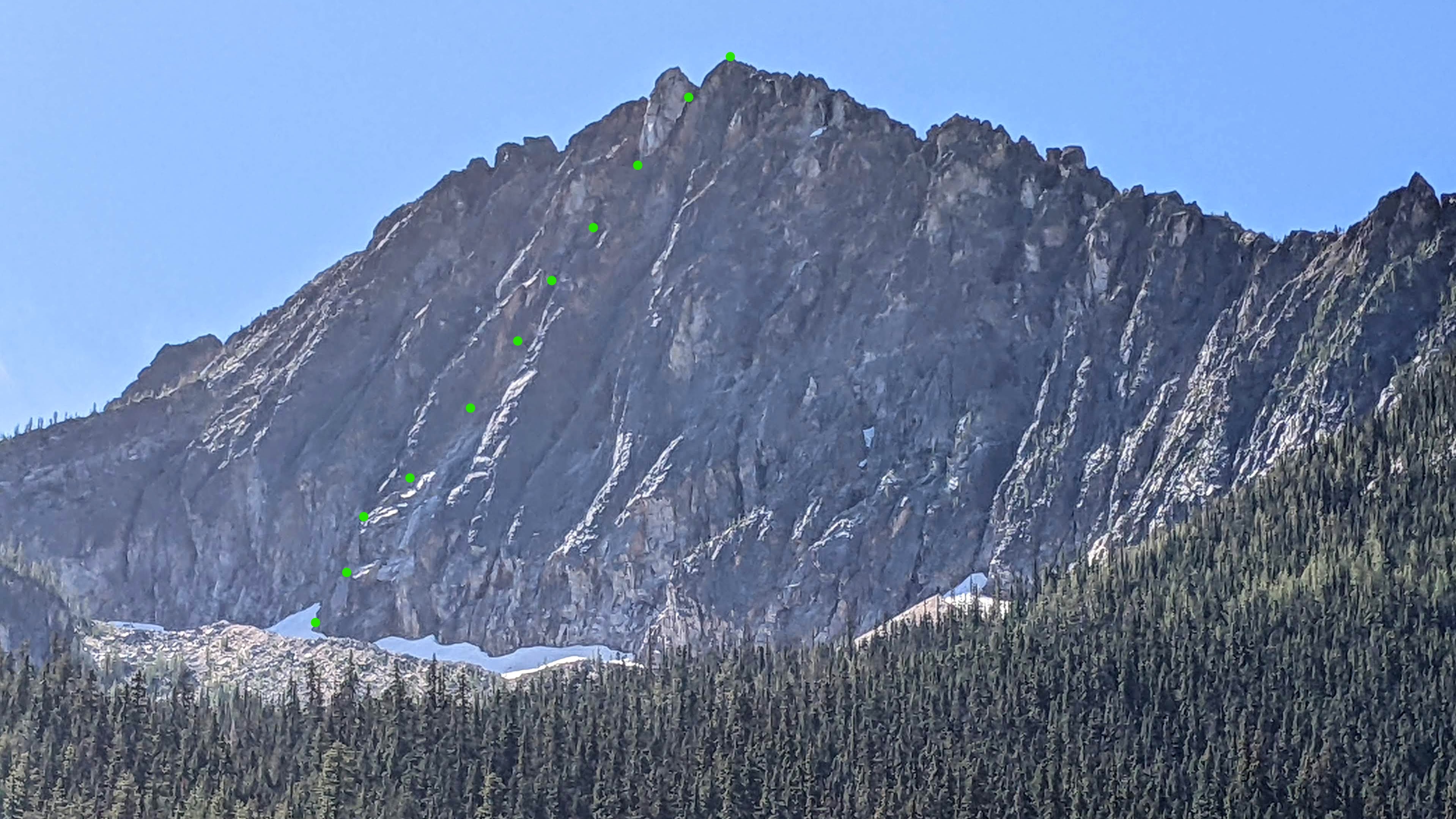
Trip: Holliway Mountain - North Face Route (aka "Scary Bear Attacks") D 5.9+ new route Trip Date: 08/14/2022 Trip Report: Let's start with a John Scurlock photo of this (likely) previously unclimbed face; Holliway's north face is on the left, Golden Horn background right: Here's a shot I took from the trail: Rolf Larson and I bring you a cautionary tale about this attractive nuisance. Our main candidates for an ascent were the two longest ribs that lead up to the two high points you see above (the true summit is on the left, and appears lower). The one on the left had a series of towers that led to the brilliant white -- and largely blank -- spike that forms the summit, while the one on the right appeared more straightforward. We kicked steps up firm snow to the footing of our preferred rib on the right. After futzing around with a difficult moat pitch, and finding a barely passable anchor poised below what looked like a difficult and very spicy next pitch, Rolf wisely downclimbed back to the snow. This cost us 3+ hours. We wandered left on the snow to "scout", and spotted some snow leading up to easy access to the rock, below the second-best left-hand rib and just right of a garbage-chute gully. Standing on the still-hard snow, contemplating the idea of beginning the route at 11:30am, one of us asked "You wouldn't let us do something stupid, would you?". This was a stupid question directed at the wrong person. So both stupidos headed upward to scout. Looking up; we began climbing off on the left, below the high point of the snow, where it makes a prominent triangular nose pointing right. Our false start was the furthest right high snow point. Our top-out on the sub-summit is the high point to the right of the V-notch; the true summit is the white spike on the left. I got the first pitch (5.9+) and it was fantastic, and would be popular if it were at a crag--fun climbing with a little bit of everything on solid rock. The uphill was all downhill from there. Rolf's second pitch (5.8?) went up a chimney that had some fun moves, but also some loose killers that he danced around. Our next several pitches took a left-hand ramp above the gully splitting the two main ribs, a couple more in/across the gully to take ramps on its right, and then we found a way to leave the gully rightward to gain the originally desired right-hand rib to the sub-summit. After pitch 2, the climbing in general wasn't too steep, but there were occasionally difficult moves; and, it was often run out and loose, requiring careful rope management. A few pitches after gaining the right-hand rib, we stood on the 7,920' sub-summit and took in the sunset. We were 9 hours on the route. We descended to the south, hemi-circumnavigated around the east side of the mountain (via headlamp and moonlight) to get back to our packs, then thrashed down to our pleasant camp at the river, arriving at around 2am. Not that anyone will bother, but FWIW, happy to provide details for the descent -- including a plausible more direct route with daylight -- upon request. After the first pitch, due to the loose rock and scarce anchors, bailing would at minimum be risky and costly. Future parties might enjoy exploring the many features on this corrugated face, but should bring a bolt kit and a sense of humor. The line required 10 pitches total. Approx route: More pics here: https://photos.app.goo.gl/zTcs4kQdwBFhEdKc7 Here's the namesake bear (there's a video series of same name too, and on the approach was bear scat and a bear hunter): Gear Notes: We had doubles through 2 when including tri-cams, a single 3, and pins. Rolf used one pin at a belay. A single 70m rope. Approach Notes: West Fork Methow River trail, then PCT (total approx 10 miles) to camp on Methow River; then up a couple thousand feet through brush and forest2 points
-
Trip: Argonaut - South Face Trip Date: 08/14/2022 Trip Report: I've been out to the Teanaway (Teanaways?) several times this summer and it's been pretty awesome to become better acquainted with the area! For this trip, D and I decided to haul gear up to Argonaut's south face for a supposed "5.3" route. "What is the difference between 5.3 and 5.6?" I asked myself... We hiked in via Beverly Creek then over Fourth of July Pass on Saturday late afternoon and camped at Ingalls Creek. In the parking lot, we met Jennifer and Chris, also heading to do the same route! In the early evening, two climbers came down back to their camp at Ingalls Creek from Argonaut and gave us some approach beta, said that there's a legit "climber's trail," and shared that it took them 3 hours from camp to summit (via the 4th class scramble route; they soloed everything/didn't rap). Wow, we thought! Maybe we will be out of here way earlier than we expected! We set off from camp a bit past 7am and quickly found a solid trail up through the scrubby open-ish eastside forest. Very unfortunately, it did not last forever, and some B2ish schwack ensued between pieces of game trail until we got into more open meadow with sandy trails. OK, all good. Not my favorite part of the approach: A much more scenic part of the approach: At this point, we aren't sure what happened, but we clearly did not pay enough attention to the navigation/GPS and we crossed into a gully too far east, thinking it was the main gully, and started ascending. We realized our mistake a bit on the later side and tried to carefully poke out a way to traverse west into the gully that we wanted, but after some 4th class stuff ("accidents often happen when people are off-route..."), we decided to go back, down, and around. Welp, that was fun exploratory bonus el! Up and up the gully, D and I being careful not to trundle things onto each other, then finally at the base of the south face. We used a Mountain Project photo overlay to locate the start the 5.3 route, and it really looked like the picture.. but anyway, that first pitch we ended up calling 5.8. Lots and lots of options on the face, lots of cool features (some chicken knobs, crystally ledges, etc), cracks, and good pro. Definitely plenty of lichen and lots of loose and jumbled blocks in cracks, as expected. I ended the first pitch at a small alcove with a giant block that was slung that I stumbled upon (the sling looked kinda old). I apologized a bunch to D for clearly getting us off-route, but she was grateful we were getting up it and safely. Very nice of her The second pitch was much easier -- I did go around a chimney feature due to the pile of microwave blocks sitting in it and then I traversed right at the top, all to keep the rope from dislodging rocks onto D. I chatted a bit with Jennifer and Chris, who had started where we did but had followed cracks trending to climber's left and had topped out a bit before us. Bringing D up to the top of the second/last pitch: Anyway, we scrambled to the top, got cool, up-close views of Colchuck and Sherpa plus FOUR volcanoes, and then we scrambled down to the rap station for the 50-foot 4th class gully. One of the amazing views from the summit: Some photos of the face, from below after rappelling: Descending the gully: As the talus gully became meadow and then forest and stripes of slide alder, we started on solid trails and then...very unfortunately, had a hell of a time finding our way down to the main trail. Time is meaningless when you're trying to be zen in slide alder, but this was some of the more memorable schwacking I've done in awhile.. and on the east side! Oh, but we did come across what I think were some bones of a mountain goat? Skull: Finally made it down to camp, apparently our friends hadn't fared much better than us on the descent. Our 6-ish mile hike out went very quickly due to D's blazing speed and pace-setting which I was so grateful for! Good bye, Argonaut, I am glad to tick you off my list. I wish I could get a ride up and just play around on that south face, but I probably won't be going up there again (at least until this memory fades). Jennifer and Chris, it was lovely chatting with you two throughout the weekend and it was very sweet of you to wait until my Civic cleared that washout/rut on the forest road before driving off on Sunday night. Thank you! Gear Notes: 60m rope, single light rack, rock shoes, fully engaged trail-ish senses, fully engaged quiet feet Approach Notes: up, down, up, up, up...I'm sure you're better than me at finding those trails!1 point
-
Trip: The Tooth - Standard (South Face) Trip Date: 08/18/2022 Trip Report: Folks wanting to climb The Tooth now that the Snow Lake summer trail is closed for trail work will find that the Alpental skin track/winter route does go, but the trail peters out ~250m after the avy explosives bunker leaving ~2.5km of mixed bushwhacking, following creeks (for path-of-least resistance), and route finding to gain suitable chute to re-join summer route, i.e. very do-able, but requires good sense of humor and reserve of patience to repeat on the way back! Gear Notes: GPS track from winter skin in/ski out helpful Approach Notes: Follow general direction of winter route until starting to approach Mushroom Couloir. Then keeping lower (right) to river allows easier travel vs. side-hilling through denser brush. We stayed lower until short headwall up to Source Lake and seemed decent option. Lots of bear sign (fresh scat, dozen tree markings), so holler to reduce chances of an encounter!1 point
-
do you or Rolf have a favorite?1 point


